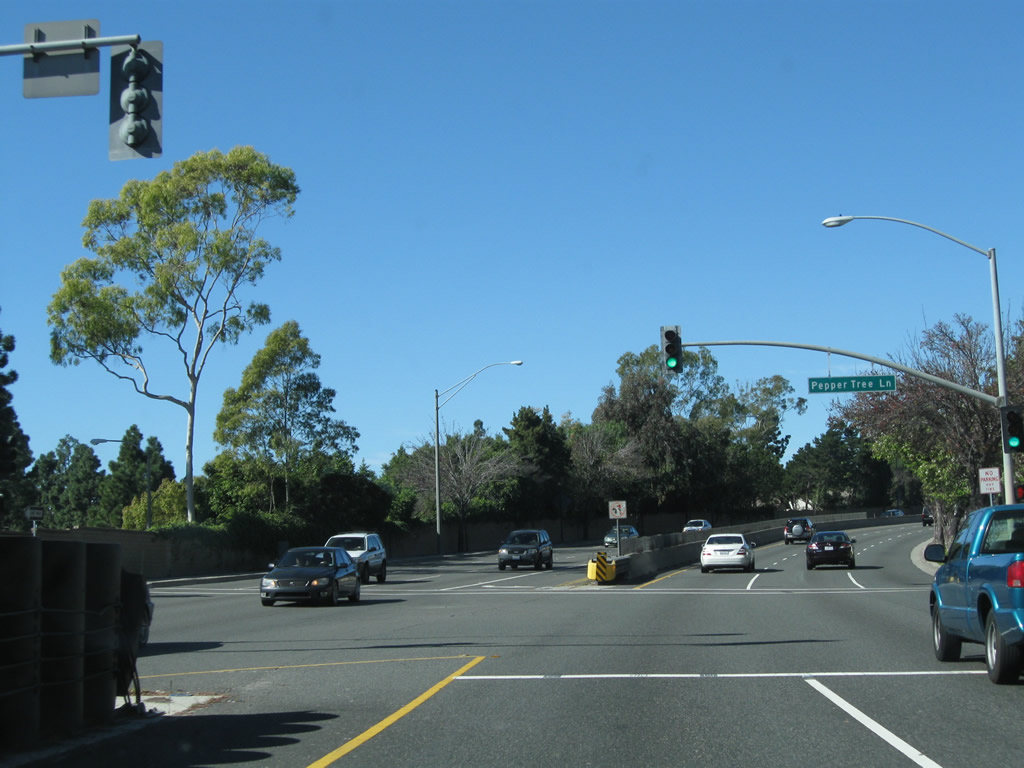
|
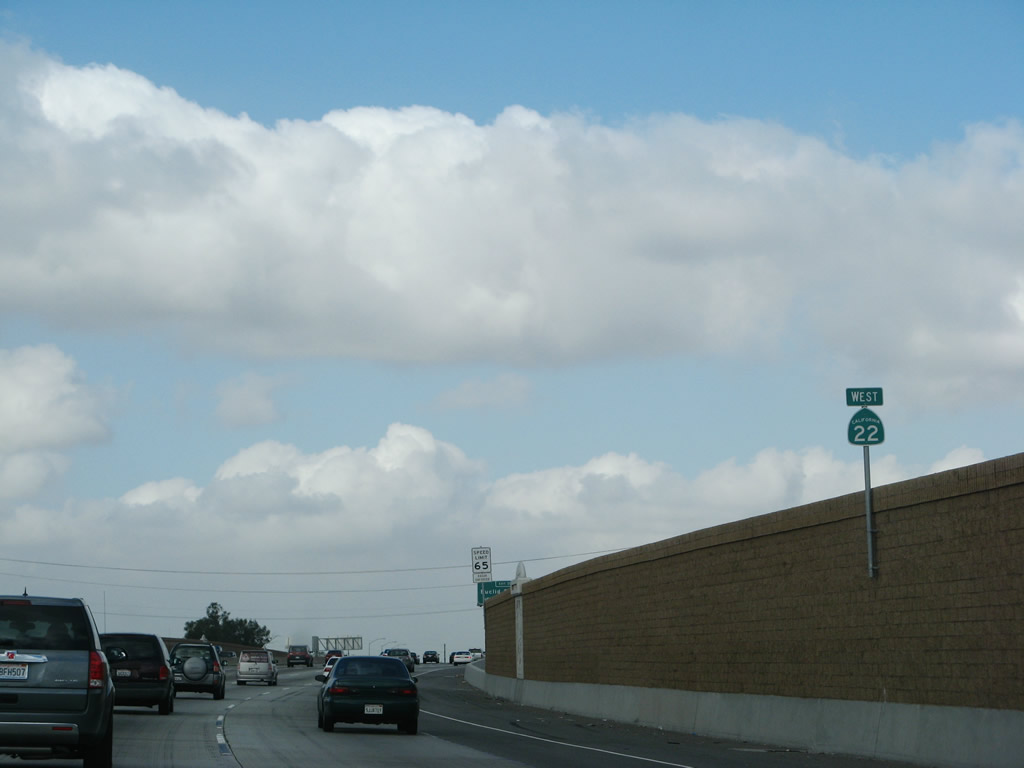
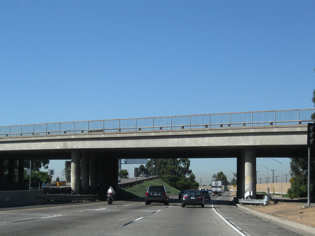
The two-lane transition ramp from California 55 north to California 22 west passes under the California 55 (Costa Mesa Freeway) mainline. Photo taken 03/15/08. |
|
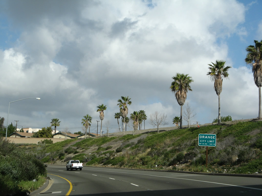
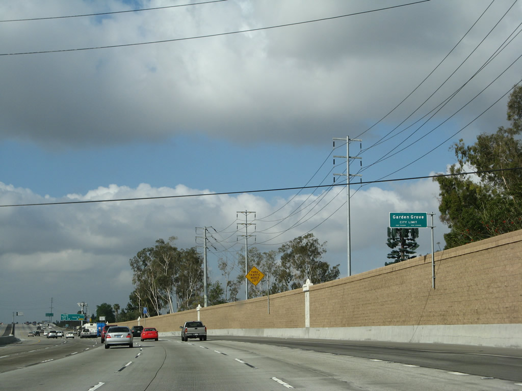
California 22 enters the city of Orange, which was incorporated on April 6, 1888. Orange had a population of 128,821 as of the 2000 Census. Photo taken 03/15/08. |
|
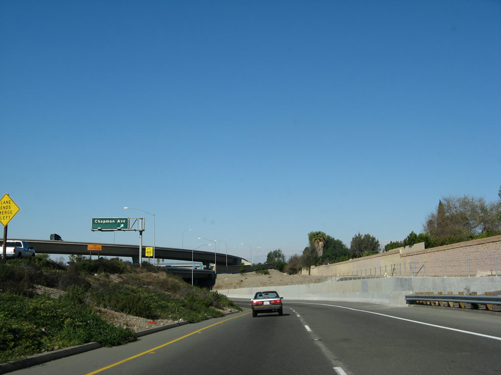
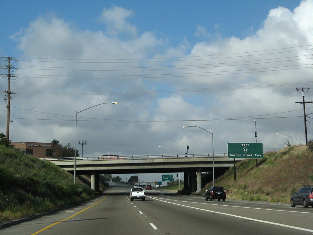
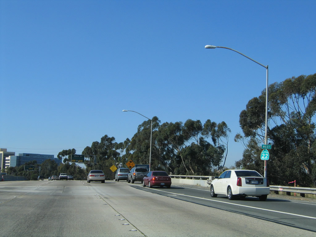
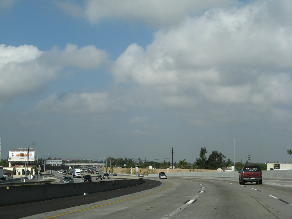
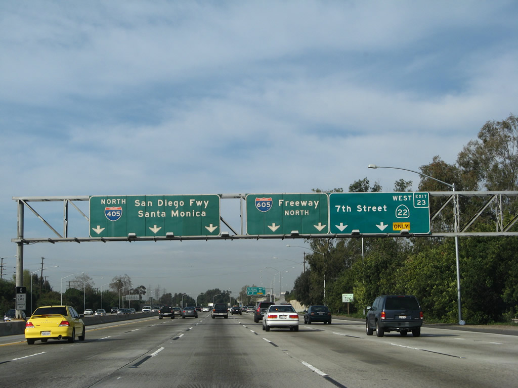
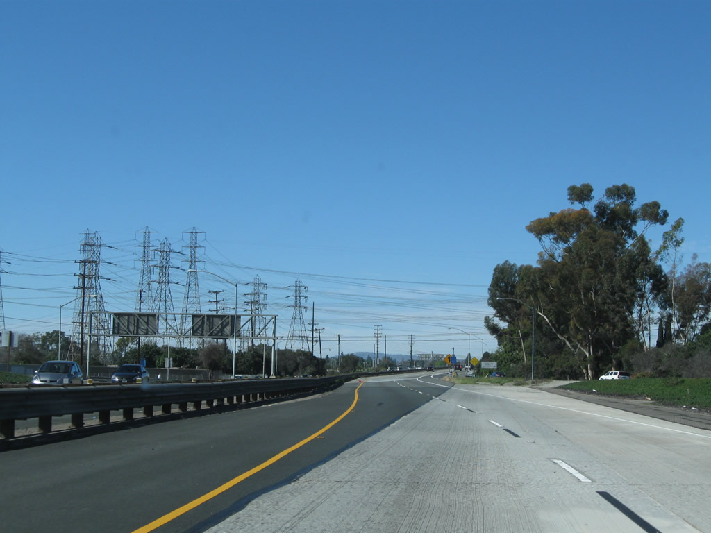
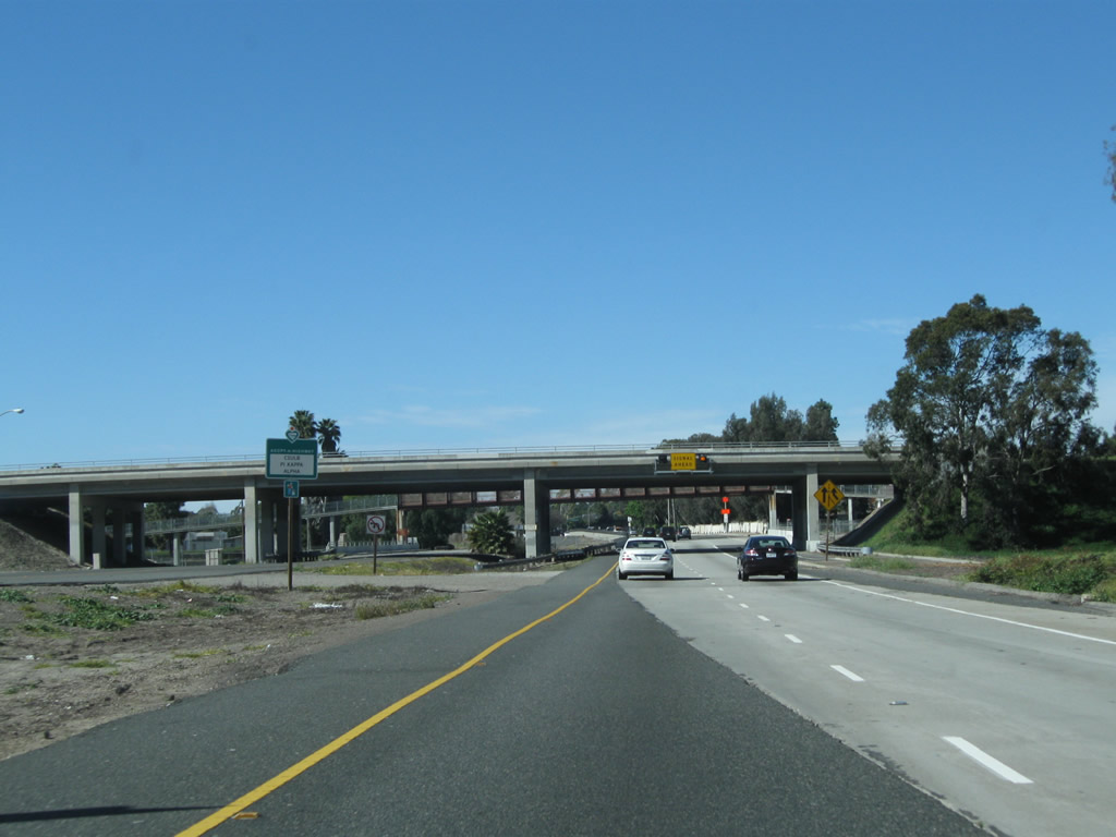
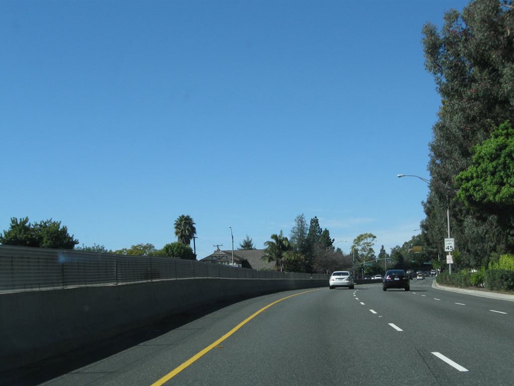
As traffic from California 55 south merges onto California 22 west, an initial guide sign reassures motorists that this is California 22 (Garden Grove Freeway) west. The freeway passes under Tustin Street ahead. Photo taken 03/15/08. |
|
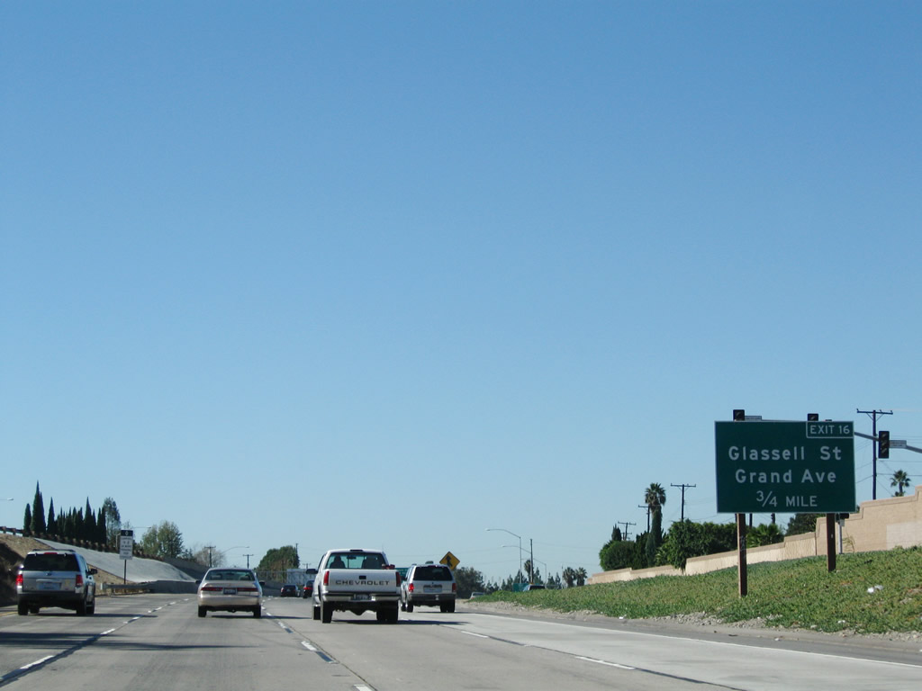
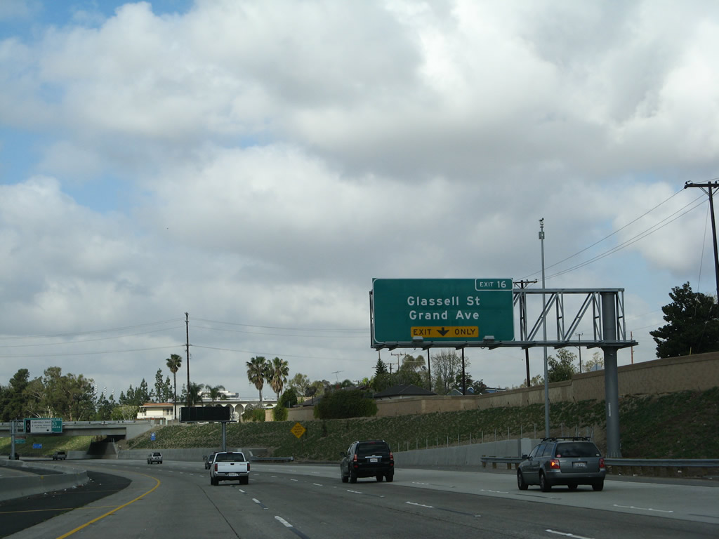
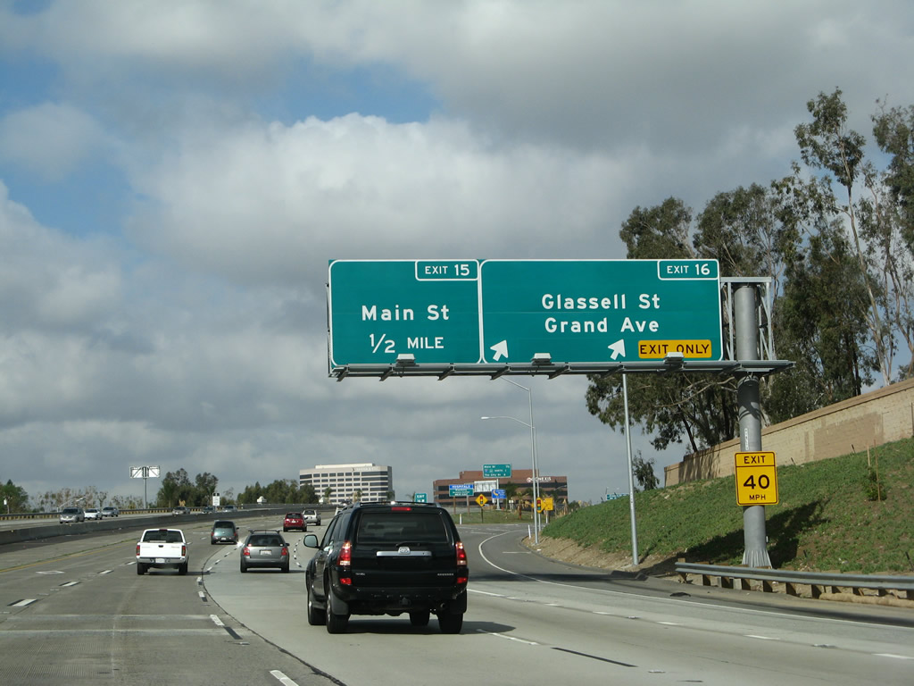
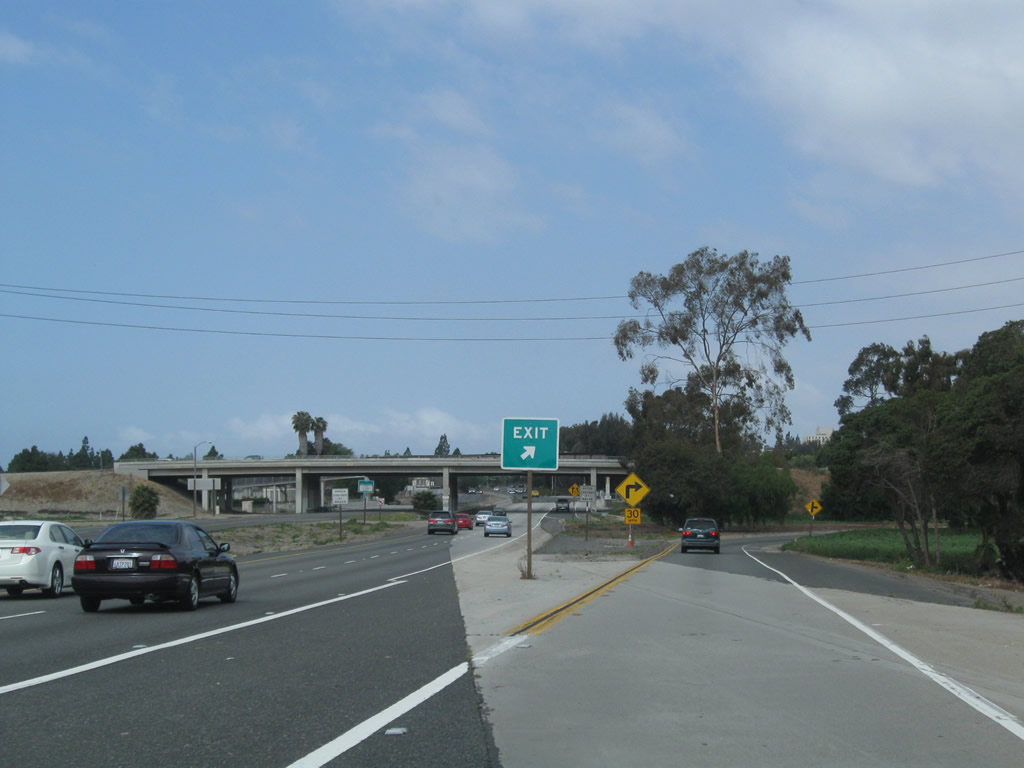
The first exit along California 22 (Garden Grove Freeway) west is Exit 16, Glassell Street and Grand Avenue (0.75 mile). Photo taken 11/08/08. |
|
|
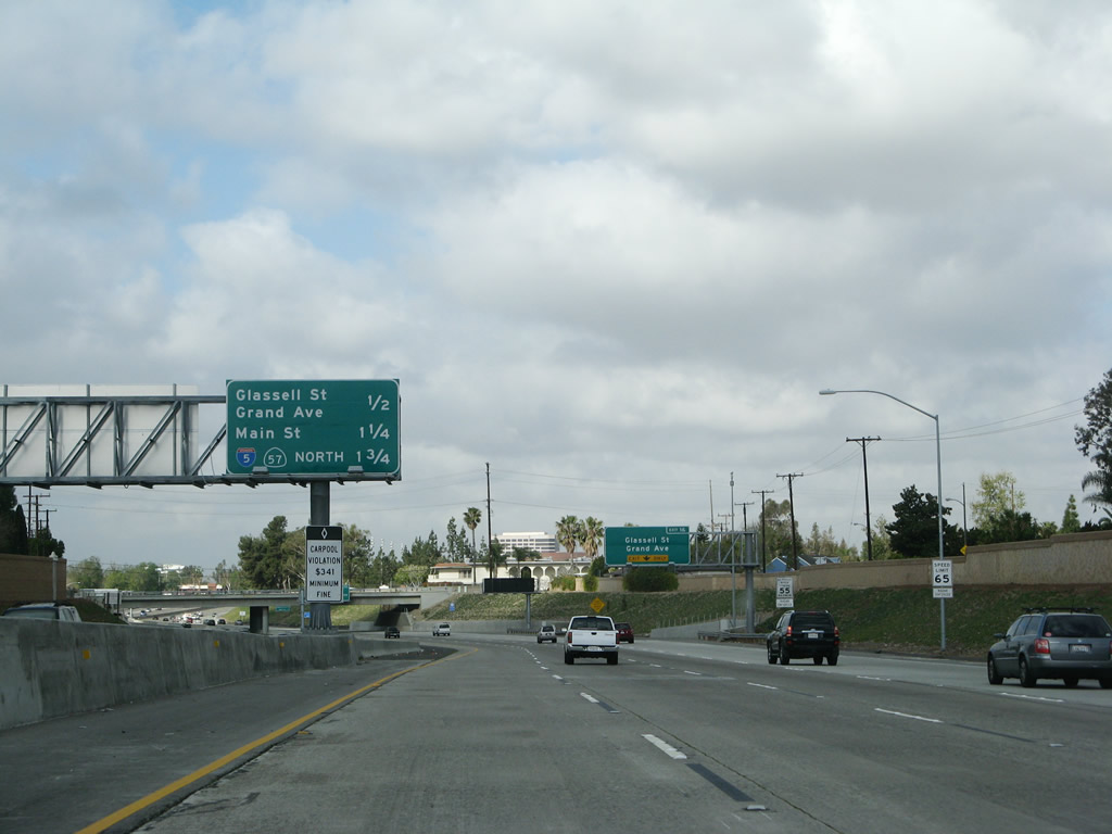
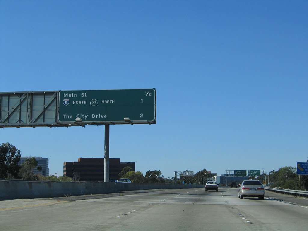
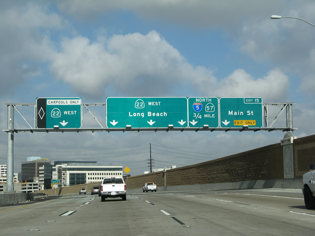
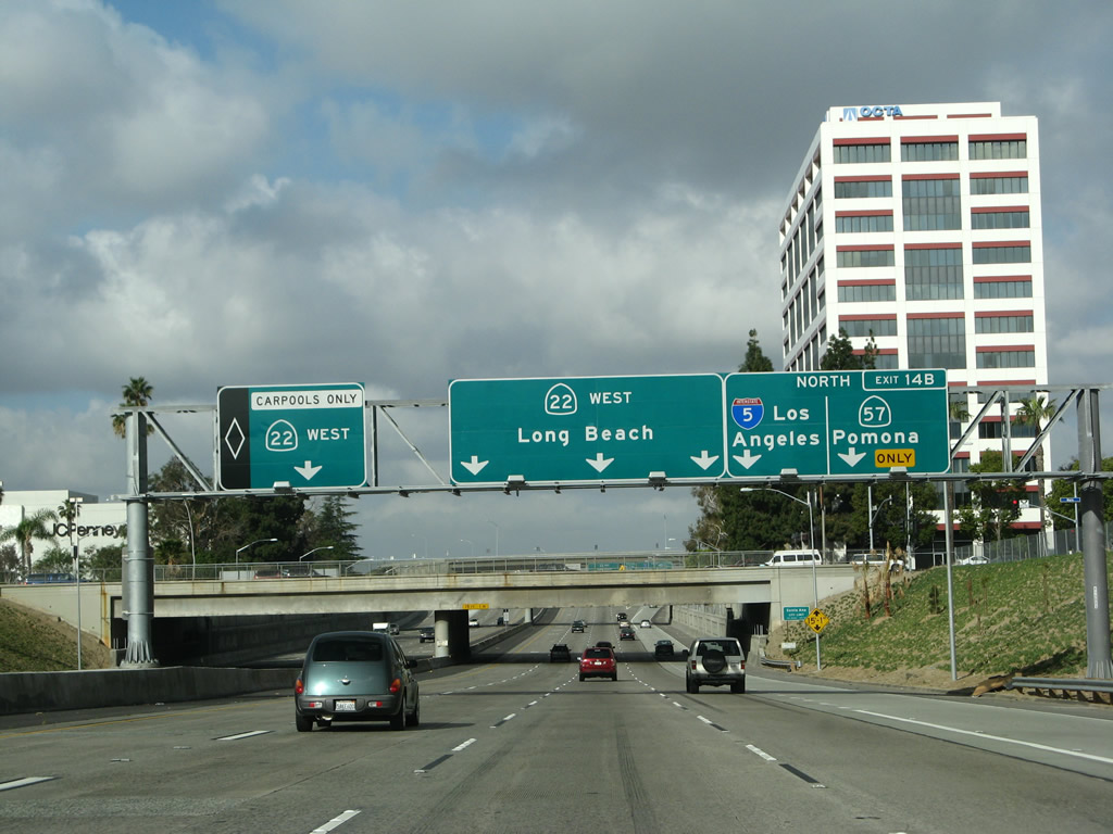
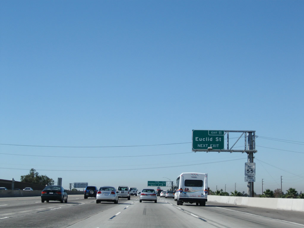
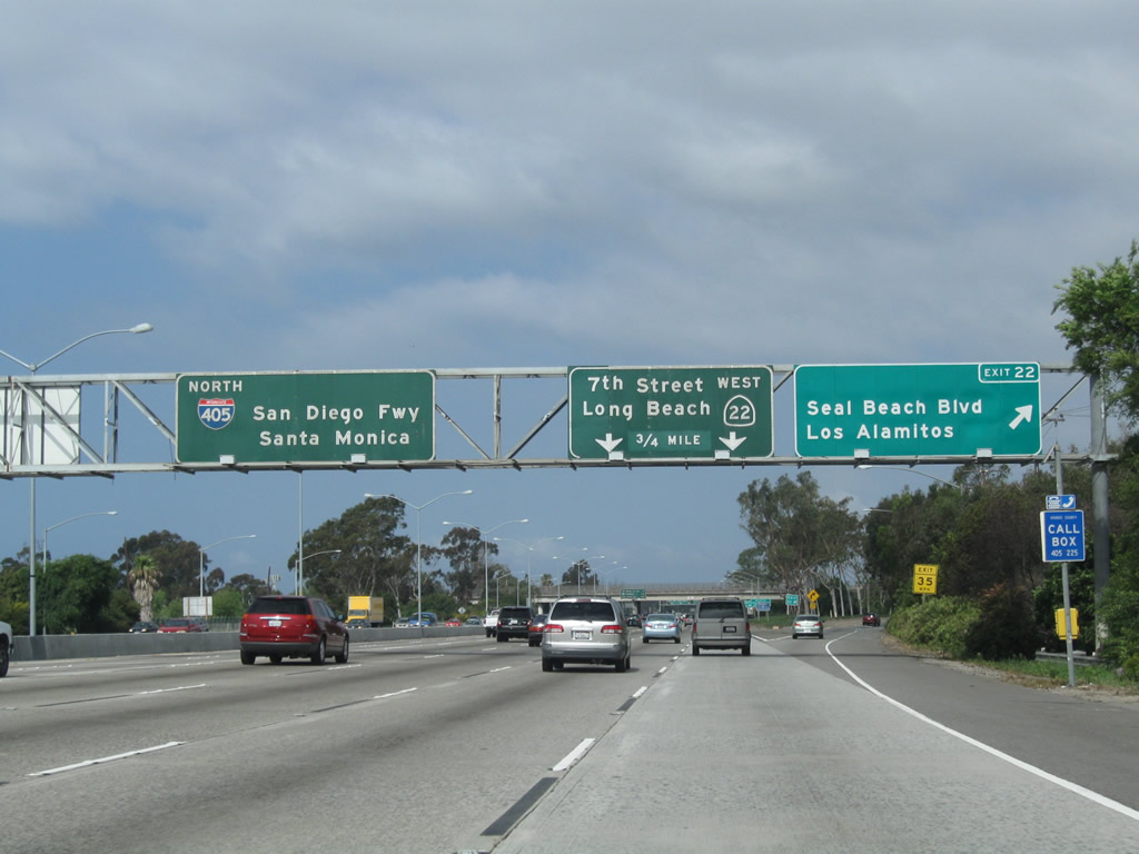
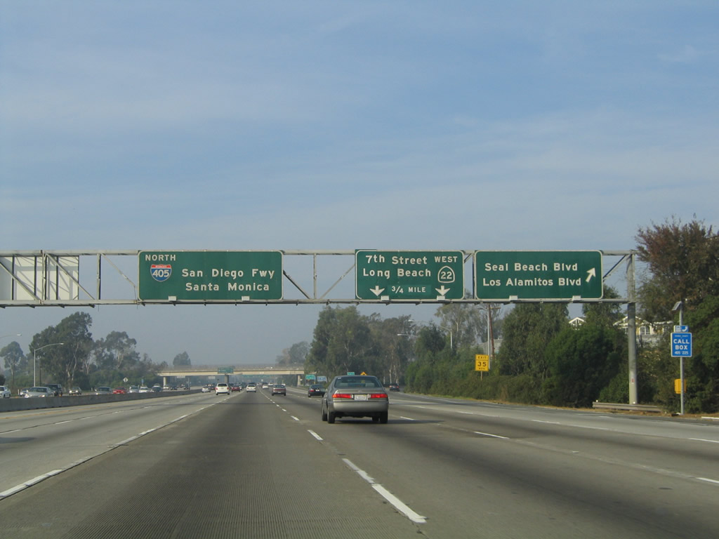
This interchange sequence sign along California 22 (Garden Grove Freeway) west provides the distance to the next three exits: Exit 16, Glassell Street and Grand Avenue; Exit 15, Main Street; and Exit 14B, Interstate 5 (Santa Ana Freeway) north and California 57 (Orange Freeway) north. All signs on this freeway were replaced as part of the California 22 reconstruction and freeway expansion that was completed around January 2007. Photos taken 03/15/08 and 11/14/04. |
|
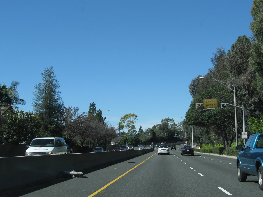
The right lane of California 22 (Garden Grove Freeway) west becomes exit only for Exit 16, Glassell Street and Grand Avenue. Between California 55 and the Orange Crush Interchange (California 57 and Interstate 5), California 22 serves as the boundary between Orange on the north and Santa Ana on the south. The city of Santa Ana is the seat of Orange County. Santa Ana sits at an elevation of 135 feet, consists of 27.2 square miles, and receives an average of nearly 13 inches of rainfall annually. Incorporated in 1886, Santa Ana became the seat of Orange County when Orange County split from Los Angeles County in 1889. As of the 2000 Census, Santa Ana had a population of 337,977 people; that number climbed to a total of 353,428 per a 2007 California Department of Finance Estimate. The city is 76% Latino or Hispanic per the 2000 Census, and Santa Ana therefore has one of the nation's largest urban populations of that ethnic group. Photo taken 03/15/08. |
|
|
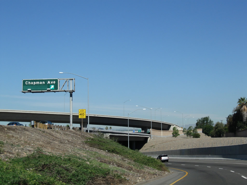
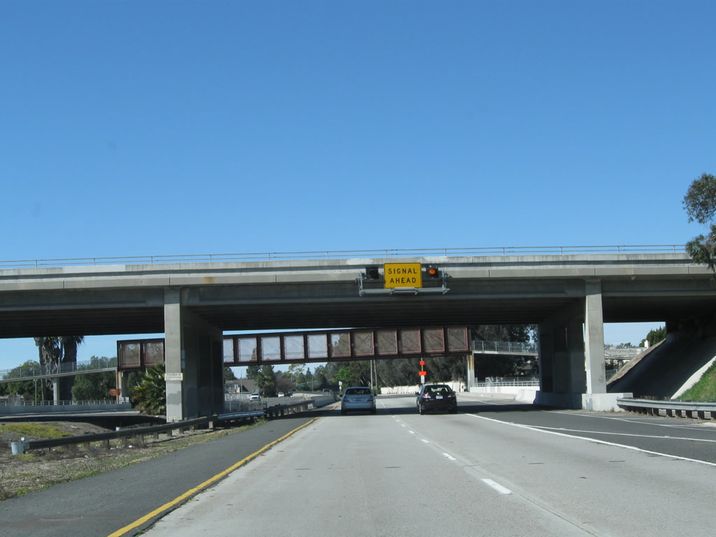
California 22 (Garden Grove Freeway) passes under Cambridge Street about midway between Tustin Street and Glassell Street/Grand Avenue. In 2004, a sign was mounted to this bridge for the pending off-ramp to Exit 16, Glassell Street north to Orange and Grand Avenue south to Santa Ana. By 2008, the sign had been replaced as part of the California 22 reconstruction. The new sign advises of the pending Orange Crush interchange, which is the convergence between Interstate 5, California 22, and California 57 in southwestern Orange. Photos taken 03/15/08 and 11/14/04. |
|
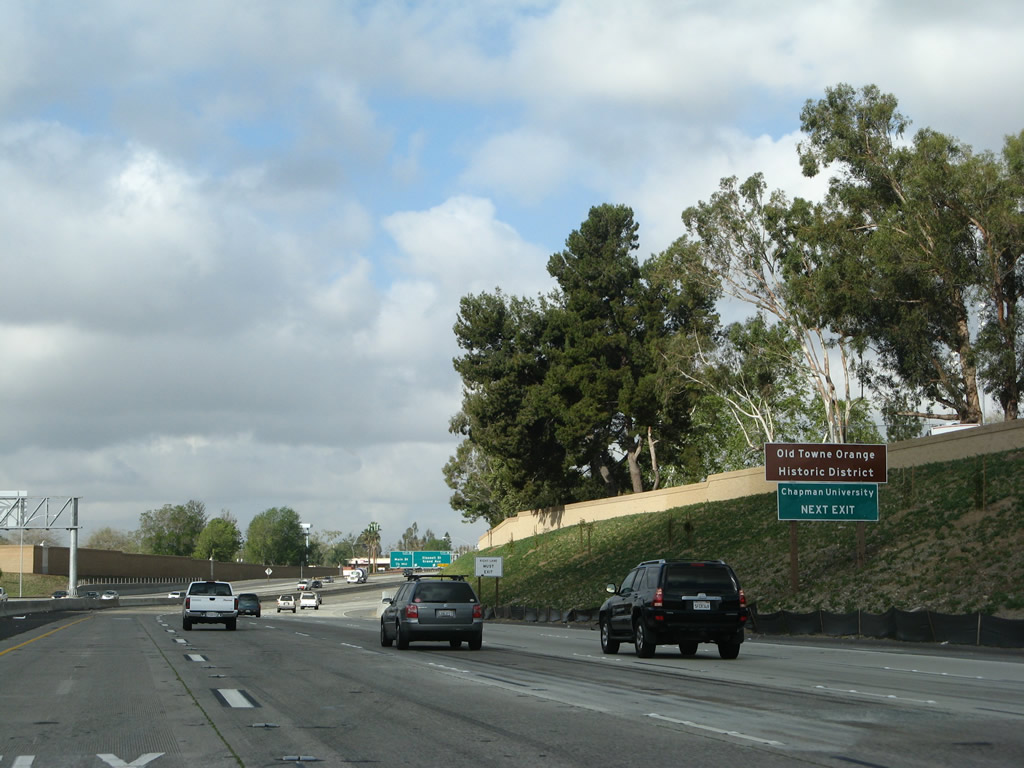
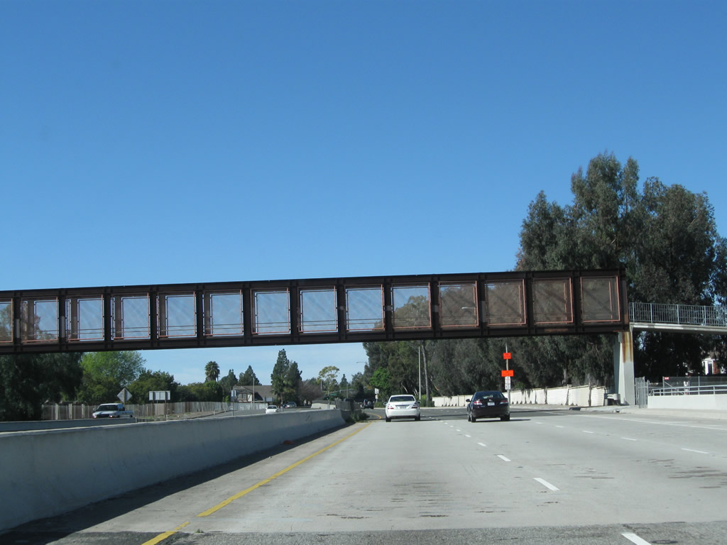
Use Glassell Street north to Old Towne Orange, including Plaza Square Park (traffic circle at the intersection with Chapman Avenue) and Chapman University. Photo taken 03/15/08. |
|
|
|
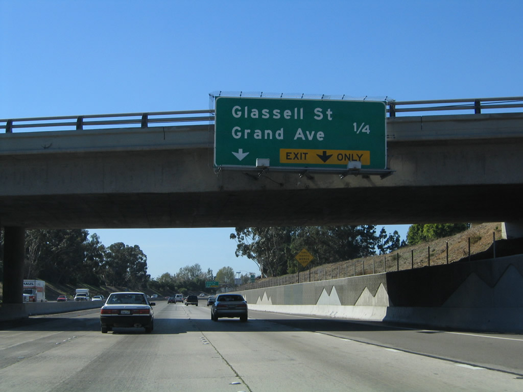
Westbound California 22 (Garden Grove Freeway) reaches Exit 16, Glassell Street north to Orange and Grand Avenue south to Santa Ana. For a brief period in early 2007, overhead guide signs had not yet been placed even after the main road construction had been completed. Photos taken 03/15/08, 01/14/07, and 11/14/04. |
|
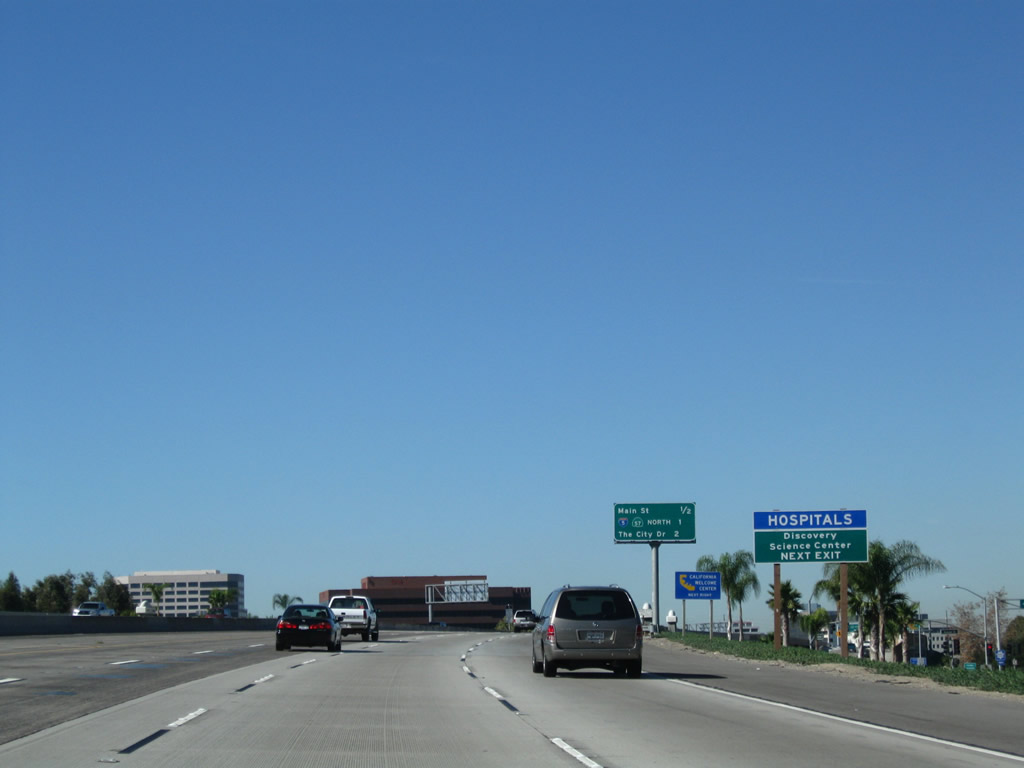
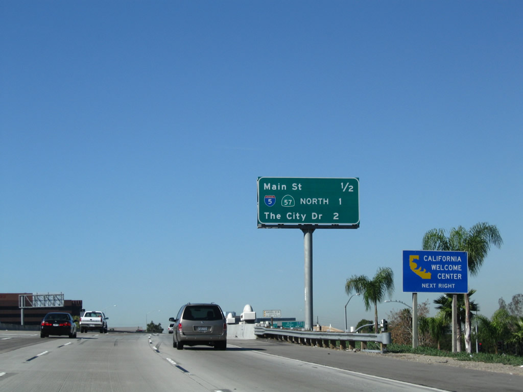
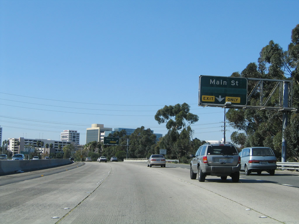
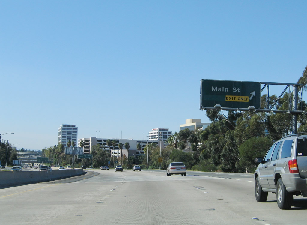
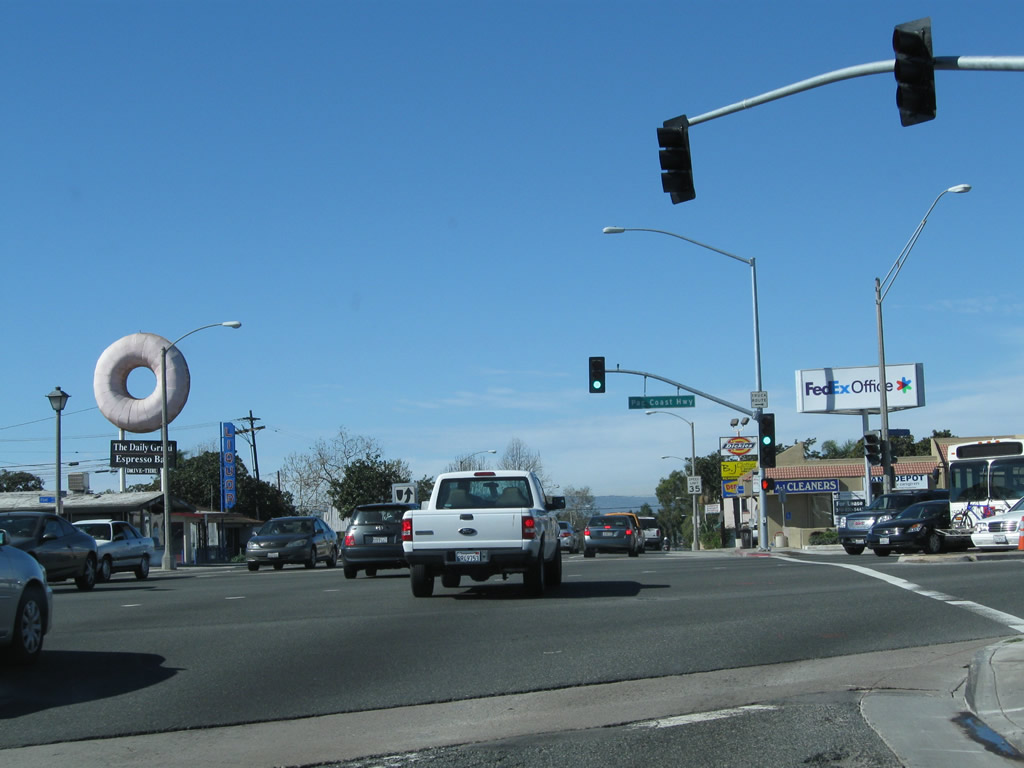
The next exit along California 22 west is Exit 15, La Veta Avenue and Main Street. Upon exiting, the ramp will connect with La Veta Avenue, an east-west arterial that parallels California 22. Use La Veta Avenue west to Main Street south to the Discovery Science Center. Photo taken 11/08/08. |
|
|
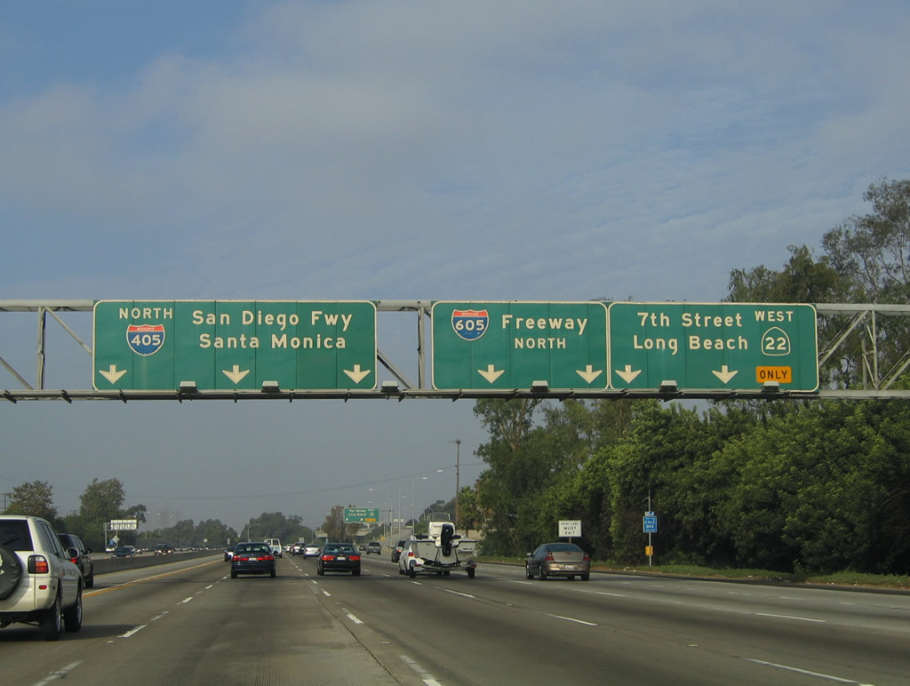
This interchange sequence sign along California 22 (Garden Grove Freeway) west provides the distance to the next three exits: Exit 15, Main Street and La Veta Avenue; Exit 14B, Interstate 5 (Santa Ana Freeway) north and California 57 (Orange Freeway) north; and Exit 14A, The City Drive. Photos taken 11/08/08 and 11/14/04. |
|
California 22 passes over Glassell Street and Grand Avenue on this stylized bridge. A decorative touch is the pilaster on the bridge rail with a small rainbow dominated by orange, brown, and yellow. Photo taken 11/08/08. |
|
This sign bridge -- which advised of Exit 14B, Interstate 5 (Santa Ana Freeway) north and California 57 (Orange Freeway) north -- was removed and not replaced. These signs were removed when the freeway was reconstructed around 2005-2006. Replacement signs have been added ahead. Photo taken 11/14/04. |
|
|
A California 22 west reassurance shield is posted after the on-ramp from Glassell Street and Grand Avenue. With the removal of nearby eucalyptus trees and addition of a new soundwall, this area changed substantially over the course of four years. Photos taken 11/08/08 and 11/14/04. |
|
|
The right lane of California 22 becomes exit only for Exit 15, Main Street and La Veta Avenue. At the end of the off-ramp is Saint Joseph Hospital. The left lane becomes a high occupancy vehicle (carpool) lane for California 22 west. Photos taken 11/08/08 and 11/14/04. |
|
|
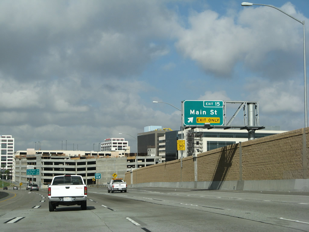
Westbound California 22 (Garden Grove Freeway) reaches Exit 15, Main Street and La Veta Avenue. Again note the changes between 2004 and 2008 as a result of freeway expansion. Photos taken 03/15/08 and 11/14/04. |
|
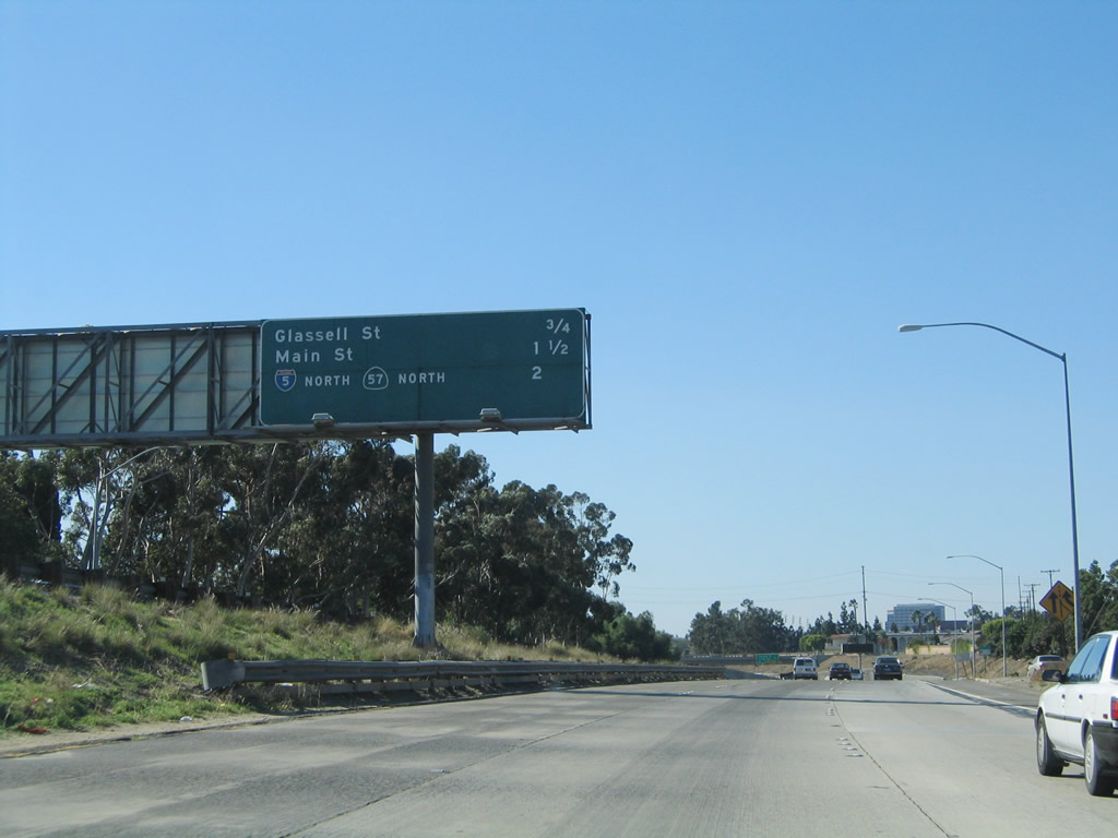
The gore point is fully signed with an Exit 15 sign with FHWA Font Series E. Photo taken 11/14/04. |
|
|
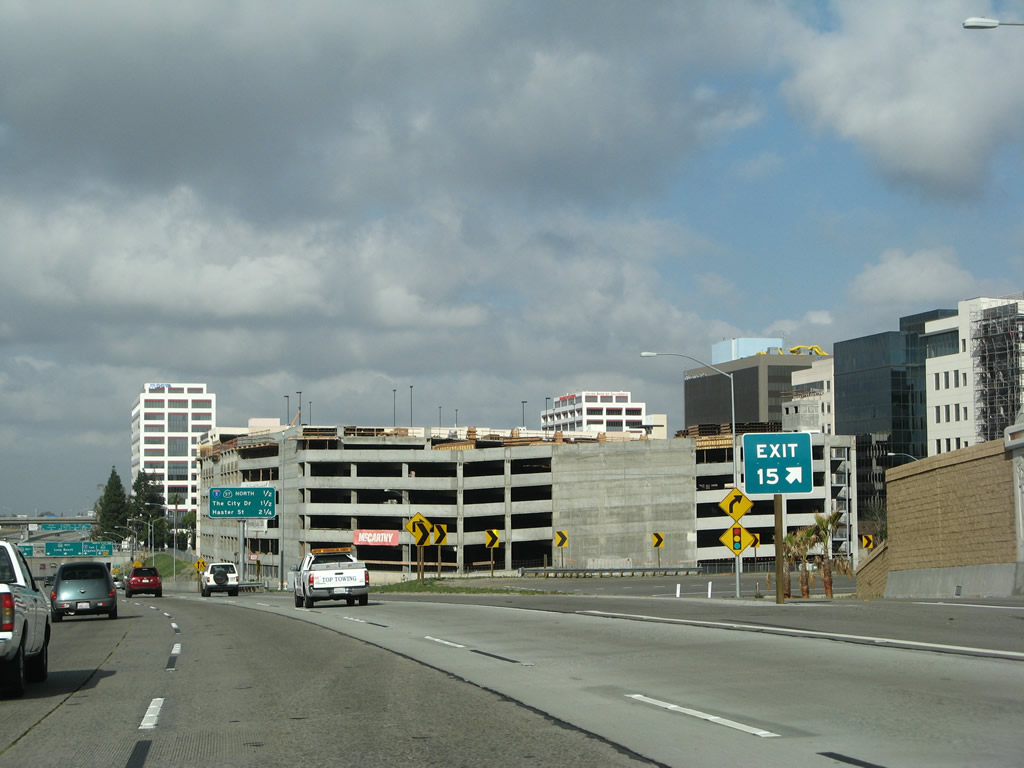
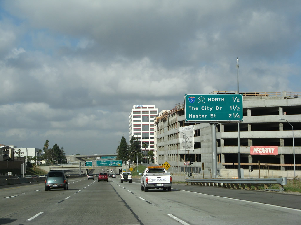
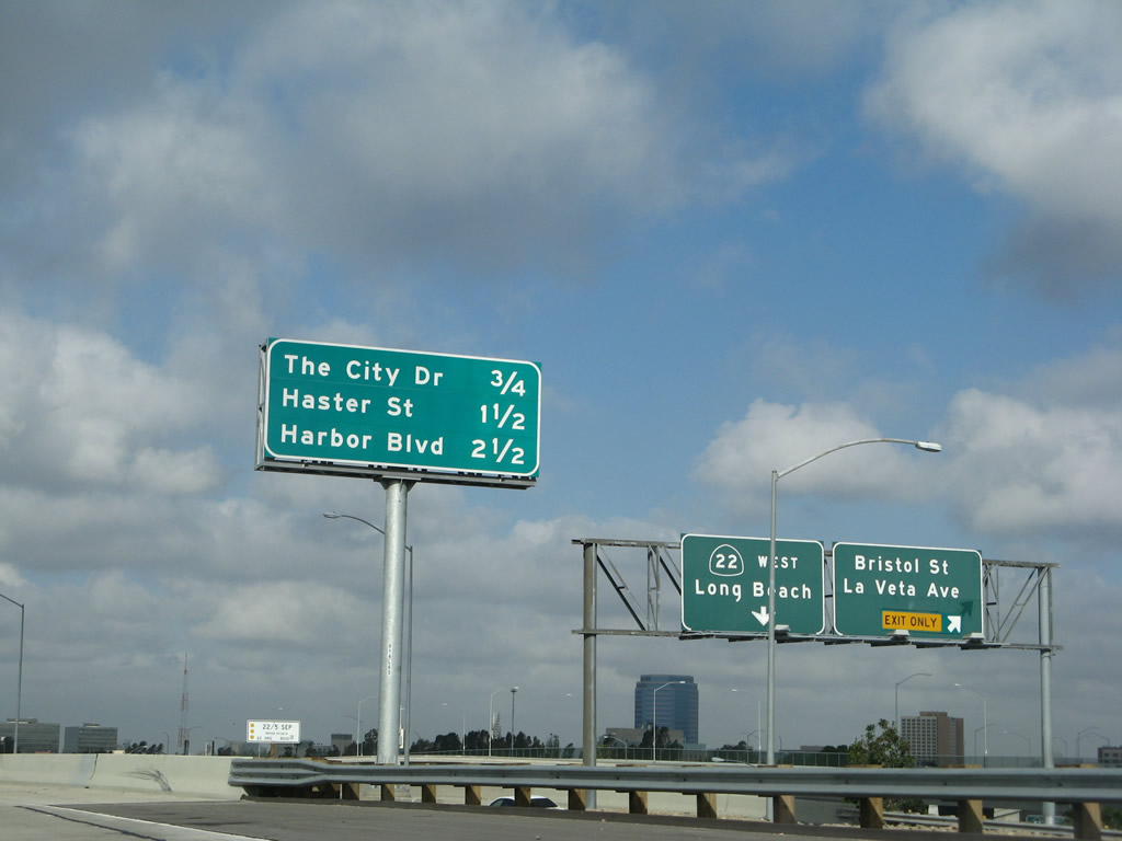
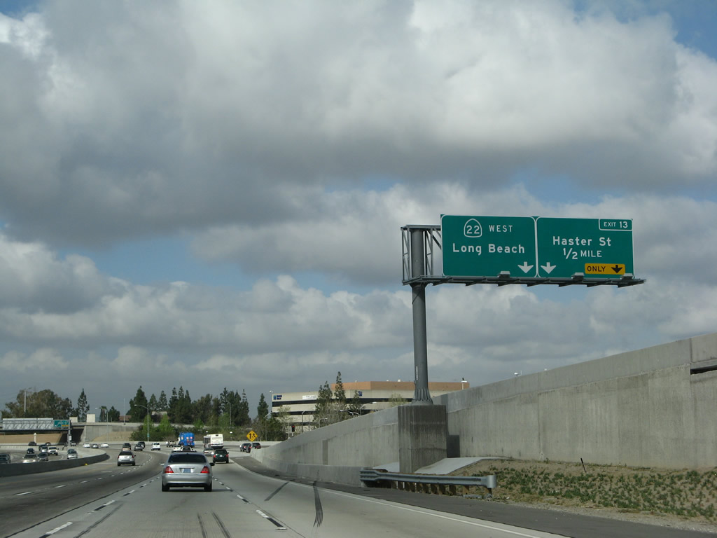
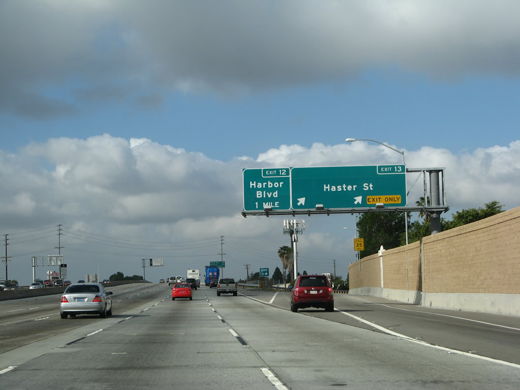
This interchange sequence sign along California 22 (Garden Grove Freeway) west provides the distance to the next three exits: Exit 14B, Interstate 5 (Santa Ana Freeway) north and California 57 (Orange Freeway) north; Exit 14A, The City Drive; and Exit 13, Garden Grove Boulevard and Haster Street. A new parking garage was built between 2004 and 2008. Photos taken 11/08/08 and 11/14/04. |
|
This sign bridge -- which advised of Exit 14B, Interstate 5 (Santa Ana Freeway) north and California 57 (Orange Freeway) north and Exit 14A, The City Drive -- was removed and not replaced. These signs were removed when the freeway was reconstructed around 2005-2006. Replacement signs have been added ahead. Photo taken 11/14/04. |
|
|
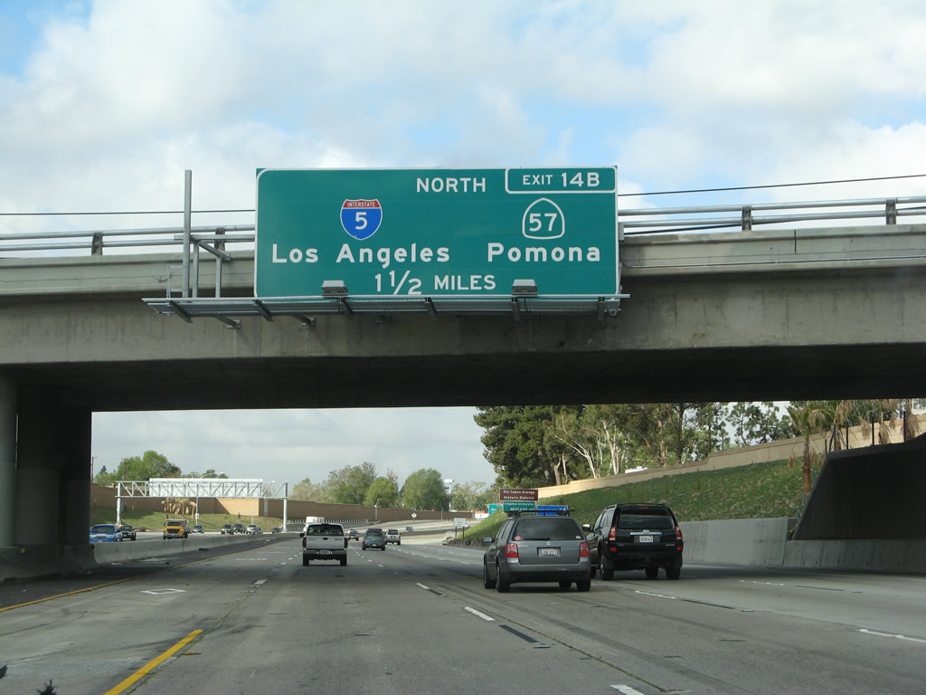
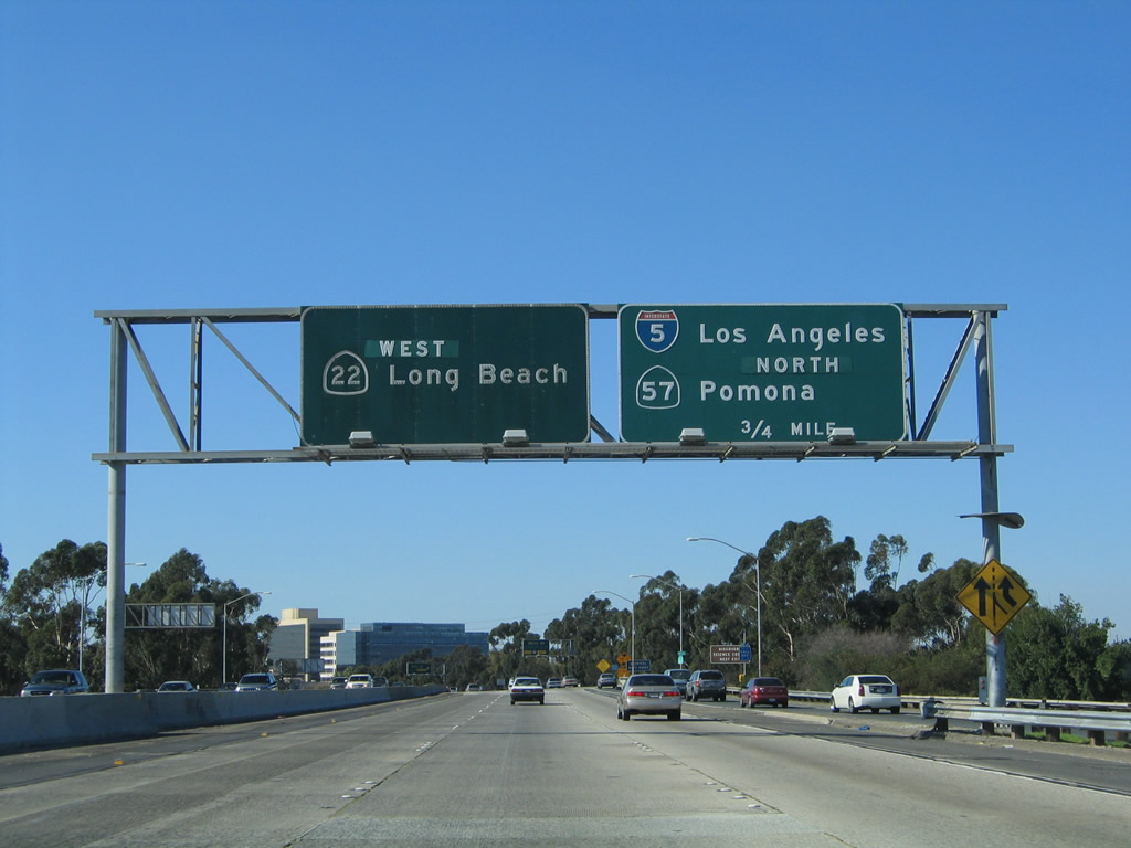
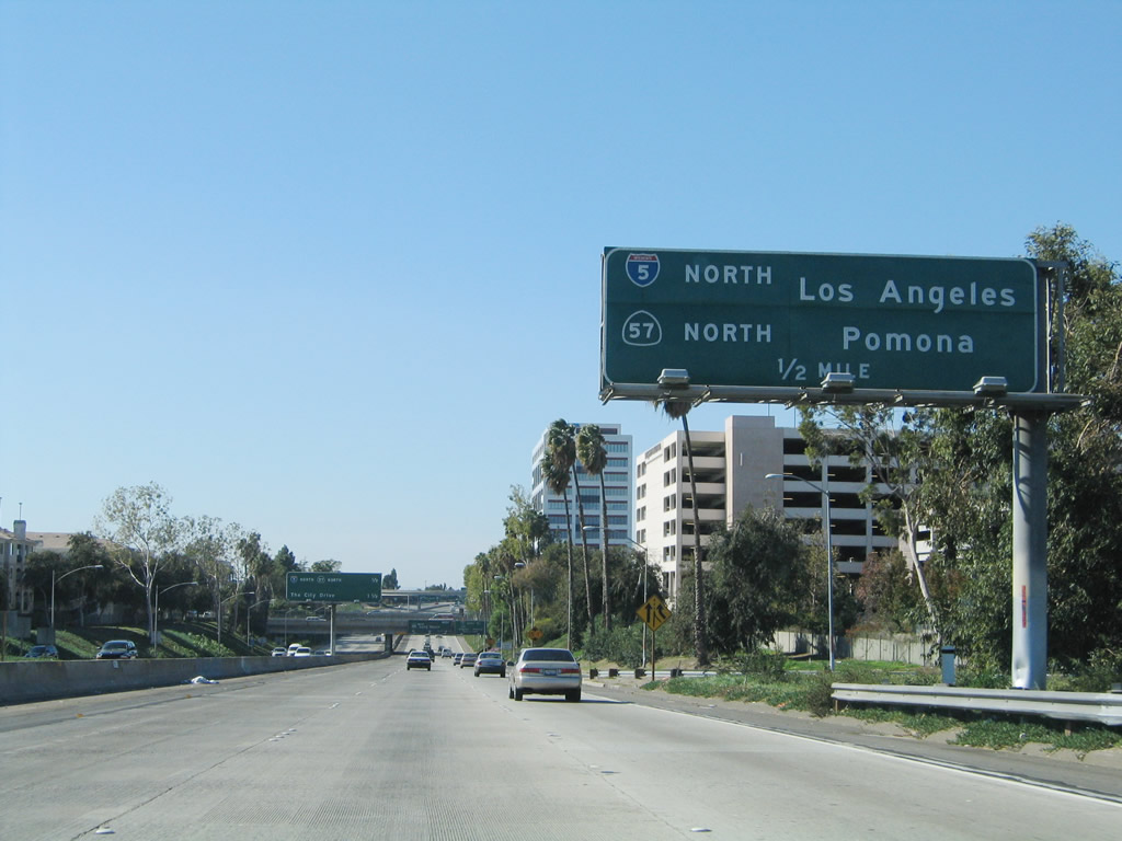
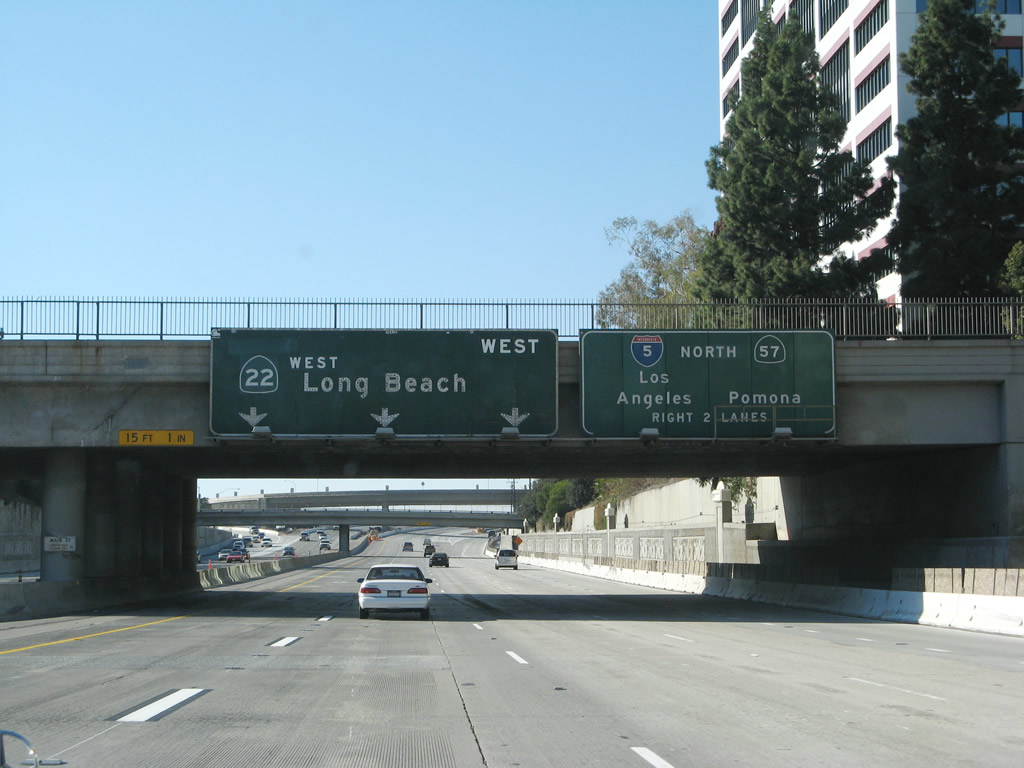
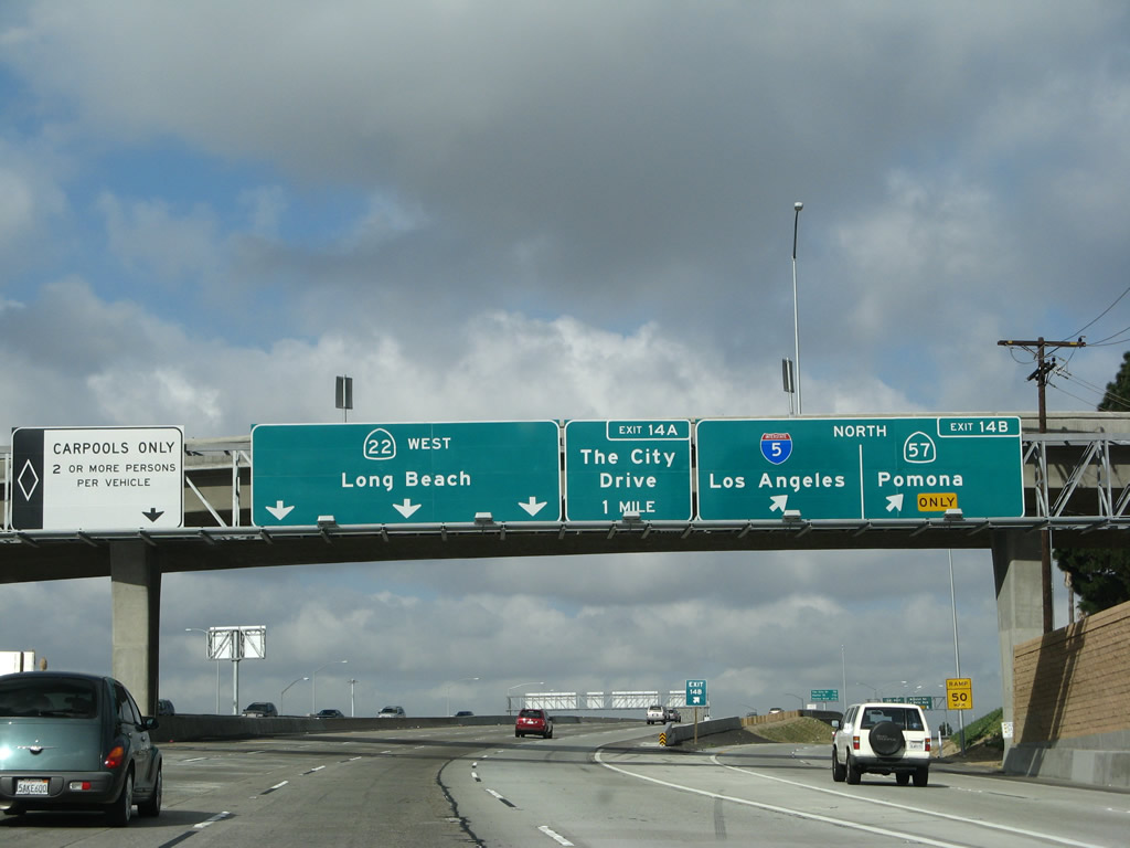
The right two lanes will connect to Exit 14B. The far right ramp will link to California 57 (Orange Freeway) north to Anaheim and Pomona, while the second lane from the right will connect to Interstate 5 (Santa Ana Freeway) northwest to downtown Los Angeles and points north. The signs here were moved to a sign bridge and off the overpass for Main Street. Photos taken 03/15/08 and 01/14/07. |
|
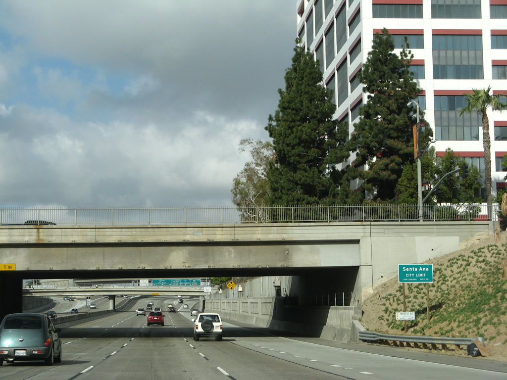
California 22 enters the city limits of Santa Ana; the freeway will reenter the city of Orange west of the Orange Crush Interchange and the Santa Ana River bridge. Photo taken 03/15/08. |
|
The freeway corridor was expanded in 2006 to allow for additional auxiliary lanes and a carpool lane. A single off-ramp carries traffic to connect with both California 57 north and Interstate 5 north. Photo taken 03/15/08. |
|
|
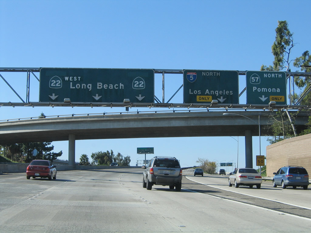
Westbound California 22 (Garden Grove Freeway) reaches Exit 14B, California 57 north and Interstate 5 north. The far right ramp will link to California 57 (Orange Freeway) north to Anaheim and Pomona, while the second lane from the right will connect to Interstate 5 (Santa Ana Freeway) northwest to downtown Los Angeles and points north. The signs here were replaced; the new signs include the new high occupancy vehicle lane and additional auxiliary lanes at the off-ramp. The next exit is Exit 14A, The City Drive. Photos taken 03/15/08 and 11/14/04. |
|
This mileage sign -- which advised of Exit 14A, The City Drive and Exit 13, Haster Street and Garden Grove Boulevard -- was removed and not replaced. These signs were removed when the freeway was reconstructed around 2005-2006. A replacement mileage sign has been added ahead. Photo taken 11/14/04. |
|
|
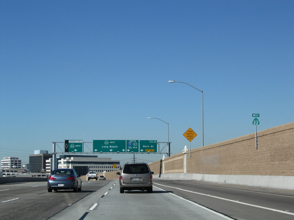
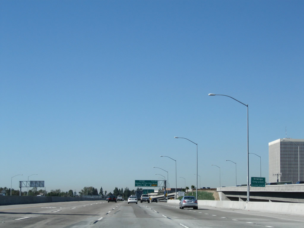
A replacement mileage sign along California 22 west provides the distance to Exit 14A, The City Drive; Exit 13, Haster Street and Garden Grove Boulevard; and Exit 12, Harbor Boulevard. A nearby sign bridge (with California 22 west and La Veta Avenue and Bristol Street listed) is located on a ramp that comes from Interstate 5 north to California 22 west (Exit 107B). This maze of ramps (linking Interstate 5, California 22, California 57, Bristol Street, and La Veta Avenue) is locally called the Orange Crush interchange. Photos taken 03/15/08. |
|
California 22 passes over Interstate 5 at this point; California 57 originates a short distance north of here. With the freeway expansion, the older landscaping (eucalyptus trees and palms) was removed, and some of the real estate became part of the wider freeway. Photo taken 03/15/08. |
|
|
|
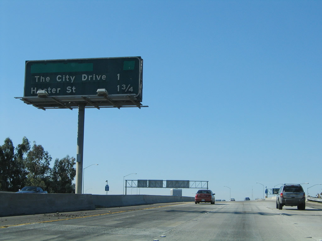
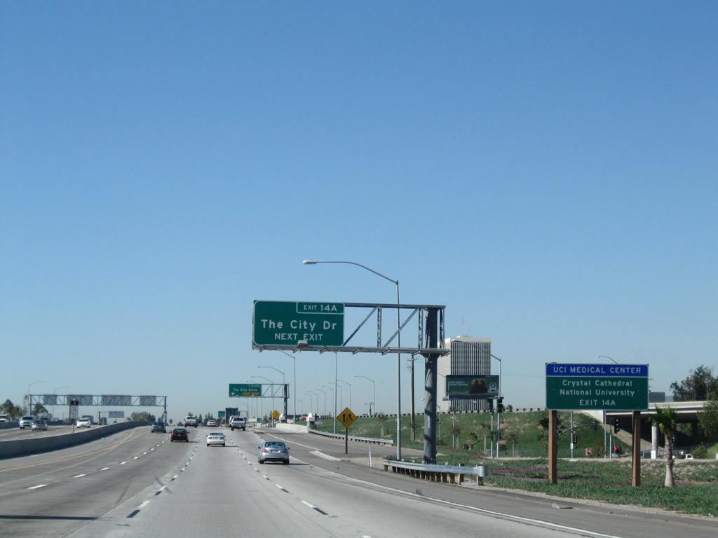
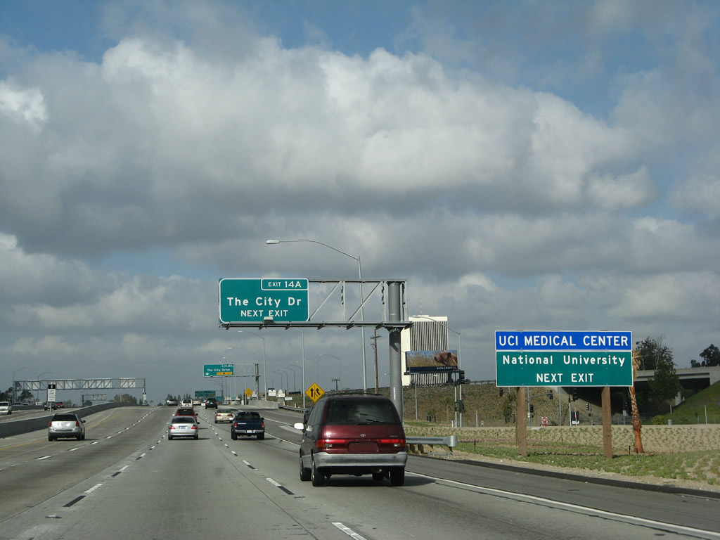
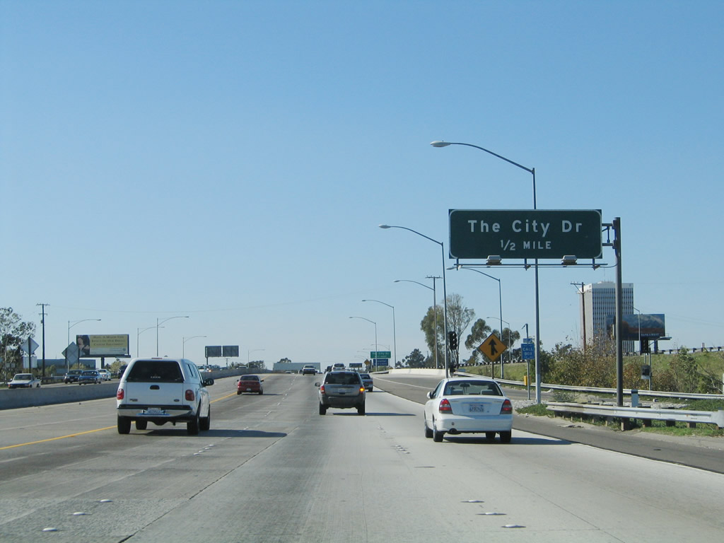
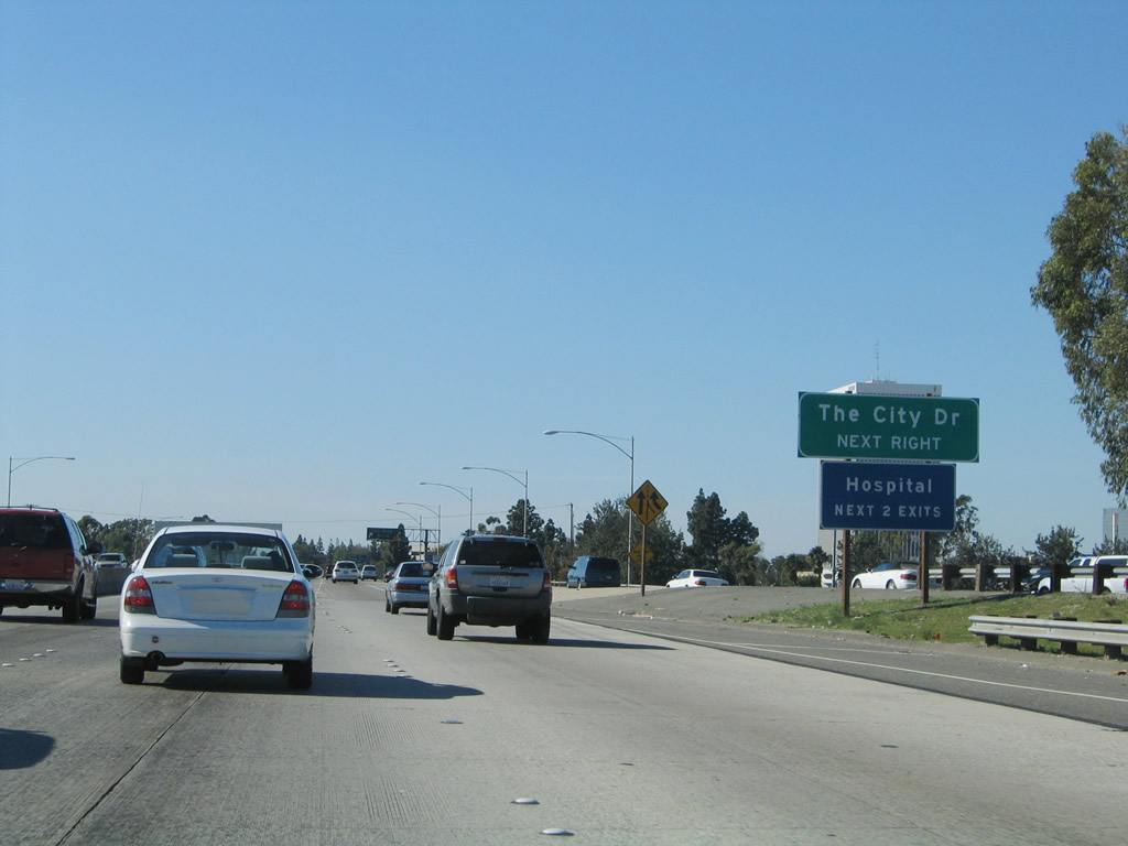
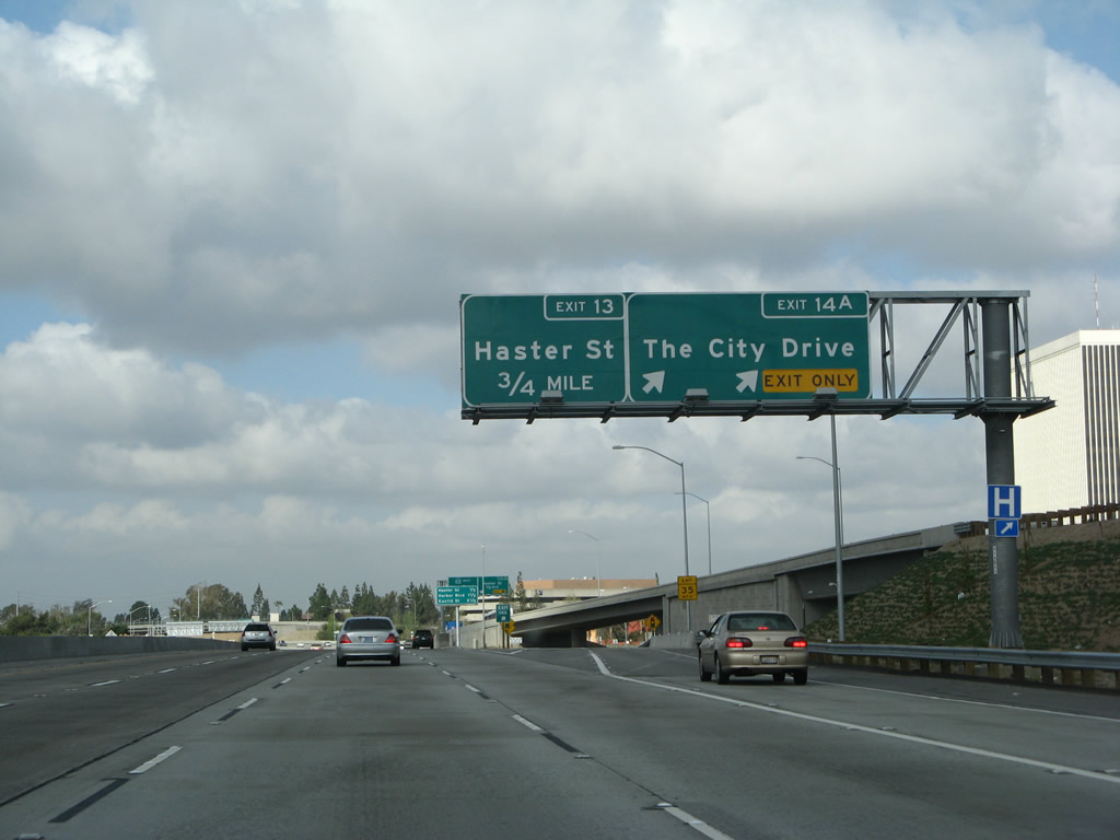
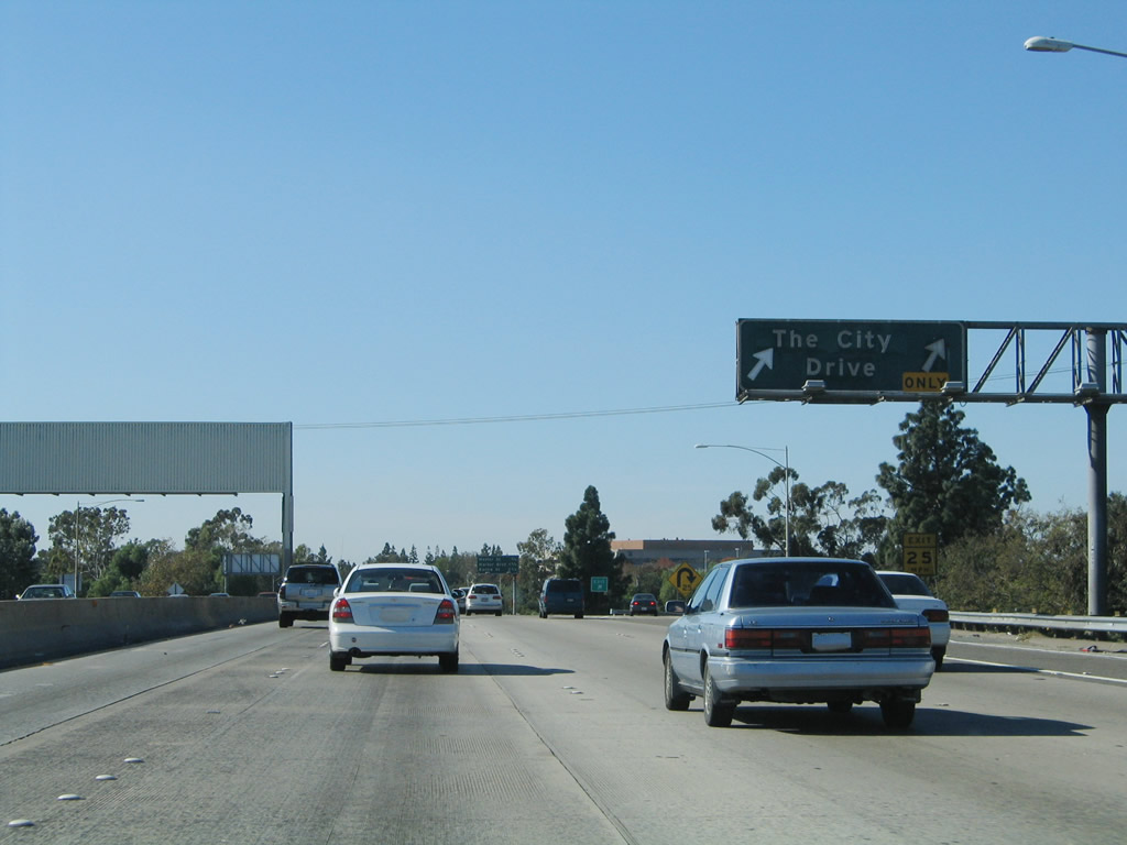
The next exit along California 22 (Garden Grove Freeway) west is Exit 14A, The City Drive. This off-ramp is located after the freeway passes over the Santa Ana River and reenters the city of Orange. Use The City Drive north to The Block at Orange, UC Irvine Medical Center, and Angel Stadium of Anaheim. The Crystal Cathedral, a well-known religious landmark, is located northwest of here in Garden Grove. Follow The City Drive north to Chapman Avenue west to the Cathedral. Photos taken 11/08/08, 03/15/08, and 11/14/04. |
|
|
The right two lanes of California 22 (Garden Grove Freeway) west will connect to Exit 14A, The City Drive. The 2004 picture shows the original configuation for this off-ramp. Photos taken 03/15/08 and 11/14/04. |
|
California 22 passes over the Santa Ana River, leaves the city of Santa Ana, and reenters the city of Orange. Photo taken 11/08/08. |
|
|
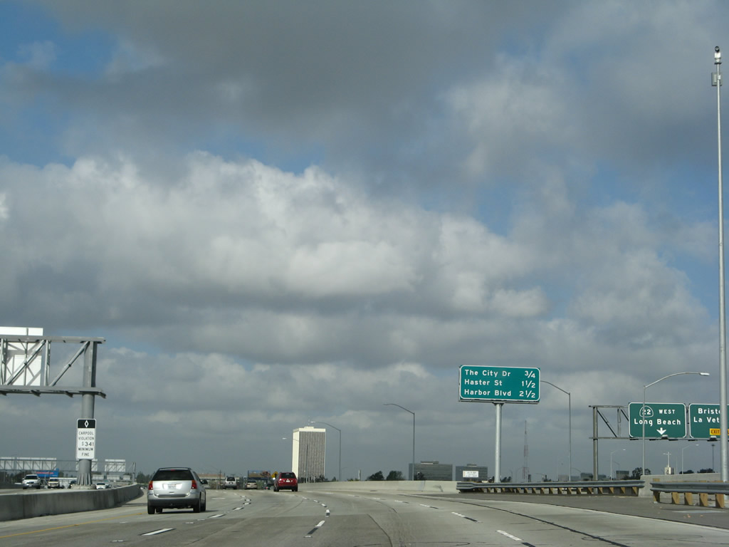
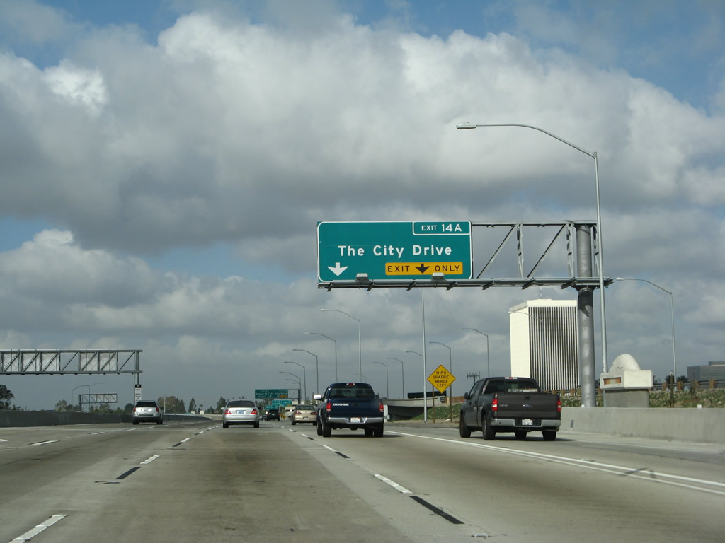
Westbound California 22 (Garden Grove Freeway) reaches Exit 14A, The City Drive. This interchange was completely reconstructed. In 2004, motorists had to make a 180 degree curve turn upon exiting. By 2008, this was changed with new entrance/exit ramps that had a separation structure. Photos taken 03/15/08 and 11/14/04. |
|
|
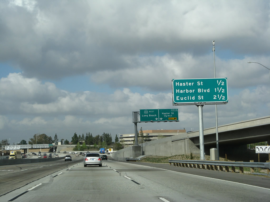
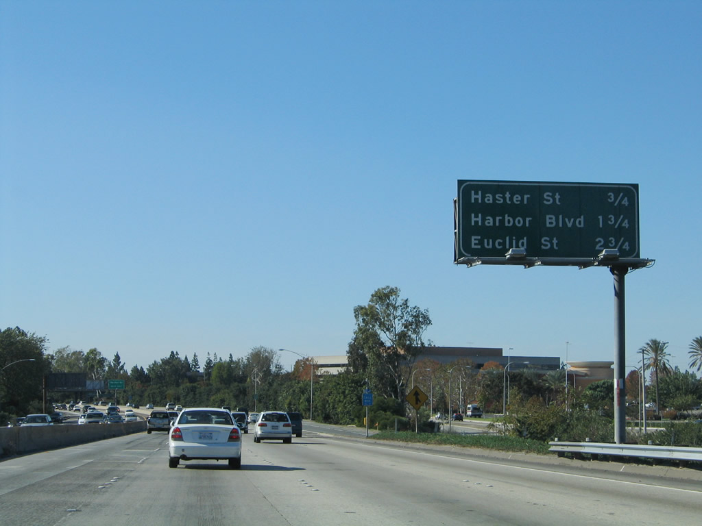
This interchange sequence sign along California 22 (Garden Grove Freeway) west provides the distance to Exit 13, Haster Street and Garden Grove Boulevard; Exit 12, Harbor Boulevard; and Exit 11, Euclid Street. Photos taken 03/15/08 and 11/14/04. |
|
Traffic from California 57 south and Interstate 5 south prepare to merge onto California 22 west. This merge point was moved to the west side of the Santa Ana River to reduce the amount of weaving and merging through the Orange Crush Interchange. A second sign here advises of the pending ramp to Exit 13, Haster Street and Garden Grove Bouelvard. Photo taken 03/15/08. |
|
|
These older signs for Exit 13, Haster Street and Garden Grove Boulevard and for the next eight exits serving the city of Garden Grove were both removed when the freeway was reconstructed. Photos taken 11/14/04. |
|
In their place was this guide sign, posted on the Lewis Street overpass, advising that the right two lanes will connect to Exit 13, Haster Street and Garden Grove Bouelvard. Photo taken 03/15/08. |
|
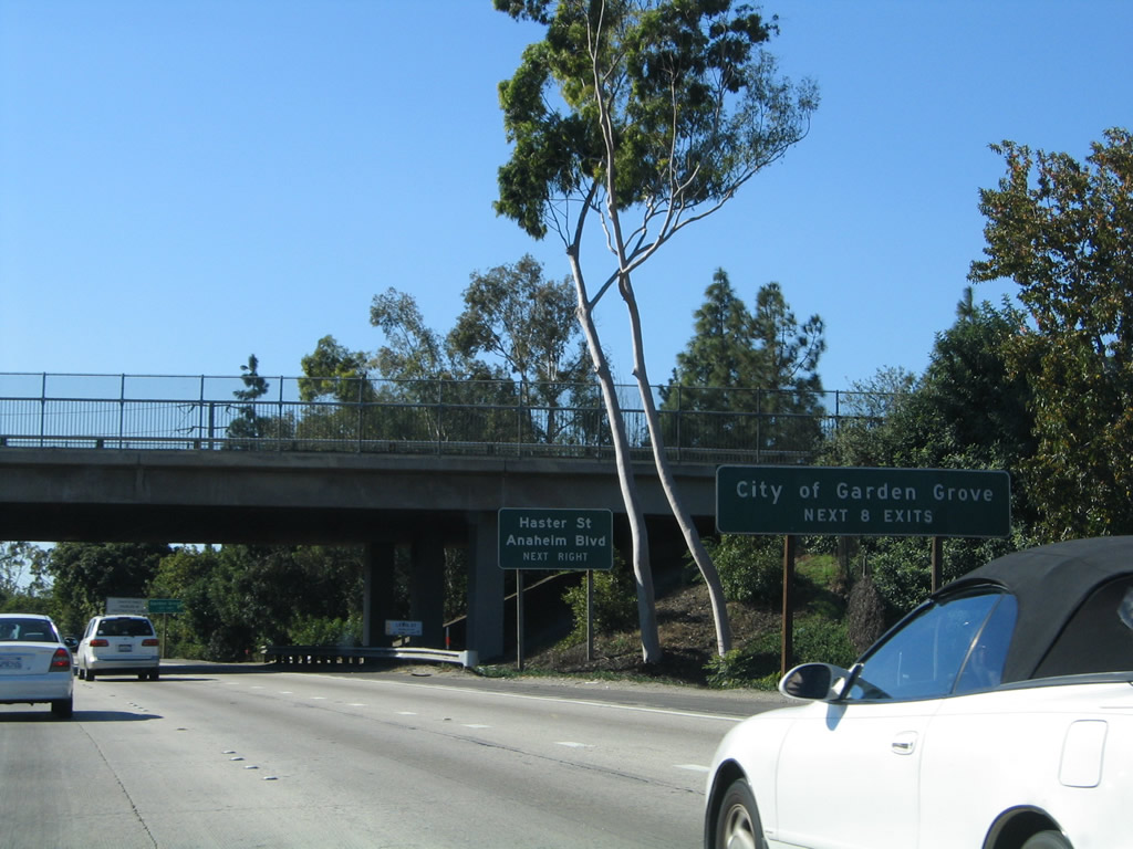
California 22 leaves the city of Orange and enters the city of Garden Grove. Incorporated on June 18, 1956, Garden Grove had a population of 165,196 as of the 2000 Census. The city consists of approximately 18 square miles and generally follows the Garden Grove Freeway corridor between Interstate 5 and Interstate 405. Photo taken 03/15/08. |
|
|
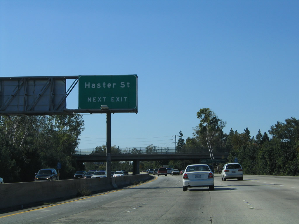
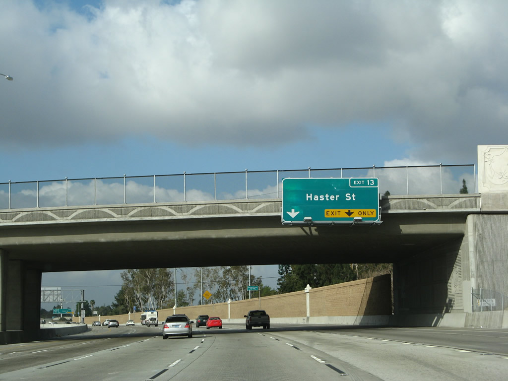
Westbound California 22 (Garden Grove Freeway) reaches Exit 13, Haster Street and Garden Grove Boulevard. This exit also links California 22 with Fairview Street south (via a brief overlap with Garden Grove Boulevard east). The next exit along westbound is Exit 12, Harbor Boulevard. Photos taken 03/15/08 and 11/14/04. |
|
|
This interchange sequence sign along California 22 (Garden Grove Freeway) west provides the distance to Exit 12, Harbor Boulevard; Exit 11, Euclid Street; and Exit 10, Brookhurst Street. Photos taken 03/15/08 and 11/14/04. |
|
Another of those orange/brown-based rainbow pilasters lines the bridge that carries California 22 over Garden Grove Boulevard. This roadway, which is old California 22, extends east back to Santa Ana (becoming Memory Lane upon crossing over the Santa Ana River). Photo taken 03/15/08. |
|
|
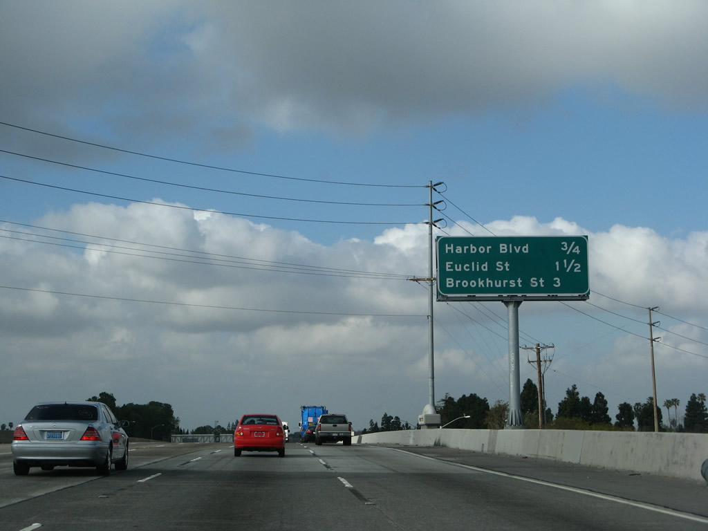
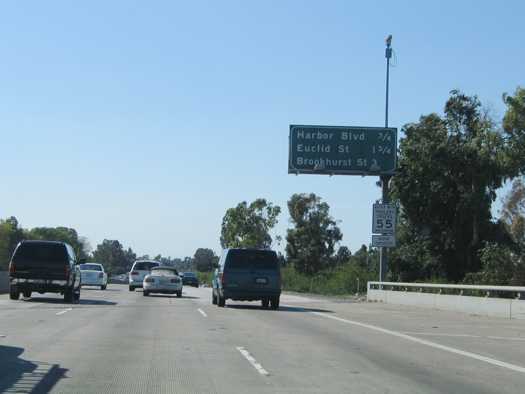
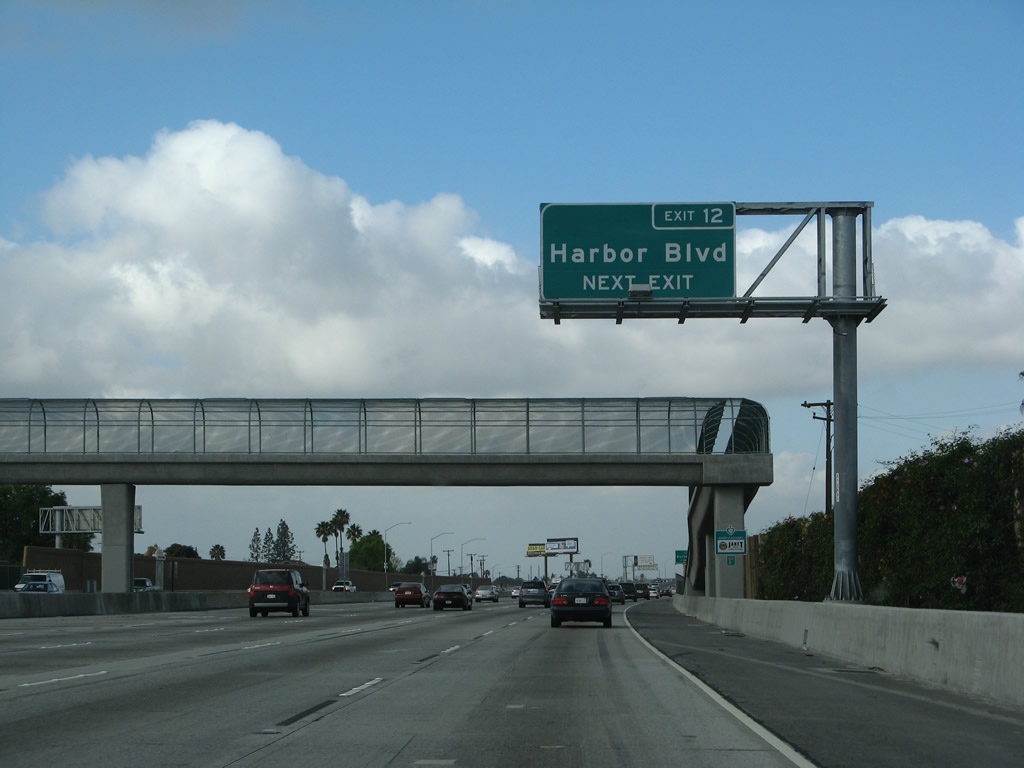
The next exit along California 22 (Garden Grove Freeway) west is Exit 12, Harbor Boulevard. Use Harbor Boulevard north to Anaheim and Disneyland Resort; to the south, Harbor Boulevard serves western Santa Ana and eastern Fountain Valley before entering Costa Mesa. This sign was moved from the centerline to the roadside as part of the 2006 freeway reconstruction. Photos taken 03/15/08 and 11/14/04. |
|
|
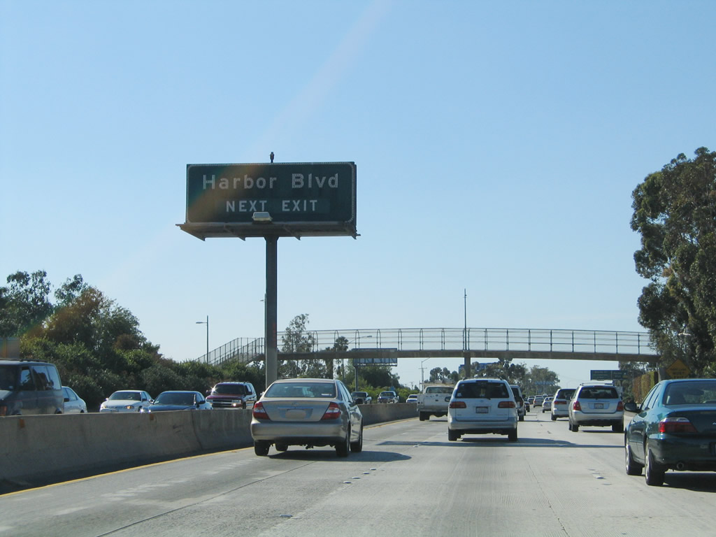
Westbound California 22 (Garden Grove Freeway) reaches Exit 12, Harbor Boulevard. The next exit along California 22 west will be Exit 11, Euclid Street. Photos taken 03/15/08 and 11/14/04. |
|
|
This interchange sequence sign along California 22 (Garden Grove Freeway) west provides the distance to Exit 11, Euclid Street; Exit 10, Brookhurst Street; and Exit 9, Magnolia Avenue. This mileage sign was relocated and adjusted for distance as part of the reconstruction project that impacted both the width of the freeway and the placement of exit ramps. Photos taken 03/15/08 and 11/14/04. |
|
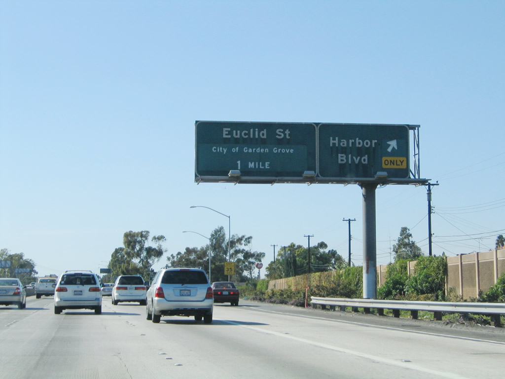
Use Exit 11 to downtown Garden Grove via Euclid Street northbound. The city center is located roughly near the intersection of Garden Grove Boulevard and Euclid Street. Photo taken 11/08/08. |
|
This California 22 west reassurance shield is posted after the on-ramp from Harbor Boulevard. Photo taken 03/15/08. |
|
|
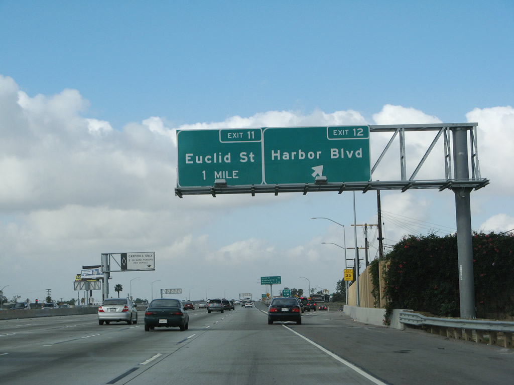
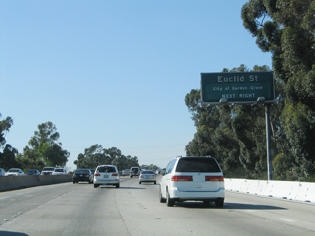
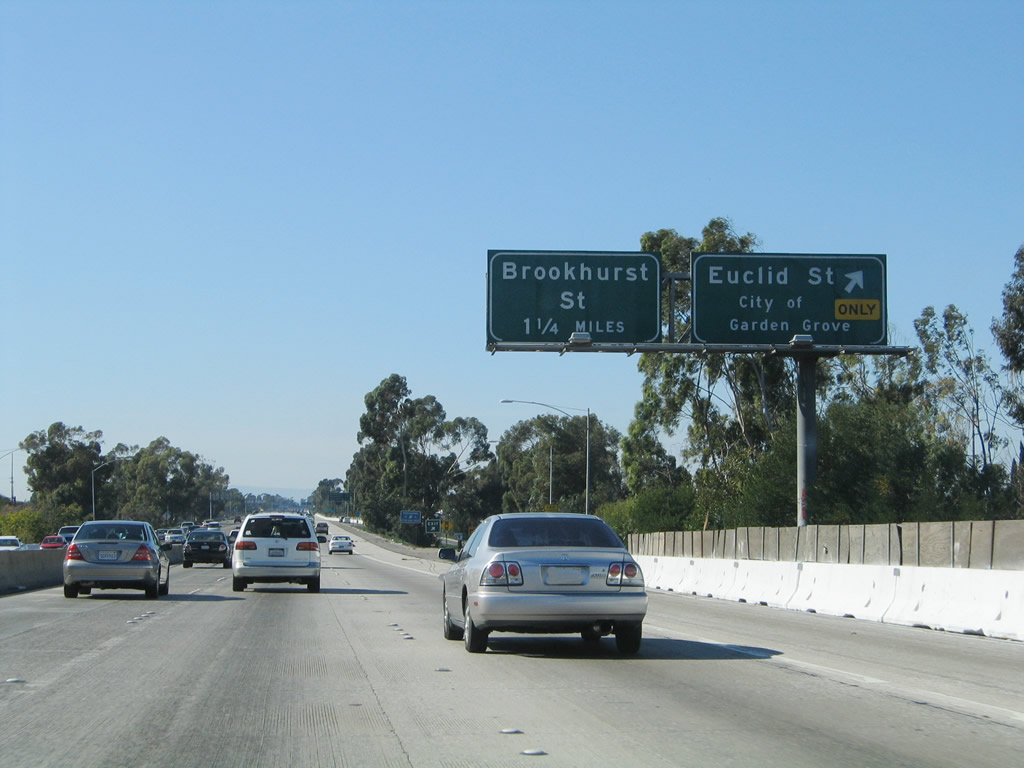
California 22 (Garden Grove Freeway) west approaches Exit 11, Euclid Street (0.50 mile). Note the significant removal of eucalyptus trees in exchange for soundwalls and expanded freeway. Photos taken 11/08/08 and 11/14/04. |
|
|
Westbound California 22 (Garden Grove Freeway) reaches Exit 11, Euclid Street, which travels north to downtown Garden Grove and south to western Santa Ana and Fountain Valley. Euclid Street interchanges with Interstate 405 at Exit 12 in Fountain Valley. Photos taken 03/15/08 and 11/14/04. |
|
This view shows the gore point for Exit 11. Photo taken 01/24/07. |
|
|
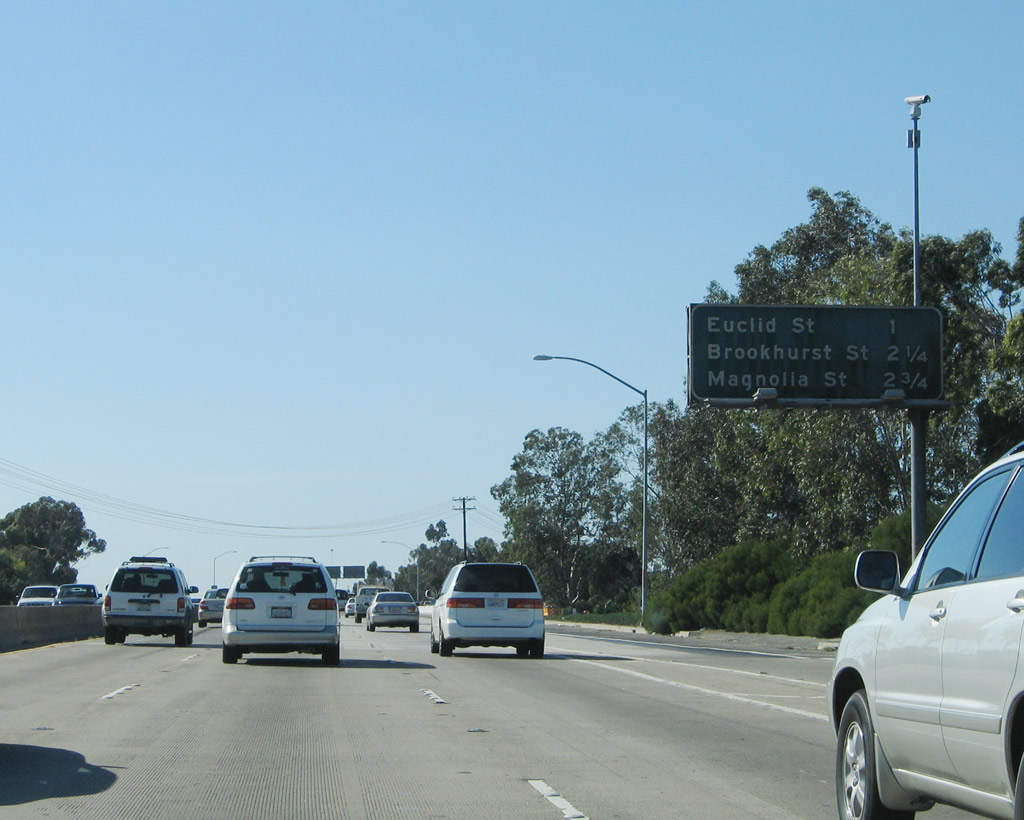
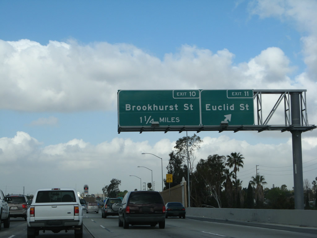
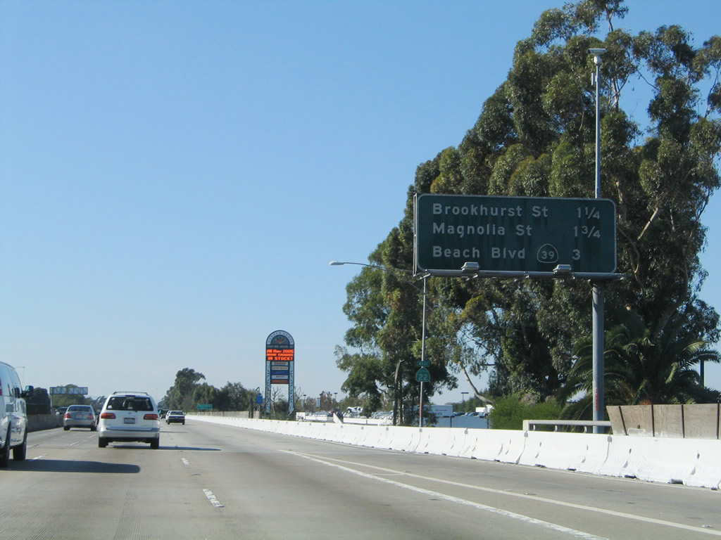
This interchange sequence sign along California 22 (Garden Grove Freeway) west provides the distance to Exit 10, Brookhurst Street; Exit 9, Magnolia Avenue; and Exit 8, California 39 (Beach Boulevard). Photos taken 03/15/08 and 11/14/04. |
|
|
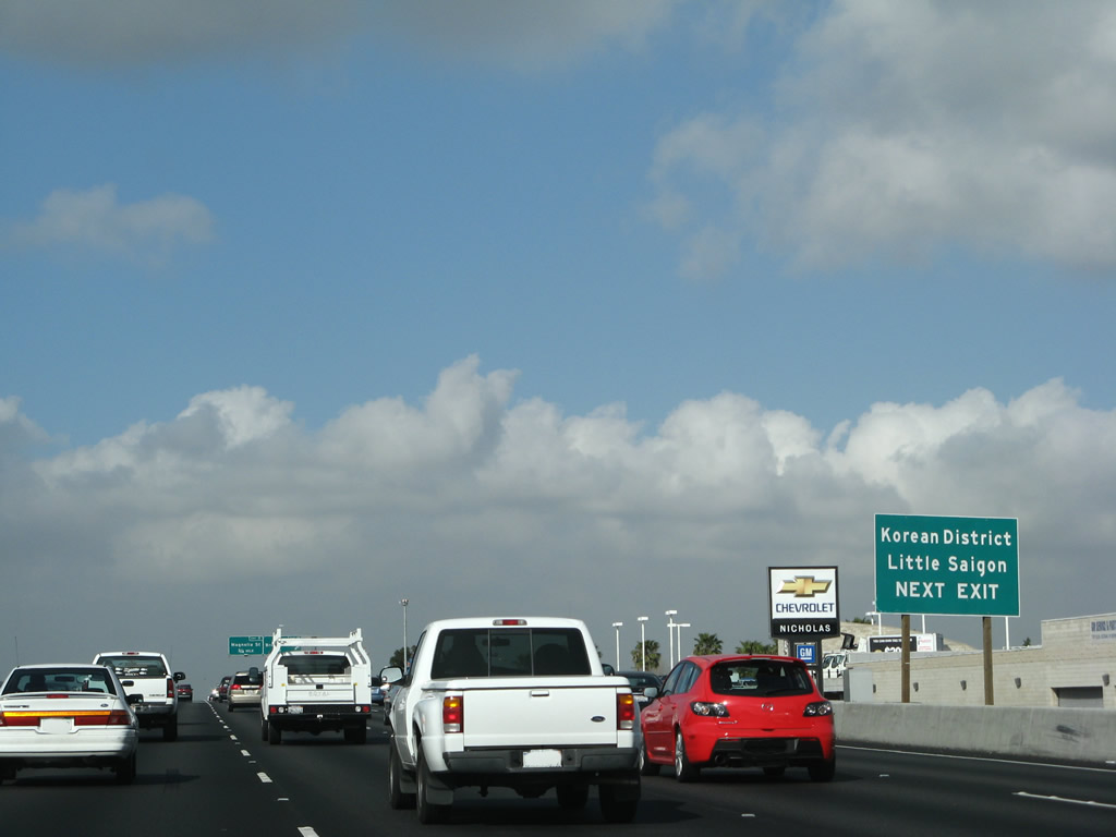
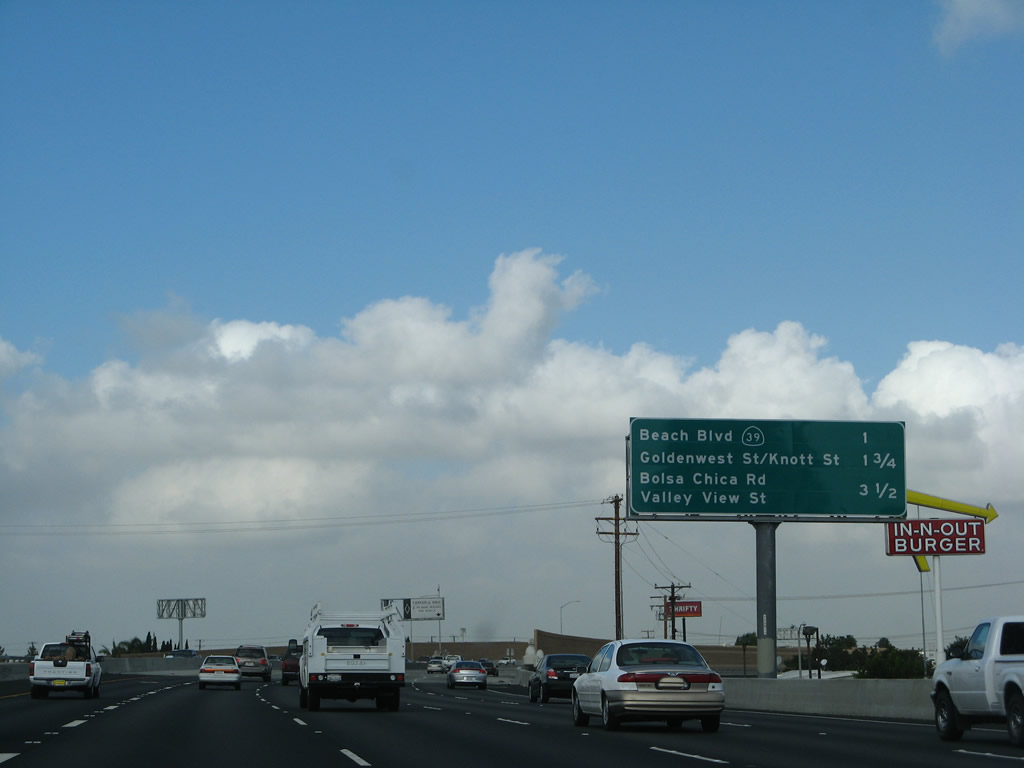
Use Brookhurst Street to Little Saigon and the Korean District. Evidence of construction could be seen even back in 2004. Photos taken 03/15/08 and 11/14/04. |
|
|
Westbound California 22 (Garden Grove Freeway) reaches Exit 10, Brookhurst Street. The next interchange is Exit 9, Magnolia Avenue. Photos taken 03/15/08 and 11/14/04. |
|
|
This interchange sequence sign along California 22 (Garden Grove Freeway) west provides the distance to Exit 9, Magnolia Avenue; Exit 8, California 39 (Beach Boulevard); and Exit 7, Garden Grove Boulevard, Goldenwest Street, and Knott Street. Photos taken 03/15/08 and 11/14/04. |
|
|
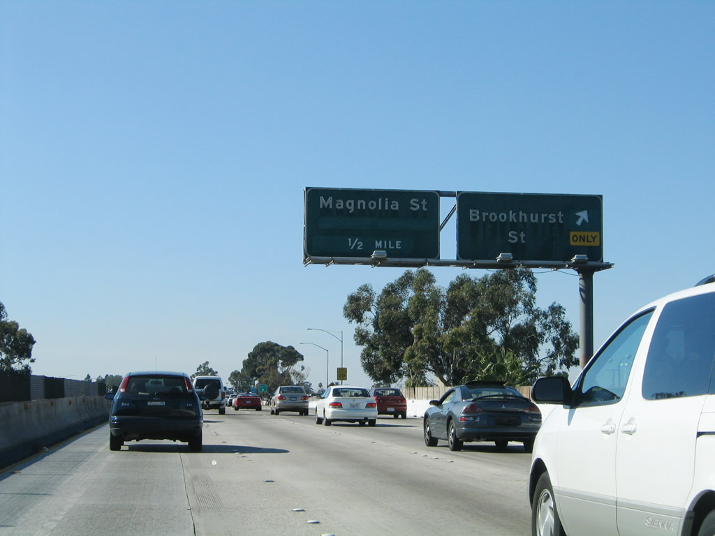
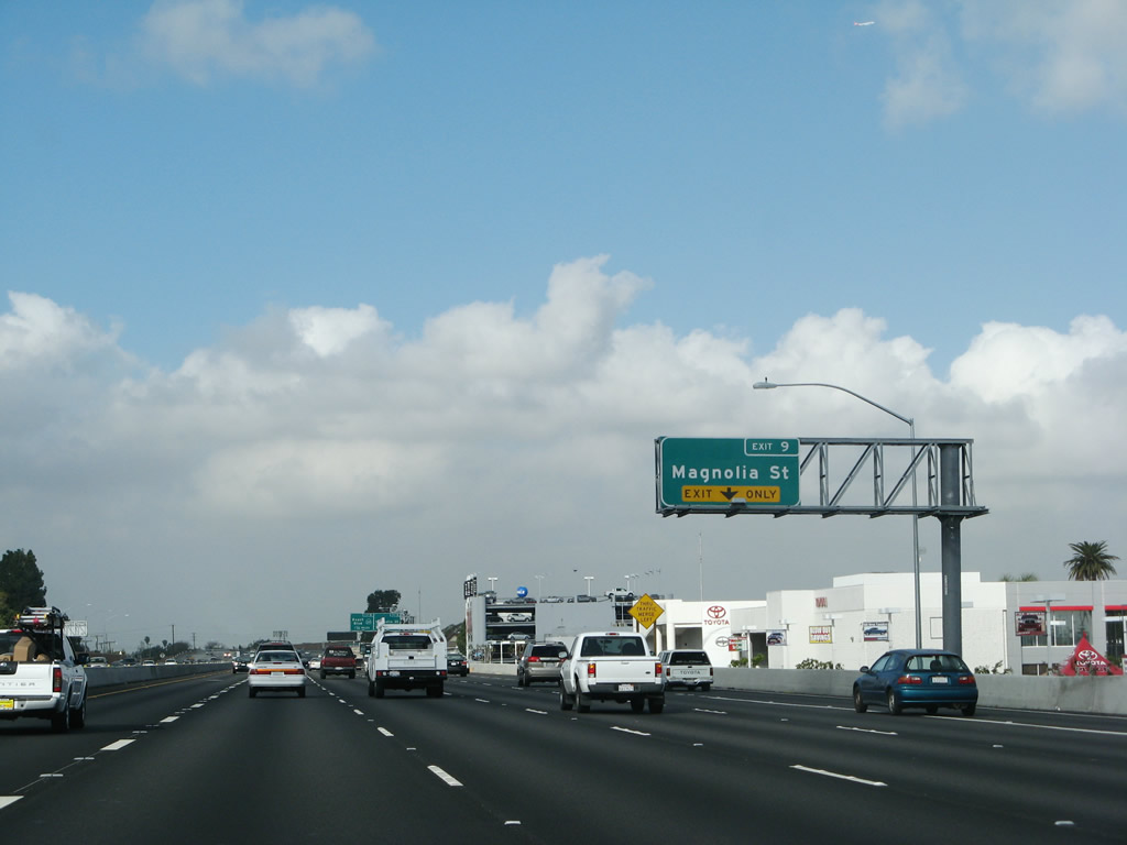
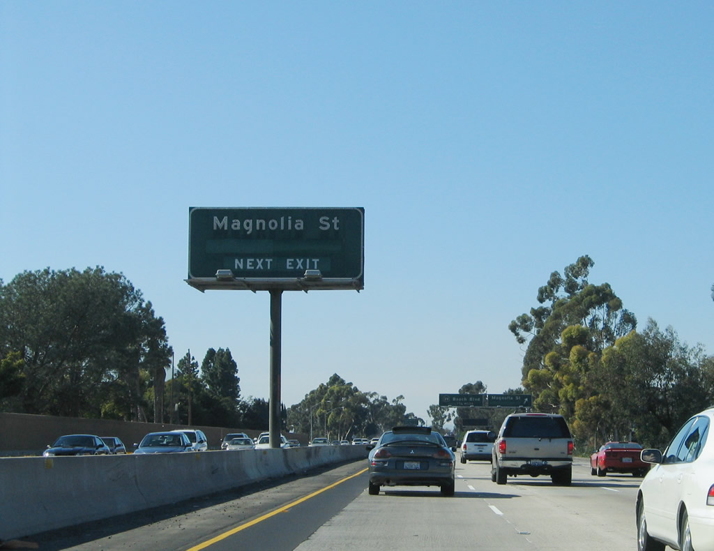
The next exit along California 22 (Garden Grove Freeway) west is Exit 9, Magnolia Avenue, a north-south major street that parallels Brookhurst Street and Euclid Street (to the east). The right lane becomes exit only for Exit 9. Photos taken 03/15/08 and 11/14/04. |
|
|
Westbound California 22 (Garden Grove Freeway) reaches Exit 9, Magnolia Avenue. The next exit is Exit 8, California 39 (Beach Boulevard). Photos taken 03/15/08 and 11/14/04. |
|
California 39 is a major north-south arterial that begins in Huntington Beach and extends north through Westminster, Garden Grove, Stanton, western Anaheim, Buena Park, and La Habra. California 39 ends in La Habra; a second segment exists in Los Angeles County north of Interstate 10 through Azusa and north into the San Gabriel Mountains. Photo taken 03/15/08. |
|
|
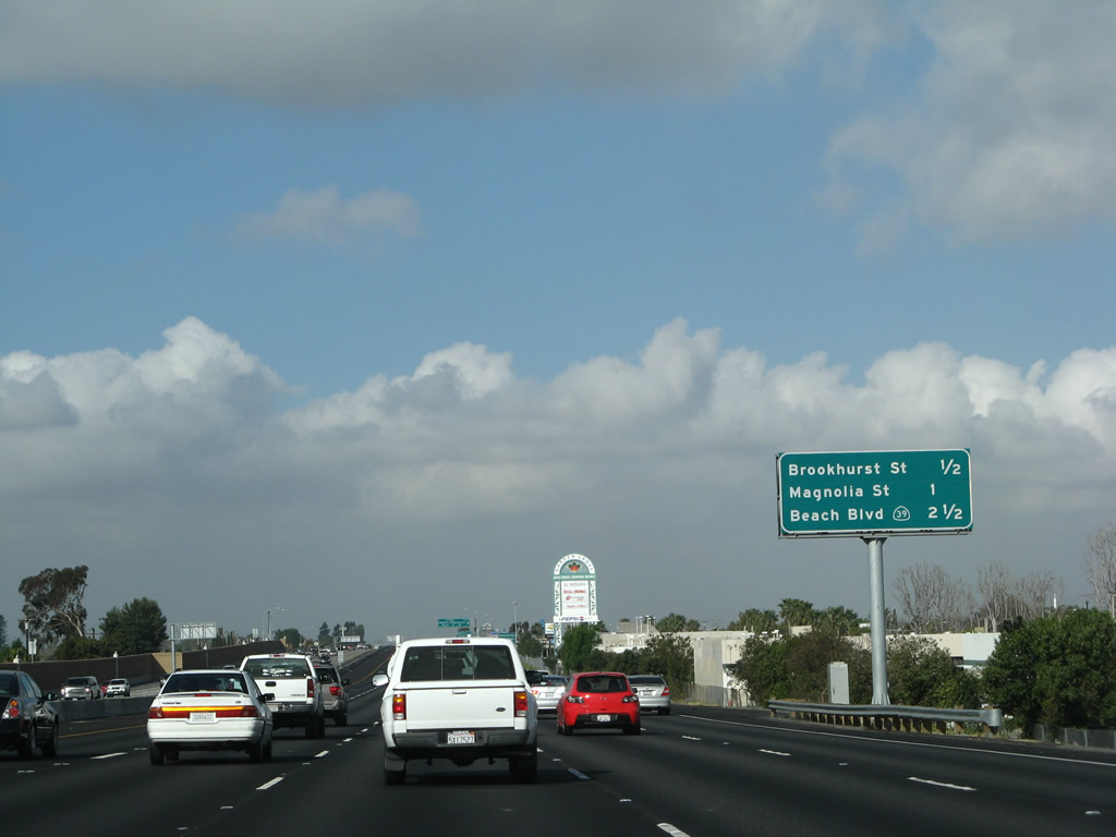
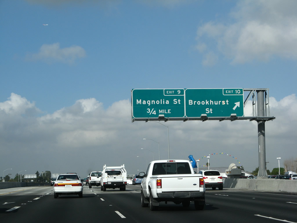
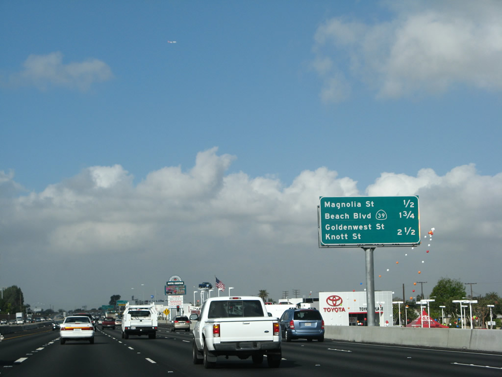
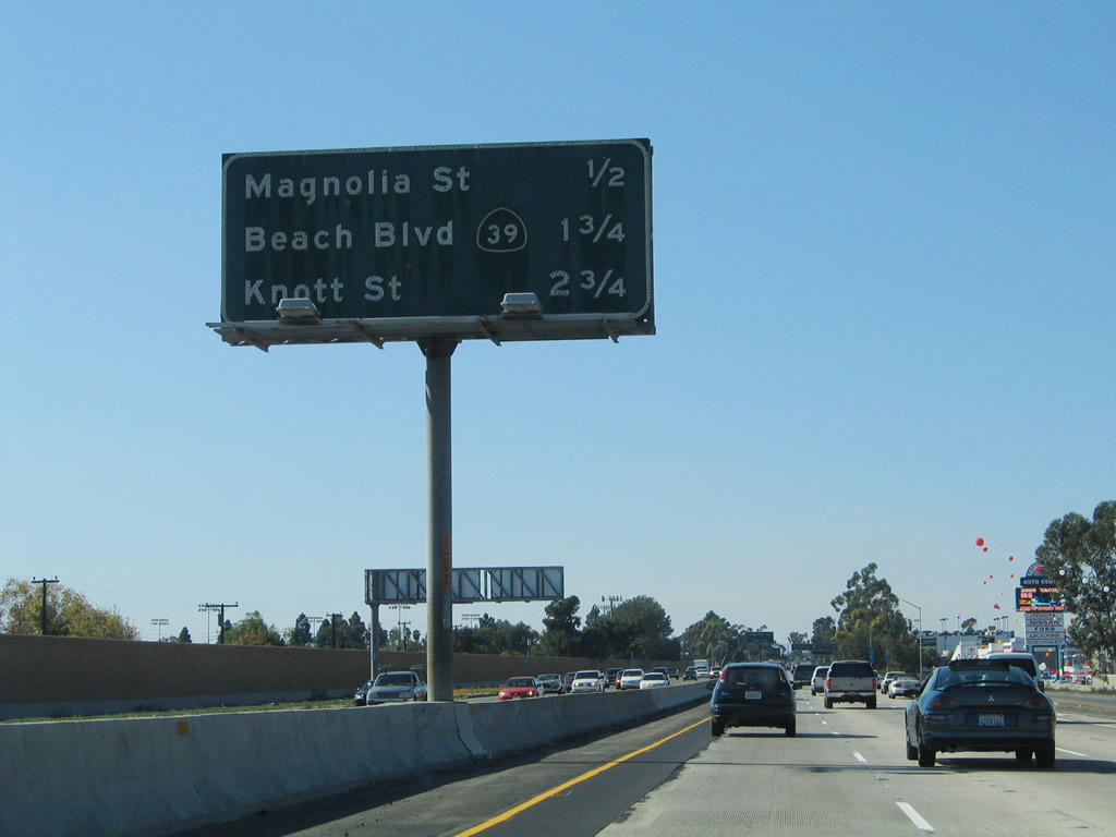
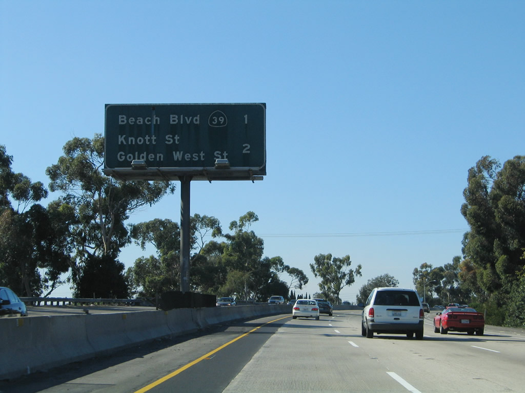
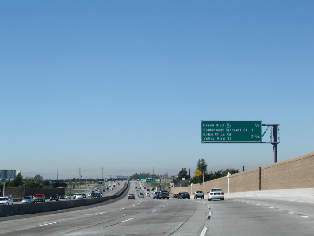
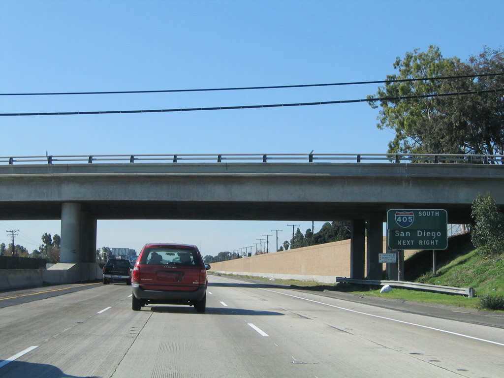
This interchange sequence sign along California 22 (Garden Grove Freeway) west provides the distance to Exit 8, California 39 (Beach Boulevard); Exit 7, Garden Grove Boulevard, Goldenwest Street south, and Knott Street north; and Exit 5, Valley View Street north and Bolsa Chica Road south to Interstate 405 (San Diego Freeway) south. Photos taken 03/15/08 and 11/14/04. |
|
California 22 curves into a new set of soundwalls. Photo taken 11/08/08. |
|
This California 22 west reassurance shield is posted after the on-ramp from Magnolia Avenue. Photo taken 11/08/08. |
|
|
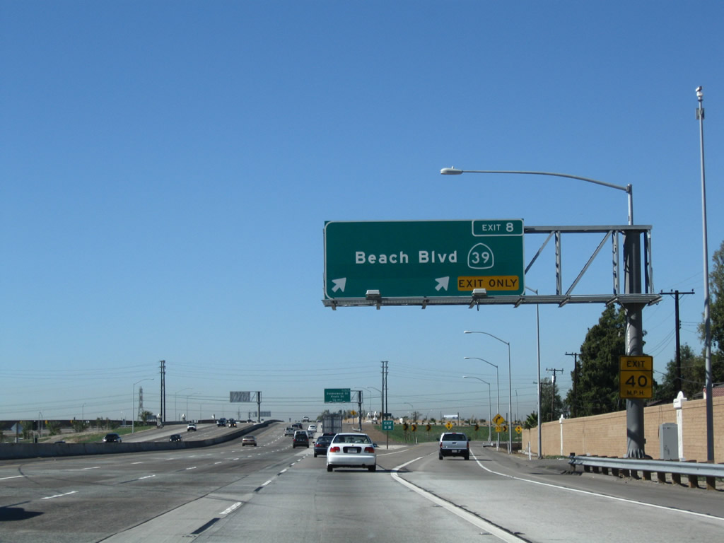
The right two lanes of California 22 (Garden Grove Freeway) west connect to Exit 8, California 39 (Beach Boulevard). Photos taken 11/08/08 and 11/14/04. |
|
Another interchange sequence sign along California 22 (Garden Grove Freeway) west provides the distance to Exit 8, California 39 (Beach Boulevard); Exit 7, Garden Grove Boulevard, Goldenwest Street south, and Knott Street north; and Exit 5, Valley View Street north and Bolsa Chica Road south to Interstate 405 (San Diego Freeway) south. Photo taken 11/08/08. |
|
|
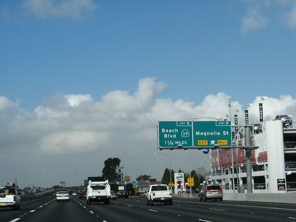
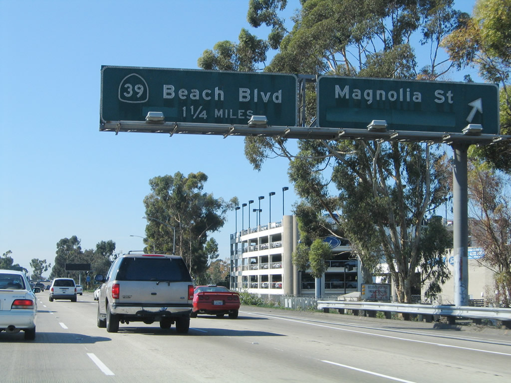
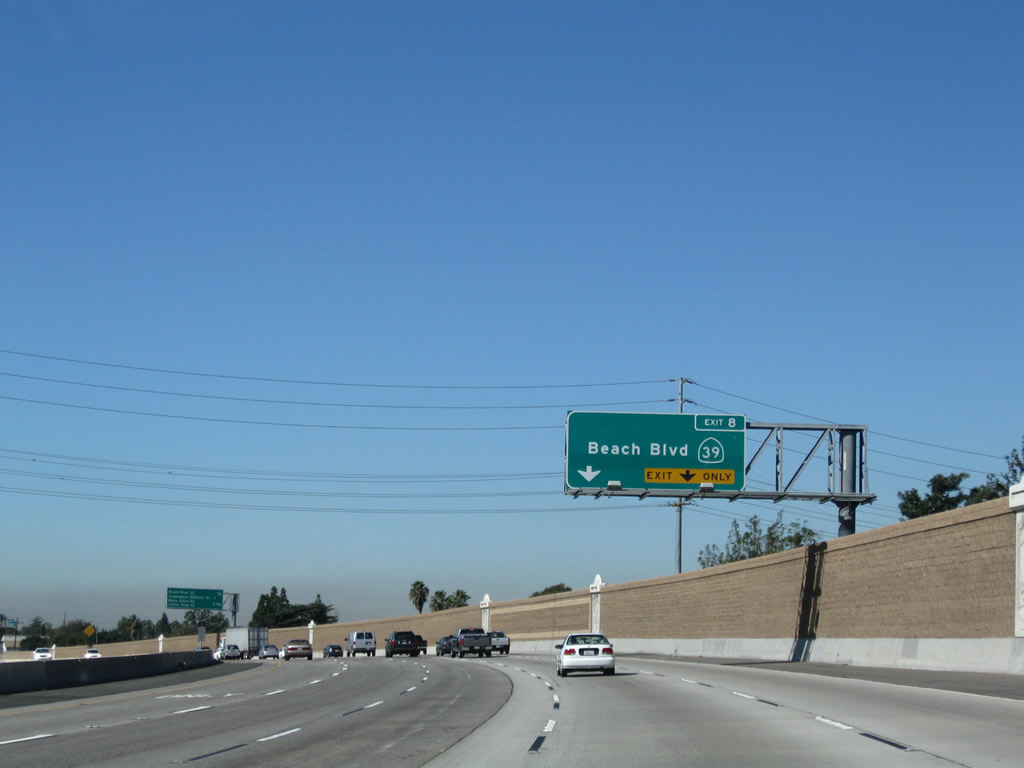
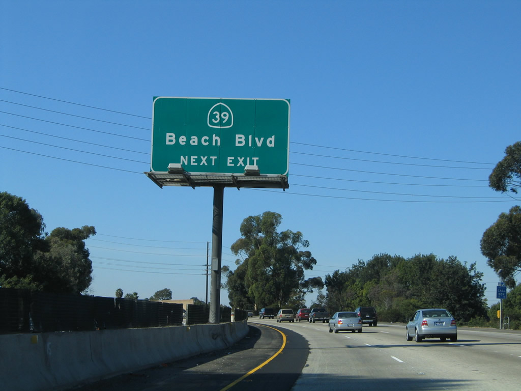
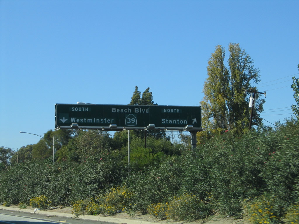
Westbound California 22 (Garden Grove Freeway) reaches Exit 8, California 39 (Beach Boulevard). California 39 travels north to the city of Stanton (population 37,403 as of 2000 Census) and south to the city of Westminster. This interchange was completely revised during reconstruction from a modified cloverleaf to a modified partial cloverleaf. Photos taken 11/08/08 and 11/14/04. |
|
Originally, the configuration of Exit 8 was a modified cloverleaf, with a high-speed ramp to California 39 north and a loop to California 39 south. This was altered with the 2005-2006 reconstruction, and this sign (on the former collector distributor lanes) is no longer needed. Photo taken 11/14/04. |
|
|
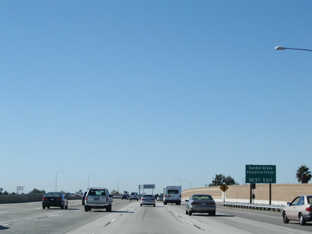
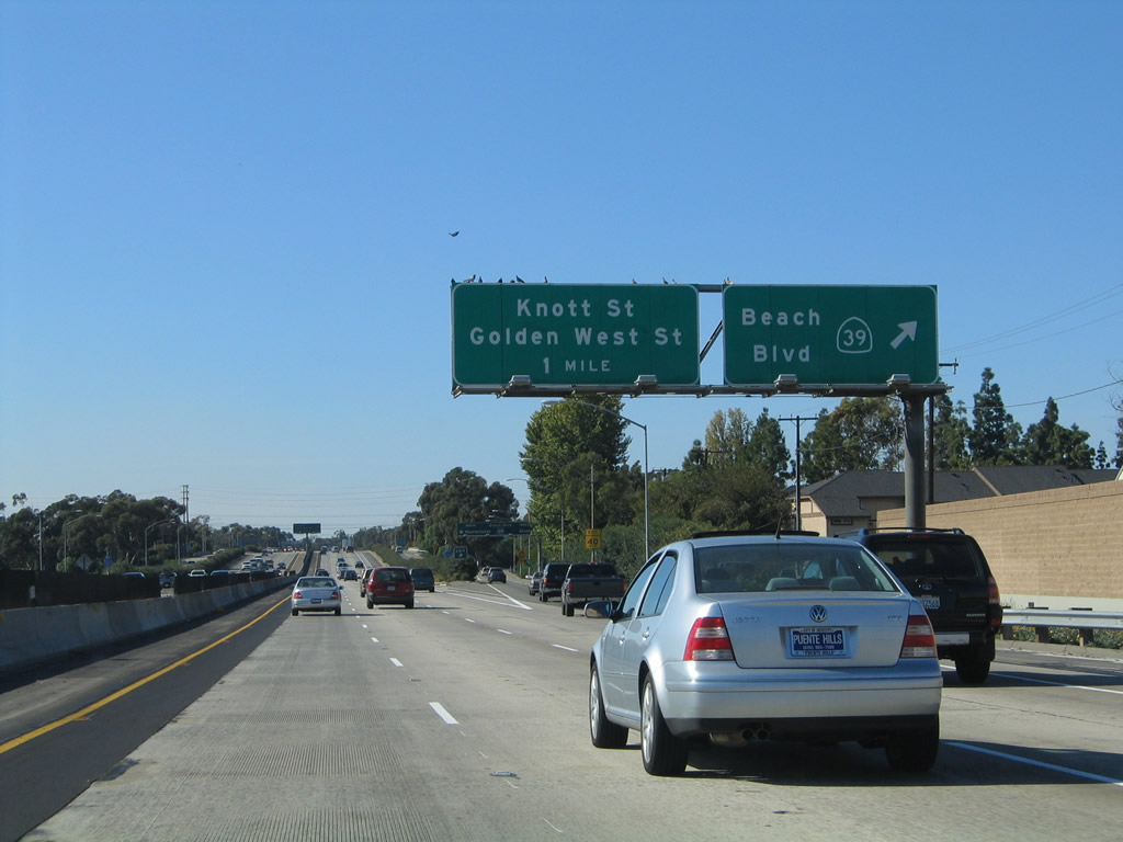
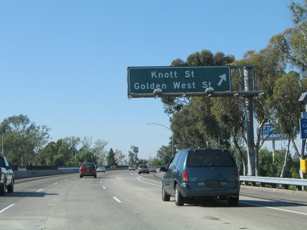
Now passing through the California 39 interchange, the next exit along California 22 (Garden Grove Freeway) west is Exit 7, Garden Grove Boulevard, Goldenwest Street south, and Knott Street north. In 2004, an interchange sequence sign was posted at this location; it was replaced with a guide sign solely for Exit 7. Photos taken 03/15/08 and 11/14/04. |
|
The right lane of California 22 (Garden Grove Freeway) becomes exit only for Exit 7, Garden Grove Boulevard, Goldenwest Street south, and Knott Street north. Around this point, California 22 briefly enters the city of Westminster. Photo taken 03/15/08. |
|
|
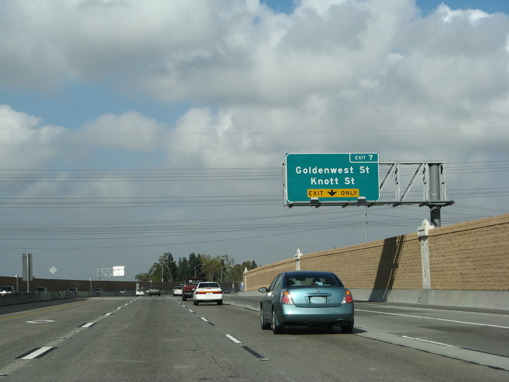
Westbound California 22 (Garden Grove Freeway) reaches Exit 7, Garden Grove Boulevard, Goldenwest Street south, and Knott Street north. The off-ramp connects directly to Garden Grove Boulevard; turn left to the intersection with Goldenwest Street south into Westminster or Knott Street north into Garden Grove toward Cypress and Stanton. Photos taken 03/15/08 and 11/14/04. |
|
|
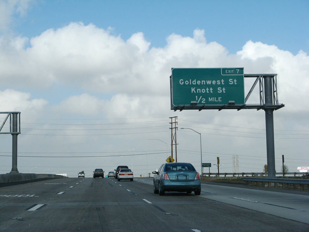
Now passing through the Goldenwest Street and Knott Street interchange, California 22 reenters the city of Garden Grove. For the next mile, California 22 serves as the northern border of Westminster and southern border of Garden Grove. The next exit along California 22 (Garden Grove Freeway) west is Exit 5, Valley View Street north and Bolsa Chica Road south to Interstate 405 south. Photos taken 03/15/08 and 11/14/04. |
|
A bridge identification marker for Knott Street is posted on the bridge rail. Photo taken 11/08/08. |
|
Here's a close look at the new brown-orange-yellow "rainbow" pilaster seen on most California 22 bridges since the freeway reconstruction. Photo taken 11/08/08. |
|
California 22 passes over Knott Street and continues west toward its merge with Interstate 405 (San Diego Freeway) en route to Long Beach. Photo taken 11/08/08. |
|
|
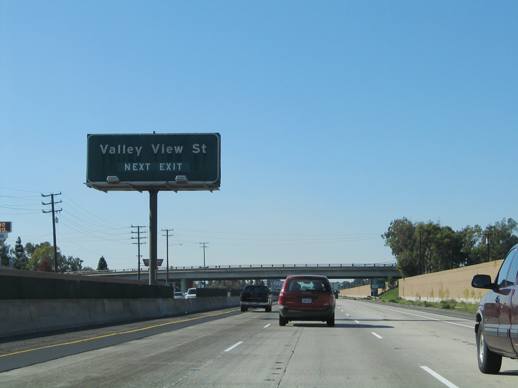
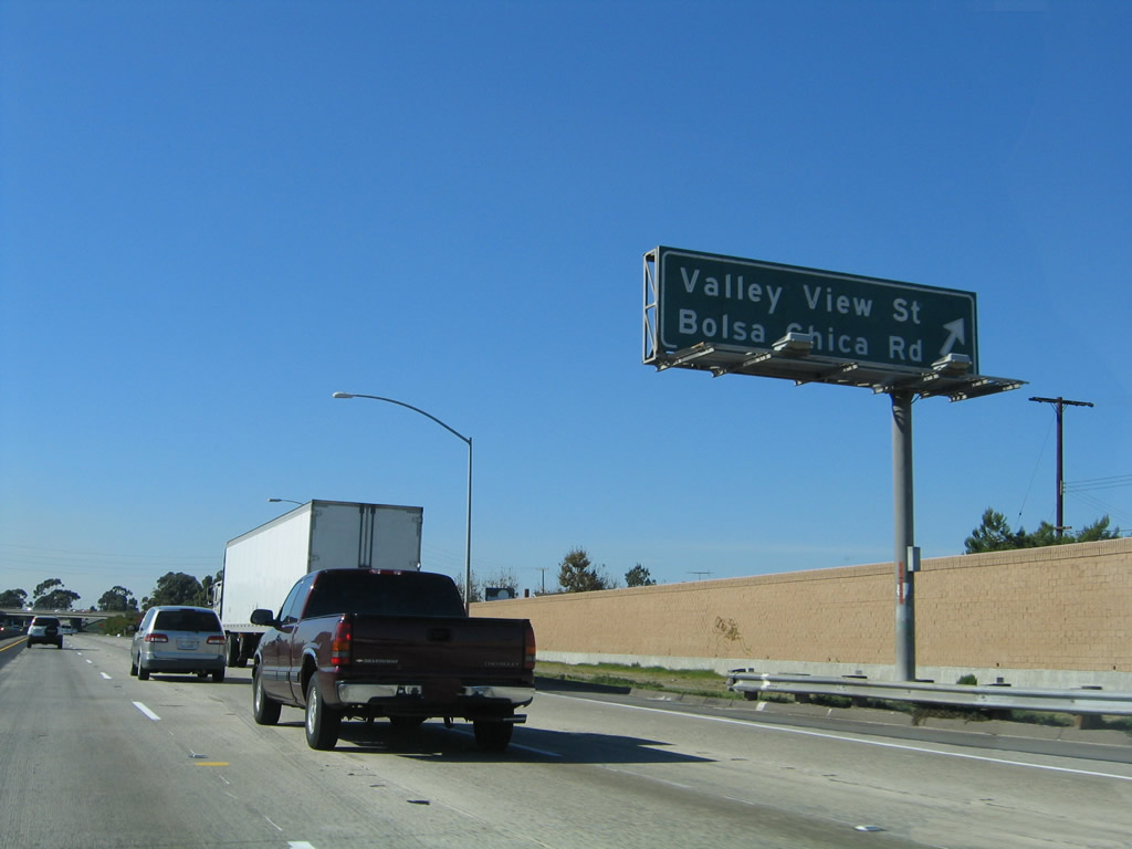
The next exit along California 22 west is Exit 5, Valley View Street north and Bolsa Chica Road south to Interstate 405 south. After this interchange, all mainline traffic will merge onto Interstate 405 north. Together, Interstate 405 north and California 22 will jointly extend toward Long Beach. This sign was removed after reconstruction, and a California 22 west reassurance shield is near this spot. Photos taken 11/08/08 and 11/14/04. |
|
|
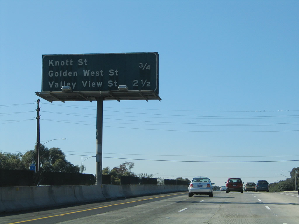
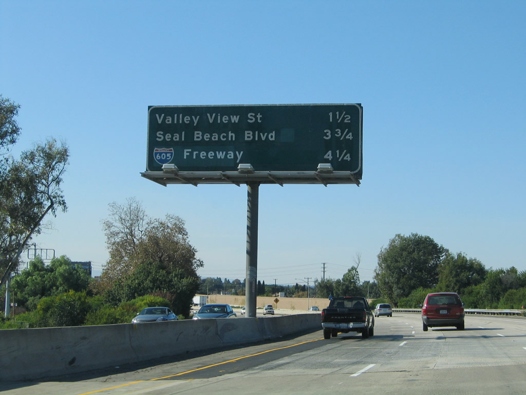
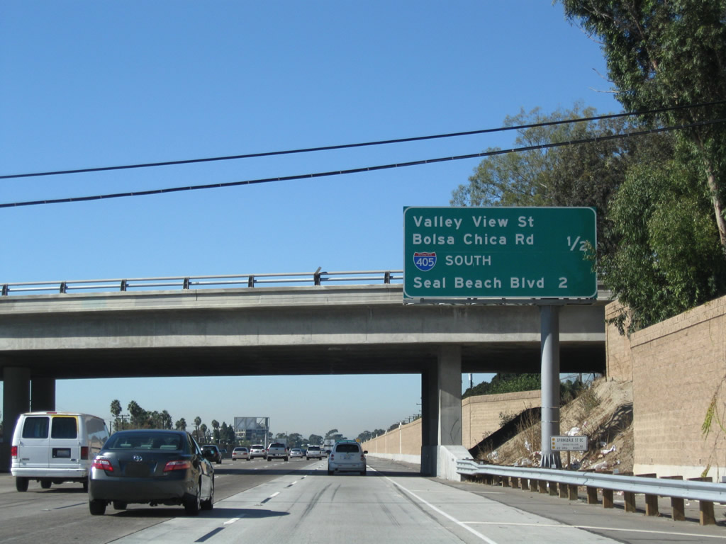
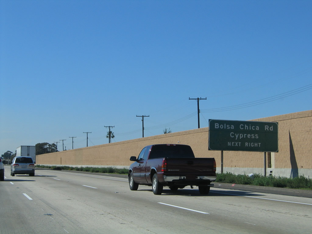
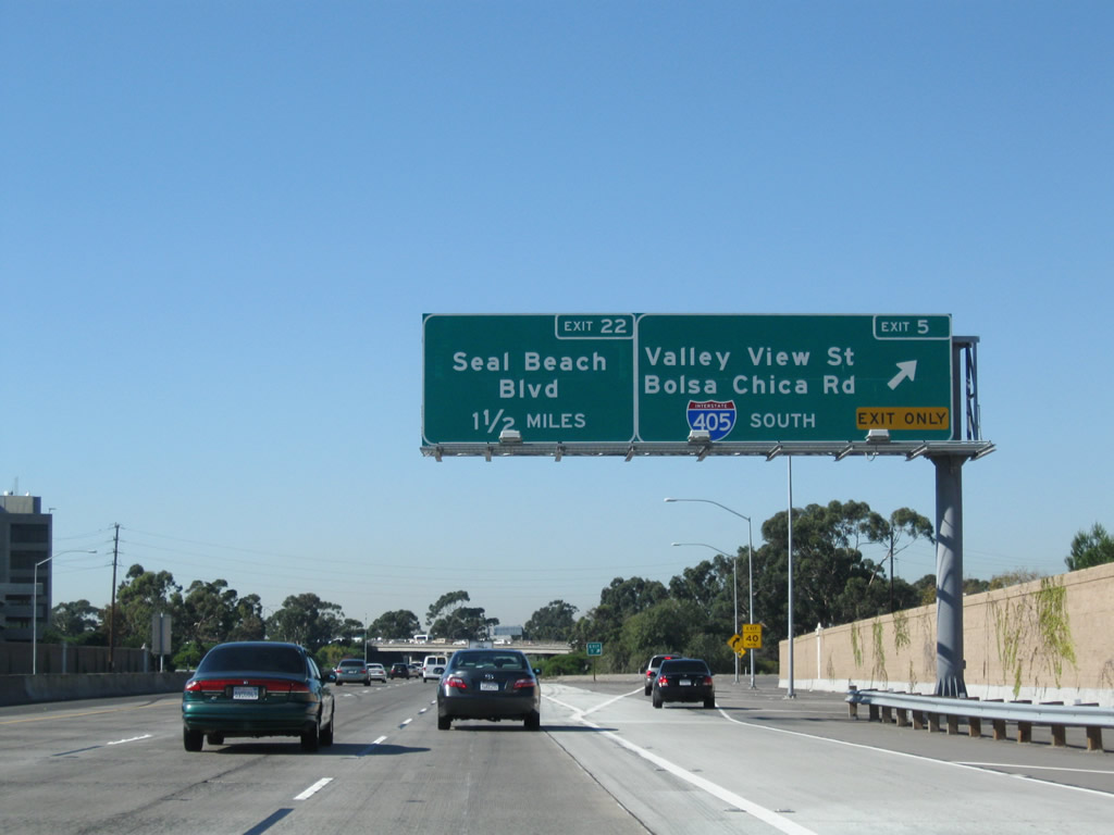
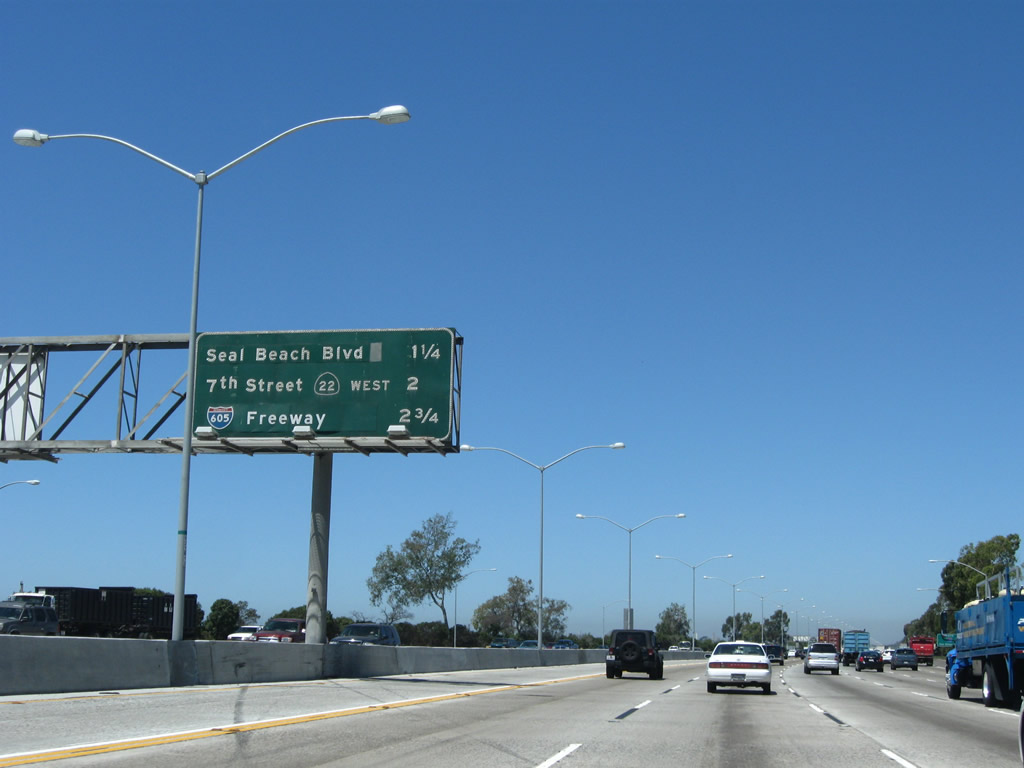
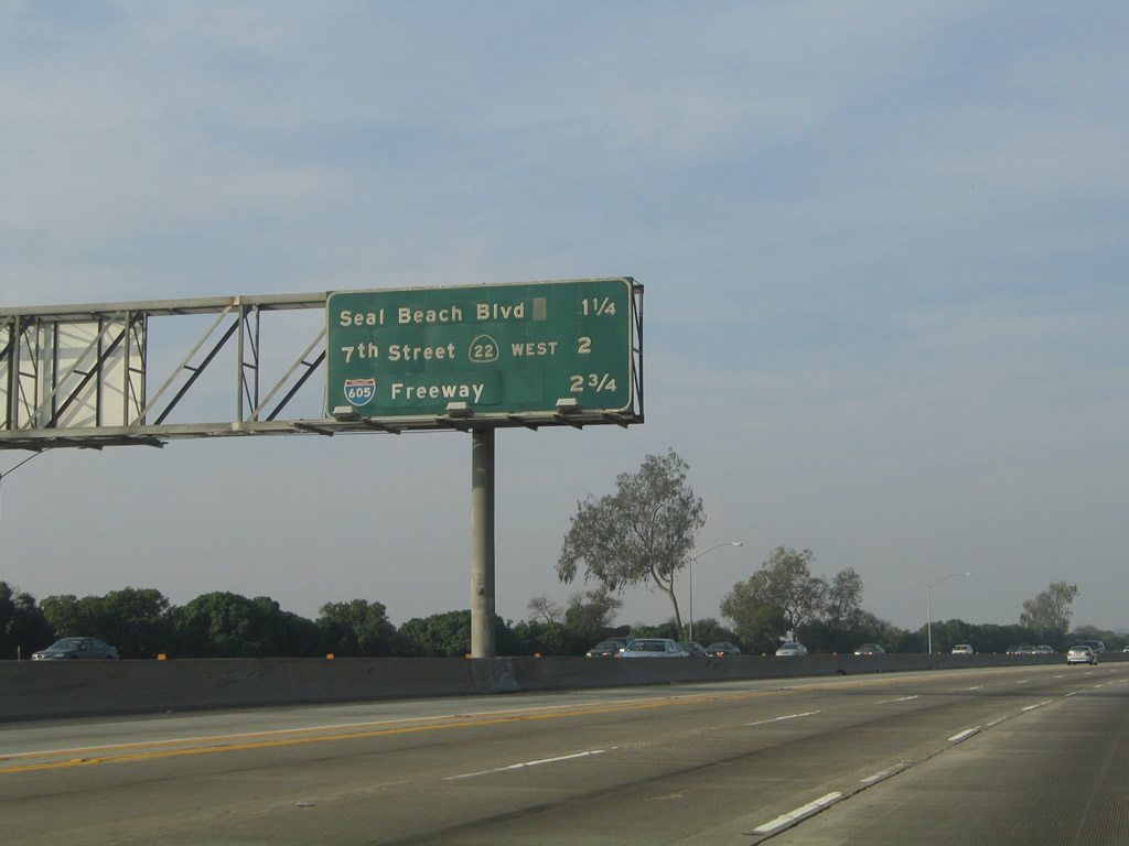
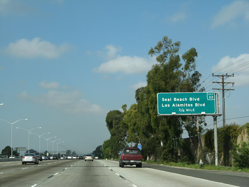
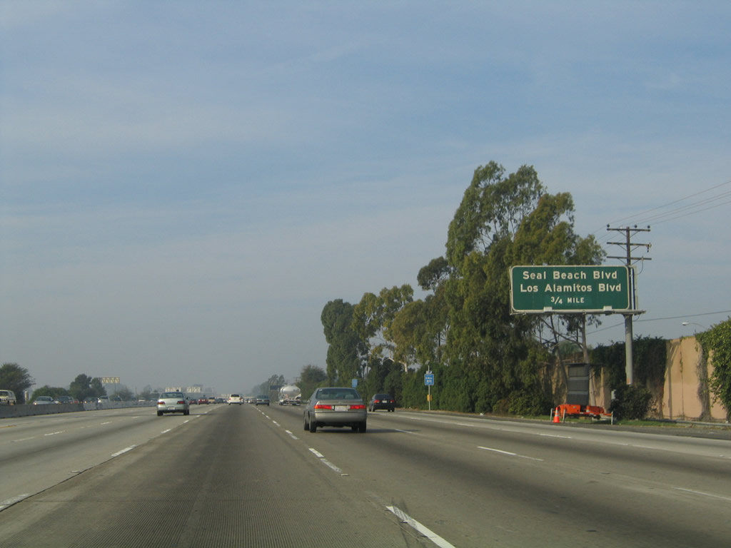
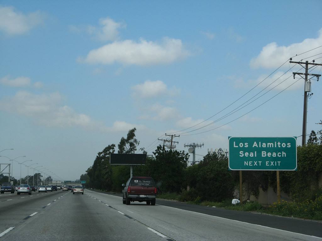
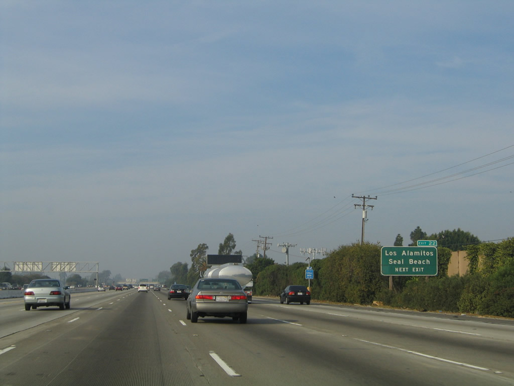
Exit 5 serves as the southern terminus of Valley View Street and northern terminus of Bolsa Chica Road. As there is no direct freeway connection to Interstate 405 south, traffic must use Bolsa Chica Road south to Interstate 405 south. A roadside sign advising of this connection was replaced by a full interchange sequence sign. The next two exits along California 22 west are: Exit 5, Valley View Street north and Bolsa Chica Road south to Interstate 405 south and Exit 22, Seal Beach Boulevard. Photos taken 11/08/08 and 11/14/04. |
|
This roadside guide sign for Bolsa Chica Road and Knott Stret north to Cypress. Photo taken 11/14/04. |
|
|
Westbound California 22 (Garden Grove Freeway) reaches Exit 5, Valley View Street north and Bolsa Chica Road south to Interstate 405 south. After this interchange, all mainline traffic will merge onto Interstate 405 north. Photos taken 11/08/08 and 11/14/04. |
|
California 22 passes under Valley View Street. Photo taken 11/08/08. |
|
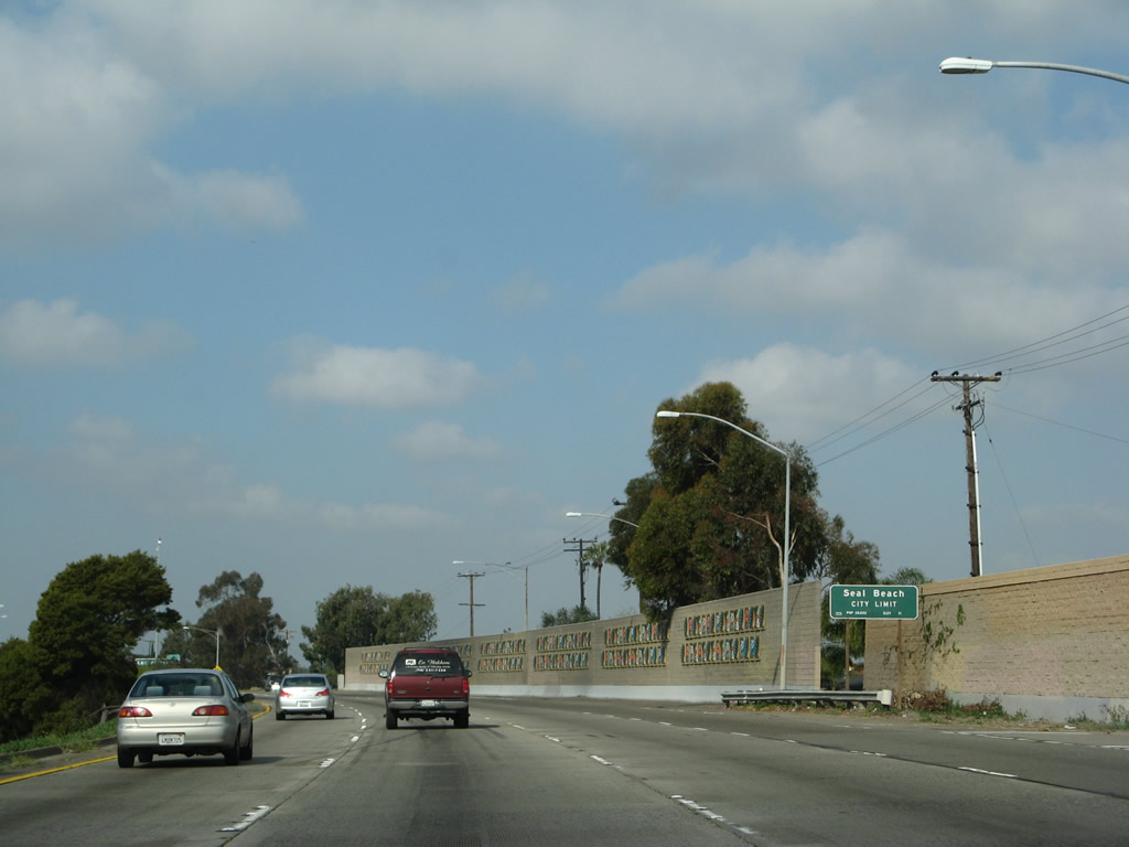
California 22 leaves Garden Grove and enters the city of Seal Beach (population 24,157 as of 2000 Census; incorporated on October 25, 1915). The 405 merge lies just ahead. Photo taken 03/15/08. |
|
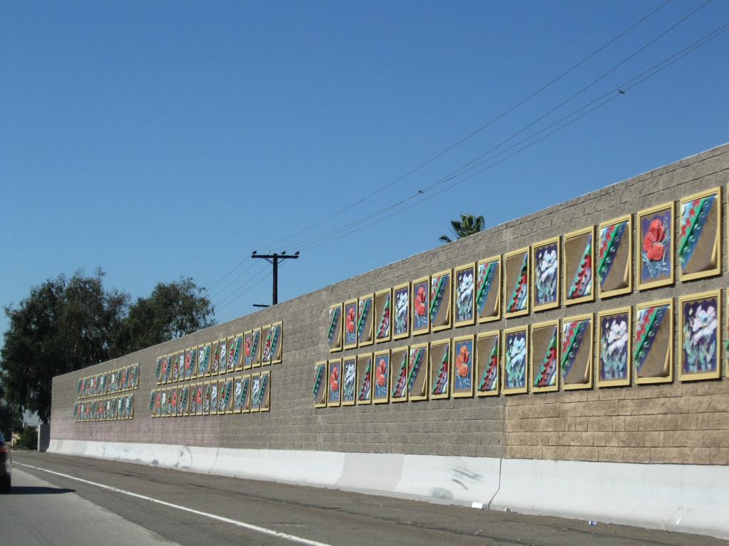
Freeway art adorns this soundwall; this wall was probably not placed as part of the 2006 reconstruction project since it does not conform with decorative touches seen east of here. Photo taken 03/15/08. |
|
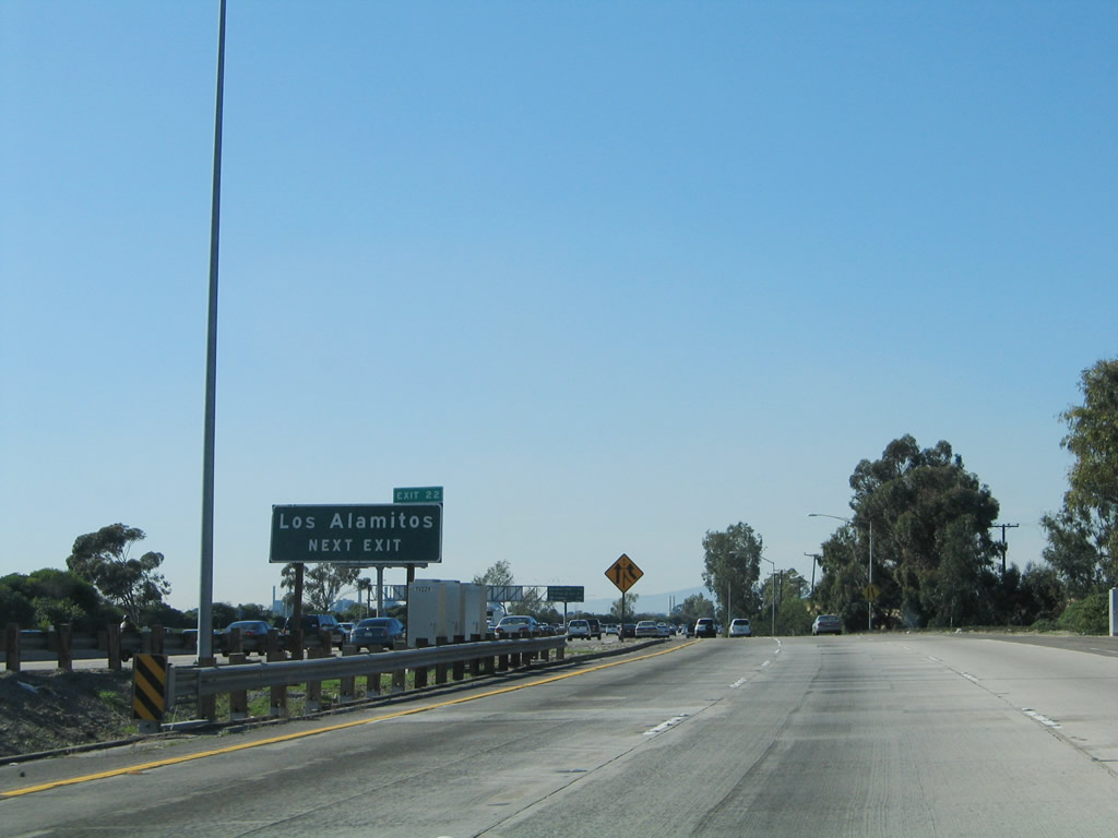
As Interstate 405 north traffic merges from the left, westbound California 22 approaches its next interchange: Exit 22, Seal Beach Boulevard. Interstate 405 north and California 22 will share alignment for the next couple of miles, then split at the Seventh Street exit (Exit 23). Photo taken 11/14/04. |
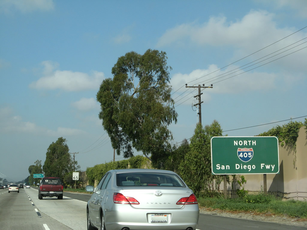
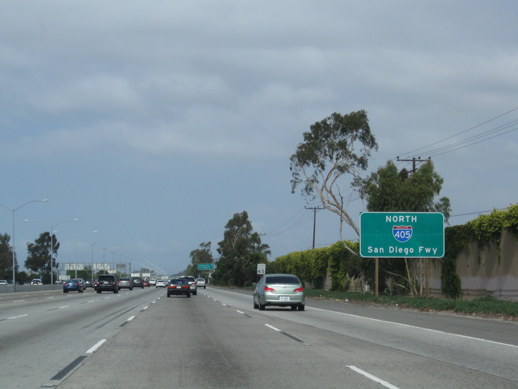
| Interstate 405 (San Diego Freeway) north and California 22 west |
|
|
This mileage sign along northbound Interstate 405 and westbound California 22 provides the distance to Exit 22, Seal Beach Boulevard and Los Alamitos Boulevard; Exit 23, California 22 (Seventh Street) west to Long Beach; and Exit 24, Interstate 605 (San Gabriel River Freeway) north to Duarte. Closely spaced street lights were added along Interstate 405 and California 22's shared alignment. Photos taken 07/13/09 and 09/25/05. |
|
|
Interstate 405 is the San Diego Freeway. Occasional signs such as this one reaffirm not only the route number and cardinal direction but also the freeway name. Photos taken 07/13/09 and 05/02/10. |
|
|
The next exit along Interstate 405 north and California 22 west is Exit 22, Seal Beach Boulevard and Los Alamitos Boulevard. Interstate 405 now passes through the city of Seal Beach (population 24,157 as of 2000 Census; incorporated on October 25, 1915). Photos taken 07/13/09 and 09/25/05. |
|
|
Seal Beach Boulevard leads south to Seal Beach, Seal Beach Naval Weapons Station, and California 1 (Pacific Coast Highway). North of Interstate 405 and California 22, Seal Beach Boulevard changes into Los Alamitos Boulevard, which heads north into Los Alamitos. Photos taken 03/15/08 and 09/25/05. |
|
|
Northbound Interstate 405 (San Diego Freeway) and westbound California 22 meet Exit 22, Seal Beach Boulevard and Los Alamitos Boulevard. Photos taken 05/02/10 and 09/25/05. |
|
|
The next exit along Interstate 405 north and California 22 west is Exit 23. The exit number is initially signed here, one-half mile prior to the split. Photos taken 05/02/10 and 03/15/08. |
|
This mileage sign along northbound Interstate 405 and westbound California 22 provides the distance to the next three exits along Interstate 405 north: Exit 23, California 22 (Seventh Street) west; Exit 24, Interstate 605 (San Gabriel River Freeway) north to Duarte; and Exit 25, Palo Verde Avenue. Photo taken 07/13/09. |
|
|
The left four lanes continue north on Interstate 405 (San Diego Freeway), while the right three lanes connect to Exit 23, California 22 (Seventh Street) west and Exit 24, Interstate 605 (San Gabriel River Freeway) north. Photo taken 02/02/08 and 11/25/04. |
|
|
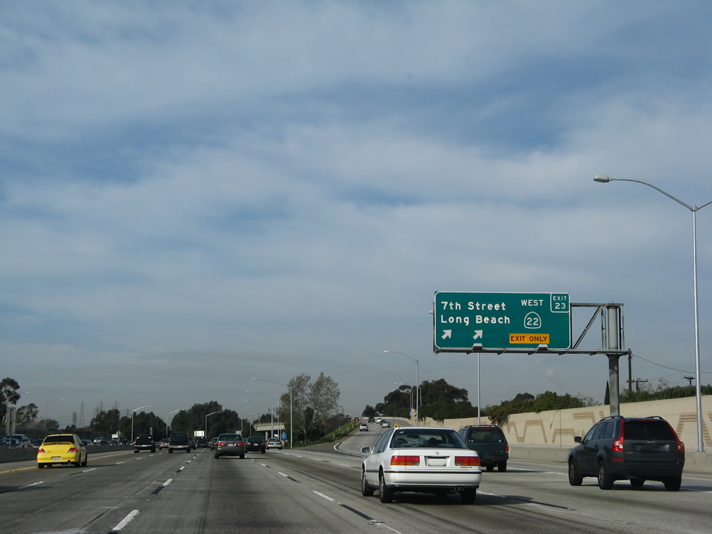
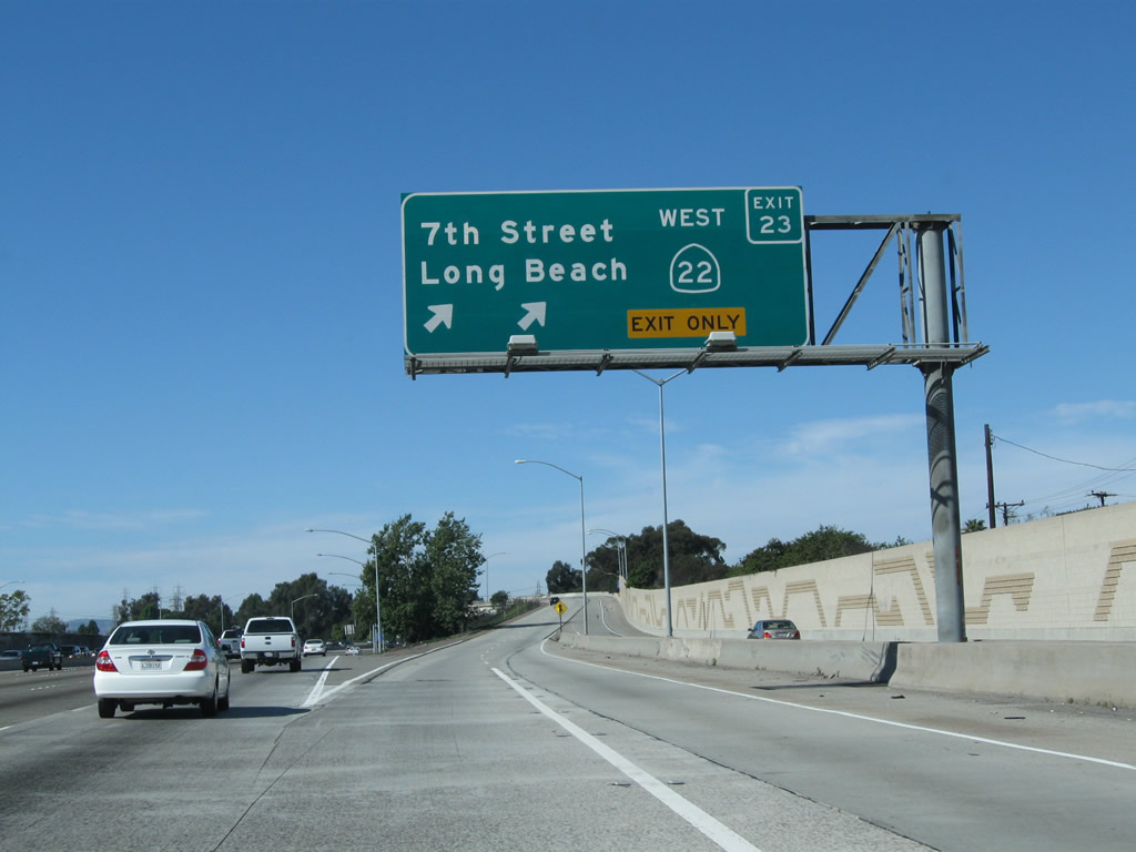
Northbound Interstate 405 (San Diego Freeway) reaches Exit 23, California 22 (Seventh Street) west to Long Beach. California 22 only continues a short distance along Seventh Street before terminating at its junction with California 1 (Pacific Coast Highway) in Long Beach. Photos taken 02/02/08 and 09/25/05. |
| California 22 (Seventh Street) west |
|
|
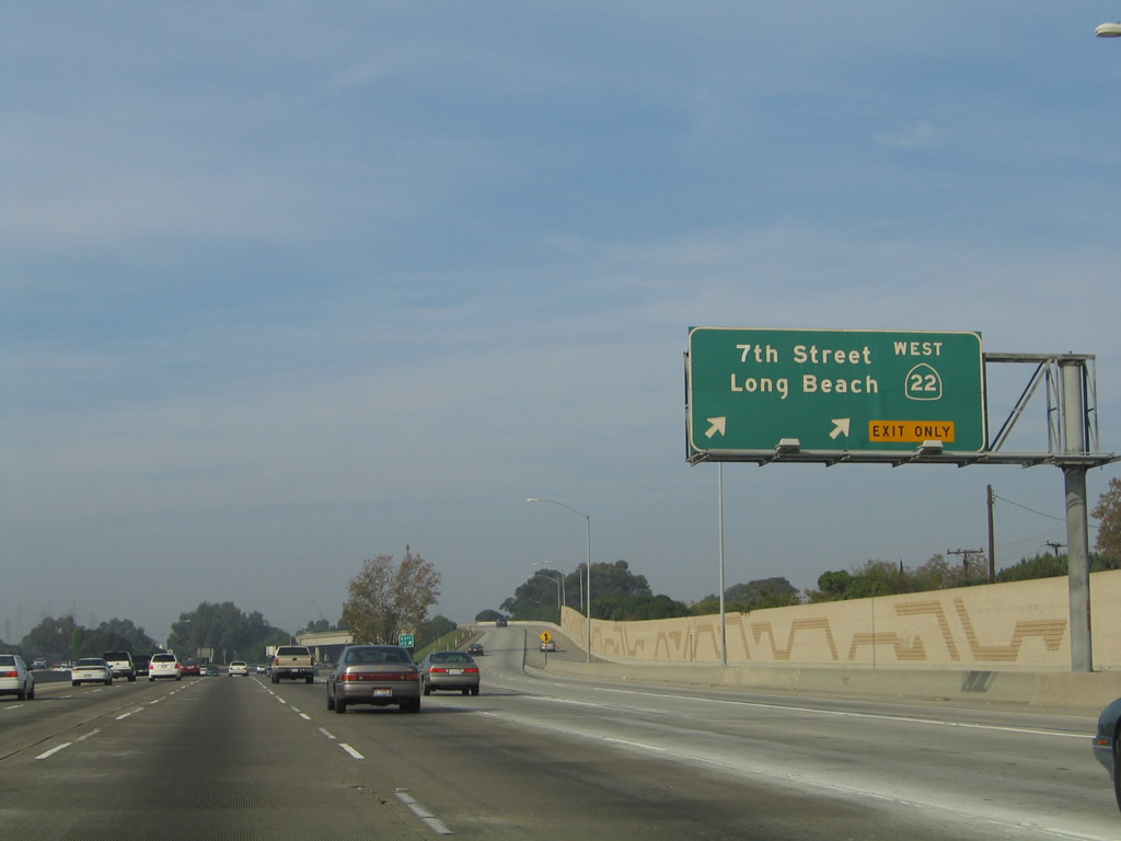
California 22 departs from Interstate 405 via a two-lane exit. Several power lines (visible in the distance) converge on a power plant located south of the Interstate 405-California 22-Interstate 605 interchange. Photos taken 02/13/11 and 05/02/10. |
|
|
The freeway continues only briefly as California 22 approaches the Orange-Los Angeles County Line, where California 22 leaves Seal Beach and enters the city of Long Beach. The ramps ahead bring traffic from Interstate 605 and Interstate 405 south onto California 22 west. For a time in the mid-1960s, the section of freeway between California 22 and Interstate 405 was designated as California 240. Now this short freeway is considered as part of Interstate 605. Photos taken 02/13/11 and 05/02/10. |
|
|
Between Interstate 405 and Studebaker Road (Exit 1), California 22 carries two lanes in each direction and serves to connect with Seventh Street and California 1 (Pacific Coast Highway). However, the pavement betrays a much grander purpose. The California 22 freeway was intended to provide a fast connection to downtown Long Beach, along with a proposed but never constructed Pacific Coast Freeway. The Pacific Coast Freeway through downtown Long Beach was never built, and thus the need for the California 22 freeway was reduced. Thus, California 22 remains a four-lane freeway to Studebaker Road, then reduces to an arterial once in Long Beach. Photos taken 02/13/11 and 05/02/10. |
|
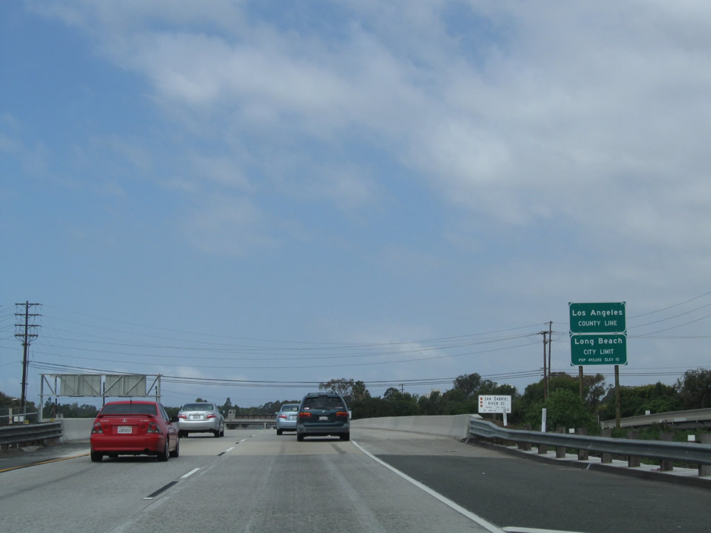
California 22 crosses over the San Gabriel River, which serves as the dividing line between Orange County and Los Angeles County. The freeway also enters the city of Long Beach, the second largest city in Los Angeles County. Photo taken 05/02/10. |
|
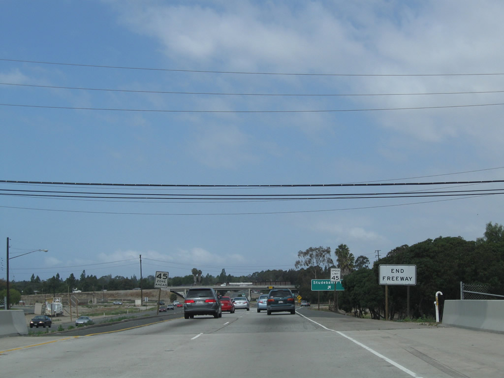
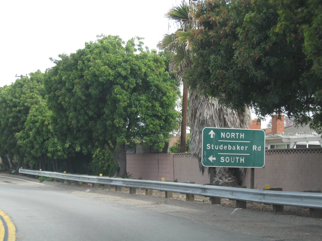
After crossing over the San Gabriel River, the freeway officially ends. The final exit along westbound California 22 is Exit 1, Studebaker Road. Photo taken 05/02/10. |
|
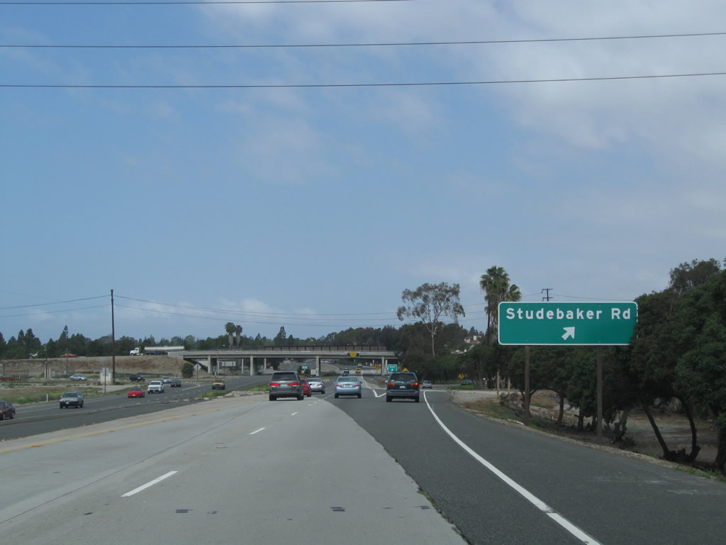
Westbound California 22 reaches Exit 1, Studebaker Road. Photo taken 05/02/10. |
|
Upon exiting, the old alignment of concrete travel lanes again cross at angles unlike the current alignment. Stay right to depart to Studebaker Road. Photo taken 05/02/10. |
|
|
After the turnoff to College Park Drive, the off-ramp will divide. Stay left for Studebaker Road south or right for Studebaker Road north. Photos taken 05/02/10. |
|
A traffic signal governs the flow of traffic from the California 22 west off-ramp to southbound Studebaker Road. Photo taken 05/02/10. |
|
|
Back on the mainline, California 22 continues to see pavement changes between asphalt and concrete. These changes are related to original plans for a freeway to freeway connection between California 22 and California 1/Pacific Coast Freeway. The Pacific Coast Freeway was never realized, and the final mile or so of California 22 is a surface street rather than freeway. Photos taken 02/13/11. |
|
|
California 22 proceeds west under a pedestrian bridge and sees a reduction in speed limit as we enter developed sections of Long Beach. Photos taken 02/13/11. |
|
|
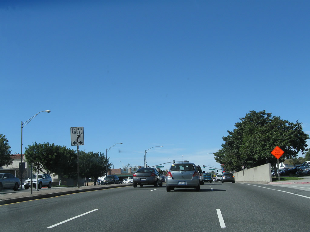
Three westbound lanes carry California 22 toward the signalized intersection with Pepper Tree Lane. Photos taken 02/13/11. |
|
|
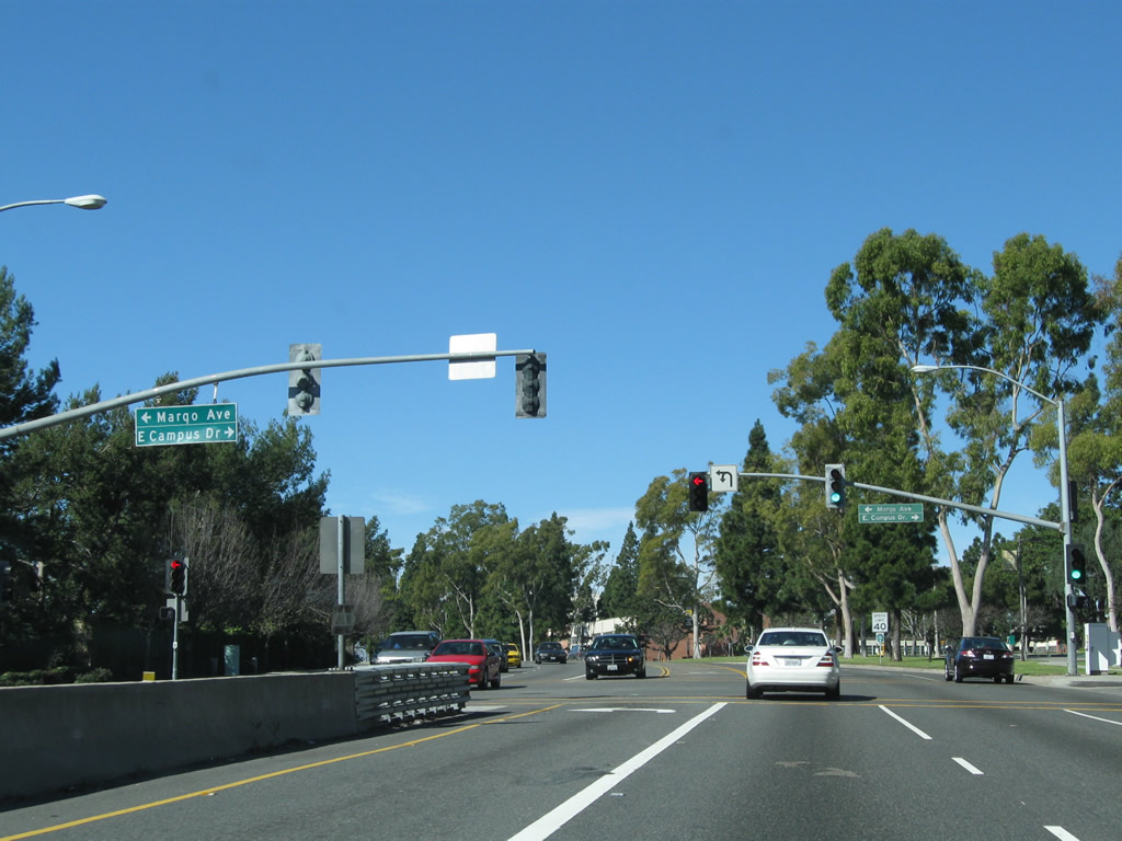
The first two signalized intersections on westbound California 22 are with Pepper Tree Lane, followed by Margo Avenue and East Campus Drive. On the north side of California 22 (Seventh Street) is the California State University at Long Beach (CSULB). Photos taken 02/13/11. |
|
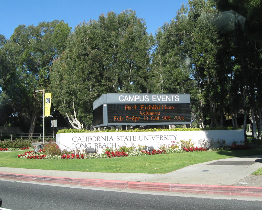
Near the intersection between California 22 and West Campus Drive is this marquee sign for California State University at Long Beach University. Photo taken 02/13/11. |
|
Nearing the end of the line in Long Beach, westbound California 22 (Seventh Street) approaches its western terminus at its intersection with California 1 (Pacific Coast Highway) in Long Beach. Although most of California 22 is the Garden Grove Freeway, the portion west of Interstate 405 follows 7th Street (a surface street) until it reaches the PCH. Photo taken 02/13/11. |
|
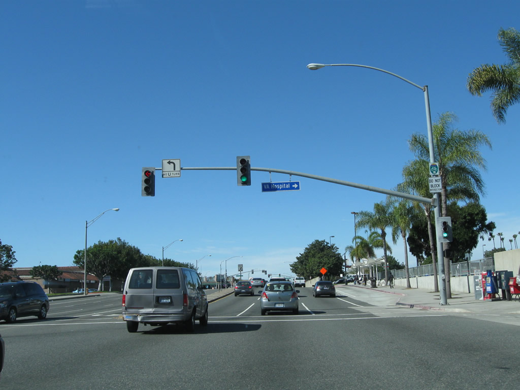
Westbound California 22 (Seventh Street) meets Channel Street at this traffic signal. Turn left to California 1 (Pacific Coast Highway) south or right to the Veterans Affairs (VA) Medical Center. A Long Beach city bike route trailblazer sign is mounted onto the traffic signal mast arm. Photo taken 02/13/11. |
|
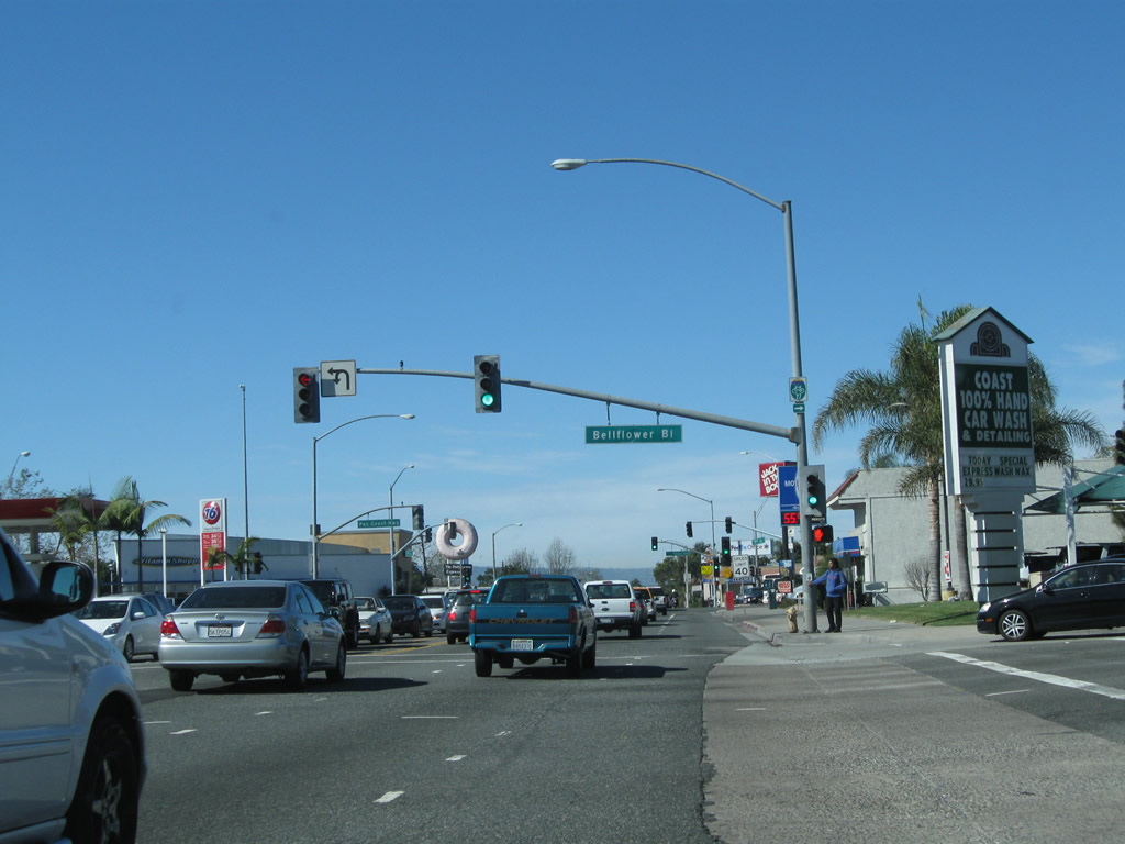
The final two intersections on California 22 west are with Bellflower Boulevard and California 1 (Pacific Coast Highway). Trucks may use either of these streets as through routes to the north. Photo taken 02/13/11. |
|
California 22 meets Bellflower Boulevard at this intersection, near the southwestern corner of the university campus. Photo taken 02/13/11. |
|
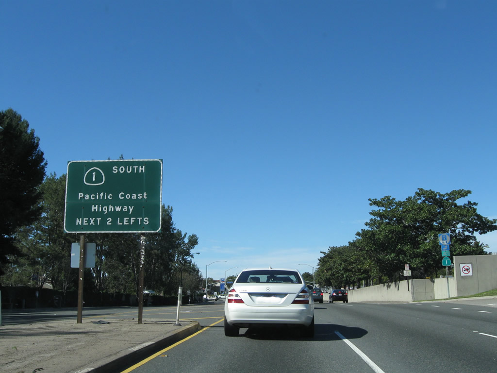
Westbound California 22 (Seventh Street) meets California 1 (Pacific Coast Highway) at this traffic signal. California 1 travels northwest toward downtown Long Beach, the Port of Long Beach, and Torrance. Turn left here for California 1 southeast to Seal Beach and Huntington Beach. No end shield assembly is posted for California 22's west end. Photo taken 02/13/11. |
Page Updated February 16, 2011.