| California 60 - Pomona Freeway east |
|
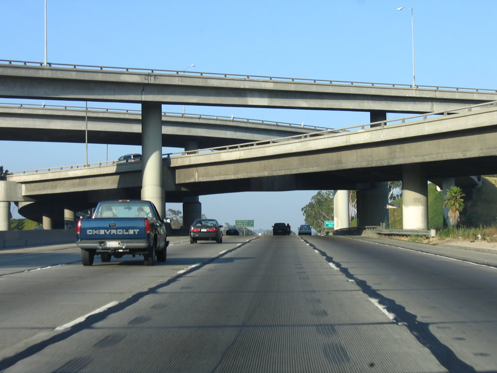
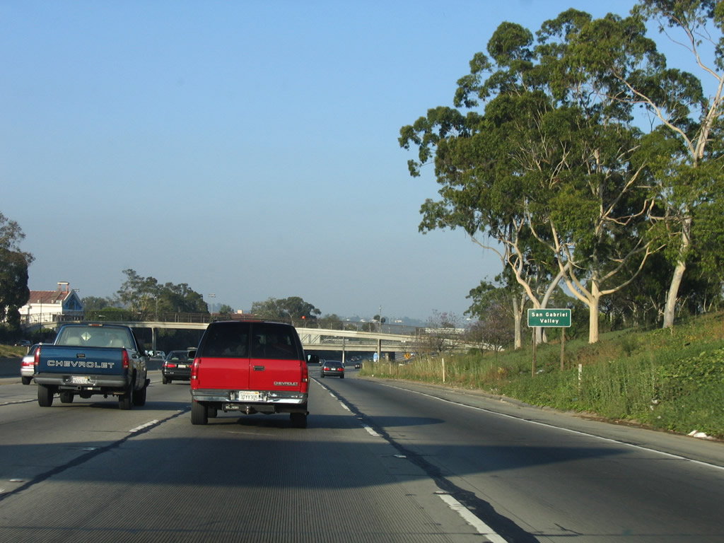
California 60 begins its easterly journey as it breaks off from Interstate 10 (Santa Monica Freeway) just west of Interstate 5 as part of the East Los Angeles Interchange. The first signs of the California 60 freeway appear on this set of local (collector distributor) lanes parallel to Interstate 10, and the mainline Interstate 10 freeway is visible to the left (north). This entire section of freeway is on a viaduct as the freeways cross over the Los Angeles River. Photo taken 07/06/04. |
|
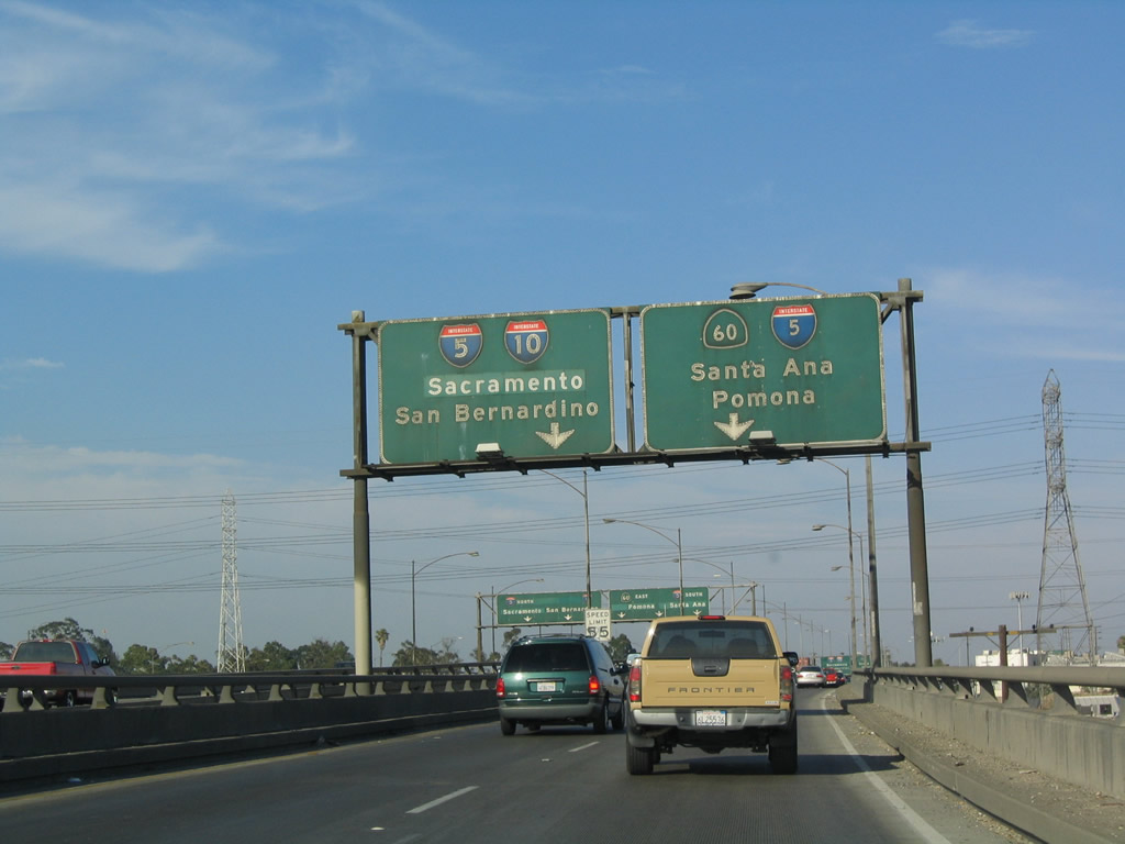
View of the signage for Interstate 5 and California 60 on eastbound Interstate 10 as seen from the local lanes (the beginning of California 60) in Los Angeles. Photo taken 07/06/04. |
|
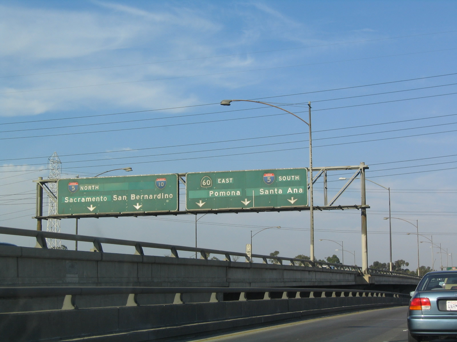
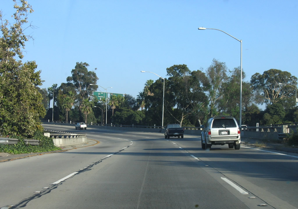
California 60 stays within the city for a short distance, leaving the city limits after the Whittier Boulevard interchange. The viaduct lanes split, with the left lane headed toward Interstate 5 north and Interstate 10 east and the right lane continuing east to California 60 east and Interstate 5 south. Photo taken 07/06/04. |
|
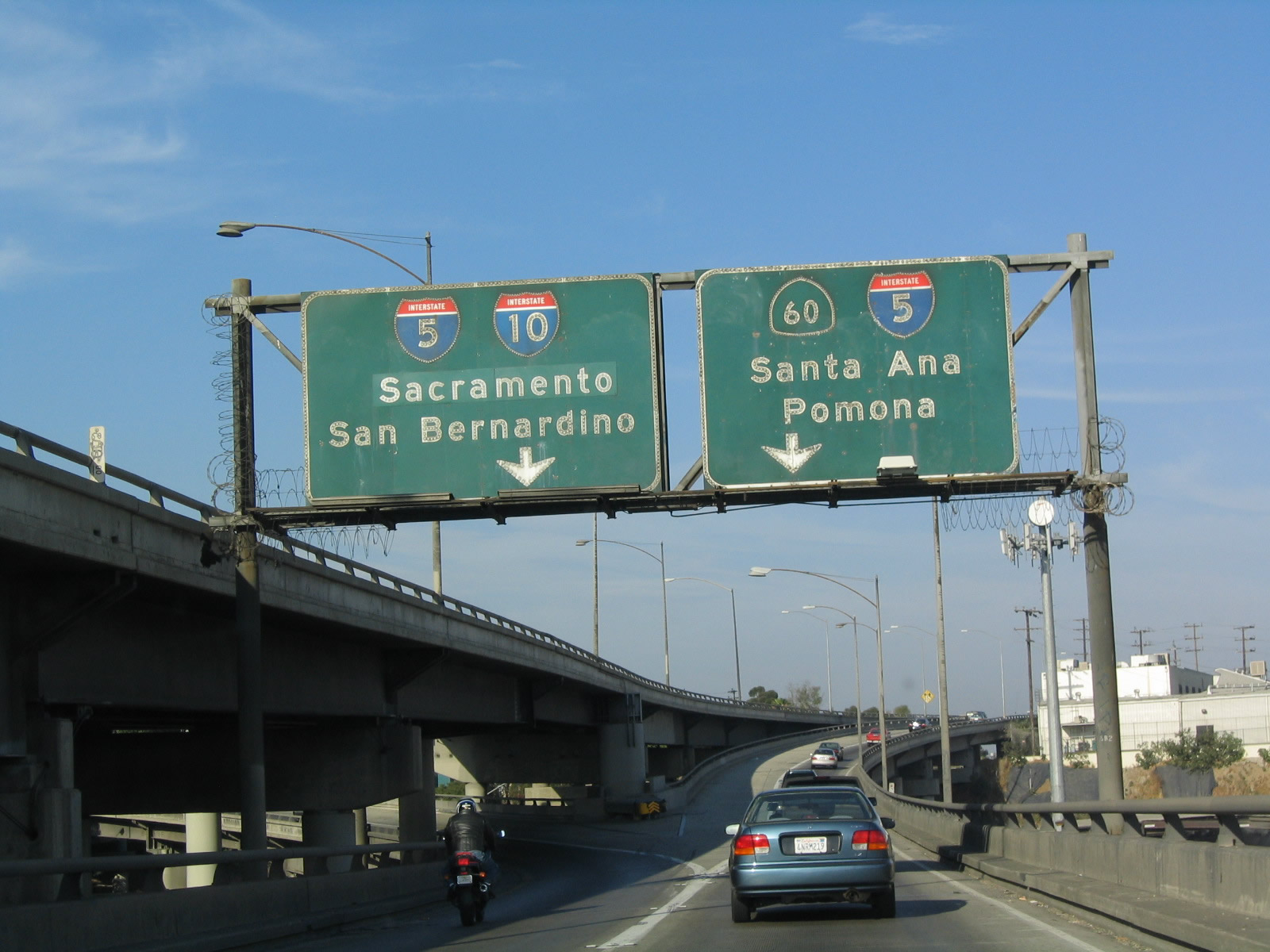
The California 60 local collector distributor lanes merge with the California 60 mainline, which was split off from mainline Interstate 10. Immediately, the freeway prepares for Exit 1A, Interstate 5 (Santa Ana Freeway) south to Orange County and San Diego. Photo taken 07/06/04. |
|
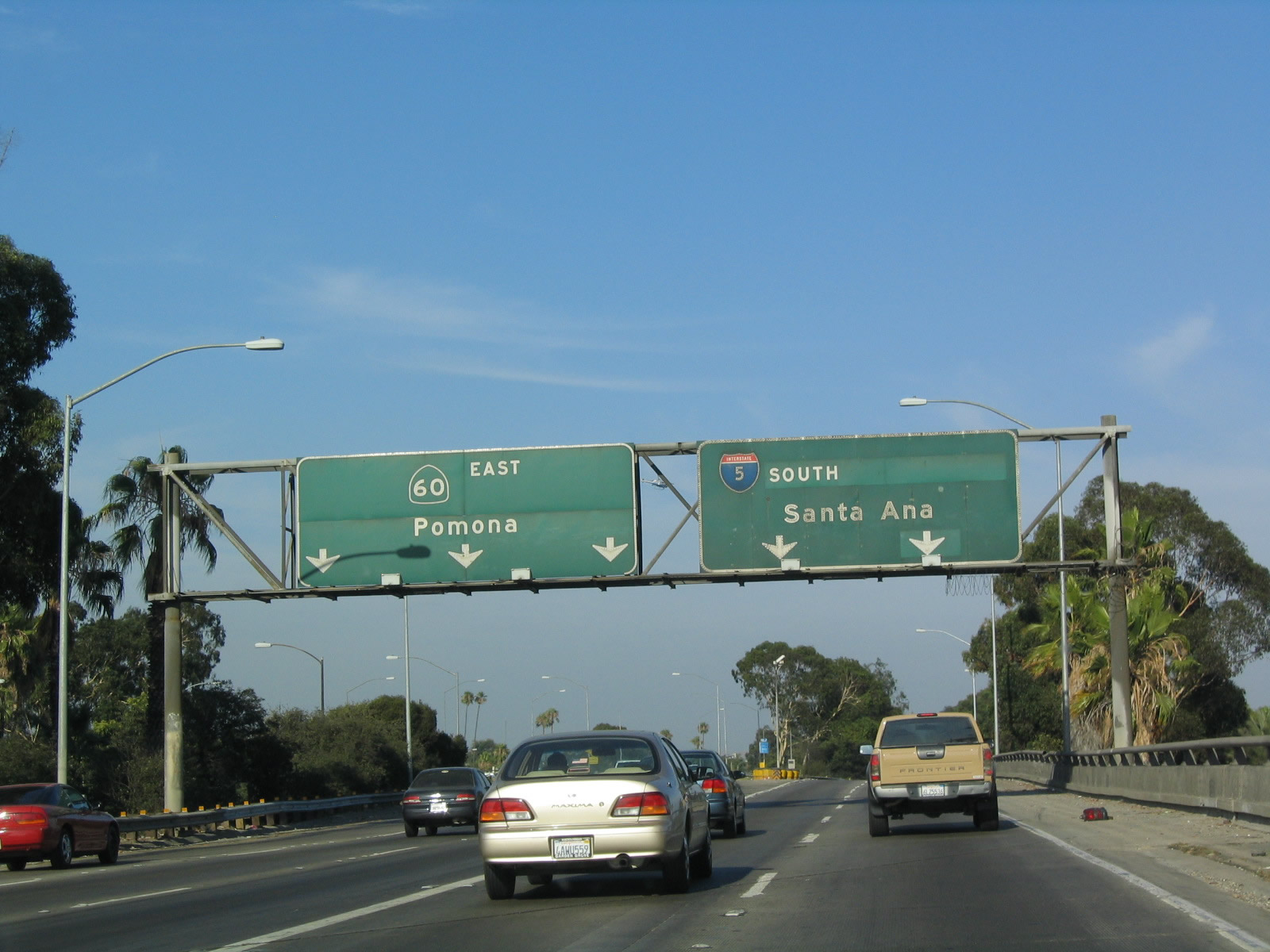
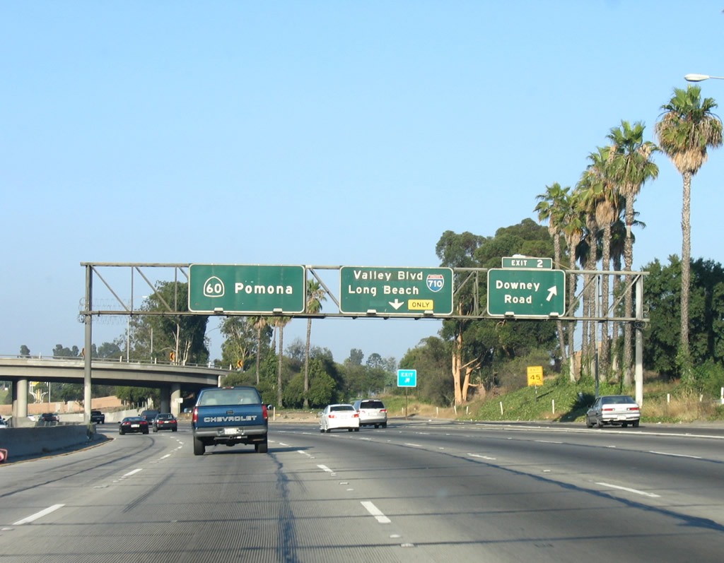
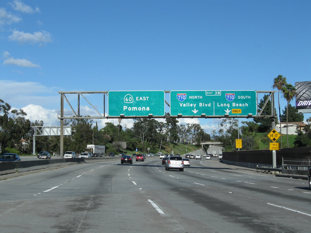
Eastbound California 60 (Pomona Freeway) reaches Exit 1A, Interstate 5 (Santa Ana Freeway) south to Santa Ana, Irvine, Oceanside, and San Diego. This off-ramp is located in the infamous East Los Angeles Interchange, which represents the confluence of Interstate 5, Interstate 10, U.S. 101, and California 60. Through traffic for California 60 should stay in the left lanes. California 60 will continue east toward Pomona; ahead, traffic from U.S. 101 (Santa Ana Freeway) south will join the freeway from the left. Photo taken 07/06/04. |
|
|
|
Leaving the mainline for a moment, this series follows the transition ramp from U.S. 101 (Santa Ana Freeway) south onto California 60 (Pomona Freeway) east, also within the East Los Angeles Interchange and seen as one of the two major ramps that lead onto the eastbound Pomona Freeway. At the end of this series of pictures, traffic from mainline California 60 (coming in from the previous photobox) joins this transition ramp from the right. Photos taken 08/24/04, 07/03/05, and 02/26/11. |
|
|
|
|
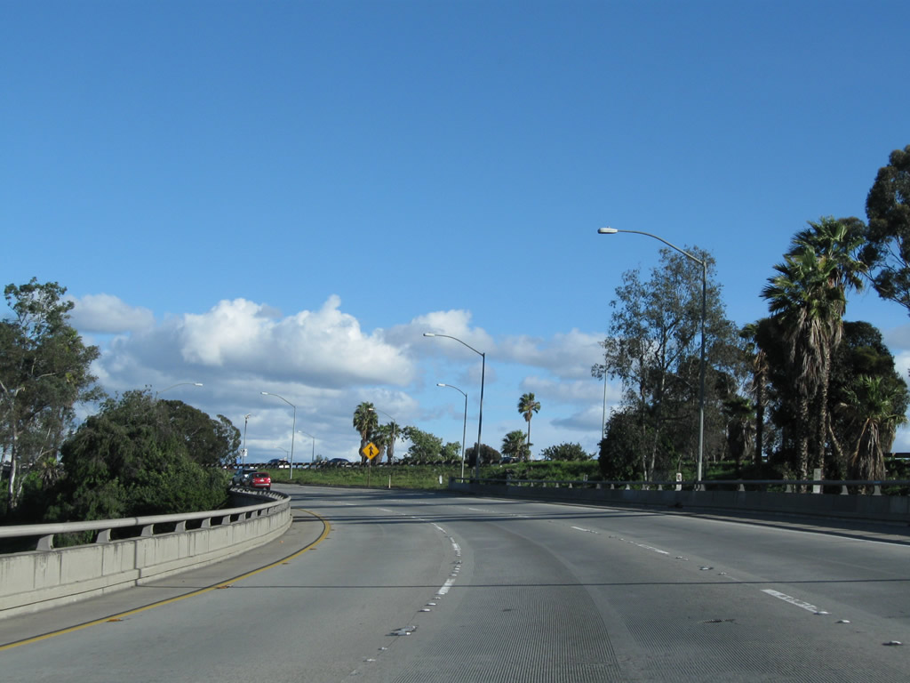
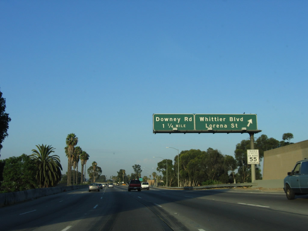
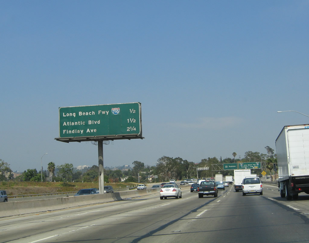
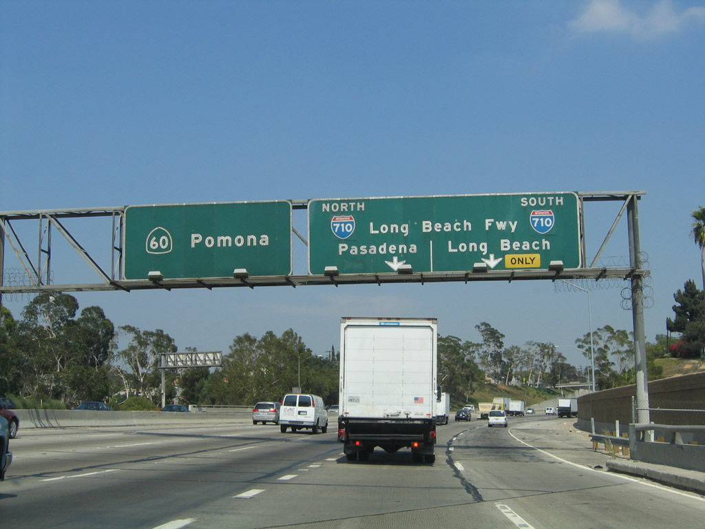
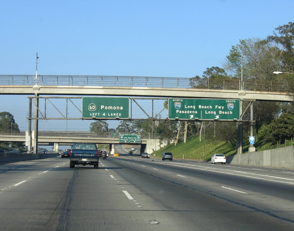
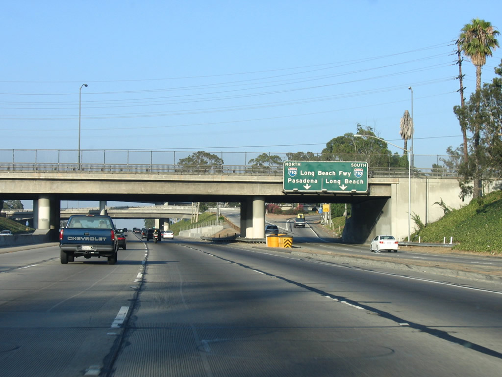
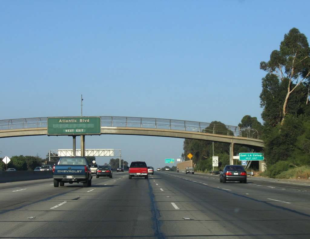
After the ramps from Interstate 10 east and U.S. 101 south merge together, California 60 continues east as a major freeway. Additional traffic will join the nascent freeway after the Interstate 710 interchange, as Interstate 710 brings truck traffic to California 60 from the Ports of Long Beach and Los Angeles. A mileage sign indicates the distance to the next three exits: Exit 1B, Whittier Boulevard (Historic U.S. 101) and Lorena Street; Exit 3A, Third Street and Downey Road; and Exit 3B, Interstate 710 (Long Beach Freeway). Photo taken 07/03/05. |
|
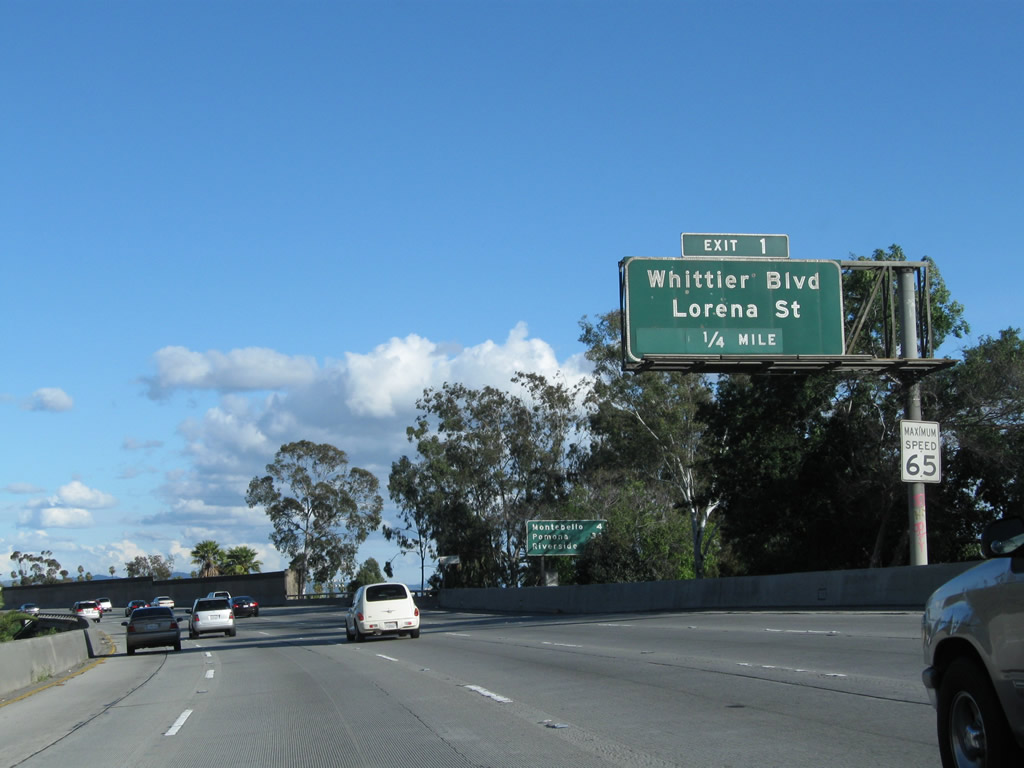
The next exit along California 60 (Pomona Freeway) east is Exit 1B, Whittier Boulevard (Historic U.S. 101) and Lorena Street. Photo taken 07/03/05. |
|
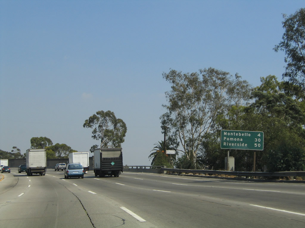
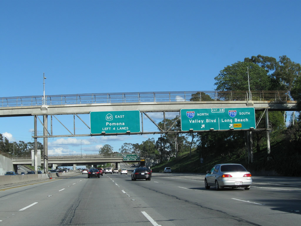
A roadside mileage sign provides the distance to the cities of Montbello (four miles), Pomona (30 miles), and Riverside (50 miles). Despite its designation as California 60, the segment of Pomona Freeway between the East Los Angeles Interchange and Pomona was never part of former U.S. 60, which was retracted in phases from the state of California starting in 1964. Only the section of California 60 between Pomona and Beaumont has freeway segments that were originally signed as U.S. 60. Prior to 1964, U.S. 60 joined U.S. 70-99 along today's Interstate 10 (San Bernardino Freeway / Ramona Parkway) route. Photo taken 08/24/04. |
|
Eastbound California 60 (Pomona Freeway) reaches Exit 1B, Whittier Boulevard to Lorena Street. Whittier Boulevard serves as part of the 1937 route of U.S. 101 through central Los Angeles. Following a path carved prior to the construction of the Santa Ana Freeway, U.S. 101 used to take Whittier Boulevard from La Habra and extend northwest to East Los Angeles. At Boyle Avenue, U.S. 101 turned north, then northwest on Pleasant Avenue, and then west on Macy Street (now Cesar Chavez Avenue) to cross over the Los Angeles River. U.S. 101 then proceeded west past Union Station and joined U.S. 66 west after the Figueroa Street interchange. U.S. 101 then proceeded northwest on Sunset Boulevard toward Hollywood and Cahuenga Pass. Now, of course, U.S. 101 follows the Santa Ana Freeway and Hollywood Freeway, with U.S. 101 coming to its southern terminus at Interstate 5 at the East Los Angeles Interchange. Old U.S. 101 southeast of there is now subsumed by Interstate 5. The original alignment of U.S. 101 followed Fourth Street and Second Street through downtown Los Angeles; the 1937 alignment helped move through traffic at that time out of downtown. We will see the original 1926 route of U.S. 101 intersect California 60 at Exit 3A, Third Street. Photo taken 07/15/07. |
|
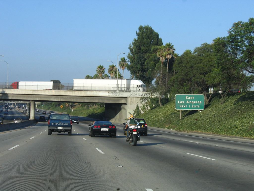
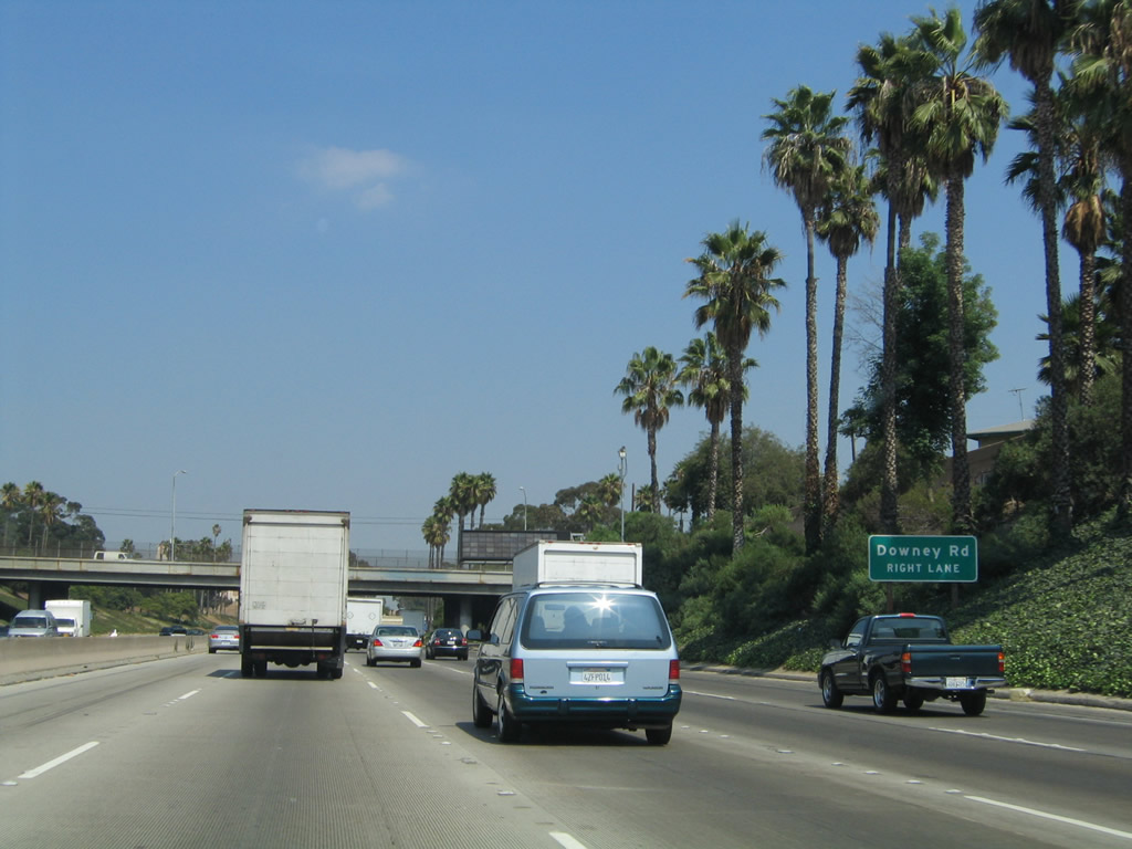
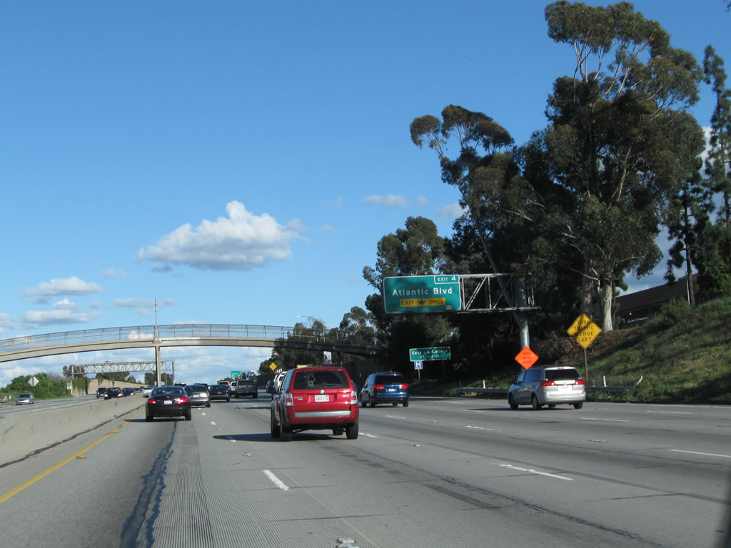
The next three exits all serve the unincorporated community of East Los Angeles: Exit 3A, Third Street (former U.S. 101 - 1926 alignment) and Downey Road; Exit 3B, Interstate 710 (Long Beach Freeway); and Exit 4, Atlantic Boulevard (former California 15). East Los Angeles, a heavily Latino community located east of downtown Los Angeles and Boyle Heights, is not an official city and takes its services from Los Angeles County. Debate continues as to whether the future of this community would be improved as an independent city. California 60 passes over Whittier Boulevard (former U.S. 101) and under Lorena Street ahead. Photo taken 07/03/05. |
|
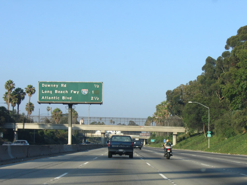
This mileage sign provides the distance to the next three exits along California 60 (Pomona Freeway) east: Exit 3A, Third Street (former U.S. 101 - 1926 alignment) and Downey Road; Exit 3B, Interstate 710 (Long Beach Freeway); and Exit 4, Atlantic Boulevard (former California 15). Photo taken 07/03/05. |
|
Stay right for the connection to Exit 3A, Third Street (former U.S. 101 - 1926 alignment) and Downey Road. Photo taken 08/24/04. |
|
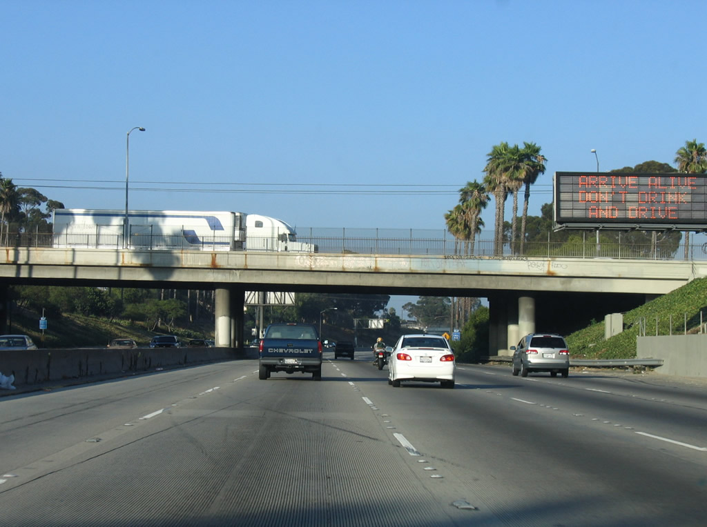
A dynamic message sign is posted prior to the Indiana Street overpass. Indiana Street serves as the boundary between the city of Los Angeles and unincorporated East Los Angeles. Photo taken 07/03/05. |
|
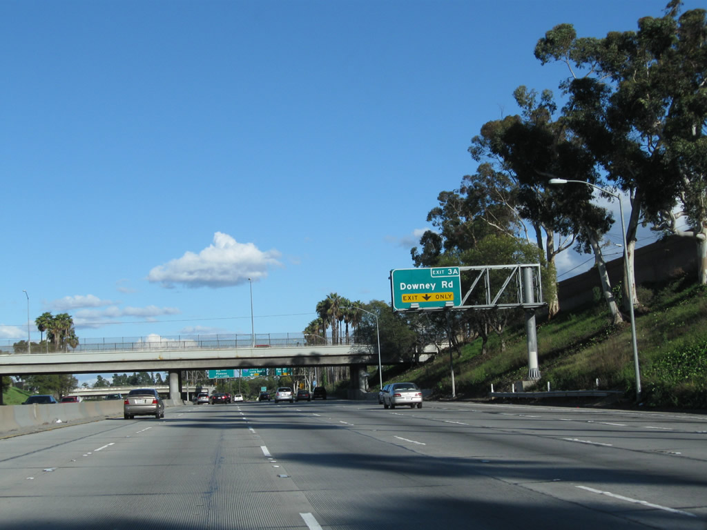
The right lane of California 60 (Pomona Freeway) east becomes exit only for Exit 3A, Third Street (former U.S. 101 - 1926 alignment) and Downey Road. Photo taken 02/26/11. |
|
|
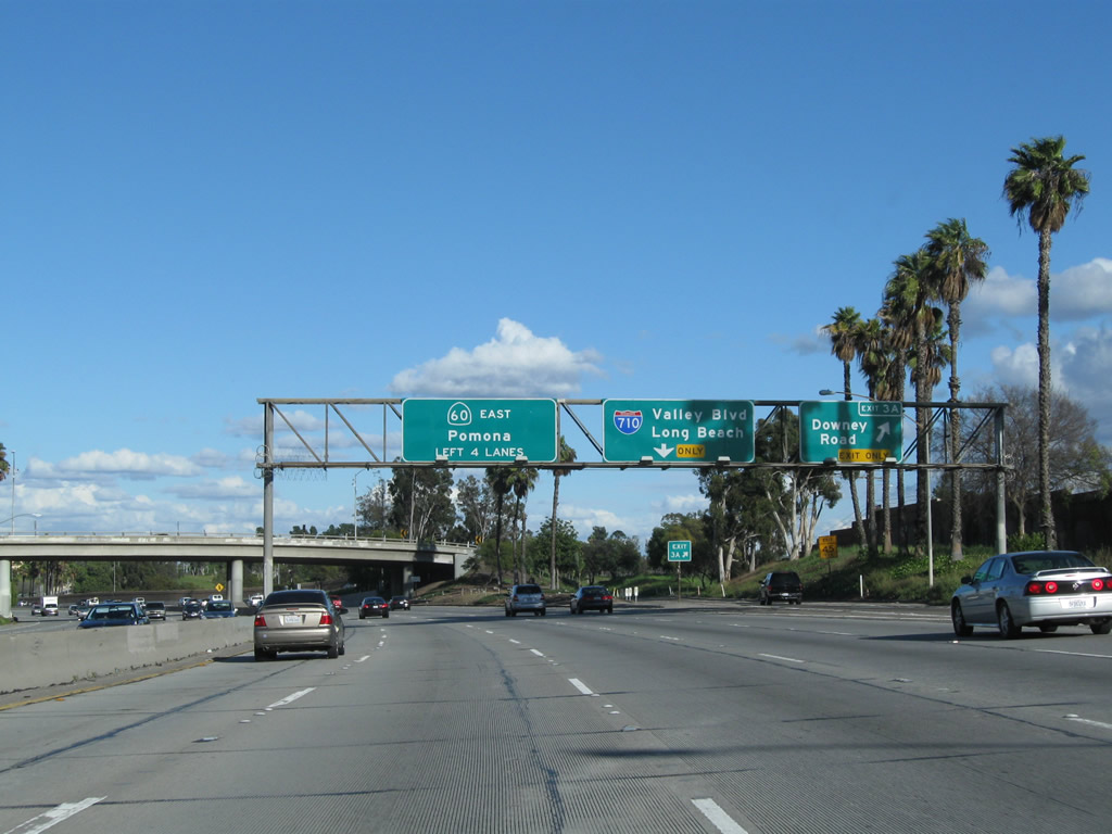
Eastbound California 60 (Pomona Freeway) reaches Exit 3A, Third Street (former U.S. 101 - 1926 alignment) and Downey Road. The next interchange along eastbound is Exit 3B, Interstate 710 (Long Beach Freeway). This sign assembly was changed to its current configuration by 2009. Photos taken 02/26/11 and 07/03/05. |
|
This flyover ramp connects southbound Gage Avenue with an on-ramp to California 60 east. Photo taken 07/03/05. |
|
This mileage sign provides the distance to the next three exits along California 60 (Pomona Freeway) east: Exit 3B, Interstate 710 (Long Beach Freeway); Exit 4, Atlantic Boulevard (former California 15); and Exit 6A, Findlay Avenue. Photo taken 08/24/04. |
|
|
The right two lanes of California 60 (Pomona Freeway) east become exit only for Exit 3B, Interstate 710 (Long Beach Freeway). Photos taken 02/26/11 and 08/24/04. |
|
|
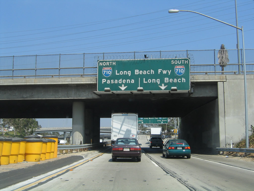
Eastbound California 60 (Pomona Freeway) meets Exit 3B, Interstate 710 (Long Beach Freeway). Interstate 710 is a major north-south freeway corridor connecting Long Beach and the ports of Long Beach and Los Angeles with the freeway system, ending at Valley Boulevard in Alhambra (near the campus of California State University at Los Angeles). This interchange is a symmetrical stack interchange, with high speed ramps for all directions of travel. Photos taken 02/26/11 and 07/03/05. |
|
|
These pictures show the overhead signs for lane allocation for Interstate 710 north to Valley Boulevard and Alhambra and south to Long Beach. Plans call for Interstate 710 to extend north from Alhambra to Pasadena, but that extension is still in doubt due to strong opposition for some cities along the proposed route. Photos taken 07/03/05 and 08/24/04. |
|
|
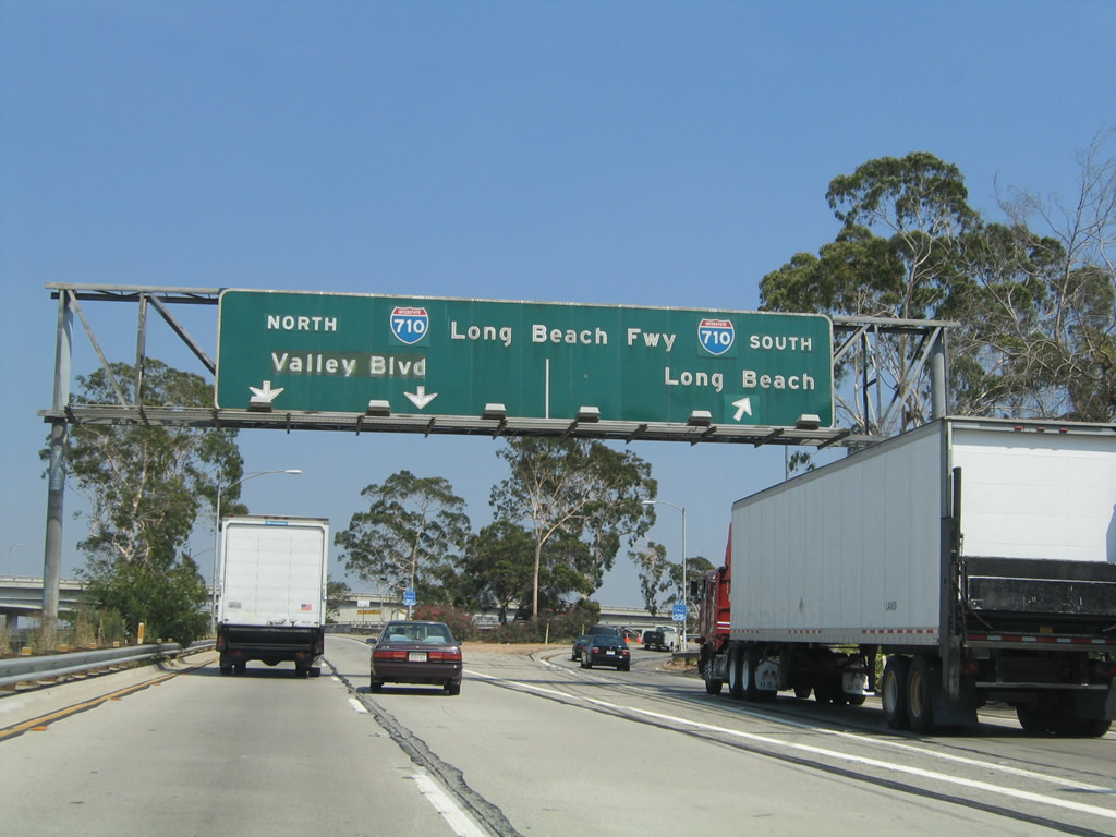
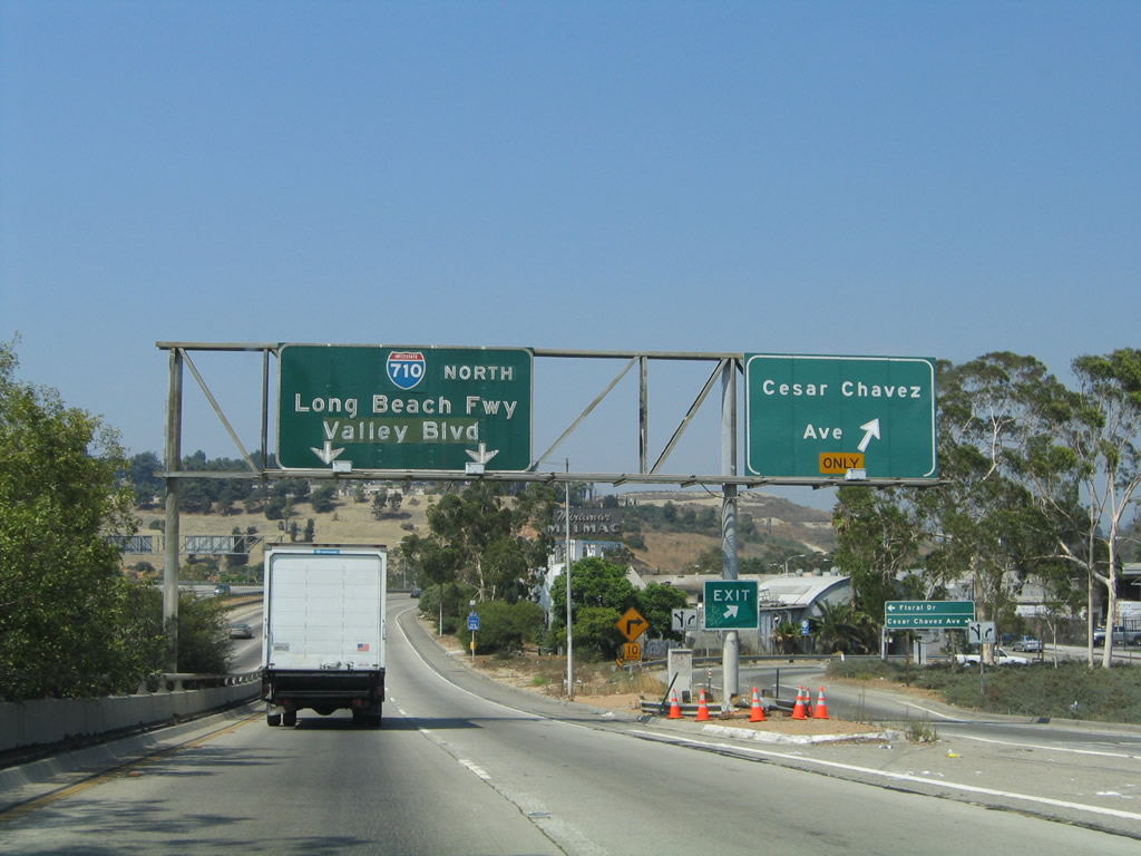
Looking at the transition ramp from California 60 (Pomona Freeway) east to Interstate 710 (Long Beach Freeway), the left two lanes link to Interstate 710 north to Alhambra and Valley Boulevard, while the right lane connects to Interstate 710 south to Long Beach. Originally designated as California 15, the Long Beach Freeway was renumbered as California 7 in 1964 to avoid confusion with newly created Interstate 15. When the Long Beach Freeway was added to the Interstate Highway System in 1983, California 7 was renumbered as Interstate 710. Some of the older signs associated with Interstate 710 still have an Interstate 710 route marker covering the original California 7 shield. Photos taken 07/03/05 and 08/24/04. |
|
|
Eastbound California 60 (Pomona Freeway) proceeds through the Interstate 710 (Long Beach Freeway). This massive stack interchange has four levels, with California 60 serving as the second level. The third and fourth levels are the high-speed transition ramps, and the bottom level is Interstate 710's mainline. The second picture shows the stack interchange as seen from the transition ramp from eastbound California 60 to Interstate 710 north. Photos taken 07/03/05 and 08/24/04. |
|
|
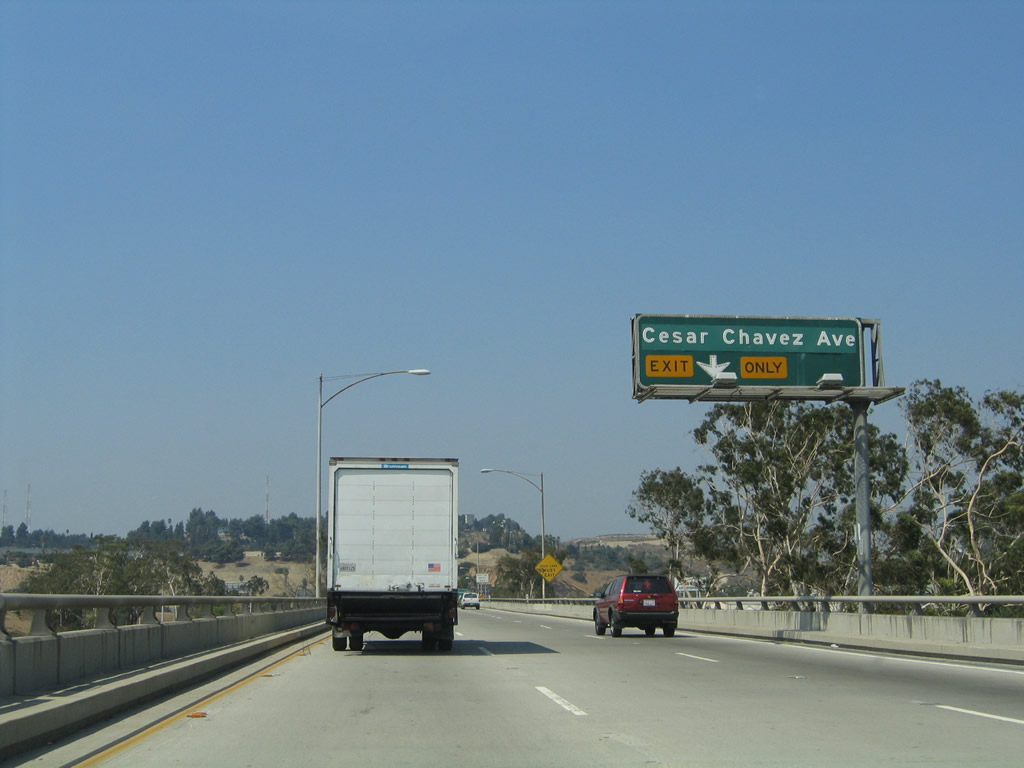
Now on the transition ramp from California 60 (Pomona Freeway) east to Interstate 710 (Long Beach Freeway) north, a slip ramp connects to Cesar Chavez Avenue (former Macy Street) in East Los Angeles. Macy Street was renamed in 1994 to honor the late labor leader, Cesar Chavez. The greenout overlay in the second picture covers original text with the name "Macy Street." Photos taken 08/24/04. |
|
This mileage sign provides the distance to the next three exits along California 60 (Pomona Freeway) east: Exit 4, Atlantic Boulevard; Exit 6A, Findlay Avenue; and Exit 6B, Garfield Avenue and Wilcox Avenue. Photo taken 02/26/11. |
|
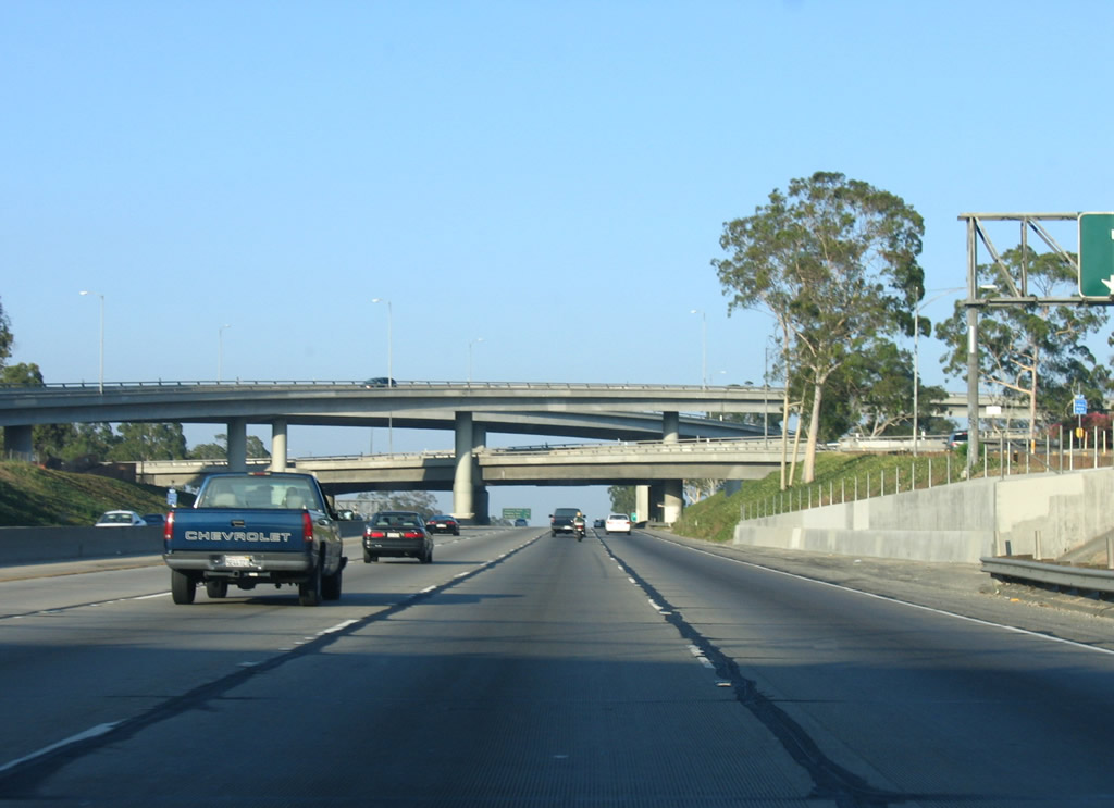
Leaving the Interstate 710 stack interchange behind, eastbound California 60 crests and descends into the San Gabriel Valley, which is formed between Los Angeles to the west and the Inland Empire (Riverside and San Bernardino) to the east. California 60 and parallel Interstate 10 and Interstate 210 serve the communities of San Gabriel Valley as each proceeds eastward. Photo taken 07/03/05. |
|
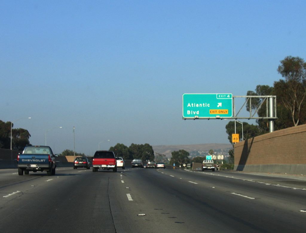
The right lane of California 60 (Pomona Freeway) east becomes exit only for Exit 4, Atlantic Boulevard. Prior to the construction of the Long Beach Freeway, Atlantic Boulevard was the main north-south corridor between Long Beach and Pasadena. It was designated as California 15, and that designation was transferred onto the Long Beach Freeway as it was built in stages. California 15/Atlantic Boulevard holds the distinction as serving as the southern/western terminus of U.S. 6 and U.S. 91 at the intersection between Atlantic Boulevard and Pacific Coast Highway in the city of Long Beach. Photo taken 02/26/11. |
|
|
An overhead for Atlantic Boulevard was previously posted above the barrier median along SR 60. Photos taken 02/26/11 and 07/03/05. |
|
Eastbound California 60 (Pomona Freeway) reaches Exit 4, Atlantic Boulevard (former California 15). At this point, California 60 leaves East Los Angeles and enters the city of Montebello (population 62,150 as of the 2000 Census, incorporated on October 19, 1920). Photo taken 07/03/05. |
|
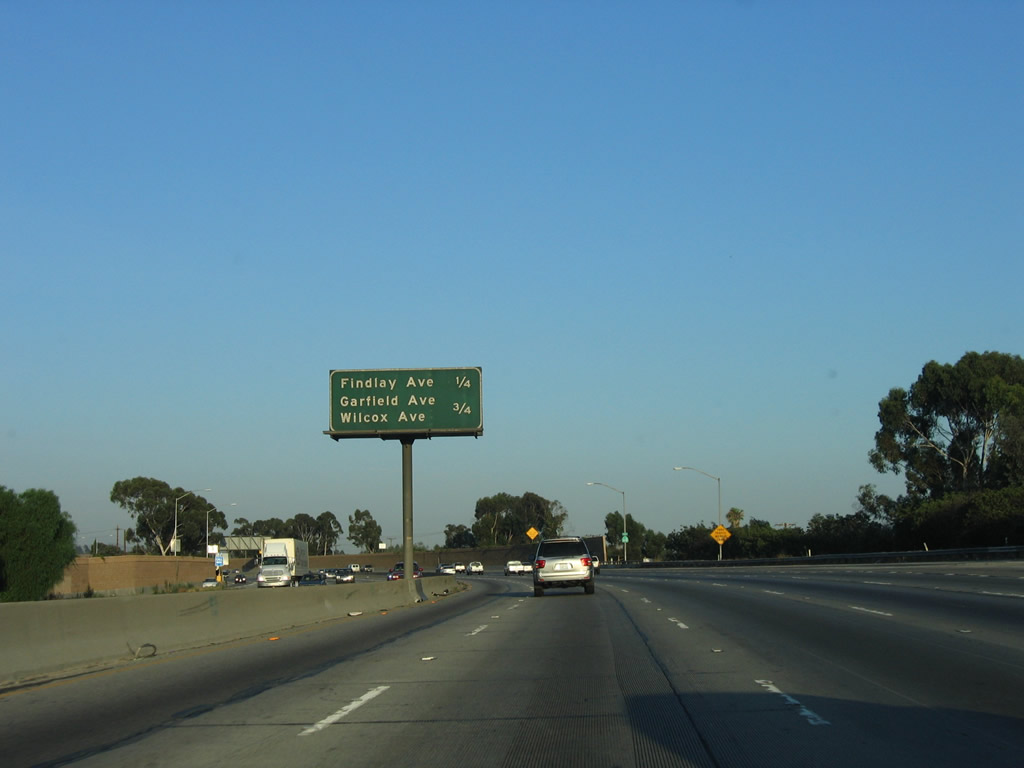
This mileage sign along California 60 (Pomona Freeway) east provides the distance to the next two exits: Exit 6A, Findlay Avenue and Exit 6B, Garfield Avenue and Wilcox Avenue. Photo taken 07/15/06. |
|
Eastbound California 60 (Pomona Freeway) reaches Exit 6A, Findlay Avenue. Photo taken 02/26/11. |
|
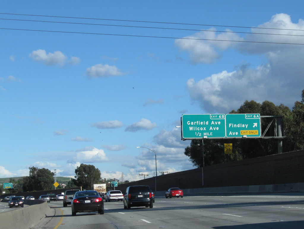
The next exit along California 60 (Pomona Freeway) east is Exit 6B, Garfield Avenue and Wilcox Avenue. Photo taken 02/26/11. |
|
This mileage sign along California 60 (Pomona Freeway) east provides the distance to the next three exits: Exit 6B, Garfield Avenue and Wilcox Avenue; Exit 8, Paramount Boulevard; and Exit 9, San Gabriel Boulevard. Photo taken 02/26/11. |
|
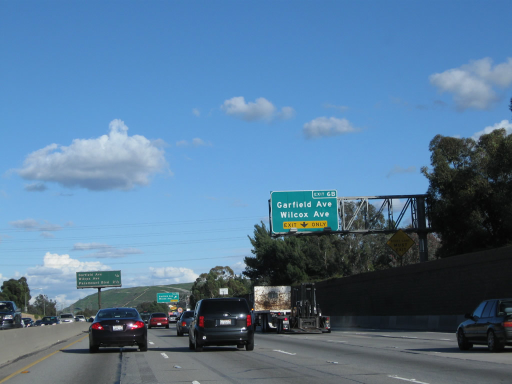
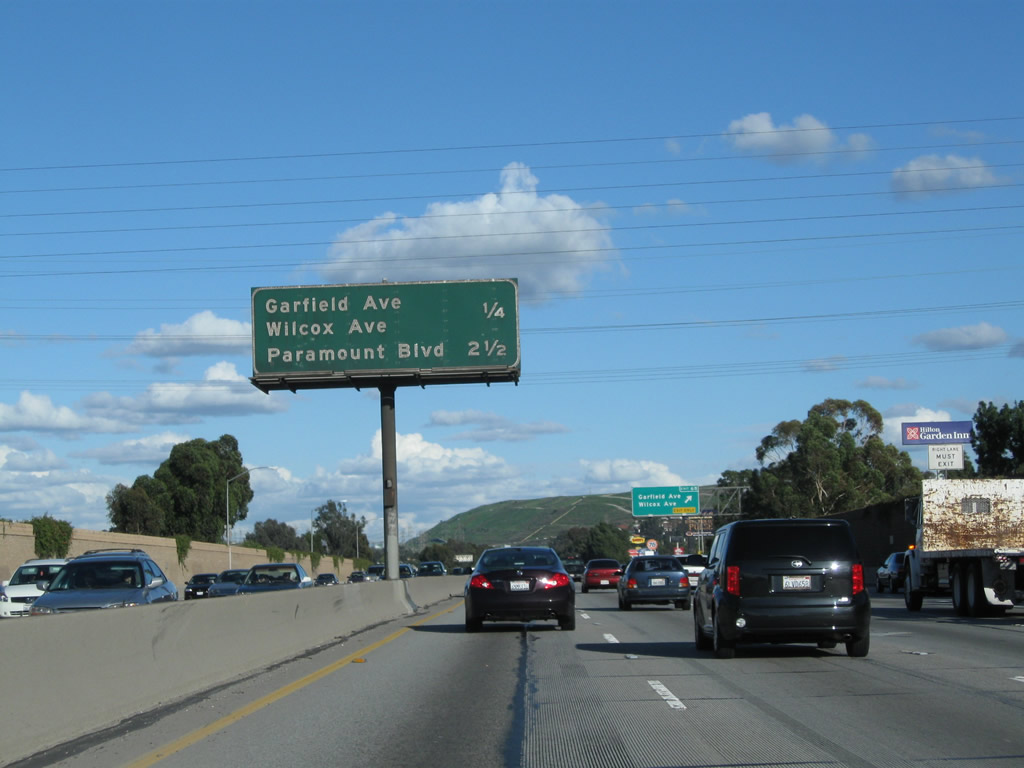
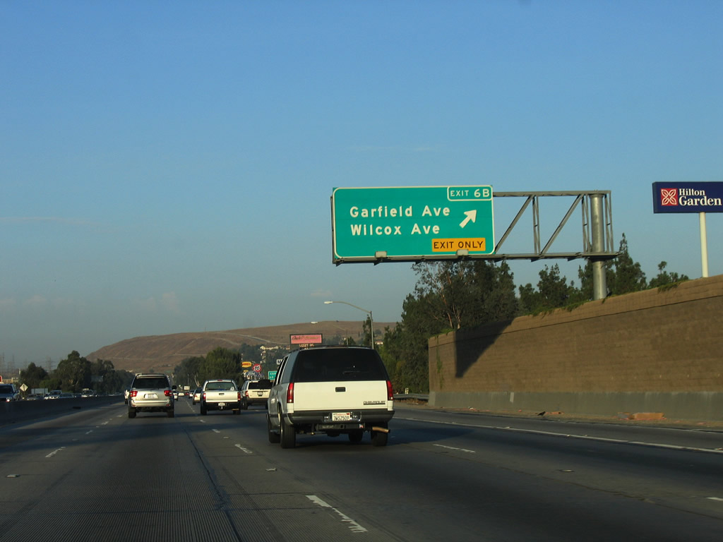
Eastbound California 60 (Pomona Freeway) reaches Exit 6B, Garfield Avenue and Wilcox Avenue. Photo taken 07/15/06. |
|
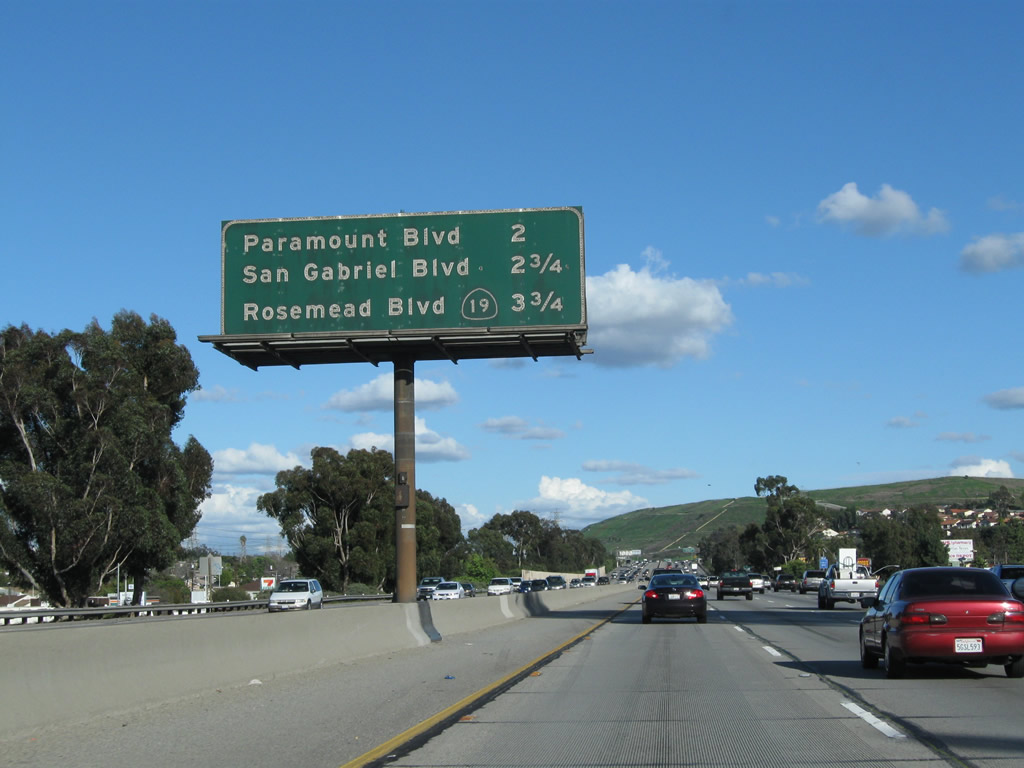
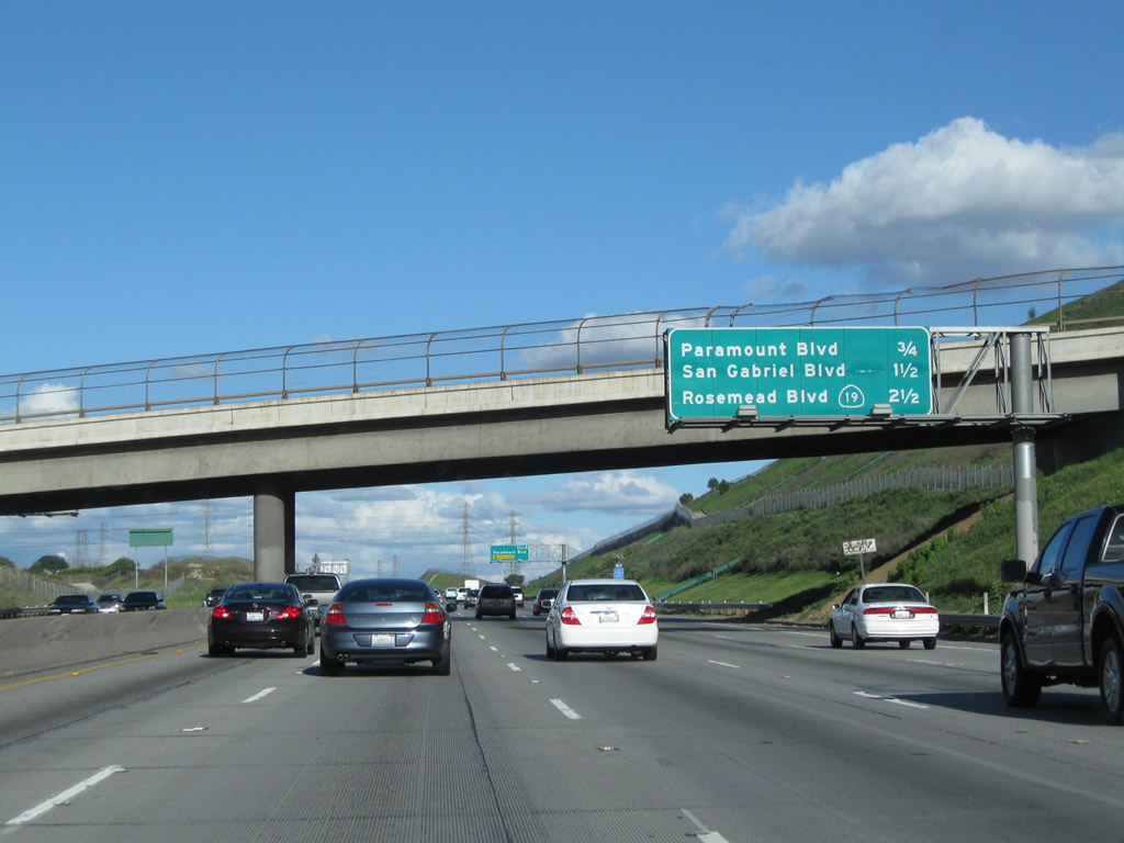
This mileage sign along California 60 (Pomona Freeway) east provides the distance to the next three exits: Exit 8, Paramount Boulevard; Exit 9, San Gabriel Boulevard; and Exit 10A, California 19 (Rosemead Boulevard). Photo taken 02/26/11. |
|
|
|
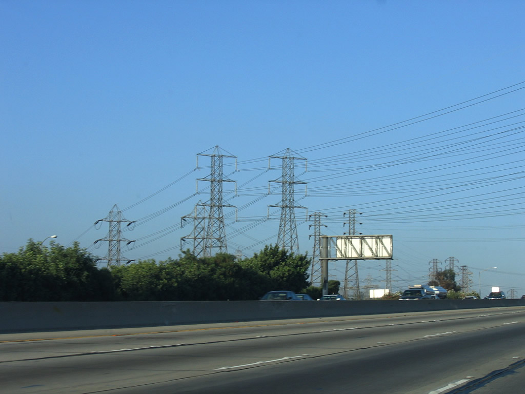
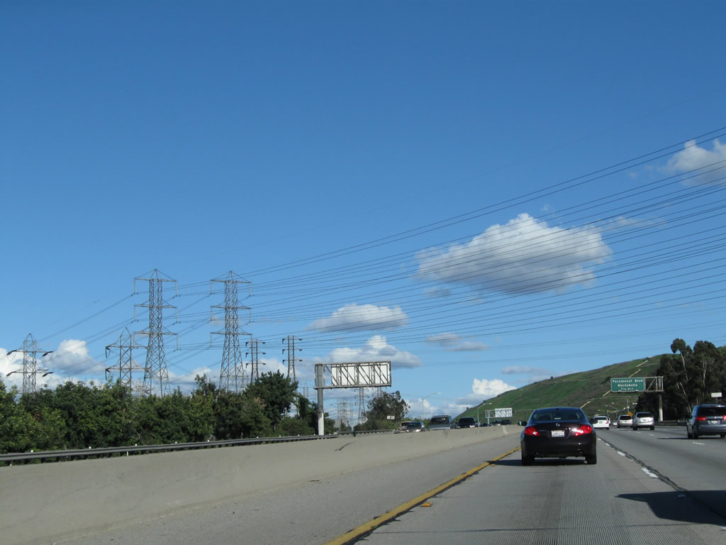
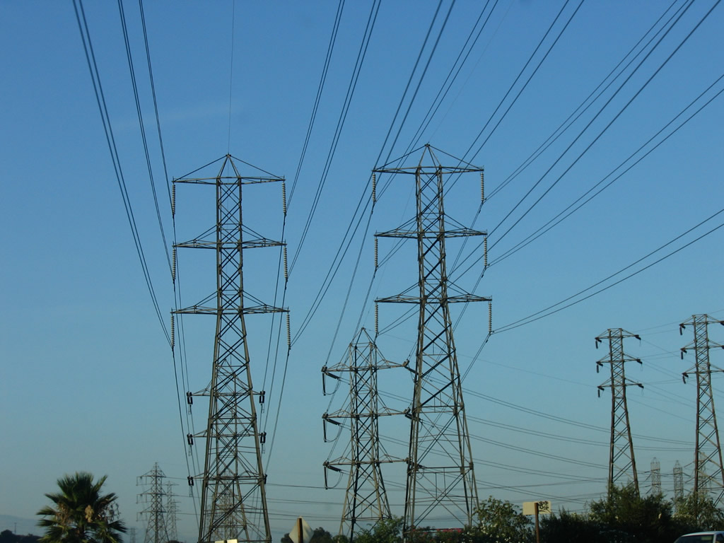
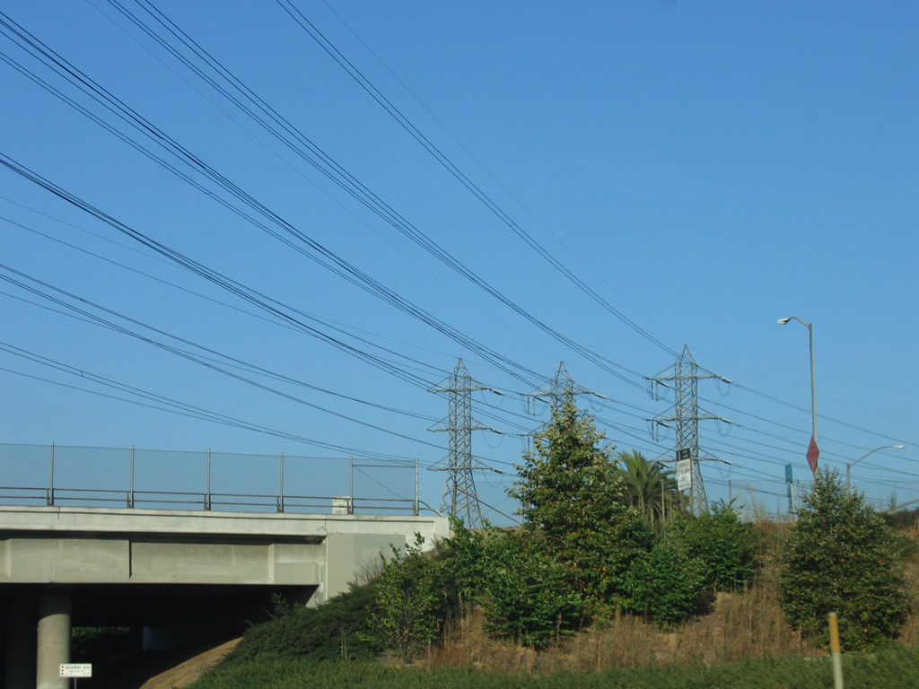
A set of Southern California Edison power lines cross over the California 60 freeway, then turn east to parallel the freeway. Photos taken 07/03/05, 07/15/06, and 02/26/11. |
|
|
|
|
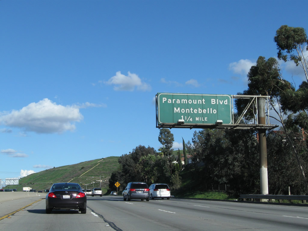
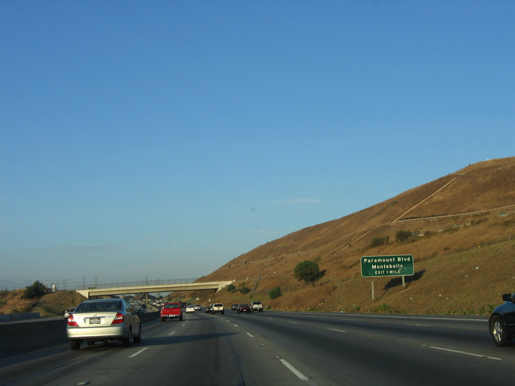
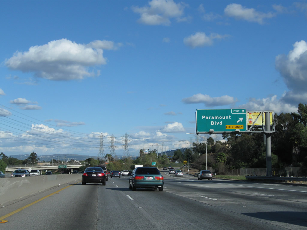
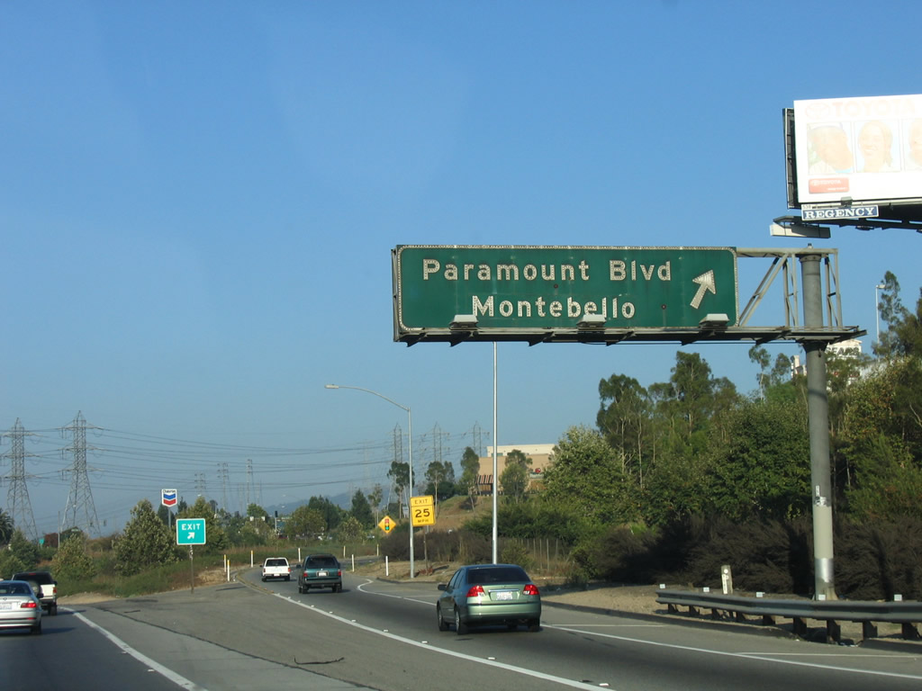
The next exit along California 60 (Pomona Freeway) east is Exit 8, Paramount Boulevard (1.25 miles). Photo taken 02/26/11. |
|
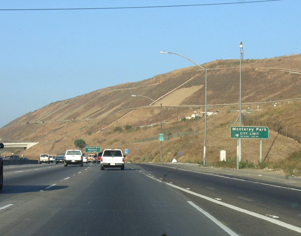
At the point where an on-ramp from Via Campo (a frontage road that brings traffic from Garfield Avenue and Wilcox Avenue to the freeway) merges onto California 60 east, the freeway leaves the city of Montebello and enters the city of Monterey Park ("Pride in the Past, Faith in the Future"). Monterey Park had a population of 60,051 as of the 2000 Census. California 60 generally stays north of Montebello and south of Monterey Park between Exits 6A and 9. Photo taken 07/03/05. |
|
Eastbound California 60 (Pomona Freeway) approaches Exit 8, Paramount Avenue to Monterey Park and Montebello. Photo taken 07/15/06. |
|
California 60 passes under Greenwood Avenue, which connects Monterey Park with the former Operating Industries Inc. (OII) landfill on both sides of the California 60 freeway. This landfill operated between 1948 and 1984, and due to hazardous materials contamination, it was designated as a Superfund site in 1986. Clean-up of the site has been underway since the Superfund designation, with capping completed in 2001 (south landfill) and 2009 (north landfill). Photo taken 07/03/05. |
|
By 2011, a new interchange sequence sign is posted along California 60 east prior to the Greenwood Avenue overpass. The next three exits are: Exit 8, Paramount Boulevard; Exit 9, San Gabriel Boulevard; and Exit 10A, California 19 and California 164 (Rosemead Boulevard). Photo taken 02/26/11. |
|
|
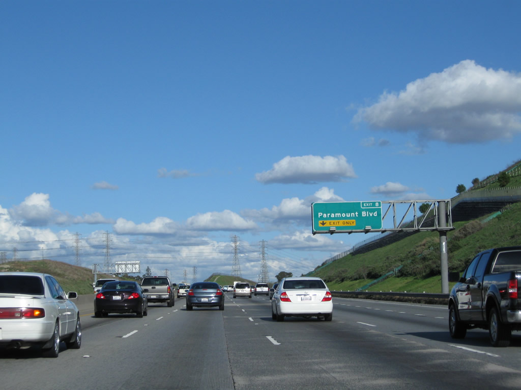
The right lane of California 60 (Pomona Freeway) east becomes exit only for Exit 8, Paramount Boulevard to Montebello. Once again, the elevated guide sign was replaced and moved from the median to the side of the road. Photos taken 02/26/11 and 07/03/05. |
|
This view looks south at the OII landfill. Photo taken 02/26/11. |
|
|
Eastbound California 60 (Pomona Freeway) reaches Exit 8, Paramount Boulevard. Paramount Boulevard travels north through South San Gabriel into the city of Rosemead. To the south, Paramount Boulevard travels only a short distance to Montebello Boulevard, which continues southwest into Montebello. Photos taken 02/26/11 and 07/03/05. |
|
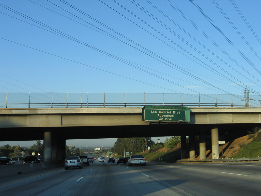
Passing under Paramount Boulevard, the next interchange along eastbound California 60 is Exit 9, San Gabriel Boulevard in southern Rosemead. This bridge was heavily damaged due to a tanker explosion along California 60 east on December 14, 2011. Exterior layers of concrete and the porcelain sign for Exit 9 were destroyed, but luckily no one was hurt. The 60 freeway was closed for several days, with partial reopening on December 17, 2011, for westbound traffic. The bridge, built in 1966, was so severely damaged and compromised by the heat of the explosion that sections had to be dismantled in phases as a result.1, 2, 3 Photo taken 07/15/06. |
|
|
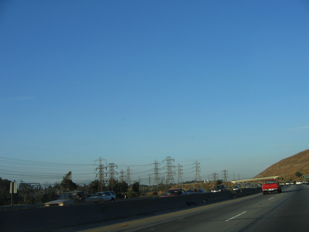
A set of Southern California Edison power lines cruise over the top of the California 60 and Paramount Boulevard interchange. Photos taken 07/03/05 and 02/26/11. |
|
|
The right lane of California 60 (Pomona Freeway) east becomes exit only for Exit 9, San Gabriel Boulevard. Photos taken 02/26/11 and 07/15/06. |
|
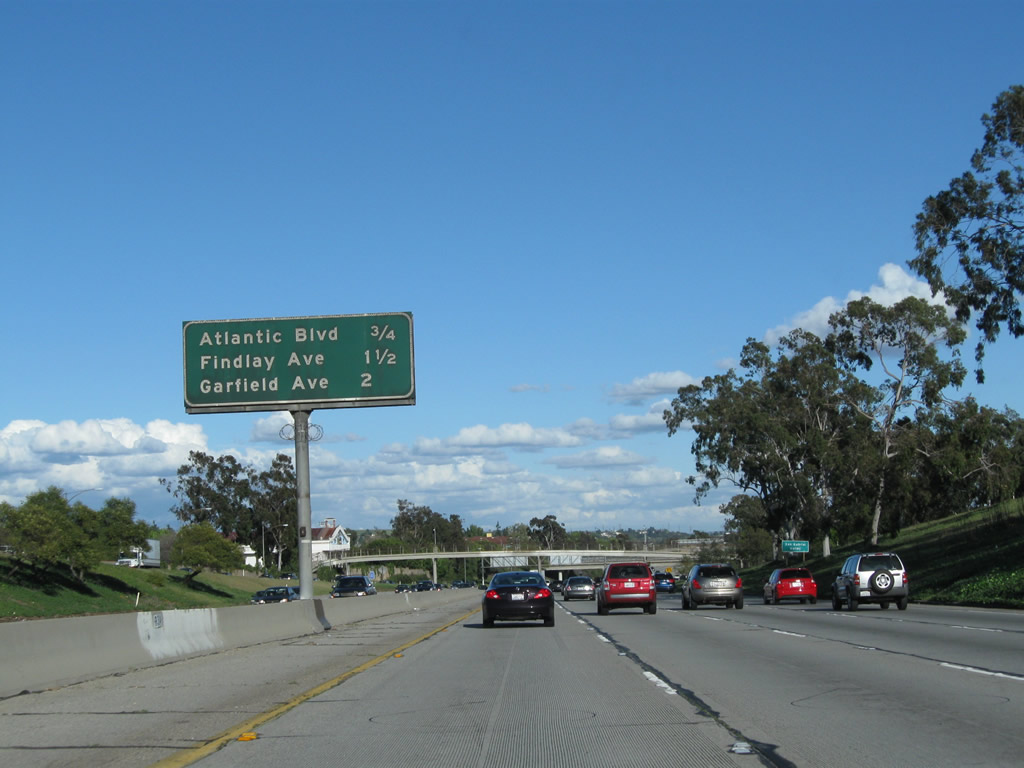
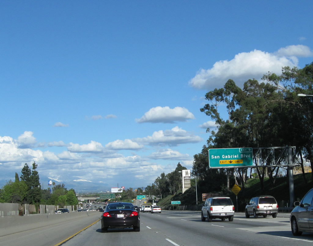
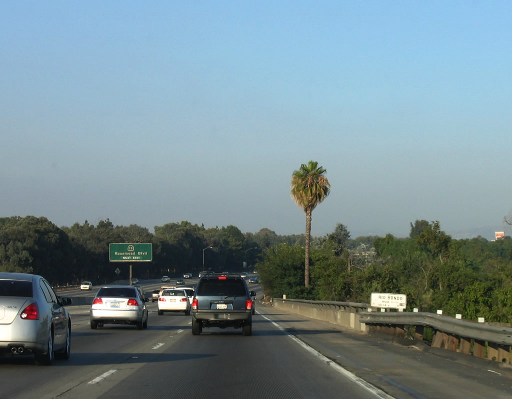
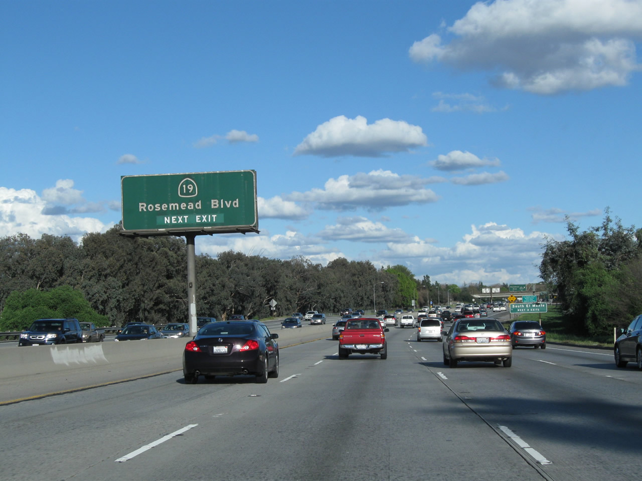
This mileage sign provides the distance to the next three exits along California 60 (Pomona Freeway) east: Exit 9, San Gabriel Boulevard to Rosemead; Exit 10A, California 19 (Rosemead Boulevard); and Exit 10B, Santa Anita Avenue. At the next interchange (Exit 9), California 60 briefly enters the southern tip of the city of Rosemead ("today's Small Town America"). Rosemead had a population of 53,505 as of the 2000 Census and was incorporated on August 4, 1958. Photo taken 02/26/11. |
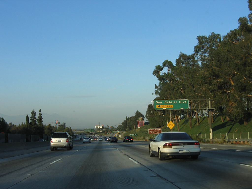
|
Eastbound California 60 (Pomona Freeway) reaches Exit 9, San Gabriel Boulevard. This overhead guide sign was replaced with a reflective sign by 2010 (not shown here). Photo taken 07/15/06. |
|
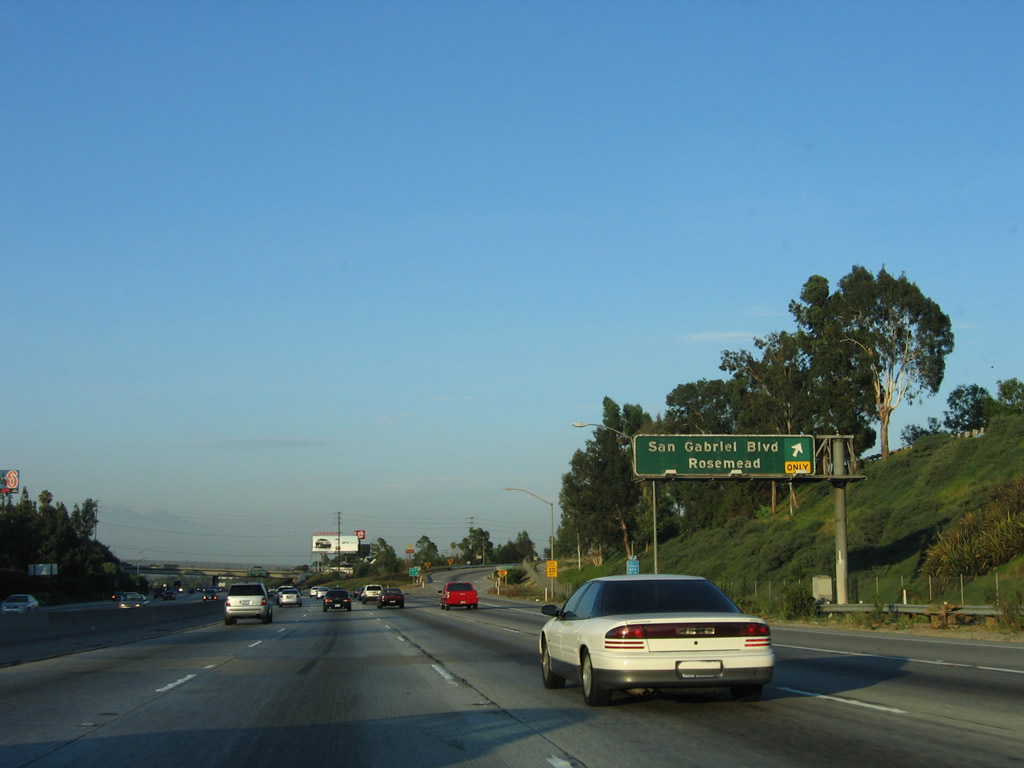
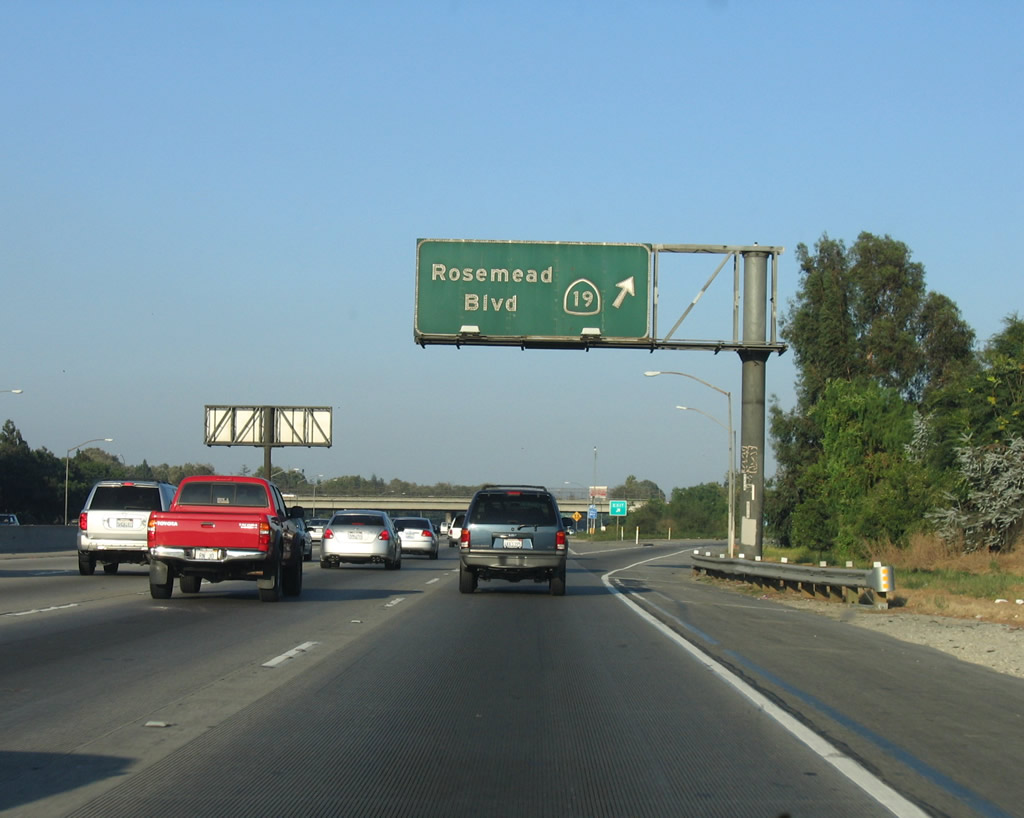
Passing under San Gabriel Boulevard, the next exit on California 60 (Pomona Freeway) east is Exit 10A, California 19 (Rosemead Boulevard). Photo taken 07/15/06. |
|
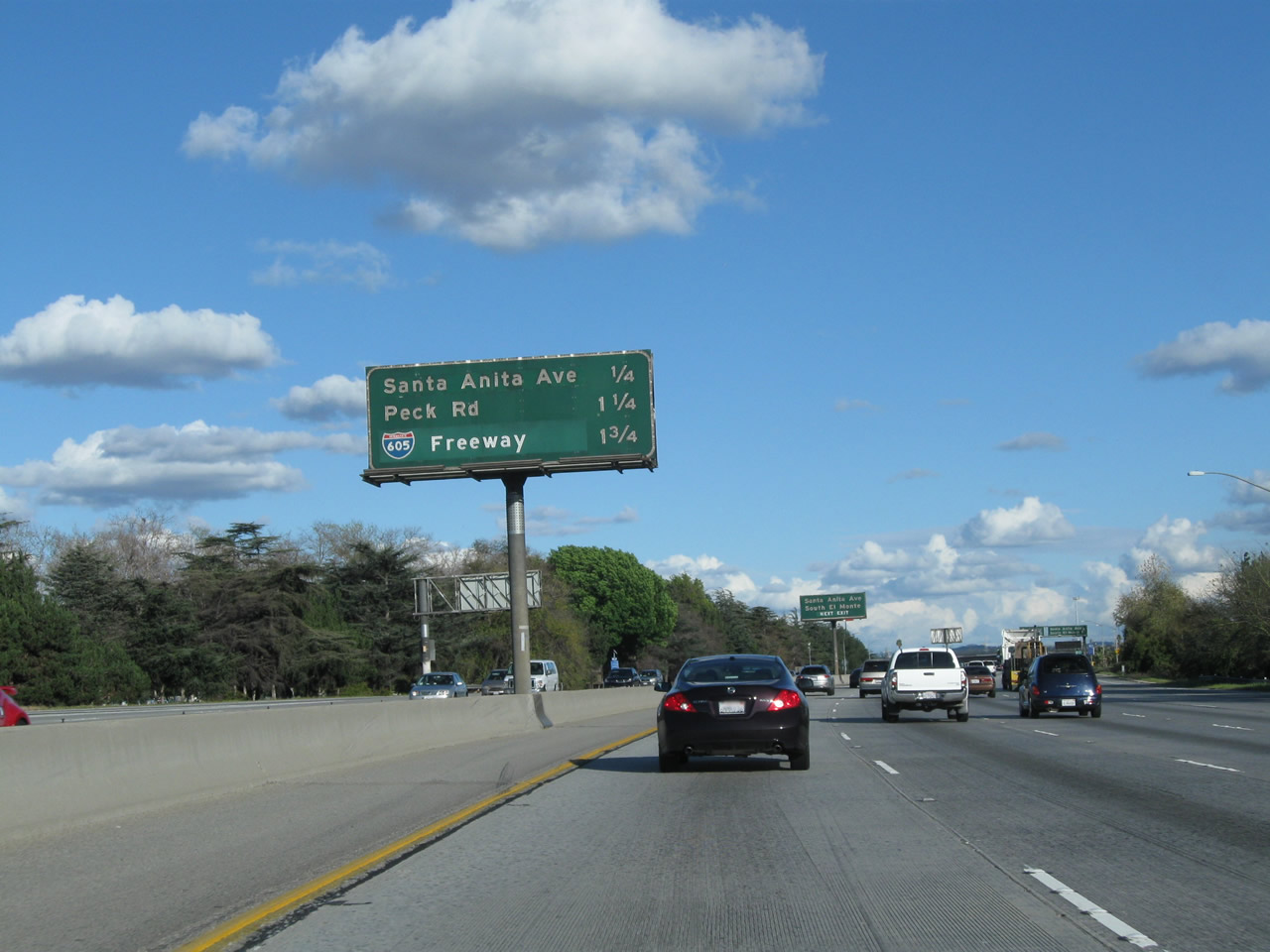
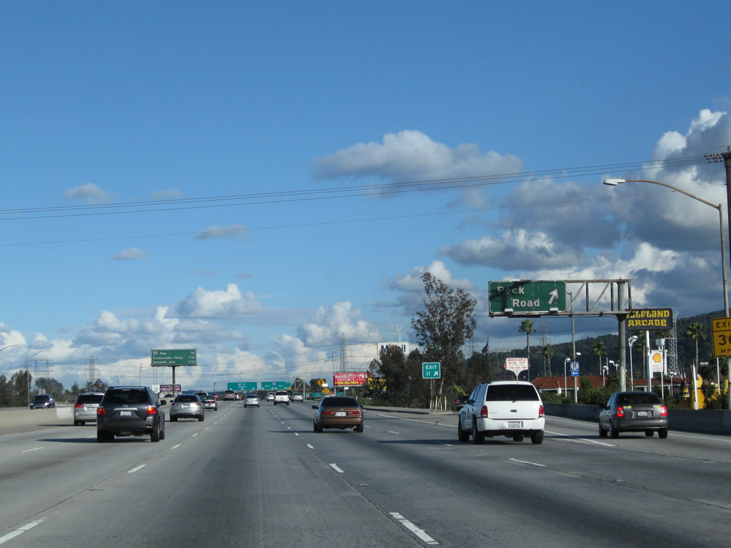
After the San Gabriel Boulevard interchange, this mileage sign provides the distance to the next three exits along California 60 (Pomona Freeway) east: Exit 10A, California 19 (Rosemead Boulevard); Exit 10B, Santa Anita Avenue; and Exit 11, Peck Road. Photo taken 02/26/11. |
|
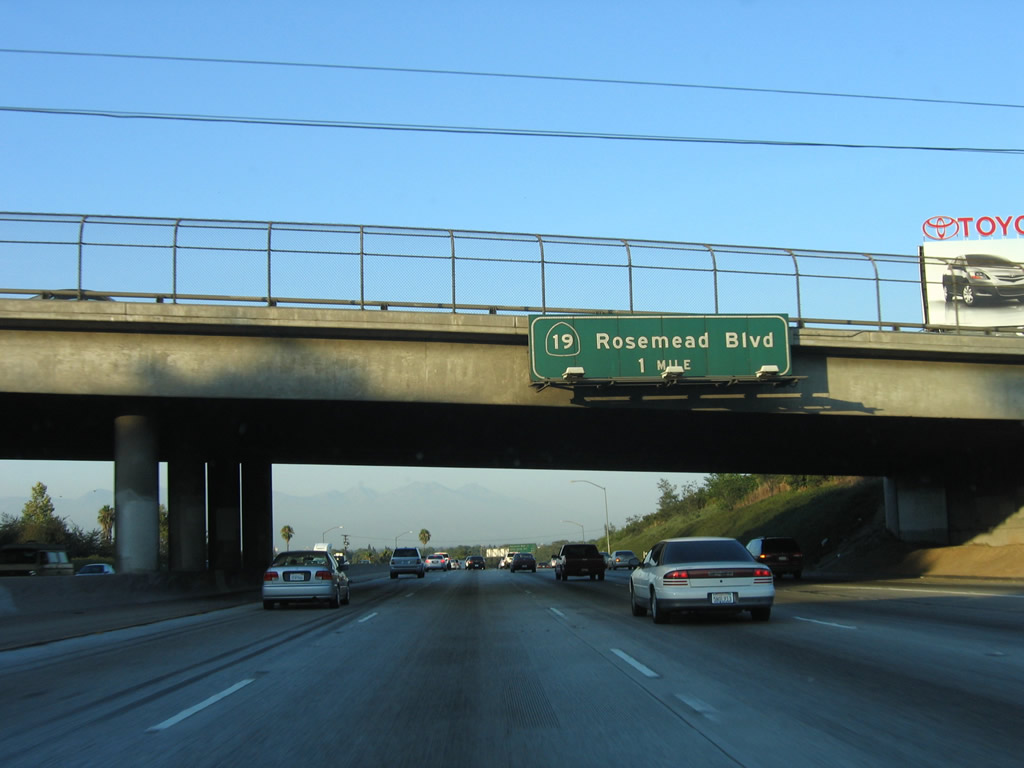
California 60 passes over the Rio Hondo, which flows from the San Gabriel Mountains (Sawpit Canyon) south through Whittier Narrows (confluence with San Gabriel River) and then southwest into the Los Angeles River. A porcelain enamel sign advising of the California 19 interchange is posted after crossing Rio Hondo. Between Exits 9 and 10B, California 60 passes through Whittier Narrows Recreation Area. Photo taken 07/03/05. |
|
This is the penultimate guide sign for Exit 10A, California 19 (Rosemead Boulevard). Photo taken 02/26/11. |
|
Eastbound California 60 (Pomona Freeway) meets Exit 10A, California 19 (Rosemead Boulevard). California 19 between Gallatin Road (southern part of Whittier Narrows in the city of Pico Rivera) and Interstate 210 is legislatively California 164, but it has been signed as part of California 19, California 164 was intended to be the Rio Hondo Freeway between Interstate 605 and Interstate 210 via Whittier Narrows into eastern Pasadena, but that plan is not likely to be realized. In fact, sections of California 19 (and secret California 164) are likely to be decommissioned to local control). Photo taken 07/03/05. |
|
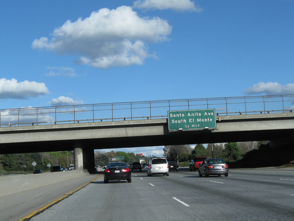
California 60 passes under California 19. An advance guide sign indicates that the next exit along eastbound California 60 (Pomona Freeway) is Exit 10B, Santa Anita Avenue. Photo taken 02/26/11. |
|
This mileage sign provides the distance to the next three exits along California 60 (Pomona Freeway) east: Exit 10B, Santa Anita Avenue; Exit 11, Peck Road; and Exit 12, Interstate 605 (San Gabriel River Freeway). Photo taken 02/26/11. |
|
Eastbound California 60 (Pomona Freeway) approaches Exit 10B, Santa Anita Avenue. Photo taken 02/26/11. |
|
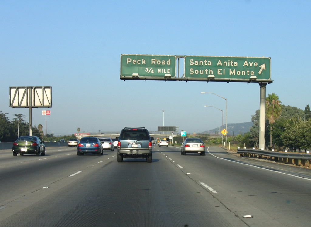
Eastbound California 60 (Pomona Freeway) meets Exit 10B, Santa Anita Avenue. California 60 leaves unincorporated Los Angeles County (as part of the Whittier Narrows Recreation Area) and next enters the southeastern corner of the city of South El Monte ("Growing our Future"). As of the 2000 census, South El Monte had a population of 21,144. The city incorporated on July 30, 1958. Photo taken 07/03/05. |
|
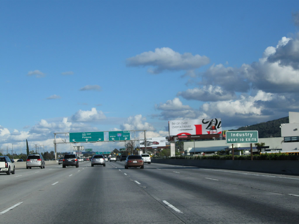
The next two exits will serve the city of Industry, which generally follows the California 60 (Pomona Freeway) corridor as it travels east toward Pomona. Photo taken 02/26/11. |
|
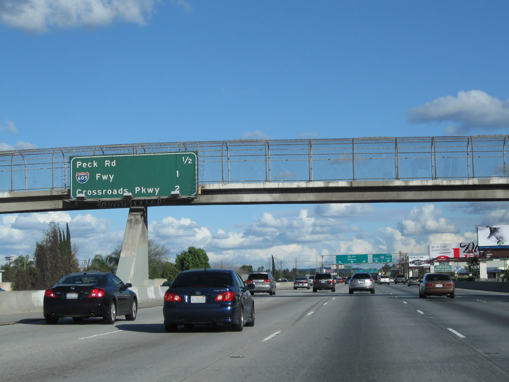
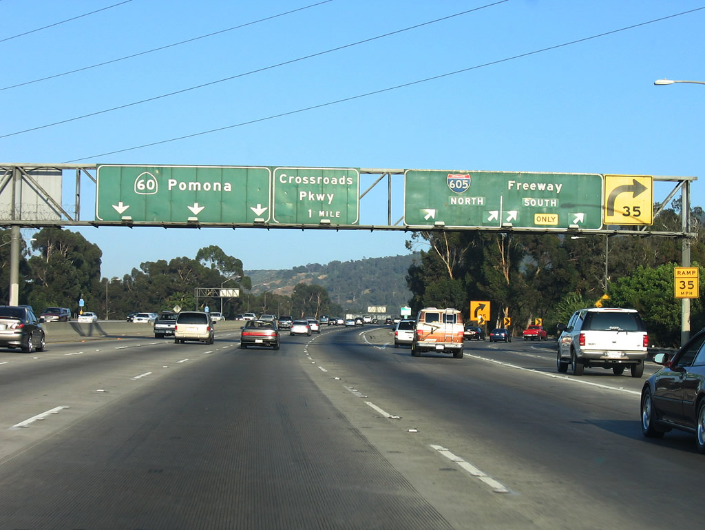
This mileage sign provides the distance to the next three exits along California 60 (Pomona Freeway) east: Exit 11, Peck Road; Exit 12, Interstate 605 (San Gabriel River Freeway); and Exit 13, Crossroads Parkway. Photo taken 02/26/11. |
|
|
A guide sign provides lane allocation for California 60 (Pomona Freeway) east and Interstate 605 (San Gabriel River Freeway). Exit 11 with Peck Road follows. Photos taken 02/26/11 and 07/03/05. |
|
Eastbound California 60 (Pomona Freeway) meets Exit 11, Peck Road. Photo taken 02/26/11. |
|
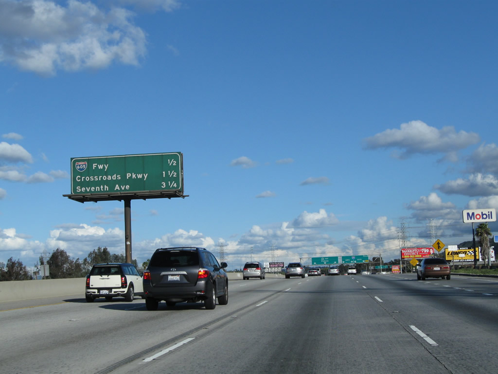
This mileage sign along California 60 (Pomona Freeway) east provides the distance to the next four exits: Exit 12, Interstate 605 (San Gabriel River Freeway); Exit 13, Crossroads Parkway; and Exits 14A-B, Seventh Avenue. Photo taken 02/26/11. |
|
|
Additional guide signs advise of the pending junction with Interstate 605, a major north-south freeway that parallels the San Gabriel River and thus provides access to various cities along its route within the San Gabriel Valley. Interstate 605 begins at Interstate 405 in Seal Beach (near Long Beach) and continues north to end at Interstate 210 and U.S. 66 in Duarte. Photos taken 02/26/11 and 07/03/05. |
|
|
|
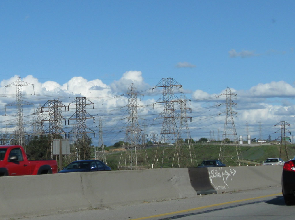
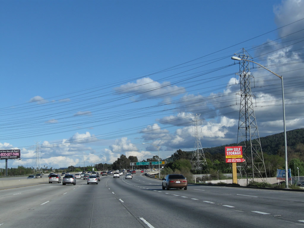
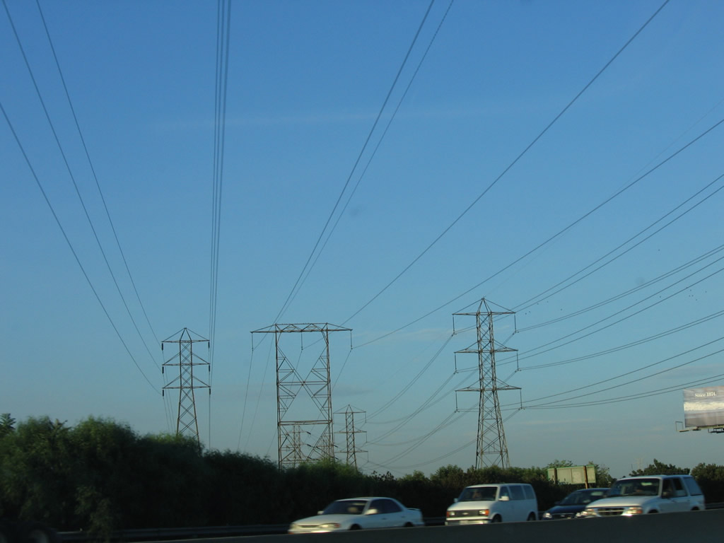
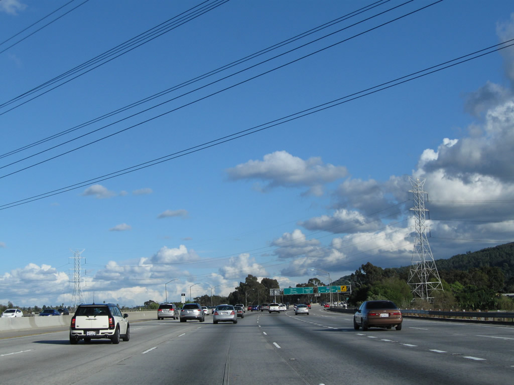
A set of Southern California Edison power lines cross over the freeway, followed by a set of Los Angeles Department of Water and Power (LADWP) lines. The LADWP lines bring electricity south from the Mojave Desert, and they parallel Interstate 15 near the top of the Cajon Summit area. Photos taken 02/26/11, 07/03/05, and 07/15/06. |
|
|
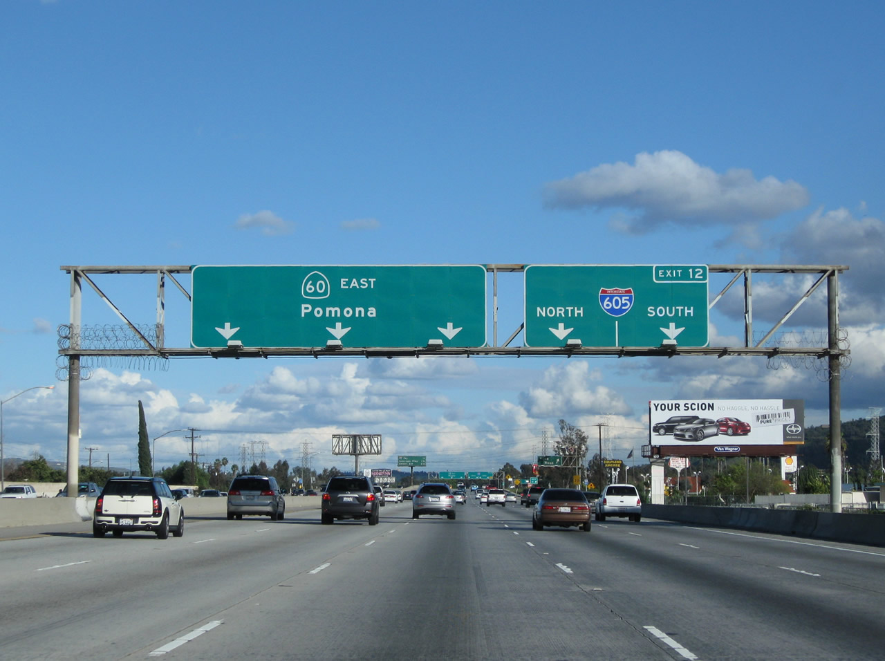
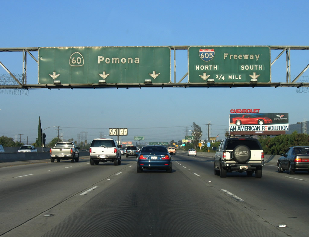
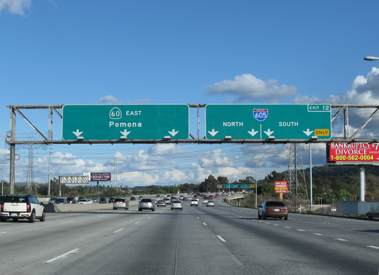
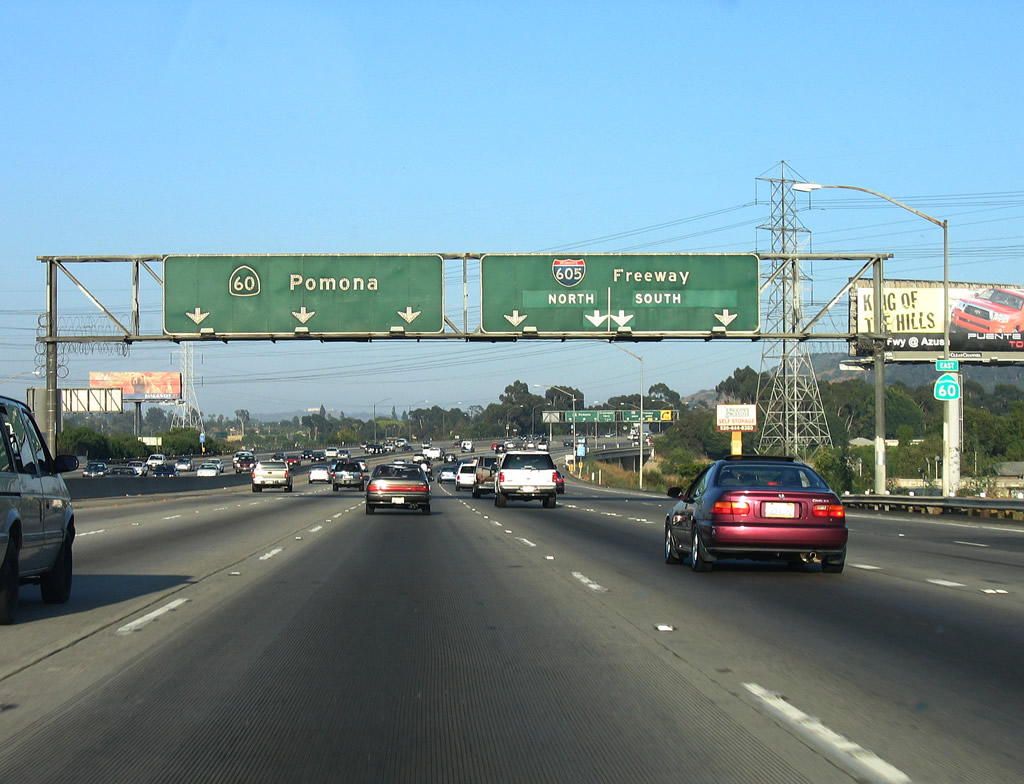
Eastbound California 60 (Pomona Freeway) meets Exit 12, Interstate 605 (San Gabriel River Freeway) north to Duarte and south to Seal Beach. Photos taken 02/26/11 and 07/03/05. |
Page Updated December 21, 2011.