
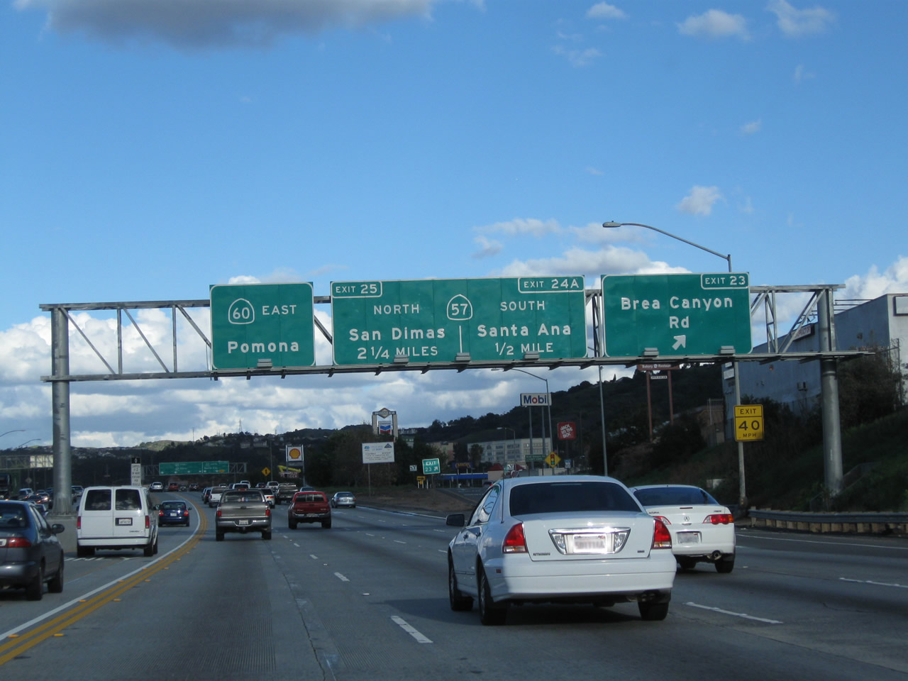
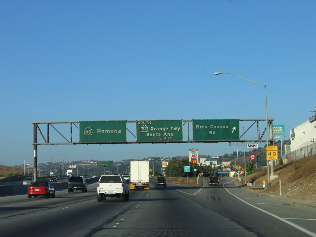
California 60 East - Interstate 605 to California 57 north
| California 60 (Pomona Freeway) east | ||
|---|---|---|
 |
 |
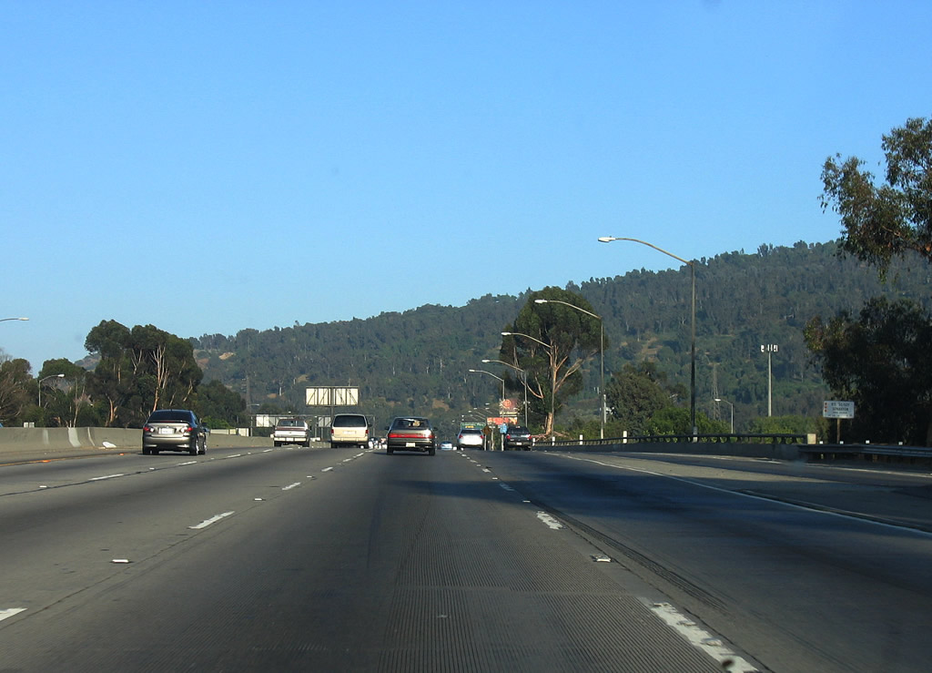
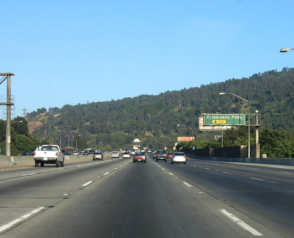
As traffic from Interstate 605 prepares to join eastbound California 60, this view is afforded prior to the Crossroads Parkway interchange. Photos taken 07/03/05 and 02/26/11. |
 |
 |
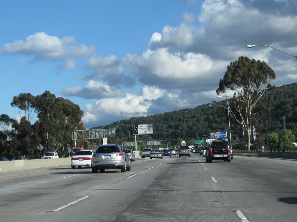
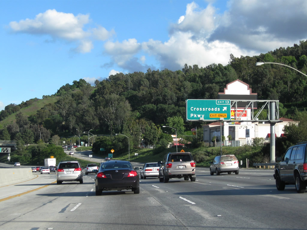
The right lane of California 60 east becomes exit only for Exit 13, Crossroads Parkway. Although the interchange with Interstate 605 is located in unincorporated Los Angeles County, the interchange with Crossroads Parkway is located in the City of Industry. True to its name, the City of Industry is a jobs center with ample employment opportunities, but it is only home to 777 residents (per the 2000 Census). Incorporated on June 18, 1957, the City of Industry is zoned almost entirely as industrial or commercial. Photos taken 02/26/11 and 07/03/05. |
 |
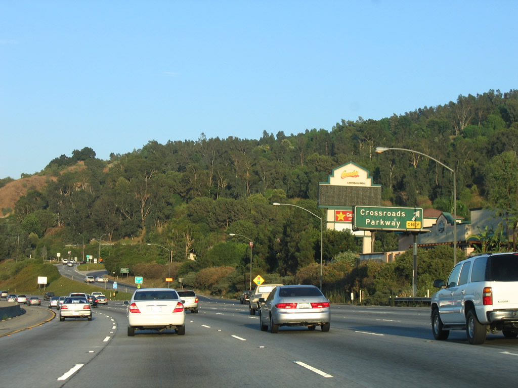 |
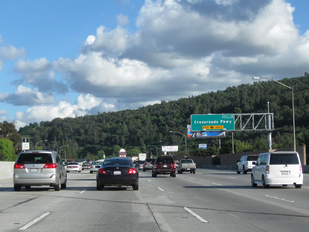
Eastbound California 60 reaches Exit 13, Crossroads Parkway. This sign was also replaced between 2006 and 2011. Photos taken 02/26/11 and 07/15/06. |
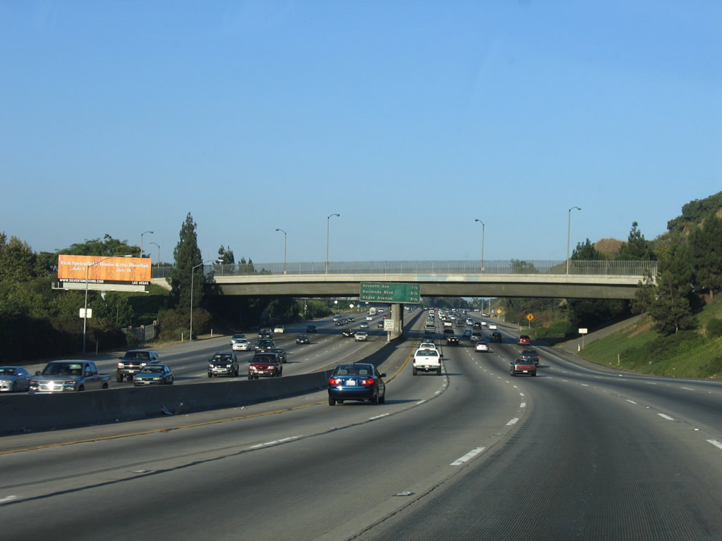 |
Advancing east from Crossroads Parkway, SR 60 follows a linear corridor through the City of Industry to Diamond Bar and SR 57. Photo taken 07/03/05. | |
 |
 |
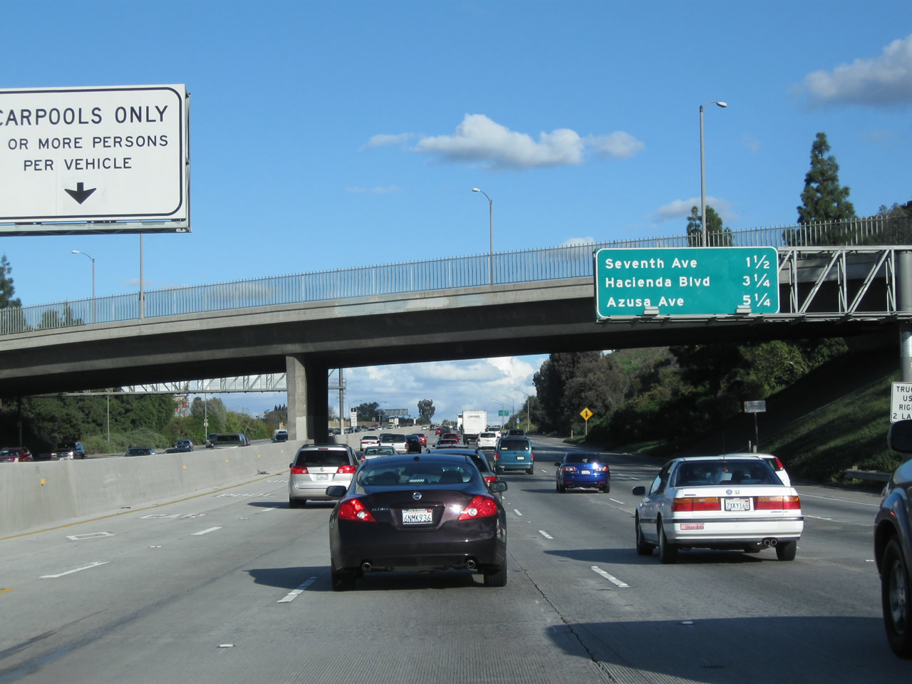
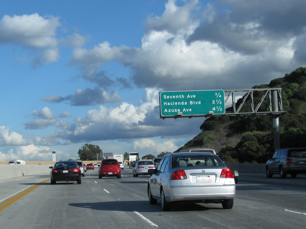
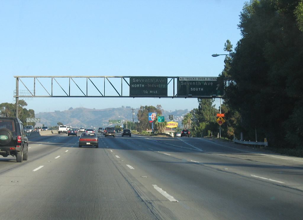
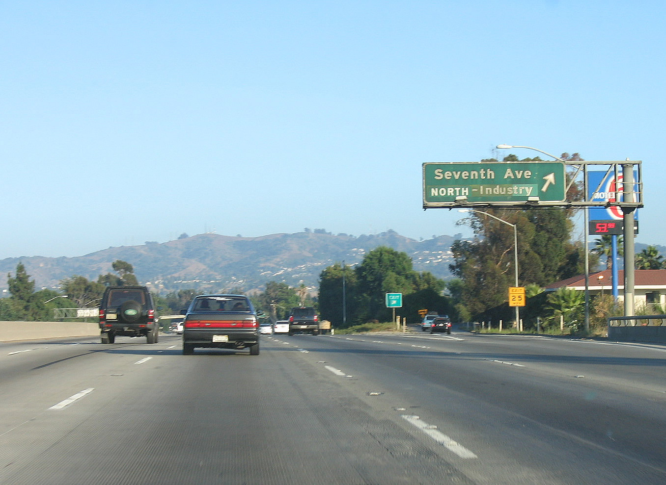
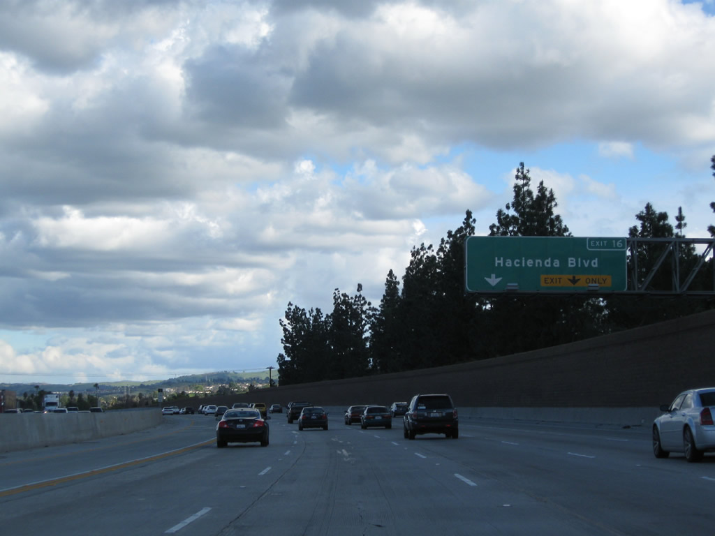
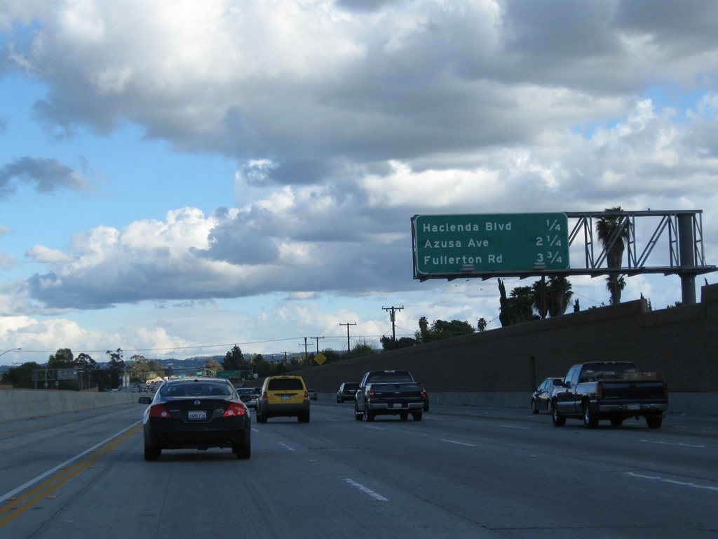
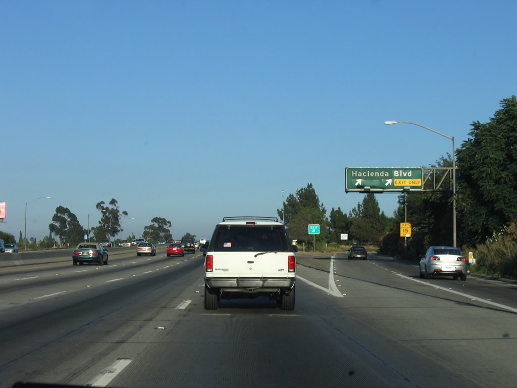
This interchange sequence sign along California 60 (Pomona Freeway) east provides the distance to the next four exits: Exits 14A-B, Seventh Avenue; Exit 16, Hacienda Boulevard (former California 39); and Exit 18, Los Angeles County N-8 (Azusa Avenue). An overlay panel covers the former California 39 state route designation for Hacienda Boulevard. Use any of these interchanges north to the City of Industry or south into Hacienda Heights, an unincorporated community of Los Angeles County. Photos taken 02/26/11 and 07/15/06. |
 |
 |
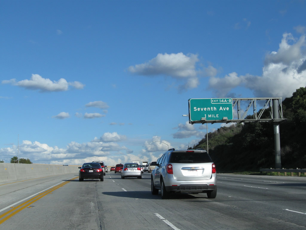
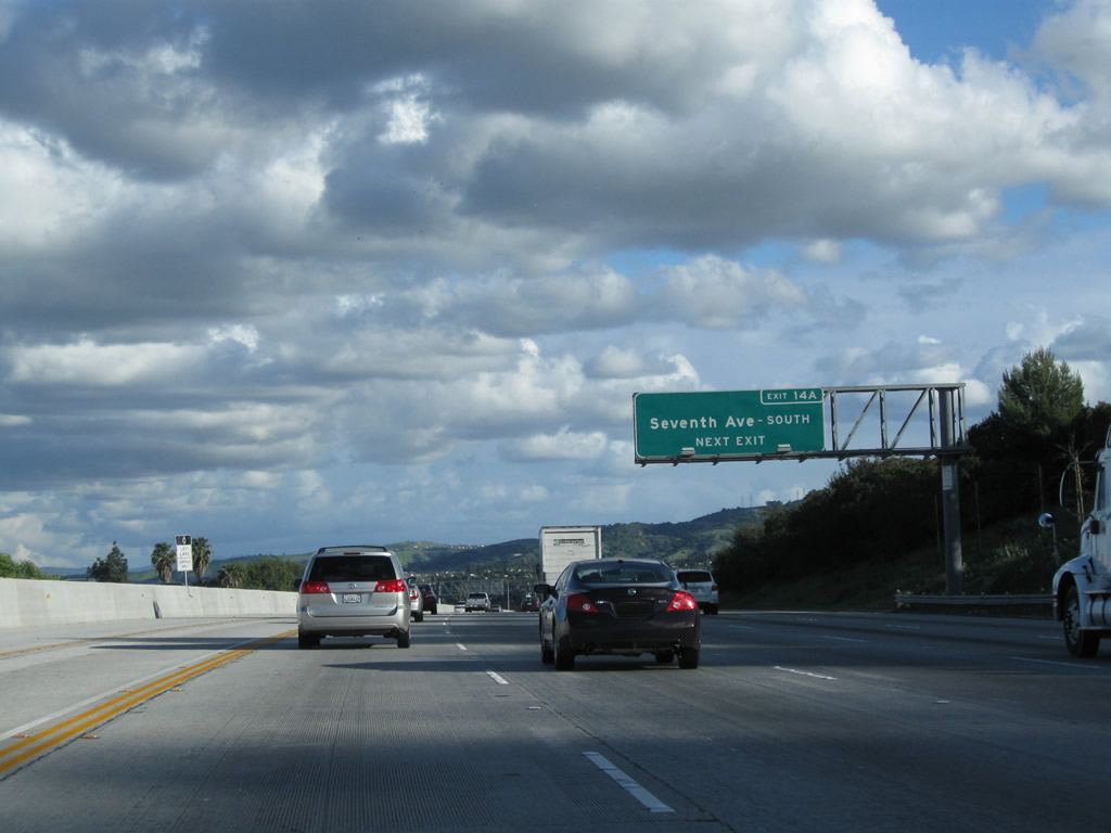
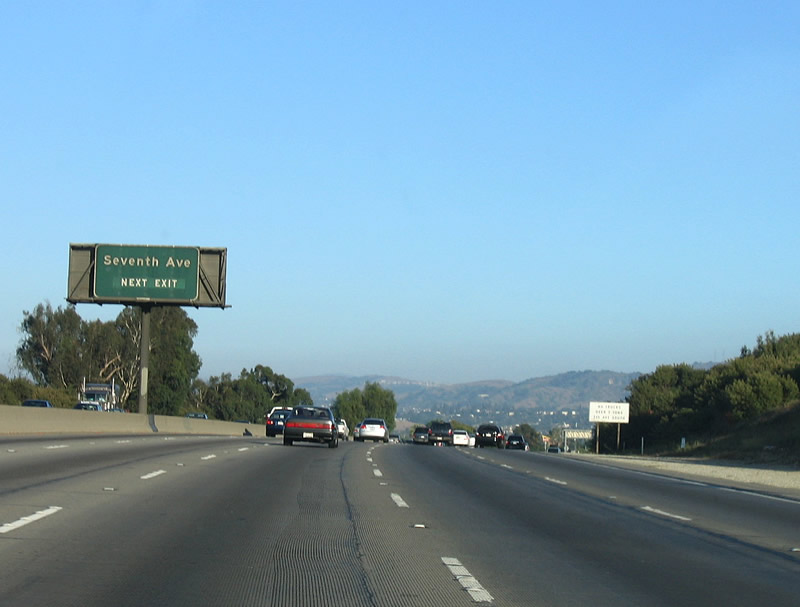
The next two exits from California 60 (Pomona Freeway) east are Exits 14A-B, Seventh Avenue. Photos taken 02/26/11 and 07/15/06. |
 |
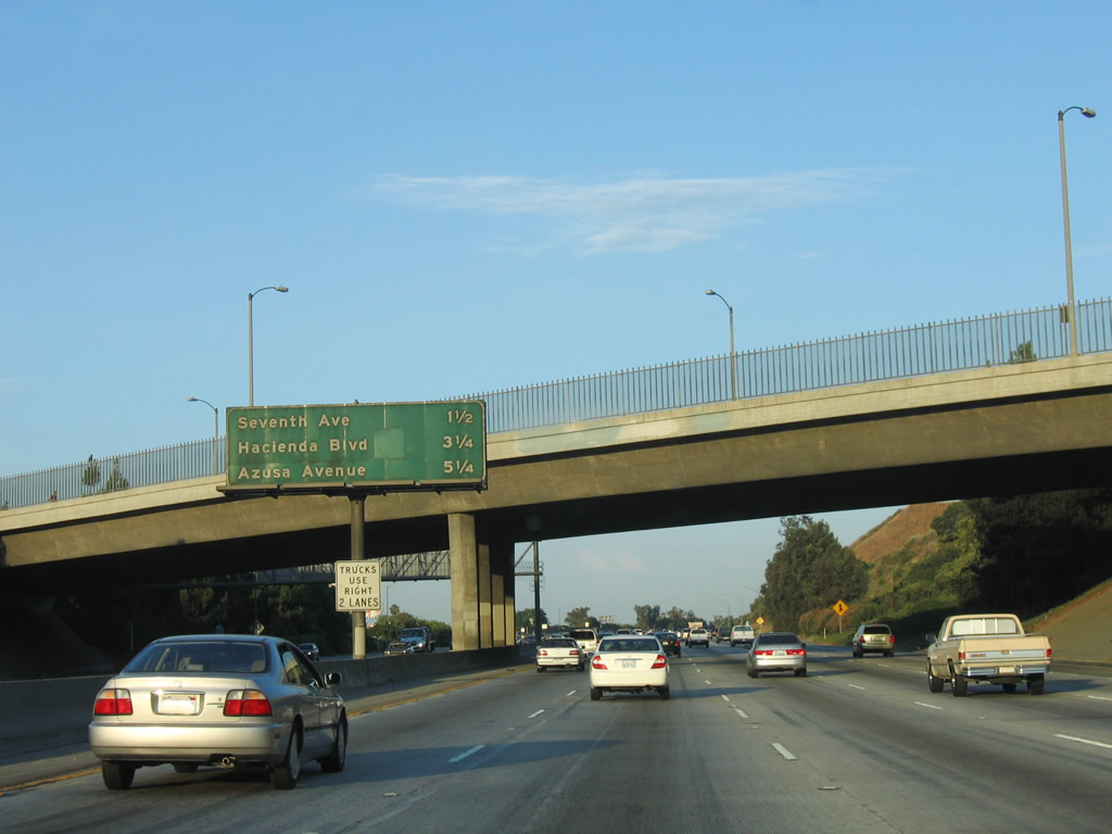
An interchange sequence sign provides the distance to the next four exits along California 60 east: Exits 14A-B, Seventh Avenue; Exit 16, Hacienda Boulevard (Former California 39); and Exit 18, Los Angeles County N-8 (Azusa Avenue). Photo taken 02/26/11. | |
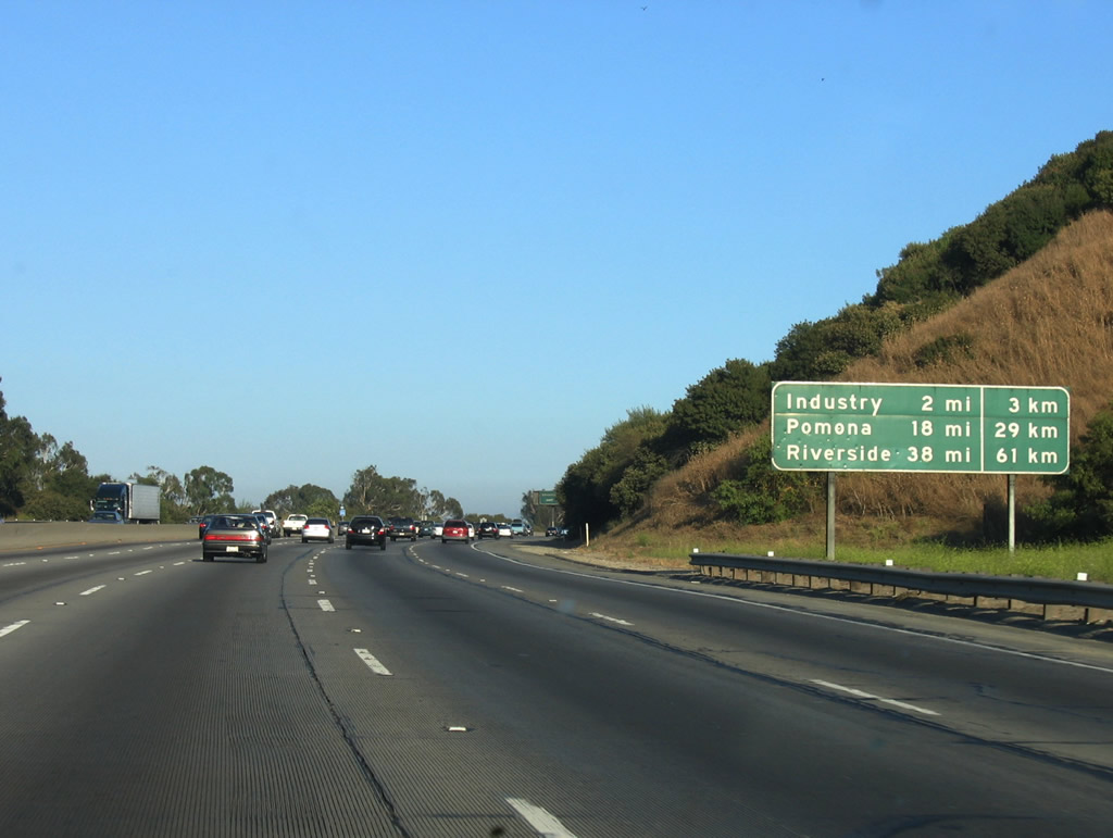 |
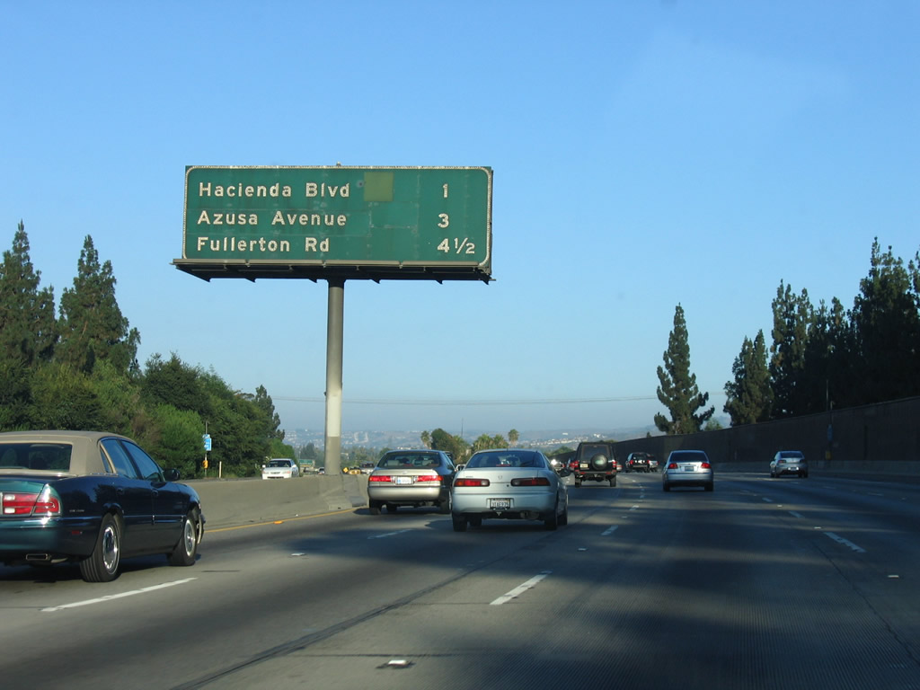
A mileage sign provides the distance to the center of the City of Industry (two miles), Pomona (18 miles), and Riverside (38 miles). Photo taken 07/03/05. | |
 |
 |
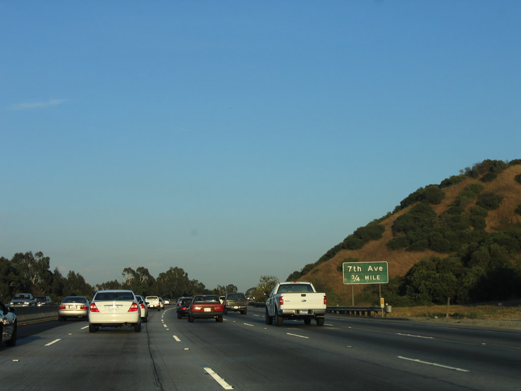
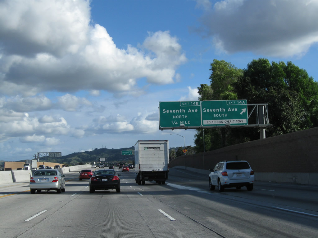
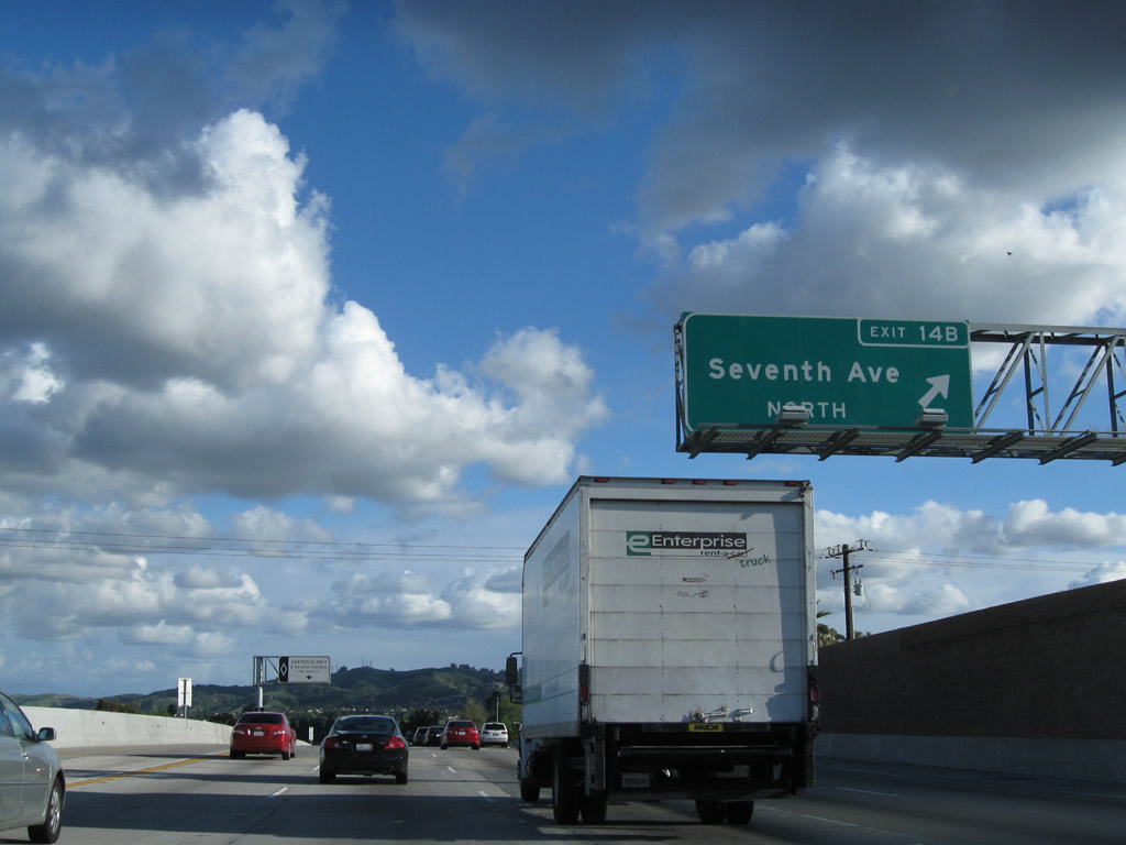
The next two exits along California 60 (Pomona Freeway) east are Exit 14A, Seventh Avenue south to Hacienda Heights and Exit 14B, Seventh Avenue north to the City of Industry. The sign has been relocated and replaced. Photos taken 02/26/11 and 07/03/05. |
 |
 |
Eastbound California 60 (Pomona Freeway) reaches Exit 14A, Seventh Avenue south to Hacienda Heights. The next exit is Exit 14B, Seventh Avenue north to the City of Industry. Photos taken 02/26/11 and 07/03/05. |
 |
 |
Immediately thereafter, eastbound California 60 (Pomona Freeway) meets Exit 14B, Seventh Avenue north to the City of Industry. Photos taken 02/26/11 and 07/03/05. |
 |
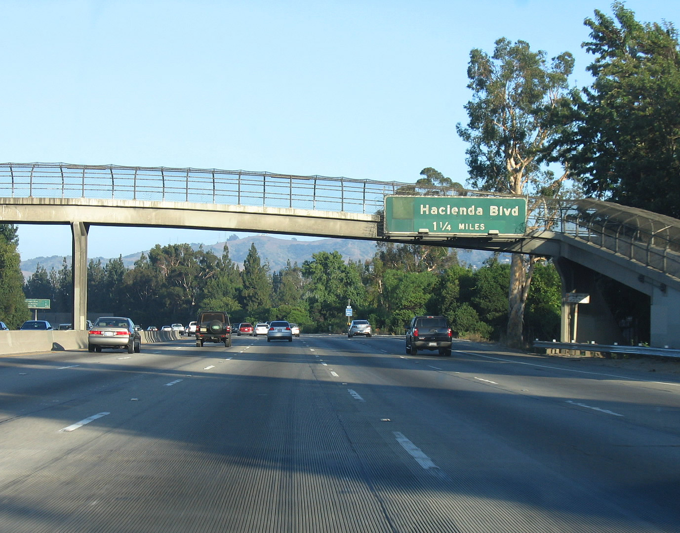 |
The next exit along California 60 (Pomona Freeway) east is Exit 16, Hacienda Boulevard (Former California 39). For those connecting north to California 39 to the San Gabriel Mountains, use either Hacienda Boulevard and Glendora Avenue north (via Exit 16) or Azusa Avenue north (Exit 17). California 39 used to follow Hacienda Road, Hacienda Boulevard, and Glendora Avenue between Whittier Boulevard (former U.S. 101, now California 72) in La Habra and Interstate 10 (former U.S. 60-70-99) in West Covina. This section of state highway was decommissioned sometime in the late 1960s or early 1970s through the Puente Hills. Photos taken 02/26/11 and 07/03/05. |
 |
 |
This interchange sequence sign along California 60 (Pomona Freeway) east provides the distance to the next three exits: Exit 16, Hacienda Boulevard (former California 39); Exit 18, Los Angeles County N-8 (Azusa Avenue); and Exit 19, Fullerton Road. Photos taken 02/26/11 and 07/03/05. |
 |
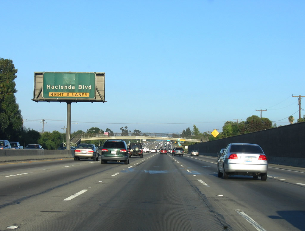 |
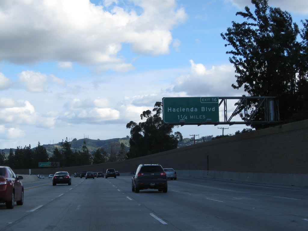
The right two lanes become exit only for Exit 16, Hacienda Boulevard (former California 39). California 39 is a segregated route with several distinct sections. The two signed segments are from California 1 in Huntington Beach and California 72 in La Habra and again from Interstate 10 north to a gate closure in Angeles National Forest (San Gabriel Mountains) near the Crystal Lake Recreation Area. A final segment north of Crystal Lake Recreation Area would connect California 39 to California 2 (Angeles Crest Highway), but that roadway has been closed since 1978 due to roadway damage. Photos taken 02/26/11 and 07/03/05. |
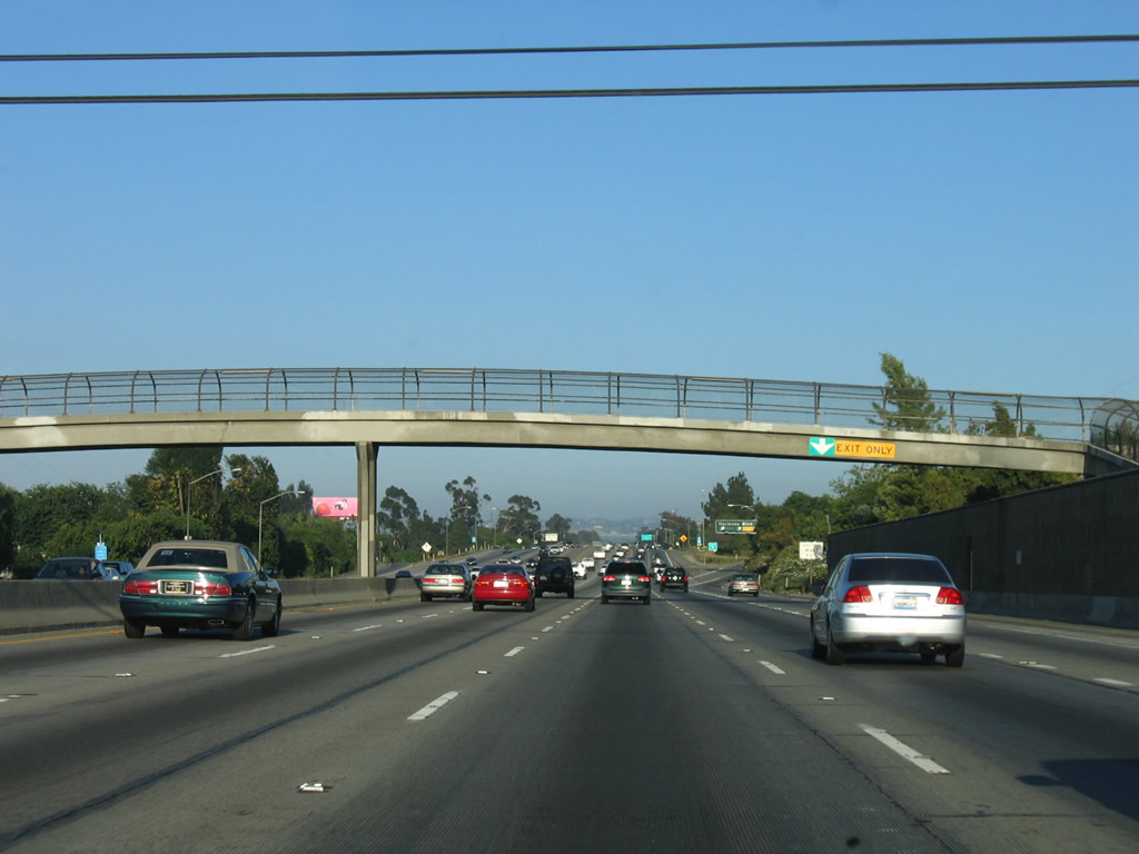 |
An exit only tab and arrow were posted on the pedestrian bridge prior to the off-ramp to Exit 16, Hacienda Boulevard (former California 39). This pedestrian bridge has since been removed. Photo taken 07/03/05. | |
 |
 |
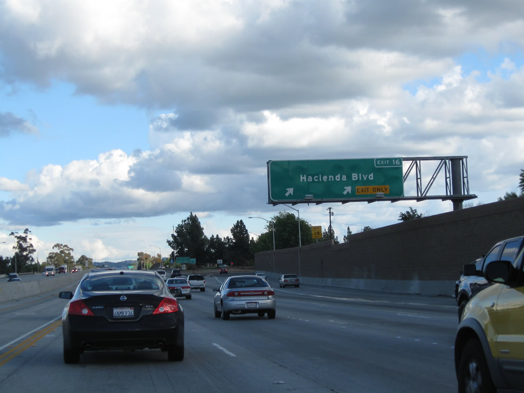
Eastbound California 60 (Pomona Freeway) reaches Exit 16, Hacienda Boulevard (former California 39). Use Hacienda Boulevard north to the City of Industry, La Puente, and West Covina; use Hacienda Boulevard south to Hacienda Heights, La Habra Heights, and La Habra. According to the legislative definition of California 39, plans call for the route to take the following route from La Habra to West Covina: Beach Boulevard north, Whittier Boulevard east, Harbor Boulevard north, Fullerton Road north, Colima Road (or parallel route) west, and Azusa Avenue north. It is unclear when, if ever, the Puente Hills gap of California 39 will be signed. Photos taken 02/26/11 and 07/03/05. |
 |
The next exit along California 60 (Pomona Freeway) is Exit 18, Los Angeles County N-8 (Azusa Avenue). The county route spans both Orange and Los Angeles County. It begins at the intersection of California 39 (Beach Boulevard) and La Mirada Boulevard in the city of Buena Park. From there, Orange County N-8 changes into Los Angeles County N-8 upon entering the city of La Mirada. Upon entering the city of Whittier, Los Angeles County N-8 connects with Colima Road, which travels northeast into Hacienda Heights. At Azusa Avenue, Los Angeles County N-8 turns north into the City of Industry and West Covina, ending at Interstate 10 Exit 36 (the same spot where California 39's northern segment resumes its northerly journey toward Azusa). The county route offers an alternative to the combination of Hacienda Road and Hacienda Boulevard or the combination of Harbor Drive and Fullerton Road to traverse the Puente Hills. Photo taken 07/03/05. | |
 |
 |
This interchange sequence sign along California 60 (Pomona Freeway) east provides the distance to the next three exits: Exit 18, Los Angeles County N-8 (Azusa Avenue); Exit 19, Fullerton Road; and Exit 20, Nogales Street. The sign was replaced when a carpool lane was added. Photos taken 02/26/11 and 07/05/06. |
 |
 |
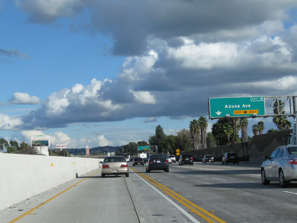
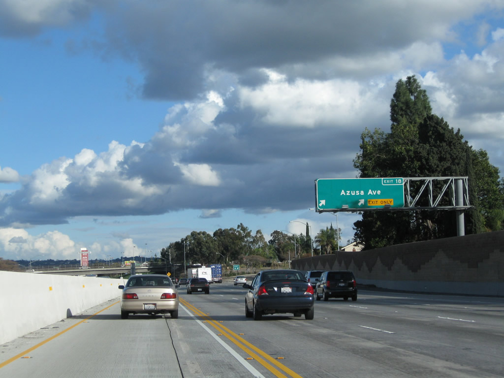
A porcelain enamel guide sign indicates that the next interchange is Exit 18, Los Angeles County N-8 (Azusa Avenue). Use Azusa Avenue north to California 39 (San Gabriel Canyon Road) north into Angeles National Forest. Photos taken 02/26/11 and 07/03/05. |
 |
 |
Eastbound California 60 (Pomona Freeway) reaches the two-lane off-ramp (Exit 18) for Los Angeles County N-8 (Azusa Avenue). Photos taken 02/26/11 and 07/03/05. |
 |
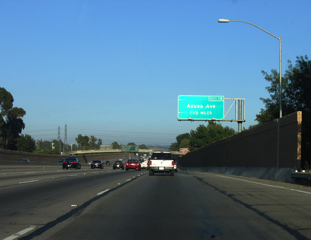
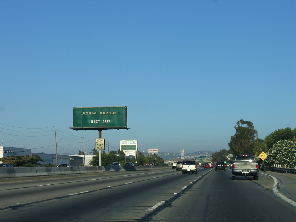
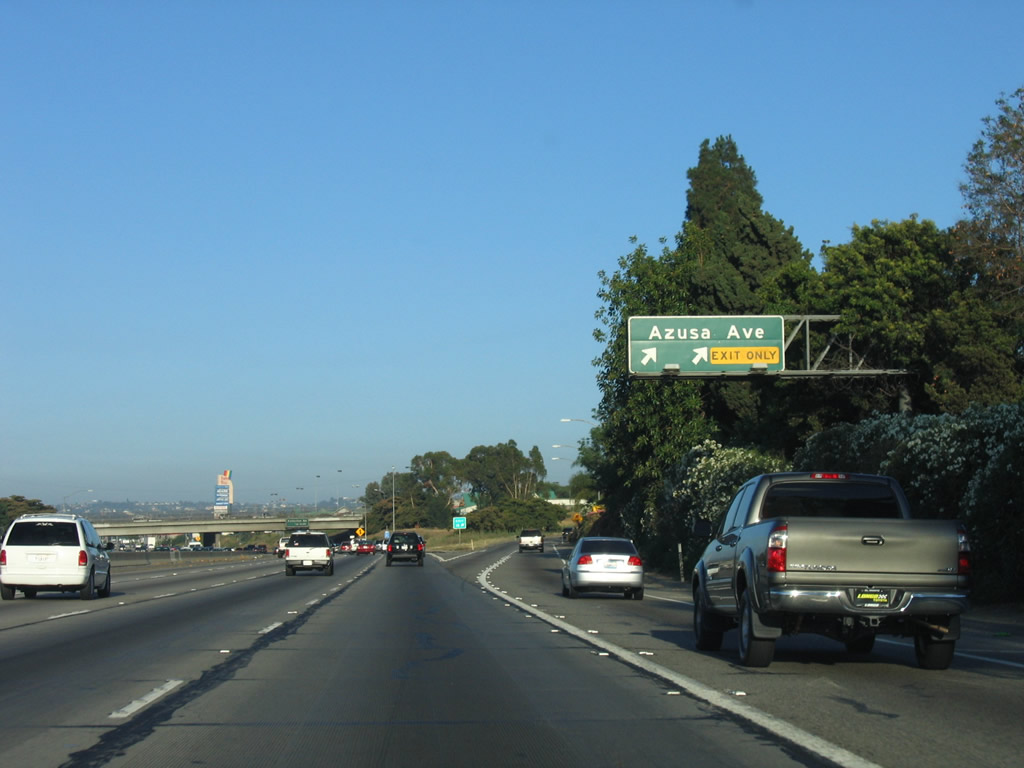
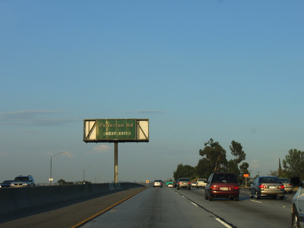
The next interchange along California 60 (Pomona Freeway) is Exit 19, Fullerton Road (1.25 miles). This sign was posted on the Azusa Avenue overpass, but it was removed when the new carpool lane was added. Photo taken 07/03/05. | |
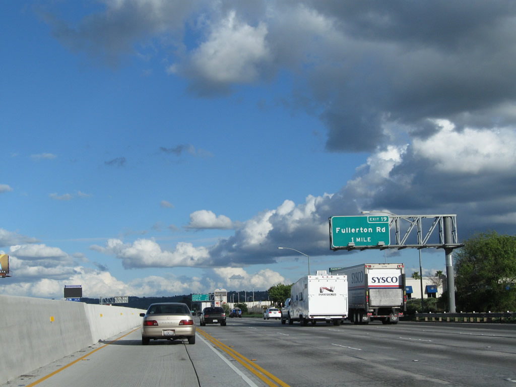 |
A replacement guide sign was posted about a quarter mile further east along California 60 (Pomona Freeway) for Exit 19, Fullerton Road. Photo taken 02/26/11. | |
 |
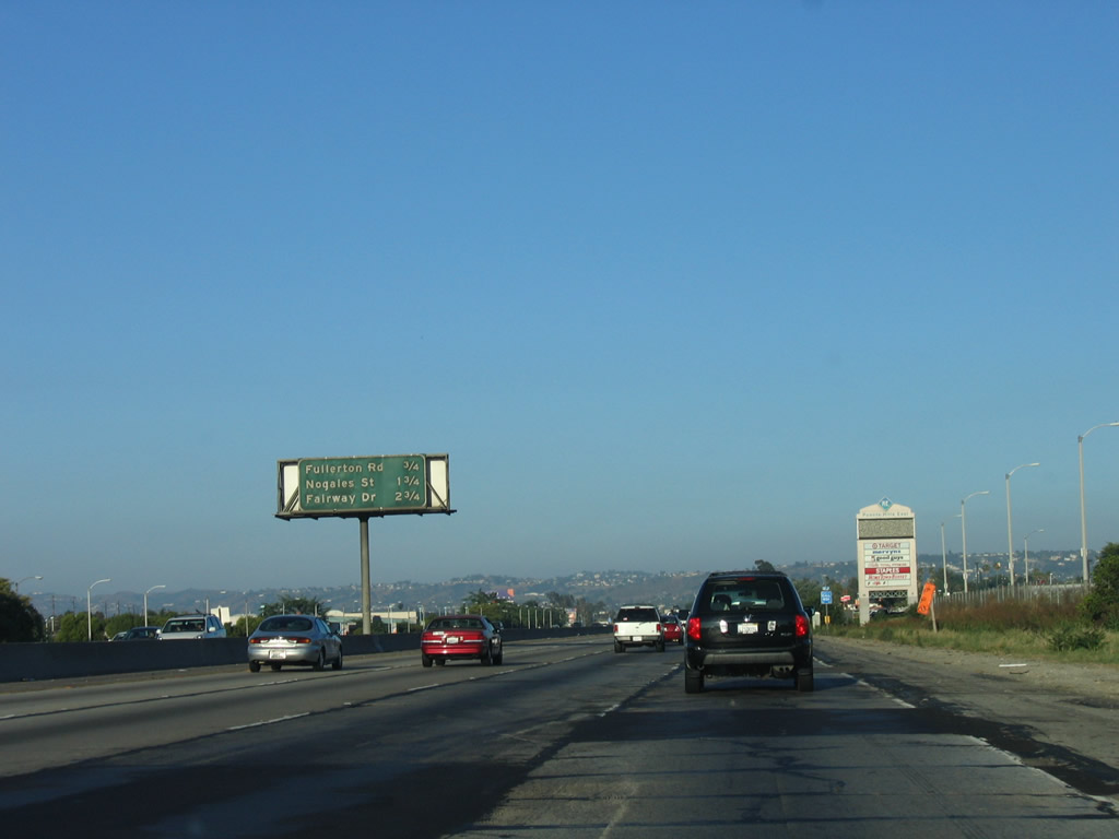 |
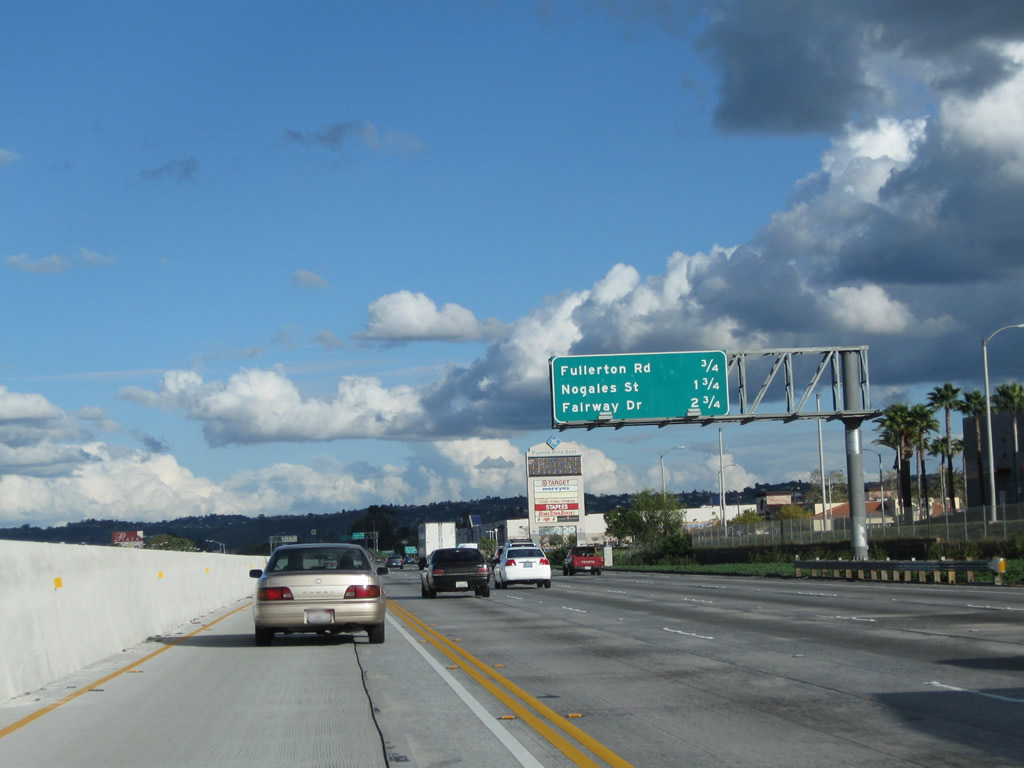
This interchange sequence sign along California 60 (Pomona Freeway) east provides the distance to the next three exits: Exit 19, Fullerton Road; Exit 20, Nogales Street; and Exit 21, Fairway Drive. This sign was moved from centerline to roadside and made reflective at the same time the carpool lane was added. Photos taken 02/26/11 and 07/03/05. |
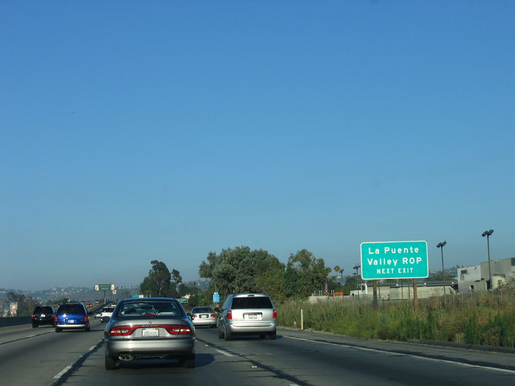 |
Use Exit 19, Fullerton Road to the La Puente Valley Regional Occupation Program in the City of Industry. Photo taken 07/03/05. | |
 |
 |
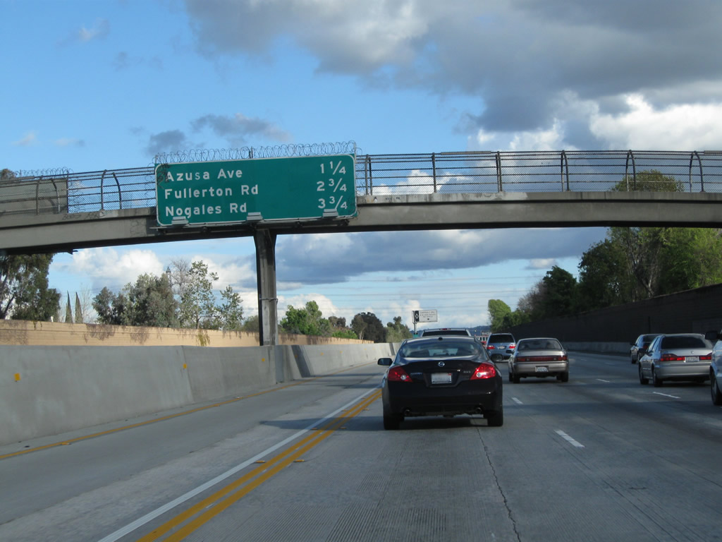
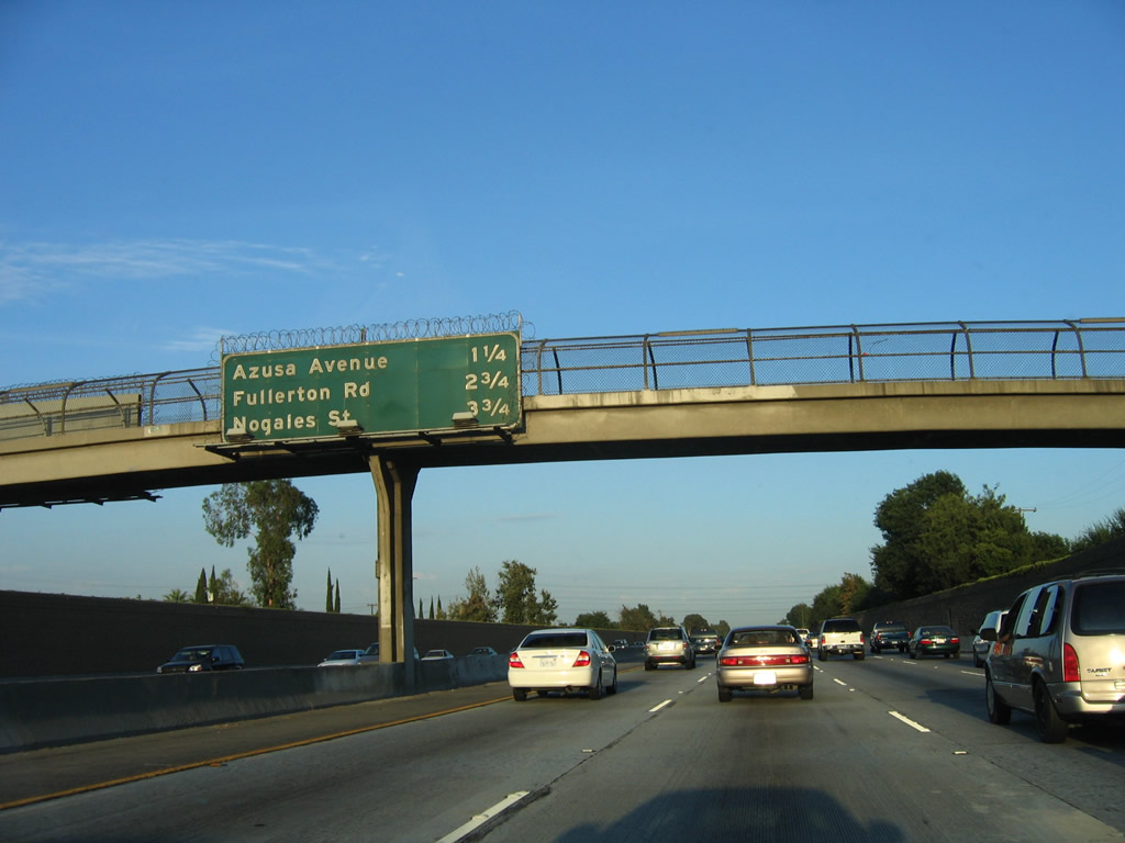
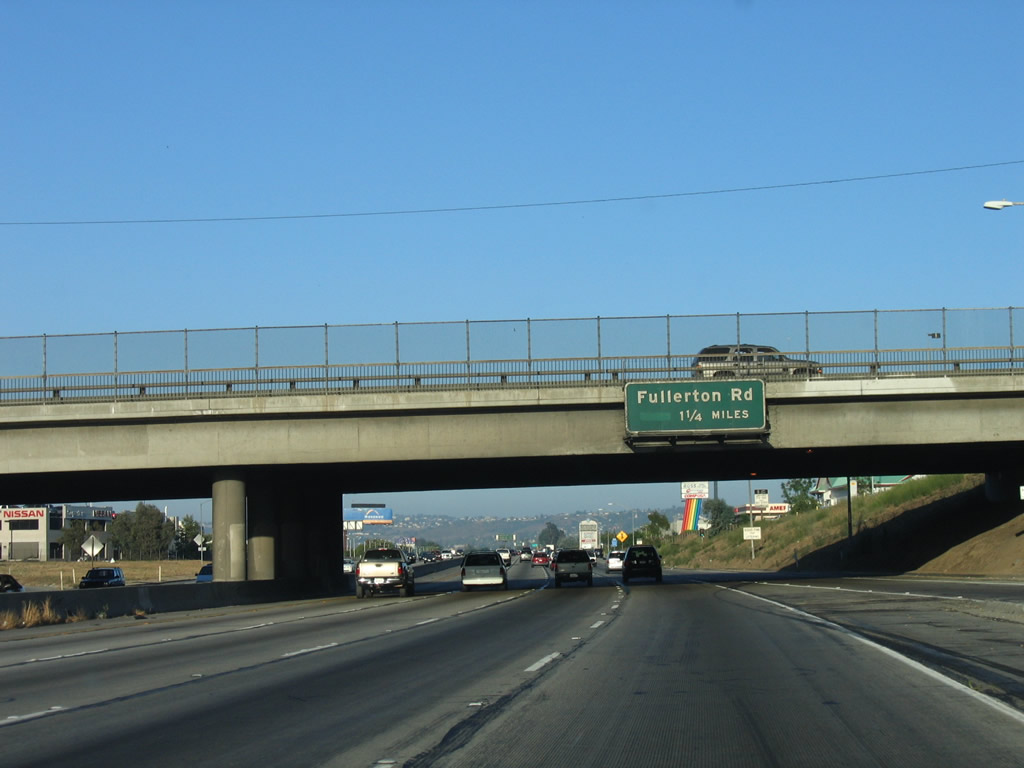
As noted above, Fullerton Road is the proposed future alignment of California 39, connecting California 60 with Whittier Boulevard via Fullerton Road and Harbor Boulevard to La Habra. Through traffic to California 39 north should use Azusa Avenue, not Fullerton Road (since it is not a through route going north). Photos taken 02/26/11 and 07/15/06. |
 |
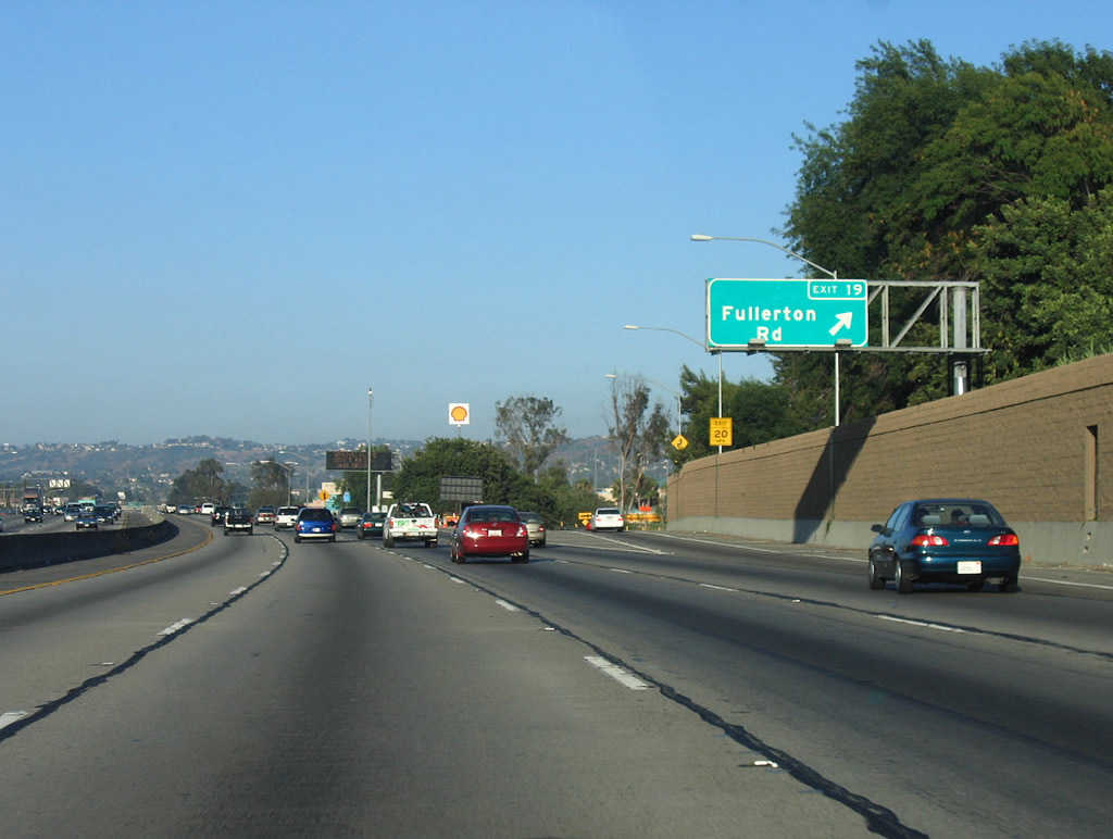 |
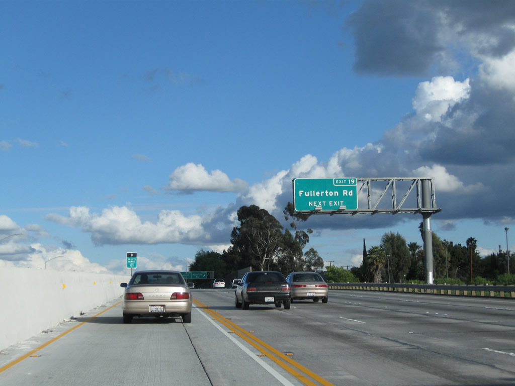
Eastbound California 60 (Pomona Freeway) reaches Exit 19, Fullerton Road north to the City of Industry and West Covina. Use Fullerton Road south to Harbor Drive and California 39 (Whittier Boulevard) in La Habra. The sign assembly here was modified to include a companion overhead sign for the next interchange (Exit 20, Nogales Street). Photos taken 02/26/11 and 07/03/05. |
 |
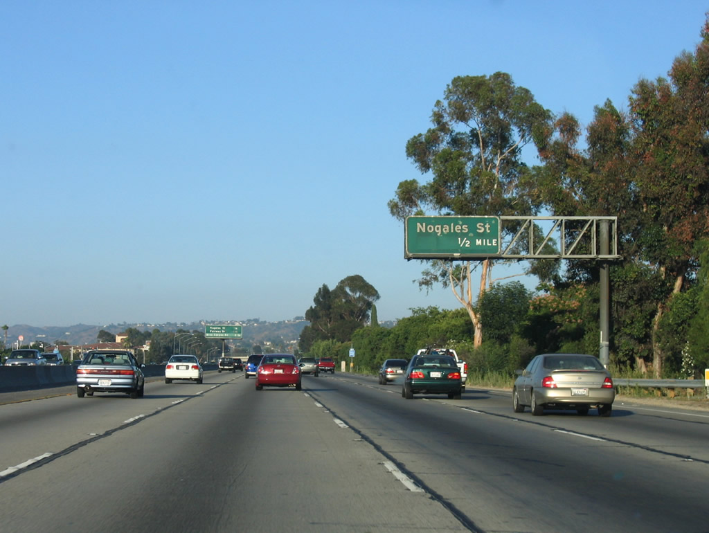 |
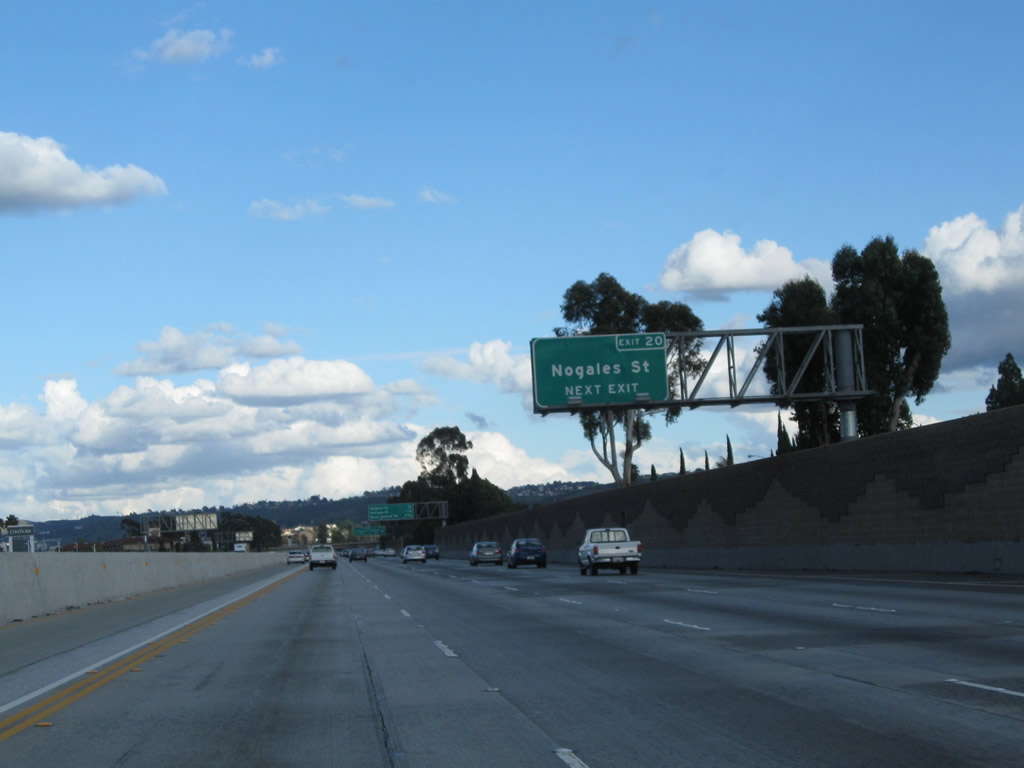
The next interchange along California 60 (Pomona Freeway) is Exit 20, Nogales Street (0.50 mile). Use Nogales Street south to Rowland Heights (unincorporated community) or north to the City of Industry and West Covina. Photos taken 02/26/11 and 07/03/05. |
 |
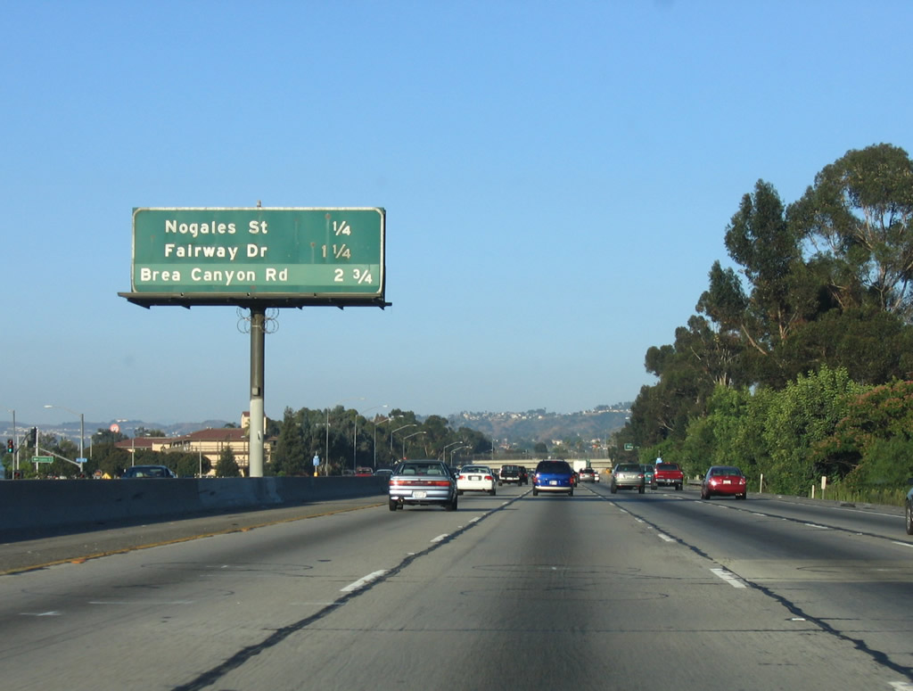 |
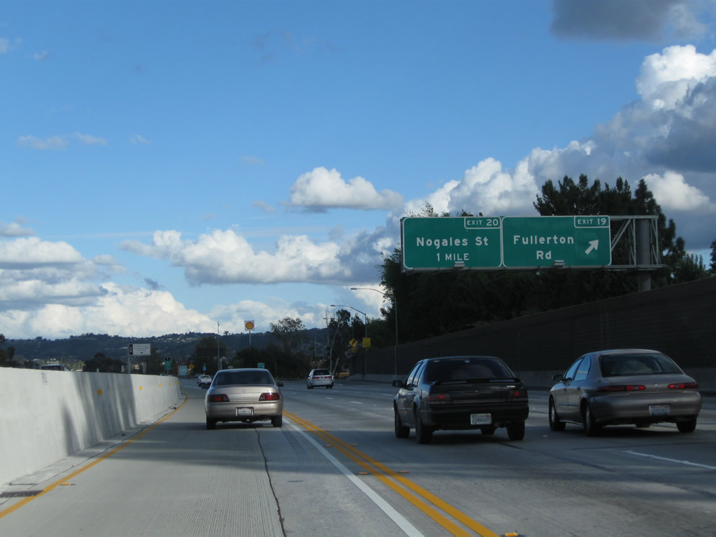
This interchange sequence sign along California 60 (Pomona Freeway) east provides the distance to the next three exits: Exit 20, Nogales Street; Exit 21, Fairway Drive; and Exit 23, Brea Canyon Road. Photos taken 02/26/11 and 07/03/05. |
 |
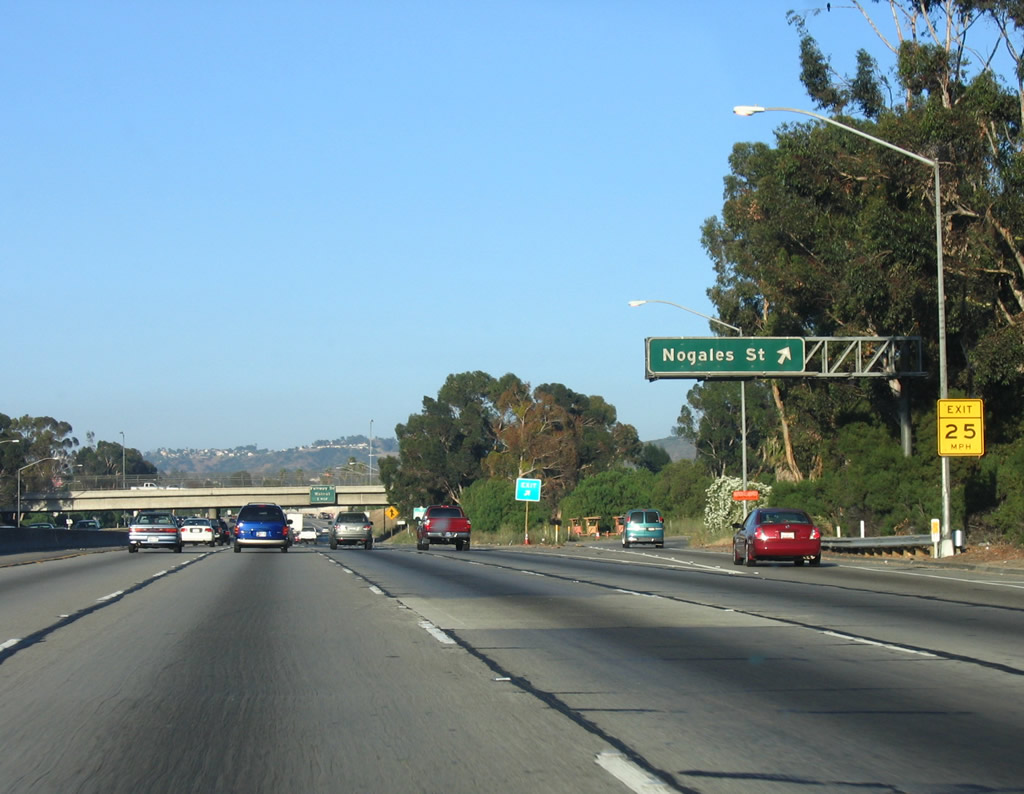 |
Eastbound California 60 (Pomona Freeway) reaches Exit 20, Nogales Street. Photos taken 02/26/11 and 07/03/05. |
 |
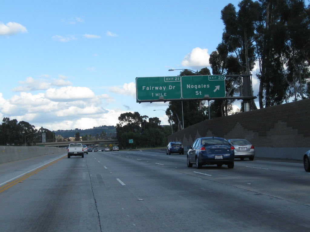
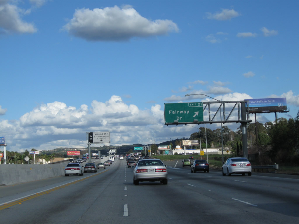
The next interchange along California 60 (Pomona Freeway) is Exit 21, Fairway Drive north to the City of Industry and the city of Walnut. Fairway Drive leads southeast to connect with Los Angeles Royal Vista Golf Course and Brea Canyon Cutoff to California 57 south. This sign, which was posted on the Nogales Street overpass, was removed when the carpool lane was added. Photo taken 07/03/05. | |
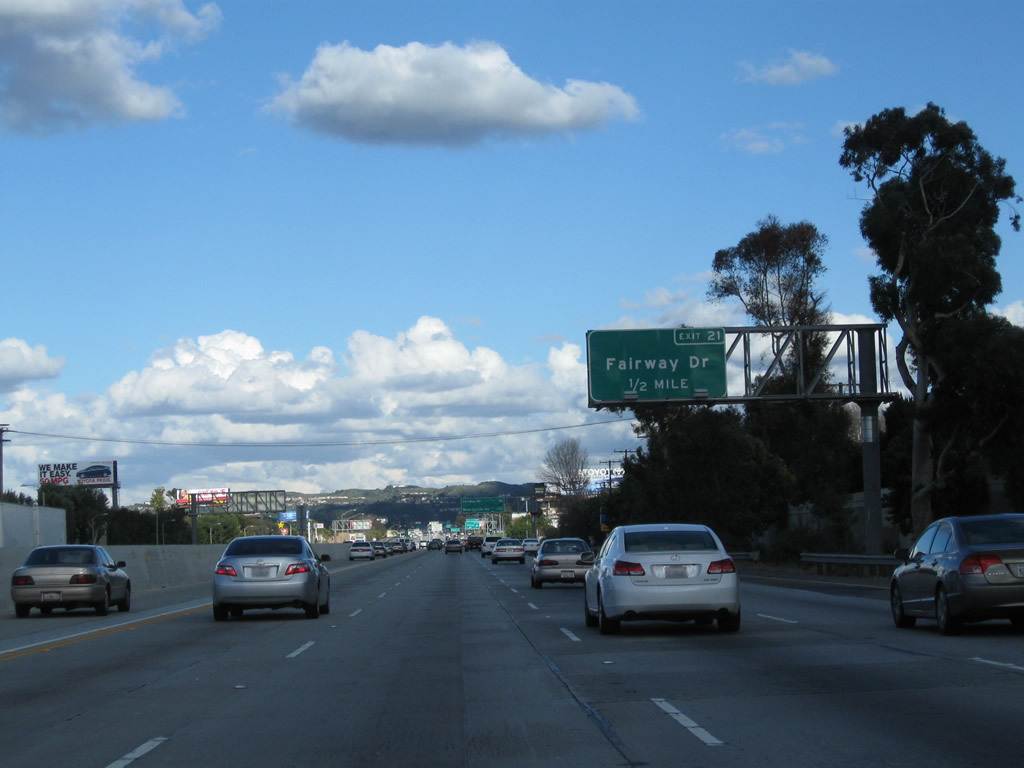 |
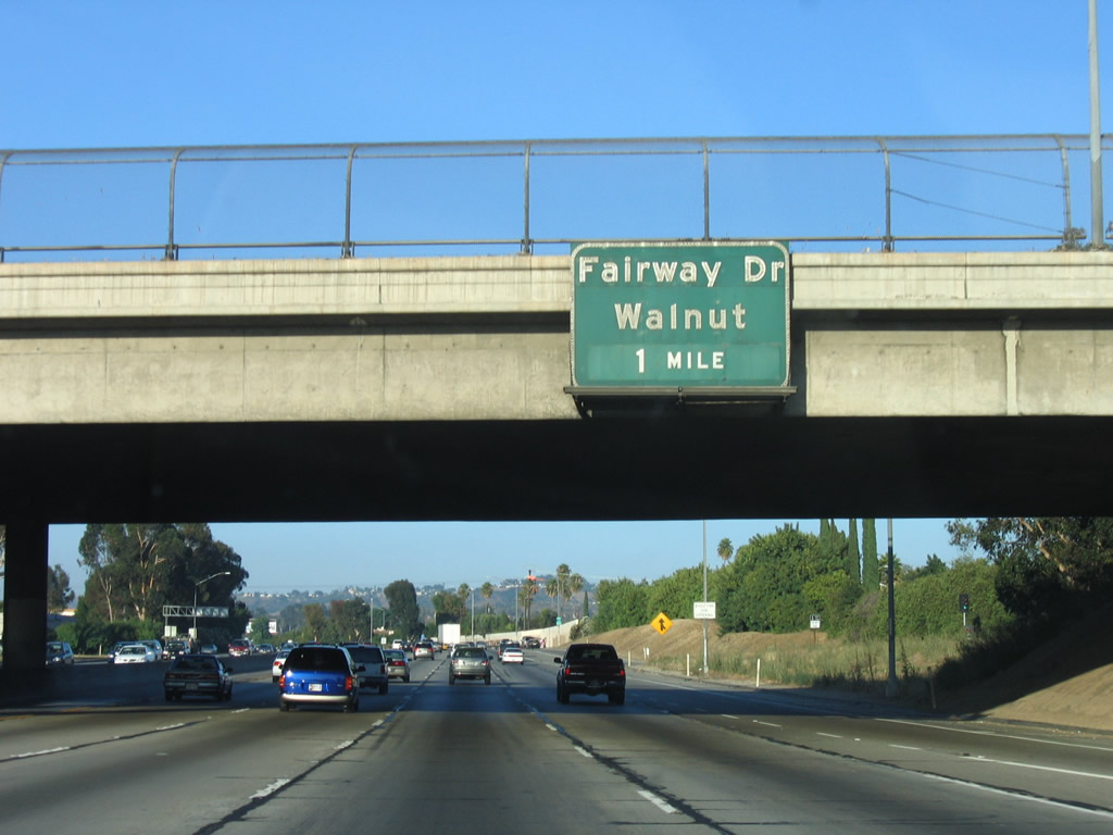
Eastbound California 60 (Pomona Freeway) approaches Exit 21, Fairway Drive (one mile). Photo taken 02/26/11. | |
 |
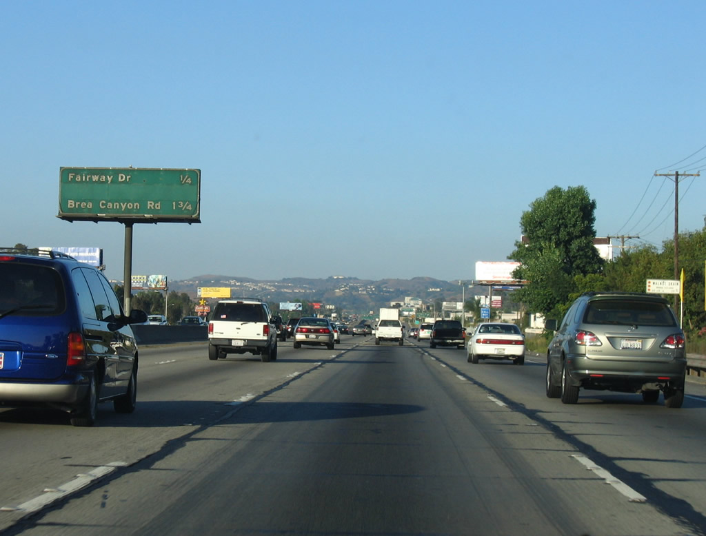 |
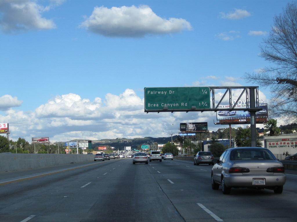
This interchange sequence sign along California 60 (Pomona Freeway) east provides the distance to the next two exits: Exit 21, Fairway Drive and Exit 23, Brea Canyon Road. Photos taken 02/26/11 and 07/03/05. |
 |
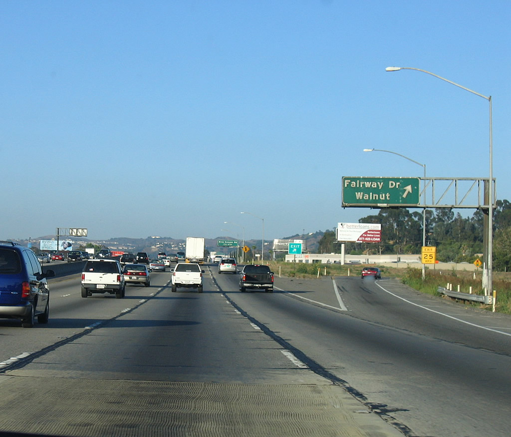 |
Eastbound California 60 (Pomona Freeway) reaches Exit 21, Fairway Drive. The city of Walnut lies north of the linear swath of the City of Industry that has paralleled California 60. Walnut had a population of 30,004 as of the 2000 Census and incorporated on January 19, 1959. California 60 does not enter the city limits of Walnut. Photos taken 02/26/11 and 07/03/05. |
 |
 |
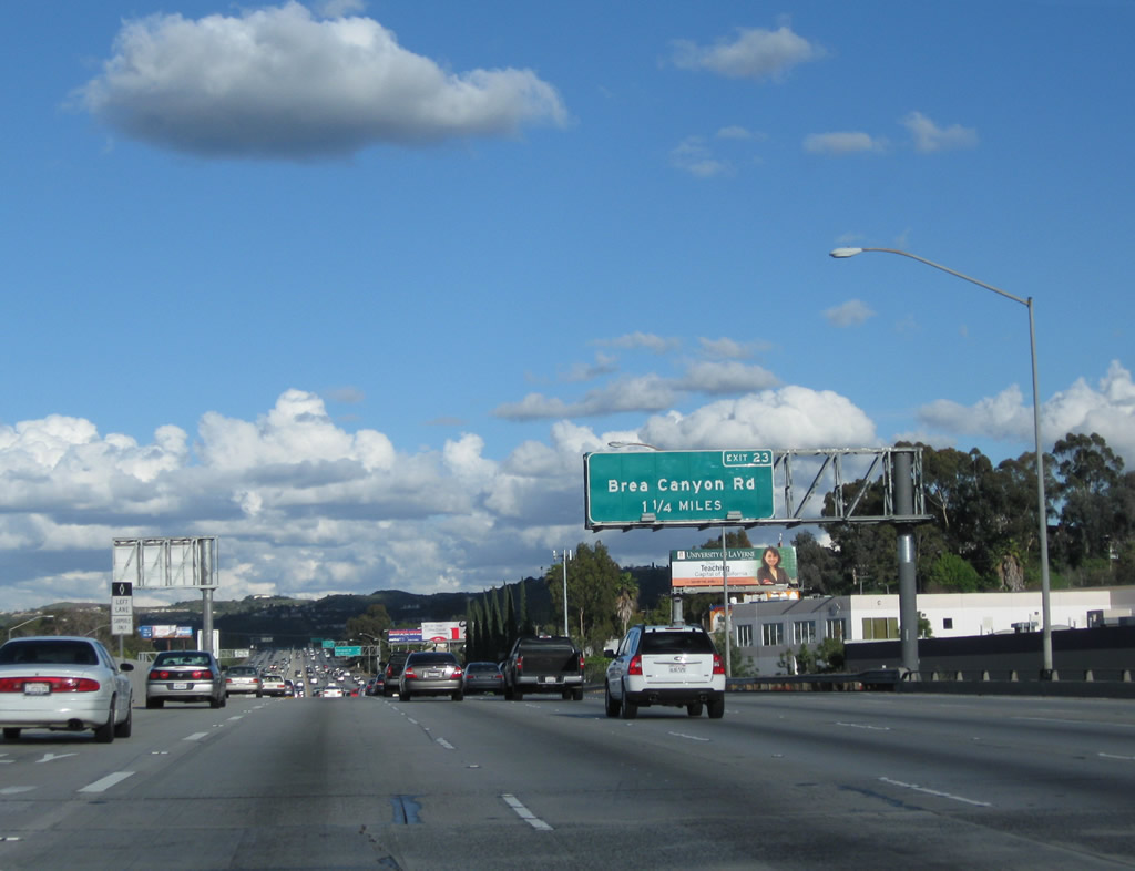
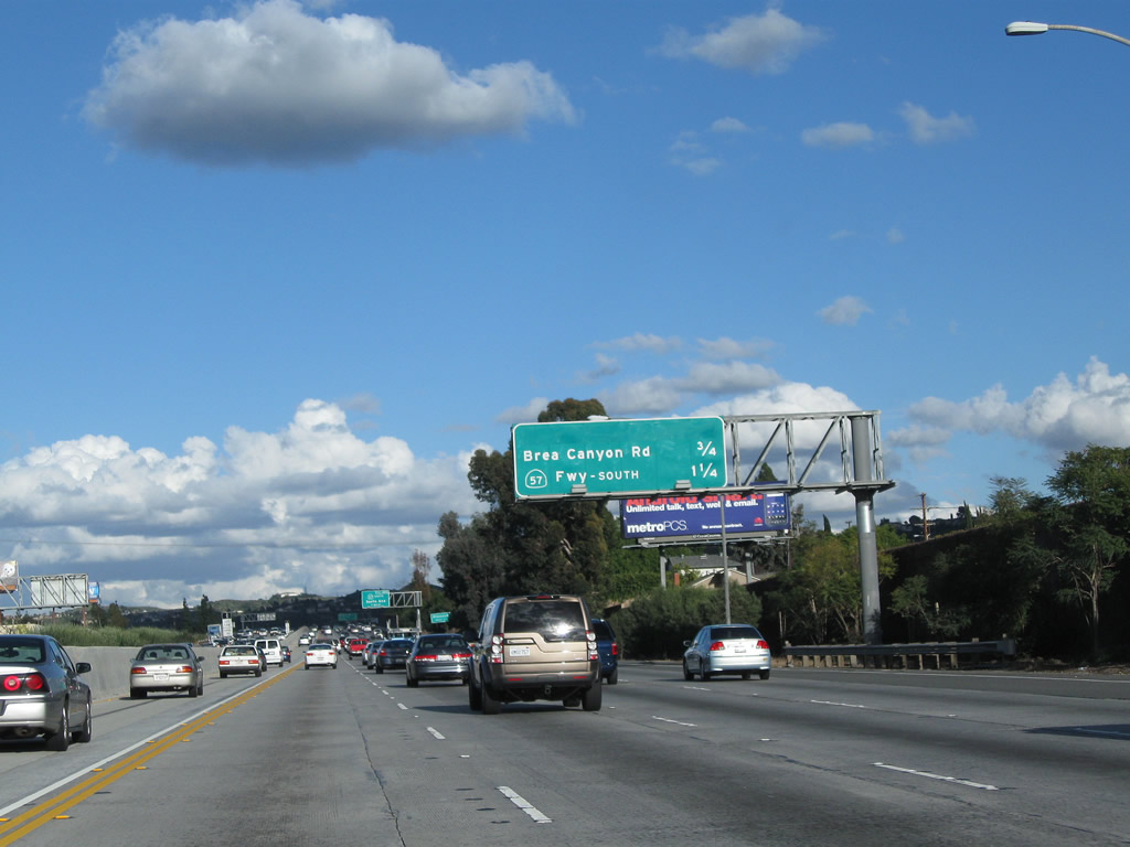
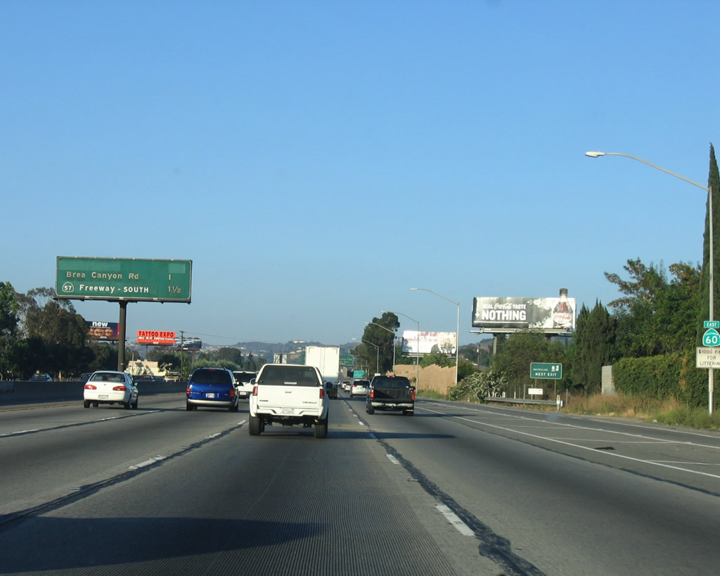
The next interchange along California 60 (Pomona Freeway) is Exit 23, Brea Canyon Road. Photos taken 02/26/11 and 07/03/05. |
 |
 |
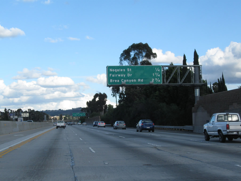
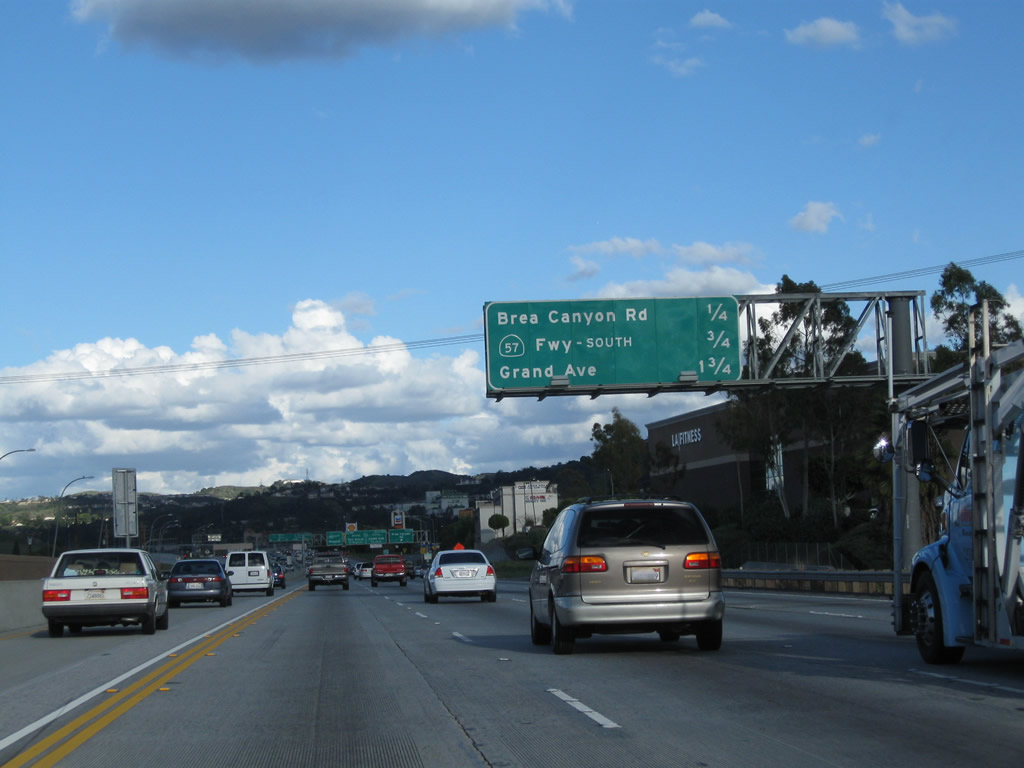
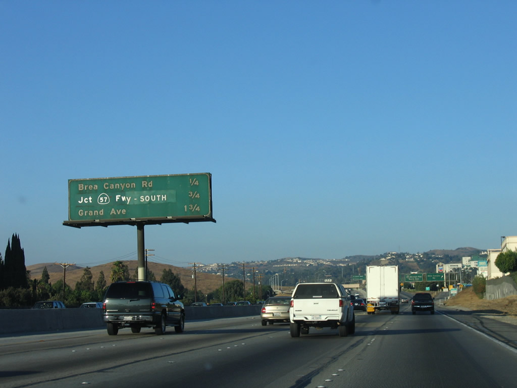
This interchange sequence sign along California 60 (Pomona Freeway) east provides the distance to the next two exits: Exit 23, Brea Canyon Road and Exit 24A, California 57 (Orange Freeway) south to Anaheim and Santa Ana. Space was left for a potential additional interchange (possibly Exit 22?) if needed. Photos taken 02/26/11 and 07/03/05. |
 |
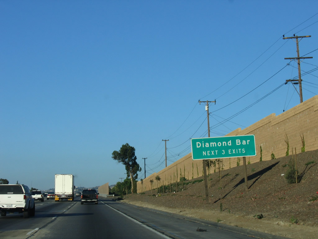 |
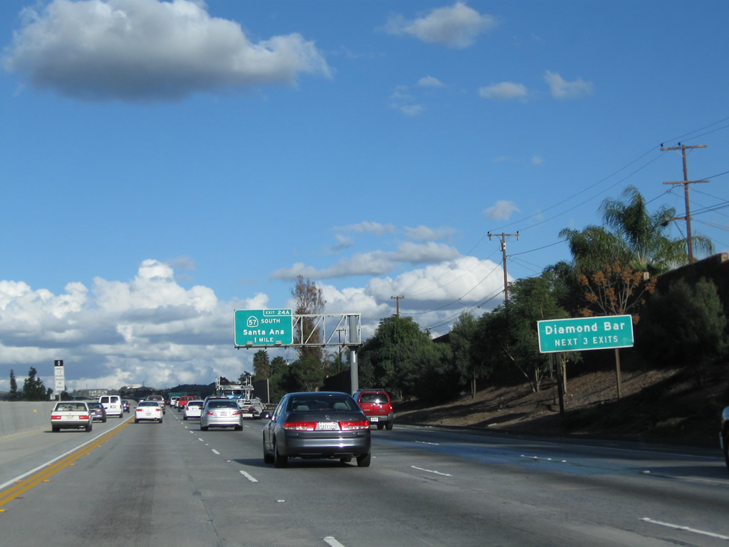
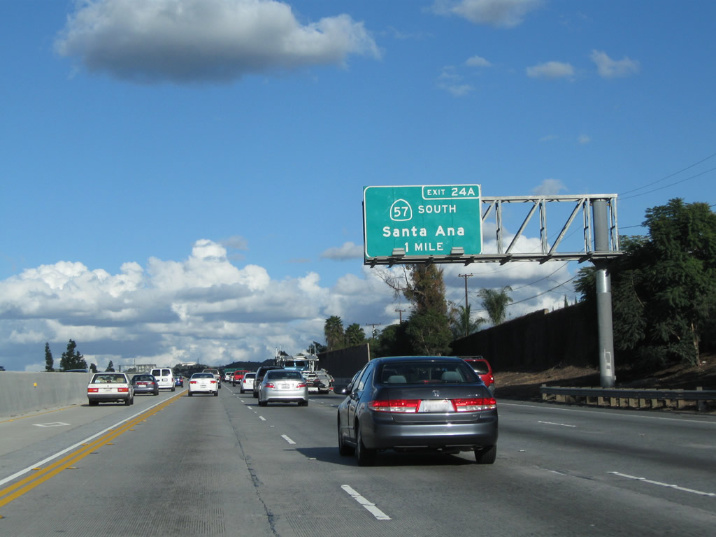
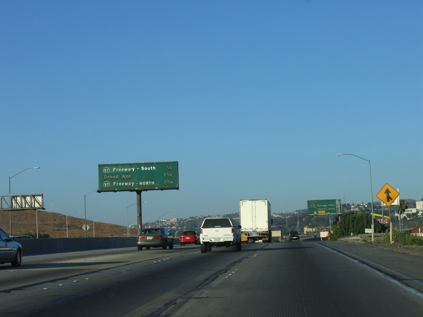
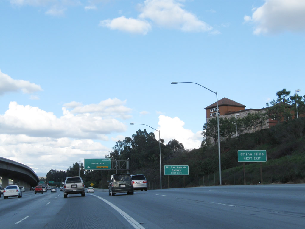
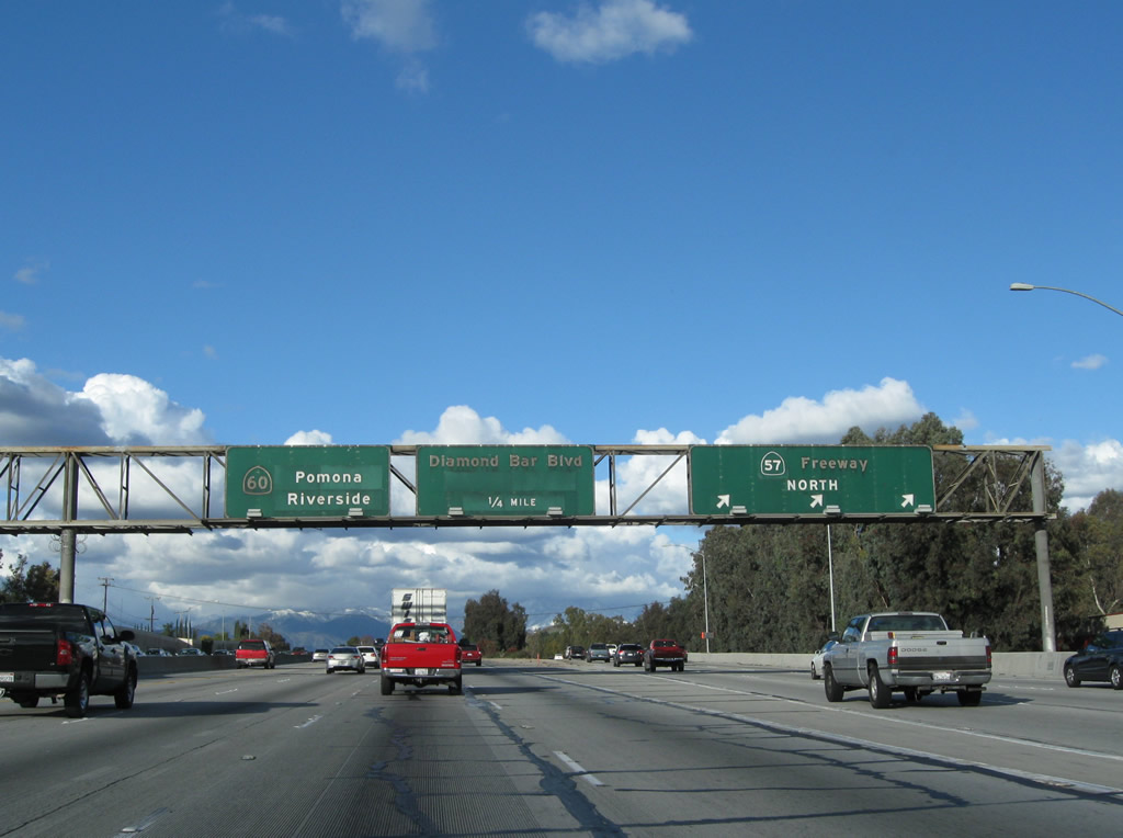
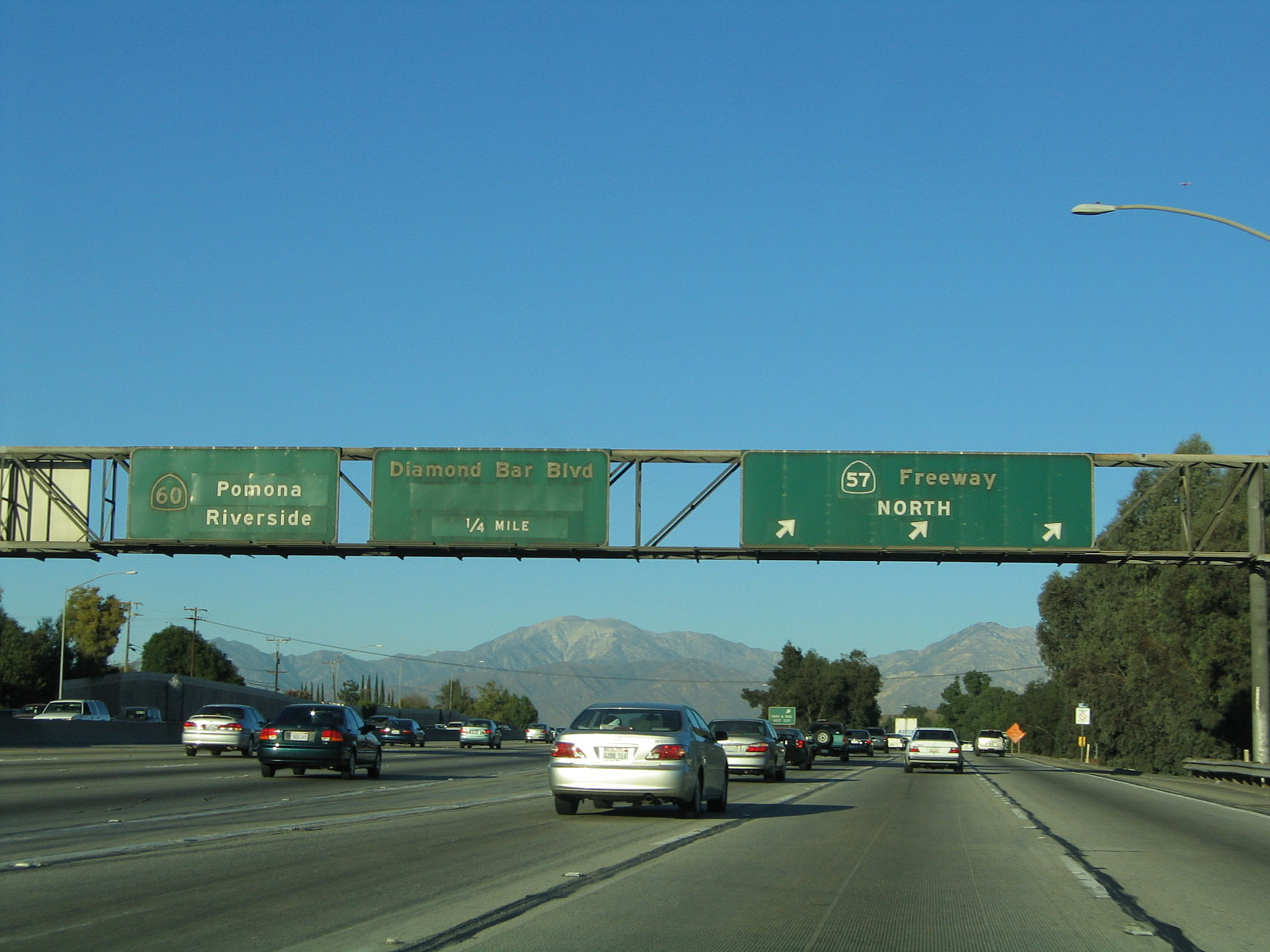
The next three exits along California 60 (Pomona Freeway) east all serve the city of Diamond Bar. California 60 (Pomona Freeway) ceases to serve as the boundary between the City of Industry and unincorporated Hacienda Heights and Rowland Heights on the south side of the freeway. California 60 enters the city of Diamond Bar. A former cattle ranch (Diamond Bar Ranch), much of the city was master planned and developed through the 1960s, 1970s, and 1980s. Population increased as the Pomona Freeway opened, and Diamond Bar incorporated as a city on April 18, 1989. The population of Diamond Bar was 56,287 as of the 2000 Census. This sign may have been moved between 2005 and 2011 in conjunction with freeway widening at the 57-60 interchange. Photos taken 02/26/11 and 07/03/05. |
 |
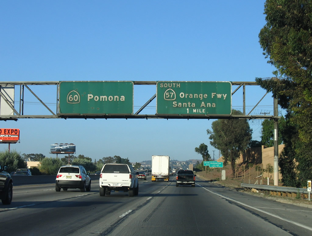 |
An overhead guide sign advises of the pending merge of California 60 (Pomona Freeway) east and California 57 (Orange Freeway) north. An exit ramp connects to California 57 (Orange Freeway) south to Anaheim and Santa Ana. This sign was moved as a result of interchange improvements at California 60 and California 57. Photos taken 02/26/11 and 07/03/05. |
 |
 |
This interchange sequence sign along California 60 (Pomona Freeway) east provides the distance to the next three exits: Exit 23, Brea Canyon Road; Exit 24A, California 57 (Orange Freeway) south to Anaheim and Santa Ana; and Exit 24B, Grand Avenue. Photos taken 02/26/11 and 07/03/05. |
 |
 |
Eastbound California 60 (Pomona Freeway) meets Exit 23, Brea Canyon Road to Diamond Bar. The next exit along California 60 east is Exit 24A, California 57 (Orange Freeway) south to Anaheim and Santa Ana. Stay left to remain east on California 60 or turn north on California 57. Photos taken 02/26/11 and 07/03/05. |
 |
This interchange sequence sign along California 60 (Pomona Freeway) east provides the distance to the next three exits: Exit 24A, California 57 (Orange Freeway) south to Anaheim and Santa Ana; Exit 24B, Grand Avenue; and Exit 25, California 57 (Orange Freeway) north to San Dimas. This sign was gone by 2011. Photo taken 07/03/05. | |
 |
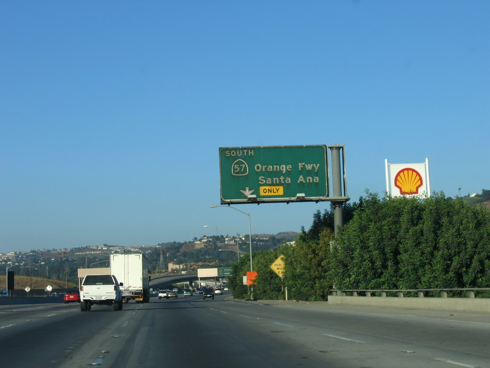 |
The right lane of California 60 (Pomona Freeway) east becomes exit only for Exit 24A, California 57 (Orange Freeway) south to Anaheim and Santa Ana. Photos taken 02/26/11 and 07/03/05. |
 |
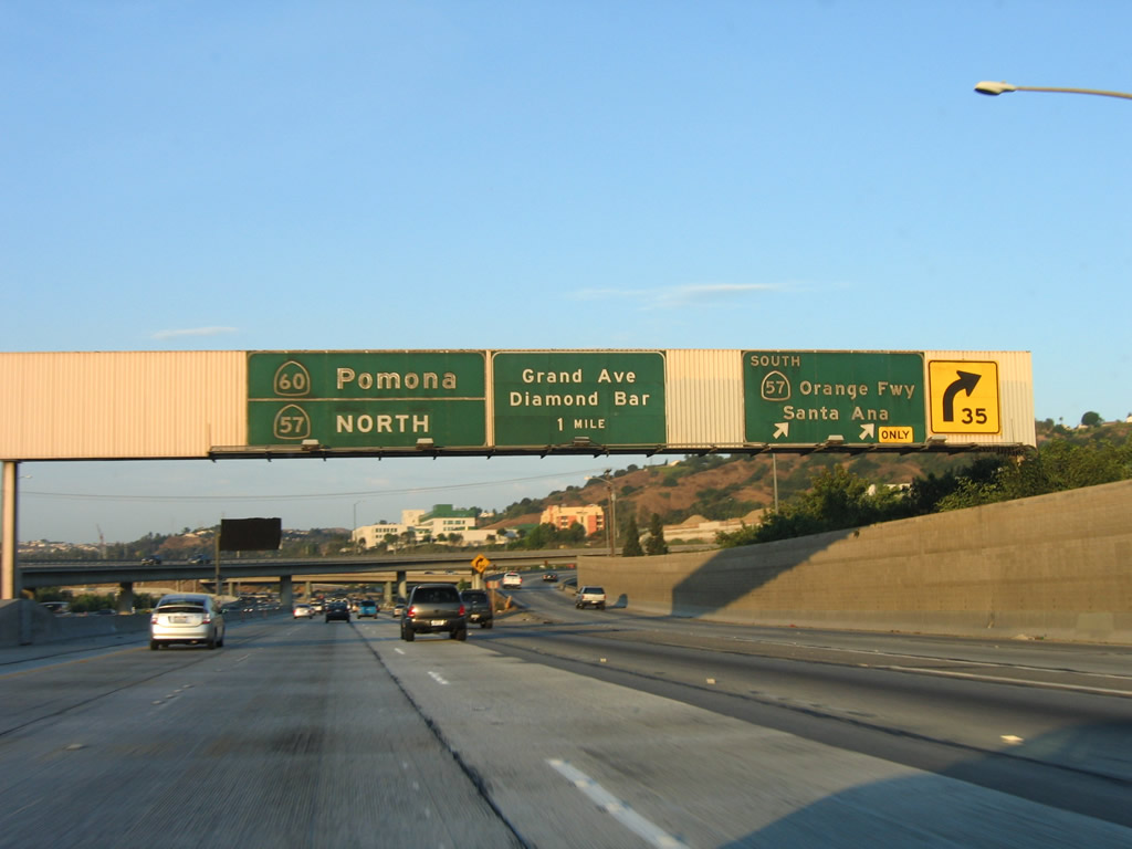 |
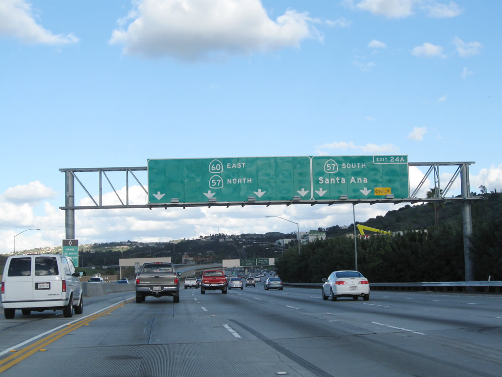
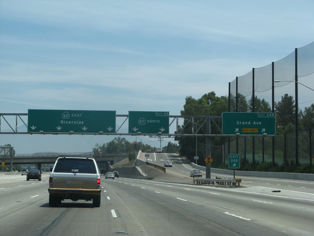
Eastbound California 60 (Pomona Freeway) reaches Exit 24A, California 57 (Orange Freeway) south to Anaheim and Santa Ana. The next exit after the California 57-60 merge is Exit 24B, Grand Avenue. The routes will divide at Exit 25, California 57 (Orange Freeway) north. Note the control cities of Pomona for California 60 east and "North" for California 57 north. Photos taken 07/03/05 and 07/15/06. |
 |
 |
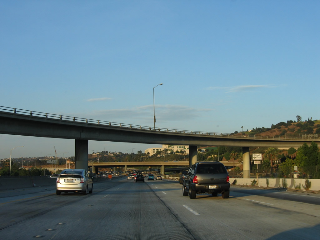
California 60 (Pomona Freeway) passes under the California 57 south interchange, including the second picture which shows the freeway overpass. Photos taken 07/15/06. |
| California 57 north & 60 east | ||
|---|---|---|
 |
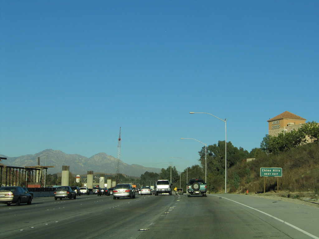 |
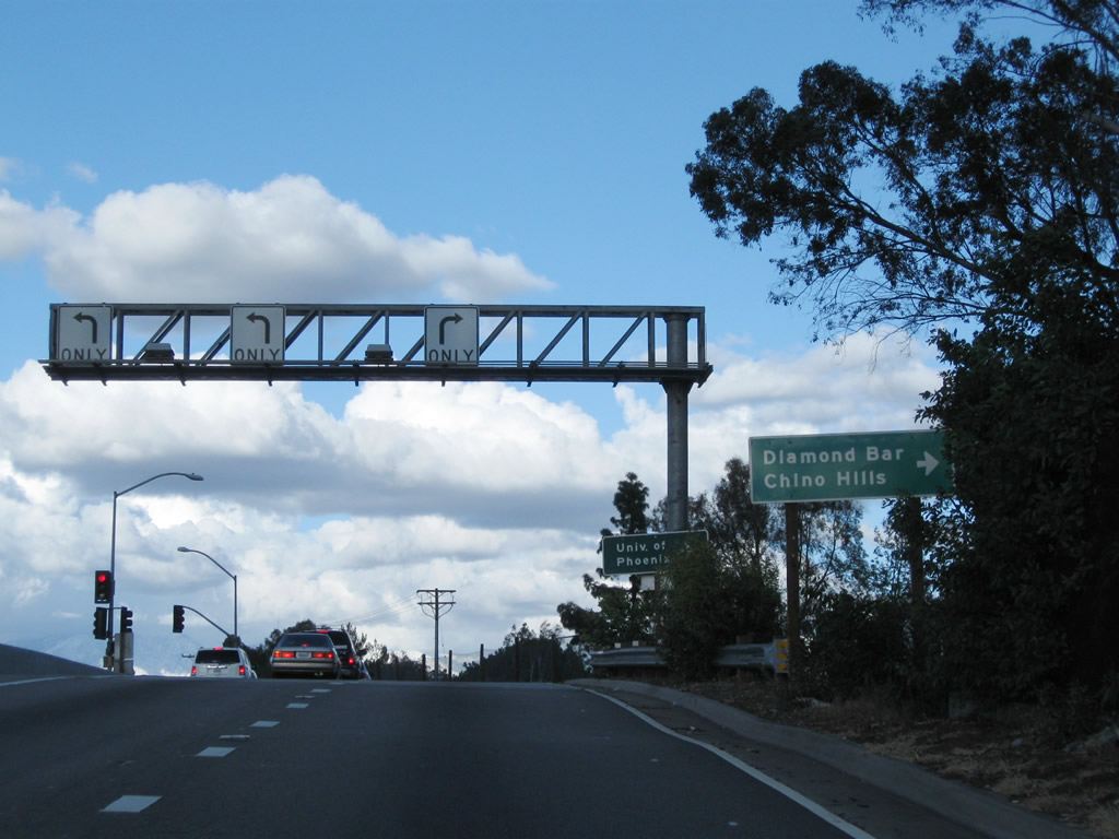
A roadside sign advising of using Exit 24B (Grand Avenue) for Chino Hills is posted. Back in 2005, the elevated carpool lanes were still under construction (including the direct connection from California 57 north to California 60 east); they were done by 2007. Photos taken 02/26/11 and 11/19/05. |
 |
Traffic from California 57 (Orange Freeway) merges onto California 60 (Pomona Freeway) east from the right. The two routes briefly share alignment, with one mutual interchange at Exit 24B, Grand Avenue. Photo taken 02/26/11. | |
 |
 |
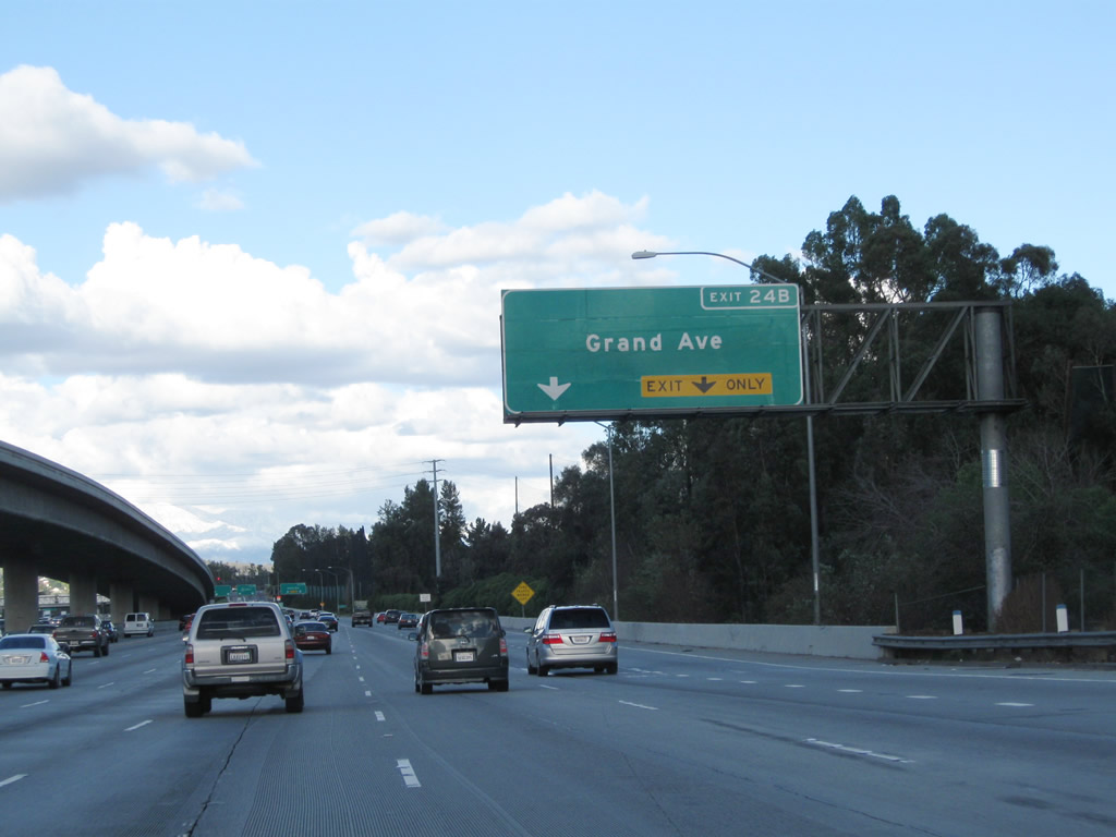
Eastbound California 60 and northbound California 57 meet Exit 24B, Grand Avenue in Diamond Bar. With the addition of a carpool lane and direct HOV connector between California 57 and California 60, this interchange underwent construction between 2002 and 2007. New signs were in place by summer 2007. Photos taken 07/04/07 and 09/28/02. |
 |
Now on the off-ramp to Grand Avenue, turn right for the connection to Diamond Bar and Chino Hills. Photo taken 02/26/11. | |
 |
A roadside sign (posted after the Grand Avenue off-ramp) advises that California 60 east and California 57 north will split at Exit 25. California 57 proceeds north to San Dimas and Interstate 210, while California 60 leads east into Pomona and Ontario. Photo taken 11/19/05. | |
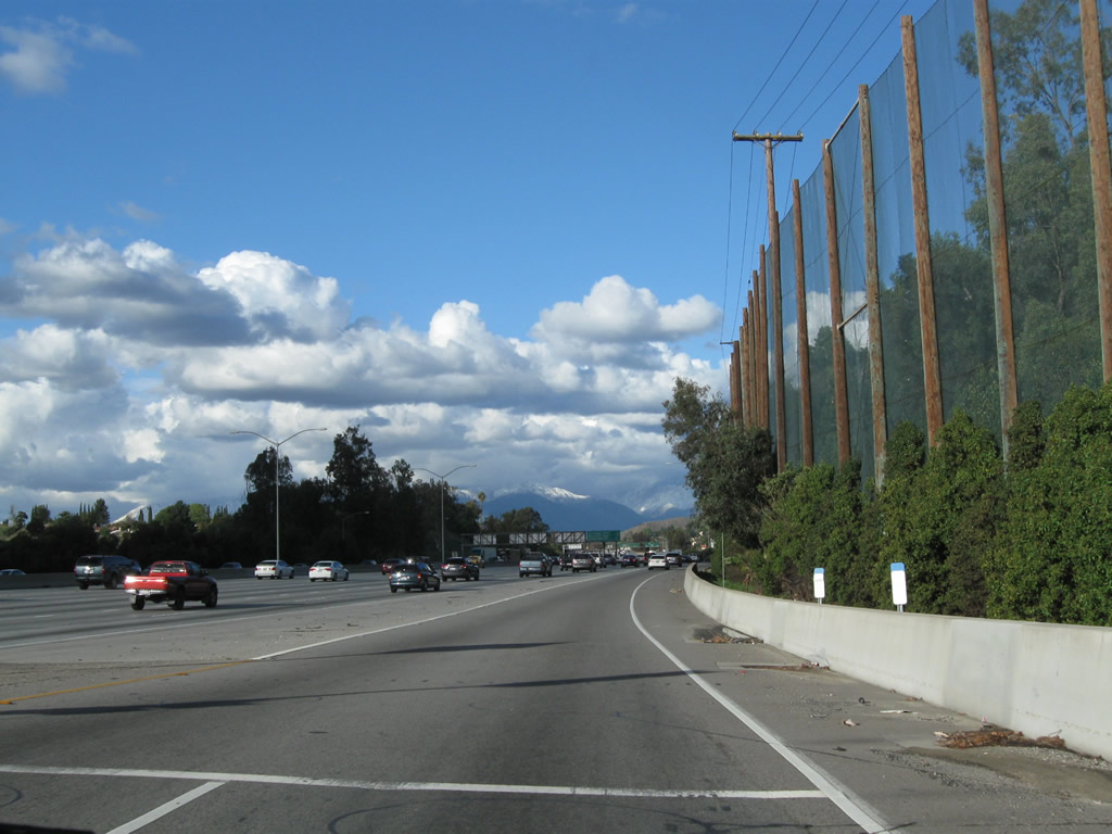 |
This view shows California 57 north and California 60 east as seen from the Grand Avenue on-ramp. A golf course is located on the southeast side of the freeway, hence the tall wooden poles and fence. Photo taken 02/26/11. | |
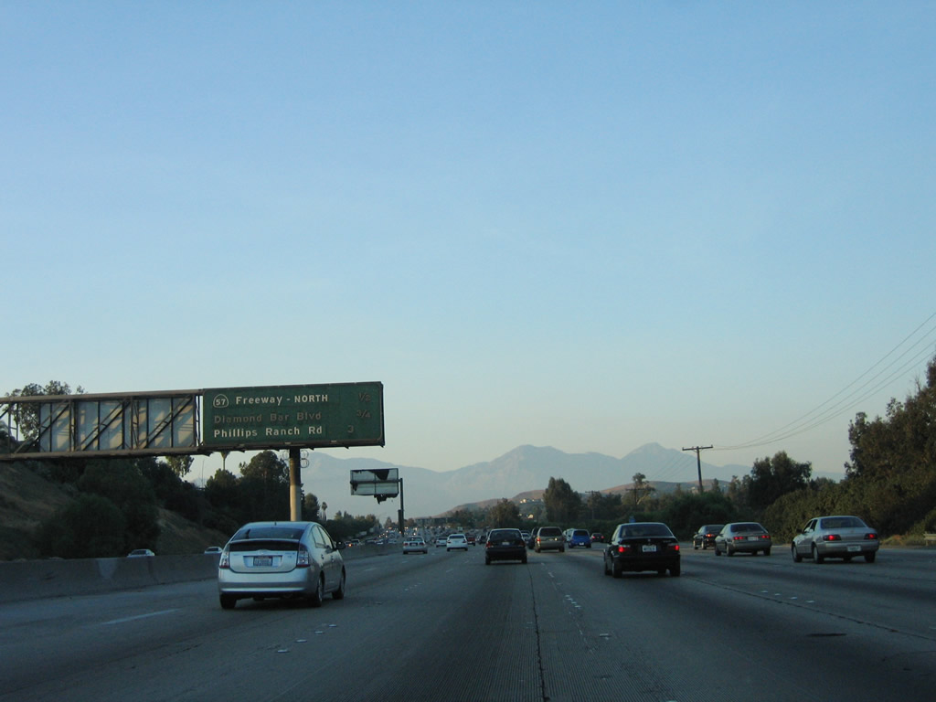 |
This mileage sign provides the distance for the next three exits on California 60 east only: Exit 25, California 57 (Orange Freeway) north; Exit 26, Diamond Bar Boulevard; and Exit 28, Phillips Ranch Road. Photo taken 07/15/06. | |
 |
 |
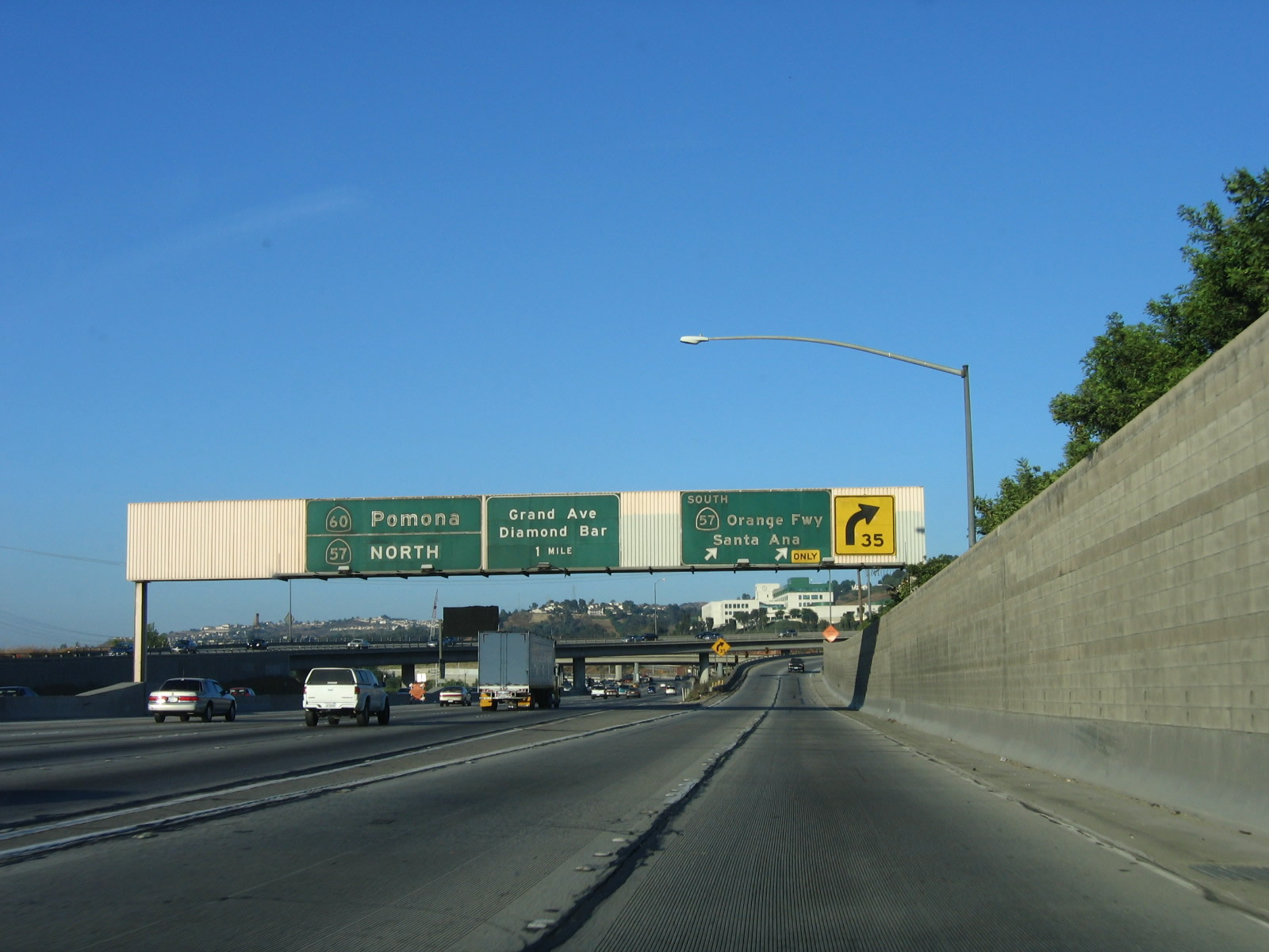
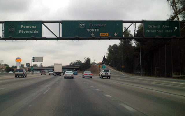
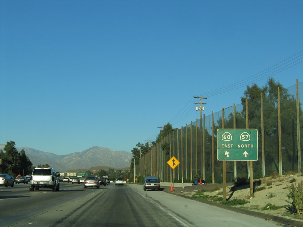
Eastbound California 60 and northbound California 57 split at Exit 25. Use the right three lanes to exit onto California 57 (Orange Freeway) north (Exit 25); the left four lanes continue east along California 60 (Pomona Freeway). The next exit along California 60 east is Exit 26, Diamond Bar Boulevard. Photos taken 02/26/11 and 11/19/05. |

Page Updated April 17, 2011.
|
About Contact Glossary |
In The News Interstate Guide |
Social Media:
 |
|
© 2000-25 AARoads.com | All Rights Reserved | Privacy Policy / Terms of Use
|
||