| California 60 east |
|
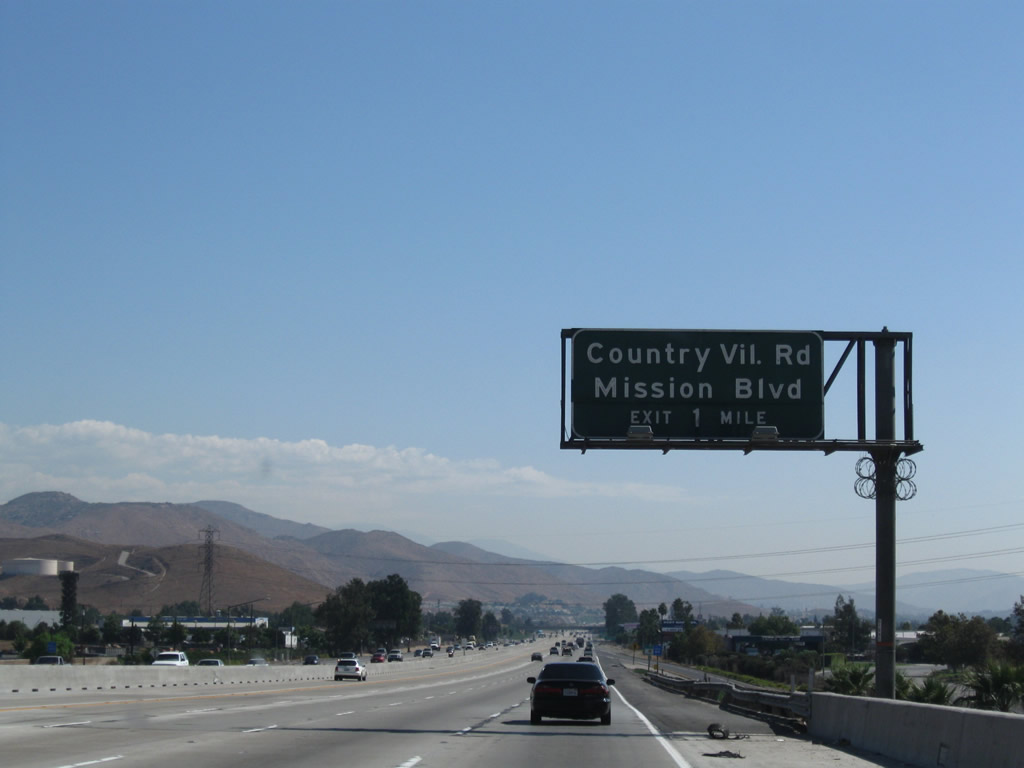
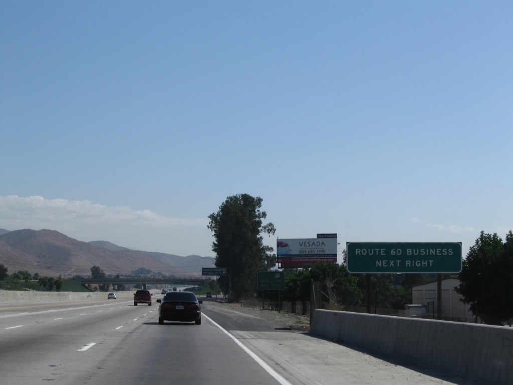
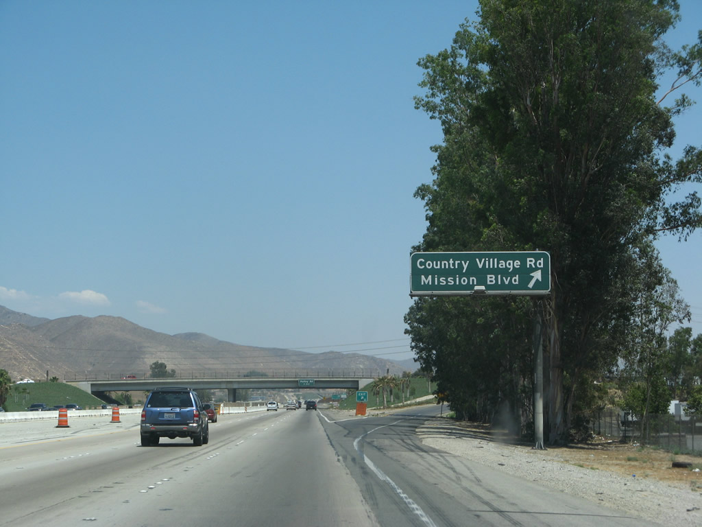
The next exit along California 60 east is Exit 43, Country Village Road to California 60 Business (Mission Boulevard) east to Riverside. When the bypass freeway around Riverside was constructed, it was signed as U.S. 60; the old alignment through Mission Boulevard was recommissioned as U.S. 60 Business. When U.S. 60 shifted to state route status in the late 1960s, California 60 and California 60 Business replaced the former U.S. 60 routes through Riverside. Photo taken 09/28/08. |
|
|
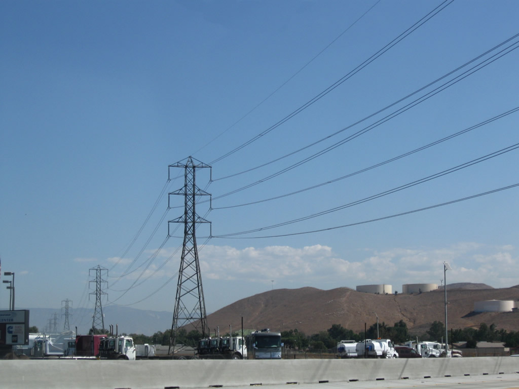
A Southern California Edison 220kV power line crosses over California 60 shortly after the Van Buren Boulevard and Etiwanda Avenue interchange. Photos taken 09/28/08 and 02/26/11. |
|
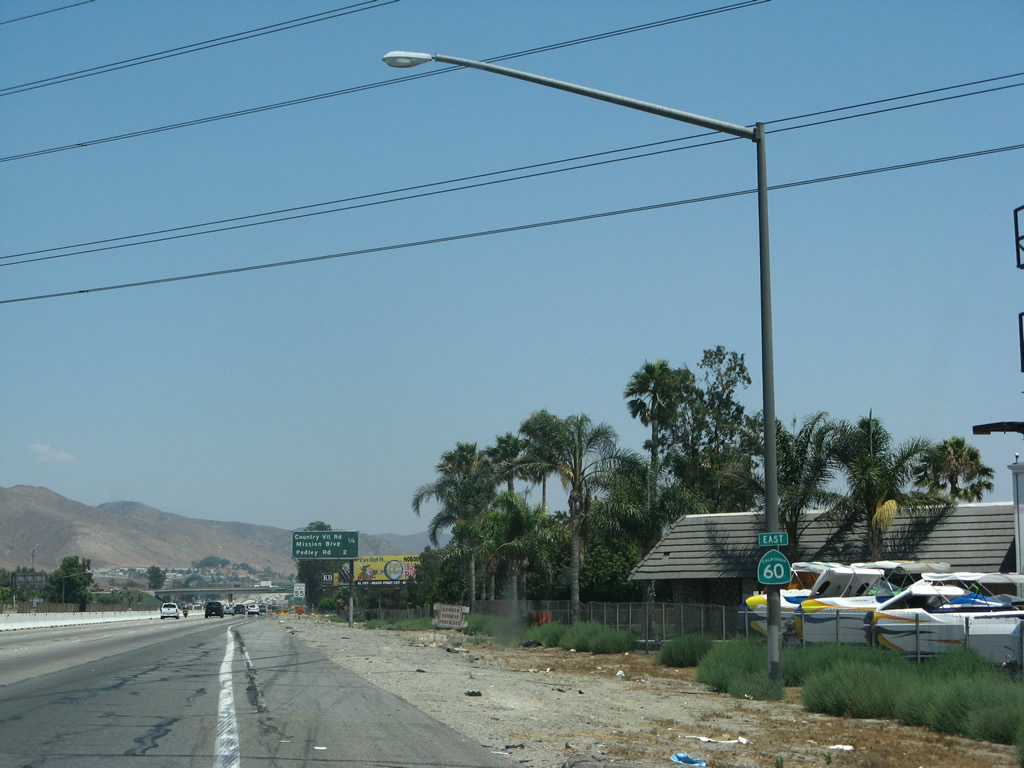
This California 60 east reassurance shield is posted after the on-ramp from Etiwanda Avenue. Photo taken 07/15/07. |
|
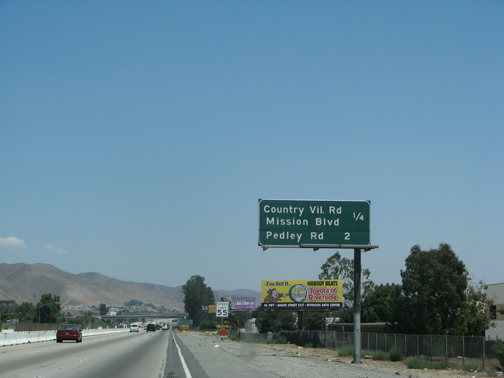
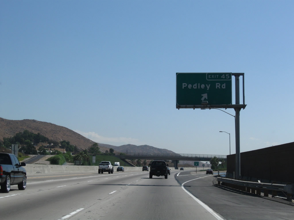
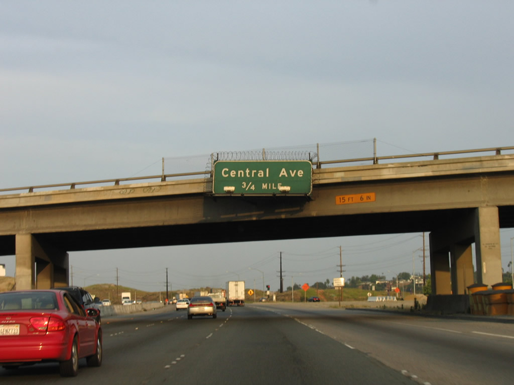
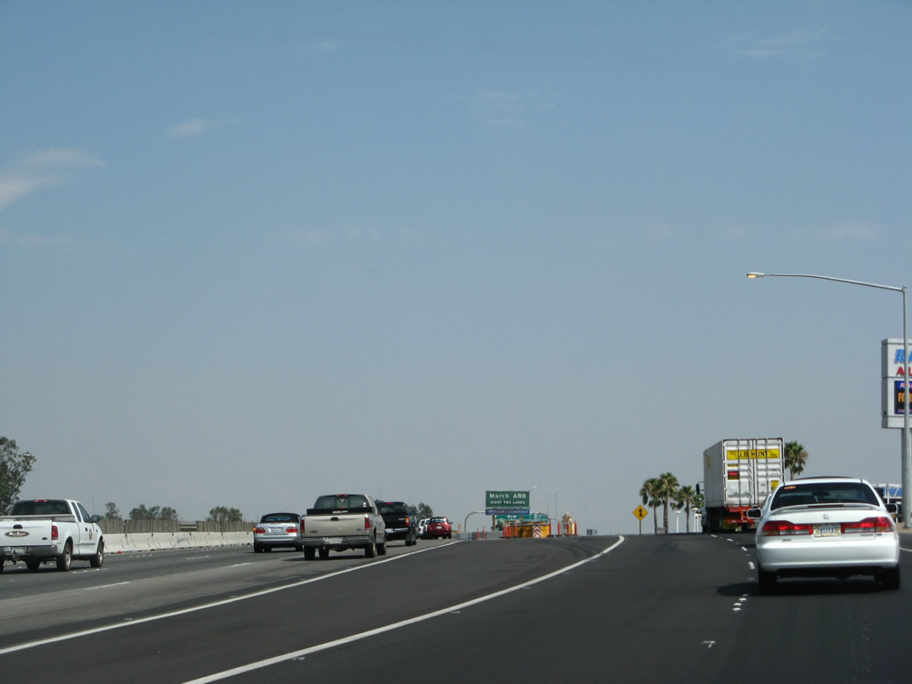
This mileage sign provides the distance to the next two exits along California 60 east: Exit 43, Country Village Road to California 60 Business (Mission Boulevard) east to Riverside and Exit 45, Pedley Road. Photo taken 09/28/08. |
|
California 60 Business follows Mission Boulevard into Riverside, then connects to University Avenue to return to California 60 and Interstate 215 near the University of California at Riverside. Photo taken 09/28/08. |
|
|
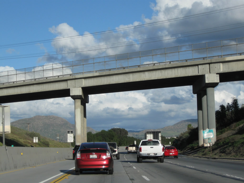
Eastbound California 60 reaches Exit 43, Country Village Road to California 60 Business (Mission Boulevard) east to Riverside. A construction project added a new HOV (carpool) lane between 2007 and 2008. Photos taken 09/28/08 and 07/15/07. |
|
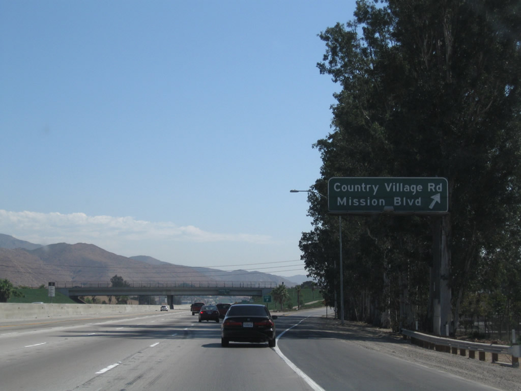
Exiting the freeway at Exit 43, a California 60 Business trailblazer is posted on the off-ramp. Turn right to follow California 60 Business along Historic U.S. 60 (Mission Boulevard) east to Riverside. Turn left at the traffic signal to travel north on Country Village Road. Photo taken 07/15/07. |
|
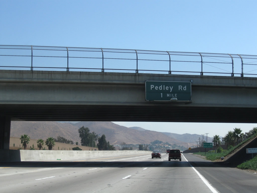
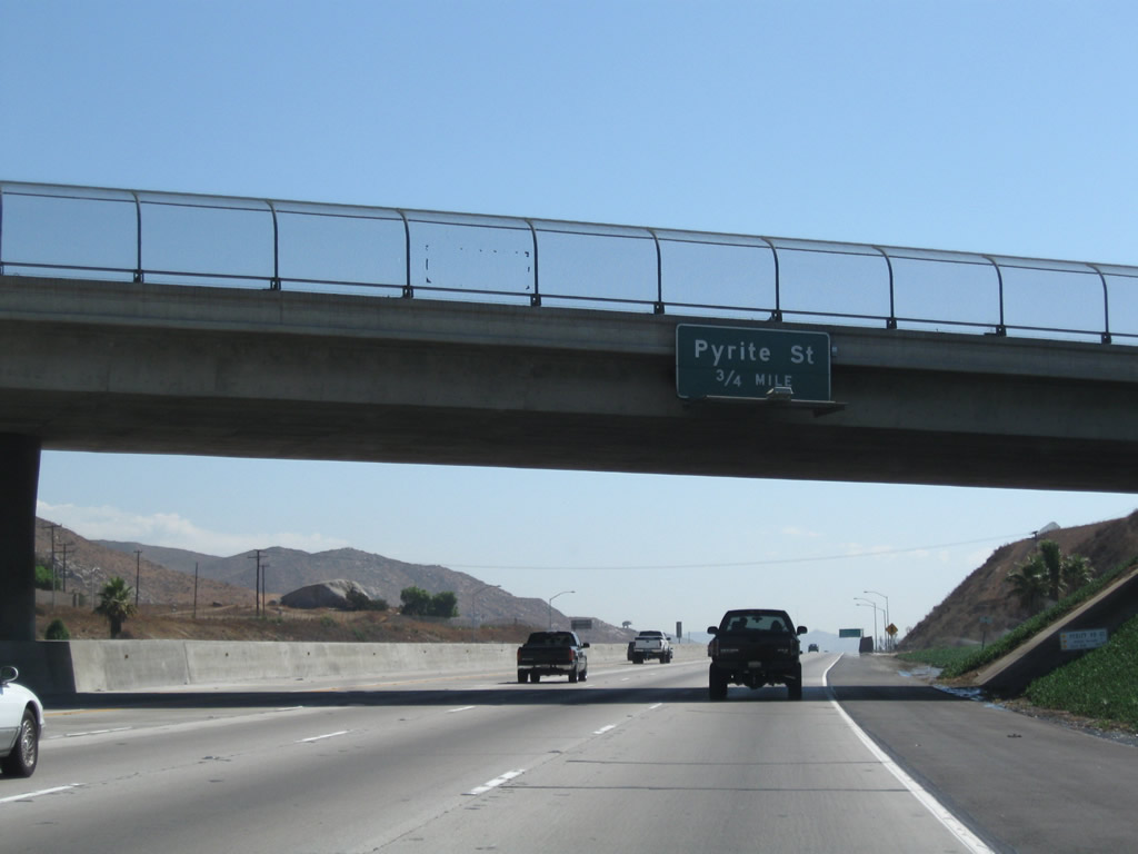
The next exit along California 60 east is Exit 45, Pedley Road (one mile). Photo taken 09/28/08. |
|
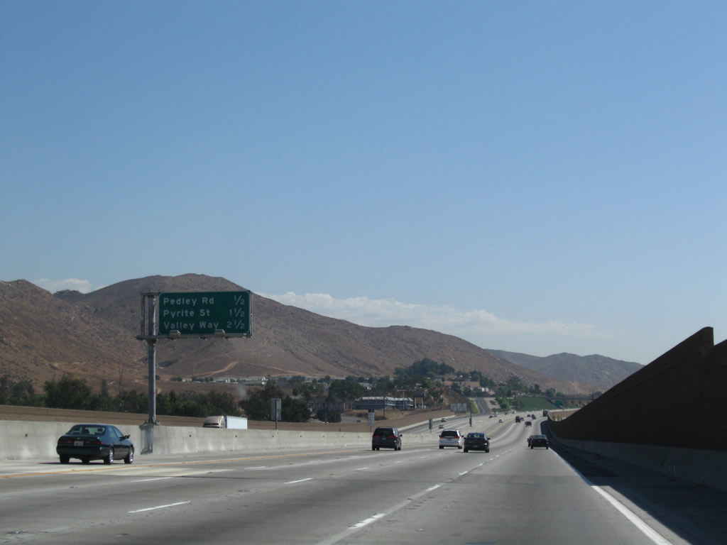
This mileage sign provides the distance to the next three exits along California 60 east: Exit 45, Pedley Road; Exit 46, Pyrite Street; and Exit 47, Valley Way. Photo taken 09/28/08. |
|
Eastbound California 60 reaches Exit 45, Pedley Road. Photo taken 09/28/08. |
|
The next exit along California 60 east is Exit 46, Pyrite Street (0.75 mile). Photo taken 09/28/08. |
|
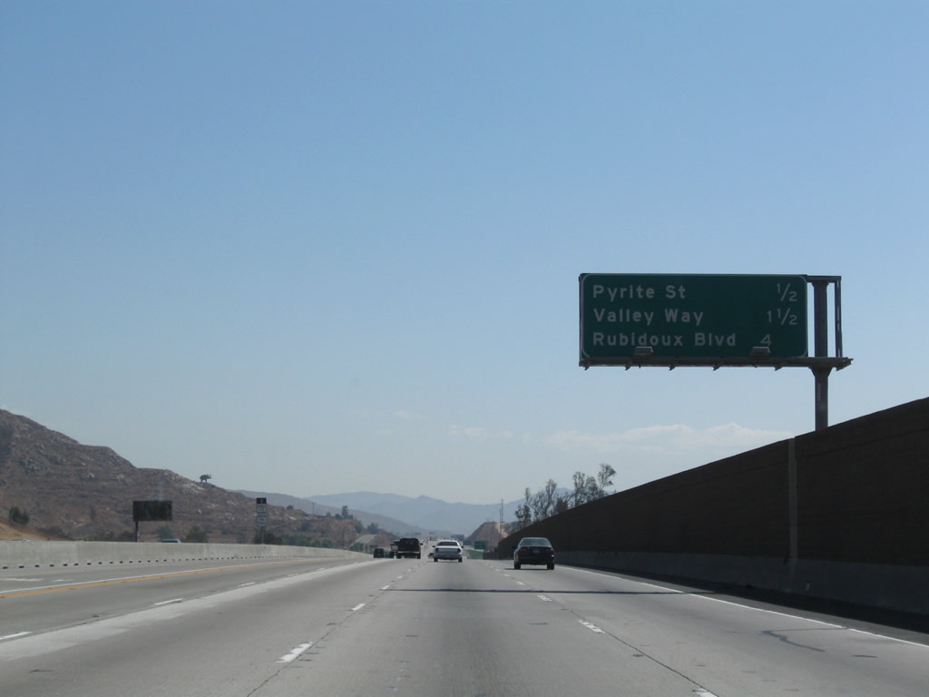
This mileage sign provides the distance to the next three exits along California 60 east: Exit 46, Pyrite Street; Exit 47, Valley Way; and Exit 50, Rubidoux Way. Photo taken 09/28/08. |
|
Use Pyrite Street to the Jurupa Cultural Center and museum. Photo taken 09/28/08. |
|
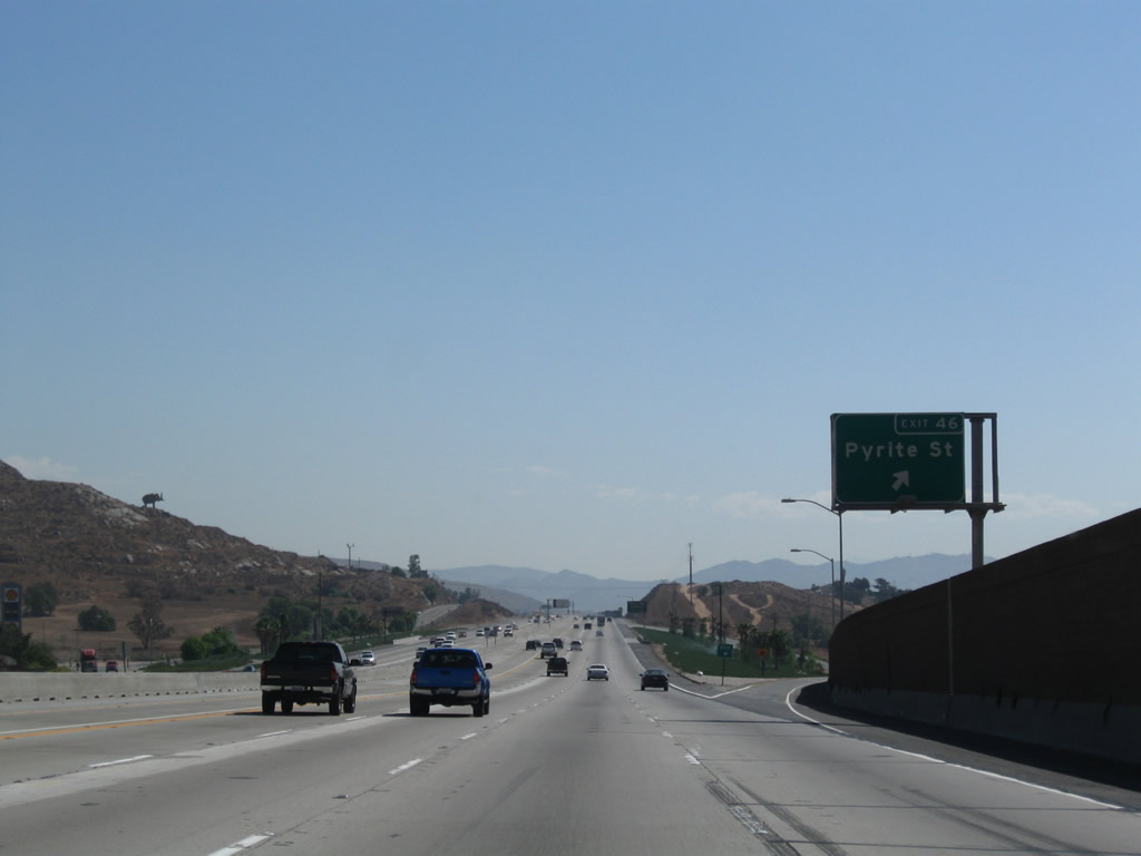
Eastbound California 60 reaches Exit 46, Pyrite Street. Photo taken 09/28/08. |
|
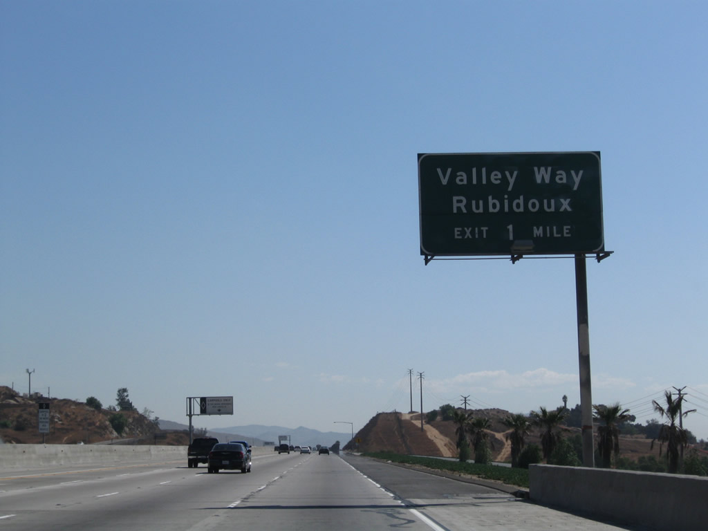
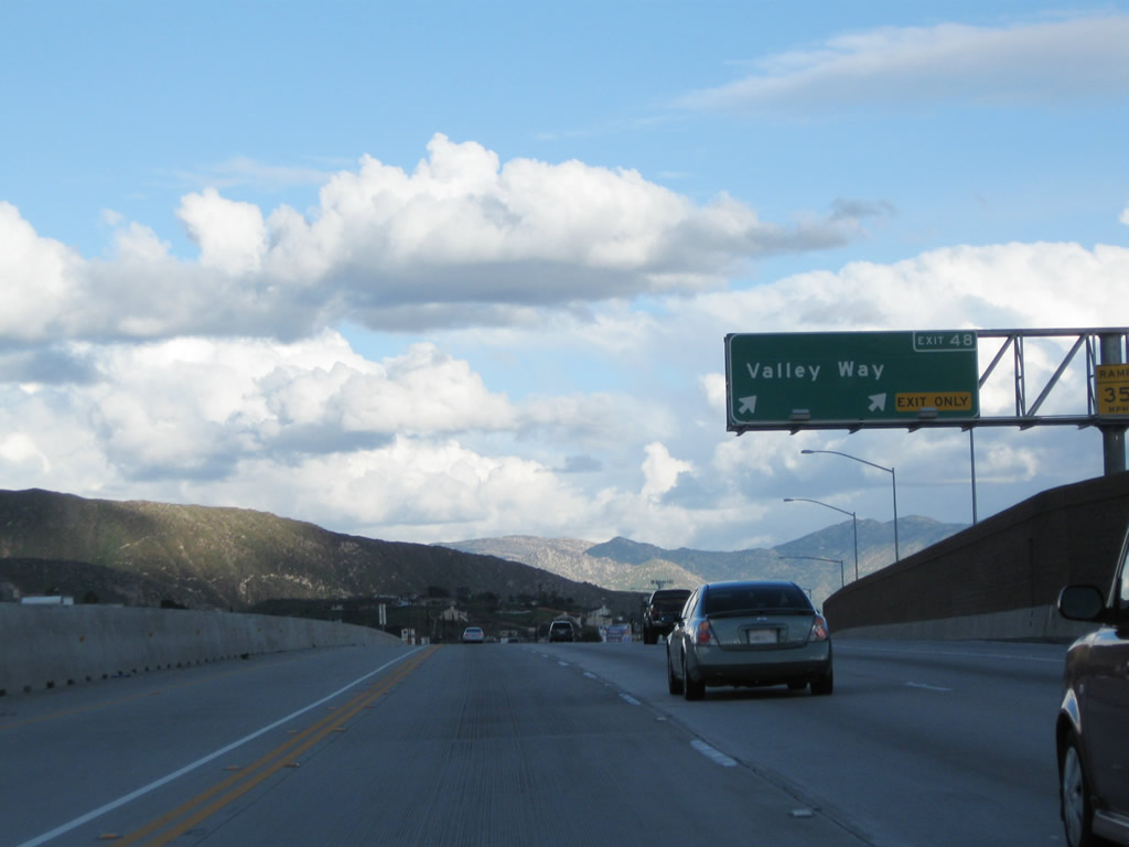
The next exit along California 60 east is Exit 48, Valley Way to Rubidoux. Photo taken 09/28/08. |
|
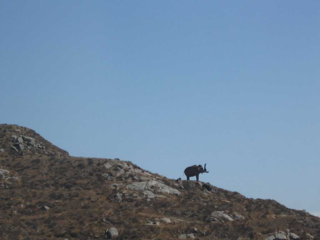
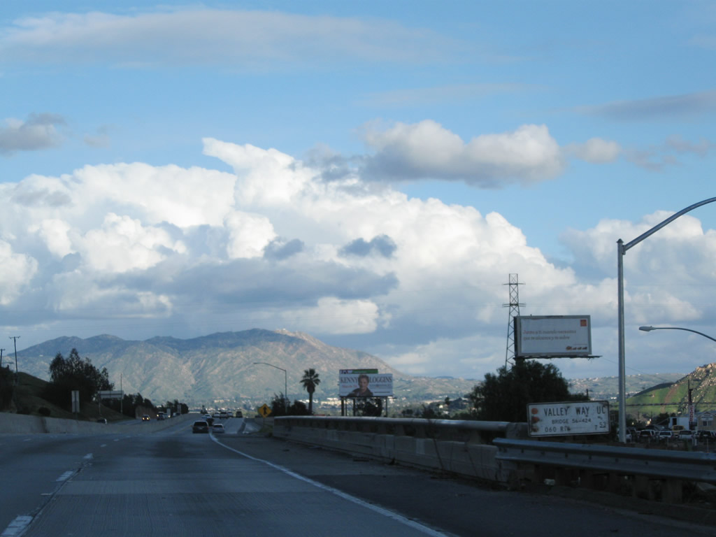
An elephant stands sentinel over California 60. Photo taken 09/28/08. |
|
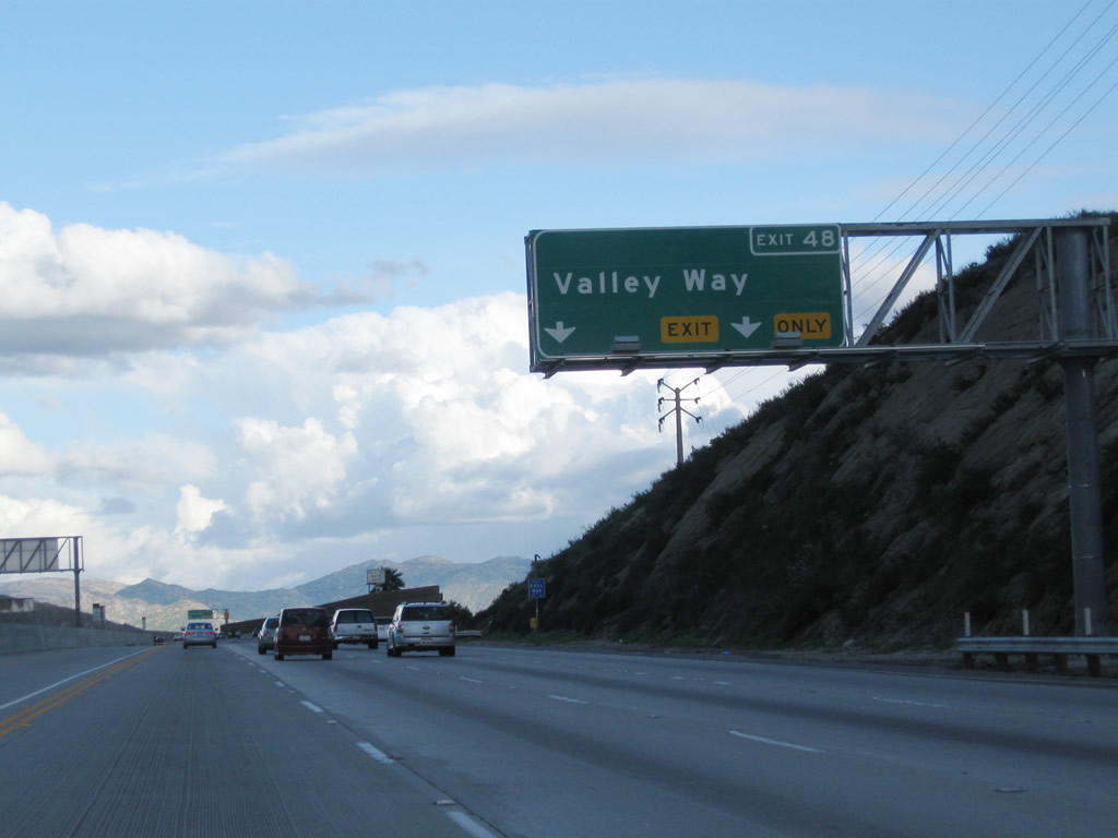
The right two lanes of California 60 (Pomona Freeway) east connect to Exit 48, Valley Way. Photo taken 02/26/11. |
|
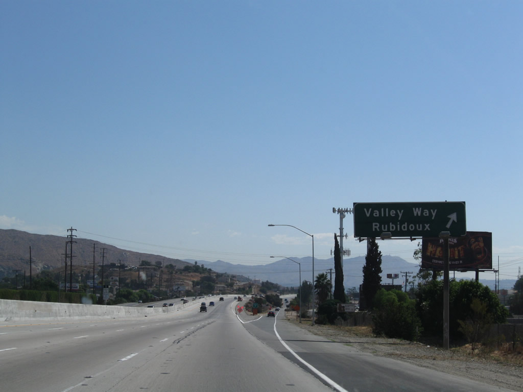
Use Valley Way north to the city of Fontana in San Bernardino County. Photo taken 09/28/08. |
|
|
Eastbound California 60 reaches Exit 48, Valley Way to Rubidoux (south) and Fontana (north). Photos taken 02/26/11 and 09/28/08. |
|
California 60 (Pomona Freeway) passes over Valley Way. Photo taken 02/26/11. |
|
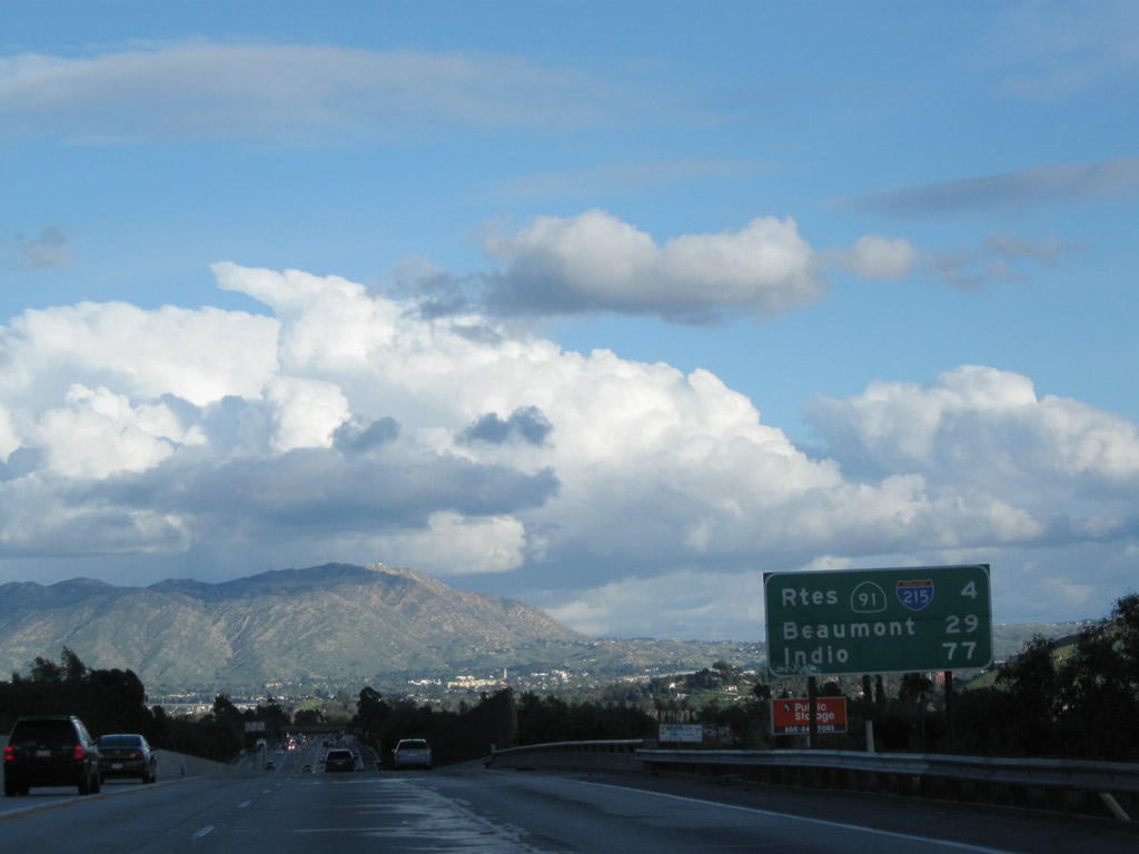
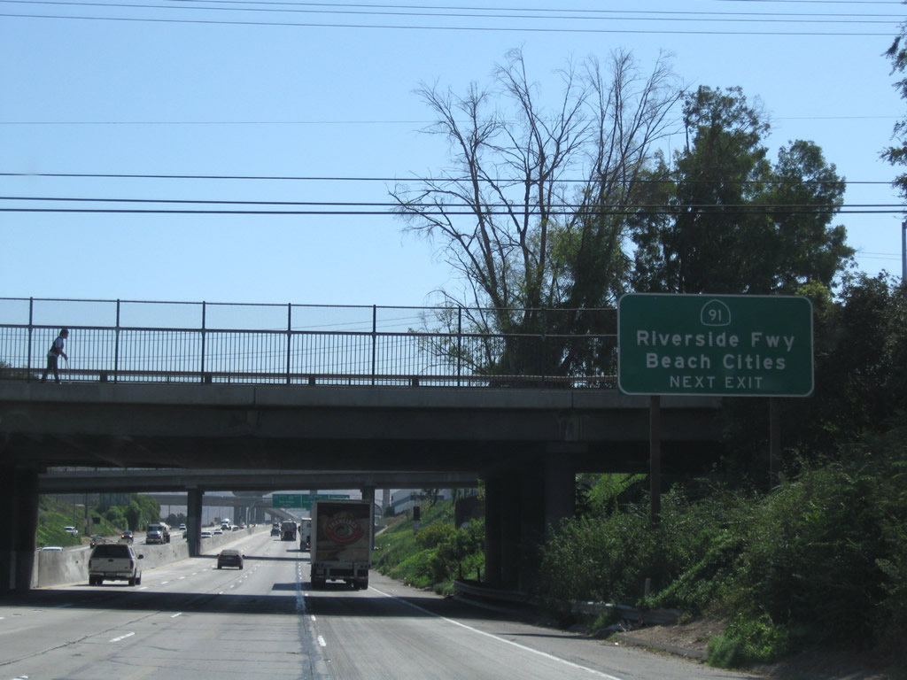
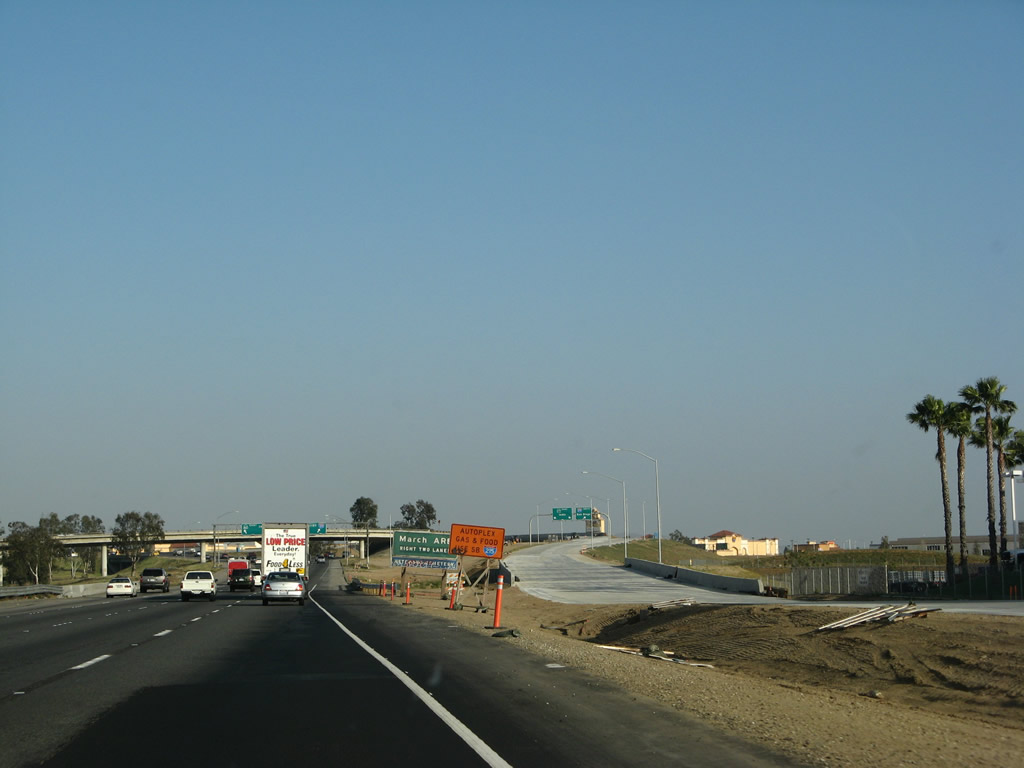
A mileage sign provides the distance to the interchange with Interstate 215 and California 91 (also known as the 60-91-215 interchange) in four miles as well as Beaumont (29 miles) and Indio (77 miles via Interstate 10 east). Photo taken 02/26/11. |
|
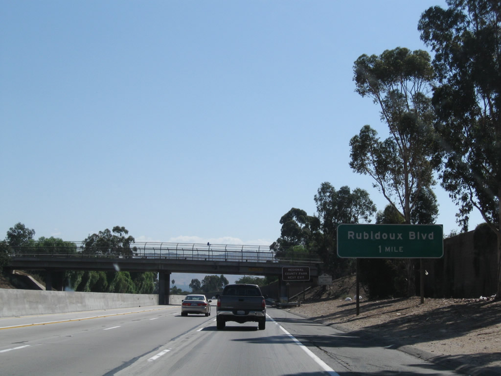
The next exit along California 60 east is Exit 50, Rubidoux Boulevard (one mile). Photo taken 09/28/08. |
|
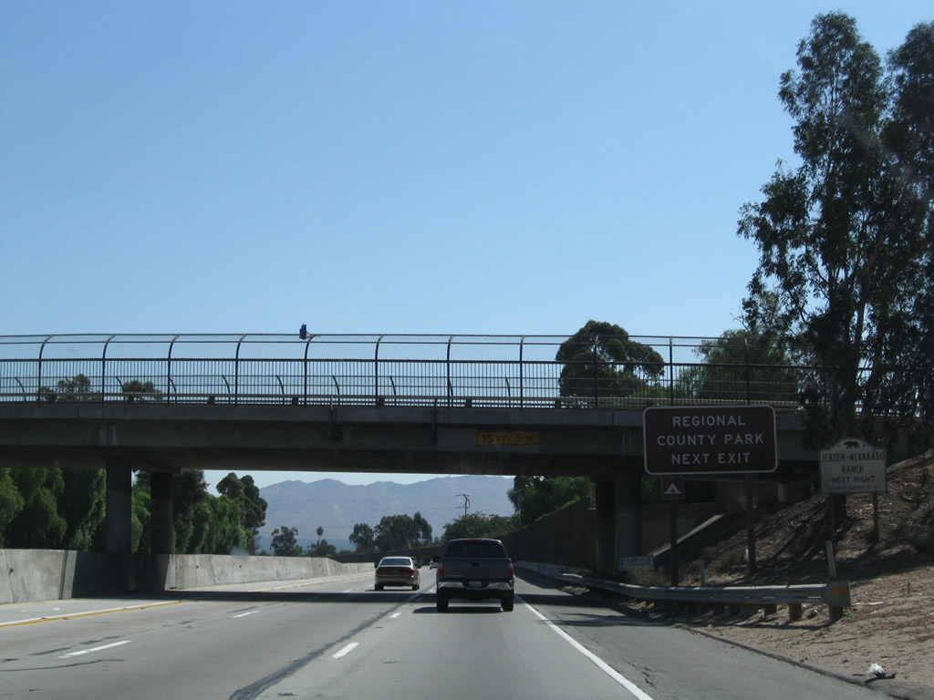
Use Rubidoux Boulevard to the Jensen Alvarado Ranch and regional county park. Photo taken 09/28/08. |
|
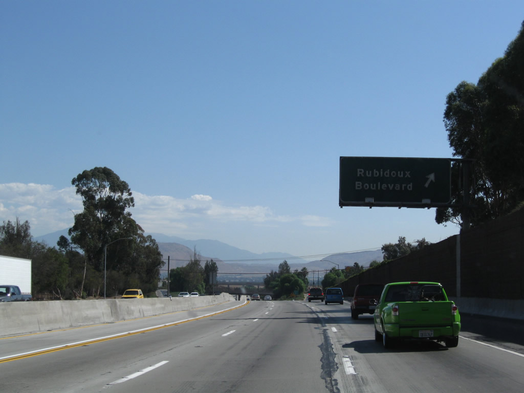
Eastbound California 60 reaches Exit 50, Rubidoux Boulevard. Photo taken 09/28/08. |
|
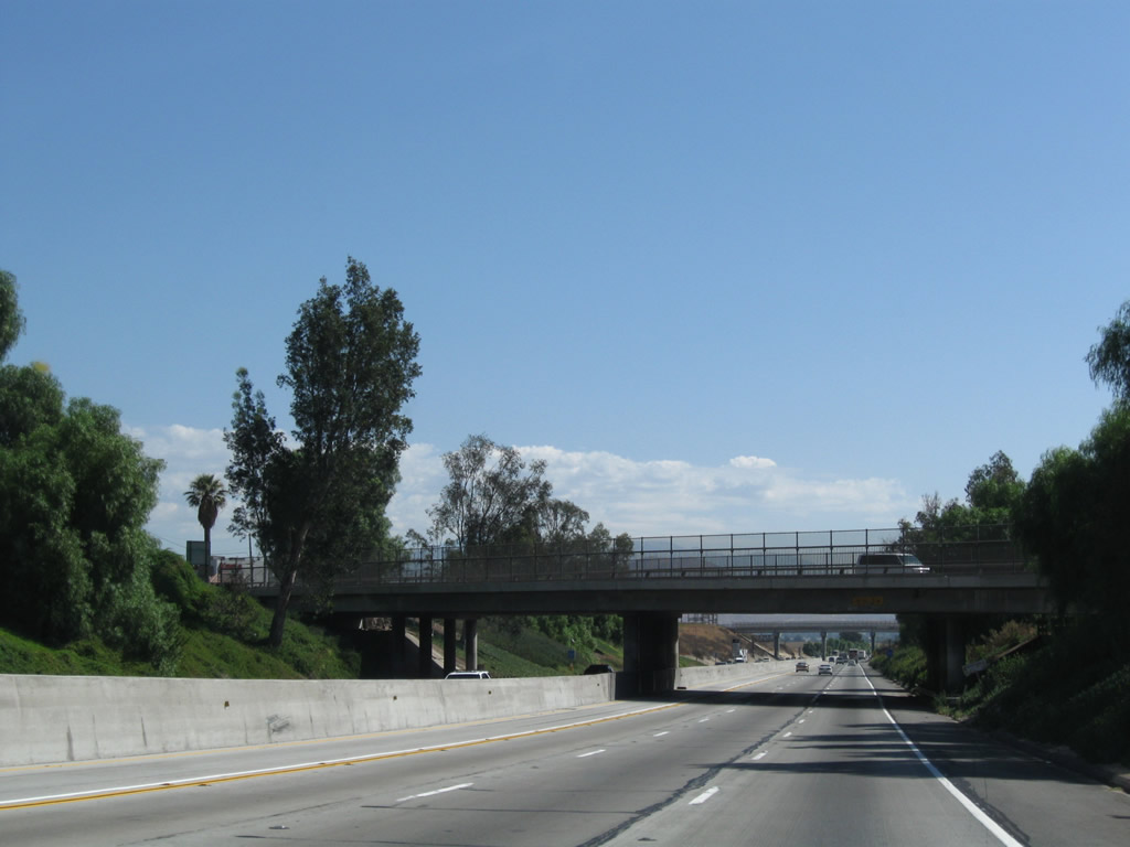
This section of California 60 features an older design standard with the freeway running below grade. An older bridge carries Rubidoux Boulevard over California 60. Photo taken 09/28/08. |
|
California 60 passes under Hall Avenue. Photo taken 02/26/11. |
|
This section of California 60 carries three general purpose lanes and one high occupancy vehicle lane. The HOV lane was added to the freeway in the early-mid 2000s. Photo taken 09/28/08. |
|
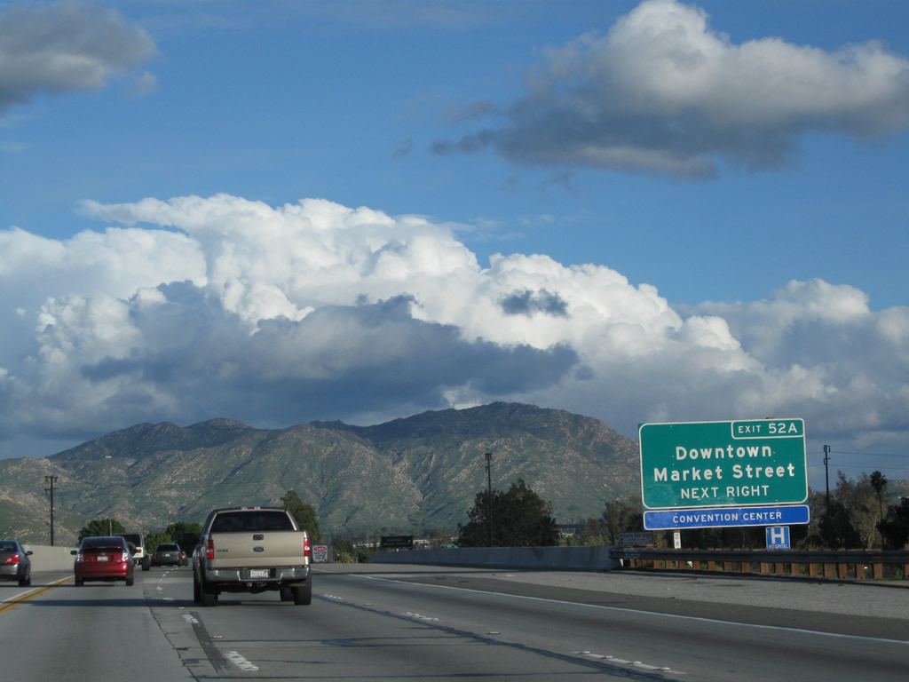
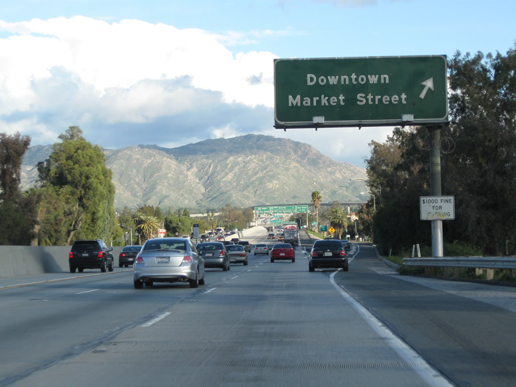
The next exit along California 60 east is Exit 52A, Main Street to downtown Riverside (0.25 mile). Photo taken 02/26/11. |
|
Provisions were made to expand and widen this section of California 60 with an abnormally wide shoulder. This would eventually connect to the widened interchange with California 91 and Interstate 215. Photo taken 09/28/08. |
|
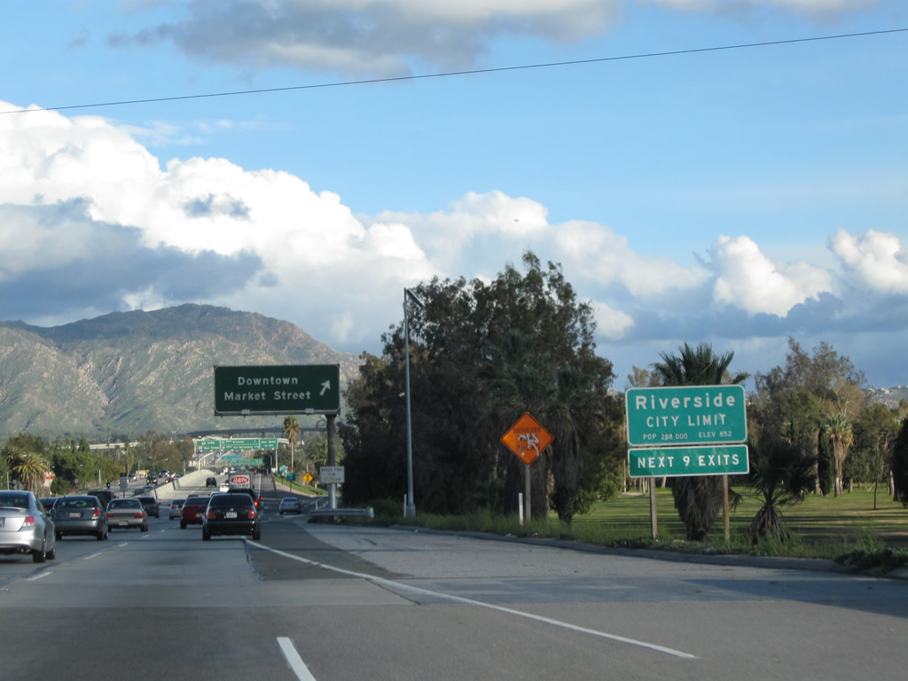
California 60 enters the city of Riverside upon crossing Alessandro Boulevard. Founded in 1870 by John North, Riverside was incorporated on October 11, 1883. The city grew around the burgeoning citrus industry. Oranges, grapefruit, lemons, and other citrus became the economic engine for Riverside; a grove is preserved as part of California Citrus State Historic Park. Citrus was first planted in 1871, and nearly half of the 500,000 citrus trees in existence in California in 1882 were located in Riverside. Photo taken 02/26/11. |
|
Eastbound California 60 reaches Exit 52A, Main Street to downtown Riverside. Photo taken 09/28/08. |
|
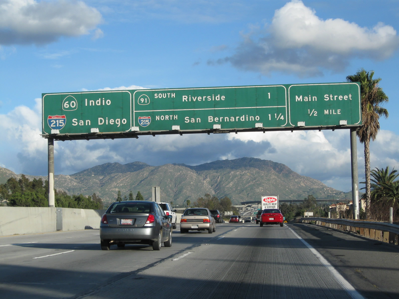
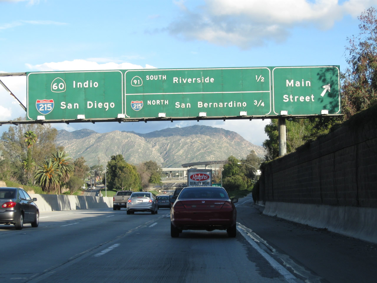
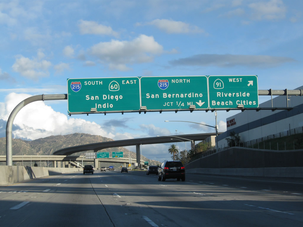
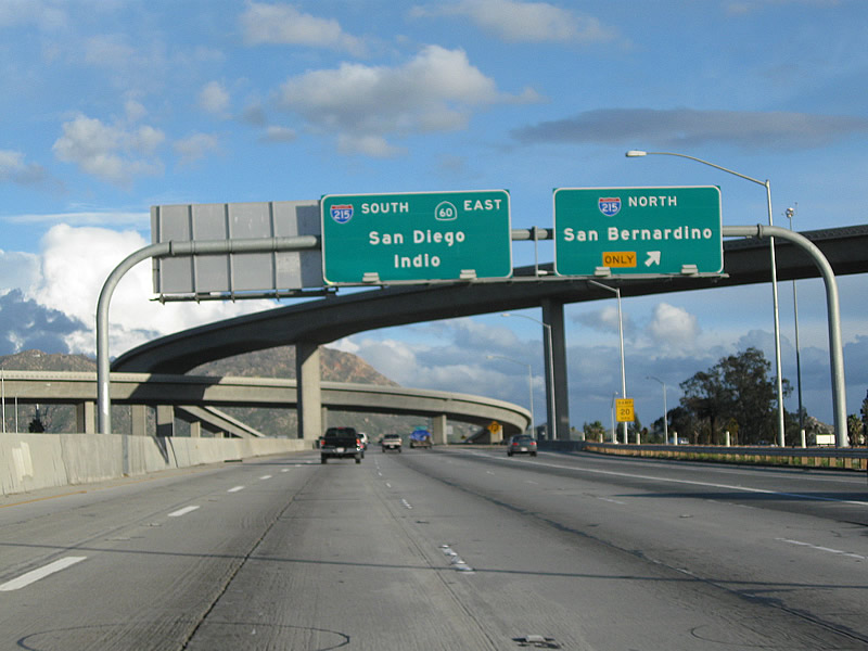
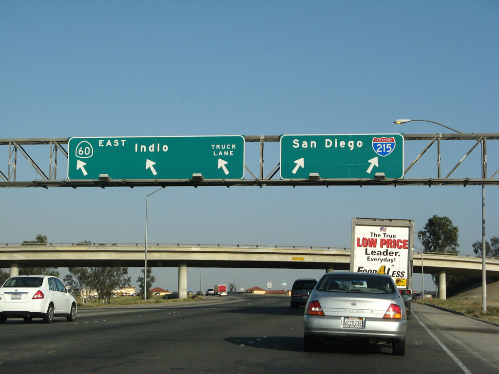
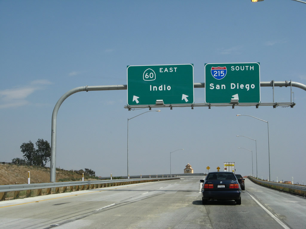
The next three exits on California 60 east are Exit 52B, Main Street; Exit 53A, California 91 (Riverside Freeway) west to Corona and Long Beach; and Exit 53B, Interstate 215/Riverside Freeway north to San Bernardino. Continue straight ahead (in the left lanes) to follow California 60 east and Interstate 215 south to Moreno Valley, Beaumont, and San Diego. Photo taken 02/26/11. |
|
Eastbound California 60 reaches Exit 52B, Main Street. A separate sign advises of the connections to Exit 53A, California 91 (Riverside Freeway) west to Corona and Long Beach and Exit 53B, Interstate 215/Riverside Freeway north to San Bernardino. The pull-through sign advises of both California 60 east and Interstate 215 south with control cities of Indio and San Diego. Photo taken 09/28/08. |
|
The next exit on California 60 east is Exit 53A, California 91 (Riverside Freeway) west to Corona and Long Beach. California 91 is a major east-west corridor between Riverside County and Orange County; commuters use this road to drive from comparably affordable housing in Riverside with jobs in the more-expensive Orange County. The route of California 91 (Riverside Freeway) through the Santa Ana River canyon is especially congested during commute hours. Plans for relief include an expensive tunnel through the mountains; however, such a route would be extremely controversial and very expensive. Photo taken 09/28/08. |
|
Eastbound California 60 reaches Exit 53A, California 91 (Riverside Freeway) west to Corona and Long Beach. The interchange was upgraded in 2007 to include a direct, high-speed ramp to carry the main lanes of Interstate 215 south through the interchange and a high-speed connector from Interstate 215 north to California 91 west. Sections of California 60 west of this interchange will eventually be widened to allow a smoother connection through the upgraded interchange. Prior to this construction, the 60-91-215 interchange was a cloverleaf that was completely overwhelmed with traffic on a daily basis regardless of commute hours. Photo taken 02/26/11. |
|
Now on the transition ramp from California 60 east to California 91 west, this view also shows the exit signs for Exit 53B, Interstate 215 north (loop ramp). In the original cloverleaf interchange, the bottom level is California 91 and the second level is California 60. Two new ramps were built on top of the cloverleaf. In this newly stacked interchange, the Interstate 215 mainline is the third level ramp, and the link from Interstate 215 north/California 60 west to California 91 west is the top level ramp. Photo taken 09/28/08. |
|
The ramp from eastbound California 60 to westbound California 91 merges prior to the high-level ramp from westbound California 60/northbound Interstate 215 to westbound California 91 as seen in this photo. Photo taken 09/28/08. |
|
Back on the mainline, eastbound California 60 (Pomona Freeway) reaches Exit 53B, Interstate 215/Riverside Freeway north to San Bernardino (loop ramp). Photo taken 02/26/11. |
|
|
|
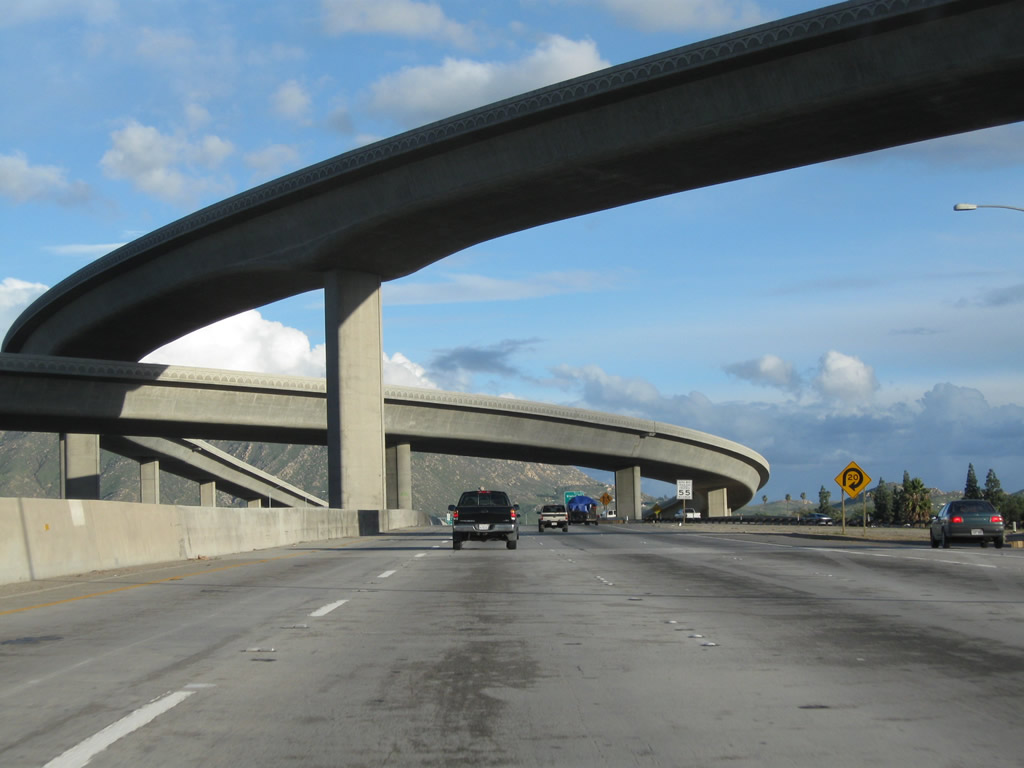
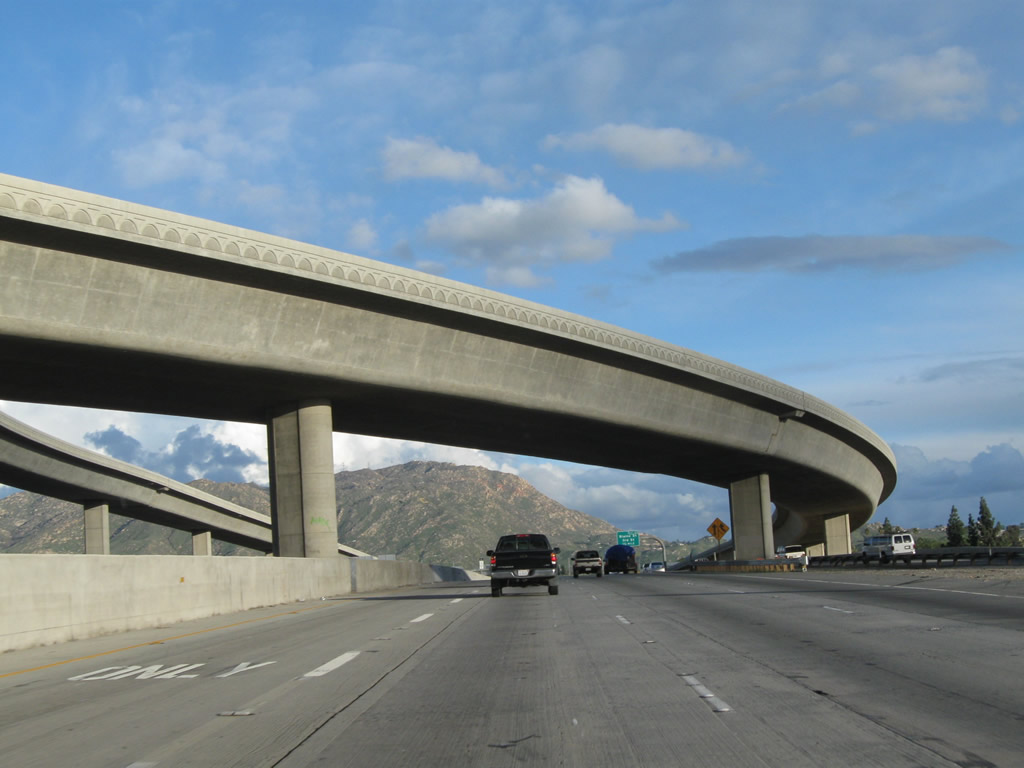
California 60 (Pomona Freeway) passes through the massive interchange with the Riverside Freeway. The through lanes for Interstate 215 south fly high overhead and will merge with California 60 east ahead. Photos taken 02/26/11. |
|
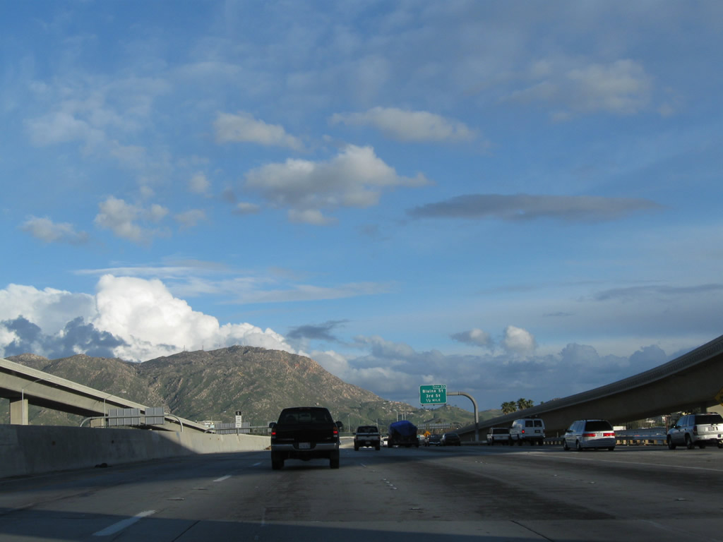
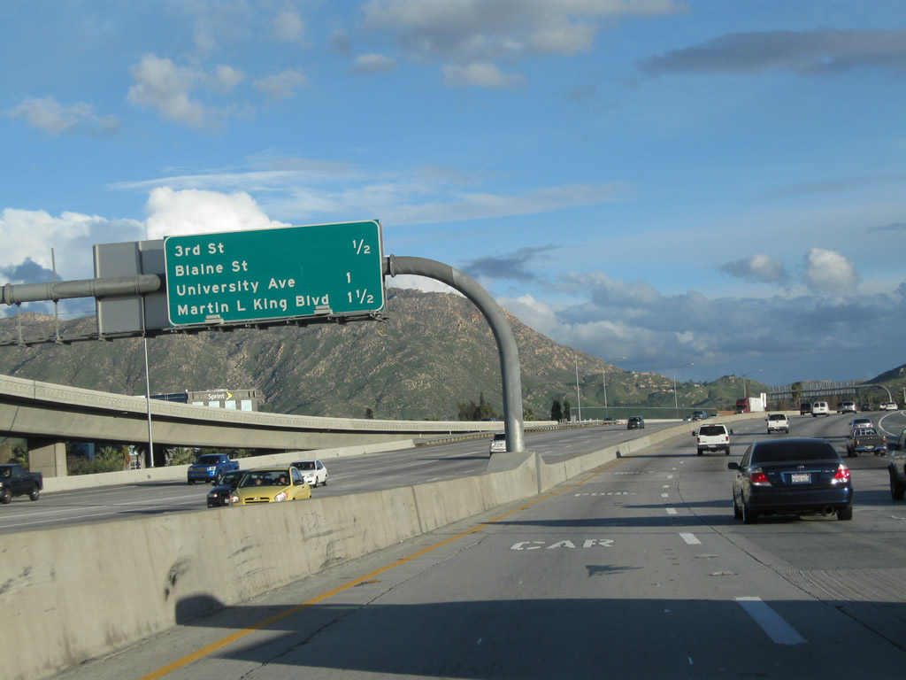
As traffic from Interstate 215/Riverside Freeway south merges with California 60 east, this mileage sign provides the distance to the next three exits (using Interstate 215's exit numbering): Exit 33, 3rd Street and Blaine Street; Exit 32, California 60 Business (University Avenue) to University of California at Riverside; and Exit 31, Martin Luther King Boulevard. Photo taken 02/26/11. |
| Interstate 215 south & California 60 east |
|
After merging onto California 60 east on the former loop ramp, this view shows the new Interstate 215 direct transition ramp and the new 60-215 north to 91 west ramp. There is a loop ramp from California 60 east to Interstate 215/Riverside Freeway north (which is California 60's Exit 53B). Photo taken 07/15/07. |
|
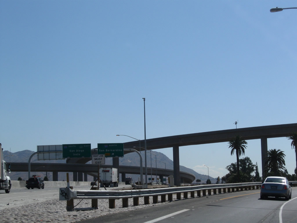
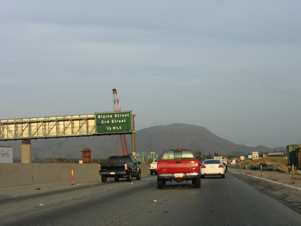
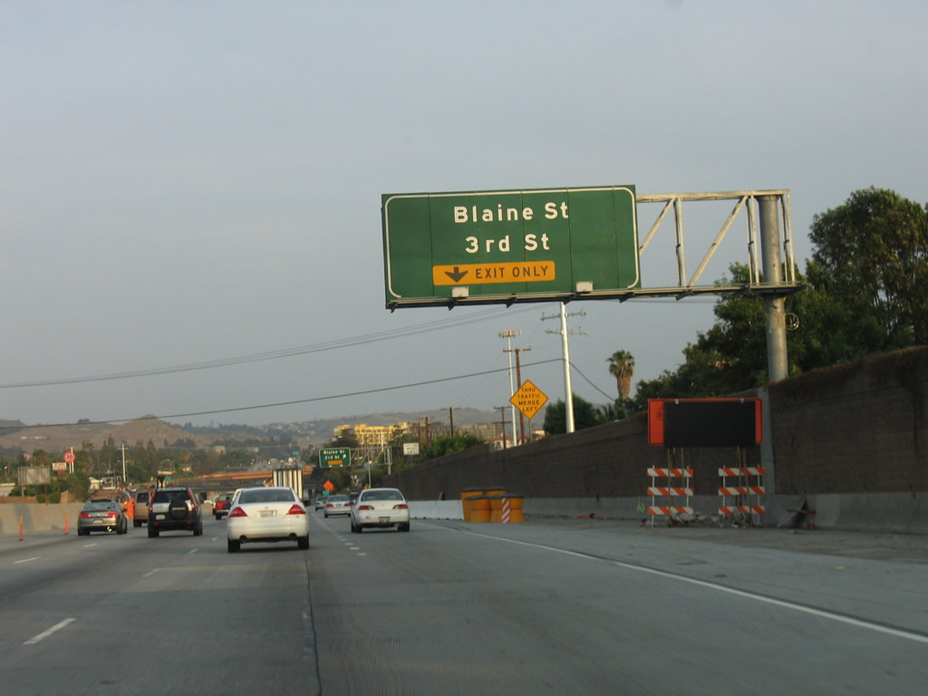
The next exit along Interstate 215 south and California 60 east is Third Street west and Blaine Street east. This whole area has been reconstructed, and these signs are no longer present. Photo taken 05/13/05. |
|
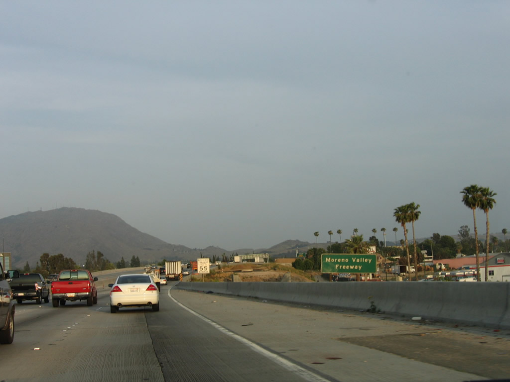
Signs indicate that the shared section of California 60 east and Interstate 215 south are known as the Moreno Valley Freeway. Legislatively, this section of freeway is also known as the Escondido Freeway, which carries Interstate 215 south to Murrieta and Interstate 15 all the way to its southern terminus in San Diego. Note all the cleared land adjacent to the freeway that has since become part of the expanded Interstate 215 corridor through Riverside. Photo taken 05/13/05. |
|
|
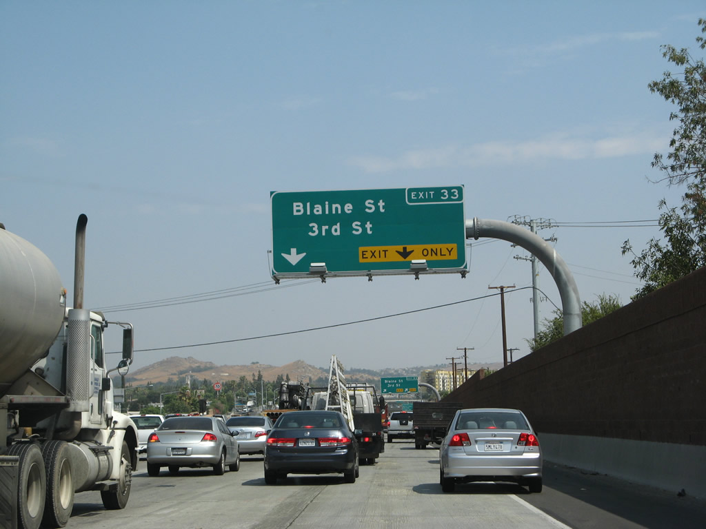
The right lane becomes exit only for Exit 33, Third Street and Blaine Street. This configuration has changed with the arrival of the new Interstate 215 connecting ramps. Photos taken 07/14/08 and 05/13/05. |
|
|
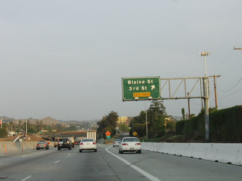
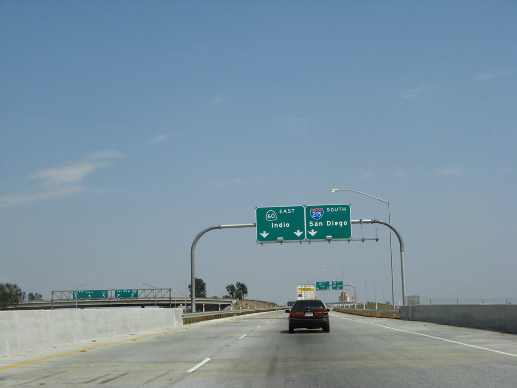
Southbound Interstate 215 (Escondido Freeway) and eastbound California 60 (Moreno Valley Freeway) reach Exit 33, Third Street and Blaine Street. With the widening of this section of road and the opening of the 215 southbound flyover ramp at the 60-91-215 interchange, new signs were installed in 2008. Photos taken 07/14/08 and 05/13/05. |
|
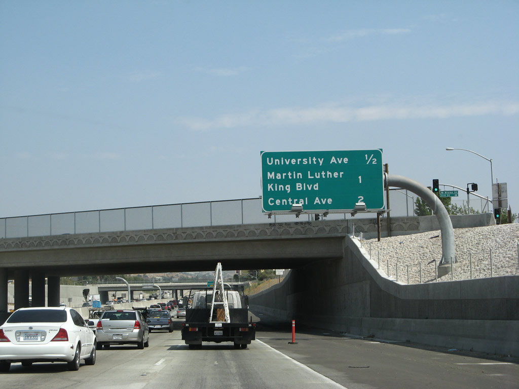
THe next three exits along Interstate 215 south and California 60 east are Exit Exit 32, University Avenue (California 60 Business); Exit 31, Martin Luther King, Jr. Boulevard; and Exit 30B, Central Avenue west and Watkins Drive north. Photo taken 07/14/08. |
|
|
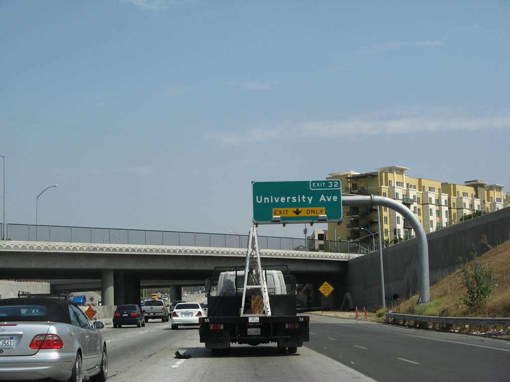
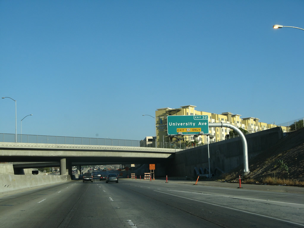
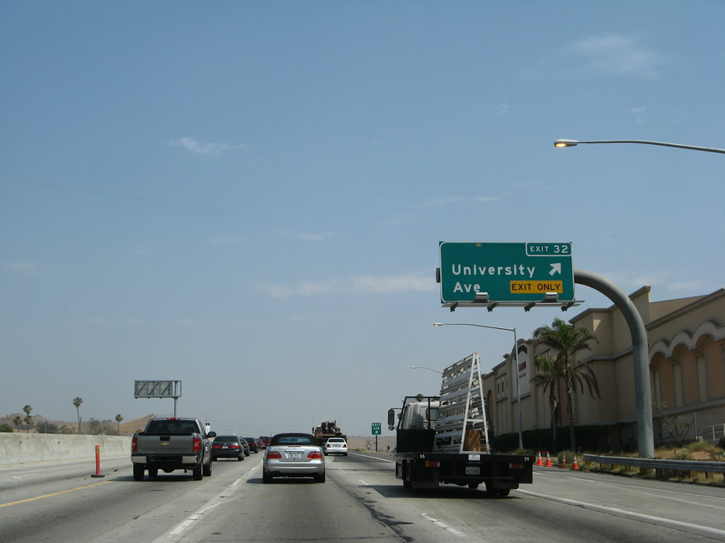
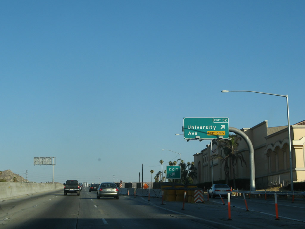
The next exit along Interstate 215 south and California 60 east is Exit 32 (Exit 32B), University Avenue (California 60 Business) to the University of California at Riverside. The university campus straddles both sides of the freeway between Exits 32 and 31 (Martin Luther King, Jr. Boulevard). Photos taken 07/14/08 and 07/15/07. |
|
|
Southbound Interstate 215 and California 60 east reaches Exit 32 (Exit 32B), University Avenue (California 60 Business) to the University of California at Riverside. This interchange was reconstructed as part of the 60-91-215 interchange widening and improvement project. Photos taken 07/14/08 and 07/15/07. |
|
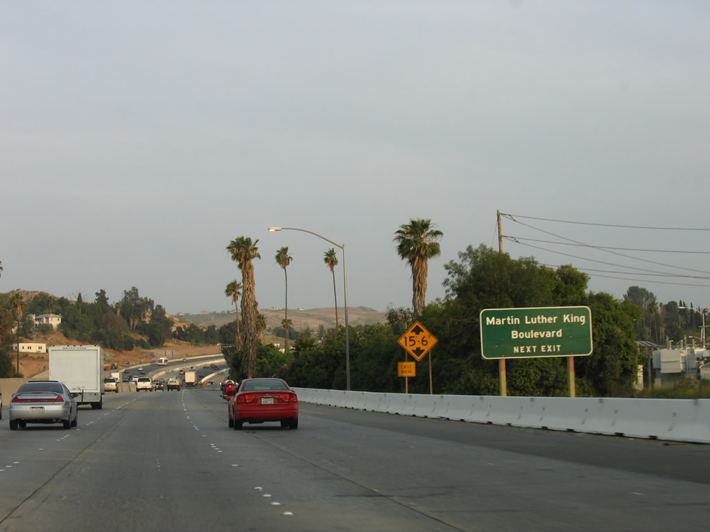
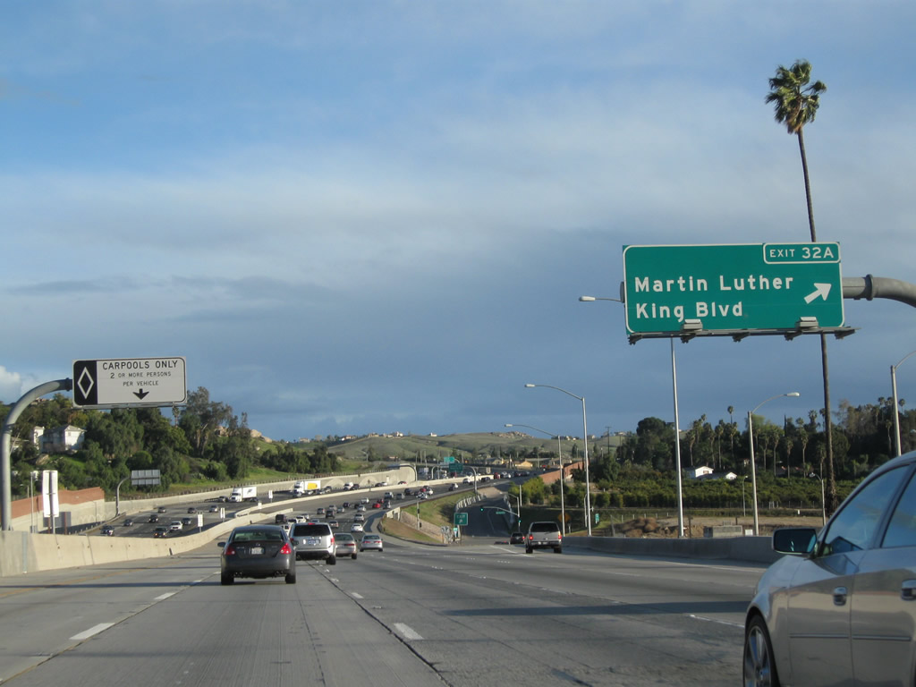
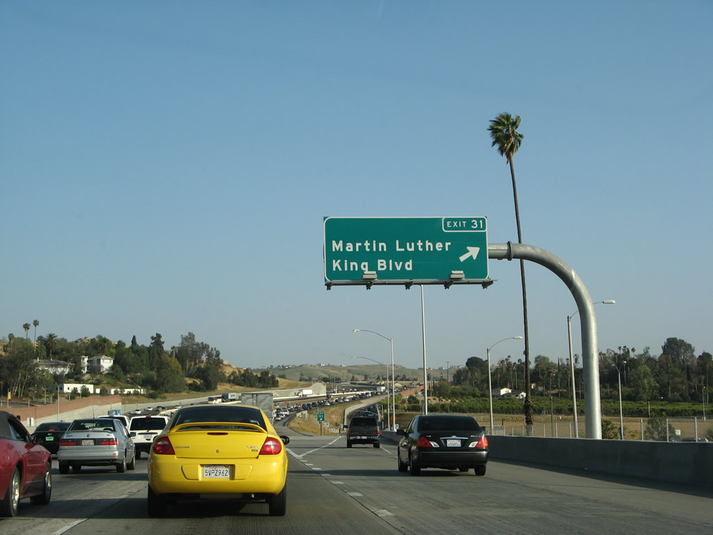
The next exit along Interstate 215 south and California 60 east is Exit 31 (Exit 32A), Martin Luther King, Jr. Boulevard. A former interchange with El Cerrito Drive has since been closed. Photo taken 05/13/05. |
|
|
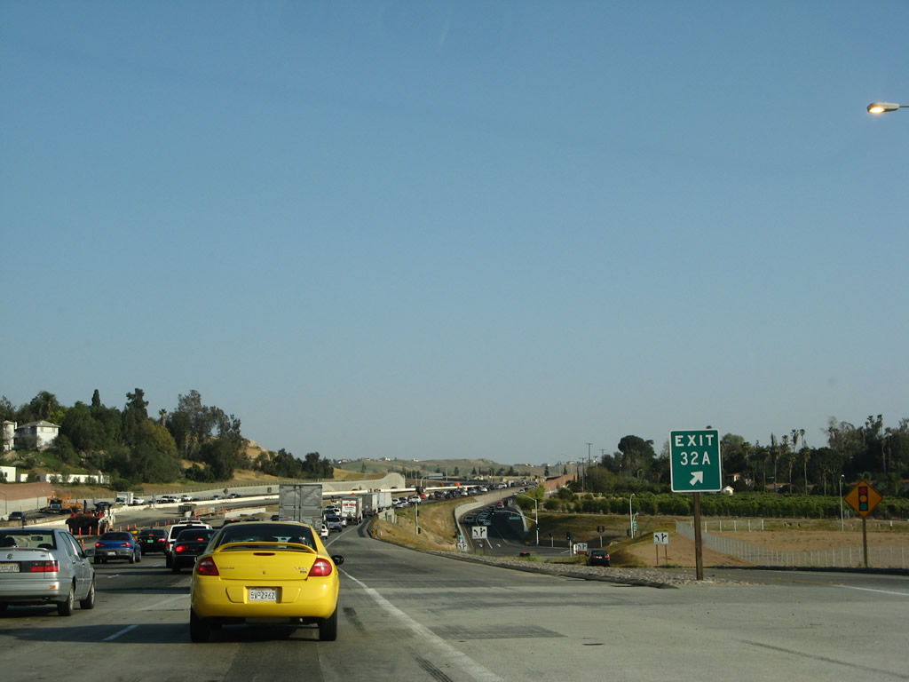
Southbound Interstate 215 and eastbound California 60 meet Exit 31 (Exit 32A), Martin Luther King, Jr. Boulevard. Revisiting this location in 2011 indicated this was Exit 32A, but the Caltrans webpage shows it as Exit 31. Photo taken 03/31/08. |
|
The gore point sign for Exit 31 (Exit 32A), Martin Luther King, Jr. Boulevard showed as Exit 32A in 2008 and as an unnumbered off-ramp in 2011. Photo taken 03/31/08. |
|
|
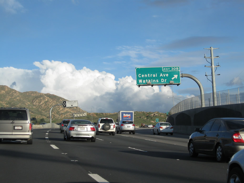
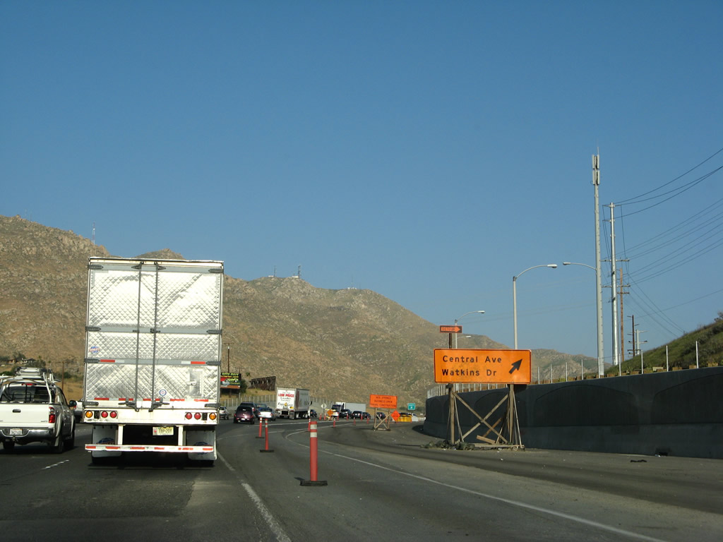
The next exit along Interstate 215 south and California 60 east is Exit 30B, Central Avenue west and Watkins Drive north. Photos taken 07/14/08 and 05/13/05. |
|
|
Southbound Interstate 215 and eastbound California 60 meet Exit 30B, Central Avenue west and Watkins Drive north. Photos taken 02/26/11 and 03/31/08. |
|
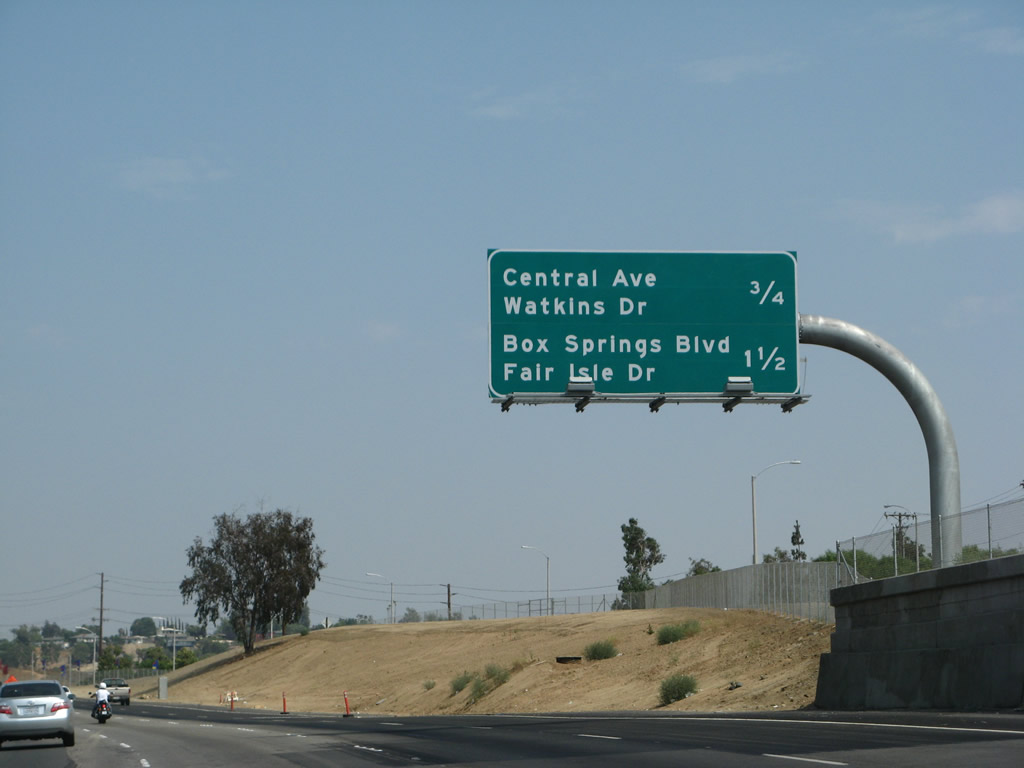
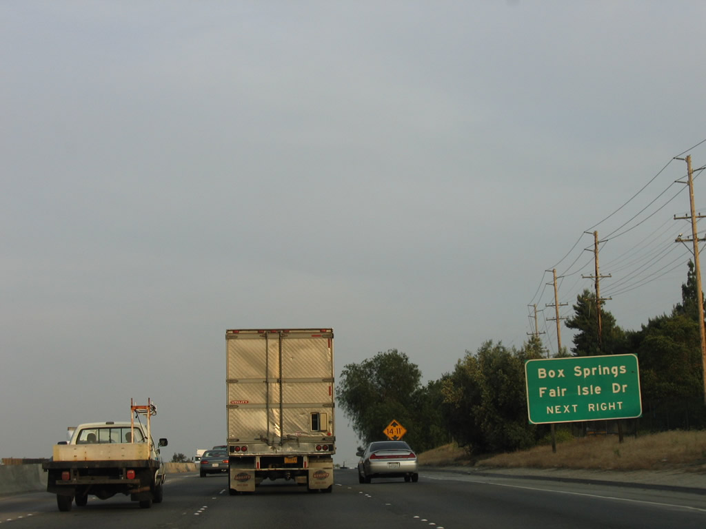
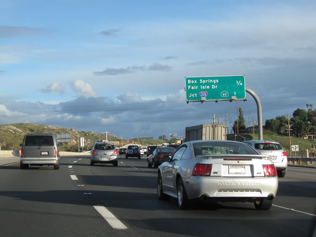
The next exit along Interstate 215 south and California 60 east is Exit 30A, Box Springs Road east to Moreno Valley and Fair Isle Drive southwest to the University City neighborhood of the city of Riverside. Photo taken 05/13/05. |
|
A mileage sign provides the distance to the next two exits along Interstate 215 south and California 60 east: Exit 30A, Box Springs Road east to Moreno Valley and Fair Isle Drive southwest and Exit 29, California 60 and Interstate 215 split. Photo taken 02/26/11. |
|
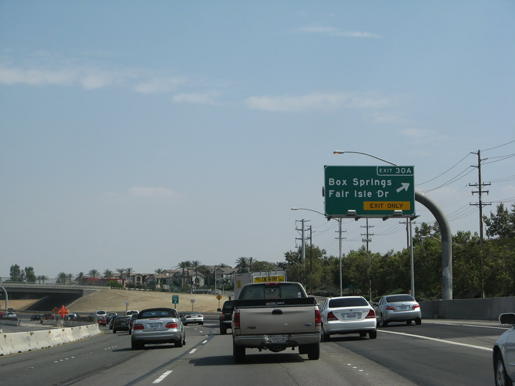
Southbound Interstate 215 and eastbound California 60 reach Exit 30A, Box Springs Road and Fair Isle Drive. This is the final exit along the shared alignment of these two freeways. Photo taken 07/14/08. |
|
Stay right to use the truck bypass connection for Interstate 215 south and California 60 east. Stay left for the continuation of California 60 (Exit 29). Photo taken 02/26/11. |
|
|
|
The right two lanes connect to the truck bypass connection for Interstate 215 south and California 60 east. See below for coverage of the truck bypass lanes. Photos taken 02/26/11 and 07/14/08. |
|
Back in March 2008, the new truck bypass connection for Interstate 215 south and California 60 east was nearly complete, even though at that time the new lanes did not yet connect to the existing mainline. Since then, the truck lanes have opened. Photo taken 03/31/08. |
|
Use Interstate 215 south to the March Air Force Reserve Base (ARB). Photo taken 03/31/08. |
|
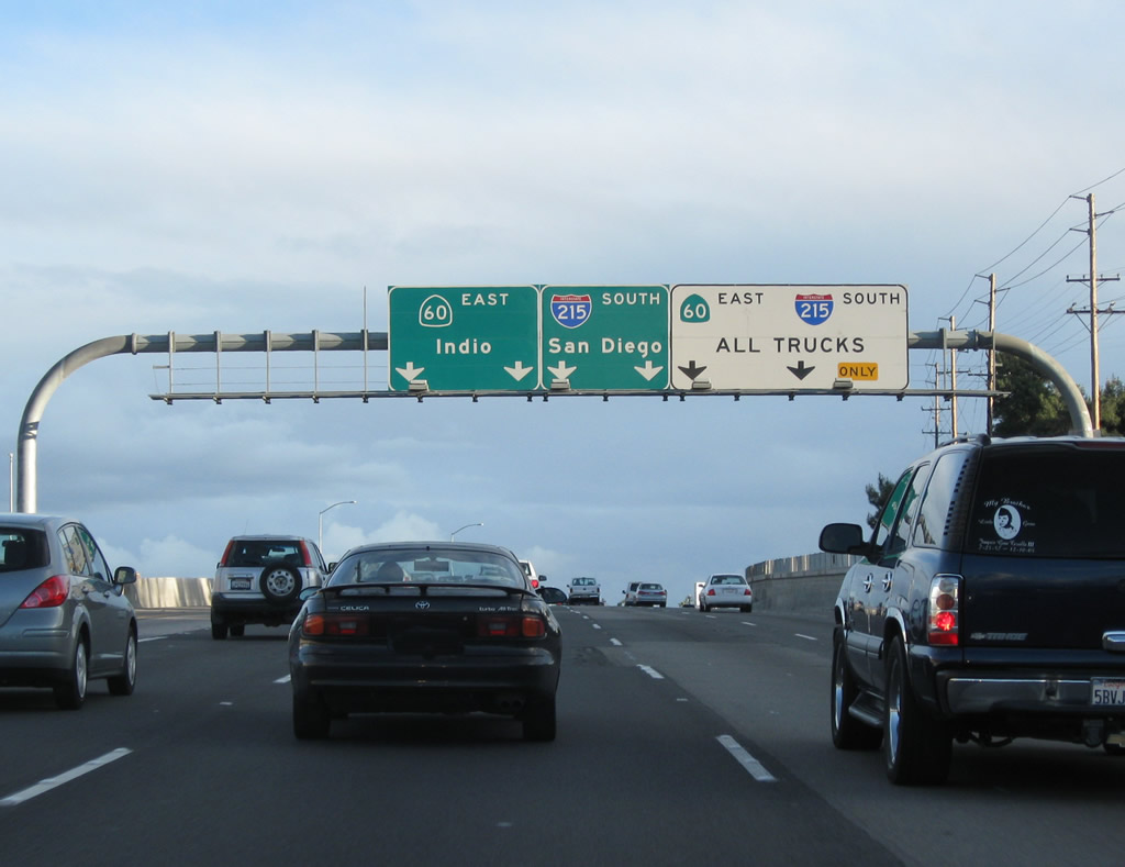
The two right lanes continue south on Interstate 215 (Escondido Freeway), while the left three lanes continue east on California 60 (Moreno Valley Freeway) east. This interchange is located in the eastern city of Riverside community of Canyon Springs. Interstate 215 travels south along Old U.S. 395 to Sun City, Perris, and Murrieta. Interstate 215 merges onto Interstate 15 south at that point, and Interstate 15 continues south to Temecula, Escondido, and San Diego. California 60, meanwhile, continues east into the city of Moreno Valley. It eventually ends at its merge onto Interstate 10 in Beaumont. Photo taken 03/31/08. |
| Truck Lanes - Interstate 215 south & California 60 east |
|
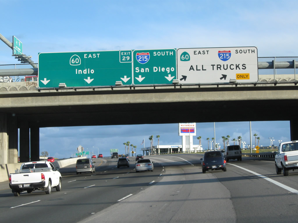
Now on the truck bypass lanes, the right lane connects to Interstate 215 (Escondido Freeway) south, while the left two lanes continue onto California 60 (Moreno Valley Freeway) east. Photo taken 07/14/08. |
|
The truck bypass splits: the left lanes continue east on California 60, while the right lane departs for Interstate 215 south. Photo taken 07/14/08. |
Page Updated April 17, 2011.