| Interstate 215 north & California 60 west |
|
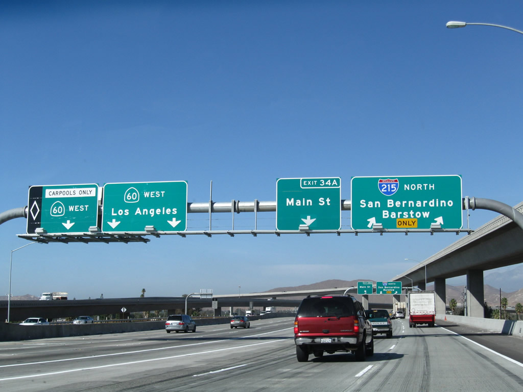
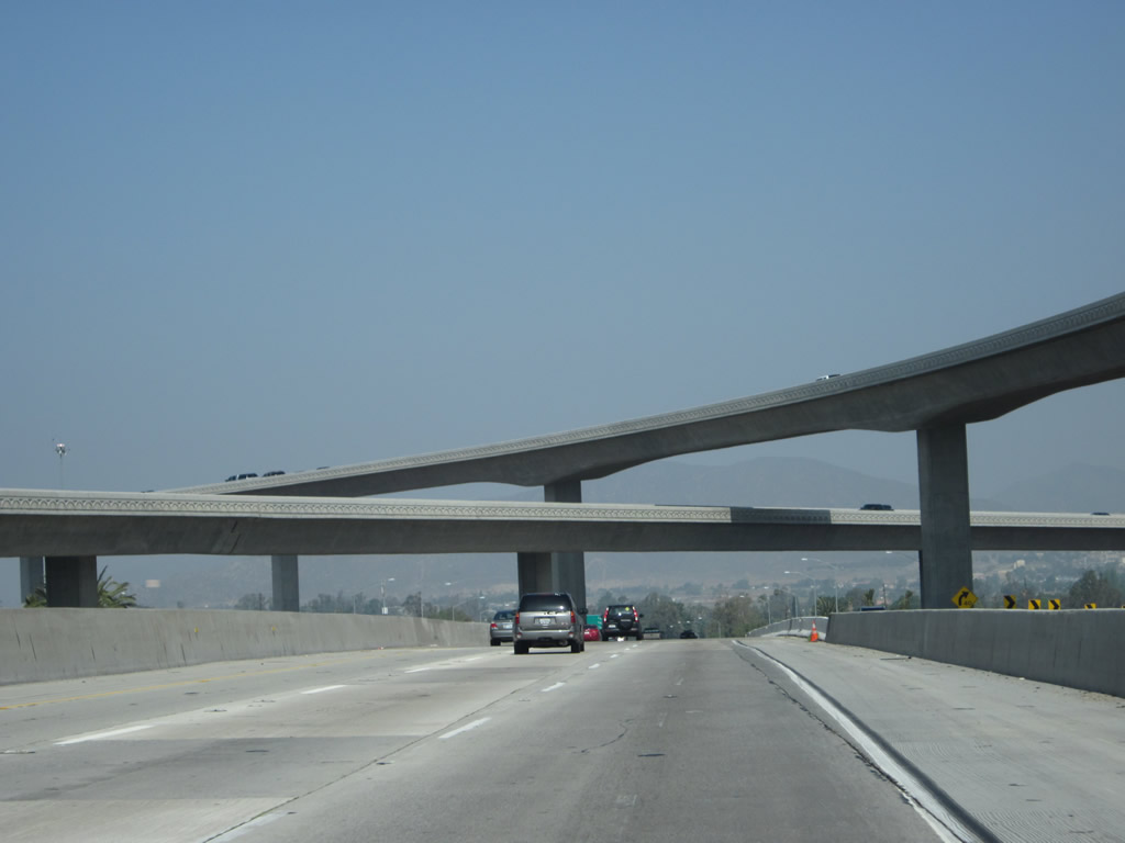
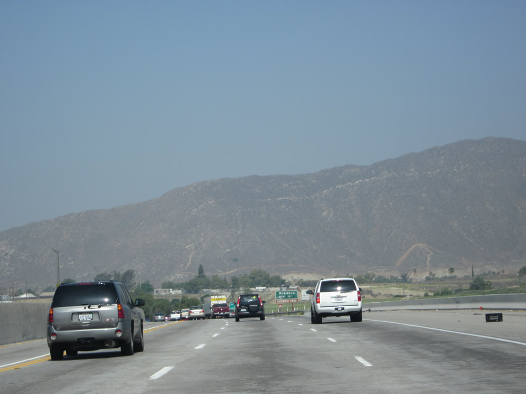
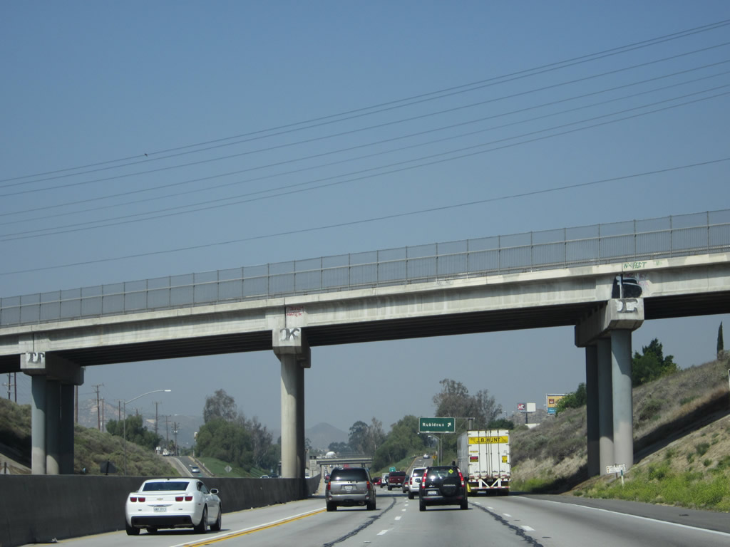
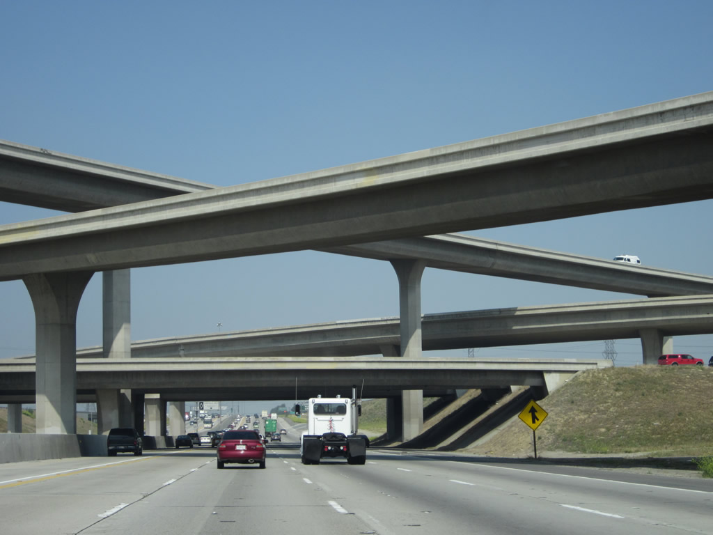
After the split with California 91, the next exit is Exit 34A, California 60 west to Pomona and Los Angeles and Main Street. This "exit" actually consists of two exits: the left three lanes continue west on California 60, while the right three lanes connect to Main Street and act as the mainline for Interstate 215 north. Photo taken 11/10/08. |
|
|
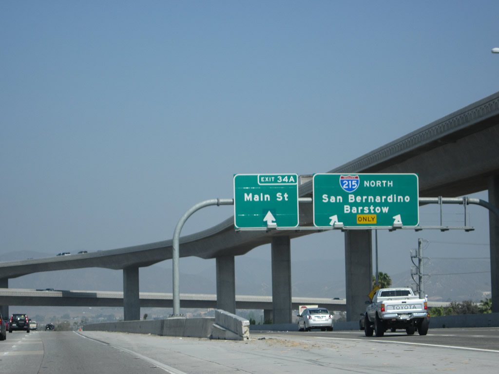
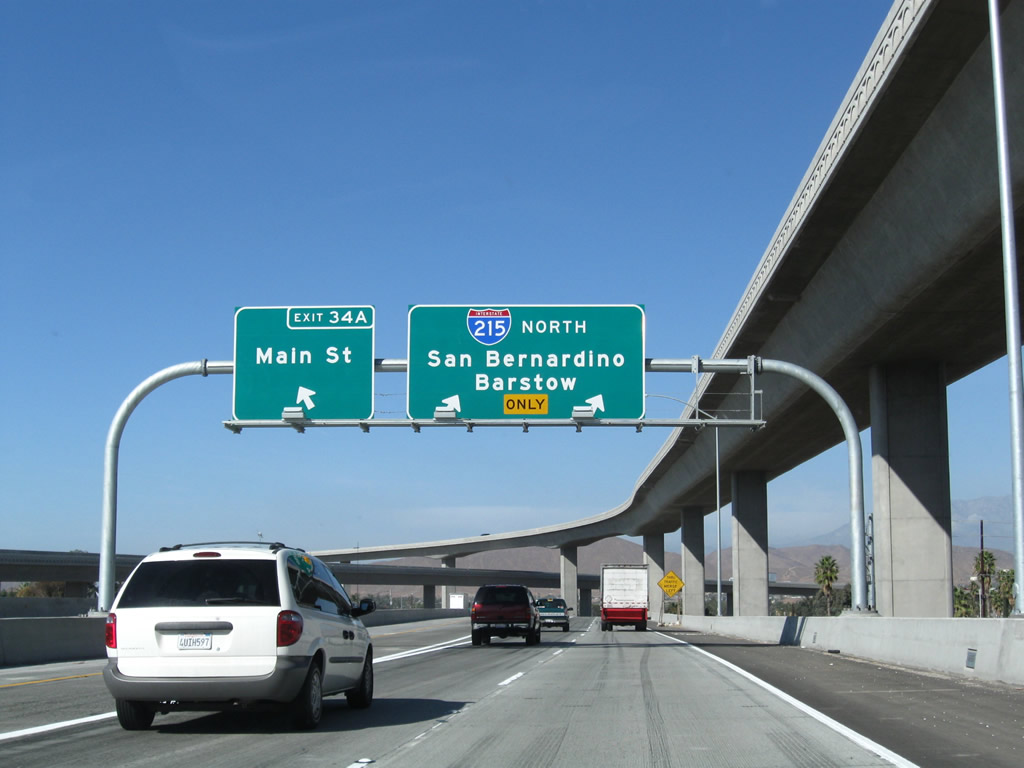
The three-lane ramp splits immediately thereafter, with the left lane of the ramp connecting to Exit 34A, Main Street, and the right two lanes continue as the mainline for Interstate 215 north. Calnexus also lists the Main Street/Orange Street off-ramp as California 60's Exit 52B, due to its prior configuration before the current 60-91-215 interchange was reconstructed. This ramp is the only way to get to the Main Street off-ramp (Exit 52B). Photos taken 05/05/12 and 11/10/08. |
| California 60 west |
|
|
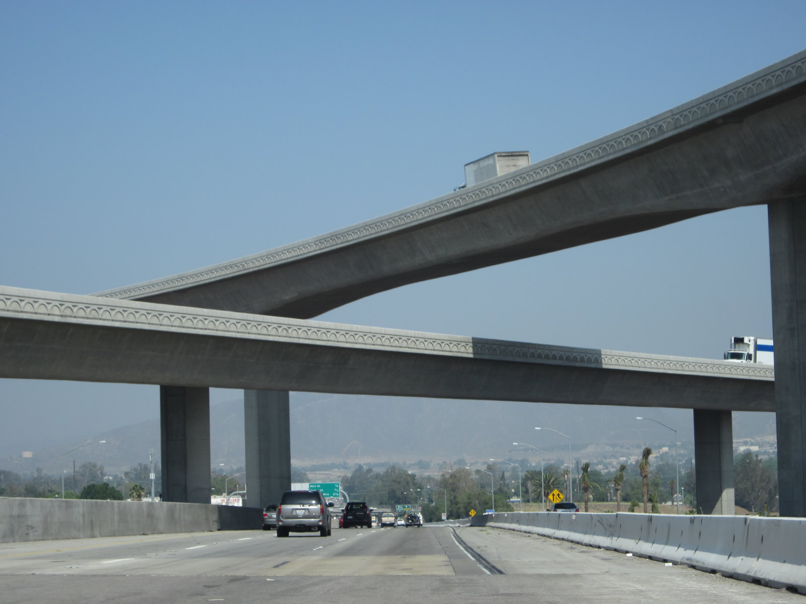
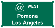
After Interstate 215 departs from the freeway, California 60 again continues along its westbound journey toward Pomona and Los Angeles. Towering transition ramps cross over the freeway, with one carrying Interstate 215 southbound traffic and the other (taller) ramp linking Interstate 215 north/California 60 west with California 91 west. Photos taken 05/05/12. |
|
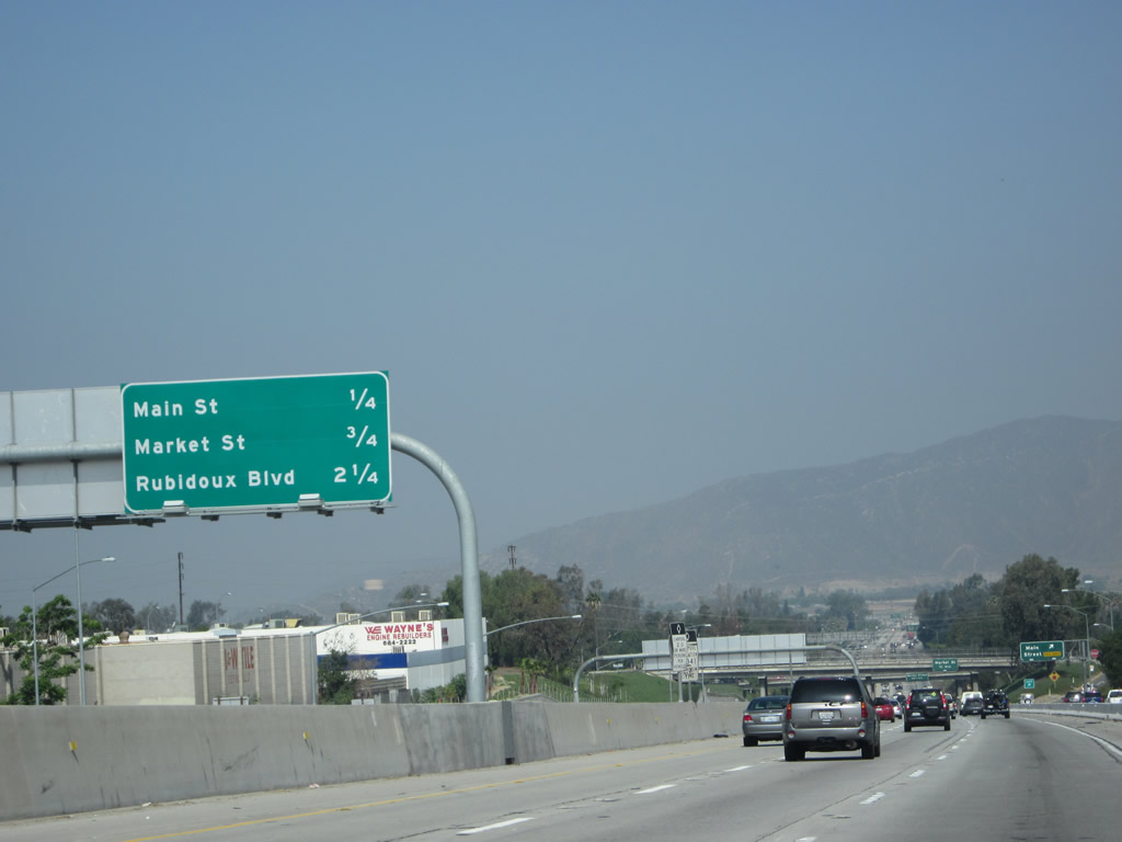
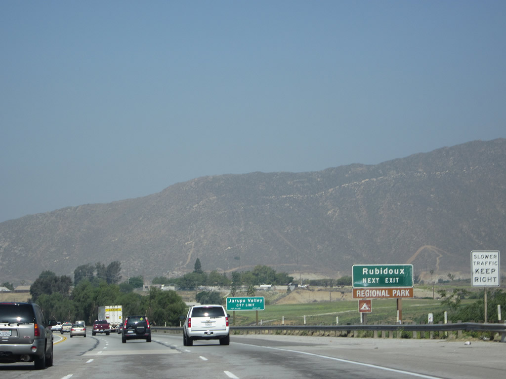
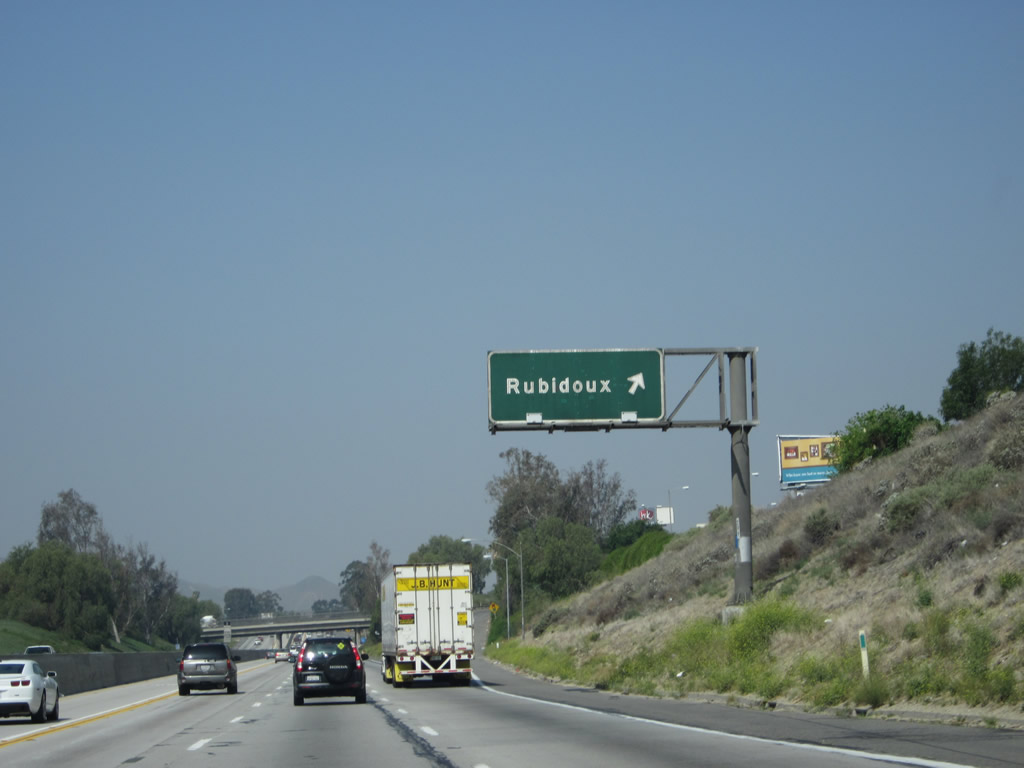
This mileage sign along California 60 west provides the distance to the next three exits: Exit 52B, Orange Street and Main Street (not accessible from the main lanes, only from the collector distributor lanes); Exit 52A, Market Street; and Exit 50, Rubidoux Boulevard. Photo taken 05/05/12. |
|
The collector distributor lanes of westbound California 60 reaches Exit 52B, Orange Street and Main Street. Upon ascending the off-ramp, the stop sign intersection is with Orange Street; after the stop sign, continue ahead past Orange Street to Main Street. Photo taken 05/05/12. |
|
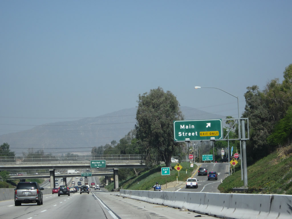
Passing under Orange Street, this guide sign advises of the next exit along westbound California 60: Exit 52A, Market Street (one-half mile). Traffic from Interstate 215 south and California 91 east merge onto California 60 west at this point, adding a fourth lane. Photo taken 05/05/12. |
|
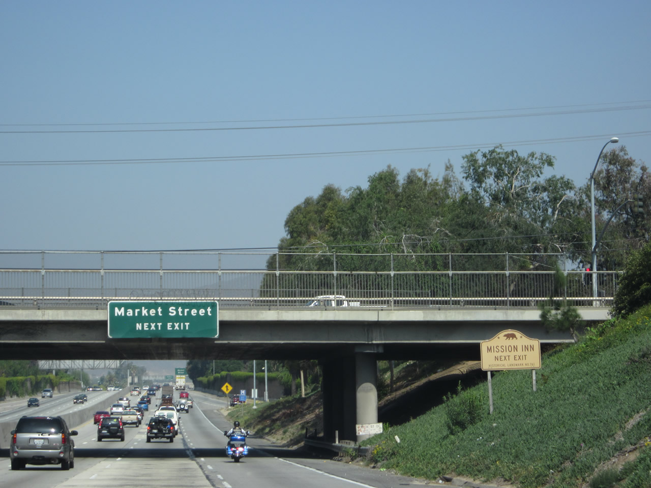
Forthcoming Exit 52A for Market Street leads motorists south to Downtown Riverside and the Mission Inn. Photo taken 05/05/12. |
|
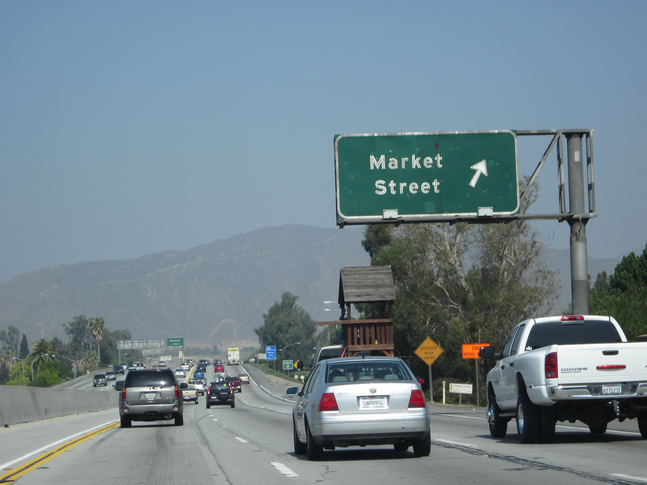
Westbound California 60 meets Exit 52A, Market Street south to downtown Riverside. A high occupancy vehicle lane resumes in the left lane. Photo taken 05/05/12. |
|
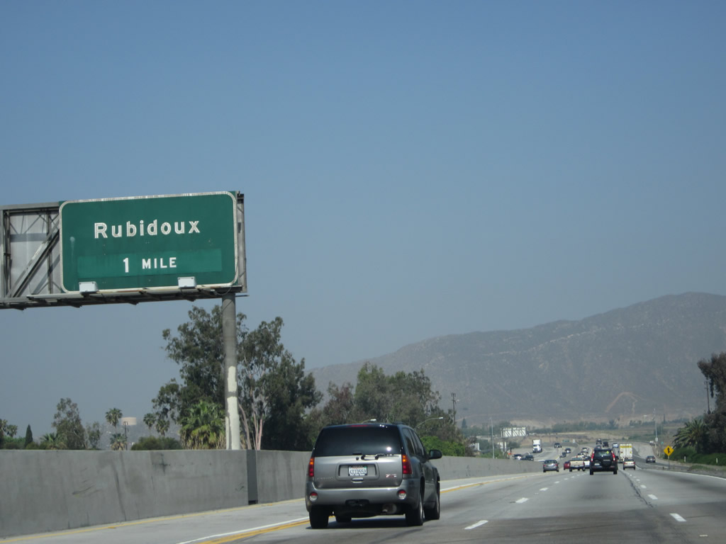
The next exit along California 60 west is Exit 50, Rubidoux Boulevard. Photo taken 05/05/12. |
|
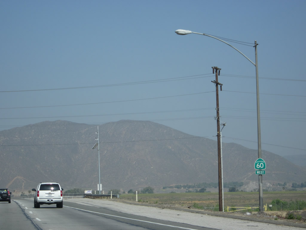
A California 60 west reassurance shield is posted after the on-ramp from Market Street. Photo taken 05/05/12. |
|
Californian 60 crosses over the Santa Ana River. Photo taken 05/05/12. |
|
Rubidoux Boulevard serves the community of Rubidoux, which is part of the city of Jurupa Valley. Exit 50 is a diamond interchange; Rubidoux Boulevard travels south to connect with California 60 Business (Mission Boulevard). Photo taken 05/05/12. |
|
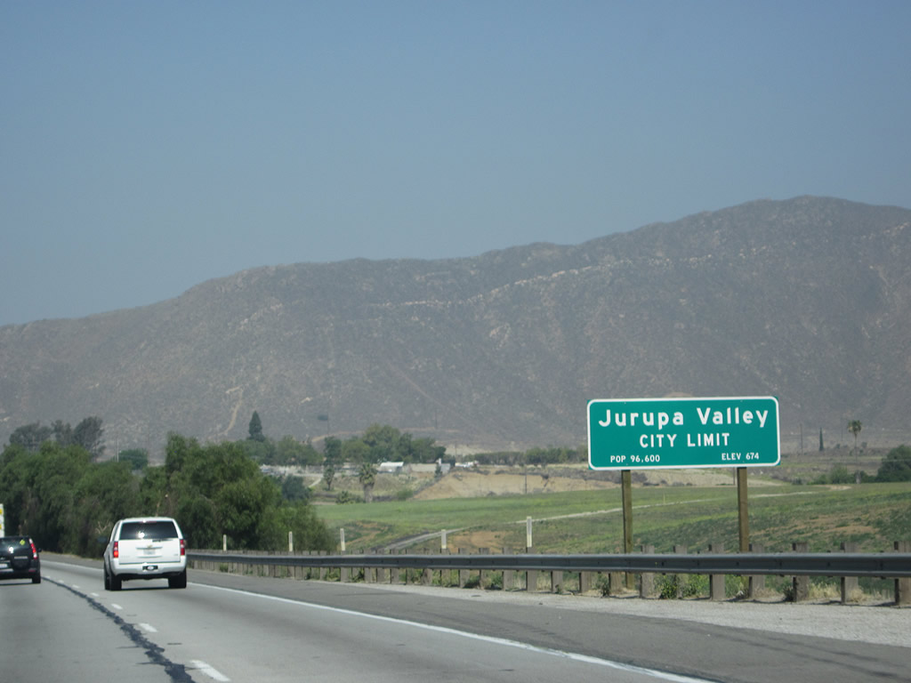
California 60 enters the city of Jurupa Valley, which incorporated as a city as of July 1, 2011. The population is estimated to be 96,600 per the Caltrans sign; official Census figures won't be available for this city until the 2020 Census. Photo taken 05/05/12. |
|
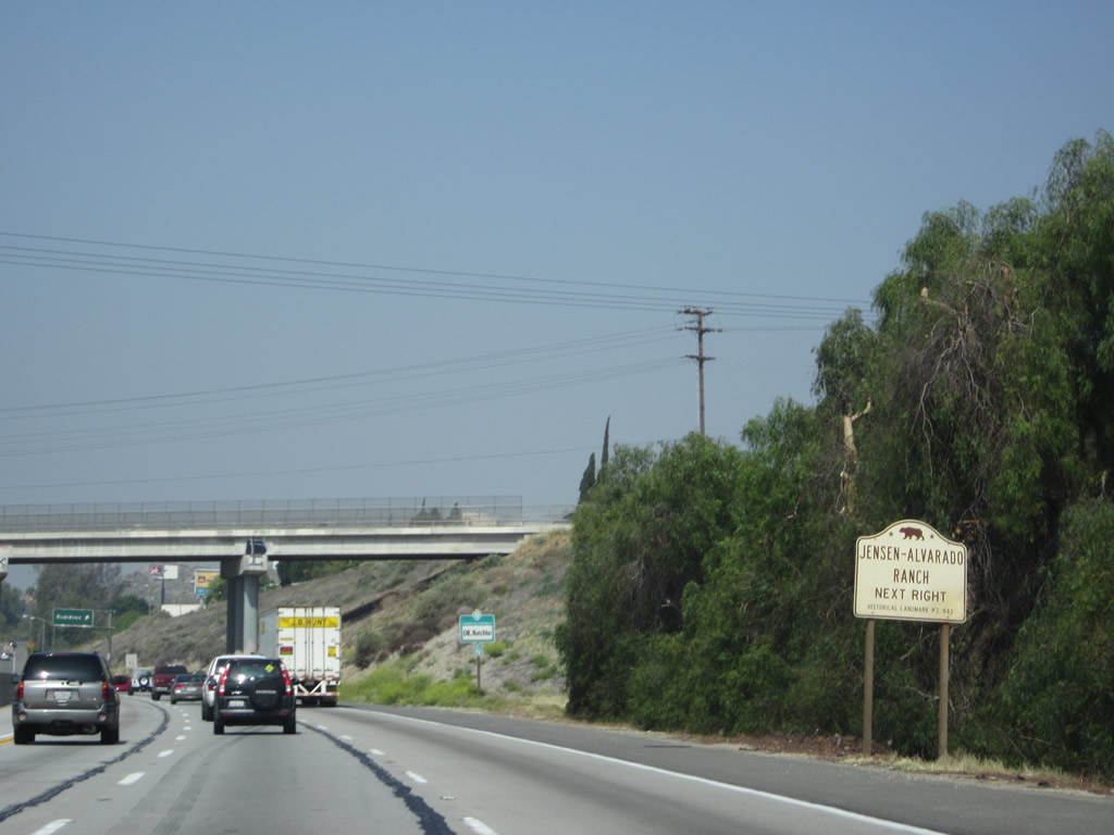
Use Exit 50 to the Jensen Alvarado Historic Ranch and Museum, which is operated by Riverside County parks. Photo taken 05/05/12. |
|
A bridge carrying Hall Avenue crosses over California 60. Photo taken 05/05/12. |
|
Westbound California 60 reaches Exit 50, Rubidoux Boulevard to Rubidoux, which is part of the city of Jurupa Valley. Photo taken 05/05/12. |
|
Traffic from Rubidoux Boulevard merges onto westbound California 60. Photo taken 05/05/12. |
|
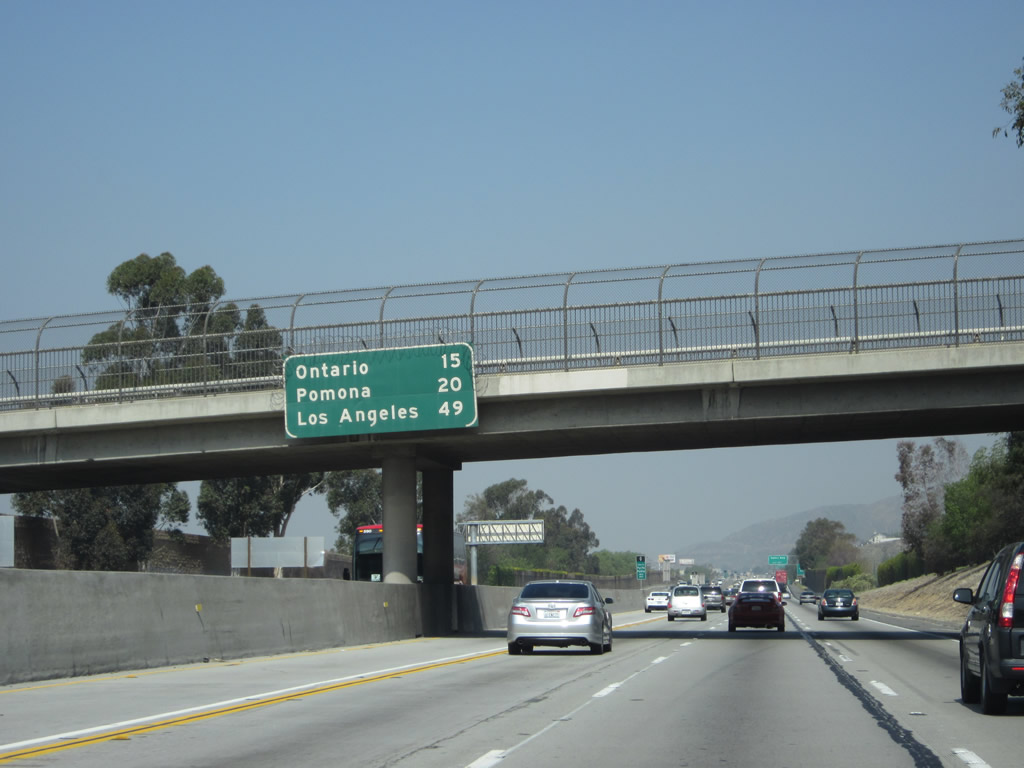
This mileage sign, mounted on the La Rue Street overpass, provides the distance to Ontario (15 miles), Pomona (20 miles), and Los Angeles (49 miles) via westbound California 60. Photo taken 05/05/12. |
|
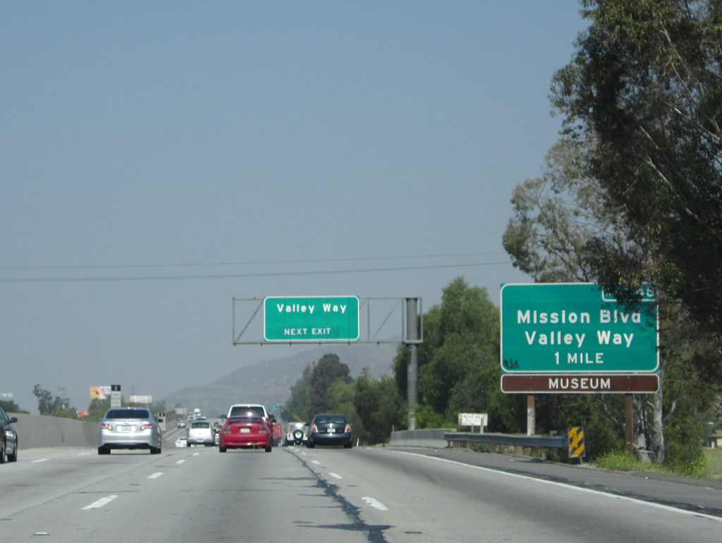
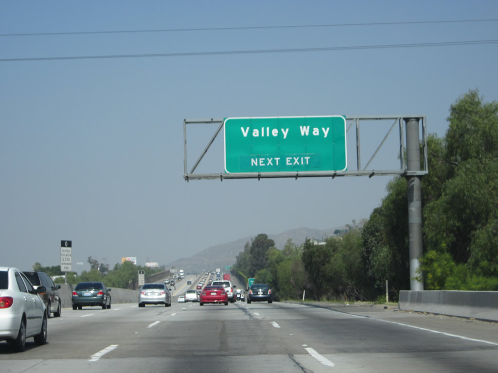
The next exit along California 60 west is Exit 48, Valley Way to California 60 Business (Mission Boulevard). Photo taken 05/05/12. |
|
Valley Way travels northeast to become Armstrong Road en route to Crestmore, and to the southwest, Valley Boulevard links with Mission Boulevard, then proceeds to merge onto Jurupa Road southwest. Jurupa Road proceeds southwest to the Mira Loma community of the city of Jurupa Valley. Photo taken 05/05/12. |
|
Mission Boulevard is a signed business route, carrying California 60 Business from Exit 43 (Mission Boulevard / Country Village Road) east to Interstate 215 / California 60 Exit 32. Most of the signed segments of business route are in Jurupa Valley, a new city, so presumably the city will take over responsibility for deciding how well to sign California 60 Business within its jurisdiction. Photo taken 05/05/12. |
|
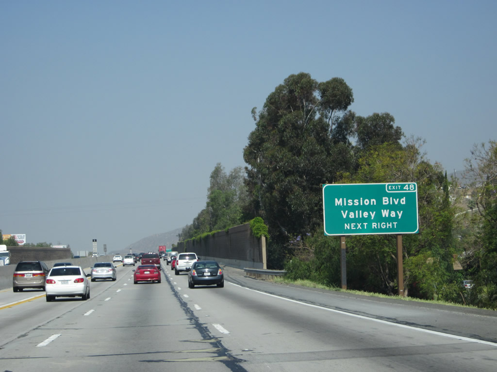
Westbound California 60 reaches Exit 48, Valley Way to California 60 Business (Mission Boulevard). Photo taken 05/05/12. |
|
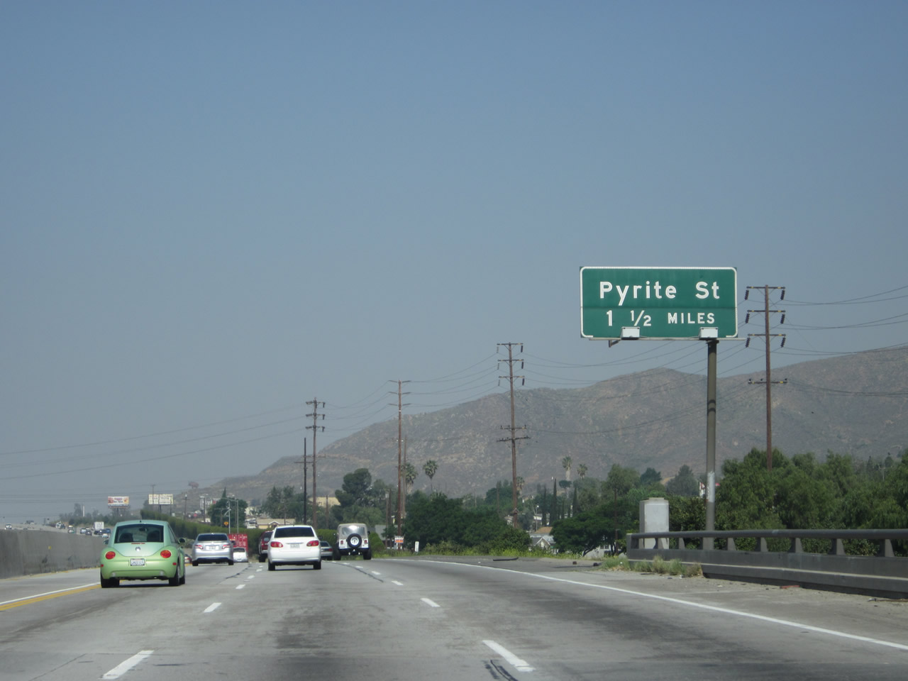
The next exit along California 60 west is Exit 46, Pyrite Street (1.50 miles). Photo taken 05/05/12. |
|
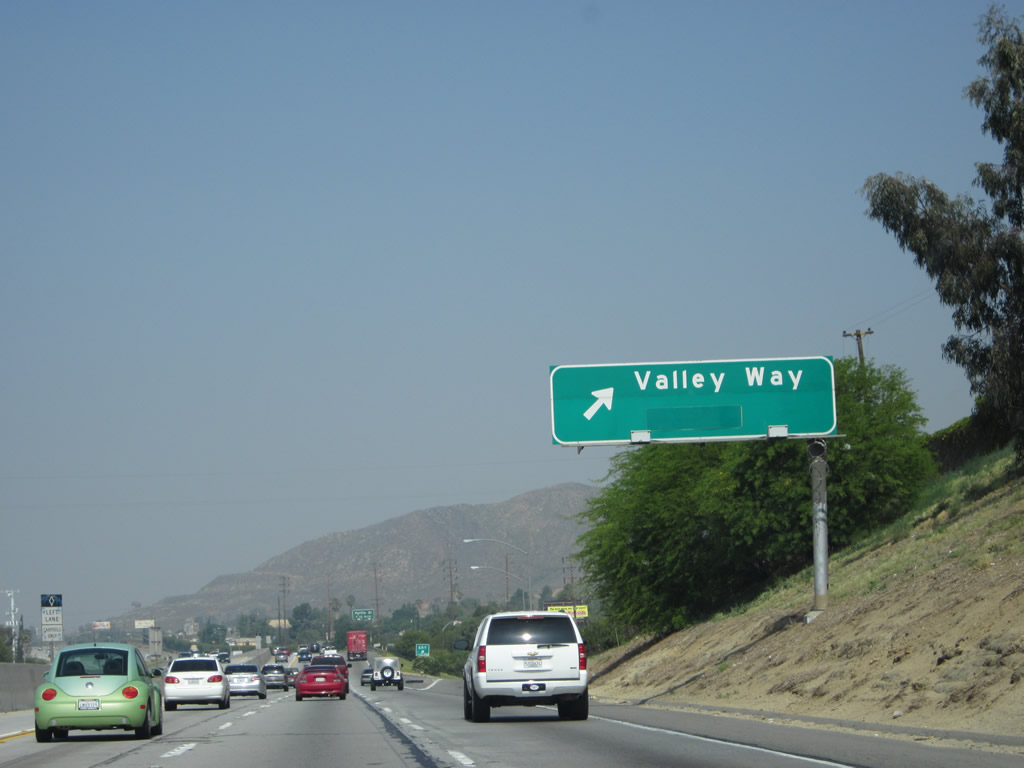
A California 60 west reassurance shield is posted after the on-ramp from Valley Way. Photo taken 05/05/12. |
|
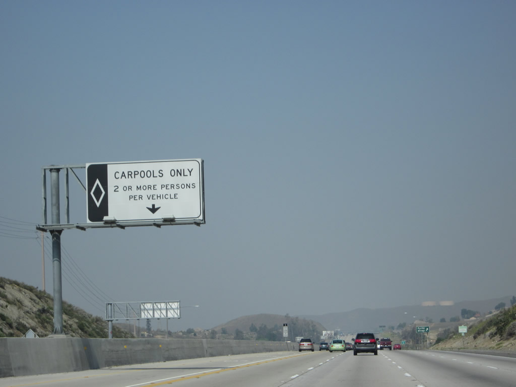
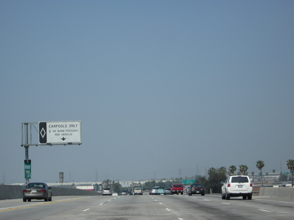
The HOV/carpool lane continues with an entrance/exit here. Photo taken 05/05/12. |
|
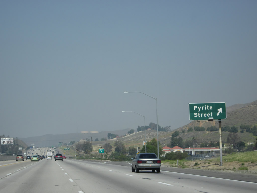
Westbound California 60 reaches Exit 46, Pyrite Street. Northbound Pyrite Street provides local access, but Pyrite Street travels south to connect to California 60 Business (Mission Boulevard) and Jurupa Road. Photo taken 05/05/12. |
|
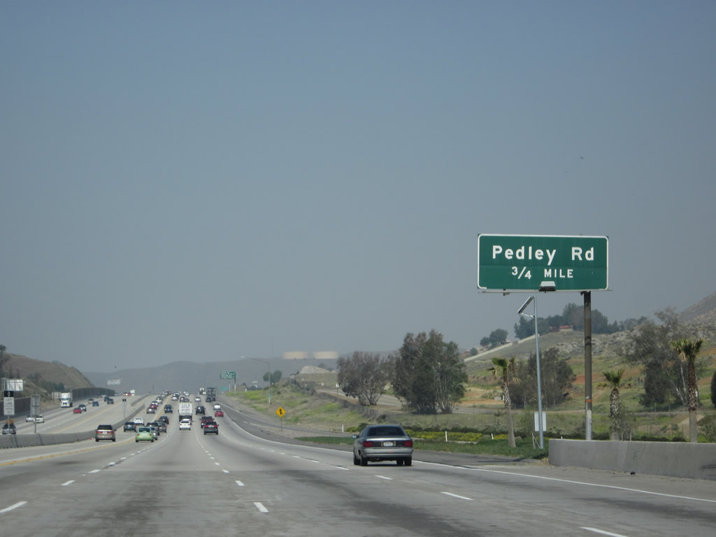
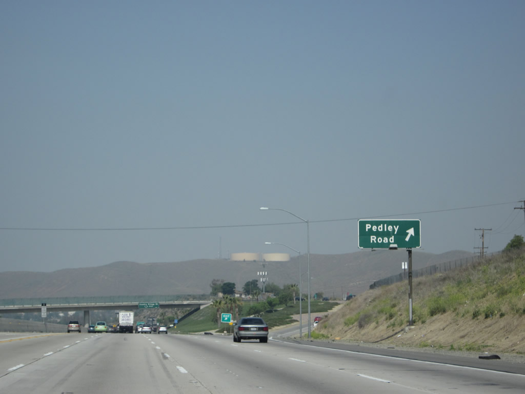
The next exit along California 60 west is Exit 45, Pedley Road (0.75 mile). Photo taken 05/05/12. |
|
A California 60 west reassurance shield is posted after the on-ramp from Pyrite Street. Photo taken 05/05/12. |
|
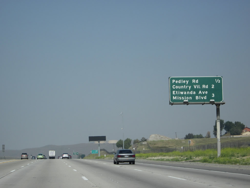
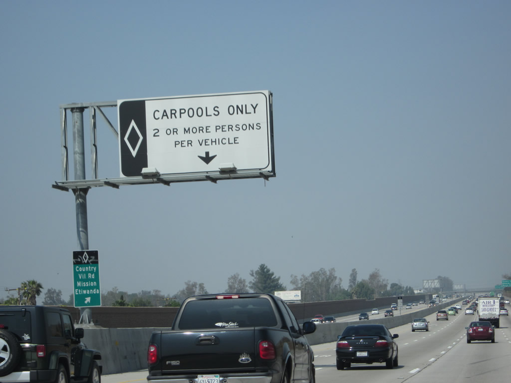
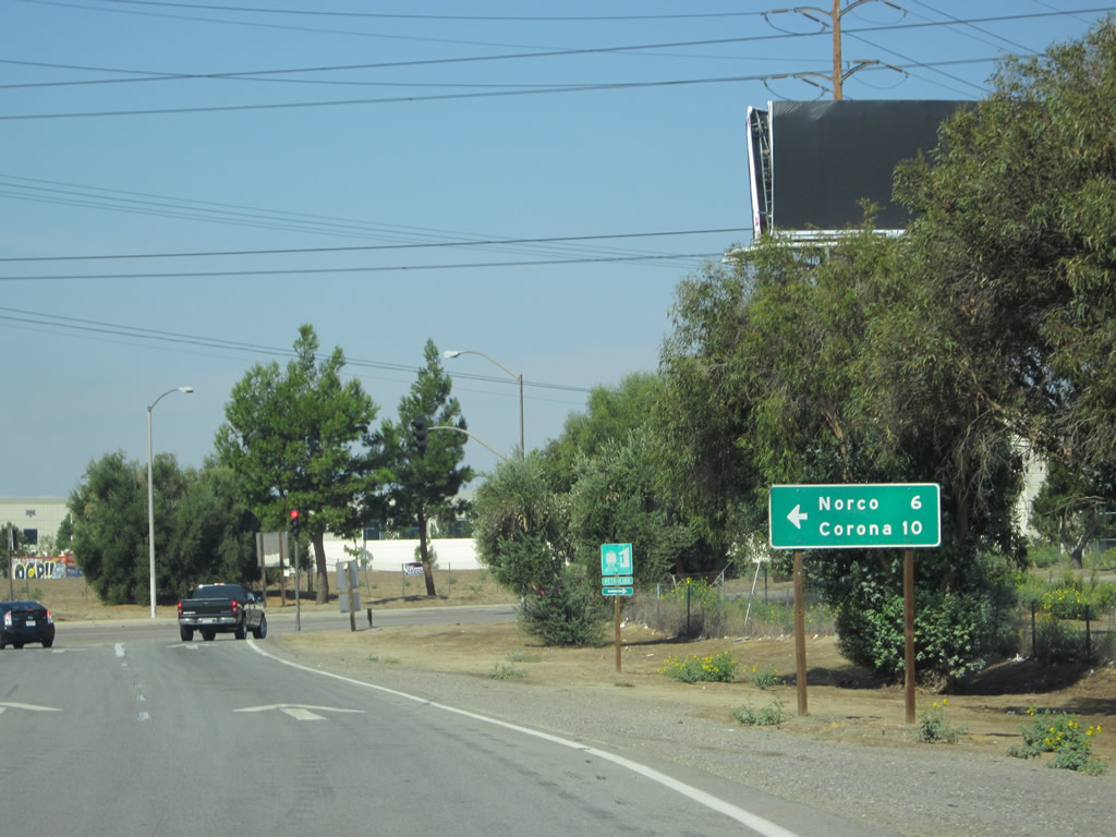
This mileage sign along California 60 west provides the distance to the next three exits: Exit 45, Pedley Road; Exit 43, California 60 Business (Mission Boulevard) east and Country Village Road north; and Exit 42, Etiwanda Avenue north/south, Mission Boulevard northwest; and Van Buren Boulevard southeast. Photo taken 05/05/12. |
|
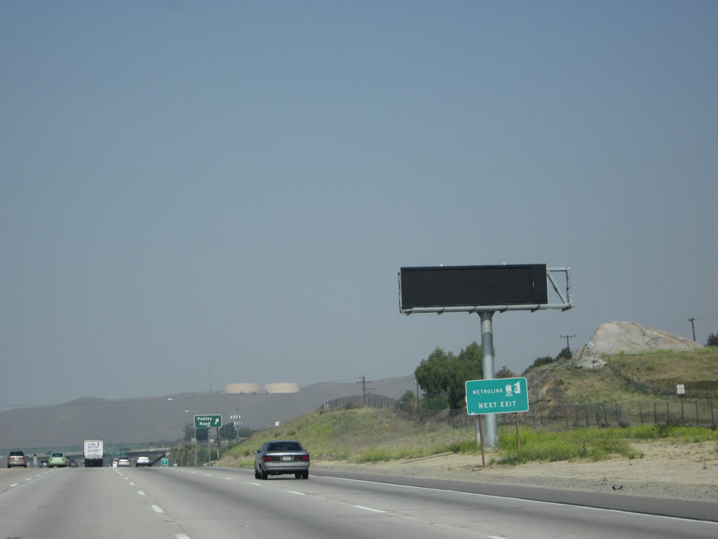
A dynamic message sign is found shortly thereafter. Use Exit 45 to a Metrolink station. Photo taken 05/05/12. |
|
Westbound California 60 reaches Exit 45, Pedley Road. Photo taken 05/05/12. |
|
The next exit along California 60 west is Exit 43, California 60 Business (Mission Boulevard) east and Country Village Road north (1.50 mile). Photo taken 05/05/12. |
|
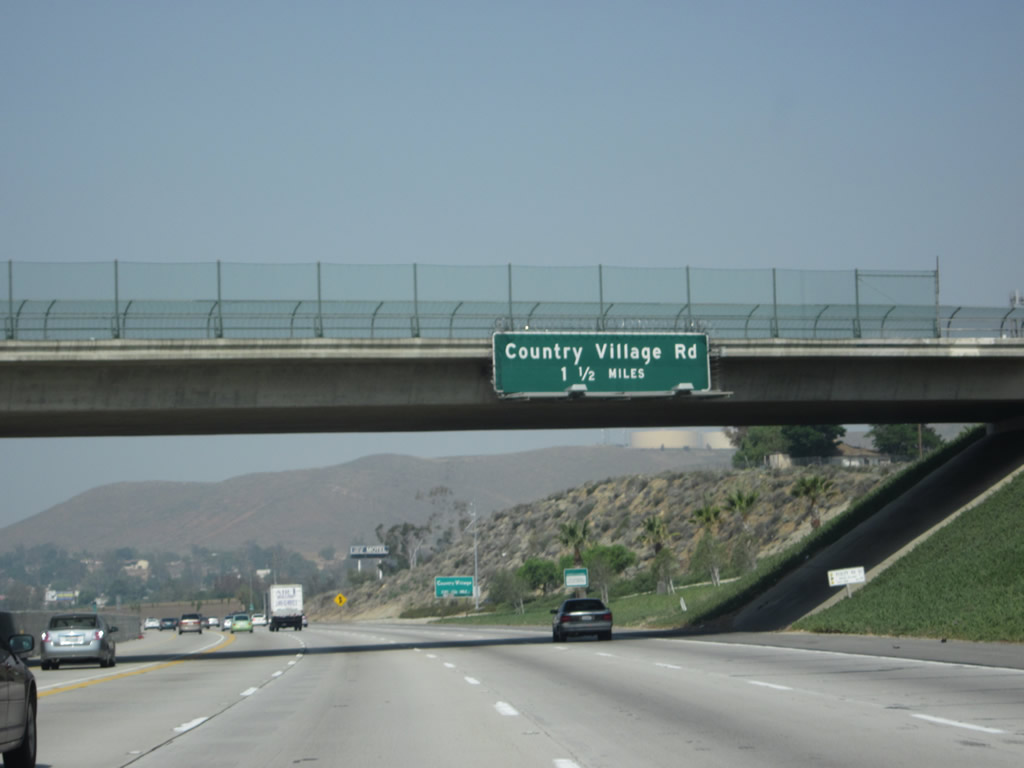
A smaller sign for Country Village Road north is posted prior to the on-ramp from Pedley Road. Photo taken 05/05/12. |
|
This view looks west on California 60 between the Pedley Road and Country Village Road interchanges. Photo taken 05/05/12. |
|
A carpool/HOV lane entrance and exit is located between these two interchanges as well. Photo taken 05/05/12. |
|
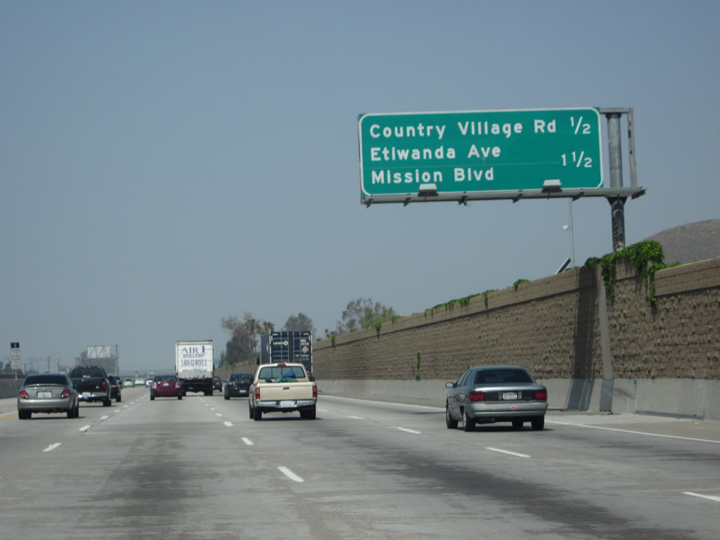
This mileage sign along California 60 west provides the distance to the next two exits: Exit 43, California 60 Business (Mission Boulevard) east and Country Village Road north and Exit 42, Etiwanda Avenue north/south, Mission Boulevard northwest; and Van Buren Boulevard southeast. Photo taken 05/05/12. |
|
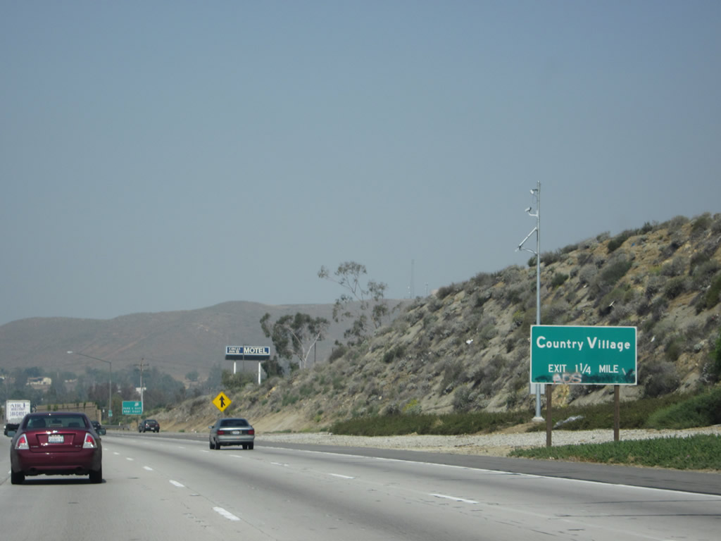
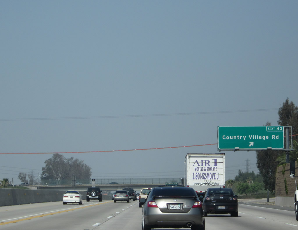
Westbound California 60 reaches Exit 43, California 60 Business (Mission Boulevard) east and Country Village Road north. This interchange marks the western terminus of California 60 Business, which travels east into Jurupa Valley and Riverside. Photo taken 05/05/12. |
|
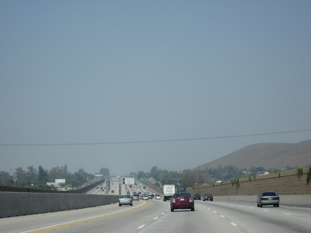
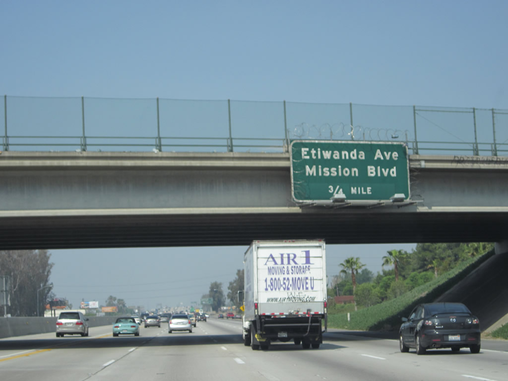
California 60 passes under Country Village Road. The next exit along westbound California 60 is Exit 42, Etiwanda Avenue, which connects to Mission Boulevard northwest and Van Buren Boulevard southeast. Van Buren Boulevard is a very long and significant inter-city route, connecting from California 60 southeast through Riverside to link back to California 91 and then east to Interstate 215. Much of the route is four lanes. Photo taken 05/05/12. |
|
|
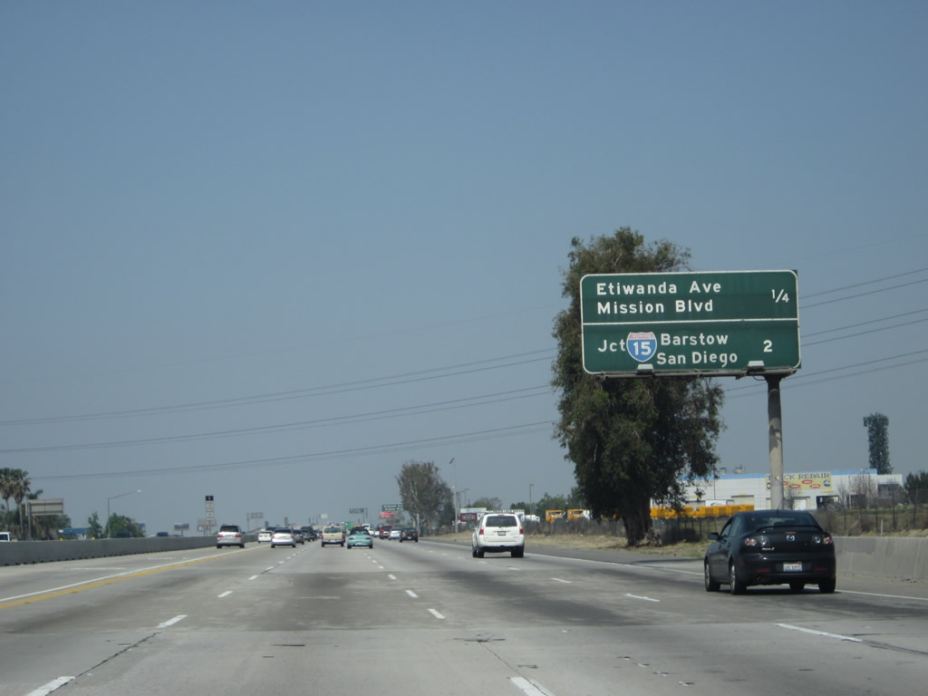
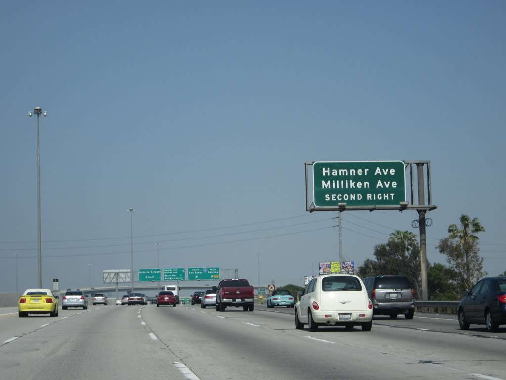
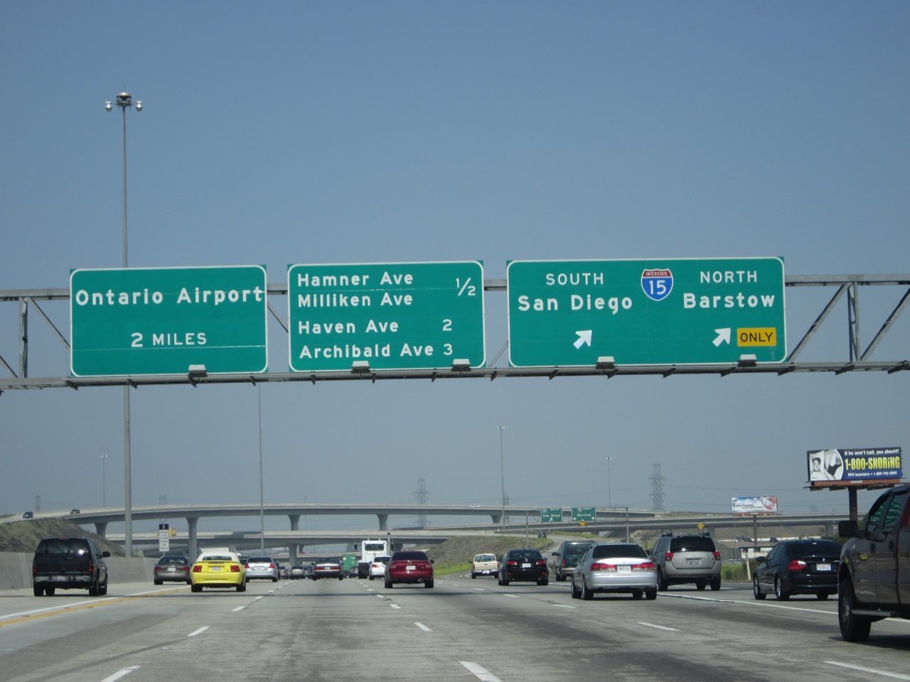
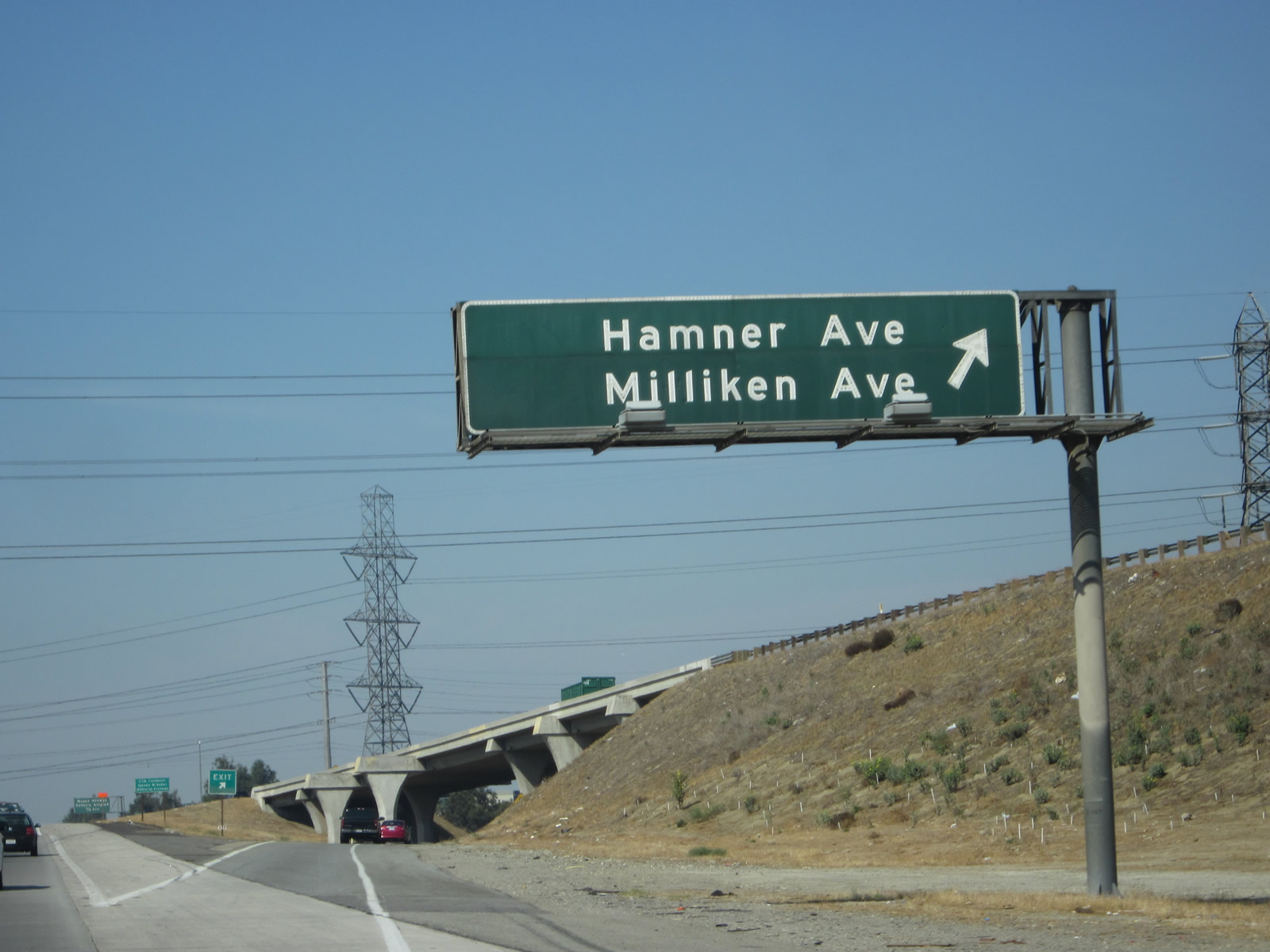
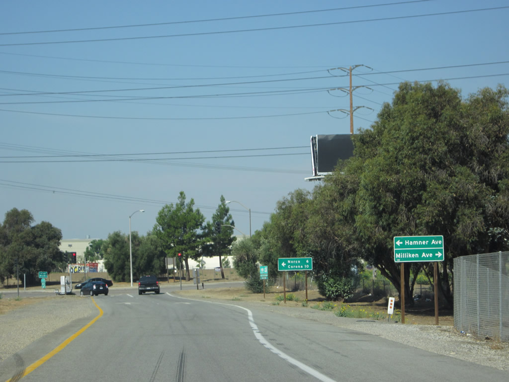
This mileage sign along California 60 west provides the distance to the next two exits: Exit 42, Etiwanda Avenue and Exit 41B, Interstate 15 north to Barstow and Las Vegas and south to Corona and San Diego. If examined closely, look below the line. You'll see that the words "Hamner Avenue" and "Milliken Avenue" on the left, and on the right side of the sign you'll see remnants of a previous California 31 shield (look to the right of the words "San Diego") that was posted here and now removed. Photos taken 05/05/12. |
|
|
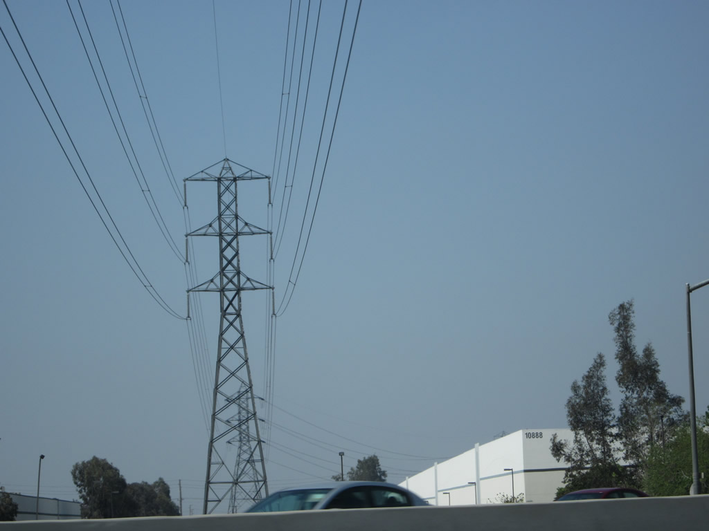
A set of 220kV Southern California Edison powerlines pass over California 60 between Country Village Road and Etiwanda Avenue. These lines travel southwest to a large, 500kV/220kV substation located west of Cantu-Galleano Road/Interstate 15 interchange. To the east, they travel toward a substation located near the Interstate 215 and Newport Avenue grade separation. Photos taken 05/05/12. |
|
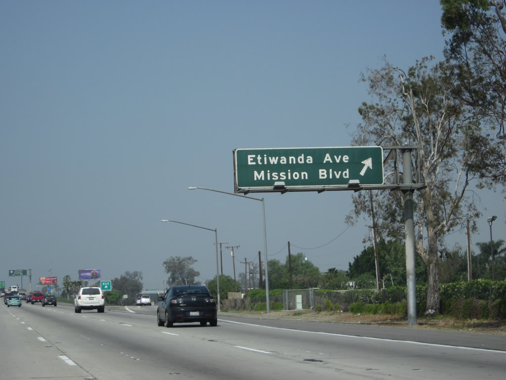
Westbound California 60 reaches Exit 42, Etiwanda Avenue, which connects to Mission Boulevard northwest and Van Buren Boulevard southeast. Mission Boulevard continues as Historic U.S. 60, traveling northwest and then west into Pomona before reuniting with Historic U.S. 70-99 in Pomona (and sharing pavement together for the final distance to Los Angeles via the Interstate 10 corridor). U.S. 60-70 used to end in downtown Los Angeles, and might have extended as far west as the Four-Level Interchange (which is the junction of U.S. 101 and California 110 today). Between Pomona and Los Angeles, California 60 was never part of U.S. 60. Photo taken 05/05/12. |
|
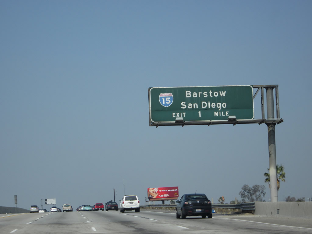
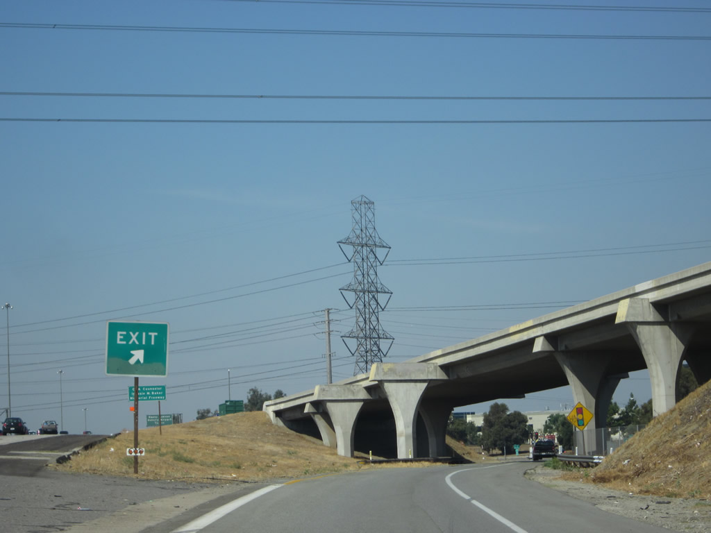
The next exit along California 60 west is Exit 41B, Interstate 15 north to Barstow and Las Vegas and south to Corona and San Diego. A major north-south corridor leading from Southern California to Las Vegas, Salt Lake City, Pocatello, Butte, and Great Falls, Interstate 15 carries a great deal of traffic into the Rocky Mountain States of Utah, Idaho, and Montana with connections to Interstate 40 east to Albuquerque, Interstate 70 east to Denver, and Interstate 80 east to Cheyenne. Photo taken 05/05/12. |
|
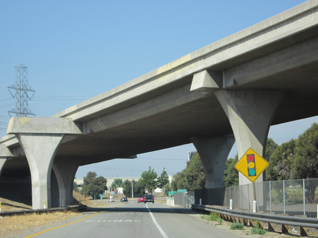
Passing over Etiwanda Avenue, westbound California 60 has five lanes, including a high occupancy vehicle lane. Photo taken 05/05/12. |
|
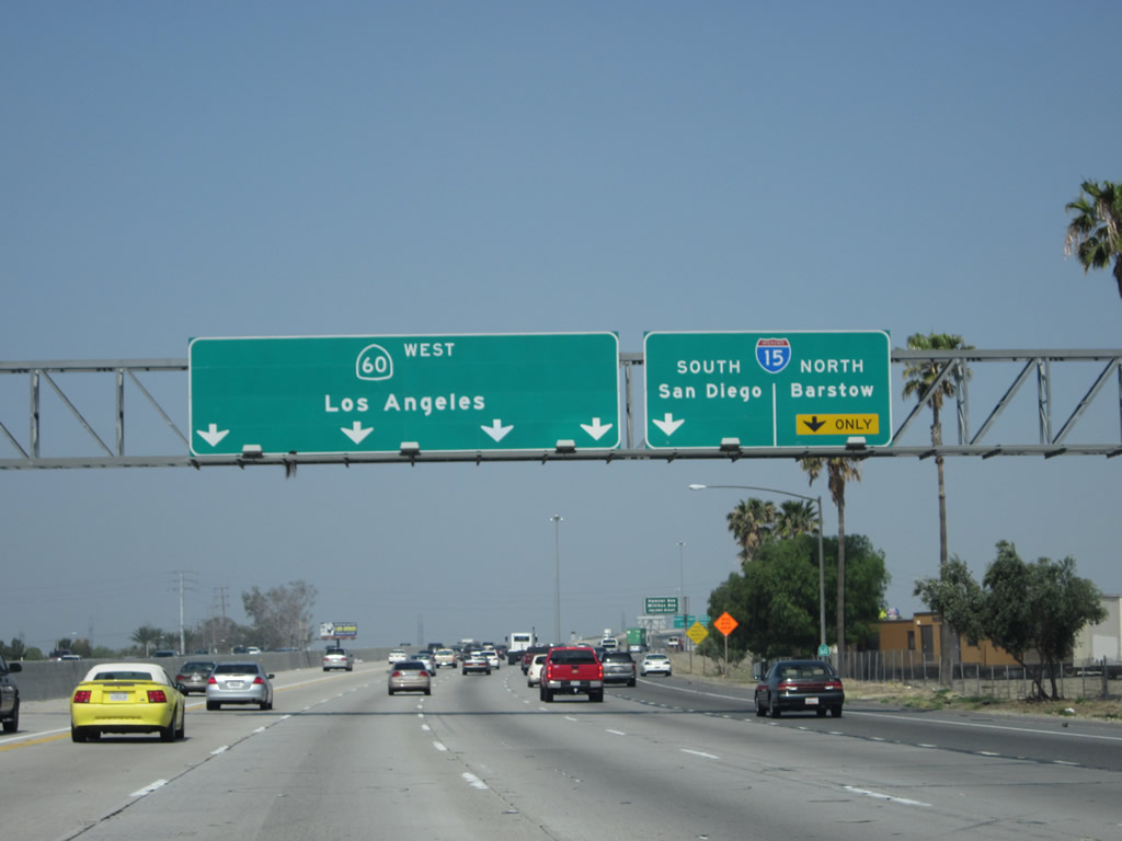
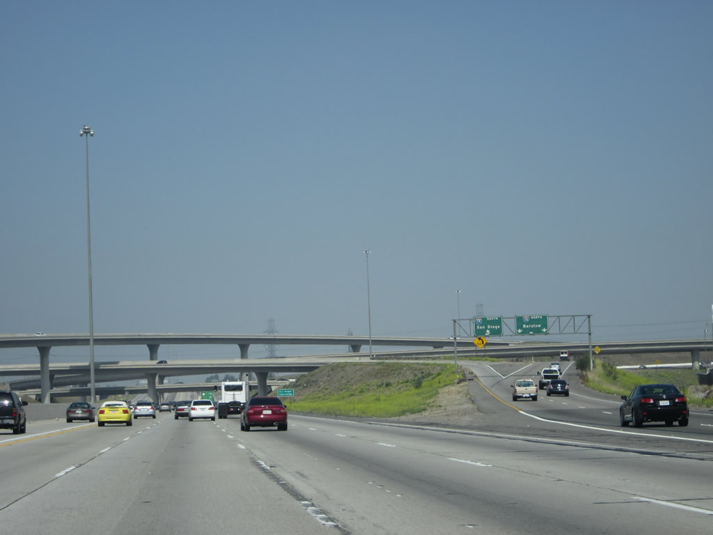
As traffic from Etiwanda Avenue joins California 60 west, this overhead sign advises that the left four lanes (and HOV lane) will continue west to Pomona and Los Angeles, while the right two lanes will connect to Interstate 15 north/south. Photo taken 05/05/12. |
|
The second exit along California 60 west (after Exit 41B, Interstate 15 north) will be Exit 41A, Hamner Avenue south and Milliken Avenue north (former California 3 1/ Temporary Interstate 15). Photo taken 05/05/12. |
|
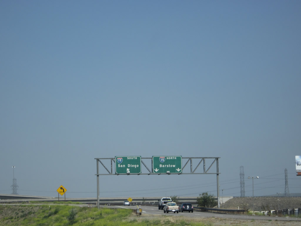
Westbound California 60 reaches Exit 41B, Interstate 15 north to Barstow and Las Vegas and south to Corona and San Diego. The next three exits will be Exit 41A, Hamner Avenue south and Milliken Avenue north (former California 31); Exit 39, Haven Avenue to Ontario International Airport; and Exit 38, Archibald Avenue. Photo taken 05/05/12. |
|
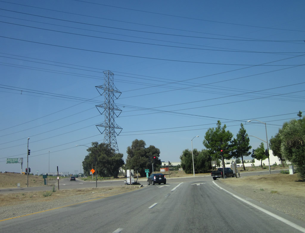
The California 60 and Interstate 15 interchange is a stack interchange (almost symmetrical except for a loop ramp from Interstate 15 north to California 60 west). Photo taken 05/05/12. |
|
Looking at the transition ramp to Interstate 15 (Exit 41B), the left lane connects to Interstate 15 south to Corona and San Diego, while the right two lanes connect to Interstate 15 north to Barstow and Las Vegas. Photo taken 05/05/12. |
|
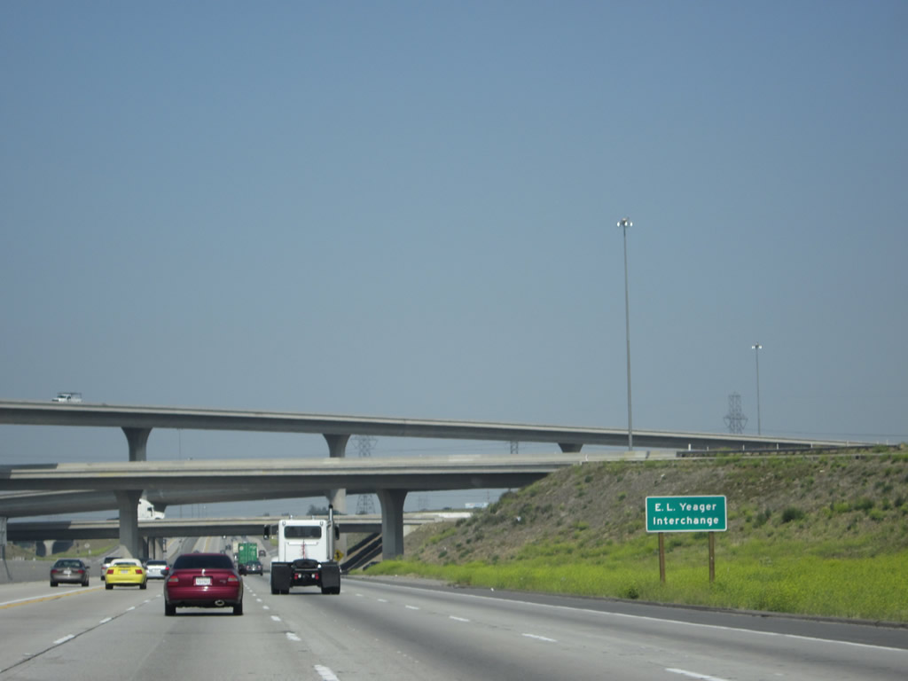
Named in honor of E.L. Yeager, this interchange has multiple levels. California 60 will serve as the bottom level of the California 60 and Interstate 15 interchange stack. Photo taken 05/05/12. |
|
Westbound California 60 passes through the Interstate 15 stack interchange. For just a short distance (between Interstate 15 and Hamner Avenue / Former California 31), California 60 passes through the city of Eastvale (population 53,668 as of the 2010 Census; elevation 627 feet; and incorporated on October 1, 2010). Photo taken 05/05/12. |
|
Westbound California 60 reaches Exit 41A, Hamner Avenue south and Milliken Avenue north (former California 31). This sign used to have a California 31 / TEMP I-15 route marker that was scraped off when that state highway was decommissioned; it is difficult to see the residual marks on this sign from when it carried those designations. Prior to the completion of Interstate 15 in the 1980s, California 31 was the north-south state route connecting Corona with Ontario via Hamner Avenue and Milliken Avenue. California 31 was decommissioned in favor of Interstate 15 once the freeway was built; a portion of Hamner Avenue through Norco is currently designated as Business Loop I-15 but is not state-maintained. Photo taken 10/13/12. |
|
|
|
|
|
| This series of pictures follows the off-ramp from California 60 west to Exit 41A, Hamner Avenue south and Milliken Avenue north (former California 31). The off-ramp must pass under the transition ramp from Interstate 15 to California 60 west, then approach a traffic signal with the former state route. Note the mileage sign, which provides the distance to Norco and Corona via Hamner Avenue (former California 31) south. No mention is made of Ontario, which lies a short distance north of here. Photo taken 10/13/12. |
|
Back on the mainline, several power lines cross over California 60 as we look at the off-ramp from California 60 west to Hamner Avenue and Milliken Avenue. Beyond that, look for an on-ramp joining California 60 west from Interstate 15. Photo taken 05/05/12. |
Page Updated October 13, 2012.