| California 91 - Riverside Freeway east |
|
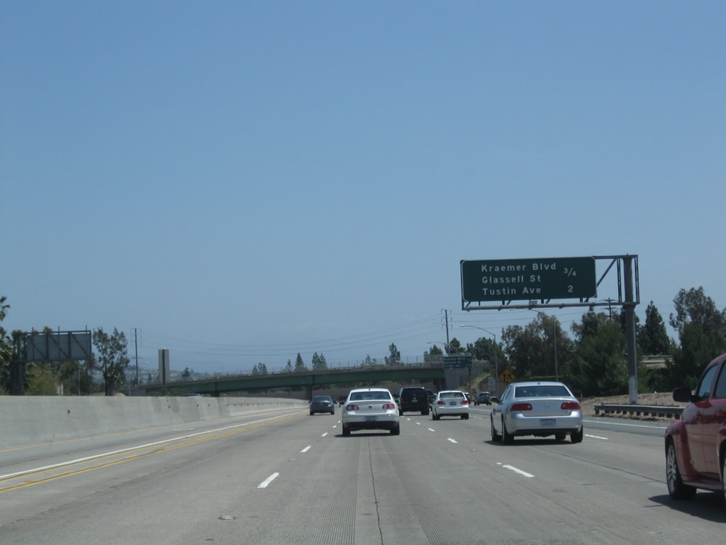
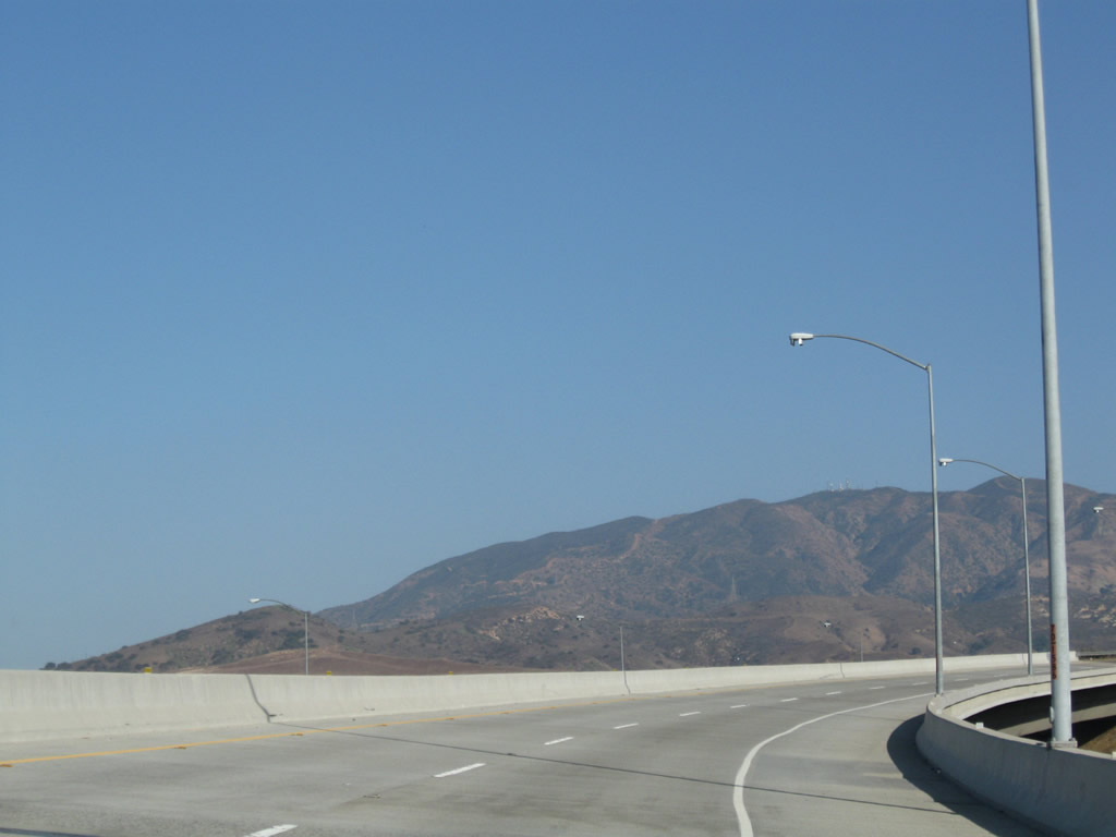
This mileage sign provides the distance to the next two exits along California 91 (Riverside Freeway) east: Exit 31, Kraemer Boulevard and Glassell Street and Exit 33, Tustin Avenue. Photo taken 05/02/10. |
|
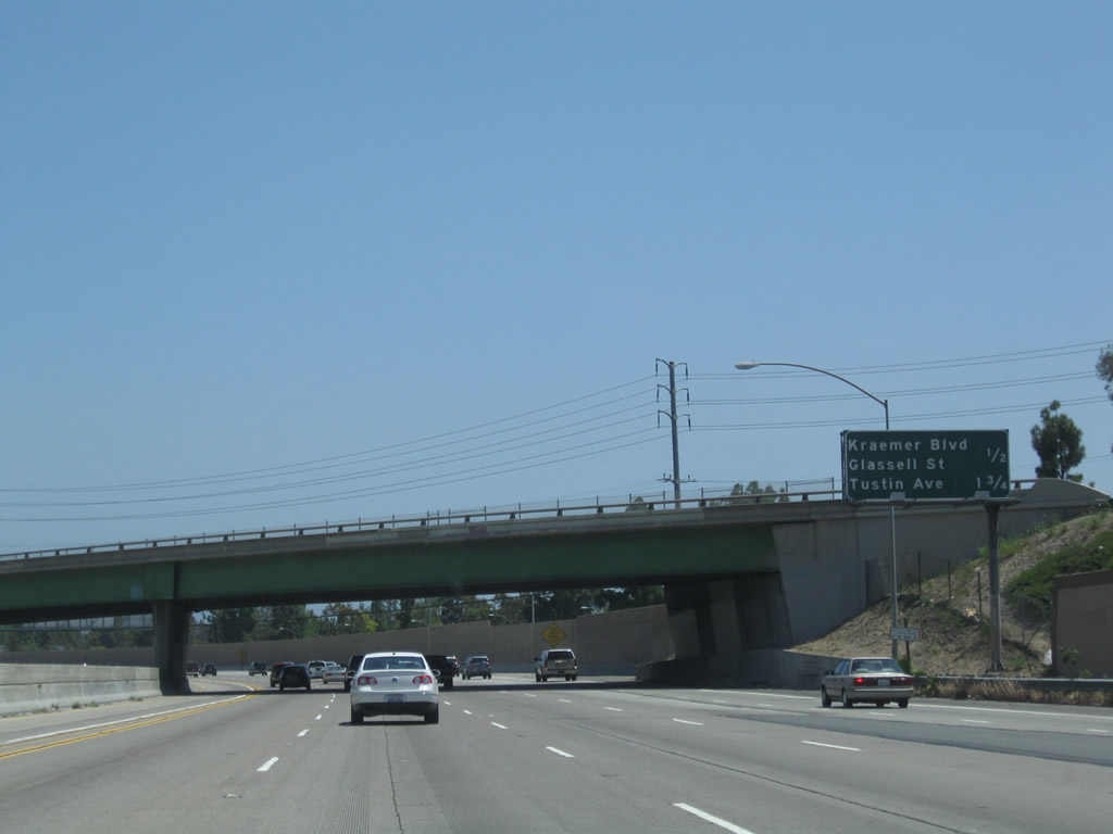
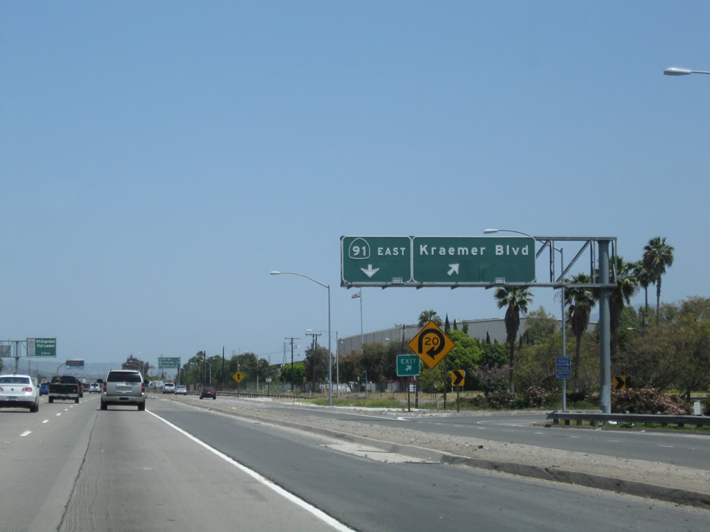
The next exit along California 91 (Riverside Freeway) east is Exit 31, Kraemer Boulevard and Glassell Street; this interchange also serves the city of Anaheim. Photo taken 05/02/10. |
|
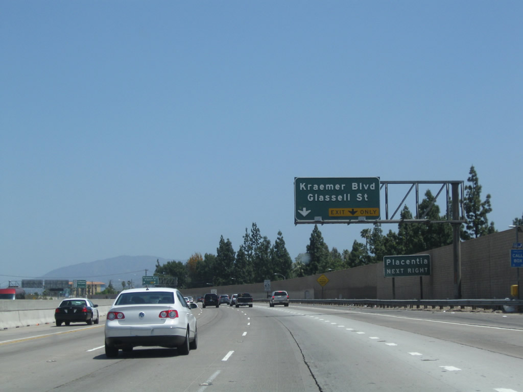
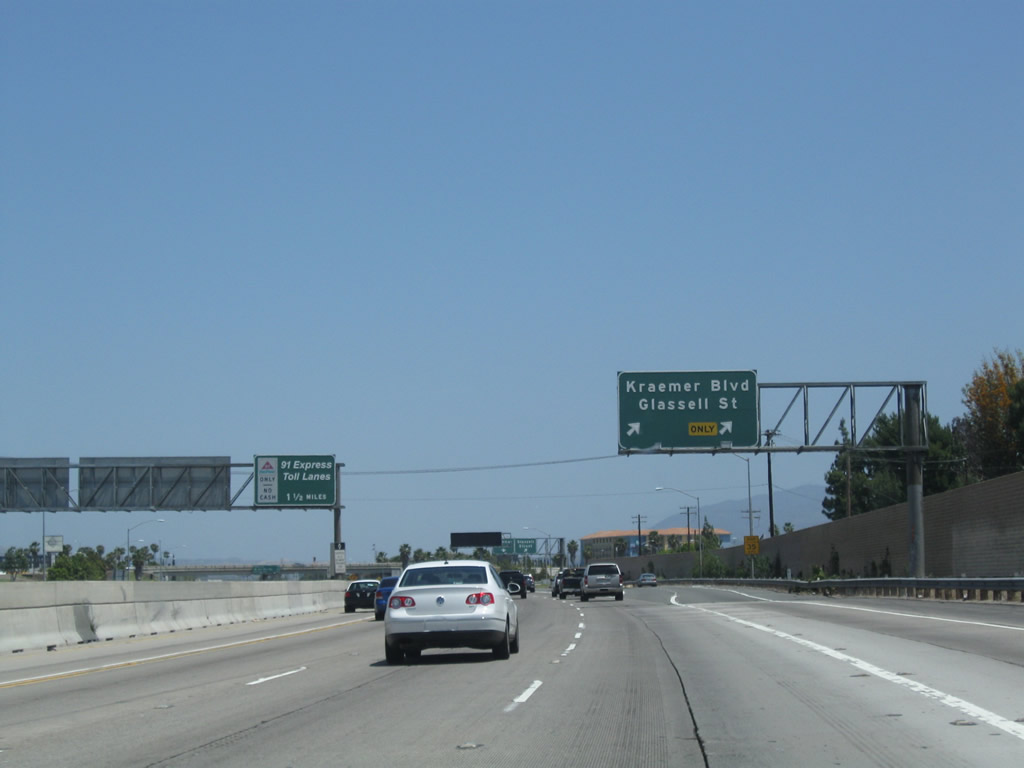
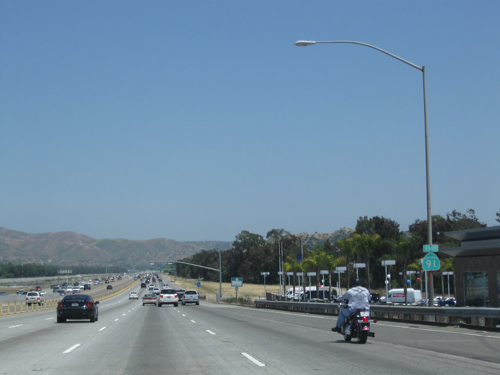
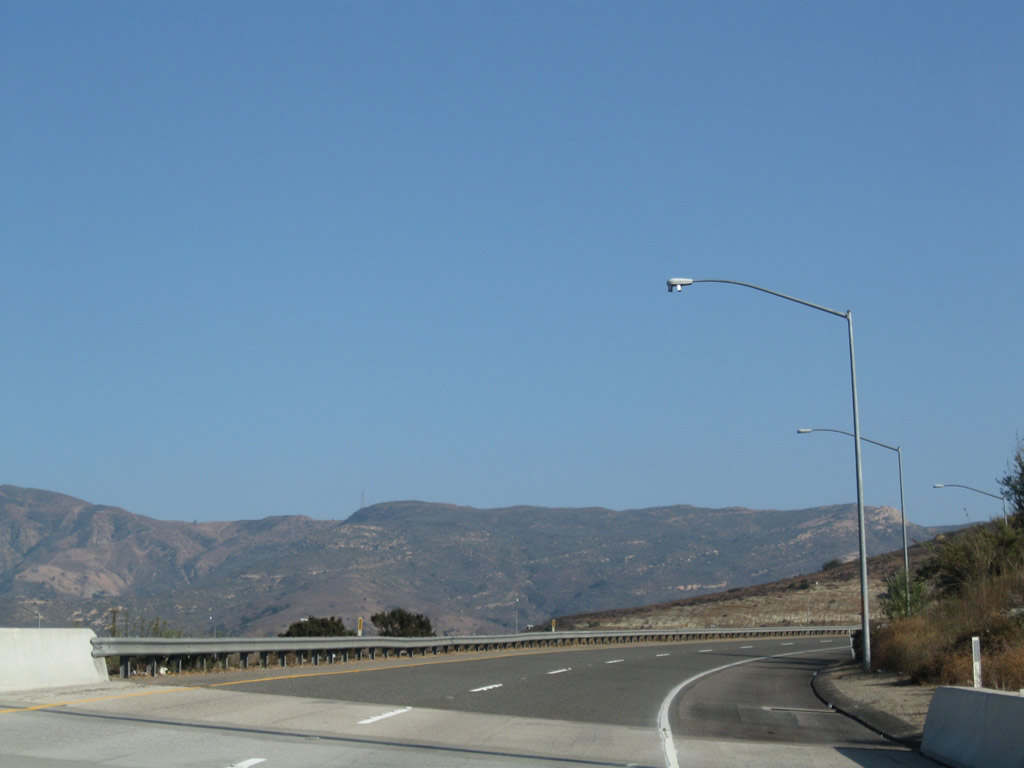
The right two lanes of California 91 (Riverside Freeway) east will connect to Exit 31, Kraemer Boulevard and Glassell Street. Kraemer Boulevard travels north toward the city of Placentia, while Glassell Street travels south toward the city of Orange. Photo taken 05/02/10. |
|
Eastbound California 91 (Riverside Freeway) meets Exit 31, Kraemer Boulevard and Glassell Street. Photo taken 05/02/10. |
|
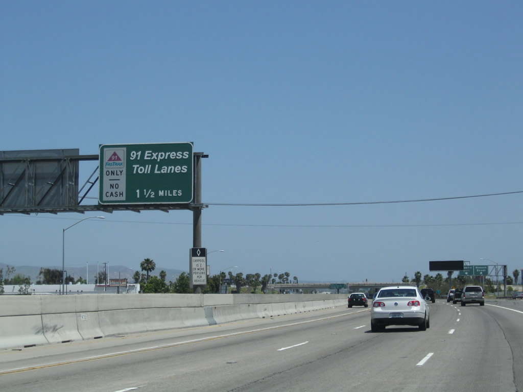
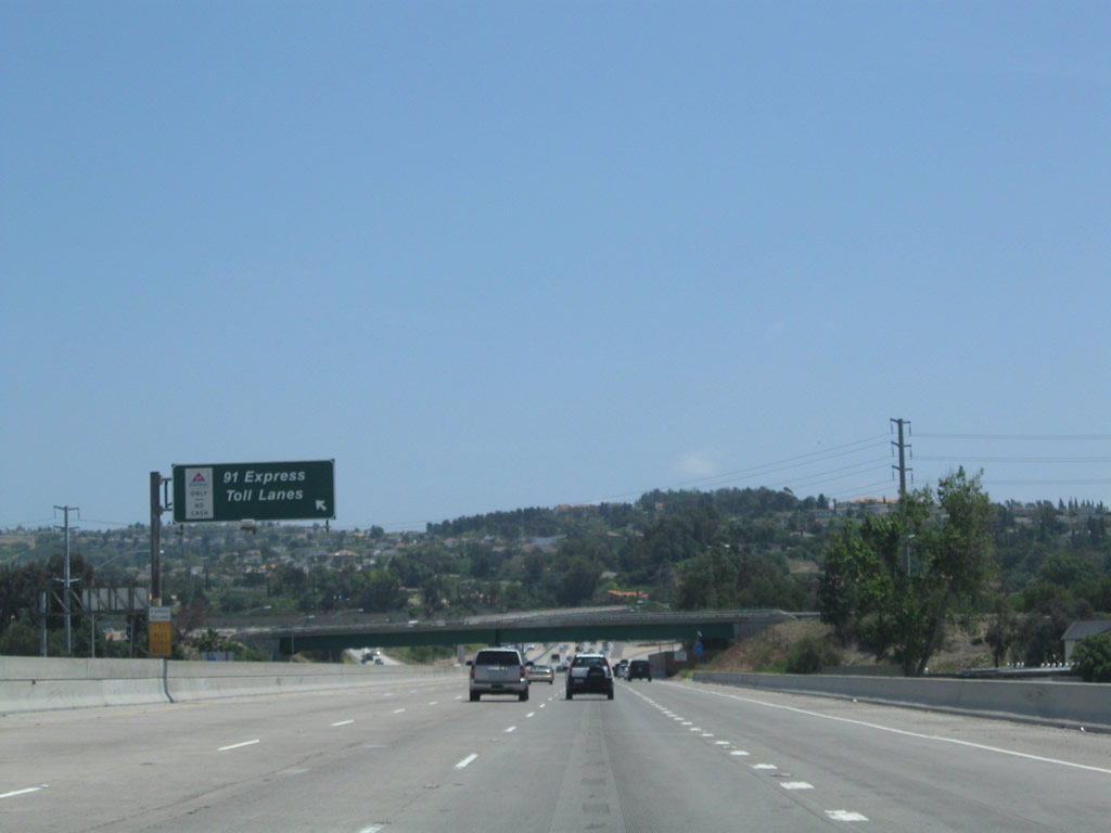
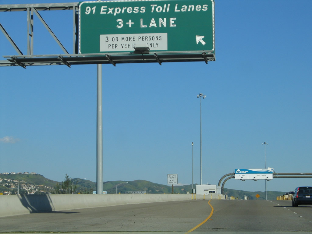
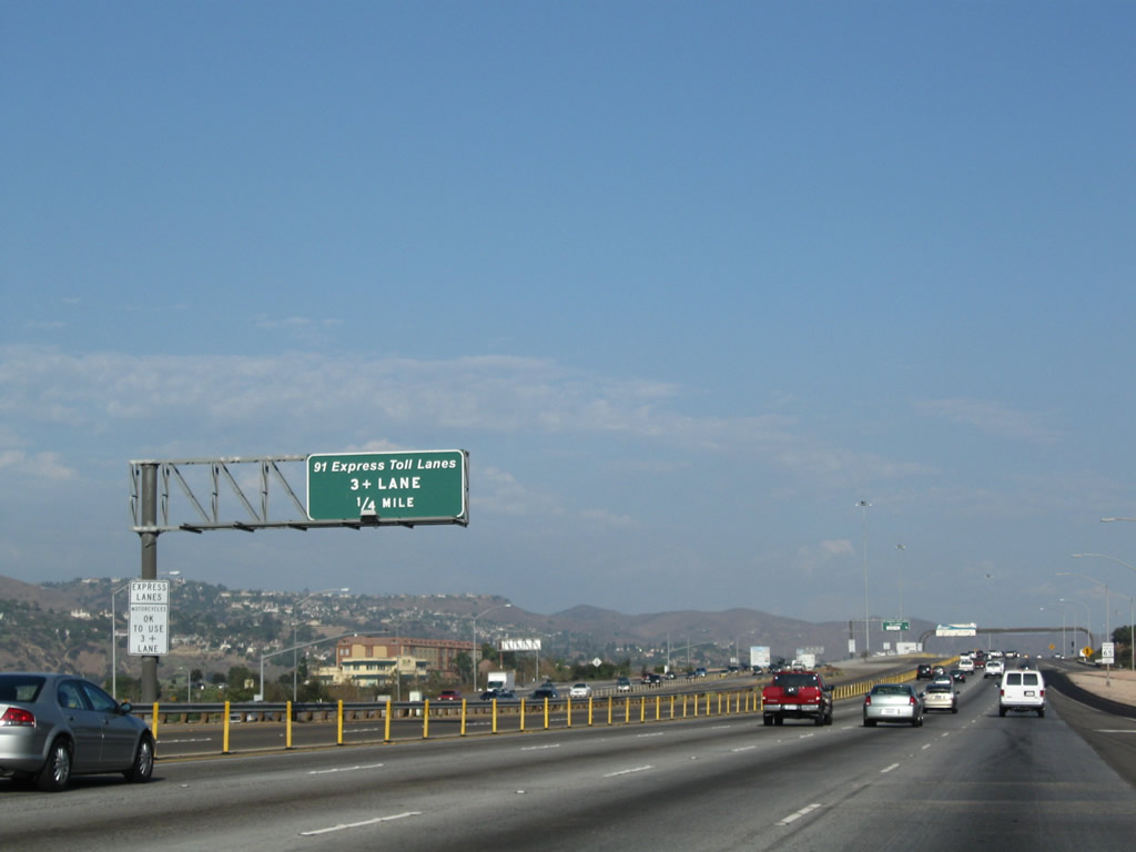
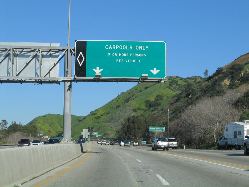
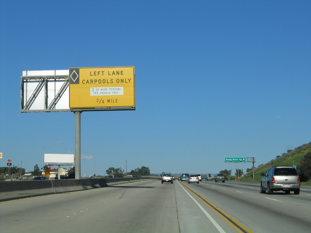
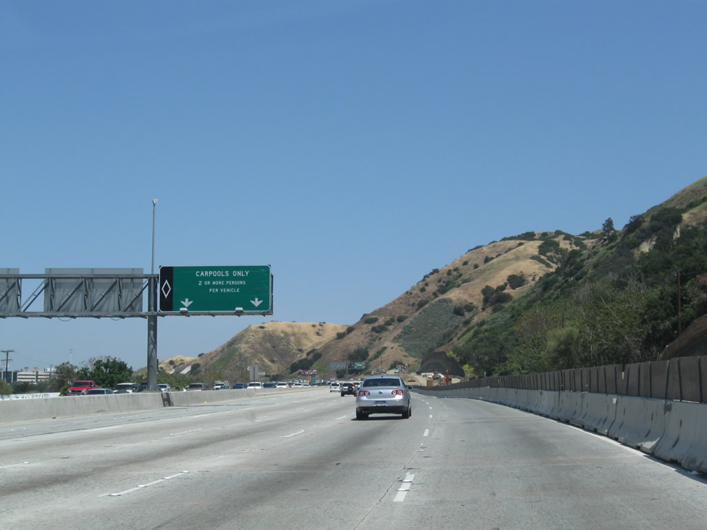
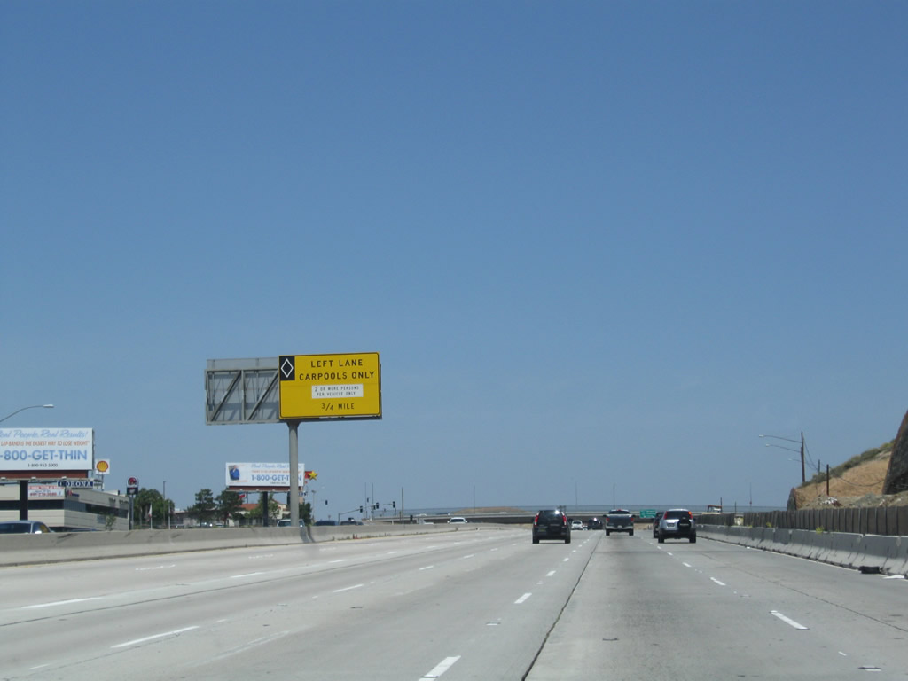
Ahead, the carpool (HOV) lanes will convert into the 91 Express Lanes, which require three people in a car to be considered a carpool. All other traffic with one or two in the car must carry electronic toll transponders to pay the required toll, which varies by congestion pricing. Photo taken 05/02/10. |
|
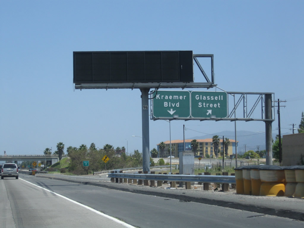
The interchange is nearly a complete cloverleaf, with a collector distributor roadway connecting to Kraemer Boulevard north and Glassell Street south. This view looks at the signage for the c-d road as seen from the main lanes. Photo taken 05/02/10. |
|
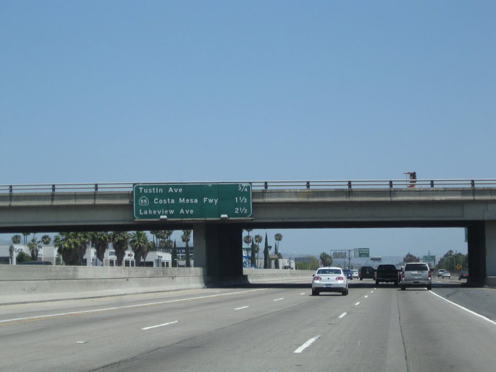
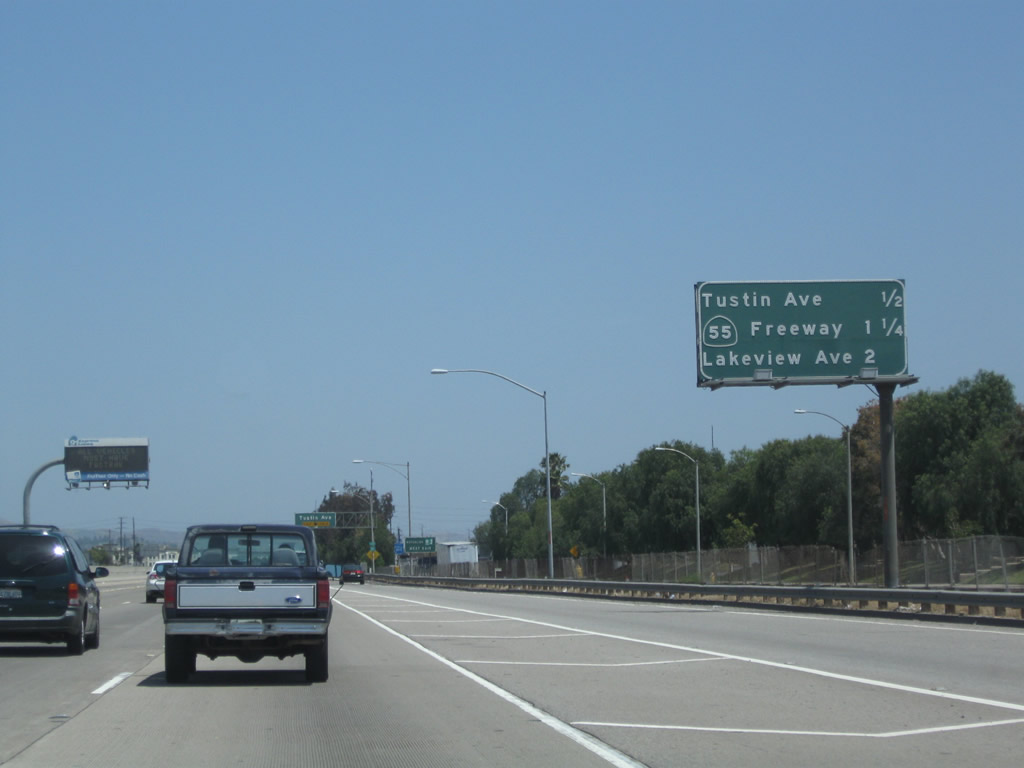
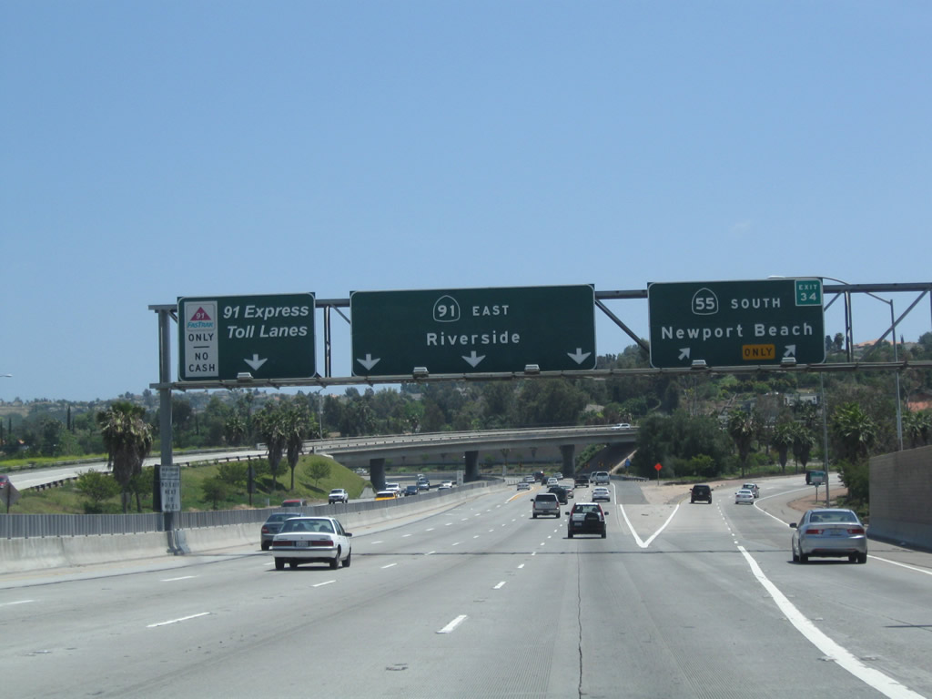
This mileage sign provides the distance to the next three exits along California 91 (Riverside Freeway) east: Exit 33, Tustin Avenue; Exit 34, California 55 (Costa Mesa Freeway) south; and Exit 35, Santa Ana Canyon Road (Old U.S. 91) and Lakeview Avenue. Photo taken 05/02/10. |
|
Back on the c-d lanes, this view shows the loop ramp linking California 91 east to Kraemer Boulevard north. Photo taken 05/02/10. |
|
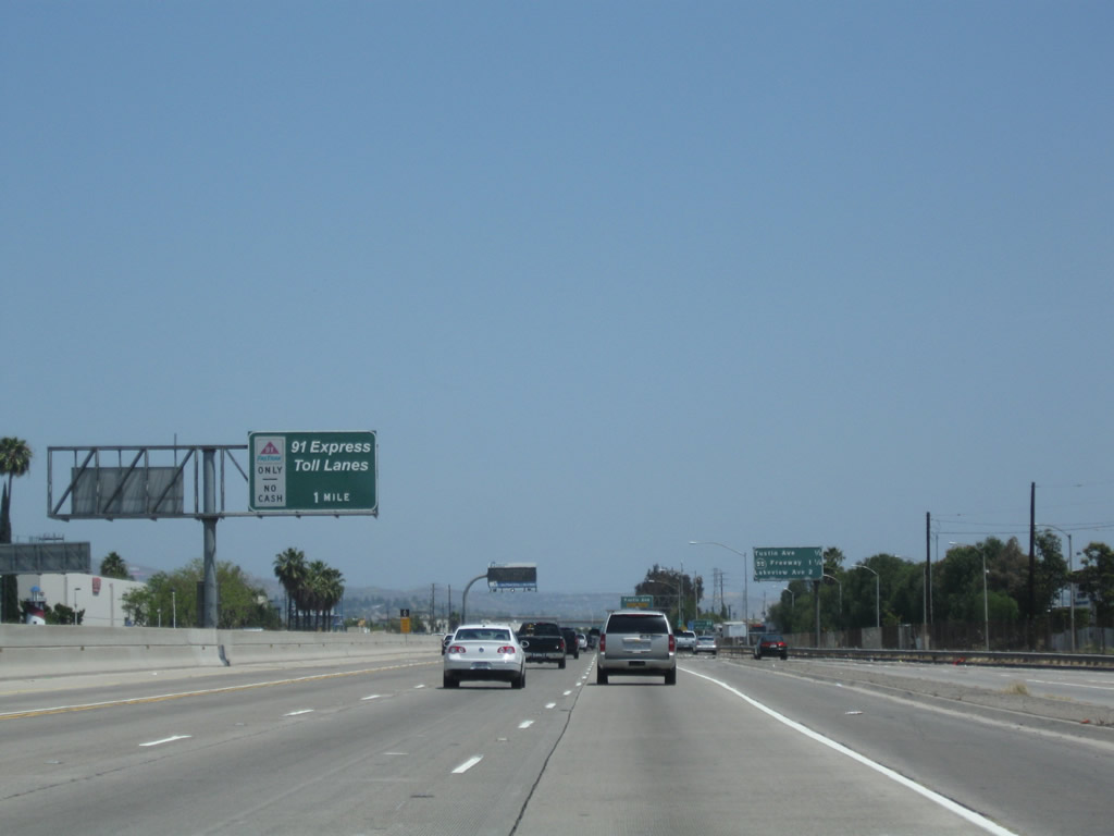
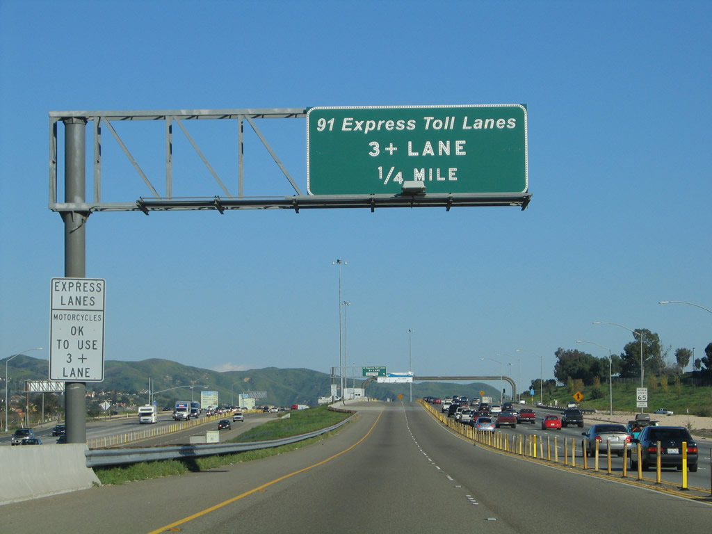
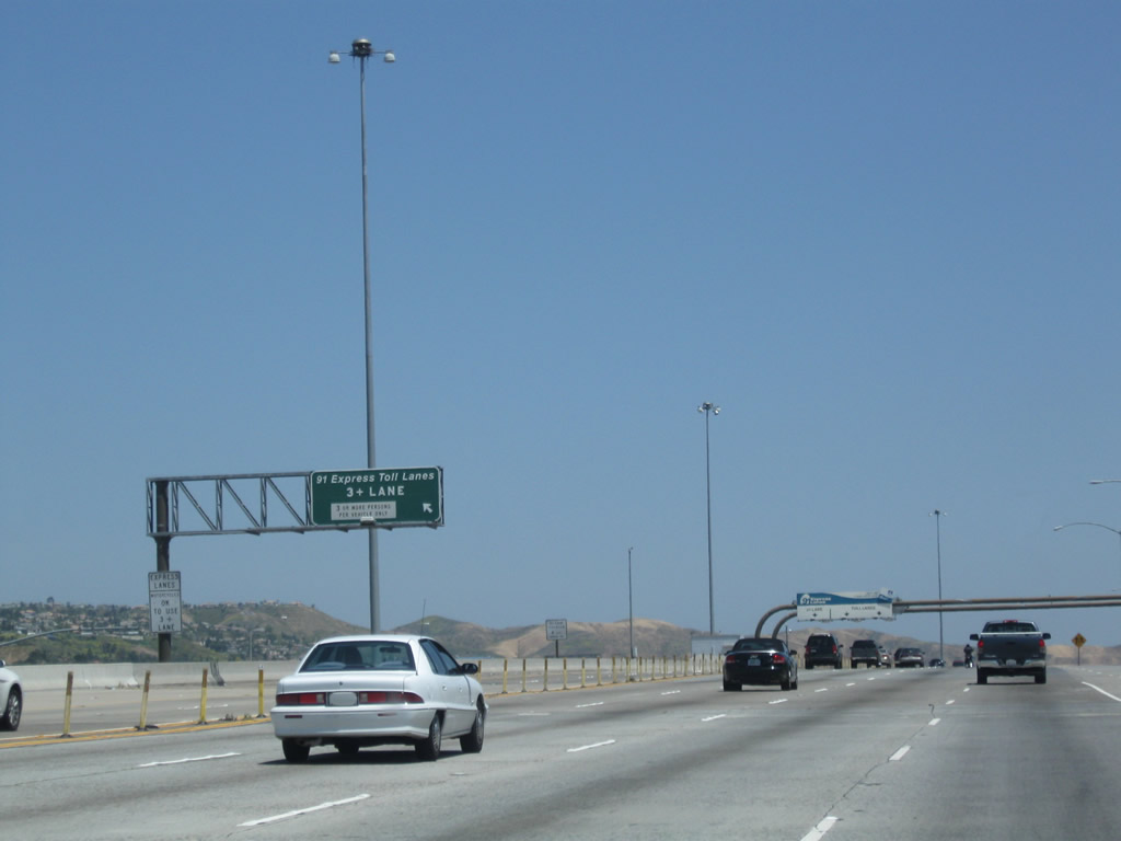
Another advance sign advertises the 91 Express Lanes. Cash is not accepted for single or double occupancy vehicles wishing to use the lanes; only three or more occupancy vehicles or a Fastrak transponder are allowed to access the 91 Express Lanes. Photo taken 05/02/10. |
|
Soon thereafter, another mileage sign provides the distance to the next three exits along California 91 (Riverside Freeway) east: Exit 33, Tustin Avenue; Exit 34, California 55 (Costa Mesa Freeway) south; and Exit 35, Santa Ana Canyon Road (Old U.S. 91) and Lakeview Avenue. Photo taken 05/02/10. |
|
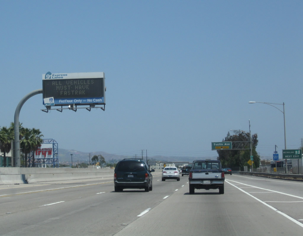
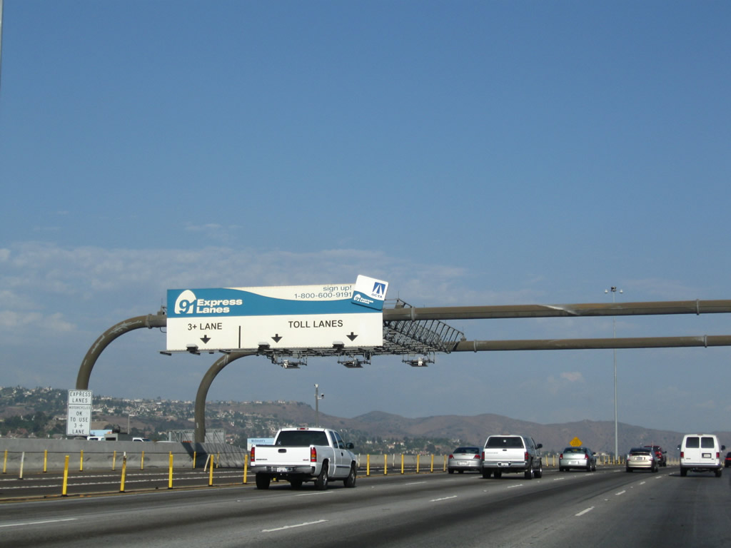
A variable message sign advises of toll rates and concerns related to the 91 Express Lanes. Photo taken 05/02/10. |
|
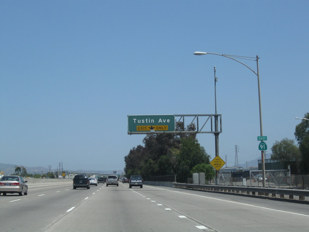
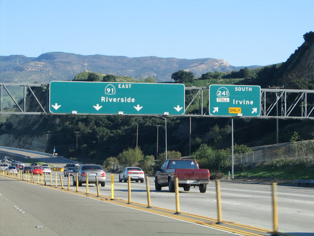
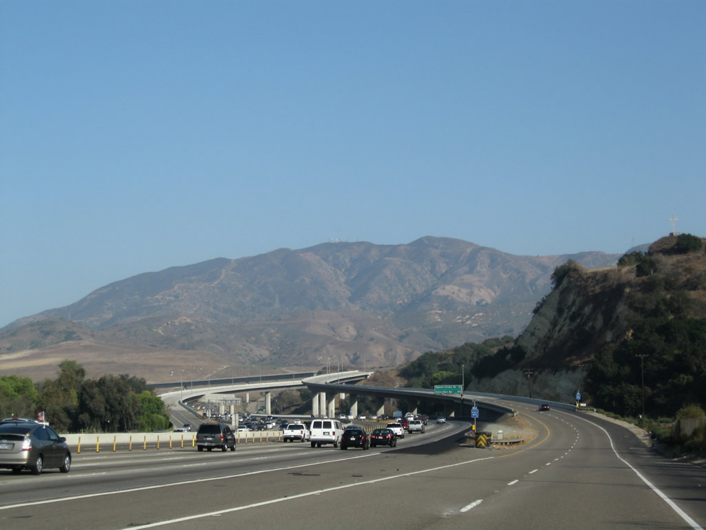
A California 91 east reassurance shield is posted prior to the off-ramp to Exit 33, Tustin Avenue. With the coming merge of California 55, the old alignment of U.S. 91 will finally come close to the modern freeway route of California 91. To Lincoln Avenue (old U.S. 91) west through Anaheim, follow Tustin Avenue south. To Santa Ana Canyon Road (old U.S. 91) east, follow California 91 east to Exit 35. Photo taken 05/02/10. |
|
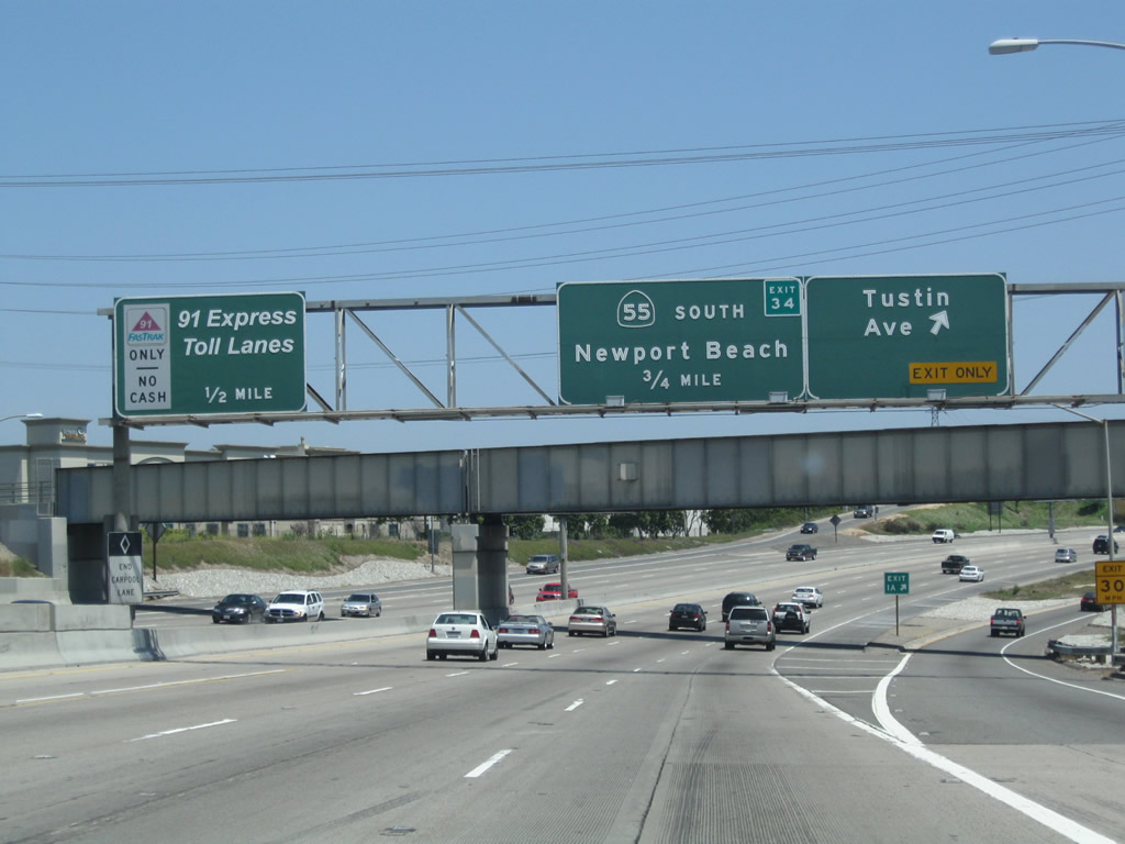
Eastbound California 91 (Riverside Freeway) meets Exit 33, Tustin Avenue. The next exit along eastbound is Exit 34, California 55 (Costa Mesa Freeway) south to Santa Ana, Costa Mesa, and Newport Beach. Photo taken 05/02/10. |
|
The next exit along California 91 east is Exit 34, California 55 (Costa Mesa Freeway) south. Photo taken 05/02/10. |
|
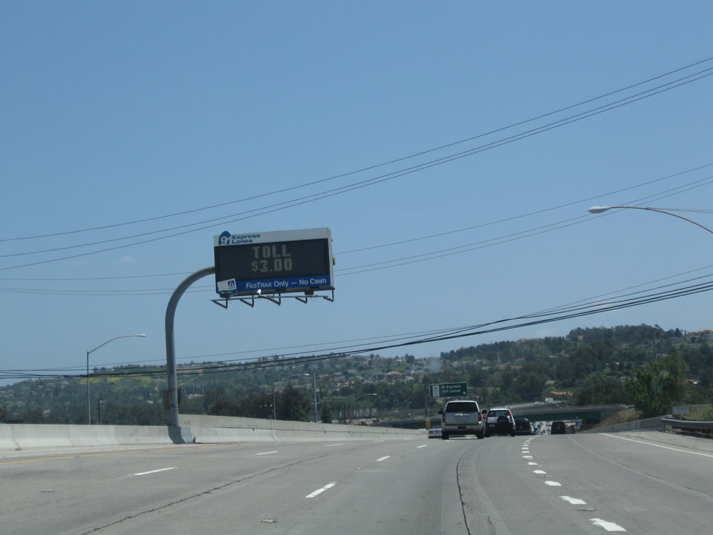
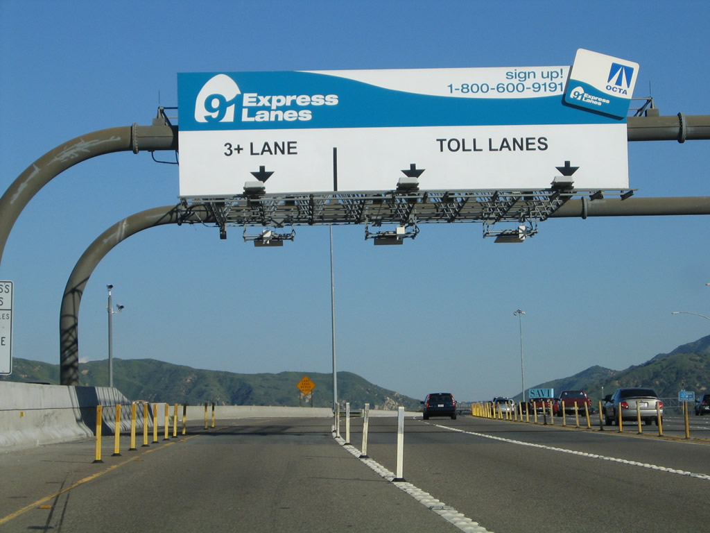
The toll on this day was $3 per car to drive the 91 Express Lanes. Carpools with less than three occupants should use the main lanes unless they have a Fastrak transponder. Photo taken 05/02/10. |
|
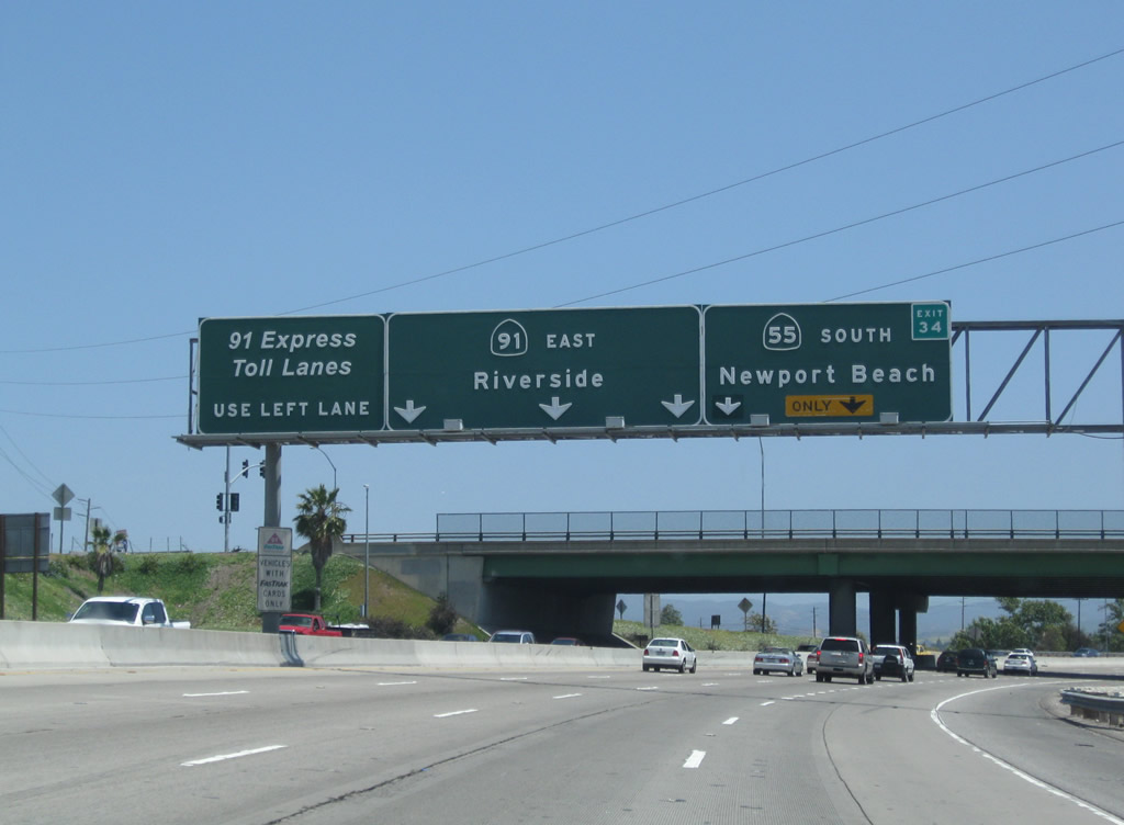
As the right lane of California 91 east becomes exit only for Exit 34, California 55 (Costa Mesa Freeway) south, the left lane becomes exit only for the 91 Express Lanes. Photo taken 05/02/10. |
|
Eastbound California 91 reaches Exit 34, California 55 (Costa Mesa Freeway) south. Photo taken 05/02/10. |
|
The left lane of California 91 east departs onto the 91 Express Lanes as the freeway passes under the transition ramp from California 55 north to California 91 west. Photo taken 05/02/10. |
|
California 91 carries only three through lanes as it passes through the California 55 interchange. Photo taken 05/02/10. |
|
Traffic from California 55 north merges onto California 91 east. Ahead is the Santa Ana River Canyon. From here northeast to Riverside, California 91 follows the original route of U.S. 91 between Anaheim and Riverside; old alignments include Santa Ana Canyon Road in northeastern Anaheim and Former California 91 Business (Magnolia Avenue) in Corona and Riverside. Photo taken 05/02/10. |
|
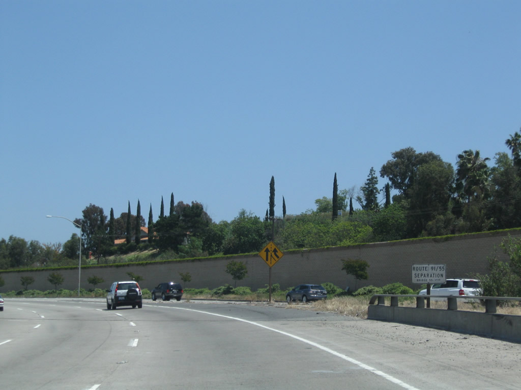
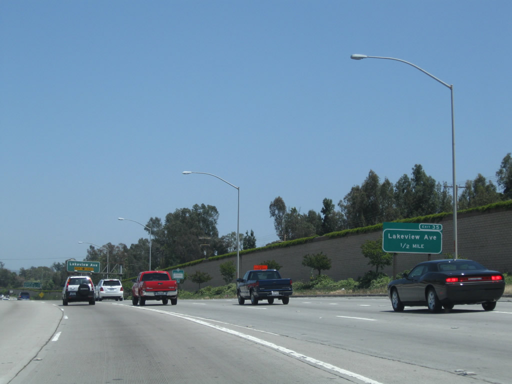
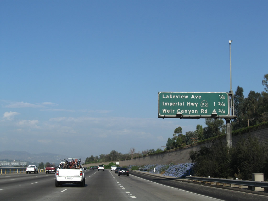
The next exit along California 91 (Riverside Freeway) east is Exit 35, Lakeview Avenue and Santa Ana Canyon Road (Historic U.S. 91). Photo taken 05/02/10. |
|
Lakeview Avenue serves the northeastern corner of the city of Anaheim. Photo taken 05/02/10. |
|
|
This mileage sign along eastbound California 91 (Riverside Freeway) provides the distance to the next three exits along eastbound: Exit 35, Lakeview Avenue; Exit 36, California 90 (Imperial Highway); and Exit 39, Yorba Linda Boulevard / Weir Canyon Road. The first picture shows the view from the 91 Express Lanes, while the second view is from the main lanes. Photos taken 01/30/05 and 09/28/08. |
|
|
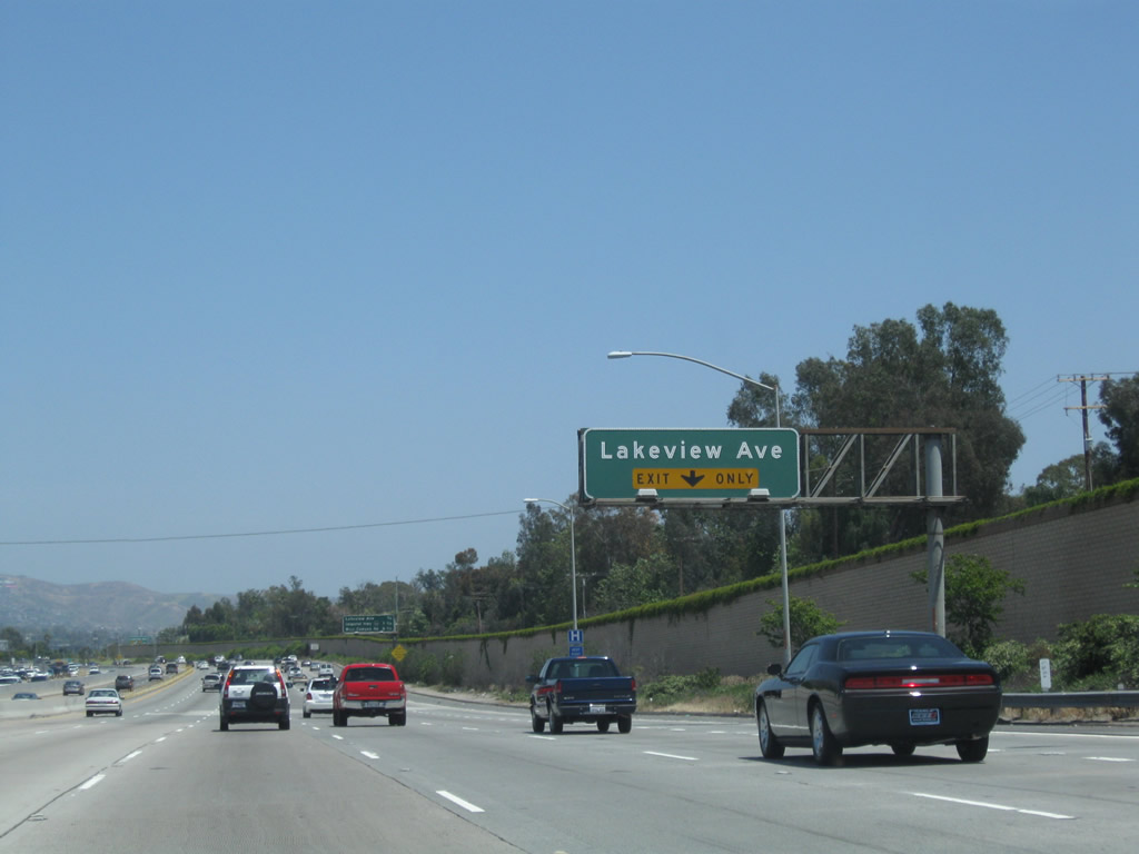
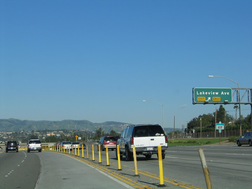
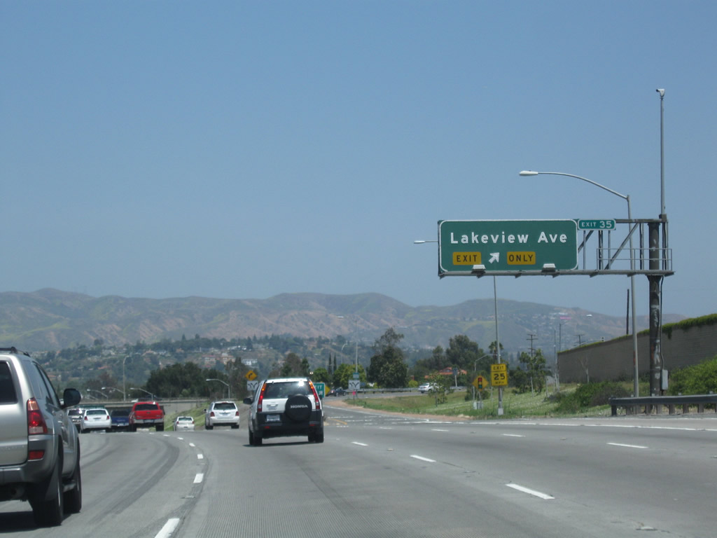
Eastbound California 91 (Riverside Freeway) meets Exit 35, Lakeview Avenue. Turn south on Lakeview Avenue to Santa Ana Canyon Road. Photos taken 01/30/05 and 04/18/04. |
|
|
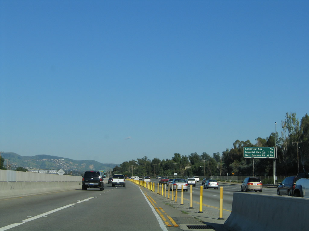
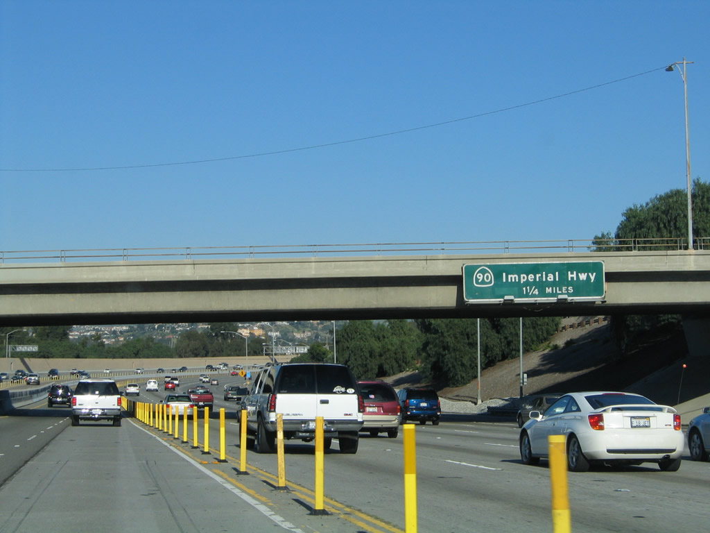
Passing under the Lakeview Avenue overpass, the next exit along California 91 (Riverside Freeway) east is Exit 36, California 90 (Imperial Highway) (1.25 miles). Photos taken 01/30/05 and 05/02/10. |
|
This mileage sign along eastbound California 91 (Riverside Freeway) provides the distance to two of the next three exits: Exit 36, California 90 (Imperial Highway); (Exit 38, Weigh Station); and Exit 39, Yorba Linda Boulevard / Weir Canyon Road. Photo taken 09/28/08. |
|
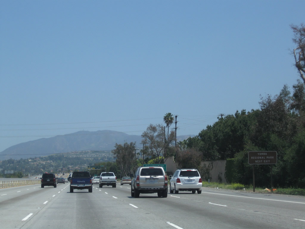
Use Exit 36, California 90 (Imperial Highway) northwest to La Palma Avenue east to Yorba Regional Park, located along the north bank of the Santa Ana River. California 91 closely follows the Santa Ana River through the canyon between California 55 and California 71. Photo taken 05/02/10. |
|
The Richard M. Nixon Presidential Library and Museum is located in the city of Yorba Linda (population 58,918 as of 2000 Census and incorporated on November 2, 1967). Yorba Linda is located just north of California 91, mostly on the north bank of the Santa Ana River (although California 91 serves as the boundary between Yorba Linda and Anaheim briefly between Weir Canyon Road and a point near the Orange-Riverside County Line). It is famous for being the birthplace of former President Richard M. Nixon. To the Library and Museum, follow California 90 (Imperial Highway) (also known as the Richard M. Nixon Parkway) northwest to Yorba Linda Boulevard, then turn west on Yorba Linda Boulevard. The library is on the north side of Yorba Linda Boulevard. Photo taken 09/28/08. |
|
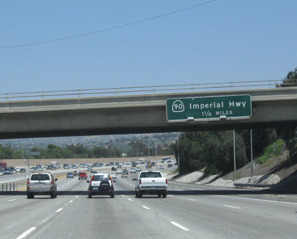
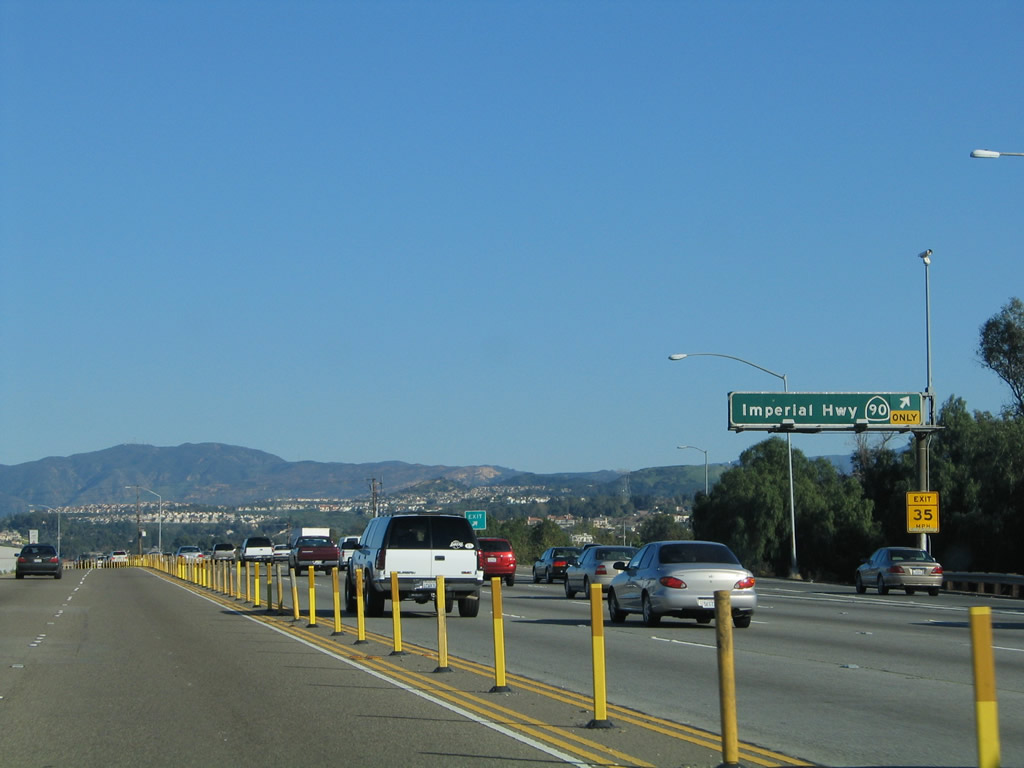
The right lane of eastbound California 91 (Riverside Freeway) becomes exit only for Exit 36, California 90 (Imperial Highway). California 90 is split into two segments: the Marina Freeway segment between California 1 and Interstate 405 in Los Angeles County and the Imperial Highway segment here in Orange County. The missing segment would have been a freeway to parallel Slauson Avenue, but that roadway gap will likely never be filled. Photo taken 09/28/08. |
|
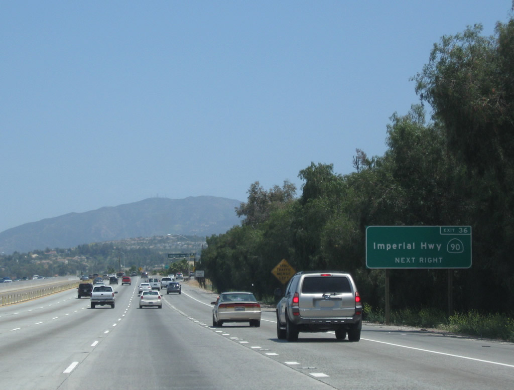
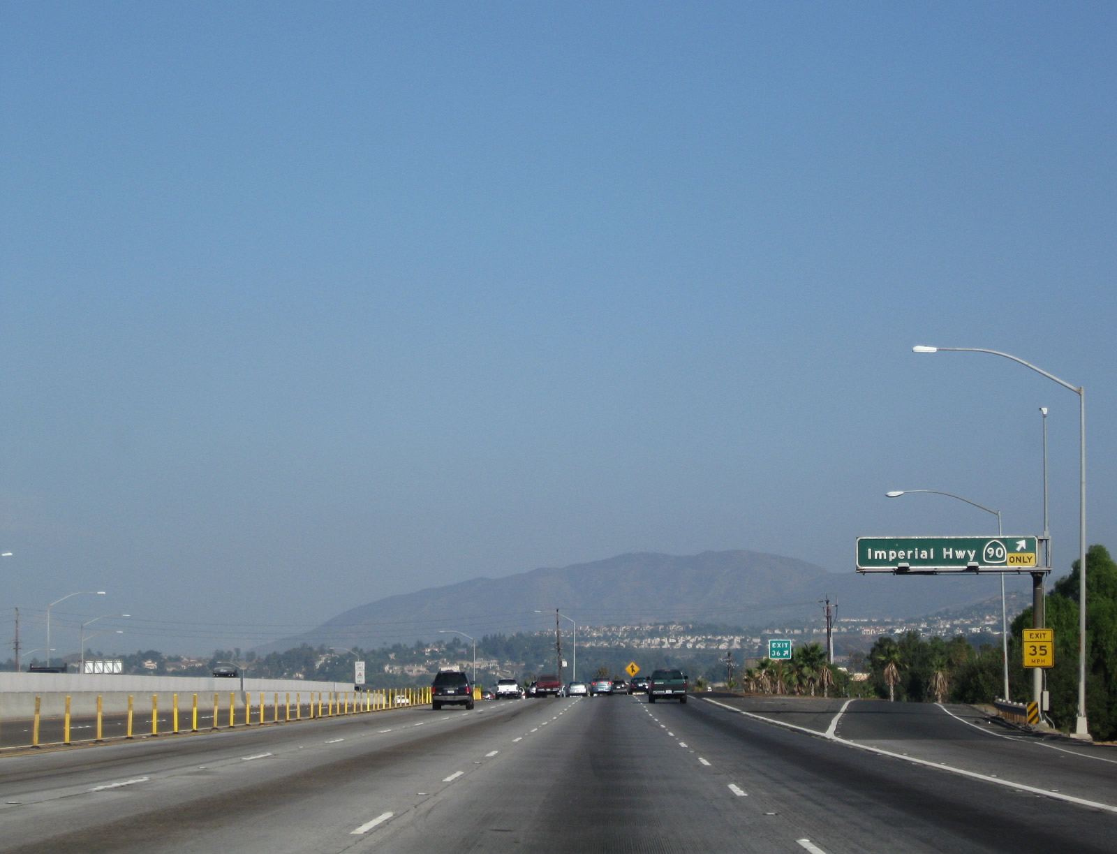
A supplemental exit number is posted on this roadside guide sign. California 90 (Imperial Highway) heads north from this interchange as an expressway, then changes briefly into a freeway ("parkway") before angling northwest toward Brea. California 90 heads north into the city of Yorba Linda. Photo taken 05/02/10. |
|
|
Eastbound California 91 (Riverside Freeway) meets Exit 36, California 90 (Imperial Highway) north, which becomes the Richard M. Nixon Parkway within the city of Yorba Linda. To the south of this interchange, Imperial Highway continues as a non-state highway to serve residential and business access for eastern areas within the cities of Anaheim and Orange, changing into Canyon Street south of the Anaheim-Orange city limits. Photos taken 01/30/05 and 05/02/10. |
|
Passing over the California 90 interchange, eastbound California 91 (Riverside Freeway) retains four through main lanes plus the two-lane 91 Express Lanes (toll). This is an extremely busy road, especially during commuting hours. Due to the lack of easy alternate routes, traffic can become quite congested if there is an accident or unusually heavy volume through the Santa Ana Canyon. The Santa Ana River, which normally carries a small to moderate amount of water, can become quite full after large rain events, especially in spring. Photos taken 05/02/10. |
|
|
This California 91 east reassurance shield is posted after the on-ramp from Imperial Highway. Photo taken 05/02/10. |
|
Over in the 91 Express Lanes, this view shows the comparative traffic flow on this winter's day. The Santa Ana River, which closely follows the freeway through here, comes into view along the eastbound 91 Express Lanes. Photo taken 01/30/05. |
|
A reassurance marker of sorts for the 91 Express Lanes comes into view shortly thereafter. The marker only refers to the 91 Express Lanes for FasTrak users only; however, carpools with three or more occupants may use these lanes for free. Photo taken 01/30/05. |
|
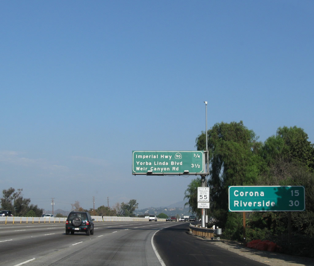
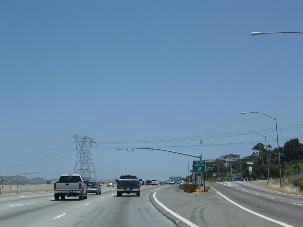
This mileage sign along eastbound California 91 (Riverside Freeway) provides the distance to two of the next three exits: (Exit 38, Weigh Station), Exit 39, Yorba Linda Boulevard / Weir Canyon Road and Exit 40, California 241 south (toll road). Photo taken 05/02/10. |
|
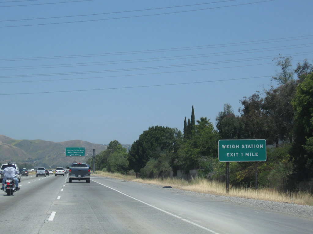
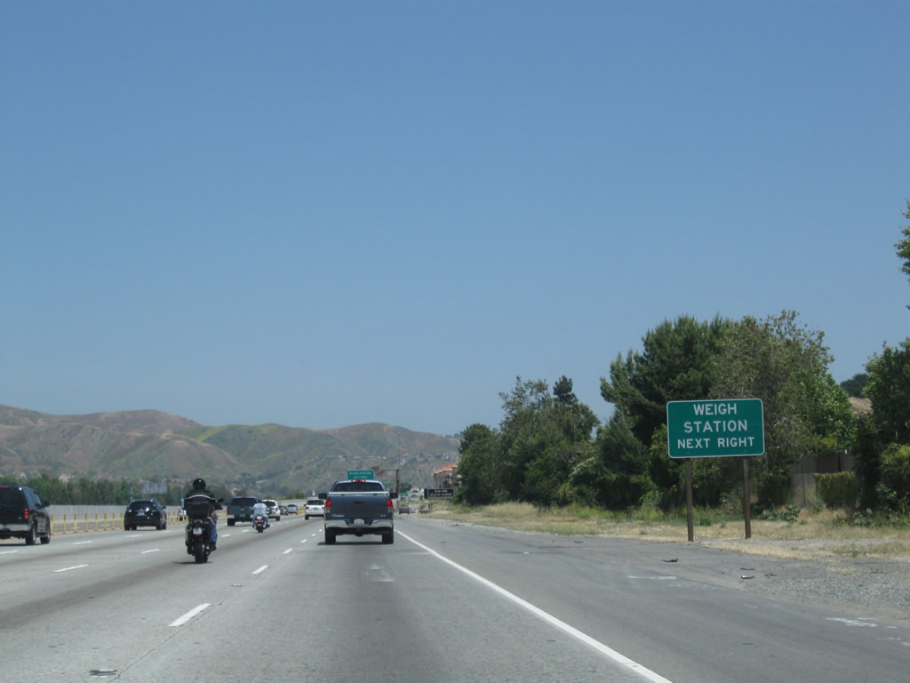
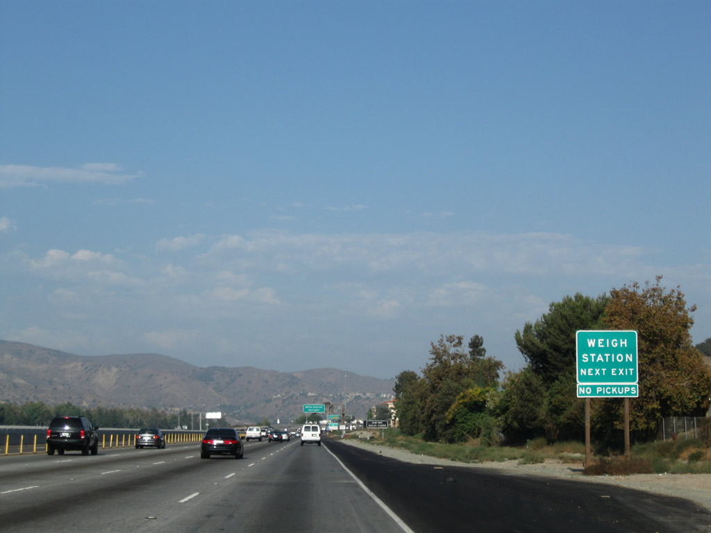
All commercial vehicles must depart the freeway at the Weigh Station (Exit 38, one mile). Photo taken 05/02/10. |
|
The second exit (after the Weigh Station) along California 91 east is Exit 39, Yorba Linda Boulevard and Weir Canyon Road. Photo taken 09/28/08. |
|
This view from the 91 Express Lanes is afforded prior to the Weigh Station exit. Photo taken 01/30/05. |
|
|
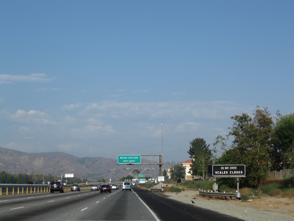
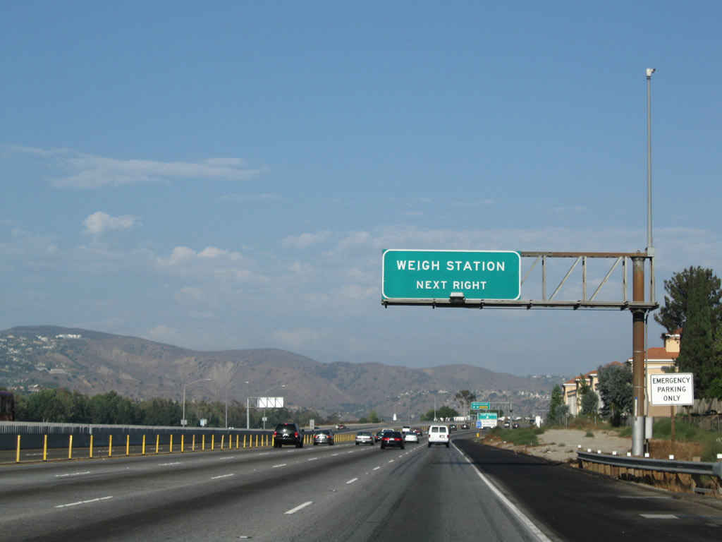
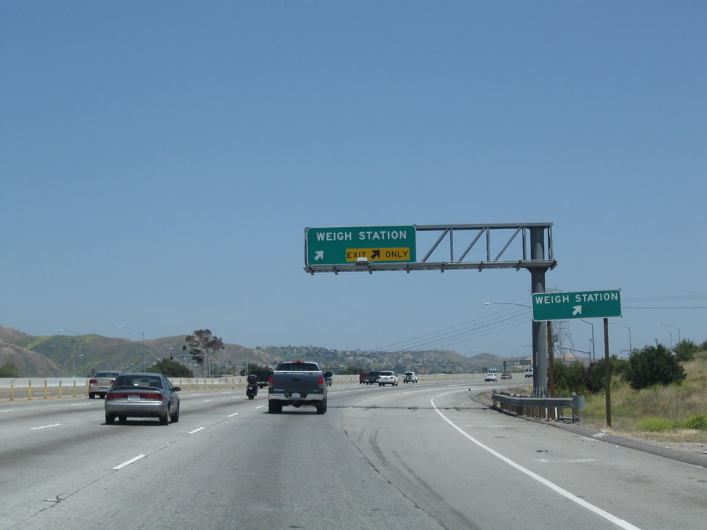
Exit 38 connects California 91 to a truck weigh station, which is open for commercial, rental, and delivery trucks. Automobiles and pick-up trucks do not need to enter the weigh station. This sign was replaced between 2008 and 2010. Photos taken 05/02/10 and 09/28/08. |
|
|
|
|
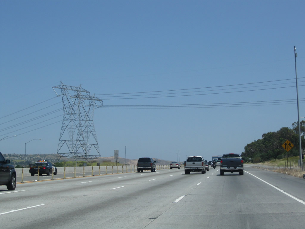
The next exit from California 91 is Exit 38, Weigh Station. Stopped or slowing traffic often occurs around this off-ramp. Photos taken 09/28/08 and 05/02/10. |
|
|
|
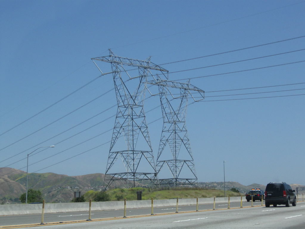
Passing by the Weigh Station, a pair of single-circuit 500kV Southern California Edison power lines crosses over the freeway. These lines carry power from the Mojave Desert and Northern California power plants and hydroelectric facilities south to large substation located southeast of the California 55/91 interchange. These lines cross over Interstate 15 in Norco on a tall, double-circuit tower rather than two single-circuit towers. Photo taken 05/02/10. |
|
Here's another view of the same power lines as seen from the 91 Express Lanes. Photo taken 01/30/05. |
|
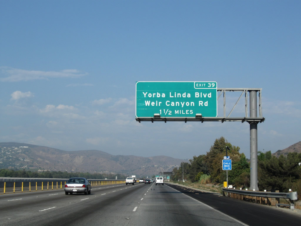
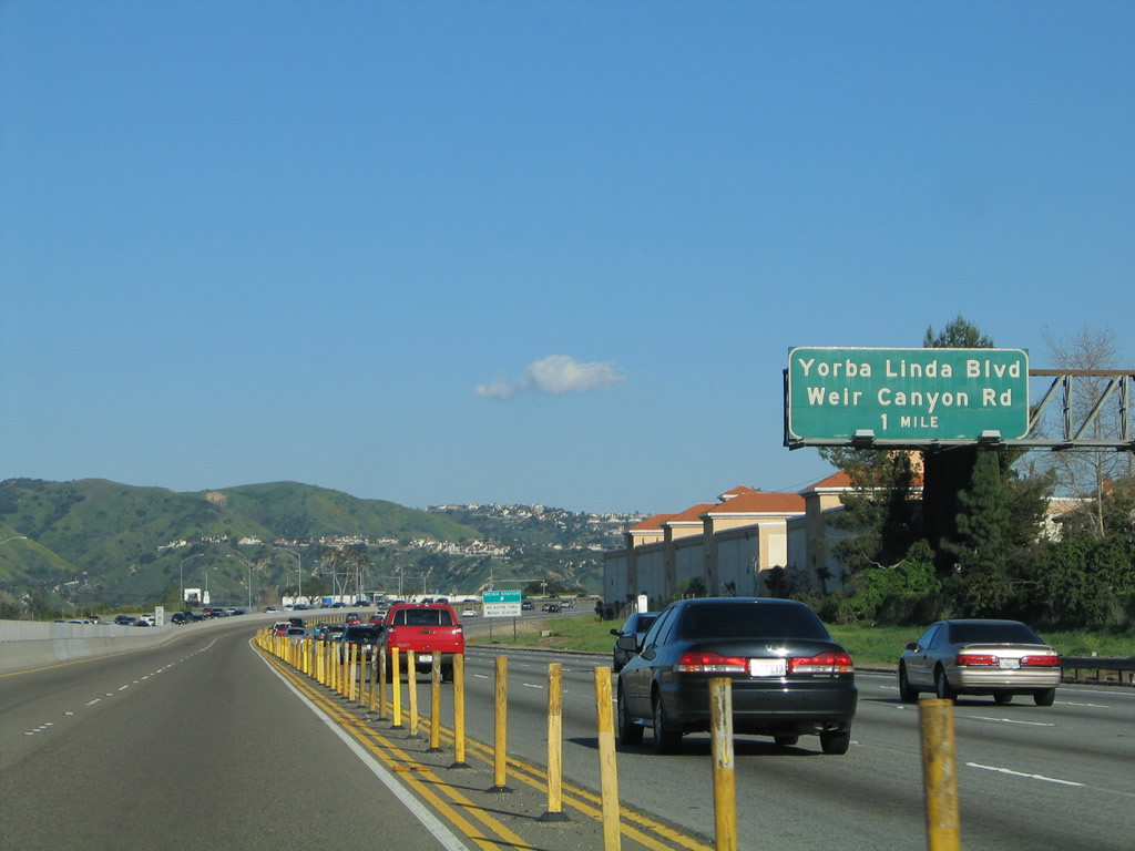
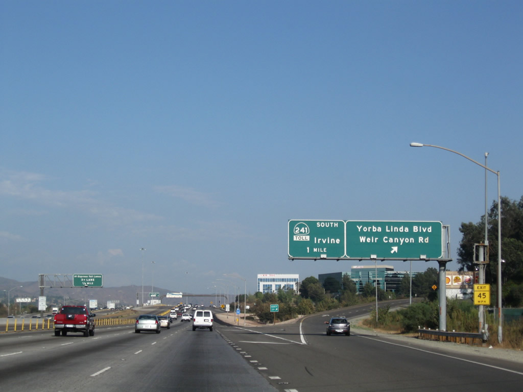
Eastbound California 91 (Riverside Freeway) meets Exit 39, Yorba Linda Boulevard and Weir Canyon Road. This is the final exit into the city of Yorba Linda. Photo taken 09/28/08. |
|
|
|
Meanwhile, over in the 91 Express Lanes, all carpools with three or more occupants must merge to the left lane, while single or double occupancy vehicles must pay the electronic toll by remaining in the right lanes of the 91 Express Lanes. A tall apparatus over the 91 Express Lanes registers tolls electronically through the Fastrak system. High Occupancy Vehicles with three or more occupants do not require an electronic toll pass to use these lanes; the may drive the express lanes for free by using the left lane only. Photos taken 01/30/05, 09/28/08, and 05/02/10. |
|
|
|
|
A California 91 reassurance shield is posted after the 91 Express Lanes toll plaza and on-ramp from Weir Canyon Road. Photo taken 05/02/10. |
|
|
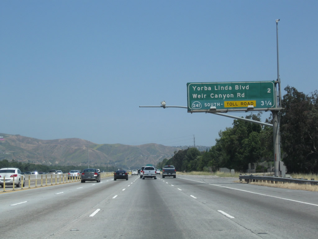
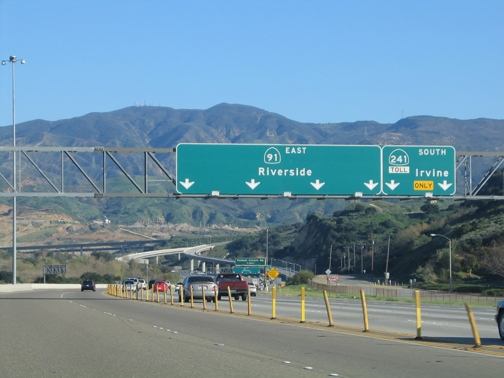
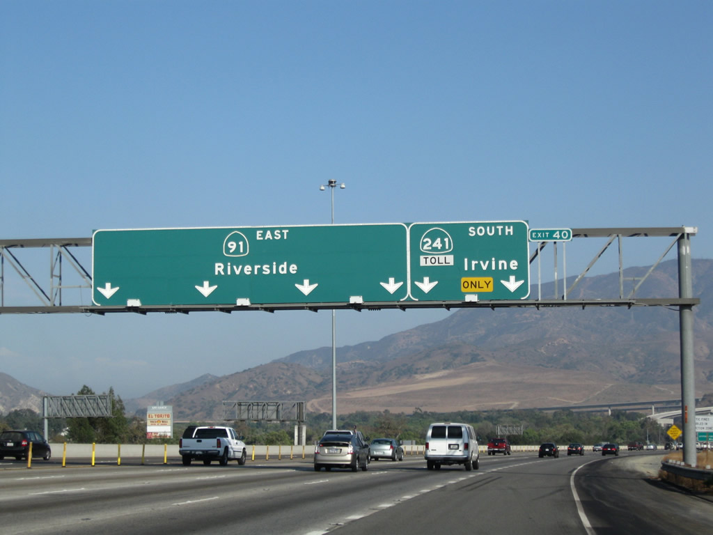
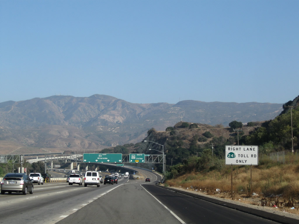
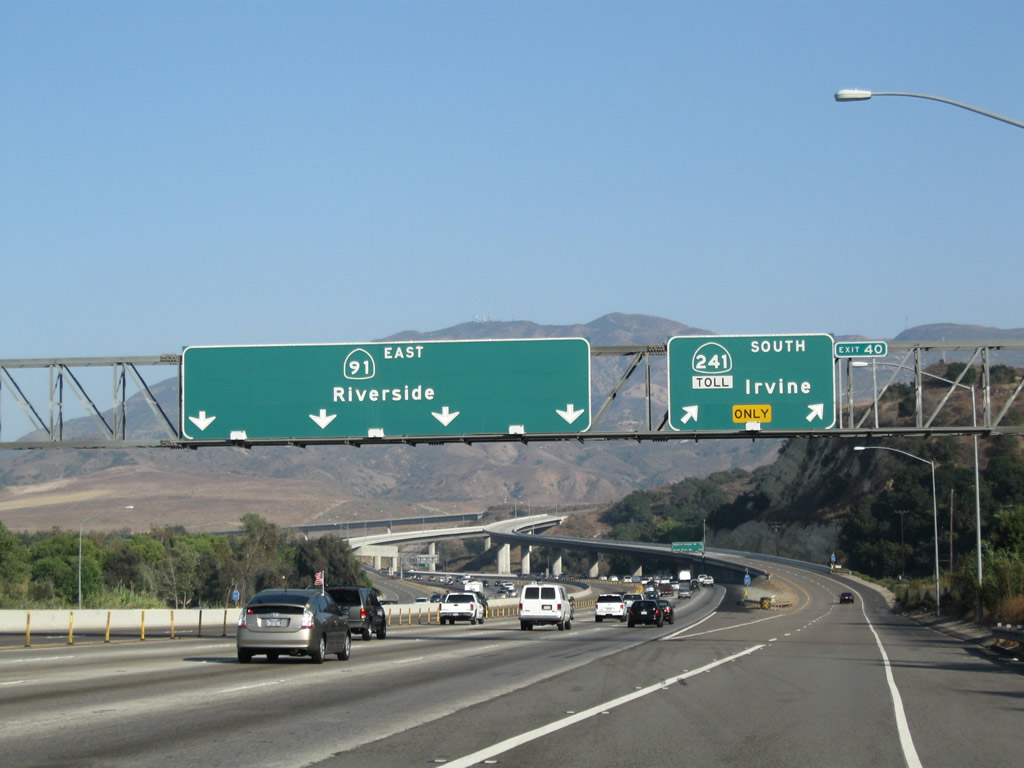
The next exit along California 91 east is Exit 40, California 241 (Eastern Transportation Corridor) (Toll). California 241 is one of four highways within the Orange County Toll Road system. The other toll roads include all of California 261, along with significant portions of California 73 and California 133. Photos taken 01/30/05 and 05/02/10. |
|
The massive interchange between California 91 and California 241 comes into view from the eastbound 91 Express Lanes. Photo taken 01/30/05. |
|
|
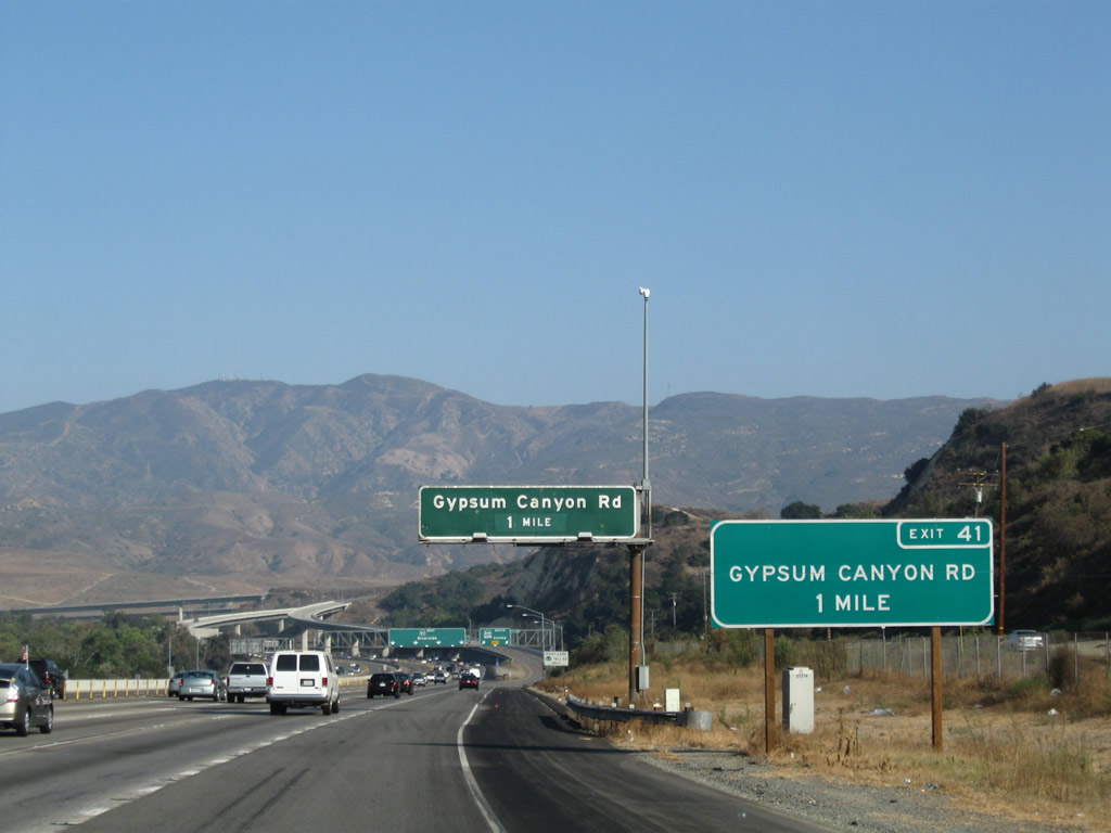
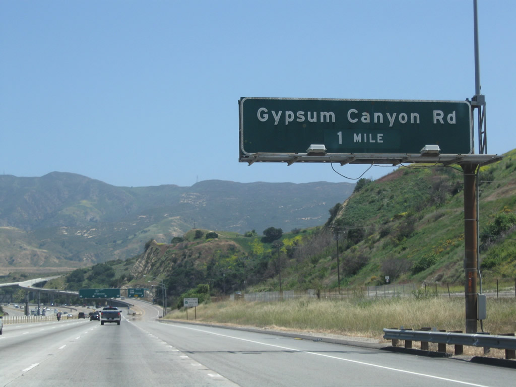
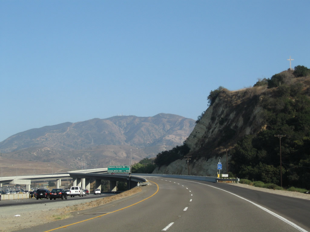
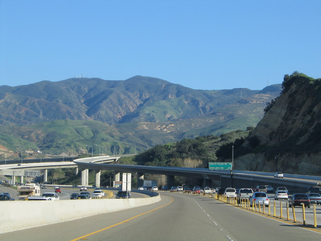
The next interchange following Exit 40 (California 241 south) is Exit 41, Gypsum Canyon Road. A ground-mounted (roadside) guide sign shows the exit number and street name in all capital letters, while the overhead guide is an older, porcelain enamel sign. Photos taken 09/28/08 and 05/02/10. |
|
The right two lanes of California 91 east will connect to Exit 40, California 241 (Eastern Transportation Corridor) (Toll). Photo taken 09/28/08. |
|
Eastbound California 91 (Riverside Freeway) reaches Exit 40, California 241 (Eastern Transportation Corridor) south to Irvine and Ladera Ranch. Ultimately, California 241 was originally planned for extension south to Interstate 5 south of San Clemente to provide an alternate route into San Diego County. However, that extension was hotly contested due to environmental and community opposition, especially its proposed terminus near San Onofre. The Transportation Corridor Agencies (TCA) of Orange County is currently (July 2010) deciding whether and how to extend California 241 to an alternate southern terminus or to leave the toll road as it is currently. Photos taken 01/30/05 and 09/28/08. |
|
|
|
|
To enable the connection between California 91 and California 241, the connecting ramps had to be constructed in such a way that the grade would not exceed six percent. This resulted in very long transition ramps from California 91 east to California 241 south. Photos taken 09/28/08. |
|
|
|
|
|
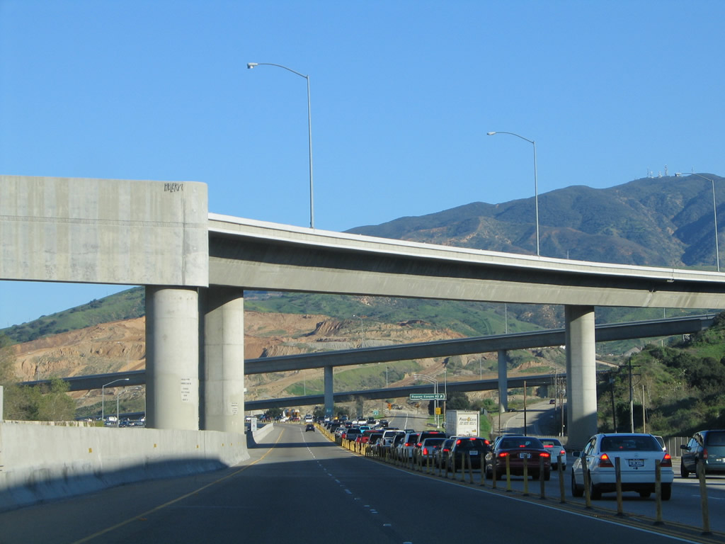
California 241 sweeps down a steep, over six percent grade to reach California 91 in the Santa Ana River Valley. The interchange glistens in the distant sunlight. Photos taken 01/30/05 and 04/18/04. |
|
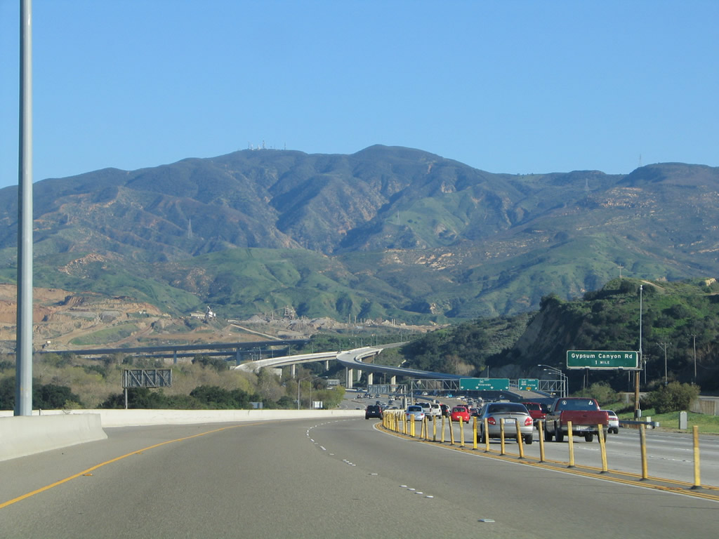
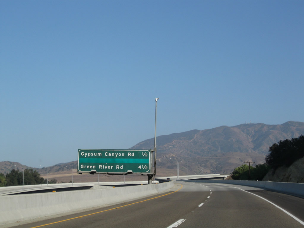
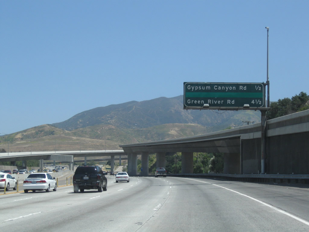
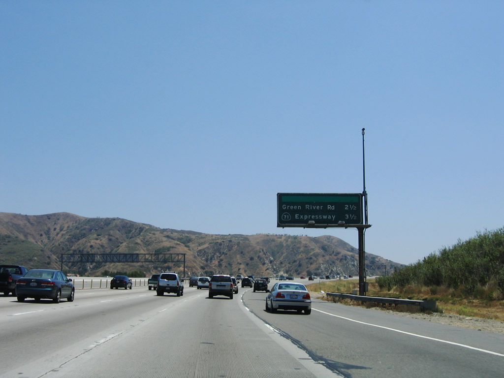
This mileage sign along eastbound California 91 (Riverside Freeway) provides the distance to the next two exits: Exit 41, Gypsum Canyon Road and Exit 44, Green River Road. Removed from this sign is defunct Exit 42, Coal Canyon Road. Photo taken 05/02/10. |
|
|
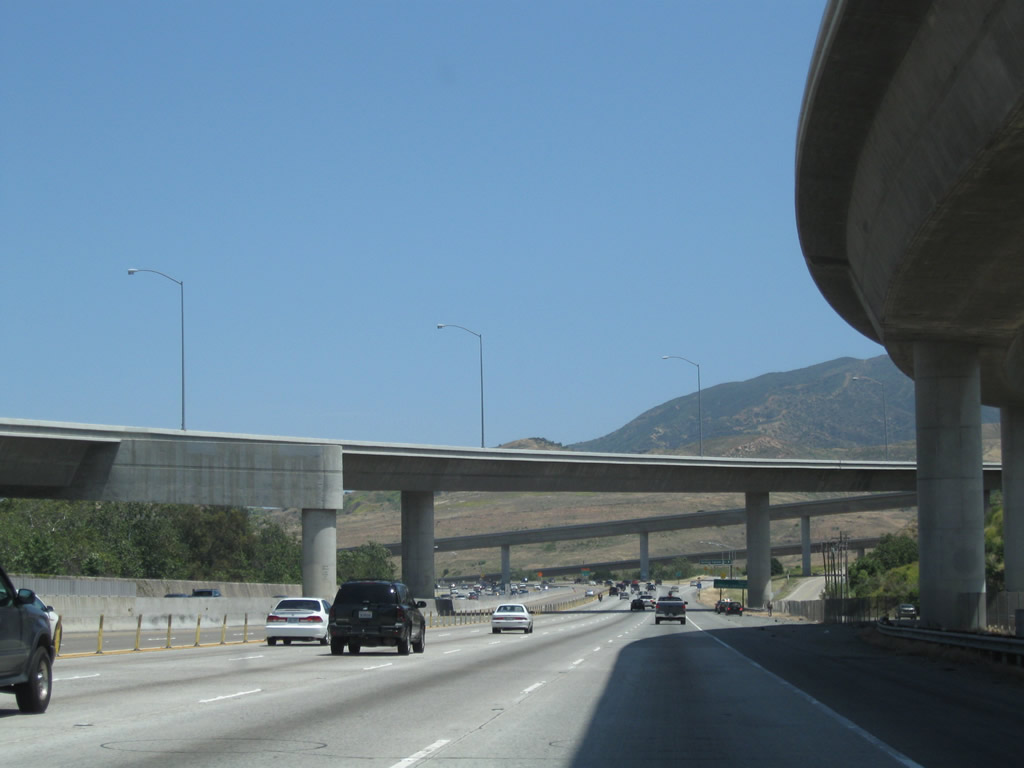
The 91 Express Lanes remain segregated as eastbound California 91 passes under the California 241 interchange in eastern Yorba Linda. Photos taken 01/30/05 and 05/02/10. |
|
Prior to the off-ramp for Exit 41 (Gypsum Canyon Road), eastbound California 91 passes under the transition ramp from California 241 north to California 91 west. Photo taken 05/02/10. |
|
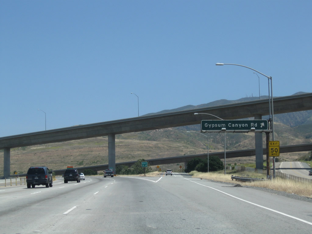
A roadside guide sign is posted with exit number for Exit 41, Gypsum Canyon Road. Photo taken 05/02/10. |
|
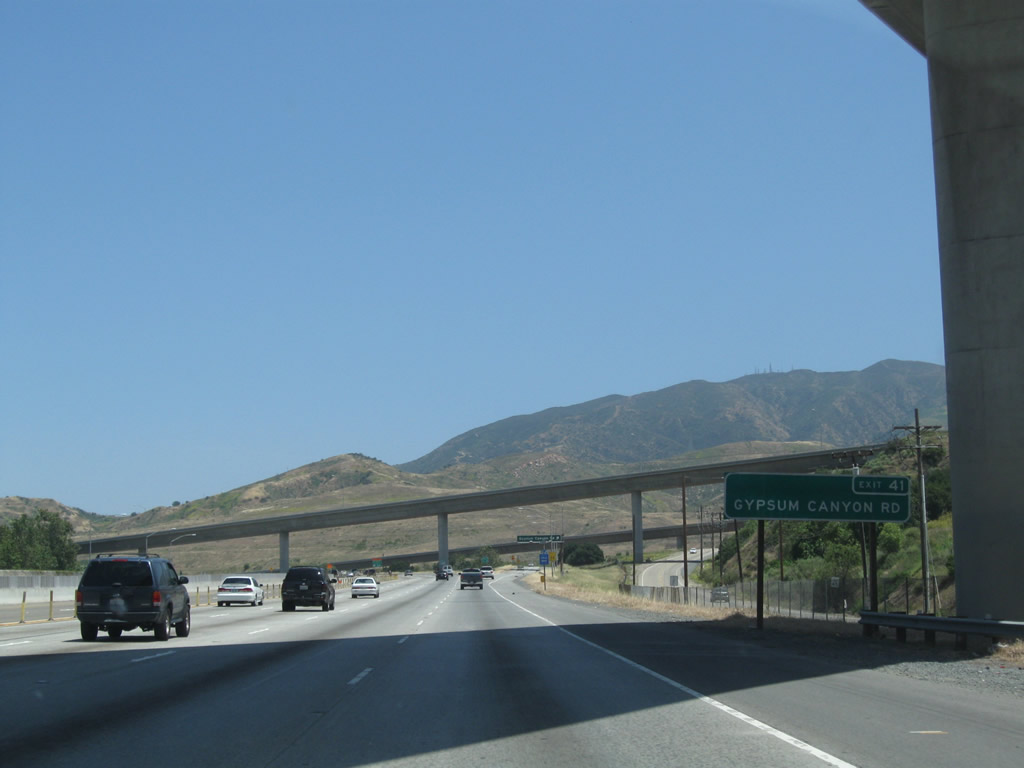
Eastbound California 91 (Riverside Freeway) reaches Exit 41, Gypsum Canyon Road. This exit ramp was here before the interchange complex for California 241 was installed. Photo taken 05/02/10. |
|
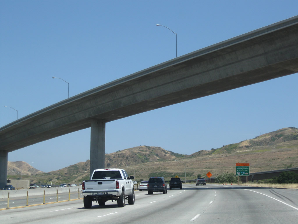
The transition ramp from California 91 west to California 241 south flies over the freeway. This freeway interchange was built in 1998; California 91 (built in 1971) predates the toll road by several decades. This section of 91 freeway was built as a state route, not as U.S. 91, since the U.S. route was eliminated in 1964. Photo taken 05/02/10. |
|
|
A California 91 reassurance shield is posted after the on-ramp from California 241 (Eastern Transportation Corridor). Photos taken 01/30/05 and 05/02/10. |
|
|
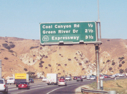
In this photo, eastbound California 91 approaches what was once Exit 42, Coal Canyon Road. This exit was eliminated in 2003 in order to promote an environmental corridor in Coal Canyon. As a result, this mileage sign was removed from the freeway. The next exits are Exit 44, Green River Drive and Exit 45, California 71 - Chino Hills Freeway (shown as an expressway here, California 71 is now a full freeway). Photos taken 06/17/06 and 09/16/00. |
|
This empty sign bridge (which has since been removed to accommodate widening on California 91) used to hold a next right sign for former Exit 42, Coal Canyon Road. Photo taken 06/17/06. |
|
Eastbound California 91 (Riverside Freeway) reaches former Exit 42, Coal Canyon Road. This exit is now closed, and the underpass is used for wildlife connectivity. Photo taken 06/17/06. |
|
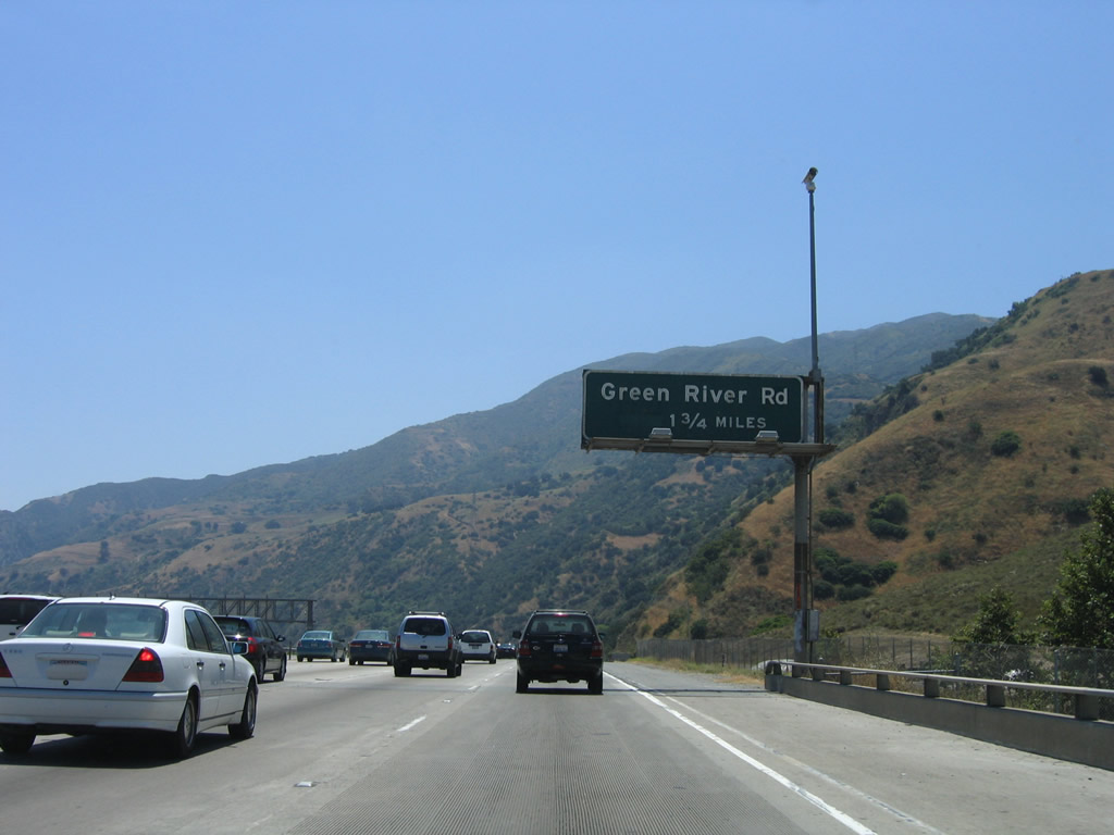
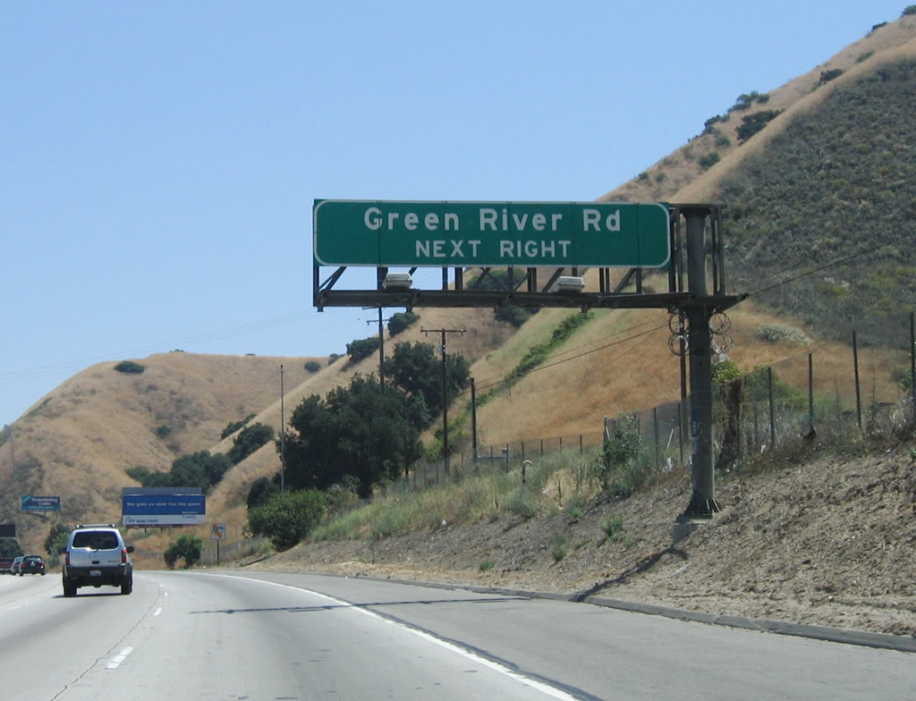
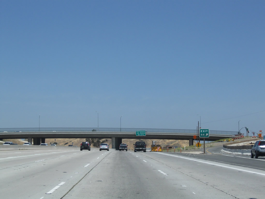
The next exit along California 91 (Riverside Freeway) east is Exit 44, Green River Road, 1.75 miles. Photo taken 06/17/06. |
|
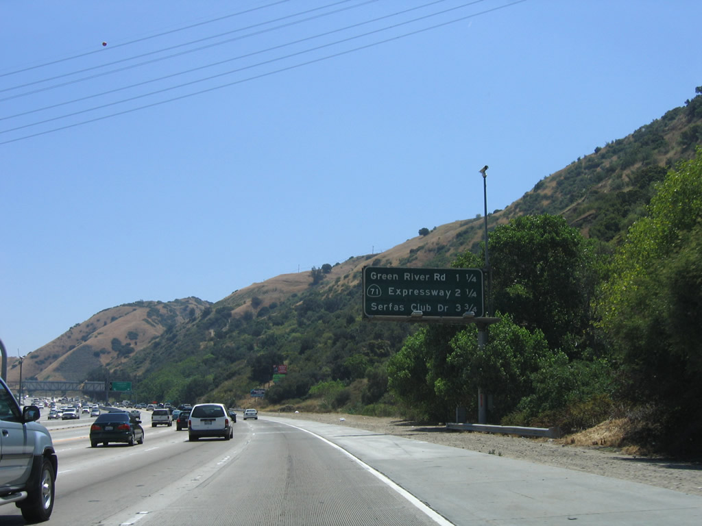
This mileage sign provides the distance to the next three exits along California 91 (Riverside Freeway) east: Exit 44, Green River Road; Exit 45, California 71 (Chino Hills Freeway) north; and Exit 47, Serfas Club Drive and Auto Center Drive. Photo taken 06/17/06. |
|
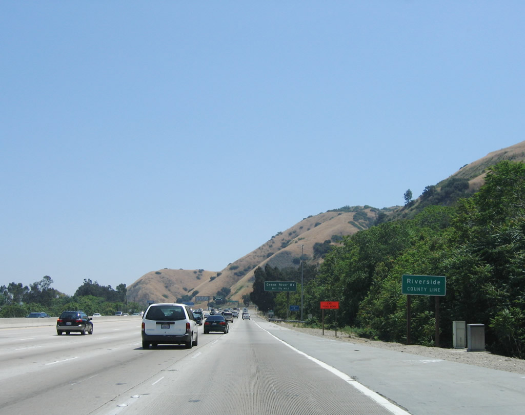
California 91 leaves Orange County and enters Riverside County. Photo taken 06/17/06. |
|
The next exit along California 91 (Riverside Freeway) east is Exit 44, Green River Road (0.75 mile), followed by Exit 45, California 71 (Chino Hills Freeway) north. Photo taken 06/17/06. |
|
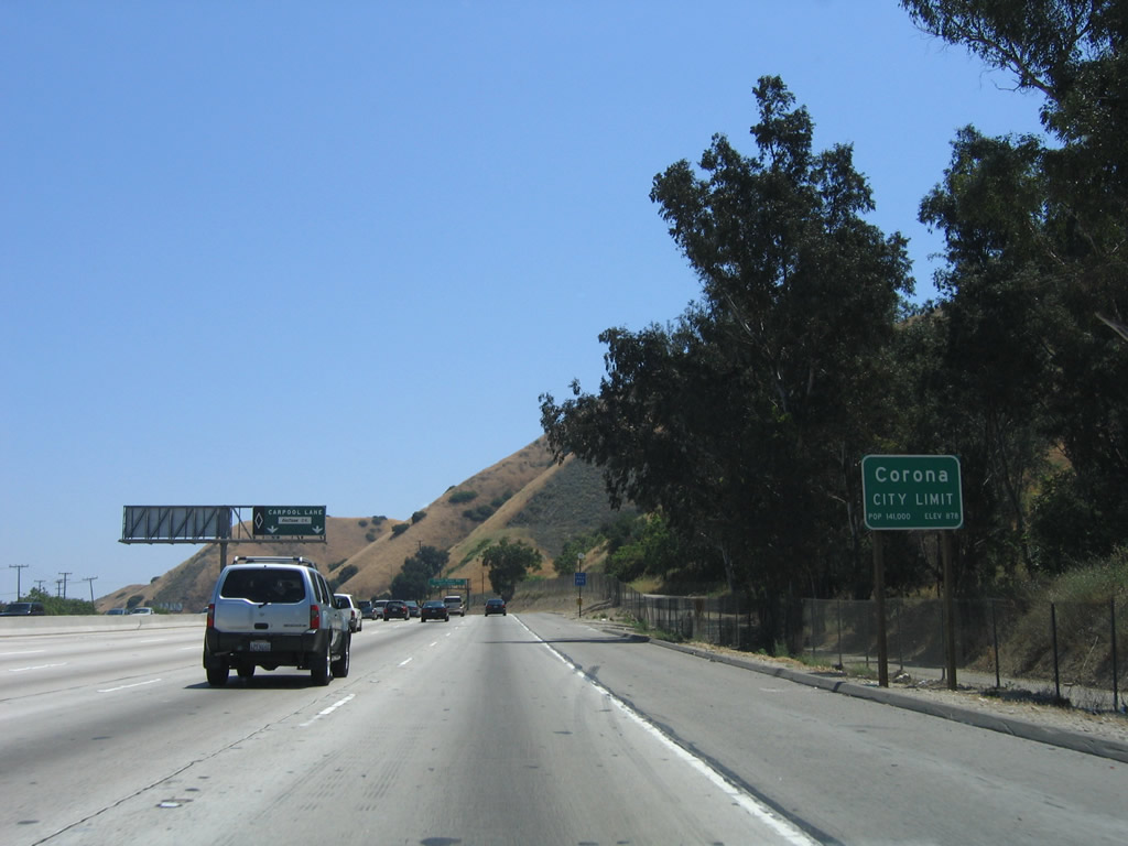
California 91 (Riverside Freeway) enters the city of Corona, incorporated in 1896 and home to over 138,000 people. Photo taken 06/17/06. |
|
California 91 east approaches Exit 44, Green River Road, next right (no exit number). This sign is posted approximately where the former Coal Canyon exit was located. Around this point, California 91 leaves Orange County and enters Riverside County. Photo taken 06/17/06. |
|
|
|
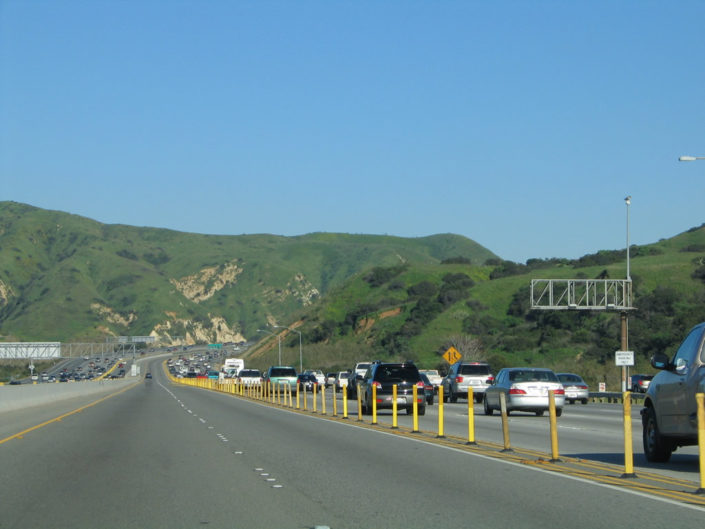
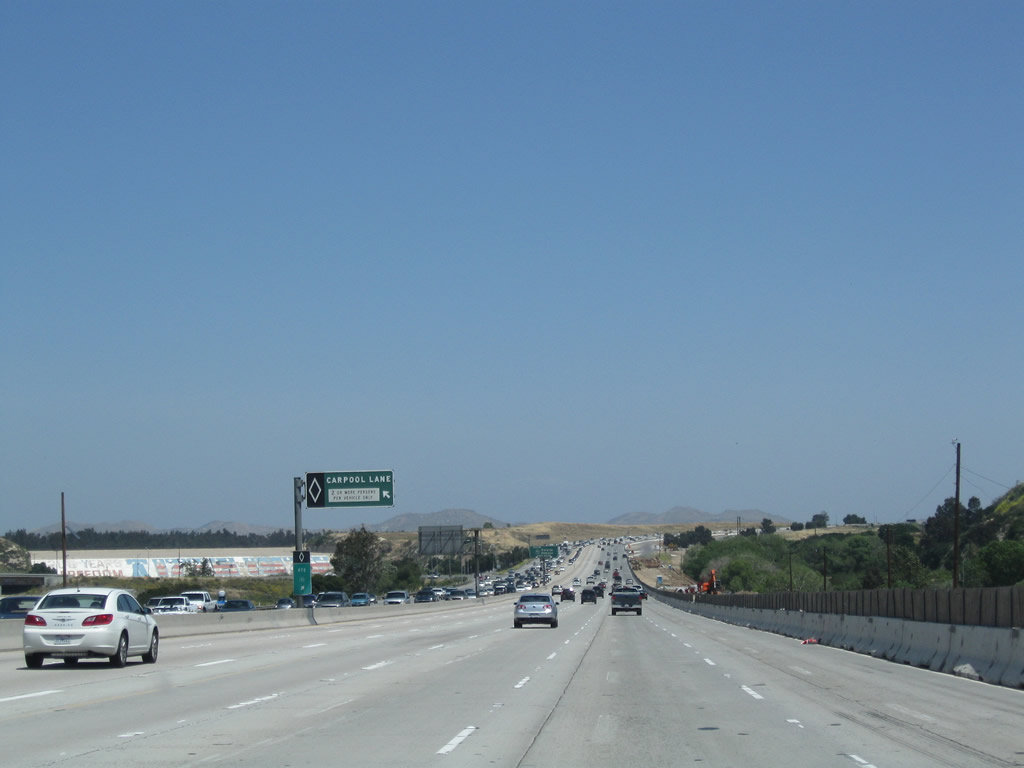
Prior to Exit 44 (Green River Road), the 91 Express Lanes come to their end. A carpool lane emerges to replace the express lanes. Construction in 2010 to add a new lane resulted in the series of signs leading up to Exit 44 being temporarily removed. Photos taken 01/30/05 and 05/02/10. |
|
|
|
|
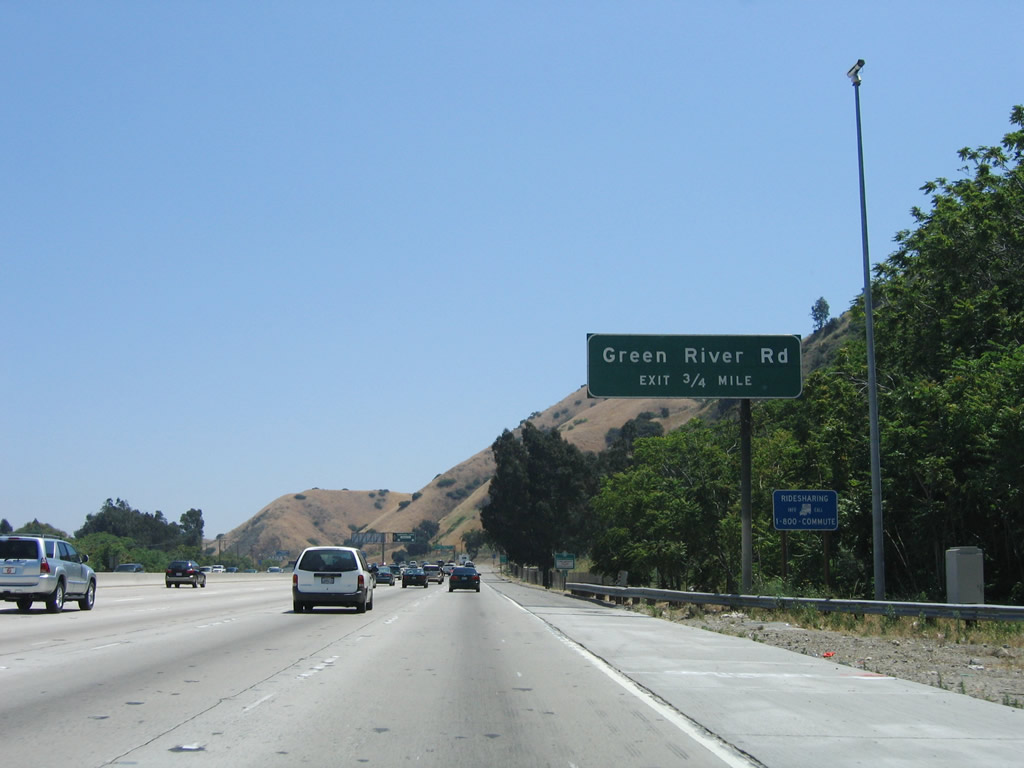
Eastbound California 91 (Riverside Freeway) meets Exit 44, Green River Road. Photo taken 04/18/04. |
|
The gore point sign for Exit 44 (Green River Road) is posted soon thereafter. Photo taken 05/02/10. |
|
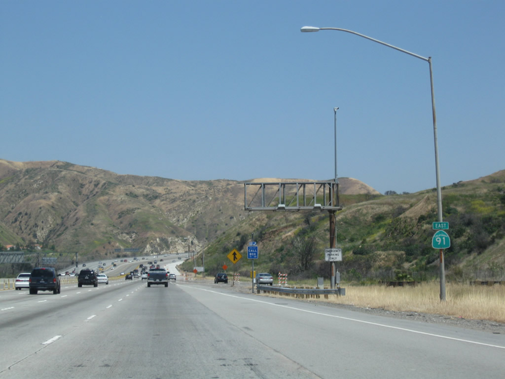
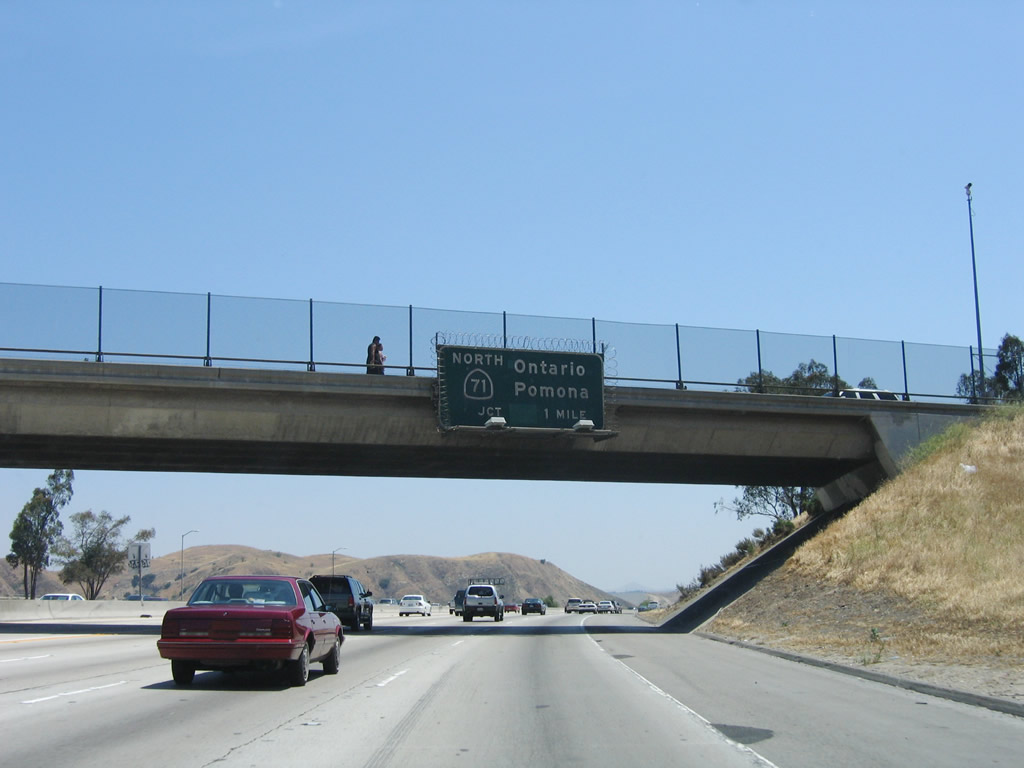
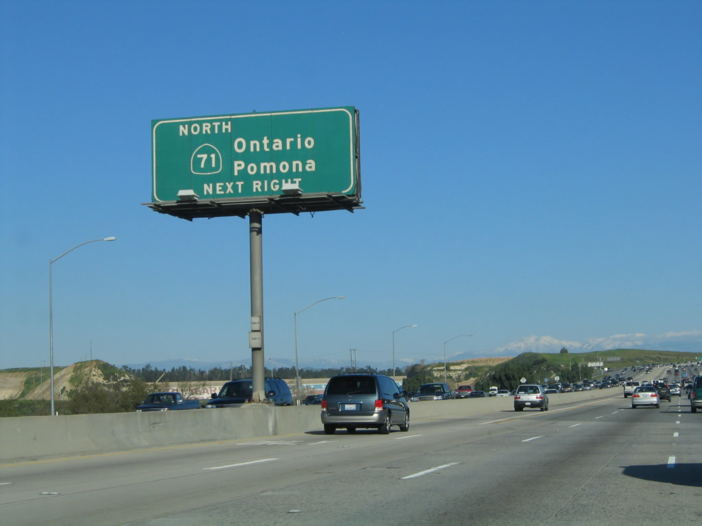
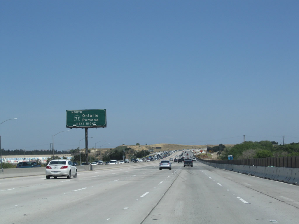
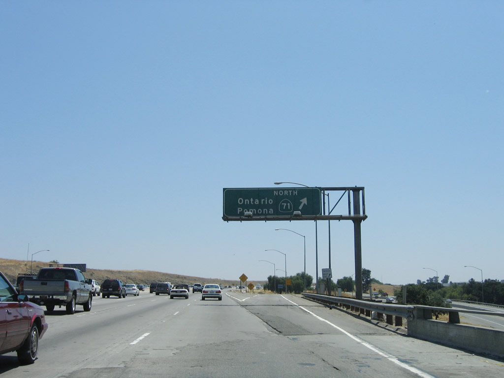
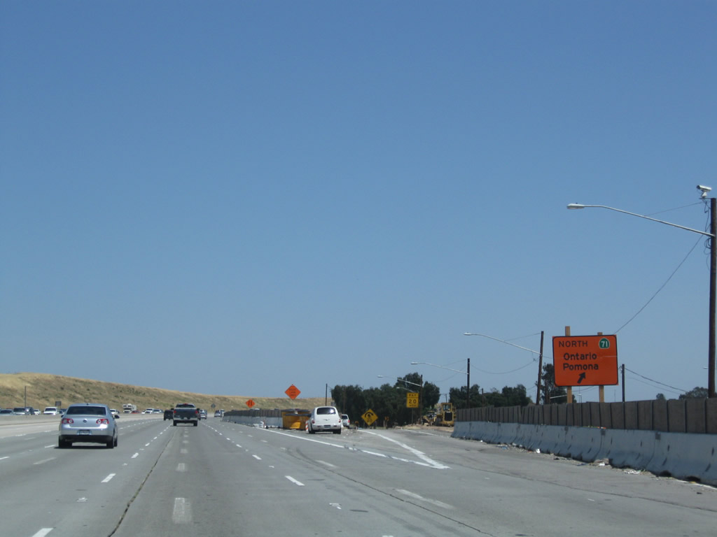
The next exit along eastbound is Exit 45, California 71 (Chino Hills Freeway) north, one mile. This interchange marks the southern terminus of California 71. Prior to the completion of Interstate 15, California 71 continued east cosigned with California 91, then turned south along Interstate 15 all the way to Temecula. California 71 then followed California 79 and California 371 southeast to end at California 74 in the mountains west of Palm Springs. All of the duplication created by this odd routing was eliminated by the mid-1980s, and now California 71 has a much shorter almost all-freeway route. Photos taken 05/02/10 and 06/17/06. |
|
|
|
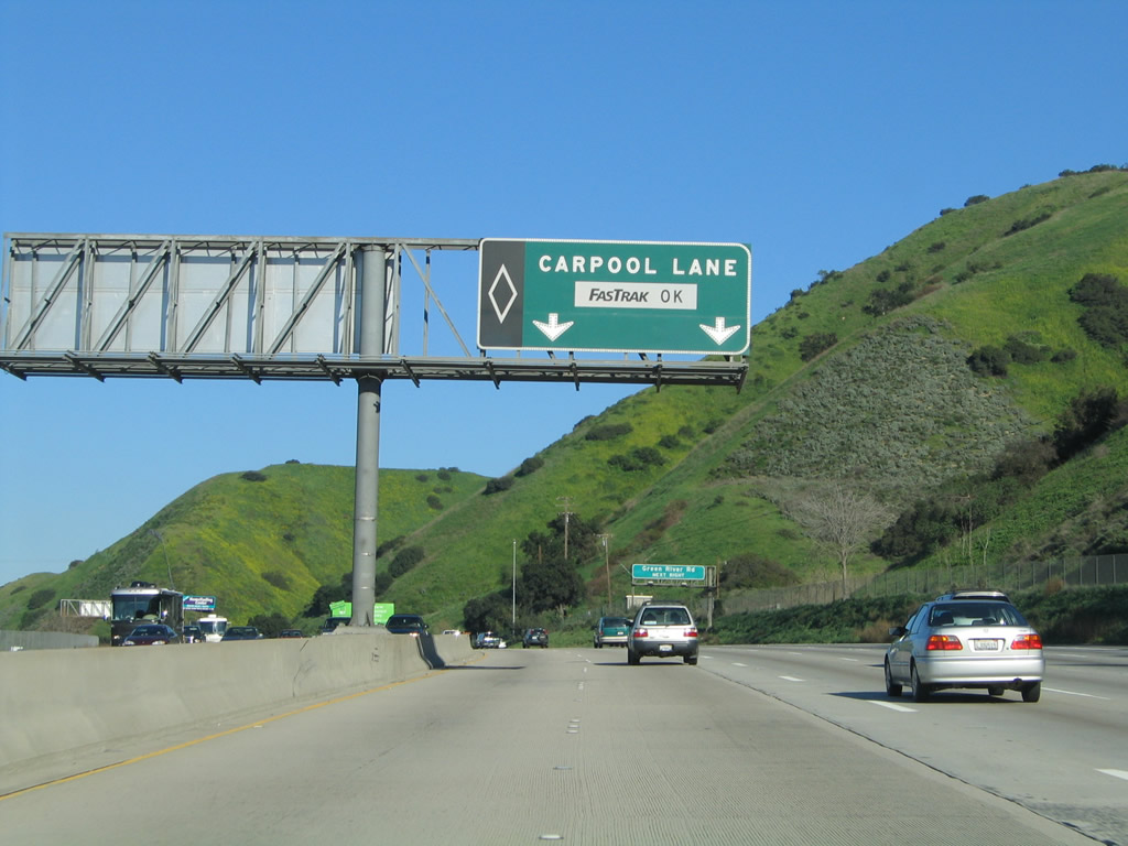
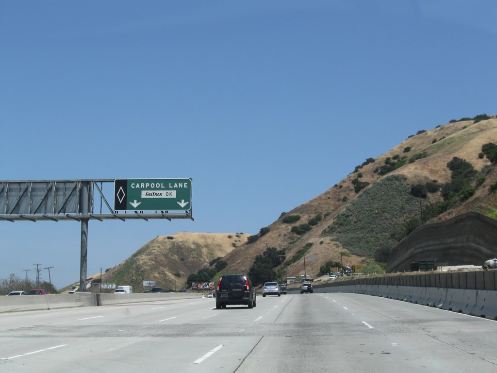
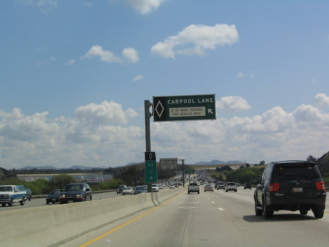
This unusual carpool lane advisory sign is white on black, while most of these signs are black on white. Unlike the earlier 91 Express Lanes, this carpool lane is more typical of HOV lanes in Southern California, as two people in car constitute a carpool. Photos taken 05/02/10 and 04/18/04. |
|
|
California 71, which used to be a much longer route, is today preserved as a southeast to northwest diagonal freeway, originating here at California 91 Exit 45 and continuing through Chino, Chino Hills, and Pomona until ending at the Kellogg Interchange (Interstate 10 (San Bernardino Freeway) and California 57 (Orange Freeway)). While most of the route is freeway, a portion remains an expressway through Pomona ... and lengthy delays often result. Photos taken 01/30/05 and 05/02/10. |
|
|
Eastbound California 91 (Riverside Freeway) reaches Exit 45, California 71 (Chino Valley Freeway) north. Originally a two-lane highway, California 71 was converted to a full freeway from California 91 north to California 60 by late 2003. The section of California 71 between California 60 and Interstate 10 is slated for upgrade from expressway to freeway, but construction has not yet begun. California 71 comes to its northern terminus at California 57 / Interstate 210 northwest of Pomona. Photos taken 05/02/10 and 06/17/06. |
|
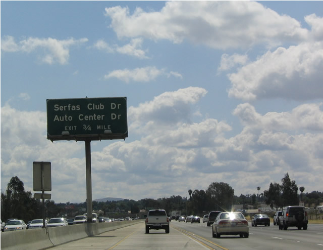
The next exit along eastbound is Exit 47, Serfas Club Drive and Auto Center Drive, which serves the city of Corona. Photo taken 04/18/04. |
|
California 91 (Riverside Freeway) approaches Exit 47, Serfas Club Drive and Auto Center Drive. Due to construction at the California 71 interchange, a detour sign is posted for that exit as well as Green River Road. Photo taken 05/02/10. |
|
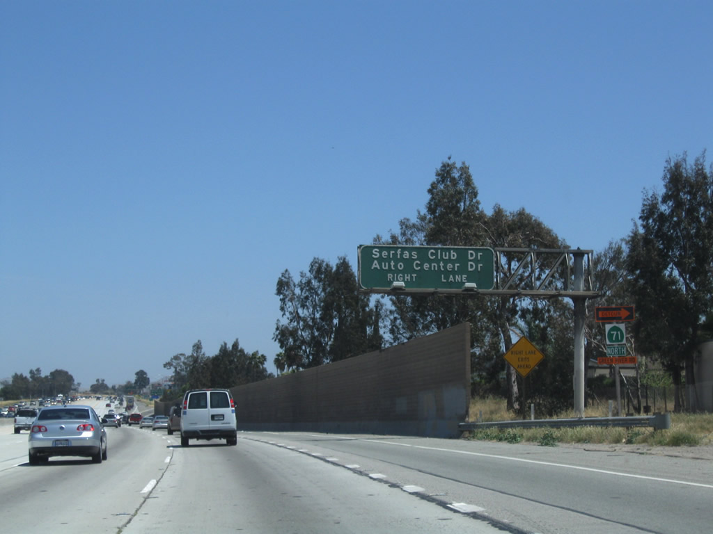
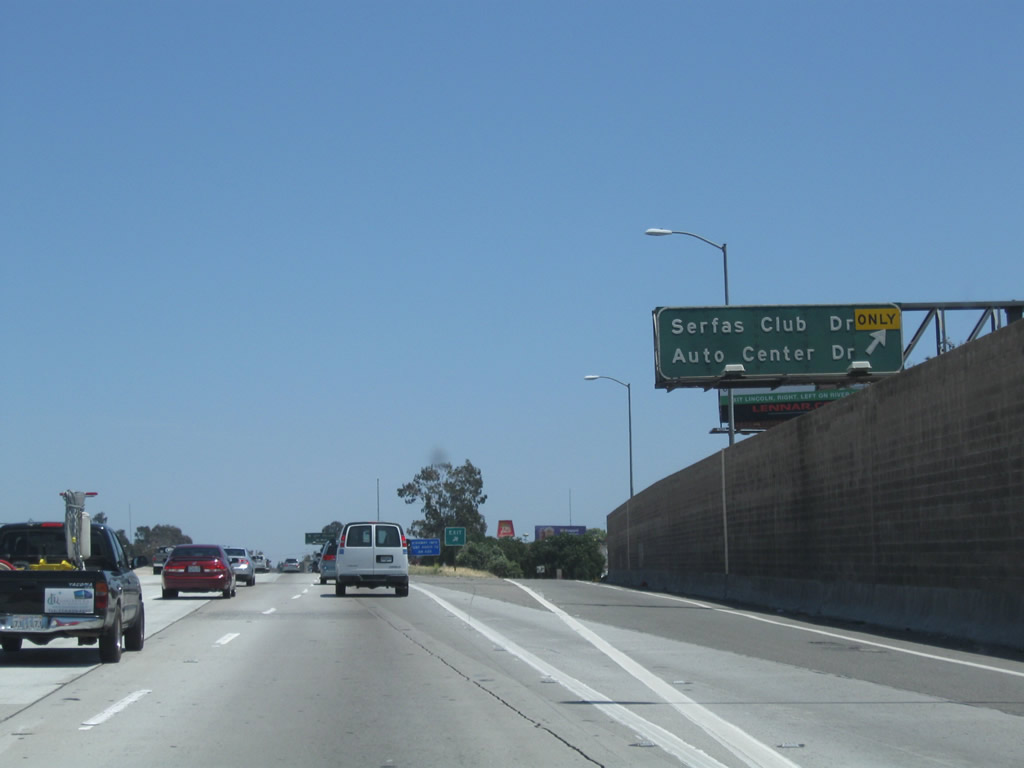
Eastbound California 91 (Riverside Freeway) reaches Exit 47, Serfas Club Drive and Auto Center Drive. The next exit is Exit 48, the (poorly marked) business loop, which follows 6th Street/Old U.S. 91 into Corona. Photo taken 05/02/10. |
|
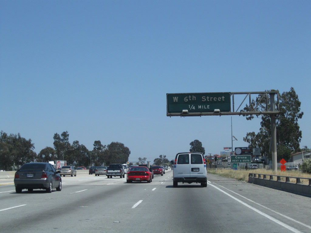
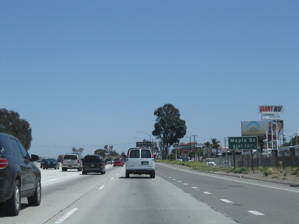
The next exit along California 91 (Riverside Freeway) east is Exit 48, Sixth Street (former U.S. 91 and former California 91 Business) and Maple Street. Former California 91 Business followed Sixth Street through Corona, meeting Main Street (old California 31) in downtown, then shifted onto Magnolia Avenue as the old route angles northeast toward Riverside. Photo taken 05/02/10. |
|
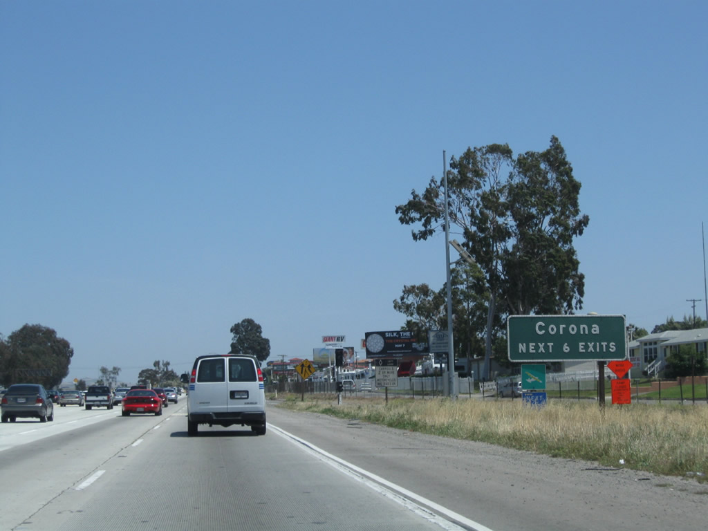
The next six exits along California 91 (Riverside Freeway) east serve the city of Corona: Exit 48, Historic U.S. 91/Sixth Street (former California 91 Business) and Maple Street; Exit 49A, Lincoln Avenue; Exit 49B, Grand Boulevard; Exit 50, Main Street (former California 31); Exit 51, Interstate 15 (Ontario Freeway) north and Interstate 15 (Corona Freeway) south; and Exit 53, McKinley Street. Photo taken 05/02/10. |
|
From this interchange (Exit 48), Maple Street travels north and then east, while Sixth Street travels due east to serve the city of Corona. Through here, California 91 is traveling nearly due east, but it will again head northeast after the Interstate 15 interchange. Photo taken 05/02/10. |
|
Eastbound California 91 (Riverside Freeway) meets Exit 48, Historic U.S. 91 and California 91 Business (Sixth Street) east and Maple Street north. Photo taken 05/02/10. |
|
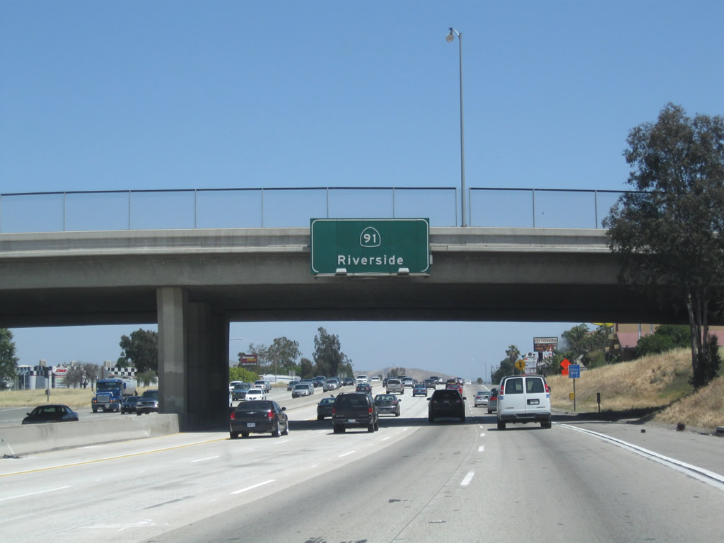
This pull-through sign for California 91 east to Riverside is mounted on the overpass for Sixth Street east and Maple Street. Photo taken 05/02/10. |
|
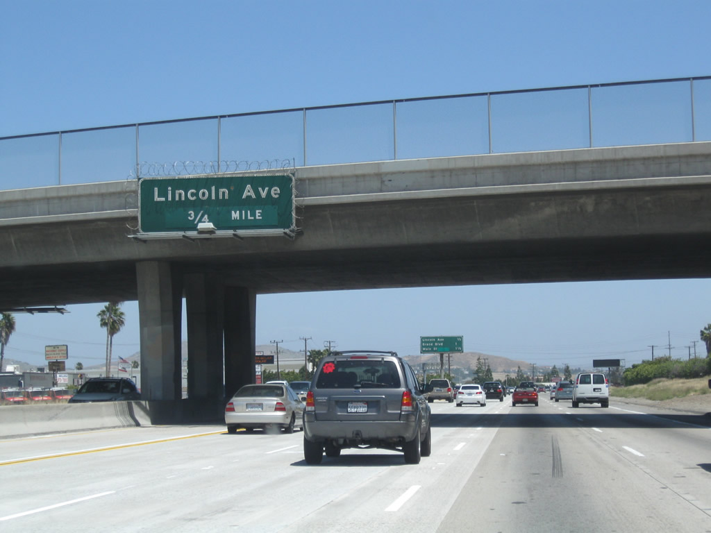
The next exit along eastbound is Exit 49A, Lincoln Avenue, 0.75 mile. Photo taken 05/02/10. |
|
This mileage sign along eastbound California 91 (Riverside Freeway) provides the distance to the three exits: Exit 49A, Lincoln Avenue; Exit 49B, Grand Boulevard; and Exit 50, Main Street. Photo taken 05/02/10. |
|
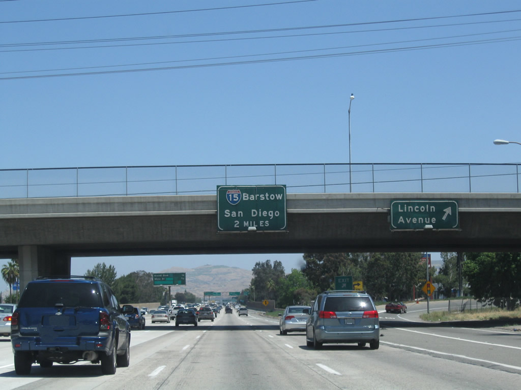
Eastbound California 91 (Riverside Freeway) meets Exit 49A, Lincoln Avenue. The next three exits are: Exit 49B, Grand Boulevard; Exit 50, Main Street (former California 31) north; and Exit 51, Interstate 15. Only Interstate 15 is posted on the overhead guide sign at the gore point for Exit 49A. Photo taken 05/02/10. |
|
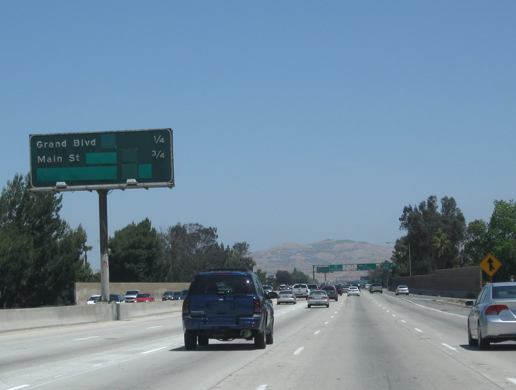
This interchange sequence sign along eastbound California 91 (Riverside Freeway) provides the distance to the next two exits: Exit 49B, Grand Boulevard and Exit 50, Main Street. Much of this sign has been modified since its original condition, including the removal of former state routes that passed through Corona such as California 31 and California 71. Photo taken 05/02/10. |
|
Eastbound California 91 (Riverside Freeway) meets Exit 49B, Grand Boulevard and Second Street. Grand Boulevard is a circular loop that encircles downtown Corona. The next interchange connects California 91 to Exit 50, Main Street. Photo taken 05/02/10. |
Page Updated November 15, 2010.