
California 91 West - Exits 65 to 50
| California 91 west | |
|---|---|
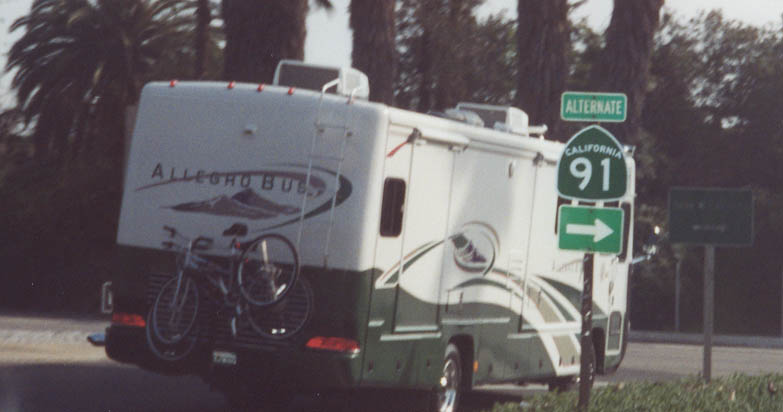 |
Prior to the reconstruction of the 60-91-215 interchange in Riverside, Exit 65 was the link from California 91 west to Poplar Street. This off-ramp was eliminated; the first exit from California 91 west is Exit 64, Mission Inn Avenue. At the base of the off-ramp was this Alternate California 91 sign, which probably led to California 91 Business west through downtown Riverside and onward to Magnolia Avenue. Both the off-ramp and the shield were gone by 2008. Photo taken 03/15/01. |
 |
Leaving the 60-91-215 interchange, this interchange sequence sign provides the distance to the next three exits along California 91 (Riverside Freeway) west: Exit 64, Mission Inn Avenue; Exit 63, Fourteenth Street; and Exit 62, Central Avenue. Photo taken 09/28/08. |
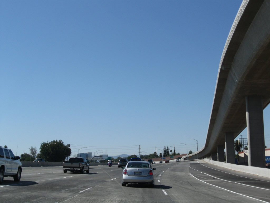 |
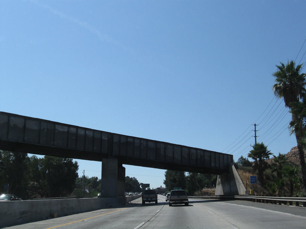
California 91 begins its westward journey with five through lanes, with provisions for an eventual carpool (high occupancy vehicle) lane. The tall ramp joining California 91 from the right carries traffic from Interstate 215 north and California 60 west to California 91 west. Photo taken 09/28/08. |
 |
Use Exit 64, Mission Inn Avenue to a museum and the Riverside convention center. An auxiliary sign for Exit 63, 14th Street is posted prior to the merge point with the flyover ramp from Interstate 215 north and California 60 west. Photo taken 09/28/08. |
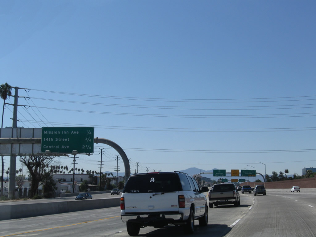 |
This interchange sequence sign provides the distance to the next three exits along California 91 (Riverside Freeway) west: Exit 64, Mission Inn Avenue; Exit 63, Fourteenth Street; and Exit 62, Central Avenue. Photo taken 09/28/08. |
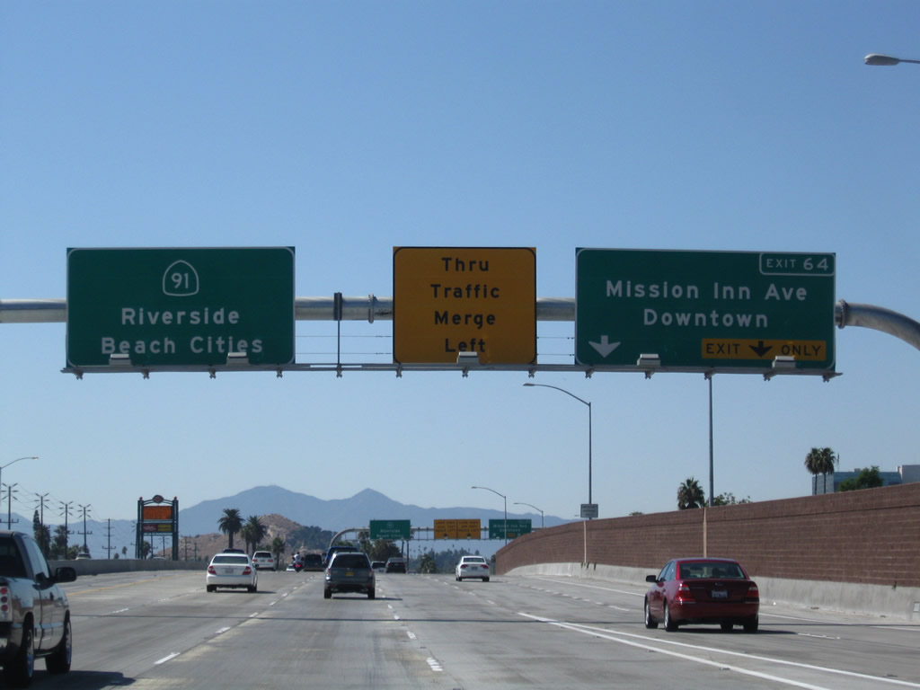 |
The right two lanes of California 91 (Riverside Freeway) west connect to Exit 64, Mission Inn Avenue. California 91 west is signed for Riverside and Beach Cities. While California 91 is near downtown Riverside at this point, the freeway remains in Riverside for some distance southwest from here. Photo taken 09/28/08. |
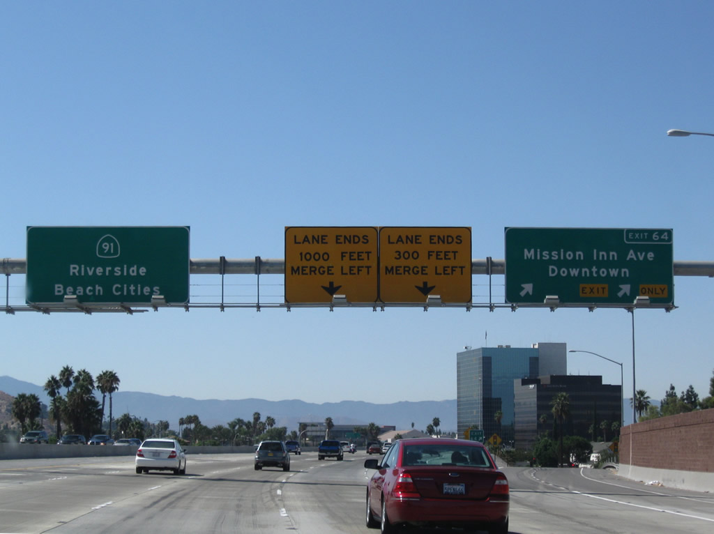 |
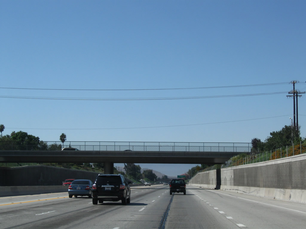
Westbound California 91 (Riverside Freeway) reaches Exit 64, Mission Inn Avenue. After the exit ramp, the right two lanes will end; traffic must merge to the left. These lanes were added to California 91 as part of the 60-91-215 interchange project; more work needs to be done to extend the new lanes further southwest. Photo taken 09/28/08. |
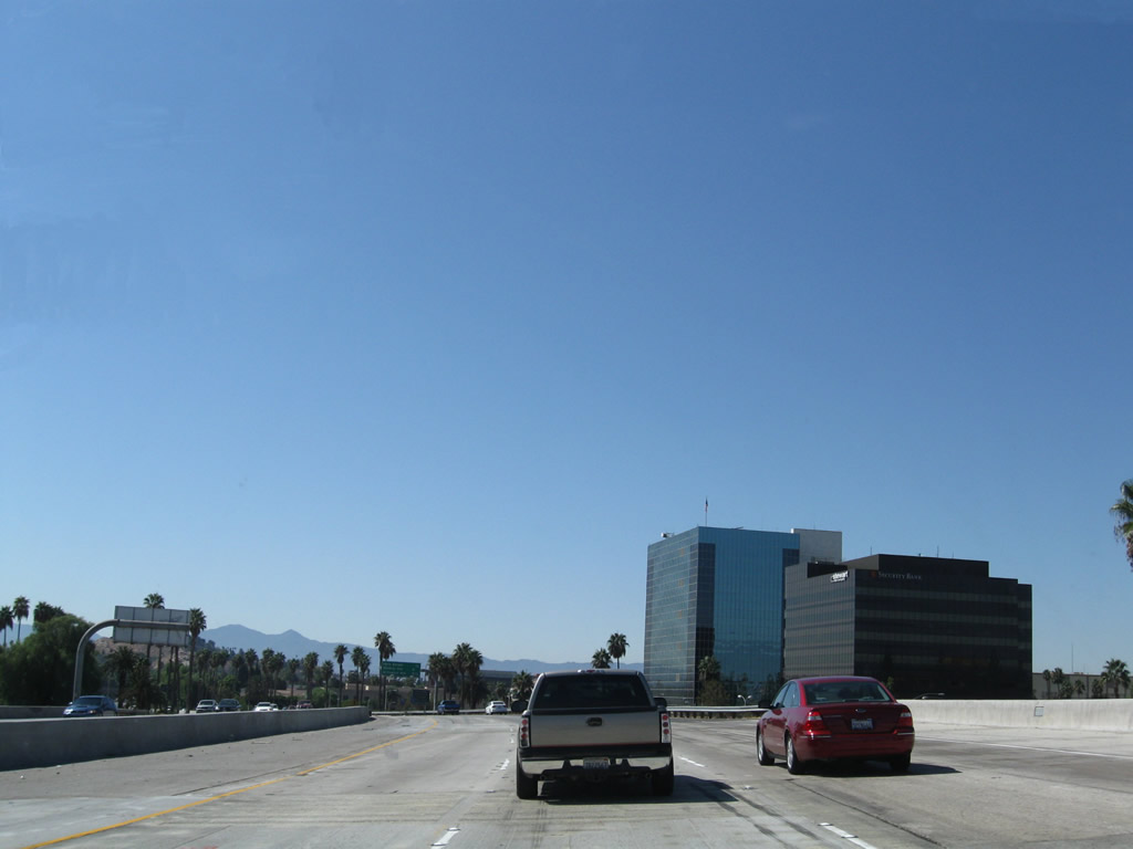 |
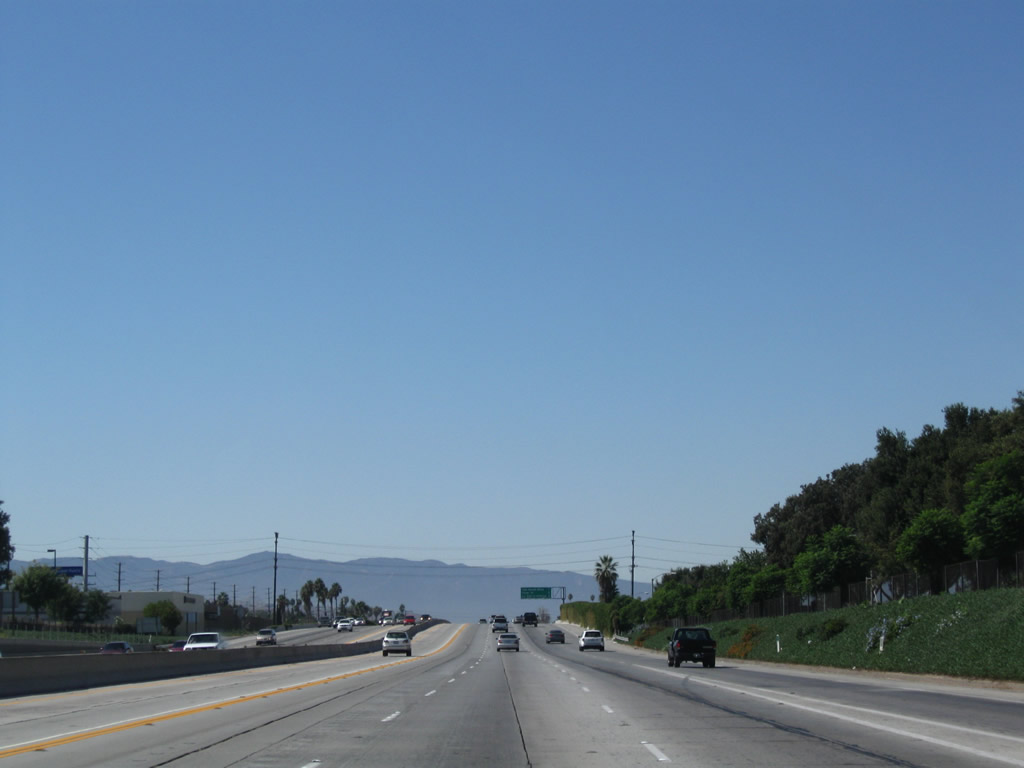
Passing by downtown Riverside, California 91 gradually reduces from five to three westbound lanes. Photo taken 09/28/08. |
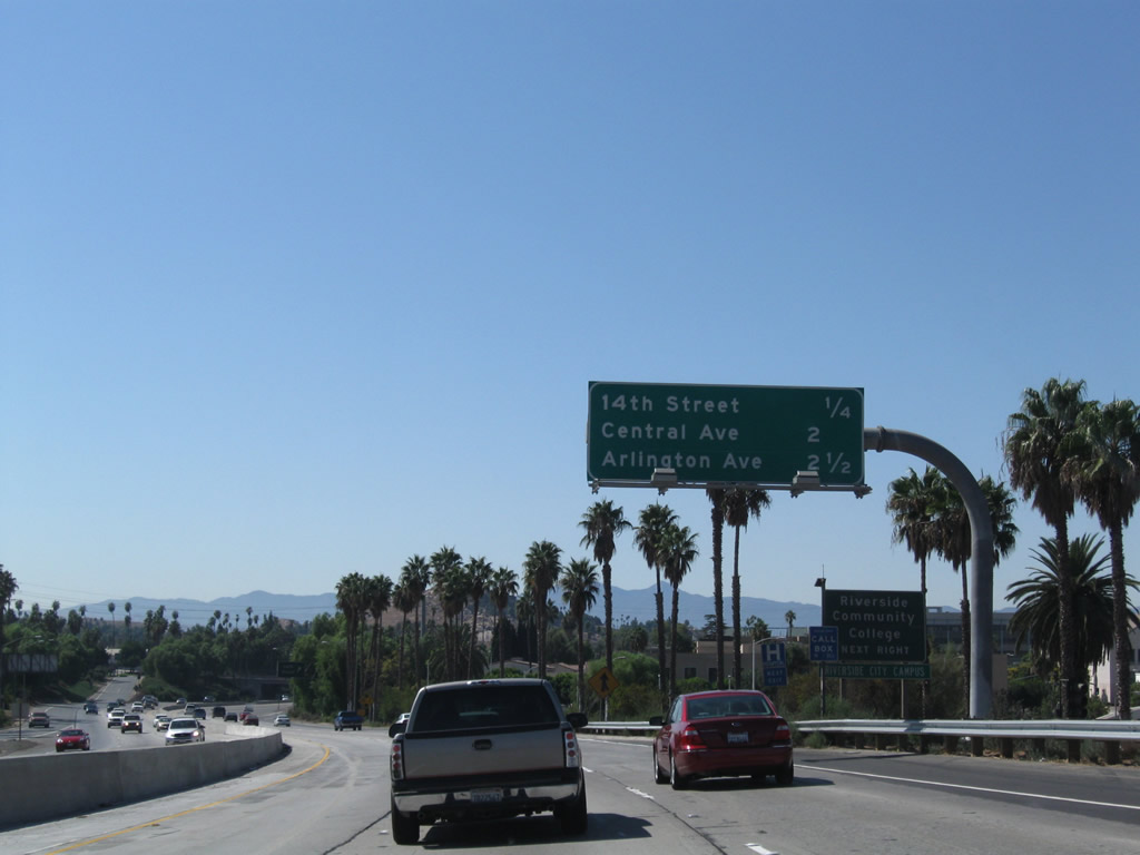 |
This interchange sequence sign provides the distance to the next three exits along California 91 (Riverside Freeway) west: Exit 63, Fourteenth Street; Exit 62, Central Avenue; and Exit 61, Arlington Avenue. Photo taken 09/28/08. |
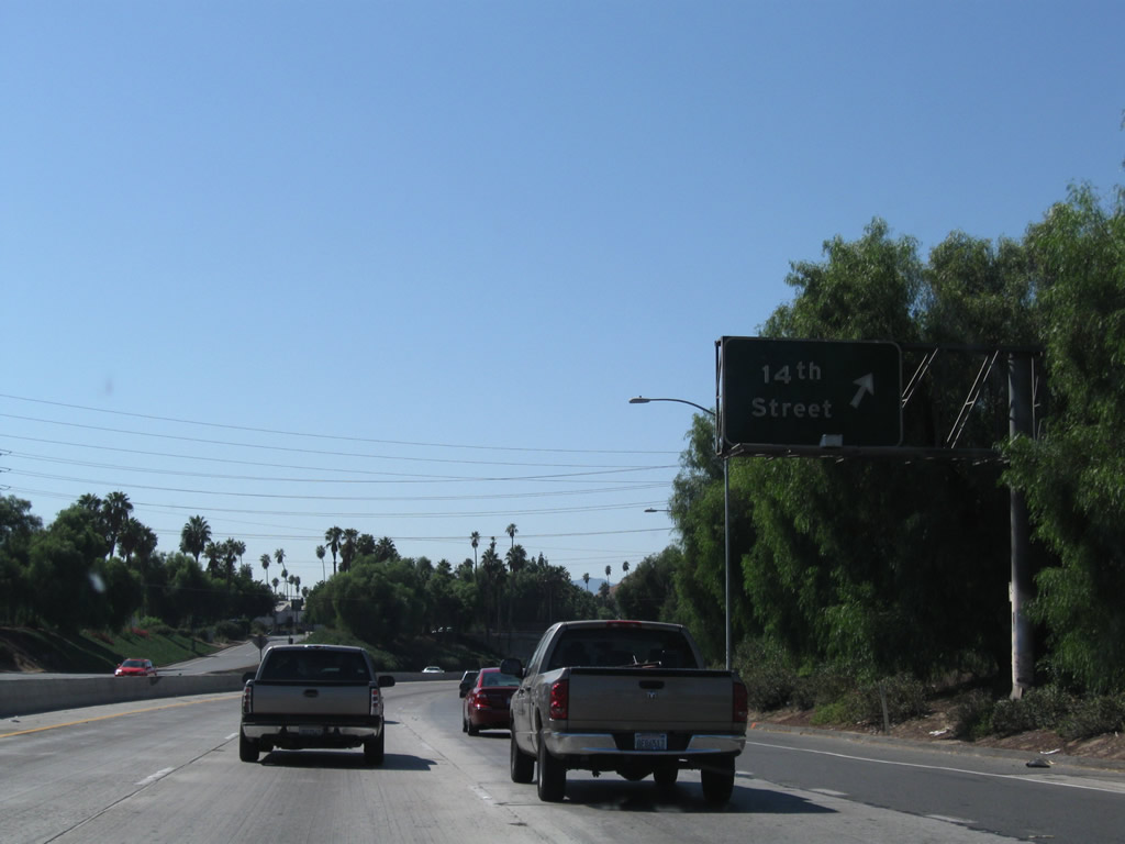 |
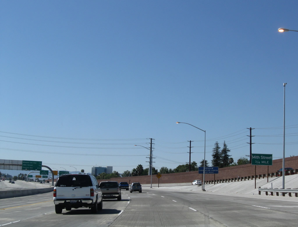
Westbound California 91 (Riverside Freeway) reaches Exit 63, Fourteenth Street. This older, porcelain enamel sign dates back to the original freeway construction. Photo taken 09/28/08. |
 |
The next exit along California 91 (Riverside Freeway) west is Exit 62, Central Avenue (1.50 miles). Photo taken 09/28/08. |
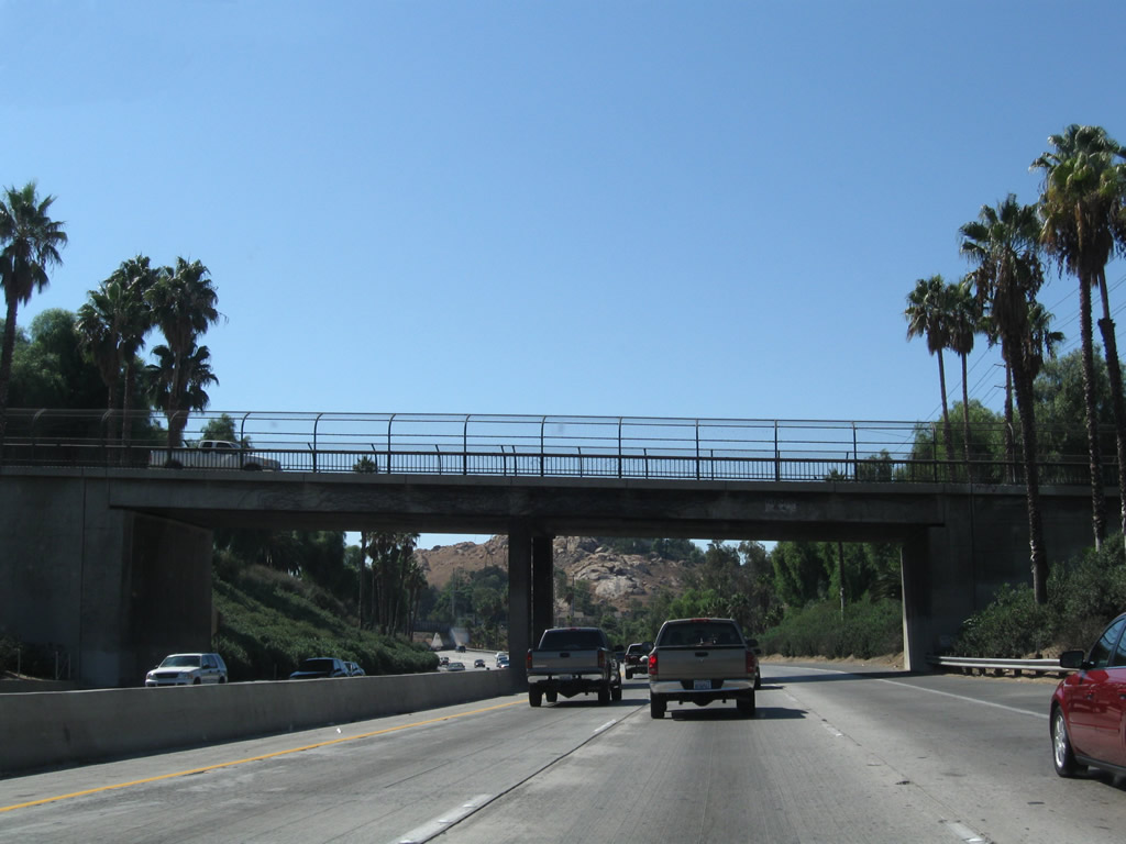 |
This overpass (Ivy Street) would be one of several that would have to be replaced in order to expand California 91 for more than six through lanes. Photo taken 09/28/08. |
 |
A railroad line passes overhead. Photo taken 09/28/08. |
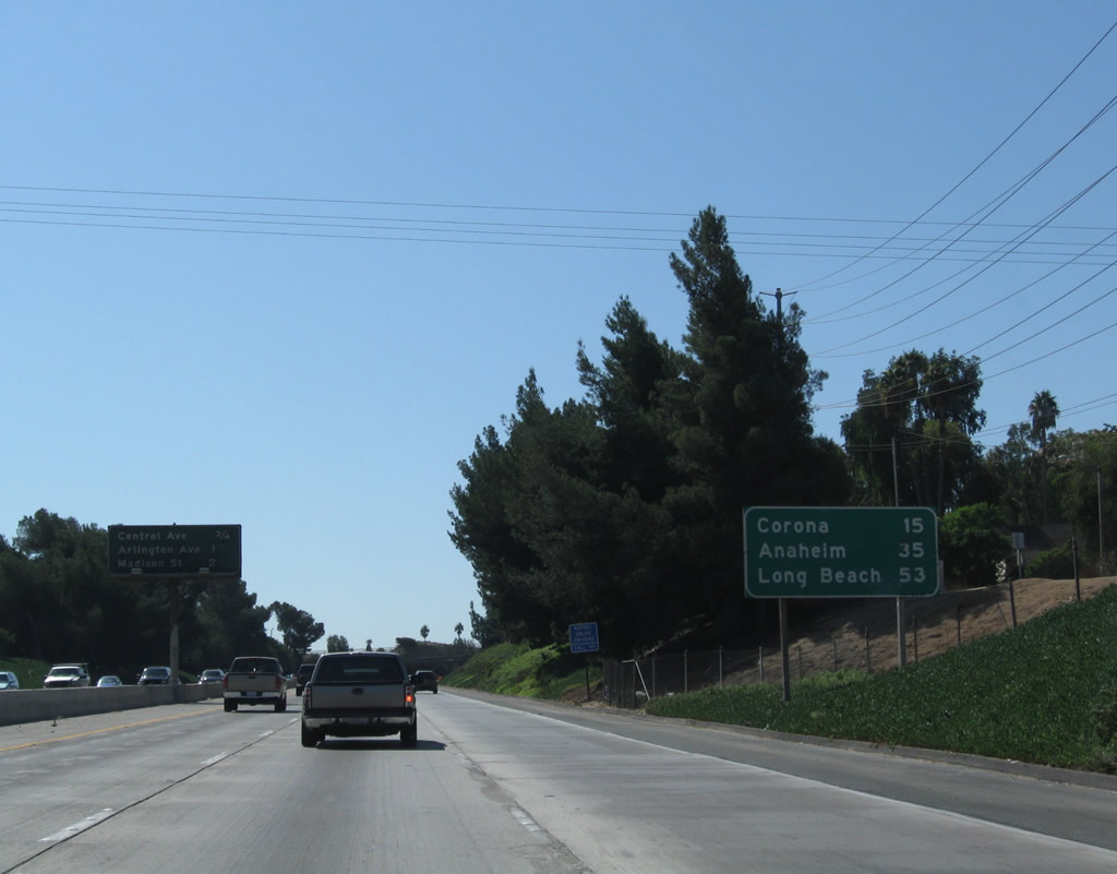 |
A pair of mileage signs is posted shortly thereafter. The first sign provides the distance to Corona (15 miles), Anaheim (35 miles), and Long Beach (53 miles). The second sign lists the upcoming exits: Exit 62, Central Avenue; Exit 61, Arlington Avenue; and Exit 60, Madison Street. Photo taken 09/28/08. |
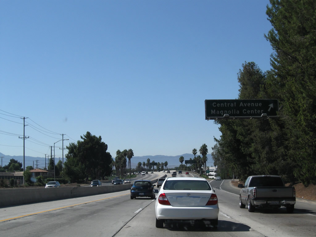 |
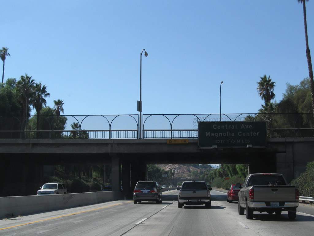
Westbound California 91 (Riverside Freeway) reaches Exit 62, Central Avenue to Magnolia Center. Photo taken 09/28/08. |
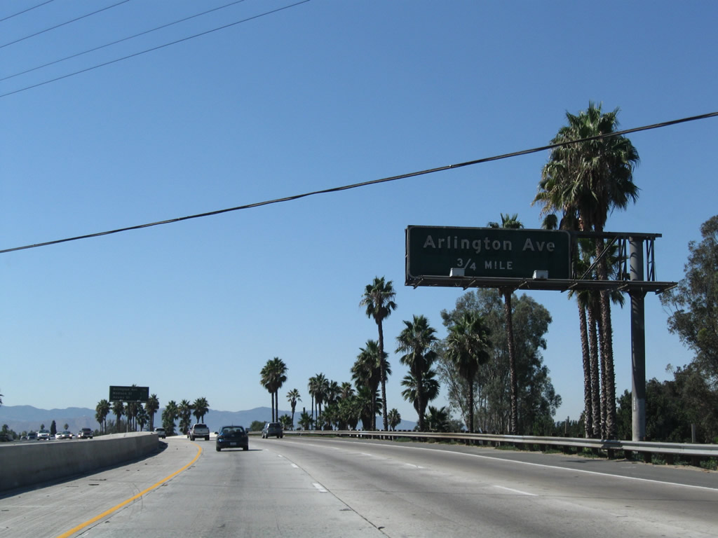 |
The next exit along California 91 (Riverside Freeway) west is Exit 61, Arlington Avenue (0.75 mile). This east-west road intersects California 91 at an angle as California 91 continues to travel southwest parallel to the Santa Ana River. Photo taken 09/28/08. |
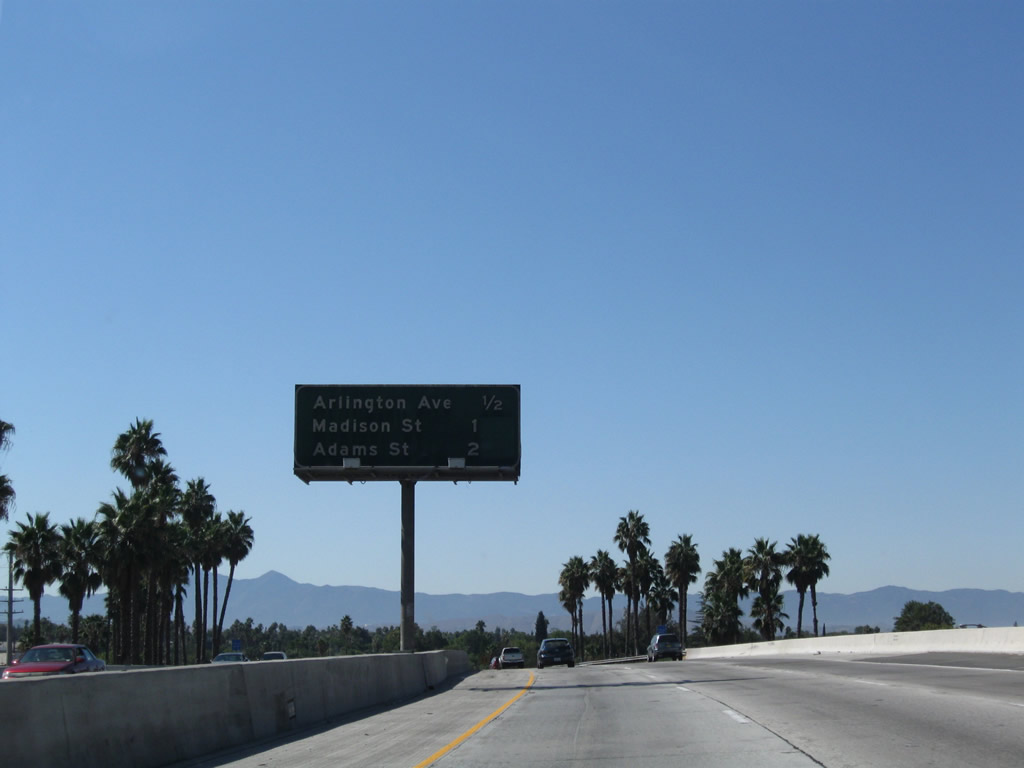 |
This interchange sequence sign lists the next three exits: Exit 61, Arlington Avenue; Exit 60, Madison Street; and Exit 59, Adams Street. Photo taken 09/28/08. |
 |
California 91 has three lanes in each direction through this segment in the city of Riverside. Photo taken 09/28/08. |
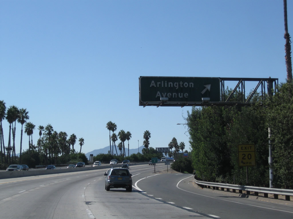 |
Westbound California 91 (Riverside Freeway) reaches Exit 61, Arlington Avenue. Photo taken 09/28/08. |
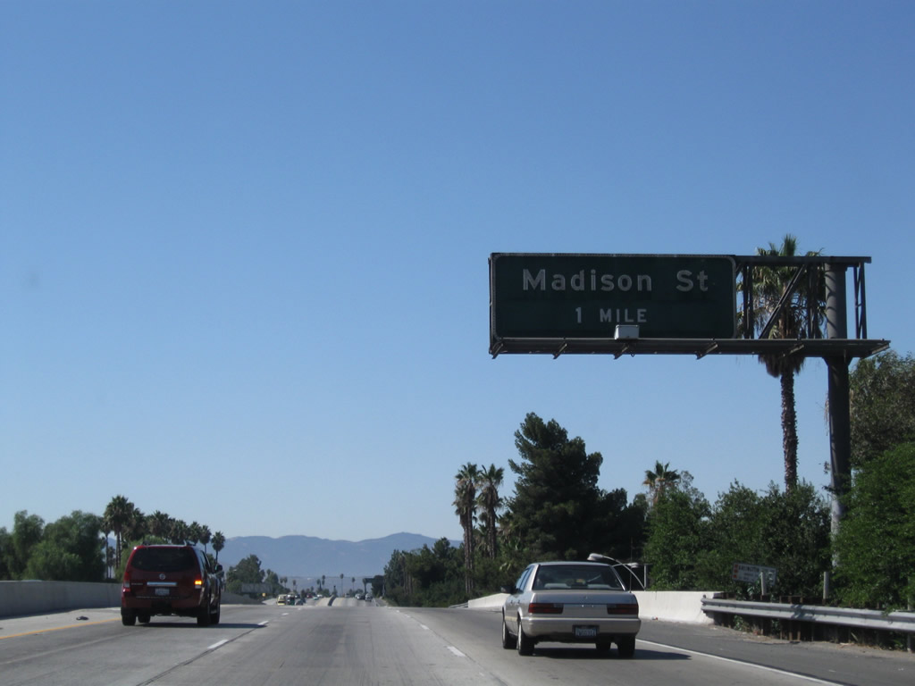 |
The next exit along California 91 (Riverside Freeway) west is Exit 60, Madison Street (one mile). Many of the streets that interchange with California 91 along this stretch are named after U.S. Presidents. Photo taken 09/28/08. |
 |
Madison Street travels south to the Casa Blanca and Prenda communities of the city of Riverside. At this point, an unsigned carpool lane begins on the left side of the westbound freeway lanes. Photo taken 09/28/08. |
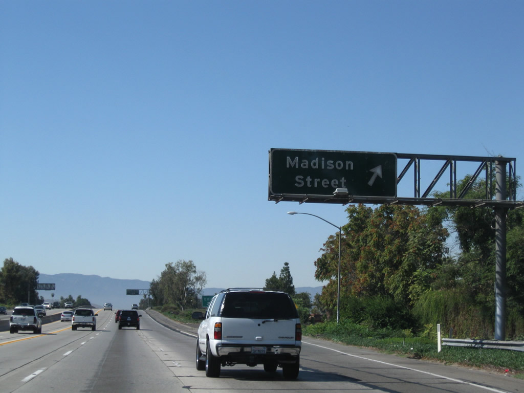 |
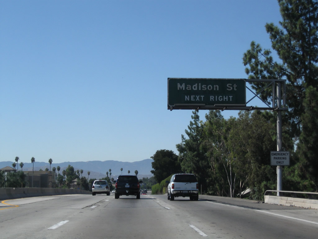
Westbound California 91 (Riverside Freeway) reaches Exit 60, Madison Street. Photo taken 09/28/08. |
 |
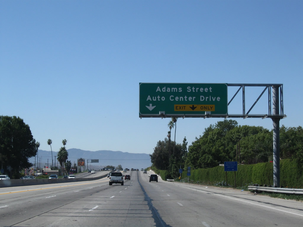
The next exit along California 91 (Riverside Freeway) west is Exit 59, Adams Street and Auto Center Drive. Take Exit 59 and turn left onto Adams Street south to Auto Drive. A variety of automobile dealerships are located along both sides of Auto Drive. Photo taken 09/28/08. |
 |
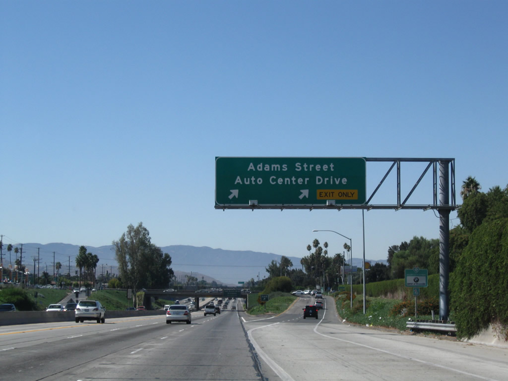
The two right lanes will connect to Exit 59, Adams Street and Auto Center Drive. A series of roundabouts (traffic circles) are found along Auto Drive between Adams Street and Jefferson Street. Photo taken 09/28/08. |
 |
Westbound California 91 (Riverside Freeway) reaches Exit 59, Adams Street and Auto Center Drive. Photo taken 09/28/08. |
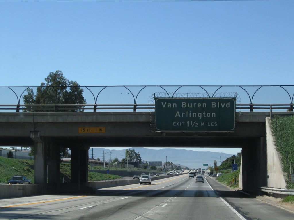 |
The next exit along California 91 (Riverside Freeway) west is Exit 58, Van Buren Boulevard. This exit serves the city of Riverside as well as Arlington. Photo taken 09/28/08. |
 |
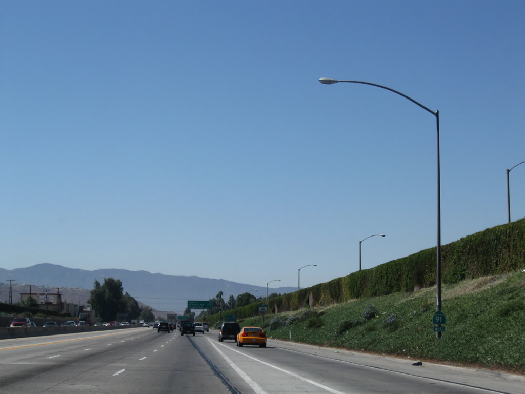
California 91 (Riverside Freeway) has three through lanes, one carpool (high occupancy vehicle lane), and one auxiliary lane on the right for entering and exiting traffic. Photo taken 09/28/08. |
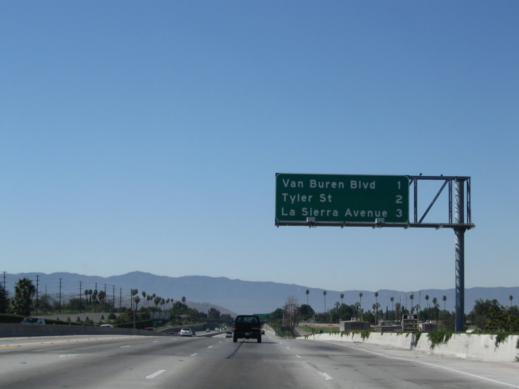 |
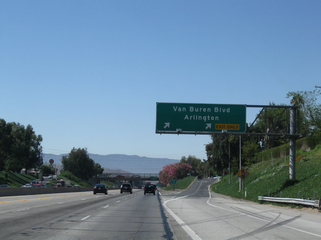
This interchange sequence sign provides the distance to the next three exits: Exit 58, Van Buren Boulevard; Exit 56, Tyler Street; and Exit 55B, La Sierra Avenue. Van Buren Boulevard is a major southeast-northwest arterial that ultimately connects with California 60 at the Mission Boulevard interchange (via Pedley, with a Santa Ana River bridge crossing). Photo taken 09/28/08. |
 |
Follow Van Buren Boulevard southeast to California Citrus State Historic Park. Van Buren Boulevard continues southeast to link with Mockingbird Canyon Road, then turns east to an interchange with Interstate 215. Photo taken 09/28/08. |
 |
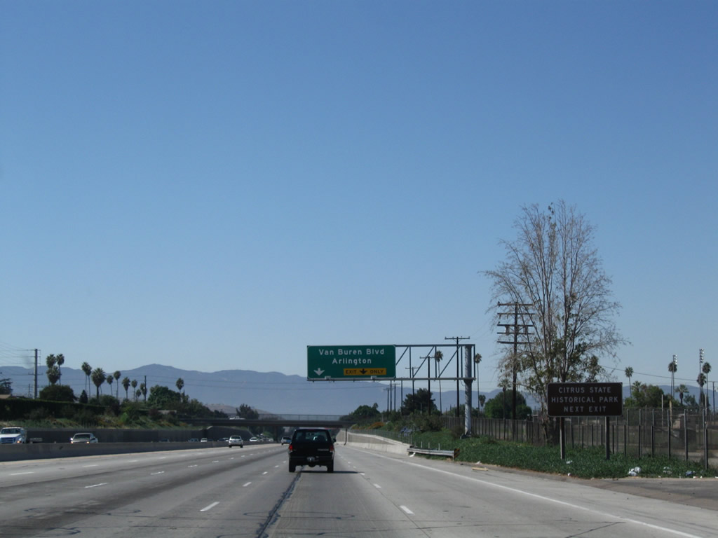
The right two lanes link California 91 with Exit 58, Van Buren Boulevard. Arlington is a neighborhood of the city of Riverside, which extends along a linear path from downtown toward Corona along the former U.S. 91 route and the Santa Ana River. Photo taken 09/28/08. |
 |
California 91 goes below grade to pass under Jackson Street. Photo taken 09/28/08. |
 |
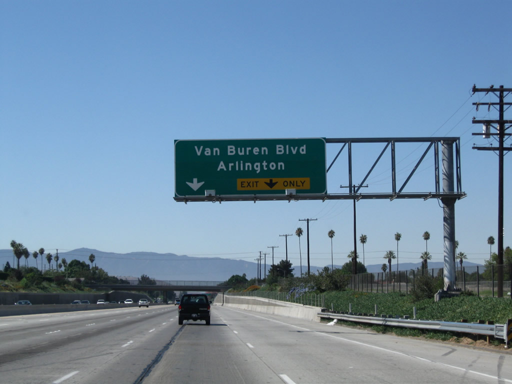
Westbound California 91 (Riverside Freeway) reaches Exit 58, Van Buren Boulevard. Photo taken 09/28/08. |
 |
The next exit along California 91 west is Exit 56, Tyler Street. The naming convention for intersecting streets continues with another Presidential name. Photo taken 09/28/08. |
 |
A California 91 west reassurance shield is posted shortly after the on-ramp from Van Buren Boulevard. Photo taken 09/28/08. |
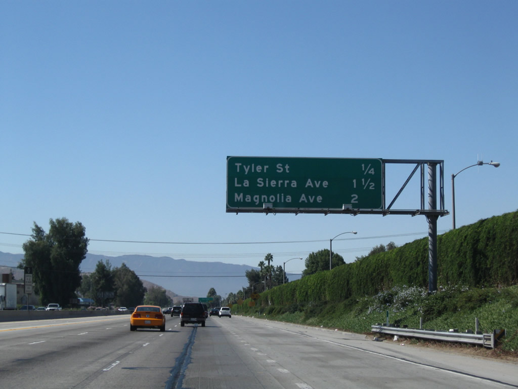 |
This mileage sign provides the distance to the next three exits along California 91 west: Exit 56, Tyler Street; Exit 55B, La Sierra Avenue; and Exit 55A, Magnolia Avenue. Photo taken 09/28/08. |
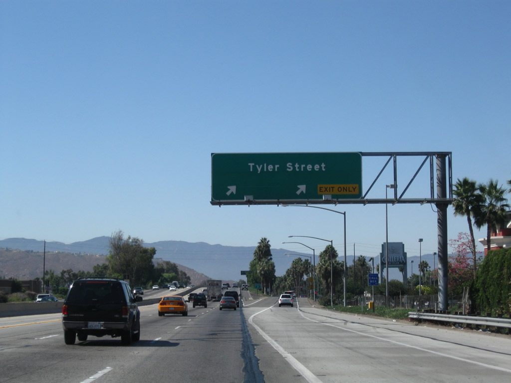 |
Westbound California 91 (Riverside Freeway) reaches Exit 56, Tyler Street. Photo taken 09/28/08. |
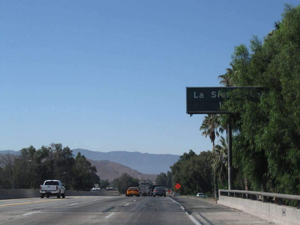 |
The next exit along California 91 (Riverside Freeway) west is Exit 55B, La Sierra Avenue. The sign is partially obscured by trees. Photo taken 09/28/08. |
 |
This mileage sign provides the distance to the next four exits along California 91 west: Exit 55B, La Sierra Avenue; Exit 55A, Magnolia Avenue; and Exits 53B-A, McKinley Street. Photo taken 09/28/08. |
 |
Westbound California 91 reaches Exit 55B, La Sierra Avenue. Construction was underway at the time this picture was taken. Photo taken 09/28/08. |
 |
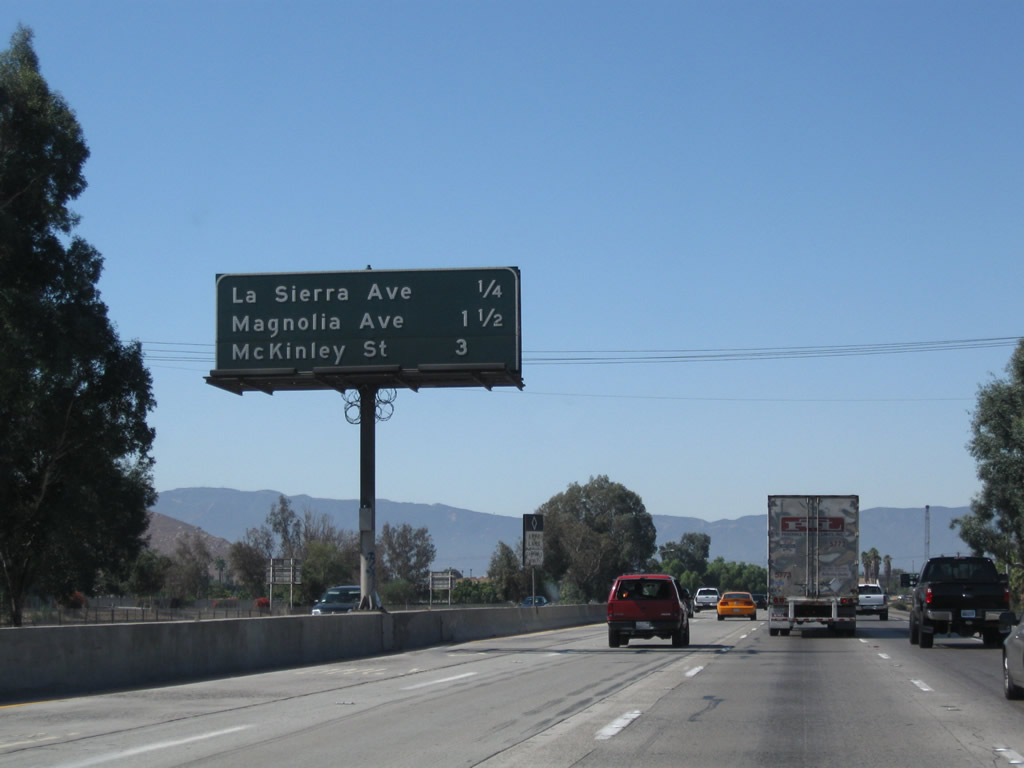
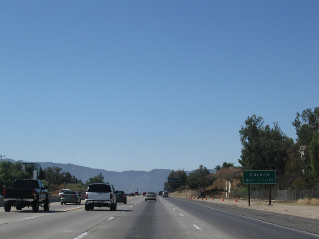
This mileage sign provides the distance to the next four exits along California 91 west: Exit 55A, Magnolia Avenue; Exits 53B-A, McKinley Street; and Exit 51, Interstate 15 (Corona Freeway) north to Ontario and south to Temecula and San Diego. Photo taken 09/28/08. |
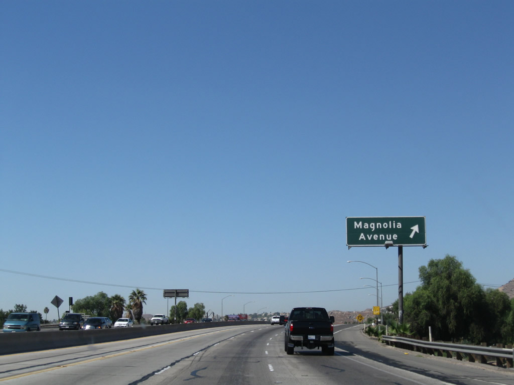 |
Westbound California 91 reaches Exit 55A, Magnolia Avenue. This two-quadrant cloverleaf interchange connects California 91 to its old alignment, Magnolia Avenue. Until 2001, Magnolia Avenue was designated as California 91 Business, and before that, U.S. 91 Business. No shields for either route remain. Photo taken 09/28/08. |
 |
A California 91 west reassurance shield is posted shortly after the on-ramp from Magnolia Avenue. Photo taken 09/28/08. |
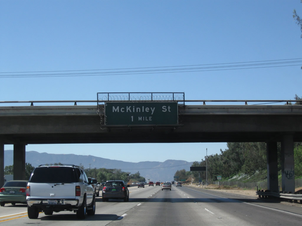 |
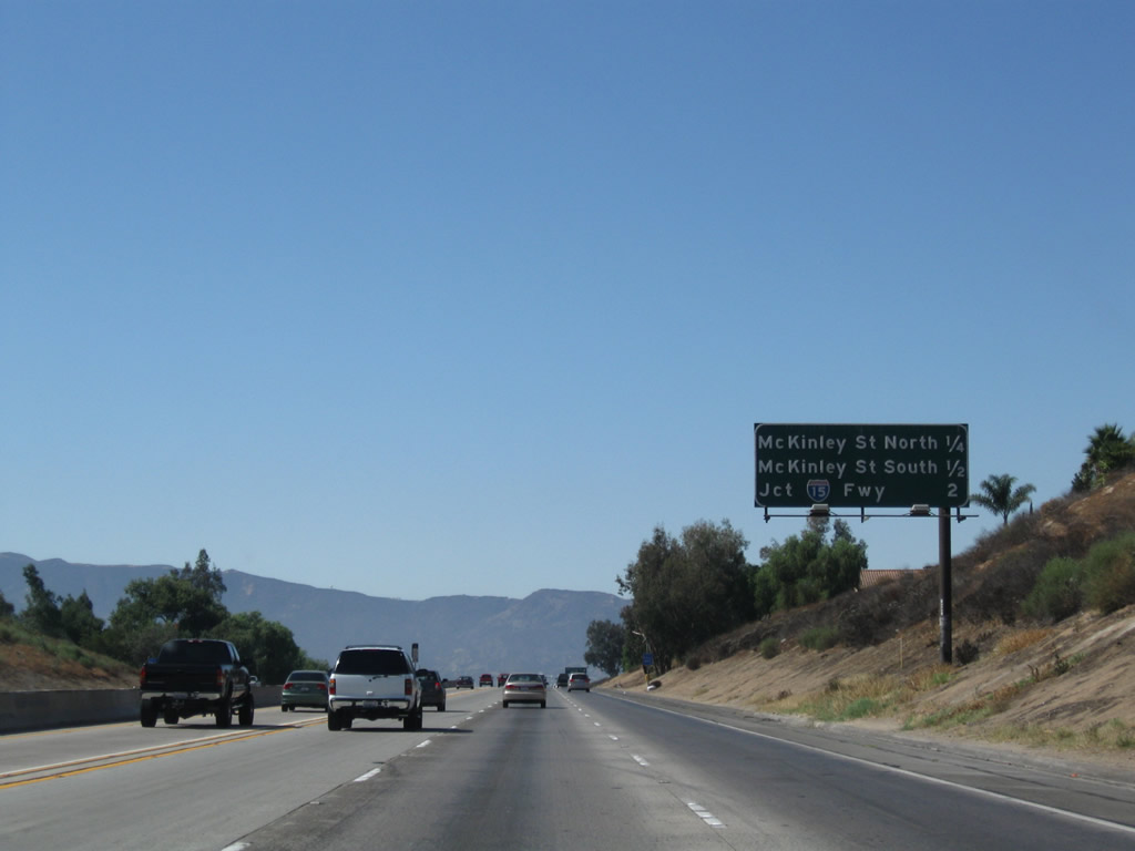
The next interchange along California 91 (Riverside Freeway) west is Exits 53B-A, McKinley Street. The first exit ramp connects to McKinley Street north, and the second exit connects to McKinley Street south. Photo taken 09/28/08. |
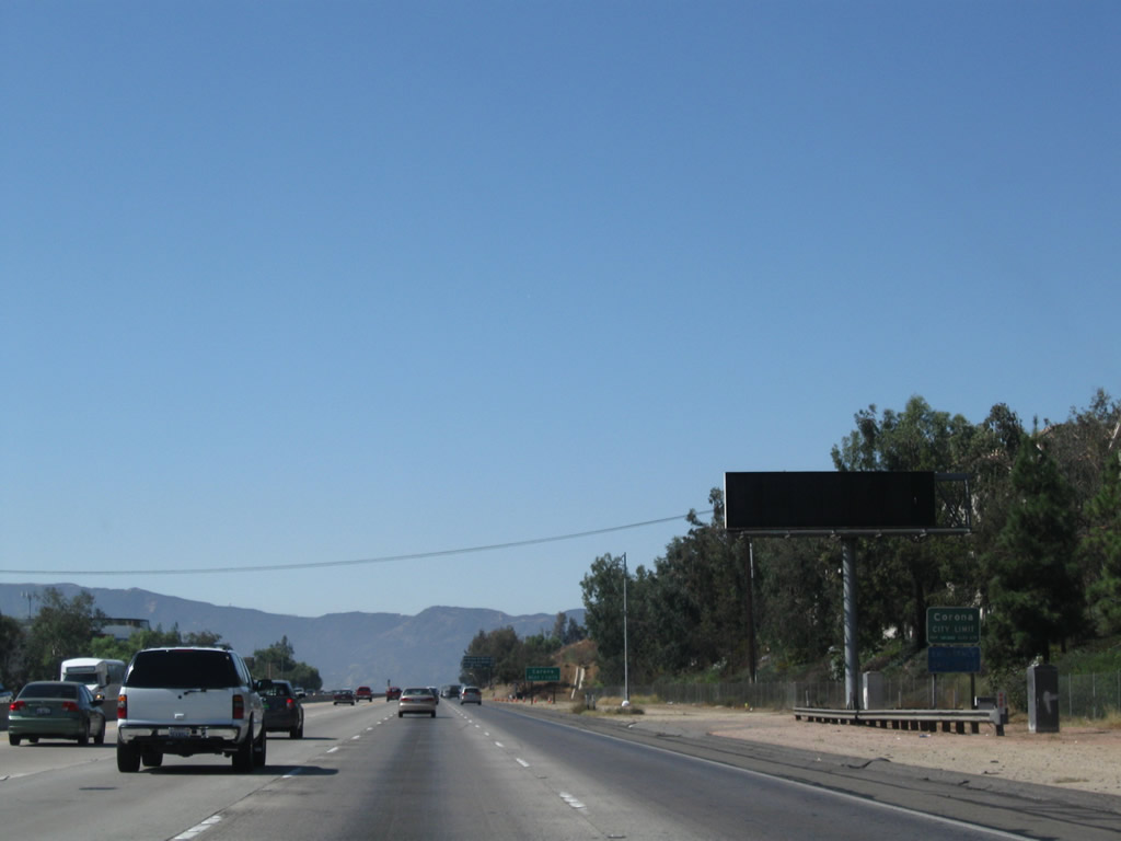 |
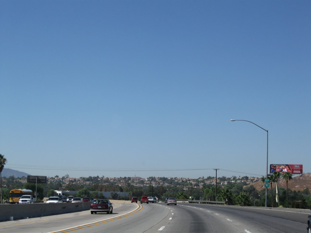
For the first time since its inception at the 60-91-215 interchange, California 91 leaves Riverside and enters the city of Corona (the Circle City), which had a population of 124,966 people per the 2000 Census. The entire downtown is belted by a circular street known as Grand Boulevard, thus giving Corona the nickname "Circle City." Photo taken 09/28/08. |
 |
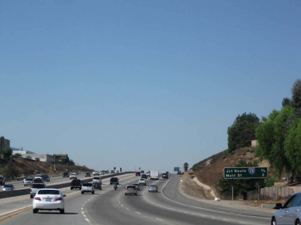
The next seven exits from California 91 west serve the city of Corona: Exit 53B, McKinley Street northwest to Norco; Exit 53A, McKinley Street south to the community of Home Gardens; Exit 51, Interstate 15 (Corona Freeway) (Corona extends several miles south along the Interstate 15 corridor); Exit 50, Main Street (former California 31); Exit 49, Lincoln Avenue; Exit 48 Maple Street; and Exit 47, Serfas Club Drive and Auto Center Drive. Photo taken 09/28/08. |
 |
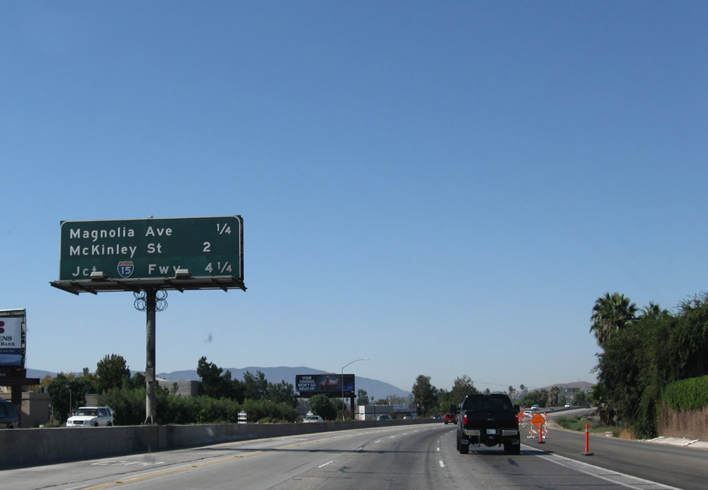
Another mileage sign provides the distance to the next three exits: Exit 53B, McKinley Street northwest to Norco; Exit 53A, McKinley Street south to the community of Home Gardens; and Exit 51, Interstate 15 (Corona Freeway). Photo taken 09/28/08. |
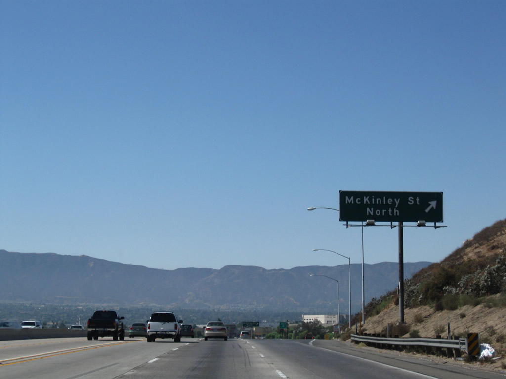 |
Westbound California 91 (Riverside Freeway) reaches Exit 53B, McKinley Street north to northeastern Corona and the city of Norco. The next ramp connects to Exit 53A, McKinley Street south to Home Gardens and eastern Corona. Photo taken 09/28/08. |
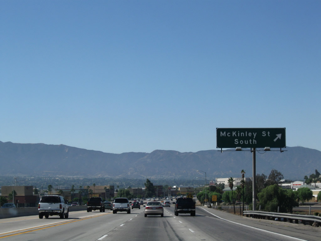 |
After crossing over McKinley Street, westbound California 91 (Riverside Freeway) next reaches Exit 53A, McKinley Street south to Home Gardens and eastern Corona. The stack interchange with Interstate 15 is next. Photo taken 09/28/08. |
 |
The next two exits along California 91 west are Exit 51, Interstate 15 (Corona Freeway) and Exit 50, Main Street (former California 31). Photo taken 09/28/08. |
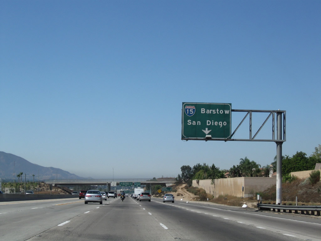 |
The right lane becomes exit only for Interstate 15. This major north-south freeway corridor connects Southern California with points northeast, including Las Vegas and Salt Lake City, Utah. Interstate 15 generally follows the U.S. 91 (Arrowhead Highway) alignment north through the Mojave Desert; some of the old route was replaced directly by the freeway, but many original alignments remain in the desert. More locally, northbound Interstate 15 serves the Inland Empire cities of Ontario and Rancho Cucamonga, then ascends the Cajon Pass to serve the cities of Hesperia, Adelanto, and Victorville before meeting Interstate 40 in Barstow. Photo taken 09/28/08. |
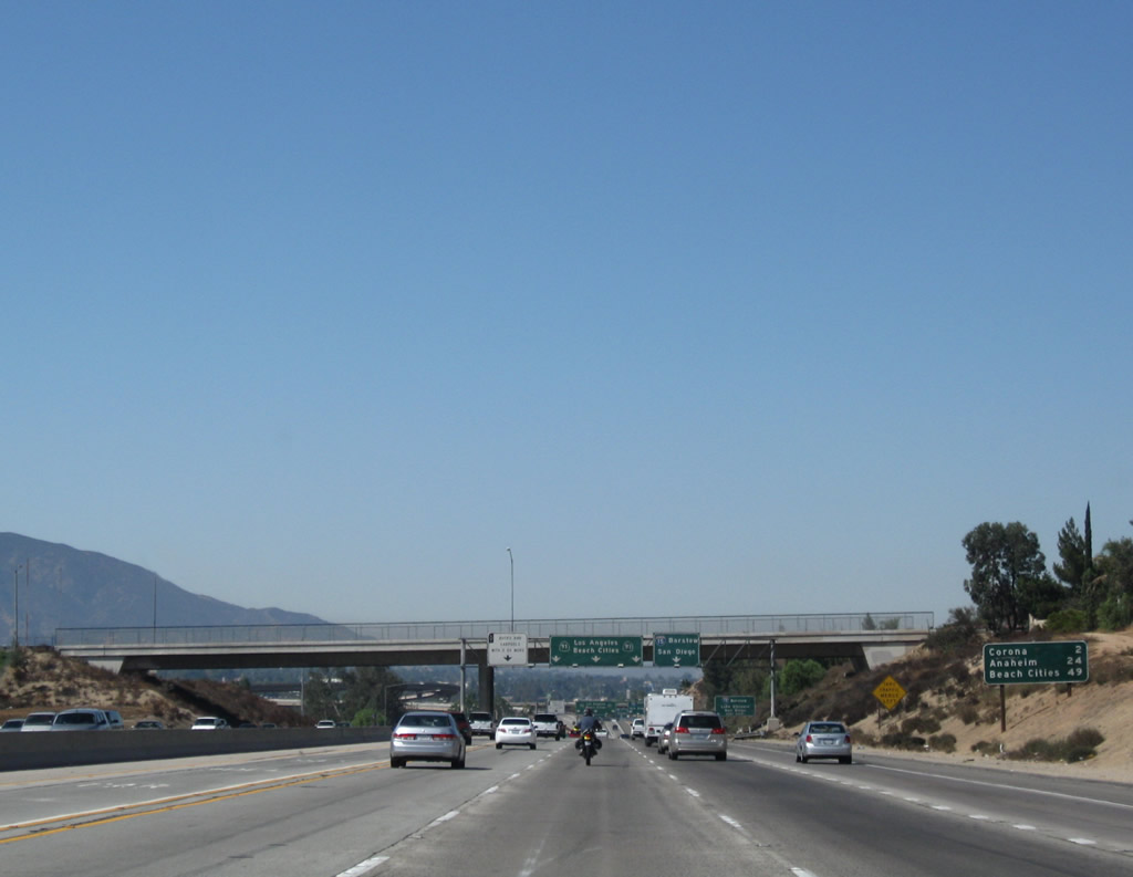 |
This mileage sign provides the distance to downtown Corona (two miles), Anaheim (24 miles), and "Beach Cities" (49 miles). Omitted is the alternate control city of Long Beach. "Beach Cities" probably refers to Manhattan Beach, Redondo Beach, and Hermosa Beach and may also include Torrance, Lawndale, and Gardena. Photo taken 09/28/08. |
 |
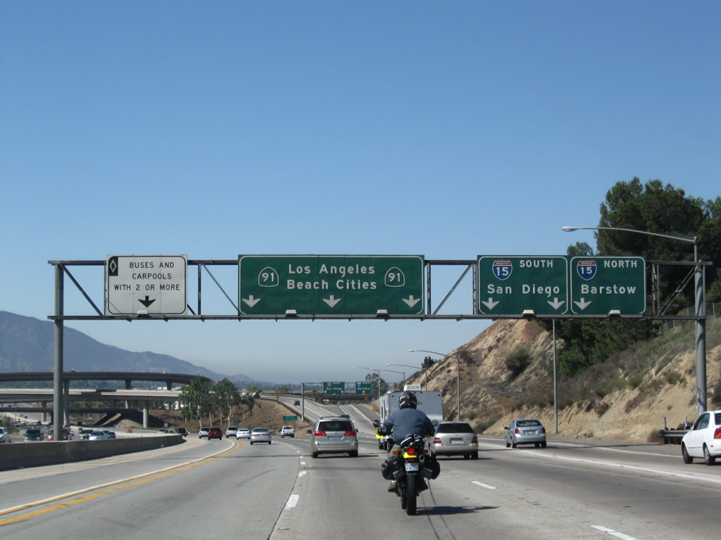
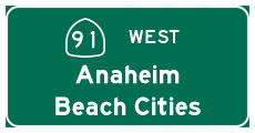
The pull-through sign for California 91 west includes "Beach Cities" and Los Angeles. The theory is that from Riverside, the route to downtown Los Angeles can be made via either Calfornia 91 west to California 71 north to California 60 west or via California 91 west to Interstate 5 north. California 91 itself actually crosses a narrow section of the city of Los Angeles between Carson and Gardena at the Interstate 110 (Harbor Freeway) interchange. This section of Los Angeles connects the Port of Los Angeles with downtown Los Angeles. Photo taken 09/28/08. |
 |
To the south, Interstate 15 follows the route of old California 71 through the Riverside County cities of Corona, Lake Elsinore, Wildomar, Murrieta, and Temecula. Wildomar is the newest city in southern Riverside County, having been incorporated in 2008. South of Temecula, Interstate 15 enters San Diego County and generally follows an old alignment of U.S. 395 through avocado orchards east of Fallbrook, then enters the city of Escondido from the north. After crossing Lake Hodges, Interstate 15 enters the city of San Diego and serves multiple communities of the city of San Diego along its path before terminating at Interstate 5 near the 32nd Street Naval Station. Photo taken 09/28/08. |
 |
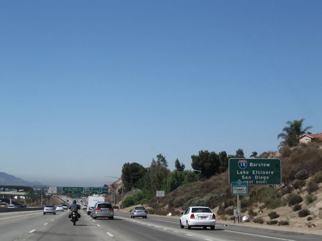
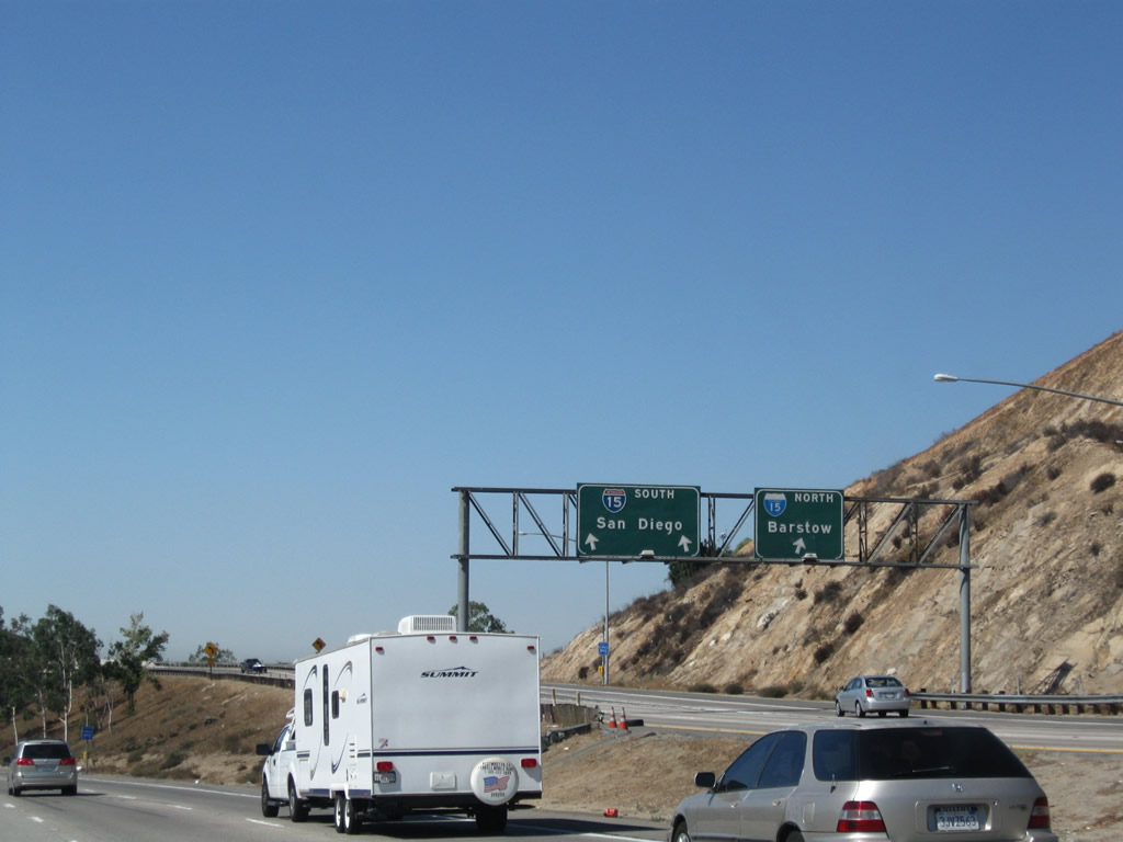
Westbound California 91 (Riverside Freeway) reaches Exit 51, Interstate 15 (Corona Freeway) north to Ontario, Barstow, and Las Vegas and south to Lake Elsinore, Temecula, and San Diego. The left four lanes continue west on California 91, with the far left lane serving as a high occupancy vehicle lane. Photo taken 09/28/08. |
 |
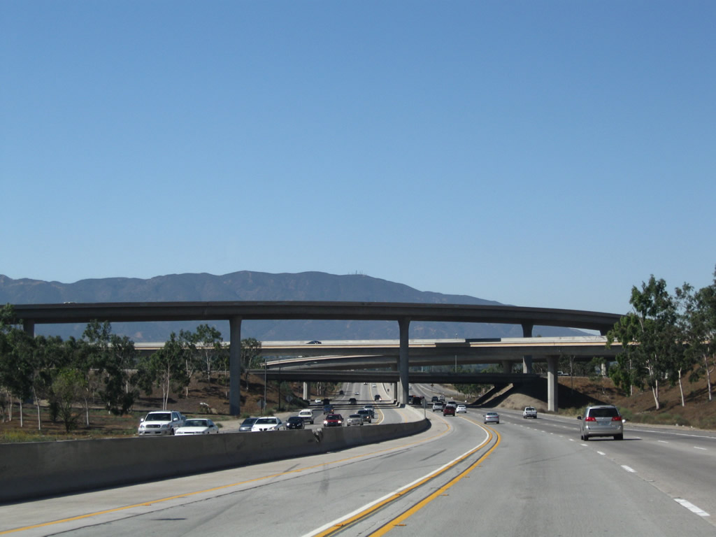
This view shows the ramp split for Interstate 15 south and north. Photo taken 09/28/08. |
 |
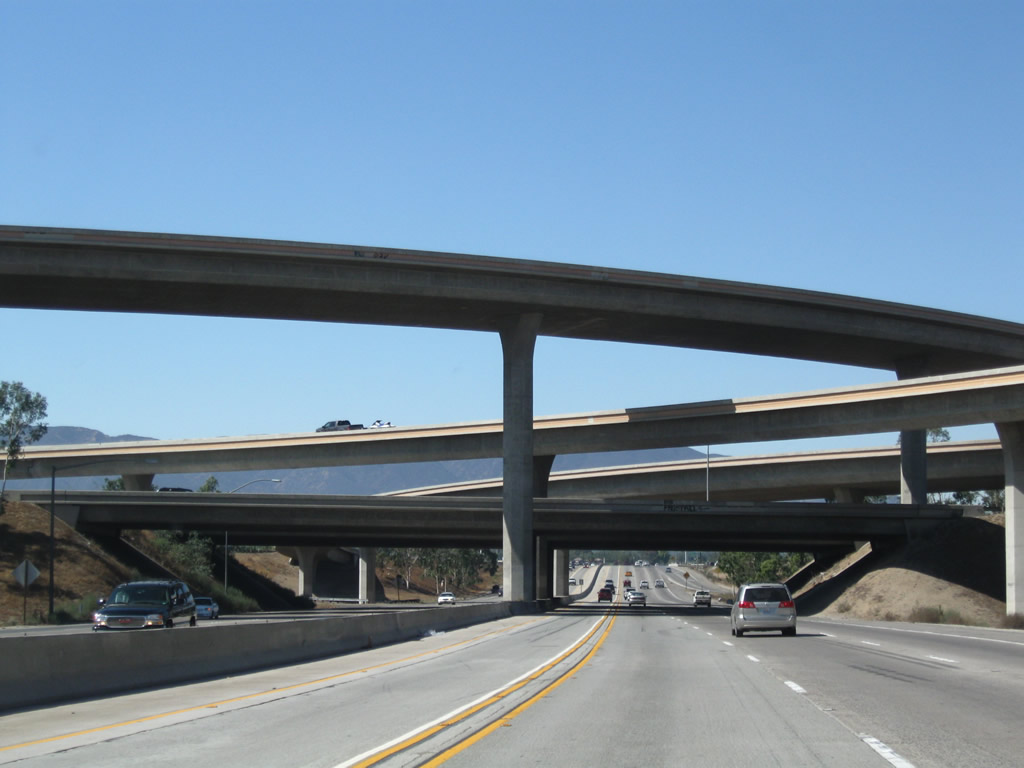 |
The interchange between Interstate 15 and California 91 is nearly a stack interchange, with high-speed connections for all connections except the loop ramp between Interstate 15 south and California 91 east. Photos taken 09/28/08. |
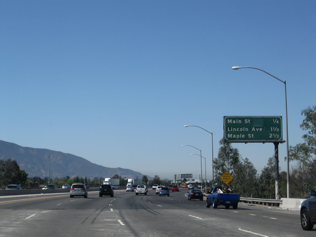 |
The next three exits along California 91 (Riverside Freeway) west are: Exit 50, Main Street (former California 31); Exit 49, Lincoln Avenue; and Exit 48, Maple Street. California 31 was the original designation of the arterial that was replaced by the Interstate 15 freeway between California 91 and Interstate 10 during the 1980s. The state route was signed as To Interstate 15 and showed on maps as Temporary Interstate 15 during the 1980s until the missing freeway gap was filled. Some remnants of California 31 remain, including a few white postmile signs north of Norco, and a short section of California 31 is designated as Business Loop I-15 through the city of Norco. Photo taken 09/28/08. |
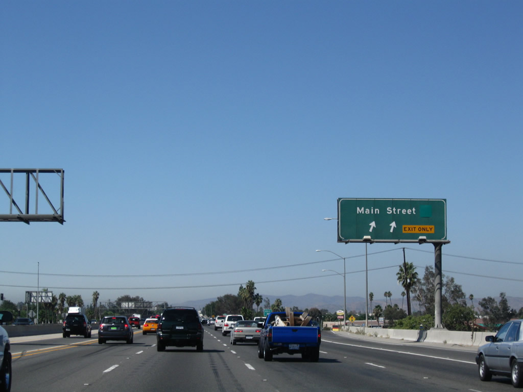 |
Westbound California 91 (Riverside Freeway) reaches Exit 50, Main Street (former California 31). Take Main Street south into downtown Corona. Grand Avenue, which encircles downtown Corona, crosses over California 91 twice, once prior to Exit 50 and again afterward. For this brief duration, California 91 is within the inner circle of the Circle City. Photo taken 09/28/08. |

Page Updated March 28, 2009.
|
About Contact Glossary |
In The News Interstate Guide |
Social Media:
 |
|
© 2000-25 AARoads.com | All Rights Reserved | Privacy Policy / Terms of Use
|
||