| California 91 - Artesia Freeway west |
|
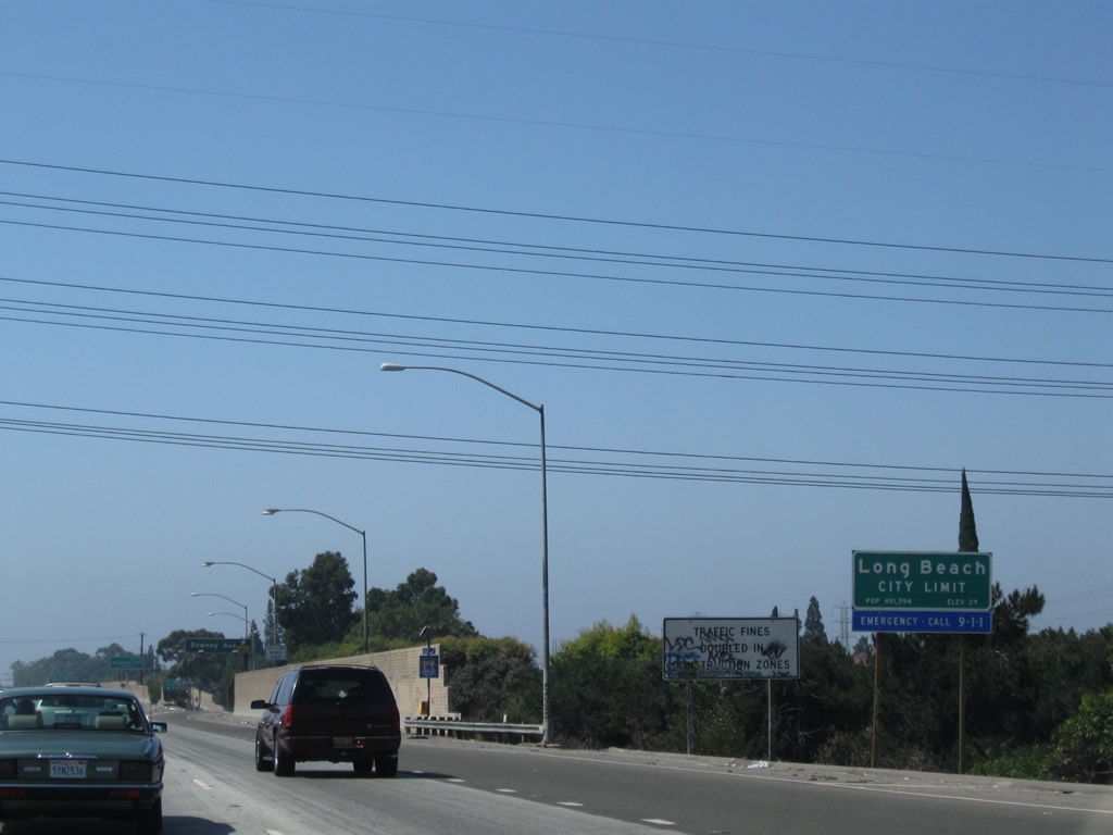
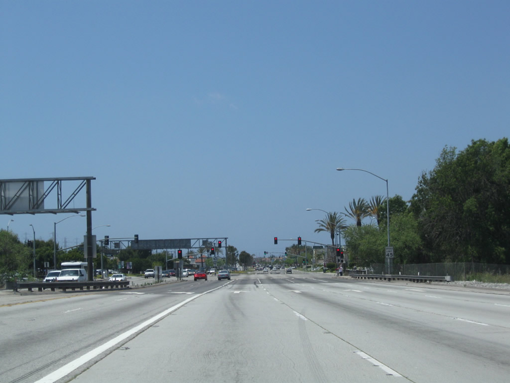
California 91 leaves Bellflower and enters the city of Long Beach. Photo taken 09/28/08. |
|
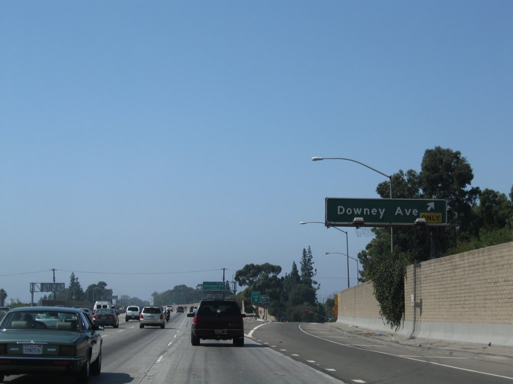
Westbound California 91 reaches Exit 14B, Downey Avenue. Photo taken 09/28/08. |
|
A second Long Beach city limits sign is posted after the off-ramp to Downey Avenue. Photo taken 09/28/08. |
|
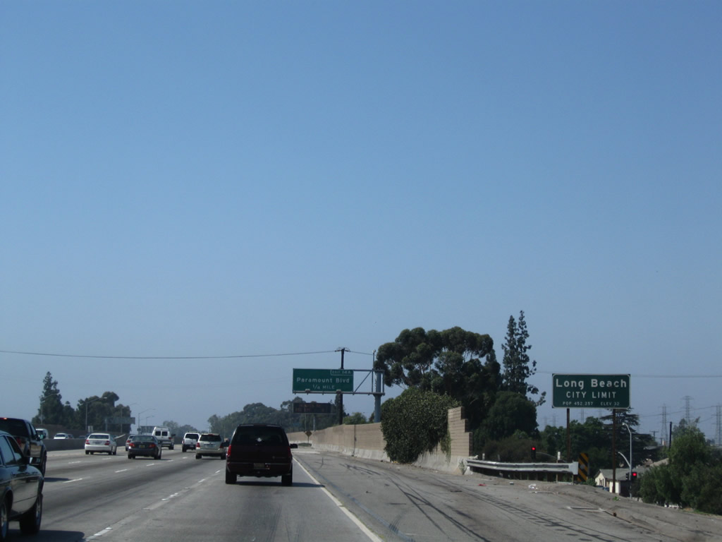
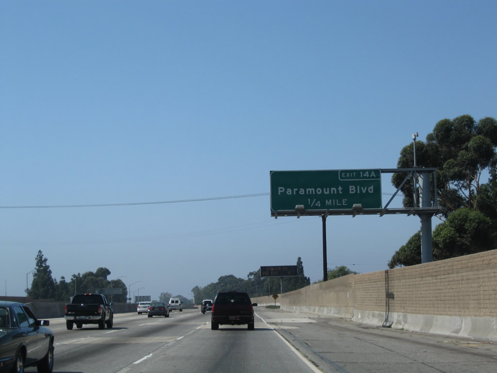
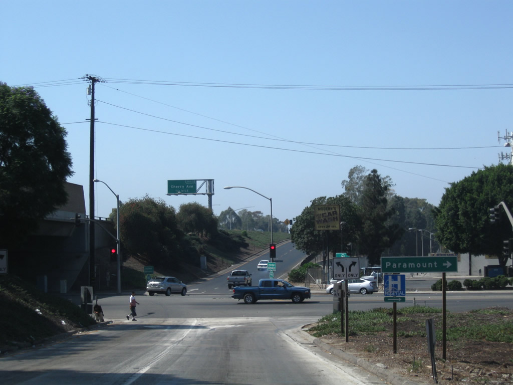
The next exit along California 91 (Artesia Freeway) west is Exit 14A, Paramount Boulevard (one-quarter mile). Photo taken 09/28/08. |
|
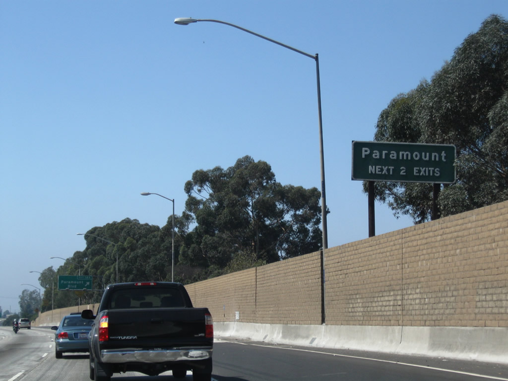
The next two exits along California 91 serve the city of Paramount, which had a total population of 55,266 as of the 2000 Census. Photo taken 09/28/08. |
|
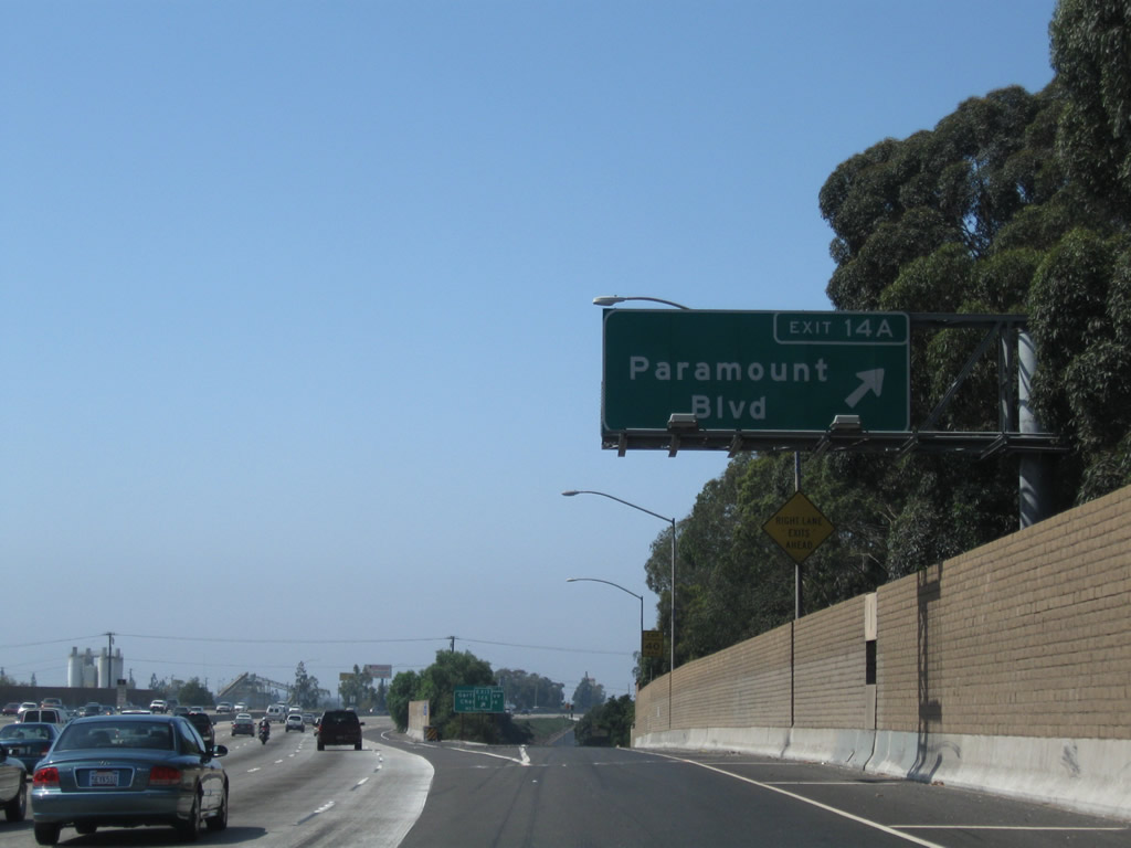
Westbound California 91 (Artesia Freeway) reaches Exit 14A, Paramount Boulevard. Photo taken 09/28/08. |
|
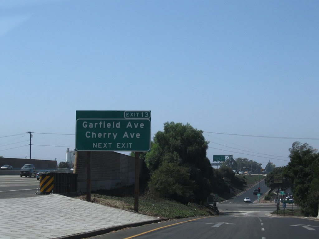
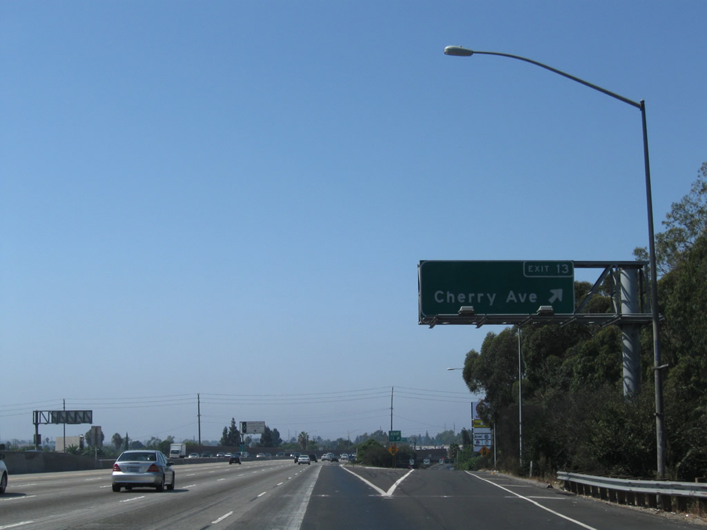
The next exit along California 91 west is Exit 13, Garfield Avenue and Cherry Avenue. Photo taken 09/28/08. |
|
Departing at Exit 14A, turn left to follow Paramount Boulevard south to Long Beach and north to Paramount. Photo taken 09/28/08. |
|
Back on the mainline, westbound California 91 (Artesia Freeway) reaches Exit 13, Garfield Avenue and Cherry Avenue. Photo taken 09/28/08. |
|
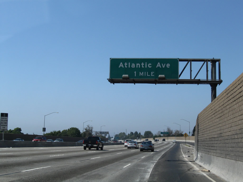
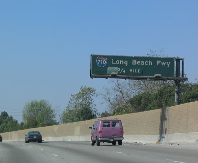
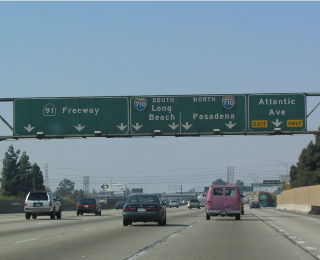
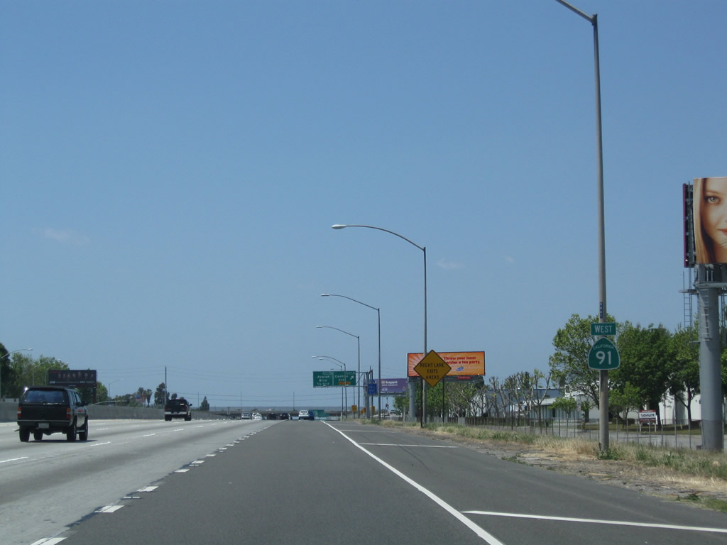
The next exit along California 91 west is Exit 12B, Atlantic Avenue (former California 15). Photo taken 09/28/08. |
|
|
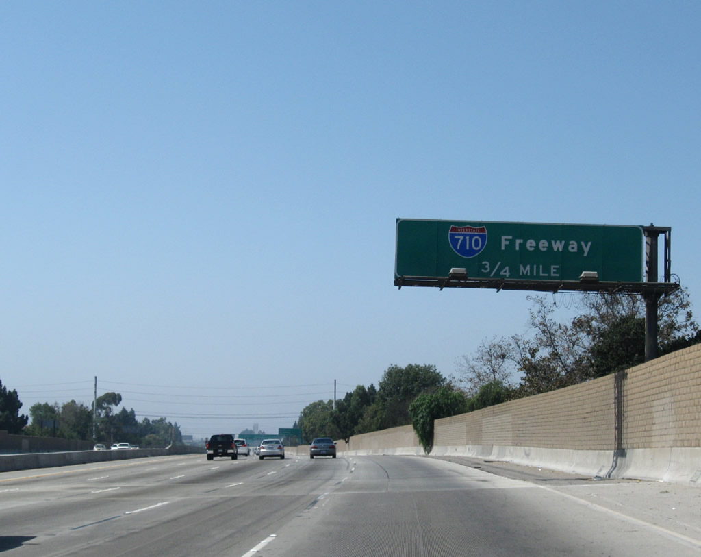
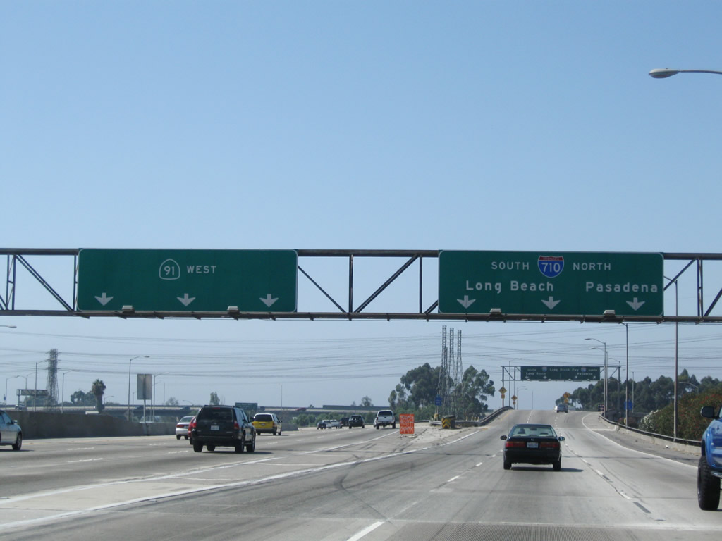
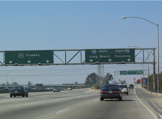
And the second exit will be Exit 12A, Interstate 710 (Long Beach Freeway) south to Long Beach and north almost to Pasadena. Back in 2004, there were two separate signs along westbound that displayed"Interstate 710, three-quarters of a mile." The first one (shown here) was replaced with a reflective sign with no exit number by 2008. Photos taken 09/28/08 and 02/15/04. |
|
|
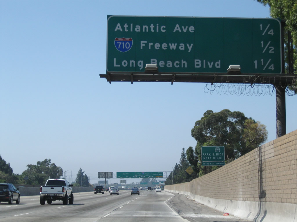
At the location of the second advance sign for Interstate 710, a new mileage sign providing the distance to the next three exits is posted. Interstate 710 is the Long Beach Freeway, which leads south to Long Beach and north to Interstate 10 and Valley Boulevard at Alhambra and Monterey Park. Interstate 710 ends just shy of Pasadena. The section of the freeway that is supposed to connect Interstate 10 with Pasadena is quite controversial, but it is still planned for construction someday, most likely as a tunnel under South Pasadena to the existing freeway stub near downtown Pasadena. Photos taken 09/28/08 and 02/15/04. |
|
|
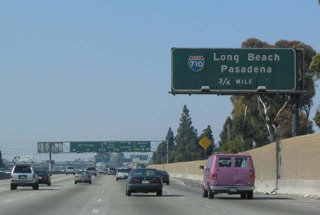
The right two lanes of westbound California 91 (Artesia Freeway) will connect to Exit 12B, Atlantic Avenue. The second exit connects California 91 with Exit 12A, Interstate 710. Photos taken 09/28/08 and 02/15/04. |
|
|
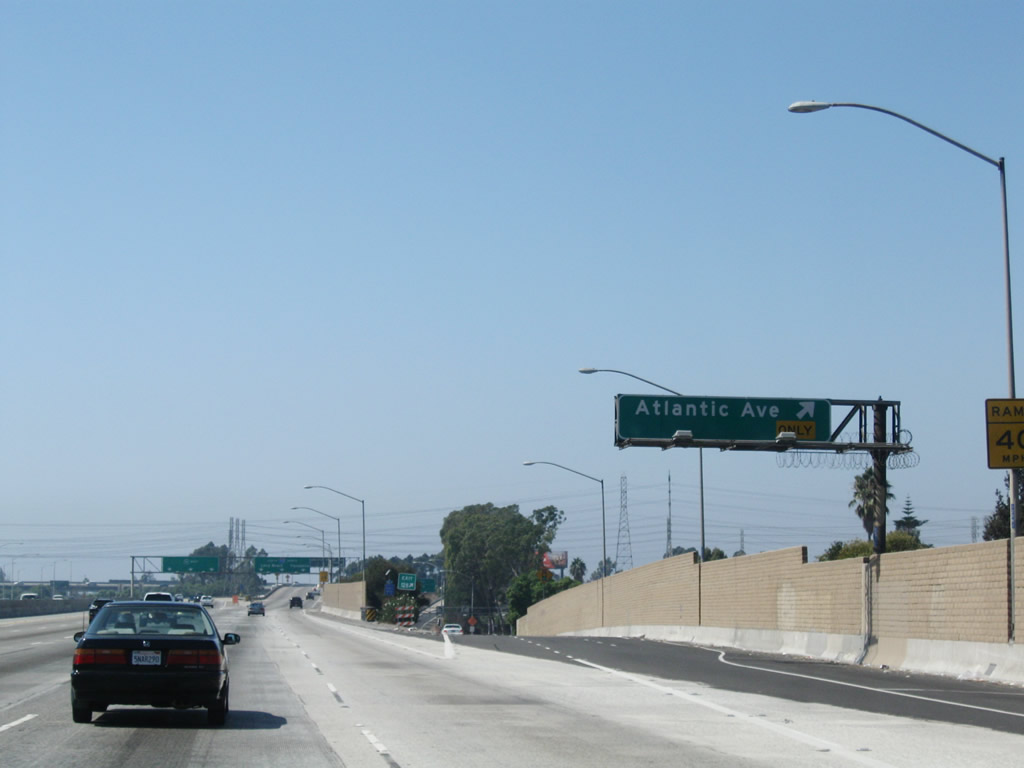
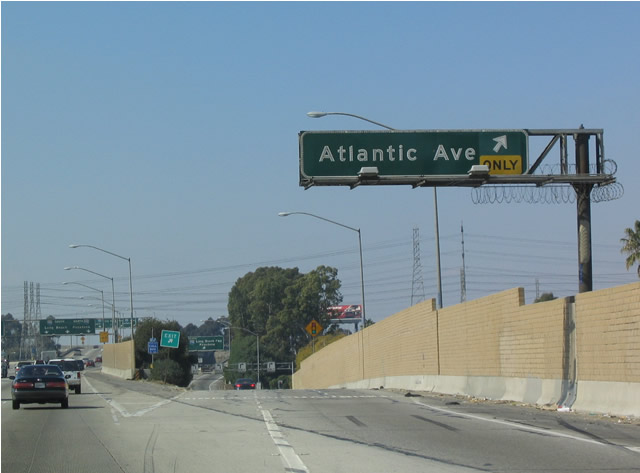
Westbound California 91 reaches Exit 12B, Atlantic Avenue. The next ramp is for Exit 12A, Interstate 710 (Long Beach Freeway). Photos taken 09/28/08 and 02/15/04. |
|
|
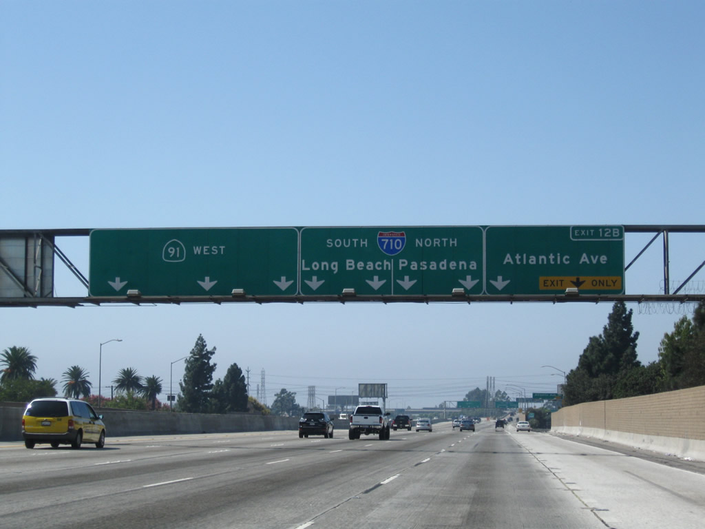
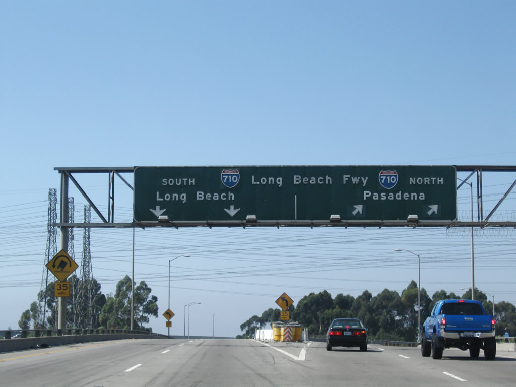
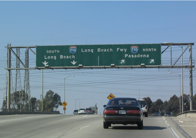
Immediately thereafter, westbound California 91 reaches Exit 12A, Interstate 710. Interstate 710 leads south into Long Beach and north to Interstate 10 in Monterey Park, with plans to extend the freeway to Pasadena. Photos taken 09/28/08 and 02/15/04. |
|
|
Old, porcelain enamel button copy signage is posted on the transition ramp from westbound California 91 to Interstate 710 (Long Beach Freeway). Stay right for Interstate 710 north and left for Interstate 710 south. Trucks will commonly make the transition to Interstate 710 south to the Port of Long Beach and Port of Los Angeles. Photos taken 09/28/08 and 02/15/04. |
|
|
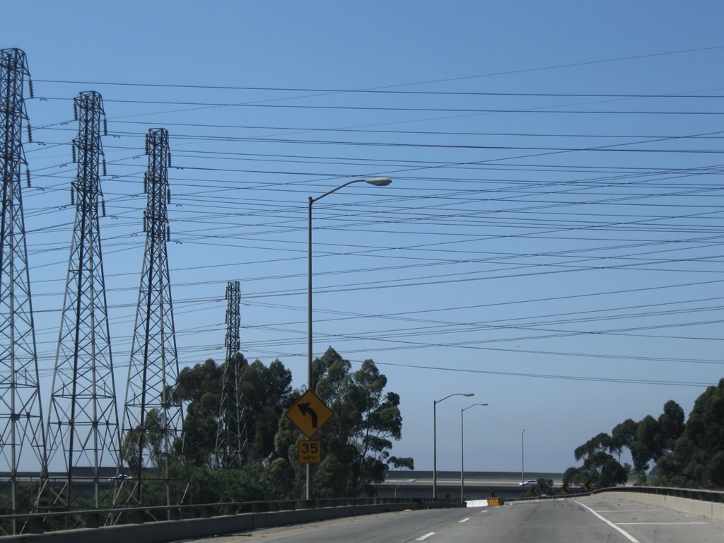
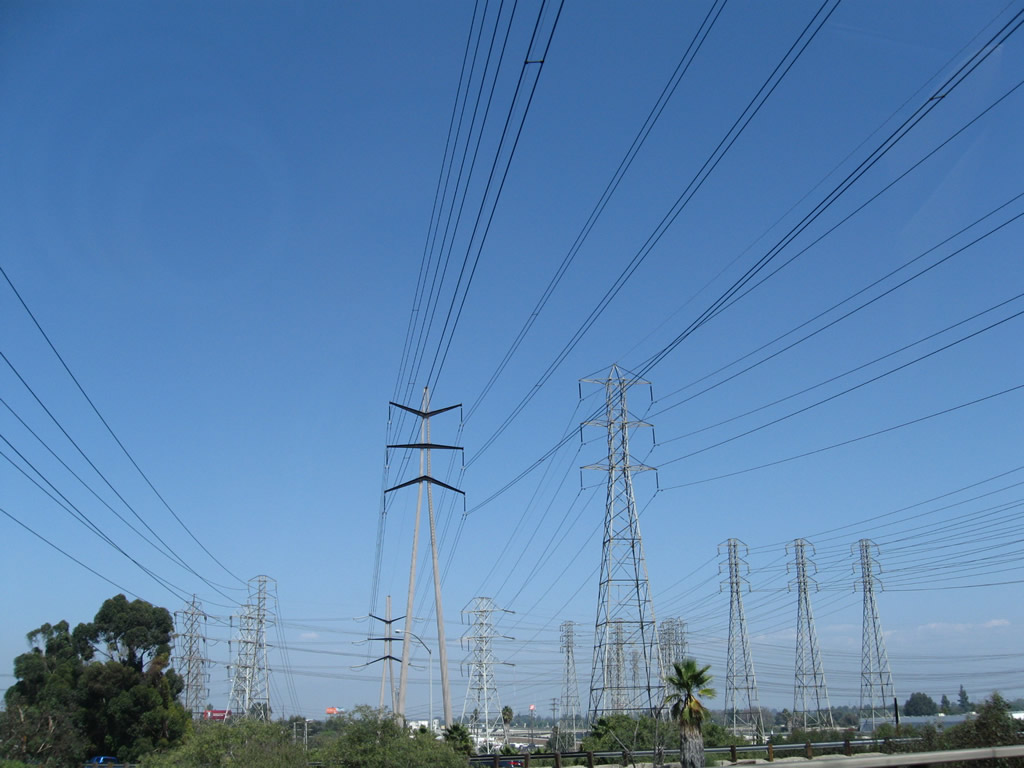
A set of Southern California Edison power lines cross over the transition ramp from California 91 west to Interstate 710 south. Photos taken 09/28/08. |
| California 91 - Gardena (Redondo Beach) Freeway west |
|
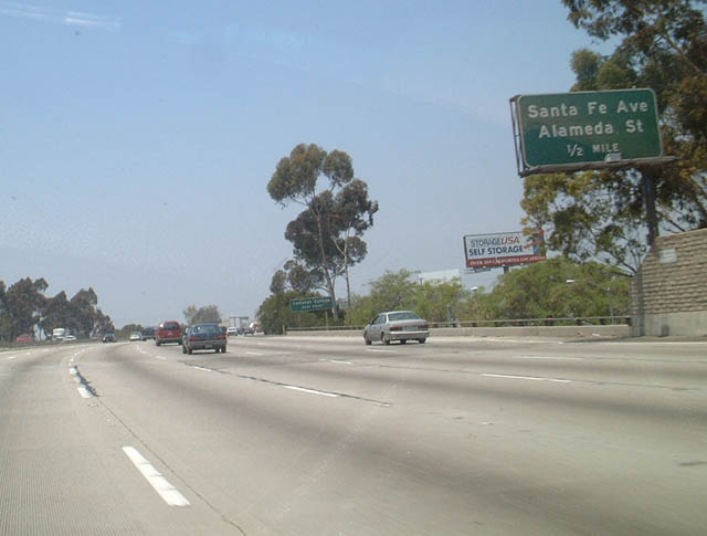
Returning to the mainline, westbound California 91 next approaches Exit 10, Santa Fe Avenue and California 47 (Alameda Street), one-half mile. Around this point, California 91 leaves the city of Long Beach and enters the city of Compton. Comption was incorporated May 11, 1888 and had a population 93,493 as of the 2000 Census. Photo taken 06/02/02. |
|
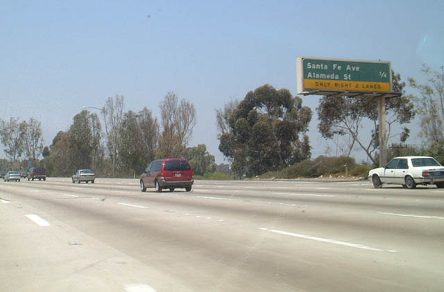
One quarter mile ahead of Exit 10 with SR 47 (Alameda Street) and Santa Fe Avenue on SR 91 west. This is a two-lane exit from westbound. From this interchange, SR 47 travels south along Alameda Street, an expressway that parallels a major railroad corridor leading south to the Ports of Los Angeles and Long Beach. While the triple-track railroad remains below grade, SR 47 remains mostly at-grade with grade-separations with most major arterials south of SR 91. This provides an alternate route for trucks leaving the port area. Upon reaching Henry Ford Avenue, SR 47 turns south to merge onto the Terminal Island Freeway for the final distance to Terminal Island and most port facilities. SR 47 crosses the Heim Bridge to Terminal Island and turns west to cross the Vincent Thomas Bridge to return to the mainland, ending at Interstate 110 (Harbor Freeway) in San Pedro. Photo taken 06/02/02. |
|
Westbound California 91 (Gardena Freeway) reaches Exit 9, Wilmington Boulevard. The next exit is Central Avenue, Exit 8. Photo taken 06/02/02. |
|
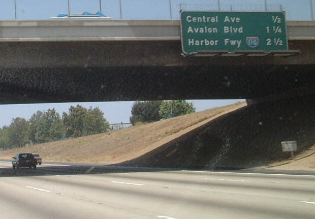
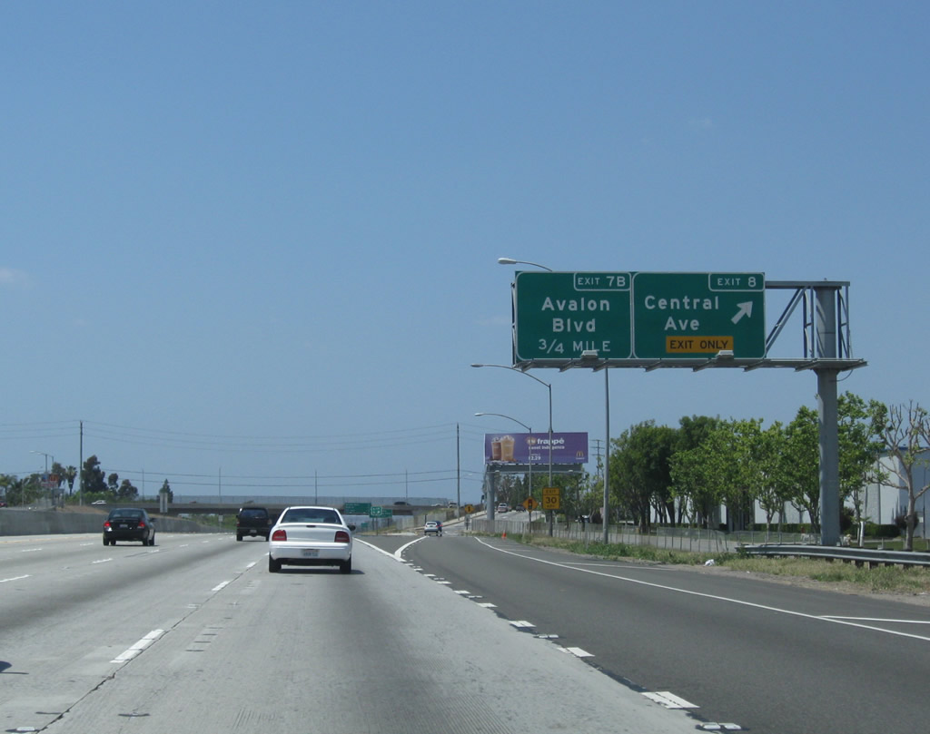
The next four exits along westbound California 91 are: Exit 8, Central Avenue; Exit 7B, Avalon Boulevard; Exit 7A, Main Street (omitted from sign); and Exit 6, Interstate 110 (Harbor Freeway). Photo taken 06/02/02. |
|
A California 91 west reassurance shield is posted after the on-ramp from Wilmington Boulevard. Photo taken 05/02/10. |
|
|
Westbound California 91 reaches Exit 8, Central Avenue. This is the last exit into Compton. Exit numbers were added to this sign assembly between 2004 and 2010. Photos taken 05/02/10 and 05/30/04. |
|
|
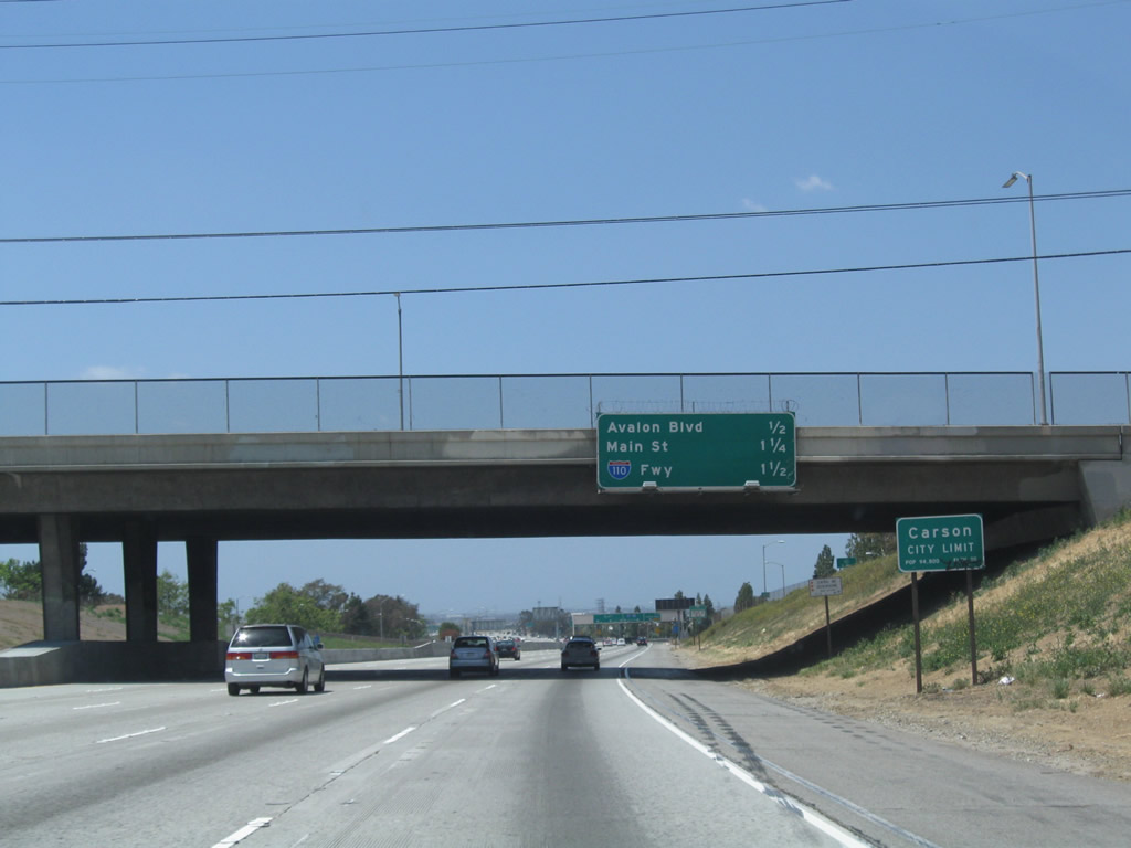
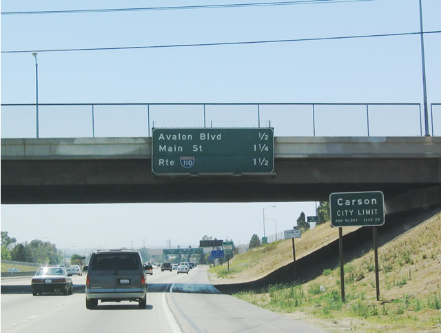
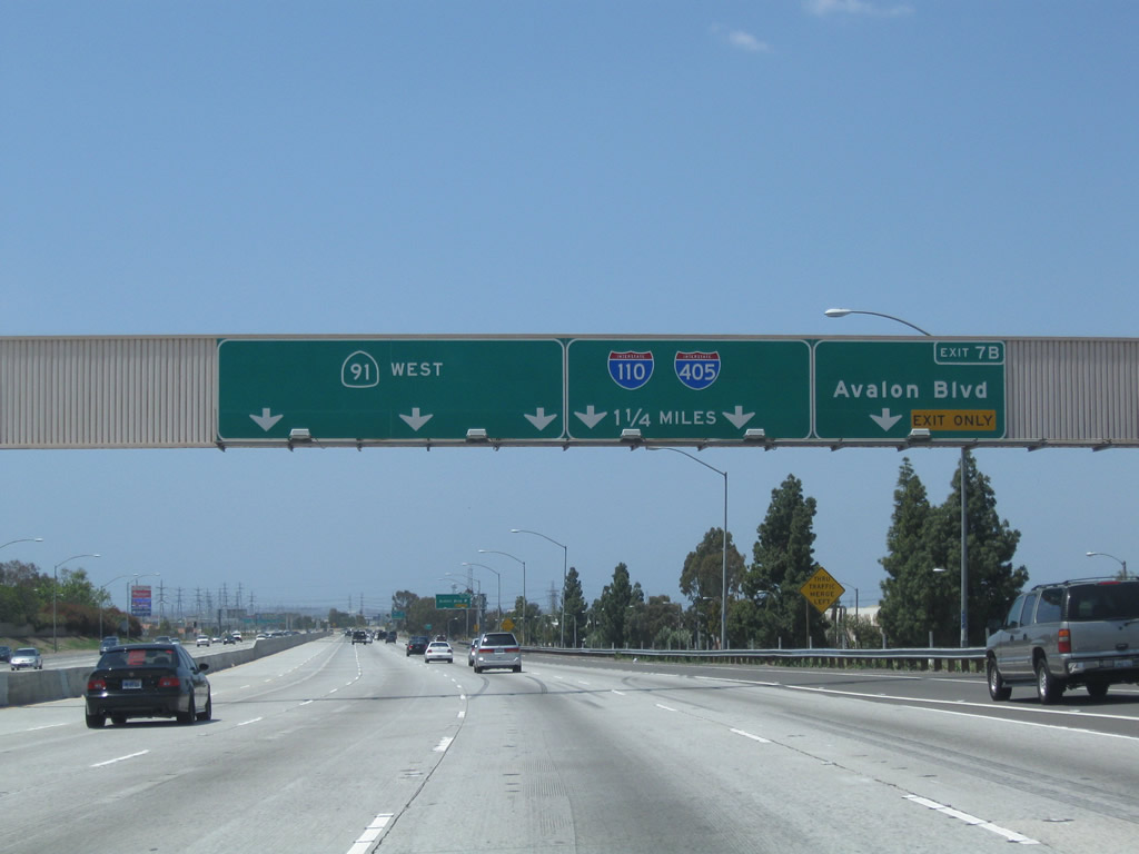
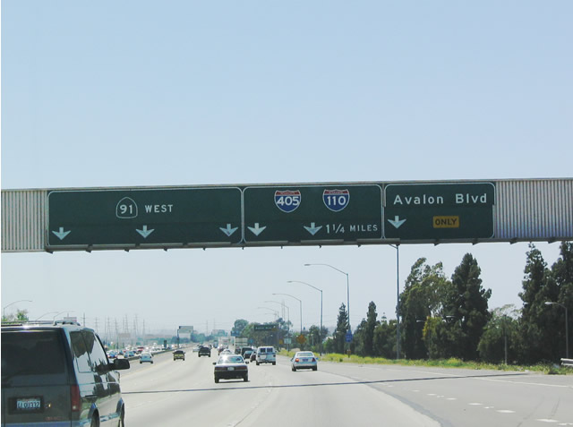
This mileage sign provides the distance to the next three exits along westbound California 91 (Gardena Freeway): Exit 7B, Avalon Boulevard; Exit 7A, Main Street; and Exit 6, Interstate 110 (Harbor Freeway). California 91 enters the city of Carson, "Future Unlimited" (population 89,730 as of the 2000 Census, incorporated on February 20, 1968). Photos taken 05/02/10 and 05/30/04. |
|
|
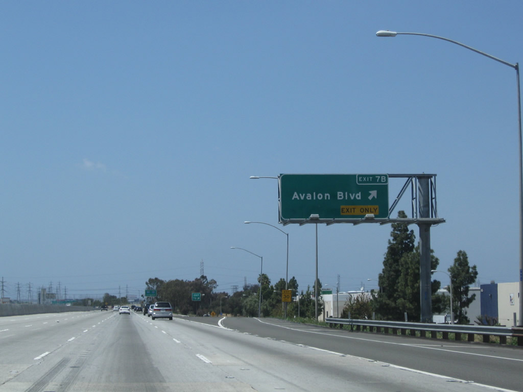
Avalon Boulevard serves the city of Carson. It is the penultimate exit before the Interstate 110 (Harbor Freeway) interchange. Photos taken 05/02/10 and 05/30/04. |
|
Westbound California 91 reaches Avalon Boulevard, Exit 7B. Photo taken 05/02/10. |
|
|
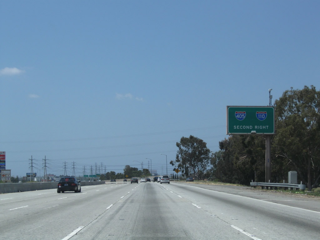
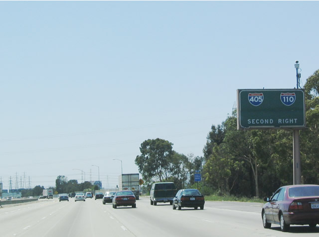
The next two exits along California 91 (Gardena Freeway) west is Exit 7A, Main Street and Exit 6, Interstate 110. Note that travelers are advised to take Interstate 110 southbound to reach Interstate 405 rather than taking California 91 west through Gardena and Torrance to reach Interstate 405. Photos taken 05/02/10 and 05/30/04. |
|
|
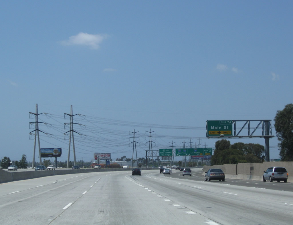
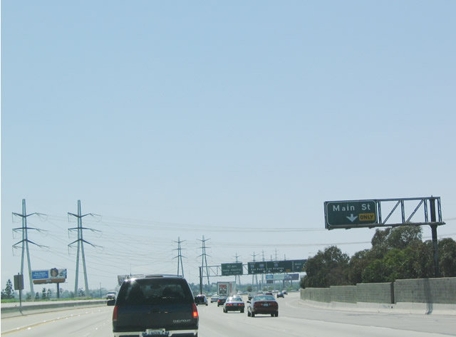
The next exit along westbound California 91 is Exit 7A, Main Street. Ahead, two Southern California Edison power lines will cross over the freeway. Photos taken 05/02/10 and 05/30/04. |
|
|
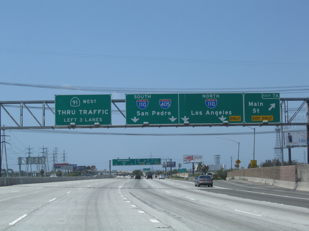
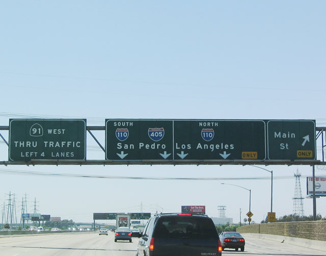
Westbound California 91 (Gardena Freeway) reaches Exit 7A, Main Street and next approaches Exit 6, Interstate 110 (Harbor Freeway) (Exit 6). For some reason, California 91 west is signed as "Thru Traffic" here, even though through traffic would be better advised to take Interstate 110 to reach Interstate 405, which is presumably the next destination of through traffic, unless they plan to really go through the cities Gardena and Torrance to reach Interstate 405. Photos taken 05/02/10 and 05/30/04. |
|
|
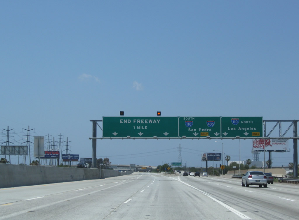
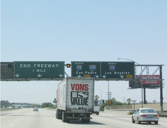
The next interchange along westbound California 91 (Gardena Freeway) is Exit 6, Interstate 110 (Harbor Freeway) to Interstate 405 (San Diego Freeway). For whatever reason, a California 91 shield is omitted on the end freeway sign, since the state route continues west from here to Manhattan Beach (although sections are being returned to local control in certain cities west of here). Thru Traffic may continue along California 91 via Artesia Boulevard to reach the next exit, which is actually a traffic light (Vermont Street). Photos taken 05/02/10 and 05/30/04. |
|
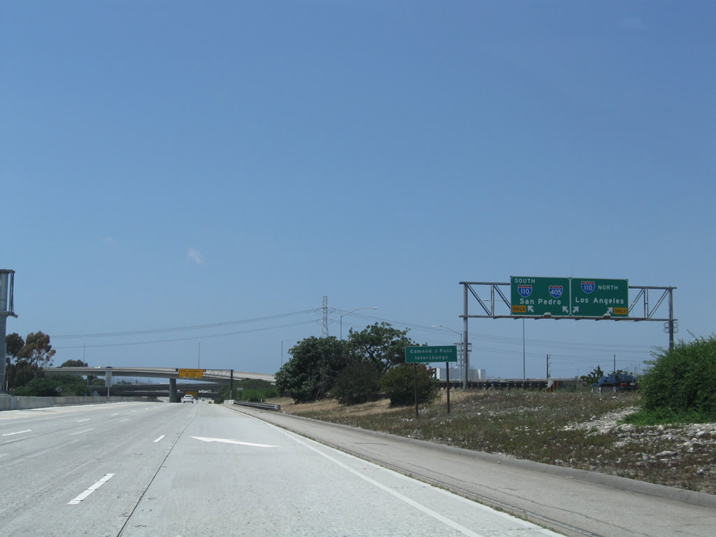
This view looks at the transition ramp from California 91 to Interstate 110 as seen from the main lanes. Photos taken 05/02/10. |
|
|
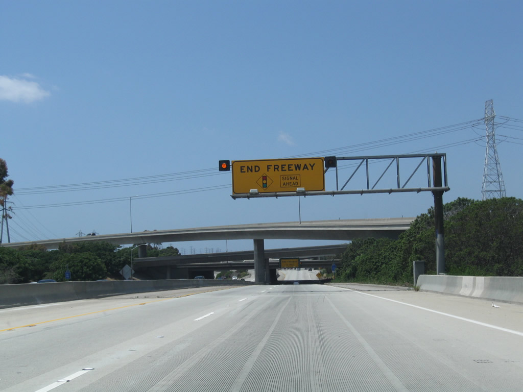
A traffic signal ahead sign is posted on an overhead panel as the freeway approaches its end in Gardena. California 91 will soon pass under the Interstate 110 freeway as well as a set of Los Angeles Department of Water and Power lines. Photos taken 05/02/10 and 05/30/04. |
|
|
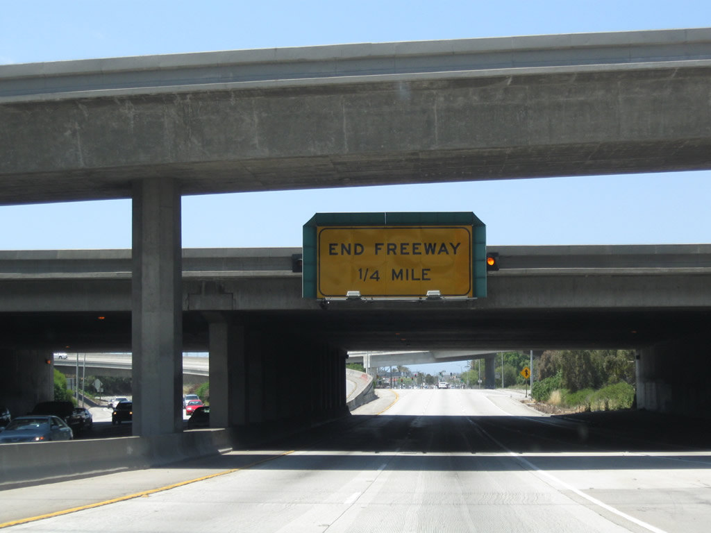
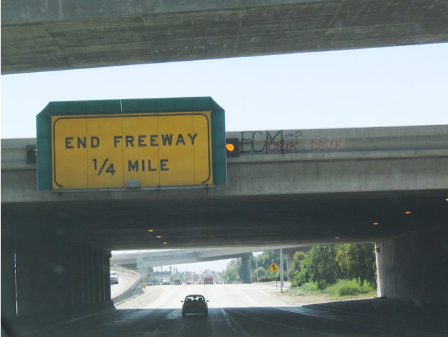
This "end freeway, 1/4 mile" signage is affixed to the Interstate 110 overpass. Even though the highway is four lanes wide at this point, the freeway is about to end. Photos taken 05/02/10 and 05/30/04. |
|
|
California 91 approaches the end of the freeway, as it passes under a transition ramp from Interstate 110. The Gardena Freeway will transition directly onto Artesia Boulevard. Photos taken 05/02/10. |
|
Westbound California 91 finds the end of its freeway, after its junction with Interstate 110. A traffic light greets freeway traffic in the distance; this is Vermont Avenue in Gardena, and Gardena Freeway ends at that traffic signal. The state route continues west toward the ocean on surface streets, but most of the route is locally maintained. Caltrans originally planned to extend the freeway west of here as the "Redondo Beach Freeway," but the freeway plans were abandoned due to local opposition. The freeway name was also changed to reflect the fact that it no longer would reach Redondo Beach. Photo taken 05/02/10. |
| California 91 - Artesia Boulevard west |
|
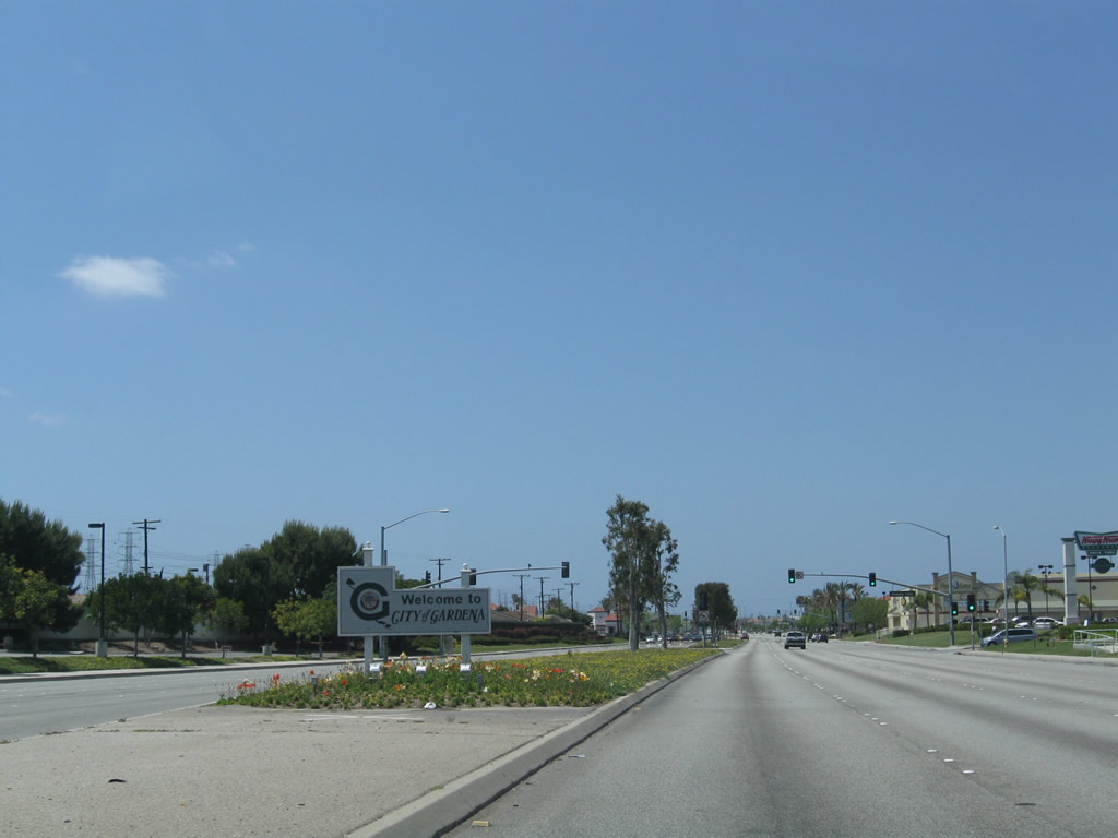
After the Vermont Avenue traffic signal, California 91 enters the city of Gardena, the "City of Opportunity." Gardena was incorporated on September 11, 1930, and it had a population of 57,746 as of the 2000 Census. A series of shopping malls and related development occupy both sides of Artesia Boulevard. Photo taken 05/02/10. |
|
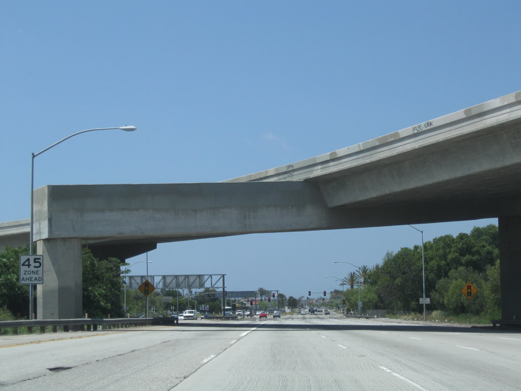
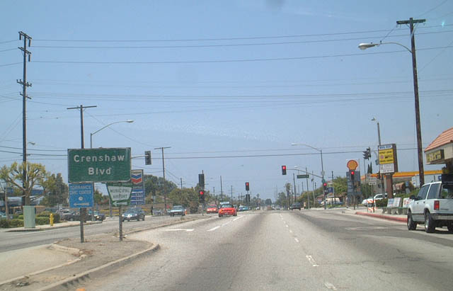
Continuing west, California 91 (Artesia Boulevard) approaches Crenshaw Boulevard in Torrance, about mid-way between the interchanges with Interstate 110 and Interstate 405. Photo taken 06/02/02. |
|
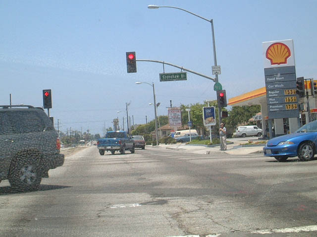
Westbound California 91 meets Crenshaw Boulevard at this intersection in Torrance. Crenshaw is a major north-south city street from Torrance and Rancho Palos Verdes north to Wilshire Boulevard in Los Angeles. Photo taken 06/02/02. |
|
|
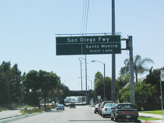
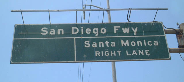
The next major junction along California 91 west is its interchange with Interstate 405 (San Diego Freeway) in Torrance. This overhead sign correctly identifies the upcoming freeway as the San Diego Freeway, but it omits the Interstate 405 shield. Although old, this sign does not have any button copy, so it is likely more difficult to read at night than the newer reflective signs. This interchange is certainly not a freeway-to-freeway style interchange. California 91 will not have freeway characteristics at any point west of here. Photos taken 05/30/04 and 06/02/02. |
|
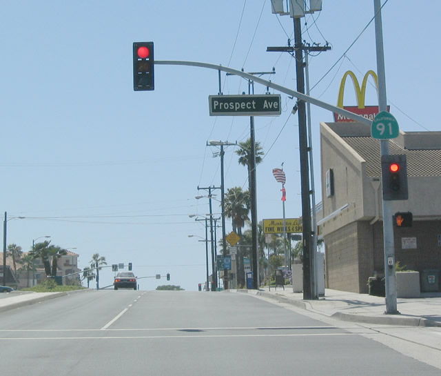
After the interchange with Interstate 405 (San Diego Freeway), westbound California 91 continues as a multi-lane, divided highway. The next major intersection along westbound is Prospect Avenue. Photo taken 05/30/04. |
|
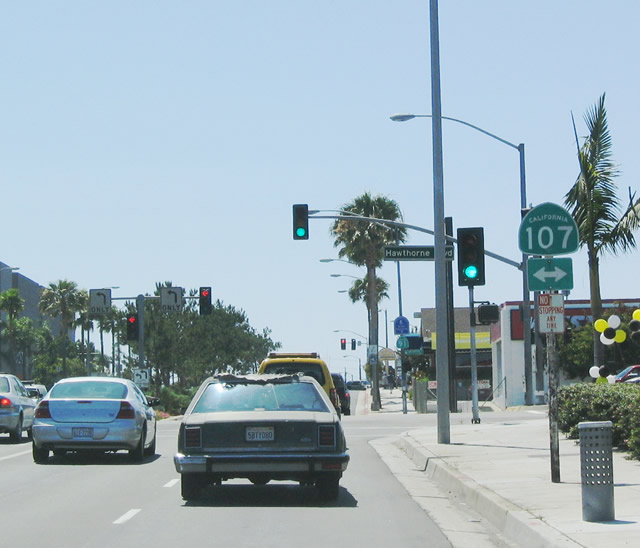
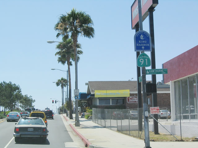
Westbound California 91 (Artesia Boulevard) approaches California 107 (Hawthorne Boulevard). California 107 travels north to Interstate 405 in Lawndale and south to California 1/Los Angeles County N-7 in Torrance. Los Angeles County N-7 continues south from Torrance along Hawthorne Boulevard to Rancho Palos Verdes. Photo taken 05/30/04. |
|
California 91 is fairly developed on both sides of the street, as shown in this photo after the California 107 (Hawthorne Boulevard) intersection. Photo taken 05/30/04. |
|
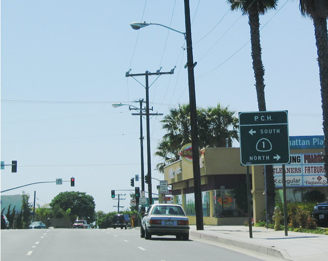
Now approaching its western terminus, the final intersection along westbound California 91 is California 1, the Pacific Coast Highway (PCH). Use California 1 (PCH) north to reach El Segundo, Los Angeles International Airport, and Santa Monica. California 1 (PCH) south leads to Redondo Beach, Torrance, Lomita, south Los Angeles (around the port), Long Beach before entering Orange County. Use California 1 (PCH) south to reach Palos Verdes Drive. No end shield assembly is posted here. Photo taken 05/30/04. |
Page Updated July 17, 2010.