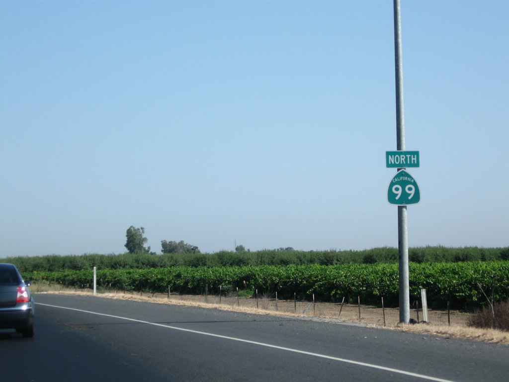
| California 99 north |
|
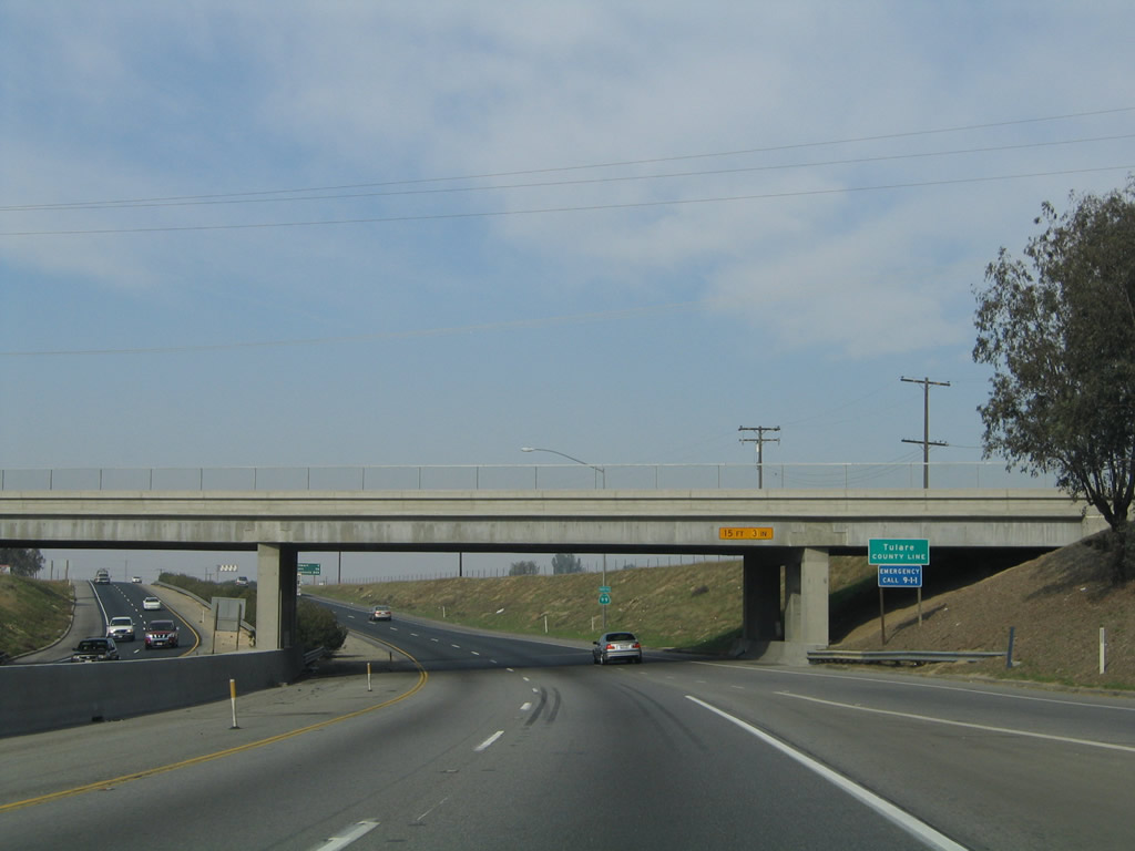
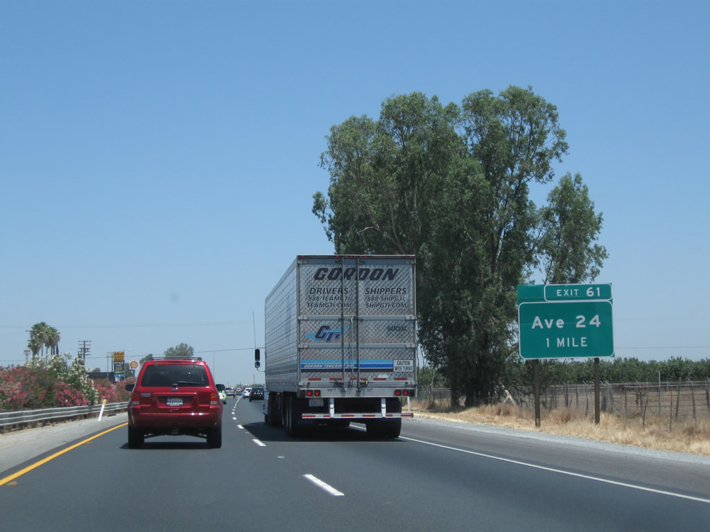
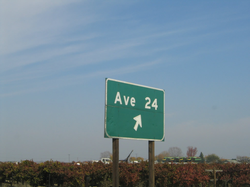
Northbound California 99 (Golden State Highway) enters Tulare County in advance of the next interchange, which is Exit 61, Avenue 24. Now leaving the petroleum-based industry and low-water agriculture of Kern County, the Central Valley rapidly becomes even more agricultural, thanks to imported water and a limited winter rainfall that slowly increases in annual totals as California 99 ascends the Valley. Even this far north, rainfall is anything but plentiful, even though winter conditions may bring weeks of continuous "tule" fog that can hide the sun for extended periods and make driving along California 99 treacherous. Photo taken 11/25/04. |
|
|
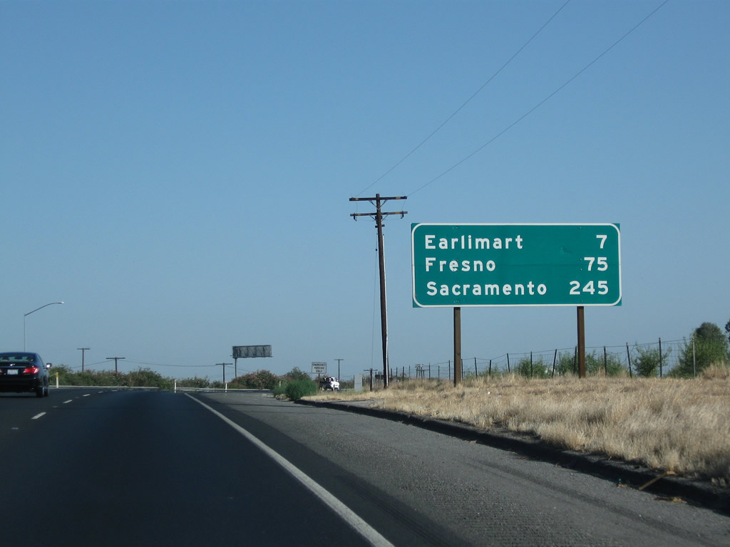
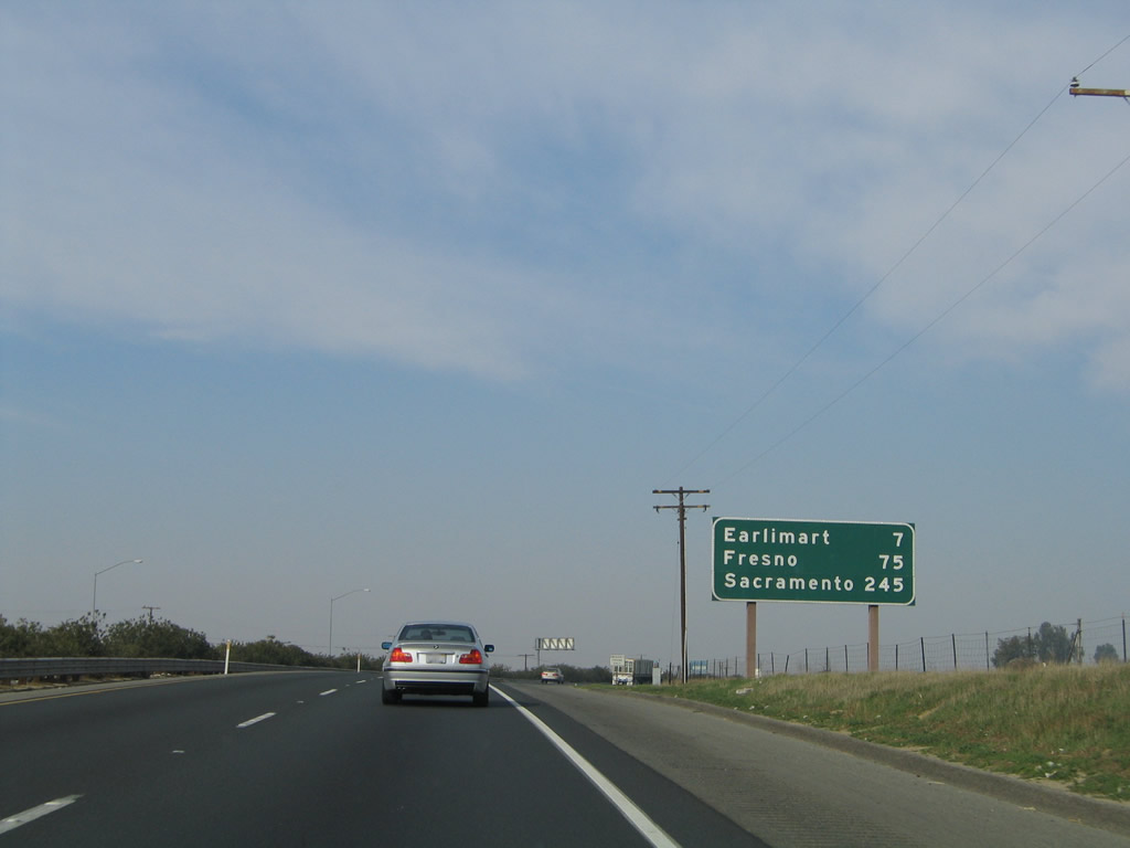
Leaving Delano behind, this mileage sign provides the distance to Earlimart (seven miles), Fresno (75 miles), and Sacramento (245 miles) via California 99 north. Photos taken 07/31/11 and 11/25/04. |
|
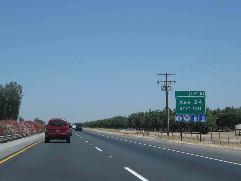
The next exit along California 99 north is Exit 61, Avenue 24 (one mile). Photo taken 07/31/11. |
|
|
Avenue 24 travels west to California 43 (Central Valley Highway) and east to Tulare County J-35 (Richgrove Drive). This road provides local farm and ranch access. Photos taken 06/19/10 and 11/25/04. |
|
|
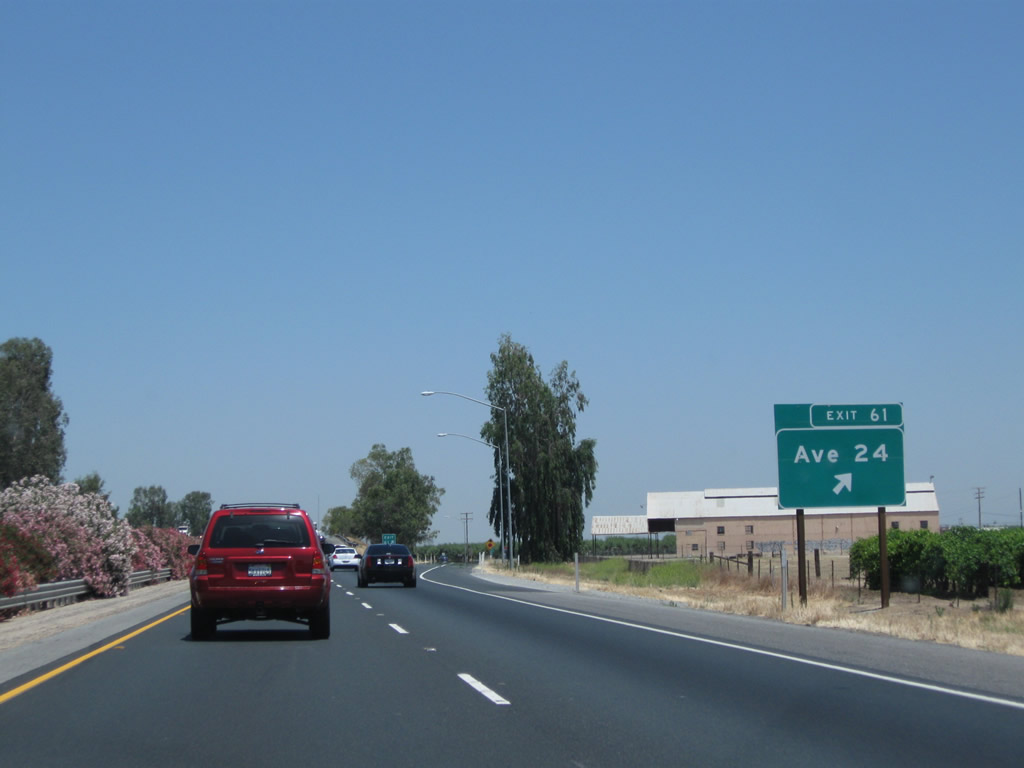
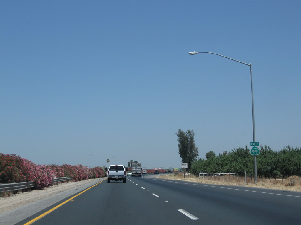
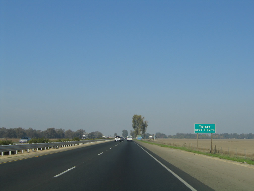
Northbound California 99 (Golden State Highway) meets Exit 61, Avenue 24. Like its neighboring counties, Tulare County is an agrarian region, and it is dependent on imported water as well as annual winter rains to quench the thirst of its various crops. Occasional signs along the 99 freeway state that "Food Grows Where Water Flows." This is a statement related to the constant struggle within the Golden State to allocate water between its urban, suburban, and rural interests, especially as the Southern California mega-metropolis expands and the desert becomes increasingly populated. Photos taken 06/19/10 and 11/25/04. |
|
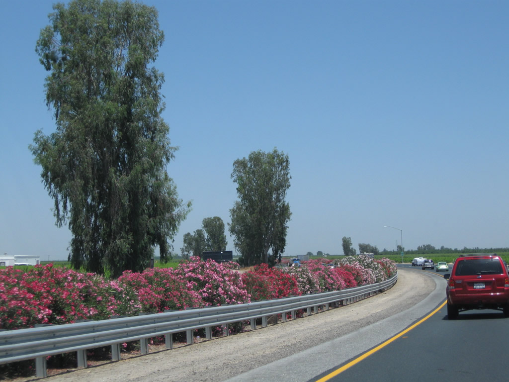
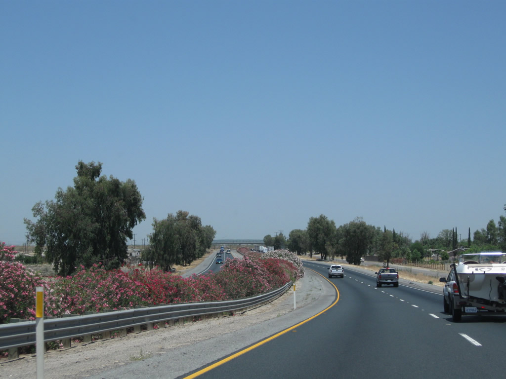
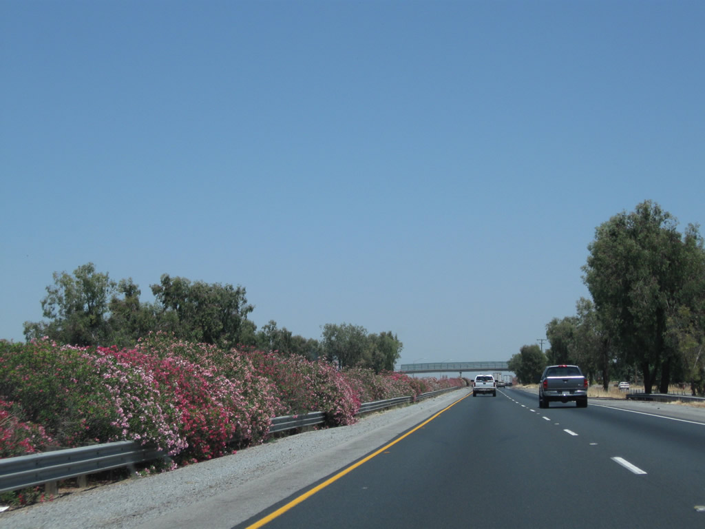
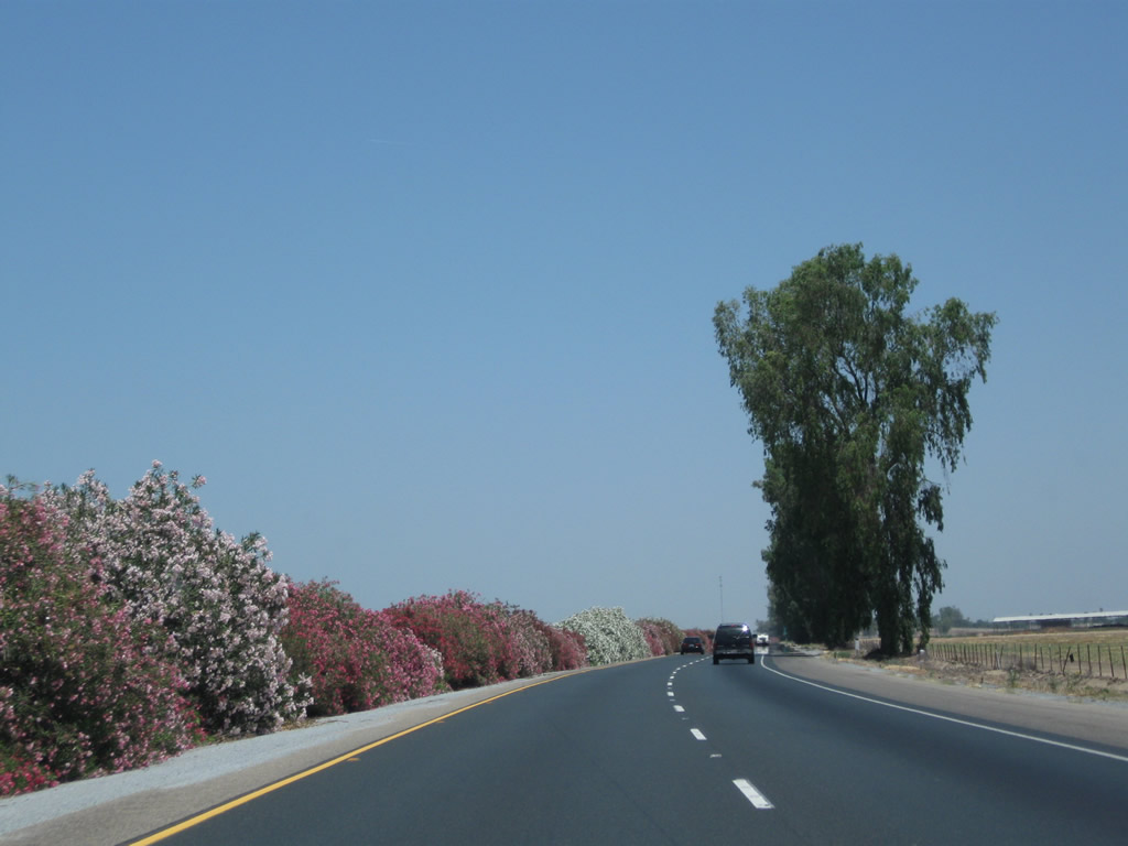
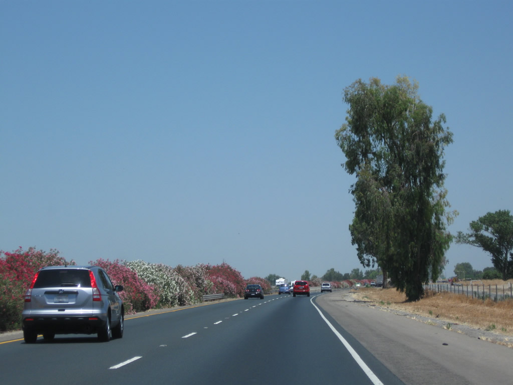
Oleander brings colorful pinks and reds to the median strip. A eucalyptus tree, imported from Australia, towers above the freeway. Photo taken 06/19/10. |
|
A California 99 reassurance shield is posted after the on-ramp from Avenue 24. Photo taken 07/31/11. |
|
|
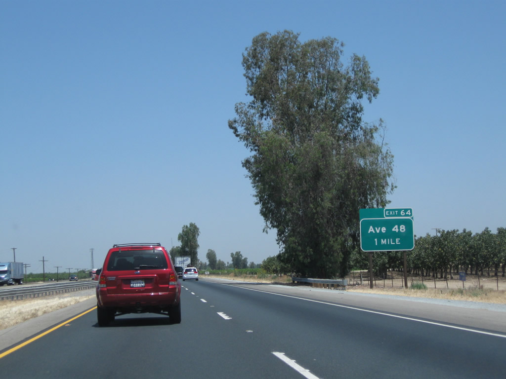
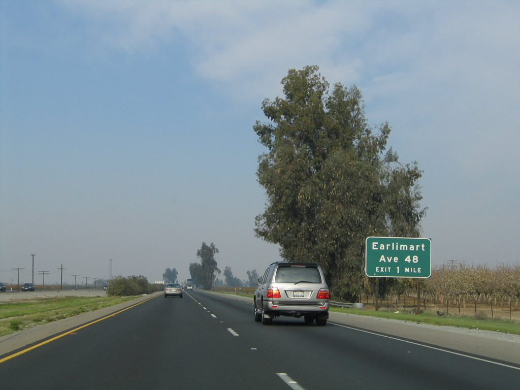
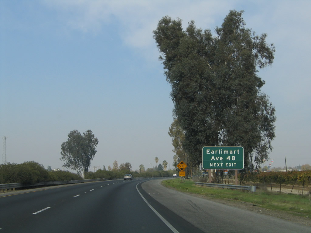
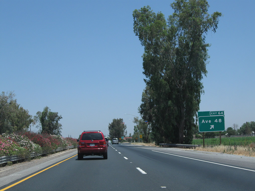
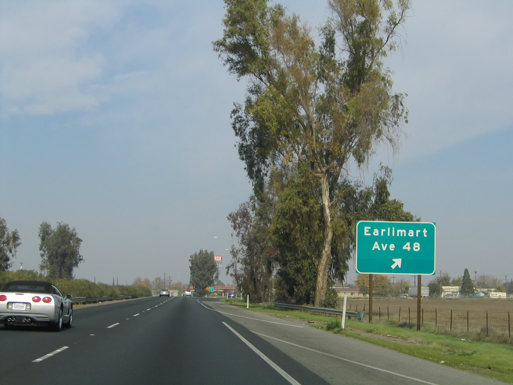
The next exit along California 99 north is Exit 64, Avenue 48 (Armstrong Avenue) and State Street in Earlimart. Use this exit to Old U.S. 99 - Front Street (possibly a former routing of California 99 Business) through Earlimart. Photos taken 06/19/10 and 11/25/04. |
|
|
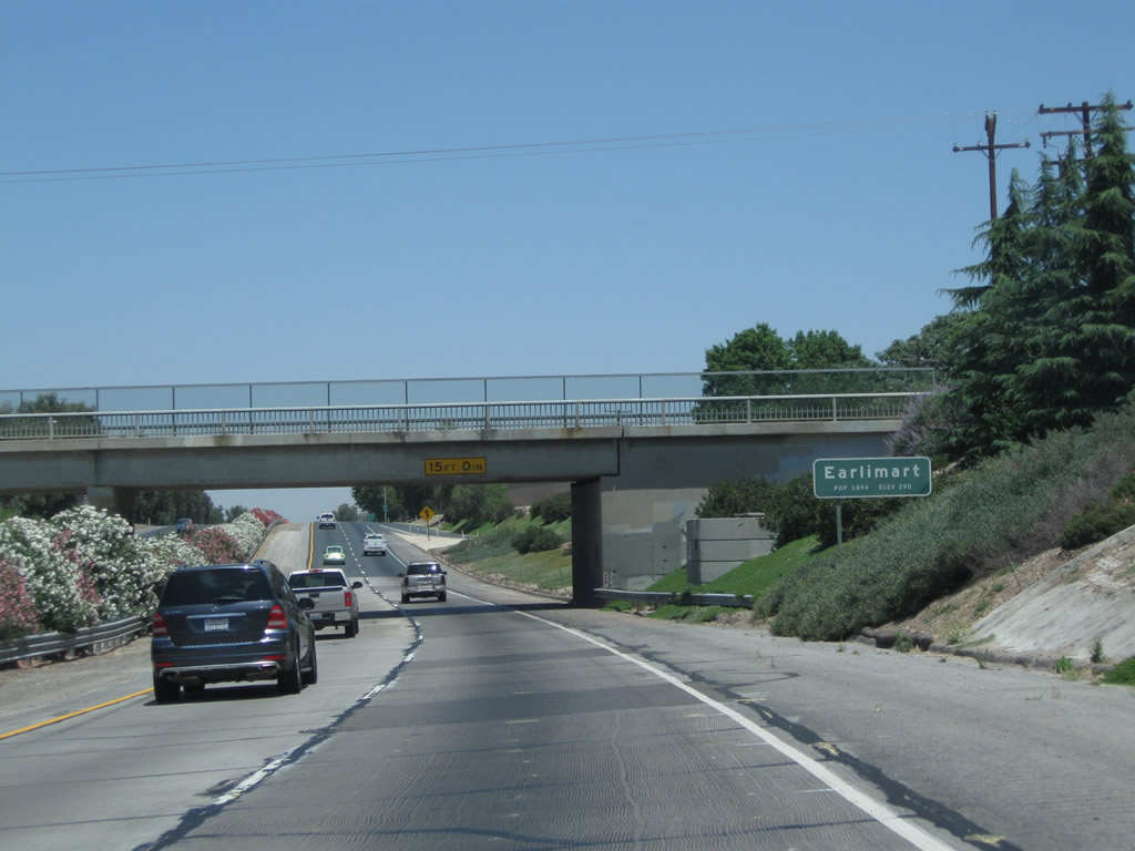
Earlimart is an unincorporated community of Tulare County, with a population of 8,537 as of the 2010 Census. Use Exit 64 to State Street north through Earlimart. Front Street is old U.S. 99, not State Street. Near as we can tell, Earlimart may have had a California 99 Business designation via Front Street. Photos taken 06/19/10 and 11/25/04. |
|
|
Northbound California 99 reaches Exit 64, Avenue 48 (Armstrong Avenue), State Street, and California 99 Business - Front Street north to Earlimart. The business route will return to California 99 at Avenue 56 (Exit 65). Front Street may had been signed as a business route at one time, but no signs remain as of 2010. Photos taken 06/19/10 and 11/25/04. |
|
|
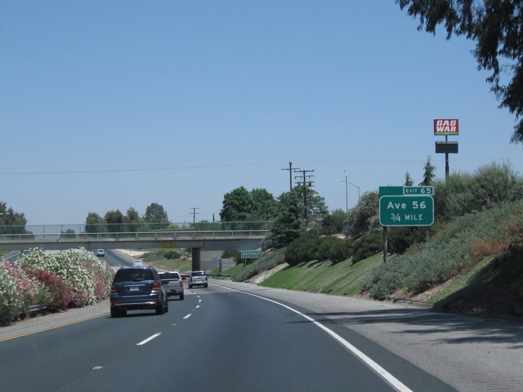
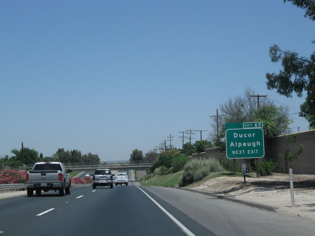
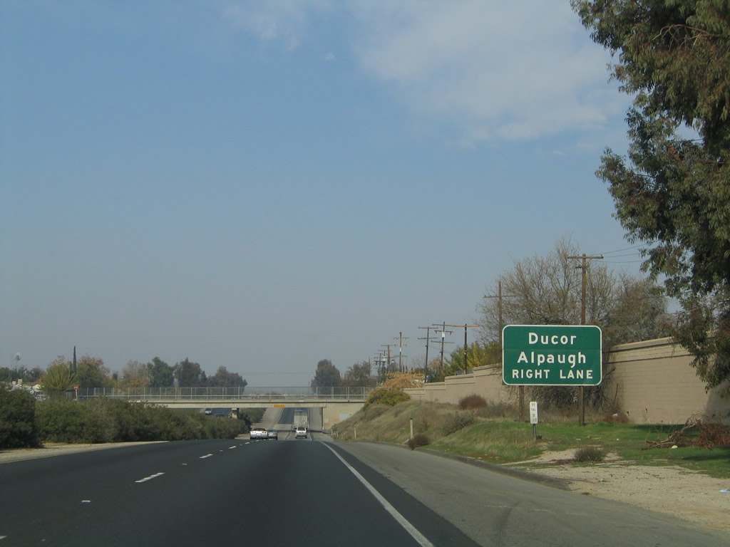
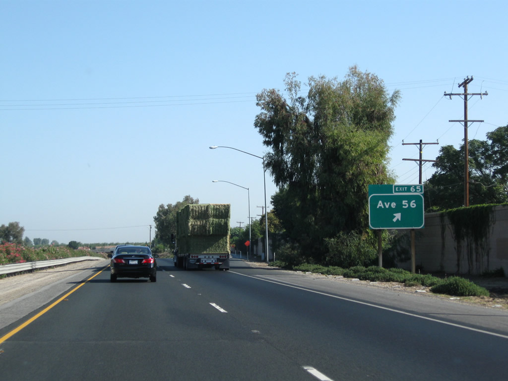
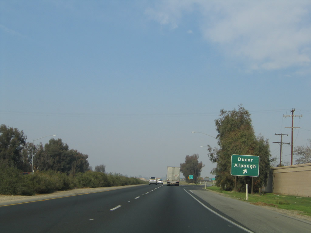
The next exit along California 99 north is Exit 65, Tulare County J-22 (Sierra Avenue). CR J-22 (Avenue 56) leads east to Ducor at the junction of California 65 and CR J-35 and west to Alpaugh, a small community located west of California 43. CR J-22 appears on most maps and might have been signed at one time. However, unlike the northern part of the Central Valley, there are very few remaining signed county routes in Tulare County. Photos taken 06/19/10 and 11/25/04. |
|
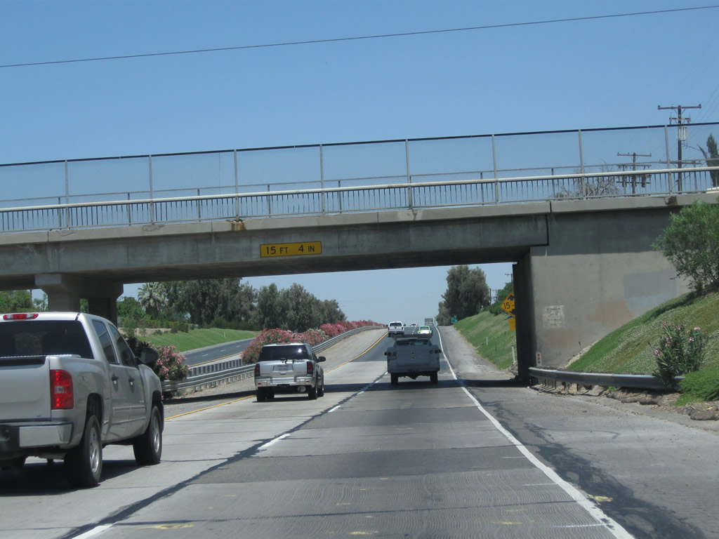
California 99 sees a brief below grade freeway segment as it passes through Earlimart and under the Avenue 48 (Armstrong Avenue) bridge. Photo taken 07/31/11. |
|
|
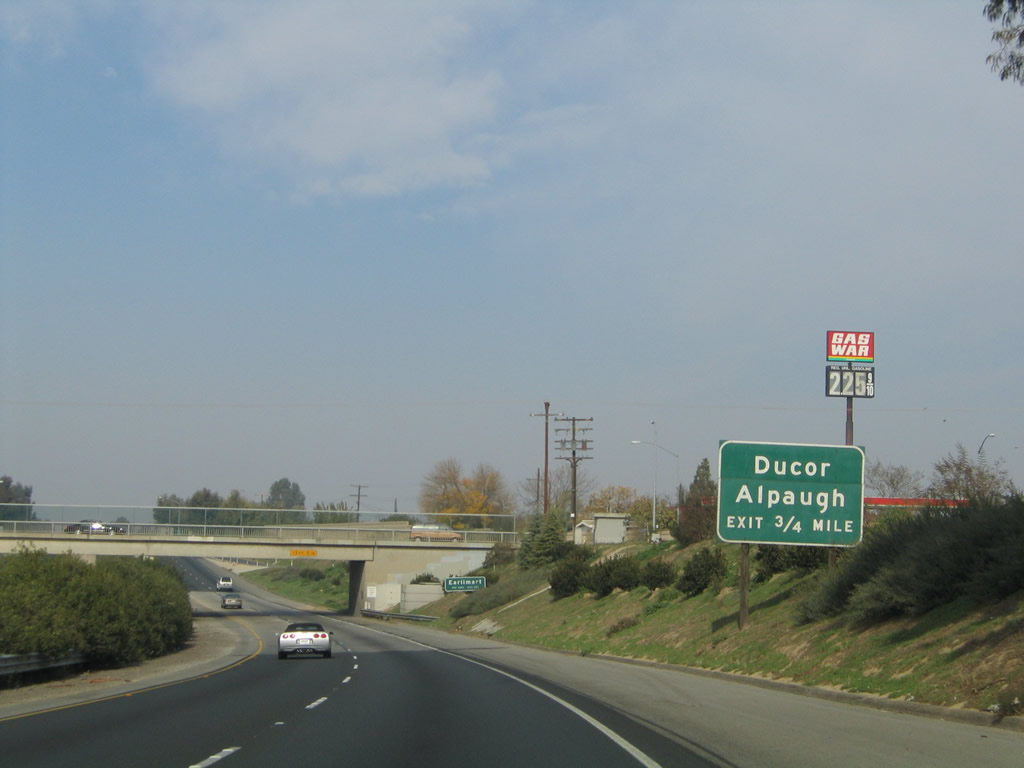
An unsigned route, Tulare County J-22 begins in Alpaugh at the intersection of Road 38 and Tule Road, and extends east along Avenue 54 (Center Avenue), Borchardt Drive and Avenue 56 (Sierra Avenue) to Ducor. It connects with California 43, California 99 and California 65 before ending at Old Stage Road (Mountain 109) in Fountain Springs in the foothills. Photos taken 06/19/10 and 11/25/04. |
|
California 99 next passes under the Avenue 52 (Washington Avenue) bridge. Photo taken 07/31/11. |
|
|
Sign replacements for Exit 65 replaced the destinations of Ducor and Alpaugh with Avenue 56 (Sierra Avenue). The practice of signing the intersecting roadway's name rather than destinations was adopted in the MUTCD and has been implemented as guide signs have been replaced. Photos taken 07/31/11 and 11/25/04. |
|
This California 99 north reassurance shield is posted after the on-ramp from Avenue 56 (J-22). Photo taken 06/19/10. |
|
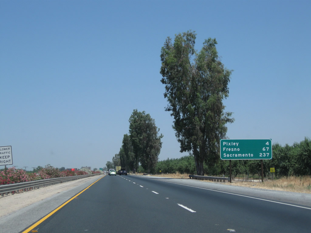
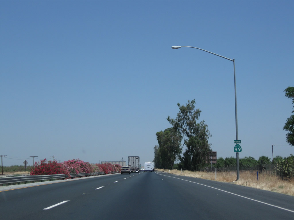
This mileage sign along California 99 north provides the distance to Pixley (four miles), Fresno (67 miles), and Sacramento (237 miles). Photo taken 06/19/10. |
|
|
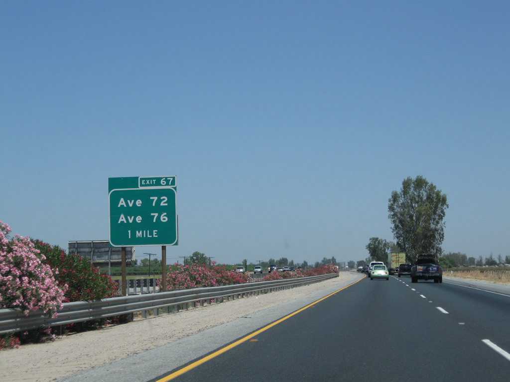
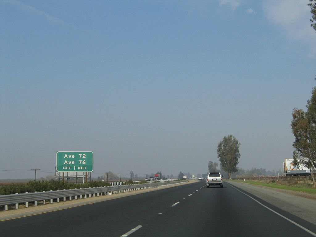
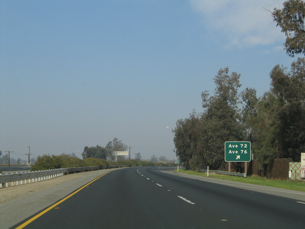
The next exit along California 99 north is Exit 67, Avenue 72 and Avenue 76. This exit is midway between Earlimart and Pixley and connects to Road 130, a frontage road on the east side of the freeway that first links to Avenue 72, then travels a bit further north to Avenue 76. Both roads provide local and ranch access. Photos taken 06/19/10 and 11/25/04. |
|
|
Northbound California 99 meets Exit 67, Avenue 72 and Avenue 76. Photos taken 06/19/10 and 11/25/04. |
|
|
These views provide more glimpses of colorful oleander along California 99 in the late spring/early summer timeframe. Photos taken 06/19/10. |
|
A California 99 north confirming marker is posted after the on-ramp from the Avenue 72 and Avenue 76 interchange. Photo taken 06/19/10. |
|
|
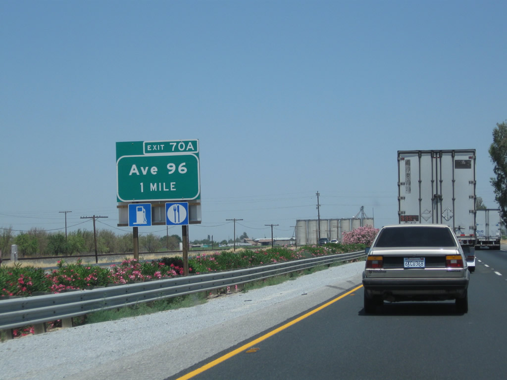
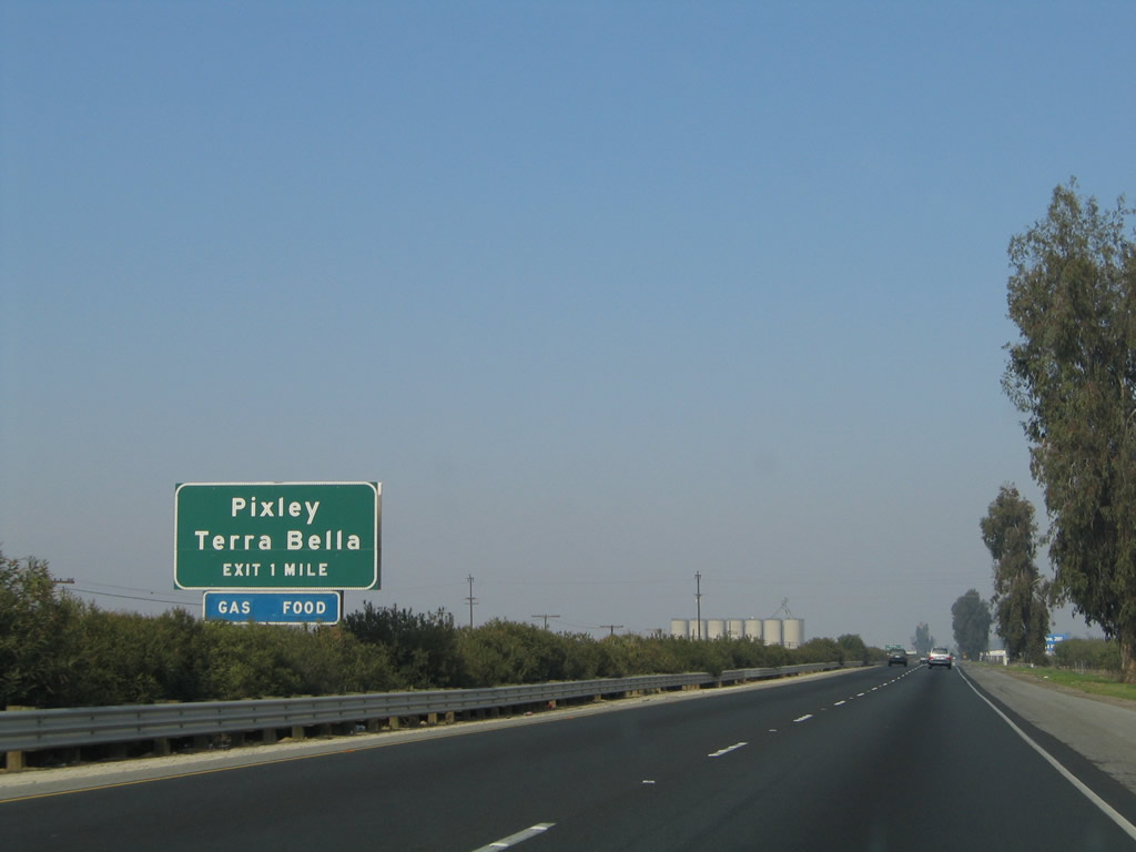
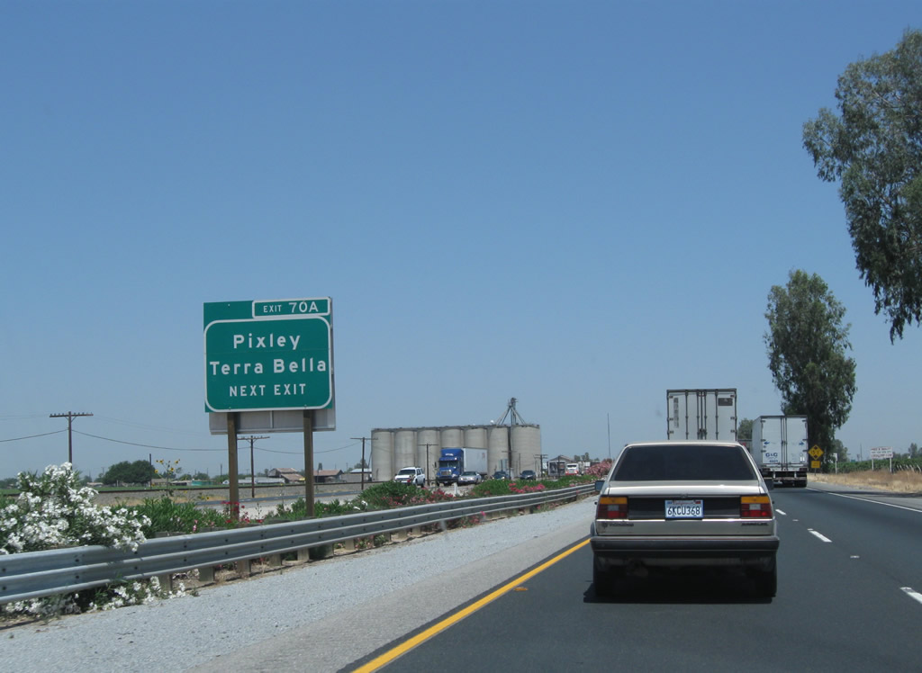
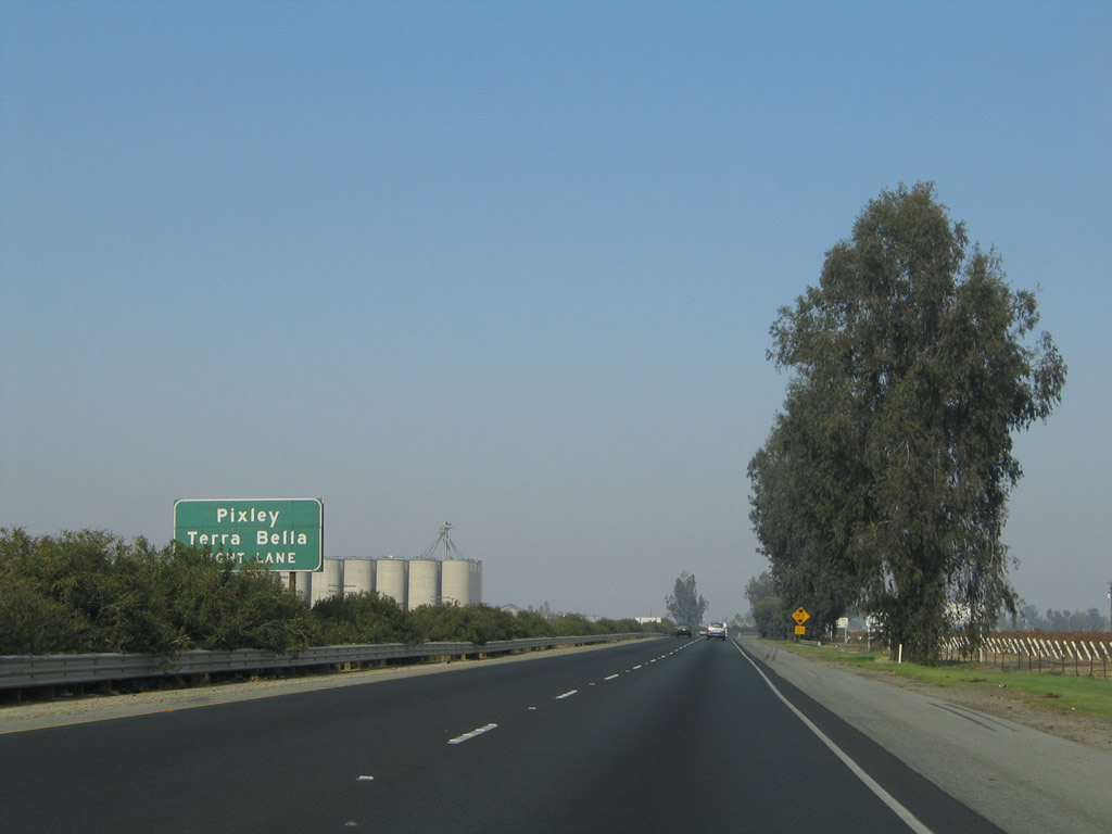
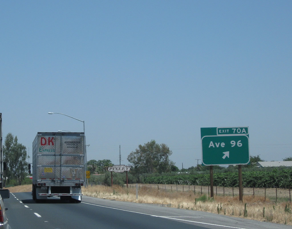
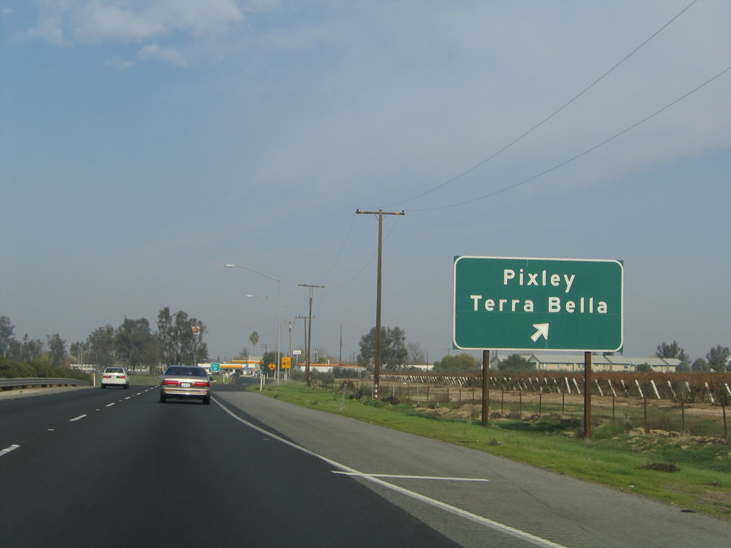
The next exit along California 99 (Golden State Highway) north is Exit 70A, Tulare County J-24 (Terra Bella Avenue) to Historic U.S. 99 (Main Street) north. CR J-24 (Avenue 96) heads west to unincorporated Pixley (population 3,310 as of 2010 Census) and east to Terra Bella. Photos taken 06/19/10 and 11/25/04. |
|
|
Tulare County J-24, just like CR J-22 in Earlimart, is generally unsigned. CR J-24 is assigned to run from California 99 (Exit 70A) east along Avenue 96 / Terra Bella Avenue, ending at California 65 near Terra Bella for a distance of 13 miles (the route was realigned onto Avenue 95 at the very eastern end of the county road). CR J-24 has a very short unsigned overlap with CR J-27 (Road 192), a north-south county road that connects CR J-22 east of Earlimart with California 65 and California 137 west of Lindsay. Photos taken 06/19/10 and 11/25/04. |
|
|
Exit 70A departs from SR 99 north for CR J-24 (Terra Bella Avenue). Historic U.S. 99 has a very short segment on the west side of the freeway along Main Street that passes through downtown Pixley. It will rejoin the freeway at Exit 71. Main Street may had been signed as a business route at one time, but no signs remained as of 2010. Photos taken 06/19/10 and 11/25/04. |
|
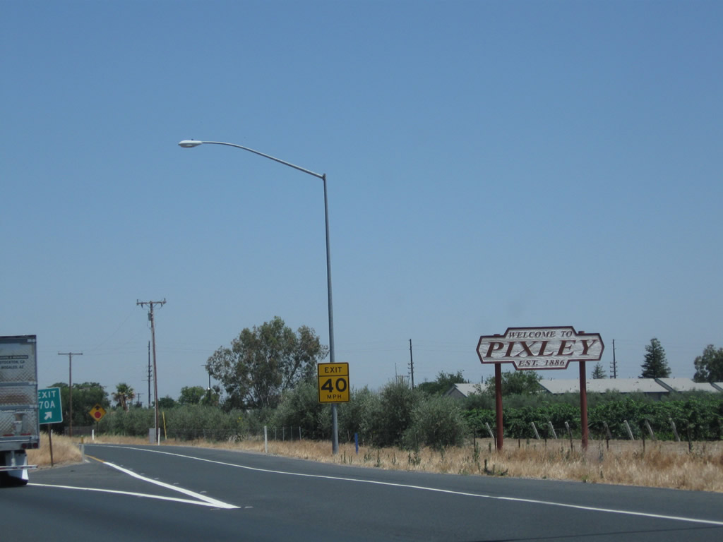
At the gore point for Exit 70A to Avenue 96 is this "Welcome to Pixley" sign. While not incorporated, the sign indicates the community has been settled since 1886. Photo taken 06/19/10. |
|
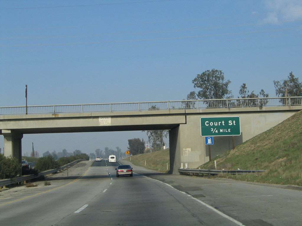
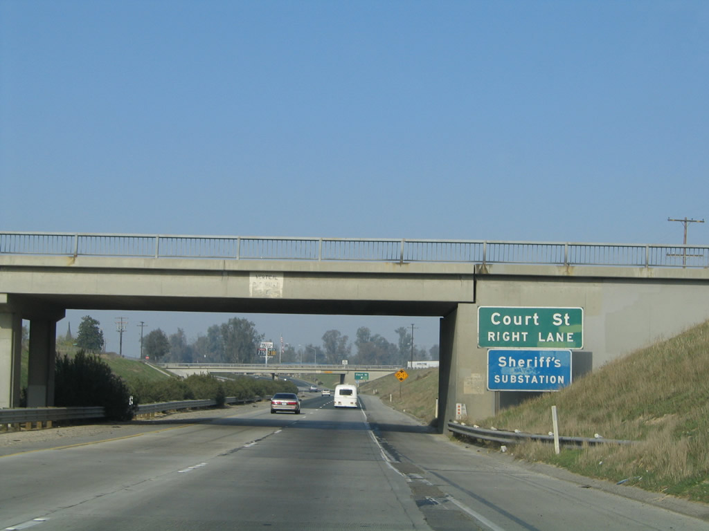
While passing under Avenue 96, this sign announces that the next exit along California 99 north is Exit 70B, Court Street (three-quarters of a mile). This sign has since been replaced with a reflective sign that includes the exit number. Photo taken 11/25/04. |
|
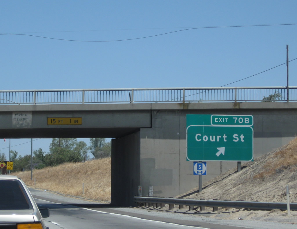
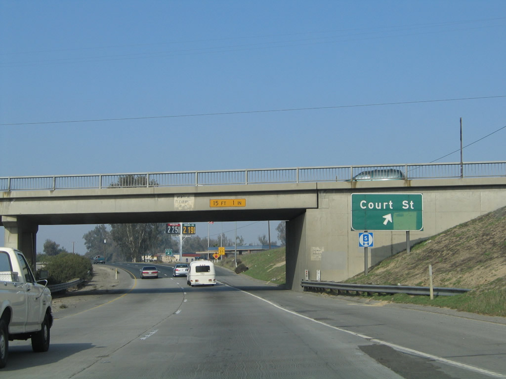
The next exit along California 99 north is Exit 70B, Court Street. This exit also serves Pixley. California 99 passes through this below-grade segment as it passes through Pixley in much the same way as Interstate 5 passes through Arbuckle in the Sacramento Valley. Photo taken 11/25/04. |
|
|
Northbound California 99 meets Exit 70B, Court Street in Pixley. Ahead, California 99 will leave Pixley and reenter rural, agricultural land. Photos taken 06/19/10 and 11/25/04. |
|
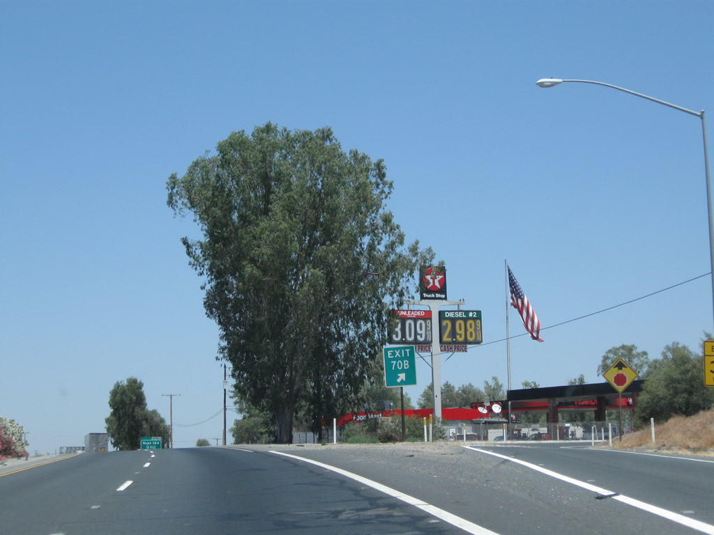
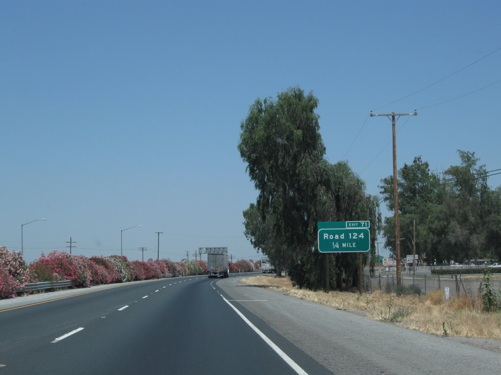
A gas station is conveniently located at the end of the off-ramp to Court Street. The off-ramp directly connects to north-south Park Street (Road 124); turn right at the end of the ramp to connect to Court Street (also shown as Court Avenue on some maps). Photo taken 06/19/10. |
|
|
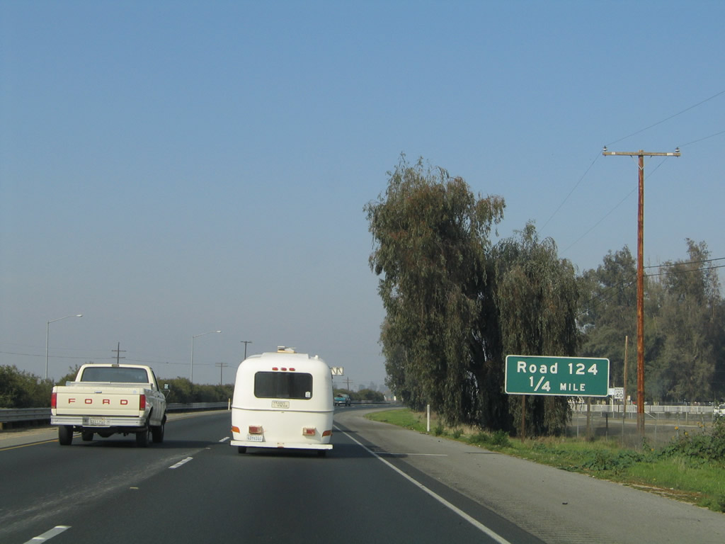
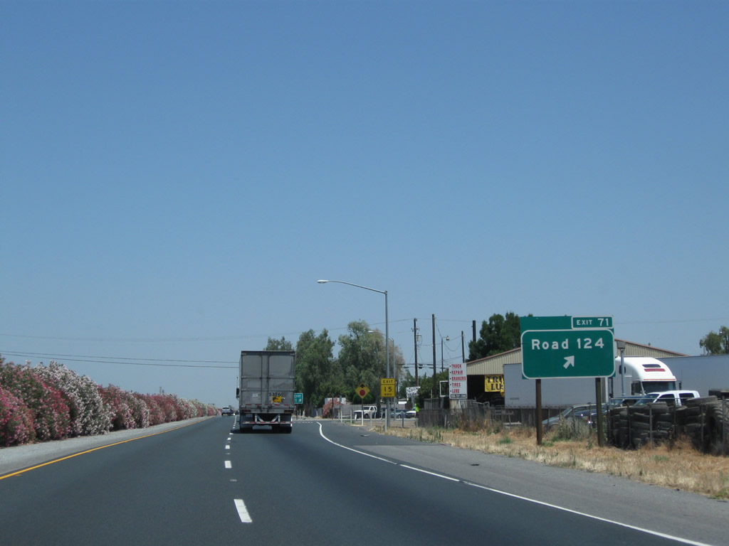
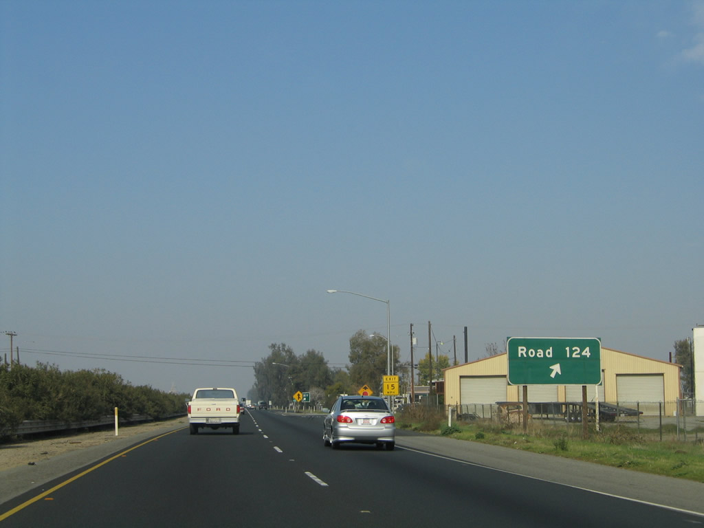
The next exit along California 99 north is Exit 71, Road 124 (Park Street) to Pixley Park. In Tulare County, all county roads are numbered into a grid system. "Roads" run north-south, while "Avenues" run east-west. Since California 99 passes through the area at a northeasterly trajectory, it intersects both Roads and Avenues. Road 124 travels due north from this interchange, while California 99 continues to aim northwest. Photos taken 06/19/10 and 11/25/04. |
|
|
Northbound California 99 (Golden State Highway) north reaches Exit 71, Road 124 (Park Street) to Pixley Park. Photos taken 06/19/10 and 11/25/04. |
|
|
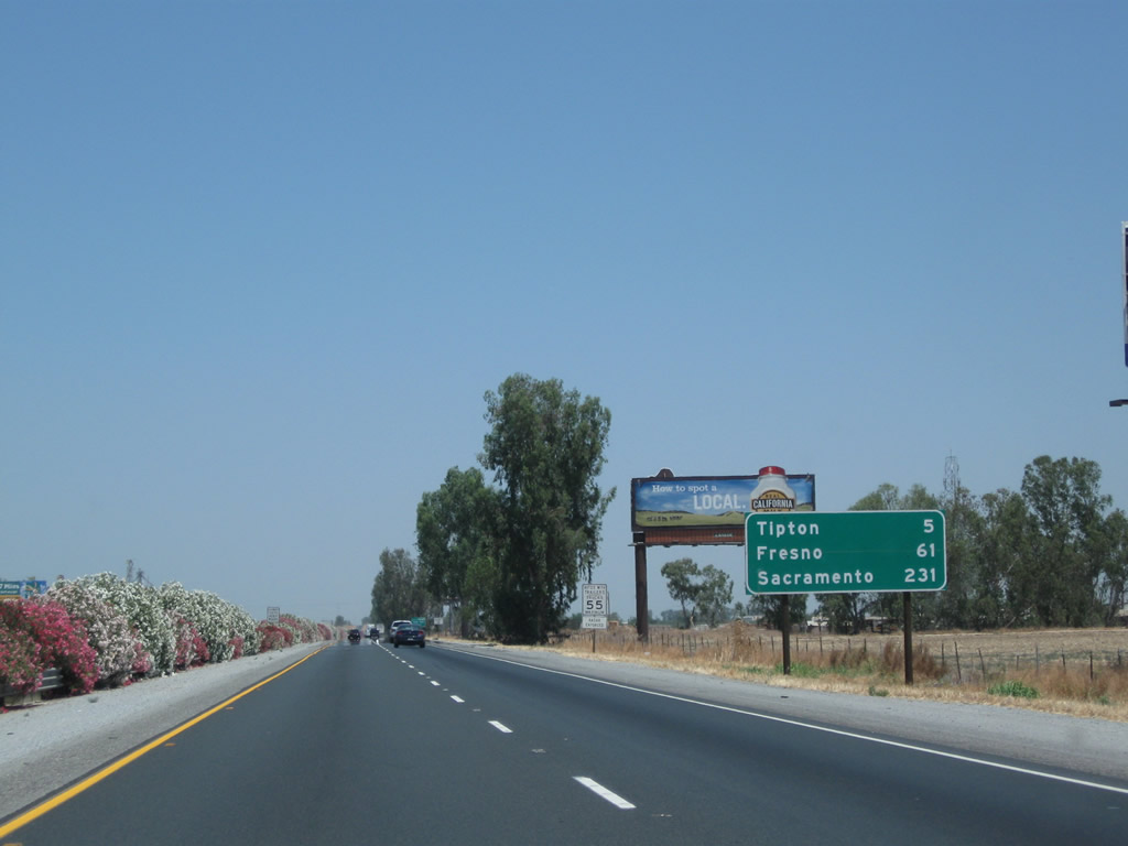
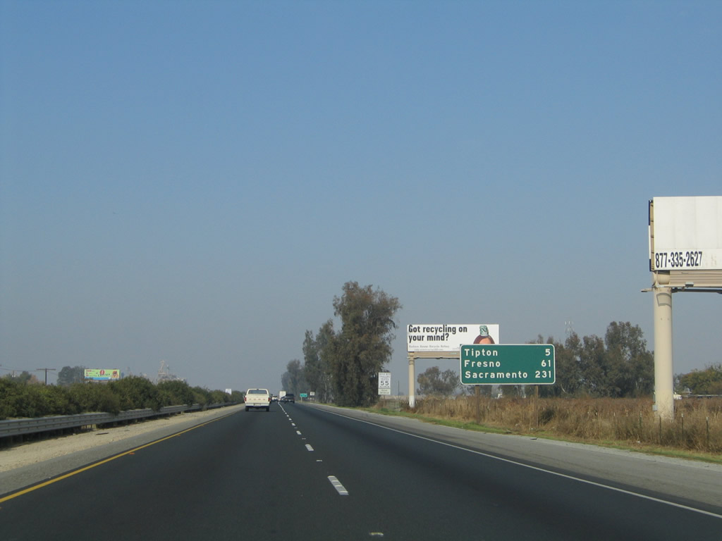
This mileage sign along California 99 (Golden State Highway) north provides the distance to Tipton (five miles), Fresno (61 miles), and Sacramento (231 miles). Photos taken 06/19/10 and 11/25/04. |
|
|
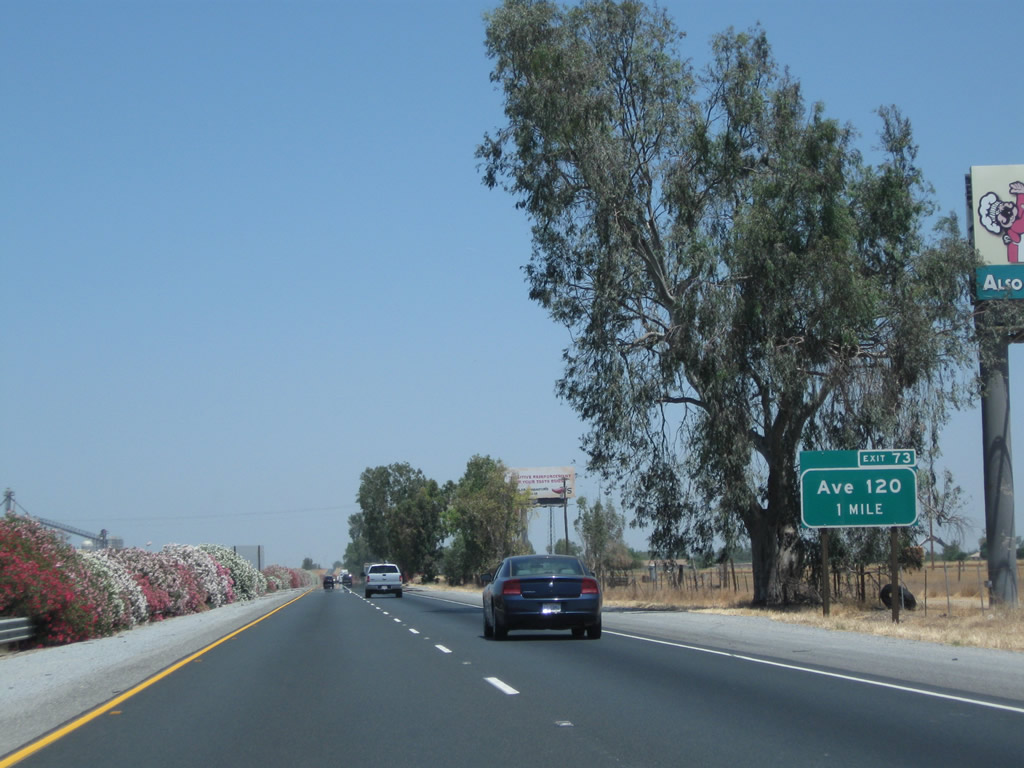
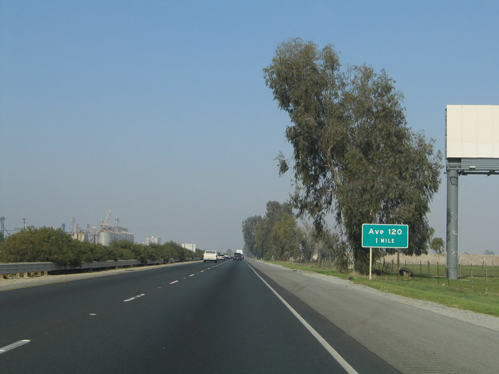
The next exit along California 99 north is Exit 73, Avenue 120 (one mile). Photos taken 06/19/10 and 11/25/04. |
|
|
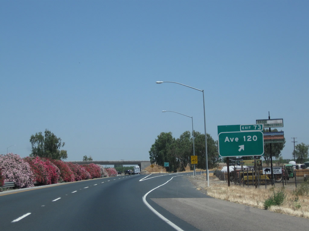
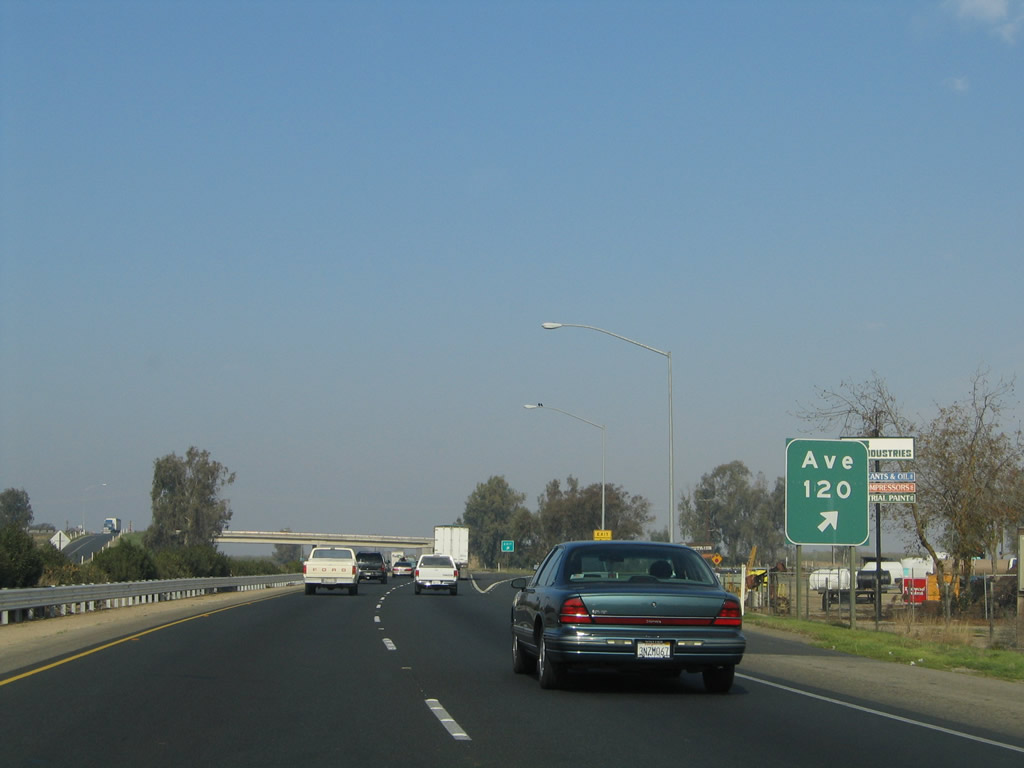
Northbound California 99 meets Exit 73, Avenue 120. From this interchange, Avenue 120 travels west to meet California 43 between Angiola and Corcoran. Photos taken 06/19/10 and 11/25/04. |
|
A California 99 confirming marker is posted after the on-ramp from Avenue 120. The next interchange is about three miles ahead. Photo taken 06/19/10. |
|
|
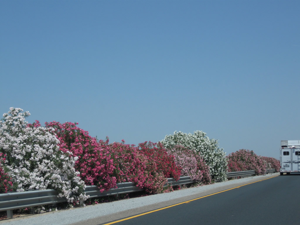
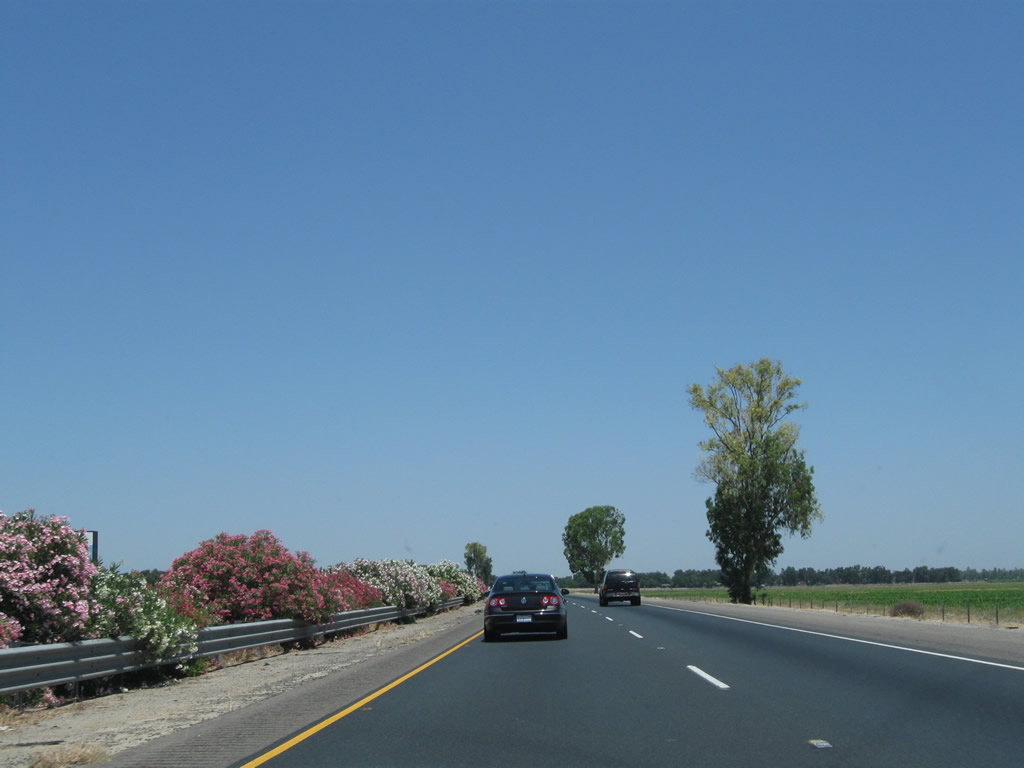
Colorful oleander blossoms in the late spring/early summer along California 99 between Avenue 120 and California 190. Oleander becomes dormant in late fall into winter. Photos taken 06/19/10. |
|
|
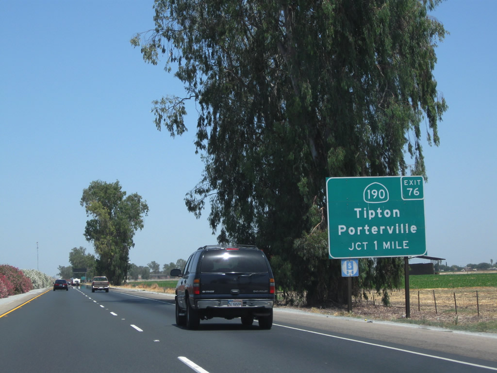
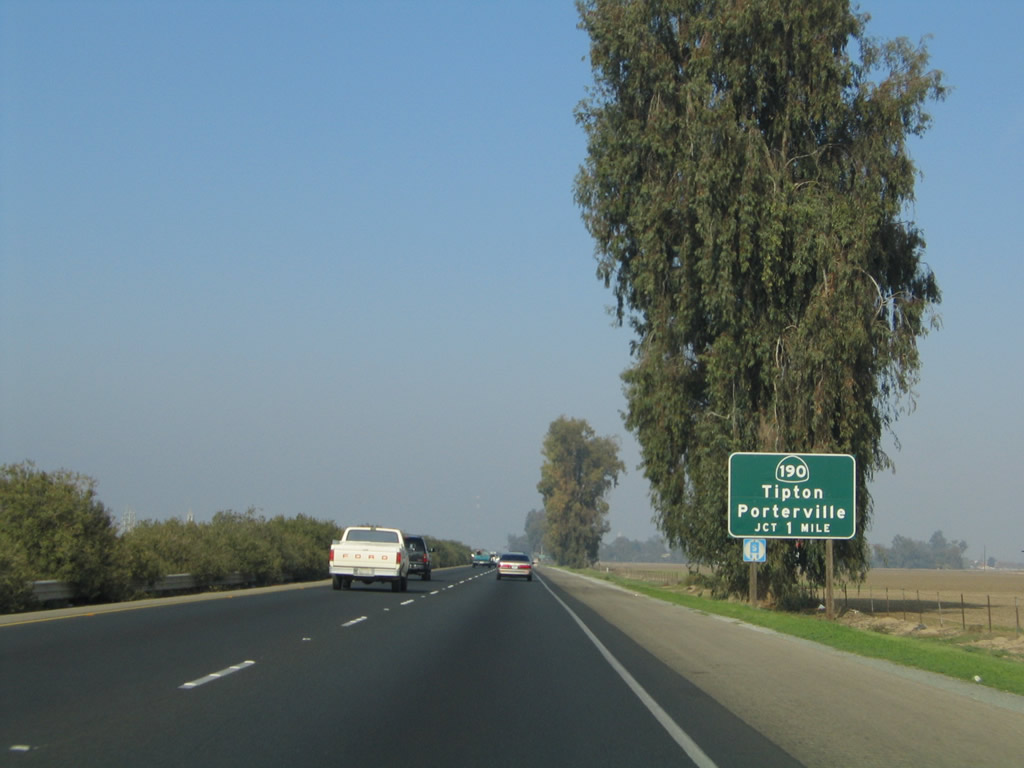
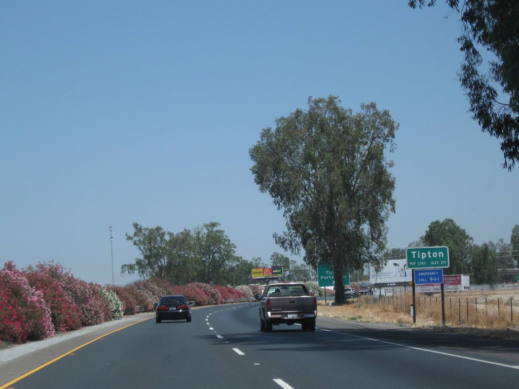
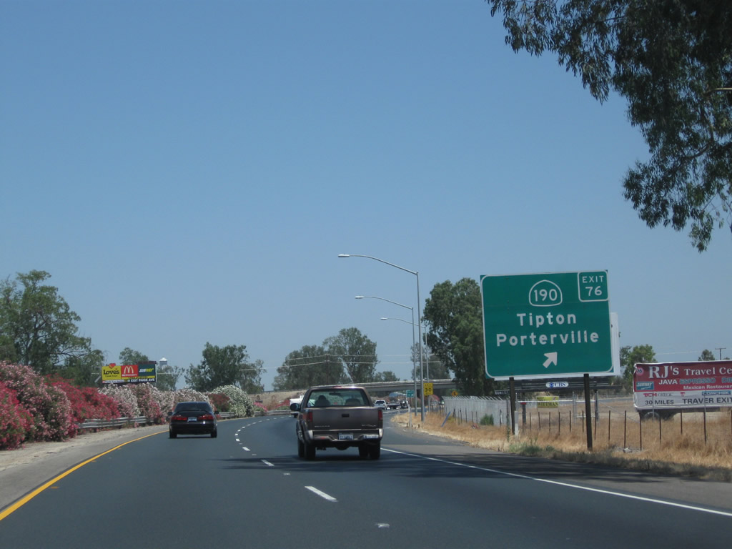
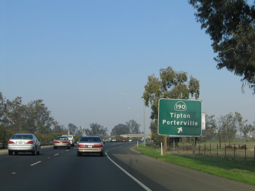
The next exit along California 99 north is Exit 76, California 190 (Avenue 144) east to Poplar-Cotton Center, Porterville, and Camp Nelson and Avenue 144 (Poplar Avenue) west to Corcoran. This exit also connects to Tipton. Photos taken 06/19/10 and 11/25/04. |
|
|
Use Avenue 144 (Poplar Avenue) west to Corocoran, which is located along the California 43 corridor at its junction with California 137. Photos taken 06/19/10 and 11/25/04. |
|
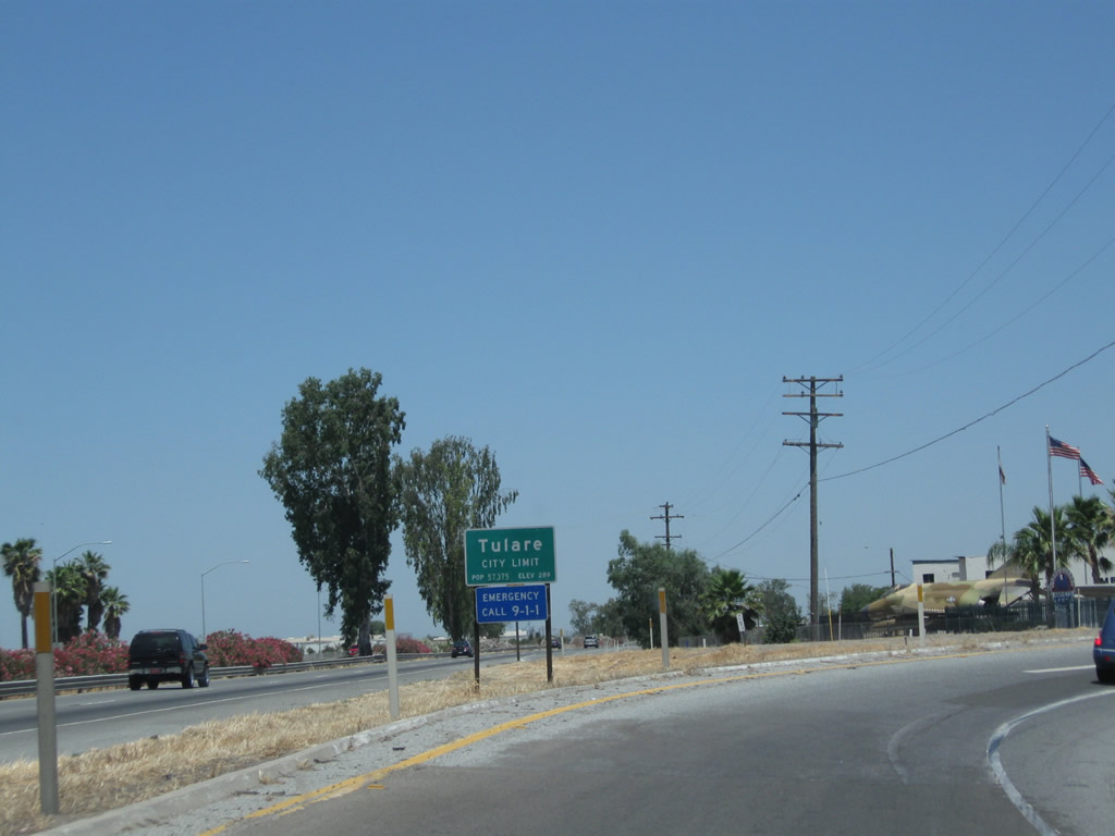
California 99 enters the unincorporated community of Tipton, which had a population of 2,543 as of the 2010 Census. Photo taken 06/19/10. |
|
|
Northbound California 99 meets Exit 76, California 190 (Avenue 144). Once anticipated to extend east across the Sierra Nevada, California 190 is now two separate routes, with an eternally hopeful proposed extension across the mountains visible only on paper. Currently, California 190 extends east from here, passing through Poplar and Porterville en route to Camp Nelson in the foothills. Use California 190 east to Evans Road north into Tipton or Avenue 144 west to Historic U.S. 99/Burnett Road north into Tipton. Photos taken 06/19/10 and 11/25/04. |
|
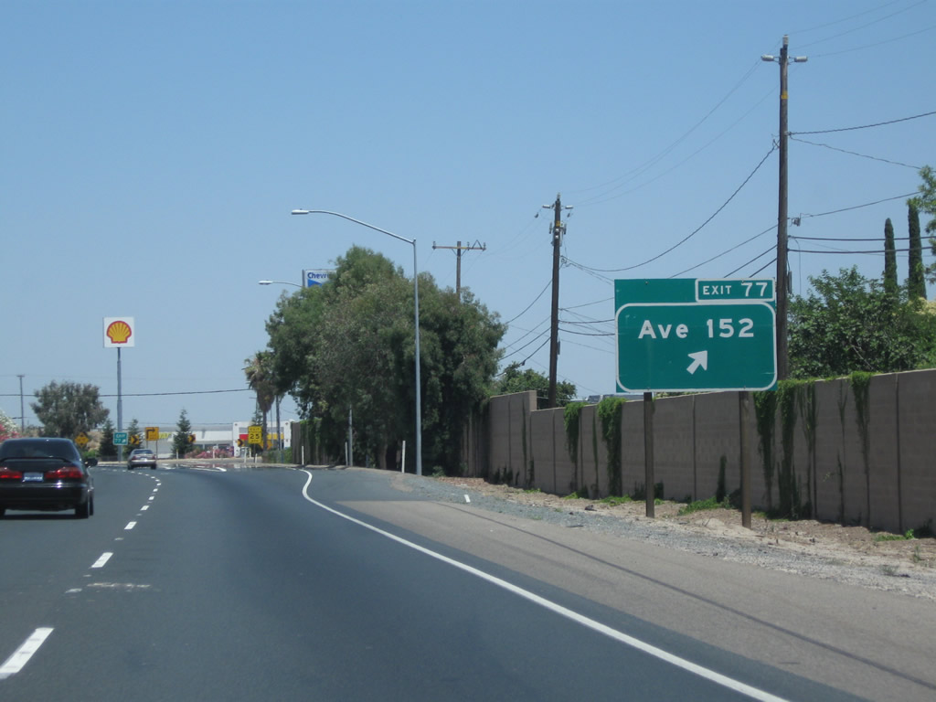
The next exit along California 99 north is Exit 77, Avenue 152 (Olive Street), one mile. This exit serves the community of Tipton, the majority of which is located to the east of the freeway. This sign was replaced by 2010. Photo taken 11/25/04. |
|
|
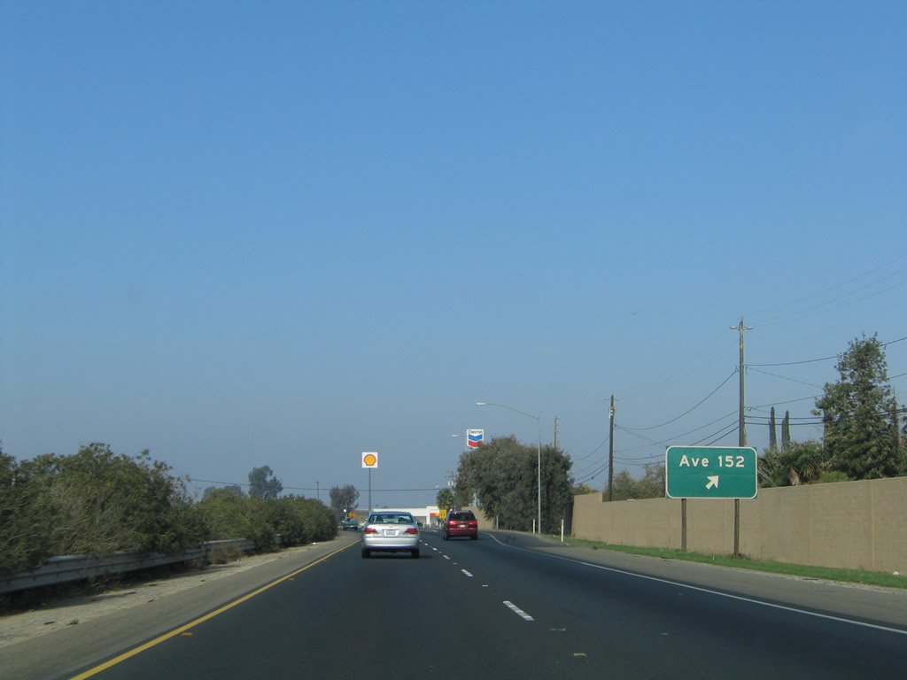
Northbound California 99 meets Exit 77, Avenue 152 (Olive Street) into Tipton. Photos taken 06/19/10 and 11/25/04. |
|
The off-ramp to Exit 77, Avenue 152 (Olive Street) leads to motorist services, including gas. Photo taken 06/19/10. |
|
A California 99 reassurance shield is posted after the Avenue 152 interchange. Photo taken 06/19/10. |
|
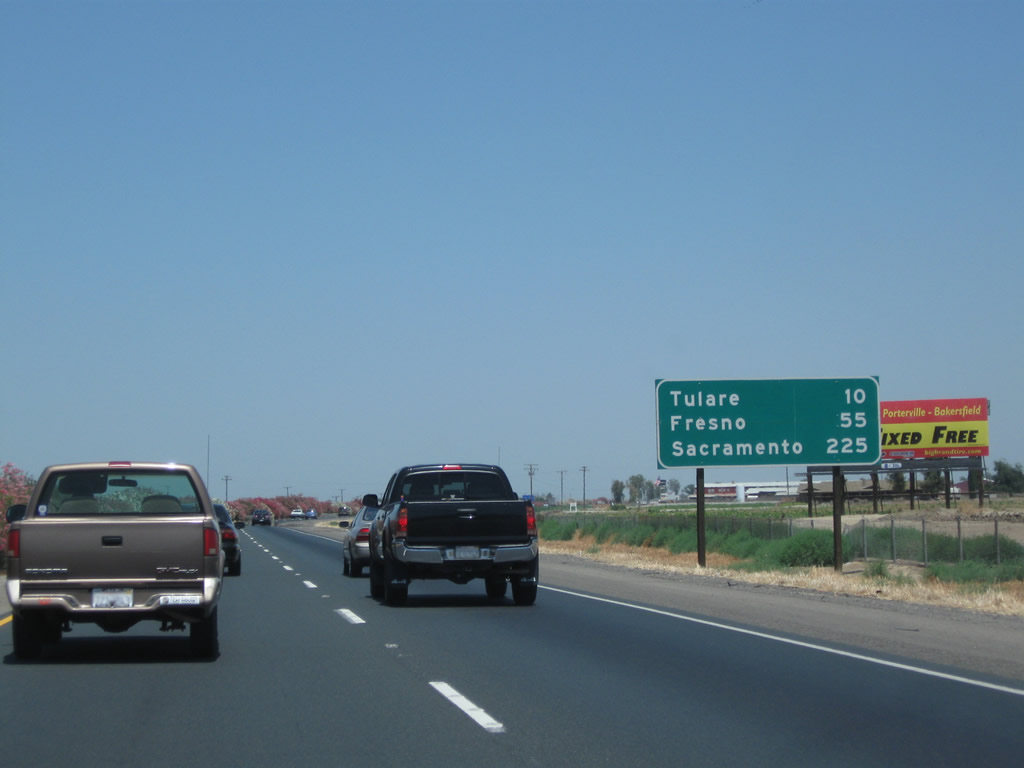
This mileage sign along California 99 (Golden State Highway) north provides the distance to Tulare (10 miles), Fresno (55 miles), and Sacramento (225 miles). Photo taken 06/19/10. |
|
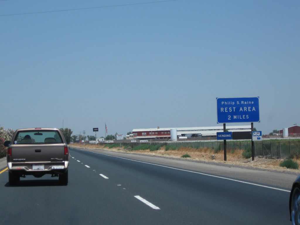
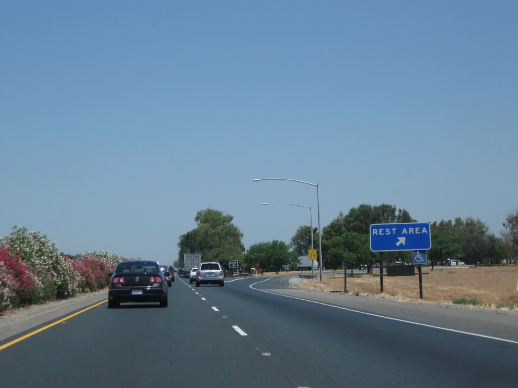
The next exit along California 99 (Golden State Highway) north is Exit 80, Philip S. Raine Safety Roadside Rest Area (two miles). This facility has restrooms, pet walking area, and vending machines. Photo taken 06/19/10. |
|
More colorful oleander lines the median of the freeway, while a eucalyptus tree or two dominates the view on the east side of the freeway. Photo taken 06/19/10. |
|
Northbound California 99 (Golden State Highway) reaches Exit 80, Philip S. Raine Safety Roadside Rest Area. Photo taken 06/19/10. |
|
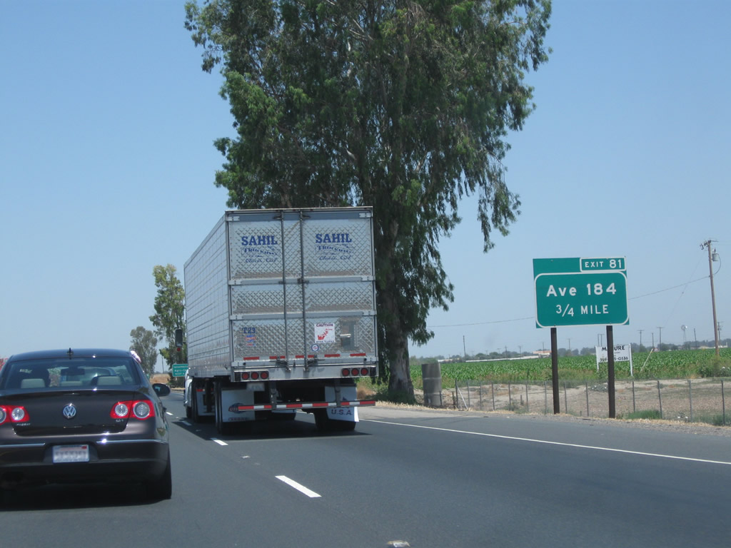
The next exit along California 99 (Golden State Highway) north is Exit 81, Avenue 184 (Octol Avenue). Photo taken 06/19/10. |
|
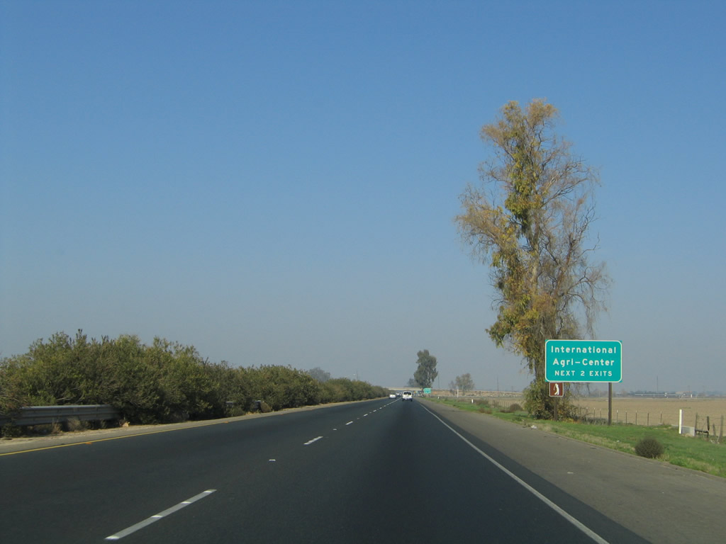
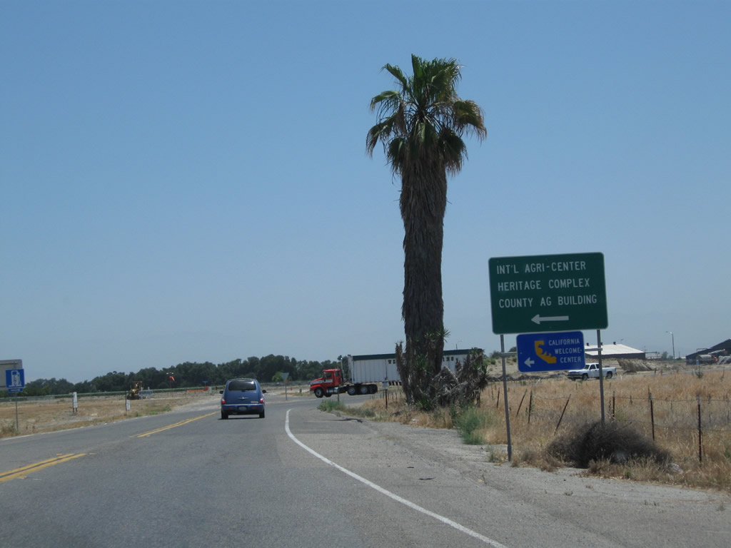
Use either Exit 81 or Exit 83 to the International Agri-Center, which is located on the east side of California 99 in Tulare on Laspina Street. Photo taken 06/19/10. |
|
Northbound California 99 meets Exit 81, Avenue 184. As early as August 2003, this sign had been converted to reflective with exit number. Photo taken 11/25/04. |
|
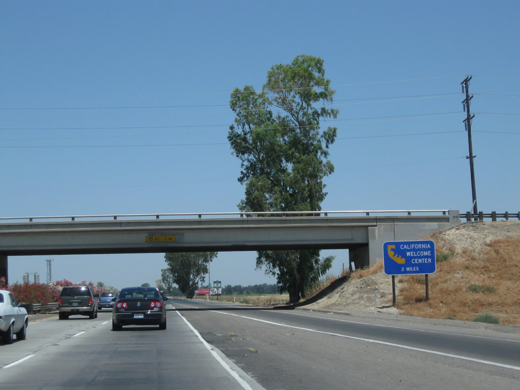
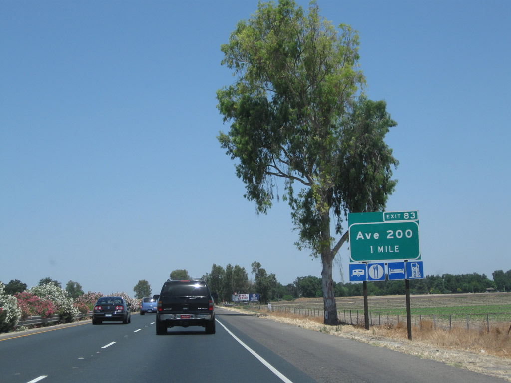
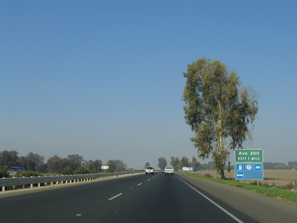
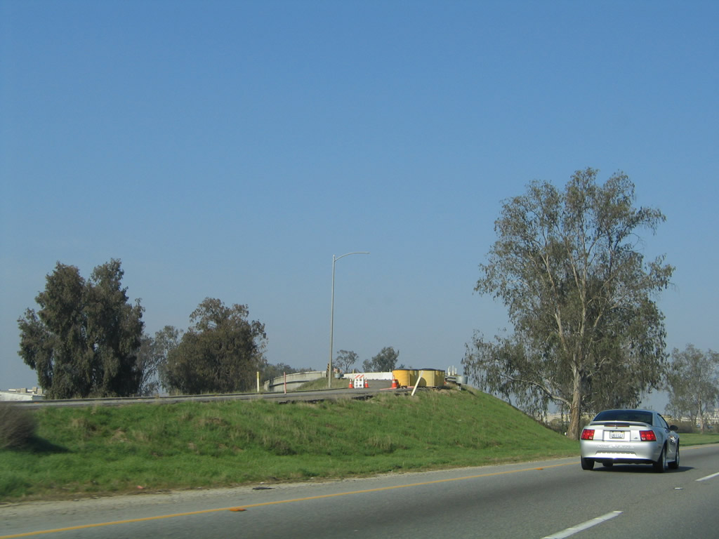
California 99 passes under Avenue 184. A California Welcome Center is located at the International Agri-Center. The next exit (Exit 83, Avenue 200) serves both the Agri-Center and the Welcome Center. Tourist information and restrooms are available at the welcome center during hours of operations (always a good idea to check hours of operation before visiting the center). Overhead, a Southern California Edison power line crosses overhead. Most of Tulare County (including the cities of Tulare and Visalia) are served by Southern California Edison, unlike most other parts of the Central Valley that are served by Pacific Gas and Electric. Photo taken 06/19/10. |
|
California 99 continues through more agricultural lands between Avenue 184 and Avenue 200. Photo taken 06/19/10. |
|
The next seven exits along northbound California 99 (Golden State Highway) serve the city of Tulare: Exit 83, Avenue 200 to California 99 Business (K Street) north to Tulare; defunct Exit 84, which used to connect directly to K Street via a left exit; Exit 85, Paige Avenue; Exit 86, Bardsley Avenue; Exit 87, California 137 (Tulare Avenue); Exit 88, Hillman Street and Prosperity Avenue; Exit 89, Cartmill Avenue; and Exit 90, Road 100 to Oaks Street south. Photo taken 11/25/04. |
|
|
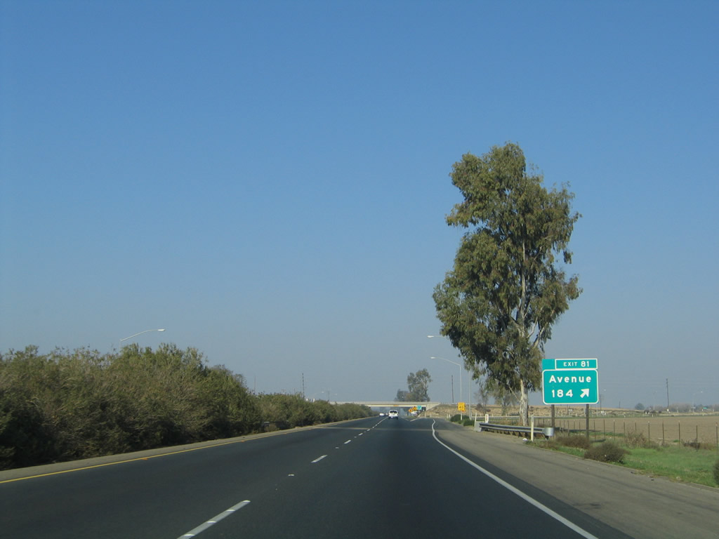
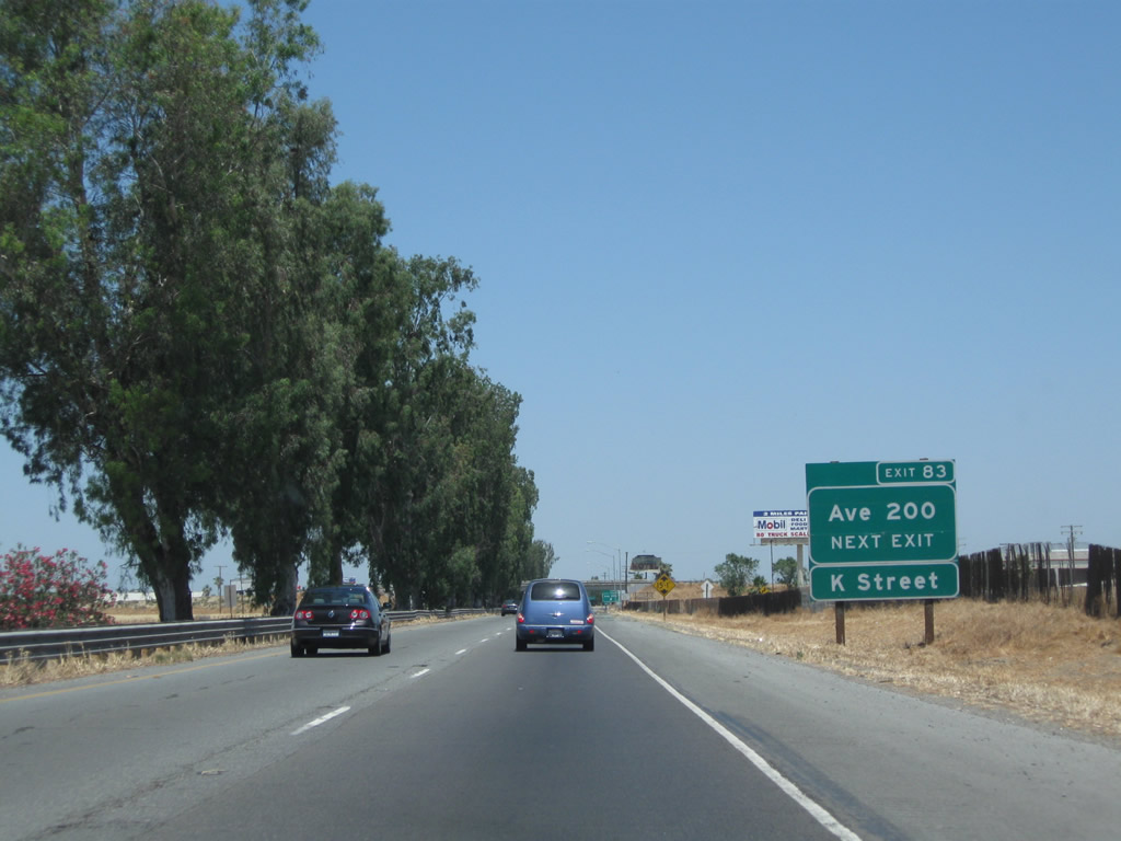
The next exit along California 99 north is Exit 83, Avenue 200 to California 99 Business (K Street) north (one mile). This is the first exit for the city of Tulare. Tulare, while not the seat of Tulare County, is a fast-growing community along the California 99 corridor. The city of Tulare had a population of 59,278 as of the 2010 Census and was incorporated on April 5, 1888. Photos taken 06/19/10 and 11/25/04. |
|
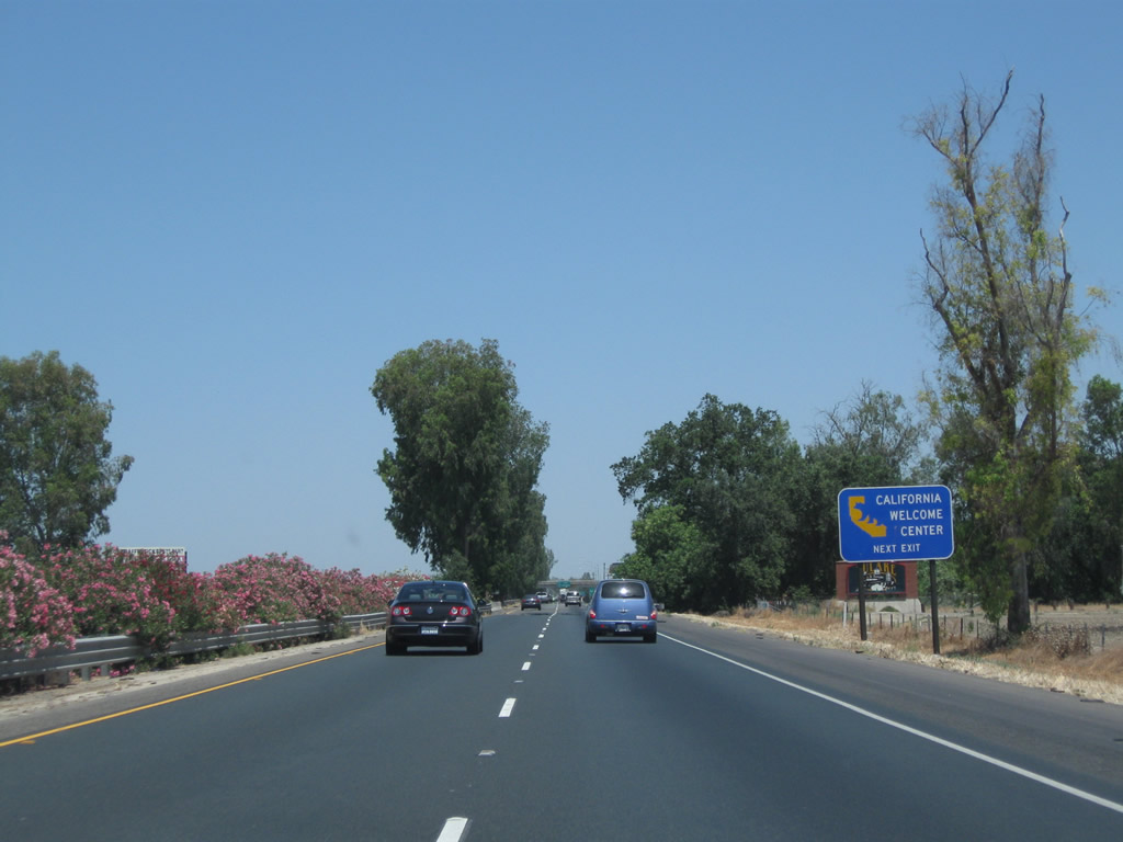
Another advance sign is posted for the California Welcome Center at the International Agri-Center in Tulare. Use Exit 83, Avenue 200 and follow the signs to the Agri-Center. Photo taken 06/19/10. |
|
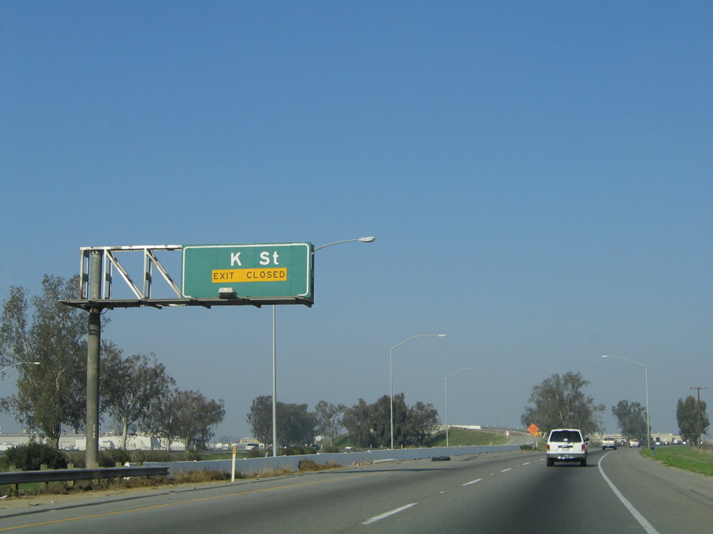
Northbound California 99 approaches Exit 83, Avenue 200. Originally, the California 99 business route had its own dedicated off-ramp that led from California 99 north directly onto K Street. That connection is now made via Avenue 200 west to K Street north. The former off-ramp (Exit 84) has been eliminated completely. Based on our drive along K Street and J Street, which combined form the business route, there are few if any remaining business route signs. However, there are occasional signs for Historic U.S. 99. Photo taken 06/19/10. |
|
Northbound California 99 meets Exit 83, Avenue 200. As seen in the background, the next exit is for K Street, the business route. K Street and J Street through Tulare may had been signed as a business route at one time, but few if any signs remain as of 2010. Photo taken 06/19/10. |
|
The ramp here is for Exit 83 to Avenue 200, but the overhead signs are for Exit 84, a left exit to the Tulare business route. This exit was in the process of becoming permanently closed at the time this photo was taken. Photo taken 11/25/04. |
|
California 99 enters the city of Tulare at the point where the ramp to Avenue 200 (Exit 83) departs the freeway. Photo taken 06/19/10. |
|
Briefly looking at the loop ramp from California 99 north to Avenue 200, this sign advises a left turn to the International Agri-Center and the Tulare California Welcome Center. Turn right to California 99 Business (K Street) (Historic U.S. 99) north to downtown Tulare. Photo taken 06/19/10. |
|
|
The closed left-ramp for Exit 84 to California 99 Business (K Street) north prior to its removal. Photo taken 11/25/04. |
|
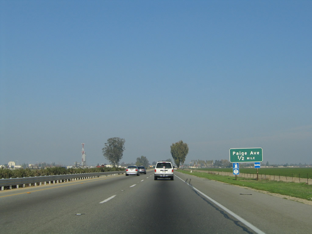
The next exit along California 99 north is Exit 85, Paige Avenue, one-half mile. Paige Avenue is an east-west street that serves the southern part of the city of Tulare, with connections to the International Agri-Center and Museum and Edison Ag-Tac. Photo taken 11/25/04. |
|
Northbound California 99 enters the heart of the city of Tulare at Exit 85. Use Exit 85 and Paige Avenue westbound as an alternative to the K Street (California 99 Business) exit. Photo taken 11/25/04. |
|
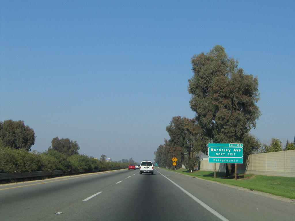
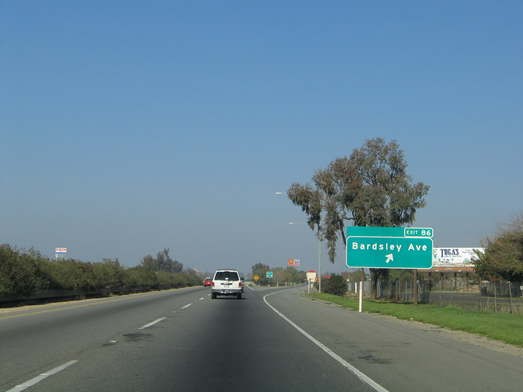
The next exit along California 99 (Golden State Highway) north is Exit 86, Bardsley Avenue. Photo taken 11/25/04. |
|
Northbound California 99 meets Exit 86, Bardsley Avenue. Bardsley Avenue leads west into Tulare, meeting California 99 Business (K Street) (Historic U.S. 99) near the Tulare County Fairgrounds. The city of Tulare is nearly equidistant from Sacramento, San Francisco, and Los Angeles, as we are approximately 200 miles away from each city from here. Photo taken 11/25/04. |
|
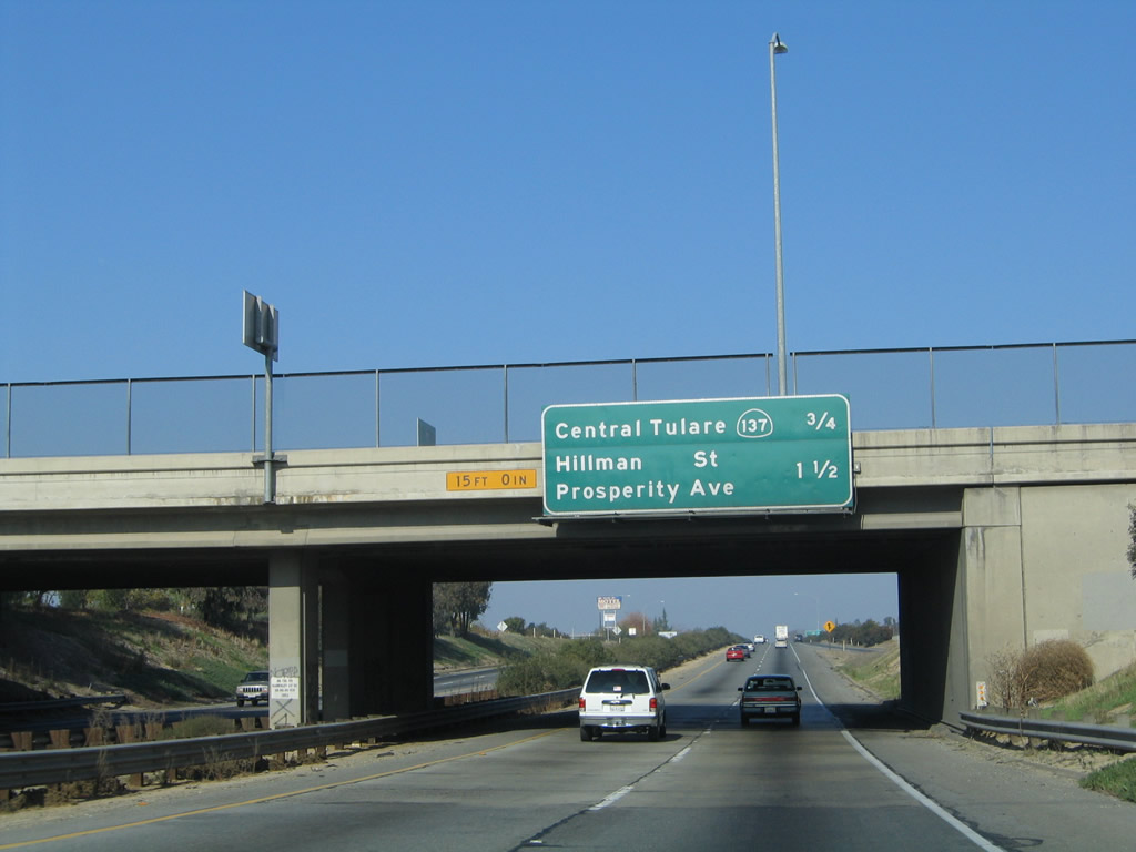
This mileage sign along northbound California 99 provides the distance to the next two exits in Tulare: Exit 87, California 137 (Tulare Avenue) and Exit 88, Hillman Street and Prosperity Avenue. Photo taken 11/25/04. |
|
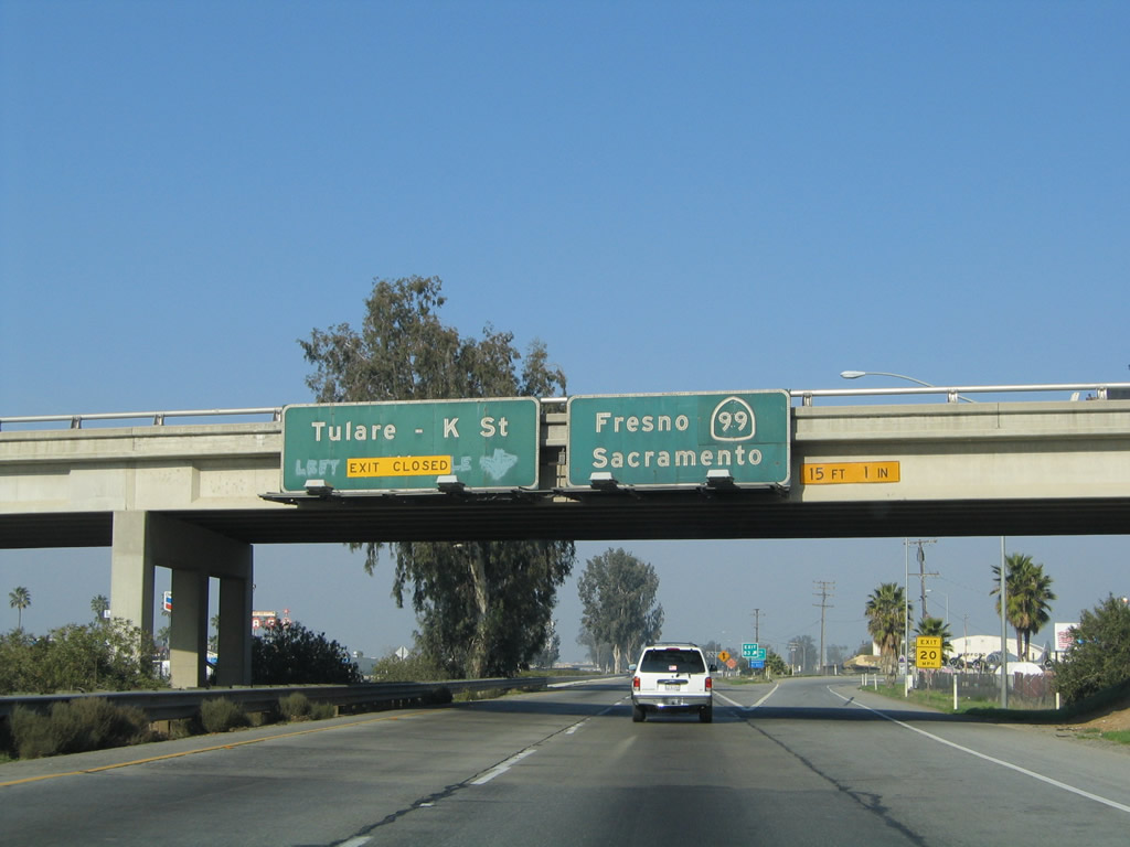
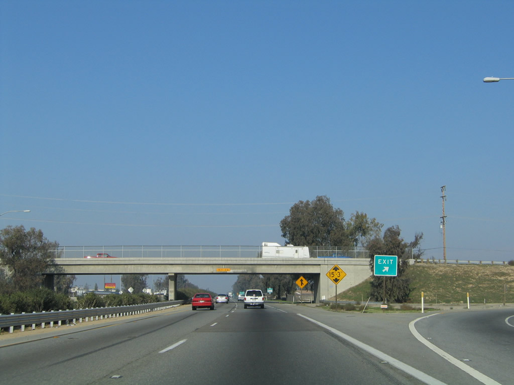
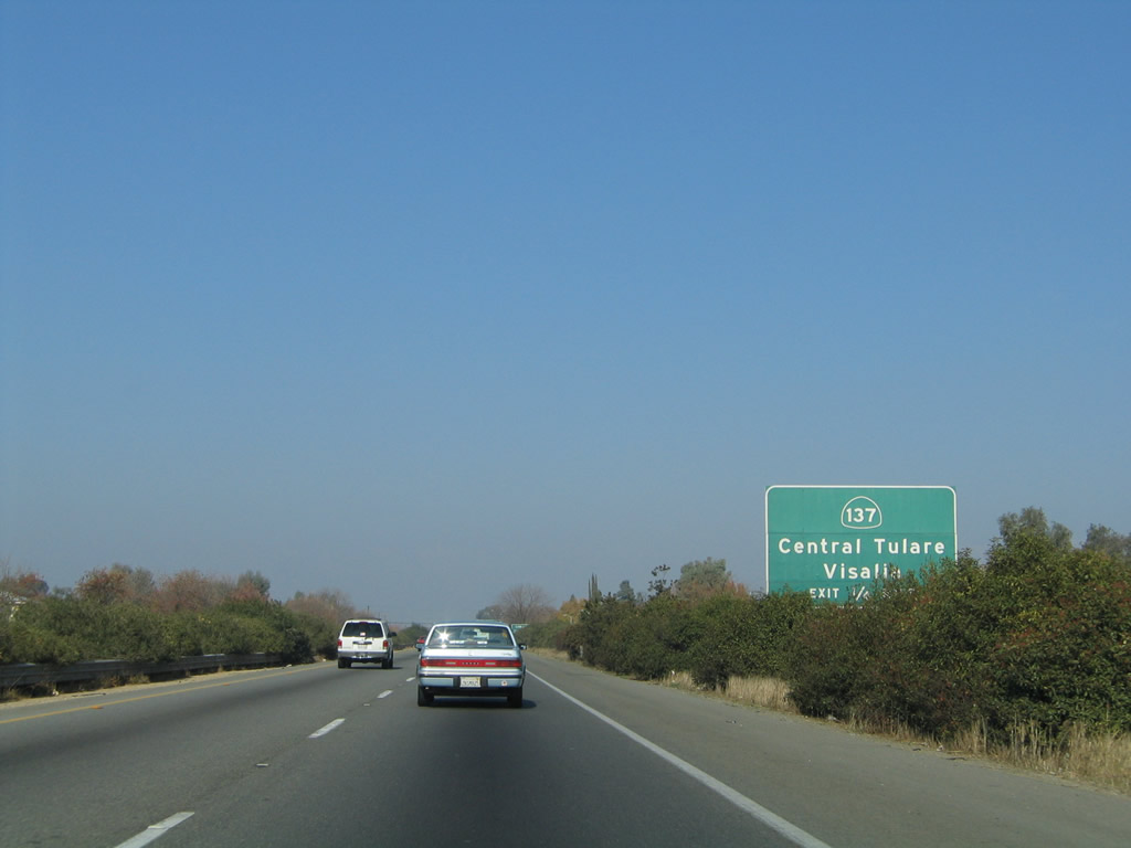
The next exit along California 99 north is Exit 87, California 137 (0.25 mile). California 137 passes through the central part of the city of Tulare just west of the freeway. To the west, California 137 connects to the southern terminus of California 63 before terminating at California 65 at Cairns Corner. Photo taken 11/25/04. |
|
Use California 137 east to Lindsay and California 65. Photo taken 11/25/04. |
|
Northbound California 99 meets Exit 87, California 137 in Tulare. California 137 leads west to the city of Corcoran. It also leads east to meet California 65 near Lindsay. Photo taken 11/25/04. |
Page Updated February 12, 2012.