
California 99 North - Fresno County
| California 99 north | ||
|---|---|---|
 |
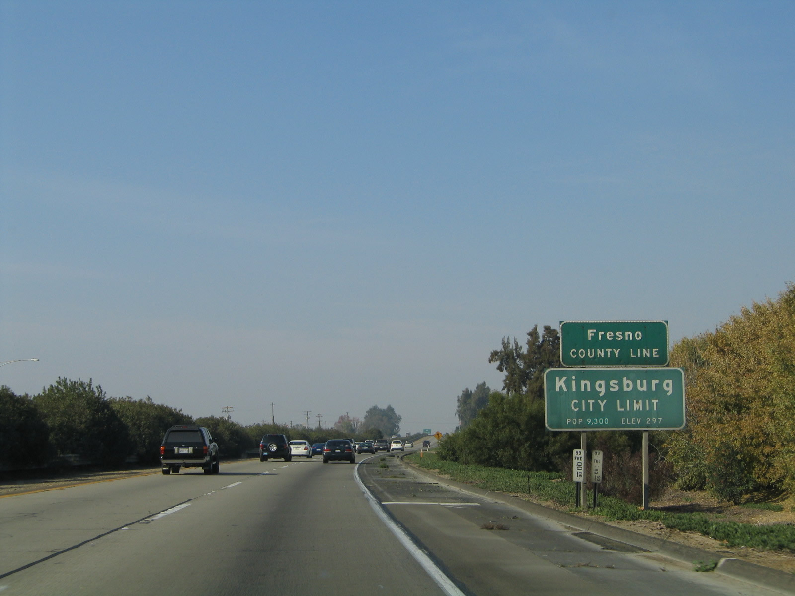 |
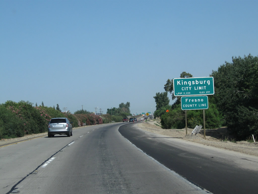
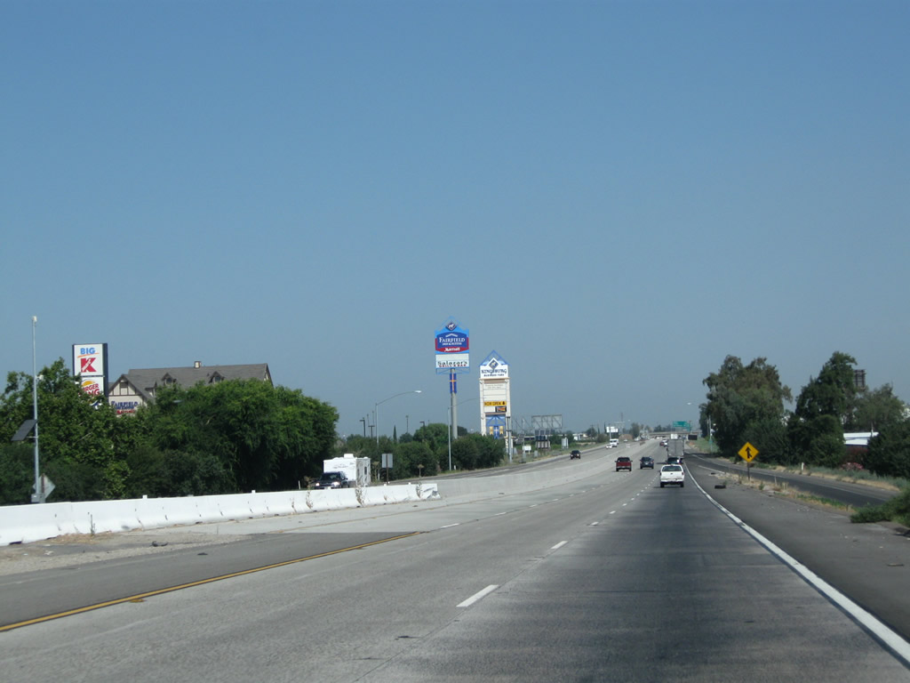
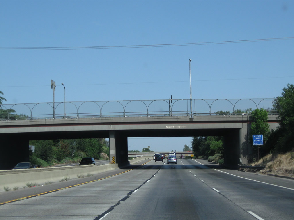
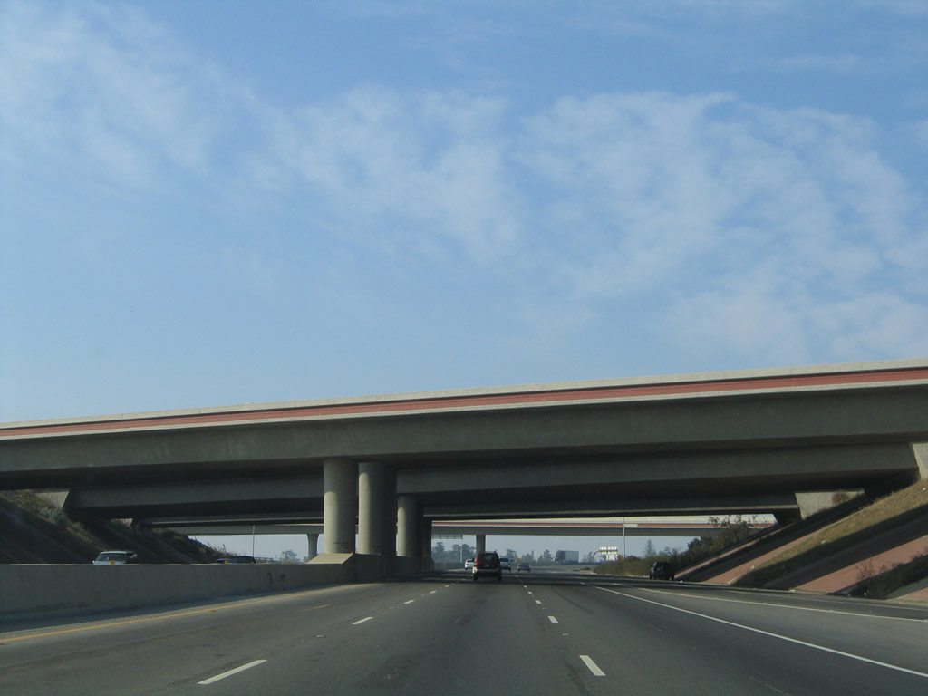
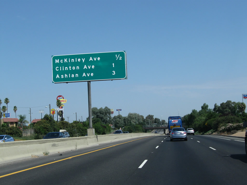
California 99 leaves Tulare County and enters Fresno County and the city of Kingsburg. Fresno County is one of the more populous counties in California, with 930,450 residents as of the 2010 Census. The county spans the Central Valley (San Joaquin Valley), with both Interstate 5 and California 99 crossing the county from south to north. Kingsburg, the first city along California 99 in Fresno County, had a population of 11,382 as of the 2010 Census and was incorporated on May 29, 1908. Photos taken 07/31/11 and 11/25/04. |
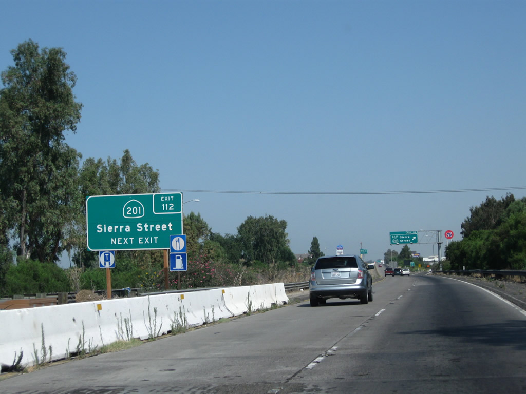 |
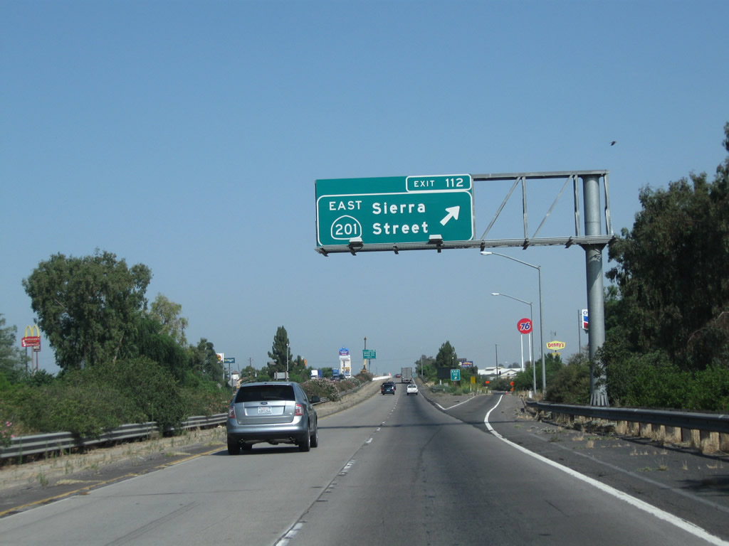
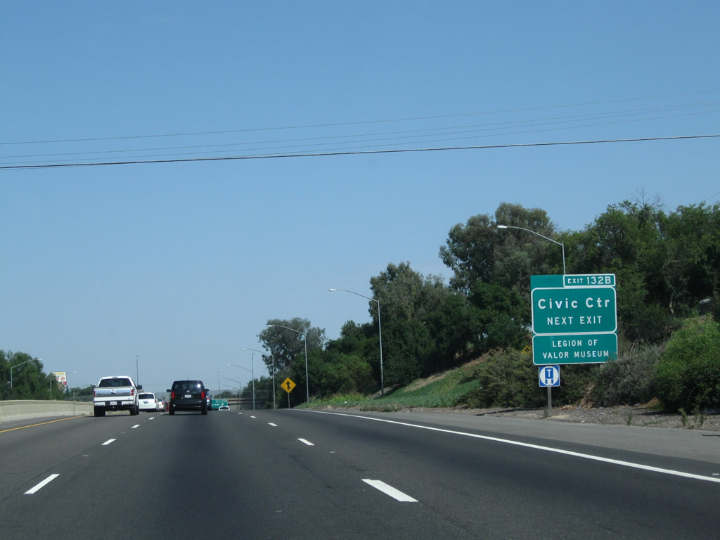
California 201 is a short east-west state route that begins here at this interchange and travels east through Kingsburg to Dinuba, Orosi, and Yettem before ending at California 245 north of Woodlake. Photo taken 07/31/11. | |
 |
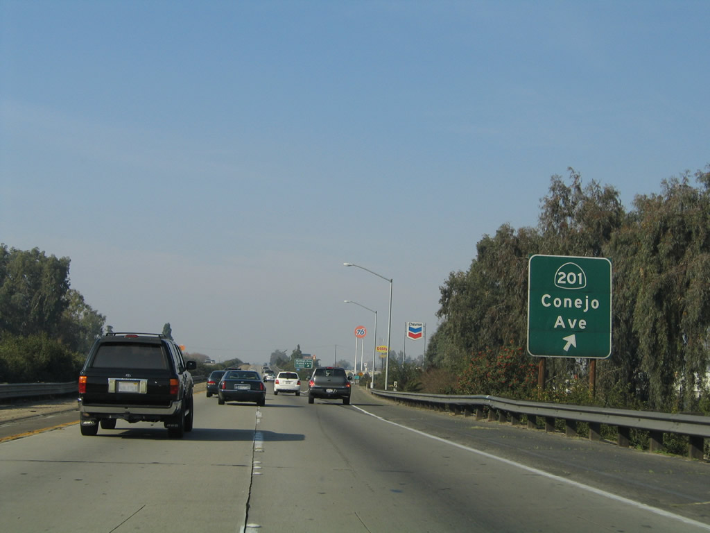 |
Northbound California 99 (Golden State Highway) meets Exit 112, California 201 (Sierra Street) east to Kingsburg and Sierra Street west to Conejo Avenue en route to Conejo and California 43. Photos taken 07/31/11 and 11/25/04. |
 |
 |
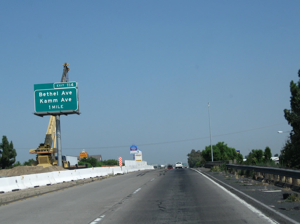
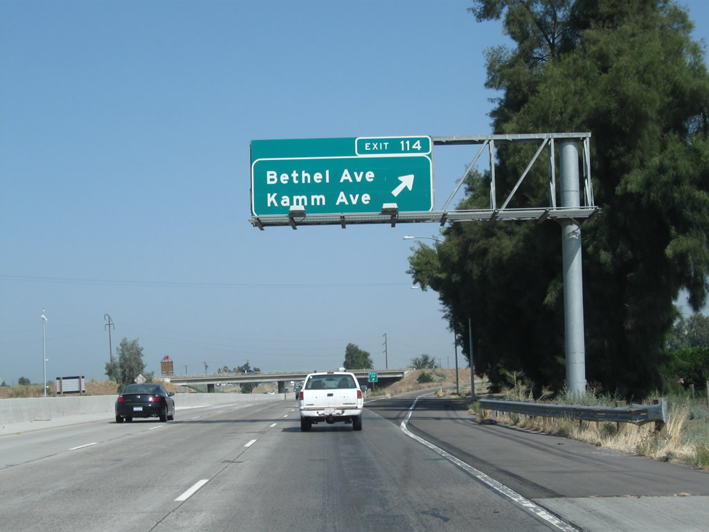
The next exit along California 99 north is Exit 114, Bethel Avenue and Kamm Avenue. Bethel Avenue travels north to the Sun-Maid Growers Visitor Center. This part of the Central Valley is famous for its raisins, which are dried grapes. Kamm Avenue is an east-west highway that meets Bethel Avenue at this interchange. Photos taken 07/31/11 and 11/25/04. |
 |
Upon crossing over California 201 (Sierra Street), California 99 north widens to three lanes. Plans call for all of California 99 in the San Joaquin Valley to be widened to three lanes in each direction; construction efforts are visible on the bridge over Sierra Street. Photo taken 07/31/11. | |
 |
This California 99 north reassurance shield is posted after the on-ramp from California 201 (Sierra Street). Ahead, the next exit is to Bethel Avenue and Kamm Avenue. Photo taken 07/31/11. | |
 |
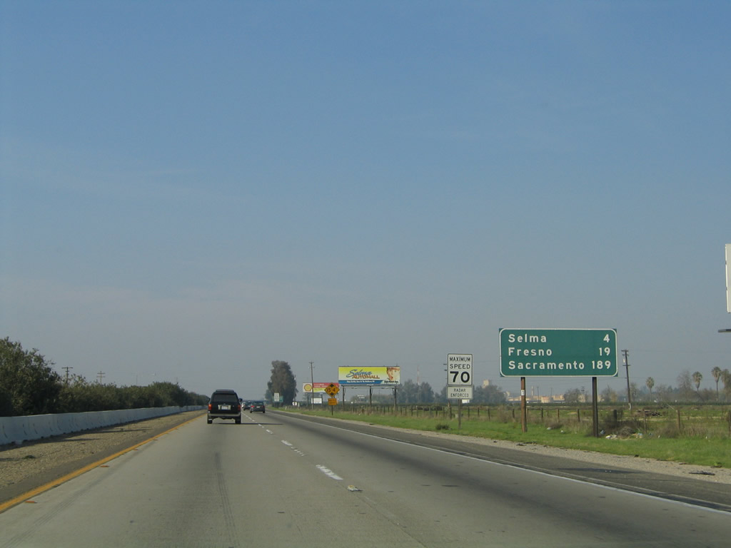 |
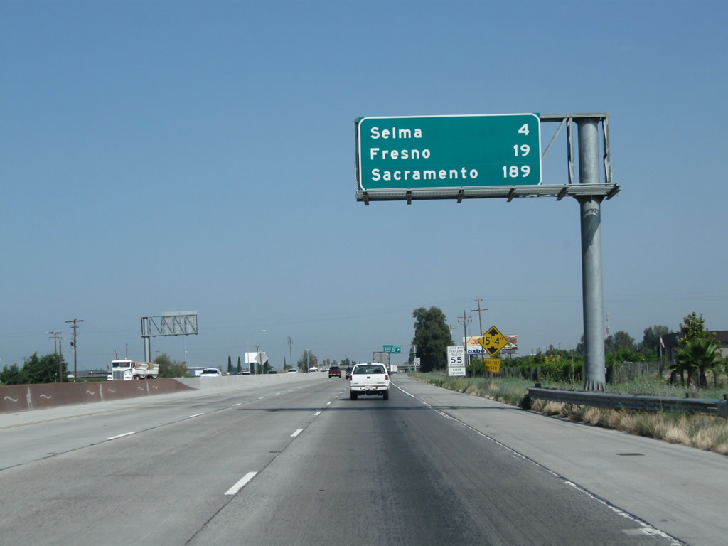
This mileage sign along California 99 north provides the distance to Selma (four miles); Fresno (19 miles); and Sacramento (189 miles). Photos taken 07/31/11 and 11/25/04. |
 |
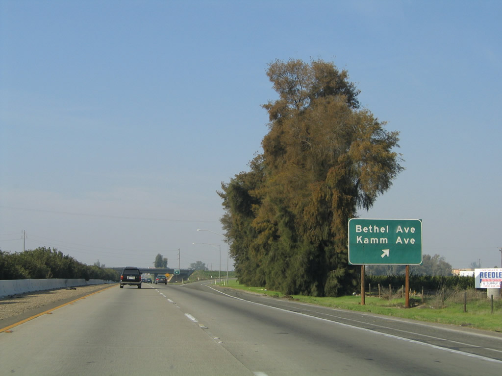 |
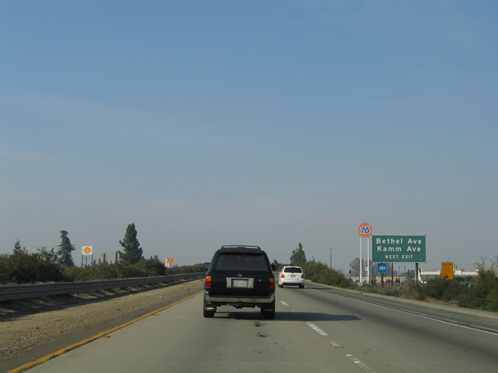
Northbound California 99 (Golden State Highway) meets Exit 114, Bethel Avenue and Kamm Avenue. Photos taken 07/31/11 and 11/25/04. |
 |
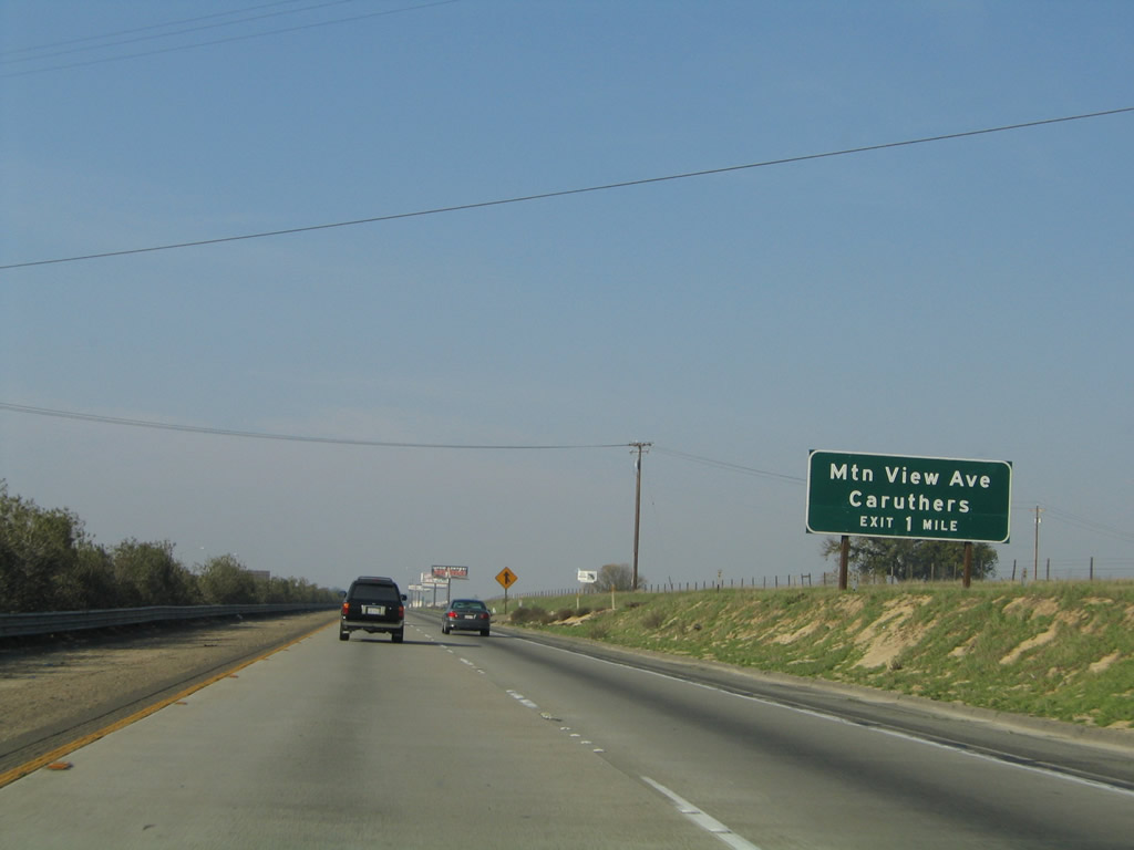 |
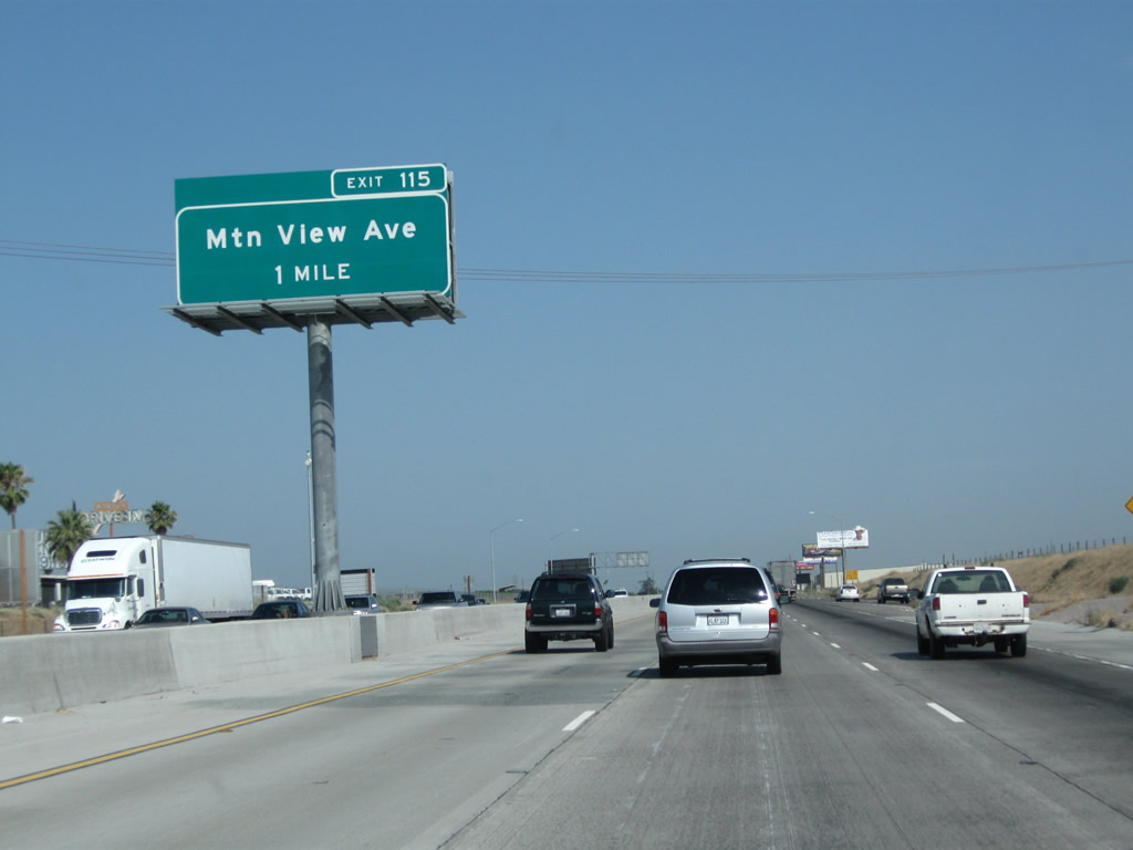
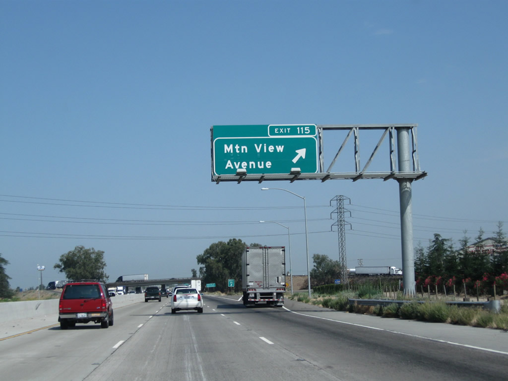
The next exit along California 99 north is Exit 115, Fresno County J-40 (Mountain View Avenue). Note the freeway expansion that resulted in an additional left lane through here; it was added between 2004 and 2011. Photos taken 07/31/11 and 11/25/04. |
 |
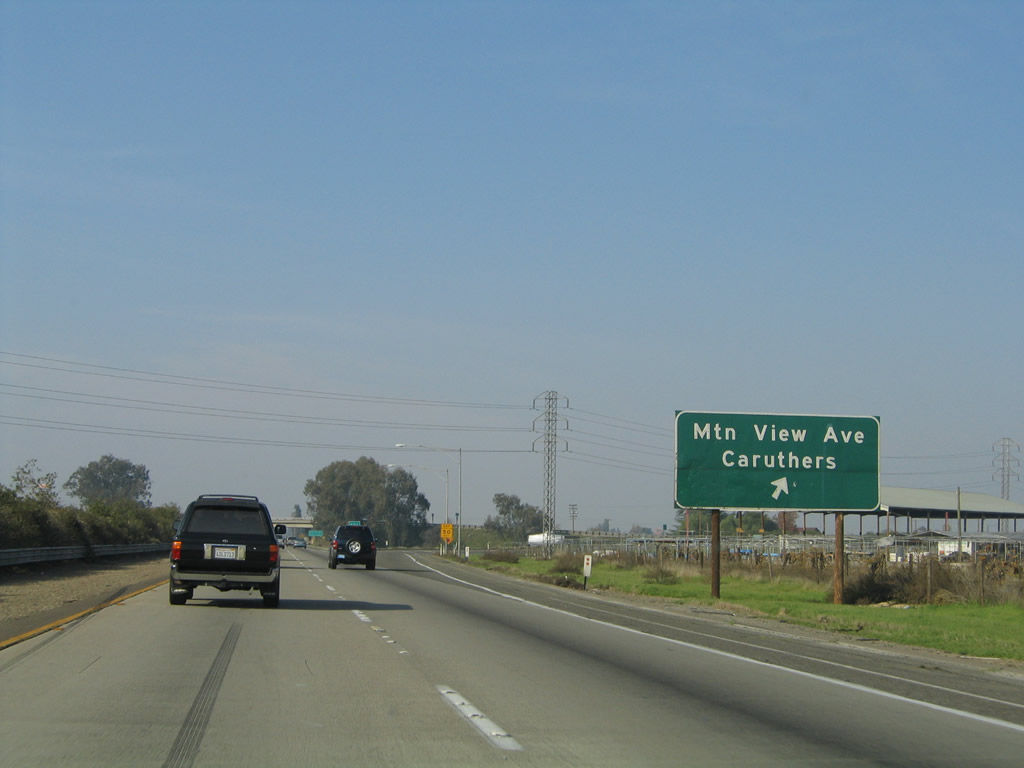 |
Northbound California 99 meets Exit 115, Fresno County J-40 (Mountain View Avenue). J-40 is an east-west, mostly unsigned county route that extends from California 99 Exit 115 east to Dinuba, ending at California 63 in Orosi. To the west, use Mountain View Avenue to California 43 (Central Valley Highway), California 41, and Caruthers. Photos taken 07/31/11 and 11/25/04. |
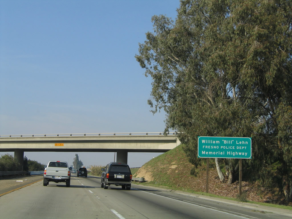 |
This section of California 99 is dedicated to Fresno Police Officer William Lehn. Photo taken 08/15/03. | |
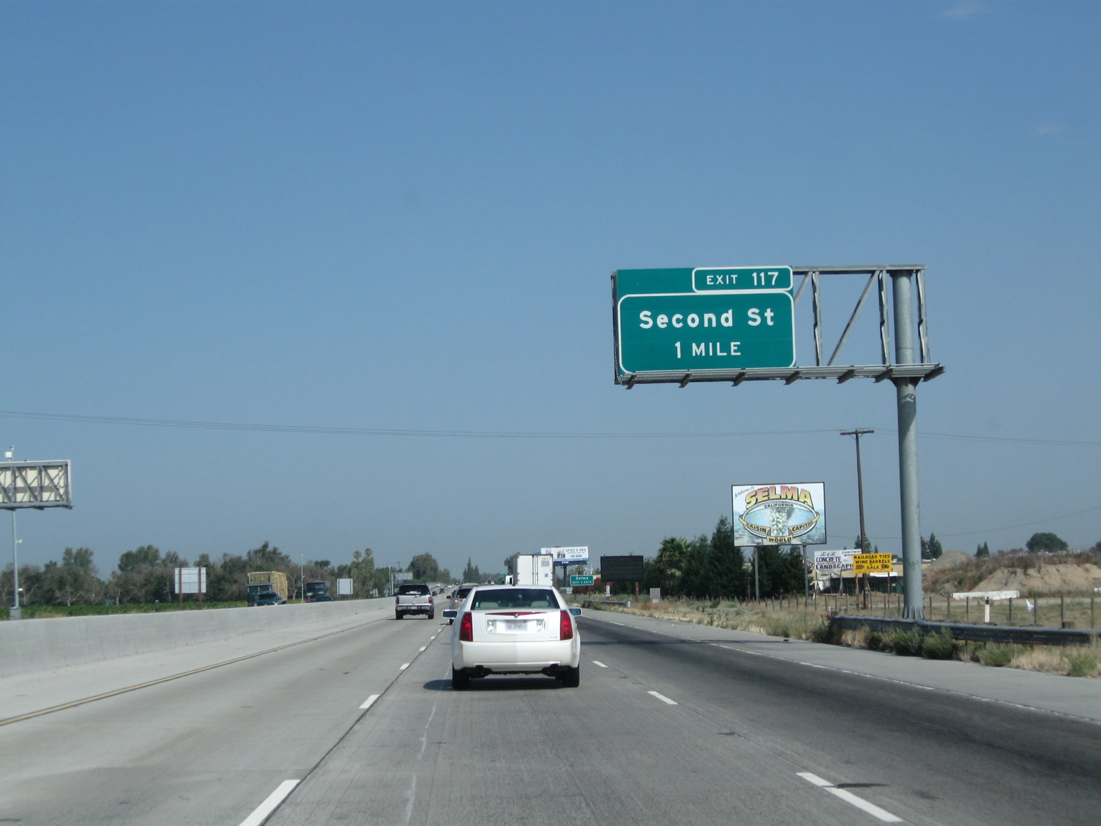 |
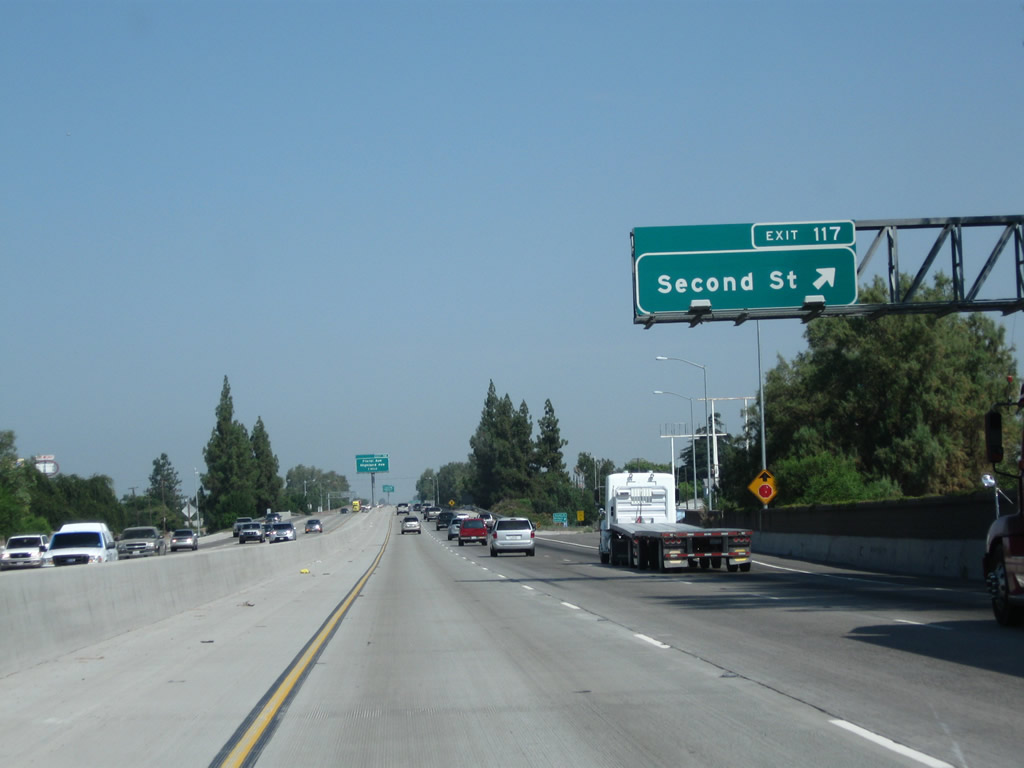
The next exit along California 99 north is Exit 117, Second Street (one mile). This is the first of two interchanges that serve the city of Selma, which is noted on the billboard as being the "Raisin Capital of the World." Photo taken 07/31/11. |
 |
Both Exit 117, Second Street and Exit 118, Floral Avenue and California 43 (Highland Avenue) will serve the city of Selma. Photo taken 07/31/11. |
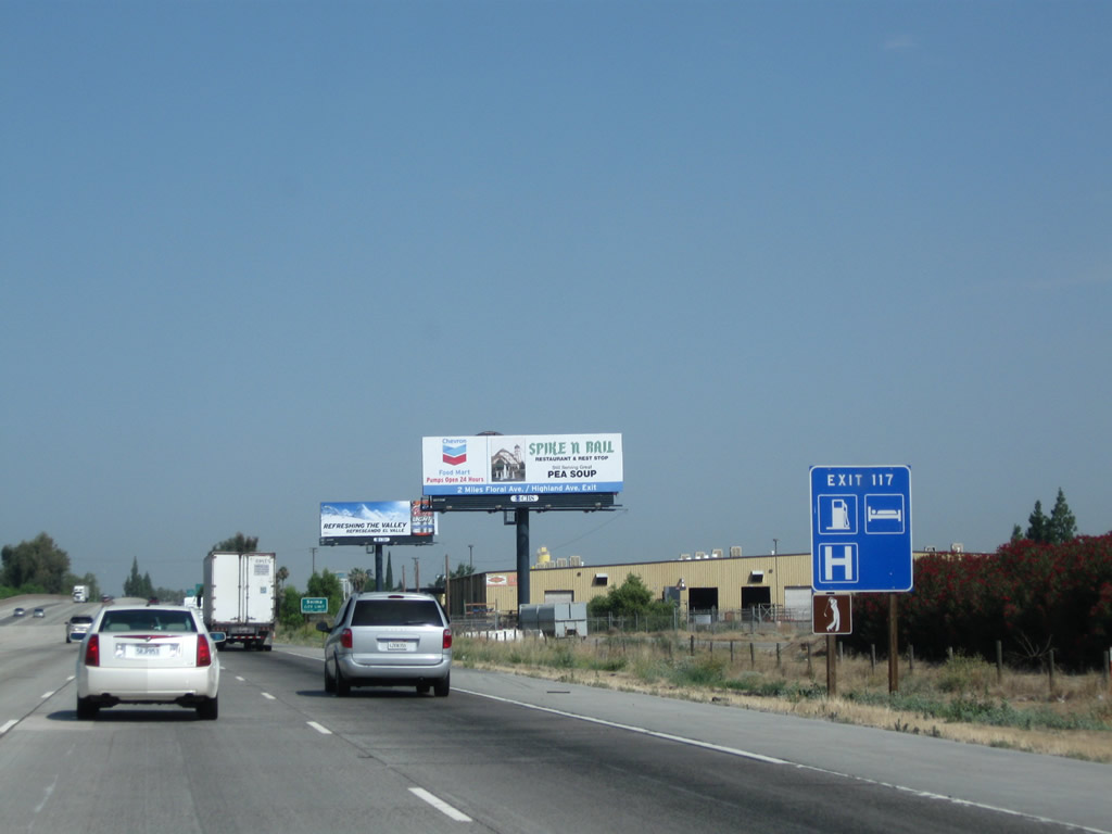 |
Most motorist services (gas, lodging, hospital, and golf course) are available at Exit 117, Second Street in Selma. Photo taken 07/31/11. |
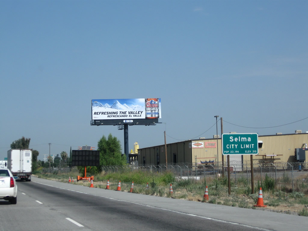 |
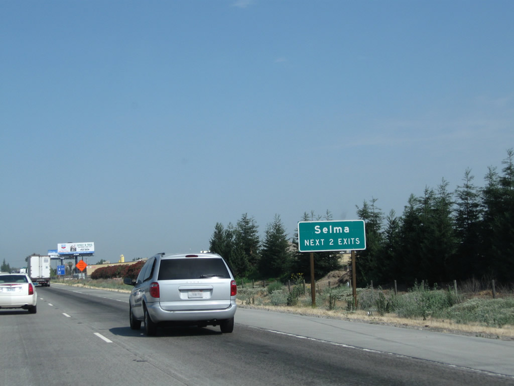
California 99 enters the city of Selma, the "Raisin Capital of the World." Selma had a population of 23,219 as of the 2010 Census and was incorporated on March 15, 1893. Photo taken 07/31/11. |
 |
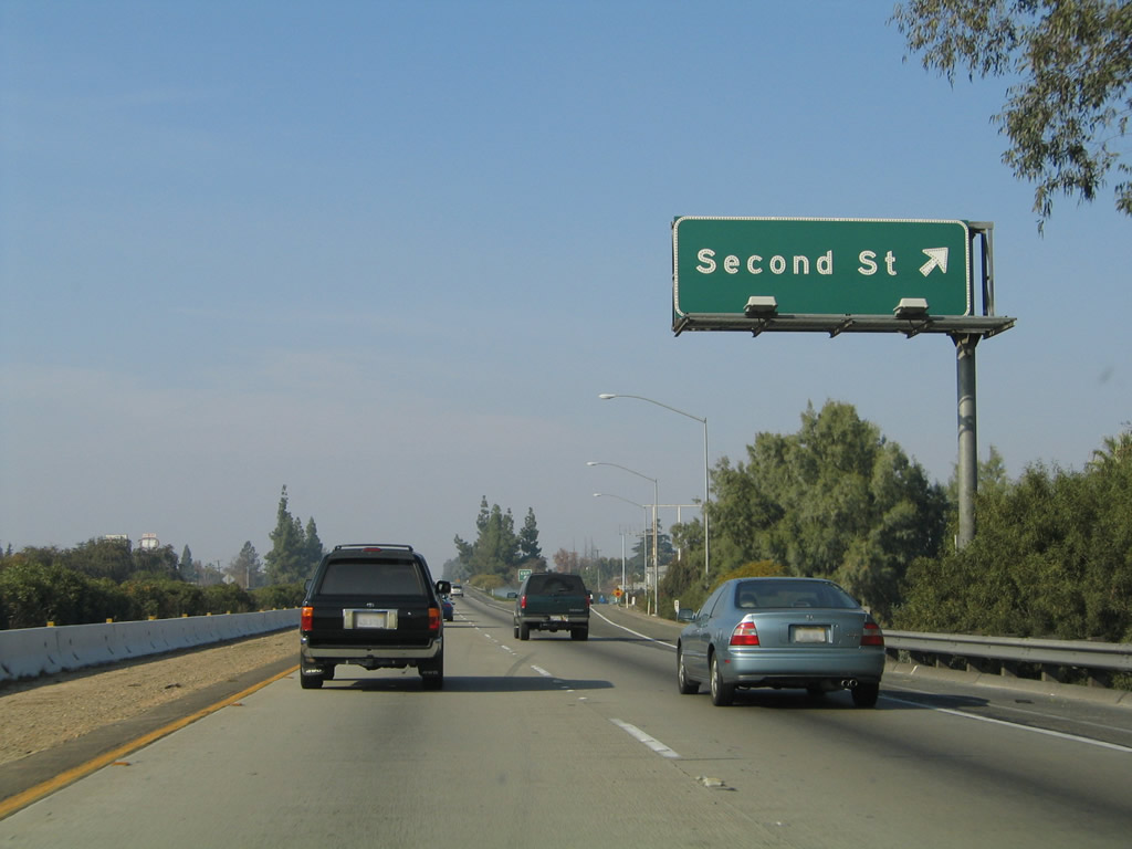 |
Northbound California 99 reaches Exit 117, Second Street, which serves the city of Selma. Use Second Street southwest to Nebraska Avenue west en route to Monmouth or northeast to connect to McCall Avenue north to Clotho. Photos taken 07/31/11 and 11/25/04. |
 |
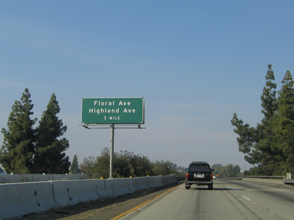 |
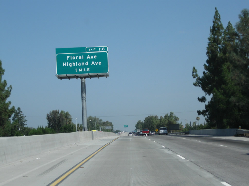
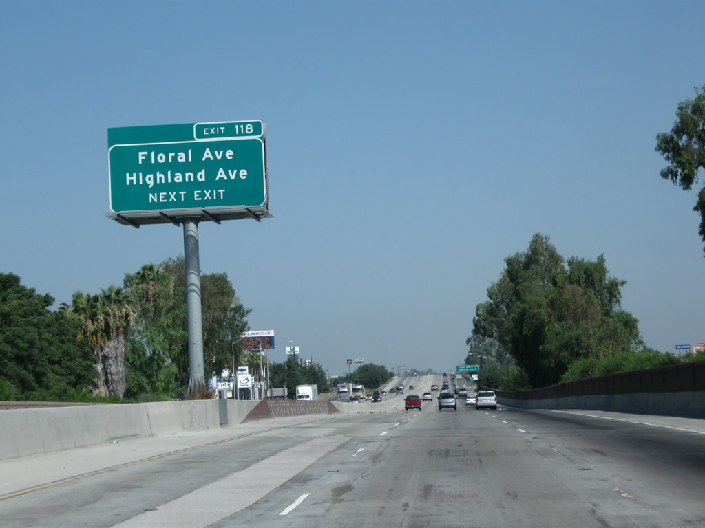
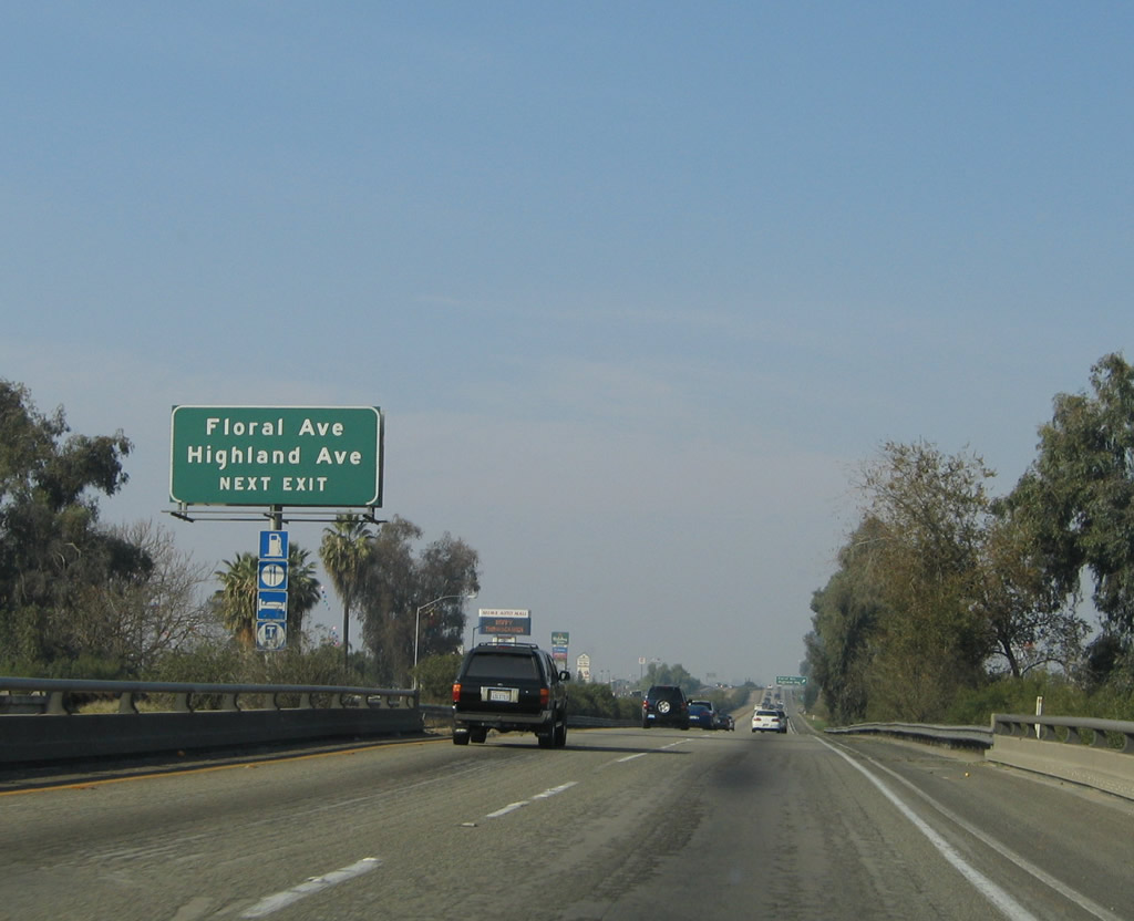
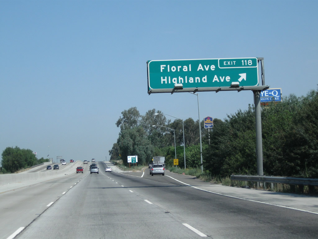
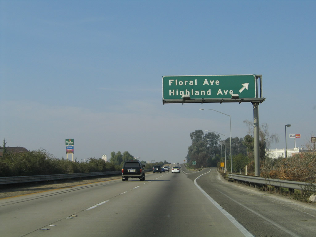
The next exit along California 99 north is Exit 118, Floral Avenue east/west, California 43 (Highland Avenue) south, and Highland Avenue north. Floral Avenue travels east to Selma and west to Monmouth. California 43 (Highland Avenue) travels south to Hanford and Corcoran. Highland Avenue continues north of this interchange to end at Dinuba Avenue. To Old U.S. 99/Golden State Boulevard, follow Highland Avenue north. Photos taken 07/31/11 and 11/25/04. |
 |
 |
California 43 is not signed from northbound California 99 since it is an illogical connection to connect to another state highway traveling south. However, this important state highway (generally known as the Central Valley Highway) begins at California 119 (Taft Highway) and travels north through Shafter, Wasco, Corcoran, and Hanford before culminating here in Selma. The upcoming interchange features most motorist services, including gas, food, and lodging. Photos taken 07/31/11 and 11/25/04. |
 |
 |
Northbound California 99 (Golden State Highway) reaches Exit 118, Floral Avenue east to Selma, Floral Avenue west to Selma Airport and California 41, California 43 (Highland Avenue) south to Hanford, and Highland Avenue north to Old U.S. 99/Golden State Boulevard and Dinuba Avenue. Photos taken 07/31/11 and 11/25/04. |
 |
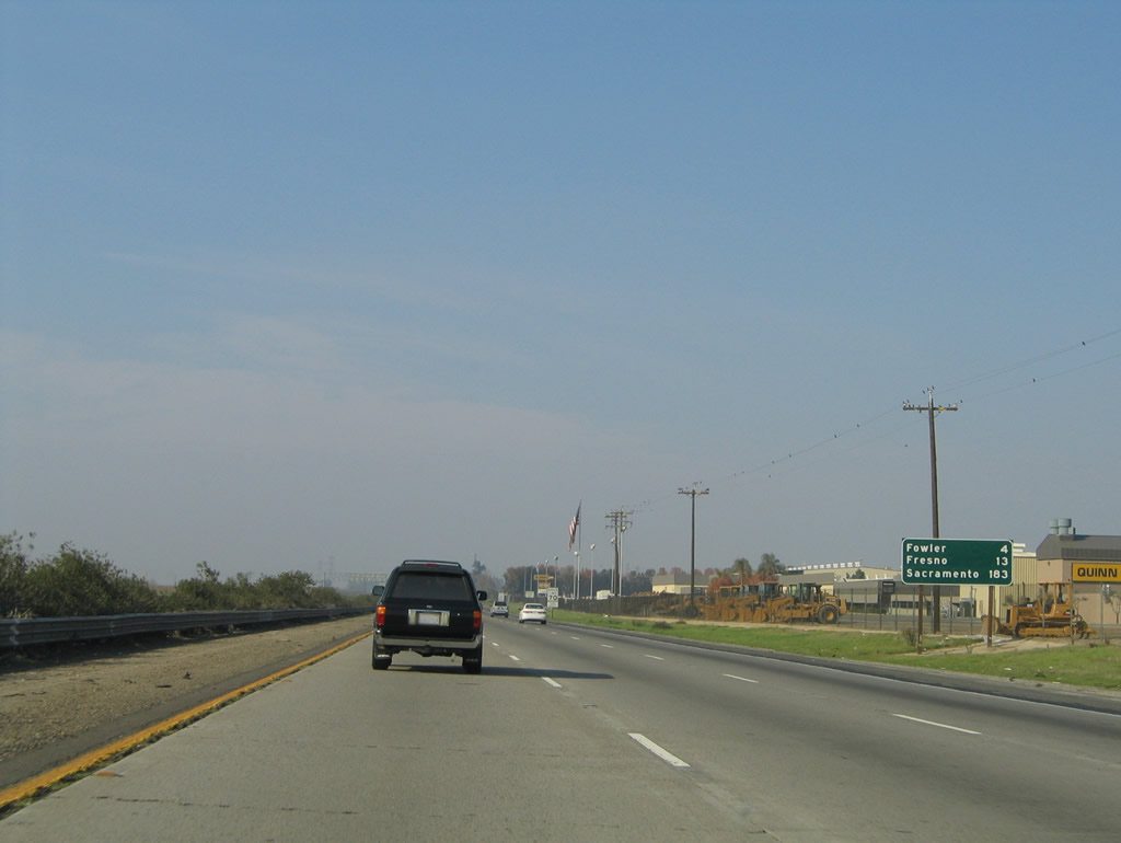 |
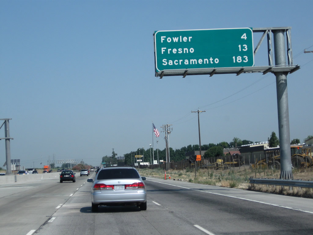
Leaving the California 43 interchange behind, this mileage sign along California 99 north provides the distance to Fowler (four miles), Fresno (13 miles), and Sacramento (183 miles). When the third lane was added through this area between Selma and Fowler, this sign was elevated and moved onto a sign bridge. Photos taken 07/31/11 and 11/25/04. |
 |
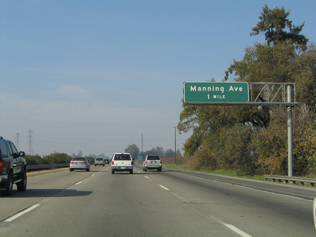 |
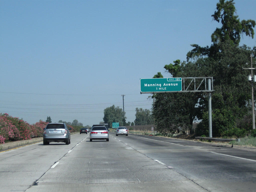
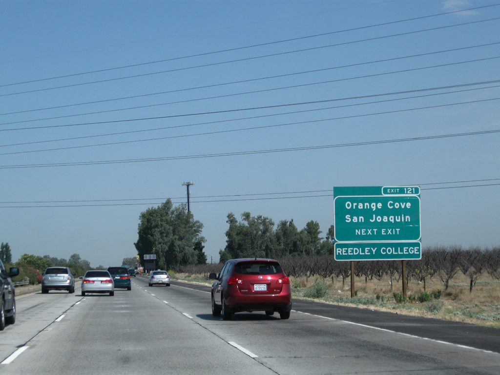
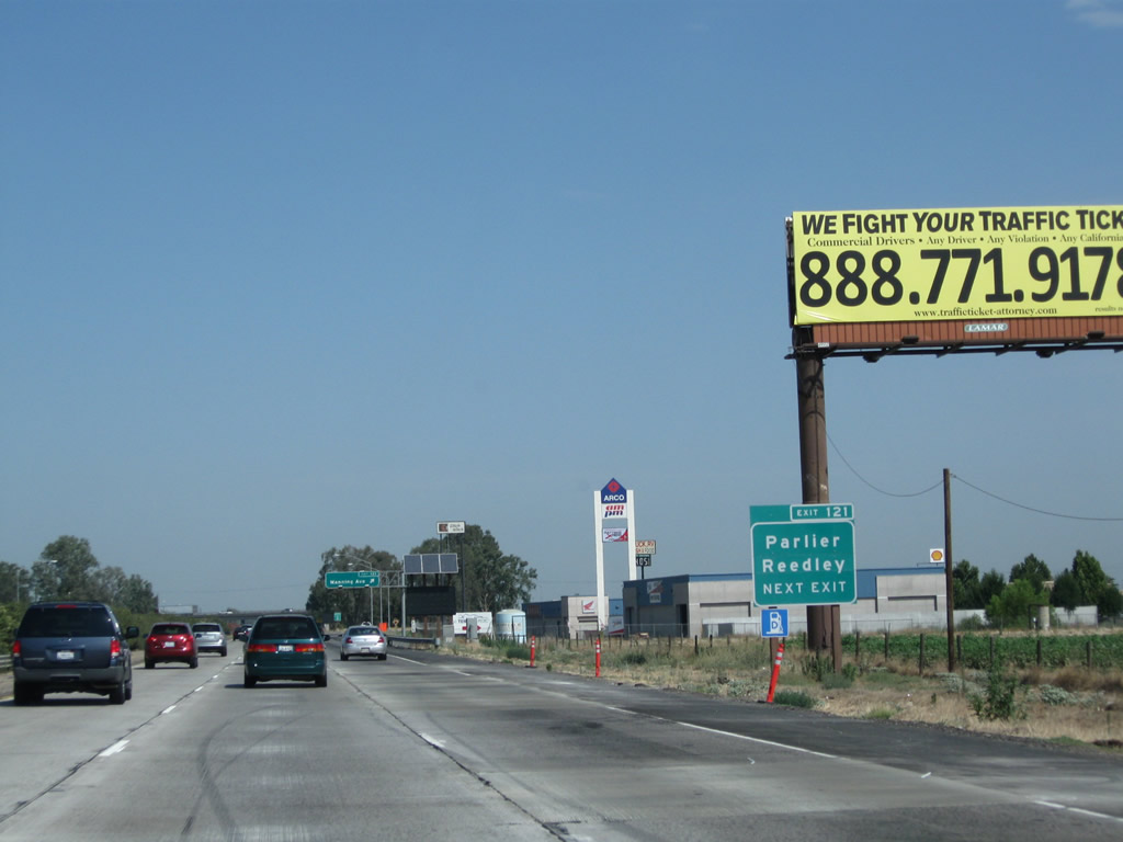
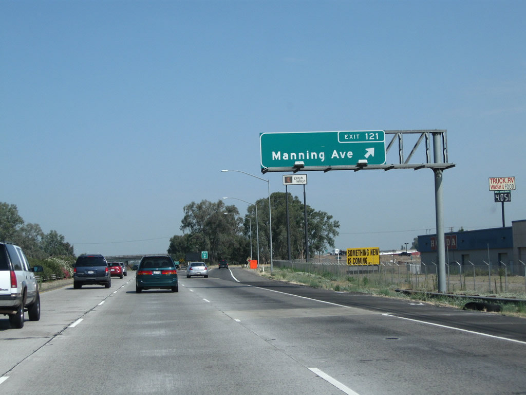
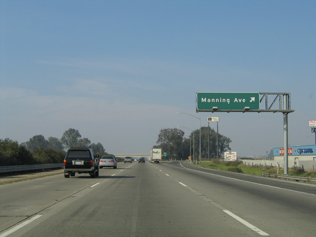
The next exit along California 99 north is Exit 121, Manning Avenue (one mile). This major, east-west county highway crosses the Central Valley and links Interstate 5, California 99, and California 63. The portion of Manning Avenue between Alta Avenue and Hills Valley Road is also designated as part of County Route J-19, which ultimately connects to Orange Cove. Photos taken 07/31/11 and 11/25/04. |
 |
Use Manning Avenue west to Bowles, Raisin City, San Joaquin, and Interstate 5 Exit 365. To the east, Manning Avenue passes through Parlier and Reedley before ending at California 63. Access to Orange Cove is afforded via CR J-19 (Hills Valley Road) north. Photo taken 07/31/11. | |
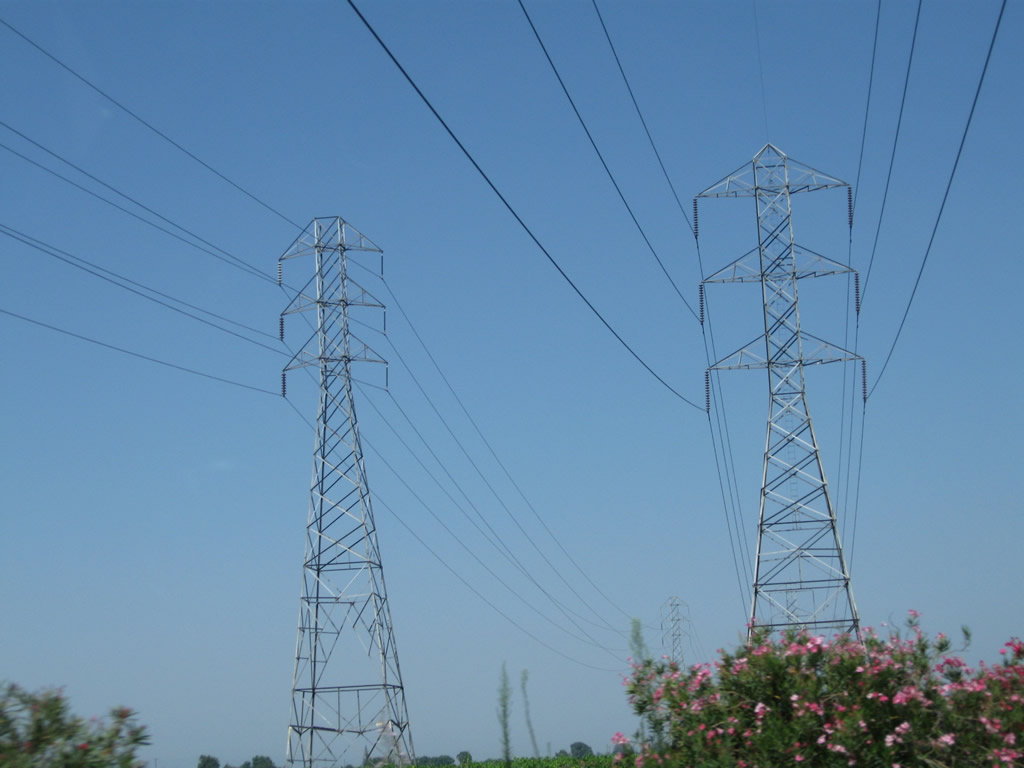 |
A pair of Pacific Gas and Electric power lines pass over California 99 around the same point as the previous picture. The larger of these two lines is a 230kV line that travels due west to link with the major power line corridor that parallels Interstate 5 north of Coalinga. Both lines lead northeast from here into a substation located to the west of Leonard Avenue and north of Manning Avenue just a short distance away from the freeway. Photo taken 07/31/11. | |
 |
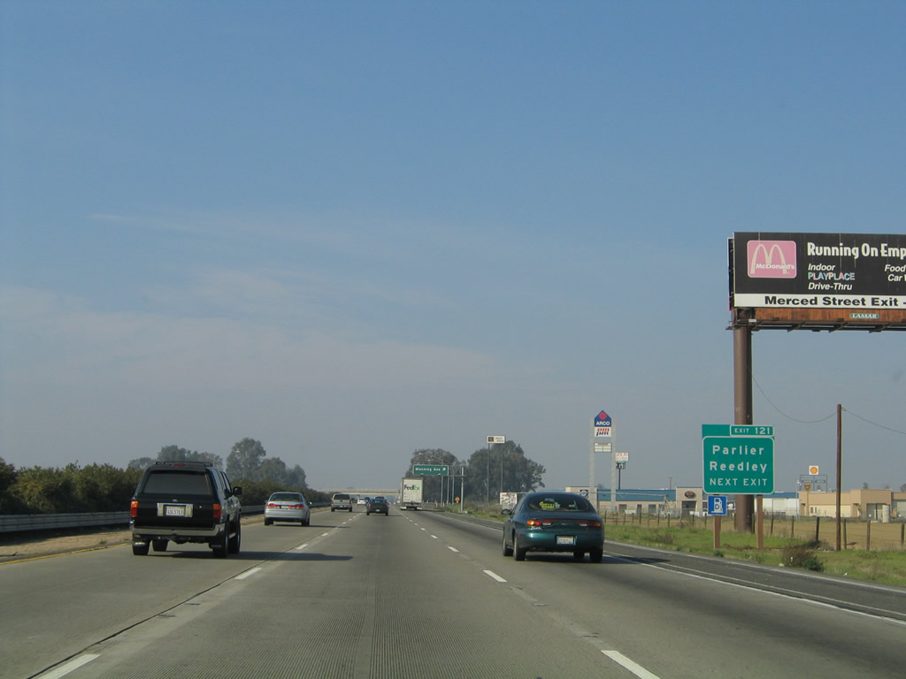 |
As noted above, use Manning Avenue west to Bowles, Raisin City, San Joaquin, and Interstate 5 Exit 365. To the east, Manning Avenue passes through Parlier and Reedley before ending at California 63. Access to Orange Cove is afforded via CR J-19 (Hills Valley Road) north. This was the first exit number sign to be posted for Exit 121 along northbound before the overhead signs were posted. Note that this section of California 99 north was widened to three lanes before the section south of California 43. Photos taken 07/31/11 and 11/25/04. |
 |
 |
Northbound California 99 meets Exit 121, Manning Avenue. Gas is available at this interchange. Manning Avenue travels east to Parlier, Reedley, and Orange Cove (via California 63), and it leads west to Bowles, Raisin City, California 145, and San Joaquin. Photos taken 07/31/11 and 11/25/04. |
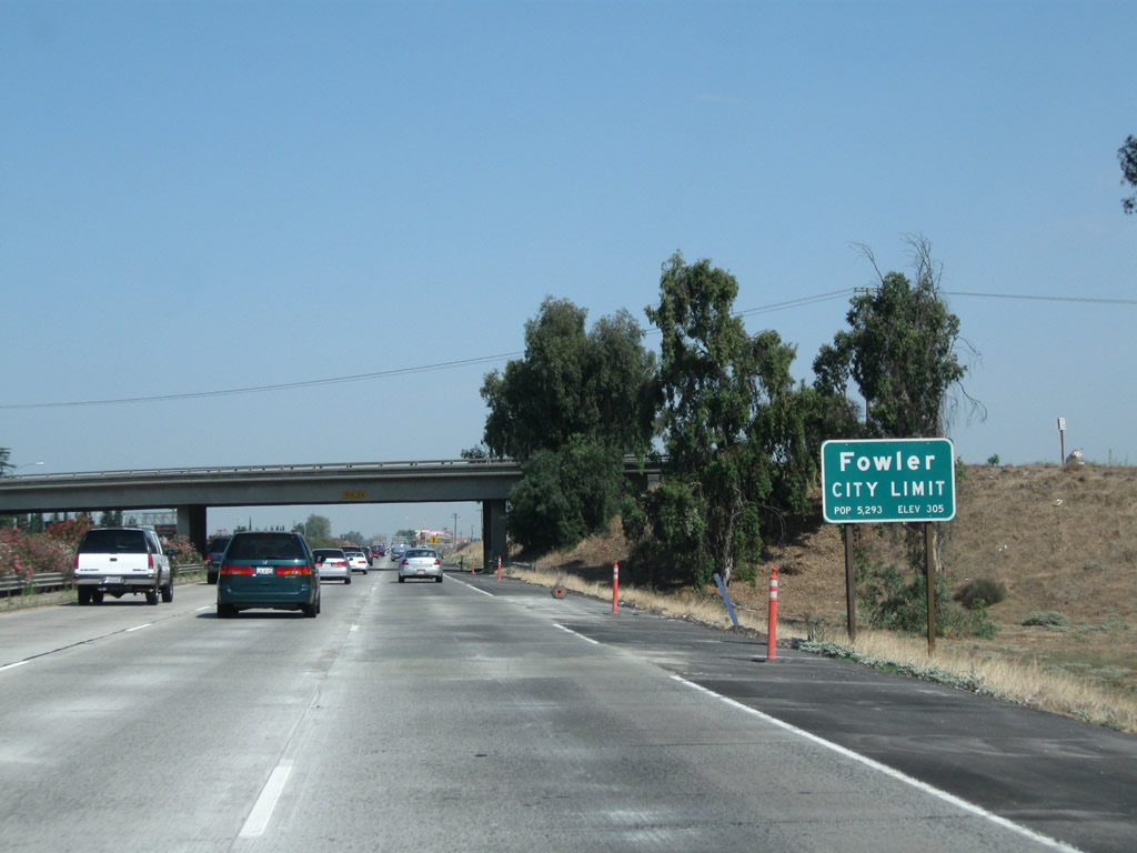 |
Upon passing under Manning Avenue, California 99 enters the city of Fowler ("The Blossom Trail City"). Fowler was incorporated on June 15, 1908, and had a population of 5,570 as of the 2010 Census. The "blossom trail" refers to Fowler's position on the county's official blossom trail, which is notable in the spring for the flowering and fruiting trees (such as citrus, almond, plum, peach, apple, and apricot trees) found along agricultural backroads in the orchards east of California 99. See Fresno County Blossom Trail for more. Photo taken 07/31/11. | |
 |
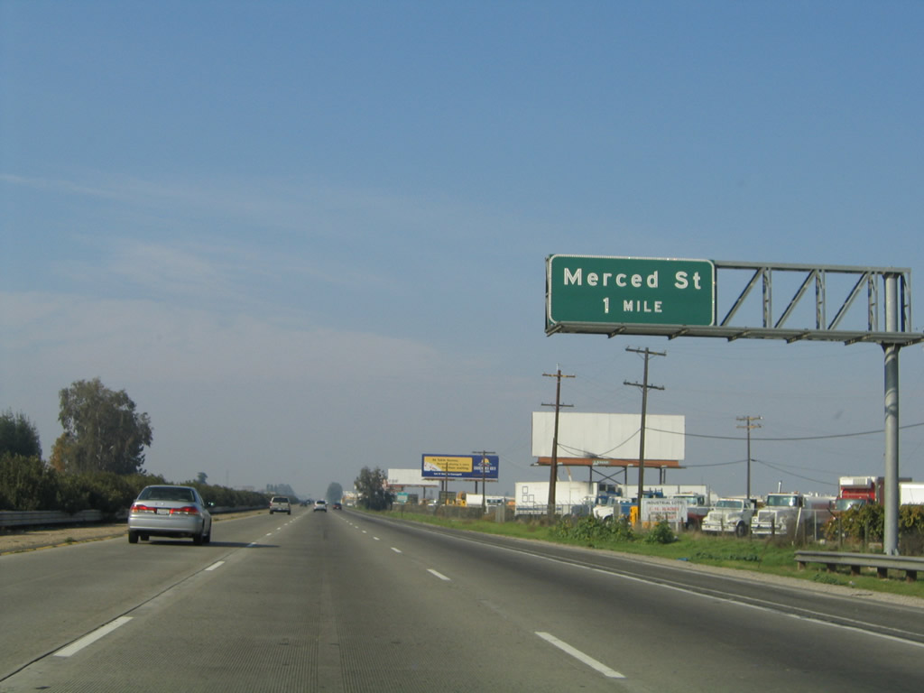 |
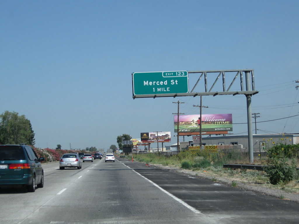
The next exit along California 99 (Golden State Highway) north is Exit 123, Merced Street (one mile). Photos taken 07/31/11 and 11/25/04. |
|
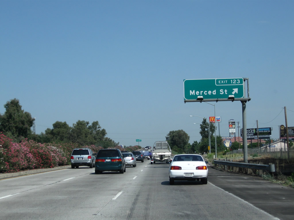
Use Merced Street northeast into downtown Fowler. Motorist services such as gas and food are available at this interchange. Photo taken 07/31/11. | |
 |
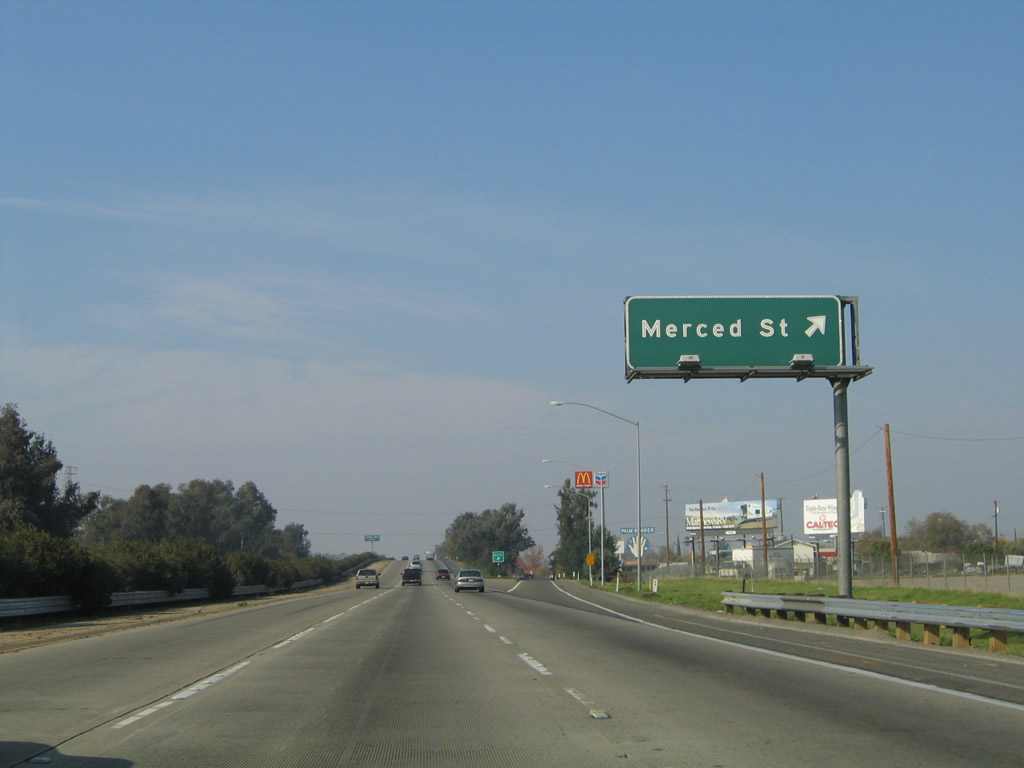 |
Northbound California 99 meets Exit 123, Merced Street in Fowler. Photos taken 07/31/11 and 11/25/04. |
 |
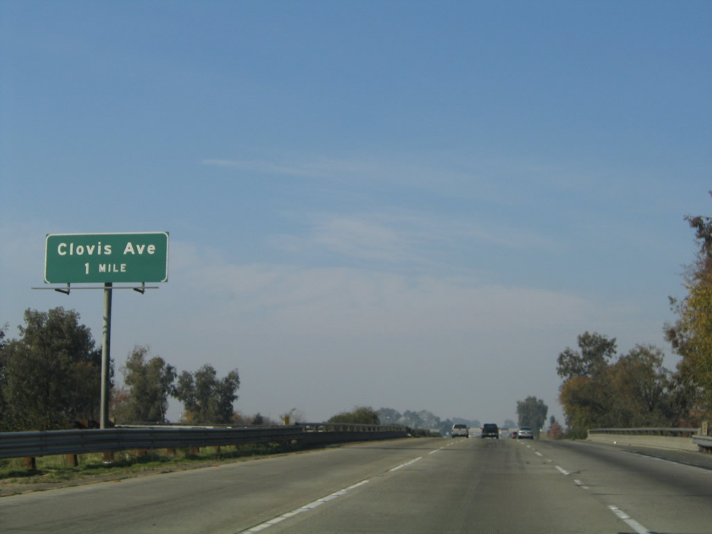 |
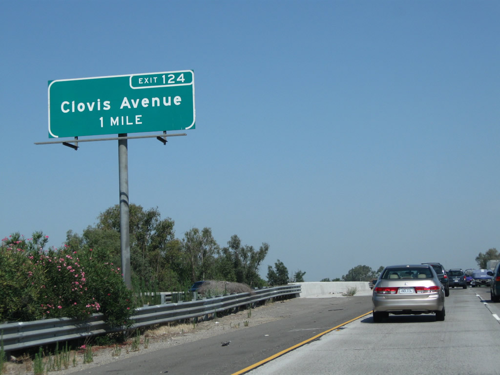
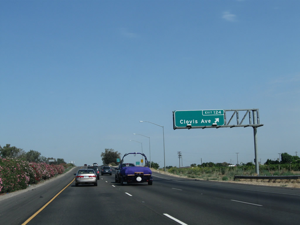
The next exit along California 99 north is Exit 124, Clovis Avenue (one mile). Clovis Avenue is a north-south highway that provides an alternate route to eastbound California 180/Kings Canyon, the Fresno Airport and Clovis. Photos taken 07/31/11 and 11/25/04. |
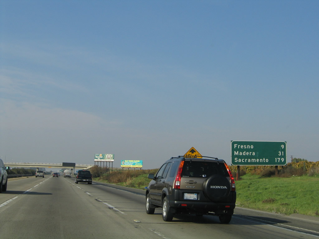 |
As traffic enters the freeway from Merced Street, this mileage sign along California 99 north provides the distance to Fresno (nine miles); Madera (31 miles); and Sacramento (179 miles). Photo taken 11/25/04. | |
 |
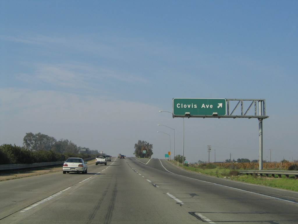 |
Northbound California 99 meets Exit 124, Clovis Avenue. Photos taken 07/31/11 and 11/25/04. |
 |
 |
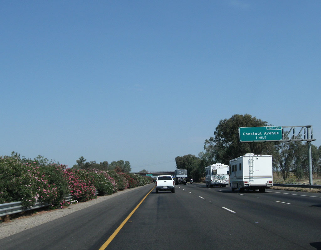
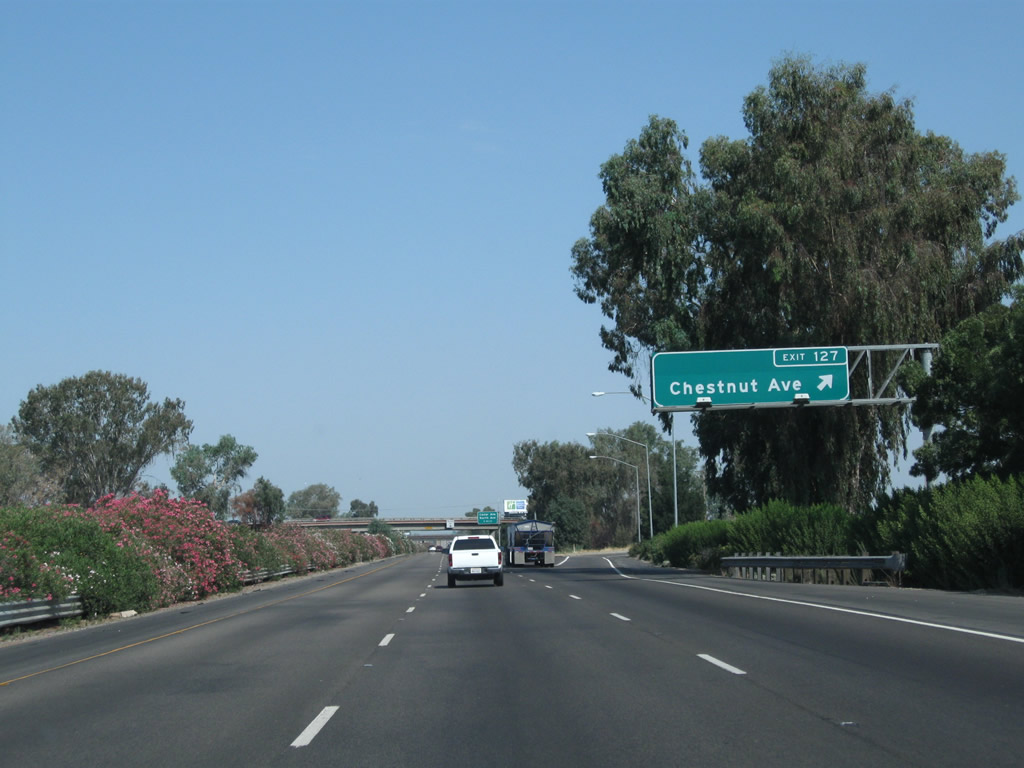
The next exit along California 99 north is Exit 127, Chestnut Avenue (one mile). Photos taken 07/31/11 and 11/25/04. |
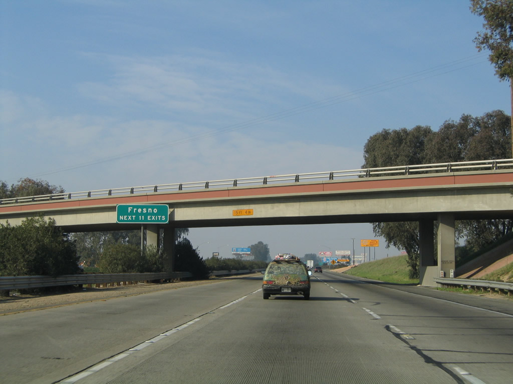 |
The next 11 interchanges serve the city of Fresno. Fresno is considered to be the largest city in the United States that is not served by an Interstate Highway. Photo taken 11/25/04. | |
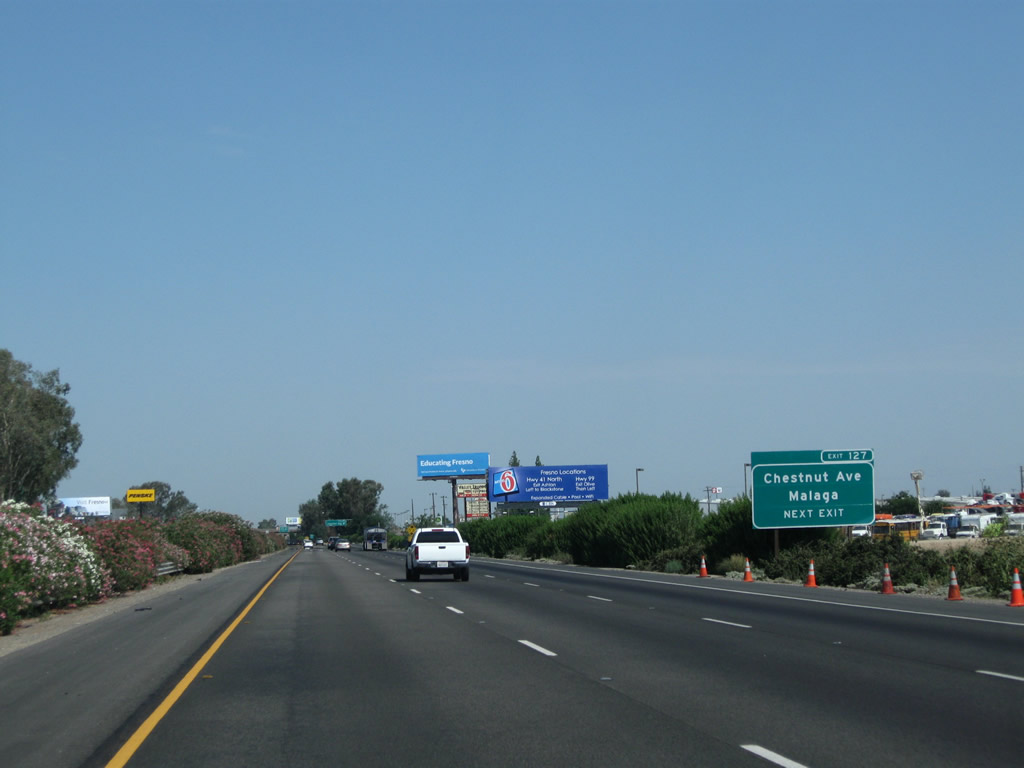 |
Use Chestnut Avenue north to the unincorporated community of Malaga. Photo taken 07/31/11. | |
 |
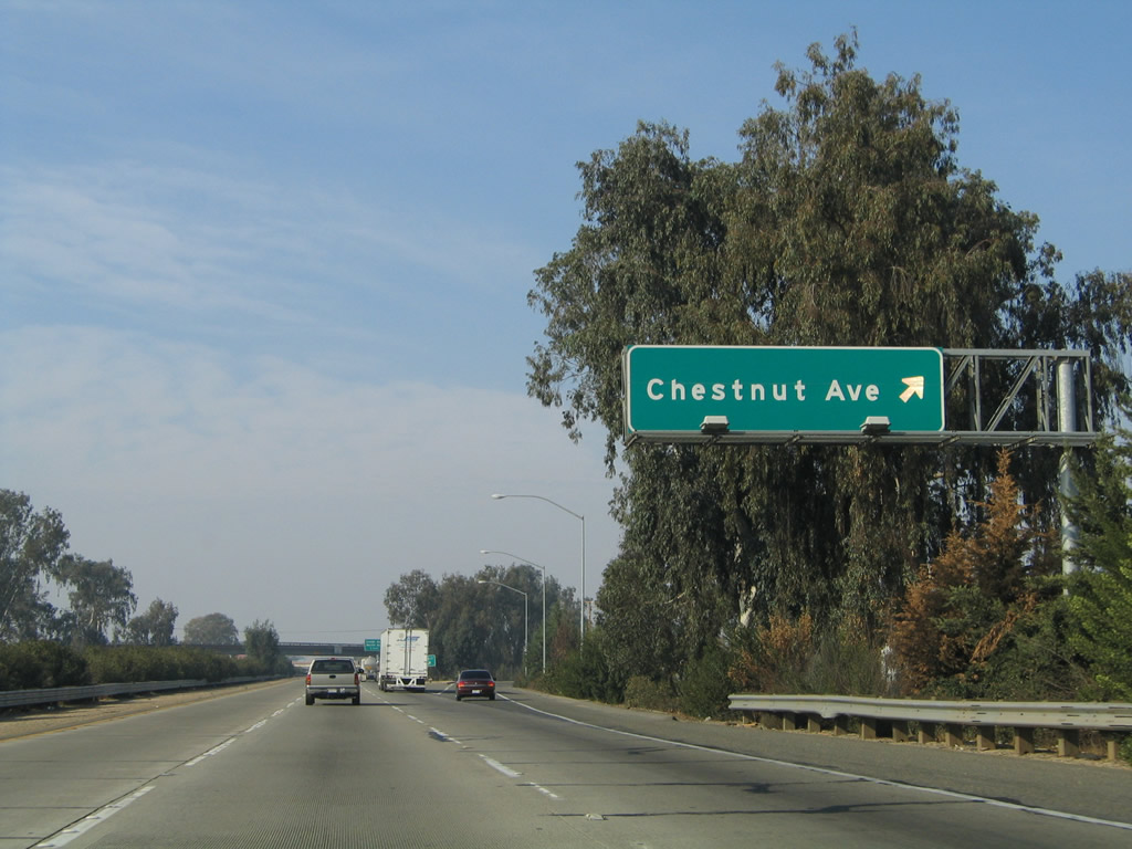 |
Northbound California 99 meets Exit 127, Chestnut Avenue. Photos taken 07/31/11 and 11/25/04. |
 |
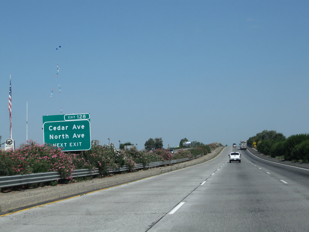
The next exit along California 99 is Exit 128, Cedar Avenue and North Avenue. This interchange consists of two half-diamond interchanges: one half-diamond with north-south Cedar Avenue (Exit 128 northbound) and another half-diamond with east-west North Avenue (southbound's Exit 129). Exiting traffic from northbound will connect directly to Cedar Avenue, with a right turn onto Cedar Avenue north to reach North Avenue. Photo taken 07/31/11. | |
 |
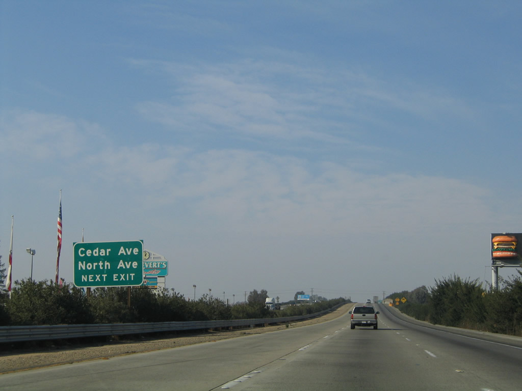 |
Cedar Avenue is a major, north-south, farm-to-market county road that travels south toward Oleander and north to end at Historic U.S. 99/Golden State Boulevard. North Avenue is a major, east-west, farm-to-market county road that travels east to connect with Clovis Avenue and west to connect with California 41. Photos taken 07/31/11 and 11/25/04. |
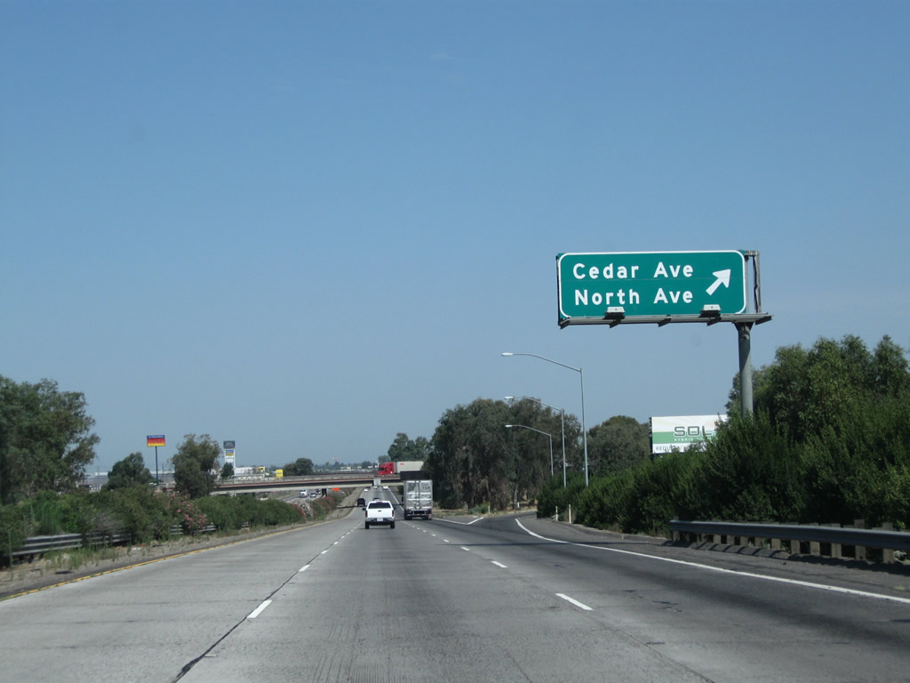 |
Northbound California 99 meets Exit 128, Cedar Avenue and North Avenue. Photo taken 07/31/11. | |
 |
The city of Fresno had a population of 494,665 as of the 2010 Census. Fresno was incorporated on October 12, 1885, and it serves as the seat of its namesake county. The city is an agricultural and urban hub for this part of the San Joaquin Valley (Central Valley), and Fresno is home to a major public university (California State University at Fresno). Irrigation plays a major role in farming here, as annual rainfall only accounts for an average of 11.47 inches of precipitation per year. Most of the San Joaquin Valley west of the city is filled with orchards, fields, and ranches, with water provided by the California Aqueduct (State Water Project). Photo taken 07/31/11. | |
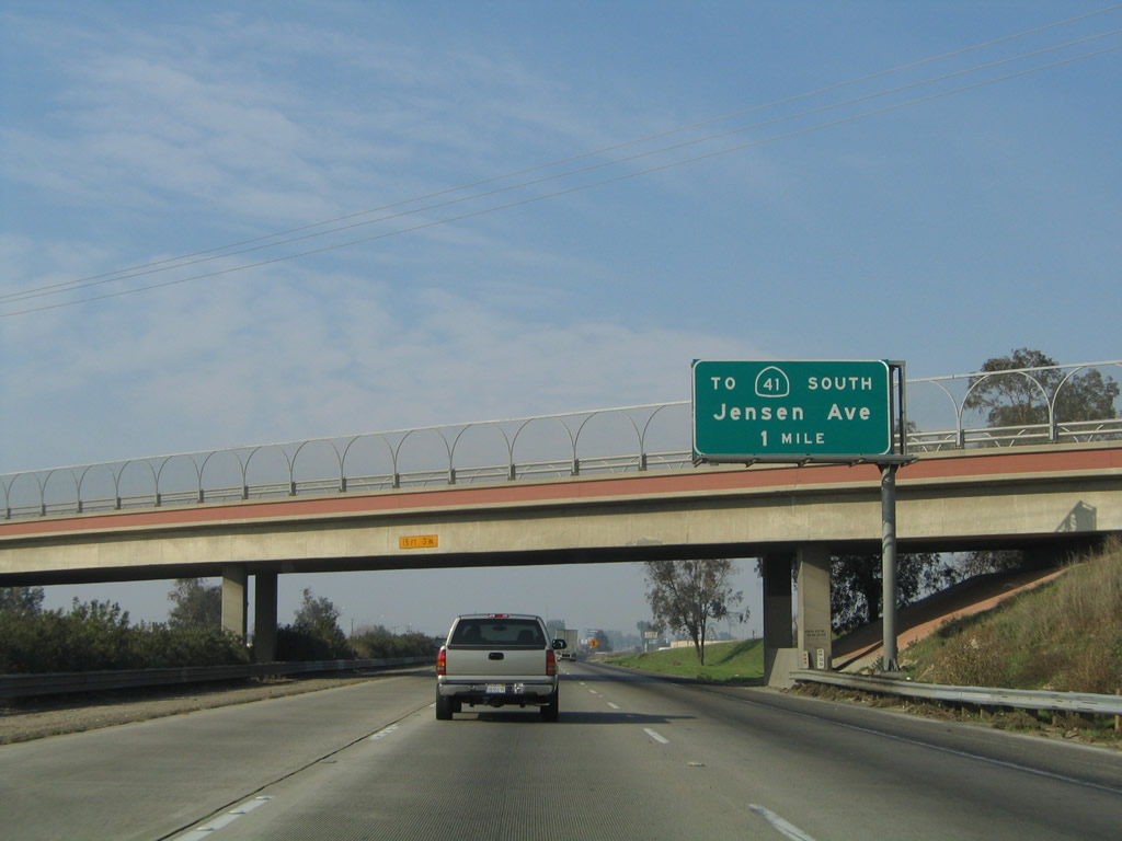 |
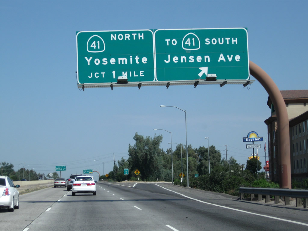
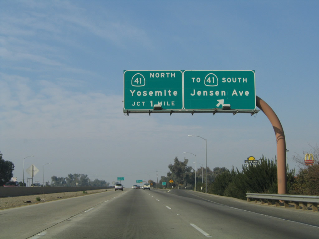
The next exit along California 99 north is Exit 130, Jensen Avenue to California 41 south (one mile). Use Jensen Avenue west to connect with the southbound California 41 freeway, as there is no direct ramp from California 99 north to California 41 south. Photo taken 11/25/04. | |
 |
 |
California 99 passes under Orange Avenue and a spur of the Burlington Northern Santa Fe (BNSF) Railroad. The spur connects to the railroad mainline, which runs parallel to California 99 on the east side of Golden State Boulevard (Old U.S. 99). Photos taken 07/31/11. |
 |
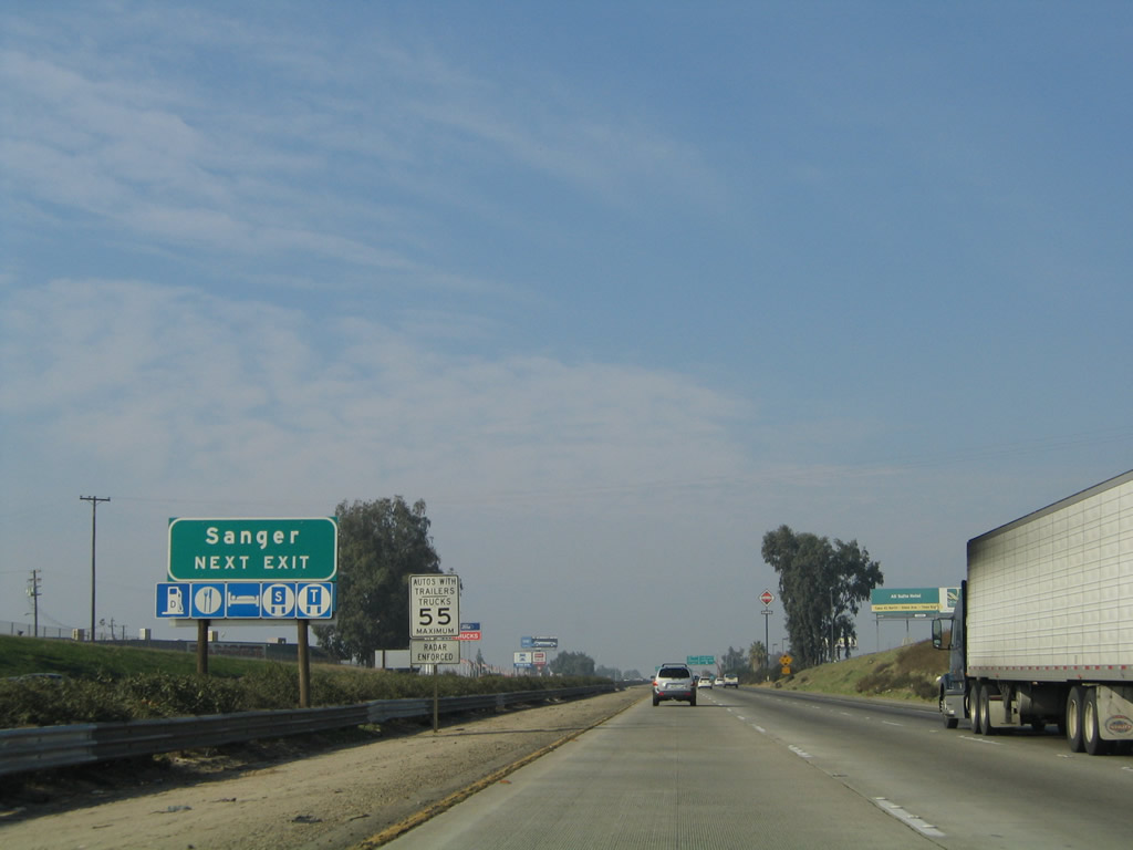 |
Use Jensen Avenue east to the city of Sanger, "The Nation's Christmas Tree City." Incorporated on May 9, 1911, Sanger had a population of 24,270 as of the 2010 Census. Sanger lies at the intersection of Jensen Avenue and Academy Avenue (and is most directly served by east-west California 180 north of the city). Photos taken 07/31/11 and 11/25/04. |
 |
 |
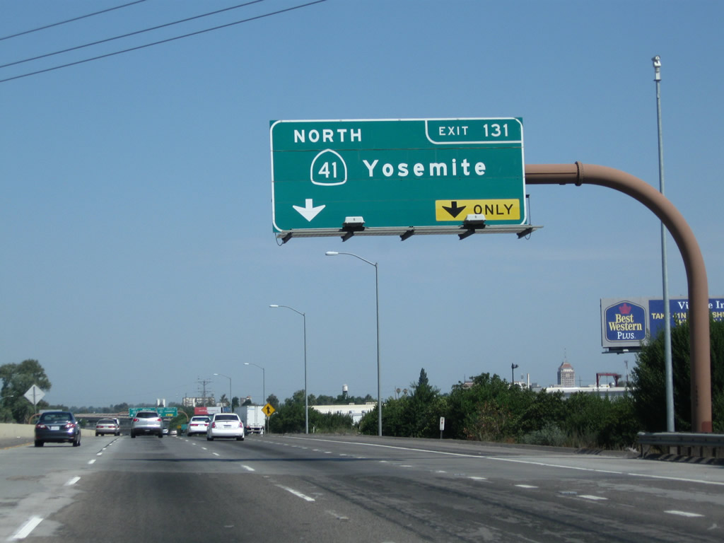
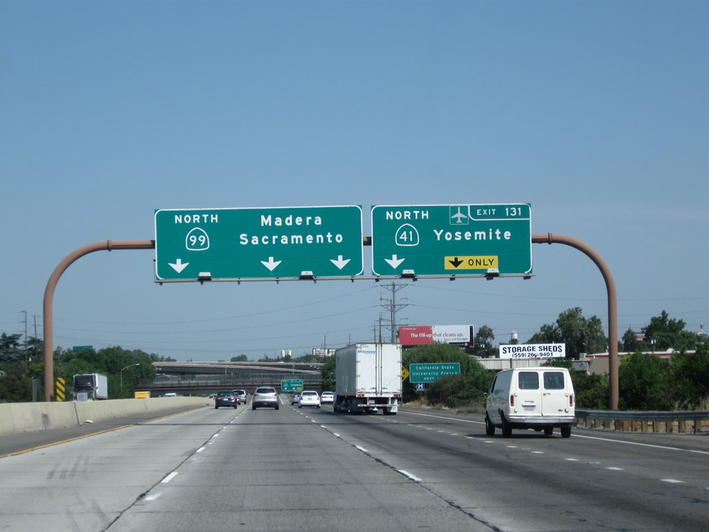
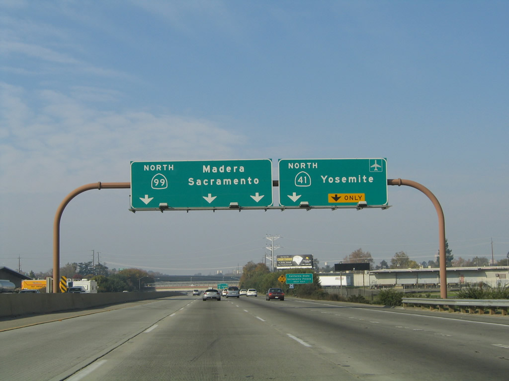
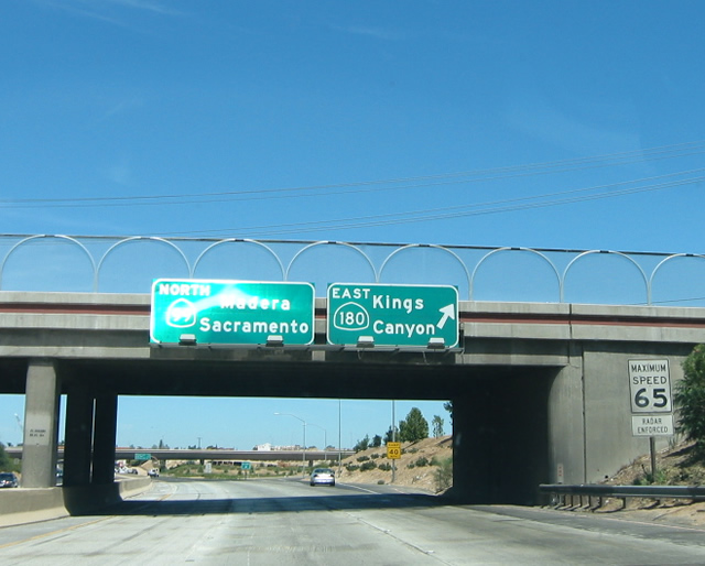
Northbound California 99 reaches Exit 130, Jensen Avenue (to California 41 south) in southern Fresno. The next exit along California 99 north is Exit 131, California 41 (Yosemite Freeway) north. As Fresno has expanded its population, it has also expanded its freeway system. As recently at the early 1990s, the only freeways in town were California 99 and parts of California 41 north of California 99. With an infusion of local sales tax dollars, the freeway system now includes extensions to the California 41 freeway and new freeways for California 168 and California 180. Photos taken 07/31/11 and 11/25/04. |
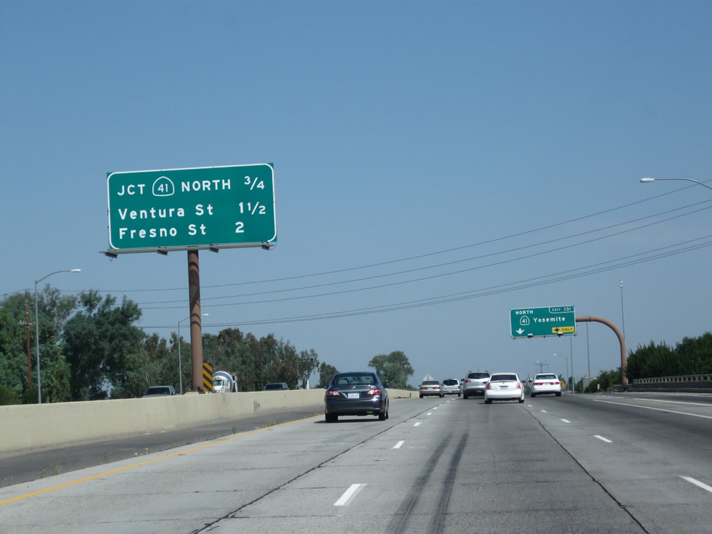 |
This mileage sign along California 99 north provides the distance to the next three exits: Exit 131, California 41 (Yosemite Freeway) north; Exit 132A, Ventura Street (Former California 180 east) to Kings Canyon Road; and Exit 132B, Fresno Street (Former California 180 west). Photo taken 07/31/11. | |
 |
 |
The right two lanes of California 99 will connect to Exit 131, California 41 (Yosemite Freeway) north. California 99 enters downtown Fresno at this interchange; the center city is bounded by California 99 on the southwest, California 180 on the north, and California 41 on the east. California 41 travels almost due north-south through Fresno. Take California 41 north to Coarsegold, Oakhurst, and Yosemite National Park. Photos taken 07/31/11 and 11/25/04. |
 |
Before California 41 (Yosemite Freeway) was extended south of California 99, the two routes shared alignment briefly between Jensen Avenue and the California 41 interchange. This co-signed route marker was in place in 2004 but gone by 2011. Now California 41 is a continuous route through Fresno with no shared segments with California 99. Photo taken 11/25/04. | |
 |
To Fresno-Yosemite International Airport, use California 41 (Yosemite Freeway) north to California 180 (Sequoia-Kings Canyon Freeway) east to Peach Avenue north. Photo taken 07/31/11. | |
 |
 |
Now at one of its widest points in the vicinity of Fresno, the three left lanes carry through traffic for northbound California 99 while the two right lanes prepare to exit onto northbound California 41 (Exit 131). This is a major freeway-to-freeway interchange. Photos taken 07/31/11 and 11/25/04. |
 |
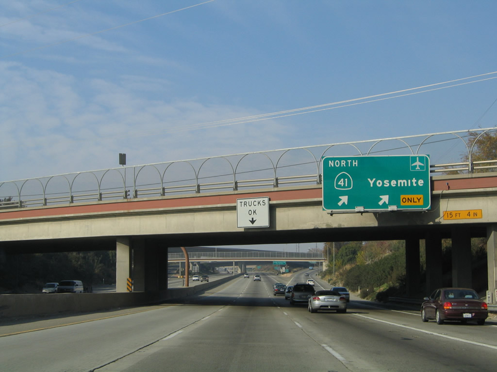 |
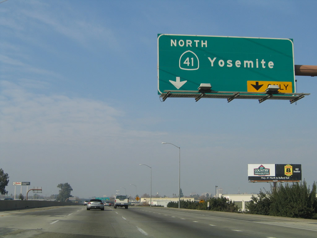
California 41 splits from California 99 north at Exit 131. Use California 41 north to Oakhurst and Yosemite National Park. Use California 99 north to Madera, Merced, Modesto, Stockton, and Sacramento. An exit number was added between 2004 and 2011. Photos taken 07/31/11 and 11/25/04. |
 |
Passing under the California 41 freeway, the next exit along northbound California 99 (Golden State Highway) is Exit 132A, Ventura Street and Kings Canyon Road. For access to California 180, use Exit 133. Photo taken 07/31/11. | |
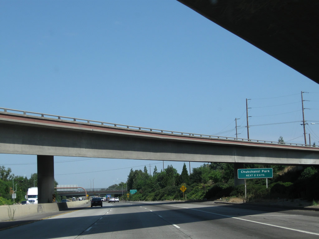 |
Use either Exit 132A or Exit 132B to Chukchansi Park (formerly Grizzlies Stadium). Chukchansi Park is a city-owned baseball stadium that is home to the minor-league Fresno Grizzlies baseball team. The ballpark is located east of California 99 toward the southern end of downtown Fresno. Photo taken 07/31/11. | |
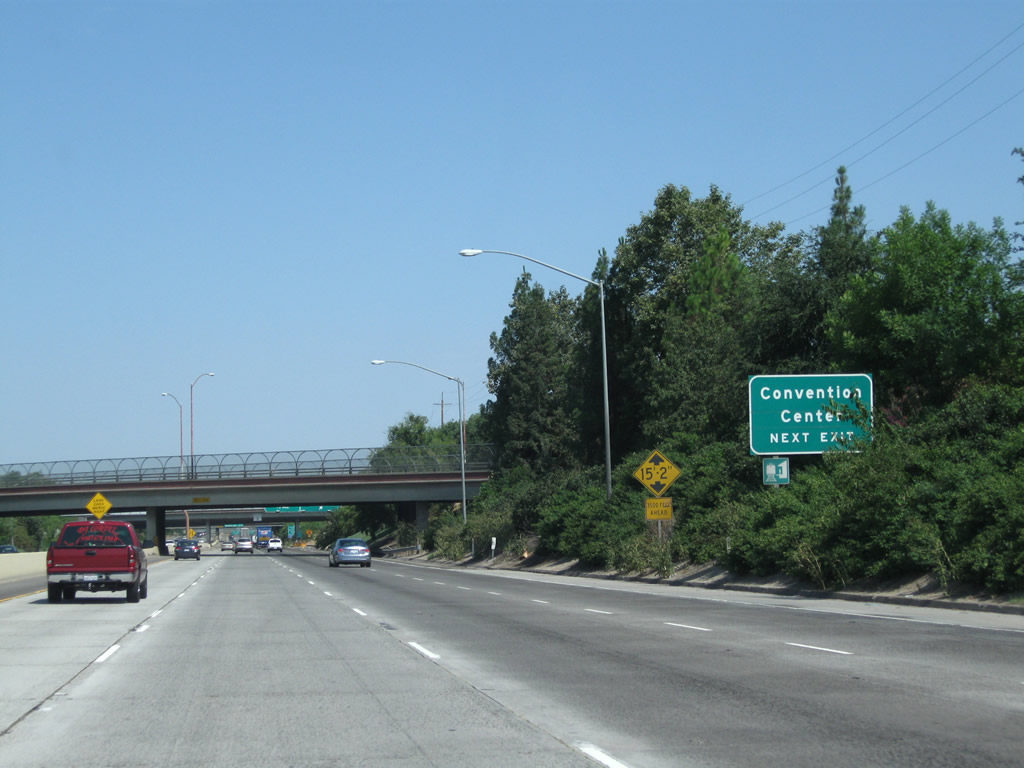 |
Use Exit 132A to the Fresno Convention and Entertainment Center, which is located east of here off Ventura Street (which is shown on some maps as Ventura Avenue). Photo taken 07/31/11. | |
 |
Northbound California 99 (Golden State Highway) meets Exit 132A, Ventura Street and Kings Canyon Road. Ventura Street forms part of the downtown street grid pattern, with connections to Fulton Mall via Van Ness Avenue, Courthouse Park via M Street, and the Convention Center complex. Ventura Street / Avenue is the old alignment of California 180 through downtown. As part of this interchange, Historic U.S. 99/Golden State Boulevard merges back onto the California 99 freeway. Photo taken 08/15/03. | |
 |
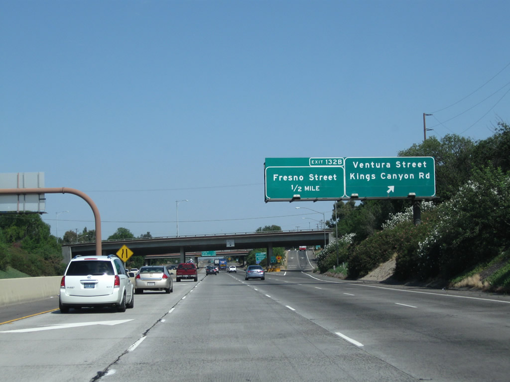
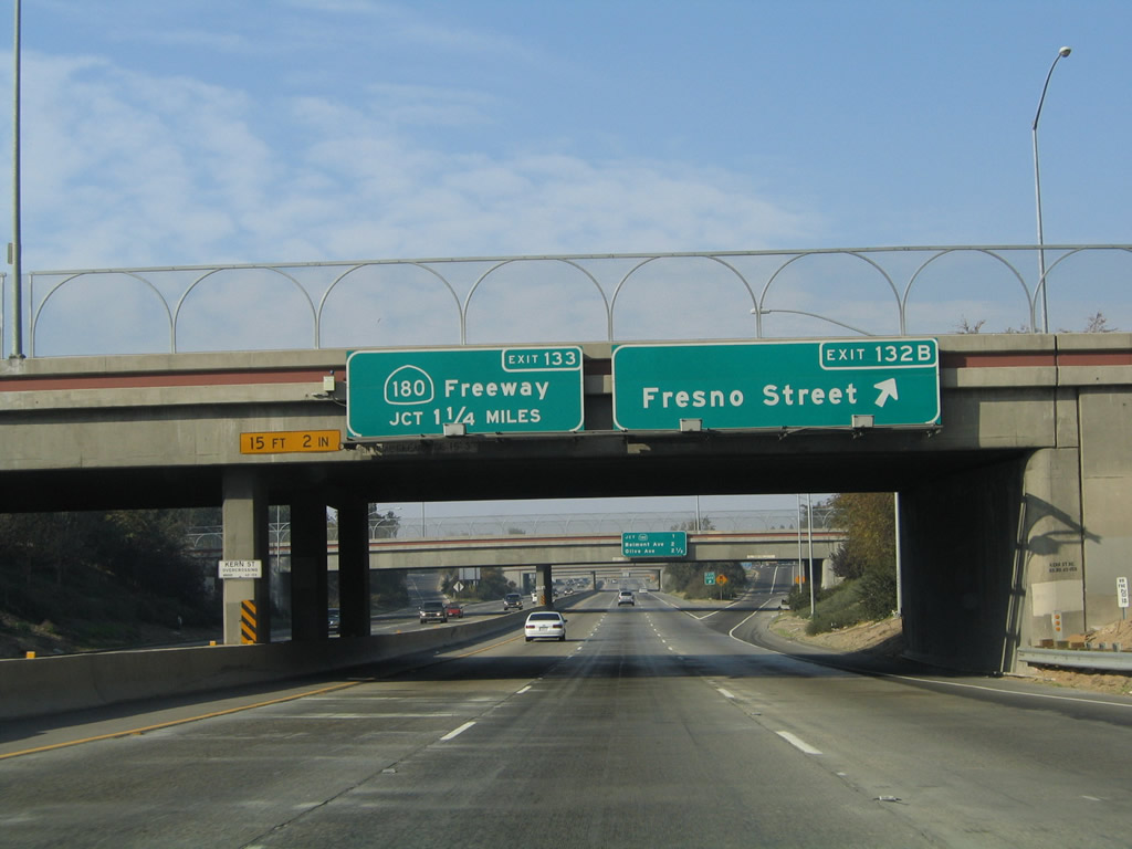
The next exit along California 99 north is Exit 132B, Fresno Street (Former California 180 west). Photo taken 07/31/11. | |
 |
This mileage sign along California 99 north provides the distance to the next three exits: Exit 132B, Fresno Street (Former California 180 west); Exit 133, California 180 (Sequoia-Kings Canyon Freeway) east and west; and Exit 134, Belmont Avenue. Photo taken 11/25/04. | |
 |
 |
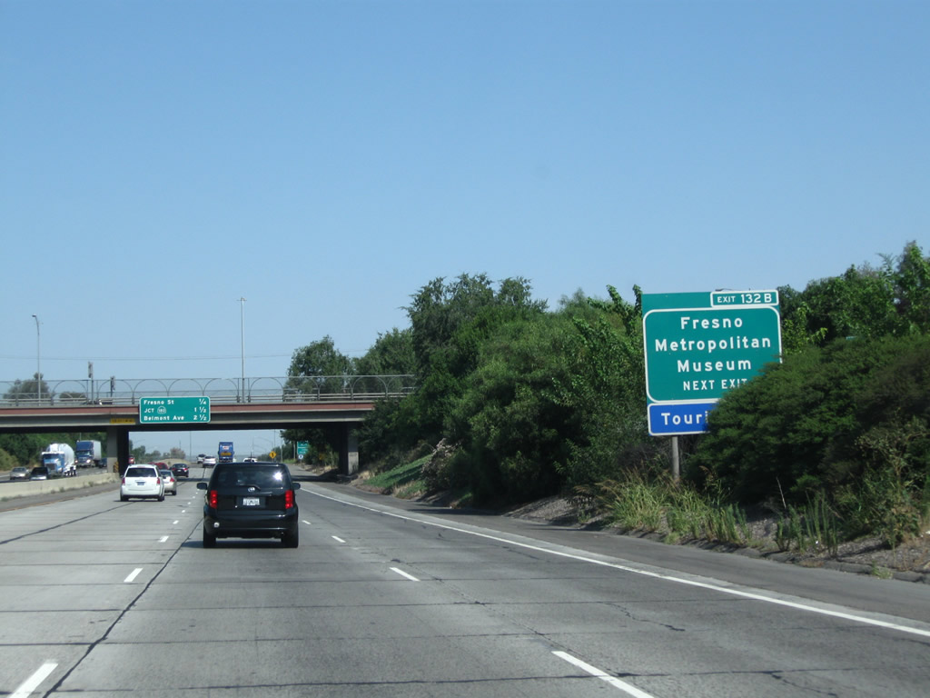
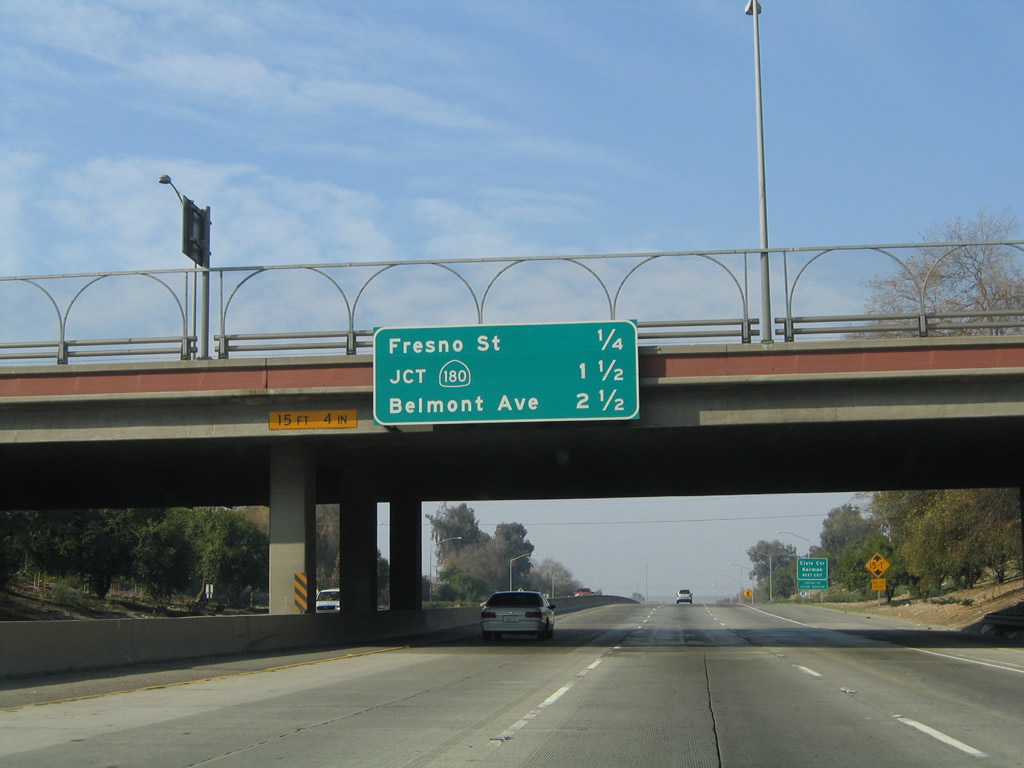
To the Fresno County Plaza, Fresno Civic Center, Fresno City Hall, and Community Regional Medical Center, take Fresno Street northeast into downtown Fresno. Notably, California 99 through Fresno was among the first freeways in the state of California to receive reflective signs, back in 1999. Since the exit numbering initiative (Cal-Nexus) did not begin until 2002, the signs along here were installed without exit numbers. Some of the signs have since been retrofitted to include exit numbers, hence why most of the 2004 pictures show reflective signs through Fresno. This particular sign was replaced and now includes the exit number. Photos taken 07/31/11 and 11/25/04. |
 |
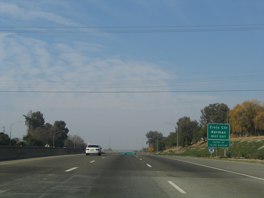
Northbound California 99 reaches Exit 132B, Fresno Street east to downtown Fresno and Civic Center. The next interchange along California 99 north is Exit 133, California 180 east to Sequoia-Kings Canyon National Park and west to Mendota. Photo taken 11/25/04. | |
 |
Another mileage sign for upcoming exits from California 99 north is posted right at the gore point for Exit 132B. The next three exits are Exit 133, California 180 (Sequoia-Kings Canyon Freeway) east and west; Exit 134, Belmont Avenue; and Exit 135A, Olive Avenue. Photo taken 11/25/04. | |
 |
 |
Through downtown Fresno, California 99 remains below grade. Views of downtown Fresno are best afforded on the elevated California 41 viaduct where it travels north over the railroad between California 99 and the Van Ness Avenue exit. Photos taken 07/31/11. |
 |
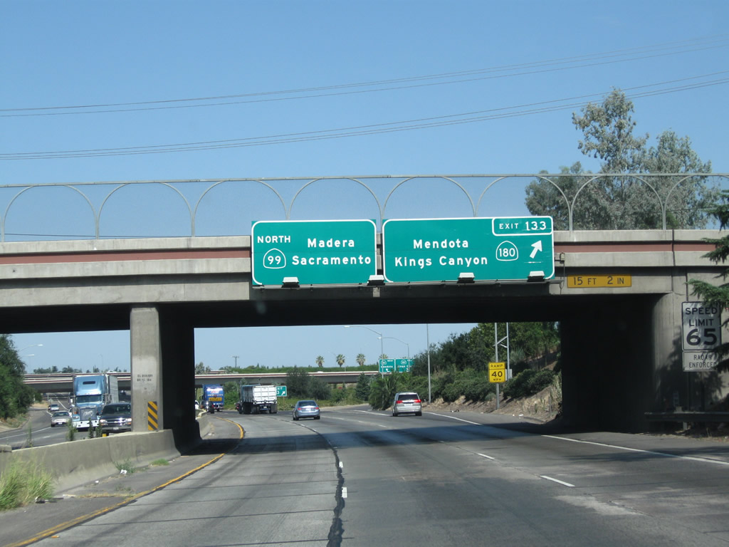
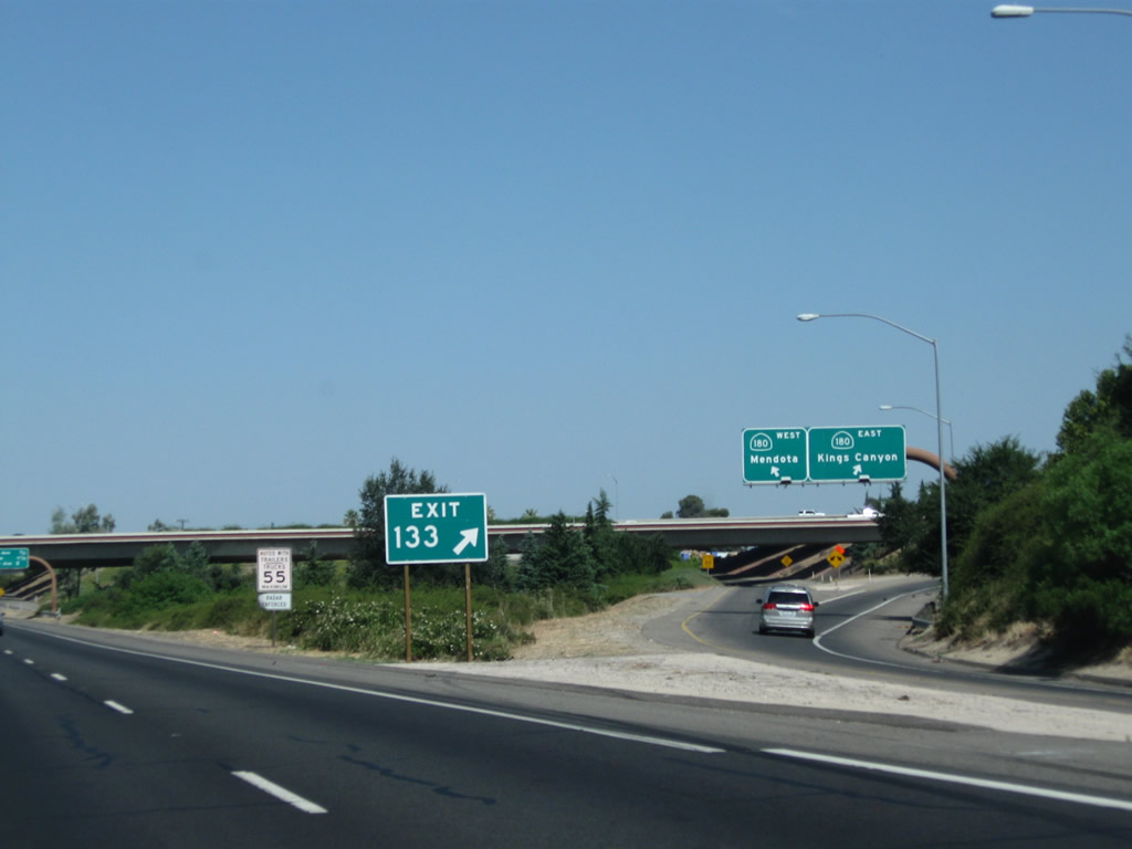
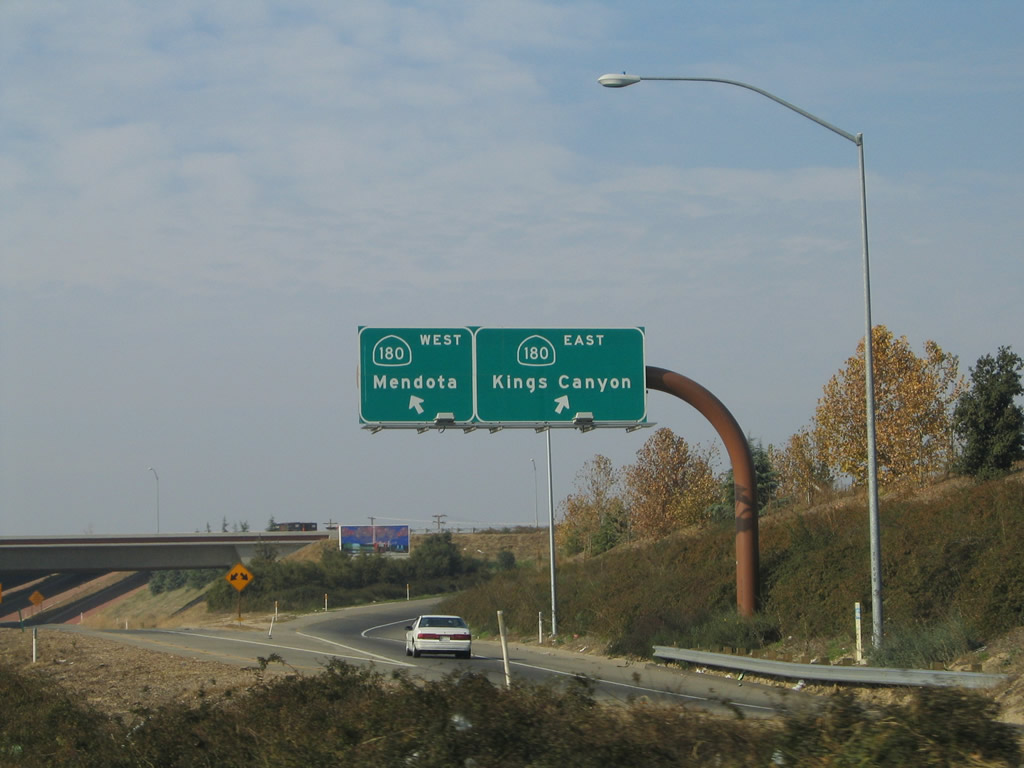
Use California 180 (Sequoia-Kings Canyon Freeway) west to Kerman and Mendota. California 180 does not provide a freeway link all the way to Interstate 5. The freeway ends and reverts to a typical state route toward western urban limits of Fresno, and California 180 then proceeds west to Kerman and ends at California 33 in Mendota. Longer-term plans call for California 180 to be extended to Interstate 5, but it is unclear if or when this extension might happen. A better route across to Interstate 5 is the California 152 expressway. Photo taken 07/31/11. | |
 |
 |
Northbound California 99 reaches Exit 133, California 180 freeway east to Kings Canyon National Park and west to Mendota. By 2004, this interchange was expanded to include a link to California 180 west as well as east. As a result, the signs changed between May 2003 and April 2004 to reflect the connection to California 180 west. Photos taken 07/31/11 and by Pete Sison (05/20/03). |
 |
 |
A huge gore point sign for Exit 133 is posted along California 99 north. Once on the ramp, the left lane will link to California 180 west to Kerman and Mendota, while the right lane will connect to California 180 east to Sequoia-Kings Canyon National Park. Photos taken 07/31/11 and 11/25/04. |
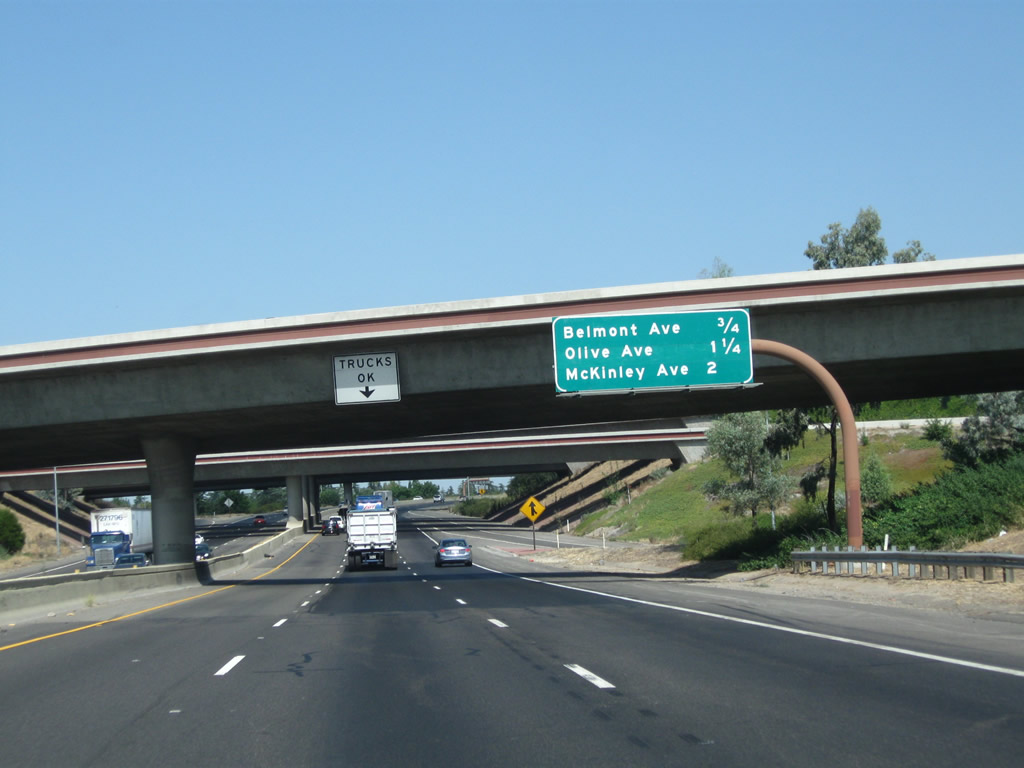 |
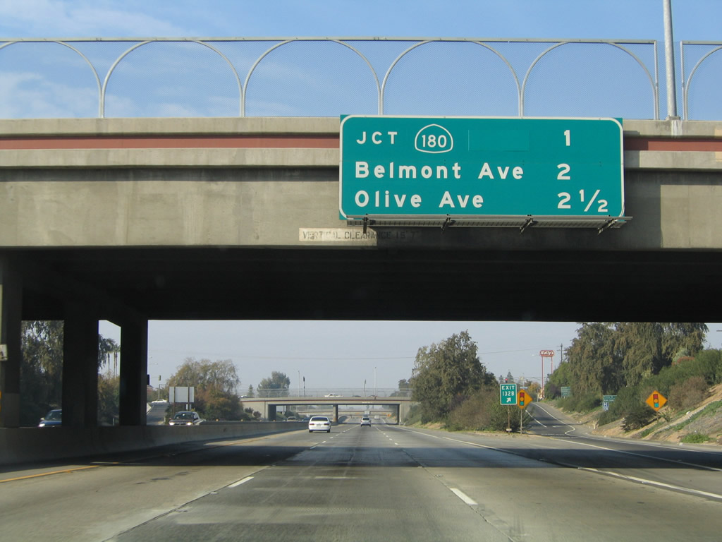
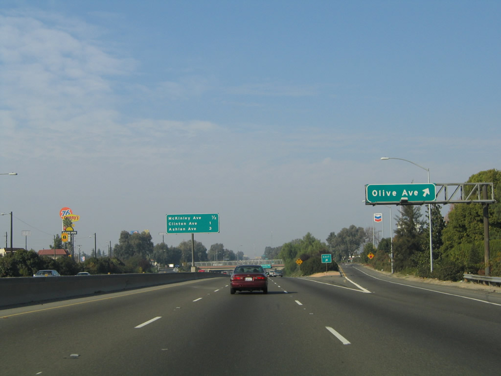
This interchange sequence sign along California 99 north provides the distance to the next three exits: Exit 134, Belmont Avenue; Exit 135A, Olive Avenue; and Exit 135B, McKinley Avenue. Photo taken 07/31/11. |
 |
California 99 passes under California 180. Note the common design features for many of the freeway interchanges in Fresno, including the notable red-brown horizontal line that offers relief to the concrete bridge. Photo taken 11/25/04. |
|
Northbound California 99 (Golden State Highway) meets Exit 134, Belmont Avenue as we leave downtown Fresno. Photo taken 08/15/03. |
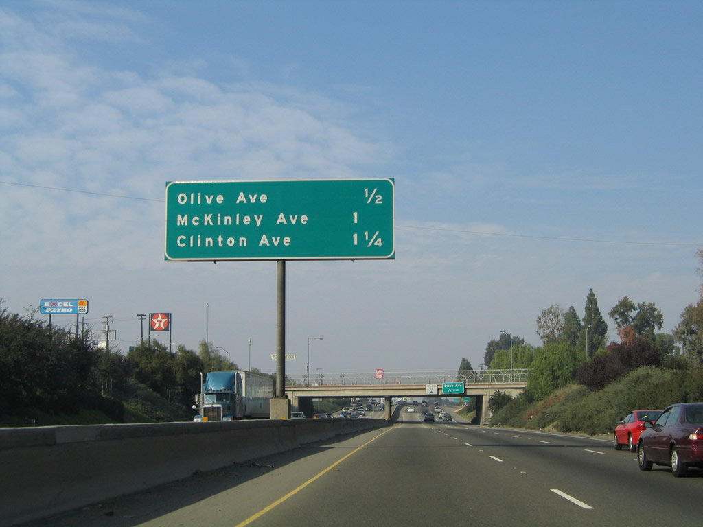 |
This interchange sequence sign along California 99 north provides the distance to the next three exits: Exit 135A, Olive Avenue; Exit 135B, McKinley Avenue; and Exit 136, Clinton Avenue. Photo taken 07/31/11. |
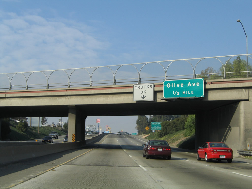 |
The next exit along California 99 north is Exit 135A, Olive Avenue (one-half mile). Photo taken 11/25/04. |
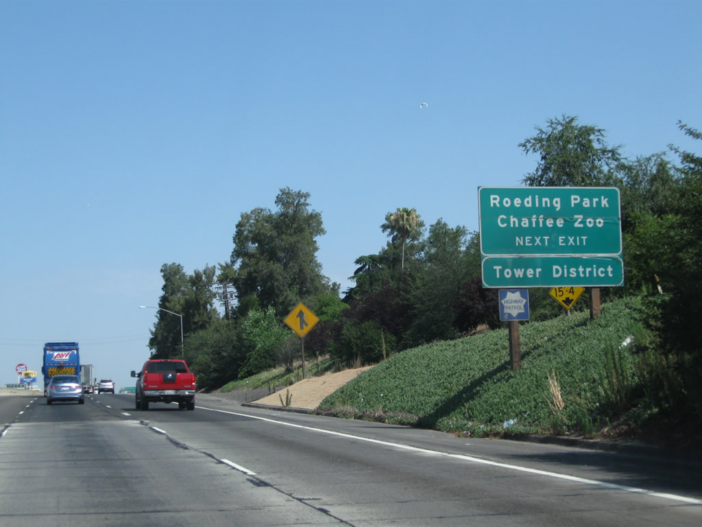 |
Use Exit 135A, Olive Avenue to Roeding Park, Fresno Chaffee Zoo, and Fresno's Tower District. Roeding Park is a large park situated east of California 99, west of Golden State Boulevard (Old U.S. 99), north of Belmont Avenue, and south of Olive Avenue. Located within Roeding Park, Fresno Chaffee Zoo is Fresno's regional zoological park, complete with animal exhibits. Fresno's Tower District is a large arts, dining, and entertainment district located along Wishon Avenue between Olive Avenue and McKinley Avenue. Photo taken 07/31/11. |
 |
Northbound California 99 meets Exit 135A, Olive Avenue. Motorist services (gas, lodging, and food) are available at this interchange. Photo taken 11/25/04. |
 |
This interchange sequence sign along California 99 north provides the distance to three of the next four exits: Exit 135B, McKinley Avenue; Exit 136, Clinton Avenue; Exit 138A, Golden State Boulevard; and Exit 138B, Ashlan Avenue. Photo taken 07/31/11. |
 |
The next exit along California 99 north is Exit 135B, McKinley Avenue (one-half mile). Photo taken 07/31/11. |
 |
Northbound California 99 meets Exit 135B, Olive Avenue. Photo taken 11/25/04. |
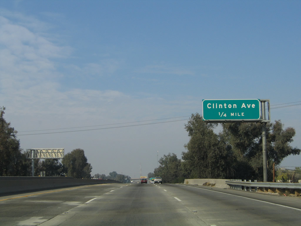 |
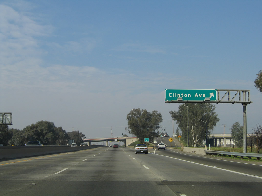
The next exit along California 99 north is Exit 136, Clinton Avenue. Photo taken 11/25/04. |
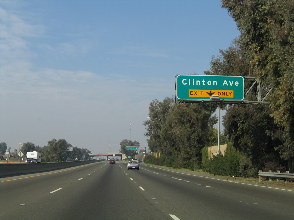 |
As traffic from Olive Avenue merges onto California 99 north, the right lane becomes exit only for Exit 136, Clinton Avenue. Photo taken 11/25/04. |
 |
Northbound California 99 (Golden State Highway) meets Exit 136, Clinton Avenue. At this point, traffic from Golden State Boulevard (Old U.S. 99) merges onto California 99 north. Golden State Boulevard used to be a through route, but the segment from the Belmont Avenue traffic circle south to California 180 was demolished and is now longer passable. The rest of the G Street segment is still passable. Photo taken 11/25/04. |
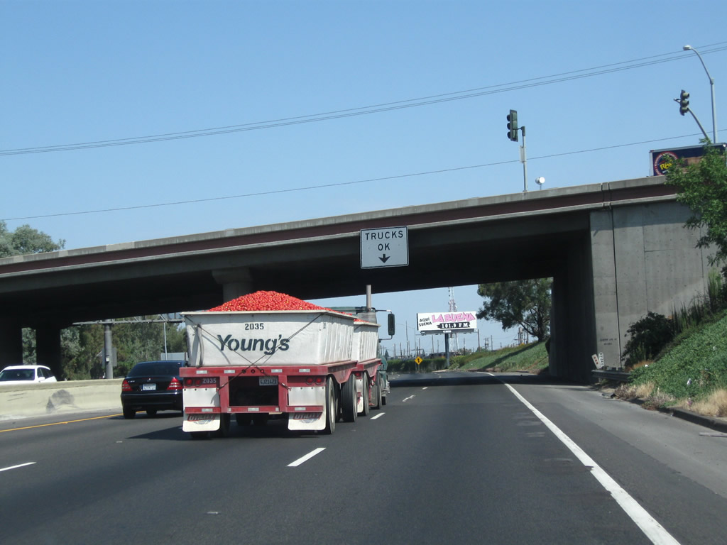 |
California 99 is known as California's Workhorse Highway due to its role moving goods across the Golden State. Trucks such as this one carrying tomatoes are a common sight in this agricultural region. Photo taken 07/31/11. |
 |
The next exit along California 99 north is Exit 138A, North Golden State Boulevard as we pass a tall tower advertising "GAS." North Golden State Boulevard is old U.S. 99; it parallels the freeway to the east between Exit 138A and Exit 143 (Herndon Avenue). Photo taken 07/31/11. |
 |
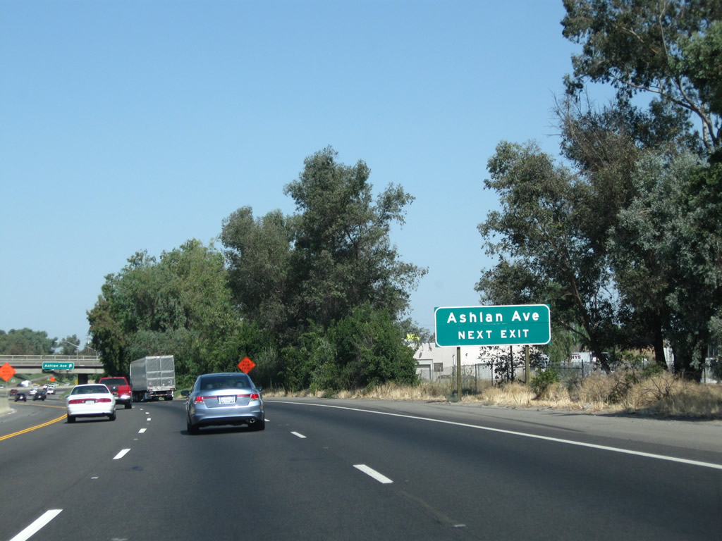
Prior to Exit 138A, North Golden State Boulevard, an advance sign is posted along California 99 for Exit 138B, Ashlan Avenue (one mile). Photo taken 07/31/11. |
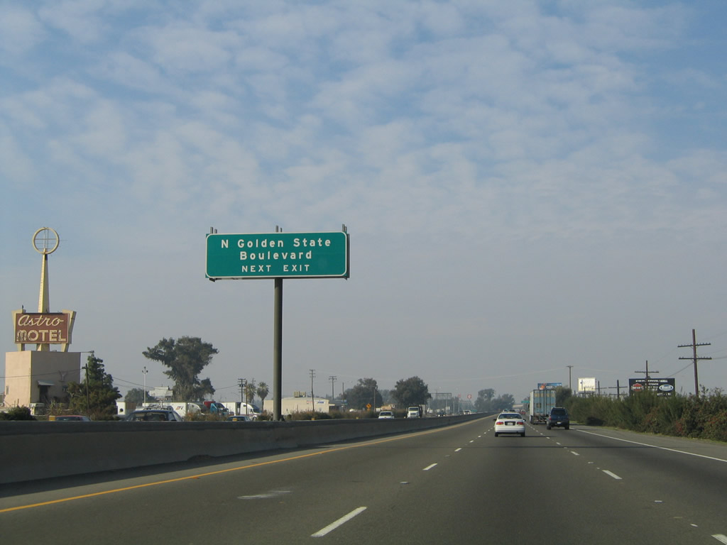 |
North Golden State Boulevard (Old U.S. 99) will parallel California 99 on the east side of the freeway. Photo taken 11/25/04. |
 |
Northbound California 99 meets Exit 138A, North Golden State Boulevard. Photo taken 07/31/11. |
 |
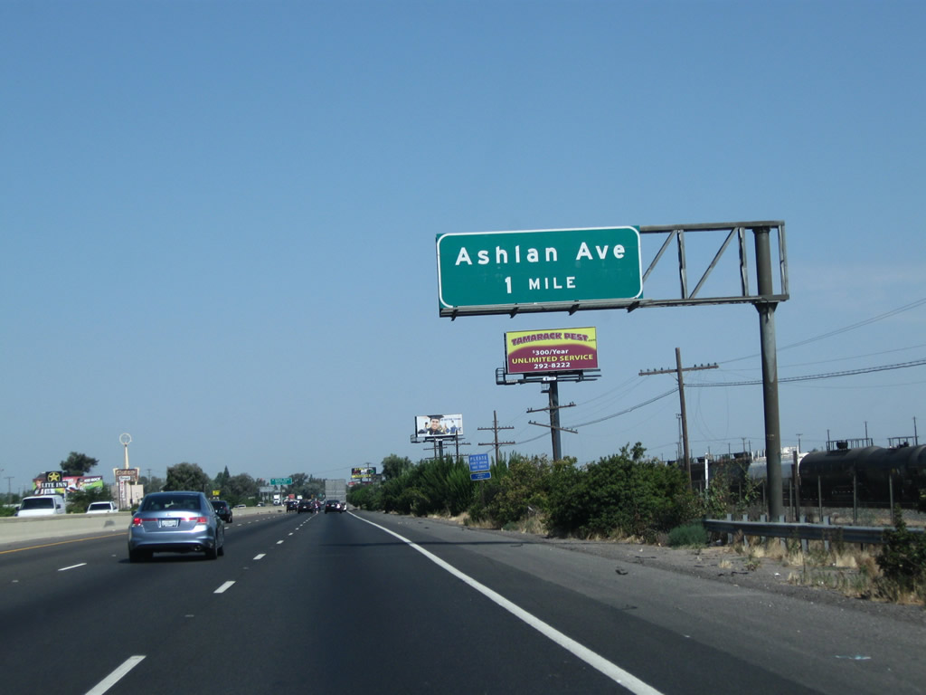
The next exit along California 99 north is Exit 138B, Ashlan Avenue (next right). Photo taken 07/31/11. |
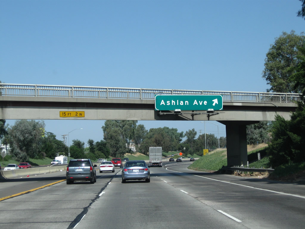 |
Northbound California 99 meets Exit 138B, Ashlan Avenue. Photo taken 07/31/11. |
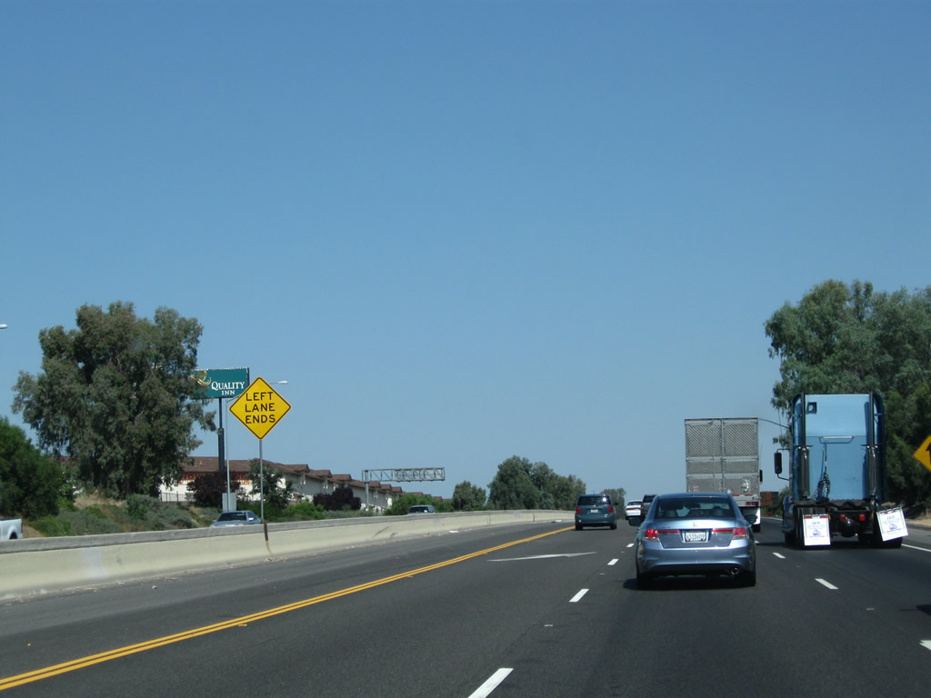 |
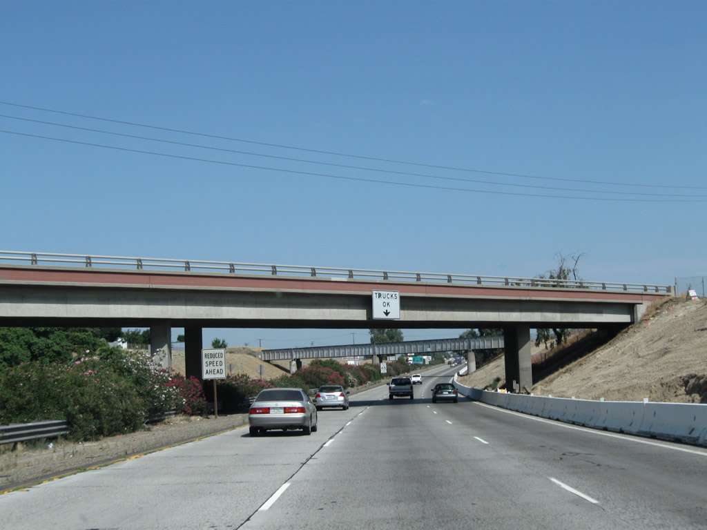
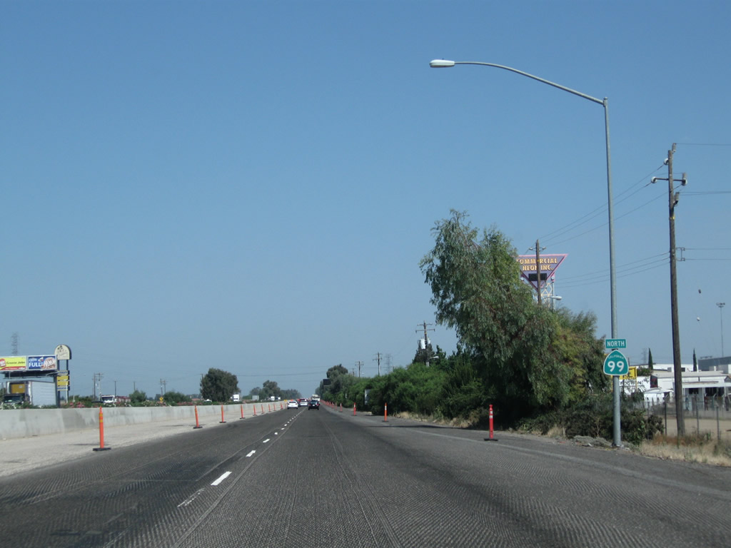
The left lane of California 99 north temporarily ends after the Ashlan Avenue interchange. This segment of freeway is being upgraded to three northbound lanes. Photo taken 07/31/11. |
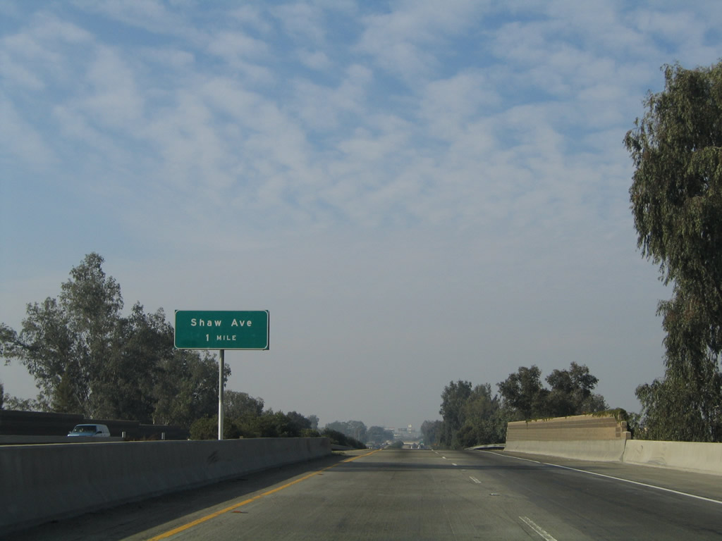 |
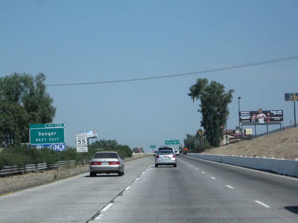
The next exit along California 99 north is Exit 140, Shaw Avenue (one mile). Due to freeway expansion work, this sign was removed by 2011. Photo taken 11/25/04. |
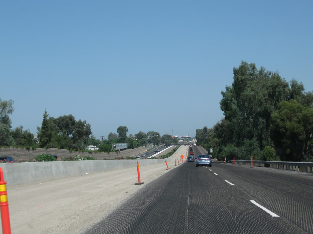 |
Highway expansion was underway in summer 2011. Photo taken 07/31/11. |
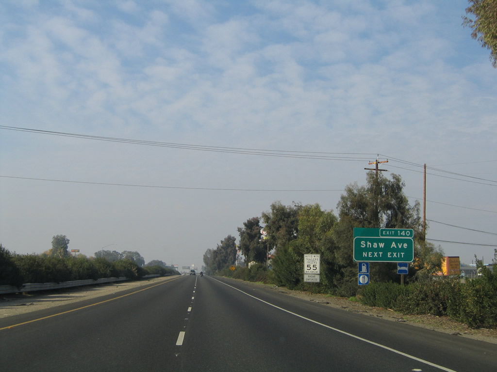 |
Shaw Avenue is old California 168 before that state route was transferred onto the Fresno freeway system. When the California 168 freeway was completed, the western terminus of California 168 was transferred from California 99 to California 180. Note the landscaped median in place prior to the freeway expansion project in 2011. Photo taken 11/25/04. |
 |
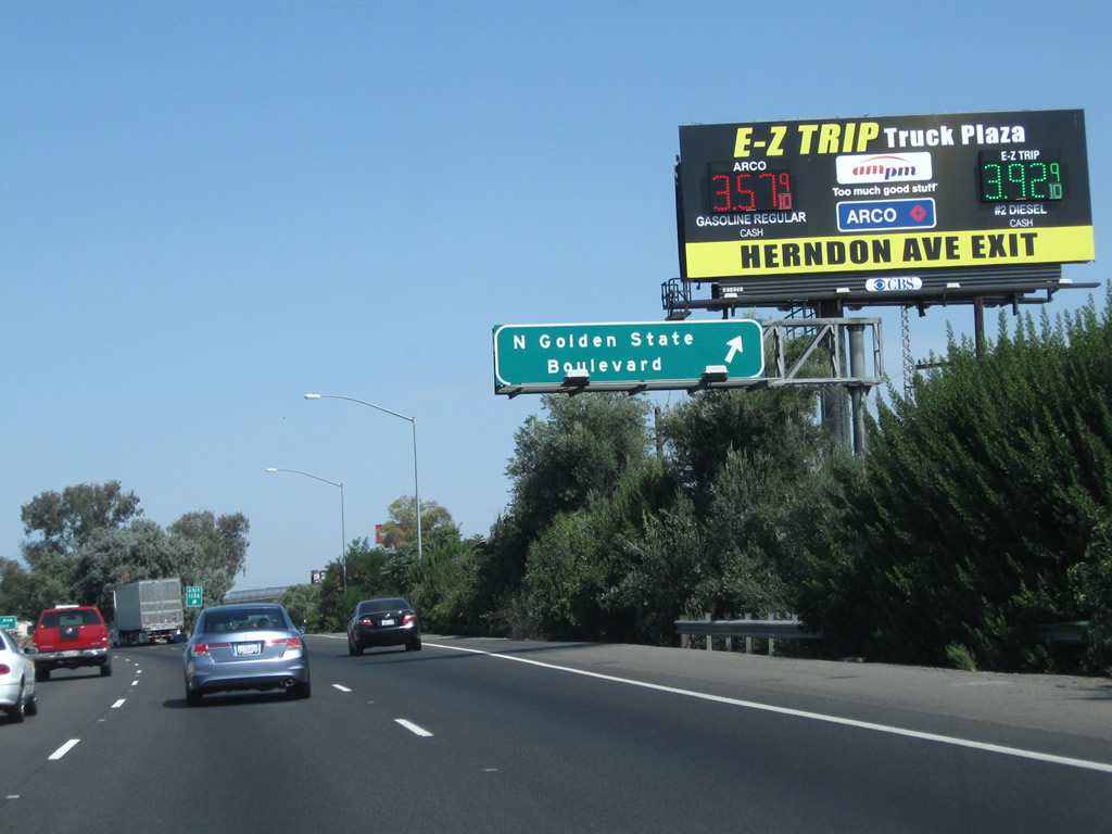
Northbound California 99 meets Exit 140, Shaw Avenue (former California 168 east). Use Shaw Avenue east to Highway City (along Golden State Boulevard) and California State University at Fresno. Photo taken 11/25/04. |
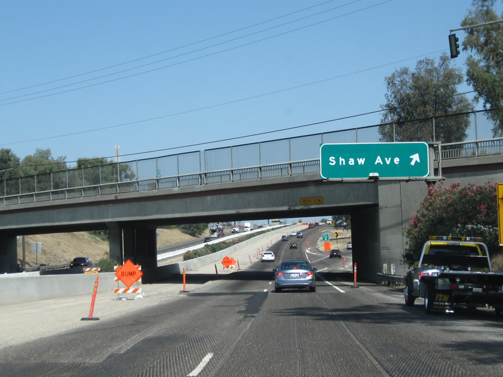 |
California 99 will see significant changes through the Shaw Avenue interchange as a result of the 2011 freeway expansion project to add a third northbound lane. Photo taken 07/31/11. |
 |
A California 99 north reassurance shield is posted after the Shaw Avenue interchange. Photo taken 07/31/11. |
 |
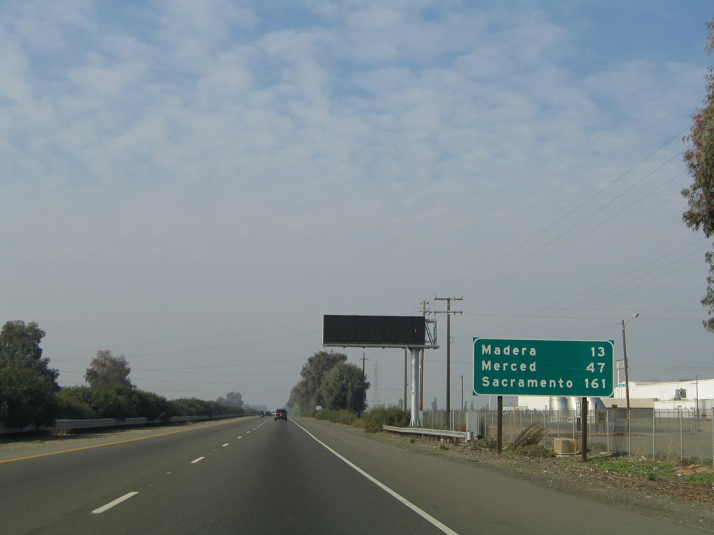 |
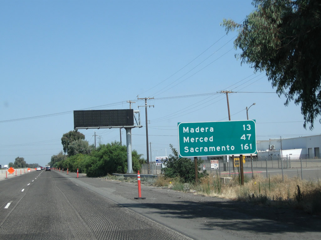
This mileage sign along California 99 north provides the distance to Madera (13 miles), Merced (47 miles), and Sacramento (161 miles). Photos taken 07/31/11 and 11/25/04. |
 |
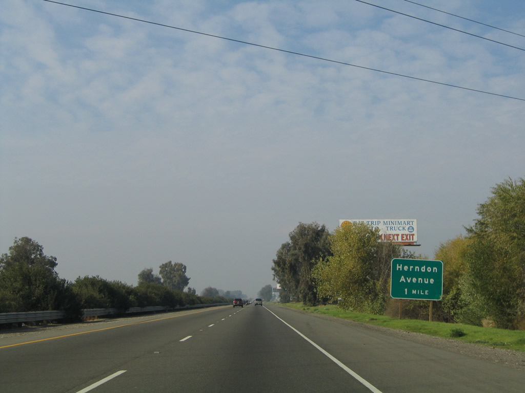 |
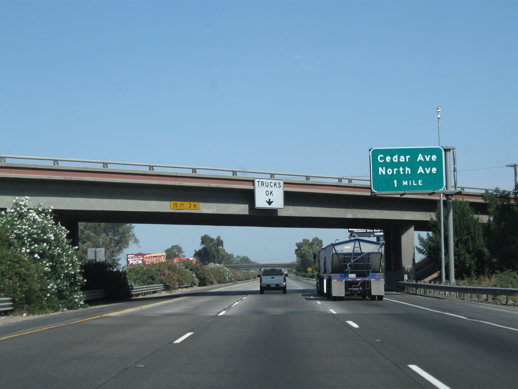
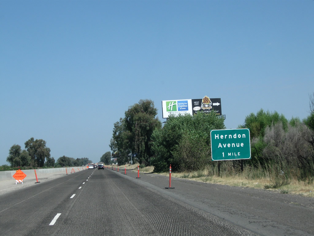
The next exit along California 99 north is Exit 143, Herndon Avenue. This will be the final interchange along California 99 within Fresno County. Note ongoing construction to expand the freeway in 2011. Photos taken 07/31/11 and 11/25/04. |
 |
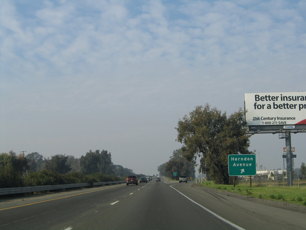 |
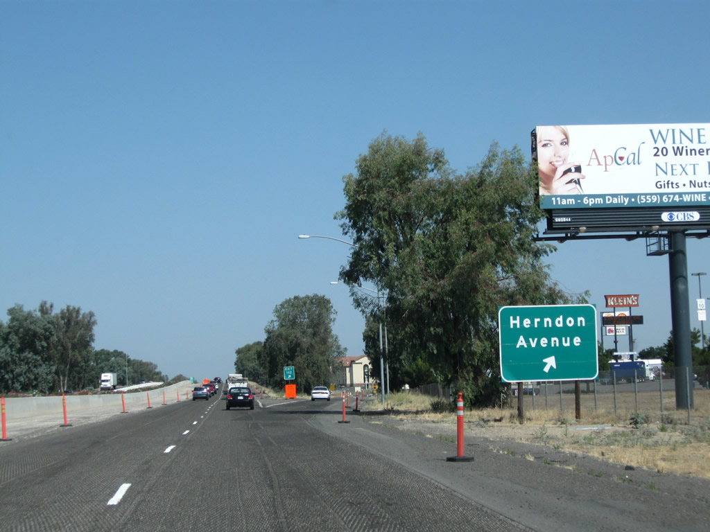
Northbound California 99 reaches Exit 143, Herndon Avenue. Between this interchange and the San Joaquin River bridge, a final on-ramp (not shown) brings traffic from Golden State Boulevard (Former California 99 Business / Motel Drive) onto California 99 north. Photos taken 07/31/11 and 11/25/04. |
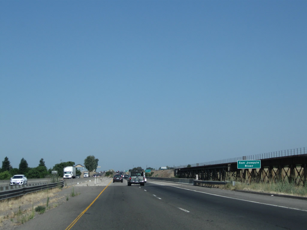 |
California 99 prepares to cross over the San Joaquin River, which gives the San Joaquin Valley its name. The San Joaquin River is a 365-mile-long major river that originates in the Sierra Nevada and travels west into the valley, then turns north toward the Sacramento-San Joaquin Delta (California Delta) to discharge into San Pablo and San Francisco Bays. This river is a major source of water, carrying snowmelt from the Sierra Nevada into the fertile agricultural regions of the valley. At the midpoint of the river is the Fresno-Madera County Line. Photo taken 07/31/11. | |

Page Updated February 27, 2012.
|
About Contact Glossary |
In The News Interstate Guide |
Social Media:
 |
|
© 2000-25 AARoads.com | All Rights Reserved | Privacy Policy / Terms of Use
|
||