| California 99 north |
|
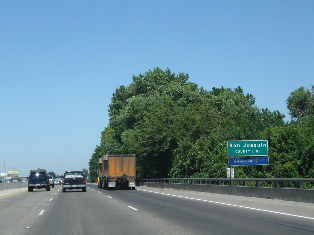
California 99 leaves Stanislaus County and enters San Joaquin County as the freeway crosses over the Stanislaus River, a major tributary of the San Joaquin River. Photo taken 07/31/11. |
|
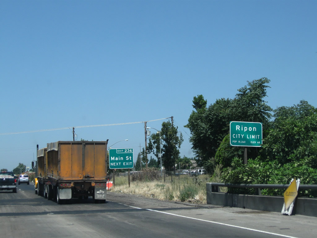
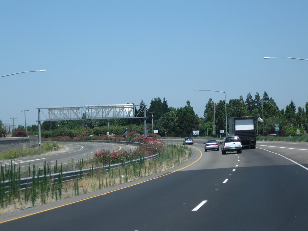
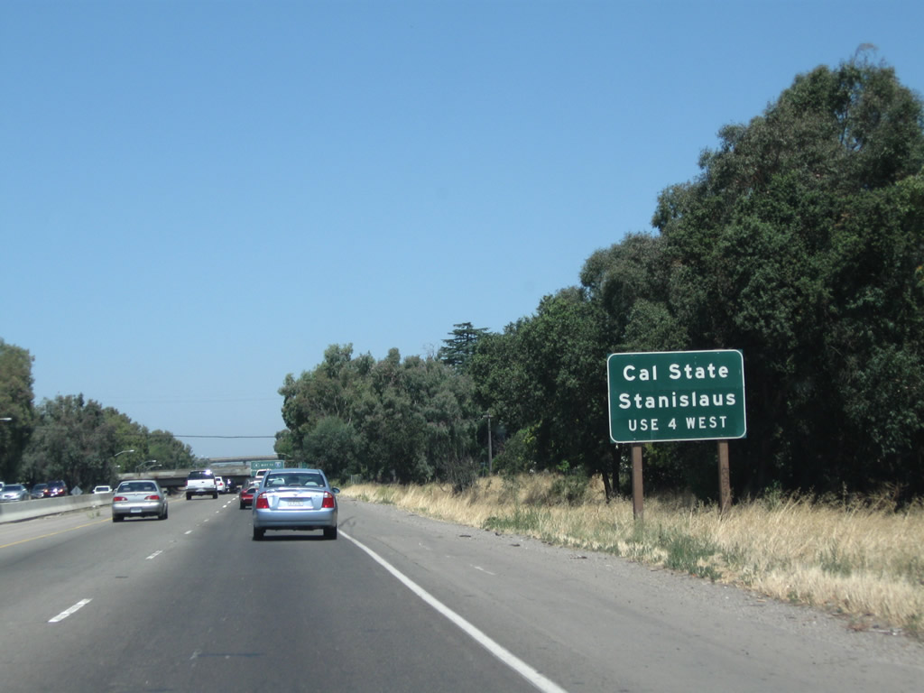
Northbound California 99 enters the city of Ripon ("The Jewel of the Valley") and approaches Exit 236, Main Street, which essentially serves as a business spur from California 99 into downtown Ripon. The city of Ripon had a population of 14,297 as of the 2010 Census and was incorporated on November 27, 1945. Photo taken 07/31/11. |
|
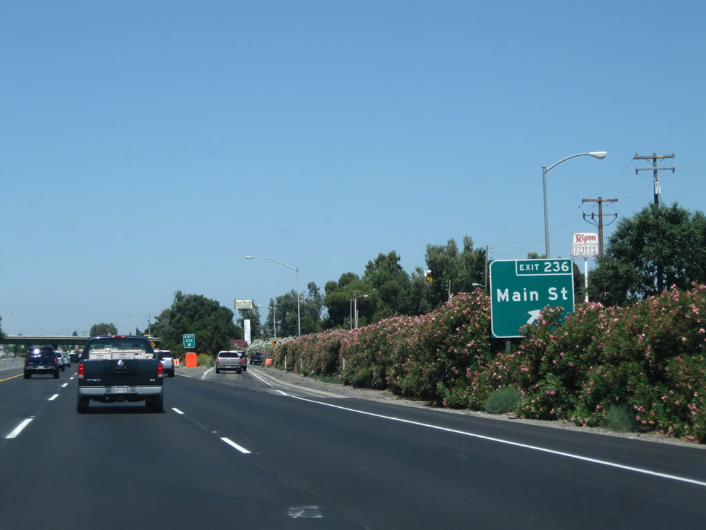
Northbound California 99 meets Exit 236, Main Street in Ripon. Photo taken 07/31/11. |
|
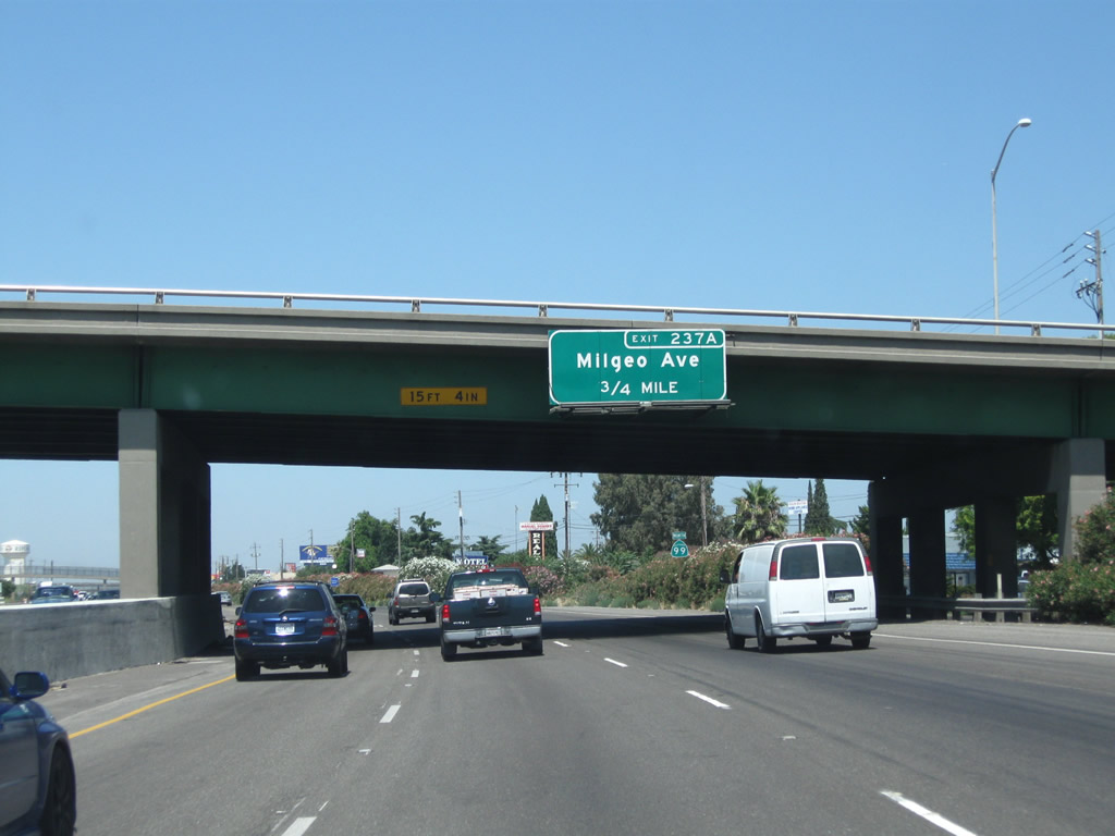
The next exit along northbound is Exit 237A, Milgen Avenue in Ripon (0.75 mile). Photo taken 07/31/11. |
|
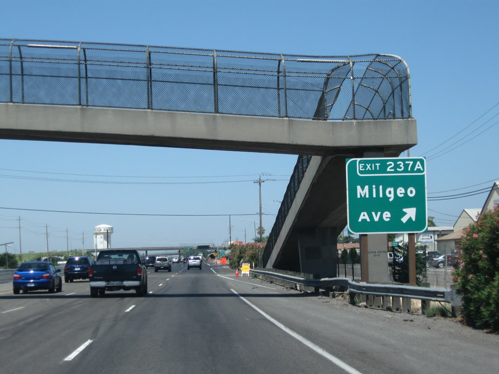
Northbound California 99 reaches Exit 237A, Milgen Avenue. Photo taken 07/31/11. |
|
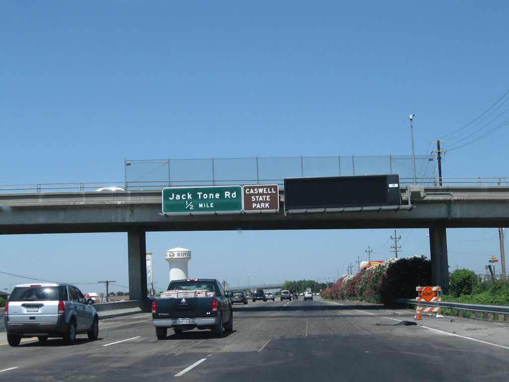
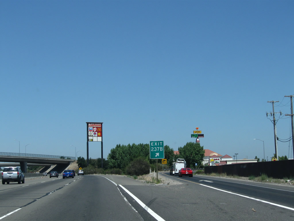
The next exit along California 99 north is Exit 237B, San Joaquin County J-5 (Jack Tone Road) and Colony Road. San Joaquin County J-5 leads north from this intersection to Five Corners, Lockeford, and Clay. Photo taken 07/31/11. |
|
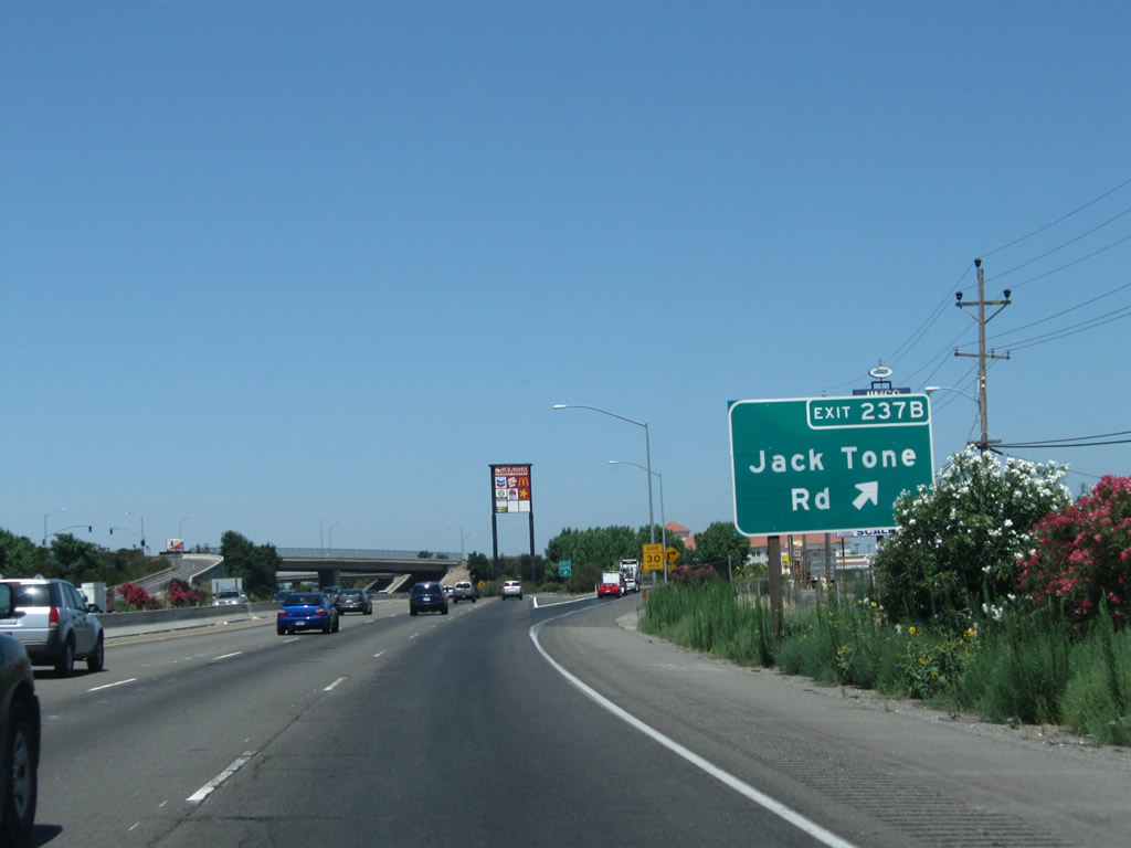
Northbound California 99 meets Exit 237B, San Joaquin County J-5 (Jack Tone Road). Most motorist services (gas, food) are available at this interchange in north Ripon. Photo taken 07/31/11. |
|
A plethora of service signs are posted overhead at Jack Tone Road interchange. Photo taken 07/31/11. |
|
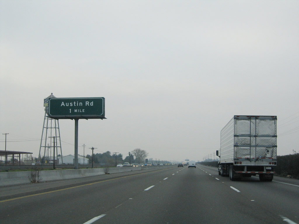
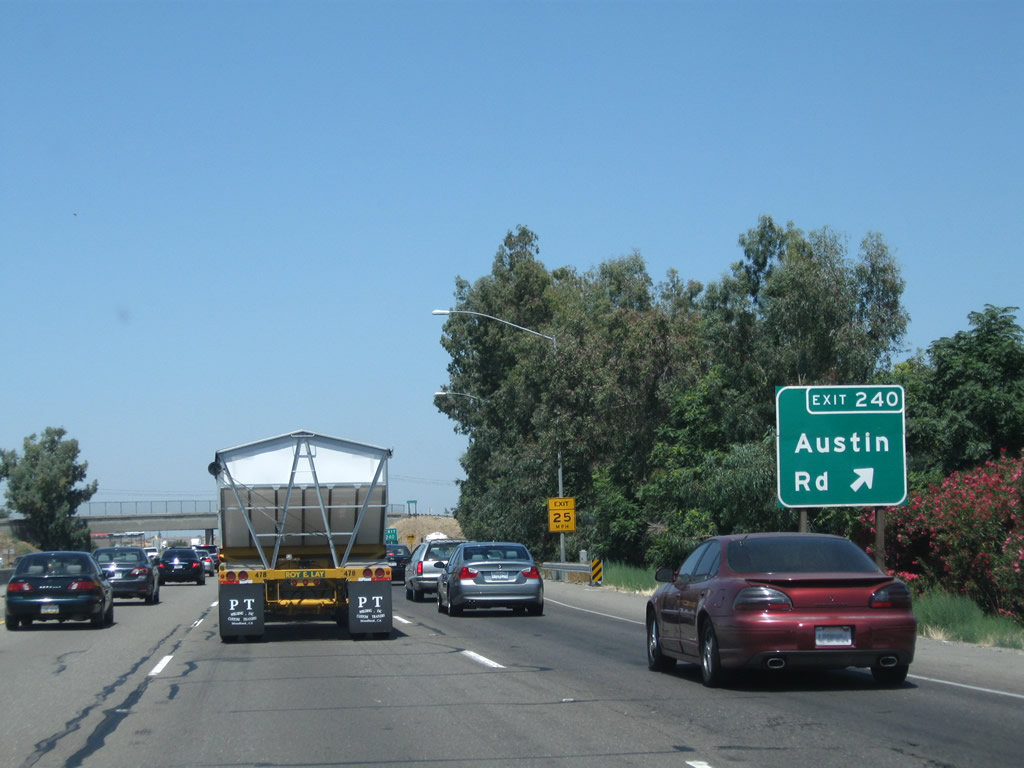
The next exit along California 99 north is Exit 240, Austin Road (one mile). Photo taken 11/25/04. |
|
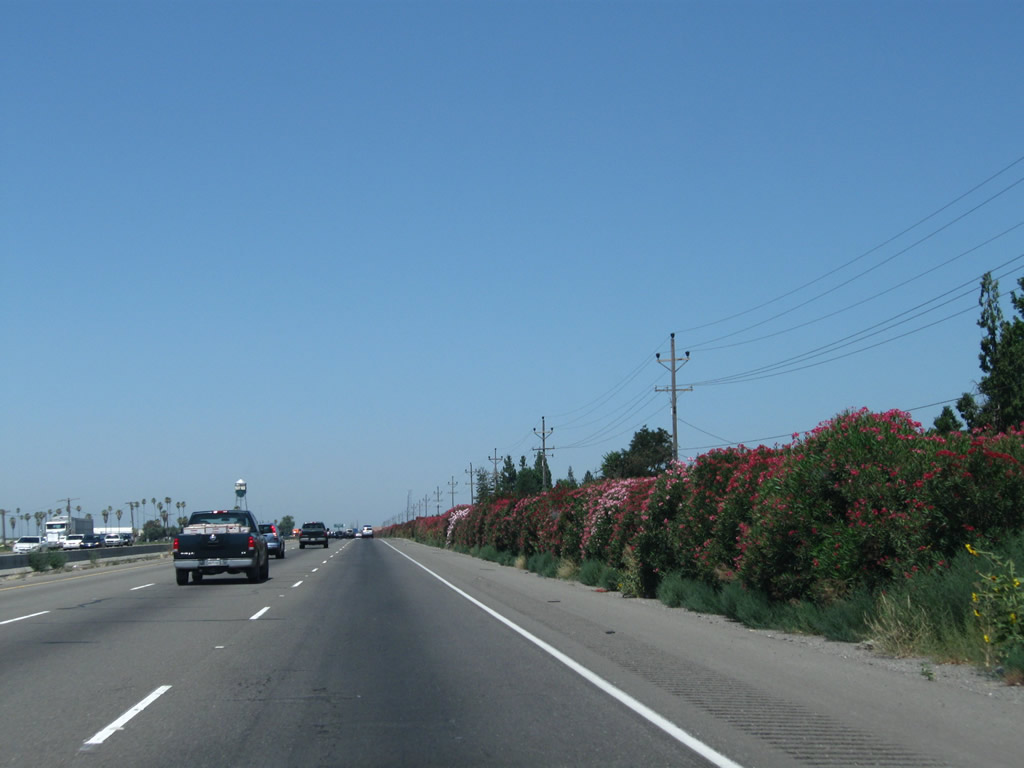
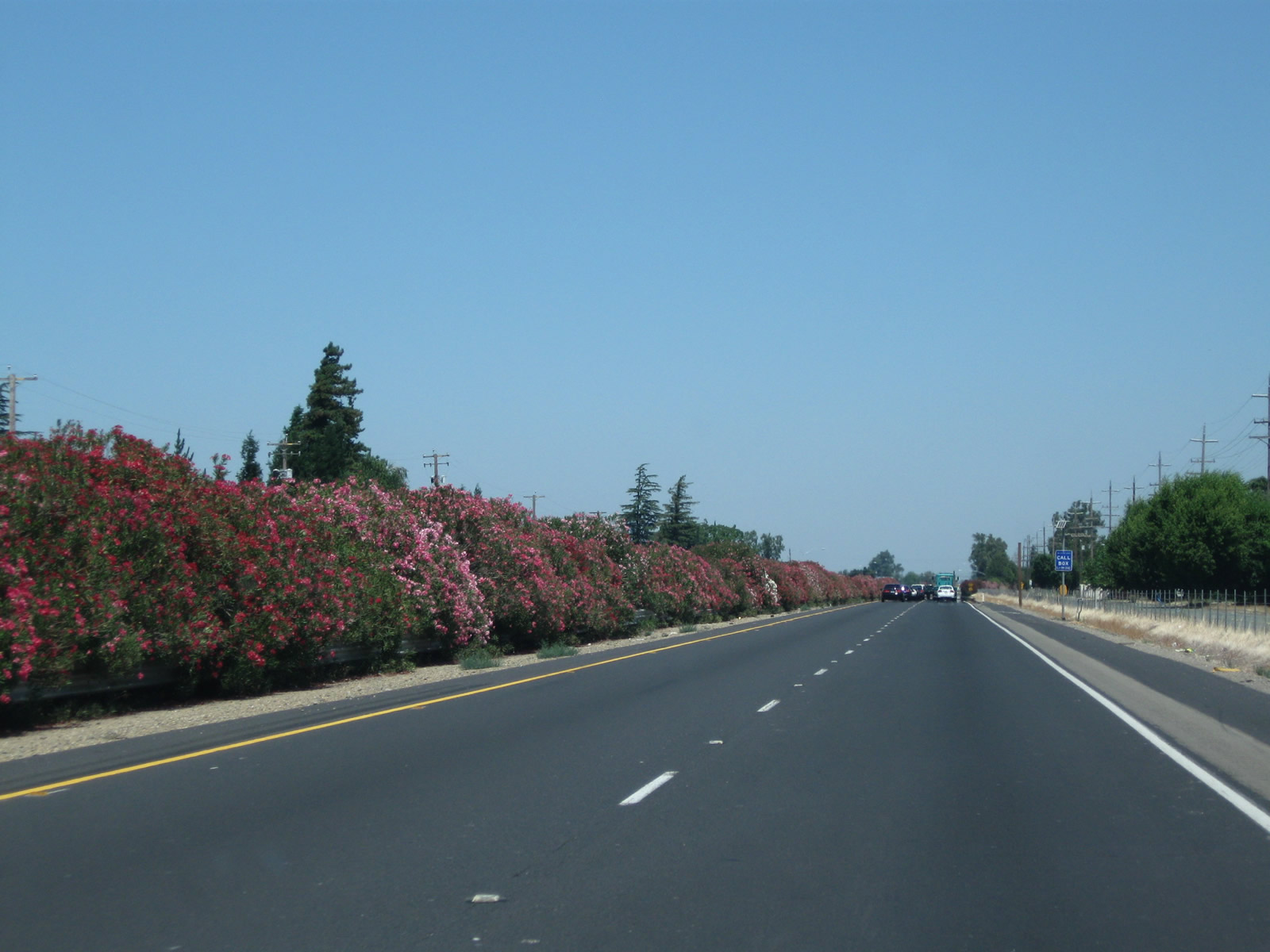
Colorful yet poisonous oleander lines the east side of the California 99 freeway between Jack Tone Road and Austin Road. Photo taken 07/31/11. |
|
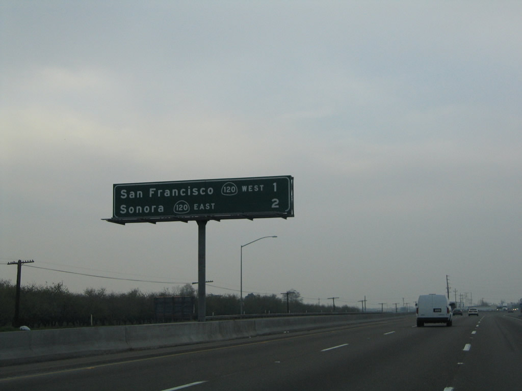
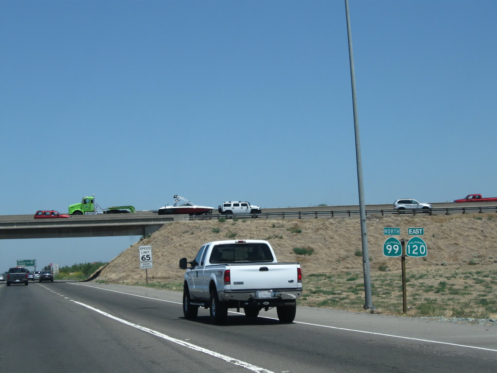
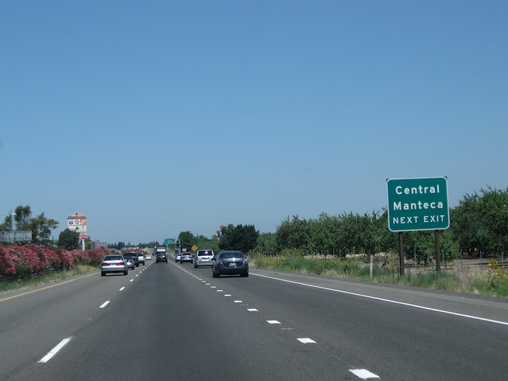
A mileage sign along California 99 north provides the distance to Exit 241, California 120 freeway west to Manteca, Tracy, and San Francisco and Exit 242, California 120 east to Oakdale and Sonora. Omitted from this sign is Exit 240, Austin Road. Photo taken 11/25/04. |
|
Northbound California 99 reaches Exit 240, Austin Road. Photo taken 07/31/11. |
|
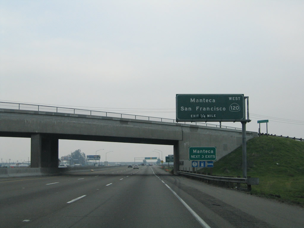
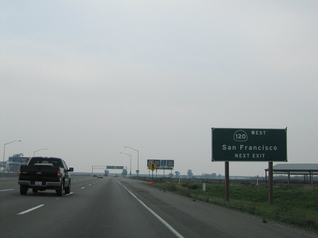
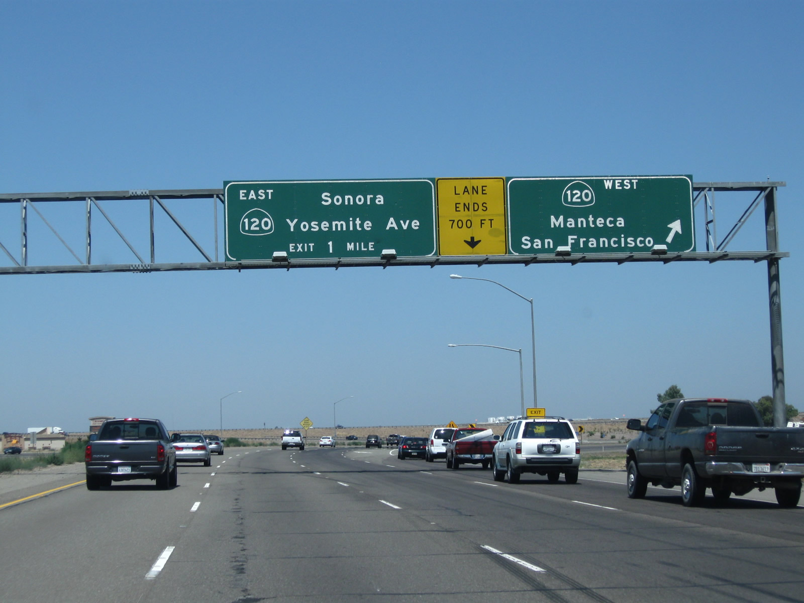
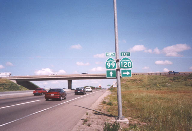
The next exit along California 99 north is Exit 241, California 120 west to Manteca, Tracy, Livermore, Dublin, Hayward, Oakland, and San Francisco. California 120 only makes it as far west as Manteca; the route does not directly serve the other locations leading into the Bay Area. San Francisco is reached via a combination of California 120, Interstate 205, Interstate 580, and Interstate 80. Use Exit 242 for California 120 east to Sonora. Photo taken 11/25/04. |
|
California 120 is a major east-west corridor across central California. After passing this interchange, eastbound California 120 merges onto northbound California 99, albeit briefly. Use California 120 west to San Francisco and all Bay Area destinations. Photo taken 11/25/04. |
|
Northbound California 99 meets Exit 241, California 120 freeway west to Manteca and San Francisco. Use California 120 west to Interstate 5, Interstate 205, Business Loop I-205/Historic U.S. 50, and Interstate 580. Photo taken 07/31/11. |
|
|
California 99 northbound and California 120 eastbound are cosigned briefly before California 120 heads east on Yosemite Avenue. Note how the arrows were removed from this route marker assembly between 2002 and 2011. Photos taken 07/31/11 and by Trevor Carrier (Summer 2002). |
|
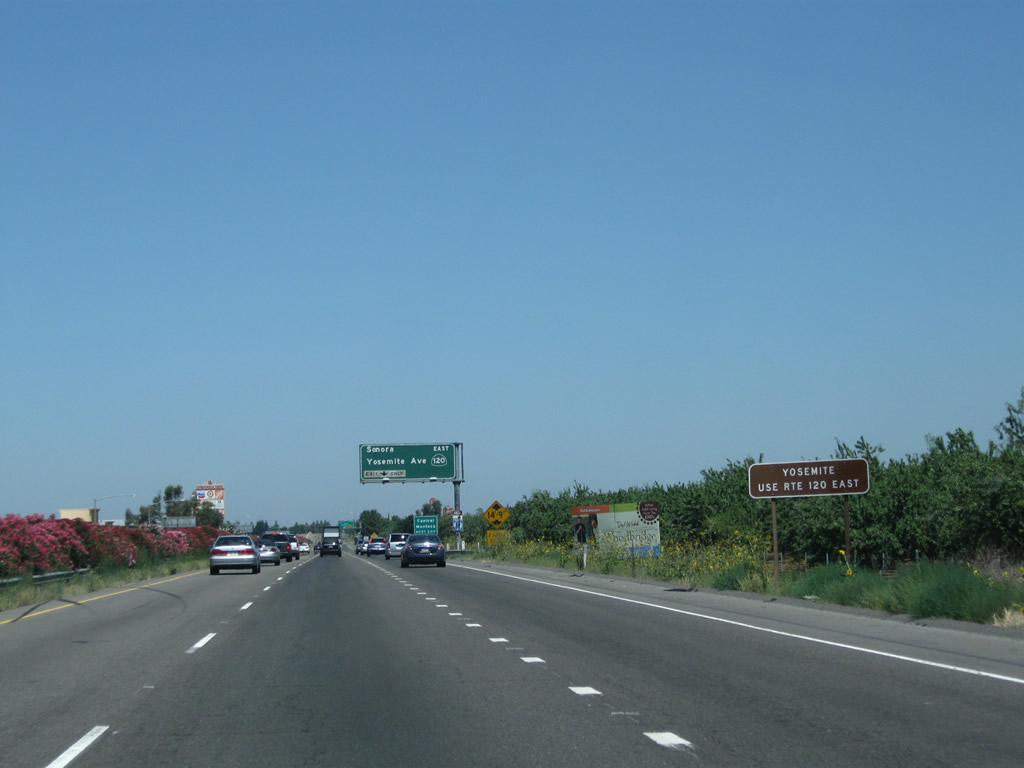
Use California 120 east to Yosemite National Park. California 120 forms the northern entrance into the park, while California 140 is the central entrance and California 41 is the southern entrance. Only California 120 survives to exit the park at the east end and descends from Tioga Pass to meet U.S. 395 near Lee Vining and ultimately U.S. 6 in Benton near the Nevada state line. Photo taken 07/31/11. |
|
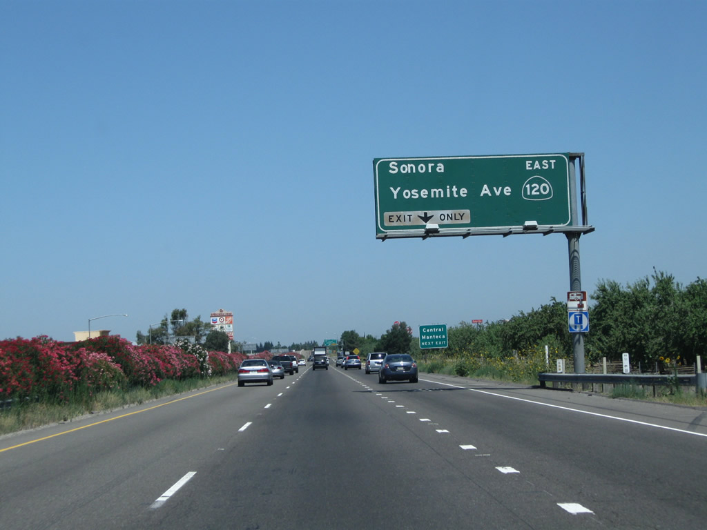
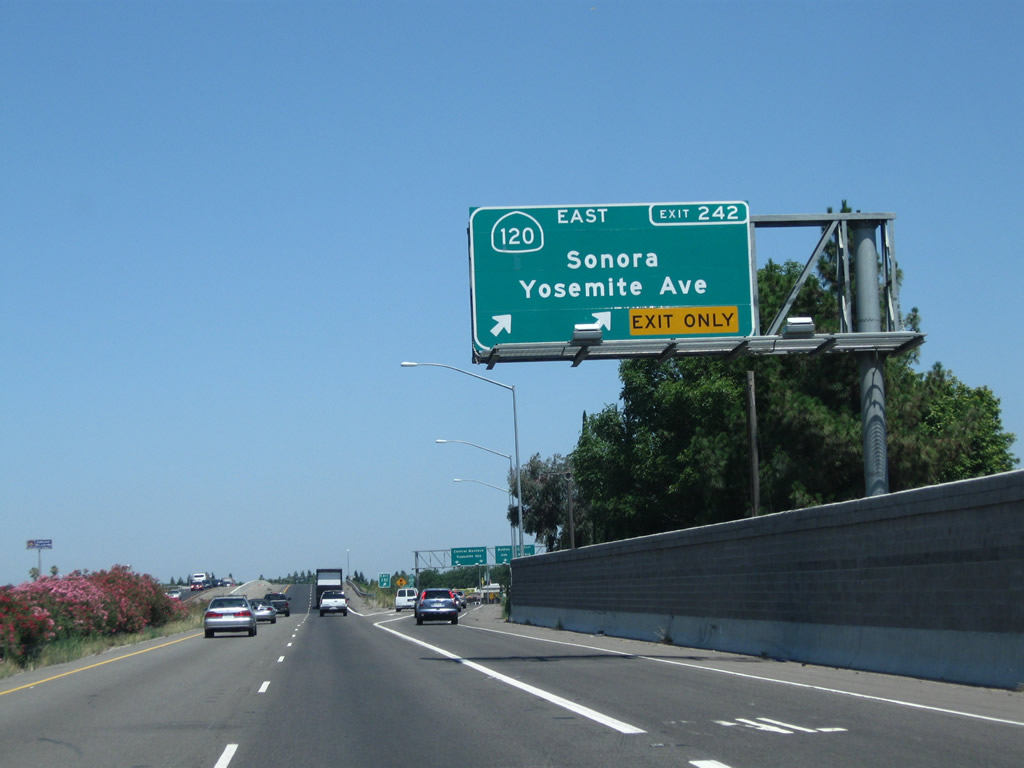
The right lane must exit onto eastbound California 120 (Exit 242). California 120 (Yosemite Avenue) leads to the Sierra Nevada Foothills and Yosemite National Park via Simms, Escalon, Oakdale, Knights Ferry, Chinese Camp, and Groveland. In the summer months, California 120 is open across Tioga Pass before meeting U.S. 395 near Lee Vining in the Eastern Sierra. Photo taken 08/22/03. |
|
Use Yosemite Avenue (Old California 120) west into downtown Manteca. Yosemite Avenue is not a designated business route of California 120, but it does follow the original route through town, reconnecting with California 120 at Exit 1 just east of Interstate 5. Photo taken 07/31/11. |
|
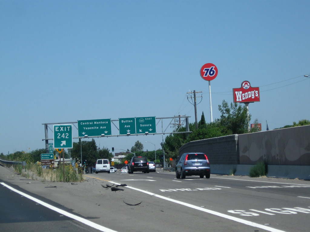
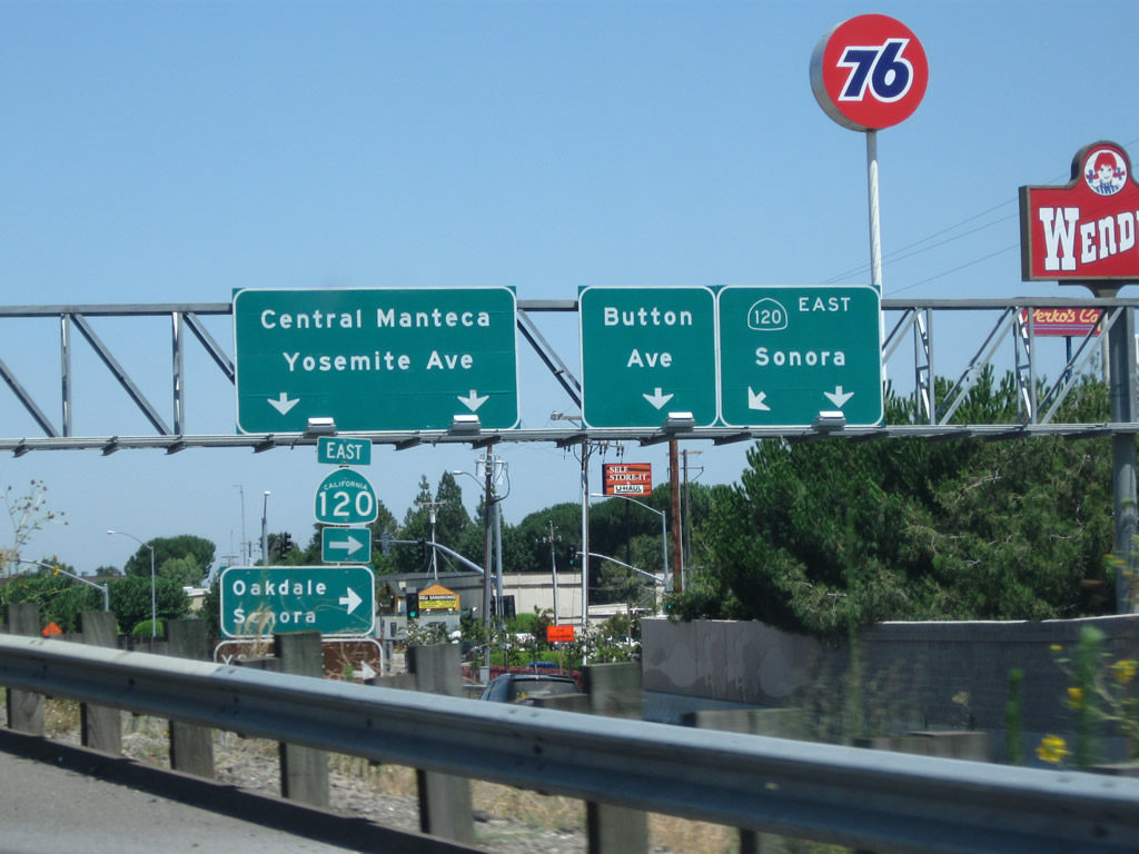
Northbound California 99 reaches Exit 242, California 120 (Yosemite Avenue) east to Oakdale and Sonora and west to downtown Manteca. Photo taken 07/31/11. |
|
The off-ramp from California 99 north to Exit 242, California 120 (Yosemite Avenue) was expanded to allow for two lanes to connect to California 120 east. Photo taken 07/31/11. |
|
Most motorist services (gas, food) are available at Exit 242, California 120 (Yosemite Avenue) in Manteca. Photo taken 07/31/11. |
|
California 99 curves to the northwest as it passes through the Exit 242 interchange (California 120 (Yosemite Avenue) in Manteca. Photo taken 07/31/11. |
|
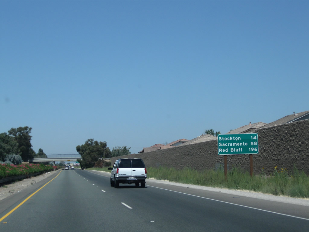
Leaving California 120 (Yosemite Avenue) behind, this mileage sign along California 99 north provides the distance to Stockton (14 miles), Sacramento (58 miles), and Red Bluff (196 miles). Photo taken 07/31/11. |
|
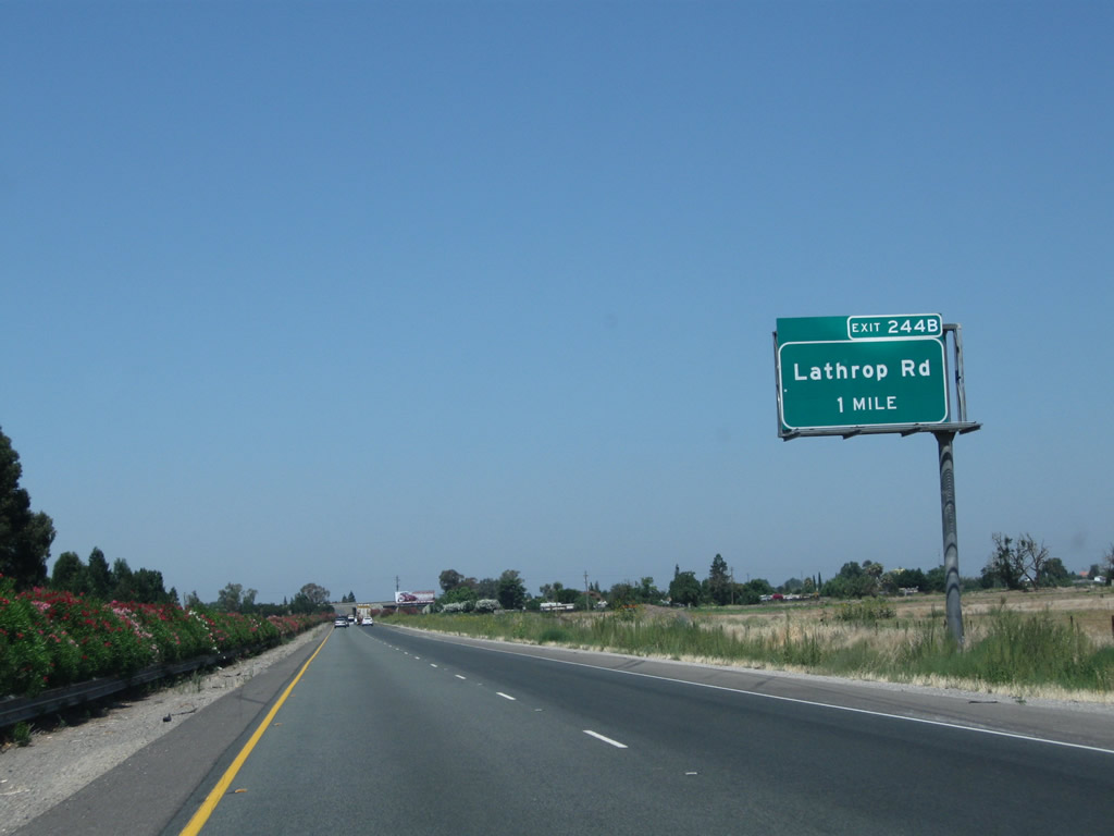
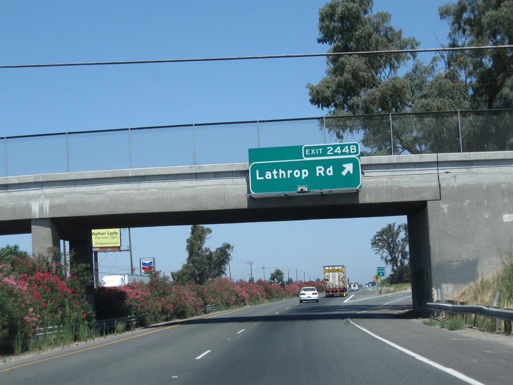
The next exit along California 99 north is Exit 244B, Lathrop Road (one mile). Exit 244A to Main Street south is not accessible from northbound California 99. Photo taken 07/31/11. |
|
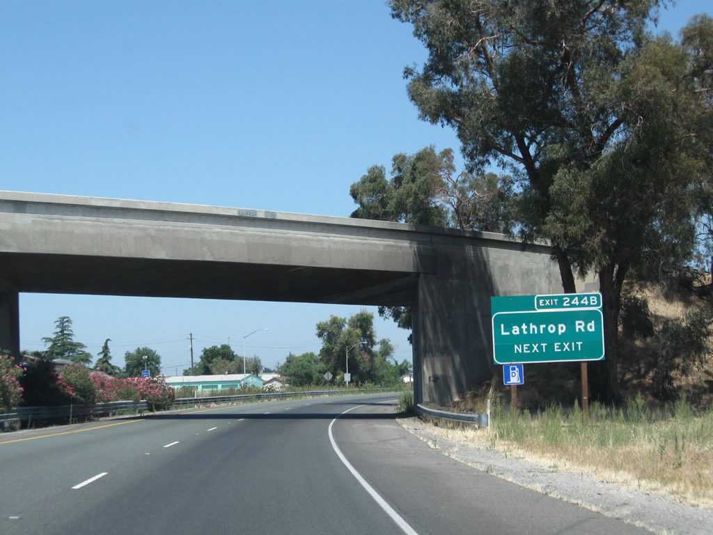
The next exit along California 99 north is Exit 244B, Lathrop Road, next right. Note the use of exit numbers on this series of new signs. Photo taken 07/31/11. |
|
Northbound California 99 meets Exit 244B, Lathrop Road. Lathrop Road leads west to Lathrop and Interstate 5; it leads east to Austin Road. Photo taken 07/31/11. |
|
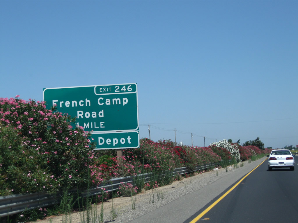
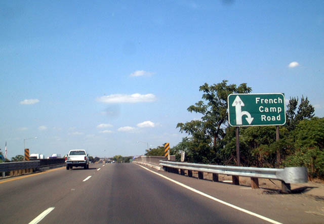
The next exit along northbound is Exit 246, San Joaquin County J-9 (French Camp Road) in one mile. Photo taken 07/31/11. |
|
San Joaquin County J-9 is a diagonal route, connecting California 99 with Five Corners and Simms (California 120) to the southeast and French Camp and Interstate 5 to the northwest. Photo taken 07/31/11. |
|
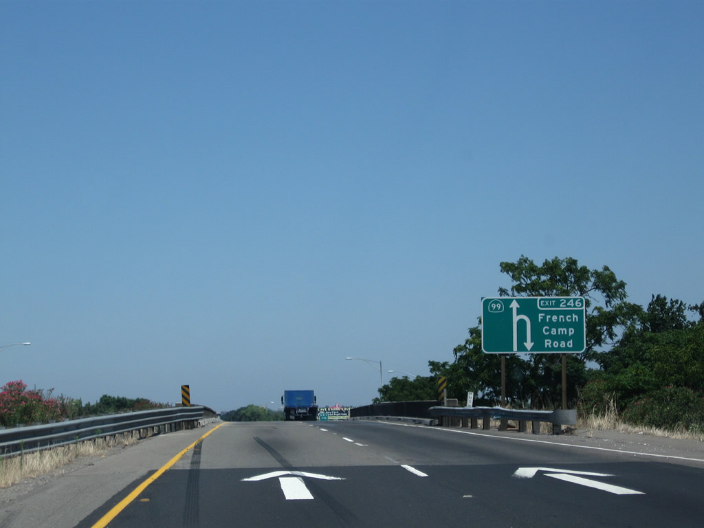
|
This unique diagrammatic sign is used for the exit from northbound California 99 to San Joaquin County J-9 (French Camp Road) (Exit 246). In the 2003 picture, the "99" is located within the head of the diagrammatic arrow without a traditional shield around the numerals. Photos taken 07/31/11 and 08/22/03. |
|
Northbound California 99 reaches Exit 246, San Joaquin County J-9 (French Camp Road). A nice view looks north along the 99 freeway. Photo taken 07/31/11. |
|
The next exit along northbound California 99 is Exit 248, which connects to Kingsley Road (the frontage road). There are several exits along this stretch of California 99 that connect to the frontage road, which occasionally was the original alignment of old U.S. 99. This is a substandard exit that would need to be reconfigured to meet today's Interstate standards. Photo taken 07/31/11. |
|
There is no deceleration lane for the "off-ramp" to Kingsley Road (the frontage road, which really is a hard, 90-degree right turn). Photo taken 07/31/11. |
|
|
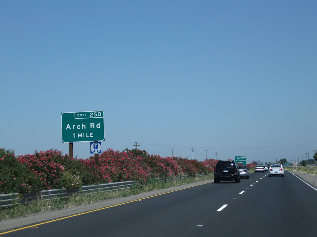
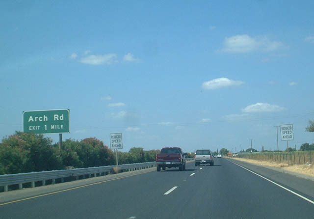
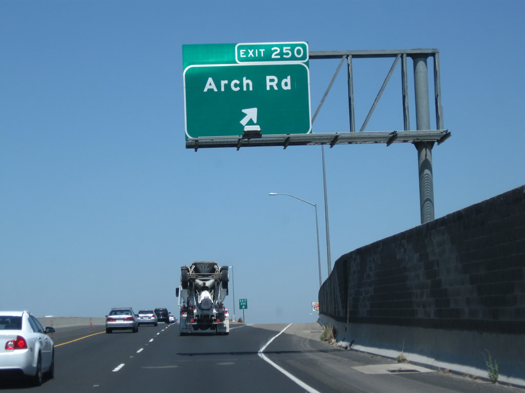
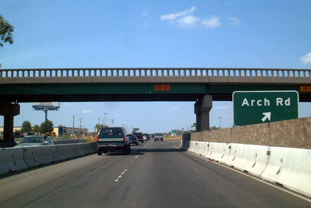
The next exit along California 99 north is Exit 250, Arch Road, one mile. This is a single-point urban interchange (one of the few along California 99), and it is the first to serve the city of Stockton. Interchange improvements were completed here in 2003-2004. Photos taken 07/31/11 and 08/22/03. |
|
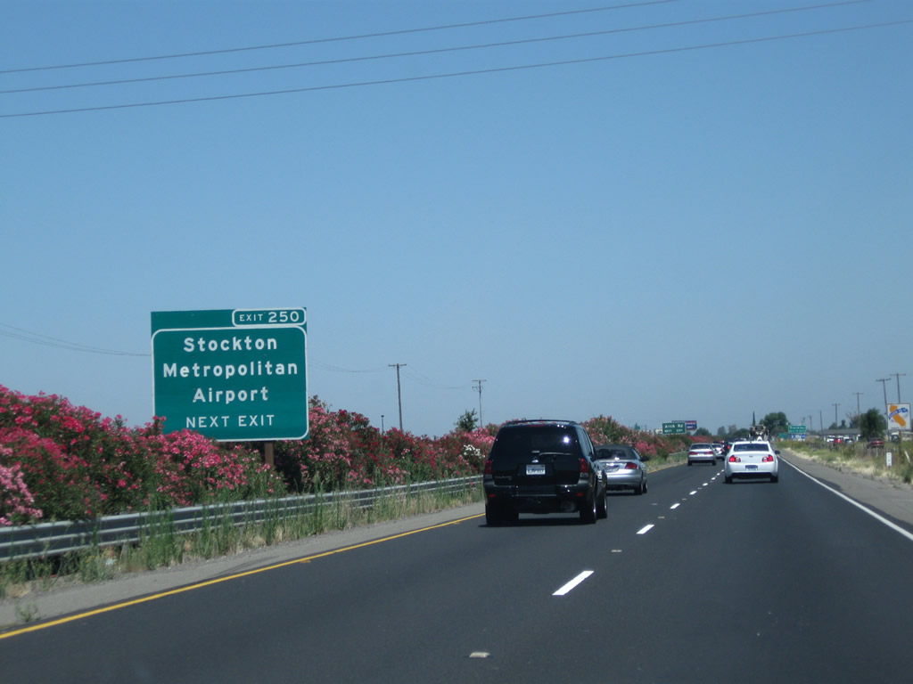
Use Arch Airport Road west to Stockton Metropolitan Airport. A proposed California state route is defined legislatively as California 234 but has not been constructed. California 234 is proposed to run east-west between California 99 and Interstate 5 along either Arch Airport Road or San Joaquin County J-8 (French Camp Road). However, there are no active plans to construct this route. Photo taken 07/31/11. |
|
Arch Airport Road travels west to Stockton Metropolitan Airport, and Arch Road travels east to Austin Road (which connects to Mariposa Road). Photo taken 07/31/11. |
|
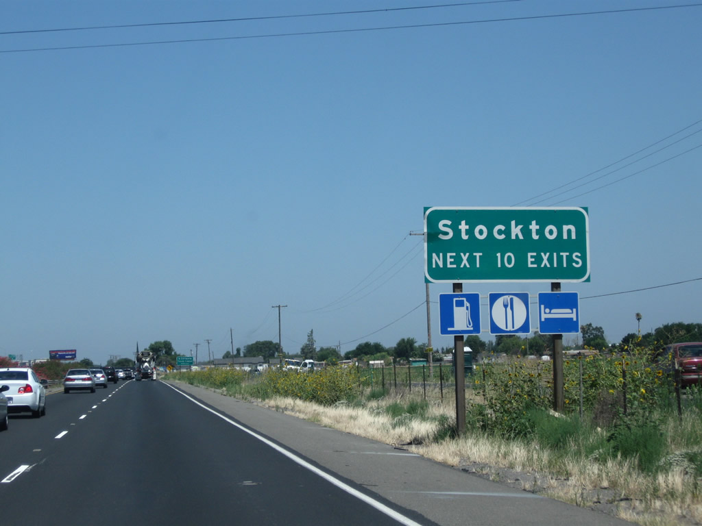
The next 10 exits along California 99 serve the city of Stockton. Photo taken 07/31/11. |
|
|
Northbound California 99 meets Exit 250, Arch Road. Note the old-style guardrail on this overpass. reconstruction of the interchange in 2003 and 2004 resulted in the current configuration as of 2011. Photos taken 07/31/11 and 08/22/03. |
|
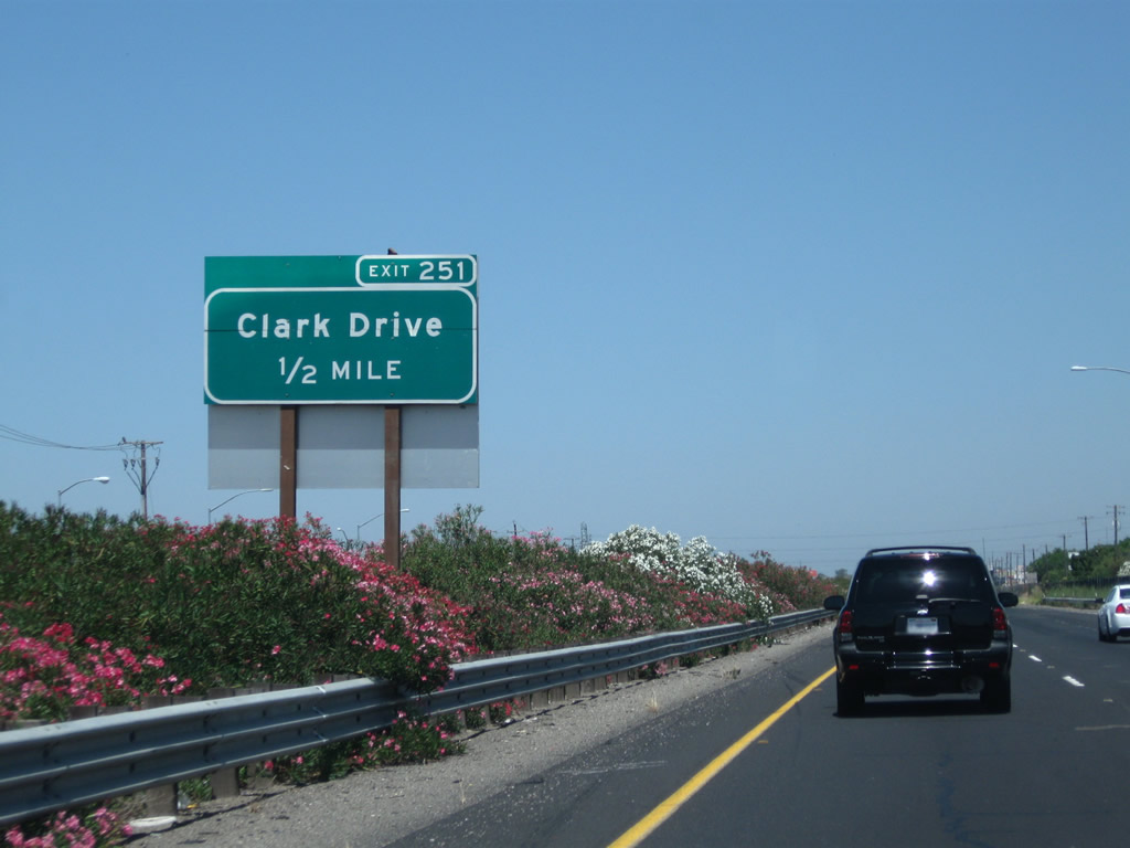
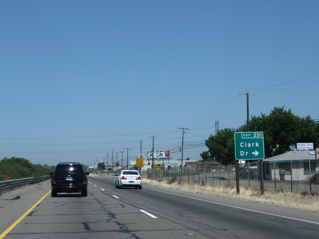
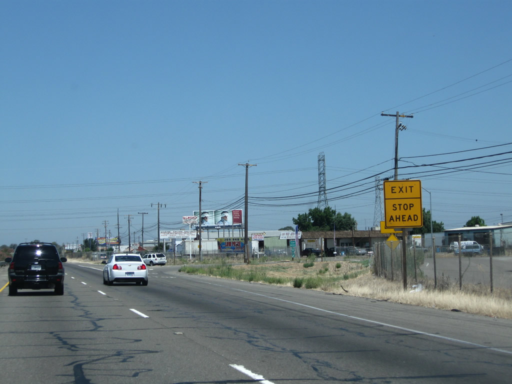
The next exit along California 99 north is Exit 251, Clark Drive, next right. Photo taken 07/31/11. |
|
Northbound California 99 meets Exit 251, Clark Drive. If California 99 were to be upgraded to Interstate standards, sharp right turn exits such as this one may have to be upgraded to modern standards. Photo taken 07/31/11. |
|
Exiting traffic will have to stop upon leaving the freeway. Photo taken 07/31/11. |
|
Clark Drive travels east from the interchange and connects to the 99 Frontage Road on the east side of the freeway. Photo taken 07/31/11. |
|
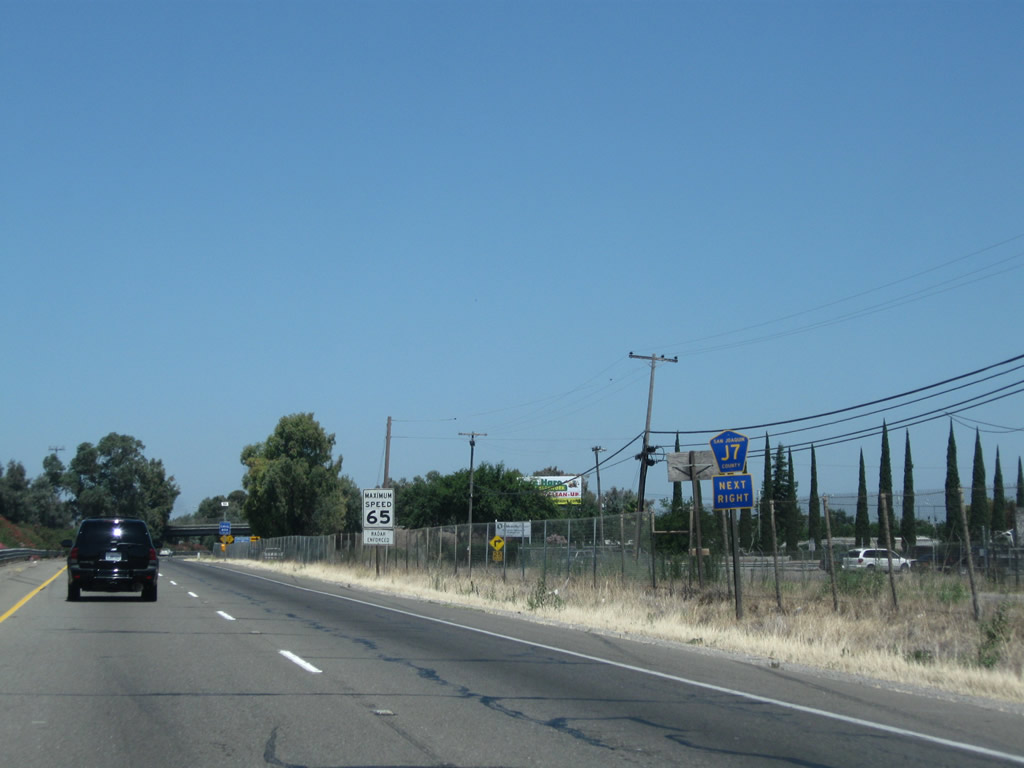
The next exit along northbound California 99 is Exit 252A, California 99 Business and San Joaquin County J-7 (Mariposa Road). San Joaquin County J-7 and California 99 Business lead northwest into Stockton; San Joaquin County J-7 leads southeast toward Escalon, Riverbank, and Empire. Use California 99 Business (Mariposa Road) north to California 4 Business west. Photo taken 08/22/03. |
|
This advance marker for San Joaquin County J-7 is a standard advance shield, placed separately from the overhead guide sign. Photo taken 07/31/11. |
|
Mariposa Road serves as the southernmost segment of the business route for California 99. It is unusual to see business route signs that feature shields on the freeway; the normal standard is for such signage to be text only. Notably, this sign mentions California 4 Business; since California 4 was rerouted onto the Crosstown Expressway, a business route was commissioned along its original route via Charter Way. Following northbound California 99 Business and San Joaquin County J-7 connects with Charter Way as a more direct route to California 4 Business (Charter Way). This sign was gone by 2011. Photo taken 08/22/03. |
|
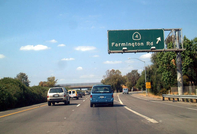
Northbound California 99 meets Exit 252A, California 99 Business (Mariposa Road) north and San Joaquin County J-7 (Mariposa Road) south. J-7 is a long county route that extends from Stockton southeast to California 59 near Merced. The next exit along California 99 north is Exit 252B, California 4 (Farmington Road) east and California 4 Business (Farmington Road) west. Photo taken 07/31/11. |
|
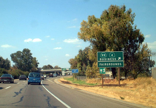
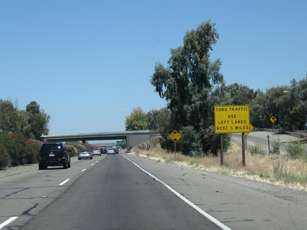
Due to high entering/exiting traffic volume along California 99 north, through traffic is advised to use the left lane. The city of Stockton is the seat of San Joaquin County and had a population of 291,707 as of the 2010 Census. Stockton was incorporated on July 23, 1850, and sits on the eastern edge of the California Delta, with a deep water port near Interstate 5 and California 4. This city was hit hard by the foreclosure crisis that began in 2007 and reduced property values substantially through 2010. Photo taken 07/31/11. |
|
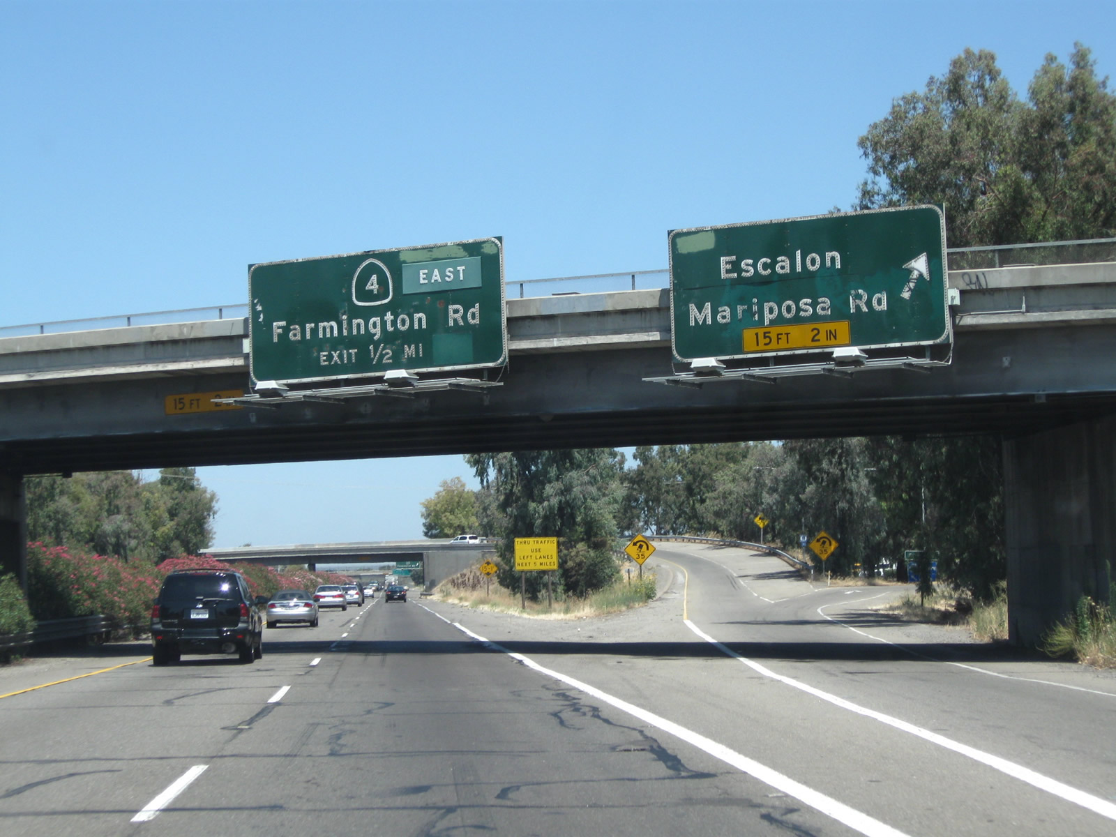
Immediately thereafter, northbound California 99 meets Exit 252B, California 4 (Farmington Road) east to Farmington, Copperopolis, Angels Camp, Murphys, and Arnold. California 4 Business (Farmington Road) (which was signed in 2003 but appears to be unsigned as of 2011) travels west from this interchange to meet Mariposa Road. Photo taken 08/22/03. |
|
|
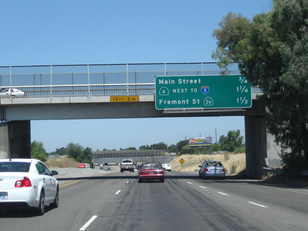
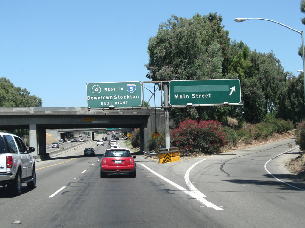
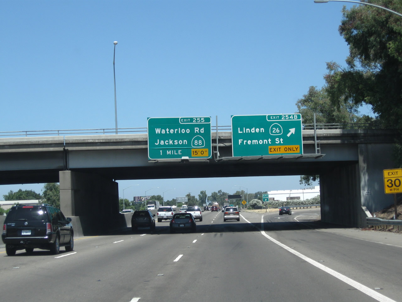
As traffic from California 4 west merges onto California 99 north, this mileage sign provides the distance to the next three exits: Exit 253, Main Street; Exit 254A, California 4 (Crosstown Freeway) west, and Exit 254B, California 26 (Fremont Street) east. If the Crosstown Freeway is extended east of California 99 someday, California 4 would be rerouted onto that freeway, and the existing sections on Farmington Road would likely become part of California 4 Business. Photos taken 07/31/11 and 08/22/03. |
|
A California 99 north reassurance shield is posted shortly thereafter. Photo taken 07/31/11. |
|
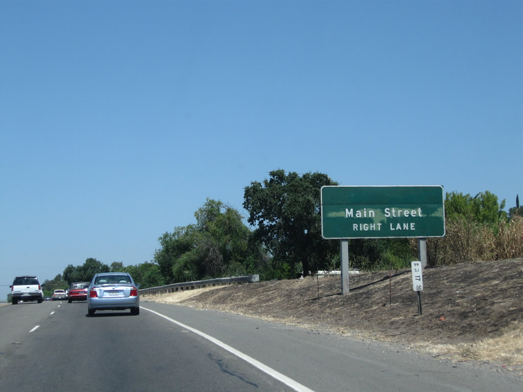
Main Street is the next exit along northbound (Exit 253). Farmington Road (which carries California 4 into Stockton from the east) becomes Main Street upon entering the city. Taking this exit westbound follows California 4 Business into Stockton, and it connects with Charter Way and California 99 Business just west of here. Photo taken 07/31/11. |
|
California State University-Stanislaus has a campus in Stockton, but this sign is interesting for omitted the state shield outline around the "4." Photo taken 07/31/11. |
|
Northbound California 99 reaches Exit 253, Main Street. The following off-ramp is Exit 254A, California 4 (Crosstown Freeway) west to Antioch and Concord. If California 99 is upgraded into Interstate 9, that route may turn west onto California 4 to end at Interstate 5. Photo taken 07/31/11. |
|
|
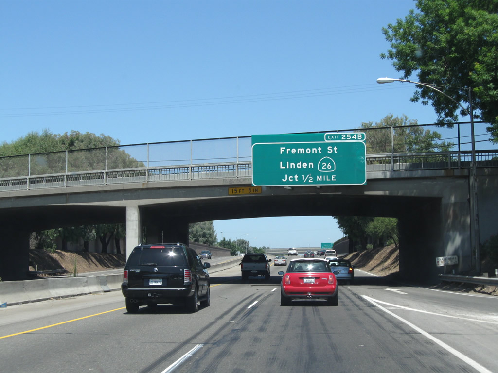
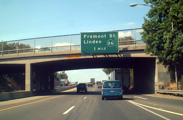
The next exit along California 99 north is Exit 254A, California 4 (Crosstown Freeway) west, followed by Exit 254B, California 26 (Fremont Street) east to Linden, Valley Springs, and Mokelumne Hill. Photos taken 07/31/11 and 08/22/03. |
|
|
Northbound California 99 reaches Exit 254A, California 4 (Crosstown Freeway) west to Interstate 5. The California 4 east-west freeway across Stockton was constructed in the early 1990s, opening in 1994. It is officially known as the Ort Loftus Freeway. The freeway may be extended east to connect with Farmington Road (thus expanding this interchange) and extended west, perhaps as part of an upgrade of the entire California 4 corridor between Stockton and Antioch to expressway or even freeway standards over time. This picture shows northbound California 99 at the interchange with California 4, which mentions its connection to Interstate 5 west of here. Photos taken 07/31/11 and 08/22/03. |
|
Two lanes transition from California 99 north to California 4 west. The left three lanes continue north. Photo taken 07/31/11. |
|
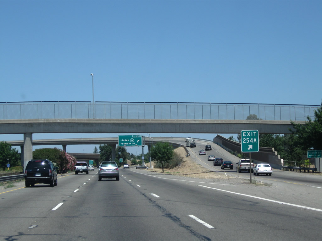
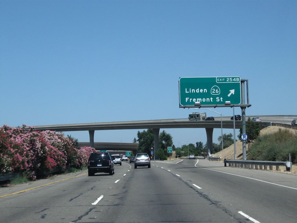
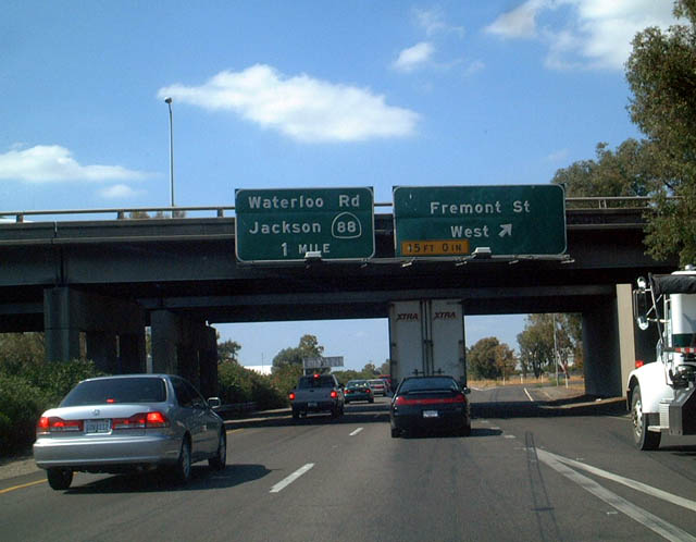
Immediately thereafter, California 99 north meets Exit 254B, California 26 (Fremont Street) east. This is the first two exits that connect to California 26 and Fremont Street. Photo taken 07/31/11. |
|
The next exit along California 99 north is Exit 254C, Fremont Street west and California 26 (Fremont Street) east (again). California 26 was known as California 8 until 1964, when it was renumbered to avoid route number duplication with newly designated Interstate 8 in Southern California. Photo taken 07/31/11. |
|
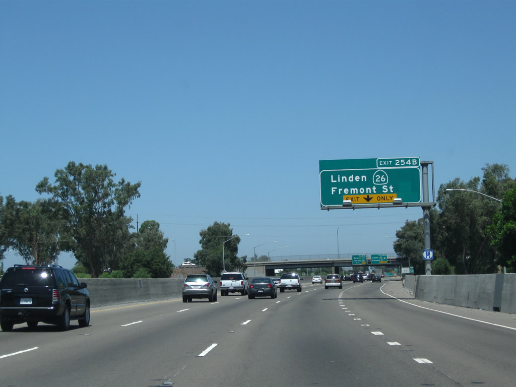
The right lane of California 99 north becomes exit only for Exit 254C, California 26 (Fremont Street). This second exit allows traffic from California 4 east to access California 26 east. This interchange serves as the western end of California 26. Fremont Street west of here is not part of the state highway system. Fremont Street enters the city center of Stockton, connecting to California 99 Business near downtown. Photo taken 07/31/11. |
|
|
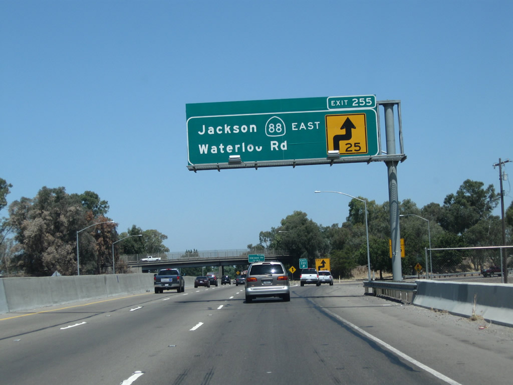
Northbound California 99 reaches Exit 254C, Fremont Street west and California 26 (Fremont Street) east. The next exit along California 99 north is Exit 255, California 88 (Waterloo Road). Photo taken 07/31/11 and 08/22/03. |
|
A California 99 north reassurance shield is posted shortly thereafter. Photo taken 07/31/11. |
|
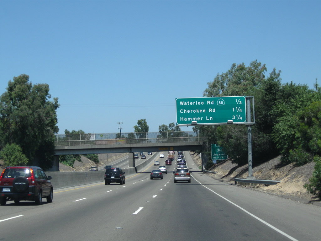
This mileage sign along California 99 north provides the distance to the next three exits: Exit 255, California 88 (Waterloo Road) east and Waterloo Road west; Exit 256, Cherokee Road; and Exit 258, San Joaquin County J-8 (Hammer Lane). Exit 257 (a frontage road off-ramp) no longer exists. Photo taken 07/31/11. |
|
California 88 is a major east-west state route that travels northeast toward the Sierra Nevada via Jackson in the foothills, taking Carson Pass over the top en route to Gardnerville, Nevada, and U.S. 395. Photo taken 07/31/11. |
|
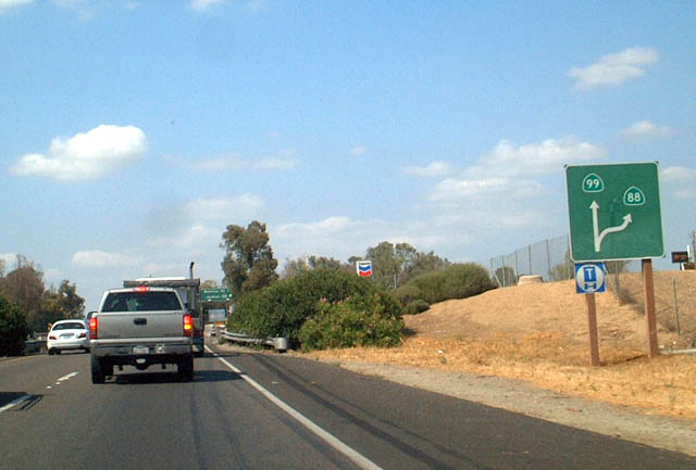
This unusual roadside directional diagram sign used to be found along California 99 north for Exit 255, California 88; it is now gone. Photo taken 08/22/03. |
|
|
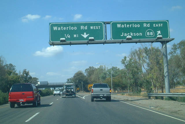
Northbound California 99 meets Exit 255, California 88 (Waterloo Road) east. California 88 leads northeast along an all-weather road across the Sierra Nevada, culminating at U.S. 395 in Minden, Nevada. Photos taken 07/31/11 and 08/22/03. |
|
|
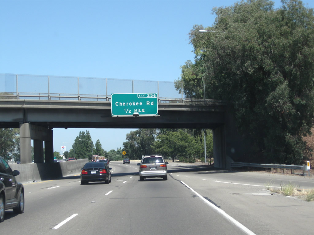
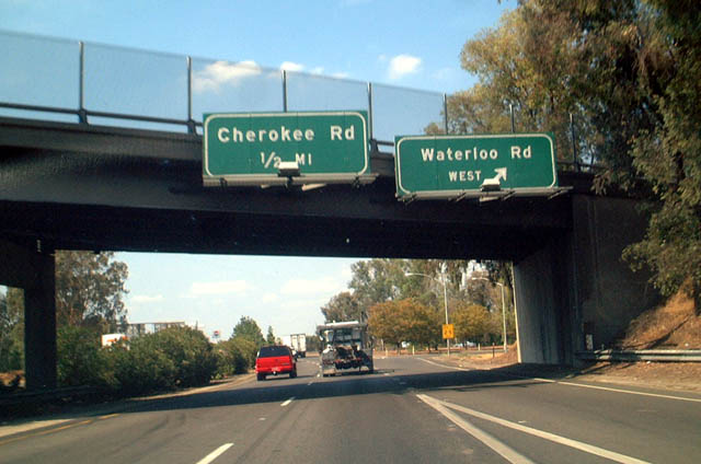
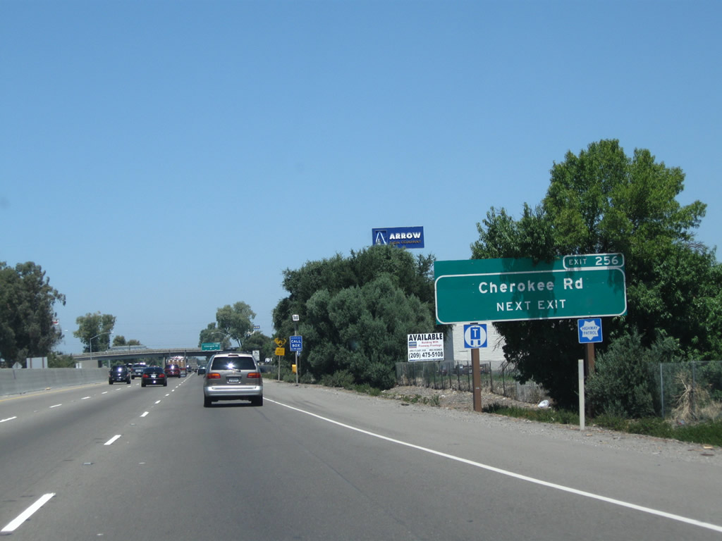
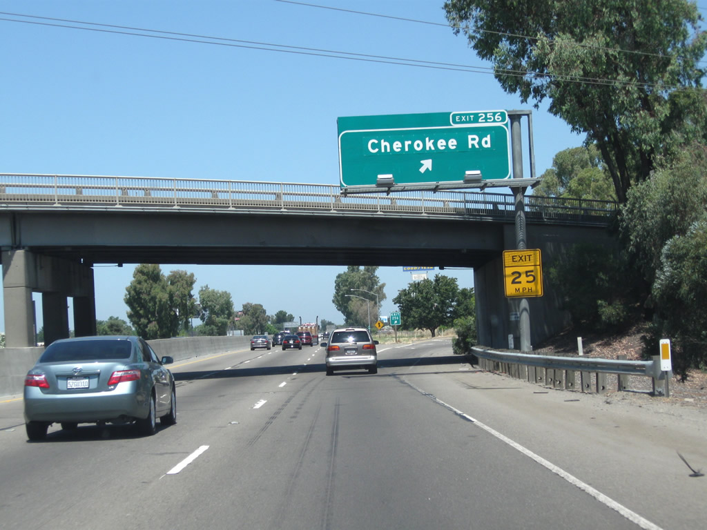
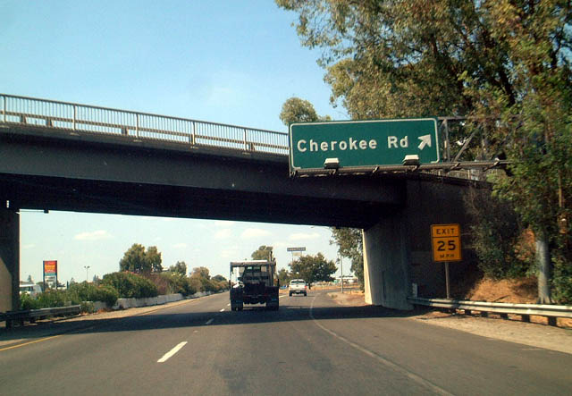
The next exit along California 99 north is Exit 256, Cherokee Lane. Back in 2003, the interchange between California 99 and California 88 was a cloverleaf; at that time, California 99 north used to meet Exit 255B, Waterloo Road west at this point. Now all traffic for Waterloo Road uses Exit 255. Photos taken 07/31/11 and 08/22/03. |
|
Cherokee Road parallels California 88 on a northeasterly trajectory between California 99 and Alpine Road. Photo taken 07/31/11. |
|
|
Northbound California 99 meets Exit 256, Cherokee Road. Photos taken 07/31/11 and 08/22/03. |
|
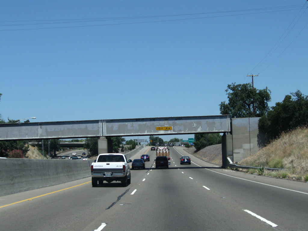
California 99 passes under a railroad bridge shortly thereafter. Photo taken 07/31/11. |
|
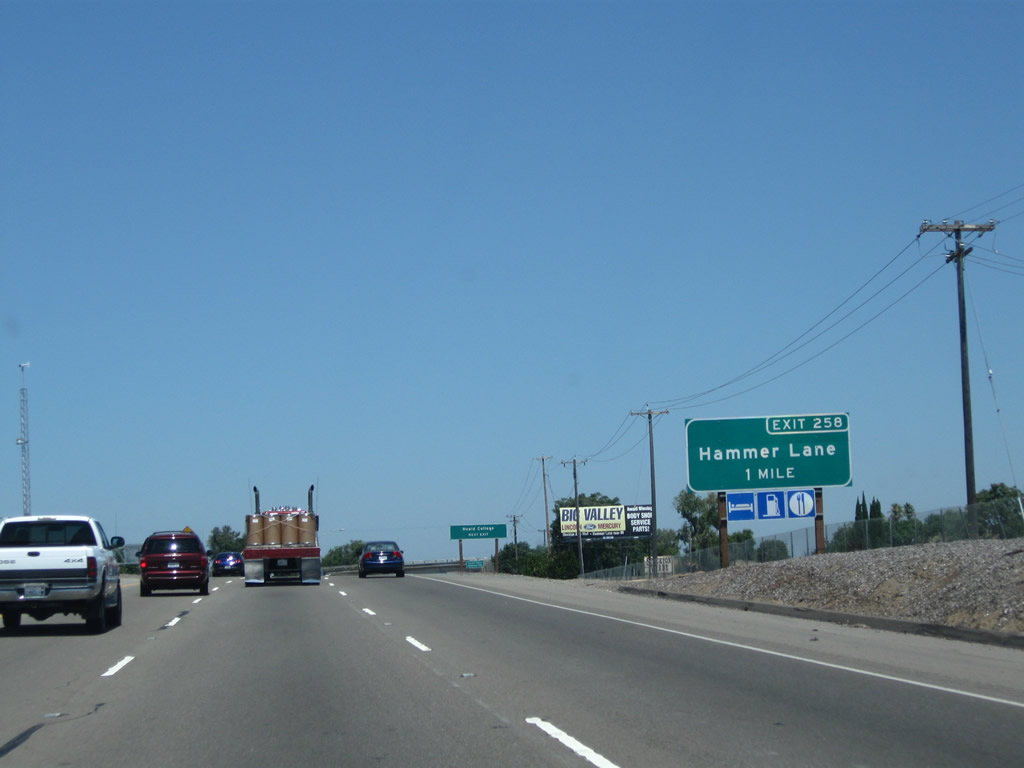
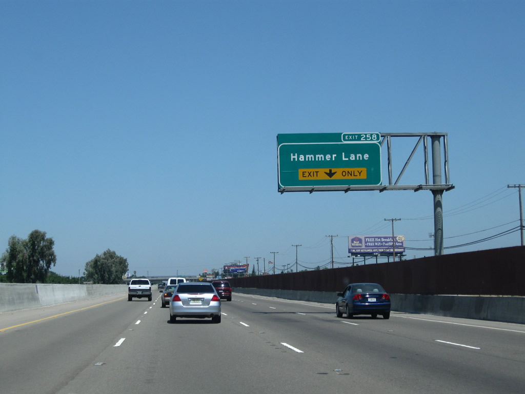
The next exit along California 99 north is Exit 258, San Joaquin County J-8 (Hammer Lane) (one mile). Nearly every kind of service is available at this major exit. Photo taken 07/31/11. |
|
Traffic from California 99 Business (Wilson Way) merges onto California 99 from the left. Photo taken 07/31/11. |
|
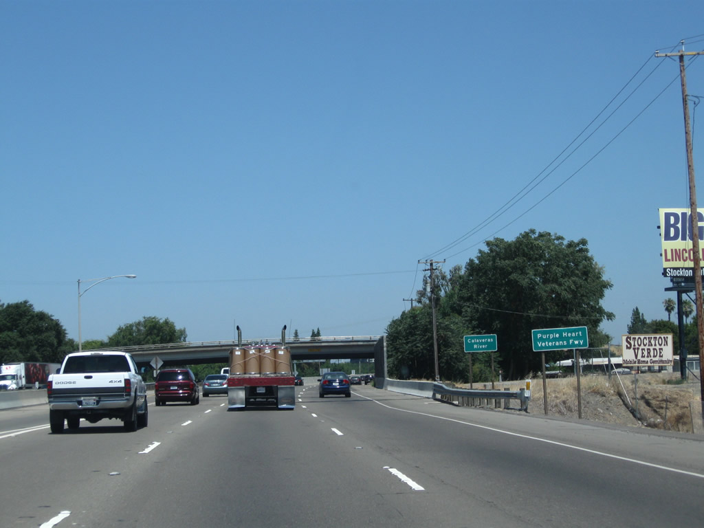
California 99 crosses over the Calaveras River, another tributary of the San Joaquin River. Photo taken 07/31/11. |
|
Shortly after traffic merges onto California 99 north from California 99 Business (Wilson Way) was a former off-ramp to Exit 257B, Frontage Road (it is now gone). Photo taken 08/22/03. |
|
The right lane of California 99 north becomes exit only along Exit 258, San Joaquin County J-8 (Hammer Lane). Photo taken 07/31/11. |
|
|
Northbound California 99 meets Exit 258, San Joaquin County J-8 (Hammer Lane). J-8 travels west to Interstate 5 Exit 478. This interchange was reconstructed in the late 2000s. Photos taken 07/31/11 and 08/22/03. |
|
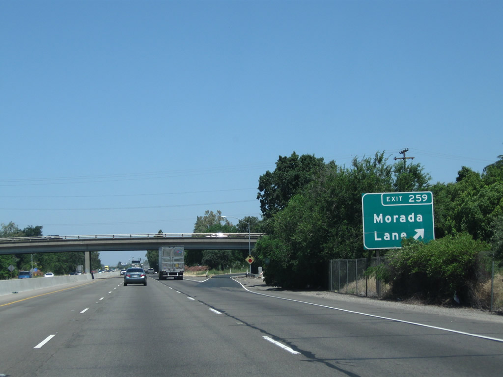
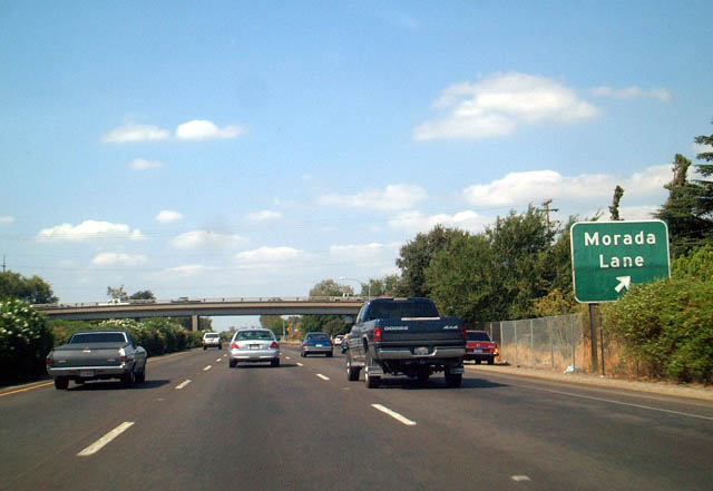
|
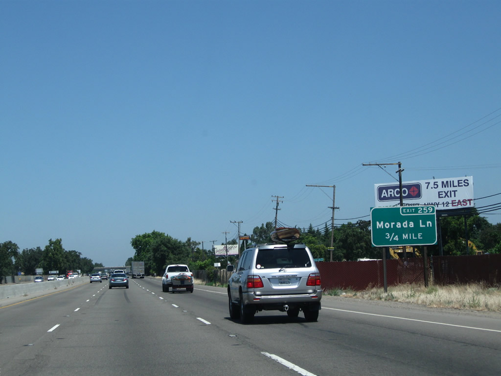
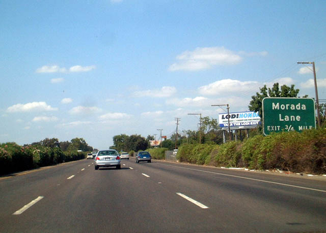
The next exit along California 99 north is Exit 259, Morada Lane (0.75 mile). Photos taken 07/31/11 and 08/22/03. |
|
|
Northbound California 99 meets Exit 259, Morada Lane. Morada Lane leads west into Morada, then connects to San Joaquin County J-3 (West Lane). Photos taken 07/31/11 and 08/22/03. |
|
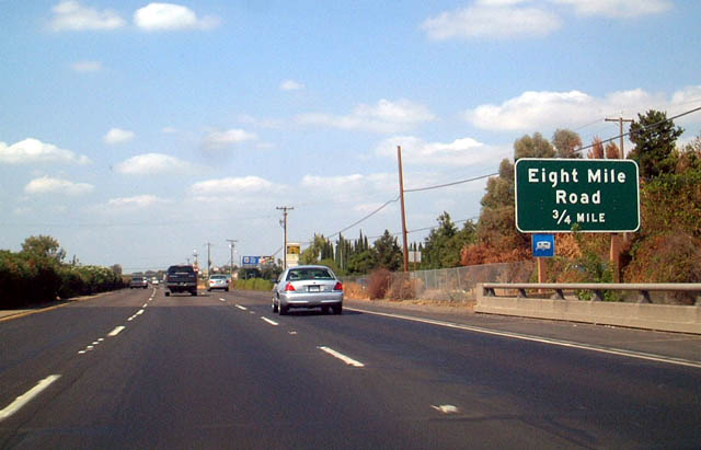
The next exit along California 99 north is Exit 260, Eight Mile Road, 0.75 mile. Photo taken 08/22/03. |
|
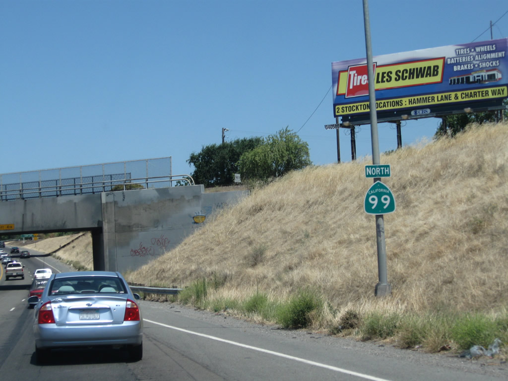
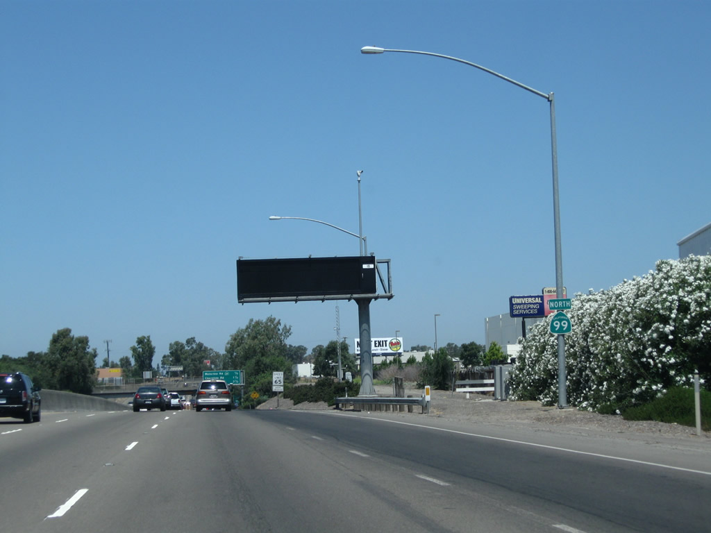
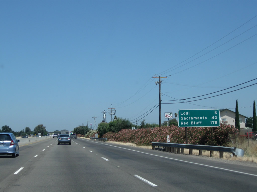
This mileage sign provides the distance to Lodi (six miles), Sacramento (40 miles), and Red Bluff (178 miles). Photo taken 07/31/11. |
|
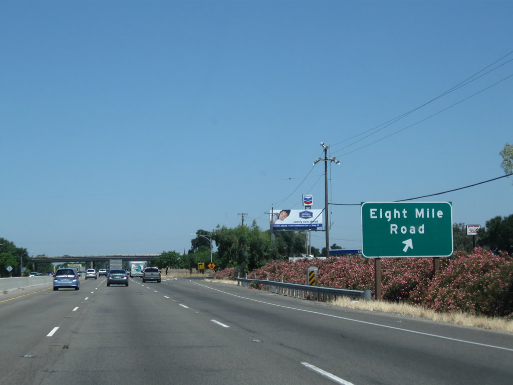
Northbound California 99 meets Exit 260, Eight Mile Road. Eight Mile Road originates in the Delta Region, then proceeds due east across the valley toward Linden and eventually California 26 via Duncan Road. Photo taken 07/31/11. |
|
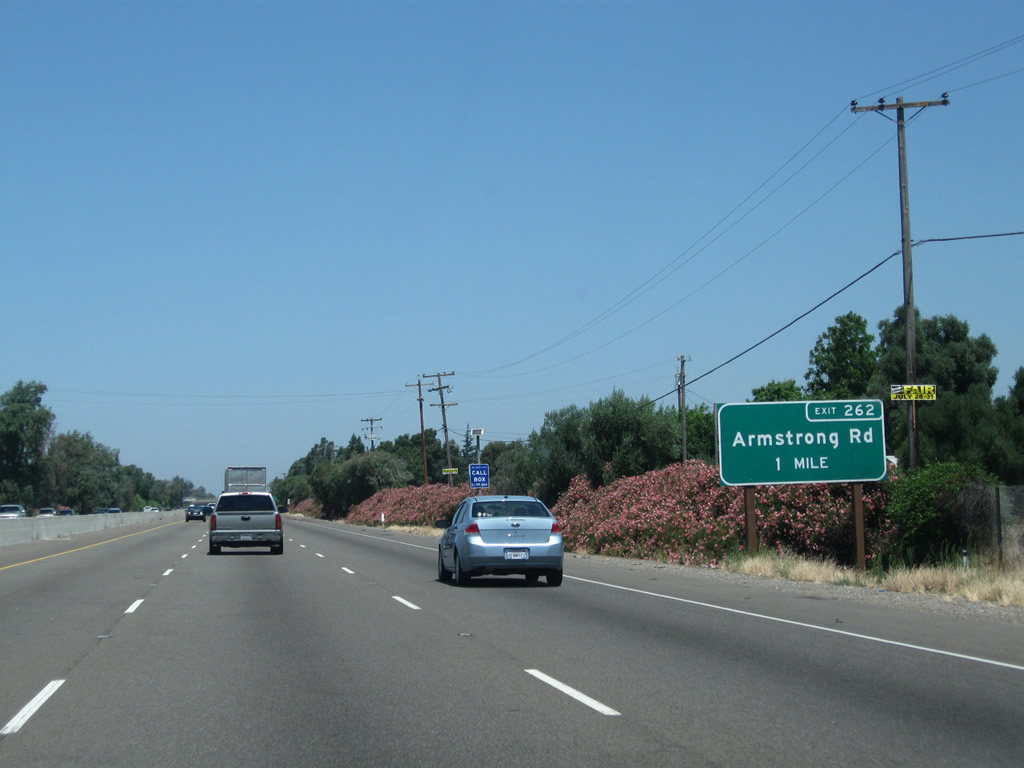
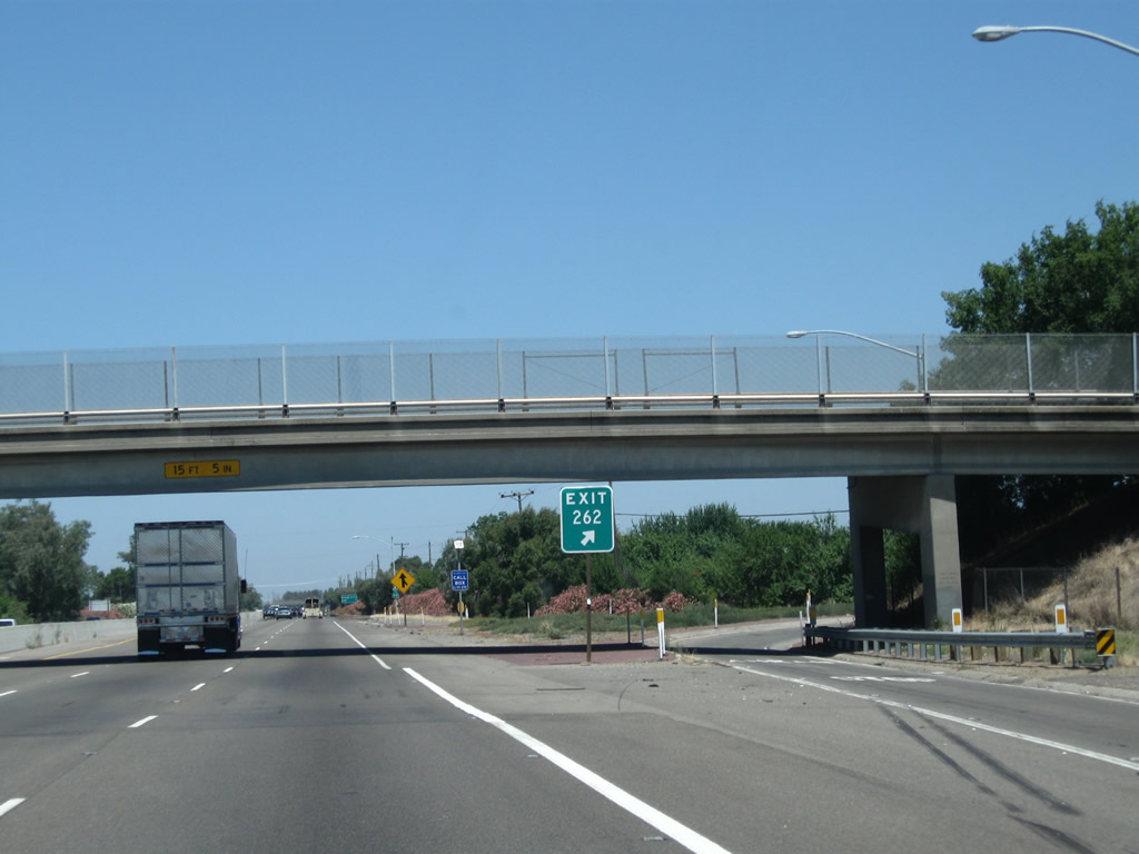
The next exit along California 99 north is Exit 262, Armstong Road (one mile). Photo taken 07/31/11. |
|
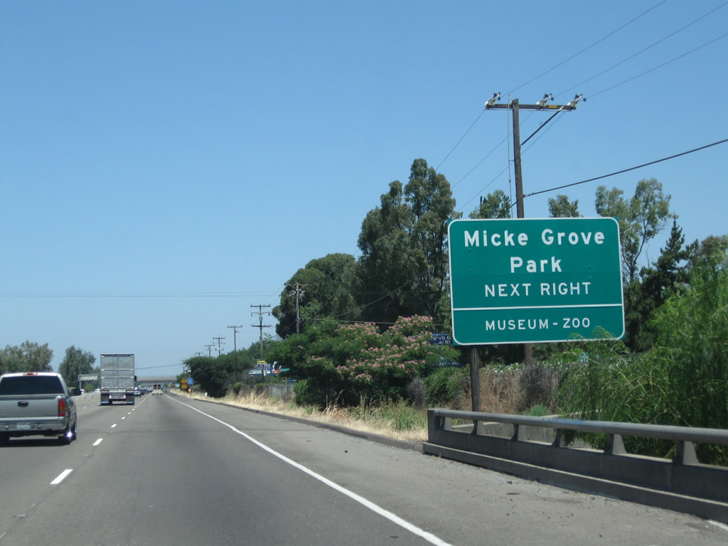
Use Armstong Road west to Micke Grove Road south to Micke Grove Park and Micke Grove Zoo. Photo taken 07/31/11. |
|
Northbound California 99 reaches Exit 262, Armstong Road. Photo taken 07/31/11. |
|
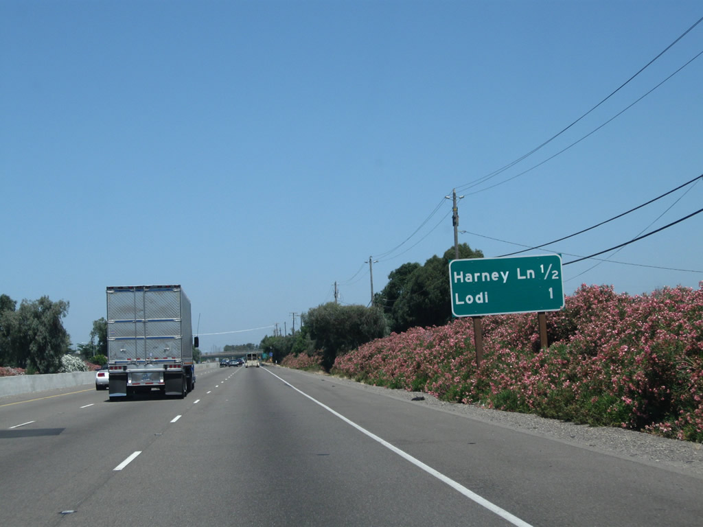
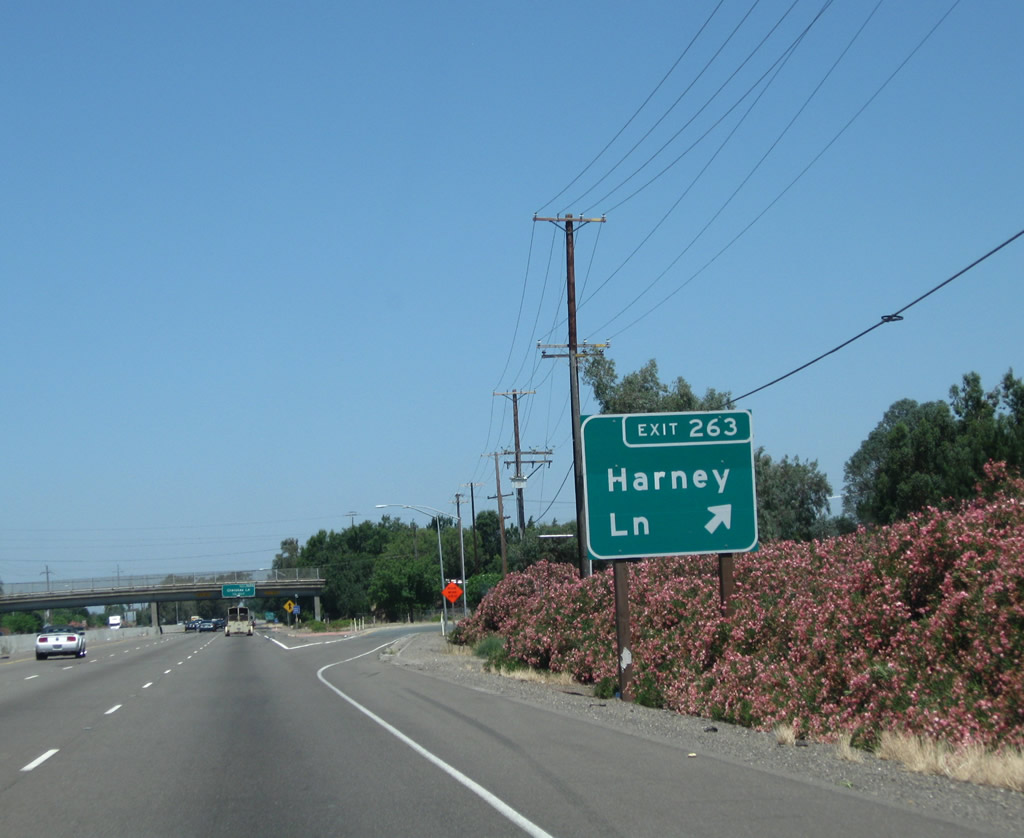
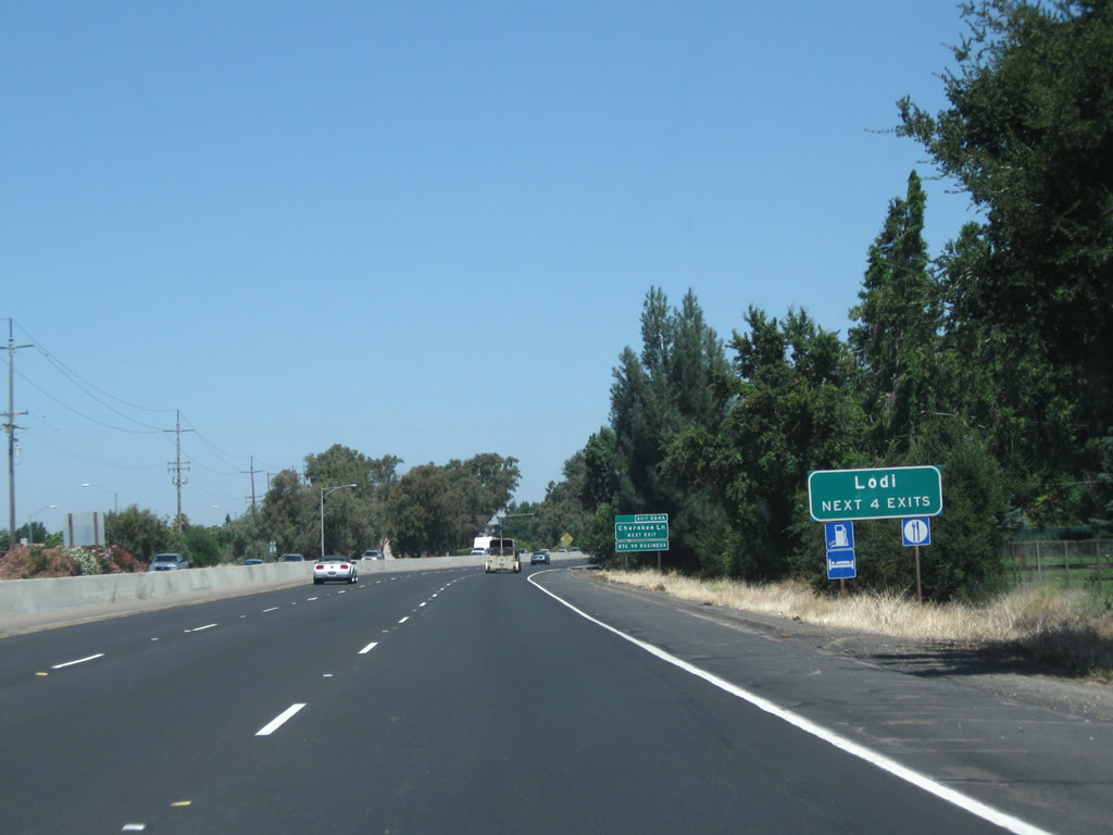
The next two exits along California 99 north are Exit 263, Harney Lane and Exit 264A, California 99 Business (Cherokee Lane) north to Lodi. Photo taken 07/31/11. |
|
Northbound California 99 meets Exit 263, Harney Lane. Photo taken 07/31/11. |
|
|
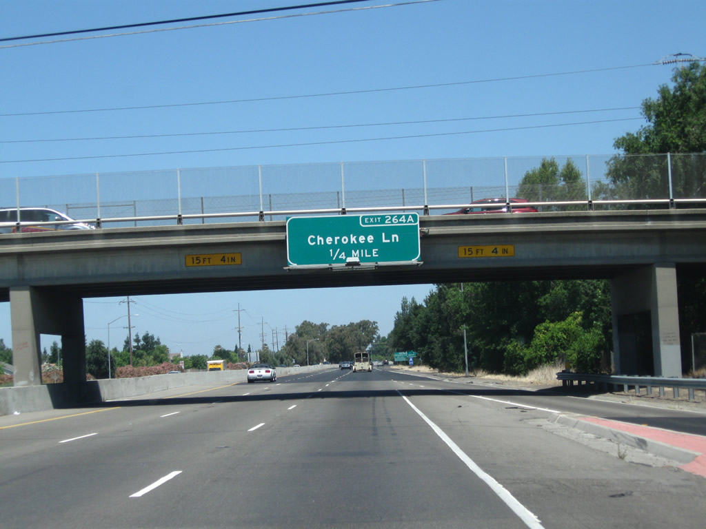
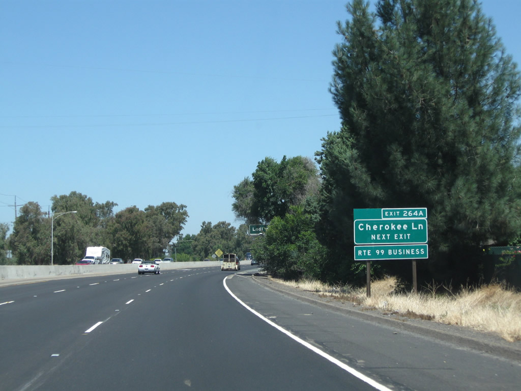
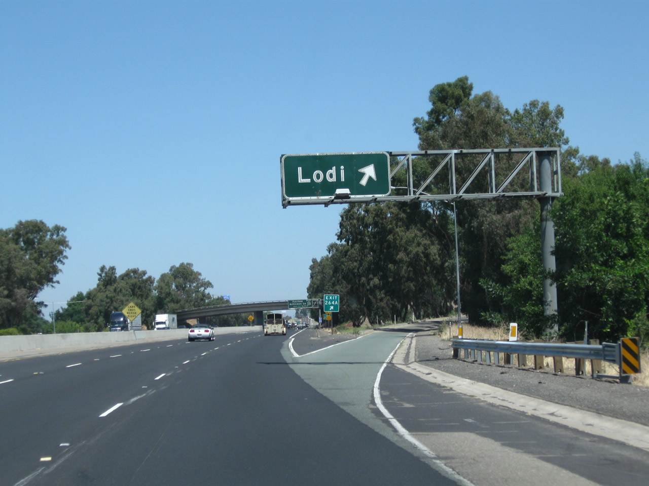
The next exit along California 99 north is Exit 264A, California 99 Business (Cherokee Lane) north to Lodi. Photos taken 07/31/11 and 08/22/03. |
|
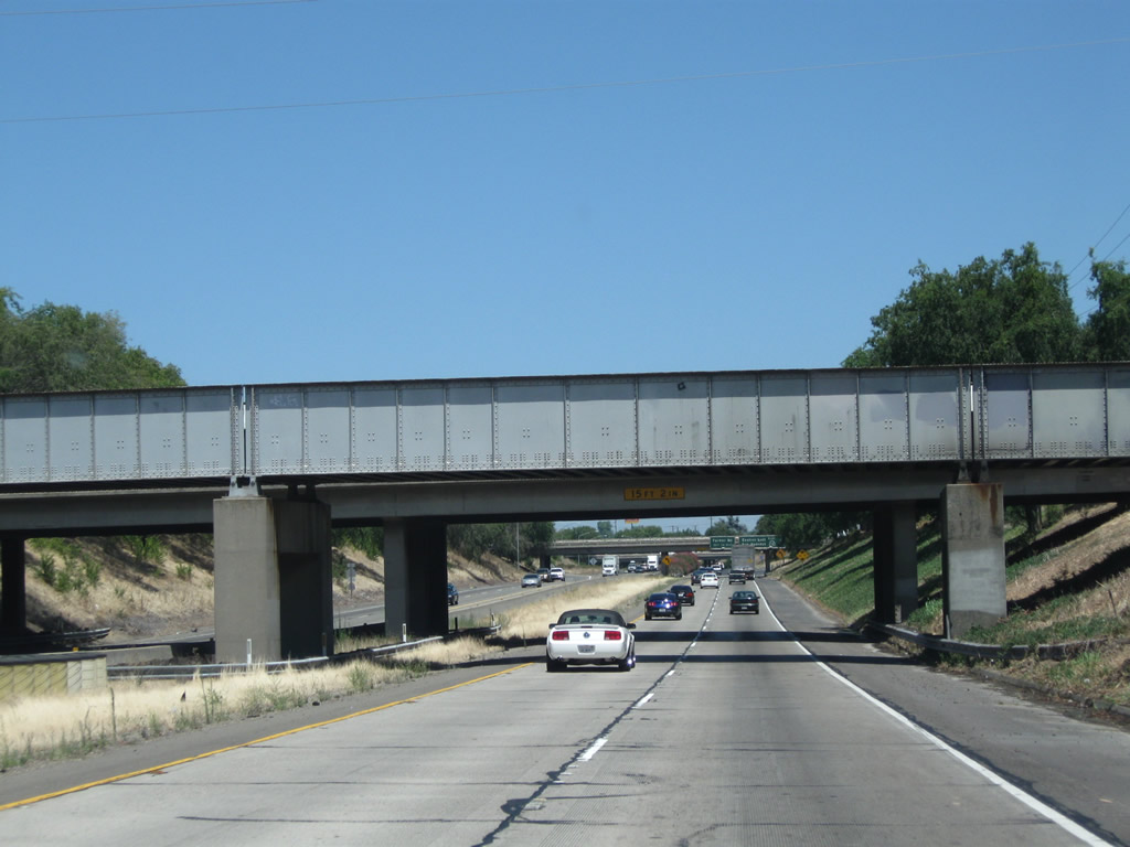
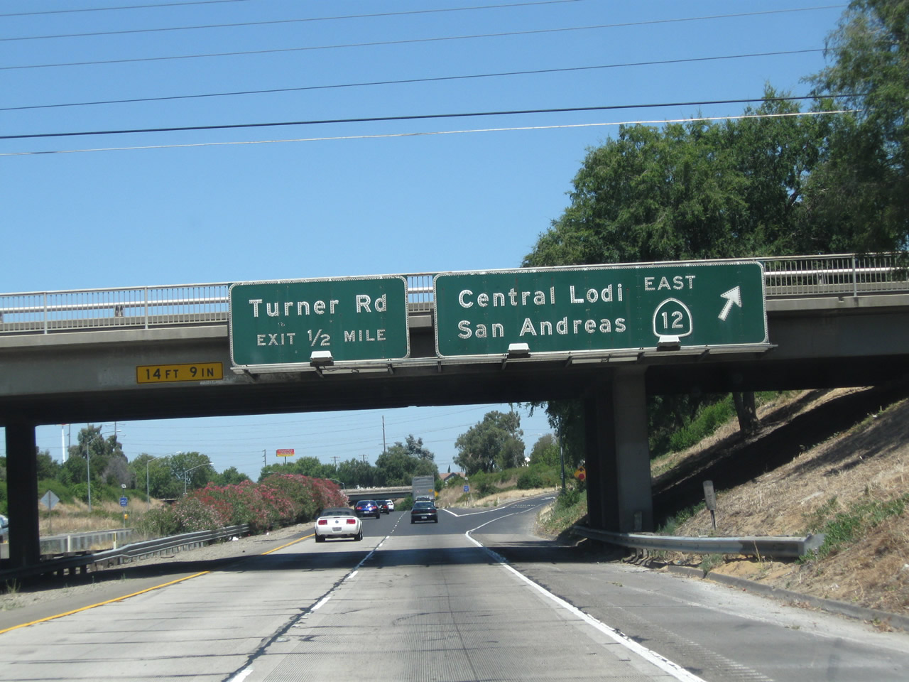
The next four exits along northbound California 99 serve the city of Lodi: Exit 264A, California 99 Business (Cherokee Lane) north; Exit 264B, California 12 (Kettleman Lane) west; Exit 266, California 12 (Victor Road) east; and Exit 267A, Turner Road. Photo taken 07/31/11. |
|
California 99 Business (signed here as "Route 99 Business") follows Historic U.S. 99 along Cherokee Lane north through Lodi, returning to the freeway at Exit 267. Historically, U.S. 99 shared alignment with U.S. 50 (Lincoln Highway) between Stockton and Sacramento. Photo taken 07/31/11. |
|
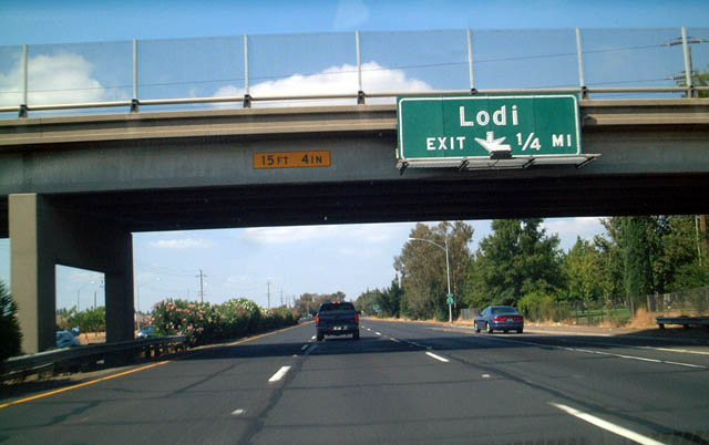
Northbound California 99 meets Exit 264A, California 99 Business (Cherokee Lane) north. The business loop follows Cherokee Lane through Lodi, which was the original path of U.S. 99 through the city. The business route through Lodi (like the Stockton loop) is sparsely signed. Photo taken 07/31/11. |
|
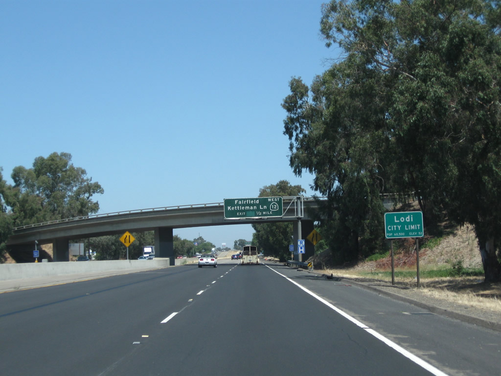
California 99 enters the city of Lodi "Zinfandel Capital of the World", which had a population of 62,134 as of the 2010 Census and was incorporated on December 6, 1906. Photo taken 07/31/11. |
|
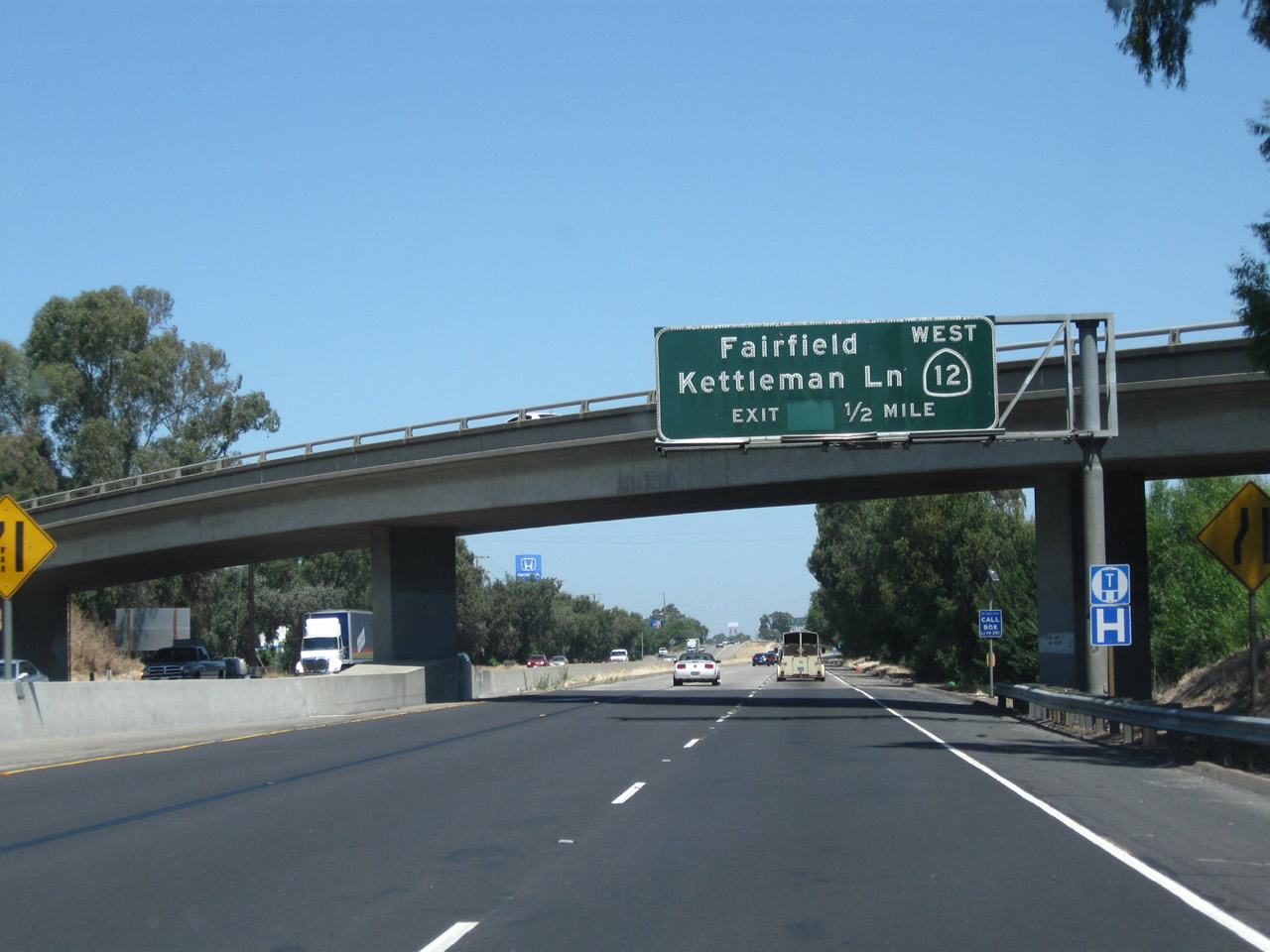
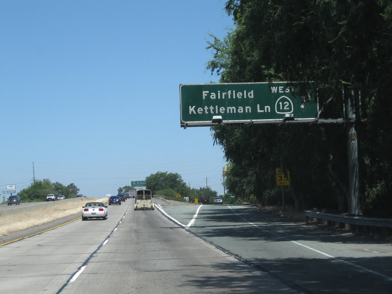
The next exit along California 99 north is Exit 264B, California 12 (Kettleman Lane) west in Lodi. California 12 leads west into the California Delta region, connecting with Interstate 80 in Fairfield, then turning northwest into the southern end of Napa Valley before entering the comparably well-regarded Sonoma Valley. After passing through Santa Rosa, California 12 culminates its westbound journey at California 116 in Sebastopol. Photo taken 07/31/11. |
|
Northbound California 99 meets Exit 264B, California 12 (Kettleman Lane) west to Rio Vista and Fairfield. California 12 east merges briefly with California 99 north for approximately two miles. Photo taken 07/31/11. |
|
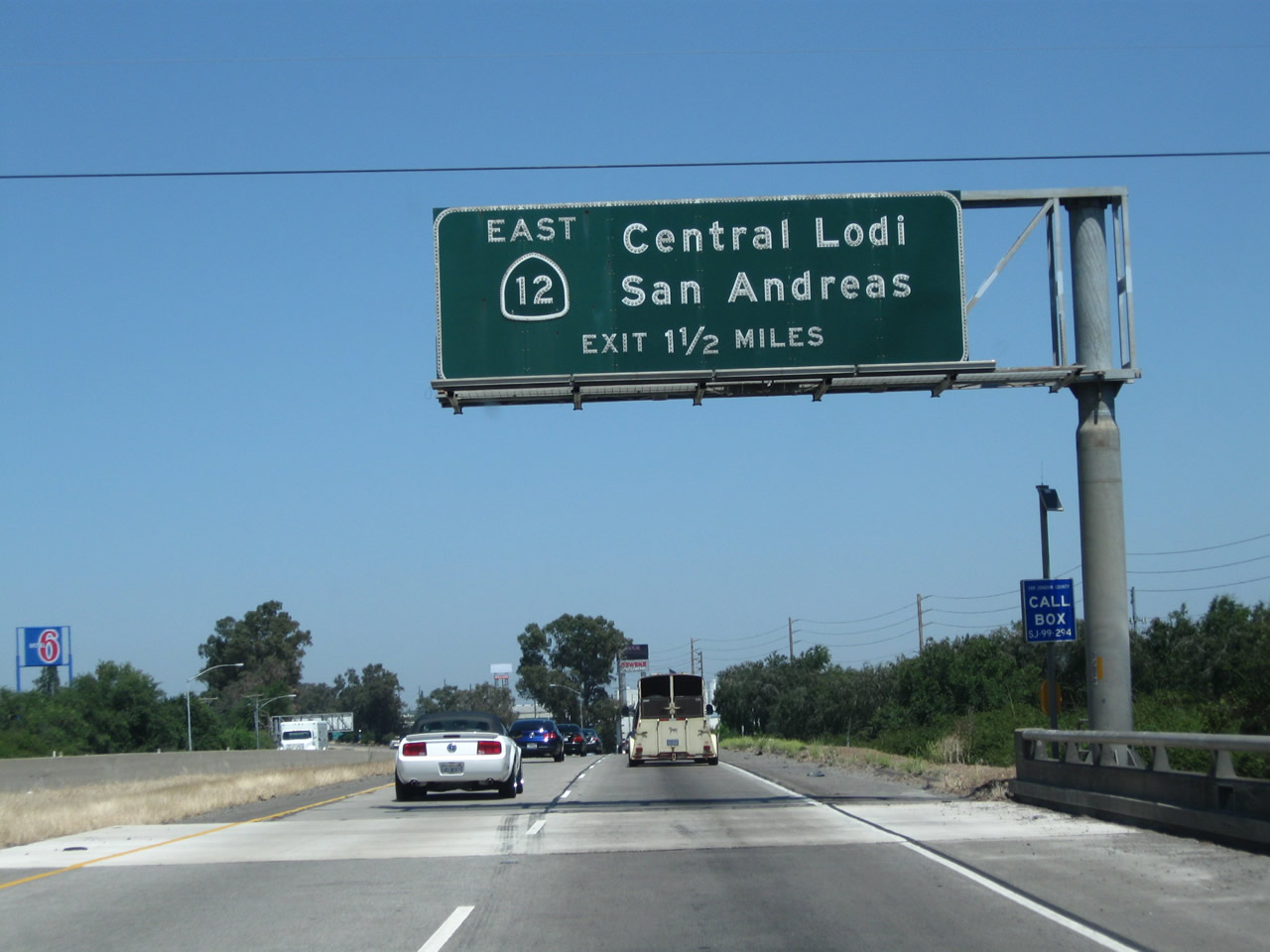
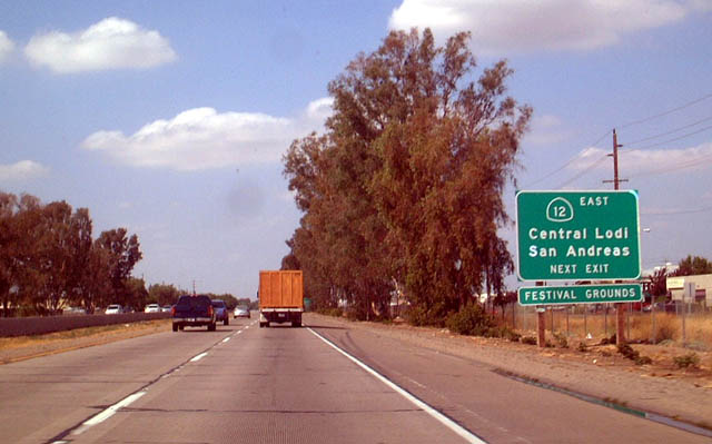
The next exit along California 99 north is Exit 266, California 12 (Victor Road) east to San Andreas. This sign is mounted on the California 99 bridge over Kettleman Lane. Ahead, traffic from California 12 east will merge onto California 99 north. Photo taken 07/31/11. |
| California 12 east & 99 north |
|
California 12 east travels to Brandywine, then connects with California 88 east of Victor. East of California 88, California 12 enters the foothills before culminating at its junction with California 49 (Gold Country Highway) in San Andreas. Photo taken 08/22/03. |
|
California 99 drops below grade as it passes near downtown Lodi. A pair of bridges pass overhead. Photo taken 07/31/11. |
|
After their brief overlap, California 99 north and California 12 east part ways at Exit 266, California 12 (Victor Road) east and Victor Road west (use Victor Road west to California 99 Business (Cherokee Lane) in Lodi). The next exit along California 99 north is Exit 267A, Turner Road. Photo taken 07/31/11. |
| California 99 north |
|
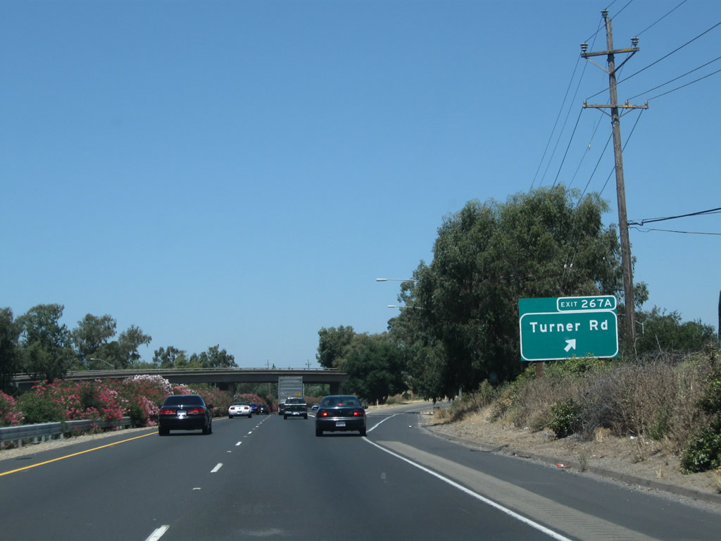
Northbound California 99 meets Exit 267A, Turner Road. Photo taken 07/31/11. |
|
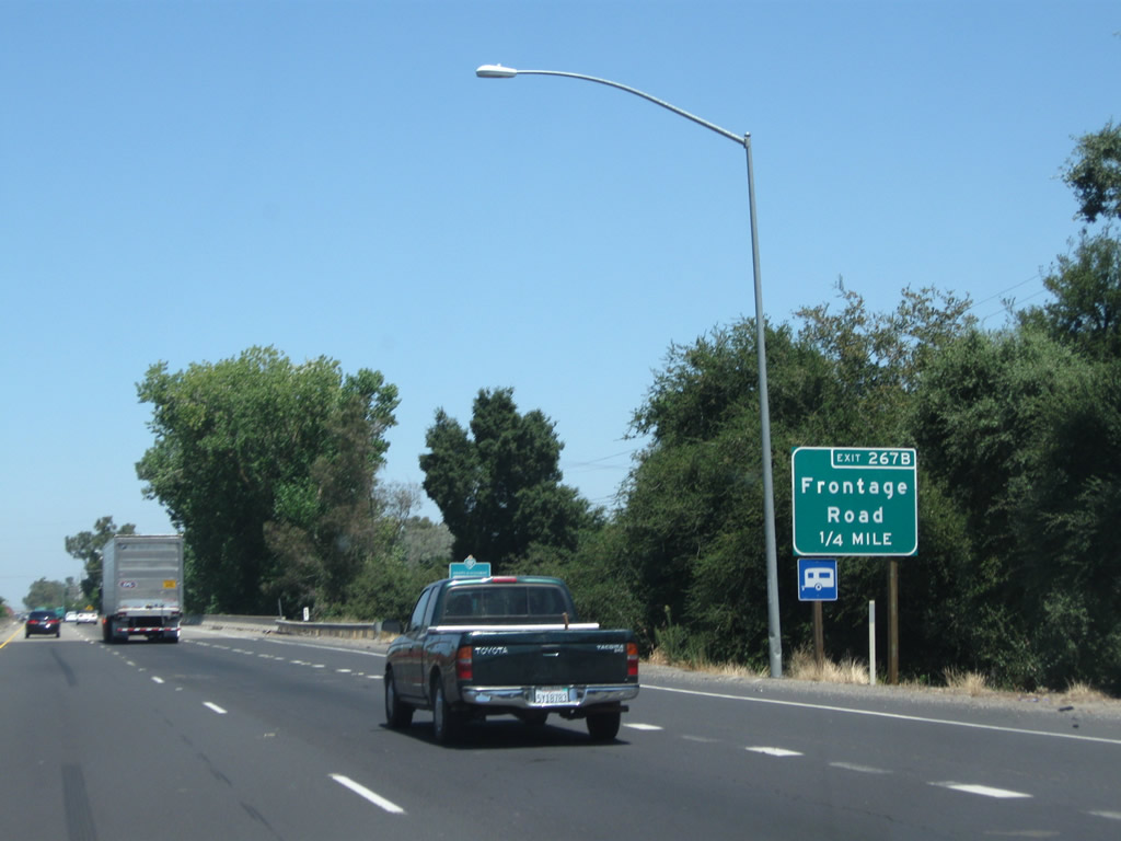
The next exit along California 99 north is Exit 267B, Frontage Road (0.25 mile). Photo taken 07/31/11. |
|
Northbound California 99 meets Exit 267B, Frontage Road. This exit is located immediately after the Mokelumne River bridge. Photo taken 07/31/11. |
|
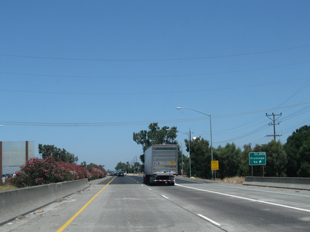
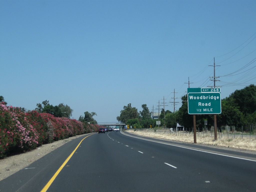
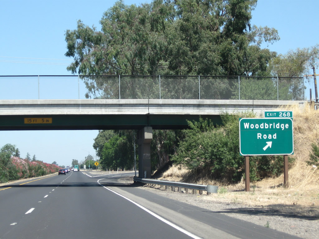
The next exit along California 99 north is Exit 268, Woodbridge Road (one-half mile). This was one of the first exit number signs to come to this stretch of California 99, as it was installed prior to August 2003. Photo taken 07/31/11. |
|
Northbound California 99 meets Exit 268, Woodbridge Road. Photo taken 07/31/11. |
|
This view looks north along California 99 between Woodbridge Road and Acampo Road. Photo taken 07/31/11. |
|
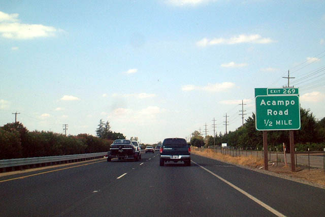
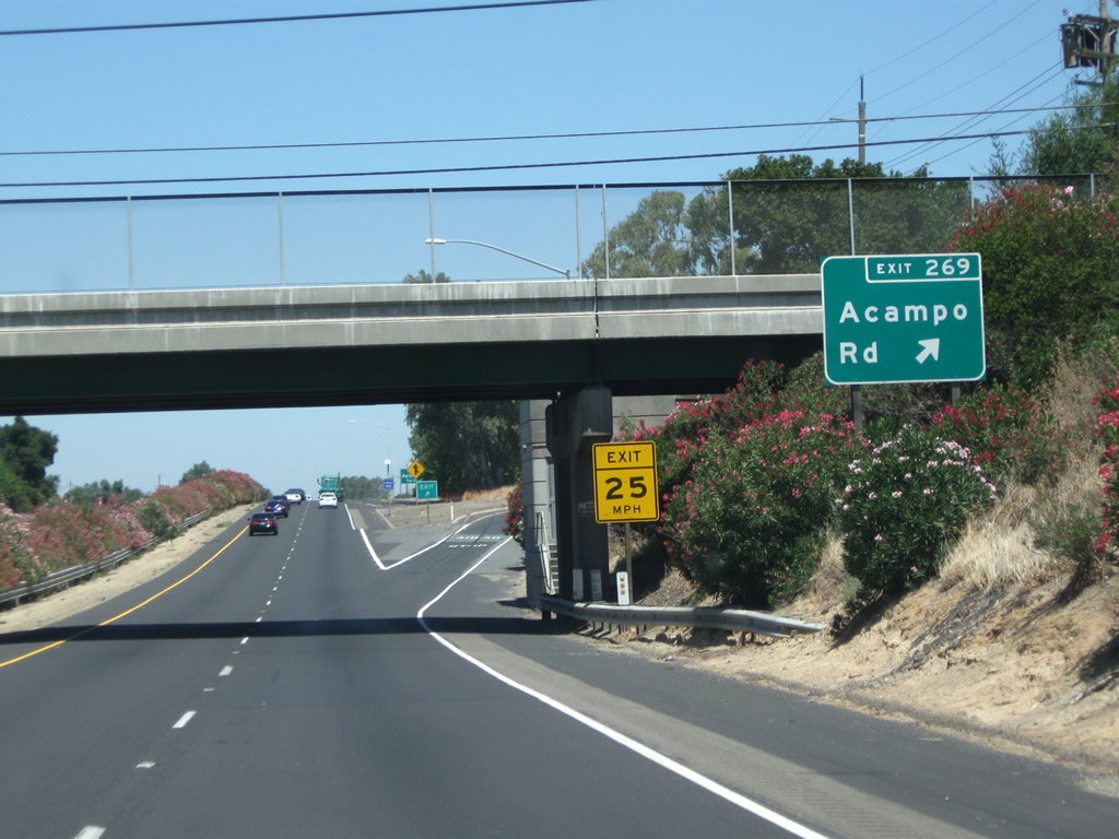
The next exit along California 99 north is Exit 269, Acampo Road, one-half mile. Photo taken 08/22/03. |
|
Northbound California 99 meets Exit 269, Acampo Road. To the west, Acampo Road travels into Acampo and meets San Joaquin County J-10 (Sacramento Road) east of there. To the east, Acampo Road connects with San Joaquin County J-5 (Elliott Road) near the banks of the Mokelumne River. Photo taken 07/31/11. |
|
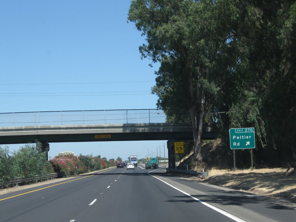
The next exit along California 99 north is Exit 270, San Joaquin County J-12 (Peltier Road). Photo taken 07/31/11. |
|
Northbound California 99 reaches Exit 270, San Joaquin County J-12 (Peltier Road). CR J-12 travels about 20 miles, starting at San Joaquin County J-8 (Thornton Road) and traveling east via Peltier Road, Tully Road, Jahant Road, Mackville Road, and Collier Road to end at California 88 northeast of Clements. Photo taken 07/31/11. |
|
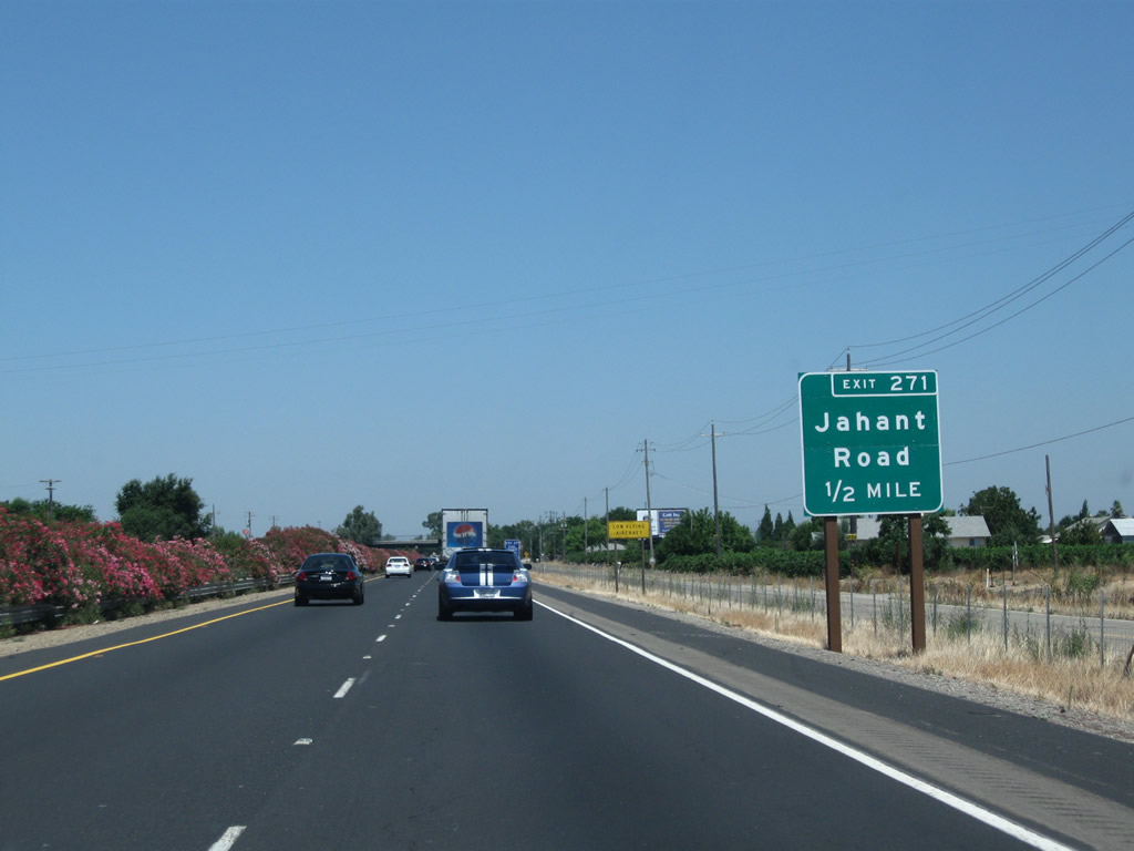
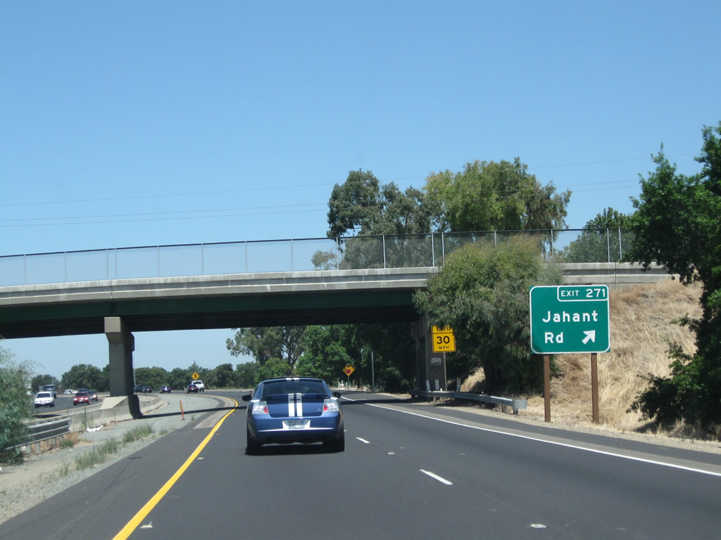
The next exit along California 99 north is Exit 271, Jahant Road. The Lodi Airport is located west of the freeway via this exit. Photo taken 07/31/11. |
|
Northbound California 99 reaches Exit 271, Jahant Road. Photo taken 07/31/11. |
|
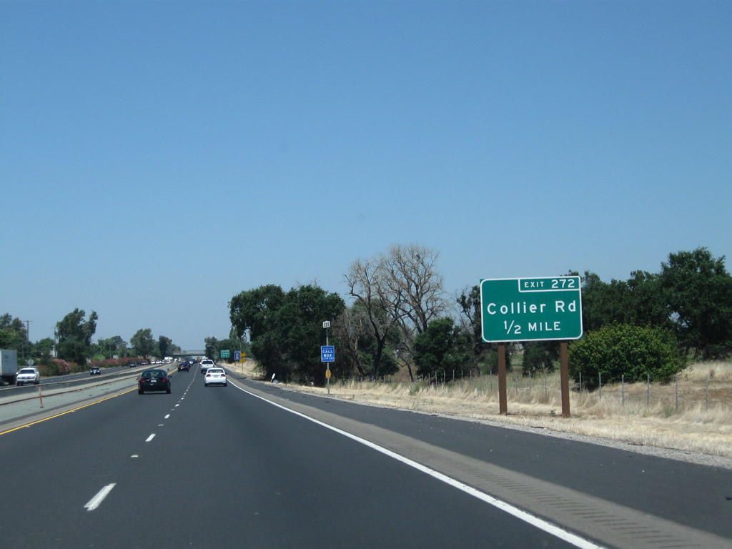
The next exit along California 99 north is Exit 272, Collier Road (0.50 mile). Photo taken 07/31/11. |
|
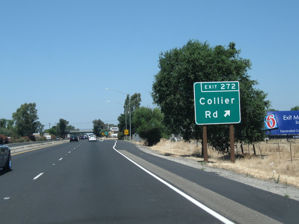
Northbound California 99 meets Exit 272, Collier Road. Like Jahant Road, Peltier Road, and Acampo Road, Collier Road travels east-west in northern San Joaquin County. Each of these county-maintained roads are spaced by approximately one mile apart from each other. Photo taken 07/31/11. |
|
The off-ramp to Collier Road uses a section of frontage road before connecting to Collier Road itself. Photo taken 07/31/11. |
|
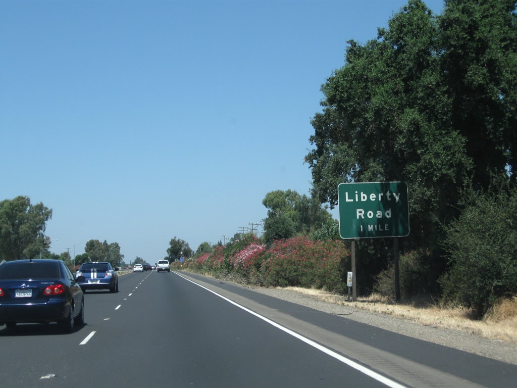
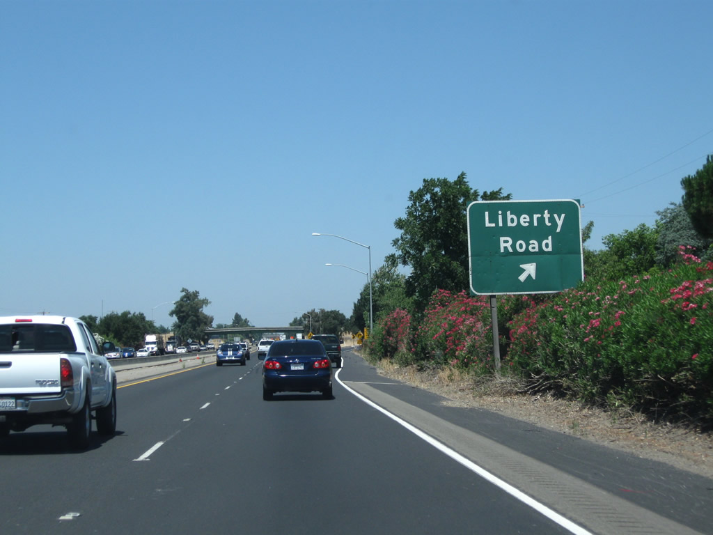
The next exit along California 99 north is Exit 273, Liberty Road (one mile). Photo taken 07/31/11. |
|
Northbound California 99 reaches Exit 273, Liberty Road. This is the last exit in San Joaquin County; after crossing the Dry Creek, California 99 will enter Sacramento County and the city of Galt. Photo taken 07/31/11. |
|
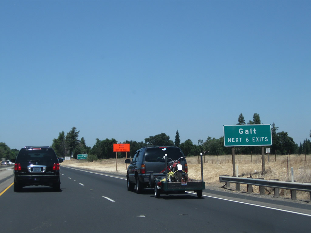
The next six exits from California 99 north serve the city of Galt: Exit 274A, Crystal Way; Exit 274B, C Street west to Galt and Boessow Road; Exit 275A, Simmerhorn Road east and Simmerhorn Road west to San Joaquin County J-10 (Lincoln Way) and Elm Avenue; Exit 275B, Ayers Lane east, Carol Lane south, and Stockton Boulevard (Historic U.S. 50-99) north; Exit 276, Walnut Avenue; and Exit 277, California 104 (Twin Cities Road) east to Ione and San Joaquin County E-13 (Twin Cities Road) west. Photo taken 07/31/11. |
|
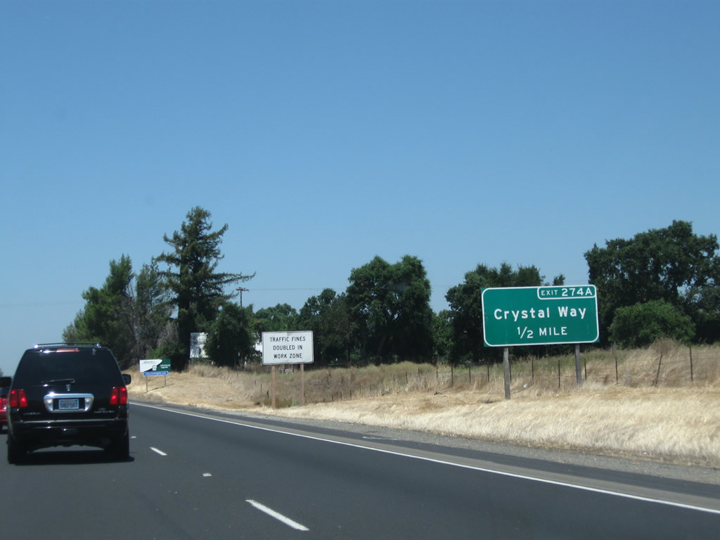
The next exit along California 99 north is Exit 274A, Crystal Way (one-half mile). Photo taken 07/31/11. |
|
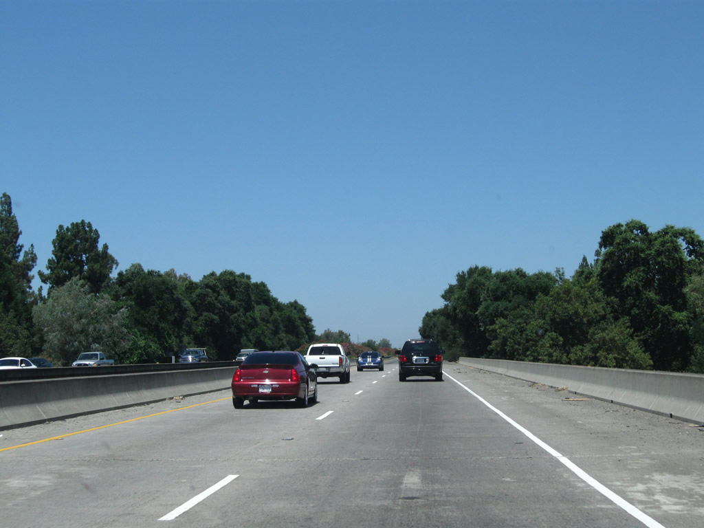
California 99 crosses Dry Creek and will soon leave San Joaquin County and enter Sacramento County. Photo taken 07/31/11. |
Page Updated March 17, 2012.