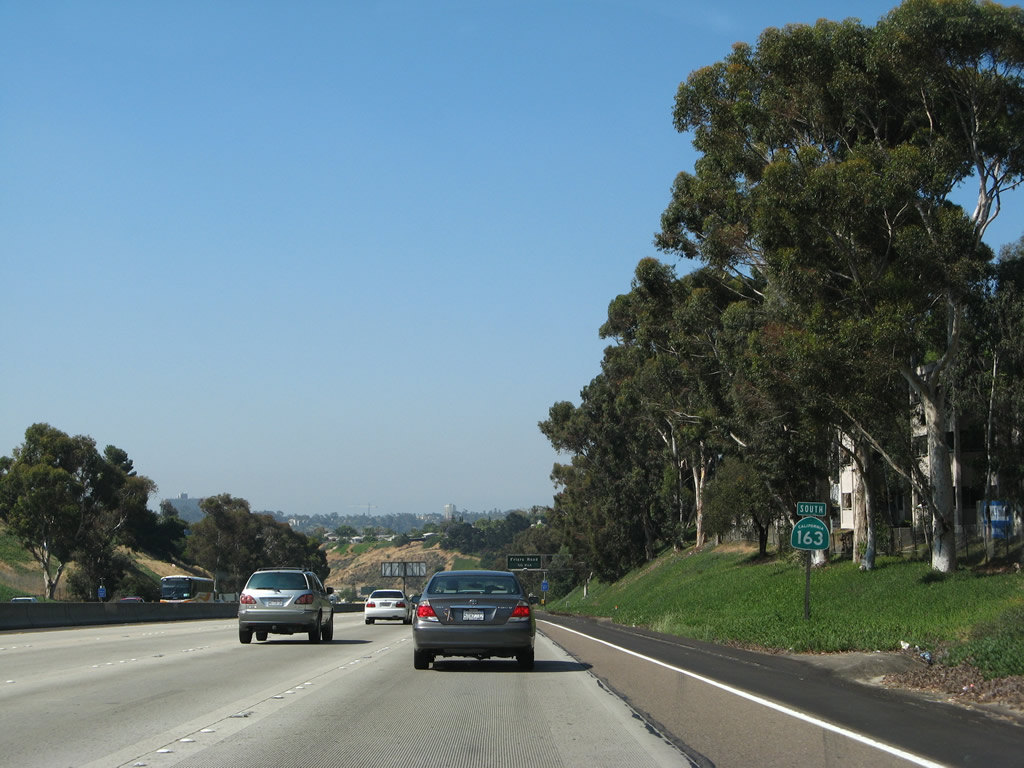
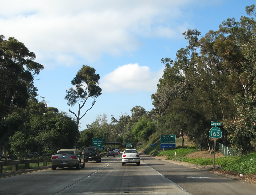
| California 163 south |
|
|
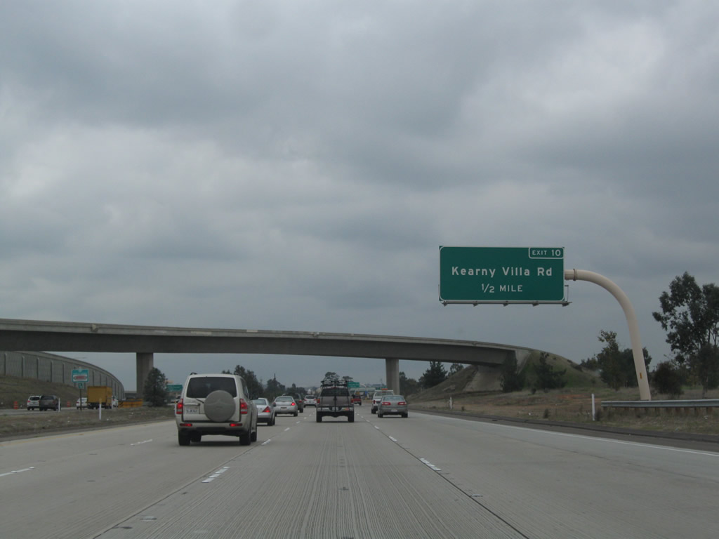
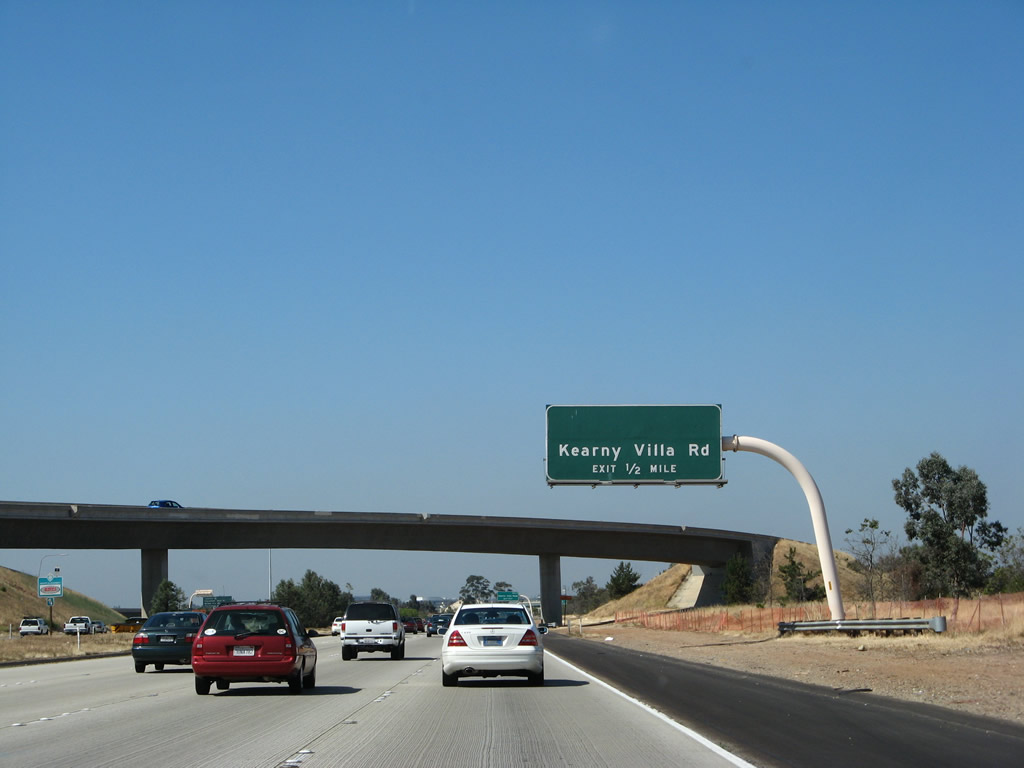
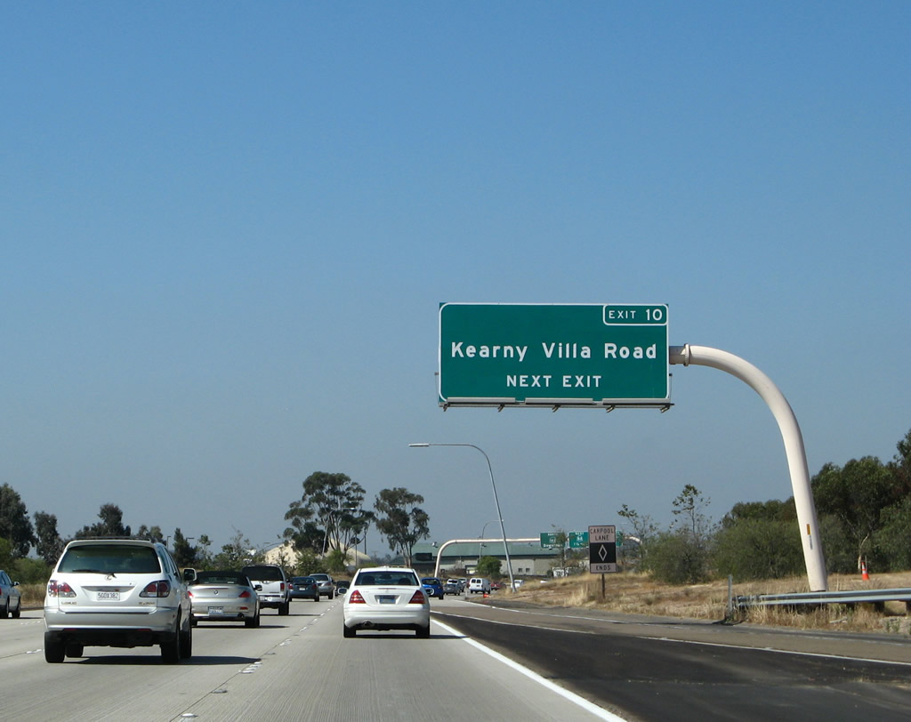
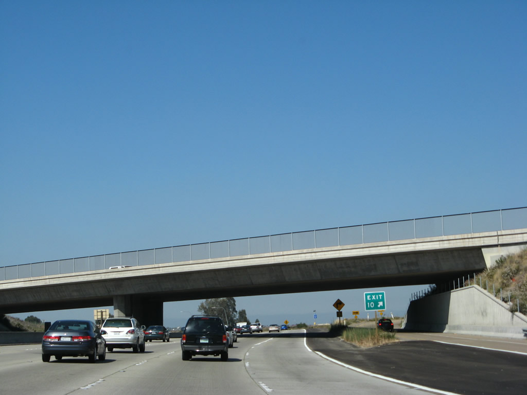
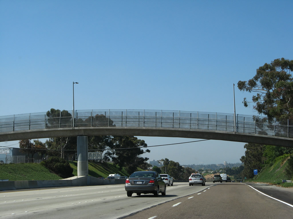
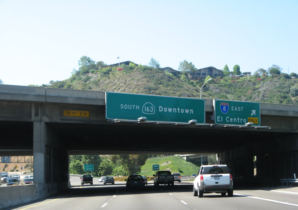
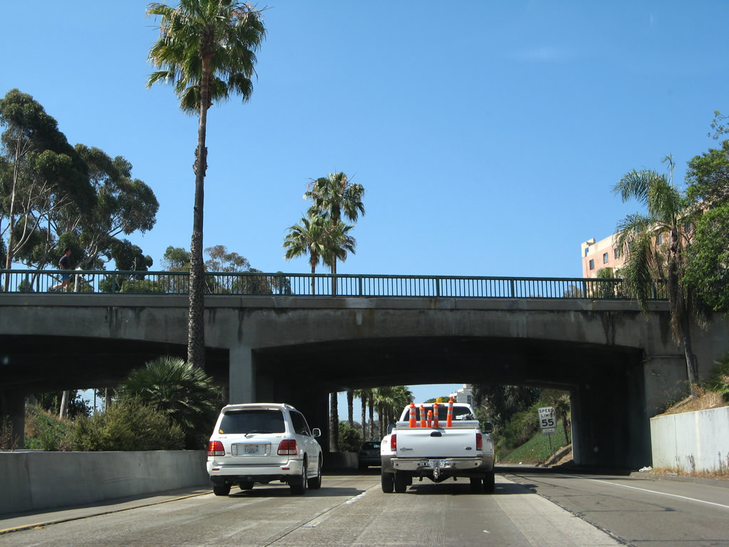
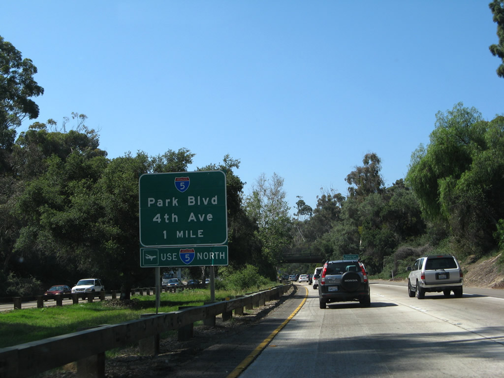
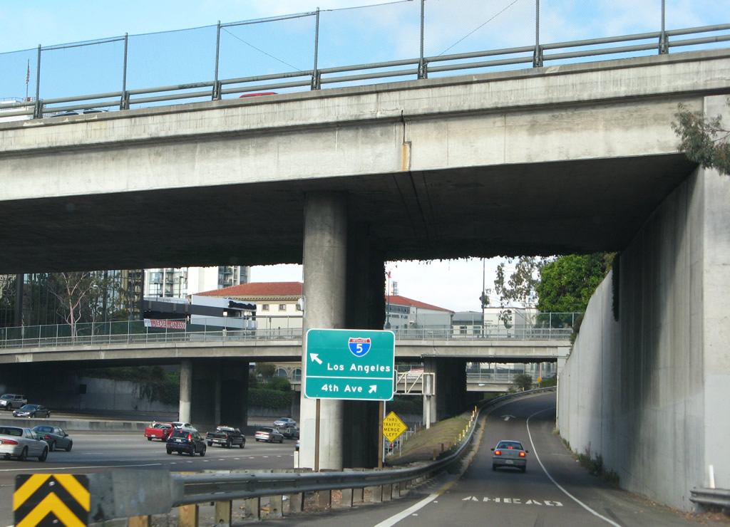
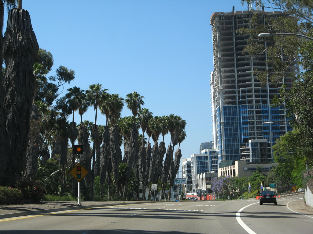
The first exit along southbound California 163 after splitting from Interstate 15 is Exit 10, Kearny Villa Road (former U.S. 395). The flyover ramp connects the Interstate 15 carpool/high occupancy vehicle reversible lanes with California 163 south. This sign has a large gap on the top because this exit used to serve as a temporary connection to the continuation of Interstate 15 into Murphy Canyon. Once the freeway split at Exit 12 was completed, the temporary connection signage was scraped off this button copy sign. Photos taken 12/28/10 and 05/30/08. |
|
Kearny Villa Road north follows an old expressway alignment of U.S. 395 through the Miramar Marine Corps Air Station. Heading south, Kearny Villa Road parallels California 163 through Kearny Mesa. Photo taken 05/30/08. |
|
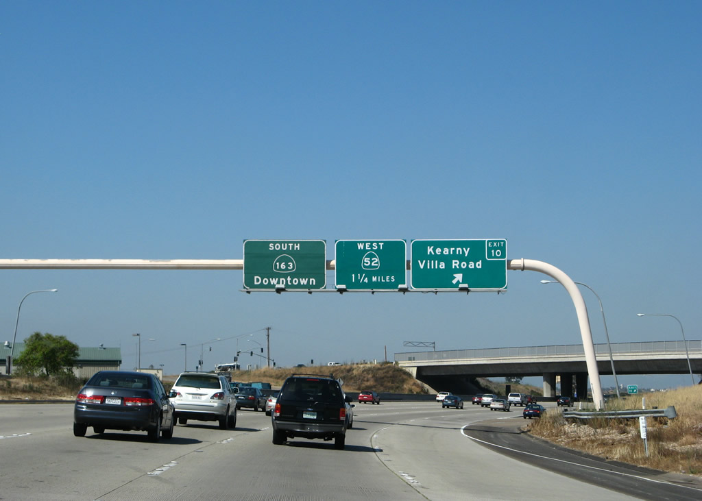
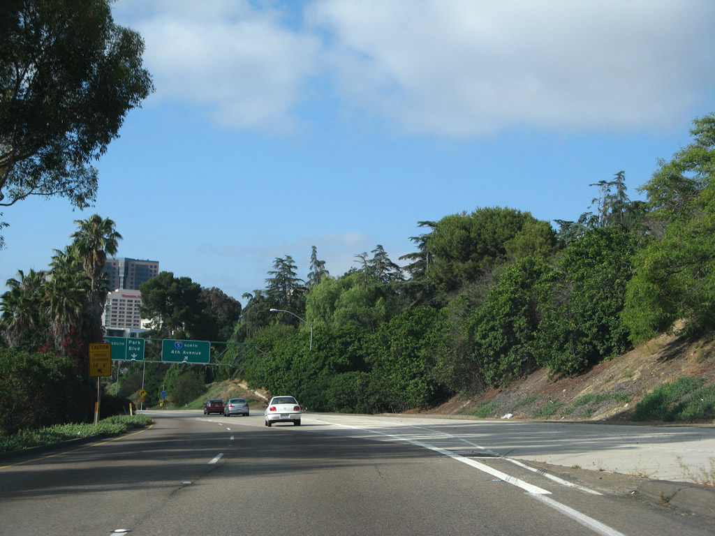
Southbound California 163 (Cabrillo Freeway) reaches Exit 10, Kearny Villa Road (former U.S. 395). A 1.25-mile advance sign for Exit 9, California 52 (Soledad Freeway) is posted on this sign bridge, along with a pull-through sign for California 163 south to downtown San Diego. Photo taken 05/30/08. |
|
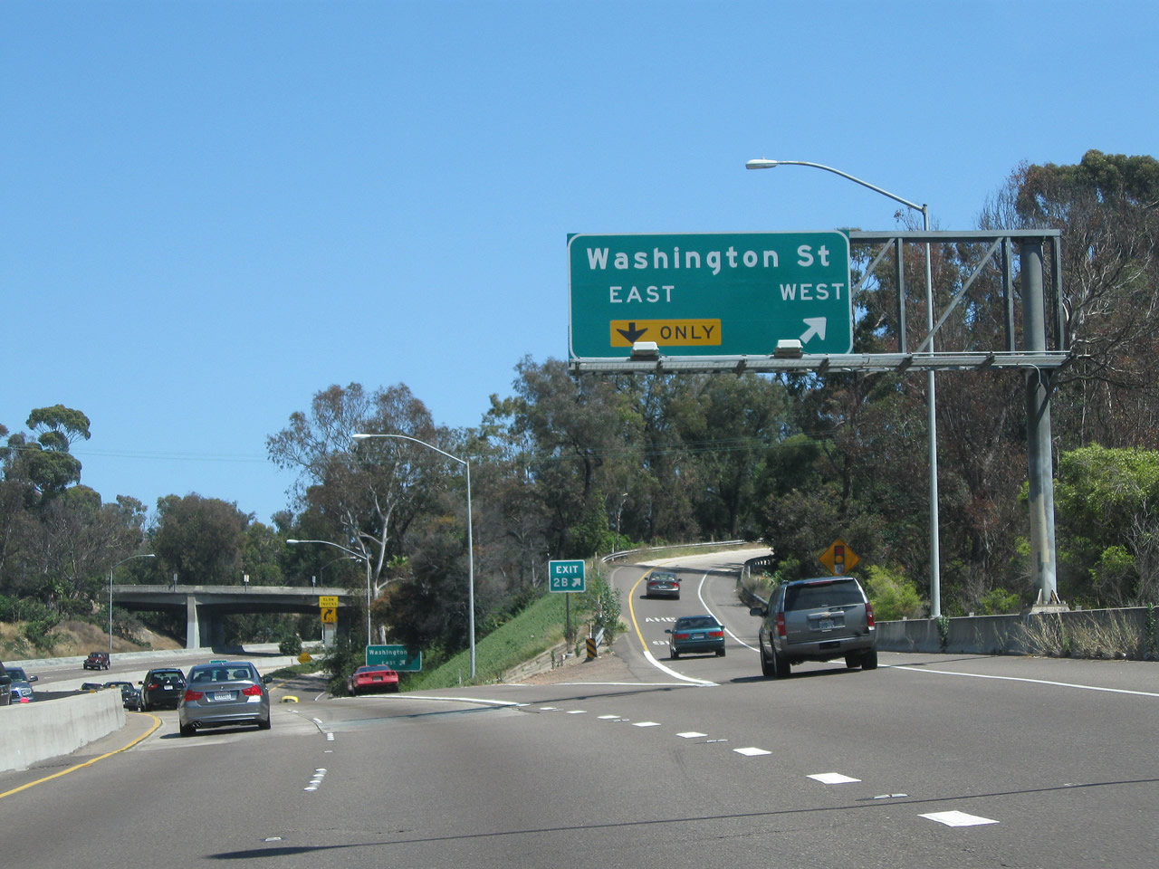
At the gore point for Exit 10, Kearny Villa Road, the right lane loops away from the freeway to the city street. The left five lanes continue south. Photo taken 05/30/08. |
|
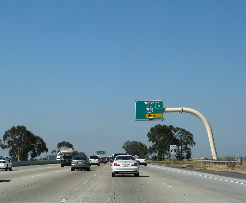
The right lane of California 163 (Cabrillo Freeway) south becomes exit only for Exit 9, California 52 (Soledad Freeway) west to San Clemente Canyon and La Jolla. There is no access from California 163 south to California 52 east; that connection is made via Interstate 15 south. Photo taken 05/30/08. |
|
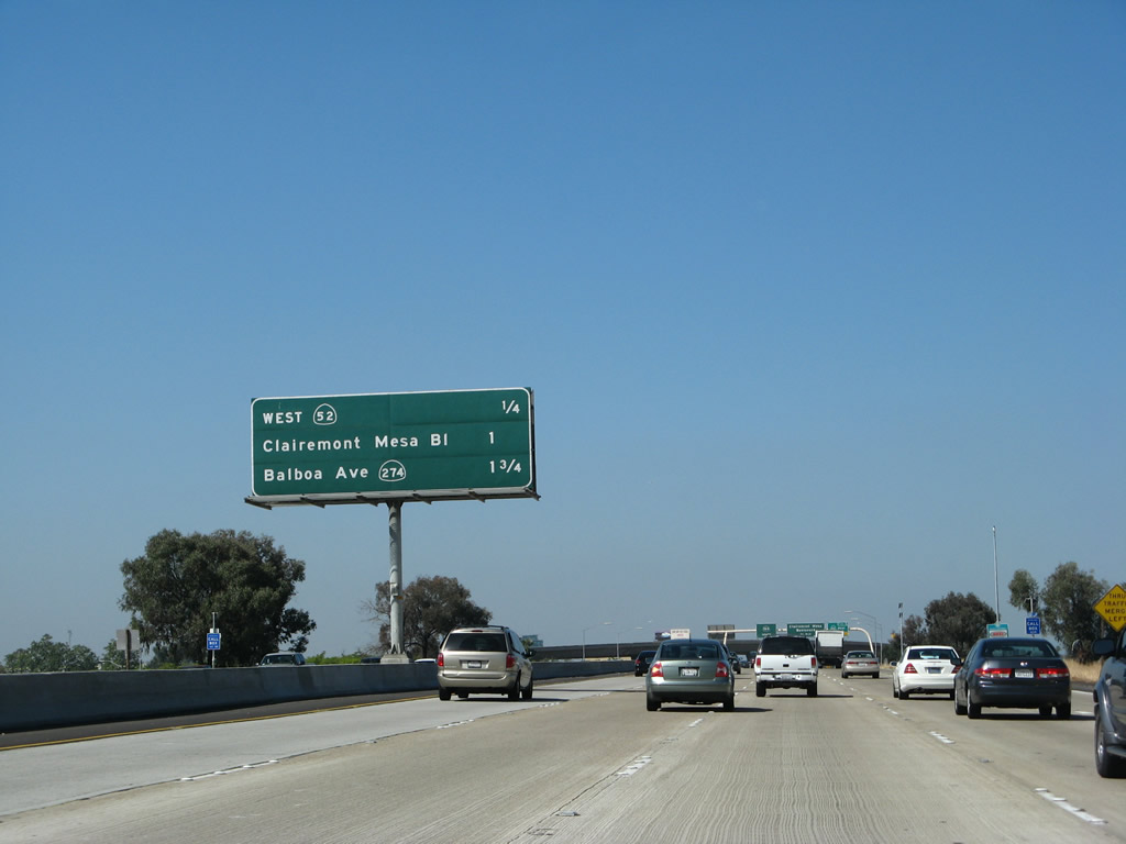
This mileage sign along California 163 south provides the distance to the next three exits: Exit 9, California 52 west; Exit 8, Clairemont Mesa Boulevard; and Exit 7, Balboa Avenue. Photo taken 05/30/08. |
|
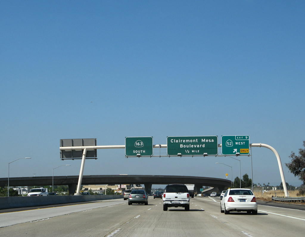
Southbound California 163 (Cabrillo Freeway) meets Exit 9, California 52 (Soledad Freeway) west. The next exit is Exit 8, Clairemont Mesa Boulevard. Photo taken 05/30/08. |
|
As Exit 9 departs for California 52 west, the left four lanes continue south on California 163. The flyover ramp connects California 52 west with California 163 south, which is part of the commute from the eastern suburban city of Santee to downtown San Diego. Photo taken 05/30/08. |
|
This view shows the transition ramp from California 163 south to California 52 west. Photo taken 07/17/11. |
|
As traffic from eastbound California 52 merges onto California 163 south, the right lane becomes exit only for Exit 8, Clairemont Mesa Boulevard. The left four lanes continue south toward downtown. Photo taken 05/30/08. |
|
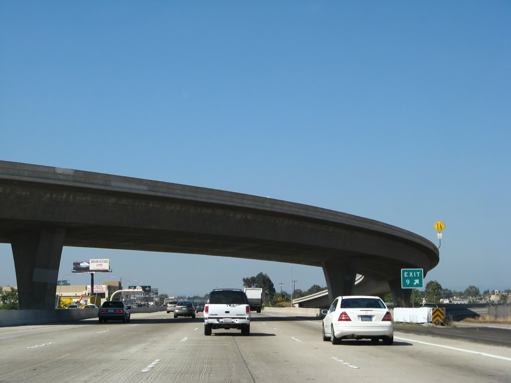
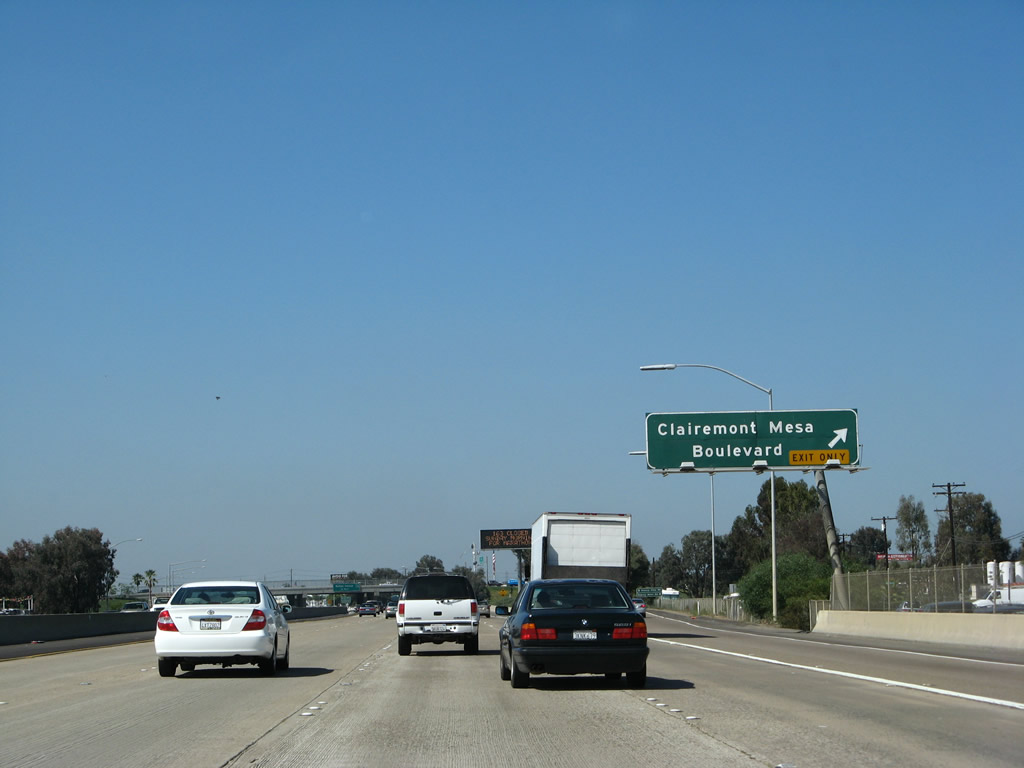
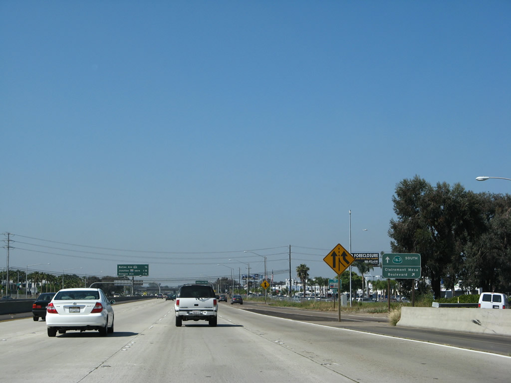
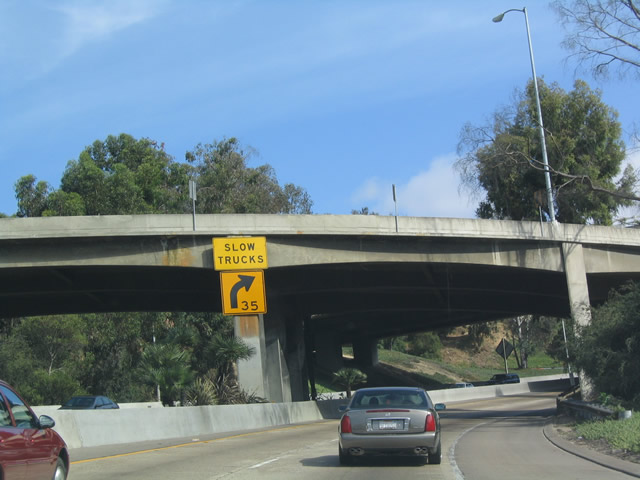
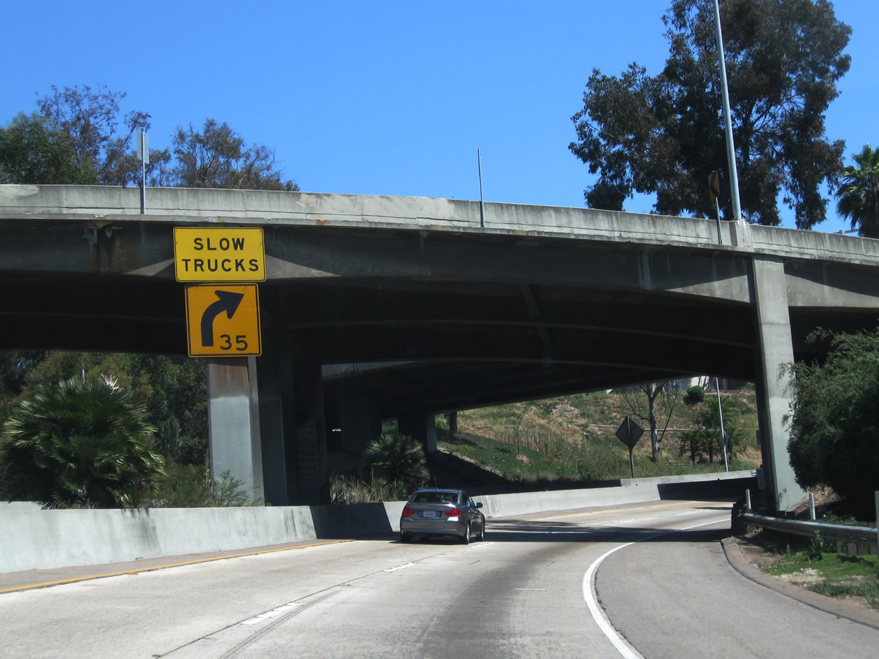
Southbound California 163 reaches Exit 8, Clairemont Mesa Boulevard. A collector distributor road will provide access to Clairemont Mesa Boulevard west to Clairemont Mesa first, followed by a loop ramp to Clairemont Mesa Boulevard east to Kearny Mesa second. This interchange was reconstructed and widened in 2007 to eliminate the modified cloverleaf for northbound traffic, reduce weaving, and add more capacity. Photo taken 05/30/08. |
|
|
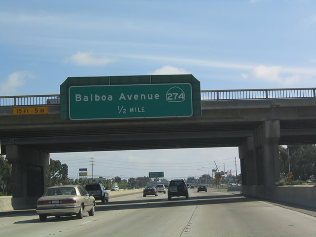
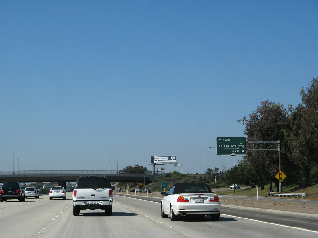
The next exit along southbound California 163 is Exit 7B, Balboa Avenue. When the Clairemont Mesa Boulevard overpass was widened to accommodate more lanes of travel, the previous reflective sign that identified Balboa Avenue as part of former California 274 was replaced with a new reflective sign in 2008. The California 274 reflective sign (see 2004 photo) was one of the first ones placed in San Diego (it made its appearance in 1999, before California 274 was decommissioned). Photos taken 05/30/08 and 05/22/04. |
|
As the collector distributor lanes prepare to rejoin California 163 south, this view shows the gore point signage for the connection from the c/d lanes to Clairemont Mesa Boulevard east as seen from the mainlines. Photo taken 05/30/08. |
|
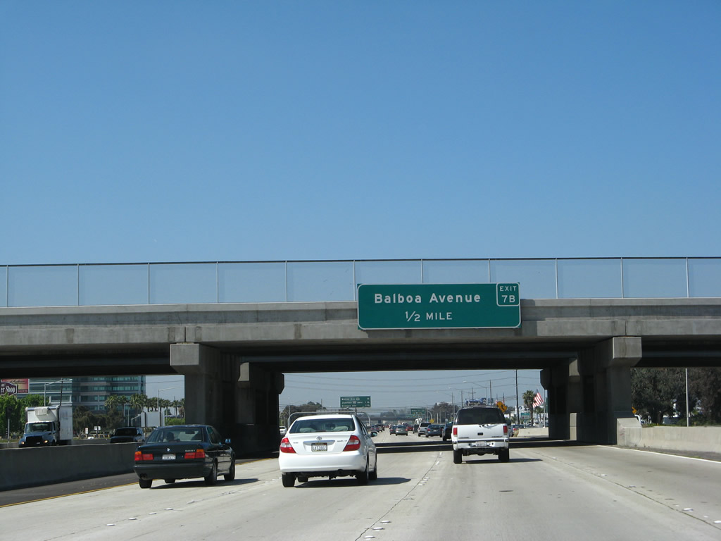
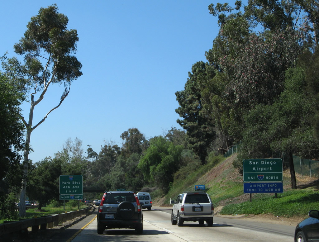
This mileage sign on California 163 (Cabrillo Freeway) south provides the distance to the next three exits: Exit 7B, Balboa Avenue (former California 274); Exit 7A, Interstate 805 (Jacob Dekema [Inland] Freeway) south; and Exit 5, Genesee Avenue. The Sunroad office tower is located on the east side of the freeway. Photo taken 05/30/08. |
|
California 274 was the former designation for Balboa Avenue between Interstate 15 in Tierrasanta and Interstate 5 in Pacific Beach; it was decommissioned in 2001, and signs along the route were taken down around 2005. Photo taken 05/30/08. |
|
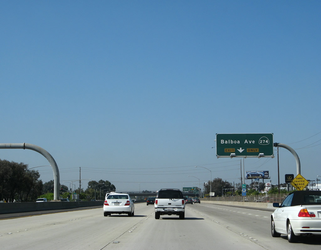
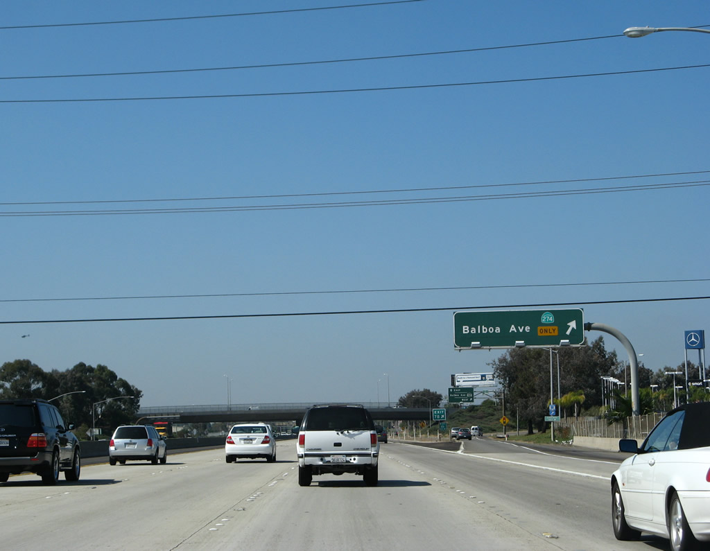
Southbound California 163 (Cabrillo Freeway) reaches Exit 7B, Balboa Avenue. California 274 shields are still present on several of these approach signs, but they will likely be removed once the signs are replaced. This interchange is a modified cloverleaf similar to the former configuration of the Clairemont Mesa Boulevard interchange. Photo taken 05/30/08. |
|
Looking at the collector distributor lane, the first ramp connects to Balboa Avenue west to Clairemont, Bay Ho, and Pacific Beach. The second ramp links with Balboa Avenue east to Kearny Mesa and Tierrasanta. Photo taken 05/30/08. |
|
The next exit along southbound California 163 (Cabrillo Freeway) is Exit 7A, Interstate 805 south. This sign is mounted onto the Balboa Avenue overpass. Photo taken 05/30/08. |
|
Interstate 805 south passes over Mission Valley and through Mid-City before entering National City, Chula Vista, and finally San Ysidro. Photo taken 05/30/08. |
|
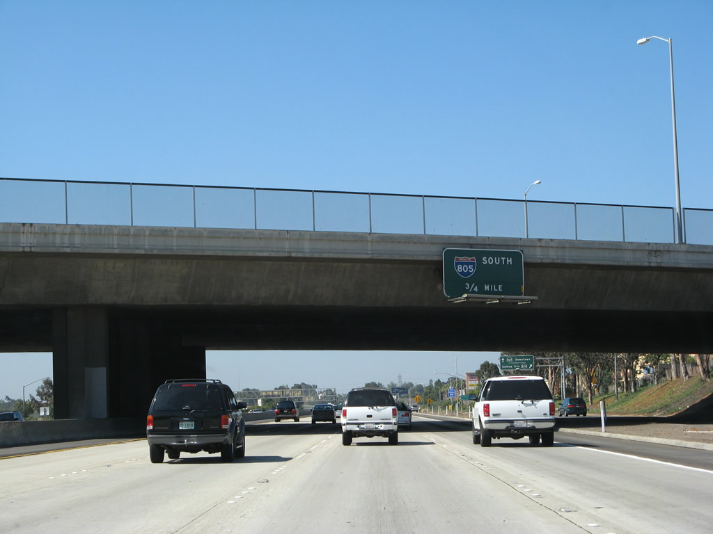
Southbound California 163 (Cabrillo Freeway) reaches Exit 7A, Interstate 805 (Jacob Dekema [Inland] Freeway) south to the Mid-City area of San Diego, then into National City and Chula Vista before merging back with Interstate 5 near the San Ysidro Port of Entry at the International Border with Mexico. The porcelain enamel overhead guide signs likely date back to the original freeway. Photo taken 05/30/08. |
|
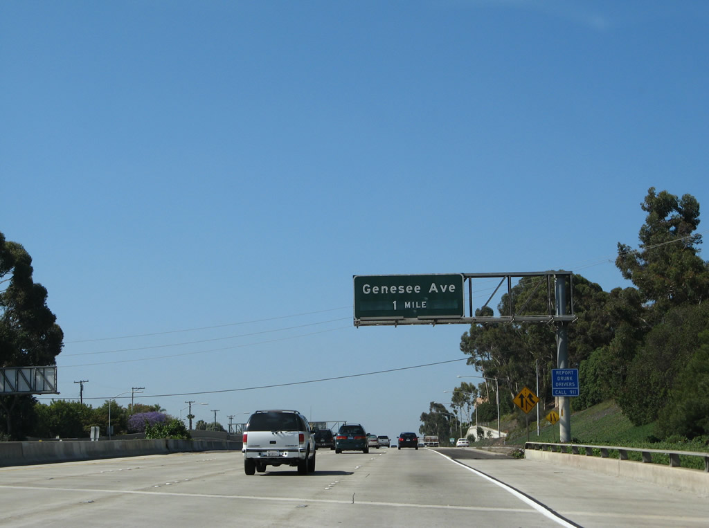
The next exit along southbound California 163 is Exit 5, Genesee Avenue. Use Genesee Avenue west (north) to Mesa College, one of several community colleges located throughout San Diego. This exit also serves the community of Linda Vista, which sits southeast of here. Photo taken 05/30/08. |
|
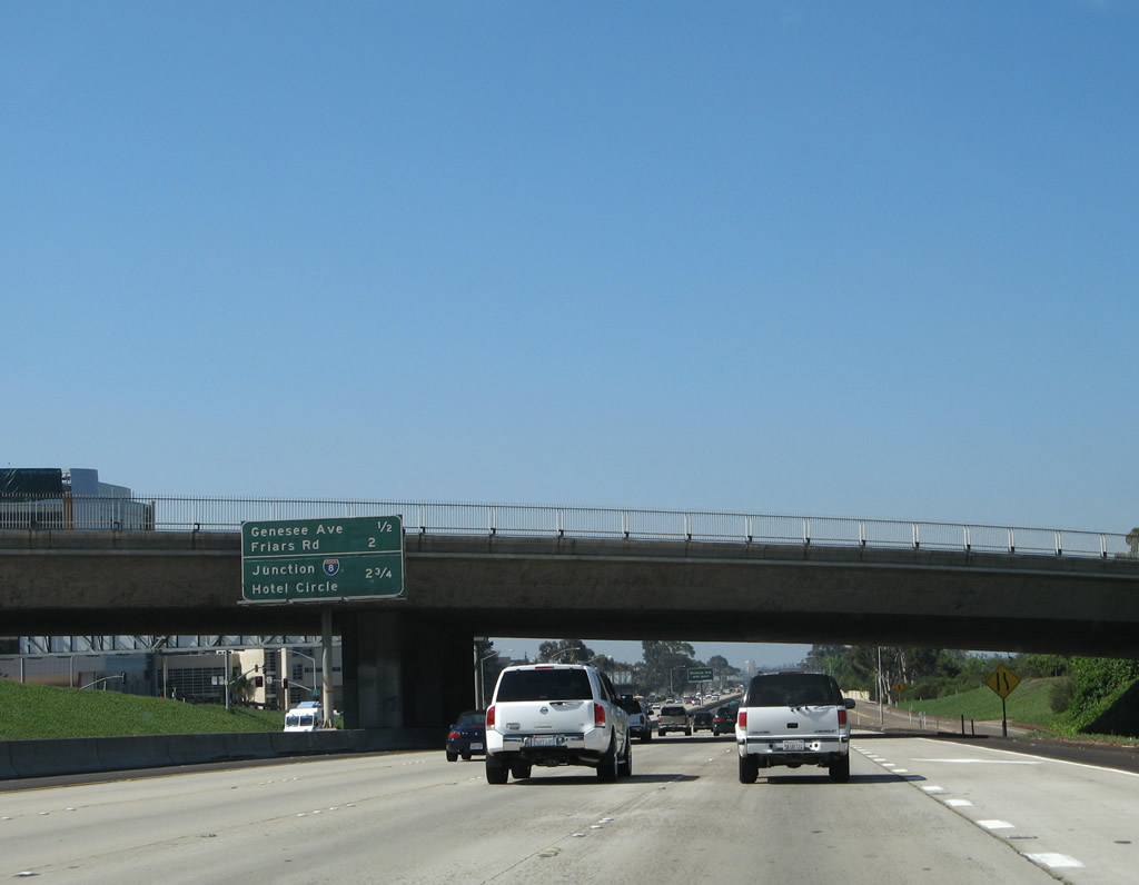
This mileage sign along southbound California 163 provides the distance to the next four exits: Exit 5, Genesee Avenue; Exit 4, Friars Road; and Exits 3B-A, Interstate 8/Alvarado (Mission Valley) Freeway and Hotel Circle. Photo taken 05/30/08. |
|
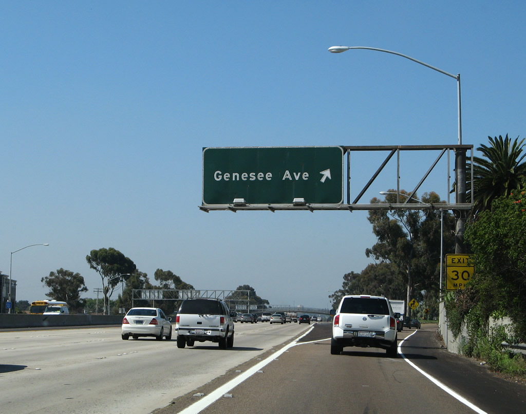
Although Genesee Avenue runs east-west through this interchange, it turns northwest to pass through the San Diego communities of Clairemont and University City before ending at North Torrey Pines Road north of La Jolla near the University of California at San Diego (UCSD). Photo taken 05/30/08. |
|
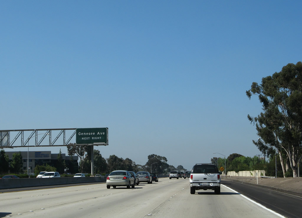
Southbound California 163 reaches Exit 5, Genesee Avenue to the communities of Linda Vista and Clairemont. Photo taken 05/30/08. |
|
Southbound California 163 passes under this pedestrian bridge, then begins its descent into Mission Valley. Unlike Interstate 805, California 163 crawls along the floor of the valley, staying just high enough to pass over the San Diego River at its lowest elevation. Photo taken 05/30/08. |
|
This California 163 south reassurance shield is posted shortly after the pedestrian bridge; Mission Valley lies ahead. Photo taken 05/30/08. |
|
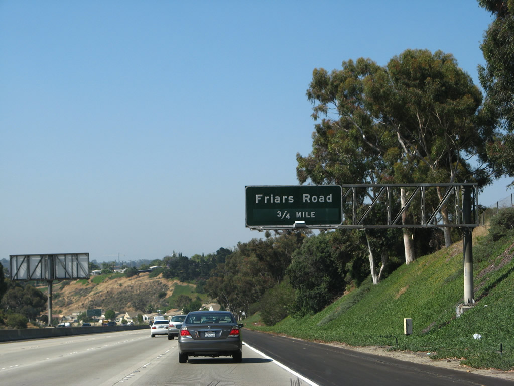
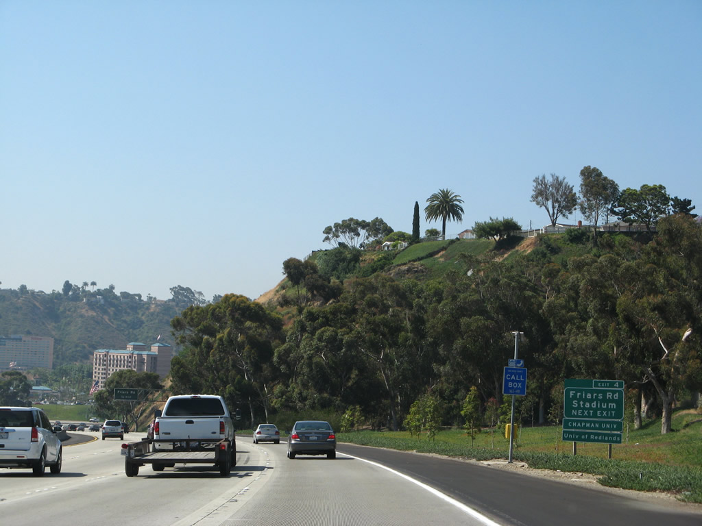
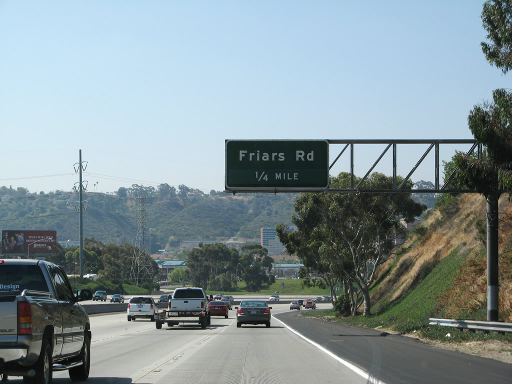
The next exit along southbound California 163 (Cabrillo Freeway) is Exit 4, Friars Road, 0.75 mile. Photo taken 05/30/08. |
|
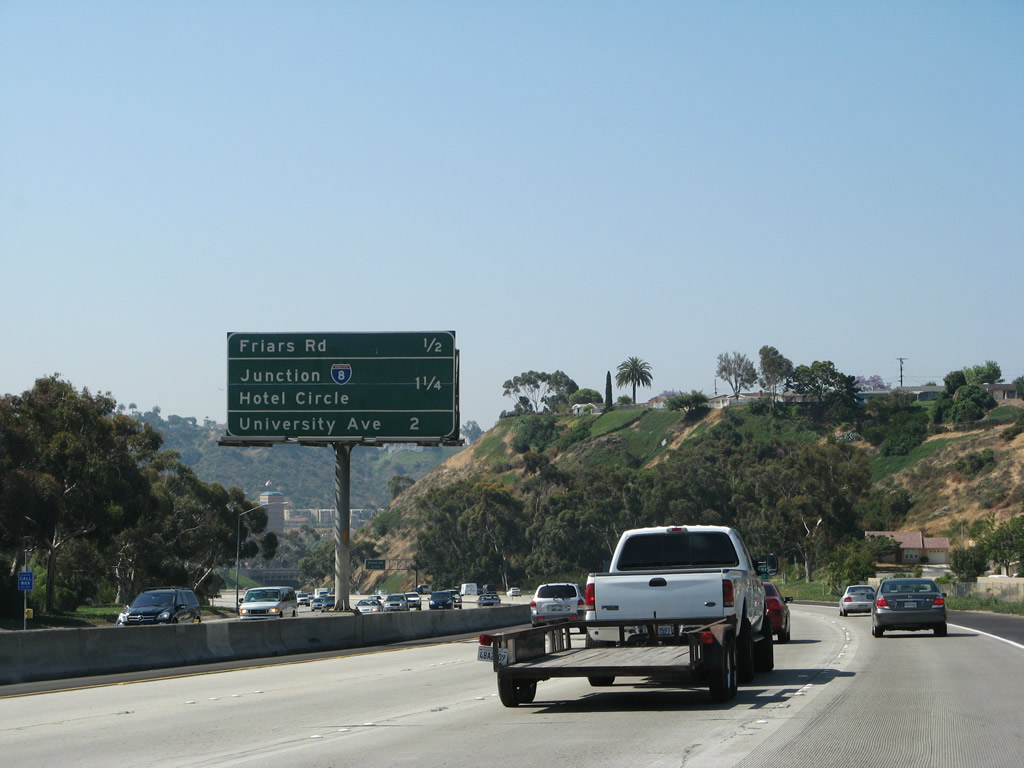
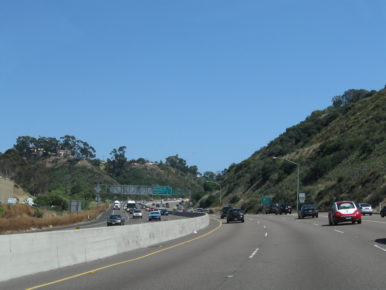
This mileage sign along southbound California 163 provides the distance to the next several exits: Exit 4, Friars Road; Exits 3B-A, Interstate 8 and Hotel Circle; and Exit 2C, University Avenue. Photo taken 05/30/08. |
|
Friars Road is signed by one exit number sign along southbound. Photo taken 05/30/08. |
|
Friars Road parallels Interstate 8 through Mission Valley, passing by Fashion Valley Mall and Riverwalk Golf Course to the west and QUALCOMM Stadium to the east. The street was constructed by the city of San Diego, but it has several sections of near-freeway grade interchanges and fast sections of roadway. Photo taken 05/30/08. |
|
Southbound California 163 (Cabrillo Freeway) meets Exit 4, Friars Road. Use Friars Road west to Fashion Valley mall and east to Mission Valley Center mall. During the busy shopping season near Christmas, traffic often backs up at this interchange as people try to get to the malls. A San Diego Trolley station is located on the south side of Fashion Valley mall, and the trolley offers connections to Old Town, Downtown, QUALCOMM Stadium, and San Diego State University. Photo taken 06/15/11. |
|
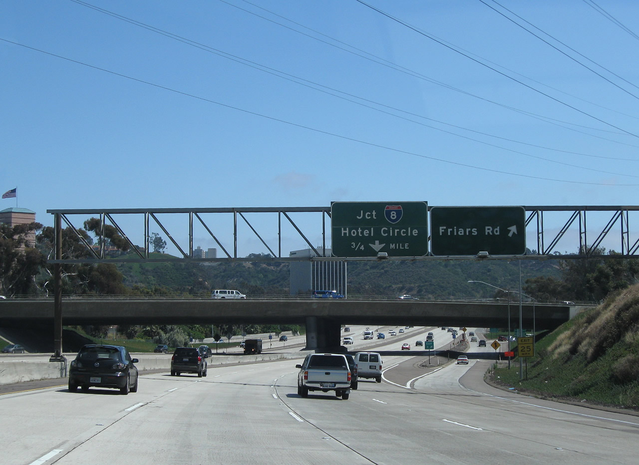
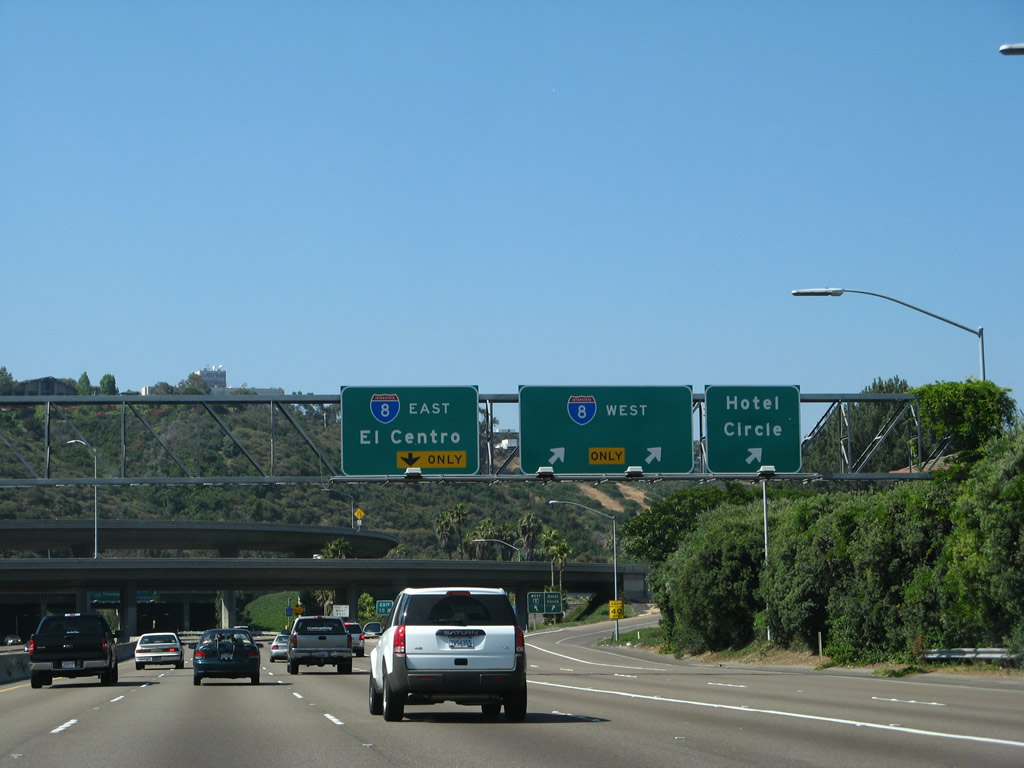
The next exit along California 163 (Cabrillo Freeway) south is Exit 3B, Interstate 8 (Mission Valley Freeway) west to Mission Beach and Ocean Beach. A slip ramp from Exit 3B also connects to Hotel Circle (north and south). The San Diego Trolley, which was built mostly above grade to ensure it would remain above water in the event of a 100-year flood, crosses over California 163. Photo taken 05/30/08. |
|
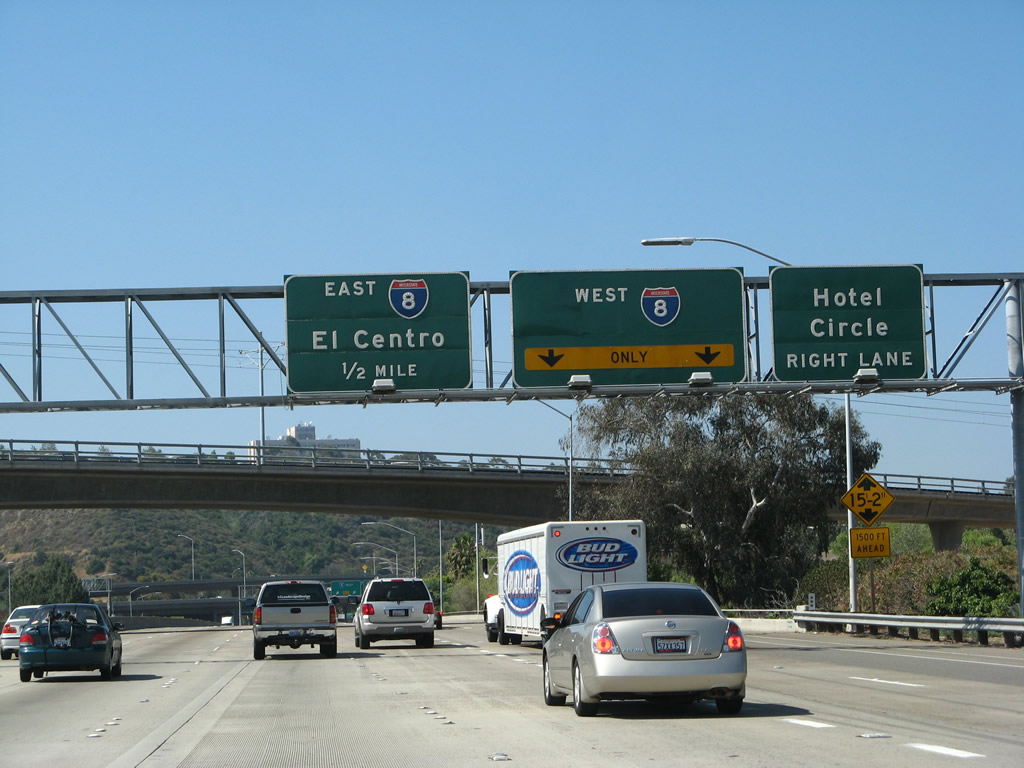
After crossing over the San Diego River (which is not marked from the freeway), southbound California 163 reaches Exit 3B, Interstate 8/Mission Valley (Alvarado) Freeway west and Hotel Circle. Interstate 8 was constructed as the U.S. 80 freeway, and the freeway officially received its new number in 1964. U.S. 80 itself did not disappear from California until 1972. Photo taken 05/30/08. |
|
Through traffic on California 163 south should merge left. As the right lane departed to Exit 3B, the number three lane will soon depart for Exit 3A, which connects to Interstate 8 east to La Mesa, El Cajon, and El Centro. The highest level on this stack interchange is the transition from westbound Interstate 8 to southbound California 163. Photo taken 05/30/08. |
|
|
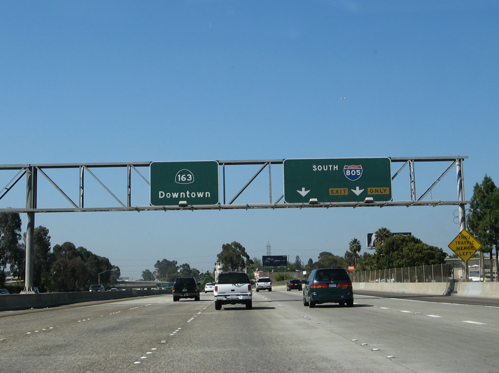
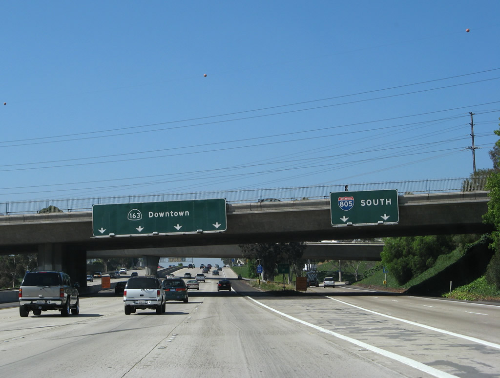
Southbound California 163 reaches Exit 3A, Interstate 8 east. California 163 continues south into downtown. This sign was replaced in 2005. Photos taken 05/30/08 and 05/22/04. |
|
|
To remain on southbound California 163 (Cabrillo Freeway) to Balboa Park and downtown, use the two left lanes. The other lanes will all exit onto Exits 2C, 2B, or 2A. Photos taken 05/30/08 and 06/15/11. |
|
|
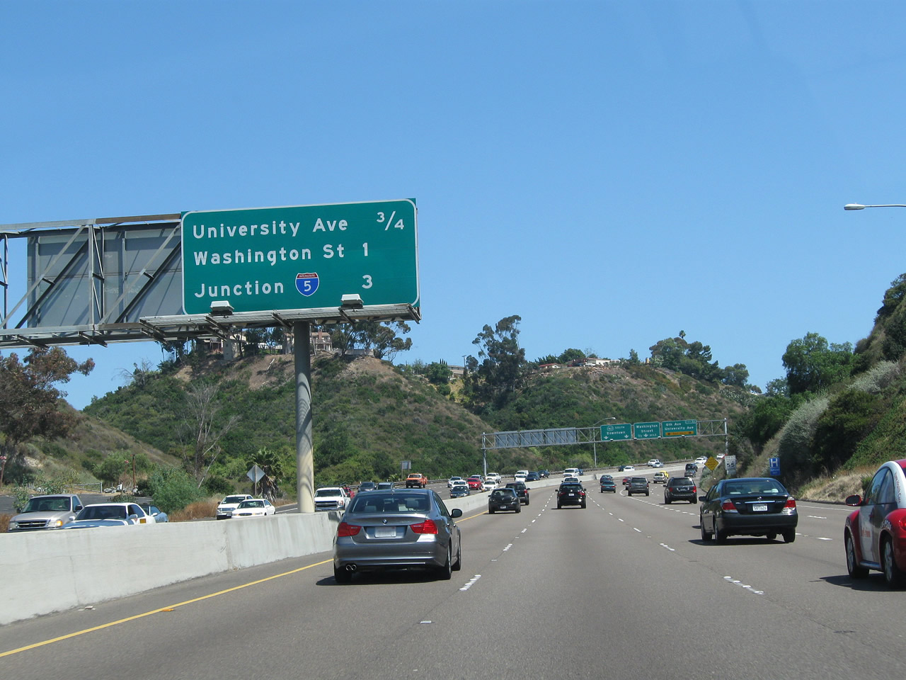
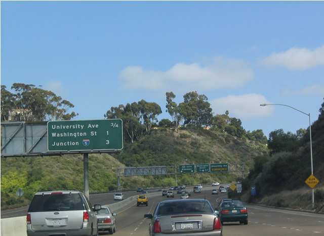
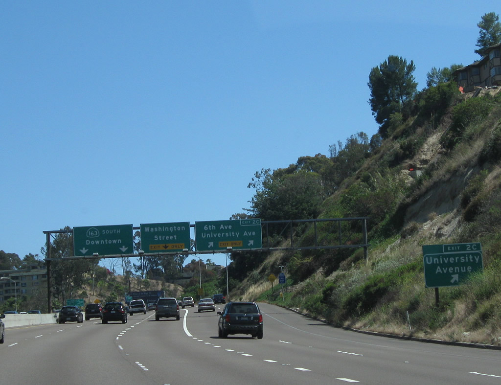
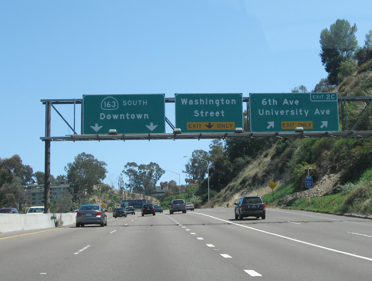
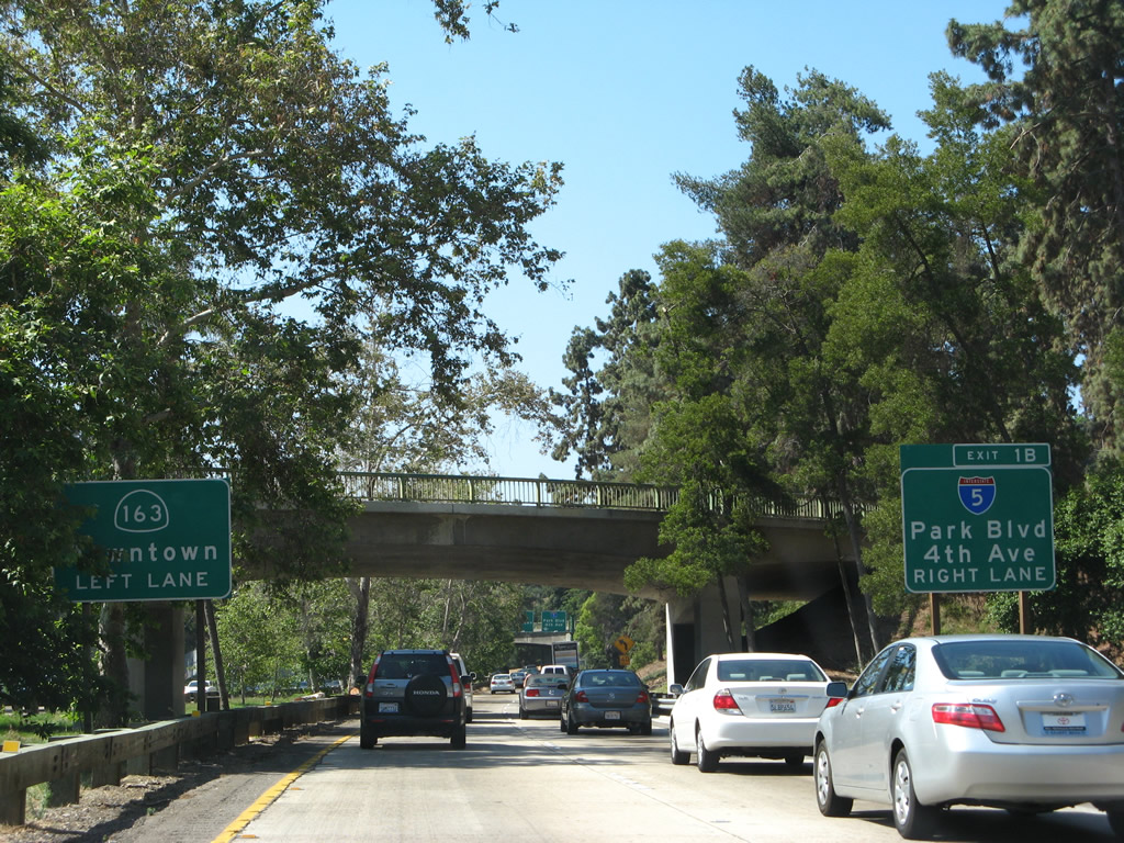
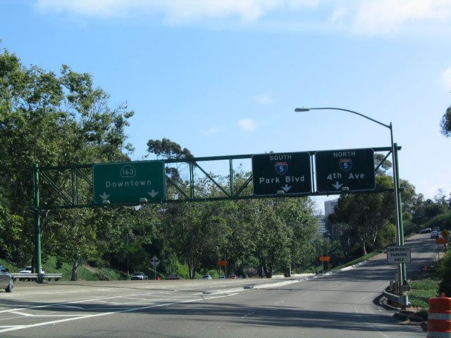
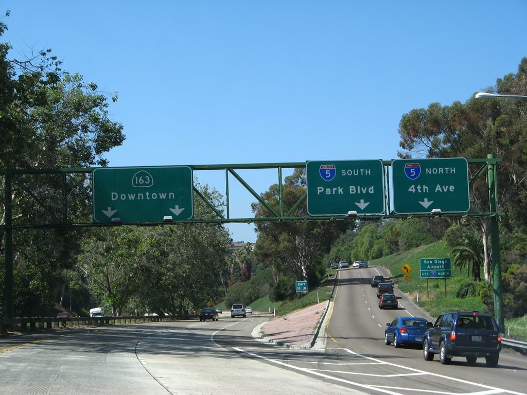
This mileage sign along southbound California 163 (Cabrillo Freeway) provides the distance to the next four exits: Exit 2C, University Avenue and 6th Avenue; Exits 2B-A, Washington Street; and Exit 1B, Interstate 5 (San Diego Freeway). The sign was replaced. Photos taken 06/15/11 and 05/22/04. |
|
|
The two left lanes are for southbound California 163; the next lane is for Exits 2B-A, Washington Street; and the right lanes are for Exit 2C, University Avenue/6th Avenue. The sign was replaced in 2005; Sixth Avenue was added to the sign in 2007. Photos taken 06/15/11 and 05/22/04. |
|
A roadside sign is also posted for Exit 2C, University Avenue (and Sixth Avenue). Photo taken 06/15/11. |
|
|
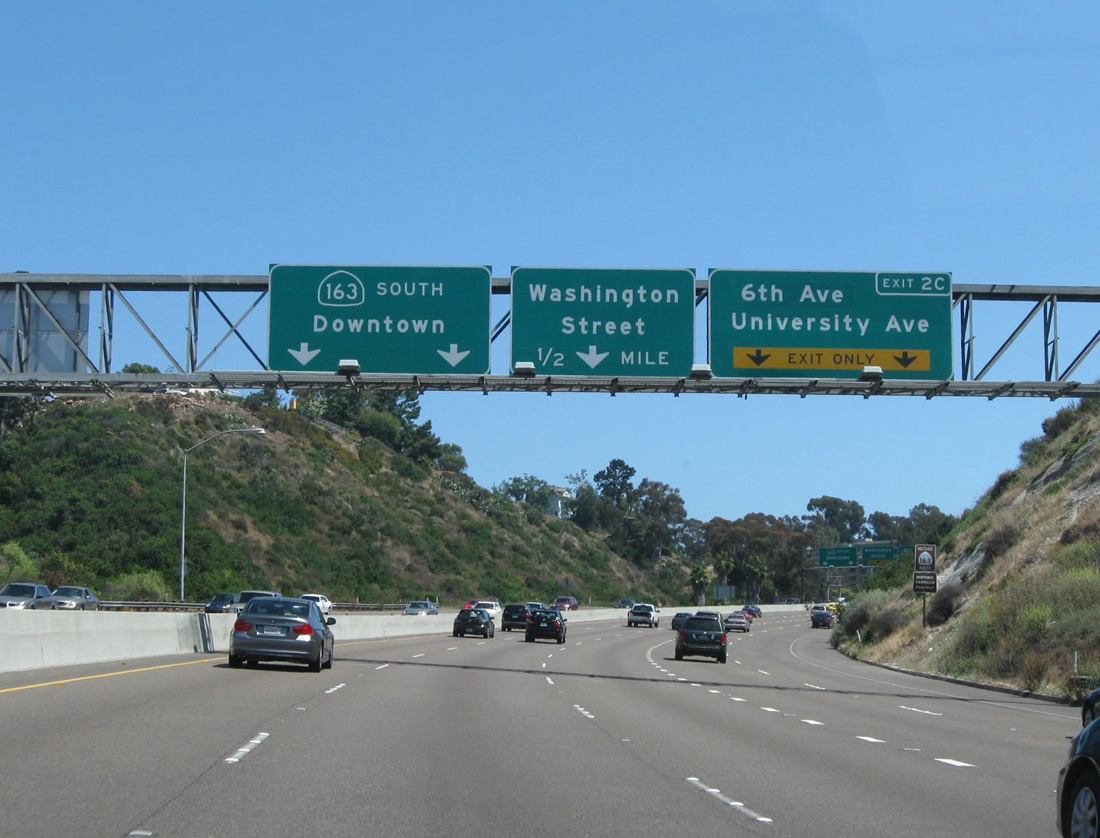
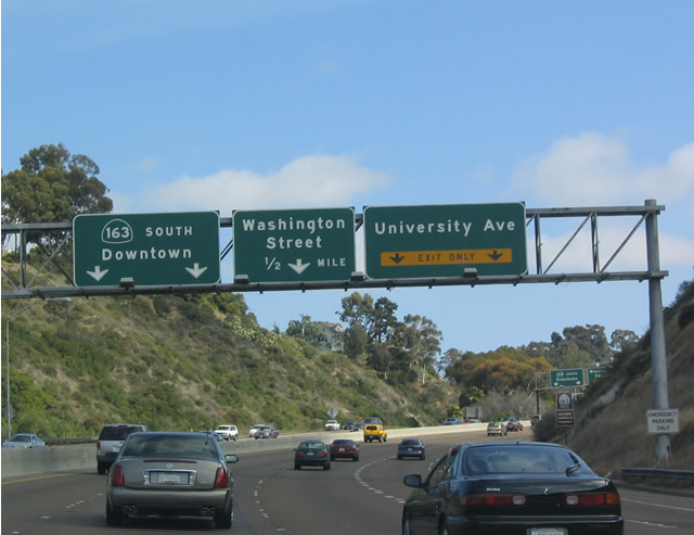
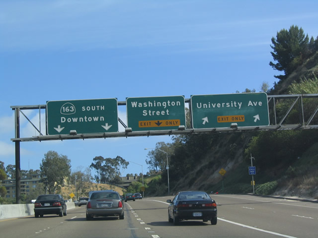
Southbound California 163 (Cabrillo Freeway) meets Exit 2C, University Avenue/6th Avenue. Two lanes split off here, leaving only three through southbound lanes. Watch for delays here due to traffic merging in the morning commute hours. Photos taken 06/15/11 and 05/22/04. |
|
|
This sign shows the exiting numbering scheme for the next two exits: west and east Washington Street exit ramps. Come on, Caltrans, you can do better than this! Each of the overhead signs should have exit numbers, and then this roadside sign would not be necessary. Photos taken 06/15/11 and 05/30/08. |
|
|
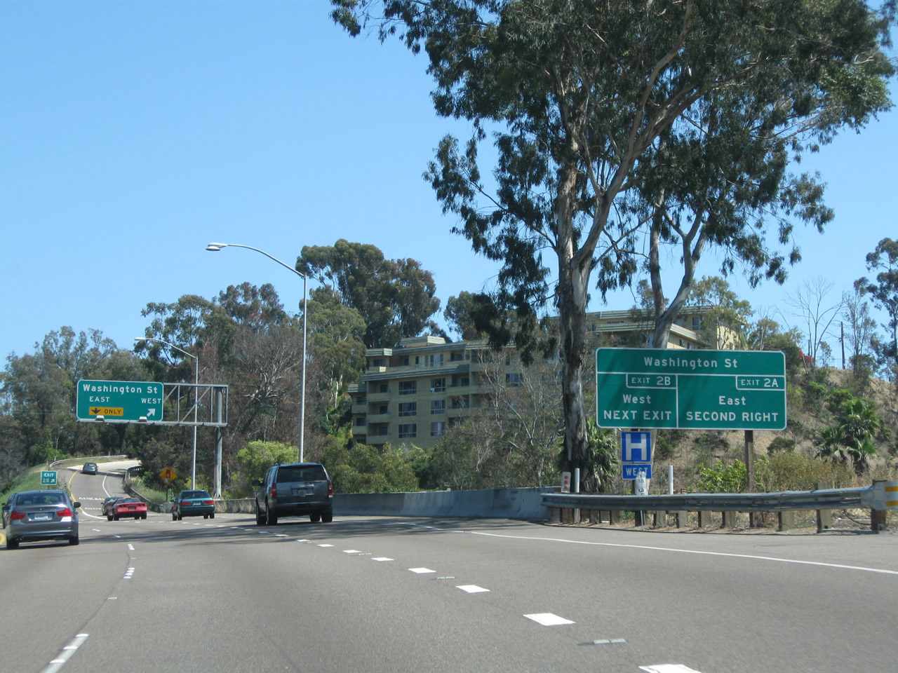
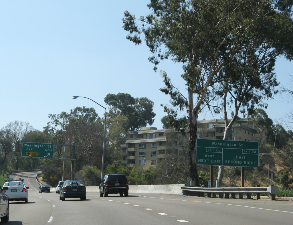
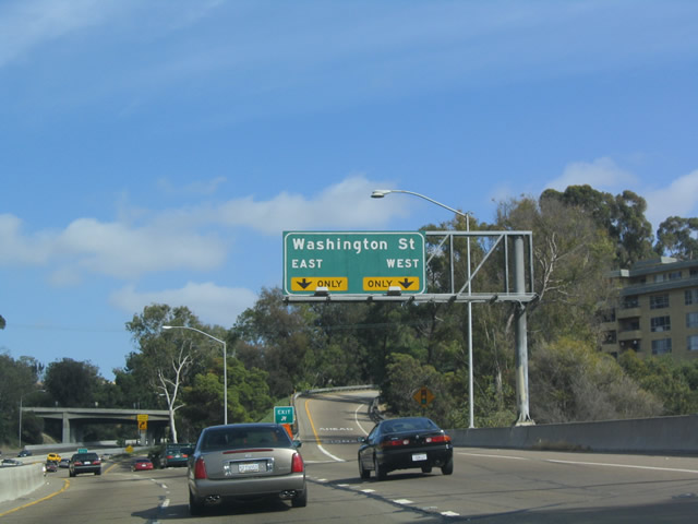
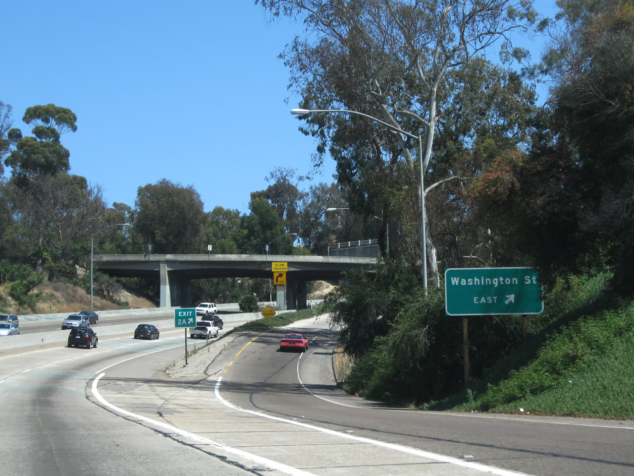
Southbound California 163 (Cabrillo Freeway) meets Exit 2B, Washington Street west to the Hillcrest and Mission Hills neighborhoods of the city of San Diego. Photos taken 06/15/11 and 05/22/04. |
|
|
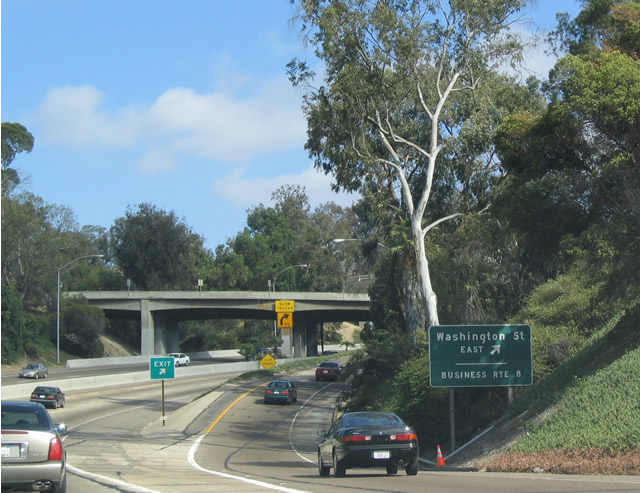
Immediately thereafter, California 163 south meets Exit 2A, Business Loop I-8 west/Washington Street. The business loop is basically unmarked except for one shield west of Interstate 805, and that shield is at the top of this exit ramp. Note that the "Route 8 Business" placard was removed once the sign was replaced in 2005. Photos taken 06/15/11 and 05/22/04. |
|
|
After Exit 2A, the now four-lane freeway changes dramatically, starting with this substandard turn that takes California 163 (Cabrillo Freeway) under Washington Street and into Balboa Park. Photos taken 05/22/04 and 06/15/11. |
|
California 163 (Cabrillo Freeway) next passes under University Avenue, which is accessed via Sixth Avenue (Exit 2C). Photo taken 05/30/08. |
|
A row of palms line the freeway median strip between the University Avenue overpass and the Robinson Avenue overpass. Photo taken 05/30/08. |
|
Original white wooden railing remains on the next overpass, which carries Robinson Avenue over California 163. Photo taken 05/29/08. |
|
This section of California 163 has not been upgraded for the most part since it was constructed. This bridge (Robinson Street overcrossing) is an original, and it is dated to another era in highway construction. The palm tree median here was added in the early 2000s. Photo taken 05/22/04. |
|
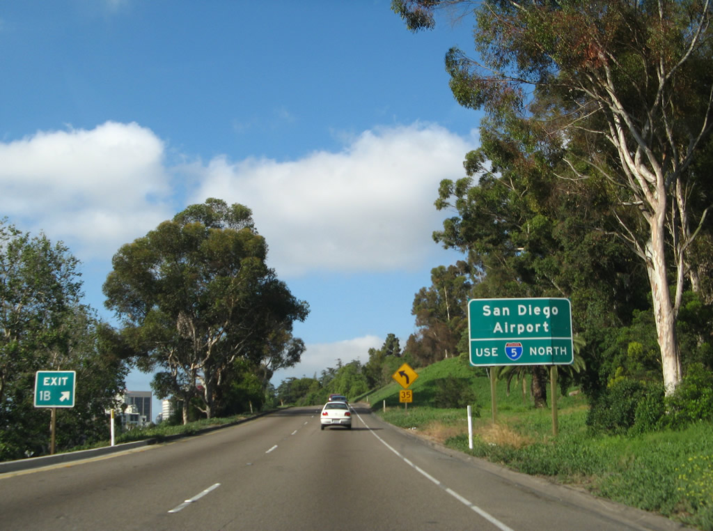
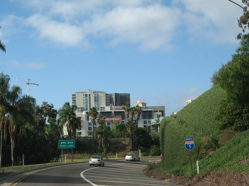
To reach the airport, follow south California 163 to north Interstate 5 (Exit 1B), then exit Hawthorn Street (Exit 17). Photo taken 05/30/08. |
|
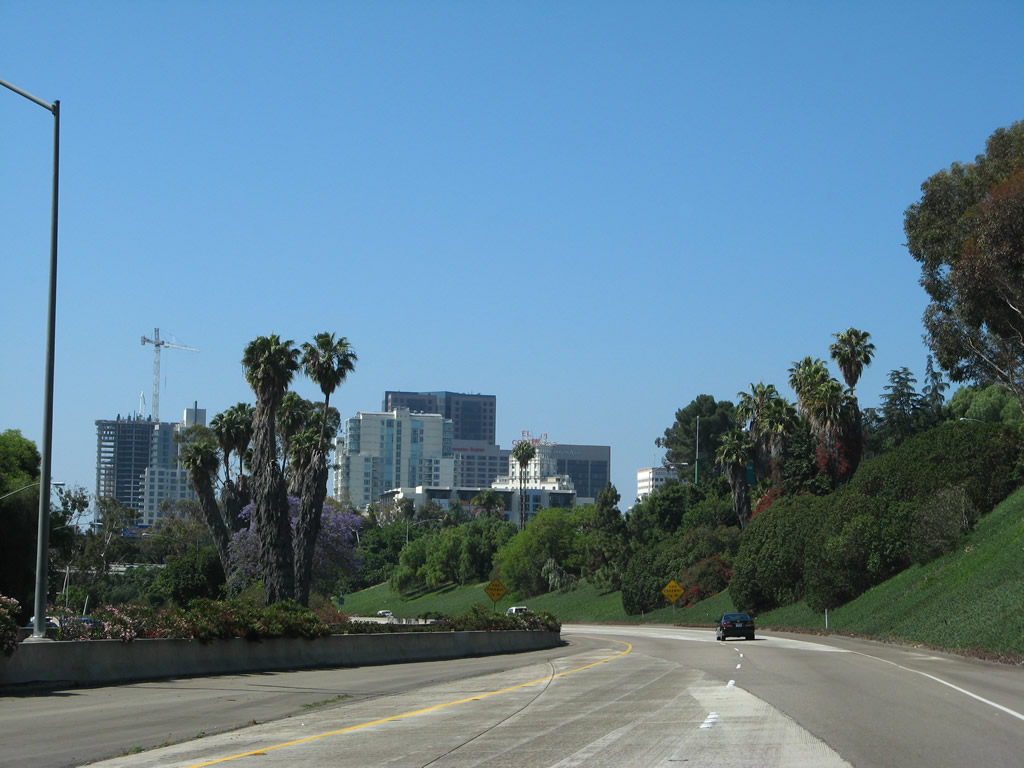
The freeway now widens out as it enters Balboa Park, with a tree-lined, turf median in the center. In 2004, there was no fence or other barrier between directions of traffic, just a wide median. Head on collisions used to happen here from time to time. Some of the gentle curves have an advisory speed because people tend to speed through the park. Now there is a guardrail barrier (see next photobox). Photo taken 05/29/08. |
|
|
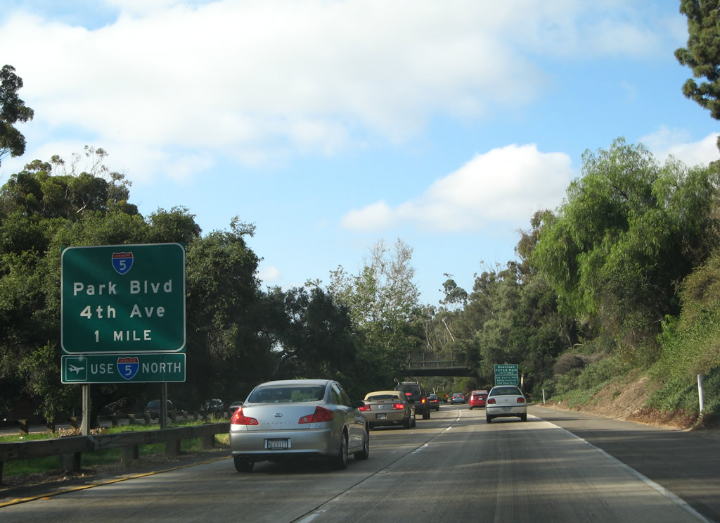
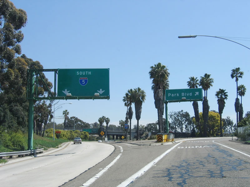
The next exit along southbound California 163 is Exit 1 (Interstate 5/Fourth Avenue/Park Boulevard), one mile. This reflective sign is located in the center median. Note the roadway improvements that were added between 2004 and 2006: new signs, new guardrails, and landscaping improvements. Photos taken 05/29/08 and 05/30/08. |
|
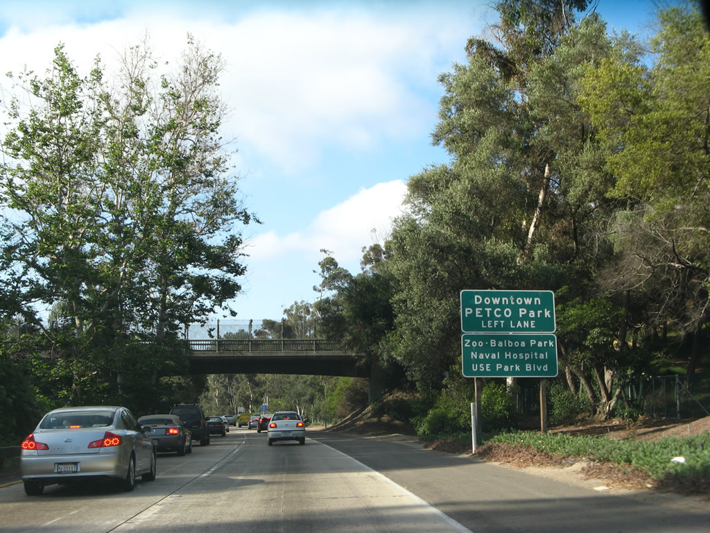
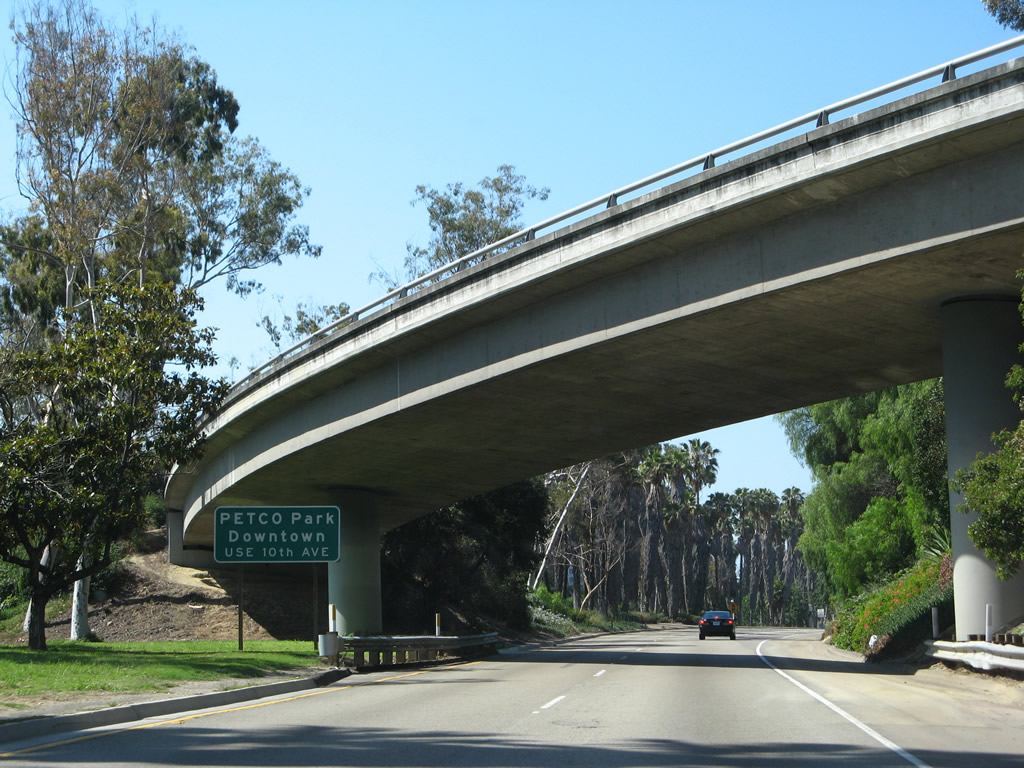
To reach downtown and Petco Park (home of Major League Baseball's San Diego Padres), use California 163 south (left lane), which changes into 10th Avenue after the Ash Street exit. To reach Balboa Park, exit onto Interstate 5 south, then follow the signs to Park Boulevard. Photo taken 05/29/08. |
|
This view shows the grassy median and wooden-concrete guardrail that separates the two directions of traffic. Photo taken 05/30/08. |
|
Use the right lane to connect to Interstate 5, Park Boulevard, and Fourth Avenue. Use the left lane to follow California 163 (Cabrillo Freeway) south to Ash Street, 10th Avenue, and B Street. Photo taken 05/30/08. |
|
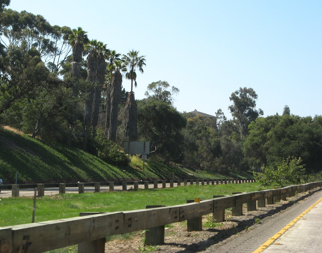
The tree-lined center median along California 163 makes this one of the most scenic stretches of freeway in San Diego. A guard rail was installed along California 163 in 2006 to prevent crossover accidents and head-on collisions; its visual impact is mitigated somewhat by having the look of wooden railing. Photo taken 05/22/04. |
|
|
|
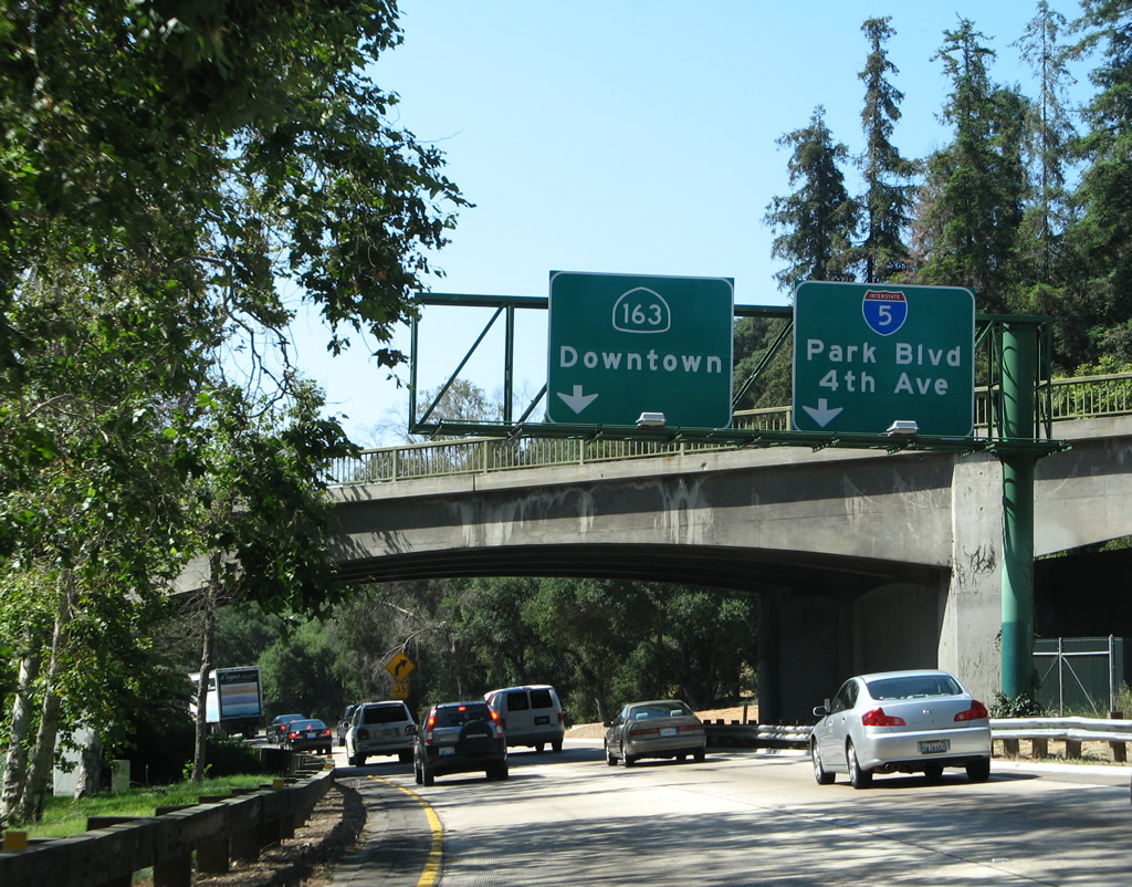
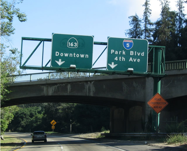
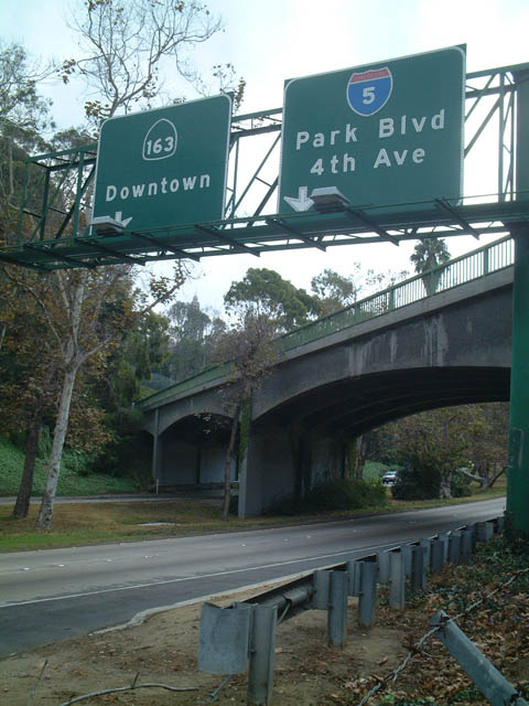
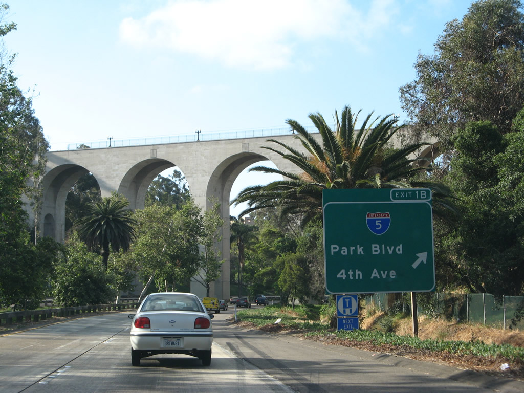
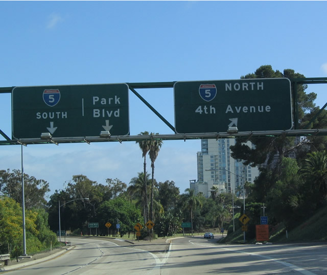
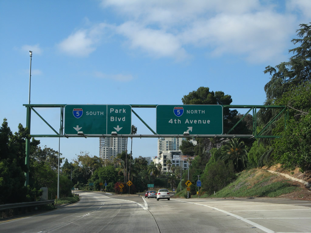
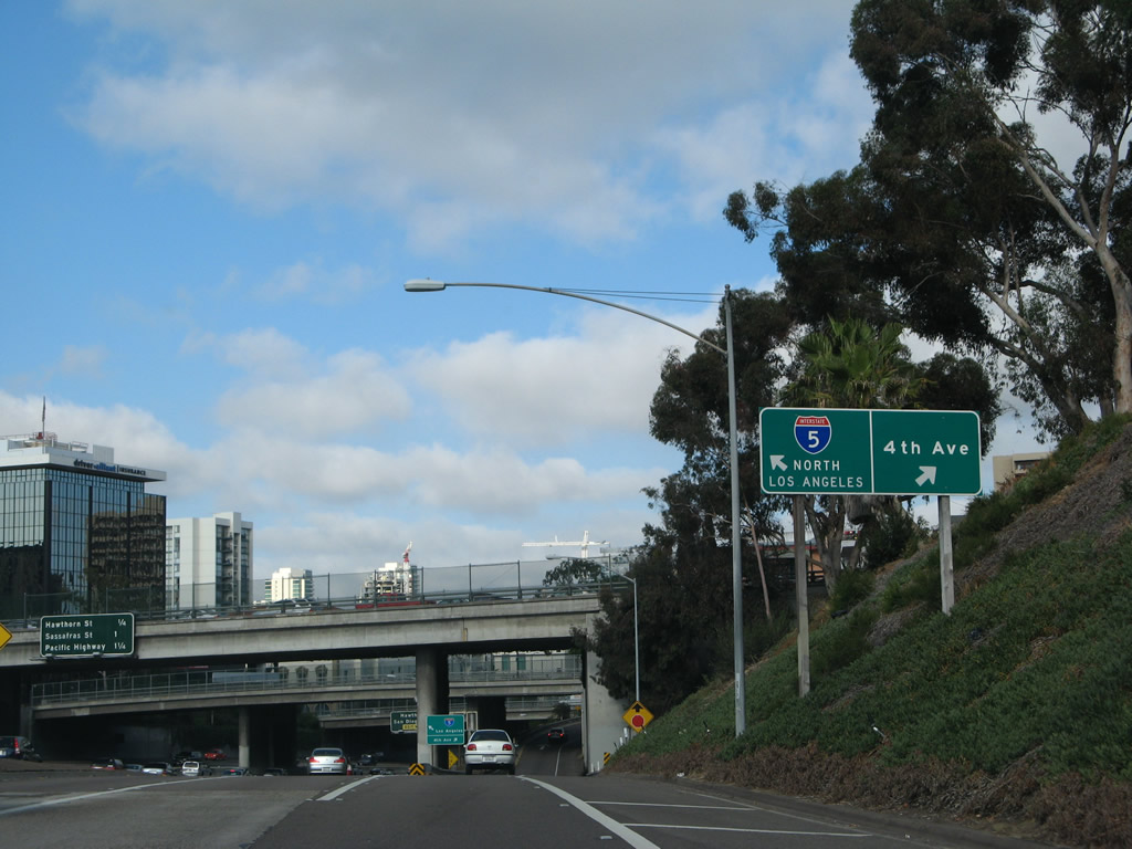
Southbound California 163 (Cabrillo Freeway) approaches Exit 1B, which connects to Interstate 5, Fourth Avenue, and Park Boulevard. This sign was modified in 1999 to eliminate the reference to California 94. Original freeway plans called for California 163 to continue as a freeway south of Interstate 5 until the area around F and G Streets. At that point, the freeway was intended to turn east to connect to the existing California 94 freeway. This connection was not built, so now traffic must use non-state routes (Tenth Avenue southbound and G Street eastbound) to reach California 94 (Martin Luther King Jr. Freeway) east. To remain on California 163 (Cabrillo Freeway), use the left lane; the right lane connects to Exit 1B, Interstate 5. This sign is mounted in front of the bridge that connects California 163 north to Quince Street and the west side of Balboa Park. There is no access from southbound to this exit. The 2008 photo shows the reflective replacement signs. The 2002 photo shows signage as seen from a foot path along the west edge of the freeway. Photos taken 05/30/08, 05/22/06, and 10/26/02. |
|
|
Southbound California 163 reaches Exit 1B, Interstate 5. Note the reflective sign was replaced to incorporate the exit number. Photos taken 05/22/04 and 05/29/08. |
|
The Cabrillo Bridge, which connects the western portion of Balboa Park with the main park via Laurel Street/El Prado, was constructed between 1912 and April 12, 1914. It opened in 1915 as part of the Panama-California Exposition, and it remains in use to this day. At the time this photo was taken, some bridge work was being performed. Shortly after this photo was taken, on the morning of June 17, 2004, a fire within one of the supports of the bridge erupted. Each of the bridge's supports are hollow, with wood pilings inside that date back to when the bridge was constructed. While the fire was contained within a few hours, some damage was evident in the internal wood pilings. Since the temperature never rose to where steel would melt, the structural integrity of the bridge was not compromised. For more information, visit The San Diego Union-Tribune webpage. (Thanks to Jared Forcier, who wrote us on 6/17/04). Photo taken 05/29/08. |
|
|
Continuing south, this overhead signage is found after the Cabrillo Bridge along south California 163 at the off-ramp to Exit 1, Interstate 5. Originally, this exit was to be more gradual, with a third set of two lane concrete passing under the Cabrillo Bridge. However, environmental concerns prevented that expansion, and as a result, the ramp to Interstate 5 from southbound California 163 is rather abrupt. Photos taken 05/22/04 and 05/30/08. |
|
Now on the transition ramp from California 163 south to Interstate 5, this sign advises motorists en route to the airport to use the right lane, which connects to Interstate 5 north. Photo taken 05/29/08. |
|
A concrete stub ramp merges onto the transition ramp shortly thereafter. Had California 163 been built as an eight-lane freeway through the park, this ramp would have been part of that connection. Today the stub ramp functions as a staging area for various repair and maintenance jobs. Photo taken 05/29/08. |
|
|
At the top of the transition ramp from southbound California 163 to Interstate 5, the right lanes head north (to 4th Avenue) and the left lanes head south (and to Park Boulevard). A reassurance shield is placed on the transition ramp for Interstate 5. Photos taken 05/22/04 and 05/29/08. |
|
After Interstate 5 north traffic splits, the left two lanes continue toward the connection to Park Boulevard and Interstate 5 south. Photo taken 03/24/06. |
|
The transition ramp from California 163 south to Interstate 5 south splits. The two left lanes continue toward Interstate 5 south, while the right lane exits onto Park Boulevard. Use Park Boulevard north to Balboa Park and the San Diego Zoo. Use Park Boulevard south to downtown San Diego, including a trolley station (at Park Boulevard and C Street) and City College. Photo taken 03/24/06. |
|
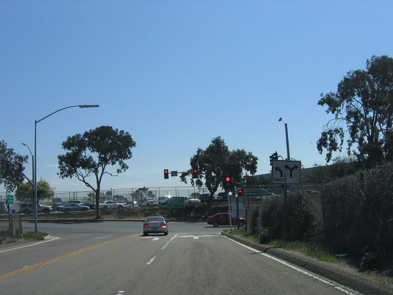
The ramp to Park Boulevard ends at this traffic signal. Photo taken 03/24/06. |
|
Now looking at the transition ramp to Interstate 5 (San Diego Freeway) north and Fourth Avenue, a reassurance shield assembly for Interstate 5 north appears. This ramp skirts the edge of Marston Point at the southwestern corner of Balboa Park. Cortez Hill and downtown San Diego's skyline come into view to the south. Photo taken 05/29/08. |
|
Access to Fourth Avenue is afforded from the ramp from California 163 south to Interstate 5 north only. There is no access to this ramp from the mainline of Interstate 5. The main line of Interstate 5 can be seen in this photo as well through the downtown S-curve. Photo taken 05/29/08. |
|
A sign at the gore point separates traffic from Interstate 5 north and Fourth Avenue. Photo taken 05/29/08. |
|
Reaching the top of the ramp to Fourth Avenue, a stop sign governs the flow of traffic. Turn left to follow Fourth Avenue south into downtown or continue straight ahead to connect to Third Avenue north to Uptown. Photo taken 05/29/08. |
|
Back on the mainline of California 163 south (after the ramp to Interstate 5 and Park Boulevard/4th Avenue), the California 163 freeway will pass under the four-level stack interchange with Interstate 5, then prepare to end after the Ash Street off-ramp (Exit 1A). Photo taken 05/30/08. |
|
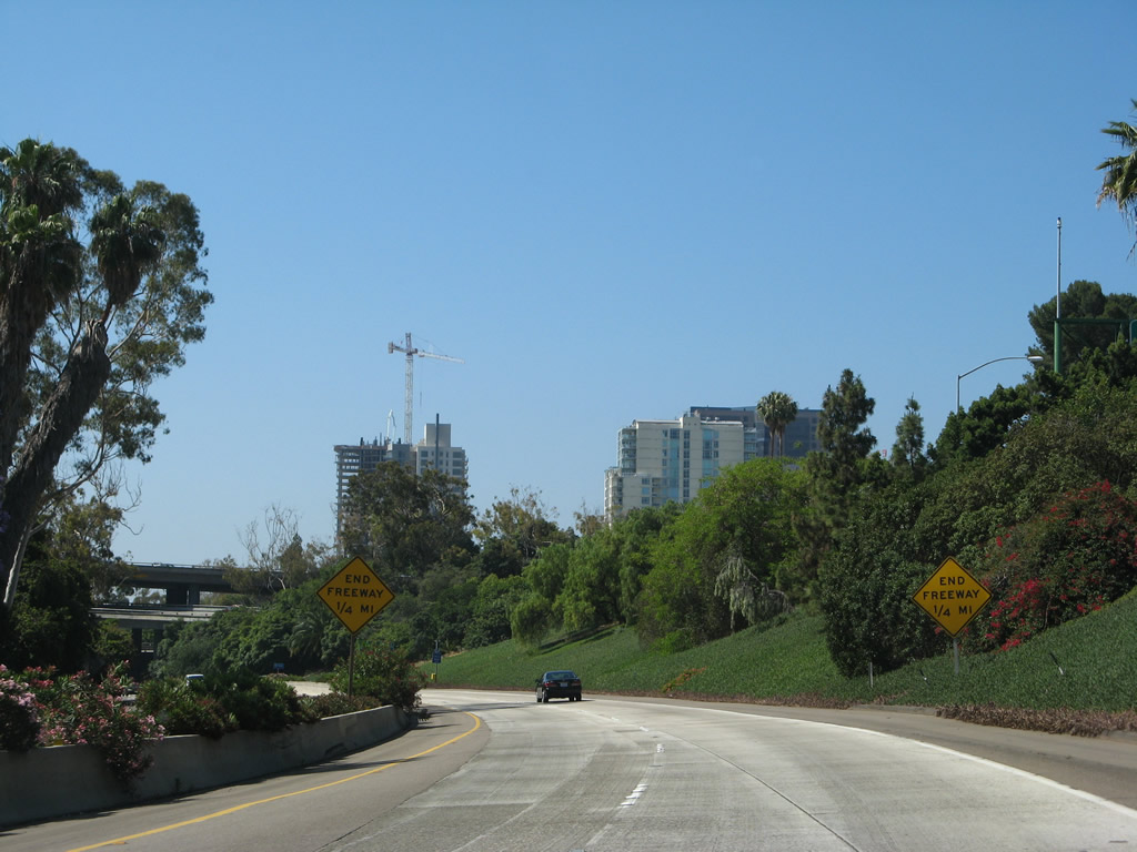
"End freeway 1/2 mile" signs flank both sides of the two southbound lanes. Photo taken 05/30/08. |
|
The stack interchange that serves California 163 and Interstate 5 comes into view. California 163 is the bottom level, and Interstate 5 is the top level. Connecting ramps between the two routes create the middle levels. Photo taken 05/30/08. |
|
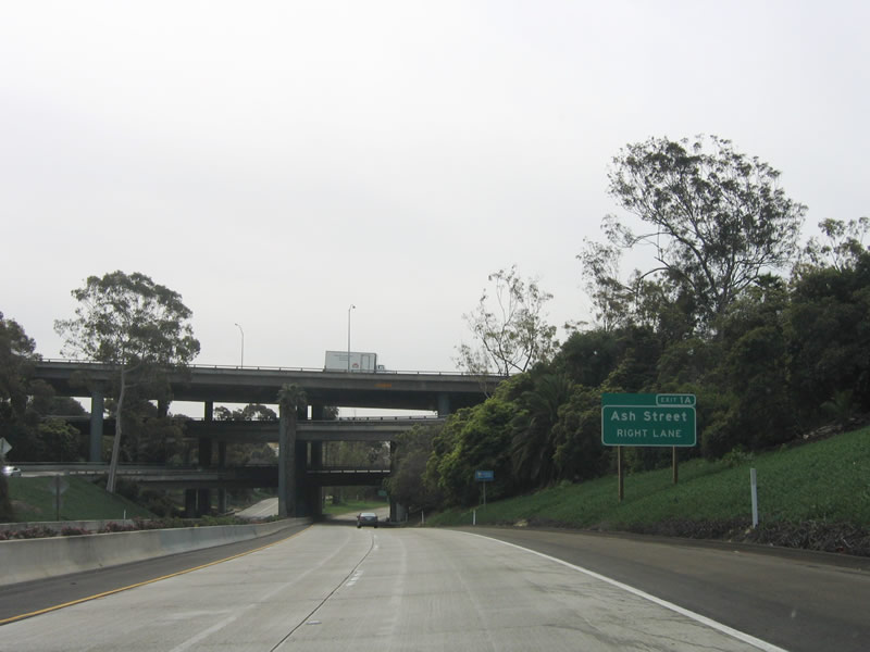
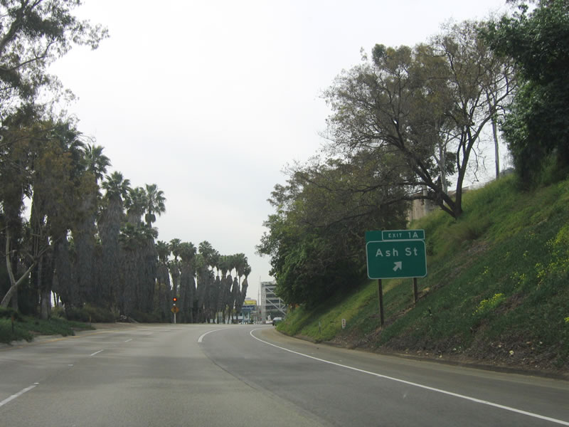
The penultimate exit on southbound California 163 is Exit 1A, Ash Street (access to westbound Ash Street only). Photo taken 05/30/08. |
|
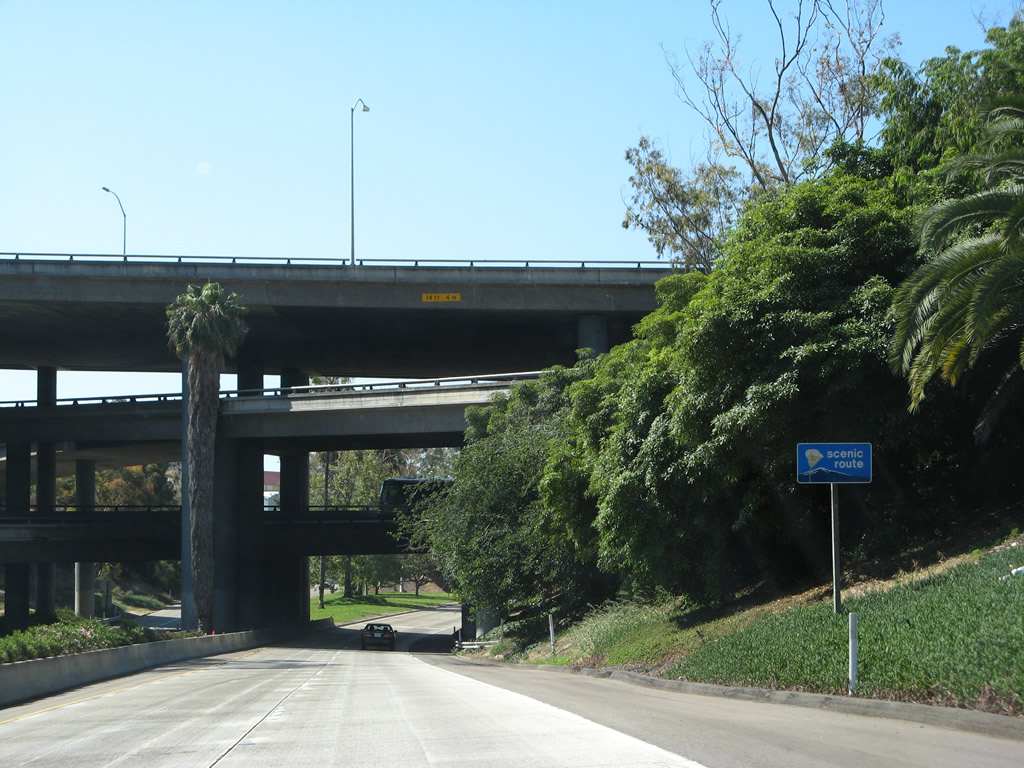
A scenic route reassurance sign is posted prior to entering the four-level stack interchange. Photo taken 05/30/08. |
|
Southbound California 163 will transition directly onto southbound 10th Avenue immediately after Exit 1A, Ash Street. The overhead ramp connects southbound Interstate 5 with southbound 10th Avenue. Photo taken 05/30/08. |
|
An auxiliary lane provides the direct connection from southbound California 163 to westbound Ash Street (Exit 1A). Use Ash Street west to Cortez Hill, the Financial District, the Civic Center, and North Embarcadero. The freeway ends immediately after Exit 1A. Photo taken 03/16/06. |
|
|
Southbound California 163 reaches Exit 1A, Ash Street. The next traffic signal is with A Street, which is one-way eastbound. Use B Street (second signal) west to the Financial District of San Diego and the Civic Center (including City Hall). A new high-rise condominium building is currently under construction that changes the look of the south end of California 163. Photo taken 05/30/08 and 03/16/06. |
|
|
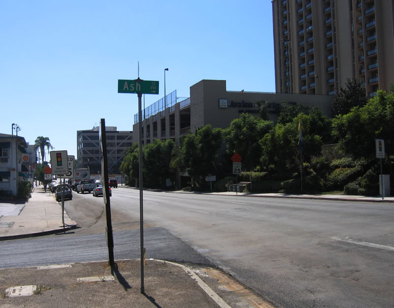
After passing under the symmetrical stack interchange, this end California 163 shield assembly is located along southbound at Ash Street, just after the short off-ramp to westbound Ash Street. The freeway transitions onto southbound 10th Avenue. Photos taken 05/30/08 and 10/06/05. |
|
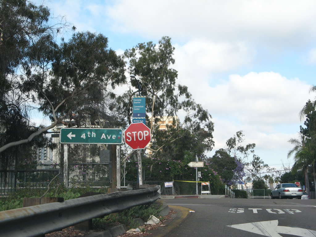
Here is another view of the southern terminus of California 163, as seen from the center median near Ash Street. From here, California 163 ceases to be a freeway, and southbound traffic enters one-way Tenth Avenue. The first intersection after Ash Street is A Street (one-way eastbound, with access to Park Boulevard and Balboa Park) followed by B Street west into the financial district of downtown. Continue south on 10th Avenue to reach Petco Park, home of the San Diego Padres. Photo taken 10/06/05. |
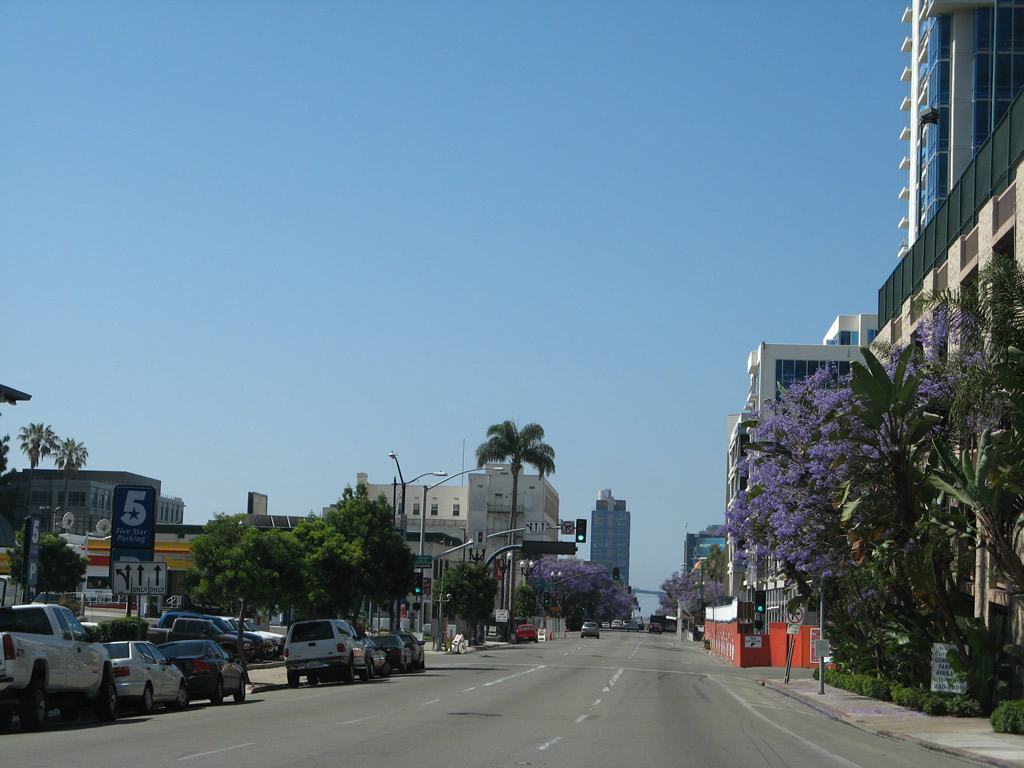
| Tenth Avenue south |
|
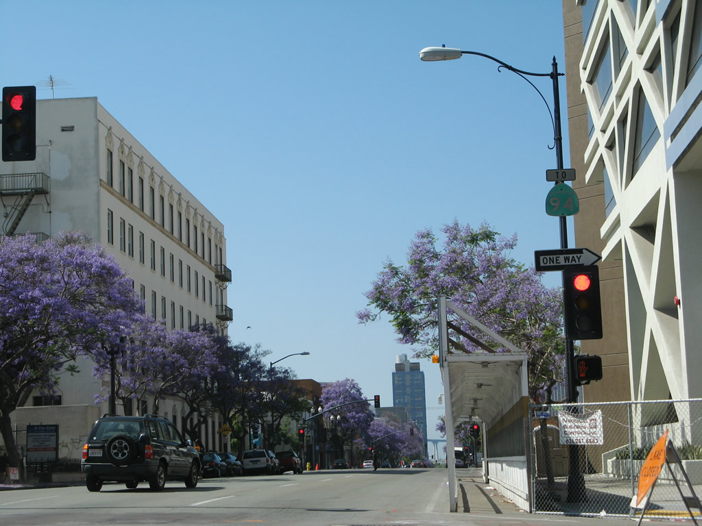
Purple flowers from jacaranda trees make for a beautiful entrance into San Diego's downtown. As the freeway ends, California 163 becomes Tenth Avenue. A traffic signal ahead connects Tenth Avenue with A Street. Photo taken 05/30/08. |
|
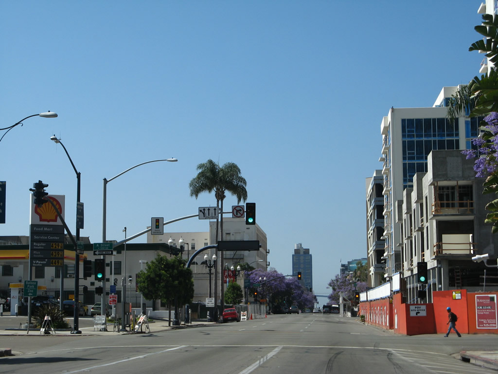
One block south of the Ash Street intersection, southbound California 163 meets A Street (one-way eastbound) at this traffic signal. To reduce the number of red-light runners, this intersection is patrolled by photo enforcement. Cameras are mounted in the northwestern and southeastern corners. Photo taken 05/30/08. |
|
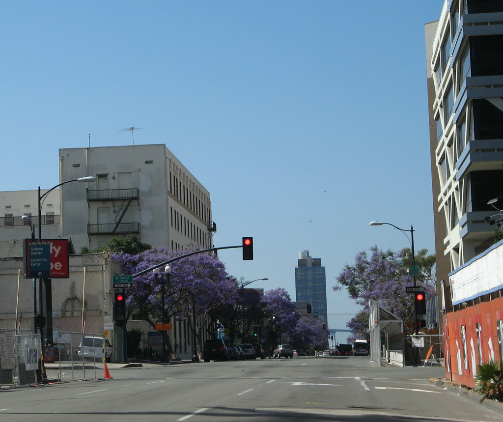
The next intersection on southbound Tenth Avenue is with B Street. Turn right on this one-way street toward the Financial District and San Diego Civic Center. Photo taken 05/30/08. |
|
At the B Street intersection is a trailblazer for California 94. To California 94 east, follow Tenth Avenue south to G Street, then turn left on G Street east. G Street transitions directly onto the eastbound freeway. Continue straight ahead to PETCO Park, the Marina District, and the convention center. Photo taken 05/30/08. |
Page Updated November 4, 2011.