

California 163 - Cabrillo Freeway
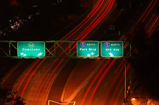
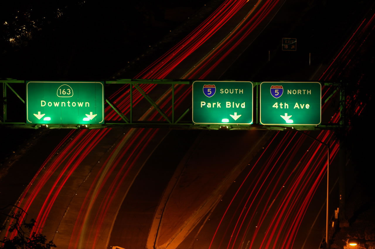
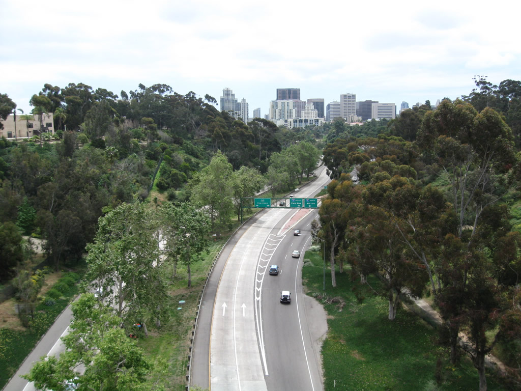
Southbound California 163 (Cabrillo Freeway) meets Interstate 5 at a four-level stack interchange. This view of the exit signage for Interstate 5 is from the Cabrillo Bridge on El Prado in Balboa Park in San Diego. See here for another view. Photo taken by Jeff Royston and Andy Field (05/19/07).
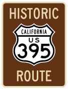
California 163 is the Cabrillo Freeway in San Diego, which follows the original freeway alignment of U.S. 395 between downtown San Diego and Miramar. The freeway changed designations once, when U.S. 395 was legislatively decommissioned in 1964. Ths signs weren't immediately removed, but by 1969, California 163 was signed on former U.S. 395. U.S. 395 shields remained alongside California 163 shields until at least 1972 or 1973 based on AAA maps from that time period. Today, California 163 is a major north-south connection in the San Diego freeway network. The section of freeway north of Interstate 8 is Interstate-standard, eight-lane freeway. The section of California 163 south of Interstate 8 through Balboa Park is a historic freeway that was one of the first freeways constructed in the city of San Diego. It is not Interstate standard, features a wide, grassy/tree-lined median, has only four lanes for the most part, and has several sharp curves (for a freeway). In an effort to improve safety along the section through the park, wooden guardrails with steel reinforcement were installed in December 2004 on either side of the grassy median.
California 163 Highway Guides
The freeway through the park is a designated California state scenic route and historic route. Great care was taken to ensure the minimum possible impact of the pavement on the surrounding greenery of Balboa Park. In a 1958 edition of California Highways and Public Works magazine, Jacob Dekema (a former director of Caltrans District XI) described the 2.5-mile stretch of freeway through the park:
- U.S. 395 [California 163 (Cabrillo Freeway)] acquires freeway character at A Street at the southern tip of 1,400-acre Balboa Park, which is imbedded in the geographical heart of the City of San Diego. The Cabrillo Freeway sweeps with gentle curves through a central valley of the park, providing the motorist with one of the most scenic drives in California. The initial freeway effort in District XI, it [California 163 through Balboa Park] still stands as a model of beauty and efficiency.1
Built between 1942 and 1947, the freeway opened in 1947 as U.S. 395. U.S. 395/Cabrillo Freeway was the first freeway to be constructed anywhere in San Diego County. The Cabrillo Freeway dates to an era when the oldest Los Angeles freeways were being built, including U.S. 66/Arroyo Seco Parkway, which is now known as California 110 (Pasadena Freeway). U.S. 395 was designed to connect the 10th Avenue and 11th Avenue couplet with Friars Road with a connection via 6th Avenue near Hillcrest into Mission Valley. The freeway was then extended north from Friars Road in phases thereafter to its current terminus at Interstate 15 in Marine Corps Air Station - Miramar.
A four-level interchange at the southern end of the freeway allows for movements in nearly all directions, except from northbound 11th Avenue to southbound Interstate 5 and from northbound Interstate 5 to southbound 10th Avenue. This interchange was initially decried by preservationists who feared such a large concrete structure would dominate the aesthetics in the park, but it seems to fit in well. Since its inception, the Cabrillo Freeway has retained only four lanes, and various efforts to expand the freeway have met with fierce resistance from local preservationists and community activists who appreciate the older design and lower capacity quality of the freeway. California 163 along the original Cabrillo Freeway alignment was established as an official state scenic route in 2003, and signs were posted to demonstrate its status as a historical route.
South of Interstate 5, there were likely plans to extend California 163 as a freeway along the 10th/11th Avenue couplet south to F Street and G Street, which in turn would connect California 163 directly to California 94, the Martin Luther King Jr. Freeway. Freeway plans contemplated this freeway connection until around 1984; maps from the 1970s and 1980s routinely showed California 163 signed on 10th Avenue and 11th Avenue. Maps still showed California 163 on 10th and 11th Avenue even after the freeway plan was scraped, but it is not clear if California 163 was ever signed on the surface streets. Two overhead signs on southbound California 163 just prior to the Interstate 5 interchange were modified in 1999 to eliminate a reference to California 94. With redevelopment now occurring throughout downtown San Diego and in the East Village, the freeway plan to connect California 163 to California 94 with a connecting freeway is dead and will not return.
| California 163 scenes - Cabrillo Bridge | ||
|---|---|---|
 |
 |
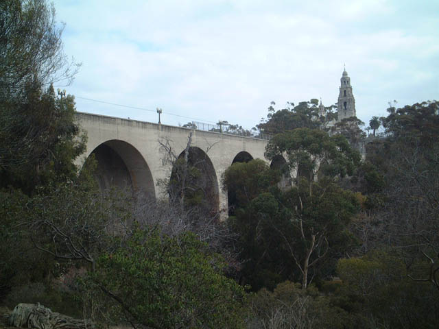
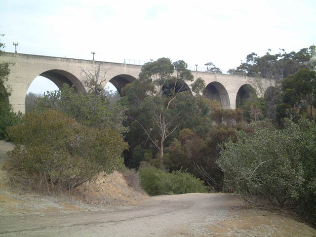
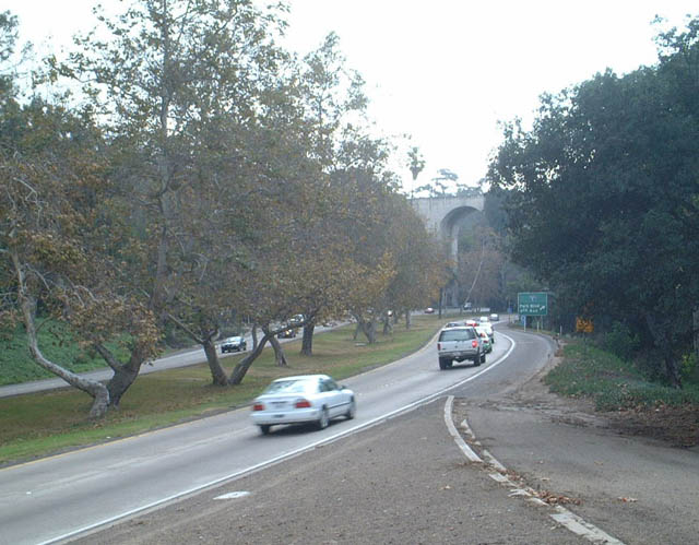
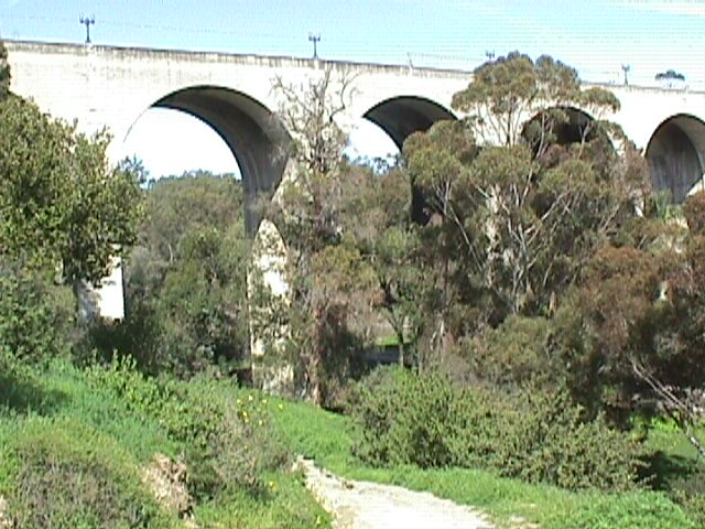
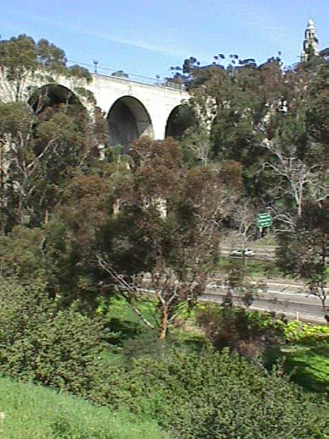
This series of pictures shows the Cabrillo Bridge (Laurel Street Bridge) from a path in Balboa Park along the western frontage of the California 163 freeway, looking northeast. The Cabrillo Bridge carries Laurel Street/El Prado over California 163 (Cabrillo Freeway). It was opened in 1915 well before the freeway was constructed; California 163 (then known as U.S. 395) was built in the 1940s, and it was one of the first freeways to be constructed in San Diego. The freeway threads through the canyon below the bridge, and a culvert carries the water that used to follow naturally through the canyon. The Cabrillo Bridge could easily have more lanes of traffic pass under it, but concerns about an ever-expanding freeway into Balboa Park have prevented any further expansions of the freeway in the canyon. Photos taken 10/26/02. |
 |
 |
|
 |
 |
These photos provide a view of the Cabrillo Bridge from a path in Balboa Park along the western frontage of the California 163 freeway, looking southeast. The bridge was constructed between 1912 and 1914, with San Diego Union-Tribune indicating that then-Assistant Secretary of the Navy Franklin Roosevelt was the first to drive across the new bridge. He later became President of the United States. The bridge was in full use in 1915 as part of the Panama-California Exposition. Photos taken 10/26/02. |
 |
 |
 |
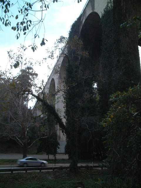
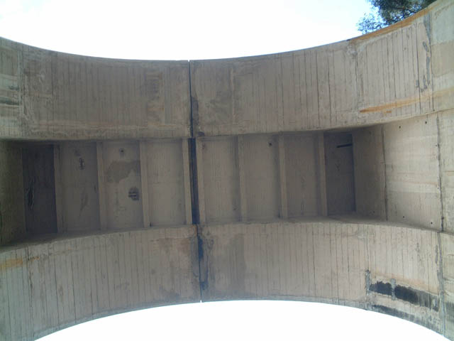
These photos provide a side view of the Cabrillo Bridge from a path in Balboa Park along the western frontage of the California 163 freeway, looking east across the freeway. The Cabrillo Bridge is a steel-reinforced cast-concrete bridge, and it rises 125 feet above the floor of the valley. The bridge itself is hollow, and wood pilings still remain from the original concrete poured in 1912-1914. Some of the interior wood burned in a fire in 2004, but the steel kept the bridge intact. Photos taken 10/26/02. |
 |
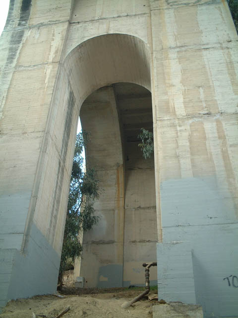
This view of the Cabrillo (Laurel Street) Bridge looks from a path in Balboa Park along the western frontage of the California 163 freeway, looking straight up at the underside of the bridge. Photo taken 10/26/02. | |
 |
 |
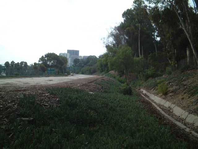
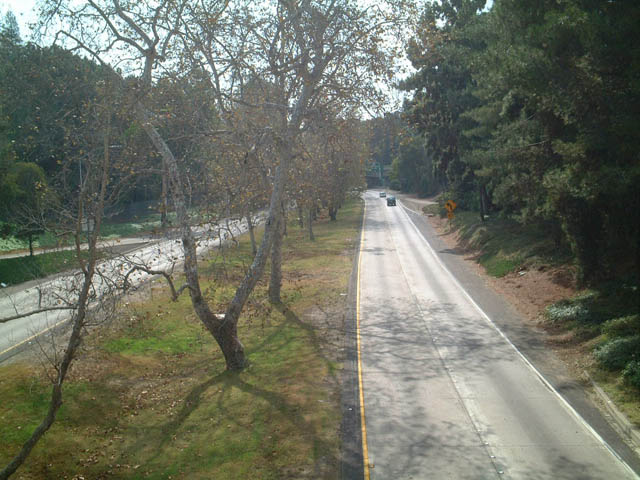
Looking down from the sidewalk along the Cabrillo Bridge are these views of northbound California 163 freeway. Photos taken 02/19/05. |
 |
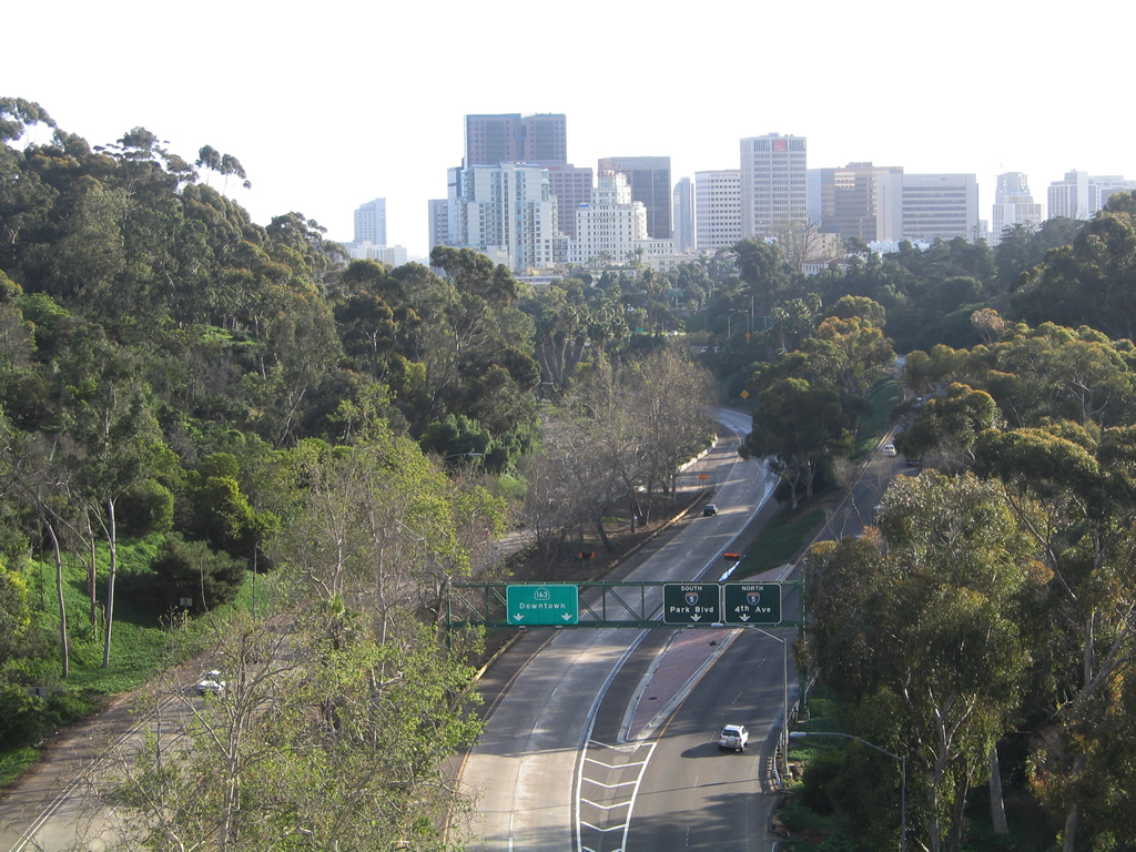 |
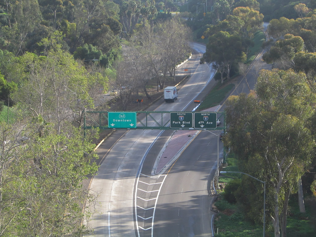
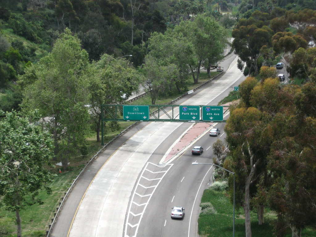
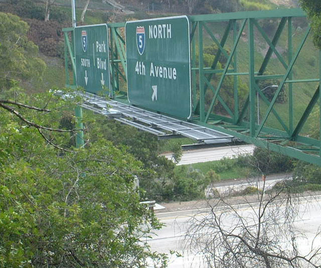
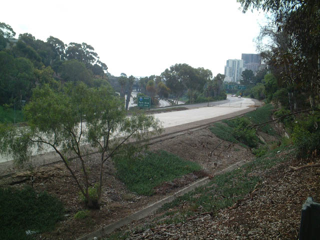
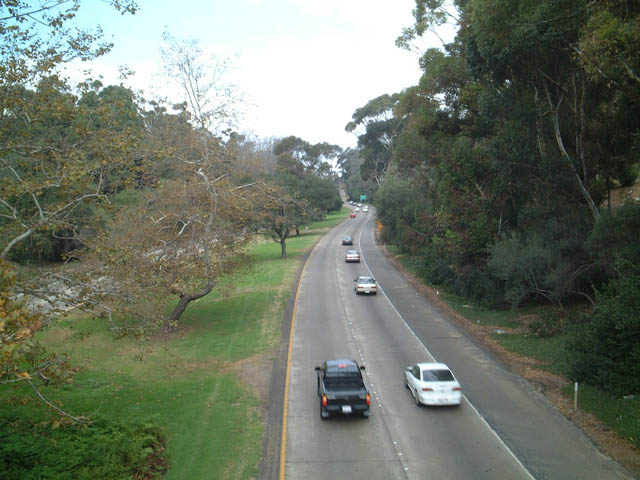
Turning south, downtown San Diego and Marston Point are visible from the Cabrillo Bridge. California 163 approaches its southern terminus below the Cabrillo Bridge, as the two southbound lanes prepare to split. The right lanes connect to Interstate 5 north to the San Diego Airport and south to Park Boulevard and points south. The overhead signs for the Interstate 5 exit were replaced between 2005 and 2006; the 2011 pictures show the newer signs. In the distance, construction resulted in more skyscrapers rising from downtown San Diego between 2011 and 2005. Photos taken 02/19/05 and 04/21/11. |
 |
 |
|
 |
 |
 |
 |
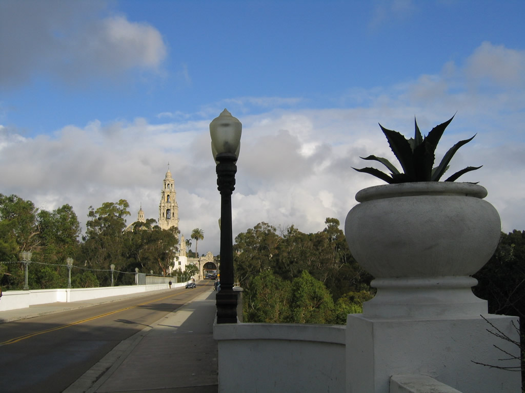
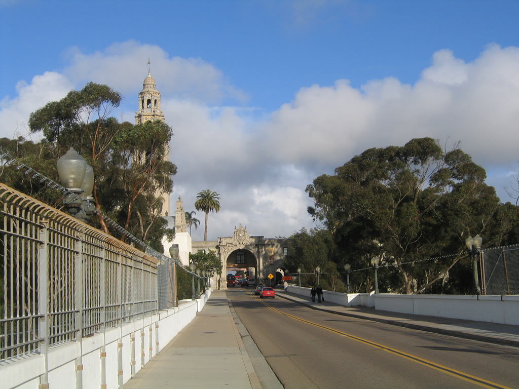
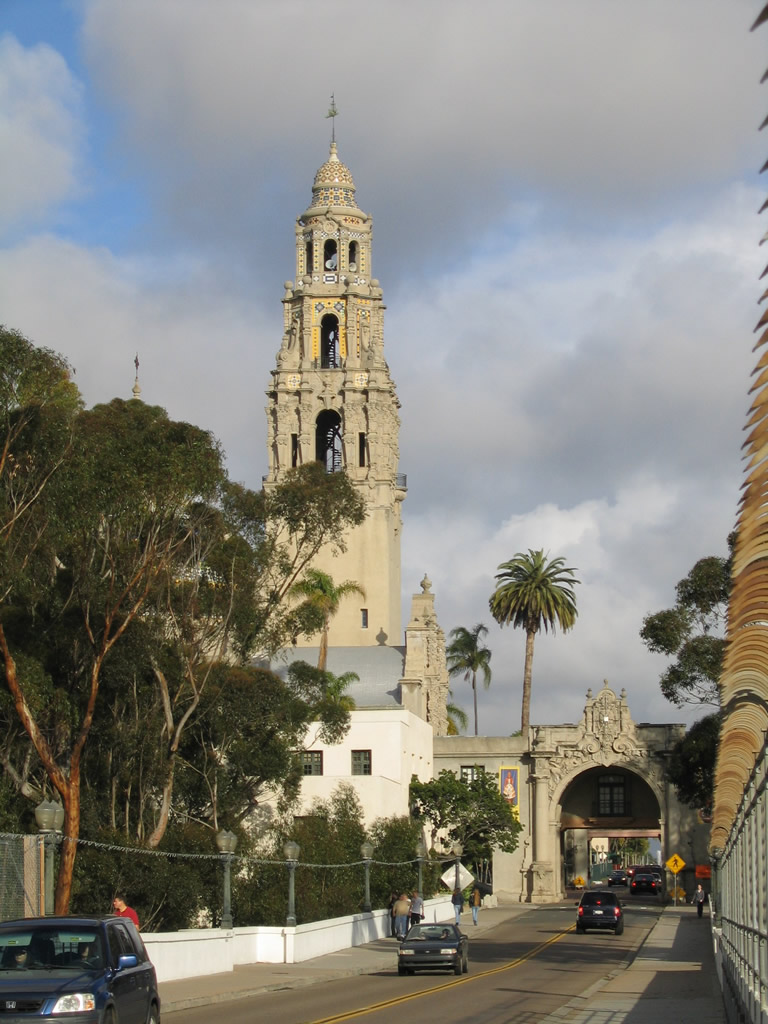
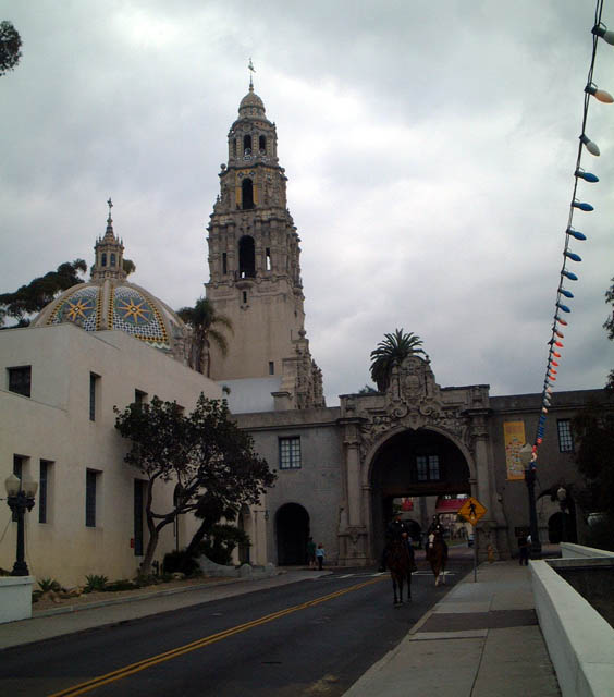
This view looks east along Laurel Street/El Prado as it crosses the Cabrillo Bridge, entering Balboa Park. The California Tower, currently home to the Museum of Man, is a prominent feature on the central mesa of expansive Balboa Park. Photos taken 02/19/05. |
 |
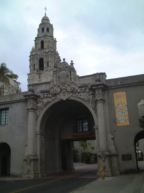 |
Eastbound El Prado approaches the California Tower in Balboa Park. During the December Nights festival, held each December after Thanksgiving (formerly called "Christmas on the Prado"), restaurants from around the city set up booths on top of the bridge to provide sampling of various cuisines. Photos taken 10/26/02. | |
|
Now looking west from the center of the Cabrillo Bridge, El Prado travels west toward the western mesa of Balboa Park, the Uptown community, and San Diego International Airport by way of Laurel Street. Photo taken 02/19/05. | ||
 |
 |
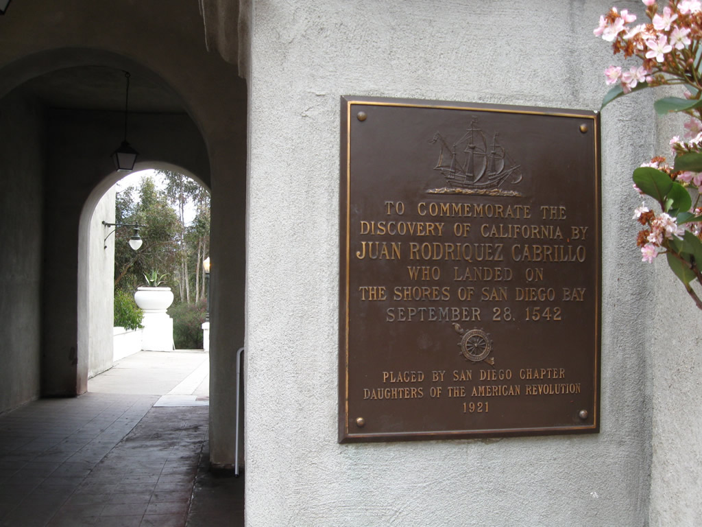 |
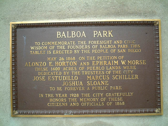
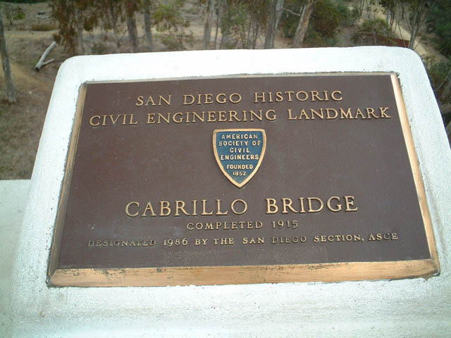
These plaques commemorates Balboa Park and the Cabrillo Bridge. They are located near the eastern end of Cabrillo Bridge as it nears the California Tower along eastbound El Prado (south side of bridge). Photos taken 10/26/02 and 04/21/11. |
 |
 |
 |
 |
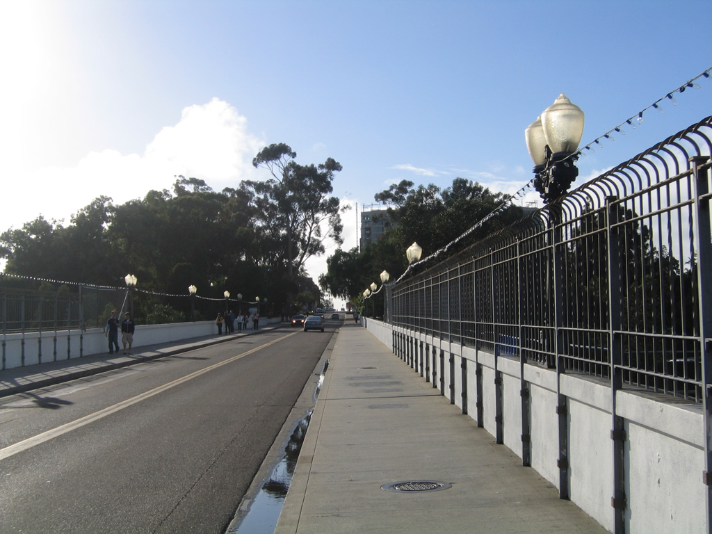
This series of photos provides views of the Cabrillo Bridge, which carries Laurel Street over California 163, as seen looking northbound from a Balboa Park hiking trail located adjacent to the right-of-way for the freeway. Photo taken 03/06/98. |
| Interstate 5 / California 163 Interchange from Balboa Park | |||
|---|---|---|---|
 |
 |
 |
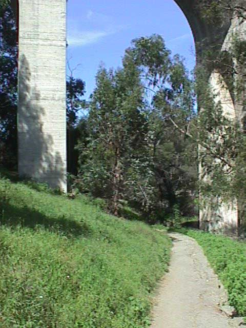
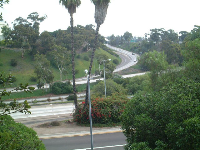
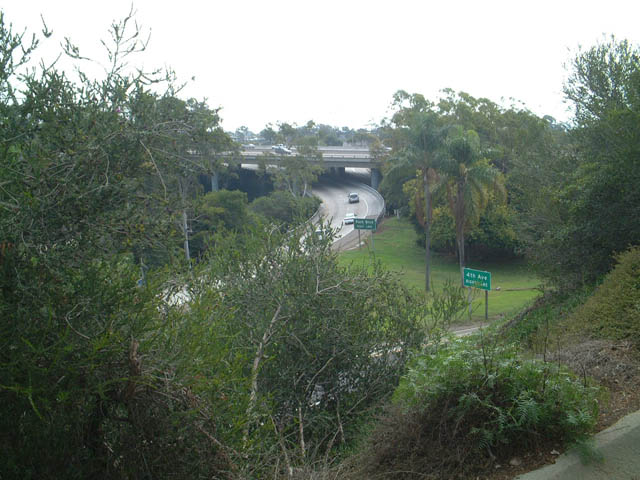
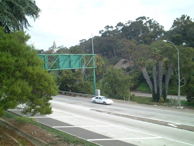
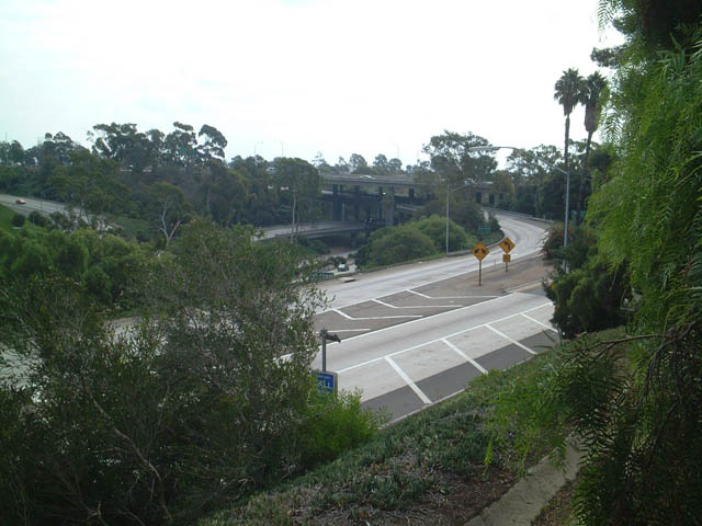
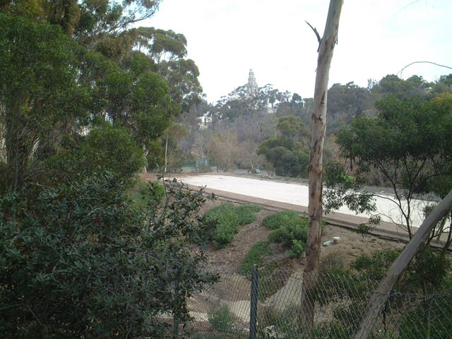
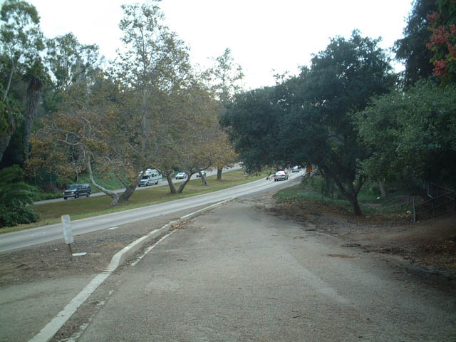
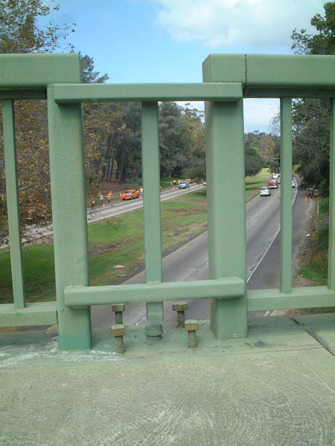
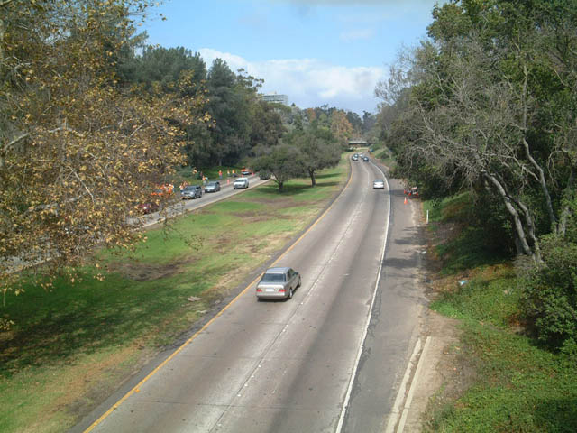
Views of the California 163/Interstate 5 stack interchange as seen from the trails of Balboa Park north and west of the interchange. Photos taken 10/26/02. |
 |
 |
||
| View of the California Tower from California 163 | |||
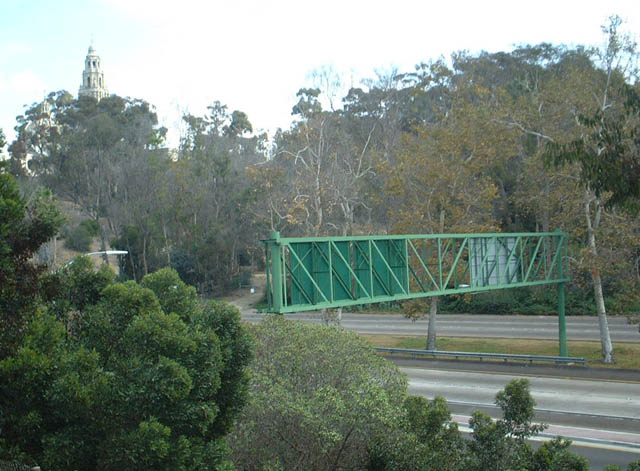 |
View of the California Tower as seen from the vicinity of the northwest quadrant of the Interstate 5/California 163 interchange. Photo taken 10/26/02. | ||
| Stub Ramp at Interstate 5 Interchange | |||
 |
 |
 |
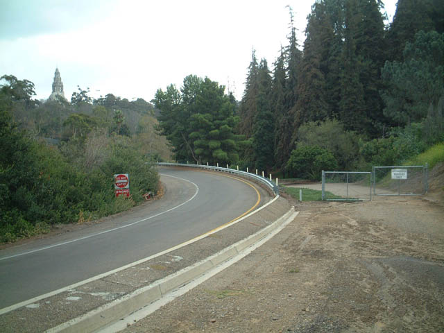
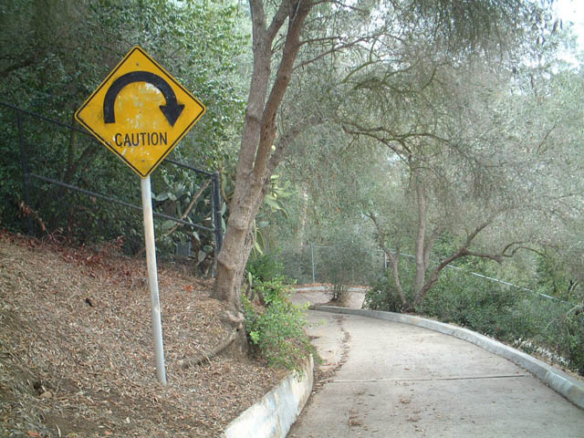
California 163 is only four lanes through Balboa Park, even though it was originally slated to be an eight to ten lane freeway through the park. This expansion project never occurred due to community protest, but some remnants of the original plan are still visible, including this stub ramp located at the top of the transition ramp from southbound California 163 onto Interstate 5. If the expanded freeway were constructed, this ramp would have continued north, covering an existing foot path within the park. Even though California 163 through the park remains congested, especially during commute hours, there are no plans to expand its capacity at this time. Photos taken 10/26/02. |
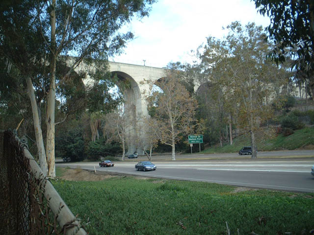
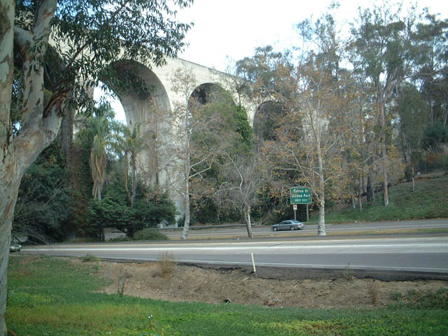
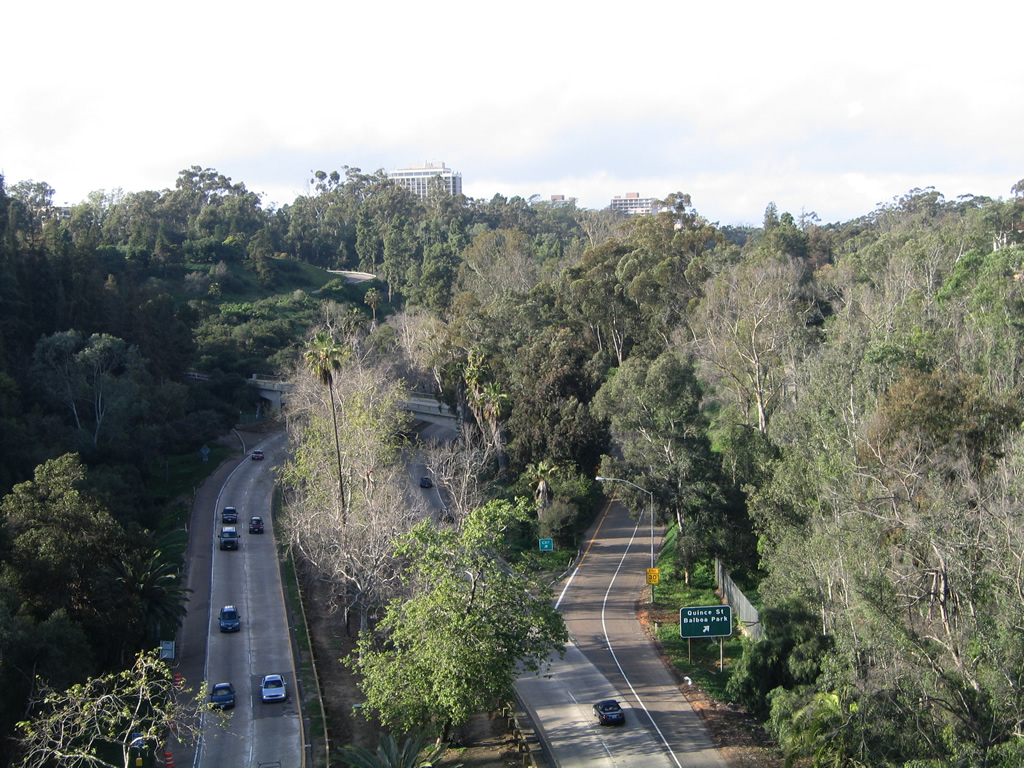
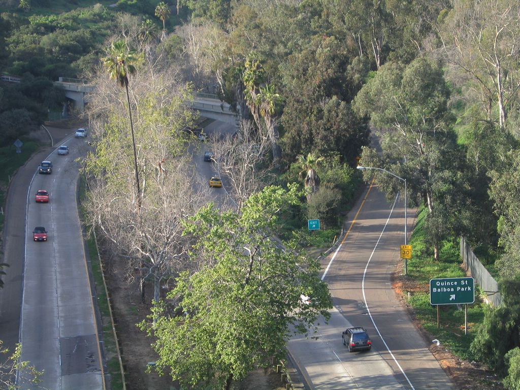
| Quince Street Overcrossing | |||
 |
 |
 |
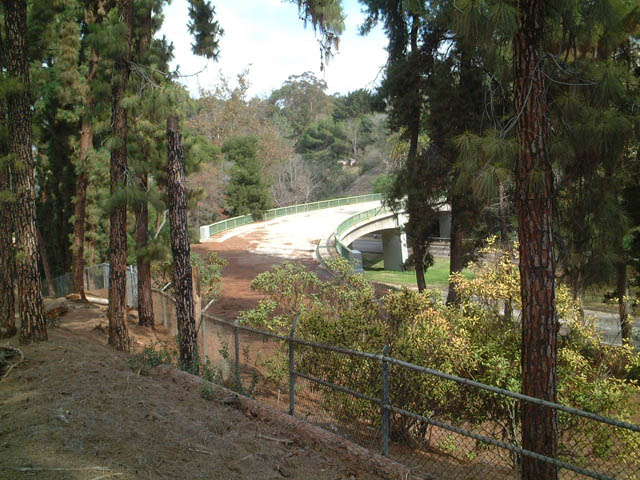
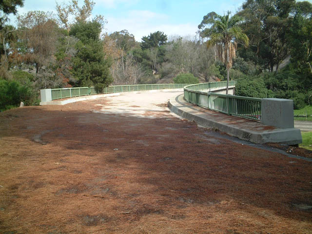
Views of the Quince Street overcrossing. Note the abandoned ramps. Currently, there is only an exit from northbound California 163 onto Quince Street. There used to be a connection from eastbound Quince Street onto Southbound California 163, but that ramp was closed as shown in the second photograph. Photos taken 10/26/02. |
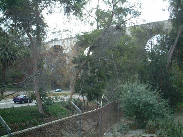
| Richmond Street Overcrossing | |||
 |
 |
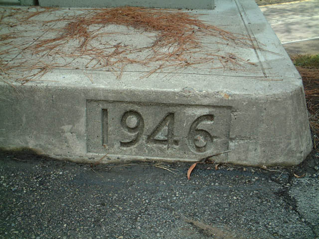 |
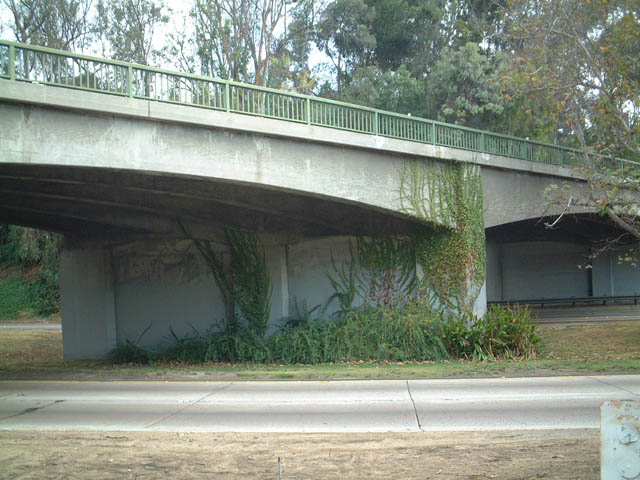
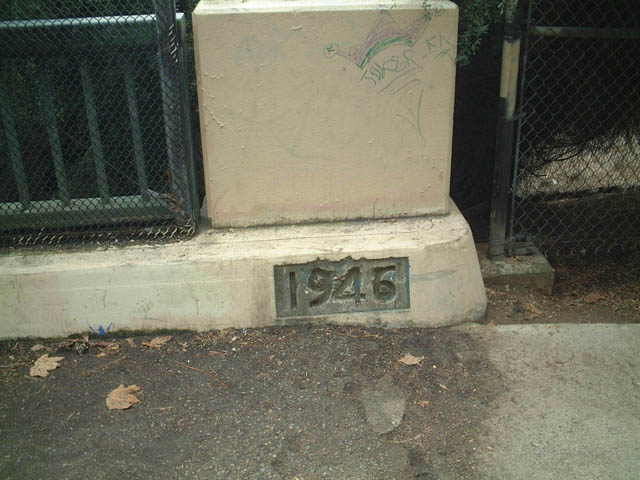
This suit of pictures shows the Richmond Street overcrossing. This bridge is no longer in use, and it is only in place because of the original connection from southbound Richmond Street onto southbound California 163. Since that ramp was closed, the bridge is no longer in use because Richmond Street does not continue south past this exit. The bridge was constructed in 1946, at approximately the same time as the freeway below. Photos taken 10/26/02. |
 |
 |
 |
|
 |
 |
Views of southbound California 163 as seen from the abandoned Richmond Street overcrossing. Photos taken 10/26/02. | |
 |
 |
 |
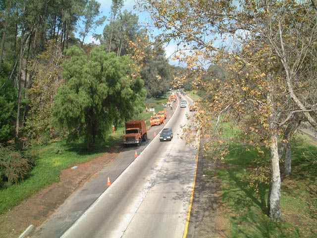 |
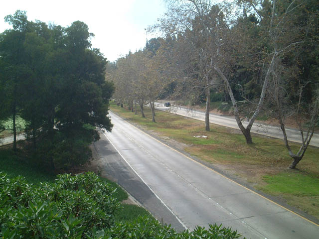
These views of California 163 north are taken from the abandoned Richmond Street overcrossing. Photos taken 10/26/02. |
| Pedestrian Bridge Overcrossing | |||
|---|---|---|---|
 |
 |
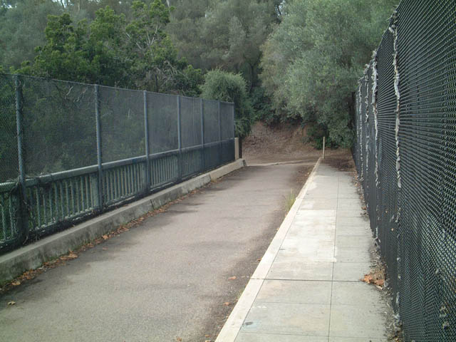 |
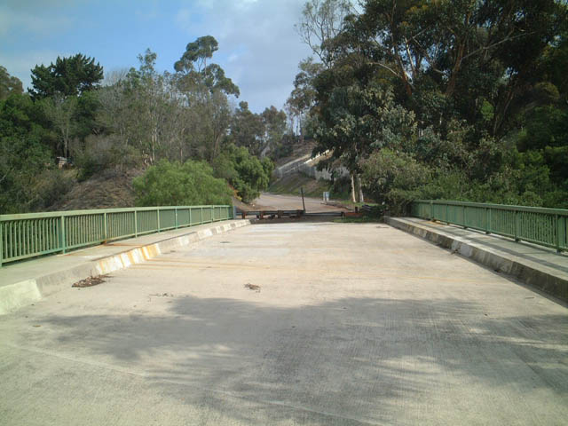
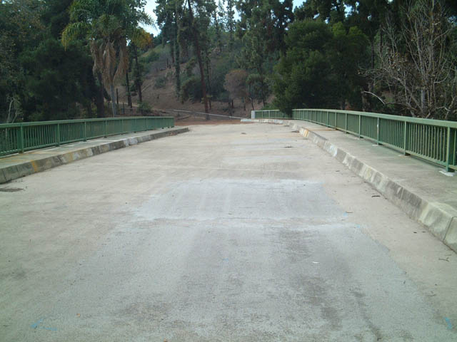
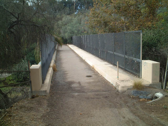
This series of pictures shows the pedestrian bridge over California 163 in Balboa Park north of the Quince Street and Richmond Street exits. Photos taken 10/26/02. |
 |
 |
||
Sources:
- "Report from District XI" by Jacob Dekema, District Engineer, California Highways and Public Works, November-December 1958, page 46.

Page Updated May 3, 2011.
|
About Contact Glossary |
In The News Testimonials Interstate Guide |
Social Media:
 |
|
© 2000-23 AARoads.com | All Rights Reserved | Privacy Policy / Terms of Use
|
||