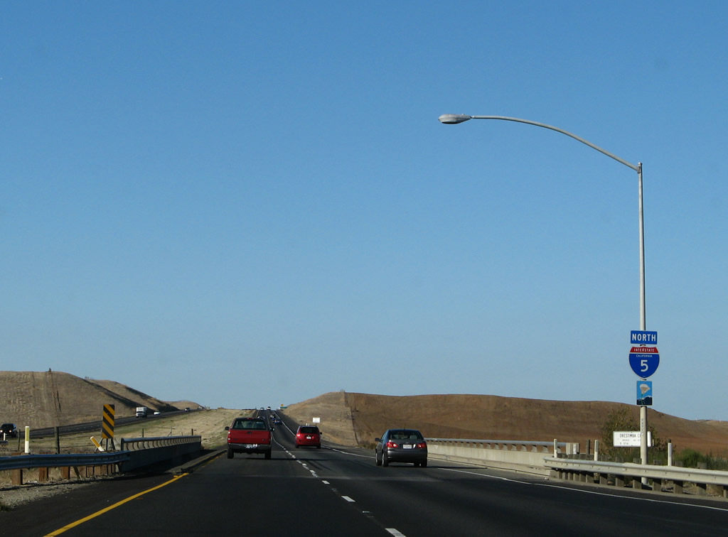
| Interstate 5 (West Side Freeway) north |
|
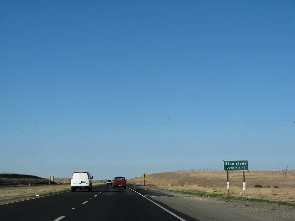
While within the footprint of the California 140 interchange, Interstate 5 departs Merced County and enters Stanislaus County ("In the Heart of Central California"), which had a population of 514,453 as of the 2010 Census. The county seat is Modesto, which is located on the California 99 corridor. Photo taken 11/22/07. |
|
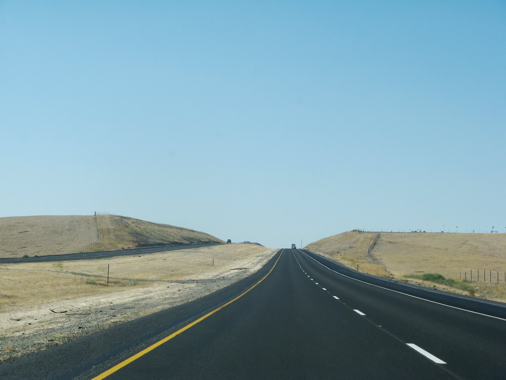
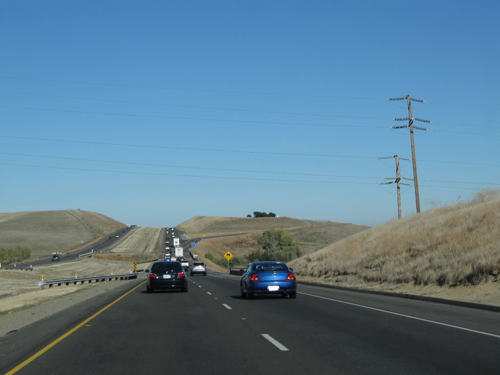
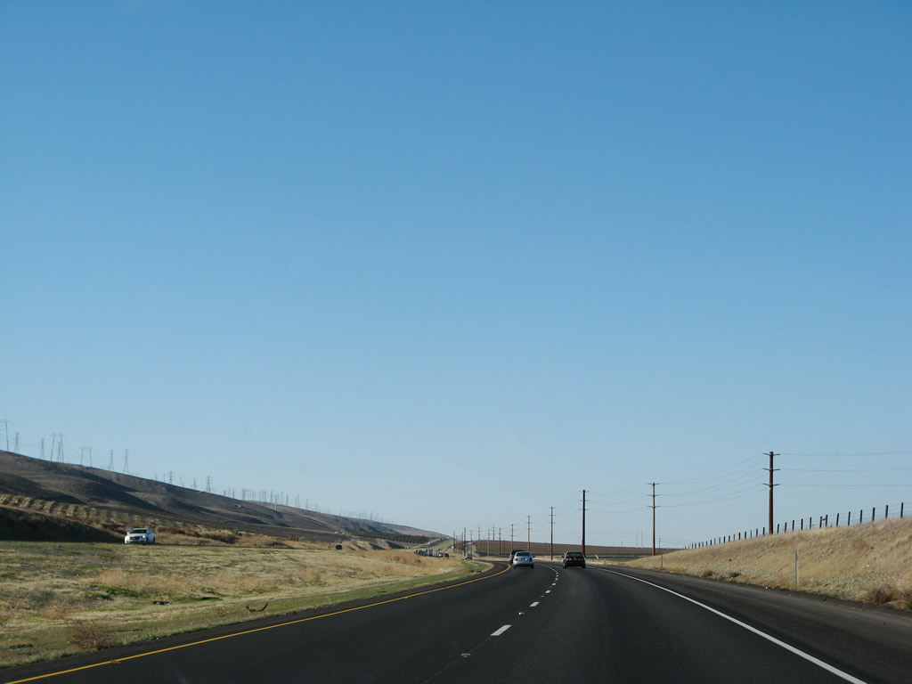
Interstate 5 continues north after the California 140 interchange along its desolate path, especially on a day with almost no traffic. However, the freeway will start to see more cities nearby (mostly along parallel California 33, which stays east of Interstate 5 until we get close to Tracy). Photo taken 07/04/07. |
|
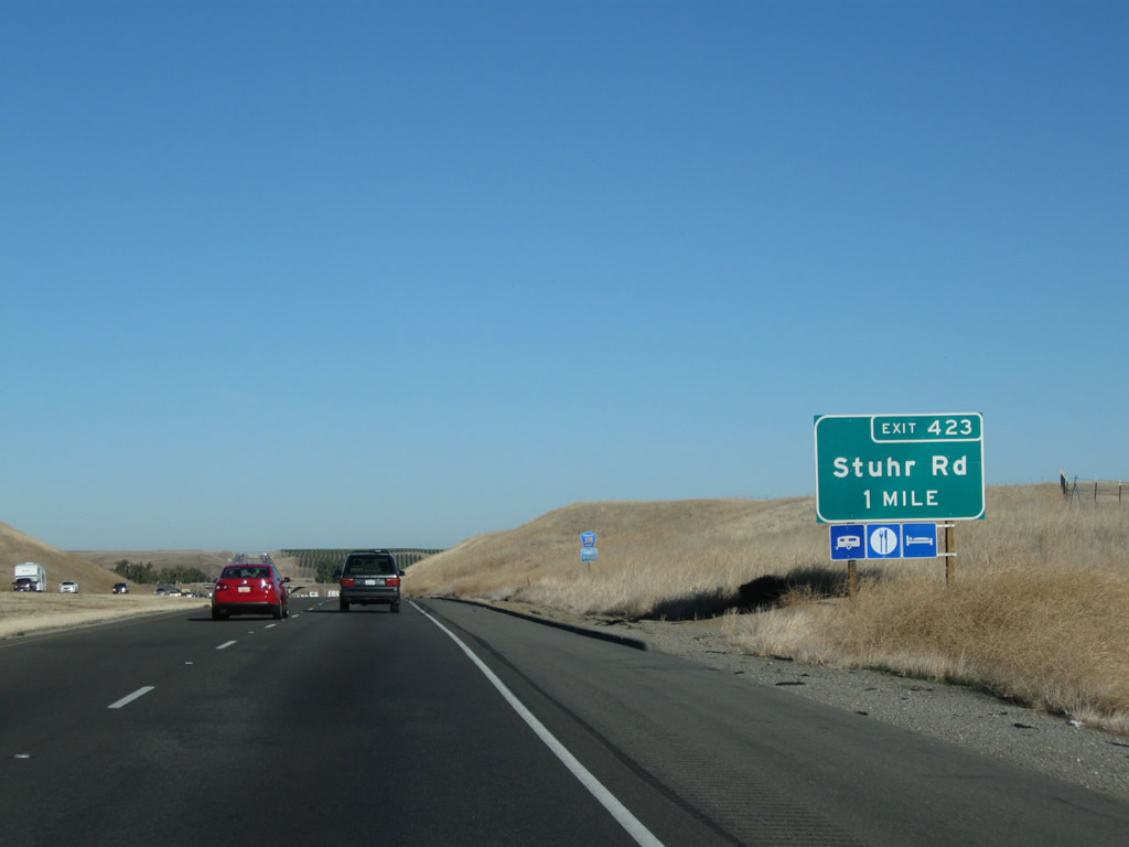
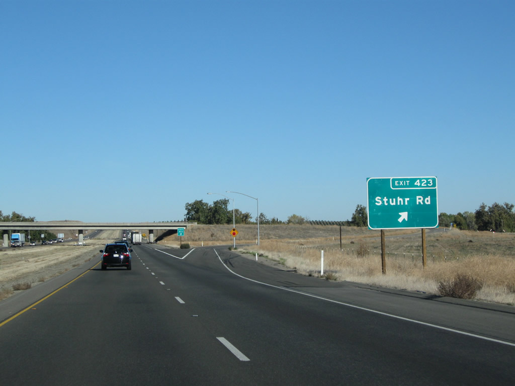
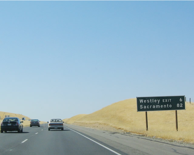
This mileage sign provides the distance to Exit 423, Stuhr Road to Newman and the city of San Francisco. Once again, Sacramento is omitted. Photo taken 11/22/07. |
|
|
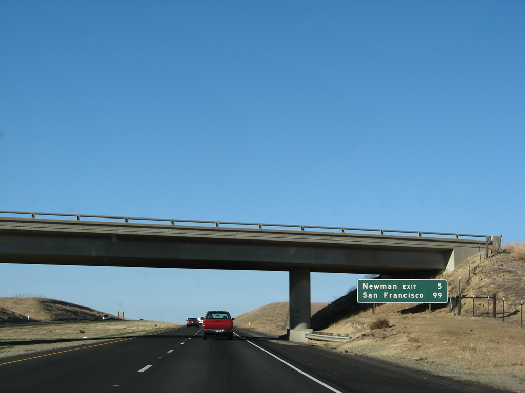
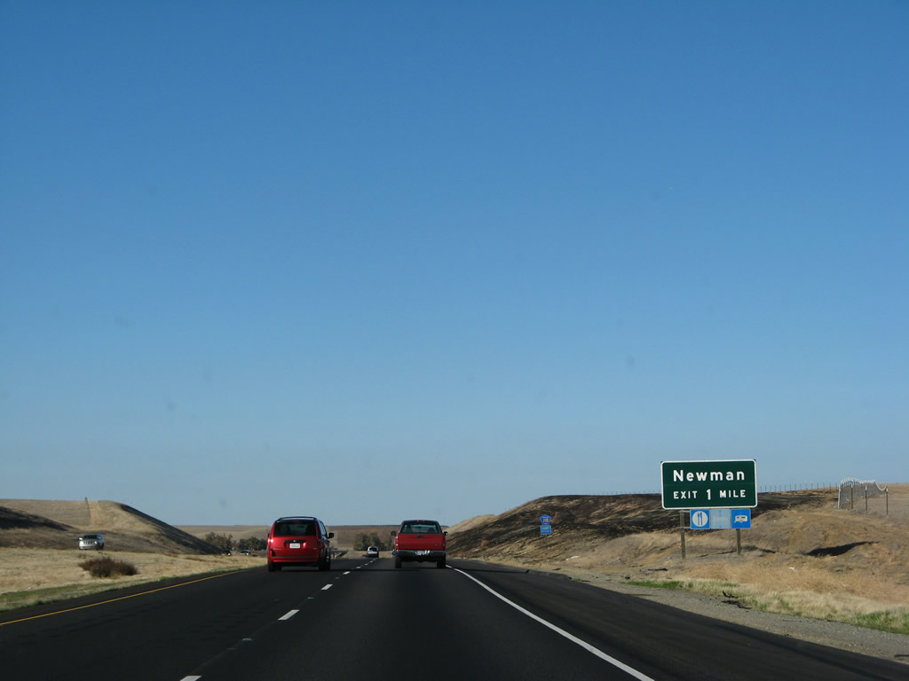
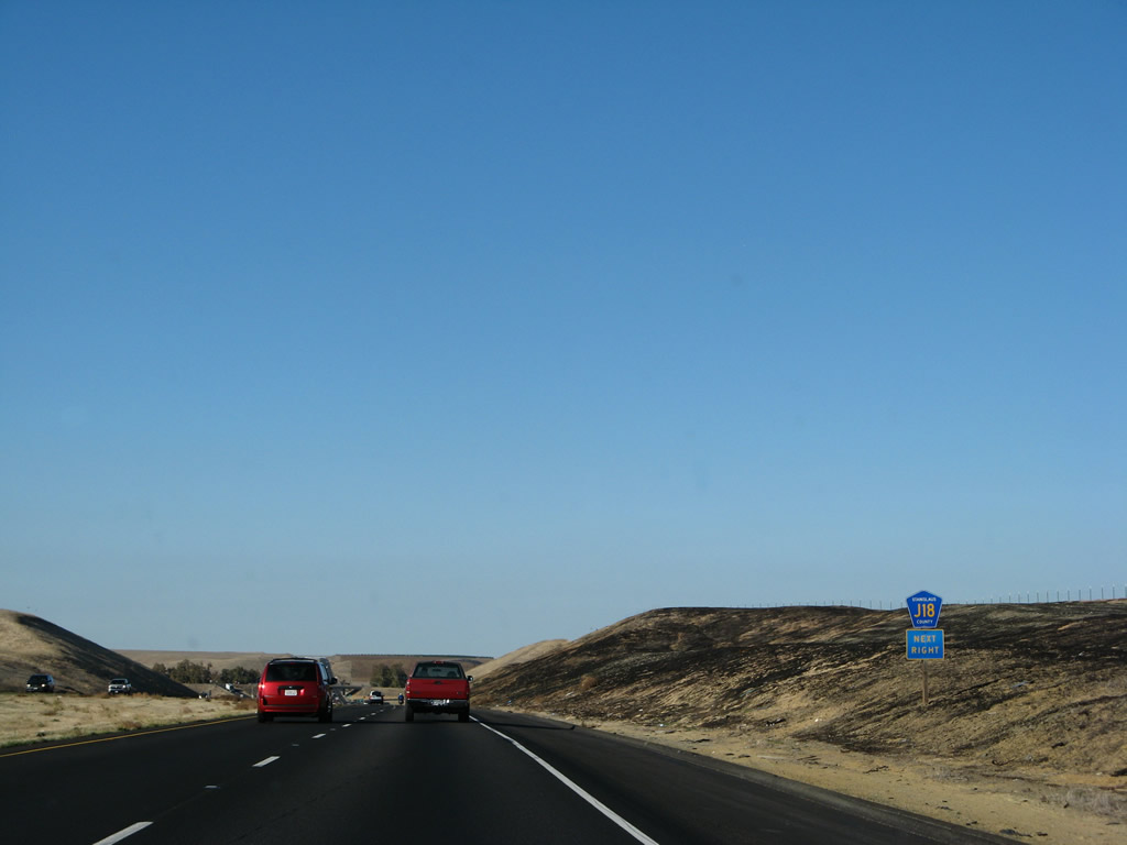
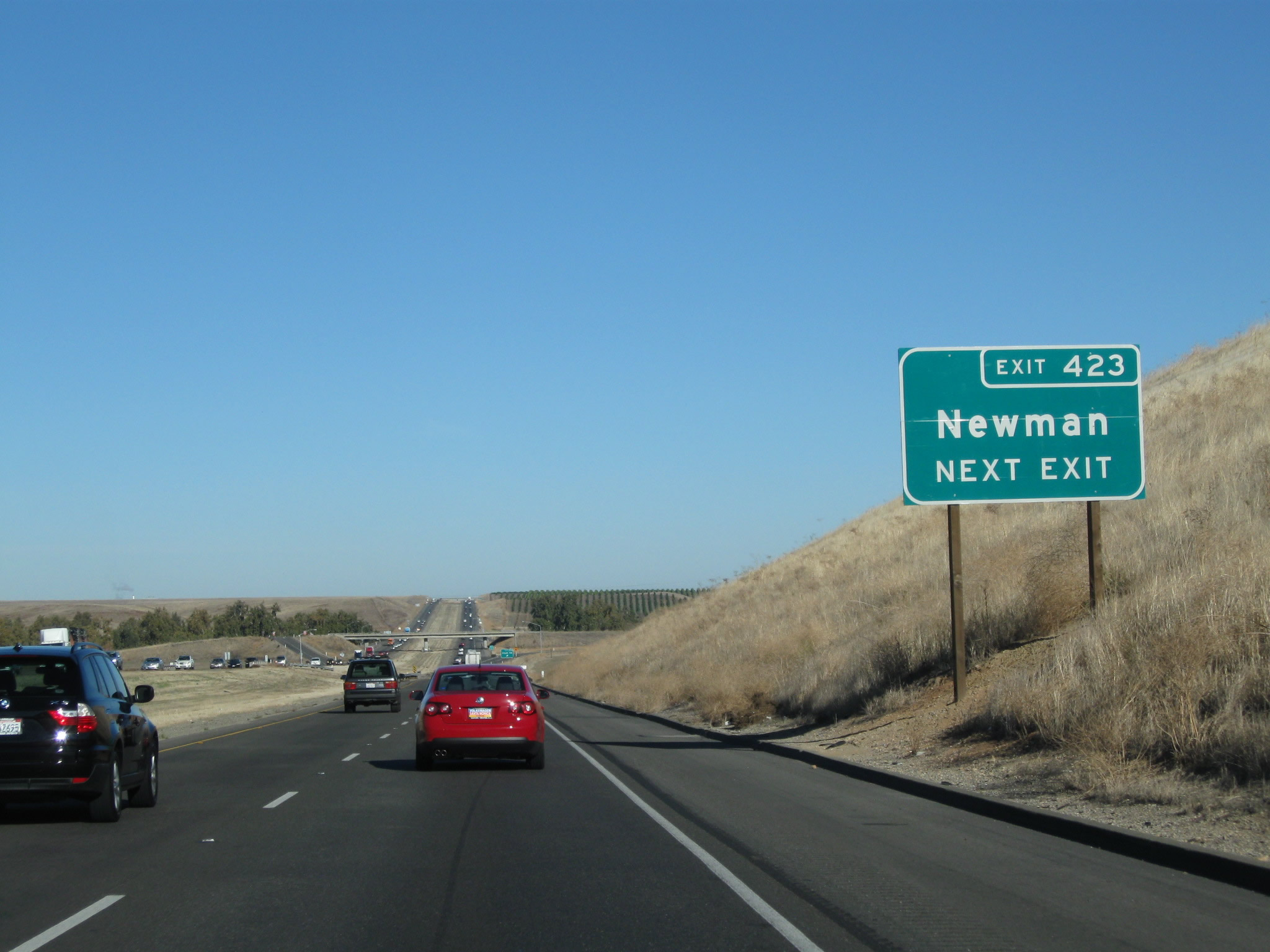
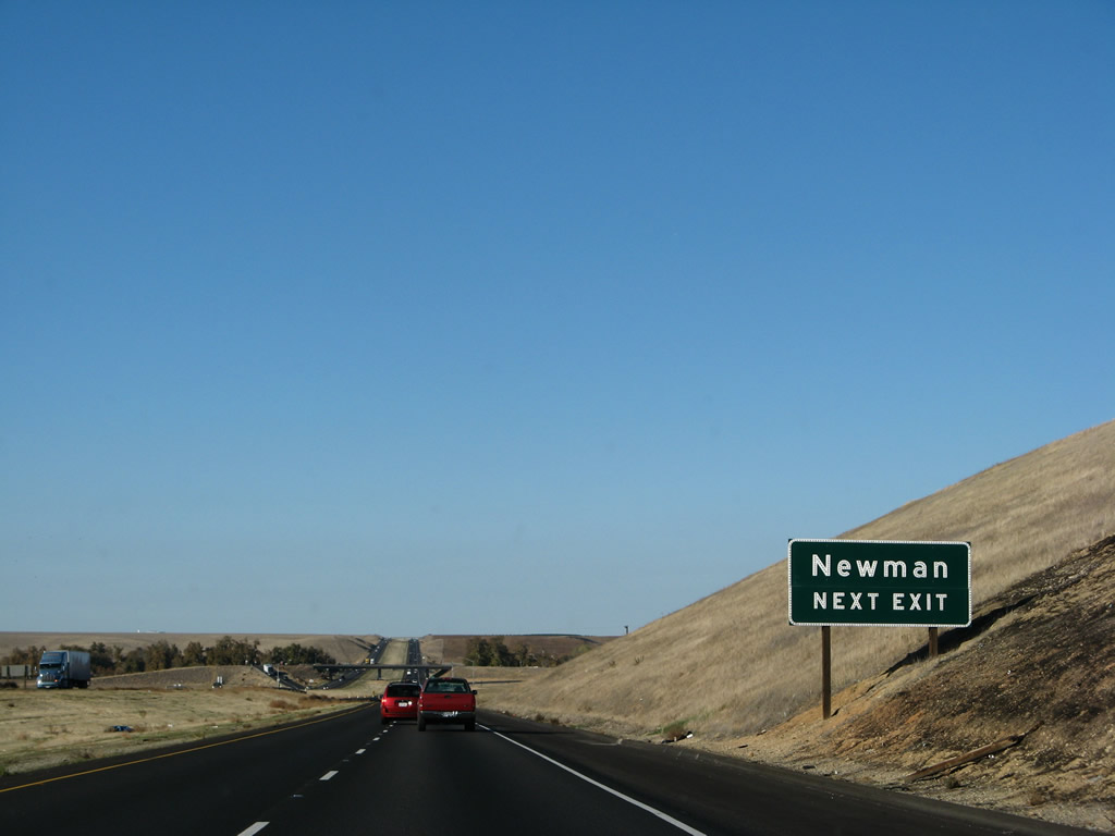
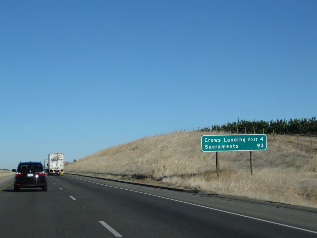
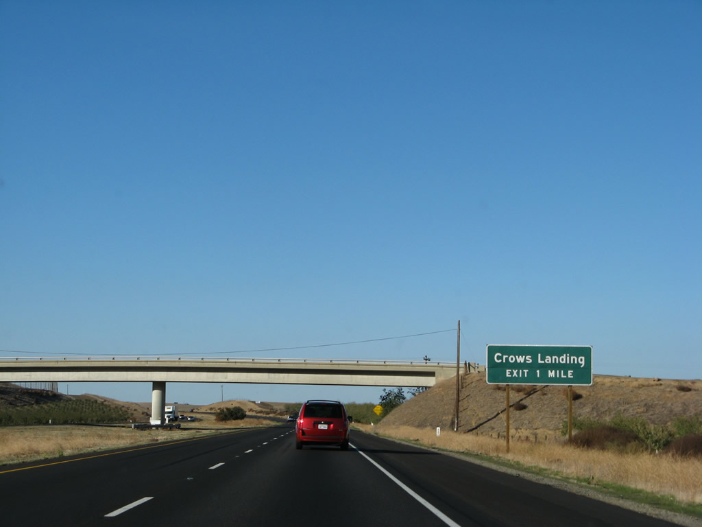
The first exit along northbound Interstate 5 in Stanislaus County is Exit 423, Stanislaus County J-18 to Newman (one mile). Interstate 5 from California 152 north to Interstate 580 is a designated scenic route, as it remains in the foothills overlooking the Central Valley visible to the east. Photos taken 11/25/10 and 11/22/07. |
|
Stanislaus County J-18 travels east to Newman, then follows the Merced River toward Livingston and Atwater along the California 99 corridor. Photo taken 11/22/07. |
|
|
Use Stanislaus County J-18 (Stuhr Road) east to Newman, a city which is located along the California 33 corridor. The city of Newman (Motto: "Honoring the Past, Celebrating the Present, Building for the Future") had a population of 10,224 as the 2010 Census and incorporated on June 10, 1908. Photos taken 11/25/10 and 11/22/07. |
|
|
Northbound Interstate 5 (West Side Freeway) meets Exit 423, Stanislaus County J-18 (Stuhr Road) east to Newman. Photo taken 11/22/07. |
|
An Interstate 5 north reassurance shield is posted after the Stuhr Road on-ramp as the freeway passes over Orestimba Creek. Photo taken 11/22/07. |
|
|
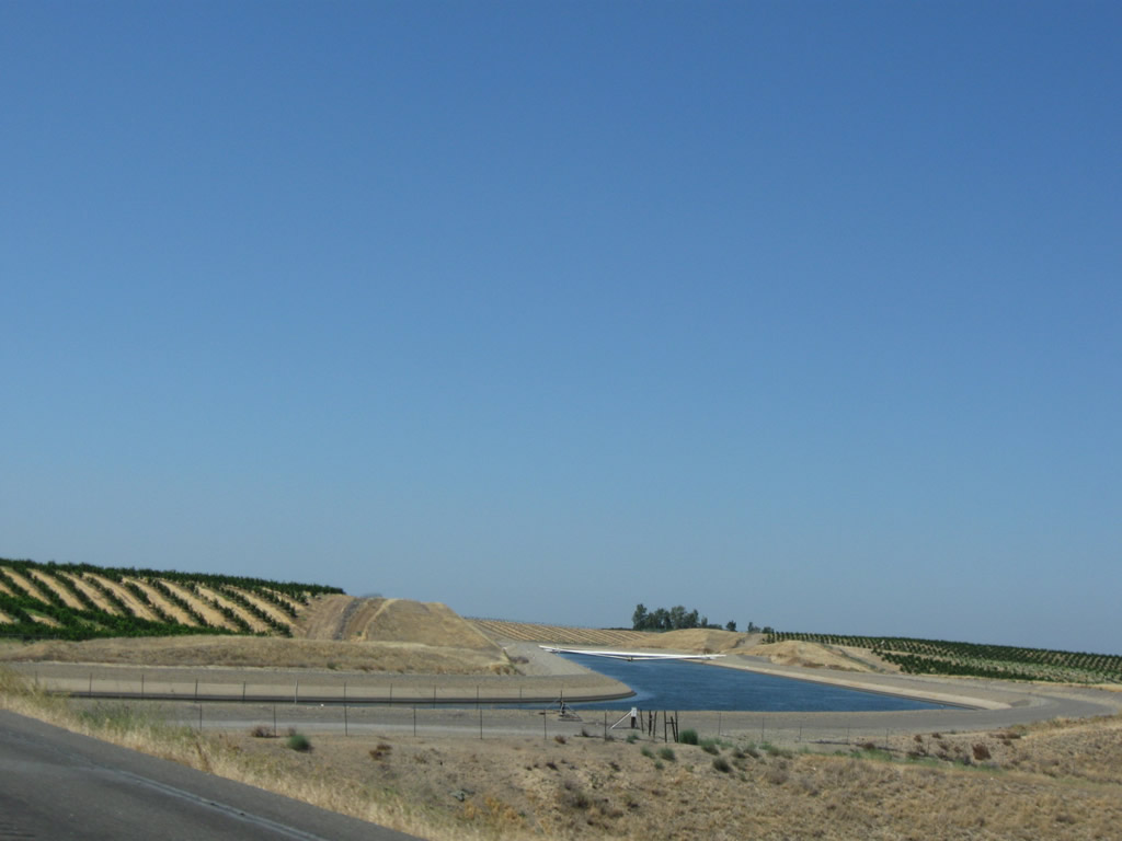
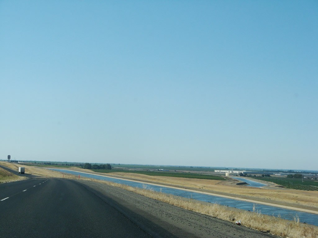
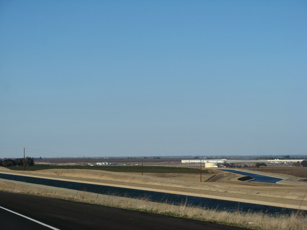
Interstate 5 crosses over a branch of the California Aqueduct. Photos taken 11/22/07 and 07/15/09. |
|
This mileage sign provides the distance to the next exit (Exit 428, Fink Road to Crows Landing) and the control city of Sacramento. The city of San Francisco is omitted on this sign. Photo taken 11/25/10. |
|
Interstate 5 passes under a local ranch access road. Photo taken 11/25/10. |
|
|
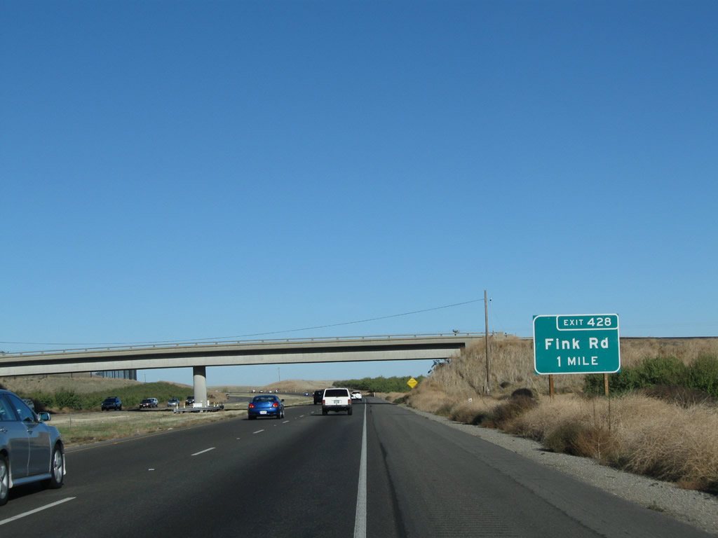
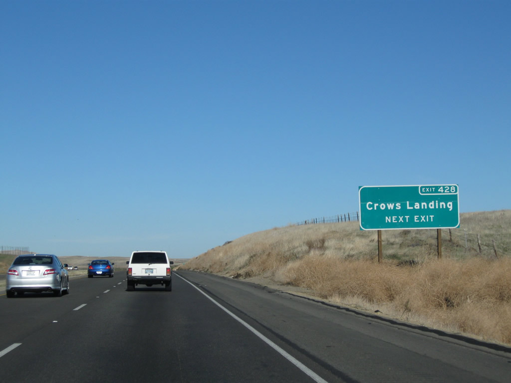
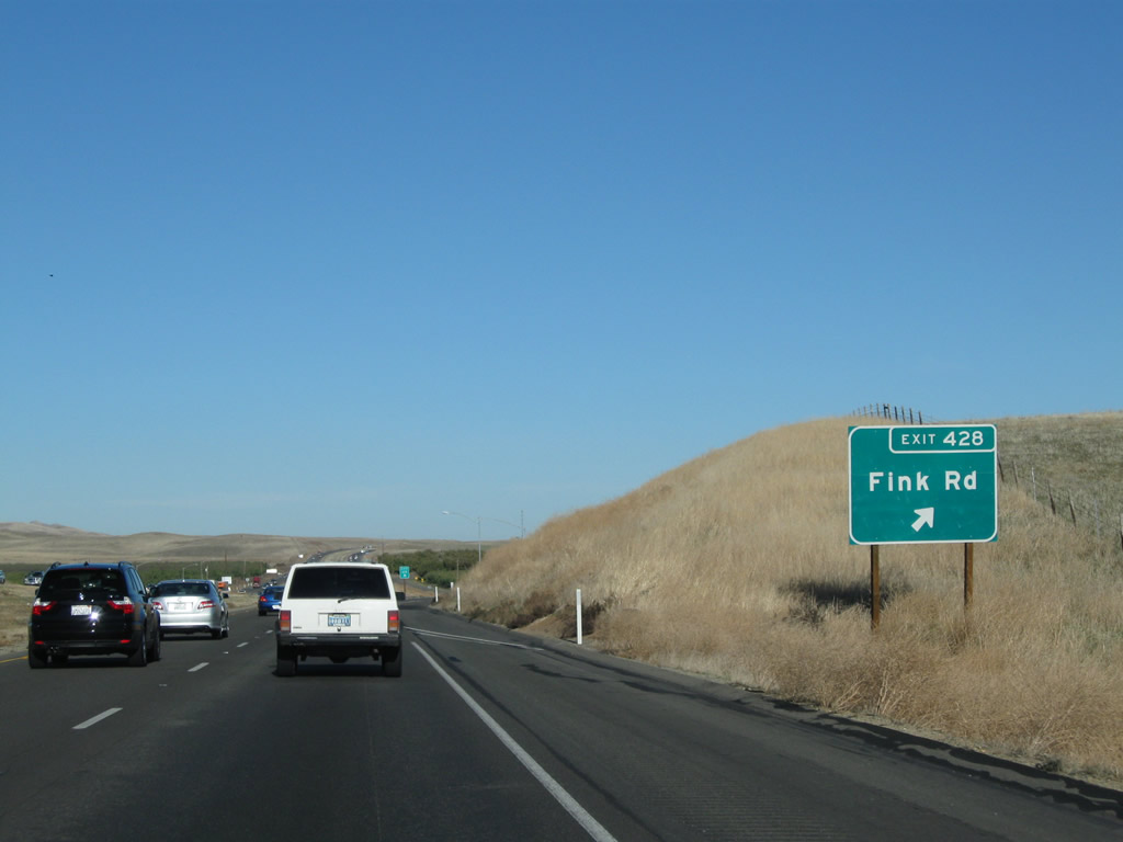
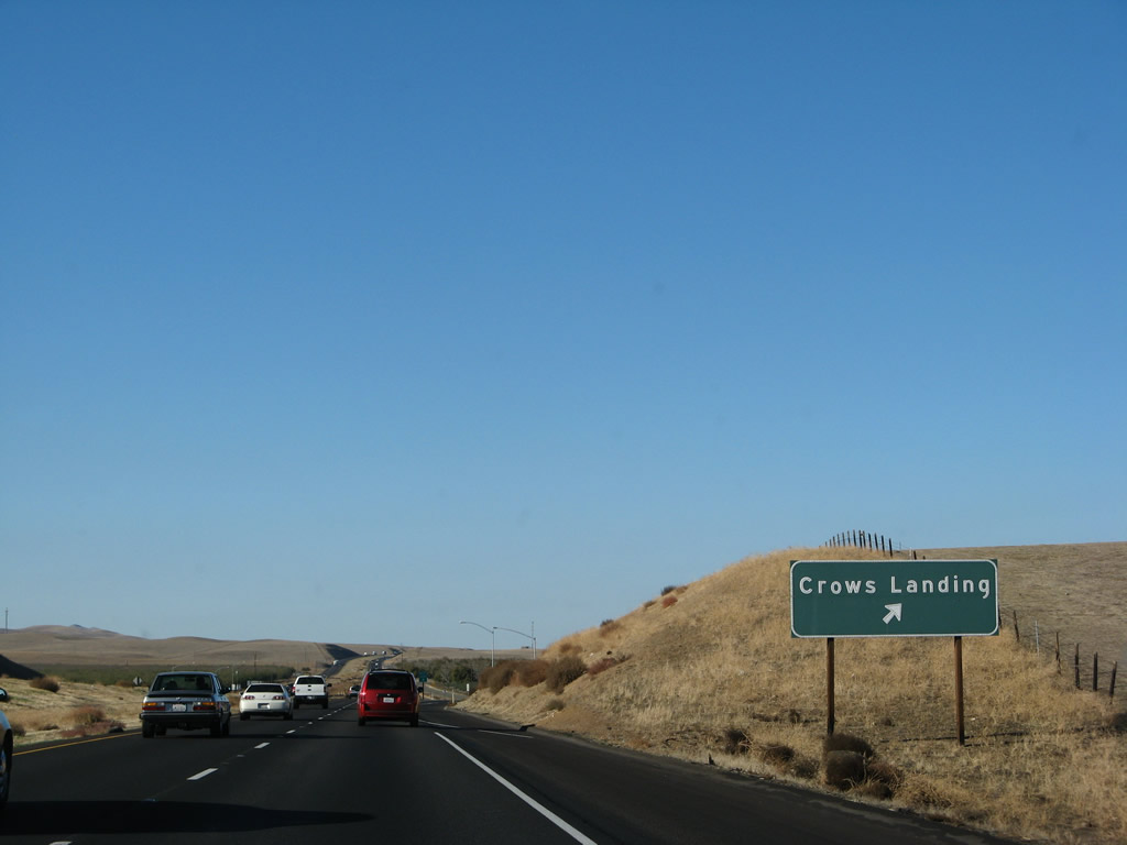
The next exit along Interstate 5 (West Side Freeway) north is Exit 428, Fink Road east to Crows Landing (one mile). The guide sign was replaced to include the exit number between 2007 and 2009. Photos taken 11/25/10 and 11/22/07. |
|
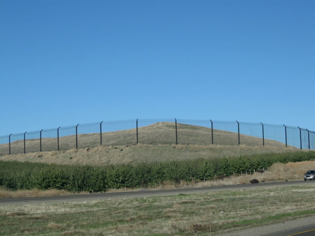
A landfill sits on the west side of Interstate 5 behind this towering fence. Use Exit 428, Fink Road west to the landfill. Photo taken 11/25/10. |
|
|
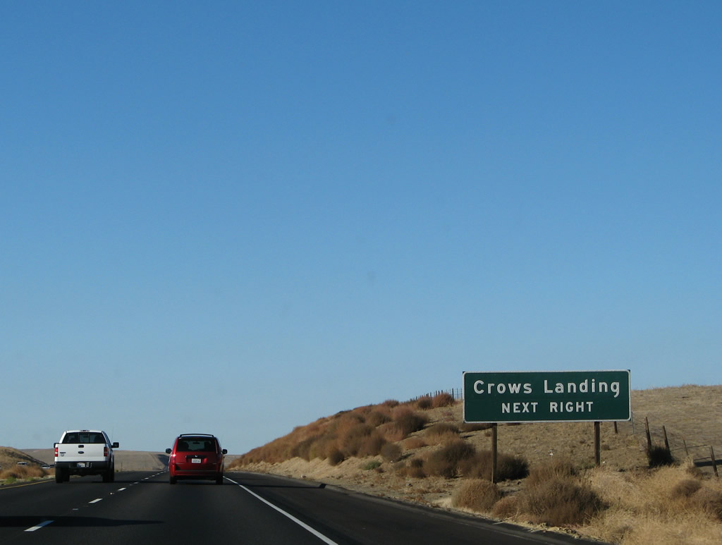
Another roadside advance sign is posted for Exit 428. It is proposed to extend California 108 south from Modesto to meet Interstate 5 near Crows Landing to provide a fast connection from Interstate 5 to Modesto and California 99, but such an extension is not under construction at this time. Photos taken 11/25/10 and 11/22/07. |
|
|
Northbound Interstate 5 (West Side Freeway) meets Exit 428, Fink Road east to Crows Landing and west to the landfill. Photos taken 11/25/10 and 11/22/07. |
|
An Interstate 5 north shield is posted after the on-ramp from Fink Road. Photo taken 11/25/10. |
|
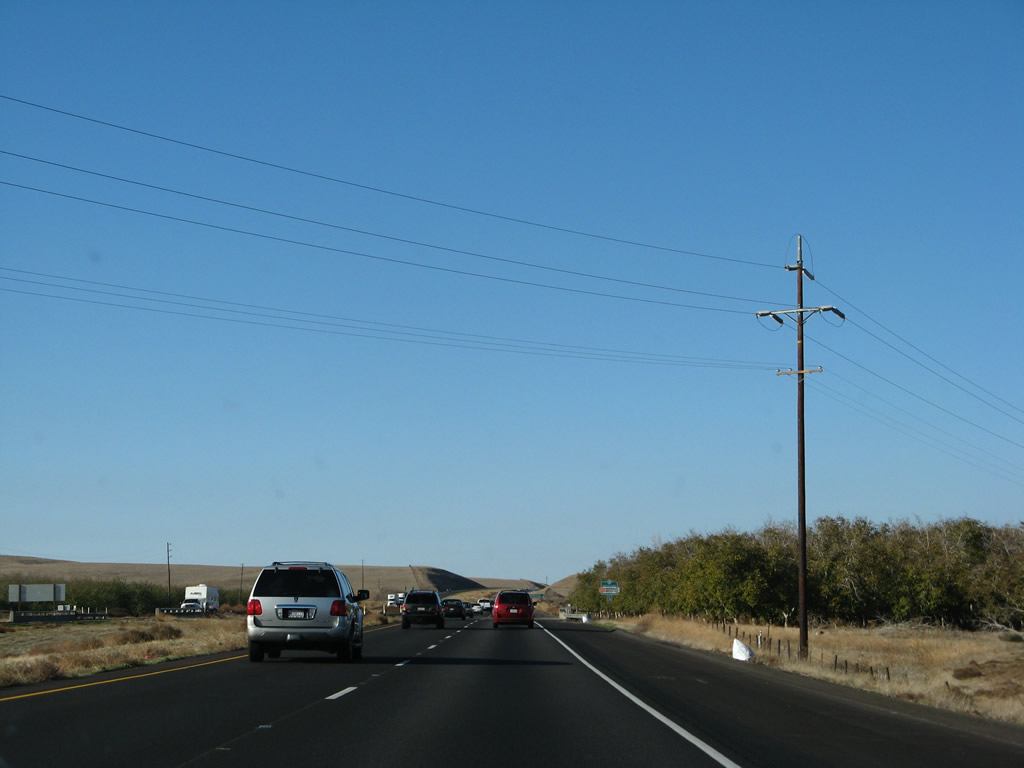
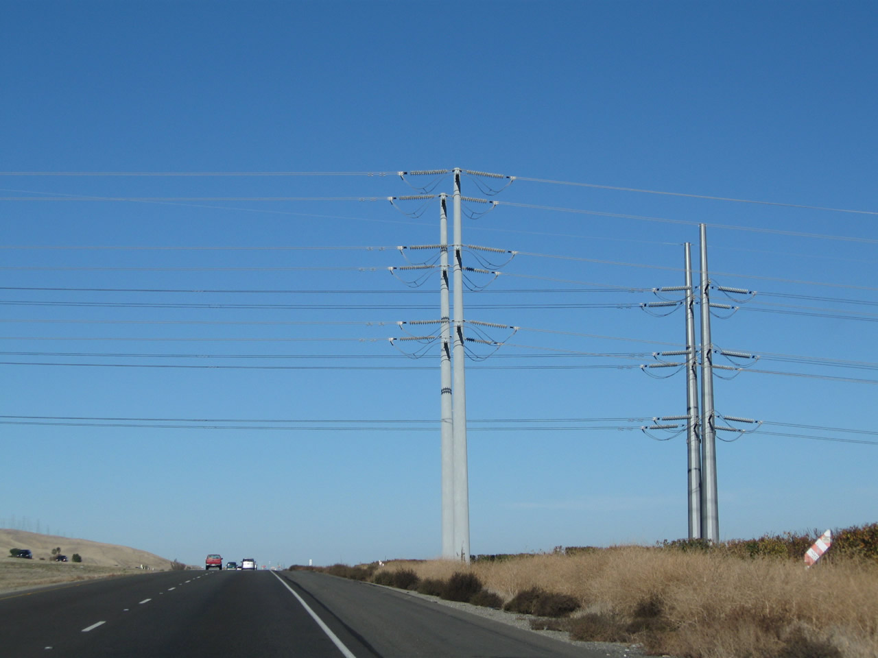
A Pacific Gas and Electric power line crosses Interstate 5 shortly thereafter. Photo taken 11/22/07. |
|
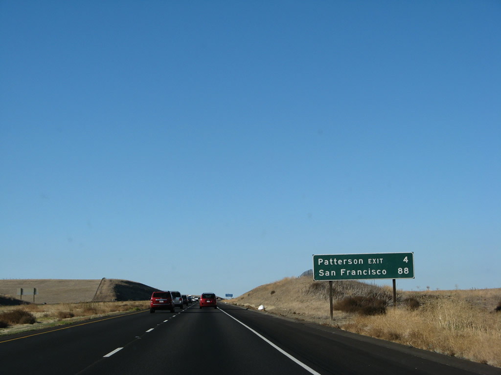
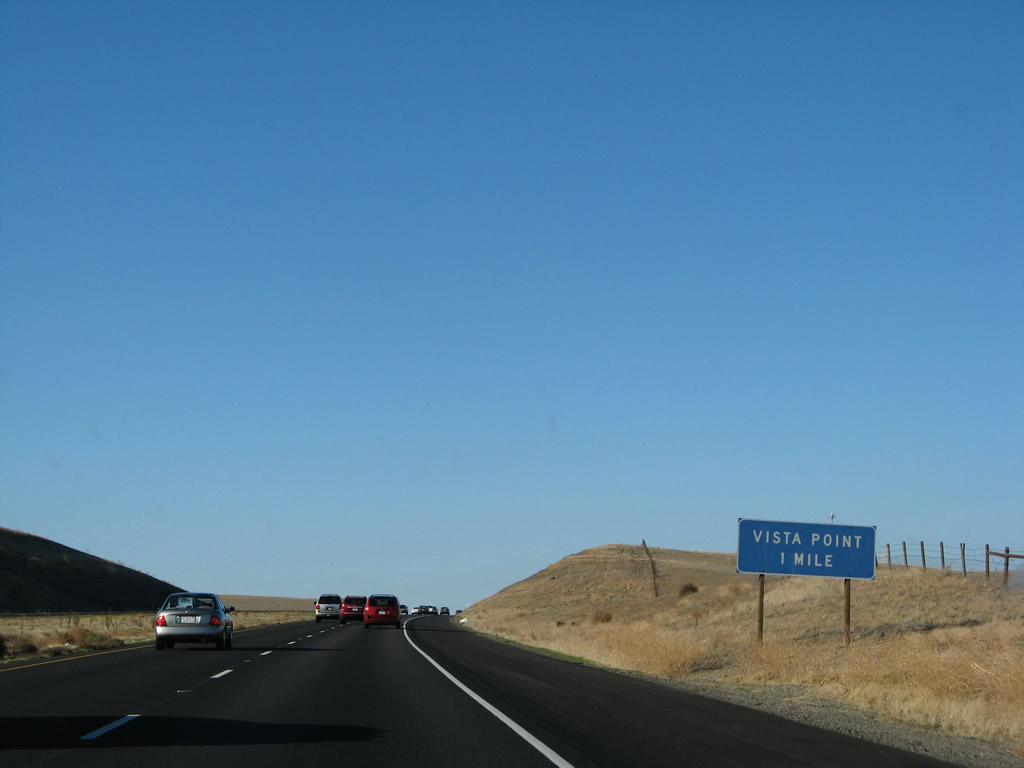
This mileage sign after Exit 428 provides the distance to the next exit (for Sperry Avenue/Patterson, four miles ahead) as well as San Francisco. Sacramento is again omitted, even though it is the northbound control city. Photo taken 11/22/07. |
|
The next exit along northbound Interstate 5 is Exit 430, Vista Point. This parking area provides an outstanding view of the California Aqueduct (State Water Project) and the surrounding area. Photo taken 11/22/07. |
|
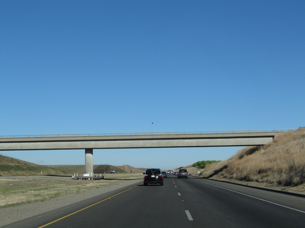
Another pair of Pacific Gas & Electric power lines cross over the freeway near the Oak Flat Road underpass (use Exit 434, Diablo Grande Parkway west to Oak Flat Road west). Photo taken 11/25/10. |
|
|
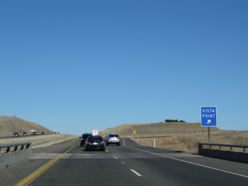
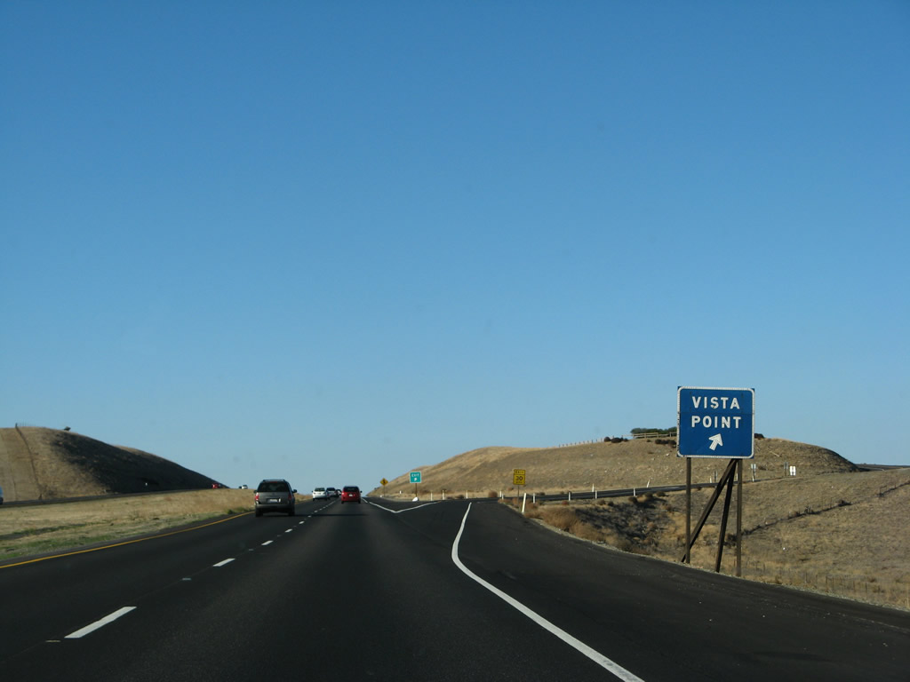
Northbound Interstate 5 meets Exit 430, Vista Point. While this exit has no motorist services or restrooms, it does offer a nice, panoramic view looking north and east into the agricultural areas of the great Central Valley. The sign was replaced between 2007 and 2009. Photos taken 11/25/10 and 11/22/07. |
|
The California State Aqueduct (part of the State Water Project) comes into view on the east side of Interstate 5 after the Vista Point. Photo taken 07/04/07. |
|
Branches of the California Aqueduct are visible again on the east side of the freeway. Photo taken 11/22/07. |
|
A power line turns north to merge alongside Interstate 5. This particular power line was not here in 2004. Photo taken 11/22/07. |
|
|
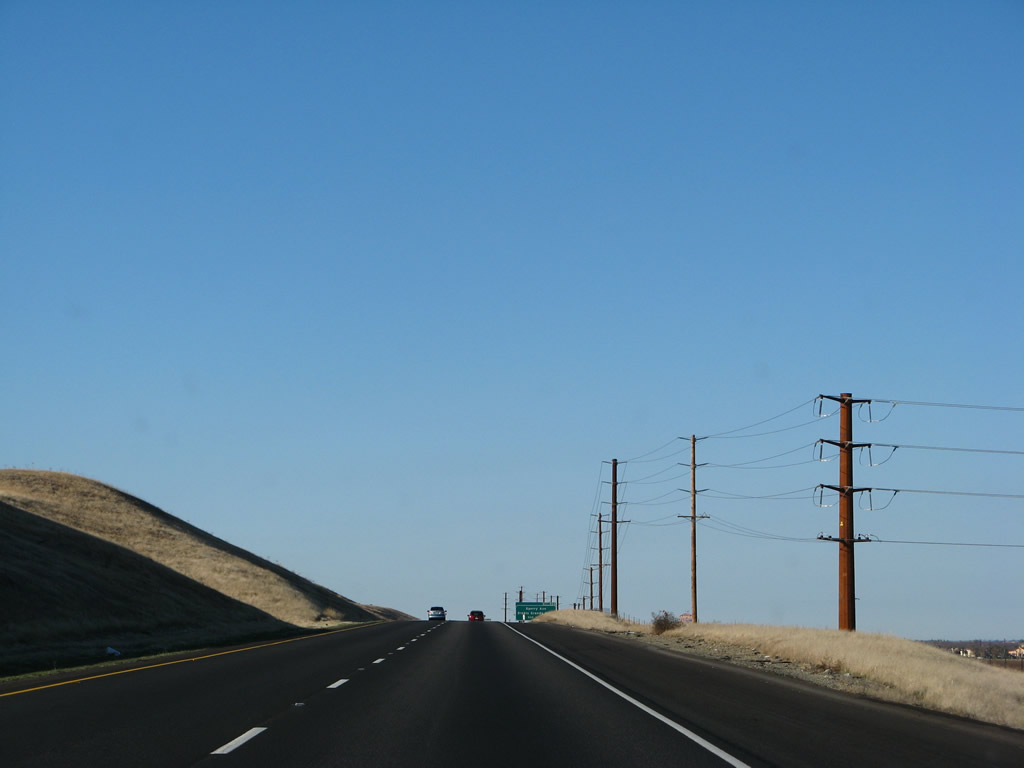
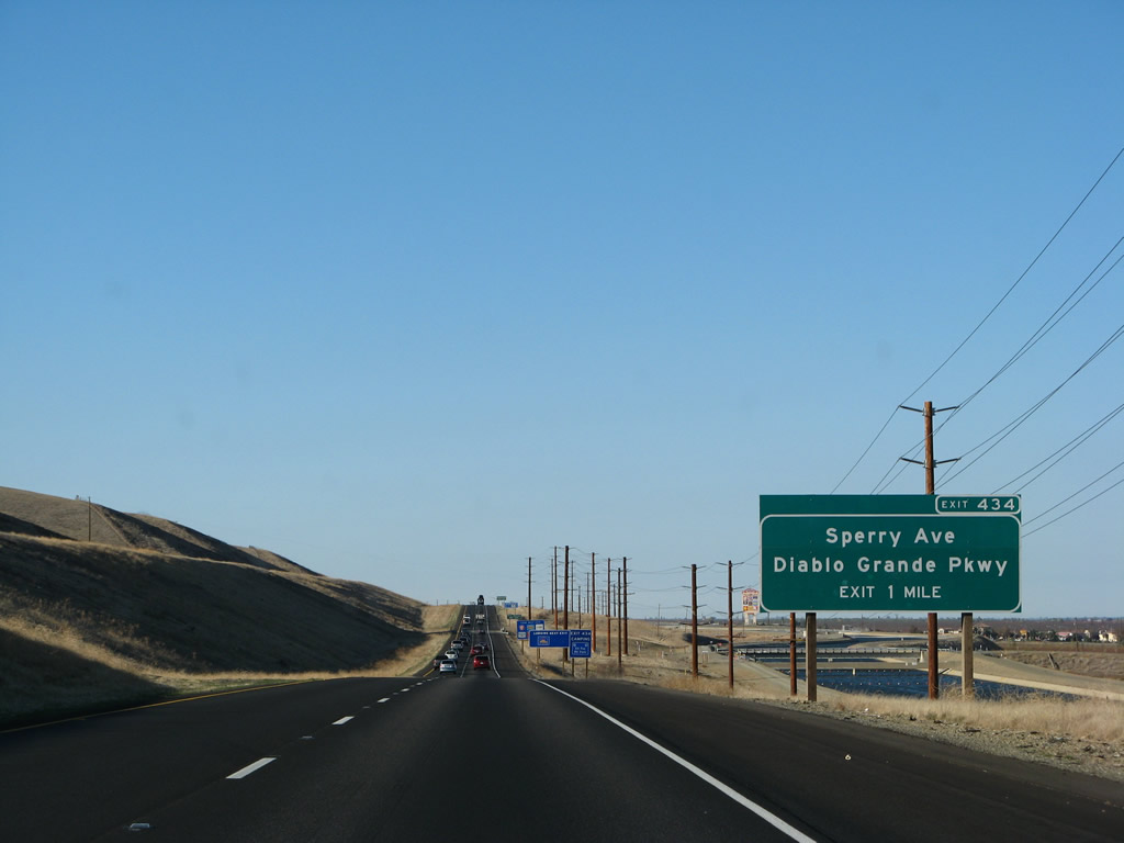
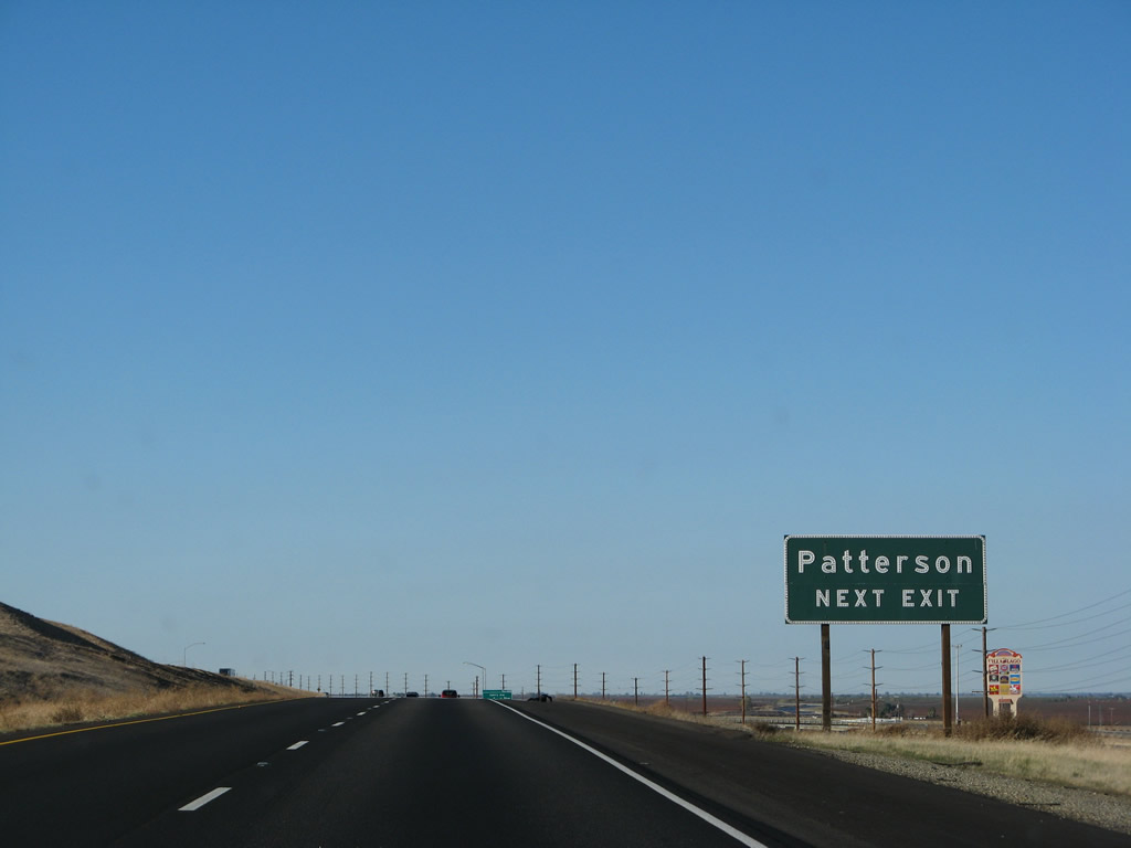
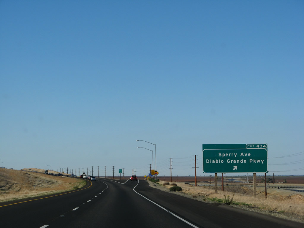
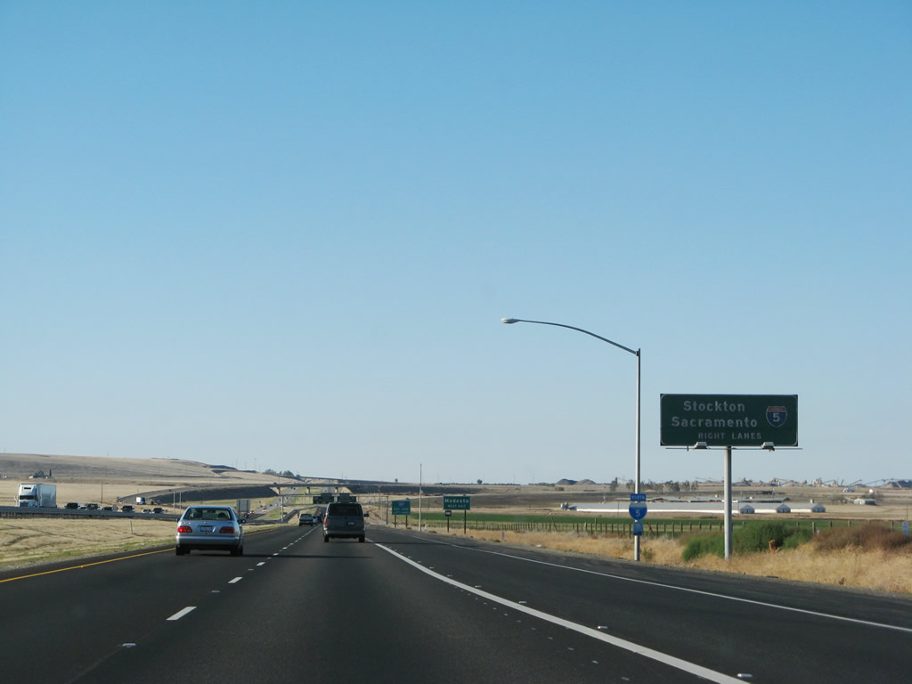
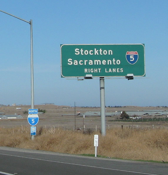
The next exit along northbound Interstate 5 is Exit 434, Stanislaus County J-17/Sperry Avenue east to Patterson (one mile). The California Aqueduct continues to follow closely alongside the east edge of the freeway, carrying water from the Sacramento-San Joaquin Delta to the San Joaquin Valley and Southern California. An exit number sign was added by 2004, replacing the original sign (photographed in 2002). Photos taken 11/22/07 and 12/22/02. |
|
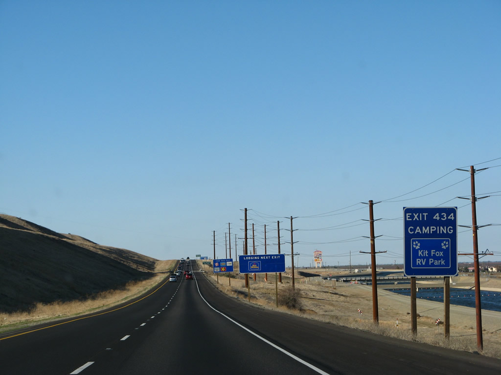
A series of blue motorist services signs are posted in sequence for camping, lodging, and food at Exit 434. Photo taken 11/22/07. |
|
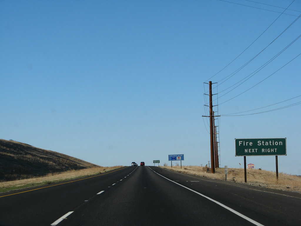
A fire station is located at Exit 434. Photo taken 11/22/07. |
|
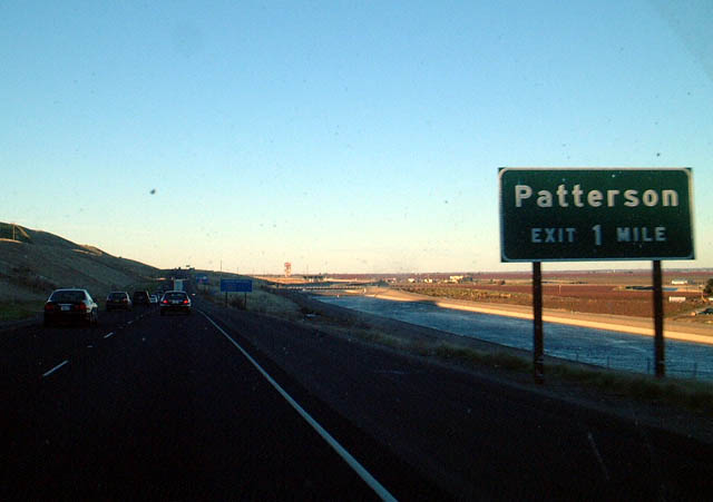
Follow Stanislaus County J-17 (Sperry Avenue) east to Patterson. This exit also connects to Westbound Del Puerto Canyon Road, which leads west to connect to California 130 near Mount Hamilton east of San Jose. This is not a good through route to San Jose, but the county route does make that connection for the brave! Photo taken 11/22/07. |
|
Northbound Interstate 5 reaches Exit 434, Stanislaus County J-17/Sperry Avenue east to Patterson and Del Puerto Canyon Road west to Mount Hamilton and San Jose (with the last section of Mount Hamilton Road designated as California 130). Photo taken 11/22/07. |
|
This mileage sign along northbound Interstate 5 provides the distance to Westley and Sacramento; San Francisco is omitted this time. Photo taken 07/02/04. |
|
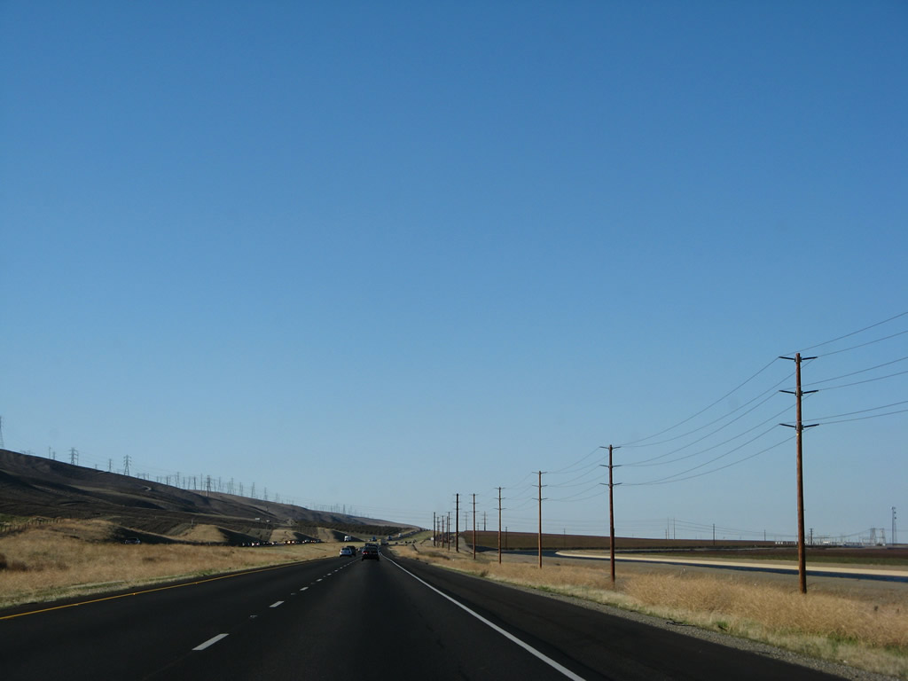
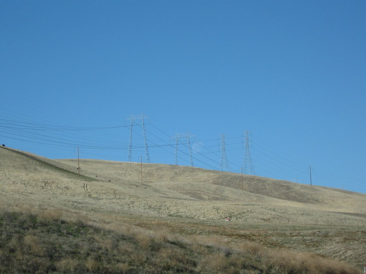
For the next five miles, a set of two Path 15 500kV power lines, two sets of 230kV power lines, and a variety of other lines travel on the ridge west of Interstate 5. Photo taken 11/22/07. |
|
The California Aqueduct will also follow Interstate 5, but it remains on the east side of the freeway. Photo taken 11/22/07. |
|
|
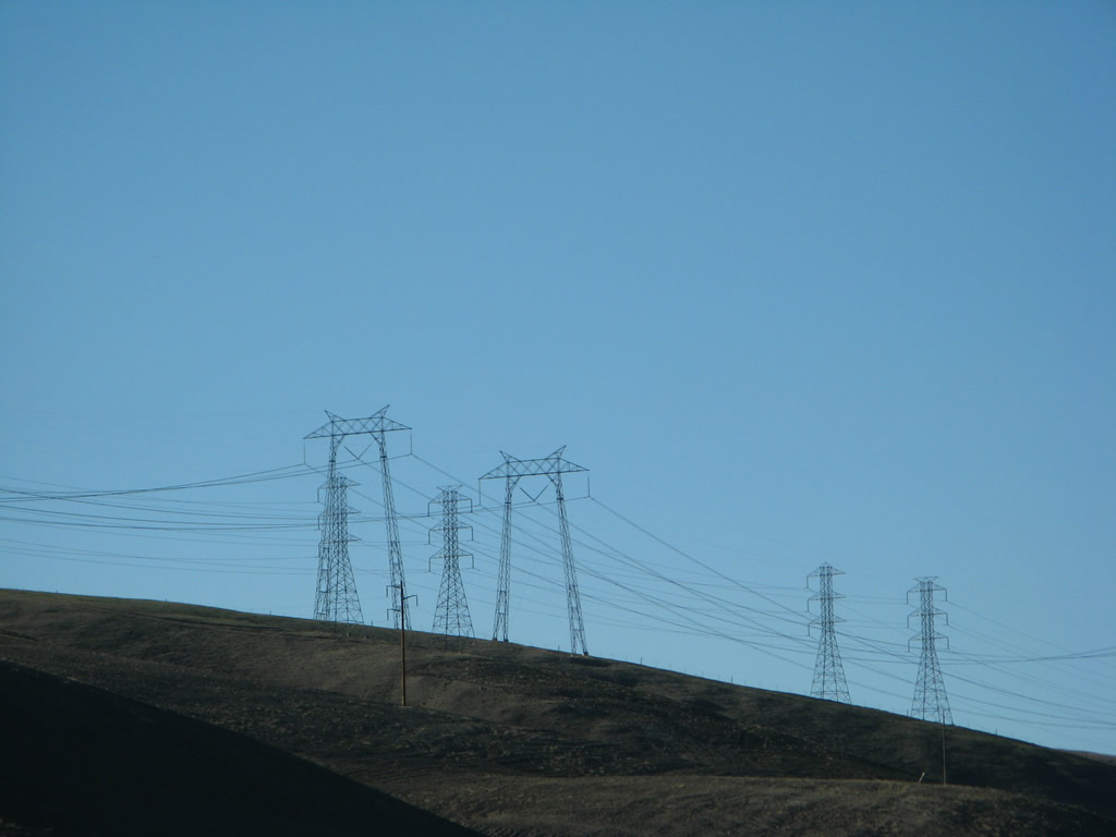
A close-up of the ridge's power lines show the Path 15 power lines. Path 15 includes two 500kV Path 15 lines, several 230kV power lines, and other transmission lines. Photos taken 11/22/07 and 11/25/10. |
|
|
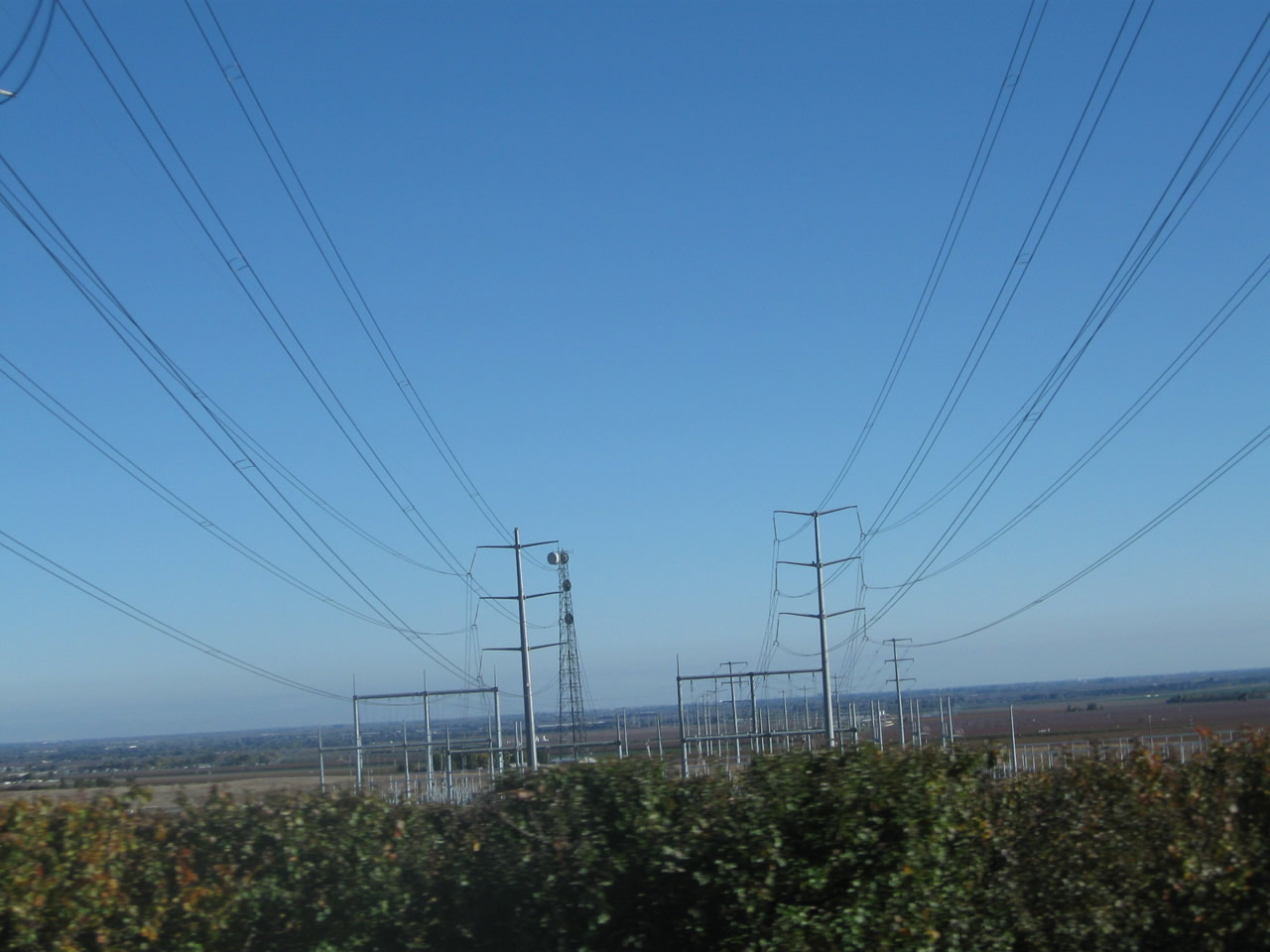
These power transmission lines connect Path 15 with the Modesto Irrigation District, which provides water and power to residents in and around the city of Modesto on the California 99 corridor. A large substation is located east of Interstate 5. Photos taken 11/22/07. |
|
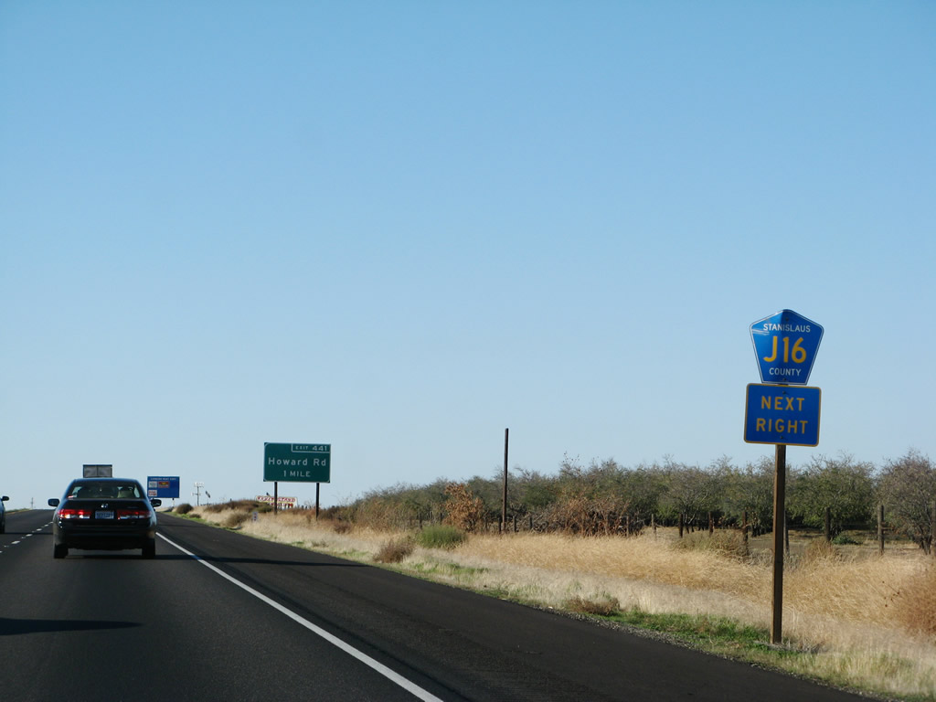
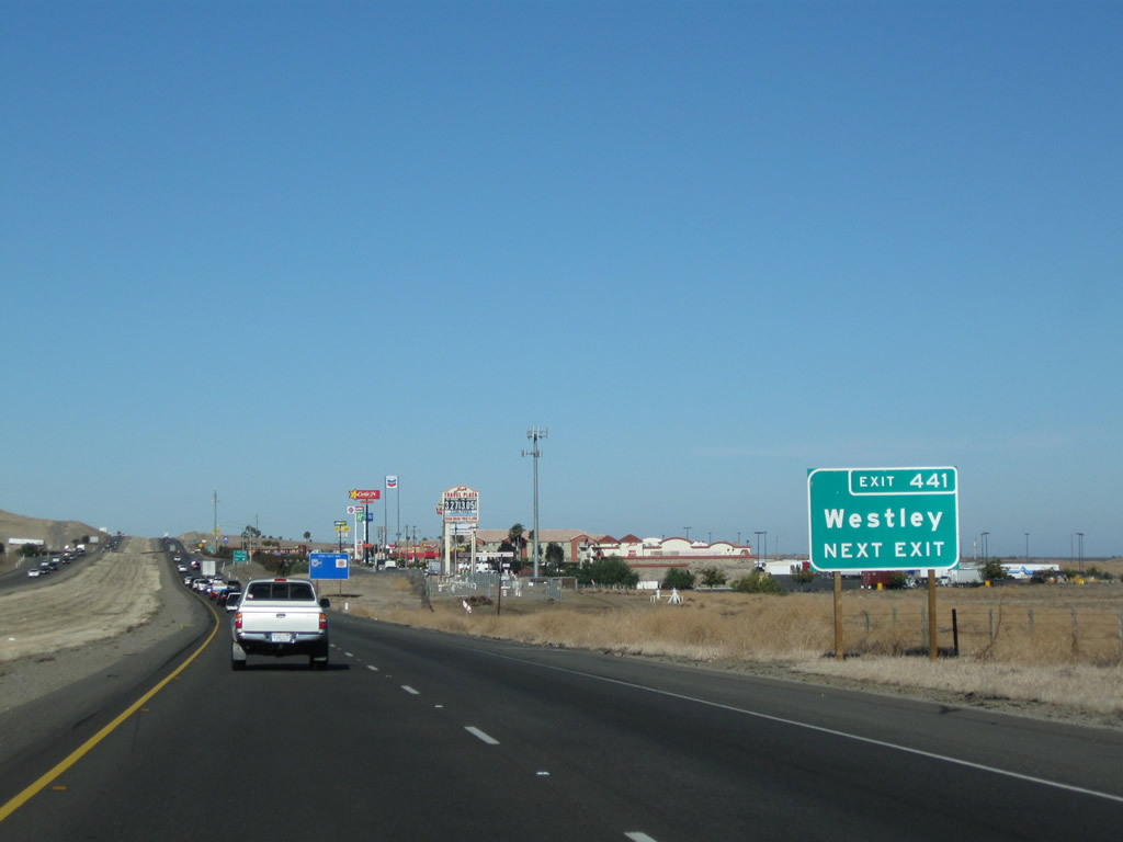
Stanislaus County J-16 is a signed county route that connects Interstate 5 Exit 441 with California 33 in Westley. County Route J-16 continues east along Grayson Road and Keyes Road before meeting California 99 at Keyes. Photo taken 11/22/07. |
|
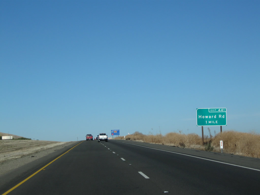
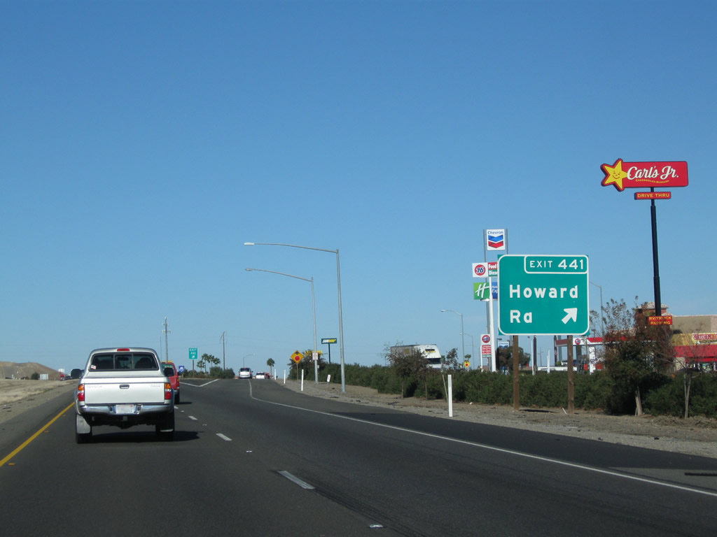
The next exit along Interstate 5 north is Exit 441, Stanislaus County J-16/Howard Road east to Westley and Grayson. Photo taken 11/22/07. |
|
|
Use Stanislaus County J-16/Howard Road east to Westley, an unincorporated community located at the intersection of Howard Road and California 33 east of here. This sign was replaced between 2007 and 2009. Photos taken 11/25/10 and 11/22/07. |
|
Northbound Interstate 5 (West Side Freeway) meets Exit 441, Stanislaus County J-16/Howard Road east to Westley, Grayson, and Keyes. Westley is located along California 33, a few miles east of here. Photo taken 11/25/10. |
|
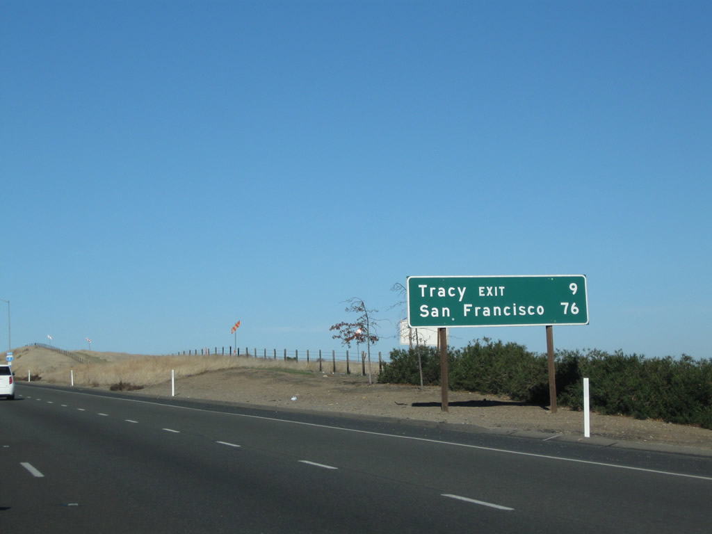
This mileage sign provides the distance to the Tracy exit and to San Francisco. Sacramento is excluded this time. Photo taken 11/25/10. |
|
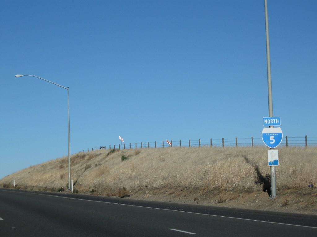
An Interstate 5 north reassurance shield is posted shortly thereafter; the freeway is still considered a scenic route. Photo taken 11/25/10. |
|
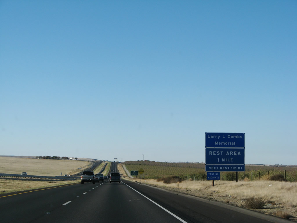
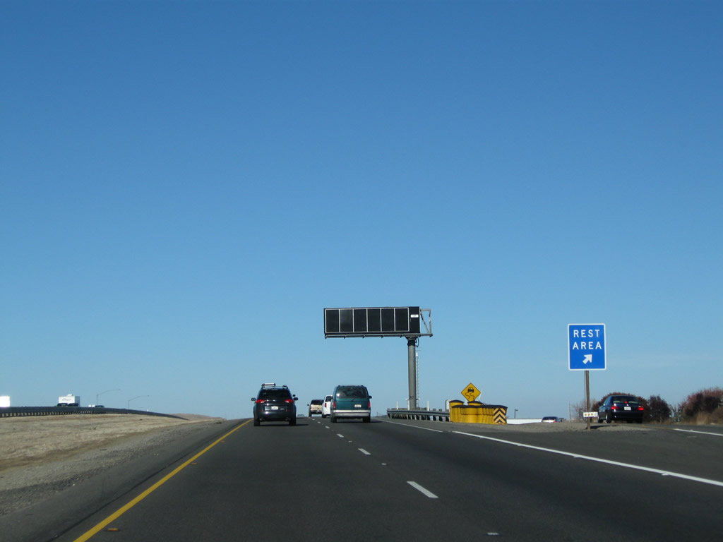
The next exit along northbound is Exit 445, Larry L. Combs Rest Area (the next rest area is 112 miles north of here, after passing through Sacramento near the airport). Photo taken 11/22/07. |
|
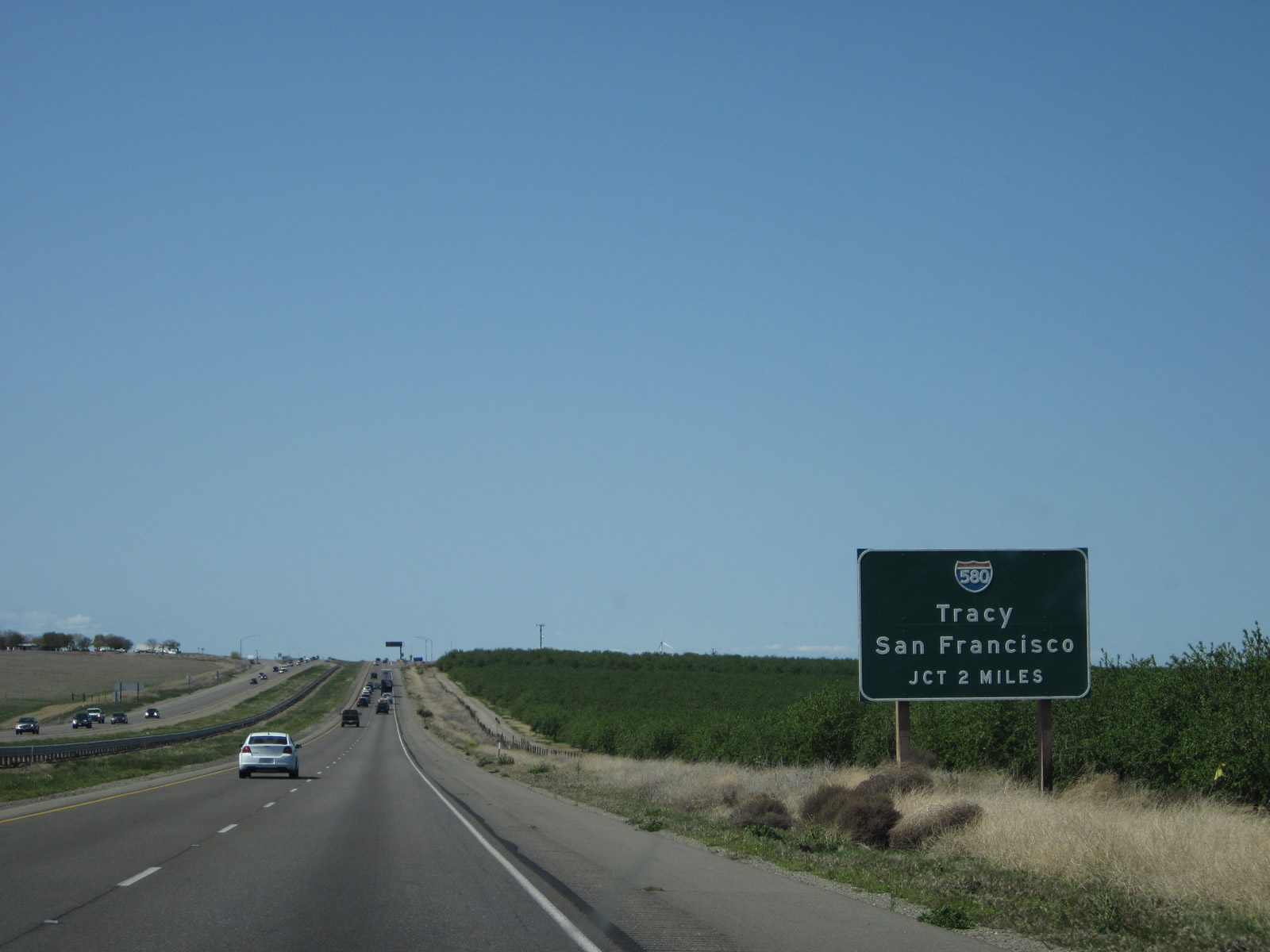
This advance sign indicates the second exit on Interstate 5 north (after the rest area) is Exit 446, Interstate 580 west to Oakland, San Francisco, and San Jose. This is the first Interstate highway to connect with Interstate 5 since Exit 161A, Interstate 210. Photo taken 04/06/12. |
|
|
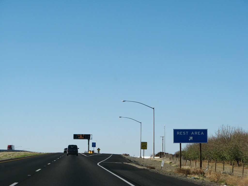
Northbound Interstate 5 reaches Exit 445, Larry L. Combs Safety Rest Area. The next exit is Exit 446, Interstate 580 west (left exit). Photos taken 11/22/07 and 11/25/10. |
|
|
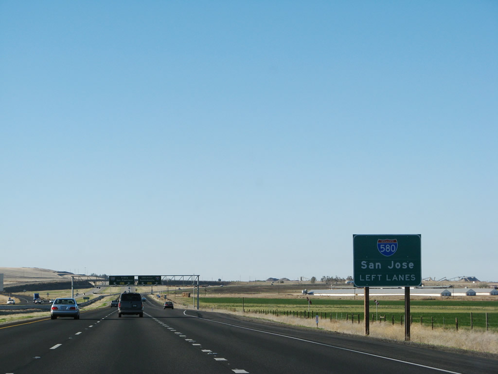
To remain on Interstate 5 north, use the right lane. For Interstate 580 northwest, use the left lanes. Photos taken 11/22/07 and 11/25/10. |
|
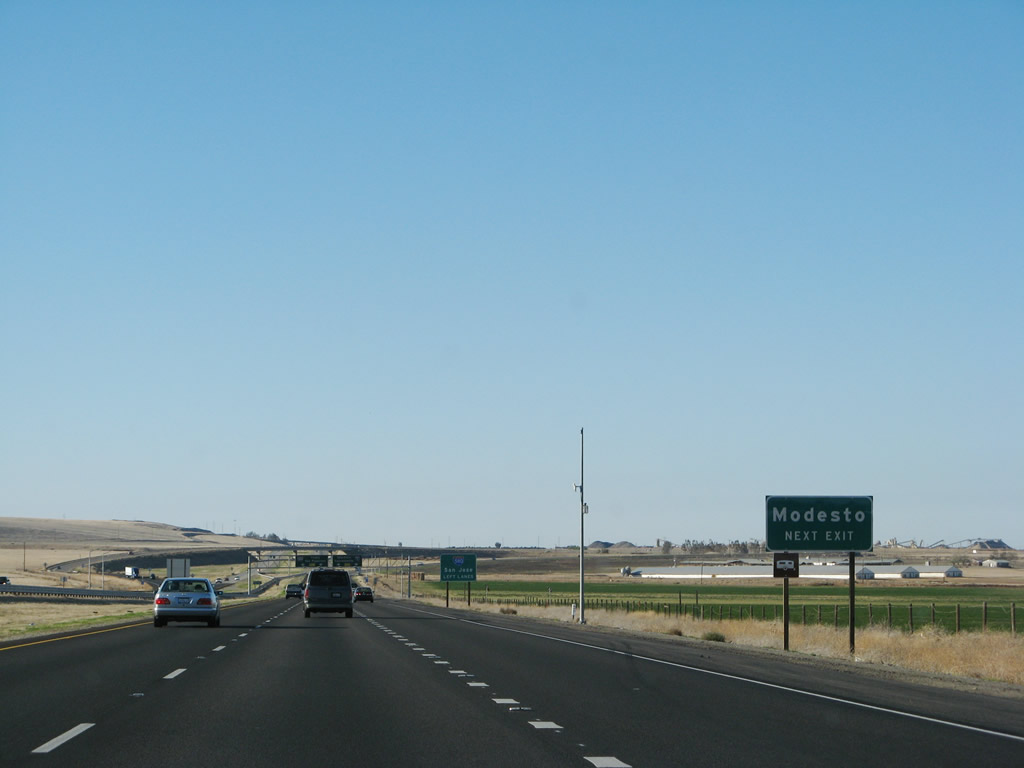
To Modesto, use Interstate 5 north to California 132 east. Photo taken 11/22/07. |
|
Together with Interstate 5 and Interstate 680, Interstate 580 is part of the only route that follows all freeway from Los Angeles to San Jose. Neither California 152 nor U.S. 101 are completely freeway at this time. Photo taken 11/22/07. |
|
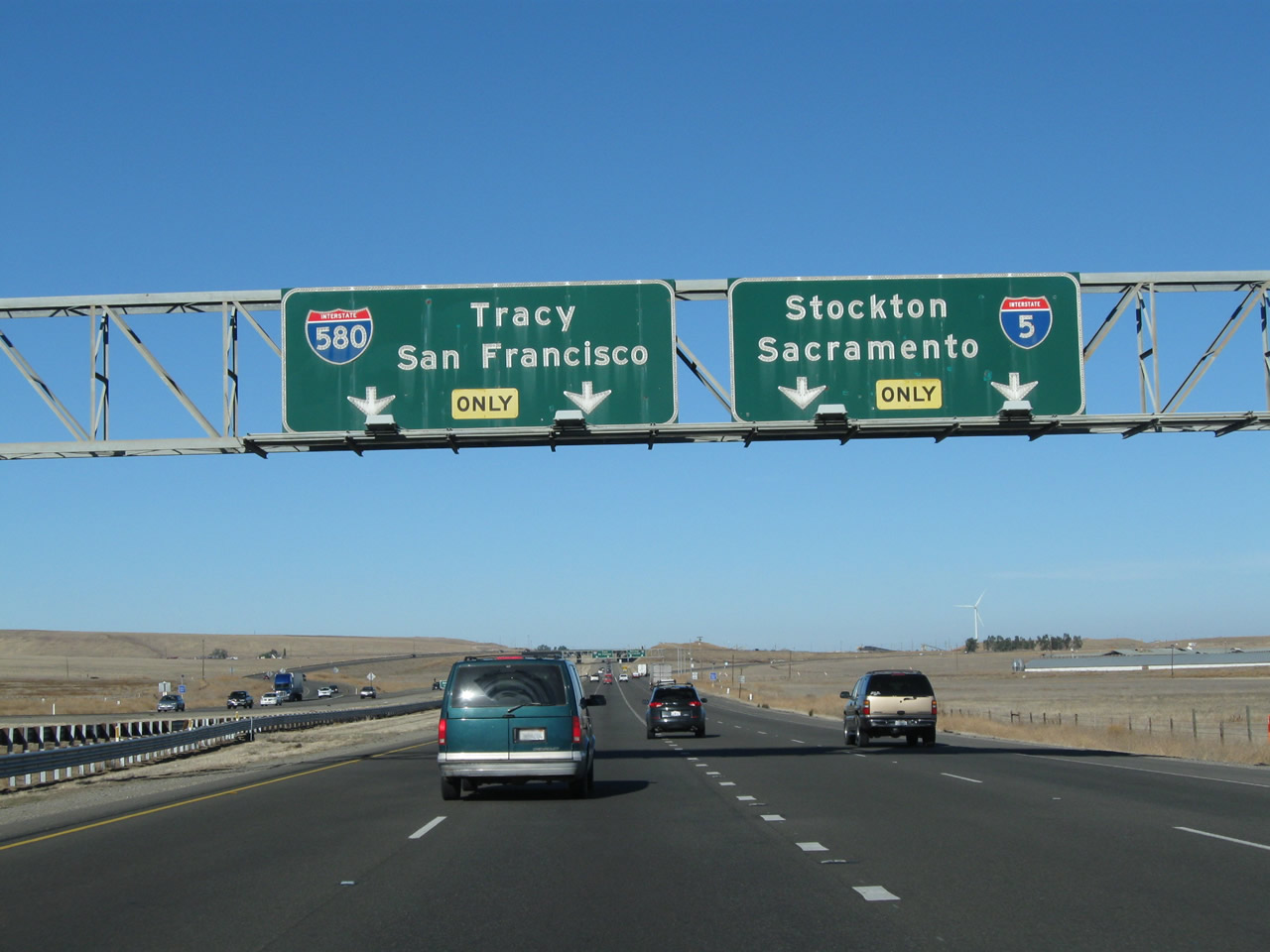
Interstate 580 west (Exit 446) splits off northbound Interstate 5 as a left exit. In this configuration, the left two lanes transition to Interstate 580 west, and the right two lanes continue north on Interstate 5. Use Interstate 580 west to all destinations in the San Francisco Bay Area; continue north on Interstate 5 to Stockton and Sacramento. Photo taken 11/25/10. |
|
Before the split between Interstate 5 and Interstate 580, the freeway leaves Stanislaus County and enters San Joaquin County. A very old and faded scenic route sign is posted below the county line sign (which is located in the median). Photo taken 11/25/10. |
Page Updated September 16, 2012.