| Interstate 5 north |
|
|
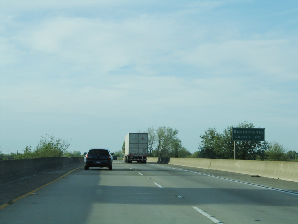
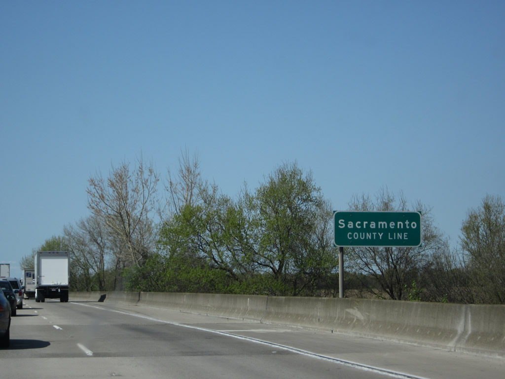
Interstate 5 leaves San Joaquin County and enters Sacramento County upon crossing the Mokelumne River. Photos taken 04/02/05 and 04/06/12. |
|
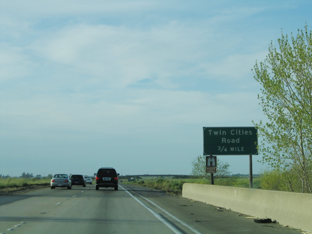
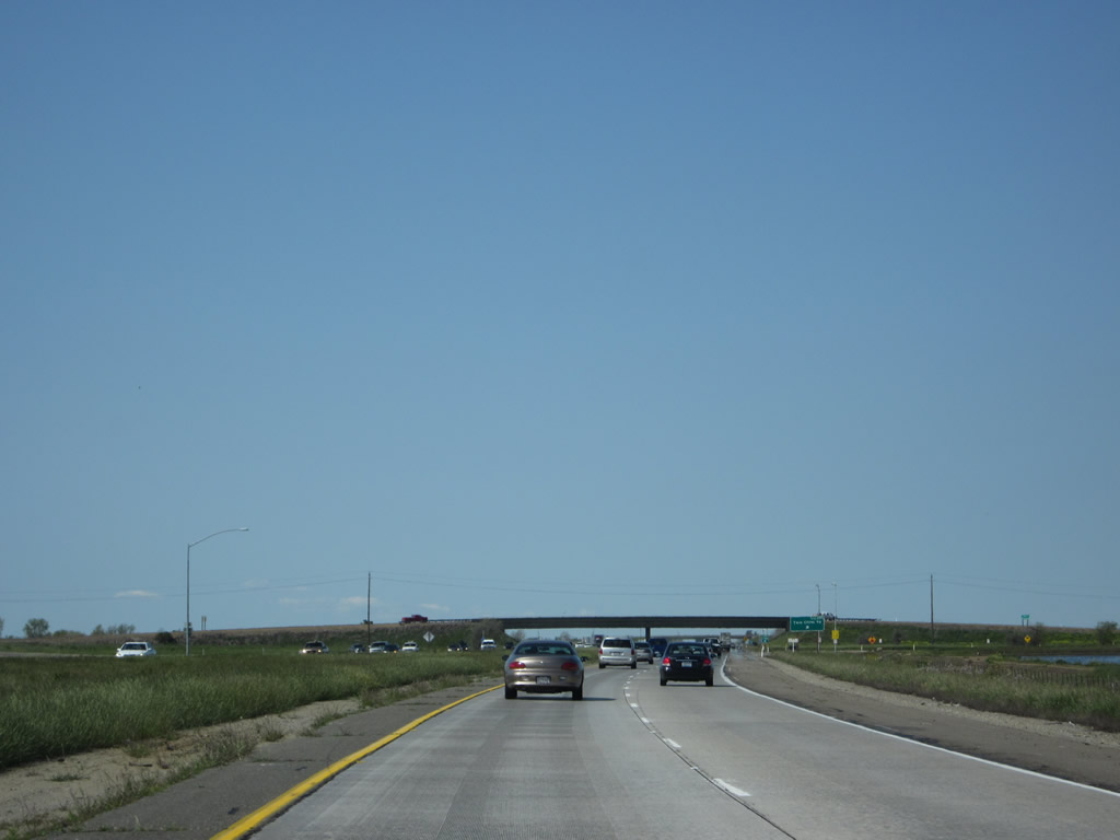
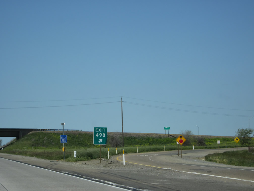
The first exit along Interstate 5 north in Sacramento County is Exit 498, Sacramento County E-13, Twin Cities Road. Photo taken 04/02/05. |
|
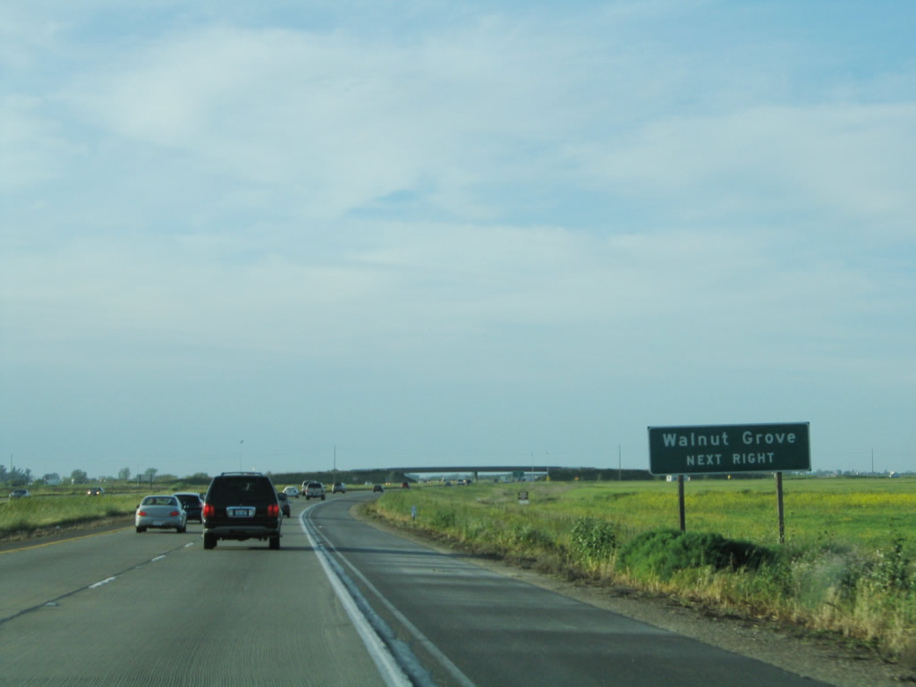
Use Sacramento County E-13 (Twin Cities Road) west to Walnut Grove and California 160. Photo taken 04/02/05. |
|
|
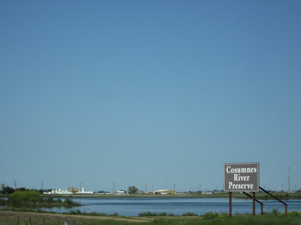
Interstate 5 travels past the Consumnes River Preserve, which protects several key areas of the 80-mile long Consumnes River watershed, including these wetland areas on the east side of Interstate 5. The Consumnes River is notable for its relatively short length and its status as the "only remaining unregulated river on the western slope of the Sierra Nevada." Photos taken 04/06/12. |
|
|
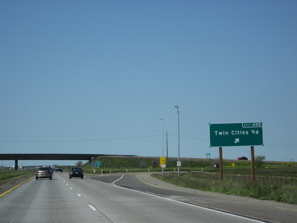
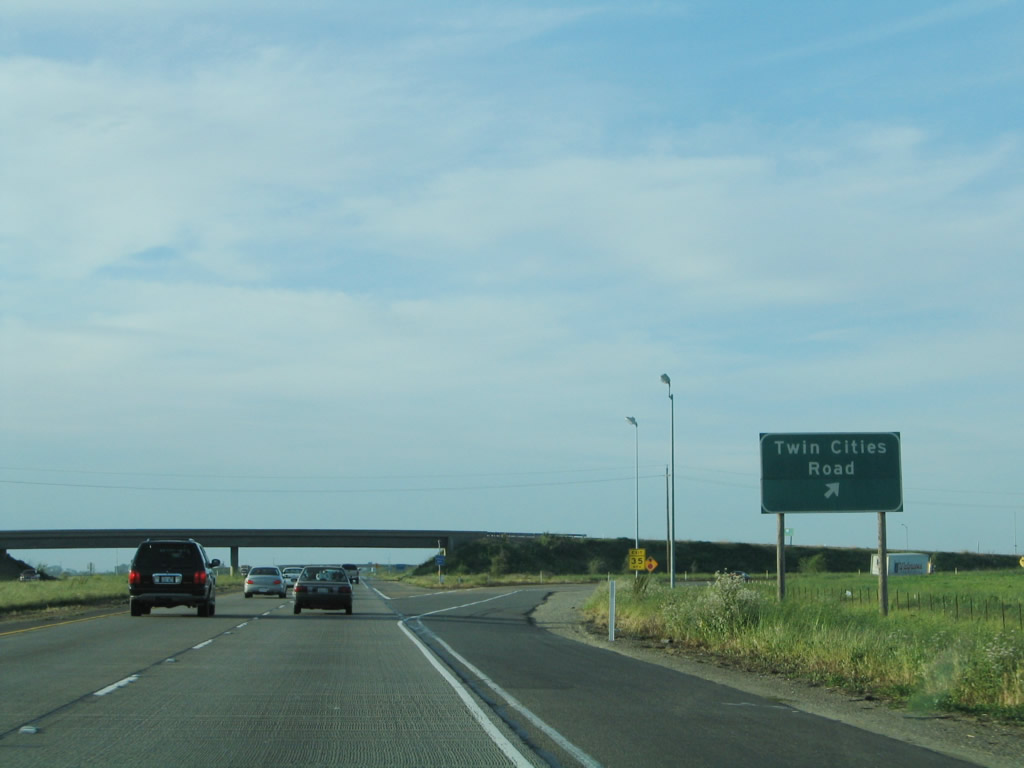
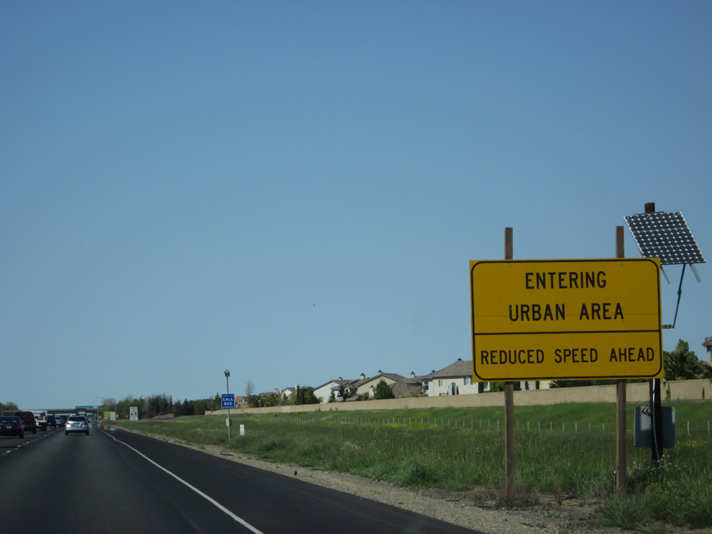
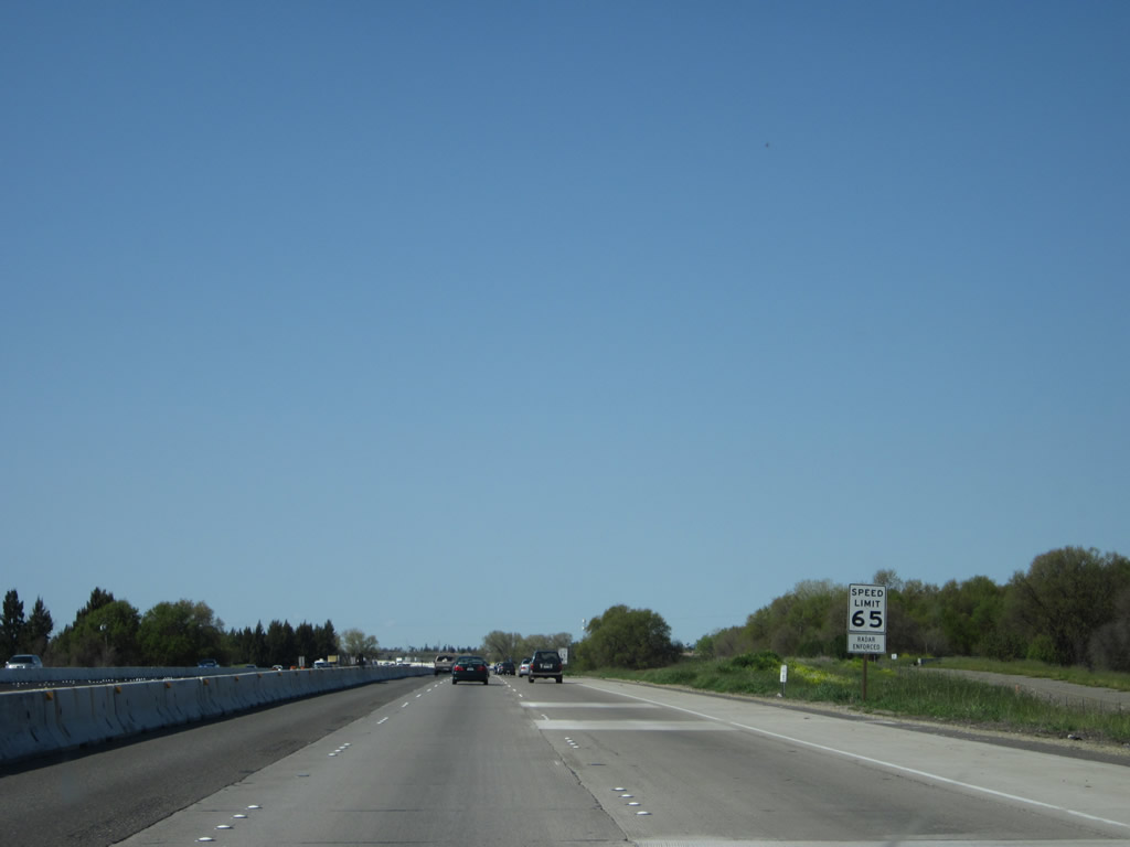
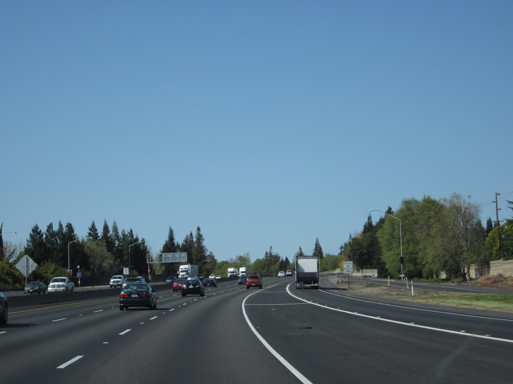
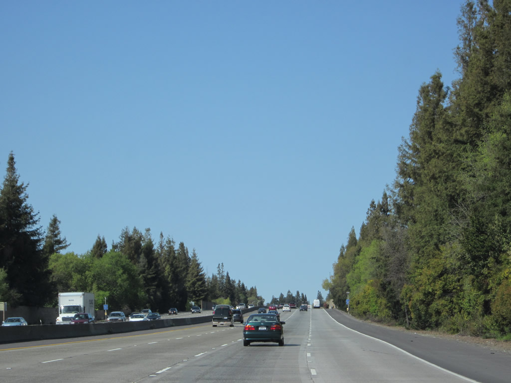
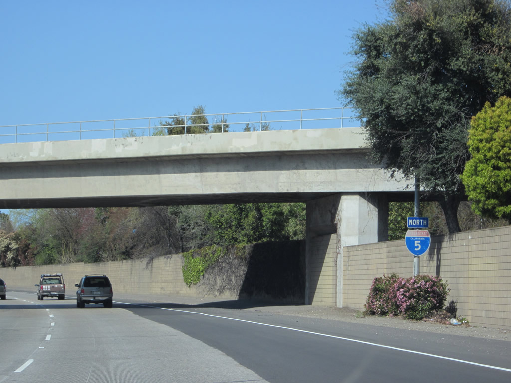
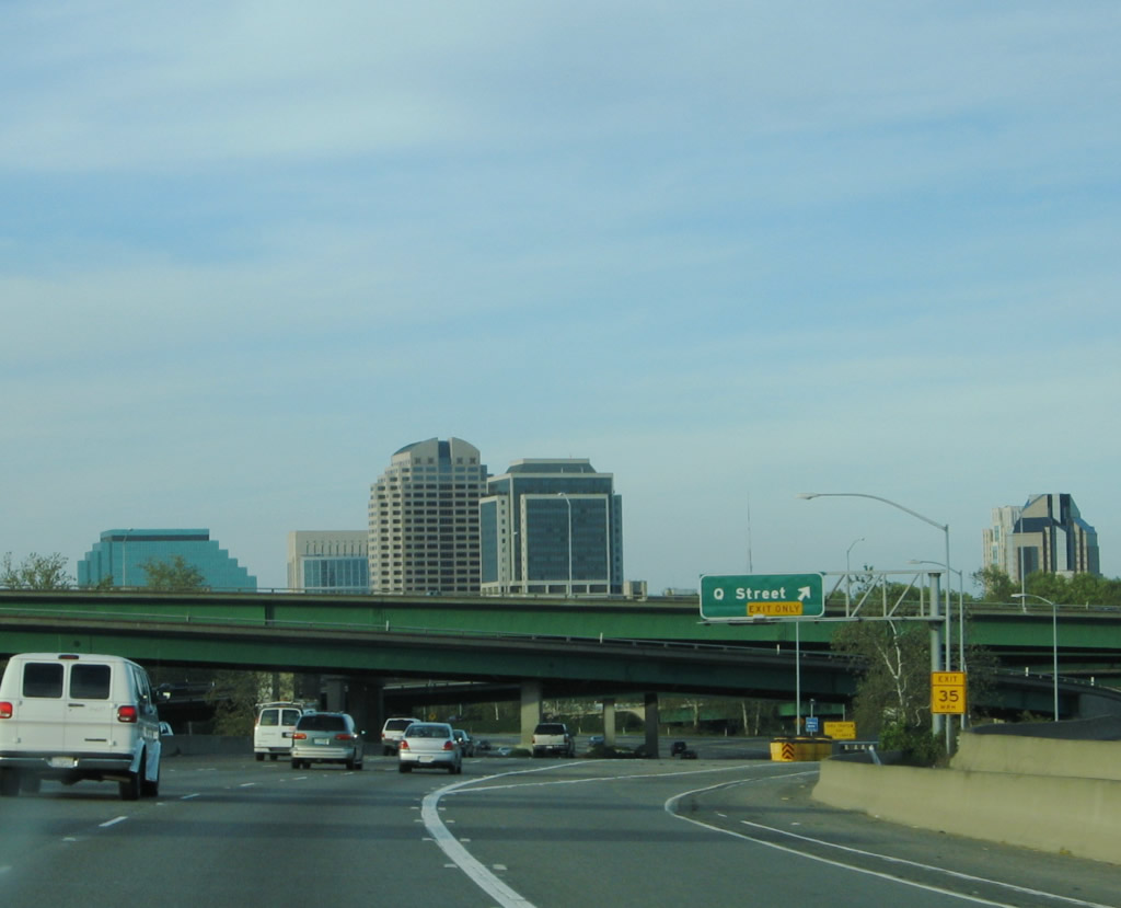
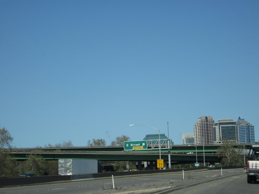
Northbound Interstate 5 reaches Exit 498, Sacramento County E-13 (Twin Cities Road) to Walnut Grove (west) and Consumnes River Preserve, Galt, and California 104 to the east. The next exit is six miles ahead. Photos taken 04/02/05 and 04/06/12. |
|
Exit 498 (Twin Cities Road interchange) is a diamond interchange. Photo taken 04/02/05. |
|
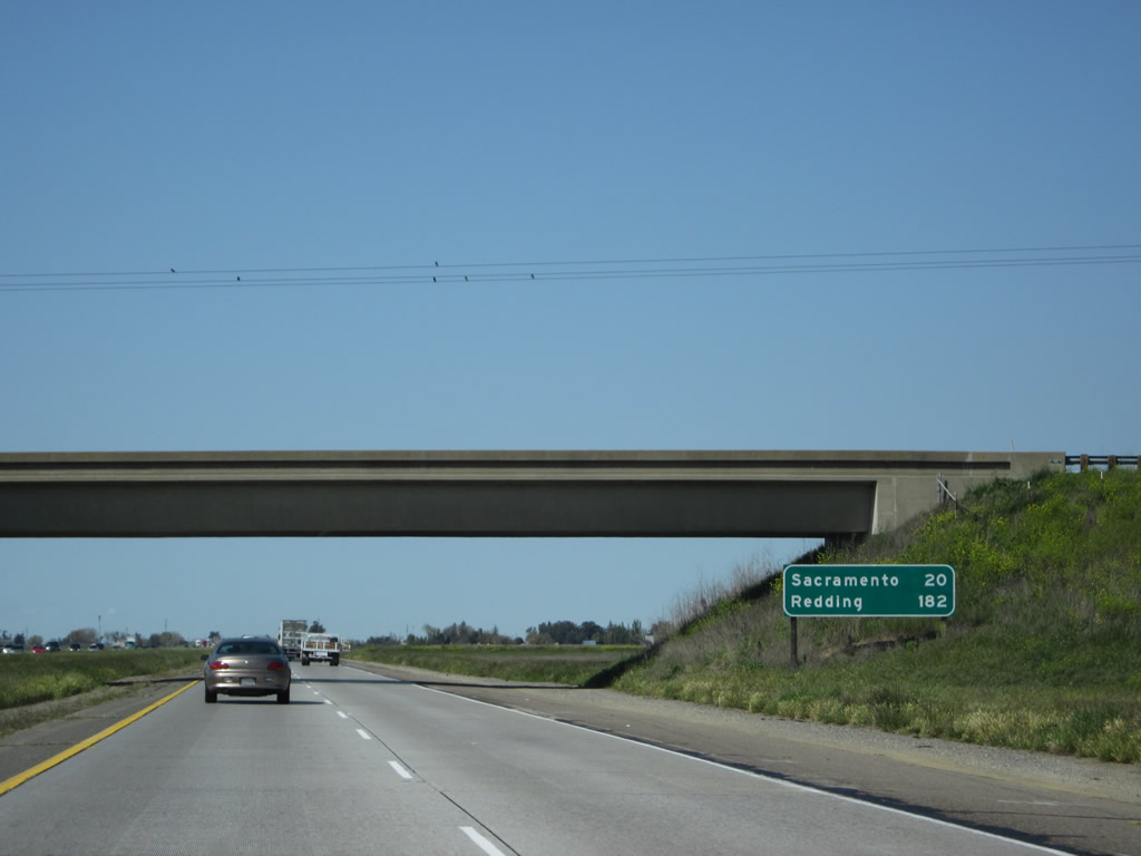
This mileage sign for Sacramento (20 miles) and Redding (182 miles) is posted under the Twin Cities Road overpass. Photo taken 04/06/12. |
|
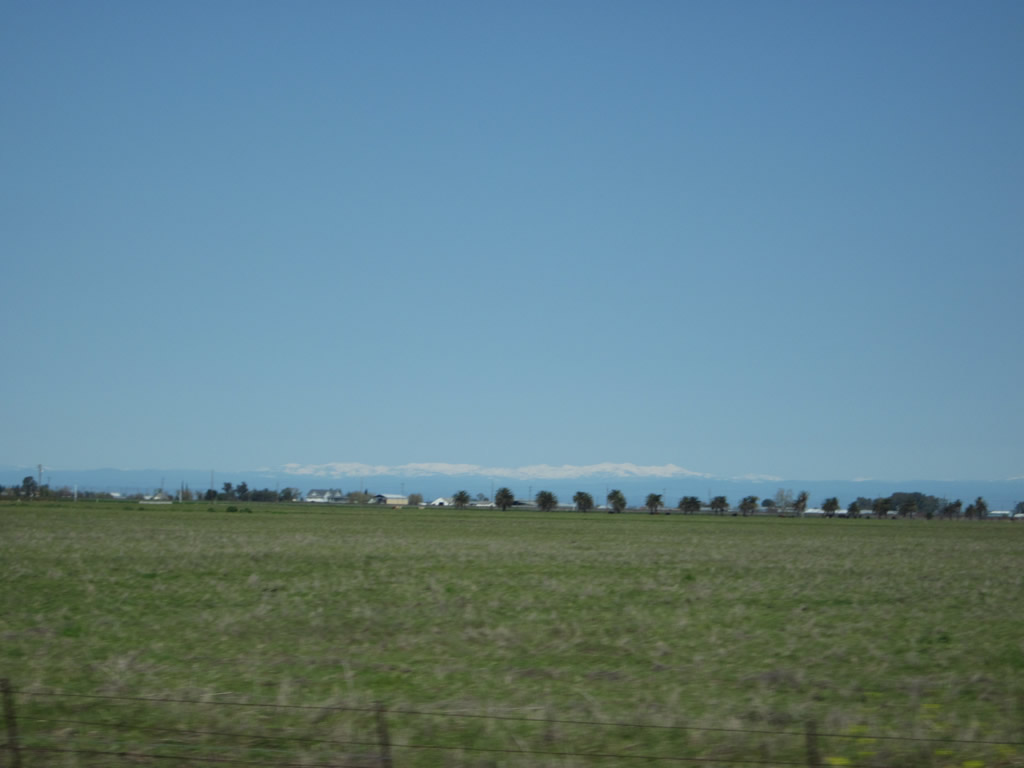
As we travel north along Interstate 5, the snow-capped peaks of the Sierra Nevada sometimes come into view by looking east from Interstate 5 during the winter and spring (such as in this picture). Photo taken 04/06/12. |
|
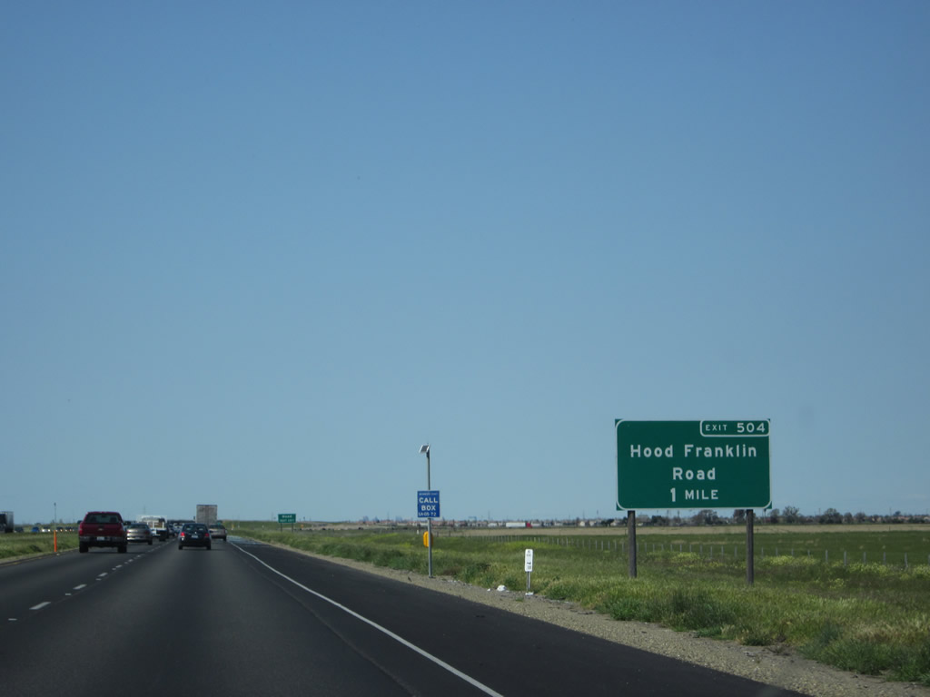
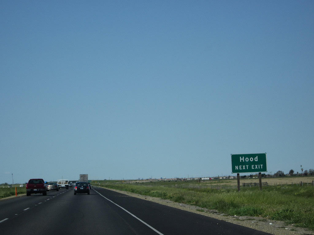
The next exit along northbound Interstate 5 is Exit 504, Hood Franklin Road. Photo taken 04/06/12. |
|
Exit 504 (Hood Franklin Road) serves the community of Hood, which sits to the west of the freeway close to the Sacramento River along California 160 (River Road). Photo taken 04/06/12. |
|
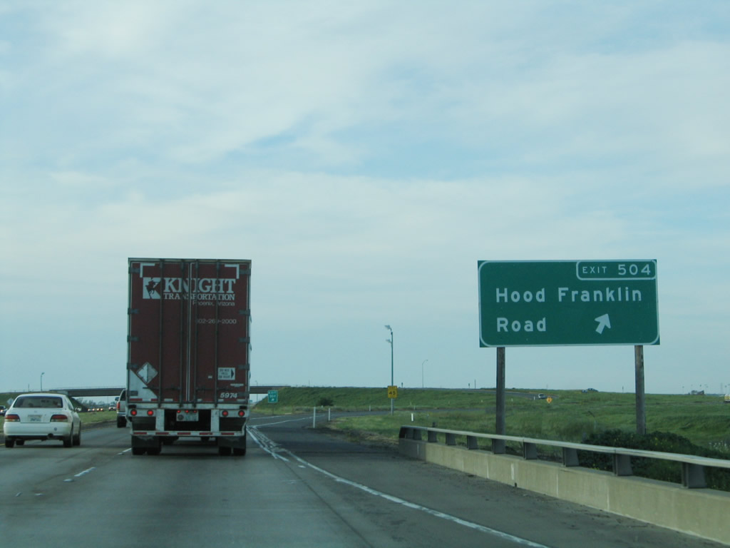
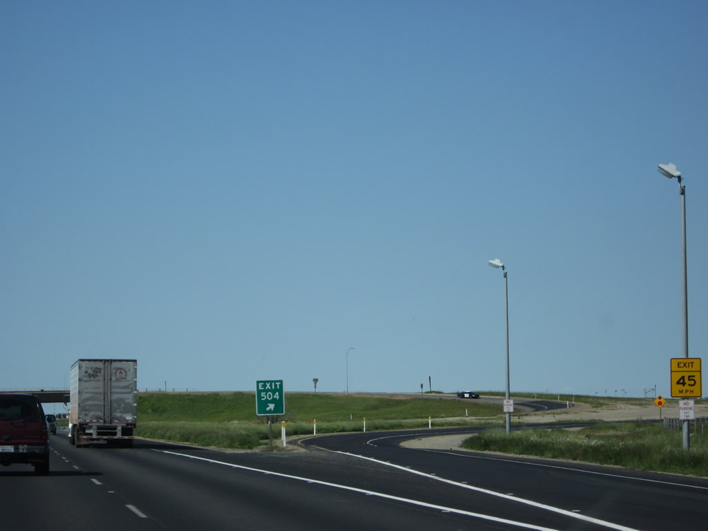
Northbound Interstate 5 reaches Exit 504, Hood Franklin Road. This interchange is a partial cloverleaf. After this interchange, Interstate 5 passes by the eastern edge of the Stone Lakes National Wildlife Refuge. Photo taken 04/02/05. |
|
Exit 504 is a partial cloverleaf interchange. Photo taken 04/06/12. |
|
Residential development is encroaching on farmland as Interstate 5 approaches the southern edge of the city of Elk Grove. Look for this suburban-rural limit to continue to push outward as housing demands continue to increase. A Pacific Gas & Electric power line passes through the area. Photo taken 04/06/12. |
|
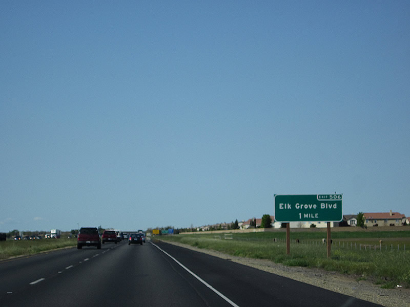
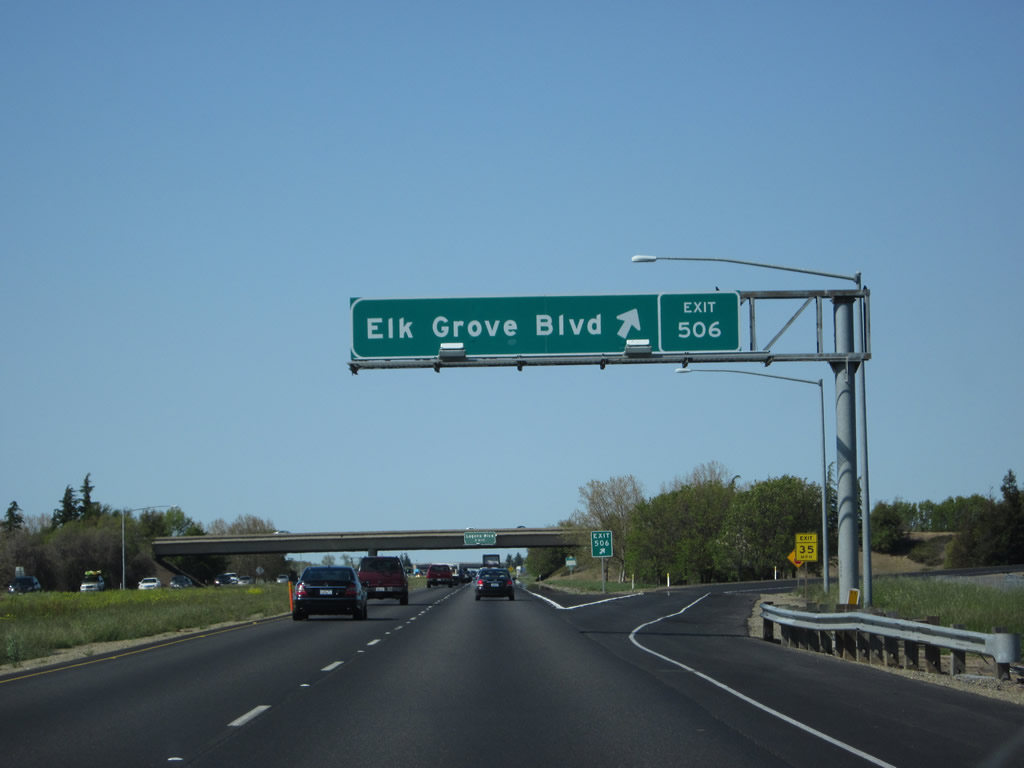
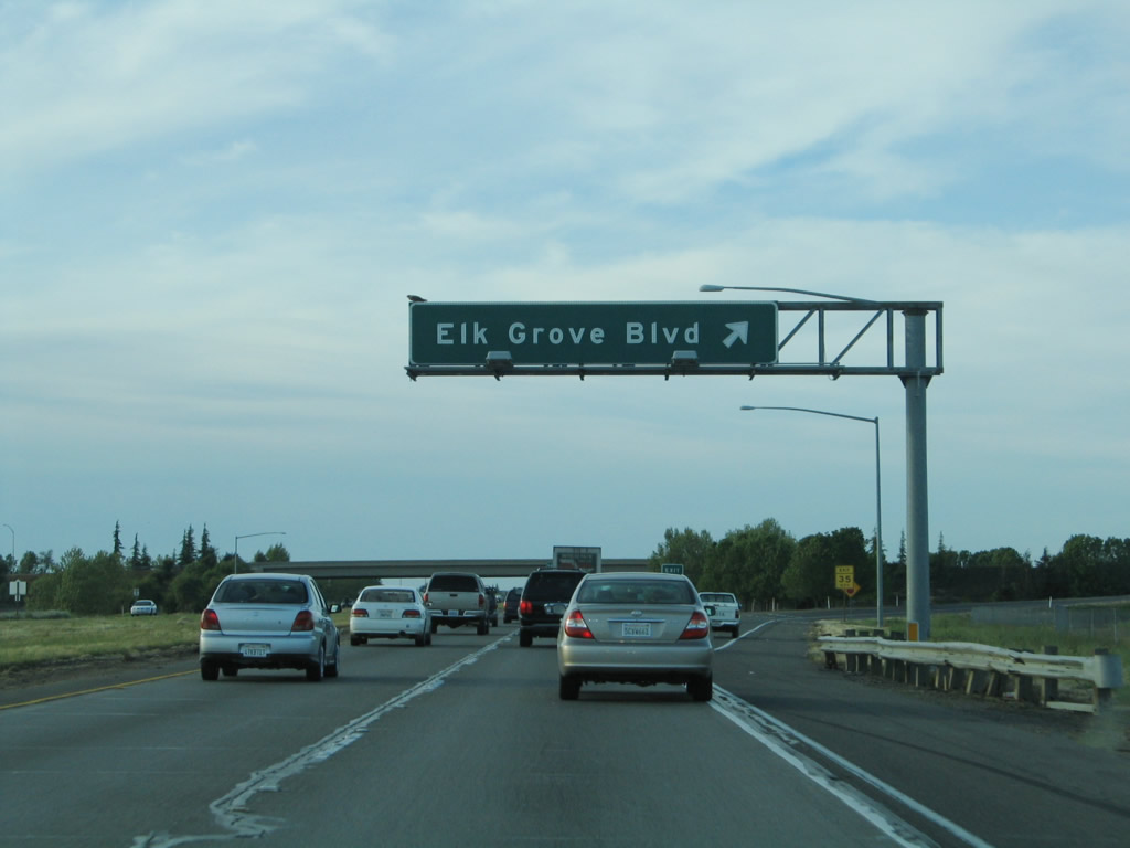
The next exit along northbound Interstate 5 is Exit 506, Elk Grove Boulevard (one mile). Housing development appears en masse along Interstate 5 for the first time since leaving Stockton. Interstate 5 approaches the city of Elk Grove, which is the first city along Interstate 5 in Sacramento County. Elk Grove was incorporated on July 1, 2000, as a general law city, but has existed since 1850. The city sits at an elevation of 45 feet and sees about 22 inches of precipitation annually, mostly during the fall and winter months. Photo taken 04/06/12. |
|
|
Since the landscape is again shifting from rural/agricultural to suburban, the needs of the freeway change as well. More commuters will take to the freeway once we enter the suburbs. The 2000 Census places the population of Elk Grove (prior to incorporation) at 59,984 people; by 2010, the U.S. Census Bureau indicated a population of 155,937 in Elk Grove (thus indicating a huge population gain during that time period). Photos taken 04/06/12 and 04/02/05. |
|
The four-lane freeway enters the urban area of Elk Grove. Traffic may be impacted during commuting hours, when residents of Elk Grove commute to nearby downtown Sacramento. Photo taken 04/02/05. |
|
|
Northbound Interstate 5 reaches Exit 506, Sacramento County E-12 (Elk Grove Boulevard). Due to the presence of the national wildlife refuge west of Interstate 5, this interchange marks the western terminus of Sacramento County E-12. To the east, the county route extends through Elk Grove, connecting with California 99 at Exit 286. At the eastern edge of the city of Elk Grove, Sacramento County E-12 ends at Sacramento County E-2 (Grant Line Road). Photos taken 04/06/12 and 04/02/05. |
|
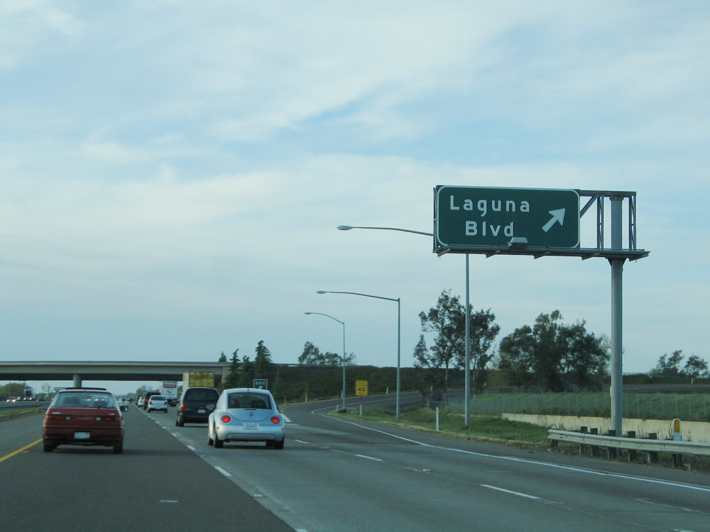
The next exit along northbound Interstate 5 is Exit 508, Laguna Boulevard, which also serves the city of Elk Grove. This interchange is a trumpet interchange. Photo taken 04/06/12. |
|
|
Northbound Interstate 5 reaches Exit 508, Laguna Boulevard. After this interchange, Interstate 5 leaves the city of Elk Grove and reenters unincorporated Sacramento County. Interstate 5 however will retain additional lanes as it continues north toward the city. The next exit is four miles ahead. Photos taken 04/06/12 and 04/02/05. |
|
Interstate 5 passes under Laguna Boulevard (Exit 508). This is a trumpet interchange. Photo taken 04/06/12. |
|
After passing through the Laguna Boulevard interchange, northbound Interstate 5 passes over a tributary to the Sacramento River. Photo taken 04/06/12. |
|
|
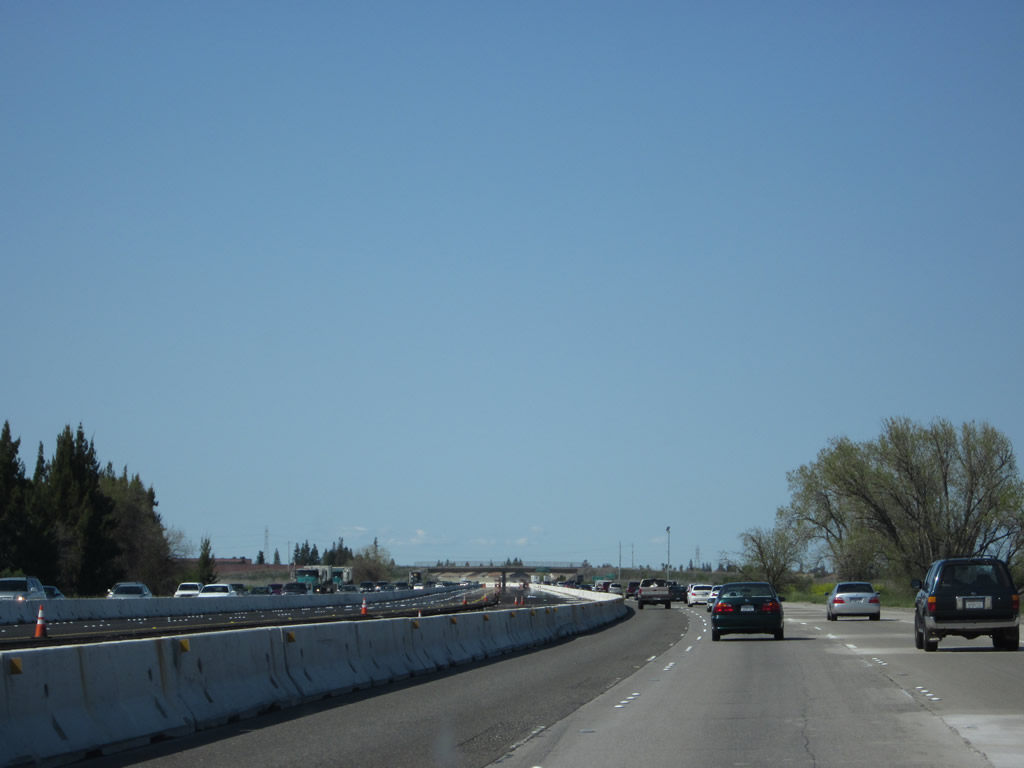
A construction project was underway between Exits 508 and 512 to expand the freeway at the time these pictures were taken. Photo taken 04/06/12. |
|
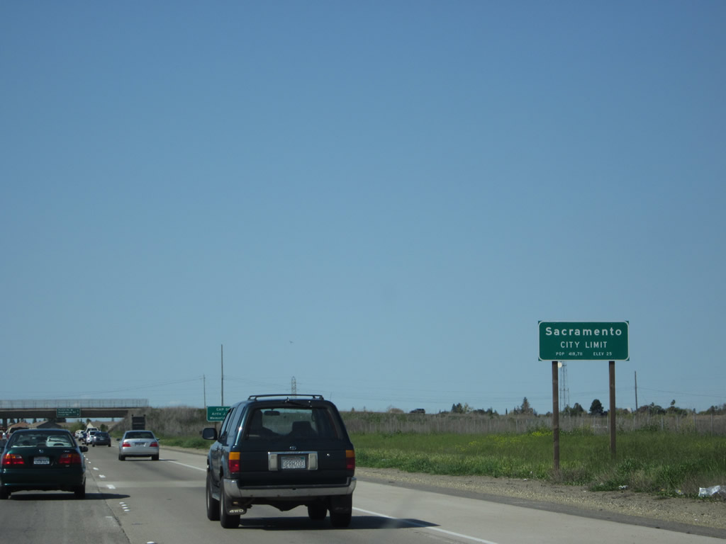
Interstate 5 enters the city of Sacramento, which is the capital of the state of California and seat of Sacramento County. This major California city is located at the crossroads of three major highways: Interstate 5 from San Diego to Blaine, Interstate 80 from San Francisco to near New York City, and U.S. 50 from West Sacramento to Ocean City, Maryland. These highways converge near downtown Sacramento, with Interstate 80 splitting into a bypass and business alignment through the city. Sacramento was founded in 1849 and is the oldest incorporated city (on February 27, 1850). Voters adopted the current Sacramento City Charter in 1920. The Sacramento area (El Dorado, Placer, Sacramento, and Yolo Counties) is the fourth largest metropolitan area in the state of California (behind Greater Los Angeles, the San Francisco Bay Area, and San Diego County) with a population in excess of 2.1 million. As of the 2010 Census, 466,488 people lived in Sacramento, which is an increase from the 2000 Census, when 407,018 people lived in Sacramento. Photo taken 04/06/12. |
|
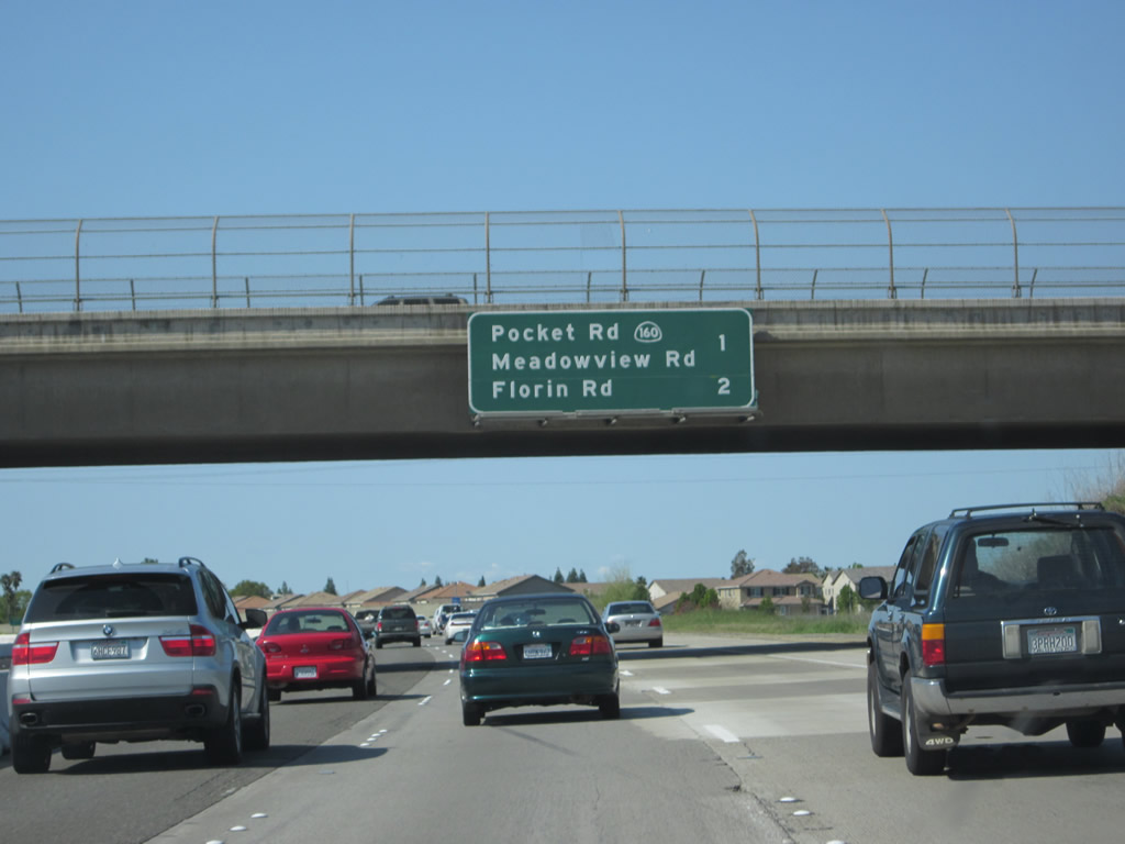
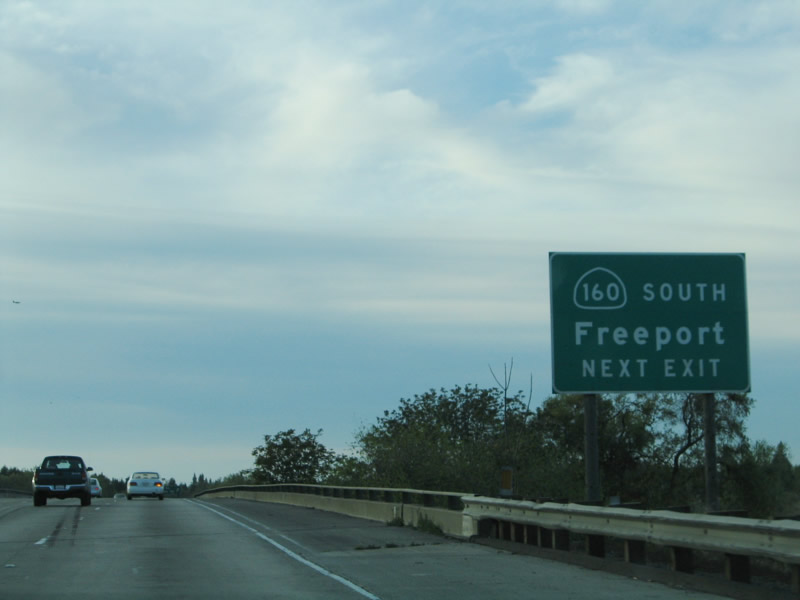
This mileage sign provides the distance to the next two exits along northbound Interstate 5 are Exit 512, Pocket Road and Meadowview Road to California 160/Freeport Boulevard (River Road) and Exit 513, Florin Road. This mileage sign is posted on the Stonecrest Avenue overpass. Photo taken 04/06/12. |
|
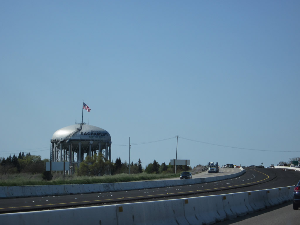
A large, distinctive water tower helps welcome northbound motorists into the city of Sacramento. Photo taken 04/06/12. |
|
As of 2003, California 160 exists in two sections. The southern section begins in Antioch and generally follows the Sacramento River northeast to the southern city limits of Sacramento after passing the Freeport Bridge (Sacramento County E-9) and before crossing under Interstate 5. The northern section is the short North Sacramento Freeway segment leading from downtown Sacramento to Business Loop I-80 (Capital City Freeway). The section in between was transferred to the city of Sacramento in 2003, when the section within the city of Sacramento was decommissioned. Photo taken 04/02/05. |
|
|
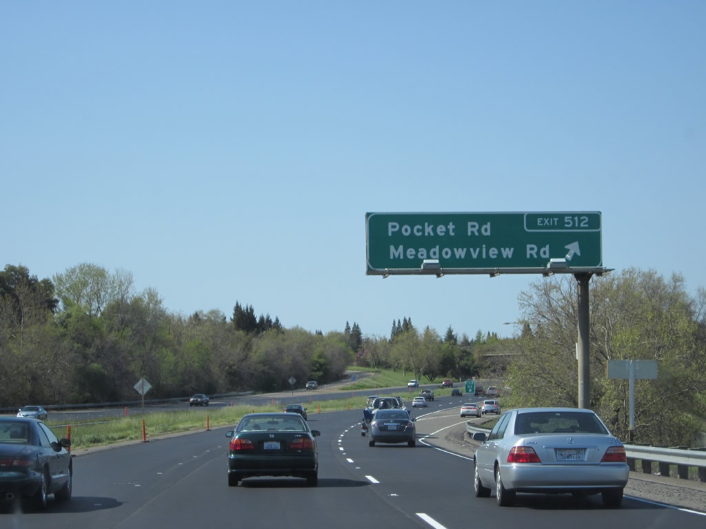
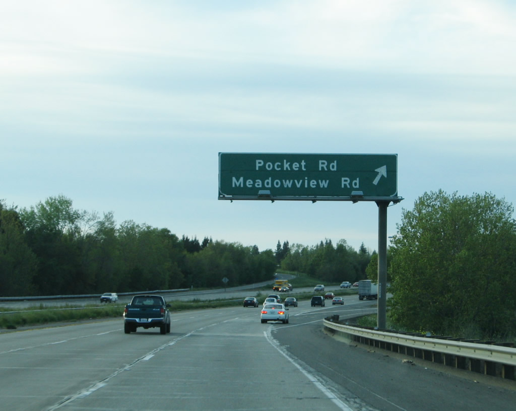
Northbound Interstate 5 reaches Exit 512, Pocket Road and Meadowview Road to California 160 south. Use Meadowview Road east to Freeport Boulevard, which is the former route of California 160. Turn south on Freeport Boulevard to California 160 south to Antioch or north on Freeport Boulevard to the Sacramento Executive Airport. Exit 512 is a partial cloverleaf. Photos taken 04/06/12 and 04/02/05. |
|
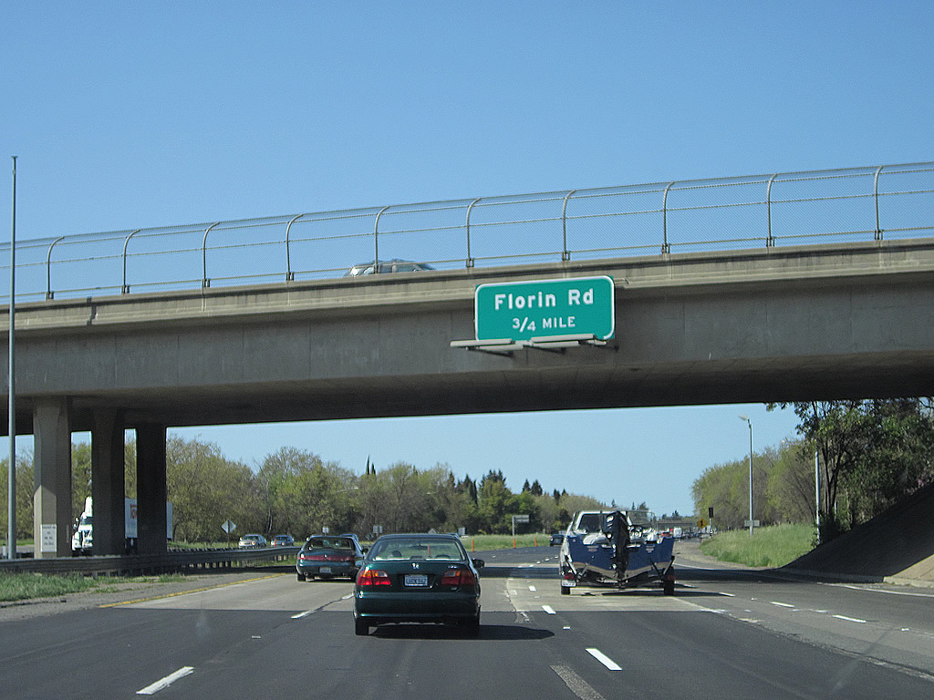
The next exit along Interstate 5 north is Exit 513, Florin Road. This modified cloverleaf interchange serves the southern parts of the city of Sacramento. From here, Interstate 5 will remain within the city of Sacramento until reaching Exit 525B, California 99/El Centro Road north to Yuba City/Marysville. Photo taken 04/06/12. |
|
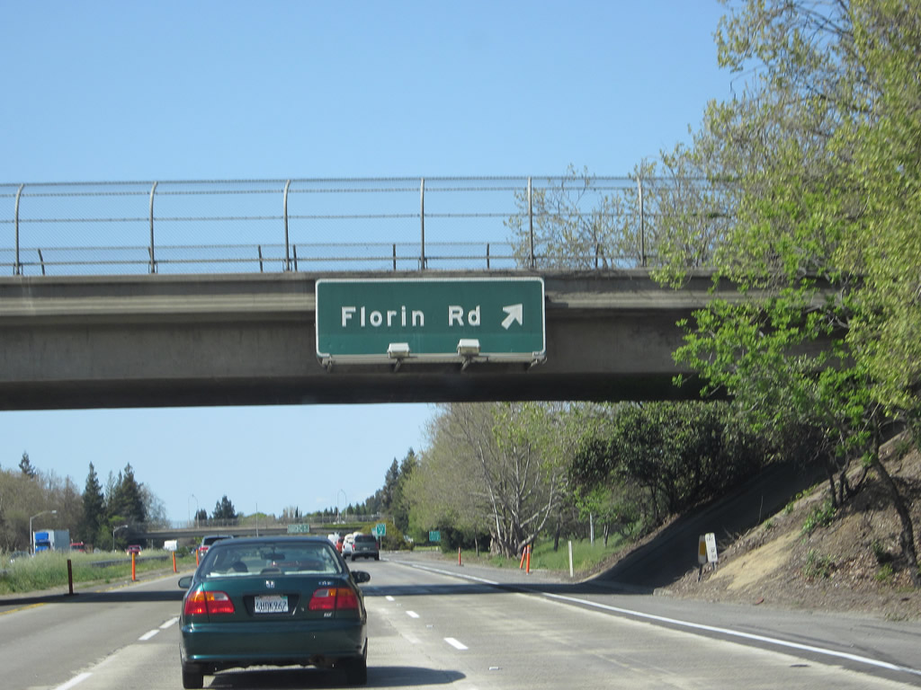
Northbound Interstate 5 meets Exit 513, Florin Road. Photo taken 04/06/12. |
|
The interchange with Exit 513, Florin Road is modified cloverleaf. Upon exiting, the first ramp connects to Florin Road east, and the second ramp loops onto Florin Road west. Photo taken 04/06/12. |
|
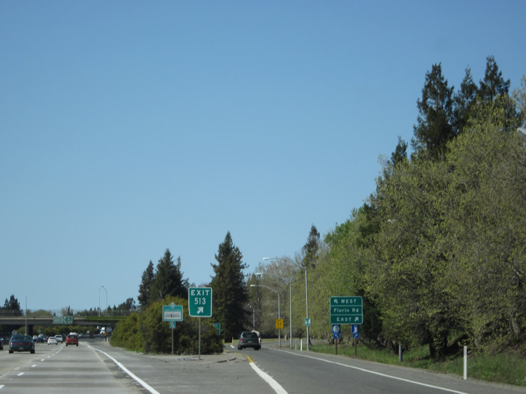
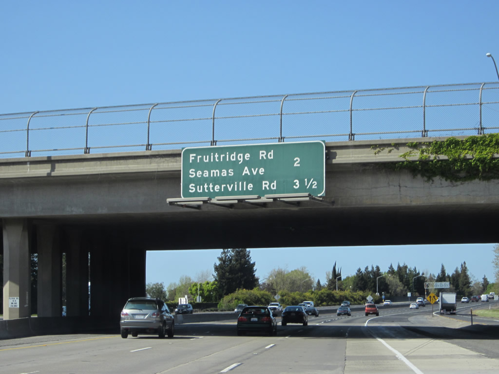
This interchange sequence sign provides the distance to the next two exits along northbound Interstate 5: Exit 515, Seamas Avenue and Fruitridge Road and Exit 516, Sutterville Road. This mileage sign is posted on the Florin Road overpass. Photo taken 04/06/12. |
|
Traffic from Florin Road merges onto Interstate 5 north. Photo taken 04/06/12. |
|
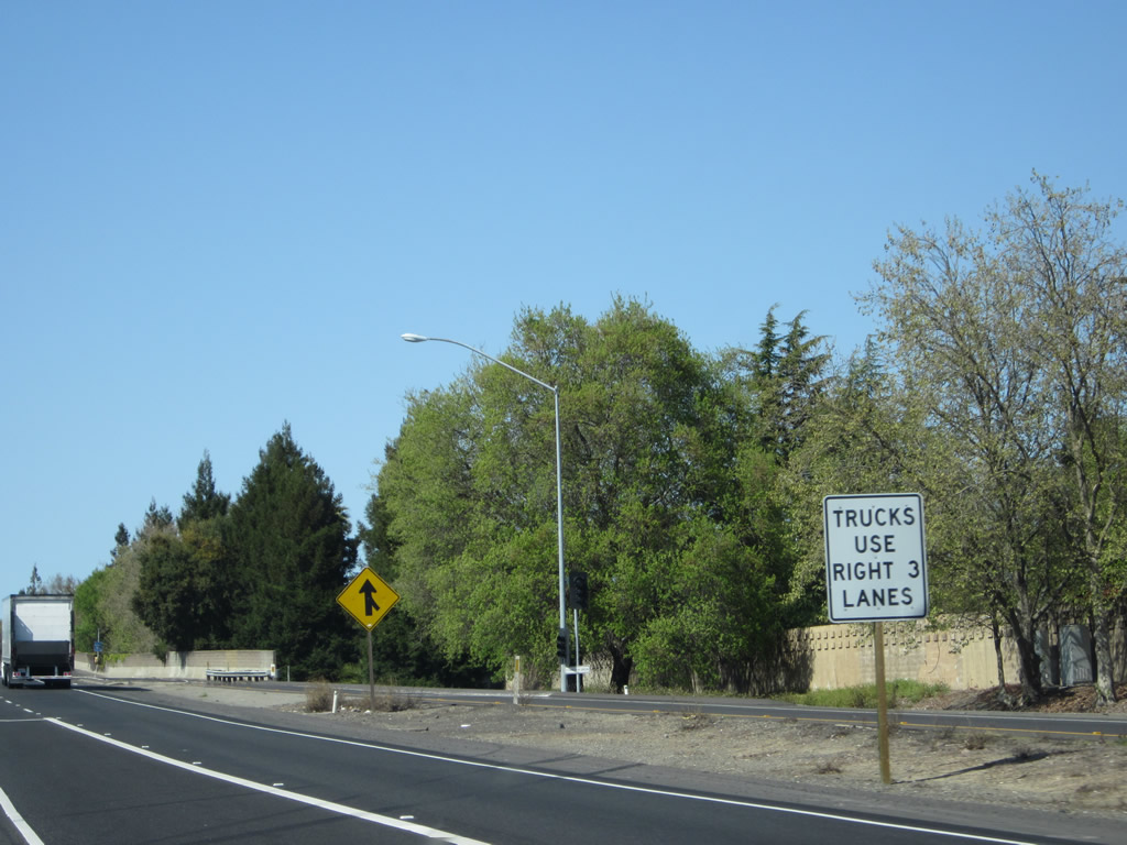
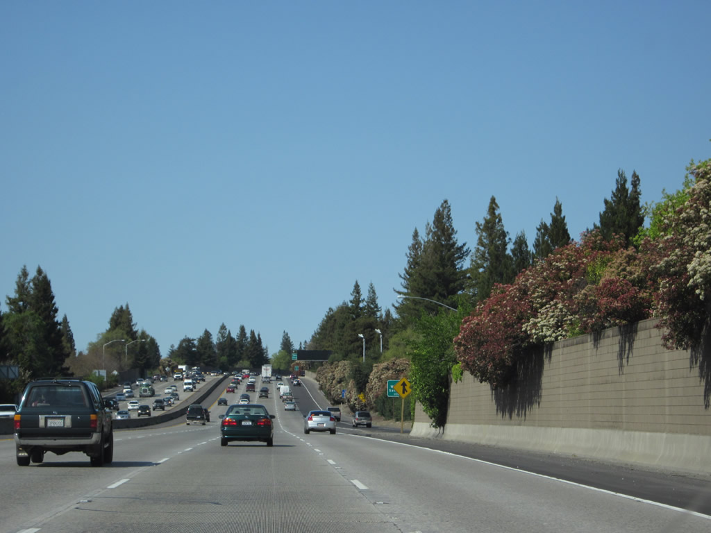
Trucks are advised to use the right three lanes between Exit 513 (Florin Road) and Exit 518 Business Loop I-80 (Capital City Freeway). Photo taken 04/06/12. |
|
After the Florin Road overpass, this diagrammatical sign was briefly posted for the upcoming Business 80 and U.S. 50 interchange (Exit 518, three miles ahead). However, the sign was gone by April 2005. Photo taken 12/28/04. |
|
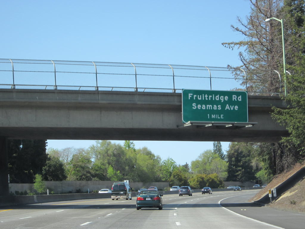
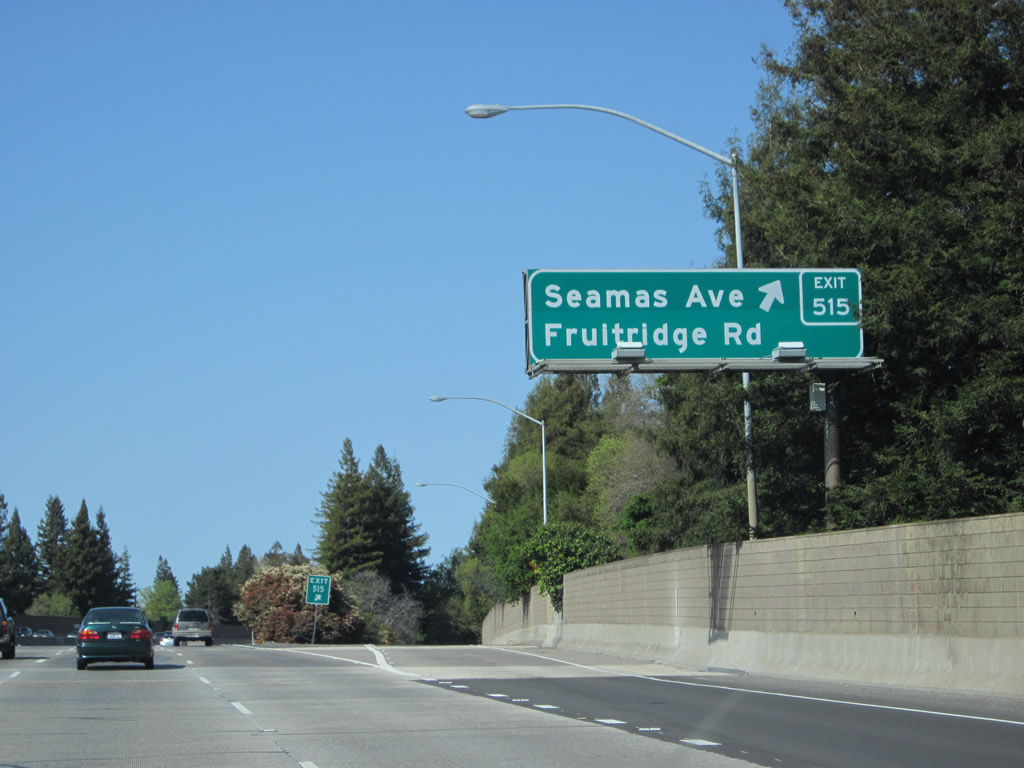
Northbound Interstate 5 approaches Exit 515, Seamas Avenue and Fruitridge Road in southern Sacramento. The freeway passes under 43rd Avenue at this point. Photo taken 04/06/12. |
|
|
The freeway widens to four northbound lanes. An on-ramp joins the northbound freeway from 43rd Avenue; there is no access to 43rd Avenue from Interstate 5 north (it is a half-diamond interchange). Photos taken 04/06/12. |
|
|
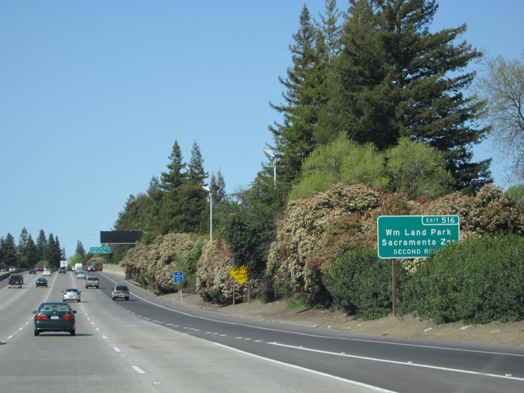
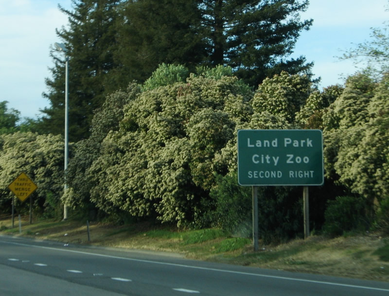
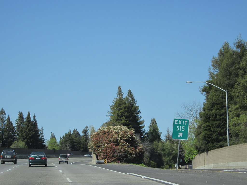
To William Land Park and the Sacramento Zoo, use Sutterville Road east (Exit 516, which is the second exit after the Seamas Avenue/Fruitridge Road interchange). The park includes the zoo, golf course, and Fairy Tale Town. Photos taken 04/06/12 and 04/02/05. |
|
|
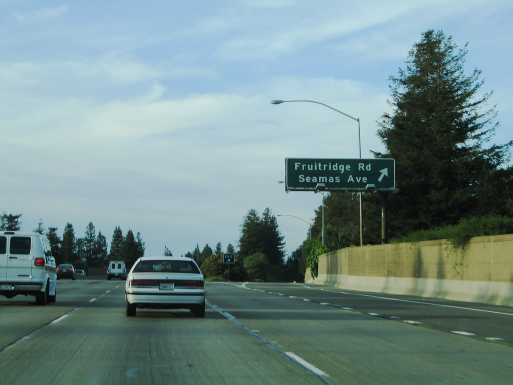
Northbound Interstate 5 reaches Exit 515, Seamas Avenue and Fruitridge Road. The interchange itself is with Seamas Avenue, but Seamas Avenue changes into Fruitridge Road east of the interchange. Photos taken 04/06/12 and 04/02/05. |
|
Although not visible from the freeway, we're now traveling very close to the east bank of the Sacramento River. Exit 515 is a diamond interchange; no motorist services are available at the foot of the off-ramp. Photo taken 04/06/12. |
|
Interstate 5 passes through the Seamas Avenue and Fruitridge Road interchange. Photo taken 04/06/12. |
|
Traffic from Seamas Avenue merges onto Interstate 5 north. Photo taken 04/06/12. |
|
|
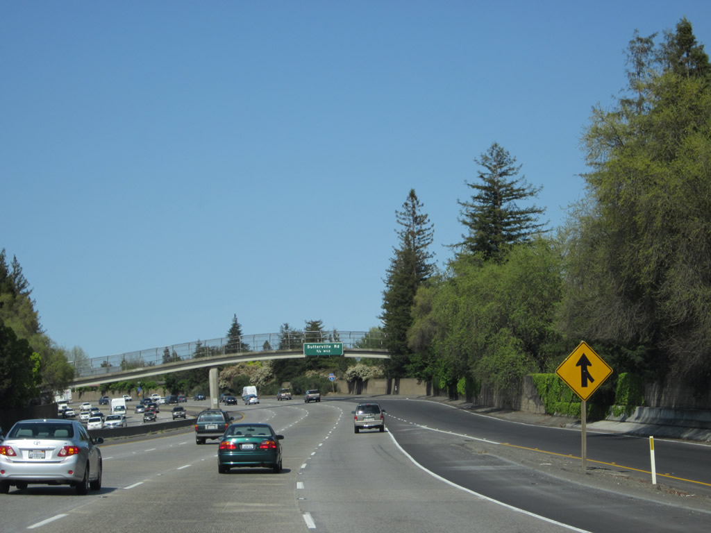
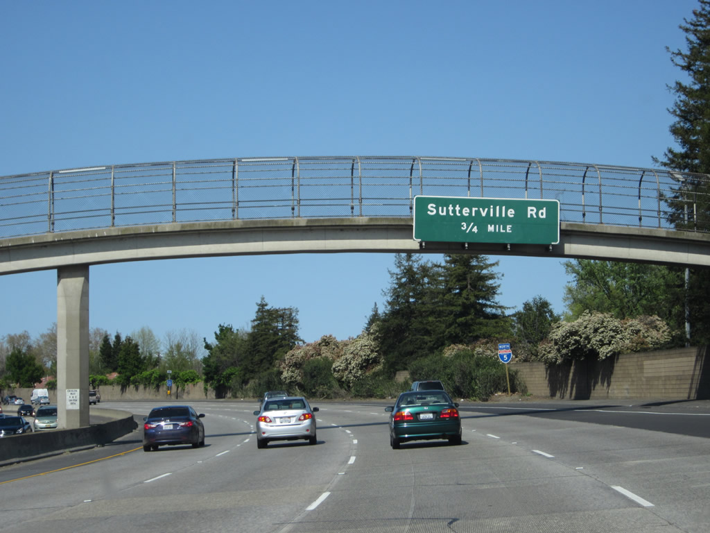
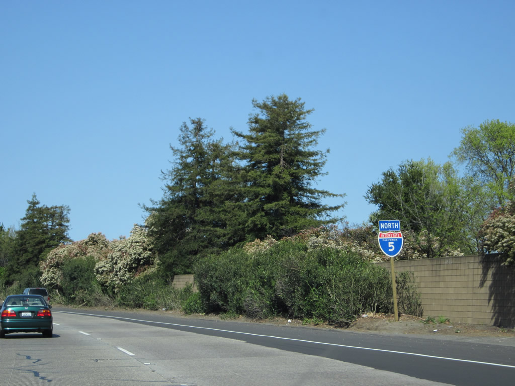
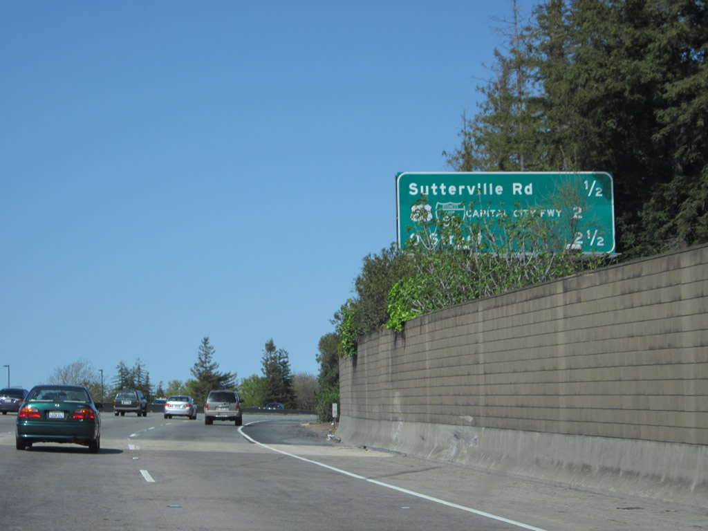
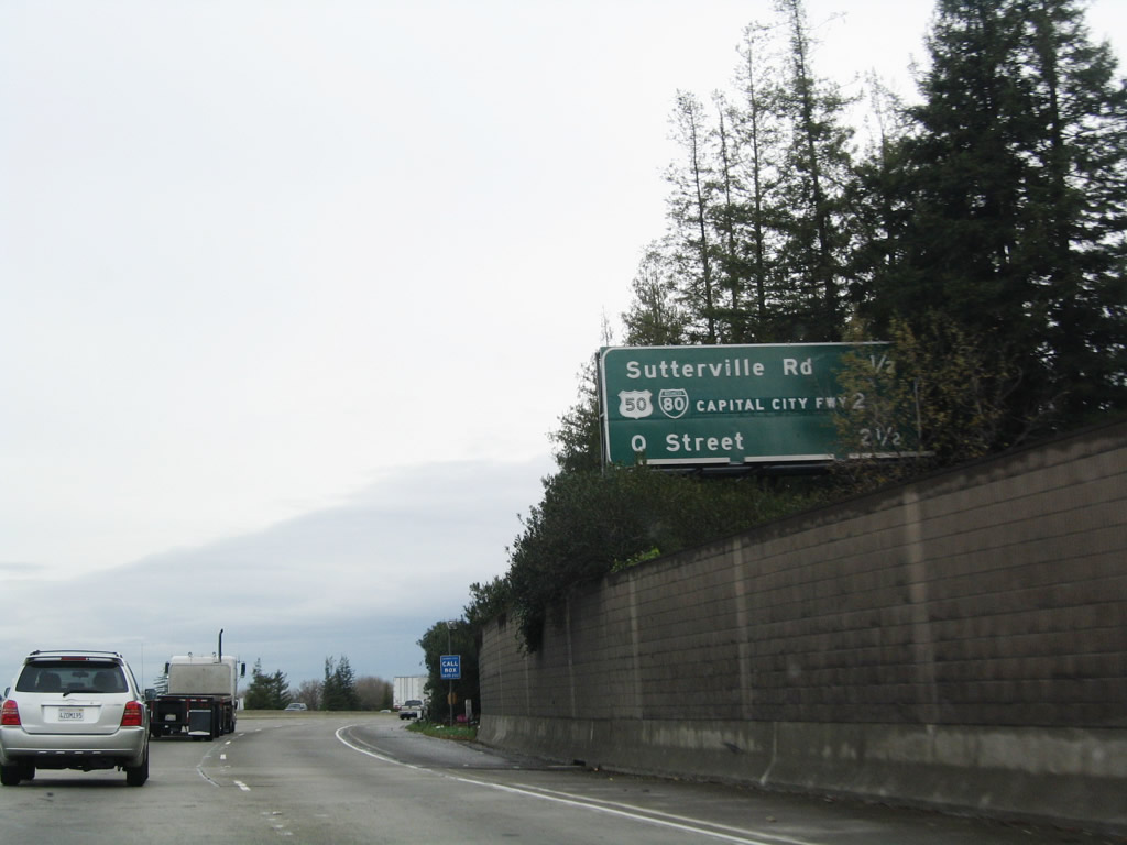
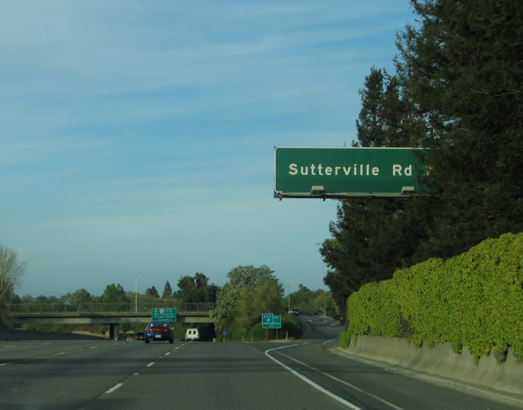
The next exit along northbound Interstate 5 is Exit 516, Sutterville Road. Use Sutterville Road east to the Sacramento Zoo, William Land Park, William Land Golf Course, Sacramento City College, Hughes Stadium, and the Sacramento Children's Home. This is a major interchange. Interstate 5 north retains four through lanes. An Interstate 5 route marker is posted just after the overhead guide sign for Exit 516. Photos taken 04/06/12. |
|
|
This mileage sign on Interstate 5 north provides the distance to Exit 516, Sutterville Road; Exit 518, Business 80 and U.S. 50; and Exit 519A, Q Street. This sign was replaced by 2012. Photos taken 04/06/12 and 12/28/04. |
|
|
Northbound Interstate 5 reaches Exit 516, Sutterville Road. As a through road, Sutterville Road connects with Freeport Boulevard (former California 160), Sacramento County J-8 (Franklin Road), and California 99 at Exit 297. East of California 99, Sutterville Road changes into 12th Avenue and 14th Avenue leading to unincorporated Fruitridge and Old U.S. 50-99/Stockton Boulevard. Photos taken 04/06/12 and 04/02/05. |
|
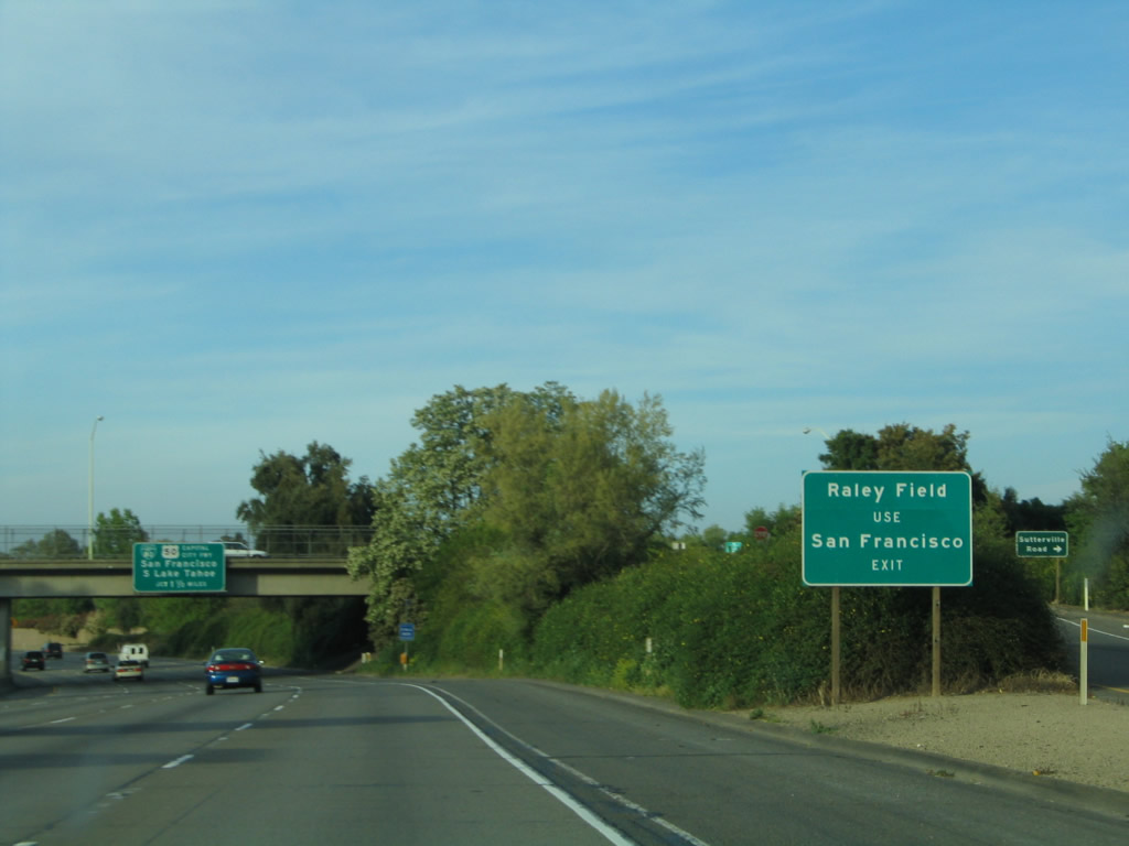
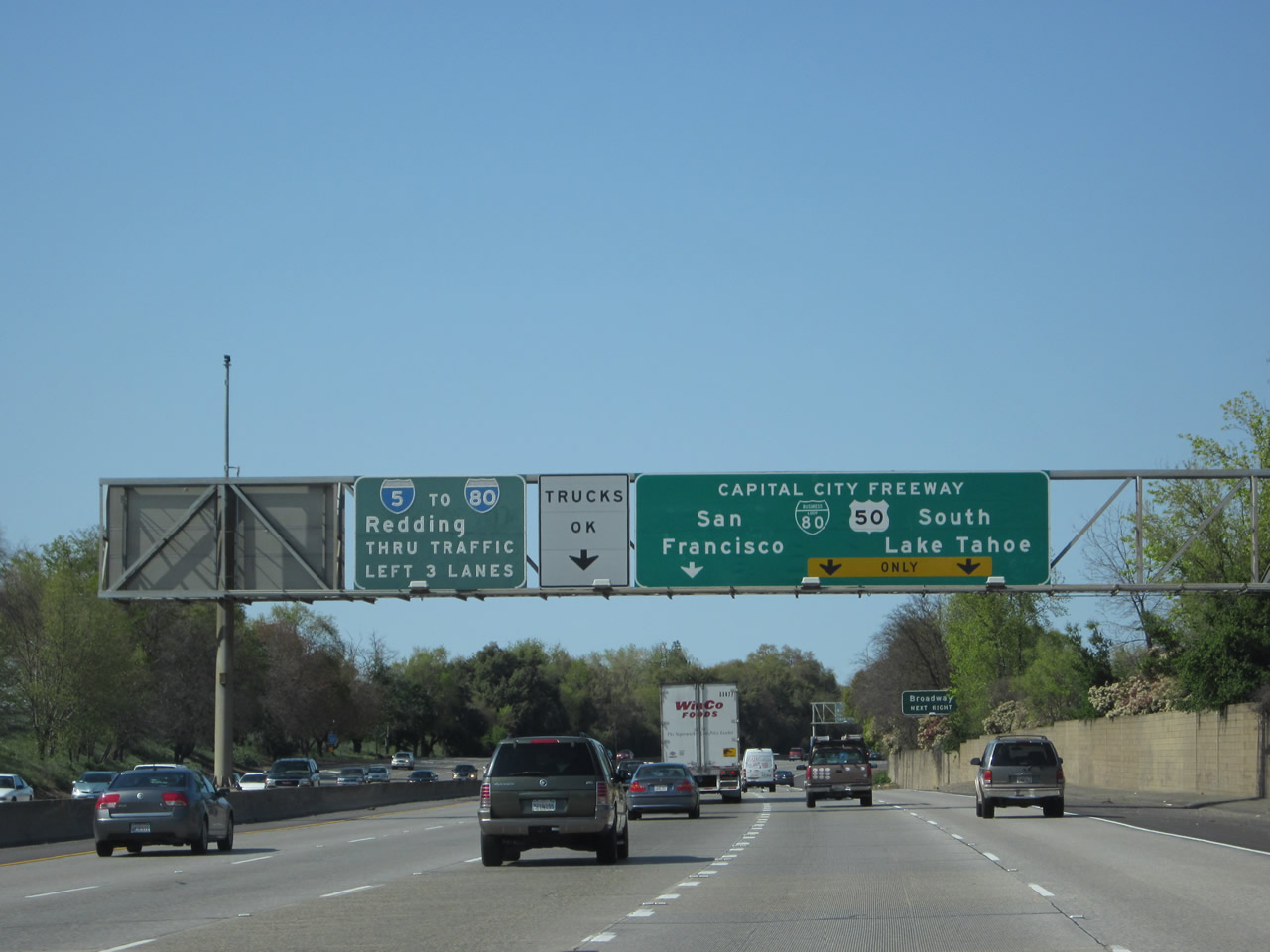
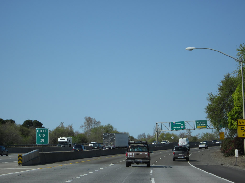
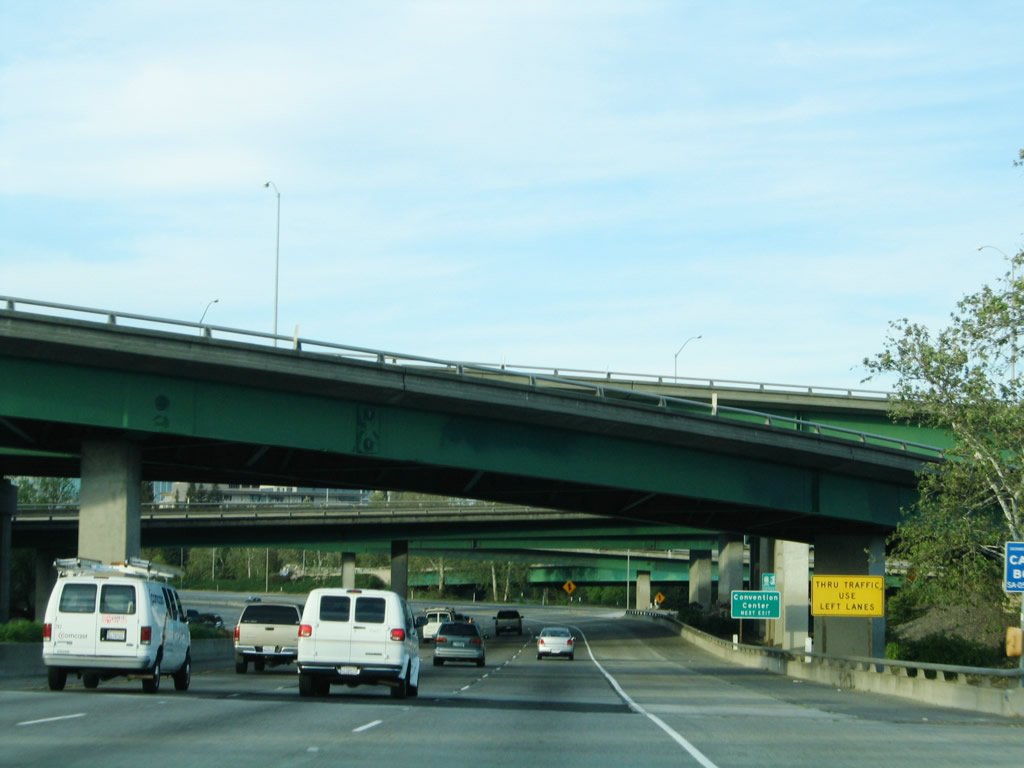
The next exit along northbound Interstate 5 is Exit 518, Business 80 and U.S. 50, the Capital City Freeway. This sign advises that Raley Field is accessible via westbound Business Loop I-80 and U.S. 50 ("San Francisco Exit"). Photo taken 04/02/05. |
|
Passing under Sutterville Road, an overhead sign for Exit 518, Business Loop I-80 and U.S. 50 appears. The east-west segment between Interstate 80 in West Sacramento and the California 99 interchange is also designated as Interstate 305 by the Federal Highway Administration; however, this designation is neither signed nor officially acknowledged as a legislative route by the state of California. These signs were replaced in 2000 and are among the first reflective signs to be placed in the Sacramento area. No exit numbers were added since these signs were installed prior to the start of that initiative. Photo taken 04/06/12. |
|
An Interstate 5 north reassurance marker is posted shortly thereafter. Photo taken 04/06/12. |
|
|
The freeway retains four northbound lanes as we approach the Business Loop I-80 interchange. Photos taken 04/06/12. |
|
The left three lanes continue north along Interstate 5; the right two lanes connect to Business Loop I-80 and U.S. 50. In addition, California 99 briefly shares alignment with Business 80 to connect California 99 to Interstate 5 north. While not clearly signed through this interchange, it is implied that California 99 comes into Sacramento, turns west briefly via Business 80 through downtown Sacramento, then turns north on Interstate 5. Ahead, Interstate 5 and California 99 will share pavement until they split at Exit 525B. Photo taken 04/06/12. |
|
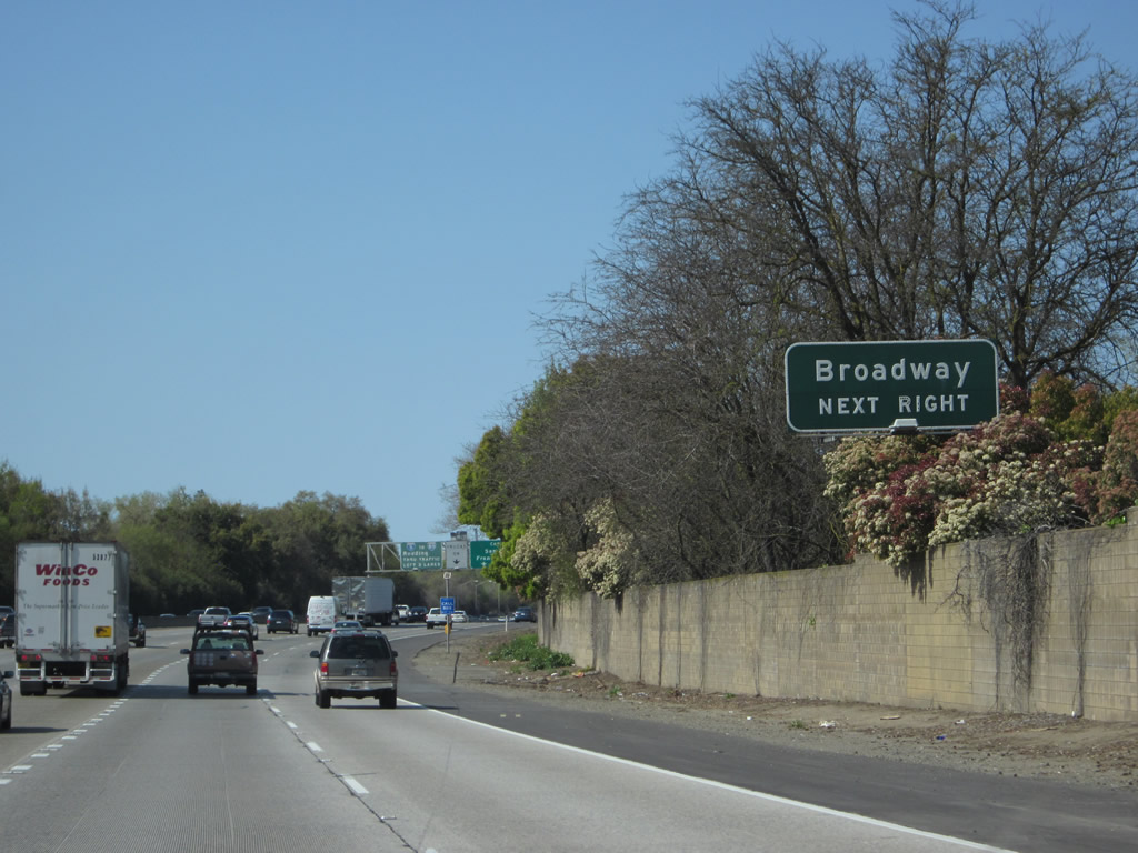
The exit to Broadway is part of this interchange, and the off-ramp to Q Street is located within the larger interchange complex (Exit 519A). Photo taken 12/28/04. |
|
The right two lanes will connect to Exit 518 (Business 80 and U.S. 50), while the left three lanes continue north on Interstate 5 and California 99. Business Loop I-80 was created in 1980 when mainline Interstate 80 was moved to the Sacramento Bypass (to replace the original routing of Interstate 880, which has since been reassigned to the Nimitz Freeway in the San Francisco Bay Area). Unlike most business loops, this route is completely freeway, but the section between U.S. 50 and Interstate 80 via the Arden area and Marconi Curve is not Interstate standard. As a result, Sacramento has two different freeways numbered 80: Interstate 80 bypass and the Business Loop. In 1996, the Business Loop was given an additional name, the Capital City Freeway. Photo taken 04/06/12. |
|
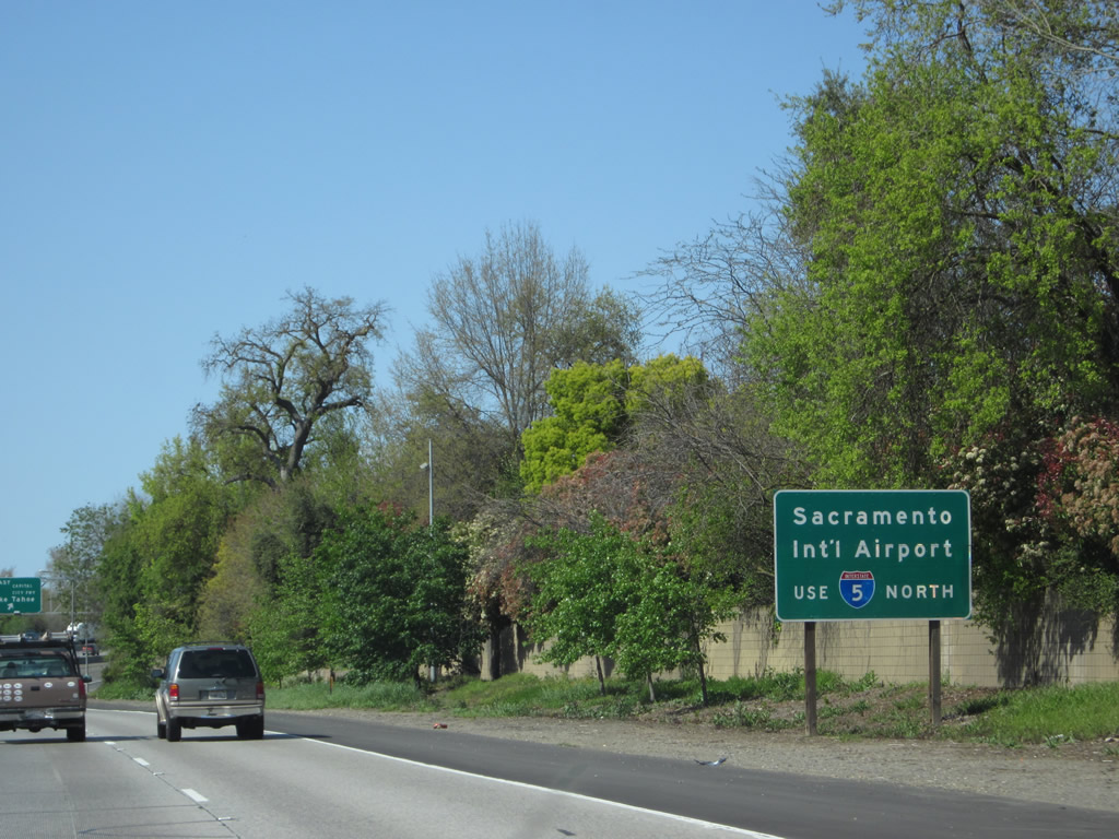
To Sacramento International Airport, continue north on Interstate 5 to Exit 528/Airport Boulevard. Photo taken 04/06/12. |
|
|
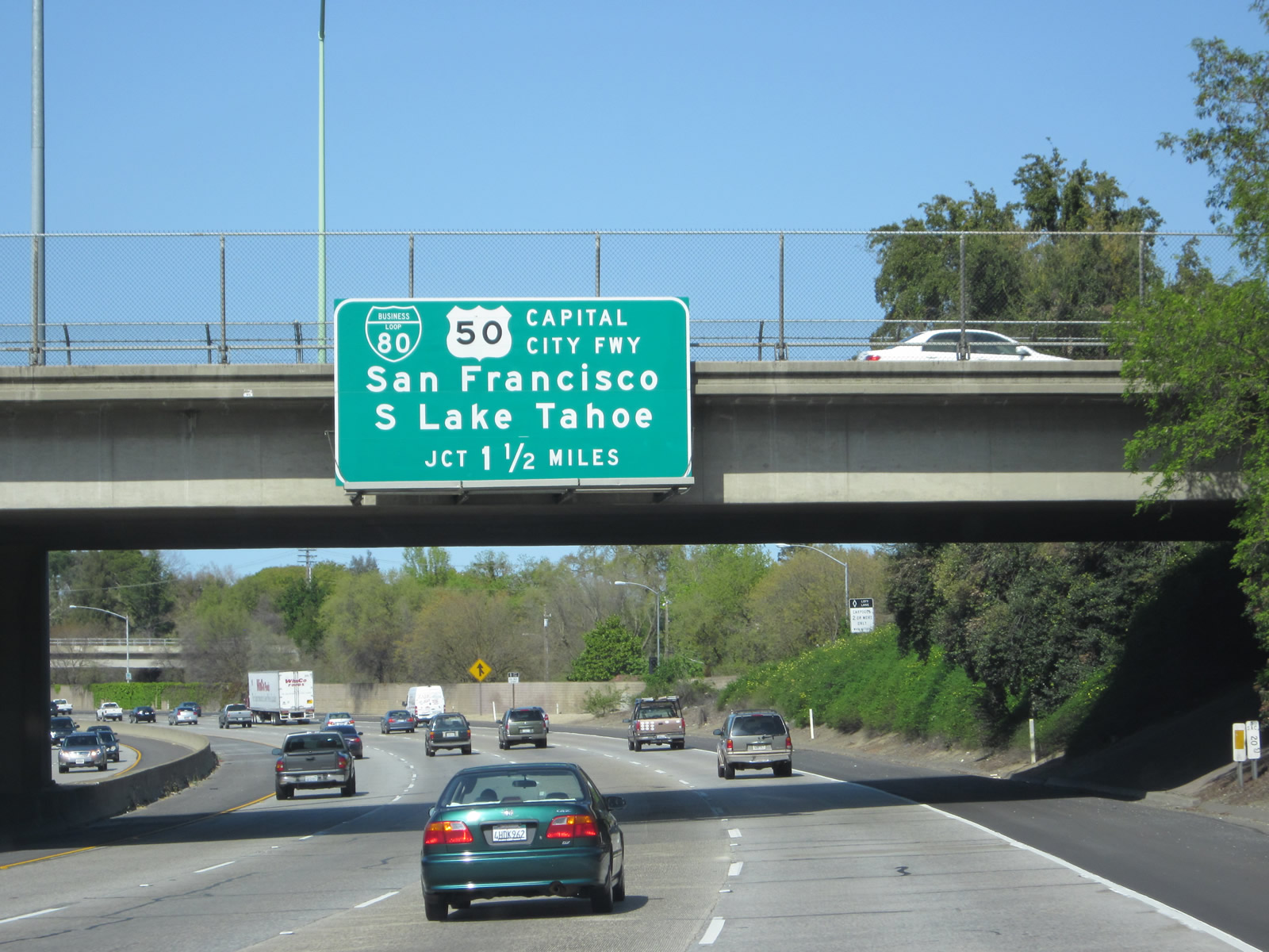
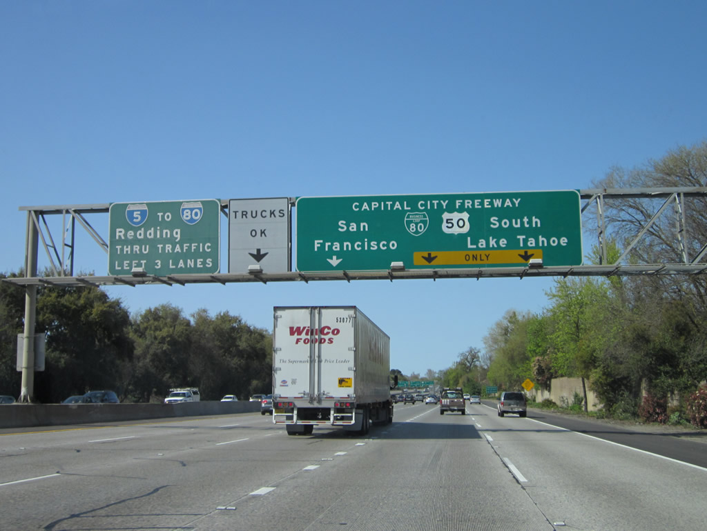
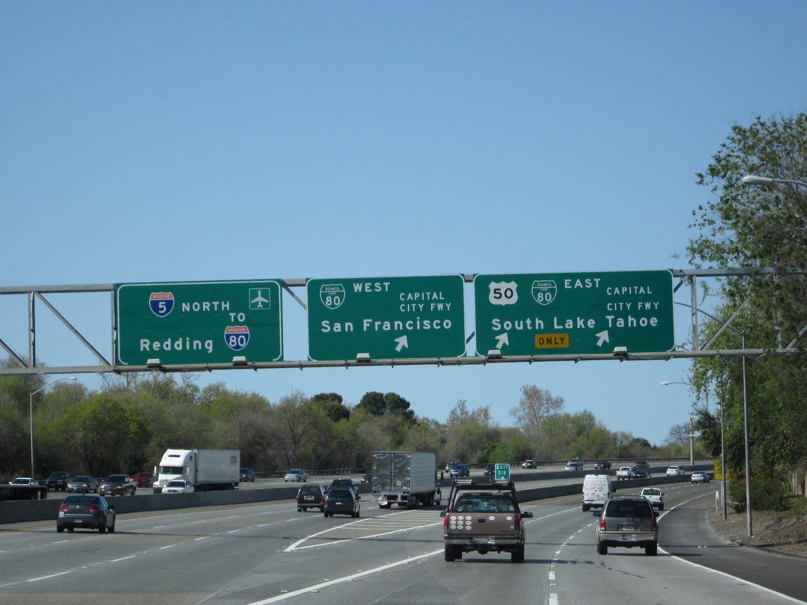
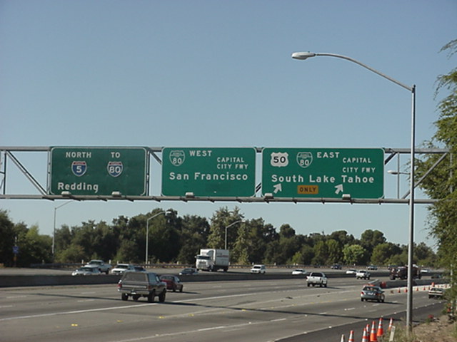
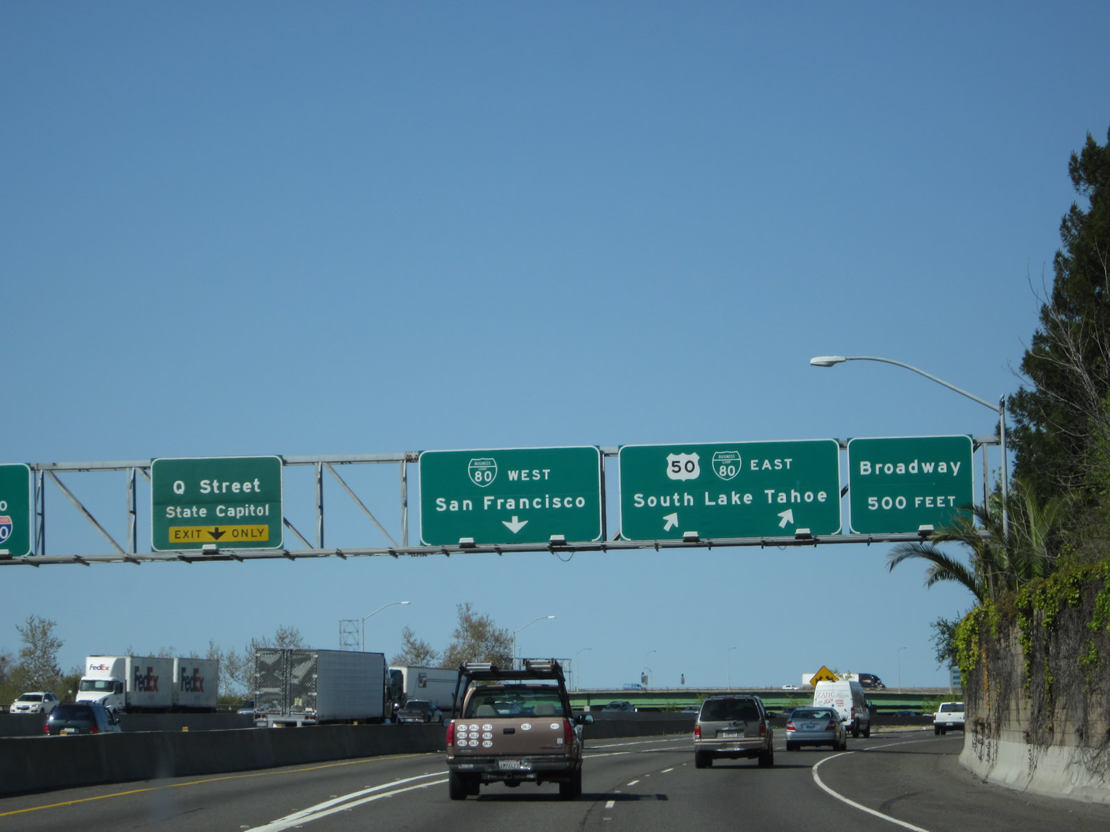
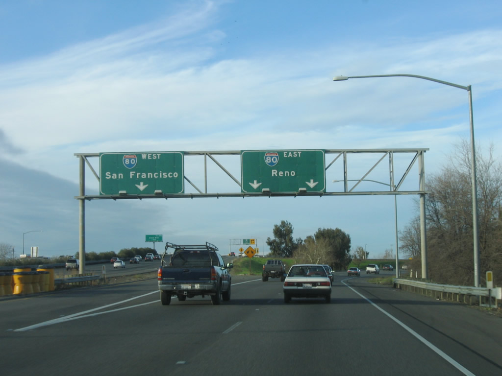
Northbound Interstate 5 reaches Exit 518, Business Loop I-80, U.S. 50, and Interstate 305 west to West Sacramento and San Francisco and Business Loop I-80, U.S. 50, and Interstate 305 east and California 99 south to Reno, South Lake Tahoe, and Fresno. U.S. 50 is cosigned with Business Loop I-80 on its east-west section, and its western terminus is only a few miles west of here, at its junction with Interstate 80 (even though the signage here makes you think that U.S. 50 ends at Interstate 5). U.S. 50 spans the country, crossing the mid-section of the United States on its way to Ocean City, Maryland. A mileage sign to Ocean City is present at its western terminus along eastbound Business Loop I-80 & U.S. 50. Photos taken 04/06/12 and 09/18/00 (by Joe Rouse). |
|
The gore point for Exit 518 is signed with an exit number; the other approach signs for Exit 518 were installed in 1999-2000, which was before California started its exit numbering program. Photo taken 04/06/12. |
|
|
These signs for the transition ramp to Exit 518 (to Business 80 and Broadway) is visible on this massive sign bridge. On the transition ramp to Business 80, the lanes split: left lane conects to Business 80/U.S. 50 west to San Francisco and the right two lanes connect to Business 80/U.S. 50 east to Broadway and to South Lake Tahoe/Reno. Note the absence of U.S. 50 shields for Business Loop I-80 west; the U.S. highway extends west of here to the merge with mainline Interstate 80 in West Sacramento. The next exit along Interstate 5 north is Exit 519A, Q Street. Photos taken 04/02/05 and 04/06/12. |
|
|
Looking at the off-ramp to Business 80/U.S. 50 east, the ramp for Exit 518 splits, with the left lanes connecting to eastbound Business 80 and the right lane exiting onto Broadway. Photos taken 04/02/05 and 04/06/12. |
|
|
Northbound Interstate 5 (West Side Freeway) meets Exit 519A, Q Street east to the California State Capitol. This exit ramp appears within the Business 80 and U.S. 50 interchange. There are two ways to get to Exit 519A, Q Street. One way is from mainline northbound Interstate 5 onto Q Street. Another way is from the transition ramp from eastbound Interstate 305-Business Loop I-80 & U.S. 50 (WX Freeway) to northbound Interstate 5. This photo shows the second way to Q Street, via the slip ramp from the transition. The slip ramp feeds into the exit ramp from mainline northbound Interstate 5 to Q Street. Also note the presence of a California 99 shield here; most of these shields between Business Loop I-80 and California 99 were removed in 2000. The 2012 picture was taken from the transition ramp from Interstate 5 north to Business 80. Photos taken 04/02/05 and 04/06/12. |
|
|
This view shows the downtown Sacramento skyline as seen from the transition ramp from Interstate 5 north to Business Loop I-80 and U.S. 50 east. Photos taken 04/06/12. |
|
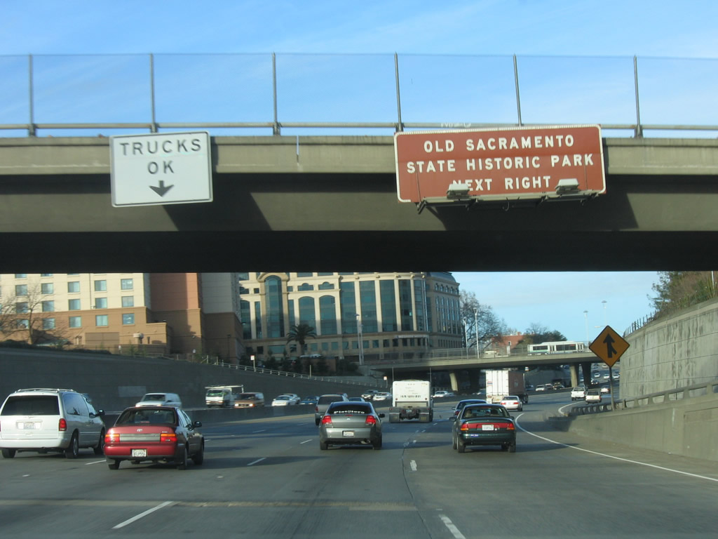
Back on the mainline and now after the interchange with Business Loop I-80 and U.S. 50, Interstate 5 passes under the interchange and enters downtown Sacramento. As Interstate 5 lowers to pass under the business loop freeway, we find ourselves at an elevation that is lower than the bottom of the Sacramento River. As a result, this section of Interstate 5 is susceptible to flooding and has been nicknamed the "Boat Section" of Interstate 5. A major project in May through July 2008 repaired signficant issues with the roadway, including an upgraded drainage system necessitated by the freeway's low elevation as compared to the nearby river. Through traffic should use the left lanes, as there are several downtown exits ahead. Photo taken 04/02/05. |
|
Looking at the off-ramp to Q Street (Exit 519A), the collector distributor lanes split to Q Street east. Photo taken 04/02/05. |
| Interstate 5 & California 99 north |
|
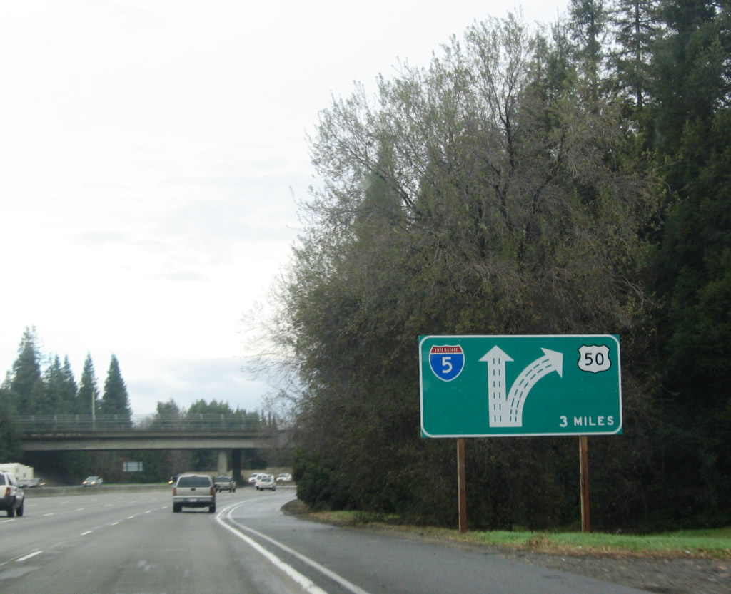
Interstate 5 lowers in elevation after passing through the Business 80 (Capital City Freeway) interchange. Portions of the freeway between the WX Freeway Interchange (Hidden Interstate 305-Business Loop I-80 & U.S. 50) and Old Sacramento (J Street) are so far below grade that the freeway is lower than the bed of the nearby Sacramento River. The Tower Bridge (California 275) is visible in the distance. California 99 silently merges onto Interstate 5 north at this interchange; the two will share alignment between Business 80 and the split at Exit Photo taken 01/15/06. |
|
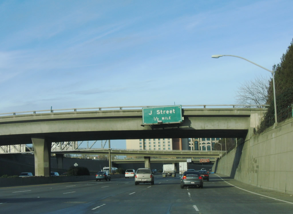
The Interstate 5 and California 99 freeway stays below grade here as it approaches Exit 519B, J Street, along northbound. J Street leads to Old Sacramento and the State Capitol complex. Photo taken 01/15/06. |
|
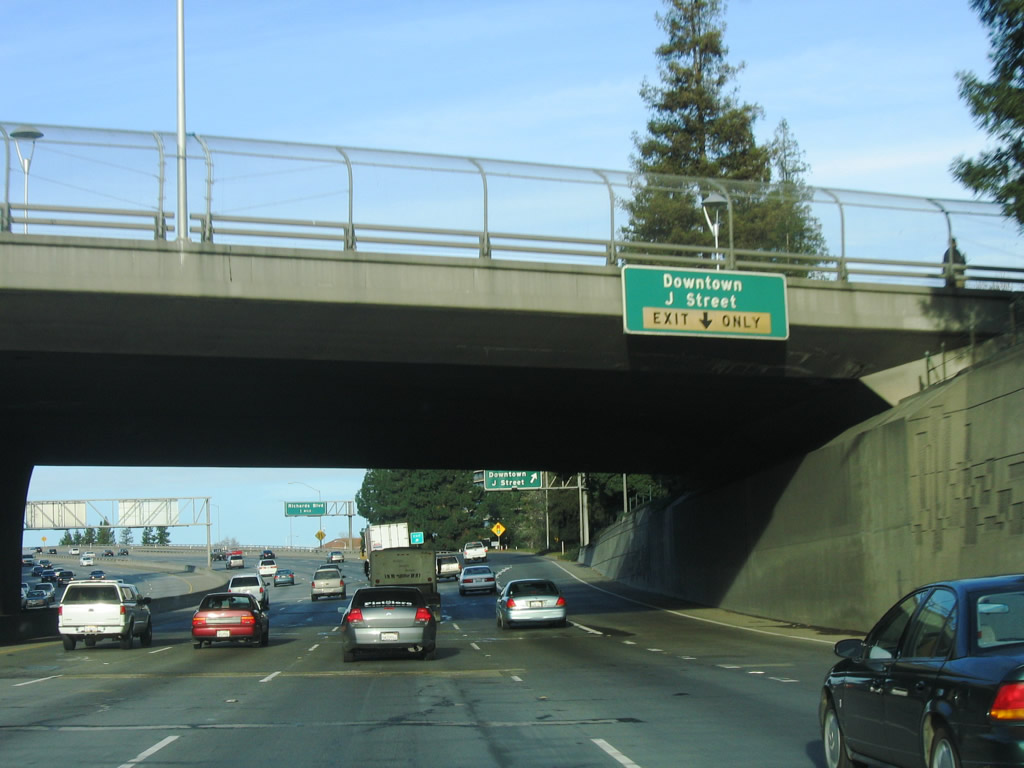
Exit 519B leads to Old Sacramento via J Street. Old Sacramento is wedged between the freeway and the Sacramento River, and the freeway rises up to a viaduct to pass over this historic area. Trucks are allowed to use the number two lane along this stretch of Interstate 5 due to the multiple exits along this stretch as well as potential exit-only lanes. Photo taken 01/15/06. |
|
The right lane becomes exit only for Exit 519B, J Street. The left four lanes continue north on Interstate 5 toward the Natomas community of the city of Sacramento, the junction with Interstate 80 (Sacramento bypass), and Sacramento International Airport. Photo taken 01/15/06. |
|
|
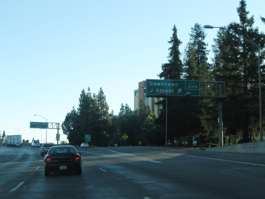
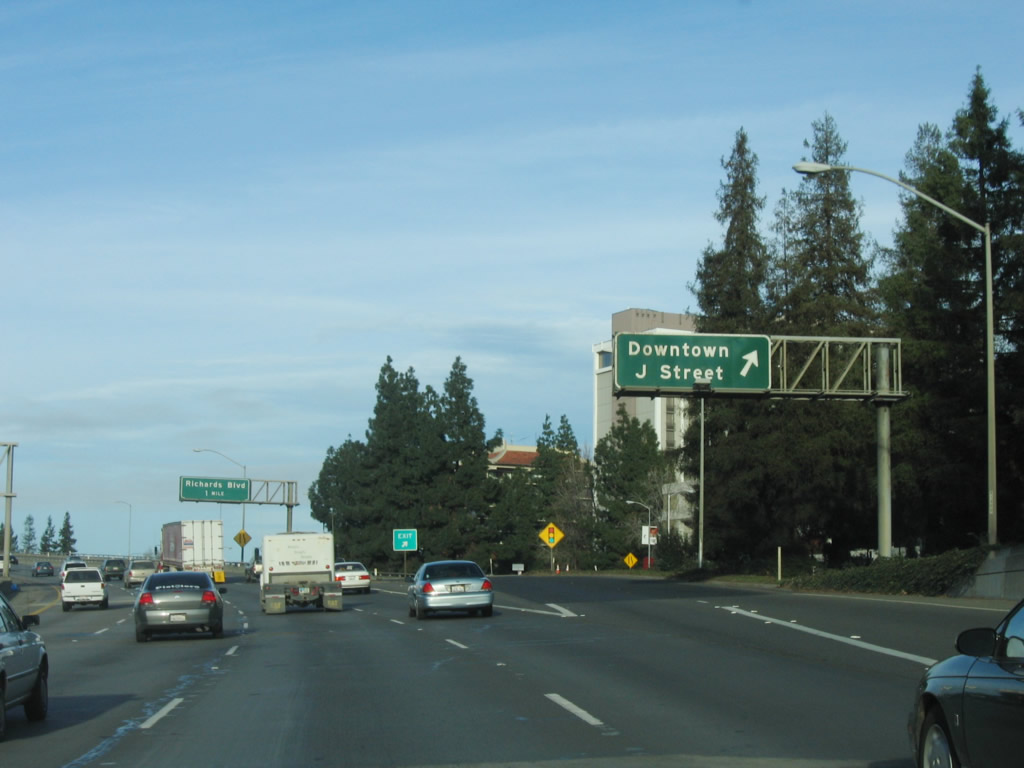
Northbound Interstate 5 reaches Exit 519B, J Street. The overhead sign was replaced during the Boat Section repair project from May to July 2008. An exit number was added on the newer sign. Photos taken 09/04/10 and 01/15/06. |
|
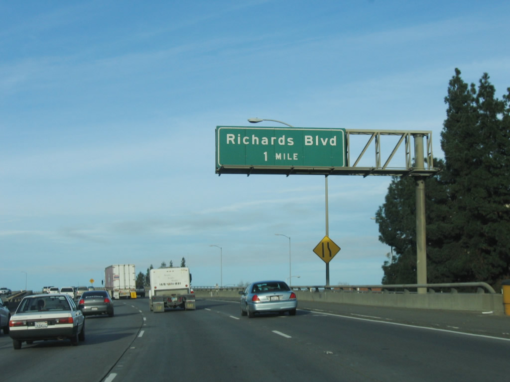
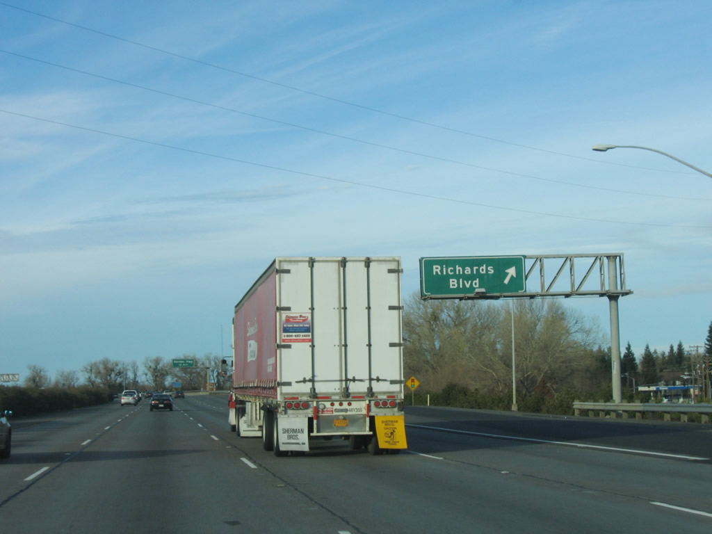
Interstate 5 and California 99 leave downtown on a viaduct as they approach Exit 520, Richards Boulevard. Richards Boulevard is a fast east-west connection through industrial areas between Interstate 5, the northern California 160, and Business Loop I-80/California 51 (Capital City Freeway) near the Arden Mall area. Photo taken 01/15/06. |
|
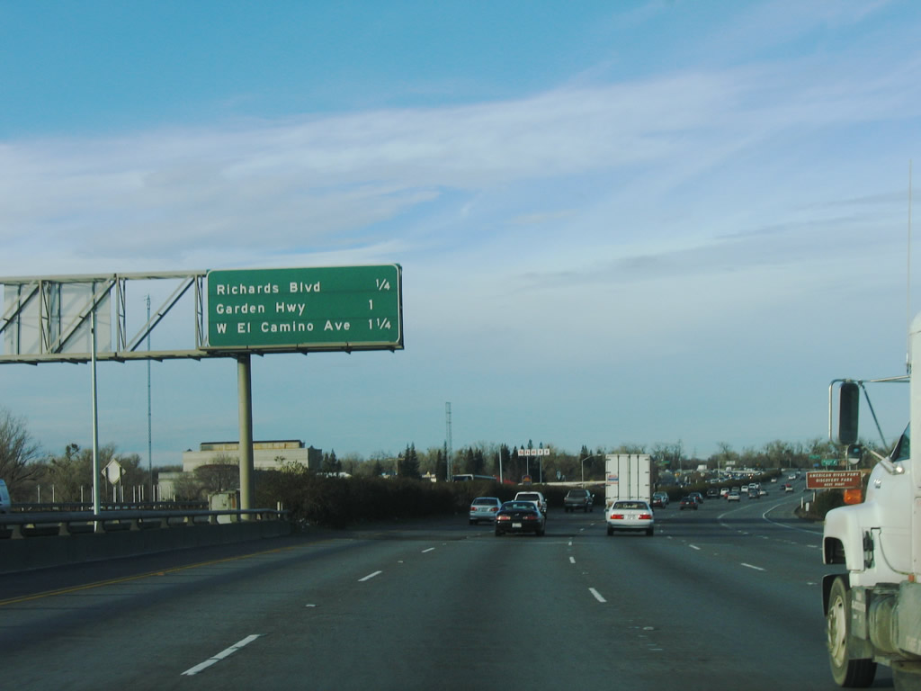
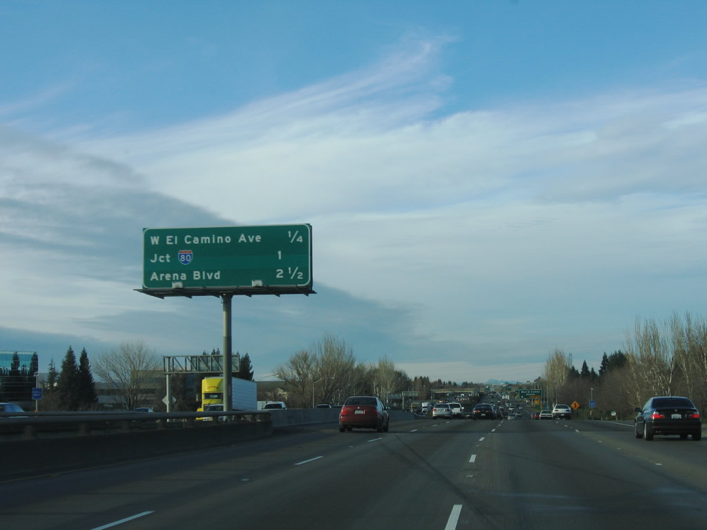
The next three exits along northbound Interstate 5 and California 99 are Exit 520, Richards Boulevard; Exit 521A, Garden Highway; and Exit 521B, West El Camino Avenue. Photo taken 01/15/06. |
|
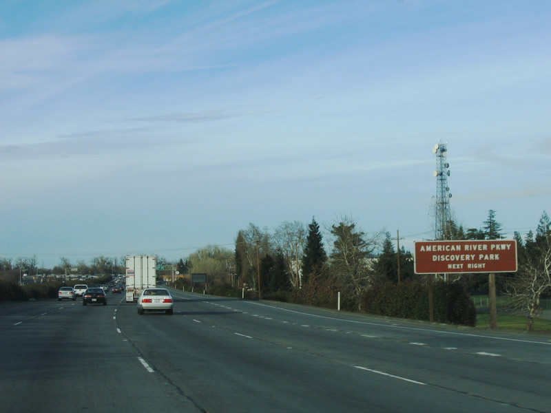
Use Exit 520, Richards Boulevard to Discovery Park, which sits at the confluence of the American and Sacramento Rivers. Photo taken 01/15/06. |
|
Northbound Interstate 5 reaches Exit 520, Richards Boulevard. Photo taken 01/15/06. |
|
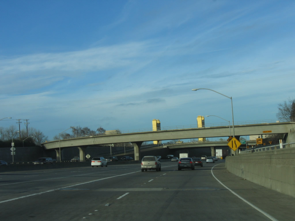
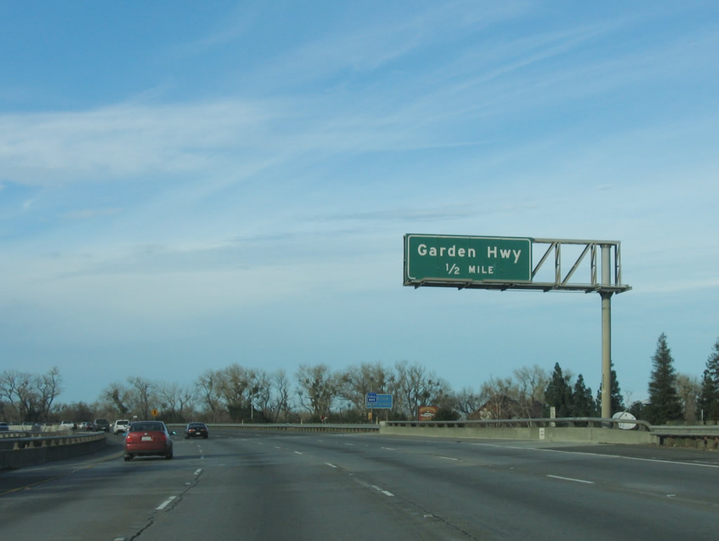
The next exit along Interstate 5 and California 99 north is Exit 521A, Garden Highway, one-half mile. The freeway now crosses over the American River Bridge as it approaches the northern part of the city. Photo taken 01/15/06. |
|
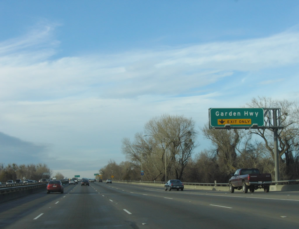
Garden Highway leads northwest, parallel to the winding Sacramento River. The right lane of Interstate 5 north becomes exit only for Exit 521A, Garden Highway. Photo taken 01/15/06. |
|
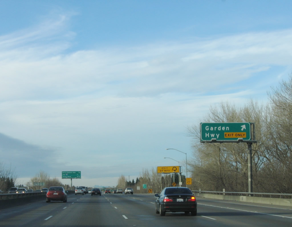
Northbound Interstate 5 (West Side Freeway) and California 99 meet Exit 521A, Garden Highway. Note the yellow overhead warning sign for the loop ramp. Photo taken 01/15/06. |
|
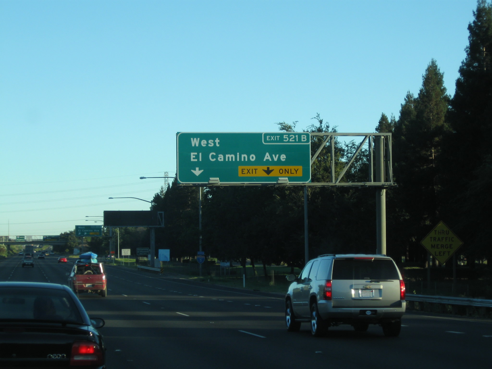
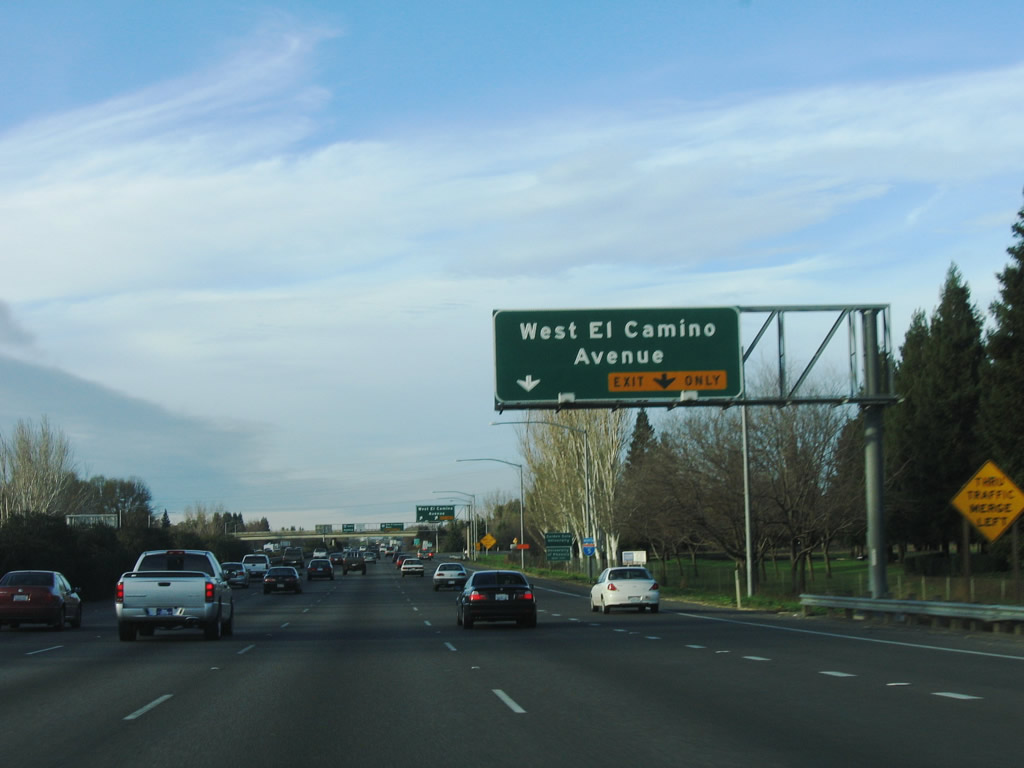
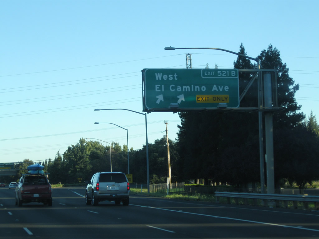
The next exit along northbound Interstate 5 is Exit 521B, West El Camino Avenue, one-quarter mile. West El Camino Avenue is a major east-west corridor, linking various neighborhoods of northern Sacramento. Photo taken 01/15/06. |
|
|
The right two lanes of Interstate 5 (West Side Freeway) and California 99 connect to Exit 521B, West El Camino Avenue. Photos taken 09/04/10 and 01/15/06. |
|
|
Northbound Interstate 5 (West Side Freeway) and California 99 meet Exit 521B, West El Camino Avenue. The overhead sign was replaced by 2010 to include the exit number. Photos taken 09/04/10 and 01/15/06. |
|
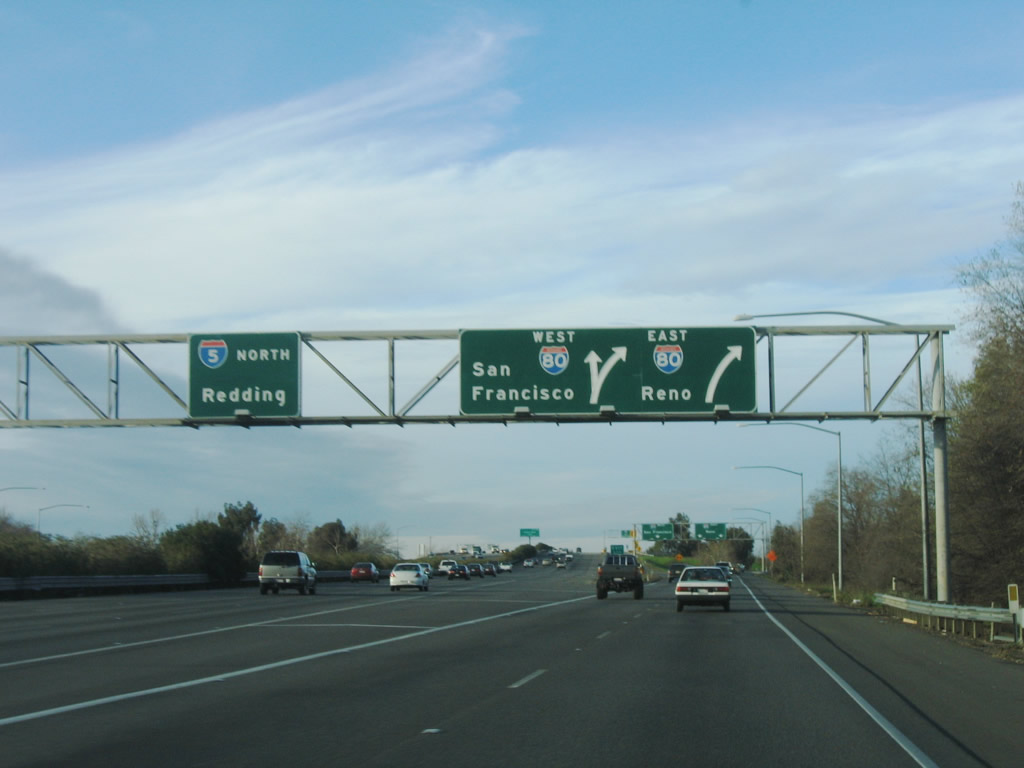
The next exit along northbound Interstate 5 and California 99 is Exit 522, Interstate 80 (one mile). This interchange between two major Inter state routes can be extremely busy, especially during rush hours and when people are headed to Arco Arena for a major sporting event. Photo taken 01/15/06. |
|
Northbound Interstate 5 reaches Exit 522, Interstate 80. The single off-ramp from northbound splits into two ramps, one for eastbound and another for westbound Interstate 80. Westbound Interstate 80 leads southwest toward the San Francisco Bay Area, while eastbound Interstate 80 leads to the Sierra foothill community of Auburn, over the top of the Sierra Nevada at Donner Pass, then into Reno, Nevada. Hiking, skiing, and gambling traffic all keep Interstate 80 between Sacramento and Reno very busy. Photo taken 01/15/06. |
|
Now on the collector distributor ramp from Interstate 5 to Interstate 80, the first ramp connects to Interstate 80 east, and the second ramp loops onto Interstate 80 west. Photo taken 01/15/06. |
|
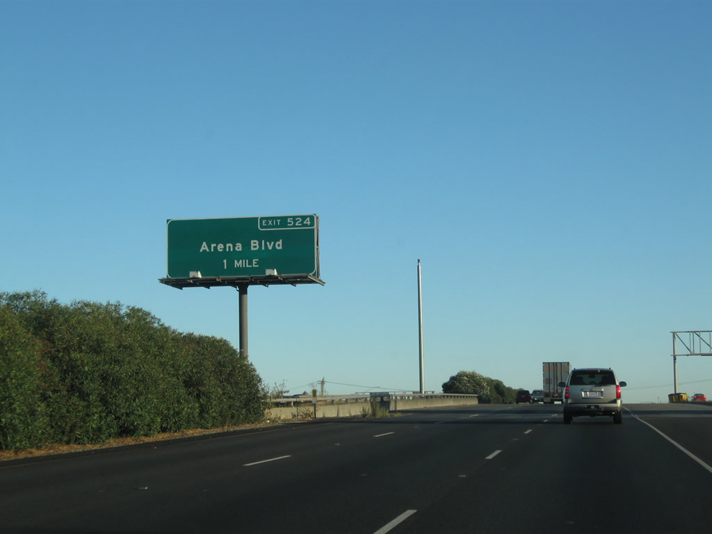
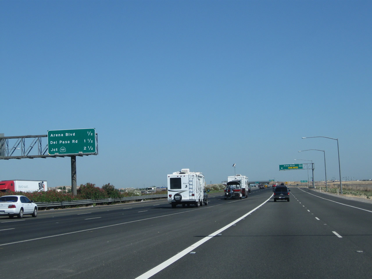
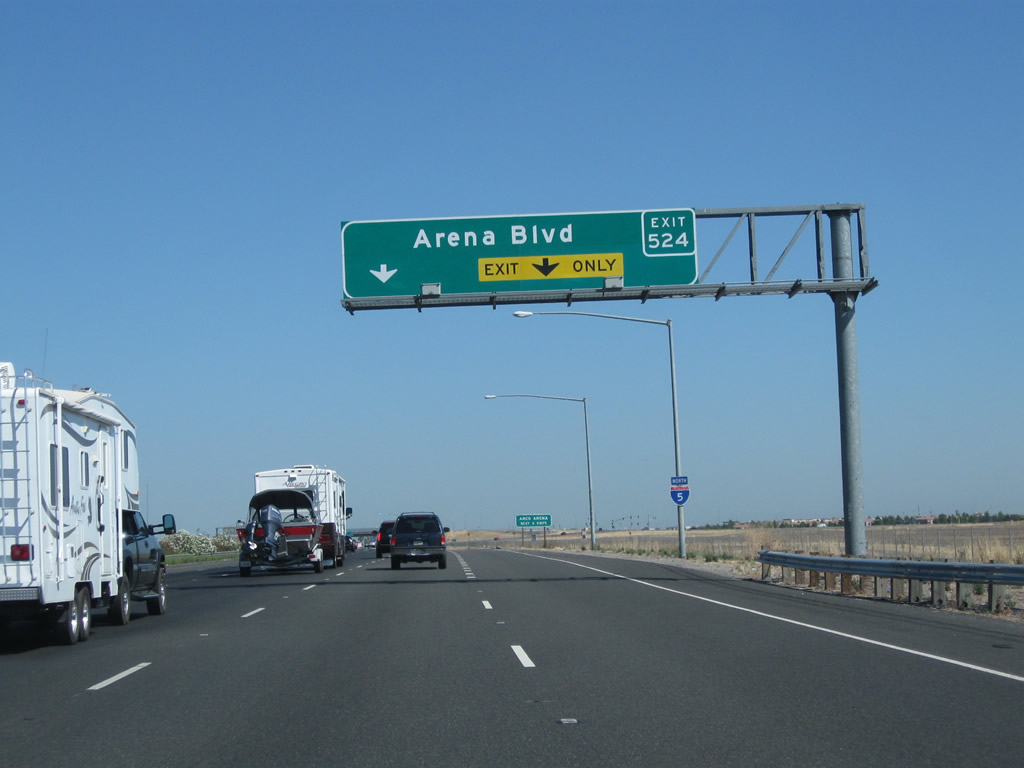
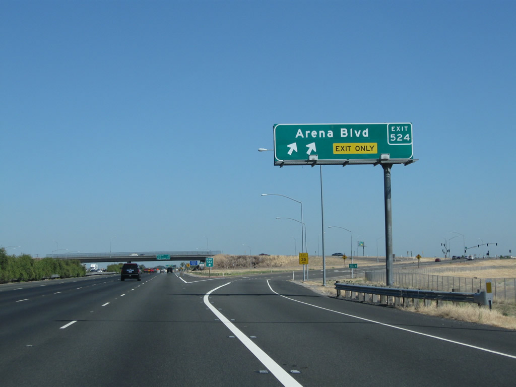
Back on the mainline, the next exit is Exit 524, Arena Boulevard, which serves the Natomas community of the city of Sacramento and the Arco Arena (hence the name of this road). This interchange was built in the early 2000s as the Natomas area grew and is one of the first overhead signs in the Sacramento area to feature the exit number. Photo taken 09/04/10. |
|
Meanwhile, back on the collector-distribution lane, the second ramp connects to Interstate 80 west to San Francisco. Continue straight ahead to return to Interstate 5 north. Photo taken 08/02/11. |
|
An Interstate 5 north trailblazer is posted on the c/d lane shortly thereafter. Photo taken 08/02/11. |
|
This interchange sequence sign provides the distance to the next three exits along Interstate 5 north: Exit 524, Arena Boulevard; Exit 525A, Del Paso Road; and Exit 525B, California 99 north. Photo taken 08/02/11. |
|
The right two lanes of Interstate 5 north connect to Exit 524, Arena Boulevard. This interchange is relatively new, having been built in the mid-2000s. Photo taken 08/02/11. |
|
A neutered Interstate 5 north shield is posted after the on-ramp from Interstate 80 and prior to Exit 524, Arena Boulevard. Photo taken 08/02/11. |
|
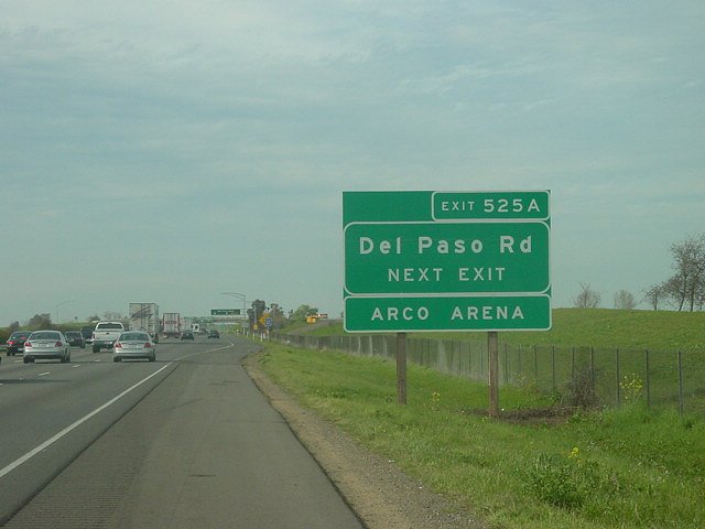
Use either Exit 524, Arena Boulevard or Exit 525A, Del Paso Road to Arco Arena. Photo taken 08/02/11. |
|
Northbound Interstate 5 and California 99 meet Exit 524, Arena Boulevard. Four lanes continue north, while the right two lanes exit. Photo taken 08/02/11. |
|
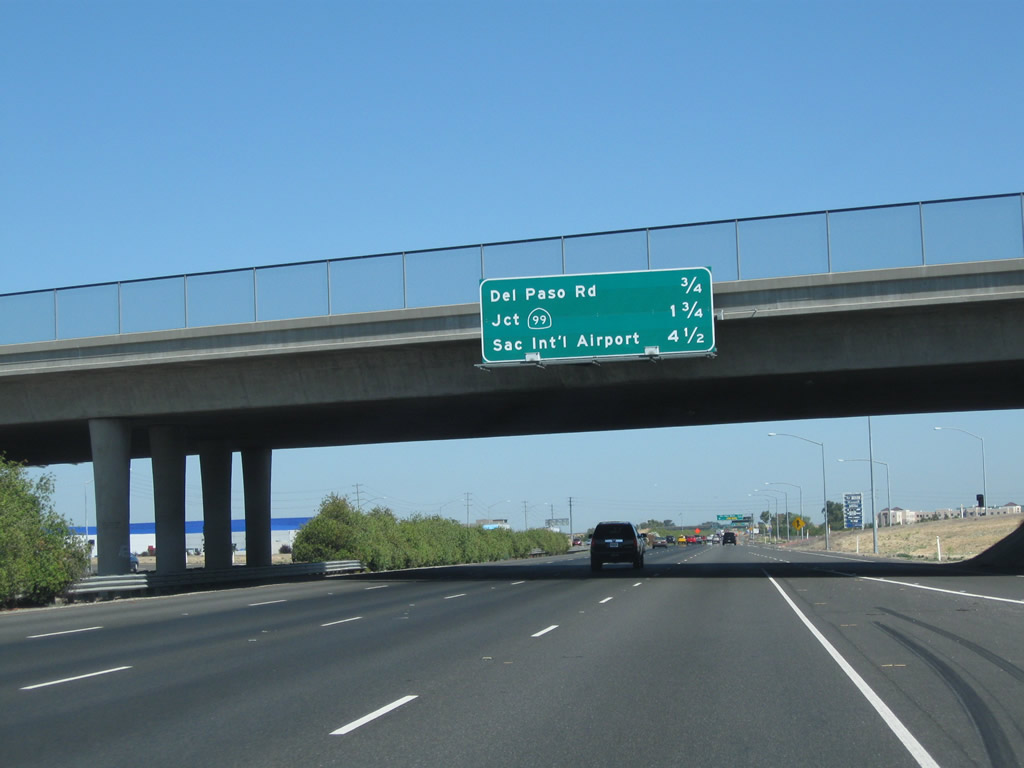
This mileage sign provides the distance to the next three exits: Exit 525A, Del Paso Road; Exit 525B, California 99 north; and Exit 528, Airport Boulevard north to Sacramento International Airport. Photo taken 08/02/11. |
|
An Interstate 5 north reassurance shield is posted after the on-ramp from Arena Boulevard. Photo taken 08/02/11. |
|
|
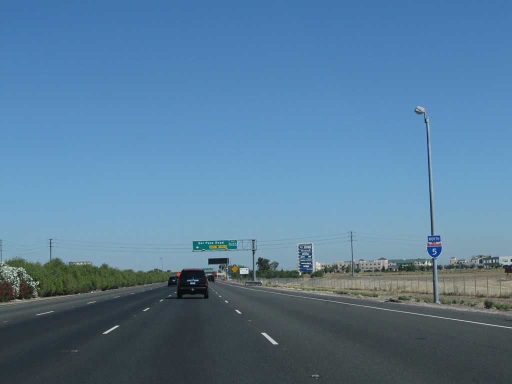
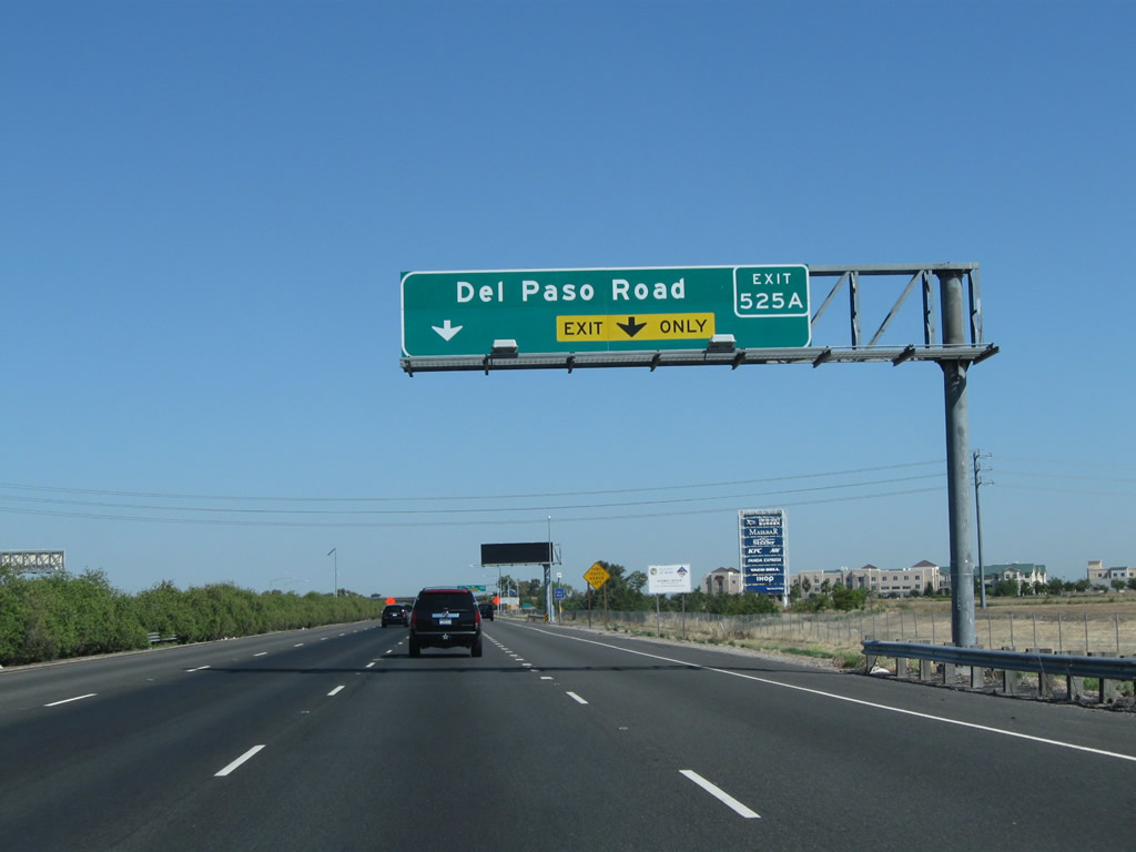
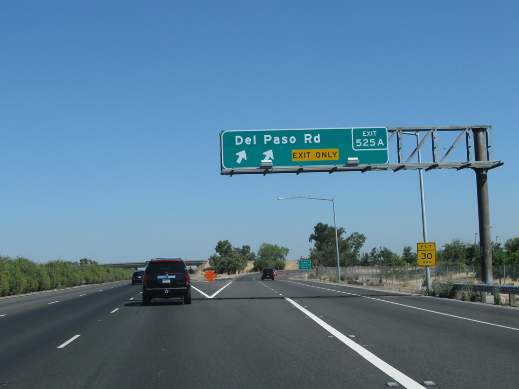
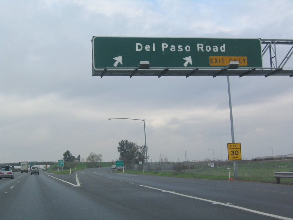
The right lane becomes exit only for Del Paso Road, Exit 525A. Del Paso Road leads east-west, but it is mostly heavily traveled as it is the primary route to the Arco Arena, home of the National Basketball Association (NBA) Sacramento Kings. The 2002 picture shows the original roadside exit number sign for Del Paso Road (Exit 525A). This particular sign was among the first exit number signs to be placed in Caltrans District 3 in 2002. It was gone by 2010, replaced by the overhead guide sign. Photo taken 08/02/11 and 03/10/02 by Joel Windmiller. |
|
|
Northbound Interstate 5 and California 99 meet Exit 525A, Del Paso Road. The left three lanes continue north along Interstate 5. Photos taken 08/02/11 and 12/29/04. |
|
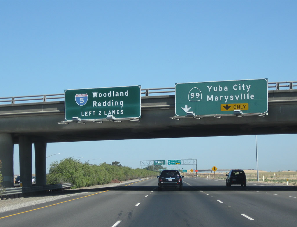
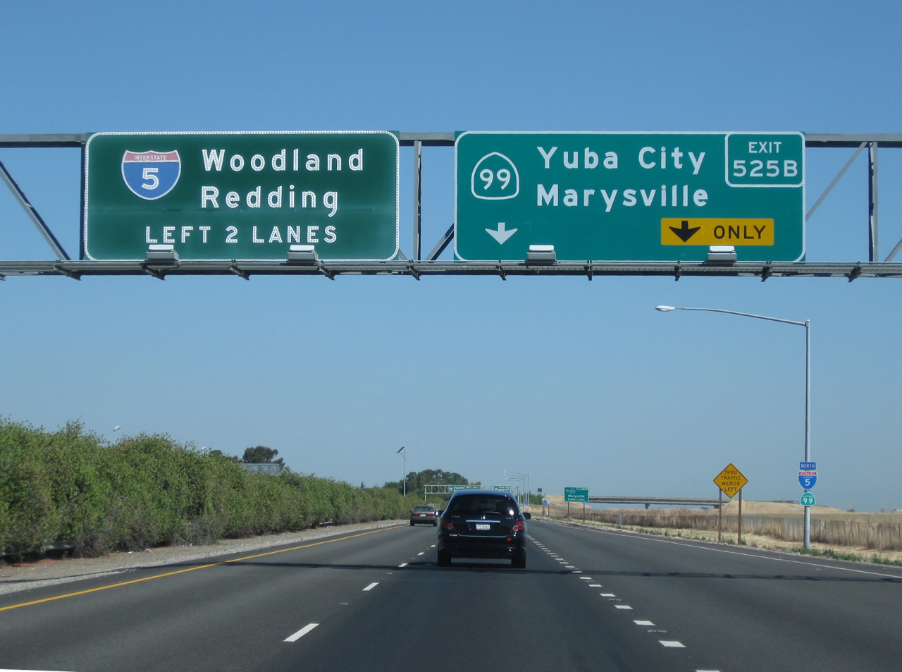
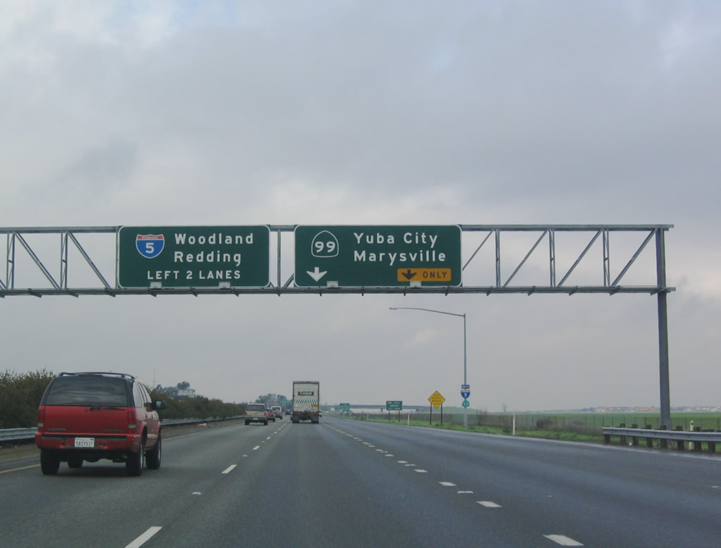
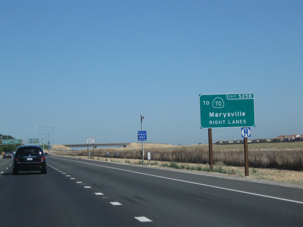
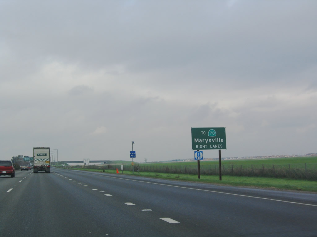
The next exit along northbound Interstate 5 (West Side Freeway) is Exit 525B, California 99 north to California 70. California 99, which had been silently merged with Interstate 5, separates from the Interstate to connect to the cities of Yuba City/Marysville, Chico, and Oroville. Despite its designation, this section of California 99 was never part of U.S. 99. North of Sacramento, U.S. 99E followed U.S. 40 east and California 65 north to Marysville, while U.S. 99W followed U.S. 40 west and California 113 north to Woodland. Photo taken 08/02/11. |
|
|
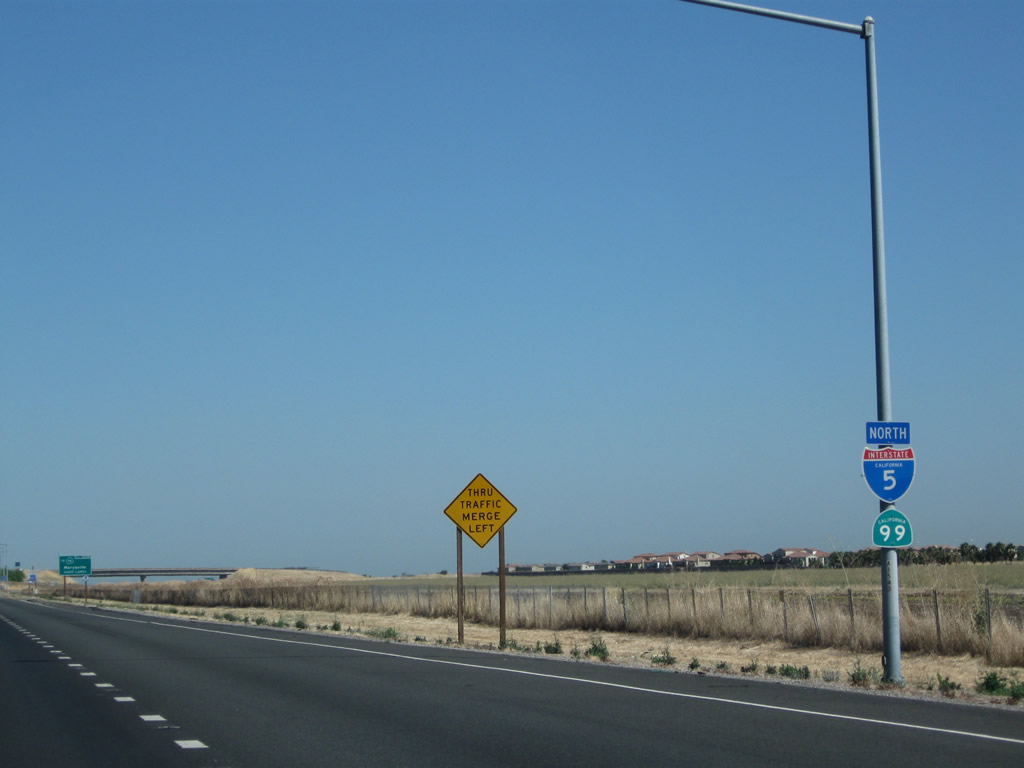
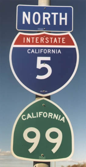
Interstate 5 and California 99 will split at Exit 525B. The left two lanes continue north along Interstate 5, while the right two lanes (including a new lane from the Del Paso Road interchange) prepare to exit to California 99 north. Note the presence of both an Interstate 5 shield and a California 99 shield along the northbound freeway. In August 2000, Caltrans directed that all California 99 reassurance shields be removed from the shared alignment with Interstate 5 between downtown Sacramento and the split at Exit 525B. This is one of the few shield assemblies that contain both shields. Photos taken 08/02/11 and 12/29/04. |
|
|
Currently, this is the only northbound reassurance shield assembly to include both Interstate 5 and California 99 north. In August 2000, Caltrans directed that all California 99 reassurance shields be removed from the cosigned section with Interstate 5 between downtown Sacramento and near the Sacramento International Airport. Photos taken 08/02/11 and 01/22/97 (by Jeff Royston). |
|
|
Until 1996, California 70 was cosigned with California 99 between Interstate 5 and the 70/99 split in Sutter County. However, the split was eliminated, and California 70 was truncated to end at its split from California 99. As noted earlier, California 99 is not consistently cosigned along with Interstate 5, either, but it is "silently merged" with Interstate 5. This sign was replaced with an exit number sign by 2010. Photos taken 08/02/11 and 12/29/04. |
|
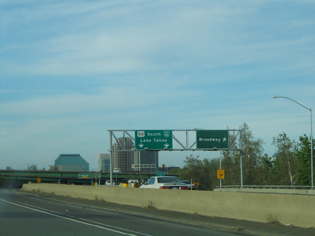
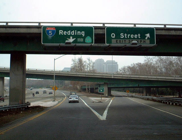
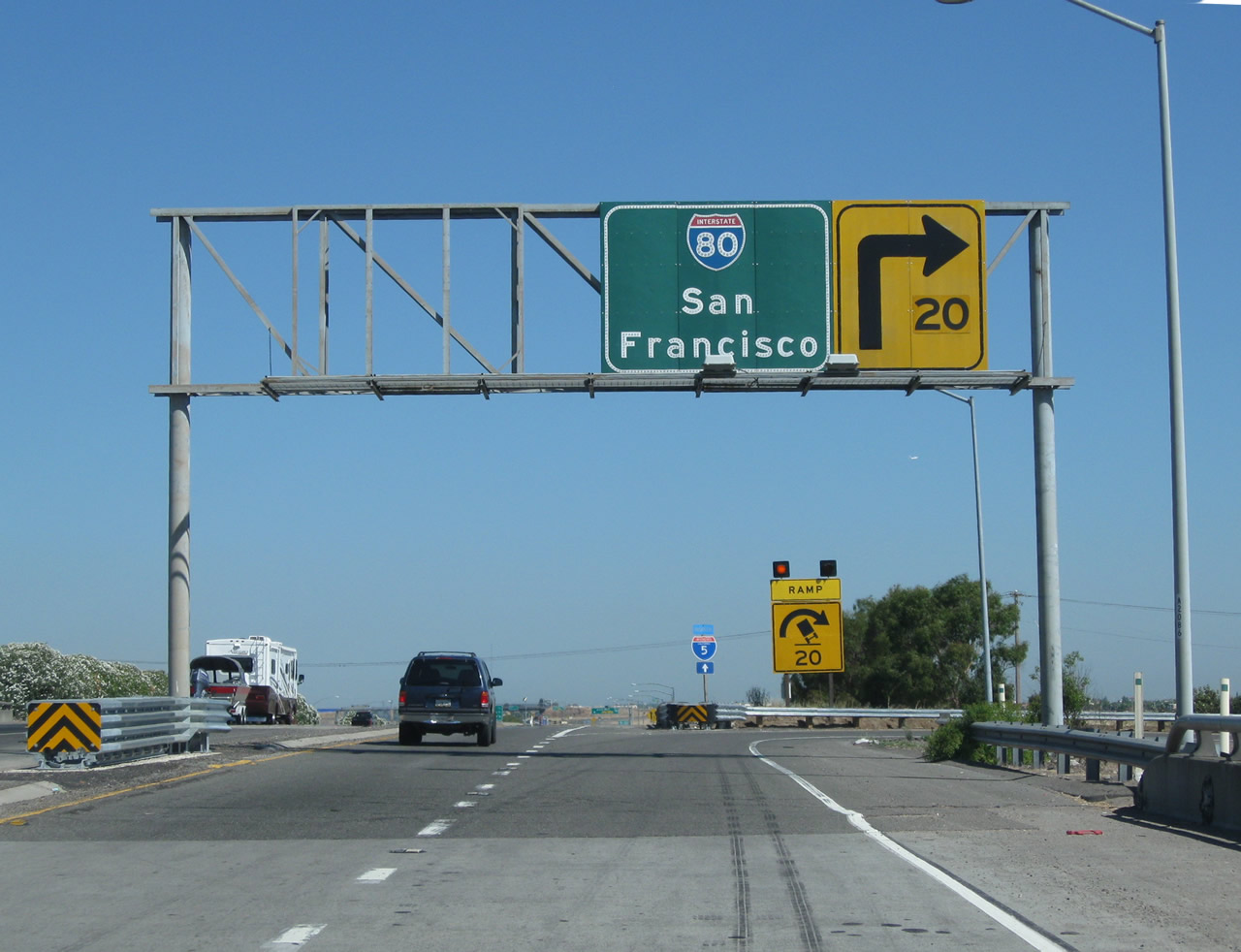
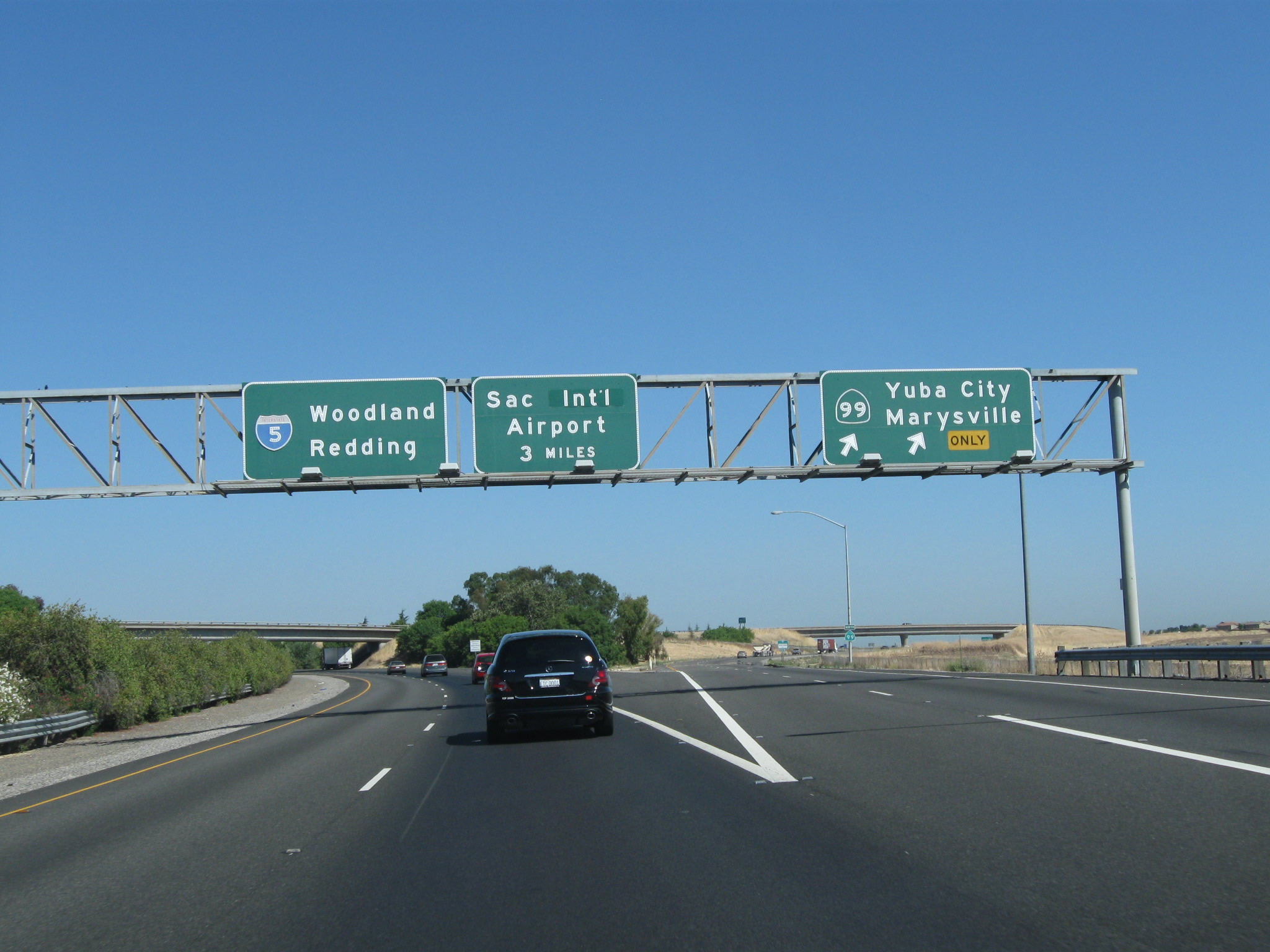
Northbound Interstate 5 and California 99 split at Exit 525B, which is California 99 north to Yuba City and Marysville. To Woodland, Red Bluff, Redding, Portland, and Sacramento International Airport (SMF), follow Interstate 5 north. Interstate 5 is a much faster route between Sacramento and Redding than California 99 or California 70. California 99 is generally not freeway-standard for most of its route north of Sacramento (excepting sections near Yuba City and Chico). California 70 also has some freeway sections, but it passes directly through downtown Marysville (no bypass). Hence, Interstate 5 is the faster through route. Photo taken 08/02/11. |
Page Updated September 19, 2012.