| Interstate 5 south |
|
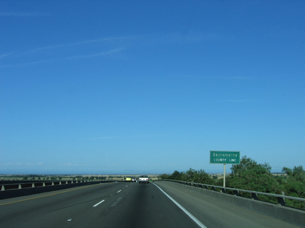
At the top of the Sacramento River bridge, Interstate 5 leaves Yolo County and enters Sacramento County. Photo taken 05/29/06. |
|
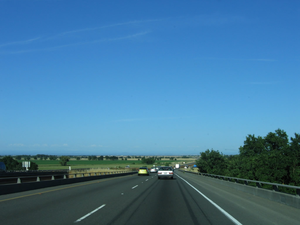
Interstate 5 descends the 1969 Sacramento River bridge. To the northeast of the freeway is Sacramento International Airport; the control tower can be seen from the bridge. Photo taken 05/29/06. |
|
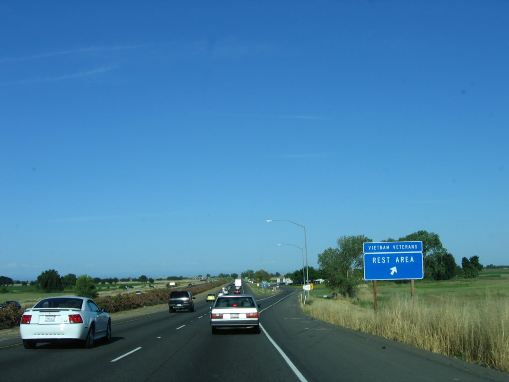
A rest area is located at the base of the Sacramento River bridge on Interstate 5 south. The section of Interstate 5 from the southern approach to the Sacramento River bridge southeast to the vicinity of K Street (near Exit 519A) was built in 1968. Photo taken 05/29/06. |
|
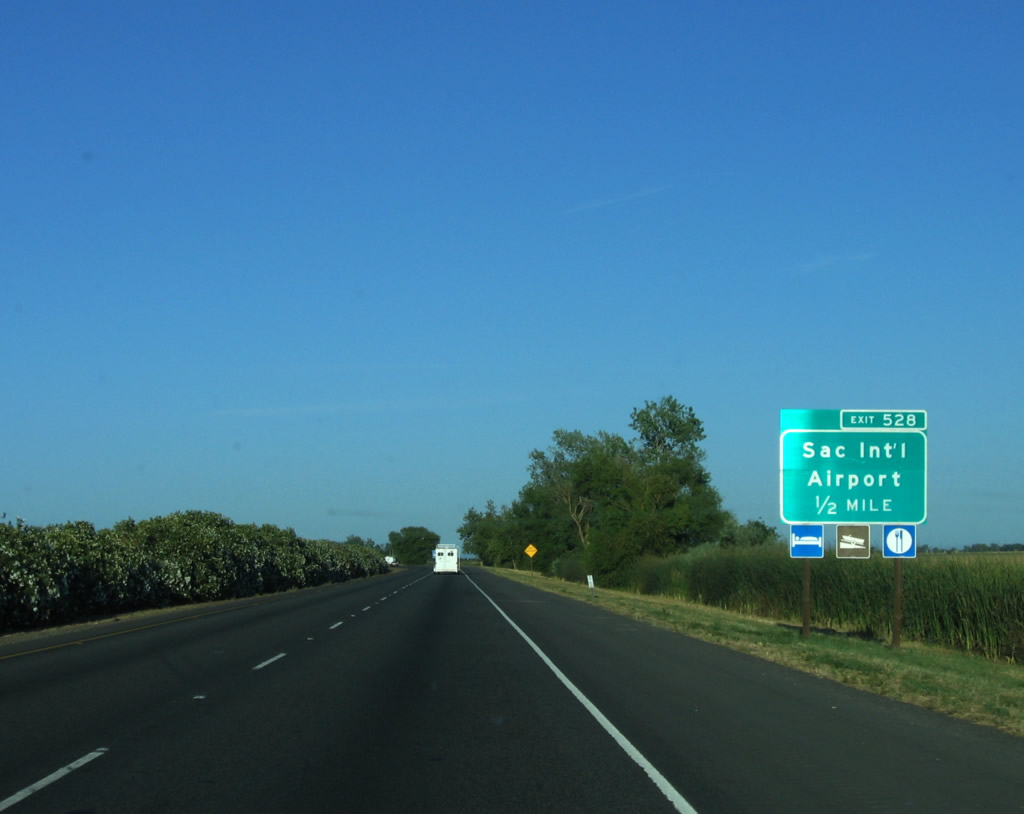
The next exit along Interstate 5 south is Exit 528, Sacramento International Airport. After this interchange, traffic along the freeway will dramatically increase and start to look more like an urban freeway as opposed to the rural freeway that Interstate 5 has been since leaving Redding. Photo taken 05/29/06. |
|
Southbound Interstate 5 reaches Exit 528, Sacramento International Airport. This exit leads to the airport access road, which is a divided highway into the airport. This airport offers connections throughout the country, including flights up and down the state of California. Photo taken 05/29/06. |
|
At the top of the ramp from Interstate 5 south to the Sacramento International Airport (SMF) access road is this motorist services sign. Photo taken 05/29/06. |
|
After the airport exit, this mileage sign provides the distance to Sacramento (10 miles) and Los Angeles (391 miles). Photo taken 01/16/06. |
|
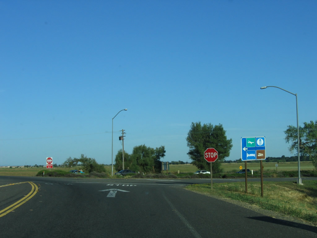
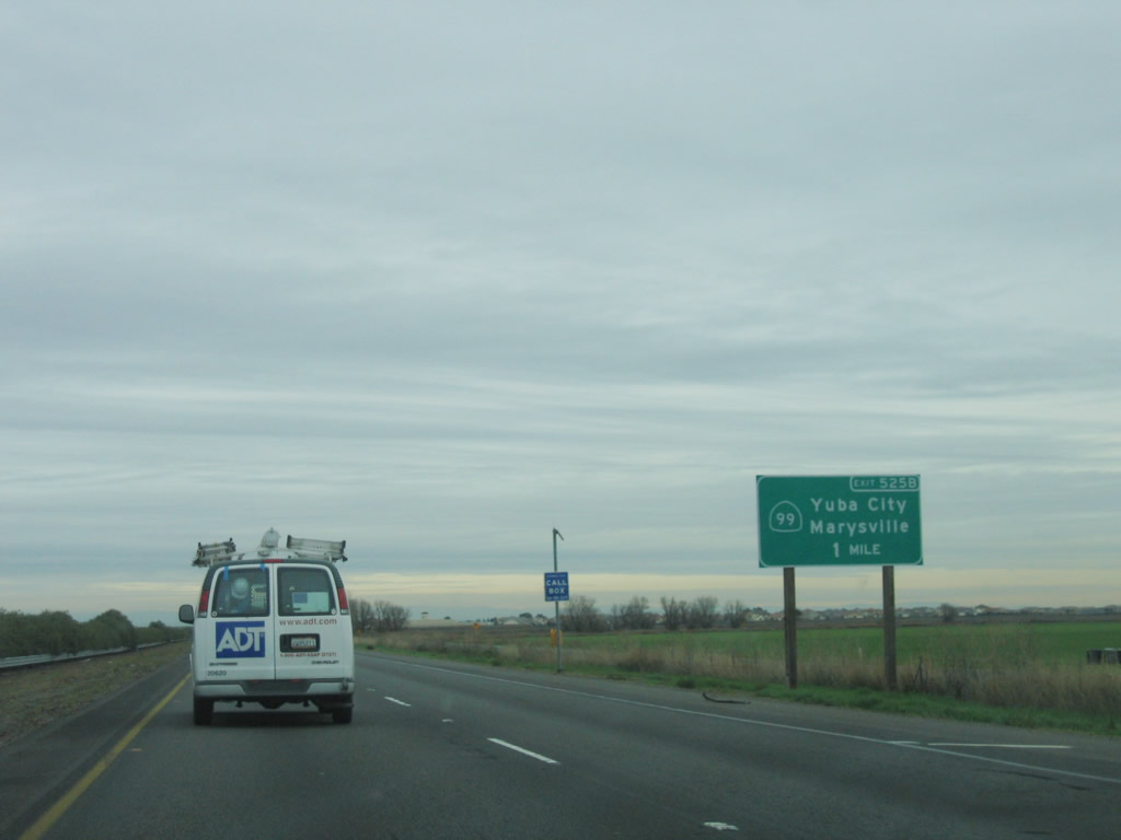
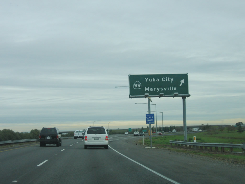
The next exit along southbound Interstate 5 is Exit 525B, California 99 north to Marysville and Yuba City. Despite its number, this section of California 99 (from here north to the California 65 interchange south of Marysville) was never part of U.S. 99. Prior to the 1964 decommissioning of U.S. 99, the U.S. highway had two branches north of Sacramento: U.S. 99W, which traveled west on U.S. 40 to Davis, then traveled north to Interstate 5 at Woodland and continued north from there to Red Bluff. U.S. 99E, the eastern branch, followed U.S. 40 northeast from Sacramento to Roseville, then turned north via California 65 and California 70 into Marysville, then west to Yuba City, and then north via California 99 to Oroville and Chico before reuniting with U.S. 99W in Red Bluff. Photo taken 01/16/06. |
|
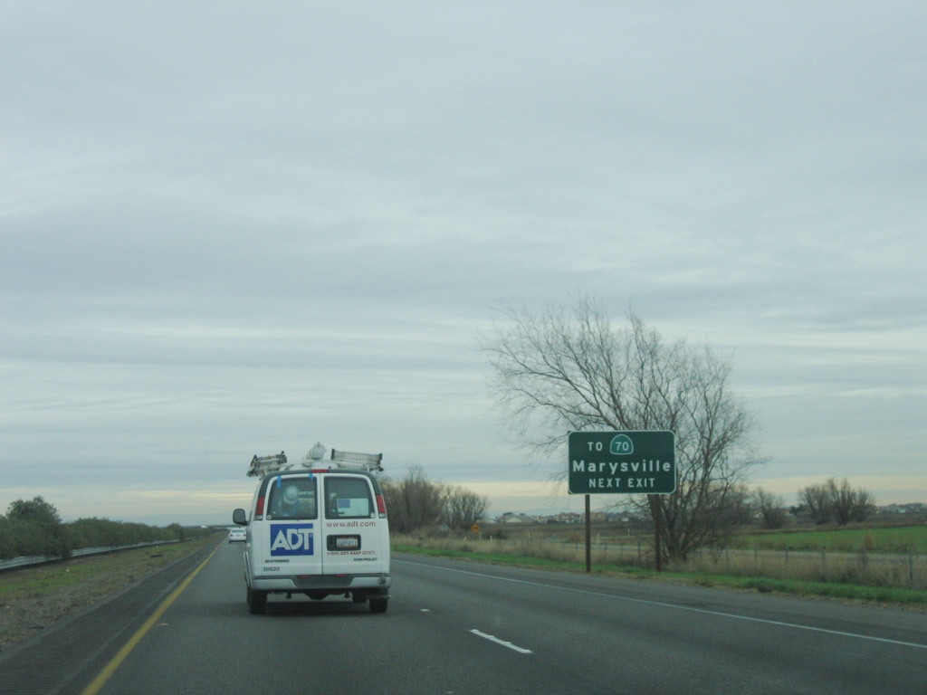
Use California 99/El Centro Road freeway north to California 70, which splits from California 99 in Sutter County. While California 99 travels north to Yuba City, California 70 (former U.S. 40 Alternate) travels north to Marysville. The two state routes parallel each other to a point north of Oroville and south of Chico. At that point, California 70 (U.S. 40 Alternate) turns northeast to follow the Feather River into the Sierra Nevada, eventually connecting with U.S. 395 at Hallelujah Junction. Photo taken 01/16/06. |
|
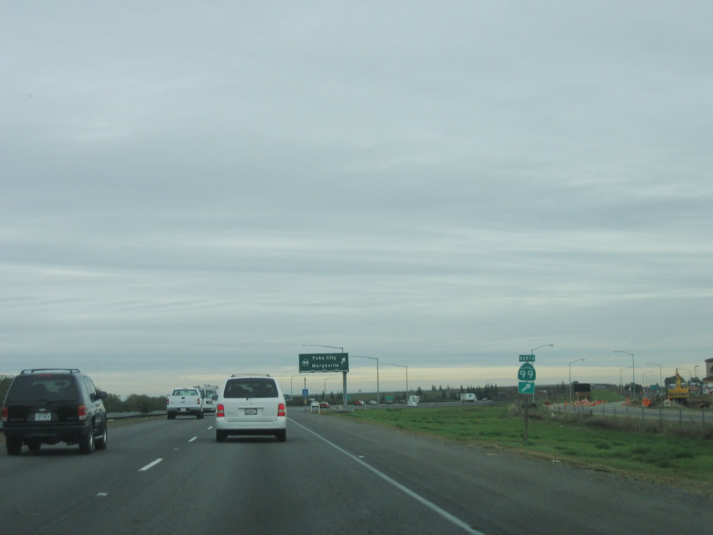
A standalone California 99 trailblazer is posted prior to the California 99 exit. From here, California 99 south will merge directly onto Interstate 5. The two routes will remain merged (with spotty cosignage on the shared alignment) until the Business Loop I-80 interchange in downtown Sacramento. Photo taken 01/16/06. |
|
Southbound Interstate 5 reaches Exit 525B, California 99/El Centro Road north to Yuba City and Marysville (via California 70). California 99 south merges onto Interstate 5 south, and the freeway will now take on an urban feel. Interstate 5 turns sharply to the south again, having finished its easterly passage over Yolo Bypass and the Sacramento River. From here, Interstate 5 will generally parallel the Sacramento River through the city of Sacramento. Photo taken 01/16/06. |
|
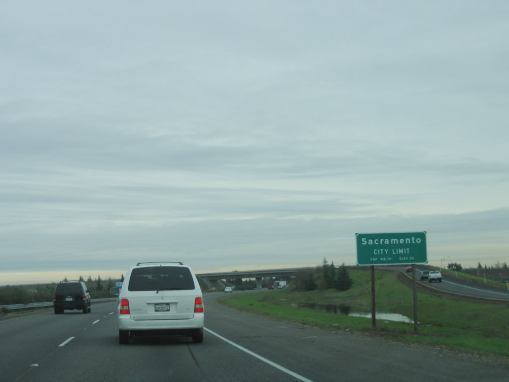
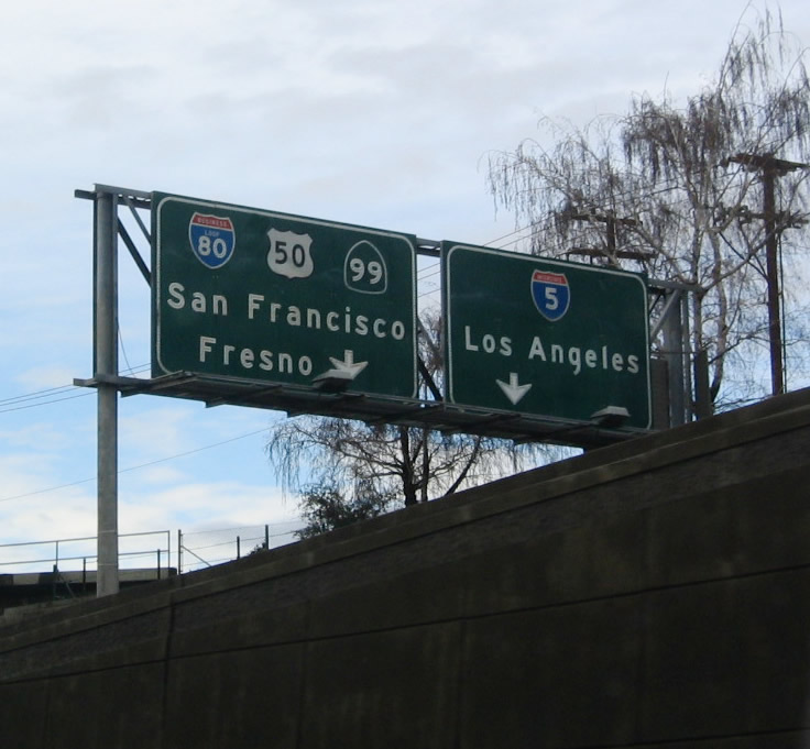
At the California 99 interchange, Interstate 5 enters the city of Sacramento, the capital of the state of California and seat of Sacramento County. This major California city is located at the crossroads of three major highways: Interstate 5 from San Diego to Blaine, Interstate 80 from San Francisco to near New York City, and U.S. 50 from West Sacramento to Ocean City, Maryland. These highways converge near downtown Sacramento, with Interstate 80 splitting into a bypass and business alignment through the city. Sacramento was founded in 1849 and is the oldest incorporated city (on February 27, 1850). Voters adopted the current Sacramento City Charter in 1920. The Sacramento area (El Dorado, Placer, Sacramento, and Yolo Counties) is the fourth largest metropolitan area in the state of California (behind Greater Los Angeles, the San Francisco Bay Area, and San Diego County) with a population in excess of 2.1 million. As of the 2000 Census, 407,018 people lived in Sacramento city. Photo taken 01/16/06. |
|
Interstate 5 will remain in Sacramento between Exit 525B and south of Exit 512 in the Freeport area. The next 13 exits all serve the city of Sacramento: Exit 525A, Del Paso Road; Exit 524, Arena Boulevard; Exit 522, Interstate 80 west to San Francisco and east to Reno; Exit 521, Garden Highway; Exit 520, Richards Boulevard; Exit 519B, J Street to downtown Sacramento; Exit 519A, Q Street to the California State Capitol; Exit 518, Business Loop I-80 and U.S. 50 (Capital City Freeway) east to South Lake Tahoe and California 99 south to Fresno and Business Loop I-80 and U.S. 50 (Capital City Freeway) west to San Francisco (with a ramp to Broadway); Exit 516, Sutterville Road; Exit 515, Fruitridge Road and Seamas Avenue; and Exit 514, 43rd Avenue; Exit 513, Florin Road; and Exit 512, Pocket Road and Meadowview Road to California 160 (River Road)-south. Photo taken 01/16/06. |
| Interstate 5 (and California 99) south |
|
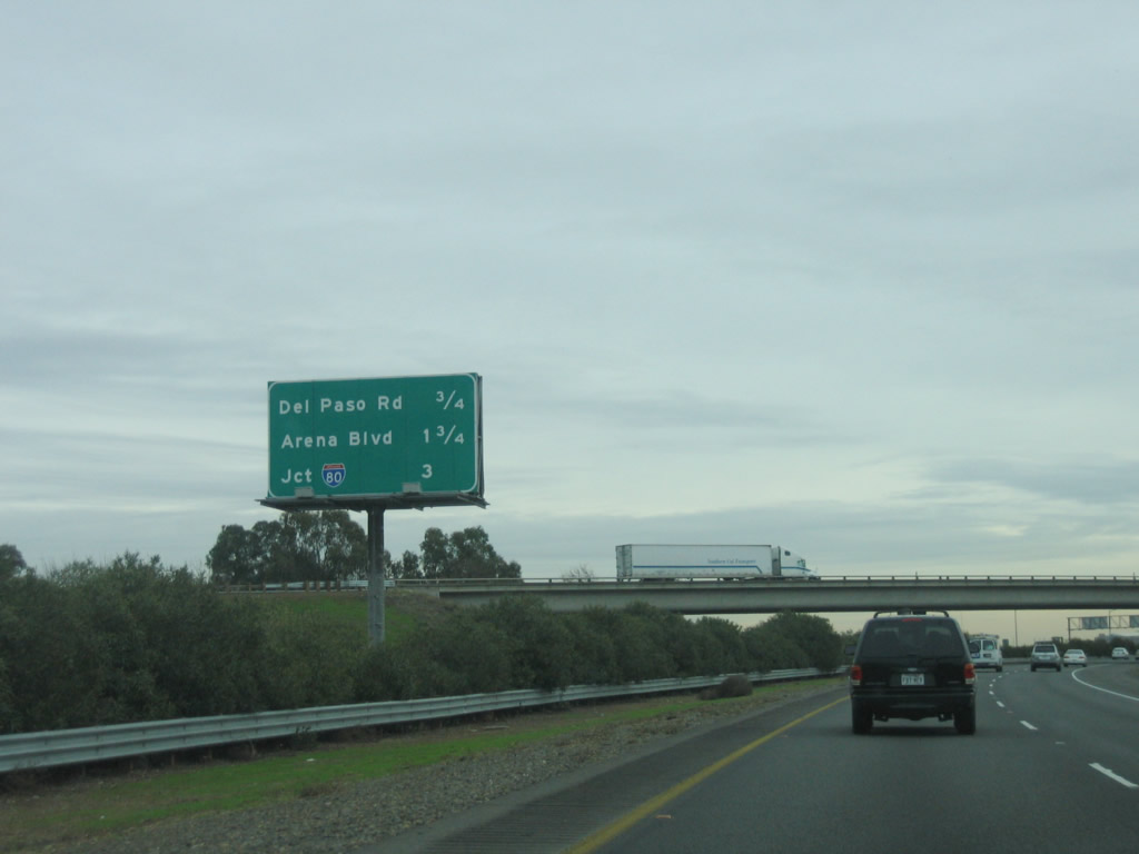
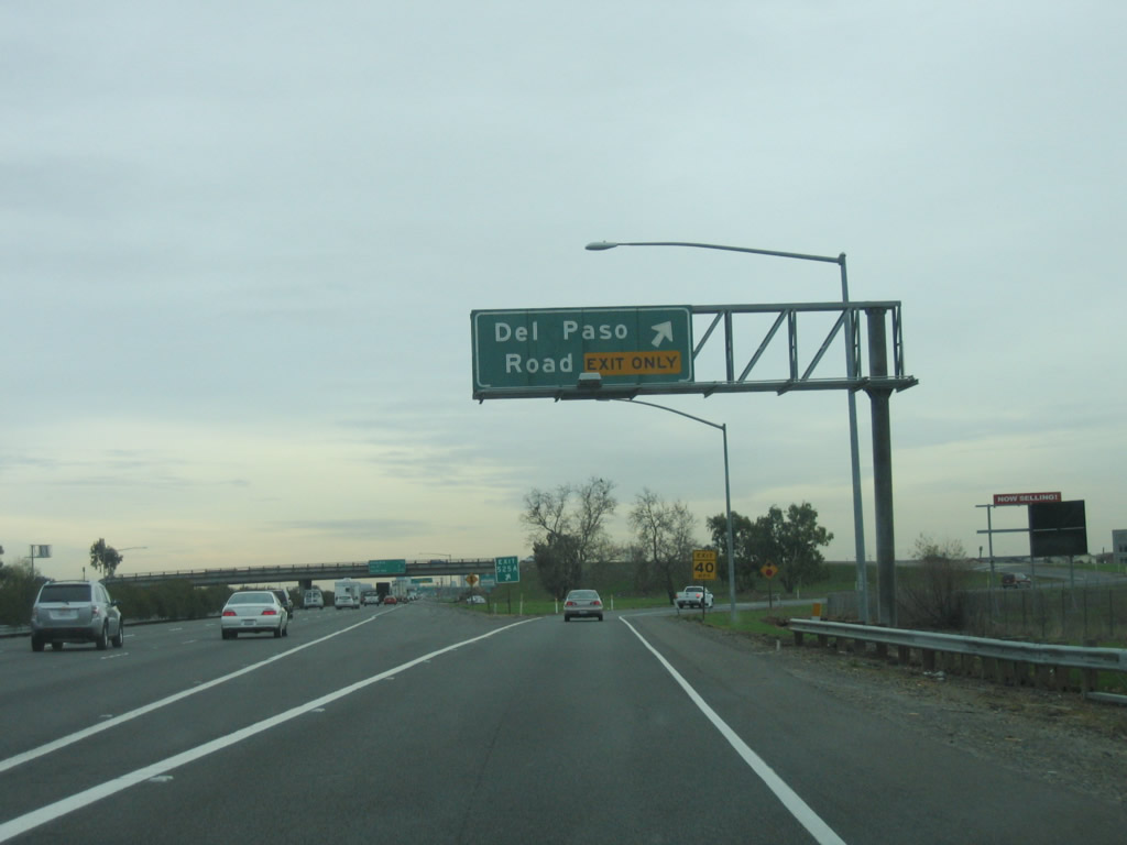
The next exit along southbound Interstate 5 and California 99 is Exit 525A, Del Paso Road. This particular sign was among the first signs to feature an exit number in the Sacramento area (it was placed in January 2002). Use this exit to the Natomas community of the city of Sacramento. This area, which is built on low-lying land along the Interstate 80 corridor generally south of the Sutter-Sacramento County Line and north of the American River, includes the Arco Arena and a variety of residential areas that developed in the 1990s and 2000s. Business parks, hotels, and industry also are located here, especially near Interstate 5 and Interstate 80. Proximity to the Sacramento International Airport also helps these areas. Photo taken 01/16/06. |
|
Southbound Interstate 5 and California 99 reach Exit 525A, Del Paso Road. A variety of business parks and Arco Arena are located east of Interstate 5 at this interchange in Natomas. The left three lanes continue south on Interstate 5 toward Sacramento. Photo taken 01/16/06. |
|
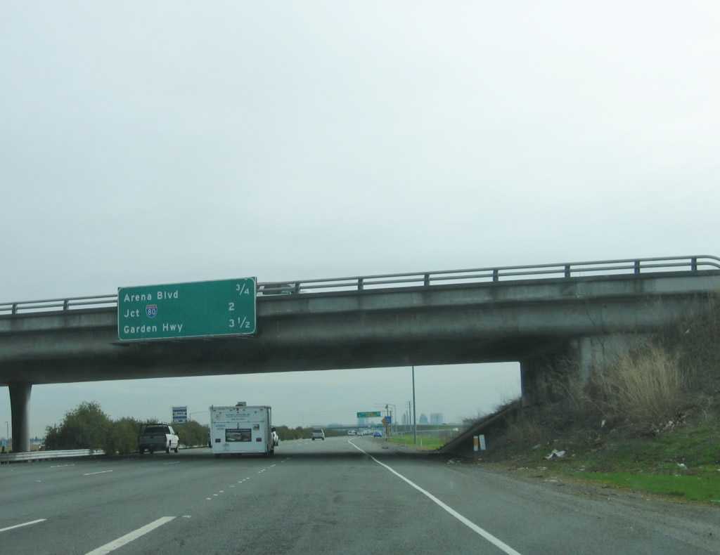
This mileage sign provides the distance to the next three exits: Exit 524, Arena Boulevard; Exit 522, Interstate 80 west to San Francisco and east to Reno; and Exit 521, Garden Highway. Photo taken 01/16/06. |
|
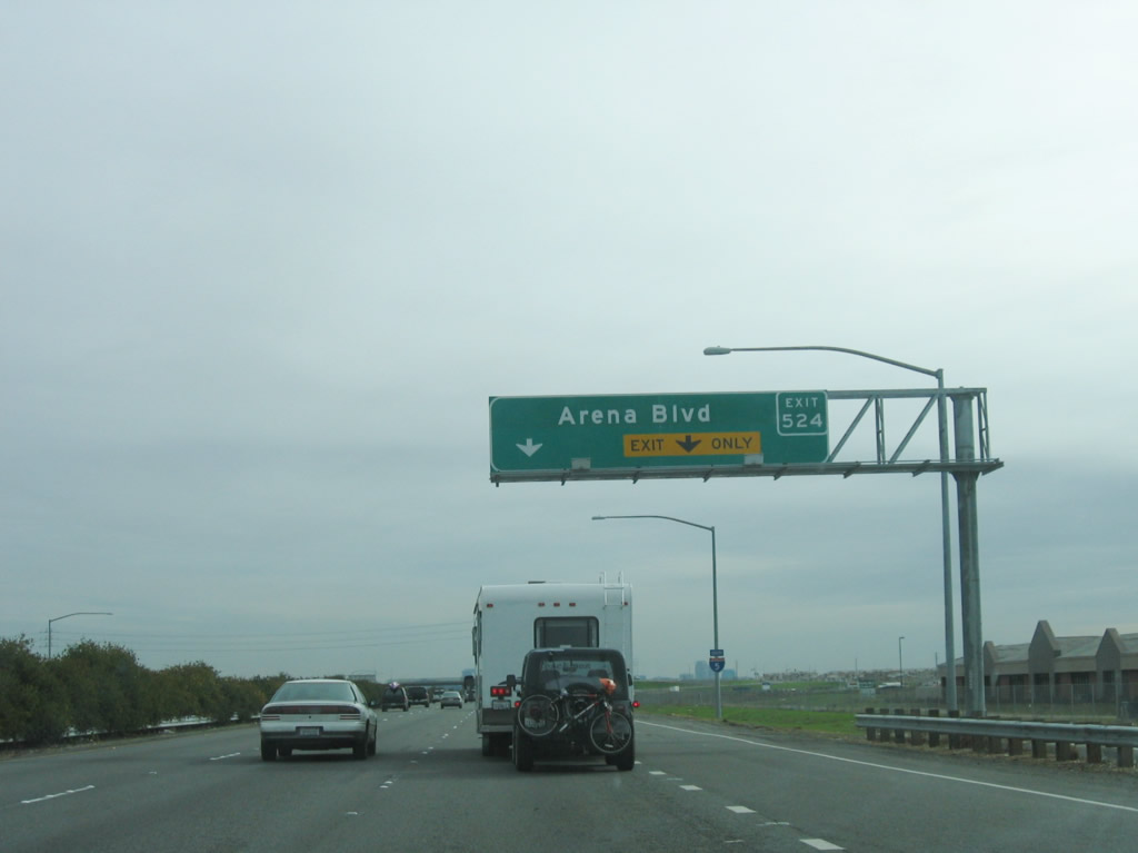
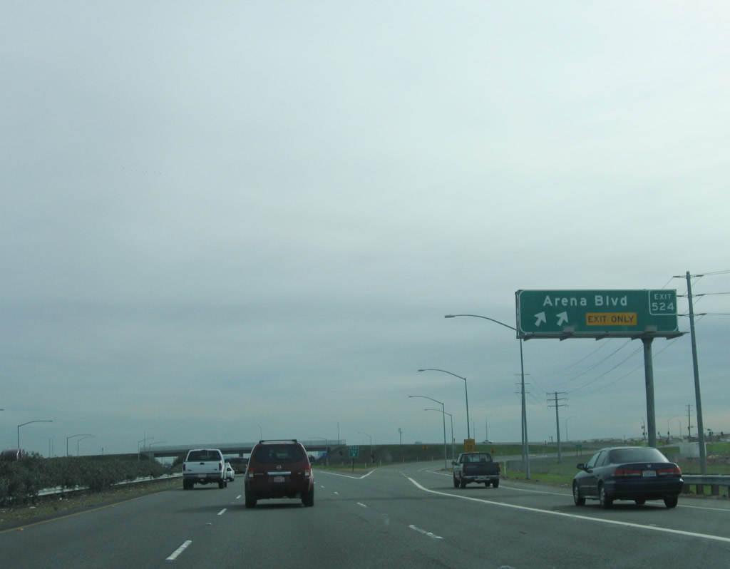
Arena Boulevard also serves the Natomas community of the city of Sacramento and also is the second of two exits to serve Arco Arena, which is home to the National Basketball Association (NBA) Sacramento Kings. Photo taken 01/16/06. |
|
Southbound Interstate 5 and California 99 reach Exit 524, Arena Boulevard. The right two lanes prepare to take the exit to Arena Boulevard. Photo taken 01/16/06. |
|
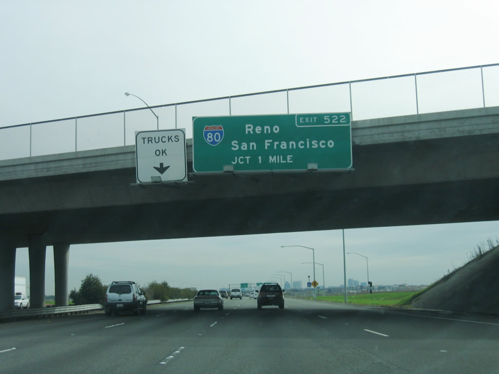
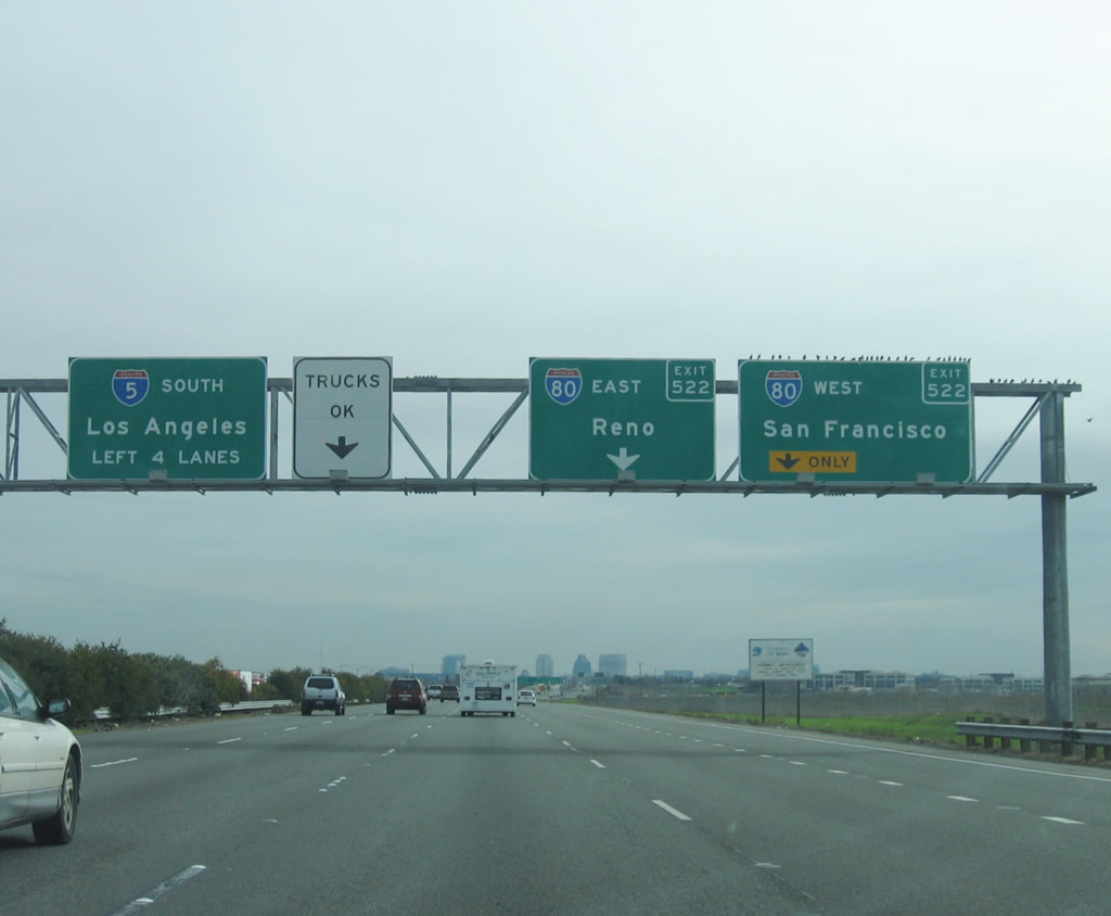
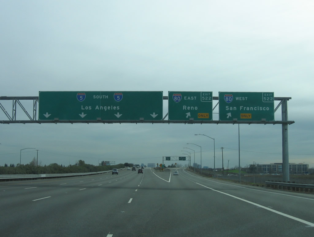
The next exit along Interstate 5 and California 99 south is Exit 522, Interstate 80. This major interchange connects two transnational highways, as Interstate 80 travels southwest toward Davis, Vacaville, Fairfield, Vallejo, Oakland, and San Francisco along the former U.S. 40 alignment. To the northeast, Interstate 80 connects Sacramento with Roseville, Auburn, Truckee, and Reno, Nevada, after traversing the Sierra Nevada along the U.S. 40 alignment. After leaving Reno, Interstate 80 then crosses Nevada, Utah, Wyoming, Nebraska, Iowa, and Illinois before entering the Chicago metropolitan area and connecting to the East Coast. Prior to 1980, the modern Interstate 80 bypass route around Sacramento was signed as Interstate 880, and the business loop through downtown Sacramento was then part of Interstate 80. The change in numbering was made as a result of a portion of the business loop not being up to modern Interstate standards. Photo taken 01/16/06. |
|
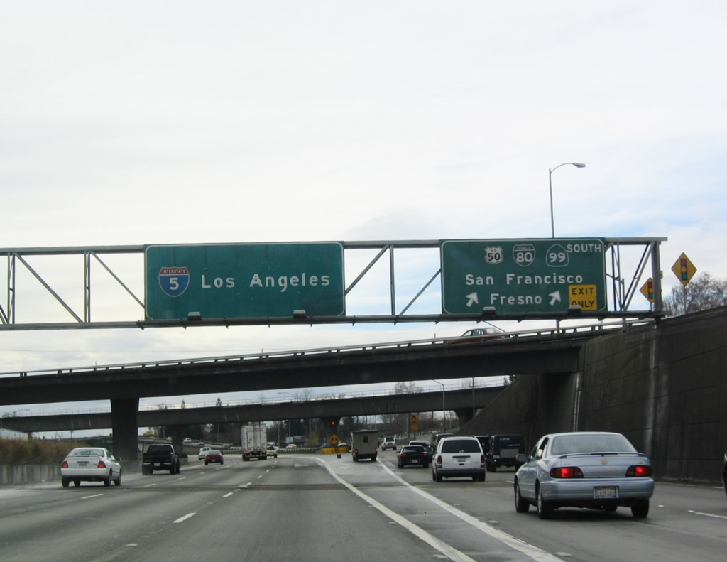
The left four lanes continue south on Interstate 5 (and California 99) to downtown Sacramento and the control city of Los Angeles. The right two lanes connect to Interstate 80 west to San Francisco and east to Reno. The connection to Interstate 80 east is a loop ramp. Photo taken 01/16/06. |
|
Southbound Interstate 5 and California 99 reach Exit 522, Interstate 80. The first ramp connects to Interstate 80 west to the city of West Sacramento in Yolo County, and the second ramp loops onto Interstate 80 east to the Sacramento community of Del Paso Heights and unincorporated Carmichael. To connect to Business 80, which is a separate freeway in downtown Sacramento, continue south on Interstate 5 and California 99 to Exit 518. Photo taken 01/16/06. |
|
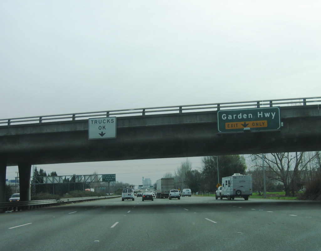
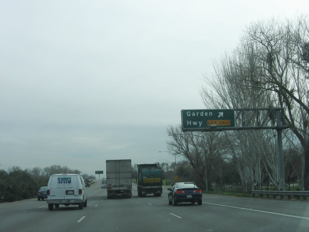
After the Interstate 80 interchange, the next exit on southbound Interstate 5 (and California 99) is Exit 521, Garden Highway. This folded diamond interchange serves Discovery Park, which is situated at the confluence of the Sacramento River and American River. To the east, Garden Highway connects to West El Camino Avenue and Arden Way en route to the Gardenland, North Sacramento, and Arden Fair communities of the city of Sacramento. Photo taken 01/16/06. |
|
The right lane becomes exit only for Exit 521, Garden Highway. The left four lanes continue south along Interstate 5 and California 99 toward downtown Sacramento. Photo taken 01/16/06. |
|
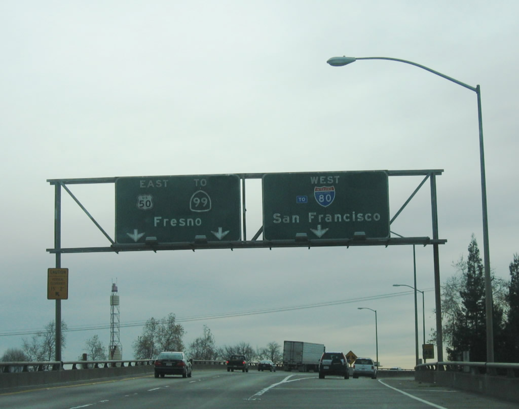
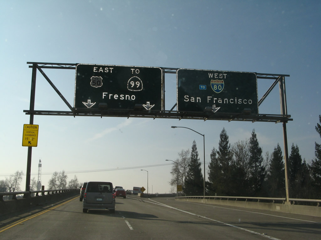
This sign announces the advance exit for Exit 518, Business Loop I-80 (Capital City Freeway). Use Business 80 and U.S. 50 east to South Lake Tahoe and California 99 south to Fresno. This sign omits any highway shields and does not refer to the exit number, which lessens its utility for travelers. Photo taken 01/16/06. |
|
Southbound Interstate 5 and California 99 reach Exit 521, Garden Highway. After this interchange, Interstate 5 crosses over the American River and leaves the Natomas community of the city of Sacramento. The American River ends just west of here when it merges into the Sacramento River to the west of the freeway at Discovery Park. Photo taken 01/16/06. |
|
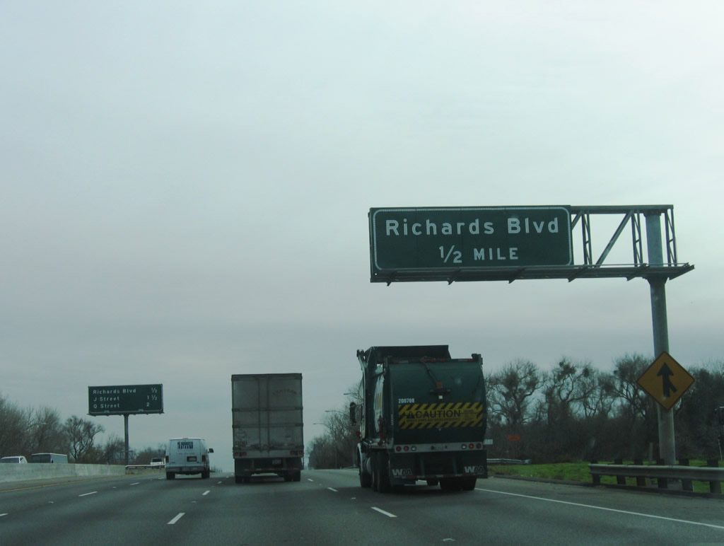
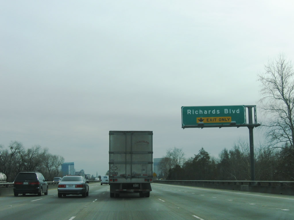
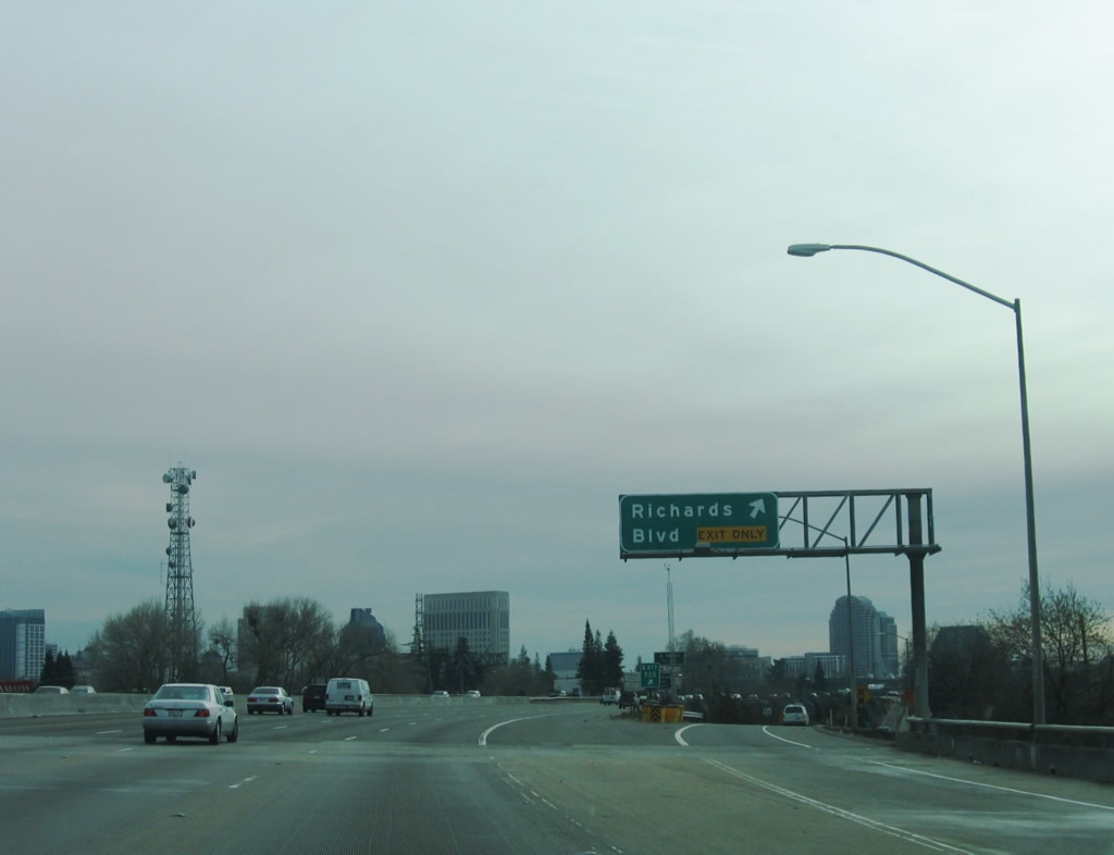
The next exit on southbound Interstate 5 (and California 99) is Exit 520, Richards Boulevard (one-half mile). Use Richards Boulevard east to California 160 (North Sacramento Freeway) and Exposition Boulevard, which leads to the California Expo and Fair (state fairgrounds) at the interchange of Business Loop I-80 (Capital City Freeway). Photo taken 01/16/06. |
|
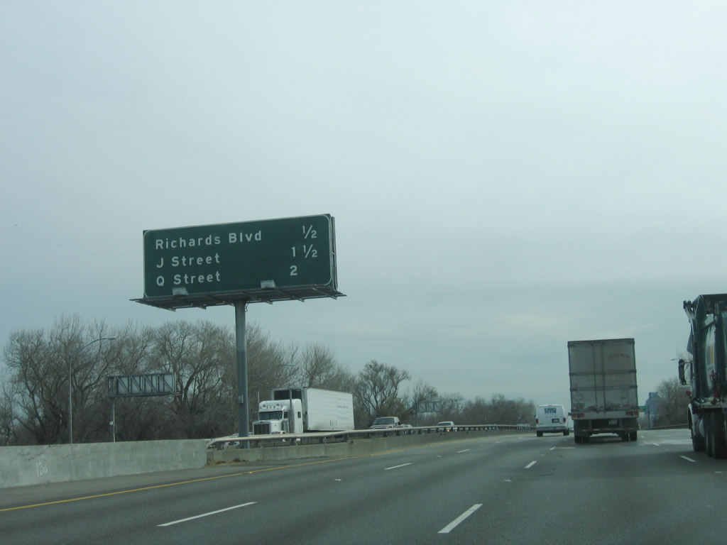
The next three exits along Interstate 5 and California 99 south are Exit 520, Richards Boulevard; Exit 519B, J Street to downtown Sacramento; and Exit 519A, Q Street to the California State Capitol. Photo taken 01/16/06. |
|
Interstate 5 crosses the American River on this 1968 bridge. The right lane of Interstate 5 becomes exit only for Exit 520, Richards Boulevard. Photo taken 01/16/06. |
|
Southbound Interstate 5 and California 99 reach Exit 520, Richards Boulevard at the southern end of the American River bridge. Richards Boulevard travels east from this interchange to industrial areas along the southern bank of the American River. To the west, Richards Boulevard promptly turns south onto Jibboom Street, which ultimately connects with the I Street Bridge (also called the Eye Street Bridge). The I Street Bridge is a double deck swing bridge built in 1911 with the lower deck for the railroad and upper deck for vehicles and pedestrians. The bridge was formerly part of California 16 (which used to follow city streets between its two disconnected segments through Sacramento, West Sacramento, and unincorporated Yolo County). The I Street Bridge one of four that cross the Sacramento River (from north to south: Interstate 80, I Street Bridge, California 275/Tower Street Bridge, and Business Loop I-80 & U.S. 50). Photo taken 01/16/06. |
|
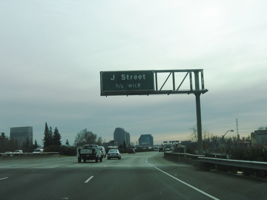
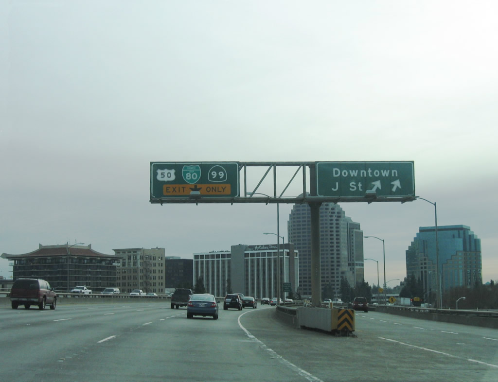
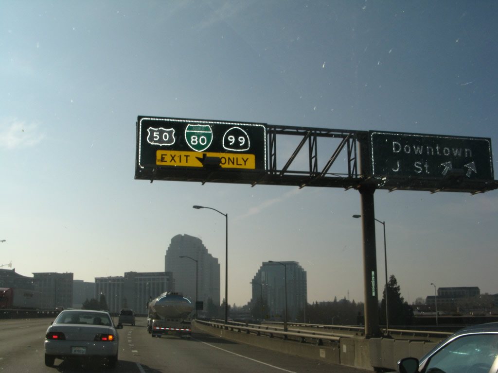
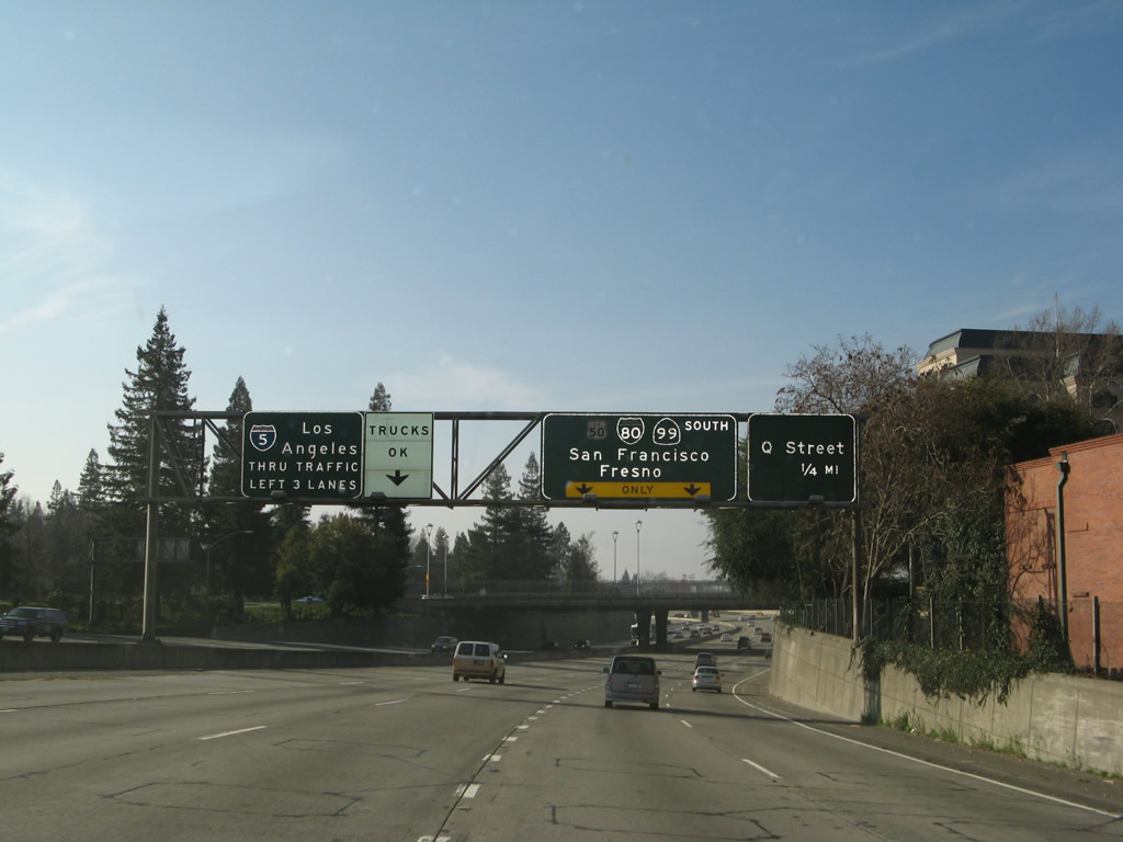
The next exit along Interstate 5 and California 99 south is Exit 519B, J Street to downtown Sacramento. This section of Interstate 5 (from Richards Boulevard south to K Street) was built as an elevated viaduct in 1968. The tall buildings of downtown Sacramento come into view. Photo taken 01/16/06. |
|
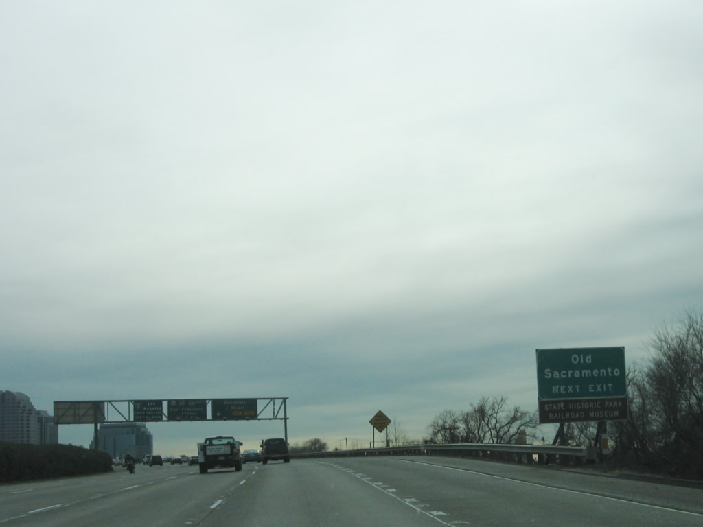
Use the J Street exit to downtown Sacramento and to the Old Sacramento State Historical Park. Several historical buildings, such as the 1849 Eagle Theater and 1853 B. F. Hastings Building, are located in this small park sandwiched between Interstate 5 and the Sacramento River. Unfortunately, the elevated Interstate 5 freeway blocks downtown Sacramento from the river. Occasionally, local groups call for the removal of Interstate 5 from downtown Sacramento to allow for no structures blocking the connection of downtown Sacramento with its historical riverfront. Due to the popularity of the park and the small footprint of the park, the best parking for the state historical park is found on the east side of the Interstate 5 freeway, especially at the Westfield Shoppingtown Downtown Plaza. Photo taken 01/16/06. |
|
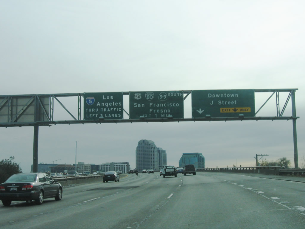
Use J Street east to downtown Sacramento, including the downtown shopping mall, city library, Cesar Chavez Park, Sacramento Convention Center, and Historic Governors Mansion. J Street and I Street together form a one-way couplet for east and west traffic. As for Interstate 5, the left three lanes continue south. The next two exits are Exit 519A, Q Street and Exit 518, Business Loop I-80 (Capital City Freeway). Photo taken 01/16/06. |
|
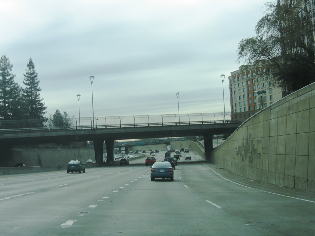
Interstate 5 lowers from the viaduct near Old Sacramento into a below-grade freeway. This section of Interstate 5 was built in 1970, two years after the elevated section to the north was completed. Since the lowest point of Interstate 5 is lower than the bottom of the Sacramento River through here, flooding can occur. Photo taken 01/16/06. |
|
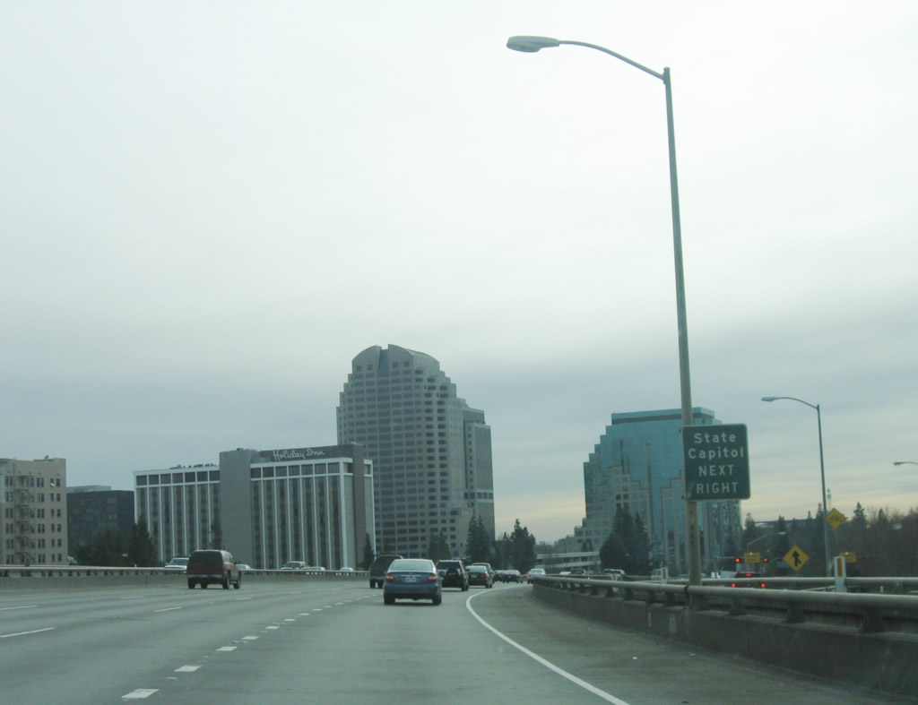
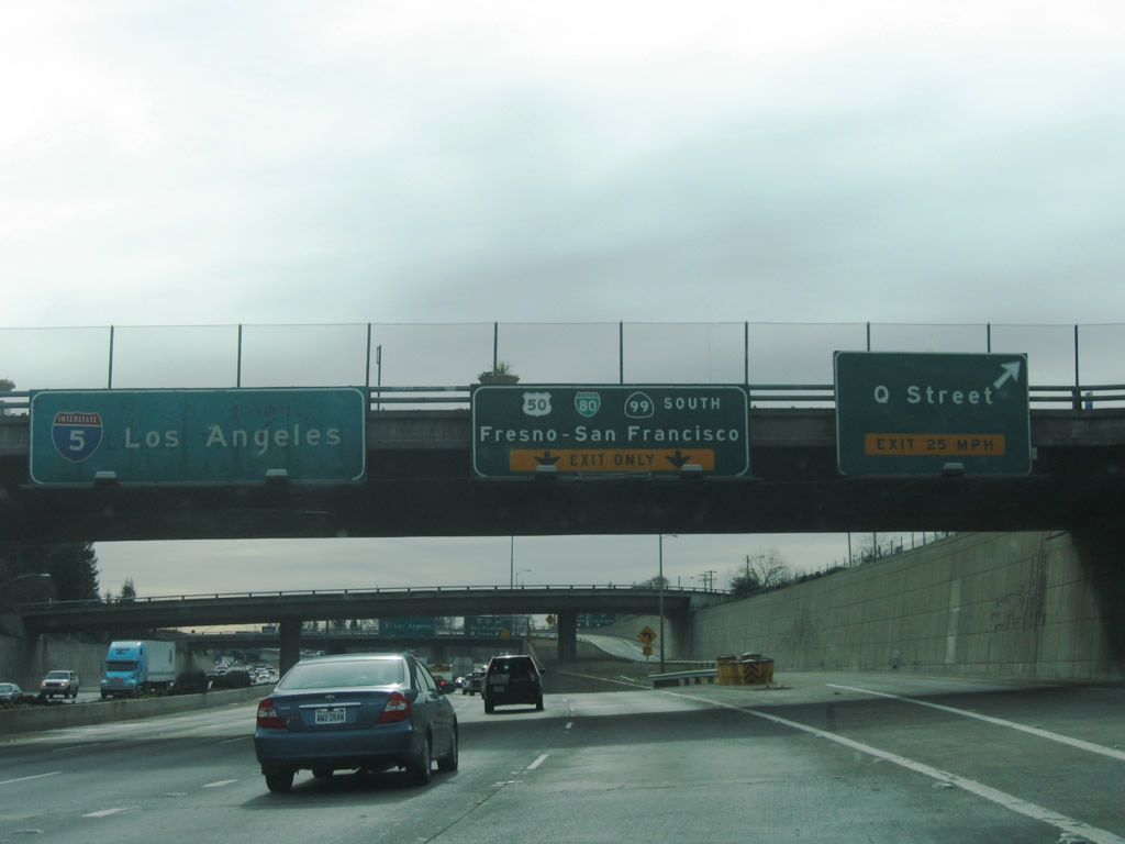
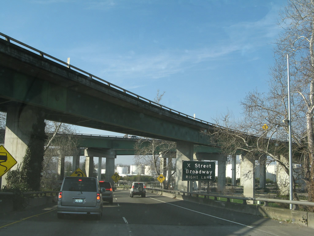
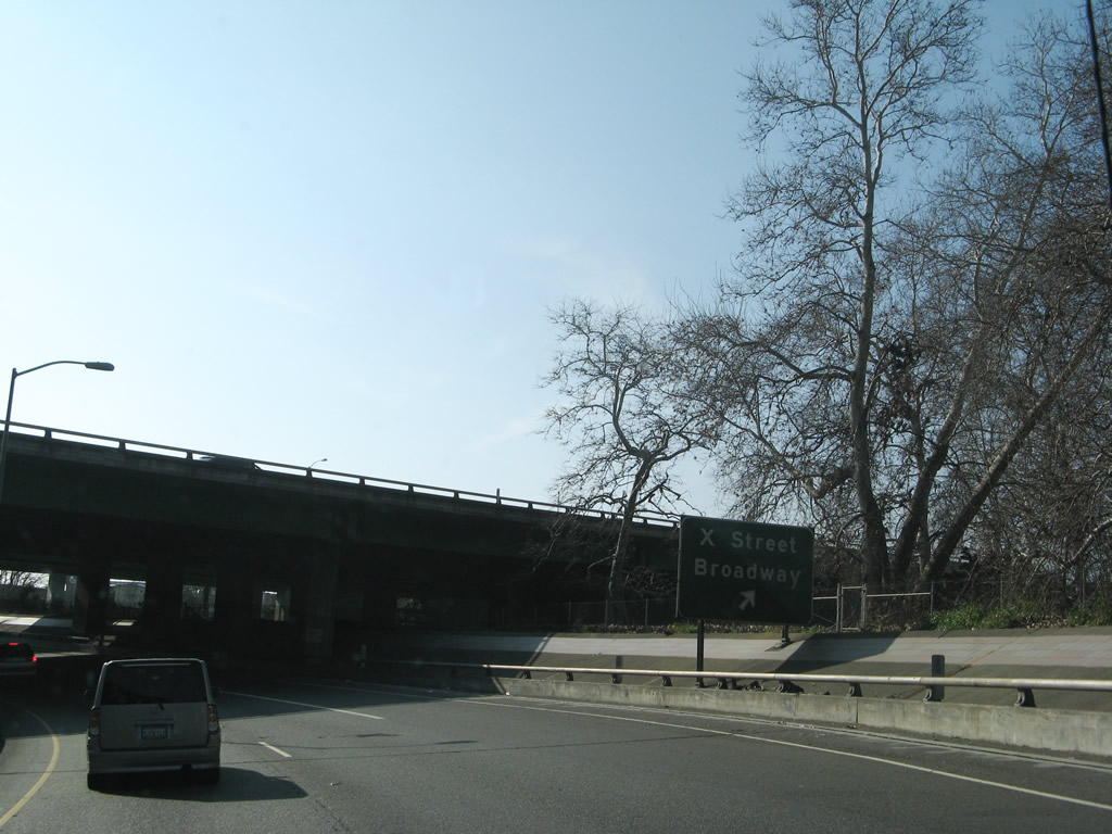
Southbound Interstate 5 reaches Exit 519A, Q Street. The next exit is Exit 518, Business 80 and U.S. 50 (Capital City Freeway). California 99 transitions from southbound Interstate 5 onto eastbound Business 80, then turns south again at the U.S. 50 interchange. Exit 518 also connects to Broadway and X Street. X Street is a frontage road alongside the business loop, while Broadway parallels the business loop freeway one block south. Photo taken 01/16/06. |
|
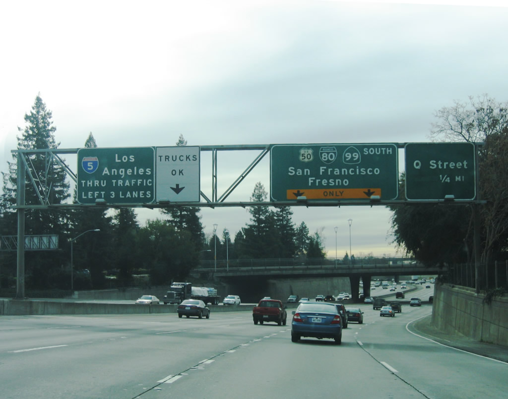
Immediately thereafter, Interstate 5 encounters the major downtown interchange with Business 80 and U.S. 50, the Capital City Freeway. Business Loop I-80 is also part of Interstate 305, an unsigned Interstate designation that covers the business loop freeway between Interstate 80 in West Sacramento and California 51 southeast of downtown Sacramento. Since the Capital City Freeway has multiple numerical designations, the Interstate 305 designation is not signed and is deemphasized. In fact, Interstate 305 is not defined in the California Streets and Highway Code; it is only acknowledged in the Federal Highway Administration (FHWA) Interstate Finder and Route Log. Photo taken 12/28/04. |
|
From mainline Interstate 5 south after the ramp to Business Loop I-80 (Capital City Freeway), this highway sign can be seen above the freeway from Q Street. Note the tri-color Business Loop I-80 shield. Photo taken 12/28/04. |
|
|
Now on the transition ramp from Interstate 5 south to Business Loop I-80 (Capital City Freeway), the left lane transitions to the eastbound Capital City Freeway and X Street/Broadway, and the right lane connects to westbound Capital City Freeway to West Sacramento. Note the lack of business loop shields on these overheads, under the theory that the eastbound direction leads to U.S. 50 east and California 99 south, while the westbound direction leads to Interstate 80. Photos taken 01/16/06 and 02/17/07. |
|
Shifting over to Business I-80 and U.S. 50 (Capital City Freeway) east from Interstate 5, there is an exit to X Street and Broadway. Photo taken 02/17/07. |
|
While the right lane departs to X Street and Broadway, the left two lanes connect to Business I-80 and U.S. 50 (Capital City Freeway) east toward Folsom. Photo taken 02/17/07. |
| Interstate 5 (West Side Freeway) south |
|
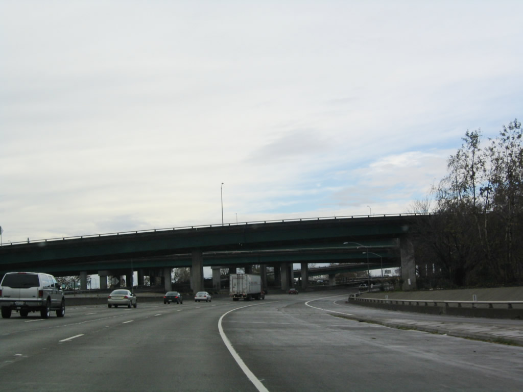
Southbound Interstate 5 passes under the Business 80 and U.S. 50 interchange. Photo taken 12/28/04. |
|
After passing through the Business 80 and U.S. 50 interchange, the next exit along southbound Interstate 5 is Exit 516, Sutterville Road. Photo taken 12/28/04. |
|
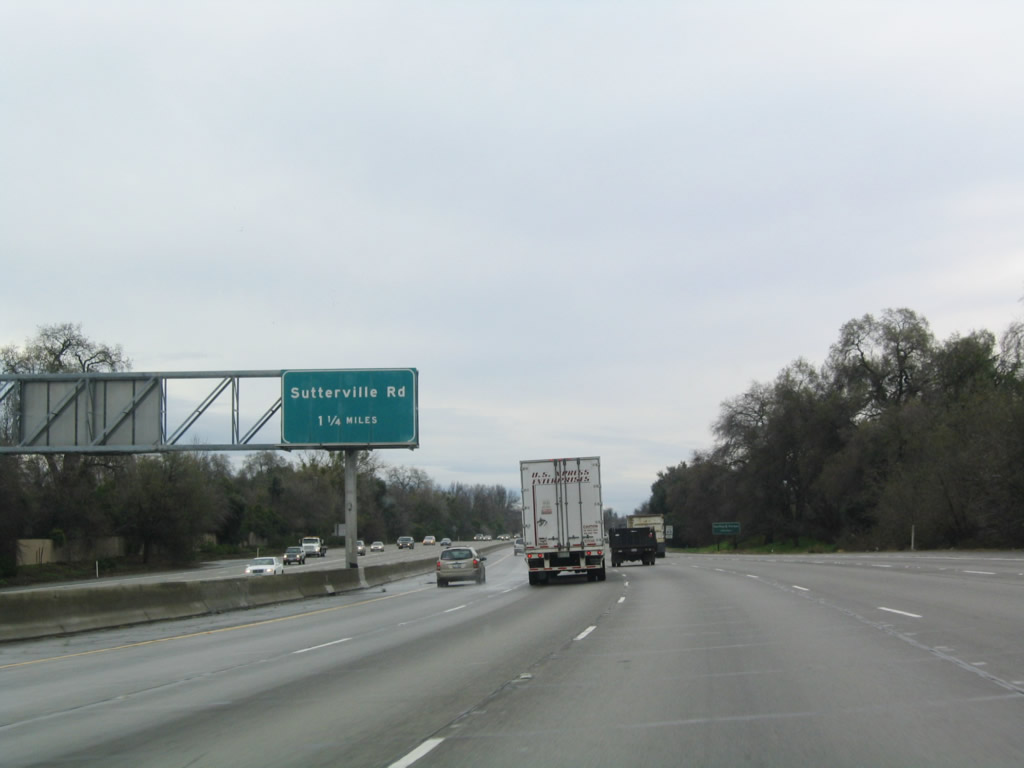
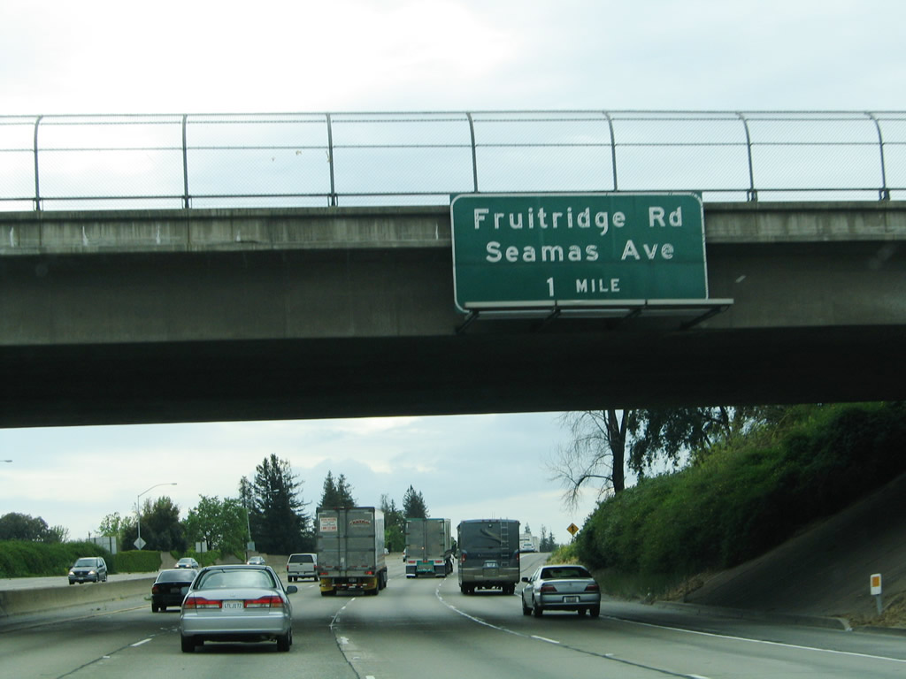
This mileage sign provides the distance to the next two exits along southbound Interstate 5: Exit 516, Sutterville Road and Exit 515, Fruitridge Road and Seamas Avenue. Photo taken 04/03/05. |
|
To William Land Park and the Sacramento Zoo, use Sutterville Road east (Exit 516, which is the second exit after the Seamas Avenue/Fruitridge Road interchange). The park includes the zoo, golf course, and Fairy Tale Town. Photo taken 04/03/05. |
|
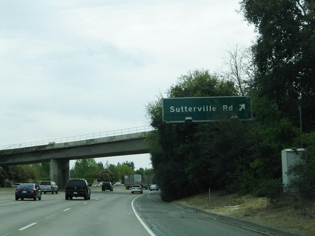
Southbound Interstate 5 reaches Exit 516, Sutterville Road. Use Sutterville Road east to the Sacramento Zoo, William Land Park, William Land Golf Course, Sacramento City College, Hughes Stadium, and the Sacramento Children's Home. This is a major interchange. Interstate 5 south retains four through lanes. Photo taken 04/03/05. |
|
The next exit along southbound Interstate 5 is Exit 515, Fruitridge Road and Seamas Avenue. Photo taken 04/03/05. |
|
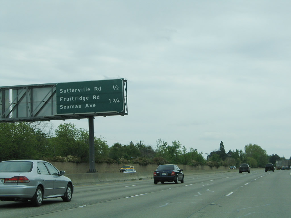
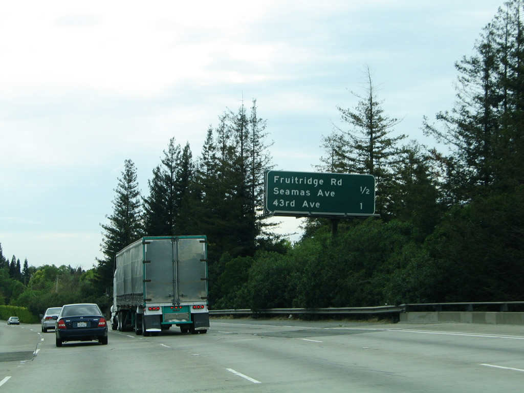
A mileage sign provides the distance to Exit 515, Fruitridge Road and Seamas Avenue and Exit 514, 43rd Avenue. Photo taken 04/03/05. |
|
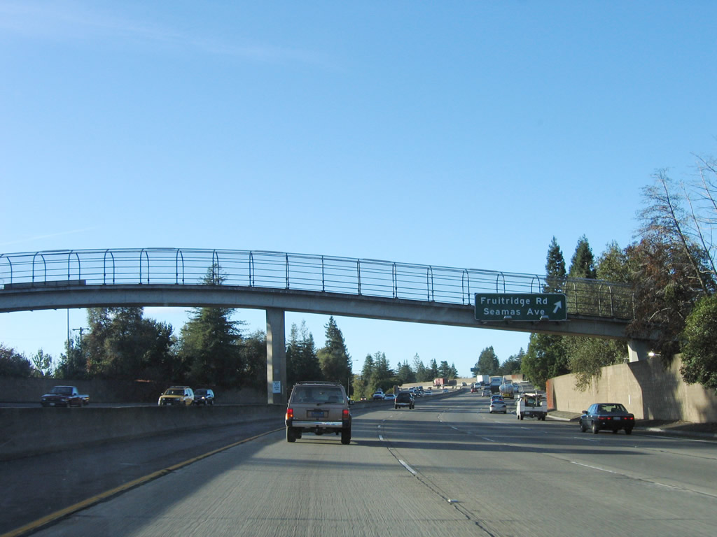
Southbound Interstate 5 reaches Exit 515, Fruitridge Road and Seamas Avenue. Photo taken 11/23/06. |
|
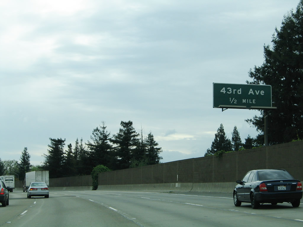
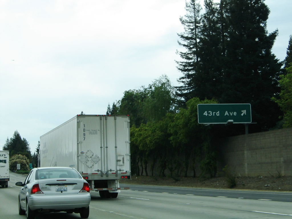
The next exit along southbound Interstate 5 is Exit 514, 43rd Avenue and Riverside Boulevard. This exit is a half-diamond, so there is no immediate access to southbound Interstaete 5 for those choosing to exit here. Photo taken 04/03/05. |
|
To Riverside Boulevard, follow 43rd Street west. Riverside Boulevard generally follows the east bank of the Sacramento River, but generally keeps its distance from the water. This exit serves the Greenhaven neighborhood of the city of Sacramento. Photo taken 04/03/05. |
|
Southbound Interstate 5 reaches Exit 514, 43rd Avenue and Riverside Boulevard to Greenhaven. Photo taken 04/03/05. |
|
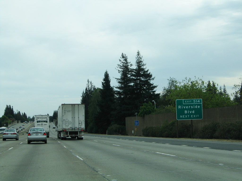
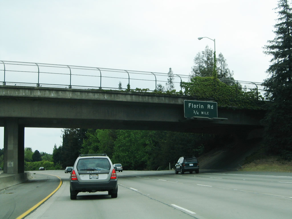
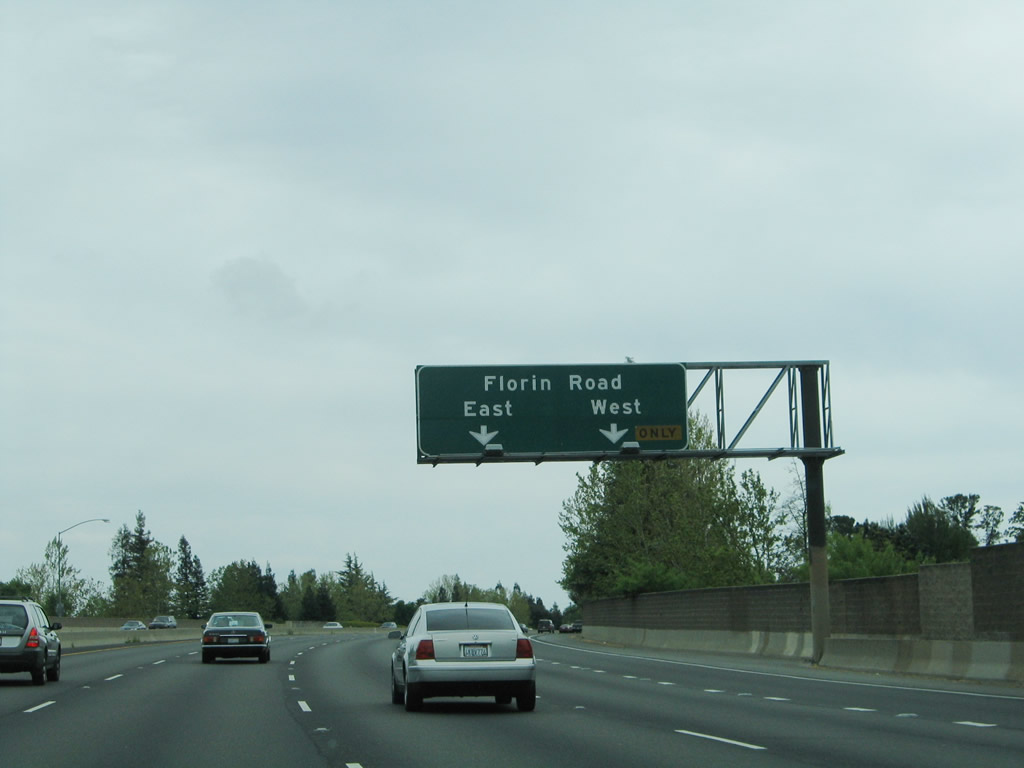
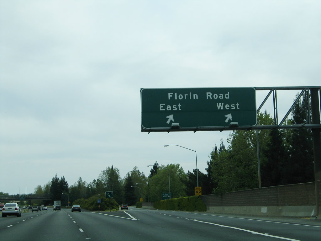
The next exit along southbound Interstate 5 is Exit 513, Florin Road. At this point, Interstate 5 passes under the 43rd Avenue overpass. Photo taken 04/03/05. |
|
The right two lanes of Interstate 5 connect to Exit 513, Florin Road. This interchange is a modified cloverleaf, so the first ramp connects to Florin Road west, while the second ramp is a loop onto Florin Road east. Use Florin Road east to the light rail station and an interchange with California 99 at Exits 293A-B. To the west, Florin Road eventually meanders to its end at Riverside Boulevard in the Greenhaven neighborhood. Residential areas abound in both directions from Interstate 5. Photo taken 04/03/05. |
|
Southbound Interstate 5 reaches Exit 513, Florin Road. The left four lanes of Interstate 5 continue south for now, but the right lane will end in about a half-mile. Photo taken 04/03/05. |
|
Now on the off-ramp to Florin Road, the left lane connects to eastbound Florin Road, and the right lane connects to Florin Road west. Photo taken 12/28/04. |
|
The next exit along southbound Interstate 5 is Exit 512, Pocket Road and Meadowview Road, with a connection to California 160/Freeport Boulevard south to Antioch. At this point, Interstate 5 passes under the Florin Road overpass. Photo taken 04/03/05. |
|
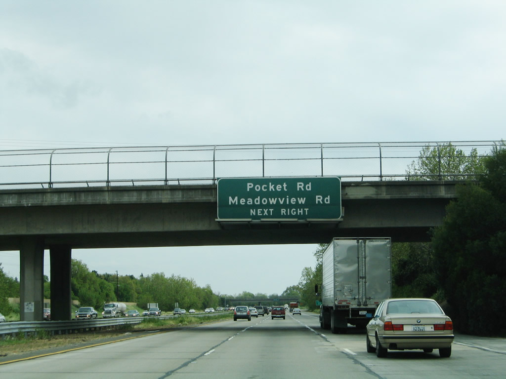
Passing under the Land Park Drive overpass, the newly three-lane Interstate 5 approaches Exit 512, Pocket Road and Meadowview Road. Pocket Road extends west, following the Sacramento River as it curves like a giant "C" to the west, north, and then east. Pocket Road eventually connects with Riverside Boulevard. Notably, none of these roads (43rd Avenue, Florin Road, Pocket Road) make an attempt to cross the Sacramento River. To the east, Pocket Road changes into Meadowview Road and changes again into Mack Road, before connecting to California 99 at Exit 291. Use this exit to Cosumnes River College, which is accessed via Sacramento County J-8 (Franklin Road) south to Cosumnes River Boulevard east. Photo taken 04/03/05. |
|
Southbound Interstate 5 reaches Exit 512, Pocket Road and Meadowview Road. To California 160 (River Road) south, exit east on Pocket Road/Meadowview Road, then turn right (south) on Freeport Boulevard. Freeport Boulevard south changes into California 160 (River Road) upon crossing the Sacramento City Limits. This exit also serves the community of Freeport, which is part of the city of Sacramento. At this point, the Sacramento River moves southwest away from Interstate 5 toward the California Delta. California 160 will faithfully follow the river all the way to Antioch. Photo taken 04/03/05. |
|
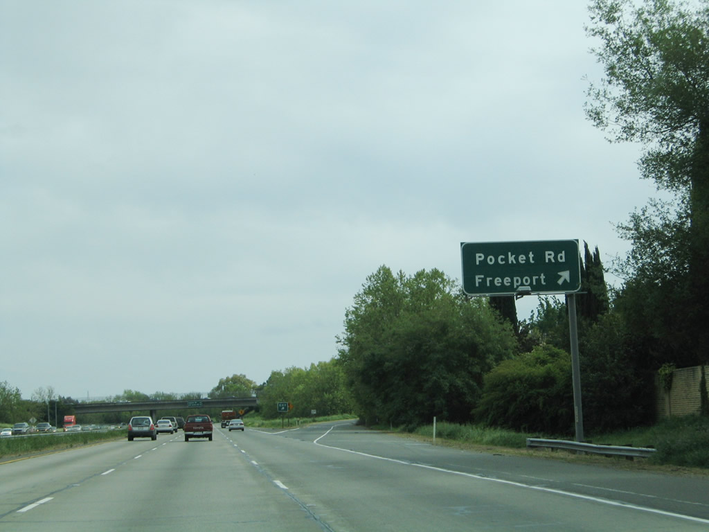
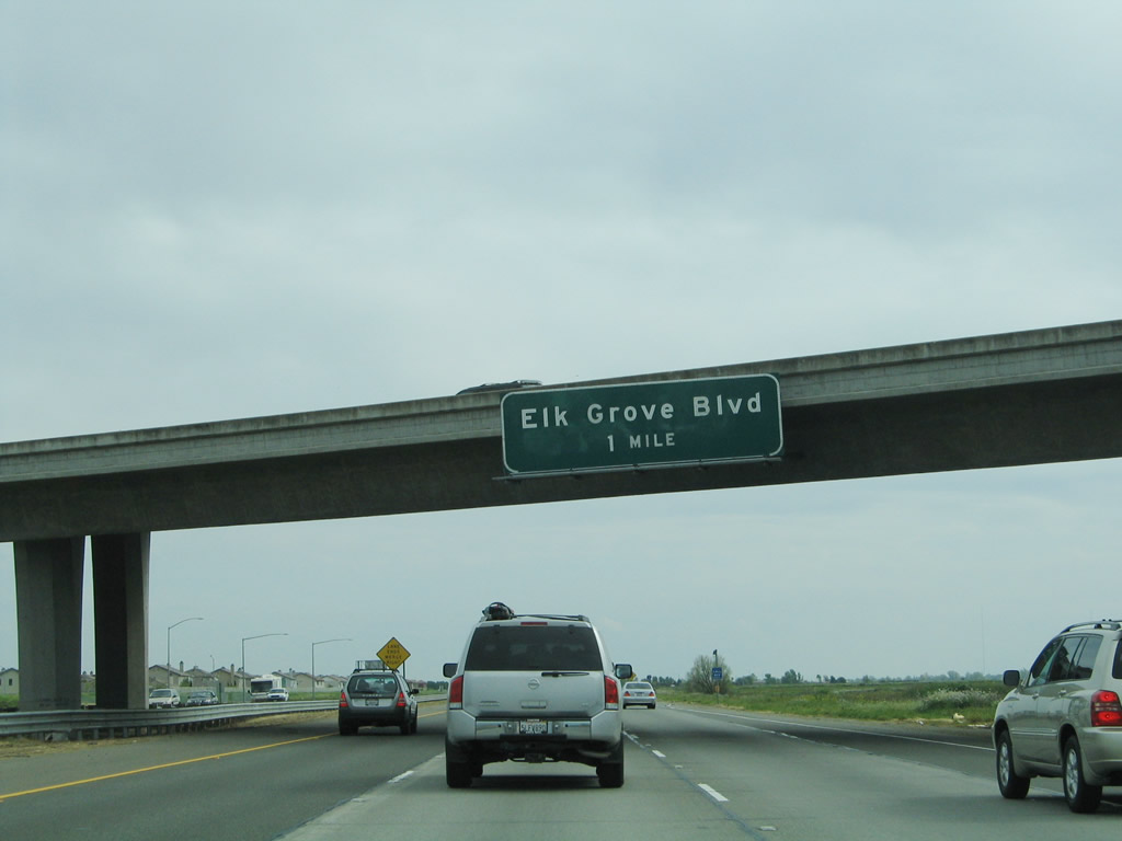
The next two exits along southbound Interstate 5 is Exit 508, Laguna Boulevard and Exit 506, Sacramento County E-12, Elk Grove Boulevard. Both of these exits serve the city of Elk Grove, which is about four miles south of here. Photo taken 04/03/05. |
|
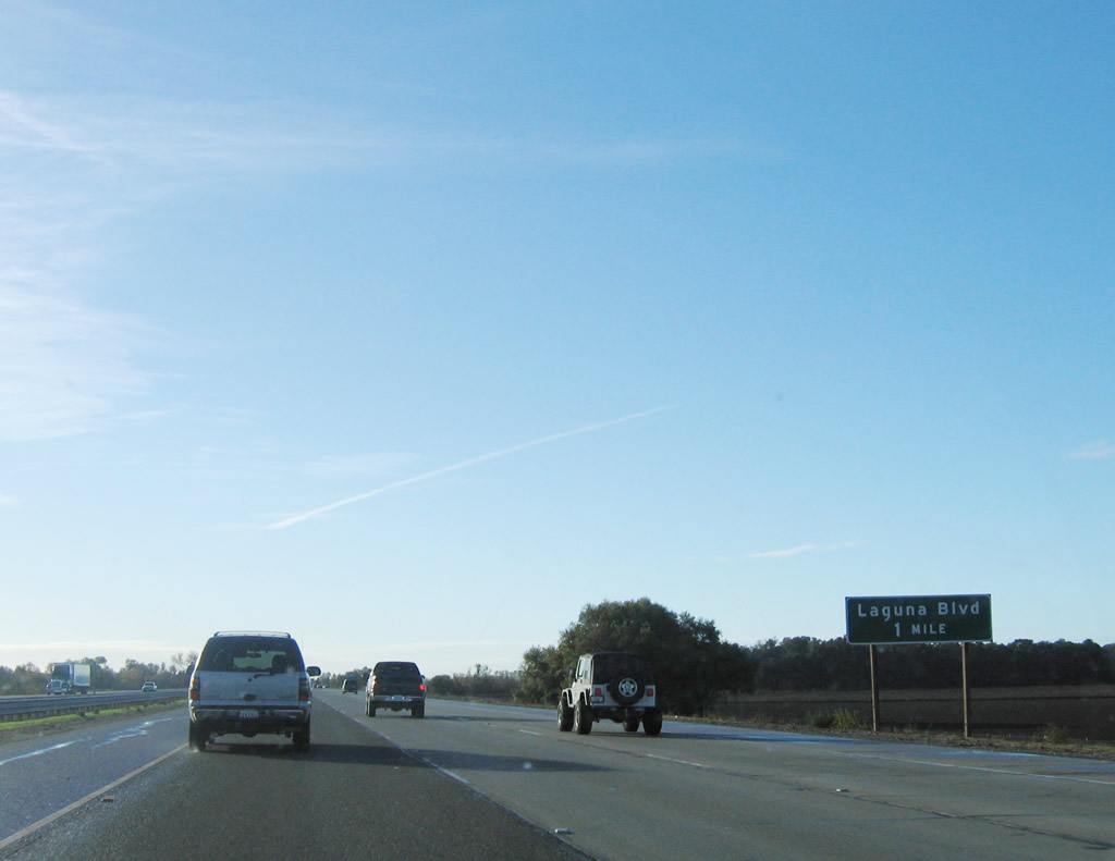
A roadside sign for Exit 508, Laguna Boulevard is posted after the Pocket Road/Meadowview Road interchange. Photo taken 11/23/06. |
|
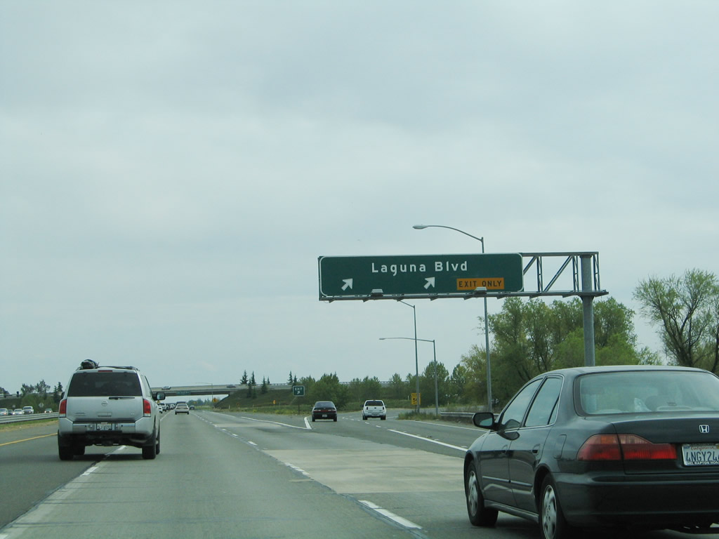
The right lane of Interstate 5 south becomes exit only for Exit 508, Laguna Boulevard. At Exit 508, Interstate 5 enters the city of Elk Grove, which is the last city along Interstate 5 in Sacramento County. Elk Grove was incorporated on July 1, 2000, as a general law city, but has existed since 1850. The city sits at an elevation of 45 feet and sees about 22 inches of precipitation annually, mostly during the fall and winter months. The 2000 Census places the population of Elk Grove (prior to incorporation) at 59,984 people; by 2007, state estimates placed the city's population at 136,318 people (thus indicating a huge population gain during that time period). Photo taken 04/03/05. |
|
Southbound Interstate 5 reaches Exit 508, Laguna Boulevard to the city of Elk Grove. The neighborhood immediately close to Interstate 5 is known as Laguna West. Housing developments are found throughout this bedroom community. Meanwhile, on the west side of Interstate 5, the Stone Lakes National Wildlife Refuge begins. No development is to be found on the west side of Interstate 5 for the next several miles. Photo taken 04/03/05. |
|
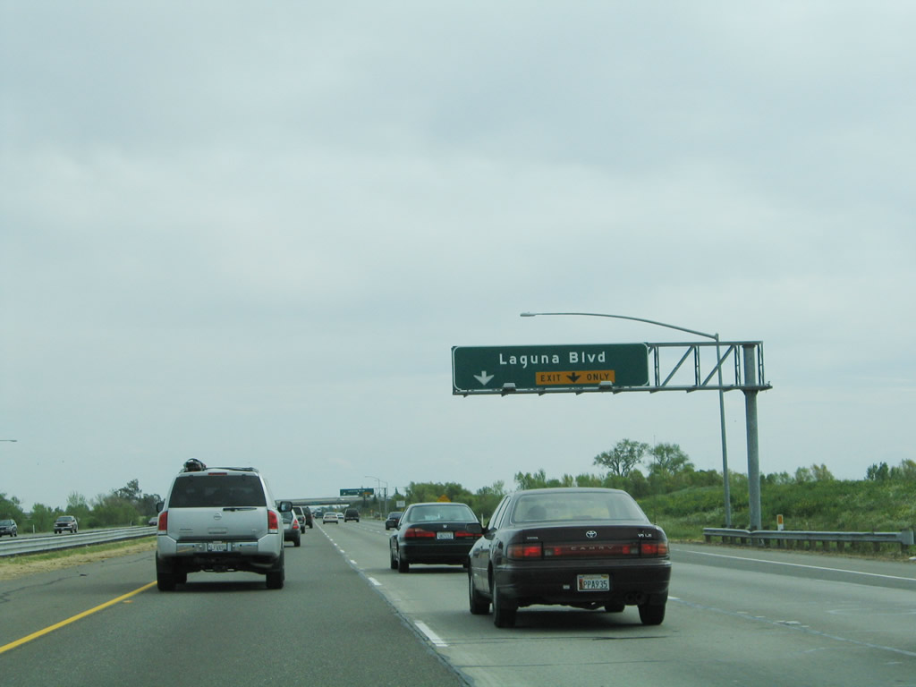
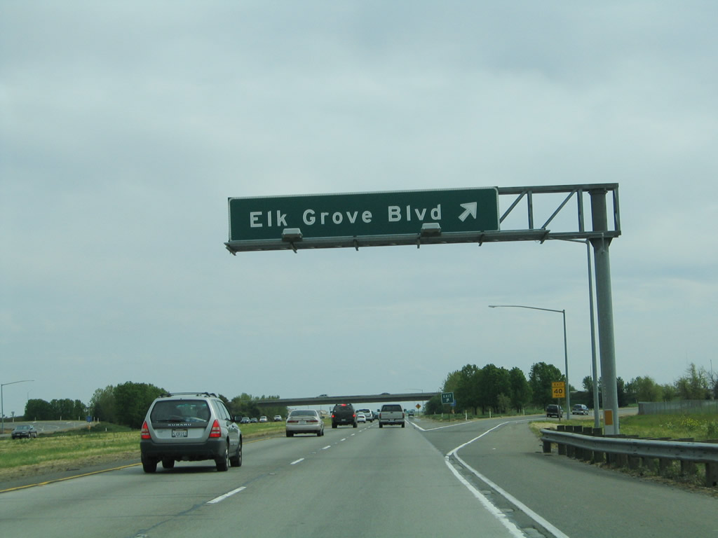
Passing under the Laguna Boulevard trumpet interchange, the next exit along southbound Interstate 5 is Exit 506, Sacramento County E-12, Elk Grove Boulevard. The southbound lanes of Interstate 5 again reduce from three to two through lanes. This will remain the configuration until Interstate 5 enters the Stockton metropolitan area. Photo taken 04/03/05. |
|
Southbound Interstate 5 reaches Exit 506, Sacramento County E-12, Elk Grove Boulevard. This is the second and final exit to serve the city of Elk Grove. Photo taken 04/03/05. |
|
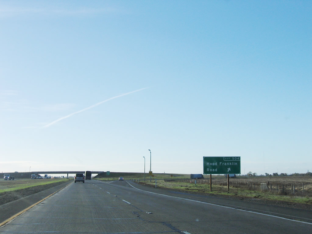
The next exit along southbound Interstate 5 is Exit 504, Hood Franklin Road west to Hood and east to Franklin. Use Hood Franklin Road west to California 160 (River Road) and east to Sacramento County J-8, Franklin Boulevard. Photo taken 04/03/05. |
|
Southbound Interstate 5 reaches Exit 504, Hood Franklin Road. Photo taken 11/23/06. |
|
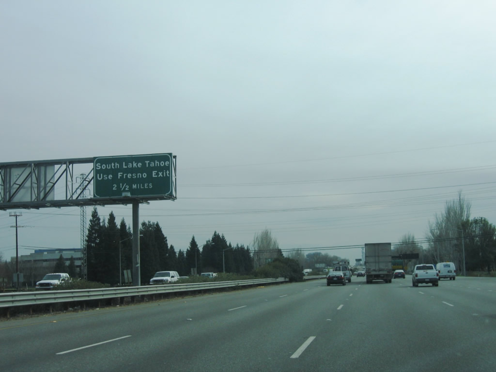
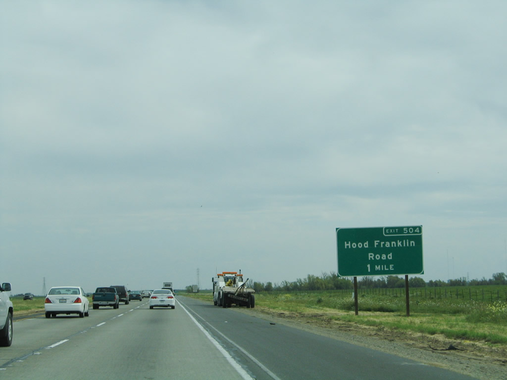
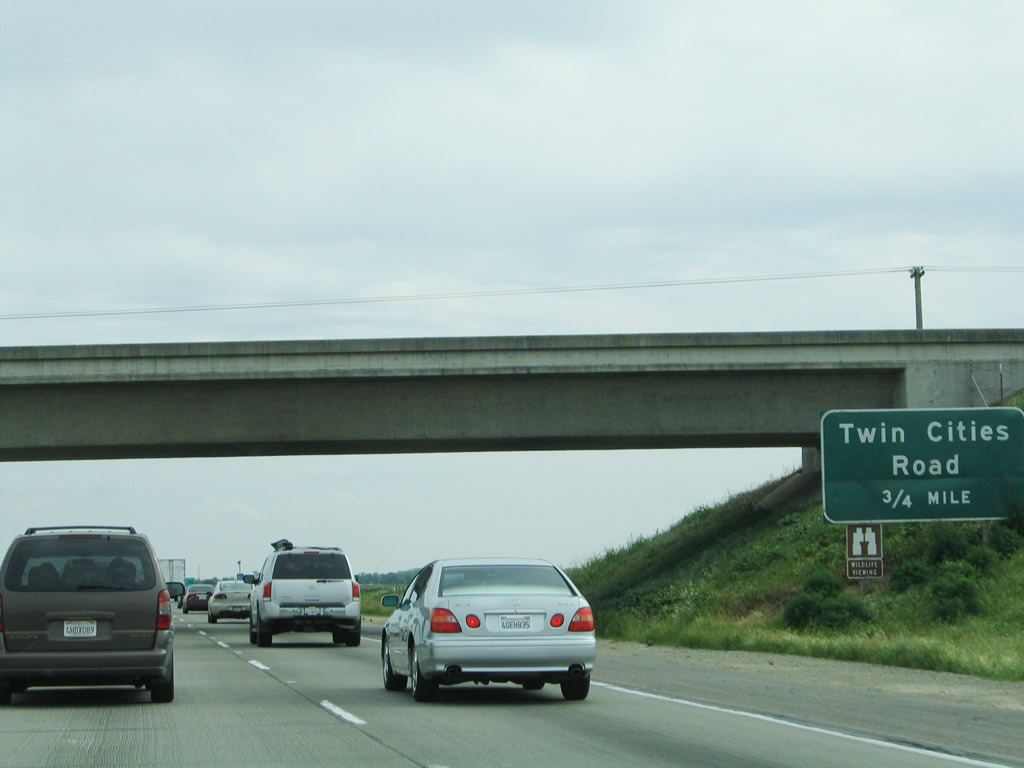
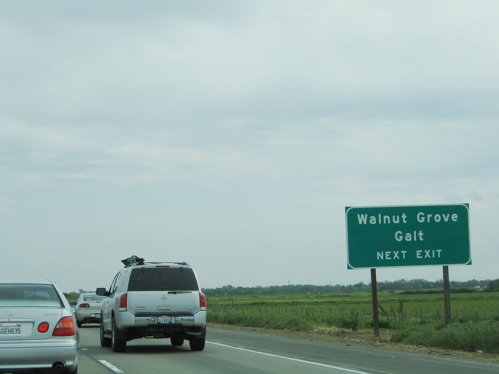
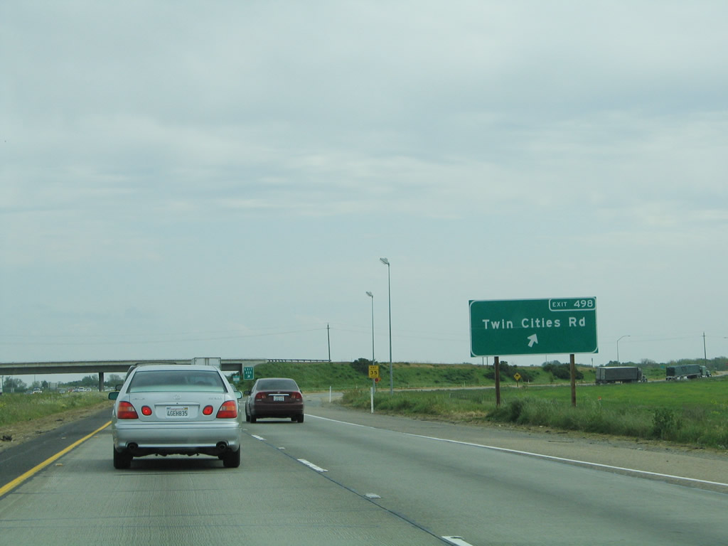
The next exit along southbound Interstate 5 is Exit 498, Sacramento County E-13 (Twin Cities Road). This is a major east-west connector, and for travelers into the California Delta to the west, this route leads to a bridge over the Sacramento River onto Grand Island and California 160. From Walnut Grove, California 160 aims southwest through Ryde, Isleton, and Sherman Island. Leaving Sherman Island, California 160 will cross the San Joaquin River via the tolled Antioch Bridge and enter the city of Antioch, where it ends at its junction with California 4. Photo taken 04/03/05. |
|
Use Sacramento County E-13 (Twin Cities Road) west to the towns of Walnut Grove and Locke along the Sacramento River. In Locke, Sacramento County E-13 and Sacramento County J-11 merge together, cross the Sacramento River, and jointly end at California 160 on the west bank of the river. To the east, Sacramento County E-13 (Twin Cities Road) leads to the city of Galt, then changes into California 104 (Twin Cities Road) east en route to the Rancho Seco Power Plant, Ione, and Jackson. Photo taken 04/03/05. |
|
Southbound Interstate 5 reaches Exit 498, Sacramento County E-13 (Twin Cities Road). Continue south on Interstate 5 to Exit 493 for the connection to San Joaquin County J-11/Walnur Grove Road. Photo taken 04/03/05. |
|
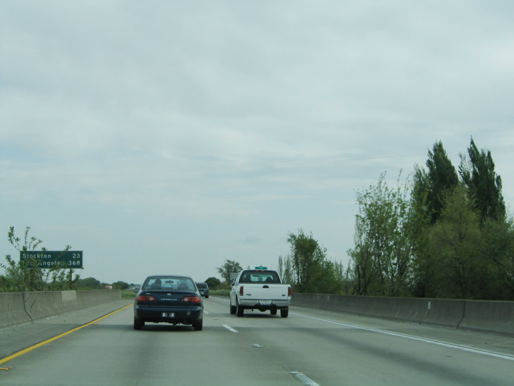
Crossing the Mokelumne River, Interstate 5 leaves Sacramento County and enters San Joaquin County. A mileage sign provides the distance to Stockton (23 miles) and the control city of Los Angeles, which is some 368 miles distant. Photo taken 04/03/05. |
Page Updated April 17, 2009.