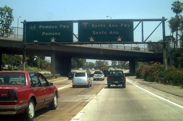
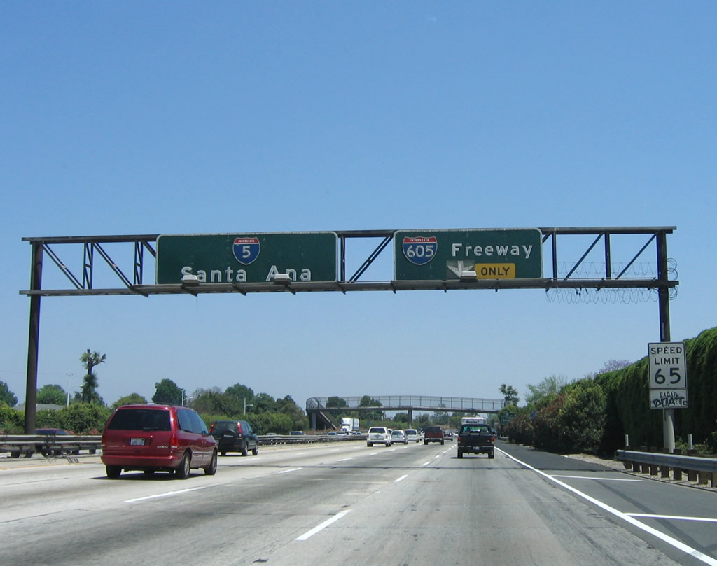
| Interstate 5 (Golden State Freeway) south and Interstate 10 west |
|
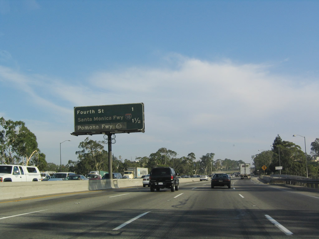
This mileage sign provides the distance to Exit 135A, Fourth Street and the myriad of ramps that constitute Exits 134C-A, Interstate 10 (Santa Monica Freeway) west and California 60 (Pomona Freeway) east. Interstate 5 south and Interstate 10 west are merged at this point as they pass through the East Los Angeles Interchange. Photo taken 07/06/04. |
|
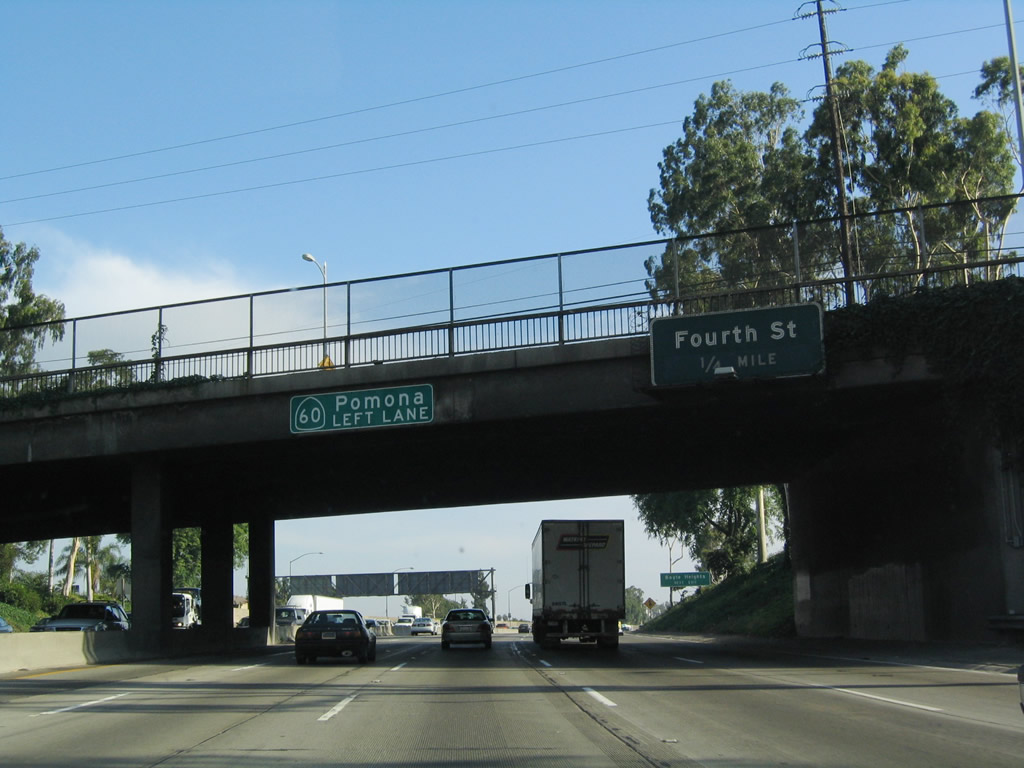
Southbound Interstate 5 and westbound Interstate 10 approach Exit 135A, Fourth Street, one-quarter mile. Note the substandard yet reflective signage for California 60 pasted on the sign bridge. Use Fourth Street to reach Boyle Heights. Photo taken 07/06/04. |
|
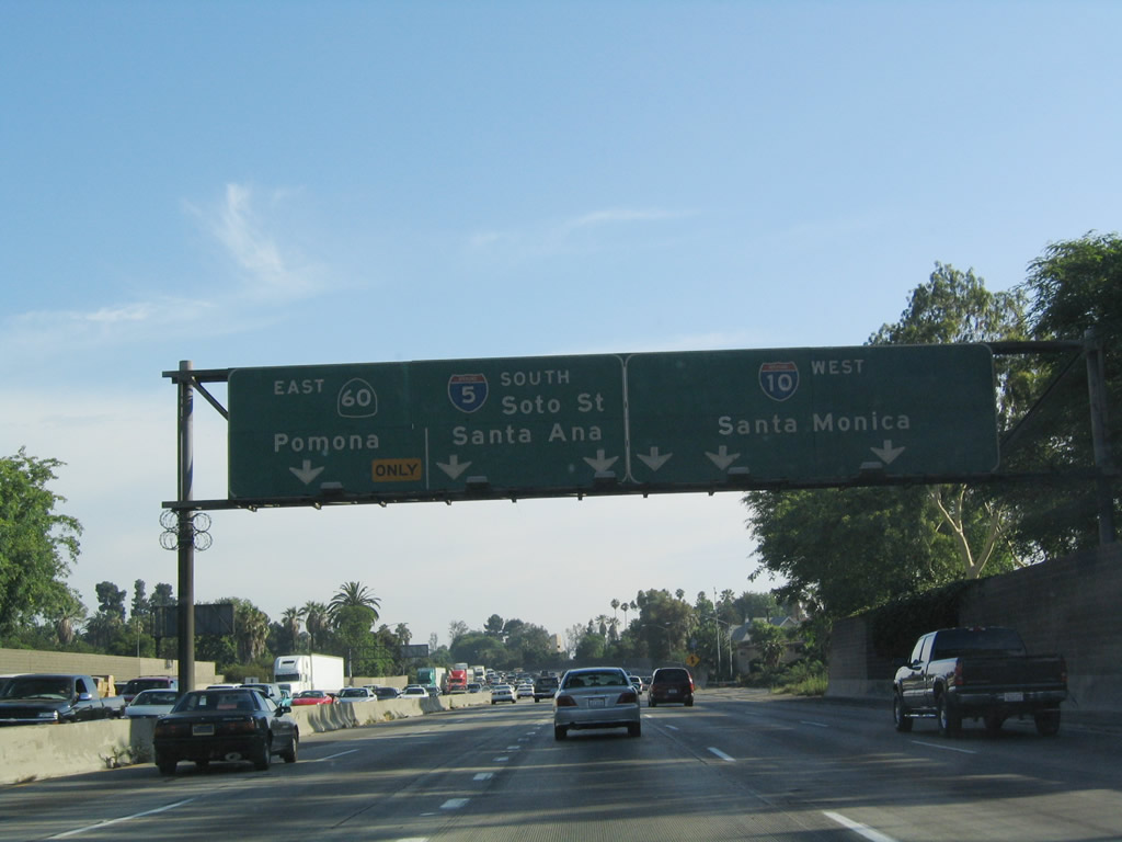
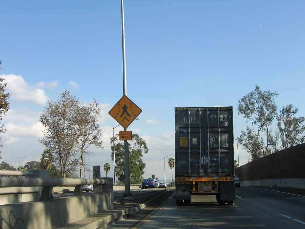
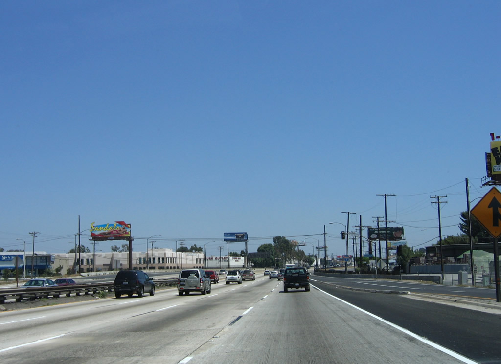
With so many exits in such a short time, several merges and exits, and a limited number of lanes, delays along the freeway are common. This picture shows southbound Interstate 5/westbound Interstate 10 as it approaches Exit 134C to westbound Interstate 10 and Exit 134B to eastbound California 60. Photo taken 07/06/04. |
|
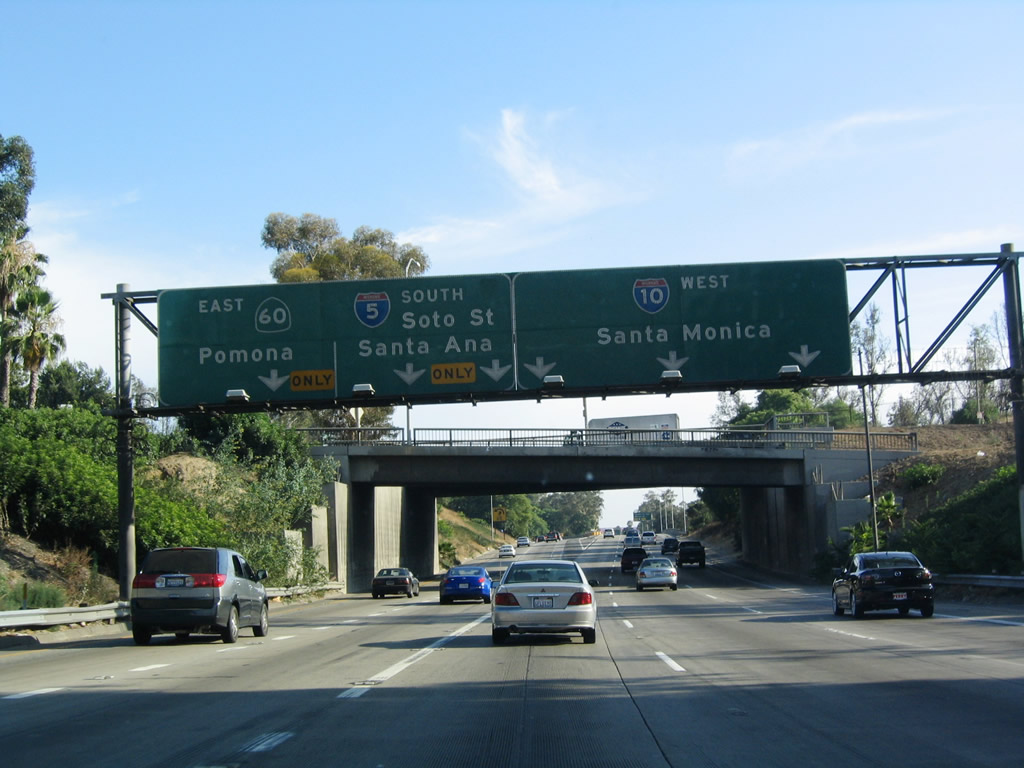
At this point, Interstates 5 and 10 separate. Westbound Interstate 10 (Santa Monica Freeway) (Exit 134C) carries the three right lanes, so through traffic for Interstate 5 must stay left ... but not too far left, because the left lane connects to eastbound California 60 (Pomona Freeway) (Exit 134B). Photo taken 07/06/04. |
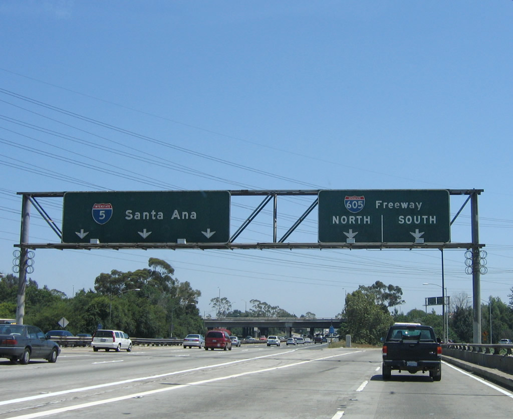
| Interstate 5 (Golden State Freeway) south |
|
As California 60 traffic exits to the left (Exit 134B), southbound Interstate 5 is squeezed into two lanes as it prepares to merge with traffic from U.S. 101 and California 60. This is the first time that through traffic is squeezed into two through lanes since leaving the Central Valley! Photo taken 07/12/03. |
|
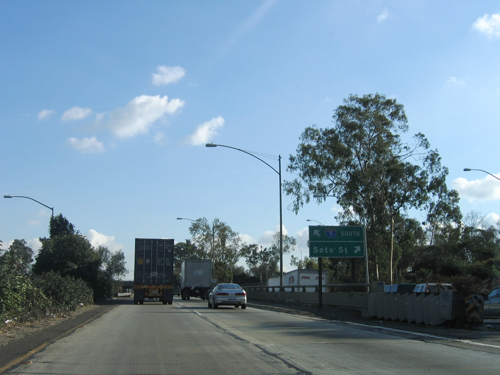
Without much warning, Interstate 5 suddenly meets Exit 134A, Soto Street. Watch closely for this tiny exit sign! Photo taken 11/27/06. |
|
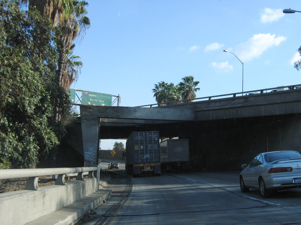
Immediately thereafter Interstate 5 south passes under the eastbound lanes of California 60 (Pomona Freeway). The freeway only retains two southbound lanes, so this area is a site for frequent delays and back-ups. Photo taken 11/27/06. |
| Interstate 5 (Santa Ana Freeway) south |
|
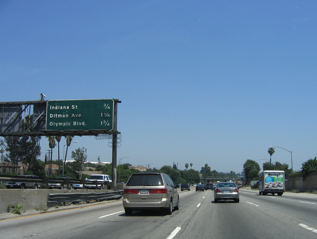
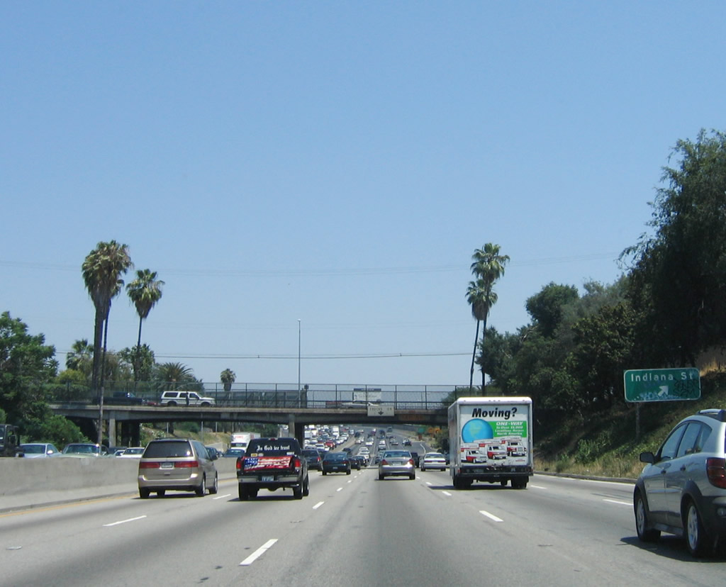
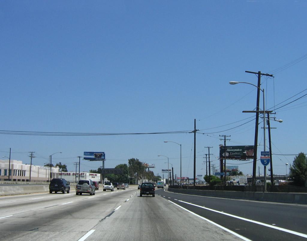
Now that southbound Interstate 5 has merged with U.S. 101 and California 60, it reassumes five through lanes as it approaches its next exit, Exit 133/Euclid Avenue (not photographed). Following Euclid Avenue is Exit 132 for Indiana Street. Following Indiana Street, the next exits are Exit 131B, Ditman Avenue and Exit 131A, Olympic Boulevard. Photo taken 06/18/06. |
|
Southbound Interstate 5 approaches Exit 132, Indiana Street, 0.50 mile. Photo taken 06/18/06. |
|
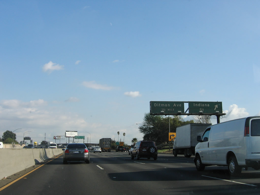
Following Indiana Street, Ditman Avenue, and Olympic Boulevard, the next interchange is Exit 130B, Interstate 710 (Long Beach Freeway) south, which is mentioned for the first time here. Photo taken 06/18/06. |
|
This is the first of two signs that advise of the exit from southbound Interstate 5 to Exit 132 at Indiana Street. Photo taken 06/18/06. |
|
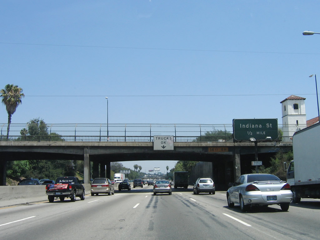
Southbound Interstate 5 reaches Exit 132, Indiana Street. The next exit is Exit 131B, Ditman Avenue. Photo taken 11/27/06. |
|
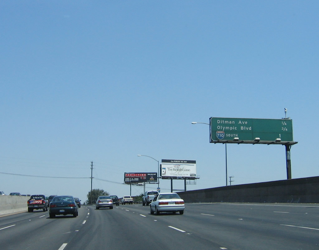
This mileage sign along southbound Interstate 5 provides the distance to the next three junctions: Exit 131B, Ditman Avenue; Exit 131A, Olympic Boulevard; and Exit 130, Interstate 710 (Long Beach Freeway) south to Long Beach. Photo taken 06/18/06. |
|
Southbound Interstate 5 (Santa Ana Freeway) reaches Exit 131B, Ditman Avenue. The exit number tab on this sign was added during Caltrans' original yet never-completed experiment with exit numbering back in the 1960s. At that time, exit numbers were placed on Interstate 5, U.S. 101, California 60, and California 110 near downtown Los Angeles as well as along Interstate 10 from Santa Monica east to Pomona. Note that the original exit number present on this sign is slightly wrong; it should be Exit 131B rather than just Exit 131. Photo taken 11/27/06. |
|
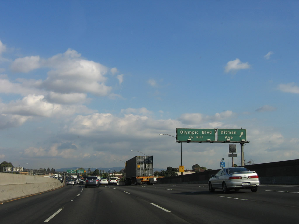
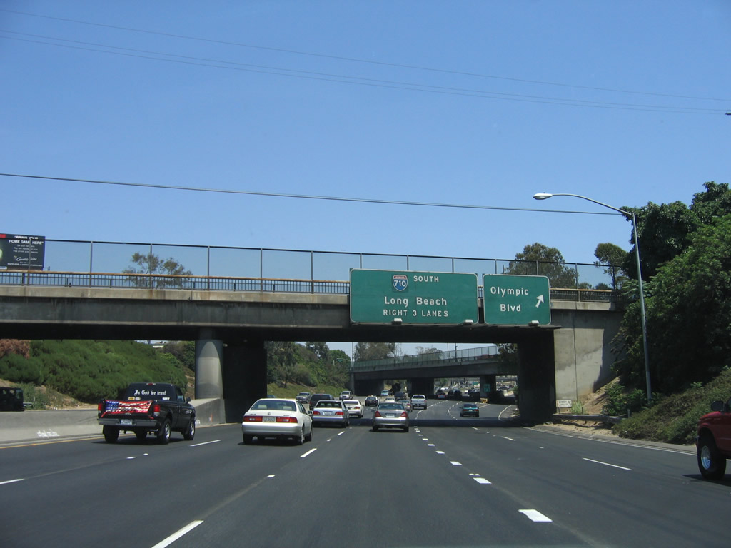
After the Ditman Avenue exit but before the Olympic Boulevard exit are these signs for Interstate 710 (Long Beach Freeway). Photo taken 11/27/06. |
|
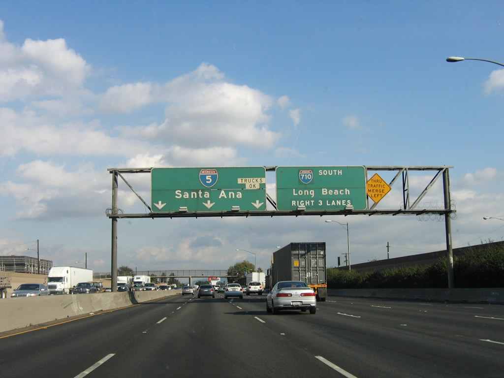
Southbound Interstate 5 (Santa Ana Freeway) reaches Exit 131A, Olympic Boulevard. Again note the incorrect exit number in use here (it is Exit 131A, not Exit 129). A major exit follows: Interstate 710 (Former California 7 - note that the Interstate 710 shield is pasted over the original California 7 shield), which connects Interstate 10 with Long Beach and the Port of Los Angeles. Photo taken 06/18/06. |
|
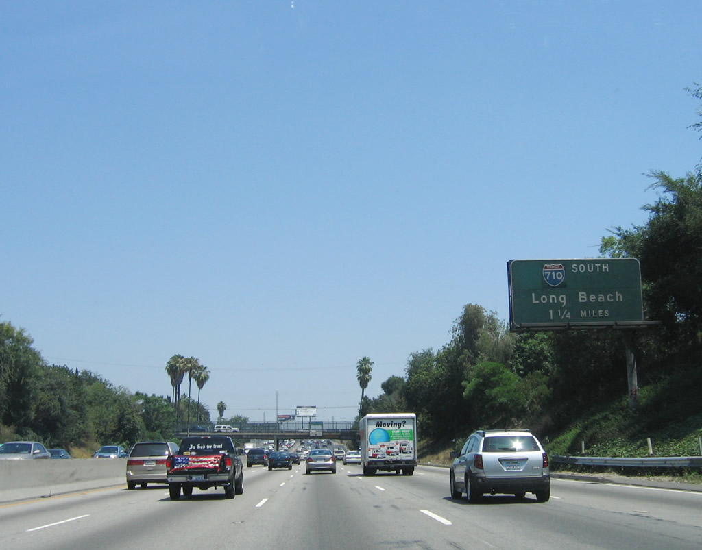
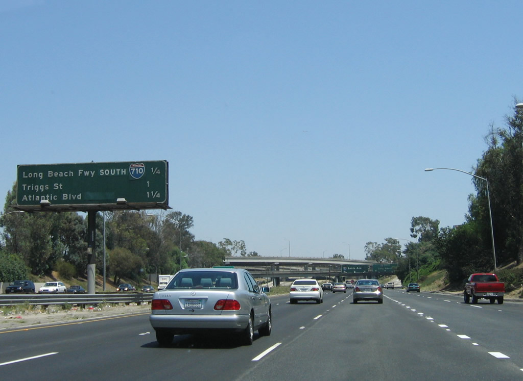
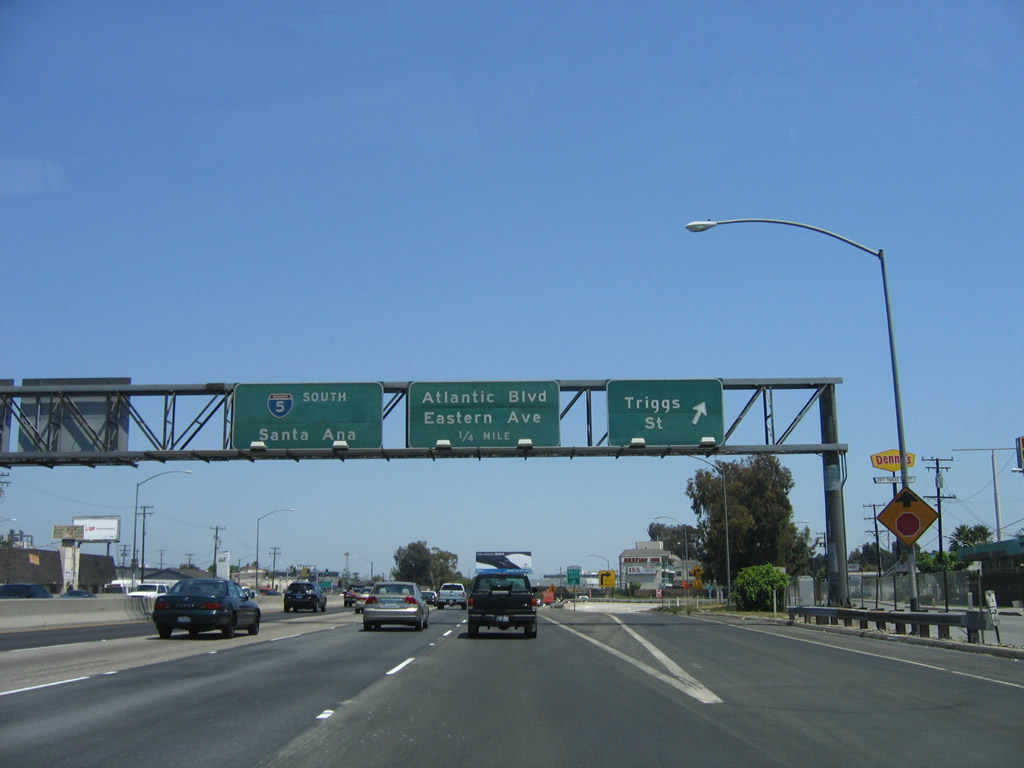
This mileage sign provides the distance for the next three exits along southbound, including Exit 130B, Interstate 710 (Long Beach Freeway) south; Exit 130A, Triggs Street; and Exit 129, Atlantic Boulevard and Eastern Avenue. Interstate 710 is a major north-south freeway that was originally constructed as a relocated California 15 in the 1950s, but its designation was changed in 1964 to California 7 to avoid confusion with Interstate 15. By that time, former California 15 (Atlantic Boulevard) was decommissioned and California 7 (Sepulveda Boulevard) was largely replaced by Interstate 405 (San Diego Freeway). Many of the northbound signs for Interstate 710 feature Interstate shields that were laid over the older signs featuring California 7 shields, as these signs are much older than the mid-1980s sign changeover. Photo taken 06/18/06. |
|
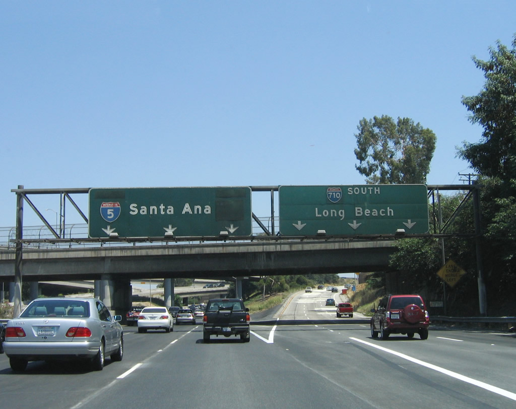
The left three lanes continue south on Interstate 5 (Santa Ana Freeway), while the right three lanes depart to Exit 130B, Interstate 710 south to Long Beach. As seen in this photo, the older button copy signs are very difficult to read after nearly 50 years in the field. The overlays likely hide the cardinal direction as well as a U.S. 101 shield. Southbound Interstate 5 leaves the city of Los Angeles a second and final time, and the freeway now enters the city of Commerce, which was incorporated in 1960 and covers mostly industrial and commercial land. A total of 12,568 people lived in Commerce as of the 2000 Census. The segment of Interstate 5 that passes through the City of Commerce lives up to its name, with industrial and commercial facilities located throughout. In addition, a large amount of railroad infrastructure is present in the City of Commerce. Photo taken 06/18/06. |
|
Interstate 5 passes through the Interstate 710 interchange. A flyover ramp connects Interstate 710 north with Interstate 5 north. Photo taken 06/18/06. |
|
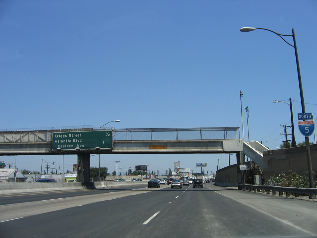
This interchange sequence sign along Interstate 5 (Santa Ana Freeway) south provides the distance to the next two exits: Exit 130A, Triggs Street and Exit 129, Atlantic Boulevard/Eastern Avenue. Photo taken 06/18/06. |
|
Businesses line both sides of Interstate 5 as the freeway continues southeast through the city of Commerce on the southwest side of the freeway and unincorporated East Los Angeles on the northeast side of the freeway. Photo taken 06/18/06. |
|
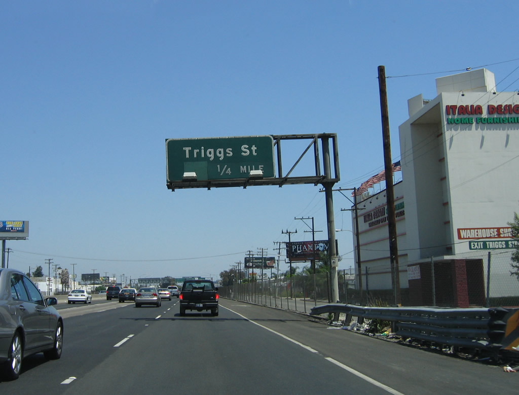
Southbound Interstate 5 (Santa Ana Freeway) reaches Exit 130A, Triggs Street. The next exit is for Atlantic Boulevard and Eastern Avenue. Photo taken 06/18/06. |
|
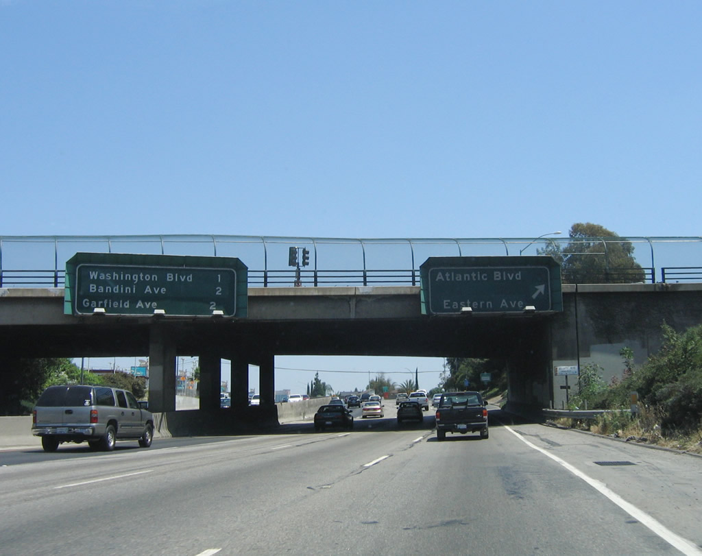
Immediately thereafter, southbound Interstate 5 (Santa Ana Freeway) reaches Exit 129, Atlantic Boulevard and Eastern Avenue. An interchange sequence sign also provides the distance to the next two exits: Exit 128B, Washington Boulevard and Exit 128A, Bandini Boulevard and Garfield Avenue. Photo taken 06/18/06. |
|
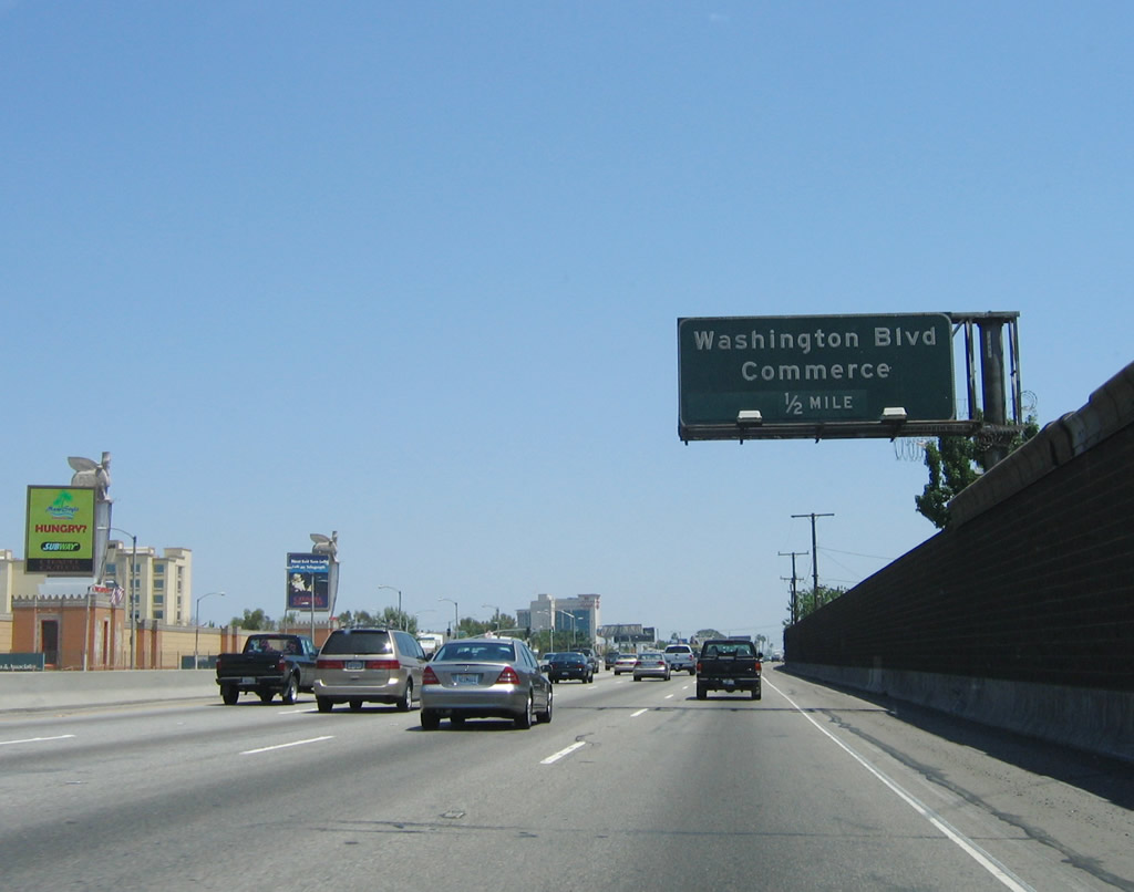
The next exit along Interstate 5 (Santa Ana Freeway) south is Exit 128B, Washington Boulevard. The Citadel Outlet Collection is an outlet mall located on the east side of the freeway. Large video screens on billboards dominate the view on the east side of the freeway adjacent to The Citadel. Photo taken 06/17/06. |
|
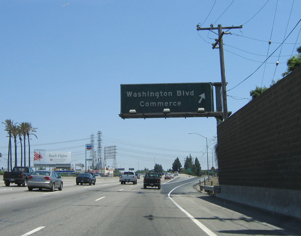
Southbound Interstate 5 (Santa Ana Freeway) reaches Exit 128B, Washington Boulevard. Photo taken 06/17/06. |
|
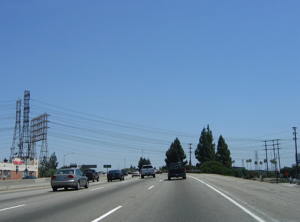
A set of Southern California Edison (SCE) power lines pass over Interstate 5 near the Washington Boulevard interchange. These lines travel south toward power plants and industrial facilities located near Long Beach and the port. Photo taken 06/17/06. |
|
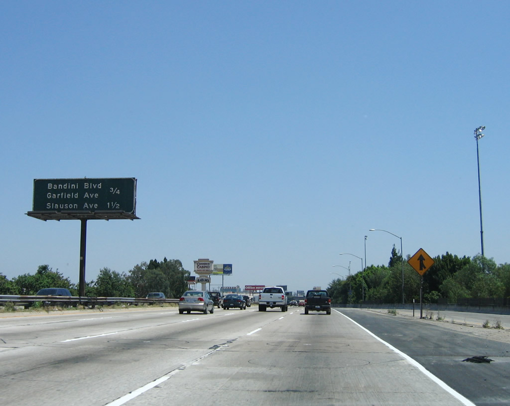
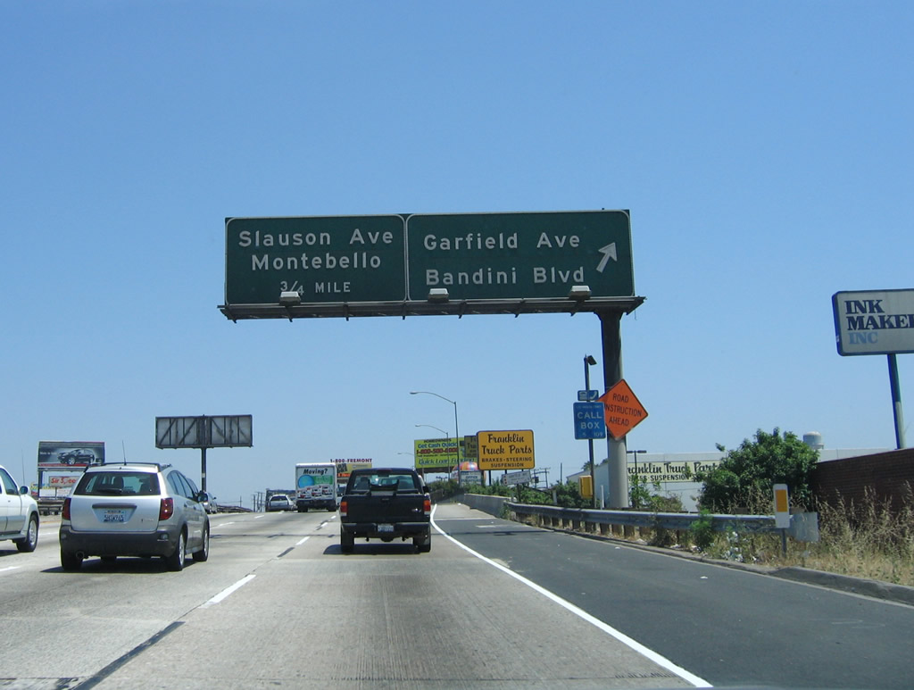
This mileage sign provides the distance to the next two exits along Interstate 5 (Santa Ana Freeway) south: Exit 128A, Garfield Avenue and Bandini Boulevard and Exit 126B, Slauson Avenue. Photo taken 06/17/06. |
|
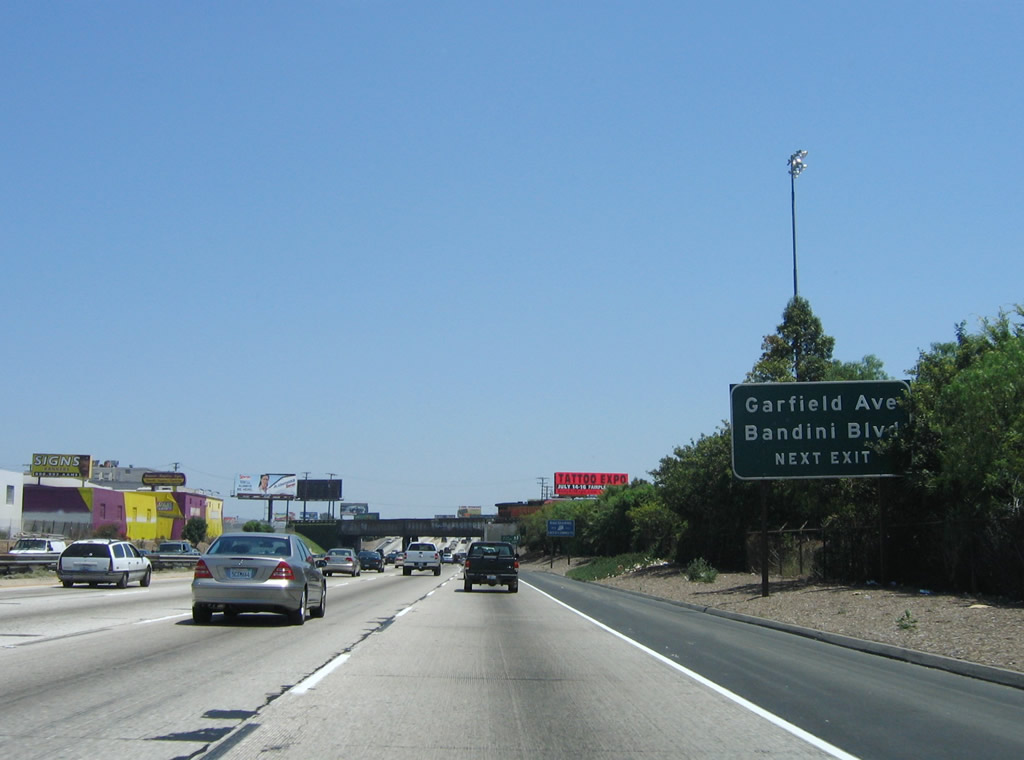
The next exit along Interstate 5 south is Exit 128A, Garfield Avenue and Bandini Boulevard. Garfield Avenue travels generally north-south through the City of Commerce, leading into the city of Bell Gardens to the south and the city of Montebello to the north. Bandini Boulevard is an east-west street that travels from the City of Commerce west toward the cities of Maywood and Vernon. Photo taken 06/17/06. |
|
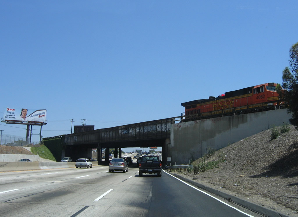
A Burlington Northern Santa Fe (BNSF) locomotive lumbers across a railroad bridge as Interstate 5 (Santa Ana Freeway) continues south toward Norwalk and Orange County. The freeway retains four southbound lanes for now, but Interstate 5 will lose one of its lanes before entering Norwalk. Additionally, note the lack of shoulders on this section of Interstate 5. Photo taken 06/17/06. |
|
Southbound Interstate 5 (Santa Ana Freeway) reaches Exit 128A, Garfield Avenue and Bandini Boulevard. The next exit is Exit 126B, Slauson Avenue. Photo taken 06/17/06. |
|
Traffic merges onto Interstate 5 south from Garfield Avenue and Bandini Avenue. Photo taken 06/17/06. |
|
An Interstate 5 south reassurance shield is posted shortly thereafter. Photo taken 06/17/06. |
|
The right shoulder, which had been missing for some distance now, reemerges after the on-ramp from Exit 128A. Photo taken 06/17/06. |
|
Southbound Interstate 5 (Santa Ana Freeway) reaches Exit 126B, Slauson Avenue. Use Exit 126B, Slauson Avenue east to the city of Montebello and Pico Rivera. Use Slauson Avenue west to the city of Commerce. As of the 2000 Census, Montebello had a total population of 62,150 people. The area was first settled during the days of Father Junipero Serra when the original San Gabriel Mission was established on on September 9, 1771; the mission was moved to San Gabriel in 1776 due to flooding. The mission was located near where San Gabriel Boulevard crosses the Rio Hondo River. The city of Montebello incorporated on October 19, 1920; the Spanish translation is "beautiful hill." Oil was discovered in and around Montebello, and that hastened the area's development in the early 20th Century. Looking to the west, Slauson Avenue travels into southern Los Angeles and the cities of Maywood and Huntington Park. Photo taken 06/17/06. |
|
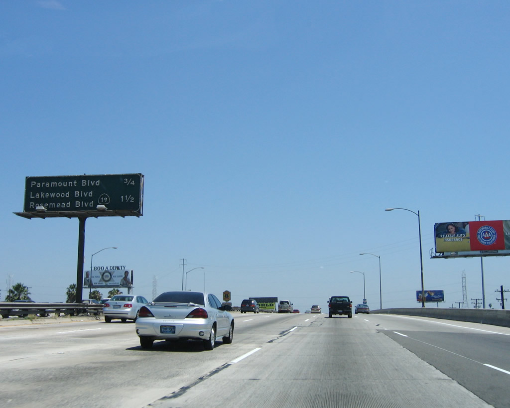
This mileage sign provides the distance to the next two exits along Interstate 5 (Santa Ana Freeway) south: Exit 126A, Paramount Boulevard and Exit 125, California 19/Lakewood Avenue south to Long Beach and California 19/Rosemead Avenue north to Rosemead. Photo taken 06/17/06. |
|
An Interstate 5 south reassurance shield is posted after the on-ramp from Slauson Avenue. Photo taken 06/17/06. |
|
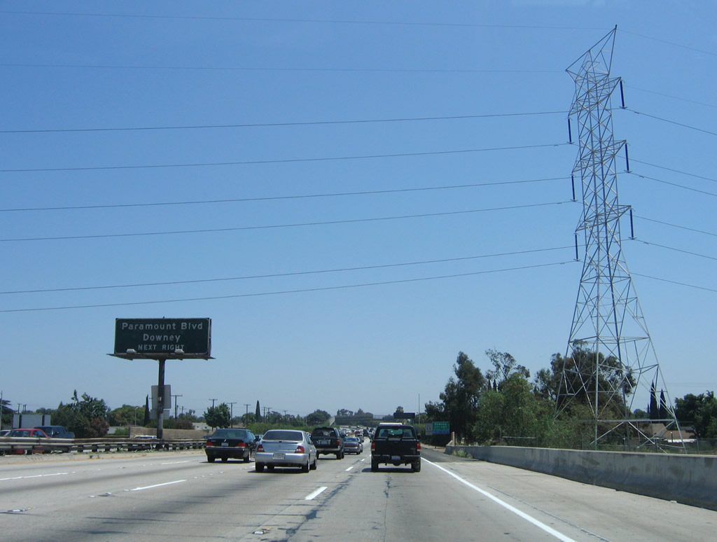
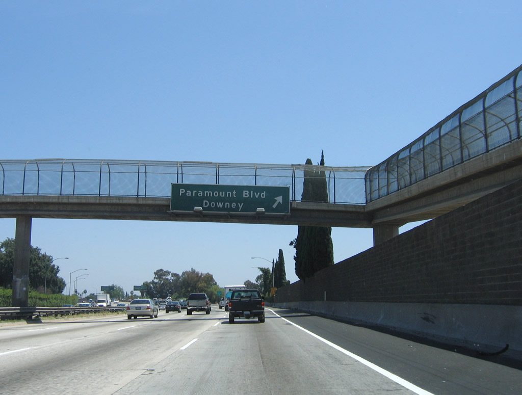
The next exit along Interstate 5 (Santa Ana Freeway) south is Exit 126A, Paramount Boulevard. Interstate 5 crosses the Rio Hondo bridge. This river serves as the boundary between the City of Commerce and the city of Downey. A Los Angeles Department of Water and Power (LADWP) power line crosses over Interstate 5 at this point. Photo taken 06/17/06. |
|
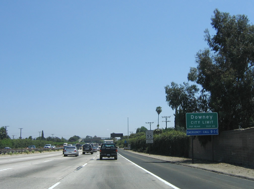
Continuing southeast on the mainline, Interstate 5 (Santa Ana Freeway) now leaves the City of Commerce and enters the city of Downey. Home to 107,323 people as of the 2000 Census, Downey was incorporated in 1956. Photo taken 06/17/06. |
|
Southbound Interstate 5 (Santa Ana Freeway) reaches Exit 126A, Paramount Boulevard. Photo taken 06/17/06. |
|
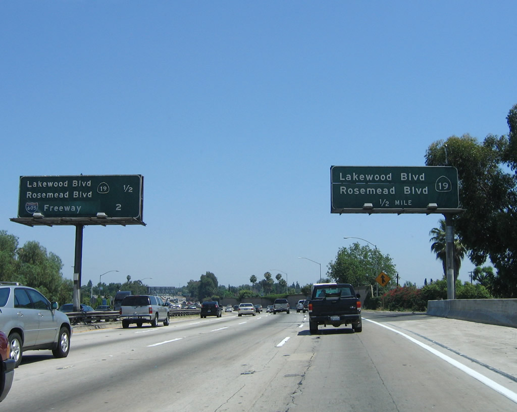
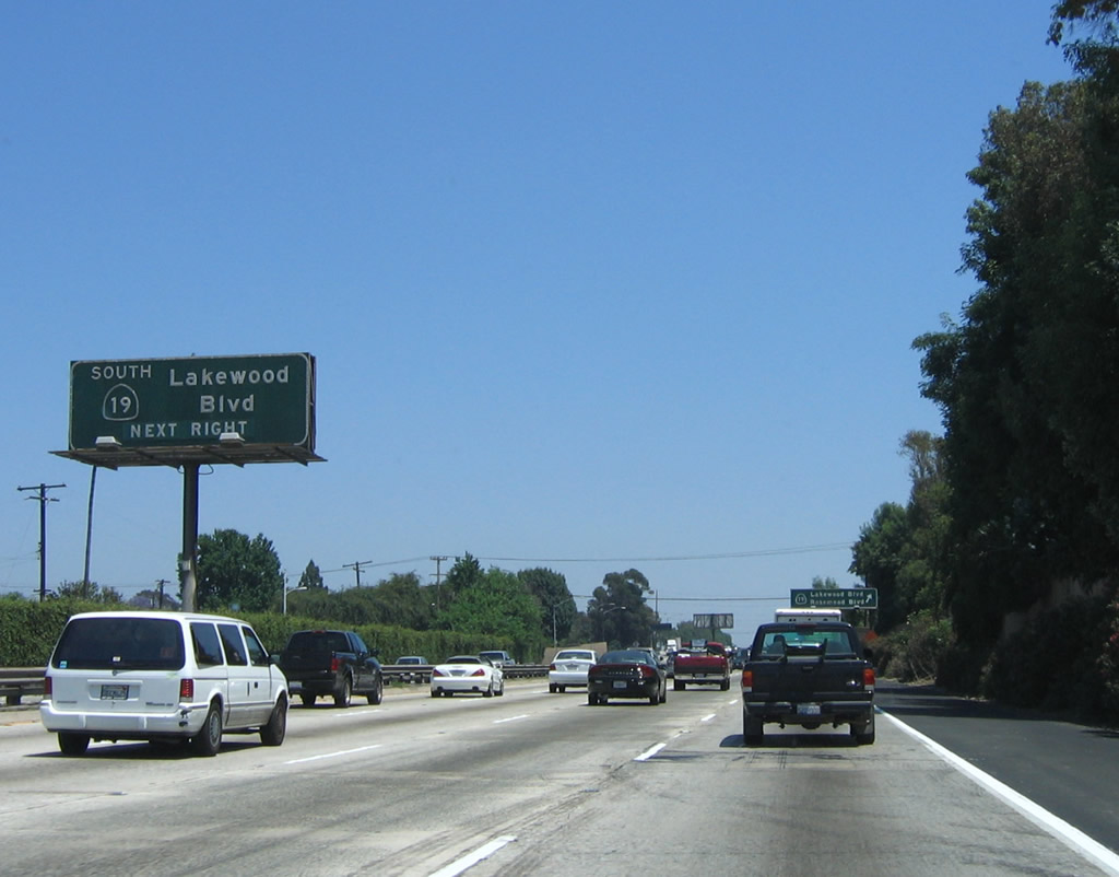
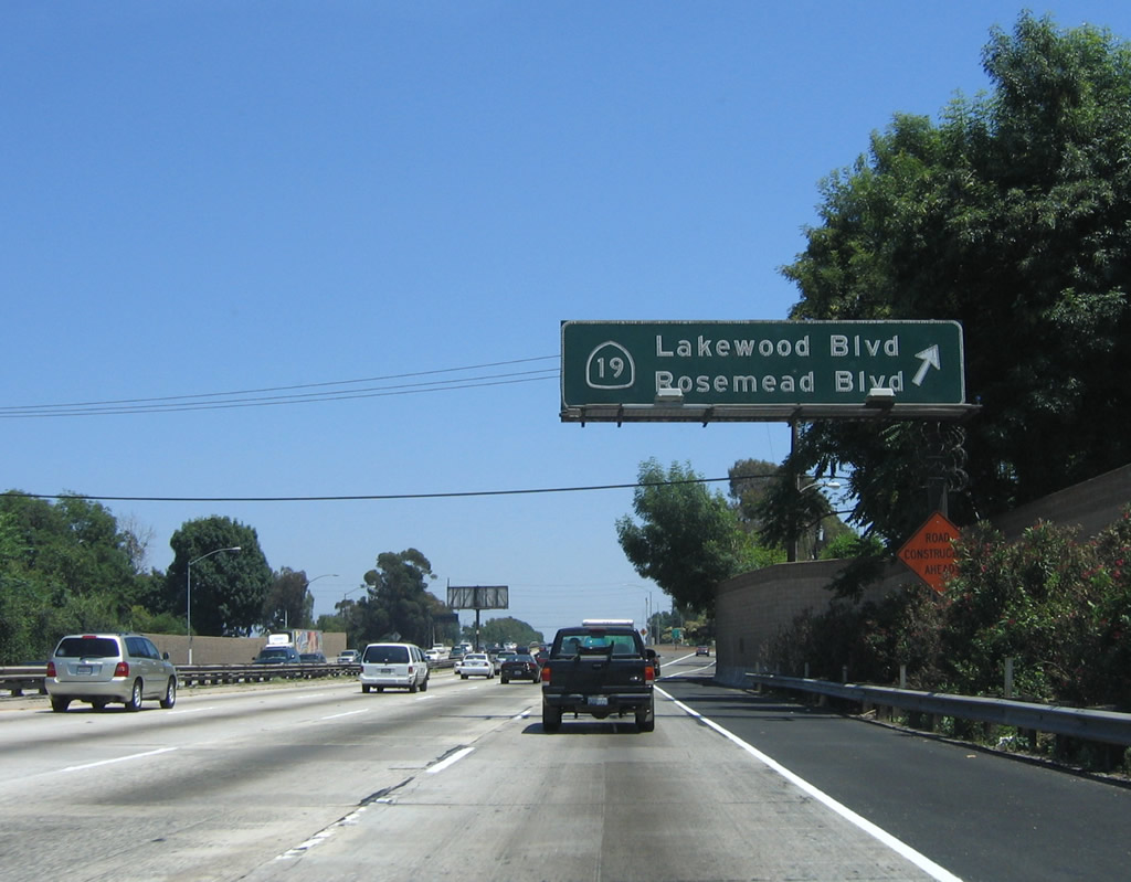
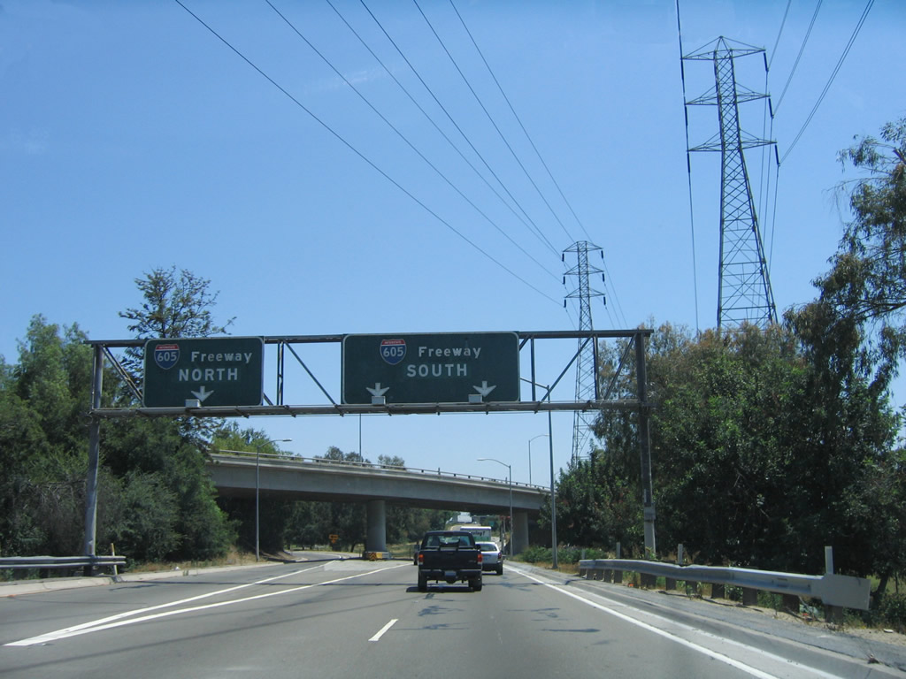
The next two exits along Interstate 5 (Santa Ana Freeway) south are Exit 125, California 19 (Lakewood Boulevard) south and California 19 (Rosemead Boulevard) north and Exit 124, Interstate 605. Photo taken 06/17/06. |
|
California 19 is Lakewood Avenue south of Interstate 5 and Rosemead Avenue north of Interstate 5. Since Interstate 5 travels in a northwest to southeast direction through southern Los Angeles County and Orange County, it intersects several streets that travel north-south. Photo taken 06/17/06. |
|
Southbound Interstate 5 (Santa Ana Freeway) reaches Exit 125, California 19/Lakewood Avenue south to Long Beach and California 19/Rosemead Avenue north to Rosemead. Photo taken 06/17/06. |
|
The right lane of Interstate 5 south becomes exit only for Exit 124 for Interstate 605 south to Seal Beach and north to Duarte. No destination or control cities are listed on these signs, which is typical for most signs related to Interstate 605. The left three lanes continue south on Interstate 5 into Norwalk. Photo taken 06/17/06. |
|
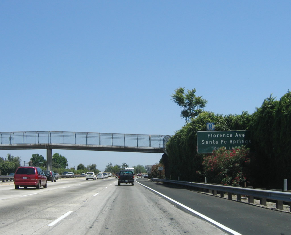
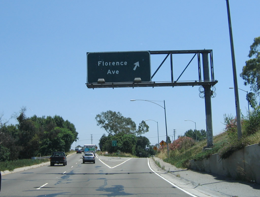
Use Exit 124 to connect to Florence Avenue and the city of Santa Fe Springs. A dedicated ramp to Exit 123, Florence Avenue is only available via the transition ramp from Interstate 5 south to Interstate 605 south. Photo taken 06/17/06. |
|
Southbound Interstate 5 reaches Exit 124, Interstate 605 (San Gabriel River Freeway). Photo taken 06/17/06. |
|
Now on the transition ramp from Interstate 5 (Santa Ana Freeway) south to Interstate 605 (San Gabriel River Freeway), this sign advises that the left lane of the transition ramp connects to Interstate 605 north, and the right two lanes connect to Interstate 605 south. Continue south for the connection to Exit 123, Florence Avenue. Photo taken 06/17/06. |
|
A right exit connects to Exit 123, Florence Avenue. There is no access to Florence Avenue from mainline Interstate 5; one must use the transition ramp to Interstate 605 south to get to this ramp for Exit 123 (note the gore point sign reads "Exit 123"). Use Florence Avenue west to Downey and Bell Gardens and east to the city of Santa Fe Springs. The city of Santa Fe Springs had a population of 17,438 as of the 2000 Census, incorporated on May 15, 1957, and consisted of 8.9 square miles. Photo taken 06/17/06. |
|
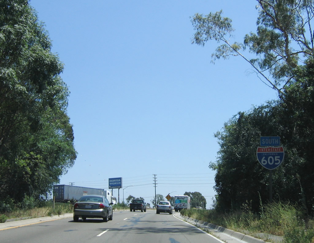
After the off-ramp to Exit 123, Florence Avenue, the transition ramp prepares to merge onto Interstate 605 south. An Interstate 605 reassurance shield is posted on the transition ramp prior to the merge onto the Interstate 605 south main lanes. Photo taken 06/17/06. |
|
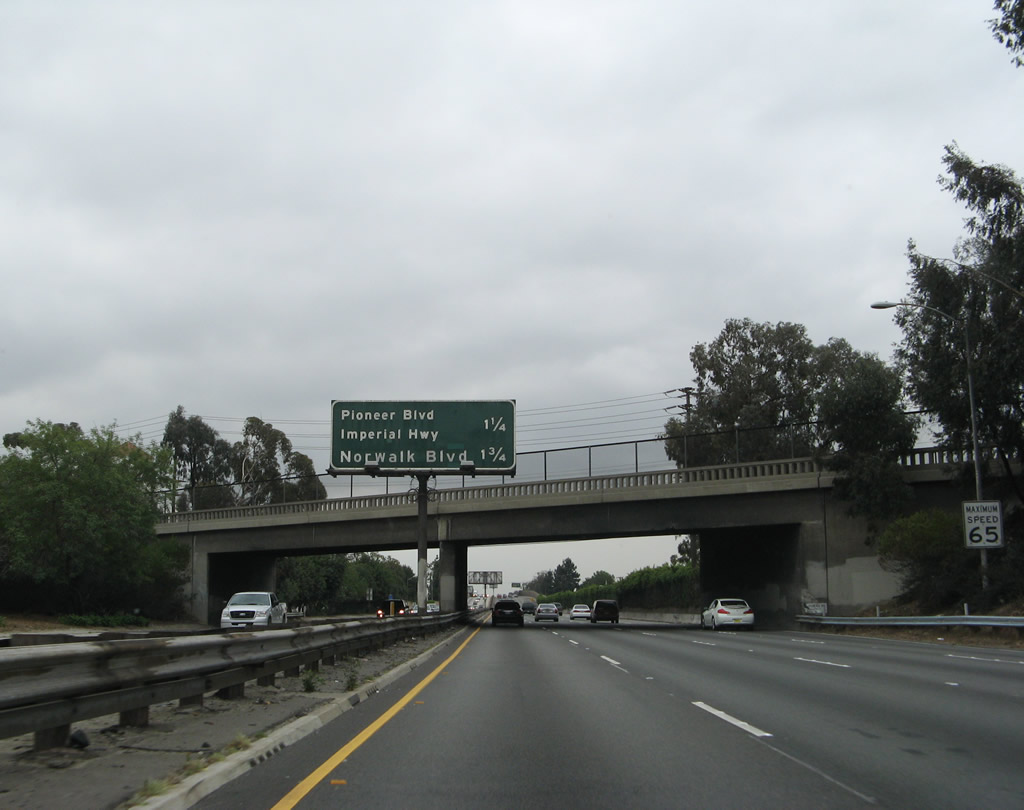
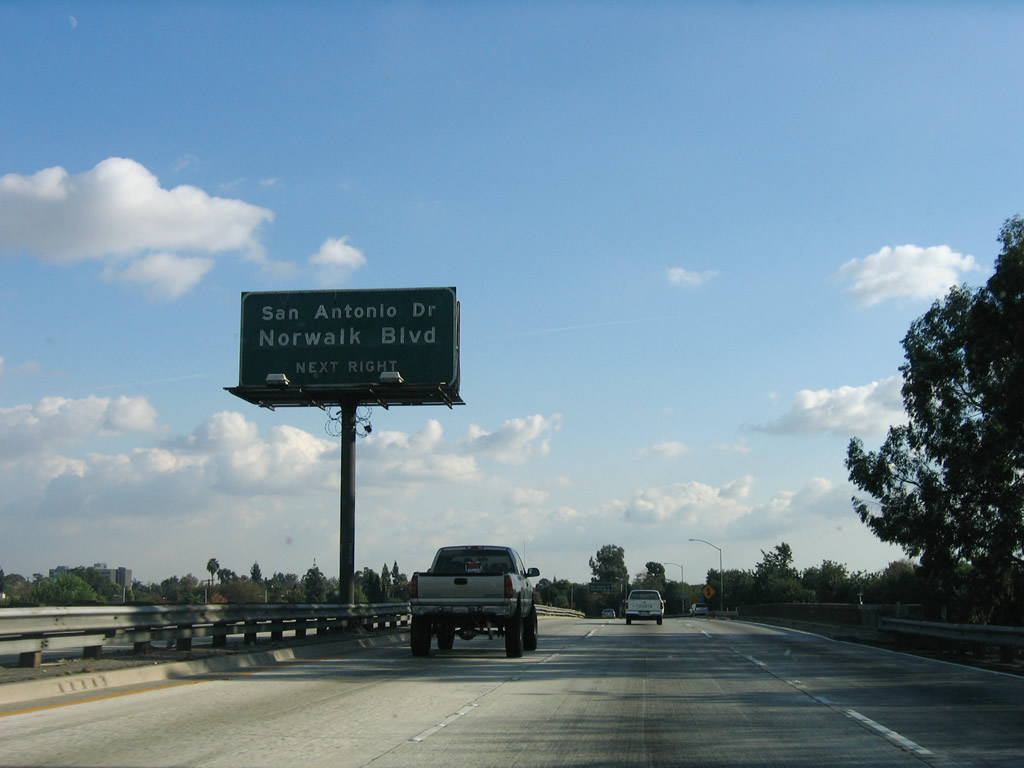
Back on the mainline, after passing through the Interstate 605 freeway-to-freeway interchange and crossing Orr and Day Road, Interstate 5 leaves the city of Downey and enters the city of Norwalk. Norwalk was home to 103,298 residents as of the 2000 Census. The city was incorporated in 1957, around the same time the Interstate 5 freeway was first built (as part of U.S. 101). Norwalk consists of 9.35 square miles. This mileage sign provides the distance to the next two exits: Exit 122, Pioneer Boulevard and Imperial Highway and Exit 121, San Antonio Drive and Norwalk Boulevard. Photo taken 04/21/07. |
|
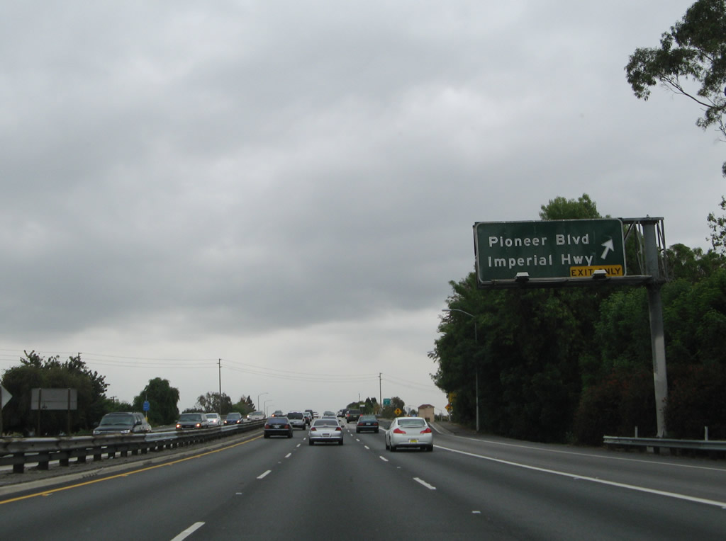
A newly formed auxiliary lane along Interstate 5 south becomes exit only for Exit 122, Pioneer Boulevard and Imperial Highway. Photo taken 11/27/06. |
|
Southbound Interstate 5 (Santa Ana Freeway) reaches Exit 122, Pioneer Boulevard/Imperial Highway. Pioneer Boulevard leads south through Norwalk into Cerritos, while Imperial Highway provides a major east-west surface street roughly parallel to Interstate 105 west of Norwalk. East of Norwalk, Imperial Highway changes into the eastern segment of California 90 at its junction with California 39 (Beach Boulevard) in La Habra. (The western segment of California 90, which is state route with a missing/unconstructed middle section, is the Marina Freeway near Culver City and Interstate 405.) Photo taken 04/21/07. |
|
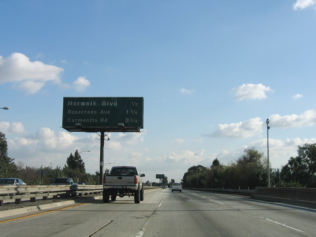
This mileage sign provides the distance to the next three exits along Interstate 5 (Santa Ana Freeway) south: Exit 121, San Antonio Drive and Norwalk Boulevard; Exit 120, Rosecrans Avenue; and Exit 119, Carmenita Road. Photo taken 11/27/06. |
|
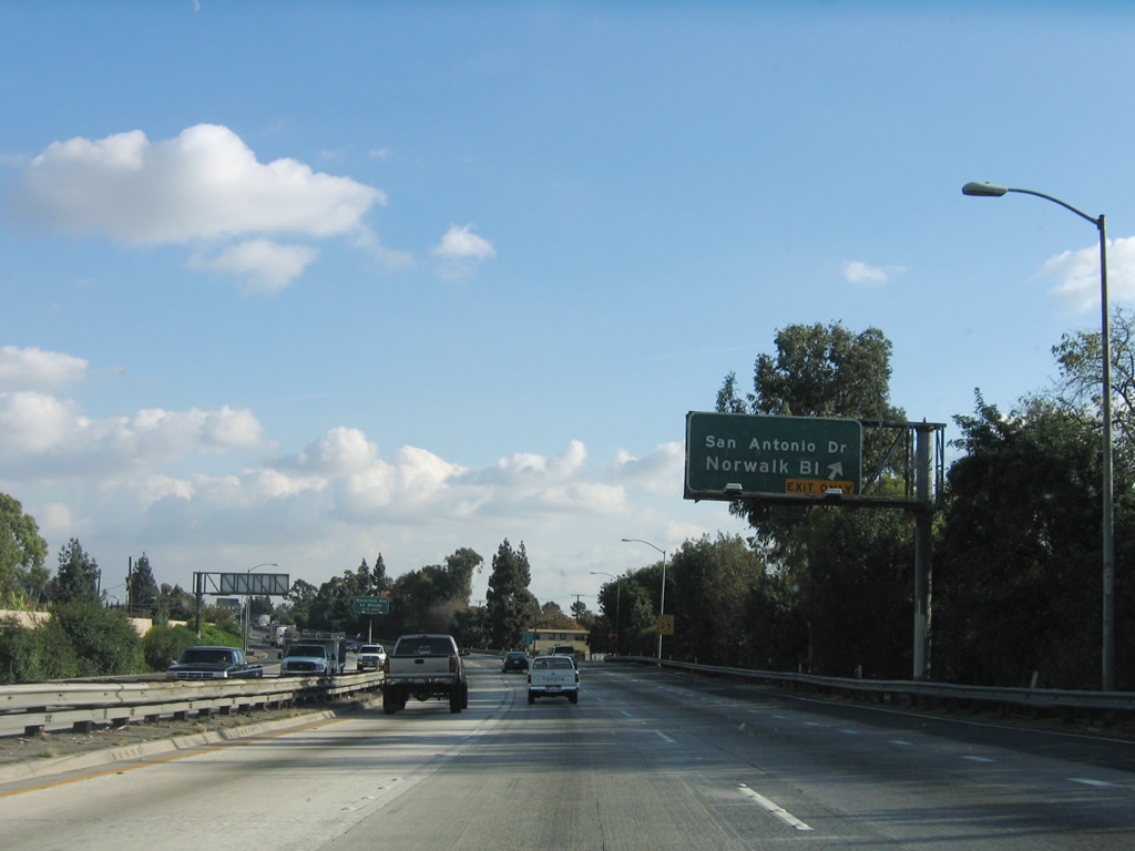
Use San Antonio Drive southwest to the Norwalk Town Square. Use Norwalk Boulevard north to Fashion Square mall and the Los Angeles County Hall of Records. Photo taken 11/27/06. |
|
Southbound Interstate 5 (Santa Ana Freeway) reaches Exit 121, San Antonio Drive/Norwalk Boulevard. Photo taken 11/27/06. |
|
The next exit along Interstate 5 south is Exit 120, Rosecrans Avenue (1.25 miles). Photo taken 11/27/06. |
|
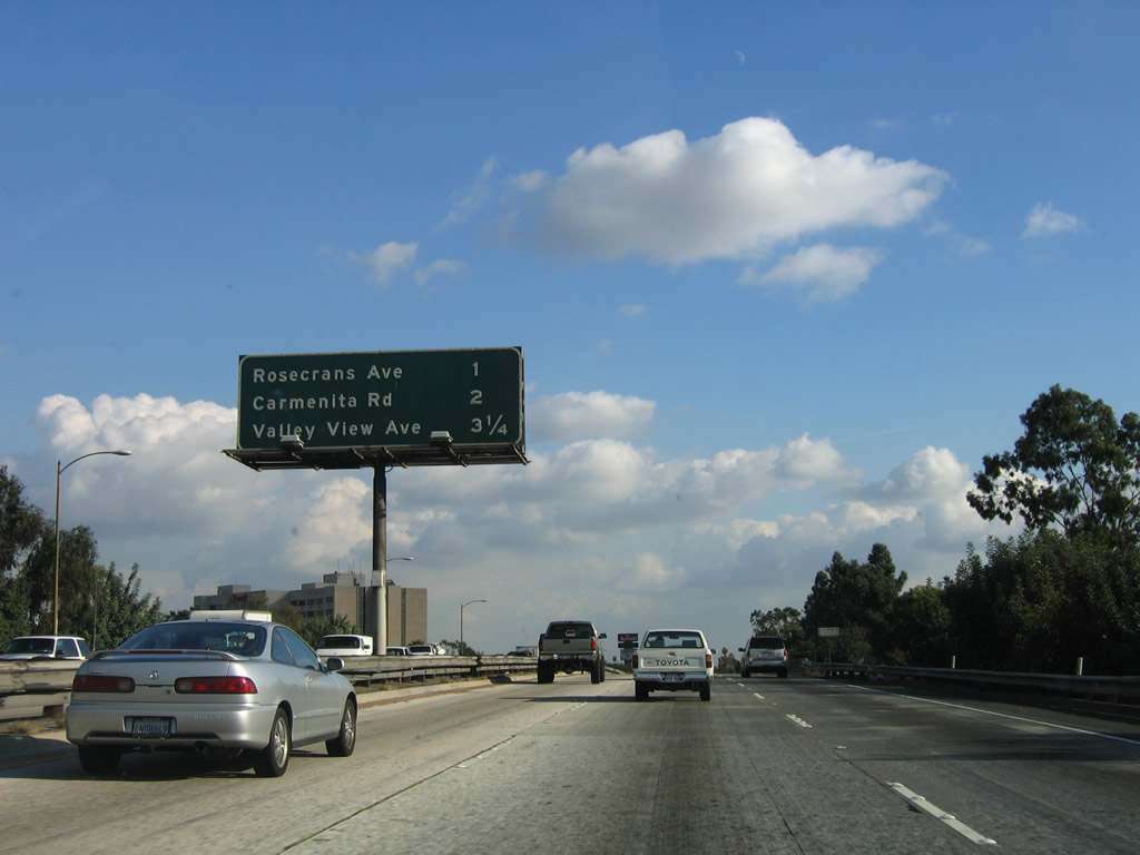
This mileage sign provides the distance to the next three exits along Interstate 5 (Santa Ana Freeway) south: Exit 120, Rosecrans Avenue; Exit 119, Carmenita Road; and Exit 118, Valley View Avenue. Photo taken 11/27/06. |
|
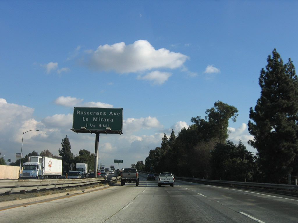
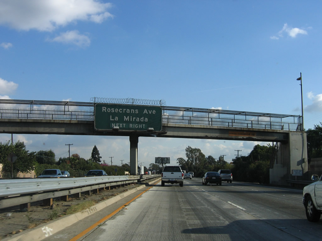
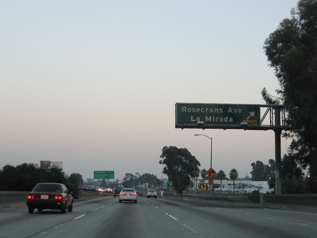
Use Rosecrans Avenue east to the city of La Mirada and west to the cities of Norwalk, Bellflower, and Paramount. Interstate 5 will skirt the southwestern corner of La Mirada between Exits 118 and 117. Photo taken 11/27/06. |
|
There is no direct access from Interstate 5 south to Firestone Boulevard (former California 42) west; however, the back of the exit signs for that connection can be seen here. The off-ramp for Exit 120, Rosecrans Avenue, is just ahead. Photo taken 11/27/06. |
|
Southbound Interstate 5 reaches Exit 120, Rosecrans Avenue and Firestone Boulevard west. Photo taken 09/25/05. |
|
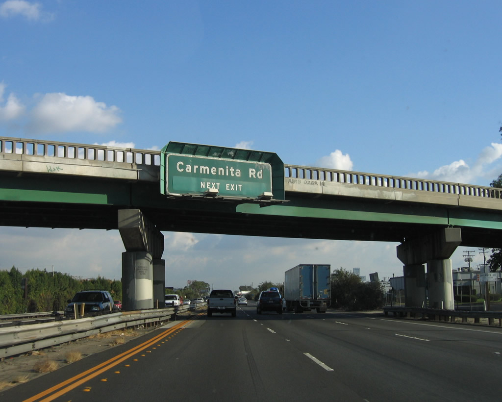
The next exit along Interstate 5 (Santa Ana Freeway) is Exit 119, Carmenita Road. At this point, north-south Shoemaker Avenue crosses over Interstate 5 on an older steel girder bridge that features old-style concrete bridge railing. Photo taken 11/27/06. |
|
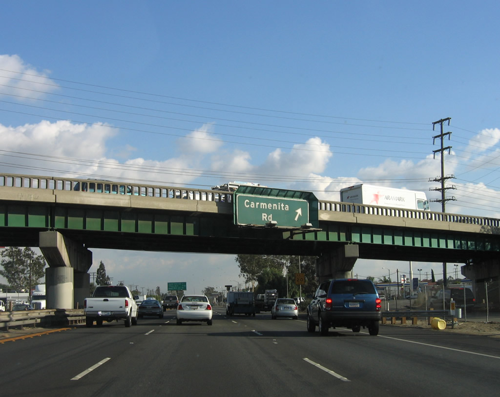
Southbound Interstate 5 reaches Exit 119, Carmenita Road. Note the original concrete guardrail present on this overpass. At this point, Interstate 5 leaves the city of Norwalk and enters the southern portion of the city of Santa Fe Springs. Photo taken 11/27/06. |
|
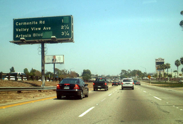
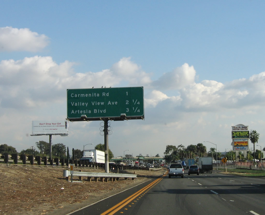
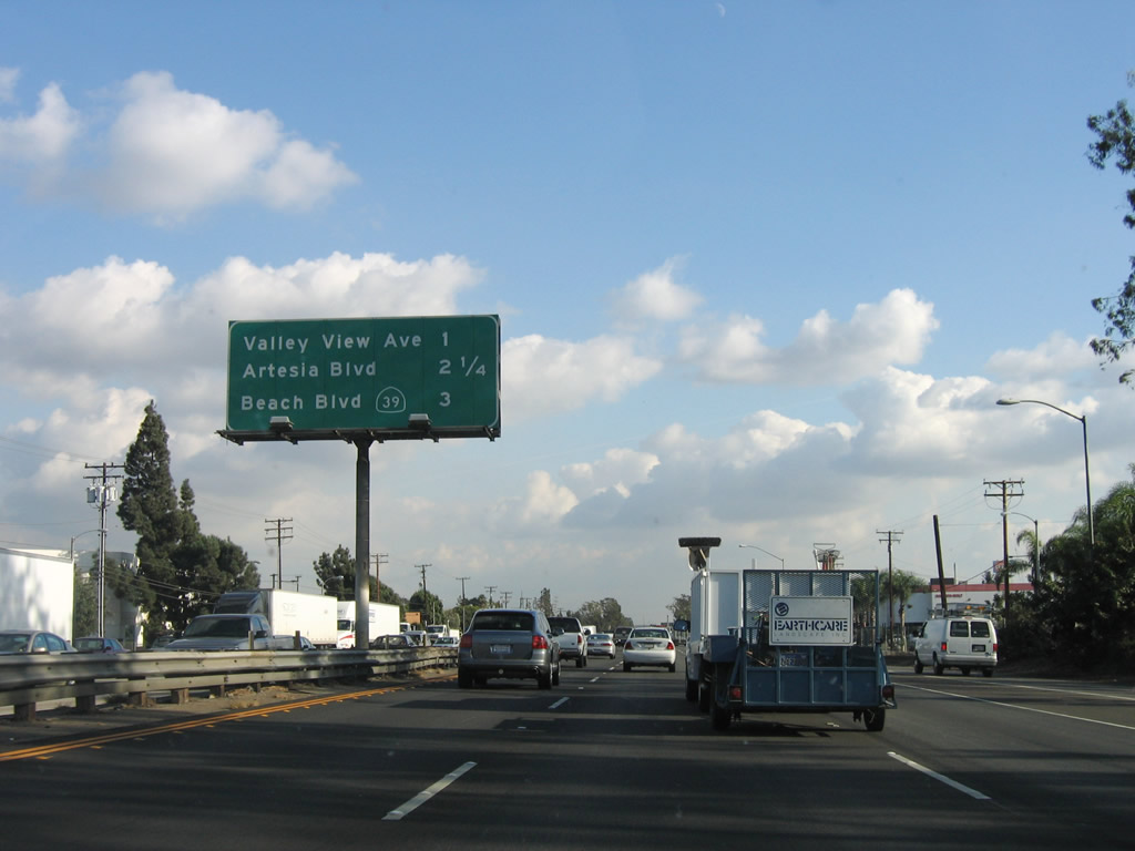
This mileage sign provides the distance to the next three exits along Interstate 5 (Santa Ana Freeway) south: Exit 118, Valley View Avenue; Exit 117, Artesia Boulevard (former California 91); and Exit 116, California 39 (Beach Boulevard). Exit 118 is the last exit for Interstate 5 in Los Angeles County; the next two exits are in Orange County. Photo taken 11/27/06. |
|
Use Valley View Avenue north to La Mirada and south to Cerritos and Buena Park. Interstate 5 will enter the city of La Mirada at the Valley View Avenue interchange briefly, then enter the Orange County city of Buena Park. Photo taken 11/27/06. |
|
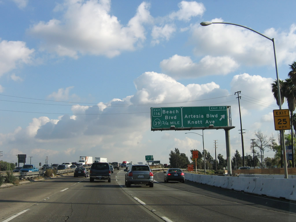
The second exit is Exit 117, Artesia Boulevard east to Buena Park and west to Cerritos and Knott Avenue south to Buena Park and Anaheim. Photo taken 11/27/06. |
|
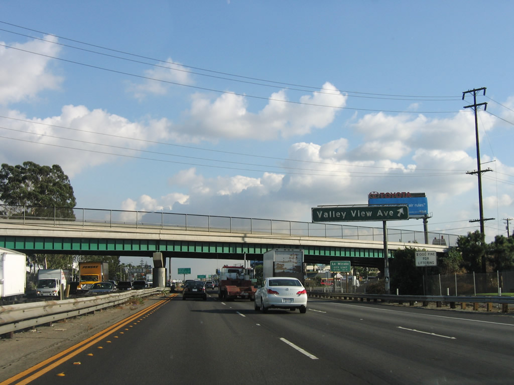
Southbound Interstate 5 (Santa Ana Freeway) reaches Exit 118, Valley View Avenue. Interstate 5 leaves the city of Santa Fe Springs and enters the city of La Mirada here; it will remain in La Mirada for only a mile before it enters Orange County and the city of Buena Park (at Exit 119). Photo taken 11/27/06. |
|
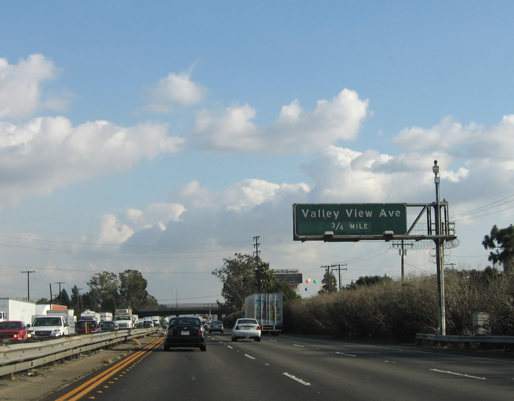
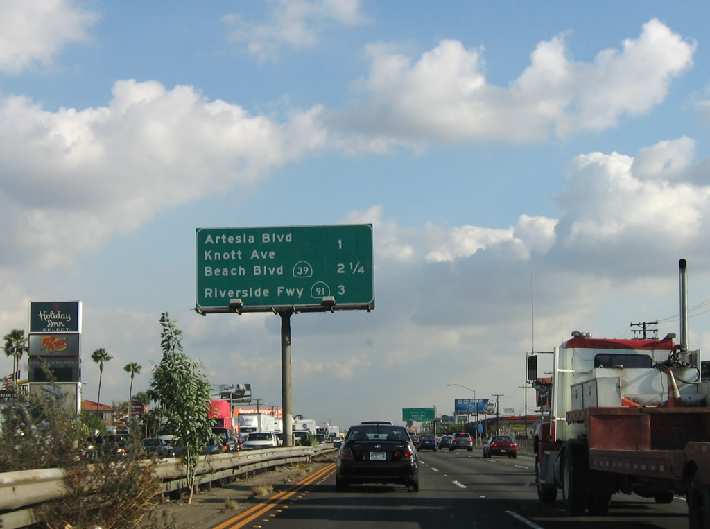
This mileage sign provides the distance to the next three exits along Interstate 5 (Santa Ana Freeway) south: Exit 117, Artesia Boulevard (former California 91); Exit 116, California 39 (Beach Boulevard); and Exit 114B, California 91 (Riverside Freeway) east to Riverside. Photo taken 11/27/06. |
|
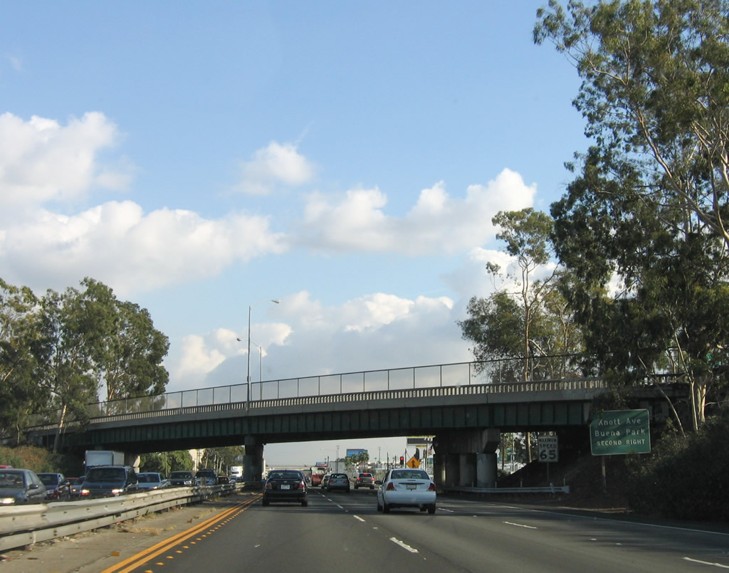
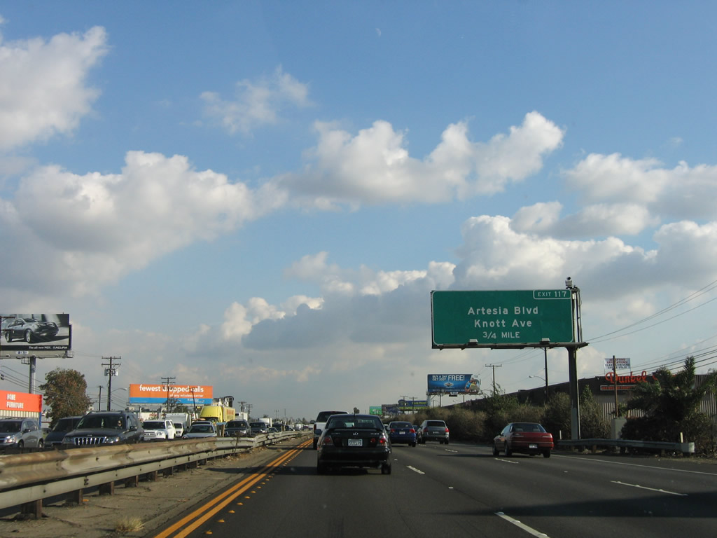
Southbound Interstate 5 (Santa Ana Freeway) approaches Exit 117, Artesia Boulevard/Knott Avenue, three-quarters of a mile. This sign is actually in La Mirada (Los Angeles County) but serves an exit in Orange County. This section of freeway is under construction for widening as of 2008. Photo taken 11/27/06. |
|
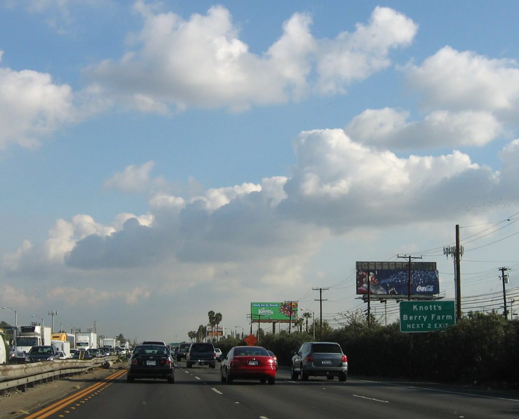
Use either Exit 117 (Knott Avenue south) or Exit 116 (California 39 (Beach Boulevard) south) to Knotts Berry Farm amusement park. Photo taken 11/27/06. |
Page Updated September 20, 2008.