| Interstate 5 (San Diego Freeway) south |
|
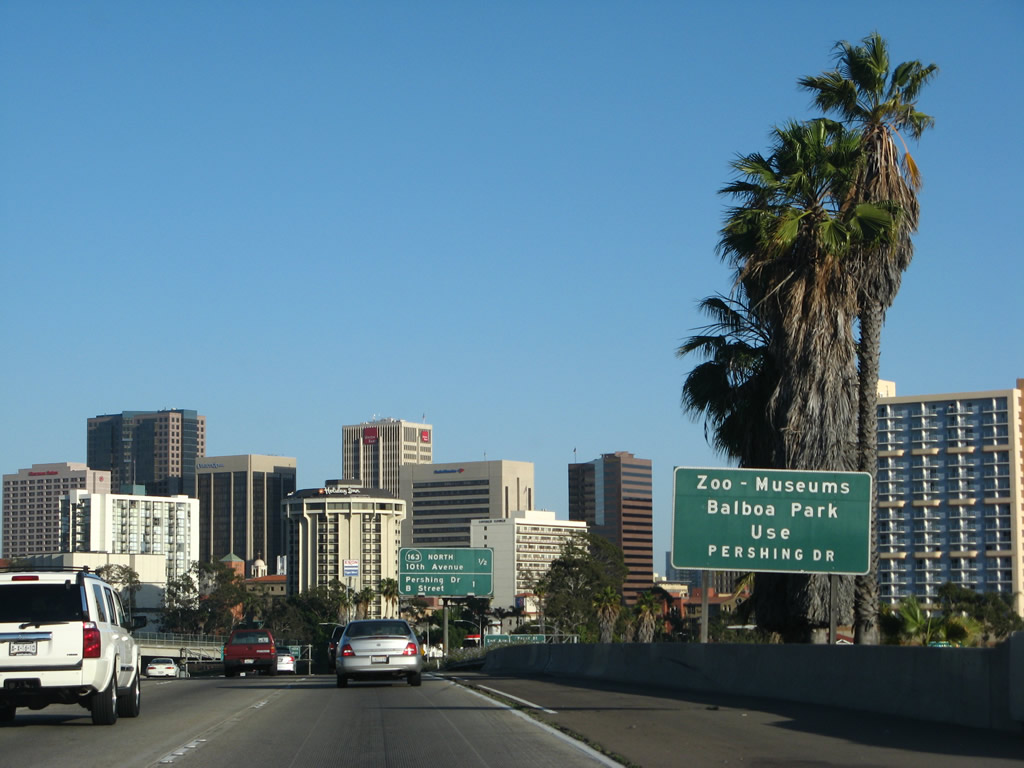
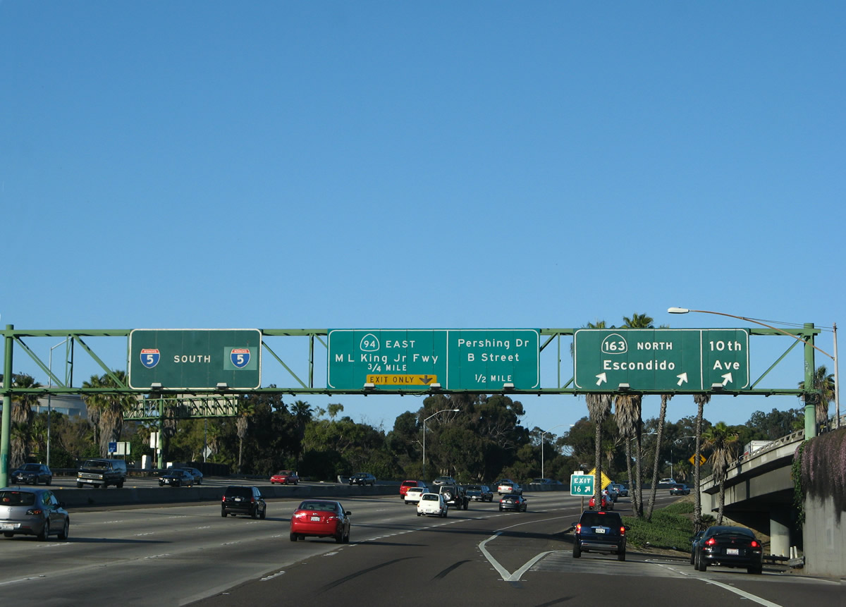
After passing the gore point for Exit 17 (Front Street), the next advises that the Pershing Boulevard interchange (Exit 15B) is the best route to Balboa Park, the museums in the park, and the world-famous San Diego Zoo. Photo taken 05/17/08. |
|
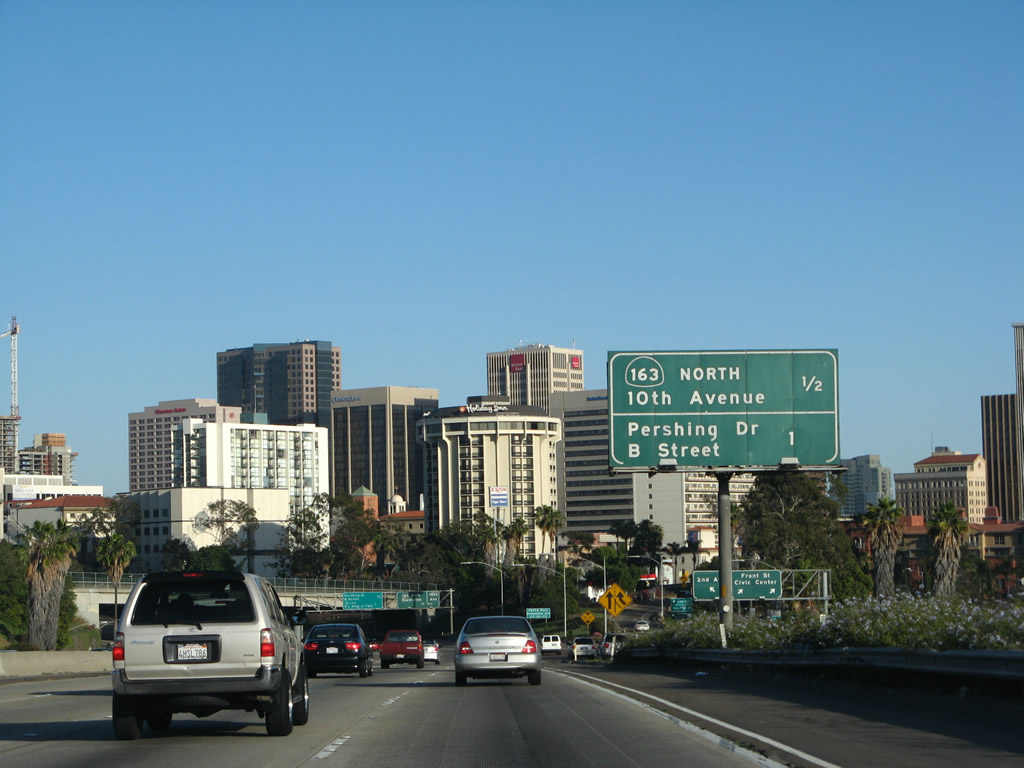
This mileage sign provides the distance to Exit 16, California 163 and Tenth Avenue and Exit 15B, Pershing Drive and B Street. Photo taken 05/17/08. |
|
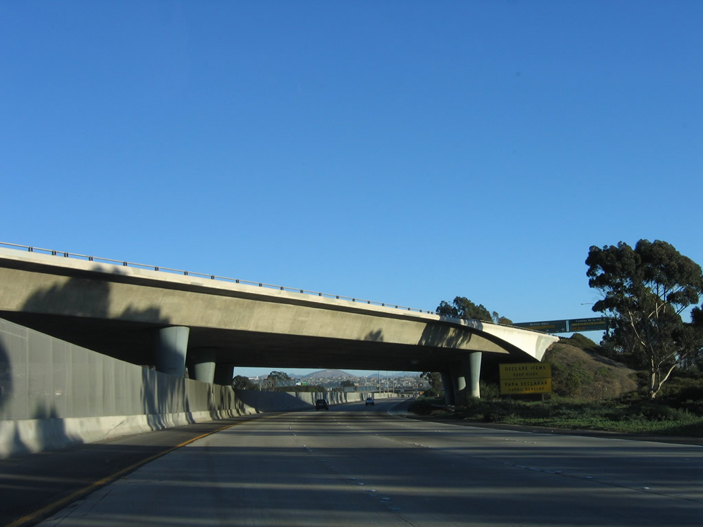
As the skyscrapers of the downtown San Diego Financial District loom, traffic from Grape Street merges onto the southbound freeway, forming a new right lane. The freeway turns dramatically here, so watch downhill speed into this trench section. Photo taken 05/17/08. |
|
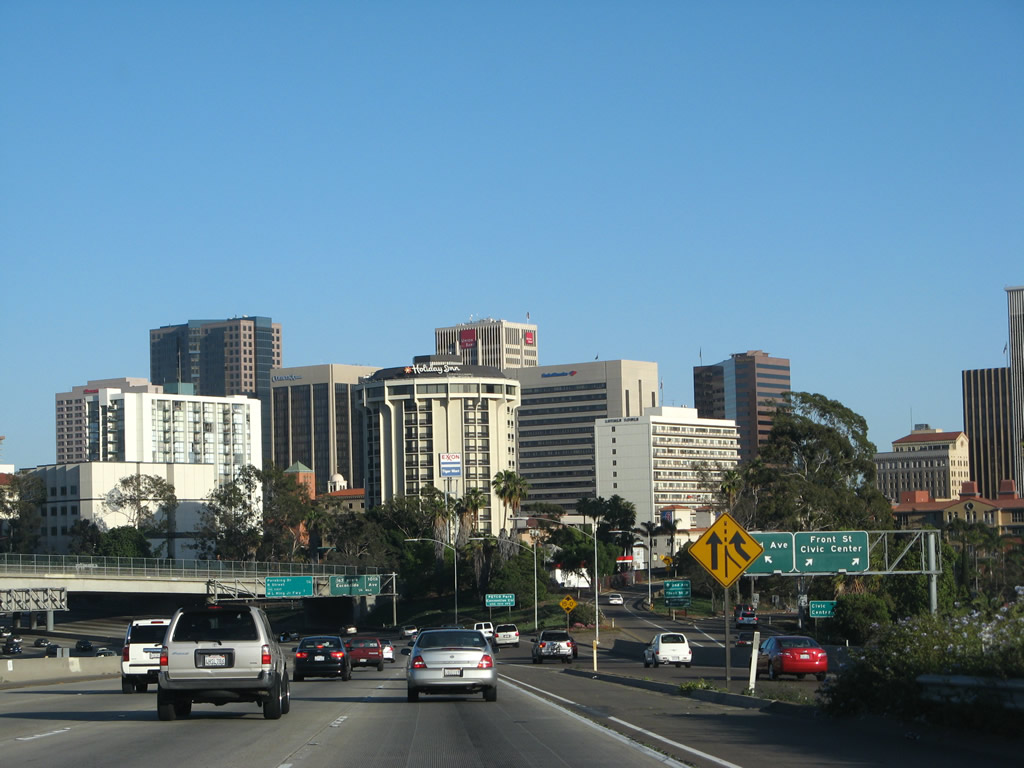
Use Exit 16/Tenth Avenue south to reach PETCO Park, the new home of Major League Baseball's San Diego Padres. Interstate 5 now enters the downtown "S" curve, where Interstate 5 falls below grade to pass under the city's street grid system. Photo taken 05/17/08. |
|
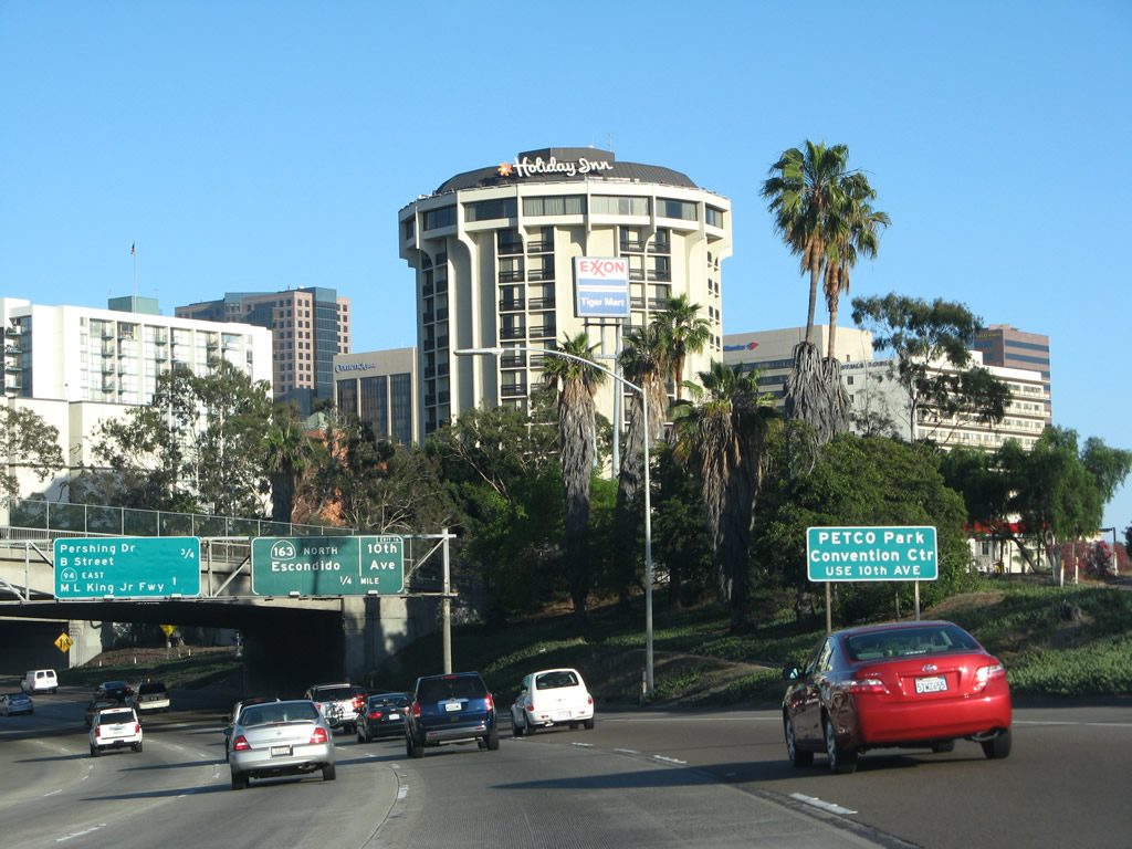
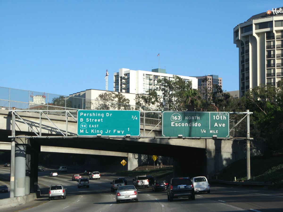
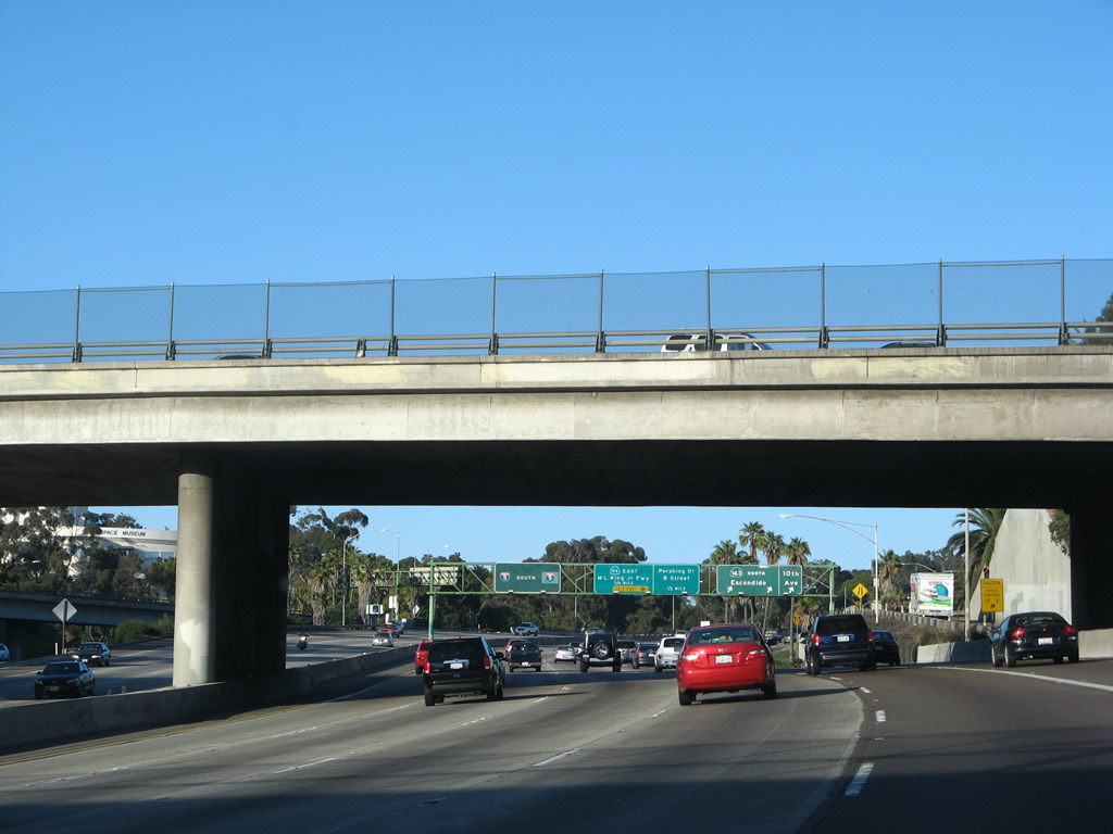
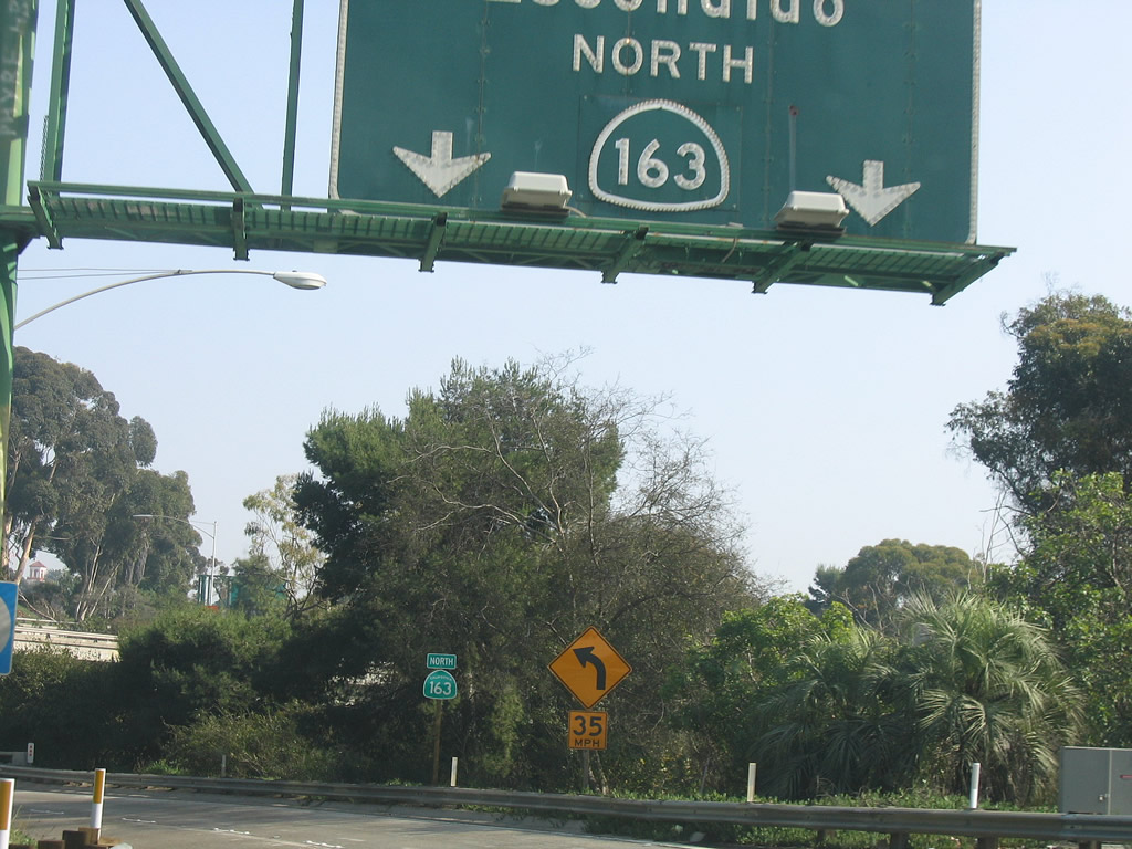
Interstate 5 makes a dramatic swing east prior to Exit 16, California 163 and Tenth Avenue. A mileage sign for Exit 15 (Pershing Drive and B Street) and Exit 15A (California 94 (Martin Luther King, Jr. Freeway)) is posted on this overhead sign. This picture also provides a sense of downtown San Diego, as seen from southbound Interstate 5 on a clear day. Most of these buildings comprise the financial district and civic center of the city. Southbound Interstate 5 approaches California 163 and Tenth Avenue, one-quarter mile. There is not much advance signage for California 163, so motorists are advised to be prepared for this prior to entering the Downtown S Curve. The mileage sign to the left was placed in 1999 when signs along California 94 were replaced to incorporate the Martin Luther King Jr. Freeway name. Photo taken 05/17/08. |
|
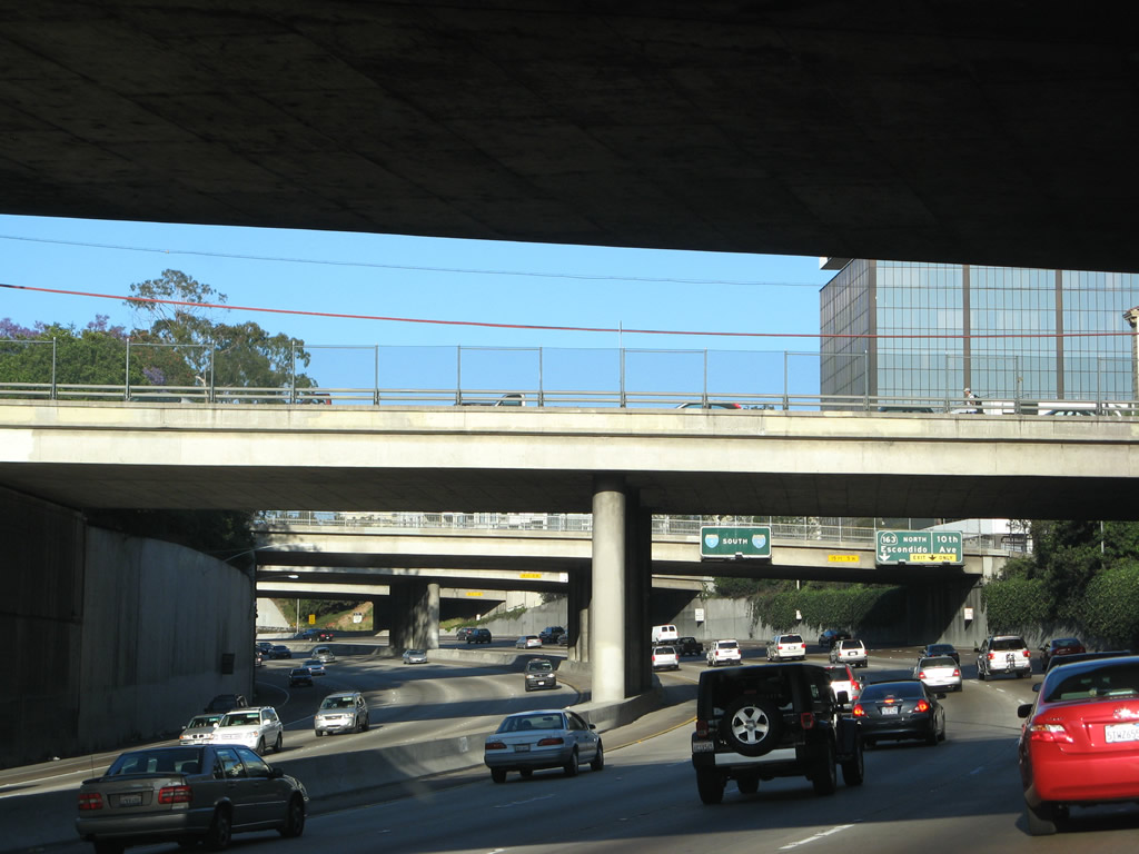
Now in the downtown "S" curve, this view shows the below-grade section of Interstate 5. Passing under Second Avenue, the next overpasses carry Third Avenue, Fourth Avenue, Fifth Avenue, and Sixth Avenue over the freeway. Photo taken 05/17/08. |
|
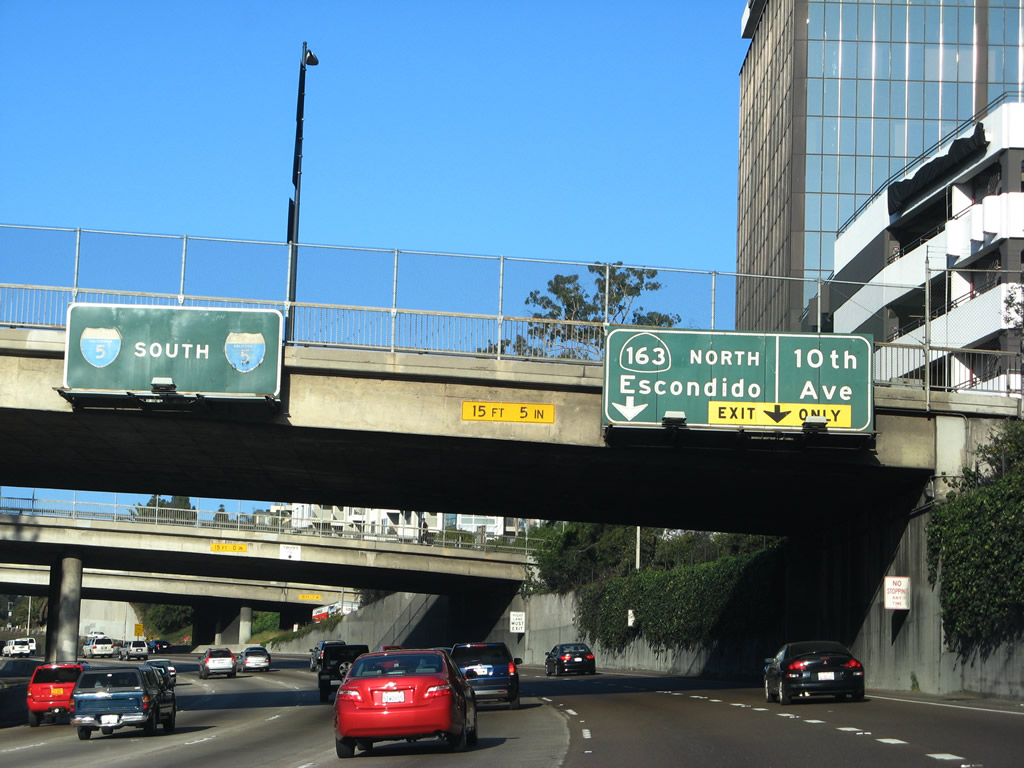
The right lane becomes exit only for California 163 north and Tenth Avenue south. The Interstate 5 pull-through sign is old enough to have a hidden U.S. 101 shield under the Interstate 5 shields. Note that Interstate 5 no longer has a southbound control city, even though it probably should be Tijuana, Baja California, Mexico. Photo taken 05/17/08. |
|
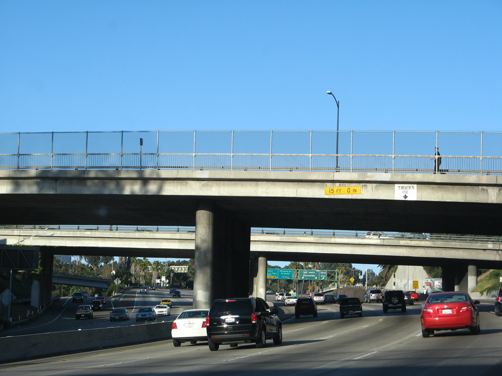
This centerline view looks east as Interstate 5 passes under Fifth Avenue and will soon pass under Sixth Avenue. Photo taken 05/17/08. |
|
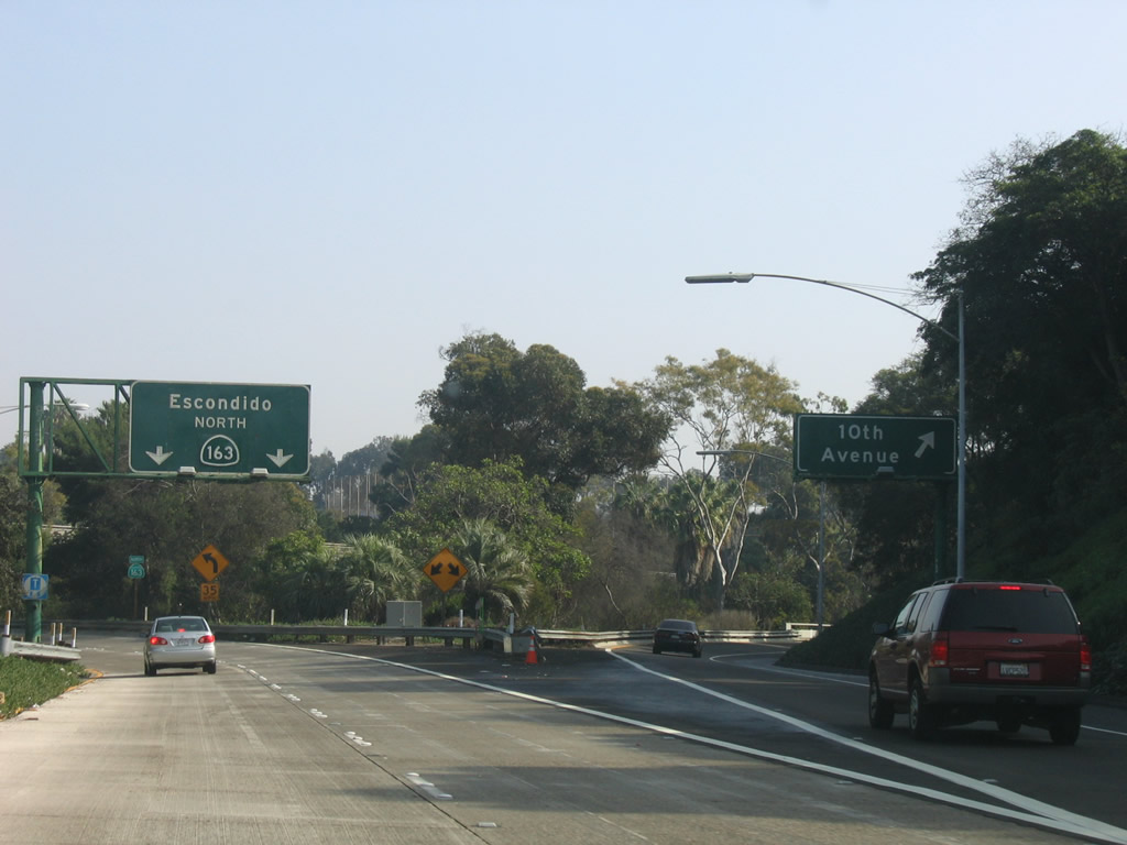
The off-ramp from Interstate 5 south to Exit 16, California 163 north and Tenth Avenue south is a two-lane exit. The left four lanes continue south on Interstate 5. Photo taken 05/17/08. |
|
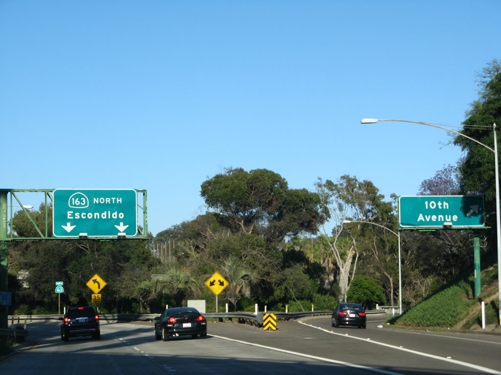
Southbound Interstate 5 (San Diego Freeway) meets Exit 16, California 163 (Cabrillo Freeway) north and Tenth Avenue south to PETCO Park. Photo taken 05/17/08. |
|
|
|
Now on the transition ramp from Interstate 5 south to Exit 16, the left two lanes connect to California 163 (Cabrillo Freeway) north and the right lane has an exit to Tenth Avenue south to PETCO Park. The older sign, shown in the 2006 photos, has a California 163 shield covering an old U.S. 395 shield, which was the original designation of the California 163 freeway. When original porcelain enamel sign was replaced, no evidence remained of the prior designation of the Cabrillo Freeway. Photos taken 05/17/08 and 01/08/06. |
|
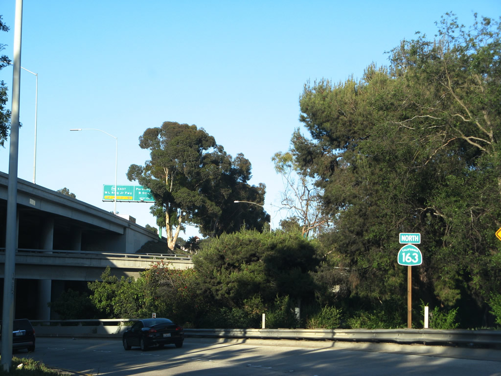
This reassurance shield for California 163 north is posted on the ramp from Interstate 5 after Tenth Avenue splits off. Photo taken 05/17/08. |
|
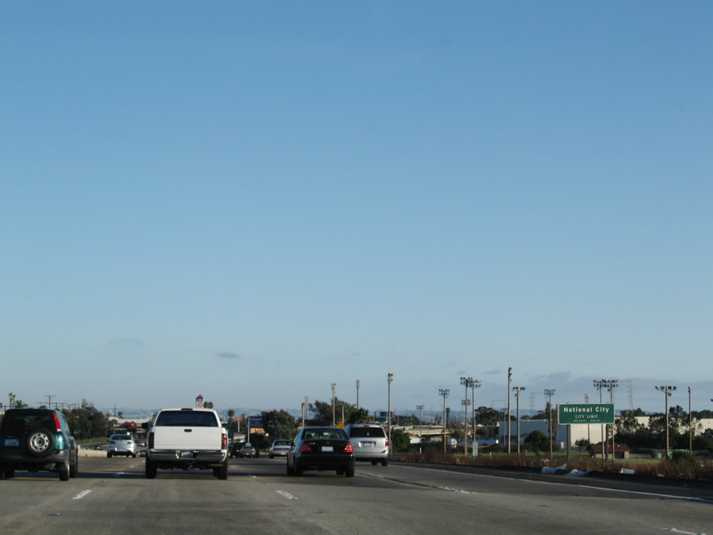
The next exit along southbound Interstate 5 is Exit 15C, Pershing Drive north to Balboa Park and San Diego Zoo and B Street east to Golden Hill and west to downtown. This is one of the first reflective signs to be installed in San Diego County; this sign dates back to 1999. Photo taken 08/26/08. |
|
Southbound Interstate 5 reaches Exit 15C, Pershing Drive and B Street. Photo taken 08/26/08. |
|
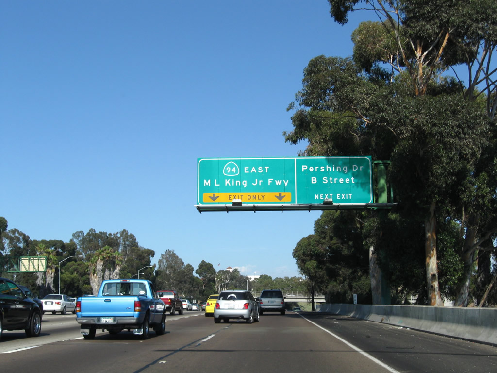
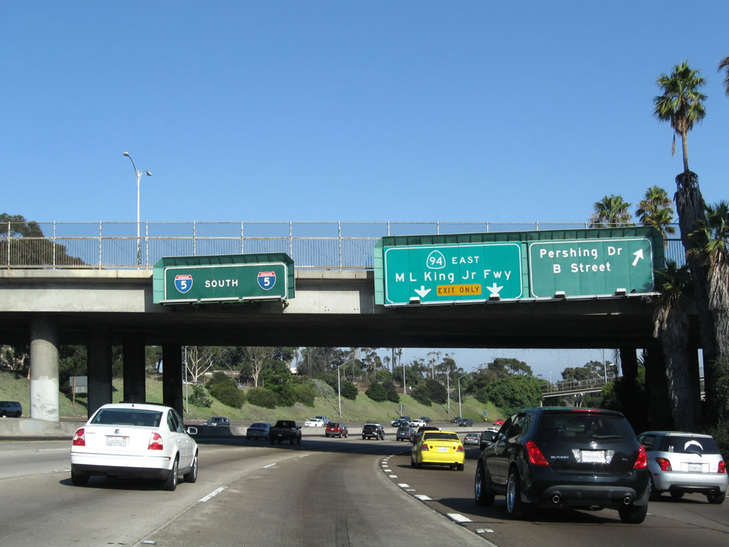
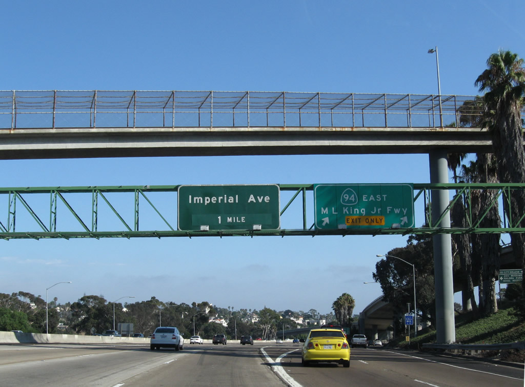
Southbound Interstate 5 reaches Exit 15B, California 94 (Martin Luther King Jr. Freeway) east to Lemon Grove, Spring Valley, Jamul, and Campo. California 94 also serves as an alternative to busy Interstate 8; use California 94 east to California 125 north to Interstate 8 east. Photo taken 08/26/08. |
| Interstate 5/John J. Montgomery Freeway south |
|
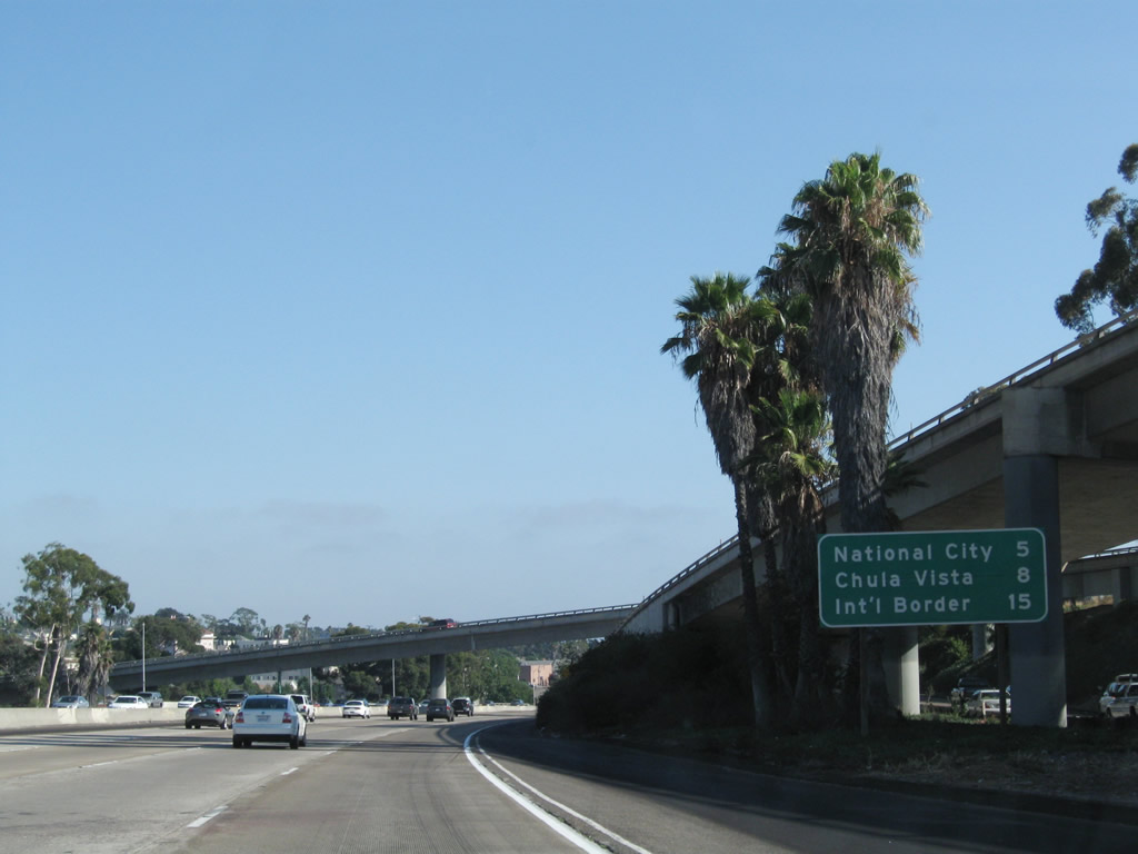
This mileage sign indicates the distance to National City, Chula Vista, and for the first time since the 5-805 split in Sorrento Valley, the new control destination of "International Border," which is the southern terminus of Interstate 5. At this point, Interstate 5 is named in honor of John J. Montgomery, who piloted the first manned, controlled, heavier-than-air flight in the United States on August 28, 1883. The site of his historic trip is preserved at Montgomery Waller Community Park in the Otay Nestor community of the city of San Diego. Photo taken 08/26/08. |
|
|
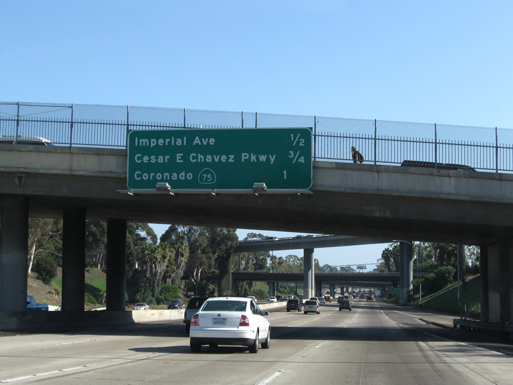
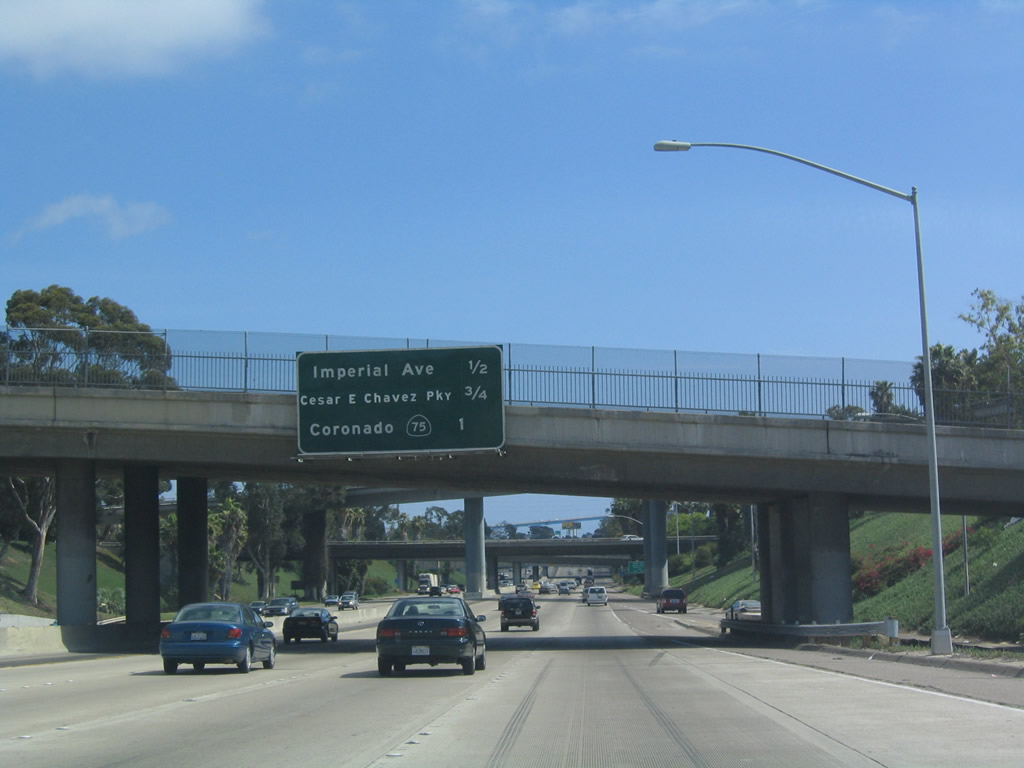
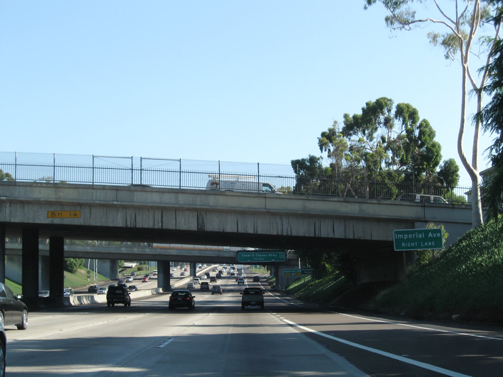
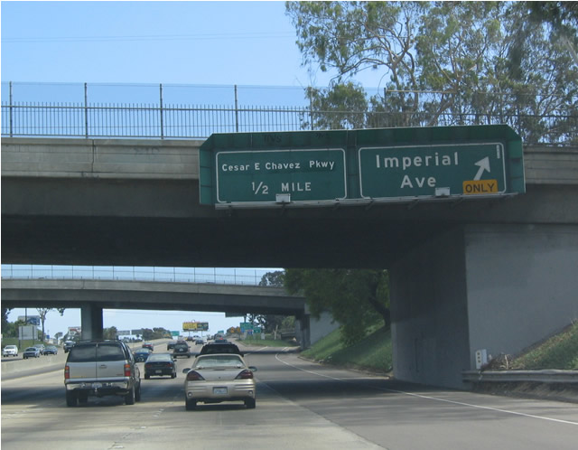
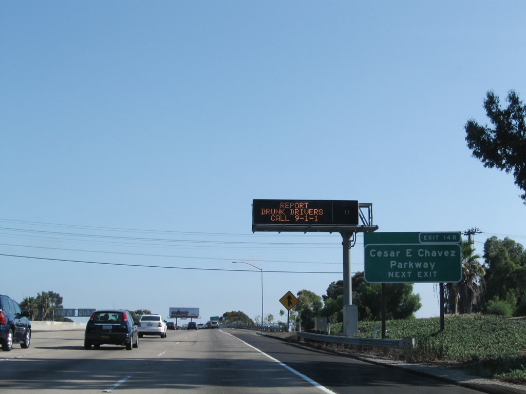
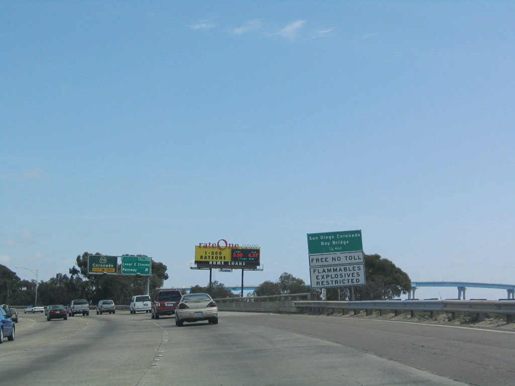
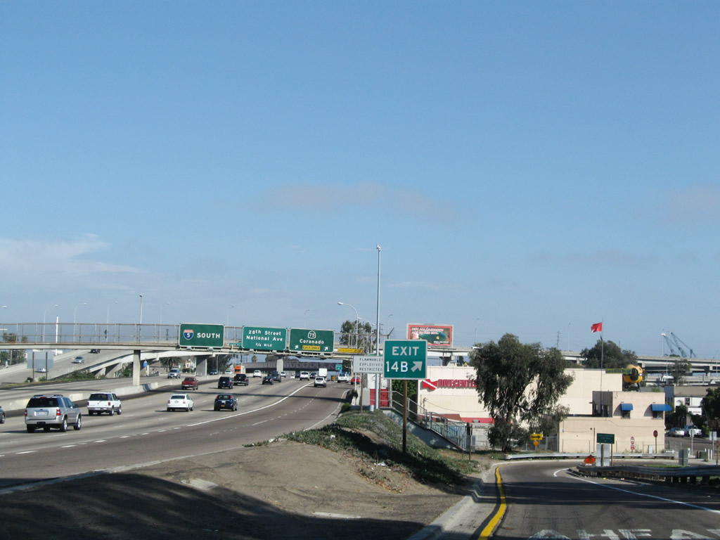
Another mileage sign provides the distance to the next three exits along southbound: Exit 15A, Imperial Avenue; Exit 14B, Cesar Chavez Parkway (former Crosby Street); and Exit 14A, California 75 south to Coronado. The interchange in the background serves as part of the connection to California 94. Photos taken 08/26/08 and 05/22/04. |
|
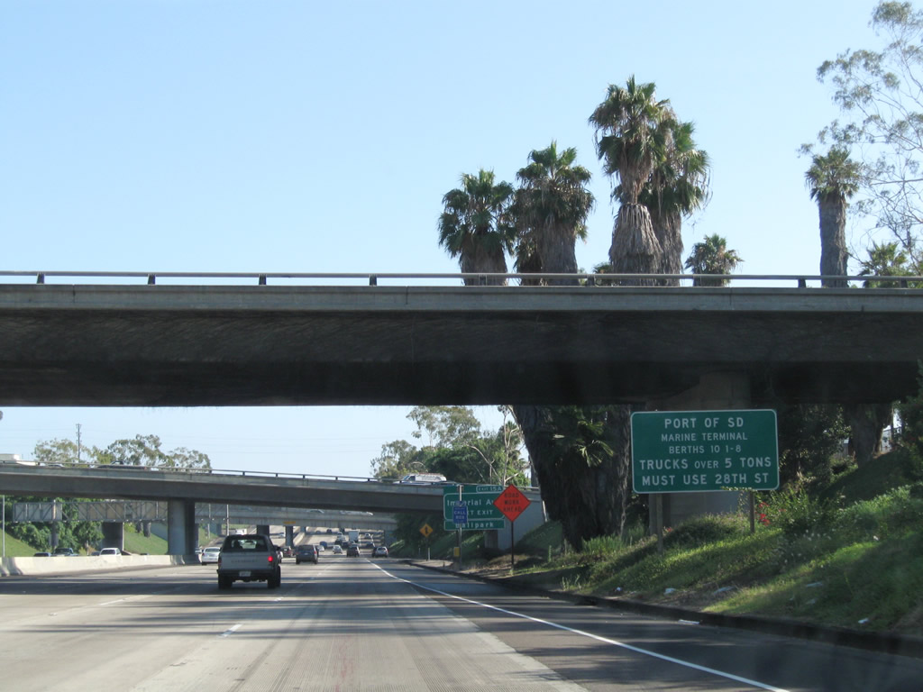
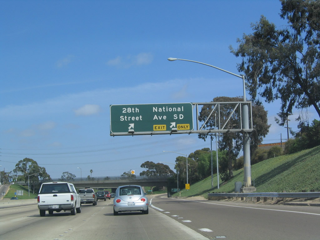
Trucks over five tons must use the 28th Street exit (located after the Imperial Avenue, Cesar Chavez Parkway, and California 75 exits) to the Port of San Diego. Photo taken 08/26/08. |
|
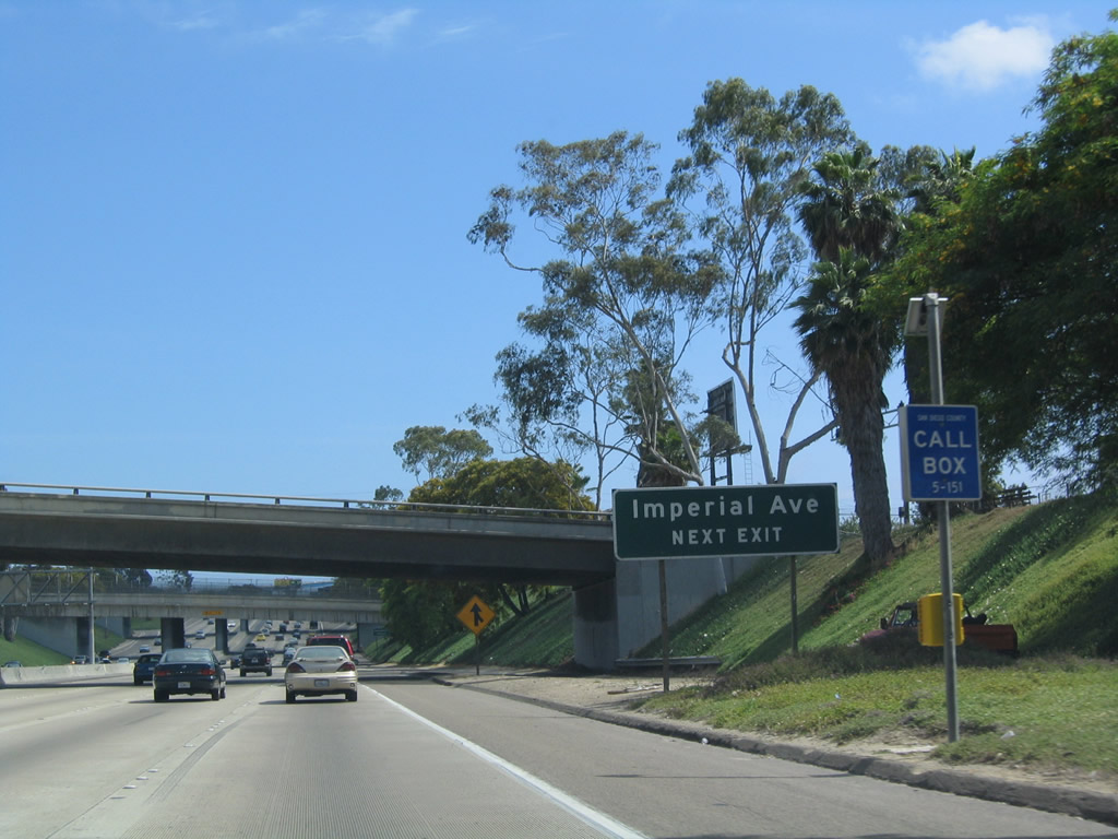
Imperial Avenue travels west to PETCO Park and the Imperial Transfer Station (transit facility include trolley and buses). It heads east into Southeastern San Diego. This sign has since been replaced with a roadside exit number sign. Photo taken 05/22/04. |
|
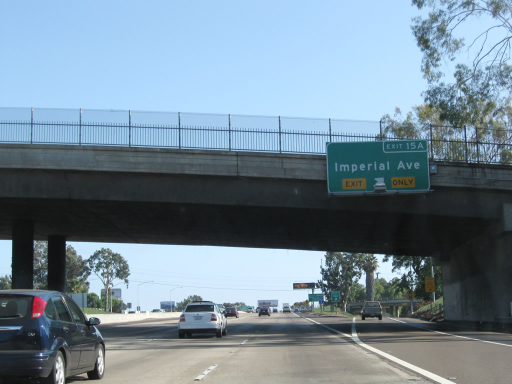
A new auxiliary lane merges onto Interstate 5 south; this lane will depart to Imperial Avenue. Use Imperial Avenue west to Petco Park. Photo taken 08/26/08. |
|
|
Southbound Interstate 5 (Montgomery Freeway) reaches Exit 15A, Imperial Avenue. This particular sign was replaced between 2004 and 2008, and a new gore point sign was installed later (see next photo). It seems like this sign assembly could benefit from two overhead signs rather than just the one for Exit 14B. The next exits are Exit 14B, Cesar Chavez Parkway (former Crosby Street) and Exit 14A, California 75 south to Coronado. Photos taken 08/26/08 and 05/22/04. |
|
Immediately thereafter, the right lane of Interstate 5 south departs to Imperial Avenue. Photo taken 08/26/08. |
|
A roadside exit number sign for Exit 14B was added here in 2002. Another variable message sign is located here as well. Photo taken 08/26/08. |
|
The Coronado Bay Bridge, which was tolled between 1969 and 2001, is now toll-free. The bridge carries five lanes with a movable center barrier to allow for two or three lane configurations in each direction depending on the flow of traffic. There are restrictions for certain types of vehicles and cargo, however. Photo taken 05/22/04. |
|
|
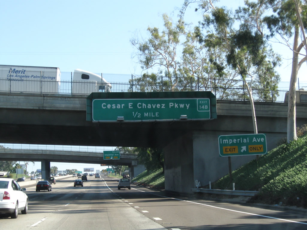
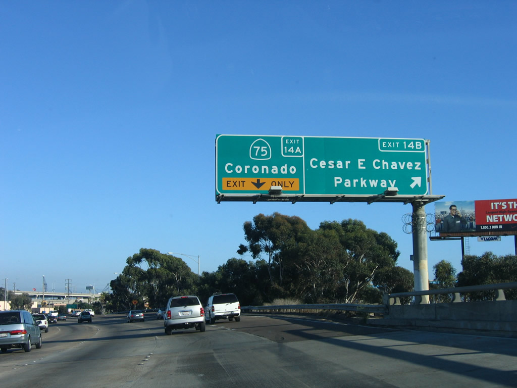
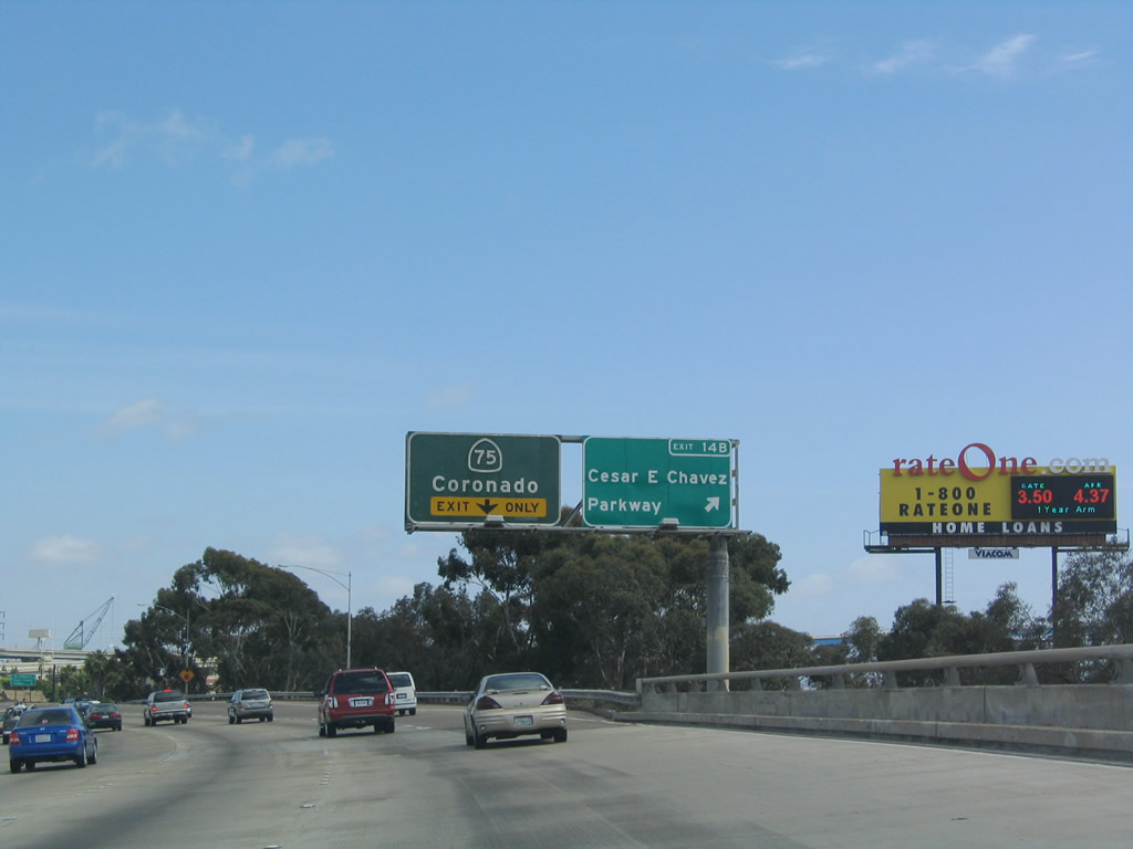
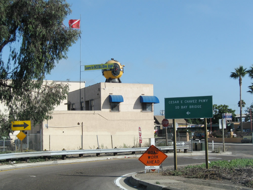
Southbound Interstate 5 (Montgomery Freeway) reaches Exit 14B, Cesar E. Chavez Parkway. Cesar Chavez Parkway was renamed in 2002 in honor of the deceased labor leader. It was formerly known as Crosby Street. The next exit is Exit 14A, California 75 south (west) to Coronado. Photos taken 08/21/08 and 05/22/04. |
|
|
The gore point sign for Exit 14B shows the exit ramp is located just prior to the off-ramp to Exit 14A, California 75 west to Coronado. In 2004, rather than an "EXIT 14B" gore point sign in the exit only lane, this directional sign used to indicate that the far right lane splits, with access to either Cesar Chavez Parkway or California 75 south/Coronado. Photos taken 08/26/08 and 05/22/04. |
|
At the bottom of the ramp to Exit 14B, turn left on Logan Avenue to Cesar E. Chavez Parkway or continue straight ahead on Beardsley Street to Newton Avenue and Main Street. Photo taken 08/26/08. |
|
|
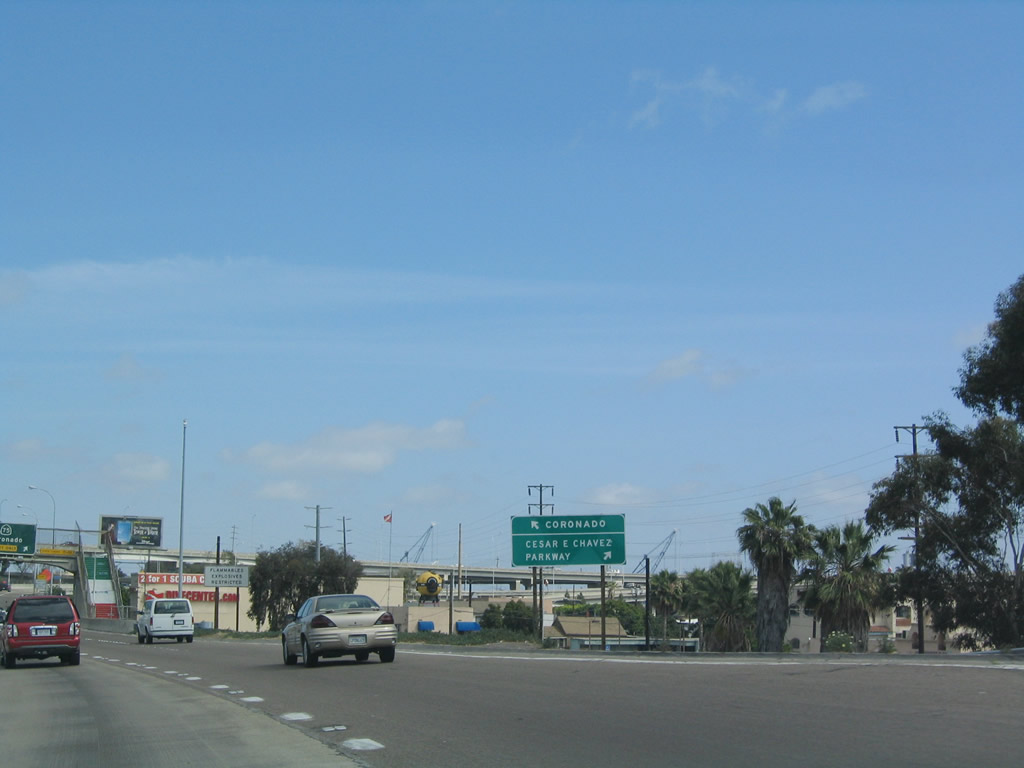
Southbound Interstate 5 at Exit 14A, California 75/Coronado Bridge, immediately after the Cesar Chavez Parkway Exit 14B off-ramp. Note the painted steps on the approach to the pedestrian overcrossing; these are the national colors of Mexico. Barrio Logan, which Interstate 5 traverses, has a large Latino population, and the park below the Interstate 5 and California 75 interchange complex (Chicano Park) has murals significant to that culture. Photos taken 08/21/08 and 05/22/04. |
|
|
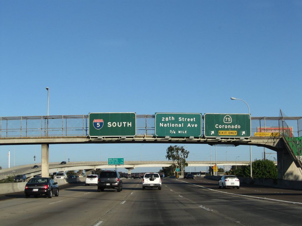
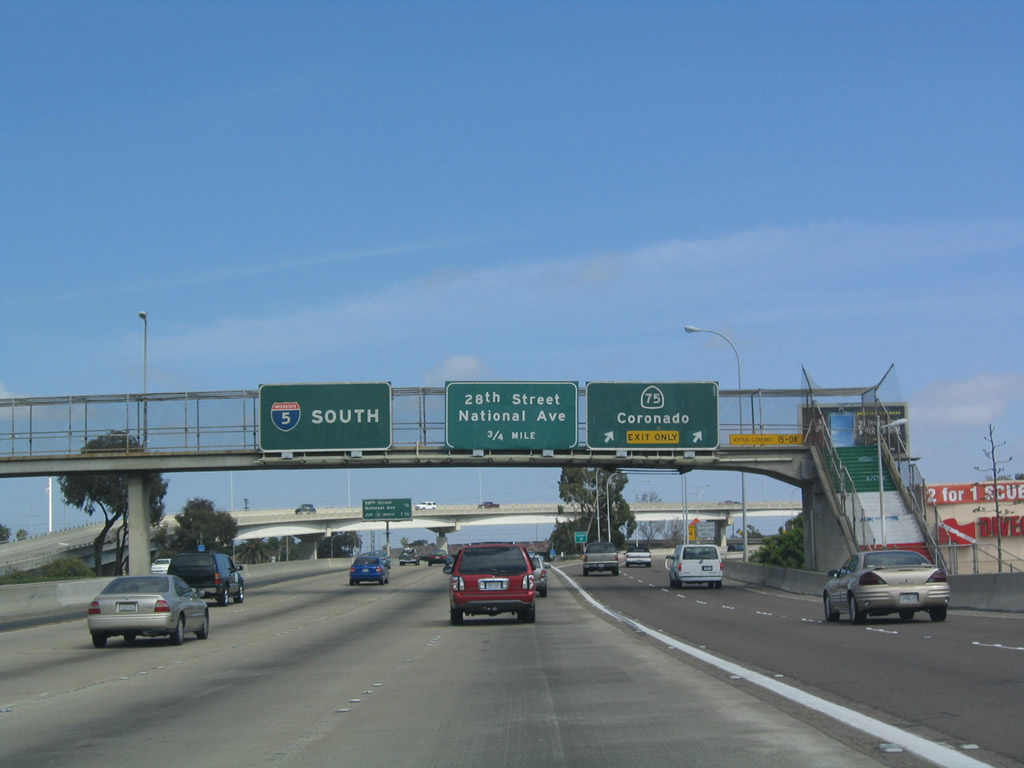
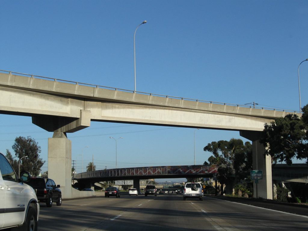
Now entering the interchange complex between Interstate 5 and California 75, this mileage indicates the distance to Exit 13B, 28th Street and Exit 13A, California 15 north to the San Diego communities of City Heights, Mission Valley, and Murphy Canyon. The non-reflective sign was replaced with a reflective sign between 2004 and 2008. Photos taken 08/21/08 and 05/22/04. |
|
The transition ramp from California 75 north to Interstate 5 north passes over the southbound lanes; the next overpass connects Interstate 5 north with California 75 south. The second overpass (seen better in the next photo) shows one of the cultural murals painted on the side of the transition ramp. Photo taken 05/22/04. |
|
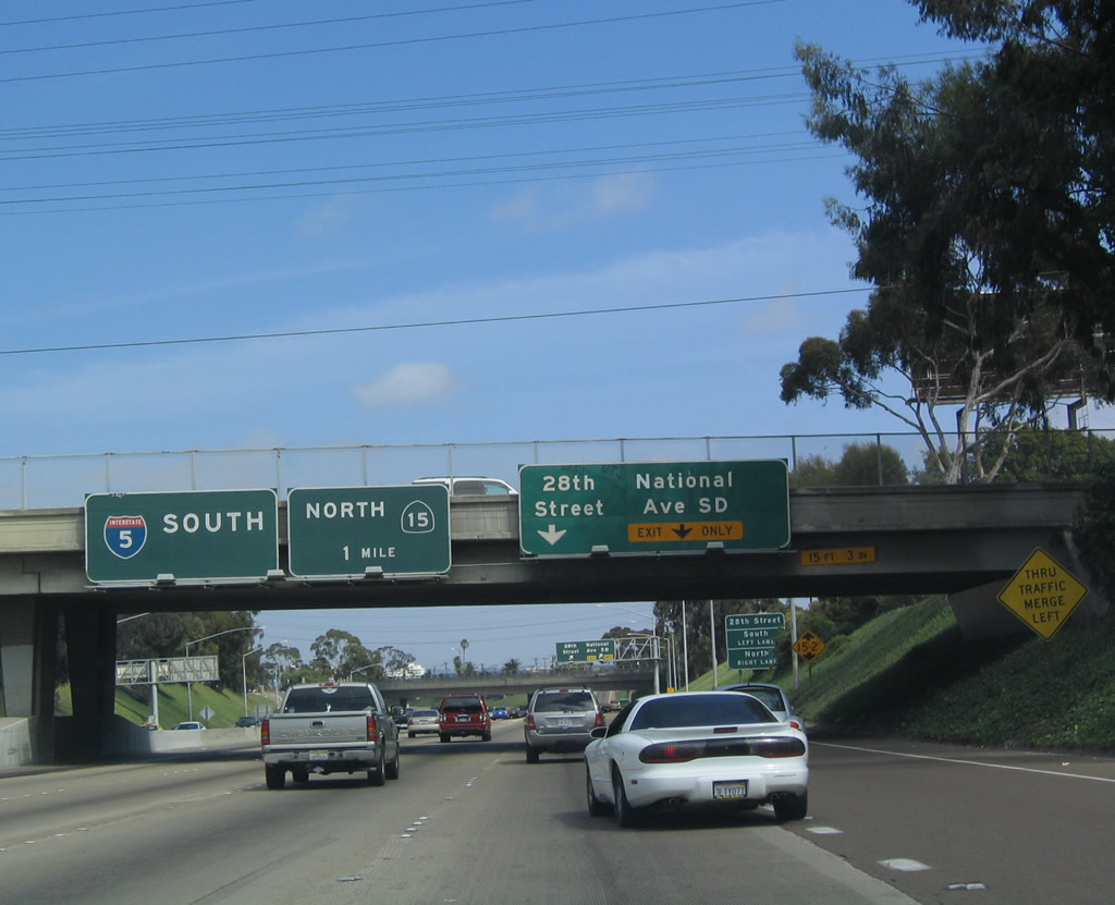
Use Exit 13B/28th Street to reach the 32nd Street Naval Station. Photo taken 05/22/04. |
|
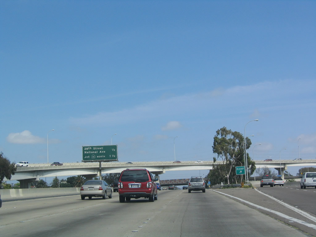
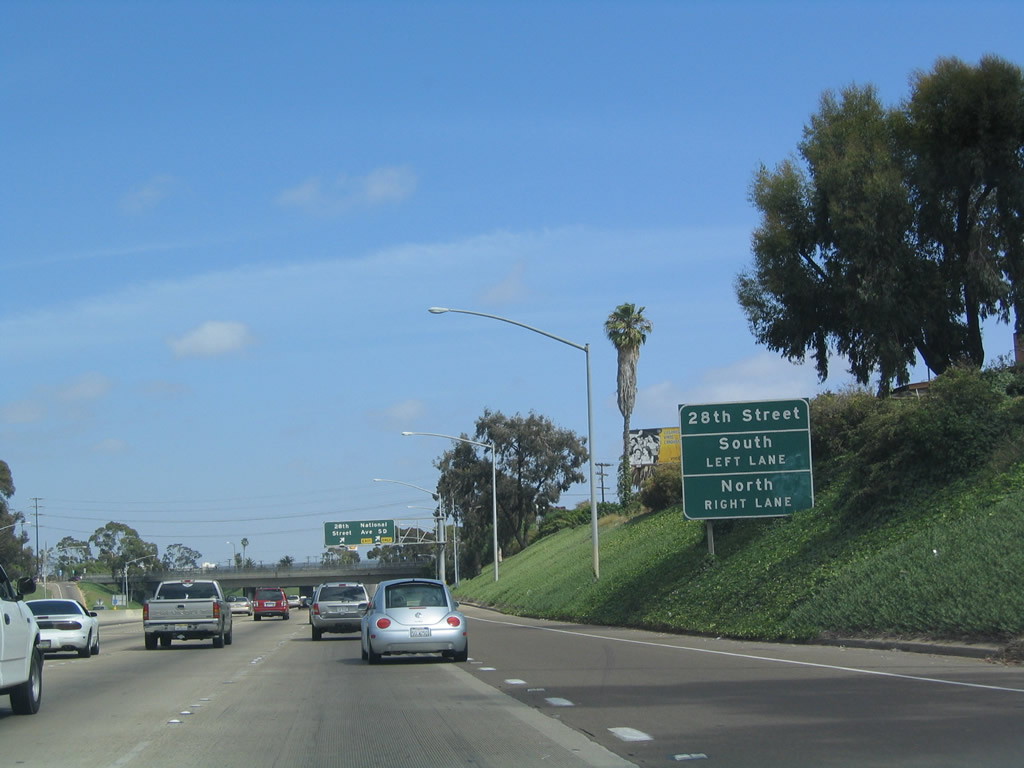
28th Street is a north-south route that meets Interstate 5 because Interstate 5 angles a bit southeast through here. Photo taken 05/22/04. |
|
28th Street and National Avenue serve the Barrio Logan community of San Diego as well as the naval station. Photo taken 05/22/04. |
|
Southbound Interstate 5 reaches Exit 13B, 28th Street and National Avenue. The next exit is Exit 13A, California 15 North. Photo taken 05/22/04. |
|
|
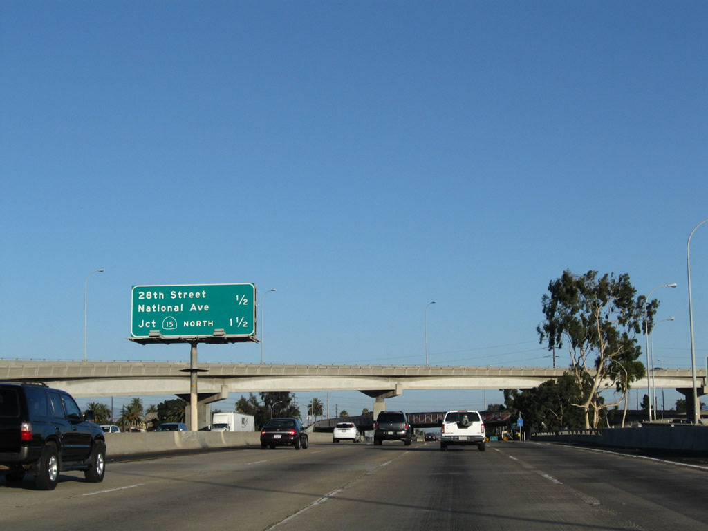
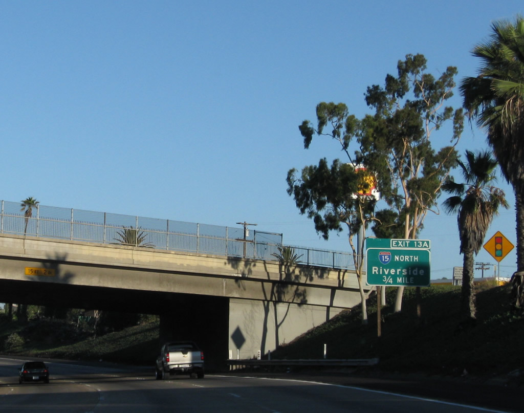
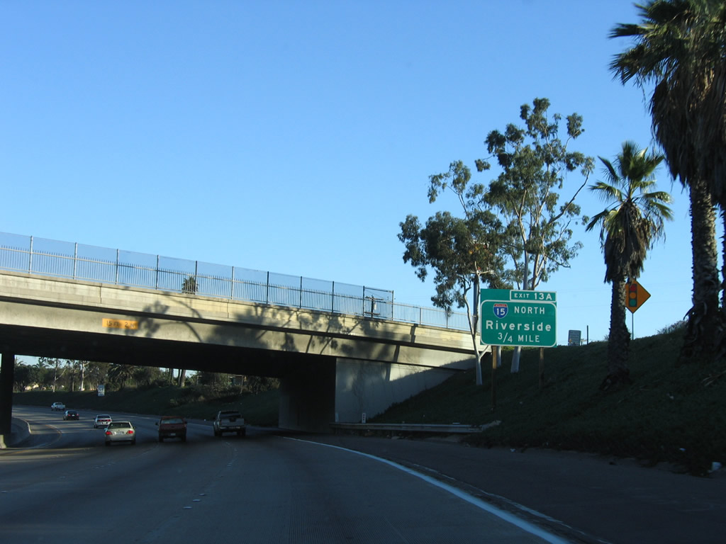
To Interstate 15 north, use Exit 13A (California 15 (Escondido Freeway)). Interstate 15 begins at the interchange with Interstate 8 in eastern Mission Valley near Qualcomm Stadium. This sign is posted near the National Avenue/28th Street overpass. This sign was replaced once between 2006 and 2008; note the subtle difference in fonts between the two signs. Photos taken 08/21/08 and 12/03/06. |
|
|
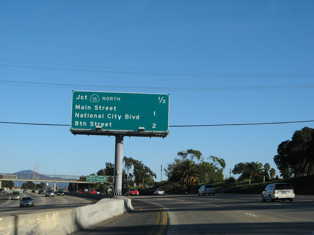
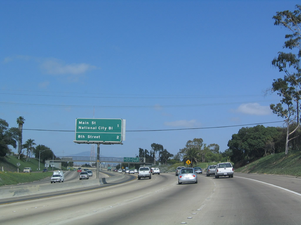
This mileage sign used to omit the next exit (Exit 13A, California 15 North) but now includes it. The next three exits are Exit 13A, California 15 north; Exit 12, Main Street/National City Boulevard; and Exit 11B, 8th Street to National City. Photos taken 12/02/07 and 05/22/04. |
|
California 15 is the Escondido Freeway, which heads north from along the old Wabash Boulevard Expressway and 40th Street Corridor to join Interstate 15 at its interchange with Interstate 8. California 15 is not designated as Interstate 15 because of the substandard interchange with California 94 (Martin Luther King, Jr. Freeway). Once that interchange is improved to interstate standards, California 15 will become designated as Interstate 15. Photo taken 05/22/04. |
|
Ice plant, commonly used on San Diego's freeways as a landscaping feature to keep rights of way looking green, appears on both sides of Interstate 5 as it approaches Exit 13A, California 15 north. Photo taken 05/22/04. |
|
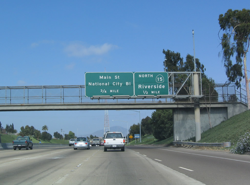
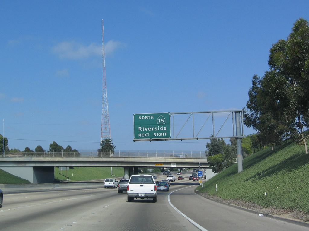
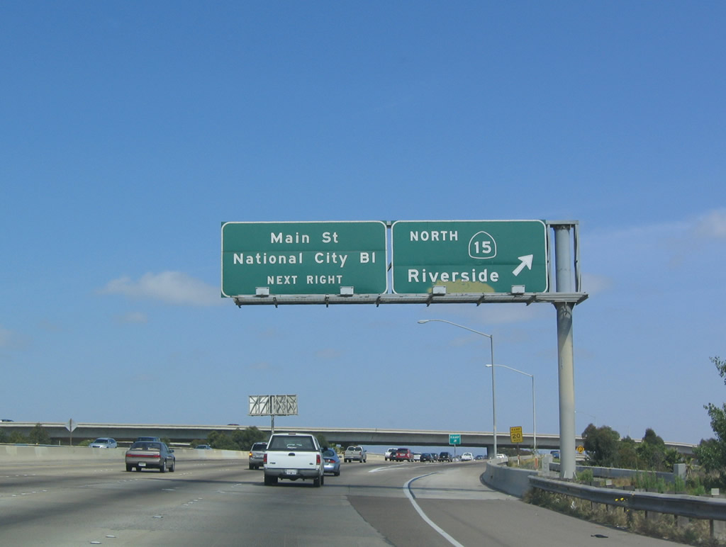
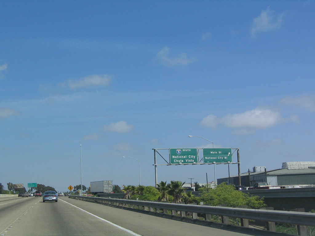
Southbound Interstate 5 reaches Exit 13A, California 15 north. The next exit is Exit 12, Main Street and National City Boulevard. Photo taken 05/22/04. |
|
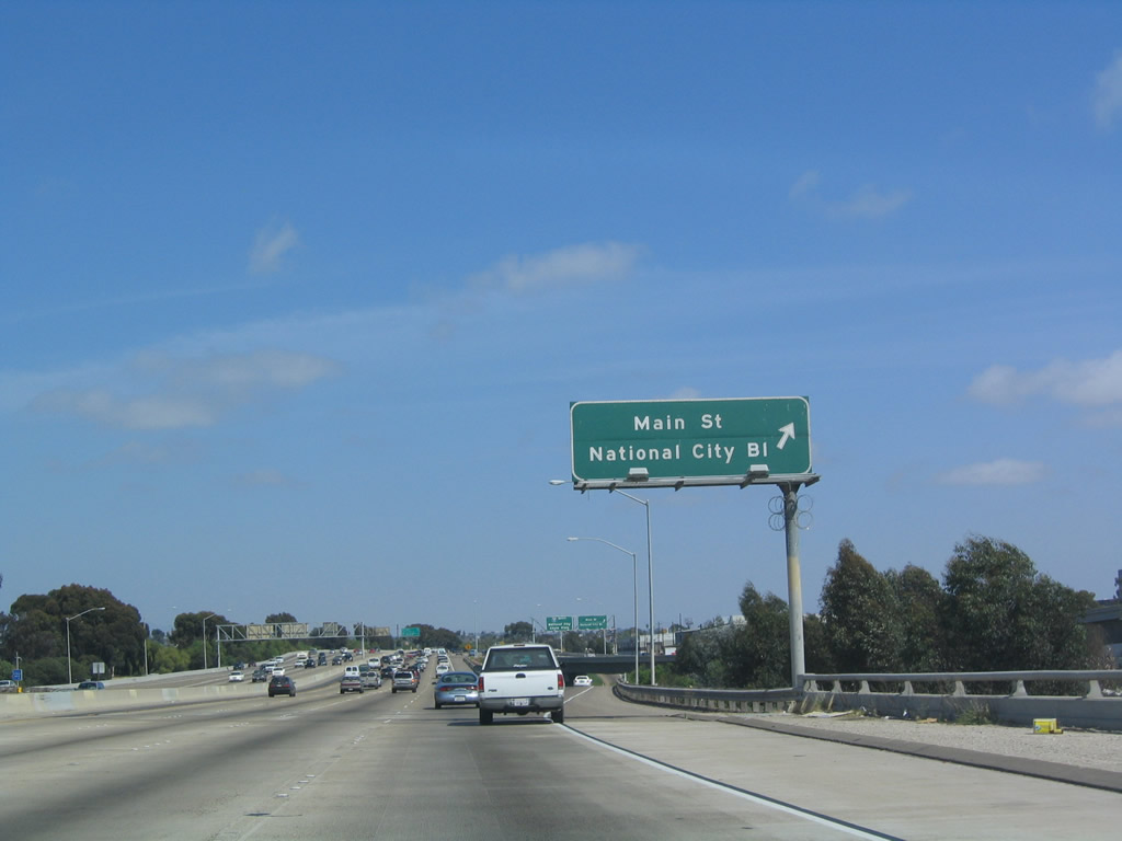
Immediately thereafter, southbound Interstate 5 reaches Exit 12, Main Street/National City Boulevard. The next exit is Exit 11B, 8th Street/National City. Photo taken 05/22/04. |
|
View of the signage on southbound California 15 as it prepares to merge onto southbound Interstate 5 after the exit ramp for Exit 12, Main Street/National City Boulevard. Photo taken 05/22/04. |
|
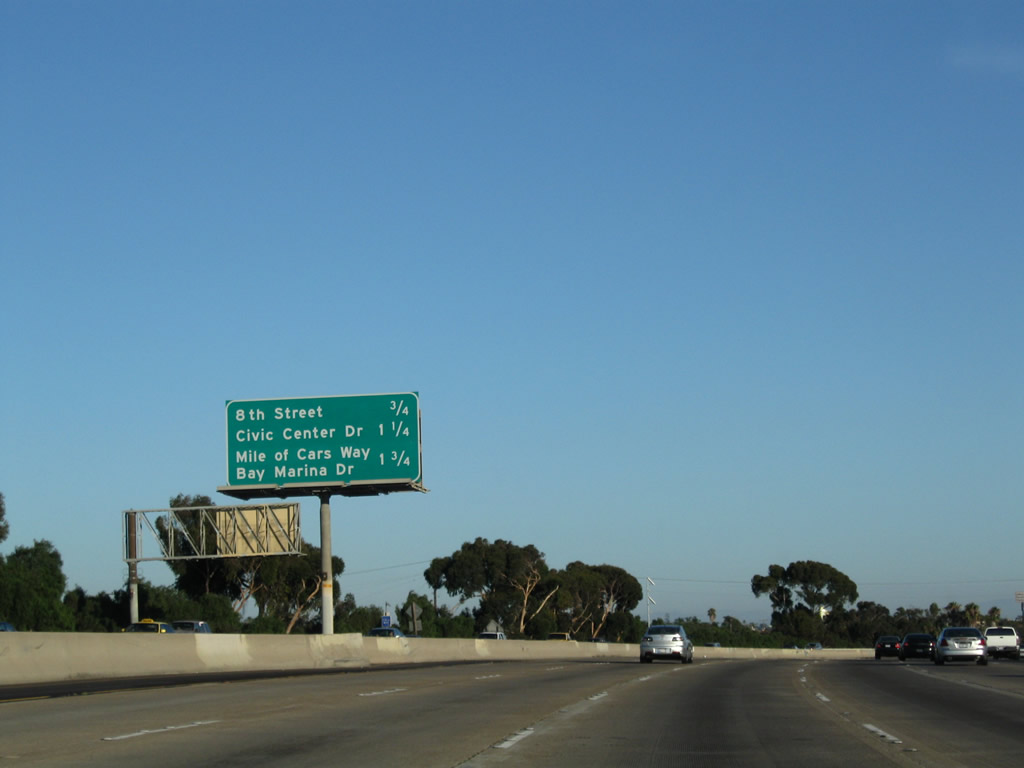
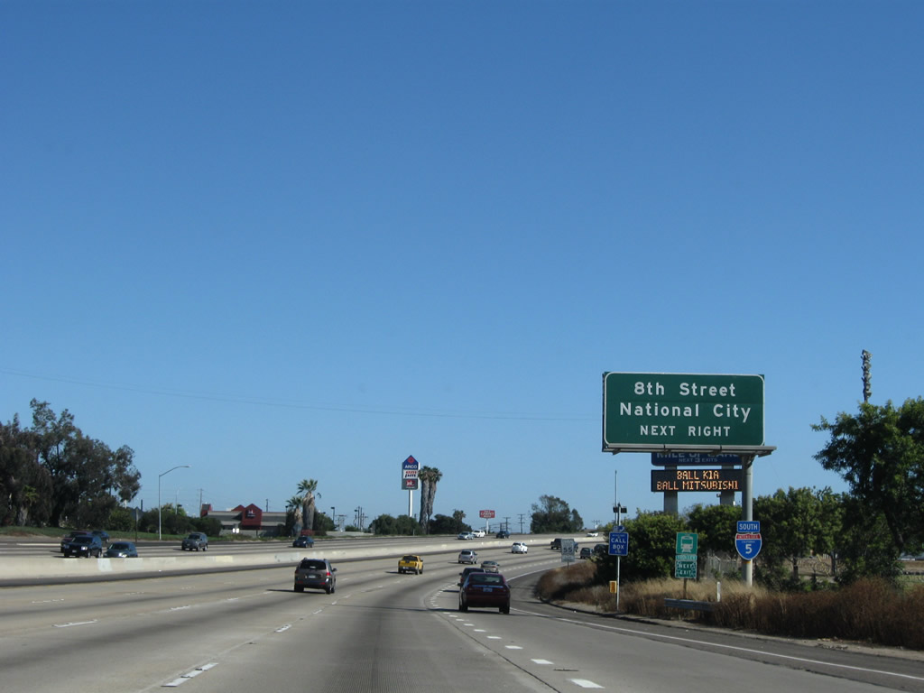
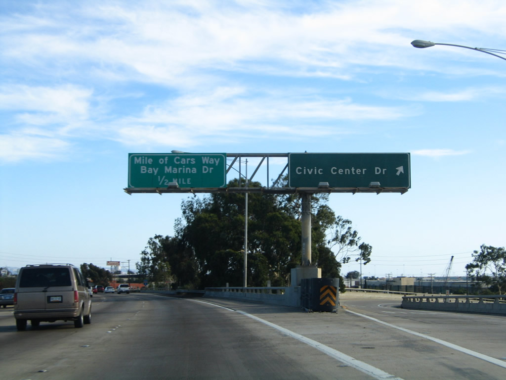
This mileage sign provides the distance to the next three exits: Exit 11B, 8th Street; Exit 11A, Civic Center Drive; and Exit 10, Mile of Cars Way and Bay Marina Drive. Photo taken 08/21/08. |
|
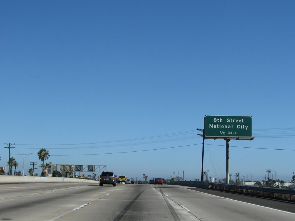
The next exit along Interstate 5 south is Exit 11B, Eighth Street (one-half mile). Photo taken 07/12/09. |
|
For the first time since Exit 36, Interstate 5 leaves San Diego and enters National City. According to the 2000 Census, National City is home to 54,260 people. The city has 9.2 square miles. Photo taken 08/21/08. |
|
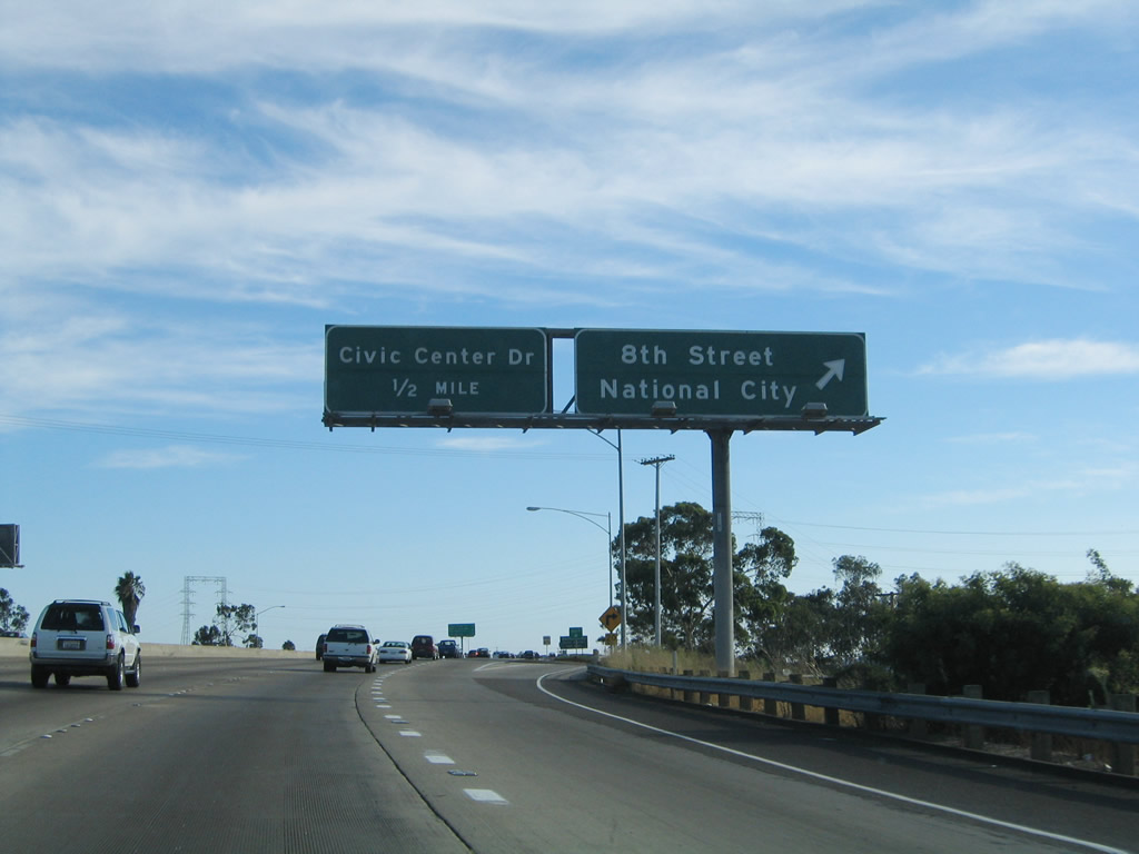
Use 8th Street to National City. The next exit is the Civic Center, followed by the Mile of Cars. Photo taken 07/12/09. |
|
Southbound Interstate 5 (Montgomery Freeway) reaches Exit 11B, Eighth Street to National City. The next exit is Exit 11A, Civic Center Drive and Old U.S. 101 (Harbor Drive) north. Photo taken 08/21/04. |
|
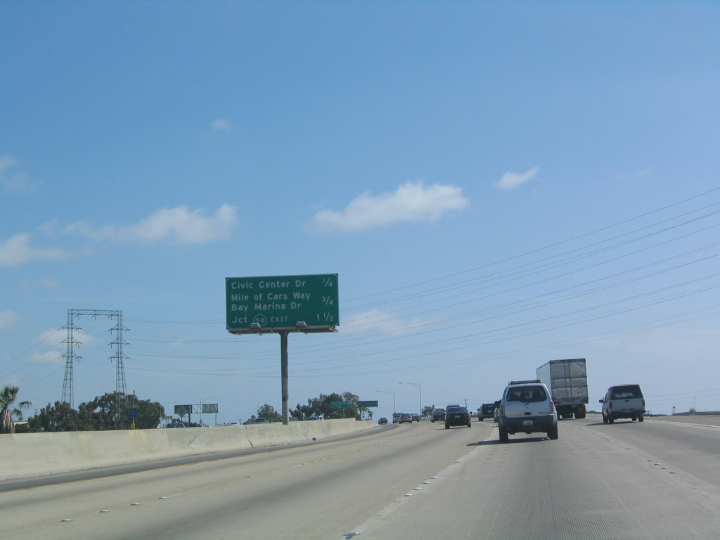
This upcoming mileage sign along Interstate 5 south provides the distance to the next three exits: Exit 11A, Civic Center Drive; Exit 10, Mile of Cars Way/Bay Marina Drive; and Exit 9, California 54 (South Bay Freeway). Photo taken 05/22/04. |
|
Southbound Interstate 5 (Montgomery Freeway) reaches Exit 11A, Civic Center Drive/Harbor Drive. Harbor Drive is former U.S. 101 and was designated a business loop of Interstate 5 through the early 1990s. Photo taken 08/21/04. |
|
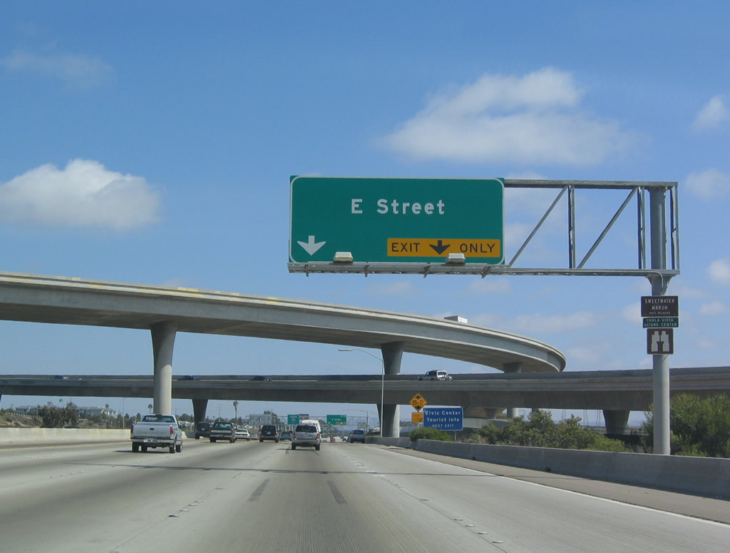
Another mileage sign posted along southbound Interstate 5 (Montgomery Freeway) provides the distance to the next three exits: Exit 10, Mile of Cars Way and Bay Marina Drive; Exit 9, California 54/South Bay Drive west; and Exit 8B, E Street/Chula Vista. Photo taken 07/12/09. |
|
|
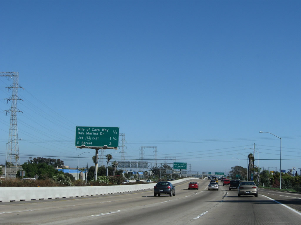
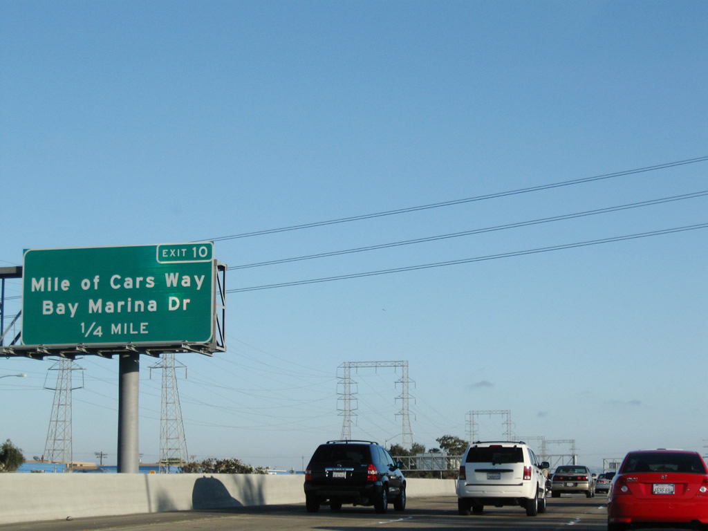
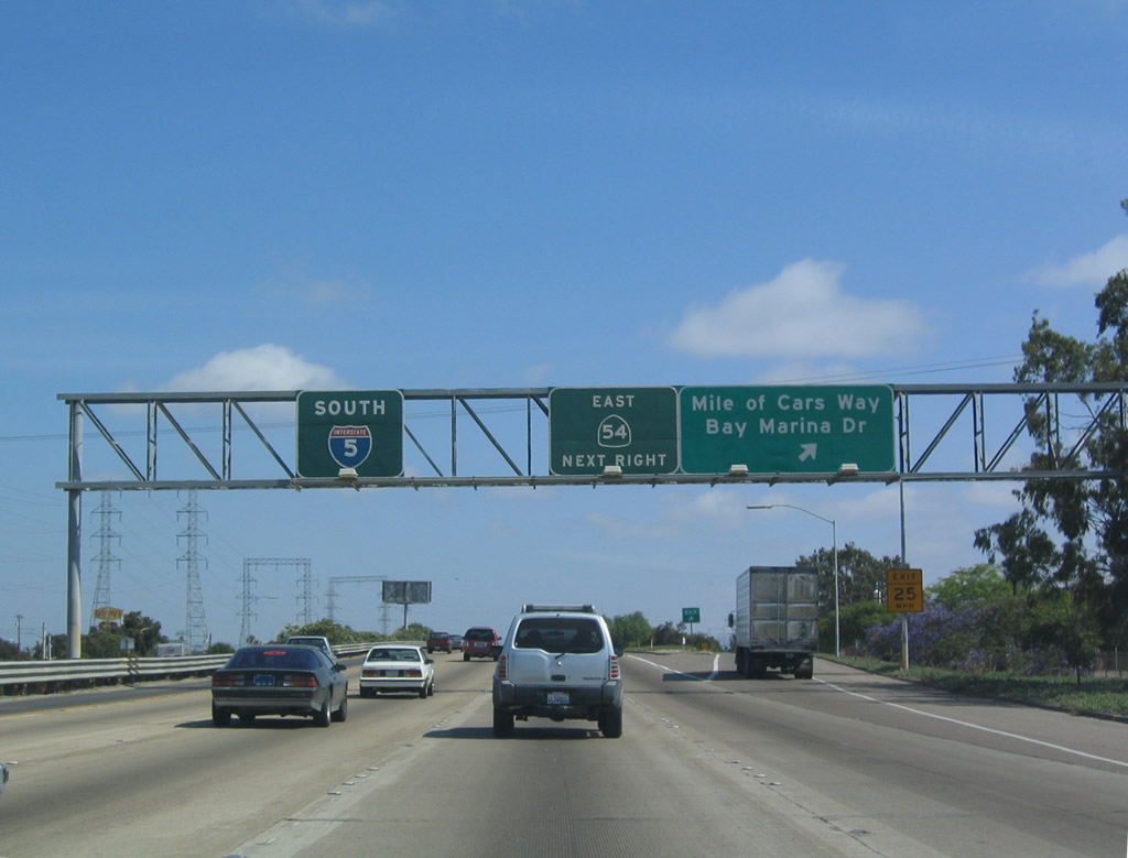
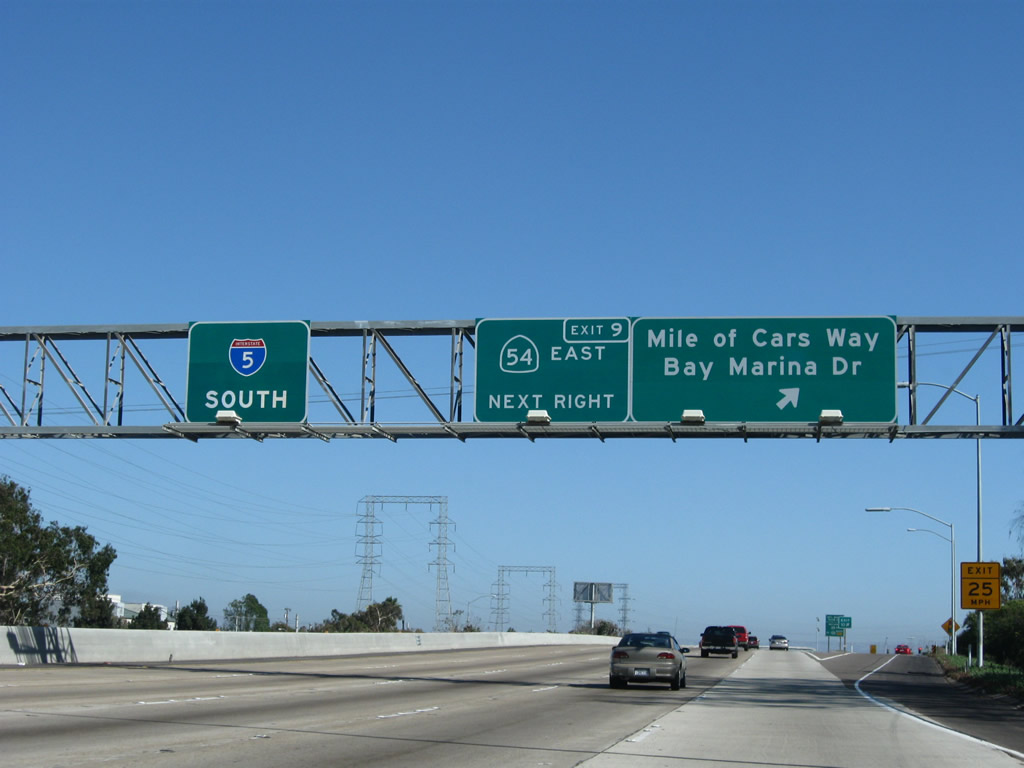
The 2004 version of this sign shows the reflective sign without the exit number, and the 2008 installation shows the exit number for Exit 10, Mile of Cars Way and Bay Marina Drive. The sign was changed initially in 2000 due to the renaming of 24th Street to Mile of Cars Way. The actual Mile of Cars lies east of here along Old U.S. 101. Photos taken 08/21/08 and 05/22/04. |
|
|
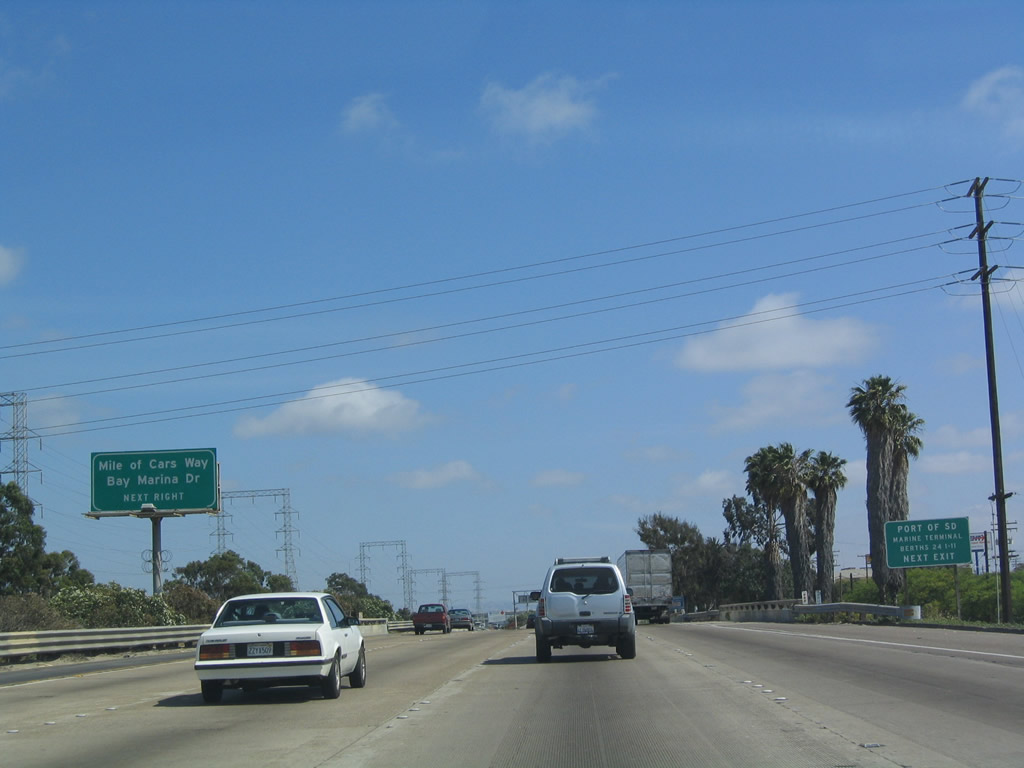
Southbound Interstate 5 reaches Exit 10, 24th Street (now Mile of Cars Way/Bay Marina Drive). The name of the street was likely changed to increase traffic visiting the Mile of Cars, which is one of the best-known commercial aspects of National City. Old U.S. 101 is now buried under the Mile of Cars to the east of Interstate 5. The next exit is California 54 (Exit 9). Photos taken 07/12/09 and 08/21/08. |
|
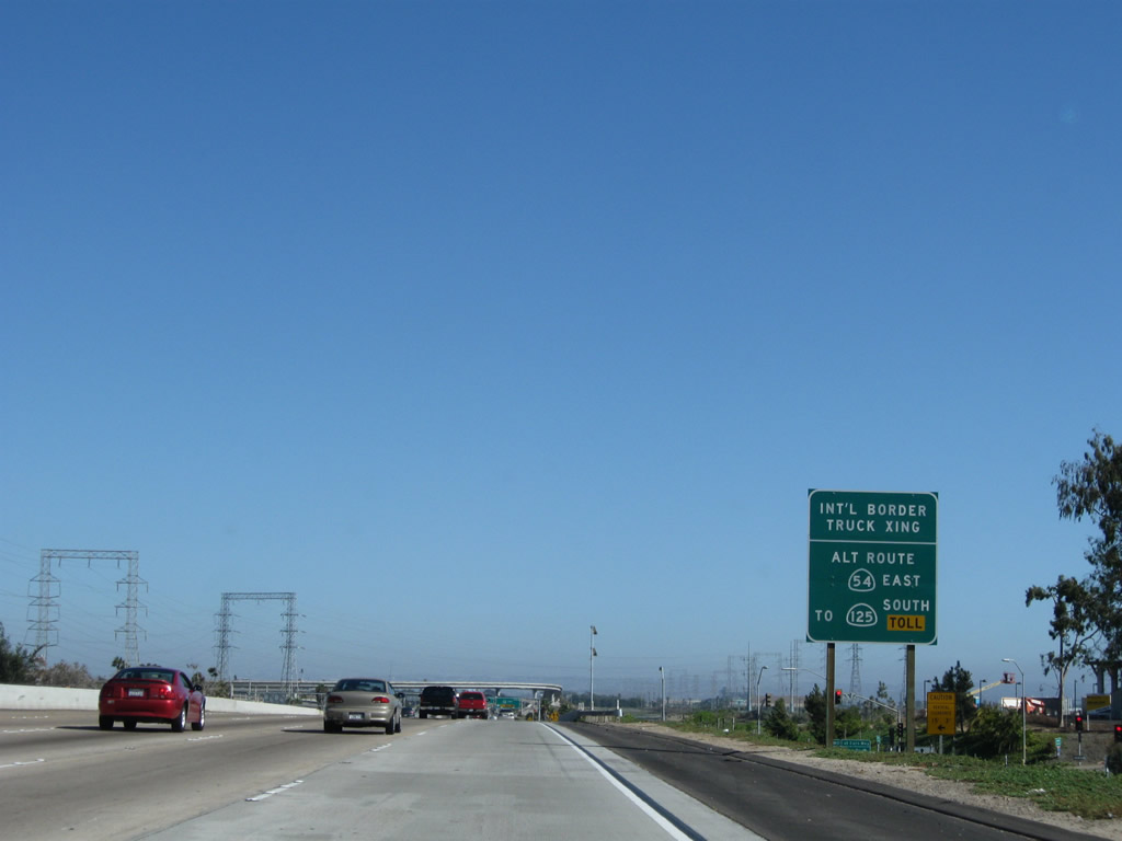
To the International Border Crossing, two routes are available: California 54 east to California 125 south or Interstate 5 south to California 905 east. Photo taken 07/12/09. |
|
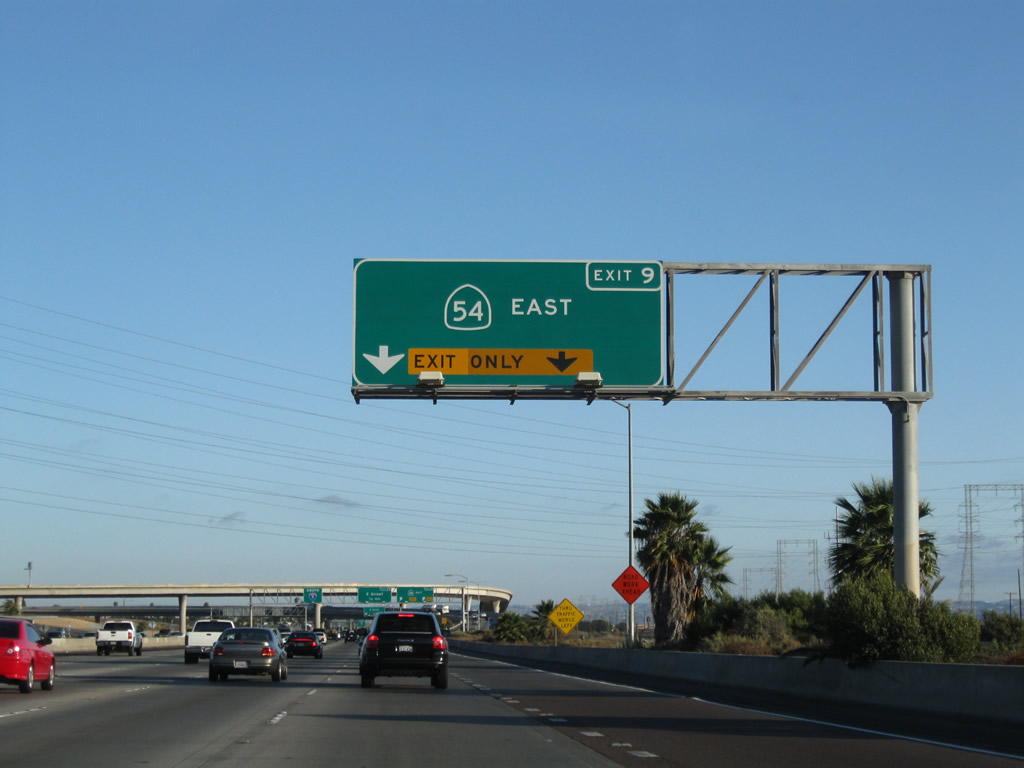
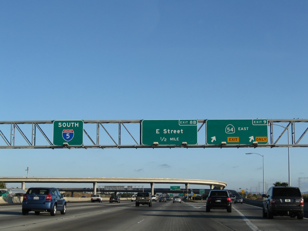
The next exit along Interstate 5 (Montgomery Freeway) is Exit 9, California 54/Flipino-American Highway (South Bay Freeway). This interchange was built over the mouth of the Sweetwater River as it drains into a wetland that feeds into the San Diego Bay to the west. As a result of this environmentally sensitive area, only limited areas west of the interchange are developed. Photo taken 08/21/08. |
|
Southbound Interstate 5 reaches Exit 9, California 54 (Filipino-American Highway) (South Bay Freeway) east to Bonita and Spring Valley (California 54 was renamed Filipino-American Highway on October 6, 2007). Much of this interchange was constructed on wetlands located near the mouth of the Sweetwater River, which empties into the San Diego Bay. The river runs between the east and westbound carriageways of California 54. New signage has been installed to incorporate the exit numbers. The next exit is Exit 8B, San Diego County S-17/E Street east. Photo taken 08/21/08. |
|
San Diego County S-17 follows E Street east into Chula Vista, then enters unincorporated areas along Bonita Road and Sweetwater Road before meeting California 54/125 near the Sweetwater Reservoir. Photo taken 05/22/04. |
|
Crossing the Sweetwater River, southbound Interstate 5 passes under the California 54 interchange, with flyover ramps connecting Interstate 5 south to California 54 east and California 54 west to Interstate 5 south. Photo taken 08/21/04. |
|
Southbound Interstate 5 (Montgomery Freeway) reaches Exit 8B, San Diego County S-17 East/E Street into Chula Vista. Photo taken 08/21/04. |
|
Interstate 5 enters the city of Chula Vista, the largest suburb of San Diego. Chula Vista is estimated to have 201,210 people (as of 2003), and demographic estimates suggest that it will continue to grow at a high rate, especially as more residential properties are developed in the eastern part of the city (in the Eastlake and Otay Ranch communities). Photo taken 05/22/04. |
|
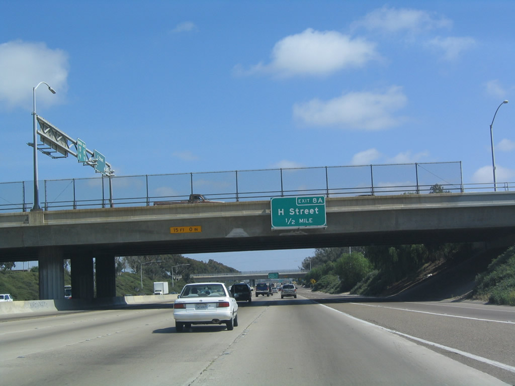
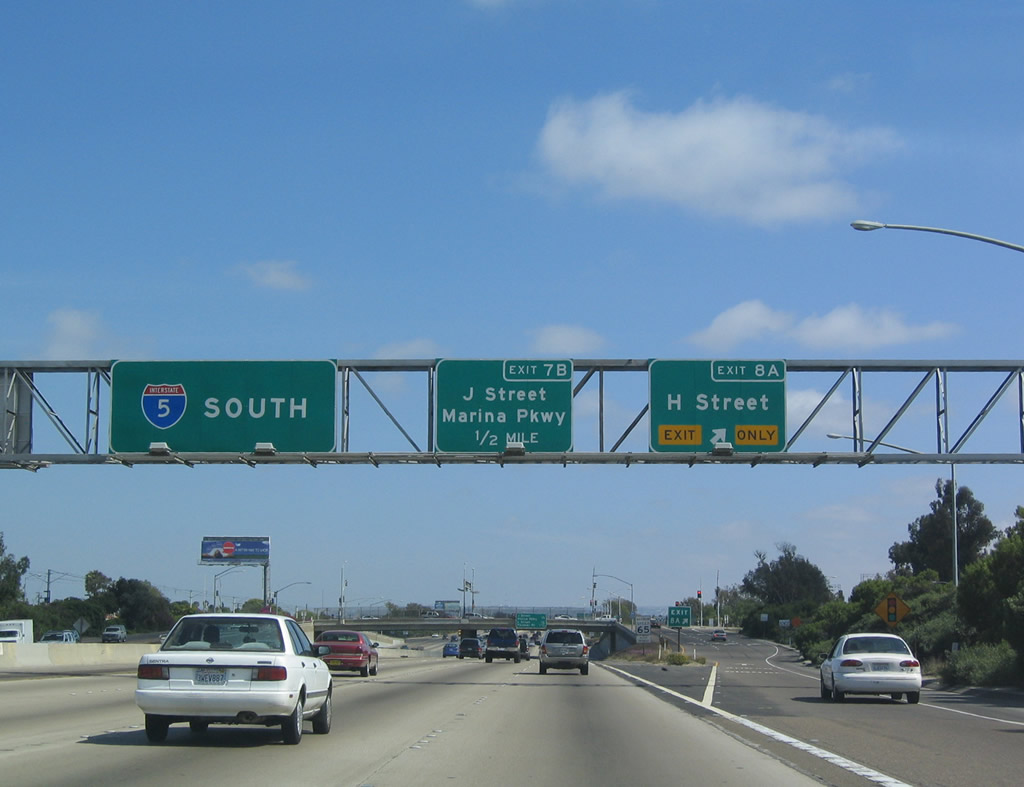
The next exit along southbound Interstate 5 is Exit 8A, H Street. This is the first of several exits to serve the city of Chula Vista. Photo taken 08/21/04. |
|
This mileage sign along southbound Interstate 5 (Montgomery Freeway) provides the distance to the next three exits: Exit 8A, H Street; Exit 7B, J Street/Marina Parkway; and Exit 7A, L Street. Photo taken 05/22/04. |
|
Southbound Interstate 5 (Montgomery Freeway) reaches Exit 8A, H Street in Chula Vista. Chula Vista has grown tremendously in the past several years, as it has seen previously undeveloped areas becoming new subdivision tracts. However, the portion of Chula Vista between Interstate 5 and Interstate 805 is the older section, and it has not seen the same construction boom as the eastern communities. Photo taken 05/22/04. |
|
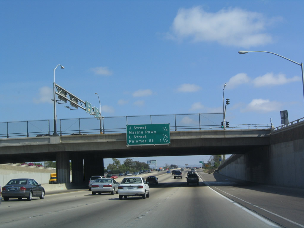
This mileage sign along southbound Interstate 5 (Montgomery Freeway) provides the distance to the next three exits: Exit 7B, J Street/Marina Parkway; Exit 7A, L Street; and Exit 6, Palomar Street. Photo taken 05/22/04. |
|
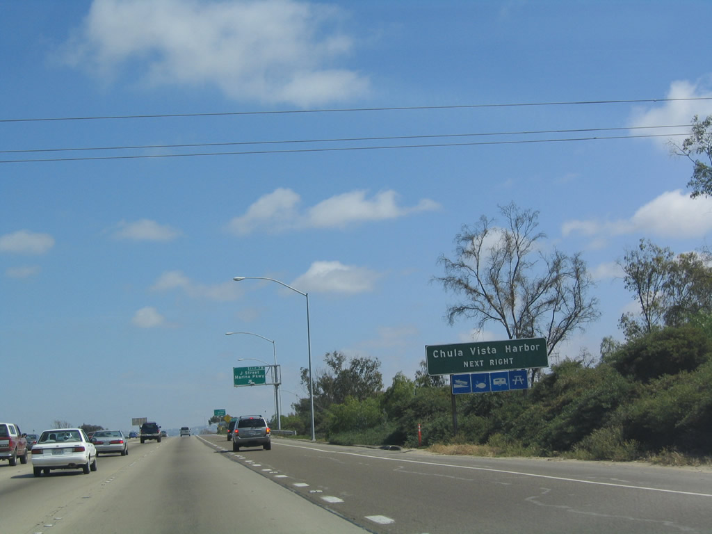
Use Exit 7B/J Street to the Chula Vista Harbor and bayside park areas. Photo taken 05/22/04. |
|
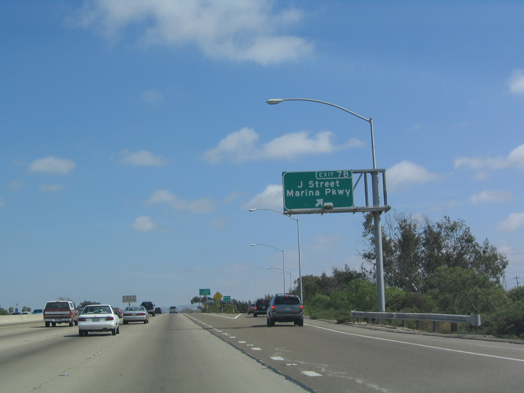
Southbound Interstate 5 (Montgomery Freeway) reaches Exit 7B, J Street/Marina Parkway. Photo taken 05/22/04. |
|
The next exit along southbound Interstate 5 is Exit 7A, L Street. Photo taken 05/22/04. |
|
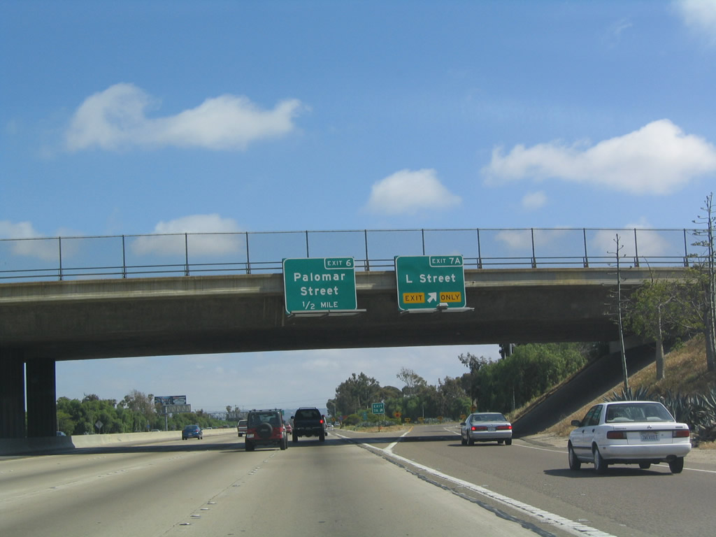
This mileage sign along southbound Interstate 5 (Montgomery Freeway) provides the distance to the next three exits: Exit 7A, L Street; Exit 6, Palomar Street; and Exit 5B, Main Street. Photo taken 08/21/04. |
|
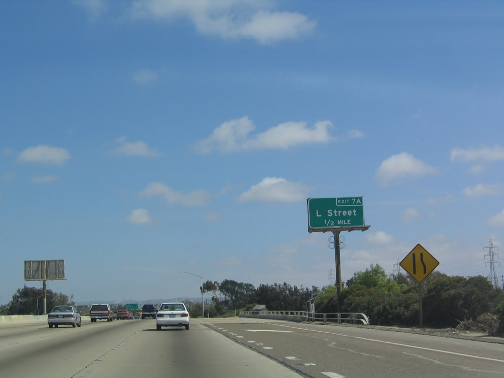
Southbound Interstate 5 reaches Exit 7A, L Street. Photo taken 05/22/04. |
|
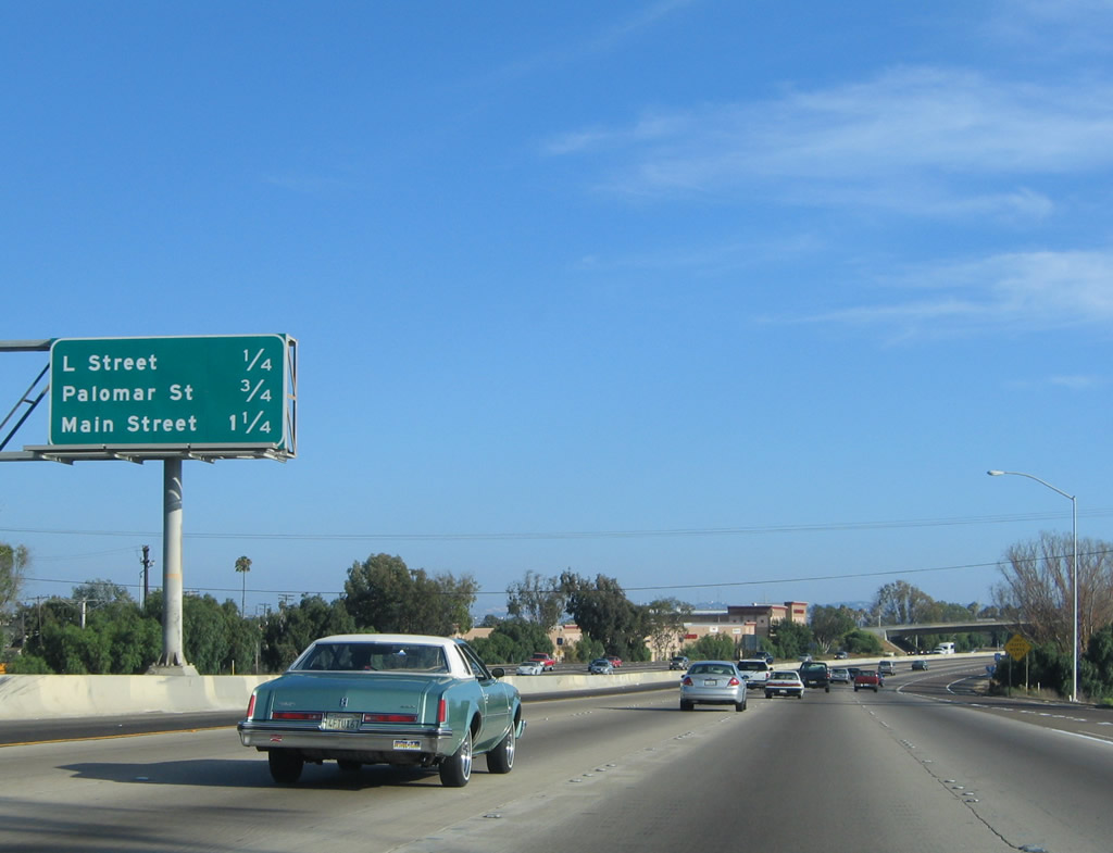
This mileage sign along southbound Interstate 5 (Montgomery Freeway) provides the distance to the next three exits: Exit 6, Palomar Street; Exit 5B, Main Street; and Exit 5A, California 75 North/Palm Avenue. Photo taken 08/21/04. |
|
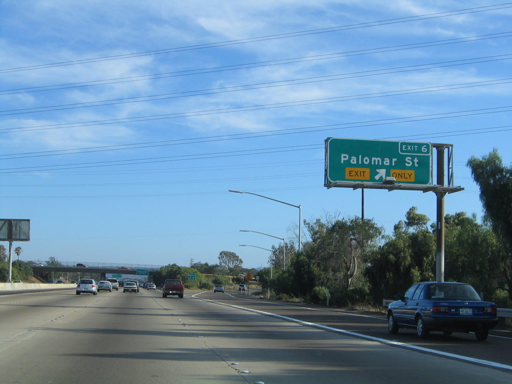
Southbound Interstate 5 reaches Exit 6, Palomar Street. Photo taken 08/21/04. |
|
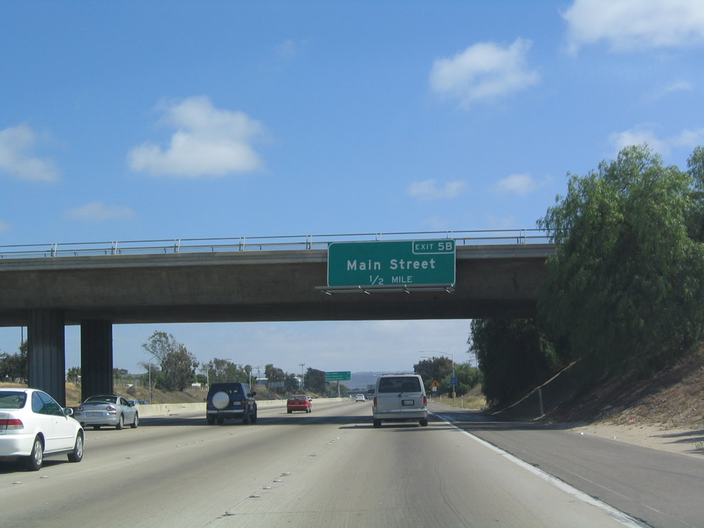
The next exit along southbound Interstate 5 (Montgomery Freeway) is Exit 5B, Main Street. Use Main Street east to Otay Valley Regional Park; this is the final Chula Vista exit. Photo taken 05/22/04. |
|
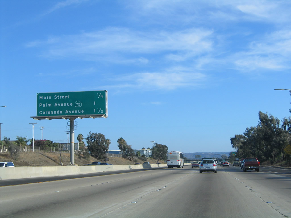
This mileage sign along southbound Interstate 5 provides the distance to the next three exits: Exit 5B, Main Street; Exit 5B, California 75 north/Palm Avenue; and Exit 4, Coronado Avenue. Around this point, Interstate 5 crosses the Otay River and reenters the city of San Diego. Photo taken 08/21/04. |
|
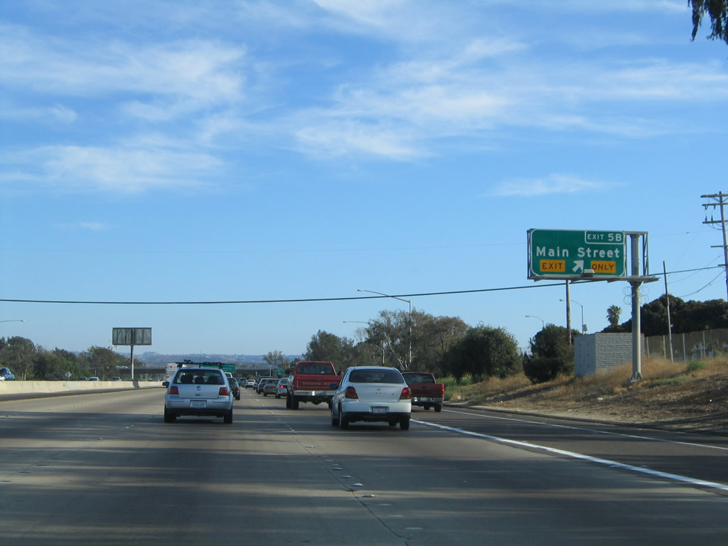
Southbound Interstate 5 (Montgomery Freeway) reaches Exit 5B, Main Street. Photo taken 05/22/04. |
|
All trucks entering Mexico must use California 905 east to the Otay Mesa Port of Entry (use Exit 3). Trucks are not allowed to use Interstate 5/San Ysidro Port of Entry. Photo taken 08/21/04. |
|
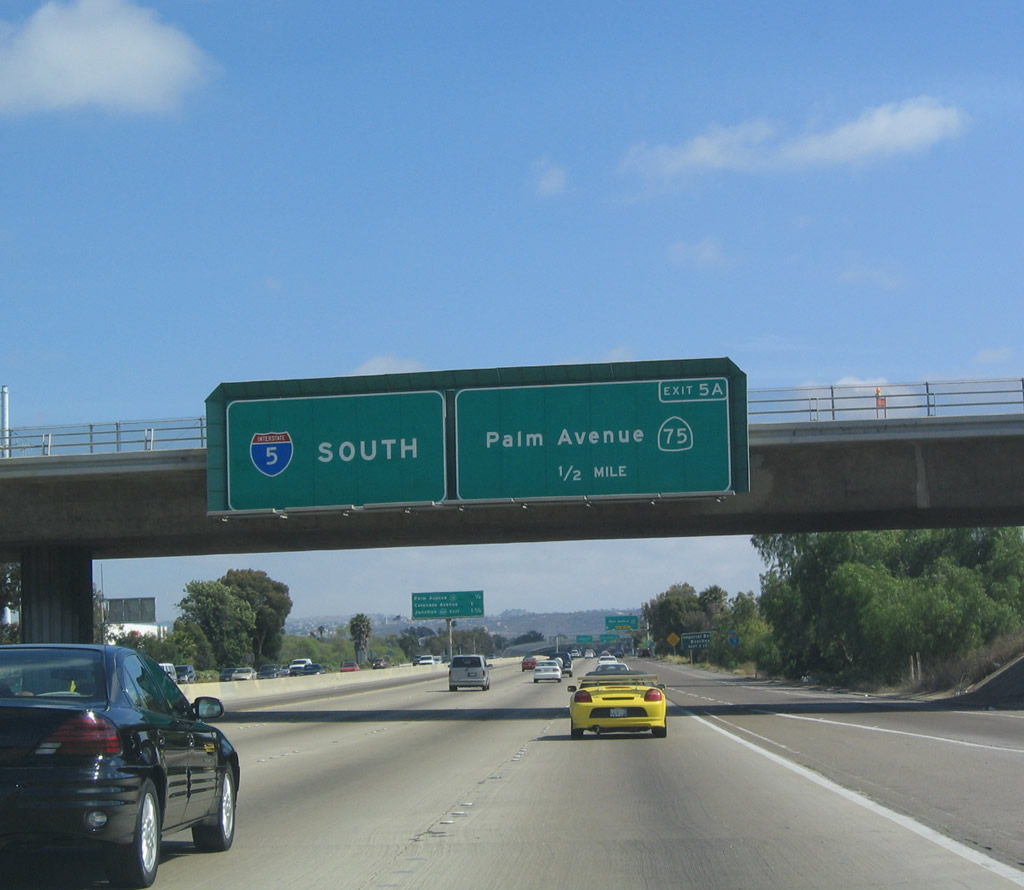
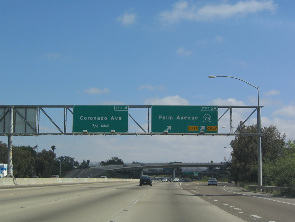
The next exit along southbound is Exit 5A, California 75 north/Palm Avenue west to Imperial Beach, the Silver Strand, and Coronado. In addition, Palm Avenue heads east toward Otay Mesa. Photo taken 05/22/04. |
|
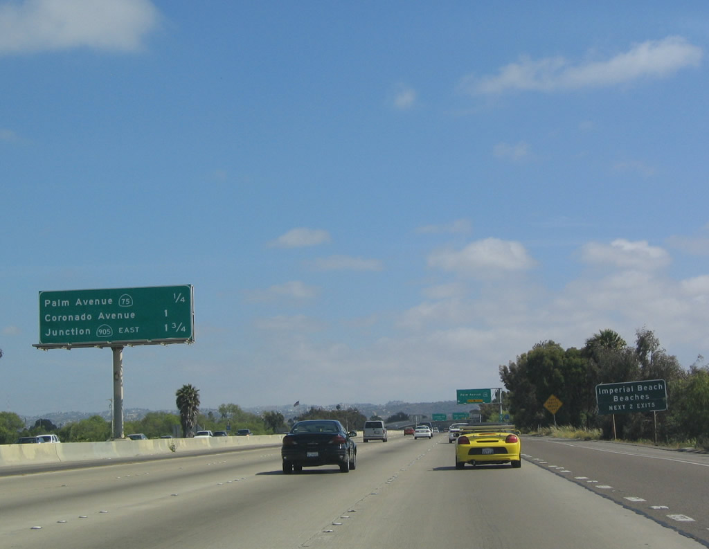
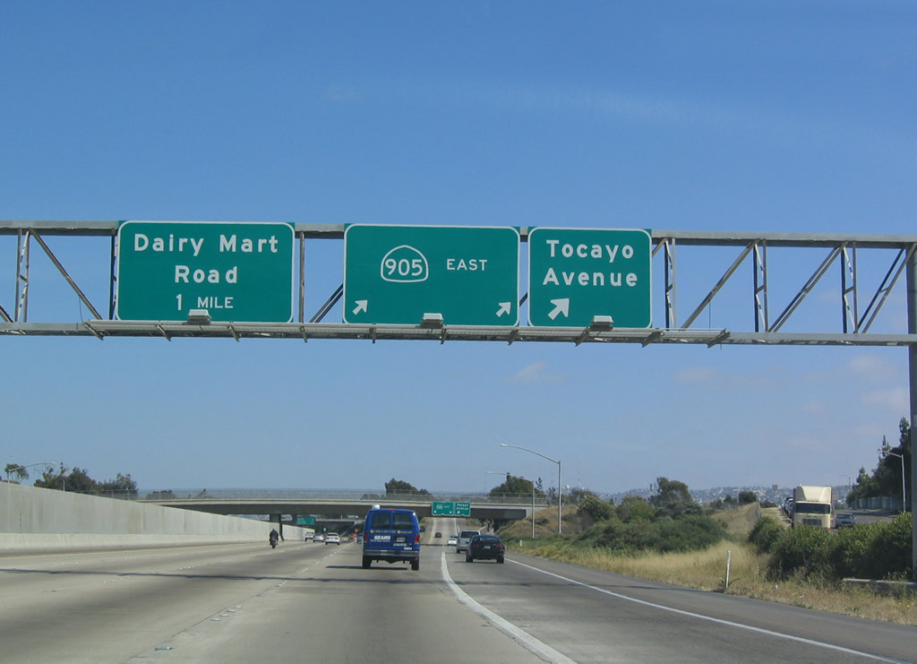
This mileage sign along southbound Interstate 5 (Montgomery Freeway) provides the distance to the next three exits: Exit 5A, California 75 north/Palm Avenue; Exit 4, Coronado Avenue; and Exit 3, California 905 East and Tocayo Avenue. Photo taken 05/22/04. |
|
California 75 follows Palm Avenue west into Imperial Beach, then turns north along the Silver Strand Highway to enter Coronado from the south. Note the lack of exit numbers on this sign, which was placed in June 2003. Photo taken 05/22/04. |
|
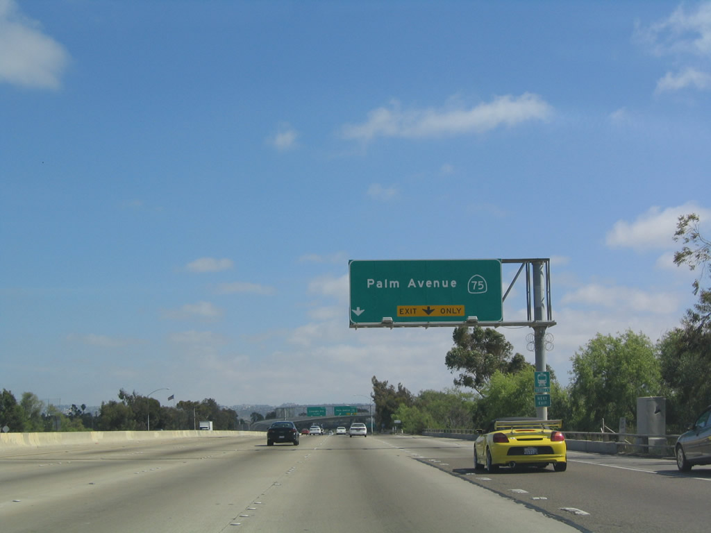
Southbound Interstate 5 (Montgomery Freeway) reaches Exit 5A, California 75 north/Palm Avenue. Photo taken 05/22/04. |
|
|
This mileage sign along southbound Interstate 5 provides the distance to the next three exits: Exit 4, Coronado Avenue; Exit 3, California 905/Tocayo Avenue; and Exit 2, Dairy Mart Road/San Ysidro Boulevard. Photos taken 08/21/04 and 05/22/04. |
|
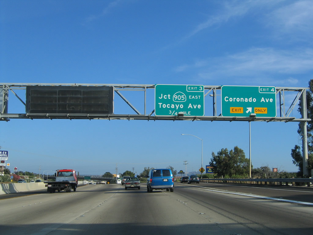
Southbound Interstate 5 (Montgomery Freeway) reaches Exit 4, Coronado Avenue; the next exit is Exit 3, California 905/Tocayo Avenue. Note the variable message sign installed here. Photo taken 08/21/04. |
|
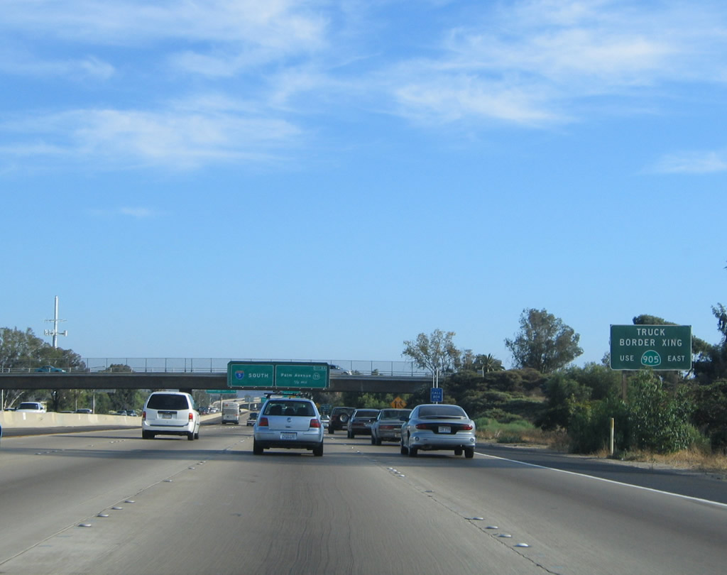
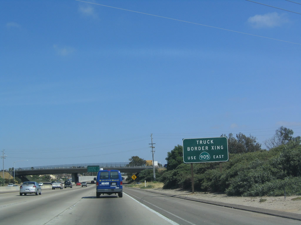
The next exit along southbound Interstate 5 (Montgomery Freeway) is Exit 3, California 905. This sign reminds commercial vehicles to use California 905 for the truck border crossing. Note that the exit is one-half mile away; the truck crossing is much farther away, at the Otay Port of Entry. Photo taken 05/22/04. |
|
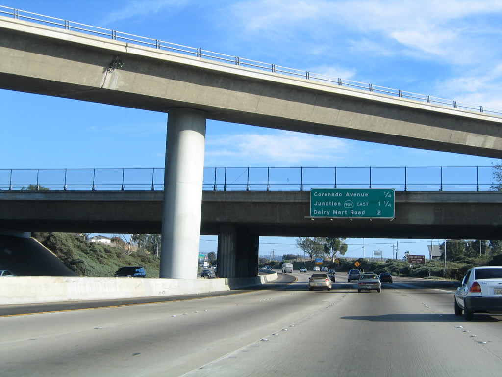
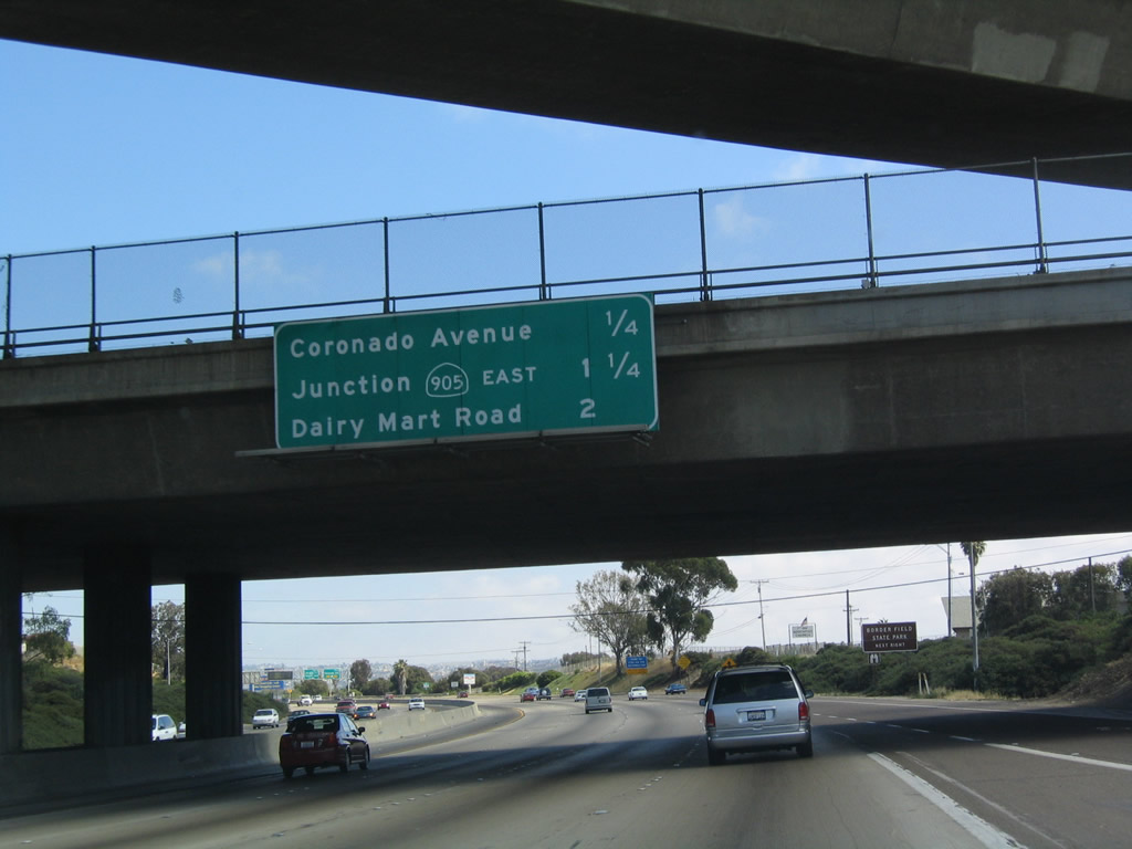
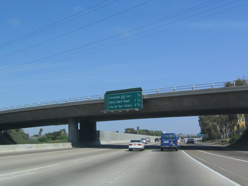
Another mileage sign along southbound Interstate 5 (Montgomery Freeway) provides the distance to the next three exits: Exit 3, California 905/Tocayo Avenue; Exit 2, Dairy Mart Road/San Ysidro Boulevard; and Exit 1B, Via de San Ysidro. A tall fence that separates the two directions of traffic now appears in the median from this overpass (Coronado Avenue) south to the border. Photo taken 05/22/04. |
|
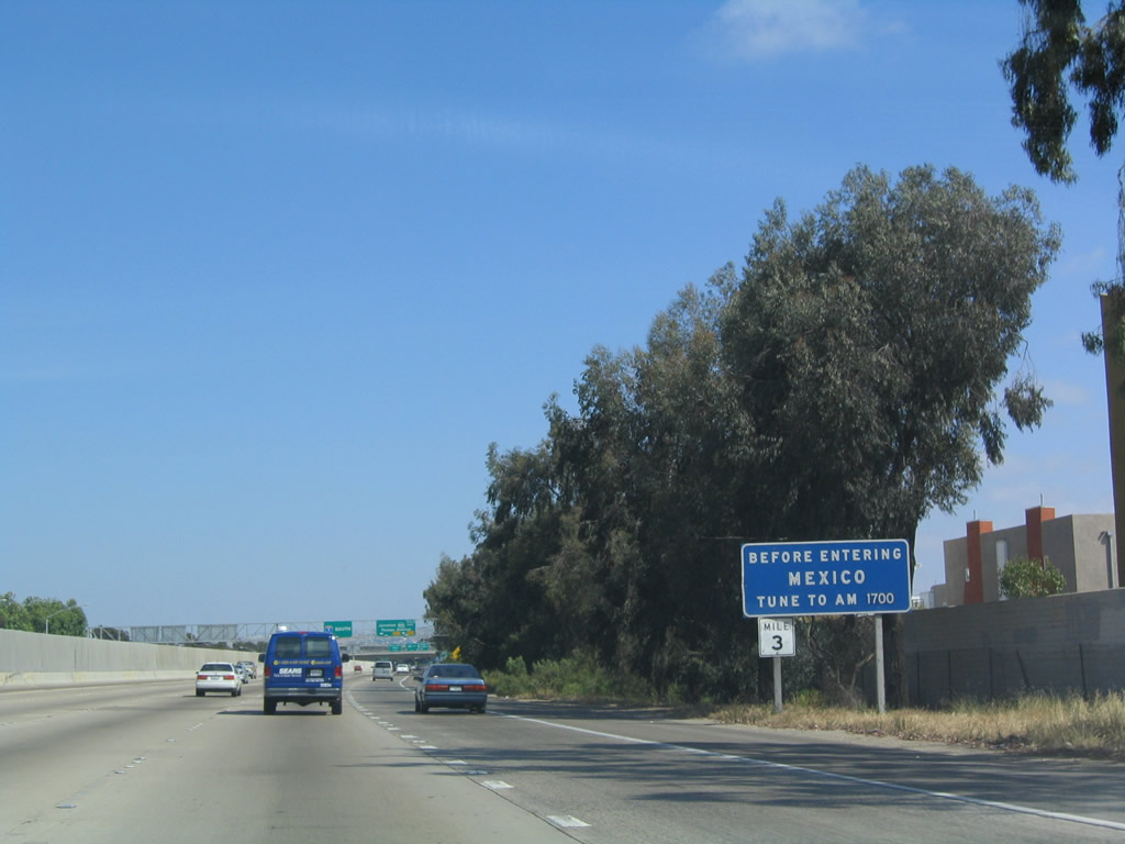
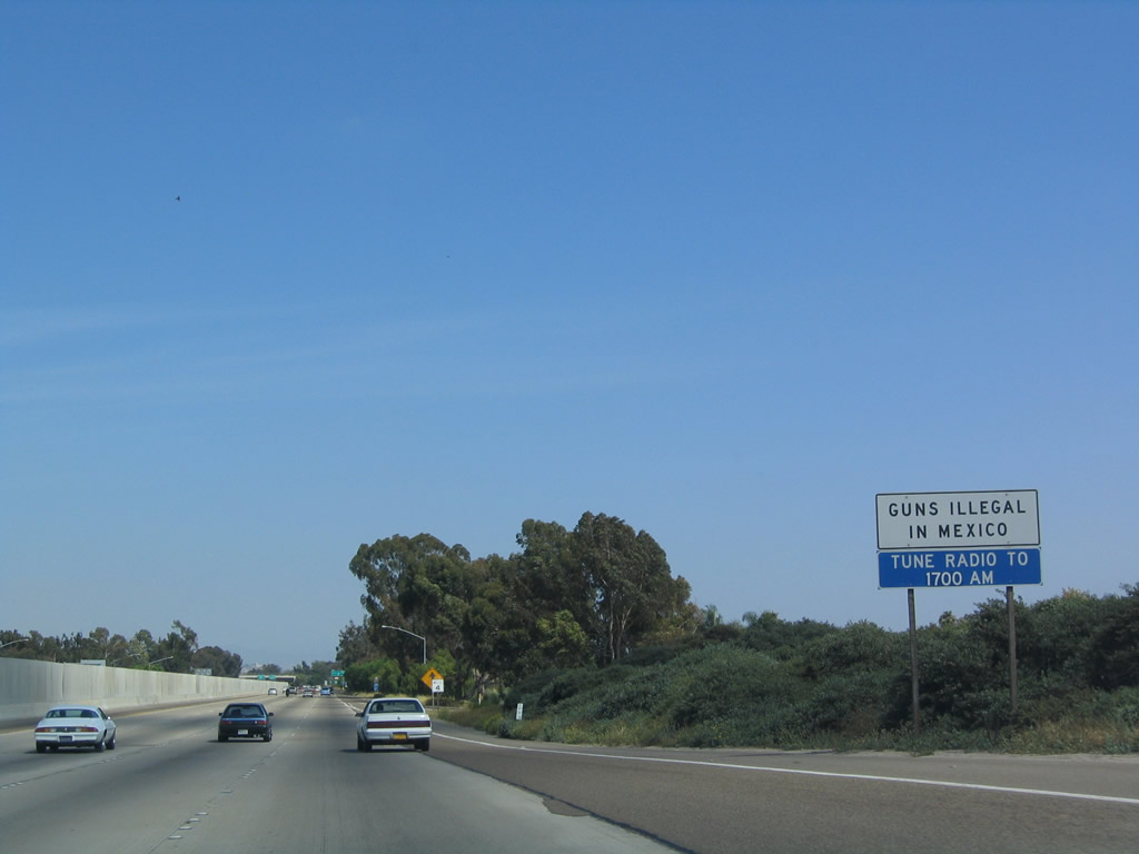
To obtain additional information about traveling into Mexico, tune to 1700 AM on the radio. It is encouraged that all motorists entering Mexico purchase Mexican auto insurance prior to crossing the border. Photo taken 05/22/04. |
|
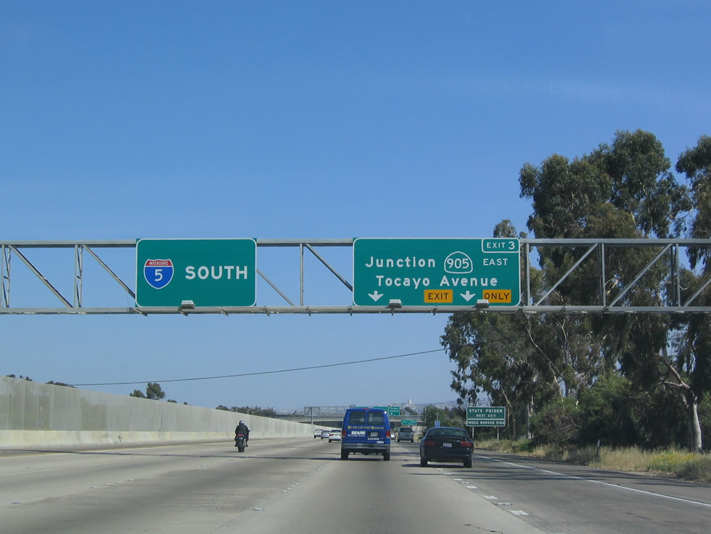
California 905 travels east along the Otay Mesa Freeway from Interstate 5 to the Otay Mesa Port of Entry. The freeway is currently incomplete between Interstate 805 and future California 125; it is planned for completion in 2006, contingent upon funding availability. Once upgraded to Interstate standards, California 905 is planned to be submitted to AASHTO and FHWA for inclusion in the Interstate Highway System as Interstate 905. Interstate 905 was already approved as Section 139(b) non-chargeable Interstate Highway mileage in 1984; all that remains is to construct the eventual freeway facility. That was at one time planned for completion by 2006, but funding gaps and shortfalls have pushed back the completion date for California 905 until at least 2011. The California 905 freeway will be built in phases, starting in the east and continuing west (from Siempre Viva Road to California 125, then west parallel to Otay Mesa Road to current freeway stub east of Interstate 805). Photo taken 05/22/04. |
|
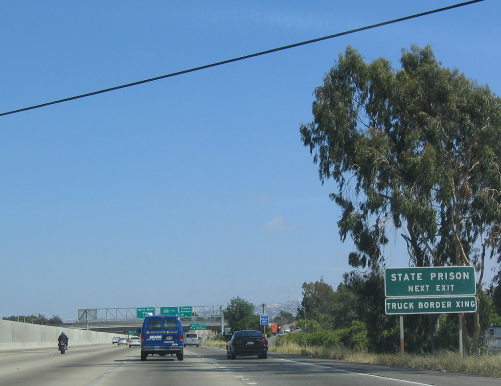
Again, Interstate 5 truckers are reminded to use California 905 to reach the border crossing at Otay Mesa. In addition, California 905 connects to Otay Mesa Road, which leads to the Donovan State Prison. Photo taken 05/22/04. |
|
Southbound Interstate 5 (Montgomery Freeway) reaches Exit 3, California 905/Tocayo Avenue. The next exit is Exit 2, Dairy Mart Road/San Ysidro Boulevard. These are new signs, but the exit numbers are missing! Photo taken 05/22/04. |
|
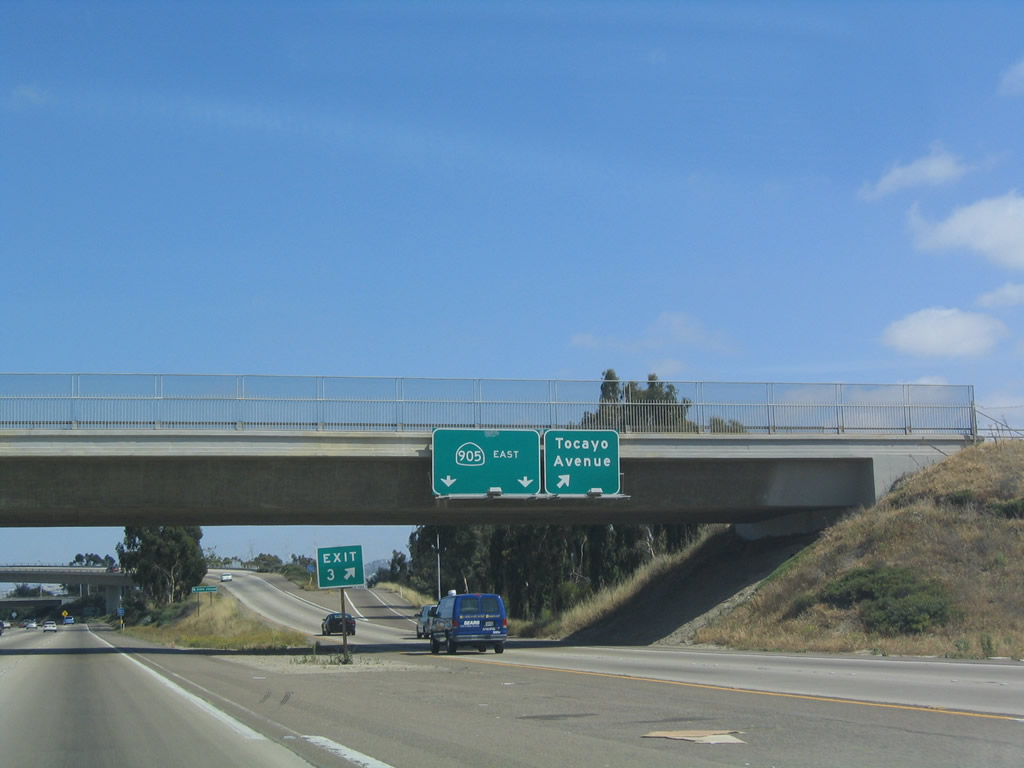
View of the exit ramp from southbound Interstate 5 onto Exit 3, California 905 east and Tocayo Road west. Photo taken 05/22/04. |
|
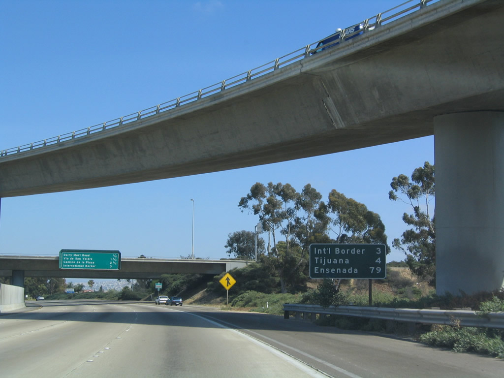
This mileage sign is the first one along southbound to acknowledge either Tijuana or Ensenada, two cities located in Baja California, Mexico, along Mexico Federal Route 1-D. Photo taken 05/22/04. |
|
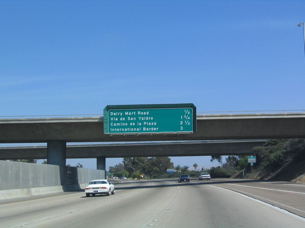
This mileage sign along southbound Interstate 5 provides the distance to the next three exits: Exit 2, Dairy Mart Road/San Ysidro Boulevard; Exit 1B, Via de San Ysidro; and Exit 1A, Camino de la Plaza. Photo taken 05/22/04. |
|
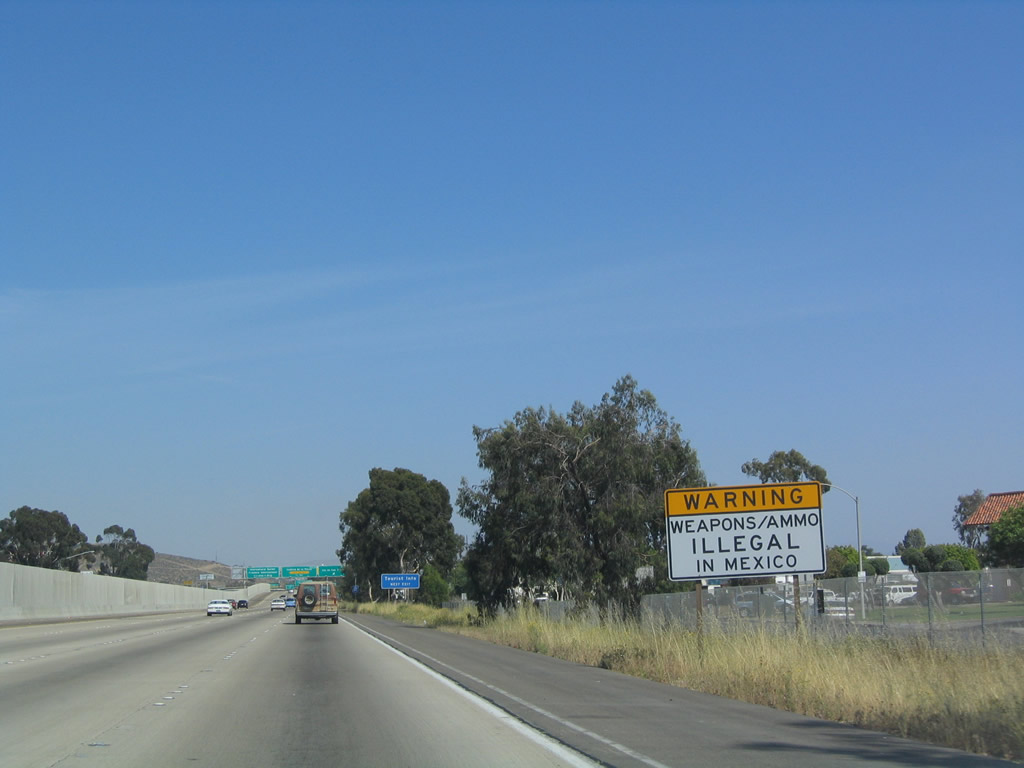
Guns and ammunition are illegal in Mexico. Photo taken 05/22/04. |
|
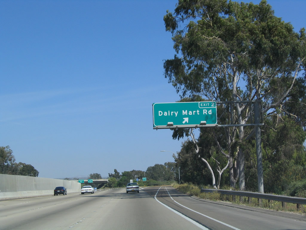
Southbound Interstate 5 (Montgomery Freeway) reaches Exit 2, Dairy Mart Road/San Ysidro Boulevard. Photo taken 05/22/04. |
|
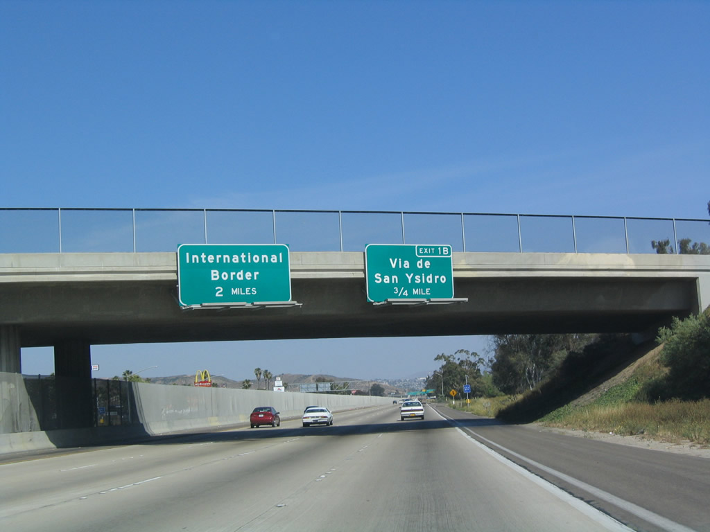
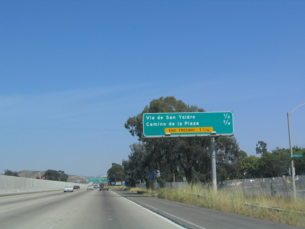
The next exit along southbound is Exit 1B, Via de San Ysidro, followed by Exit 1A, Camino de la Plaza. Photo taken 05/22/04. |
|
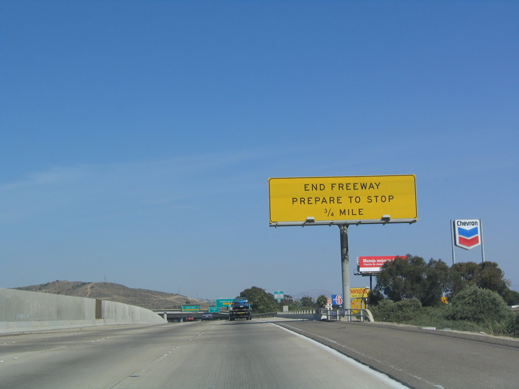
This is the final mileage sign along southbound Interstate 5. It features the distance to the final two exits -- Exit 1B, Via de San Ysidro and Exit 1A, Camino de la Plaza -- and the border crossing. Interstate 5 ends in 1.25 miles. Photo taken 05/22/04. |
|
Again, motorists are reminded not to bring guns and ammunition into Mexico. This kind of sign (white and yellow) is more typically found at the Arizona border crossings. Photo taken 05/22/04. |
|
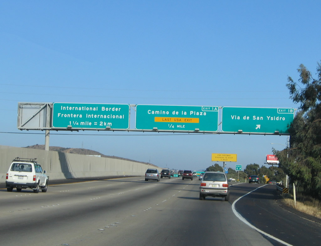
Southbound Interstate 5 meets Exit 1B, Via de San Ysidro. The final exit along southbound Interstate 5 is Exit 1A, Camino de la Plaza. All other through traffic is defaulted into the international border crossing into Mexico. Photo taken 08/21/04. |
|
Interstate 5 ends in 0.75 mile; if Mexican officials are stopping traffic at the border, delays may occur even as far north as here. Photo taken 05/22/04. |
|
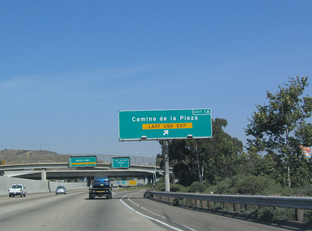
Southbound Interstate 5 reaches Exit 1A, Camino de la Plaza. This is the last United States exit (although a last-minute U-turn is available from the left lane prior to the actual border crossing). Photo taken 05/22/04. |
|
Use Exit 1A, Camino de la Plaza, to reach the outlet shops, border shops, transit center, pedestrian walkway into Mexico, and parking areas. All through traffic from here is defaulted into Mexico. With the exception of a U-Turn that must be taken from the far left lane, there is no return access to the United States. The ramp/bridge in the background carries Interstate 805 to its southern terminus as it merges into Interstate 5. Photo taken 05/22/04. |
|
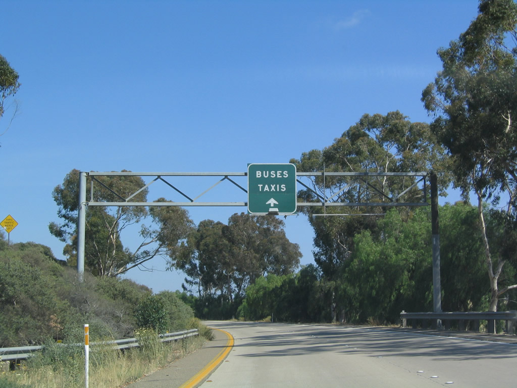
Once on the two-lane off-ramp to Camino de la Plaza, this sign advises buses and taxis to use the left lane. Parking facilities for people crossing the border into Mexico is available on the U.S. side of the border. Photo taken 05/22/04. |
|
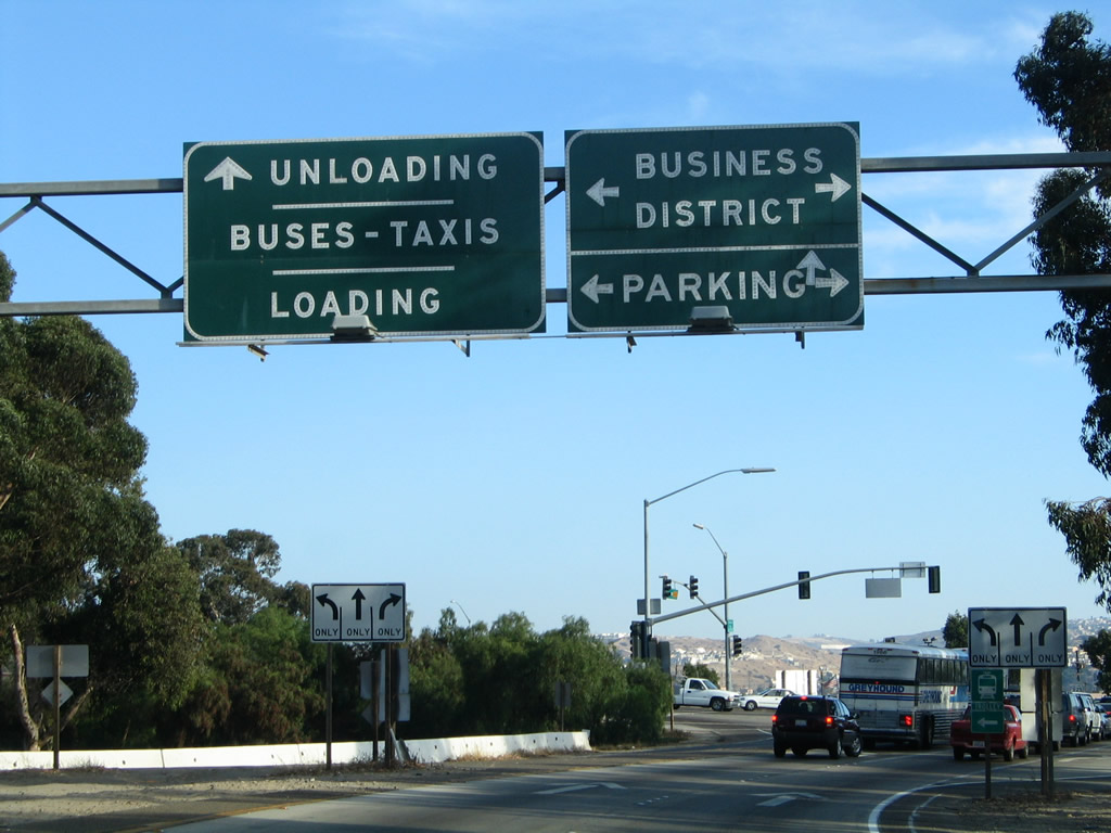
The off-ramp meets Camino de la Plaza at this signal. Turn right to Las Americas Mall and left to cross the freeway to the U.S. Customs House. Pedestrians and bicyclists crossing into Mexico must use the portal on the west side of the freeway, so drop-offs should follow the signs by continuing straight on Camiones Way. Photo taken 08/21/04. |
|
|
To declare items to the Mexican authorities, use the right lane. All other lanes are subject to random searches at the request of officials. Photos taken 12/03/06 and 05/22/04. |
|
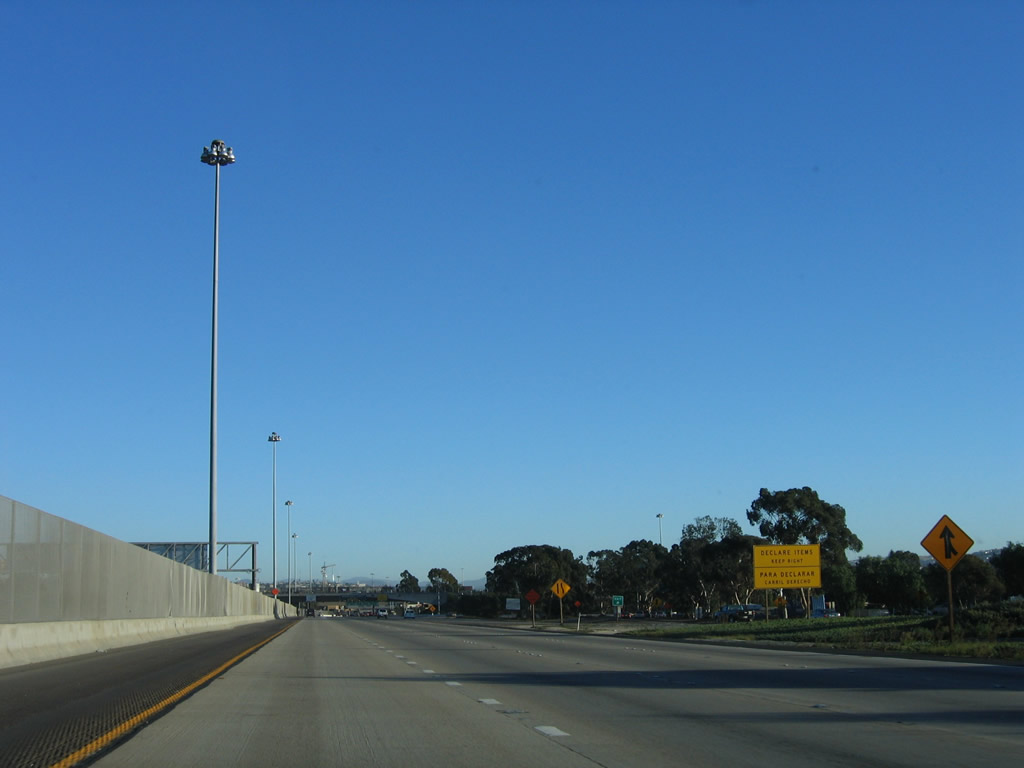
As traffic from Interstate 805 merges onto Interstate 5 from the right, another declaration sign is posted. Photo taken 12/03/06. |
|
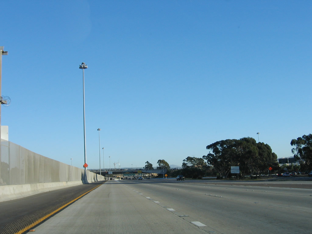
Tall mast lighting illuminates the border area. The tall median fence continues all the way to the border; this fence helps keep people from crossing over the freeway and reduces accidents. Photo taken 12/03/06. |
|
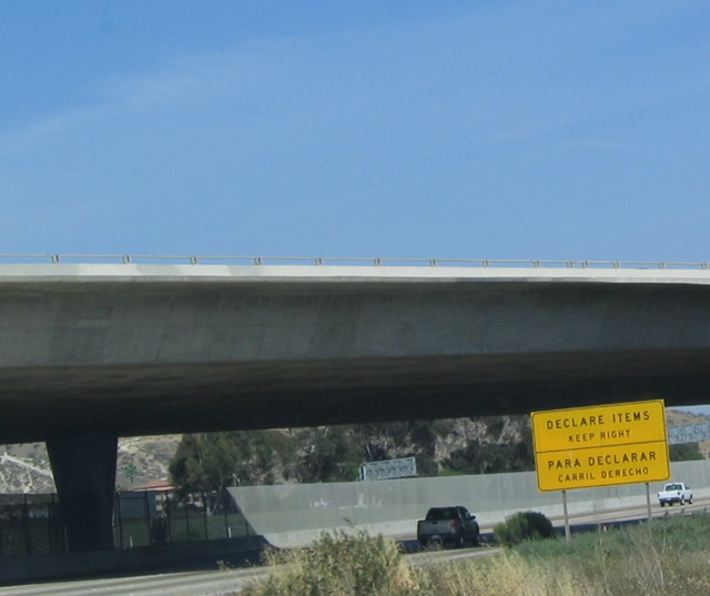
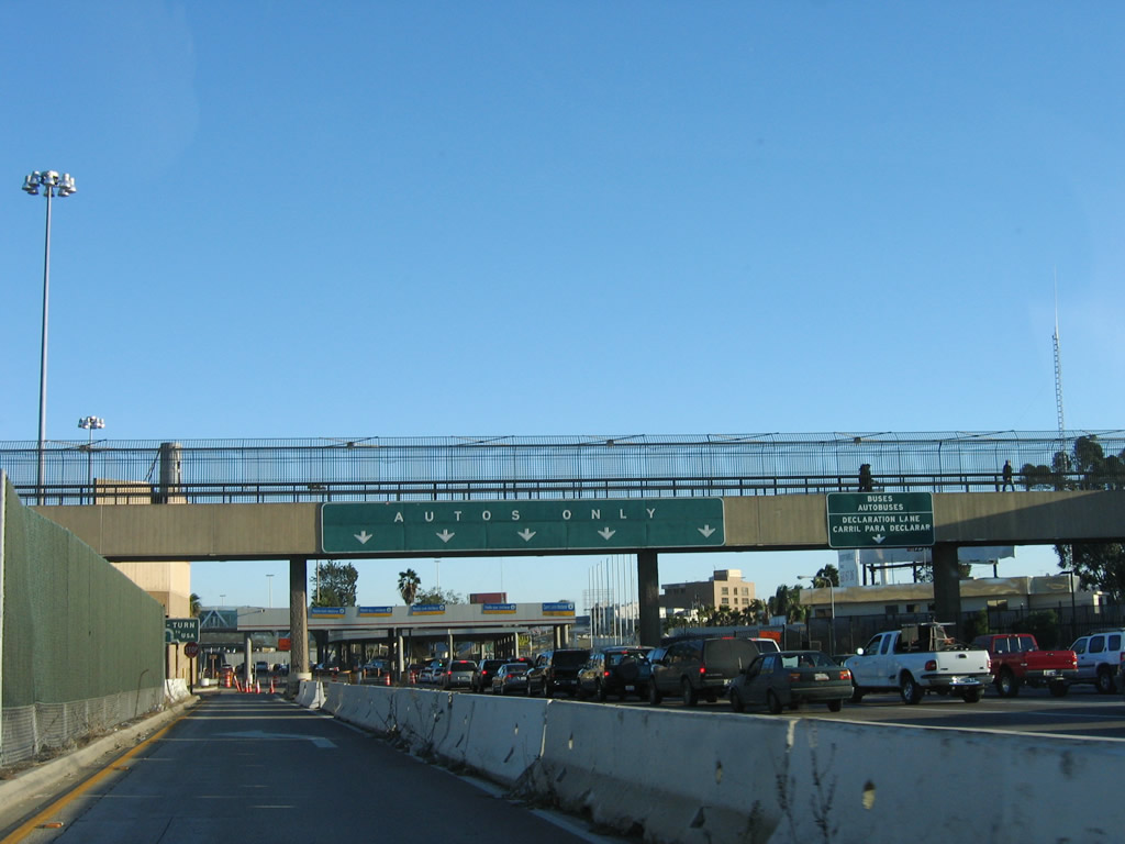
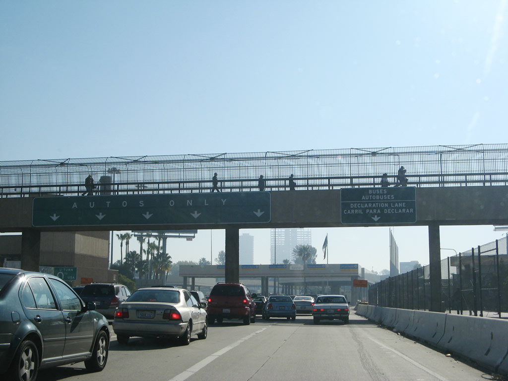
The left lane becomes exit only to the last United States U-Turn. The middle lanes continue south across the border into Tijuana, Baja California, Mexico. The right lanes will allow motorists passing into Mexico to declare items. A passport is required for passage from Mexico back into the United States, so all border crossers should carry adequate documentation. Photo taken 12/03/06. |
|
|
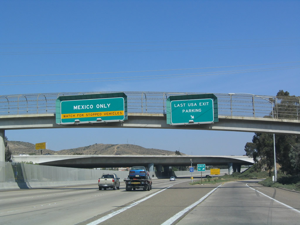
Reaching the end of Interstate 5, the left lane becomes separated from the rest of the freeway lanes. The left lane will culminate in a U-Turn that connects to Interstate 5 and Interstate 805 north. The right lanes can become congested especially on days when Mexican authorities stop traffic. The 2008 photo shows some congestion as well as the upcoming border crossing. There is no end shield for either Interstate 5 or Interstate 805. Photos taken 12/03/06 and 01/12/08. |
| Interstate 5 scenes |
|
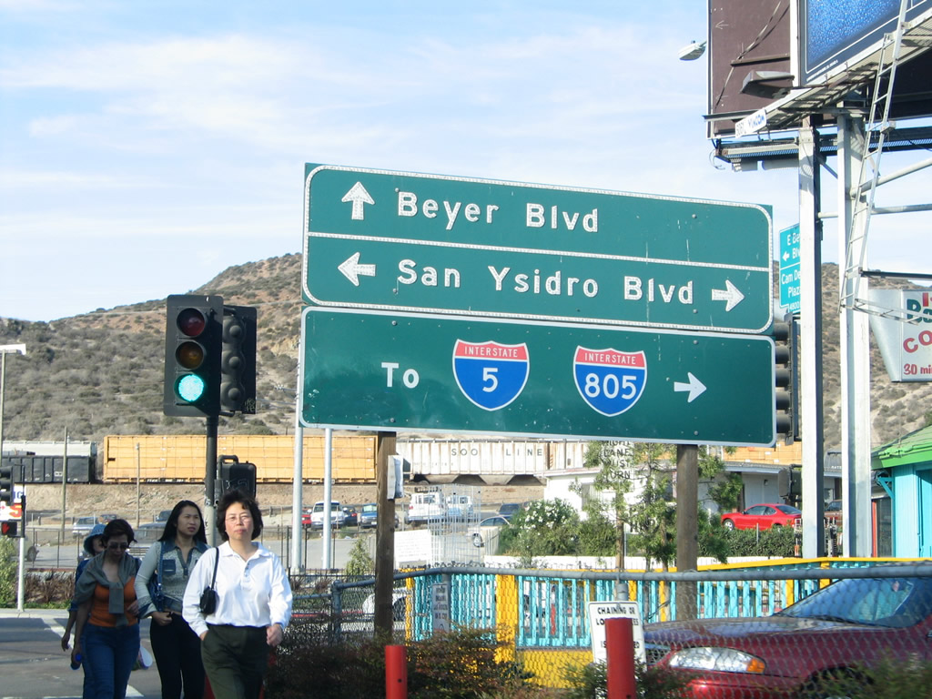
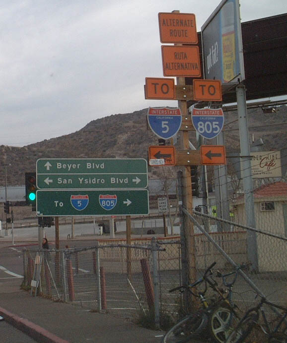
Signage for Interstate 5 and Interstate 805 along Beyer Boulevard in the San Ysidro community of San Diego. The alternate route signage is in place to alleviate traffic on southbound San Ysidro Boulevard; note the use of the bilingual signs. "Ruta Alternativa" means Alternate Route. San Ysidro Boulevard is the original alignment for U.S. 101 just before it crossed into Mexico. With the completion of the freeway, traffic must use Interstate 5 rather than San Ysidro Boulevard to reach the International Border Crossing. Much of this area is under construction, including the area around the southern terminus of the San Diego Trolley. This construction is still ongoing as of April 2003. Photos taken 08/21/04 and 06/99. |
|
|
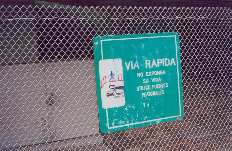
Along the right-of-way fence, signs such as this one warn pedestrians not to enter the freeway. Posted in Spanish, the signs reads "Expressway: Do Not Expose Your Life; Use the Pedestrian Overpasses." This particular sign is located on the west side of the freeway as seen from Calle Primera (frontage road) near a pedestrian overpass. Photo taken 06/99. |
|
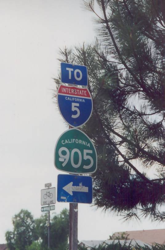
These Interstate 5 and California 905 shields are posted on southbound Oro Vista Road at its intersection with Tocayo Avenue in southern San Diego. A left turn on Tocayo Avenue east from this location will take travelers directly into the Interstate 5/California 905 interchange. Photo taken 06/99. |
|
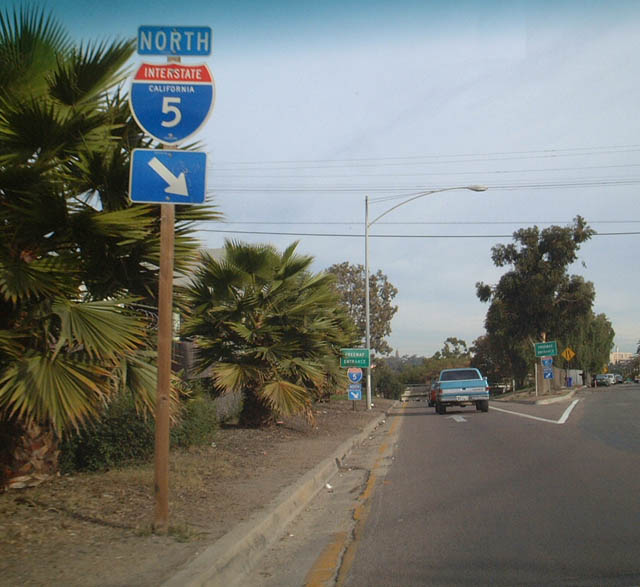
Freeway entrance for Interstate 5 northbound from Imperial Avenue. This picture was taken on the way back to the freeway after eating at Sister Pee-Wee's Soul Food restaurant. Photo taken 05/02. |
|
|
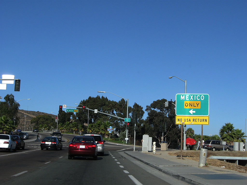
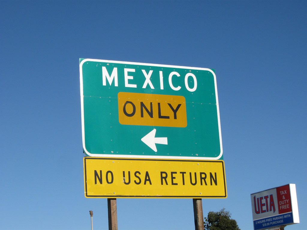
Eastbound Camino de la Plaza approaches the on-ramp to Interstate 5 south, which leads directly into Tijuana, Baja California, Mexico. The ramp is signed for Mexico only. Photos taken 07/12/09. |
Page Updated August 21, 2010.