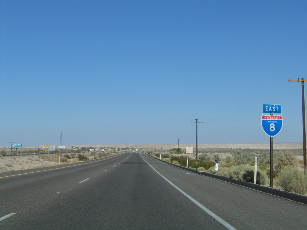
| Interstate 8 east |
|
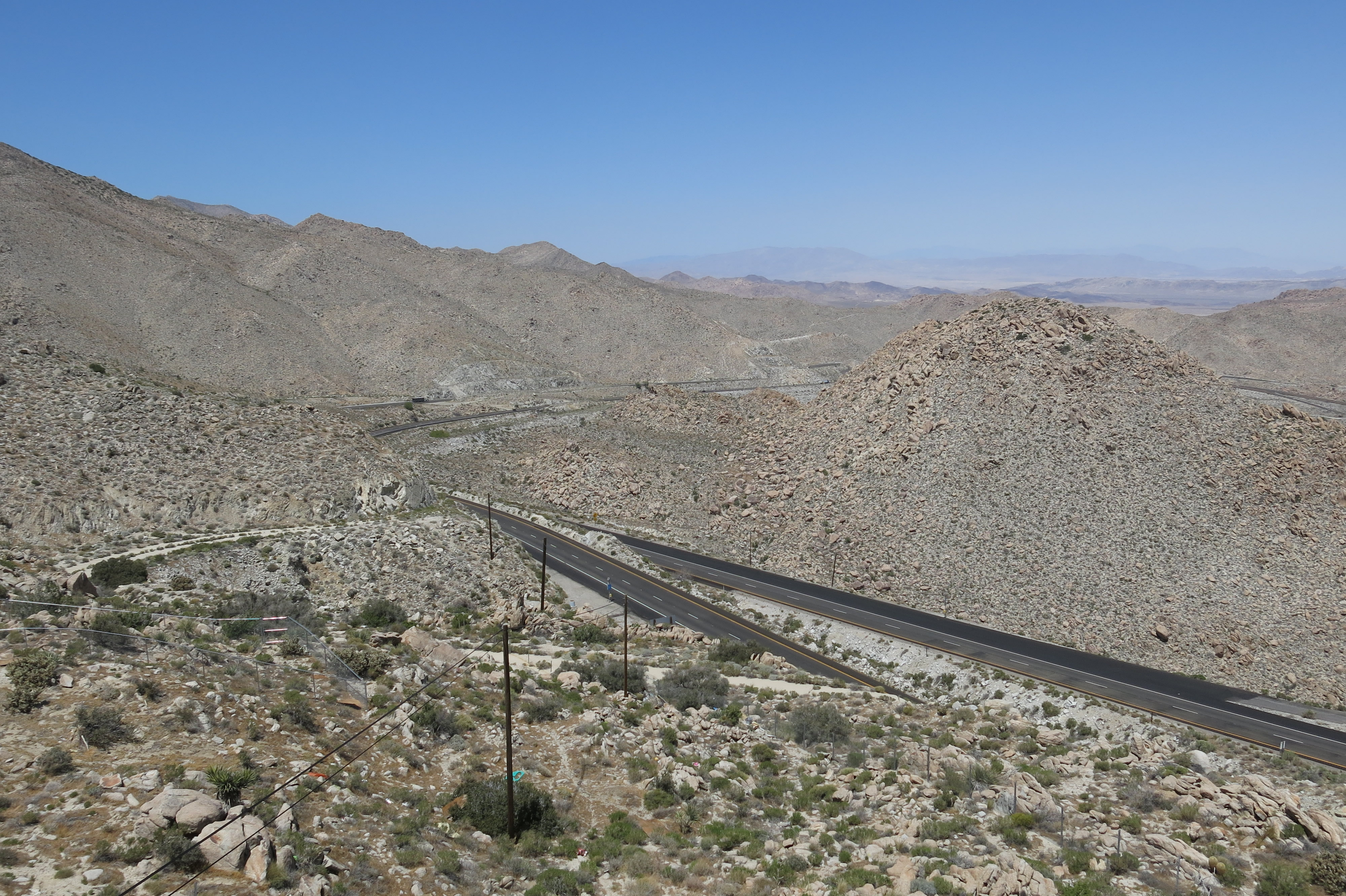
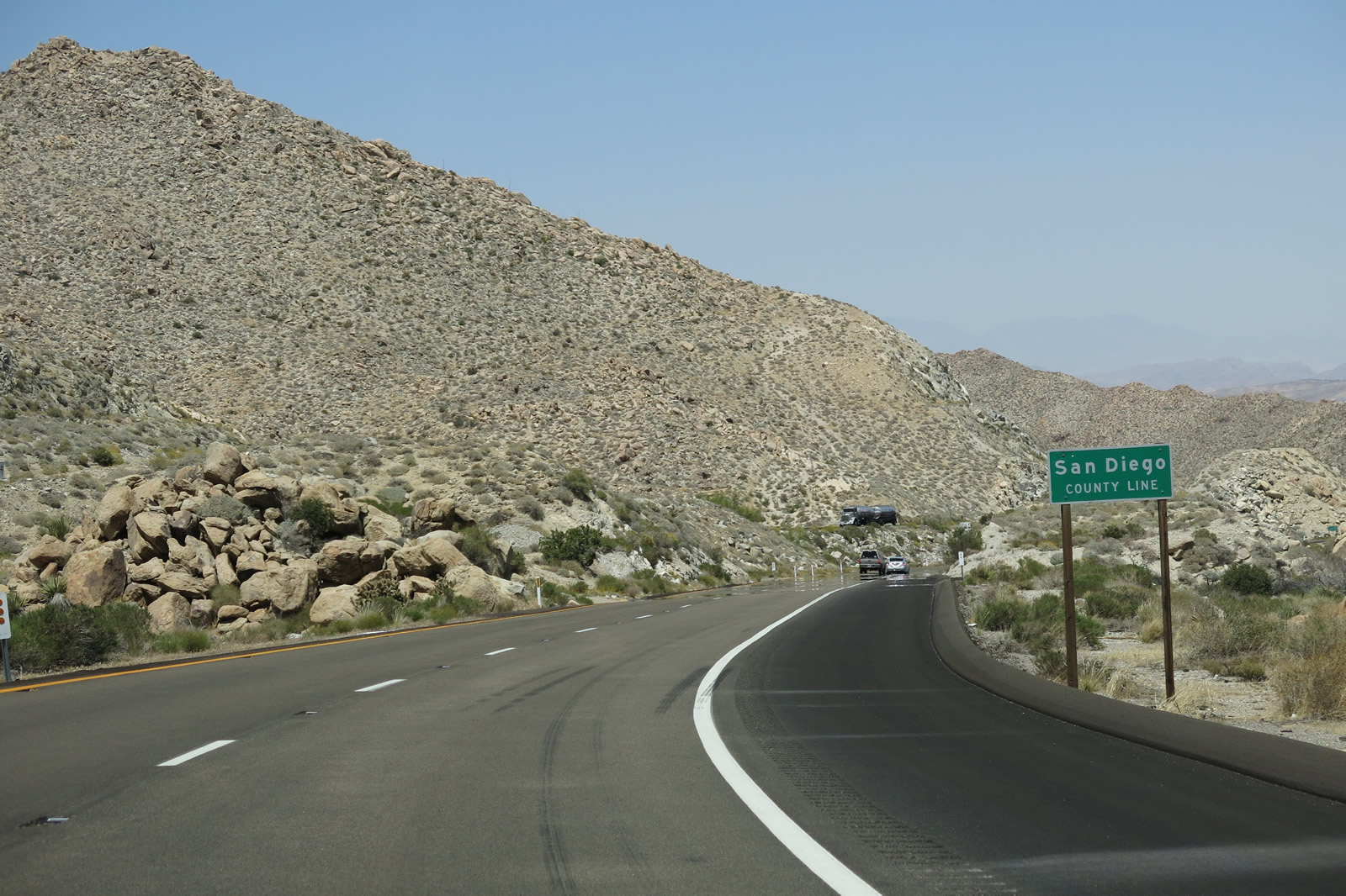
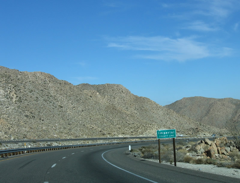
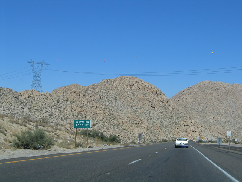
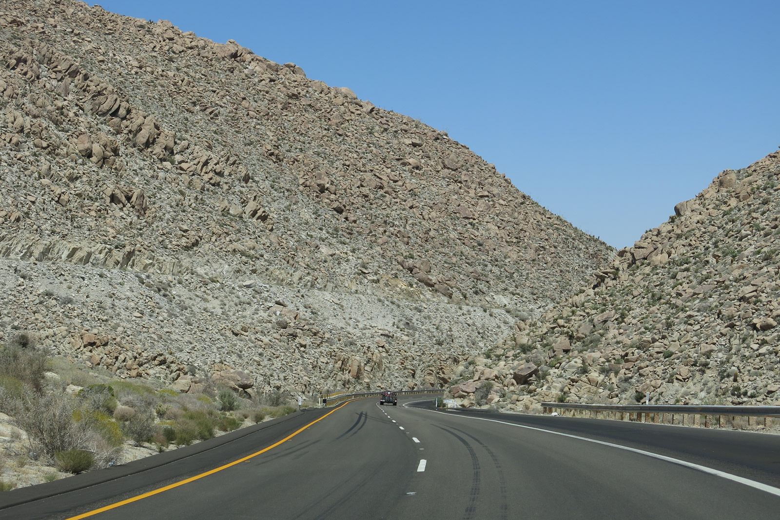
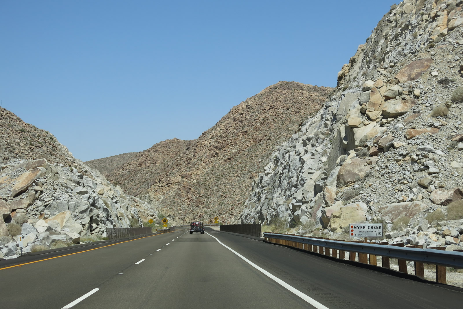
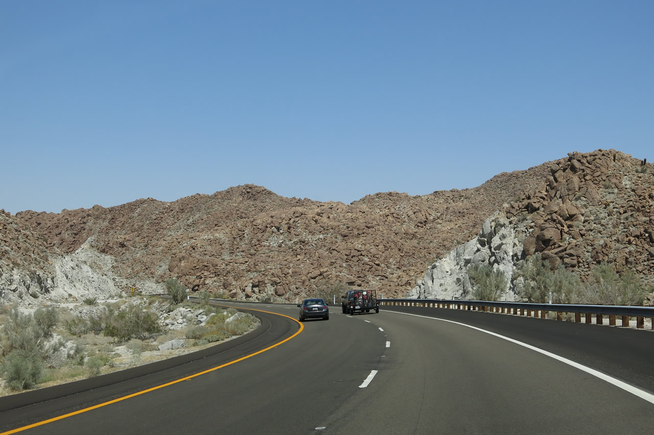
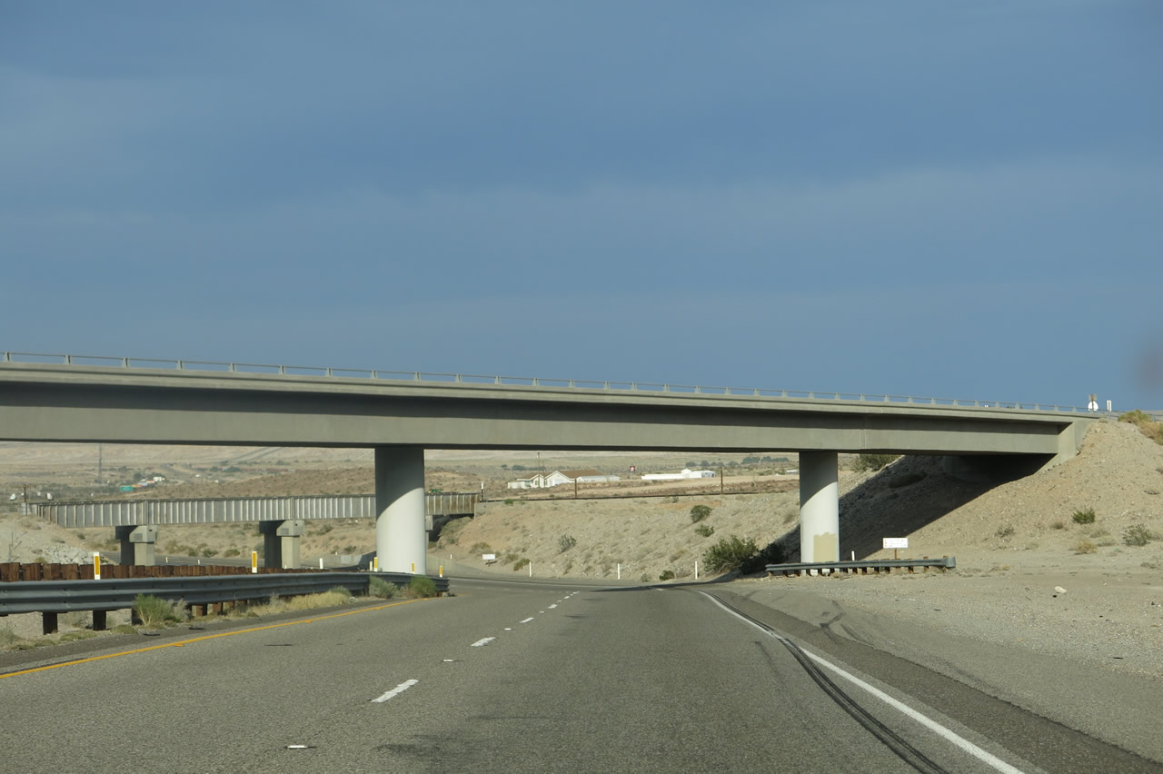
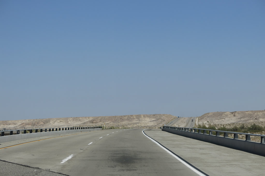
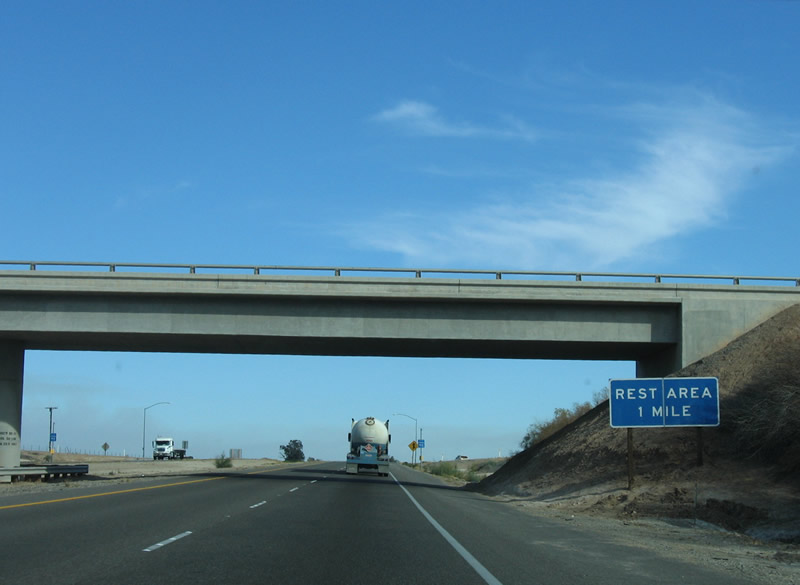
After crossing the In-Ko-Pah Park Road overpass, eastbound Interstate 8 leaves San Diego County and enters Imperial County for the first time. Eastbound Interstate 8 will turn north ahead in order to follow the downgrade to Mountain Springs. This north-south section of Interstate 8 will straddle the San Diego-Imperial County Line. This causes the freeway to cross the county line several times (see subsequent photos for each county line crossing). Notably, the white postmiles show "IMP" for Imperial after the In-Ko-Pah Park Road interchange (Exit 77), even for the sections of Interstate 8 that cross back into San Diego County north of here. Photo taken 08/27/04. |
|
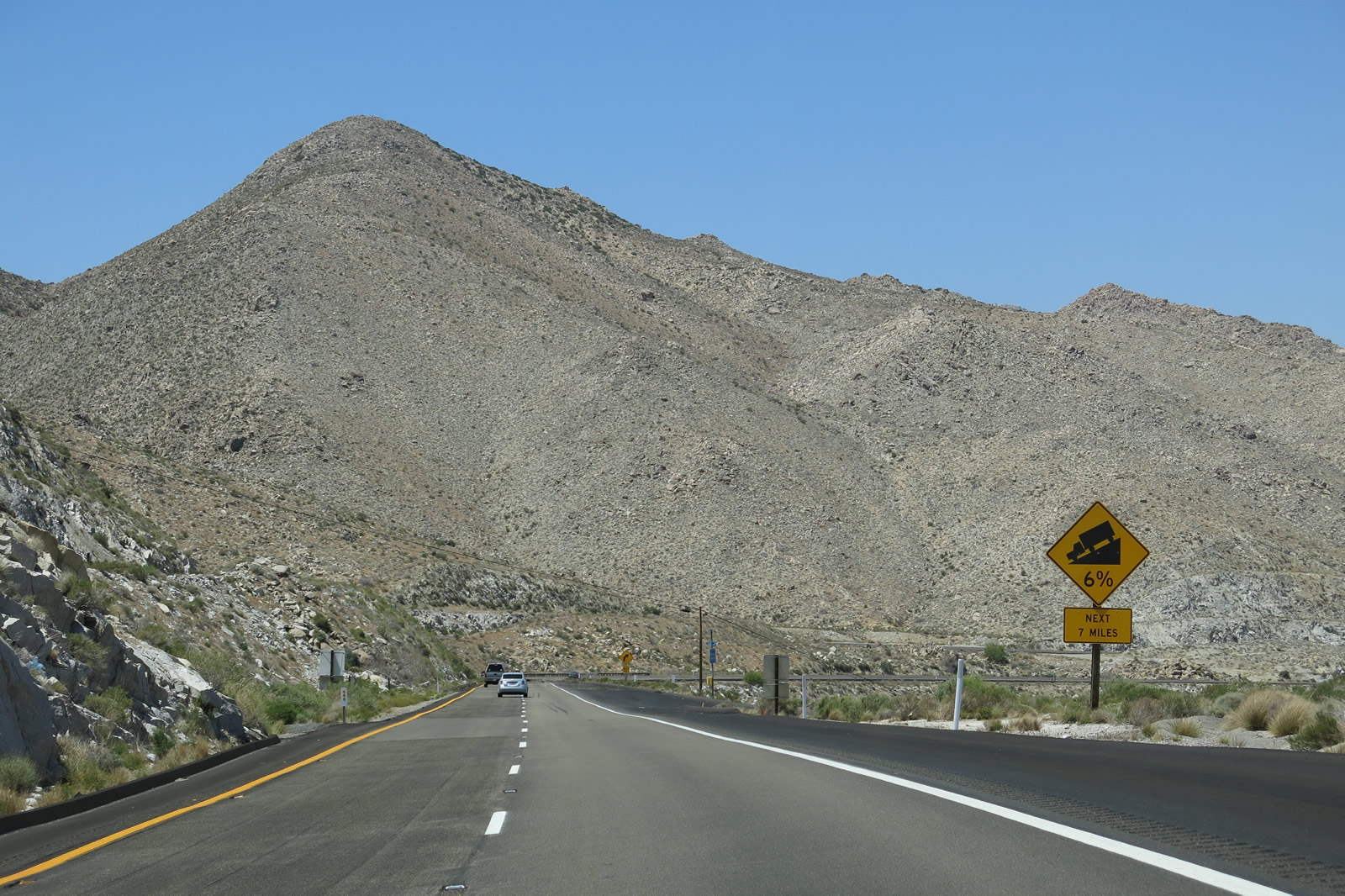
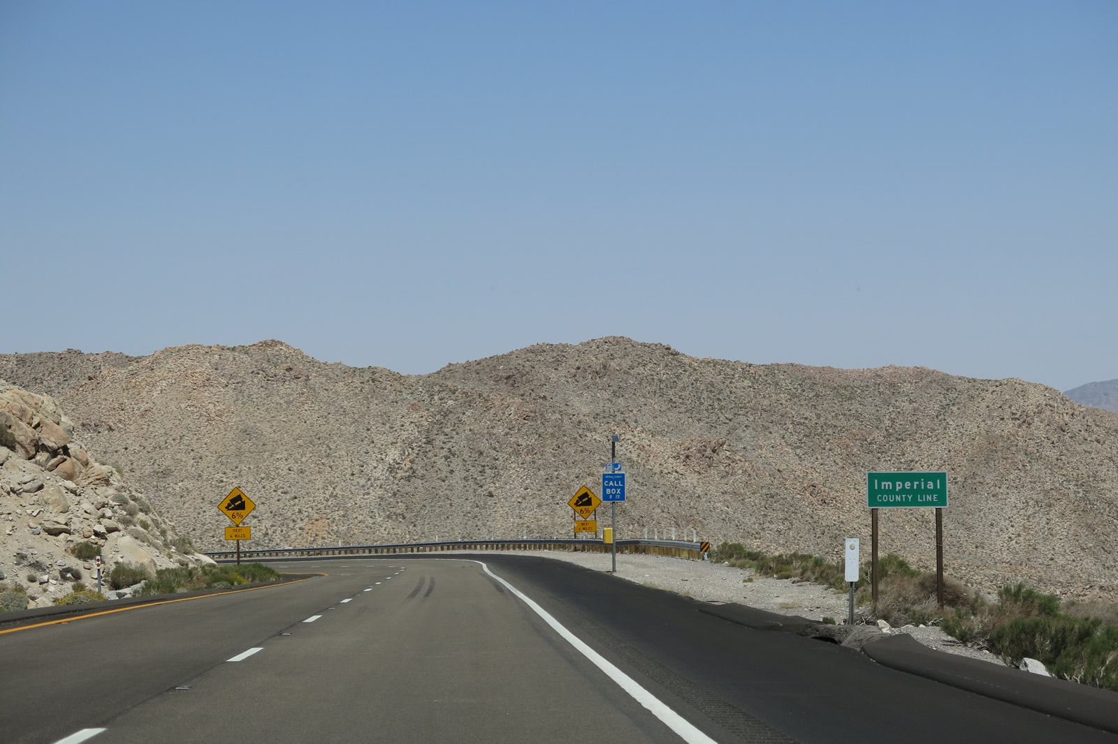
Most of the grade between In-Ko-Pah Park and the California 98 interchange is six percent, the maximum grade allowed without a waiver on the Interstate Highway System. While certain sections are certainly less steep, other sections are very steep. Photo taken 01/27/06. |
|
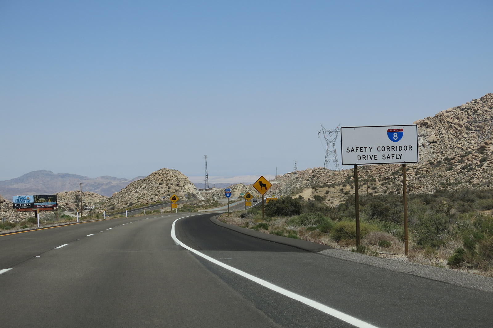
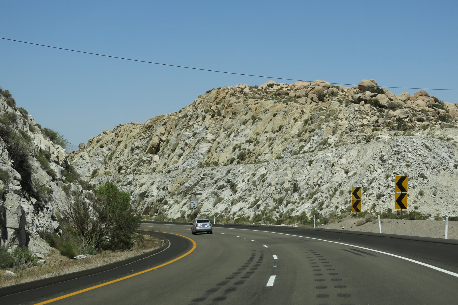
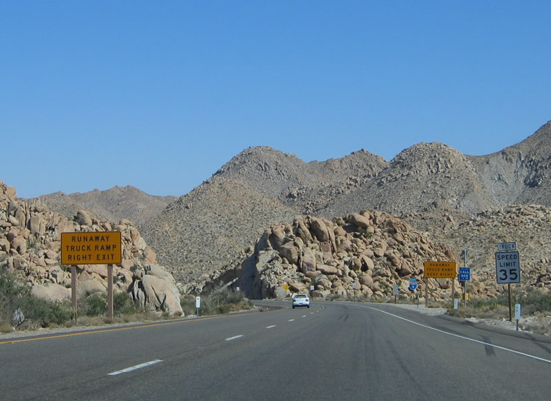
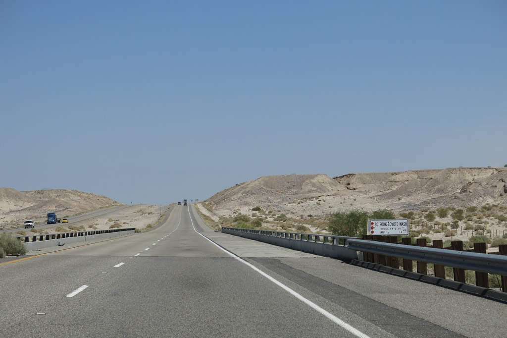
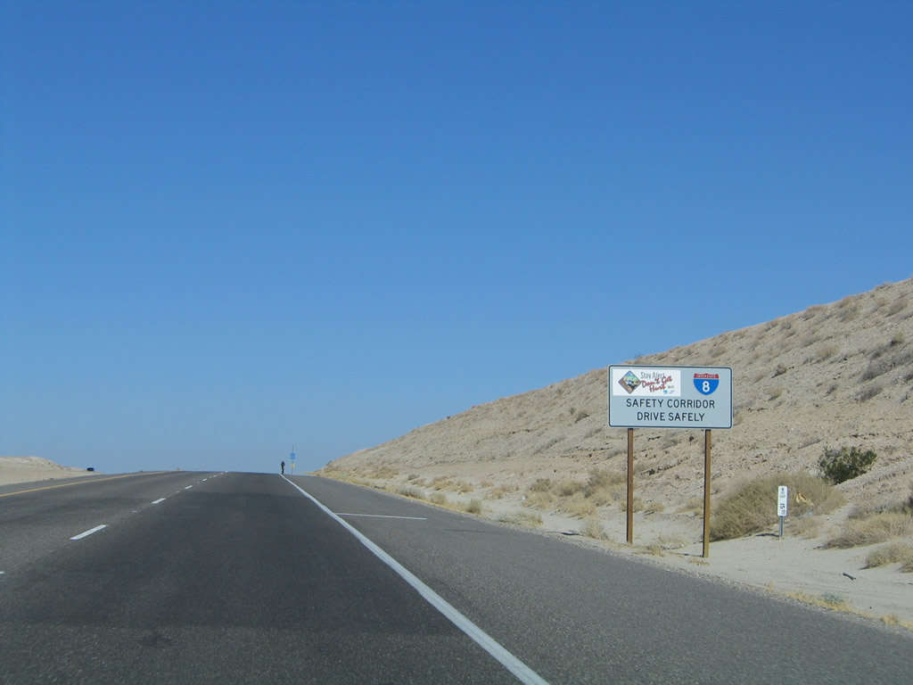
Over the course of about ten miles, Interstate 8 will drop a little less than 3,000 feet in elevation. With high-speed traffic, trucks, and limited sight distance on the descent, drivers must be extra cautious. Note the speed limit for trucks is only 35 miles per hour, making the right lane often much slower than the left lane. There is no climbing or truck lane in either direction of Interstate 8 between In-Ko-Pah Park and the junction with California 98 near Ocotillo. As a result of these challenges, this stretch of Interstate 8 is designated an official safety corridor. Photo taken 04/20/13. |
|
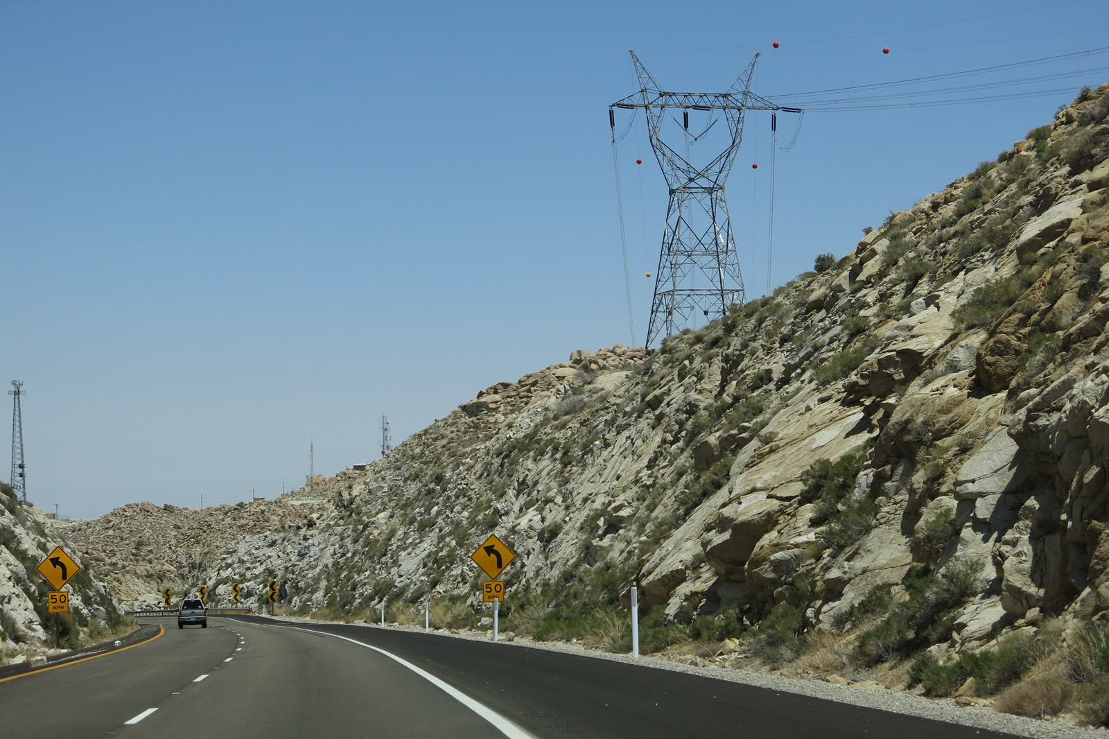
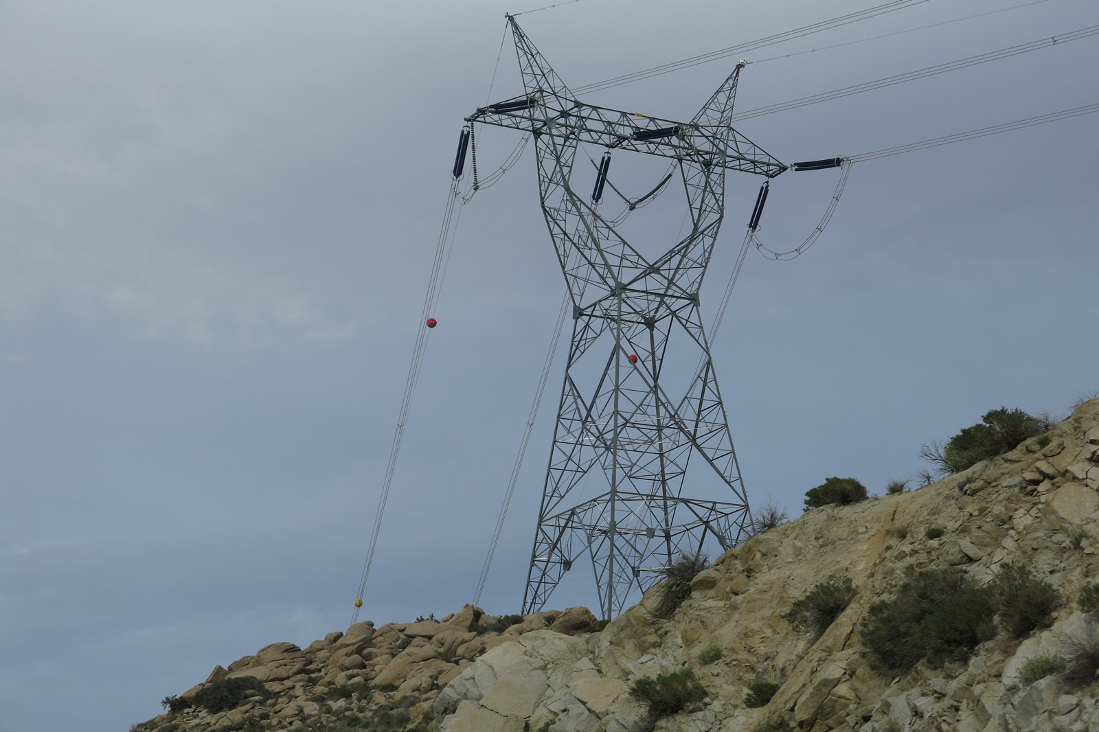
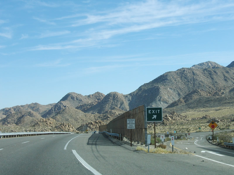
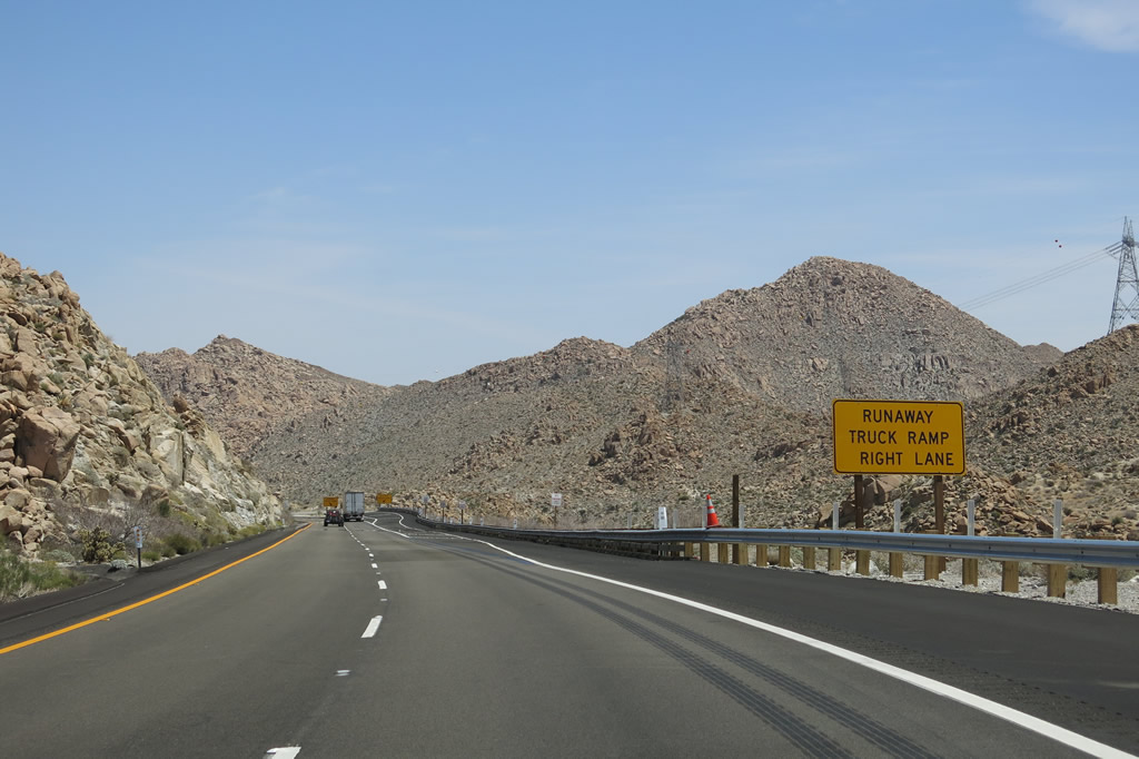
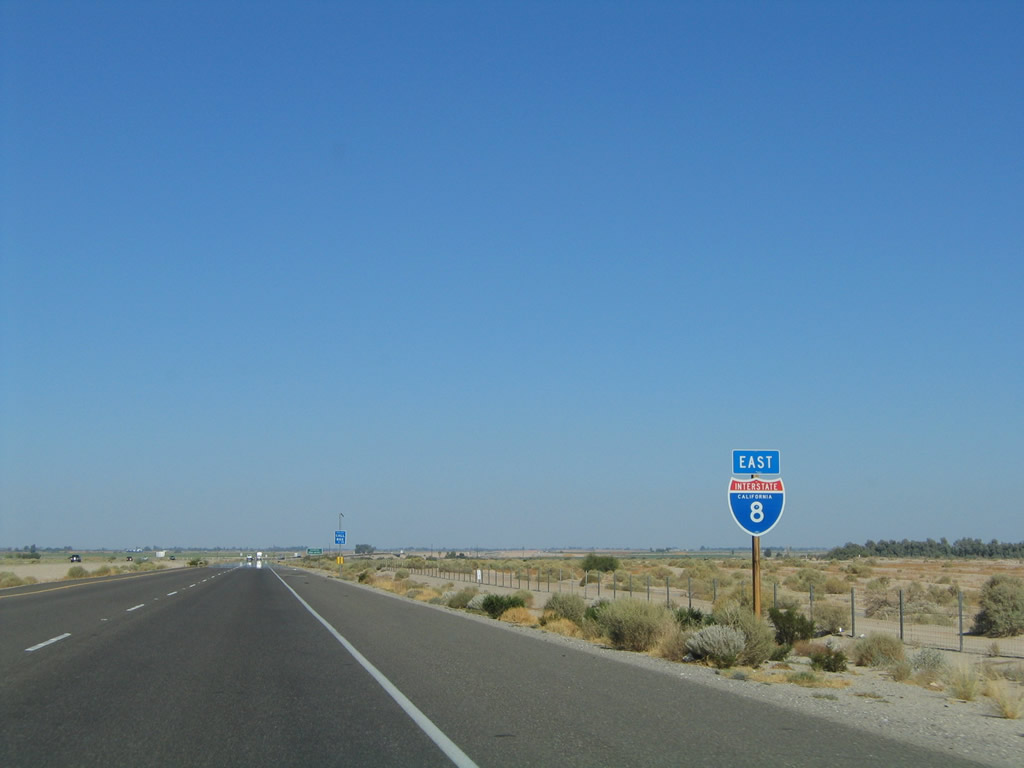
A California-standard, slightly angular Interstate 8 east reassurance shield is posted after the on-ramp from In-Ko-Pah Park Road (to Historic U.S. 80). To the left of the freeway, one can catch a glimpse of the Desert View Tower. This cylinder-shaped building was constructed in 1922 by Burt Vaughn. For more information and photos about the tower and that section of Old U.S. 80, visit Finding U.S. 80: Mountain Spring and In-Ko-Pah Gorge. Behind the route marker, note the series of pictures warning of the upcoming downhill segment through In-Ko-Pah Gorge. Beyond that is one of the towers for the Sunrise Powerlink, which also descends toward the Imperial Valley. Photo taken 04/20/13. |
|
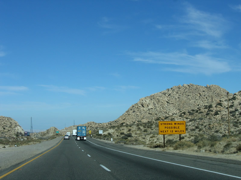
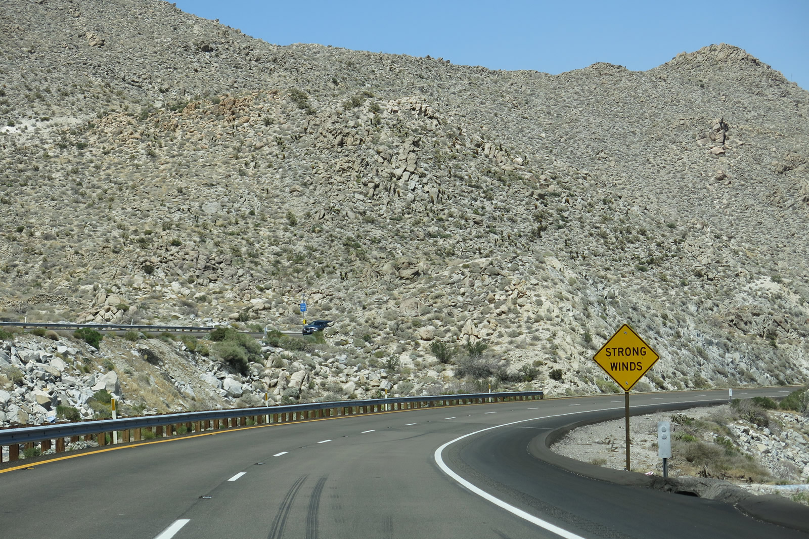
On the descent to the Imperial Valley floor, the strong wind warning that has persisted since Alpine continues for another 12 miles, until the area around the junction with Imperial County S-2 (Imperial Highway) in Ocotillo. Windy conditions are especially acute during periods of Santa Ana winds, which bring dry air from the desert regions toward the coastal regions of Southern California. Often these dry winds carry an increased danger of wildfire. Photo taken 01/27/06. |
|
|
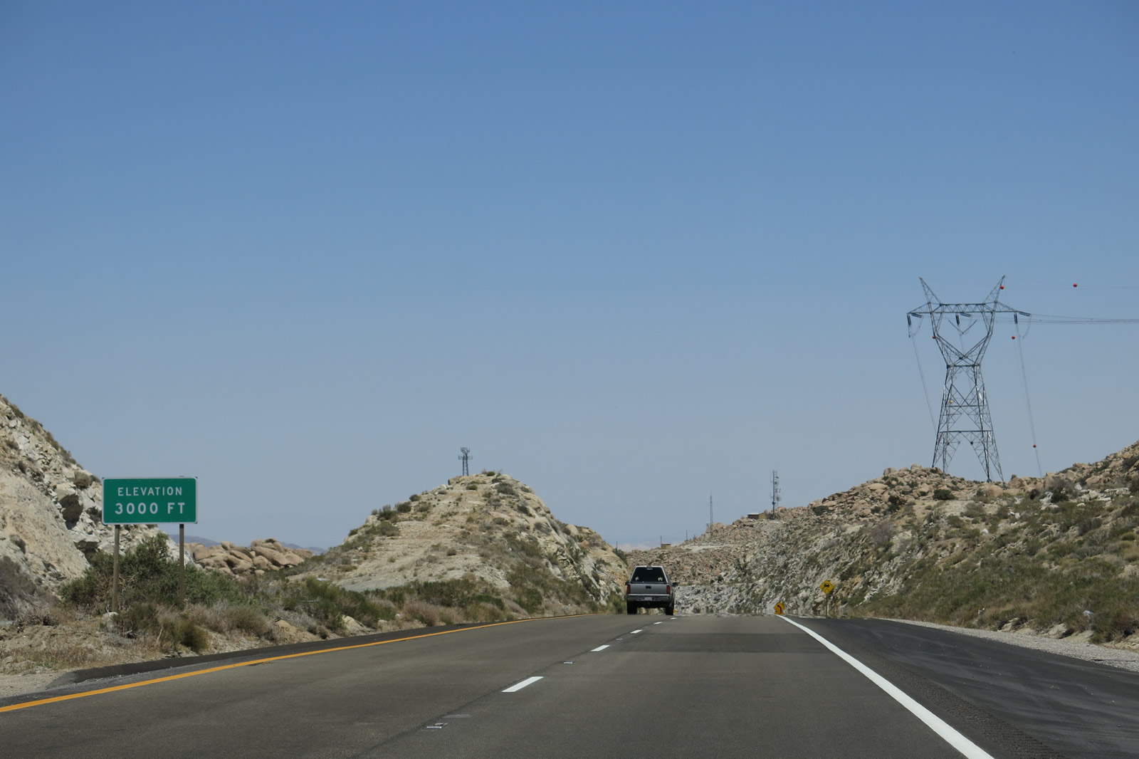
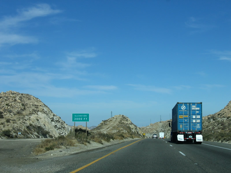
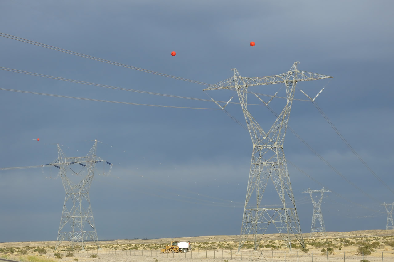
At the top of the Mountain Springs and In-Ko-Pah Gorge grades, Interstate 8 sits at an elevation of 3,000 feet. The freeway will lose a substantial elevation after the highway turns north. In fact, the curve turning the road due north is visible immediately after the truck in the photograph. Visible in this picture is the 500kV Sunrise Powerlink, which runs alongside the freeway just before it descends toward Mountain Springs. Photos taken 04/20/13 and 01/27/06. |
|
|
|
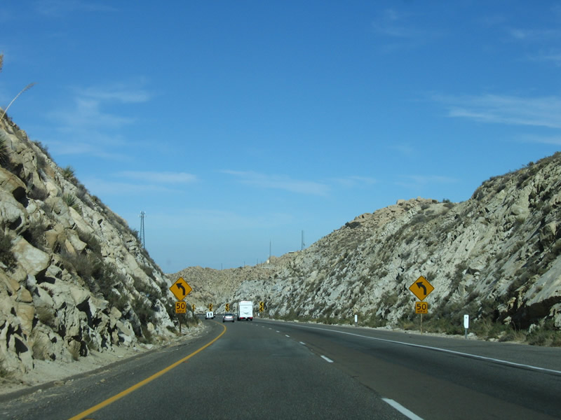
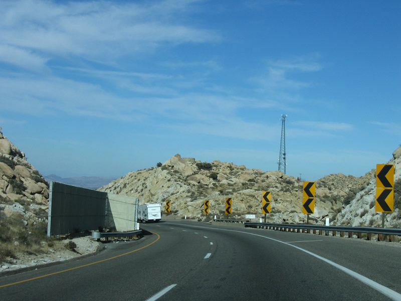
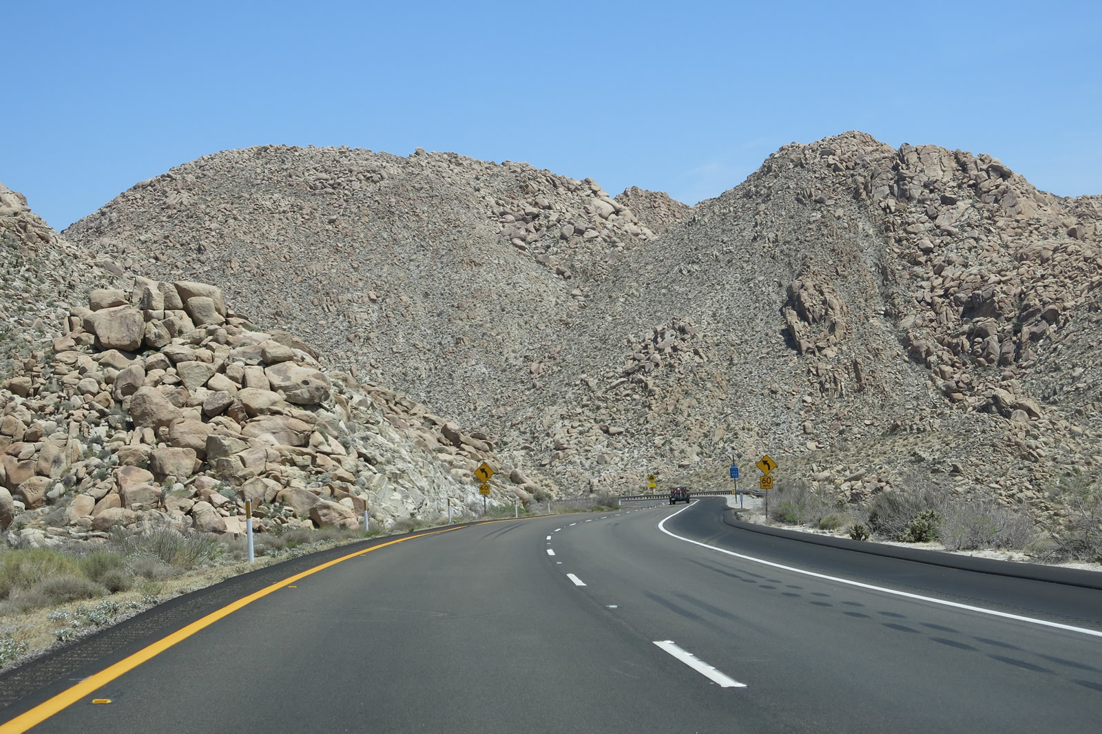
| The freeway turns north at this curve, thus positioning Interstate 8 to go back into San Diego County. Built in 1963, Interstate 8 through Mountain Springs and In-Ko-Pah Gorge blasted many of the rock walls and hills that stood in the freeway's path. Prior to the completion of the freeway, the old alignment of U.S. 80 crossed over these hills, but that old alignment was rendered impassable and partially destroyed by freeway construction. A similar situation exists on Interstate 5 in the vicinity of Grapevine, where the old road (U.S. 99) followed the contours of landscape, while the freeway blasted through the rocks to make a straight path for high-speed travel. The advisory speed (50 miles per hour) is recommended due to limited sight distance, curves, and six percent downhill grade. Note the Sunrise Powerlink (500kV San Diego Gas & Electric power line) was added to this scene in 2012. The power line will travel directly downhill, parallel to the older Southwest Powerlink (also 500 kV) and thus will cross Interstate 8 multiple times along the downgrade. Photos taken 04/20/13, 04/04/13, and 01/27/06. |
|
|
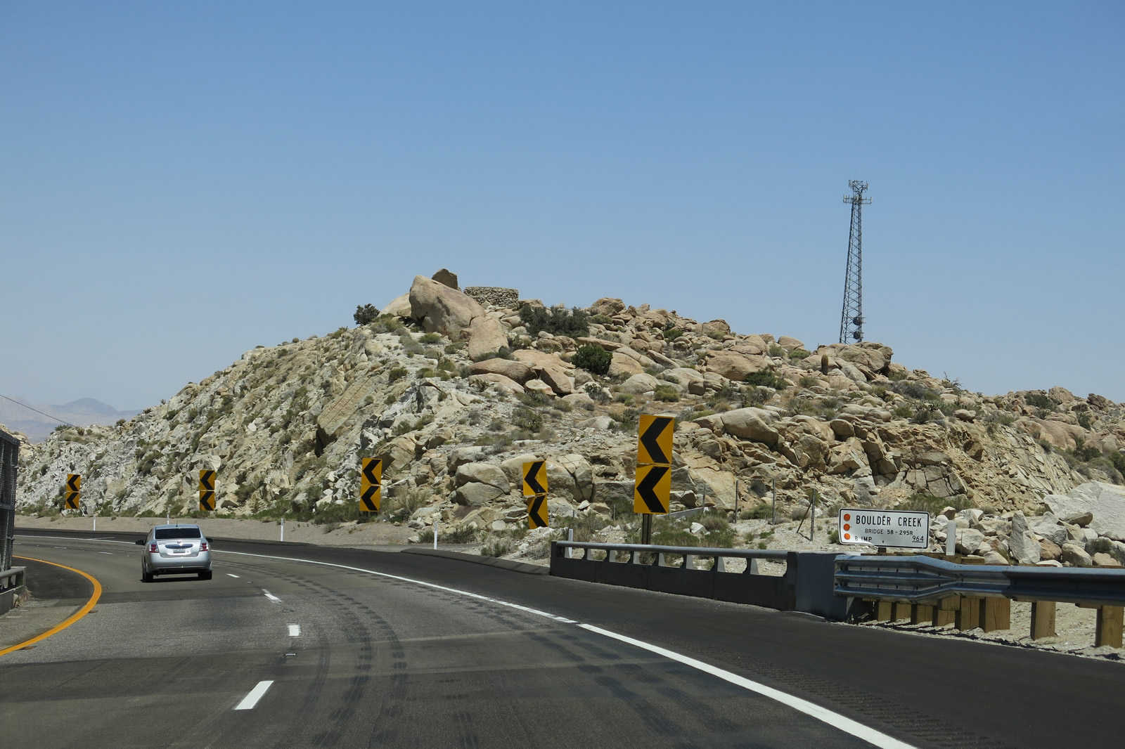
At many of the overpasses within the vicinity of Mountain Springs and In-Ko-Pah Gorge, tall fences help protect vehicles from unexpected wind gusts. This particular bridge, which carries Interstate 8 over Boulder Creek, is located in between two rock cuts, so the fence lends a consistency for wind channeling along the freeway. For the first time, the vast Colorado Desert and Imperial Valley can be seen in fleeting glances. Photos taken 01/27/06 and 04/20/13. |
|
|
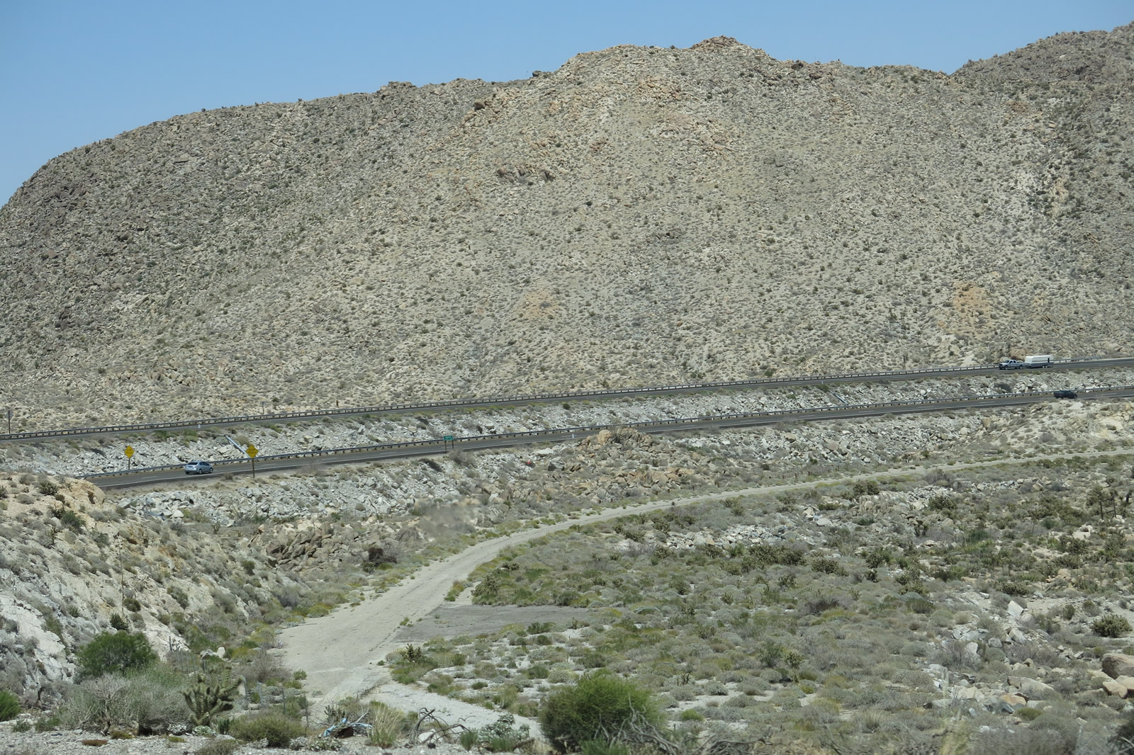
Just beyond the Boulder Creek bridge is an unpaved turnoff that leads to an abandoned parking/rest area, which had previously served as an old alignment of U.S. 80. Interstate 8 was realigned to cut through the rock and avoid some perilous curves on the hillside. Layered rock cuts such this are common on the descent to Mountain Springs. In addition to rock cuts, look on both sides of the freeway to see abandoned sections of U.S. 80 that were in use prior to 1963. There were actually two different alignments of U.S. 80 built through here: the concrete section built in the 1910s and the modern road built in the 1940s. These sections of 1910s road can be readily identifiable by twin-slab concrete, which was a common construction. The 1940s section has some asphalt sections and can be clearly seen from the freeway when we approach the Mountain Springs Road off-ramp (Exit 80). Photos taken 04/20/13 and 01/27/06. |
|
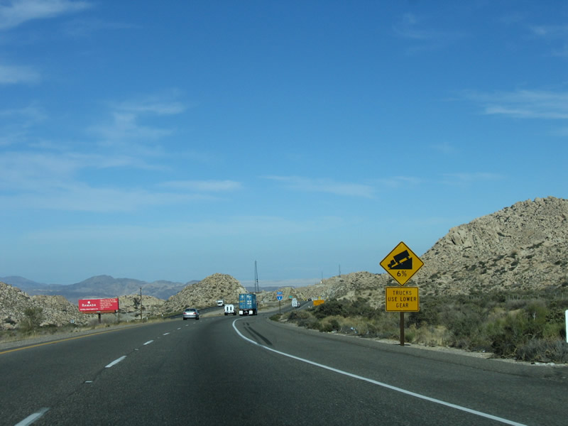
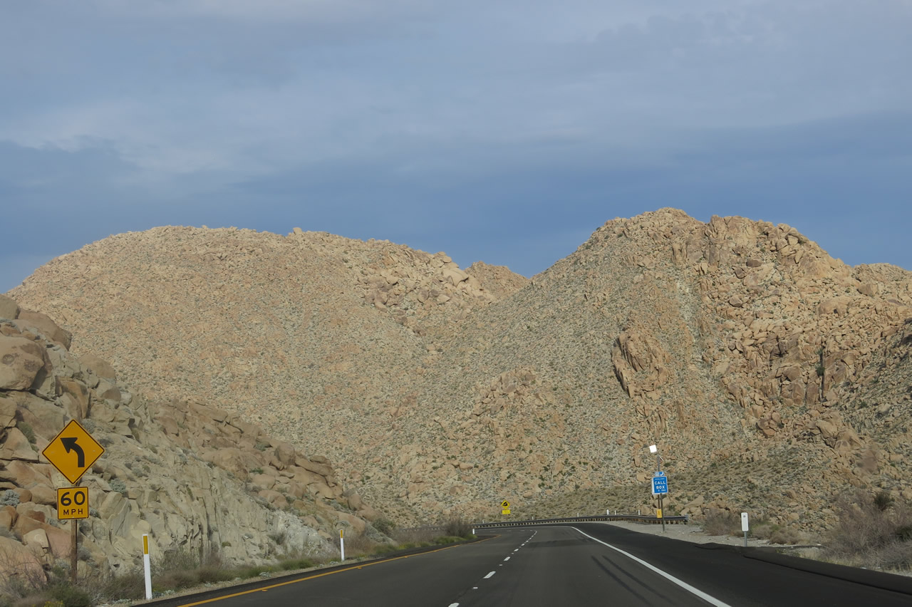
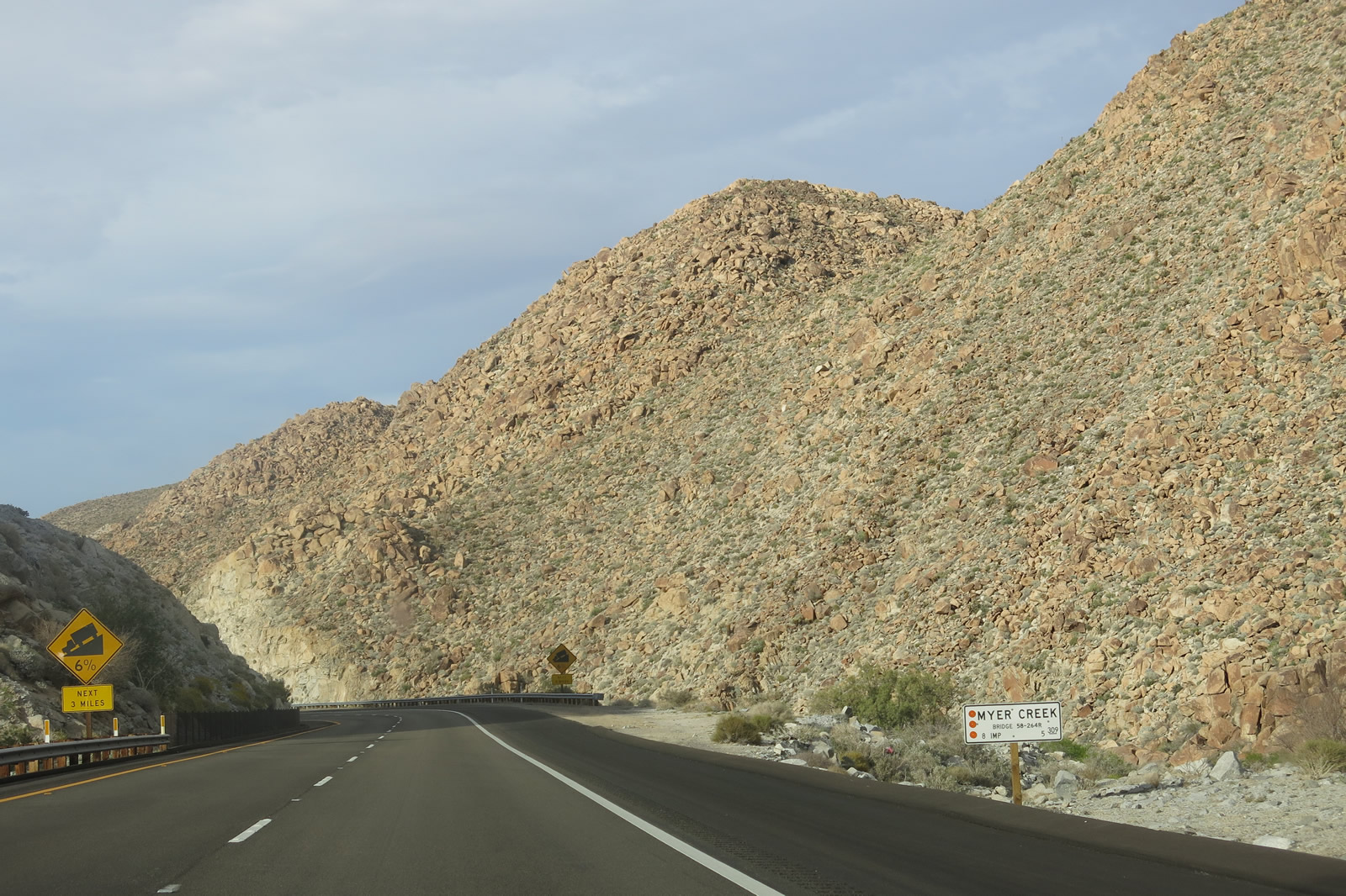
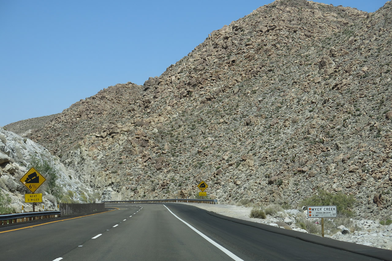
The steep downgrade continues, with another sign warning of the continuing six-percent downhill grade. Photo taken 04/20/13. |
|
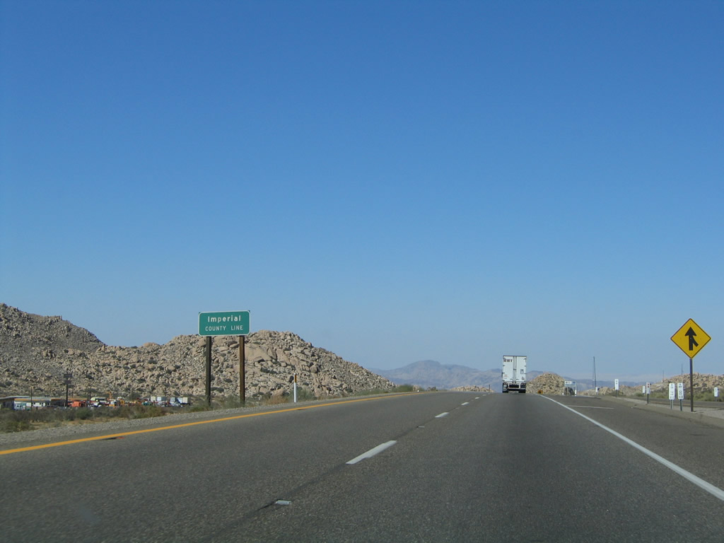
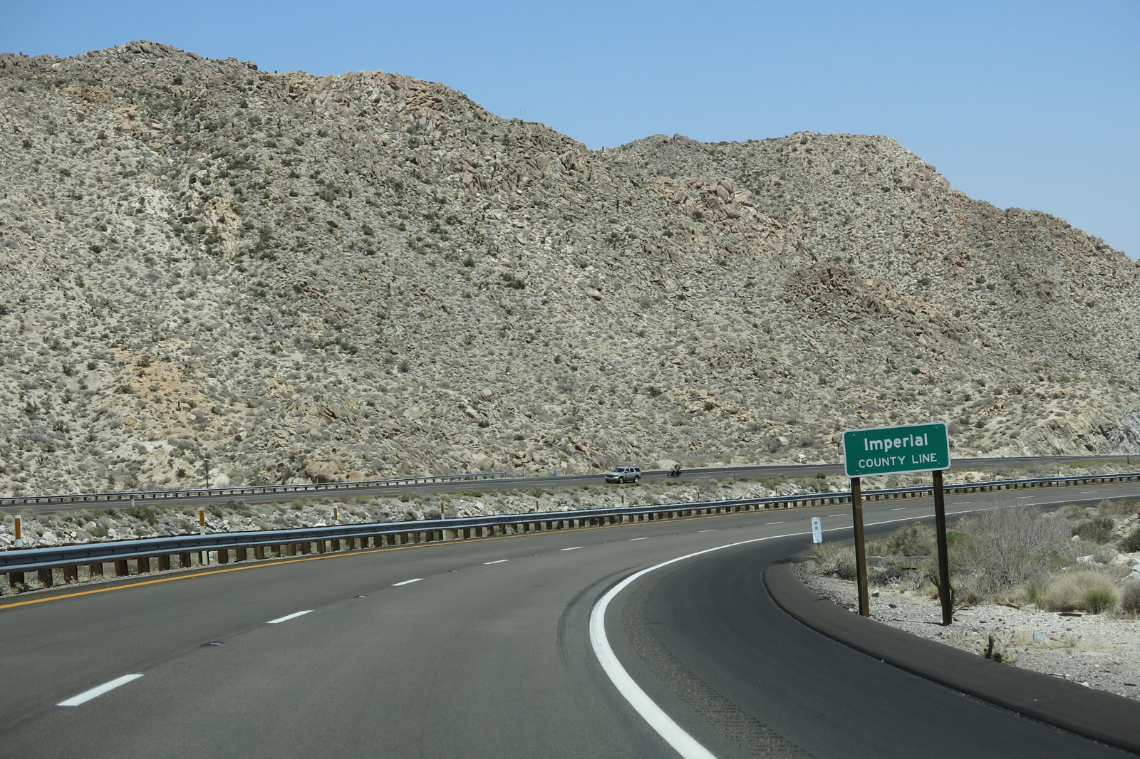
As the freeway straddles the county line as it proceeds north downhill and through the rock cuts, eastbound Interstate 8 enters San Diego County for a second time, albeit briefly. Photo taken 04/20/13. |
|
Curving around a rock formation, Interstate 8 again enters Imperial County as the highway its descent. Photo taken 04/20/13. |
|
After moving around the rock formation, Interstate 8 turns west just enough to enter San Diego County a third and final time. Photo taken 04/20/13. |
|
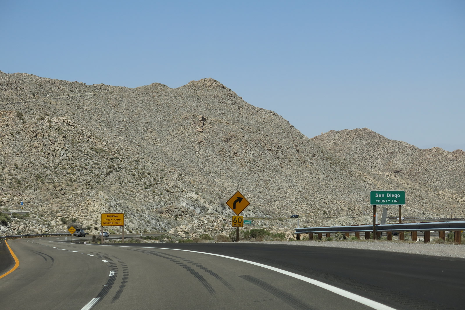
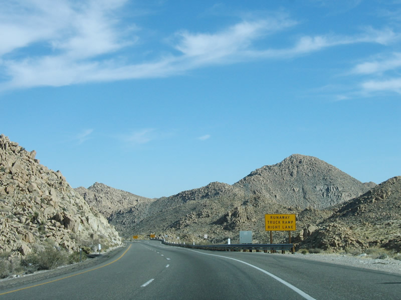
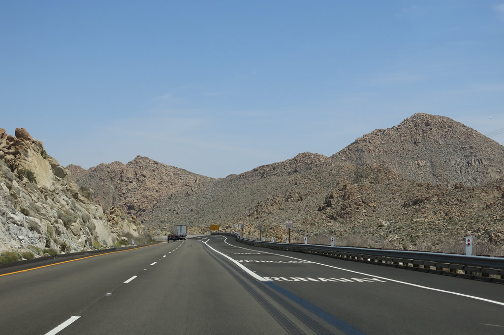
With the steep decline at six percent grade, a runaway truck ramp is available immediately after the Mountain Springs Road interchange. Trucks can access the runaway truck (escape) ramp via the right lane. Photo taken 04/20/13. |
|
Watch for strong winds while traveling downhill on Interstate 8. Photo taken 04/20/13. |
|
The 1940s alignment of U.S. 80 comes into view as we round another curve on Interstate 8. Access to this segment of U.S. 80 is afforded via Exit 80 and turning right on Mountain Springs Road. While the old alignment remains in place, it has become weed infested. The older, 1913 alignment (date stamps place the concrete road as being built in 1927) is also visible from this interchange, but it sits on private property and cannot be accessed (but it can be seen from the Mountain Springs Road interchange). Photo taken 04/20/13. |
|
|
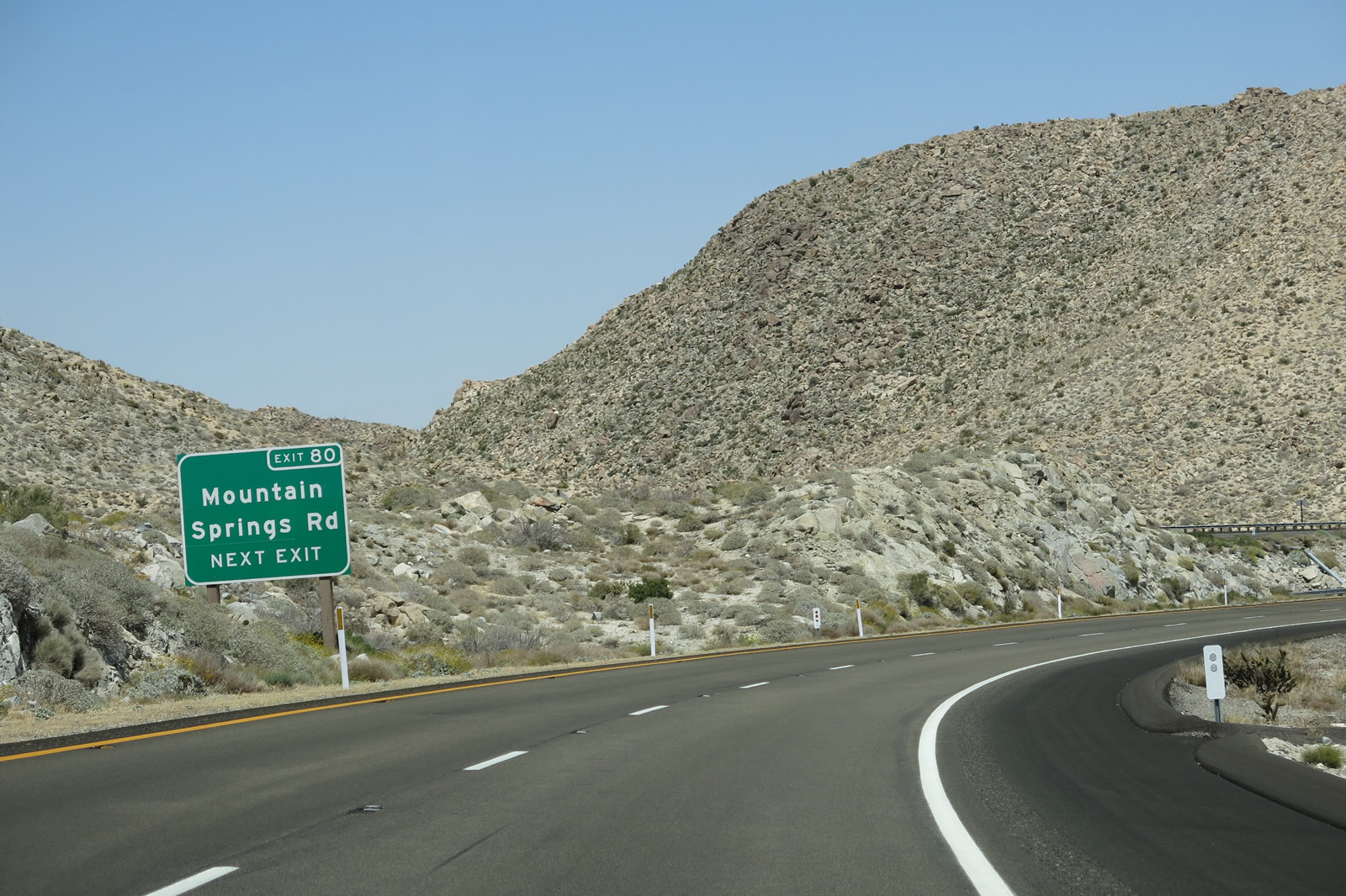
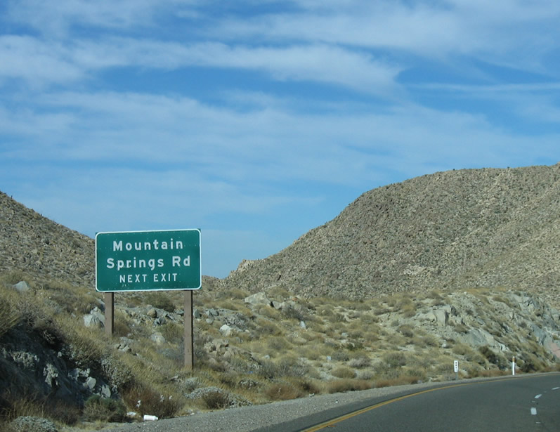
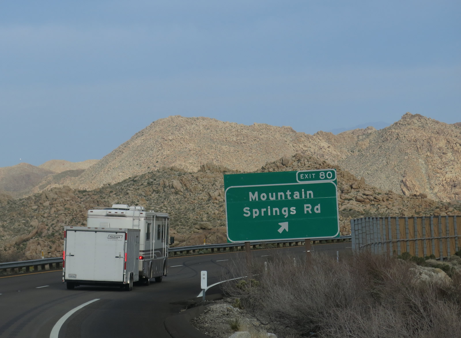
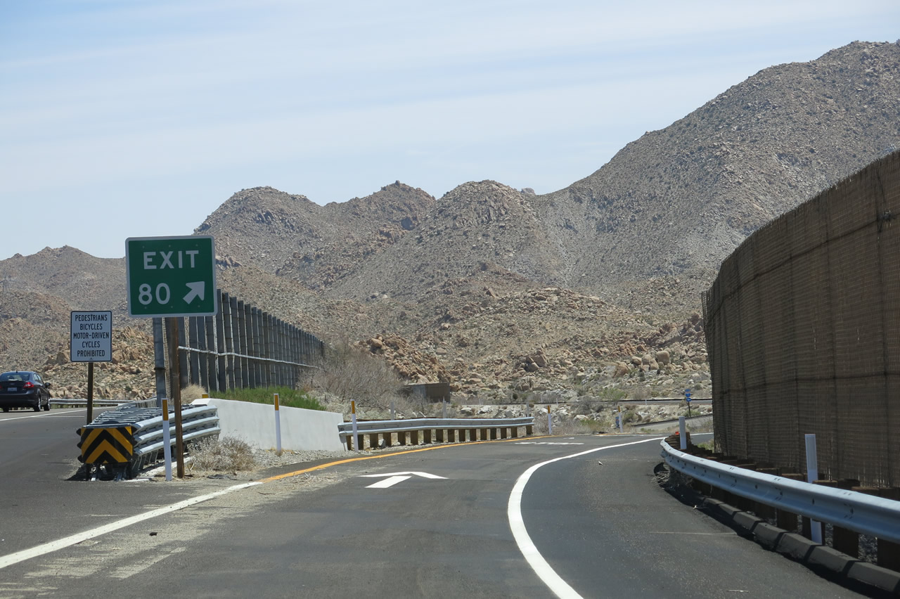
The next exit along Interstate 8 is Exit 80, Mountain Springs Road, with the runaway truck ramp thereafter. The guide sign for Exit 80 was replaced between 2006 and 2013 to include the exit number. Photos taken 04/20/13 and 01/27/06. |
|
|
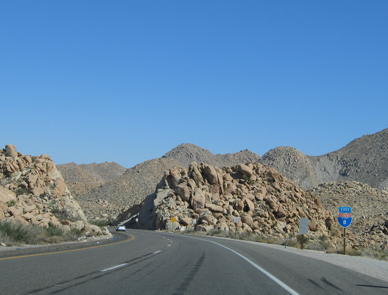
Interstate 8 reenters Imperial County, this time for good. The freeway resumes its westerly trajectory, then winds a bit south in order to meet the grades required in the area around Mountain Springs leading into In-Ko-Pah Gorge. Photos taken 01/27/06 and 04/20/13. |
|
|
Eastbound Interstate 8 reaches Exit 80, Mountain Springs Road. There are no services at this exit. One point of interest at this exit is a long, extant segment of original, twin-slab concrete of U.S. 80 visible from the freeway and accessible from this exit. Like the section of U.S. 80 between Pine Valley and Jacumba, this concrete dates back to the highway's original paving in the early 1930s. Photos taken 04/20/13 and 08/27/04. |
|
|
The gore point sign for the Mountain Springs Road off-ramp is now signed for Exit 80. A fence is again placed at the top of the Mountain Springs Road undercrossing. This interchange is relatively unchanged since it was built in 1963. Photos taken 01/27/06 and 04/20/13. |
|
|
A stop sign and a bunch of Interstate 8 trailblazer signs await at the bottom of the Mountain Springs Road off-ramp. Upon exiting, turn right for access to the two earlier generations of U.S. 80. Turn left to pass under the freeway to see another segment of first-generation U.S. 80, including several pristine sections of double-slab concrete roadway dating from the 1920s and 1930s. Photos taken 04/20/13. |
|
|
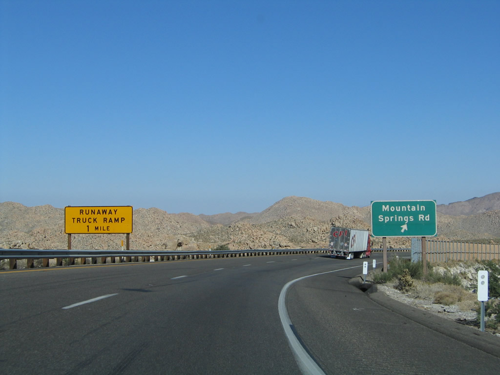
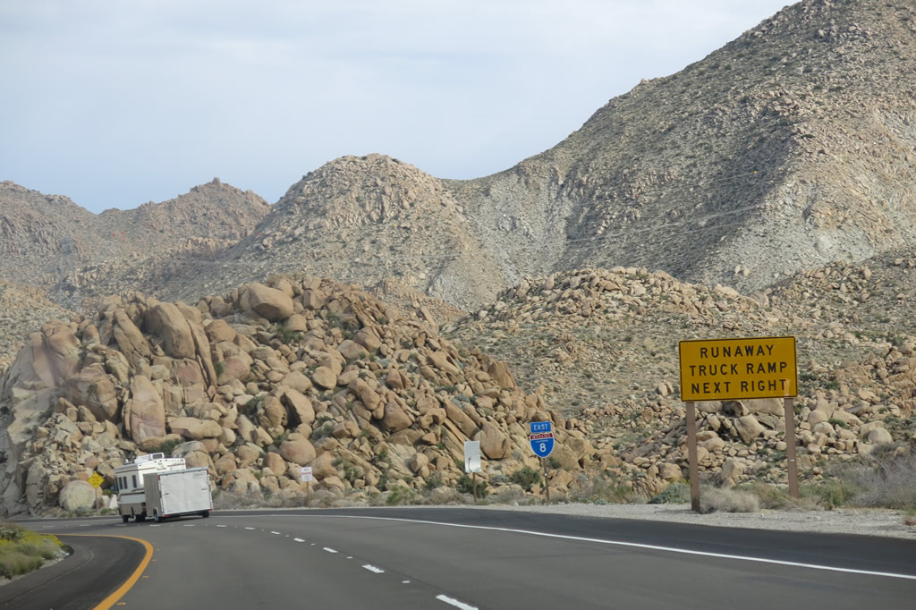
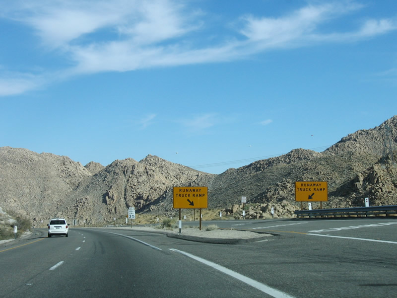
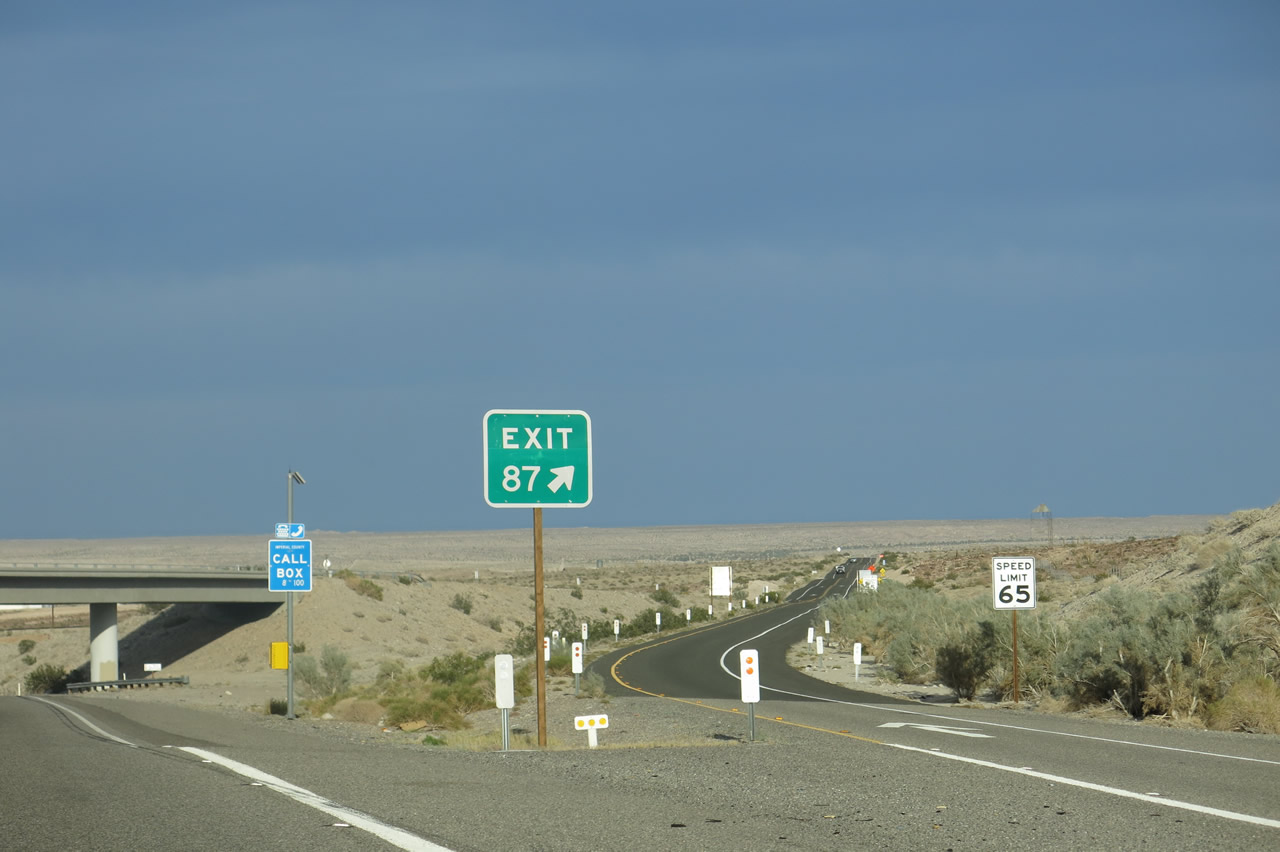
Back on the mainline, two yellow, cautionary signs advise of the pending runaway truck ramp, which is located after the on-ramp from Mountain Springs Road. We still have seven miles of downgrades from here to the California 98 off-ramp (Exit 87). Photos taken 08/27/04 and 04/05/13. |
|
This reassurance shield for Interstate 8 is posted after the on-ramp from Mountain Springs Road. Note the rock cut made for the road in the distance. While eastbound traffic will enter In-Ko-Pah Gorge for the remainder of the descent to the Imperial Valley, westbound traffic will follow an entirely separate alignment via Devil's Canyon. As a result, the westbound lanes of traffic will not be visible for the next several miles. At times, the westbound lanes will be as far as one mile separated from the eastbound lanes. Photo taken 08/27/04. |
|
|
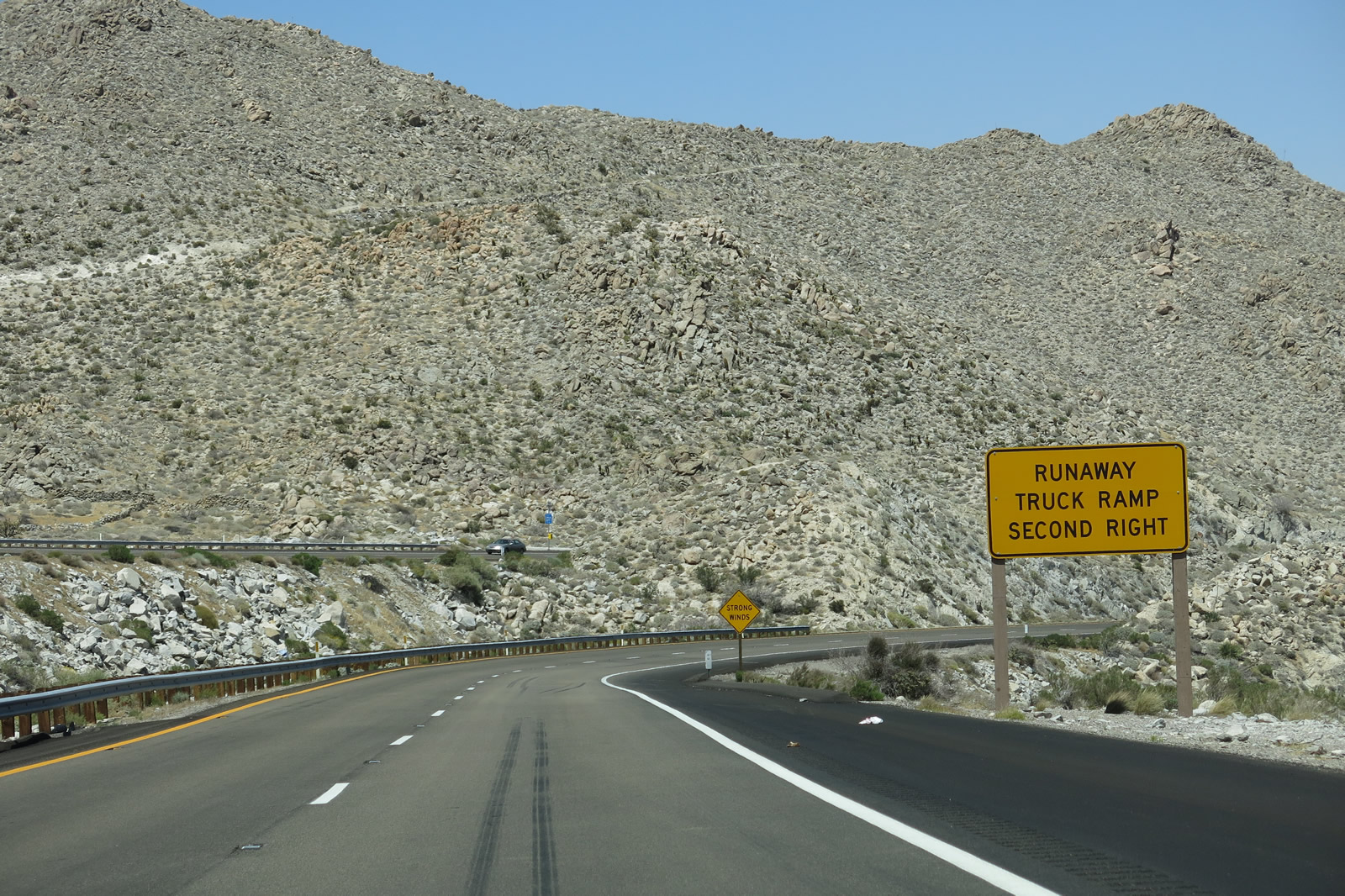
After passing through the brief rock cut, the runaway truck ramp comes into view on the right side. This is a deep gravel escape ramp rather than an uphill escape ramp. Now eastbound Interstate 8 follows its own alignment, separate from westbound. The narrow In-Ko-Pah Gorge (see upcoming pictures) explains why road builders decided not to route both directions of the freeway there. Photos taken 01/27/06 and 04/20/13. |
|
|
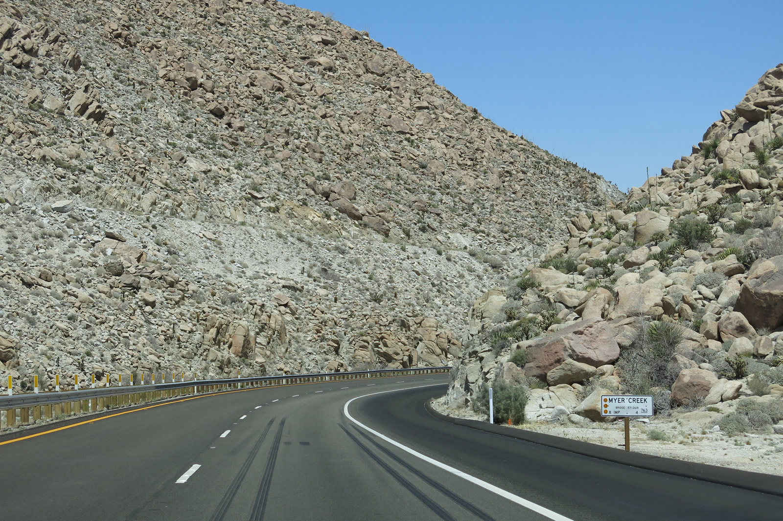
Eastbound Interstate 8 approaches and reaches the runaway truck ramp; a third lane briefly forms to allow easy access for vehicles needing to use the ramp. The deep gorge to the right (south) of the eastbound lanes comes into view alongside and below the runaway truck ramp. We will follow Myer Creek downhill from here through In-Ko-Pah Gorge with multiple crossings under the eastbound lanes of the freeway. Photos taken 04/20/13 and 01/27/06. |
|
|
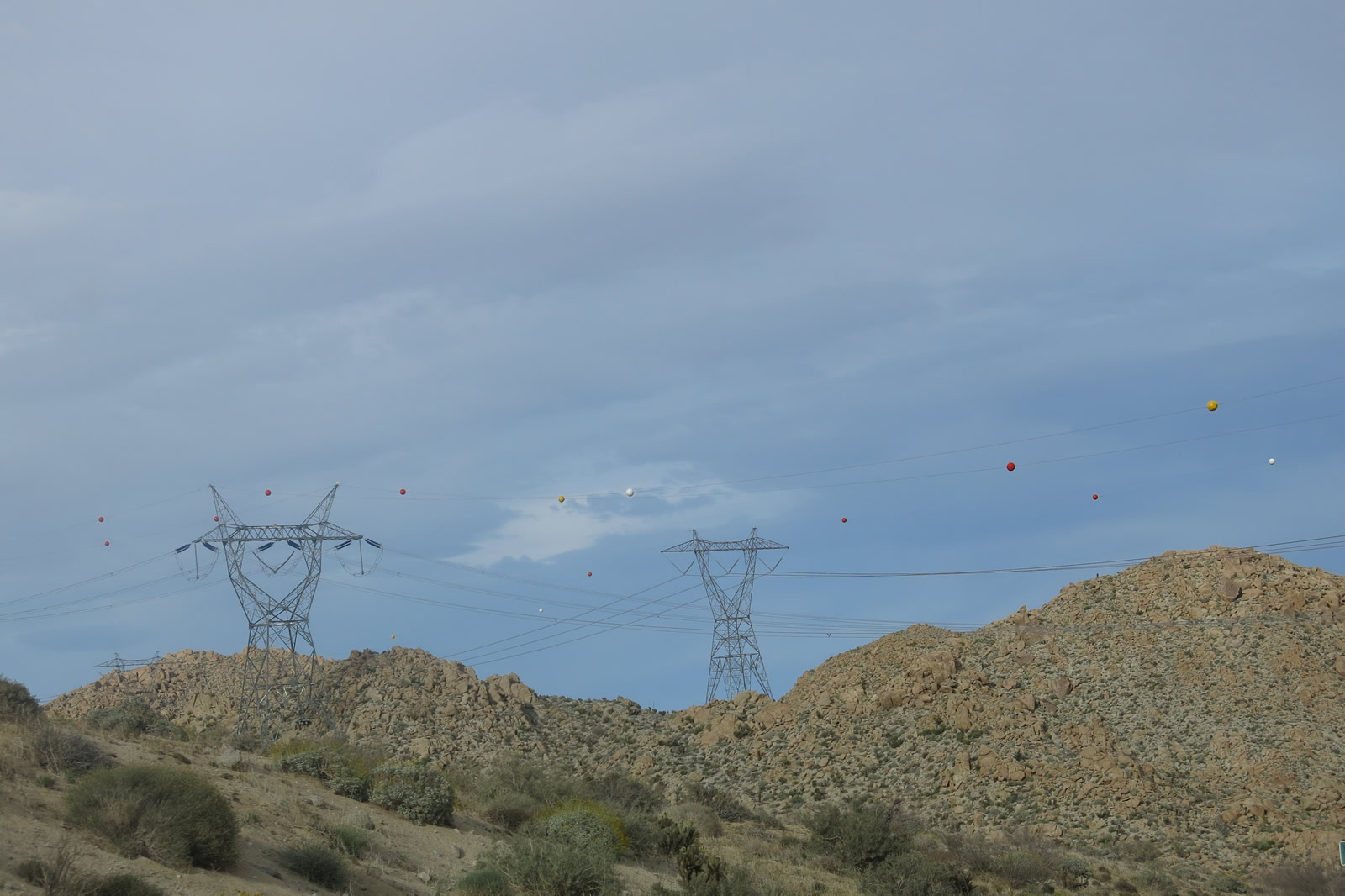
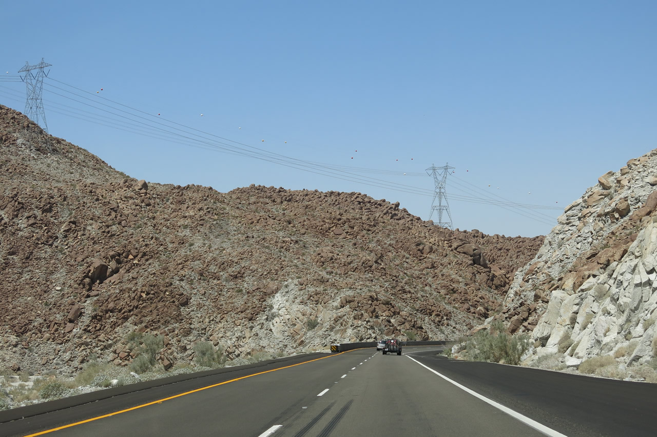
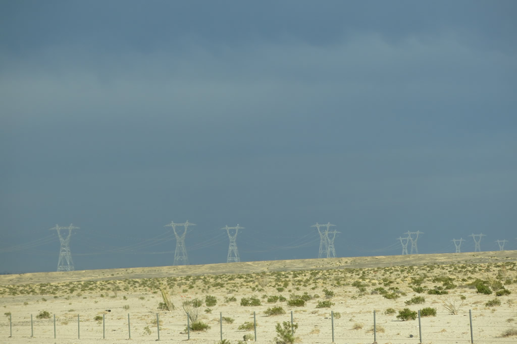
The freeway descends to 2,000 feet at point between In-Ko-Pah Park (Desert View Tower) and Mountain Springs, a distance of about three miles, which explains the six percent grade. Overhead, the two major east-west, 500kV power transmission lines between the Imperial Valley and San Diego pass overhead, including the Sunrise Powerlink first and Southwest Powerlink second. These power lines continue to follow Interstate 8 over the gorge and then into the Imperial Valley, connecting to the Ocotillo wind farm and then to the massive Imperial Valley substation west of Calexico and southwest of El Centro. At this substation, other transmission lines that carry electricity generated elsewhere in the desert and in Mexico converge. Several power plants near Mexicali, Baja California Norte, produce electricity that is transmitted across the International Border and fed into this major power transmission line. Photos taken 04/05/13 and 08/27/04. |
|
|
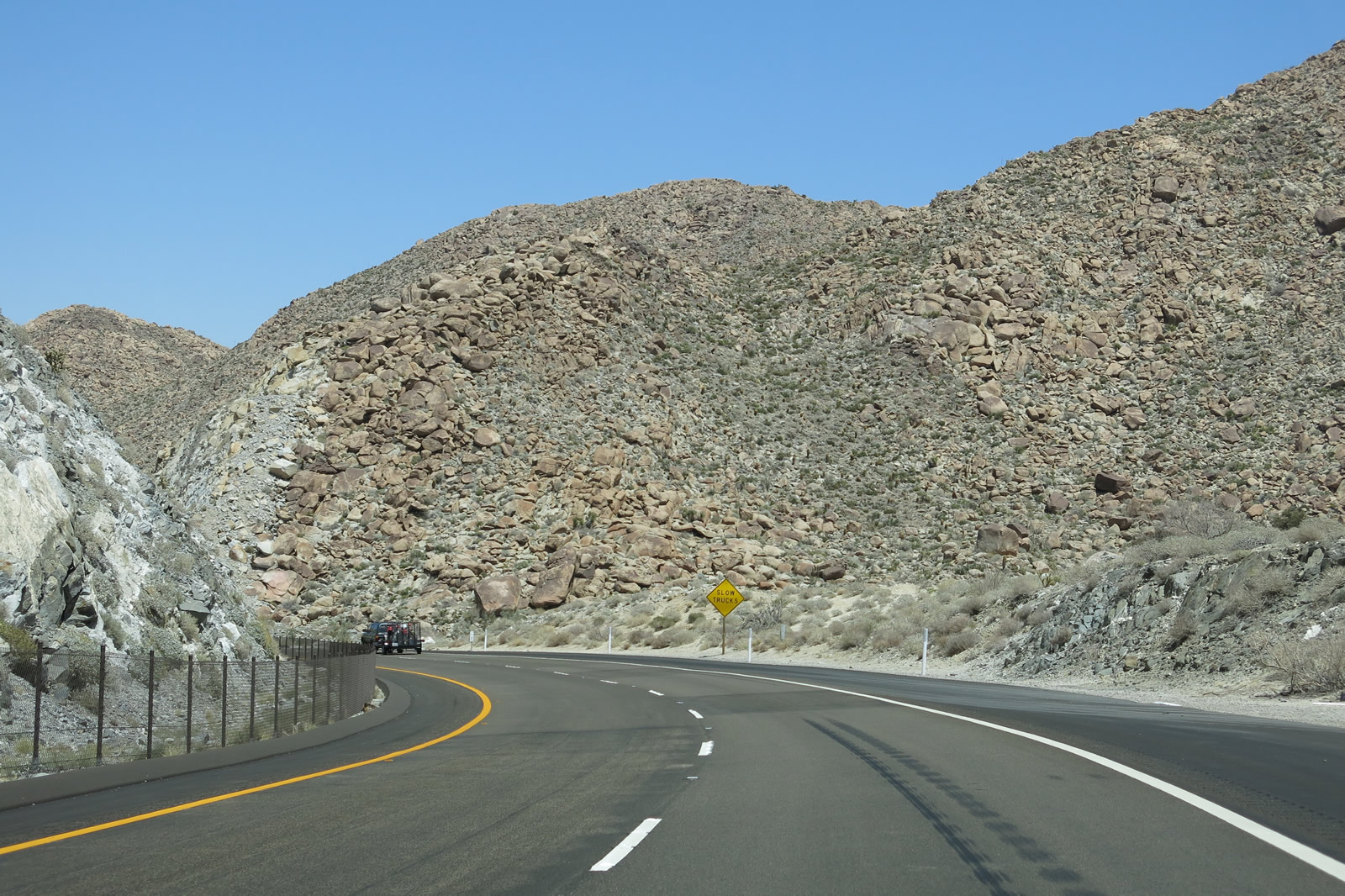
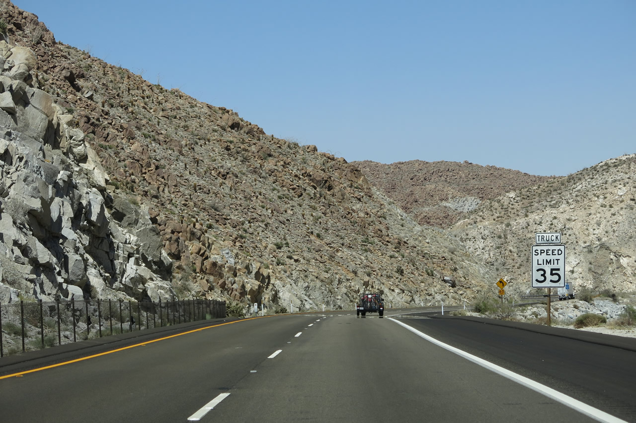
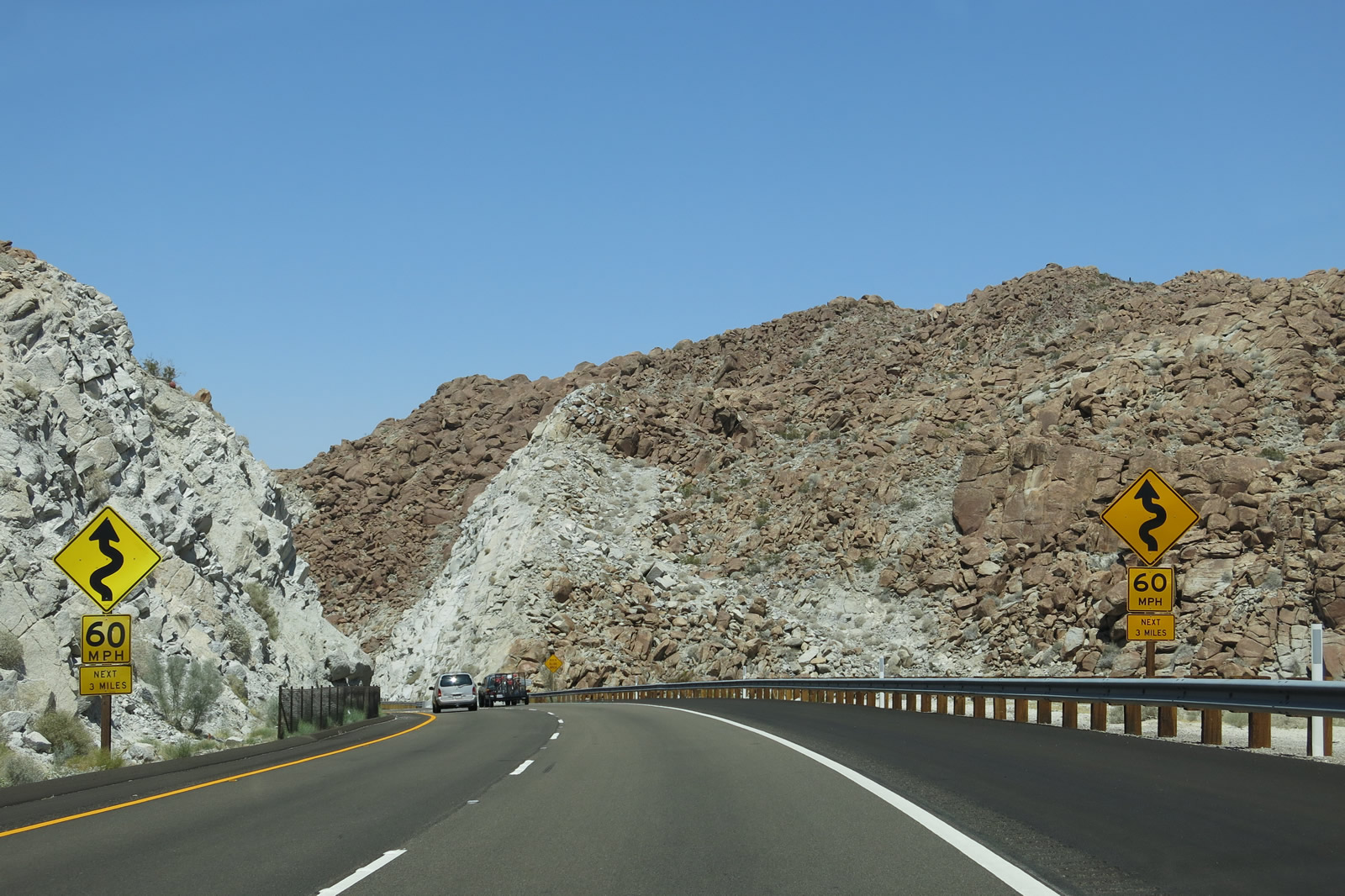
The advisory speed for the next six miles is 60 miles per hour due to the windy nature of the freeway. Traveling through the canyon, sight distances are limited, and trucks have a lower speed limit. Also be wary of pedestrians in the form of immigrants entering the United States from Mexico. While encountering one is unlikely, the freeway is in an undeveloped area that has been known to be a conduit for travelers. In the various nooks and crannies around In-Ko-Pah Park, Mountain Springs, and In-Ko-Pah Gorge, there may be U.S. Border Patrol vehicles parked on the freeway, offroad, or in the hills above the road. Photos taken 04/20/13 and 04/05/13. |
|
|
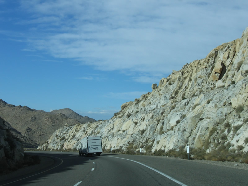
A wall of rocks greets motorists as Interstate 8 enters In-Ko-Pah Gorge. This kind of rock formation is very common along this stretch of Interstate 8 as the freeway descends the eastern face of the Laguna Mountains. Rainfall through this area is very scarce, but at times precipitation can come all at once. These storms, which can occur as part of the winter rains, added moisture from El Niño, the Pineapple Express, the July monsoon, or a far-reaching hurricane from the Gulf of California, can create a flood situation in the narrow canyons of the desert. Photos taken 04/20/13. |
|
|
The aforementioned abandoned section of U.S. 80 that is accessible from the Mountain Springs interchange (Exit 80) comes into view on the cliff above the freeway. This section of roadway is still driveable, but it ends at the point where the freeway intercepts the old road. Photos taken 04/20/13. |
|
|
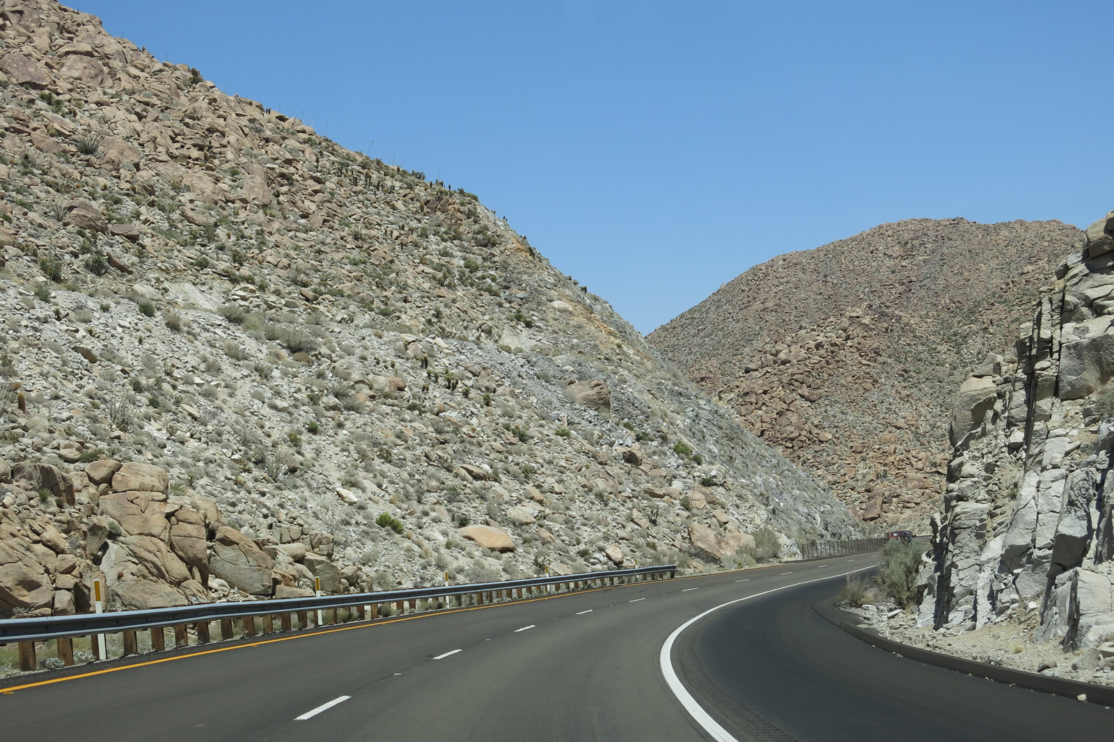
The two lanes of eastbound Interstate 8 continue to descend through In-Ko-Pah Gorge. The narrowness of the canyon again proves that a four-lane freeway could not be done without a great deal of earth and rock movement. Any such construction project would have changed the character of the gorge forever. Luckily, the westbond lanes of Interstate 8 were placed in Devil's Canyon and avoid In-Ko-Pah Gorge. Photos taken 04/20/13. |
|
|
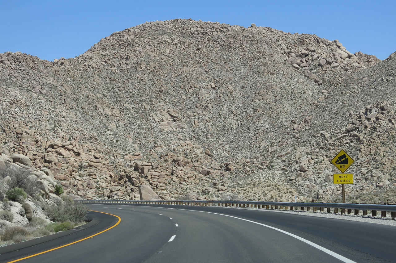
The warning for six percent grade continues for another three miles. The freeway turns northeast for the final distance into Ocotillo. Also note the Myers Creek Bridge, which is actually an arch bridge underneath. It was built in the 1940s to carry old U.S. 80, and it is still in use today for the Interstate. Photos taken 04/20/13 and 04/05/13. |
|
|
|
|
|
| Interstate 8 continues east through In-Ko-Pah Gorge. Look to the north of the freeway to see sections of Old U.S. 80 at points where the canyon widens out. Photos taken 04/20/13, 04/05/13, and 01/27/06. |
|
Myer Creek again crosses under Interstate 8. However, this particular bridge is unique from the others. It is much older, as it carried U.S. 80 from the time the modern road was built in the 1940s to replace the original road built in the 1910s. This bridge is a concrete arch design, which is invisible to the thousands who drive the freeway each day. It was retrofitted to meet Interstate standards, and it still functions today as the crossing over Myer Creek. From here, you can see the changes in rock coloration as a result of the rock movement that occurred during the construction of the highway. Photo taken 04/20/13. |
|
|
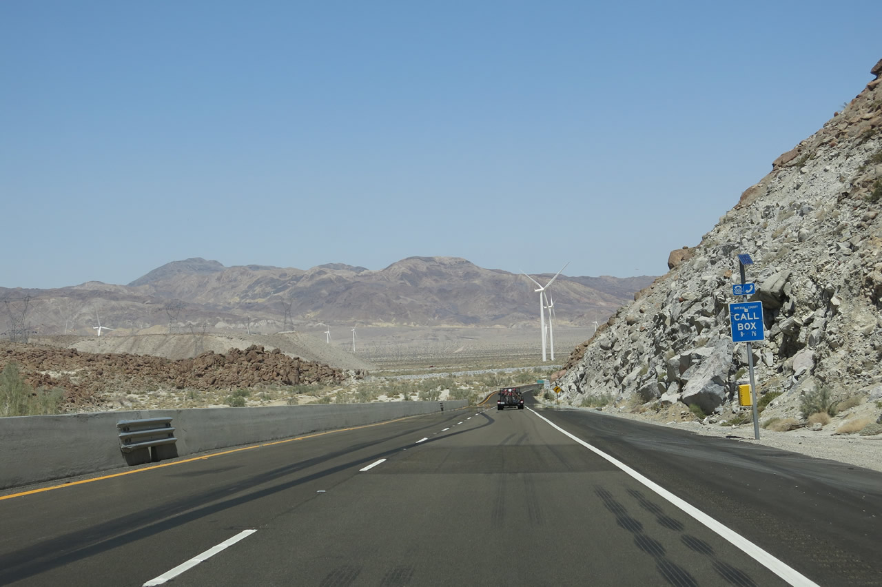
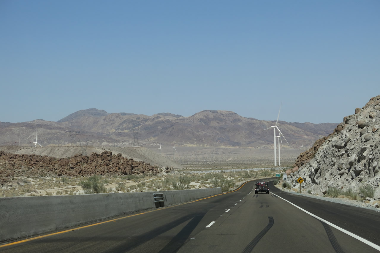
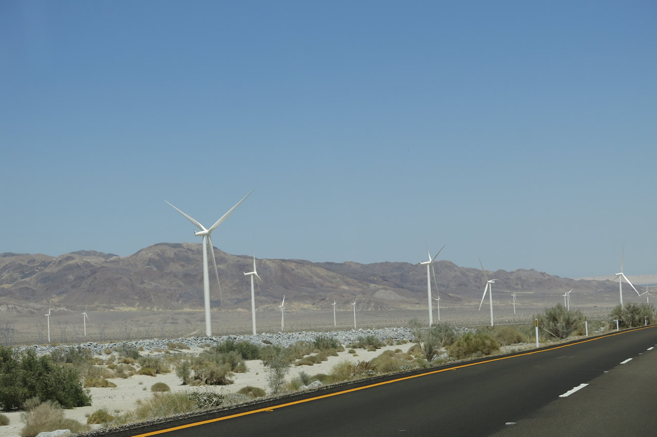
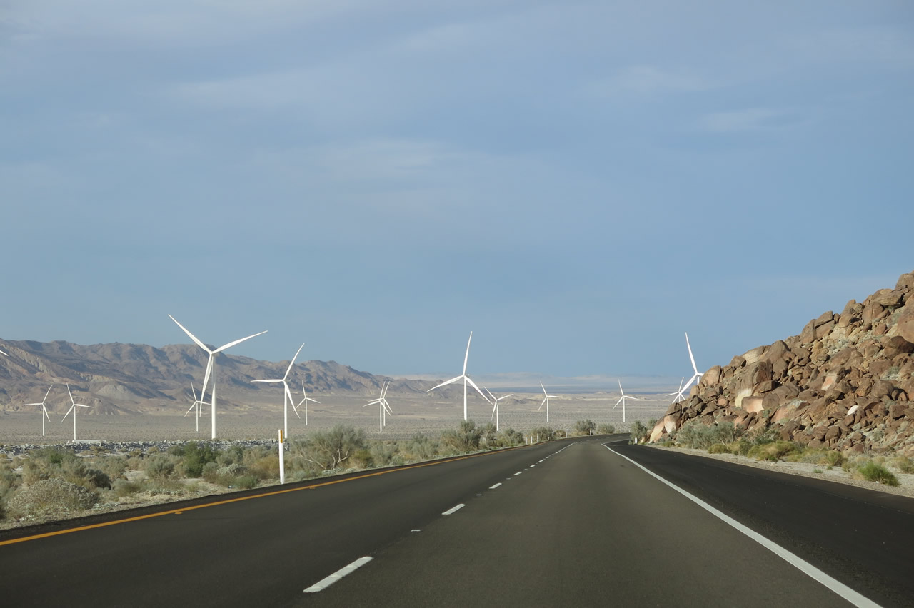
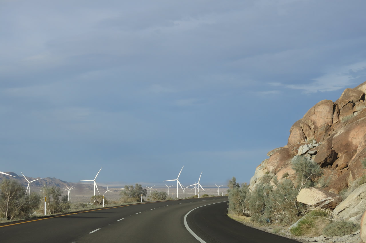
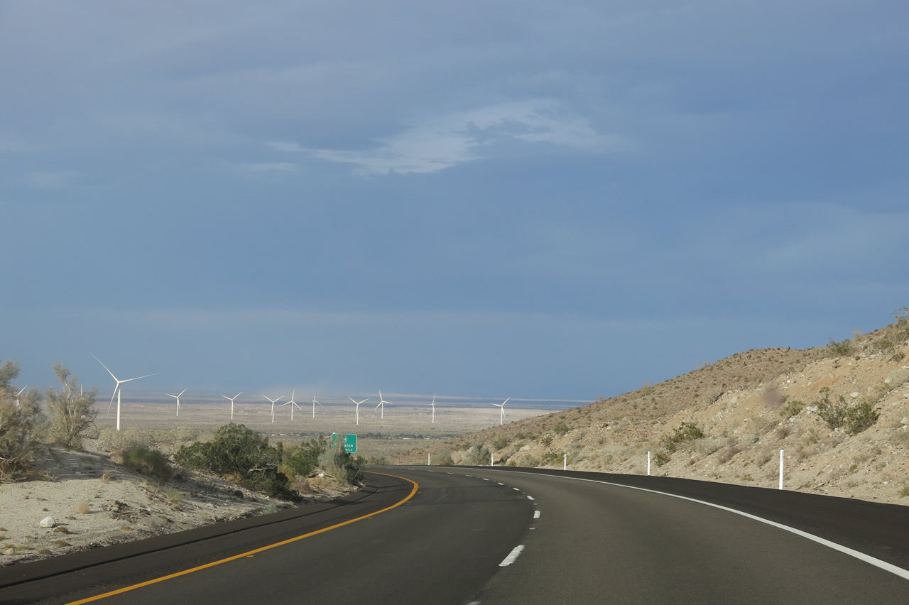
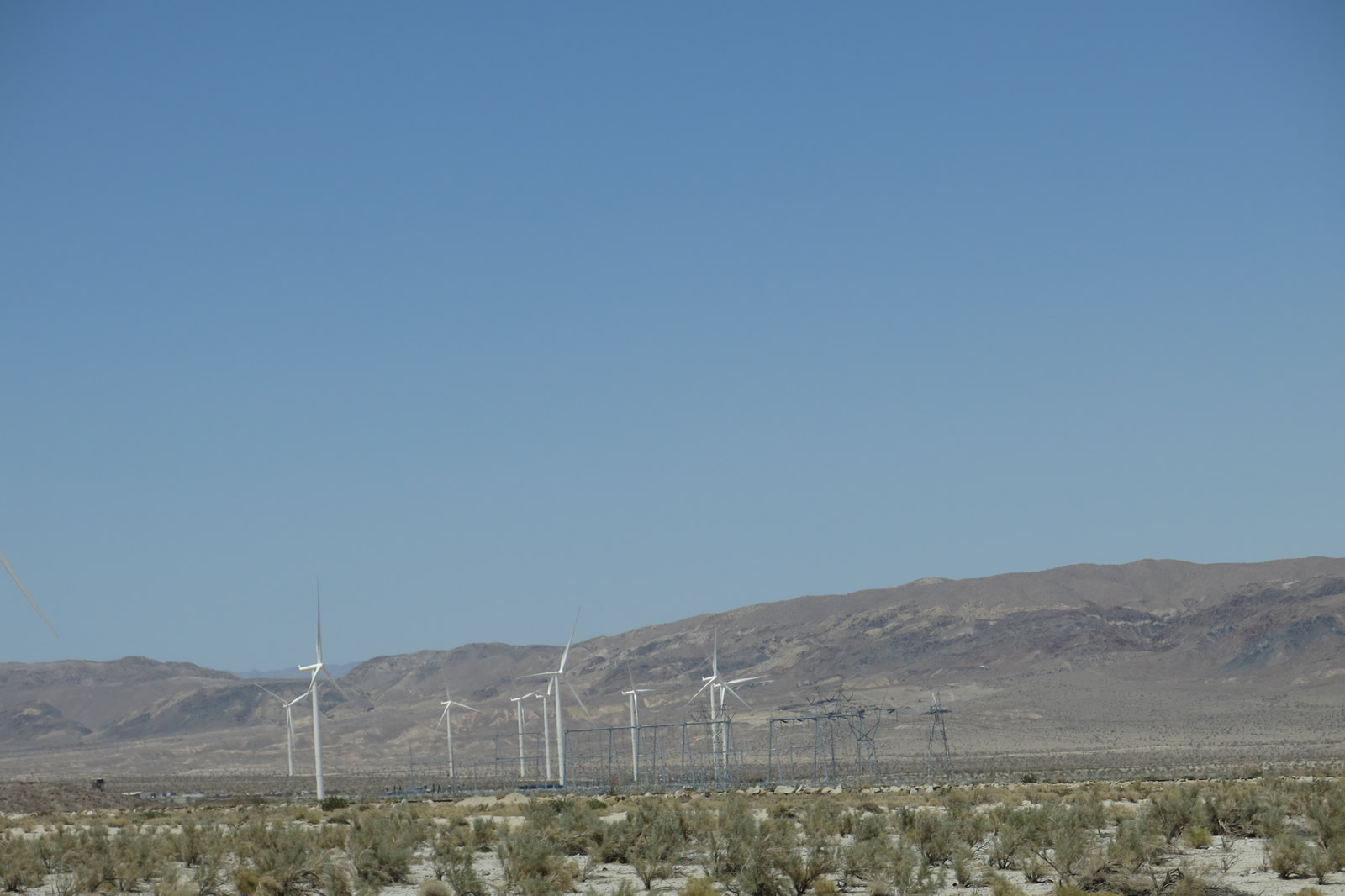
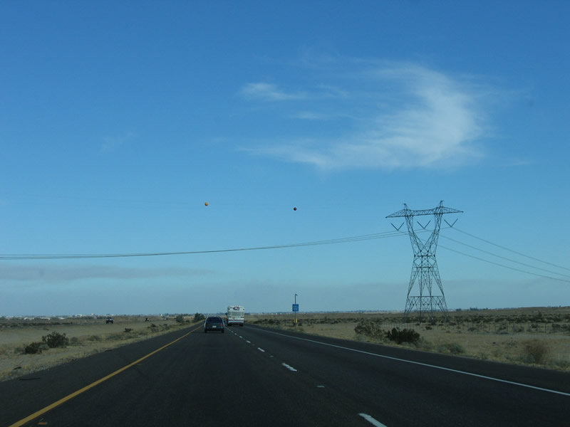
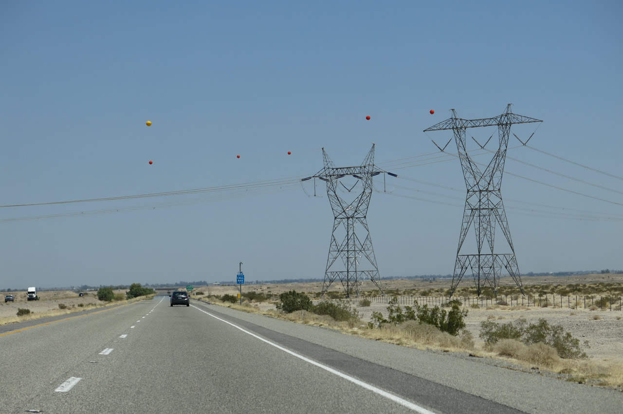
The 500kV Southwest Powerlink and Sunrise Powerlink again come into view along Interstate 8 east. At the bottom of the grade, the white Ocotillo wind farm turbines come into view. Photos taken 04/20/13. |
|
|
In addition to the Ocotillo wind farm turbines, we also see flat land ahead. Interstate 8 will leave the winding, curving nature of mountainous driving behind and proceed onward first into the arid Yuha Desert and then into the agricultural areas of the Imperial Valley. Photos taken 04/20/13. |
|
|
|
|
|
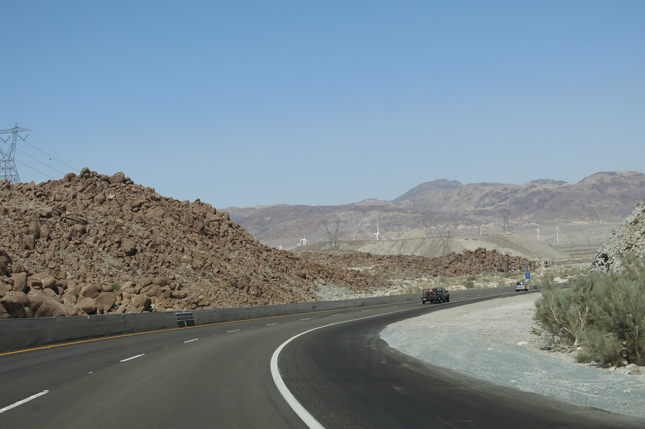
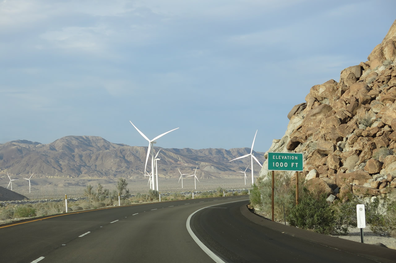
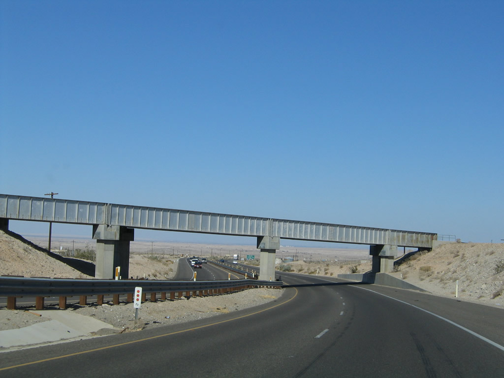
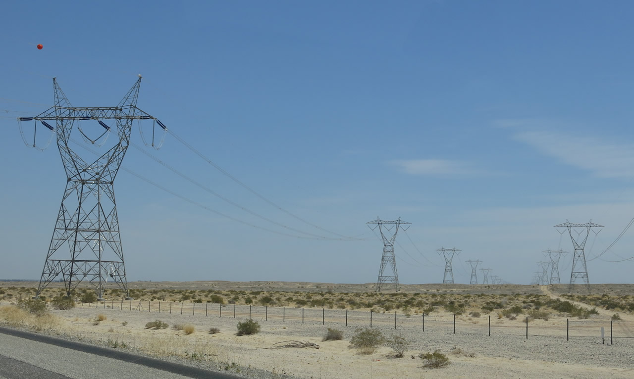
| The floor of the Imperial Valley again comes into view as eastbound Interstate 8 leaves In-Ko-Pah Gorge and comes within view of the westbound lanes of traffic. A large wash still separates eastbound lanes from westbound lanes. The elevation is now 1,000 feet, and the freeway will continue to descend all the way to sea level ... and even lower, bottoming out at the New River crossing near Seeley. The Ocotillo Wind Project provides artificial scenery in addition to the majesty of the surrounding gorge. Photo taken 04/05/13 and 04/20/13. |
|
|
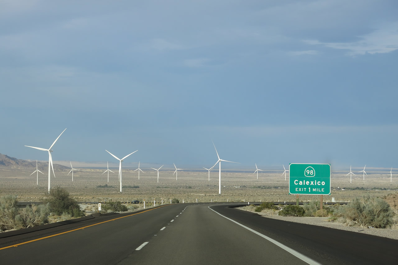
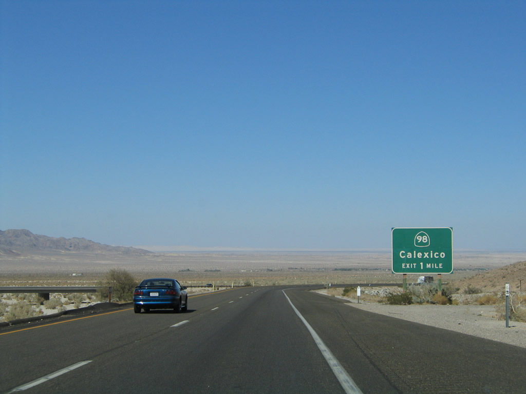
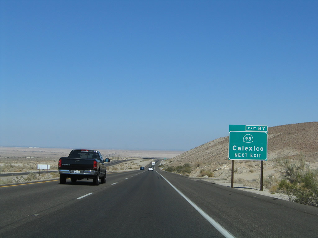
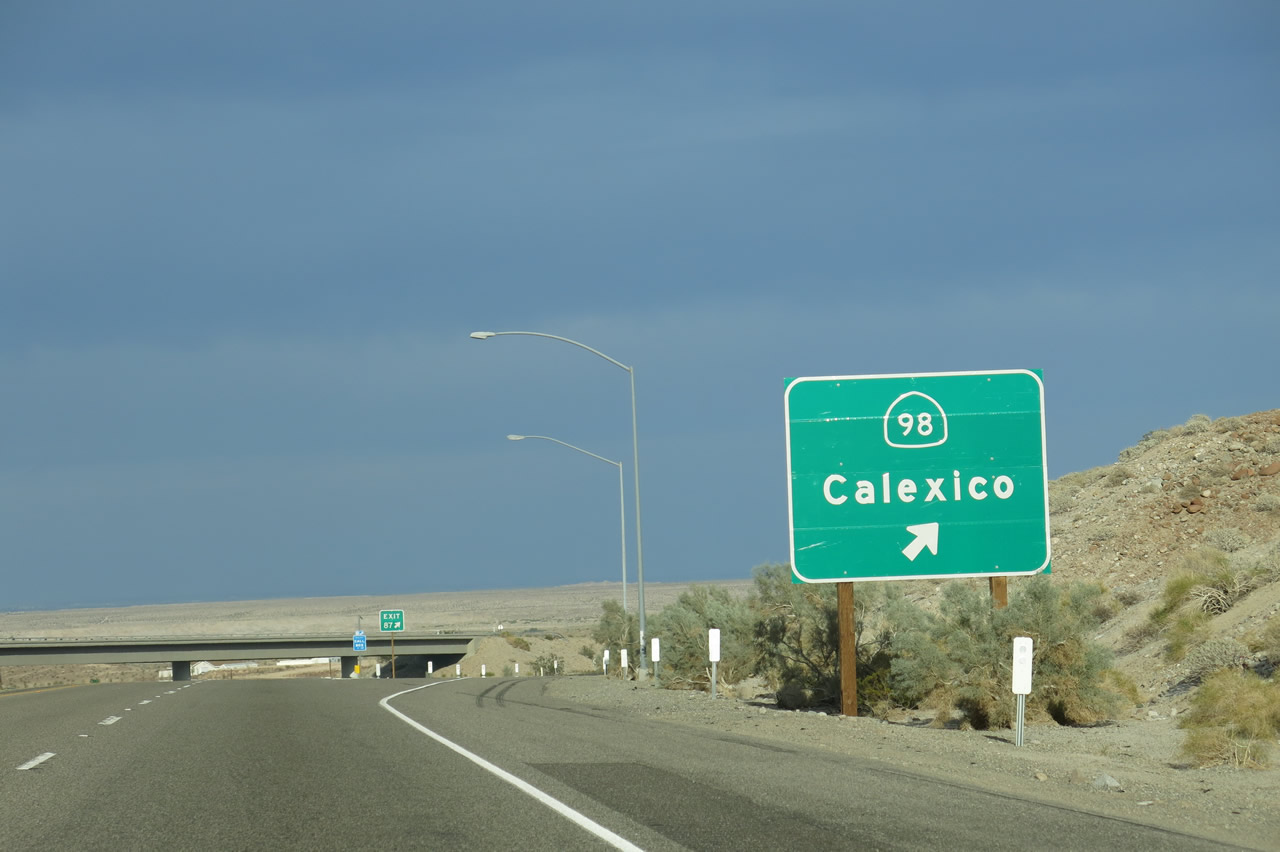
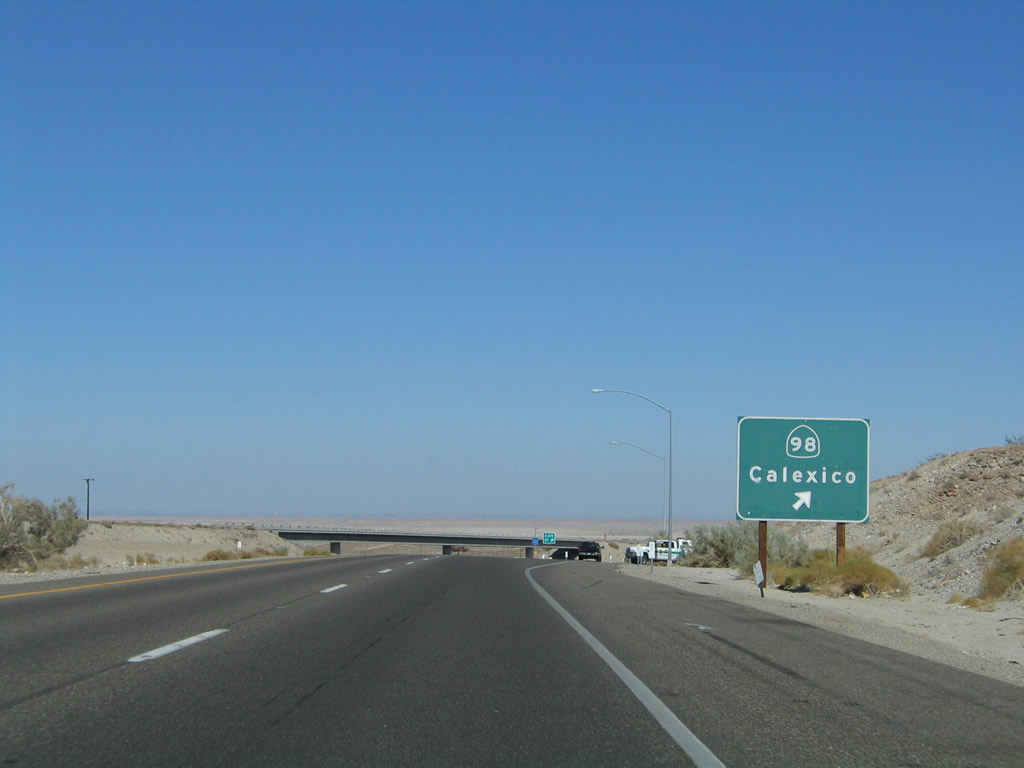
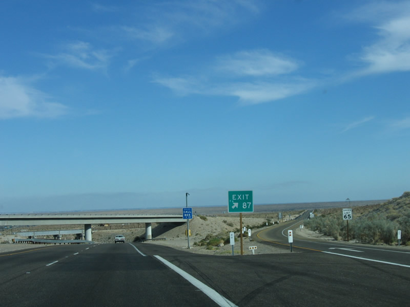
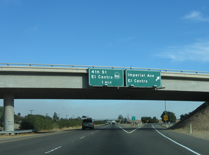
The first exit along eastbound Interstate 8 since the Mountain Springs interchange (Exit 80) is Exit 87, California 98 east to Calexico. The California 98 interchange only offers a connection from Interstate 8 eastbound; westbound traffic cannot access this interchange. Additionally, those taking this off-ramp cannot return to east Interstate 8 at this point. They will have to follow California 98 east to Imperial County S-2 (Imperial Highway) north, and return to the freeway at Exit 89. Photos taken 04/05/13 and 08/27/04. |
|
A sole exit number sign is placed on the approach to Exit 87, California 98 east to Calexico. Old U.S. 80, which has been buried under the eastbound lanes of Interstate 8, did not follow California 98 east to Calexico. Instead, it followed the route of Interstate 8 east toward El Centro. The old alignment of U.S. 80 resumes as Imperial County S-80 at Exit 89, the Imperial Highway interchange. Photo taken 08/27/04. |
|
A substation connects the Ocotillo Wind Farm with the 500kV Sunrise Powerlink. Photo taken 04/20/13. |
|
|
Eastbound Interstate 8 meets Exit 87, California 98 east to Calexico. California 98 is an east-west highway sandwiched between Interstate 8 to the north and the International Border with Mexico to the south. It provides the most direct route to Calexico, which is the sister city to the sprawling megalopolis of Mexicali, the capital of Baja California. The city of Mexicali encroaches all the way to the border, and there are places along the border where there are farms and agriculture on the U.S. side that contrast with the completely urbanized area on the Mexican side. Photos taken 04/20/13 and 08/27/04. |
|
|
The off-ramp to Exit 87 is high-speed and is fully signed with an exit number. In 2006, this exit gore point sign for California 98 was a bit backward, since the arrow should be to the right of the numeral, not to the left. But hey, at least there is an exit number here! Photos taken 04/20/13 and 01/27/06. |
|
Eastbound Interstate 8 passes under the transition ramp from California 98 west to Interstate 8 west. Photo taken 04/05/13. |
|
Immediately after the California 98 overpass, a second bridge crosses over Interstate 8 immediately thereafter. This bridge carries the San Diego-Imperial Valley Railroad bridge, which was recently restored to active status as a result of a major investment to improve the railroad infrastructure. The railroad ascends the Laguna Mountains at a constant grade through a variety of bridges and tunnels. This route was abandoned between the 1980s and 2004, partially because a portion of the railroad goes through Mexico on its way to San Diego and also because several tunnels and bridges were compromised, some beyond repair. With an increase in trade in the Port of San Diego and the increased need for transportation between the Imperial Valley and San Diego, the railroad was revitalized and was repaired so that San Diego is once again be connected to a railroad that does not pass through Los Angeles. However, the new rail line is not nearly as busy as the other routes in the Greater Los Angeles area. Photo taken 08/27/04. |
|
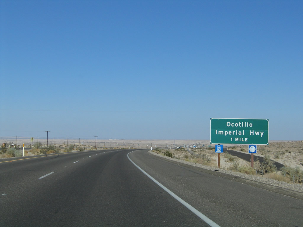
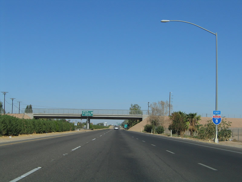
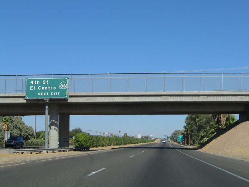
The next exit along eastbound Interstate 8 is Exit 89, Imperial County S-2 (Imperial Highway) and Imperial County S-80 (Evan Hewes Highway and Historic U.S. 80), one mile. This is the first interchange with services since the Jacumba/Carrizo Gorge Road interchange (Exit 72) in San Diego County, a distance of 17 miles. Photo taken 08/27/04. |
|
|
The small community just north of the Interstate 8 and Imperial County S-2 interchange is Ocotillo. As of the 2000 Census, 296 people lived in Ocotillo. This is the first community found along eastbound Interstate 8 since leaving the vicinity of Jacumba and In-Ko-Pah Park. Limited services are available here, including gasoline and food, but a wider variety of services is available in El Centro. The sign was replaced by 2013, but the newer sign did not provide the exit number. Photos taken 04/05/13 and 08/27/04. |
|
|
Imperial County S-2 travels northwest from Interstate 8, crossing the Imperial-San Diego County Line after leaving Ocotillo. The county line also serves as the eastern boundary of Anza-Borrego Desert State Park, one of the largest parks in the California State Park system. Continuing northeast, San Diego County S-2 follows Sweeney Pass Road, which changes into the "Great Southern Overland Stage Route of 1849" after crossing Sweeney Pass. The county highway serves Agua Caliente (Hot Springs) County Park, Vallecito, and Shelter Valley Ranchos before meeting California 78 at Scissors Crossing. Northwest of California 78, San Diego County S-2 travels toward San Felipe. After intersecting San Diego County S-22 (Montezuma Valley Road), San Diego County S-2 ends at its junction with California 79 northeast of Morettis and southwest of Warner Springs. Photos taken 04/20/13 and 08/27/04. |
|
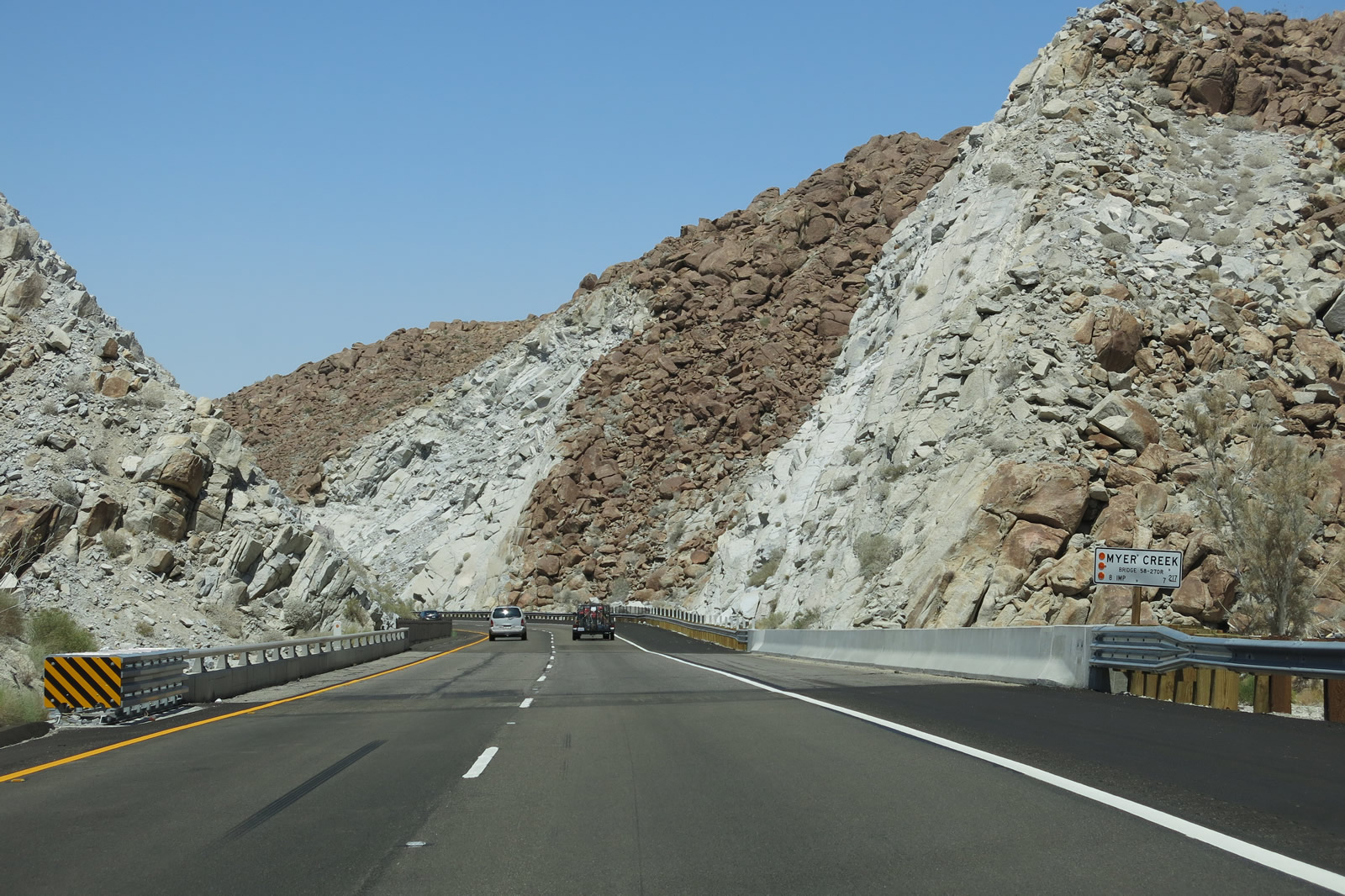
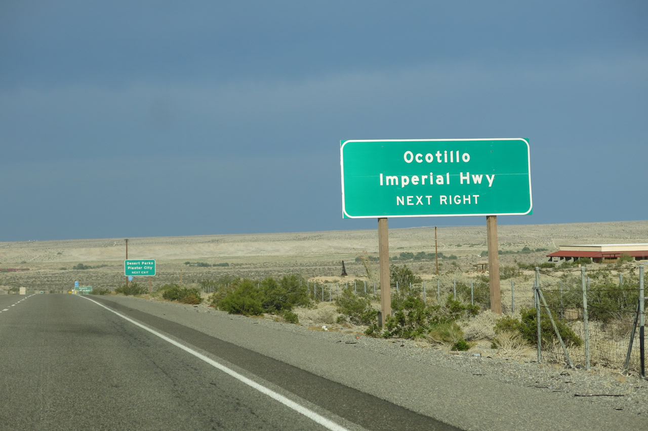
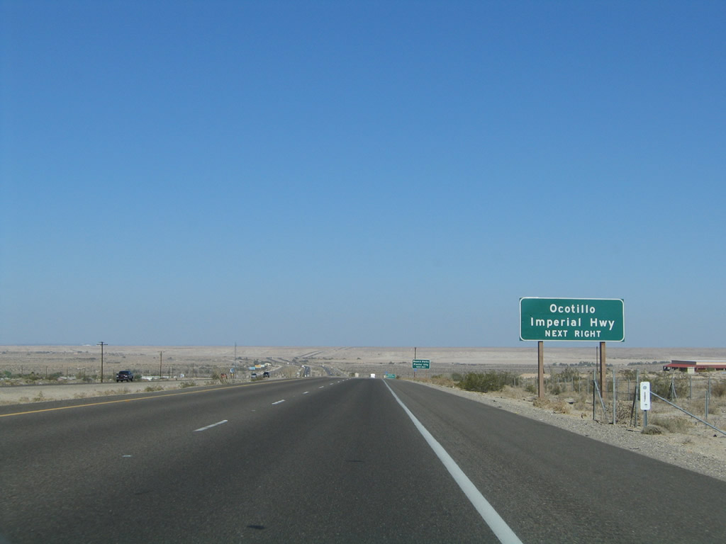
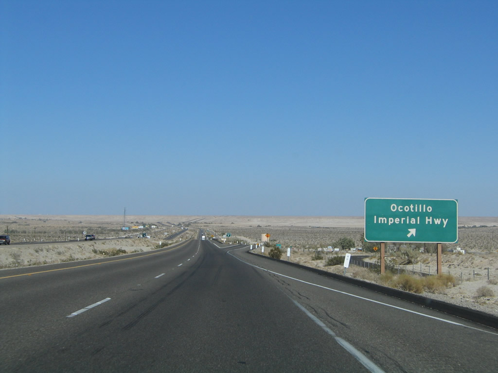
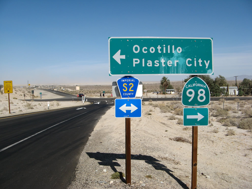
Eastbound Interstate 8 reaches Exit 89, Imperial County S-2 (Imperial Highway). A few roadside businesses including gas and food are available in the community of Ocotillo, and these are the first motorist services on eastbound Interstate 8 since leaving the vicinity of Jacumba back in the high country. To the north of here via S-2 is the Ocotillo Wind Farm, which was visible at the bottom of In-Ko-Pah Gorge. Imperial County S-2 travels northwest from here into Anza-Borrego State Park and Agua Caliente County Park, with connections to California 78 (to Banner and Julian) and Borrego Springs via San Diego County S-3. This exit also marks the western terminus of Imperial County S-80, which is former U.S. 80. Imperial County S-80 parallels Interstate 8 from here all the way east to California 115 near Holtville as an extant route. Use Imperial County S-80 (U.S. 80) east to Coyote Wells and Plaster City. Photo taken 08/27/04. |
|
Upon exiting Interstate 8, a second Imperial County S-2 trailblazer is posted. Turn right to follow Imperial County S-2 south to its southern terminus at California 98 (a distance of less than a mile); turn left to follow Imperial County S-2 north to the unincorporated community of Ocotillo and the beginning of Imperial County S-80 east to Plaster City. From there, Imperial County S-2 continues north into Anza-Borrego Desert State Park. Photo taken 01/27/06. |
|
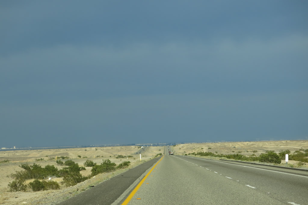
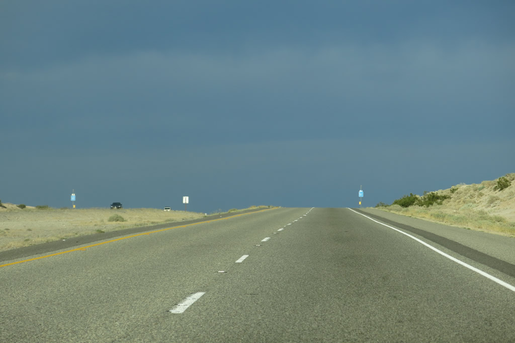
Back on Interstate 8 east, there is a long distance without exits between Imperial County S-2 (Exit 89) and Dunaway Road (Exit 101). Unlike the previous ten miles of downgrade and mountainous slopes through Mountain Springs and In-Ko-Pah Gorge, the next ten miles of Interstate 8 is comparably flat and generally straight. Photo taken 08/27/04. |
|
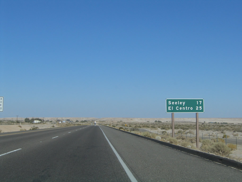
The next community along Interstate 8 is Seeley, which lies north of the freeway on Old U.S. 80 (known as Imperial County S-80 (Evan Hewes Highway)) via Drew Road (Exit 107). El Centro remains the eastbound control city. Look north of Interstate 8 around Milepost 98 to see the industrial operations at Plaster City. Photo taken 08/27/04. |
|
|
|
|
|
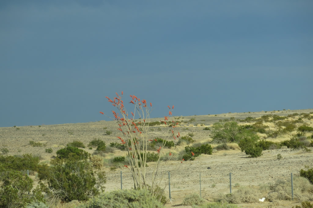
| Interstate 8 proceeds east through the arid Yuha Desert, which is part of the Colorado Desert and sits in the rainshadow of the nearby mountains. The freeway will pass over several dry washes along its path through here. The barren Colorado Desert covers much of Imperial County; in fact, it extends from the Mexican border in the south to Joshua Tree National Park in the north. However, life exists here, as seen by the red-tipped Ocotillo bush seen in this series of pictures. From east to west, the Colorado Desert begins at the foot of the Laguna Mountains and continues east to the Colorado River and the Arizona state line. It is biologically and climatologically diverse from the Mojave Desert north of Joshua Tree, largely due to its higher elevation but also due to the different plant and animal species found there. The Colorado Desert is considered an extension of the Sonoran Desert to the east in Arizona and Mexico. Photos taken 08/27/04, 01/27/06, 04/05/13, and 04/20/13. |
|
|
|
|
|
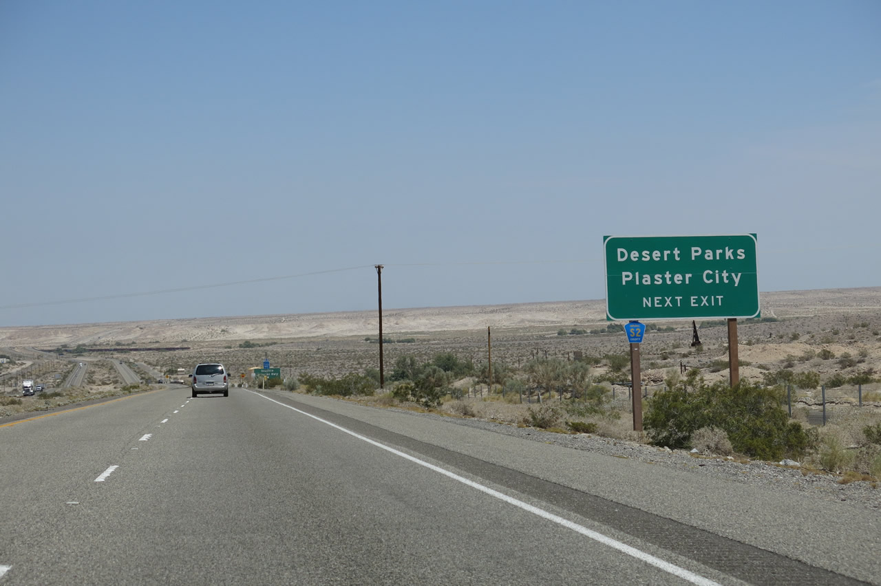
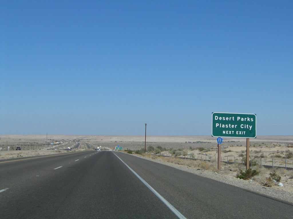
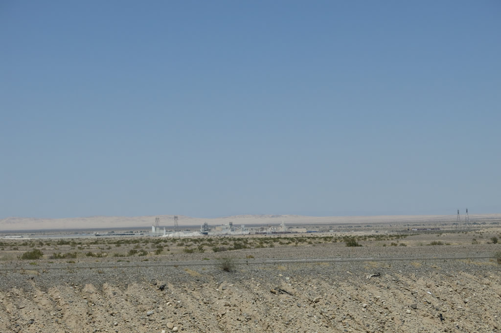
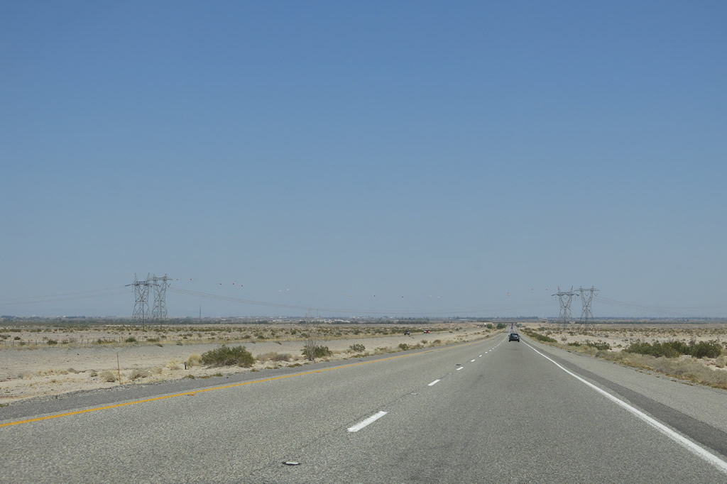
| Plaster City comes into view on the north side of the freeway; it is only accessible via Imperial County S-80. Interstate 8 rolls through the Yuha Buttes and eventually starts to descend slightly toward sea level and eventually the New River crossing. Many diverse species reside in the Colorado Desert, even though a significant portion of the desert is irrigated for farmland and other agricultural uses; farmland comes into view in the distance, as does another crossing of the 500kV Southwest Powerlink (Miguel to Imperial Valley) and Sunrise Powerlink (Sycamore Canyon to Imperial Valley). Looking east on Interstate 8, the desert largely remains in its original condition between Exits 89 and 101. Photos taken 08/27/04, 01/27/06, 04/05/13, and 04/20/13. |
|
|
|
|
|
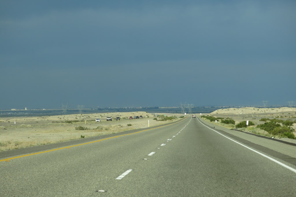
| Interstate 8 crosses under the 500kV Southwest Powerlink and Sunrise Powerlink, both owned and operated by San Diego Gas & Electric (SDG&E) as part of Path 46 (West of Colorado River, southern segment). Both lines transmit power from the Imperial Valley west to greater San Diego. Here these massive lines again pass over Interstate 8. We last these 500kV power lines at the bottom of In-Ko-Pah Gorge near the Ocotillo wind farm. From this point east, the two lines will approach and connect with the massive Imperial Valley substation (which also links to power generation facilities in Mexico via several 230kV power lines). As of 2012, the Sunrise Powerlink terminates at the Imperial Valley substation, while the Southwest Powerlink proceeds east toward Yuma and eventually Palo Verde in Arizona. Long-term plans call for the addition of a second 500kV line between Imperial Valley, Yuma, and Palo Verde, but not until the late 2010s or 2020s. The Southwest Powerlink will continue east and become visible from Interstate 8 at the Algodones Sand Dunes, remaining south of Interstate 8. The 500 kV line continues east from the substation, crossing the Imperial Valley and the Colorado River into Arizona. Ultimately, this power line connects with the Palo Verde Nuclear Power Plant in Arizona west of Phoenix. Photo taken 01/27/06, 04/05/13, and 04/20/13. |
|
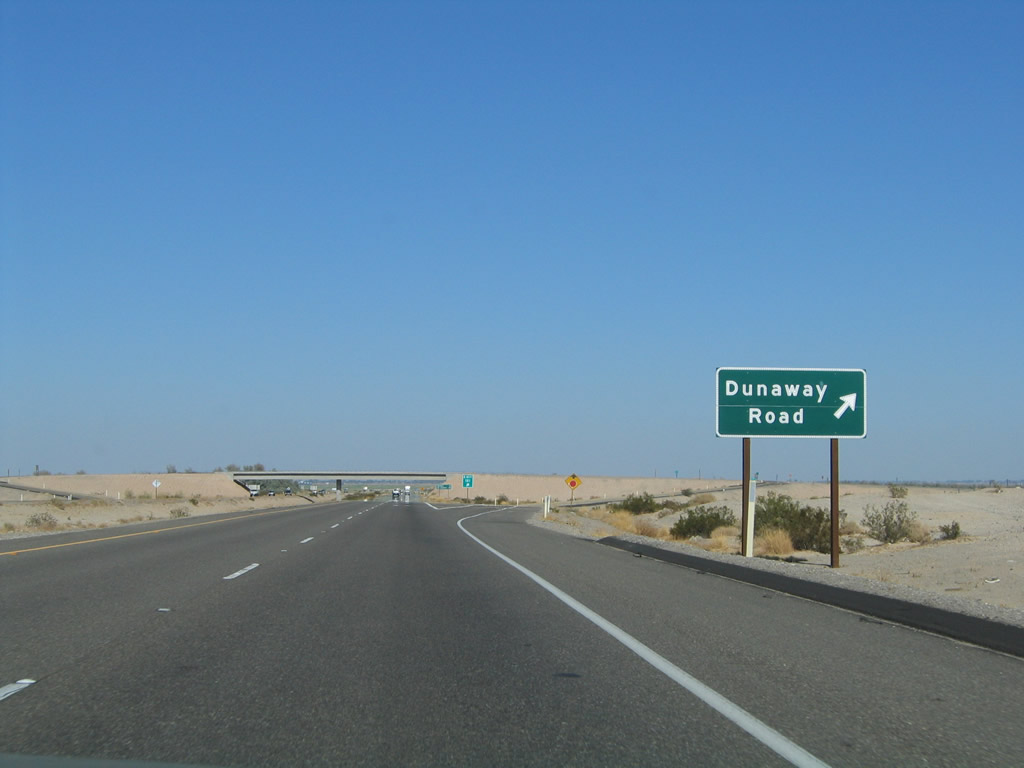
The next exit along eastbound Interstate 8 is Exit 101, Dunaway Road. Use Dunaway Road north to Historic U.S. 80 (Imperial County S-80). Turn east on Imperial County S-80 to the vicinity of Dixieland and west to Plaster City. Photo taken 08/27/04. |
|
Eastbound Interstate 8 reaches Exit 101, Dunaway Road. The dry desert gives way to irrigated agricultural land, with certain plots of green fields located adjacent to dry desert sagebrush open space. Photo taken 08/27/04. |
|
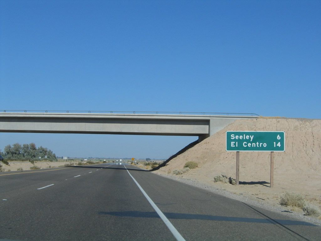
At the base of the Dunaway Road overpass, this mileage sign provides the distance to Seeley (six miles) and El Centro (14 miles). Photo taken 08/27/04. |
|
Another California-standard Interstate 8 reassurance shield is posted after the on-ramp from Dunaway Road. Photo taken 08/27/04. |
|
|
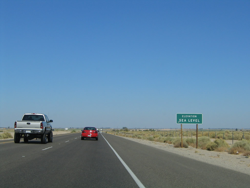
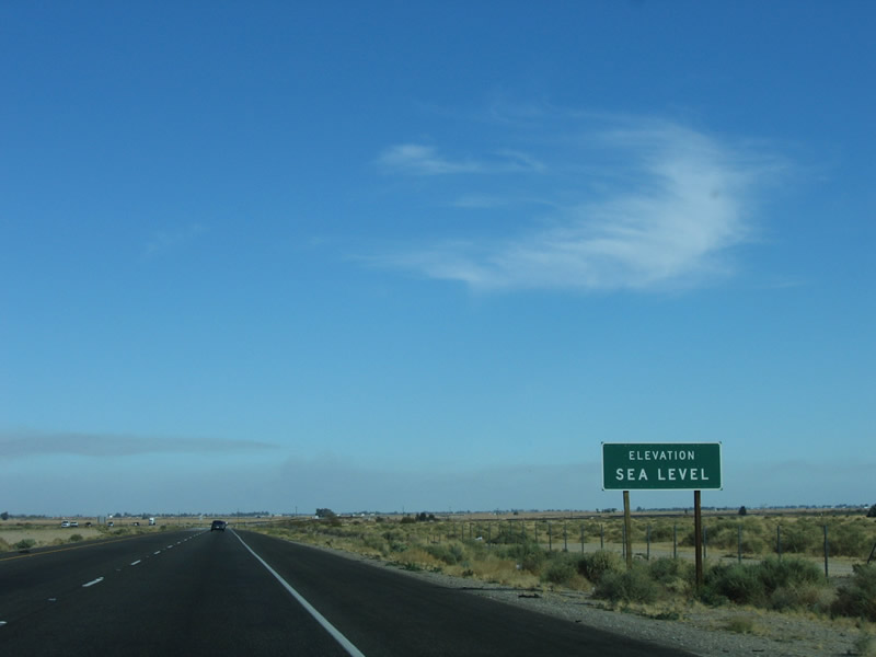
Between Dunaway Road (near Plaster City) and Drew Road (near Seeley), Interstate 8 drops to Sea Level. However, there is no water waiting to greet the Interstate, unlike the Sea Level near the Pacific Ocean. Instead, Interstate 8 continues to even lower elevations, especially as it nears Seeley (el. -42 feet below sea level) and El Centro (el. -45 feet below sea level). From here, Interstate 8 generally remains below sea level until it reaches the area around the sand dunes on the east end of the Imperial Valley. Photos taken 08/27/04 and 01/27/06. |
|
|
|
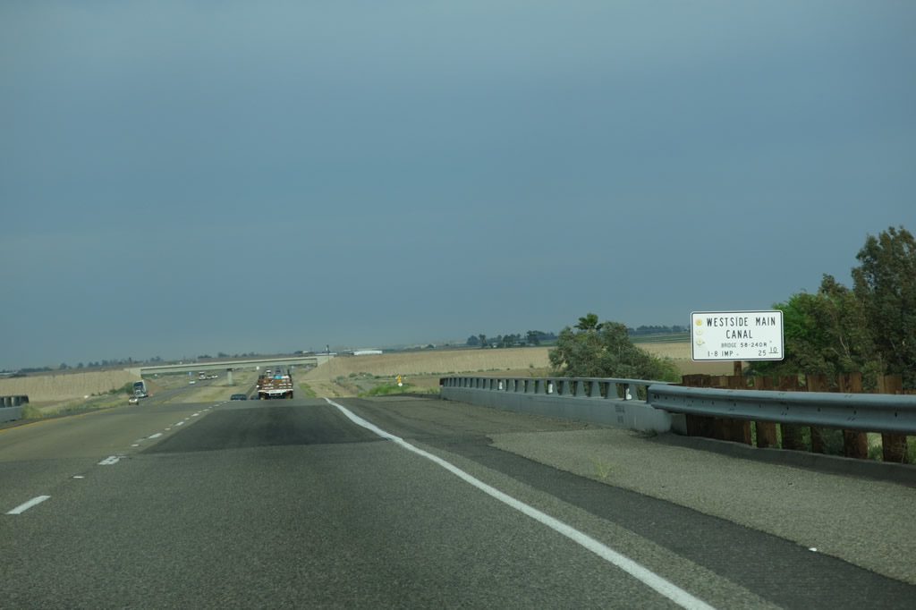
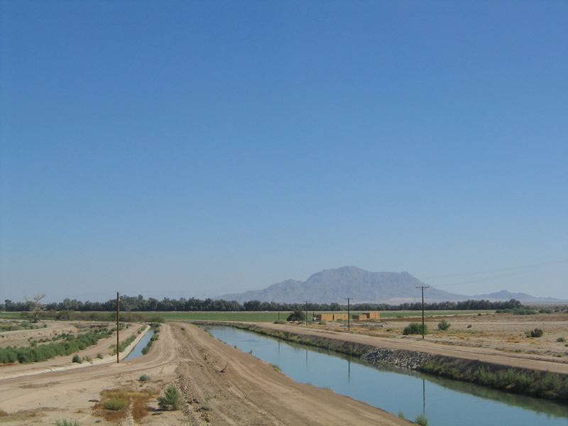
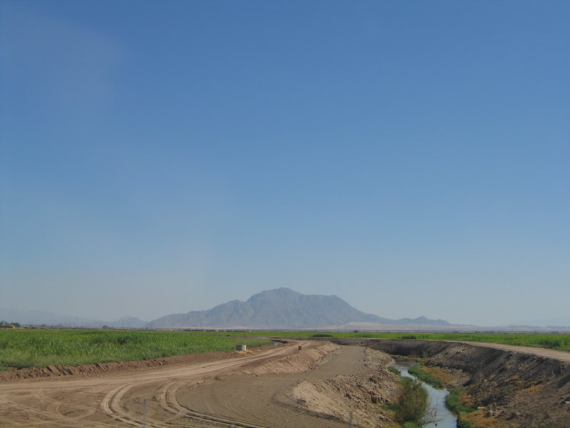
Interstate 8 passes over the Westside Irrigation Canal, and the surrounding landscape dramatically changes from desert to farmland. Looking to the south of Interstate 8, irrigation canals wind their way through the farmland, offering water to a land that would be barren without it. The Imperial Valley, which is part of the Colorado Desert, is known for having two growing seasons annually due to the length of each growing season (300+ days each year). Over one-seventh of salad vegetables comes from the Imperial Valley, as well as fruits, dates, cotton, grains, and dairy products. Photos taken 04/05/13 and 08/27/04. |
|
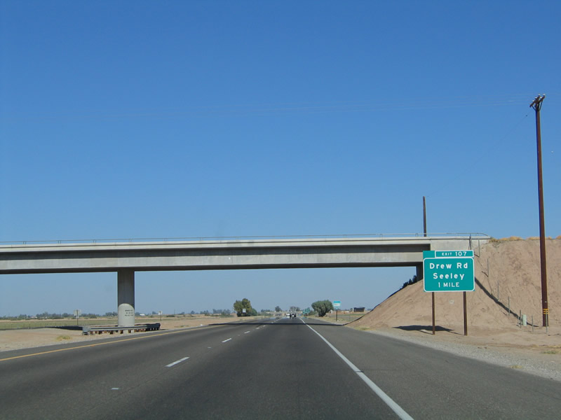
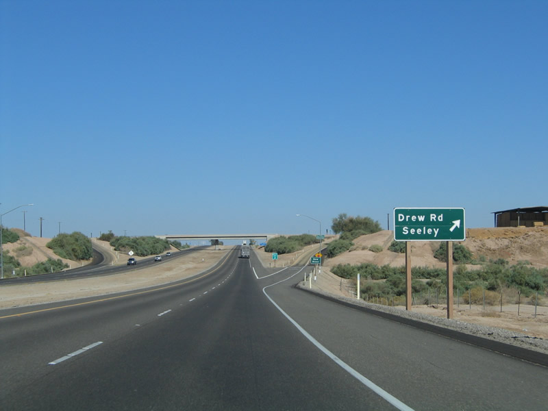
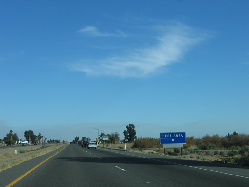
The next two exits along eastbound Interstate 8 are Exit 107, Imperial County S-29 (Drew Road) and Exit 108, Rest Area. The rest area is mentioned first, since it is the first such rest since the San Diego County S-1 (Buckman Springs Road) interchange. Photo taken 08/27/04. |
|
Eastbound Interstate 8 approaches Exit 107, Imperial County S-29, Drew Road, one mile. The town of Seeley is located just north of this interchange, at the junction of Imperial County S-29 and Imperial County S-80 (Historic U.S. 80). Photo taken 08/27/04. |
|
Almost magically, the dry desert terrain shifts into a verdant green. Farmlands dominate the view on both sides of the freeway as Interstate 8 approaches Seeley. Bugs become more common, making frequent car window washing necessary. Photo taken 01/27/06. |
|
Use Imperial County S-29 (Drew Road) north to Sunbeam Lake County Park. A large recreational vehicle resort is located at the site of the county park. Photo taken 08/27/04. |
|
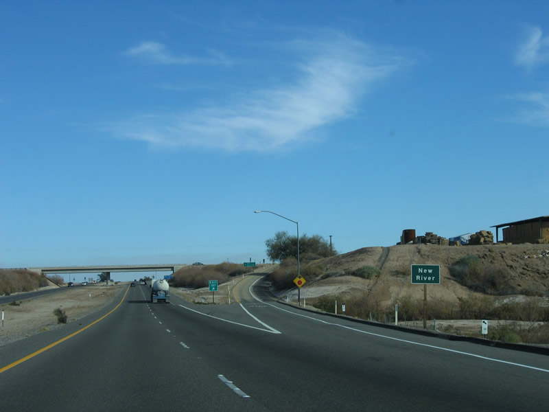
Eastbound Interstate 8 reaches Exit 107, Imperial County S-29, Drew Road. Just prior to this interchange, as Interstate 8 crosses the New River, Interstate 8 reaches its lowest point (around 45 or 50 feet below sea level). The New River Undercrossing on Interstate 8 is the lowest point of any Interstate Highway that is not within an underwater tube or tunnel. Photo taken 08/27/04. |
|
Just prior to the gore point for Exit 107, the freeway passes over a river: the New River. The New River lives up to its name, as it was not a river until agricultural and urban runoff from Mexico and the Imperial Valley combined to form a river in this otherwise dry wash. Flowing south to north, it feeds into the Salton Sea, one of two rivers that provide "fresh" water into the sea (the other being the Alamo River). However, the New River is one of the most polluted rivers in the country, and it is slowly polluting the Salton Sea with its runoff, full of fertilizers and assorted bacteria from the huge Mexicali metropolis south of the border. Because of the growing salinity of the Salton Sea, proposed transfers of freshwater from the Imperial Valley (including the fresh water of the All-American Canal) to the coastal cities have undergone increased scrutiny, since the Salton Sea ecosystem may not survive without additional freshwater to flush polluted water flowing in the New and Alamo Rivers. A continuing debate will be the sharing of limited freshwater resources by urban and rural areas. Photo taken 01/27/06. |
|
|
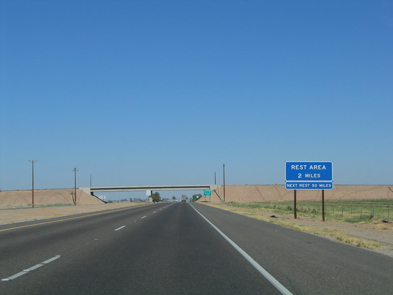
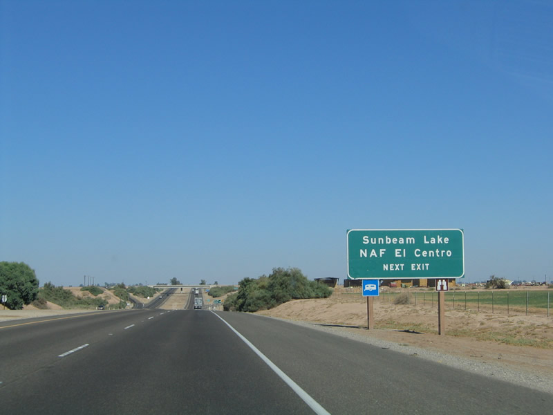
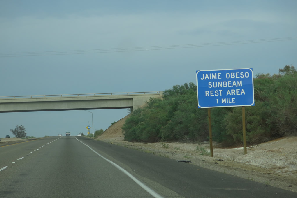
The next exit along eastbound Interstate 8 is Exit 108, Sunbeam (Jaime Obeso) Rest Area. Unlike the rest areas at Buckman Springs Road in San Diego County and in the Algodones Sand Dunes, the Sunbeam Rest Area has separate facilities for each direction of traffic. The other two rest areas along Interstate 8 are shared by both directions of traffic. Photos taken 04/05/13 and 08/27/04. |
|
An Interstate 8 reassurance shield is posted shortly thereafter. Photo taken 04/20/13. |
|
The next mileage sign provides the mileage to El Centro (eight miles) and Yuma, Arizona (67 miles). Yuma becomes the control city after Interstate 8 leaves El Centro. Photo taken 01/27/06. |
|
|
Eastbound Interstate 8 reaches Exit 108, Sunbeam (Jaime Obeso) Rest Area, which was named in honor of Leadworker Jaime Obeso in 2011. Restrooms, water, and a parking area are available at this rest area. Photos taken 08/27/04. |
|
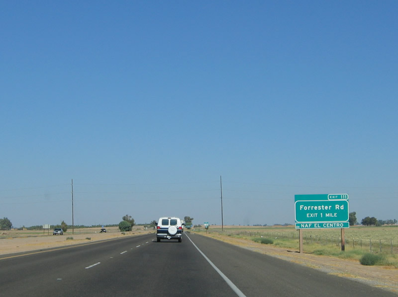
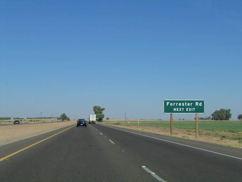
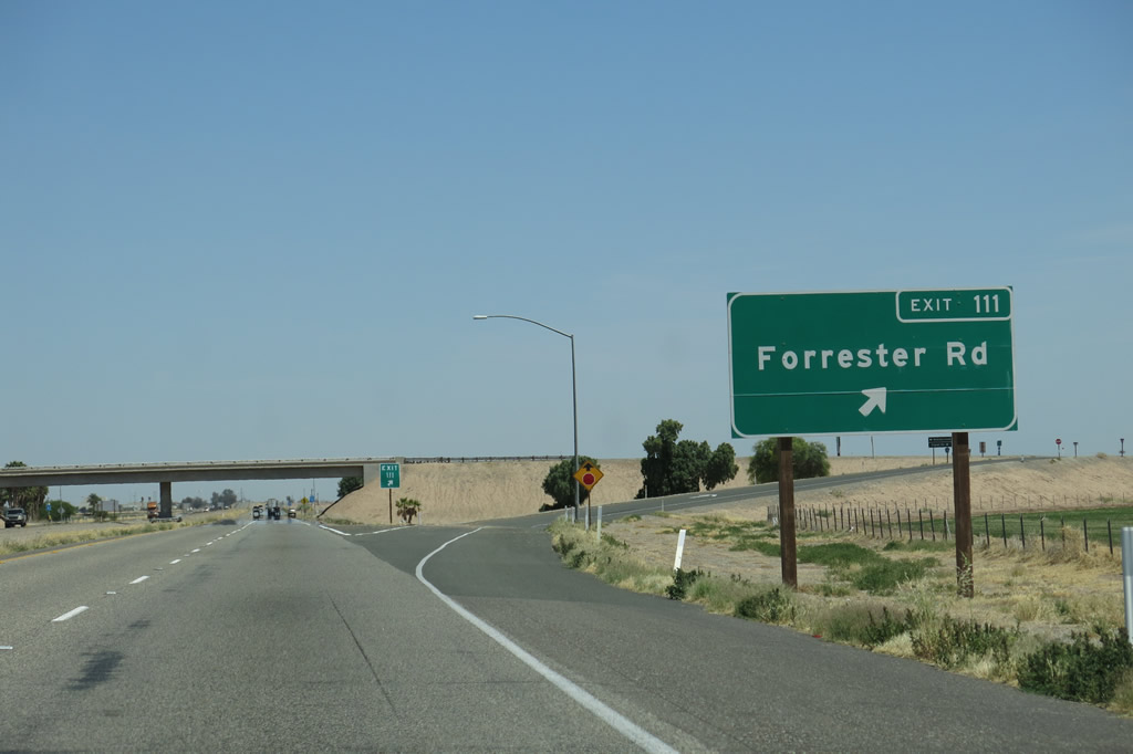
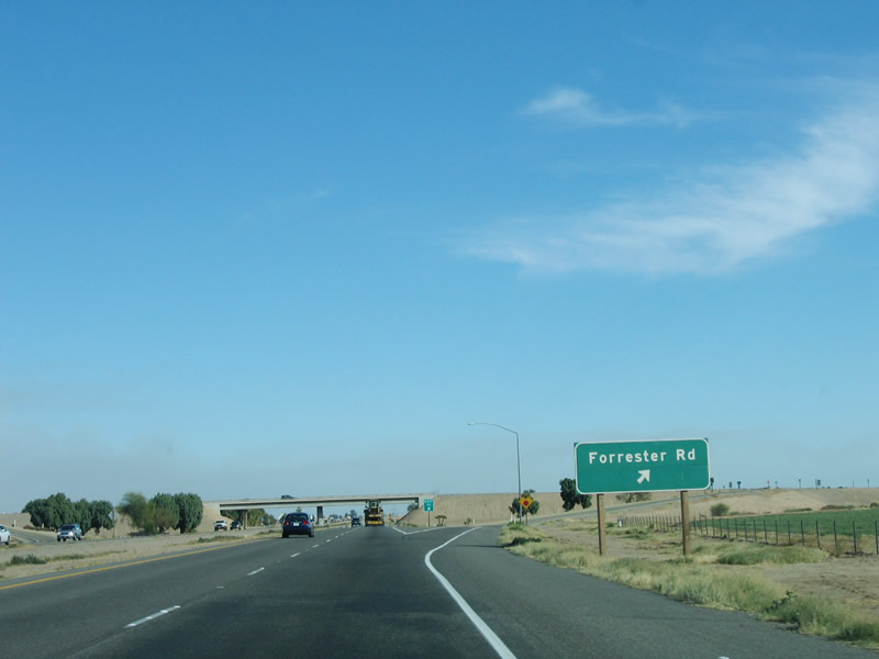
The next exit along eastbound Interstate 8 is Exit 111, Imperial County S-30, Forrester Road. County Route S-30 leads north from here to near the southeastern shore of the Salton Sea via Westmorland, then turns east to its northern terminus at California 111 and California 115 in Calipatria. It also heads south from here to meet California 98 west of Calexico. Photo taken 08/27/04. |
|
Forrester Road is a major north-south arterial that is signed as Imperial County S-30 for most of its length. It is part of an arterial grid system that was laid out when the Imperial Valley was settled and farmed. Aside from a few exceptions, most rural roads in Imperial County travel north-south or east-west. In their haste to build the road system in the Imperial Valley, some of the roads have "kinks" in them where the road has to realign itself through an "S" curve or similar design features. Forrester Road succumbs to this at a few locations in the Imperial Valley. Photo taken 08/27/04. |
|
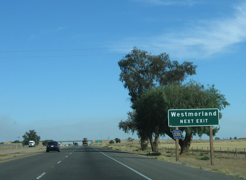
Imperial County S-30 bisects Imperial County from south to north, generally paralleling California 86 and California 111 yet intersecting both routes along its path. The county route begins at California 98 in Mount Signal, and it follows Brockman Road and Forrester Road north past Interstate 8 and Imperial County S-80 before meeting California 78 and California 86 in Westmorland. Continuing north, Imperial County S-30 transitions onto Gentry Road. At Eddins Road, Imperial County S-30 turns east, ending at its intersection with California 111 and California 115 in Calipatria. Gentry Road continues north of Eddins Road as an unnumbered route, culminating at the Salton Sea National Wildlife Refuge. Photo taken 01/27/06. |
|
|
Eastbound Interstate 8 reaches Exit 111, Imperial County S-30 (Forrester Road). This sign was replaced to include the exit number by 2013. Take S-30 north to Westmorland. Photos taken 04/20/13 and 01/27/06. |
|
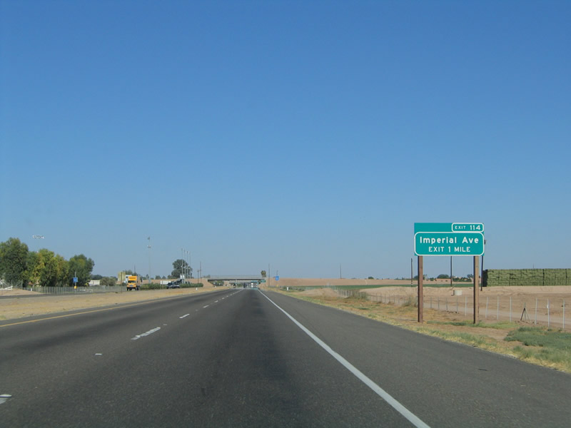
The next exit along eastbound Interstate 8 is Exit 114, Business Loop I-8 (Imperial Avenue) north to downtown El Centro. After seeing all of the overhead signs featuring El Centro in the San Diego metropolitan area, we have finally arrived at the control city of El Centro. El Centro is 45 feet below sea level, and it is the center of the agriculture that pervades the Imperial Valley. It is also a gateway to Mexico, as California 86 and California 111 lead to Calexico and two border crossings. Photo taken 08/27/04. |
|
Exit 114 serves the city of El Centro, the largest city in the Imperial Valley. Business Loop I-8 provides an easy route from the freeway to downtown El Centro and its business district. The city limits sign is visible in the median next to the overpass. Photo taken 08/27/04. |
|
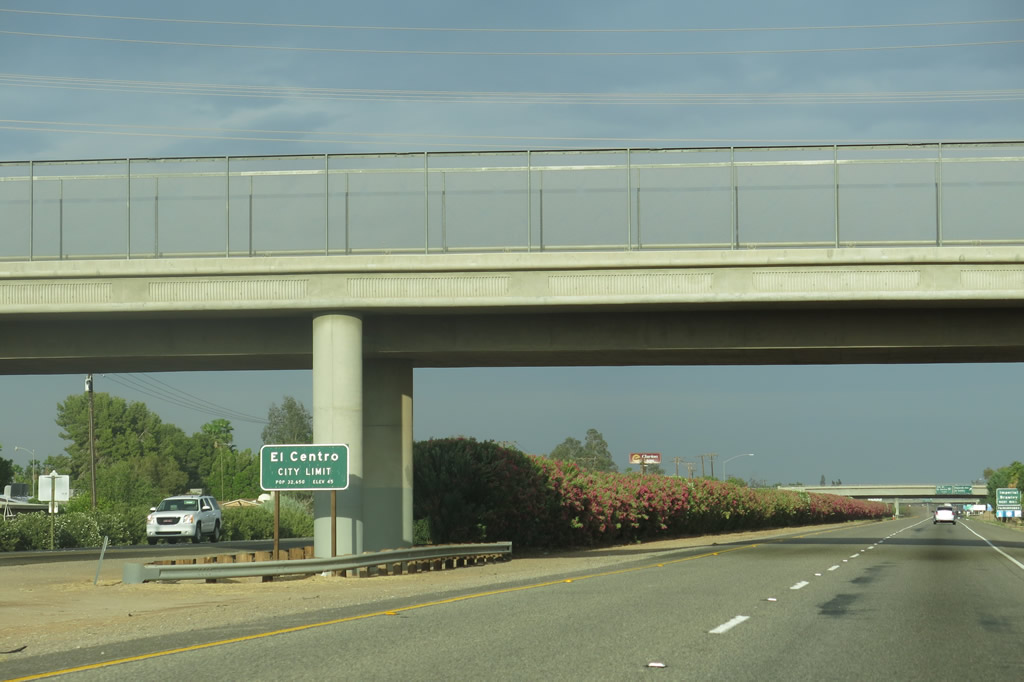
Interstate 8 enters the city of El Centro, the seat of Imperial County. Situated on over 10.75 square miles, El Centro was founded in 1906 and incorporated as a city on April 16, 1908. Built for an agricultural economy, in recent years, El Centro has diversified its economic interests. Its position along Interstate 8 just north of the busy International Border crossing with Mexico in Calexico makes El Centro a formidable player for international trade. Evidence of this kind of growth can be seen on the outskirts of town, such as commercial development along California 111. El Centro has seen significant population growth, from 31,384 as of the 1990 Census to 37,835 people as of the 2000 Census. The city limits sign is visible in the median next to the overpass. Photo taken 04/05/13. |
|
For the first time since leaving El Cajon in San Diego County, eastbound Interstate 8 enters an incorporated city: El Centro. Business Loop I-8 (Imperial Avenue) provides the most direct route to California 86 north. California 86 travels north to the cities of Imperial and Brawley. Photo taken 08/27/04. |
|
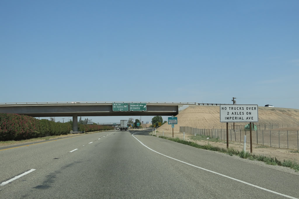
Trucks are restricted on Business Loop I-8 (Imperial Avenue). Through trucks over the size restriction must use California 86 (Fourth Street) (Exit 115). Photo taken 04/05/13. |
|
Eastbound Interstate 8 reaches Exit 114, Business Loop I-8 (Imperial Avenue) in El Centro. The high school in El Centro is visible to the north of the freeway and west of Imperial Avenue. Business Loop I-8 in El Centro starts with Imperial Avenue northbound until it meets Imperial County S-80 (Old U.S. 80) and California 86 near downtown, then returns to Interstate 8 via southbound California 86. Photo taken 08/27/04. |
|
Another eastbound Interstate 8 reassurance shield (standard shape and design) is posted after the Business Loop I-8 (Imperial Avenue) trumpet interchange. Photo taken 08/27/04. |
|
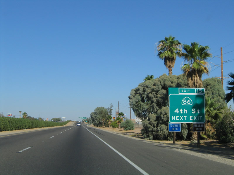
The next along eastbound Interstate 8 is Exit 115, California 86 and Business Loop I-8 (Fourth Street) in El Centro. There is only a one-mile gap between the two business loop exits, since Business Loop I-8 heads north via Imperial Avenue, turns east along Old U.S. 80 through downtown El Centro for about a mile, then turns south via California 86 to return to the Interstate. California 86 is also historically significant as the original alignment of U.S. 99, which was decommissioned in the Imperial Valley in 1963-1964 in favor of California 86. Photo taken 08/27/04. |
|
A lone exit number sign for the interchange with California 86 is posted here, on a relatively new roadside sign. Photo taken 08/27/04. |
|
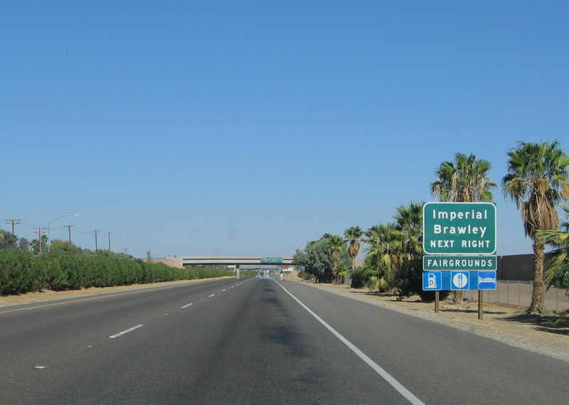
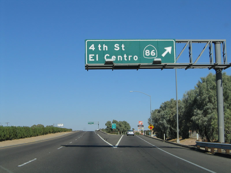
Eastbound Interstate 8 reaches California 86 and Business Loop I-8 (Fourth Street) in El Centro (Exit 115). California 86 is a major north-south route that connects the Imperial Valley with the Coachella Valley to the northwest, skirting the west shore of the Salton Sea on a four-lane, divided expressway for nearly its entire length (excepting a portion through Brawley). Heading south from here, California 86 travels south to Heber, then turns east to consolidate with California 111. Old U.S. 99 then follows California 111 south to Mexico at the primary Calexico port of entry and border crossing. Photo taken 10/05/02. |
|
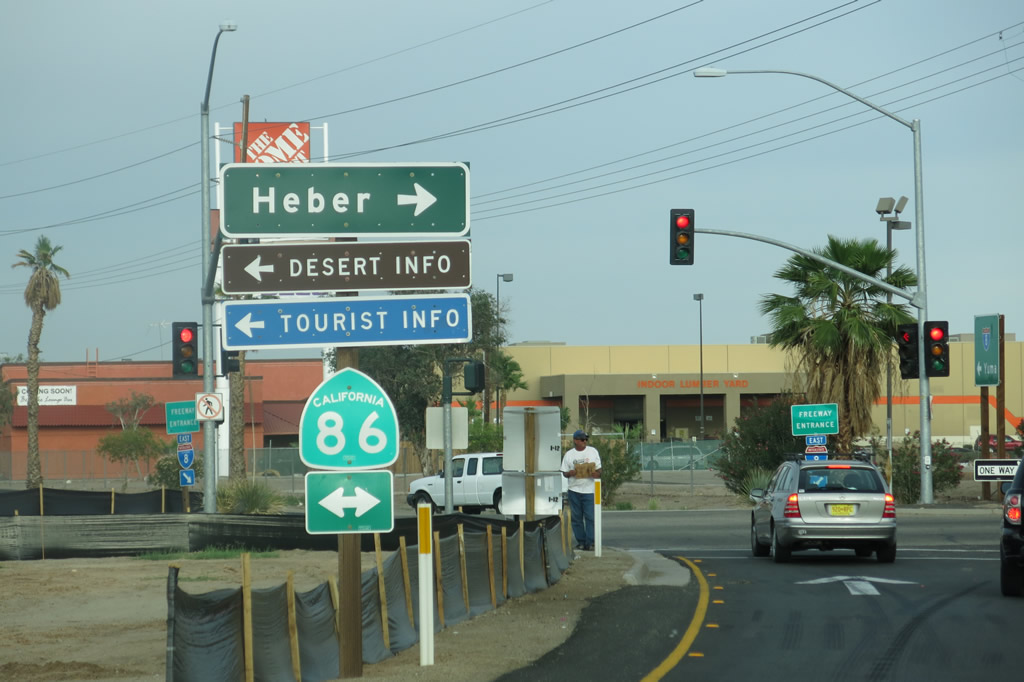
At the bottom of the off-ramp to Exit 115, we find this California 86 trailblazer. Turn left for California 86 and Historic U.S. 99 north to El Centro or right for California 86 and Historic U.S. 99 south to Heber and Calexico. Photo taken 04/05/13. |
Page Updated May 21, 2013.