| Interstate 8/Alvarado Freeway (Kumeyaay Highway) west |
|
Westbound Interstate 8 reaches Exit 14A, Grossmont Center Drive and La Mesa Boulevard. To continue west on Historic U.S. 80, exit here and follow La Mesa Boulevard southwest to the city center. At the split between La Mesa Boulevard and University Avenue, follow La Mesa Boulevard into downtown La Mesa along former U.S. 80 Business; continue straight on University Avenue to continue west on Old U.S. 80. Both roads reconnect with Business Loop I-8 (El Cajon Boulevard) northwest of downtown La Mesa. El Cajon Boulevard resumes at Exit 13A, and Historic U.S. 80 follows the business route west into the city of San Diego. While Interstate 8 uses Mission Valley to connect with the coast, Old U.S. 80 follows El Cajon Boulevard across the central mesa of the city of San Diego. Photo taken 03/19/07. |
|
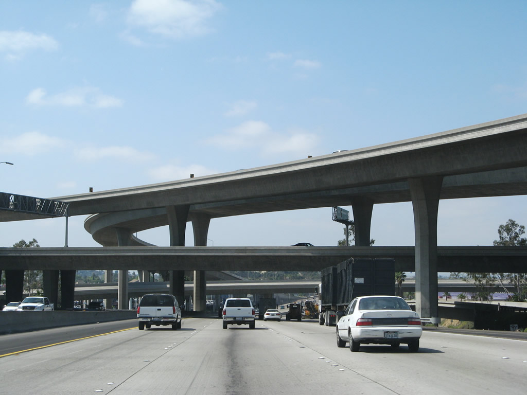
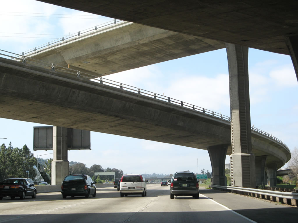
The California 125 interchange is visible in the background; this is the first stack interchange along westbound. It was built in 1989-1992 on top of the original 1961 interchange. Originally, the interchange with California 125 was a cloverleaf... and California 125 south of Interstate 8 was at that time part of California 67. Now one of the tallest stack interchanges in the county, the cloverleaf is a distant memory. Photo taken 03/19/07. |
|
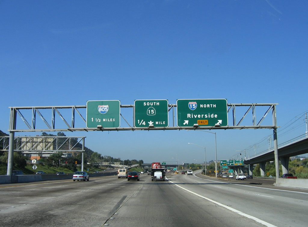
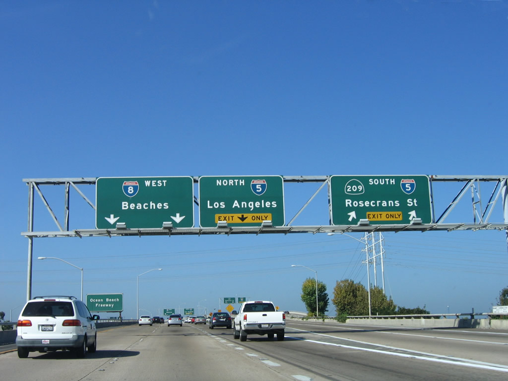
This is the last series of overhead signs that feature San Diego as a control city (last one is at the exit for Business Loop I-8 (El Cajon Boulevard) west). The next pull-through sign, at the junction with Interstate 15, features "Beaches" as the control point for the first time on mainline Interstate 8 west. Photo taken 03/19/07. |
|
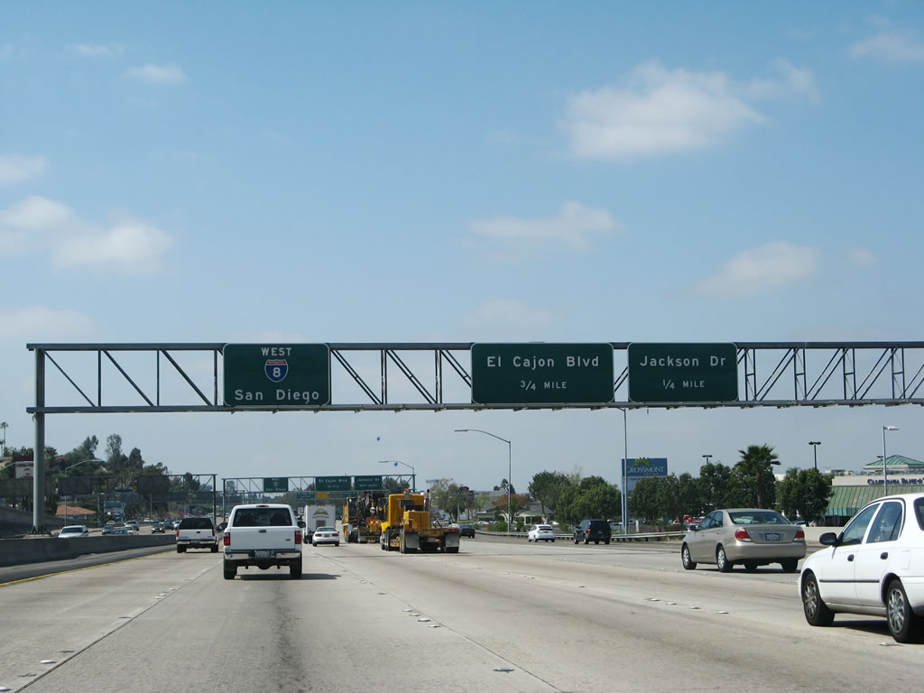
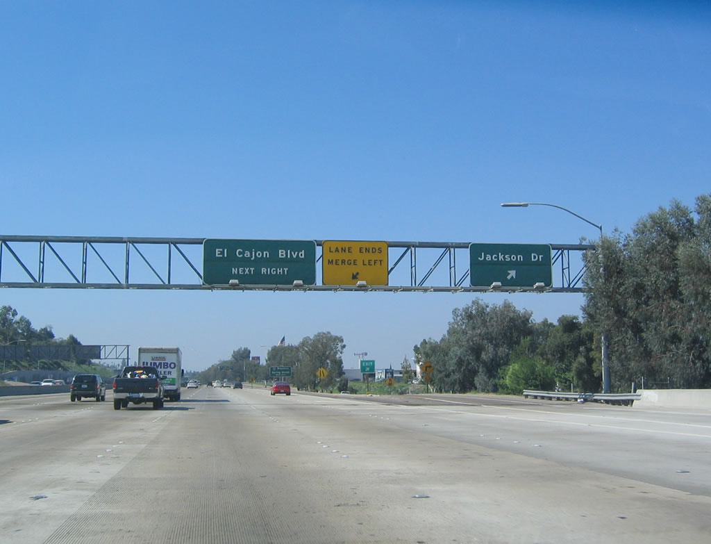
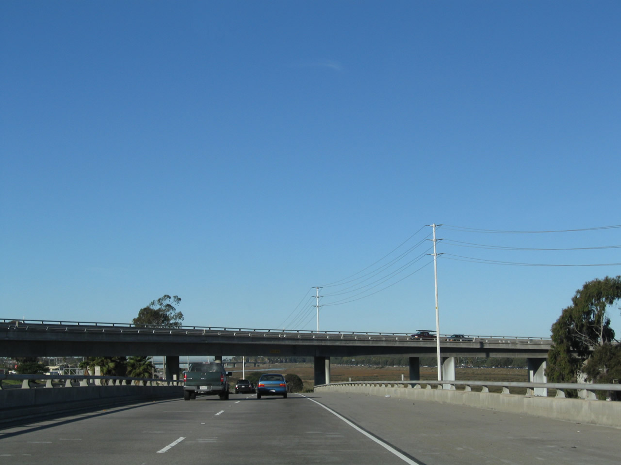
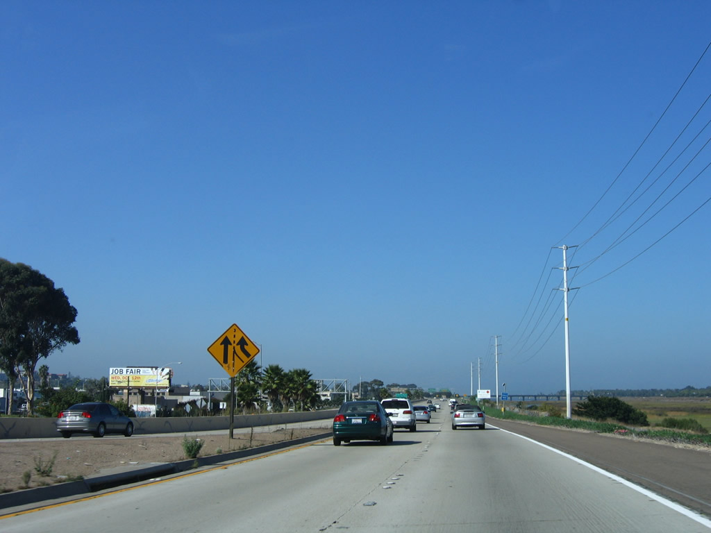
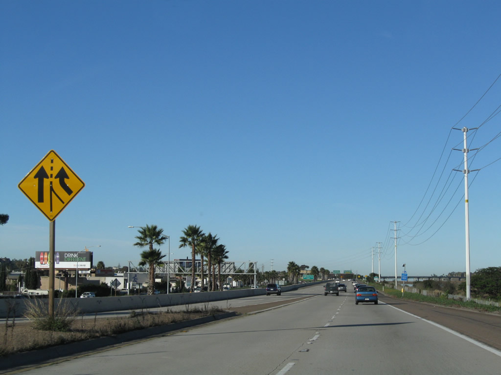
The next two exits along westbound Interstate 8 serve the city of La Mesa, but in different capacities. Exit 13B follows Jackson Drive north to Grossmont Center, while Exit 13A connects to Business Loop I-8 west/El Cajon Boulevard into downtown La Mesa, which is south of the freeway. Photo taken 10/12/03. |
|
Westbound Interstate 8 reaches Exit 13B, Jackson Drive. The next exit is Exit 13A, Business Loop I-8 west/El Cajon Boulevard, with a connection Spring Street south to downtown La Mesa. The section of Interstate 8 between California 125 and Fletcher Parkway was generally built in 1962. Photo taken 10/12/03. |
|
This unusual Business Loop I-8 sign features a red, white, and blue shield with the word "Business" next to it. We have not spotted any similar business route signage anywhere else in the state. The business loop is not signed in La Mesa, sporadically signed in east San Diego, and barely signed west of Interstate 805 (most shields were removed in the North Park community around 2002). The business route ends at the interchange between California 163 and Washington Street, but only one shield remains for it at that interchange. Photo taken 03/19/07. |
|
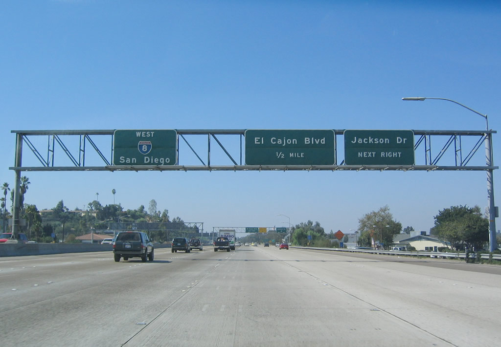
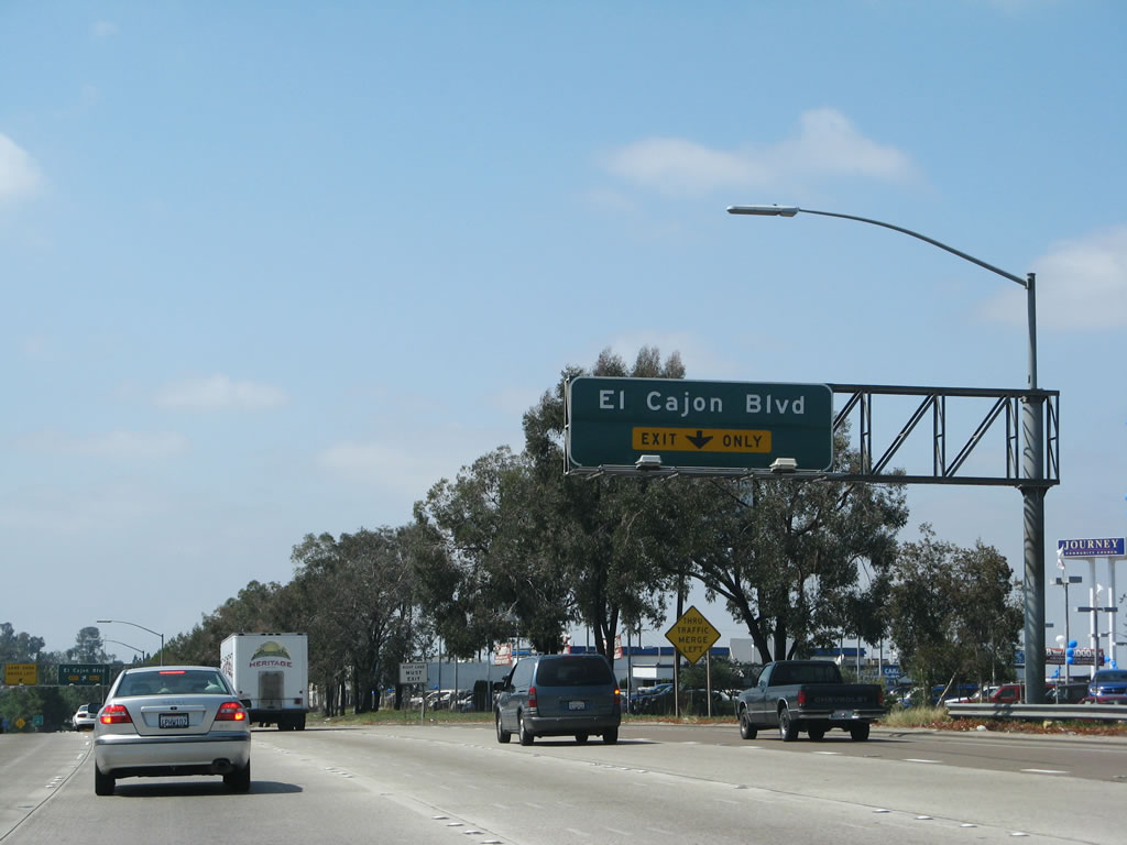
Westbound Interstate 8 approaches Exit 13A, Business Loop I-8 west/El Cajon Boulevard to southbound Spring Street. The auto malls and shopping malls are prevalent to the north of the freeway through here, as Interstate 8 passes through the Grossmont area of La Mesa. Photo taken 03/19/07. |
|
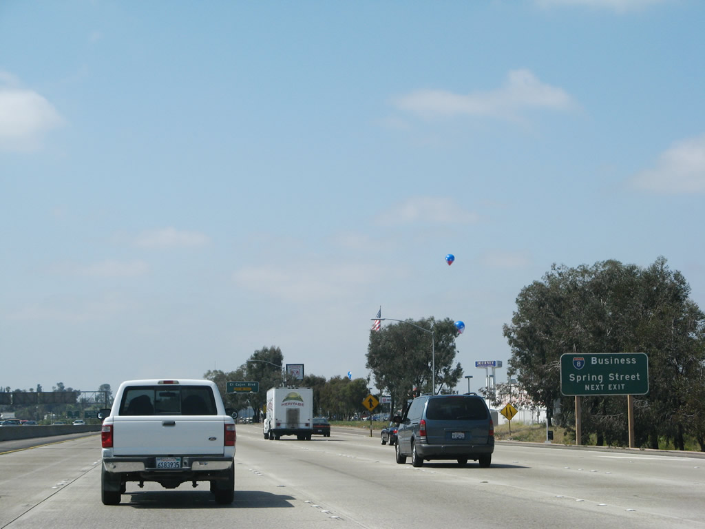
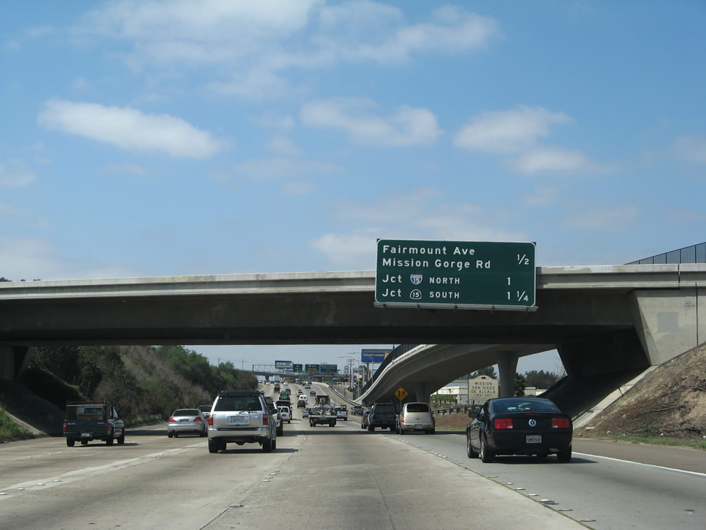
Westbound Interstate 8 reaches Exit 13A, Business Loop I-8 west/El Cajon Boulevard to southbound Spring Street. The business loop follows El Cajon Boulevard, and the exit ramp places traffic directly onto westbound El Cajon Boulevard. Follow Business Loop I-8 for the continuation of Old U.S. 80, which follows El Cajon Boulevard west until its end at Park Boulevard. Old U.S. 80 passes through La Mesa and the following communities and neighborhoods of the city of San Diego: College Area, Rolando, Talmadge, City Heights, and North Park. At Park Boulevard, Old U.S. 80 (1926-1947 alignment) turns south toward Balboa Park and downtown. A more recent alignment of Old U.S. 80 (from 1947 to 1964, after California 163 (Cabrillo Freeway) - Old U.S. 395 was built) continues west along Normal Street and Washington Street to the junction with California 163; the business route follows this course to end at California 163. Photo taken 03/19/07. |
|
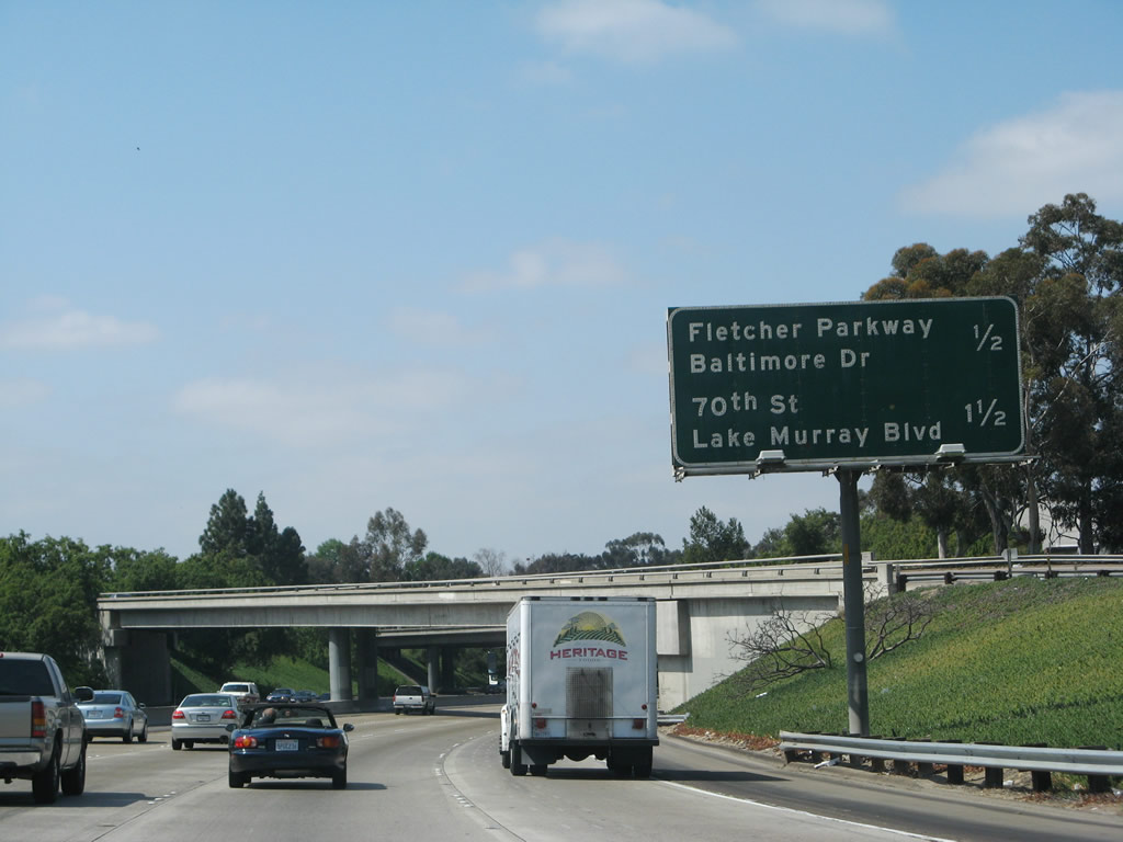
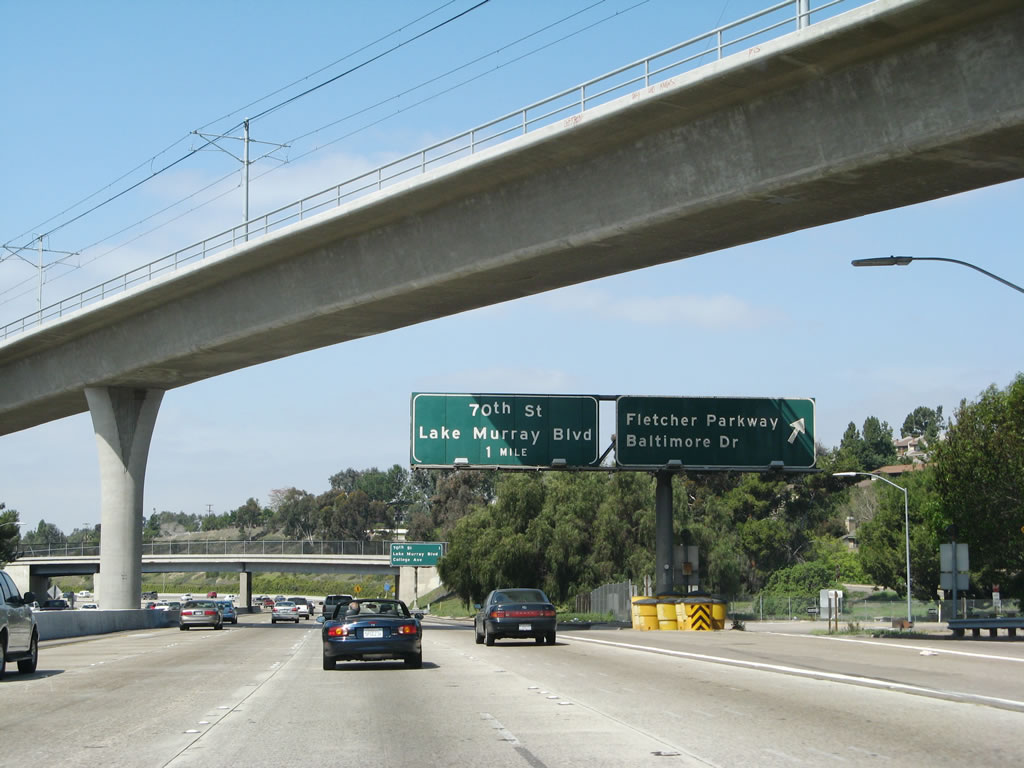
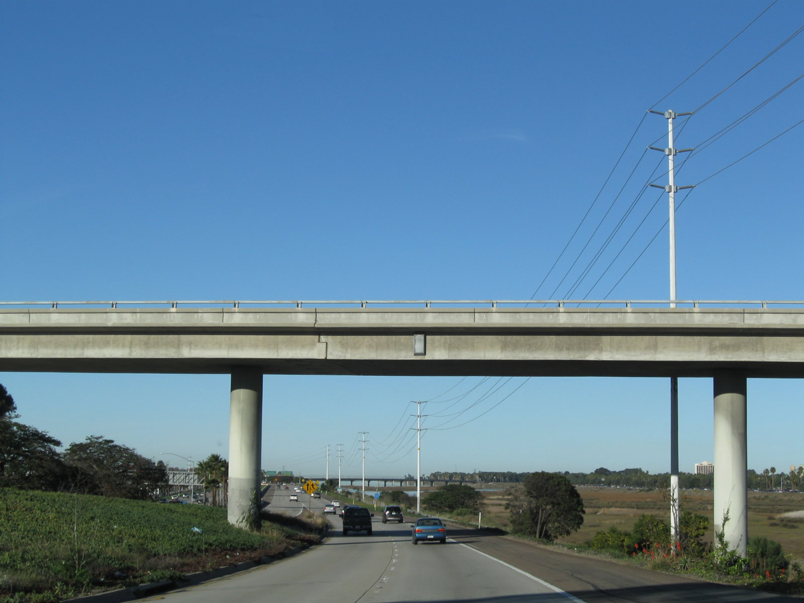
An upcoming exit mileage sign is posted along westbound Interstate 8 as we approach Exit 12, Fletcher Parkway and Baltimore Drive. Fletcher Parkway is a major, six-lane arterial roadway that travels northeast toward Grossmont Center and Fletcher Hills in El Cajon. Early planning maps called for this to be built as a freeway, but instead it has some expressway characteristics, such as access control at regular traffic signals and limited driveway connections. Baltimore Drive is a north-south roadway that extends north toward Lake Murray and the San Carlos neighborhood of San Diego and south toward downtown La Mesa and Old U.S. 80. Photo taken 03/19/07. |
|
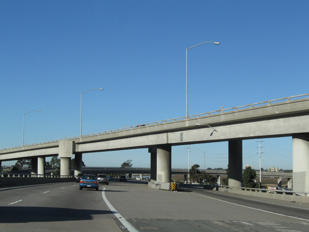
The trolley extension passes above Interstate 8 west at the exit for Fletcher Parkway, Exit 12. The trolley extension was built from Qualcomm Stadium to Grossmont Center via San Diego State University in 2005. From here west to Interstate 5 (Old U.S. 101), the freeway was built in the late 1950s (1956-1959). Most of the bridges and other structures have been expanded to allow for increased capacity since then, so many of the original structures have been replaced. Photo taken 03/19/07. |
|
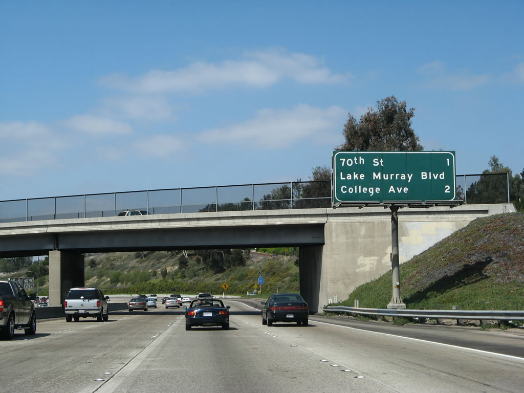
This mileage sign on westbound Interstate 8 provides the distance to the next two exits: Exit 11, 70th Street/Lake Murray Boulevard and Exit 10, College Avenue. Photo taken 03/19/07. |
|
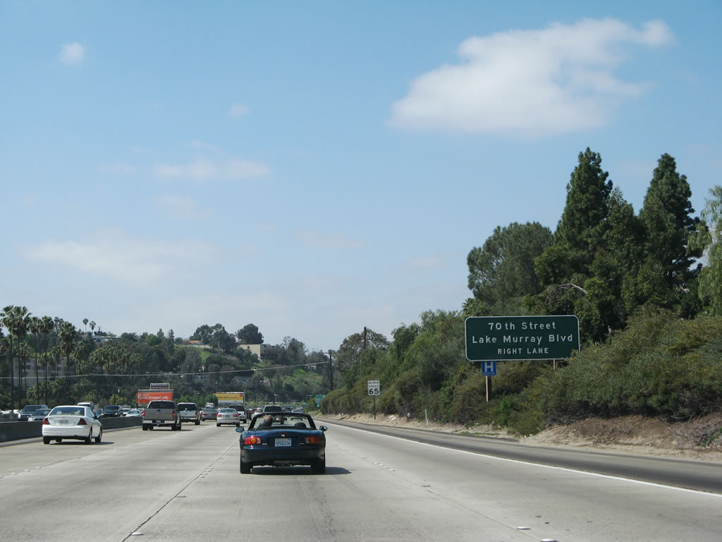
Westbound Interstate 8 approaches Exit 11, 70th Street and Lake Murray Boulevard. Curiously, this is the only numbered street from San Diego's street grid system that intersects Interstate 8. The canyons and Mission Valley prevent additional numbered streets from reaching Interstate 8, although California 163 at one time was known as the 6th Avenue Extension (of course, now that is a freeway). Photo taken 03/19/07. |
|
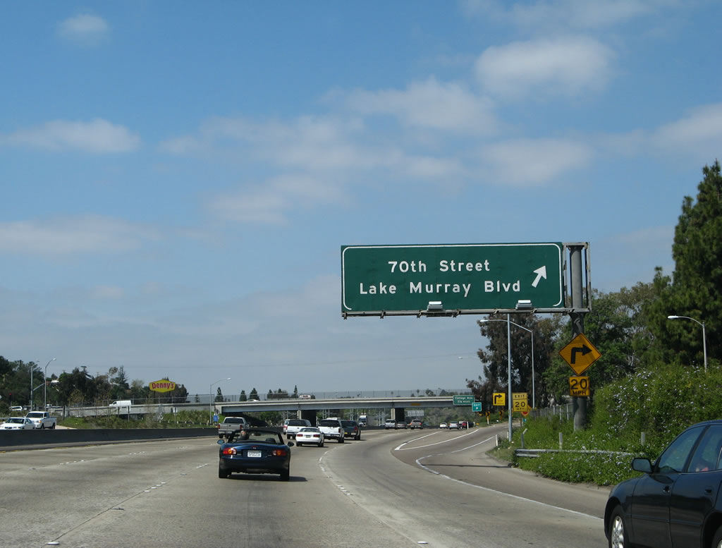
Westbound Interstate 8 reaches Exit 11, 70th Street south into San Diego and Lake Murray Boulevard northeast into La Mesa. Photo taken 03/19/07. |
|
This sign for Exit 10, College Avenue, is mounted on the overpass for 70th Street and Lake Murray Boulevard, an original steel bridge. Interstate 8 enters the city of San Diego and exits La Mesa immediately after this interchange. Photo taken 03/19/07. |
|
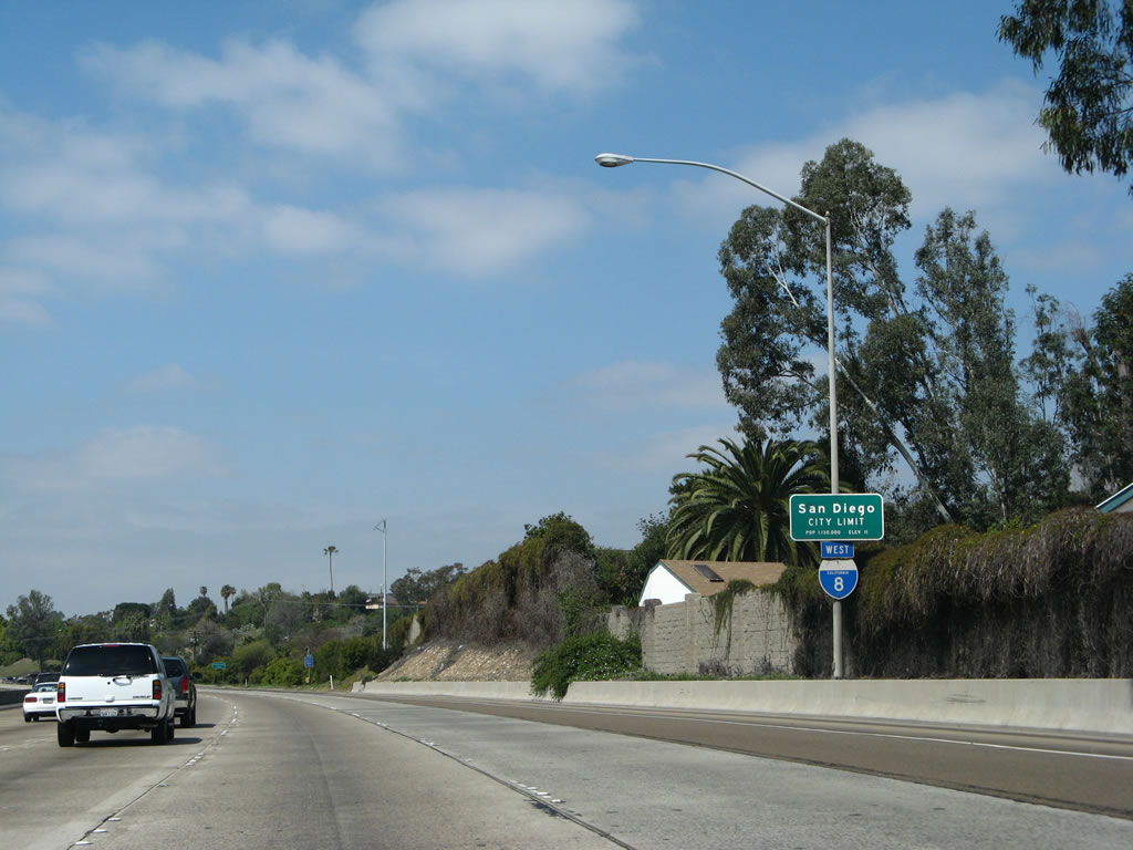
This reassurance shield is posted after the 70th Street and Lake Murray Boulevard as Interstate 8 leaves the city of La Mesa and finally enters the city of San Diego. Home to 1,223,400 people as of the 2000 Census, San Diego was the sixth largest city at that time, but it has since slipped to eighth largest (moving behind Phoenix and San Antonio). Annual precipitation at San Diego International Airport (Lindbergh Field) amounts to 10.77 inches annually, which makes San Diego an arid place. However, the agreeable climate allows for plant growth with sufficient irrigation. Being at the southern end of the state, water is a major concern here, as the vast majority of water is imported from the Colorado River or from Northern California via the State Water Project (California Aqueduct). Growth is expected to continue, despite the fact that San Diego has one of the highest costs of living in the country. Photo taken 03/19/07. |
|
This sign reaffirms that Interstate 8 is the Kumeyaay Highway, both in the city and county of San Diego. The freeway carries other, older names. The stretch between Grossmont Summit and Mission Valley has been referred to as the Alvarado Freeway in the past, but few use that name today. Photo taken 03/19/07. |
|
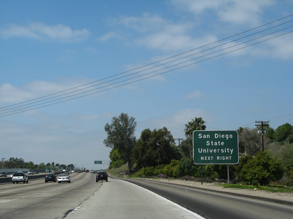
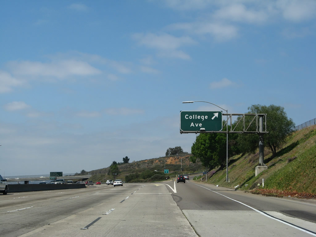
College Avenue south is the best route to reach San Diego State University, but Fairmount Avenue may also be used. San Diego State University is the largest campus in the California State University system in terms of enrollment, and it offers many major and degrees through the Masters level. Publicly offered Ph.D. programs are predominantly offered by the University of California system, not the California State University system. Photo taken 03/19/07. |
|
To the north, College Avenue enters the neighborhood of Del Cerro. The four-lane major arterial has a unique median separation through the community, then comes to an end at Navajo Road. From there northward, Waring Road continues into Allied Gardens, then turns southwest to rejoin Interstate 8 at Exit 9. Photo taken 03/19/07. |
|
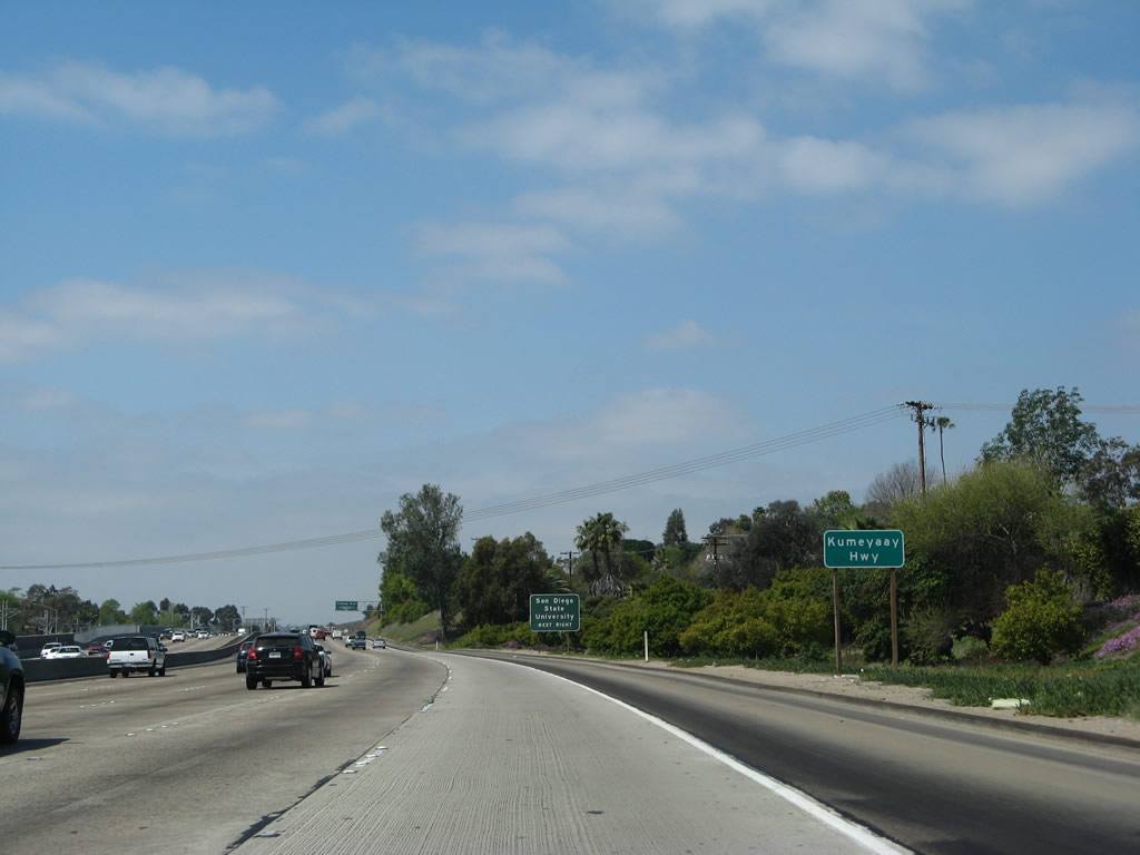
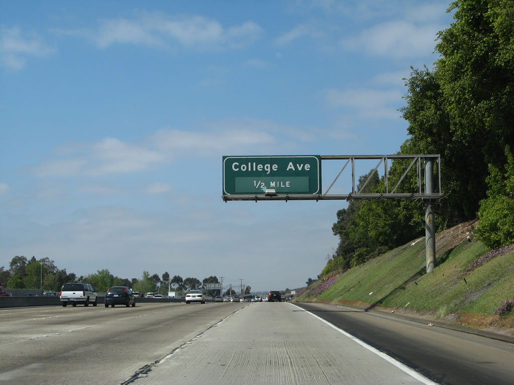
Westbound Interstate 8 reaches Exit 10, College Avenue. Follow College Avenue north to the neighborhood of Del Cerro and to Navajo Road eastbound to Mission Trails. Photo taken 03/09/07. |
| Interstate 8/Mission Valley (Alvarado) Freeway (Kumeyaay Highway) west |
|
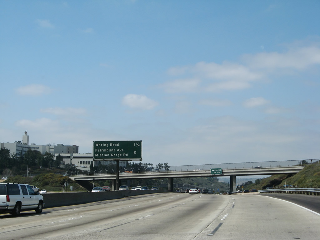
Campanile Tower and the buildings of San Diego State University can be seen on Montezuma Mesa on the south side of Interstate 8 and west of College Avenue. Campanile Tower is the focal point of the campus and is clearly visible on top of the mesa. Construction has been rampant on this campus through the years, and some of the more recent additions (such as the buildings below the tower) can be seen from the freeway, along with a marquee sign for upcoming events and information for San Diego State University students. Back on Interstate 8 west, a mileage sign provides the distance to Exit 9, Waring Road and Exit 8, Mission Gorge Road/Fairmount Avenue. Photo taken 03/09/07. |
|
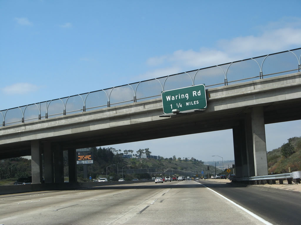
The next exit on westbound is Waring Road, 1.25 miles. Interstate 8 will now descend on a grade from the summit at College Avenue to Mission Gorge/Mission Valley at the bottom over the course of 1.50 miles. In the background, the aforementioned marquee sign (announcing a concert with the band Modest Mouse on May 14) can be seen. Photo taken 03/09/07. |
|
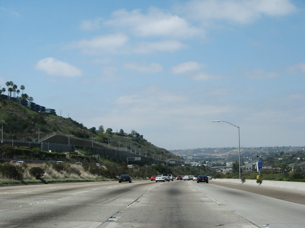
Continuing the descent that has been underway since leaving Grossmont Summit, Interstate 8 prepares to enter Mission Valley. A parallel light rail track was constructed between 2003-2005, and it was cut into the wall of the valley on the south side of the Interstate 8 freeway. The light rail trolley line will follow Interstate 8 into Mission Valley, then cross over the freeway to connect to Qualcomm Stadium. Photo taken 03/09/07. |
|
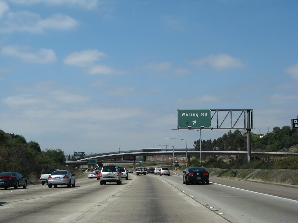
Westbound Interstate 8 reaches Exit 9, Waring Road. Waring Road leads north into Allied Gardens and Grantville before looping back to College Avenue and Navajo Road in Del Cerro. A former trumpet interchange, this area was reconfigured into a tight diamond interchange to accommodate the trolley extension. Photo taken 03/09/07. |
|
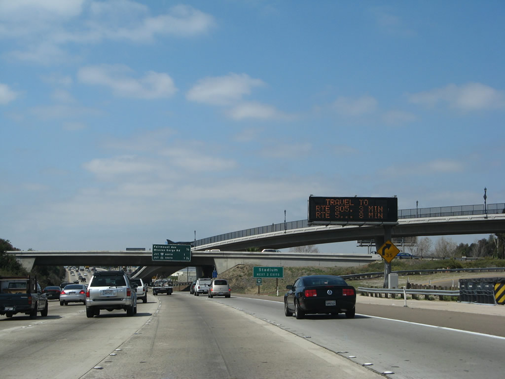
A second variable message sign featuring travel times is posted on westbound Interstate 8/Alvarado Freeway (Kumeyaay Highway). To Qualcomm Stadium, use either Mission Gorge Road north (Exit 8) or Interstate 15 north (Exit 7B) to Friars Road west. Photo taken 03/09/07. |
|
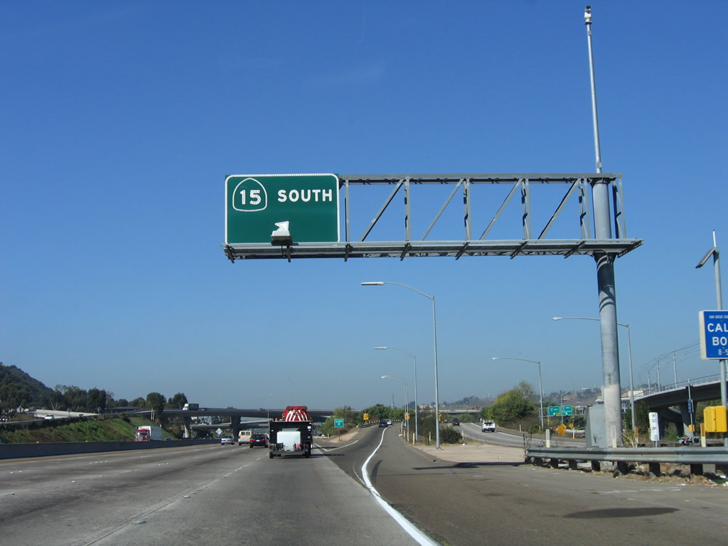
This mileage sign on westbound Interstate 8 provides the distance to Exit 8, Mission Gorge Road and Fairmount Avenue and Exits 7B-A, Interstate 15 and California 15. This sign was put in place in 1998, right after the transition from westbound Interstate 8 to southbound California 15 was reconstructed to eliminate a blind merge. It was one of the last non-reflective, button-copy signs to be placed on a California freeway. Photo taken 03/19/07. |
|
The ramp behind the Waring Road overpass carries Alvarado Canyon Road between Mission Gorge Road and Waring Road. Shown here coming down from Waring Road to Alvarado Canyon Road, this ramp was built as a mitigation measure as part of the trolley construction process, thus reducing local traffic that used to have to use the freeway to make that connection (prior to 2001). This stretch of Interstate 8 west is among the busiest stretches of freeway in all of San Diego County. At this point (approaches two major arterials and Interstate 15), it is six lanes wide. Photo taken 03/09/07. |
|
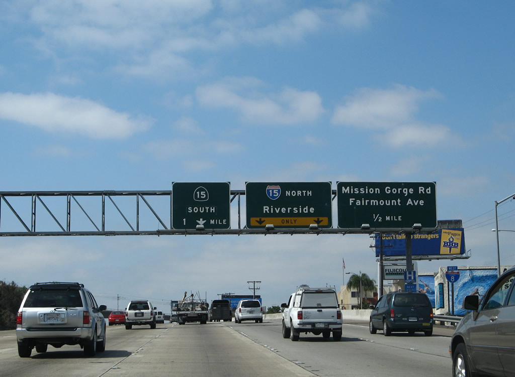
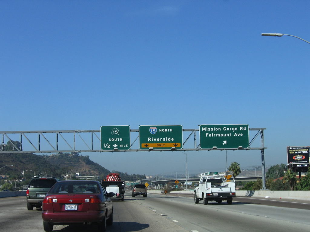
Now approaching Exit 8, Mission Gorge Road and Fairmount Road, Interstate 8 also approaches the major interchange with north-south Interstate 15. The right two lanes become exit only for Exit 7B, Interstate 15 north. Note that despite the construction of California 15 as a freeway through City Heights south of Interstate 8, it is still signed as a state route. This is because of deficiencies in the California 15 freeway corridor near Fairmount Park at the California 94 interchange. Photo taken 03/19/07. |
|
|
In grandiose style, the San Diego Trolley passes over Interstate 8 (Mission Valley Freeway) (Kumeyaay Highway) and approaches the Mission Gorge station, which is elevated. The increased elevation of the trolley tracks is required in order to allow the electric trains a suitable uphill grade. Photos taken 11/10/12 and 03/09/07. |
|
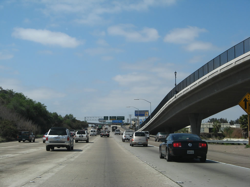
Westbound Interstate 8 reaches Exit 8, Mission Gorge Road northeast to Mission Trails Regional Park and Santee and Fairmount Avenue south to City Heights (with access to eastbound Montezuma Road which leads back to San Diego State University, in case you missed the College Avenue Exit 10). Photo taken 10/10/05. |
|
Immediately after the Mission Gorge Road exit, westbound Interstate 8 reaches Exit 7B, Interstate 15 north to the northern reaches of San Diego, Escondido, Temecula, and Riverside/San Bernardino Counties. Interstate 15 does not pass through its control city of Riverside. The following Exit is Exit 7A, California 15 south. Note the color differences between the 1972 Interstate 805 sign and the 1998 Interstate 15 signs. Photo taken 10/10/05. |
|
The second ramp in the Interstate 15 interchange connects westbound Interstate 8 with Exit 7A, California 15 south. This ramp connects with the collector distributor lanes, then exits on a loop ramp to southbound. Although California 15 is slated for upgrading to Interstate 15, that designation must wait until after the interchange between California 15 and California 94 is reconstructed. Photo taken 10/10/05. |
|
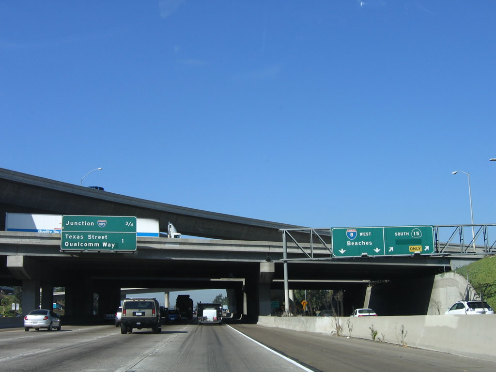
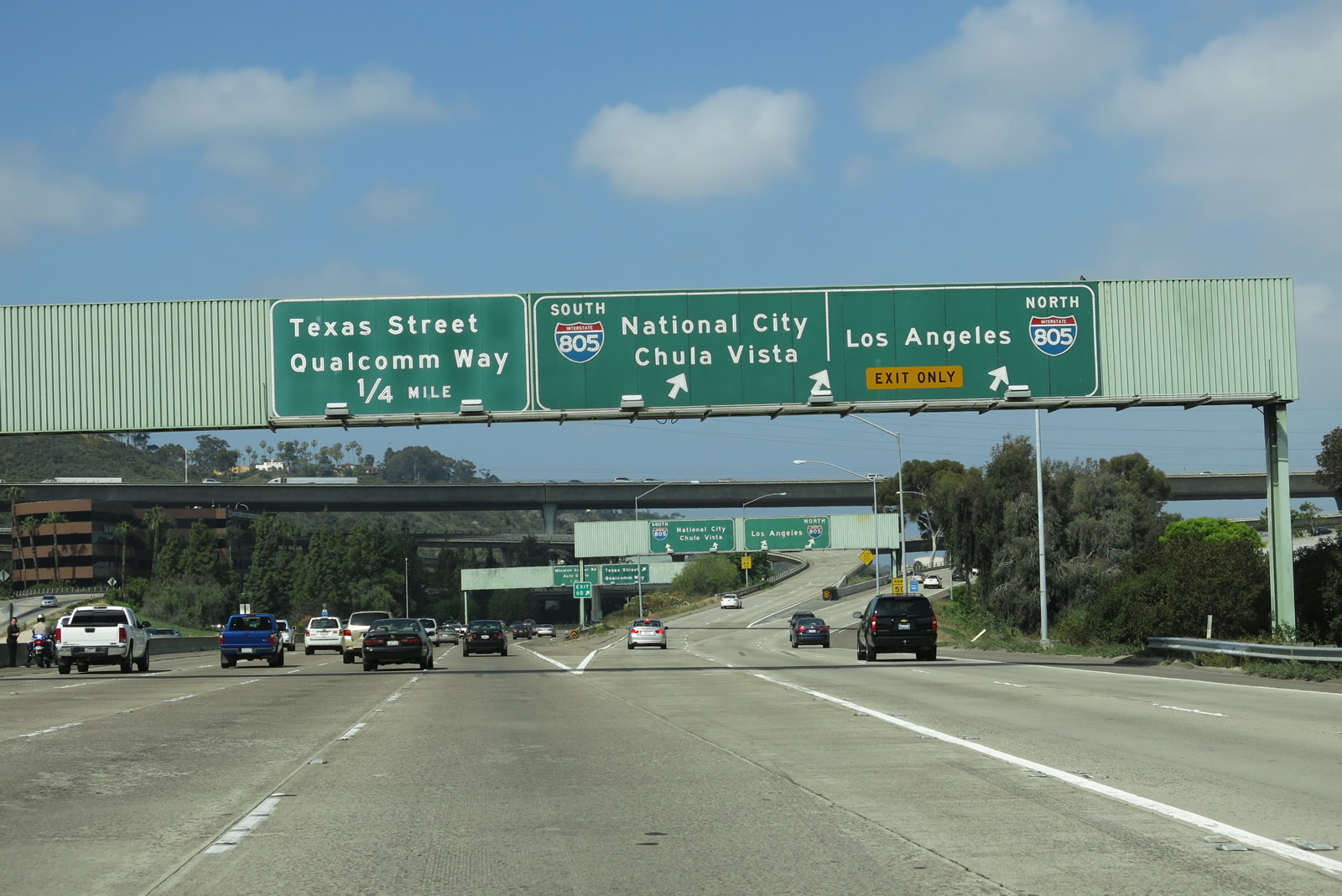
This mileage sign provides the distance to the next two exits: Exit 6B, Interstate 805 and Exit 6A, Texas Street and Qualcomm Way (formerly Stadium Way until 1997, which was the year in which Jack Murphy Stadium was renamed as Qualcomm Stadium). Also note the exit ramp for California 15 south on the collector distributor lanes. Photo taken 10/10/05. |
|
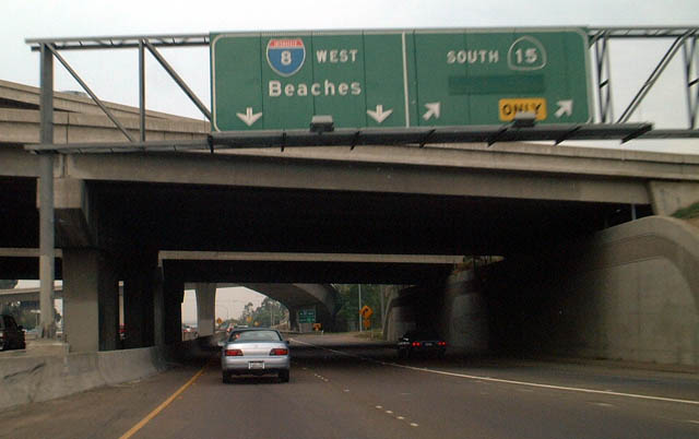
This photo shows the signage along the transition ramp from Mission Gorge Road/Fairmount Avenue southbound to Interstate 8 westbound/Interstate 15 northbound/California 15 southbound. This set of signs is not accessible from the mainline. Photo taken 09/05/02. |
|
Now on the transition ramp from Mission Gorge Road/Fairmount Avenue southbound to Interstate 8 west, we approach the California 15 south split (also shown from main lanes previously). As part of the construction of the California 15 freeway through Mid-City along 40th Street, a new ramp was placed to facilitate traffic flow from westbound Interstate 8 onto southbound California 15. Prior to the improvement, traffic had to enter this transition ramp from the left, then cut across three lanes of traffic to get to this right clover exit. This was corrected with the use of a flyover ramp that moved traffic over the three lanes of traffic and directly into the exit only lane for California 15. Photo taken 09/05/02. |
|
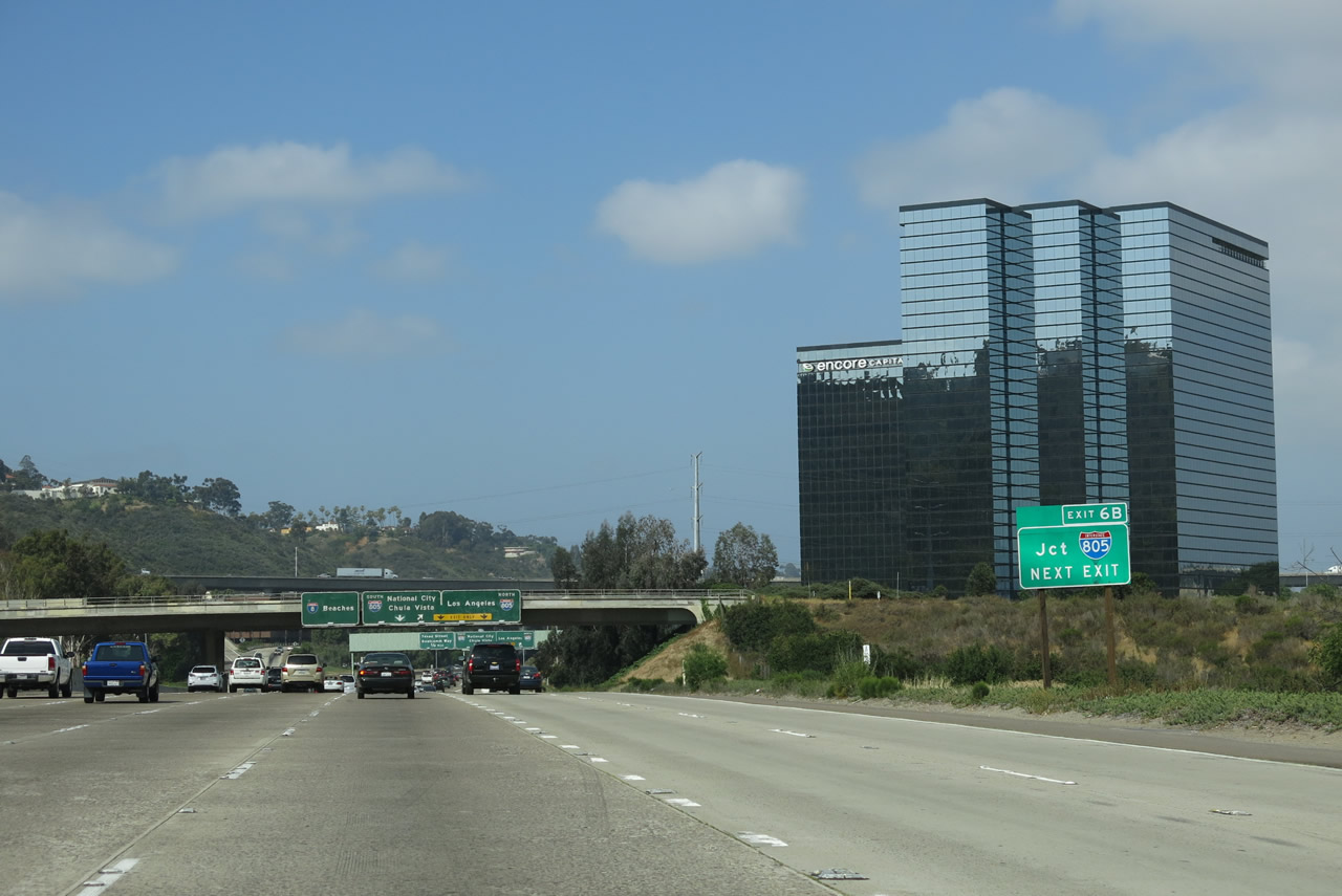
The next exit along westbound Interstate 8 is Exit 6B, Interstate 805 north to Santa Ana and Los Angeles and south to National City and Chula Vista. The far right lanes came in from Interstate 15 and Mission Gorge Road, and they become two exit-only lanes for Interstate 805. Photo taken 05/23/13. |
|
A lone exit number sign is posted prior to the Interstate 805 interchange. It is very small and barely noticeable for traffic moving along the six lanes of westbound Interstate 8. Photo taken 05/23/13. |
|
Another set of overhead signs greet westbound travelers. The Interstate 805 interchange was constructed in 1972, including the massive bridge that spans Mission Valley. On the sign (which is posted on the Mission City Parkway overcrossing), note the extra arrow that used to be covered by an overlay. The overlay fell off in 1999, and no one has fixed it since. Photo taken 05/23/13. |
|
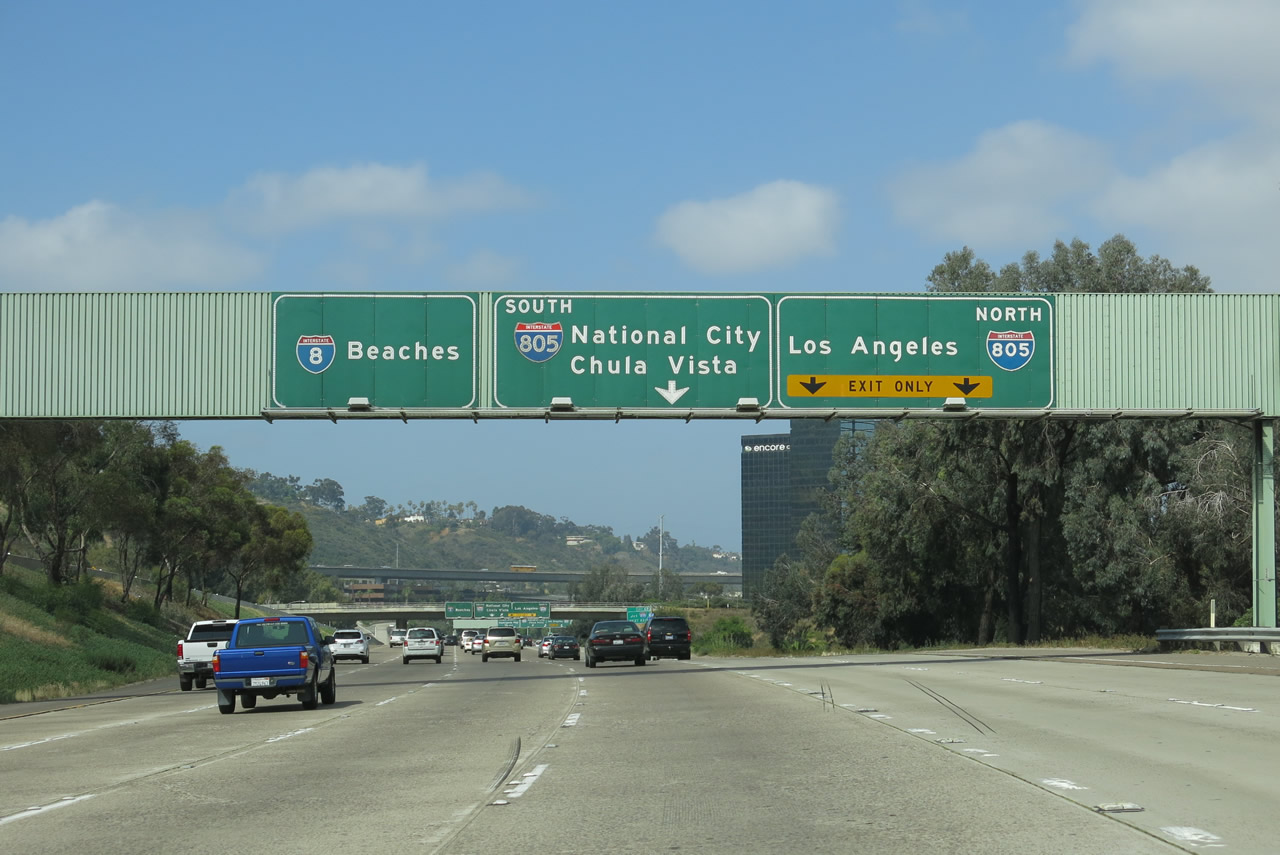
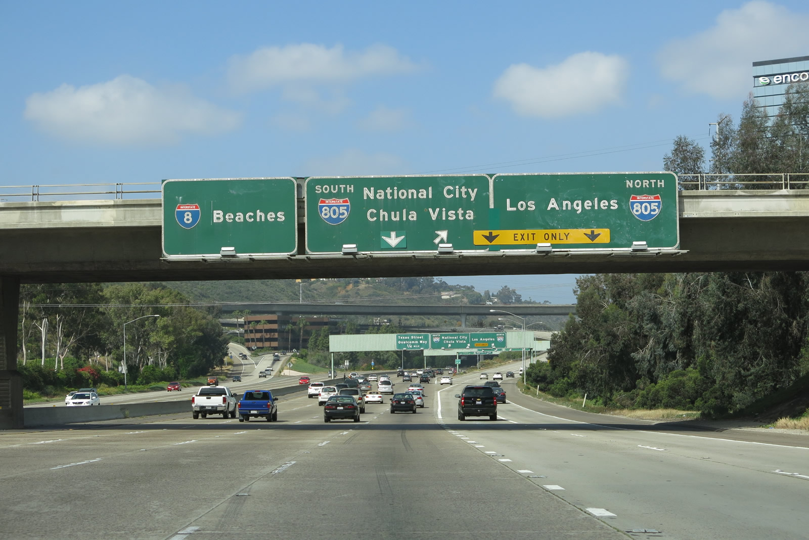
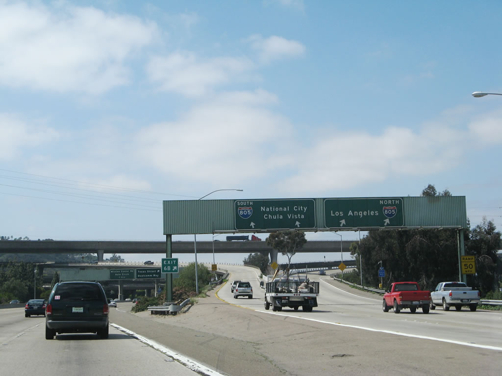
Westbound Interstate 8 meets Exit 6B, Interstate 805 (Dekema Freeway). Use Interstate 805 south to the City Heights, North Park, and Southeastern San Diego communities of San Diego; south of California 252, Interstate 805 departs San Diego and enters the city of National City, a southern suburb of San Diego. Continuing south, Interstate 805 is the primary route to Chula Vista's booming eastern suburban neighborhoods, and it reenters the city of San Diego upon crossing the Otay River Valley. After intersecting California 905, Interstate 805 ends as it merges with Interstate 5 just north of the international border crossing at San Ysidro. Photo taken 10/10/05. |
|
The right two lanes exit only onto Interstate 805, and the ramp splits: the left two lanes connect to Interstate 805 south, while the right two lanes connect to Interstate 805 north. Note the control city of Los Angeles for Interstate 805 north; Interstate 805 does not leave San Diego, so it is using the control city for Interstate 5 north (which technically is Santa Ana, the seat of Orange County - but Santa Ana is not nearly as well known as Los Angeles). Photo taken 03/19/07. |
|
Westbound Interstate 8 reaches Exit 6A, Qualcomm Way and Texas Street. This is a good route to take to Qualcomm Stadium (home of the National Football League's San Diego Chargers and San Diego State University Aztecs as well as the college football Holiday Bowl and Poinsettia Bowl) from westbound, as is Mission Gorge Road. The Interstate 805 interchange looms in the background. When Jack Murphy Stadium was renamed as Qualcomm Stadium in 1997, Stadium Way was renamed as Qualcomm Way at the same time. Photo taken 05/23/13. |
|
|
|
|
|
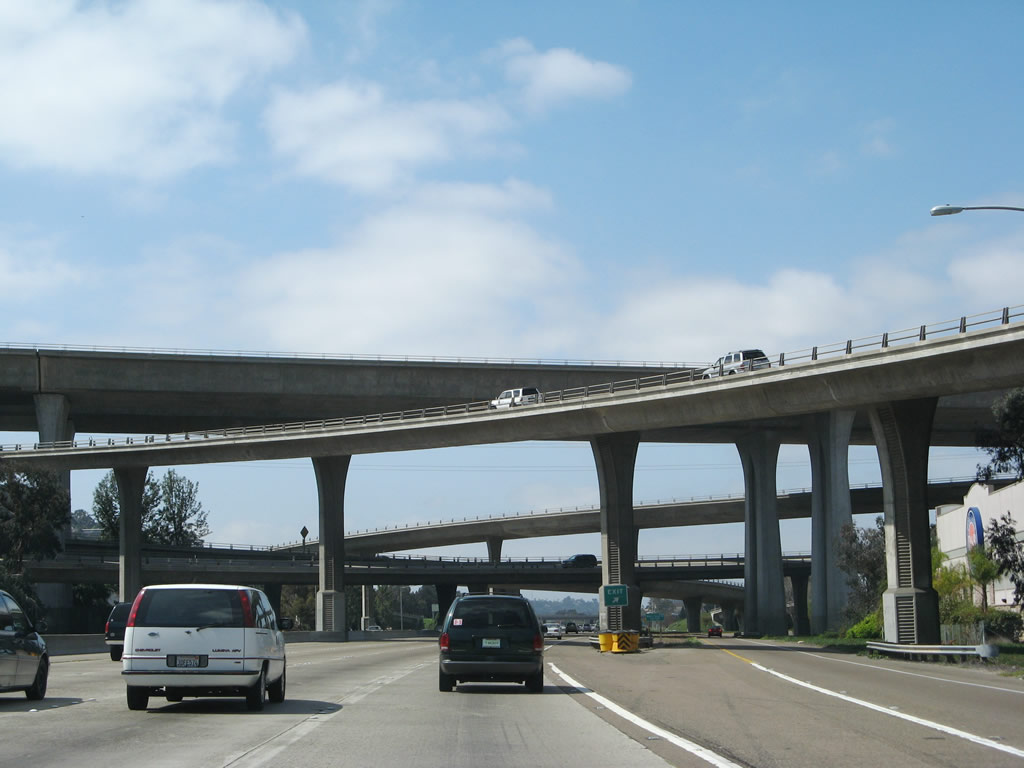
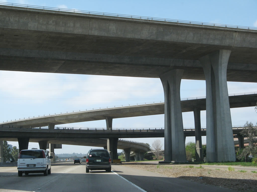
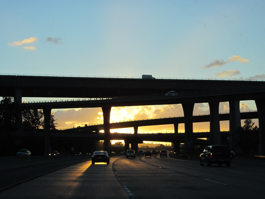
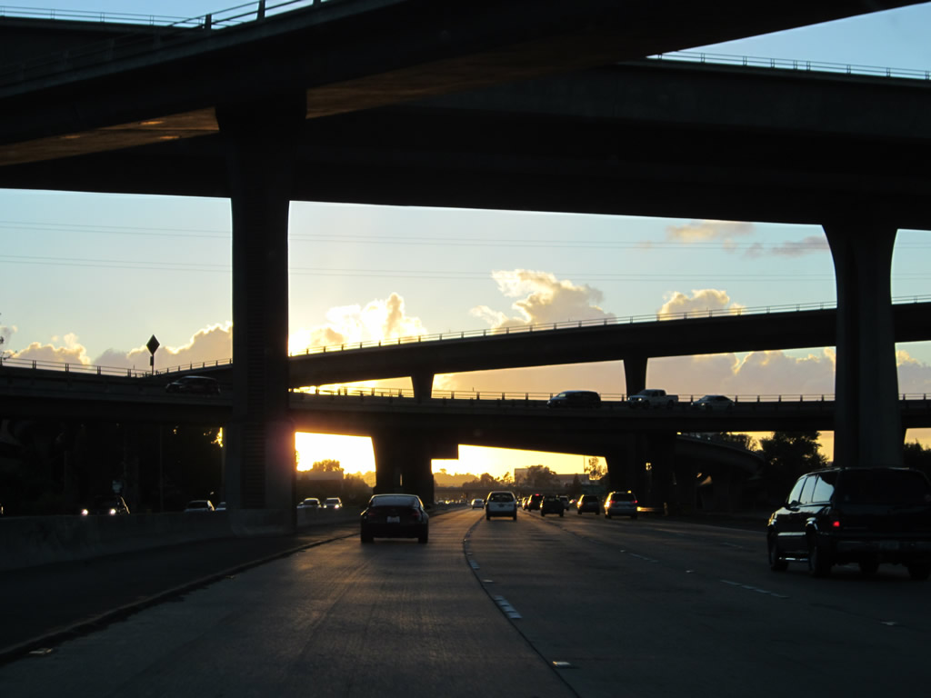
| This suite of photos shows the Interstate 805 interchange complex as seen from westbound Interstate 8. The tall Interstate 805 bridge is known as the Jack Schrade Memorial Bridge; the entire web of ramps was built in 1972. This is the only symmetrical stack interchange in San Diego County. Photos taken 03/19/07 and 11/10/12. |
|
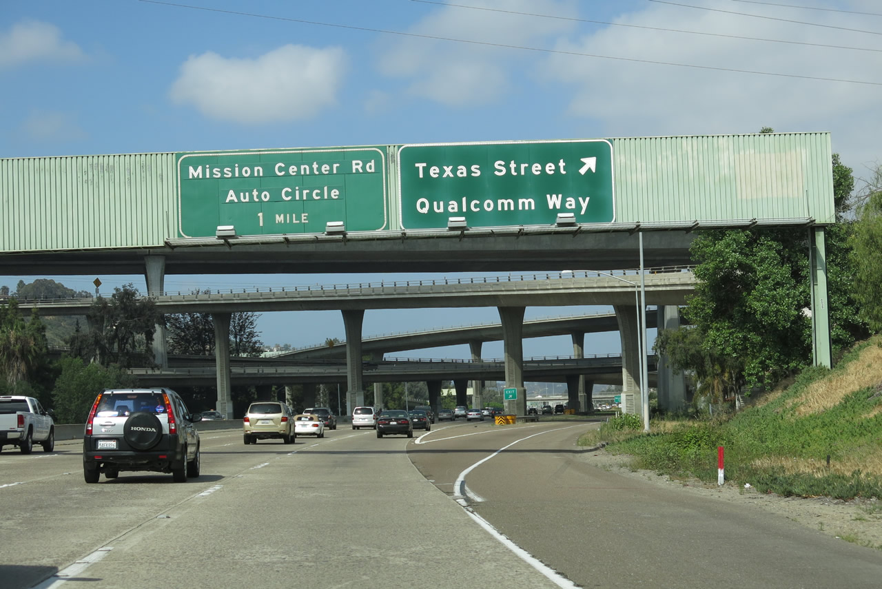
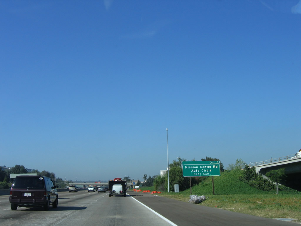
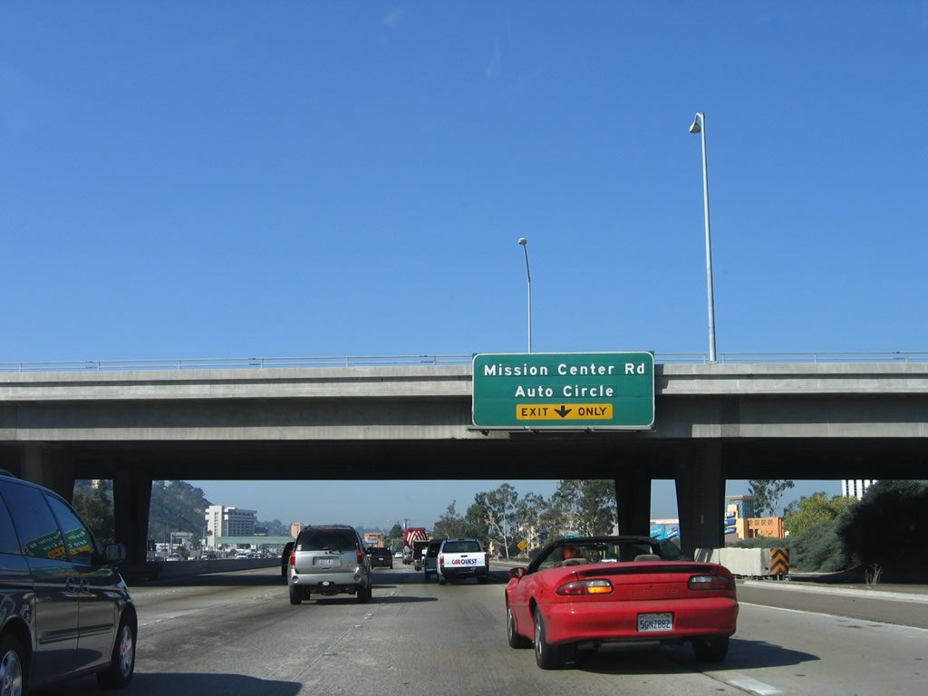
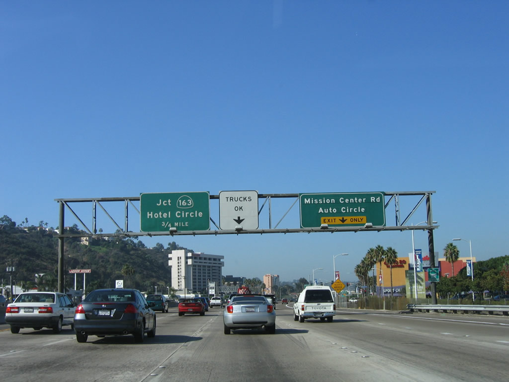
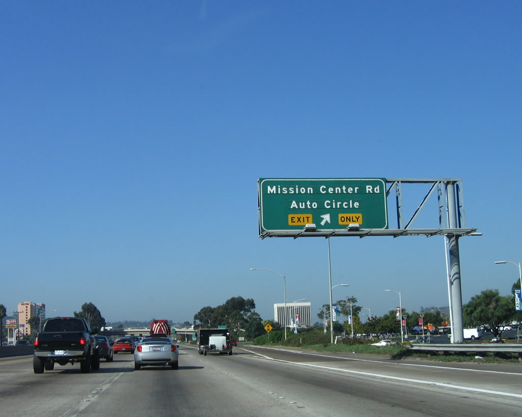
The next exit on westbound is Exit 5, Mission Center Road and Auto Circle, one of the main access routes into one of the region's largest commercial areas. Photo taken 10/10/05. |
|
Westbound Interstate 8 approaches Exit 5, Mission Center Road and Auto Circle. Auto Circle is a designation only for the overpass over Interstate 8; Mission Center Road continues north from the freeway into Mission Valley, intersecting with Friars Road a mile or so north of here. The trucks only lane sign indicates that the fourth lane will become exit only, so trucks should merge left. Photo taken 10/10/05. |
|
The right lane becomes exit only for Exit 5, Mission Center Road and Auto Circle. The next interchange is with California 163 (Exits 4B-A). Photo taken 10/10/05. |
|
Westbound Interstate 8 reaches Exit 5, Mission Center Road and Auto Circle. This exit is extremely busy during the evenings and nights to serve the shopping mall and movie crowd. In addition, there is not much vehicle storage on the short off-ramps, so sometimes traffic will back up onto the freeway. Photo taken 10/10/05. |
|
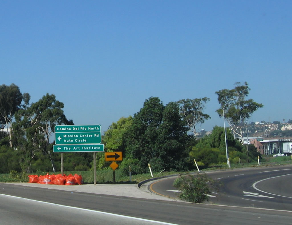
Once on the exit ramp, this sign advises that the exit ramp actually ends at Camino del Rio North. Turn left to connect to Mission Center Road and Auto Circle. The overpass ahead carries Mission Center Road and Auto Circle over the freeway. Photo taken 10/10/05. |
|
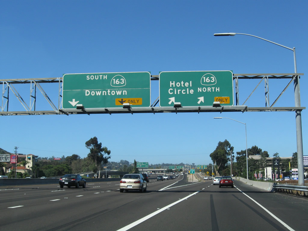
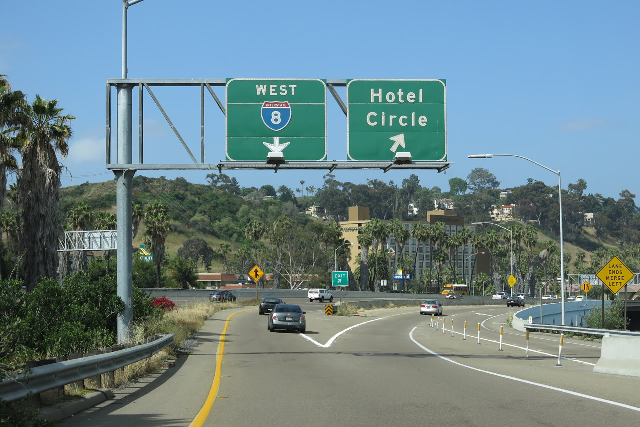
The next exit along Interstate 8 west is Exit 4B, California 163 north and Hotel Circle and Exit 4A, California 163 south to downtown. This exit numbering sequence is different from eastbound because one exit is used for Hotel Circle (Exit 4A), then California 163 south and north (Exits 4B-C). California 163 is another north-south freeway; it travels south through Hillcrest and Balboa Park to downtown San Diego. To the north, California 163 travels to Linda Vista and Kearny Mesa before merging into Interstate 15 near Miramar Marine Corps Air Station. Photo taken 05/23/13. |
|
Westbound Interstate 8 reaches Exit 4B, California 163 (Cabrillo Freeway) north and Hotel Circle west. Through traffic for Interstate 8 may exit here and reconnect back to Interstate 8; just follow the signs for Hotel Circle. The next ramp along Interstate 8 west will connect to Exit 4A, California 163 (Cabrillo Freeway) south to downtown. California 163 is old U.S. 395, which was moved onto the freeway back in 1947 when the first section of the Cabrillo Freeway was built through Balboa Park. Photo taken 08/23/10. |
|
Upon exiting at Exit 4B, the ramp splits. Stay right for California 163 north and Friars Road. Stay left for Hotel Circle or to return back to Interstate 8 west. Photo taken 08/23/10. |
|
Staying right on the transition ramp, traffic from Interstate 8 east and west merge to connect to California 163 north and Friars Road. Stay left for California 163 or right for Friars Road east/west in Mission Valley. Photo taken 08/23/10. |
|
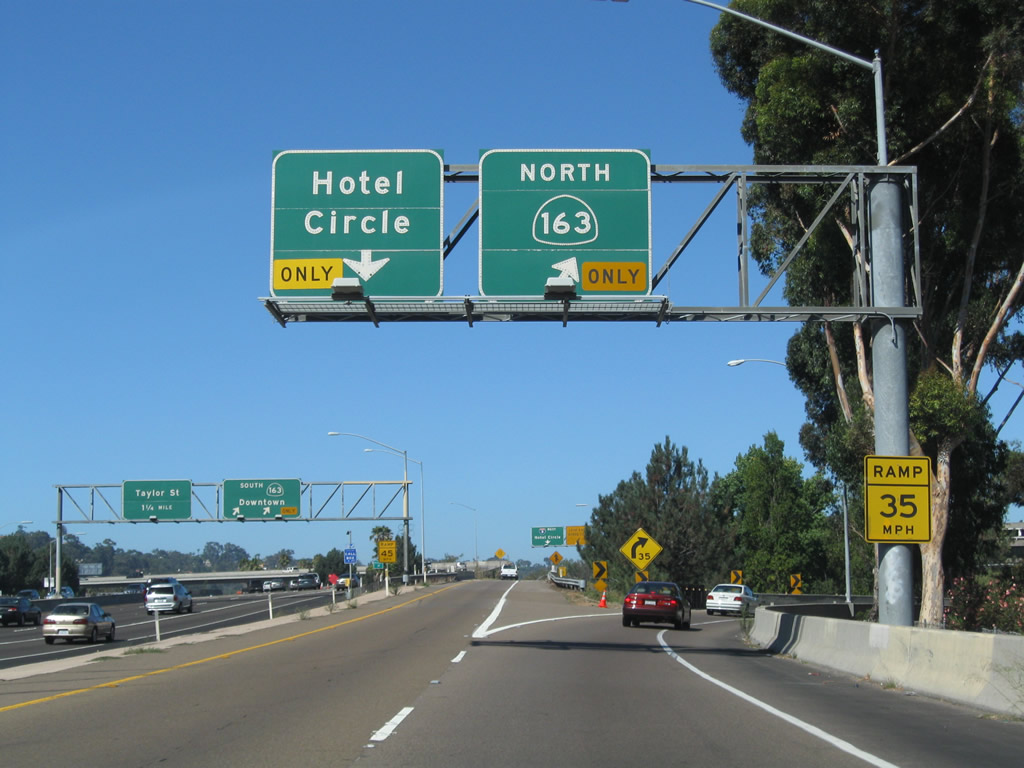
Staying left on the transition ramp, a ramp from California 163 north joins on the right side. The lanes merge together into one lane at we cross over California 163 and then split between a return to Interstate 8 west and a ramp to Hotel Circle North. Photo taken 05/23/13. |
|
The single lane splits. Aim left for the return to Interstate 8 west, or turn right to connect with Hotel Circle North. Photo taken 05/23/13. |
|
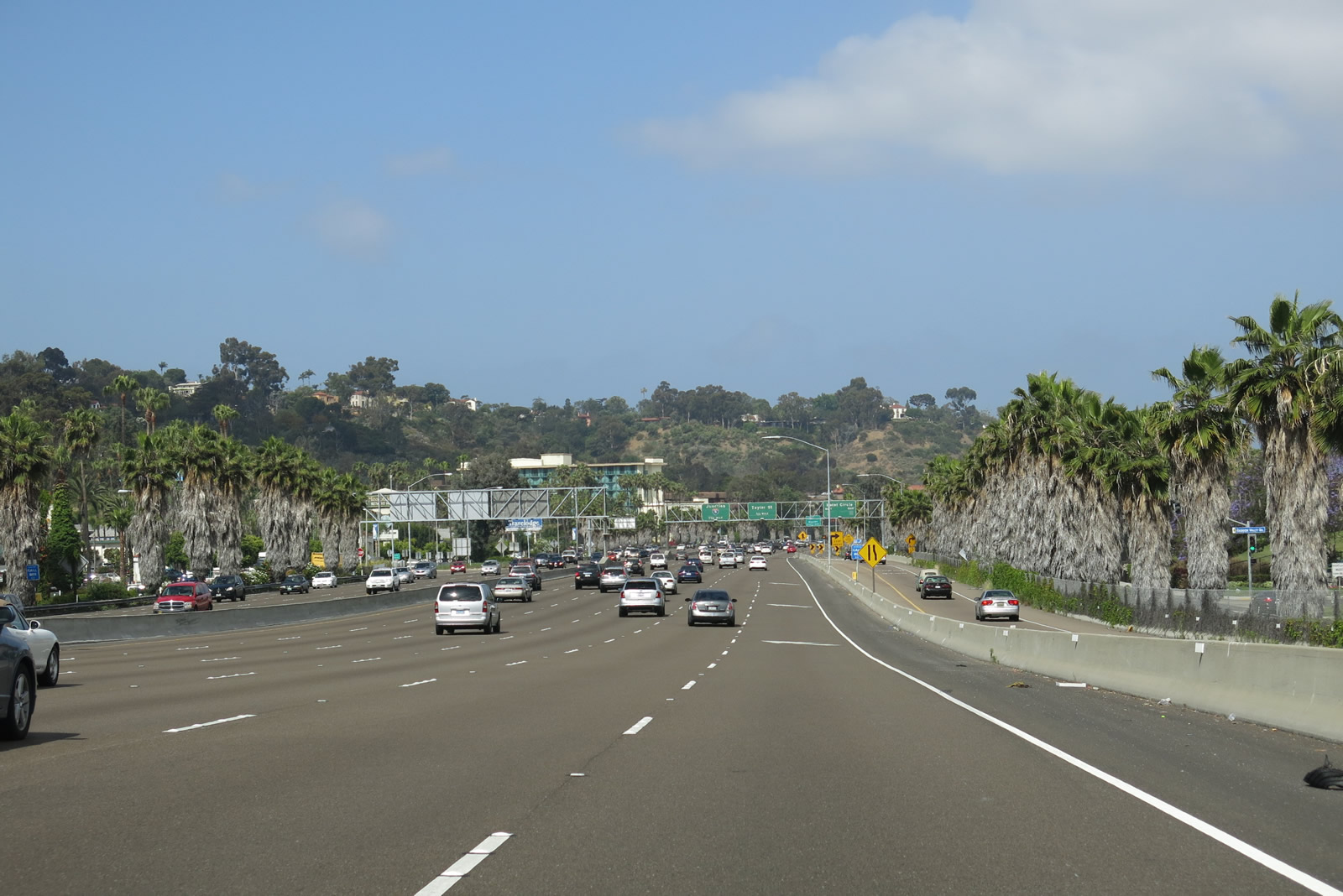
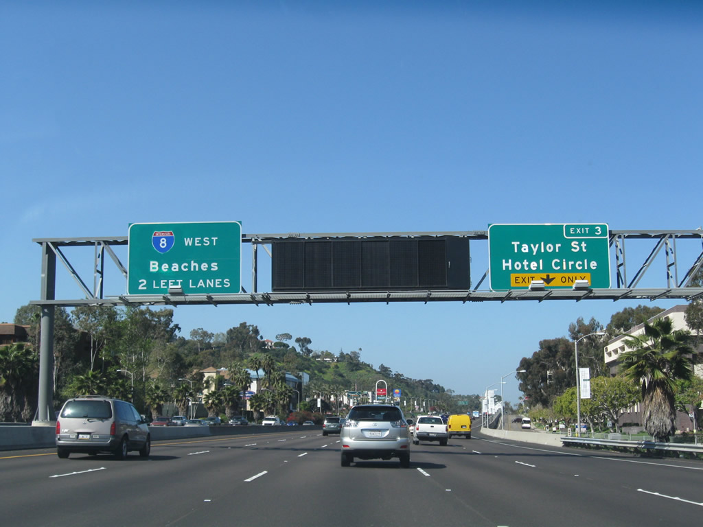
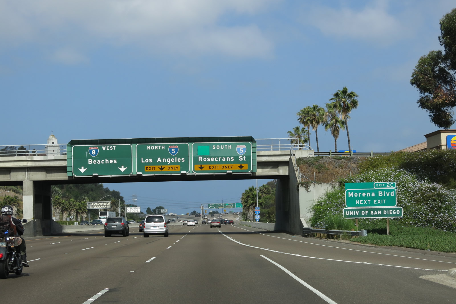
Back on the mainline, this mileage sign marks the first appearance of an Interstate 5 sign along westbound Interstate 5. Prior to Interstate 5, there are exits for Exit 4A, California 163 south; Exit 3, Taylor Street/Hotel Circle; and Exit 2C, Morena Boulevard (former U.S. 101). Photo taken 10/10/05. |
|
Immediately thereafter, westbound Interstate 8 reaches Exit 4A, California 163 south to downtown San Diego. The freeway narrows to three through lanes along westbound, but it will quickly swell back to five lanes between California 163 and Interstate 5. The next exit is Taylor Street/Hotel Circle (Exit 3). Photo taken 10/10/05. |
|
This flyover ramp connects Interstate 8 (Kumeyaay Highway) west with California 163 (Cabrillo Freeway) south to downtown San Diego. It was constructed in 1991. Photo taken 10/10/05. |
|
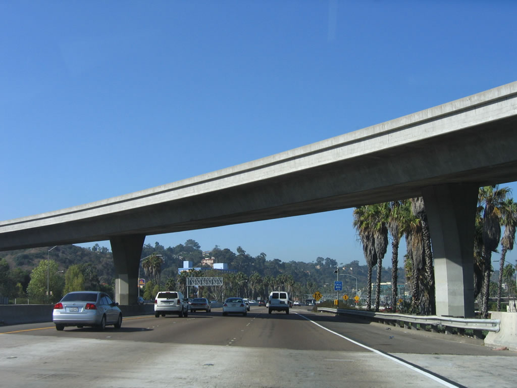
After the Interstate 8/California 163 interchange, the freeway again widens to six lanes, plus a single lane off-ramp to Hotel Circle that is blocked from the main lanes by a jersey barrier. The freeway is paved in asphalt rather than concrete due to its location along the former bottom of the San Diego River, which now flows about an eighth of a mile north of here and parallel to the freeway. The San Diego River's course has been altered several times within Mission Valley to accommodate the built environment and to inhibit flooding. Photo taken 05/23/13. |
|
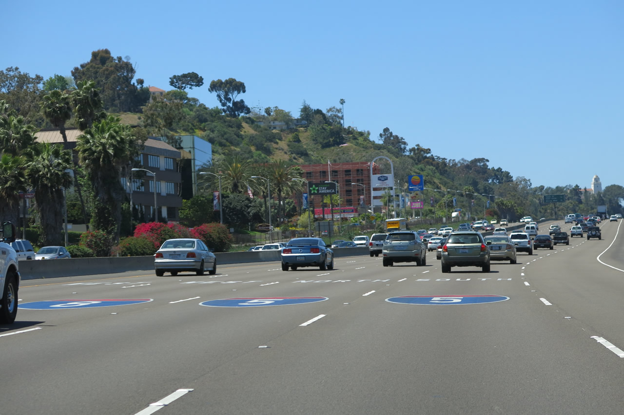
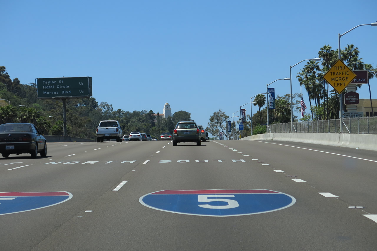
Due to the pending junction with Interstate 5 and multiple exits over a short period of time, Caltrans took the innovative step in November 2012 to add route markers onto the pavement to help motorists choose the correct lane for Interstate 8 west, Interstate 5 north, and Interstate 5 south. Photo taken 05/23/13. |
|
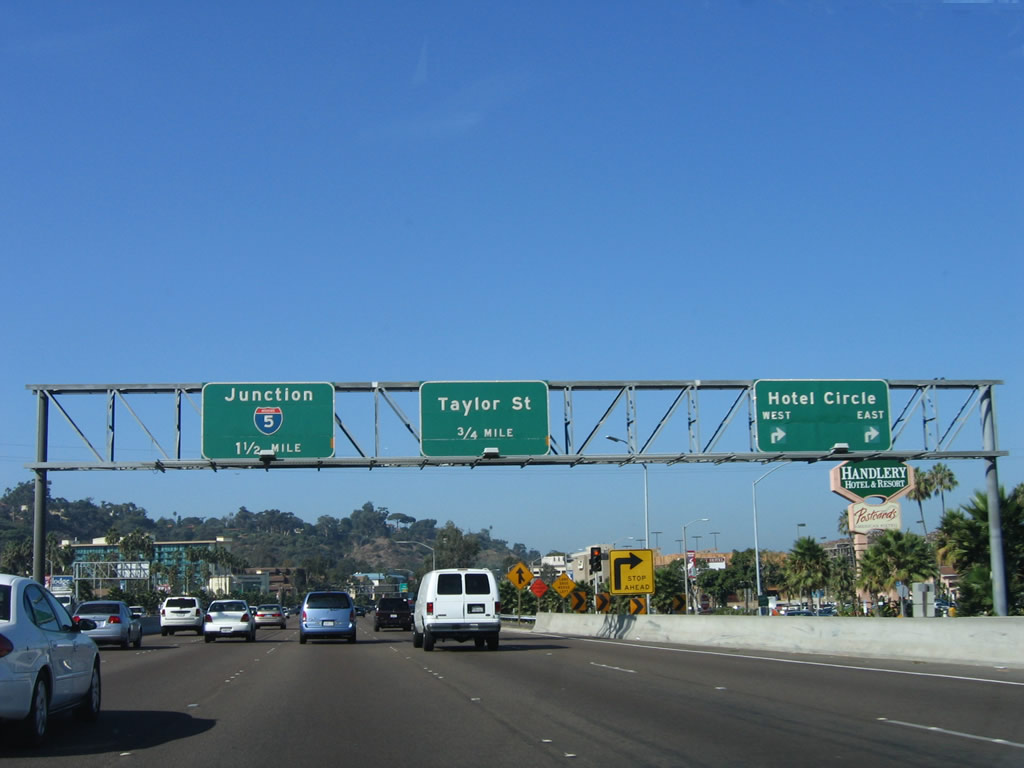
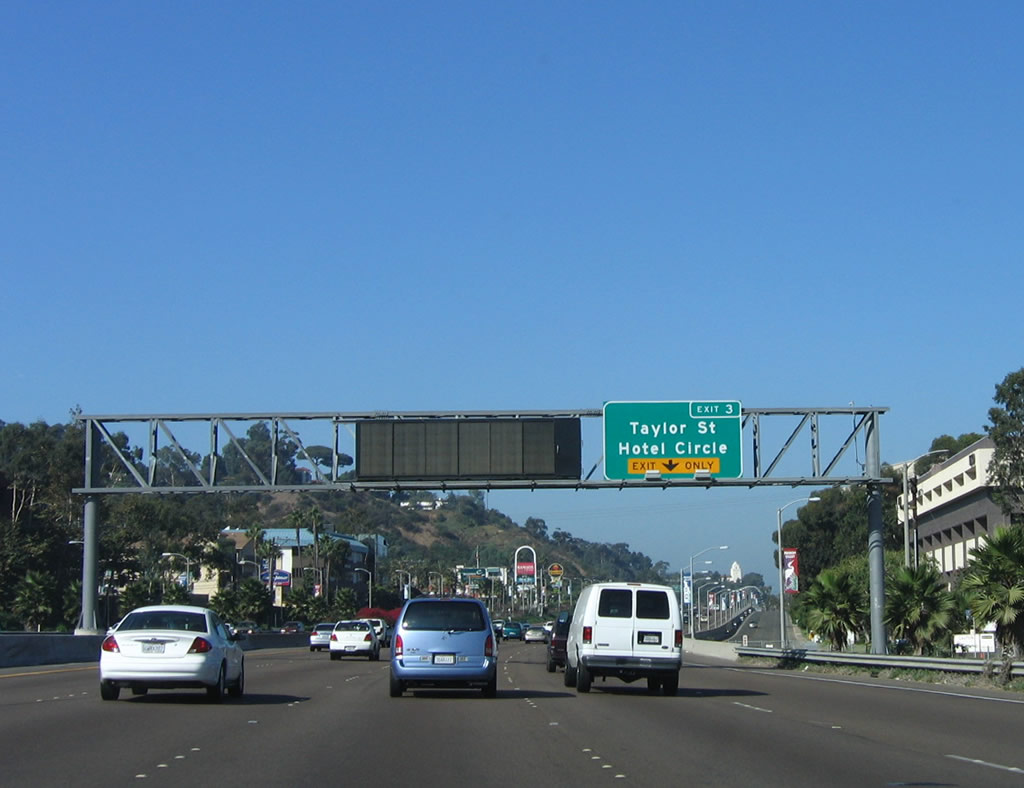
The next exit along westbound Interstate 8 is Exit 3, Taylor Street. Note the Hotel Circle exit to the right; this exit is reached by using Exit 4B (California 163 northbound) and then following a separated alignment to this exit ramp. Photo taken 10/10/05. |
|
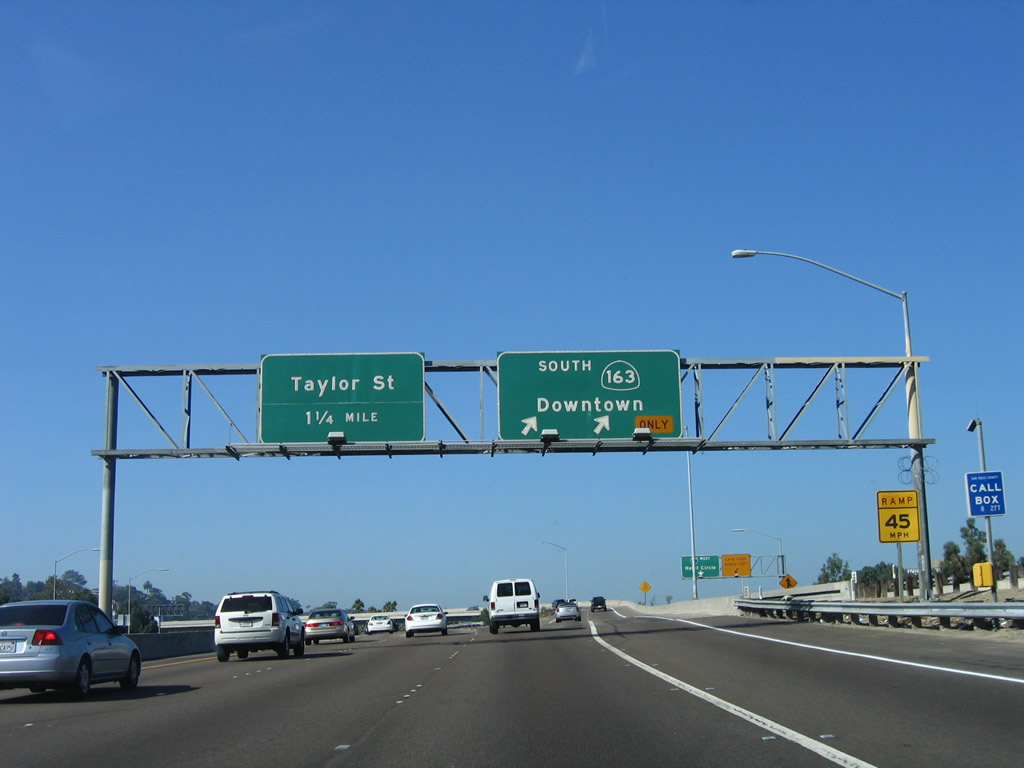
Use Exit 3 to Old Town State Historic Park as well as the San Diego Presidio site and Father Junipero Serra Museum, which is visible on a promontory above and just south of the freeway. Old Town also hosts a large transit center found at the intersection of Taylor Street and Pacific Highway. Photo taken 05/23/13. |
|
|
|
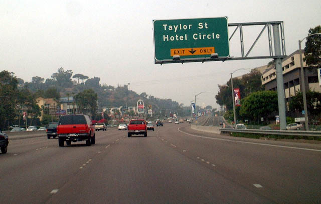
Taylor Street travels west into Old Town, which is the original site of San Diego before the "New Town" or Downtown was conceived by city founder Alonzo Horton. Old Town State Historical Park contains replicas of old buildings and features activities for the family. Signage for Taylor Street changed in 2004. A variable message sign warning of traffic or weather conditions is posted alongside the new exit number sign. The pull-through sign for Interstate 8 was added in 2009. Photos taken 09/05/02, 10/10/05, and 03/12/10. |
|
|
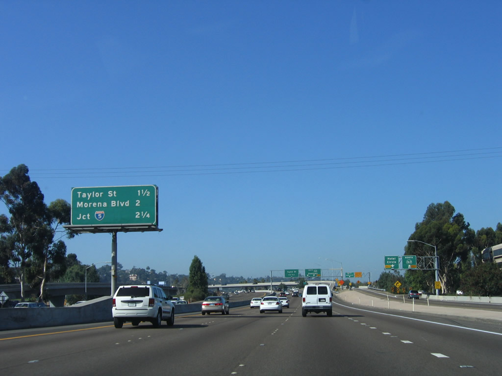
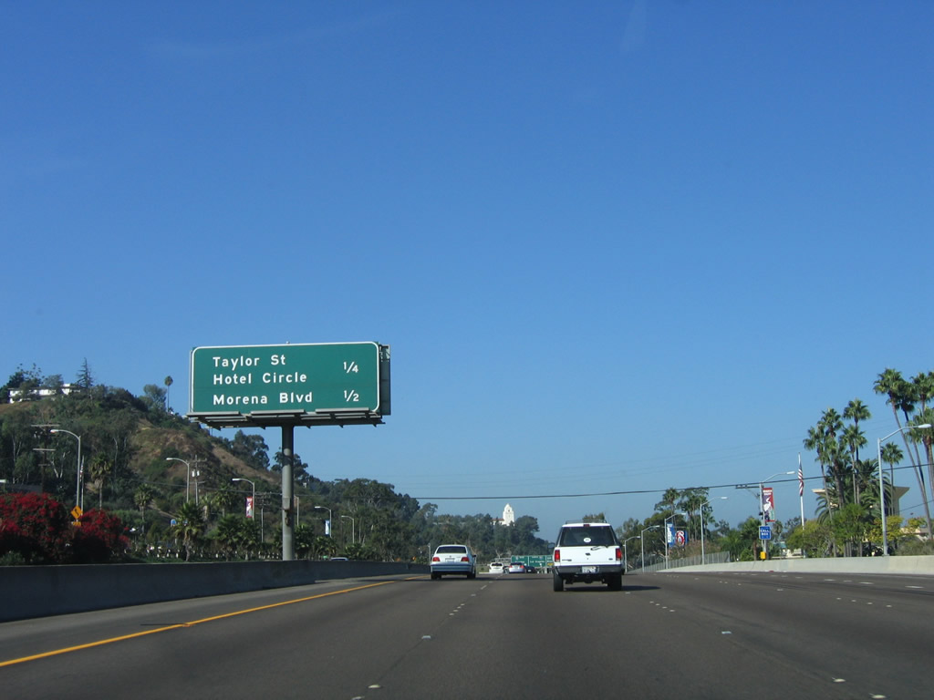
This mileage sign provides the distance to the Taylor Street/Hotel Circle and Morena Boulevard (former U.S. 101). Omitted from this sign is the junction with Interstate 5, which has not been signed since the previous interchange sequence sign before California 163. In advance of this sign is a second set of pavement route markers, this time on a concrete segment. Photos taken 04/19/13 and 10/10/05. |
|
|
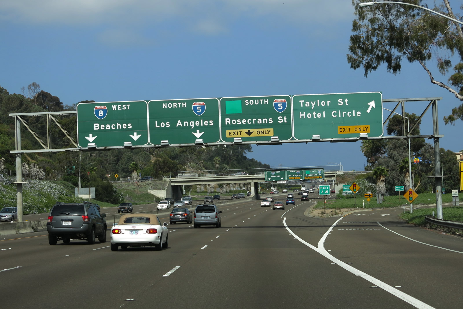
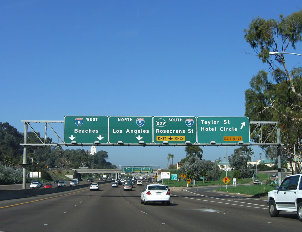
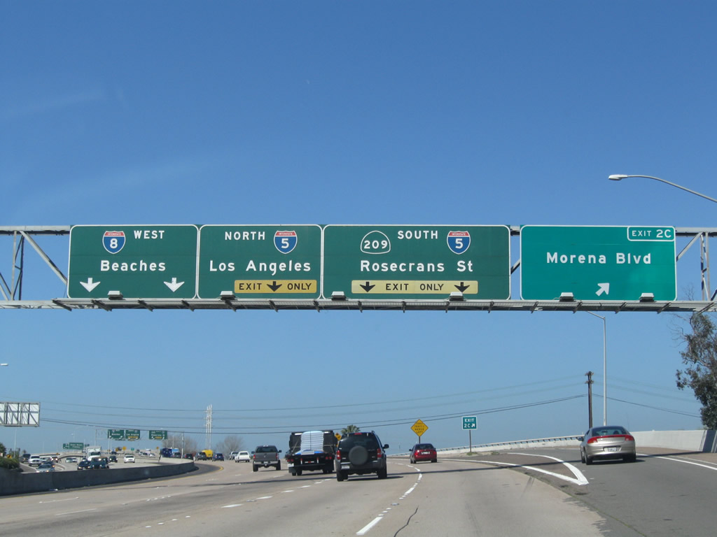
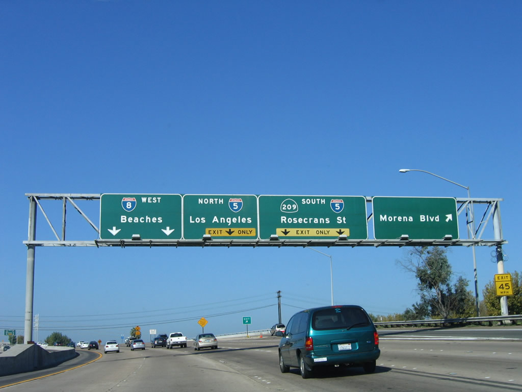
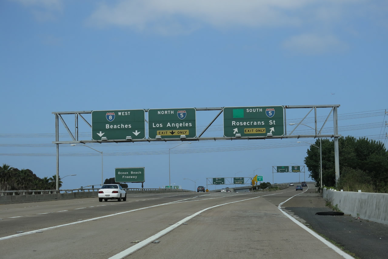
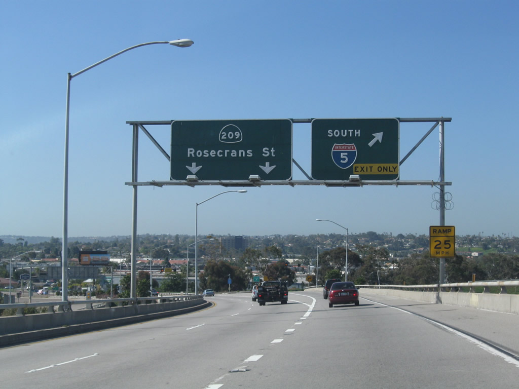
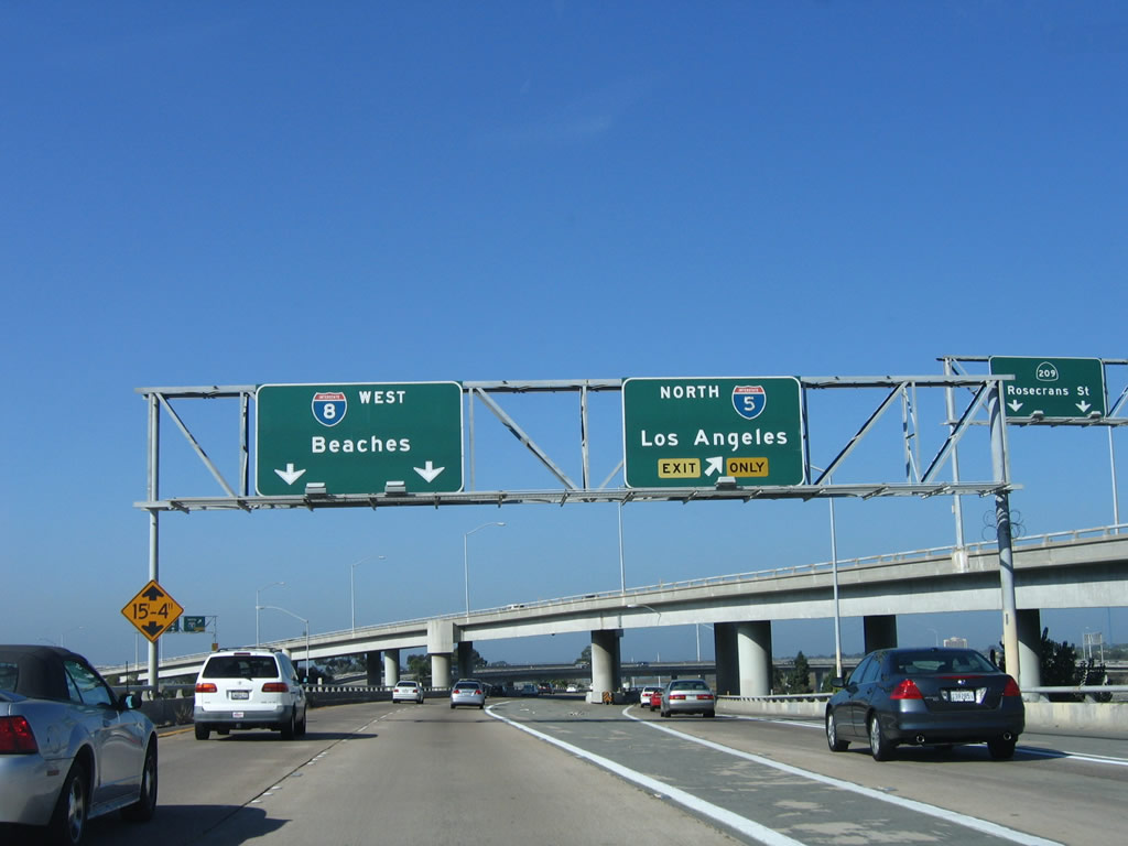
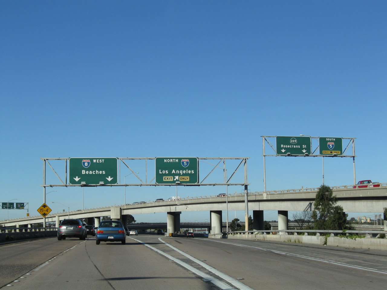
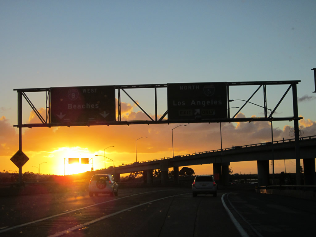
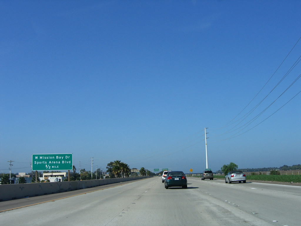
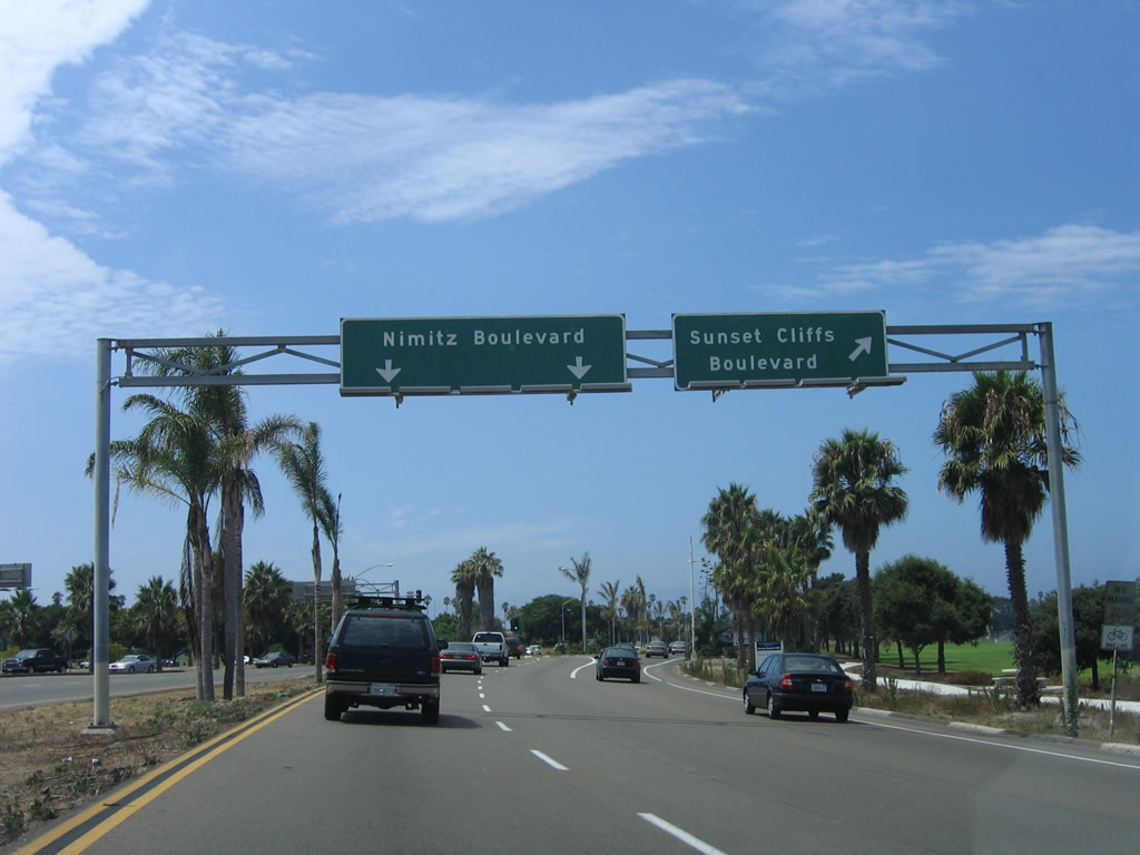
Westbound Interstate 8 (Kumeyaay Highway) reaches Exit 3, Taylor Street. The final five exits along westbound are: Exit 2C, Morena Boulevard; Exit 2B, Interstate 5 (San Diego Freeway) south and Rosecrans Street south; Exit 2A, Interstate 5 (San Diego Freeway) north; Exit 1, Mission Bay Drive north and Sports Arena Boulevard north/south (to Ingraham Street north and Midway Drive south); and Exit 0, Nimitz Boulevard/Sunset Cliffs Boulevard. The only change made to this sign was to cover up the California 209 shield in December 2012. Photos taken 05/23/13 and 10/10/05. |
|
|
The next exit along westbound Interstate 8 is Exit 2C, Morena Boulevard. Interstate 5 signage dominates here, since more traffic will take the freeway instead of the city street. Use the left two lanes to continue west along Interstate 8. The right two lanes transition to Exit 2C, Morena Boulevard and Exit 2B, Interstate 5 South/Rosecrans Street South. The middle lane connects to Exit 2A, Interstate 5 north. Photos taken 05/23/13 and 10/10/05. |
|
|
An Interstate 8 west reassurance shield is posted after the on-ramp from Taylor Street and Hotel Circle (west). This sign was replaced in 2011 with a rare Series E numeral within a California-standard Interstate highway route marker. Photo taken 03/12/10. |
|
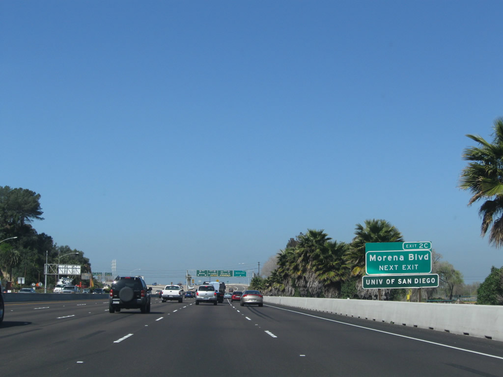
Use Exit 2C (Morena Boulevard north) to the University of San Diego. This sign was moved by 2012. Photo taken 03/12/10. |
|
|
|
| Westbound Interstate 8 (Kumeyaay Highway) meets Exit 2C, Morena Boulevard (Historic U.S. 101) north. This set of overhead signs was modified in December 2012 when the California 209 shields were finally covered over a decade after legislative decommissioning from the state route. Morena Boulevard carries Old U.S. 101 north from Old Town to Balboa Avenue. For through traffic on Interstate 8 west, use the left two lanes. For traffic connecting to northbound Interstate 5, use the number three lane. The right two lanes connect to Morena Boulevard, Rosecrans Street (Camino del Rio/Former California 209), and southbound Interstate 5 to downtown and the airport. The interchange with Morena Boulevard and Interstate 5 was built in 1969. The California 209 route marker shield was covered up in December 2012. Photos taken 05/23/13, 03/12/10, and 10/10/05. |
|
|
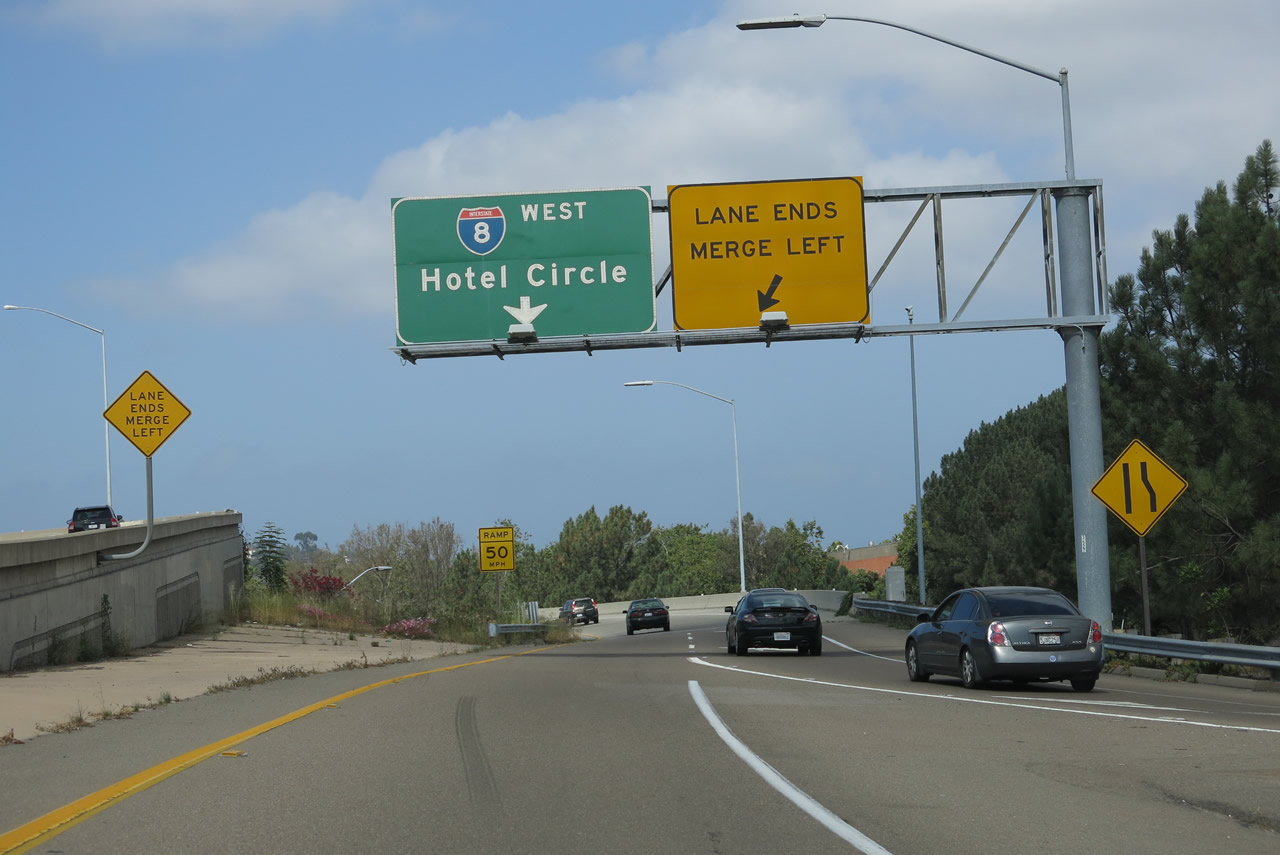
Continuing west, Interstate 8 next connects with Exit 2B, Interstate 5 (San Diego Freeway) south and Camino del Rio south to Rosecrans Street (former California 209 south). Former California 209 used to travel southwest into the Midway District, then angled into Point Loma before terminating at Cabrillo National Monument. Interstate 5 leads south to the airport and downtown. Originally, Interstate 8 was planned to end here, at its junction with Interstate 5. However, with the construction of the Ocean Beach Freeway (former California 109), the Interstate was extended west to a new terminus at the intersection of Nimitz Drive and Sunset Cliffs Boulevard. Photos taken 05/23/13 and 10/10/05. |
|
|
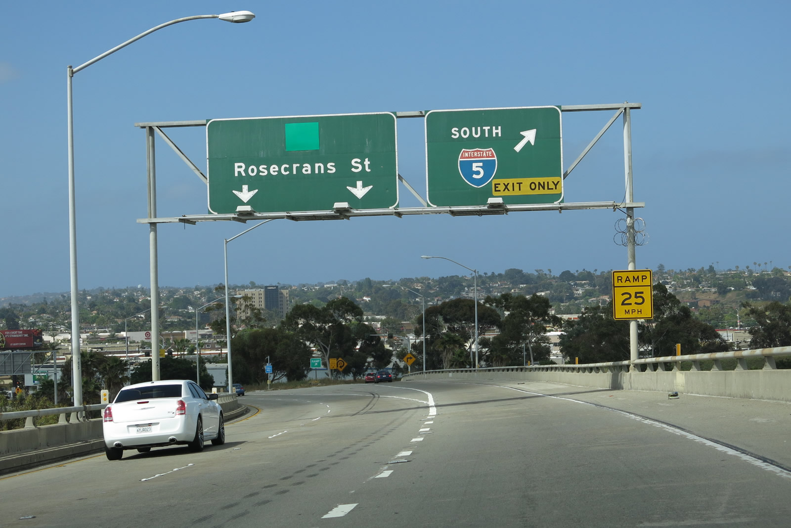
View of the initial transition ramp signage from westbound Interstate 8 to southbound Interstate 5 and southbound Rosecrans Street. The oncoming traffic from the right appears from Morena Boulevard/Linda Vista. Photos taken 05/23/13 and 03/12/10. |
|
|
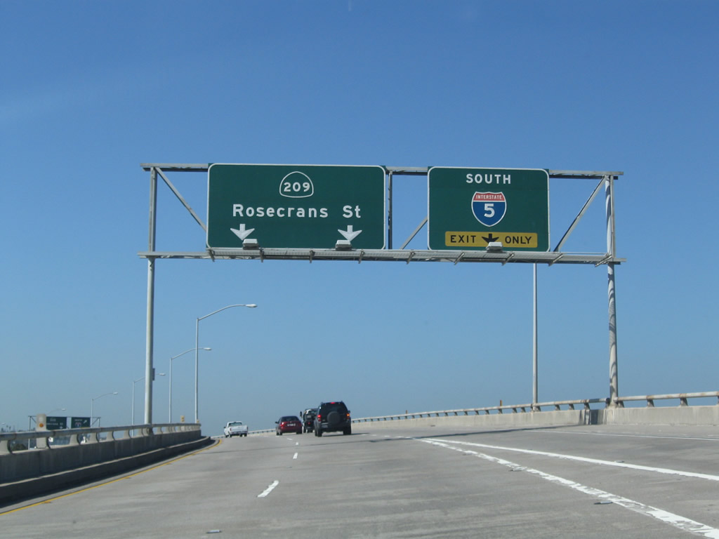
The transition ramp splits between southbound Rosecrans Street and southbound Interstate 5, with Rosecrans Street taking the main lanes. Since the Interstate 5 south is a cloverleaf loop, it must be taken at slow speeds. Photos taken 05/23/13 and 03/12/10. |
|
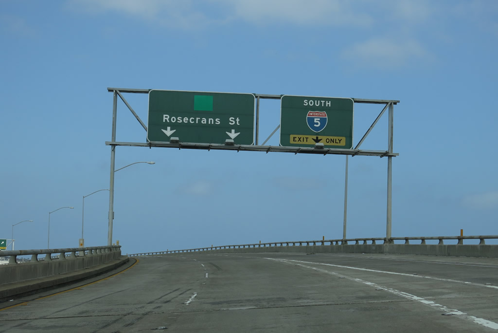
This is the transition ramp split between southbound Interstate 5 and southbound former California 209 (Rosecrans Street). California 209, which is decommissioned but still signed, leads south into the Sports Arena district, then turns west and south into Point Loma. Photo taken 10/12/03. |
| Interstate 8 (Ocean Beach Freeway) (Kumeyaay Highway) west |
|
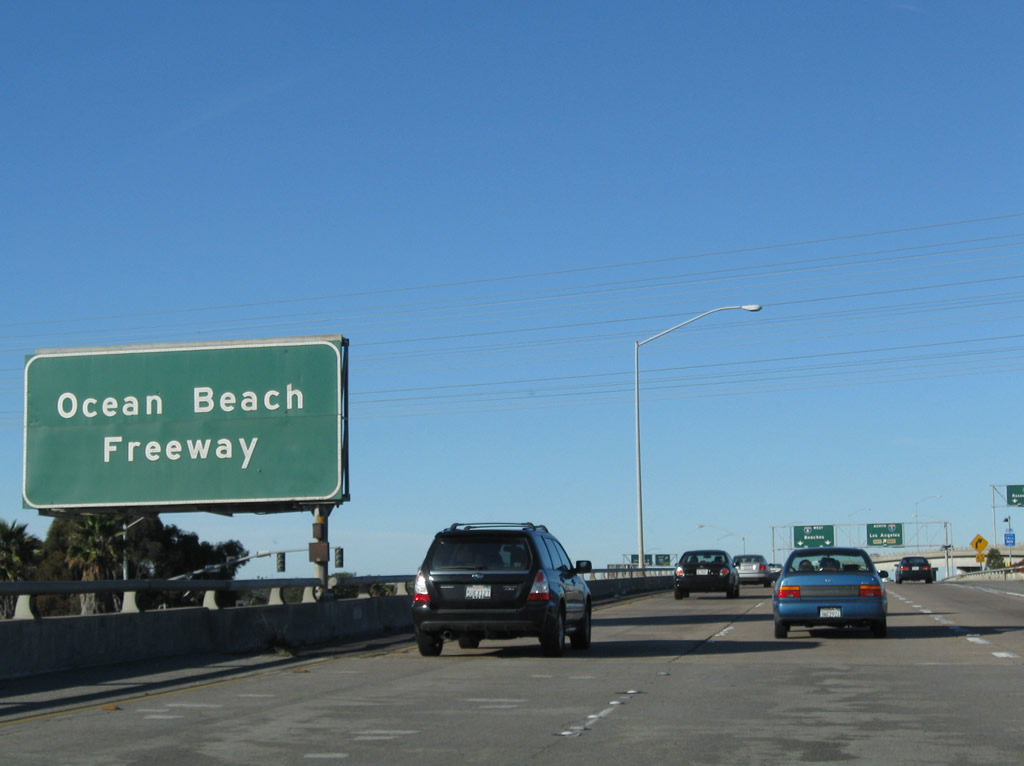
On the left side of westbound Interstate 8 is this "Ocean Beach Freeway" sign. Photo taken 02/11/12. |
|
|
|
Back on the mainline for Interstate 8 west, the right lane transitions onto Interstate 5 north, leaving Interstate 8 west with two through lanes. The freeway is now known as the Ocean Beach Freeway and later became known as the Kumeyaay Highway (1997 from El Cajon to San Diego-Imperial county line and 2002 from Ocean Beach to El Cajon). From here, Interstate 8 follows former California 109 west to Mission Bay Park and Ocean Beach. Photos taken 10/10/05, 02/11/12, and 11/10/12. |
|
Narrowed now to two through lanes while passing over the main lanes of Interstate 5, westbound Interstate 8 (Ocean Beach Freeway) (Kumeyaay Highway) passes under the transition ramp that connects to Camino del Rio and Rosecrans Street. Photo taken 02/11/12. |
|
|
|
Interstate 8 passes under two more ramps (one leading from Interstate 5 south to Interstate 8 east, and the other linking Interstate 5 south with Camino del Rio and Rosecrans Street south). After these transition ramps from Interstate 5, new lanes will merge onto Interstate 8 west. This will briefly bring the freeway back to four westbound lanes, but two of those lanes will exit at Exit 1, Mission Bay Drive and Sports Arena Boulevard. Photos taken 10/10/05 and 02/11/12. |
|
|
Two new left lanes join Interstate 8 west; they connect Interstate 5 north with Interstate 8 west. California 109 was built in 1969, and Interstate 8 shields were posted on the freeway shortly thereafter. Photos taken 10/10/05 and 02/11/12. |
|
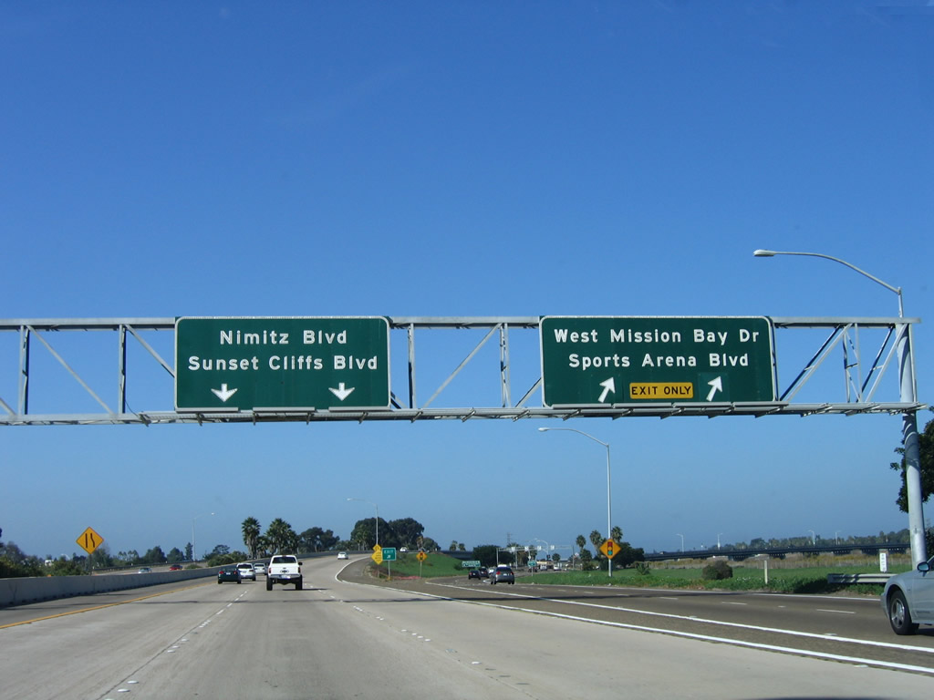
The final standalone interchange on westbound Interstate 8 is Exit 1, Sports Arena Boulevard/West Mission Bay Drive. This exit serves the area around the 1960s-era San Diego Sports Arena and also leads north to Mission Bay Park, Sea World, and Pacific Beach via West Mission Bay Drive and Ingraham Street northbound. Photo taken 10/10/05. |
|
The right two lanes become exit only for Exit 1, Mission Bay Drive/Sports Arena Boulevard. Use the left three lanes to continue west toward the final exit, which serves Sunset Cliffs Boulevard and Nimitz Boulevard. This final "exit" is actually a traffic signal at the western end of Interstate 8. Note the lack of overhead Interstate 8 shields on the pull-through sign. Photo taken 10/10/05. |
|
Westbound Interstate 8 reaches Exit 1, Mission Bay Drive/Sports Arena Boulevard. Use Mission Bay Drive north to cross the San Diego River en route to Mission Beach and Pacific Beach. Use Sports Arena Drive south to enter the Midway-Sports Arena District, including the San Diego IPay One Sports Arena, home to several minor league sports teams. Photo taken 10/10/05. |
|
This view looks north from Interstate 8 toward Mission Bay Drive and Sports Arena Boulevard north. Note the San Diego River passes below. Photo taken 02/11/12. |
|
Interstate 8 crosses over Mission Bay Drive and Sports Arena Boulevard. Photo taken 10/10/05. |
|
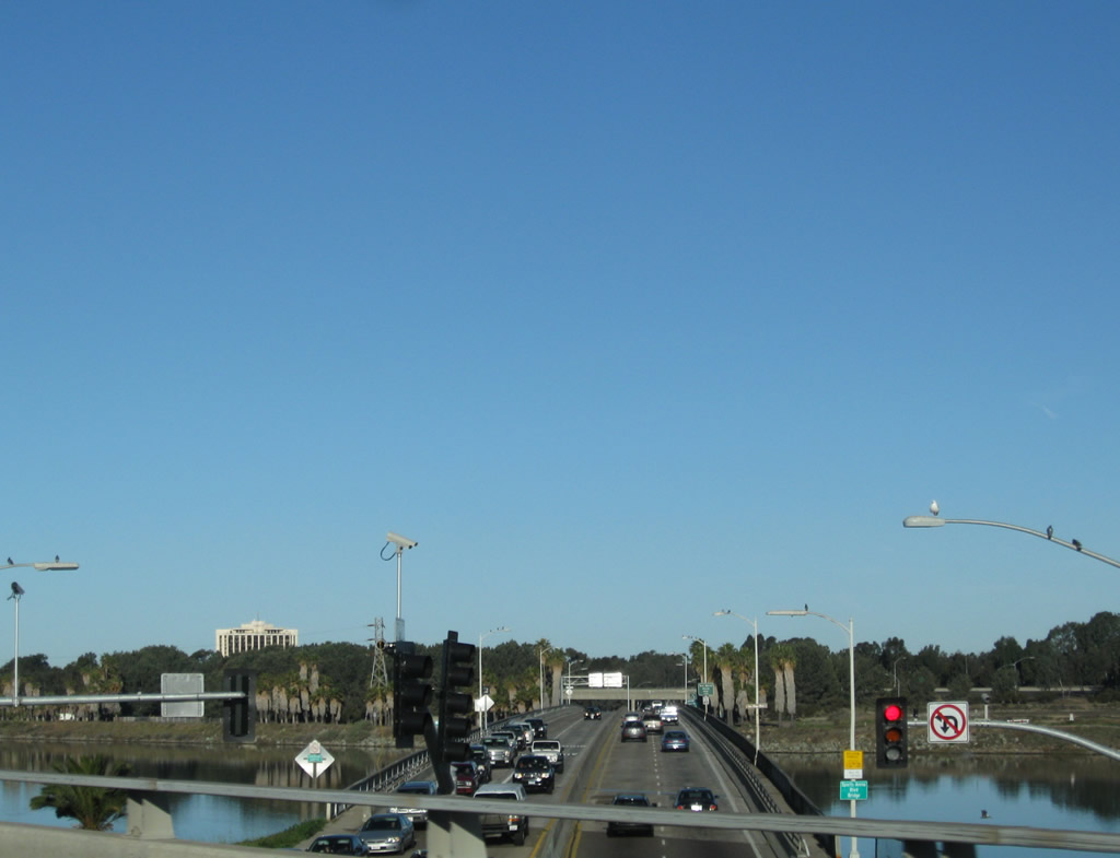
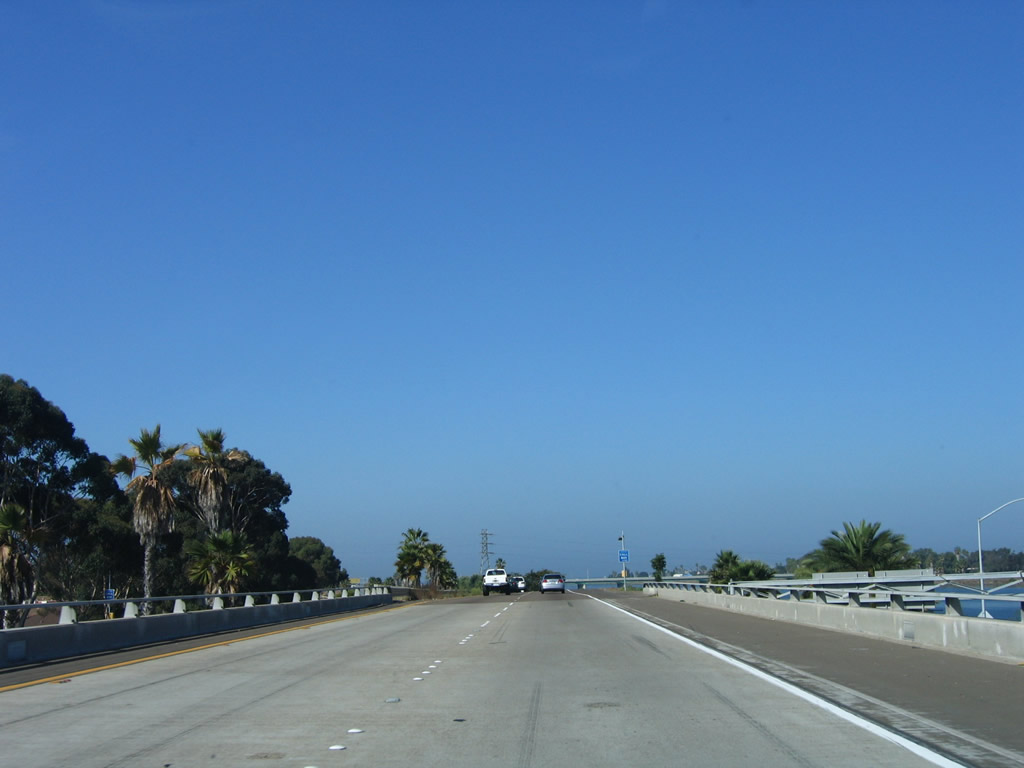
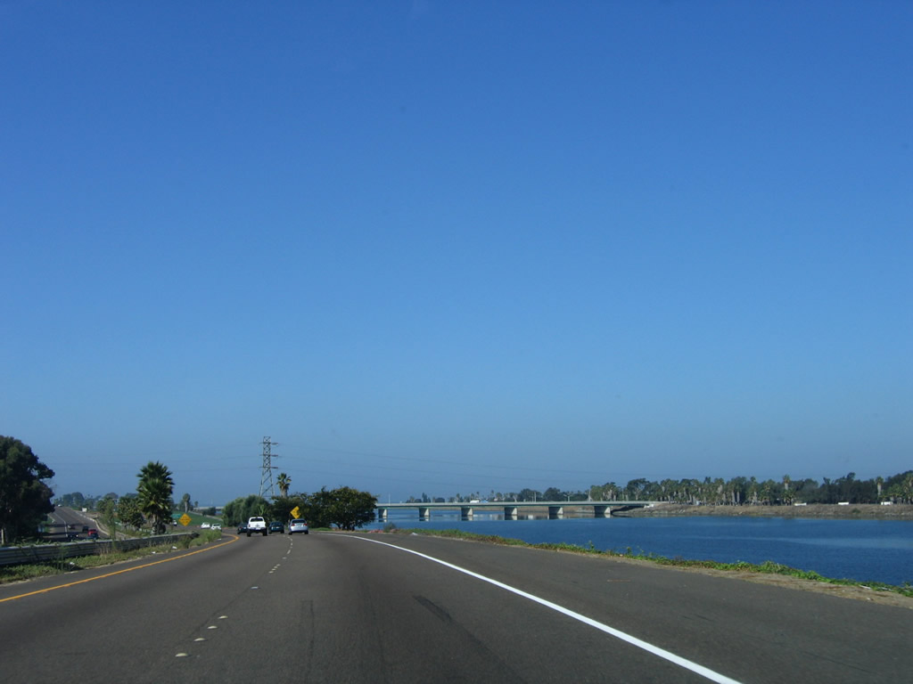
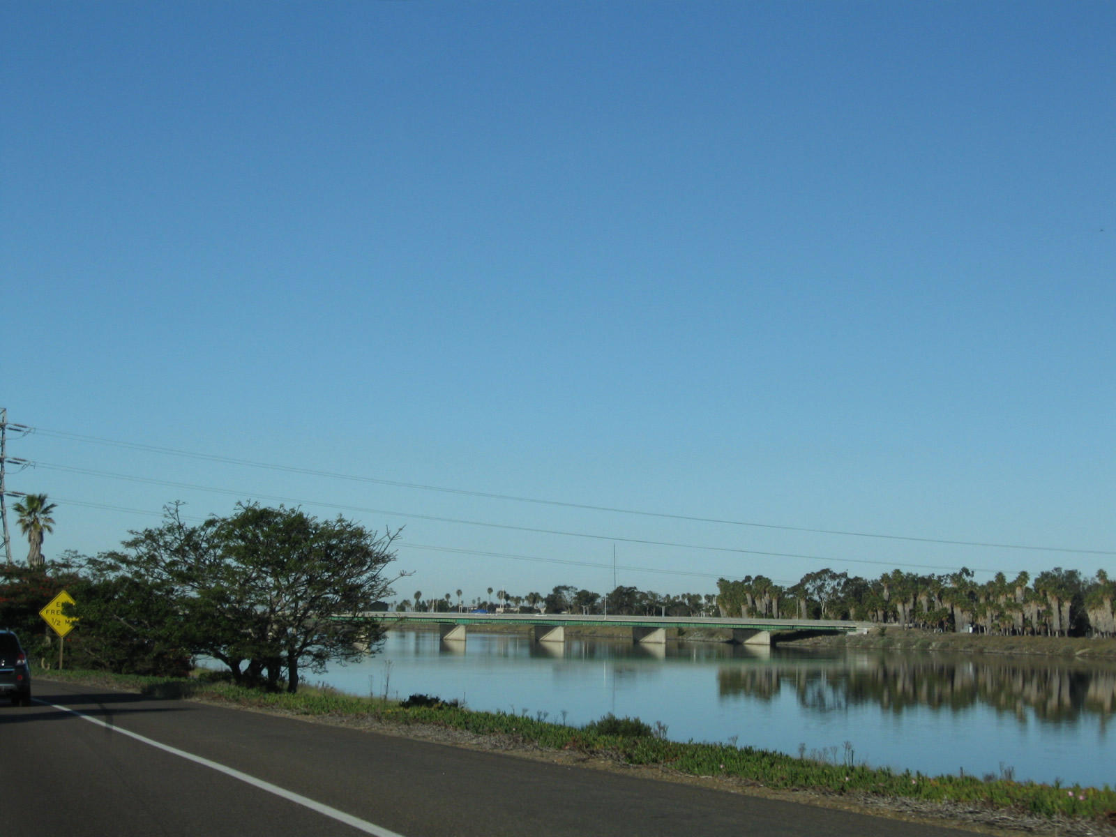
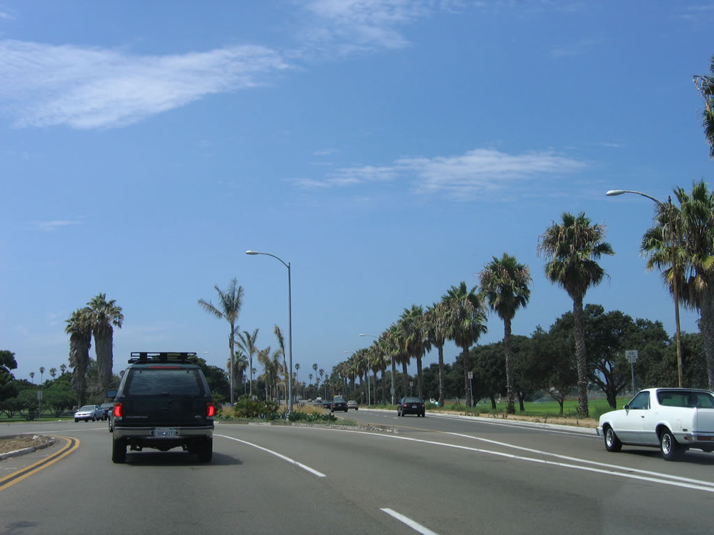
The San Diego River comes alongside Interstate 8 (Ocean Beach Freeway) (Kumeyaay Highway), offering this scenic view west toward the Pacific Ocean. Photo taken 10/10/05. |
|
Trees reflect on the waters of the San Diego River. Photo taken 02/11/12. |
|
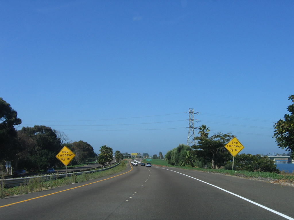
These signs advise that the western end of the Interstate 8 freeway is coming in one-half mile. Photo taken 10/10/05. |
|
|
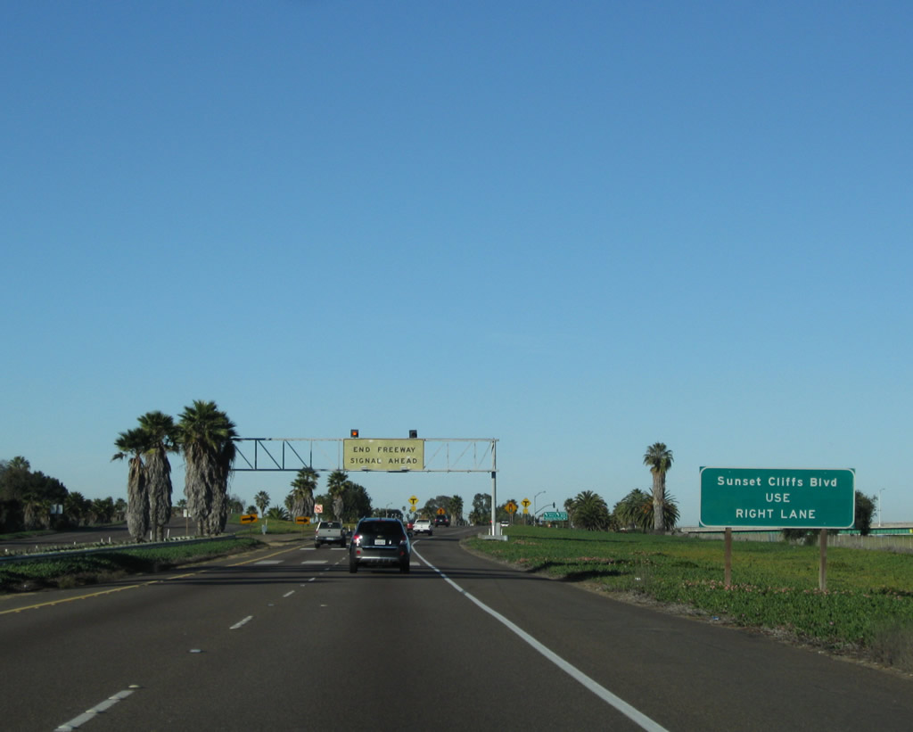
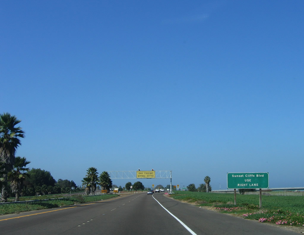
Use the right lane to connect to Sunset Cliffs Drive southwest into Ocean Beach. For Nimitz Boulevard south, use the left lane. The button copy sign was replaced sometime around 2008 with a reflective sign. Photos taken 02/11/12 and 10/10/05. |
|
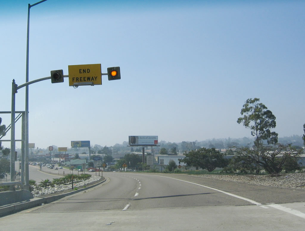
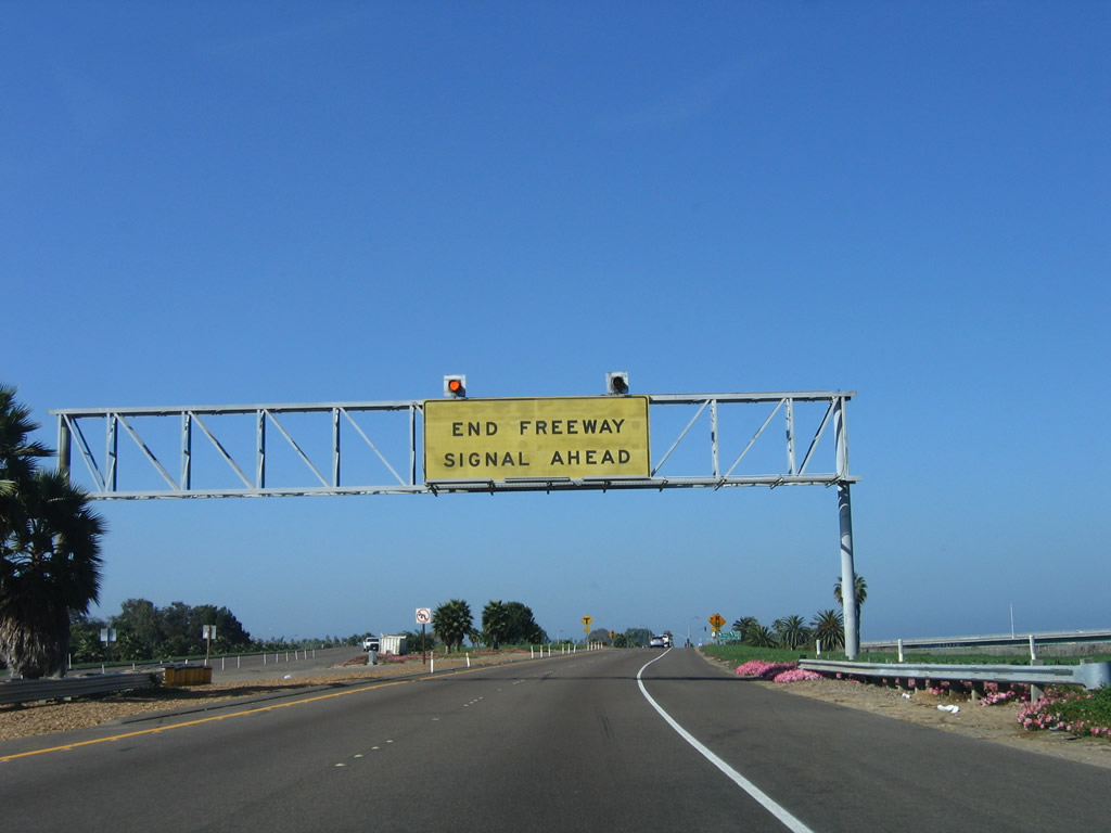
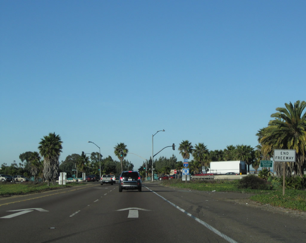
An "End Freeway" yellow overhead sign is posted about a quarter mile east of the western terminus of Interstate 8. Photo taken 10/10/05. |
|
A signal ahead sign is posted immediately after the end freeway overhead sign. Photo taken 10/10/05. |
|
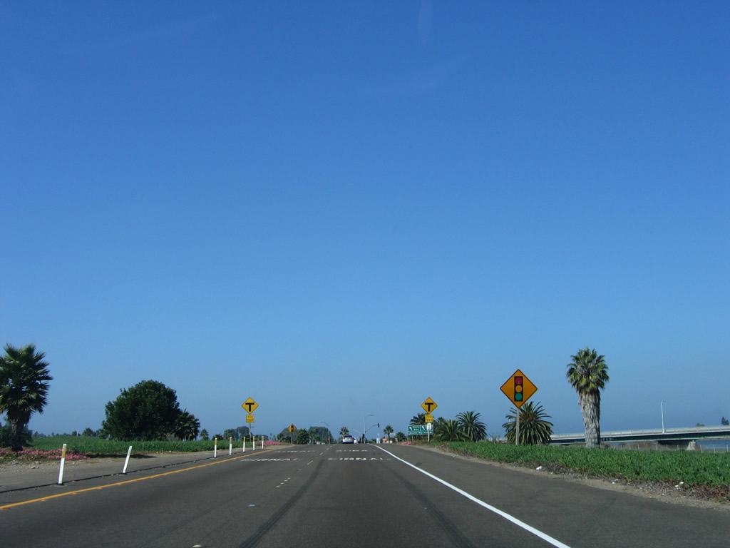
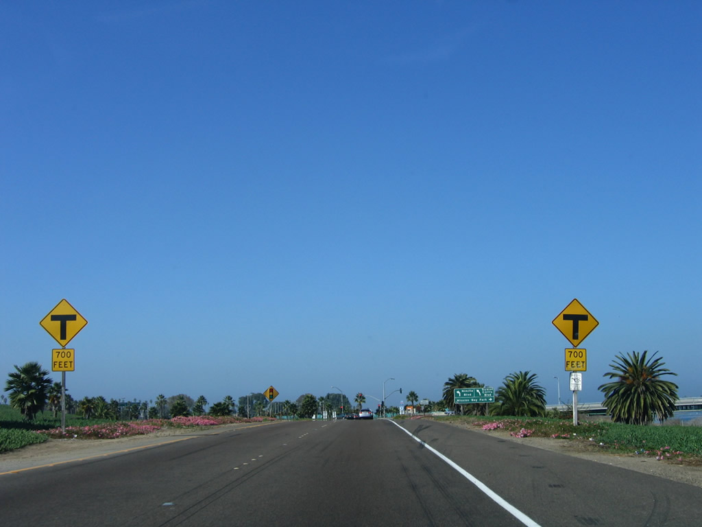
A "T" intersection sign is posted as well, which advises that the road ends in 700 feet. Photo taken 10/10/05. |
|
|
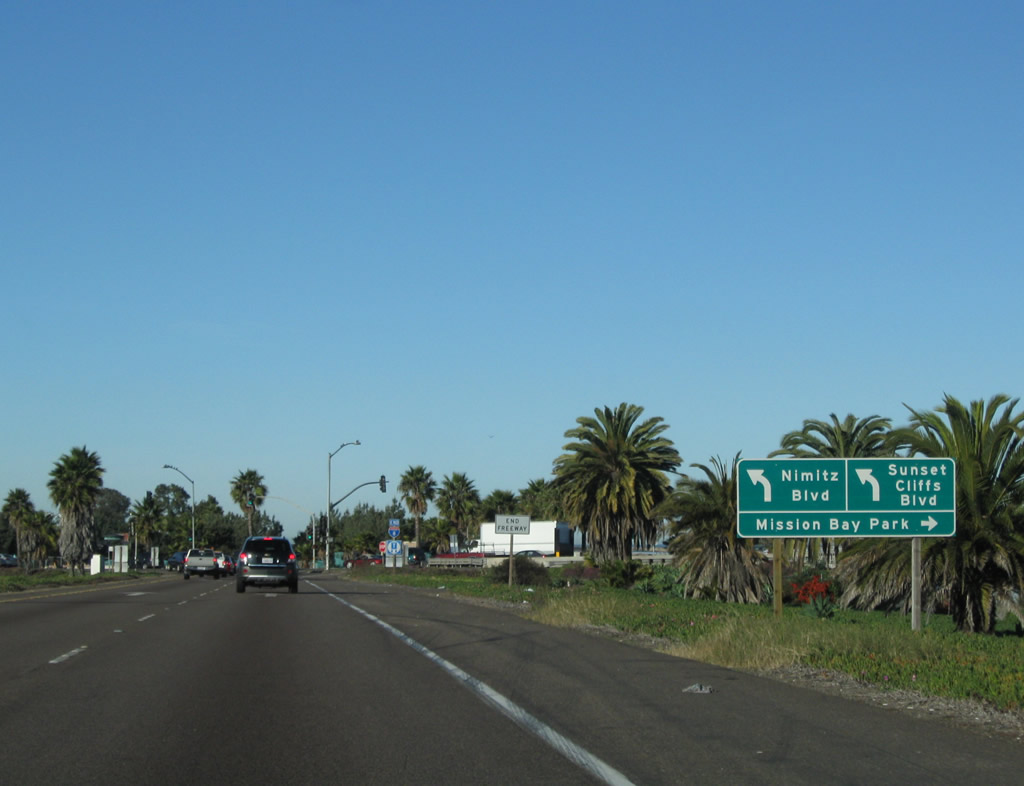
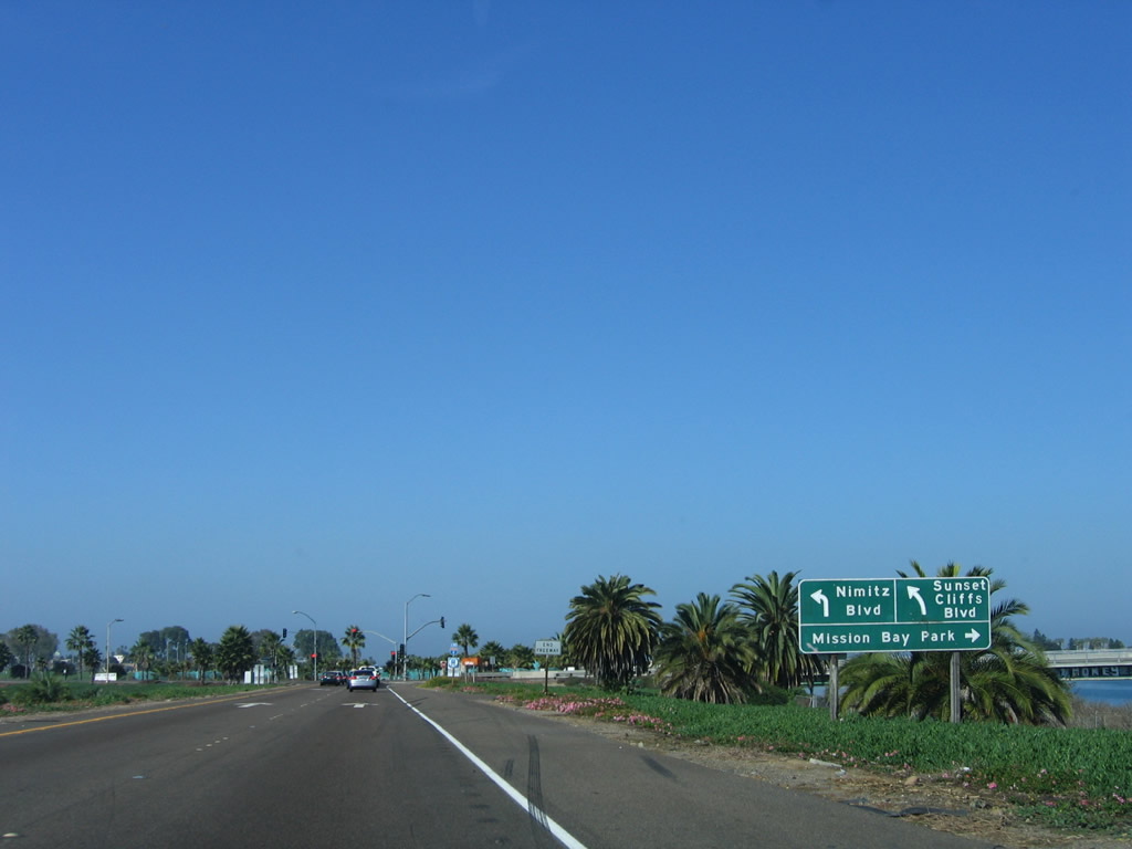
Nearing the end of the freeway, this directional sign provides lane allocation for Nimitz Boulevard, Sunset Cliffs Boulevard, and Mission Bay Park. This is sign is located just ahead of the final traffic light, which signals the end of Interstate 8. Photos taken 02/11/12 and 10/10/05. |
|
An end freeway sign is posted shortly thereafter. There are plenty of warning signs in advance of the signalized western terminus of Interstate 8. Photo taken 02/11/12. |
|
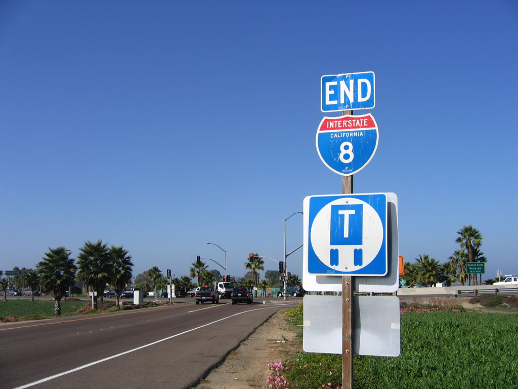
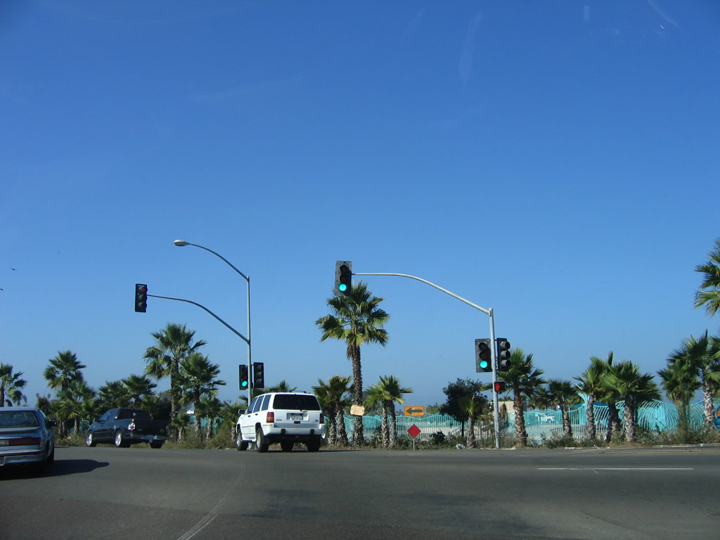
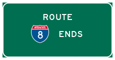
A rarity in Caltrans District 11, Interstate 8 is signed with an end shield just prior to the Sunset Cliffs Boulevard traffic signal. The end shield assembly is covered in bird poop! Photo taken 10/10/05. |
|
Interstate 8 ends at this traffic light, which connects the freeway with Sunset Cliffs Boulevard. Nimitz Boulevard begins a short distance south of here. Future plans call for the possible construction of an interchange here, which would extend Interstate 8 another tenth of a mile westward. But that enhancement is several years away. The area behind the traffic light is Robb Field Skate Park, so any extension of Interstate 8 would likely take a southwesterly trajectory. Photo taken 10/10/05. |
|
|
After making the double left turn at the traffic signal, this sign advises that the left two lanes connect to Nimitz Boulevard south to the Point Loma neighborhoods, while the right lane connects to Sunset Cliffs Boulevard to Ocean Beach. Photos taken 08/11/06. |
Page Updated February 20, 2013.