| California 1 (Pacific Coast Highway) south |
|
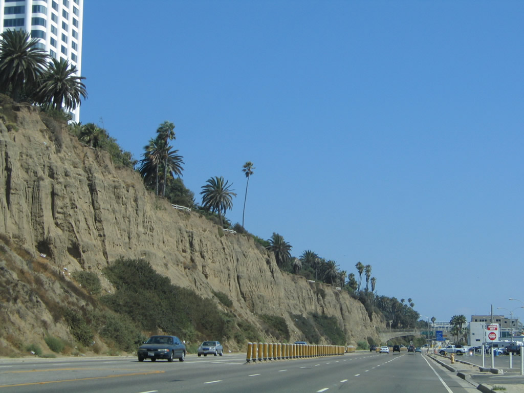
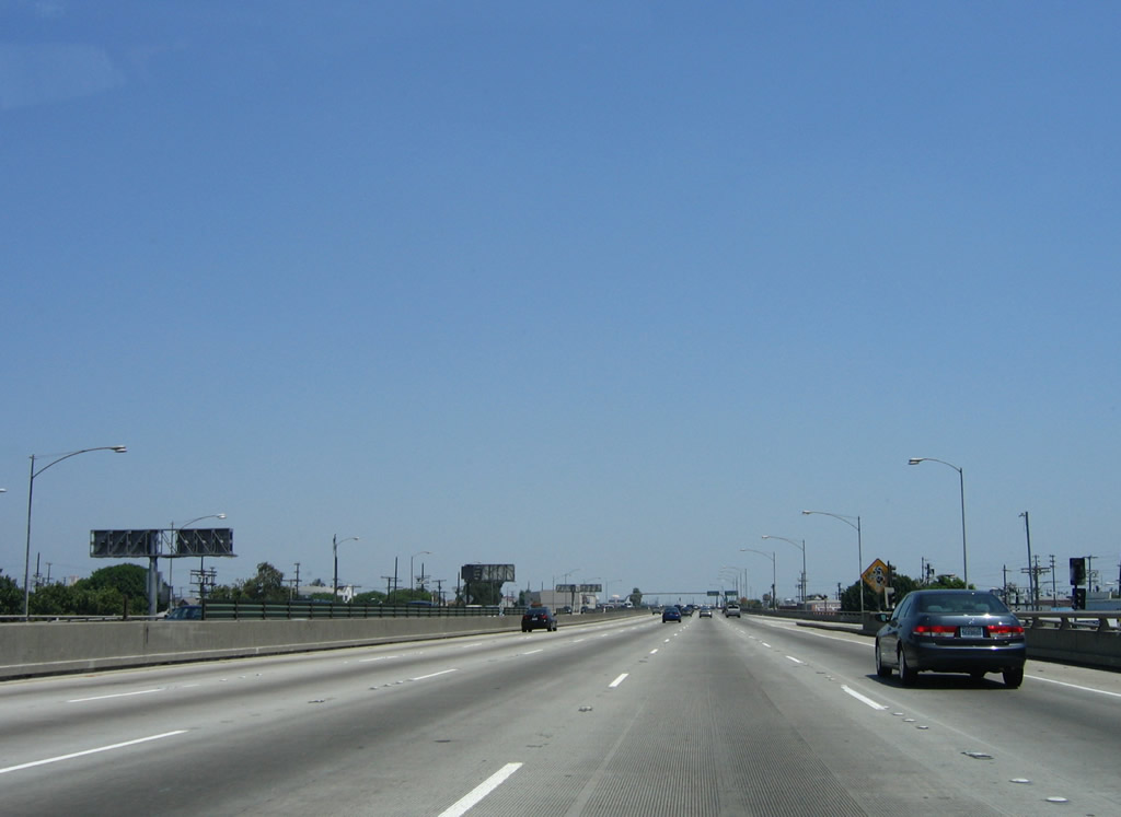
Traveling south on California 1 (Pacific Coast Highway), the Palisades rise to the east in the city of Santa Monica. Ahead, California 1 will connect to Interstate 10 after passing through the McClure Tunnel. Santa Monica had a population of 84,084 people as of the 2000 Census and was incorporated on November 30, 1886. The city is a well-known tourist destination with the famous Santa Monica Pier, Palisades Park on a coastal bluff, the west end of Historic U.S. 66 at the intersection of Lincoln Boulevard and Olympic Boulevard (near today's Interstate 10 and California 1 interchange), and shopping at the Third Street Promenade. Palisades Park, with its incredible evening views of the sunset, sits atop the cliffs seen on the east side of California 1 (Pacific Coast Highway). The highway travels alongside the beach, with parking lots located on the west side of the highway. Photo taken 08/24/04. |
|
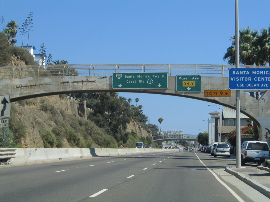
The next exit along California 1 (Pacific Coast Highway) south connects to Coast Avenue in Santa Monica. The left two lanes will connect to Interstate 10 (Santa Monica Freeway) east and California 1 (Lincoln Boulevard) south to Venice and Marina del Rey. This is the first advance signage for Interstate 10 seen on California 1 south in Santa Monica. Photo taken 08/24/04. |
|
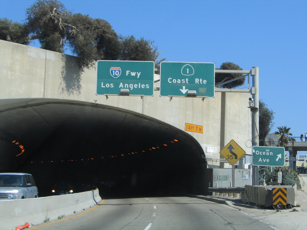
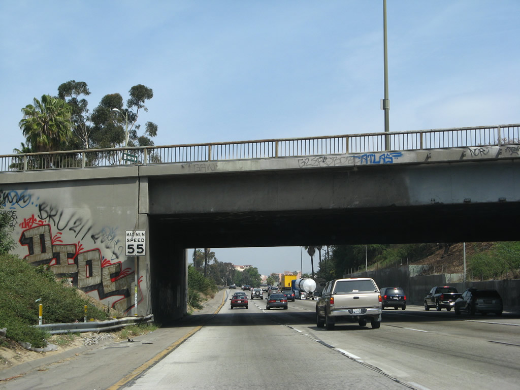
Southbound California 1 (Pacific Coast Highway) splits with Coast Avenue prior to entering the McClure Tunnel. This exit does not have an exit number. The right lane departs to Coast Avenue in Santa Monica, while the left two lanes connect to Interstate 10 (Santa Monica Freeway) east and California 1 (Lincoln Boulevard) south to Venice and Marina del Rey. Built between 1935 and 1939 as part of historic Alternate U.S. 101, the Robert E. McClure (Palisades) Tunnel is a historic resource in the greater Los Angeles transportation network. The tunnel is not wide enough to meet Interstate standards and thus is not a part of Interstate 10. However, it is part of a dramatic and fitting precursor to a long Interstate highway that crosses the country en route to Jacksonville, Florida. Photo taken 08/24/04. |
|
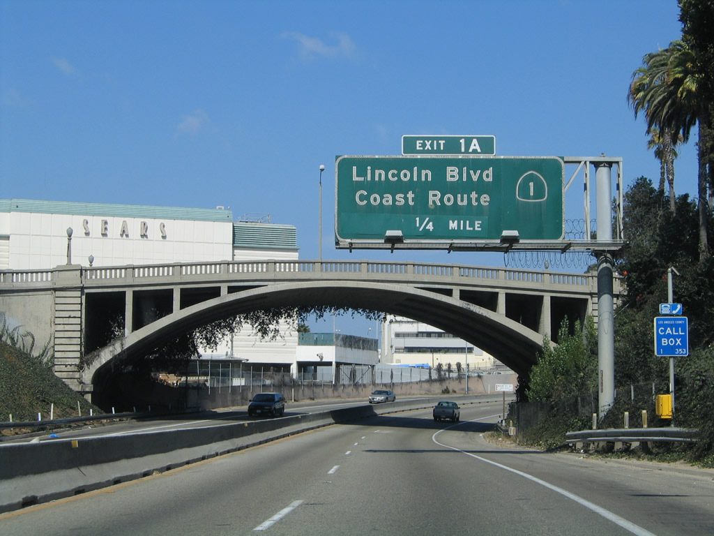
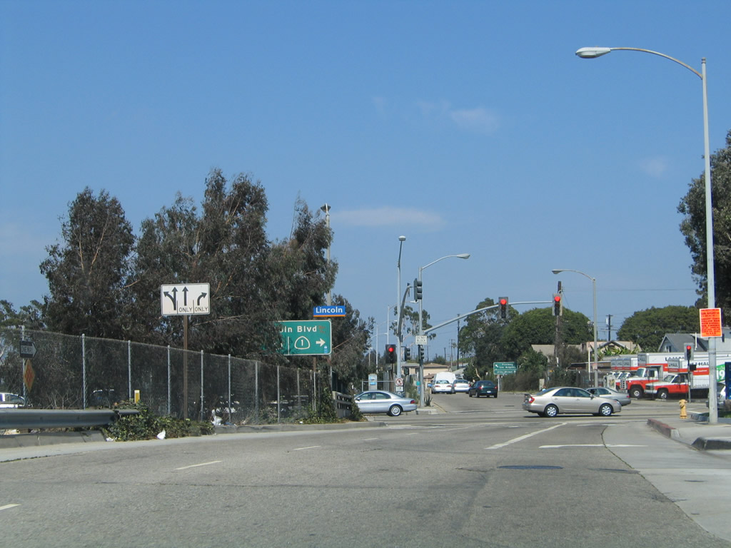
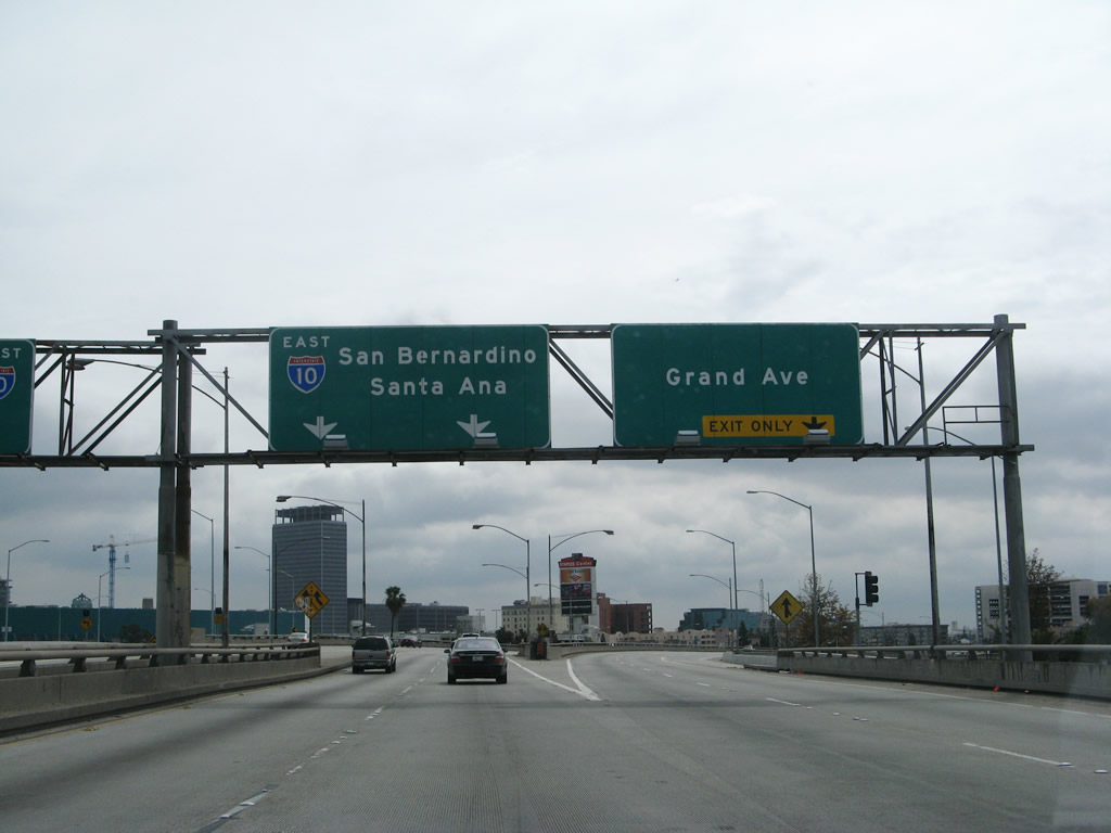
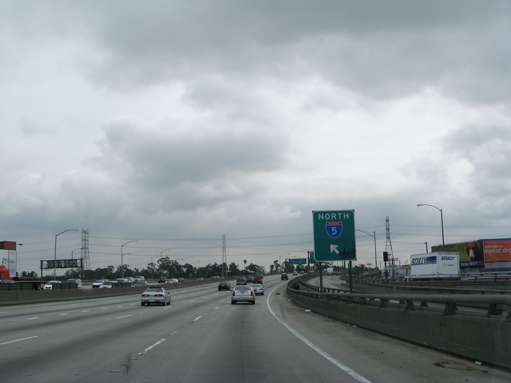
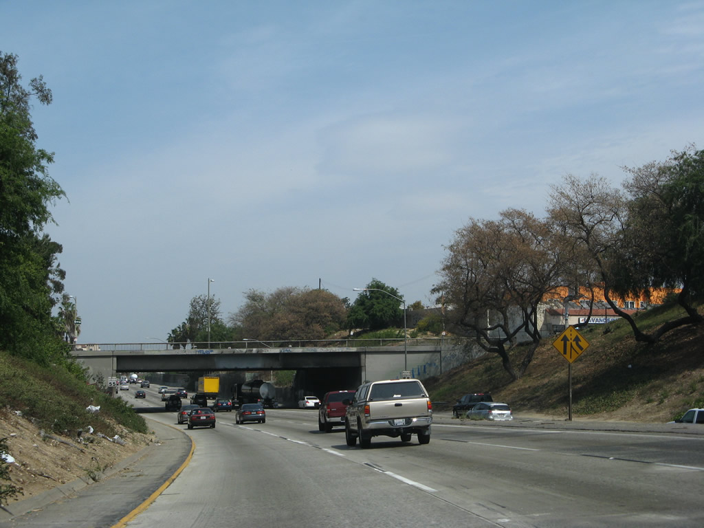
After clearing the McClure Tunnel, California 1 only carries two lanes in each direction with a single jersey barrier median as it travels below-grade almost due east. Main Street passes overhead on an old concrete arch bridge built in 1925 as an overpass to Olympic Boulevard (which preceded California 1 along this stretch). The next exit, which is signed as Exit 1A, carries California 1 south onto Lincoln Boulevard and also connects to Lincoln Boulevard north to California 2 and U.S. 66 east. Photo taken 08/24/04. |
|
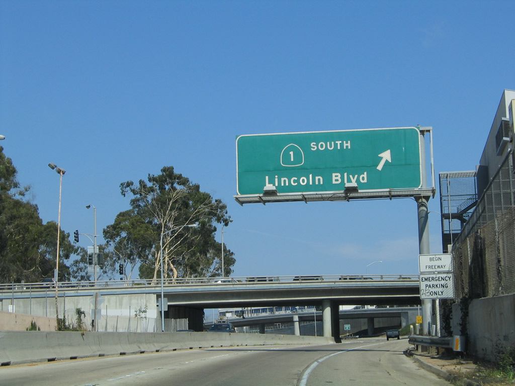
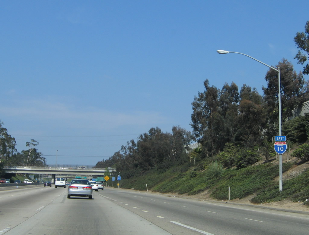
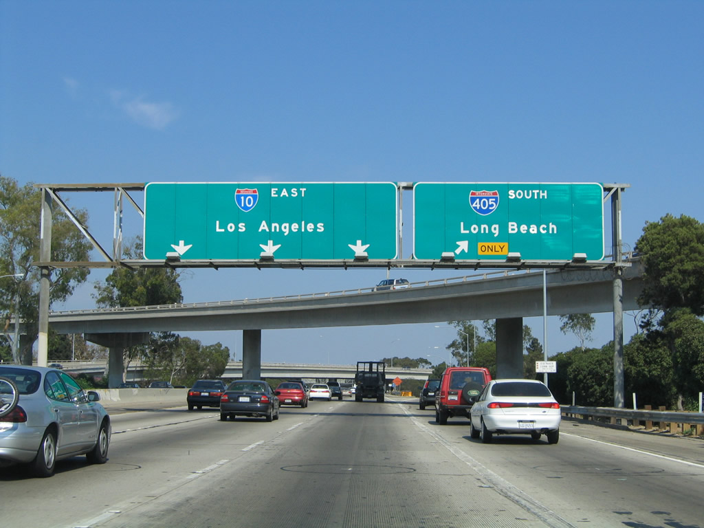
Southbound California 1 departs the freeway and connects to Exit 1A, Lincoln Boulevard south to Venice Beach, Marina del Rey, and Los Angeles International Airport (LAX) and Lincoln Boulevard north to U.S. 66 and California 2. U.S. 66 generally follows the path of California 2 east to U.S. 101, then follows its own path around the edge of downtown Los Angeles, then aims northeast toward Pasadena along the California 110 corridor. At Pasadena, U.S. 66 turns east to follow Interstate 210 (Foothill Freeway) toward Pasadena, then turns north along the Interstate 15 (and former U.S. 91-395) corridor toward Barstow. At Barstow, U.S. 66 follows Interstate 40 east toward Needles, Flagstaff, Albuquerque, Amarillo, and Oklahoma City before turning northeast toward its eastern terminus in Chicago. Interstate 10 officially begins at this point as California 1 departs on the off-ramp. (Note the begin freeway sign; there is no begin Interstate 10 shield.) Photo taken 08/24/04. |
| Interstate 10/Santa Monica (Christopher Columbus Transcontinental) Freeway east |
|
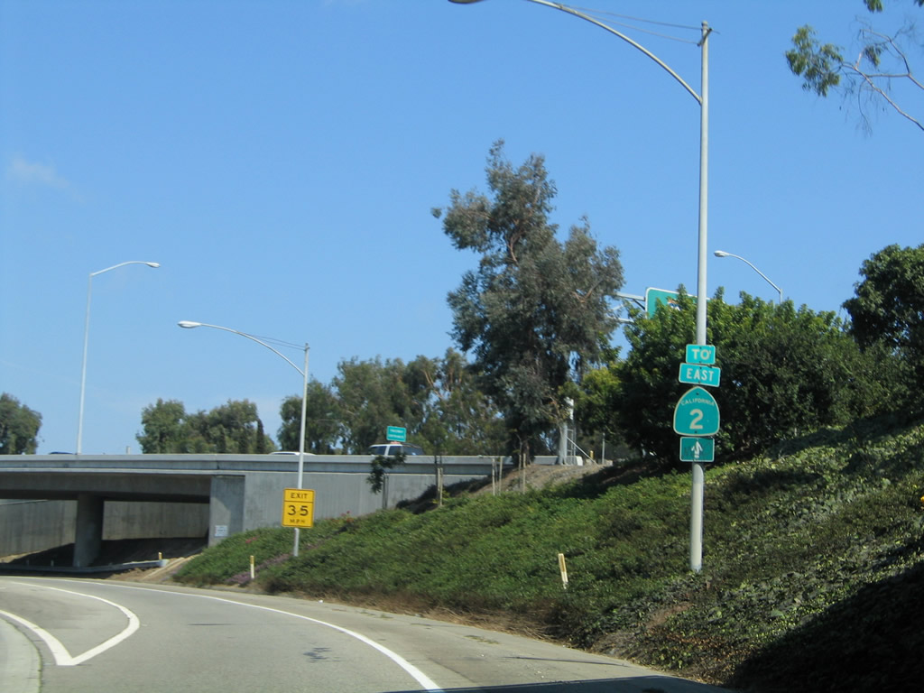
A California 2 trailblazer is posted on the off-ramp to Lincoln Boulevard. California 2 is a fairly significant route that extends from Santa Monica west through Beverly Hills and West Hollywood to merge briefly with U.S. 101 (Hollywood Freeway) near Hollywood. California 2 splits north through Echo Park and Silver Lake to merge onto the Glendale Freeway toward Glendale and La Canada-Flintridge. After crossing Interstate 210, California 2 becomes the Angeles Crest Highway and travels northeast through the scenic Angeles National Forest as a two-lane scenic highway. Ultimately California 2 ends at its intersection with California 138. Photo taken 08/24/04. |
|
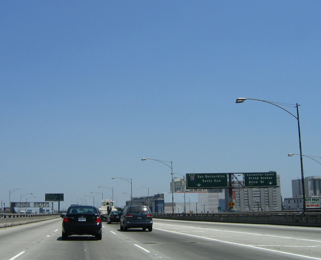
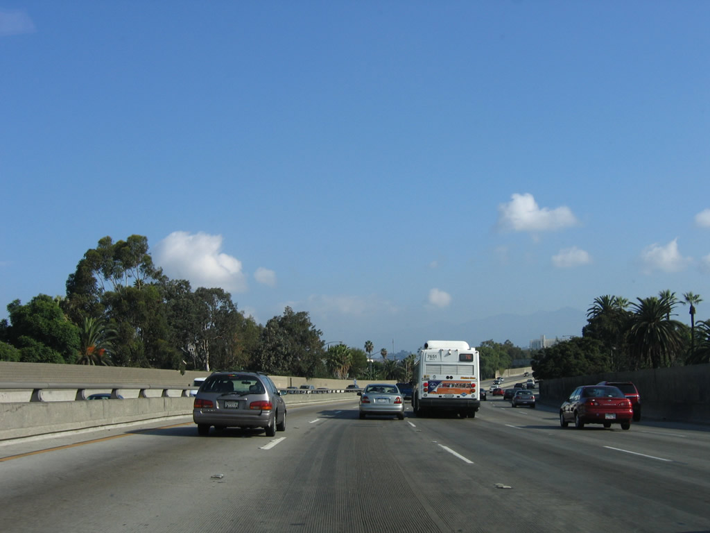
This view shows the nascent Santa Monica Freeway as it travels east toward Los Angeles. Photo taken 08/24/04. |
|
At the top of off-ramp is the traffic signal with Lincoln Boulevard. A partially obscured sign advises that California 1 through traffic should turn right (south) onto Lincoln Boulevard, and traffic from California 2 east should turn left onto Lincoln Boulevard north. U.S. 66 is not mentioned on this sign. Photo taken 08/24/04. |
|
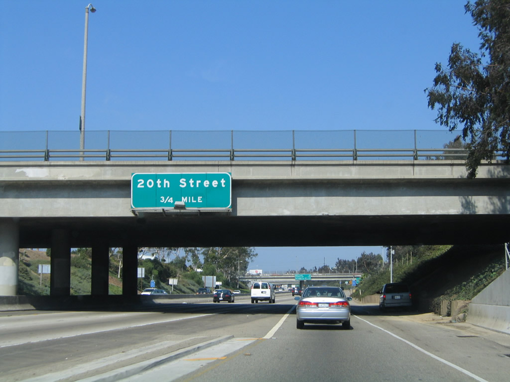
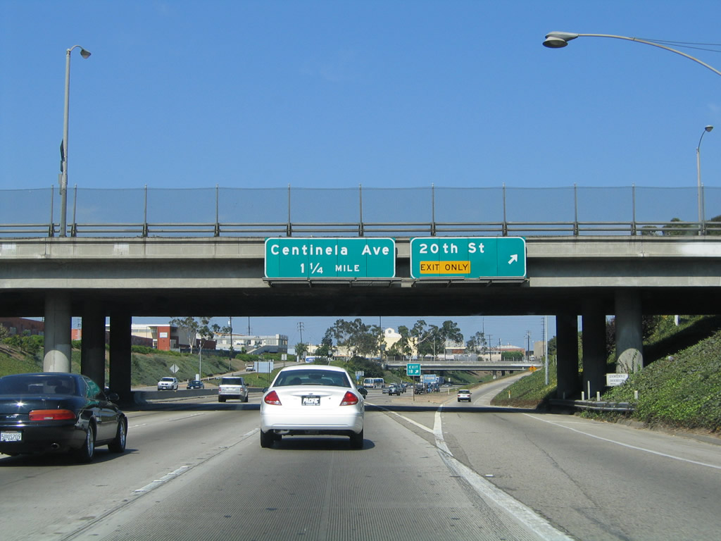
The next exit along Interstate 10 (Santa Monica Freeway) east is Exit 1B, 20th Street (0.75 mile). Photo taken 08/24/04. |
|
A roadside exit number sign for Exit 1B, 20th Street is posted shortly thereafter. Photo taken 08/24/04. |
|
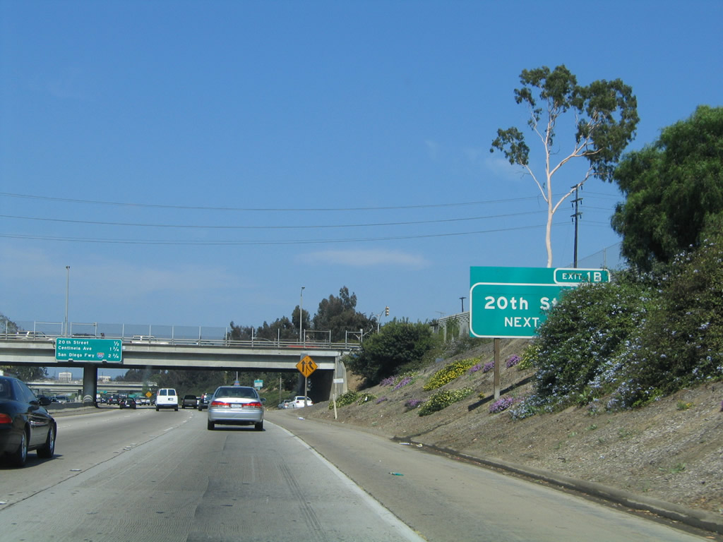
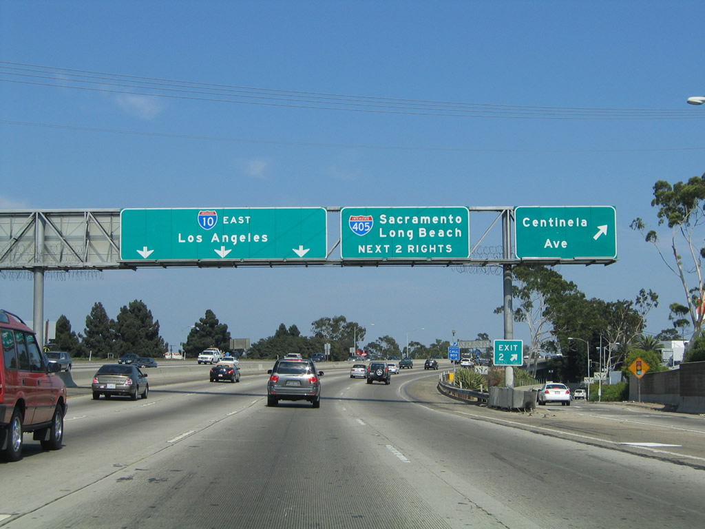
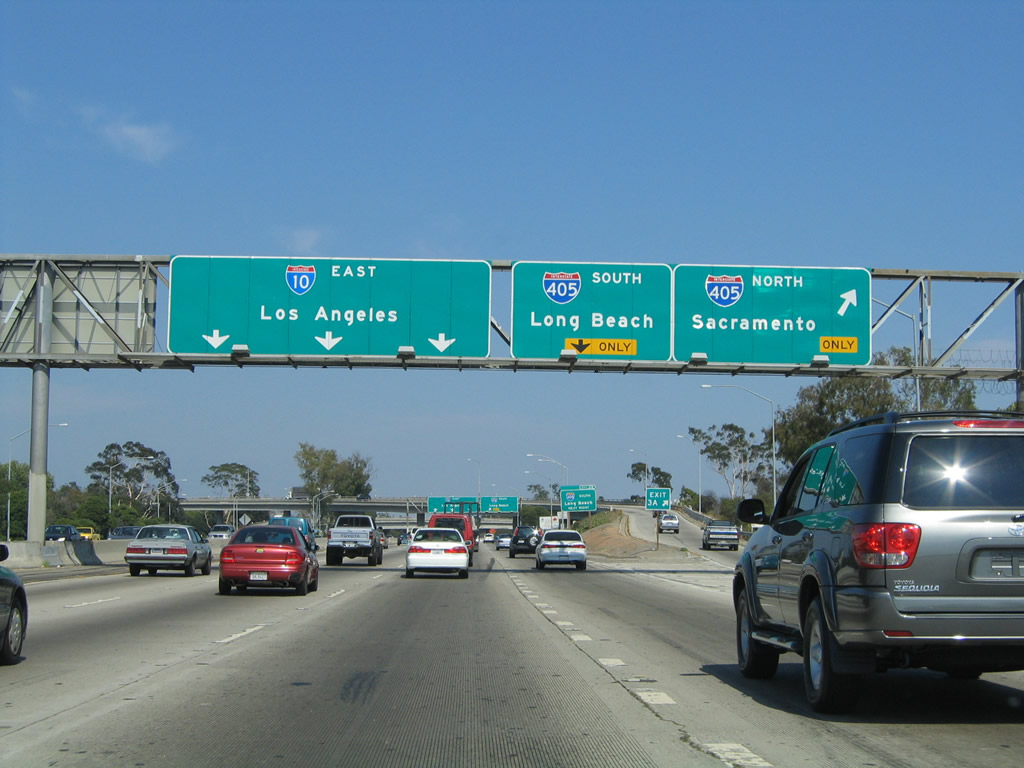
This interchange sequence sign provides the distance to the next four exits along Interstate 10 west: Exit 1B, 20th Street; Exit 2, Centinela Avenue; Exit 3A, Interstate 405 (San Diego Freeway) north Santa Clarita, Sacramento, and San Francisco Bay Area; and Exit 3B, Interstate 405 (San Diego Freeway) south to Long Beach, Irvine, and San Diego. Photo taken 08/24/04. |
|
The first Interstate 10 east reassurance shield is posted prior to Exit 1B, 20th Street; Exit 2, Centinela Avenue; Exit 3A, Interstate 405 (San Diego Freeway) north Santa Clarita, Sacramento, and San Francisco Bay Area; and Exit 3B, Interstate 405 (San Diego Freeway) south to Long Beach, Irvine, and San Diego. Photo taken 08/24/04. |
|
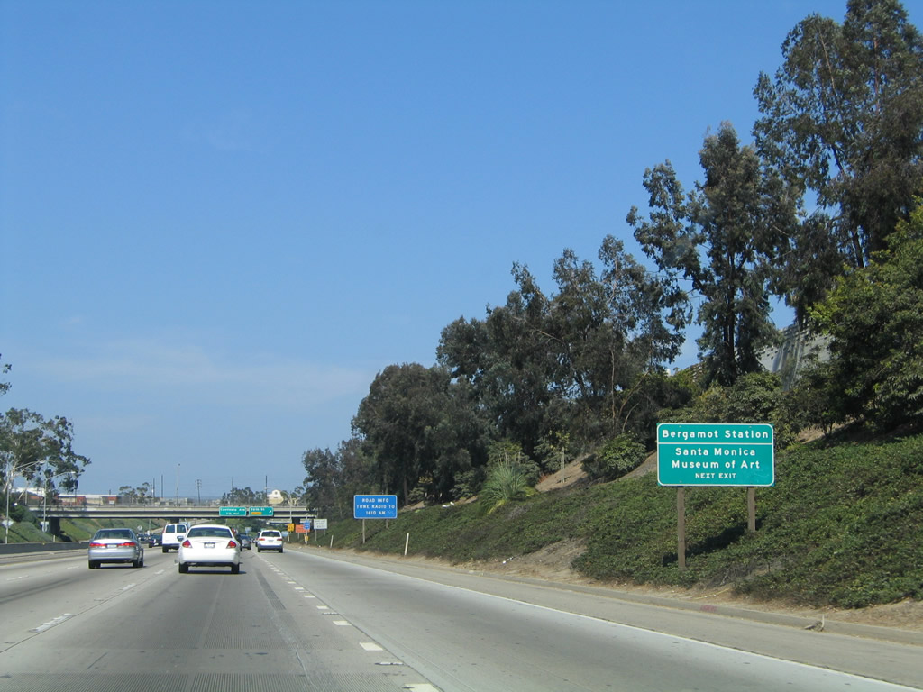
Use Exit 1B, 20th Street to the Santa Monica Museum of Art and Bergamot Station. Photo taken 08/24/04. |
|
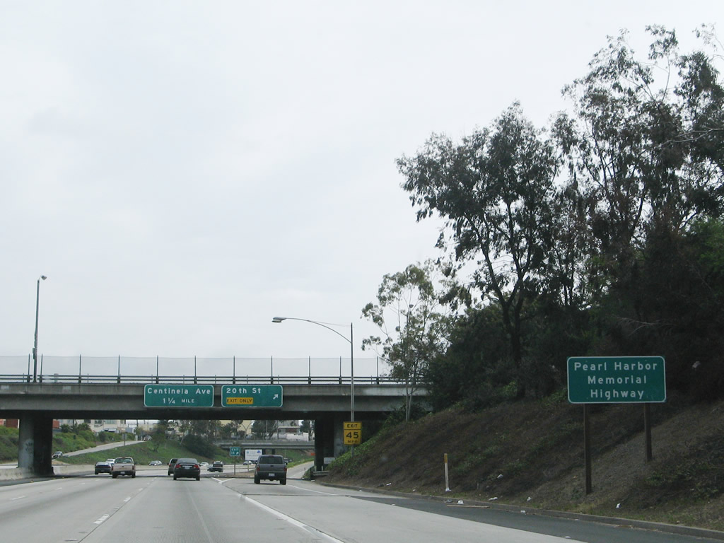
Interstate 10 is known as the Pearl Harbor Memorial Highway, a designation seen in both California and Arizona. The California segment of Interstate 10 was designated on December 7, 2004, on the anniversary of the Pearl Harbor invasion by Japan in the early stages of World War II. Arizona's designation was made in 2003 (per HJR2003-421R). Other states have designated segments of their highway systems as Pearl Harbor Memorial Highway as well. Photo taken 04/22/07. |
|
Eastbound Interstate 10 (Santa Monica Freeway) reaches Exit 1B, 20th Street. The next exit is Exit 2, Centinela Avenue. Photo taken 08/24/04. |
|
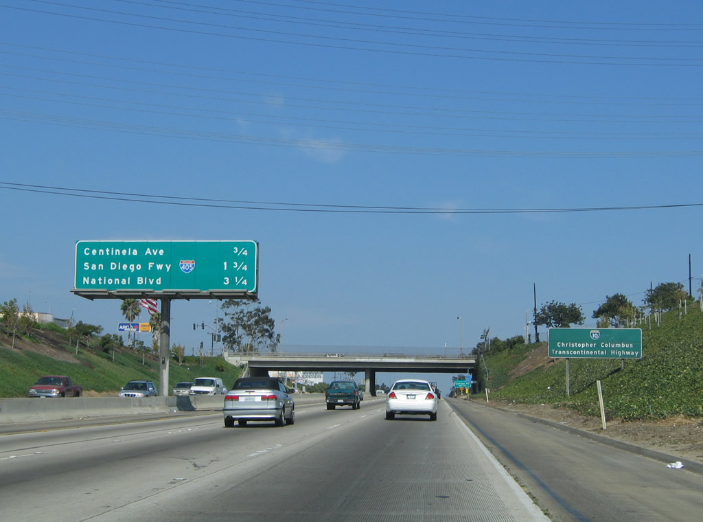
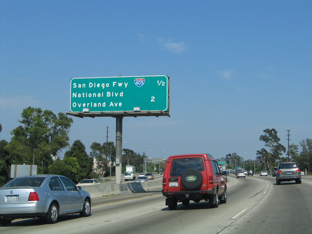
This interchange sequence sign provides the distance to the next four exits along Interstate 10 west: Exit 2, Centinela Avenue; Exit 3A, Interstate 405 (San Diego Freeway) north to Santa Clarita, Sacramento, and San Francisco Bay Area; Exit 3B, Interstate 405 (San Diego Freeway) south to Long Beach, Irvine, and San Diego; and Exit 4, National Boulevard and Overland Avenue. Photo taken 08/24/04. |
|
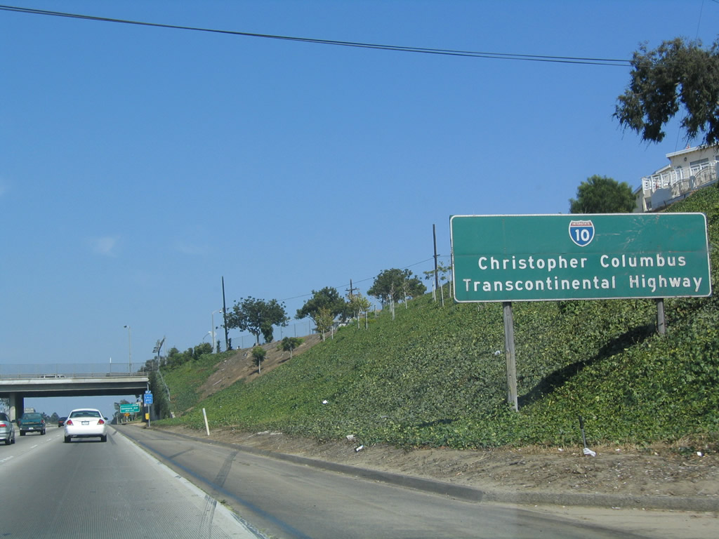
Interstate 10 in the state of California is known as the Christopher Columbus Transcontinental Highway; it was so designated by the California state legislature in 1976. Photo taken 08/24/04. |
|
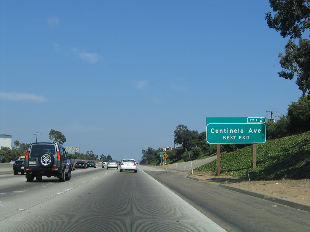
Centinela Avenue (Exit 2) serves as the boundary between the city of Santa Monica and city of Los Angeles. To Bundy Boulevard and Pico Boulevard, use Exit 2. Photo taken 08/24/04. |
|
Eastbound Interstate 10 (Santa Monica Freeway) reaches Exit 2, Centinela Avenue to Bundy Boulevard and Pico Boulevard. The next two exits follow within the city of Los Angeles for Interstate 405 north and south. Photo taken 08/24/04. |
|
This interchange sequence sign provides the distance to the next four exits along Interstate 10 east. Photo taken 08/24/04. |
|
An Interstate 10 east reassurance shield is posted after the on-ramp from Centinela Avenue. Photo taken 08/24/04. |
|
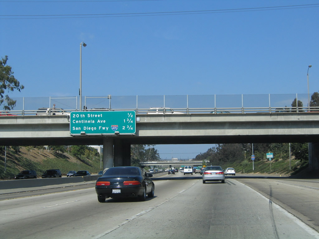
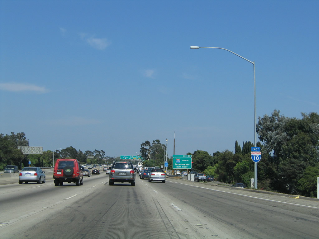
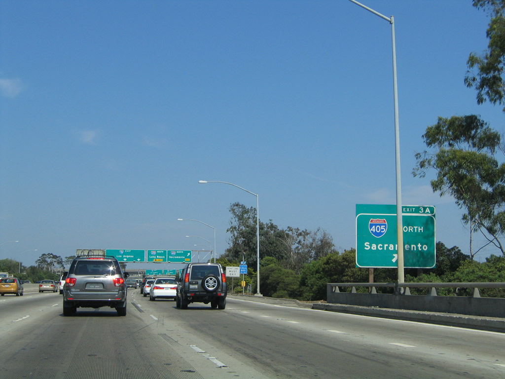
The next exit along Interstate 10 (Santa Monica Freeway) east is Exit 3A, Interstate 405 (San Diego Freeway) north Santa Clarita, Sacramento, and San Francisco Bay Area. Interstate 405 is a very busy freeway that extends from Interstate 5 in the northern San Fernando Valley south to Long Beach and then southeast through Irvine back to Interstate 5 in Lake Forest. Photo taken 08/24/04. |
|
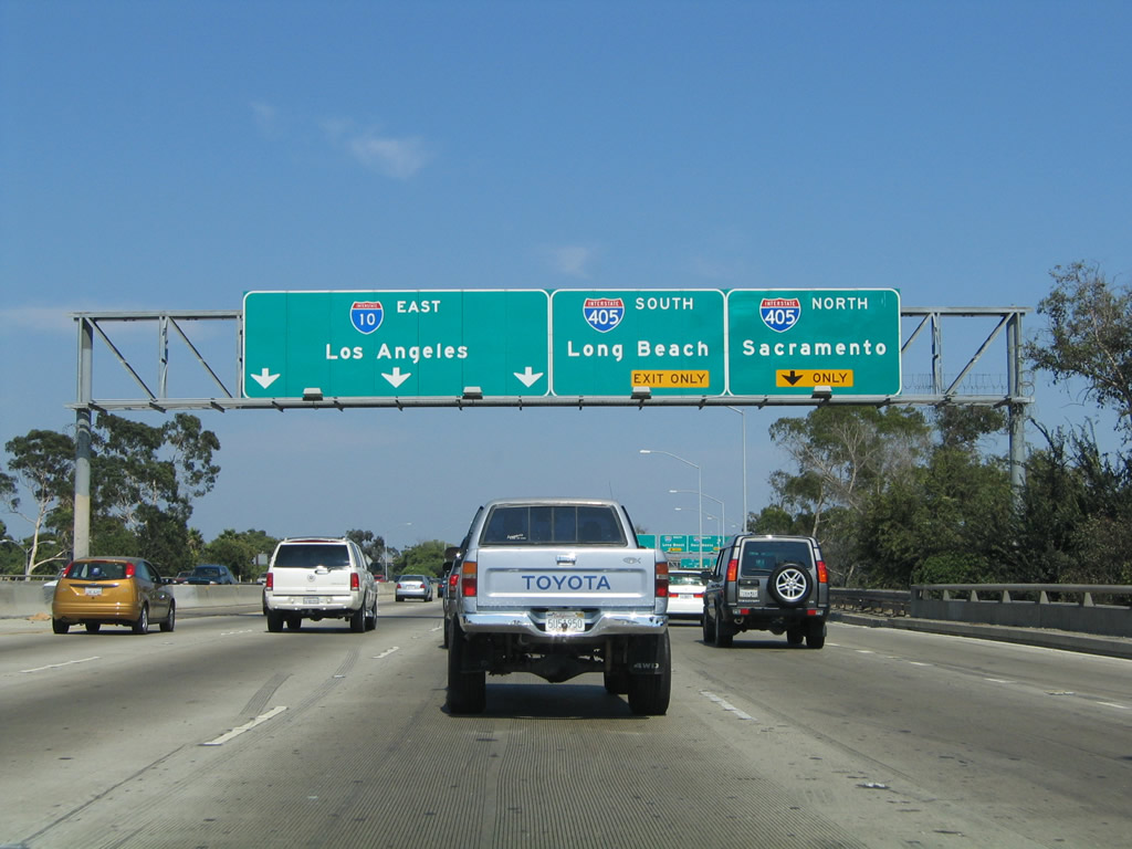
The right lane becomes exit only for Exit 3A, Interstate 405 north, and the #2 lane becomes exit only for Exit 3B, Interstate 405 south. The left three lanes continue east on Interstate 10 (Santa Monica Freeway) toward downtown Los Angeles. The Santa Monica Freeway between Interstate 405 and Interstate 5 has traffic volumes that cause it to be known one of the busiest freeways (if not the busiest freeway) in the country. Interstate 90-94/Dan Ryan Expressway is a close competitor for the "busiest freeway" distinction. Photo taken 08/24/04. |
|
Another roadside sign for Exit 3A (Interstate 405 north) is posted shortly thereafter. Photo taken 08/24/04. |
|
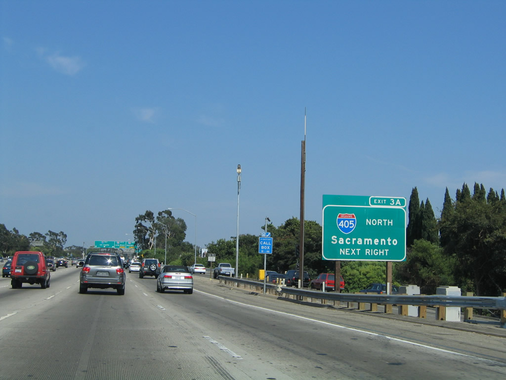
Eastbound Interstate 10 (Santa Monica Freeway) reaches Exit 3A, Interstate 405 (San Diego Freeway) north to Santa Clarita, Sacramento, and San Francisco Bay Area. The next ramp connects to Exit 3B, Interstate 405 south to LAX, Long Beach, and San Diego. Photo taken 08/24/04. |
|
Immediately thereafter, eastbound Interstate 10 (Santa Monica Freeway) reaches Exit 3B, Interstate 405 (San Diego Freeway) south to Los Angeles International Airport (LAX), Long Beach, Irvine, and San Diego. The left three lanes continue east on Interstate 10 toward downtown LA. Photo taken 08/24/04. |
| Interstate 10/Santa Monica (Rosa Parks) (Christopher Columbus Transcontinental) Freeway west |
|
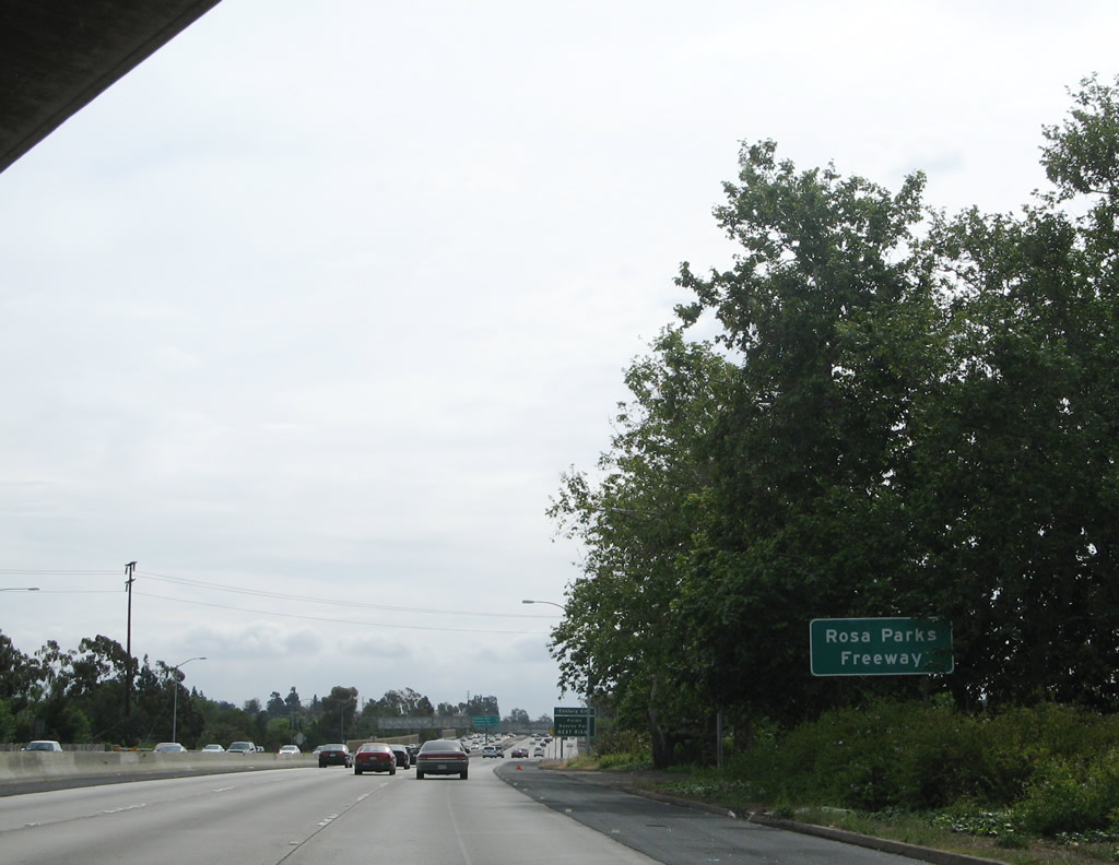
Interstate 10 between Interstate 405 and Interstate 110 is also known as the Rosa Parks Freeway, named in honor of Rosa Parks, the "Mother of the Modern Day Civil Rights Movement," who refused to give up a seat on a bus back in 1955 in Montgomery, Alabama. The state designated this stretch of freeway in her honor on February 4, 2002, on her 89th birthday. Photo taken 04/22/07. |
|
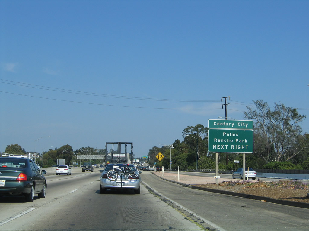
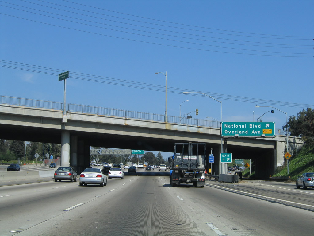
The next exit along Interstate 10/Santa Monica (Rosa Parks) Freeway east is Exit 4, National Boulevard and Overland Avenue. Use National Boulevard west to the Los Angeles community of Palms and Manning Avenue northwest to the community of Rancho Park. Photo taken 08/24/04. |
|
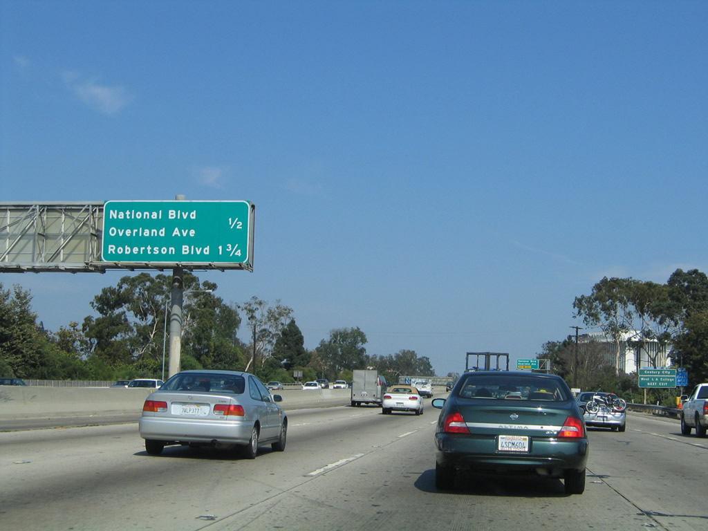
This mileage sign along Interstate 10 (Santa Monica Freeway) east provides the distance to the next two exits: Exit 4, National Boulevard and Overland Avenue and Exit 6, Robertson Boulevard to Culver City. Photo taken 08/24/04. |
|
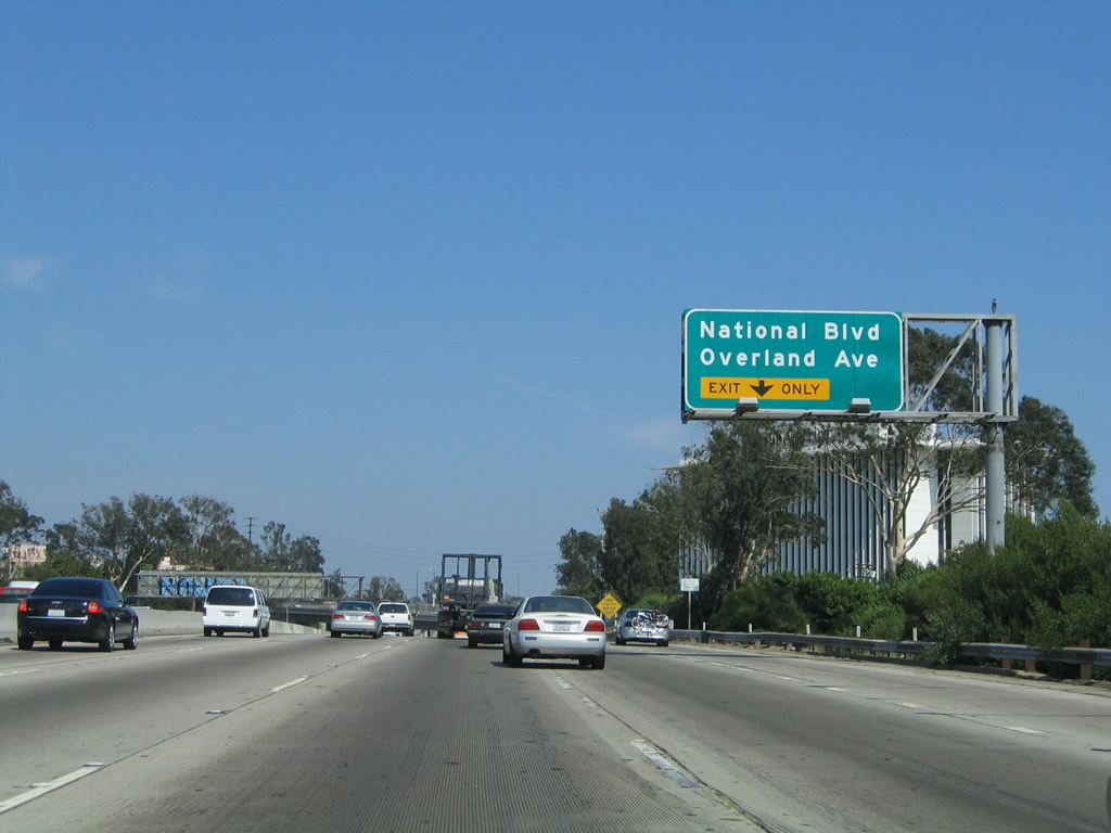
The right lane of Interstate 10 (Santa Monica Freeway) east becomes exit only for Exit 4, National Boulevard and Overland Avenue. Photo taken 08/24/04. |
|
An advance exit number sign warns of the pending off-ramp to Exit 4, National Boulevard and Overland Avenue. Photo taken 08/24/04. |
|
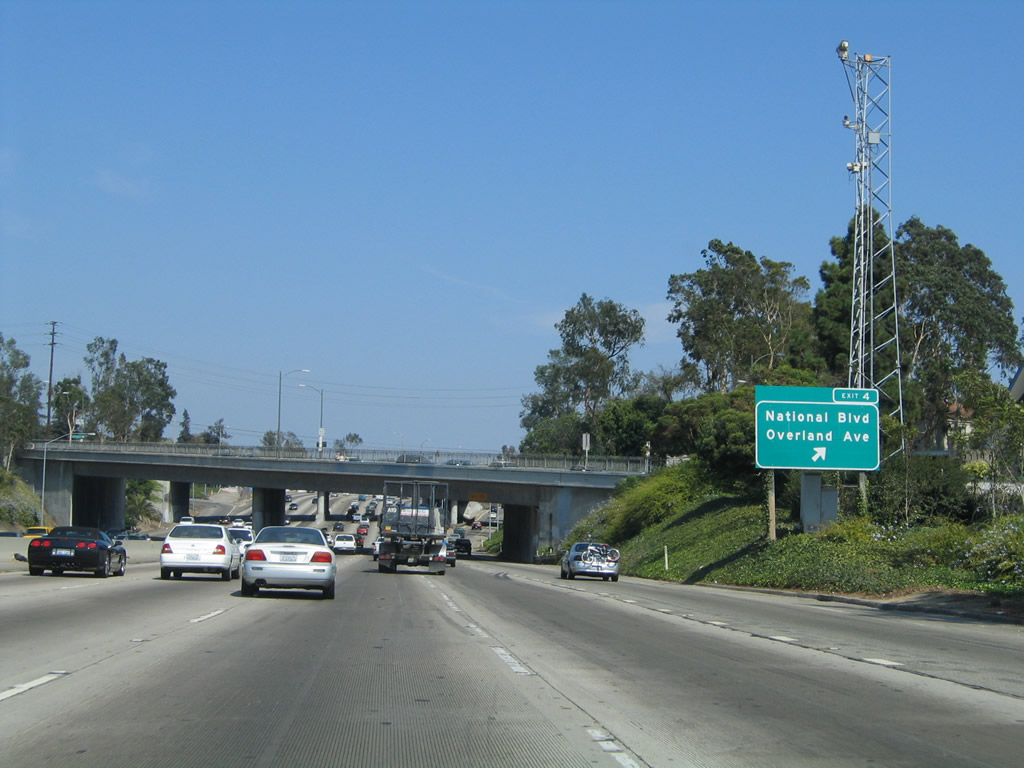
Eastbound Interstate 10 (Santa Monica Freeway) reaches Exit 4, National Boulevard and Overland Avenue. The next exit along eastbound is Exit 6, Robertson Boulevard to Culver City. Photo taken 08/24/04. |
|
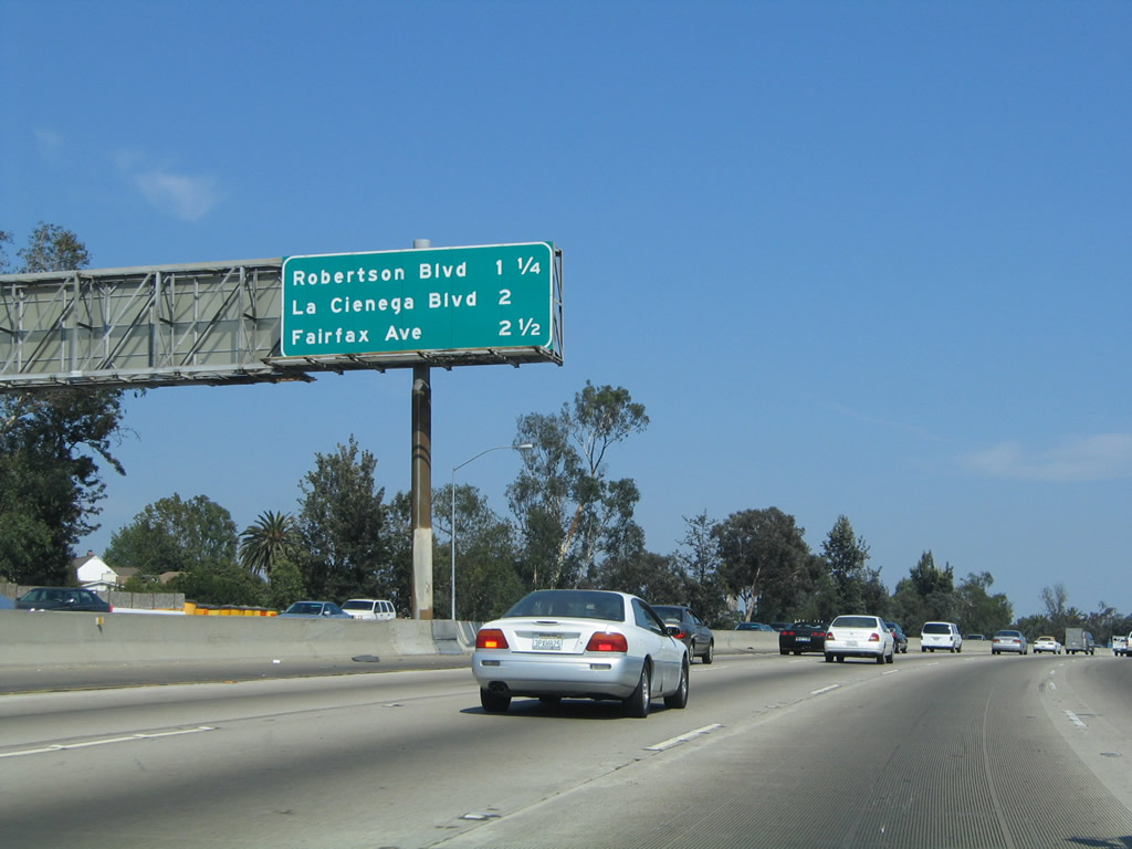
This mileage sign along Interstate 10 (Santa Monica Freeway) east provides the distance to the next three exits: Exit 6, Robertson Boulevard to Culver City; Exit 7A, La Cienega Boulevard and California 187 (Venice Boulevard) west; and Exit 7B, Fairfax Avenue. Photo taken 08/24/04. |
|
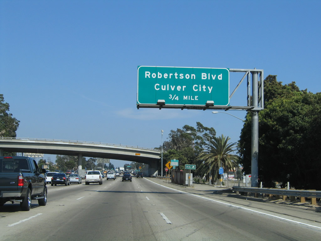
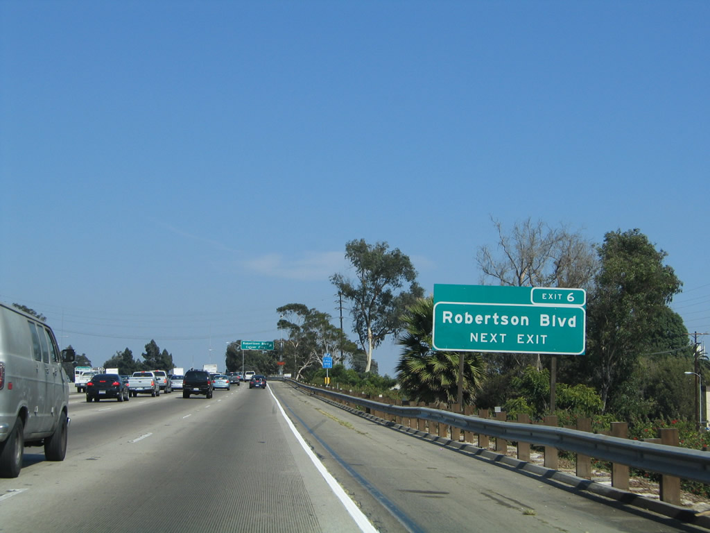
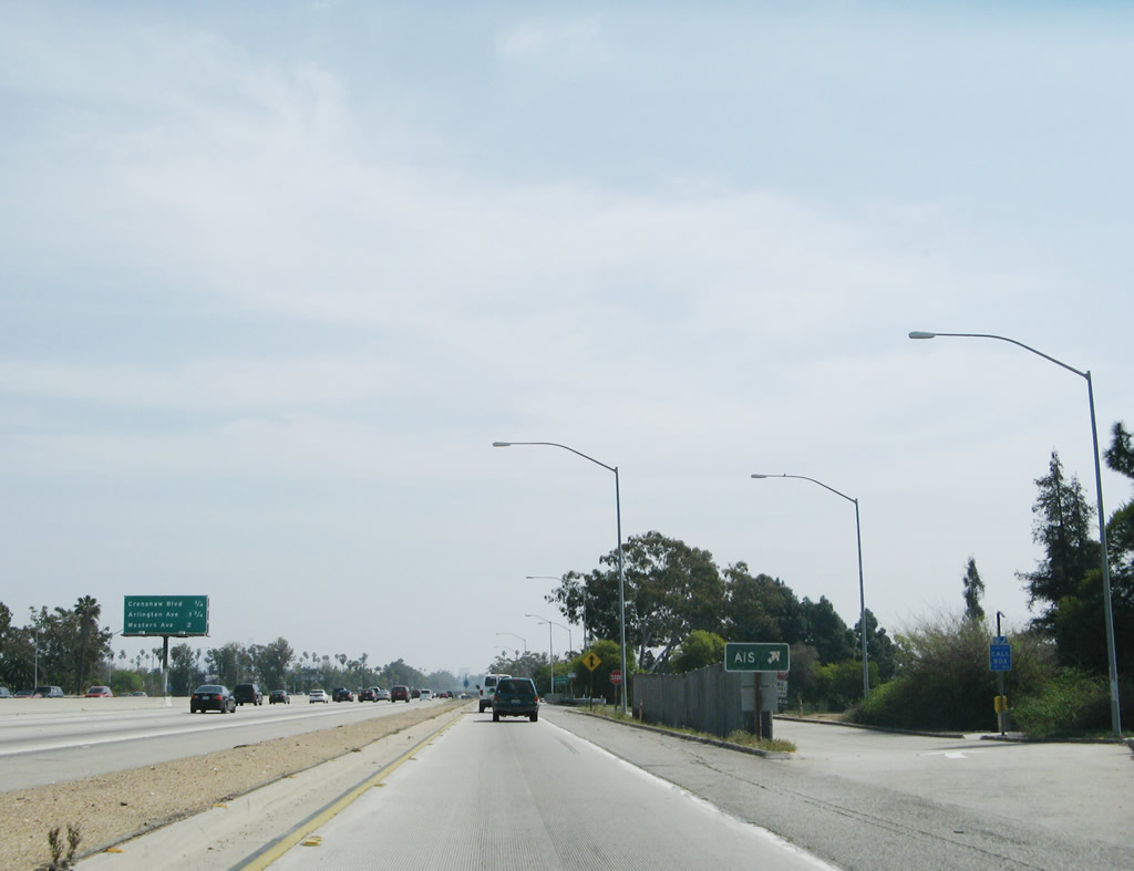
The next exit along Interstate 10 (Santa Monica Freeway) east is Exit 6, Robertson Boulevard to Culver City (0.75 mile). An accident investigation site (AIS) is located prior to the flyover ramp that connects Manning Avenue with Interstate 10 east. Photo taken 08/24/04. |
|
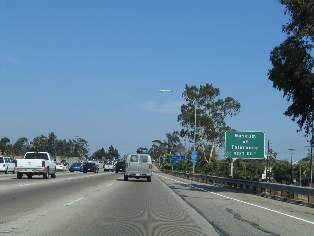
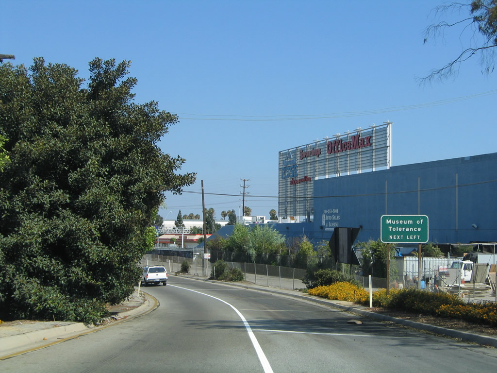
The Museum of Tolerance is located on Pico Boulevard. Take Robertson Boulevard north to Pico Boulevard, then turn left (west). The museum is located on the south side (left side) of Pico Boulevard. Photo taken 08/24/04. |
|
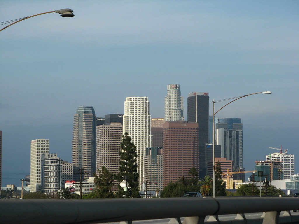
Use Robertson Boulevard north to the city of Beverly Hills, which consists of 5.7 square miles and is home to 33,784 people as of the 2000 Census. The city was incorporated on October 22, 1906, and was seen as a suburban development between Santa Monica and Los Angeles. The median household income as of 2000 was $70,945, which is not the wealthiest area in California. Known as home to many rich and famous celebrities, home tours through Beverly Hills and Bel Air are well known tourist destinations. Beverly Hills has a famed downtown area that includes Rodeo Drive and its fabulous boutique stores. Look around town for a map to find the homes of the rich and famous. Photo taken 08/24/04. |
|
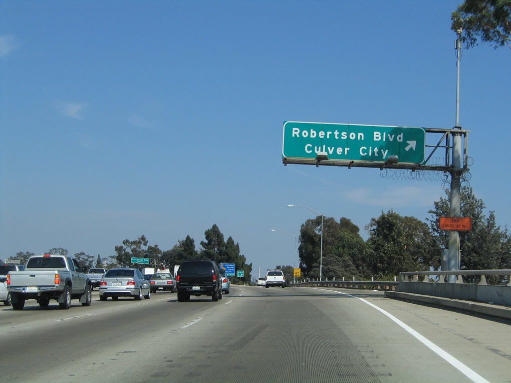
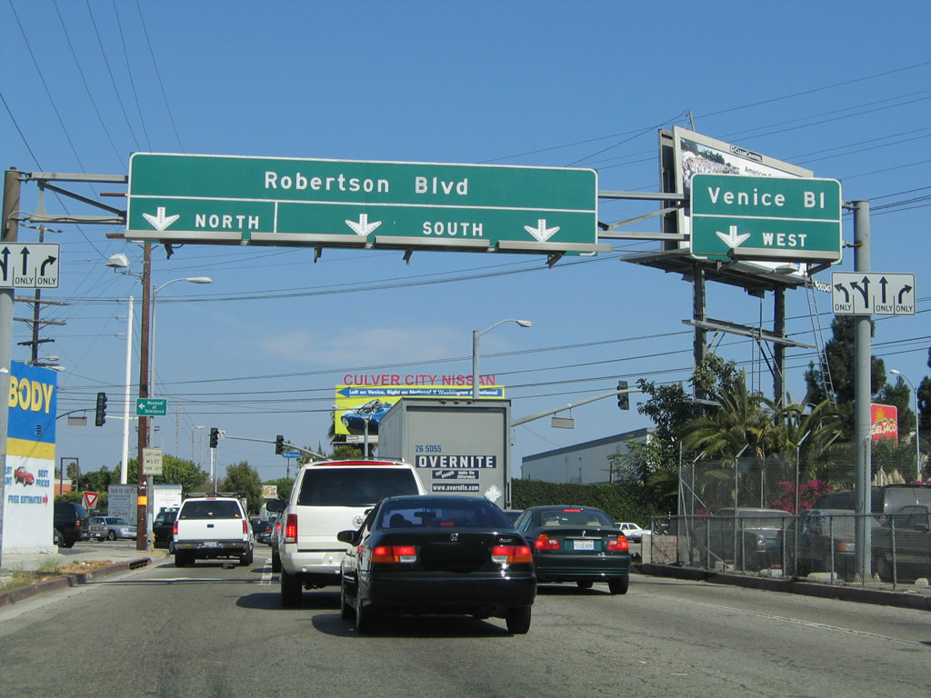
Eastbound Interstate 10/Santa Monica (Rosa Parks) Freeway reaches Exit 6, Robertson Boulevard to the city of Culver City, which sits south of Interstate 10. Culver City is home to 38,816 people as of the 2000 Census and incorporated on September 20, 1917. Many films and television shows have been filmed along the streets of Culver City. Photo taken 08/24/04. |
|
A variety of signs are posted after the Exit 6 gore point for the next off-ramp (Exit 7A, La Cienega Boulevard). Photo taken 08/24/04. |
|
Now on the off-ramp to Exit 6, turn left to follow Robertson Boulevard north to the Museum of Tolerance. Photo taken 08/24/04. |
|
The left lane connects to Robertson Boulevard north, while the middle two lanes connect to Robertson Boulevard south. To California 187 (Venice Boulevard), use the right lane. Photo taken 08/24/04. |
|
The next exit along Interstate 10 (Santa Monica Freeway) east is Exit 7A, La Cienega Boulevard and California 187 (Venice Boulevard) west (0.75 mile). California 187 is a mostly unsigned state highway that connects Interstate 10 Exit 7A with California 1 (Pacific Coast Highway) in the city of Los Angeles community of Venice. The entire route is a multi-lane divided surface street that features a wide median and was a former alignment of the Pacific Electric railway. Photo taken 04/22/07. |
|
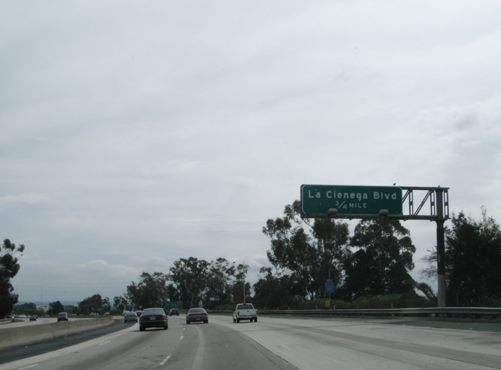
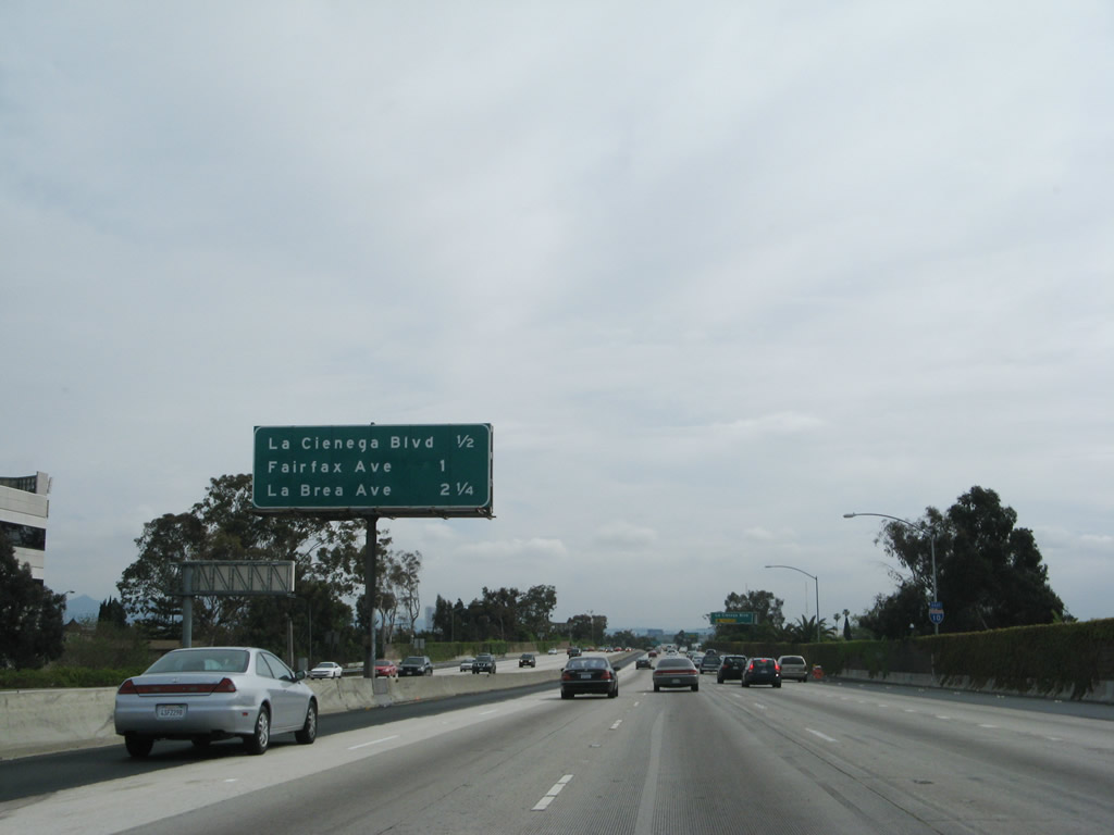
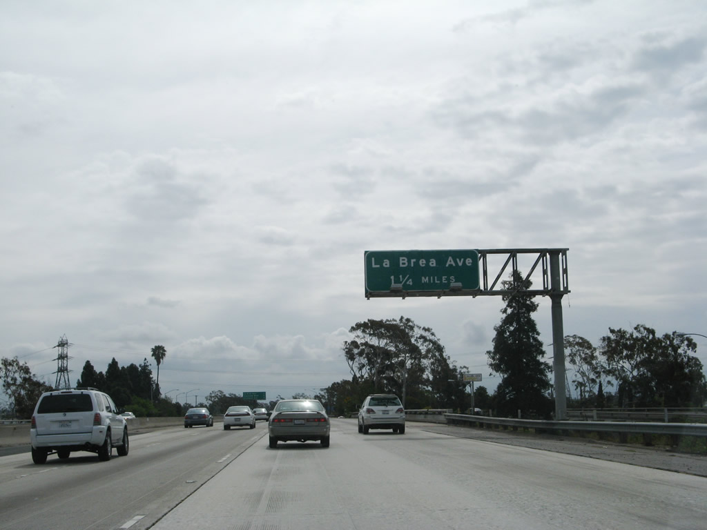
This mileage sign along Interstate 10 (Santa Monica Freeway) east provides the distance to the next three exits: Exit 7A, La Cienega Boulevard and California 187 (Venice Boulevard) west; Exit 7B, Fairfax Avenue; and Exit 8, La Brea Avenue. Photo taken 04/22/07. |
|
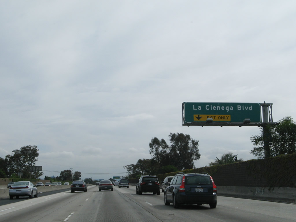
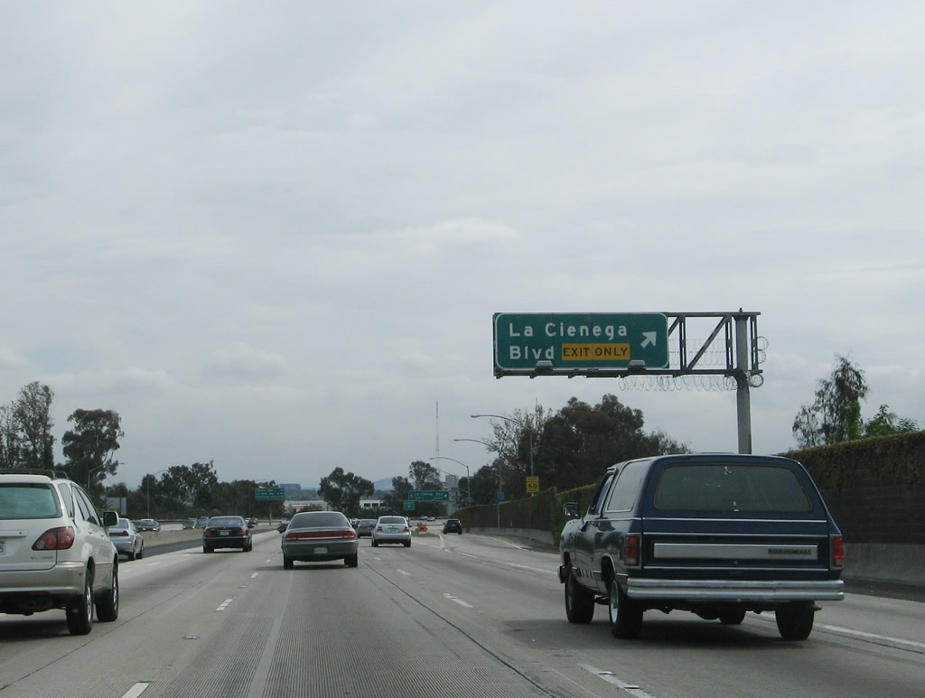
The right lane of Interstate 10 (Santa Monica Freeway) east becomes exit only for Exit 7A, La Cienega Boulevard and California 187 (Venice Boulevard) west. La Cienega Boulevard is a city expressway that travels south from Interstate 10 past the Baldwin Hills to merge with Interstate 405 (San Diego Freeway) along the western boundary of the city of Inglewood. The La Cienega corridor is part of the proposed route of a southern segment of California 170, but the state did not accept the expressway nor does the state maintain it. To the north, La Cienega Boulevard travels toward the city of West Hollywood. Photo taken 04/22/07. |
|
Eastbound Interstate 10 (Santa Monica Freeway) reaches Exit 7A, La Cienega Boulevard and California 187 (Venice Boulevard) west. Upon exiting, the ramp splits to north and south La Cienega Boulevard. The next exit is Exit 7B, Fairfax Avenue (0.25 mile). Photo taken 04/22/07. |
|
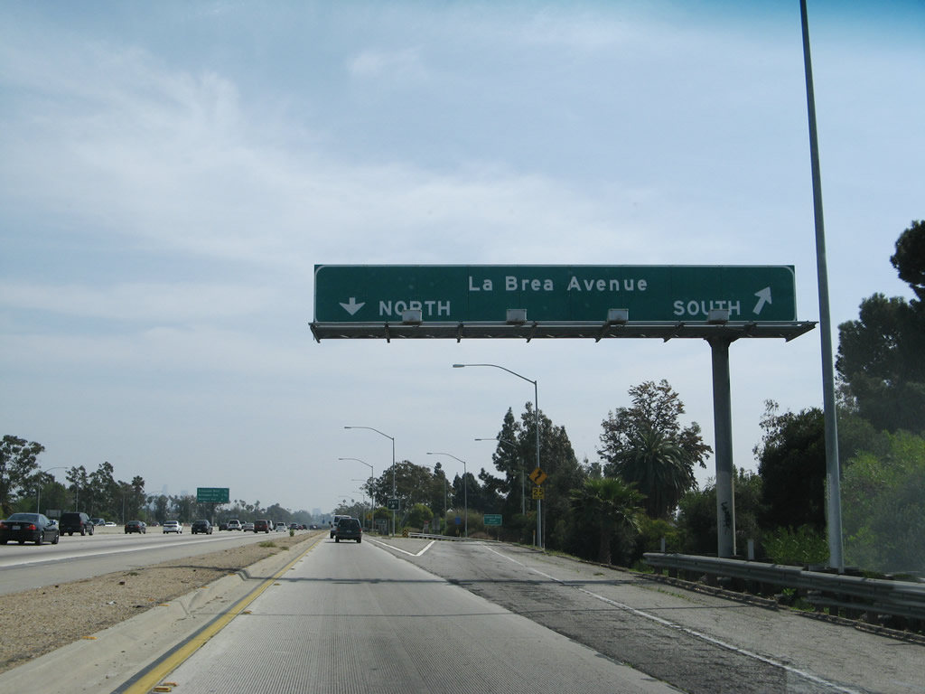
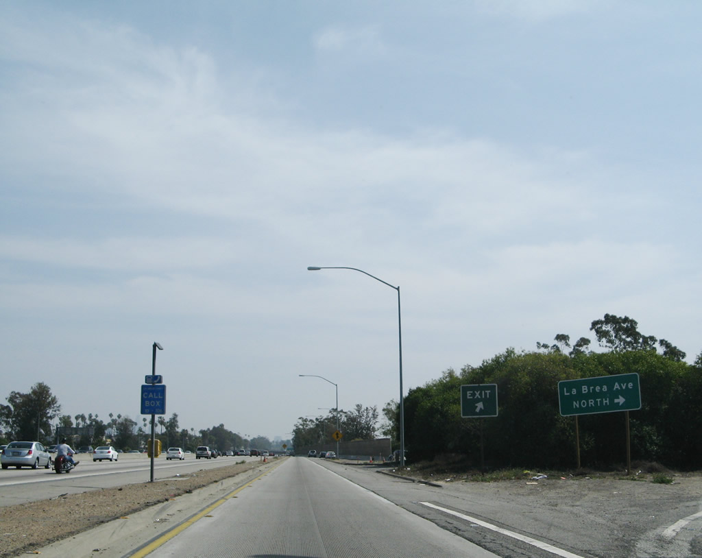
After the Fairfax Avenue off-ramp, the next exit along Interstate 10 (Santa Monica Freeway) east is Exit 8, La Brea Avenue. Use La Brea Avenue north to Mid-City and the Miracle Mile. To the world famous La Brea Tar Pits, use La Brea Avenue north to Wilshire Boulevard (Miracle Mile) west to the Los Angeles County Museum of Art. Note that since "La Brea" means "Tar Pits," the term "La Brea Tar Pits" is redundant. To the south, La Brea Avenue travels through Baldwin Village toward Baldwin Hills and Windsor Hills before leaving the city of Los Angeles and entering the city of Inglewood. Photo taken 04/22/07. |
|
The La Brea Avenue interchange is a modified cloverleaf, so through traffic may exit and return back to the main lanes of Interstate 10. This is the first of a series of collector distributor and express/local configurations that continue along Interstate 10 all the way to the Interstate 5 U.S. 101 California 60 East Los Angeles Interchange. Photo taken 03/25/07. |
|
Eastbound Interstate 10 (Santa Monica Freeway) reaches Exit 8, La Brea Avenue. Photo taken 03/25/07. |
|
Now on the collector distributor lanes for Exit 8, the first ramp connects eastbound Interstate 10 to La Brea Avenue south; the second right connects to La Brea Avenue north. Photo taken 03/25/07. |
|
An accident investigation site is located within the cloverleaf interchange between the north and south La Brea Avenue off-ramps. Photo taken 03/25/07. |
|
Still in the collector distributor lanes for Exit 8, the second ramp connects eastbound Interstate 10 to La Brea Avenue north. From here, the c/d lanes will merge back onto the mainline. Photo taken 03/25/07. |
|
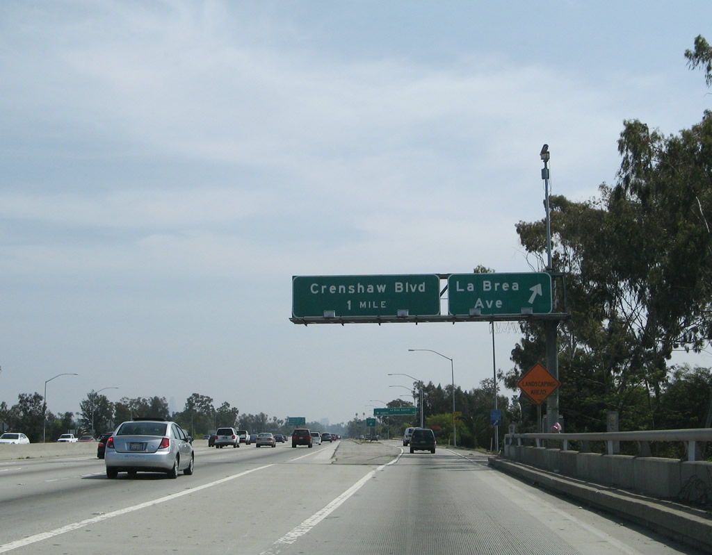
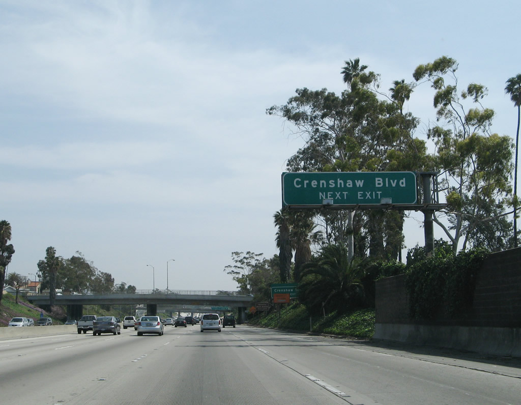
The next exit along Interstate 10 (Santa Monica Freeway) east is Exit 9, Crenshaw Boulevard. Use Crenshaw Boulevard north to the communities of Lafayette Square, Country Club Park, and Windsor Square. To the south, Crenshaw Boulevard leads to Jefferson Park, Crenshaw, Leimert Park, and Hyde Park. Photo taken 03/25/07. |
|
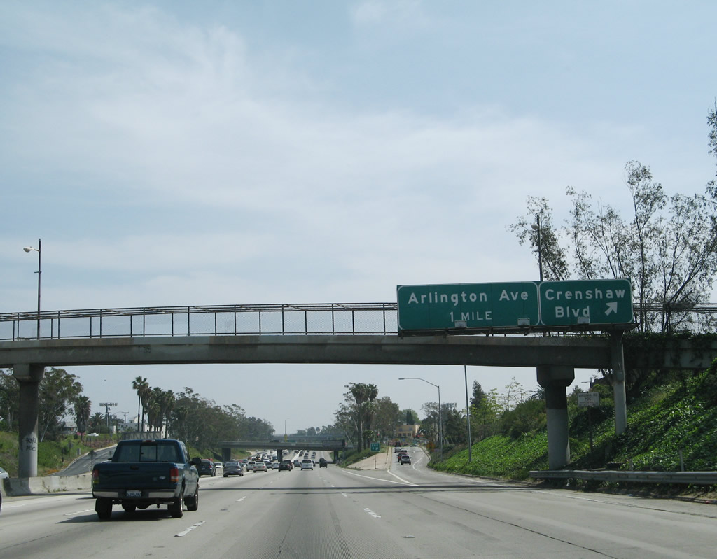
Eastbound Interstate 10 (Santa Monica Freeway) reaches Exit 9, Crenshaw Boulevard (diamond interchange). The next exit along Interstate 10 east is Exit 10, Arlington Avenue (one mile). Photo taken 03/25/07. |
|
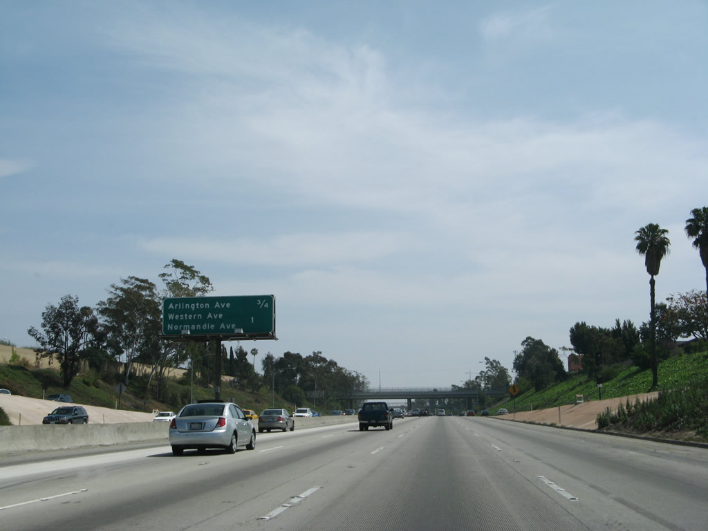
This mileage sign provides the distance to the next three exits along Interstate 10 (Santa Monica Freeway) east: Exit 10, Arlington Avenue; Exit 11A, Western Avenue; and Exit 11B, Normandie Avenue. Photo taken 03/25/07. |
|
Eastbound Interstate 10 (Santa Monica Freeway) reaches Exit 10, Arlington Avenue. The next exit along Interstate 10 east is Exits 11A-B, Western Avenue and Normandie Avenue. Photo taken 03/25/07. |
|
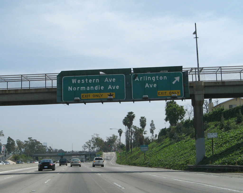
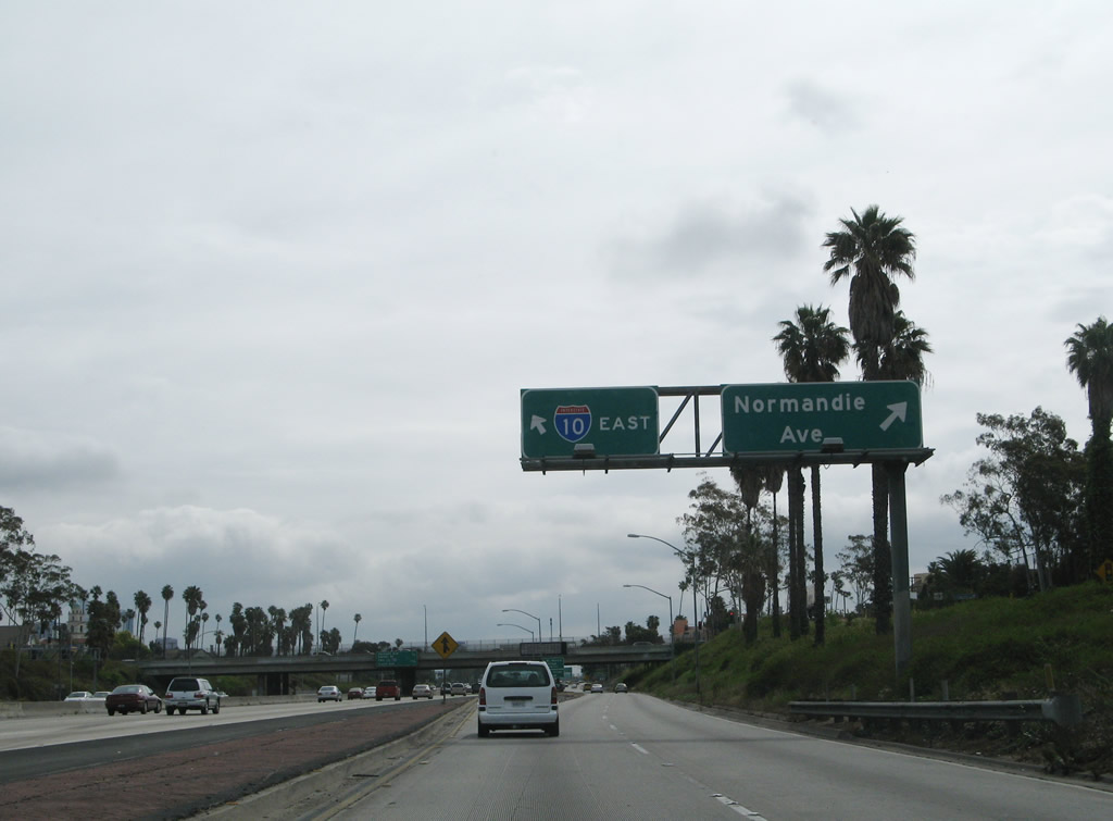
At this point, Interstate 10 (Santa Monica Freeway) begins a dual freeway configuration. The right lane (designated as Exit 11) connects Interstate 10 east with Exits 11A (Western Avenue) and 11B (Normandie Avenue). The left three lanes begin an express configuration. Photo taken 03/25/07. |
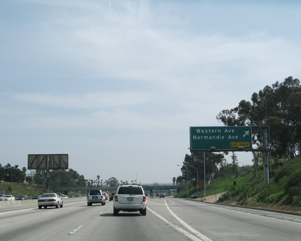
|
The first ramp in the Interstate 10 eastbound local lanes is the ramp to Exit 11A, Western Avenue. The next exit within the local lanes is Exit 11B, Normandie Avenue. Over in the main lanes, a sign advises of the next ramp connecting to the local lanes, which serves Exits 12A-B (Vermont Avenue and Hoover Street). Photo taken 04/22/07. |
|
After the Western Avenue off-ramp, traffic may merge back onto the main lanes, or remain in the local lanes to connect to Exit 11B, Normandie Avenue and Exits 12A-B. Photo taken 04/22/07. |
|
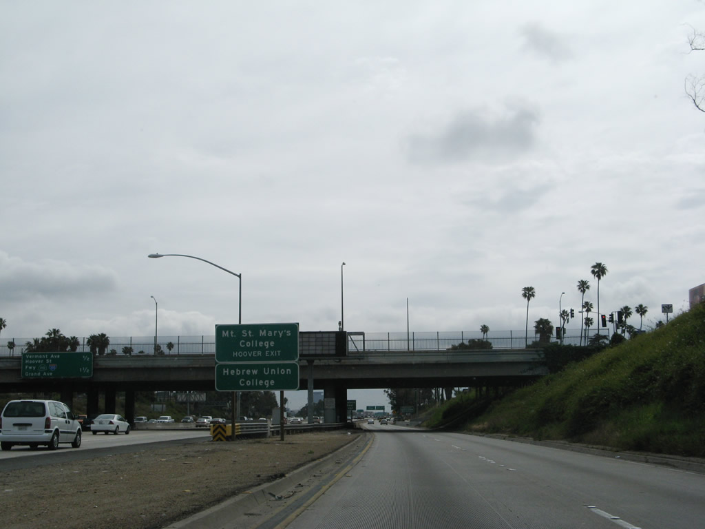
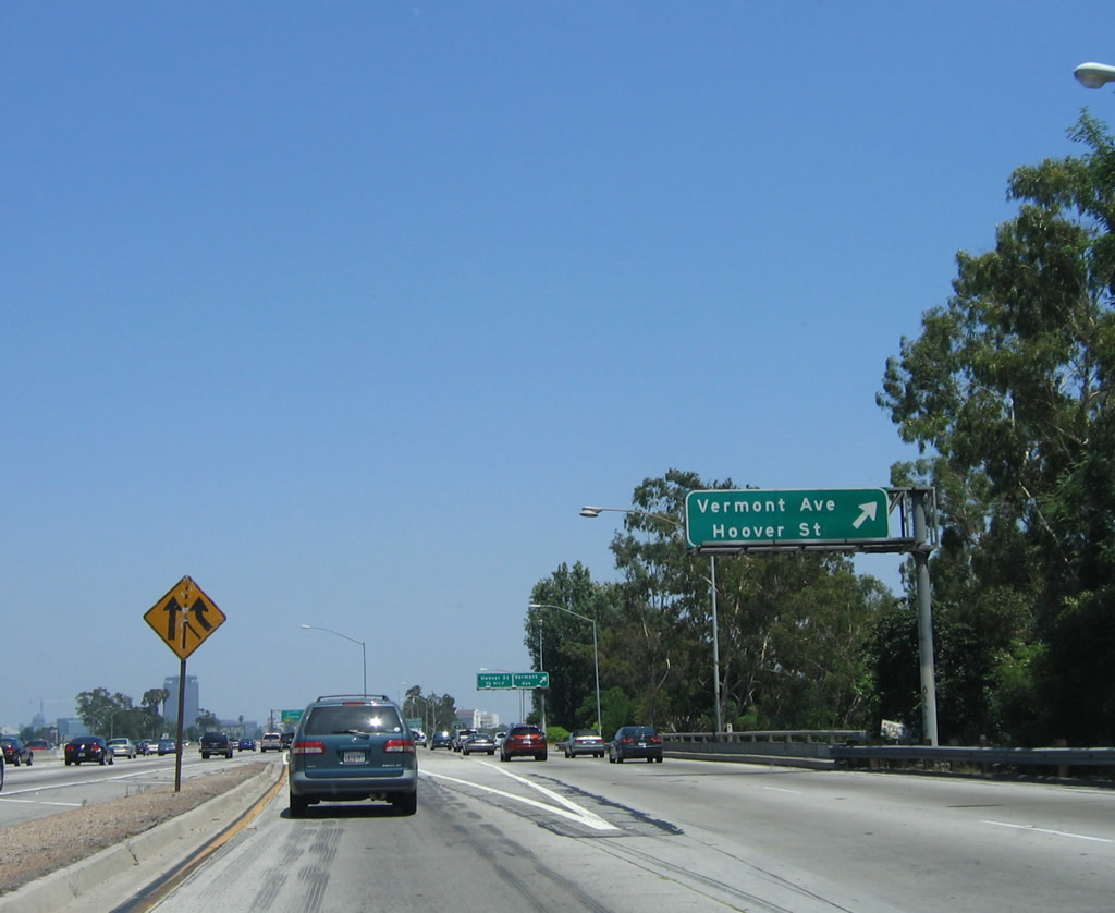
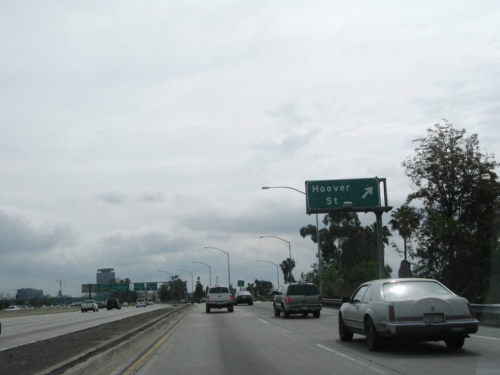
Use Hoover Street (Exit 12B) to the University of Southern California, Mt. St. Mary's College, and Hebrew Union College. Photo taken 04/22/07. |
|
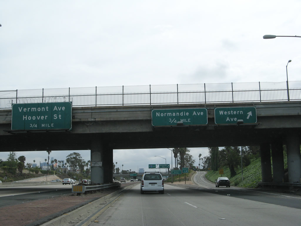
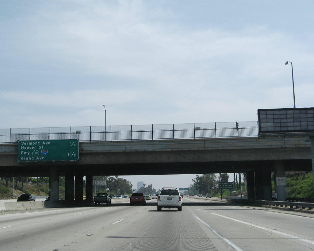
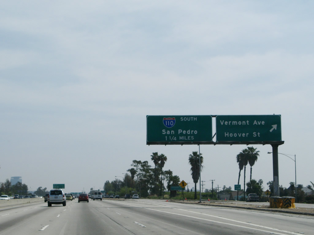
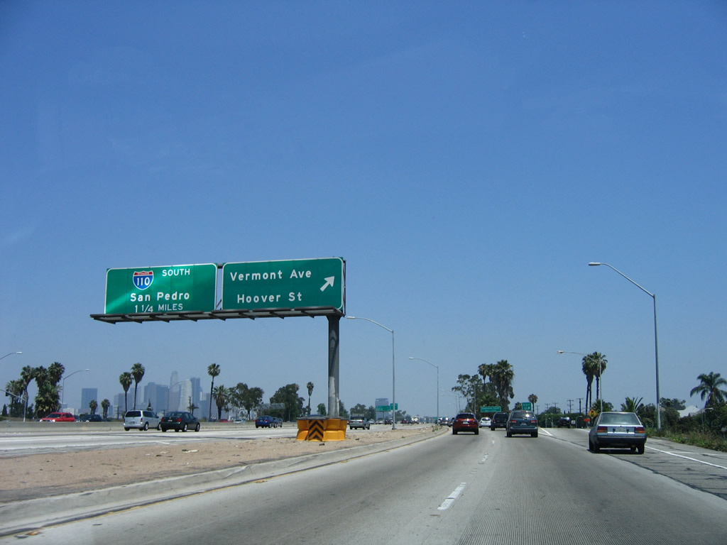
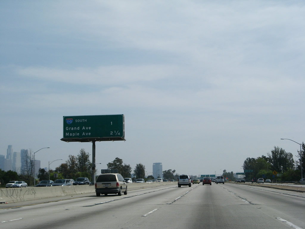
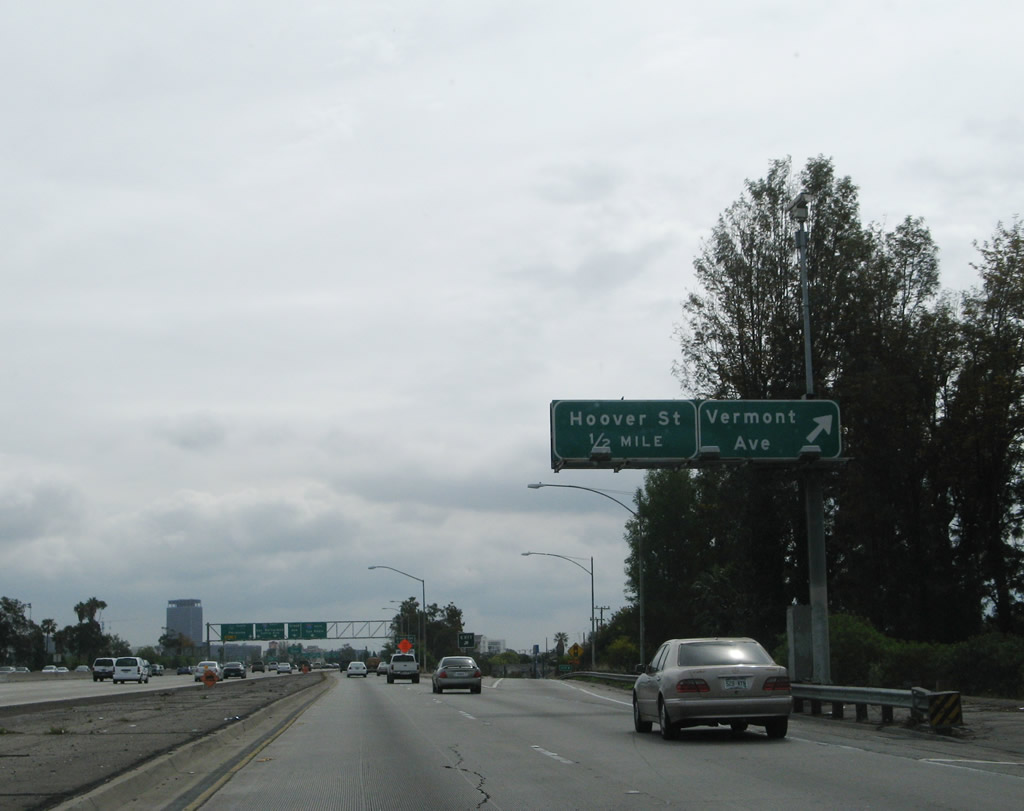
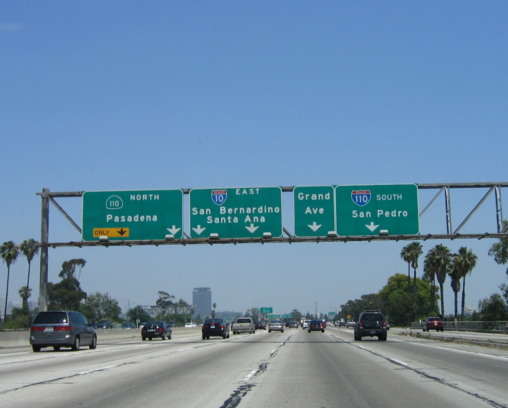
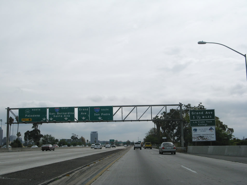
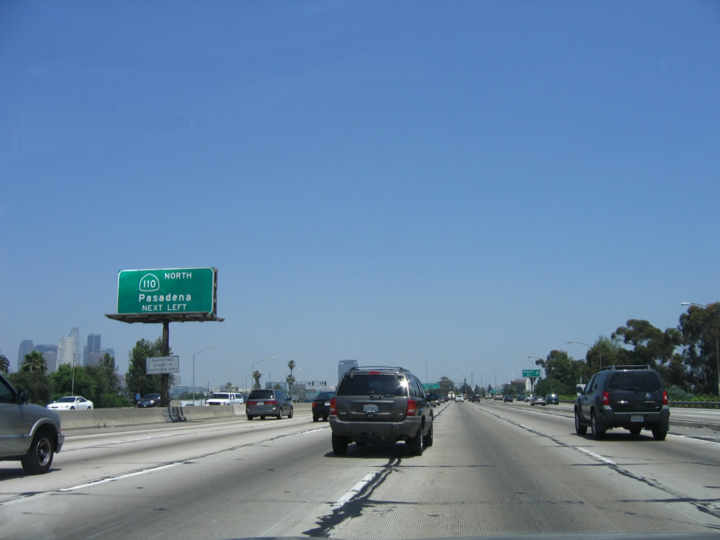
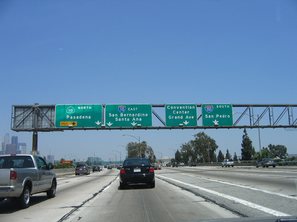
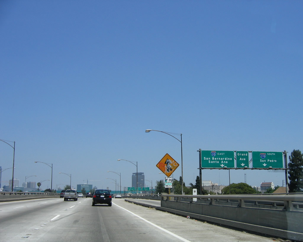
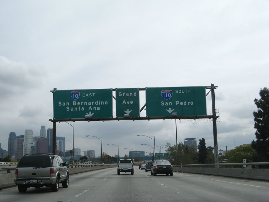
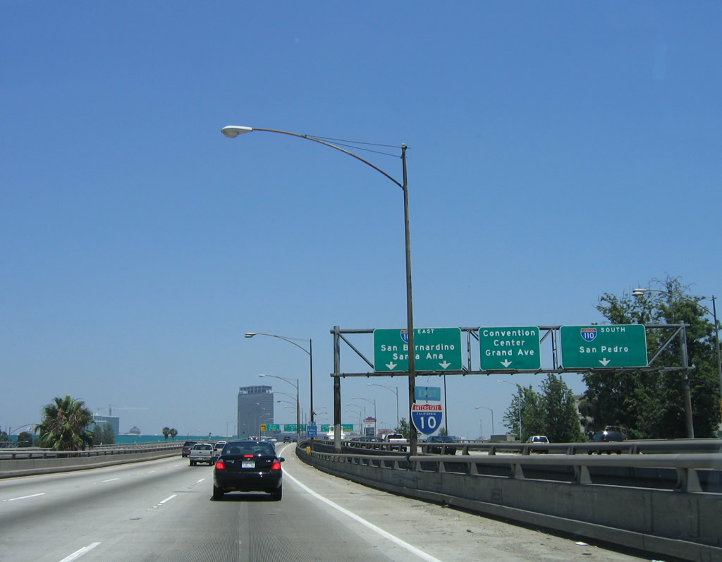
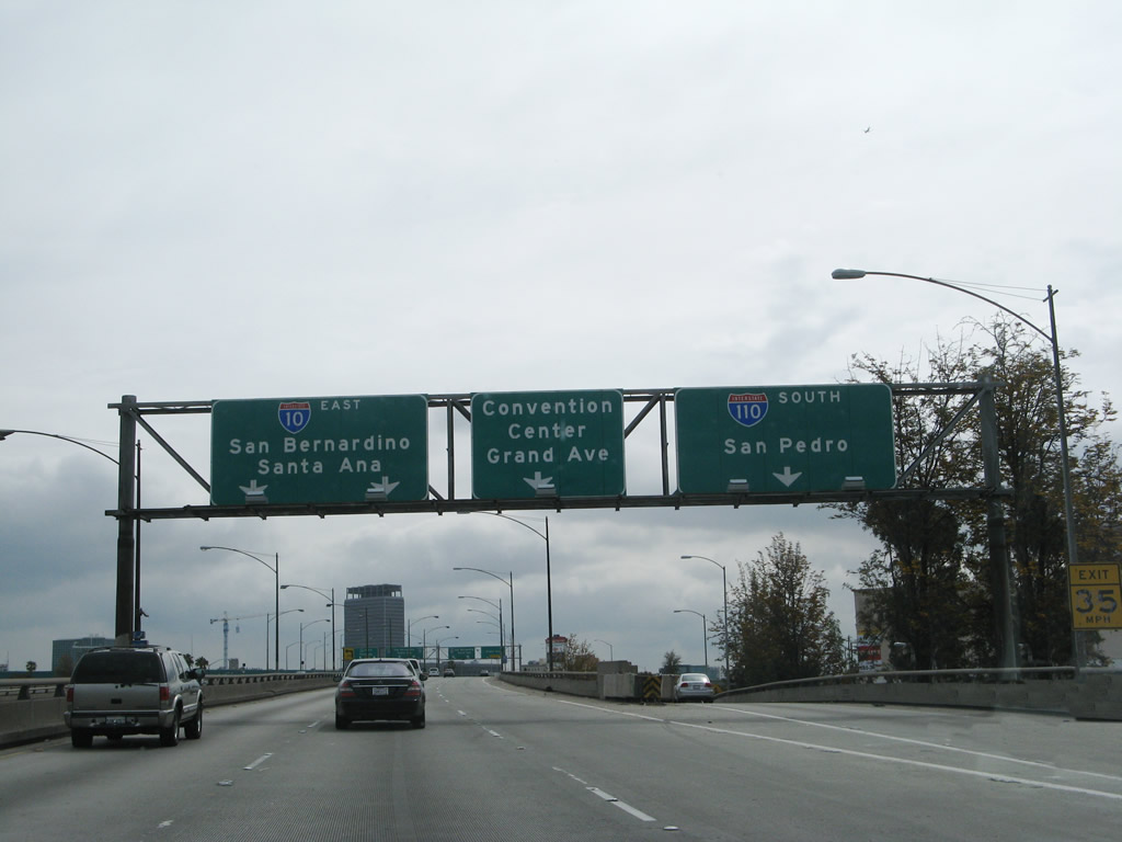
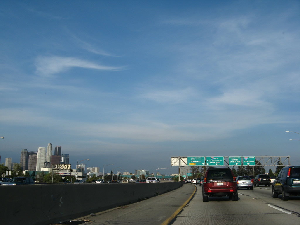
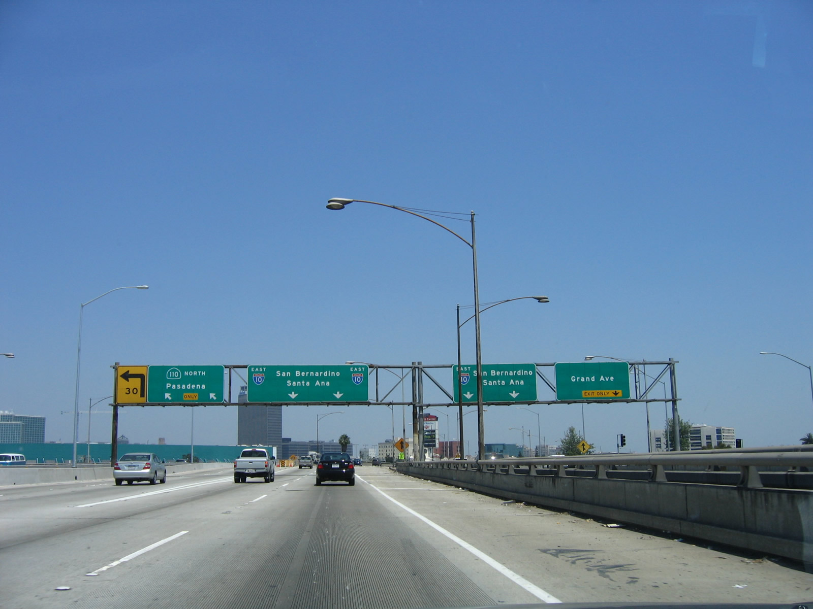
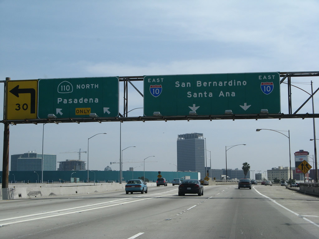
Back on the main lanes, this mileage sign provides the distance to the next several exits along Interstate 10 (Santa Monica Freeway) east: Exit 12A, Vermont Avenue; Exit 12B, Hoover Street; Exit 13A, Interstate 110 (Harbor Freeway) south to San Pedro; Exit 13B, California 110/Harbor Freeway north to downtown Los Angeles and Pasadena; and Exit 13C, Grand Avenue. At this point, Interstate 10 passes under Western Avenue. Photo taken 03/25/07. |
|
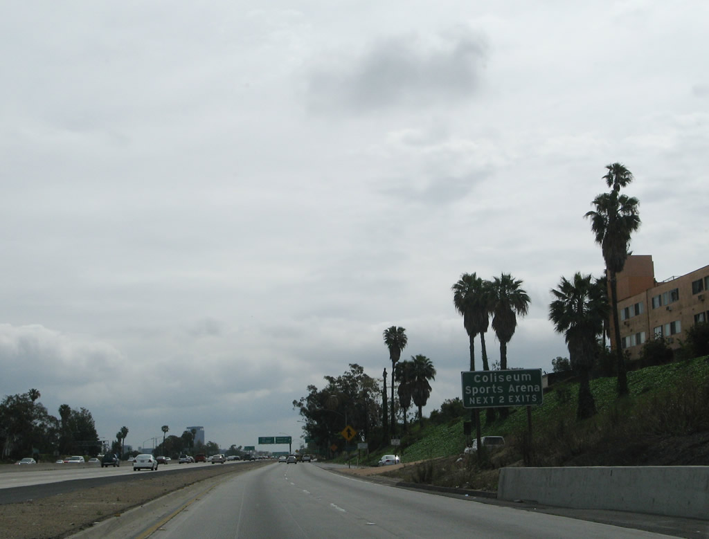
Shifting back to the local lanes, use Exit 11B, Normandie Avenue; Exit 12A, Vermont Avenue; or Exit 12B, Hoover Street south to the University of Southern California and Los Angeles Coliseum. Photo taken 03/25/07. |
|
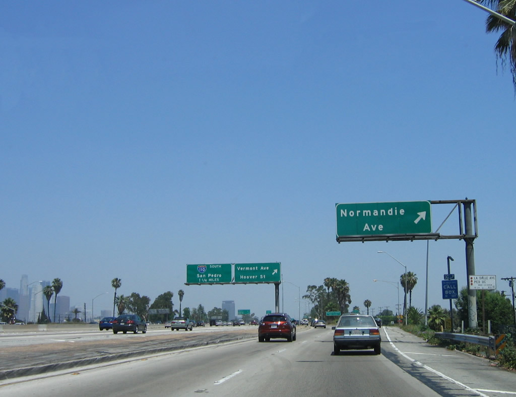
On the local lanes, eastbound Interstate 10/Santa Monica (Rosa Parks) Freeway reaches Exit 11B, Normandie Avenue. The next two off-ramps from the local lanes will be Exit 12A, Vermont Avenue and Exit 12B, Hoover Street. Photo taken 06/17/06. |
|
|
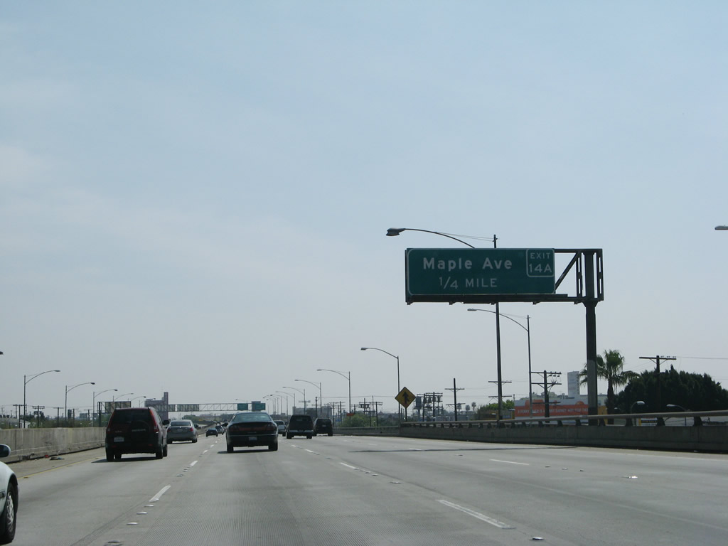
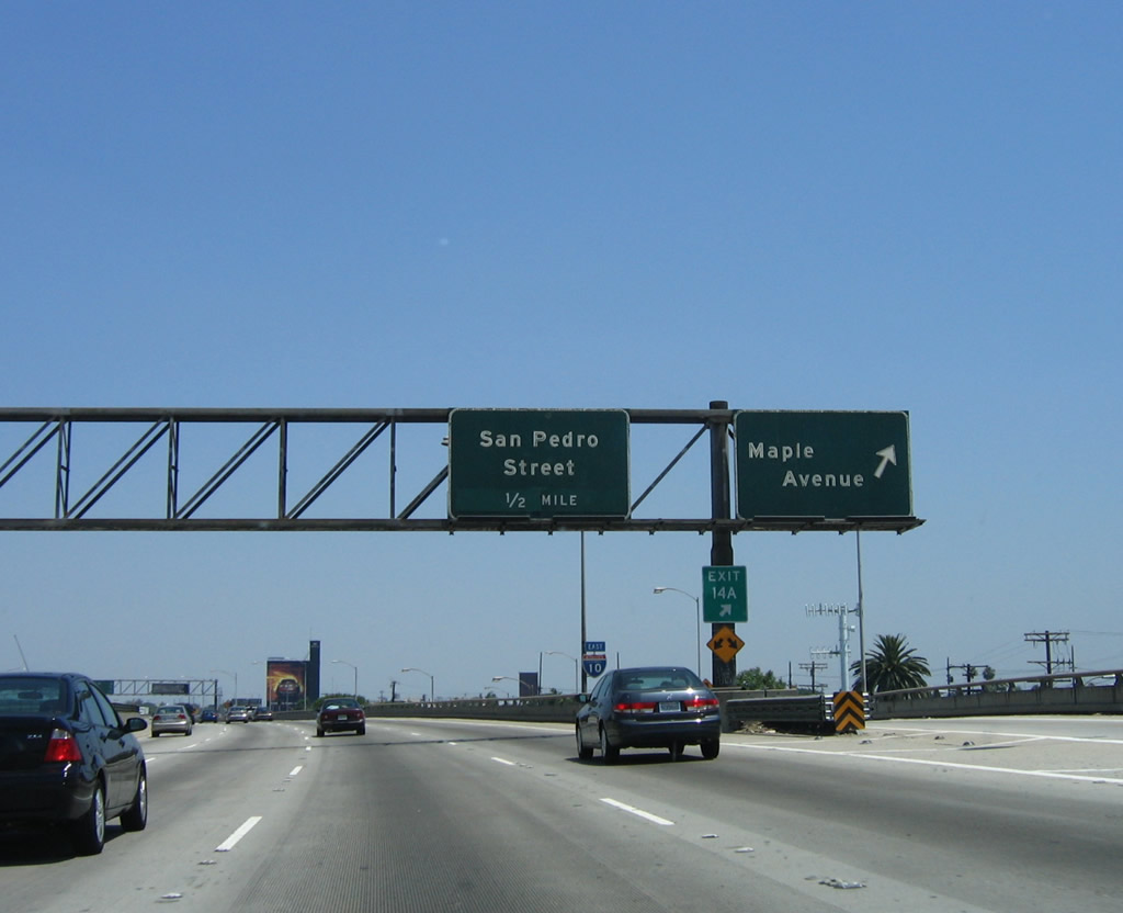
The next exit along Interstate 10 (Santa Monica Freeway) east is Exit 14A, Maple Avenue (0.25 mile). A sign replacement project removed the older porcelain enamel signs with newer reflective signs between 2006 and 2007. Unlike the reflective signs along Interstate 10 west of the Harbor Freeway interchange, most of these signs have exit numbers posted on the overhead signs. Photos taken 03/25/07 and 06/17/06. |
|
|
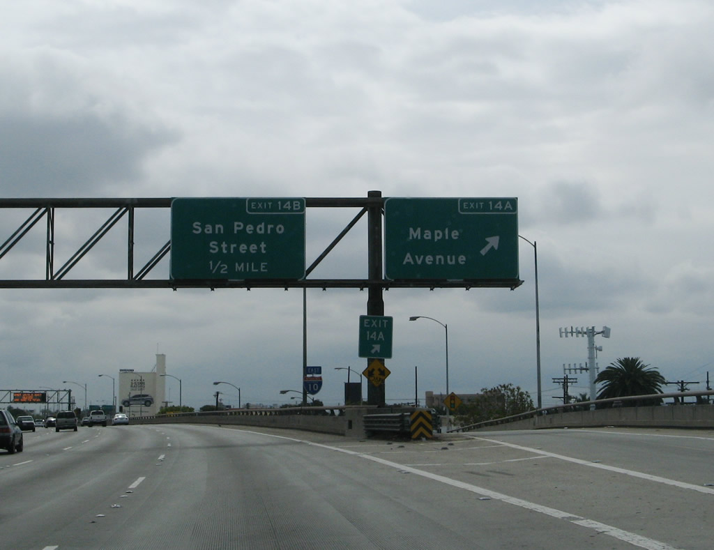
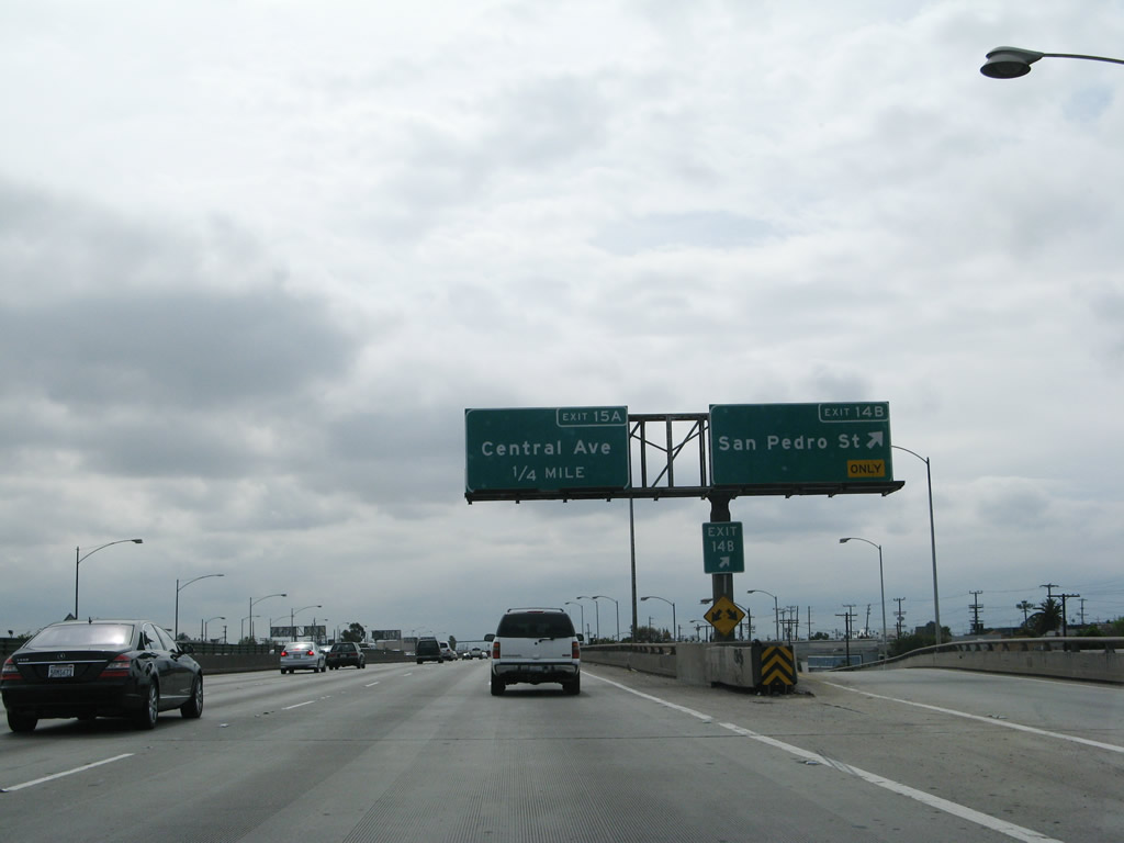
Eastbound Interstate 10 (Santa Monica Freeway) reaches Exit 14A, Maple Avenue. The next off-ramp from Interstate 10 east is Exit 14B, San Pedro Street. Photos taken 04/22/07 and 06/17/06. |
|
|
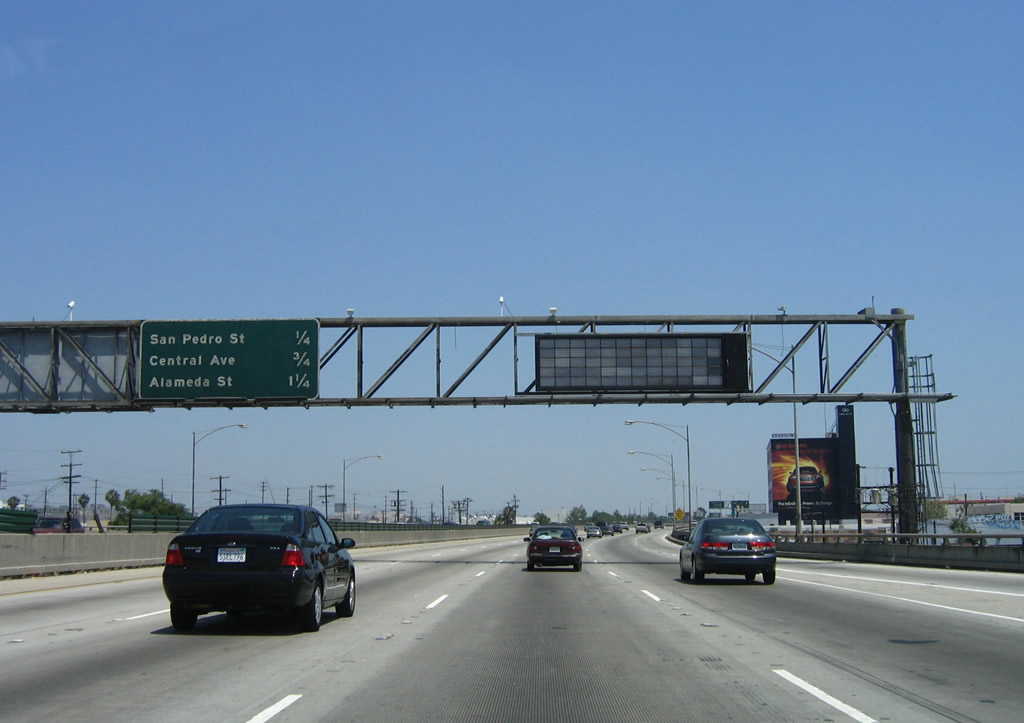
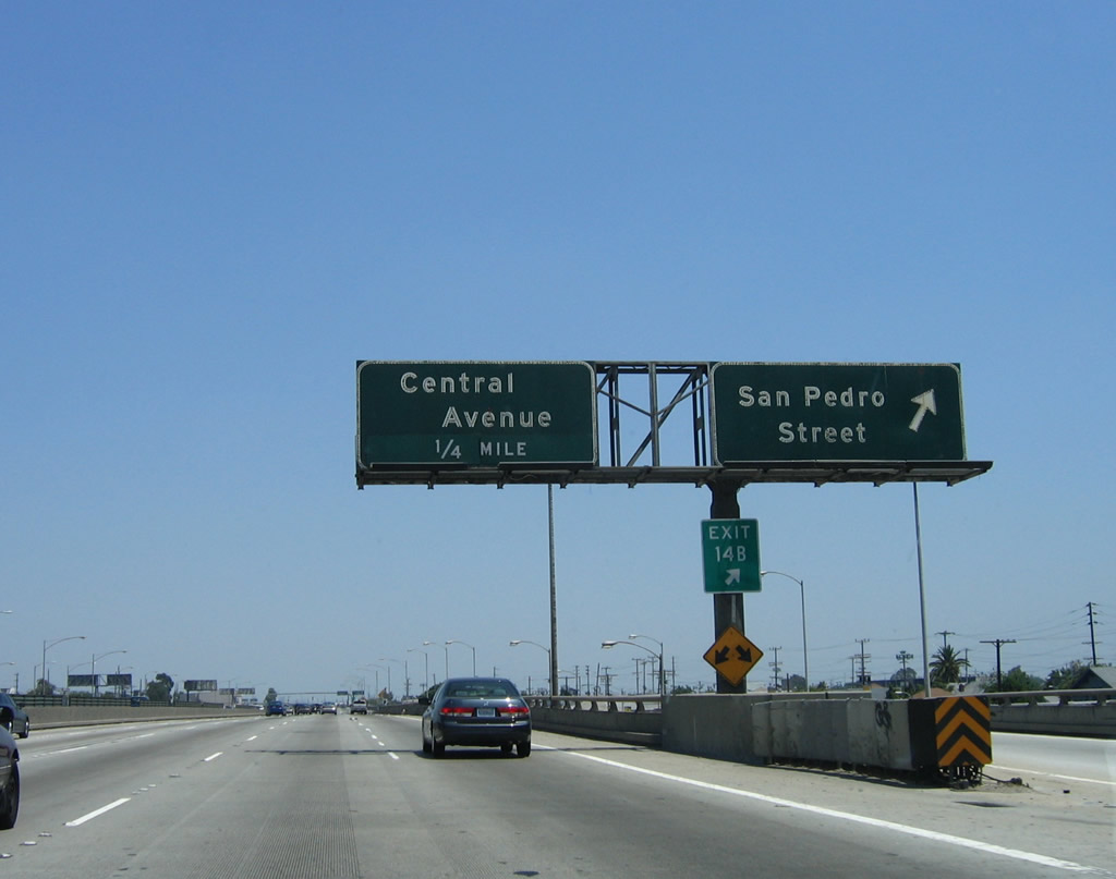
This mileage sign used to provide the distance to the next several exits along Interstate 10 (Santa Monica Freeway) east: Exit 14B, San Pedro Street; Exit 15A, Central Avenue; and Exit 15B, Alameda Street. Photos taken 03/25/07 and 06/17/06. |
|
|
Eastbound Interstate 10 (Santa Monica Freeway) reaches Exit 14B, San Pedro Street. The next exit along eastbound is Exit 15A, Central Avenue. Photos taken 04/22/07 and 06/17/06. |
|
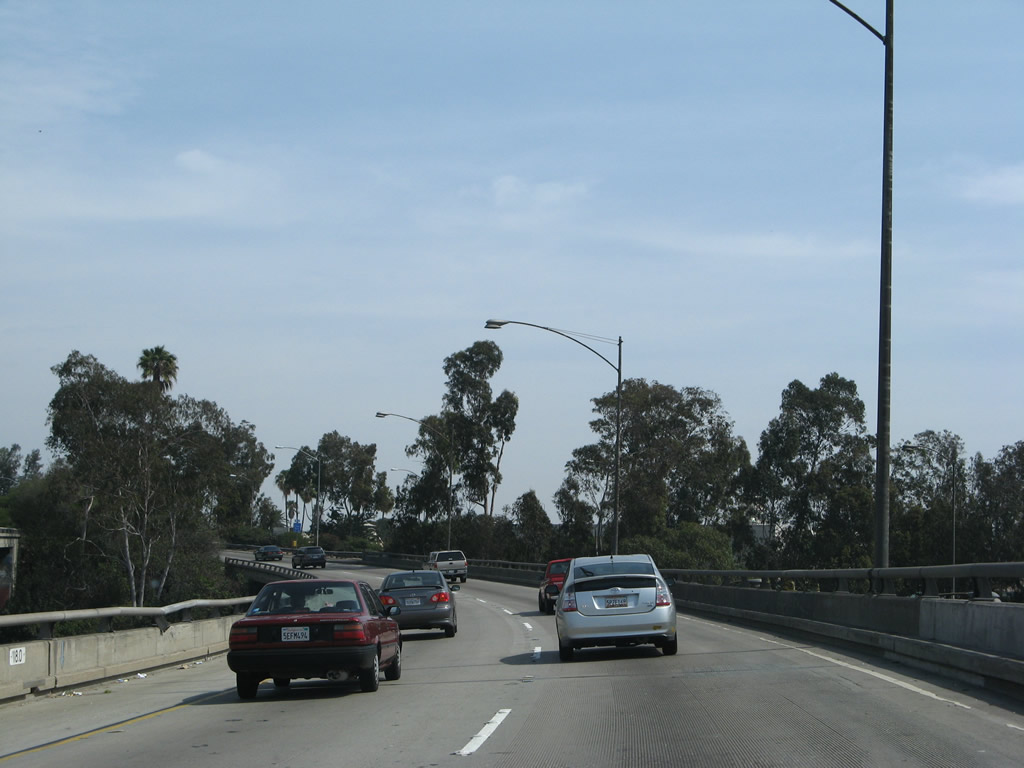
Five eastbound lanes carry Interstate 10 on an elevated viaduct. This viaduct extends almost the entire distance from Interstate 110 to Interstate 5, including passage over the Los Angeles River. Photo taken 06/17/06. |
|
|
Eastbound Interstate 10 (Santa Monica Freeway) reaches Exit 15A, Central Avenue. OK, maybe they haven't been so good about introducing exit numbers after the new signs were added between 2006 and 2007. The next exit along Interstate 10 east is Exit 15B, Alameda Street. Photos taken 03/25/07 and 06/17/06. |
|
|
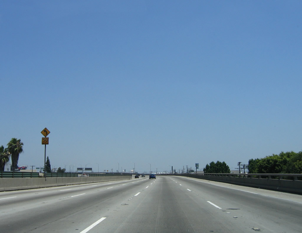
Five eastbound lanes are asked to reduce speed to 50 miles per hour for a curve. Photos taken 06/17/06. |
|
|
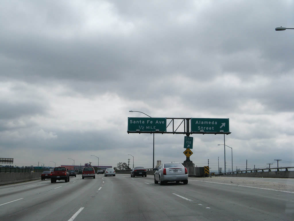
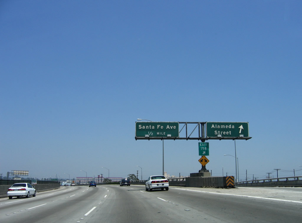
Eastbound Interstate 10 (Santa Monica Freeway) reaches Exit 15B, Alameda Street. The next exit along Interstate 10 east is Exit 16A, Santa Fe Avenue. Photos taken 04/22/07 and 06/17/06. |
|
|
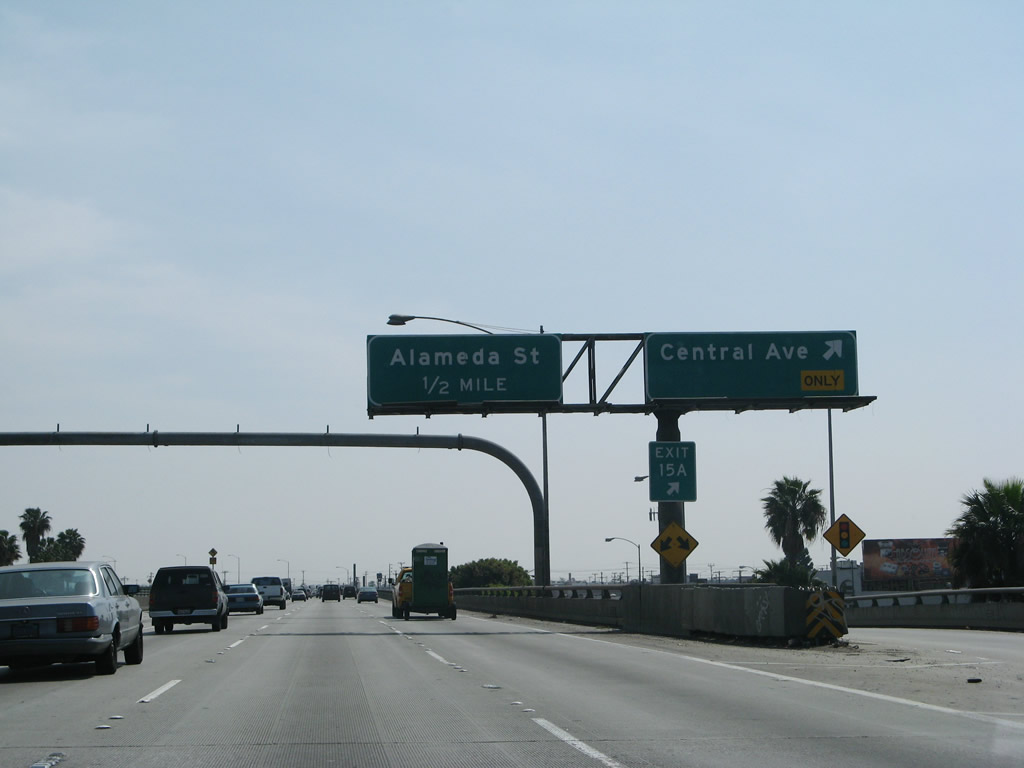
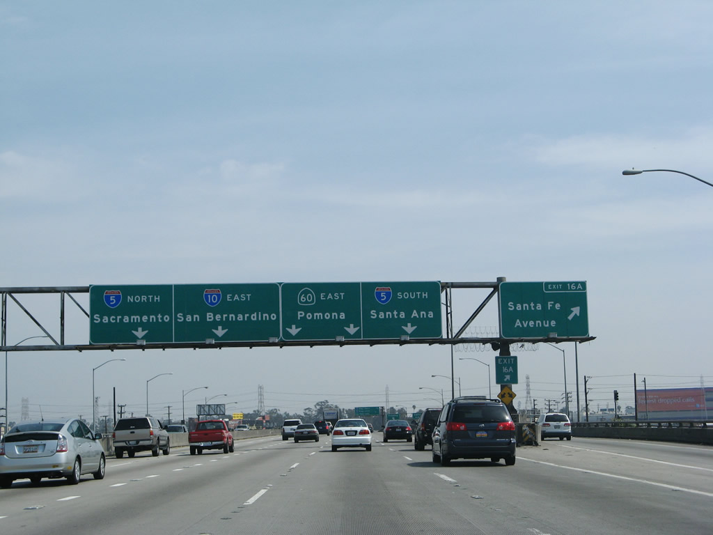
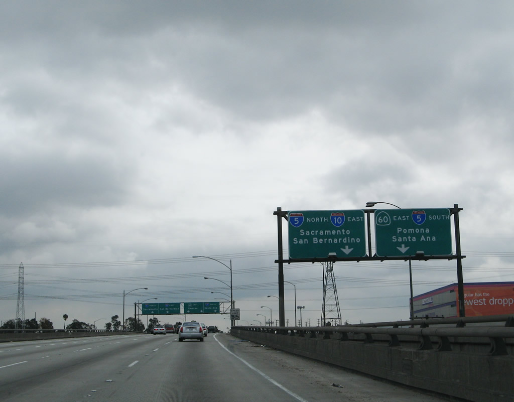
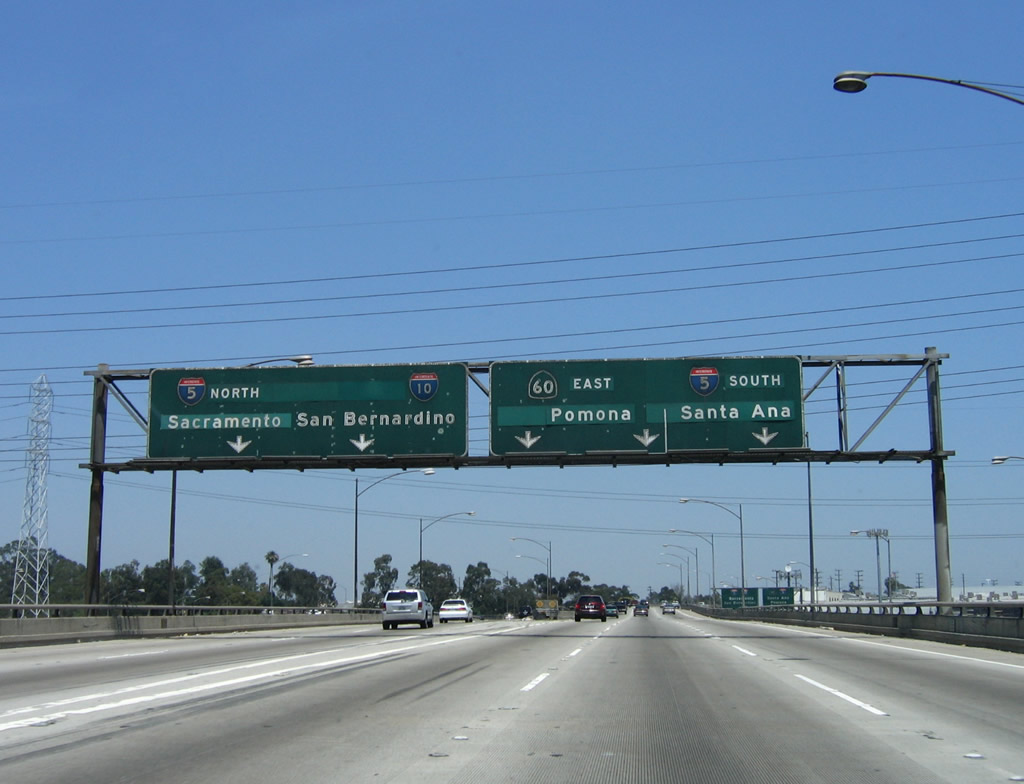
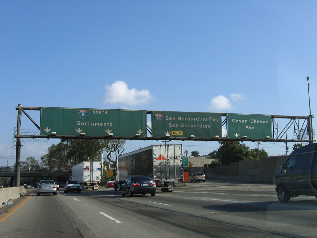
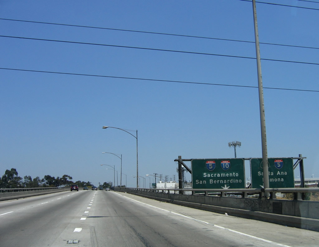
This mileage sign used to provide the distance to the next several exits along Interstate 10 (Santa Monica Freeway) east: Exit 16A, Santa Fe Avenue; Exit 16B, California 60 (Pomona Freeway) east to Pomona and Riverside; Exit 1A, Interstate 5 (Santa Ana Freeway) south to Santa Ana and San Diego (using the exit numbering for California 60 east); and Exit 17, Interstate 5 (Golden State Freeway) north and Interstate 10 (San Bernardino Freeway) east to San Bernardino. This sign saw significant changes between the 2006 and 2007 versions (including the use of route numbers rather than freeway names for Exits 16B and 17). We will soon enter the East Los Angeles Interchange (Junction 5-10-60-101), one of the single busiest interchanges in the world. Photos taken 03/25/07 and 06/17/06. |
|
|
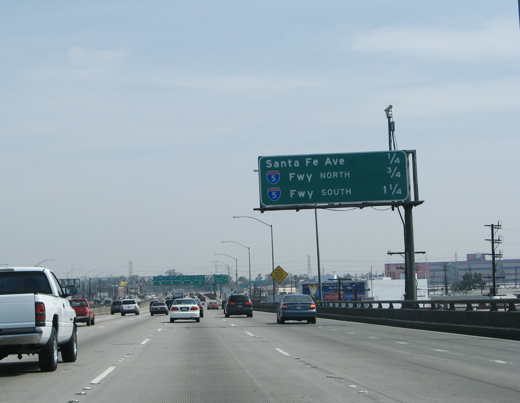
Eastbound Interstate 10 (Santa Monica Freeway) reaches Exit 16A, Santa Fe Avenue. At this point, Interstate 10 again enters a local-express configuration, with a collector distributor lane system prior to the East Los Angeles Interchange. This sign advises of the lane allocation for Exits 16B-17: the left #1 lane connects to Interstate 5 (Golden State Freeway) north; the #2 lane continues east on Interstate 10 (San Bernardino Freeway) east to San Bernardino; the #3 and #4 lanes connect to California 60 (Pomona Freeway) east to Pomona and Riverside; and the right #5 lane connects to Interstate 5 (Santa Ana Freeway) south to Santa Ana and San Diego. Photos taken 03/25/07 and 06/17/06. |
|
|
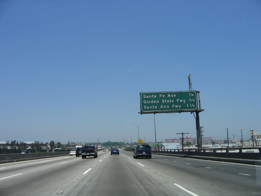
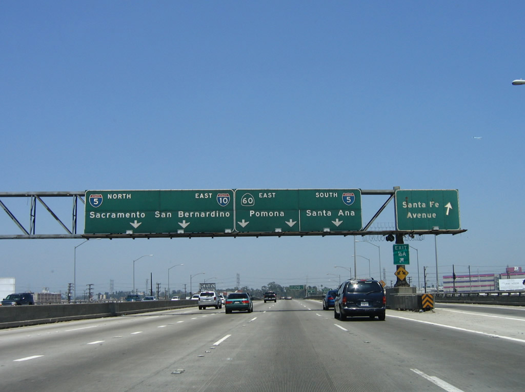
Traveling on the main lanes, this view shows the off-ramp from the local lanes to Exit 16A, Santa Fe Avenue. Another mileage sign for the main lanes provides the distance to the off-ramps to Exit 16B, California 60 (Pomona Freeway) east to Pomona and Riverside; Exit 1A, Interstate 5 (Santa Ana Freeway) south to Santa Ana and San Diego; and Exit 17, Interstate 5 (Golden State Freeway) north. Photos taken 04/22/07 and 06/17/06. |
|
|
A roadside sign for Exit 17, Interstate 5 (Golden State Freeway) north advises motorists to get into the left lanes. Photos taken 04/22/07 and 06/17/06. |
|
|
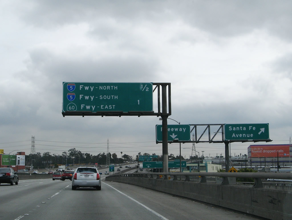
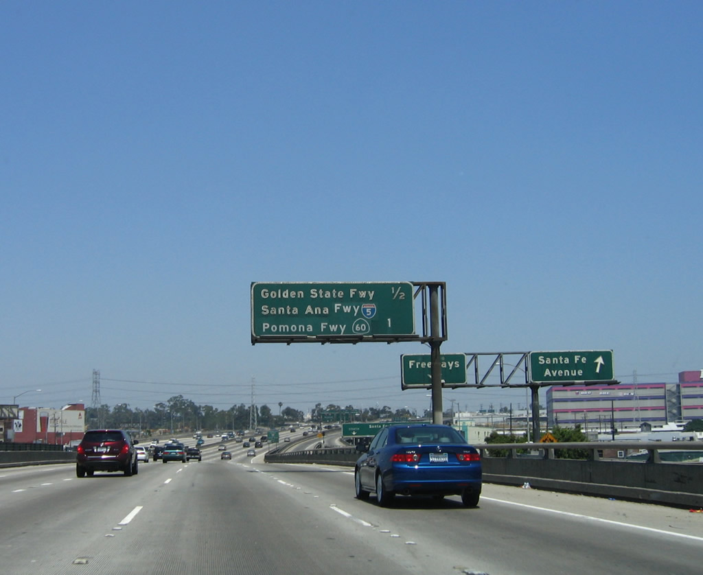
Traffic in the local lanes is afforded the same choices for Interstate 5 north, Interstate 10 east, California 60 east, and Interstate 5 south as motorists in the main lanes. Photos taken 04/22/07 and 06/17/06. |
|
|
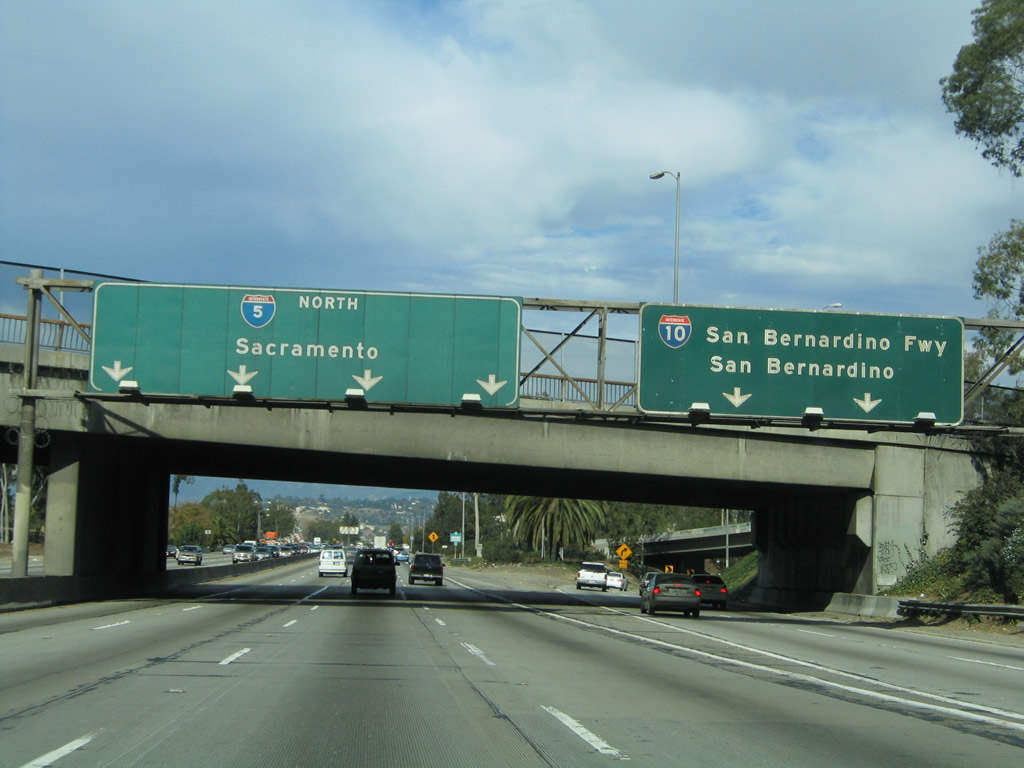
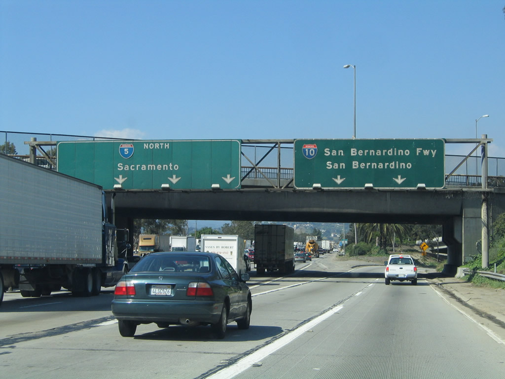
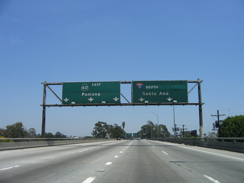
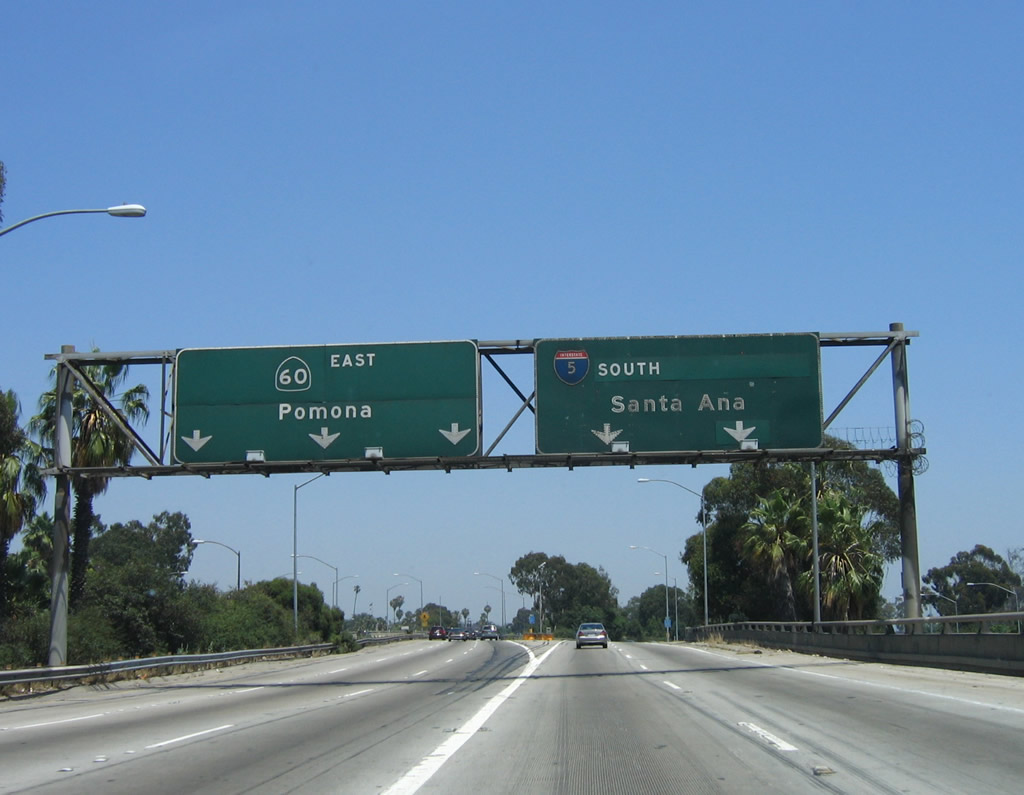
The Santa Monica Freeway designation will soon come to an end as the freeway splits: the left lane connects to Exit 17, Interstate 5 north, and the #2 lane carries Interstate 10 east to the San Bernardino Freeway. The right three lanes depart to Exit 16B, California 60 east to Interstate 5 south (see the "Ramp to California 60" section below for photos of the transition). There is NO ACCESS to U.S. 101 (Santa Ana Freeway) north. Photos taken 03/25/07 and 06/17/06. |
|
Returning to Interstate 10 east mainline, the connecting ramp carries only two through lanes on the transition from the Santa Monica Freeway east to the San Bernardino Freeway east (via a brief overlap on Interstate 5 (Golden State Freeway) north). Photo taken 03/25/07. |
|
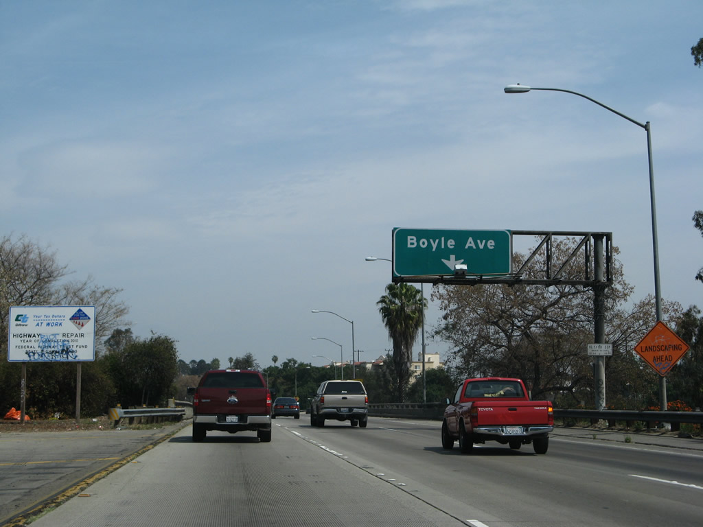
An off-ramp from Interstate 10 east to Exit 16C, Boyle Avenue to the Boyle Heights community of Los Angeles, is located on the transition from the Santa Monica Freeway east to the Golden State Freeway north. Photo taken 03/25/07. |
|
Eastbound Interstate 10 reaches Exit 16C, Boyle Avenue. Photo taken 03/25/07. |
|
Immediately after the Boyle Avenue off-ramp, Interstate 10 east merges onto Interstate 5 north. Three lanes of Interstate 10 merge onto Interstate 5 north from the left side. "Exit 17" is considered to be the connection to Interstate 5 north. Photo taken 03/25/07. |
| Interstate 5 (Golden State Freeway) north and Interstate 10 east |
|
Passing under Whittier Boulevard, Interstate 5 north and Interstate 10 east have a 55 mile per hour speed limit. Traffic for Interstate 10 east needs to merge right to continue east to the San Bernardino Freeway. Photo taken 03/25/07. |
|
After merging with Interstate 10 east, Interstate 5 (Golden State Freeway) north now has five through lanes. The next exit along Interstate 5 north and Interstate 10 east is Exit 135A, Fourth Street. Photo taken 10/07/06. |
|
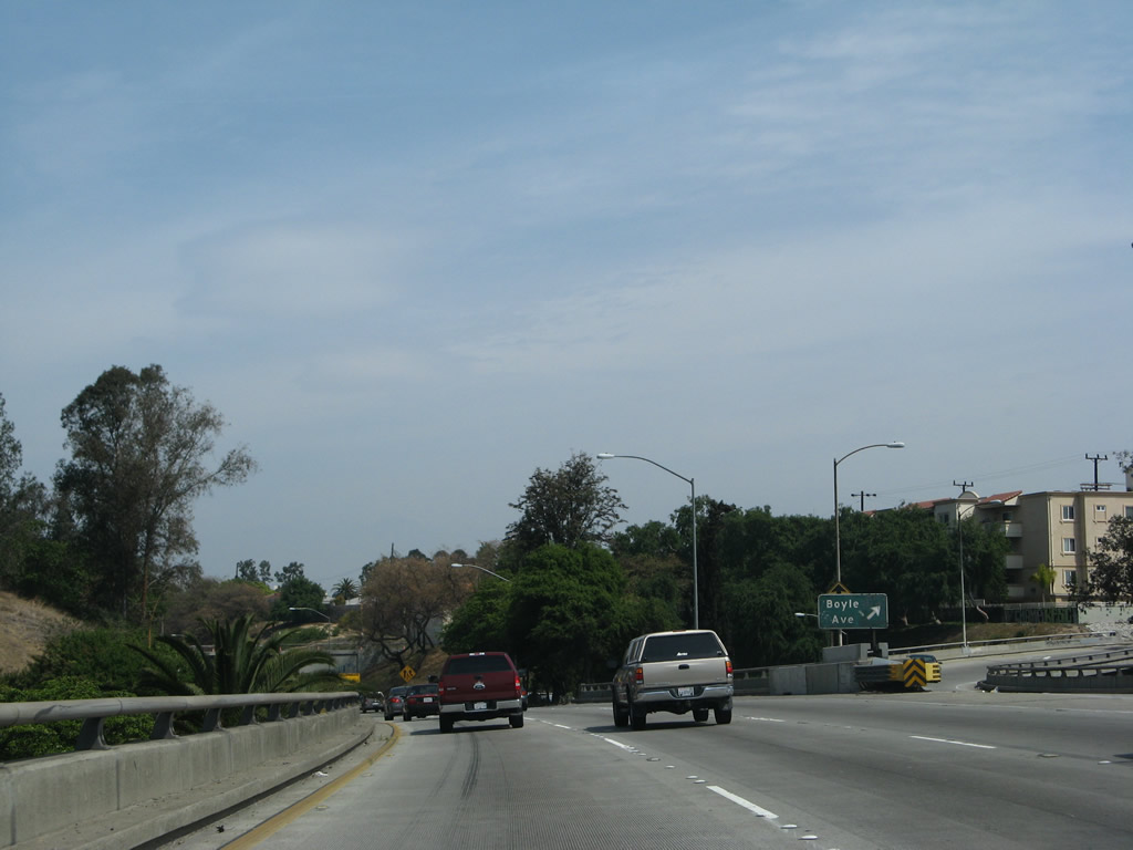
Northbound Interstate 5 (Golden State Freeway) and eastbound Interstate 10 reaches Exit 135A, Fourth Street. Use Fourth Street west over the Los Angeles River into downtown Los Angeles and east into the Boyle Heights neighborhood of Los Angeles. Photo taken 10/07/06. |
|
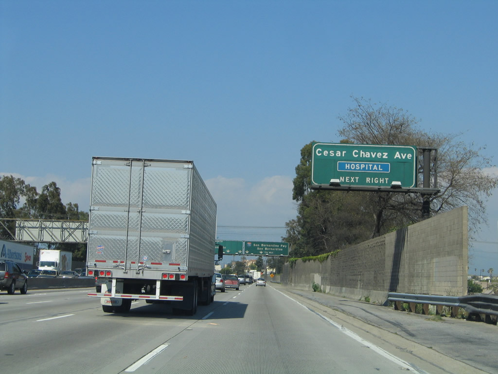
The next exit along Interstate 5 (Golden State Freeway) north and Interstate 10 east is Exit 135B, Cesar Chavez Avenue. Photo taken 03/25/05. |
|
Northbound Interstate 5 (Golden State Freeway) and eastbound Interstate 10 reach Exit 135B, Cesar Chavez Avenue. The next exit is Exit 135C, eastbound Interstate 10 (San Bernardino Freeway). Through traffic on Interstate 10 should merge right, and traffic for Interstate 5 should merge left. Exit 135C comes quickly. Photo taken 10/07/06. |
Page Updated October 31, 2008.