| Interstate 10 (San Bernardino Freeway) west |
|
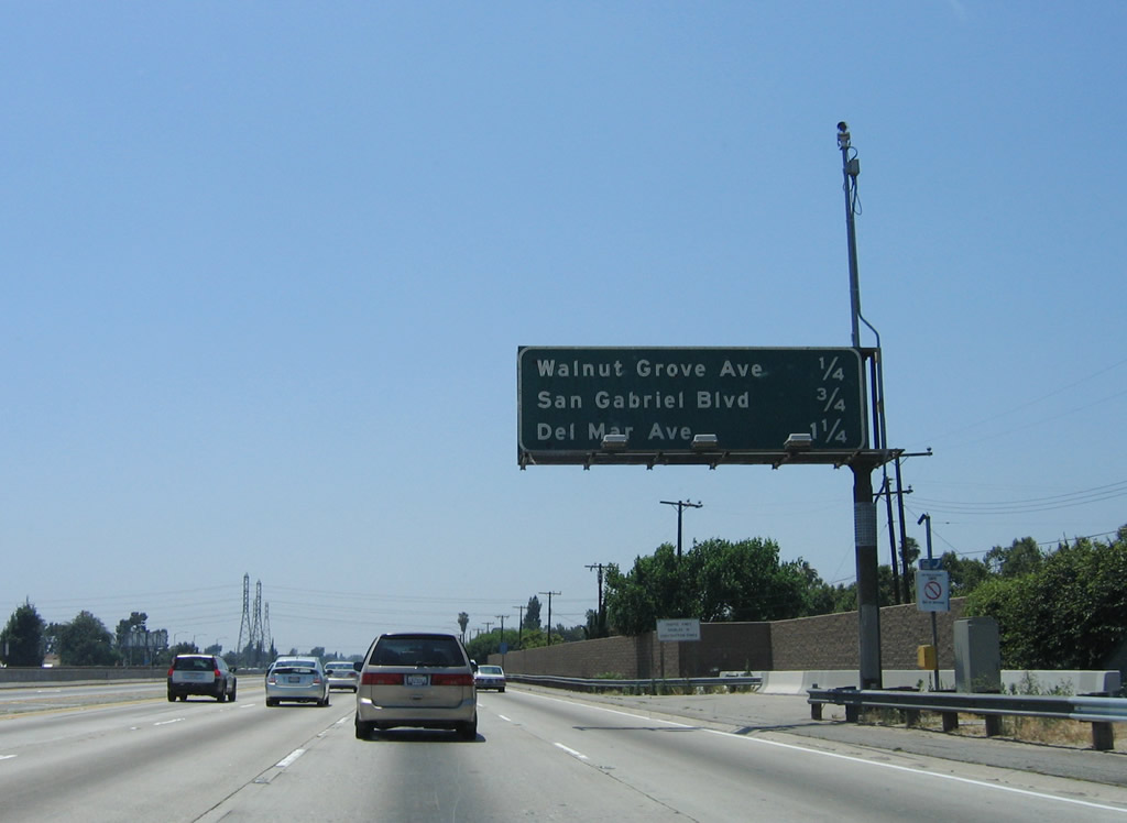
This mileage sign provides the distance to the next three exits along Interstate 10 (San Bernardino Freeway) west: Exit 26A, Walnut Grove Avenue; Exit 25B, San Gabriel Boulevard; and Exit 25A, Del Mar Avenue. Photo taken 06/17/06. |
|
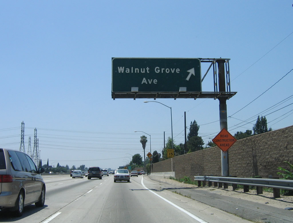
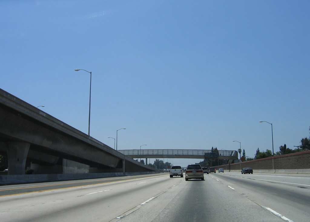
Westbound Interstate 10 (San Bernardino Freeway) reaches Exit 26A, Walnut Grove Avenue. Photo taken 06/17/06. |
|
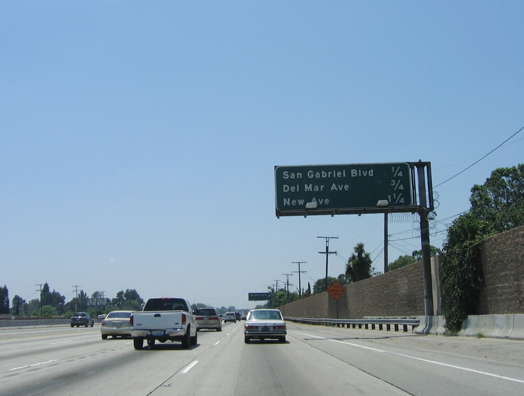
This mileage sign provides the distance to the next three exits along Interstate 10 (San Bernardino Freeway) west: Exit 25B, San Gabriel Boulevard; Exit 25A, Del Mar Avenue; and Exit 24, New Avenue. Photo taken 06/17/06. |
|
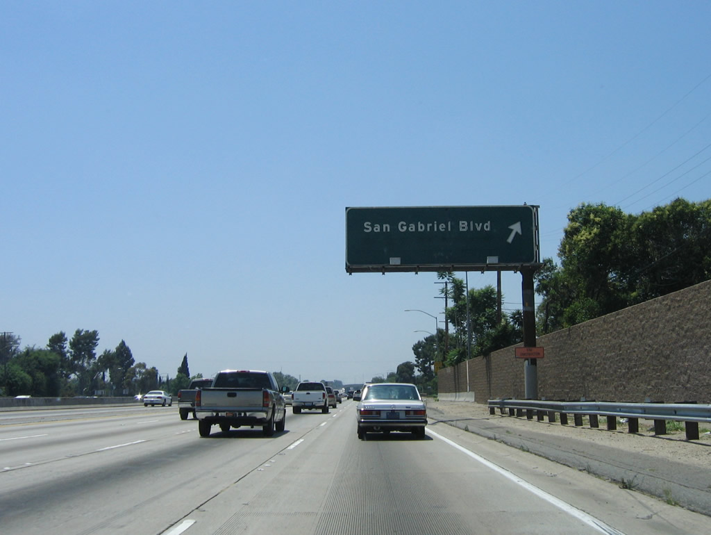
Westbound Interstate 10 (San Bernardino Freeway) reaches Exit 25B, San Gabriel Boulevard in the city of Rosemead. Use San Gabriel Boulevard north to the city of San Gabriel, which lies north of Interstate 10 between Exits 25B and 24. San Gabriel had a population of 39,804 as of the 2000 Census, was incorporated on April 24, 1913, and is named after the historic Mission San Gabriel Arc-ngel (one of the original Spanish missions that dot California generally along the route of El Camino Real). Photo taken 06/17/06. |
|
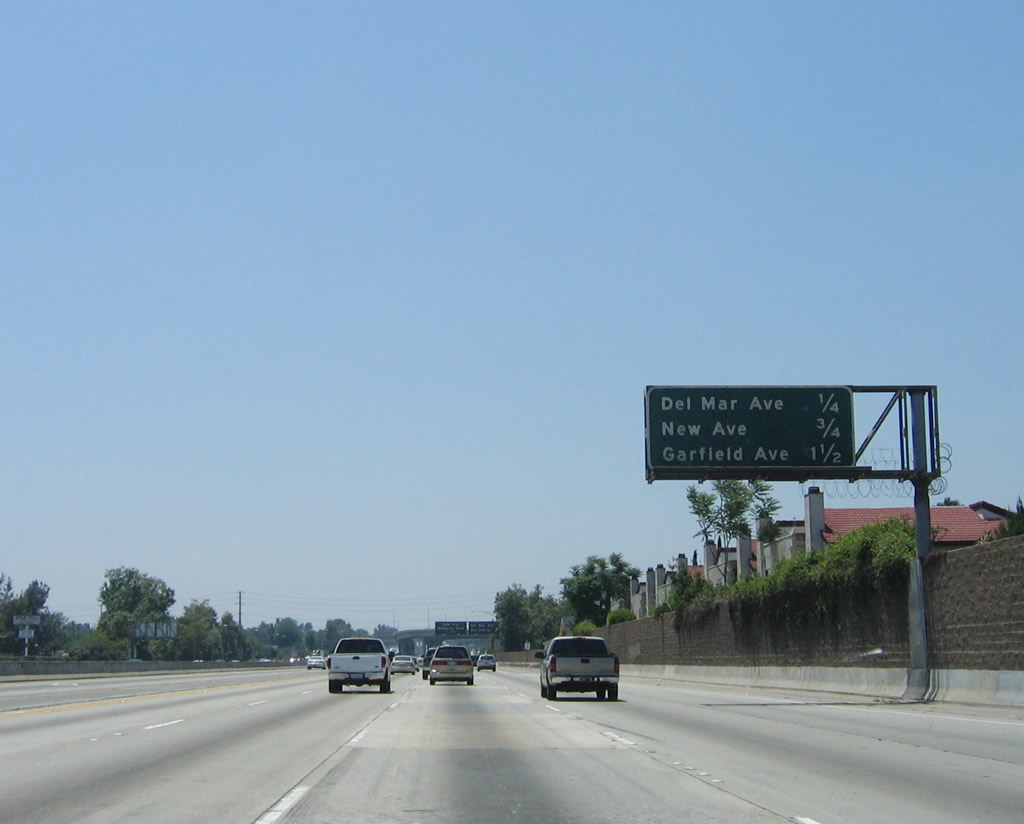
This mileage sign provides the distance to the next three exits along Interstate 10 (San Bernardino Freeway) west: Exit 25A, Del Mar Avenue; Exit 24, New Avenue; and Exit 23B, Garfield Avenue. Photo taken 06/17/06. |
|
Westbound Interstate 10 (San Bernardino Freeway) reaches Exit 25A, Del Mar Avenue. Use Del Mar Avenue north to a park and ride and transit facility associated with the Interstate 10 busway. Plans call for conversion of the Busway to a HOT configuration, thus offering motorists the opportunity to use the lanes with less than three vehicle occupants by paying a toll. The next exit along westbound is Exit 24, New Avenue. Photo taken 06/17/06. |
|
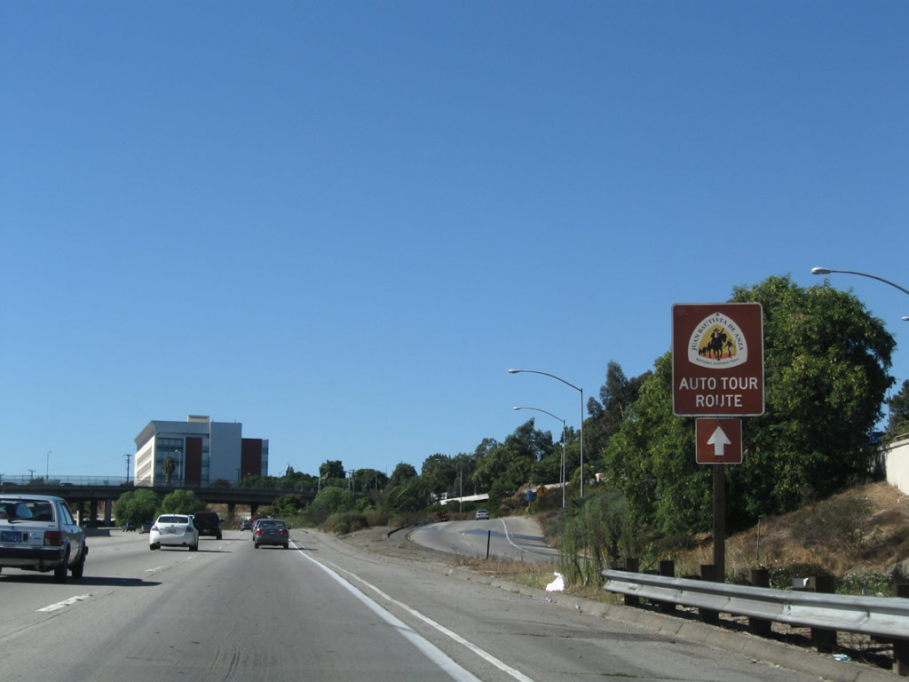
Entering the city of San Gabriel, a flyover ramp brings bus and HOV traffic onto the centerline Busway, which continues to provide a faster rush hour route for commuting vehicles in the center of the San Bernardino Freeway. The park and ride associated with this flyover ramp is located at the Del Mar Avenue interchange. Photo taken 06/17/06. |
|
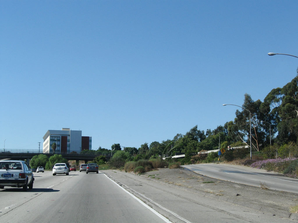
The Busway connector lanes come down to the same level as the main busway lanes in the center of the freeway. Photo taken 06/17/06. |
|
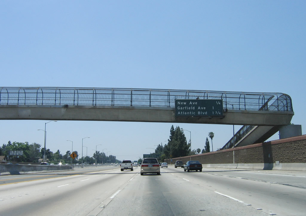
This mileage sign provides the distance to the next three exits along Interstate 10 (San Bernardino Freeway) west: Exit 24, New Avenue; Exit 23B, Garfield Avenue; and Exit 23A, Atlantic Boulevard (former California 15). Photo taken 06/17/06. |
|
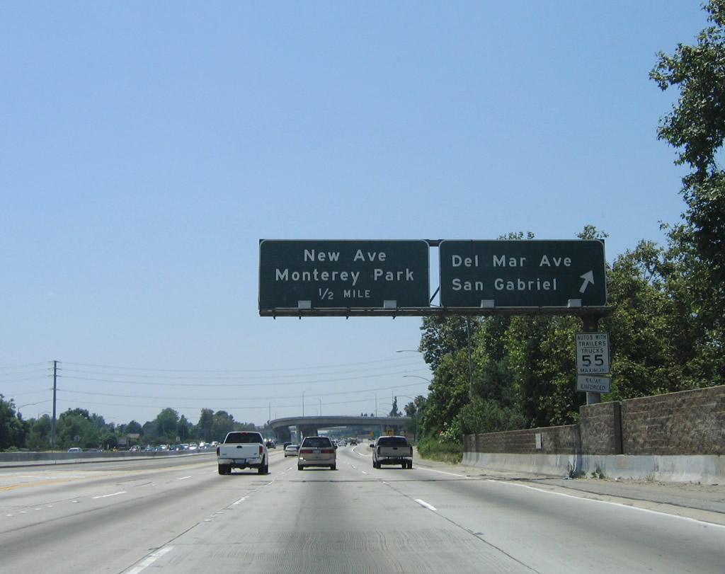
Westbound Interstate 10 (San Bernardino Freeway) reaches Exit 24, New Avenue to the city of Monterey Park. While most of the city lies south of the freeway, most of the Interstate 10-710 interchange sits within Monterey Park's limits. This city was home to 60,051 people as of the 2000 Census and incorporated on May 29, 1916. The next exit along westbound is Exit 23B, Garfield Avenue. Photo taken 06/17/06. |
|
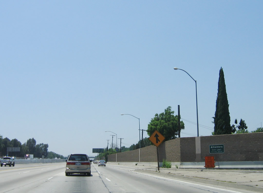
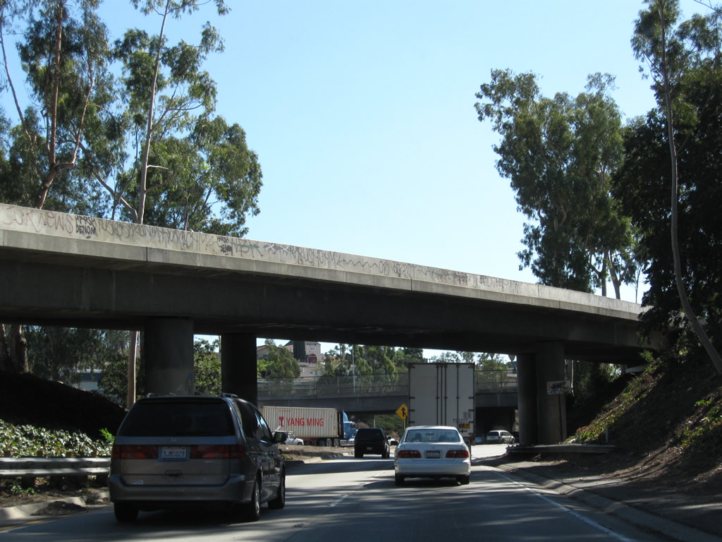
After the New Avenue interchange, Interstate 10 enters the city of Alhambra. Incorporated on July 11, 1903, Alhambra had a population of 85,804 people as of the 2000 Census. Photo taken 06/17/06. |
|
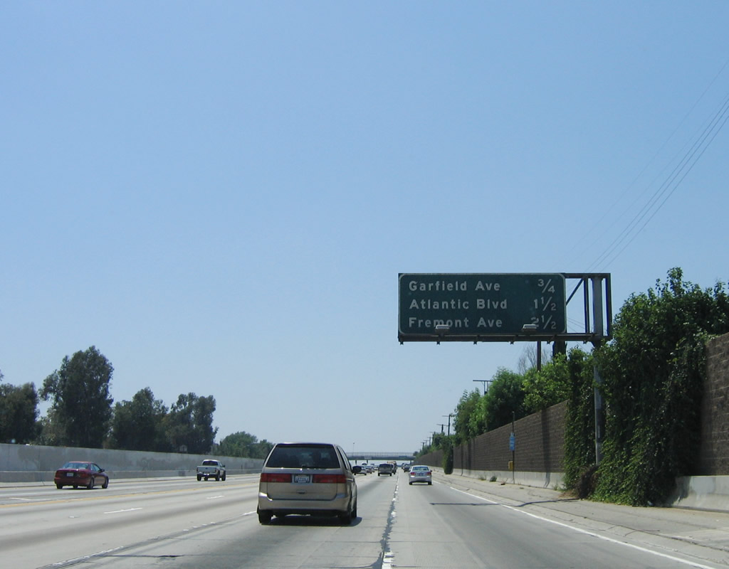
This mileage sign provides the distance to the next three exits along Interstate 10 (San Bernardino Freeway) west: Exit 23B, Garfield Avenue; Exit 23A, Atlantic Boulevard (former California 15); and Exit 22, Fremont Avenue. Photo taken 06/17/06. |
|
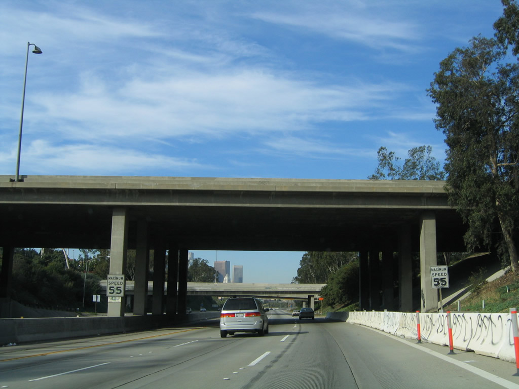
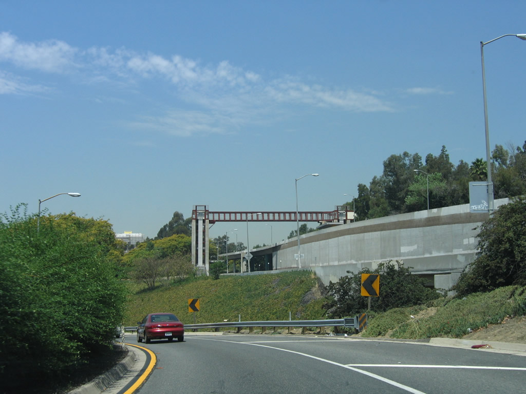
The next exit along Interstate 10 (San Bernardino Freeway) west is Exit 23B, Garfield Avenue. Note the Busway signage posted in the center lanes for HOV+3 vehicles and buses. Photo taken 06/17/06. |
|
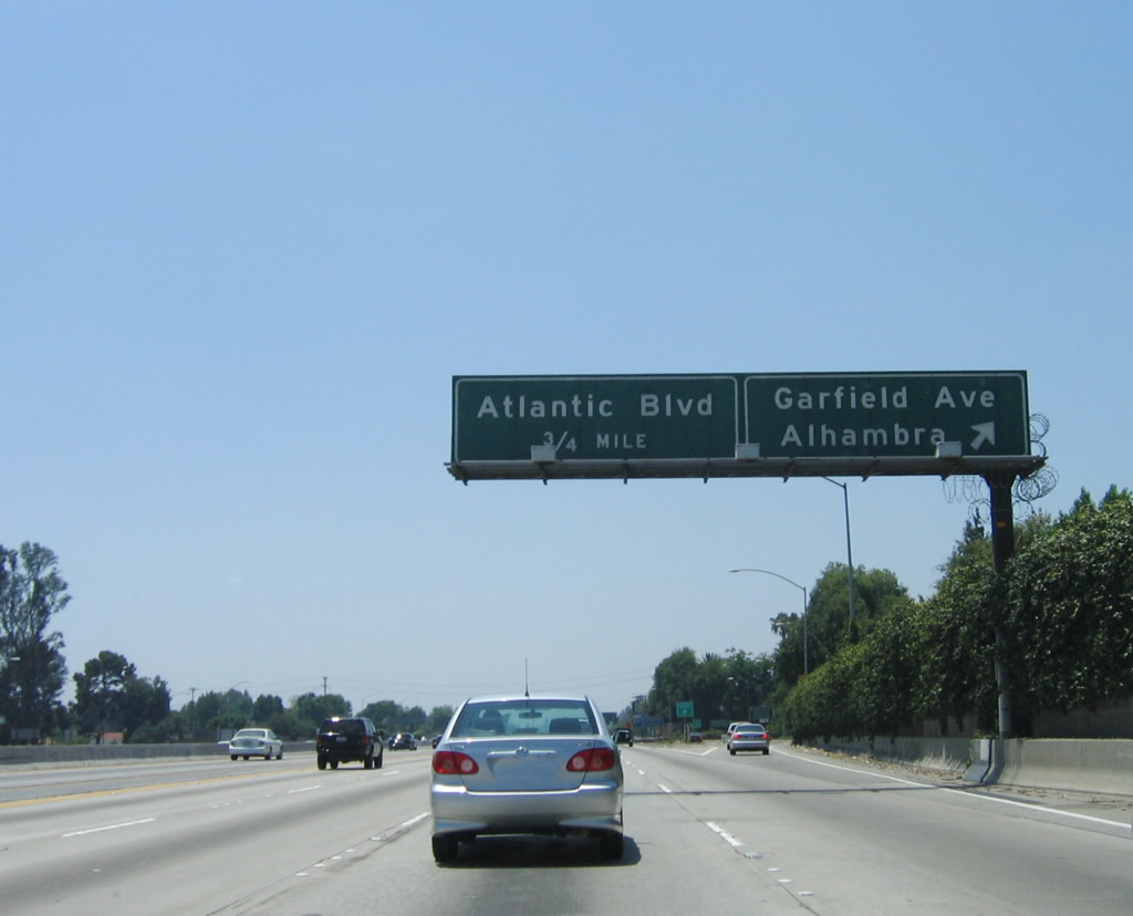
Westbound Interstate 10 (San Bernardino Freeway) reaches Exit 23B, Garfield Avenue. The next exit along westbound is Exit 23A, Atlantic Boulevard (former California 15). Photo taken 06/17/06. |
|
Old highway features, such as old bridge railing and divoted curbing is prevalent at the Interstate 10 overpass at Garfield Avenue. Note the signage for the exit to Garfield Avenue south, which is visible in the background. Another sign touting the benefits of the Busway to downtown Los Angeles is posted here. Photo taken 06/17/06. |
|
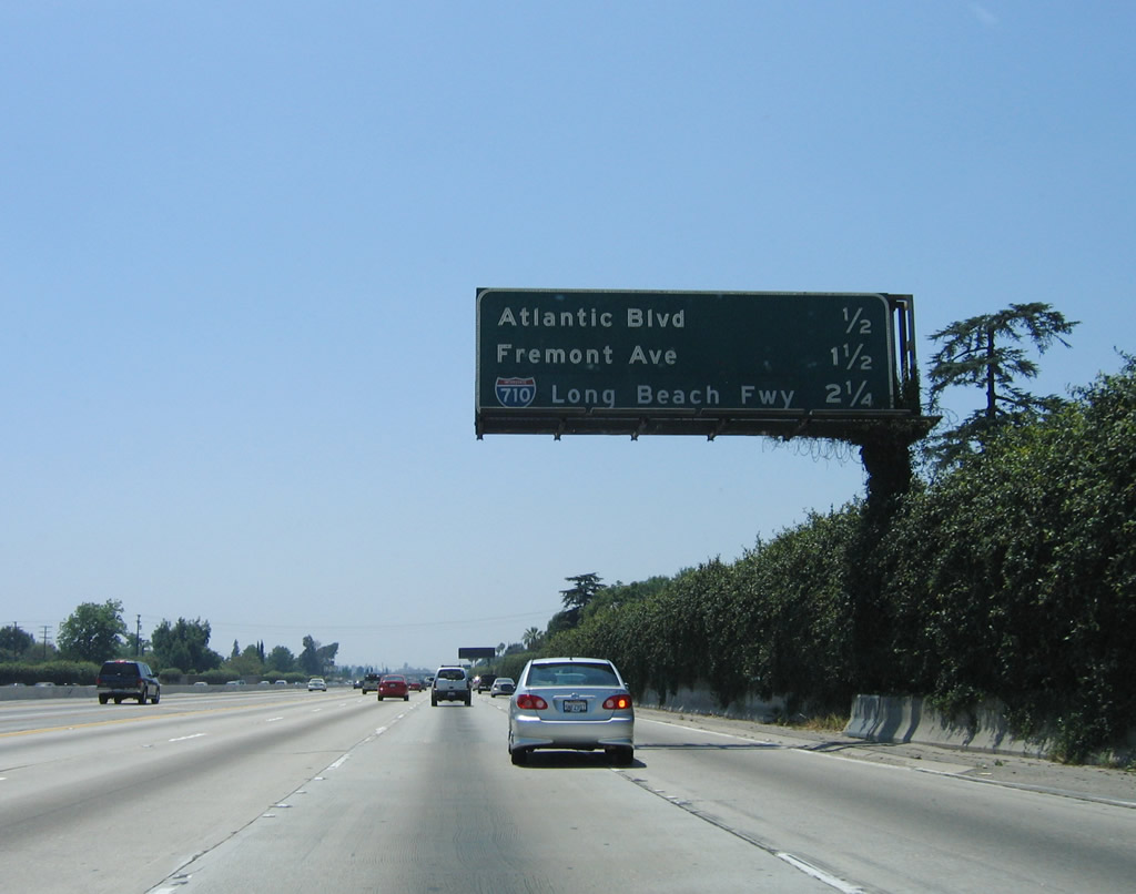
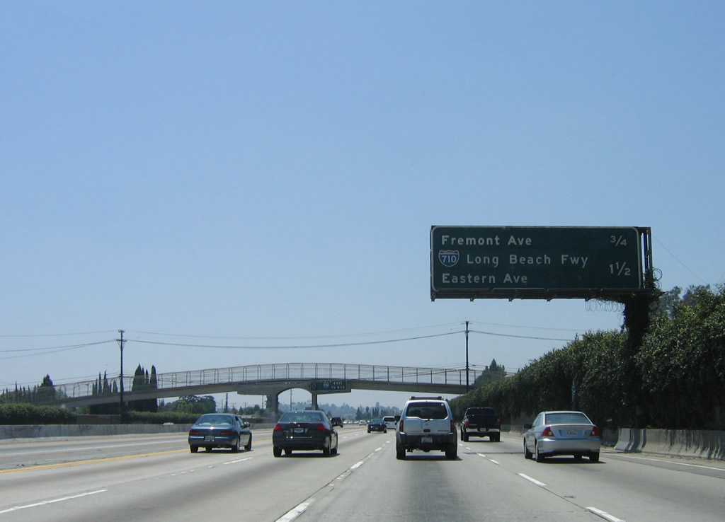
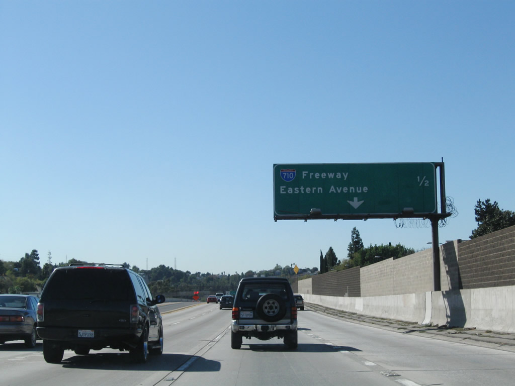
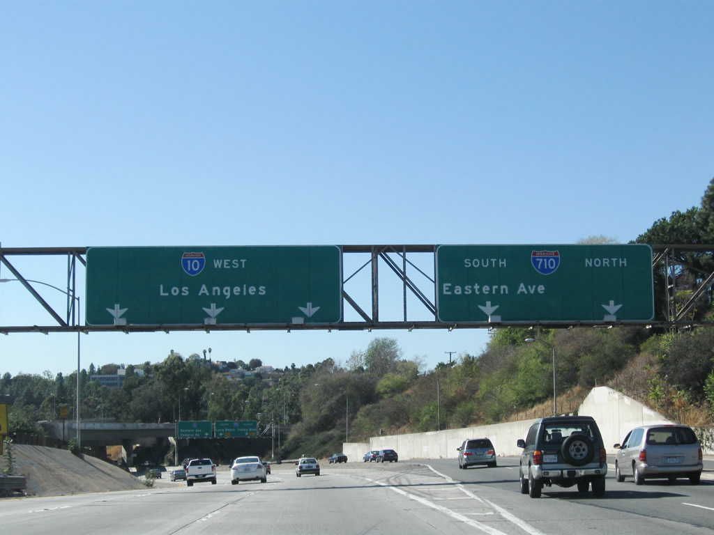
This mileage sign provides the distance to the next three exits along Interstate 10 (San Bernardino Freeway) west: Exit 23A, Atlantic Boulevard (former California 15); Exit 22, Fremont Avenue; and Exit 21, Interstate 710 (Long Beach Freeway) (south to Long Beach and north to Valley Boulevard) and Eastern Avenue. Photo taken 06/17/06. |
|
Westbound Interstate 10 (San Bernardino Freeway) reaches Exit 23A, Atlantic Boulevard. This interchange marks the former northern terminus of California 15, which used to follow Atlantic Boulevard from Long Beach (at the intersection with Alternate U.S. 101/Pacific Coast Highway) north to the Ramona Parkway (former U.S. 60-70-99 and now Interstate 10 / San Bernardino Freeway). California 15 was moved over the to the Long Beach Freeway alignment in stages through the 1950s as various segments were completed. One notable feature of California 15 is that its southern terminus with the Pacific Coast Highway was also the endpoint of U.S. 6 (Grand Army of the Republic Highway) and U.S. 91 (Arrowhead Highway) in Long Beach until 1964, when both U.S. routes were legislatively decommissioned. Photo taken 06/17/06. |
|
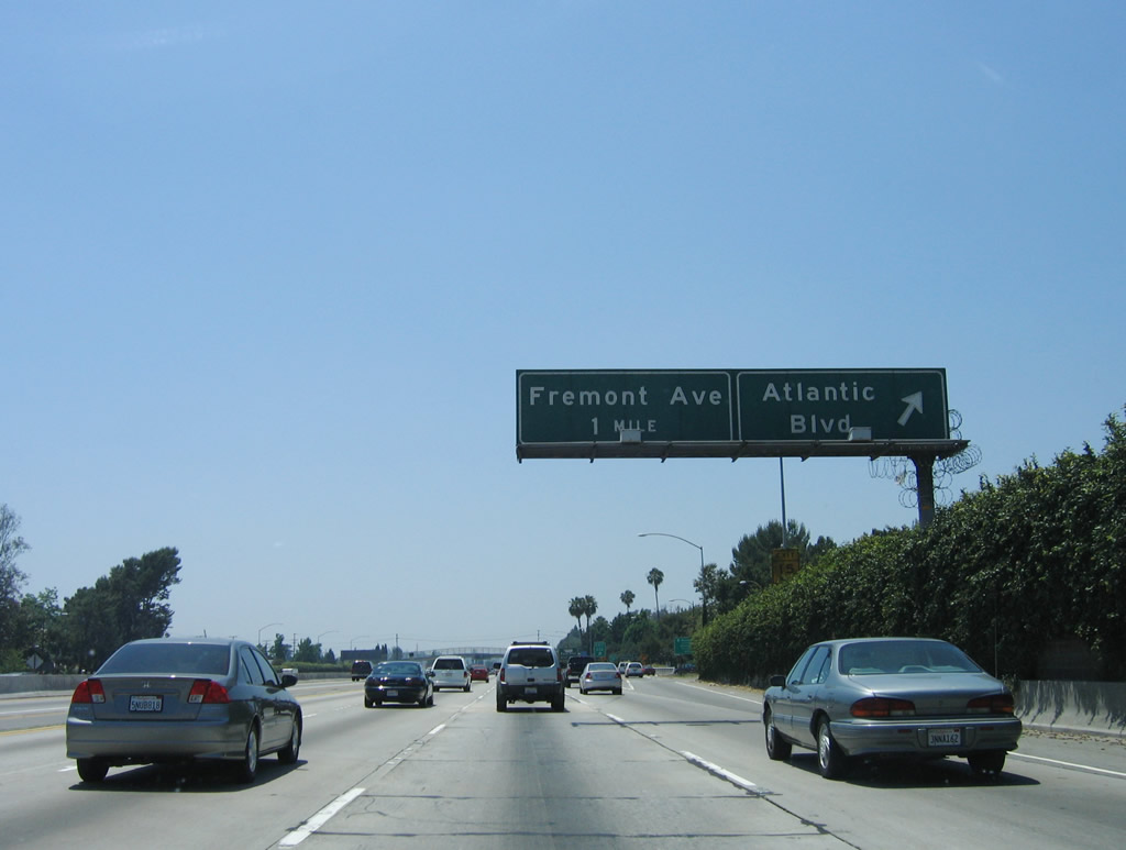
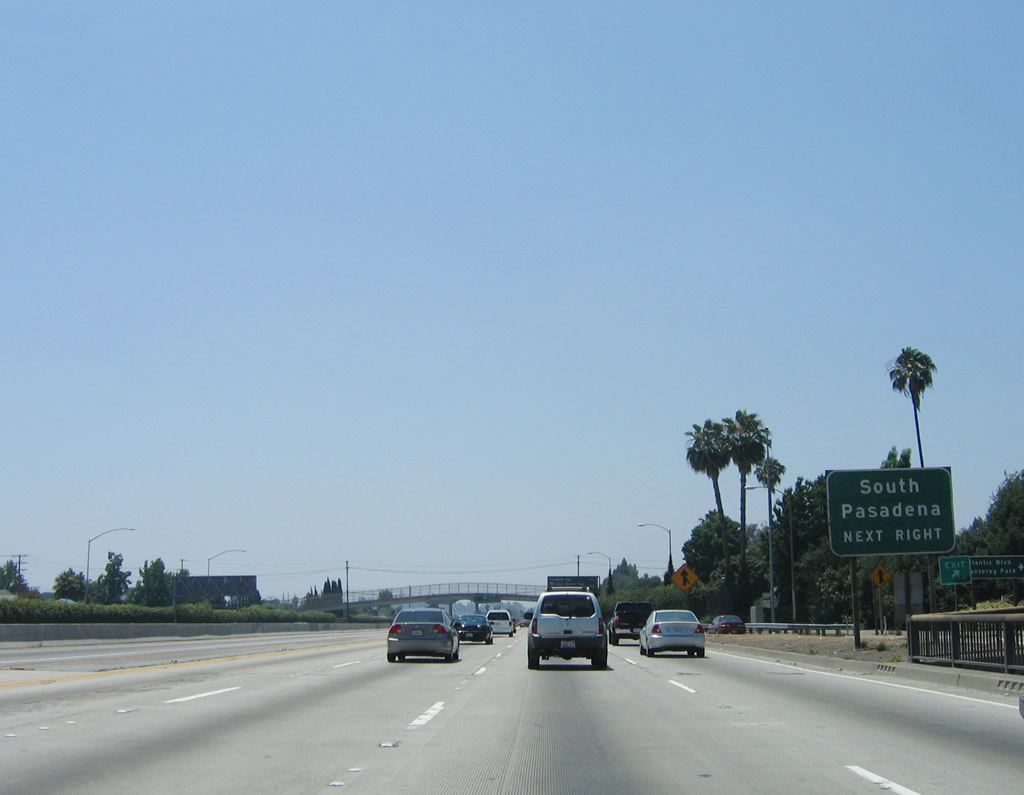
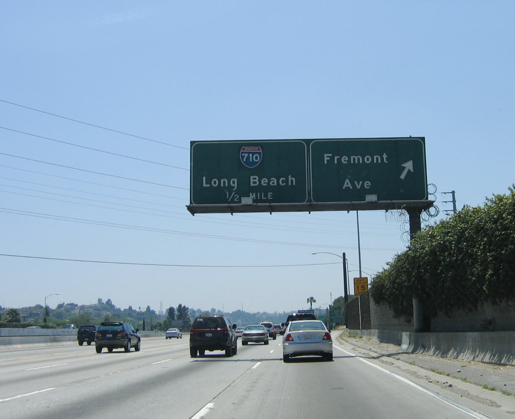
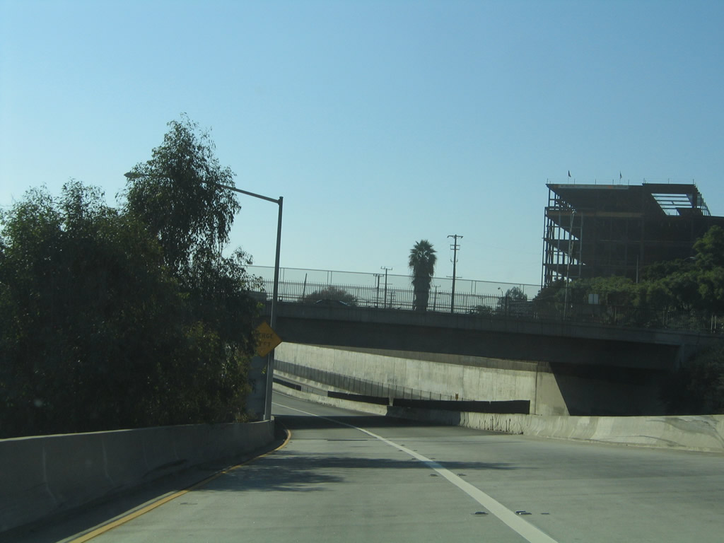
Passing over Atlantic Boulevard (former California 15), the next exit along westbound Interstate 10 is Exit 22, Fremont Avenue. Use Fremont Avenue north to the city of South Pasadena and south to the city of Monterey Park. Photo taken 06/17/06. |
|
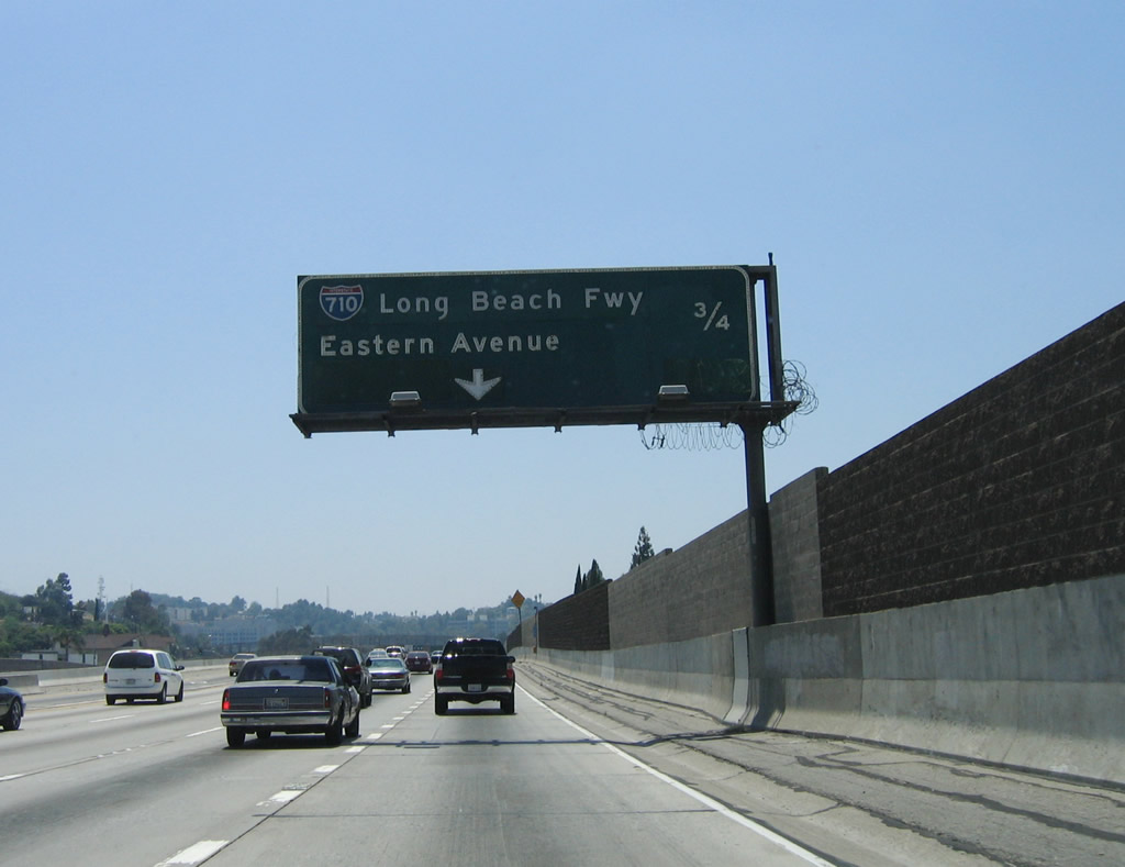
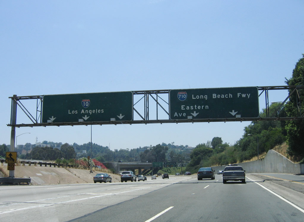
This mileage sign provides the distance to the next two exits along Interstate 10 (San Bernardino Freeway) west: Exit 22, Fremont Avenue and Exit 21, Interstate 710/Long Beach and Eastern Avenue. Photo taken 06/17/06. |
|
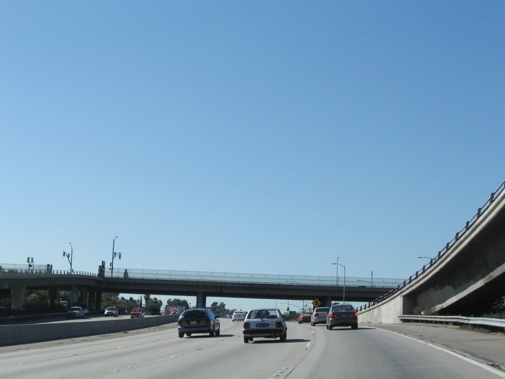
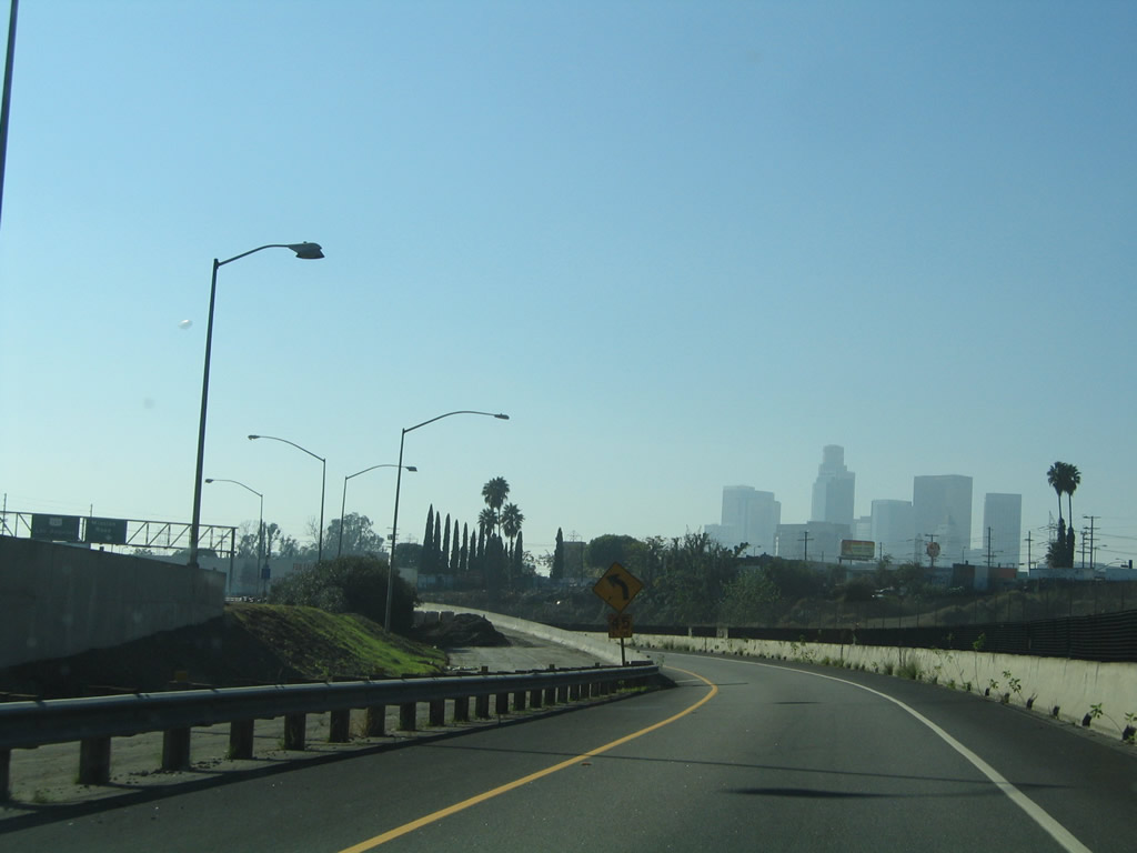
Southern California Edison subtransmission lines parallel the freeway briefly. This view of the superelevated turn in the freeway shows both the main lanes and the Busway (separated by double yellow lines). Photo taken 06/17/06. |
|
Metrolink rail and the Busway are visible in this view of westbound Interstate 10. Photo taken 06/17/06. |
|
Westbound Interstate 10 (San Bernardino Freeway) (Ramona Parkway) reaches Exit 22, Fremont Avenue. Photo taken 06/17/06. |
|
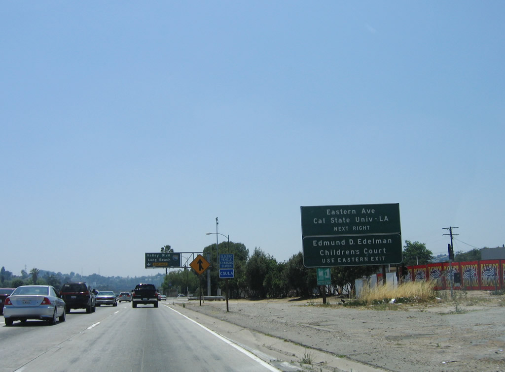
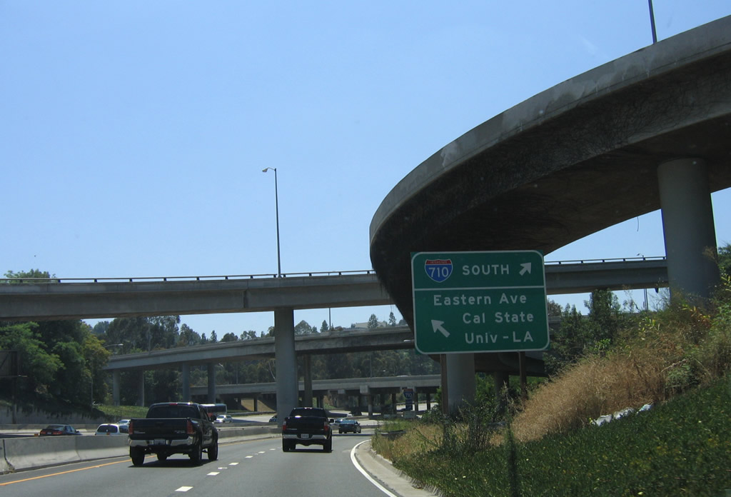
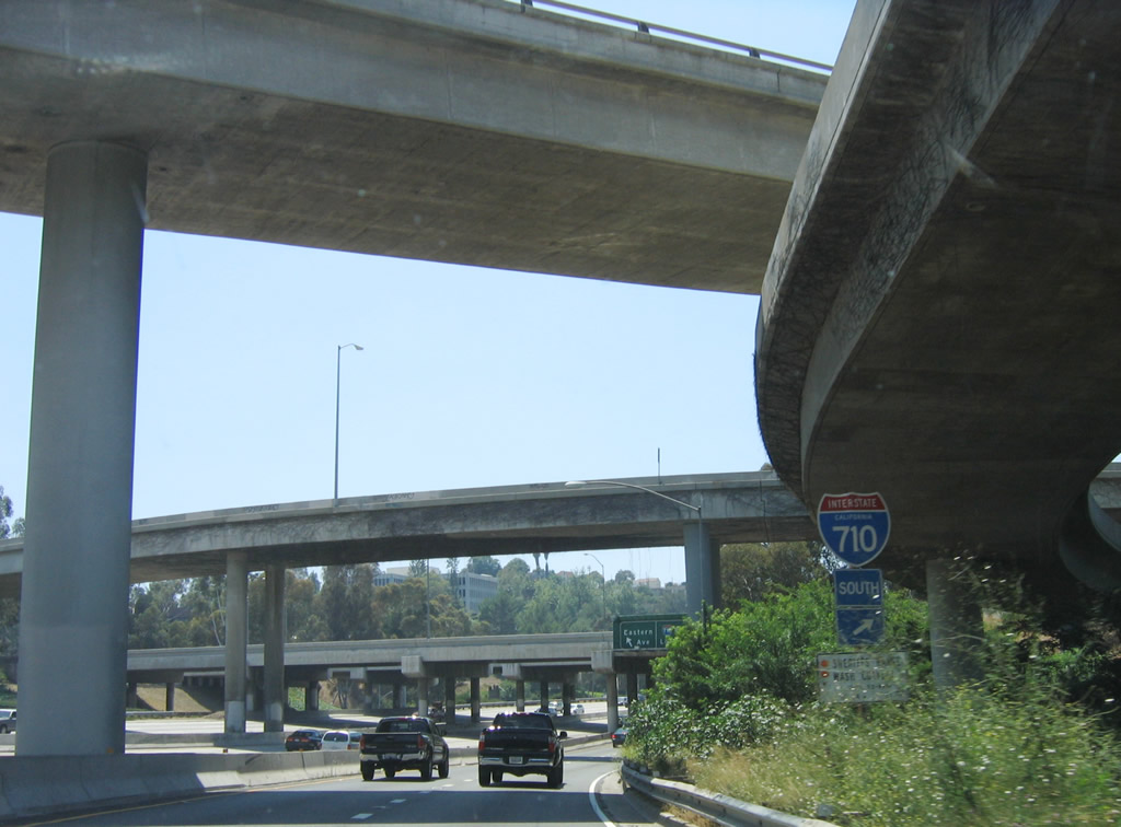
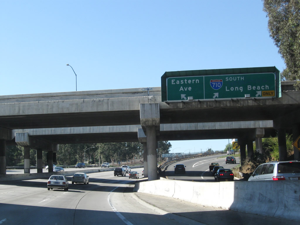
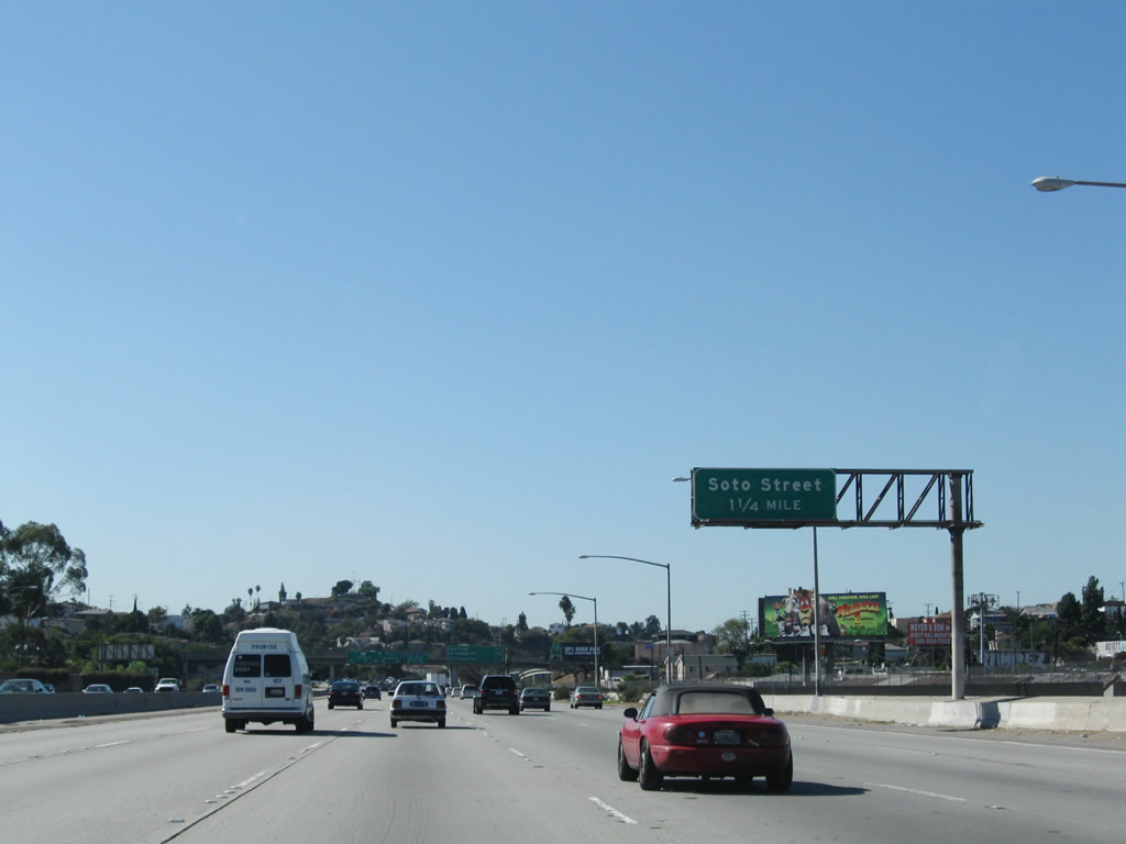
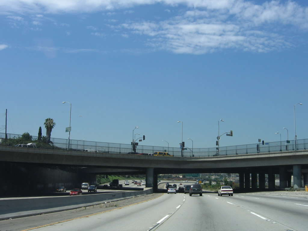
After the Fremont Avenue on-ramp in Alhambra, the next exit along Interstate 10 (San Bernardino Freeway) west is Exit 21, Interstate 710 (Long Beach Freeway). Use Exit 21 to Eastern Avenue, California State University at Los Angeles, and children's court. Photo taken 06/17/06. |
|
|
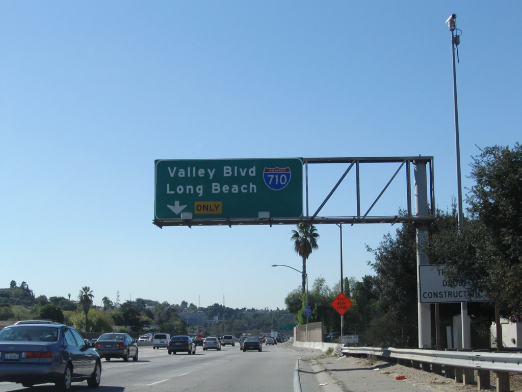
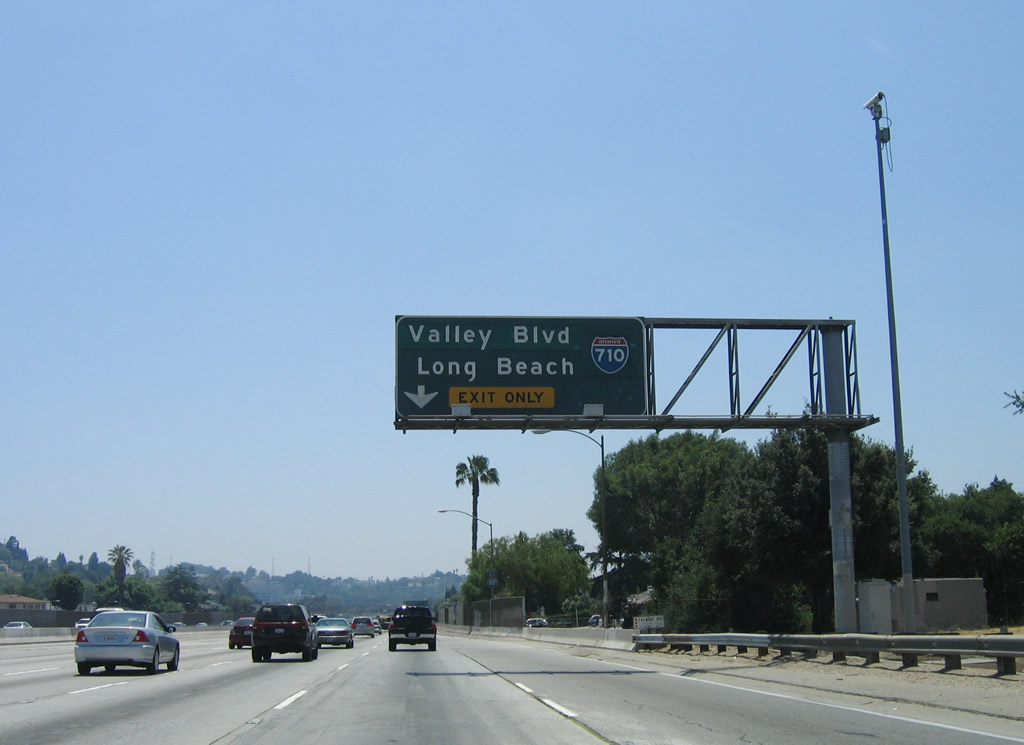
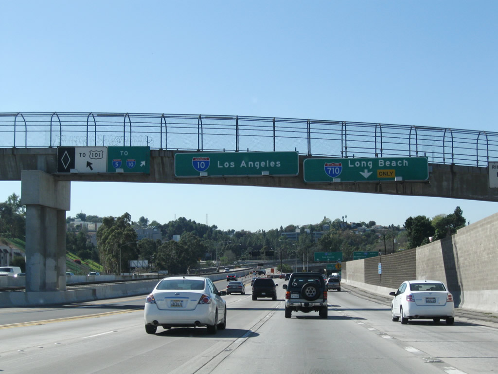
The right lane becomes exit only for Exit 21, Interstate 710 (Long Beach Freeway). Signs were replaced between 2006 and 2008. In the older sign, note that the Interstate 710 shield covers the post-1964 designation of the Long Beach Freeway: California 7. The Long Beach Freeway was originally signed as California 15 (a transfer from Atlantic Boulevard), but that designation was shifted to California 7 in 1964 to allow for Interstate 15 to become a state highway at the same time. Also on the older sign, "Valley Boulevard" is listed as a control city; this destination covers "Pasadena" as the intended northern terminal control city for Interstate 710. Photos taken 11/08/08 and 06/17/06. |
|
An Interstate 10 reassurance shield is posted after the on-ramp from Fremont Avenue. Photo taken 11/08/08. |
|
|
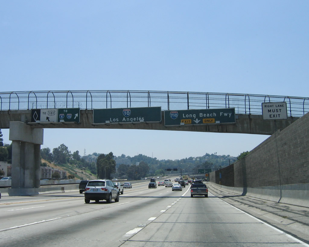
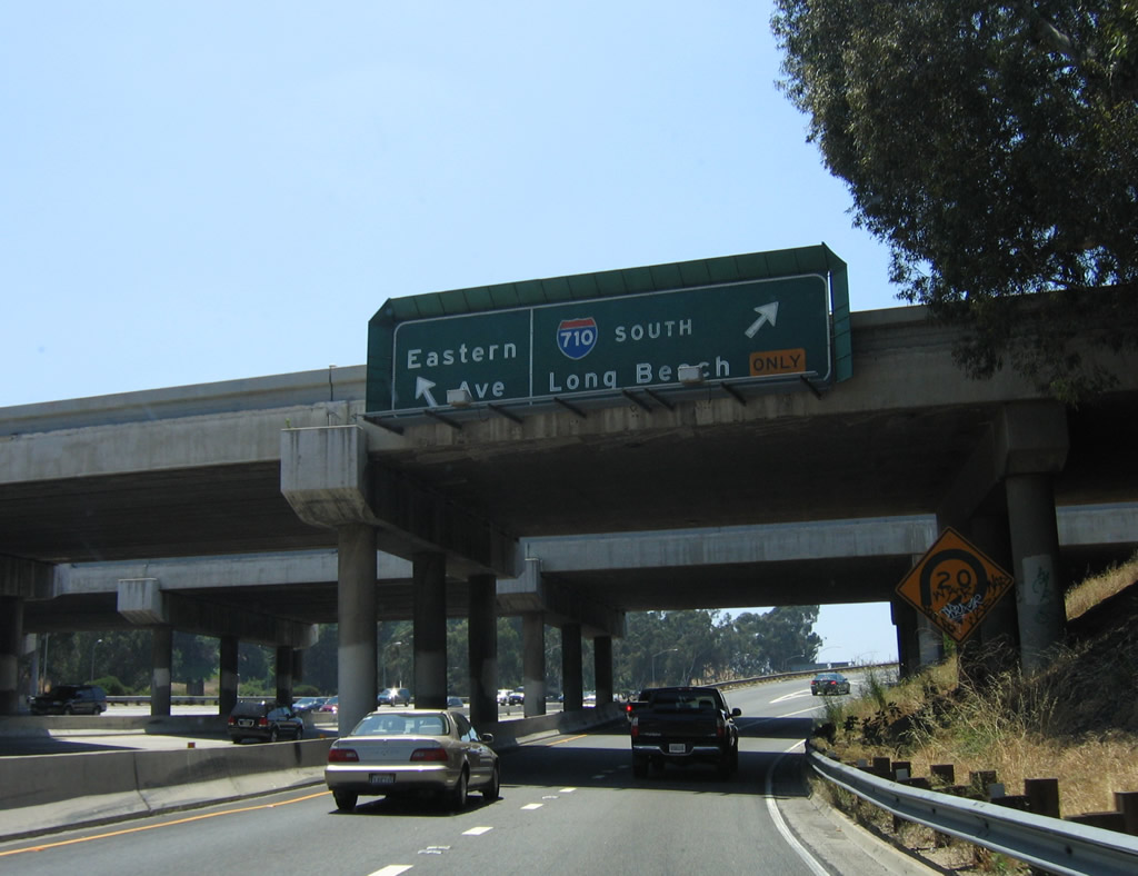
The 0.75-mile advance sign was also replaced between 2006 and 2008. While the junction with Interstate 710 is Exit 21, the new signs omit the exit number and almost exactly replicated the older sign. The newer sign omits the designation of "Long Beach Freeway" but still includes Eastern Avenue. We thought the reason to replace these overhead signs was so that exit numbers could be included! We guess that is not the case here. Photos taken 11/08/08 and 06/17/06. |
|
|
Interstate 710 travels south to Long Beach and the Port of Long Beach. The control city for Interstate 710 north is "Valley Boulevard" due to the unrealized extension of the freeway north to Pasadena. While plans still call for a tunnel to bring the freeway under the city of South Pasadena, such an extension is years and years (and many lawsuits) away. To the south, Interstate 710 travels through the Los Angeles Basin toward Long Beach. The new signs do not include the "Long Beach Freeway" designation for Interstate 710. Also at this point, the westbound Busway begins in the left lane; this high occupancy vehicle lane connects directly to U.S. 101 north and Alameda Street in downtown Los Angeles. There is no access from the Busway to the continuation of Interstate 10 west to Santa Monica. Photos taken 11/08/08 and 06/17/06. |
|
|
Westbound Interstate 10 (San Bernardino Freeway) reaches Exit 21, Interstate 710 (Long Beach Freeway) and Eastern Avenue. The older porcelain enamel signs were gone by 2008. Photos taken 11/08/08 and 06/17/06. |
|
|
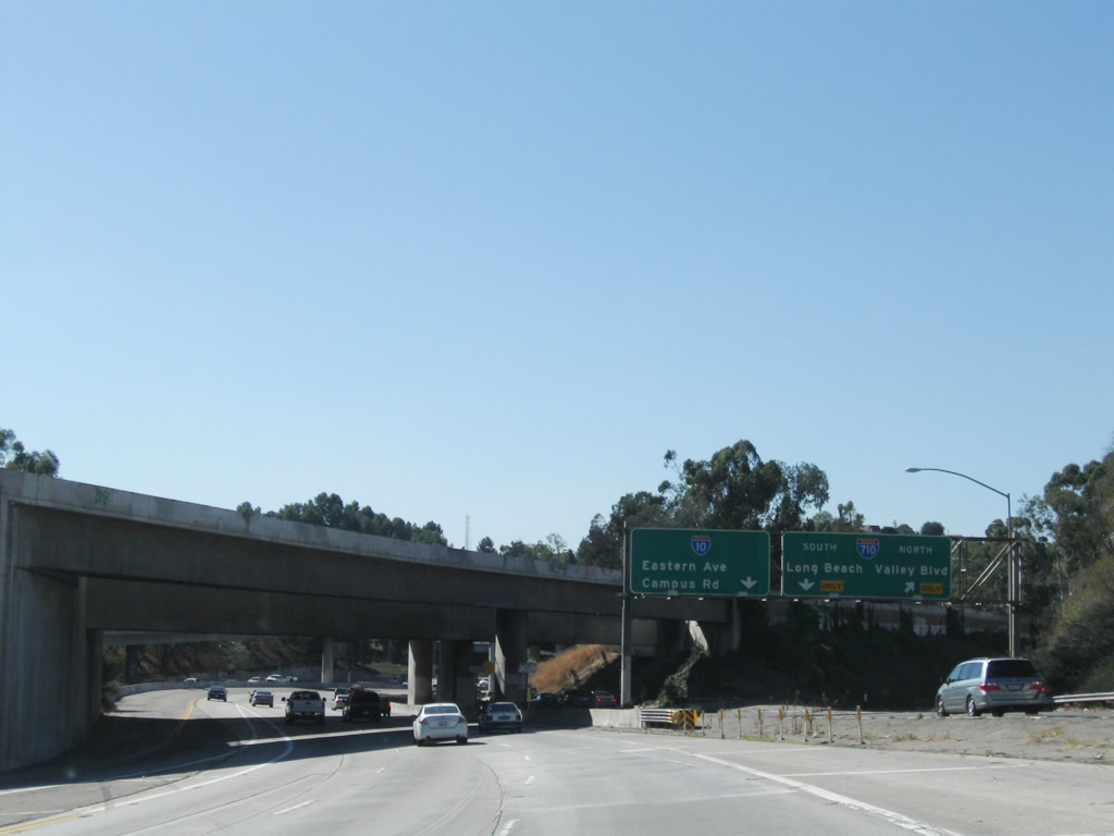
Now looking at the collector distributor lanes for Exit 21, the 2006 photo shows the c/d lanes, while the 2008 photo shows the c/d roadway from the main lanes. The collector distributor lanes will split between Interstate 710 (Long Beach Freeway) north to Valley Boulevard first, Interstate 710 (Long Beach Freeway) south to Long Beach, and finally Eastern Avenue and Campus Road to California State University at Los Angeles (CSULA). Photos taken 11/08/08 and 06/17/06. |
|
Still on the c/d roadway, the next exit will be the connection to Interstate 710 south to Long Beach. Continue straight to connect to Eastern Avenue and Campus Road. Photo taken 06/17/06. |
|
Through the maze of ramps at the 10-710 interchange, this Interstate 710 south trailblazer is posted on the c/d roadway prior to the loop ramp to the Long Beach Freeway south. Photo taken 06/17/06. |
|
Back on the main lanes, the dedicated lanes for the San Bernardino Freeway busway cross over the main lanes of Interstate 10. Photo taken 11/08/08. |
|
Immediately thereafter, the stack interchange with Interstate 710 comes into view. Photo taken 11/08/08. |
|
|
The second ramp in the network of Interstate 710 ramps is a loop ramp that connects Interstate 10 west with Interstate 710 south. The signage on the collector distributor lanes was replaced in 2008 (compare 2006 vs. 2008 pictures). Photos taken 11/08/08 and 06/17/06. |
|
After the split on the c/d lane between Eastern Avenue and Interstate 710, a two-lane ramp makes the link to southbound. The ramp to Eastern Avenue will connect to Campus Road and offer a return to Interstate 10 west to Los Angeles. Photo taken 06/17/06. |
|
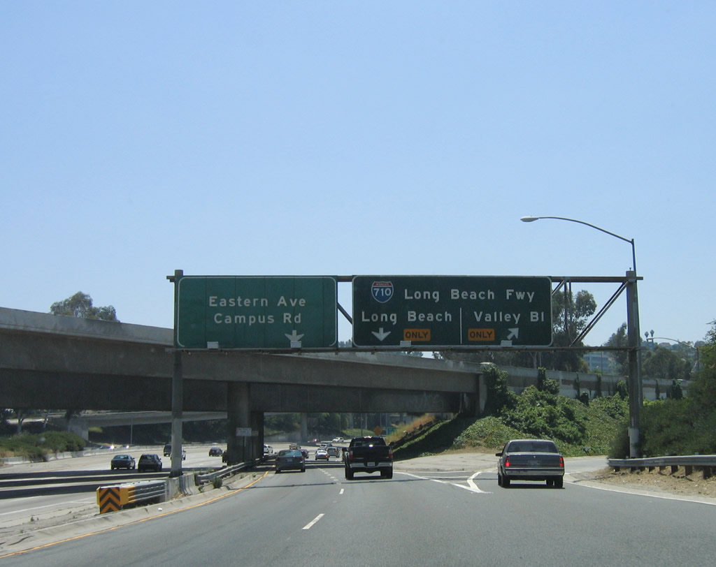
The third ramp along the collector distributor ramp system for the Interstate 710 interchange links to Eastern Avenue, which is signed as Exit 21 (even though the entire Interstate 710 interchange is technically Exit 21). Photo taken 11/08/08. |
|
|
|
The Busway and collector distributor lanes for the Interstate 710 interchange separate, and the c/d lanes will merge back onto the main lanes ahead. The two-lane roadway seen to the right of the main lanes is the c/d roadway; the busway is on the other side of the c/s lanes. Photos taken 11/08/08. |
|
|
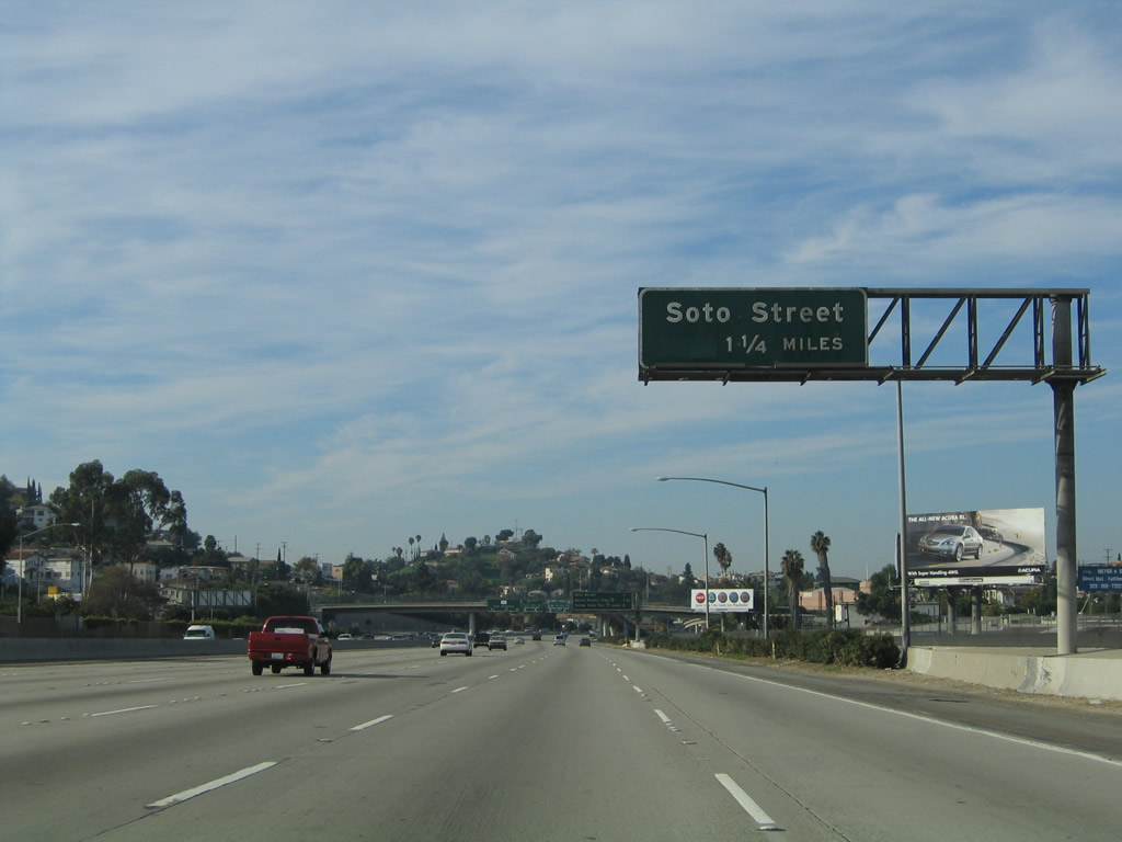
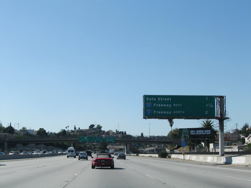
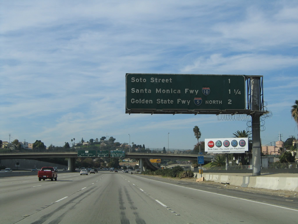
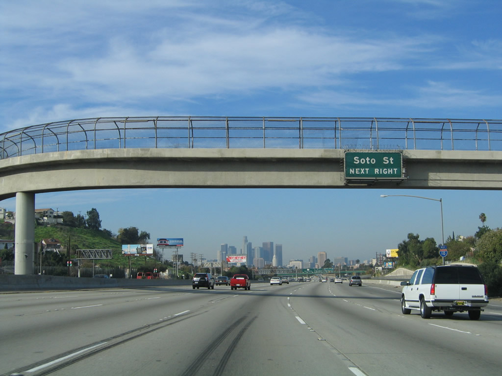
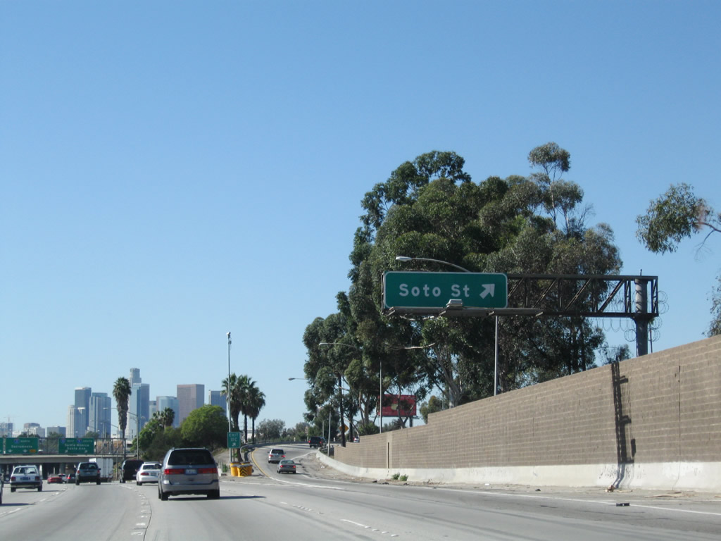
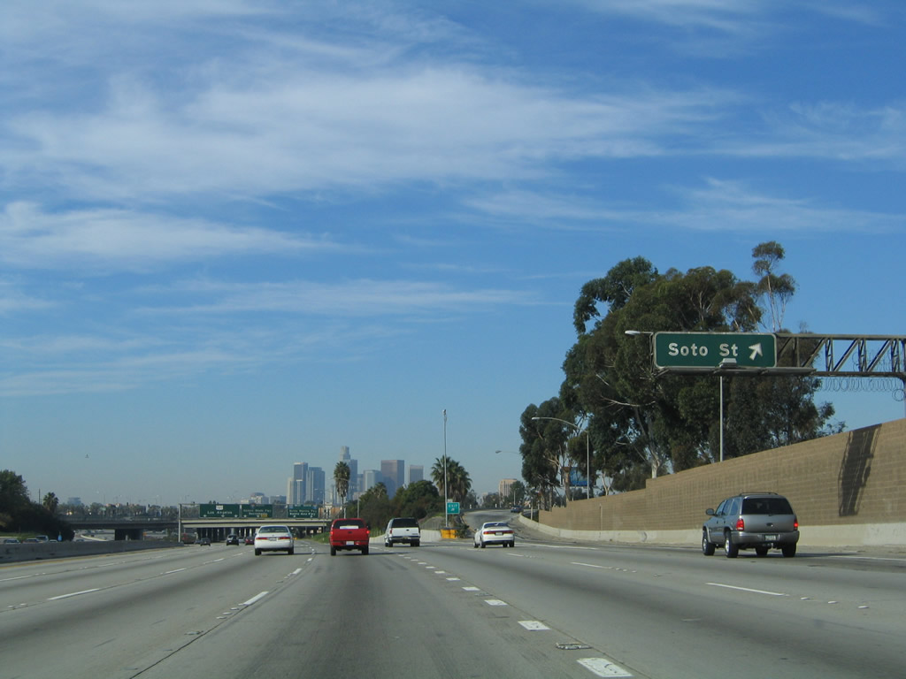
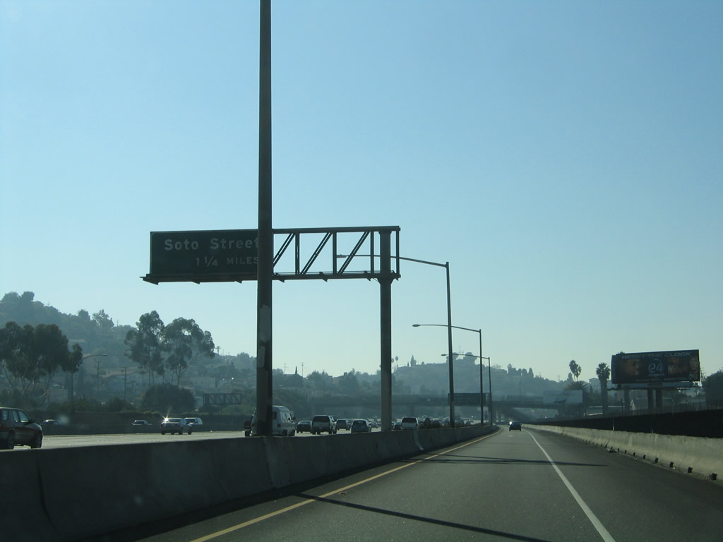
After the Interstate 710 interchange, the next exit along Interstate 10 (San Bernardino Freeway) west is Exit 19C, Soto Street. Photos taken 11/08/08 and 11/25/04. |
|
|
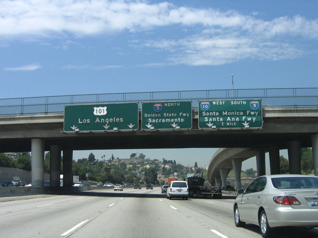
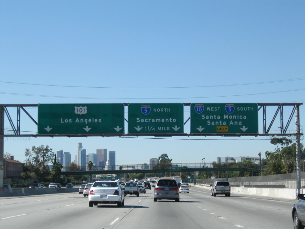
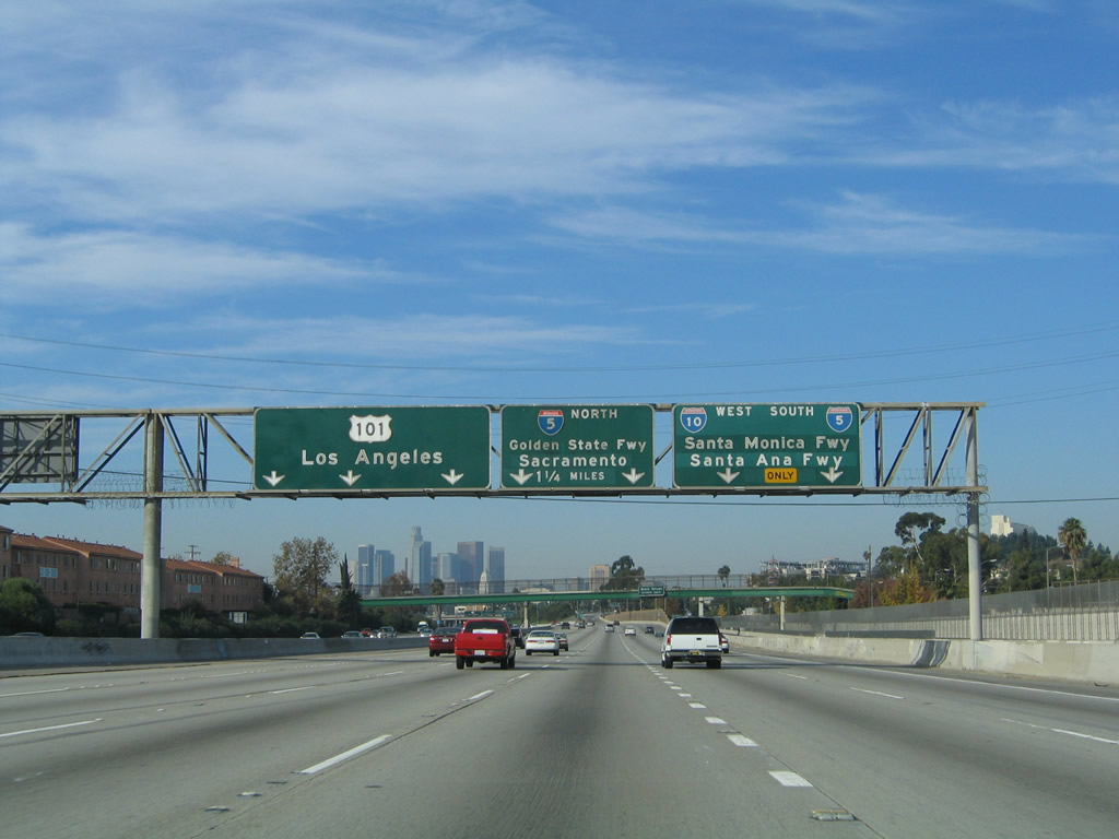
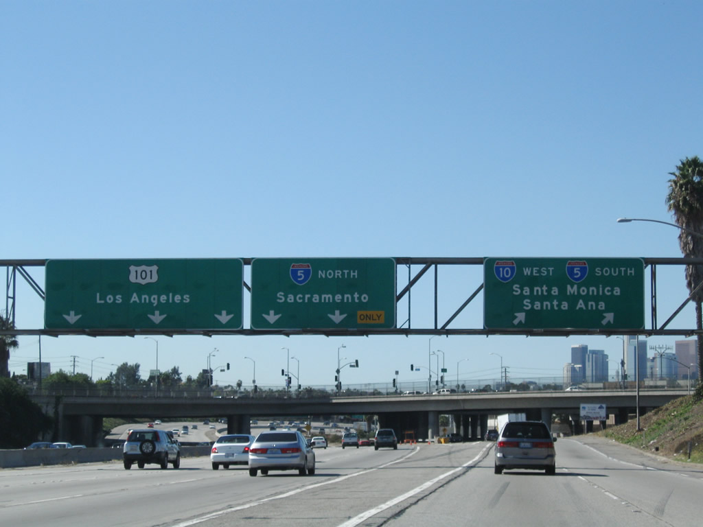
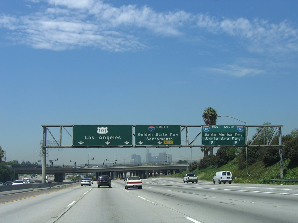
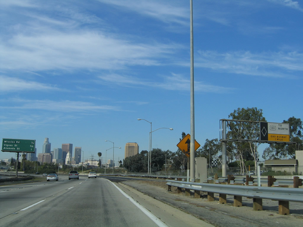
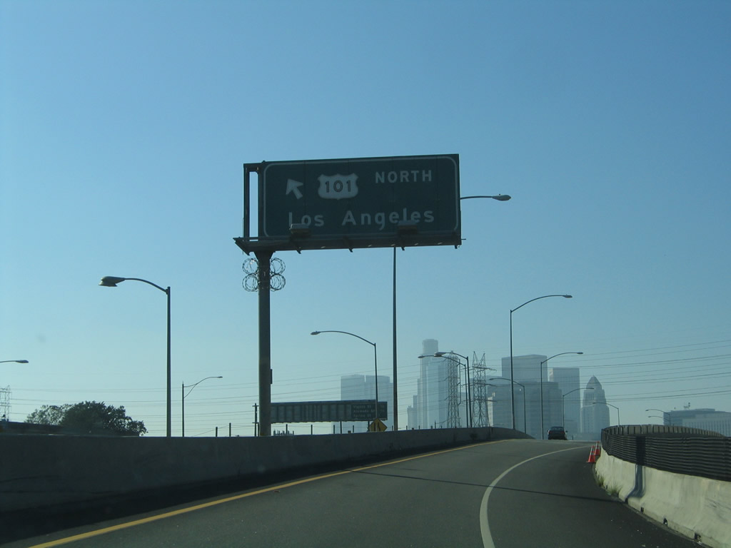
This mileage sign provides the distance to the next two exits along Interstate 10 (San Bernardino Freeway) west: Exit 19C, Soto Street and Exit 19B, U.S. 101 (Santa Ana Freeway) north to downtown Los Angeles and Hollywood and Interstate 5 (Golden State Freeway) north to Sacramento. An exit is also posted to Interstate 10 (Santa Monica Freeway) west, which implies Interstate 10 exits from itself. That is somewhat true, as Interstate 10 will divert away from the San Bernardino Freeway (which extends west to U.S. 101 as unsigned California 10) and merge onto Interstate 5 (Golden State Freeway) south briefly before splitting west again toward Santa Monica. Photos taken 11/08/08 and 11/25/04. |
|
|
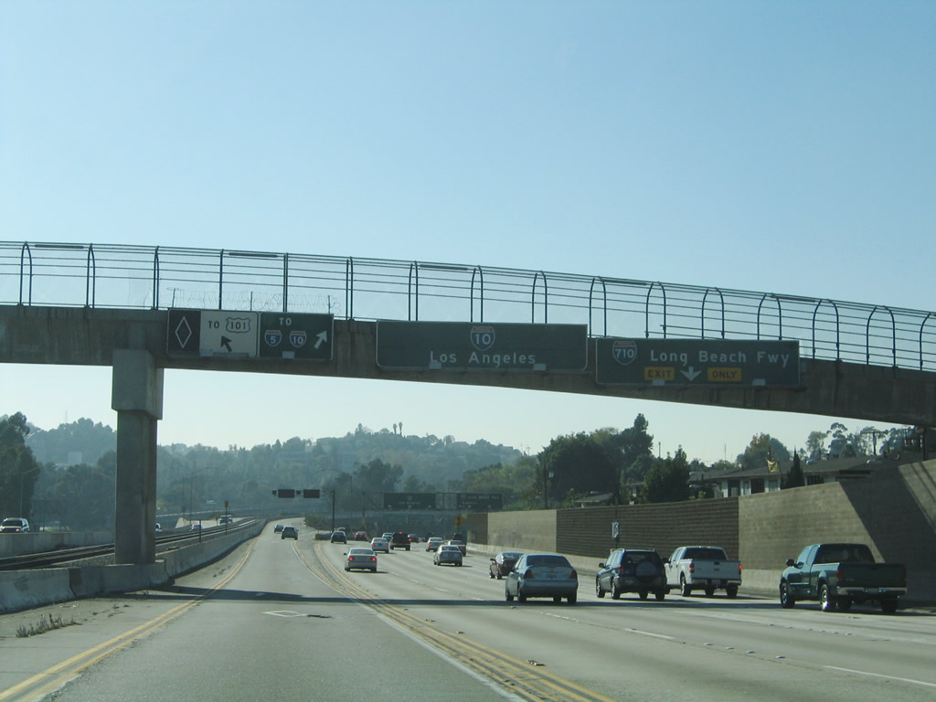
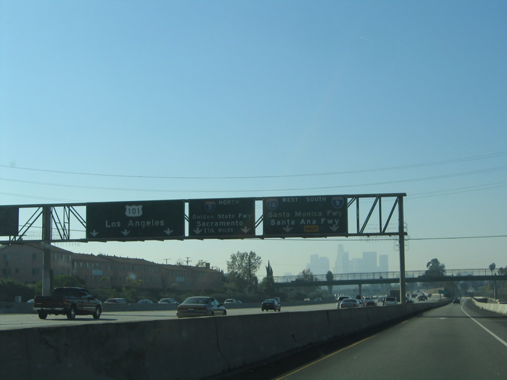
Passing under Herbert Avenue overpass, this set of signs provides lane allocations for the pending split. The left three lanes continue west on unsigned California 10 (former Interstate 110 from 1964 to 1968, now also referred to as Spur I-10) to U.S. 101 (Santa Ana Freeway) north to downtown Los Angeles, Hollywood, Ventura, and points west and north. The middle two lanes connect to Exit 19B, Interstate 5 (Golden State Freeway) north to Santa Clarita, Sacramento, and the most direct route to the San Francisco Bay Area. The right two lanes carry Interstate 10 west and Interstate 5 south through the East Los Angeles Interchange. A connection to California 60 east is offered via Interstate 5 south. Stay right for the connection to Exit 19C, Soto Street. Photos taken 11/08/08 and 11/25/04. |
|
Westbound Interstate 10 (San Bernardino Freeway) passes under a pedestrian bridge prior to the Soto Street exit (Exit 19C). Photo taken 11/25/04. |
|
|
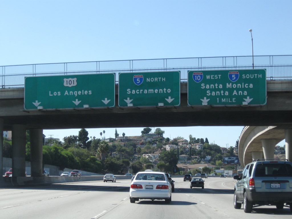
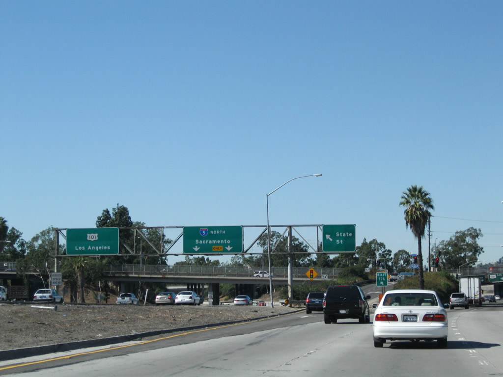
The downtown Los Angeles skyline comes into view as another lane allocation sign bridge advises of the pending junction with Interstate 5 and U.S. 101. This interchange marks the southern terminus of U.S. 101, the major coastal route from Los Angeles north to Olympia, Washington. Passing through Ventura, Santa Barbara, Santa Maria, San Luis Obispo, and Salinas, U.S. 101 enters the San Francisco Bay Area from the south. However, U.S. 101 is a longer route to San Francisco than taking the route via Interstate 5 and Interstate 580. Photos taken 11/08/08 and 11/25/04. |
|
|
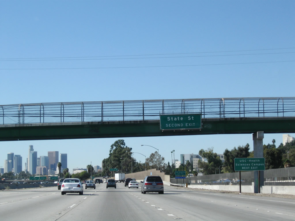
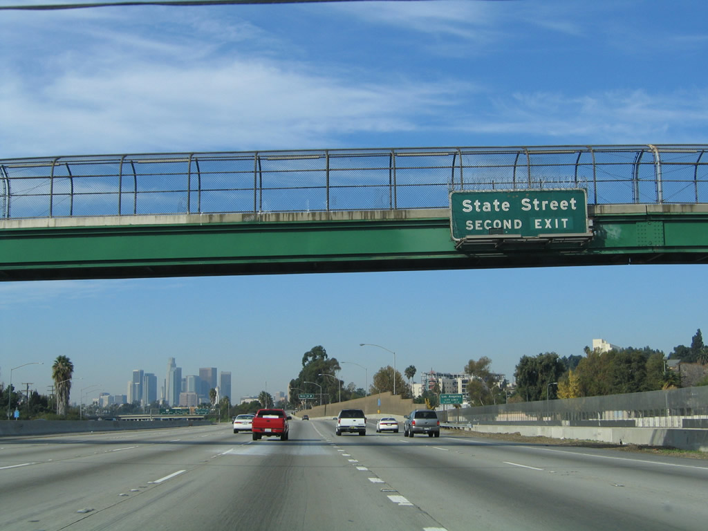
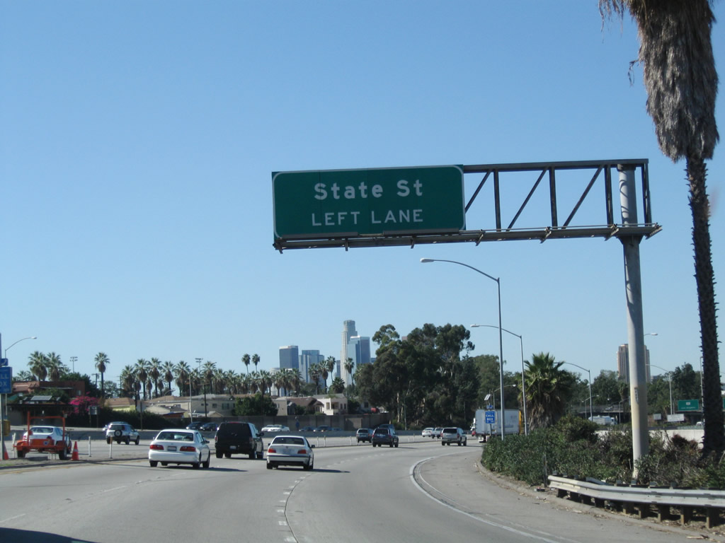
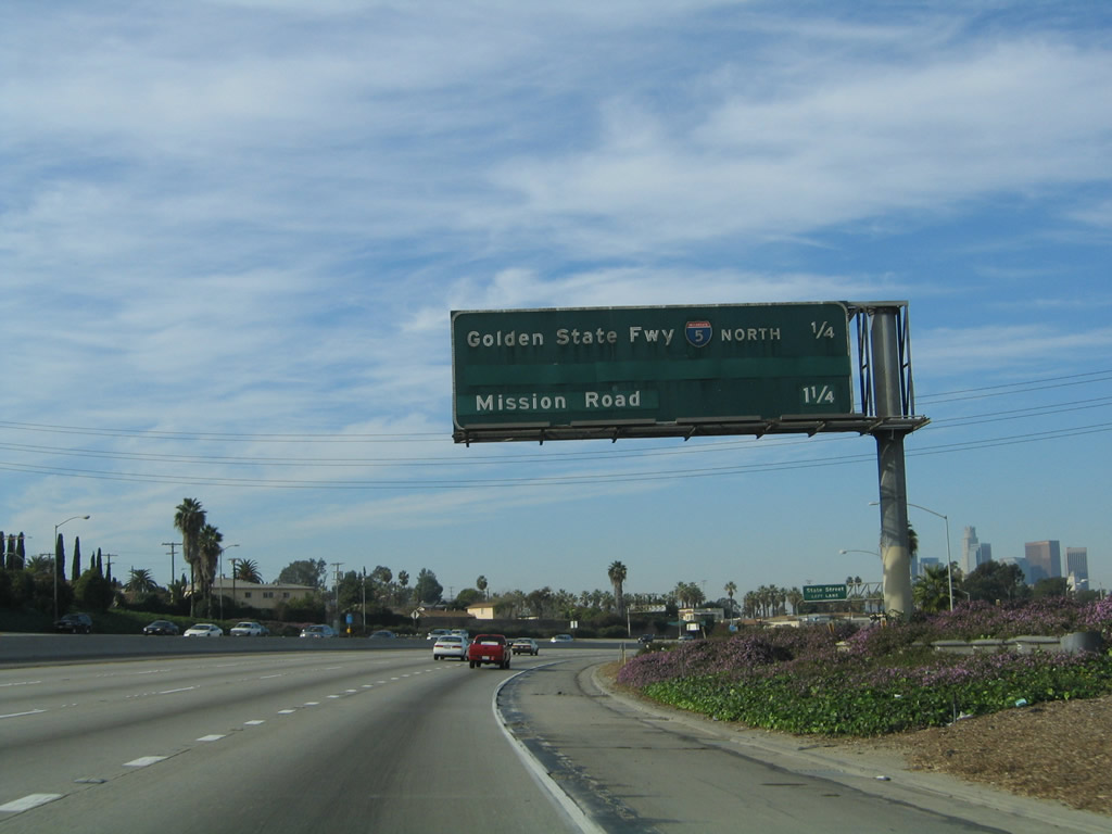
To State Street (Exit 19A), follow Interstate 10 west and Interstate 5 south. Photos taken 11/08/08 and 06/28/06. |
|
Interstate 10 leaves unincorporated City Terrace and enters the city of Los Angeles. Photo taken 11/25/04. |
|
|
Westbound Interstate 10 (San Bernardino Freeway) reaches Exit 19C, Soto Street. Photos taken 11/08/08 and 11/25/04. |
|
|
|
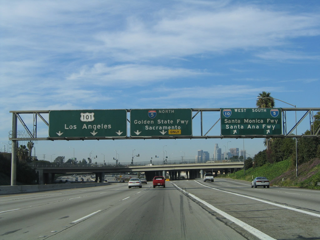
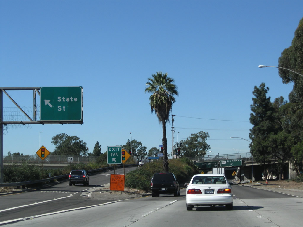
Interstate 10 splits at this point. The left three lanes continue west on unsigned California 10 to U.S. 101 (Santa Ana Freeway) north to downtown Los Angeles, Hollywood, Ventura, and points west and north. The middle two lanes connect to Exit 19B, Interstate 5 (Golden State Freeway) north to Santa Clarita, Sacramento, and the most direct route to the San Francisco Bay Area. The right two lanes carry Interstate 10 west and Interstate 5 south through the East Los Angeles Interchange. Stay right to connect to Exit 19A, State Street and to California 60 (Pomona Freeway) east. Photos taken 11/08/08, 06/28/06, and 11/25/04. |
|
The right two lanes continue west on Interstate 10 as the freeway enters the sprawling East Los Angeles Interchange. Here, the freeway passes under Soto Street and Marengo Street. Photo taken 11/08/08. |
|
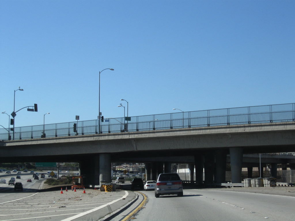
The next exit along Interstate 10 west is Exit 19A, State Street. For now, Interstate 10 parallels Spur I-10. Photo taken 11/08/08. |
|
|
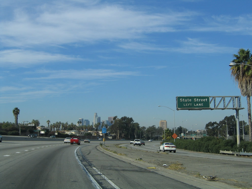
Westbound Interstate 10 reaches Exit 19A, State Street (left exit). The signage has changed in recent years to reflective signs, but no exit numbers are posted on the overhead signs. Photos taken 11/08/08. |
|
Mainline Interstate 10 narrows to three lanes and squeezes under State Street. The next ramp connects Interstate 10 west to Spur I-10 west to U.S. 101 north; this is the second ramp to U.S. 101 north after Exit 19B. Photo taken 11/08/08. |
|
The right lane becomes exit only for U.S. 101 north, while the left two lanes will follow Interstate 10 west onto Interstate 5 (Golden State Freeway) south to Santa Ana and Santa Monica. Photo taken 11/08/08. |
|
Interstate 10 again splits, with the right lane linking to Spur I-10 to U.S. 101 north, while the left two lanes turn sharply south to merge onto Interstate 5 south. Photo taken 11/08/08. |
|
|
Now two lanes wide, westbound Interstate 10 bends to the south for its merge onto Interstate 5 (Golden State Freeway) south. Interstate 10 and Interstate 5 share alignment for less than a mile within the East Los Angeles Interchange, then will split at the Santa Monica Freeway interchange. Photos taken 11/08/08. |
| Spur I-10 (California 10)/San Bernardino Freeway (Former Interstate 110) west |
|
The intersection of Soto Street and Marengo Street is elevated above the freeway split. At this point, the San Bernardino Freeway is unsigned California 10 (Spur I-10), which was formerly known as Interstate 110 (between 1964 and 1968). This section of freeway was mostly built in 1959 according to the bridge log. Photo taken 06/28/06. |
|
This mileage sign provides the distance to the next two exits along the San Bernardino Freeway west: Exit 19B Ramp 1, Interstate 5 (Golden State Freeway) north to Sacramento and an unnumbered exit (we'll call it Exit 19B Ramp 2) to Mission Road. The transition to U.S. 101 north (which is the third ramp from Exit 19B) occurs after the Mission Road off-ramp. Photo taken 11/25/04. |
|
Between Soto Street and Interstate 5 (Golden State Freeway) (a distance of about 0.25 mile), Interstate 10 has a dual freeway alignment. The two-lane freeway on the right follows mainline Interstate 10 west to Interstate 5 south and State Street (Exit 19A), and the three-lane freeway on the left carries unsigned California 10 traffic to Interstate 5 north (Exit 19B-1), Mission Road (Exit 19B-2), and U.S. 101 (Exit 19B-3. Signage for Exit 19A, State Street, can be seen from the California 10 lanes looking over at the main line Interstate 10 lanes. Photo taken 11/25/04. |
|
Westbound California 10 (Spur I-10)/San Bernardino Freeway reaches Exit 19B-1, Interstate 5 (Golden State Freeway) north to Sacramento. The left three lanes continue west to Mission Road and U.S. 101 north. A left exit from Interstate 10 main lanes to Exit 19A, State Street, can be seen from the California 10 lanes. After Exit 19A, the Interstate 10 through lanes will climb up and merge onto Interstate 5 south. Photo taken 11/25/04. |
|
The San Bernardino Freeway (unsigned State Route 10; called "10 SPUR" in the official District 7 Bridge Log) passes under the main lanes of the Golden State Freeway (Interstate 5) shortly thereafter. Photo taken 11/25/04. |
|
Right after that, the main lanes of Interstate 10 west cross over California 10 on the "West 10 connector to South 5." Photo taken 06/28/06. |
|
A sign for the Busway, which connects Interstate 10 west to U.S. 101 north for HOV+2 (or +3 during commuting hours) traffic, comes into view again on the north side of California 10. The busway will end in one mile at the Alameda Street intersection, but motorists on the busway may return to the freeway system at U.S. 101. Photo taken 11/25/04. |
|
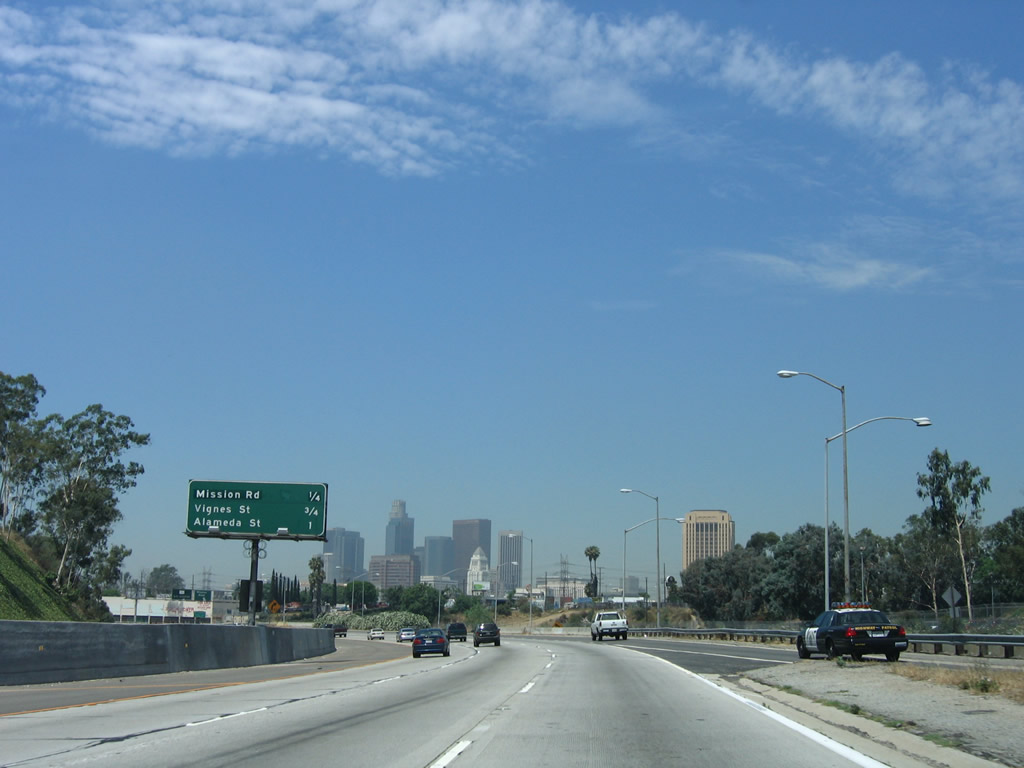
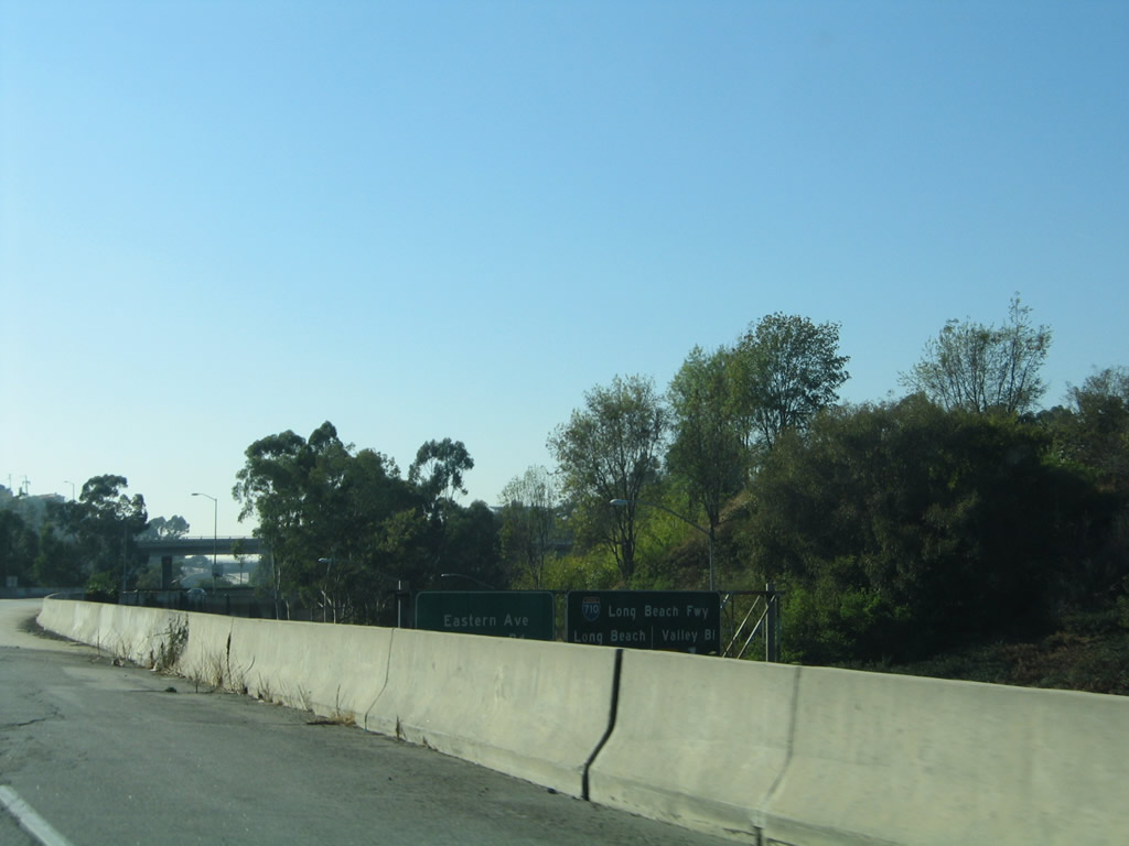
This mileage sign provides the distance to three of the next four exits along the San Bernardino Freeway west and Santa Ana Freeway north: Exit 19B-2, Mission Road; Exit 19B-3, U.S. 101 north; U.S. 101 Exit 2A, Vignes Street; and U.S. 101 Exit 2B, Alameda Street and Los Angeles Street. Around this point, the Metrolink railway Photo taken 06/28/06. |
|
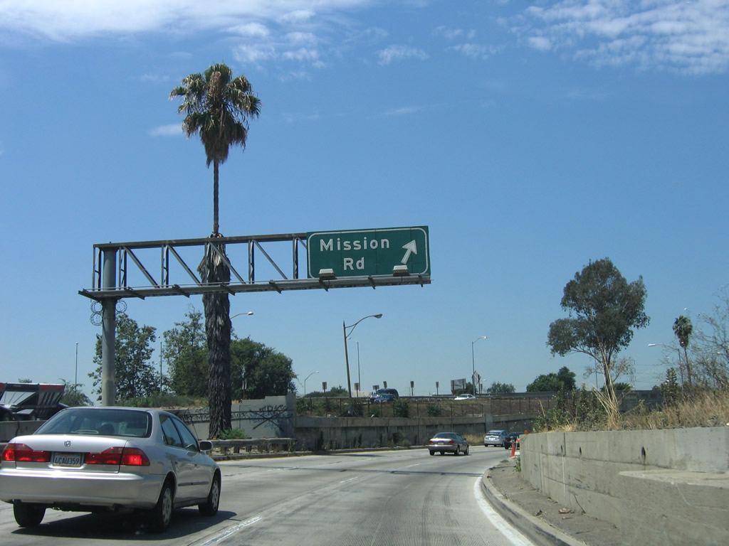
The next exit along California 10 (Spur I-10)/San Bernardino Freeway west is Exit 19B-2, Mission Road. The pull-through sign is again for U.S. 101 north to Los Angeles. Photo taken 06/28/06. |
|
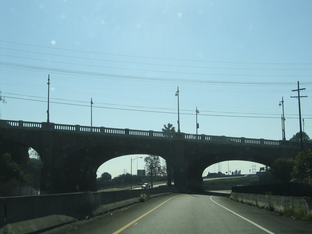
This arch bridge (built in 1906 according to the bridge log) carries Cesar E. Chavez Avenue (former U.S. 60-70-99-101/Macy Street) over the San Bernardino Freeway and the Busway. It connects to the historic 1926 bridge that carries Cesar E. Chavez Avenue over the Los Angeles River. Photo taken 06/28/06. |
|
Westbound Spur I-10 (California 10) reaches Exit 19B-2, Mission Road. Photo taken 06/28/06. |
|
At the same point as the exit to Mission Road, the California 10/Spur I-10 segment of the San Bernardino Freeway merges onto U.S. 101 (Santa Ana Freeway) north. A busway ramp can be seen with its ramp to U.S. 101 north. From this point, continue on to U.S. 101 north Photo taken 06/28/06. |
| Busway: Interstate 10 west to U.S. 101 north |
|
At the interchange with Interstate 710 (Long Beach Freeway), the carpool (high occupancy vehicle - HOV) lane on the left side of the freeway will split from the main lanes and becomes its own, independent roadway called the Busway that offers a connection directly into downtown Los Angeles and also links to U.S. 101 (Santa Ana Freeway) north to Hollywood. The entrance to the Busway is located east of the Interstate 710 interchange, and there are no additional access points from the Interstate 10 west main lanes to the Busway west of that point. Photo taken 11/13/05. |
|
The Busway switches from the left side of the freeway to the right side of the freeway via a flyover ramp. The freeway exit signs for the Interstate 710 interchange can be seen below the ramp. The Busway is open for HOV (at least two occupants except during commuting hours, when three occupants per vehicle is mandatory) traffic and buses. In the Los Angeles County Thomas Guide, look for the blue line that parallels Interstate 10 on the north side to distinguish the Busway from the main lanes of the freeway. Metrolink, the regional commuter rail that was previously located in the median of Interstate 10 (San Bernardino Freeway), now parallels the freeway and busway on the north side of the freeway between Interstate 710 and downtown Los Angeles. Photo taken 11/13/05. |
|
|
A bus station is located in the northwestern quadrant of the Interstate 10/710 interchange; it is located at the southern end of the California State University at Los Angeles campus and thus is heavily used by students. Buses using the busway may stop at this station. The 2006 photo shows the bus station and busway location relative to the connecting ramp from Interstate 710 north to Interstate 10 west. Photos taken 11/13/05 and 06/28/06. |
|
|
Continuing west, the busway swings under the Eastern Avenue and Marianna Avenue overpass. Again, the 2006 photo shows the busway relative to the connecting ramp from Interstate 710 north to Interstate 10 west. Photos taken 11/13/05 and 06/28/06. |
|
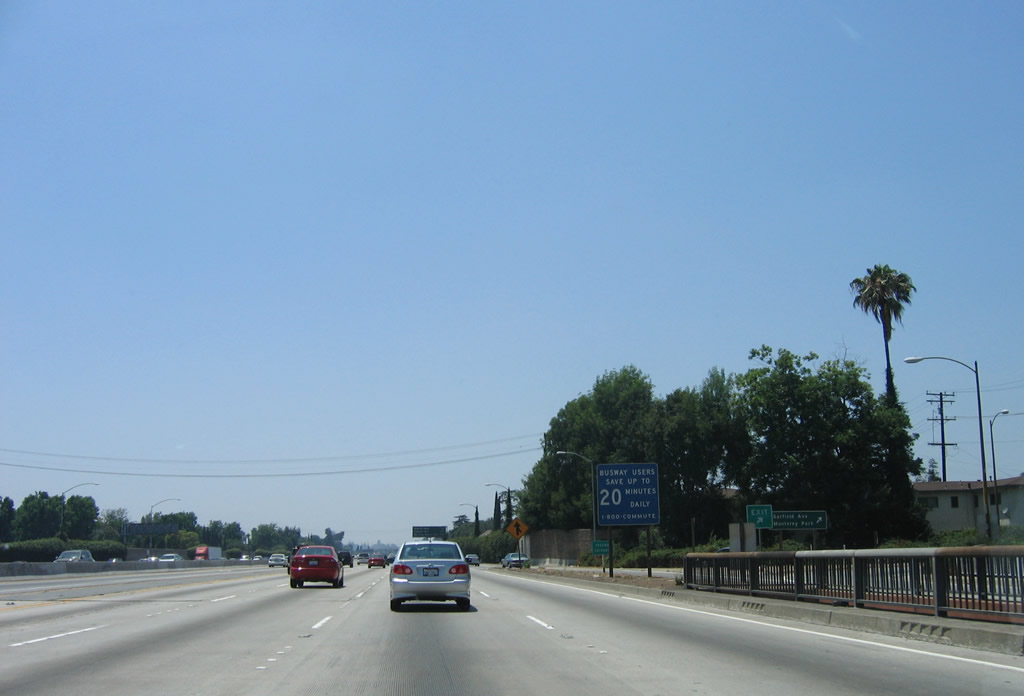
The busway now resides on the right side of the freeway, separated by a jersey barrier from the main lanes. The next exit from the Busway will be the connection to U.S. 101 north and to downtown Los Angeles via Alameda Street. The busway is only one lane wide. Photo taken 11/13/05. |
|
There is no access from the Busway to Interstate 10 west or Interstate 5 north/south. The only access is to U.S. 101 north and to downtown Los Angeles via Alameda Street. Photo taken 11/13/05. |
|
After the Interstate 5 and Interstate 10 interchange, the busway separates itself from the California 10 ramp connection to U.S. 101 north. According to this sign, the busway ends in one mile. Downtown Los Angeles comes into view in the distance on this hazy, late fall afternoon. Photo taken 11/13/05. |
|
What appears to be an abandoned ramp comes alongside the busway. The busway has an odd configuration because the westbound traffic on the busway is south of the eastbound traffic. Normally, opposing traffic is situated to the left, and in this case, opposing traffic is situated on the right side. Photo taken 11/13/05. |
|
The busway, which is parallel to unsigned California 10/San Bernardino Freeway, passes under the Cesar E. Chavez Avenue overpass and will soon have a connecting ramp to U.S. 101 (Santa Ana Freeway) north. Photo taken 11/13/05. |
|
Westbound Interstate 10 Busway reaches the split to U.S. 101 north. This is the only freeway-to-freeway access from the busway. Continuing straight ahead will bring drivers to Alameda Street, which is where the busway (and its freeway standards) to an end. Photo taken 11/13/05. |
|
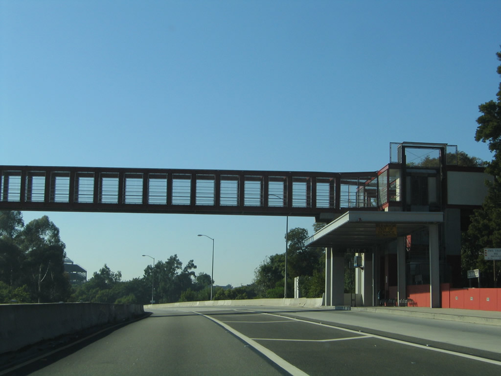
After the U.S. 101 split, the busway elevates briefly before connecting to Alameda Street. Photo taken 11/13/05. |
|
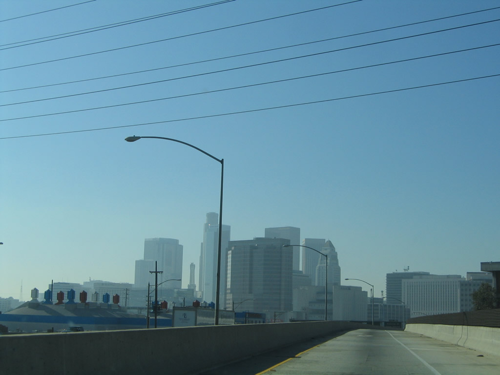
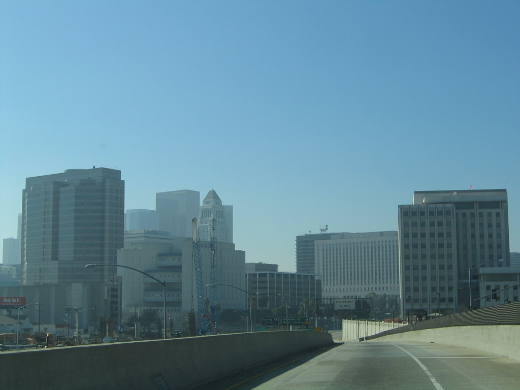
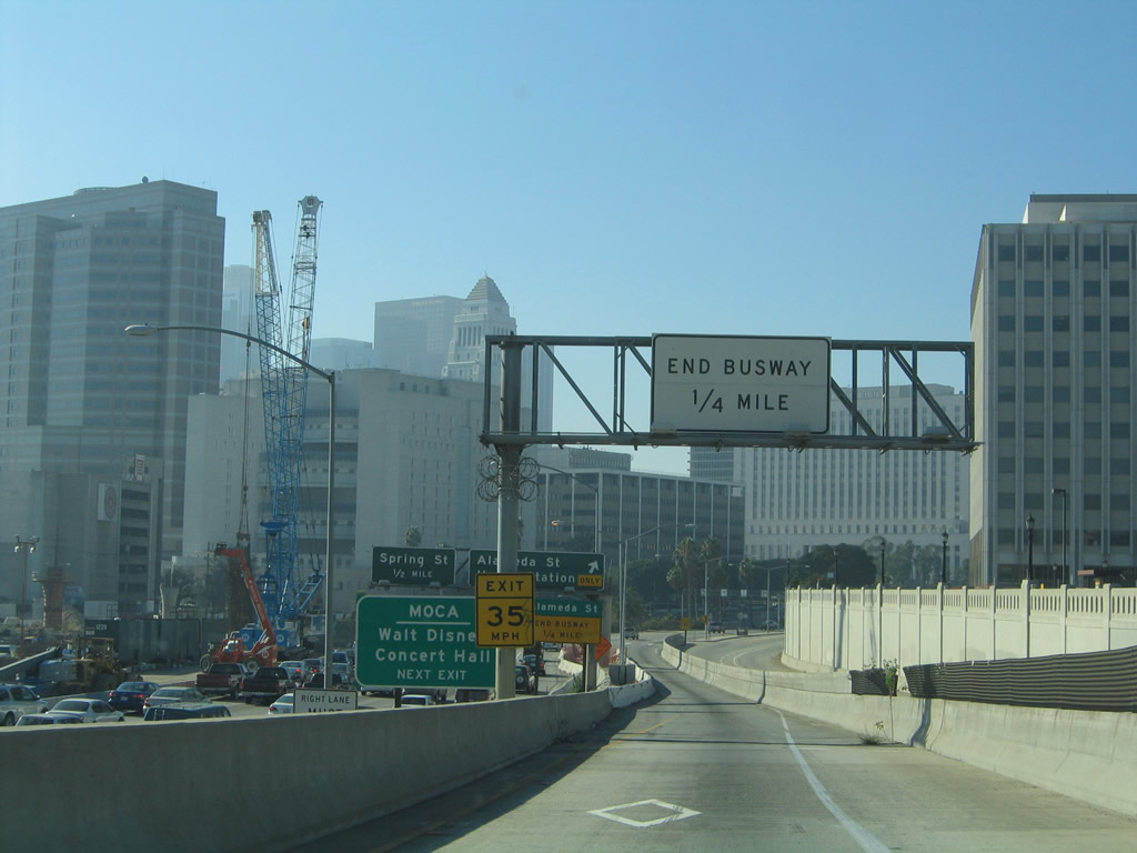
The skyline of downtown Los Angeles dominates the view along the westbound busway. The construction ahead is from the development of the Yellow Line light rail. Photo taken 11/13/05. |
|
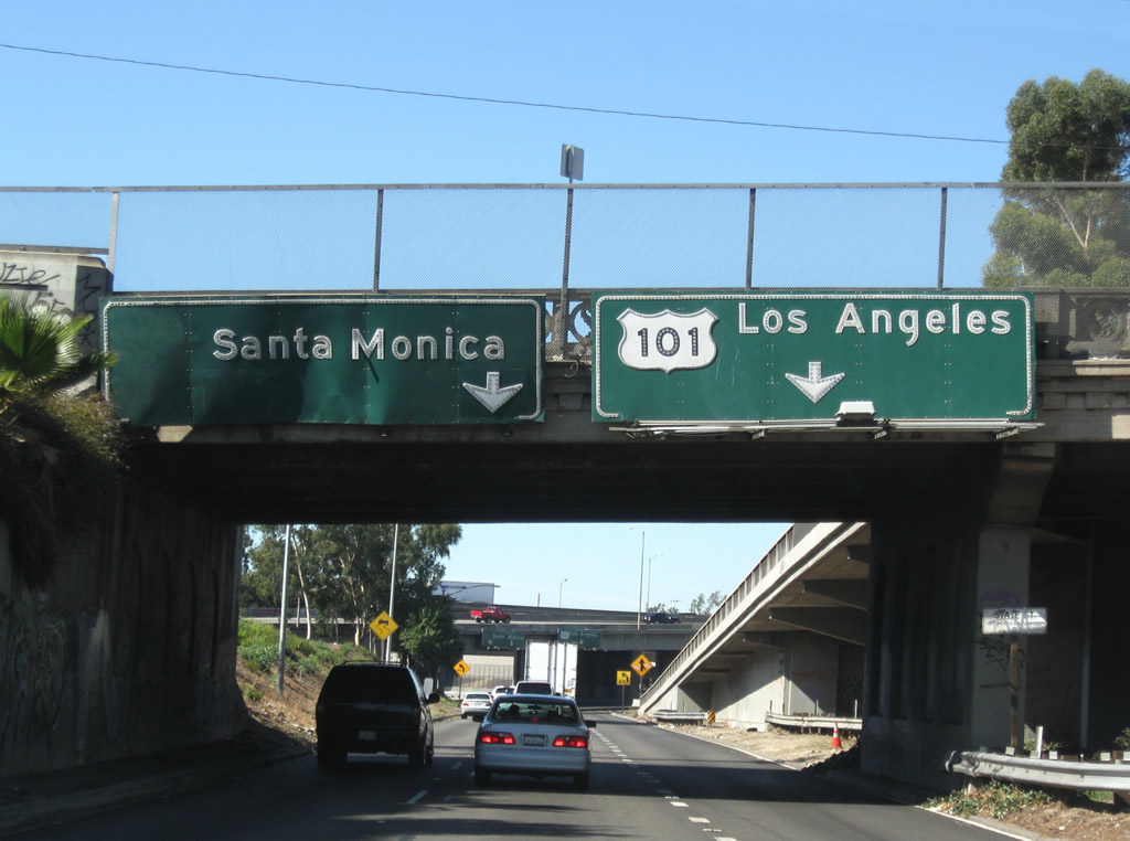
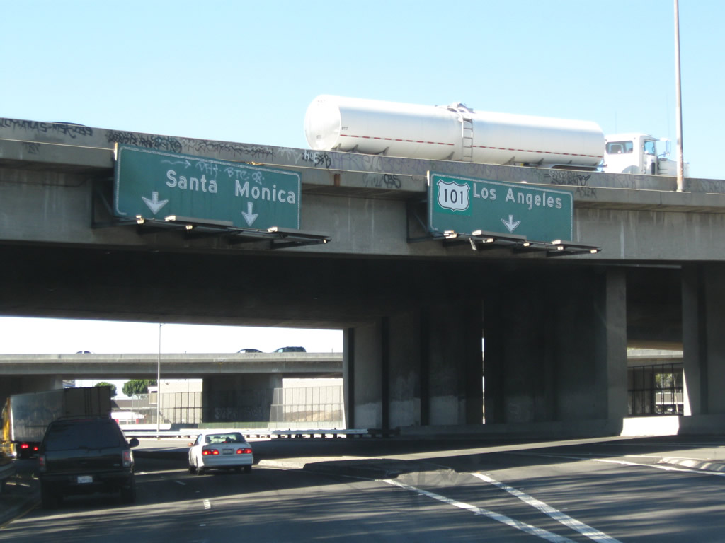
The busway ends in 0.25 mile. U.S. 101 north comes into view below and to the left of the busway as the freeway passes through the Downtown Slot. The traffic signal with Alameda Street is just ahead. Photo taken 11/13/05. |
|
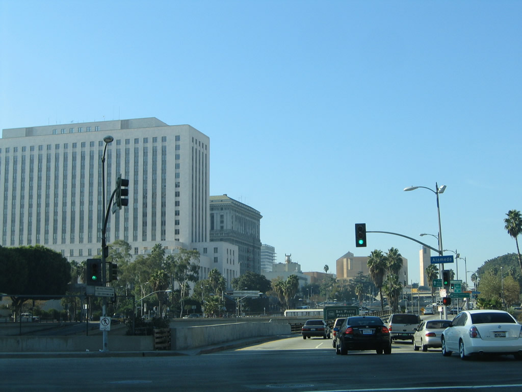
At this traffic signal, the busway ends at Alameda Street. Turn right (north) on Alameda Street to Union Station, the downtown terminal point of Metrolink, various light rail systems, and local and regional buses. El Pueblo de Los Angeles State Historic Park is located on the west side of Alameda Street north of this intersection, and Alameda Street continues north into Chinatown, ending at Spring Street. Continue straight ahead on Arcadia Street to follow a frontage road that parallels U.S. 101 on the northeast side, and make a left on Spring Street to the Civic Center of Los Angeles and other downtown attractions. To the left (south) on Alameda Street is Little Tokyo and the commercial areas south of downtown. Photo taken 11/13/05. |
Page Updated February 2, 2009.