| Interstate 15/Temecula Valley Freeway (Avocado Highway/Escondido Freeway) north |
|
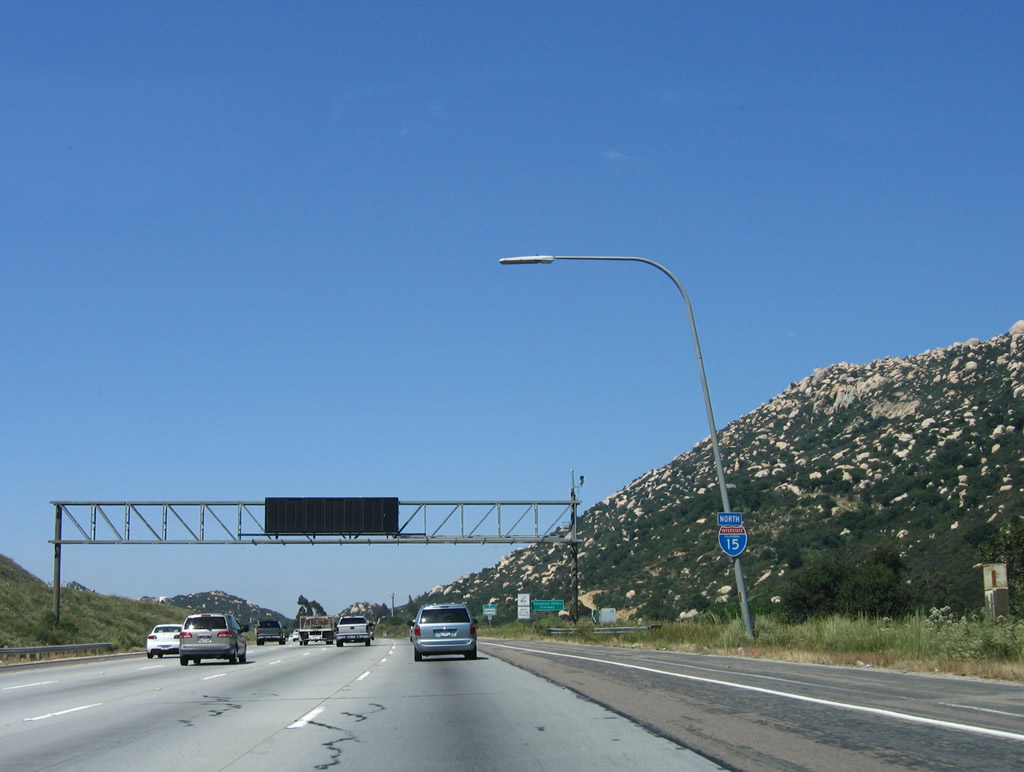
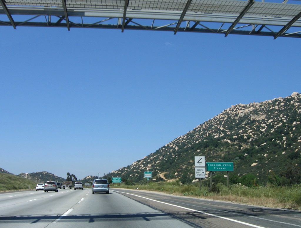
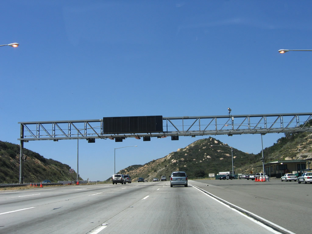
Upon entering Riverside County, this Interstate 15 north reassurance shield is posted after the on-ramp from Rainbow Valley Road. An overhead variable message sign is posted to relay any upcoming traffic issues as well as provide guidance for the U.S. Border Patrol Inspection Station that is operational at the weigh station facility from time to time. Watch for stopped or slowing traffic. Photo taken 06/03/06. |
|
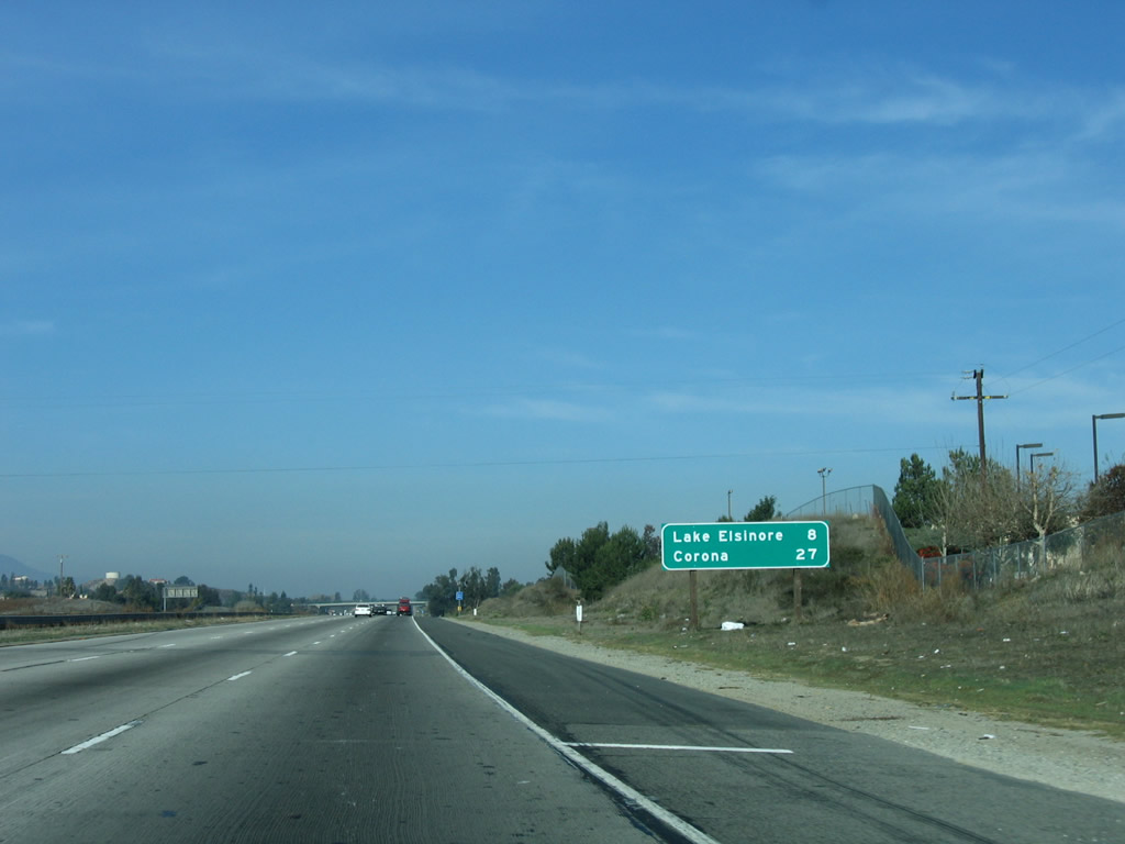
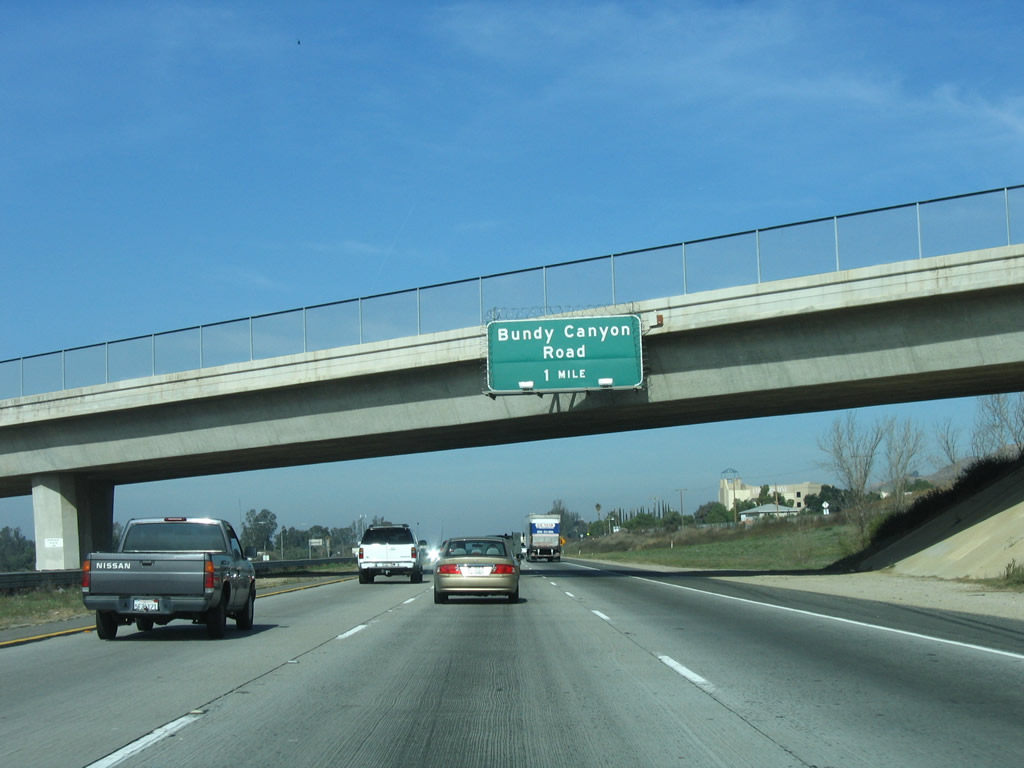
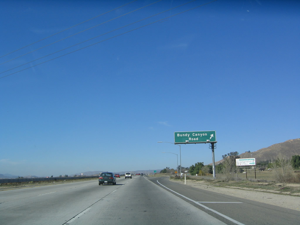
Interstate 15 is the Temecula Valley Freeway between the San Diego-Riverside County Line and Bundy Canyon Road (Exit 71) near Lake Elsinore. This sign is posted in the shadow of the variable message sign. Photo taken 06/03/06. |
|
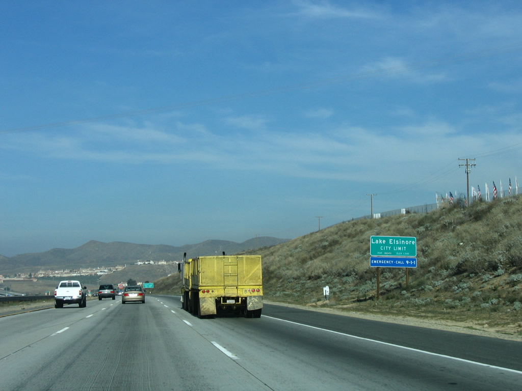
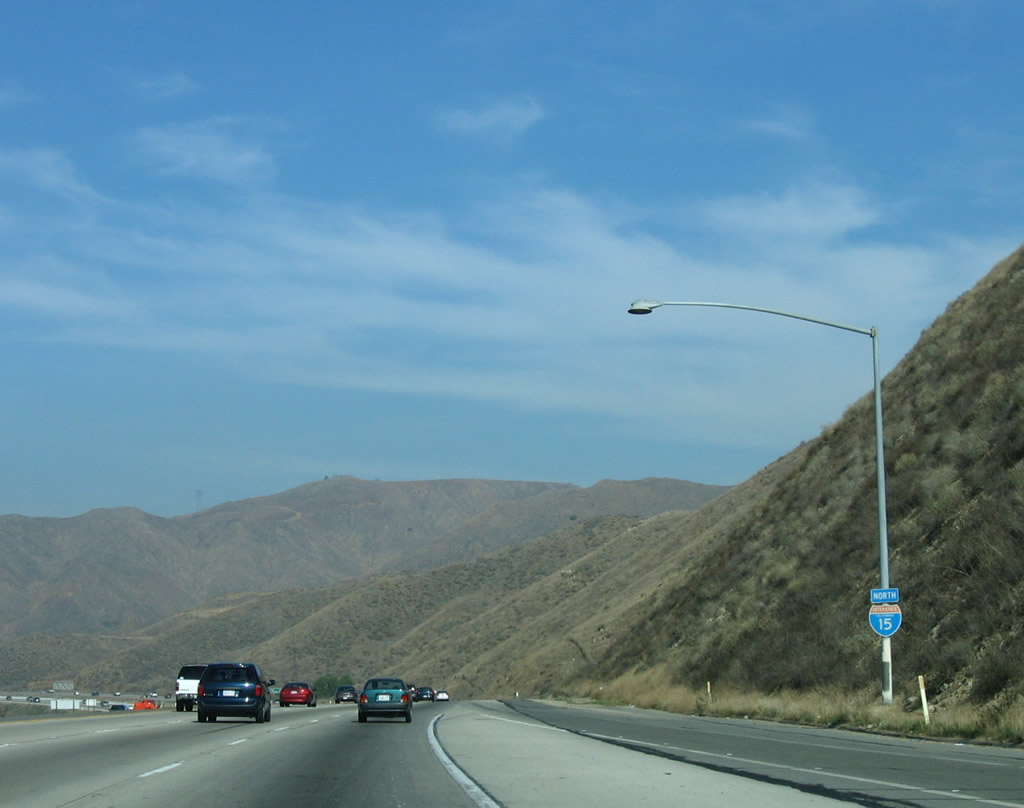
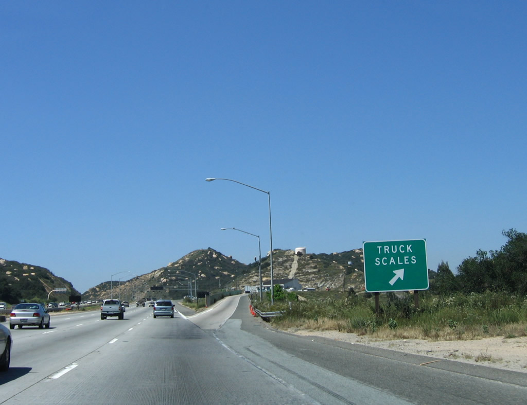
The next exit along northbound Interstate 15/Temecula Valley (Escondido) Freeway is Exit 55, Weigh Station. This is the first State of California truck scales along Interstate 15 north. When open, all trucks must stop. Photo taken 06/03/06. |
|
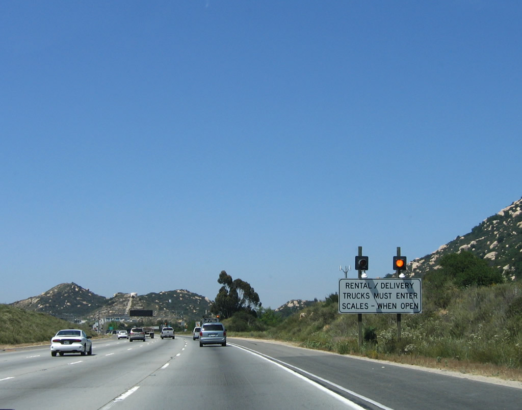
Rental and delivery trucks are also required to enter the truck scales. Photo taken 06/03/06. |
|
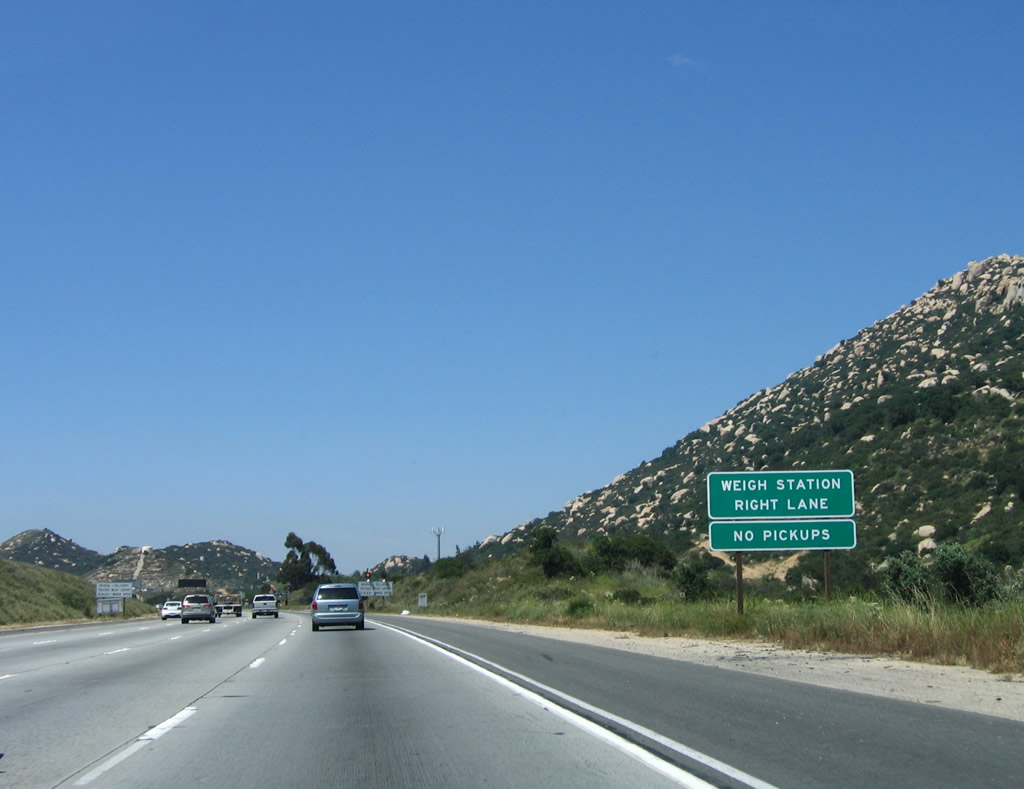
Northbound Interstate 15 reaches Exit 55, Weigh Station/Truck Scales. Photo taken 06/03/06. |
|
After passing by the weigh station, all traffic may be required to stop at the U.S. Border Patrol Inspection Station. Watch for U.S. officers patrolling this area, and be prepared to stop if asked. This can be the source of delays when the border patrol stops all northbound traffic. Photo taken 06/30/06. |
|
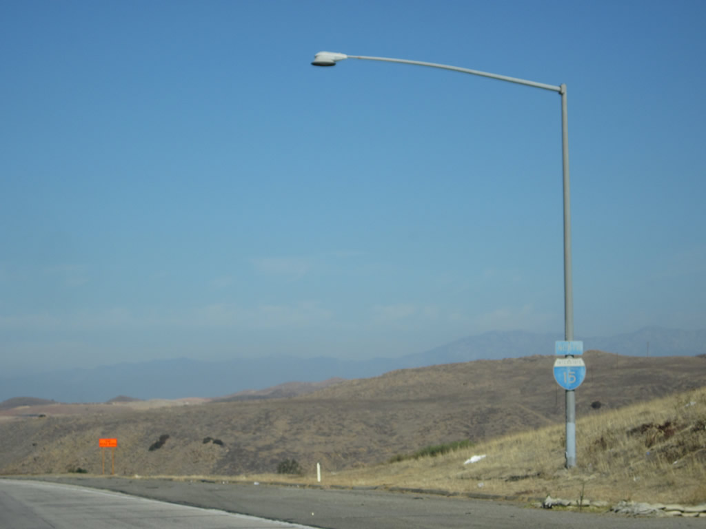
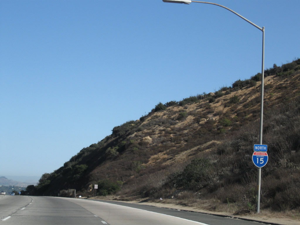
An Interstate 15 north reassurance shield is posted shortly after the inspection station. Photo taken 09/28/08. |
|
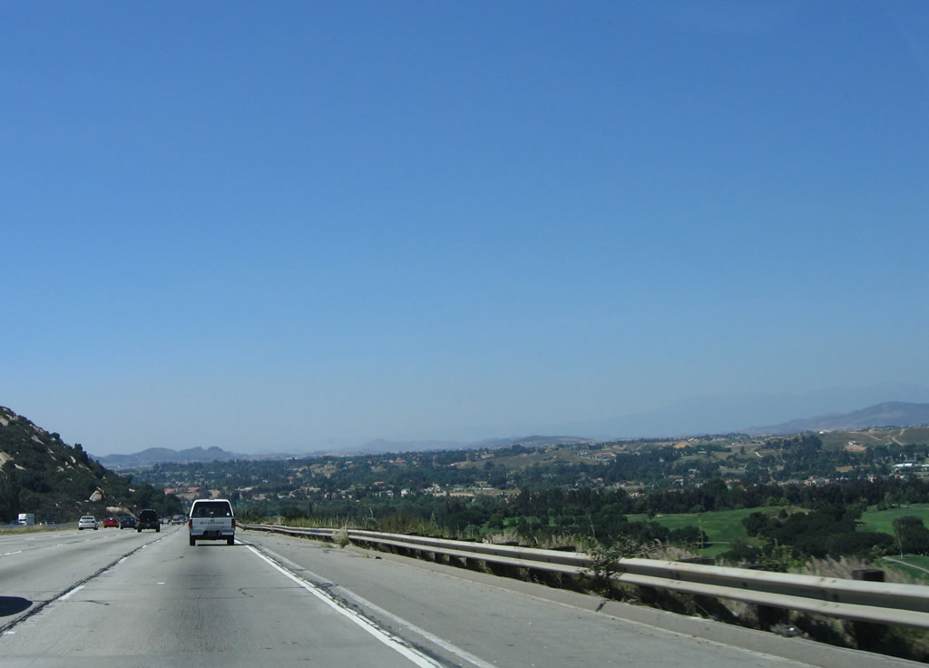
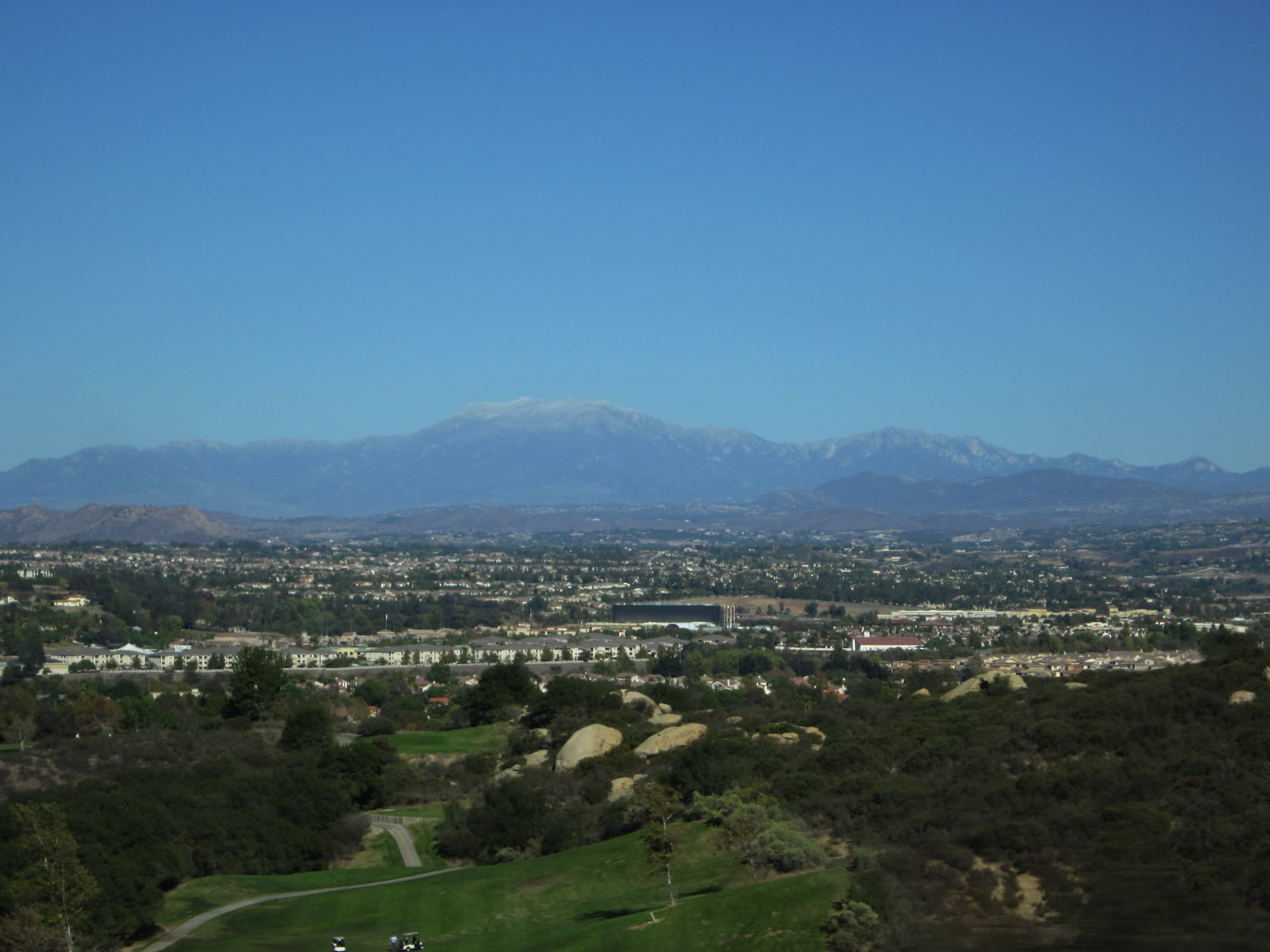
After passing over the Rainbow Summit, the Temecula Valley spreads out. This area has been rapidly developing through the 1990s and 2000s as new housing development and jobs have come to the region. An area known for farming and wineries has also become a bedroom community for some who commute to Los Angeles, Orange County, or San Diego, and several businesses have relocated to this region as well. Traffic congestion has been a by-product of this development. Photo taken 06/03/06. |
|
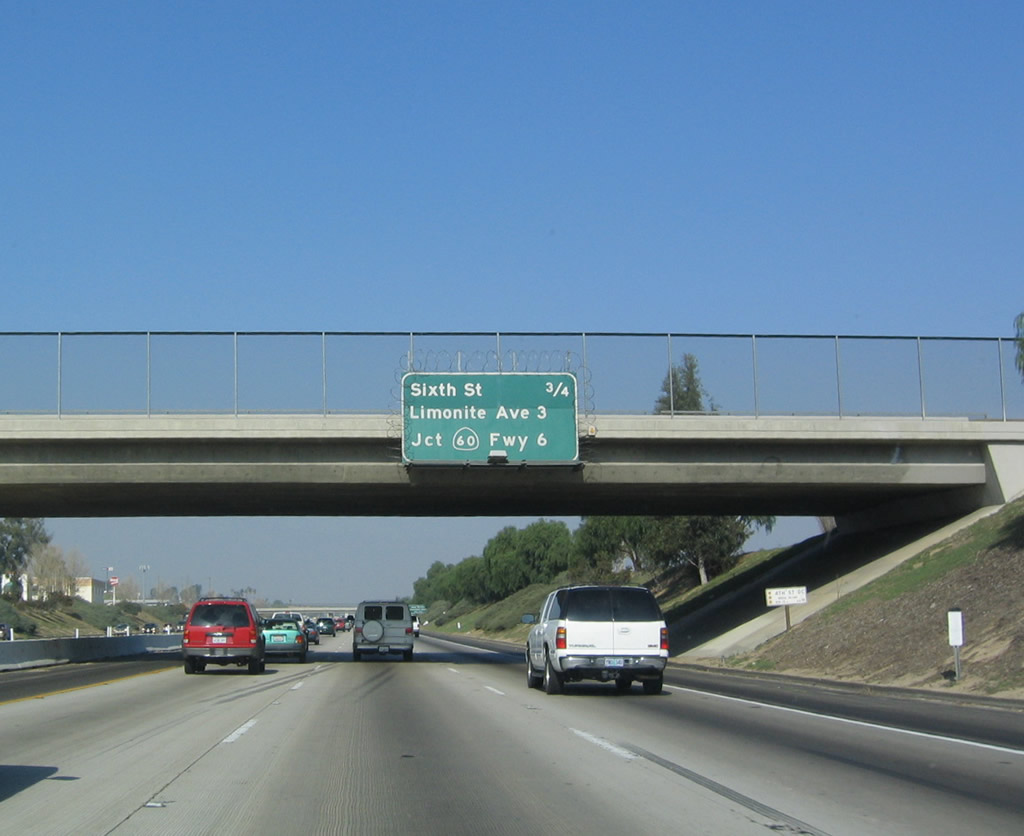
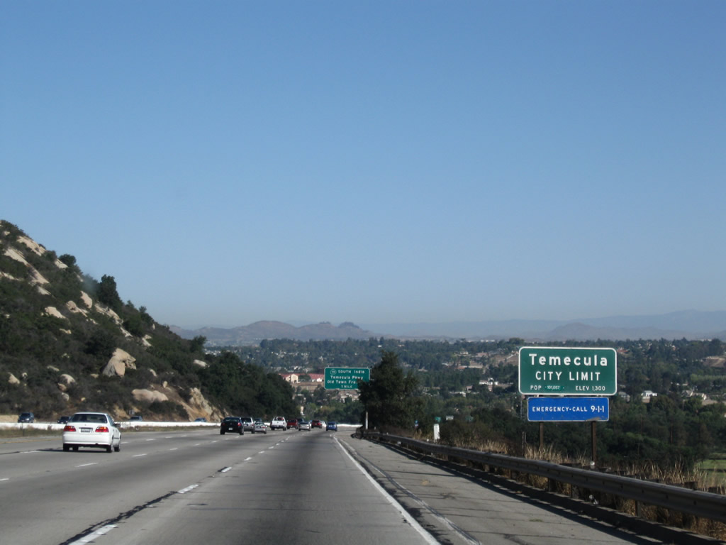
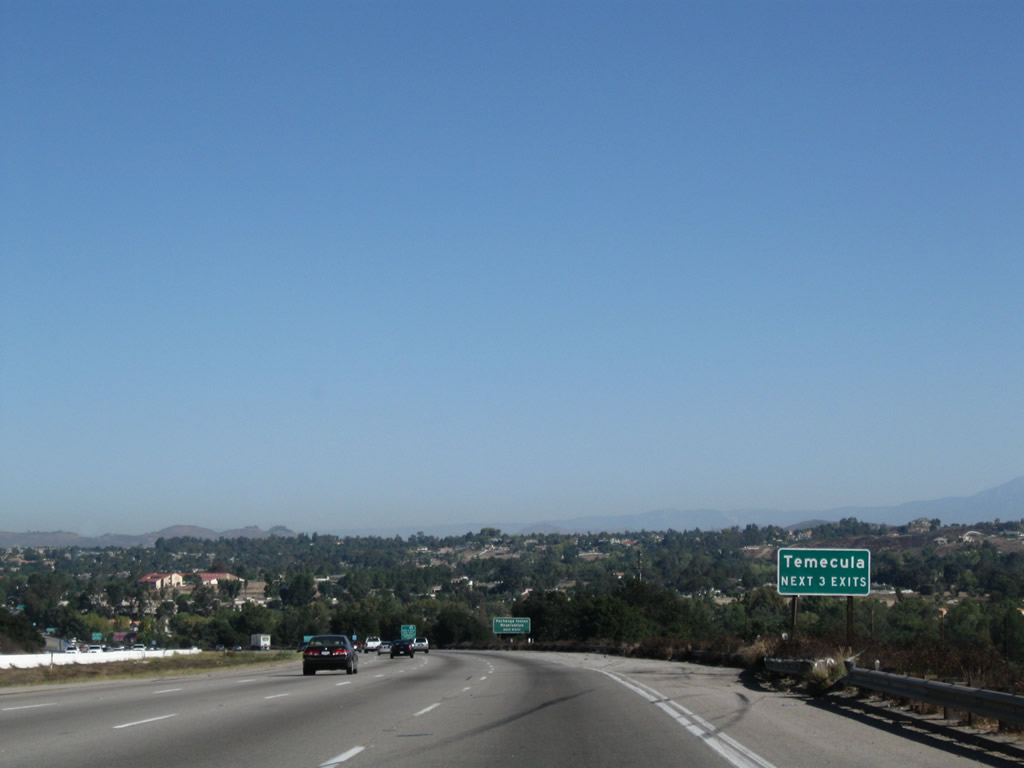
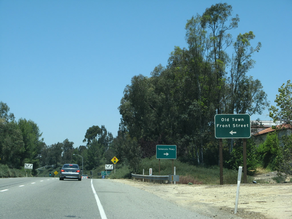
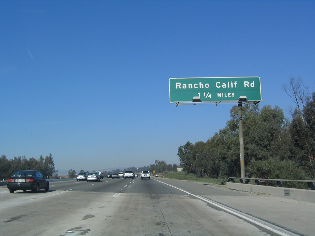
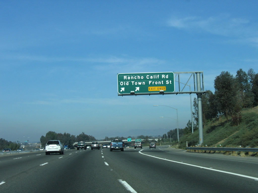
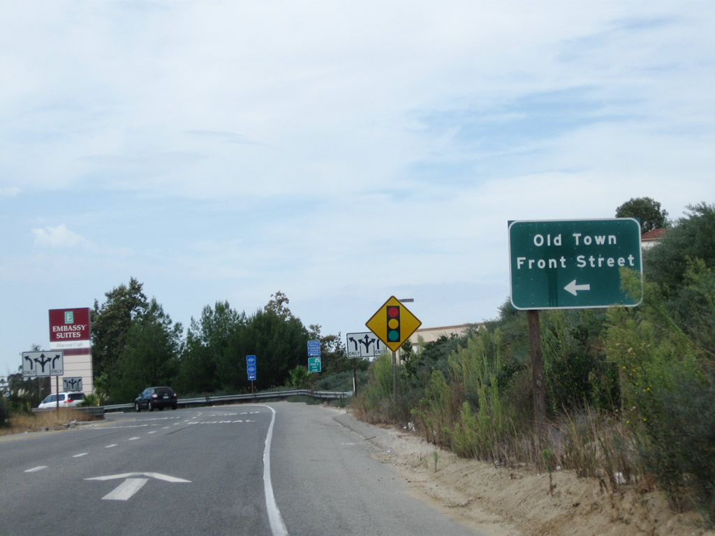
Interstate 15 enters the city of Temecula, the first city along Interstate 15 in the Temecula Valley. As of the 2000 Census, Temecula's population was 57,716 people, but that figure may nearly double by 2010 (due to the annexation of the Redhawk community and increasing housing developments). The city was incorporated on December 1, 1989; prior to that, it was an unincorporated community of Riverside County. The city consists of 26.3 square miles, but that figure may grow as the city expands. Temecula was settled in 1859 and has an old town (use Exit 58, Old Town Front Street north) featuring late 1800s buildings and a variety of art shops, antique stores, and restaurants. Additionally, Temecula is the anchor for the Temecula Valley Wine Country, which is accessed via Exit 59, Rancho California Road east. Most of the wineries are located along Rancho California Road east of the city limits. Photo taken 09/28/08. |
|
|
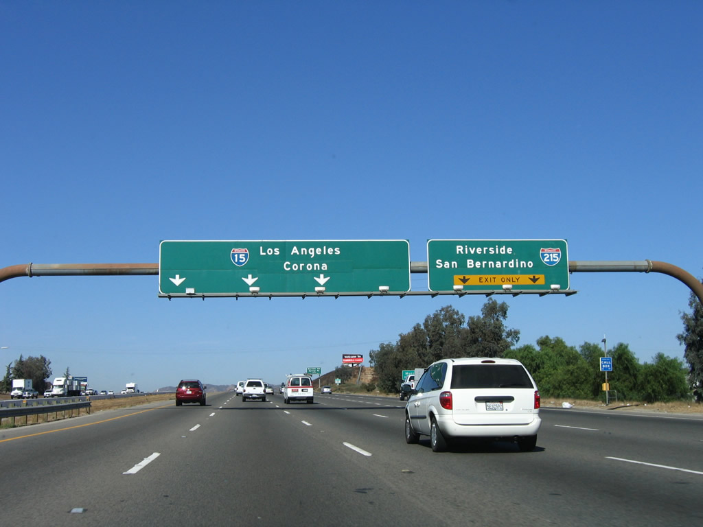
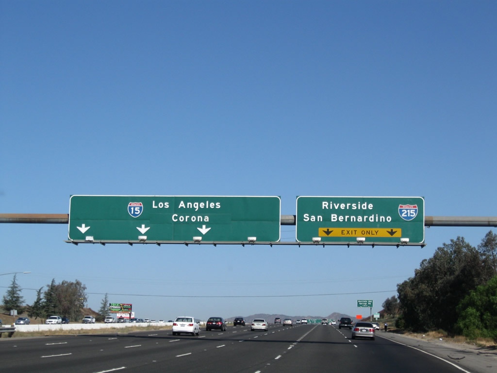
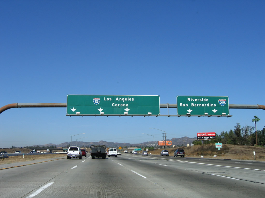
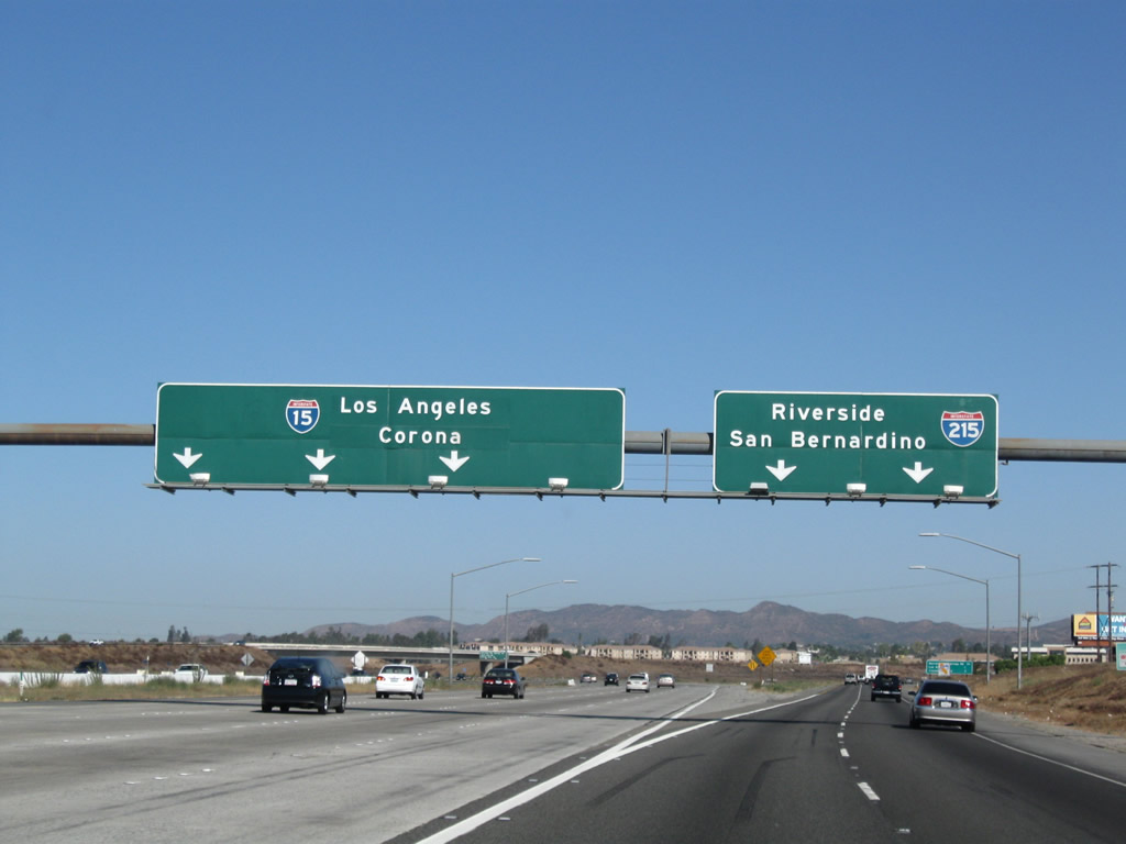
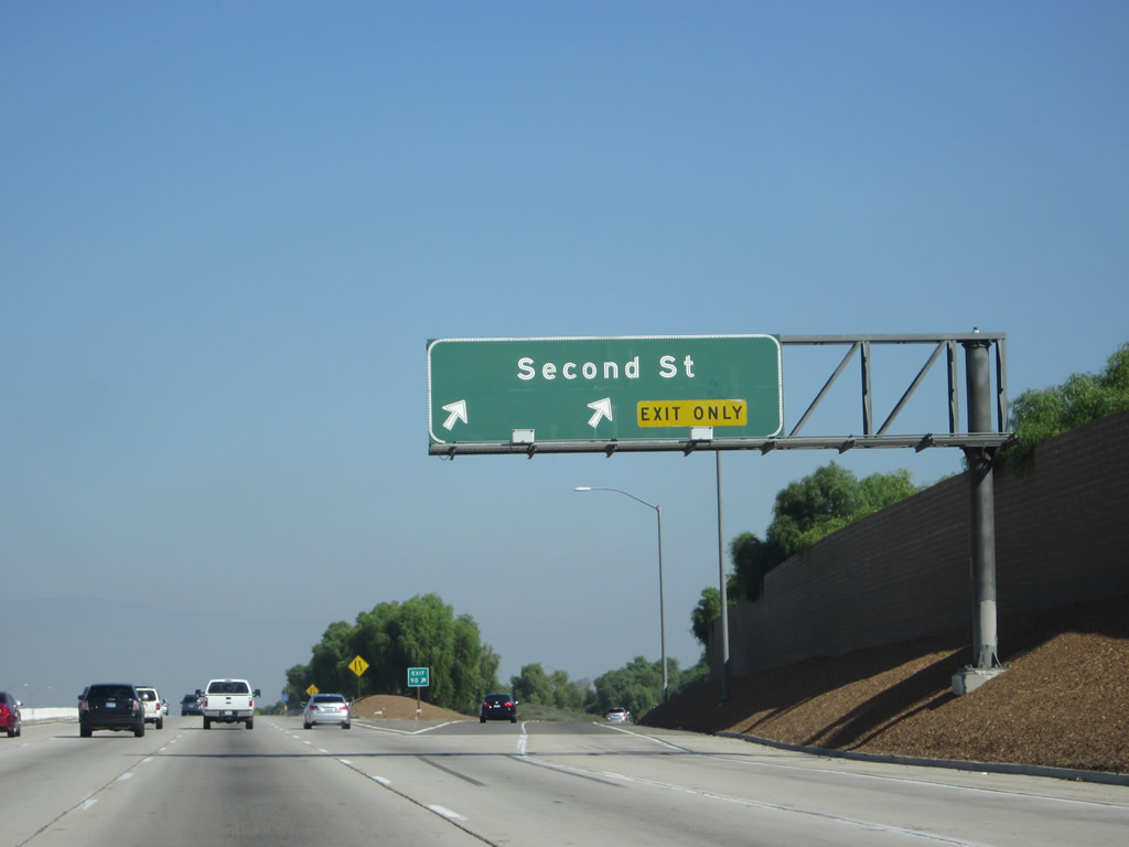
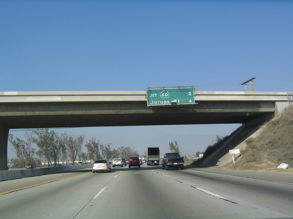
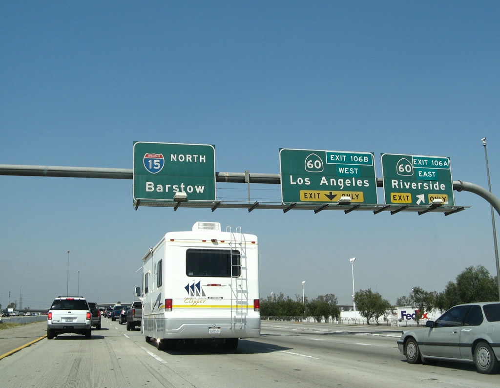
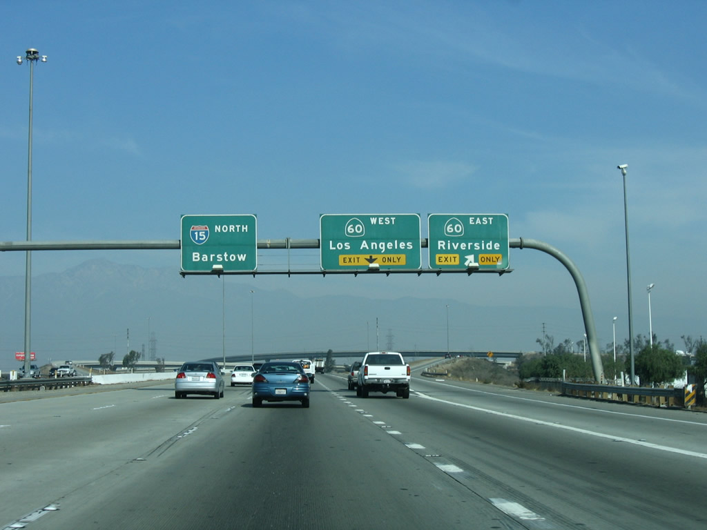
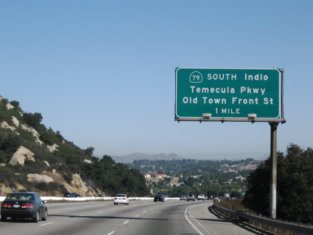
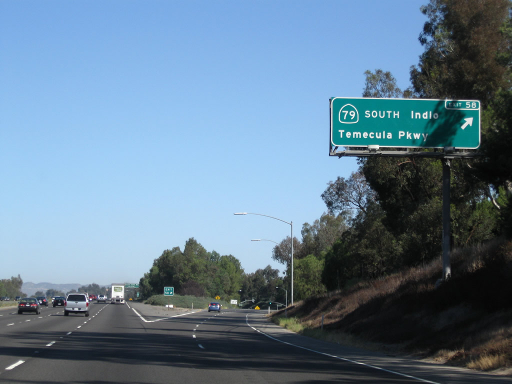
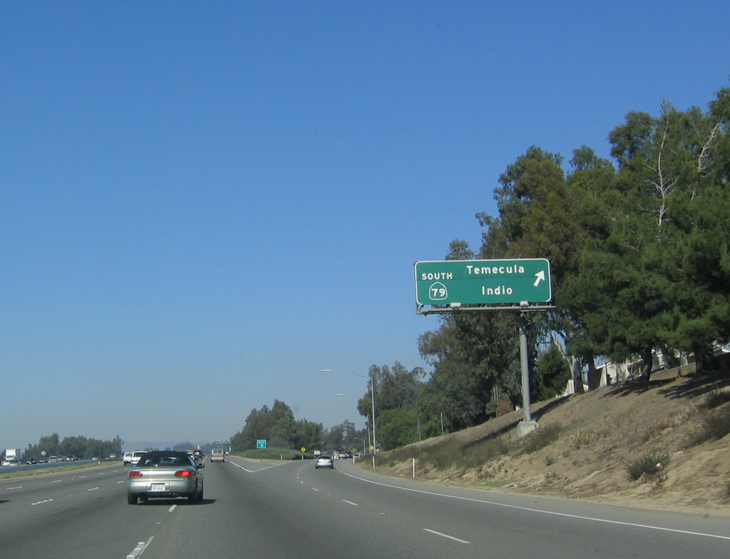
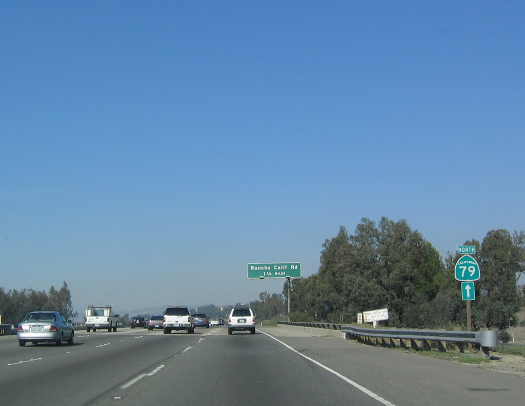
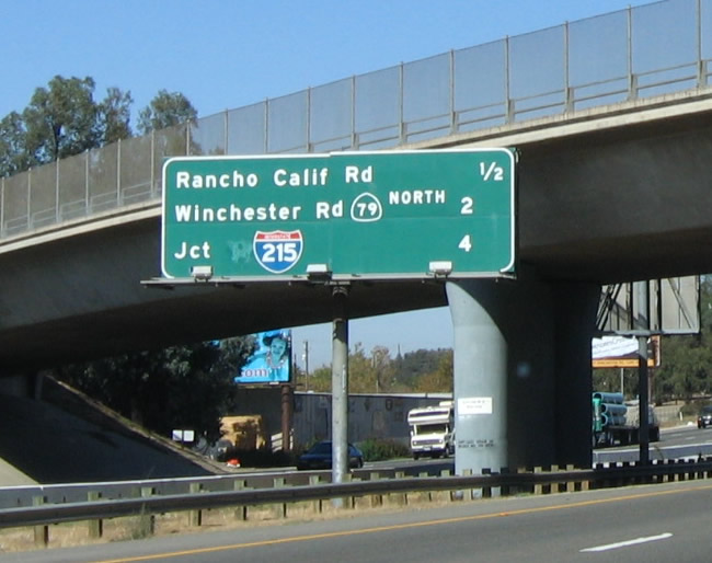
The first exit to serve Temecula along Interstate 15/Temecula Valley Freeway north is Exit 58, California 79 (Temecula Parkway) south to Warner Springs and Indio and Old Town Front Street north to historic downtown Temecula. Although signed as "south," California 79 actually travels a good distance east to Aguanga, where California 79 meets California 371. The east-west section of California 79 and all of California 371 were formerly part of an extended California 71, but California 71 was retracted to its currently freeway and expressway alignment north of Corona by legislation in 1974. Signs for the various segments of California 71 cosigned with Interstate 15 and California 79 came down in stages thereafter. The connection of California 79 south, California 371 east, and California 74 east is the most direct route from Interstate 15 to the desert community of Indio and all points east via Interstate 10. Photos taken 09/28/08 and 06/03/06. |
|
The Temecula Valley spreads out toward the northeast. This area has seen explosive growth over the past few decades, resulting in quite a bit of residential expansion. Towering Mt. San Jacinto dominates the view; at the time this picture was taken, a storm had dropped a light dusting of snow on top of the mountain. Photo taken 11/11/12. |
|
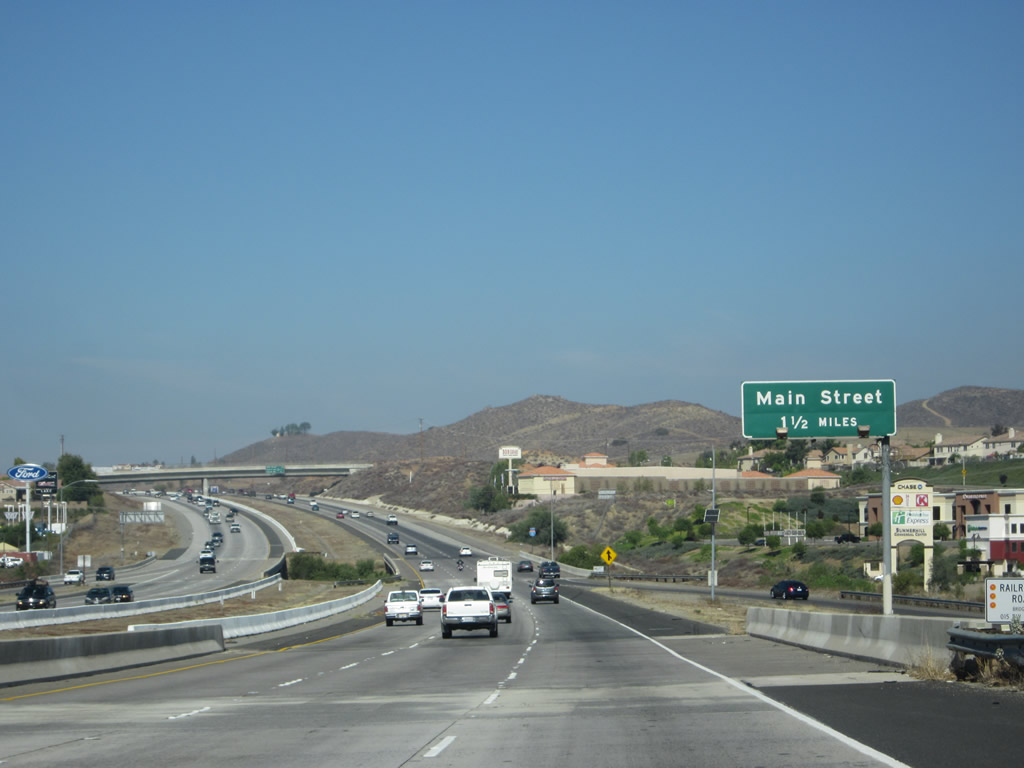
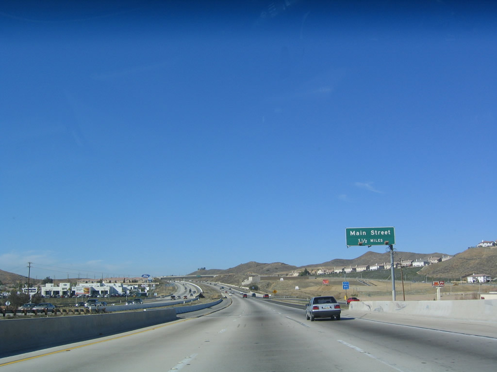
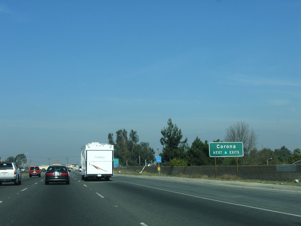
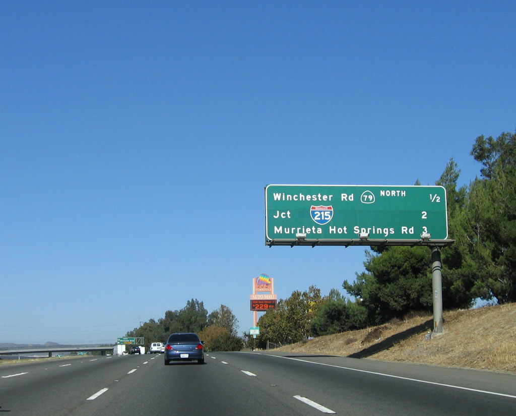
The next three exits lead into the City of Temecula, "where the future lives." These exits are Exit 58, California 79 (Temecula Parkway) south and Old Town Front Street north; Exit 59, Rancho California Road to the Temecula Valley Wine Country; and Exit 61, California 79 (Winchester Road) north. Photo taken 09/28/08. |
|
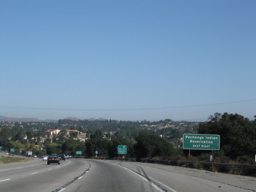
Use Exit 58, California 79 (Temecula Parkway) south to Riverside County S-16 (Pechanga Parkway) south to the Pechanga Indian Reservation, which includes the Pechanga Resort Casino. Pechanga Parkway travels south from the reservation into San Diego County, changing into Pala-Temecula Road. San Diego County S-16/Pala-Temecula Road ends at California 76 in the Pala Indian Reservation, which includes another casino. The small town of Pala is also home to Mission San Antonio de Pala. Photo taken 09/28/08. |
|
Both Exit 58 and Exit 59 serve Temecula Valley Wine Country, but the most direct route is via Rancho California Road (Exit 59). Photo taken 09/28/08. |
|
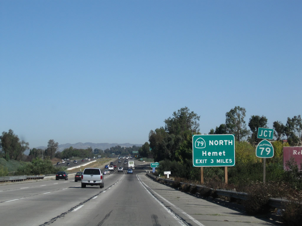
Prior to Exit 58, California 79 (Temecula Parkway) south, this auxiliary signage indicates that the connection to California 79 north to Hemet is is another three miles north, at Exit 61. California 79 and Interstate 15 share their alignment between Exits 58 and 61. Photo taken 09/28/08. |
|
After passing through Aguanga, California 79 south connects to Sunshine Summit and Warner Springs, two unincorporated communities in northern San Diego County. Since much of California 79 passes through rugged back country in San Diego County, the most direct route to either of these communities requires significant distance on two-lane highways. Photo taken 01/18/04. |
|
|
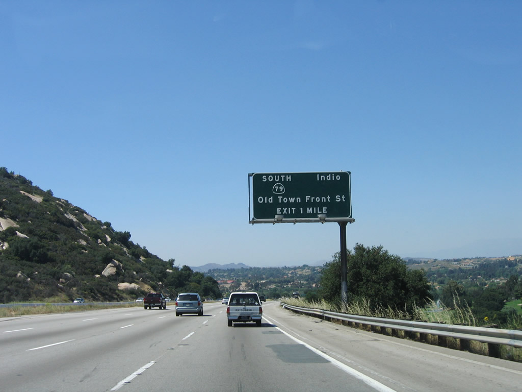
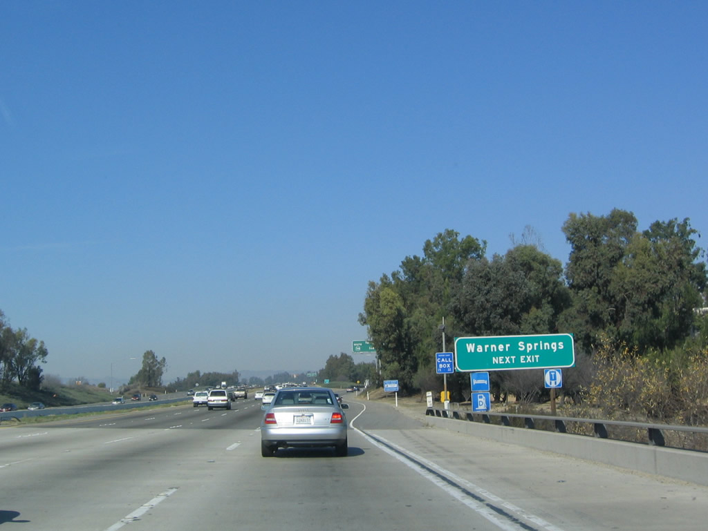
Northbound Interstate 15 reaches Exit 58, California 79 (Temecula Parkway) south and Old Town Front Street north to downtown Temecula. A new exit number sign was posted in 2008. California 79 travels due east to Aguanga, then turns south toward Warner Springs. This state highway also serves as part of the most direct route to Indio and Palm Springs via California 371 east and California 74 (Pines to Palms Highway) east. California 79 itself turns south after its intersection with California 371 into San Diego County, where it passes through Warner Springs, Santa Ysabel, Julian, and the Cleveland National Forest before terminating at Interstate 8 near Descanso. Photos taken 09/28/08 and 01/18/04. |
|
|
|
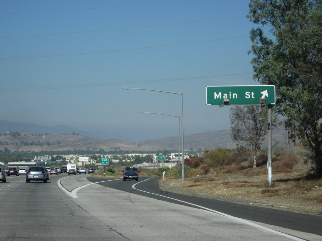
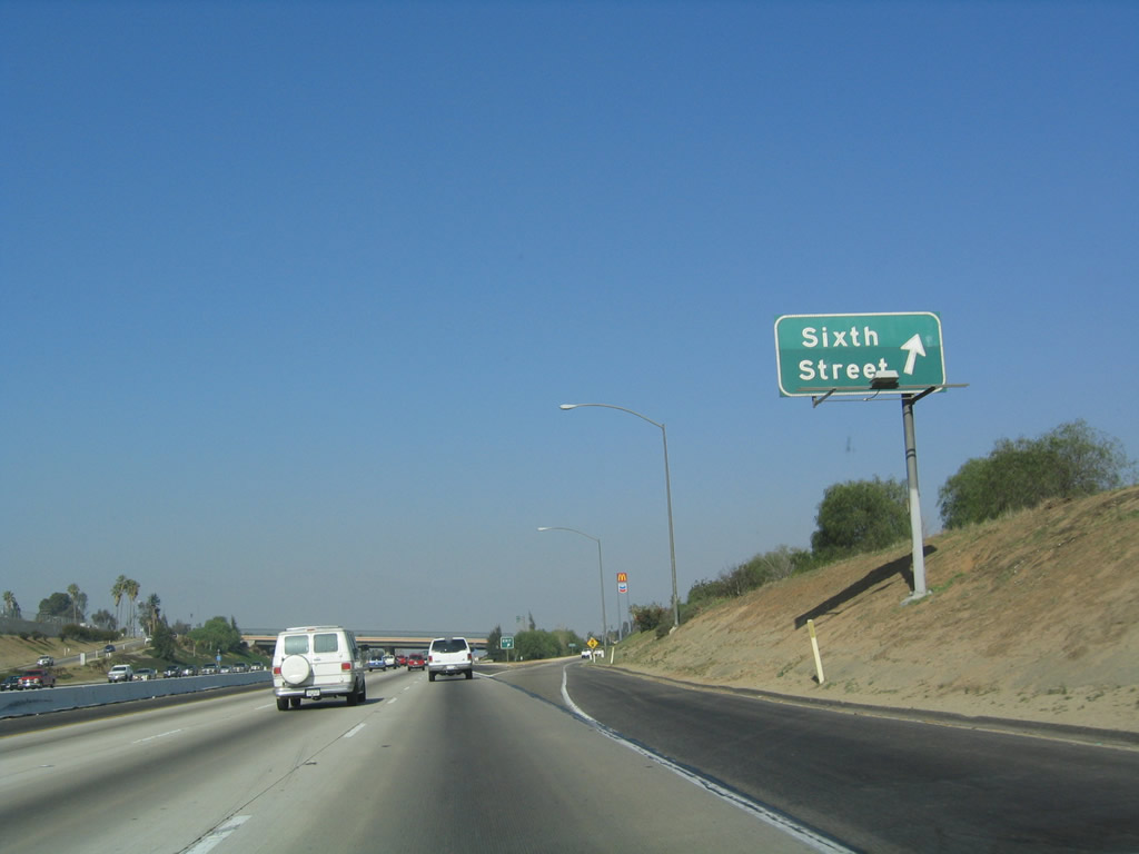
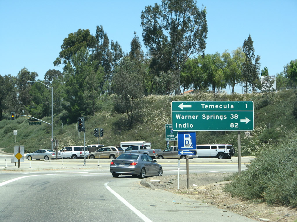
Now on the off-ramp, a set of traffic signals governs flow. Motorists should turn right to California 79 (Temecula Parkway) and Historic U.S. 395 south, and turn left to Historic U.S. 395 (Old Town Front Street) north into downtown Temecula. A mileage sign at the bottom of the ramp indicates the distance to Warner Springs (38 miles via California 79 south) and Indio (82 miles via California 79 south, California 371 east, California 74 east, and California 111 east). Photos taken 06/07/08 and 06/03/06. |
| Interstate 15/Temecula Valley Freeway (Escondido Freeway) north |
|
Immediately after passing the gore point for Exit 58, a reassurance marker reminds travelers on Interstate 15 north that California 79 north merges onto the freeway. The routes will divided at Exit 61. The next exit along Interstate 15 and California 79 north is Exit 59, Rancho California Road. Photo taken 01/18/04. |
|
To the Temecula Valley Wine Country, use Exit 59 and follow Rancho California Road east. Photo taken 01/18/04. |
|
A set of Interstate 15 and California 79 reassurance shields is posted after the on-ramp from Temecula Parkway. This section of Interstate 15 (from Exit 59 to Exit 61) is particularly interesting given the various designations this freeway has had. While currently signed as Interstate 15 and California 79, it has also been signed as U.S. 395 and California 71. This would have resulted in a four-route shield assembly, which might have existed in the early 1970s. Photo taken 11/10/06. |
|
|
The next three exits along Interstate 15/Temecula Valley (Escondido) Freeway north are Exit 59, Rancho California Road; Exit 61, California 79 (Winchester Road) north; and Exit 63, Interstate 215 (Escondido Freeway) north to Riverside. The mileage sign shows part of a scraped off shield, which may have been a shield for Interstate 15E (this was the former designation of Interstate 215 from 1969 until 1982), U.S. 395 (which was decommissioned south of Hesperia in 1969), California 215, or California 71. Signs at the Interstate 15/215 split still show silhouettes of former California 71. Photos taken 11/10/06. |
|
The two right lanes provide access to Exit 59, Rancho California Road. Follow Rancho California Road east to the wine country. This exit also connects to downtown Temecula via Rancho California Road west to Old Town Front Street south. Use Rancho California Road west to Jefferson Avenue north, which is part of old California 71-79 before the routes were placed on the freeway. Photo taken 11/10/06. |
|
Northbound Interstate 15 meets Exit 59, Rancho California Road and Old Town Front Street. Rancho California Road leads east from downtown Temecula, leading into the locally famous Temecula Wine Country. Upon leaving the suburban areas, wineries may be found all along the highway as its heads east into the back country. This exit also provides access to the north end of downtown Temecula via Old Town Front Street. Photo taken 01/28/06. |
|
Now on the off-ramp, turn left on Rancho California Road to Historic U.S. 395 (Old Town Front Street) or right for Rancho California Road east to Temecula Wine Country. Photo taken 10/02/11. |
|
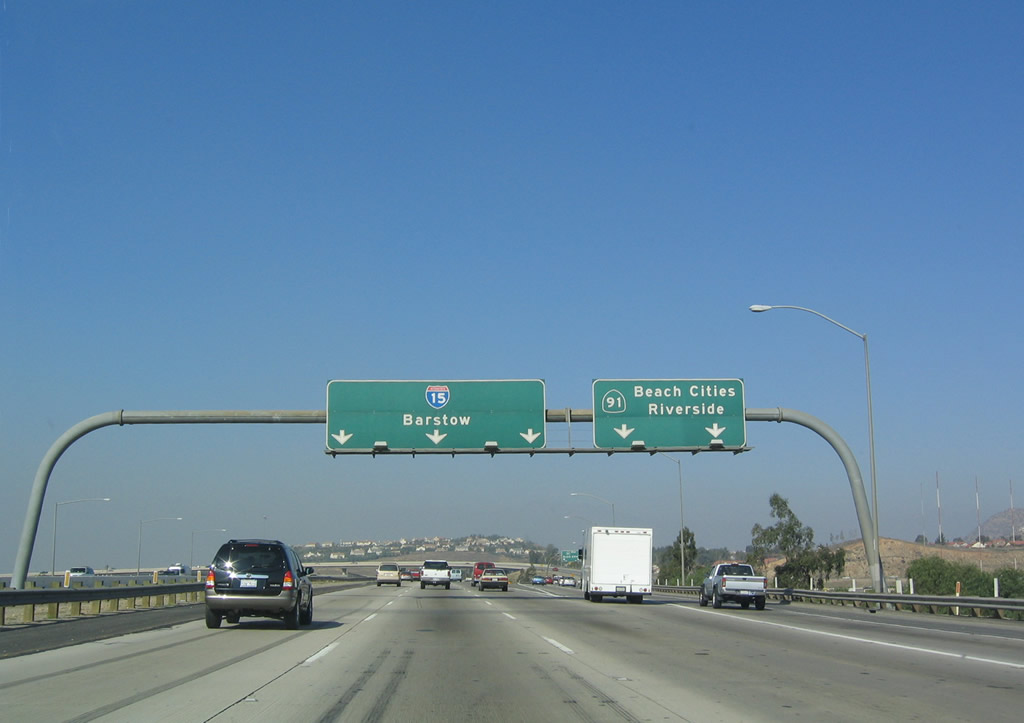
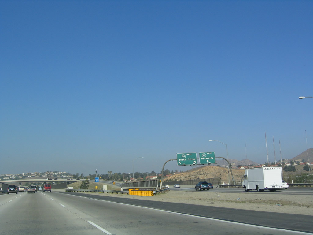
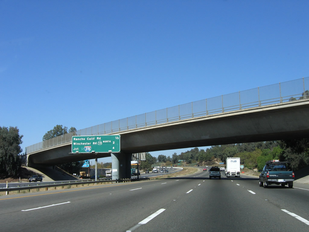
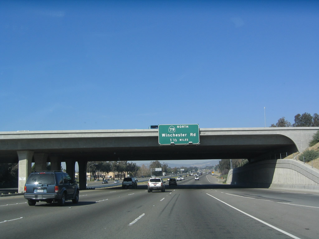
Back on the mainline, Interstate 15 and California 79 prepare to split after their brief shared alignment through Temecula. The next exit along Interstate 15 north is Exit 61, California 79 (Winchester Road) north. This sign is posted on the Rancho California Road overpass. From here, California 79 travels northeast from the Exit 61 interchange to Hemet, where it meets California 74 and Riverside County R-3. From there, California 79 turns north toward Interstate 10 and California 60 in Beaumont. Photo taken 01/18/04. |
|
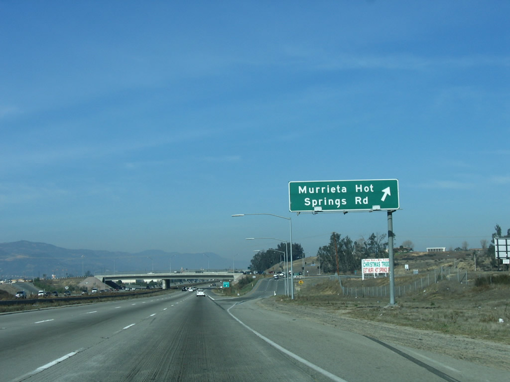
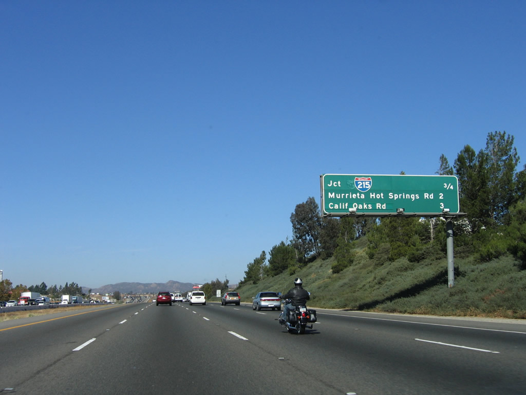
This mileage sign provides the distance to the next three exits: Exit 61, California 79 (Winchester Road) north; Exit 63, Interstate 215 (Escondido Freeway) north to Riverside; and Exit 64, Murrieta Hot Springs Road. Photo taken 11/10/06. |
|
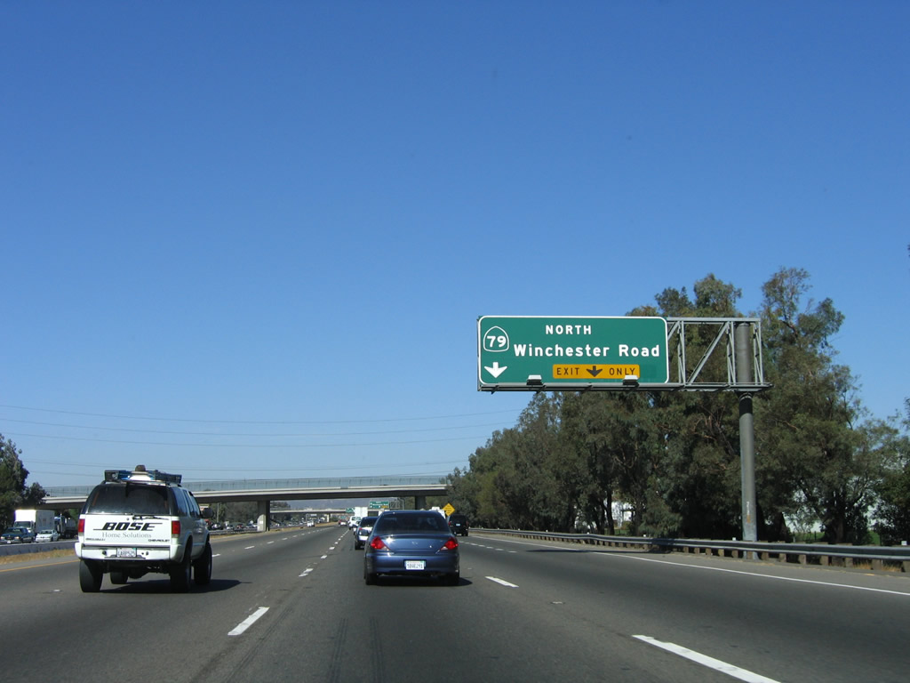
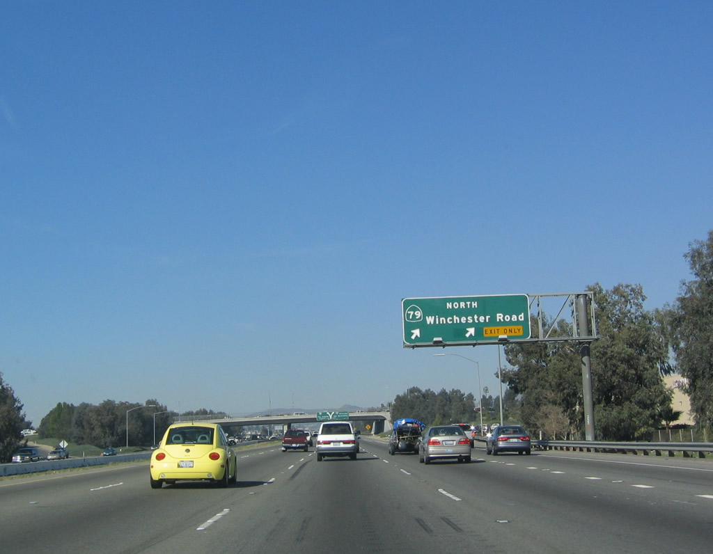
The right two lanes will connect to California 79 (Winchester Road) north. Prior to to the decommissioning of California 71 in 1974, Exit 61 was the former split between the two state routes (California 71 and California 79), which had been merged together since Aguanga. At this interchange, Interstate 15 (U.S. 395) and California 71 continued straight ahead, while California 79 turned northeast toward Hemet and Beaumont. Today, with the high average daily traffic counts along California 79 north, an expressway or freeway bypass for the state highway is being considered, including a possible extension of California 67 or California 125 from San Diego County. Such a route could also relieve Interstate 15 and Interstate 215. Photo taken 11/10/06. |
|
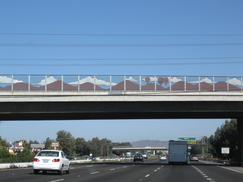
Freeway streetscape was added to this overpass prior to the California 79 off-ramp. Photo taken 09/28/08. |
|
Northbound Interstate 15/Temecula Valley Freeway reaches Exit 61, California 79 (Winchester Road) north to Hemet. For through traffic to Beaumont, use Interstate 215 (Escondido Freeway) north to California 60 (Moreno Valley Freeway) east. Photo taken 01/18/04. |
|
|
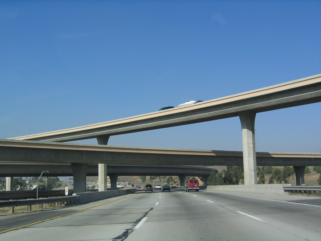
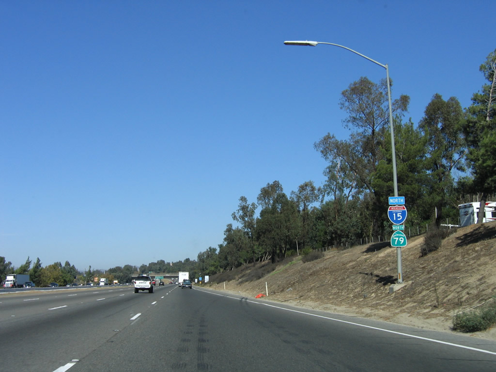
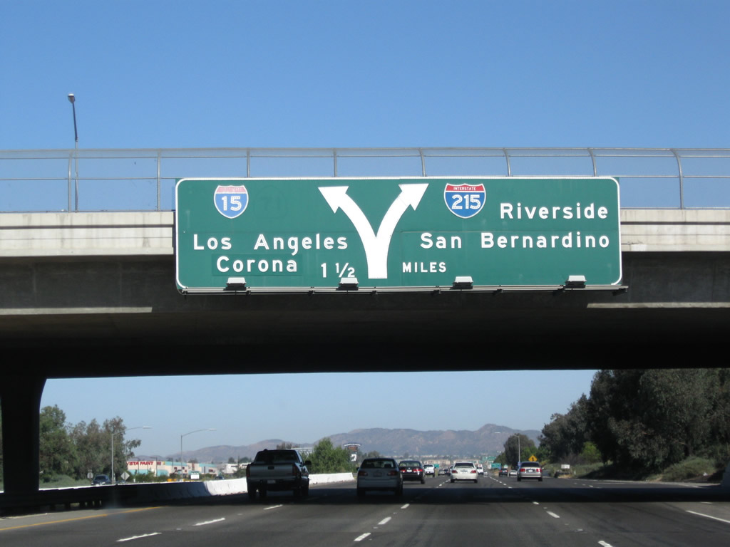
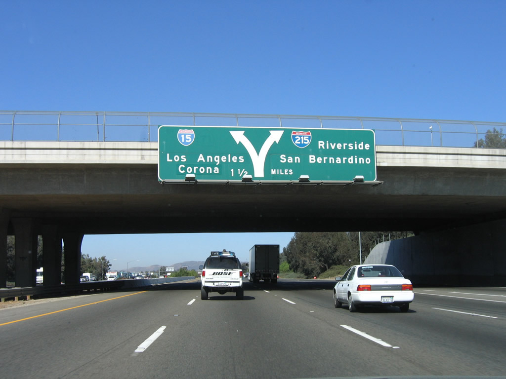
The next exit along Interstate 15 north is also a major interchange. At Exit 63, Interstate 15 north and Interstate 215 north split. Note the use of arrows on this overhead sign, which is posted on the Winchester Road overpass. This sign also includes a scraped-off California 71 shield to the right of the Interstate 15 shield. Interstate 215 follows the original U.S. 395 route through Sun City, Perris, Moreno Valley, Riverside, Colton, and San Bernardino. It was upgraded to full freeway by the 1990s. Interstate 15, meanwhile, turns northwest to Lake Elsinore, Corona, Norco, Ontario, and Rancho Cucamonga before turning northeast and reuniting with Interstate 215 at Devore. Photos taken 09/28/08 and 11/10/06. |
|
|
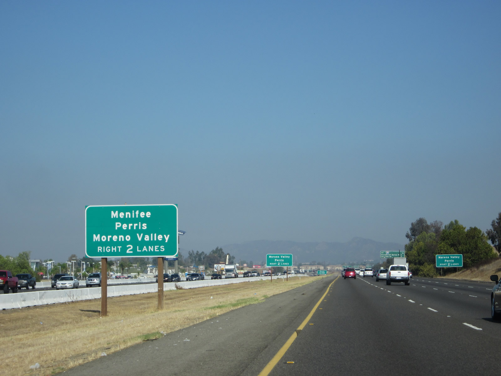
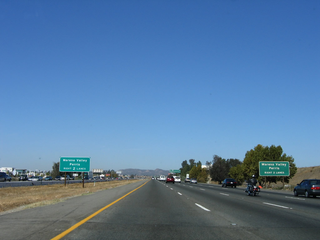
Two sets of median signs advise of destinations along Interstate 215 north (Exit 63). To reach Moreno Valley and Perris, use Interstate 215. In addition, to travel to Palm Springs, use Interstate 215 north to either California 74 east or California 60 east. At this interchange, note that the control city for Interstate 15 changes from Riverside to Corona/Los Angeles, while Interstate 215 picks up Riverside and San Bernardino. Photos taken 10/13/12 and 11/10/06. |
|
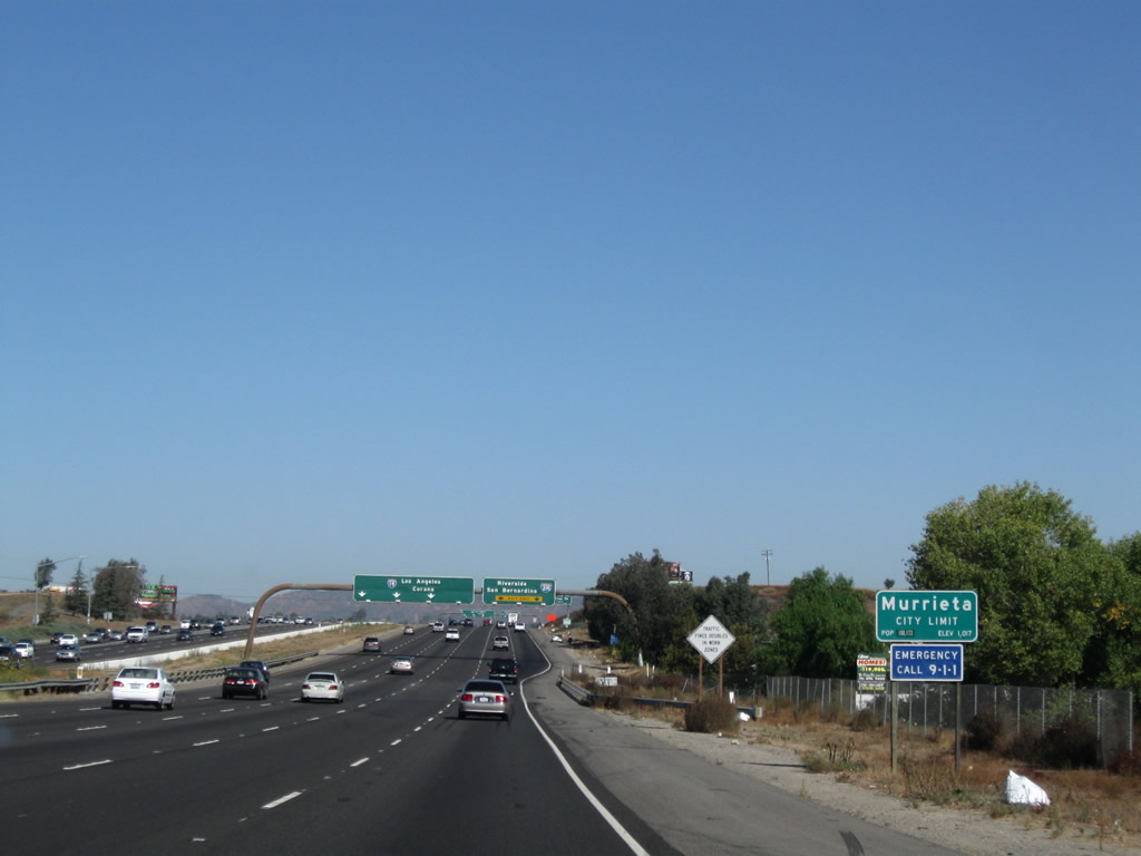
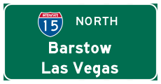
This mileage sign along northbound Interstate 15 provides the distance to the next three exits: Exit 63, Interstate 215 (Escondido Freeway) north; Exit 64, Murrieta Hot Springs Road; and Exit 65, California Oaks Road. Interstate 15 avoids the larger cities of Riverside and San Bernardino, and it is the faster through route to points north of the Inland Empire, such as Barstow and Las Vegas. Following the Corona Freeway, Interstate 15 passes through Lake Elsinore, then enters the Inland Empire at Corona, passing by the agriculture and industry of Norco, Ontario, Rancho Cucamonga, and Fontana before meeting Interstate 215 near Devore. Note the city of Temecula sign that is partially obscured by shrubs and trees on the hill to the east of the freeway. At this point, Interstate 15 leaves Temecula and enters the city of Murrieta. Photo taken 11/10/06. |
|
|
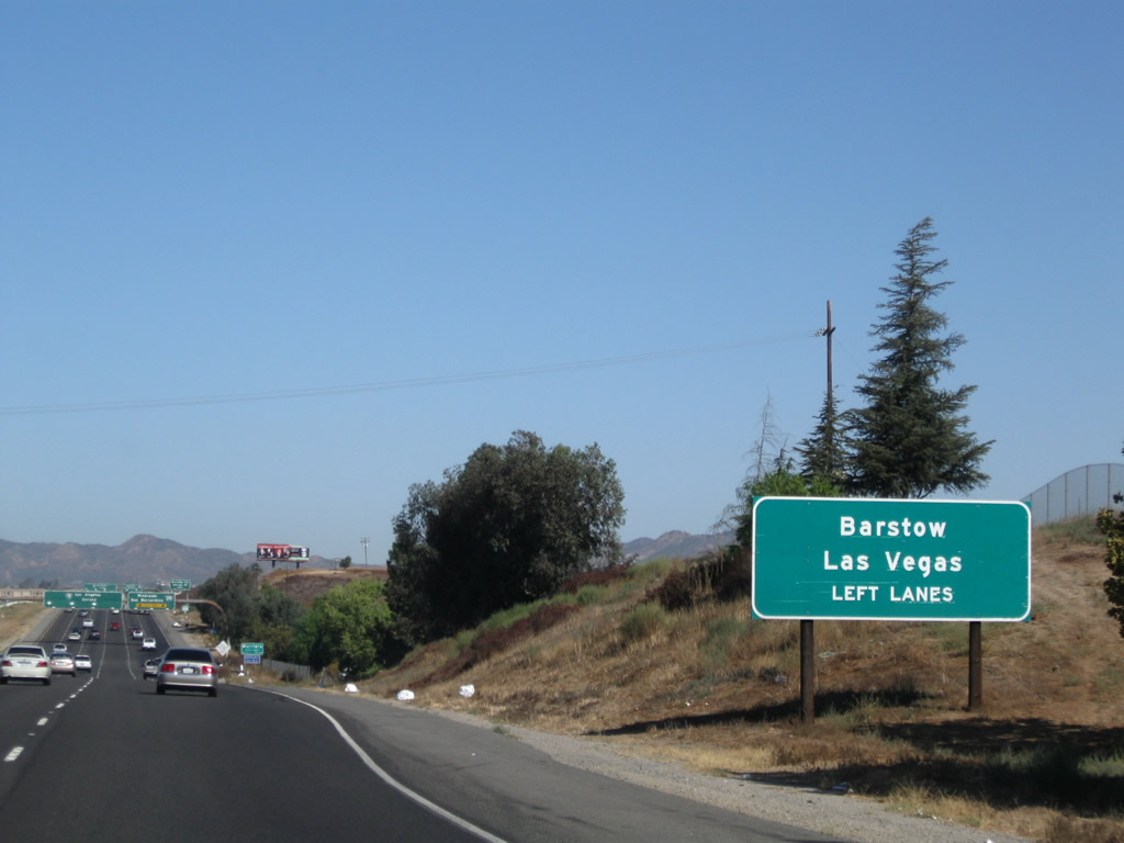
Since Interstate 15 is a more direct route through the Inland Empire, it is the best route to take for destinations in the high desert, Nevada, or beyond. This is the first sign featuring the control cities of Barstow or Las Vegas along northbound. Due to the high volume of automobile traffic headed to Las Vegas from points as far south as San Diego, this sign is very helpful. Interstate 215 of course is an alternate route, but it is slower due to its interchange with California 60/California 91 and because it generally has only four lanes rather than six lanes. Old U.S. 395 splits away from Interstate 15 at this interchange; it opts to follow Interstate 215 through Riverside and San Bernardino before rejoining Interstate 15 near Cajon Pass. Photos taken 09/28/08 and 01/28/06. |
|
Interstate 15 enters the city of Murrieta, a "great place to grow." Murrieta is the southern terminus of Interstate 215 and is another rapidly growing community in the Temecula Valley. Like Temecula, Murrieta incorporated relatively recently (July 1, 1991). Murrieta is named for Esequial Murrieta, who purchased 52,000 acres and transferred the property to his brother, Juan Murrieta, in 1873. The region was mostly agricultural at that time, but development increased with the coming of Interstate 15 in the 1970s and 1980s (just as in neighboring Temecula). The city's population was 44,282 as of the 2000 Census, and California Department of Finance estimates place the 2007 population of Murrieta at 97,257. Photo taken 09/28/08. |
|
|
Northbound Interstate 15/Temecula Valley (Escondido) Freeway approaches Exit 63, Interstate 215 (Escondido Freeway) north. This advance guide sign advises lane allocation in advance of this major freeway split. Although Interstate 15 is four lanes along northbound here, this interchange will take two lanes onto Interstate 215 and leave three lanes along northbound at least to Lake Elsinore. Once in the Inland Empire, Interstate 15 again has at least four lanes in each direction. Photos taken 11/10/06 and 09/28/08. |
|
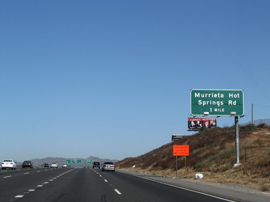
Both northbound Interstate 15 and Interstate 215 have full interchanges with Murrieta Hot Springs Road; this one-mile advance sign is posted immediately prior to the 12-215 split. Photo taken 09/28/08. |
|
|
Interstate 15 and Interstate 215 split; the left three lanes continue north on Interstate 15, and the right two lanes connect to Interstate 215 north. At this point, Interstate 15 turns northwest toward Corona, and Interstate 215 continues north toward Riverside and San Bernardino. The Temecula Valley Freeway turns northwest on Interstate 15 (which is old California 71), and the Corona Freeway designation begins at this interchange along Interstate 15 north. Interstate 215 takes over the Escondido Freeway designation, which will continue north to the California 60 interchange in Riverside. The corridor traveled by Interstate 215 between Interstate 15 and California 60 has a history of prior designations: U.S. 395 (1931-1969), Interstate 15E (hidden California 194) (1969-1982), California 215/To Interstate 215 (1982-1996), and Interstate 215 (1996-current). Photos taken 11/10/06 and 09/28/08. |
|
The northbound lanes split between Interstate 15 and Interstate 215 north; this view is taken from the main lanes of Interstate 15 north. Interstate 15 shifts from four lanes in each direction to three lanes in each direction, and it retains that configuration for the most of the way to Devore, which is where Interstate 215 rejoins its parent route. Photo taken 01/18/04. |
| Interstate 15/Temecula Valley Freeway (Corona Freeway) north |
|
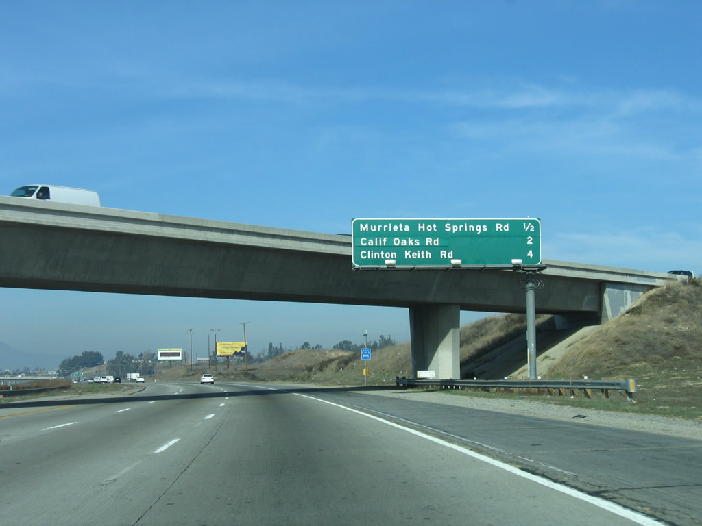
Passing under the transition ramp from Interstate 215 south to Interstate 15 south, this mileage sign provides the distance to the next three exits: Exit 64, Murrieta Hot Springs Road; Exit 65, California Oaks Road; and Exit 68, Clinton Keith Road. Between Interstate 215 and California 91, Interstate 15 generally follows the old California 71 corridor. Photo taken 01/28/06. |
|
Northbound Interstate 15 reaches Exit 64, Murrieta Hot Springs Road; this is the first local exit to serve the city of Murrieta. The actual Murrieta Hot Springs is located east of Interstate 215 and west of California 79/Winchester Canyon Road just north of Temecula. Photo taken 01/28/06. |
|
This mileage sign along northbound Interstate 15/Temecula Valley (Corona) Freeway indicates that the control city has changed, albeit briefly, to Los Angeles. This is due to the fact that most commuters from the Temecula Valley are traveling to the greater Los Angeles area. A more appropriate control city might be Barstow or Las Vegas. To Los Angeles, follow Interstate 15 north to California 91 (Riverside Freeway) west, then Interstate 5 (Santa Ana Freeway) north into the city. The other two destinations listed on this sign (Lake Elsinore and Corona) are both located within Riverside County along the Interstate 15 corridor. Photo taken 01/28/06. |
|
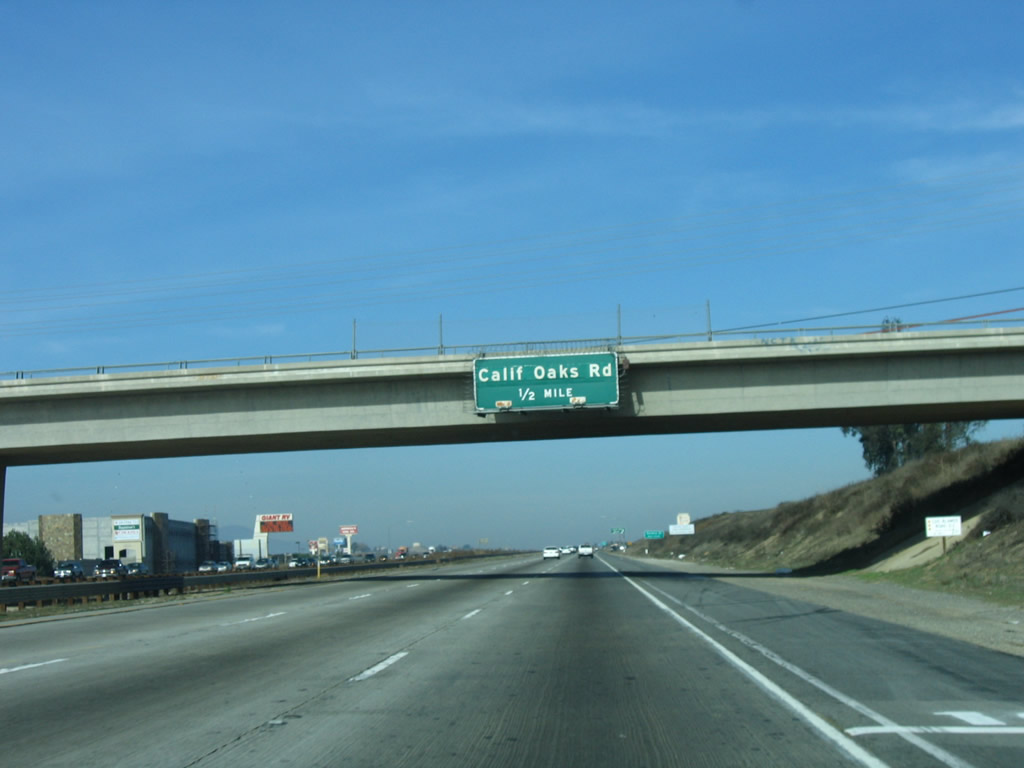
The next exit along Interstate 15 north is Exit 65, California Oaks Road and Kalmia Street. California Oaks Road travels northeast through Murrieta to Clinton Keith Road, and Kalmia Street leads southwest toward Washington Avenue. Photo taken 01/28/06. |
|
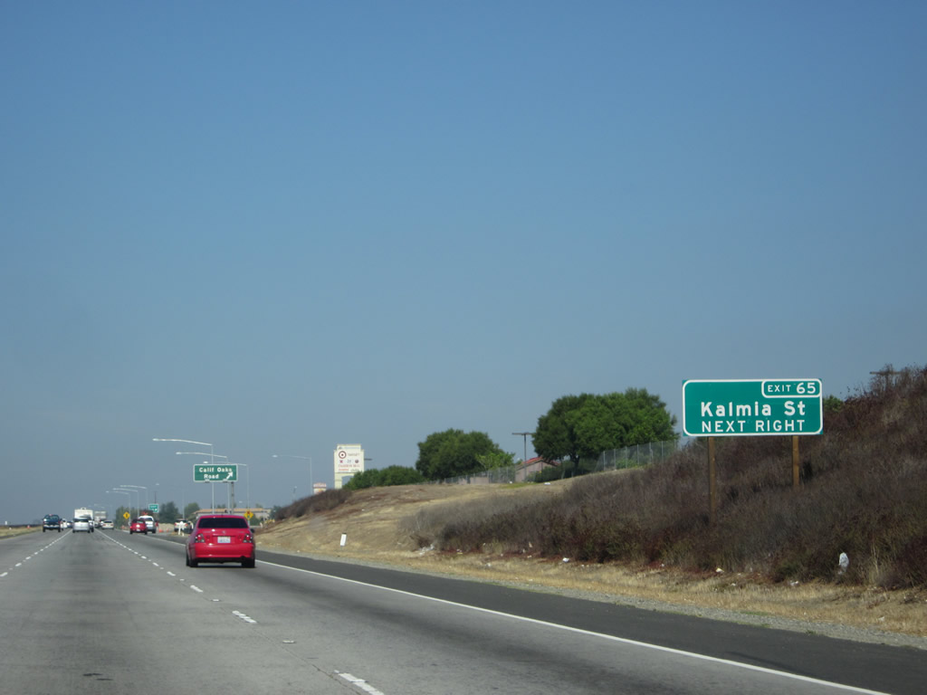
A newer auxiliary signs advises that the next exit is numbered 65 and also connects to Kalmia Street. Photo taken 10/13/12. |
|
Northbound Interstate 15/Temecula Valley (Corona) Freeway reaches Exit 65, California Oaks Road. This kind of "minimalist" sign bridge is common between Interstate 215 and California 91. Photo taken 01/28/06. |
|
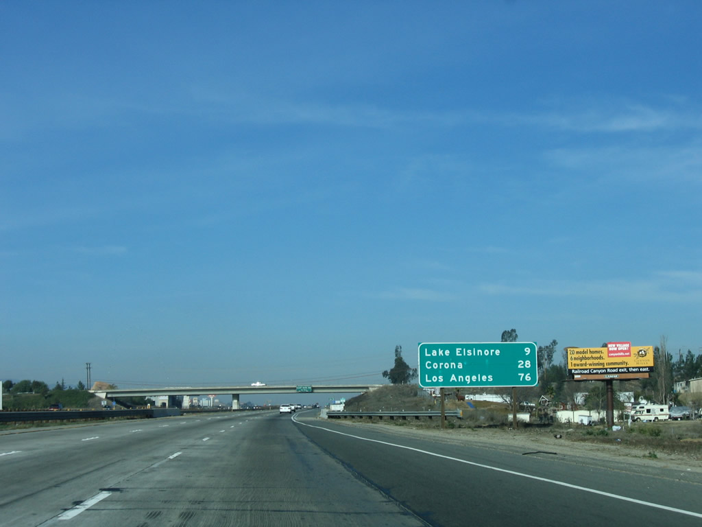
This mileage sign provides the distance to the next two destinations along Interstate 15 north: Lake Elsinore and Corona. Photo taken 01/28/06. |
|
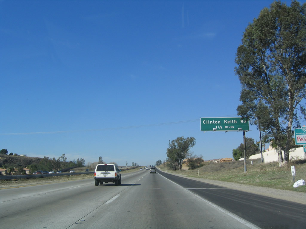
The next exit along Interstate 15 north is Exit 68, Clinton Keith Road (1.25 miles). Clinton Keith Road travels west to meet old California 71 and east to meet Interstate 215 at Exit 4 in Murrieta. Around this point, Interstate 15 leaves the city of Murrieta and enters the city of Wildomar (which incorporates July 1, 2008). Wildomar is now the third city within the Temecula Valley, and it covers the formerly unincorporated area between the cities of Murrieta and Lake Elsinore. Photo taken 01/18/04. |
|
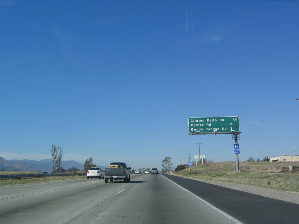
This mileage sign along Interstate 15 north provides the distance for the next three exits: Exit 68, Clinton Keith Road; Exit 69, Baxter Road; and Exit 71, Bundy Canyon Road. Photo taken 01/18/04. |
|
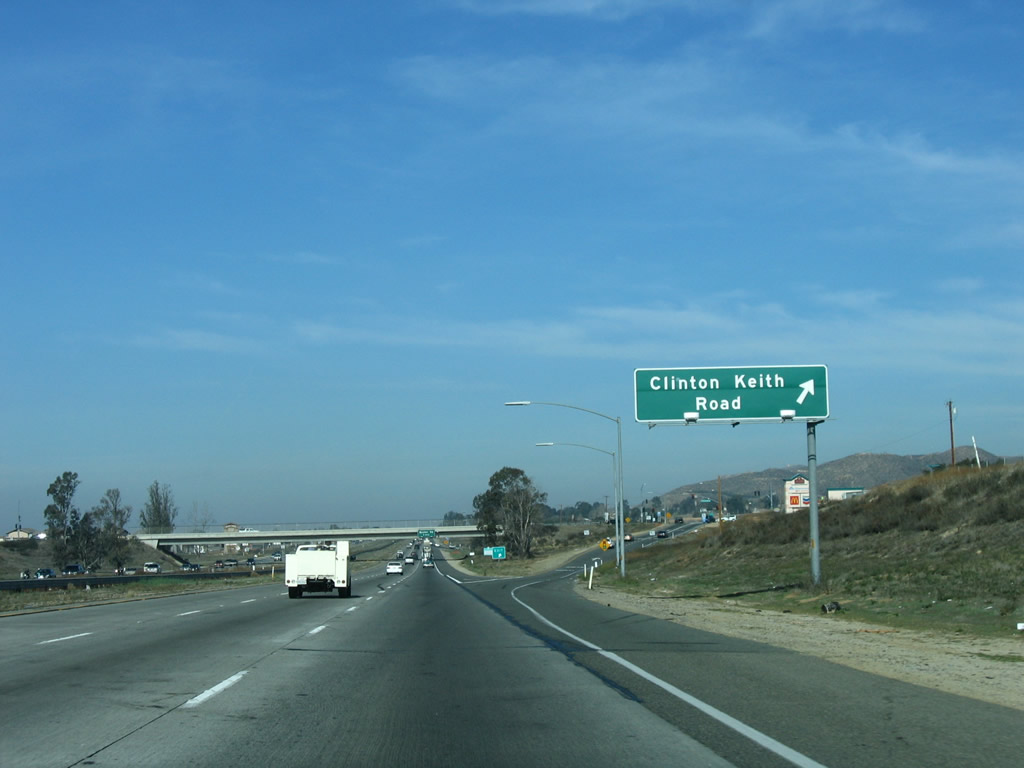
Northbound Interstate 15 reaches Exit 68, Clinton Keith Road. Use Clinton Keith Road west to the unincorporated community of Wildomar. Wildomar was home to 14,064 people as of the 2000 Census and will become a city on July 1, 2008, as a result of the Measure C election held on February 5, 2008. For more on the election and on the new city's plans, visit the Wildomar Community Council webpage. Photo taken 01/28/06. |
|
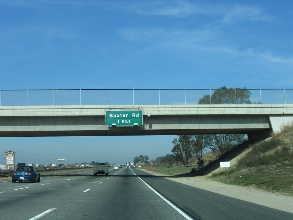
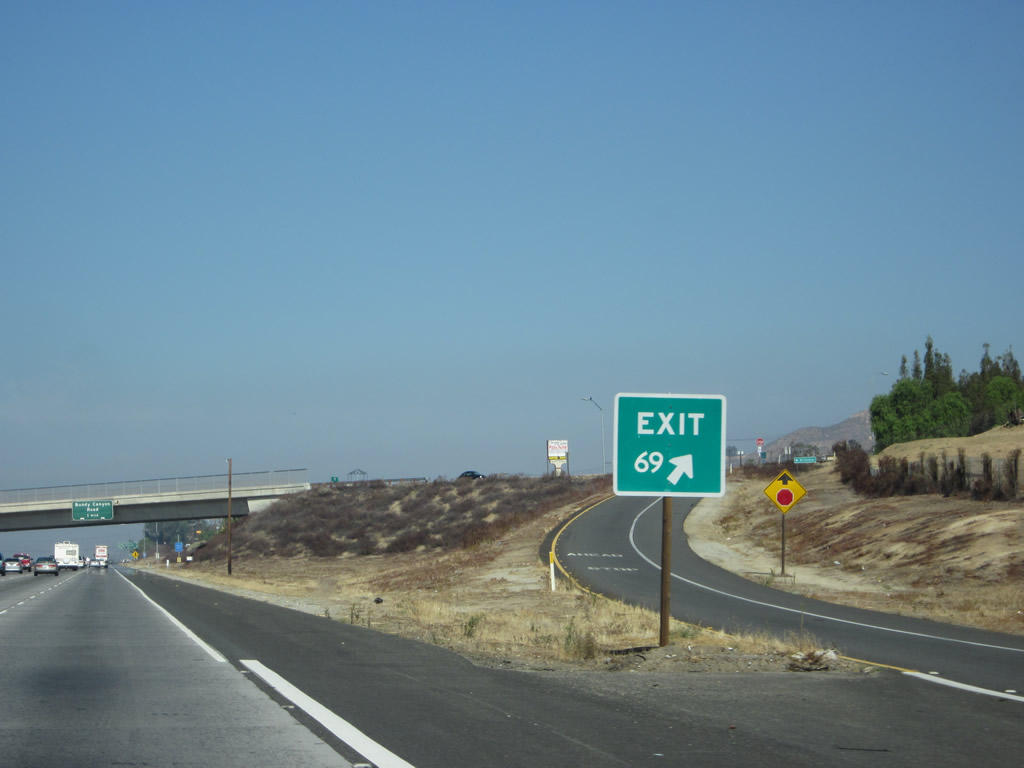
The next exit along Interstate 15 north is Exit 69, Baxter Road. Baxter Road travels southwest to meet Palomar Street in the community of Wildomar. Photo taken 01/28/06. |
|
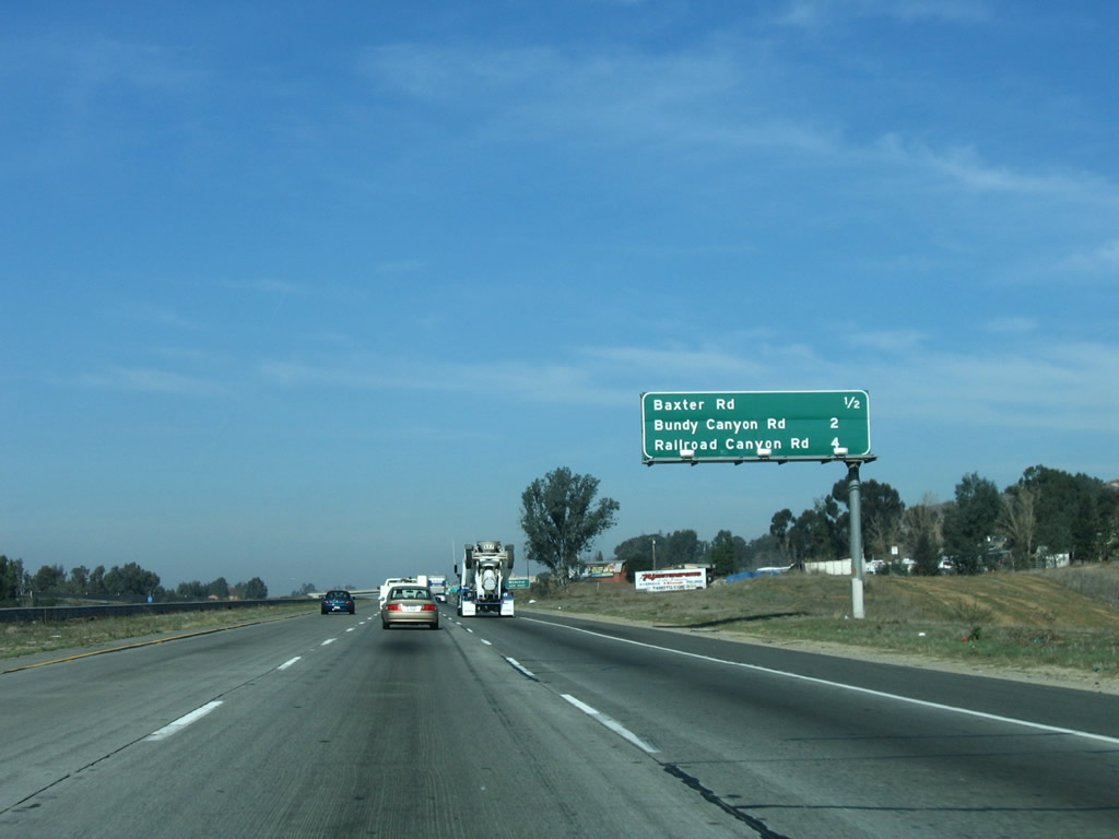
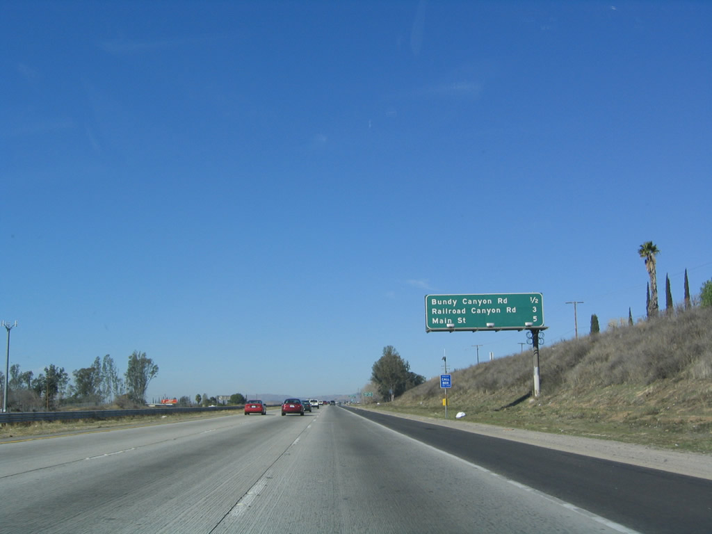
This mileage sign along Interstate 15 north provides the distance to the next three exits: Exit 69, Baxter Road; Exit 71, Bundy Canyon Road; and Exit 73, Railroad Canyon Road/Diamond Drive. Photo taken 01/28/06. |
|
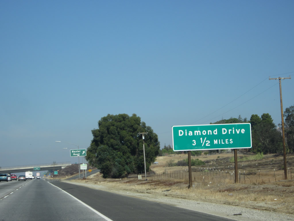
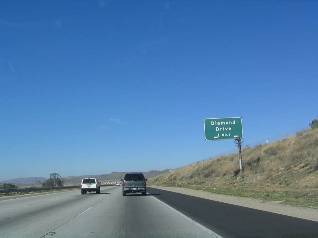
Perhaps since it was not listed on the previous interchange sequence sign, an auxiliary sign advises that Exit 73 serves Diamond Drive (as well as Railroad Canyon Road). Photo taken 10/13/12. |
|
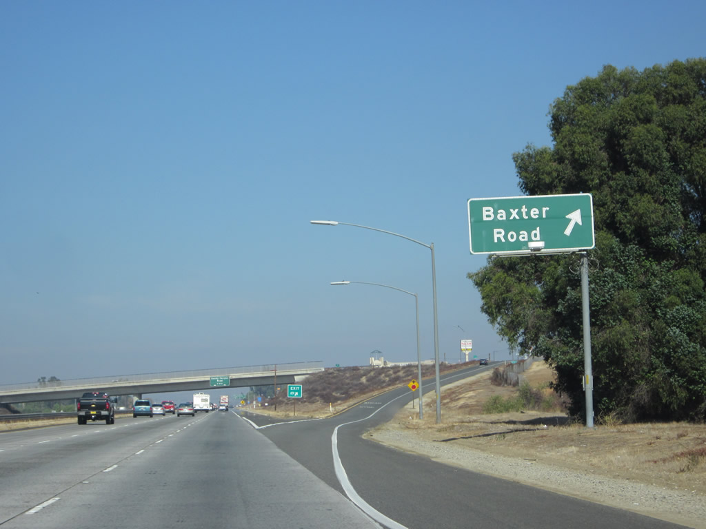
Northbound Interstate 15 reaches Exit 69, Baxter Road to Wildomar. Photo taken 10/13/12. |
|
Exit 69 is a diamond interchange. Photo taken 10/13/12. |
|
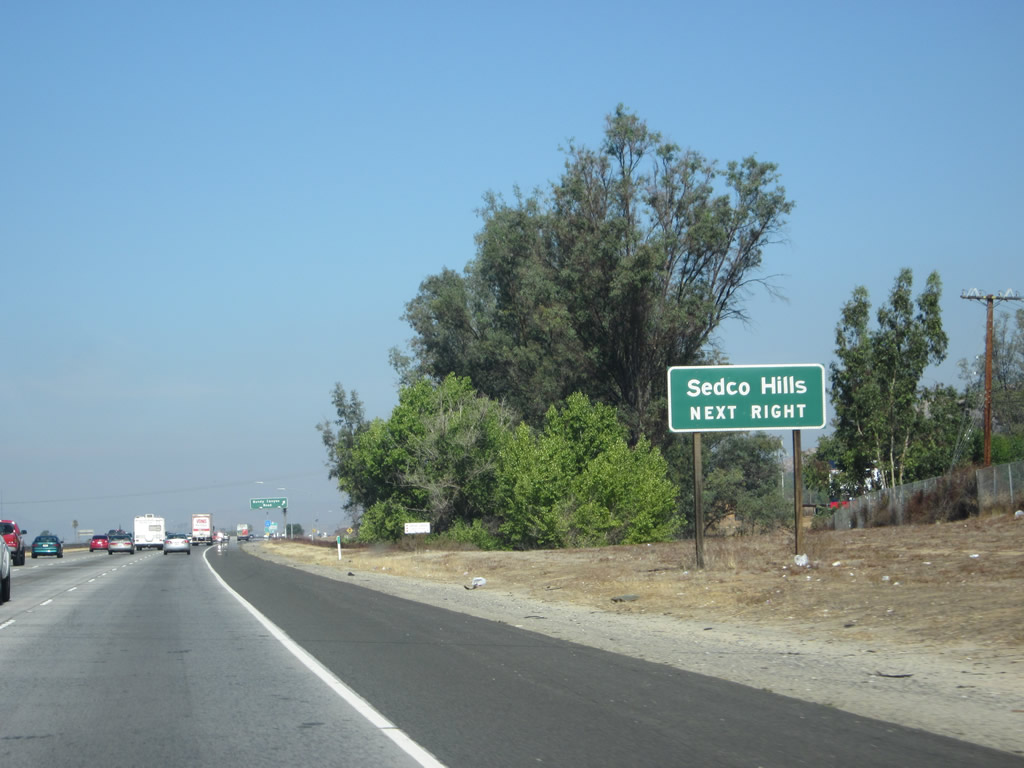
The next exit along northbound Interstate 15 is Exit 71, Bundy Canyon Road, which changes into Scott Road as it heads east. Heading west, it connects to old California 71/Palomar Street in Sedco Hills. Photo taken 01/28/06. |
|
An Interstate 15 north reassurance shield is posted after the Bundy Canyon Road interchange. Photo taken 10/13/12. |
|
This mileage sign along Interstate 15 north provides the distance to the next three exits: Exit 71, Bundy Canyon Road; Exit 73, Railroad Canyon Road/Diamond Drive; and Exit 75, Business Loop I-15 (Main Street) to Lake Elsinore. Photo taken 01/18/04. |
|
Use Bundy Canyon Road to the formerly unincorporated community of Sedco Hills, which had 3,078 people as of the 2000 Census and sits at an elevation of 1,276 feet. Sedco Hills became part of the city of Wildomar when that city incorporated on July 1, 2008. Wildomar had a population of 32,176 as of the 2010 Census. Photo taken 10/13/12. |
|
Northbound Interstate 15 meets Exit 71, Bundy Canyon Road to Sedco Hills. At this interchange, the "Temecula Valley Freeway" designation ends, but the Corona Freeway designation continues. Photo taken 01/18/04. |
| Interstate 15 (Corona Freeway) north |
|
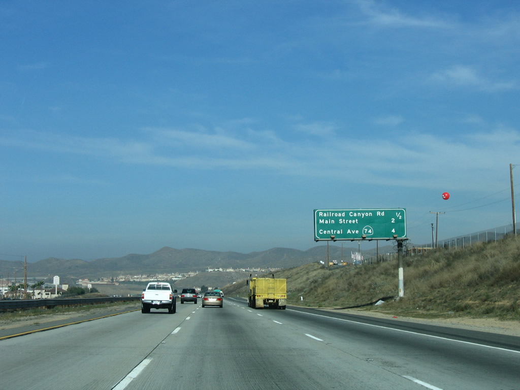
The next exit along Interstate 15 (Corona Freeway) north is Exit 73, Business Loop I-15/Diamond Drive and Railroad Canyon Road. The business route follows Diamond Drive west, turns northwest along Lakeshore Drive, then turns north again via Main Street to rejoin the freeway at Exit 75. Railroad Canyon Road and Diamond Drive is the first interchange to serve the city of Lake Elsinore. Photo taken 01/18/04. |
|
|
The next five exits serve the city of Lake Elsinore: Exit 73, Business Loop I-15/Diamond Drive north and Railroad Canyon Road east; Exit 75, Business Loop I-15 (Main Street) south; Exit 77, California 74/Central Avenue; Exit 78, Nichols Road; and Exit 81, Lake Street. Photos taken 10/13/12 and 01/28/06. |
|
Interstate 15 enters the city of Lake Elsinore. The city is home to the Single "A" San Diego Padres baseball farm team, the Lake Elsinore Storm. The Storm play at Diamond Stadium. Lake Elsinore has a population of 28,928 people as of the 2000 Census, and it is also rapidly growing as more housing developments are constructed. The city was incorporated on April 9, 1888, consists of 38.8 square miles, and sits at an elevation of 1,306 feet. Photo taken 01/28/06. |
|
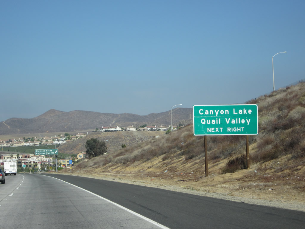
Use Railroad Canyon Road east to the city of Canyon Lake, one of five gated cities in California. This master-planned development was built by the Corona Land Company in 1968 surrounding a reservoir created in 1927 (Canyon Lake Reservoir is owned and operated by the Elsinore Valley Municipal Water District). The city of Canyon Lake was incorporated on December 1, 1990, and it has a population of 9,952 people as of the 2000 Census. No state highway enters the city of Canyon Lake, and Railroad Canyon Road skirts the southern edge of the city. Most of the city is behind a gate. In addition, this exit also serves unincorporated Quail Valley (population 1,639 as of 2000 Census), which is located northeast of Canyon Lake. Photo taken 10/13/12. |
|
|
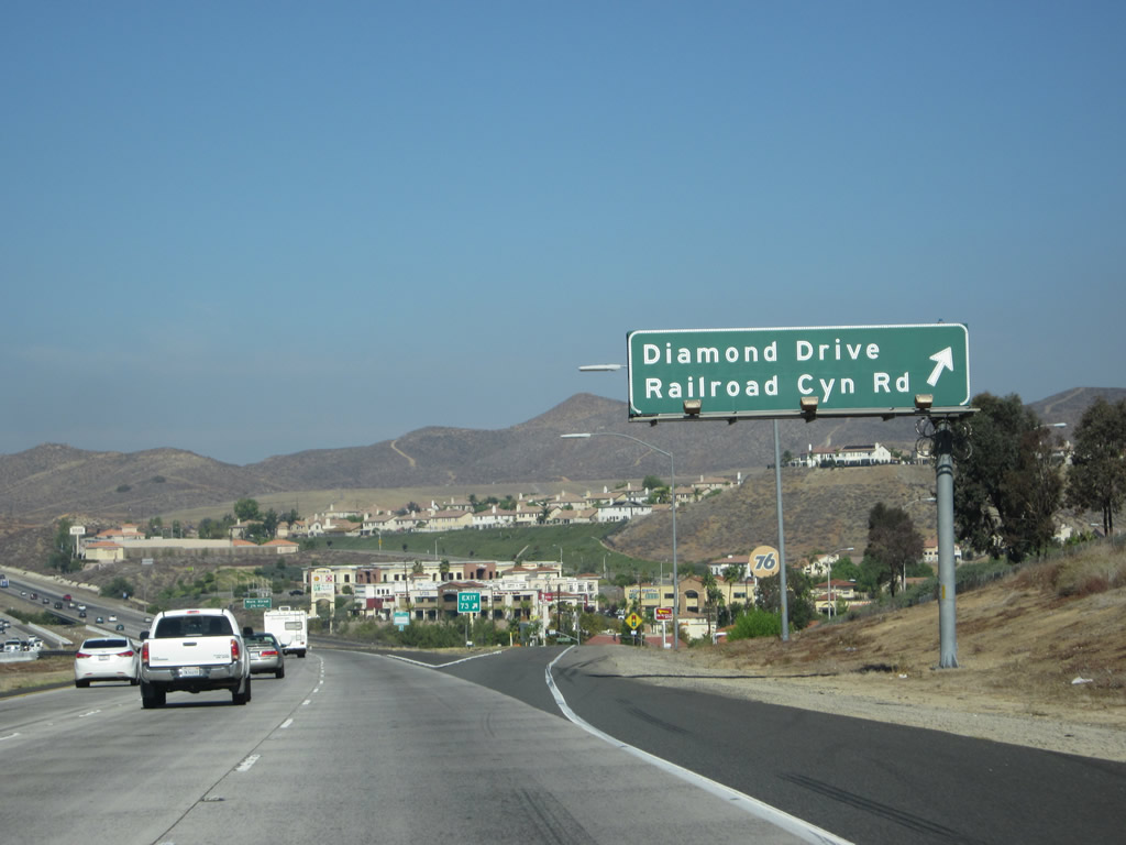
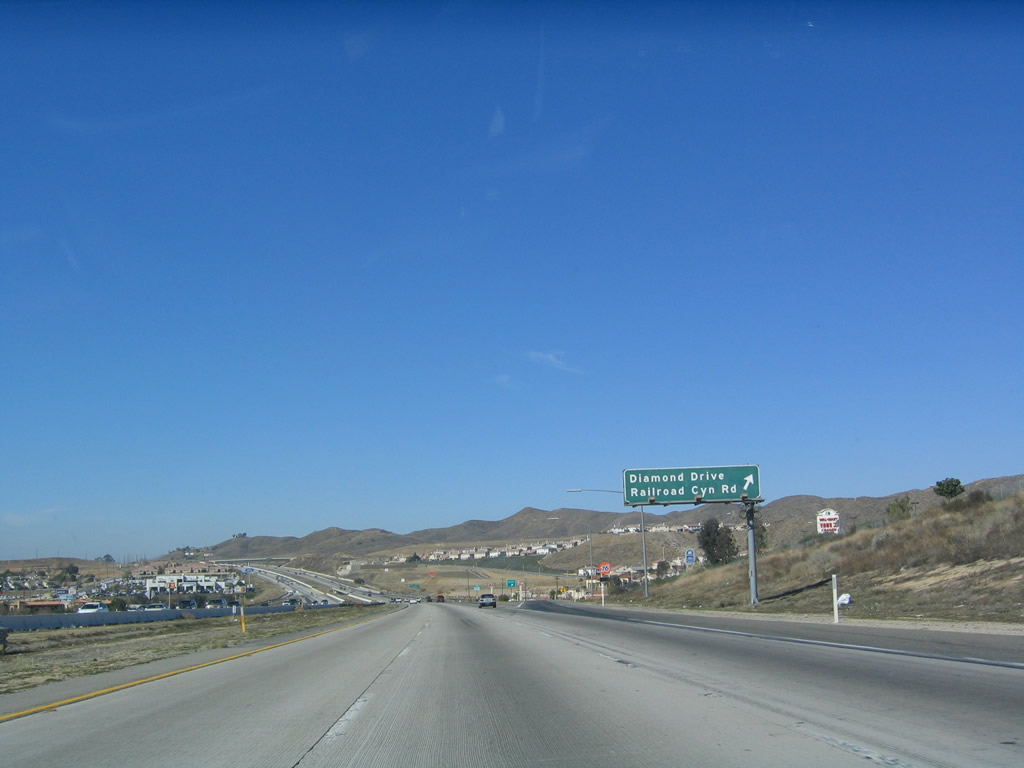
Northbound Interstate 15 reaches Exit 73, Business Loop I-15/Diamond Drive north and Railroad Canyon Road east. Food and gas are available at this interchange, which saw additional development as seen in the comparison of pictures between 2004 and 2012. Photos taken 10/13/12 and 01/18/04. |
|
|
The next exit along Interstate 15 north is Exit 75, Business Loop I-15 (Main Street) south. As is typical, only one of the advance signs mentions that this exit is the business loop into Lake Elsinore. Photos taken 10/13/12 and 01/18/04. |
|
This mileage sign along Interstate 15 (Corona Freeway) north provides the distance to the next three exits: Exit 75, Business Loop I-15 (Main Street) south; Exit 77, California 74; and Exit 78, Nichols Road. Photo taken 01/18/04. |
|
Use Exit 75 to historic downtown Lake Elsinore. Photo taken 10/13/12. |
|
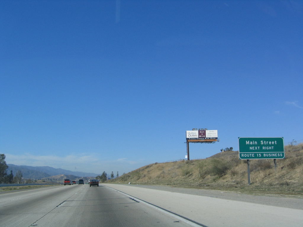
A "Route 15 Business" auxiliary sign along northbound as it approaches Exit 75. This new reflective business loop signage was placed before the directive related to exit numbering was issued, so it does not feature an exit number. Photo taken 01/18/04. |
|
Northbound Interstate 15 reaches Exit 75, Business Loop I-15 (Main Street) in Lake Elsinore. Use Business Loop I-15 west into the historic downtown. Lake Elsinore takes its name from the large lake situated at the base of the Santa Ana Mountains. It connects to the San Jacinto River watershed, which empties into the lake and does not drain to the ocean. The business route follows former California 71 along Main Street and Lakeshore Drive through Lake Elsinore. A portion of the business route also used to be U.S. 395 and is signed as an historical route. Photo taken 10/13/12. |
|
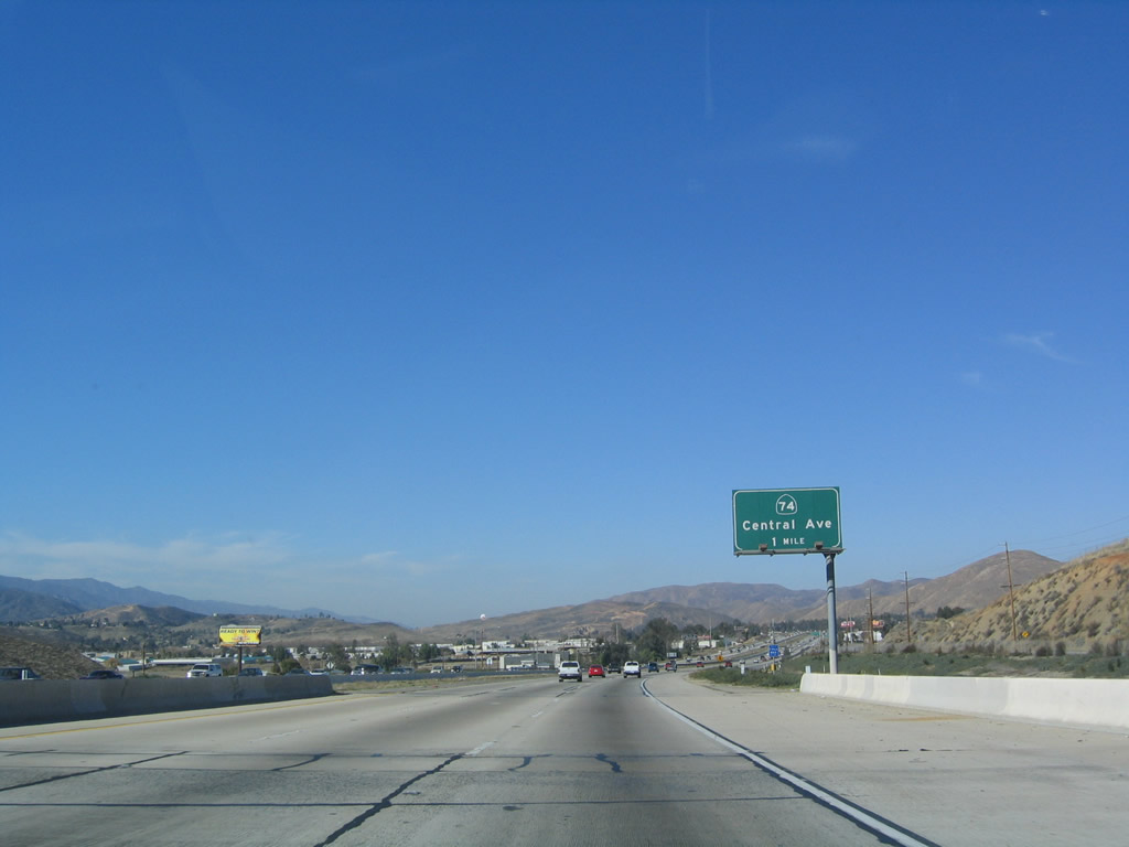
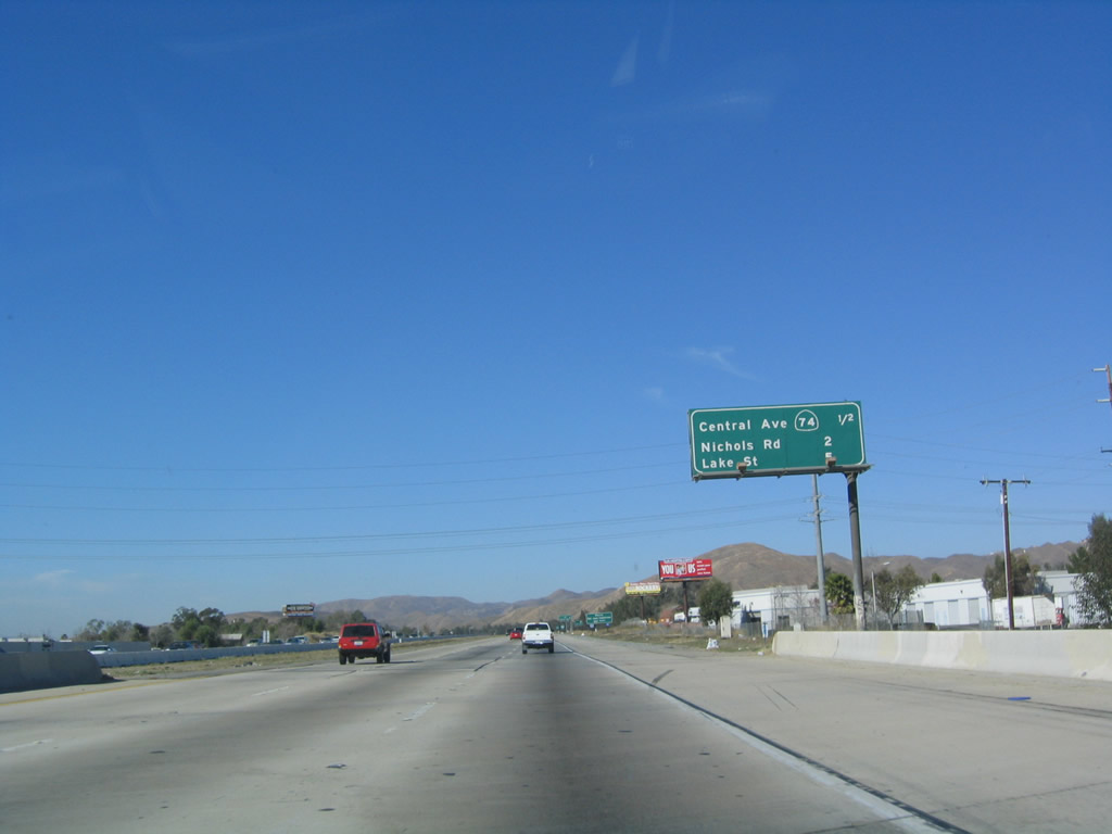
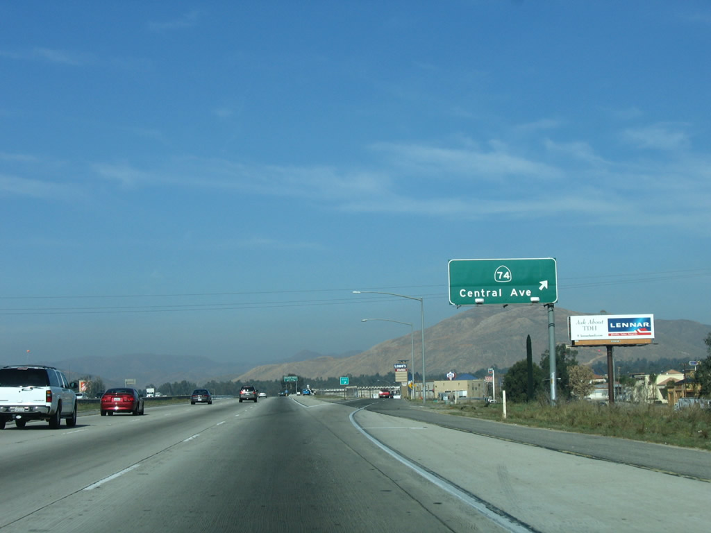
The next exit along Interstate 15 north is Exit 77, California 74/Central Avenue in Lake Elsinore. California 74 heads east toward Perris and Hemet, then onward to Idyllwild and Palm Desert via the San Jacinto Mountains. The next two exits along northbound are all in Lake Elsinore, and they are Nichols Road and Lake Street. The Interstate 15 business route returns to Interstate 15 at Exit 77. Photo taken 01/18/04. |
|
This mileage sign along Interstate 15 (Corona Freeway) north provides the distance to the next three exits: Exit 77, California 74/Central Avenue; Exit 78, Nichols Road; and Exit 81, Lake Street. Photo taken 01/18/04. |
|
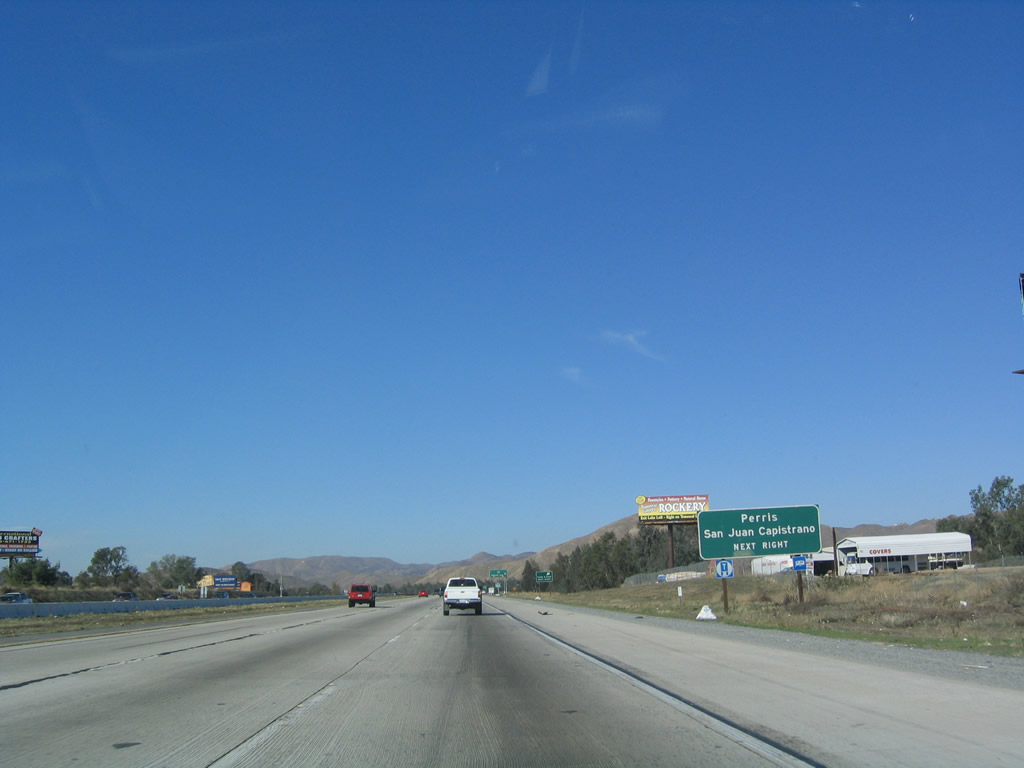
California 74 begins at San Juan Capistrano along the coast at the interchange with Interstate 5. The state route crosses over the Ortega Highway to Lake Elsinore, then continues east toward Perris and Hemet before descending into the desert. Photo taken 01/18/04. |
|
Northbound Interstate 15 reaches Exit 77, California 74/Central Avenue to Business Loop I-15/Lakeshore Drive in Lake Elsinore. California 74 west travels over the Santa Ana Mountains to reach the Orange County coast at San Juan Capistrano. This corridor was once considered for a freeway alignment, but the highway crosses terrain that is too treacherous and environmentally fragile to accommodate a freeway. However, there is a proposal now to construct a tunnel that would carry traffic under the mountains, and this tunnel would create a second freeway (other than California 91 (Riverside Freeway)) between Orange County and Riverside County. Photo taken 01/18/04. |
|
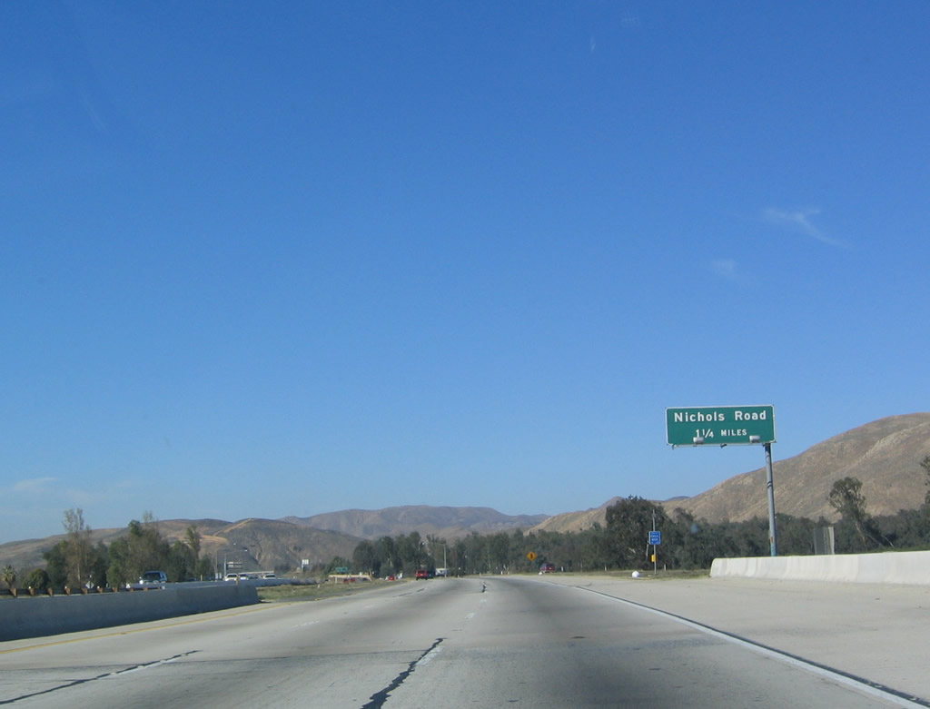
The next exit along Interstate 15 north is Exit 78, Nichols Road. Photo taken 01/18/04. |
|
|
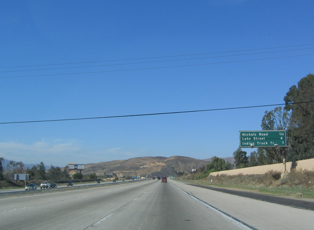
This mileage sign along Interstate 15 (Corona Freeway) north provides the distance to the next three exits: Exit 78, Nichols Road; Exit 81, Lake Street; and Exit 85, Indian Truck Trail. Photos taken 10/13/12 and 01/18/04. |
|
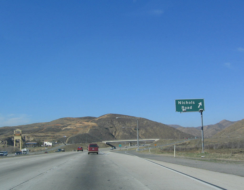
Northbound Interstate 15 meets Exit 78, Nichols Road in Lake Elsinore. This exit leads to the well-known outlet shops at Lake Elsinore. It is not uncommon for people from throughout the Inland Empire and San Diego County to shop at these outlets in search of deals. Photo taken 01/18/04. |
|
This reassurance shield is posted after the Nichols Road on-ramp. Photo taken 01/18/04. |
|
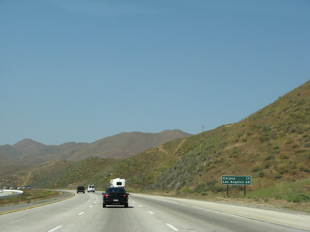
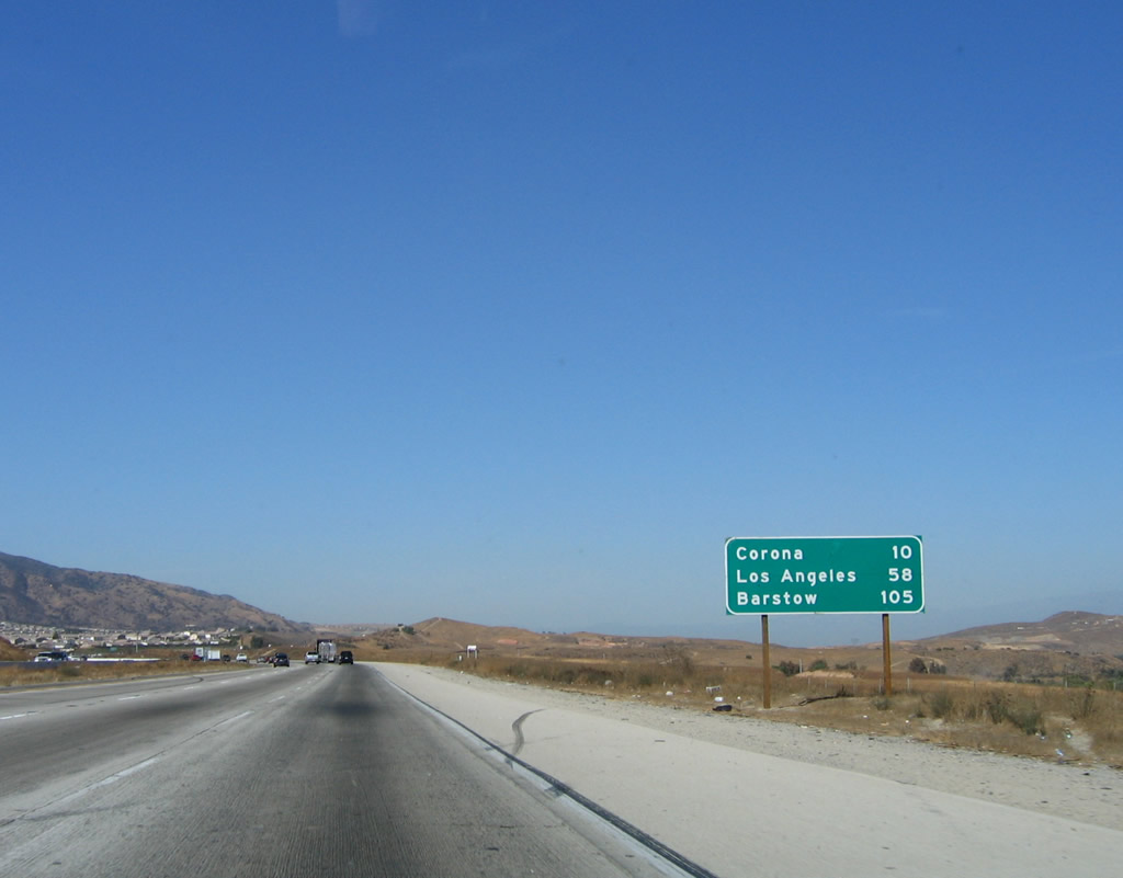
A mileage signs on northbound Interstate 15 next provides the distance to Corona and Los Angeles. Omitted are Barstow and Las Vegas. Photo taken 03/28/08. |
|
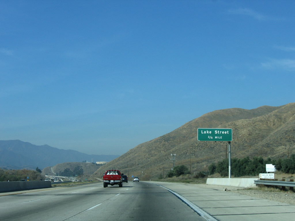
The next exit along Interstate 15 north is Exit 81, Lake Street. Photo taken 01/28/06. |
|
This interchange sequence sign along northbound Interstate 15 provides the distance to Exit 81, Lake Street; Exit 85, Indian Truck Trail; and Exit 88, Temescal Canyon Road. Photo taken 01/28/06. |
|
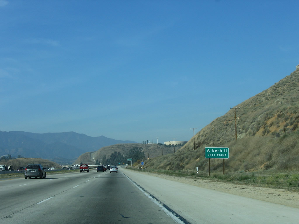
Use Lake Street south to Alberhill, a community in Lake Elsinore. Photo taken 01/28/06. |
|
Northbound Interstate 15 reaches Exit 81, Lake Street. Photo taken 01/18/04. |
|
Now leaving the greater Lake Elsinore area, Interstate 15 enters Temescal Canyon, which is located within unincorporated Riverside County. Photo taken 01/28/06. |
|
The towering Santa Ana Mountains, which separate coastal Orange County cities with the Temecula Valley and Temescal Canyon, dominate the view looking west as Interstate 15 continues northwest toward Corona. Photo taken 01/28/06. |
|
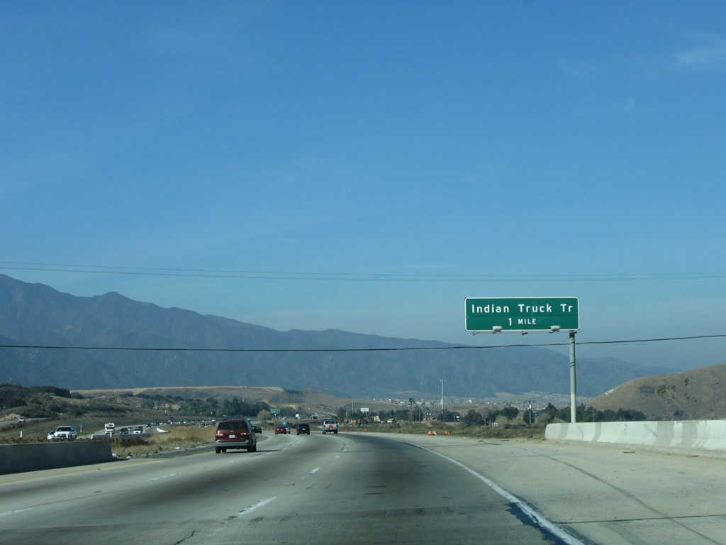
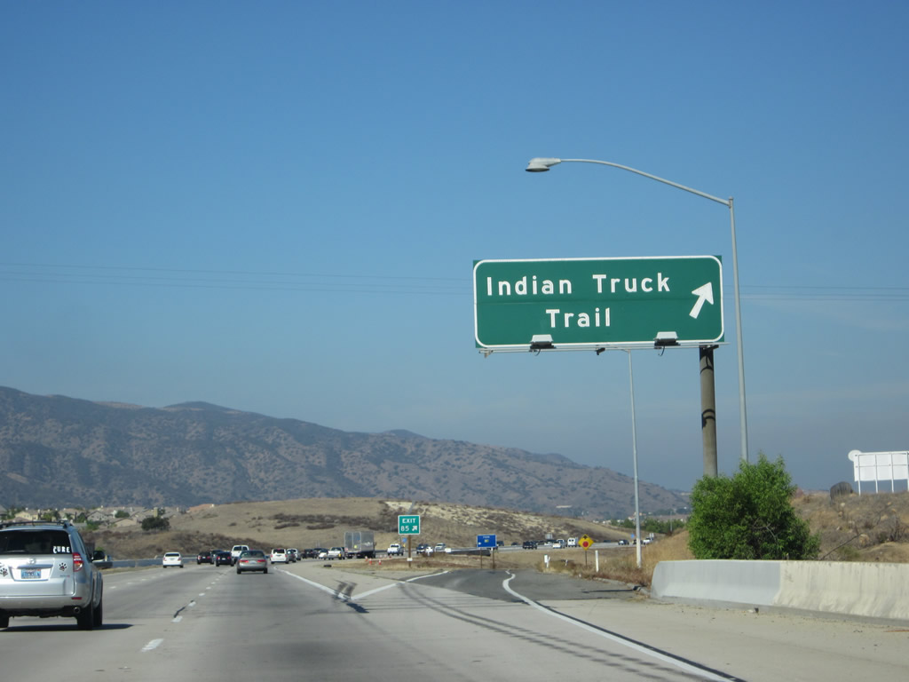
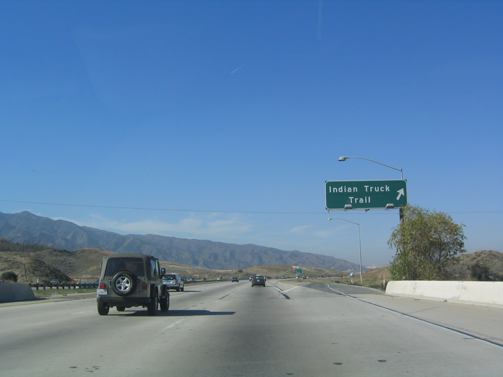
The next exit along Interstate 15 north is Exit 85, Indian Truck Trail. Indian Truck Trail provides local and ranch access to the foothills of the Santa Ana Mountains, which dominate the skyline to the west of the freeway. Photo taken 01/28/06. |
|
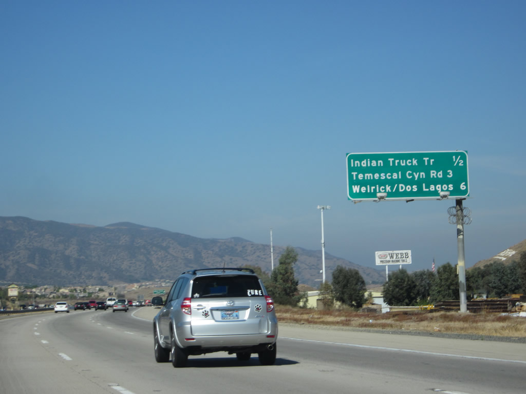
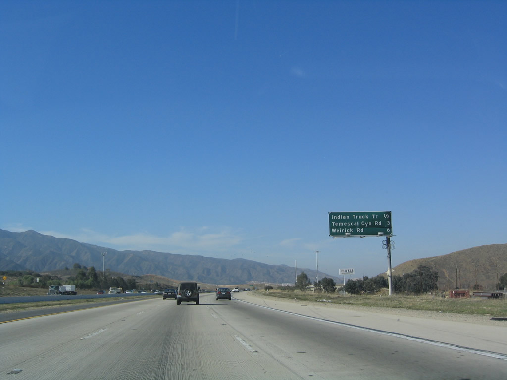
|
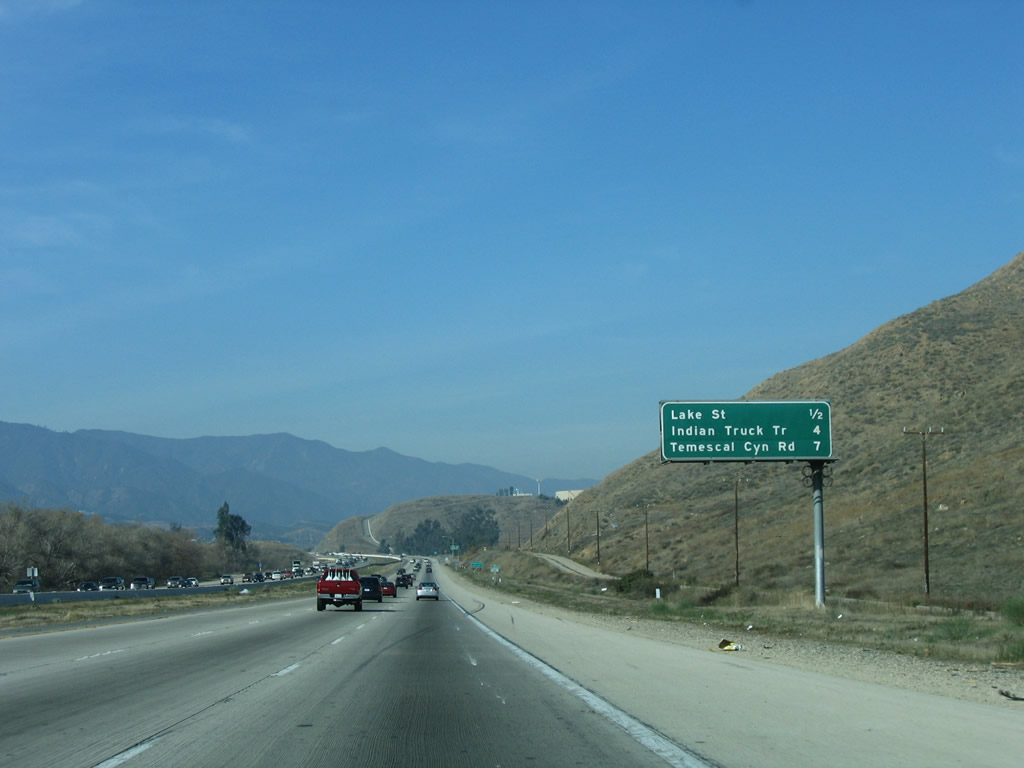
This interchange sequence sign along northbound Interstate 15 provides the distance to the next three exits: Exit 85, Indian Truck Trail; Exit 88, Temescal Canyon Road; and Exit 90, Weirick Road. Photos taken 10/13/12 and 01/18/04. |
|
|
Northbound Interstate 15 reaches Exit 85, Indian Truck Trail. A nearly-hidden residential development is visible in the 2012 picture; it wasn't there in 2004. Photos taken 10/13/12 and 01/18/04. |
|
This Interstate 15 north reassurance shield is very old and faded. Photo taken 10/13/12. |
|
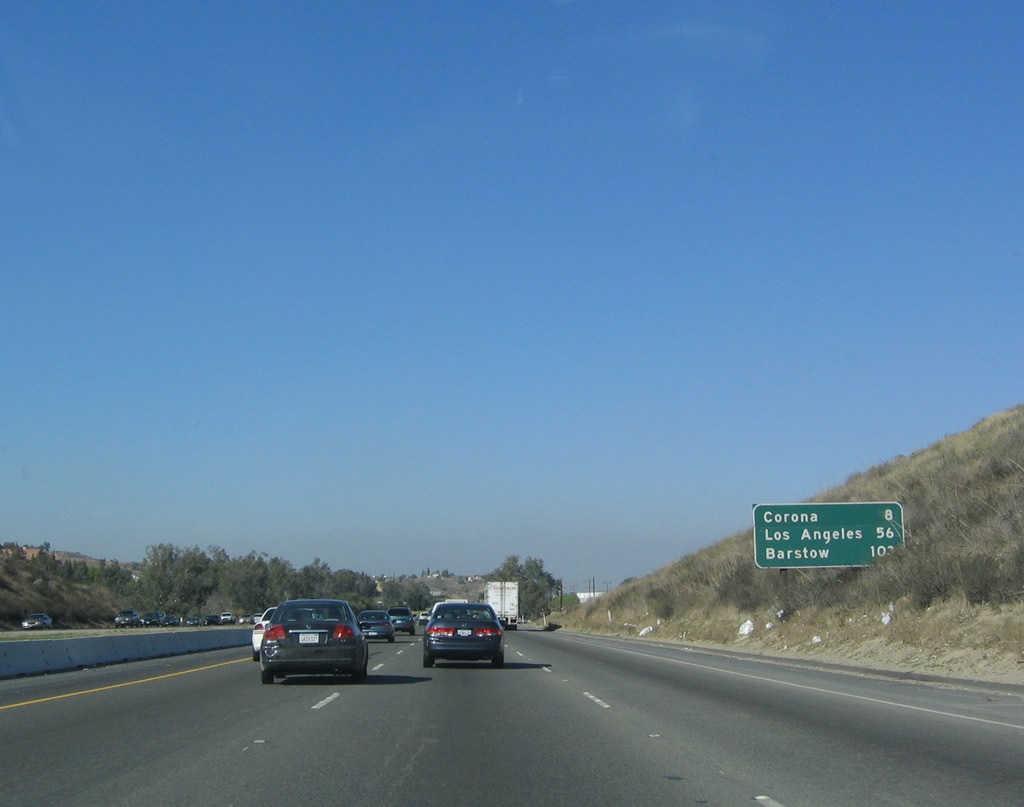
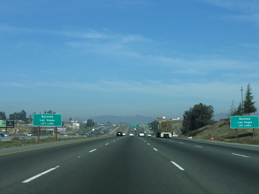
This mileage sign along Interstate 15 north provides the distance to Corona, Los Angeles, and Barstow. This is the first sign to mention Barstow since the split from Interstate 215. Photo taken 11/10/06. |
|
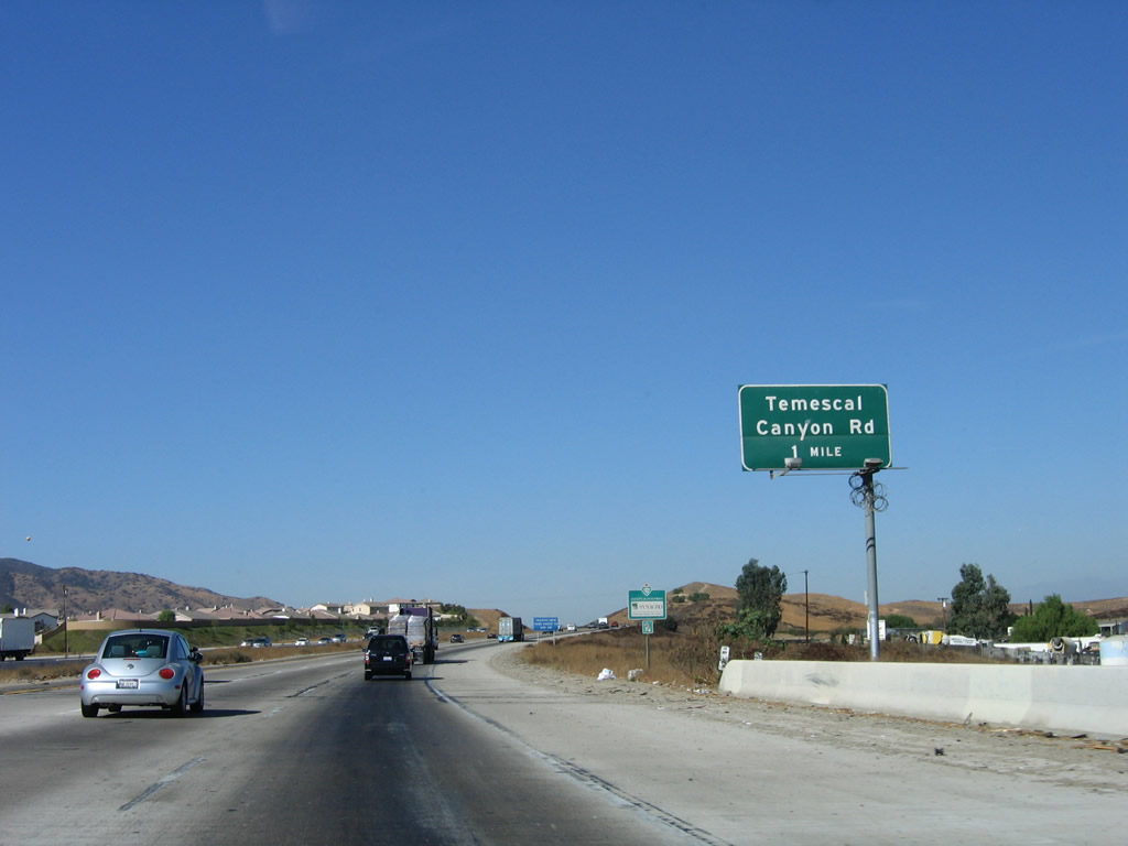
The next exit along Interstate 15 (Corona Freeway) north is Exit 88, Temescal Canyon Road. Glen Ivy Hot Springs are located at this exit just west of the freeway. Photo taken 11/10/06. |
|
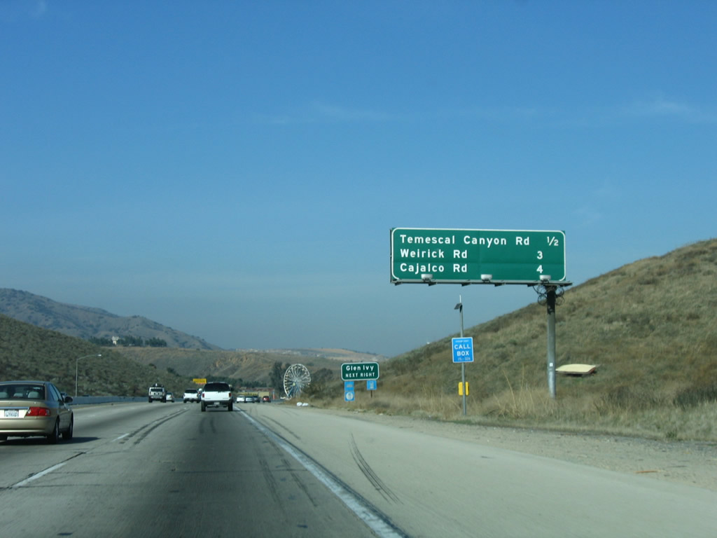
This interchange sequence sign along northbound Interstate 15 provides the distance to the next three exits: Exit 88, Temescal Canyon Road; Exit 90, Weirick Road; and Exit 92, Cajalco Road. Photo taken 01/28/06. |
|
Northbound Interstate 15 reaches Exit 88, Temescal Canyon Road. Temescal Canyon Road is the old alignment of California 71, which parallels Interstate 15 through the canyon. Photo taken 11/10/06. |
|
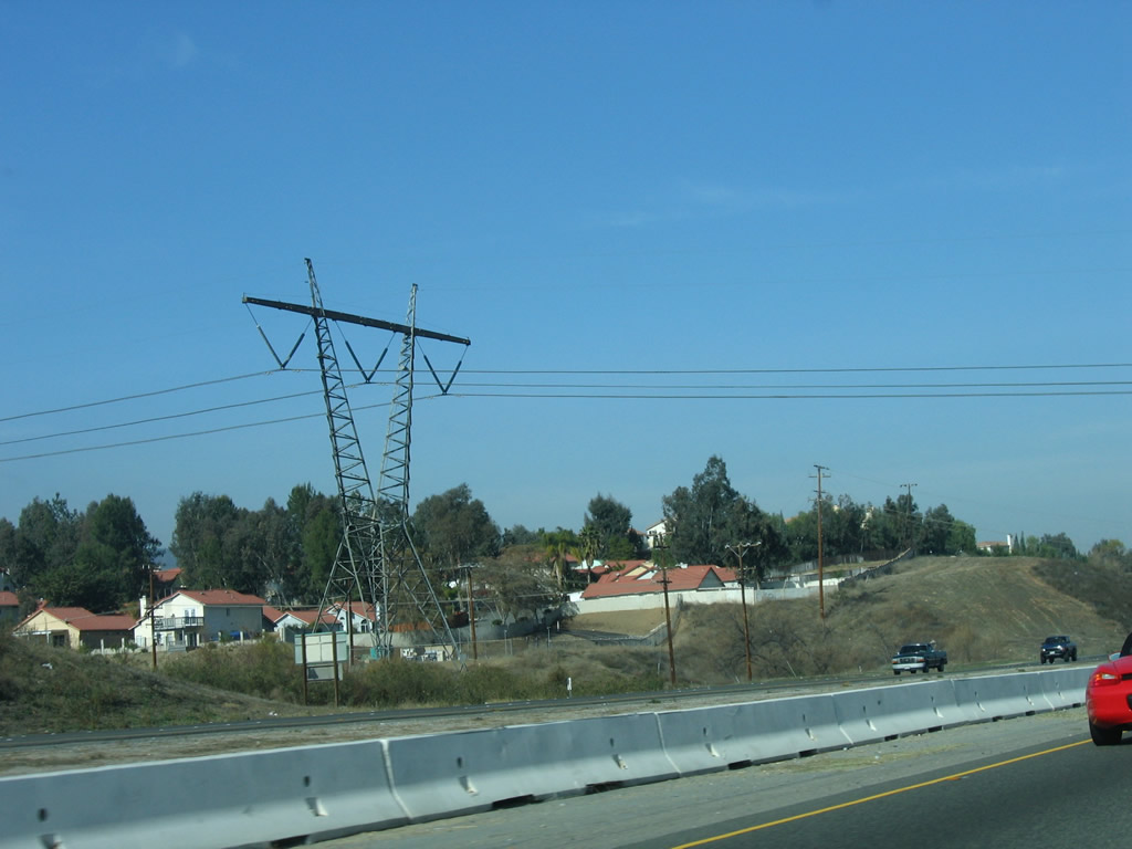
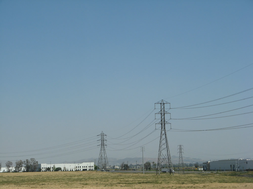
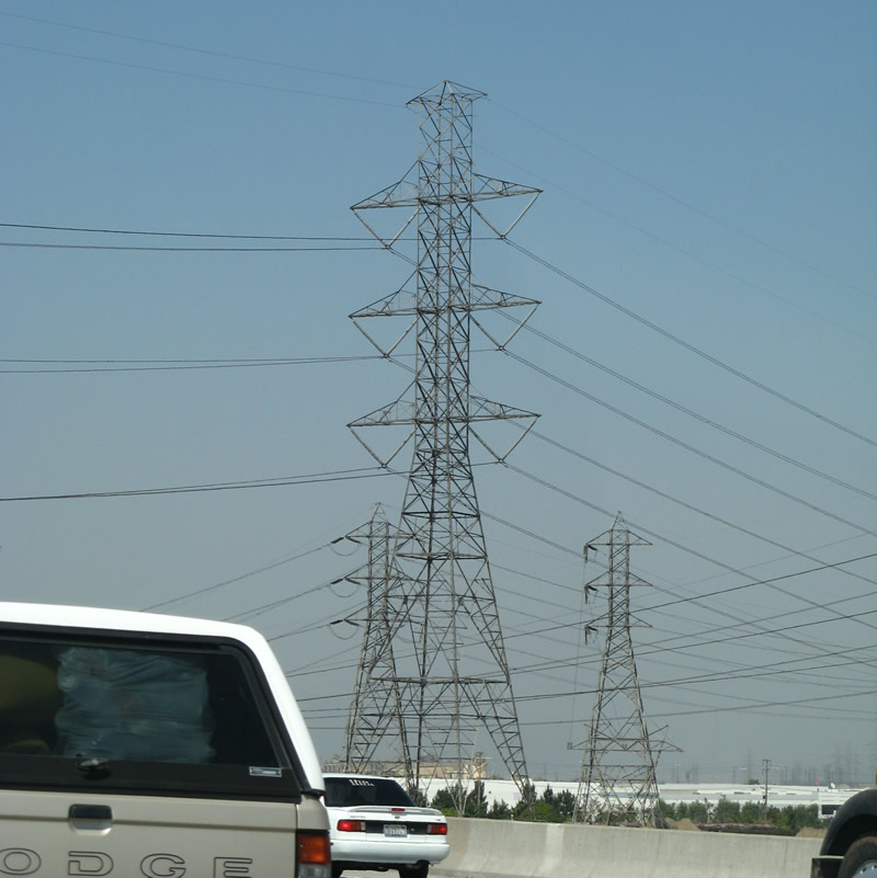
A set of 500kV power lines crosses over Interstate 15 between Exits 88 and 90. This particular line is a connection from the Path 46 interconnection system. The Palo Verde to Devers Alignment of Path 46 connects the Palo Verde Nuclear Generating Station near Buckeye, Arizona, west to the Devers substation near Palm Springs. This 500kV power line, in turn, connects the Devers substation near Palm Springs with a substation in Orange County off of California 241 and California 91. This is the first of many 500kV powerlines to cross Interstate 15 on the journey northeast to Las Vegas. Photo taken 01/28/06. |
|
Another mileage sign on Interstate 15 north provides the distance to Corona, Los Angeles, and Barstow. Photo taken 01/18/04. |
|
|
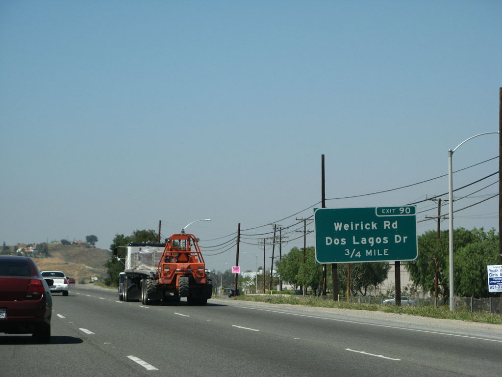
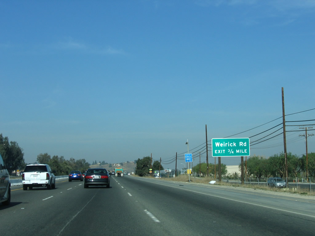
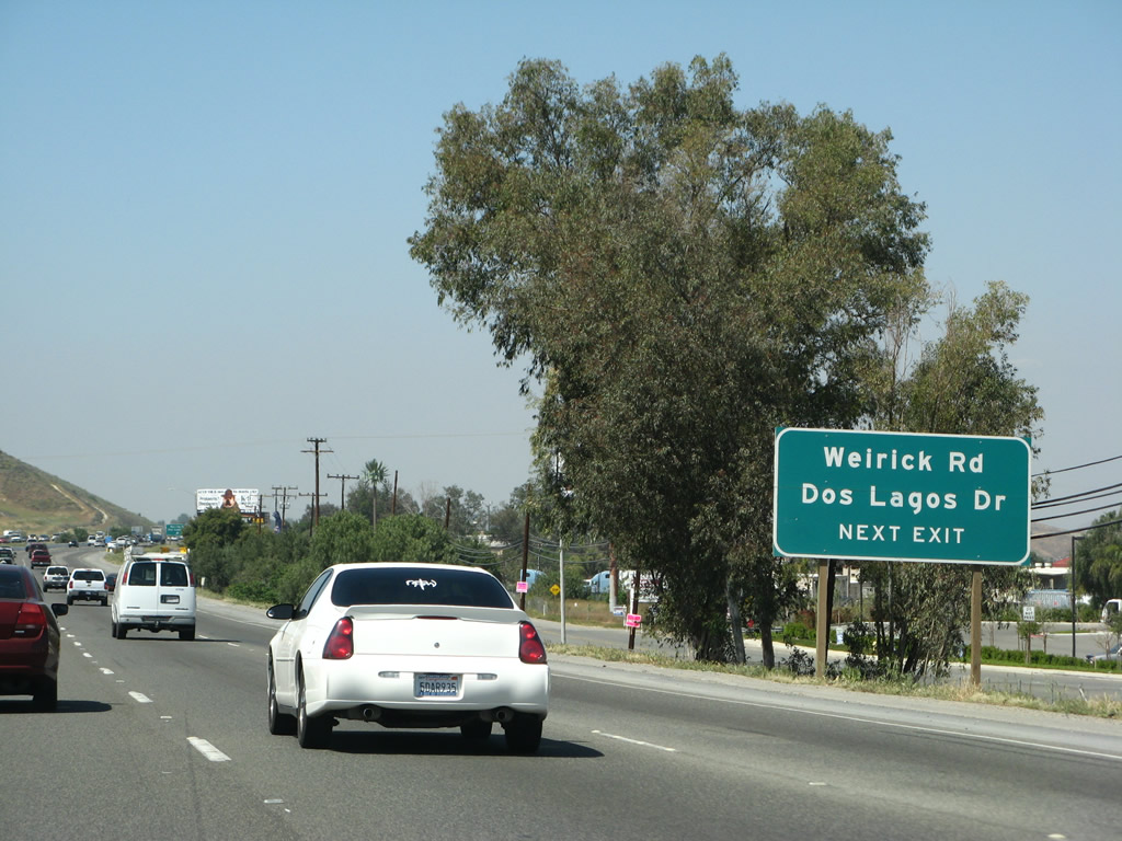
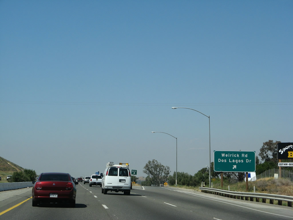
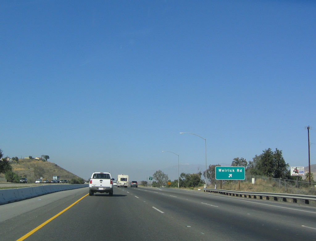
The next exit along Interstate 15 (Corona Freeway) north is Exit 90, Weirick Road and Dos Lagos Drive. A new exit number sign was posted in 2007. Photos taken 03/28/08 and 01/28/06. |
|
Weirick Road is the first exit to serve the city of Corona, and Interstate 15 briefly enters Corona (and leaves before Exit 92). Use Weirick Road east to Temescal Canyon Road (Old California 71). Photo taken 01/18/04. |
|
|
Northbound Interstate 15 (Corona Freeway) reaches Exit 90, Weirick Road and Dos Lagos Drive. Photos taken 03/28/08 and 01/18/04. |
|
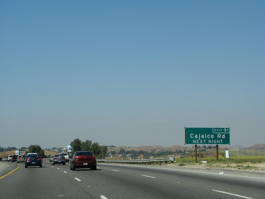
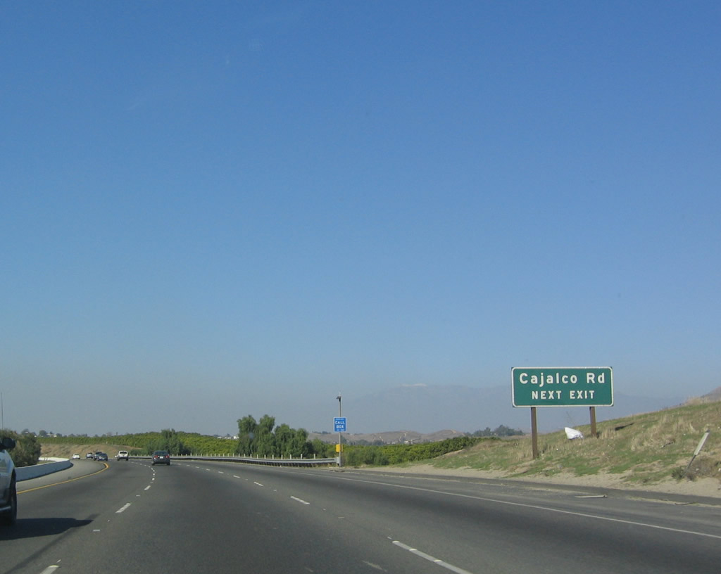
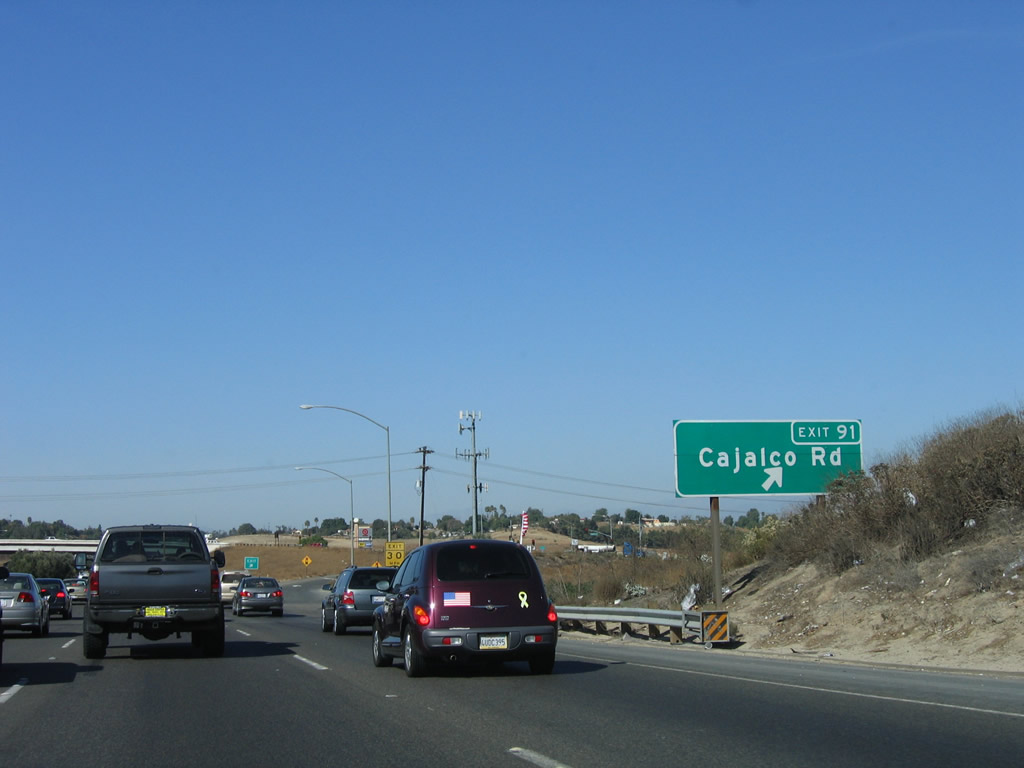
The next exit along northbound is Exit 91, Cajalco Road. This interchange is also located in the city of Corona. Photo taken 01/28/06. |
|
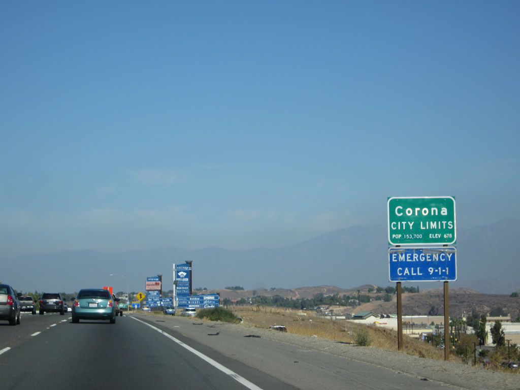
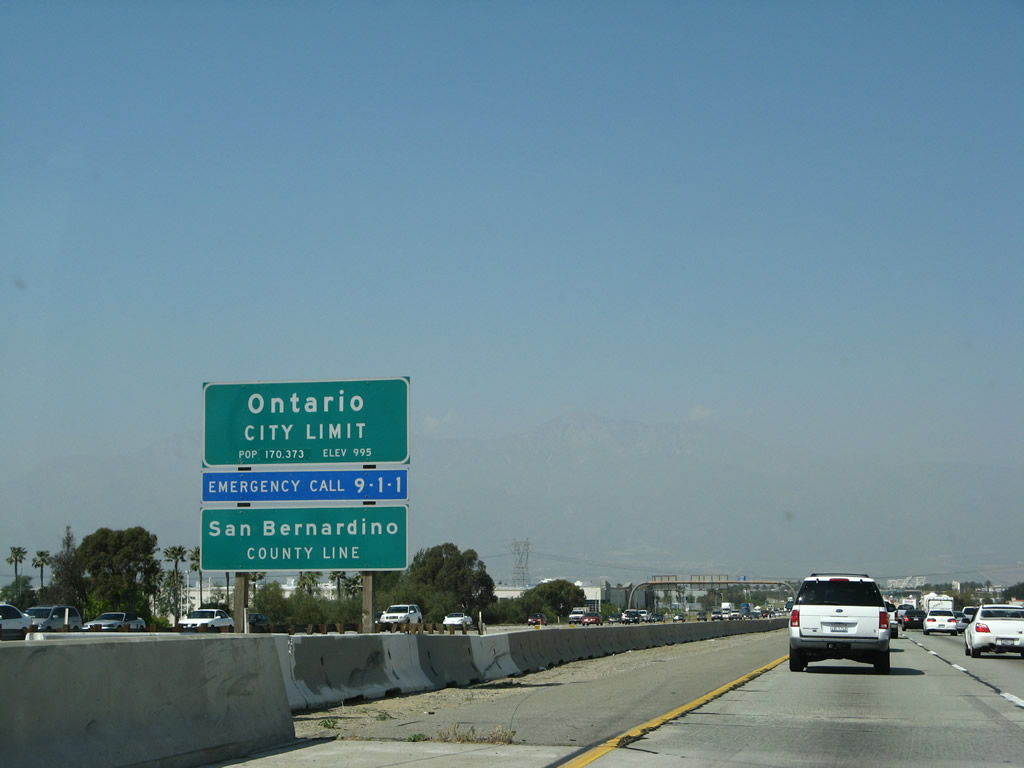
Interstate 15 enters the city of Corona (population 152,374 as of the 2010 Census), the Circle City. Photo taken 10/13/12. |
|
|
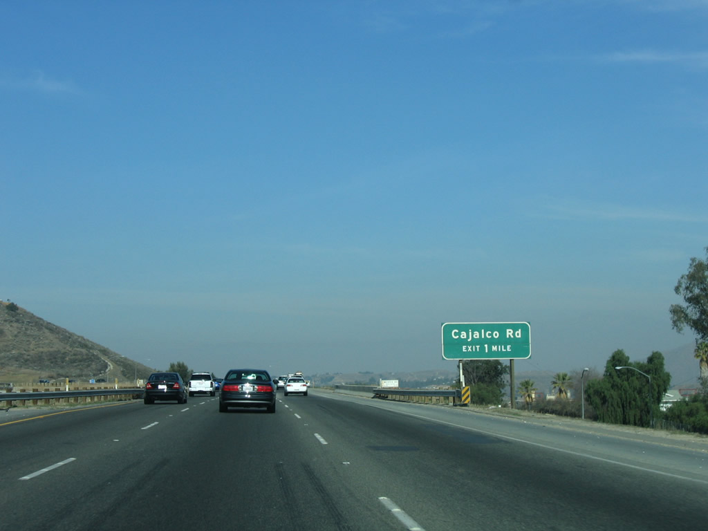
Cajalco Road travels east past Lake Mathews to meet Interstate 215 at Exit 22. Upon entering Perris, Cajalco Road changes into the Ramona Expressway, which continues east around Lake Perris and north of Hemet before joining California 74 in Valle Vista. Photos taken 03/28/08 and 01/18/04. |
|
|
Northbound Interstate 15 reaches Exit 91, Cajalco Road. The new exit number sign looks congested and too small; and overhead guide sign might be more appropriate here. Photos taken 11/10/06 and 01/18/04. |
|
|
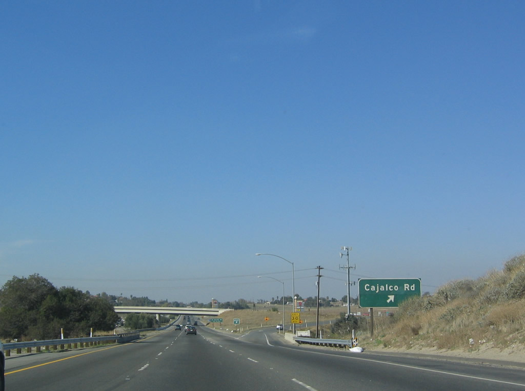
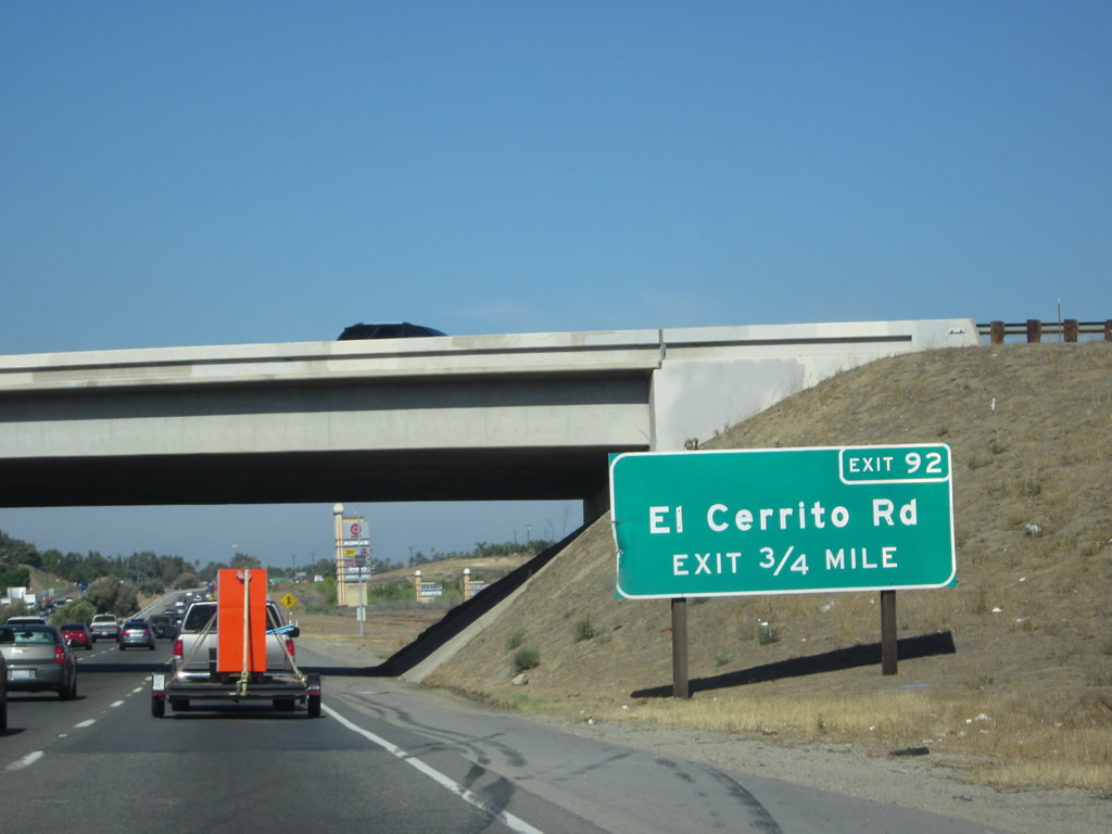
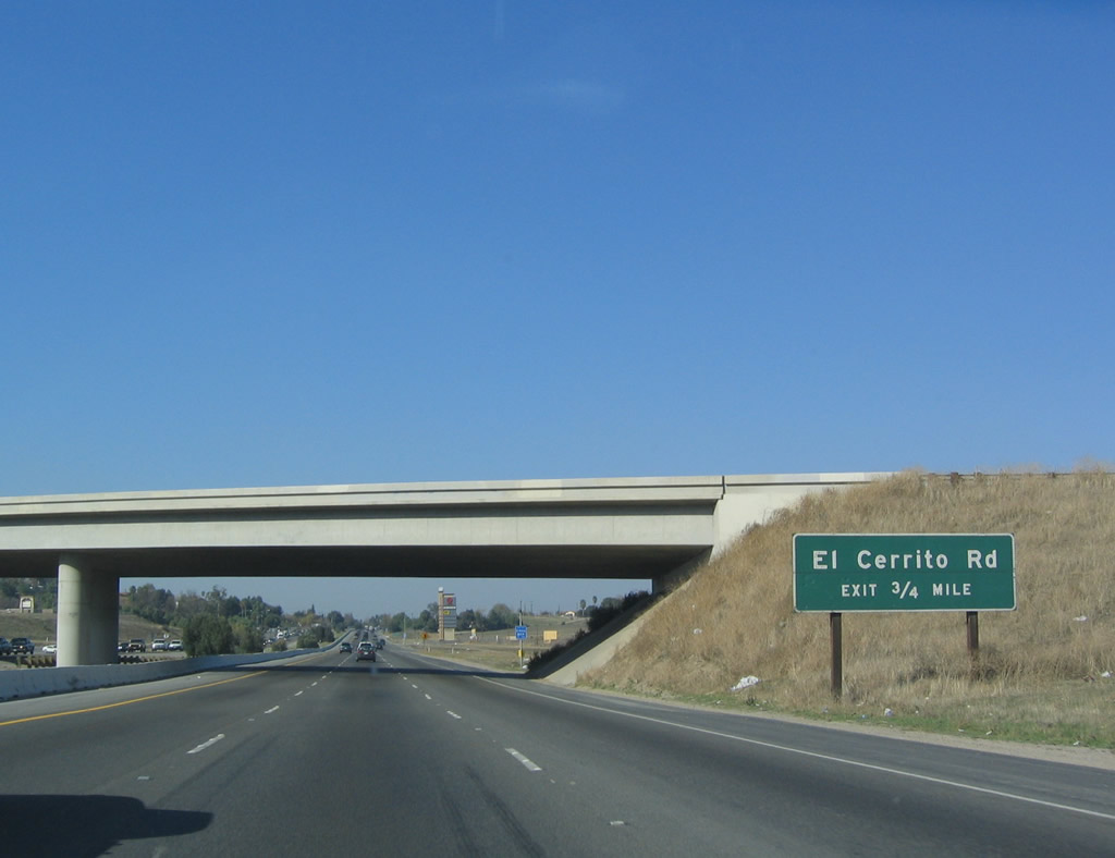
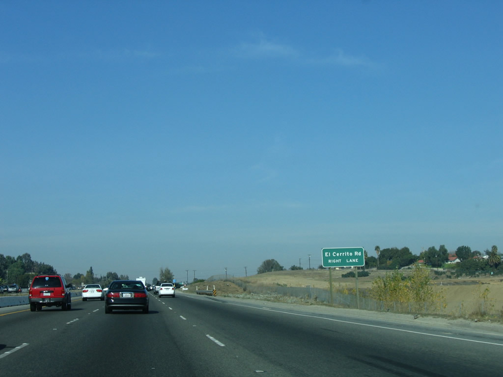
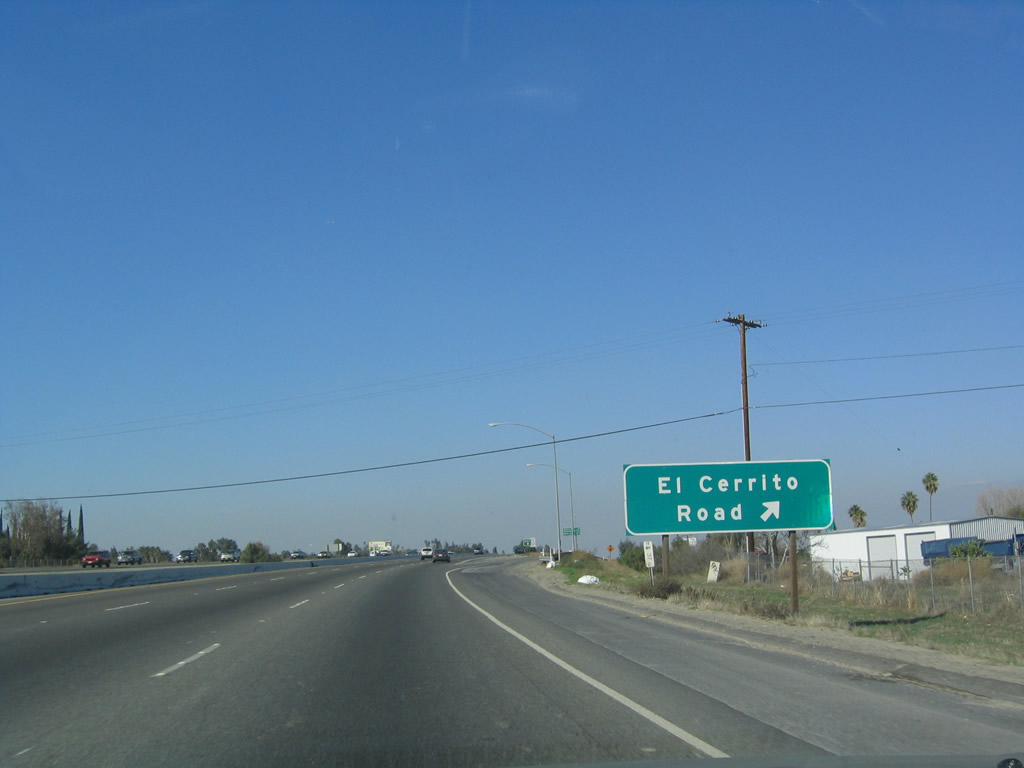
The next exit along Interstate 15 is Exit 92, El Cerrito Road. Also in the city of Corona, El Cerrito Road travels east to El Cerrito, which is situated at the intersection with Temescal Canyon Road (Old California 71). Photos taken 10/13/12 and 01/18/04. |
|
An Interstate 15 north reassurance shield is posted after the on-ramp from Cajalco Road. Photo taken 10/13/12. |
|
This sign for El Cerrito Road is almost too small to be noticed, especially on a busy and fast six-lane highway. Photo taken 01/28/06. |
|
Northbound Interstate 15 reaches Exit 92, El Cerrito Road. This interchange is not located in the city of Corona, but it connects to Foothill Parkway in the city of Corona to the west. Photo taken 01/18/04. |
|
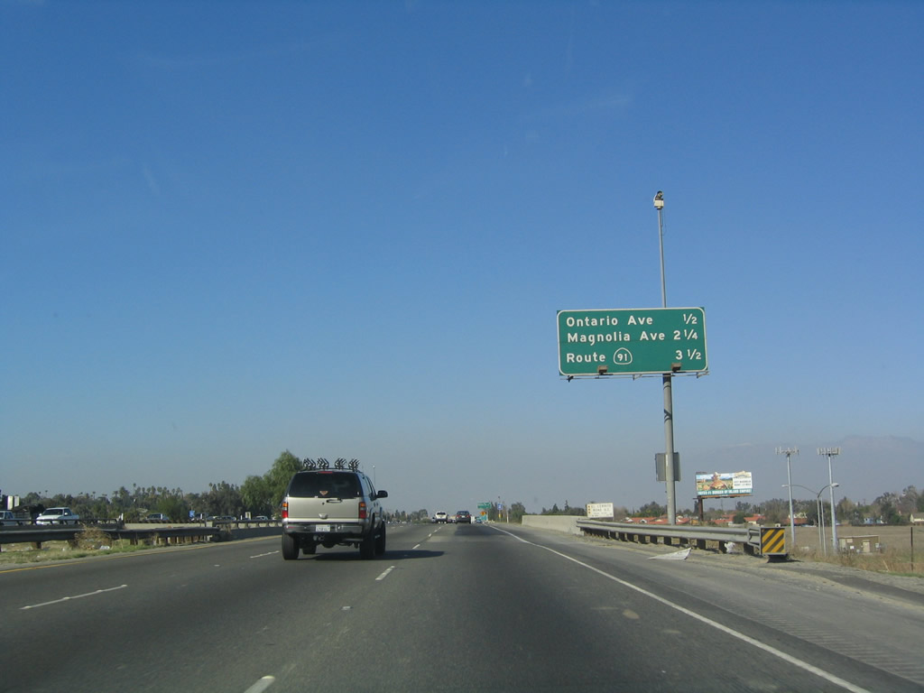
This mileage sign along Interstate 15 (Corona Freeway) provides the distance to the next three exits: Exit 93, Ontario Avenue; Exit 95, Magnolia Avenue; and Exit 96, California 91. Photo taken 01/18/04. |
|
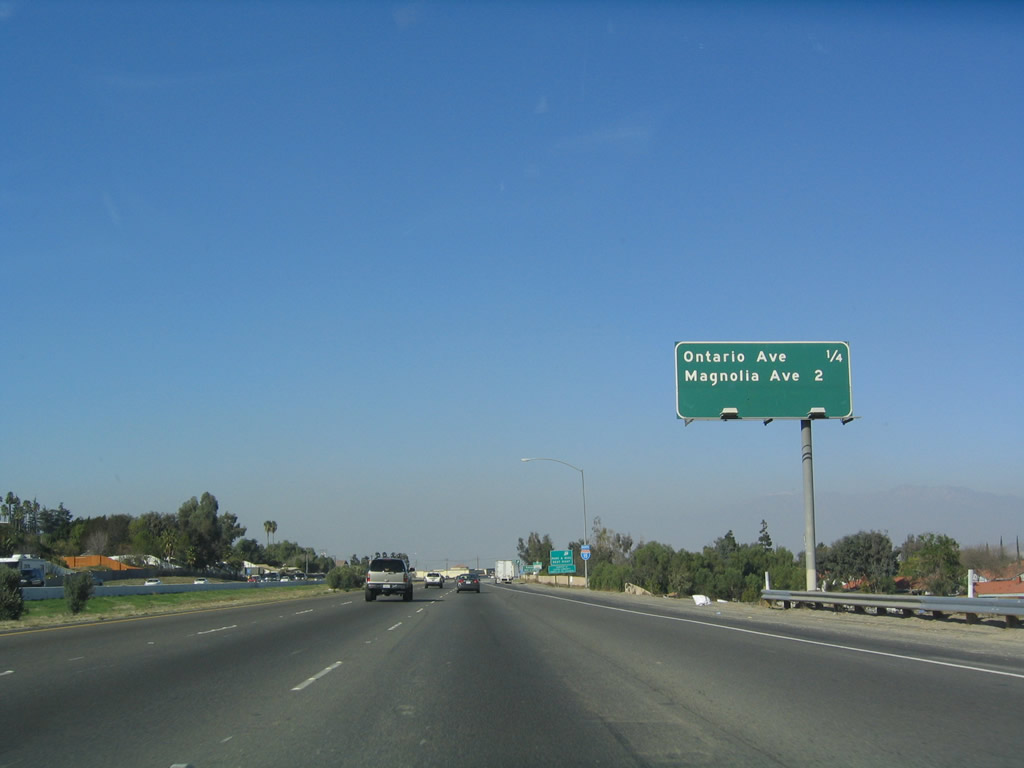
Another mileage sign is posted along northbound Interstate 15 prior to Exit 93, Ontario Avenue. Ontario Avenue follows old California 71 southeast toward Temescal Canyon. The next exit is Exit 95, Magnolia Avenue. Photo taken 01/18/04. |
|
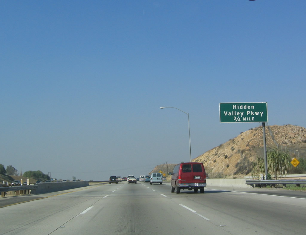
A total of six exits along Interstate 15 serve the city of Corona. Of these six, two (Exits 90 and 91) already passed by. The next four exits also serve the city of Corona: Exit 93, Ontario Avenue; Exit 95, Magnolia Avenue; Exit 96, California 91 (Riverside Freeway); and Exit 97, Hidden Valley Parkway. Photo taken 01/18/04. |
|
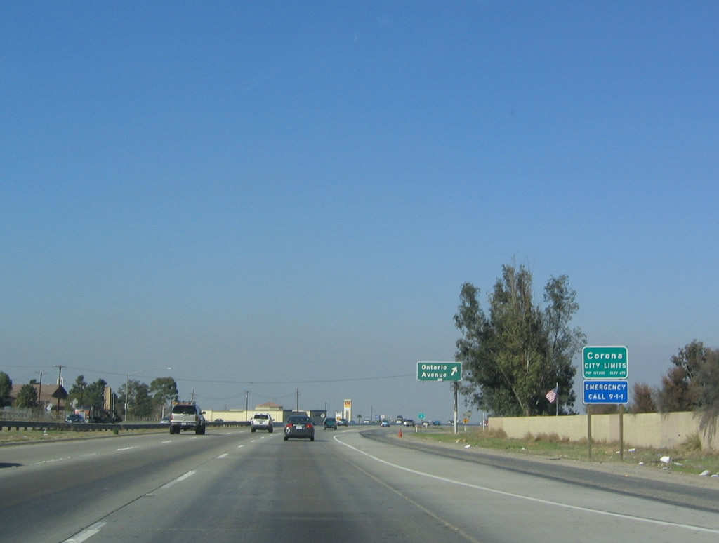
Back in 2004, Interstate 15 used to cross into the city of Corona (the Circle City) at this point, rather than the current location of the entry sign south of here. Back then the sign noted a population of 124,966 people in Corona per the 2000 Census. Upon exiting the canyon, Interstate 15 enters the Inland Empire, which is generally considered to be all the communities within the basin from Corona in the south to San Bernardino in the north and west to Chino Hills/Pomona and east to Moreno Valley. Some describe the Inland Empire as containing more or all of San Bernardino and Riverside Counties, but it is generally a term applied to this populated valley. Photo taken 01/18/04. |
|
Northbound Interstate 15 (Corona Freeway) reaches Exit 93, Ontario Avenue. A fourth lane is added to northbound Interstate 15 for the first time since the Interstate 215 split in Murrieta. Photo taken 01/18/04. |
|
|
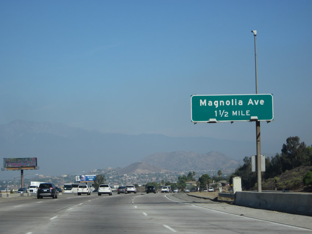
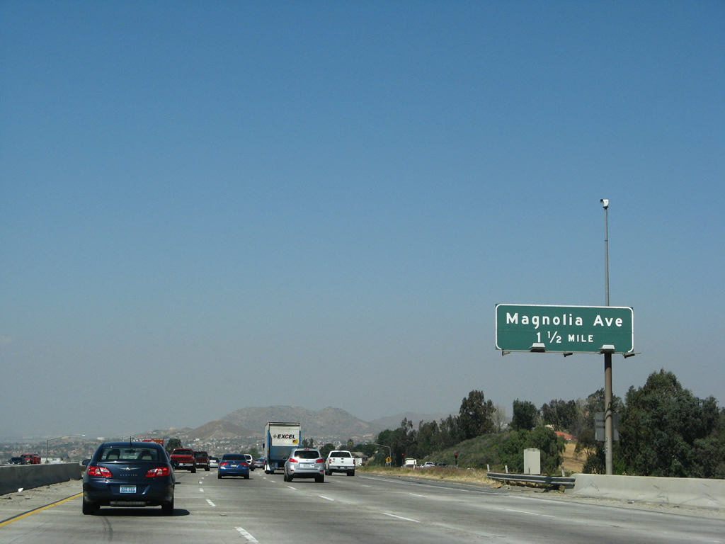
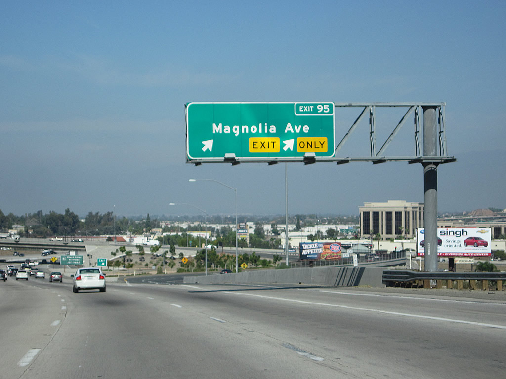
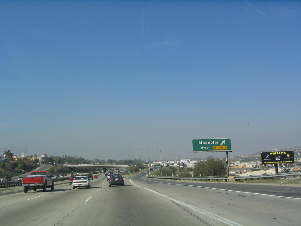
The next exit along Interstate 15 (Corona Freeway) north is Exit 95, Magnolia Avenue. Magnolia Avenue connects to Old U.S. 91, which follows Sixth Street through downtown. The entire downtown is belted by a circular street known as Grand Boulevard. This circle gives Corona the nickname "Circle City." To downtown Corona, turn west on Magnolia Avenue, then turn northwest on Rimpau Avenue, Fullerton Avenue, or Kellogg Avenue. Photos taken 10/13/12 and 01/18/04. |
|
This mileage sign provides the distance to the next two exits, Exit 95, Magnolia Avenue and Exit 96, California 91 (Riverside Freeway). Photo taken 01/28/06. |
|
|
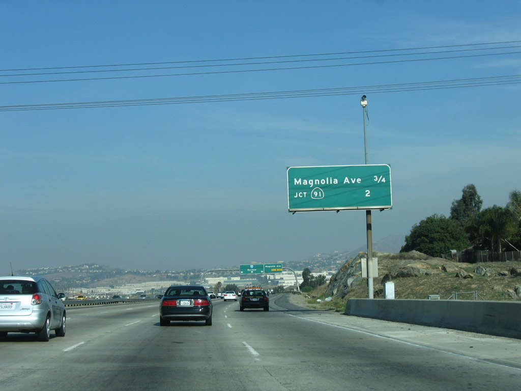
An overhead for Interstate 15 north and Magnolia Avenue is posted shortly thereafter. The right lane becomes exit only for Magnolia Avenue, which connects with Old U.S. 91 en route to Riverside. The section of Magnolia Avenue between California 91 Exit 48 west of downtown Corona to the northeastern end of the freeway in Riverside was known as California 91 Business, but shields for this route were gone by 2005. This overhead sign has seen better days, as noted by the faded Interstate 15 shield mounted on the pull-through sign. Photos taken 10/13/12 and 01/18/04. |
|
|
Northbound Interstate 15 reaches Exit 95, Magnolia Avenue (which connects to old U.S. 91/6th Street). The next exit after Magnolia Avenue is Exit 96, California 91, the Riverside Freeway. Photos taken 10/13/12 and 01/18/04. |
|
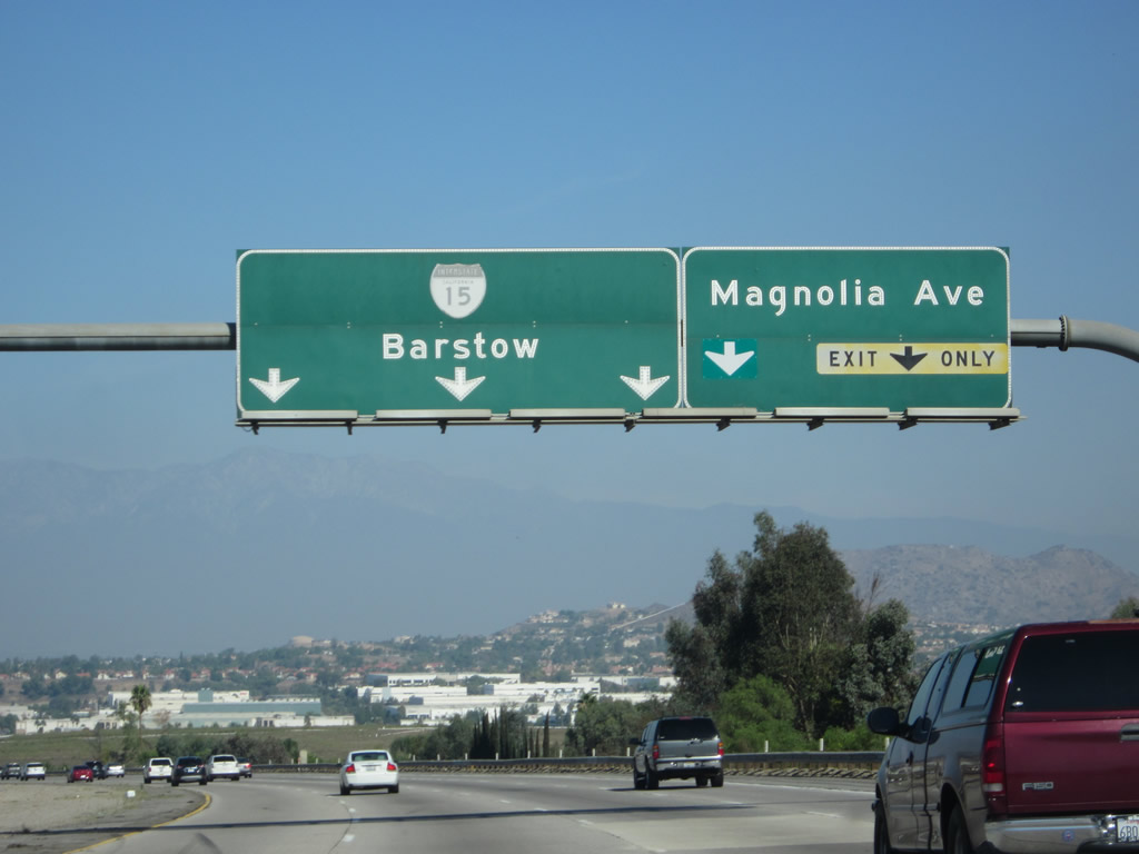
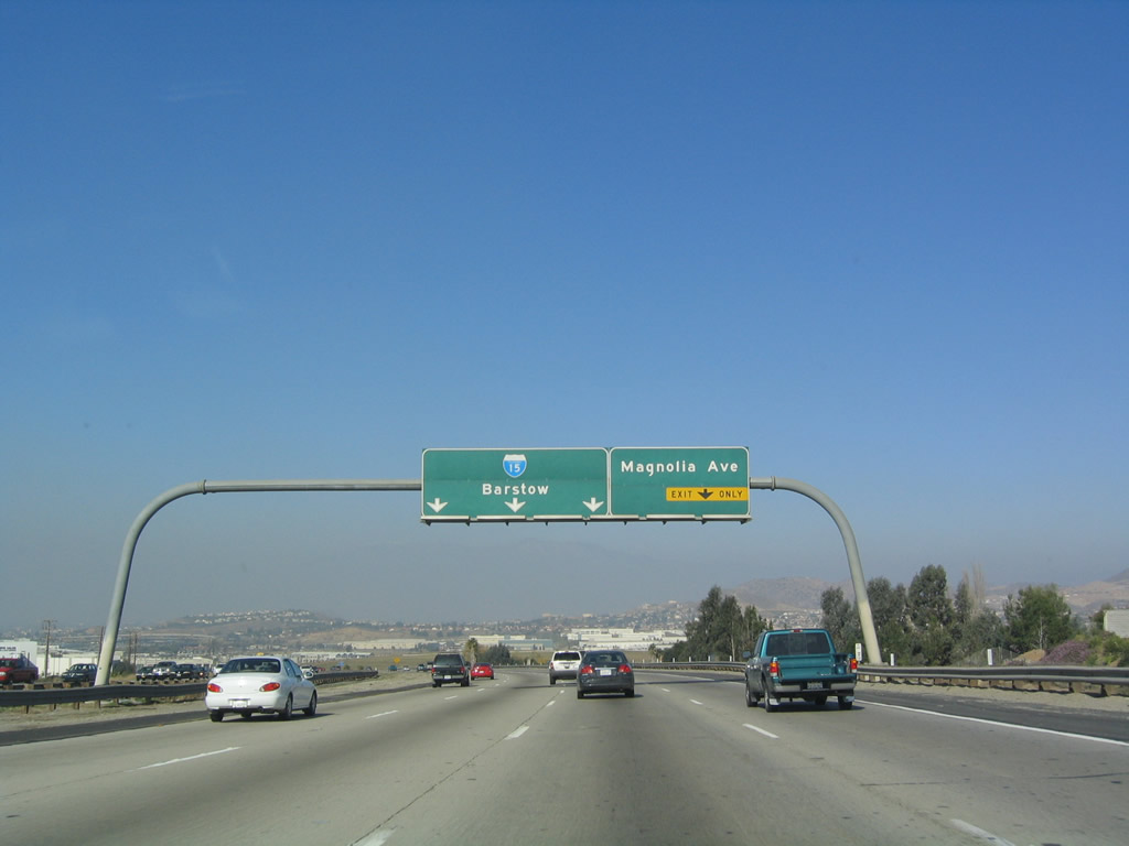
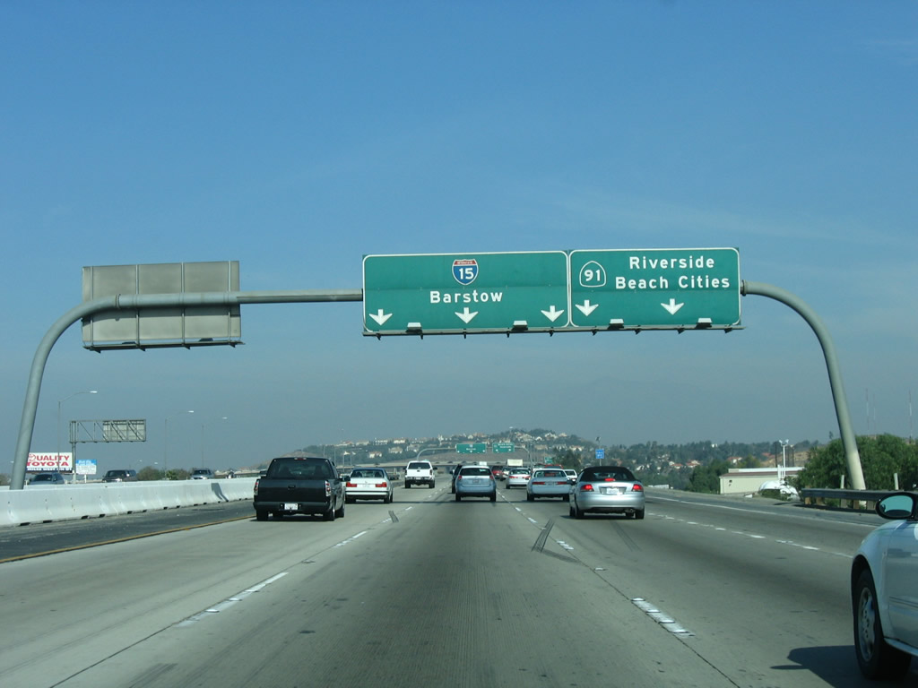
The next exit along northbound is Exit 96, which connects Interstate 15 to California 91, the Riverside Freeway. This roadside sign will soon be gone, as this area is being expanded to increase lane capacity (as of early 2008). The control city for northbound changes again, from Corona/Los Angeles to Barstow. Barstow remains the control city until reaching the Interstate 40 interchange, where it becomes Las Vegas. Photo taken 01/28/06. |
|
Briefly, Interstate 15 has four lanes in each direction as it approaches Exit 96 (California 91 (Riverside Freeway)), but one of those lanes becomes exit only. Interstate 15 will not have four lanes in each direction consistently until reaching the Interstate 15/215 merge and ascending Cajon Summit. Photo taken 01/28/06. |
|
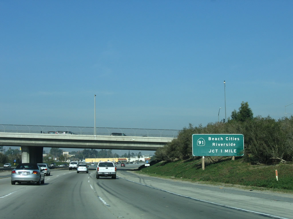
Northbound Interstate 15 approaches Exit 96, California 91. California 91 follows the path of old U.S. 91 as it heads northeast toward Riverside and San Bernardino and southwest toward Orange County and Long Beach. At this point, Interstate 15 follows the old alignment of California 31 (Hammer Avenue), and the old alignment of California 71 turns west along with California 91 until the interchange with California 71 (Chino Valley Freeway) north at California 91's Exit 45. Photo taken 01/18/04. |
|
View of the signage for the transition ramp from northbound Interstate 15 to east/west California 91 as seen from the through lanes. Photo taken 01/18/04. |
|
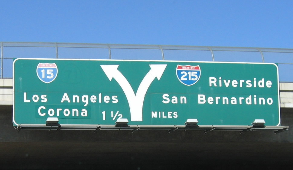
Northbound Interstate 15 passes under the transition ramps to California 91. Interstate 15 forms the second level of this stack interchange; the bottom level is California 91 (Riverside Freeway). At this point, the Corona Freeway designation ends. Interstate 15 is now the Ontario Freeway. Photo taken 01/18/04. |
| Interstate 15 (Ontario Freeway) north |
|
|
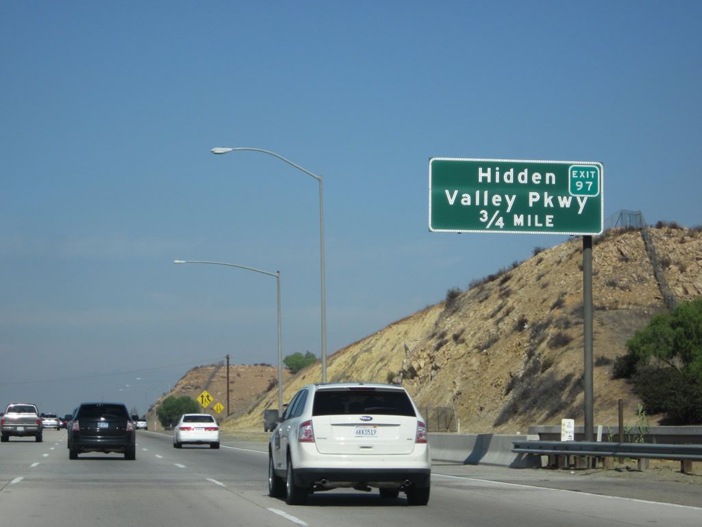
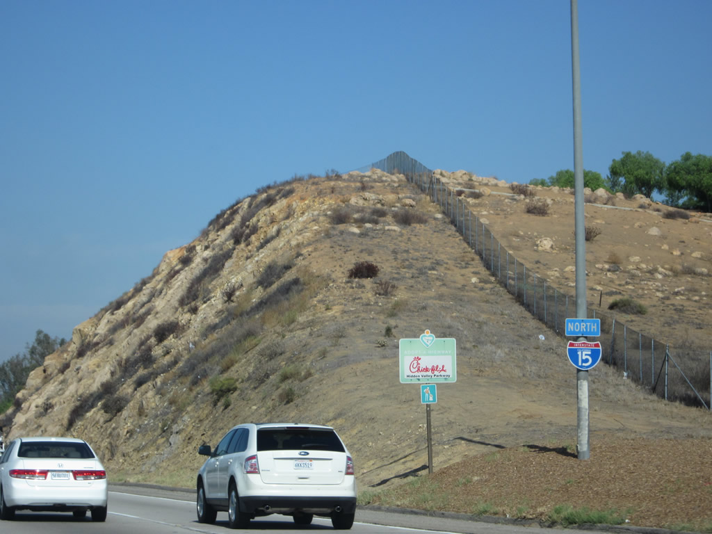
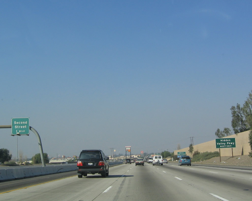
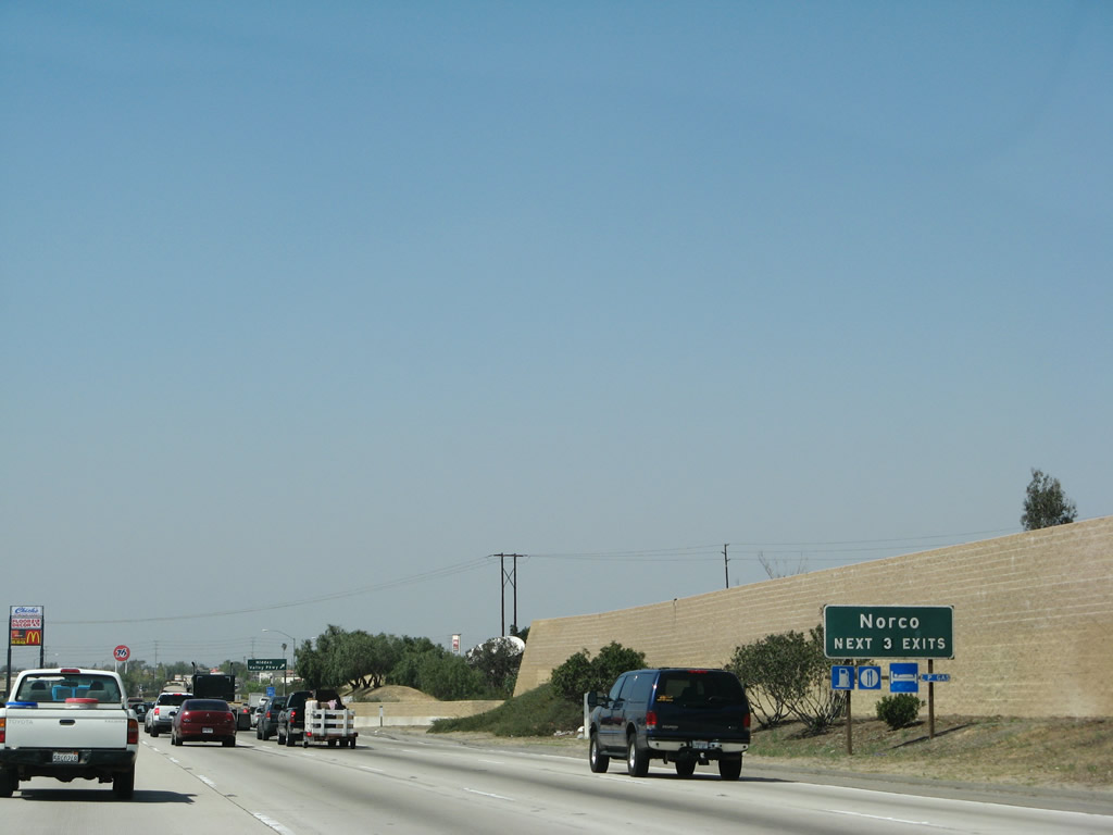
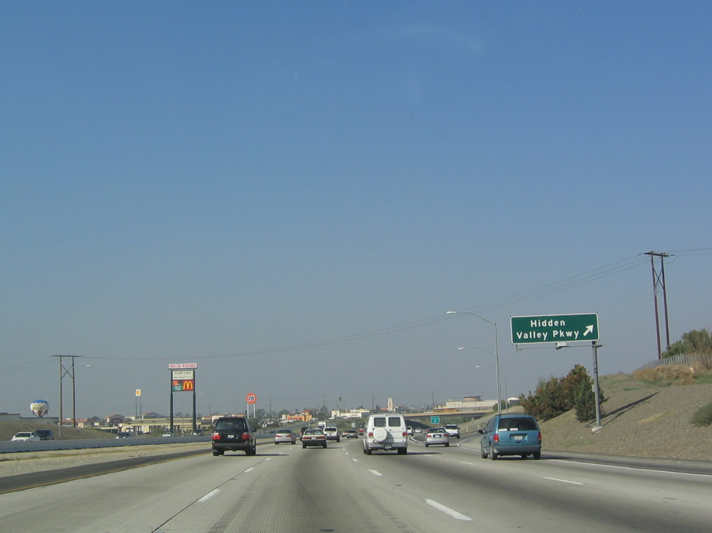
The next exit along Interstate 15 north is Exit 97, Hidden Valley Parkway. This is the last exit to serve Corona and the first exit to serve the city of Norco, which is an abbreviation for "North Corona." The city of Norco is known as "Horse Town USA." Photos taken 10/13/12 and 01/18/04. |
|
An Interstate 15 north reassurance shield is posted after traffic from California 91 joins the northbound freeway. Photo taken 10/13/12. |
|
This sign assembly along northbound Interstate 15 (Ontario Freeway) is a clear example where an overhead sign bridge would function much more efficiently. The roadside sign indicates that the next exit is Exit 97, Hidden Valley Parkway, while the overhead sign for Exit 98, Business Loop I-15/Second Street is mounted so far to the left that it's not really in the immediate motorist line of sight. Photo taken 01/18/04. |
|
The next three exits of Interstate 15 north serve Norco: Exit 97, Hidden Valley Parkway; Exit 98, Business Loop I-15/Second Street; and Exit 100, Business Loop I-15/Sixth Street. Photo taken 01/28/06. |
|
Northbound Interstate 15 reaches Exit 97, Hidden Valley Parkway. The parkway leads southeast toward Corona and Home Gardens, with a connection to old California 91 (Magnolia Avenue) via McKinley Street. Photo taken 01/18/04. |
|
The city of Norco had a population of 24,157 as of the 2000 Census and consists of 14.4 square miles. Norco is at a lower elevation (640 feet) than the cities of the Temecula Valley. Photo taken 10/13/12. |
|
The next exit along Interstate 15 (Ontario Freeway) north is Exit 98, Business Loop I-15/Second Street. Photo taken 01/18/04. |
|
|
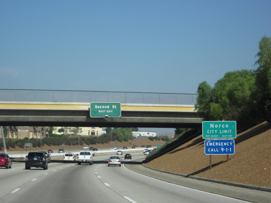
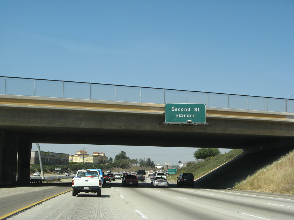
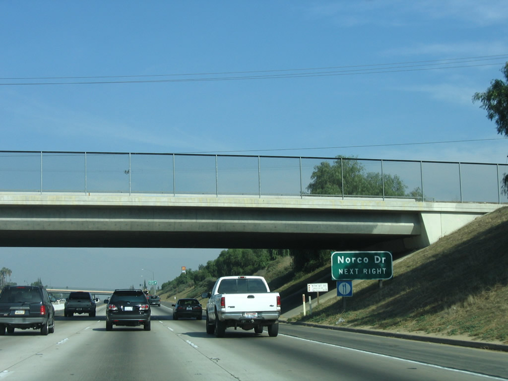
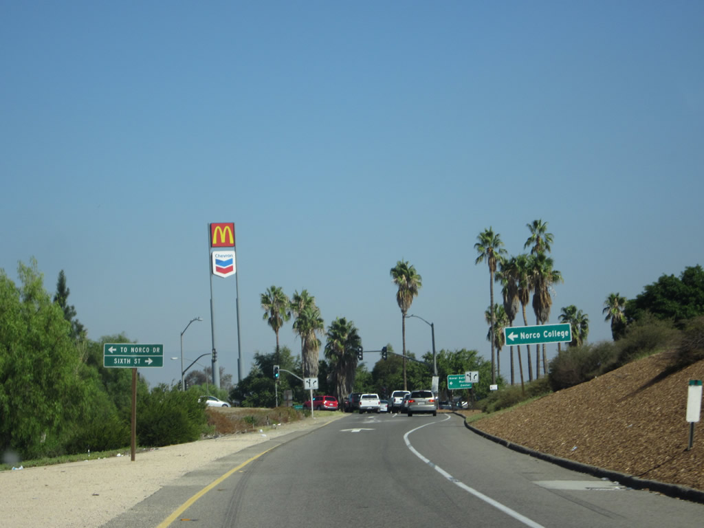
Use Exit 98 for Norco College (formerly the Norco campus of Riverside Community College). Prior to 2003, this sign indicated "Route 15 Business"; this roadside sign was removed in 2003 and replaced with signage for the college. The business loop is inconsistently signed within Norco. The loop follows Second Street west to Hammer Avenue, then Hammer Avenue north to Sixth Street east. Photos taken 10/13/12 and 01/18/04. |
|
Northbound Interstate 15 (Ontario Freeway) reaches Exit 98, Business Loop I-15 north into Norco. Photo taken 10/13/12. |
|
A Business Loop I-15 trailblazer is posted on the off-ramp for Exit 98. Norco is located west of the freeway. Photo taken 08/12/08. |
|
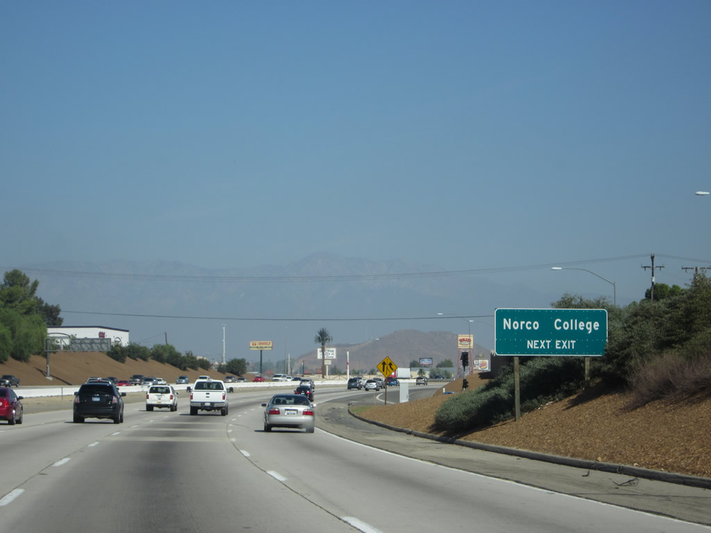
Follow the business route west to Norco College and to all motorist services in Norco. Photo taken 11/10/06. |
|
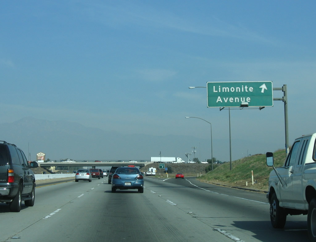
This mileage sign is unusual for its positioning; normally, such signs are located on overhead sign bridges. This particular mileage sign provides the distances to the next two exits: Exit 100, Business Loop I-15 South/6th Street and Exit 103, Limonite Avenue. Photo taken 10/13/12. |
|
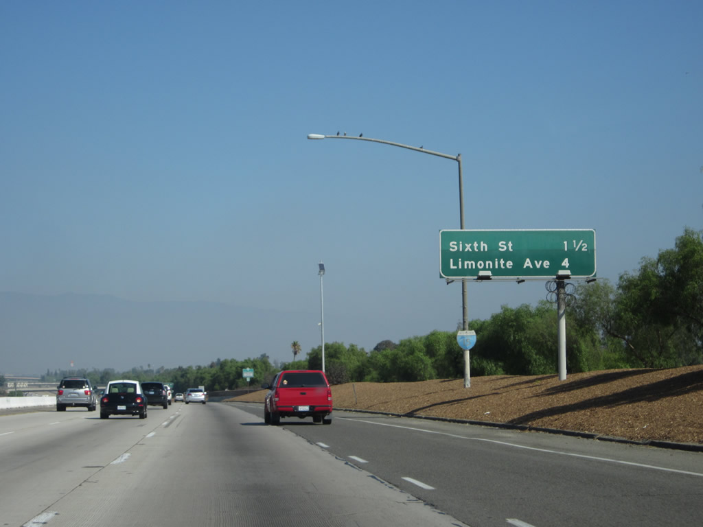
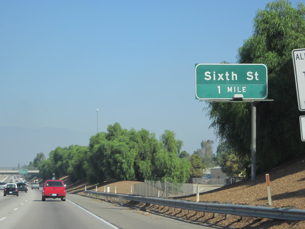
The next exit along northbound is Exit 100, 6th Street west to Business Loop I-15/Hammer Avenue south. The business loop returns to Interstate 15 at Exit 100 after leaving old California 31 in Norco. Photo taken 10/13/12. |
|
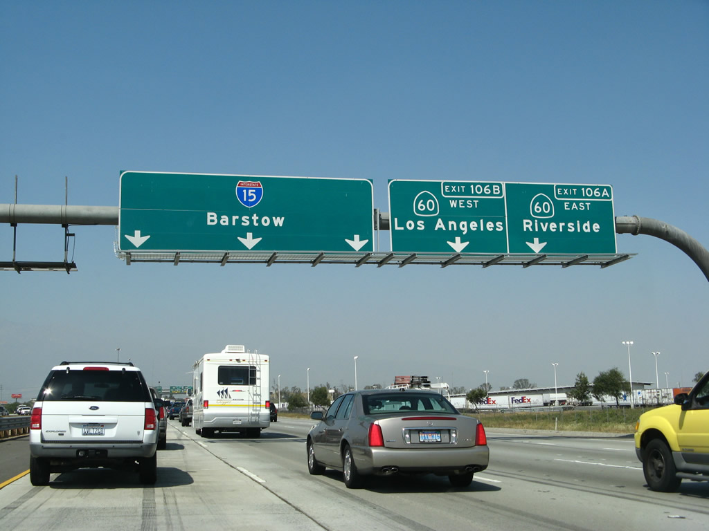
This mileage sign along northbound provides the distance for the next three exits: Exit 100, Sixth Street (Business Loop I-15 south to Norco); Exit 103, Limonite Avenue; and Exit 106, California 60 (Pomona Freeway). Photo taken 01/18/04. |
|
Use Exit 100 to Norco Drive. Photo taken 01/28/06. |
|
Northbound Interstate 15 reaches Exit 100, Business Loop I-15 South/Sixth Street. Sixth Street leads west to Hammer Lane, which carries the business route south through Norco and then back to the freeway via Second Street (Exit 98). Photo taken 01/18/04. |
|
Departing the freeway at Exit 100, we find food and gas services right at the interchange. Turn left for Business Loop I-15 south and Sixth Street/Norco Drive west. Turn right for Sixth Street east. Photo taken 10/13/12. |
|
Returning to the freeway, Interstate 15 leaves Norco and enters the city of Jurupa Valley, which incorporated on July 1, 2011, and includes portions of several formerly unincorporated communities along the Interstate 15 and California 60 corridors including Pedley and Rubidoux. Photo taken 10/13/12. |
|
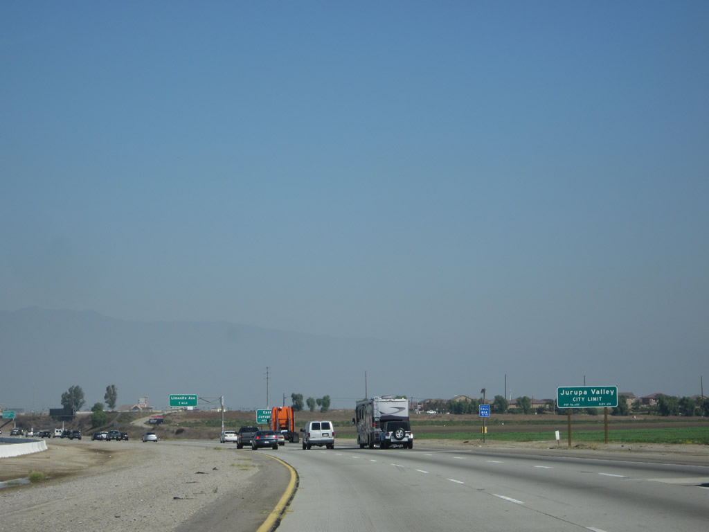
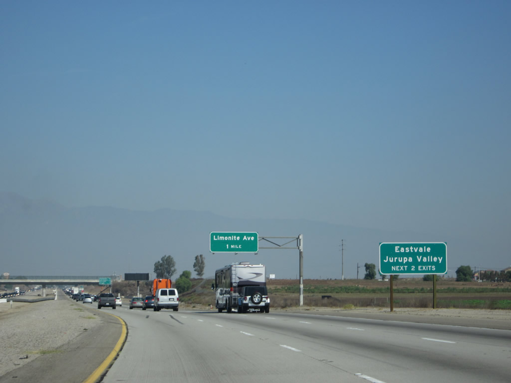
The next two exits (Exit 103 and Exit 105) serve the cities of Eastvale and Jurupa Valley. Photo taken 10/13/12. |
|
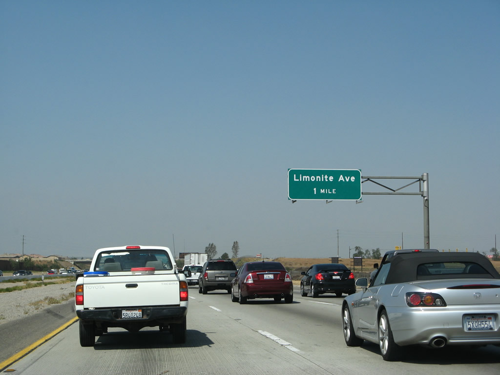
The next exit along Interstate 15 is Exit 103, Limonite Avenue. Photo taken 03/28/08. |
|
|
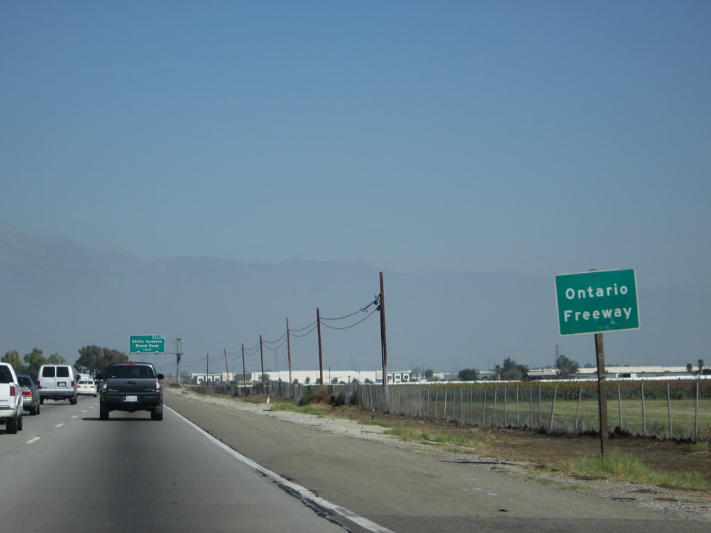
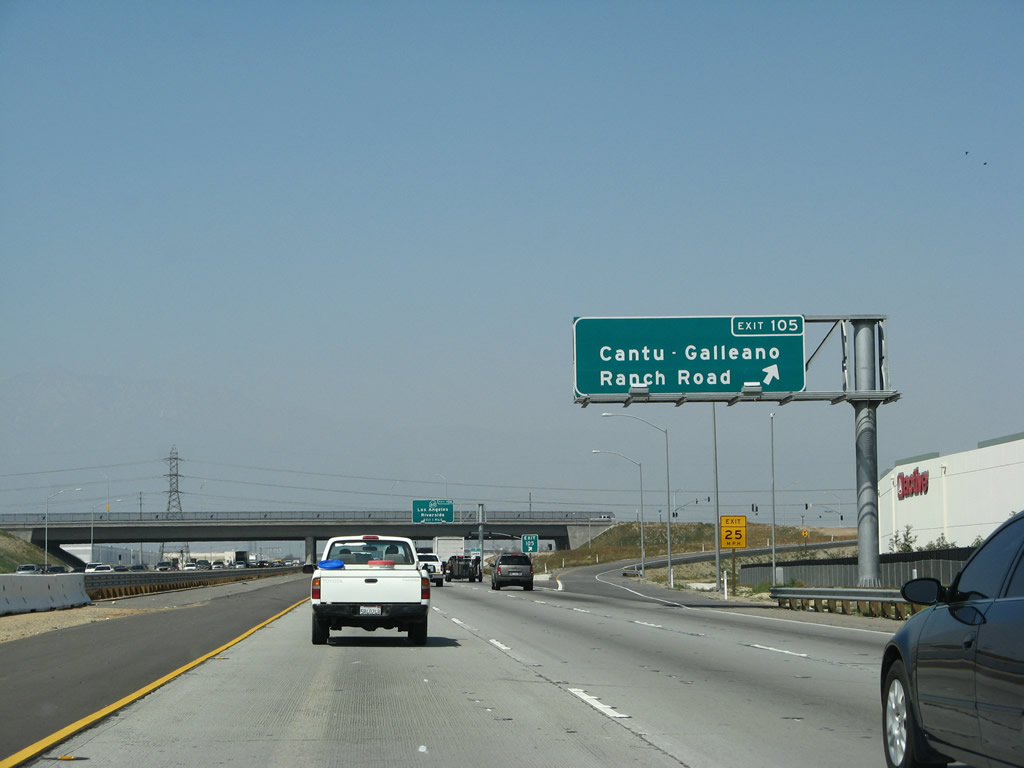
The next three exits along Interstate 15 (Ontario Freeway) are Exit 103, Limonite Avenue; Exit 105, Cantu-Galleano Ranch Road; and Exits 106A-B, California 60 (Pomona Freeway). For as densely populated as the Inland Empire is, there is still plenty of vacant land. Several stretches of Interstate 15 are still agricultural/rural, even between California 91 and California 60 as evidenced in this picture. However, this is changing. Exit 105 was added in 2008, and additional development is possible at any new freeway interchange. Also note this new interchange reduces the original spacing of exits along this section of Interstate 15, which is generally more than one every other mile between Norco and Ontario. Photos taken 03/28/08 and 01/18/04. |
|
Northbound Interstate 15 reaches Exit 103, Limonite Avenue. Between Exits 103 and 106B, Interstate 15 is again within unincorporated Riverside County. Limonite Avenue leads east to the city of Jurupa Valley (incorporated March 8, 2011), which includes Pedley and Rubidoux. Heading west, Limonite Avenue changes into Cloverdale Road after passing old California 31/Hammer Avenue. Photo taken 01/28/06. |
|
A small roadside sign advises that this section of Interstate 15 is the Ontario Freeway. Photo taken 03/28/08. |
|
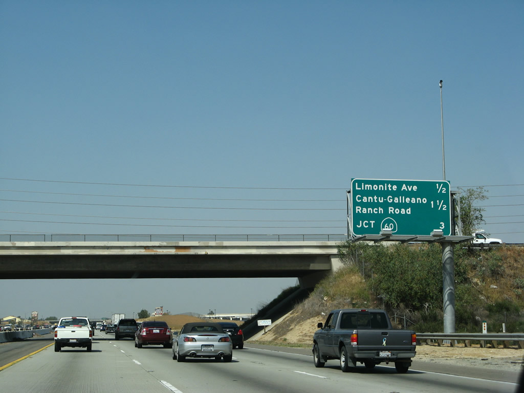
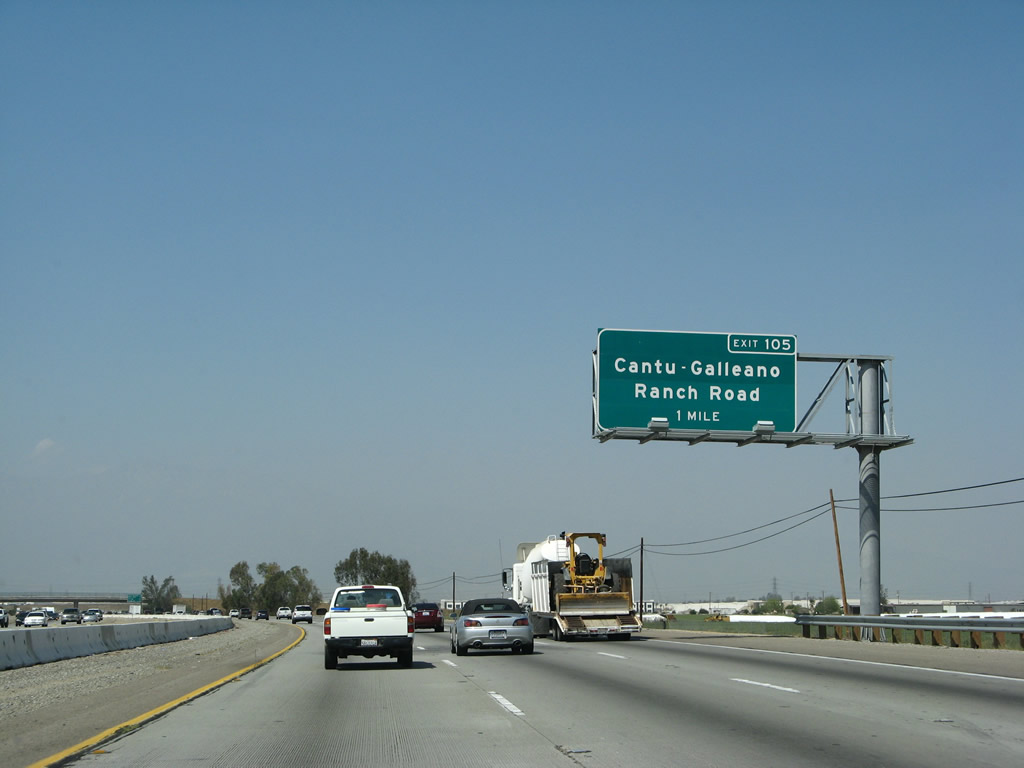
The next exit along Interstate 15 (Ontario Freeway) is Exit 105, Cantu-Galleano Ranch Road; this interchange opened in Fall 2007. Photo taken 03/28/08. |
|
|
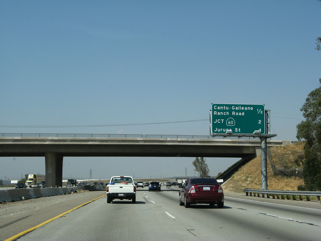
This interchange sequence sign along Interstate 15 (Corona Freeway) north provides the distance to the next three exits: Exit 105, Cantu-Galleano Ranch Road; Exits 106A-B, California 60 (Pomona Freeway); and Exit 108, Jurupa Street. Photo taken 03/28/08. |
|
Northbound Interstate 15 (Ontario Freeway) reaches Exit 105, Cantu-Galleano Ranch Road. Photo taken 03/28/08. |
|
|
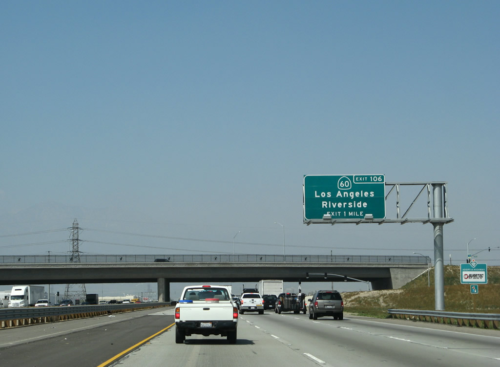
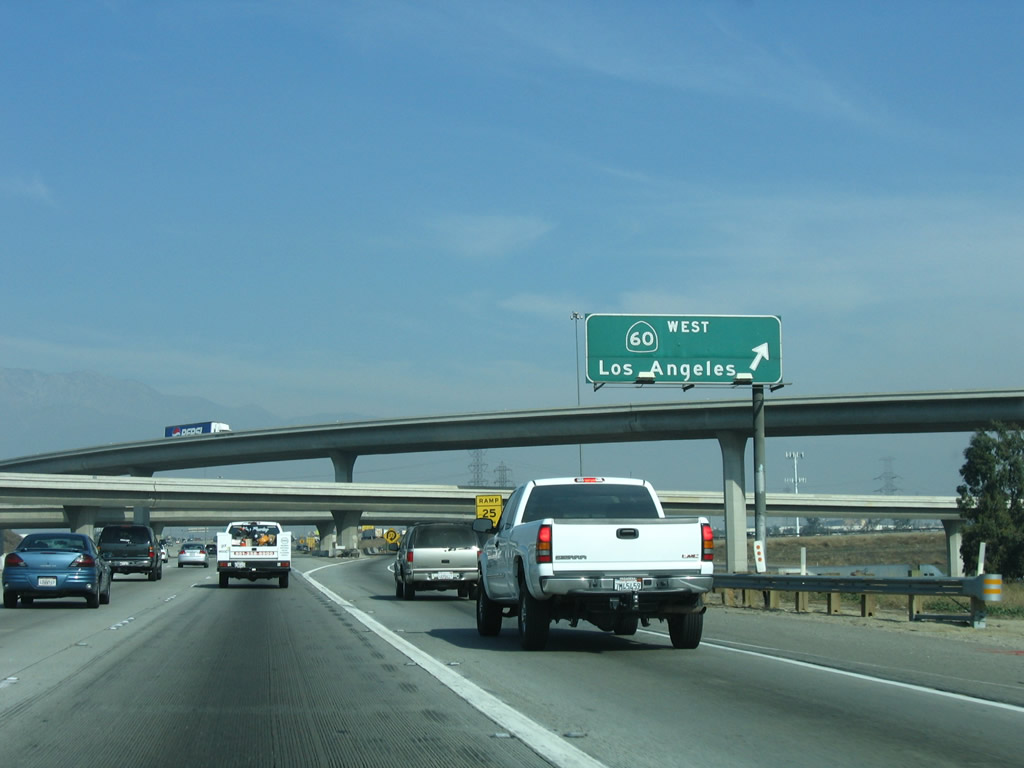
The next exit along Interstate 15 (Ontario Freeway) north is Exit 106, California 60 (Pomona Freeway) east to Riverside and west to Los Angeles. This advance guide sign is posted prior to the Cantu-Galleano Ranch Road overpass; compare to how the area looked before (2004) and after (2008) the interchange was completed. Photos taken 03/28/08 and 01/18/04. |
|
|
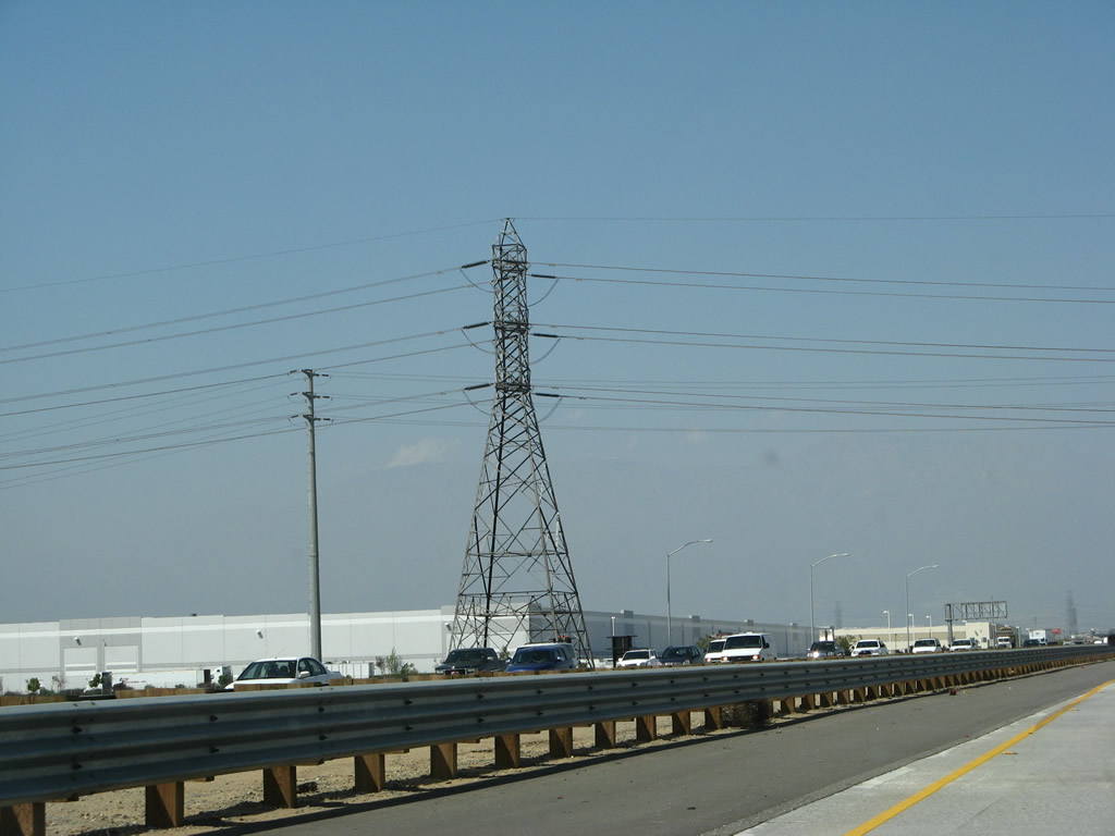
A 230kV Southern California Edison (SCE) power line passes over Interstate 15 after Cantu-Galleano Ranch Road. This land may not remain undeveloped for long now that the interchange is complete. Photos taken 03/28/08. |
|
|
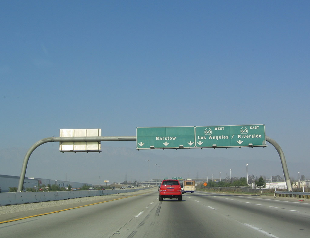
Interstate 15 approaches Exits 106A-B, California 60 Freeway. Use California 60 west to Pomona and Los Angeles and east to Riverside, Moreno Valley, and Beaumont (Interstate 10). Photos taken 03/28/08 and 01/18/04. |
|
|
The right lane departs for Exit 106A, California 60 east to Riverside. The next ramp connects to California 60 west to Pomona and Los Angeles. Add-on plates were installed in late 2007 for the exit numbers. Photos taken 03/28/08 and 01/28/06. |
|
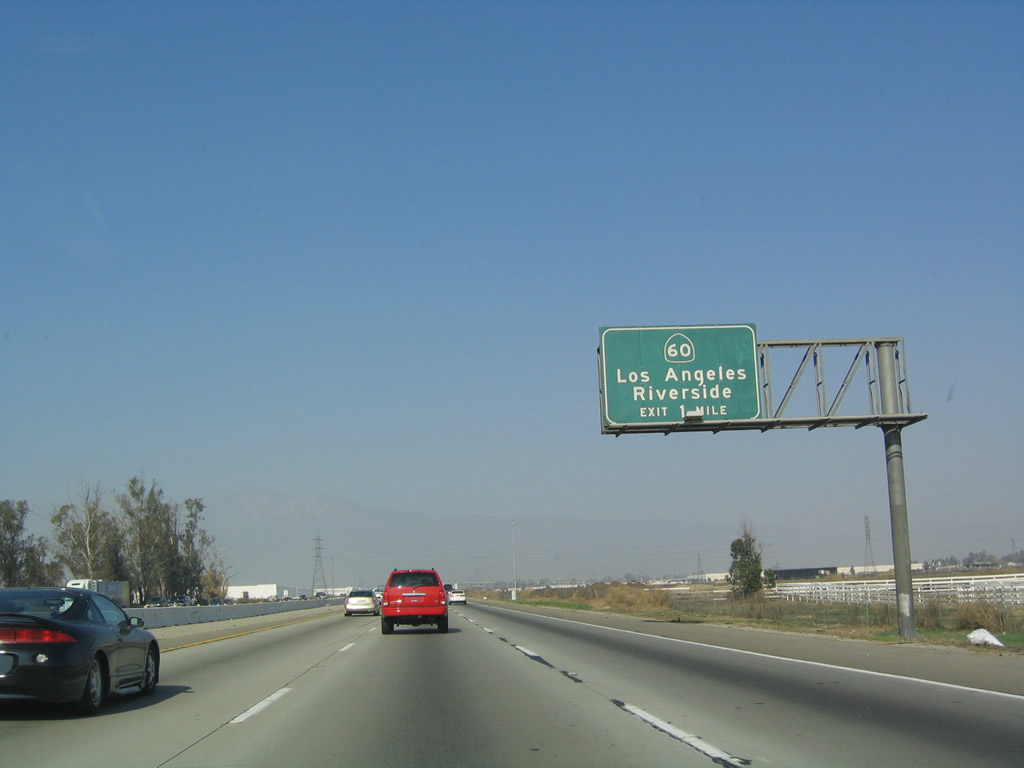
Northbound Interstate 15 reaches Exit 106B, California 60 (Pomona Freeway) west to Pomona and Los Angeles. Note the use of the tall overhead mast lamps, which are relatively uncommon in California (as compared to some other states). This interchange would be a symmetrical stack, aside from the loop ramp connection from Interstate 15 north to California 60 west. Photo taken 01/18/04. |
|
|
Another set of power lines pass over Interstate 15 just prior to the Riverside-San Bernardino County Line. The taller power line is a rare double-circuit 500kV, and the shorter 230kV power line passes underneath. Photos taken 01/18/04 and 03/28/08. |
|
The next exit along northbound is Exit 108, Jurupa Street. This exit is actually located within San Bernardino County, but this sign is located in Riverside County. Photo taken 01/28/06. |
|
|
Interstate 15 leaves Riverside County and enters the city of Ontario in San Bernardino County. The next three exits along Interstate 15 north are: Exit 108, Jurupa Street; Exit 109, Interstate 10 (San Bernardino Freeway); and Exit 110, Fourth Street. Photos taken 01/18/04 and 03/28/08. |
Page Updated January 6, 2013.


