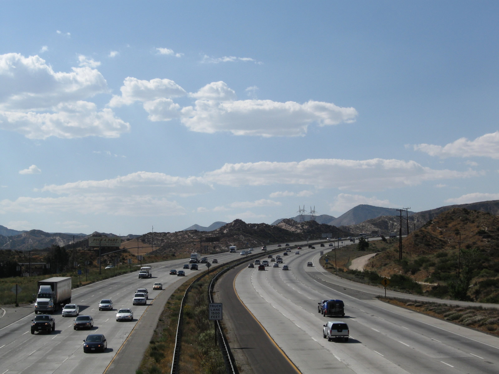
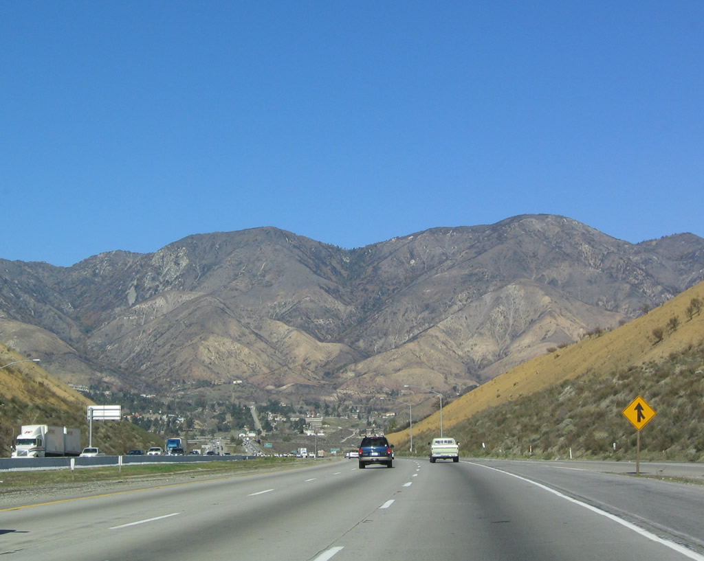
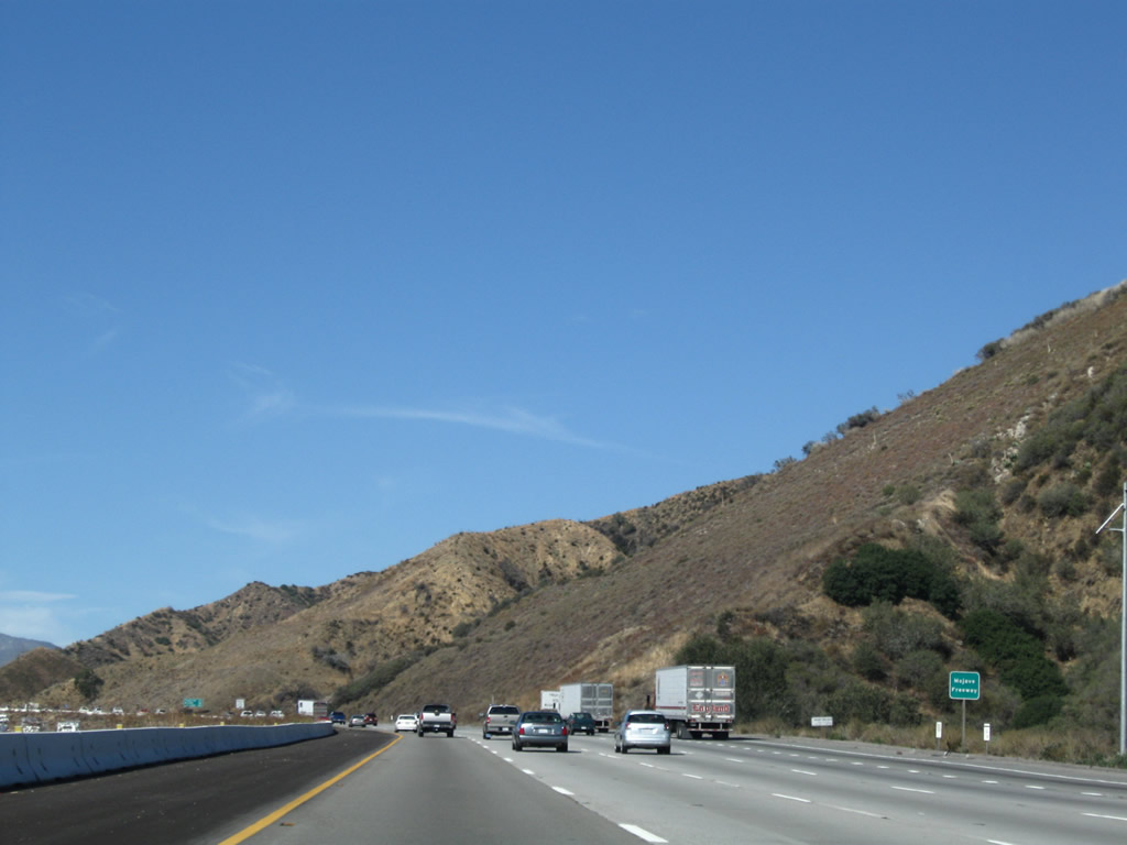
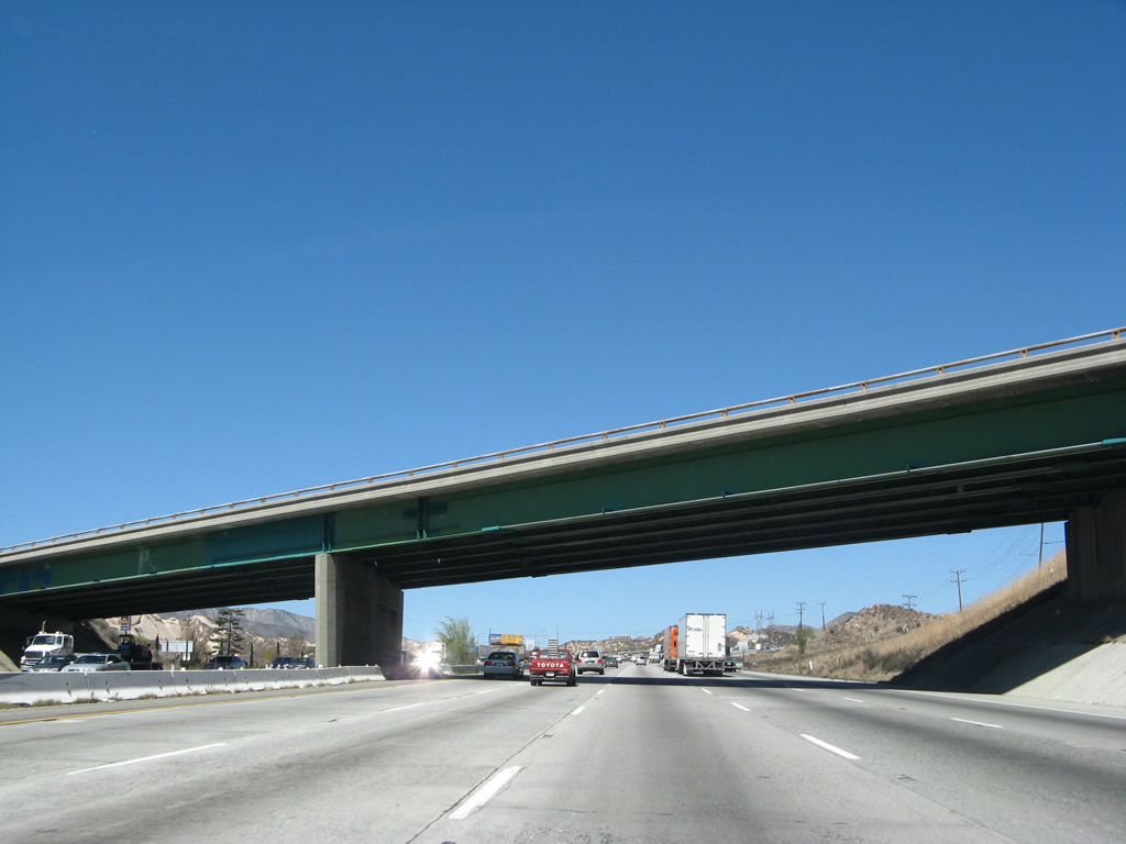
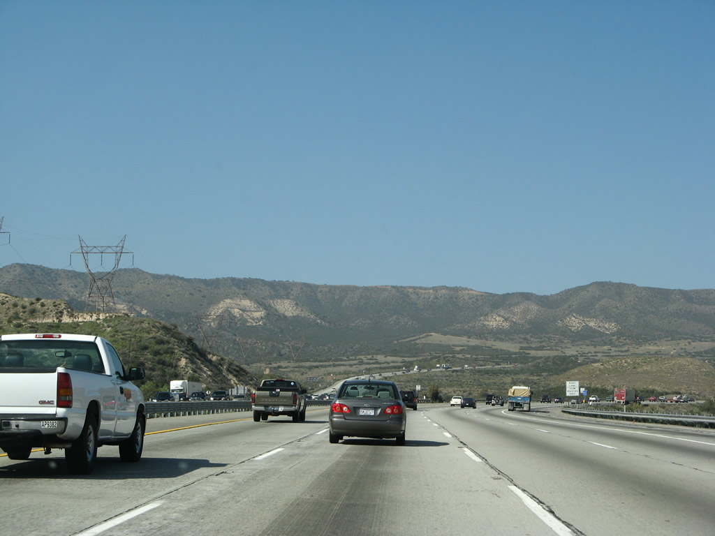
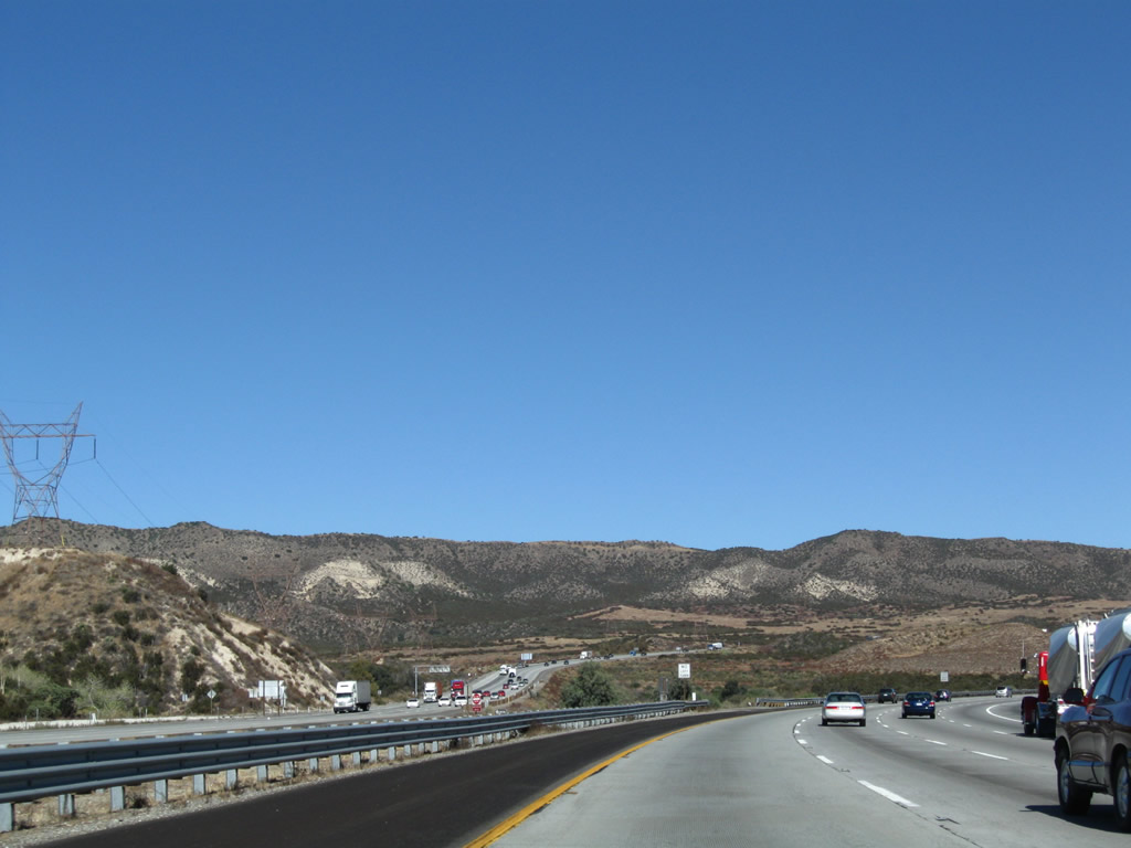
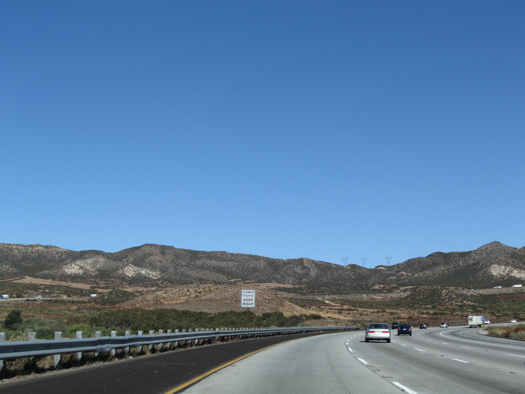
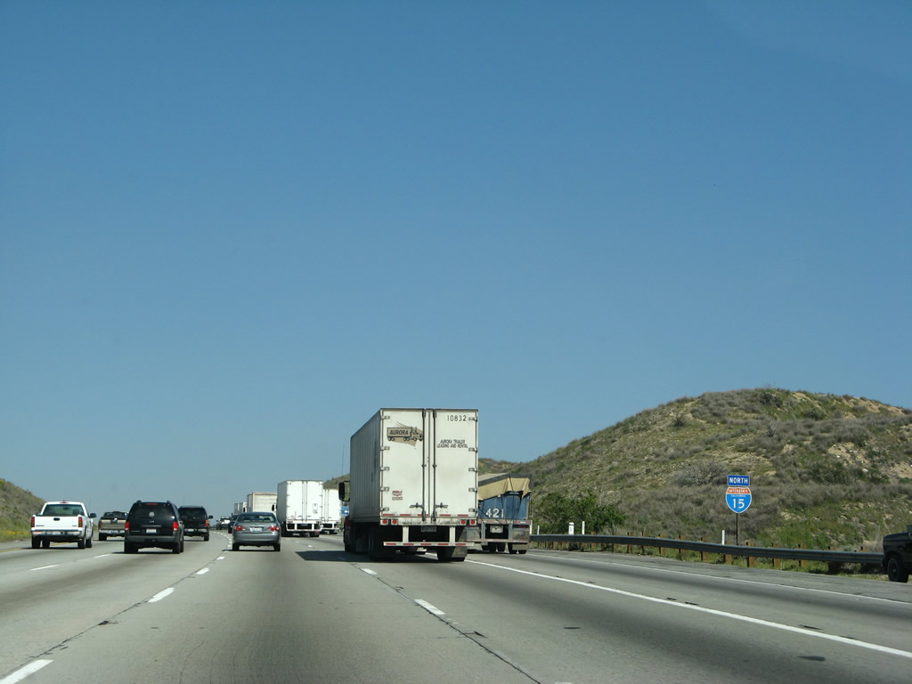
Interstate 15 north proceeds uphill from the exchange with California 138 near Cajon Summit to Hesperia. Photo taken 06/27/09.
| Interstate 15 (Ontario Freeway) north |
|
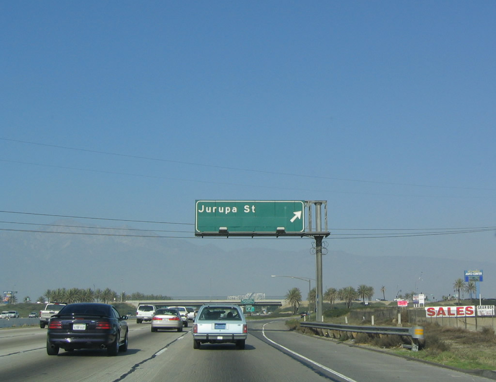
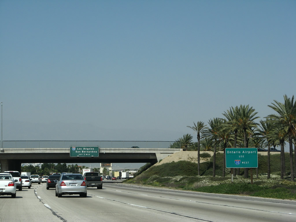
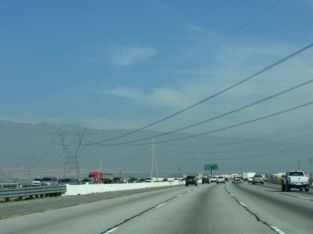
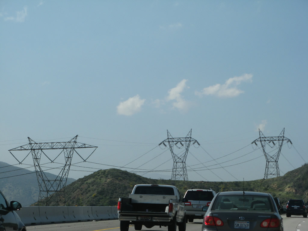
Northbound Interstate 15 reaches Exit 108, Jurupa Street. Jurupa Street leads east into Fontana, where it becomes Jurupa Avenue (consist with Baseline Road, which becomes Baseline Avenue upon entering the city limits of Fontana). Heading west, Jurupa Street enters the city of Ontario, which has a population of 170,373 as of the 2000 Census. The city is known for Ontario Mills, the largest shopping mall in Southern California. Many visitors to Ontario use the regional Ontario International Airport, which has nationwide service and can be a less stressful airport connection for people of the Inland Empire than using Los Angeles International Airport (LAX). Photo taken 01/18/04. |
|
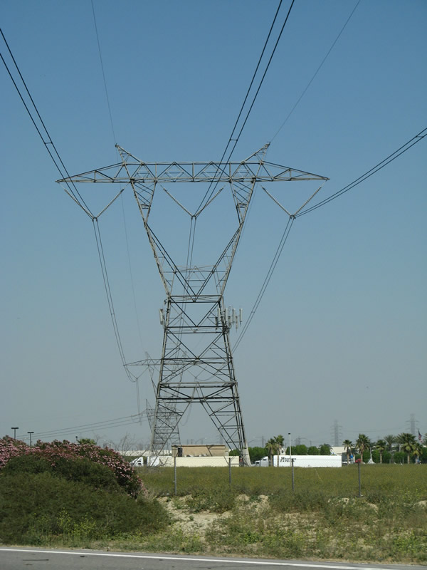
Another 500kV power line crosses Interstate 15 at the Jurupa Street interchange. Photo taken 03/28/08. |
|
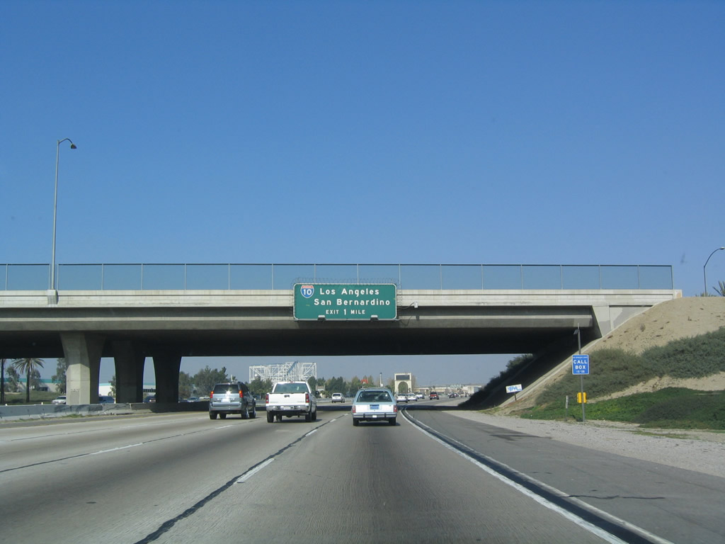
The best route to Ontario International Airport from northbound Interstate 15 (Ontario Freeway) would be via Exit 109, Interstate 10 west. Take Interstate 10 (San Bernardino Freeway) west to Exit 55B, Archibald Avenue south. In addition, downtown Ontario is located on Holt Boulevard (Business Loop I-10/Old U.S. 70-99), and the business route is also accessed via Interstate 10's Exit 55A. Ontario, with its huge population, is one of the largest cities in the Inland Empire and is growing at a rapid pace. With a warm climate (average median temperature is 83 degrees with 16 inches of precipitation annually) and low elevation (925 feet), people are moving in droves to this area. Photo taken 03/28/08. |
|
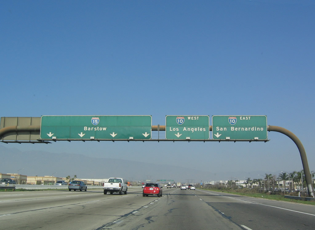
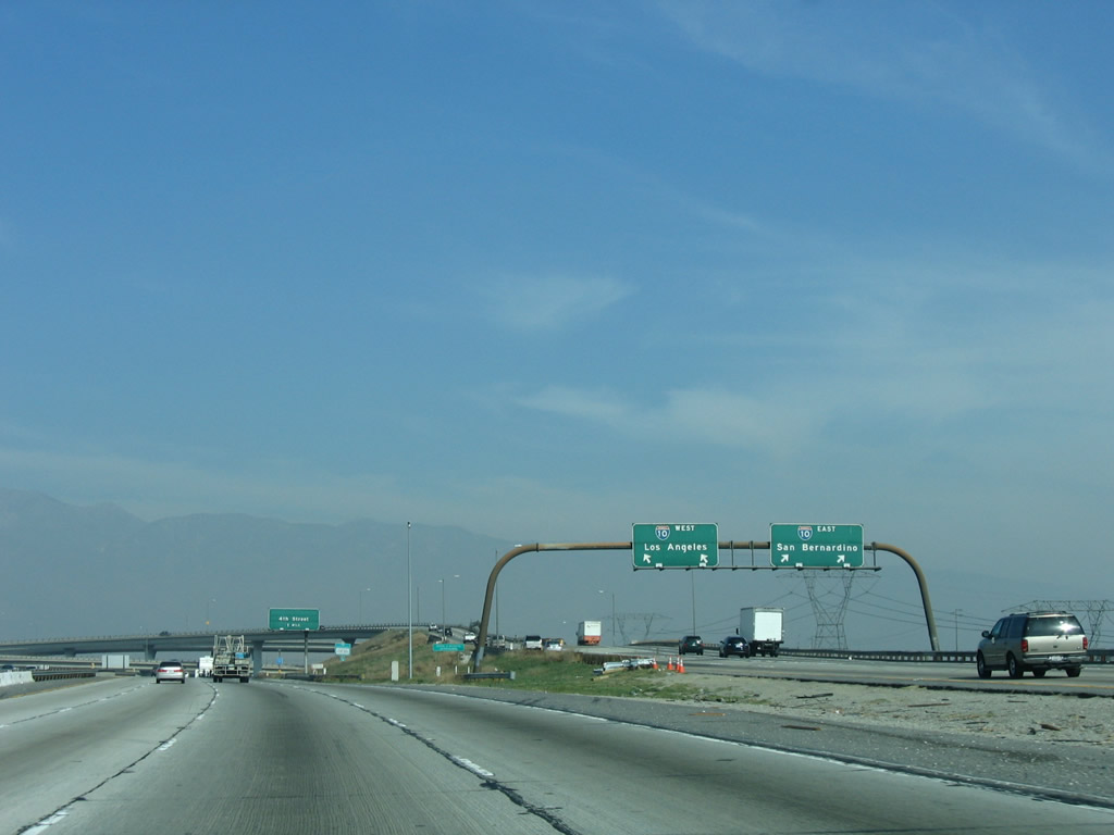
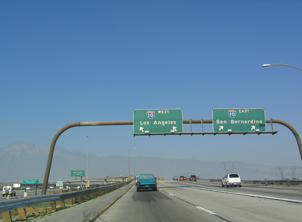
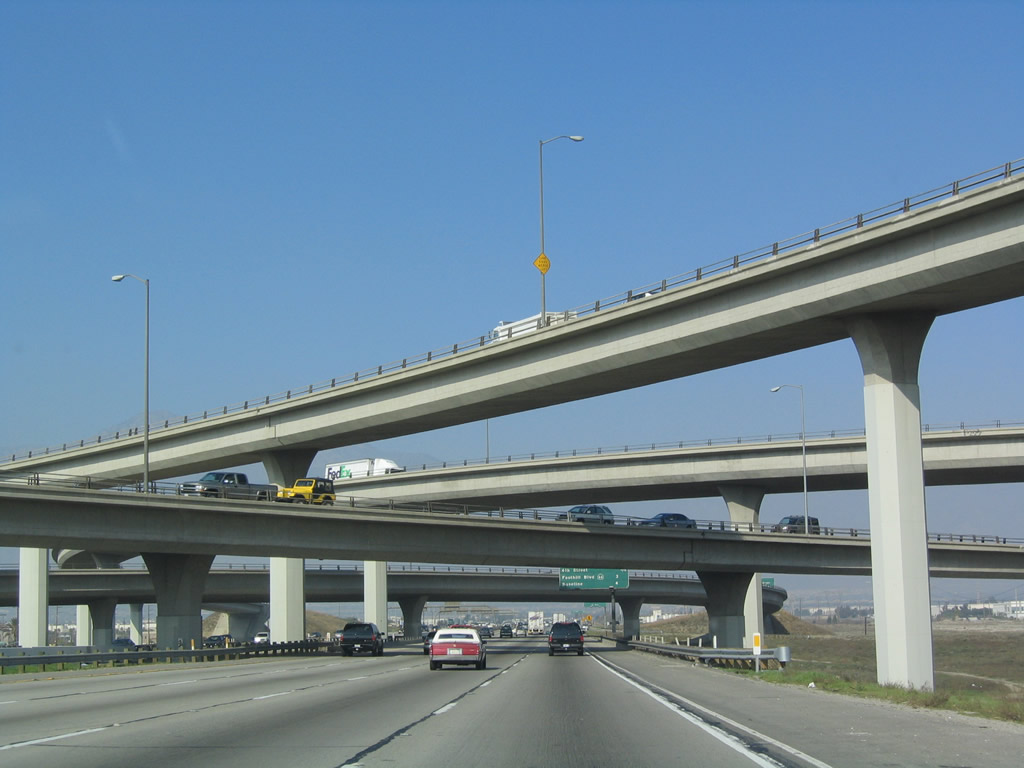
The next exit along northbound Interstate 15 is Exit 109, Interstate 10 (San Bernardino Freeway). This is major interchange that has freeway-speed ramps for all transitions. This symmetrical stack interchange accommodates maximum traffic flow in all directions; even so, it can be overwhelmed with the traffic that flows through the Inland Empire. Photo taken 01/18/04. |
|
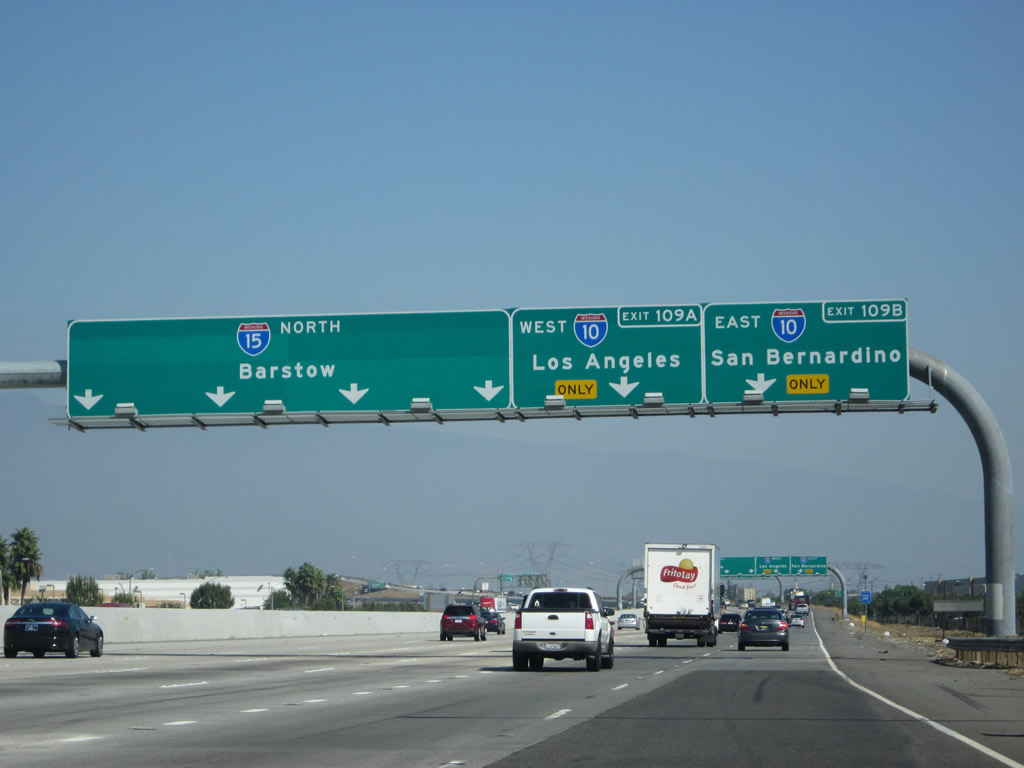
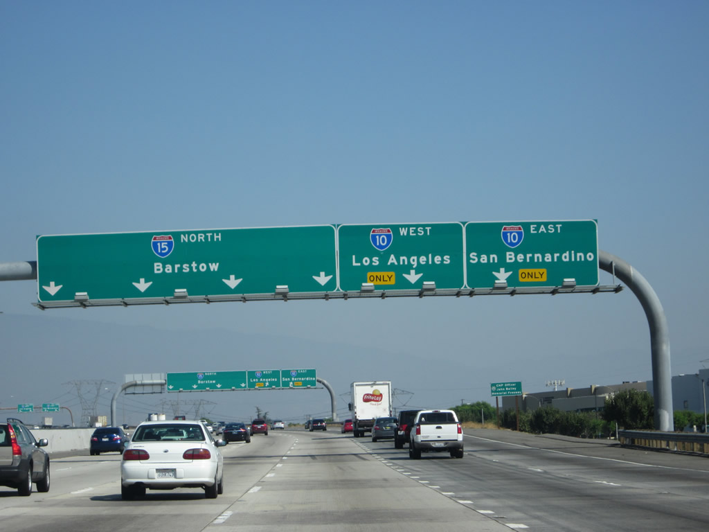
A new set of overhead lane allocation signs are posted for the connection from Interstate 15 to Exits 109A-B, Interstate 10 east/west. Photo taken 10/13/12. |
|
|
Transcontinental Interstate 10 intersects Interstate 15 here in Ontario, one of the larger cities in the Inland Empire. As a major route, Interstate 10 is frequently congested, thus necessitating the use of alternate routes. California 210, which passes through less densely populated areas, is the best alternative, followed by California 60, which is known for its heavy truck traffic. Note the change in signage between 2004 and 2008; however, exit numbers were not placed on these overhead signs. Photos taken 03/28/08 and 01/18/04. |
|
Another new set of overhead lane allocation signs was posted for the connection from Interstate 15 to Exits 109A-B, Interstate 10 east/west by 2012. Photo taken 10/13/12. |
|
|
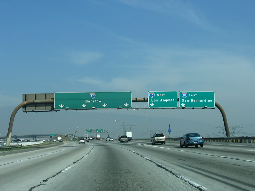
Northbound Interstate 15 meets Exit 109, Interstate 10 (San Bernardino Freeway). Parts of the westbound Interstate 10 sign were damaged and removed; the exit signs were replaced by 2006. Photos taken 01/28/06 and 01/18/04. |
|
|
|
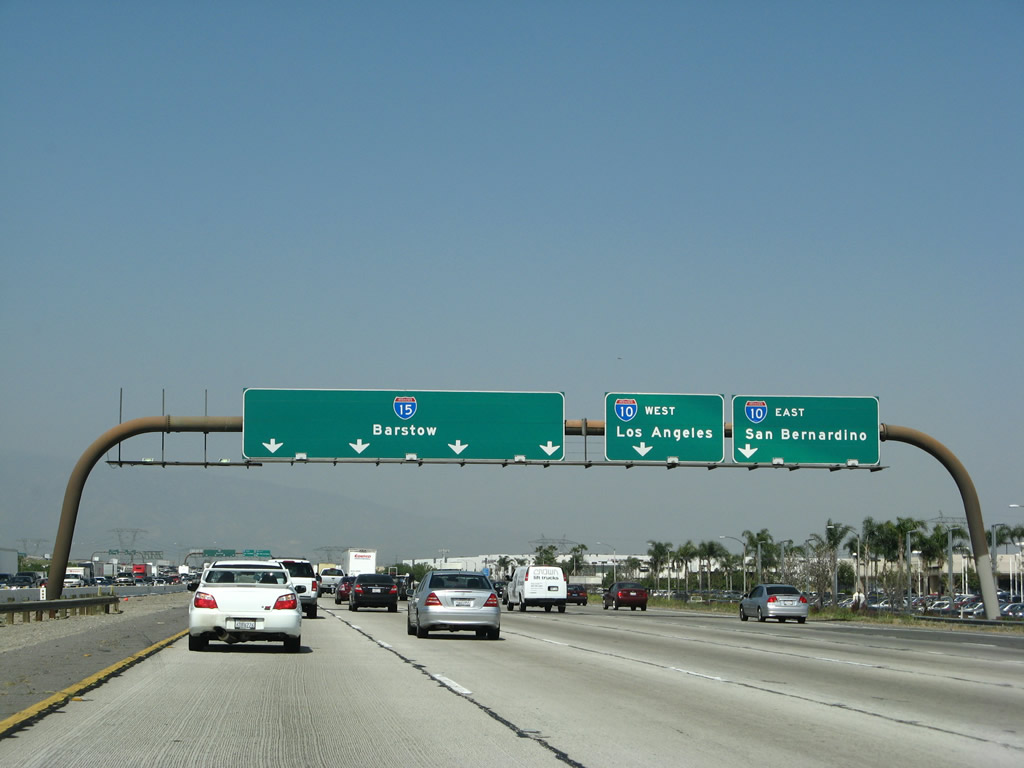
These signs as posted on the transition ramp from Interstate 15 north to Interstate 10 east and west. The 2004 photo shows the signage on the exit ramp, and the 2006 photo shows the same signage from the mainline. Interstate 10 east leads to San Bernardino, Palm Springs, and Indio before reaching Arizona. Interstate 10 west angles toward downtown Los Angeles, culminating in Santa Monica. Photos taken 10/13/12, 01/28/06, and 01/18/04. |
|
|
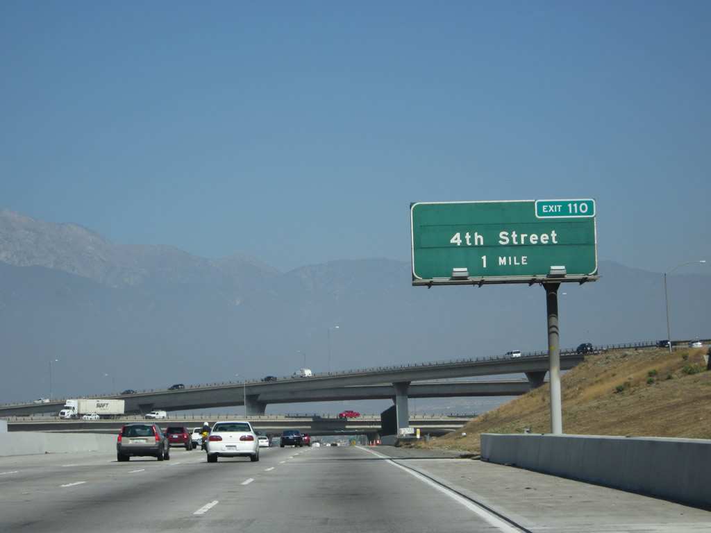
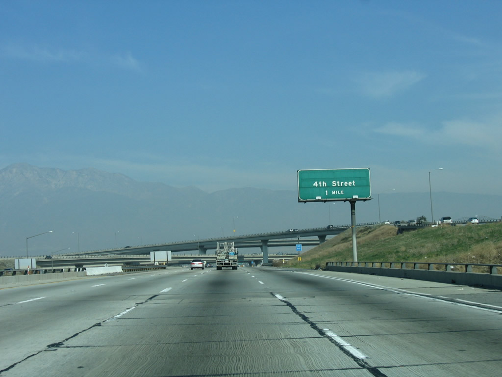
The next exit along northbound Interstate 15 (Ontario Freeway) is Exit 110, 4th Street. Photos taken 10/13/12 and 01/28/06. |
|
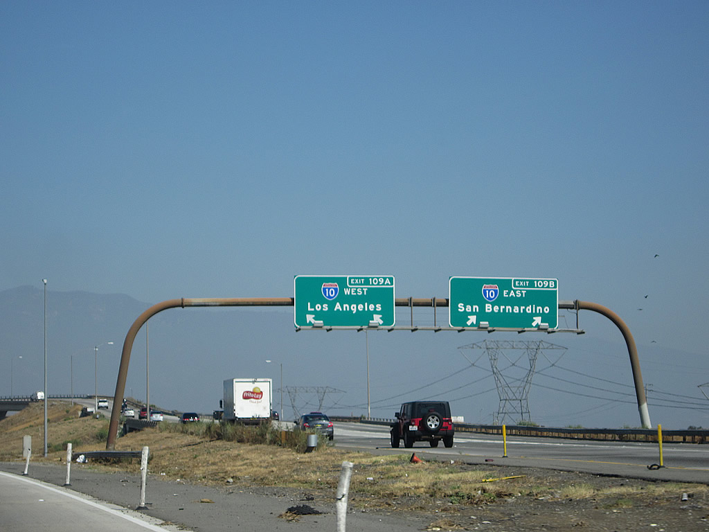
Interstate 15 passes through the symmetrical stack interchange with Interstate 10; this view shows northbound Interstate 15 looking at the flyover ramps. Photo taken 01/18/04. |
|
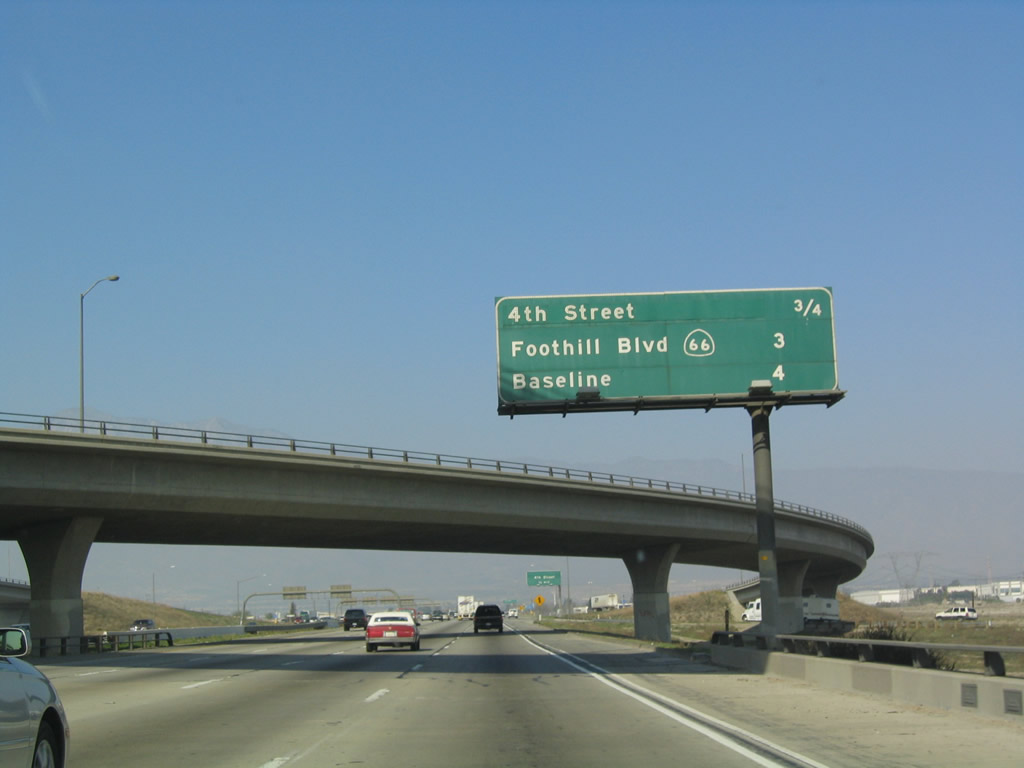
This interchange sequence sign provides the distance to the next three exits along northbound: Exit 110, 4th Street; Exit 112, California 66, Foothill Boulevard; and Exit 113, Baseline Road/Baseline Avenue. Photo taken 01/18/04. |
|
|
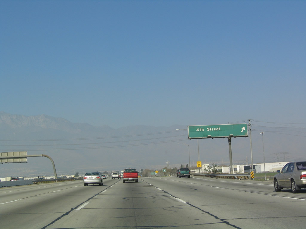
Interstate 15 approaches Exit 110, Fourth Street. This road forms the boundary between the city of Ontario and the city of Rancho Cucamonga. Photos taken 10/13/12 and 01/18/04. |
|
Northbound Interstate 15 reaches Exit 110, Fourth Street. Photo taken 01/18/04. |
|
Interstate 15 leaves the city of Ontario and the city of Rancho Cucamonga, which had a population of 127,743 people as of the 2000 Census and continues to grow rapidly. The city was incorporated on November 30, 1977, and it consists of 37.46 square miles. Photo taken 01/18/04. |
|
An Interstate 15 route marker is posted shortly thereafter. This section of freeway was under construction in 2012. Photo taken 10/13/12. |
|
|
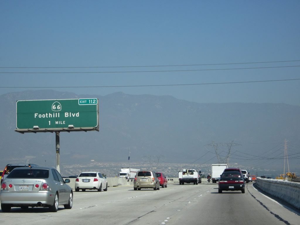
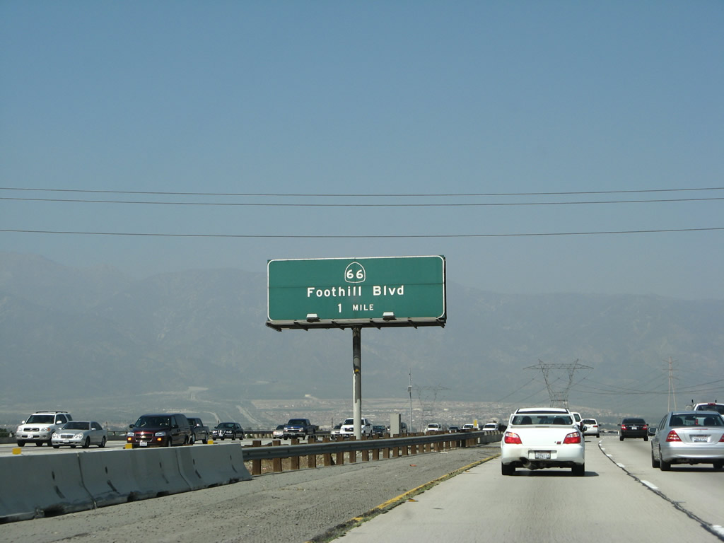
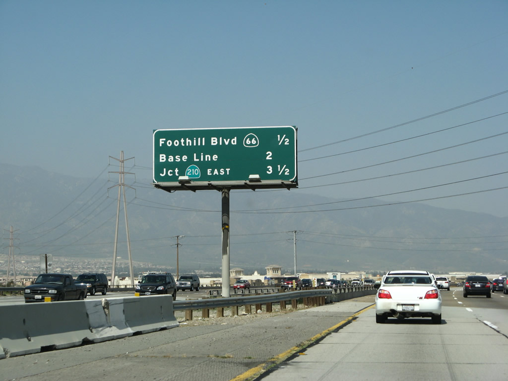
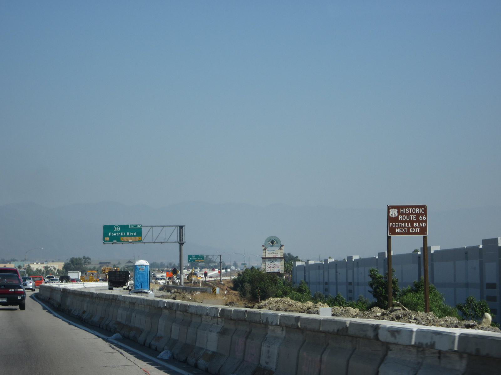
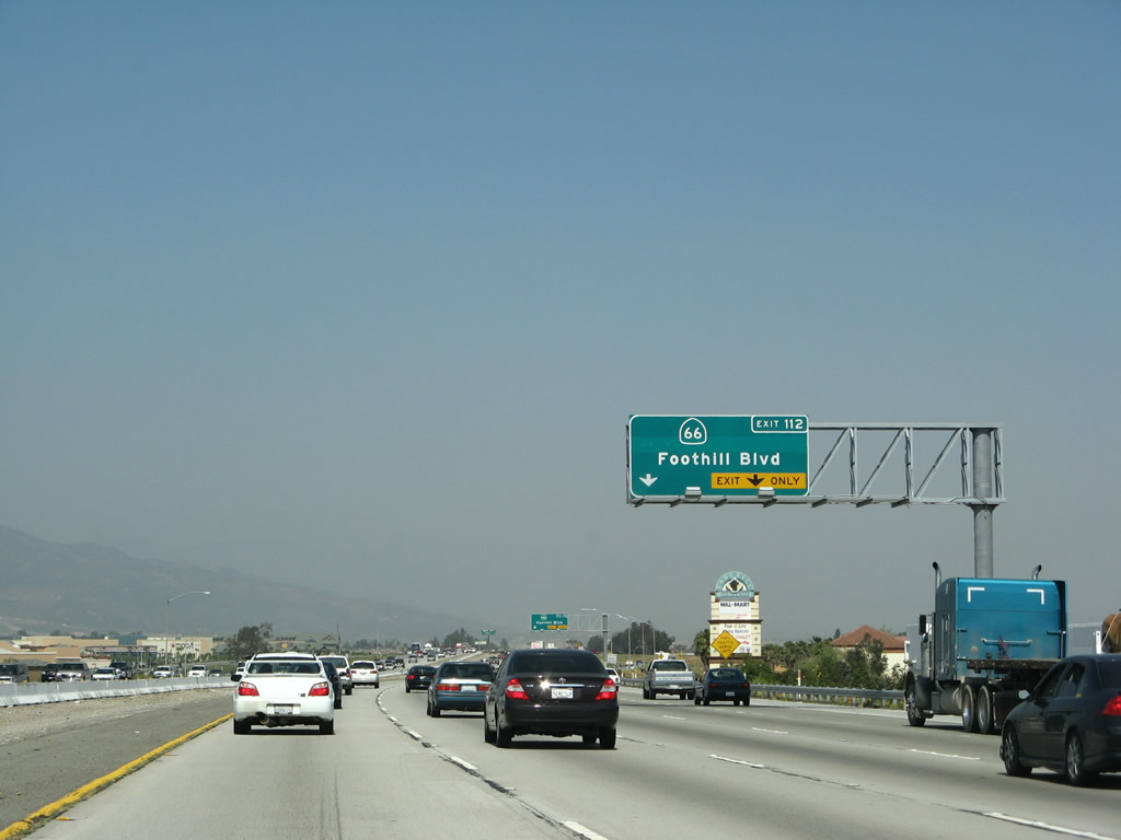
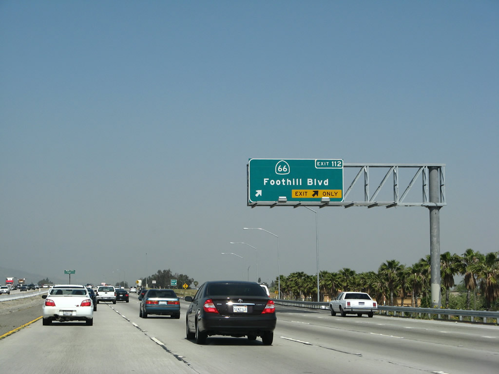
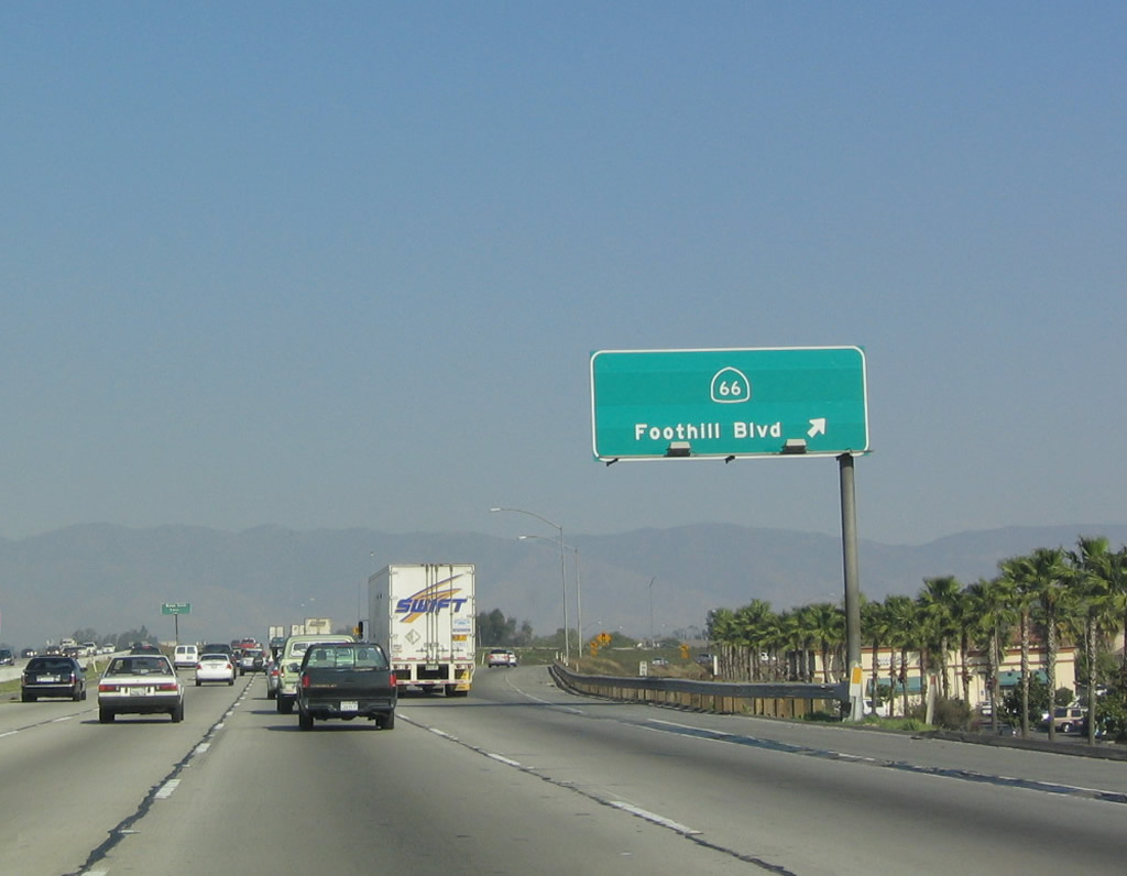
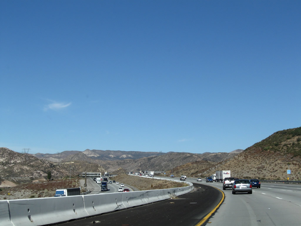
The next exit along Interstate 15 (Ontario Freeway) north is Exit 112, California 66, one mile. This is Historic U.S. 66, which leads east from here to San Bernardino, then turns north along U.S. 395 to rejoin Interstate 15 at Devore (northern terminus of Interstate 215). Photos taken 10/13/12 and 03/28/08. |
|
Another 500kV power line and a 220kV power line (Southern California Edison) pass over Interstate 15 between Exits 110 and 112. Photo taken 01/28/06. |
|
This interchange sequence sign provides the distance to the next three exits along northbound: Exit 112, California 66/Foothill Boulevard in Rancho Cucamonga. California 66 is sometimes shielded as U.S. 66 along this stretch, in memory of its original official designation. Photo taken 03/28/08. |
|
|
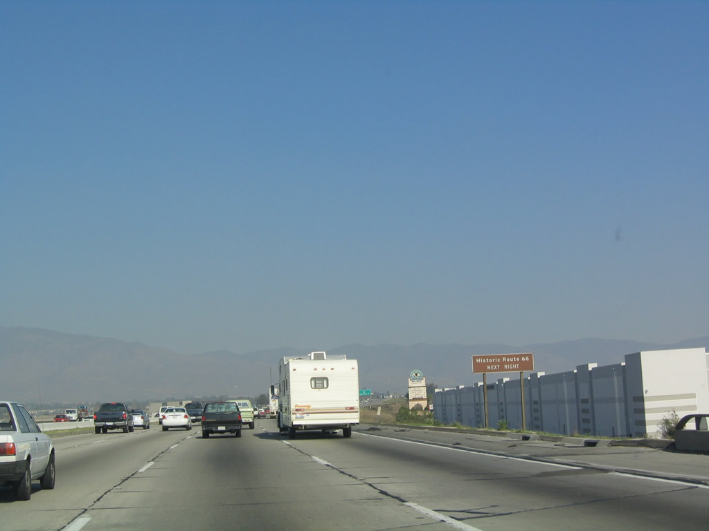
Historic U.S. 66 follows California 66 east and west from Exit 112. From this interchange, the old highway follows California 66 east to Mount Vernon Avenue just west of the Interstate 215 interchange in San Bernardino. Mount Vernon Avenue is old U.S. 66-91-395, and it turns northwest as Cajon Boulevard en route to Devore and Cajon Pass Road. Heading west from here, U.S. 66 follows California 66/Foothill Boulevard all the way into Los Angeles County. Photos taken 10/13/12 and 01/18/04. |
|
The right two lanes connect to Exit 112, California 66/Foothill Boulevard. This sign and additional auxiliary lane were installed around 2007. Photo taken 03/28/08. |
|
|
Northbound Interstate 15 reaches Exit 112, California 66, Foothill Boulevard in Rancho Cucamonga. Photos taken 03/28/08 and 01/18/04. |
|
|
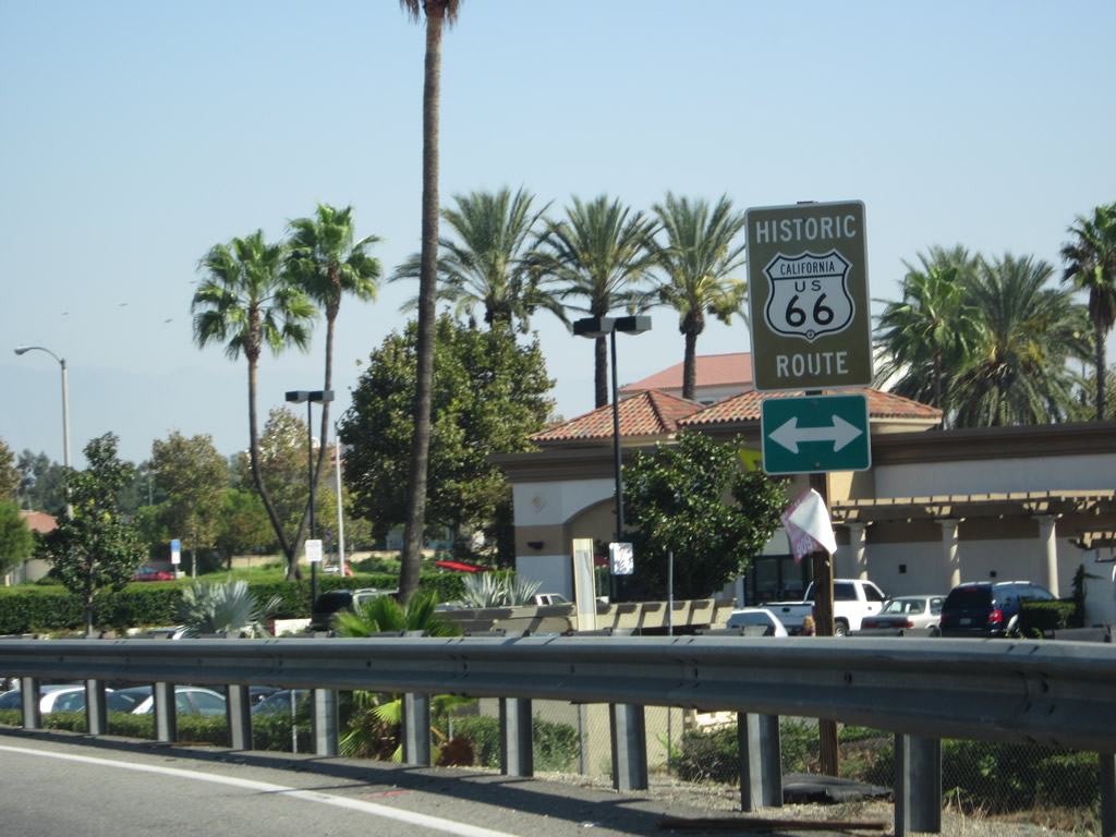
Upon exiting from Interstate 15 north to California 66 (Historic U.S. 66), we see a trailblazer for Historic U.S. Route 66 and a guide sign pointing the way to Rancho Cucamonga via U.S. 66/Foothill Boulevard west. Photos taken 10/13/12. |
|
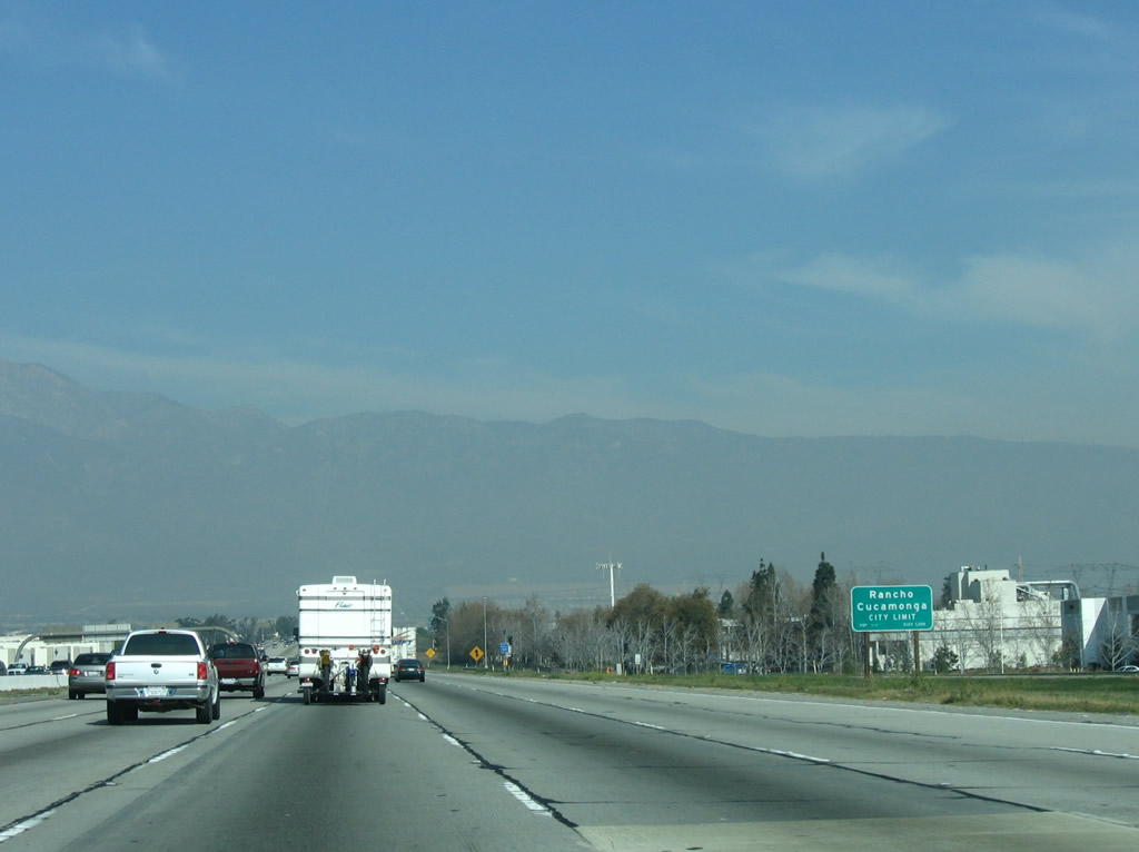
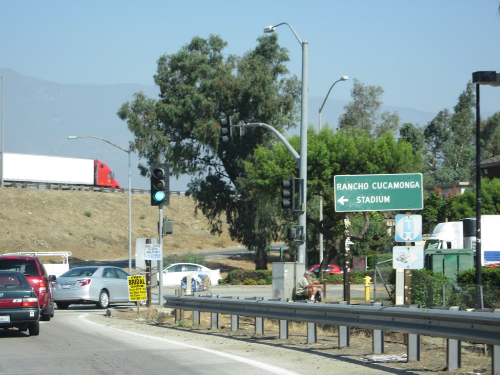
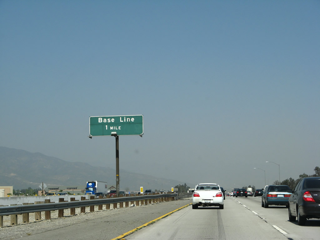
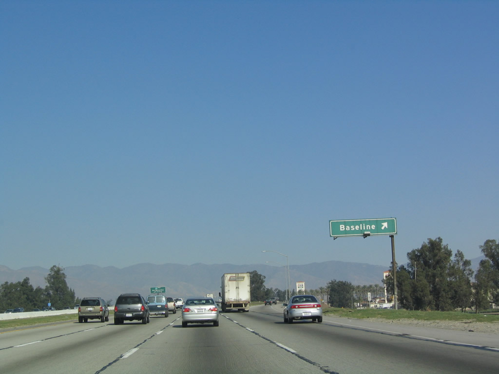
The next exit along Interstate 15 (Ontario Freeway) north is Exit 113, Baseline Road/Baseline Avenue. The city of Fontana is located east of here on Baseline Avenue, and the city of Rancho Cucamonga is located west of here on Baseline Road. Photo taken 03/28/08. |
|
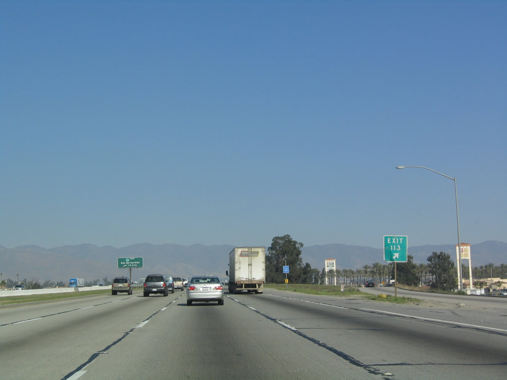
This interchange sequence sign provides the distance to the next three exits along northbound: Exit 113, Baseline Road/Baseline Avenue; Exit 115A, California 210 east; and Exit 115B, California 210 west. The roadside approach sign for Exit 113, Baseline Road/Baseline Avenue includes the exit number and was first installed in 2003 and replaced by 2008. Photo taken 03/28/08. |
|
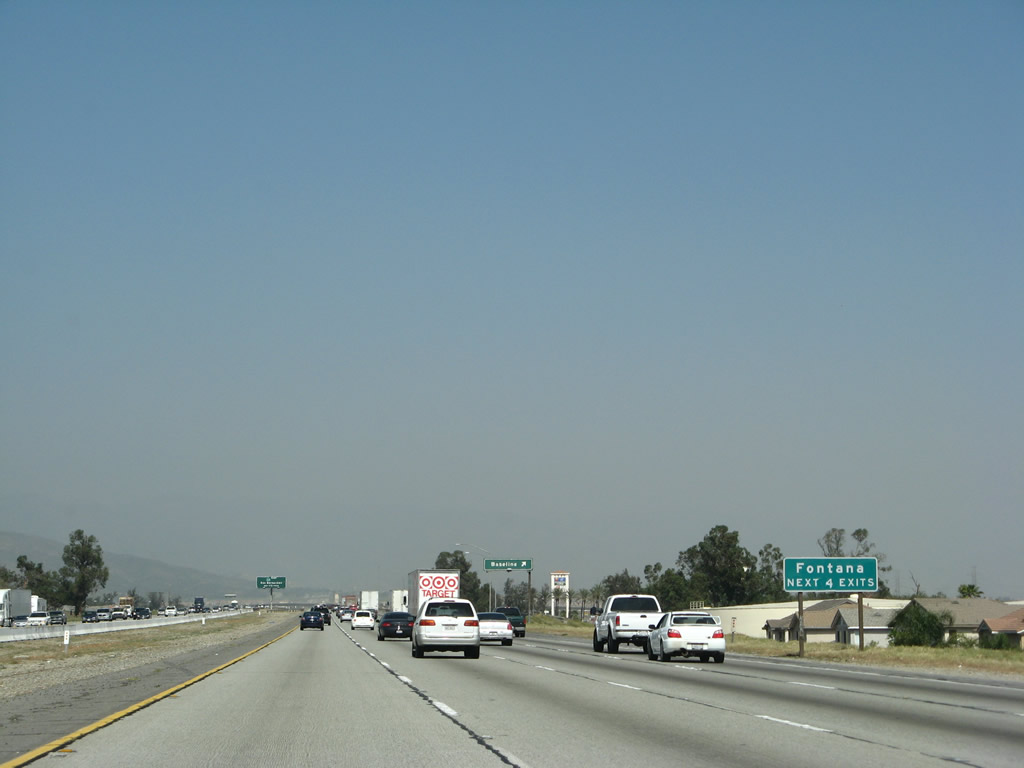
The next four exits all serve the city of Fontana. Founded in 1913 and incorporated on June 25, 1952, Fontana had a population of 128,929 people as of the 2000 Census. Just like Ontario and Rancho Cucamonga, the population of Fontana has increased dramatically throughout the 2000s. Interstate 15 does not enter Fontana until after Exit 116, but any of the next four exits leading east will connect Interstate 15 with Fontana. Photo taken 03/28/08. |
|
Northbound Interstate 15 reaches Exit 113, Baseline Road/Baseline Avenue. This exit is labeled simply as "Baseline" because the road is called "Baseline Avenue" east of here (in Fontana) and "Baseline Road" west of here (in Rancho Cucamonga). Photo taken 01/18/04. |
|
This gore point signage for Exit 113/Baseline Road and Baseline Avenue is posted shortly thereafter. Photo taken 01/18/04. |
|
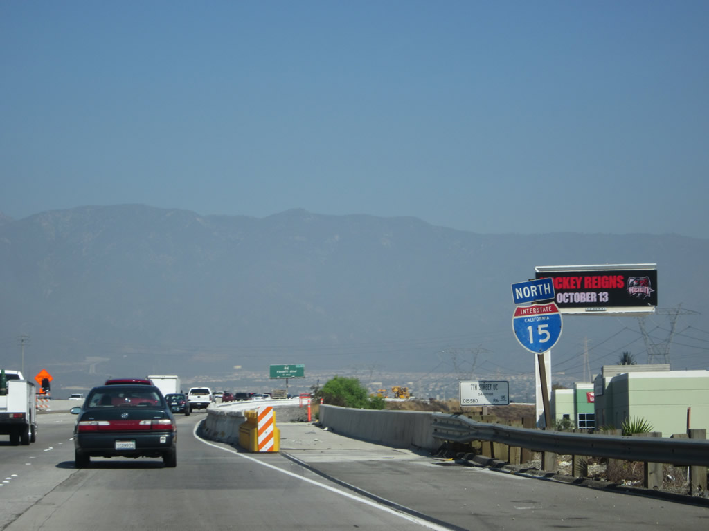
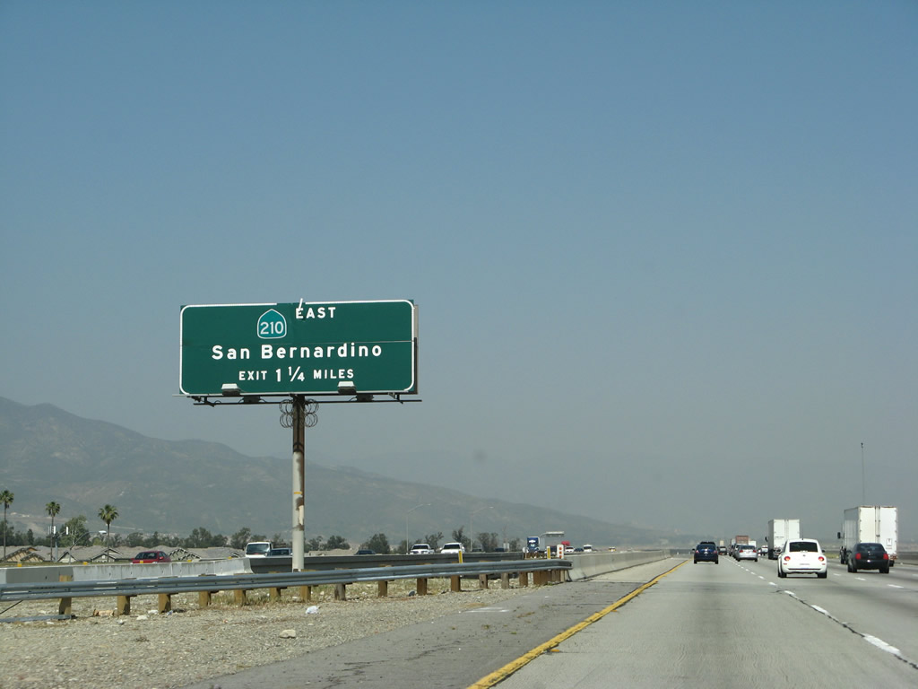
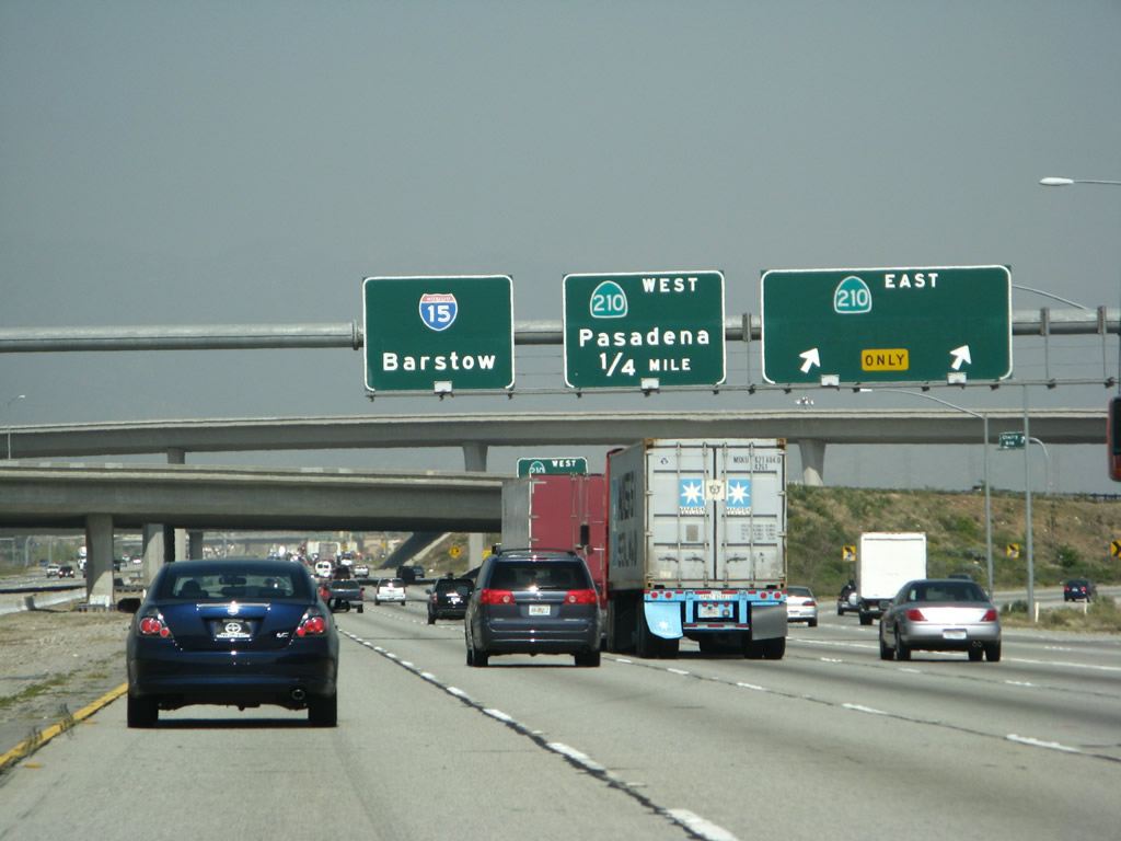
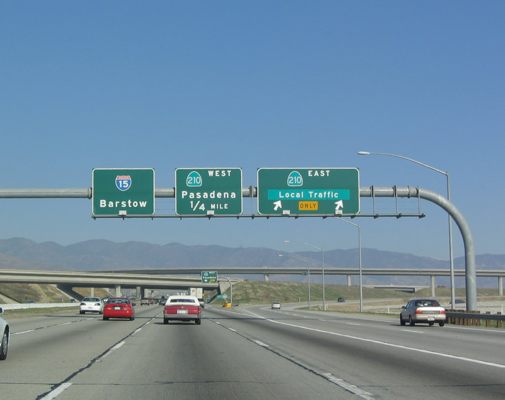
The next exit along Interstate 15 north is Exits 115A-B, California 210. Before it was constructed, California 210 (Foothill Freeway) was to be signed as California 30. However, the numbering was changed with the planned extension of the 210 corridor east to Redlands. Currently this route is a state highway, but it could be considered for Interstate status once all work on the freeway is complete and the freeway meets all applicable standards. Photo taken 03/28/08. |
|
|
Northbound Interstate 15 (Ontario Freeway) approaches Exit 115, California 210 (Foothill Freeway). Originally, each of these button copy exit signs was marked as California 30 rather than California 210; however, it was renumbered based on the change in legislative route definition. Therefore, the "210" in the shield is reflective rather than button copy/non reflective. Note the change in 2007 when the final segment of California 210 in Rialto and Muscoy opened. Photos taken 03/28/08 and 01/18/04. |
|
|
Northbound Interstate 15 reaches Exit 115A, California 210 (Foothill Freeway) east to Fontana, Rialto, and San Bernardino. During 2004 (when the freeway was not constructed between Sierra Avenue and Interstate 215), the control city was listed as "local traffic." This changed with the opening of California 210 in 2007. The next exit is Exit 115B, California 210 (Foothill Freeway) west to Pasadena. Photos taken 03/28/08 and 01/18/04. |
|
California 210 west follows the Foothill Freeway across the northern tier of San Bernardino County and Los Angeles County suburbs, passing through Rancho Cucamonga, Upland, Claremont, La Verne, and San Dimas before reaching its junction with Interstate 210/California 57. This section of new freeway was open to traffic by 2002. Photo taken 01/18/04. |
|
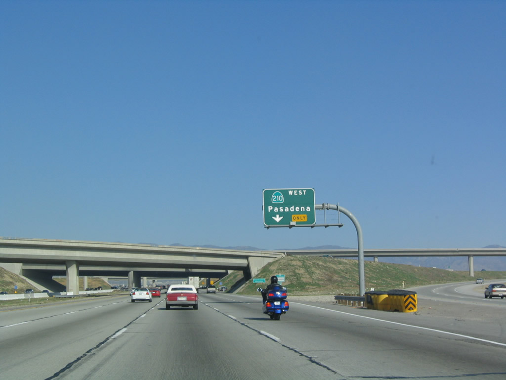
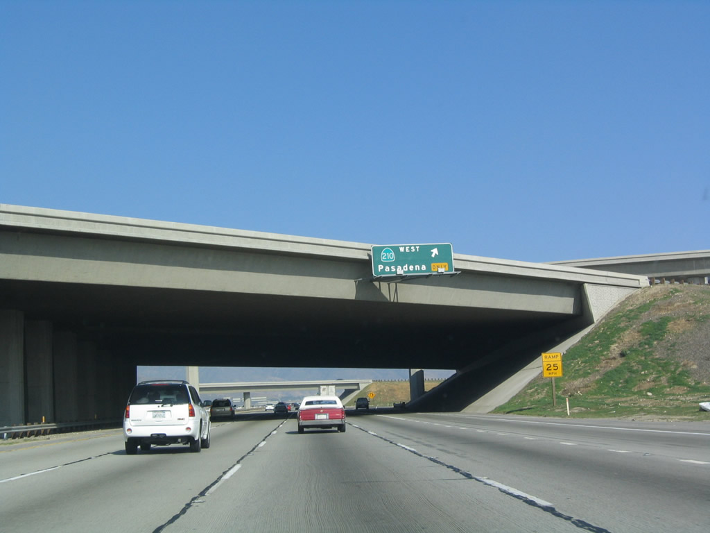
Northbound Interstate 15 reaches Exit 115B, California 210 (Foothill Freeway) west. The transition from Interstate 15 north to California 210 west is a loop ramp with sharp curves and a low advisory speed (25 miles per hour). Photo taken 01/18/04. |
|
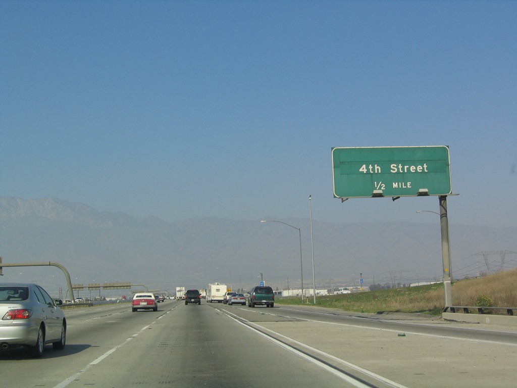
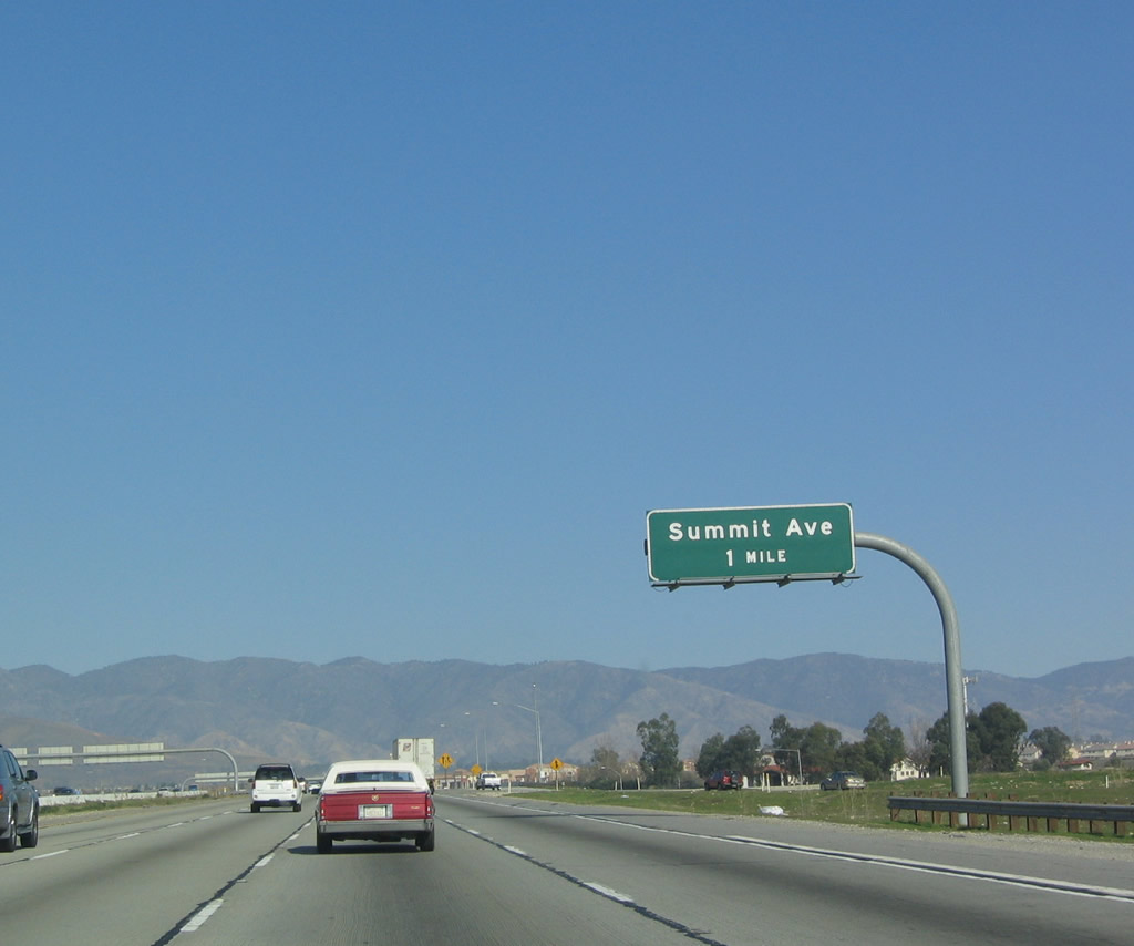
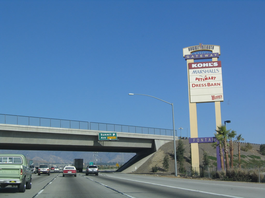
The next exit along Interstate 15 north is Exit 116, Summit Avenue, one mile. Photo taken 01/18/04. |
|
Summit Avenue is an east-west city street through Fontana, running parallel to the California 210 freeway. Photo taken 01/18/04. |
|
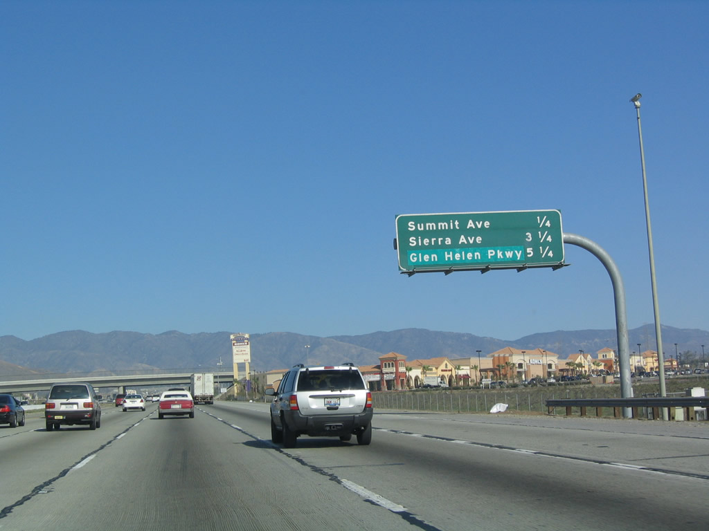
Mileage sign along northbound for the next three exits: Exit 116, Summit Avenue; Exit 119, Sierra Avenue; and Exit 122, Glen Helen Parkway. Photo taken 01/18/04. |
|
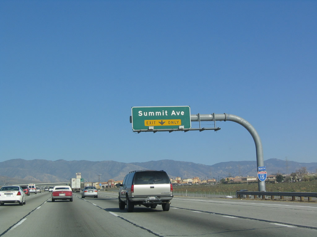
Northbound Interstate 15 reaches Exit 116, Summit Avenue. This was temporary California 30 before the California 210 freeway was completed. At this point, Interstate 15 leaves Rancho Cucamonga and enters Fontana. Photo taken 01/18/04. |
|
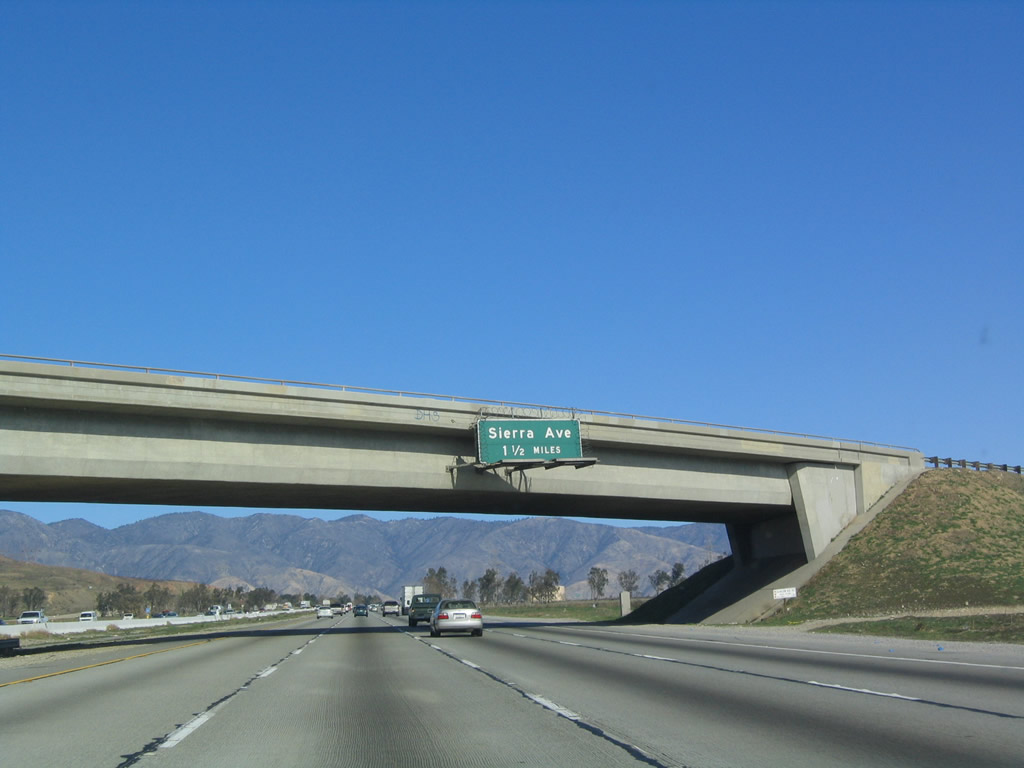
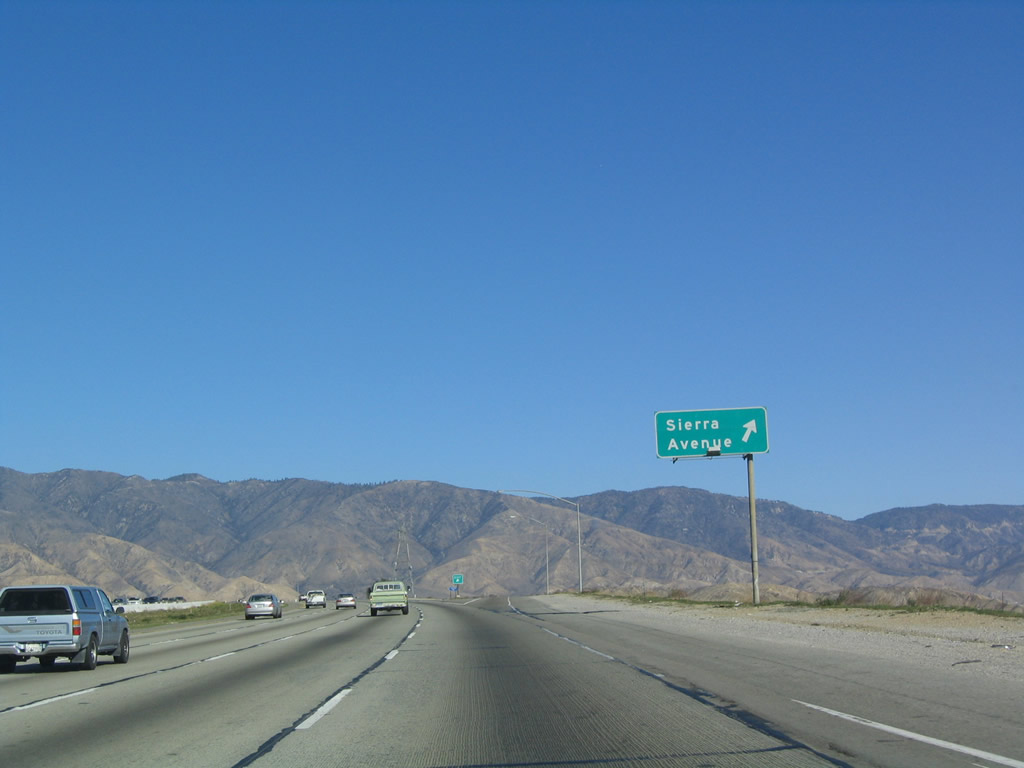
The next exit along Interstate 15 north is Exit 119, Sierra Avenue. Sierra Avenue is a north-south highway that passes south through Fontana before reaching California 60 (Pomona Freeway) west of Riverside. Exit 119 is 1.50 miles north of this sign along northbound. Photo taken 01/18/04. |
|
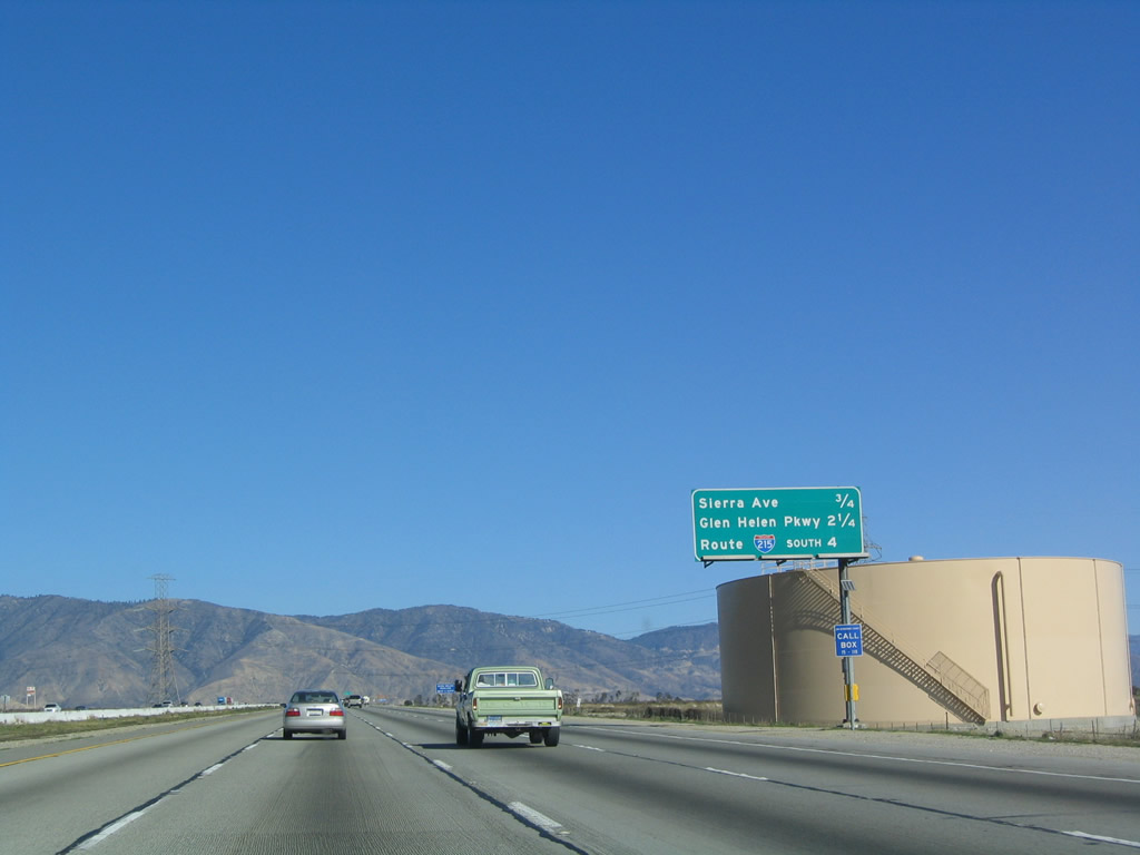
This interchange sequence sign provides the distance to the next three exits along northbound: Exit 119, Sierra Avenue; Exit 122, Glen Helen Parkway; and Exit 123, Interstate 215 south to San Bernardino. Photo taken 01/18/04. |
|
|
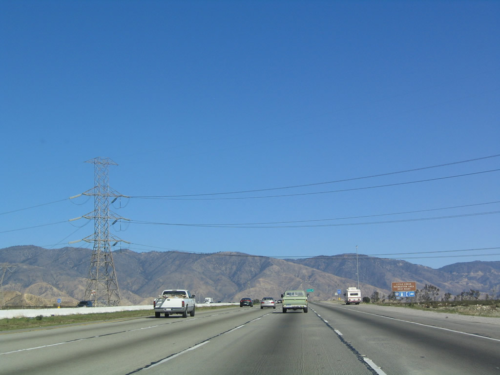
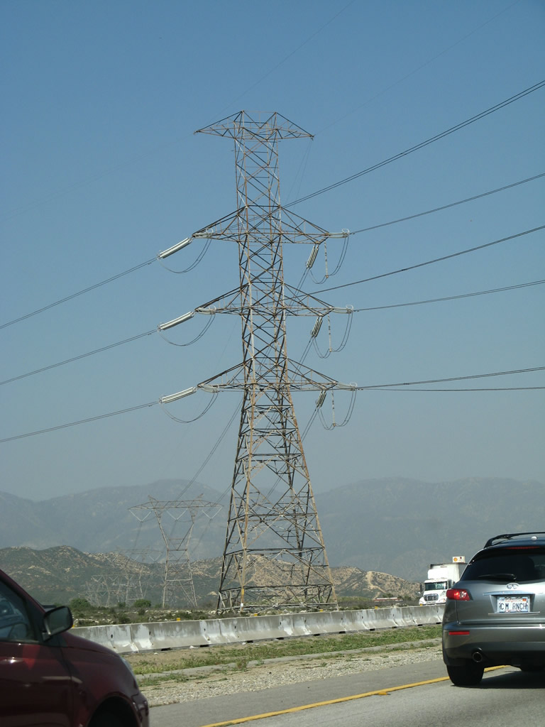
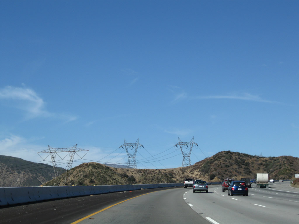
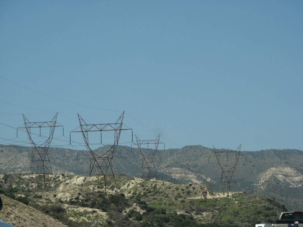
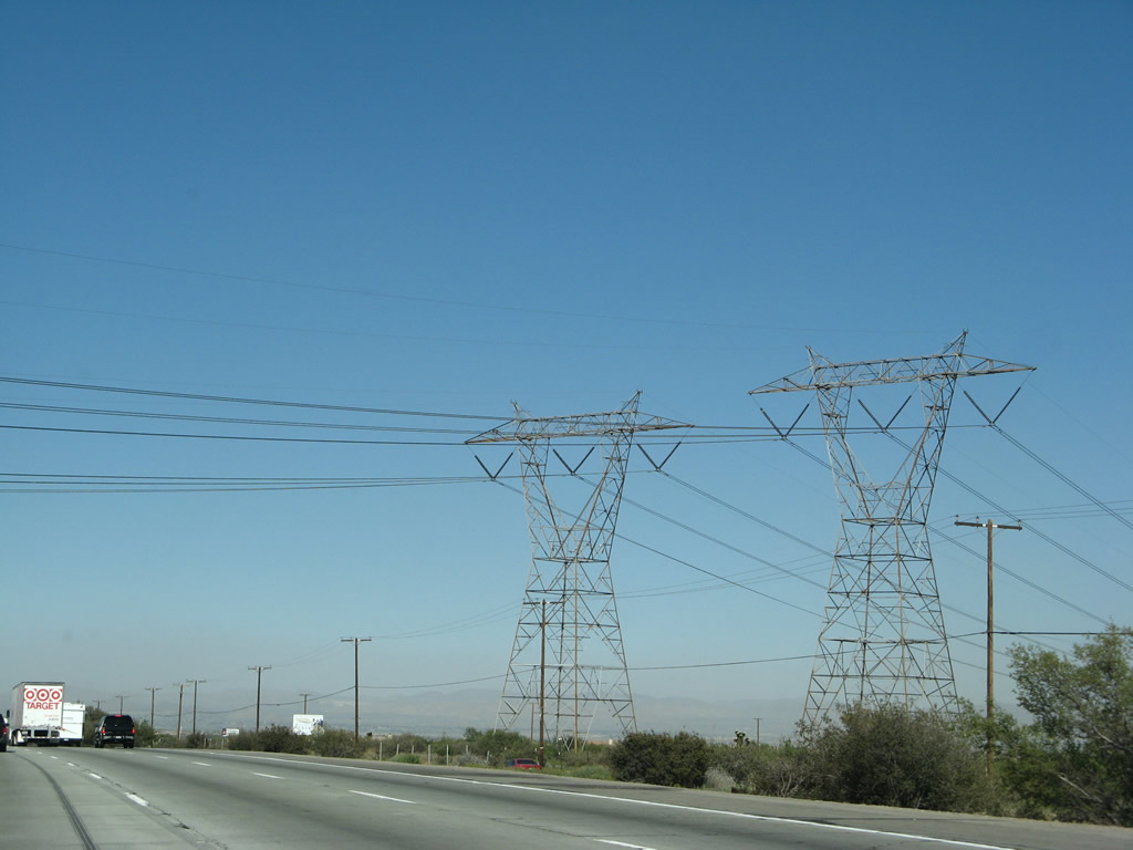
Just like the Interstate 5 corridor's connection to the San Fernando Valley, several power lines enter the Inland Empire in the vicinity of Interstate 15, such as these 500kV power lines that constitute part of Path 46. This tower signifies the end of a rare double circuit 500kV power line incoming from the Mojave Desert. Many of the lines connect to the fossil fuel and hydroelectric facilities in the Colorado River Basin and northeast toward the Four Corners. Photos taken 01/18/04 and 03/28/08. |
|
Northbound Interstate 15 reaches Exit 119, Sierra Avenue. After this interchange, Interstate 15 leaves Fontana and crosses the Lytle Creek Wash. Photo taken 01/18/04. |
|
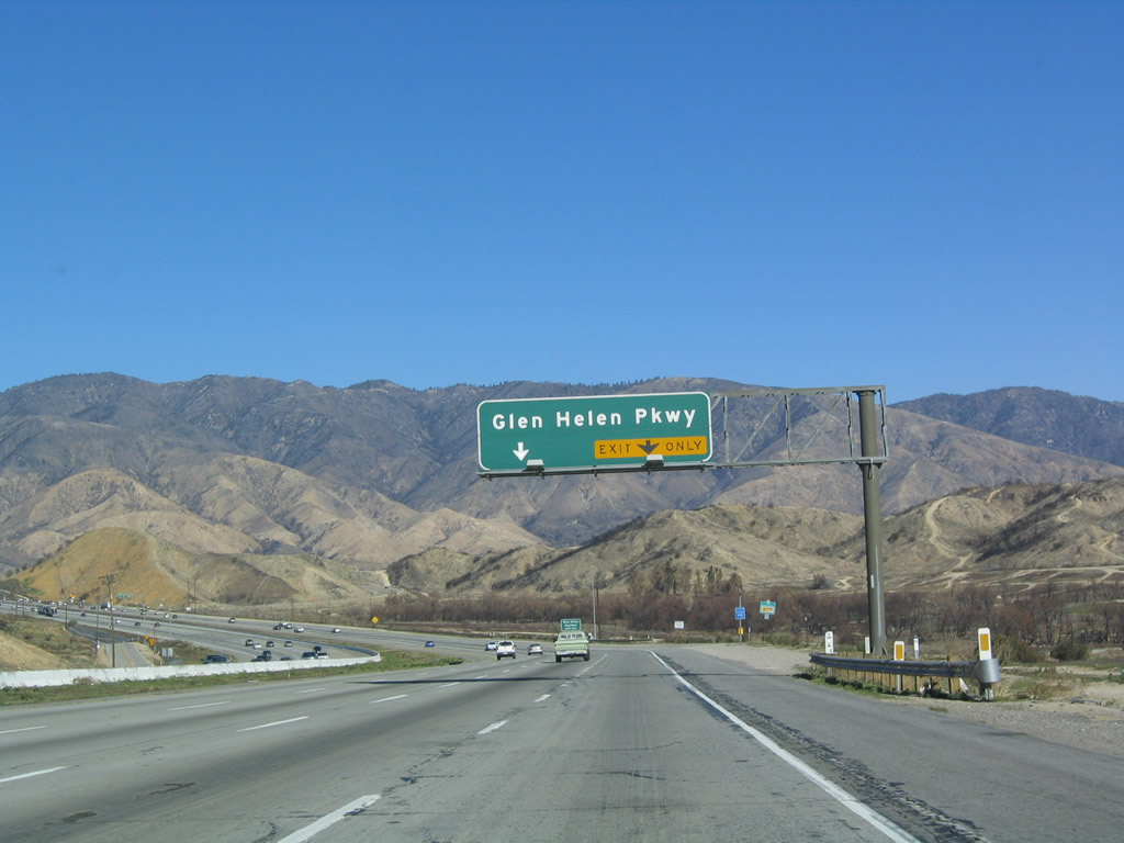
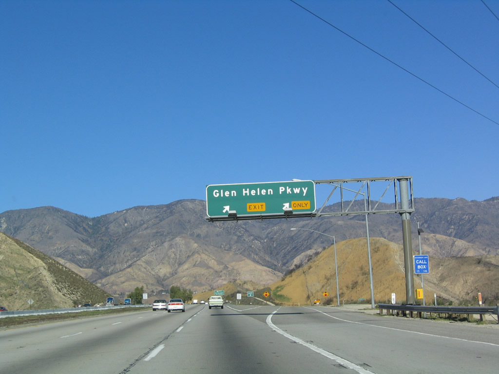
The next exit along northbound is Exit 122, Glen Helen Parkway, one mile. Photo taken 01/18/04. |
|
Glen Helen Parkway connects to Glen Helen Regional Park, which includes an off-road area and the Glen Helen Blockbuster Pavilion. Photo taken 01/18/04. |
|
Northbound Interstate 15 (Ontario Freeway) reaches Exit 122, Glen Helen Parkway. Photo taken 01/18/04. |
|
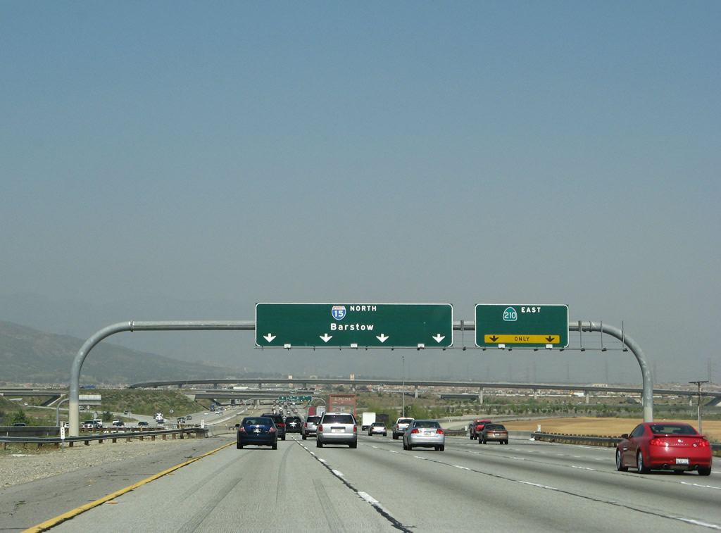
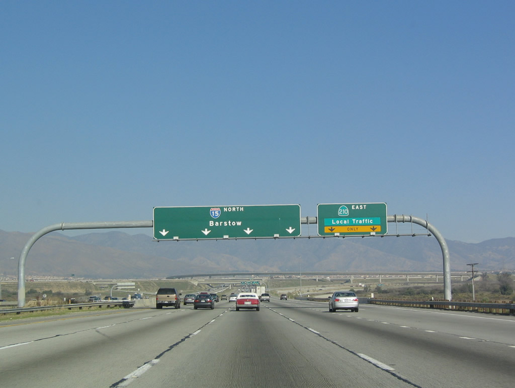
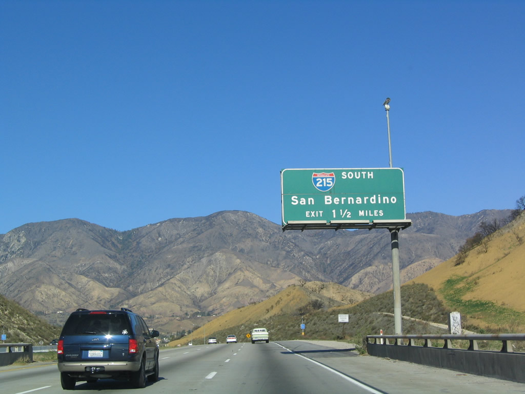
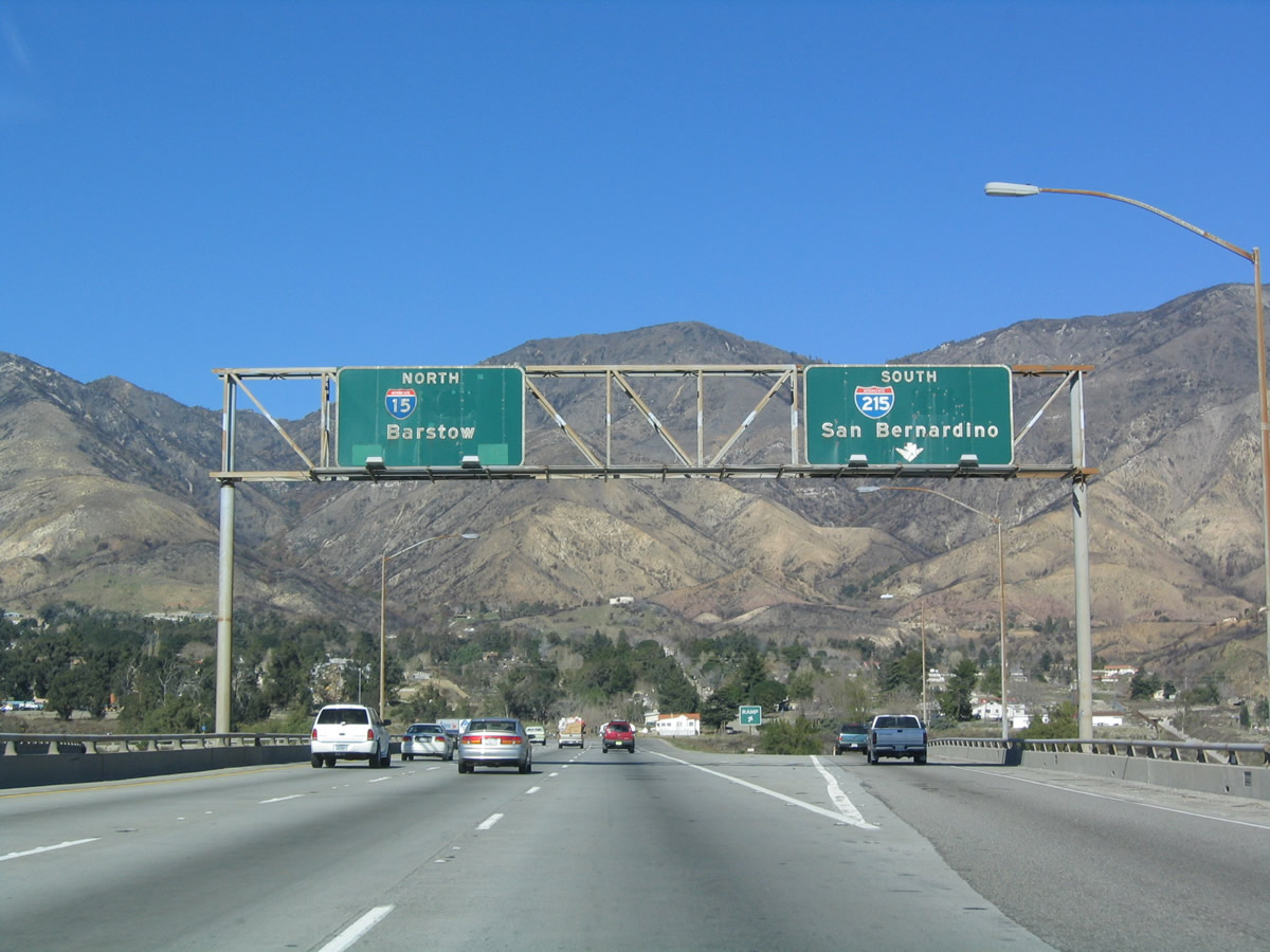
The final major interchange within the Inland Empire is Exit 123, Interstate 215. Access is provided to southbound Interstate 215, and northbound traffic merges with Interstate 215 after the interchange in preparation for the ascent up Cajon Summit. Photo taken 01/18/04. |
|
This view of northbound Interstate 15 is afforded after the Glen Helen interchange. Photo taken 01/18/04. |
|
In the aftermath of the devastating wildfires from October 2003, Devore made the news as the location of a mudslide that killed several people at a religious camp during a fierce downpour in a storm later in the season. Devore is also the northern terminus of Interstate 215. Photo taken 01/18/04. |
|
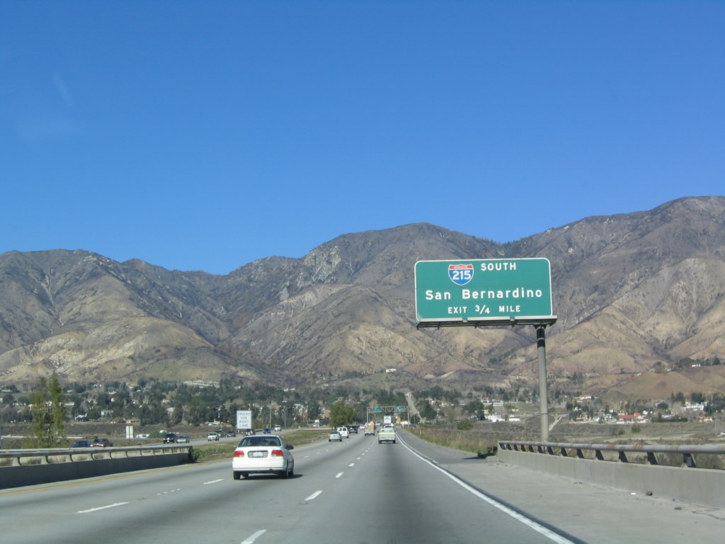
Interstate 215 follows old U.S. 395 south into San Bernardino, then continues into Colton, Riverside, and Perris before reaching its southern terminus at Murrieta. Although it parallels Interstate 15, it is not always a good alternative due to the construction project at the Interstate 215/California 60/California 91 interchange. Once that reconstruction project is complete, Interstate 215 will have a direct connection that will preclude the use of the cloverleaf interchange ramps. Photos taken 03/28/08 and 01/18/04. |
|
|
Northbound Interstate 15 reaches Exit 123A, Interstate 215 south to San Bernardino. The old porcelain enamel signs date back to when U.S. 66 and U.S. 395 were still signed at this interchange. The Interstate 215 exit sign was replaced between 2004 and 2008. Photos taken 03/28/08 and 01/18/04. |
|
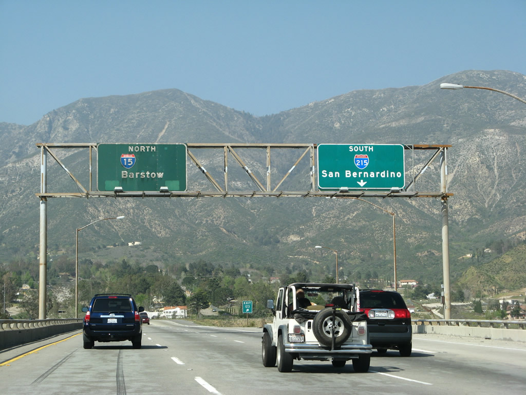
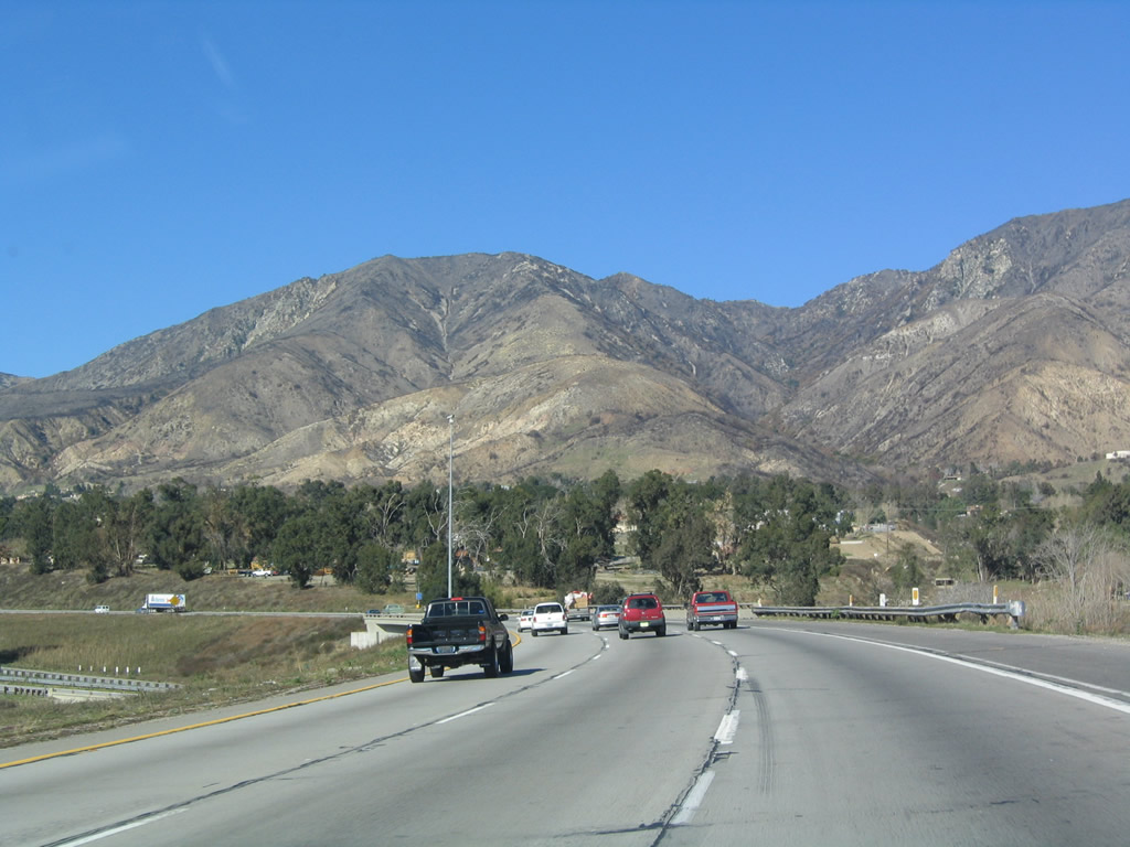
View of the merge between Interstate 15 and Interstate 215 as seen from the northbound lanes of Interstate 15. At this point, the Ontario Freeway ends, and Interstate 15 shifts onto the Mojave Freeway. Photo taken 01/18/04. |
| Interstate 15/Mojave Freeway north |
|
|
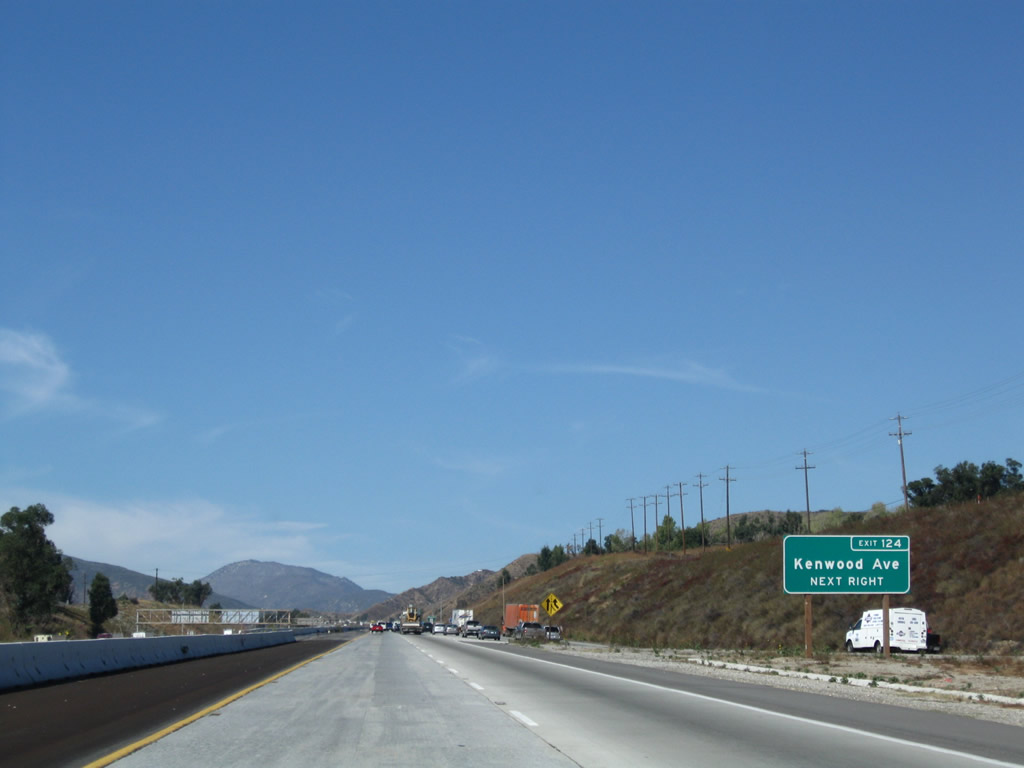
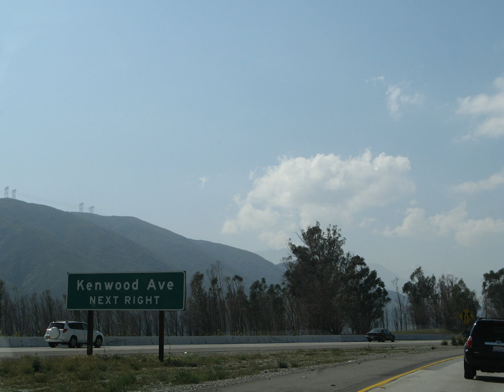
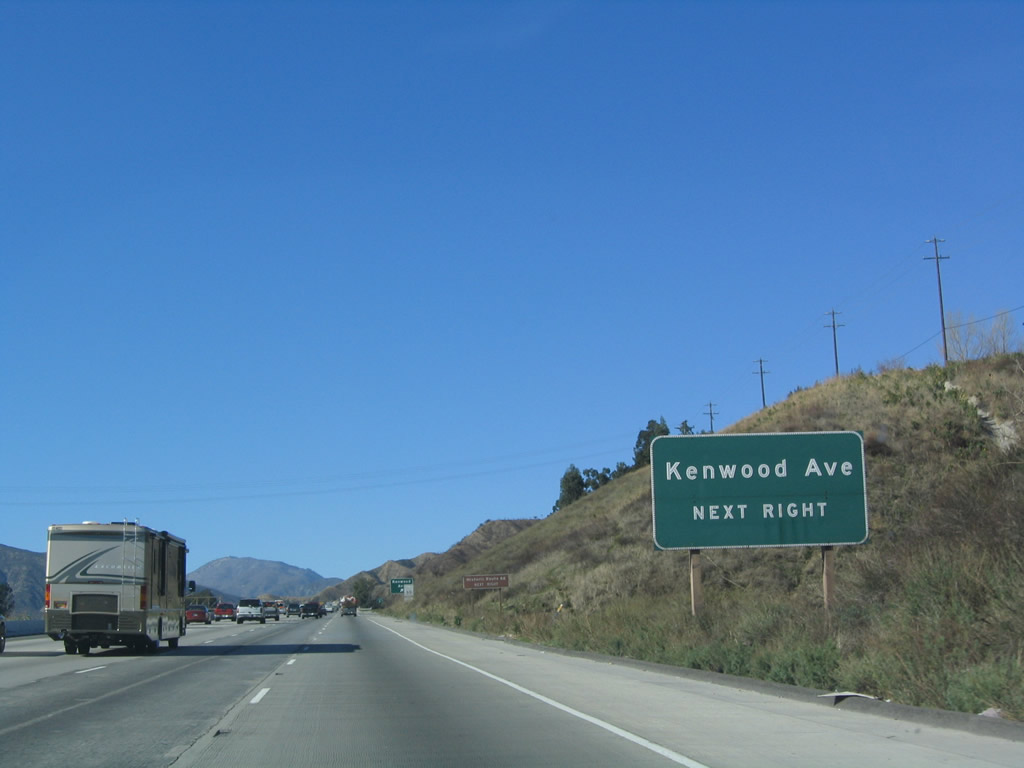
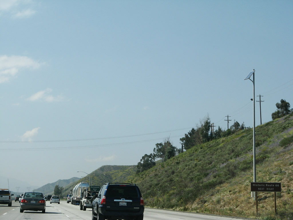
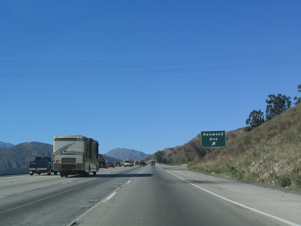
The next exit along Interstate 15 is Exit 124, Kenwood Avenue to Historic U.S. 66-91-395/Cajon Boulevard north. Traffic from Interstate 215 merges onto Interstate 15 from the left. Northbound Interstate 15 traffic should merge left for the trip up to Cajon Summit. The first photo is taken from Interstate 215 north; the second photo is taken from the main lanes of Interstate 15 north. Photos taken 11/10/08 and 03/28/08. |
|
A nice old alignment of U.S. 66 may be reached via Exit 124, Kenwood Avenue. This U.S. 66 section (Cajon Boulevard) contains a vintage expressway section and a 1930s-era bridge, as well as U.S. 66 shields painted into the pavement. Photo taken 01/18/04. |
|
A brown Historic U.S. 66 sign is posted prior to Exit 124. Photo taken 03/28/08. |
|
Northbound Interstate 15 reaches Exit 124, Kenwood Avenue to Historic U.S. 66-91-395/Cajon Boulevard north. Photo taken 01/18/04. |
|
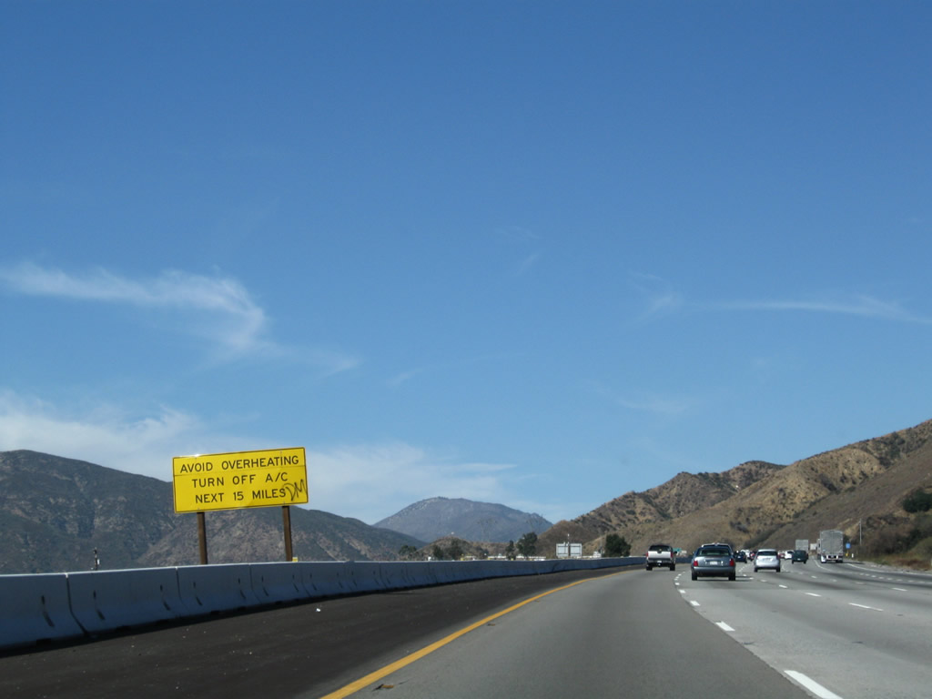
As Interstate 15 heads north up the grade to Cajon Summit, motorists are advised to turn off air conditioning to avoid overheating during the hot summer months. Photo taken 11/10/08. |
|
|
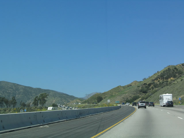
View of northbound Interstate 15 as it ascends to Cajon Summit. The freeway has eight lanes for the entire climb. Photos taken 11/10/08 and 03/28/08. |
|
|
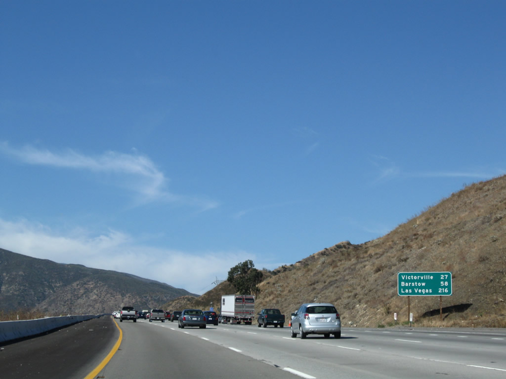
This mileage sign along northbound is among the first to list Las Vegas as a control city. The two destination cities are Victorville and Barstow; omitted is Hesperia, Adelanto, and Apple Valley. Photos taken 11/10/08 and 04/18/04. |
|
|
In addition to the freeway, several power lines (Path 46, 500kV transmission system) and two railroads use the Cajon Summit pass to reach the high desert. Photos taken 11/10/08 and 03/28/08. |
|
Another view of Interstate 15 as it approaches the Cajon Summit. Old U.S. 66-91-395 is in the valley to the west of the freeway, and the old route is still in use between Exits 124 and 129. Photo taken 11/10/08. |
|
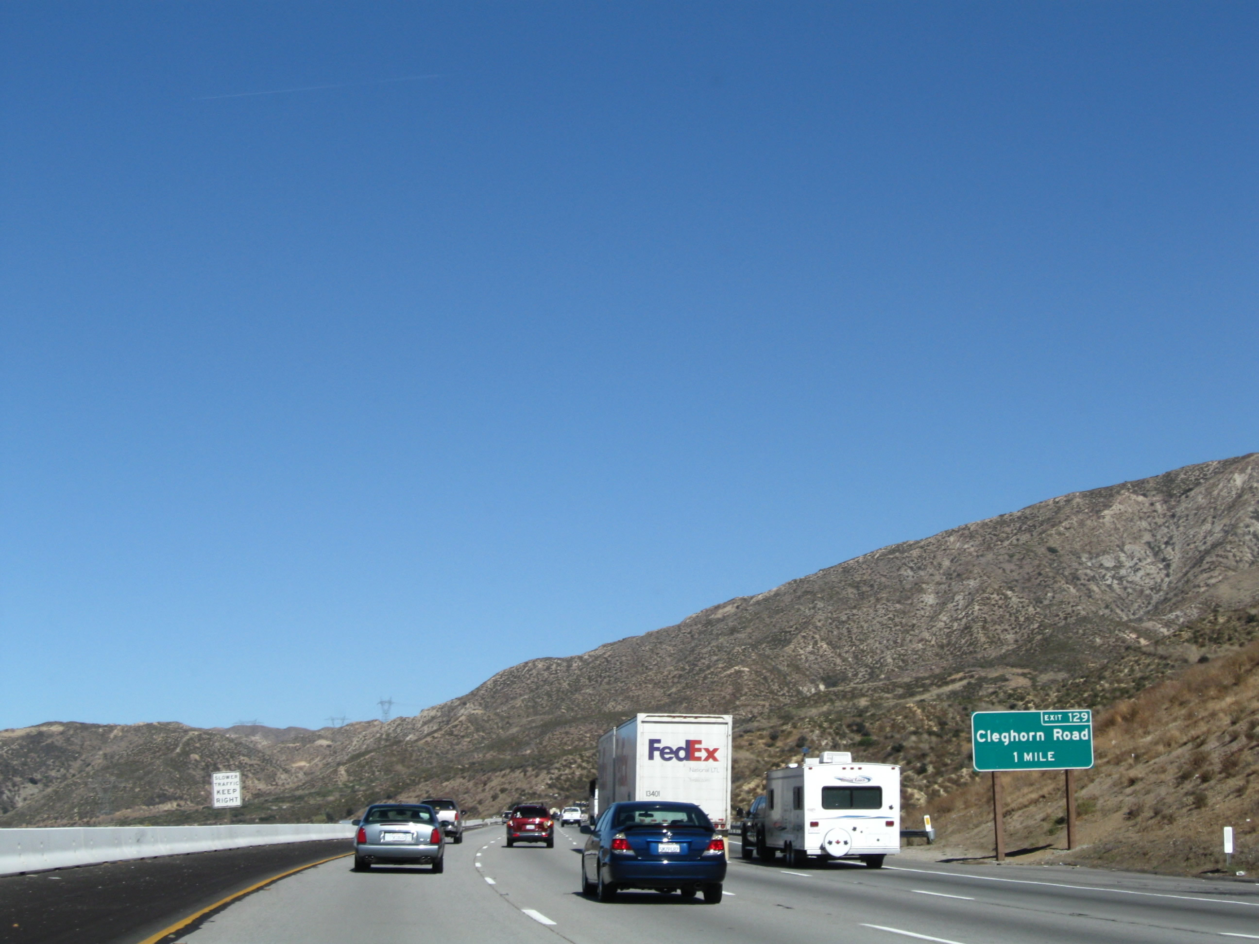
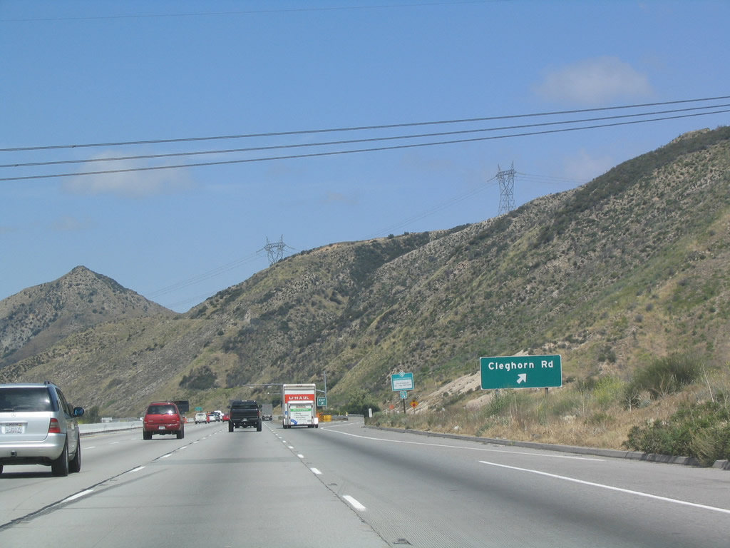
The next exit along Interstate 15 north is Exit 129, Cleghorn Road to U.S. 66-91-395 south. Photo taken 11/10/08. |
|
Near as we can tell, there is no connection between the Cleghorn Road interchange at Interstate 15 and the Cleghorn Road exit from California 138 south of Silverwood Lake (unless it is a dirt or unimproved road through the backcountry). Photo taken 03/28/08. |
|
Northbound Interstate 15 reaches Exit 129, Cleghorn Avenue. Take Cleghorn Avenue west from Interstate 15 to reach the old alignment of U.S. 66-91-395. Photo taken 04/18/04. |
|
|
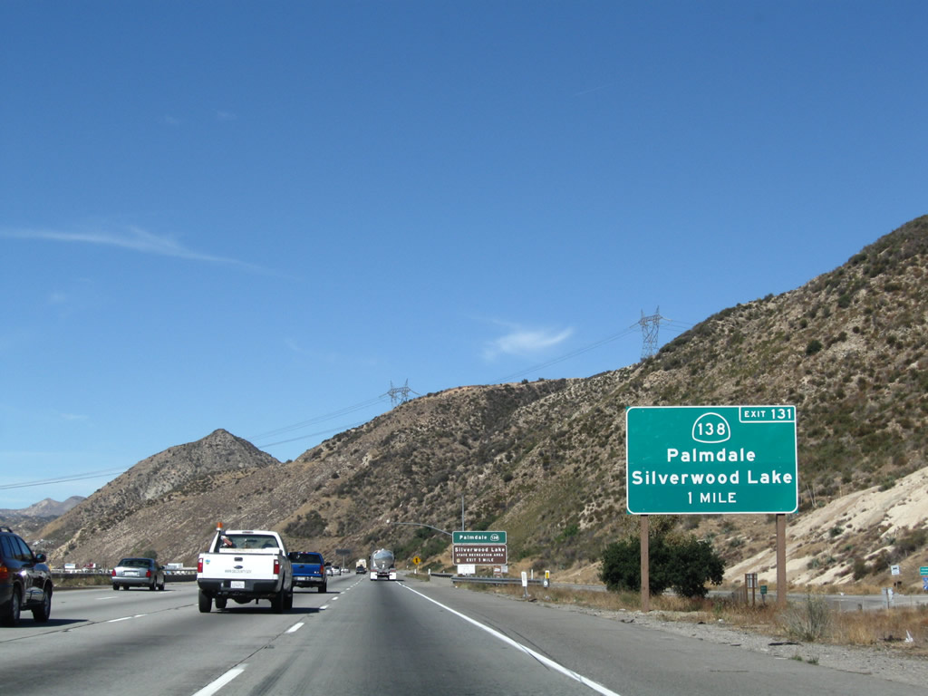
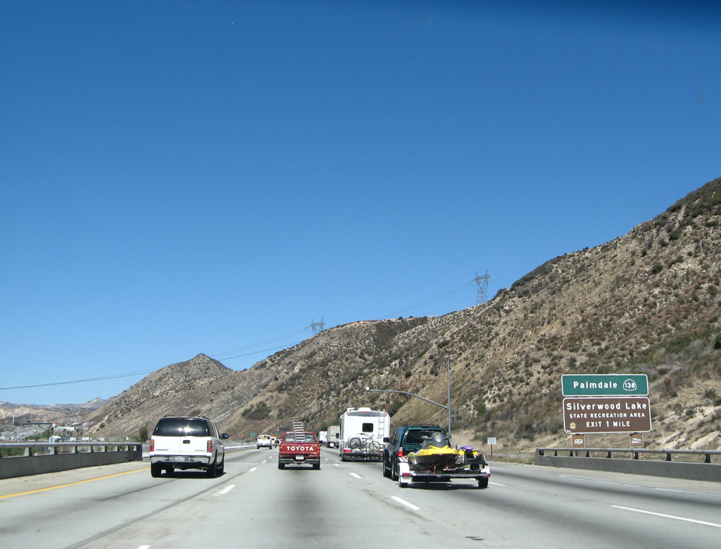
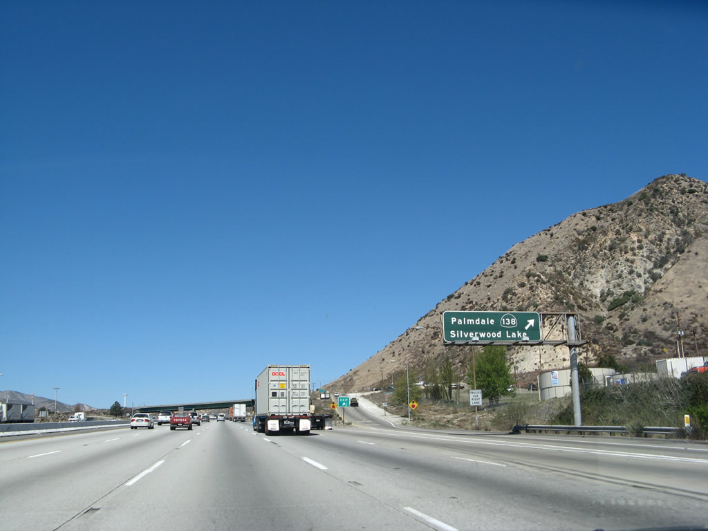
The next exit is Exit 131, California 138, one mile. The older sign is difficult to read, partially because California 138 is given a smaller shield that shares the word "Palmdale" on the top line, and the brown portion of the sign implies that Silverwood Lake itself is only one mile away (when in reality it is ten miles east of here). Photos taken 11/10/08 and 03/30/07. |
|
Prior to reaching Exit 131/California 138, Interstate 15 passes by a weigh station and checkpoint for all commercial vehicles. As noted by the sign, westbound California 138 serves the communities of Phelan and Wrightwood (via California 2). To reach the Angeles Crest Highway, use California 138 west to California 2 west. Photo taken 03/30/07. |
|
California 138 is a major route heading west, providing a connection to the cities of Antelope Valley (Palmdale and Lancaster). It has been considered for a freeway upgrade at varying intervals, but that plan is currently unfunded and is controversial. To the east, California 138 is a much less busy, winding scenic route that passes over Cajon Pass to reach Silverwood Lake, Crestline, and Lake Arrowhead/Big Bear Lake via California 18. Photo taken 03/30/07. |
|
Northbound Interstate 15 reaches Exit 131, California 138. Photo taken 03/30/07. |
|
During the 1970s, this style of bridge with a green painted steel substructure was commonly found on freeway constructed during that era. Photo taken 03/30/07. |
|
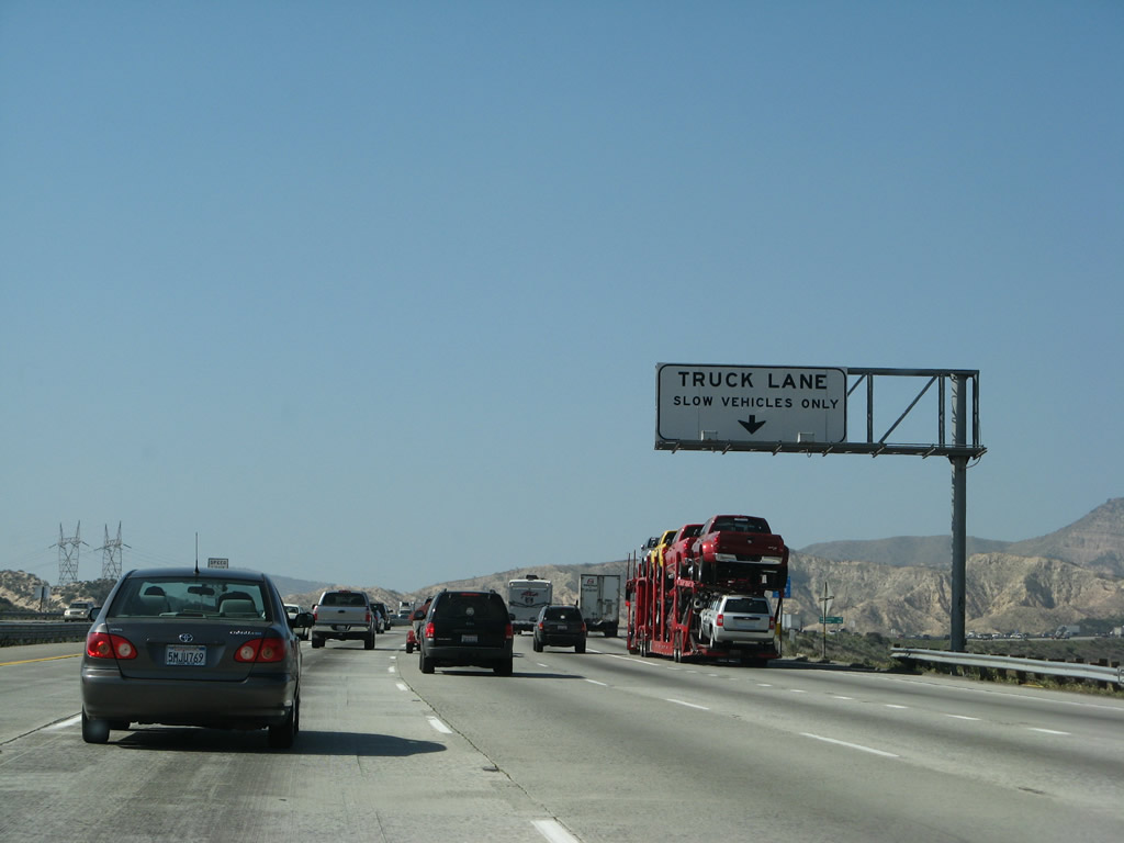
This sign assigns a truck climbing lane (number five lane) along northbound Interstate 15/Mojave Freeway as the freeway ascends to Cajon Summit (el. 4,190 feet). Photo taken 03/28/08. |
|
|
With the truck climbing lane in position, traffic continues along one of the steepest portions of the ascent to Cajon Pass. A set of powerlines again parallel the freeway, but these are not 500kV like the ones seen closer to Cleghorn Avenue. Photos taken 03/28/08. |
|
|
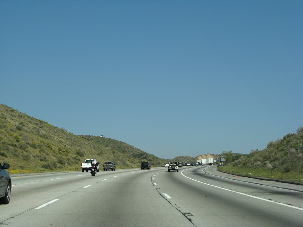
The northbound and southbound lanes of Interstate 15/Mojave Freeway separate dramatically as the freeway passes Mormon Rocks and bends east to continue its ascent. The freeway will gain nearly 4,000 feet in elevation at the conclusion of this up-slope. Photos taken 03/28/08. |
|
|
This view shows the separation of the northbound and southbound carriageways. Photos taken 11/10/08. |
|
|
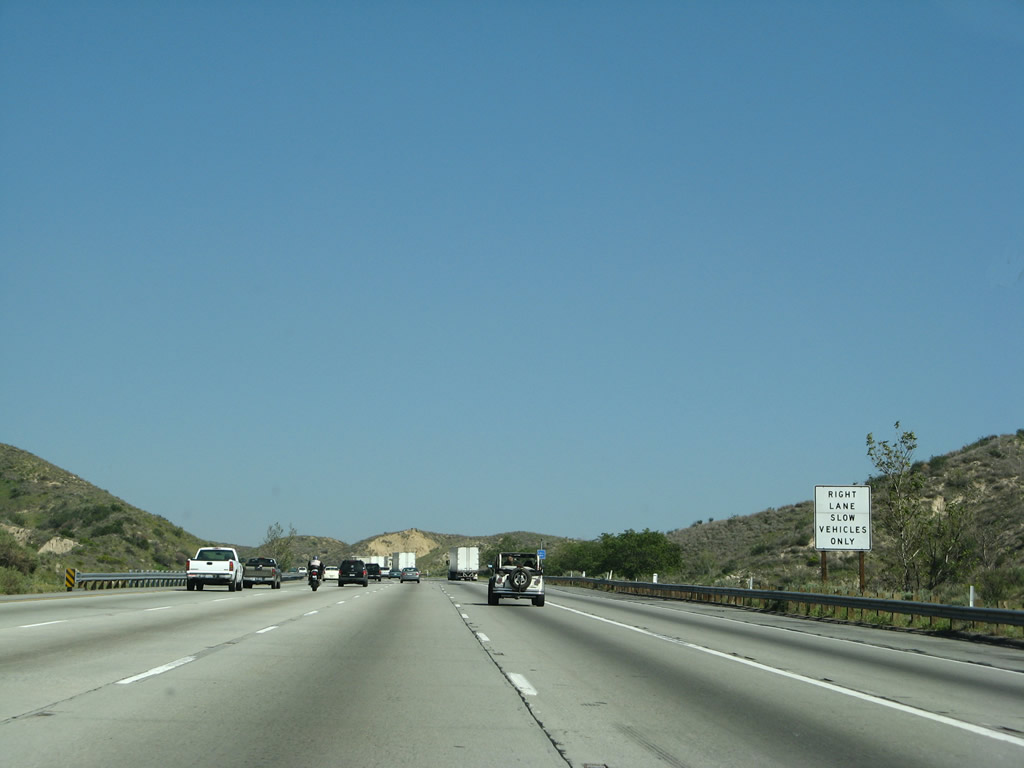
Interstate 15 retains five northbound lanes (including the truck lane) as the freeway approaches the summit. Photos taken 03/28/08. |
|
|
The upper reaches of the San Bernardino National Forest come into view as Interstate 15 continues its ascent. Photos taken 03/28/08. |
|
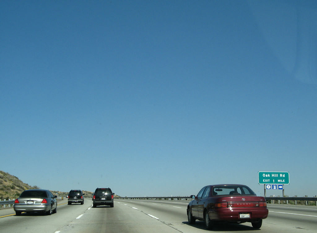
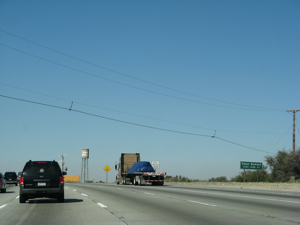
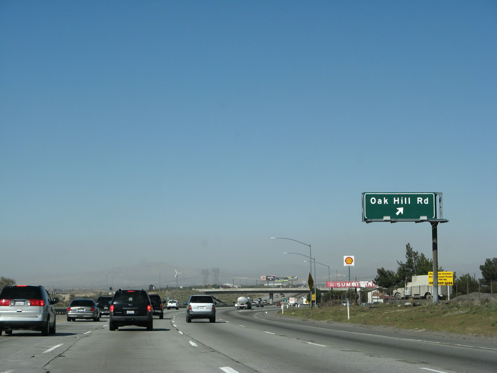
The next exit along Interstate 15/Mojave Freeway north is Exit 138, Oak Hill Road. Photo taken 03/28/08. |
|
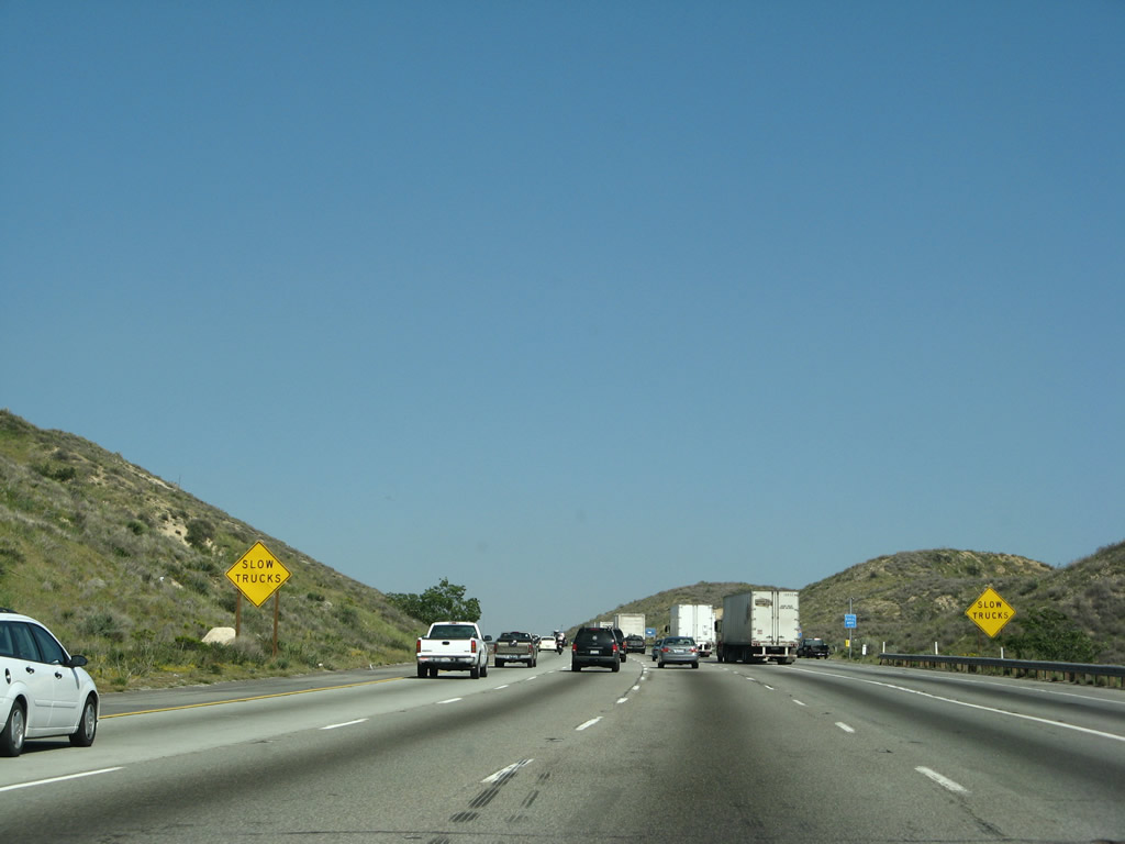
The right lane remains available for trucks only, but it will end after the top of the uphill climb. Photo taken 03/28/08. |
|
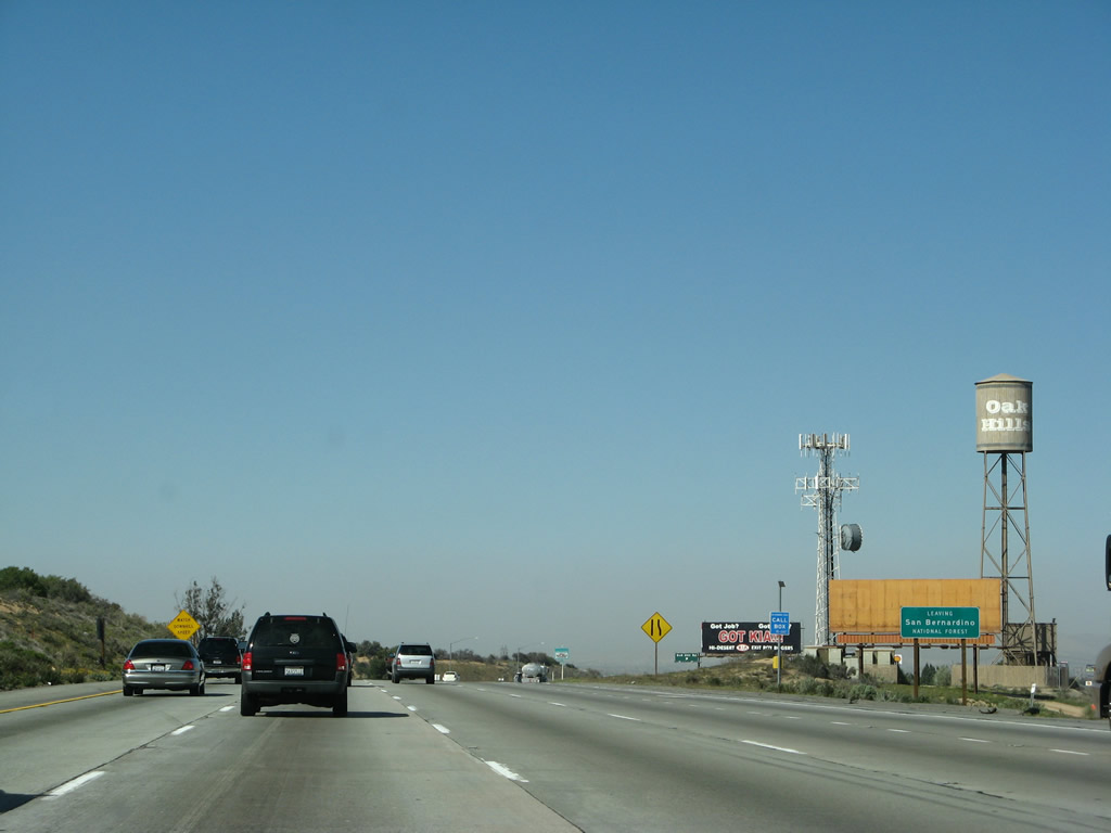
Interstate 15 finally reaches the Cajon Summit, and there is an exit just beyond the top of the summit signs for Exit 138. Oak Hill Road provides some services, and there is an old alignment of U.S. 66-91-395 visible from the eastern frontage road just past the businesses. Photo taken 03/28/08. |
|
Interstate 15 leaves the San Bernardino National Forest and immediately enters the city of Hesperia. Photo taken 03/28/08. |
|
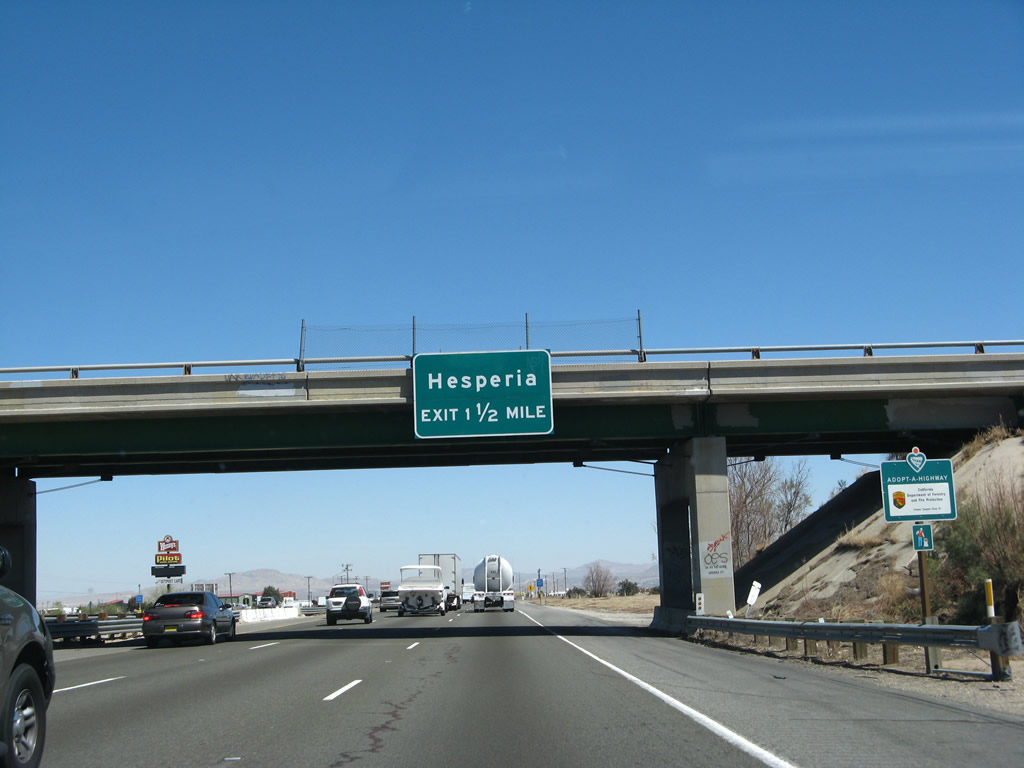
Northbound Interstate 15/Mojave Freeway reaches Exit 138, Oak Hill Road. This interchange is the first of four to serve Hesperia: Exit 138, Oak Hill Road; Exit 141, U.S. 395 north; Exit 143, Main Street; and Exit 147, Bear Valley Road. Photo taken 03/28/08. |
|
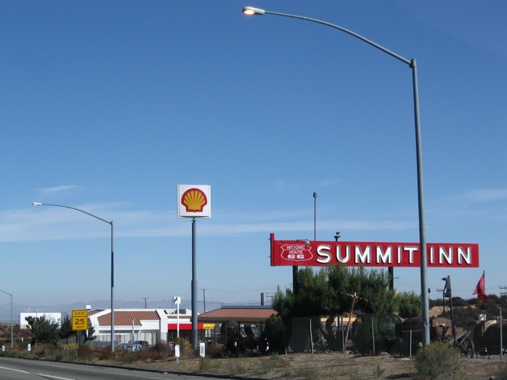
The marquee sign for the Summit Inn includes a Historic U.S. 66 shield. Photo taken 11/10/08. |
|
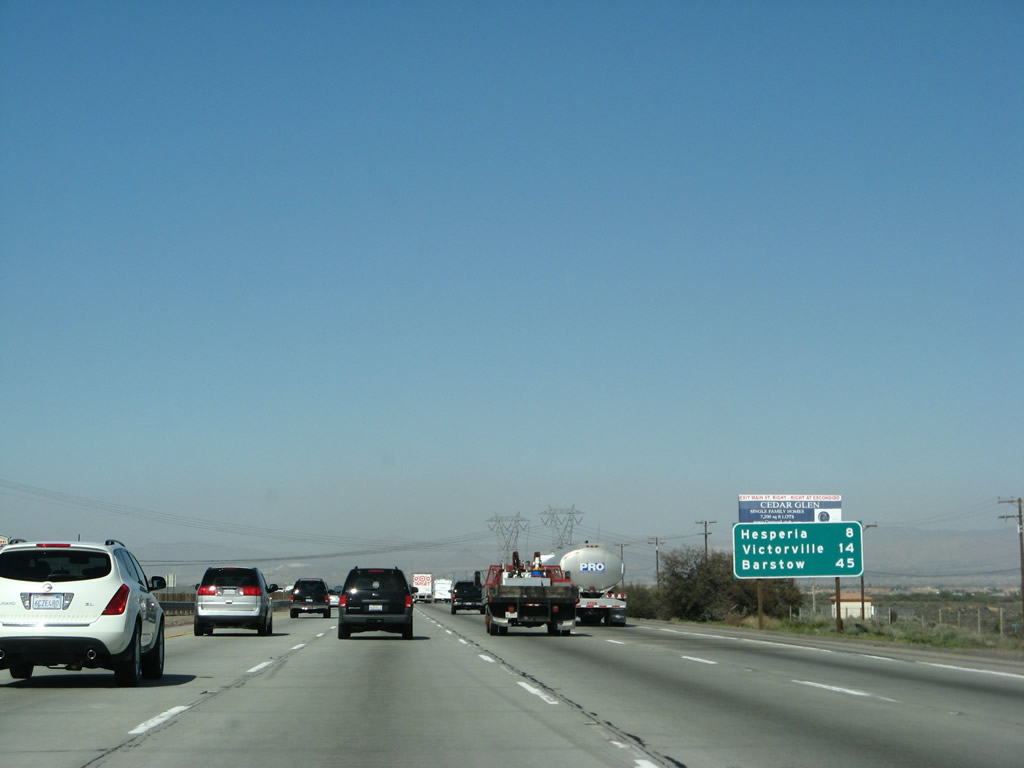
This mileage sign along northbound provides the distance to the next three cities along the Interstate 15 corridor: Hesperia, Victorville, and Barstow. Presumably Hesperia is listed due to the location of its downtown. Photo taken 03/28/08. |
|
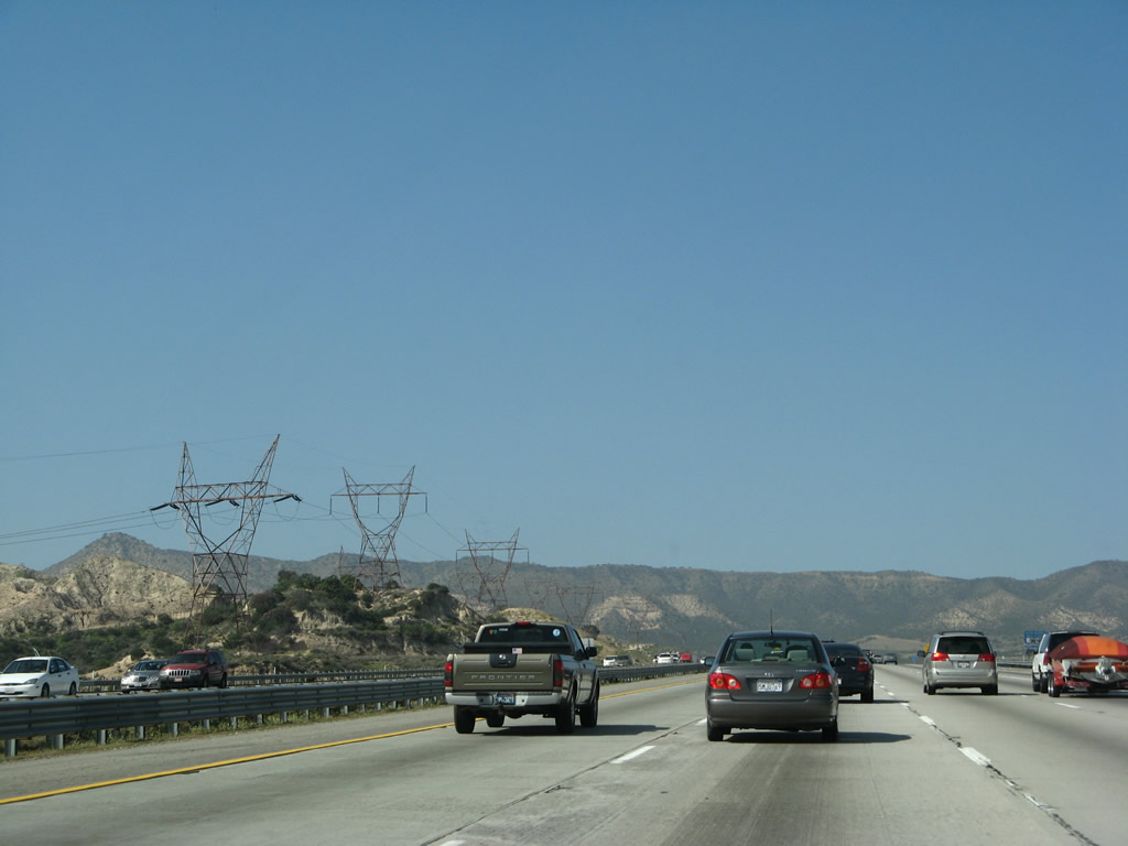
Another set of 500kV power lines passes over Interstate 15. These lines are owned by Southern California Edison and form part of Path 26 between the Lugo and Vincent substations. These two lines join Path 46 at the Lugo substation in Hesperia. From that substation, one of the lines connects with the Mohave Power Generating Station (non-functioning as of early 2010), a coal-fire electricity generating station near Laughlin, Nevada. The other line travels northeast to the Eldorado Substation, which is located southwest of Lake Mead and Hoover Dam in Nevada. Photo taken 03/28/08. |
|
|
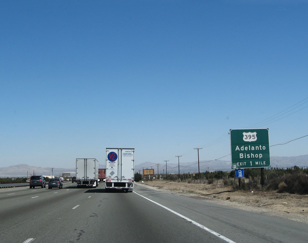
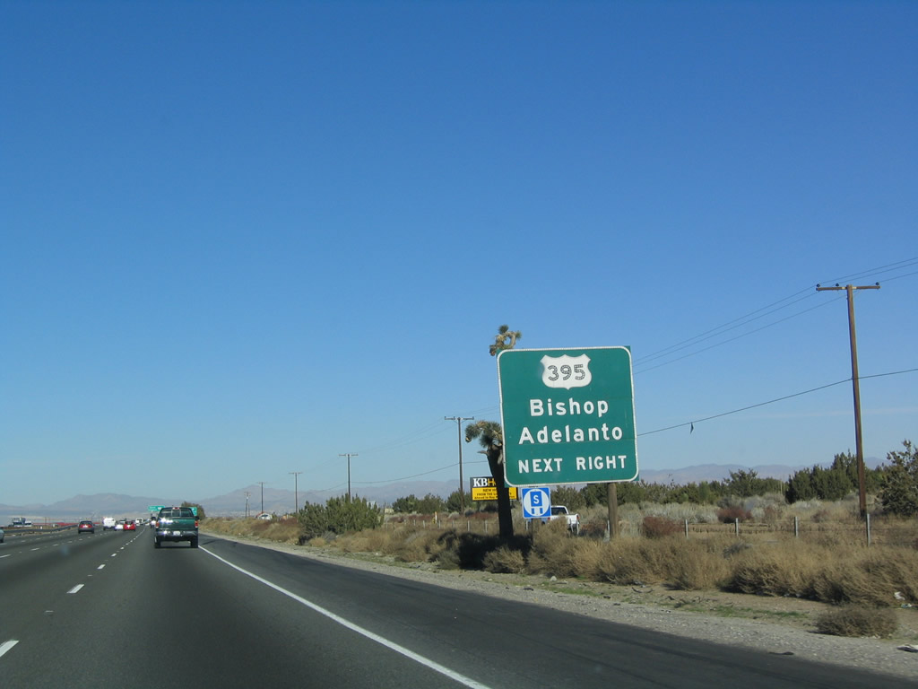
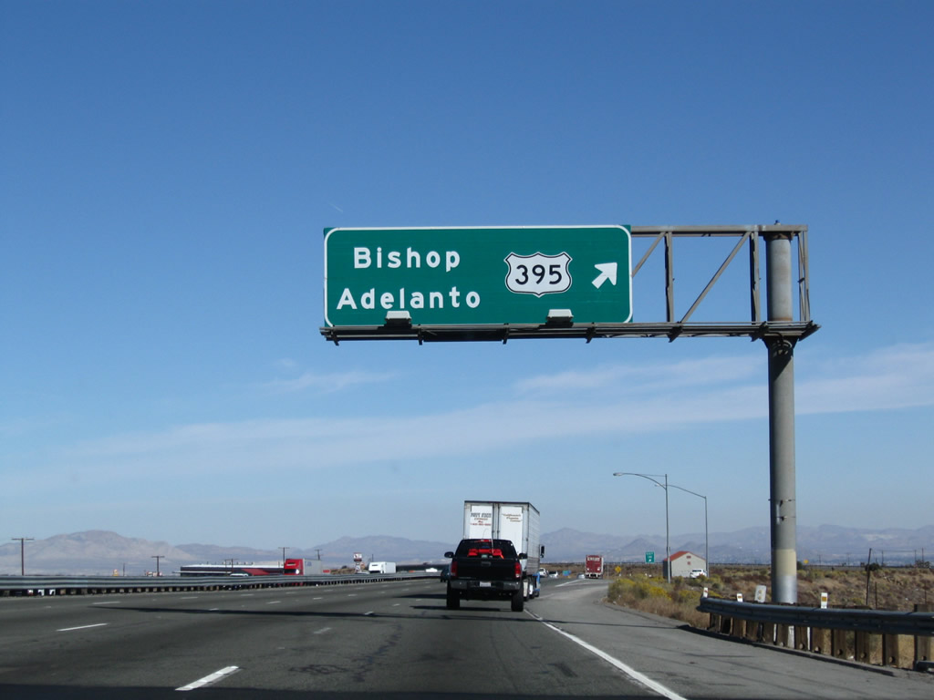
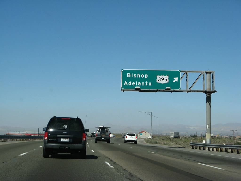
The next exit along northbound Interstate 15 is Exit 141, U.S. 395 north. U.S. 395 will depart from Interstate 15 for the final time. Exit 141 is a major exit for long-distance travelers: those heading to the Eastern Sierra, Mammoth Ski Resort, Mono Lake, or Reno should use U.S. 395 north. Up until this point, Interstate 15 (and Interstate 215 and California 163) replaced U.S. 395. North of here, the U.S. route is fully signed. Photos taken 11/10/08 and 01/18/04. |
|
|
A roadside guide sign is posted on Interstate 15 north for Exit 141, U.S. 395. Meanwhile, Interstate 15 continues northeast toward Barstow (Interstate 40) and Las Vegas. By the time U.S. 395 intersects Interstate 80 in Reno, Nevada, Interstate 15 is almost 500 miles east of U.S. 395 in Salt Lake City, Utah! Photos taken 11/10/08 and 03/30/07. |
|
|
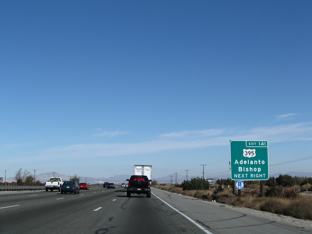
Northbound Interstate 15 reaches Exit 141, U.S. 395. U.S. 395 begins its northward journey here, serving Ridgecrest, Lone Pine, Bishop, and Mammoth as it follows the Eastern Sierra. The original sign was button copy, non-reflective; it was replaced with a reflective sign before the decision was made to install exit numbers on all new signs. Photos taken 11/10/08 and 03/28/08. |
|
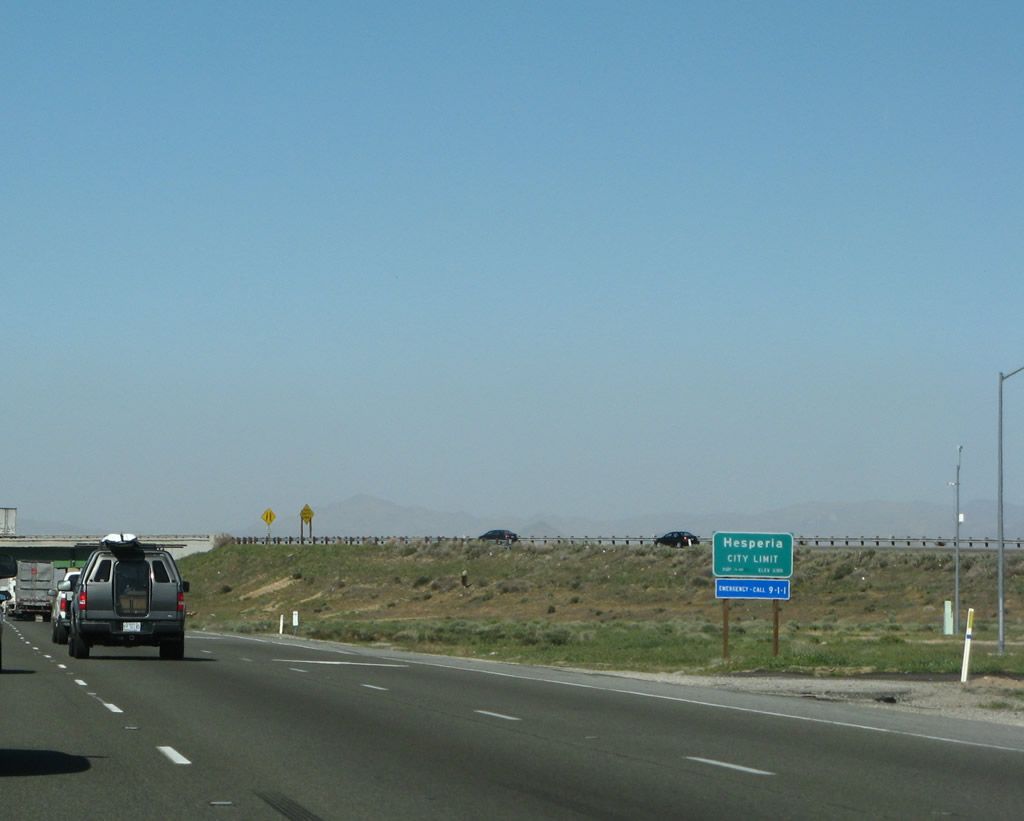
The official city limits sign for Hesperia is posted within the U.S. 395 interchange. The city of Hesperia was incorporated in June 1988. As of the 2000 Census, 62,582 people lived in Hesperia; the city sits at an elevation of 3,186 feet in the Mojave Desert. Photo taken 03/28/08. |
|
The transition ramp from Interstate 15 north to U.S. 395 north crosses over the freeway. From here, Interstate 15 generally follows Old U.S. 66-91 through Hesperia and Victorville. Photo taken 03/28/08. |
|
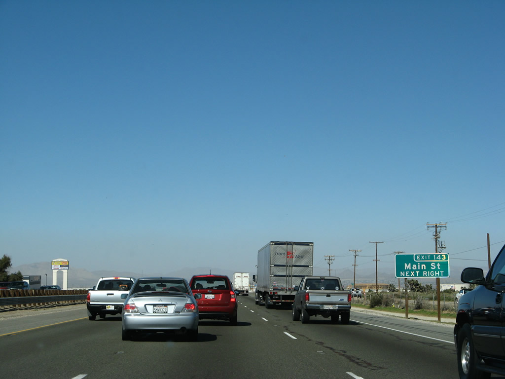
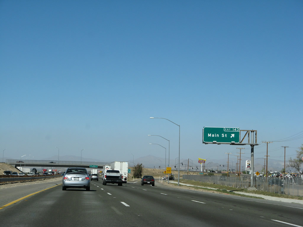
The next exit along Interstate 15 north is Exit 143, Main Street to Hesperia. Photo taken 03/30/07. |
|
An exit number roadside guide sign is posted for Exit 143, Main Street. Photo taken 03/28/08. |
|
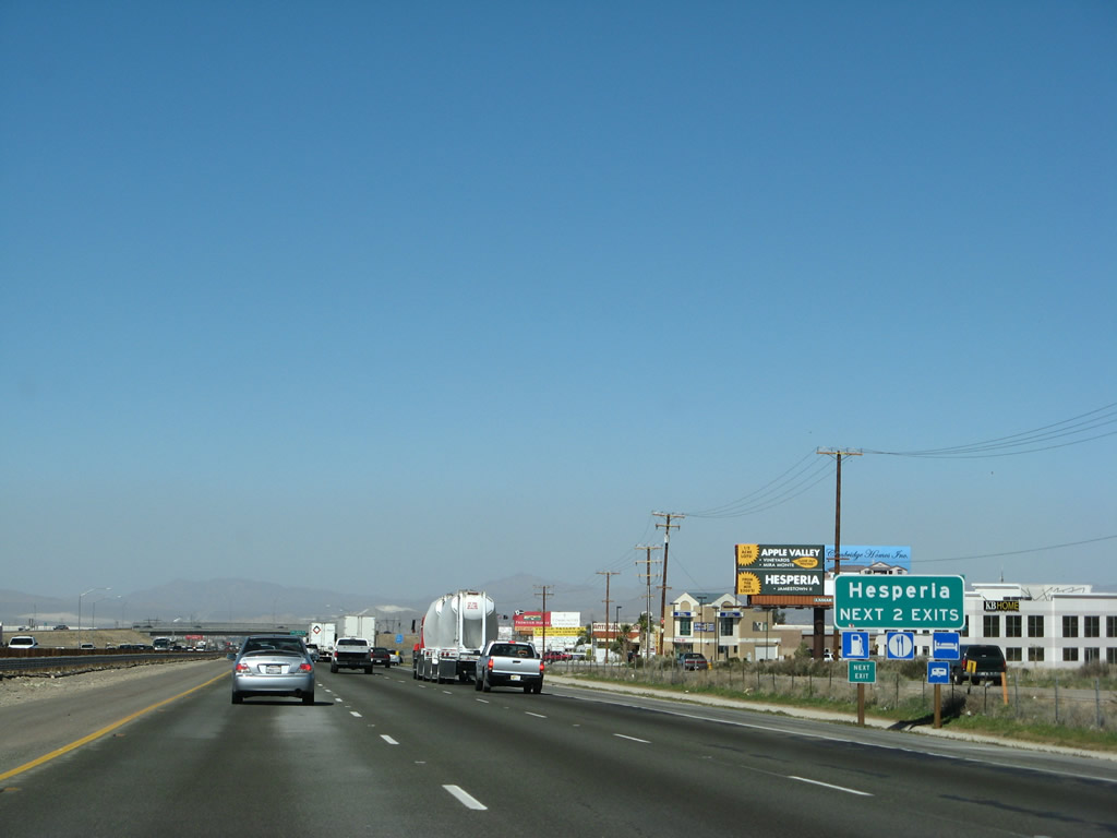
The next two exits along Interstate 15 north serve Hesperia: Exit 143, Main Street and Exit 147, Bear Valley Road. Photo taken 03/28/08. |
|
Northbound Interstate 15 reaches Exit 143, Main Street. All motorist services are available at this interchange. Photo taken 03/28/08. |
Page Updated January 7, 2013.