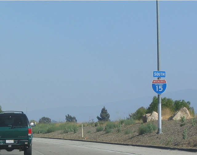
| Interstate 15 (Ontario Freeway) south |
|
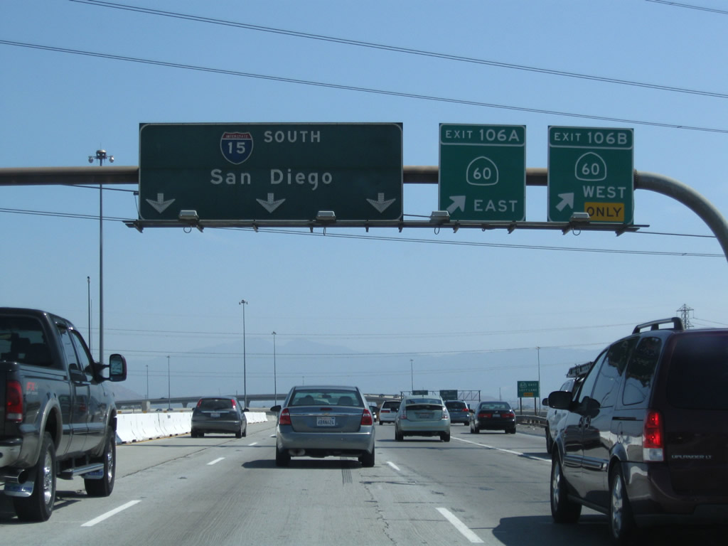
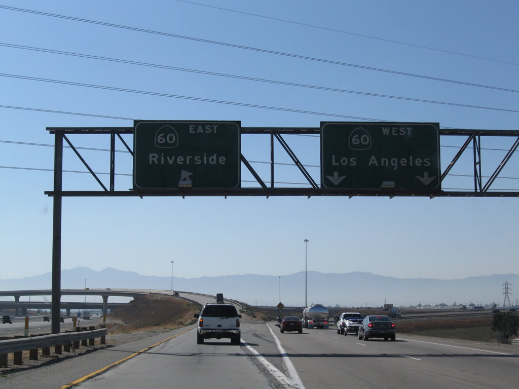
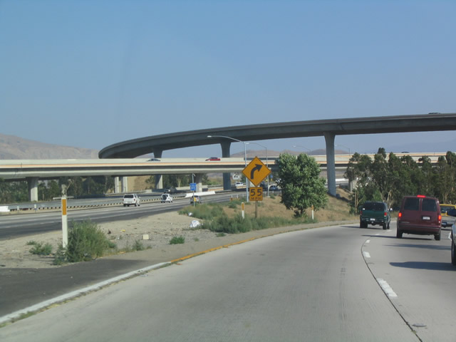
Southbound Interstate 15 (Ontario Freeway) approaches its interchange with California 60 (Pomona Freeway) once it enters Riverside County. The east-west freeway heads west to Pomona and Los Angeles and east to Riverside and Moreno Valley. Riverside County is also considered to be part of the Inland Empire, which is generally considered to be all the communities within the basin from San Bernardino in the north to Corona in the south and west to Chino Hills/Pomona and east to Moreno Valley. Some describe the Inland Empire as containing more or all of San Bernardino and Riverside Counties, but it is generally a term mostly applied to this populated valley. Photos taken 07/26/09 and 06/27/04. |
|
|
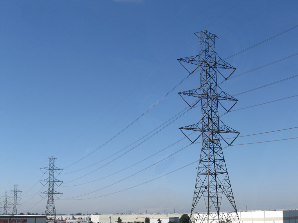
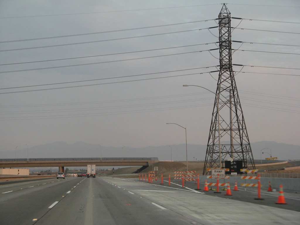
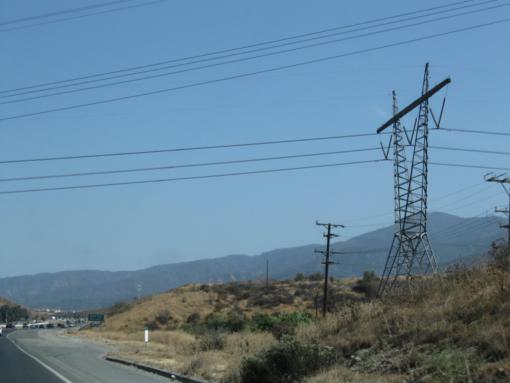
A rare double-circuit 500kV power line crosses over Interstate 15 at the California 60 interchange; this line is also part of Path 46. Photo taken 09/28/08. |
|
|
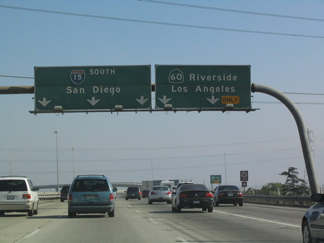
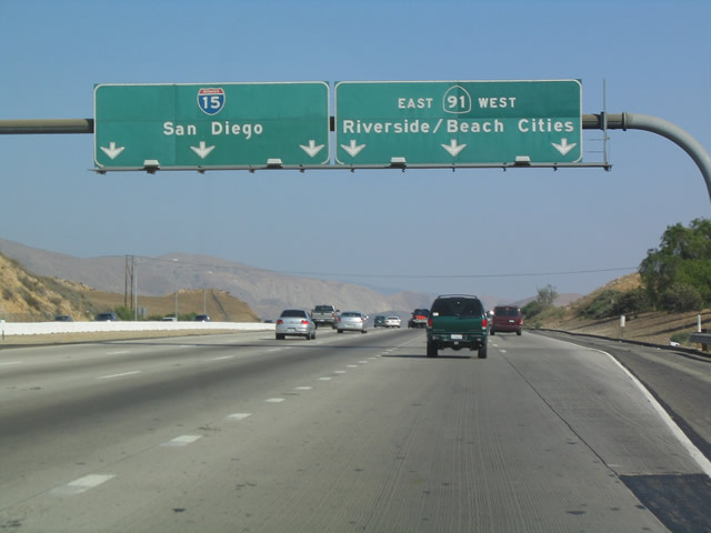
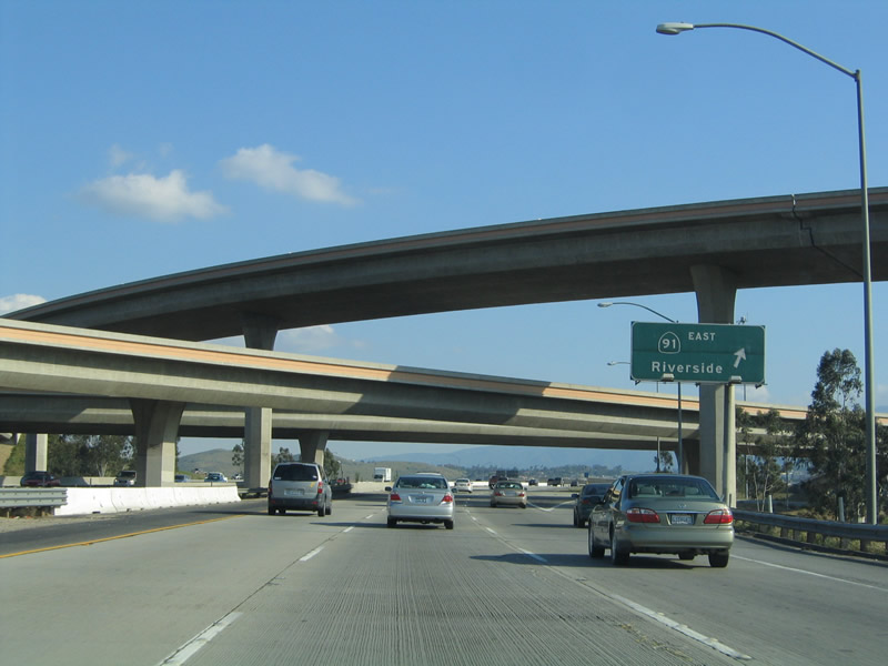
Now on the connecting ramp from Interstate 15 south to California 60, the left lane travels east to Riverside, while the right two lanes lead west to Los Angeles. The second photo follows the flyover ramp to California 60 east. Photos taken 09/28/08. |
|
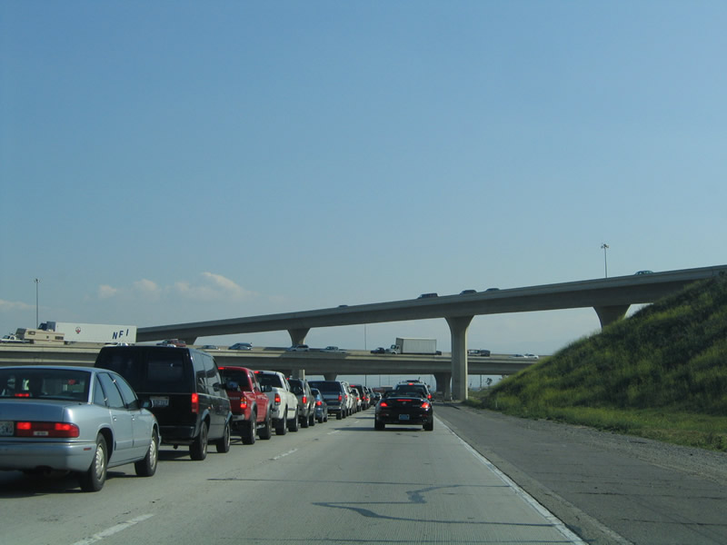
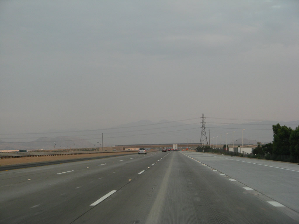
The last section of Interstate 15 to be completed in Riverside County was generally between California 60 and California 91. Once constructed in the 1980s as a six-lane freeway, it has not been upgraded since then. Traffic delays such as this congestion during commuting hours, have escalated on Interstate 15 as more cars and trucks use the freeway. Photo taken 03/25/05. |
|
|
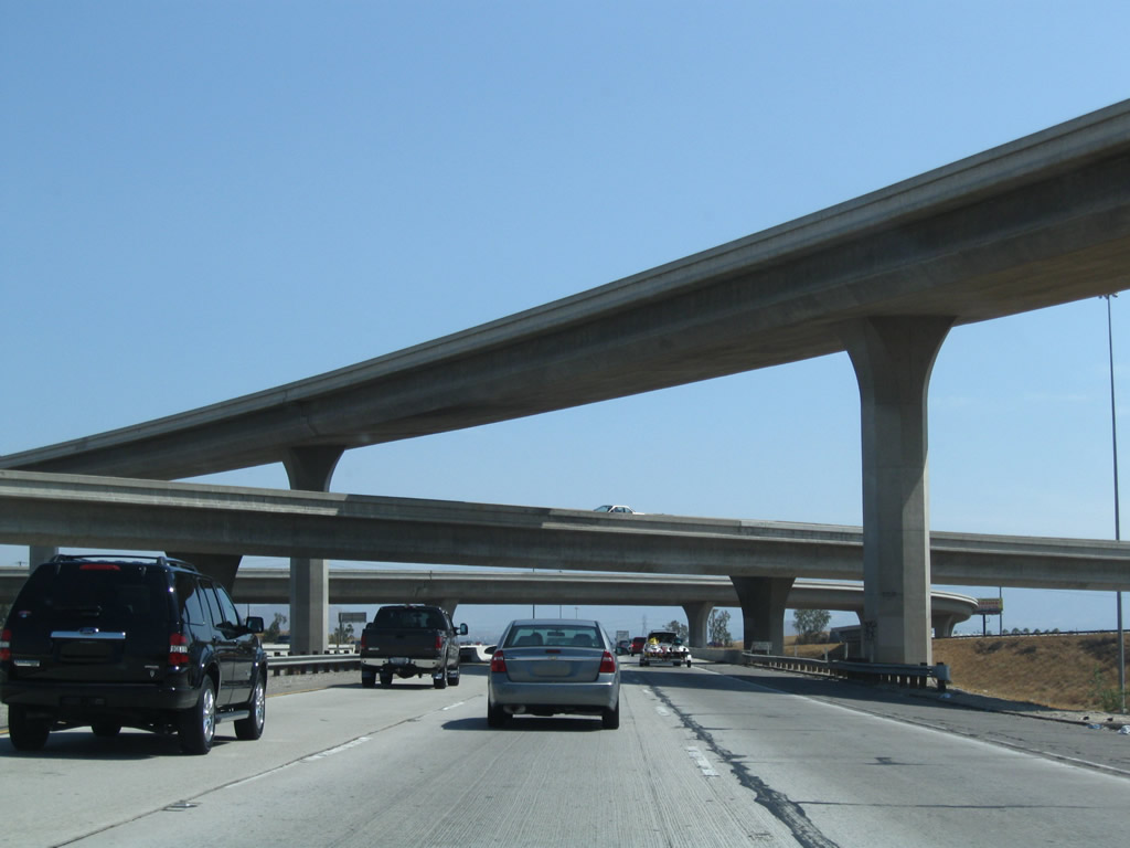
Passing under California 60, the highest ramps fly over the top of Interstate 15. Photos taken 07/26/09 and 03/25/05. |
|
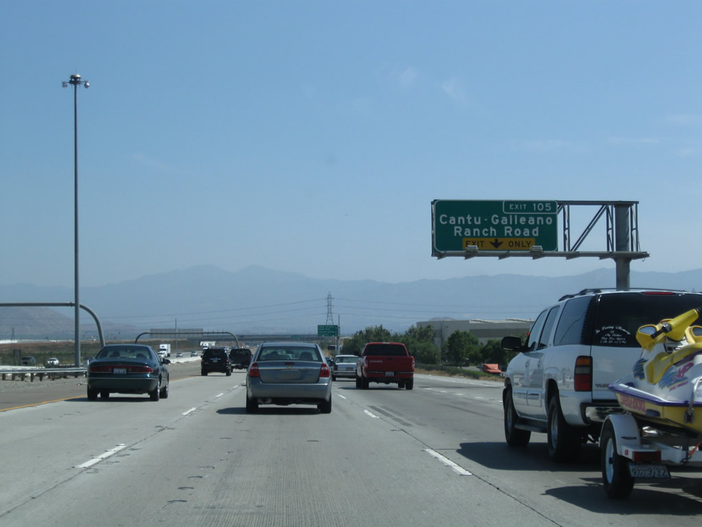
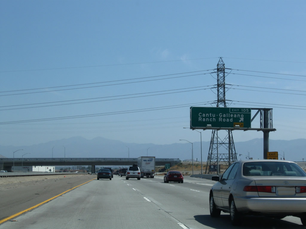
Once Interstate 15 passes California 60 (Pomona Freeway), the next exit is Exit 105, Cantu-Galleano Ranch Road (right lane exit only). This interchange opened in late 2007. Photo taken 07/26/09. |
|
This photo shows the approach to Exit 105 before the interchange opened to traffic. Photo taken 07/09/07. |
|
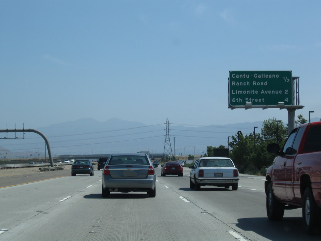
A mileage sign provides the distance to Exit 105, Cantu-Galleano Ranch Road; Exit 103, Limonite Avenue; and Exit 100, Business Loop I-15 South/Sixth Street to Norco. Photo taken 07/26/09. |
|
Southbound Interstate 15 reaches Exit 105, Cantu-Galleano Ranch Road. Photo taken 07/26/09. |
|
This view shows the Exit 105 off-ramp under construction in 2007. Photo taken 07/09/07. |
|
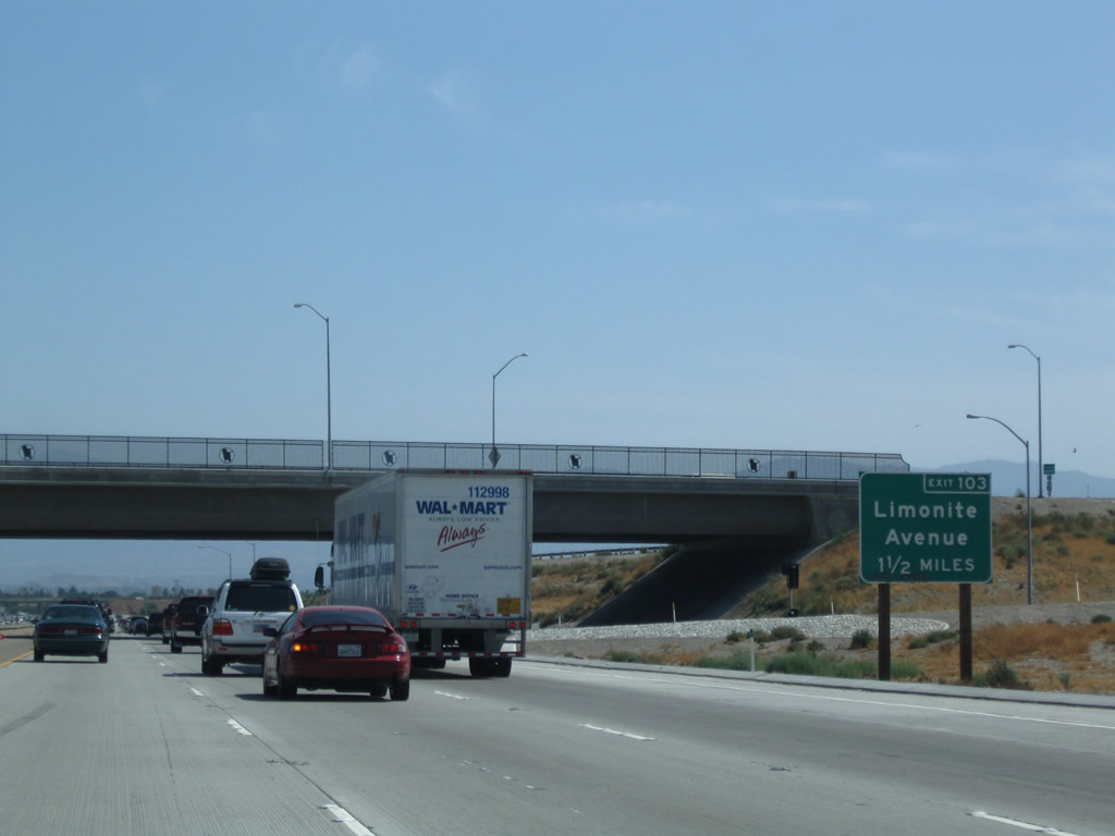
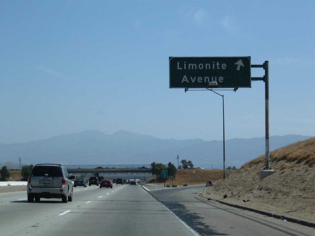
The next exit along Interstate 15 south is Exit 103, Limonite Avenue (1.50 miles). Photo taken 07/26/09. |
|
A mileage sign provides the distance to Norco (four miles), Corona (eight miles), and San Diego (102 miles). Photo taken 07/26/09. |
|
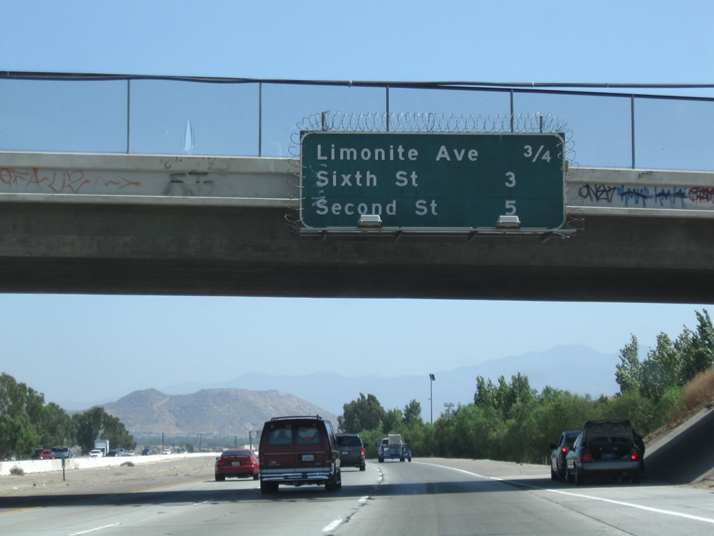
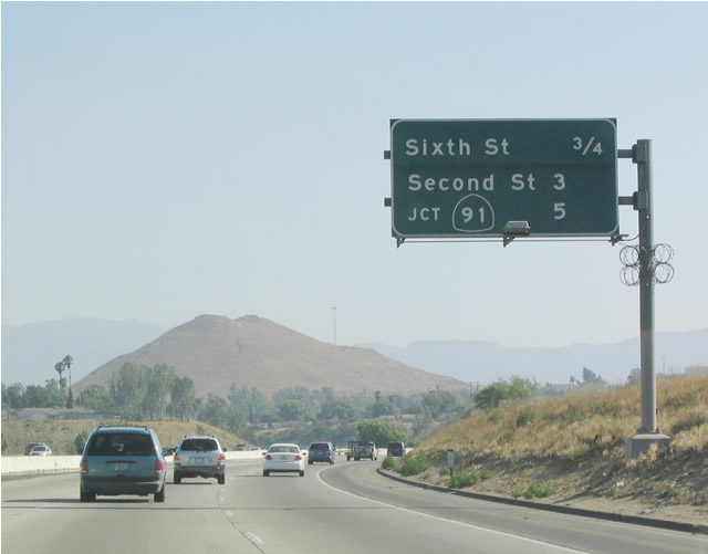
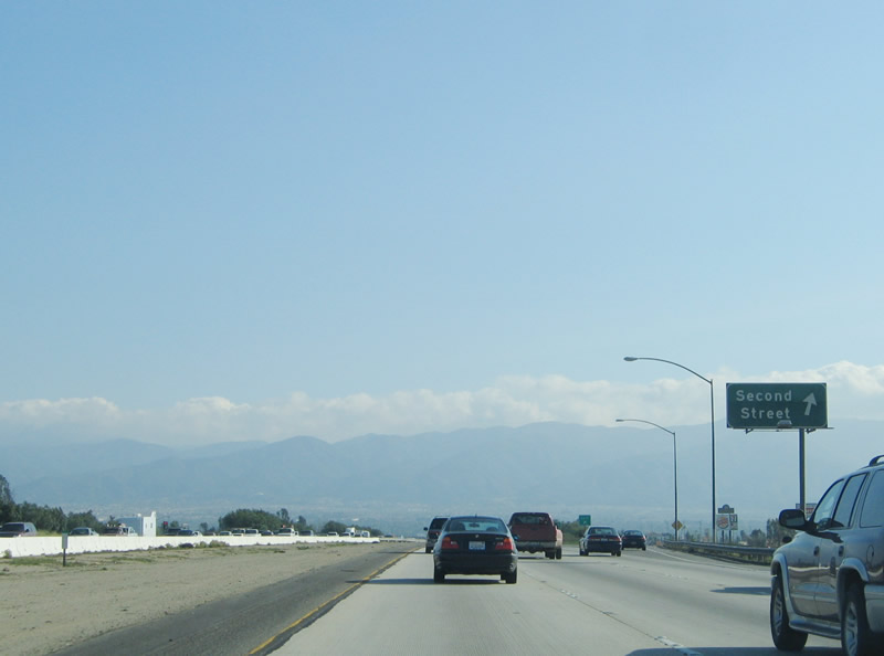
This mileage sign provides the distance to the next three exits along Interstate 15 south: Exit 103, Limonite Avenue; Exit 100, Business Loop I-15 South/Sixth Street; and Exit 98, Second Street (Business Loop I-15 north). Photo taken 07/26/09. |
|
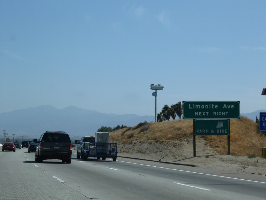
The next exit along Interstate 15 south is Exit 103, Limonite Avenue (next right). Photo taken 07/26/09. |
|
Southbound Interstate 15 reaches Exit 103, Limonite Avenue. The section of Interstate 15 (Ontario Freeway) between California 60 and California 91 was constructed in the mid-1980s and features a different design standard than the section north of California 60 and south of California 91. One of these features is the smaller sign bridges, such as this one found along southbound at Exit 103, Limonite Avenue. Limonite Avenue heads east to Pedley and Rubidoux (ending at California 60 Business (Mission Boulevard) just west of Riverside), roughly following the Santa Ana River. Photo taken 07/26/09. |
|
This Interstate 15 south reassurance shield is posted after the on-ramp from Limonite Avenue. Photo taken 07/26/09. |
|
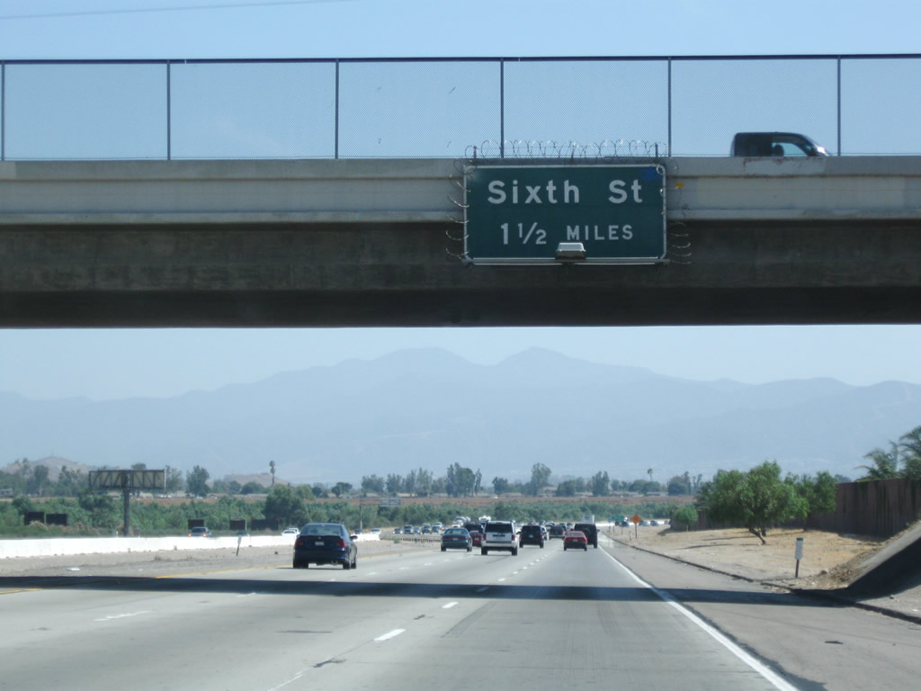
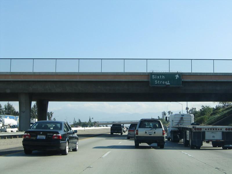
The next exit along southbound Interstate 15 is Exit 100, Business Loop I-15 south/Sixth Street west to Norco and Sixth Street east to Riverside via California Avenue and La Sierra Avenue. Photo taken 07/26/09. |
|
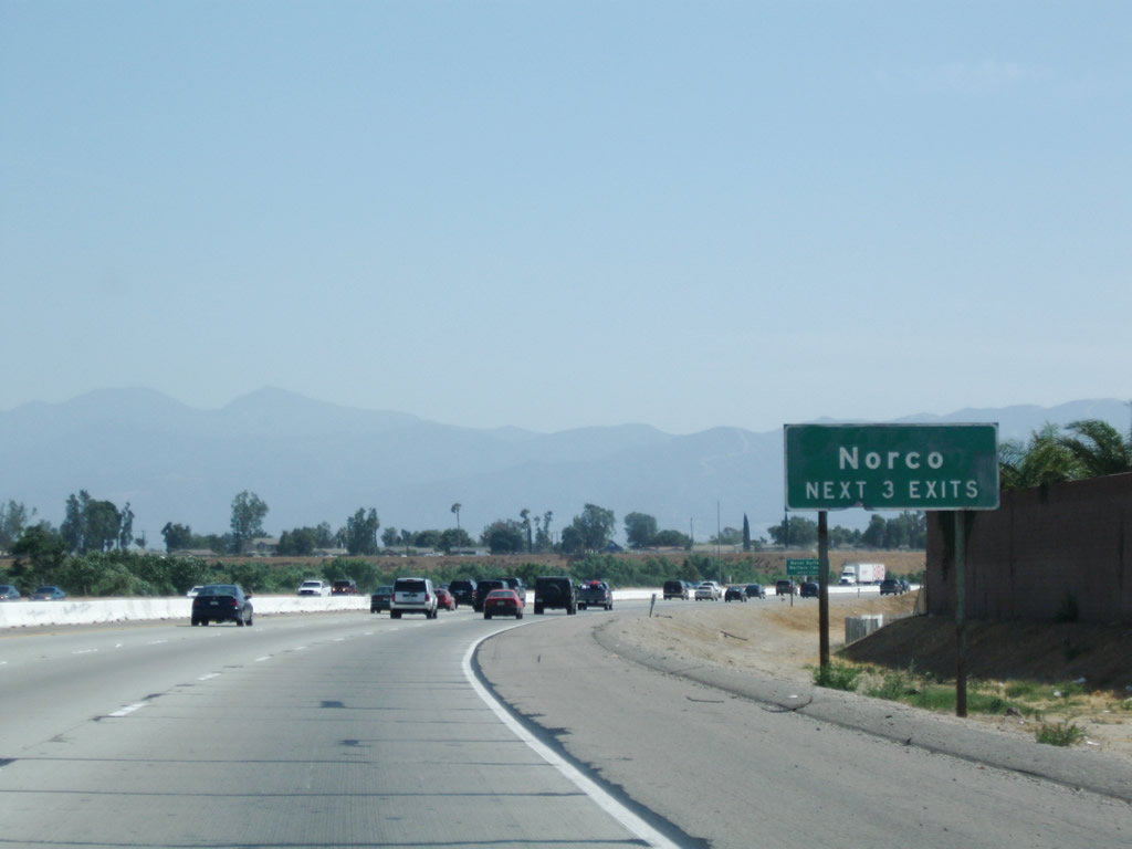
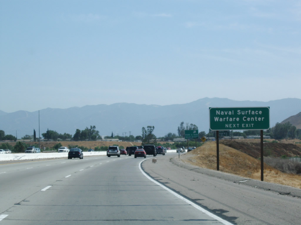
The next three exits along Interstate 15 south serve the city of Norco. Photo taken 07/26/09. |
|
Use Exit 100 to the Naval Surface Warfare Center. Photo taken 07/26/09. |
|
This mileage sign provides the distance to three of the next four exits: Exit 100, Business Loop I-15/Sixth Avenue; Exit 98, Second Avenue (Business Loop I-15 north); Exit 97, Hidden Valley Parkway (omitted); and Exits 96B-A, California 91 (Riverside Freeway). Photo taken 06/27/04. |
|
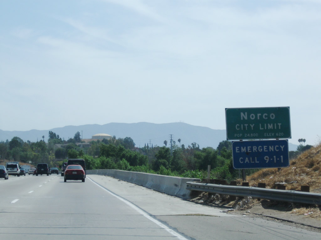
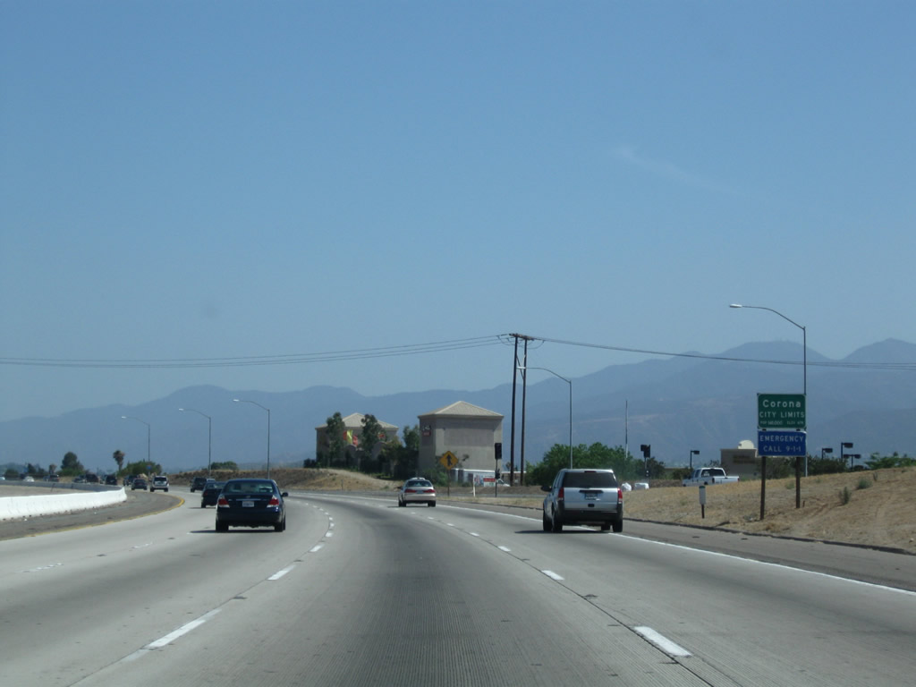
Prior to crossing the Santa Ana River, southbound Interstate 15 enters the city of Norco (population 24,157 as of the 2000 Census; elevation 640 feet; incorporated December 28, 1964). Photo taken 07/26/09. |
|
A three-lane bridge carries southbound traffic over the Santa Ana River. Photo taken 07/26/09. |
|
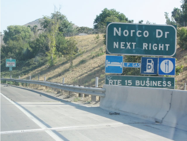
This roadside sign ("Rte 15 Business") along southbound is located immediately after the Santa Ana River Bridge. In addition to serving Sixth Avenue, Exit 100 also accesses Business Loop I-15 south and Norco Drive. Photo taken 06/27/04. |
|
Southbound Interstate 15 reaches Exit 100, Business Loop I-15 south/Sixth Street. There is space on this overhead sign to fit a business loop shield, but it is doubtful any such shield was ever intended to be mounted on this sign. The business loop heads west on Sixth Avenue to Hamner Avenue, then follows former California 31/Hamner Avenue through Norco south to Second Avenue. Business Loop I-15 then turns east on Second Avenue to rejoin Interstate 15. Photo taken 03/25/05. |
|
The next exit along southbound Interstate 15 is Exit 98, Business Loop I-15 north/Second Street. The business loop only follows former California 31 between Exits 100 and 98. Photo taken 03/25/05. |
|
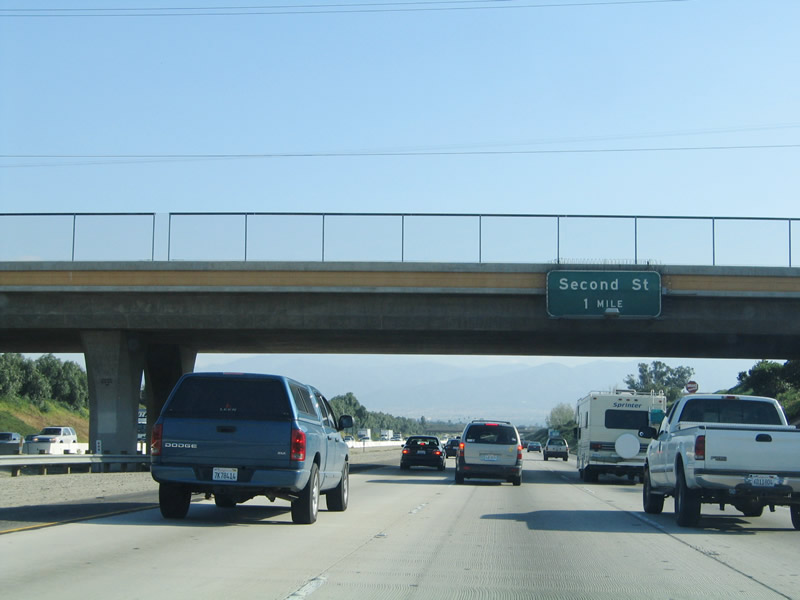
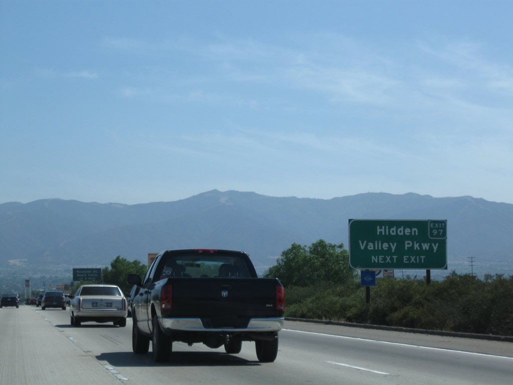
The next two exits along southbound Interstate 15 are Exit 98, Business Loop I-15 north/Second Street, 0.75 mile, followed by Exit 97, Hidden Valley Parkway, 1.50 miles. Photo taken 03/25/05. |
|
Southbound Interstate 15 reaches Exit 98, Business Loop I-15 north and Second Street west to Norco and River Road. Photo taken 03/25/05. |
|
|
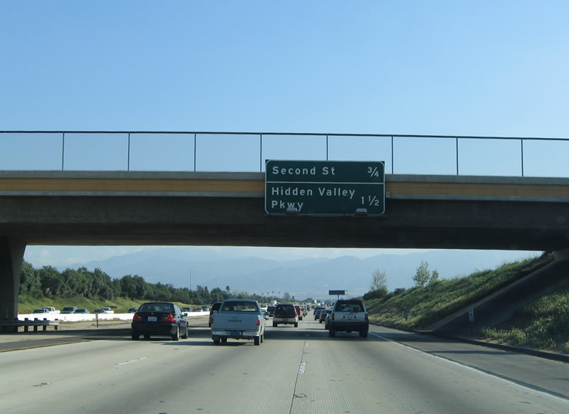
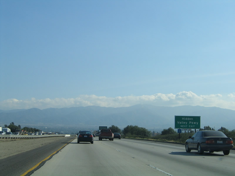
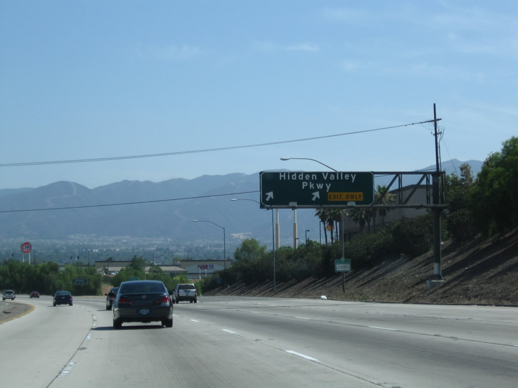
The next exit along southbound is Exit 97, Hidden Valley Parkway. Use Hidden Valley Parkway east to reach McKinley Street (which meets California 91 at Exit 53 near Home Gardens in eastern Corona) and west to old California 31/Hamner Avenue. Photos taken 07/26/09 and 03/25/05. |
|
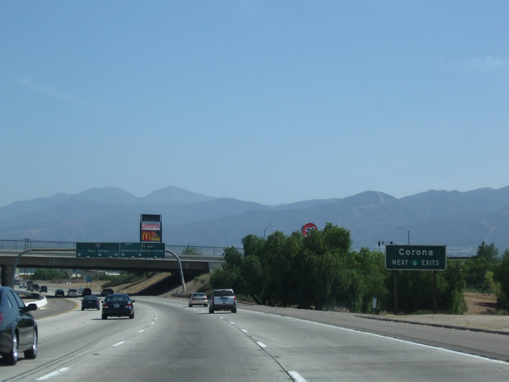
After the Hidden Valley Parkway interchange, Interstate 15 will meet California 91 (Riverside Freeway), at Exits 96B-A. Interstate 15 leaves Norco and enters the city of Corona (the Circle City), which had a population of 124,966 people per the 2000 Census. Photo taken 03/25/05. |
|
Southbound Interstate 15 reaches Exit 97, Hidden Valley Parkway. Hidden Valley Parkway is the final Norco exit. After Exit 97, Interstate 15 enters the city of Corona. Photo taken 07/26/09. |
|
The next six exits all serve the city of Corona. Photo taken 07/26/09. |
|
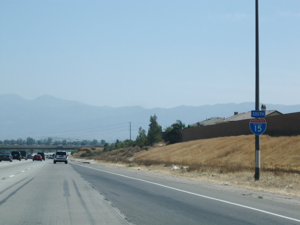
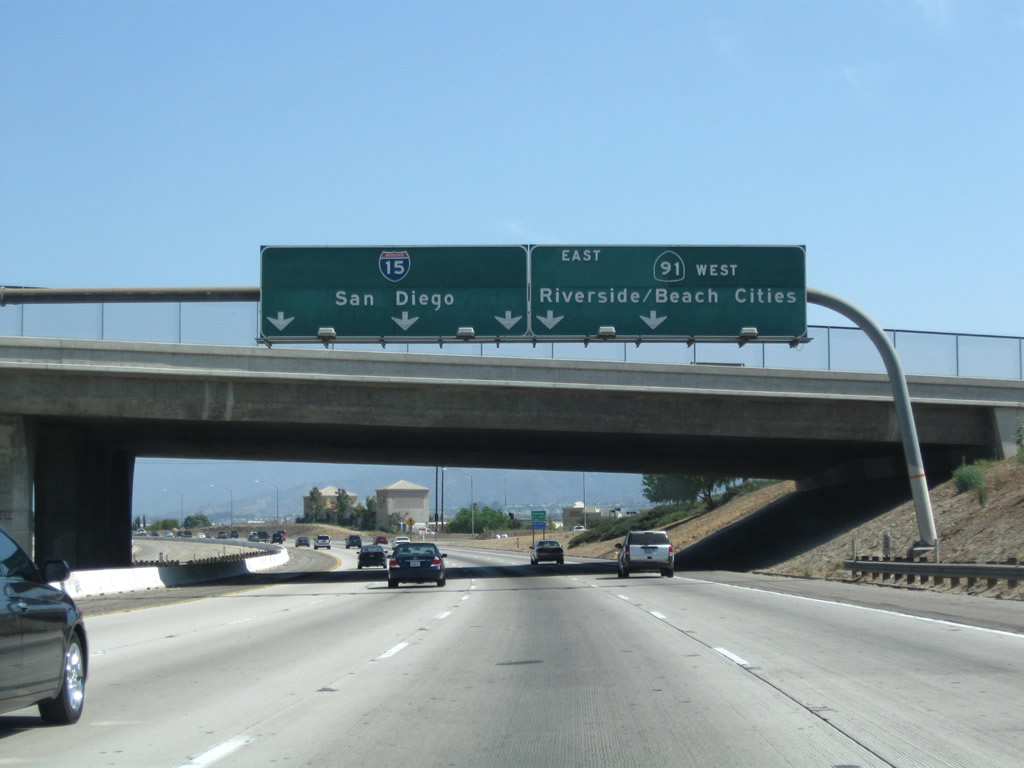
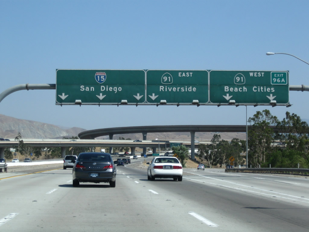
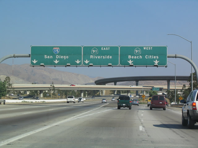
The next exit along southbound Interstate 15 is Exit 96B, California 91 (Riverside Freeway) east to Riverside and west to Orange County (Yorba Linda, Anaheim, Fullerton, and Buena Park), southern Los Angeles County (Cerritos, Norwalk, Bellflower, Paramount, Compton, Carson, Torrance, Lawndale, and Hermosa Beach/California 1), Long Beach via Interstate 605 or Interstate 710, and Orange County beach areas via California 55. Photo taken 07/26/09. |
|
Interstate 15 leaves Norco and enters the city of Corona. Corona had a population of 124,966 as of the 2000 Census. This city was incorporated on July 13, 1896. Photo taken 07/26/09. |
|
This reassurance shield for south Interstate 15 is posted after the on-ramp from Hidden Valley Parkway. The right lane becomes exit only for California 91/Exits 96B-A. Photo taken 06/27/04. |
|
The single exit only lane widens into two lanes as southbound Interstate 15 approaches California 91. Signed east-west, most of California 91 follows the original alignment of U.S. 91 roughly between Interstate 5 and California 60/Interstate 215. U.S. 91 was decommissioned along with many other California U.S. routes in 1964; signs were removed shortly thereafter. Photo taken 06/27/04. |
|
|
Southbound Interstate 15 reaches Exit 96B, California 91 (Riverside Freeway) west to Orange County and southern Los Angeles County (including connections to most beach areas). The next exit is Exit 96A, California 91/Riverside County east to Riverside. Photos taken 07/26/09 and 06/27/04. |
|
This picture shows the Interstate 15/California 91 as seen from the transition ramp from southbound Interstate 15 onto westbound California 91. Photo taken 06/27/04. |
|
|
Southbound Interstate 15 next reaches Exit 96A, California 91 north to Riverside. An exit number was pasted onto the previously posted guide sign sometimes around 2008. Photos taken 07/26/09 and 03/25/05. |
| Interstate 15 (Corona Freeway) south |
|
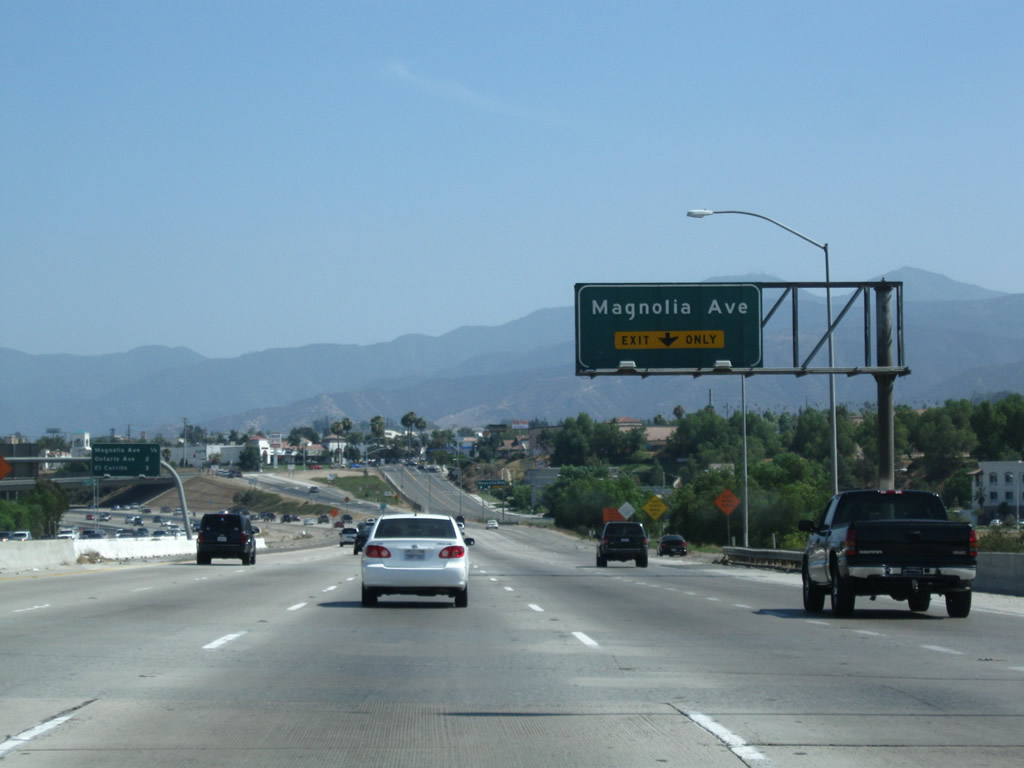
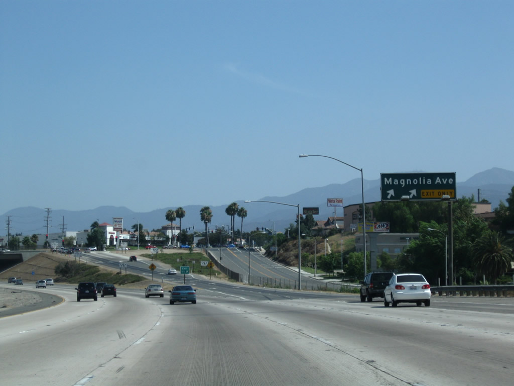
After the interchange with California 91 (Riverside Freeway), the next exit along Interstate 15 south is Exit 95, Magnolia Avenue. Magnolia Avenue connects to Old U.S. 91, which follows Sixth Street through downtown. The entire downtown is belted by a circular street known as Grand Boulevard. This circle gives Corona the nickname "Circle City." To downtown Corona, turn west on Magnolia Avenue, then turn northwest on Rimpau Avenue, Fullerton Avenue, or Kellogg Avenue. Photo taken 07/26/09. |
|
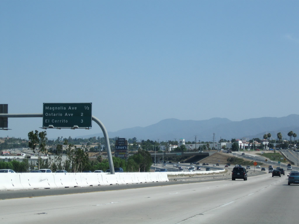
The next three exits along southbound are Exit 95, Magnolia Avenue; Exit 93, Ontario Avenue; and Exit 92, El Cerrito Road. Photo taken 07/26/09. |
|
A double lane exit facilitates traffic leaving Interstate 15 (Corona Freeway) south at Exit 95, Magnolia Avenue. Photo taken 07/26/09. |
|
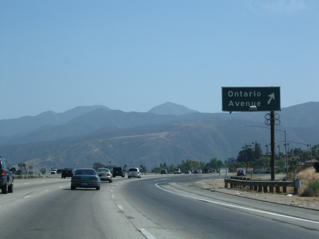
The next exit along southbound is Exit 93, Ontario Avenue. Photo taken 07/26/09. |
|
A neutered Interstate 15 shield (no state name) is posted after the on-ramp from Magnolia Avenue. Neutered shields are incresingly common on California's Interstate system. Photo taken 07/26/09. |
|
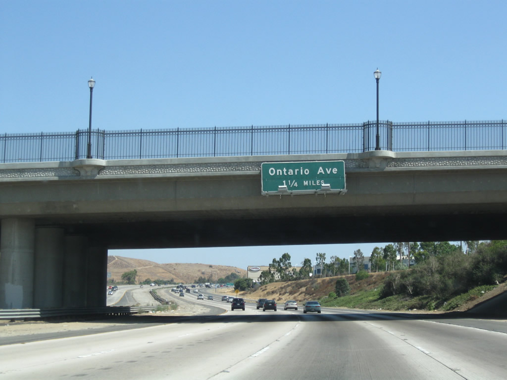
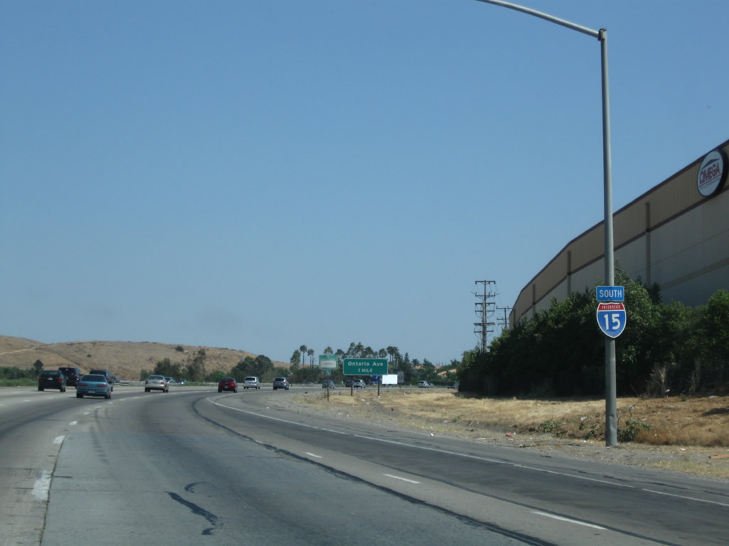
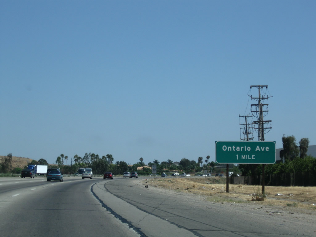
A one-mile advance sign is posted for Ontario Avenue shortly thereafter. Photo taken 07/26/09. |
|
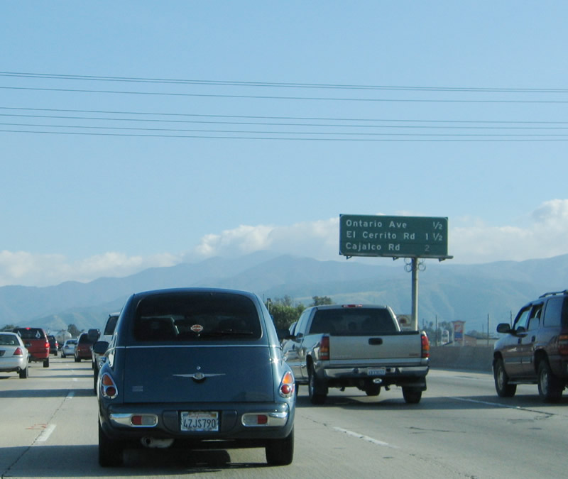
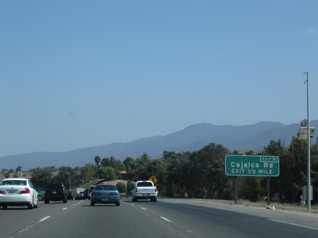
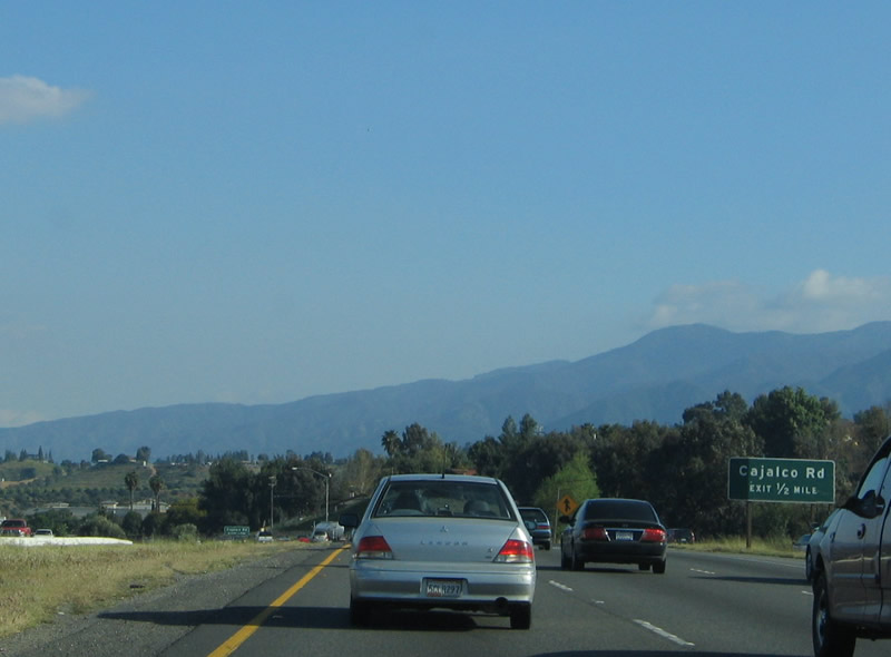
The next three exits along southbound are Exit 93, Ontario Avenue; Exit 92, El Cerrito Road; and Exit 91, Cajalco Road. Photo taken 03/25/05. |
|
Southbound Interstate 15 (Corona Freeway) reaches Exit 93, Ontario Avenue. Photo taken 07/26/09. |
|
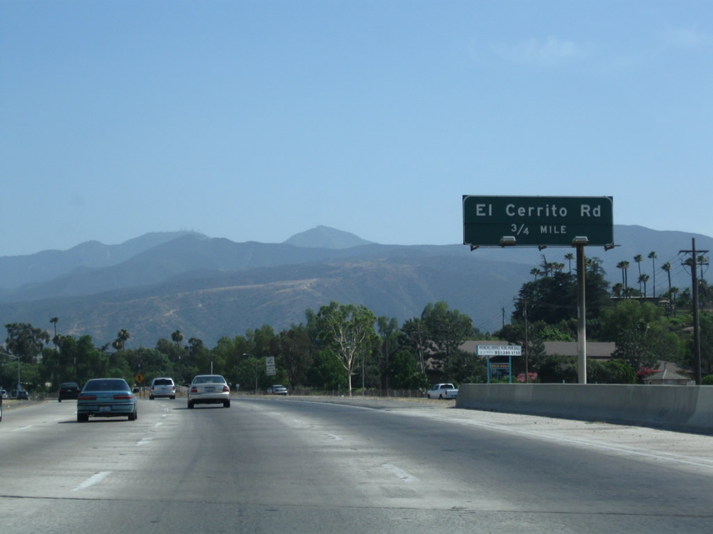
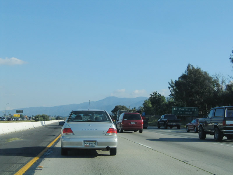
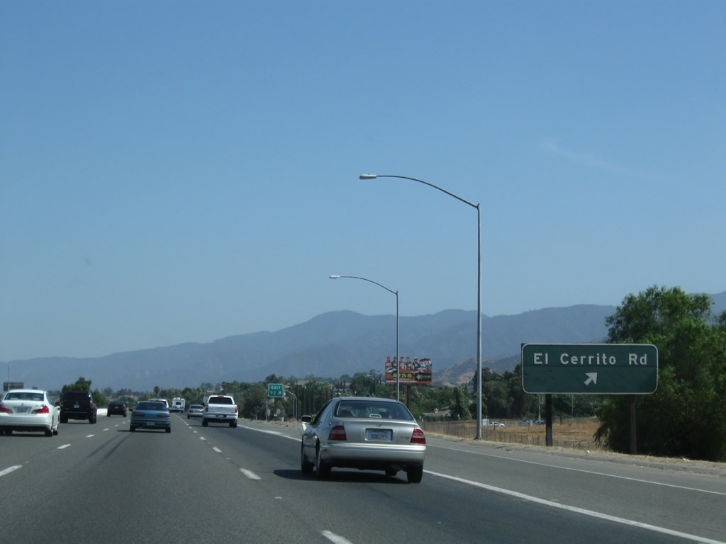
The next exit along Interstate 15 is Exit 92, El Cerrito Road. El Cerrito Road travels east to El Cerrito, which is situated at the intersection with Temescal Canyon Road (Old California 71). Photo taken 03/25/05. |
|
This sign for El Cerrito Road is almost too small to be noticed, especially on a busy and fast six-lane highway. Photo taken 03/25/05. |
|
Southbound Interstate 15 reaches Exit 92, El Cerrito Road. This interchange is not located in the city of Corona, but it connects to Foothill Parkway in the city of Corona to the west. Photo taken 07/26/09. |
|
|
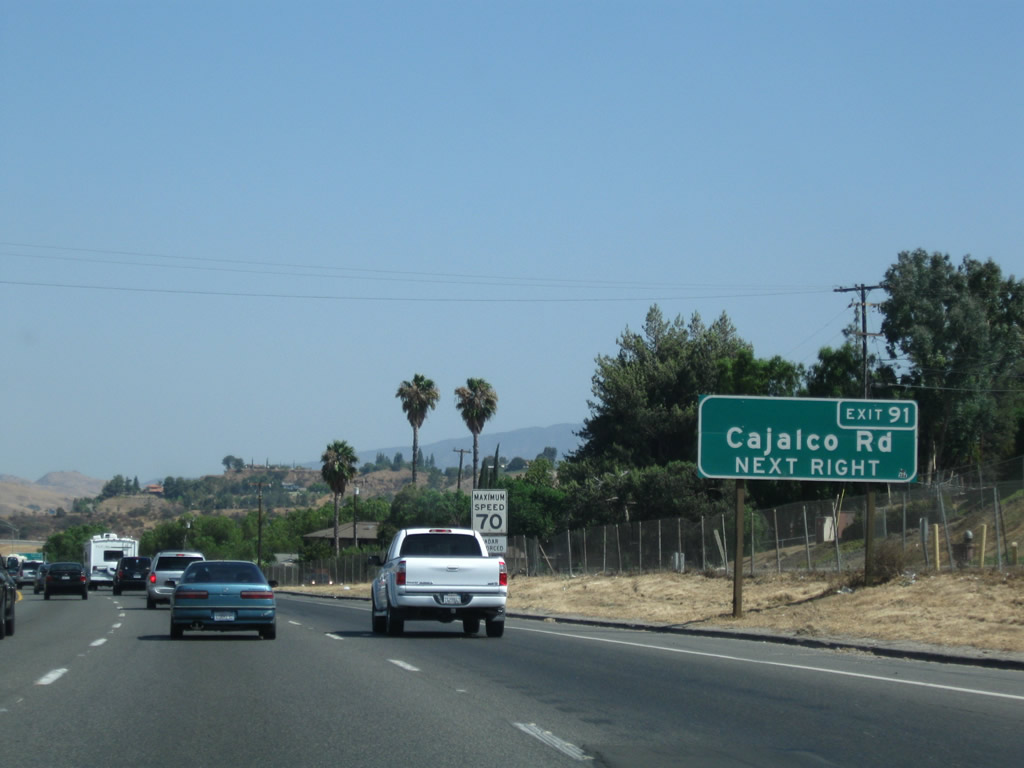
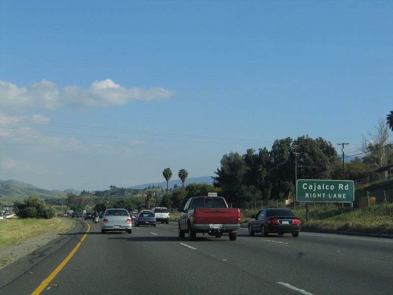
The next exit along southbound is Exit 91, Cajalco Road; an exit number sign was in place by 2009. This interchange is also located in the city of Corona. Photos taken 07/26/09 and 03/25/05. |
|
|
Cajalco Road travels east past Lake Mathews to meet Interstate 215 at Exit 22. Upon entering Perris, Cajalco Road changes into the Ramona Expressway, which continues east around Lake Perris and north of Hemet before joining California 74 in Valle Vista. Photos taken 07/26/09 and 03/25/05. |
|
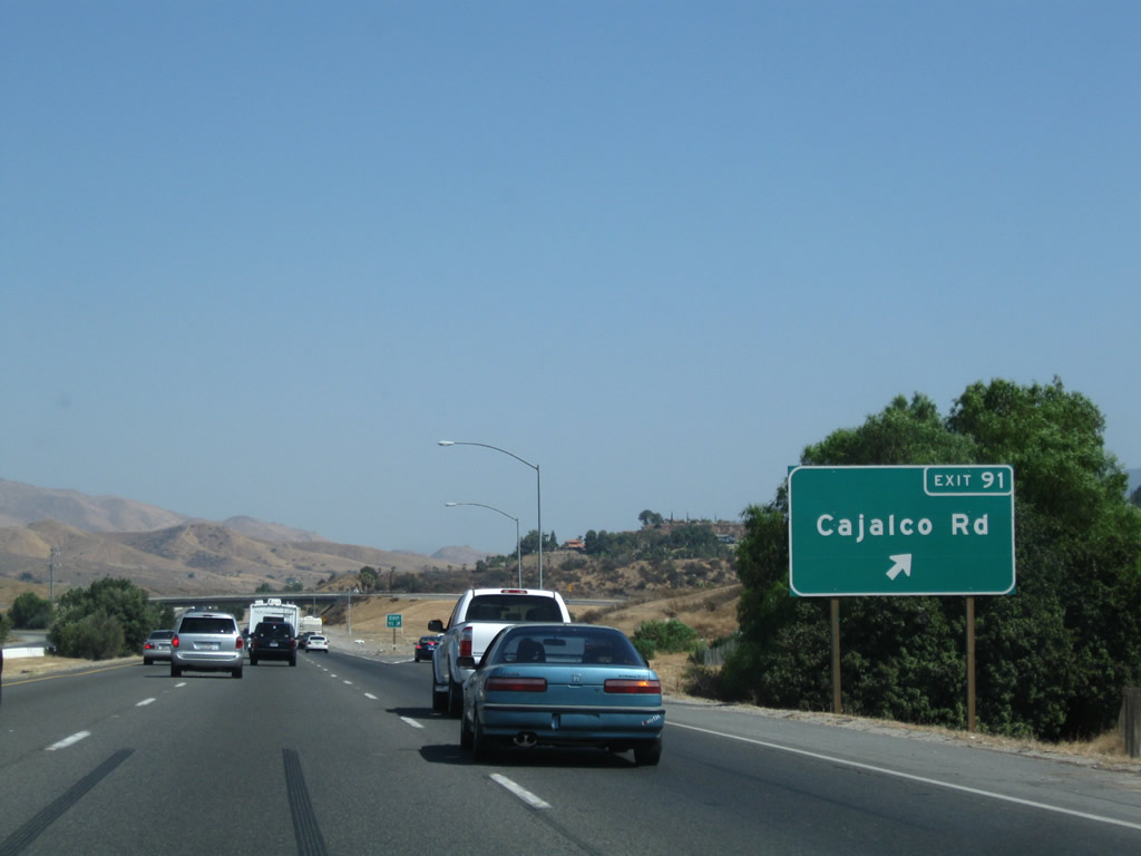
Southbound Interstate 15 reaches Exit 91, Cajalco Road. Photo taken 07/26/09. |
|
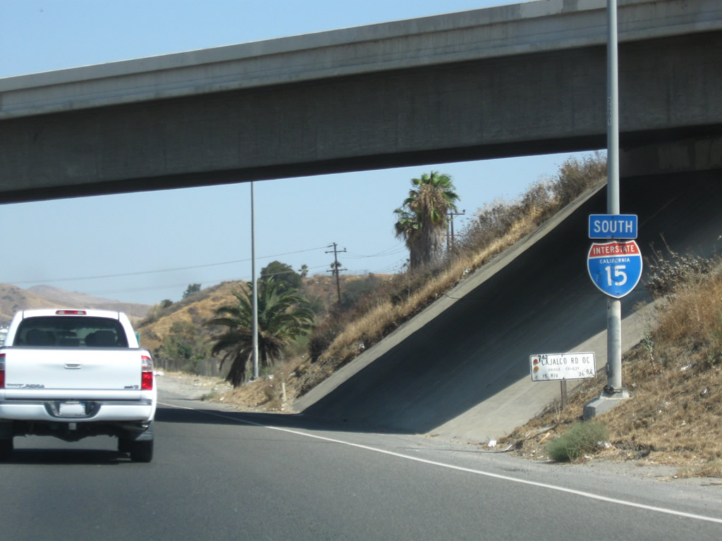
This Interstate 15 south route marker is posted prior to passing under Cajalco Road. Photo taken 07/26/09. |
|
|
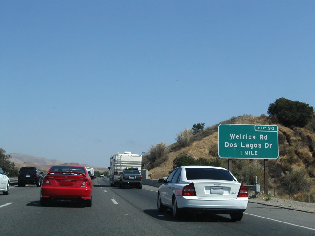
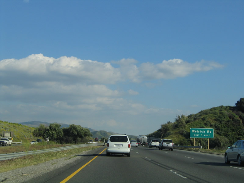
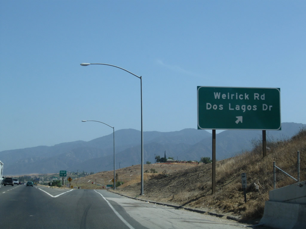
The next exit along Interstate 15 (Corona Freeway) south is Exit 90, Weirick Road and Dos Lagos Drive (one mile). Photos taken 07/26/09 and 03/25/05. |
|
A second advance guide sign for Exit 90, Weirick Road and Dos Lagos Drive is posted shortly thereafter. Photo taken 07/26/09. |
|
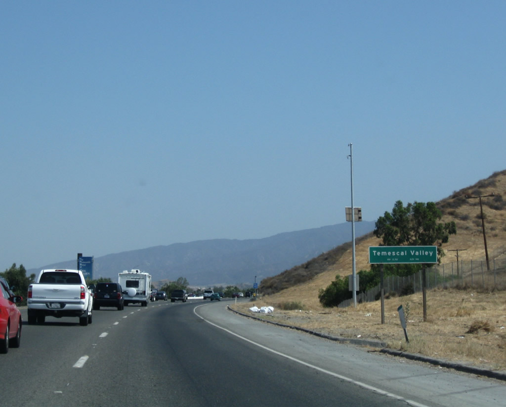
Interstate 15 leaves the city of Corona and enters Temescal Valley. Photo taken 07/26/09. |
|
|
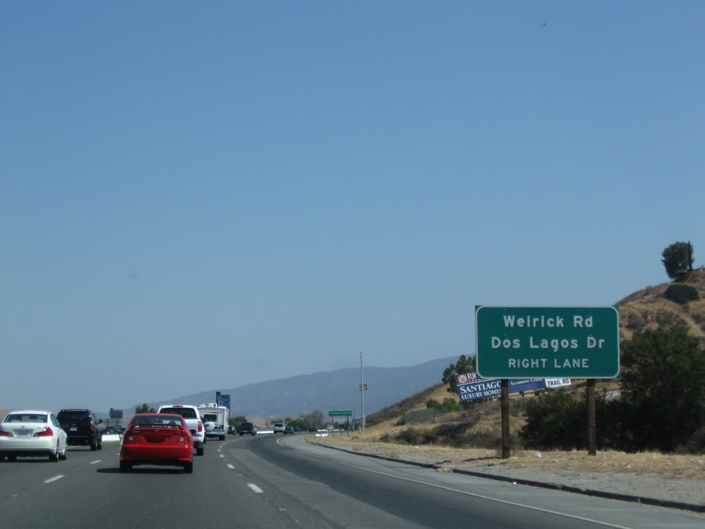
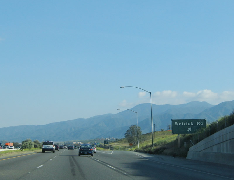
Southbound Interstate 15 (Corona Freeway) reaches Exit 90, Weirick Road and Dos Lagos Drive. Weirick Road is the final exit to serve the city of Corona, and Interstate 15 briefly enters Corona (and leaves before Exit 92). Use Weirick Road east to Temescal Canyon Road (Old California 71). Photos taken 07/26/09 and 03/25/05. |
|
This Interstate 15 south reassurance shield is posted after the on-ramp from Weirick Road. Photo taken 07/26/09. |
|
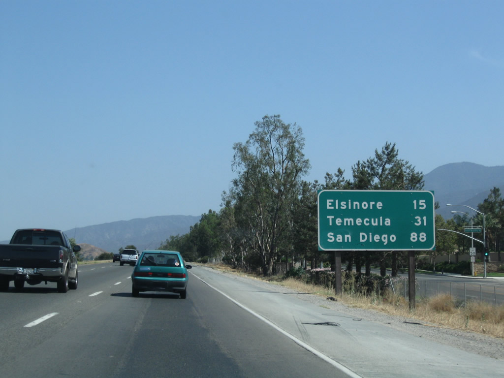
A mileage sign provides the distance to Lake Elsinore (15 miles), Temecula (31 miles), and San Diego (88 miles). Photo taken 07/26/09. |
|
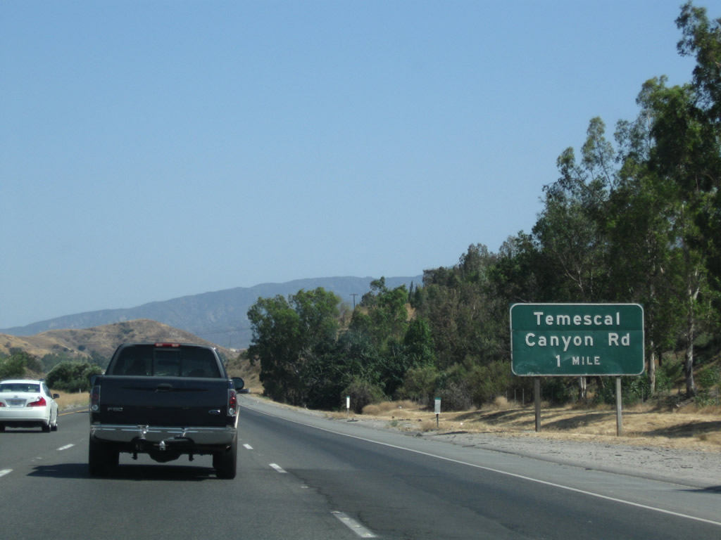
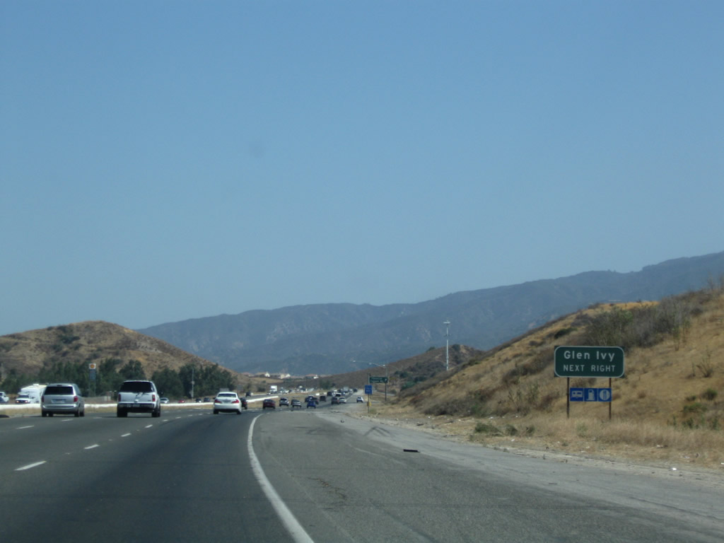
The next exit along Interstate 15 (Corona Freeway) south is Exit 88, Temescal Canyon Road. Glen Ivy Hot Springs are located at this exit just west of the freeway. Photo taken 07/26/09. |
|
A 500kV Southern California Edison power line crosses over the freeway at this point; this line transmits power between Southern California and Arizona. Photo taken 07/26/09. |
|
Use Exit 88 to Glen Ivy. Photo taken 07/26/09. |
|
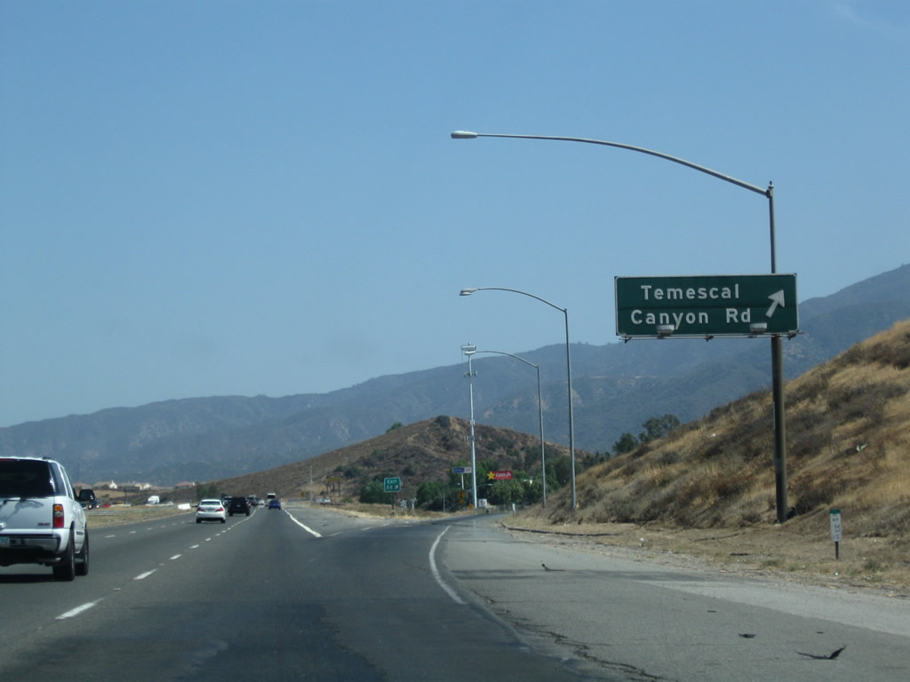
Southbound Interstate 15 reaches Exit 88, Temescal Canyon Road. Temescal Canyon Road is the old alignment of California 71, which parallels Interstate 15 through the canyon. Photo taken 07/26/09. |
|
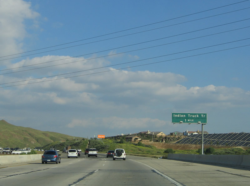
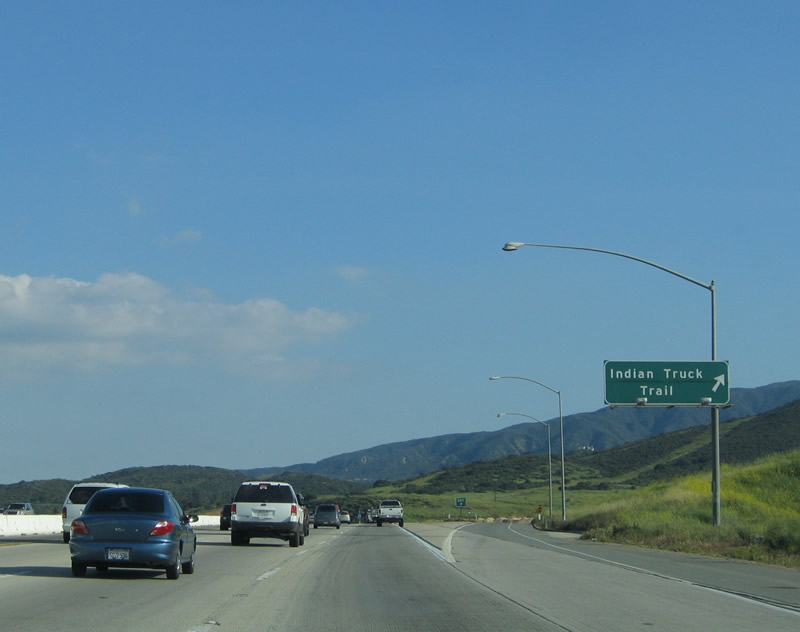
The next exit along Interstate 15 south is Exit 85, Indian Truck Trail. Indian Truck Trail provides local and ranch access to the foothills of the Santa Ana Mountains, which dominate the skyline to the west of the freeway. Photo taken 03/25/05. |
|
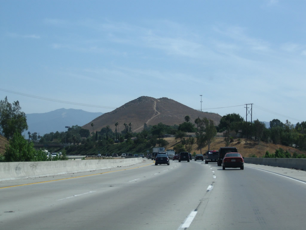
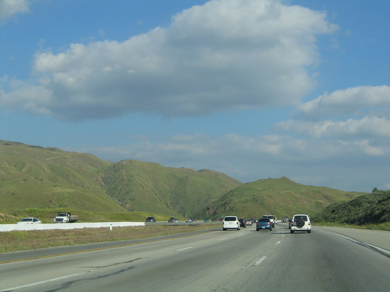
Verdant green hills greet southbound travelers as the freeway passes through undeveloped Temescal Canyon. During summer months, the grasses dry out, and the hills look golden brown. Fire is a danger during those dry summer months. Photo taken 03/25/05. |
|
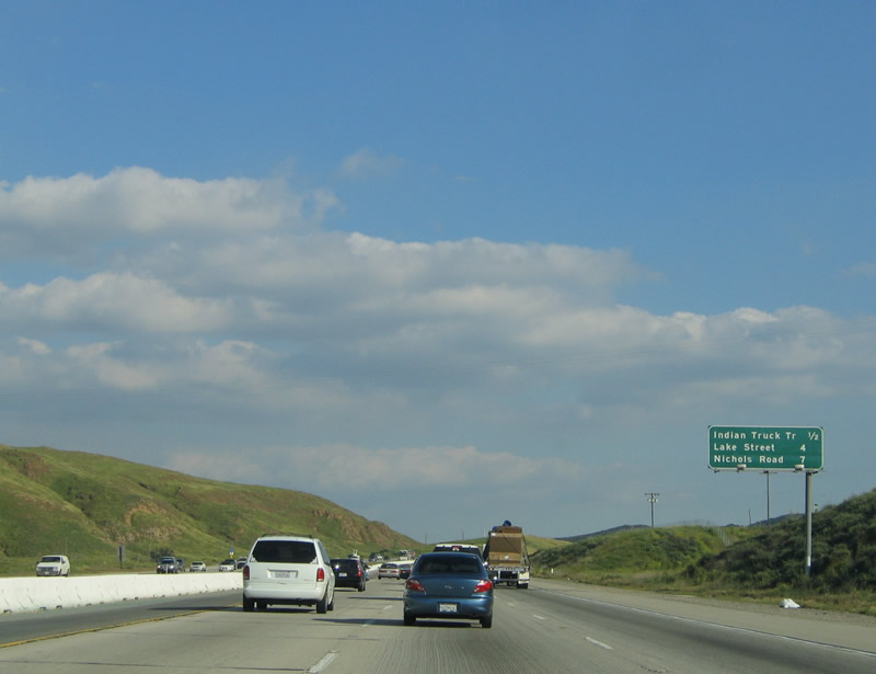
This mileage sign provides the distance to Exit 85, Indian Truck Trail; Exit 81, Lake Street; and Exit 78, Nichols Road. Photo taken 03/25/05. |
|
Southbound Interstate 15 reaches Exit 85, Indian Truck Trail. Photo taken 03/25/05. |
Page Updated May 25, 2010.