| Interstate 80 east |
|
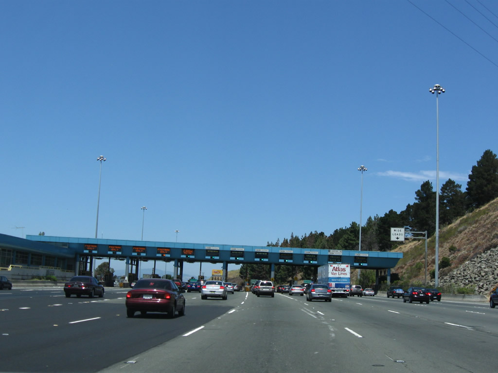
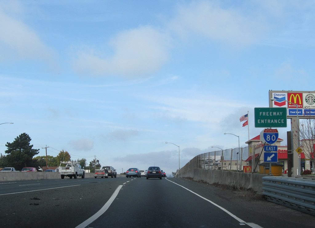
Eastbound Interstate 80 departs the Carquinez Bridge and approaches the toll plaza. The toll plaza is charged to eastbound traffic only (consistent with one-way tolling practices on other Bay Area toll bridges), and the plaza is found on the north shore of the straits. Photo taken 07/18/09. |
|
|
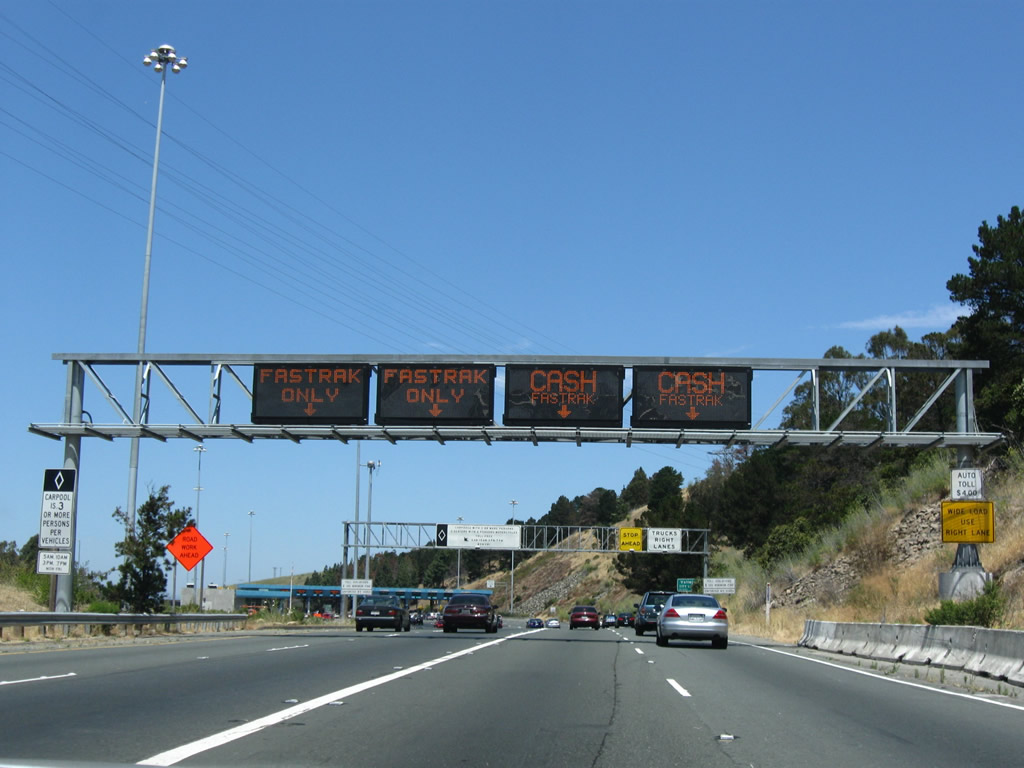
The Carquinez Bridge consists of a suspension bridge for westbound traffic (Alfred Zampa Bridge) and a steel truss bridge for eastbound traffic. The middle span, built in the 1920s, could not be retrofitted for earthquake safety, and it was removed between 2004 and 2008. The oldest span formerly carried the westbound traffic. At this point, Interstate 80 leaves Contra Costa County and enters Solano County and the city of Vallejo. Most signage here is related to the upcoming toll plaza. Photos taken 07/18/09 and 11/28/04. |
|
View of the Carquinez Bridge toll plaza along eastbound Interstate 80. The toll is only collected in this direction; it is free in the westbound direction. Photo taken 07/18/09. |
|
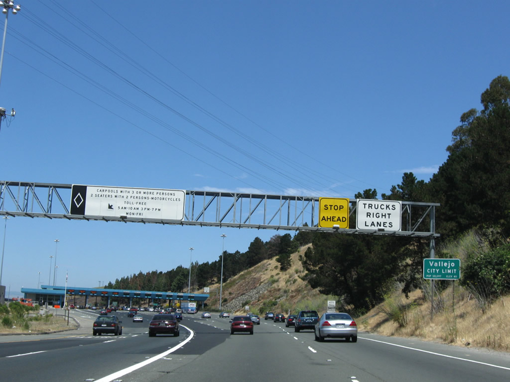
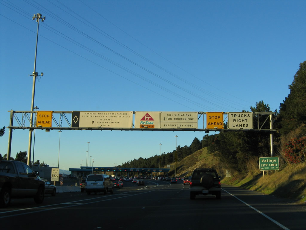
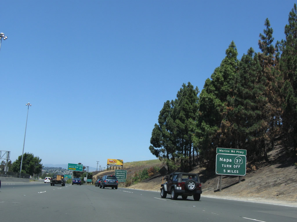
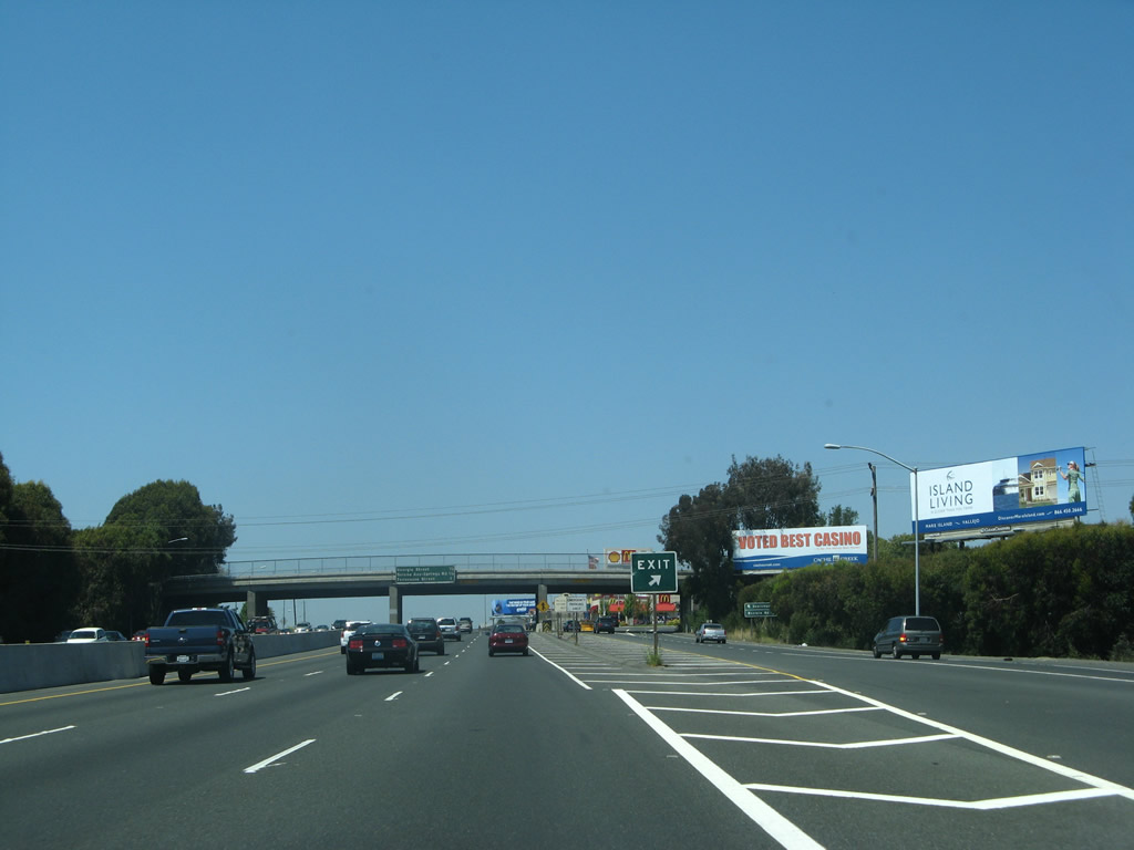
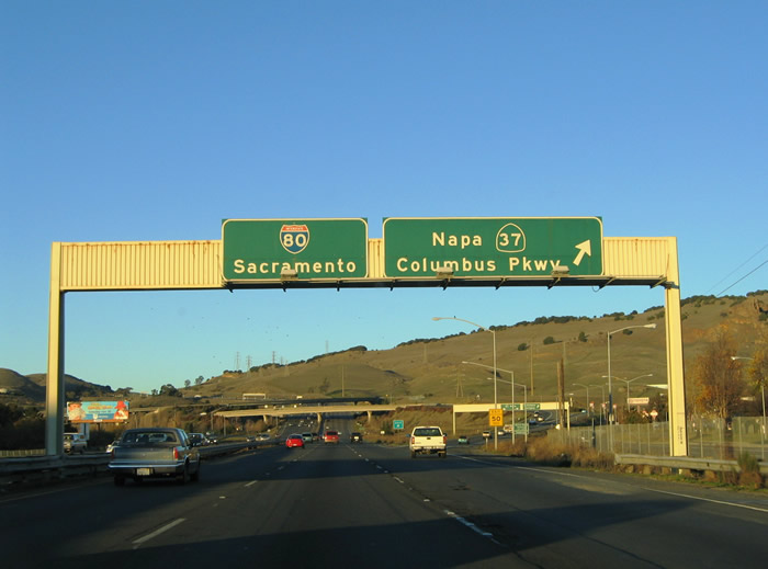
Interstate 80 leaves the Carquinez Bridge and approaches Exit 29A for California 29. This sign advises motorists who might be tempted to use California 29 to reach Marine World or Napa Valley to use California 37 instead. California 29 passes through the city of Vallejo en route to Napa Valley, and it is generally faster to avoid the urban traffic by taking California 37. Photo taken 07/18/09. |
|
Nearing the Exit 29A ramp departure to California 29 (Sonoma Boulevard) on Interstate 80 east. California 29 northbound leads through the city of Vallejo en route to Napa, Napa Valley (St. Helena and Calistoga), and Lake County (Clear Lake, the largest natural fresh water lake wholly located within California). As noted earlier, California 37 might be a better route to those destinations north of Vallejo, considering the traffic lights along California 29. Photo taken 11/28/04. |
|
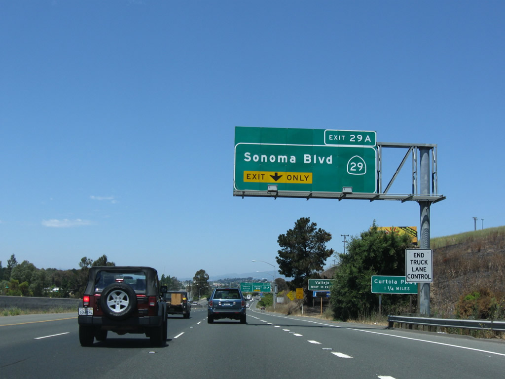
Interstate 80 eastbound reaches the Exit 29A wye interchange with California 29 (Sonoma Boulevard) northbound. Sonoma Boulevard travels 1.8 miles north to Curtola Parkway and 4.6 miles to California 37 (Marine World Parkway) through downtown Vallejo. Photo taken 07/18/09. |
|
|
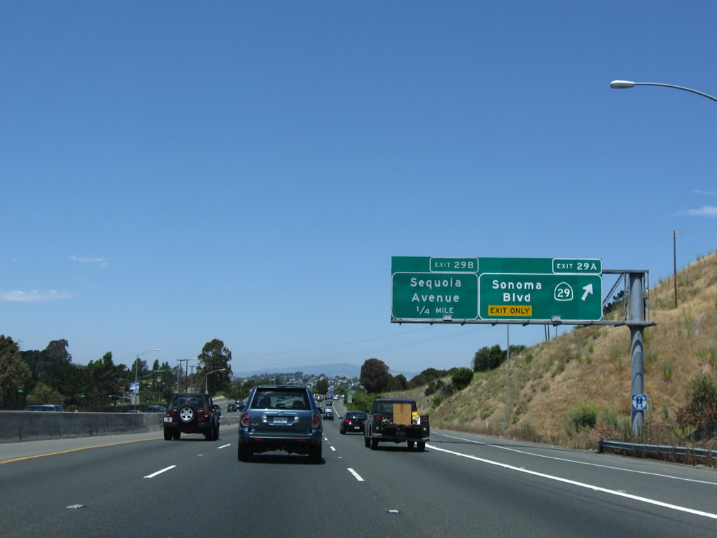
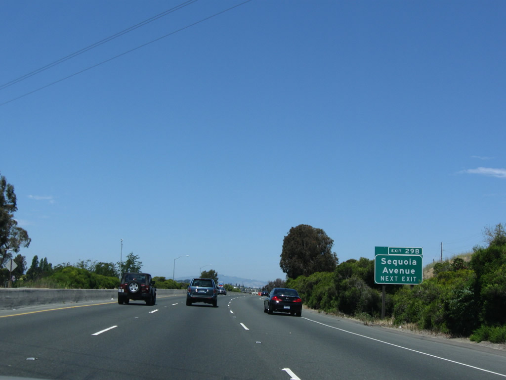
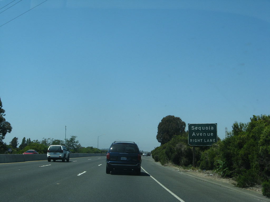
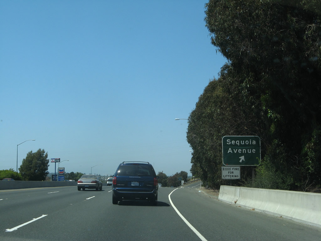
Interstate 80 eastbound continues a short distance to the Exit 29B off-ramp to Sequoia Avenue east and Lincoln Road (historic U.S. 40 east). Lincoln Road forms a frontage road system for the freeway off and on through the city of Vallejo. Photos taken 07/18/09 and 07/07/07. |
|
Exit 29B departs Interstate 80 eastbound for Lincoln Road East north and Sequoia Avenue east. Sequoia Avenue serves a residential area adjacent to the freeway with connections to Jordan and Navone Streets. Photo taken 07/07/07. |
|
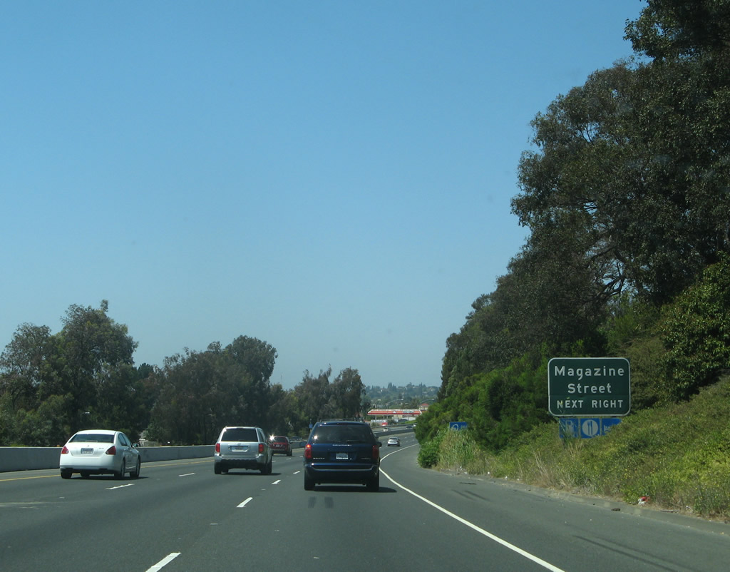
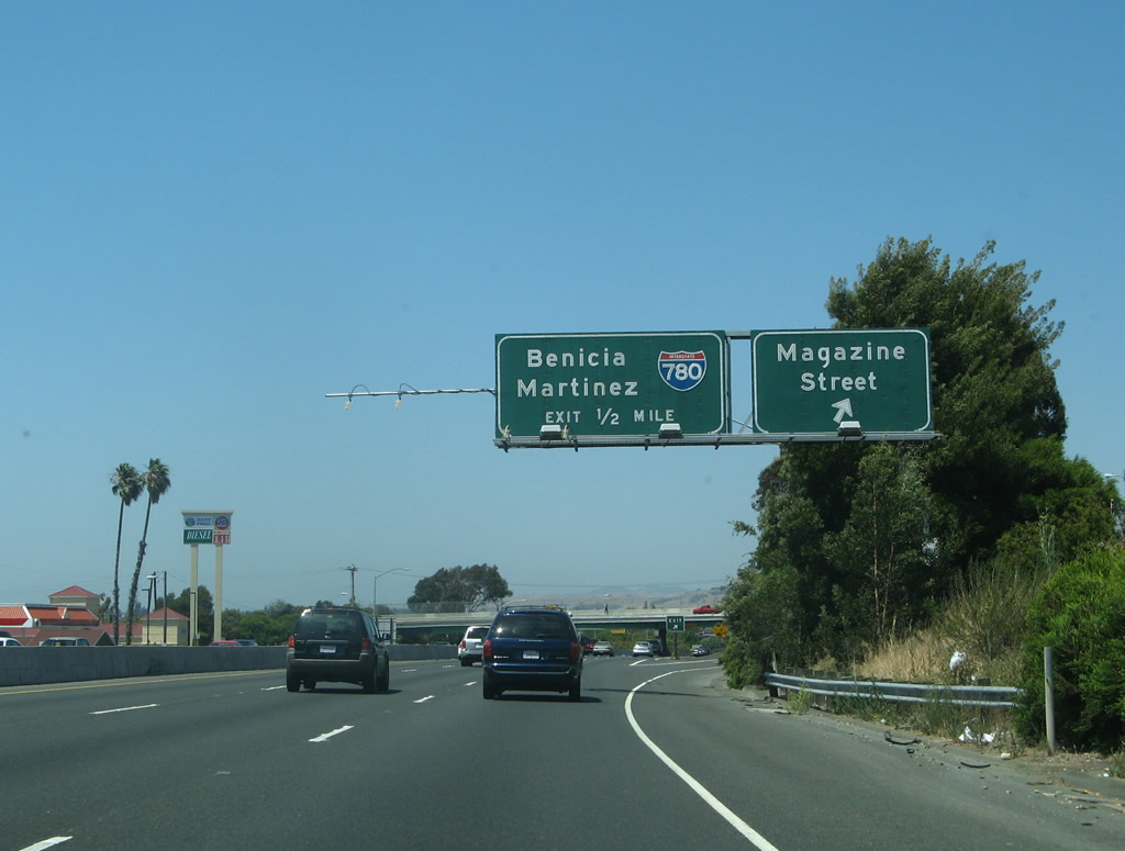
Magazine Street crosses paths with Interstate 80 at Exit 29C. Magazine Street arcs east from Porter Street and California 29 (Sonoma Boulevard) to Laurel Street and Glen Cove Road. Photo taken 07/07/07. |
|
Slip ramps join I-80 with Lincoln Road East ahead of the intersection with Magazine Street at Exit 29 C. One half mile further is the cloverleaf interchange (Exit 30 A) with Interstate 780 east and Curtola Parkway west.
I-780 provides a high speed link between Vallejo and I-680 at Benicia. 07/07/07 |
|
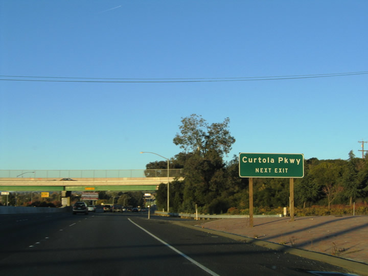
The entrance ramp from Lincoln Road East joins I-80 eastbound ahead of the Magazine Street overpass. Exit 30 B serves Curtola Parkway westbound one quarter mile ahead. Maintained by the city, Curtola Parkway stems
west from I-780 as an at-grade boulevard to Lemon Street, Solano Avenue and SR 29 (Sonoma Boulevard) south of Downtown Vallejo. 11/28/04 |
|
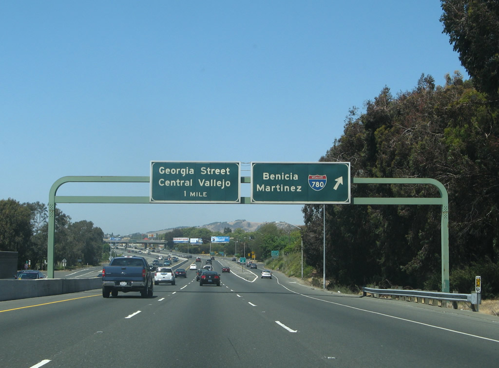
This internally lit sign, located along eastbound Interstate 80 at Exit 30A, Interstate 780 east to Benicia, is one of the few internally lit overhead signs in California. This exit connects to a collector distributor lane that first connects to Interstate 780 east, then links to Curtola Parkway west and Benicia Road. Through traffic may depart here and return back to the mainline freeway. Interstate 780 travels 6.50 miles between Vallejo and Benicia, connecting Interstate 80 with Interstate 680 at the head of the Benicia-Martinez Bridge. Interstate 680 traveled west along Interstate 780 from the Benicia-Martinez Bridge to Interstate 80 at Vallejo until 1976. At that time, California 21 was the designation for the northernmost segment of present-day Interstate 680 between Benicia and Fairfield. Photo taken 07/07/07. |
|
Looking at the collector distributor lanes, the first links to Interstate 780 east to Benicia, and the second ramp links to Curtola Parkway west to Vallejo. Both ramps are considered part of Exit 30A. Photo taken 07/07/07. |
|
This ramp, located along eastbound just after the ramp to eastbound Interstate 780 connects to the collector distributor lane. It's surprising that this ramp is not given a more descriptive name than "Frontage Road," but at least it is designated as Exit 30B. The slip ramp allows Interstate 80 eastbound drivers access to Benicia Road, which is the third exit from the c-d lanes. Photo taken 07/07/07. |
|
Exit 30B is basically a slip ramp from the mainline into the collector distributor lanes associated with the Interstate 780 interchange. Photo taken 07/07/07. |
|
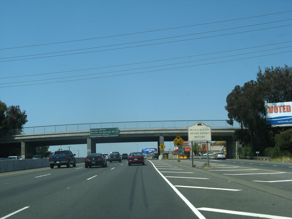
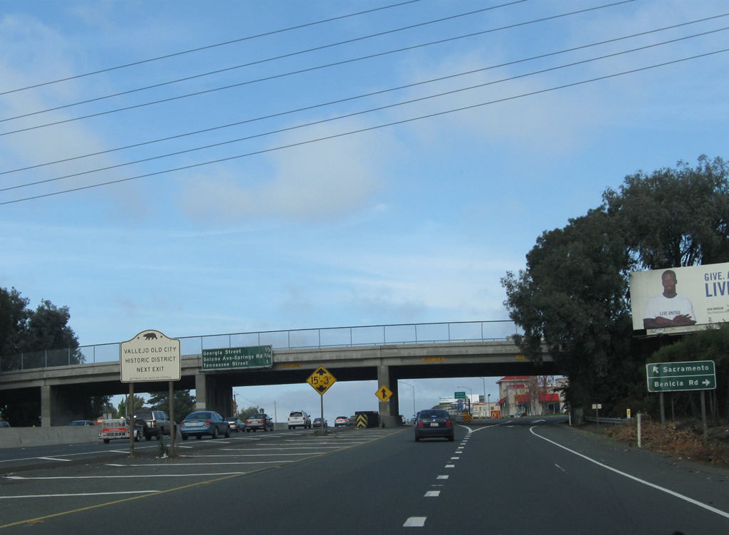
Use Exit 30C (Georgia Street) to Historic Old City Vallejo. Photo taken 07/07/07. |
|
Over on the collector distributor lanes and next to the Historic Old City Vallejo sign, the c/d lanes gain traffic from Interstate 780 west and will see traffic depart onto Benicia Road (Exit 30B). Stay left to merge onto Interstate 80 east to Sacramento. Photo taken 11/26/11. |
|
Passing under Benicia Road, the c/d lanes split between Interstate 80 east and Benicia Road. Photo taken 11/26/11. |
|
This mileage sign provides the distance to the next three exits along Interstate 80 east. The next interchange along eastbound is Exit 30C, Georgia Street (one-half mile). This is a classic example of a porcelain enamel button copy freeway guide sign, generally placed on California freeways prior to 1972. Benicia Road passes over the freeway in this scene. Benicia Road parallels Interstate 780 three blocks to the north through residential neighborhoods. Photo taken 07/07/07. |
|
The c/d lanes return to Interstate 80, flanked by a freeway entrance shield assembly. Photo taken 11/26/11. |
|
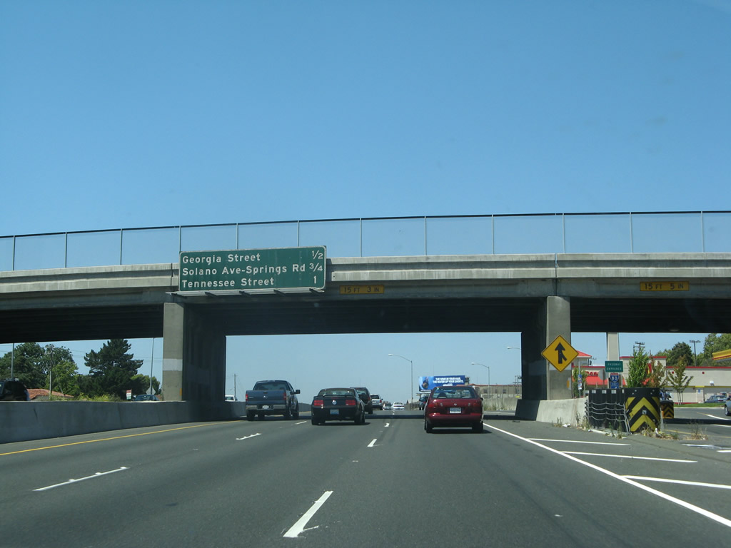
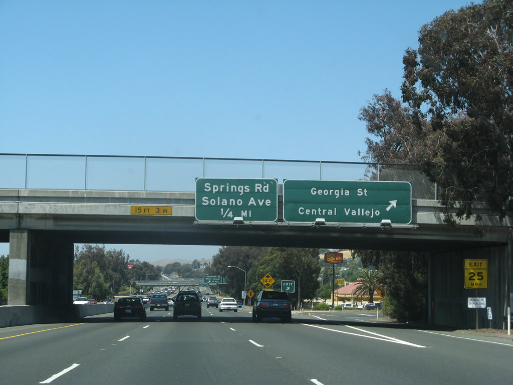
Continuing eastbound to the Exit 30C half-cloverleaf interchange with Georgia Street. Georgia Street comprises an east-west surface arterial between downtown Vallejo and Oakwood Avenue to the east. Photo taken 07/07/07. |
|
Eastbound Interstate 80 meets Exit 31A, Springs Road and Solano Avenue (with connections via Lincoln Road East). Solano Avenue travels 1.5 miles northeast from the Napa River front to Springs Road and Interstate 80. Springs Road continues the street east 1.3 miles to Columbus Parkway. Photo taken 07/07/07. |
|
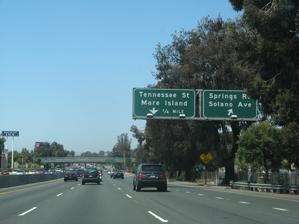
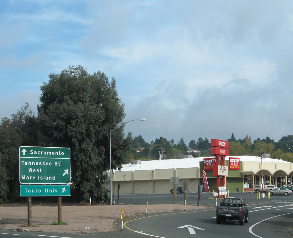
Exit 31B constitutes a collector distributor roadway between Interstate 80 east and Tennessee Street. A full-cloverleaf interchange joins the east-west street with the freeway between Mariposa and Humboldt Streets. Tennessee Street comprises a major through route between the city of Vallejo and Mare Island. Tennessee Street transitions into Mare Island Causeway two miles to the west at Wilson Avenue. From there Mare Island Causeway crosses the Napa River becoming G Street on Mare Island. Tennessee Street ends 1.4 miles to the east at Columbus Parkway. Photo taken 07/07/07. |
|
The off-ramp to Exit 31B splits, with the first ramp connecting to Tennessee Street east and the second ramp linking to Tennessee Street west. A short collector distributor lane arrangement begins here as we pass through the Tennessee Street interchange. Photo taken 11/27/11. |
|
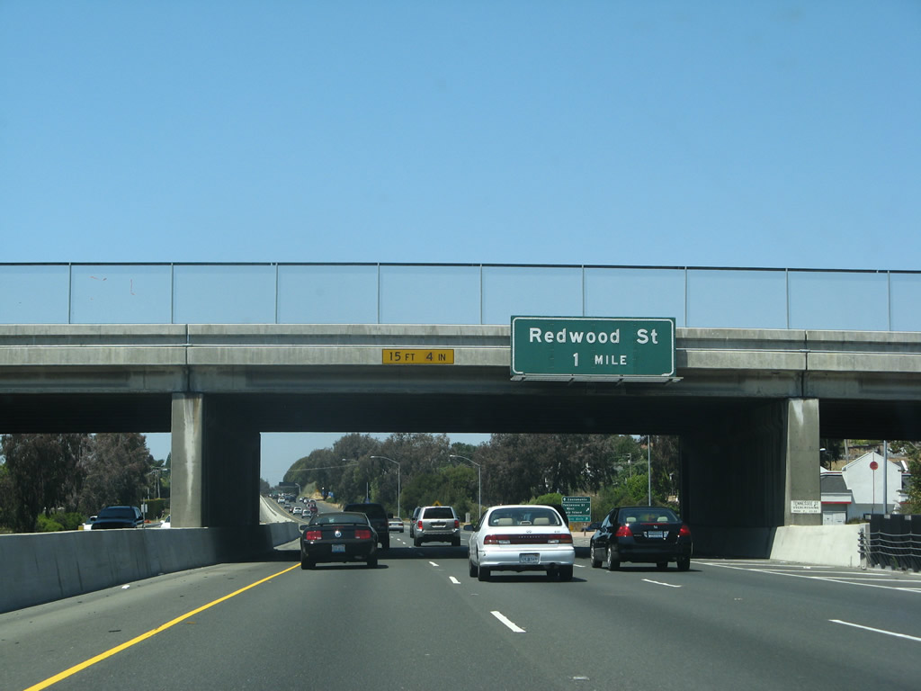
Interstate 80 passes under Tennessee Street; the next exit is Exit 32A, Redwood Street (partial-cloverleaf interchange). Redwood Street travels 1.7 miles west from Interstate 80 and Fairgrounds Drive to Sacramento Street. Photo taken 07/07/07. |
|
Shortly thereafter, over on the collector distributor lanes, the second ramp departs to Tennessee Street west (part of the Exit 31B interchange complex). Photo taken 11/27/11. |
|
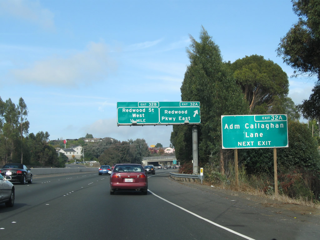
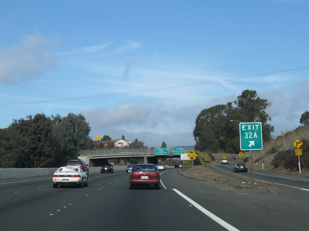
The next exit along Interstate 80 east is Exit 32A, Redwood Parkway east and Admiral Callaghan Lane. Upon departing the freeway via this off-ramp, motorists may turn right (east) on Redwood Parkway or proceed straight ahead (northeast) along Admiral Callaghan Lane, which is the frontage road on the southeast side of Interstate 80 between Exits 32A and 33. Photo taken 11/27/11. |
|
Eastbound Interstate 80 meets Exit 32A, Redwood Parkway east and Admiral Callaghan Lane. Redwood Parkway continues Redwood Street east as a multi-lane divided highway 1.4 miles to Ascot Parkway and 2.4 miles to Columbus Parkway. This pair of overhead signs was replaced by 2011. Photo taken 07/07/07. |
|
The gore point also contains the exit number of 32A. Next up is the connection to Exit 32B, Redwood Street west. Photo taken 11/27/11. |
|
|
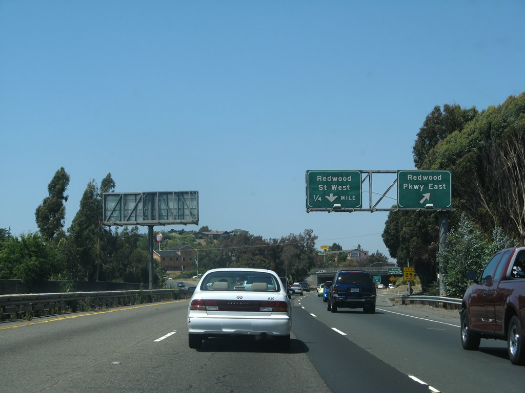
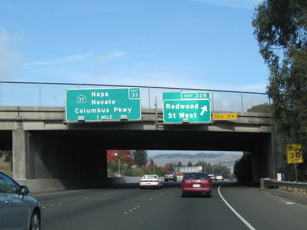
Exit 32B loops onto Redwood Parkway west ahead of its intersection with Fairgrounds Drive and Redwood Street west. Fairgrounds Drive heads north from Redwood Street 1.3 miles to the Solano County Fairgrounds, Six Flags Marine World, and California 37. The next Interstate 80 exit is for California 37 west to Napa, Sonoma, and points north and west via California 29, California 128, and California 116. Photos taken 11/27/11 and 07/07/07. |
|
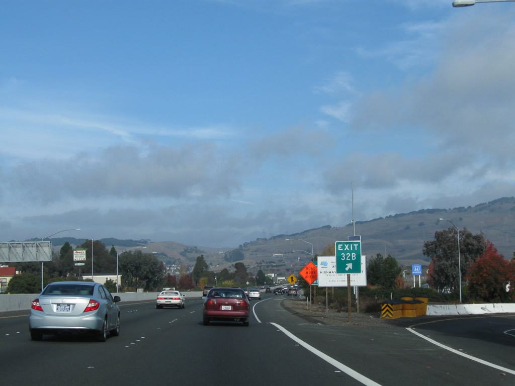
The gore point also contains the exit number of 32B. Next up is the connection to Exit 33, California 37 west to San Rafael and Columbus Parkway east. Photo taken 11/27/11. |
|
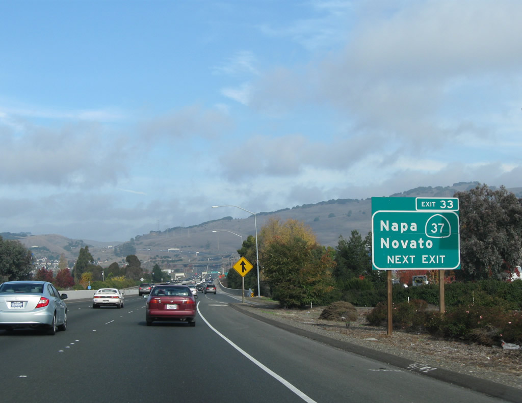
The next exit along Interstate 80 east is Exit 33, California 37 west. This busy east-west highway connects Vallejo with Novato and San Rafael in Marin County, and it links to California 29 north en route to Napa, St. Helena, Calistoga, Middletown, Clearlake, and Lakeport. Photo taken 11/27/11. |
|
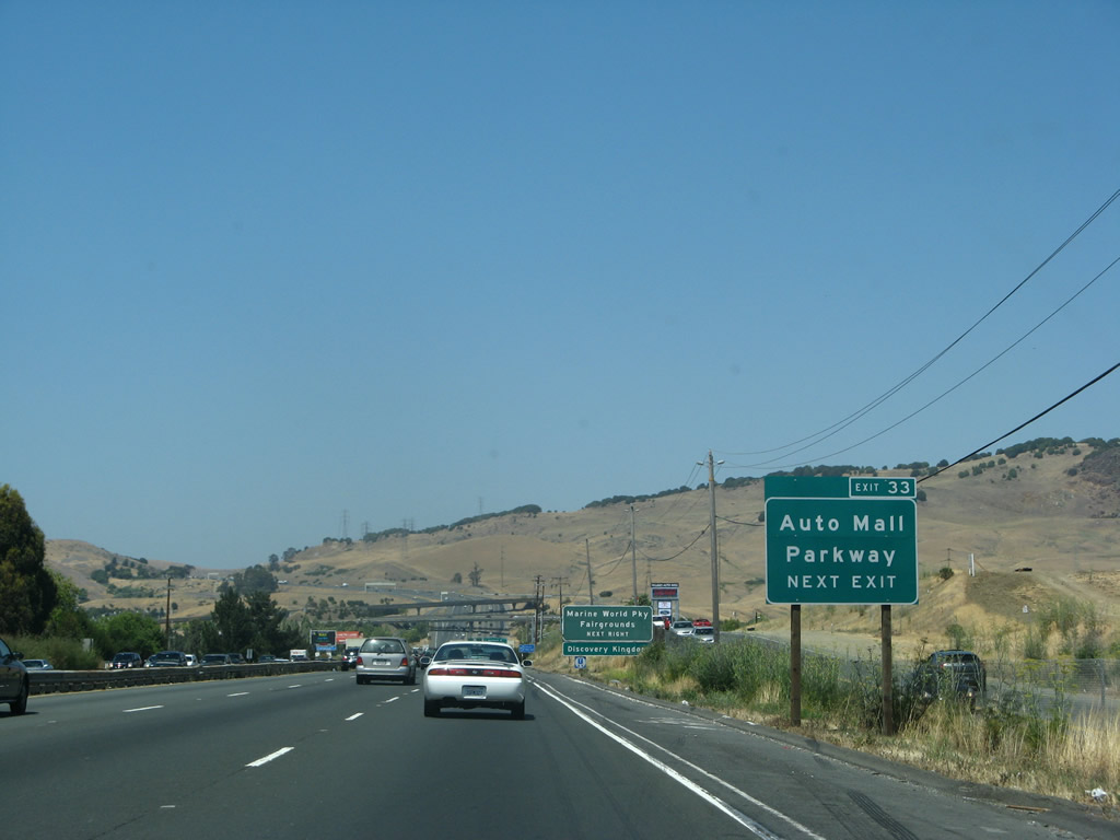
Another roadside sign advises that Exit 33 links to Auto Mall Parkway (in addition to California 37 and Columbus Parkway). Photo taken 07/07/07. |
|
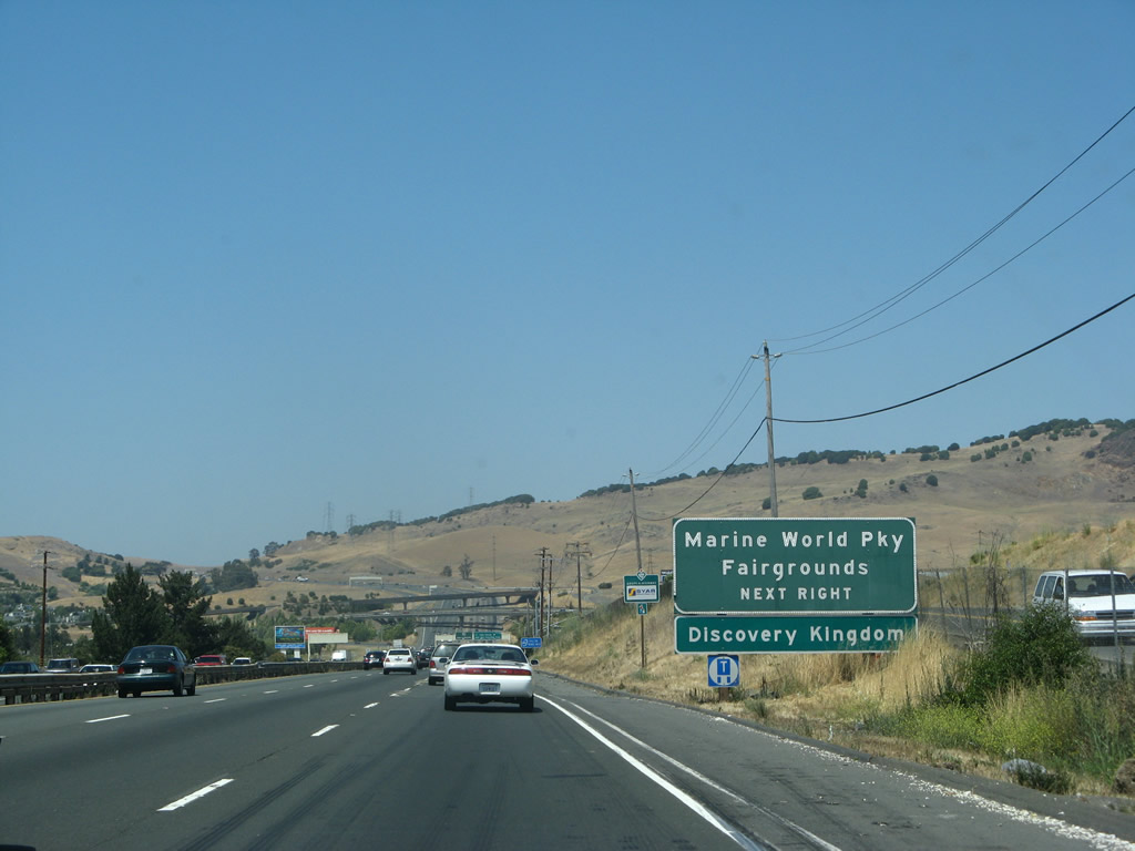
Interstate 80 traffic bound for Marine World and the Solano County Fairgrounds is directed onto Exit 33 (California 37 west). California 37 meets Fairgrounds Drive via a diamond interchange just west of Interstate 80 and north of the facilities. Photo taken 07/07/07. |
|
|
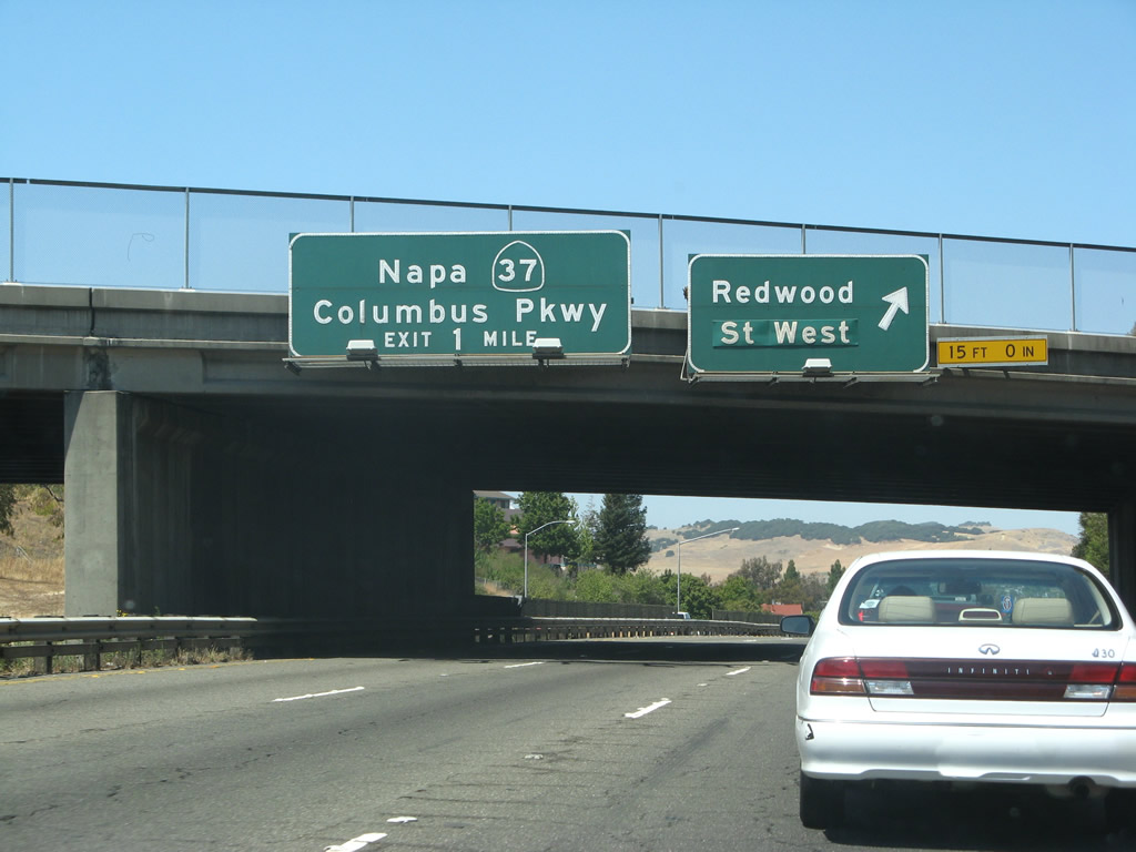
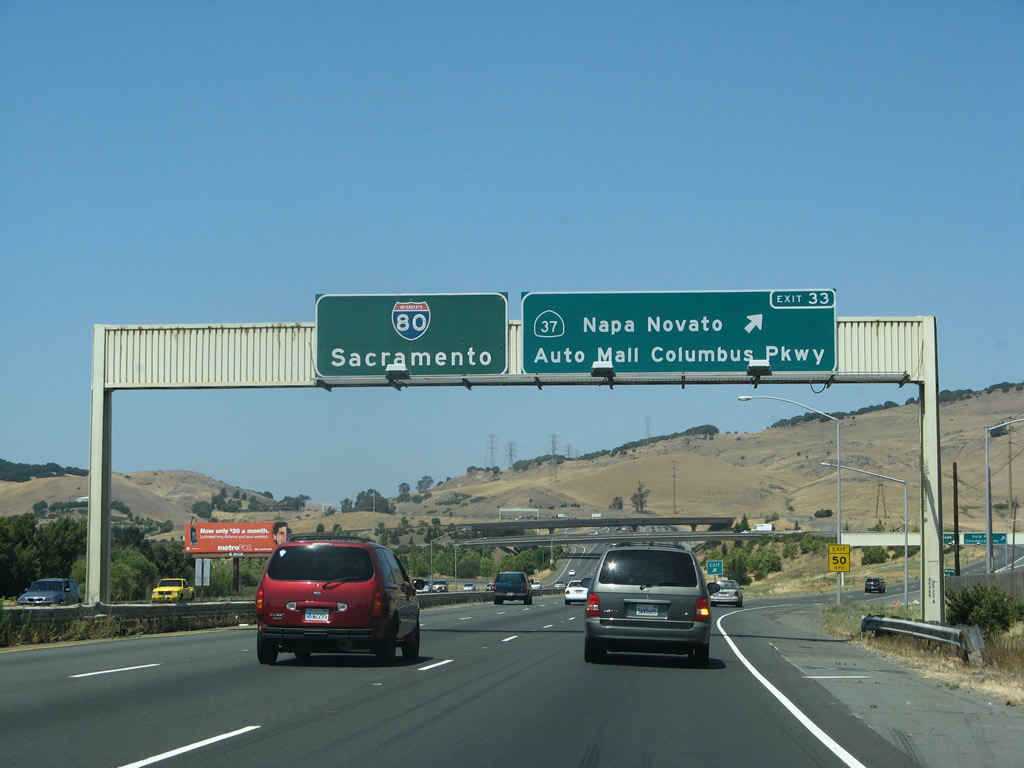
Exit 33 departs Interstate 80 eastbound for California 37 (Marine World Parkway) west and Columbus Parkway east. Although constructed as a freeway to freeway interchange, California 37 narrows to two lanes as it crosses the northern edge of San Francisco Bay en route to U.S. 101 in Novato. This route carries a great deal of traffic, and it is targeted for upgrades and widening due to the high number of accidents. Photos taken 07/07/07 and 11/28/04. |
|
The exchange joining I-80 and SR 37 is known as the Gary L. Hughes Memorial Interchange. High speed flyovers link I-80 east to SR 37 west and from SR 37 east to I-80 east. 11/28/04 |
|
Exit 33 partitions with a ramp to Auto Mall Parkway/Colmbus Parkway northeast of Vallejo. SR 37 west connects with Marine World Parkway and Discovery Kingdom. 07/07/07 |
|
Columbus Parkway stems east and south around the city of Vallejo from Marine World Parkway. The arterial route extends 5.5 miles south to I-780 and Rose Drive. Exit 33 marks the east end of SR 37. 07/07/07 |
|
Two lanes continue from Exit 33 onto SR 37 westbound. Exit 20 departs from the freeway next for Fairgrounds Drive to Discovery Kingdom. 07/07/07 |
|
Interstate 80 east ascends from Vallejo and Napa River Valley toward American Canyon Road and Exit 36 to Hiddenbrooke Parkway. The freeway nips a corner of Napa County between Exits 33 and 36. 11/28/04 |
|
|
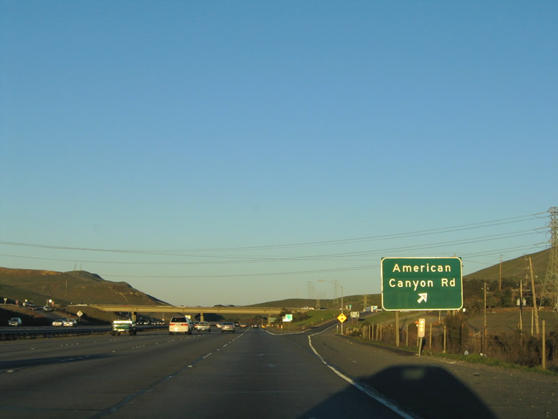
The forthcoming diamond interchange at Exit 36 joins I-80 with American Canyon Road west and Hiddenbrooke Parkway east. American Canyon Road meanders three miles west from Interstate 80 to the
city of American Canyon in southern Napa County. 11/28/04 |
|
Hiddenbrooke Parkway continues American Canyon Road southeast to the suburban community of Hiddenbrooke in northeast Vallejo. Photo taken 11/28/04. |
|
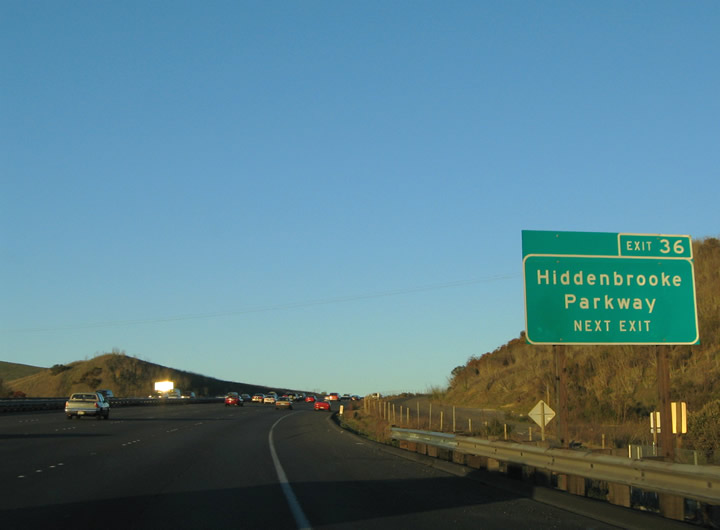
Eastbound Interstate 80 meets Exit 36, American Canyon Road west and Hiddenbrooke Parkway east. Hiddenbrooke Parkway provides no connections to other area through roads. American Canyon Road travels west to connect to California 29 in southern Napa Valley. Photo taken 11/28/04. |
|
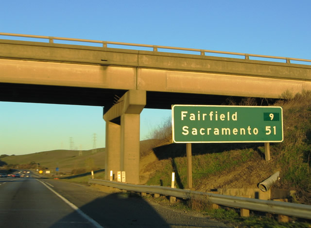
This eastbound mileage sign is posted at the American Canyon Road over crossing. Interstate 80 reenters Solano County ahead on the nine-mile drive to Fairfield. Sacramento lies 51 miles to the northeast in the Central Valley. Photo taken 11/28/04. |
|
Confirming marker posted beyond the entrance ramp at Exit 36. 11/28/04 |
|
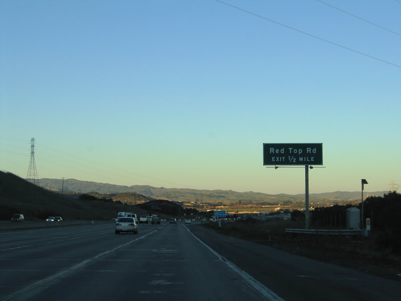
Interstate 80 enters the shadows of the mountains north of Vallejo ahead of the Red Top Road diamond interchange. McGary Road parallels the eastbound side of the freeway from Hiddenbrooke Parkway northeast to Red Top Road. Photo taken 11/28/04. |
|
SR 12 (Jameson Canyon Road) combines with I-80 eastbound ten miles from the Napa vicinity via a wye interchange at Exit 39 B. Red Top Road formerly linked
I-80 east with SR 12 west, but that changed in 2021 when the left turn from Red Top Road at the expressway along SR 12 was eliminated. 11/28/04 |
|
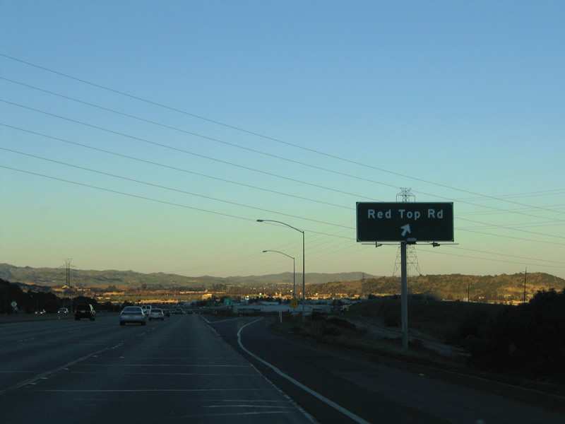
Eastbound Interstate 80 meets the Exit 39 off-ramp to Red Top Road. Red Top Road loops 1.4 miles northwest from Lopes Road to California 12 (Jameson Canyon Road) in west Fairfield. California 12 eastbound merges onto eastbound Interstate 80 from Napa, Sonoma, and Santa Rosa in one mile. Photo taken 11/28/04. |
| Interstate 80 and California 12 East |
|
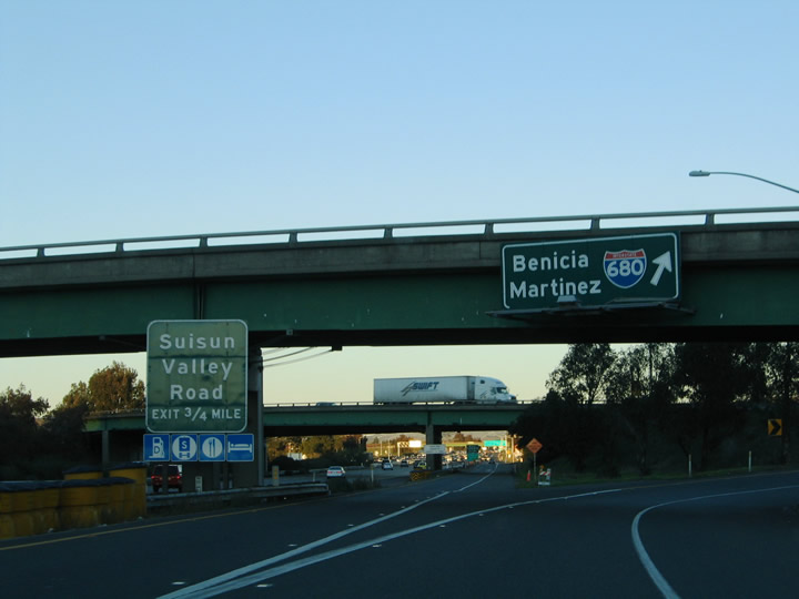
I-80/SR 12 eastbound converge with I-680 at Exit 40 in one mile. Interstate 680 follows the original alignment of SR 21 south to Benicia, then serves growing East Bay communities of Martinez, Concord, Pleasant Grove,
Walnut Creek, Danville and Dublin before entering the open space around the Sunol Grade. The southerly route along I-680 culminates at U.S. 101 and I-280 near Downtown San Jose. 11/28/04 |
|
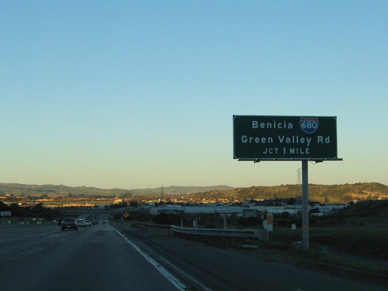
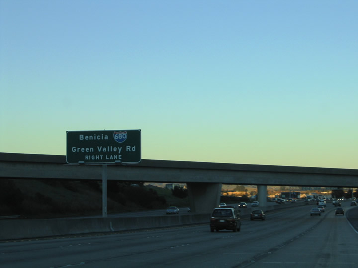
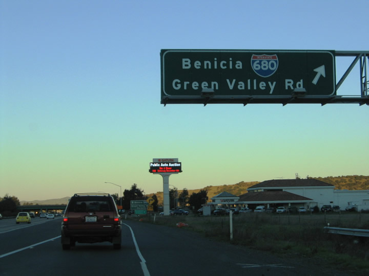
Even though eastbound Interstate 80 passes through some relatively unpopulated areas between Vallejo and Fairfield, the freeway remains six to eight lanes wide. The next exit (Exit 40), southbound Interstate 680, is more used for westbound traffic than eastbound traffic, since Interstate 80 is angled northeasterly at this point. Green Valley Road, a local access road, is also reached via Exit 40 to an automobile dealership. Photo taken 11/28/04. |
|
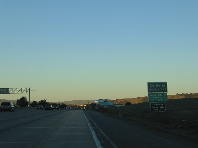
Exit 40 onto Lopes Road south links I-80/SR 12 with the community of Cordelia and Chapman University. Lopes Road continues Green Valley Road south alongside I-680 from Fairfield and Cordelia to Benicia. 11/28/04 |
|
A collector distributor roadway departs Interstate 80 & California 12 eastbound via Exit 40. The c/d roadway provides connections to Green Valley Road north, Lopes Road south, and the southbound beginning of Interstate 680. It is interesting to note that there is a automobile dealership; how often are they placed right at the interchange of two Inter state routes? Photo taken 11/28/04. |
|
The Exit 40 c/d roadway partitions into ramps for Lopes Road south and Green Valley Road north and the continuation to Interstate 680 south and Interstate 80 east. Interstate 680 heads 12 miles south to Interstate 780 at Benicia and 17.5 miles to California 4 at Concord. Green Valley Road spurs north to Mangels Boulevard and Rockville Road in Fairfield. Photo taken 11/28/04. |
|
Interstate 80 & 680 shield and guide sign assembly for the Exit 40 c/d roadway. A trumpet interchange facilitates the movements between the two freeways at Fairfield. The c/d roadway carries Lopes and Green Valley Road motorists onto Interstate 80 eastbound ahead. Photo taken 11/28/04. |
|
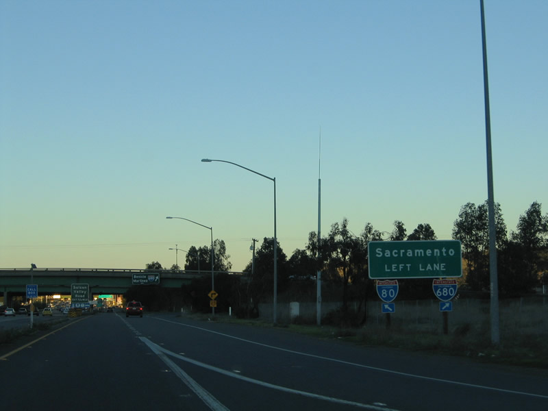
The southbound beginning of Interstate 680 departs the Exit 40 c/d roadway. Interstate 680 travels 70.52 miles between Fairfield and San Jose. The next Interstate 80 & California 12 interchange (Exit 41) serves Suisun Valley Road in three-quarters of a mile. Photo taken 11/28/04. |
|
|
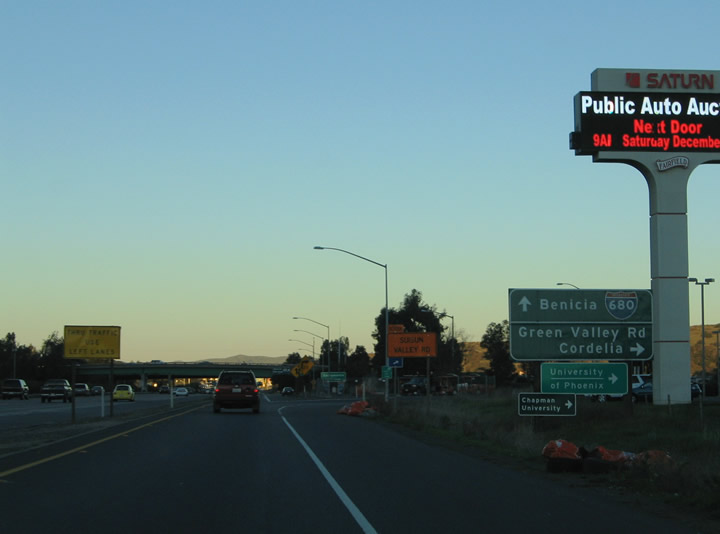
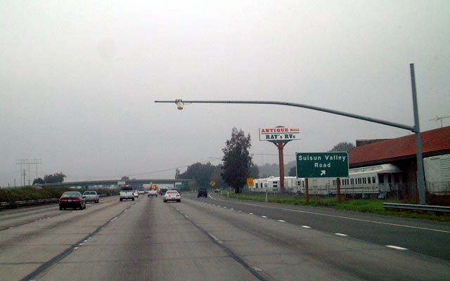
Eastbound Interstate 80 reaches Exit 41, Suisun Valley Road (diamond interchange). The sensors on the mast arm over the freeway are used to monitor traffic and trucks in the right lane. Note that Interstate 80 is still eight lanes plus auxiliary lanes here, approaching Fairfield. Suisun Valley Road continues Pittman Road north from Cordelia Road to Wooden Valley Road at the Napa County line. The antique mall at this exit is worth a visit! This sign was replaced with an overhead sign by 2009. Photos taken 07/18/09 and 01/18/03. |
|
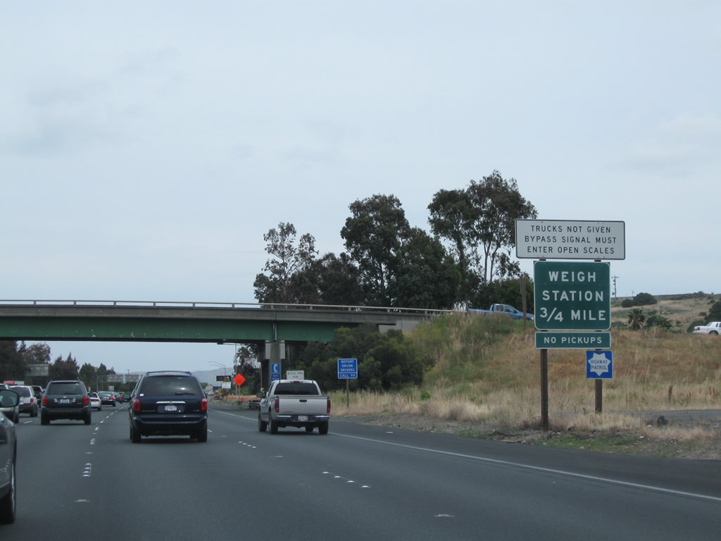
The next exit from Interstate 80 east is Exit 42, Weigh Station (0.75 mile). This is a repeat of the overhead sign shown in the prior photobox. Photo taken 05/14/11. |
|
After the on-ramp from Suisun Valley Road is this reassurance shield assembly for Interstate 80 and California 12 east. Photo taken 07/18/09. |
|
After the Suisun Valley Road interchange, eastbound Interstate 80 approaches Exit 42, Weigh Station. This sign was gone by 2012. Photo taken 03/31/05. |
|
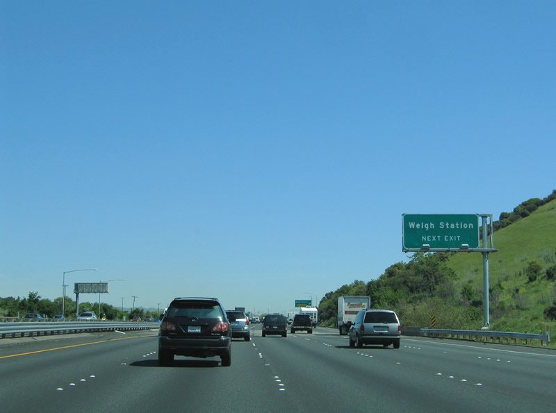
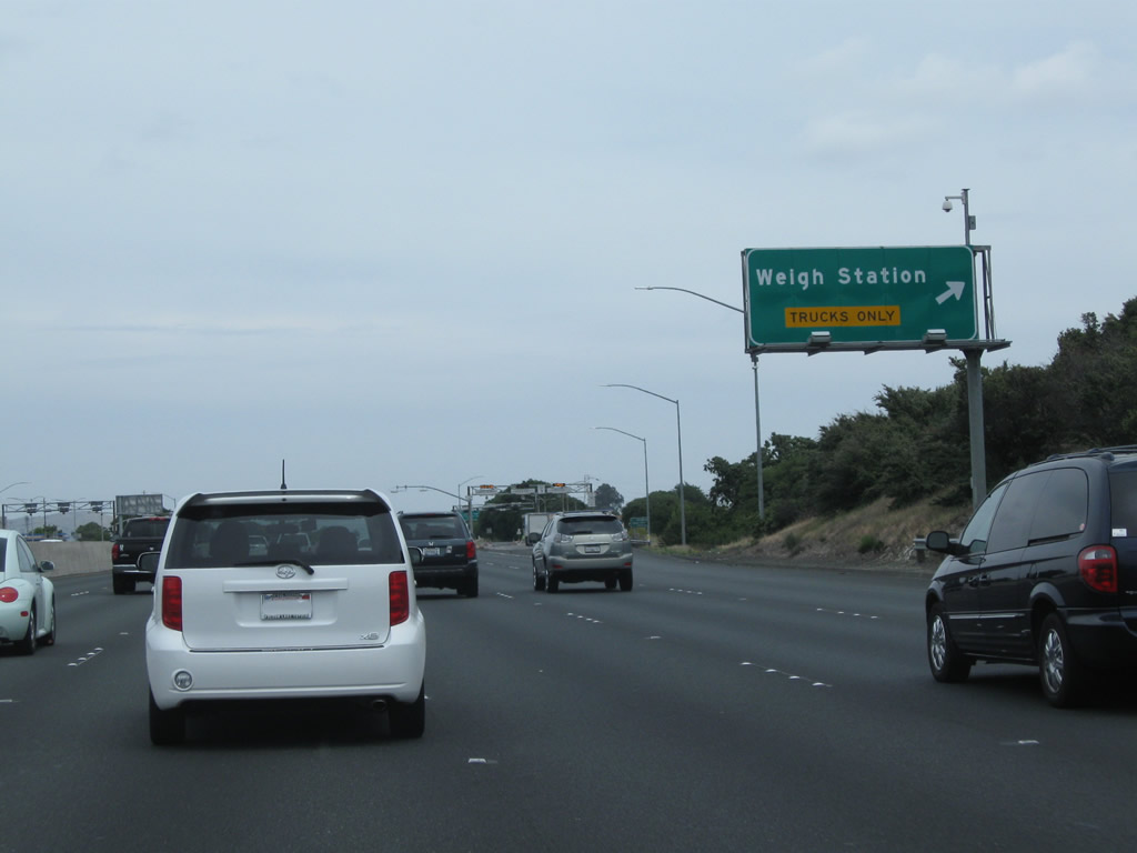
Eastbound Interstate 80 meets Exit 42, Weigh Station. Commercial vehicles must stop. There are no public facilities here (no restrooms). The weigh station will be relocated further northeast and modernized; construction was underway in summer 2012. Photo taken 05/14/11. |
|
|
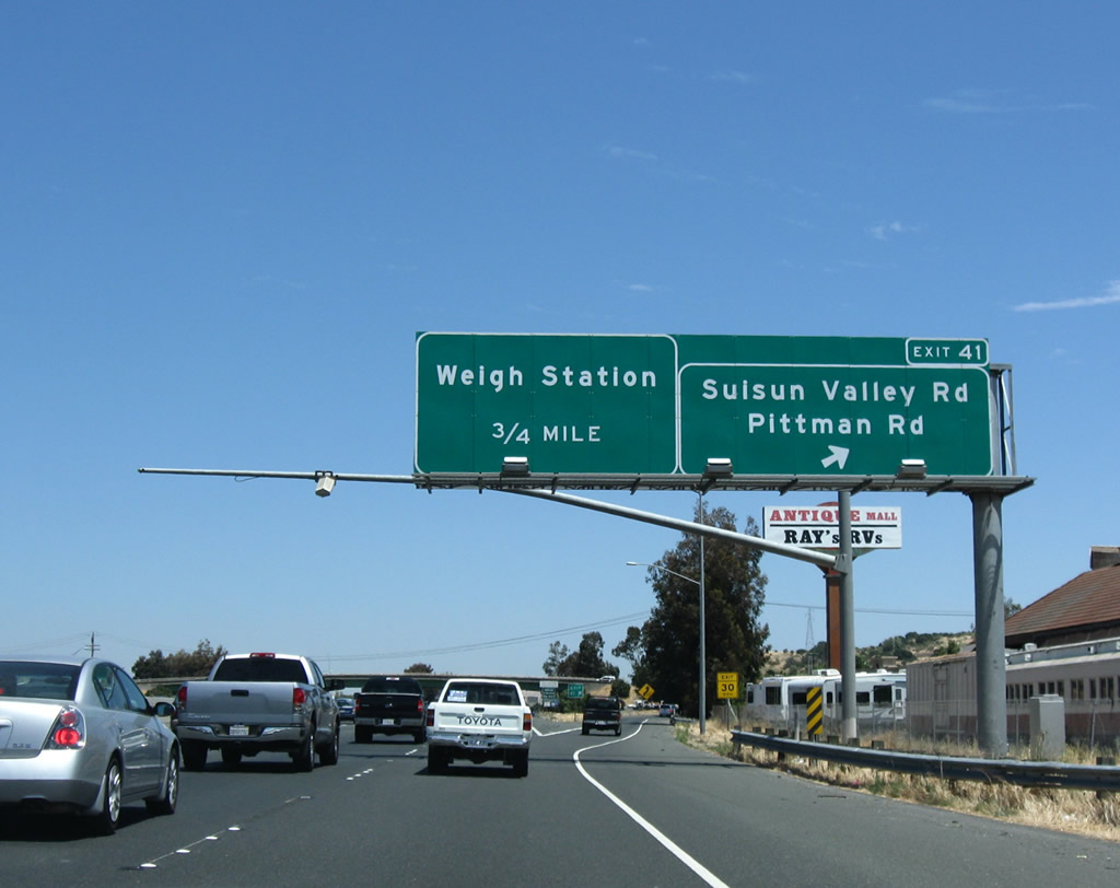
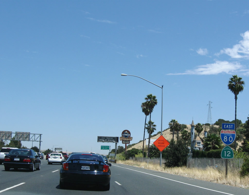
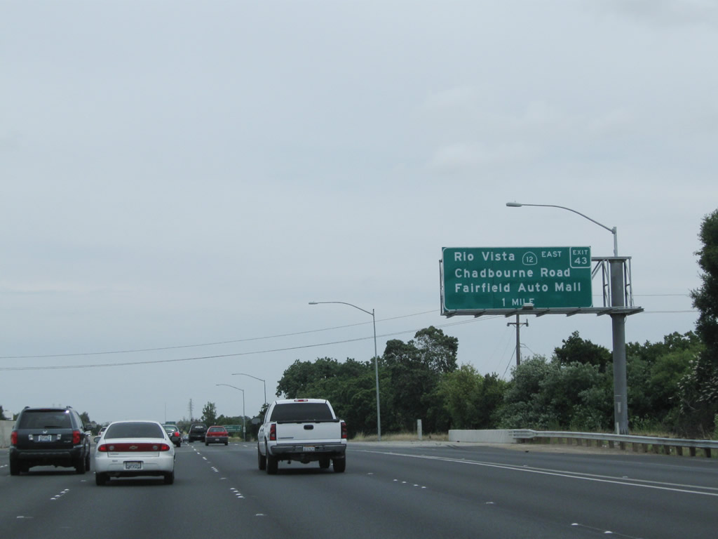
The next exit along Interstate 80 and California 12 east is Exit 43, California 12 east to Rio Vista (one mile). In addition, this interchange connects to the Fairfield Auto Mall and Chadbourne Road. California 12 east will cross the delta en route to Rio Vista, then proceed into the Central Valley, serving Lodi, and then ascends into the foothills, ending at California 49 near San Andreas. A well-traveled route, California 12 is generally inadequate for the heavy traffic it carries, especially between here and Interstate 5. The sign was replaced by 2011 to include the exit number. By 2012, the trees alongside the freeway were removed, and earthwork had begun to construct the replacement weigh station. Photos taken 05/14/11 and 03/31/05. |
|
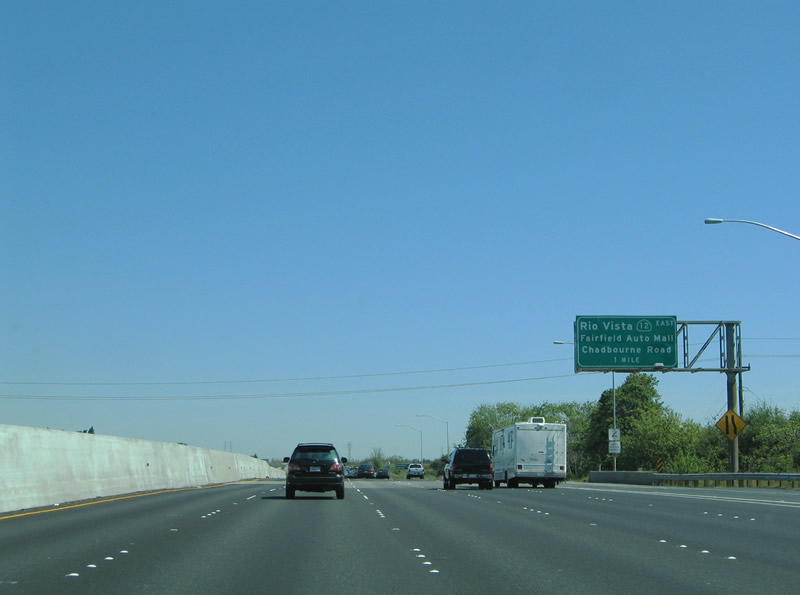
Eastbound Interstate 80 approaches Exit 43, California 12 east. In addition to the Central Valley and Sierra Foothill destinations served by California 12, this exit also serves metropolitan Fairfield, Suisun City, and Travis Air Force Base. This sign was gone by 2012, probably in relationship to the project to build the new weigh station. Photo taken 07/18/09. |
|
|
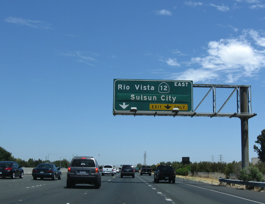
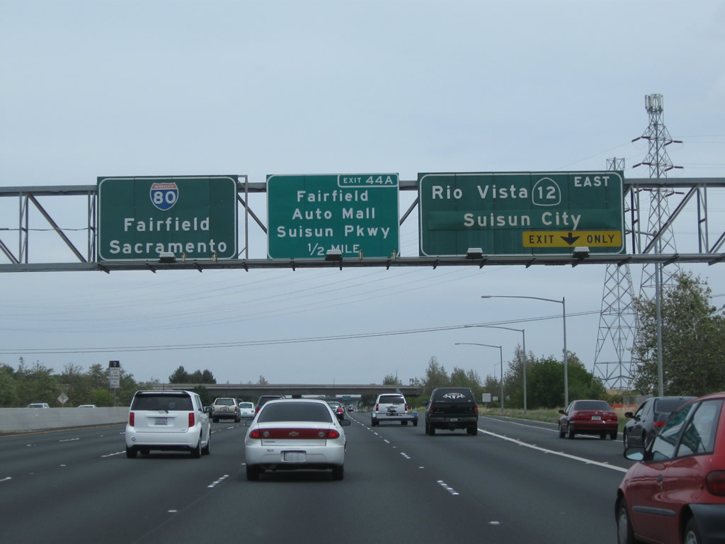
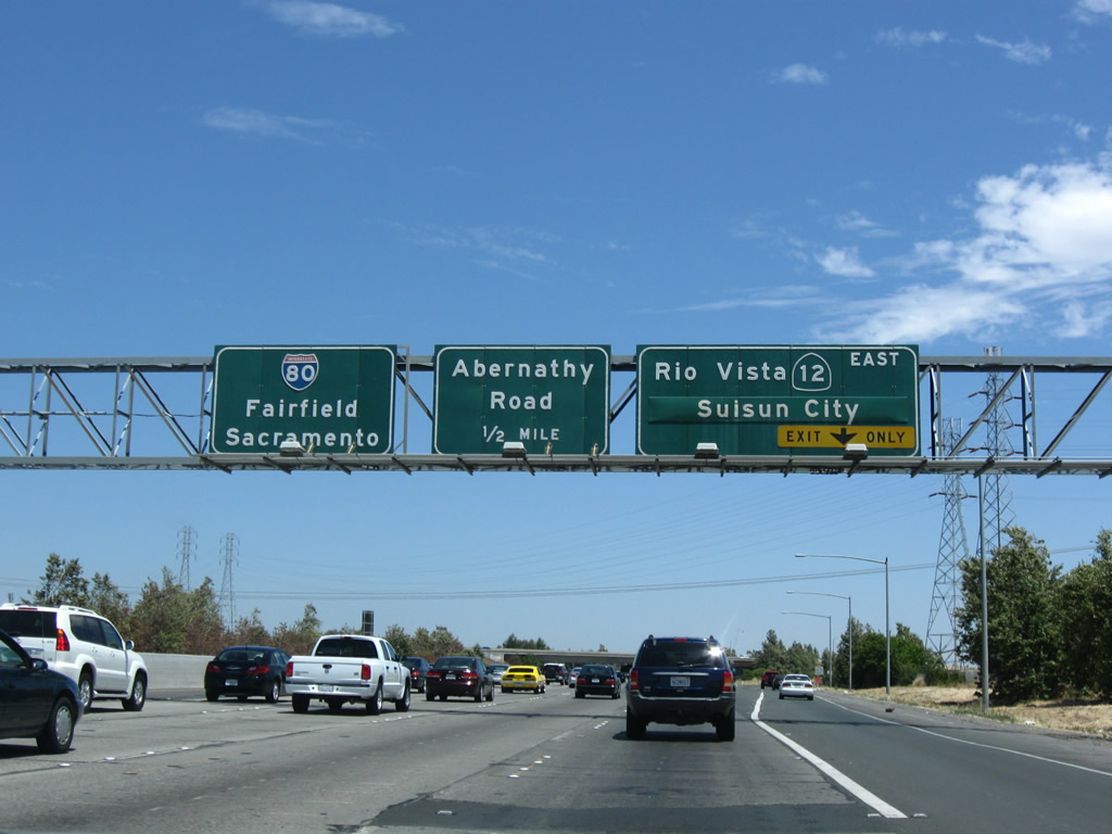
California 12 and Interstate 80 split at Exit 43; California 12 travels east along Rio Vista Road through Fairfield toward Suisun City. To Chadbourne Road, follow California 12 east. The second exit is Exit 44A, Suisun Parkway to Abernathy Road north and Auto Mall Parkway. Suisun Parkway connects directly with Chadbourne Road just east of the Exit 43 wye interchange. Note that the through control cities for Interstate 80 are Fairfield and Sacramento, even though Interstate 80 is already within the city limits of Fairfield. Note that the sign for Exit 44A changed between 2009 and 2011. Photos taken 05/14/11 and 07/18/09. |
Page Updated September 4, 2012.