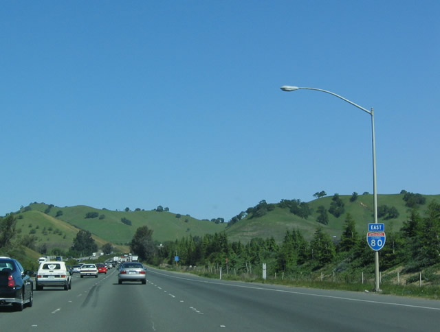
| Interstate 80 east |
|
|
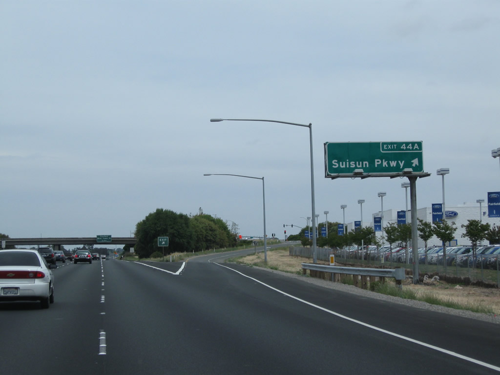
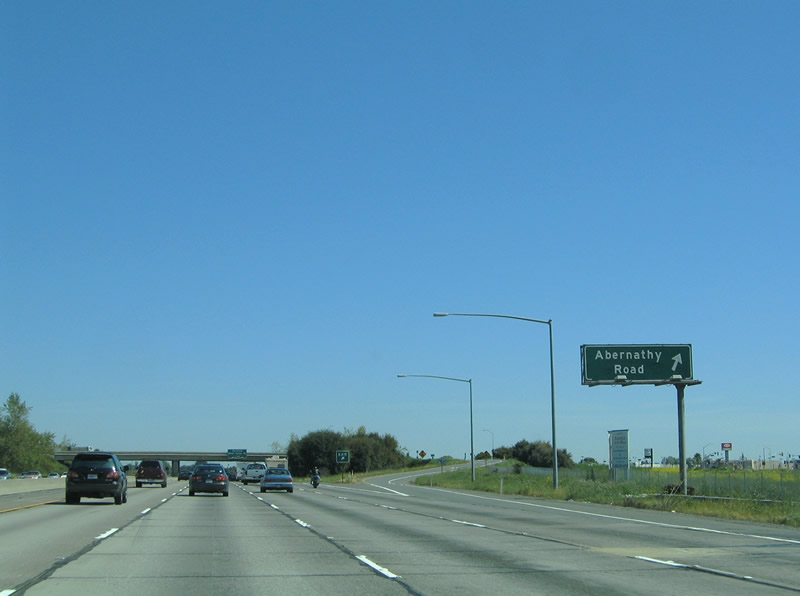
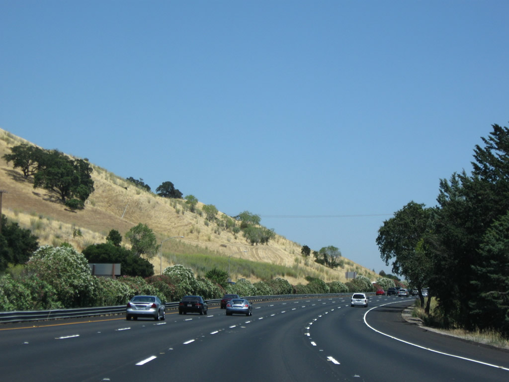
Eastbound Interstate 80 meets Exit 44A, Suisun Parkway. The ramp leaves Interstate 80 eastbound for Suisun Parkway. Turn left on Suisun Parkway to Abernathy Road or right for Auto Mall Parkway. Abernathy Road heads north of the freeway to Rockville Road and Mankas Corner Road west of Fairfield. Photos taken 05/14/11 and 03/31/05. |
|
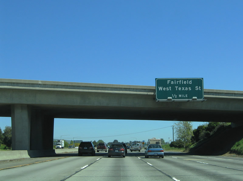
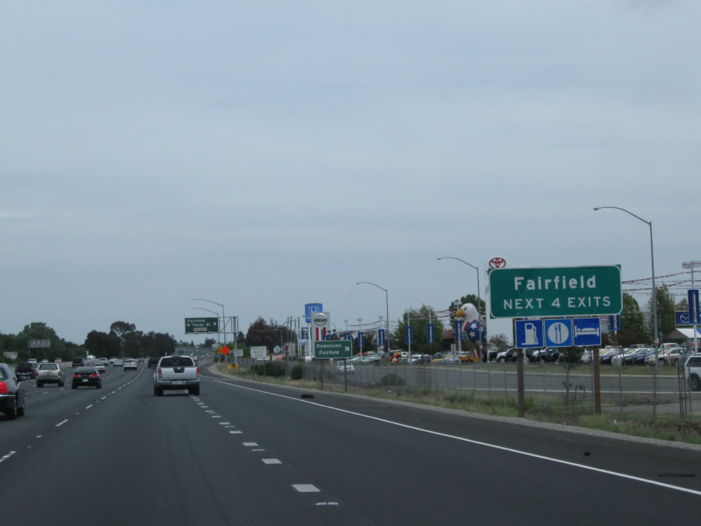
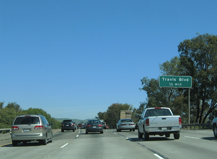
The next exit is Exit 44B, Historic U.S. 40/West Texas Street east and Rockville Road west (one-half mile). This is the first of four exits into the city of Fairfield, home of Travis Air Force Base. Incorporated in 1903, Fairfield has 102,500 people as of January 2003. One of the major employers here is Jelly Belly candies, producer of President Reagan's favorite confection while he was in the White House. Photo taken 03/31/05. |
|
|
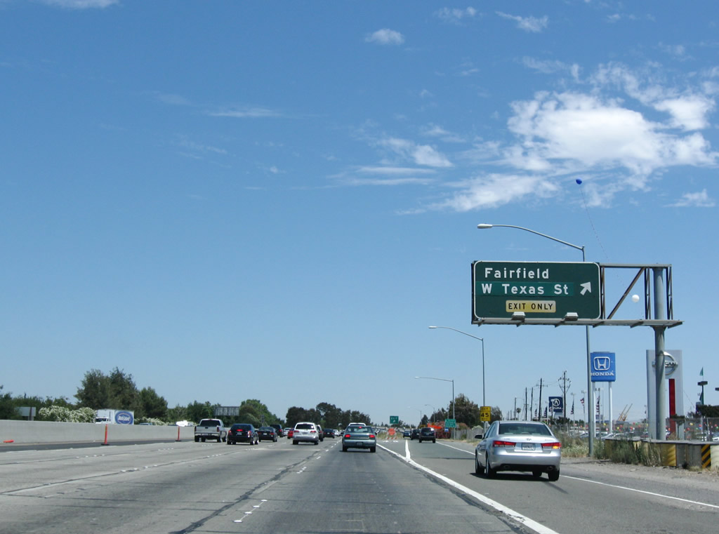
The next four exits along Interstate 80 east all serve the city of Fairfield: Exit 44B, Historic U.S. 40/West Texas Street east and Rockville Road west; Exit 45, Travis Boulevard; Exit 47, Air Base Parkway east and Waterman Parkway west; and Exit 48, Manuel Campos Parkway to Historic U.S. 40/North Texas Street and Lyon Road. Use Exit 44B for Historic U.S. 40, which follows Texas Street through downtown Fairfield. Photos taken 05/14/11. |
|
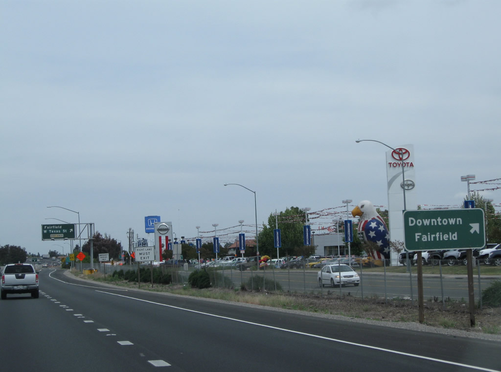
Eastbound Interstate 80 meets Exit 44B. A split diamond interchange joins Interstate 80 with West Texas Street, Beck Avenue, and Oliver Road at Exit 44B. West Texas Street and North Texas Street could be a business loop if it were so designated. The surface streets loop into downtown Fairfield between Exits 44B and 48. Rockville Road stems west from West Texas Street to Abernathy and Suisun Valley Roads. Photo taken 07/18/09. |
|
|
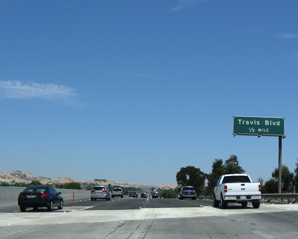
The next exit along eastbound is Exit 45, Travis Boulevard. Travis Boulevard intersects the freeway at Solano Mall between Oliver Road and Pennsylvania Avenue. This section of Interstate 80 was widened and repaved, with visible roadwork done by summer 2012. Photos taken 07/18/09 and 03/31/05. |
|
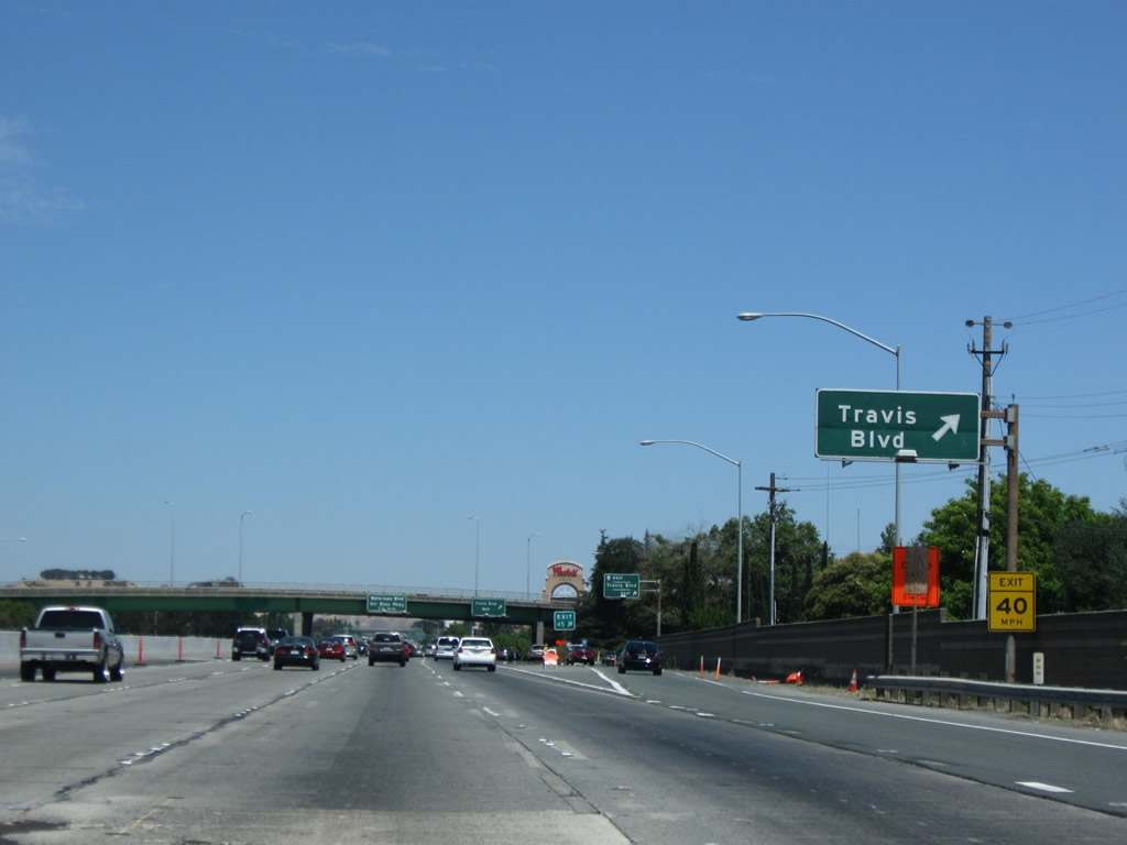
Eastbound Interstate 80 reaches Exit 45, a six-ramp partial-cloverleaf interchange with Travis Boulevard. Travis Boulevard constitutes a surface arterial between Oliver Road and Sunset Avenue, a distance of 2.6 miles. Photo taken 07/18/09. |
|
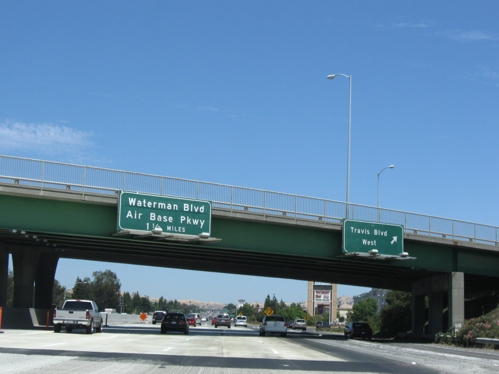
Interstate 80 passes under Travis Parkway 1.25 miles south of the Exit 47 partial-cloverleaf interchange with Waterman Boulevard west and Air Base Parkway east. Note the signage for Travis Boulevard on the collector distributor lane. Photo taken 07/18/09. |
|
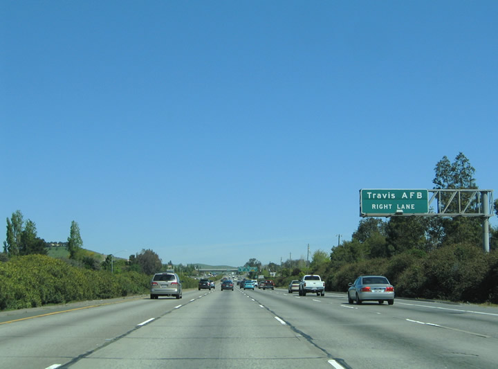
Travis Air Force Base, which is situated east of the city of Fairfield, is most directly accessed by eastbound Air Base Parkway. California 12 passes to the south of the Air Force Base. Photo taken 03/31/05. |
|
Since Interstate 80 is still angled southwest to northeast, many of the Fairfield interchanges connect with east-west city streets. Exit 47 is one such exit. Air Base Parkway travels through the northern reaches of Fairfield 3.3 miles to Walters Road and 4.4 miles to Travis A.F.B. Photo taken 03/31/05. |
|
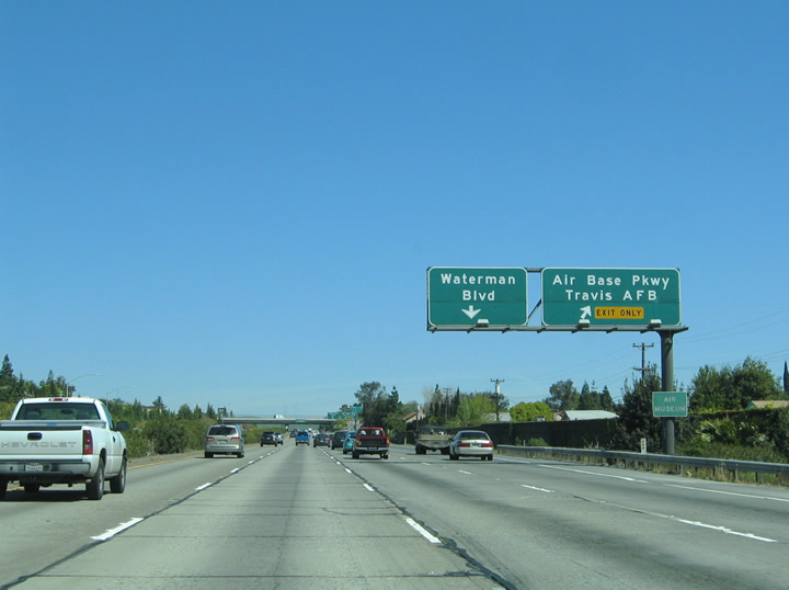
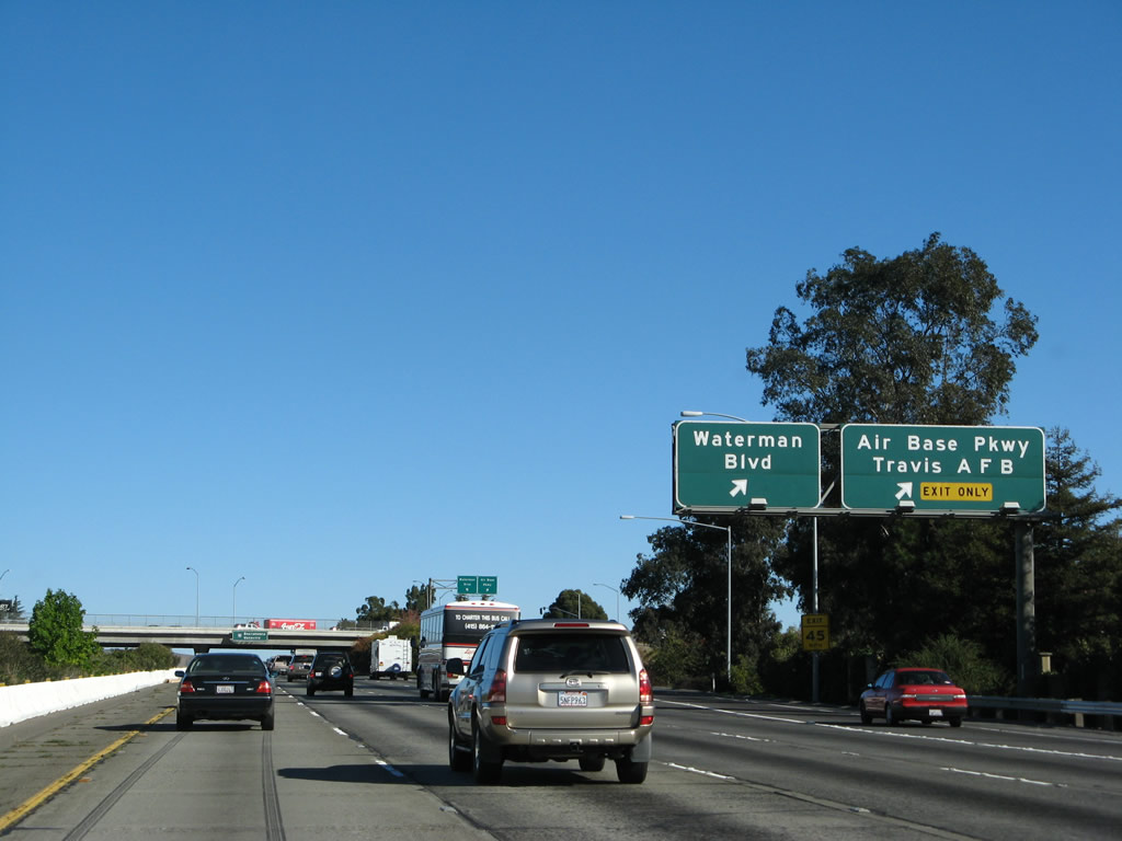
Eastbound Interstate 80 reaches Exit 47, Air Base Parkway east and Waterman Parkway west. Waterman Boulevard stems west from the freeway 1.5 miles to Oliver Road and 1.7 miles to Rancho Solano Parkway. Photo taken 11/23/07. |
|
This overhead reassurance sign is mounted on the overpass for Waterman Boulevard and Travis Air Base Parkway. Vacaville lies six miles to the northeast of here. Photo taken 11/23/07. |
|
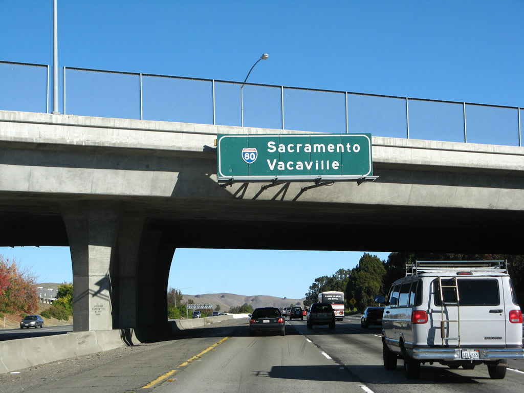
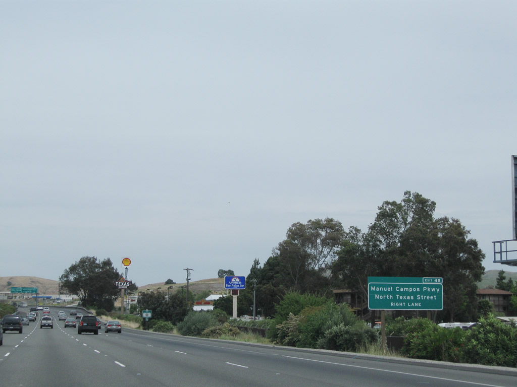
The last Fairfield exit along eastbound Interstate 80 is Exit 48, Manuel Campos Parkway to Historic U.S. 40/North Texas Street. In addition, this exit serves to provide access to the old U.S. 40 frontage road (Lyon Road). Interstate 80 is now traveling almost due north again for the first time since leaving Vallejo. The freeway will again curve northeast as it leads toward Vacaville. Photo taken 03/31/05. |
|
|
Interstate 80 east approaches Exit 48, Manuel Campos Parkway to Historic U.S. 40/North Texas Street and Lyon Road. A partial-cloverleaf interchange joins Interstate 80 with Manuel Campos Parkway, which in turn connects to several major city streets: North Texas Street, Lyon Road, Nelson Road, and Hilborn Road in north Fairfield. Lyon and Nelson Roads comprise frontage roads for Interstate 80 north of Fairfield. Hilborn Road meanders southwest from North Texas Street to Waterman Boulevard. Photos taken 05/14/11 and 03/31/05. |
|
|
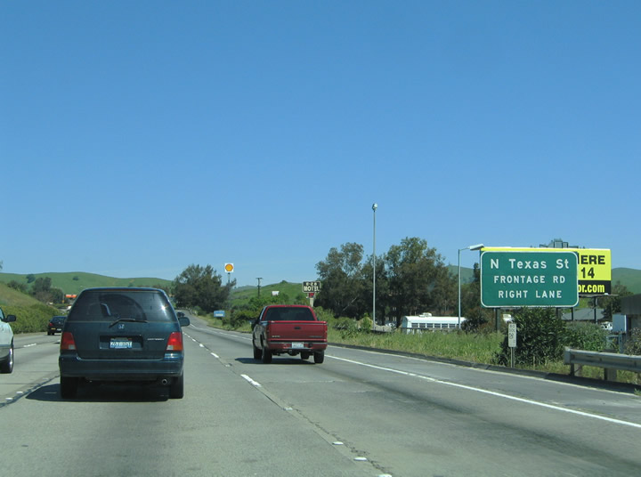
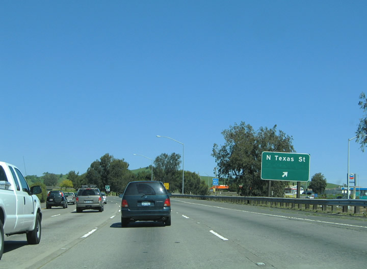
Eastbound Interstate 80 reaches Exit 48, Manuel Campos Parkway to Historic U.S. 40/North Texas Street and Lyon Road. Drivers bound for Manuel Campos Parkway, Texas Street, Lyon Road, and Nelson Road depart Interstate 80 eastbound via the Exit 48 off-ramp. North Texas Street heads south to Dickson Hill Road, Air Base Parkway, Travis Boulevard and downtown Fairfield. Lyon Road parallels the westbound carriageway of Interstate 80 northward to Cherry Glen Road (Exit 51A). An overhead exit number sign was added with the 2009 repaving project. Photos taken 07/18/09 and 03/31/05. |
|
Between Fairfield and Vacaville, eastbound Interstate 80 passes through a scenic, undeveloped valley. Photo taken 04/03/04. |
|
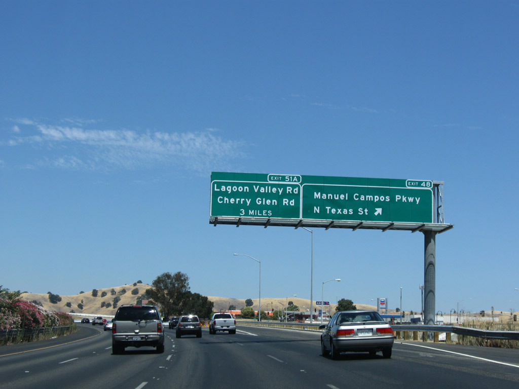
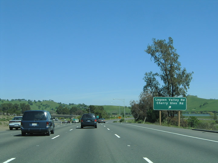
Lagoon Valley Road and Cherry Glen Road intersects Interstate 80 at the Exit 51A diamond interchange north of Fairfield. Lagoon Valley Road heads east to Lagoon Valley Regional Park. Cherry Glen Road enters the scene from Laguna Creek Trail 0.75 miles to the north. Photo taken 04/03/04. |
|
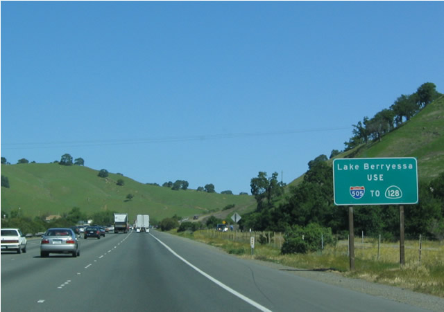
Cherry Glen Road connects to northbound Pleasants Valley Road, a road leading north 12.6 miles to California 128> near Lake Berryessa. However motorists are encouraged to use Exit 55/Interstate 505 north to California 128 west to reach Lake Berryessa. Photo taken 04/03/04. |
|
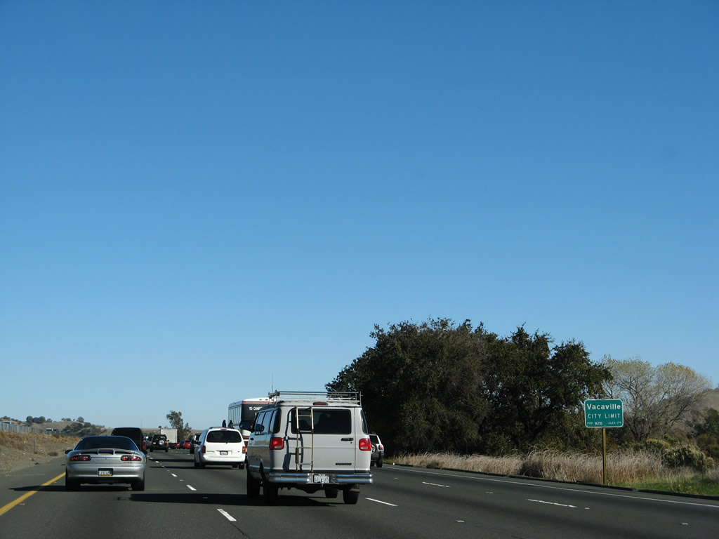
Shortly before the off-ramp for Exit 51A, Interstate 80 enters the city of Vacaville, which was incorporated in 1892 and home to 88,642 people as of the 2000 Census. Vacaville sits at an elevation ranging between 90 and 300 feet. Average annual rainfall is 17.39 inches, and temperatures range from an average of 94 degrees during the day in summer to 36 degrees during winter nights. Photo taken 11/27/07. |
|
Eastbound Interstate 80 reaches Exit 51A, Cherry Glen Road west and Lagoon Valley Road east. Riveria Road continues the Nelson Road frontage road north to Exit 51B. Lyon Road ends at Cherry Glen Road west of the interchange. Photo taken 03/31/05. |
|
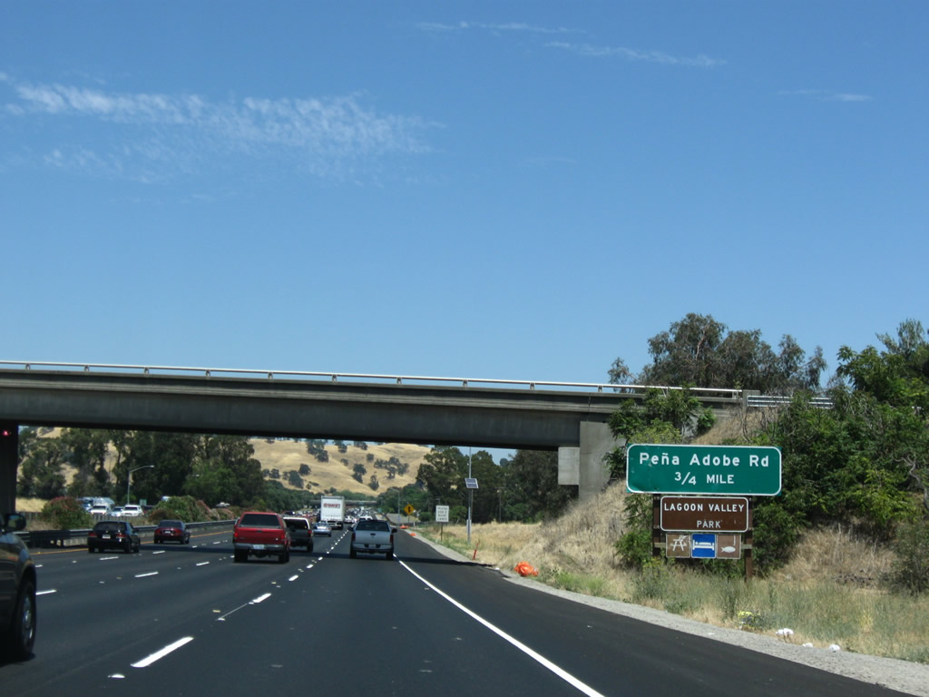
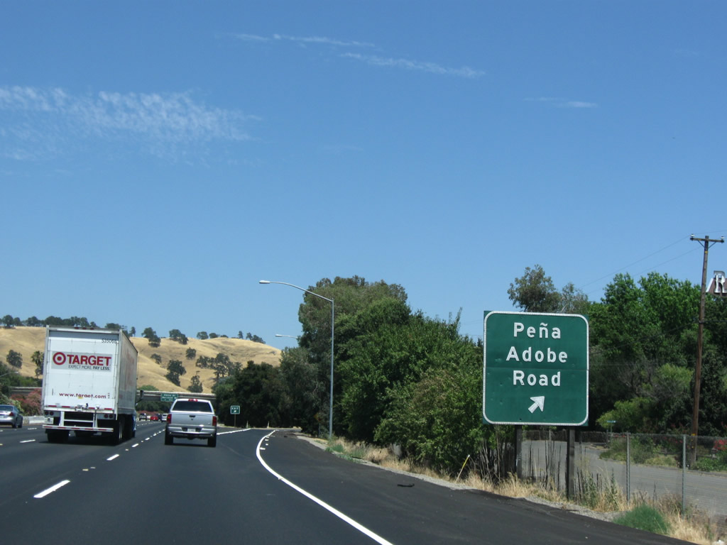
Cherry Glen Road loops northward and returns to Interstate 80 via Pe-a Adobe Road at Exit 51B. Pe-a Adobe Road spurs east to the freeway and Lagoon Valley Recreational Area. Photo taken 07/18/09. |
|
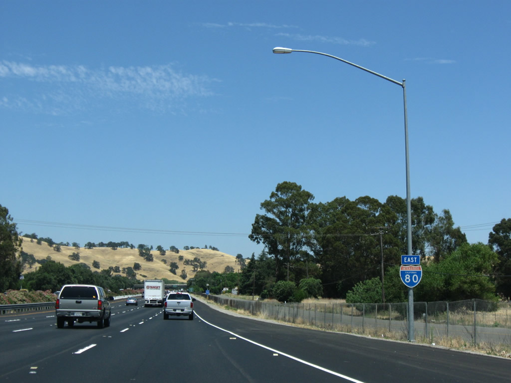
An Interstate 80 east reassurance shield is posted shortly thereafter. Photo taken 07/18/09. |
|
Eastbound Interstate 80 reaches Exit 51B, Pe-a Adobe Road (folded-diamond interchange). Riveria Road ends at Pe-a Adobe Road just east of Interstate 80. Photo taken 07/18/09. |
|
The first exit along eastbound Interstate 80 to serve the city of Vacaville is Exit 53, Alamo Drive and Merchant Street. Vacaville, which translates to "Cow Town", is home to 96,735 residents. Founded in 1892, Vacaville began as a small agricultural town. Photo taken 03/31/05. |
|
This view looks east along Interstate 80 as we approach Vacaville. Photo taken 07/18/09. |
|
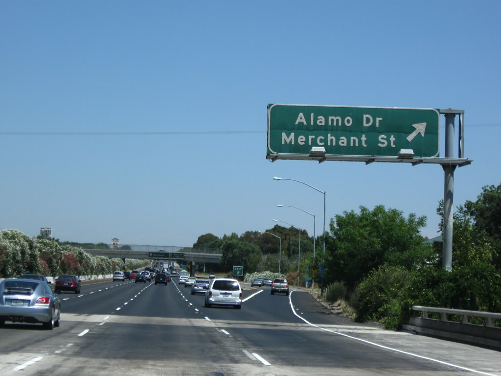
Alamo Drive interchanges with Interstate 80 between Marshall Road and Merchant Street in west Vacaville. Alamo Drive skirts the southern and western reaches of Vacaville between Leisure Town Road and Foothill Drive / Monte Vista Avenue. Merchant Street stems east from the Interstate 80 partial-cloverleaf interchange to Dobbins and Main Streets in downtown Vacaville. Photo taken 07/18/09. |
|
Interstate 80 continues east toward downtown Vacaville and Exit 54A (Davis Street). The pull-through overhead attached to the Alamo Drive overpass once touted a U.S. 40 shield to the right. Photo taken 11/27/07. |
|
The Exit 54A folded-diamond interchange joins Interstate 80 with Belle Vista Road and Davis Street south of downtown Vacaville. Bella Vista Road parallels the freeway east from Bishop Drive to Davis Street. The eastbound ramps join Bella Vista Road. Photo taken 03/31/05. |
|
Eastbound Interstate 80 reaches Exit 54A, Davis Street. The off-ramp leaves eastbound for Bella Vista Road east ahead of its intersection with Davis Street. Davis Street travels 1.4 miles north from Alamo Drive to Main Street in downtown Vacaville. Photo taken 07/18/09. |
|
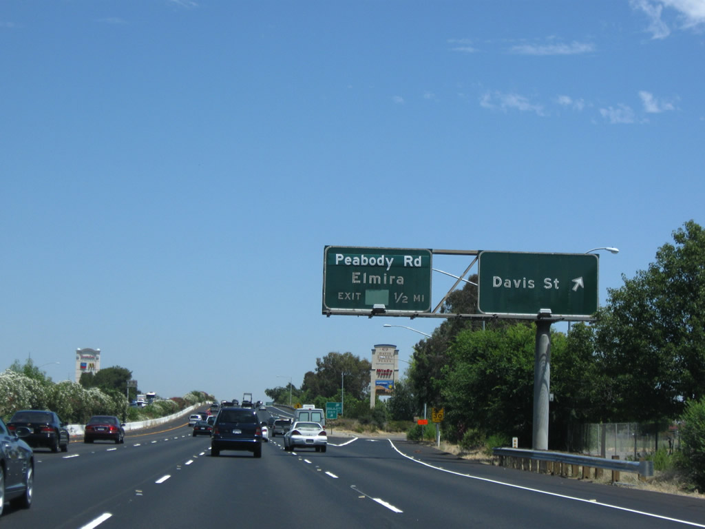
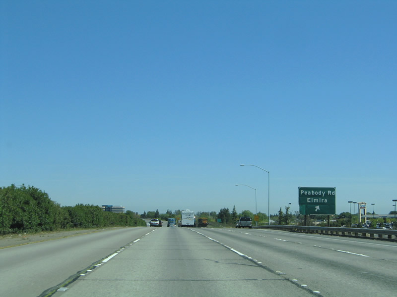
The next exit along eastbound motorists is the Exit 54B folded-diamond interchange with Cliffside Drive, Peabody Road, Mason Street west and Elmira Road east. Cliffside Drive joins the eastbound ramps with Peabody Road. Peabody Road travels south from Mason Street / Elmira Road to Alamo Drive and Travis A.F.B. Mason Street departs downtown Vacaville and transitions into Elmira Road east of Peabody Road. Elmira Road travels through east Vacaville 3.6 miles to the rural village of Elmira. Photo taken 03/31/05. |
|
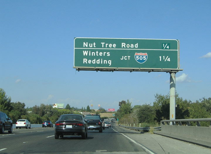
This mileage sign is posted at the Mason Street under crossing along Interstate 80 eastbound. The sign features the distances to Exit 55, Monte Vista Avenue (Historic U.S. 40), Allison Drive, and Nut Tree Parkway and Exit 56, Interstate 505 north. Interstate 505 provides a freeway connection between Interstate 80 at Vacaville to Interstate 5 near Dunnigan. Photo taken 09/10/05. |
|
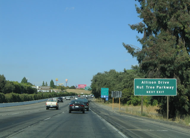
Departing the freeway ahead is the Exit 55 off-ramp to Allison Drive and Nut Tree Parkway east. Nut Tree Parkway stems east from the interchange alongside Interstate 80 to the Factory Stores at Nut Tree and Nut Tree Parkway at Orange Drive. Photo taken 09/10/05. |
|
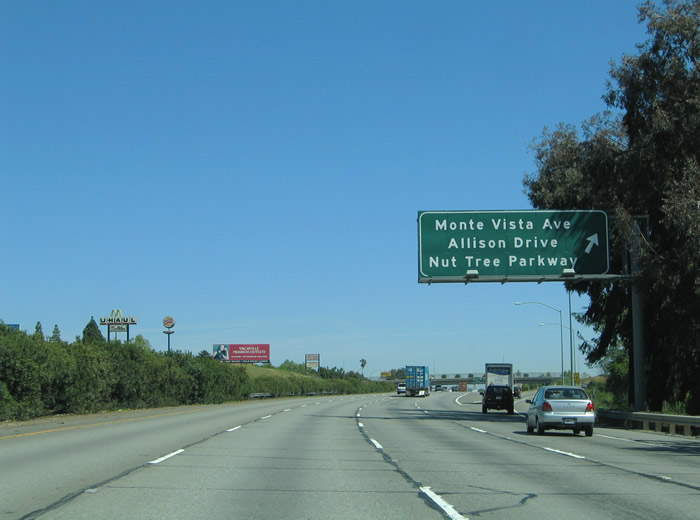
Interstate 80 eastbound at the Exit 55 partial-cloverleaf interchange with Allison Drive, Nut Tree Parkway, and Monte Vista Avenue. Allison Drive heads north 1.3 miles from Elmira Road to Monte Vista Avenue and Browns Valley Parkway. Historic U.S. 40/Monte Vista Avenue parallels the freeway from Interstate 505 and Nut Tree Airport west to Depot Street before turning into downtown Vacaville. Photo taken 03/31/05. |
|
A directional interchange joins Interstate 80 with the southern terminus of Interstate 505 at Exit 56. Interstate 505 was originally the northern segment of a planned Interstate 5W loop, which would funnel traffic from Interstate 5 south from Dunnigan into the eastern Bay Area, following Interstate 505 south to Interstate 80 west, then Interstate 580 southeast back to Interstate 5. The loop idea was abandoned for a variety of reasons, including the lengthy overlap with Interstate 80 and the request to eliminate suffixed Interstate routes. Photo taken 09/10/05. |
|
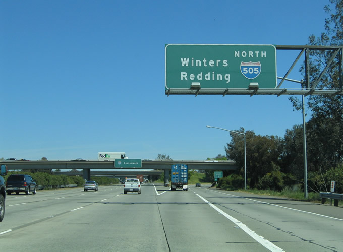
The first exit along northbound Interstate 505 is a brief ramp to Orange Drive, which connects into the regionally famous Vacaville outlet stores. A Jelly Belly factory outlet store is located here. Winters lies 11 miles to the north along Interstate 505 at the junction with California 128. Photo taken 03/31/05. |
|
|
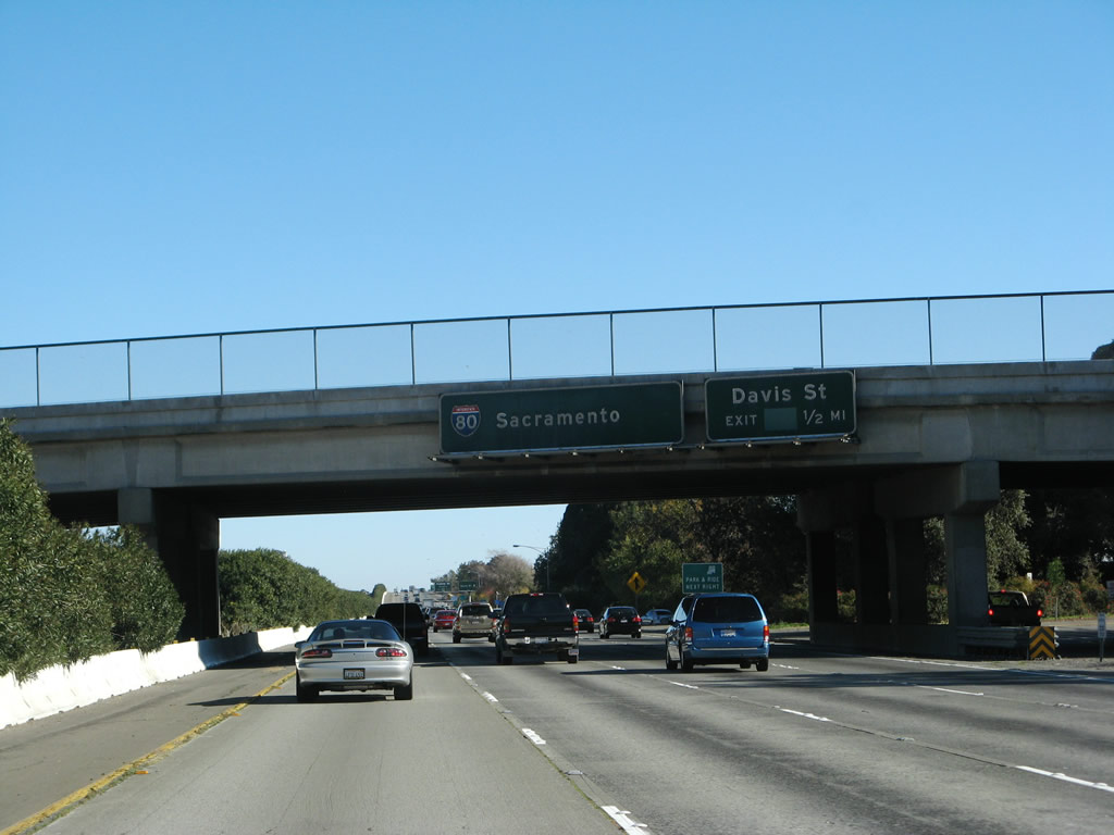
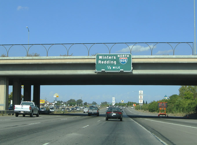
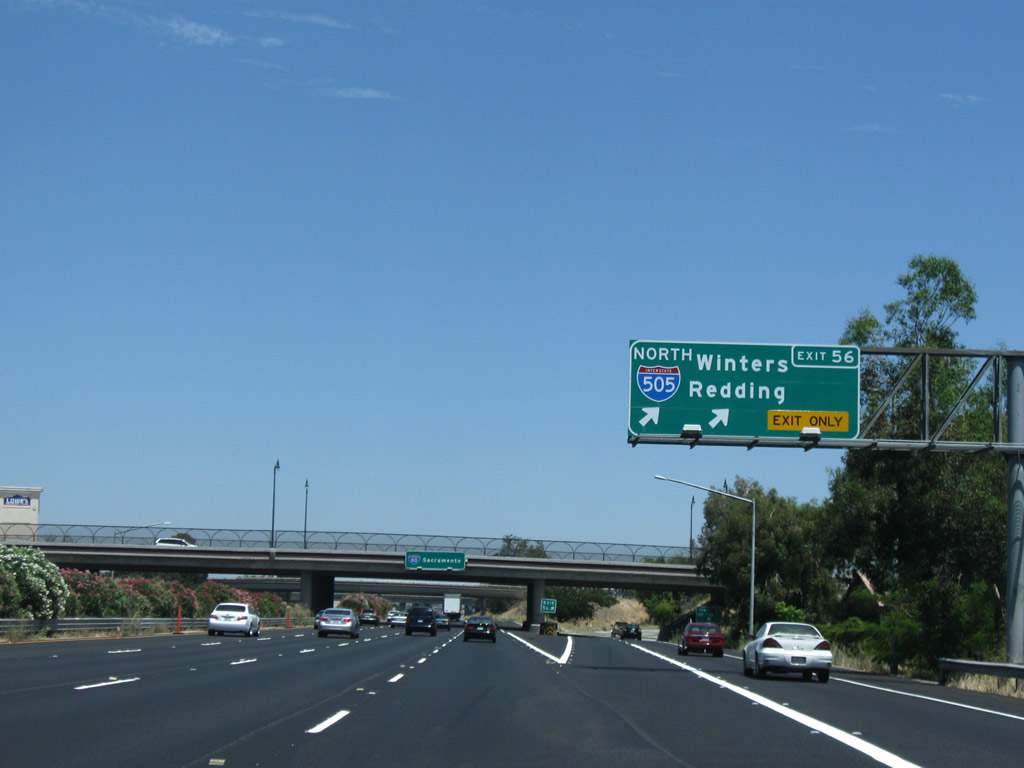
Eastbound Interstate 80 reaches Exit 56, Interstate 505 north to Winters and Dunnigan. Interstate 5, which takes over for Interstate 505 north of Dunnigan, serves the northern Central Valley communities of Williams, Red Bluff, and Redding, then continues toward the Pacific Northwest. Historically speaking Interstate 505 and Interstate 5 from Dunnigan north to Red Bluff replaced the routing of U.S. 99W. U.S. 99E follows present day California 99 north from Sacramento to Yuba City, Chico, and Red Bluff. Photos taken 07/18/09 and 03/31/05. |
|
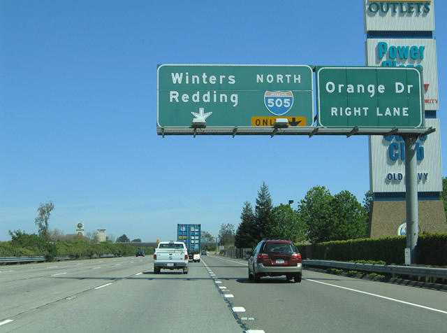
Interstate 505 northbound departs Interstate 80 east via Exit 56. The Orange Drive off-ramp departs Interstate 505 onto the parallel frontage road. Orange Drive continues as Nut Tree Parkway east to Leisure Town Road in northeast Vacaville. Photo taken 03/31/05. |
|
|
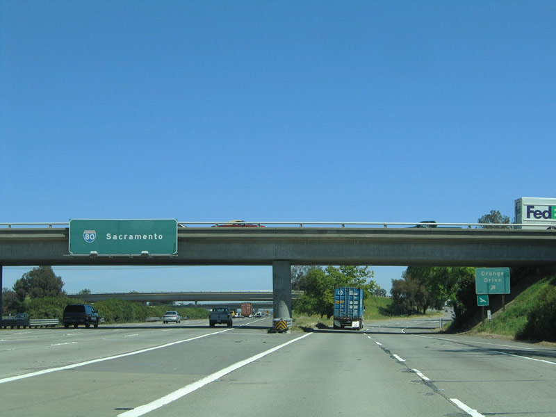
Interstate 80 eastbound meets Exit 56, Nut Tree Parkway over crossing and split with Interstate 505. An expansion of Nut Tree Parkway was underway at the time of the 2005 photograph. Note the new bridge supports behind the eastbound pull-through panel. Sacramento is 32 miles to the east at this point. Photos taken 07/18/09 and 09/10/05. |
|
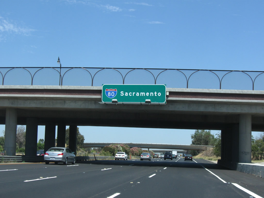
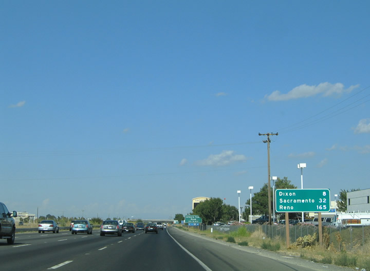
This mileage sign is posted along Interstate 80 east after the junction with Interstate 505 (Exit 56). The freeway continues its northeasterly trek toward Dixon and its interchange with California 113 south (eight miles), Davis and California 113 north (12 miles), West Sacramento and the junction with Business Loop I-80 (Capital City Freeway) and U.S. 50 (26 miles), and Sacramento (32 miles via Business 80 and U.S. 50). The new control city of Reno is 165 miles northeast of here. Photo taken 09/10/05. |
|
|
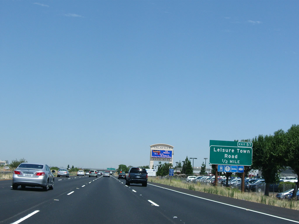
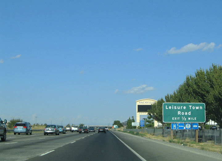
Continuing east toward the half-cloverleaf interchange with Leisure Town Road on Interstate 80. Many of the interchanges along the freeway between Vacaville and Davis lie at the cross roads of the primary north-south and east-west roads, and thus are half-cloverleaf interchanges. These roads serve the farms of the western Central Valley. Leisure Town Road skims the eastern reaches of Vacaville between Interstate 80 and Fry Road. Photos taken 07/18/09 and 09/10/05. |
|
|
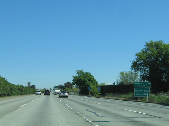
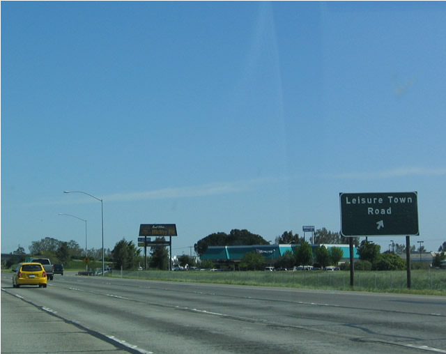
Eastbound Interstate 80 meets Exit 57, Leisure Town Road. This sign was replaced between 2005 and 2007 to be moved overhead and now includes an exit number. Leisure Town Road meets Orange Drive just south of the freeway and Vaca Valley Parkway west and Quinn Road (frontage road) east north of I-80. Vaca Valley Parkway travels west to Exit 1 of Interstate 505. Leisure Town Road continues north 4.7 miles to Allendale Road adjacent to Interstate 505 Exit 6. Photos taken 11/23/07 and 04/03/04. |
|
|
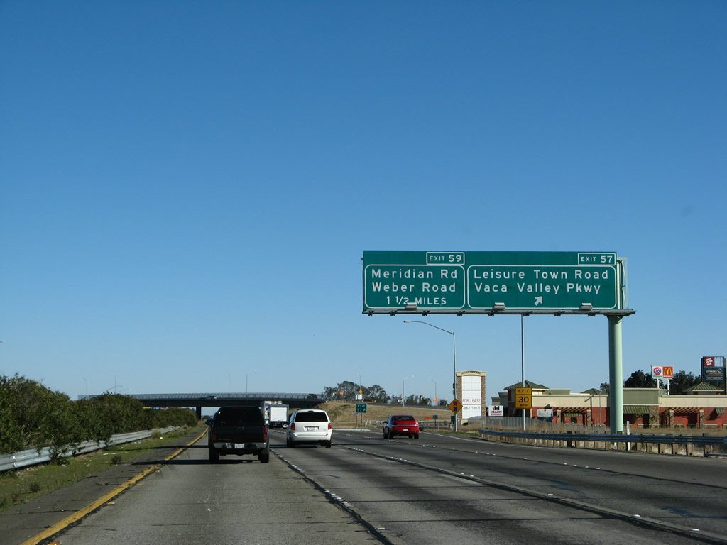
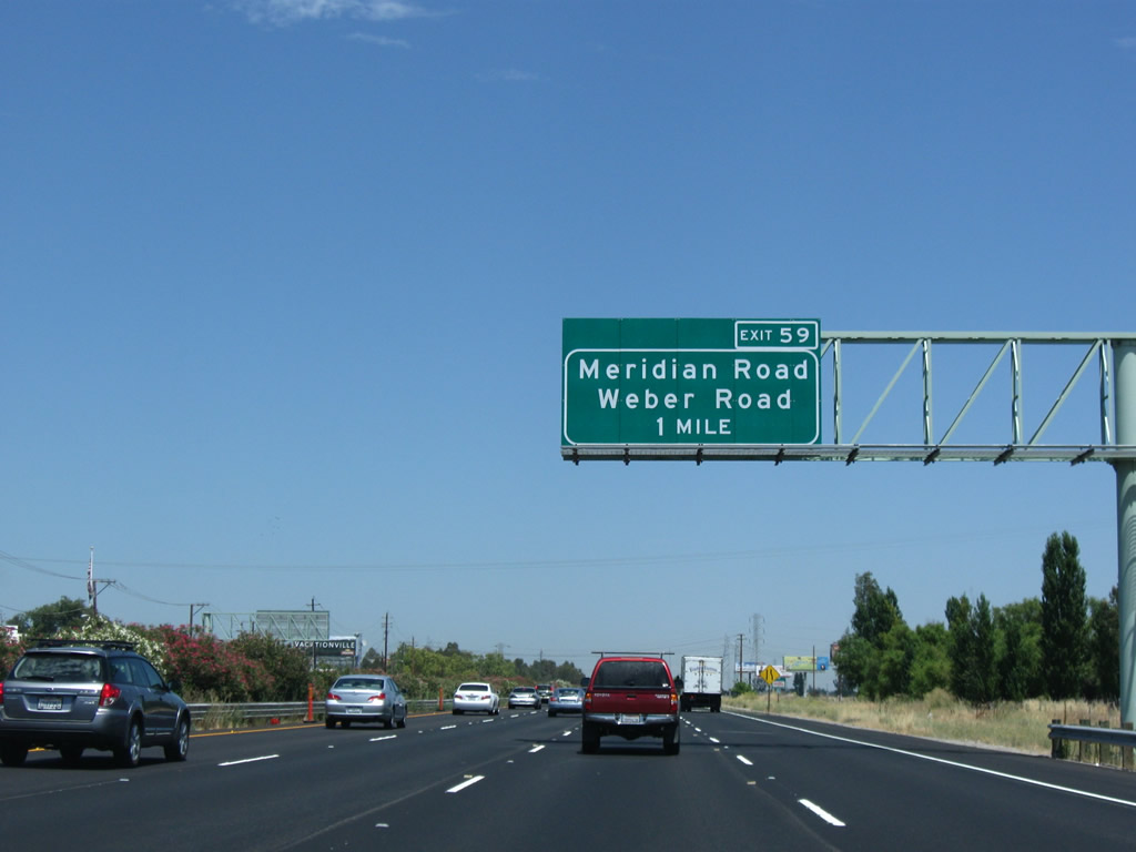
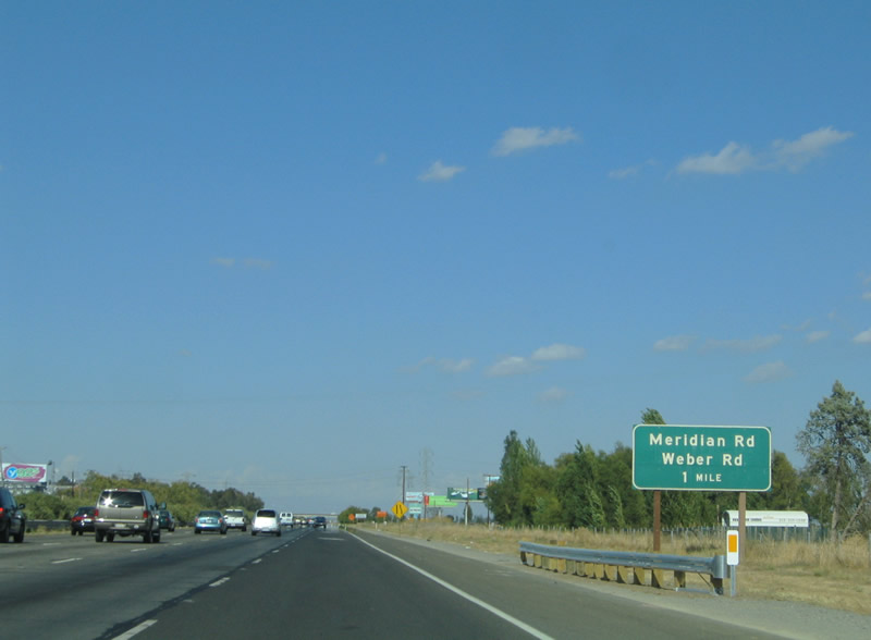
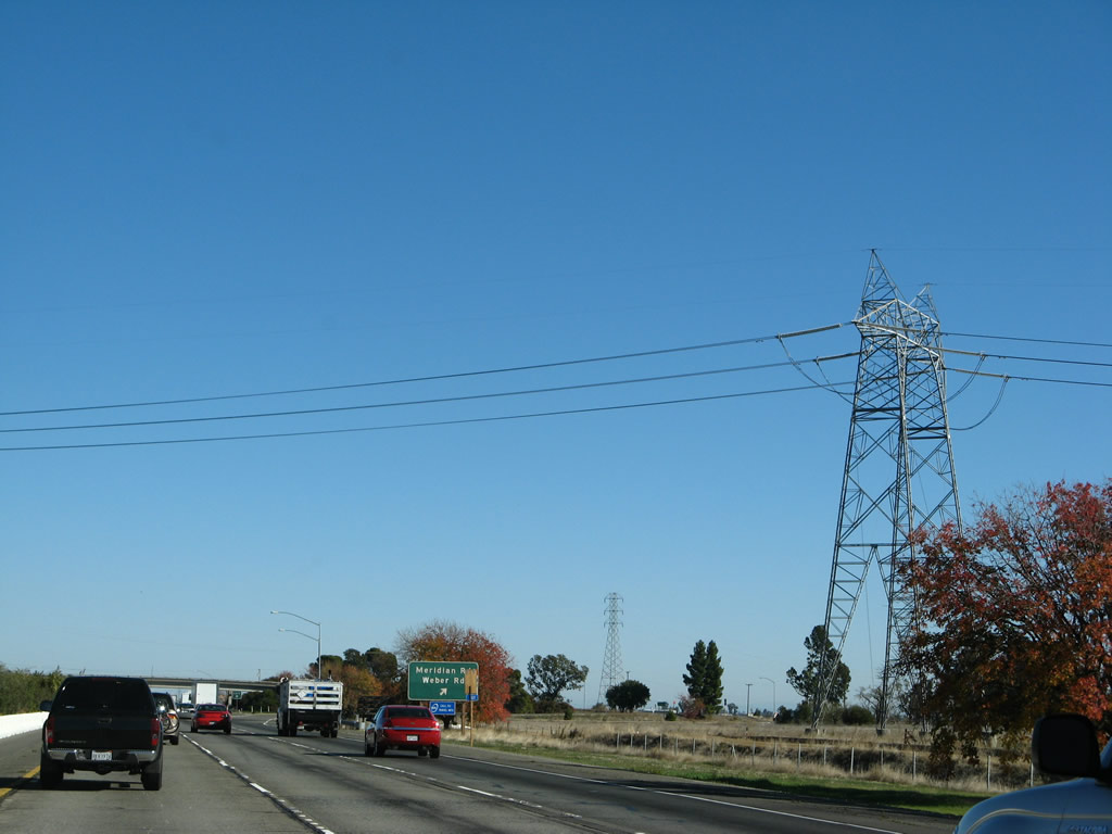
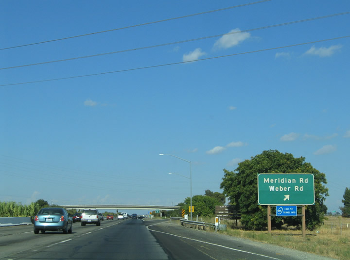
The next exit along Interstate 80 east is Exit 59, Meridian and Weber Roads (one mile). Exit 59 is a folded-diamond interchange. Meridian Road enters the scene from Midway to the north and turns east to become Weber Road at Exit 59. Photos taken 07/18/09 and 09/10/05.
|
|
|
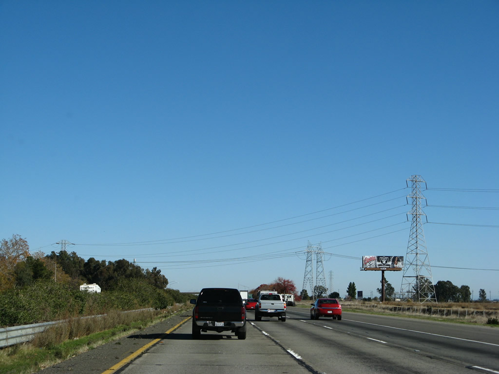
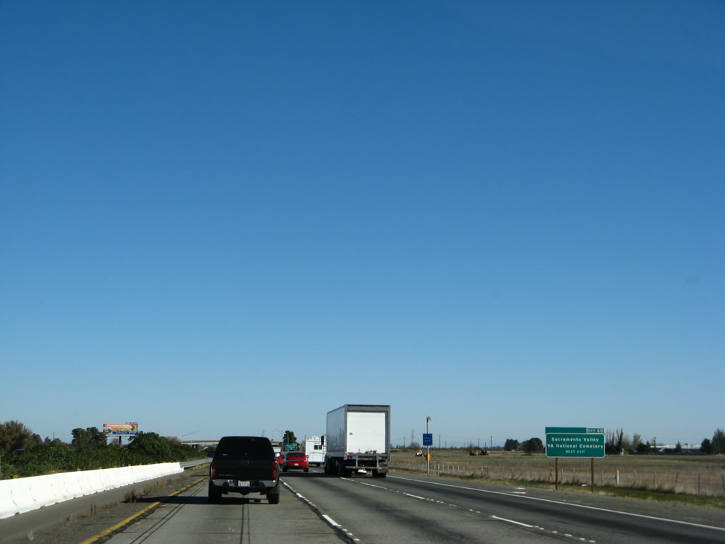
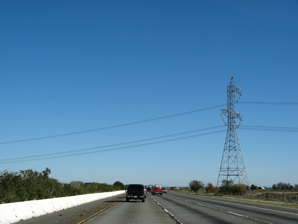
Interstate 80 crosses under the first of three sets of major power lines between Vacaville and Sacramento. The first is one-half of the Path 15 north-south 500kV power lines. This line connects power generation facilities in the Pacific Northwest with customers in Northern, Central, and Southern California. This line terminates at the Midway Substation near Buttonwillow, where the Pacific Gas and Electric 500kV power lines interconnect with Southern California Edison 500kV power lines. Photos taken 11/23/07. |
|
Eastbound Interstate 80 meets the Exit 59 loop ramp to Meridian Road north and Weber Road east. Meridian Road travels 4.3 miles north to Sweeney Road. Weber Road ends at Pitt School Road four miles to the east. Photo taken 09/10/05. |
|
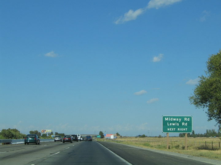
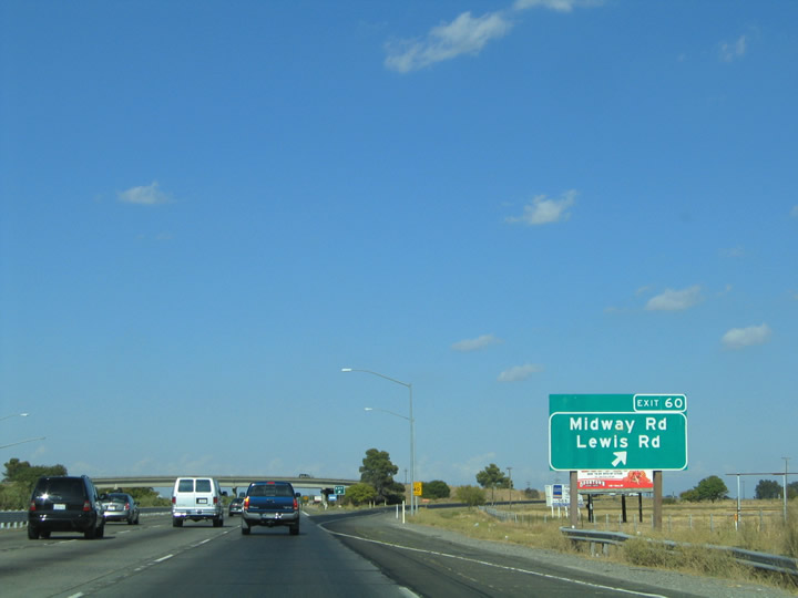
Interstate 80 continues east to meet Midway and Lewis Roads at Exit 60. Midway Road travels east-west between Hartley and Yolano in rural environs. Lewis Road stems south from the interchange seven miles to Hay Road. Use Lewis Road south for the village of Elmira via Holdener Road west. Photo taken 09/10/05. |
|
Use Exit 60 to the Sacramento Valley VA National Cemetery. Photo taken 11/23/07. |
|
Drivers bound for Midway Road and Lewis Road south leave Interstate 80 eastbound at Exit 60. Midway Road ventures 15 miles east from Timm Road north of Vacaville to Hyde Road and the Yolo County line. The road interchanges with Interstate 505 2.5 miles to the west and intersects California 113 (Rio Dixon Highway) four miles to the east. Photo taken 09/10/05. |
|
|
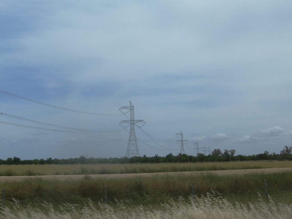
This 500kV power transmission line carries power from Malin, Oregon, south to the power plants in the Sacramento Delta Region as part of federally designated Path 66. Parallel to Path 15, this power line was constructed by the Western Area Power Administration (WAPA) rather than Pacific Gas and Electric. This line interconnects with the Path 15 power lines near Tracy. Interstate 80 carries six lanes for much of its stretch through northwestern Solano County. Photos taken 04/03/04 and 05/14/11. |
|
|
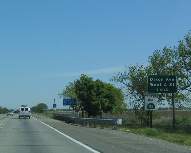
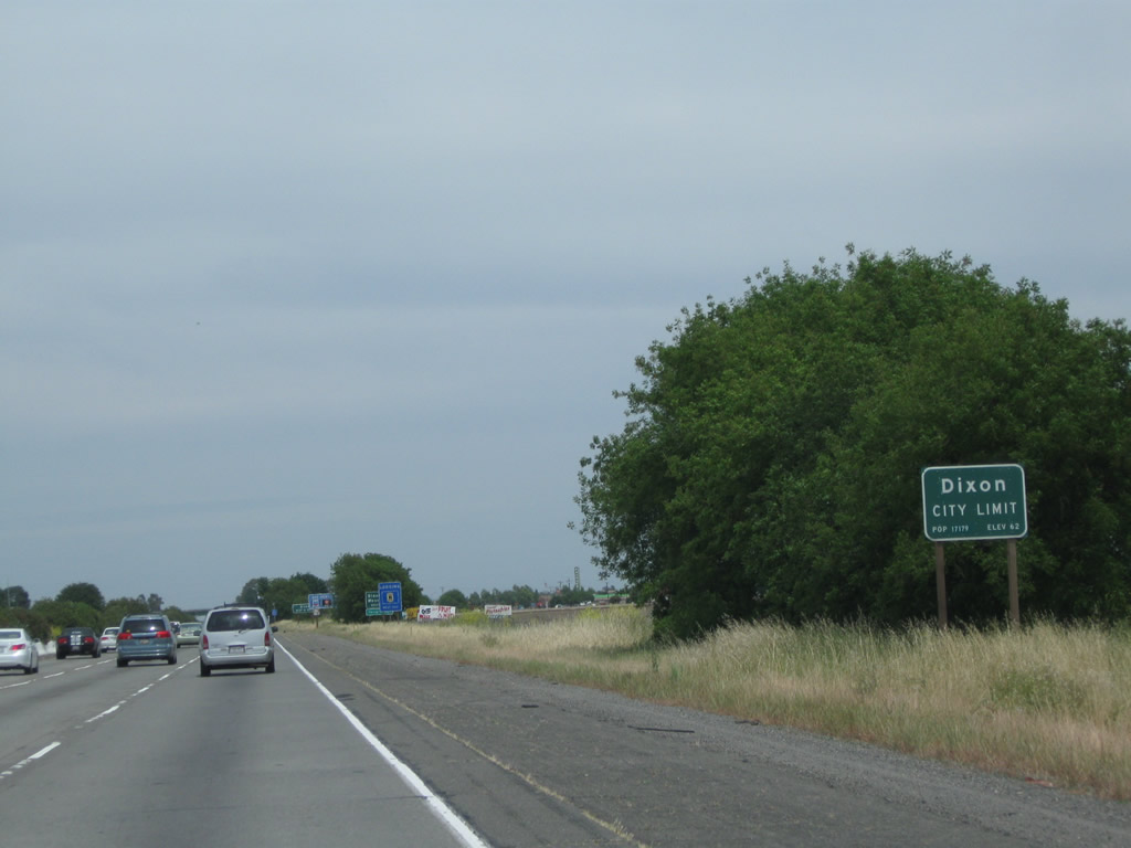
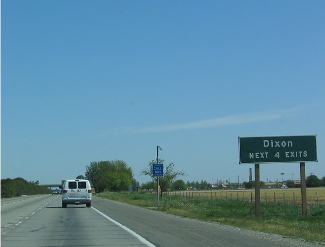
Interstate 80 east now enters the city of Dixon ahead of the Exit 63 half-cloverleaf interchange with Dixon Avenue west and A Street east and Batavia Road south. Trucks to downtown Dixon are advised to take California 113/First Street south into Dixon via Exit 66 in lieu of A Street east. To reach downtown otherwise, follow A Street east into town. Photos taken 04/03/04 and 05/14/11. |
|
|
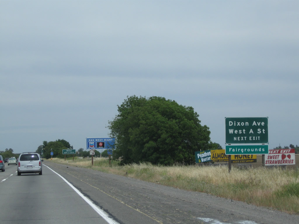
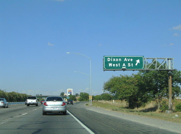
Approaching the Exit 63 off-ramp to Batavia Road for Dixon Avenue west and A Street east at Dixon. Exit 63 is the first of four exits to serve the city of Dixon. Batavia Road enters the scene from Weber and Midway Roads three miles to the south. Schroeder Road continues the north-south road between Dixon Avenue and Sievers Road. Photos taken 05/14/11 and 04/03/04. |
|
Eastbound Interstate 80 reaches Exit 63, Batavia Road to Dixon Avenue west and A Street east. Dixon Avenue stems west three miles to Meridian Road. West A Street continues Dixon Avenue east one mile to Pitt School Road, two miles to California 113 (First Avenue), three miles to Pedrick Road and four miles to Robben Road. The primary north-south and east-west roads in the west Central Valley parallel each other in one mile increments. Photo taken 09/10/05. |
|
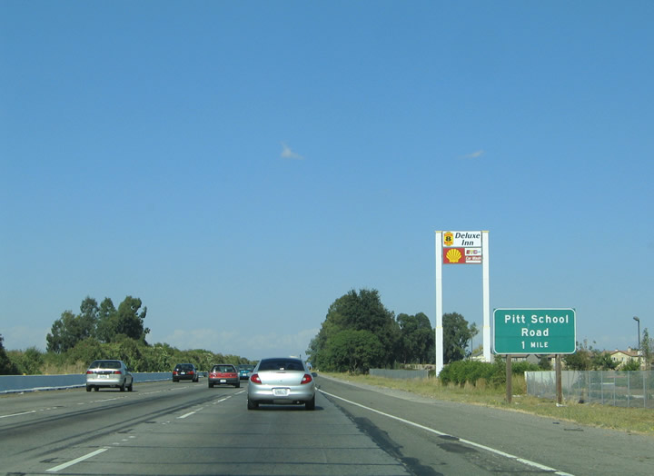
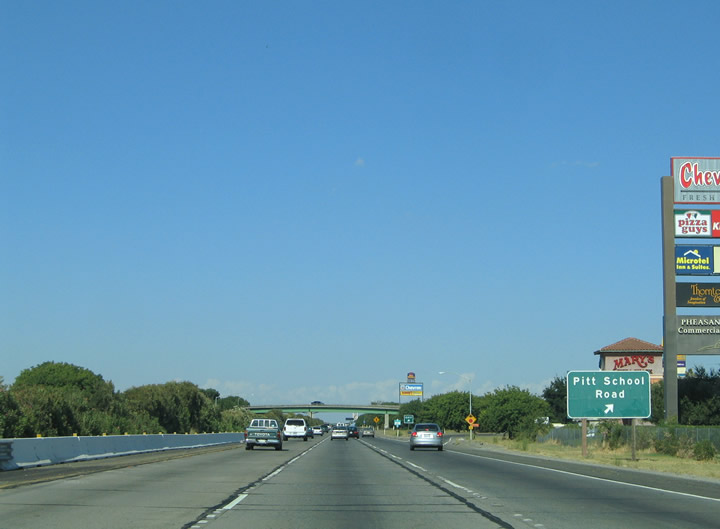
The next exit along Interstate 80 east is Exit 64, Pitt School Road (one mile). Pitt School Road travels nine miles between Hawkins and Sievers Road through the city of Dixon. Photo taken 09/10/05. |
|
A half-cloverleaf interchange joins Pitt School Road with Interstate 80 at Stratford Avenue at the north edge of Dixon. Stratford Avenue joins Pitt School Road with California 113 (First Avenue) one mile to the east. Lincoln Street (Historic U.S. 40) parallels Interstate 80 between Stratford Avenue and First Avenue. Photo taken 09/10/05. |
|
|
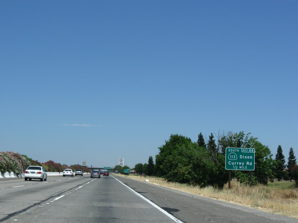
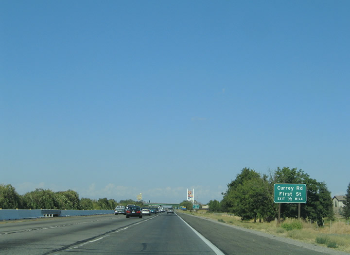
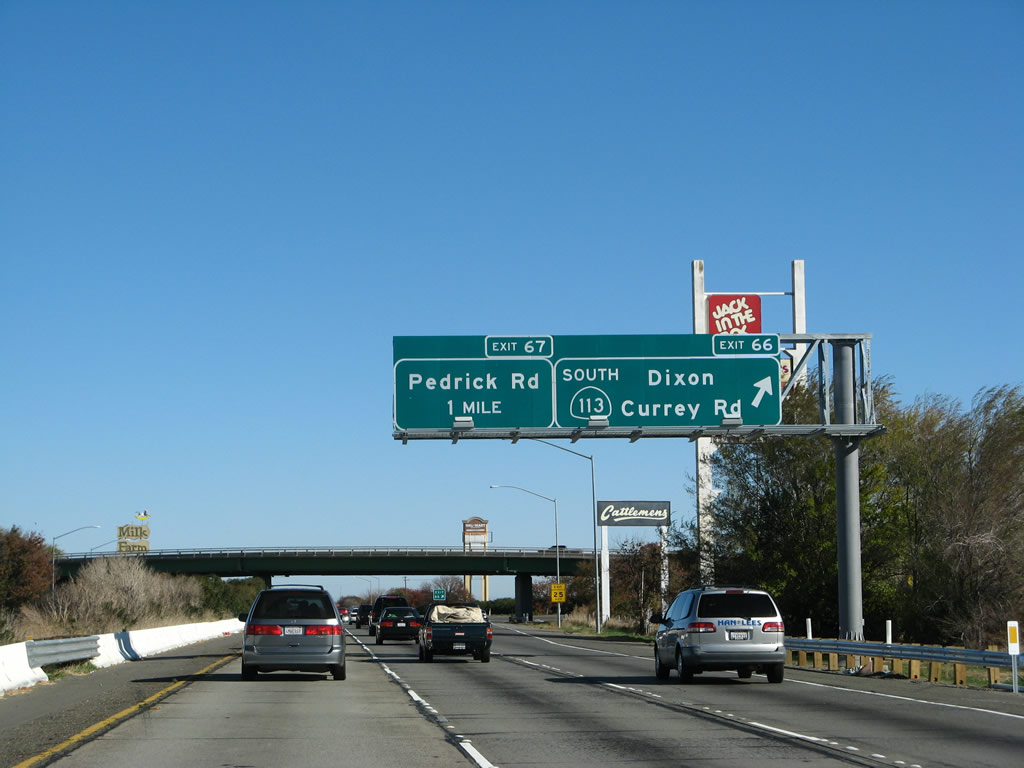
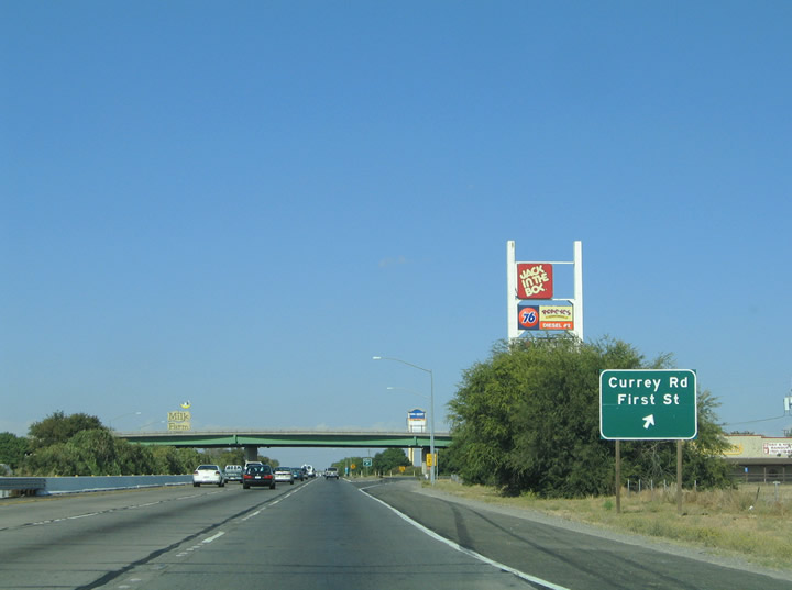
The next exit along Interstate 80 east is Exit 66, Currey Road and First Street (California 113 south). California 113 follows First Street through east Dixon to Currey Road and its merge onto Interstate 80. Currey Road continues First Street north one mile to Sievers Road and 4.1 miles to its end at the Yolo County line. Photos taken 07/18/09 and 09/10/05. |
|
|
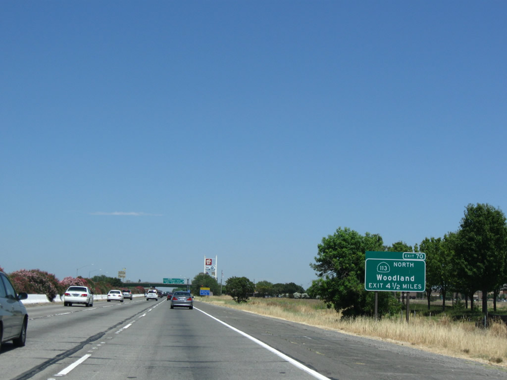
This sign is now gone, but this sign used to be posted one-half mile prior to the Exit 66 merge with California 113 (First Street) on Interstate 80 east. This unusual sign indicates that California 113 heads south from this exit, serving Dixon and Rio Vista via California 12 east and that traffic for north California 113 should continue straight ahead until Exit 70. California 113 overlaps Interstate 80 for approximately four miles and splits from Interstate 80 near Davis as a freeway to Woodland. This sign was gone by 2009. Photos taken 11/23/07 and 09/10/05. |
|
In place of the sign shown in the previous photobox is a new exit number sign for Exit 70, which where California 113 north departs Interstate 80 east en route to Woodland and Yuba City-Marysville. California 113 north of Davis approximates the alignment of Historic U.S. 99W between Davis and Woodland and Historic U.S. 40 Alternate between Davis and Yuba City (with an overlap with California 99 after California 113's northern terminus). Photo taken 07/18/09. |
|
|
Exit 66 leaves Interstate 80 eastbound at the Currey Road over crossing for California 113 (First Avenue) south into Dixon. California 113 (1st Street) intersects A Street in two miles near downtown Dixon on the 21-mile drive to California 12 (Rio Vista Road). Photos taken 11/23/07 and 09/10/05. |
| Interstate 80 east & California 113 north |
|
These reassurance shields for both eastbound Interstate 80 and northbound California 113 are found immediately after Exit 66, California 113. California 113 remains merged with Interstate 80 from here northeast to Exit 70 near Davis. Photo taken 09/10/05. |
|
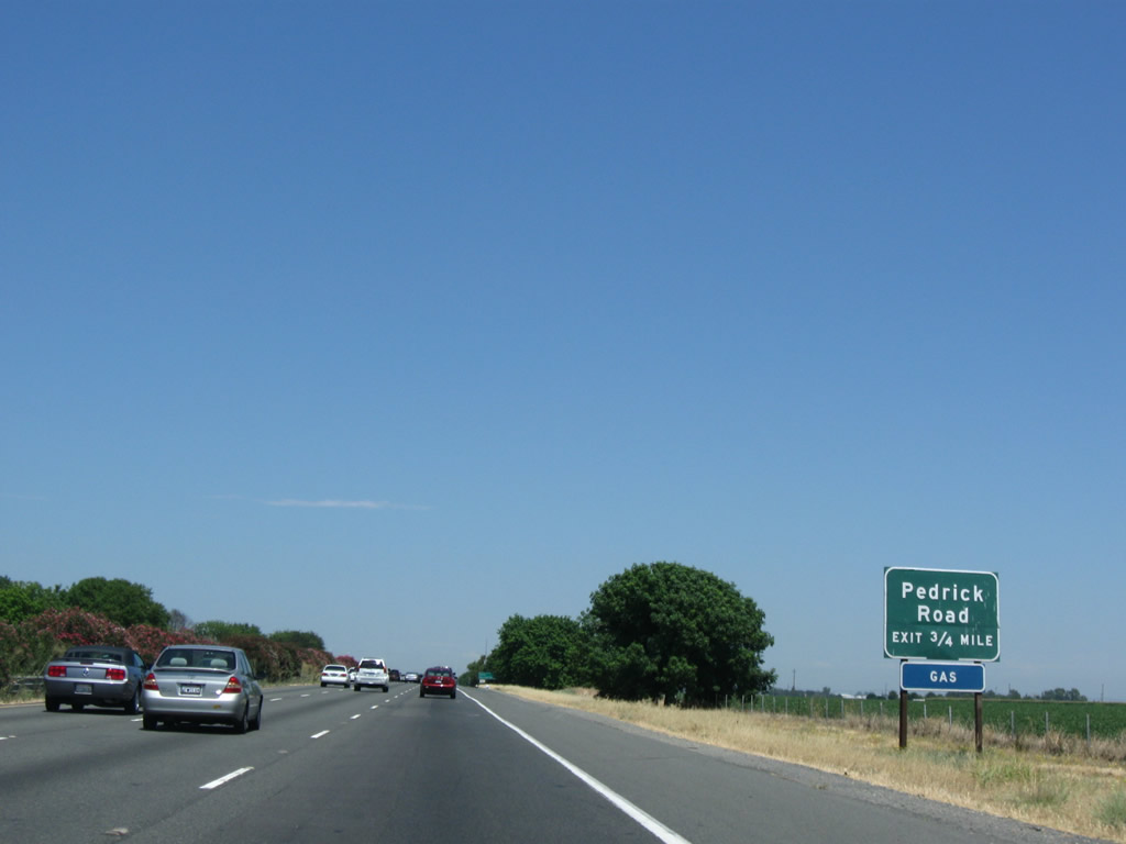
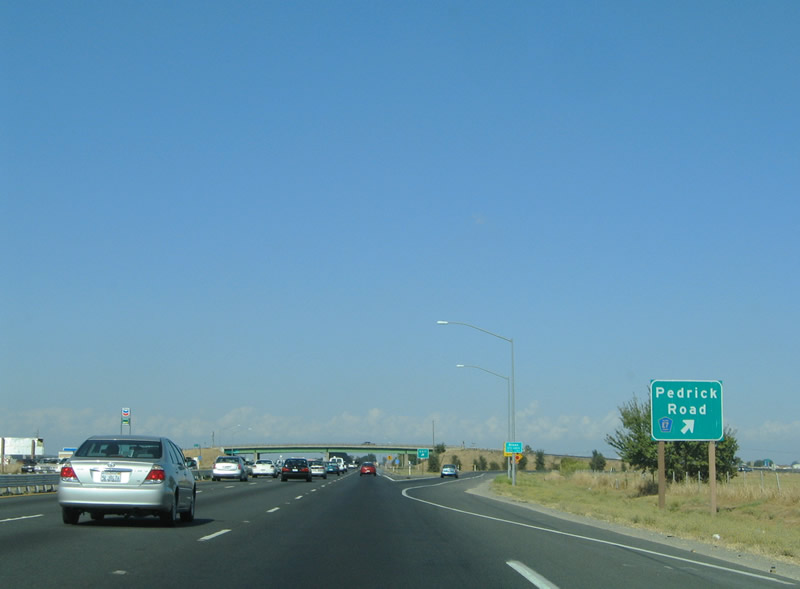
Eastbound Interstate 80/Northbound California 113 next approaches Exit 67, Solano County E-7, Pedrick Road. Solano County E-7 heads north over the South Fork of the Putah Creek, which forms the Solano-Yolo County Line west of Davis. Yolo County E-7 then heads due north along Road 98, connecting with California 16 west of Woodland. The highway parallels California 113, the freeway to the east. Photo taken 07/18/09. |
|
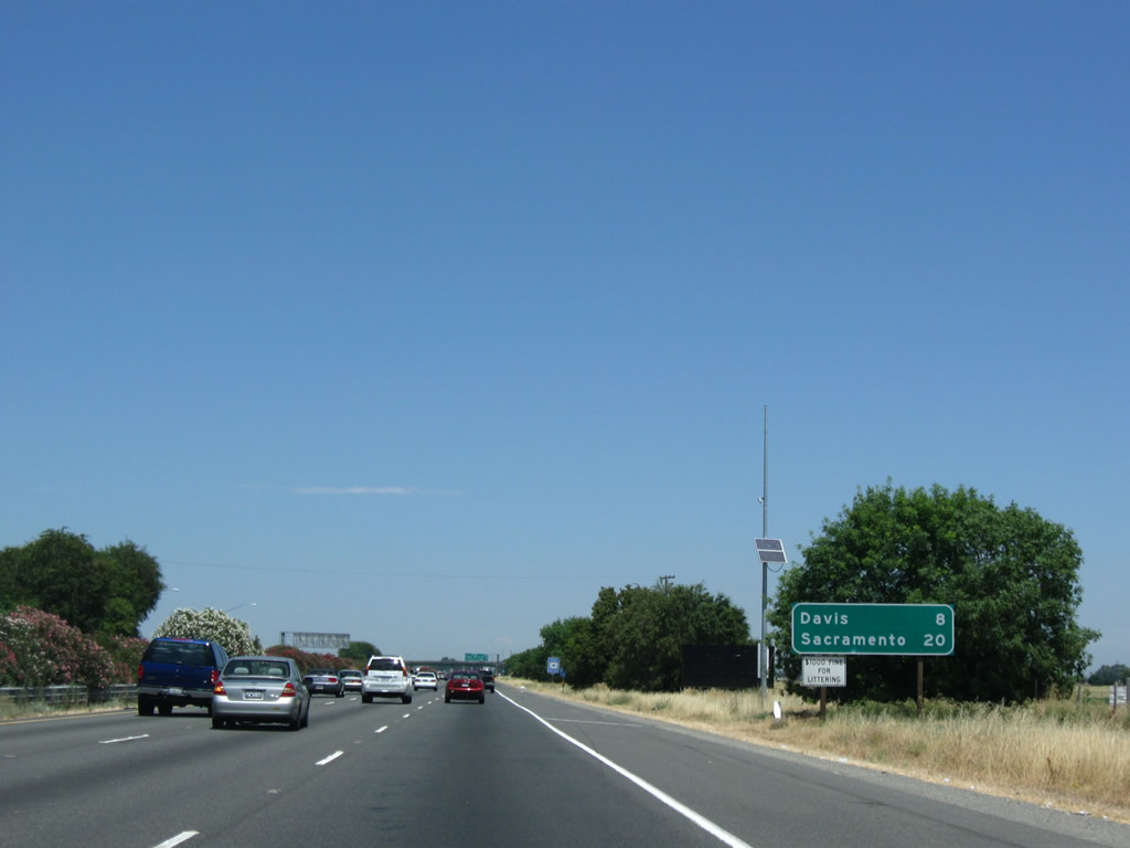
This mileage sign provides the distance to Davis (eight miles) and Sacramento (20 miles). Photo taken 07/18/09. |
|
|
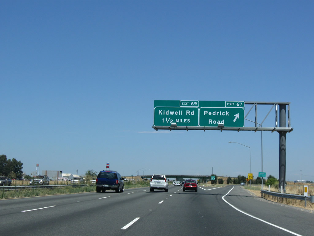
Interstate 80 east and California 113 north meet Exit 67, Solano County E-7 (Pedrick Road) and Sparling Lane. Sparling Lane (Historic U.S. 40) forms an eastbound side frontage road between Pedrick Road, Tremont Road, and Kidwell Road (Exit 69). Photos taken 07/18/09 and 09/10/05. |
|
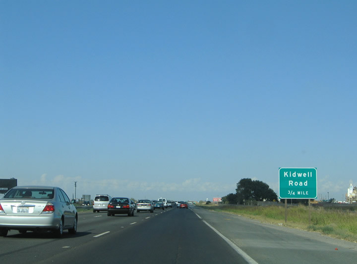
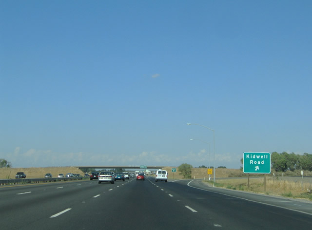
Next in line for drivers on Interstate 80 east and California 113 north is the Exit 69 diamond interchange with Kidwell Road. Kidwell Road comprises a short connector between the adjacent frontage roads of Sparling Lane (eastbound side) and Olmo Lane (westbound side) southwest of Davis. Photo taken 09/10/05. |
|
|
Eastbound Interstate 80 and northbound California 113 reach Exit 69, Kidwell Road. Olmo Lane and Sparling Lane (Historic U.S. 40) serve farming interests alongside the freeway. Both Sparling and Olmo Lanes end ahead of the Putah Creek crossing. Photos taken 07/18/09 and 09/10/05. |
|
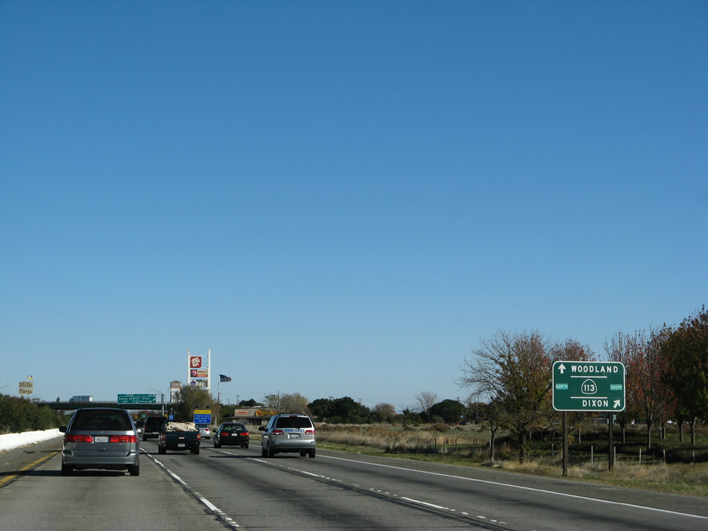
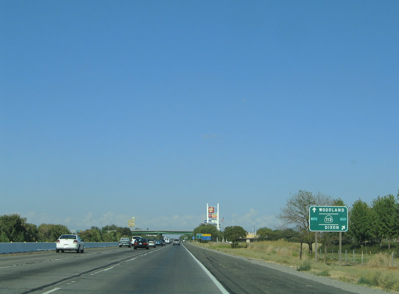
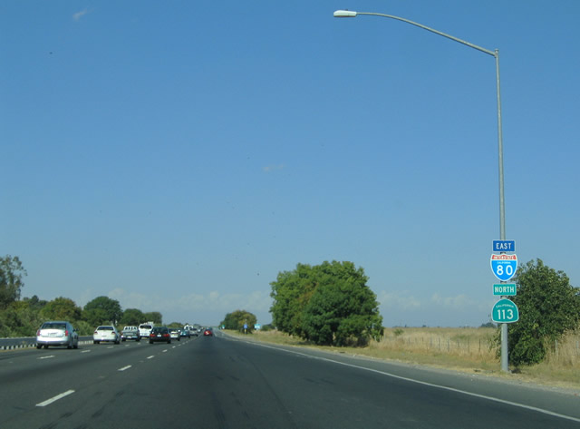
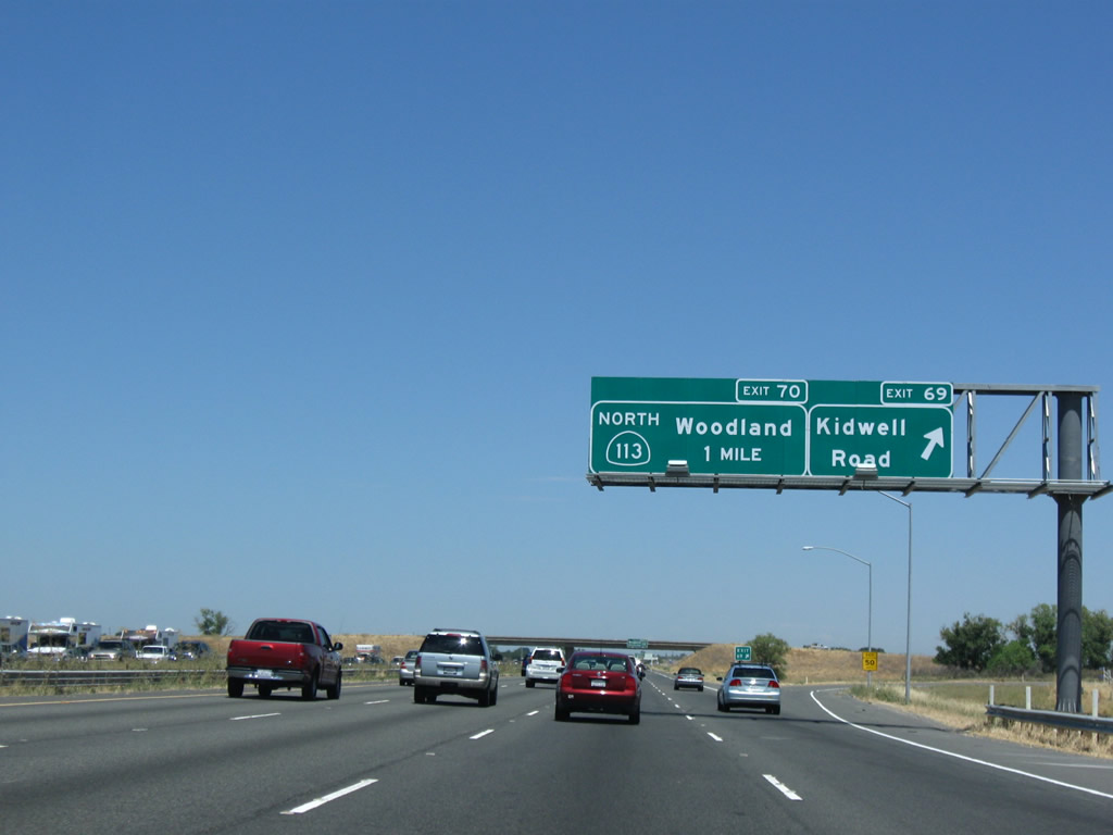
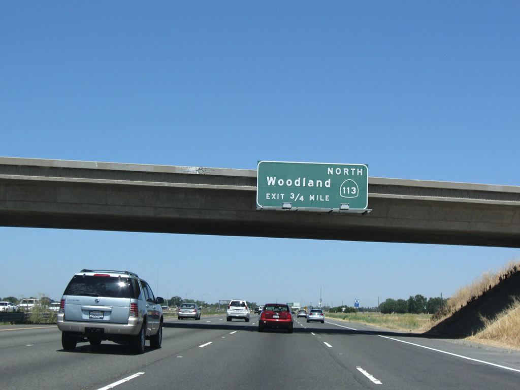
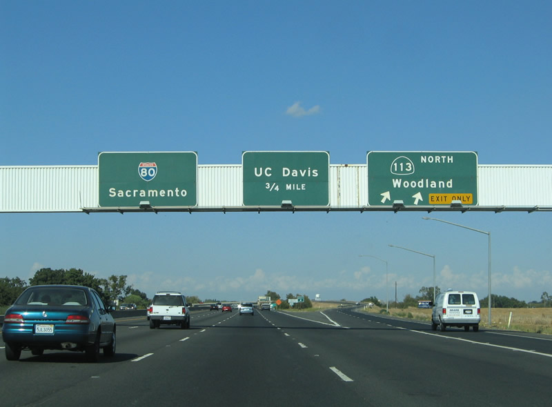
The next exit along eastbound is the split between the eastbound Interstate 80 and northbound California 113 freeways. California 113 heads north ten miles to the city of Woodland and 12.5 miles to its brief merge with Interstate 5. Photo taken 07/18/09. |
|
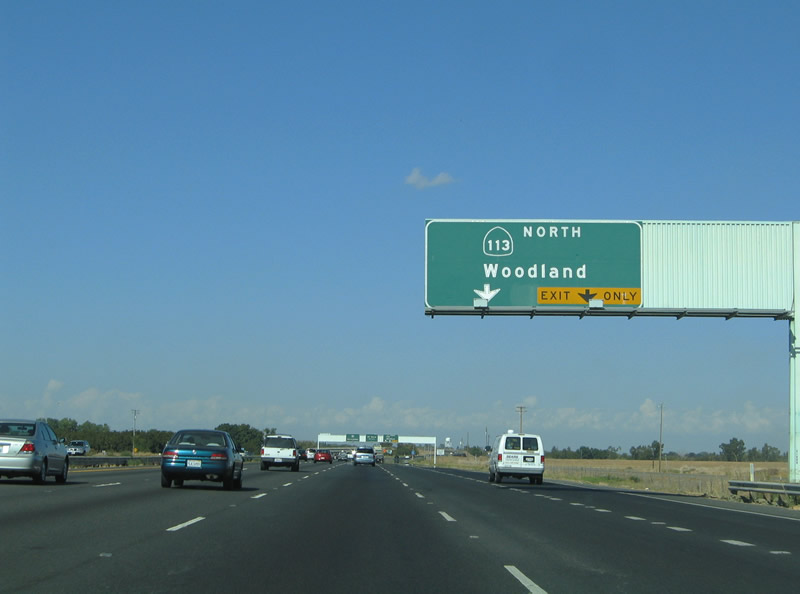
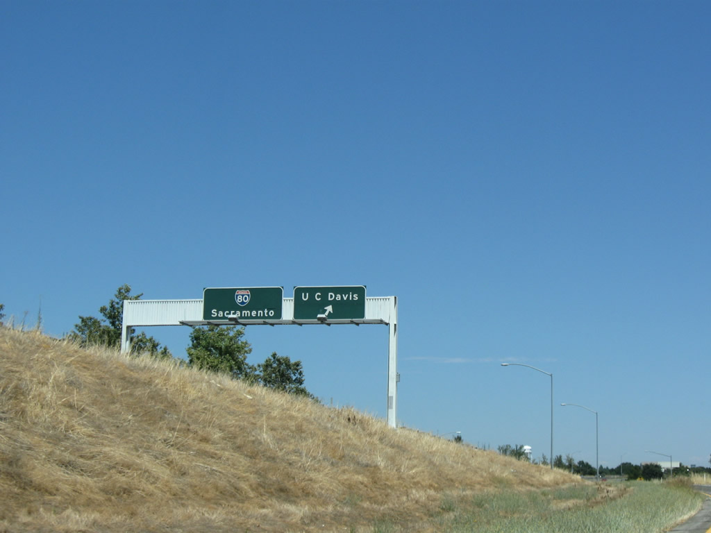
Northbound California 113 splits off from eastbound Interstate 80 at Exit 70. Following a freeway alignment from Davis north to Woodland, it acts as a cut-off route from Davis to Interstate 5 north. California 113 continues north from Interstate 5, passing by Knights Ferry en route to ending at a junction with California 99 south of Yuba City. California 113 follows the original route of U.S. 99W between Davis and Woodland, although the actual historic route (from east to west, then south to north) approximately followed today's Chiles Road, Cowell Boulevard, Olive Drive (not connected since it's on the north side of Interstate 80, so one must use Richards Boulevard to cross the freeway), First Street, B Street, Russell Boulevard, and Lake Boulevard. Leaving the city limits, Lake Boulevard becomes Road 99 en route to Woodland. U.S. 40 Alternate also began in Davis, following U.S. 99W north to Woodland, then splitting northeast along California 113 to meet former U.S. 99E in Marysville. To see the old alignment of U.S. 99W, follow Interstate 80 east to Exit 72, Richards Parkway (Downtown Davis). Photo taken 09/10/05. |
|
Eastbound Interstate 80 and northbound California 113 split at Exit 70, which is a freeway-to-freeway directional interchange at Davis. California 113 remains a freeway between Interstate 80 and Interstate 5, providing a direct route for those en route to Redding, Ashland, and Portland. After a brief merge with Interstate 5, California 113 reverts to a rural two-lane highway and eventually ends at California 99 about 39 miles to the north of here and about ten miles south of Yuba City and Marysville. Photo taken 09/10/05. |
| Interstate 80 east |
|
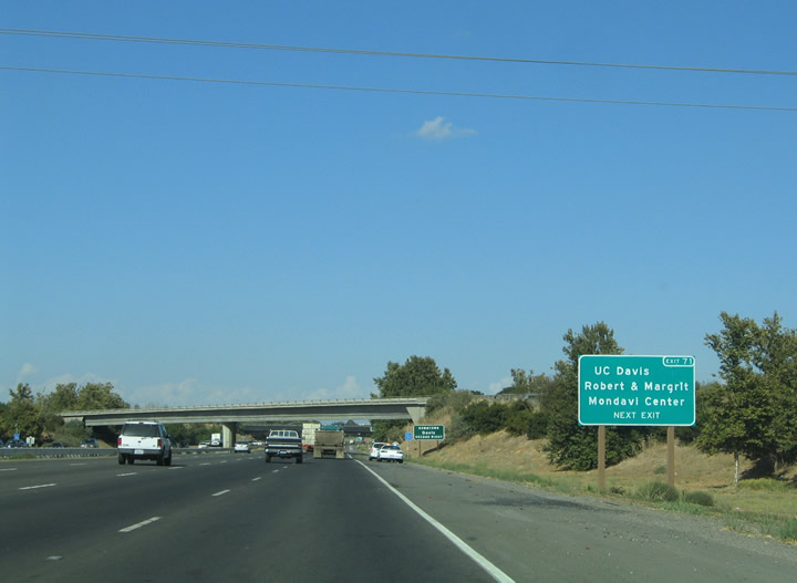
The next exit along eastbound Interstate 80 is Exit 71, Old Davis Road to the University of California at Davis campus. Old Davis Road straddles the county line from California Avenue to A Street through the university campus. The northbound ramp for California 113 passes over the freeway in the background. Photo taken 09/10/05.
|
|
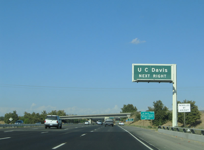
Nearing the Exit 71 diamond interchange with Old Davis Road and the campus of UC - Davis. Use Exit 71 for the Robert & Magrit Mondavi Center for the Performing Arts. The university itself constitutes a sprawling facility that occupies the area north and east of the Interstate 80 & California 113 interchange. Photo taken 09/10/05. |
|
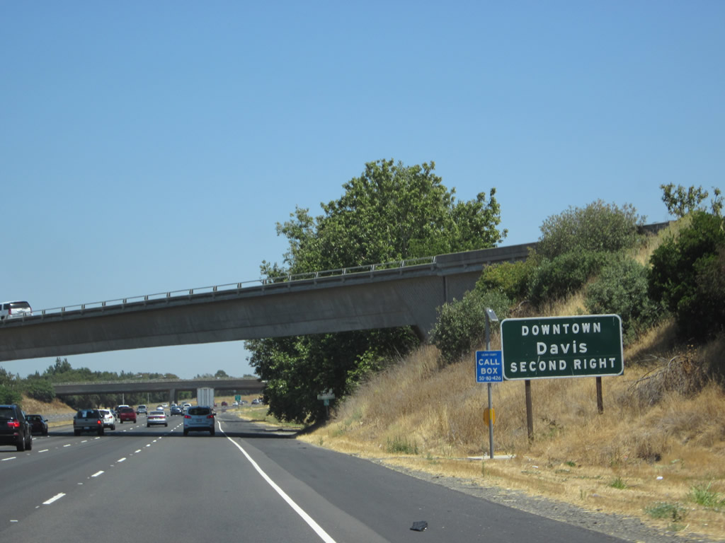
Traffic interests to downtown Davis should use Exit 72 from Interstate 80 eastbound. Exit 72 joins the freeway with Richards Boulevard just south of downtown. That exit is located within Yolo County. Photo taken 09/10/05. |
|
Eastbound Interstate 80 reaches Exit 71, Old Davis Road to UC Davis. Old Davis Road travels north three miles from Tremont and Becker Roads to the UC - Davis campus at California Avenue. Old Davis Road meets A Street one half mile east of California Avenue near downtown Davis. Immediately after this exit ramp, Interstate 80 exits Solano County and enters Yolo County. Photo taken 09/10/05. |
|
Now on the transition ramp, a ramp connects from California 113 south onto Old Davis Road. The two ramps merge ahead, then depart to Old Davis Road. At this point, Interstate 80 leaves Solano County and enters Yolo County. Photo taken 07/18/09. |
Page Updated September 4, 2012.