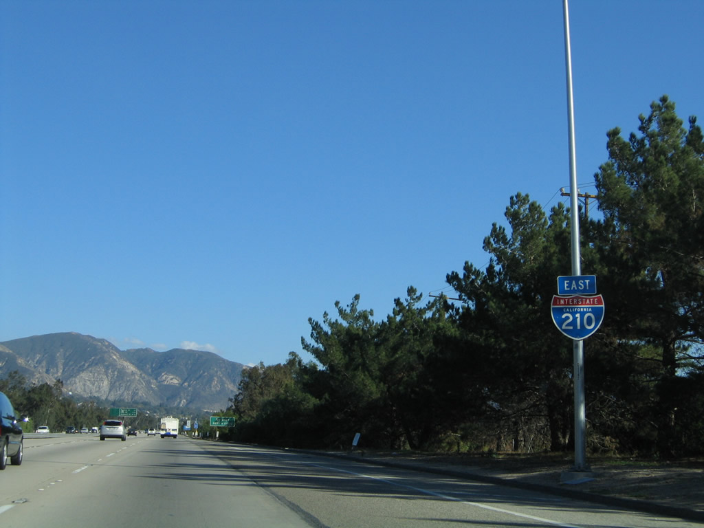
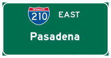
| Interstate 210 east |
|
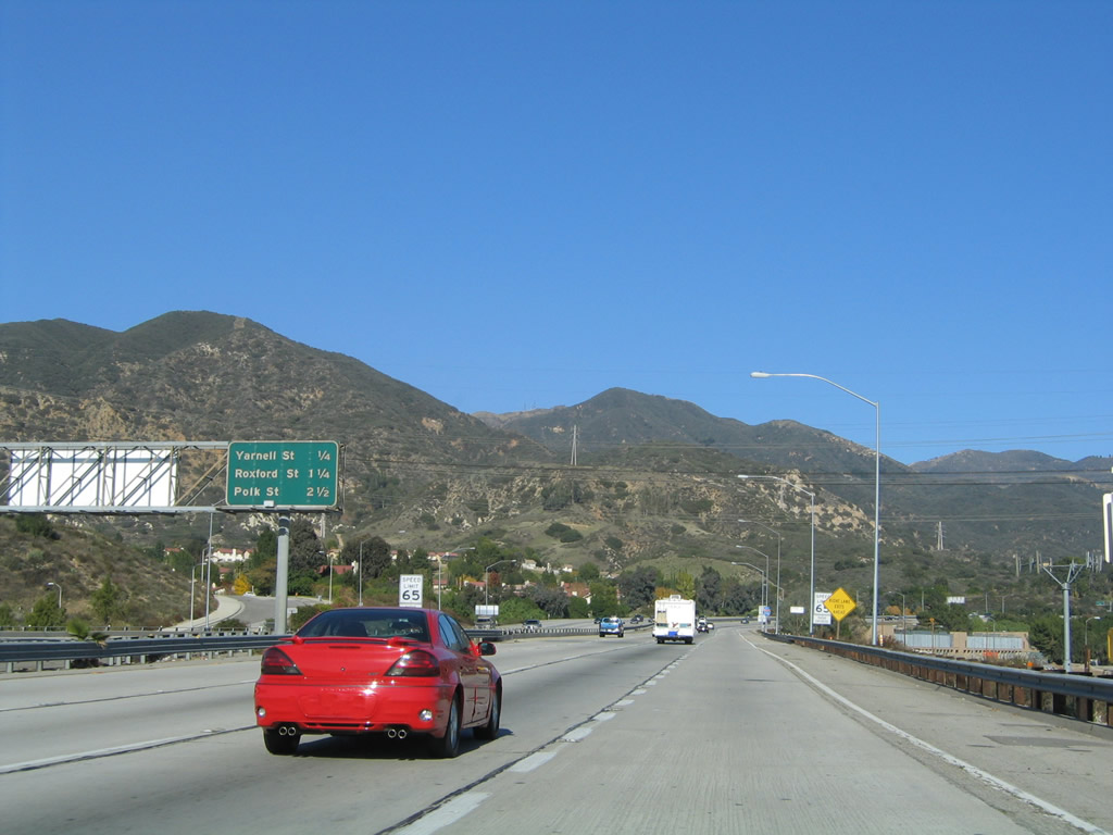
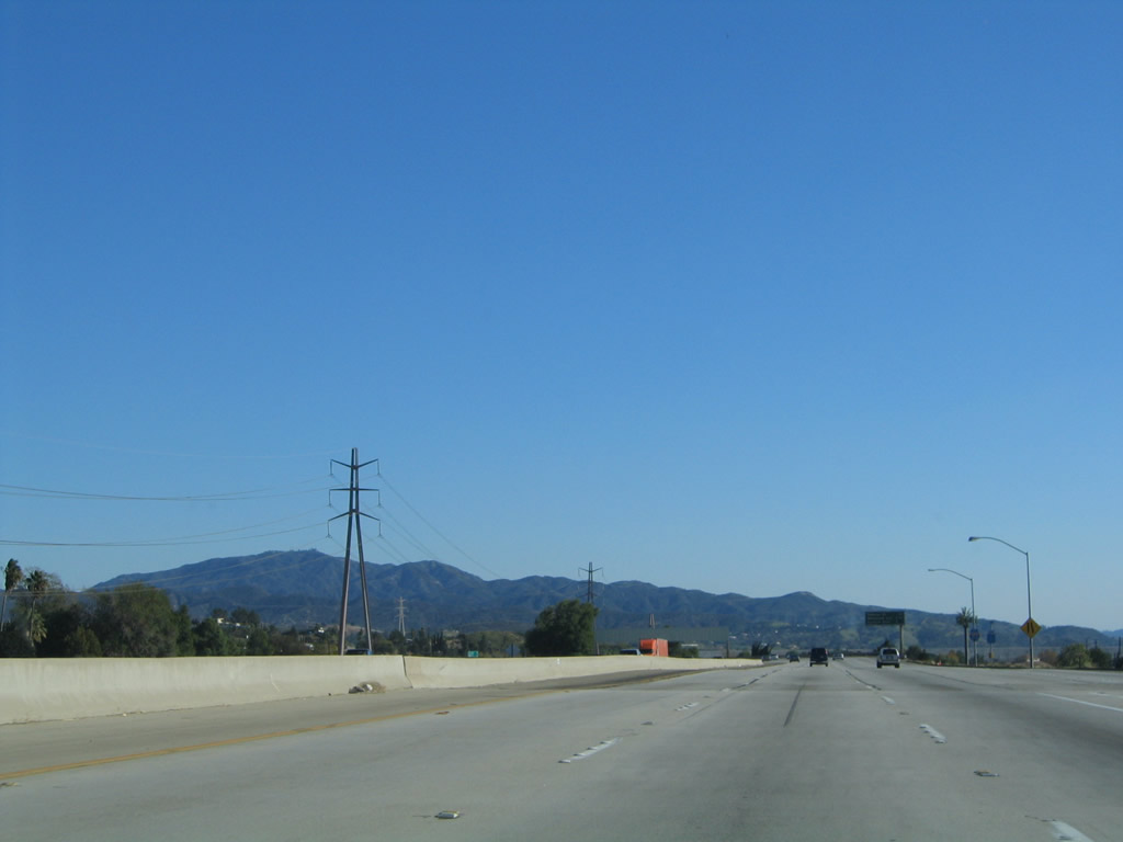
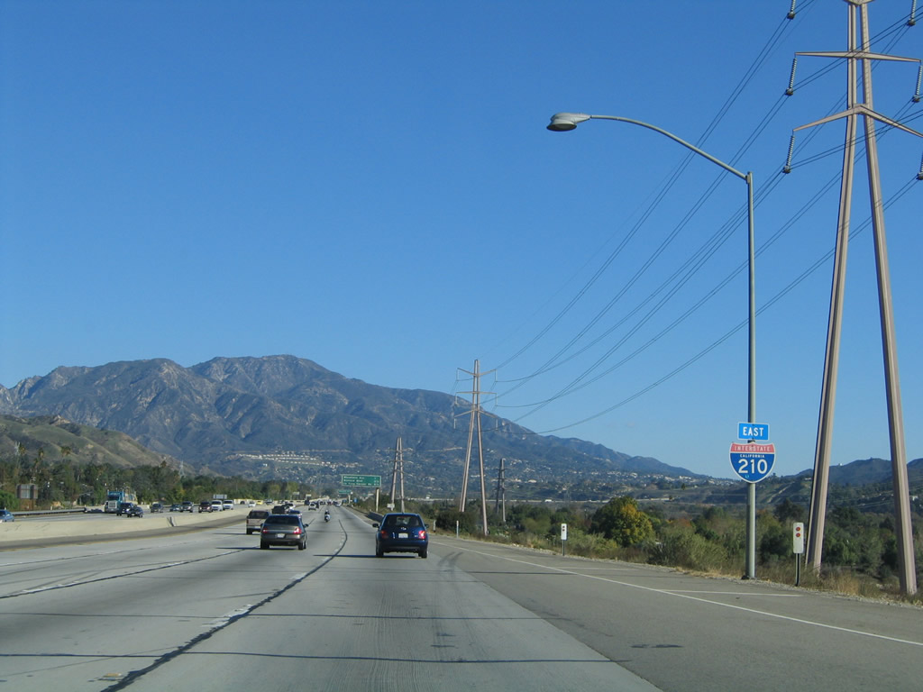
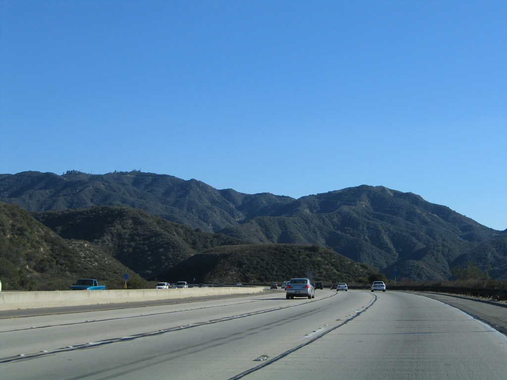
Leaving the Interstate 5 (Golden State Freeway) interchange, this mileage sign provides the distance to the first three exits from eastbound Interstate 210 (Foothill Freeway): Exit 1, Yarnell Avenue; Exit 2, Roxford Street; and Exit 3, Polk Street. While the interchange between Interstate 5 and Interstate 210 was built in 1971 (after the Sylmar Earthquake), the route leading east toward Yarnell Stret was built in 1970. Photo taken 11/14/04. |
|
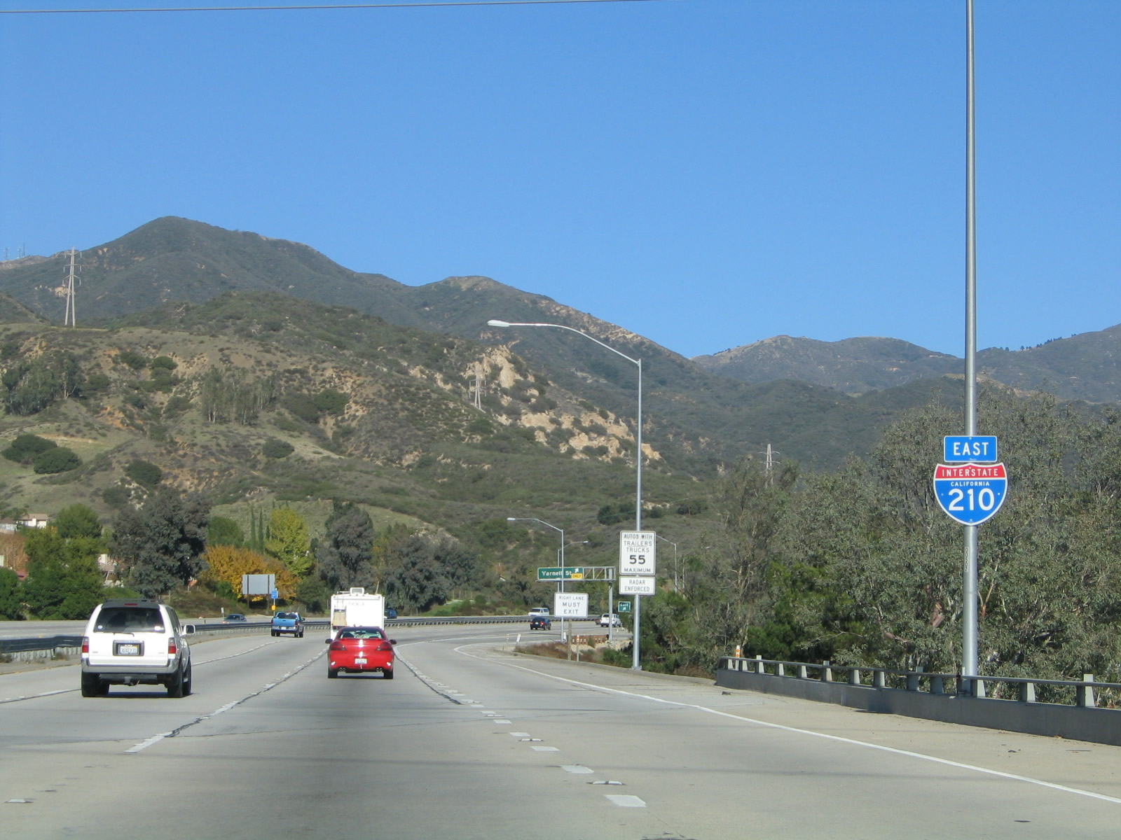
The first Interstate 210 east reassurance shield is posted shortly thereafter. Following the Foothill Freeway, Interstate 210 will skirt the city of San Fernando, then proceed southeast toward Pasadena. At the California 134 and California 710 interchange, Interstate 210 will turn east to follow the U.S. 66 corridor east to Duarte, San Dimas, Rancho Cucamonga, and San Bernardino. Photo taken 11/14/04. |
|
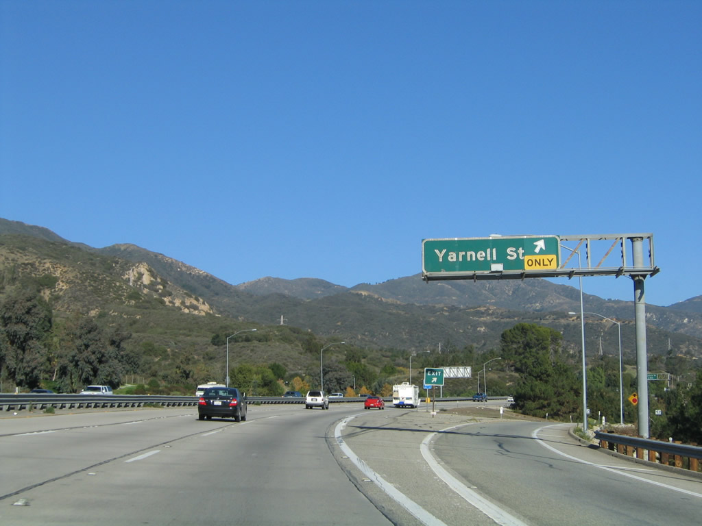
Eastbound Interstate 210 (Foothill Freeway) reaches Exit 1, Yarnell Avenue. This north-south street provides access to the residential areas in the city of Los Angeles in the community of Sylmar. Photo taken 11/14/04. |
|
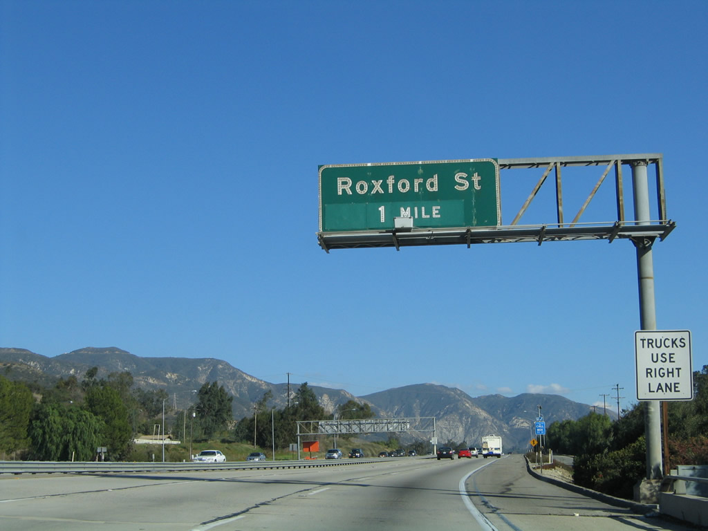
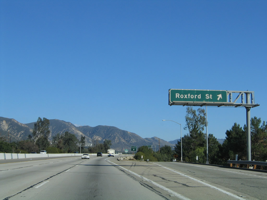
The next exit along Interstate 210 (Foothill Freeway) east is Exit 2, Roxford Street (one mile). Like Yarnell Street, Roxford Street serves the Los Angeles community of Sylmar. It travels northeast-southwest, ending at Interstate 5 Exit 159 and Sepulveda Boulevard near Los Angeles Reservoir. Use Roxford Street north to Olive View Drive to the Los Angeles County Olive View-UCLA Medical Center on the north side of the freeway. Interstate 210 from Roxford Street to Maclay Street was built in 1969. Photo taken 11/14/04. |
|
This Interstate 210 east reassurance shield is posted after the on-ramp from Yarnell Street in Sylmar. Photo taken 11/14/04. |
|
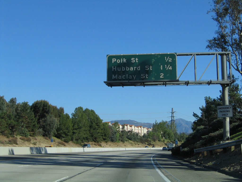
The next four exits along Interstate 210 (Foothill Freeway) east serve the community of Sylmar within the city of Los Angeles: Exit 2, Roxford Street; Exit 3, Polk Street; Exit 4, Hubbard Street; and Exit 5, Maclay Street. Photo taken 11/14/04. |
|
This mileage sign provides the distance to the next three exits along Interstate 210 (Foothill Freeway) east: Exit 2, Roxford Street; Exit 3, Polk Street; and Exit 4, Hubbard Street. Photo taken 11/14/04. |
|
Eastbound Interstate 210 (Foothill Freeway) reaches Exit 2, Roxford Street. Photo taken 11/14/04. |
|
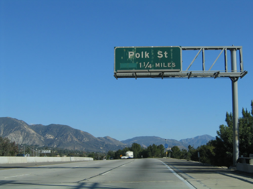
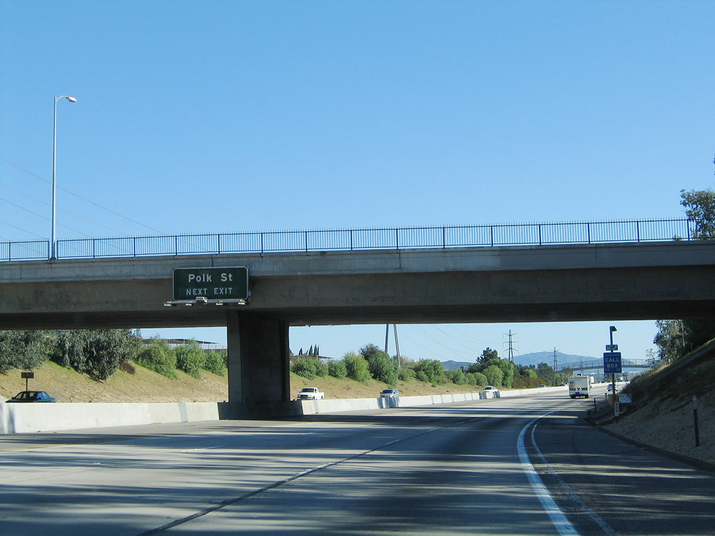
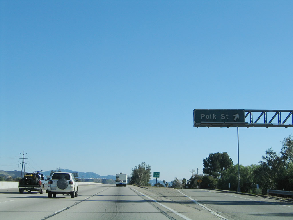
The next exit along Interstate 210 (Foothill Freeway) east is Exit 3, Polk Street. Photo taken 11/14/04. |
|
This Interstate 210 east reassurance shield is posted after the on-ramp from Roxford Street in Sylmar. Photo taken 11/14/04. |
|
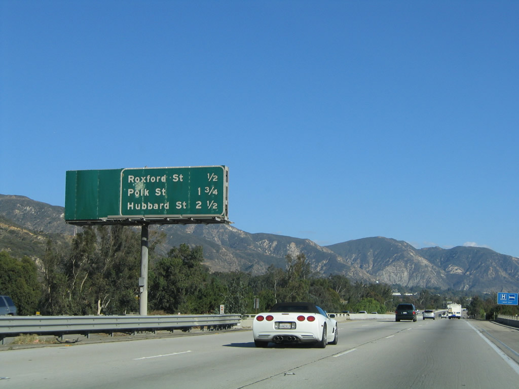
This mileage sign provides the distance to the next three exits along Interstate 210 (Foothill Freeway) east: Exit 3, Polk Street; Exit 4, Hubbard Street; and Exit 5, Maclay Street. Photo taken 11/14/04. |
|
Interstate 210 turns southeast shortly after the Roxford Street interchange. The next exit along eastbound is Exit 3, Polk Street. Photo taken 11/14/04. |
|
Eastbound Interstate 210 (Foothill Freeway) reaches Exit 3, Polk Street. Photo taken 11/14/04. |
|
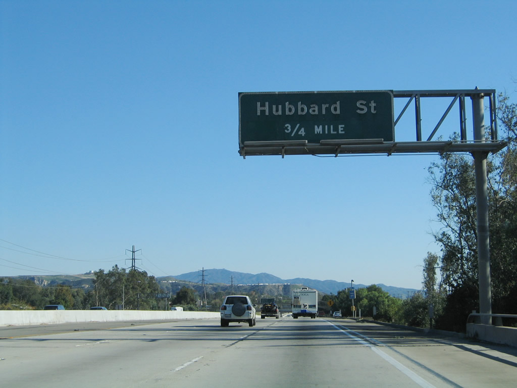
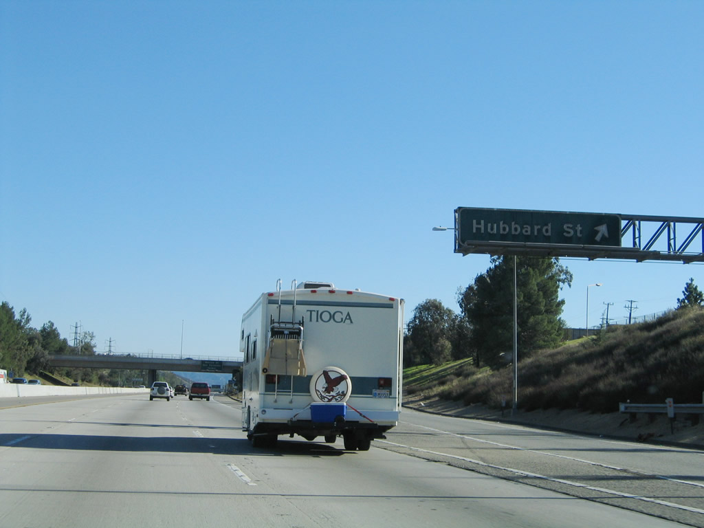
The next exit along Interstate 210 (Foothill Freeway) east is Exit 4, Hubbard Street (0.75 mile). Photo taken 11/14/04. |
|
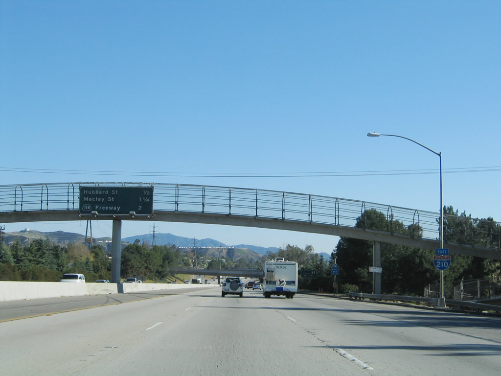
This mileage sign provides the distance to the next three exits along Interstate 210 (Foothill Freeway) east: Exit 4, Hubbard Street; Exit 5, Maclay Street; and Exit 6A, California 118 (Simi Valley / Ronald Reagan Freeway) west to Simi Valley. Photo taken 11/14/04. |
|
Eastbound Interstate 210 (Foothill Freeway) reaches Exit 4, Hubbard Street. Photo taken 11/14/04. |
|
Passing under the Hubbard Street overpass, the next exit along Interstate 210 (Foothill Freeway) east is Exit 5, Maclay Street (0.75 mile). While Interstate 210 does not enter the city of San Fernando, it comes within a block of the freeway when Interstate 210 crosses the Pacoima Wash after the Maclay Street interchange. Use Maclay Street southwest to downtown San Fernando. An enclave, San Fernando is surrounded by the much larger city of Los Angeles on all sides. Photo taken 11/14/04. |
|
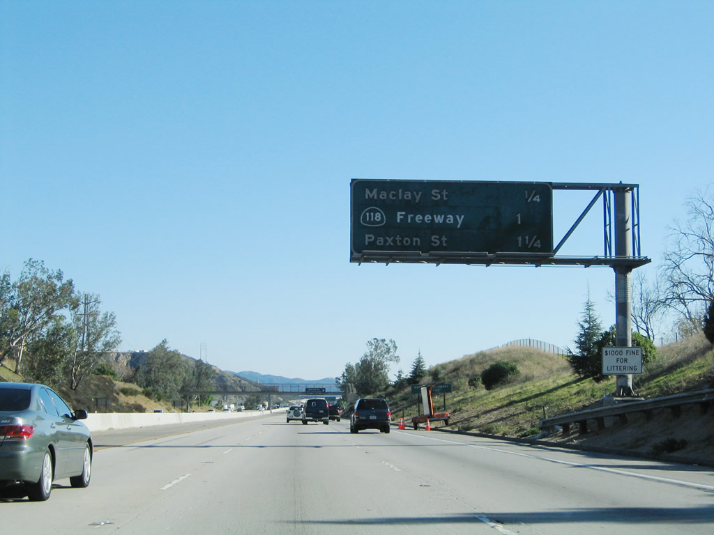
This mileage sign provides the distance to the next three exits along Interstate 210 (Foothill Freeway) east: Exit 5, Maclay Street; Exit 6A, California 118 (Simi Valley / Ronald Reagan Freeway) west to Simi Valley; and Exit 6B, Paxton Street. Interstate 210 skirts the northwestern edge of the city of San Fernando, which is known as the "First City of the Valley" as it was the first to incorporate within the large San Fernando Valley. San Fernando had a population of 23,564 and was incorporated on August 31, 1911. Photo taken 11/14/04. |
|
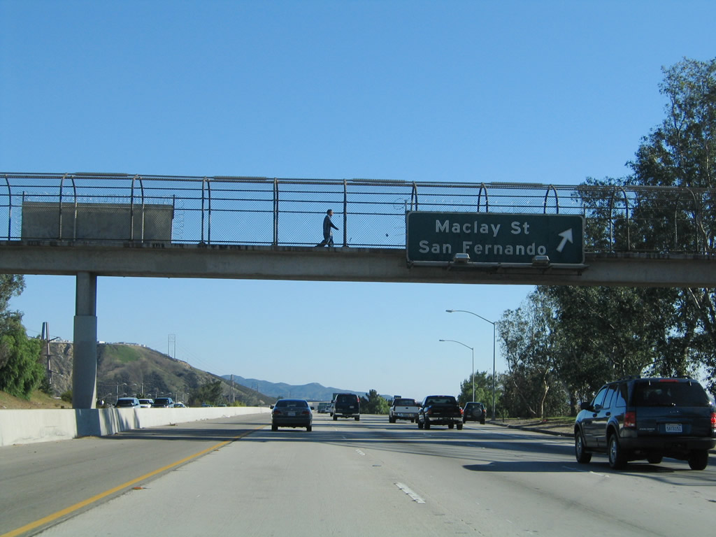
Eastbound Interstate 210 (Foothill Freeway) reaches Exit 5, Maclay Street to San Fernando. The city of San Fernando avoided being absorbed by the larger city of Los Angeles in the 1910s because it had its own groundwater supplies, which meant it did not need to turn to the city of Los Angeles for provision of water via its system of aqueducts. As the rest of the San Fernando Valley grew through the 20th Century, water became the key ingredient needed to develop the formerly agricultural valley. The city of Los Angeles annexed many of these areas as water needs for development increased. The city of San Fernando was named for the named for the nearby Mission San Fernando Rey de Espa-a. (Founded on September 8, 1797, the mission is actually located west of here, within the city of Los Angeles along San Fernando Mission Boulevard between Interstate 5 and Interstate 405 in the Mission Hills community. Follow Maclay Street west to Truman Street north to San Fernando Mission Boulevard west to the historic mission). Photo taken 11/14/04. |
|
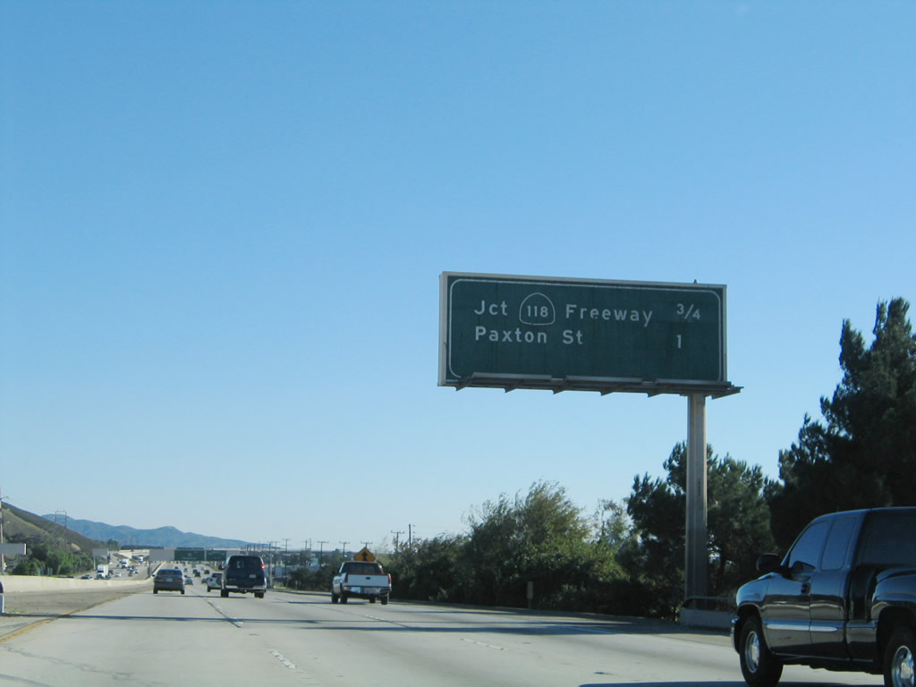
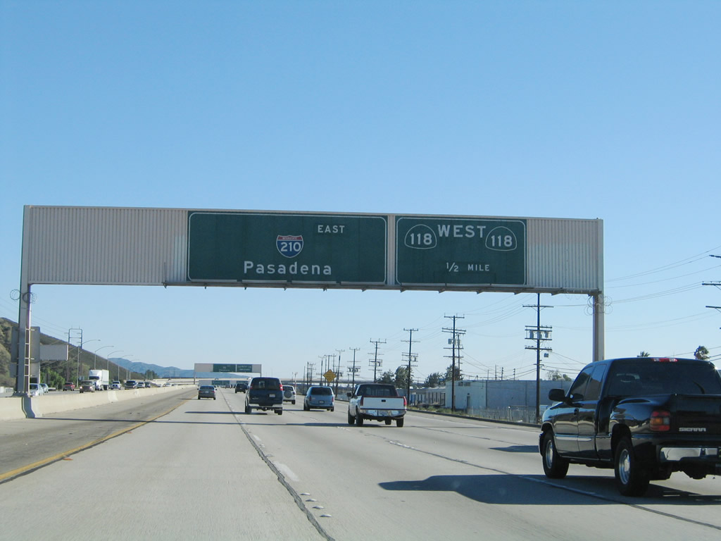
This mileage sign provides the distance to the next two exits along Interstate 210 (Foothill Freeway) east: Exit 6A, California 118 (Simi Valley / Ronald Reagan Freeway) west to Simi Valley and Exit 6B, Paxton Street. Around this point is the closest Interstate 210 gets to the boundary of the city of San Fernando. Photo taken 11/14/04. |
|
California 118 (Simi Valley / Ronald Reagan Freeway) travels west from San Fernando through the Mission Hills and Granada Hills districts of the city of Los Angeles en route to Simi Valley and points west in Ventura County. Photo taken 11/14/04. |
|
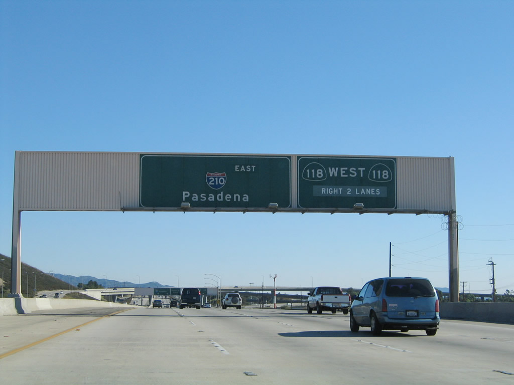
The right two lanes of Interstate 210 east connect to Exit 6A, California 118 (Simi Valley / Ronald Reagan Freeway) west. The left three lanes continue southeast to Pasadena. Photo taken 11/14/04. |
|
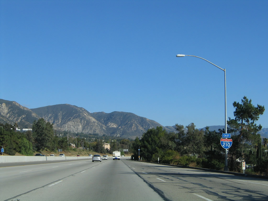
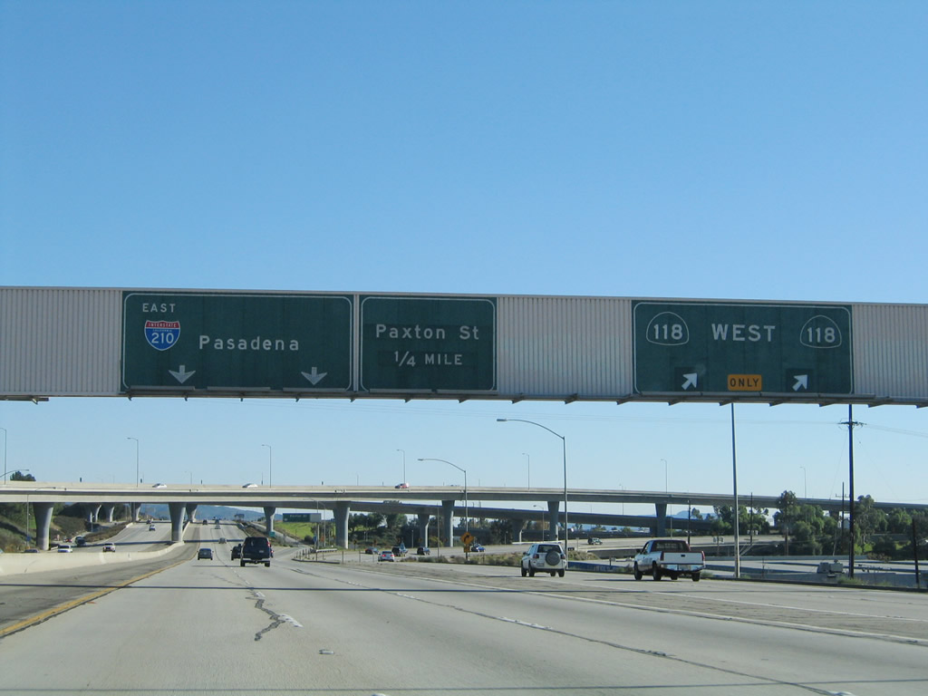
Eastbound Interstate 210 (Foothill Freeway) reaches Exit 6A, California 118 (Simi Valley / Ronald Reagan Freeway) west to Simi Valley. The stack interchange between Interstate 210 and California 118, which was built in 1975, comes into view ahead. Photo taken 11/14/04. |
|
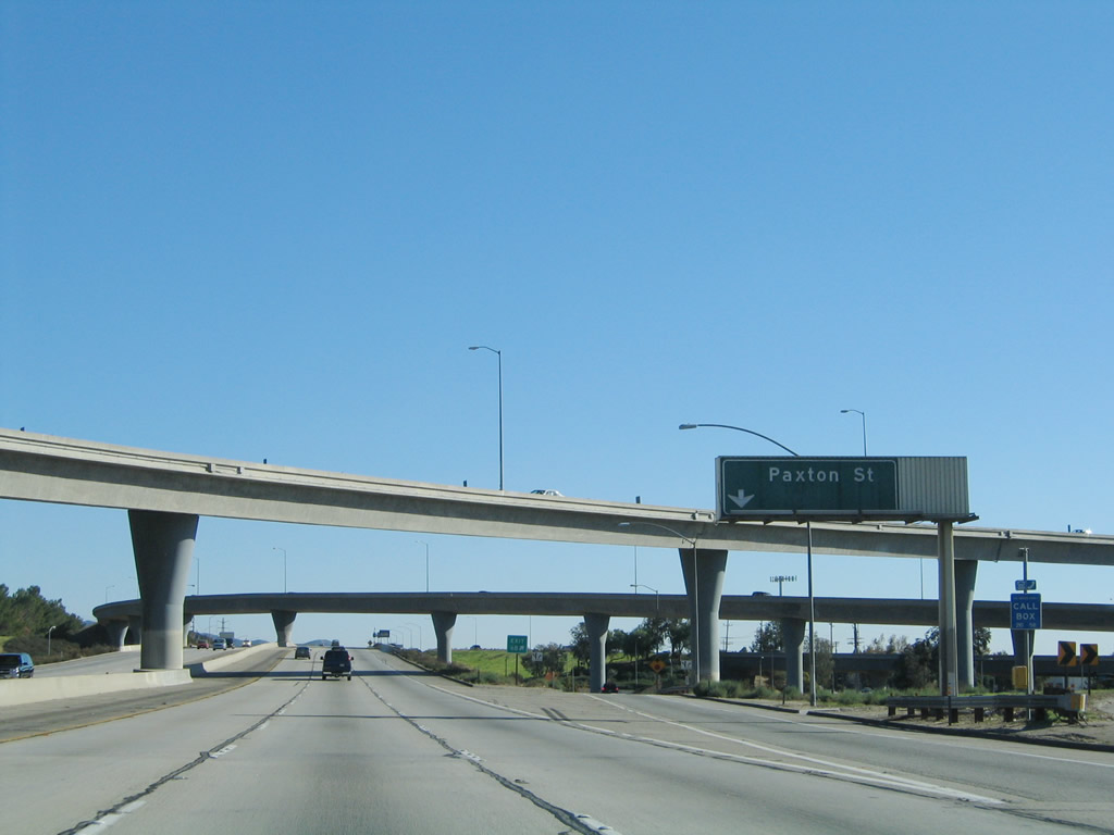
While within the interchange with California 118, eastbound Interstate 210 reaches Exit 6B, Paxton Street west to the Pacoima district of the city of Los Angeles. Pacoima borders the city of San Fernando to the south. Photo taken 11/14/04. |
|
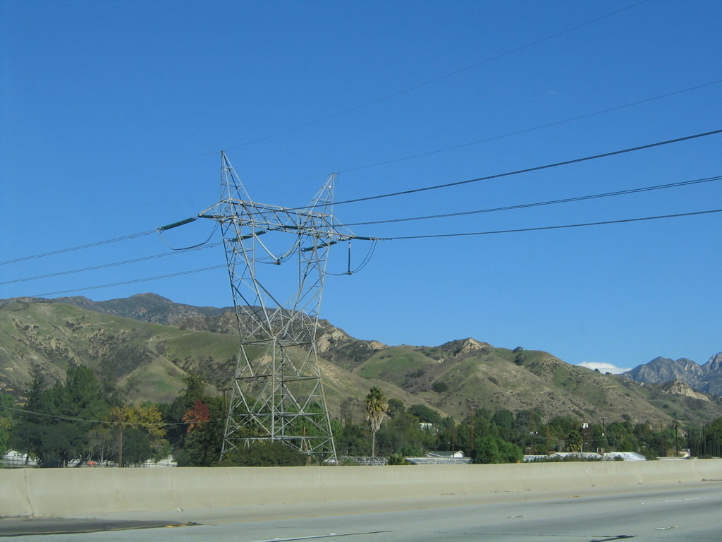
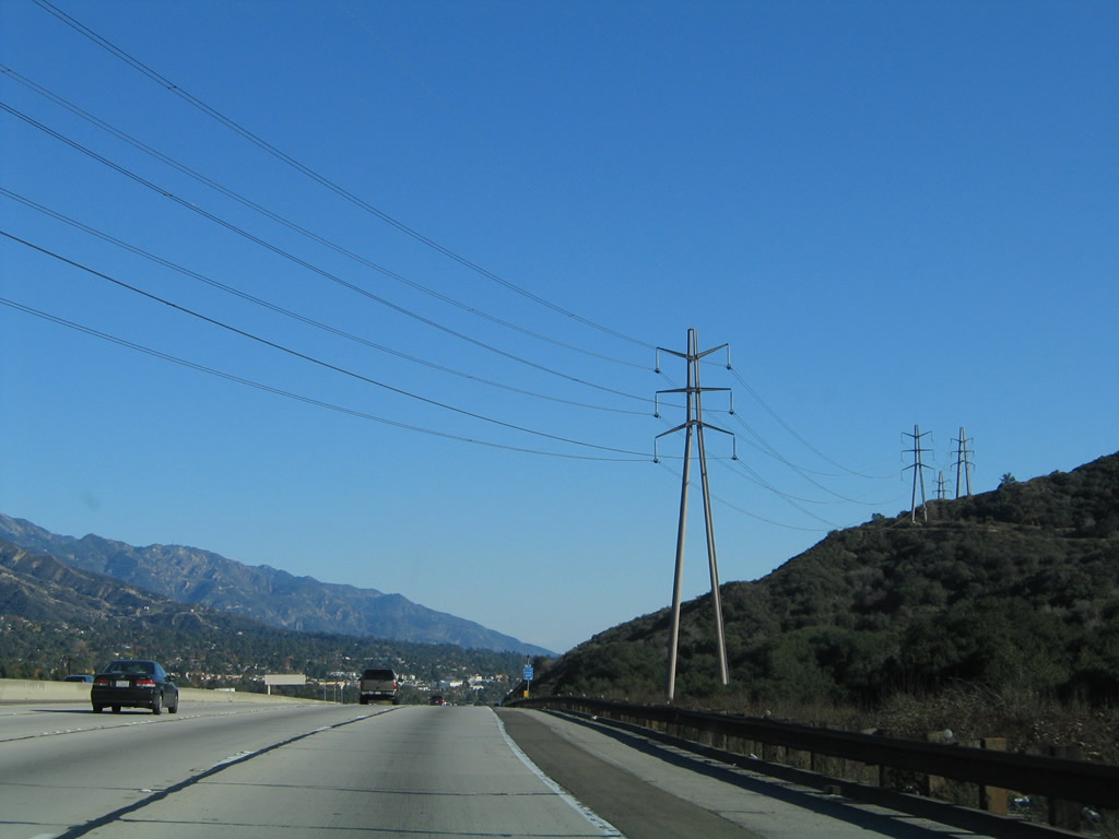
Southern California Edison power lines parallel Interstate 210 as it travels southeast from San Fernando into the Lake View Terrace community of the city of Los Angeles. Photo taken 11/14/04. |
|
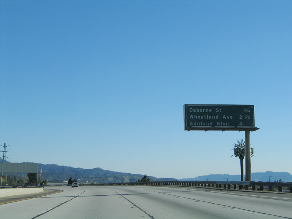
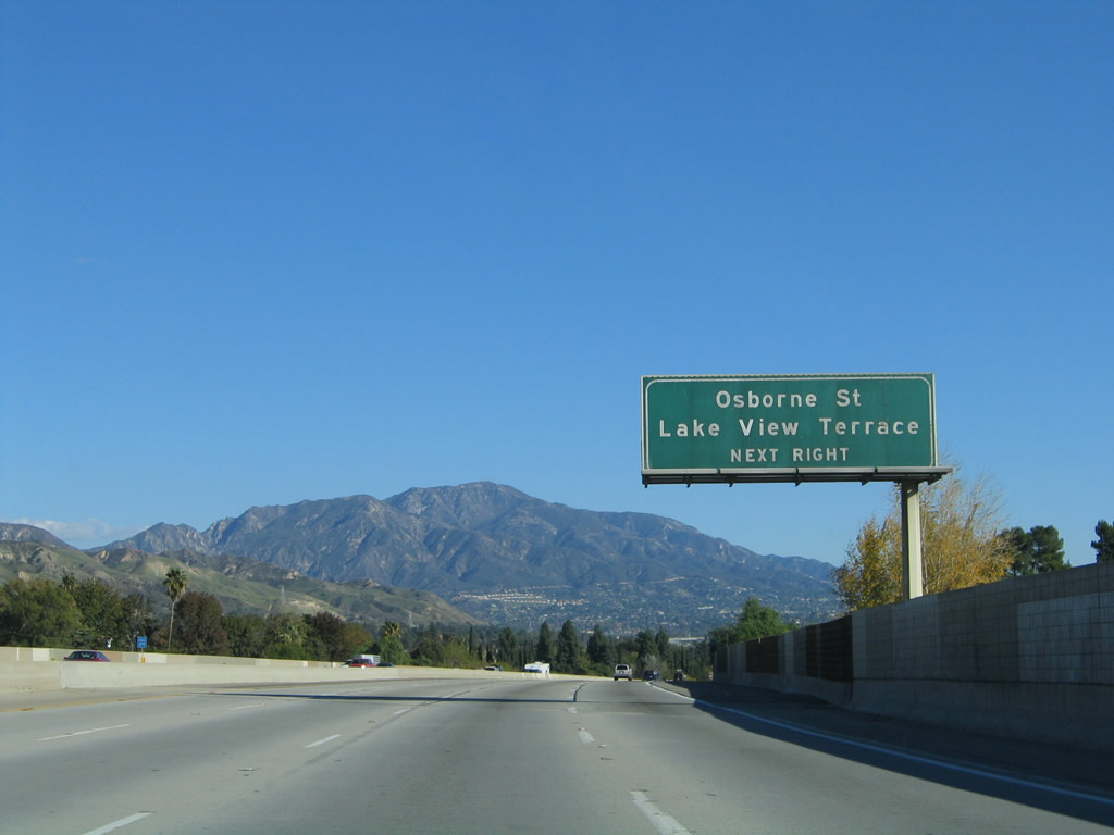
Continuing east, Interstate 210 now parallels the old alignment of California 118 (Foothill Boulevard). California 118 was decommissioned in favor of Interstate 210 as the freeway was constructed to bypass Foothill Boulevard. California 118 used to extend southeast all the way to Pasadena, where it used to end at U.S. 66. With the completion of Interstate 210, the California 118 state route was truncated to end at Interstate 210 Exit 6A near San Fernando. To see some old state highway, travel Foothill Boulevard southeast toward Pasadena rather than the modern freeway. The next three exits along Interstate 210 (Foothill Freeway) are Exit 8, Osbourne Street and Foothill Boulevard (former California 118); Exit 9, Wheatland Avenue; and Exit 11, Sunland Boulevard. This section of freeway (California 118 to Sunland Boulevard) was built in 1980. Photo taken 11/14/04. |
|
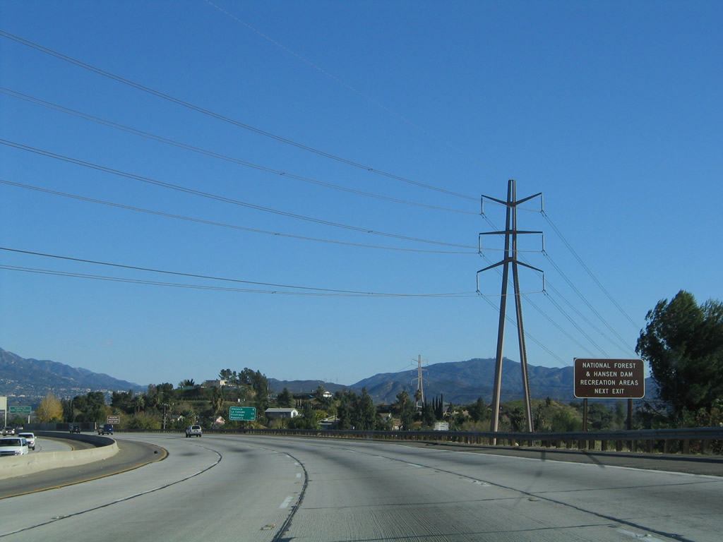
The aforementioned Southern California Edison power line crosses over Interstate 210 at this point. Again turning due east briefly, use Exit 8 for Osbourne Street north to Little Tujunga Road into Angeles National Forest and Foothill Boulevard/Osbourne Street southwest to Hansen Dam Park. Photo taken 11/14/04. |
|
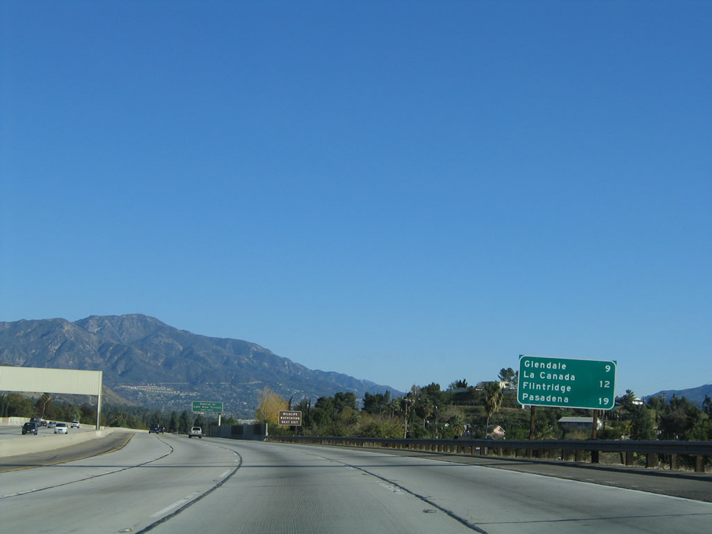
This mileage sign provides the distance to Glendale (nine miles), La Canada Flintridge (12 miles), and Pasadena (19 miles). Photo taken 11/14/04. |
|
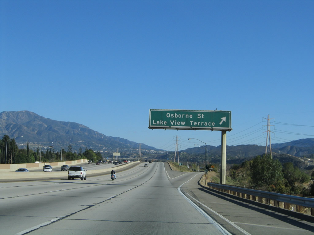
Interstate 210 approaches Exit 8, Osbourne Street to the Lake View Terrace district of the city of Los Angeles. Photo taken 11/14/04. |
|
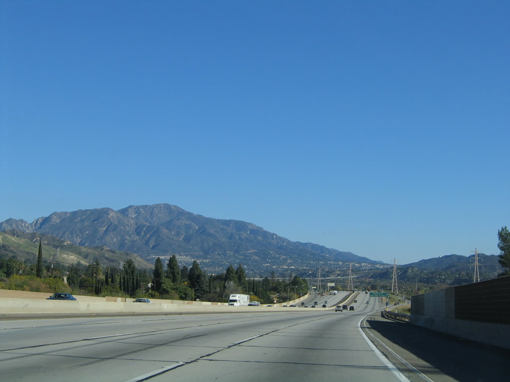
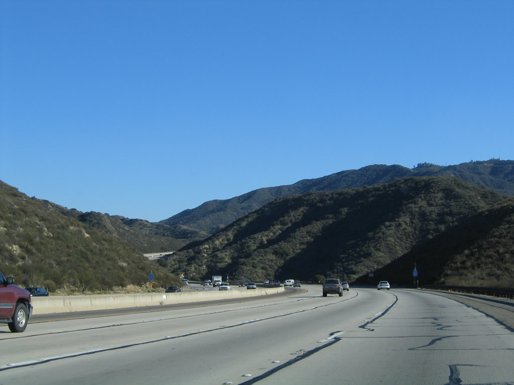
Mount Lukens (el. 5,074 feet) dominates the view looking east toward the San Gabriel Mountains. The Foothill Freeway will try to stay on the southern edge of the San Gabriel Mountains, and this causes the freeway to aim in a southeasterly directionbetween Sunland and La Canada Flintridge. Photo taken 11/14/04. |
|
Eastbound Interstate 210 meets Exit 8, Osbourne Street. This exit serves Little Tujunga Canyon (via Osbourne Street and Little Tujunga Road north), the Lake View Terrace district, Hansen Dam Park, and Foothill Boulevard (old California 118). Photo taken 11/14/04. |
|
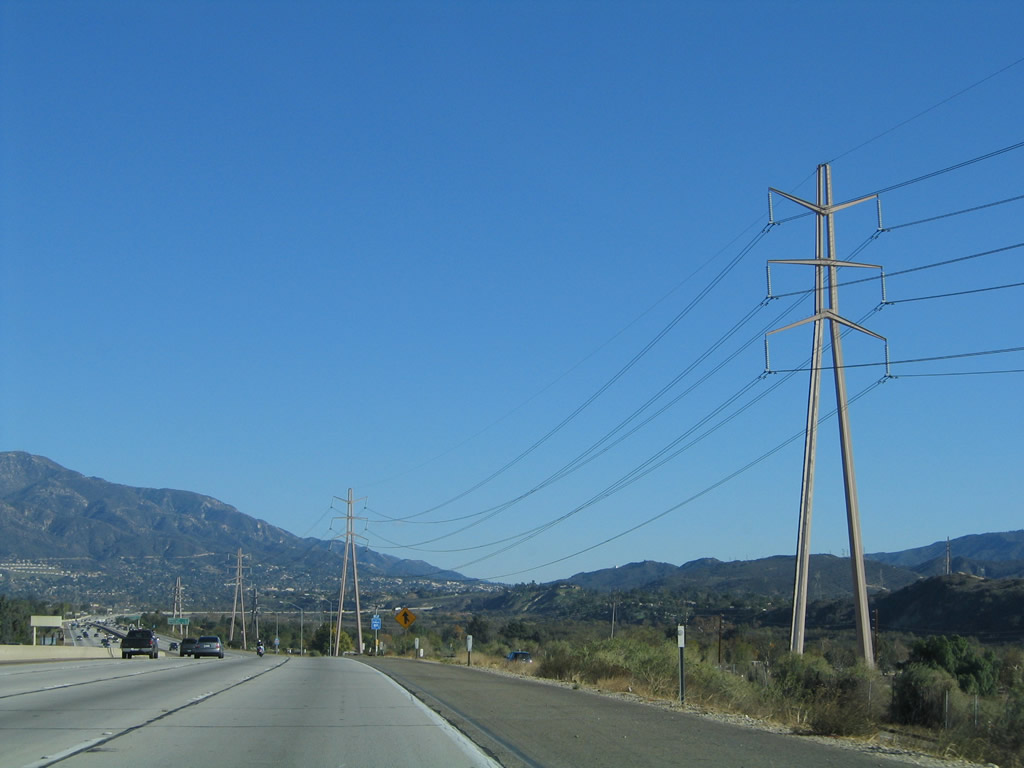
Now the Southern California Edison power lines follow Interstate 210 on the south side of the freeway. Photo taken 11/14/04. |
|
This Interstate 210 east reassurance shield is posted after the on-ramp from Osbourne Street. Photo taken 11/14/04. |
|
This mileage sign provides the distance to the next three exits from Interstate 210 (Foothill Freeway) east: Exit 9, Wheatland Avenue; Exit 11, Sunland Boulevard; and Exit 14, La Tuna Canyon Road. Photo taken 11/14/04. |
|
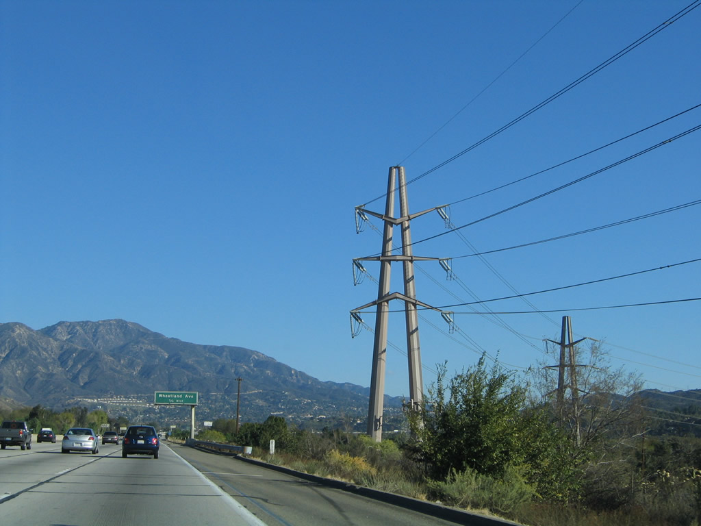
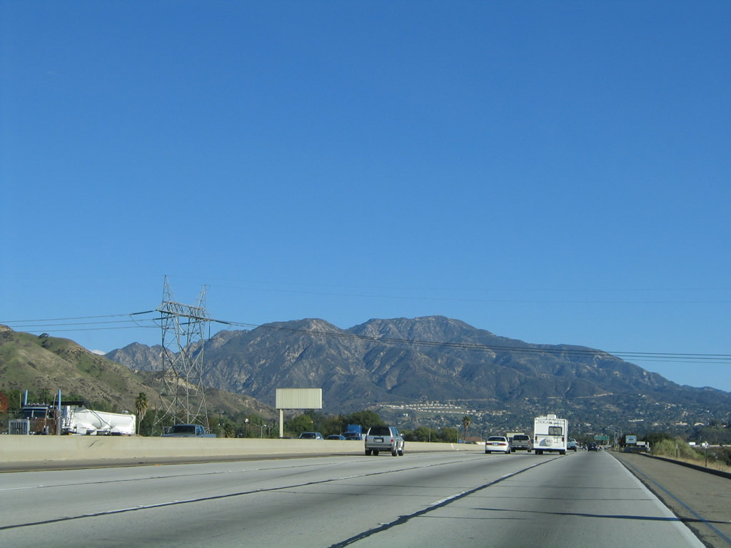
The Southern California Edison power lines turn south prior to the Wheatland Avenue interchange, skirting the east edge of the Hansen Dam Park before proceeding into the Shadow Hills district of the city of Los Angeles. Photo taken 11/14/04. |
|
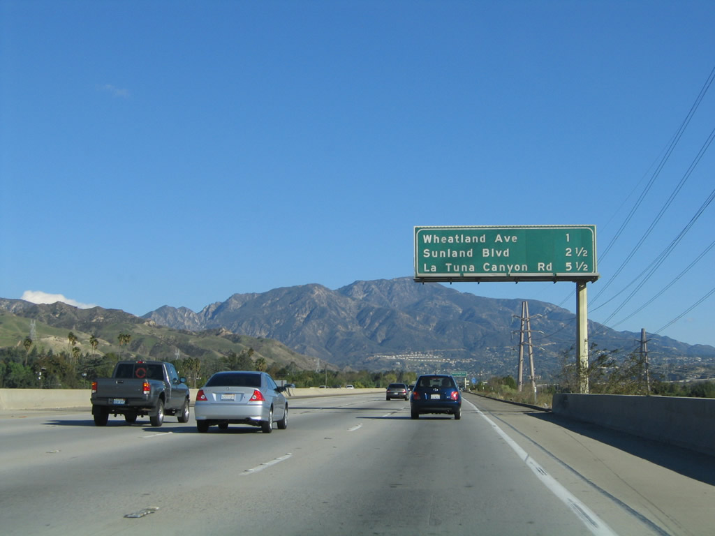
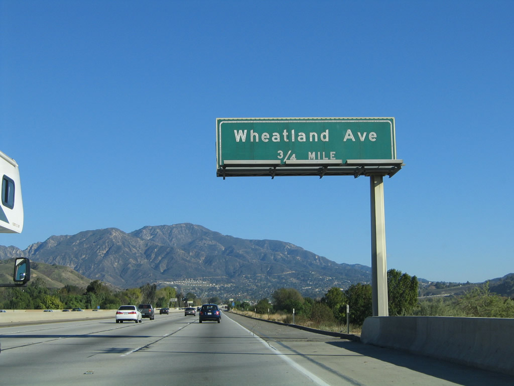
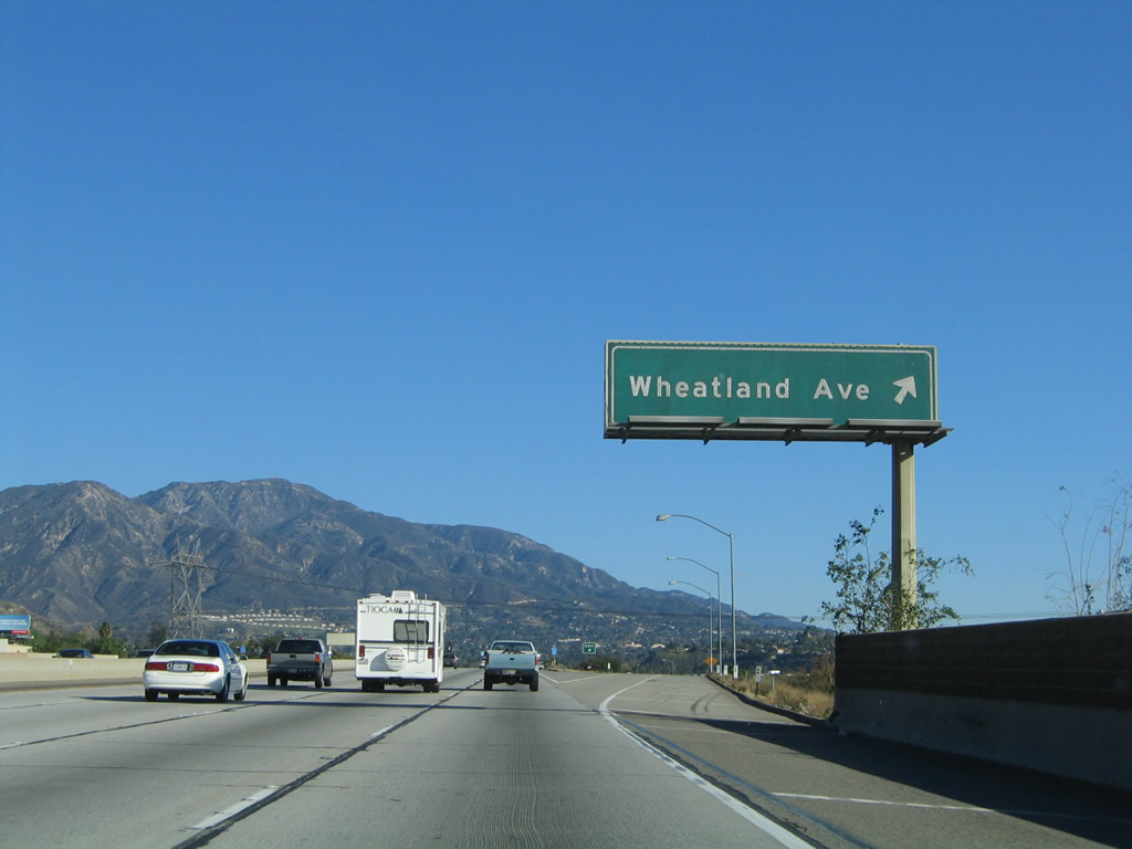
The next exit along Interstate 210 (Foothill Freeway) east is Exit 9, Wheatland Avenue (0.75 mile). Wheatland Avenue is a short city street that connects Interstate 210 with Foothill Boulevard (former California 118) in eastern Lake View Terrace. Photo taken 11/14/04. |
|
Eastbound Interstate 210 (Foothill Freeway) reaches Exit 9, Wheatland Avenue north to the Lake View Terrace district of Los Angeles. Photo taken 11/14/04. |
|
This mileage sign provides the distance to the next three exits from Interstate 210 (Foothill Freeway) east: Exit 11, Sunland Boulevard; Exit 14, La Tuna Canyon Road; and Exit 16, Lowell Avenue. An Interstate 210 east reassurance shield is mostly obscured by the call box sign. Photo taken 11/14/04. |
|
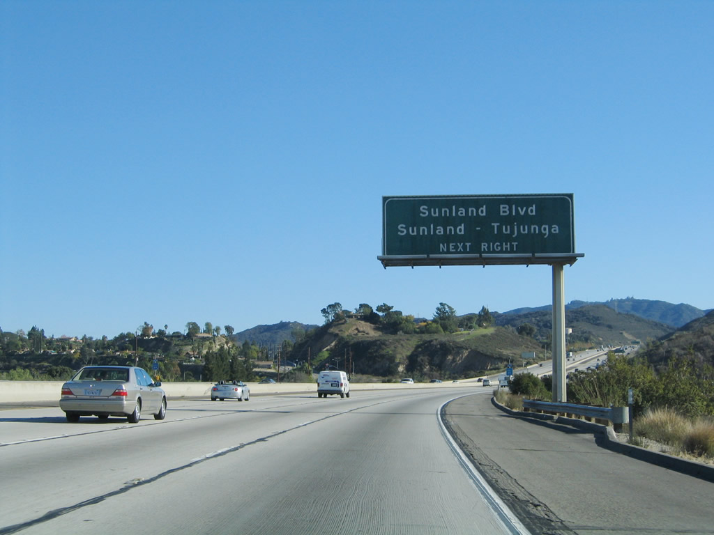
The next exit on Interstate 210 (Foothill Freeway) east is Exit 11, Sunland Boulevard east to the Sunland district of the city of Los Angeles and west to the Shadow Hills district of the city of Los Angeles. Use Sunland Boulevard east to Foothill Boulevard east to Mount Gleason Avenue north to Big Tujunga Canyon Road. Historic bridge enthusiasts might enjoy the drive along Big Tujunga Canyon Road in the Angeles National Forest in the San Gabriel Mountains. Photo taken 11/14/04. |
|
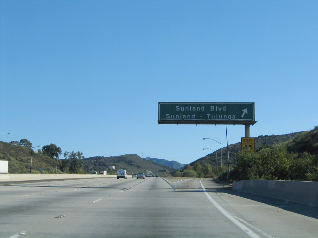
Eaatbound Interstate 210 (Foothill Freeway) reaches Exit 11, Sunland Boulevard to Sunland, Big Tujunga Canyon, and Shadow Hills. Photo taken 11/14/04. |
|
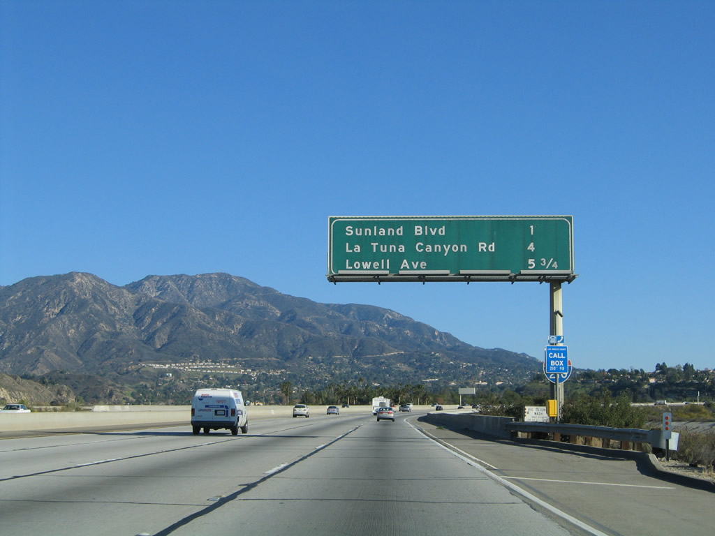
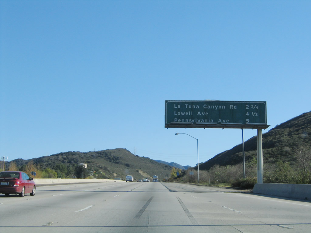
This mileage sign provides the distance to the next three exits from Interstate 210 (Foothill Freeway) east: Exit 14, La Tuna Canyon Road; Exit 16, Lowell Avenue; and Exit 17, Pennsylvania Avenue. Photo taken 11/14/04. |
|
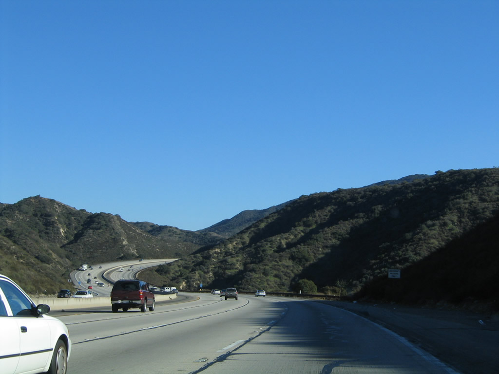
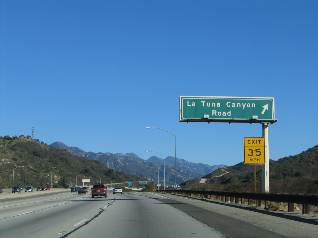
The next exit along Interstate 210 (Foothill Freeway) east is Exit 14, La Tuna Canyon Road. Photo taken 11/14/04. |
|
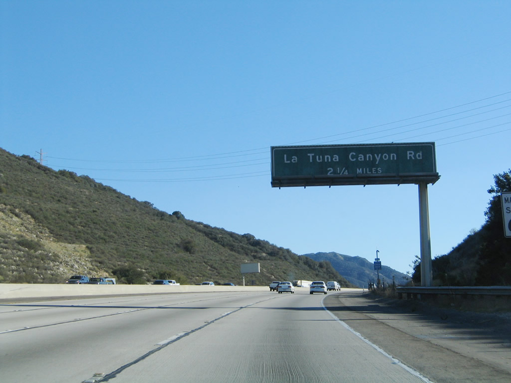
Interstate 210 (Foothill Freeway) east approaches Exit 14, La Tuna Canyon Road. Photo taken 11/14/04. |
|
Eastbound Interstate 210 (Foothill Freeway) reaches Exit 14, La Tuna Canyon Road. Use La Tuna Canyon Road east to the Tujunga district of the city of Los Angeles and the northern extent of the city of Glendale. Use La Tuna Canyon Road west to La Tuna Canyon and the Sun Valley district of Los Angeles. Photo taken 11/14/04. |
|
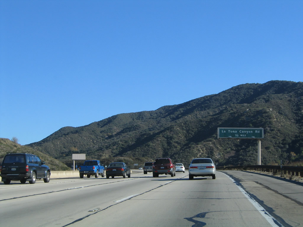
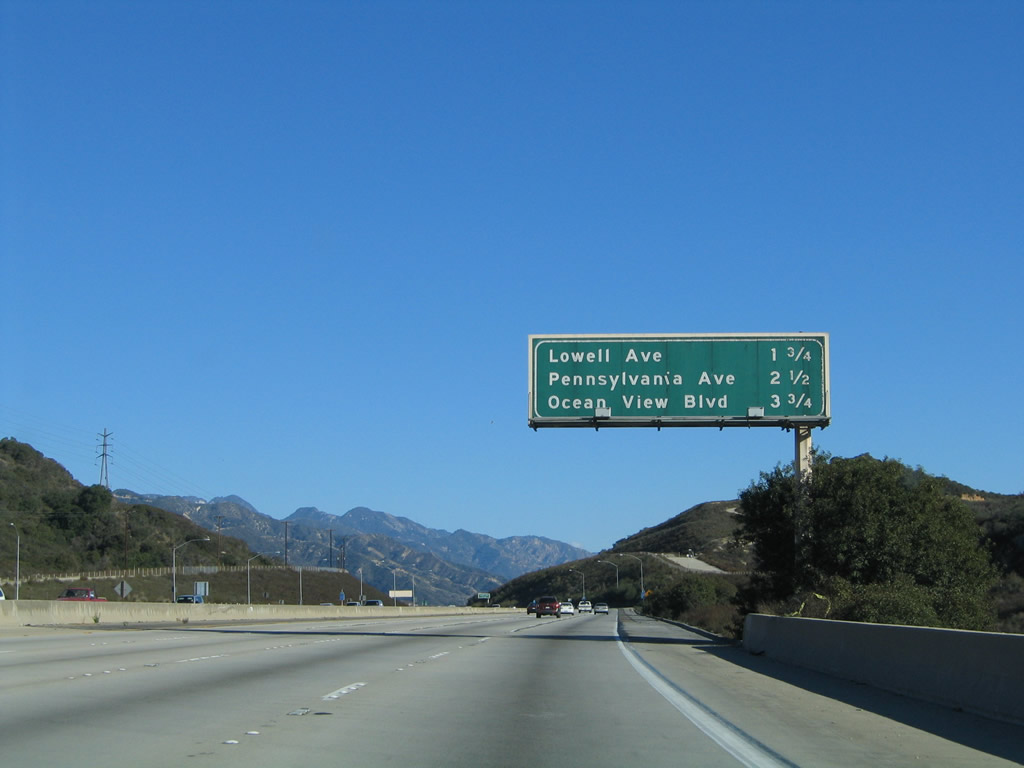
This mileage sign provides the distance to the next three exits from Interstate 210 (Foothill Freeway) east: Exit 16, Lowell Avenue; Exit 17, Pennsylvania Avenue; and Exit 18, Ocean View Boulevard. This segment of Interstate 210 (from La Tuna Canyon Road to California 2) was built in 1972. Photo taken 11/14/04. |
|
An Interstate 210 east reassurance shield is posted after the on-ramp from La Tuna Canyon Road. Photo taken 11/14/04. |
|
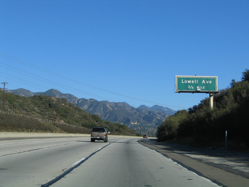
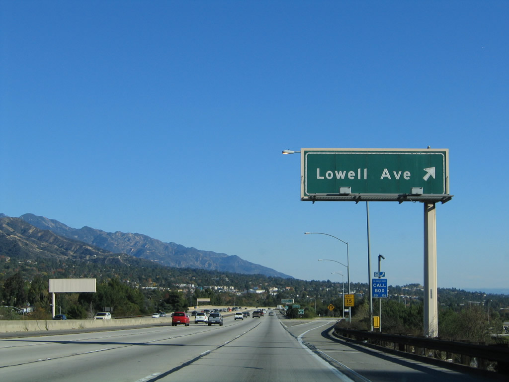
The next exit along Interstate 210 (Foothill Freeway) east is Exit 16, Lowell Avenue and Honolulu Avenue. This interchange serves the city of Glendale. Photo taken 11/14/04. |
|
The Southern California Edison power lines again cross Interstate 210 prior to the Lowell Avenue interchange. Photo taken 11/14/04. |
|
Eastbound Interstate 210 (Foothill Freeway) reaches Exit 16, Lowell Avenue. Interstate 210 leaves Los Angeles for the first time on its eastbound journey and briefly enters the city of Glendale. Situated at the southeastern end of the San Fernando Valley, Glendale ("The Jewel City") had a population of 194,973 as of the 2000 Census, consists of 30.7 square miles, and was incorporated on February 15, 1906. Photo taken 11/14/04. |
|
This mileage sign provides the distance to the next three exits from Interstate 210 (Foothill Freeway) east: Exit 17, Pennsylvania Avenue; Exit 18, Ocean View Boulevard; and Exit 19, California 2 (Glendale Freeway) south to Los Angeles. Photo taken 11/14/04. |
|
An Interstate 210 east reassurance shield is posted after the on-ramp from Lowell Avenue. Photo taken 11/14/04. |
|
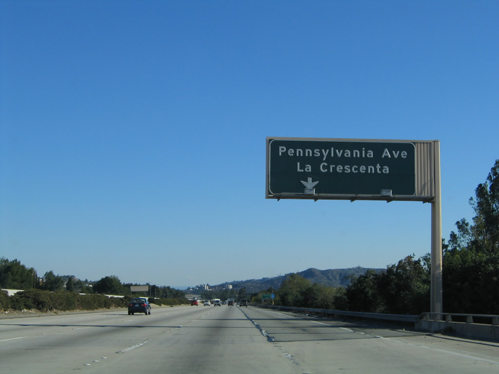
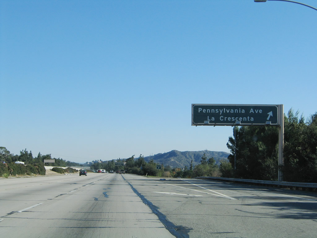
The next exit along Interstate 210 east is Exit 17, Pennsylvania Avenue to the unincorporated communities of La Crescenta and Montrose. This area, which includes areas not located within the cities of Glendale or La Canada Flintridge, had a population of 18,532 as of the 2000 Census. Photo taken 11/14/04. |
|
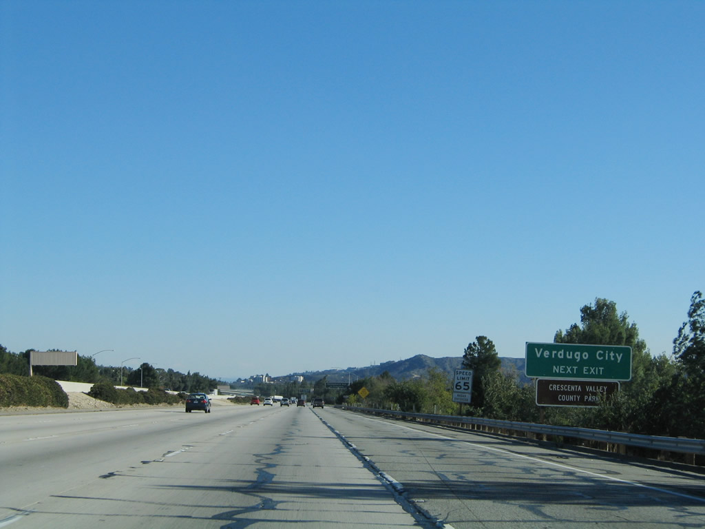
Verdugo City is a community within the city of Glendale that is located on the south side of the Interstate 210 freeway. Use Exit 17 (Pennsylvania Avenue south) for Verdugo City. Photo taken 11/14/04. |
|
Eastbound Interstate 210 (Foothill Freeway) reaches Exit 17, Pennsylvania Avenue to La Crescenta and Montrose. At this point, Interstate 210 leaves the city of Glendale and enters unincorporated Los Angeles County communities of La Crescenta (north of freeway) and Montrose (south of freeway). Photo taken 11/14/04. |
|
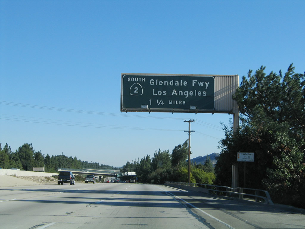
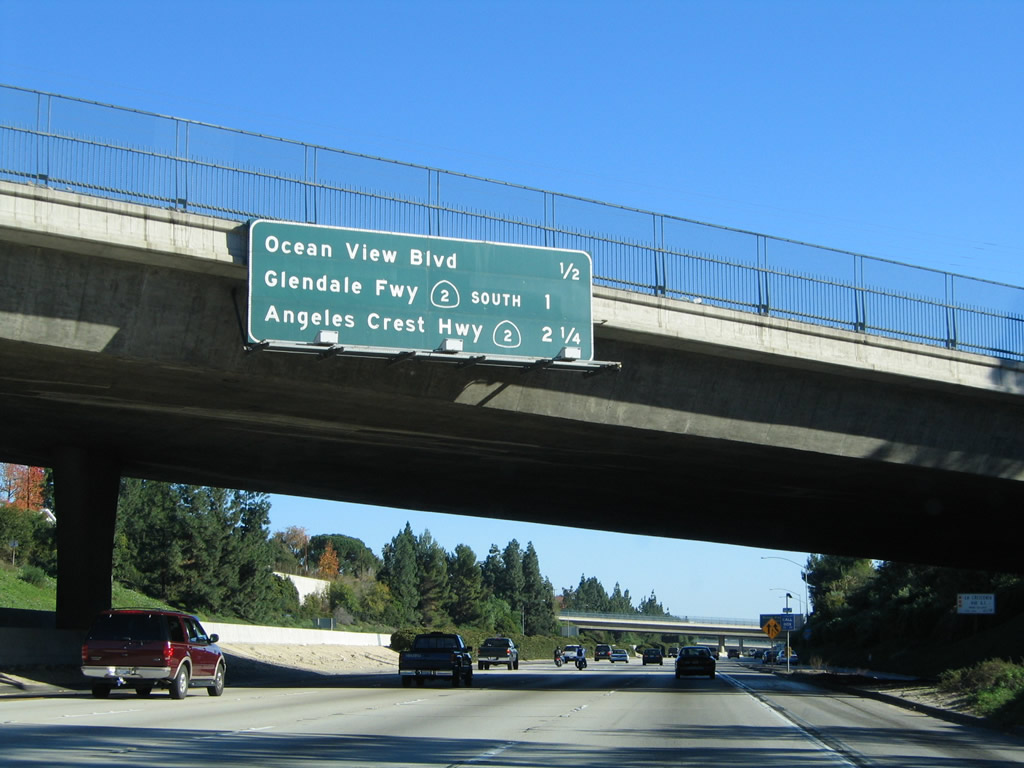
The next exit along Interstate 210 (Foothill Freeway) east is Exit 18, Ocean View Boulevard (not shown on this overhead guide sign assembly) followed by Exit 19, California 2 (Glendale Freeway) south to Los Angeles. The Glendale Freeway travels south through Glendale toward Interstate 5 (Golden State Freeway) near Echo Park in Los Angeles. Photo taken 11/14/04. |
|
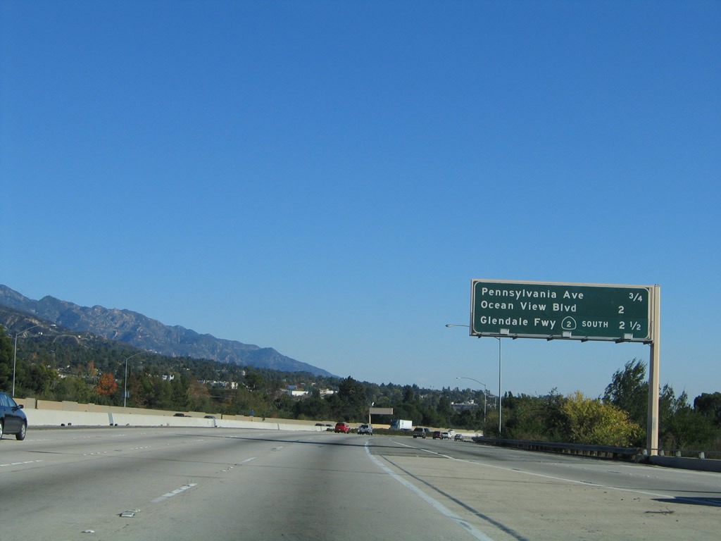
This mileage sign provides the distance to the next three exits from Interstate 210 (Foothill Freeway) east: Exit 18, Ocean View Boulevard; Exit 19, California 2 (Glendale Freeway) south to Los Angeles; and Exit 20, California 2 (Angeles Crest Highway) north. Photo taken 11/14/04. |
|
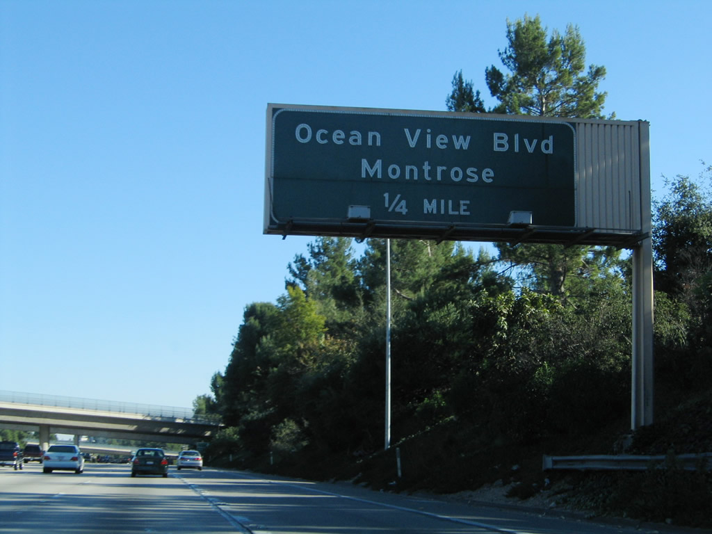
The next exit along Interstate 210 (Foothill Freeway) east is Exit 18, Ocean View Boulevard to the unincorporated communities of La Crescenta and Montrose. Photo taken 11/14/04. |
|
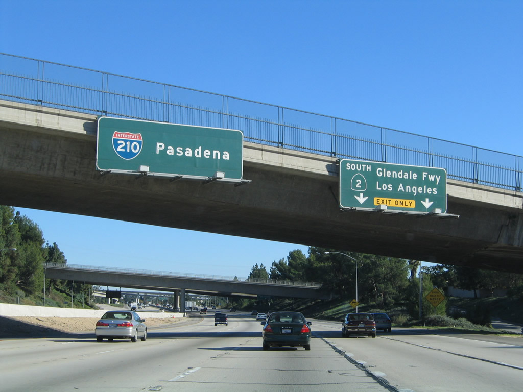
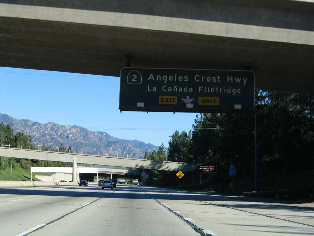
After the off-ramp to Exit 18 (Ocean View Boulevard), the next exit along Interstate 210 (Foothill Freeway) east is Exit 19, California 2 (Glendale Freeway) south to Los Angeles, followed by Exit 20, California 2 (Angeles Crest Highway) north. Interstate 210 and California 2 share a brief overlap between these two exits. The right two lanes become exit only for California 2 south, while the left four lanes continue east on Interstate 210 to Pasadena. Photo taken 11/14/04. |
|
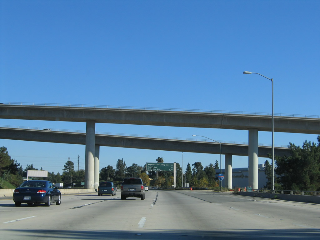
After the right two lanes depart to California 2 south (Exit 19), the next exit along Interstate 210 (Foothill Freeway) east is Exit 20, California 2 (Angeles Crest Highway) north. This segment of Interstate 210 (from California 2 to Berkshire Place) was built in 1972. Photo taken 11/14/04. |
|
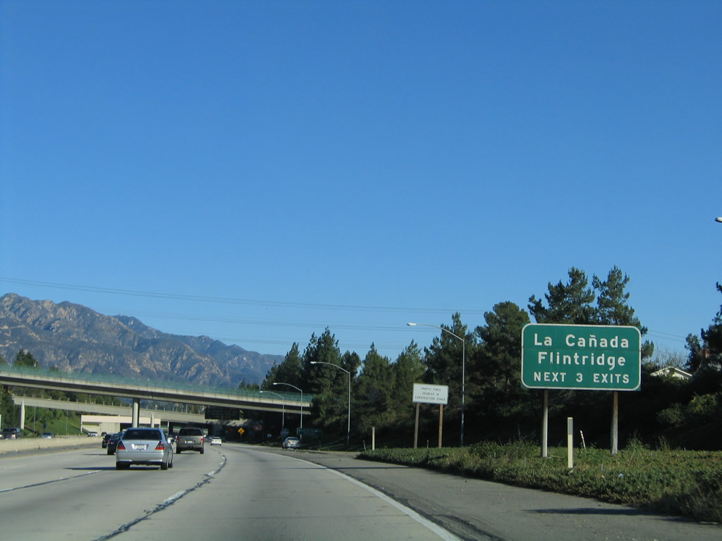
These two tall overpasses carry traffic from California 2 (Glendale Freeway) to Foothill Boulevard. Around this point, Interstate 210 leaves unincorporated Los Angeles County and enters the city of La Canada Flintridge, population 20,318 as of the 2000 Census (incorporated on November 30, 1976). Photo taken 11/14/04. |
|
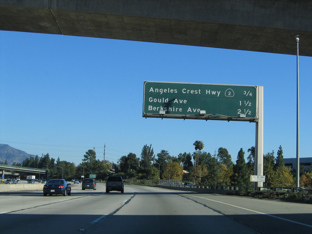
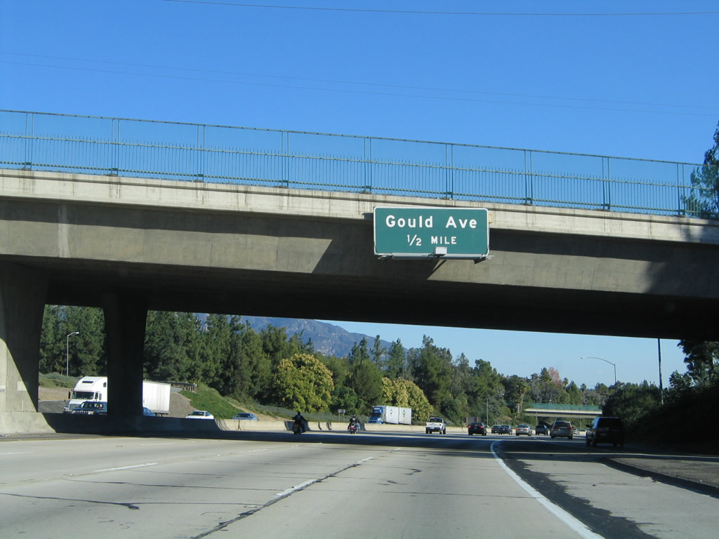
As traffic merges onto the freeway from Ocean View Boulevard, a mileage sign along eastbound Interstate 210 (Foothill Freeway) provides the distance to the next three exits: Exit 20, California 2 (Angeles Crest Highway) north; Exit 21, Gould Avenue and Foothill Boulevard (old California 118); and Exit 22A, Berkshire Place. Photo taken 11/14/04. |
|
Each of these three exits (Exit 20, California 2 (Angeles Crest Highway) north; Exit 21, Gould Avenue and Foothill Boulevard [old California 118]; and Exit 22A, Berkshire Place) serve the city of La Canada Flintridge. Photo taken 11/14/04. |
|
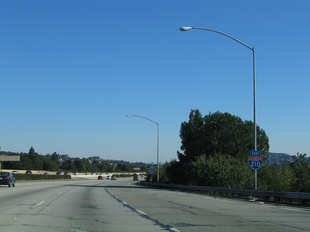
Traffic from California 2 north merges onto Interstate 210 east at this point. Photo taken 11/14/04. |
| Interstate 210 (Foothill Freeway) east and California 2 north |
|
The overlap between the two state routes lasts for less than a mile. California 2 north splits off Interstate 210 at Exit 20. The right lane becomes exit only for the continuation of California 2 northeast, while the left four lanes continue east along Interstate 210 toward Pasadena and San Bernardino. Photo taken 11/14/04. |
|
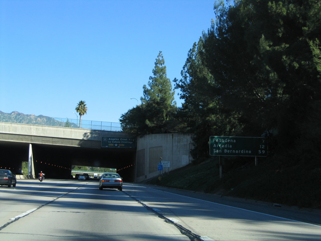
This mileage sign provides the distance to Pasadena (seven miles), Arcadia (12 miles), and San Bernardino (59 miles). Photo taken 11/14/04. |
|
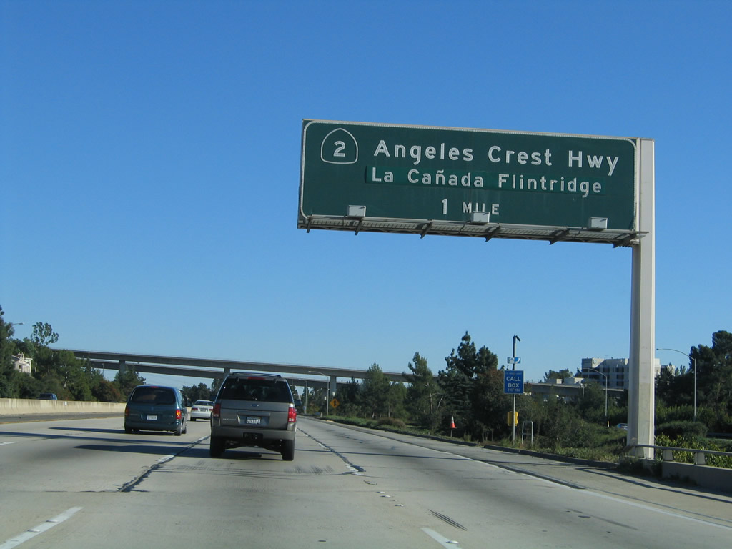
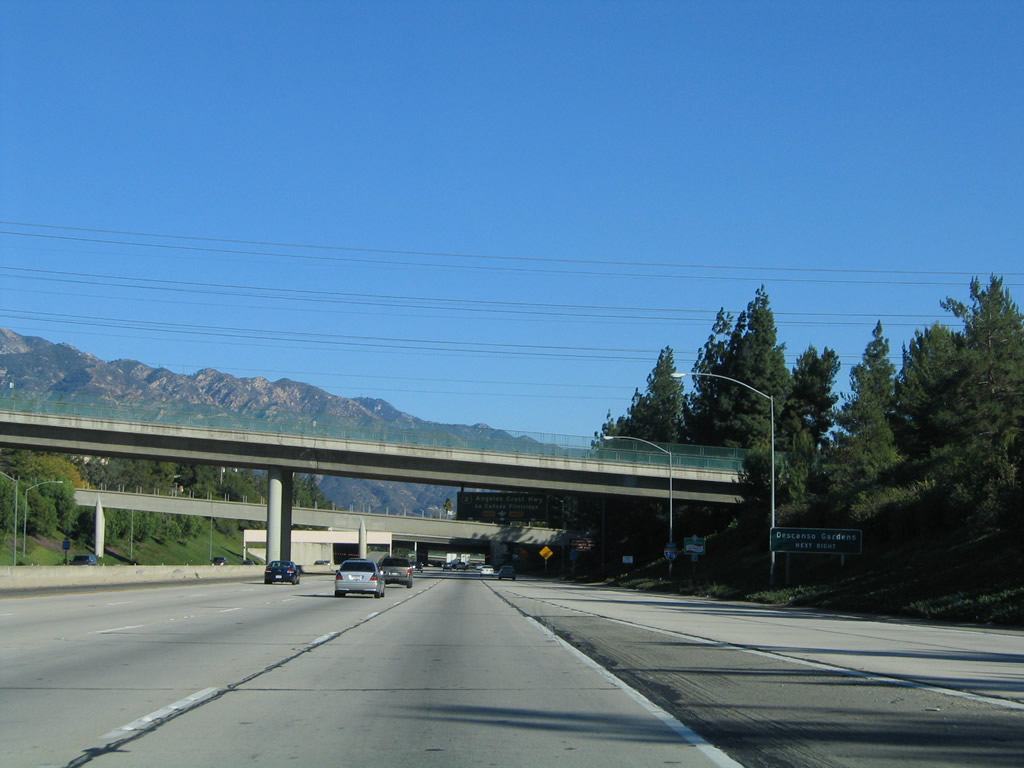
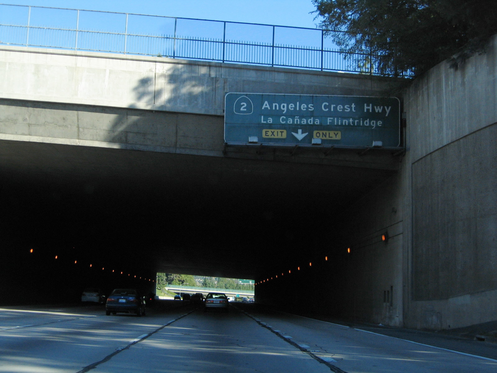
A cut and cover tunnel over Interstate 210 provides for Memorial Park on the top deck as well as the crossing for Foothill Boulevard (former California 118). Stay right for the connection to California 2 (Angeles Crest Highway) northeast to the San Gabriel Mountains. Photo taken 11/14/04. |
|
The cut and cover tunnel only last for the equivalent of about a city block. At the end of the tunnel, California 2 departs for the Angeles Crest Highway. Photo taken 11/14/04. |
| Interstate 210 (Foothill Freeway) east |
|
The next exit along Interstate 210 (Foothill Freeway) is Exit 21, Gould Avenue north and south to Foothill Boulevard (0.50 mile). Photo taken 11/14/04. |
|
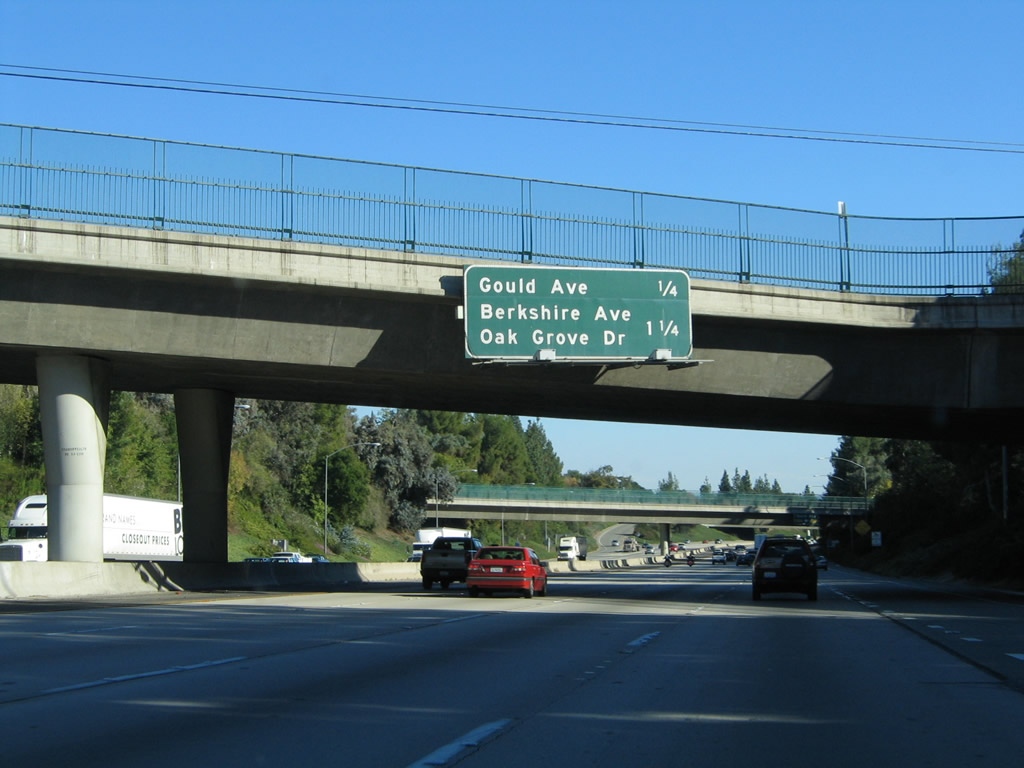
A mileage sign provides the distance to the next two exits along Interstate 210 (Foothill Freeway) east: Exit 21, Gould Avenue to Foothill Boulevard and Exit 22A, Berkshire Place to Oak Grove Drive and former California 159/Linda Vista Avenue south. Photo taken 11/14/04. |
|
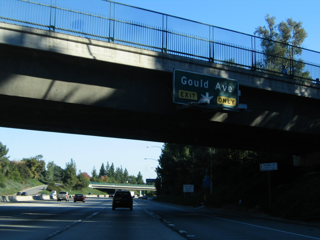
The right lane of eastbound Interstate 210 (Foothill Freeway) becomes exit only for Exit 21, Gould Avenue to Foothill Boulevard. Photo taken 11/14/04. |
|
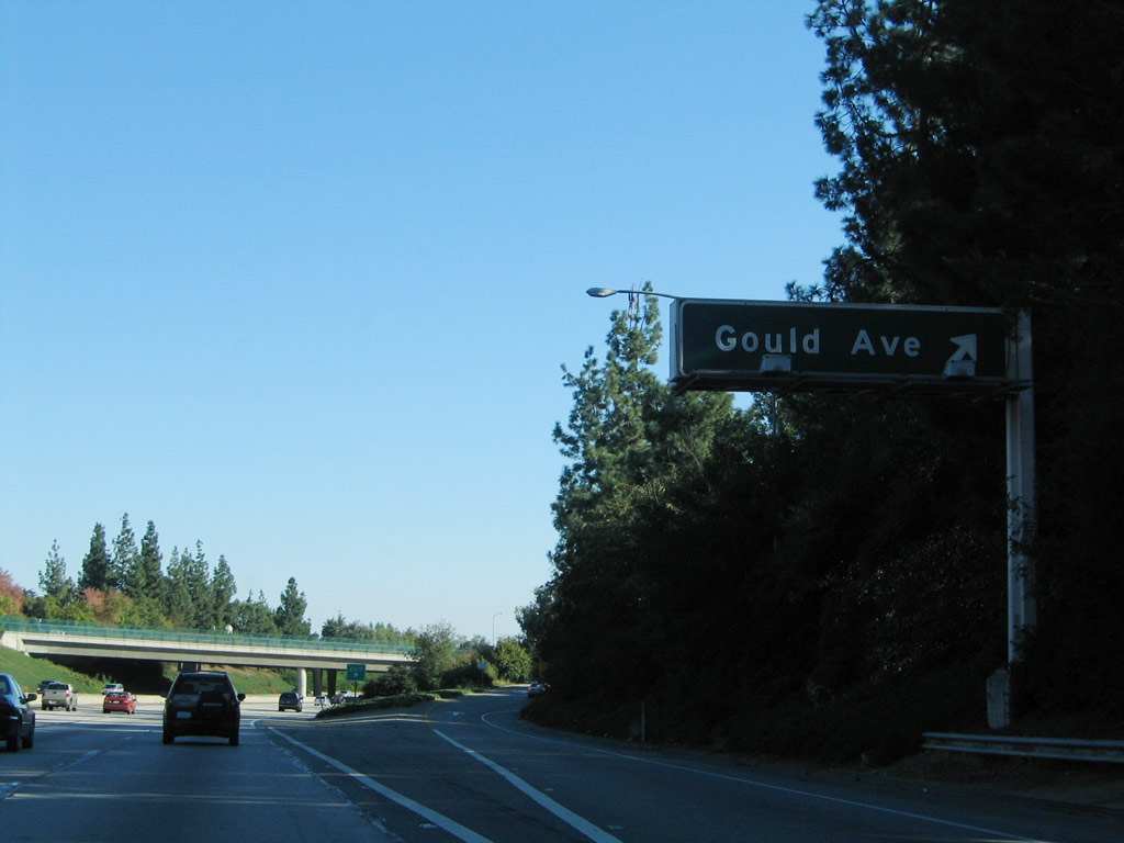
Eastbound Interstate 210 (Foothill Freeway) reaches Exit 21, Gould Avenue. Turn south on Gould Avenue to Former California 118/Foothill Boulevard. Photo taken 11/14/04. |
|
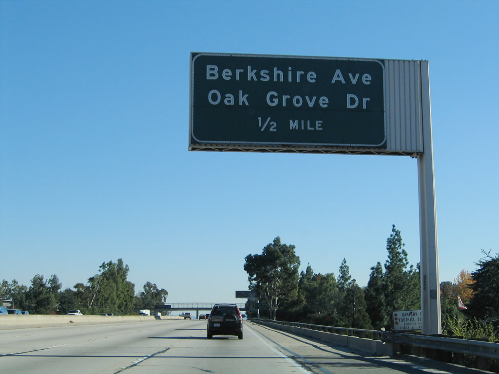
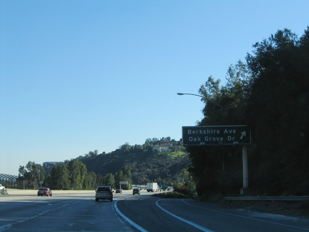
The next exit along Interstate 210 (Foothill Freeway) is Exit 22A, Berkshire Place to Oak Grove Drive and former California 159/Linda Vista Avenue south. Photo taken 11/14/04. |
|
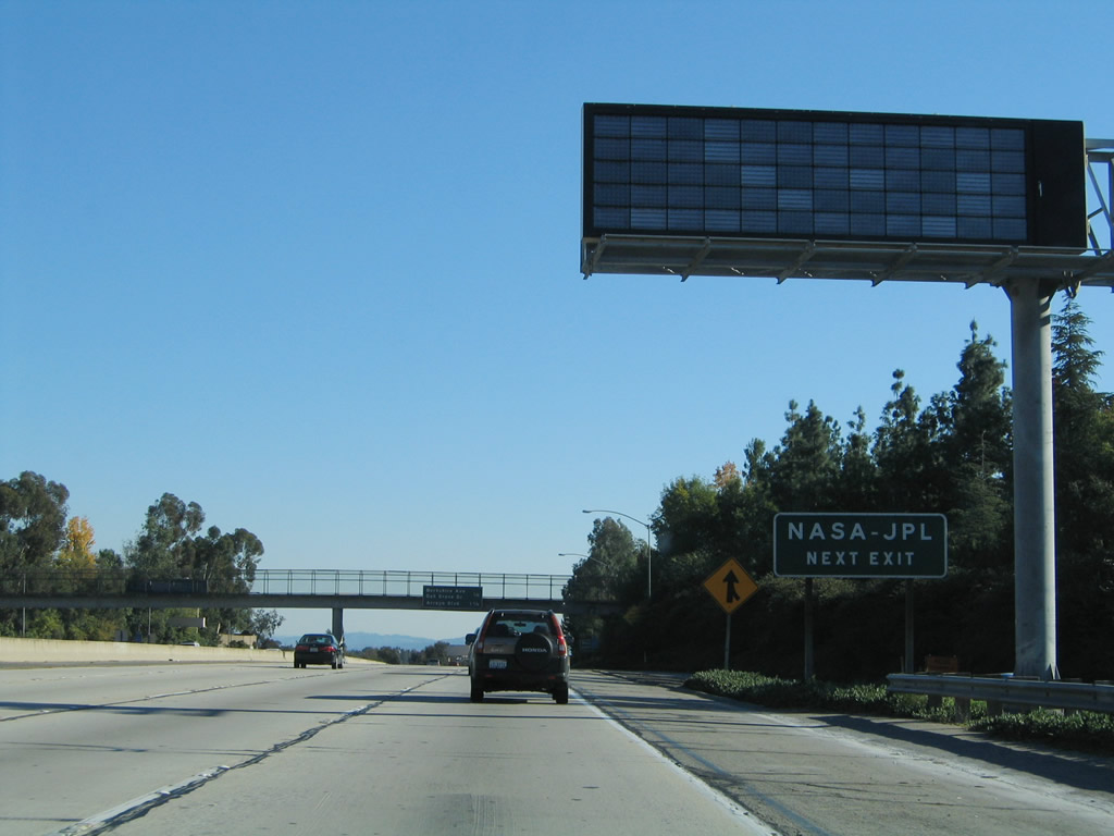
A dynamic message sign is placed prior to Exit 22A. Follow Berkshire Place east to Oak Grove Drive north to the NASA Jet Propulsion Laboratory (JPL). Photo taken 11/14/04. |
|
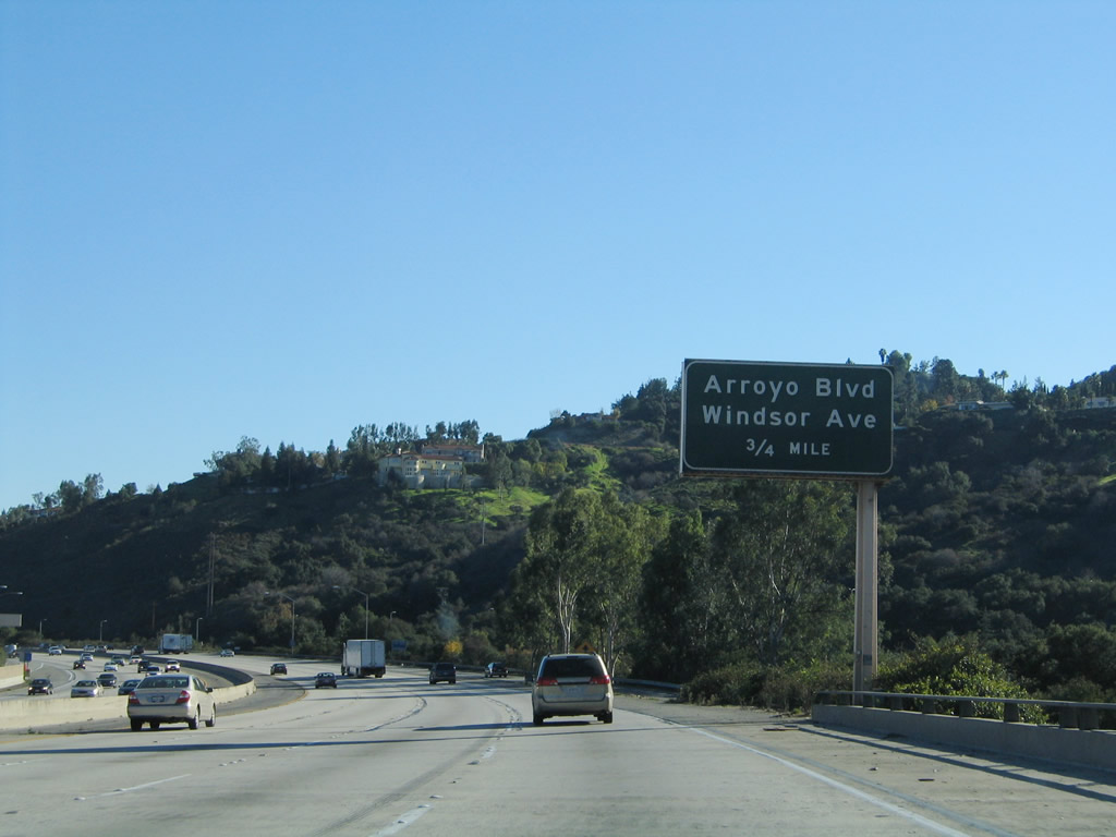
This mileage sign provides the distance to the next two exits along Interstate 210 (Foothill Freeway): Exit 22A, Berkshire Place to Oak Grove Drive and Linda Vista Avenue and Exit 22B, Arroyo Boulevard and Windsor Avenue. Photo taken 11/14/04. |
|
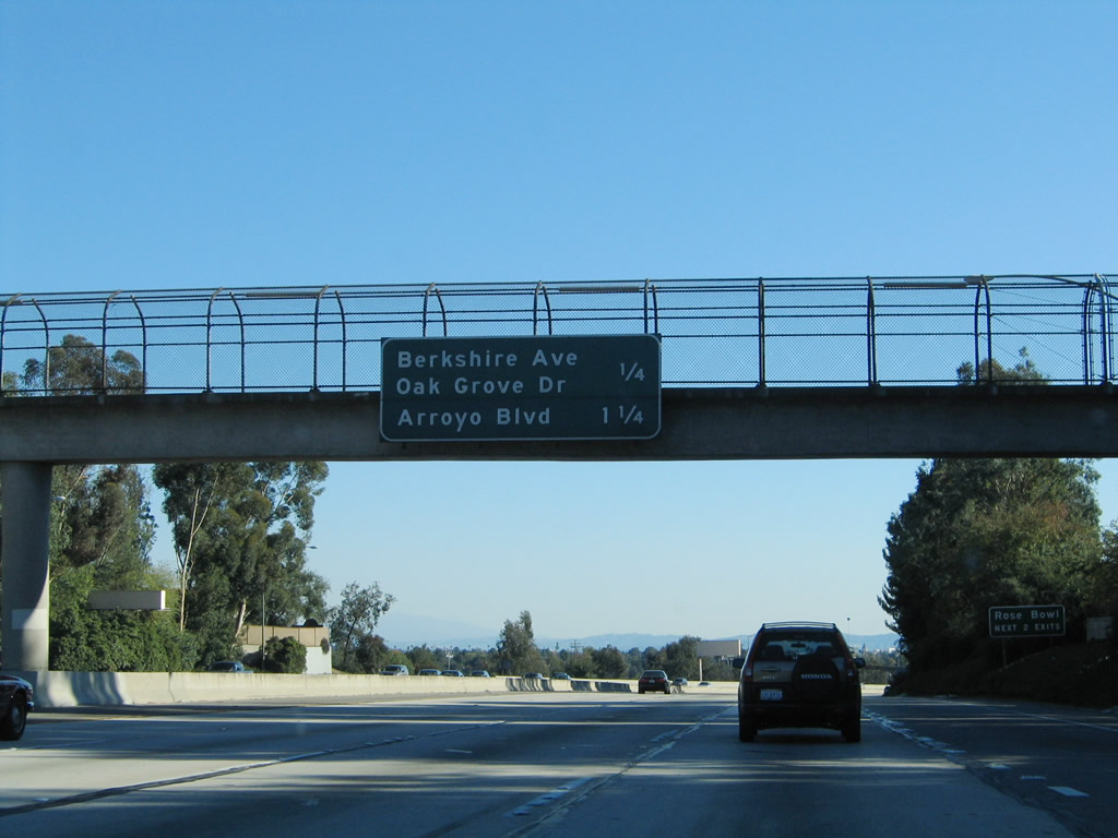
Eastbound Interstate 210 (Foothill Freeway) reaches Exit 22A, Berkshire Place to Oak Grove Drive. Use Oak Grove Drive south to former California 159/Linda Vista Avenue south to the Rose Bowl, or use Exit 22B (Arroyo Boulevard) south to the Rose Bowl. This segment of Interstate 210 (from Berkshire Place to the Arroyo Seco crossing near Linda Vista Road/California 159) was built in 1974. Photo taken 11/14/04. |
|
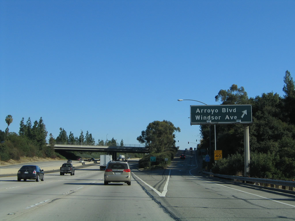
The next exit along Interstate 210 (Foothill Freeway) is Exit 22B, Arroyo Boulevard and Windsor Avenue. Photo taken 11/14/04. |
|
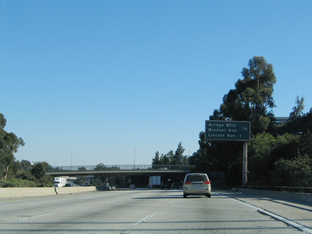
This mileage sign provides the distance to the next two exits along Interstate 210 (Foothill Freeway): Exit 22B, Arroyo Boulevard and Windsor Avenue and Exit 23, Lincoln Avenue and Howard Street. Photo taken 11/14/04. |
|
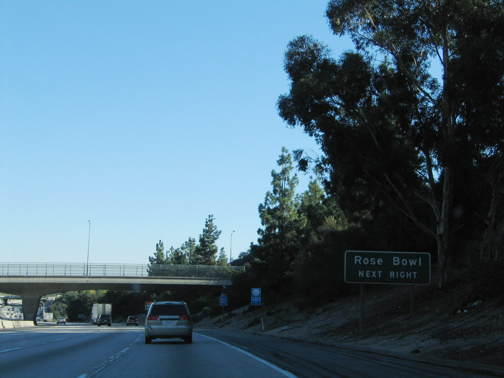
Exit 22B (Arroyo Boulevard and Windsor Avenue) is the second of two exits from Interstate 210 east that lead to the Rose Bowl. Situated in the Arroyo Seco (a valley behind the hill on the southwest side of the freeway), the Rose Bowl is not visible from Interstate 210. Photo taken 11/14/04. |
|
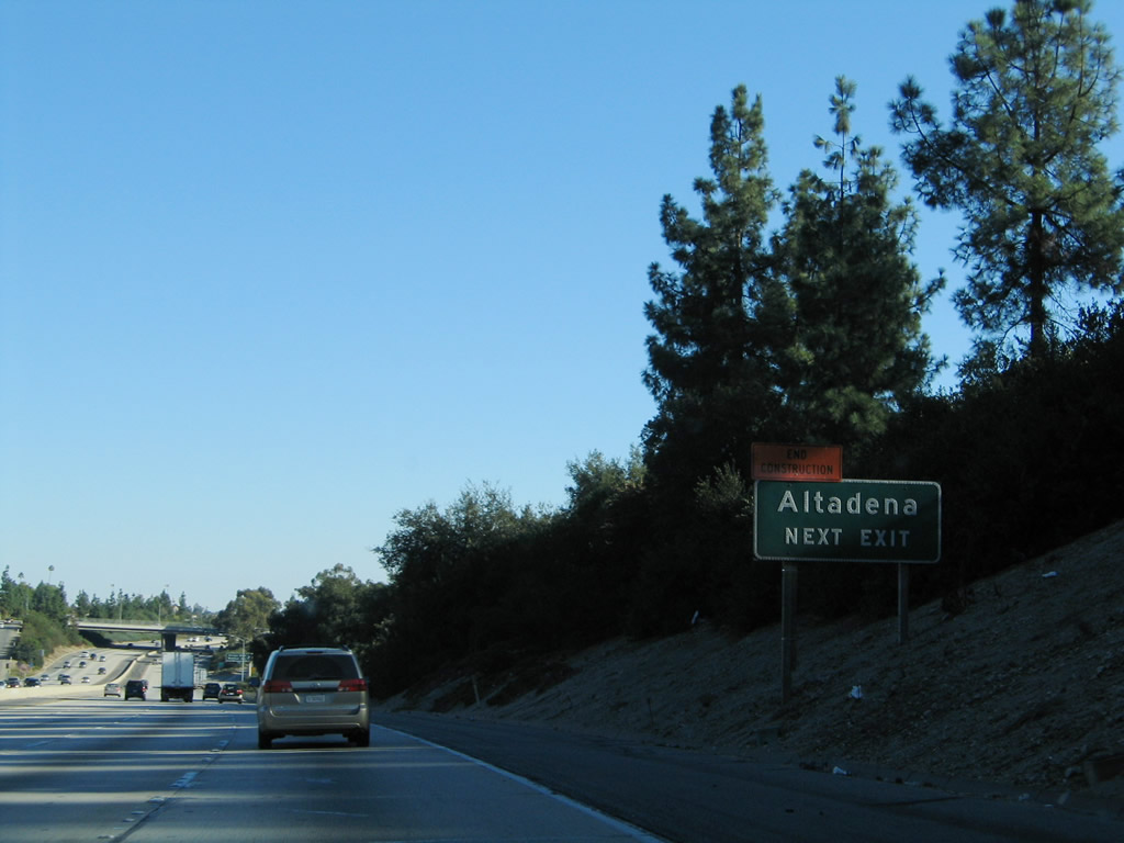
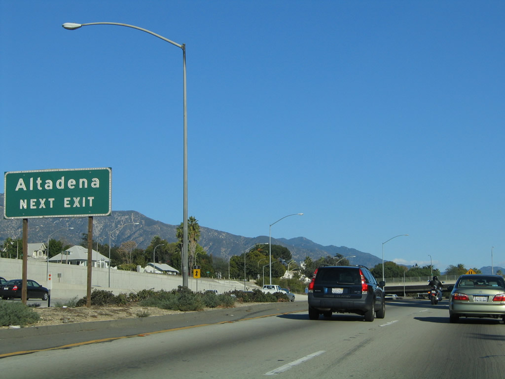
Use Exit 22B for Arroyo Boulevard north to the unincorporated community of Altadena, which had a population of 42,610 as of the 2000 Census. Photo taken 11/14/04. |
|
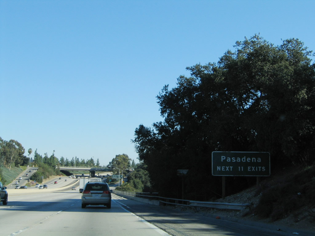
Meanwhile, Interstate 210 leaves the city of La Canada Flintridge and enters the city of Pasadena. The next 11 exits all serve the city of Pasadena: Exit 22B, Arroyo Boulevard and Windsor Avenue; Exit 23, Lincoln Avenue and Howard Street; Exit 24, Mountain Street and Seco Street; Exit 25A, California 710 south (stub freeway) to Del Mar Boulevard, California Boulevard, and Historic U.S. 66 (Colorado Boulevard); Exit 25B, California 134 (Ventura Freeway) west to Glendale and Ventura; Exit 26, Lake Avenue; Exit 27, Hill Avenue; Exit 28, Altadena Drive; Exit 29A, San Gabriel Boulevard; Exit 29B, Madre Street; and Exit 30A, California 19 (legislative California 164)/Rosemead Boulevard. Photo taken 11/14/04. |
|
Eastbound Interstate 210 (Foothill Freeway) meets Exit 22B, Arroyo Boulevard and Windsor Avenue to the Rose Bowl (via south Arroyo Boulevard) and western Altadena (via north Windsor Avenue). By this point, Interstate 210 is in the city of Pasadena, which had a 2000 Census population of 133,936. The city consisted of 23.2 square miles at that time and was incorporated on June 19, 1886. Pasadena is home to the Rose Bowl, which is a large venue that hosts the annual "Granddaddy of them all": the Tournament of Roses. Each year on New Year's Day, the city hosts the spectacular Tournament of Roses. The annual parade (with floats partially made of rose petals) follows Colorado Boulevard through Old Pasadena (downtown). The festivities culminate with the annual college football game, which often is involved in determining that year's college football champion. During the regular college season, the University of California at Los Angeles (UCLA) uses the Rose Bowl for its home games. Photo taken 11/14/04. |
|
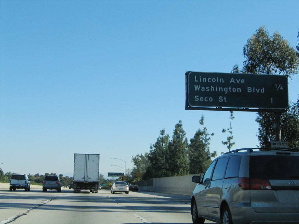
The next exit along Interstate 210 (Foothill Freeway) is Exit 23, Lincoln Avenue, Washington Boulevard, and Howard Street (0.50 mile). This segment of Interstate 210 (from the Arroyo Seco crossing near Linda Vista Road/California 159 south to the California 134-710 interchange) was built in 1973. Photo taken 11/14/04. |
|
This mileage sign provides the distance to the next two exits along Interstate 210 east: Exit 23, Lincoln Avenue and Howard Street and Exit 24, Mountain Street and Seco Street. Photo taken 11/14/04. |
|
Eastbound Interstate 210 (Foothill Freeway) reaches Exit 23, Lincoln Avenue, Washington Boulevard, and Howard Street. At this point, Interstate 210 is traveling nearly due south and will continue to do so until the interchange with California 134 and California 710 near downtown Pasadena. Photo taken 11/14/04. |
|
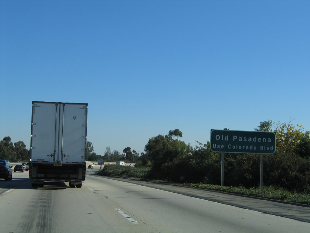
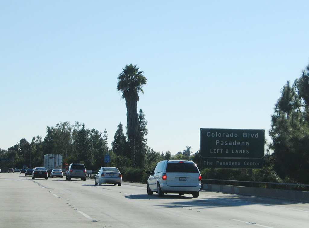
To downtown Pasadena, continue south on unsigned California 710 to the Historic U.S. 66 (Colorado Boulevard) exit. Photo taken 11/14/04. |
|
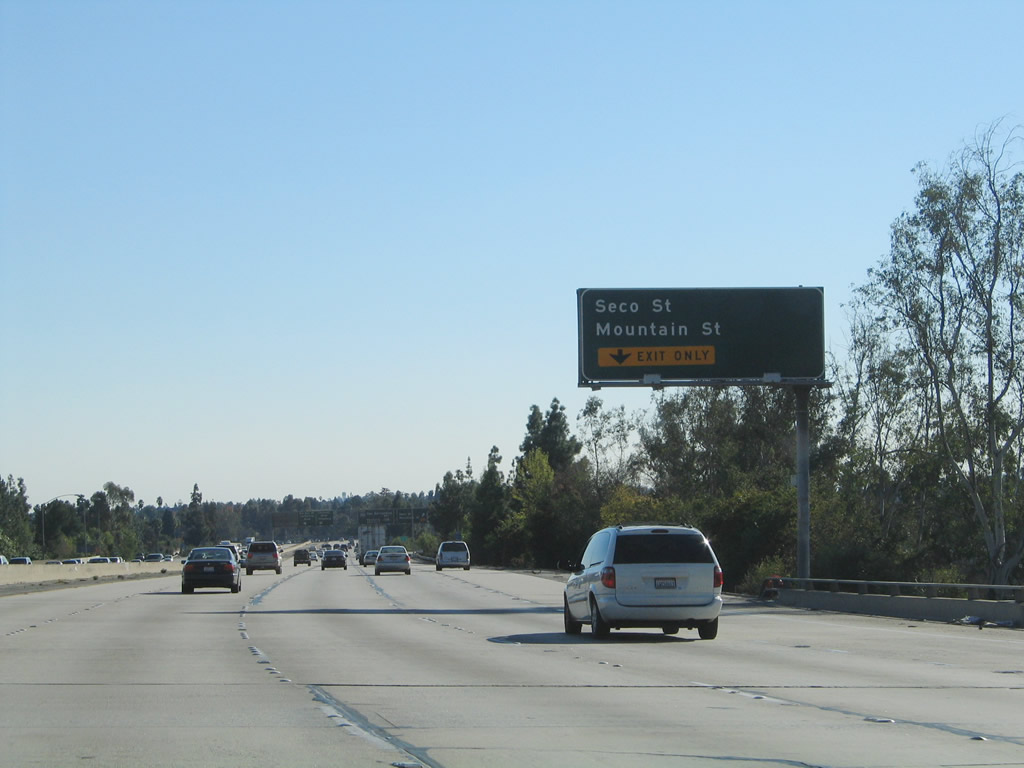
The next exit along Interstate 210 (Foothill Freeway) is Exit 24, Mountain Street and Seco Street. The right lane becomes exit only for Exit 24. Space on this sign seems to allow for a state highway shield, although neither of these roads were state routes (as far as we know). Photo taken 11/14/04. |
|
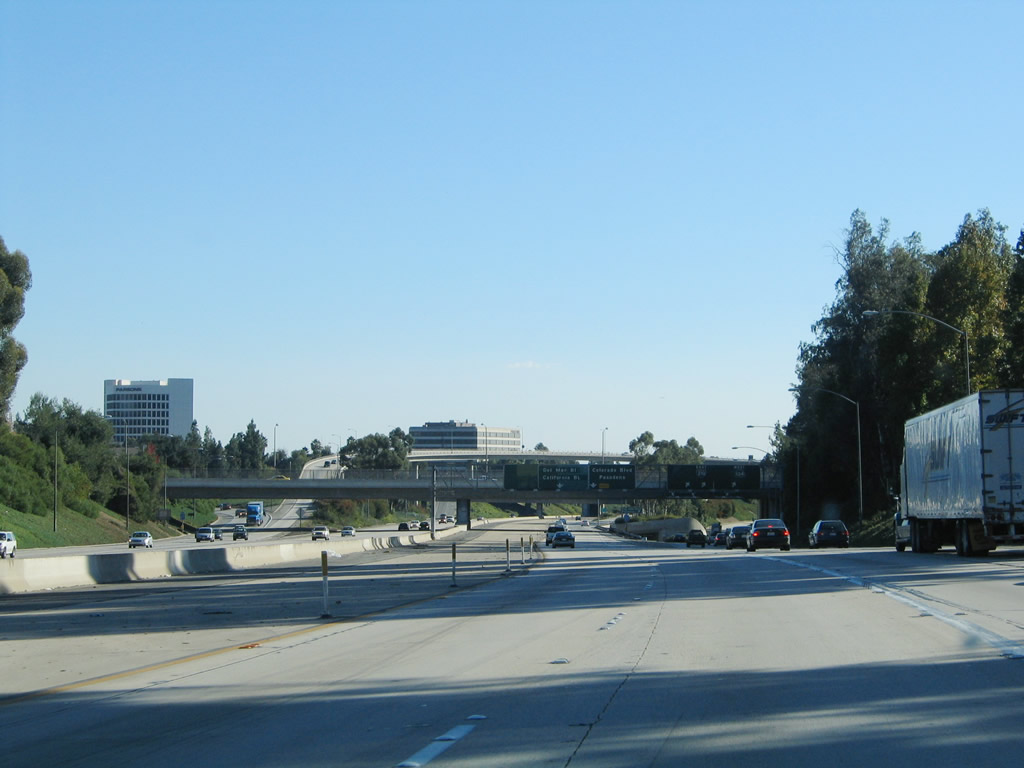
Eastbound Interstate 210 (Foothill Freeway) reaches Exit 24, Mountain Street and Seco Street. Ahead, Interstate 21 approaches the massive interchange with California 134 and California 710. The left two lanes connect to California 710 freeway south, which is a stub to Del Mar Boulevard and California Boulevard. The 710 freeway then ends, awaiting an eventual connection with the rest of Interstate 710 to the south with proposed construction of a tunnel under Pasadena and South Pasadena. Through traffic on Interstate 210 east or to California 134 west should stay right. Photo taken 11/14/04. |
|
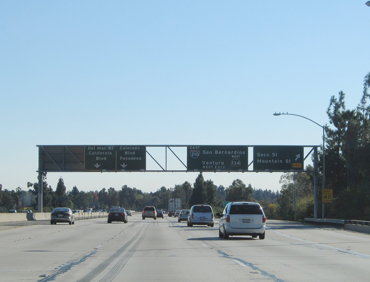
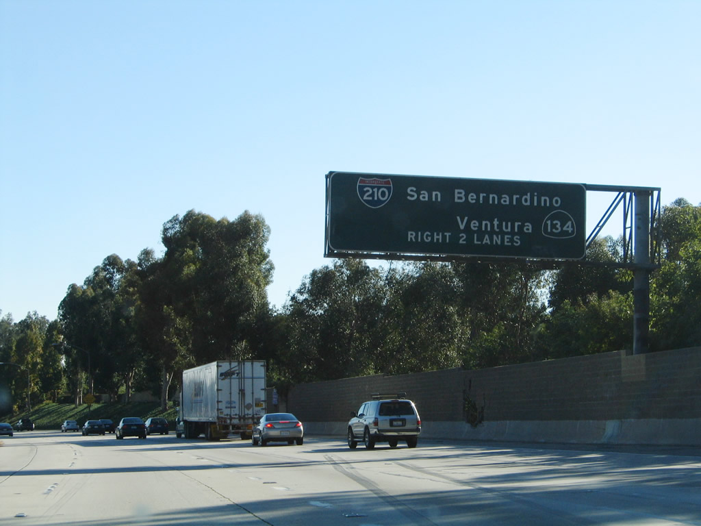
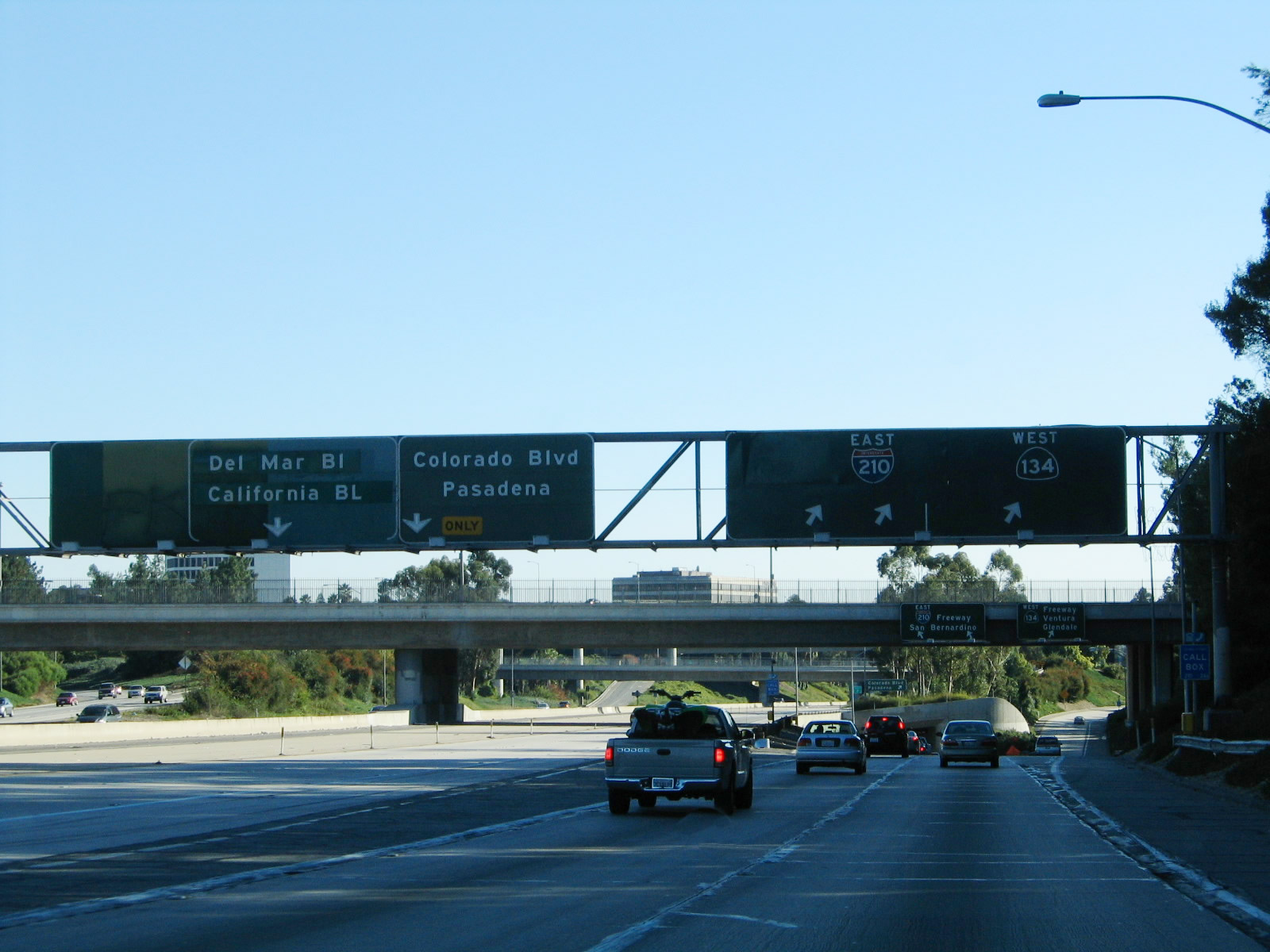
The next exit along Interstate 210 (Foothill Freeway) is Exit 25A, California 710 south to Historic U.S. 66 (Colorado Boulevard), Del Mar Boulevard, and California Boulevard to California 110 (Pasadena Freeway) (left exit). California 710 is not signed. There is no direct access to Interstate 710 south to Long Beach without going to Interstate 5 or Interstate 605. Photo taken 11/14/04. |
|
Meanwhile, the right two lanes provide the continuation of Interstate 210 (Foothill Freeway) east and the ramp to Exit 25B, California 134 (Ventura Freeway) west to Glendale, Hollywood, and Ventura. Photo taken 11/14/04. |
|
Looking south from the left lane, extra capacity is waiting for eventual use once (if) the 710 connector is built between Interstate 210 and Interstate 10. Most traffic departs to the right here since the 710 freeway is not built. Photo taken 11/14/04. |
|
Eastbound Interstate 210 reaches Exit 25A, California 710 south to Historic U.S. 66 (Colorado Boulevard), Del Mar Boulevard, and California Boulevard. Stay right to continue east on Interstate 210 and connect to California 134 west. Photo taken 11/14/04. |
|
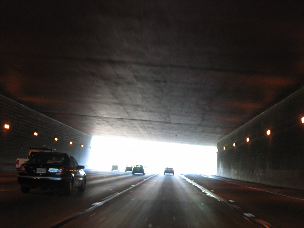
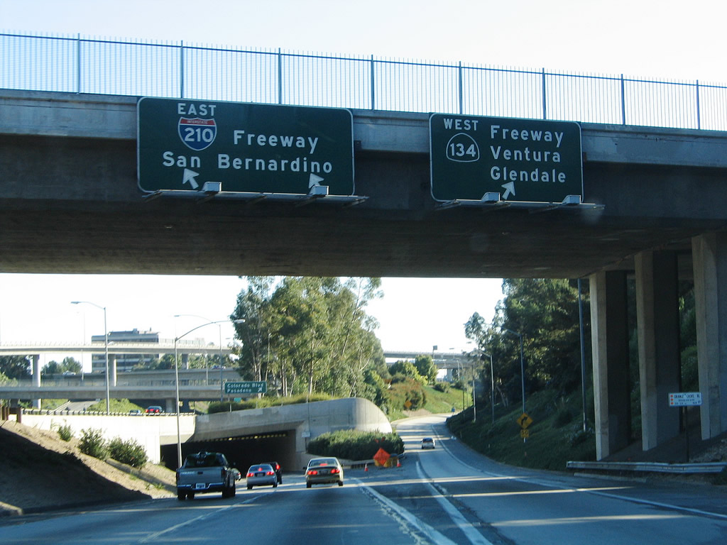
Immediately thereafter, eastbound Interstate 210 reaches Exit 25B, California 134 (Ventura Freeway) west to Glendale, Hollywood, and Ventura. Only two lanes carry Interstate 210 through this interchange ... and it will pass under the interchange through a tunnel. Photo taken 11/14/04. |
|
Eastbound Interstate 210 squeezes into this tunnel, which passes under the 134-210-710 interchange. The freeway will daylight briefly, then enter a second tunnel before returning to grade and merging with California 134 eastbound traffic. Photo taken 11/14/04. |
|
Emerging from the tunnels, eastbound Interstate 210 returns to grade and prepares to merge with traffic from California 134 west (coming in from the left). Photo taken 11/14/04. |
|
As California 134 east merges into Interstate 210 from the left, this mileage sign provides the distance to the next three exits on Interstate 210 east: Exit 26, Lake Avenue; Exit 27, Hill Avenue; and Exit 28, Altadena Drive. Photo taken 11/14/04. |
Page Updated January 4, 2010.