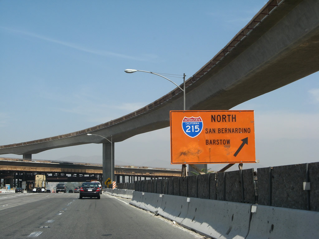
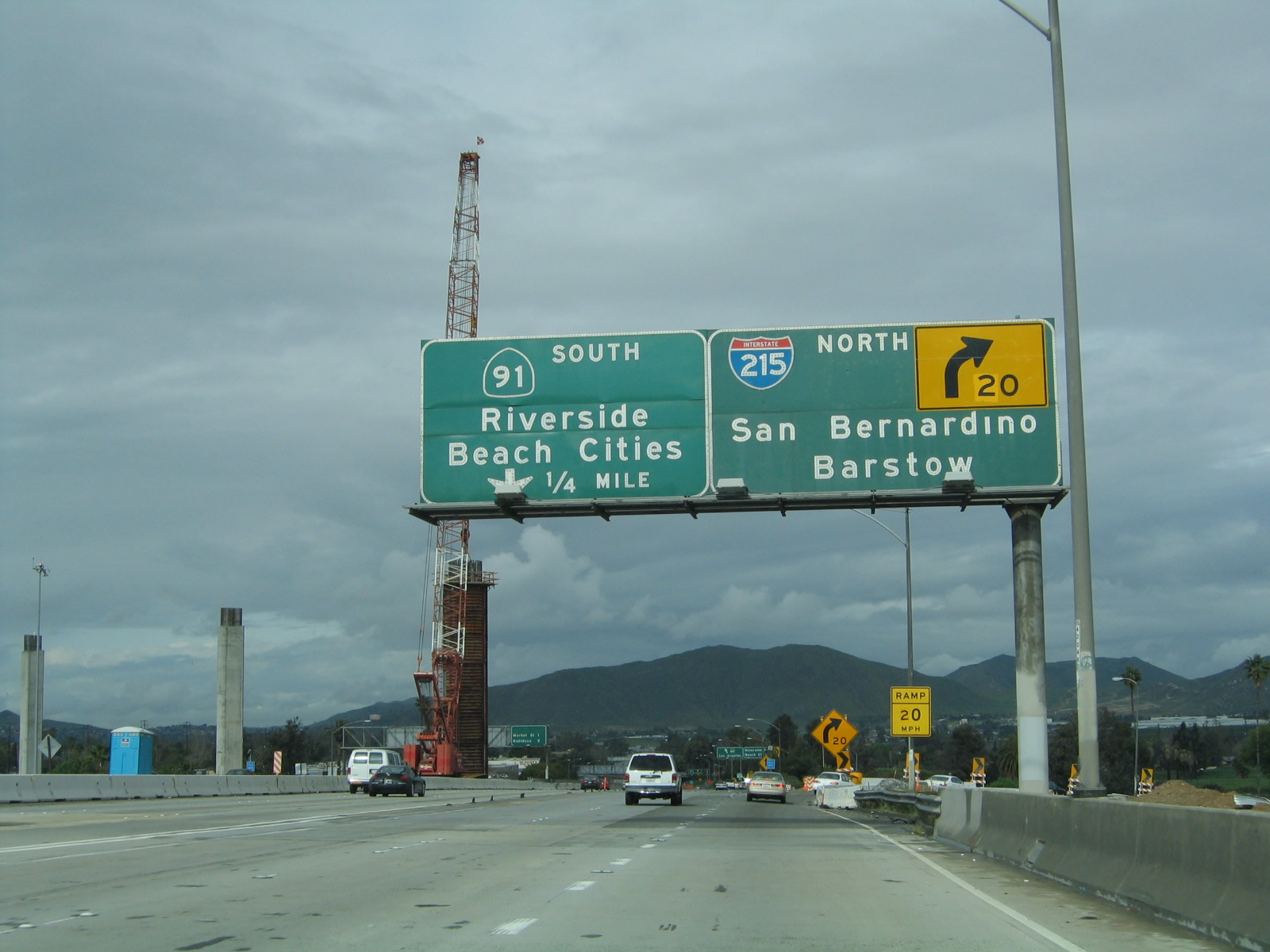
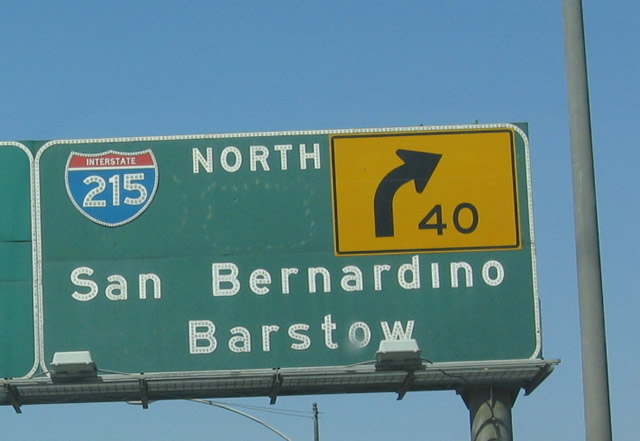
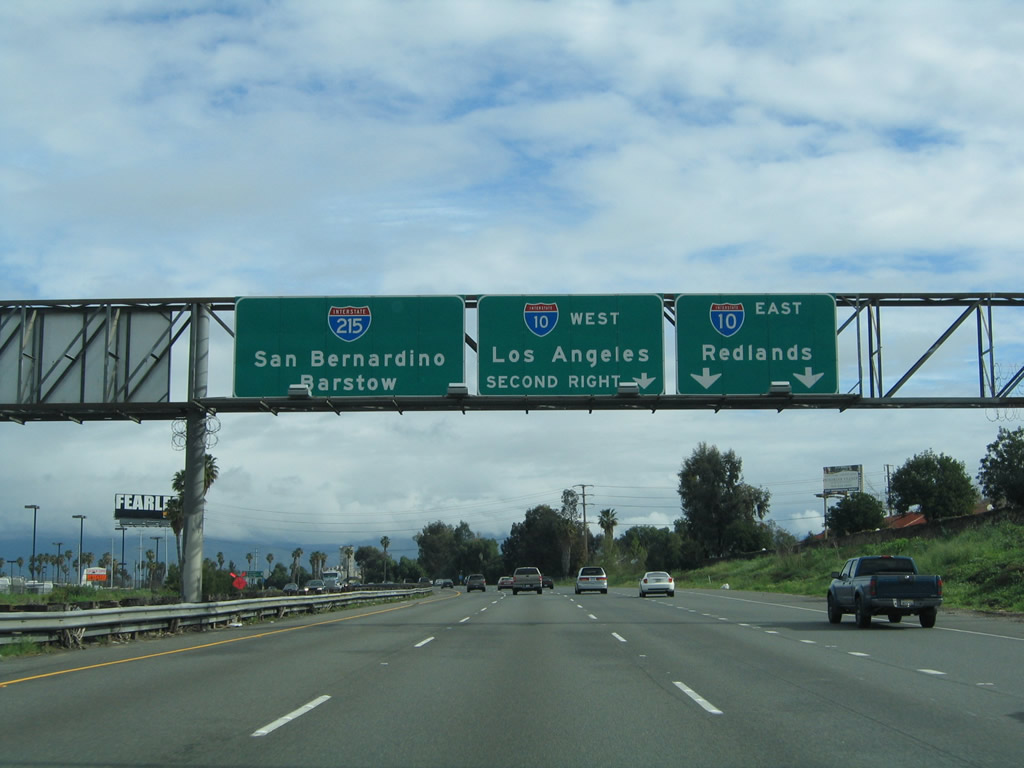
| Interstate 215 north & California 60 west |
|
|
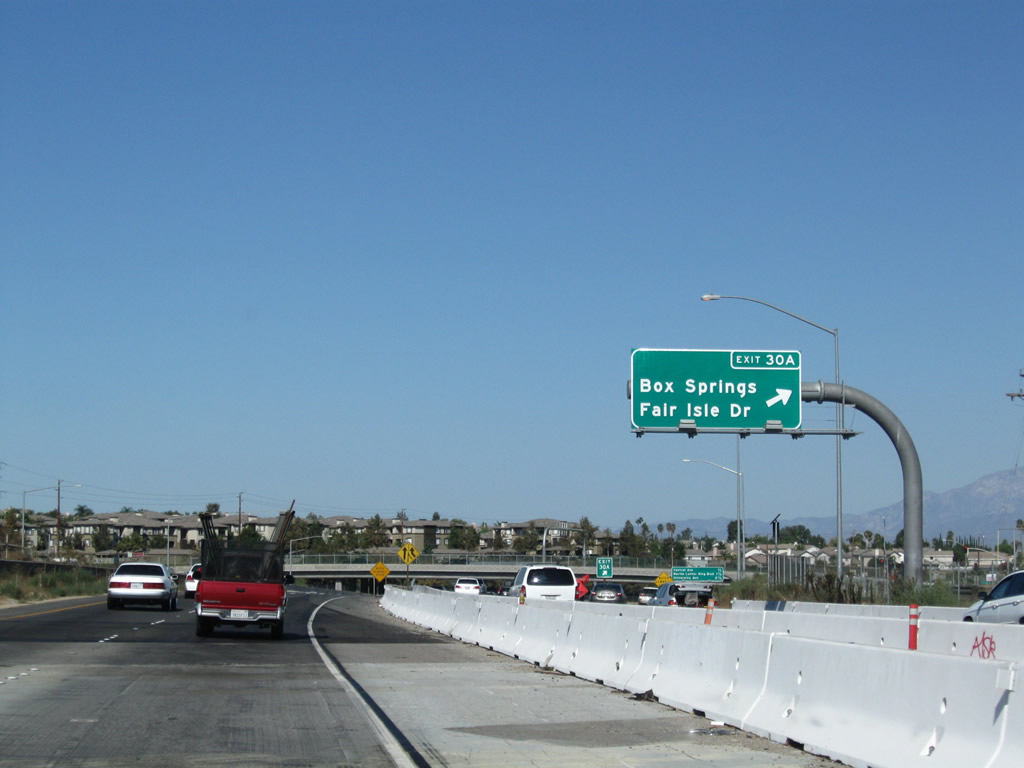
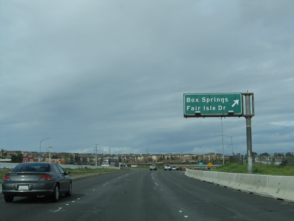
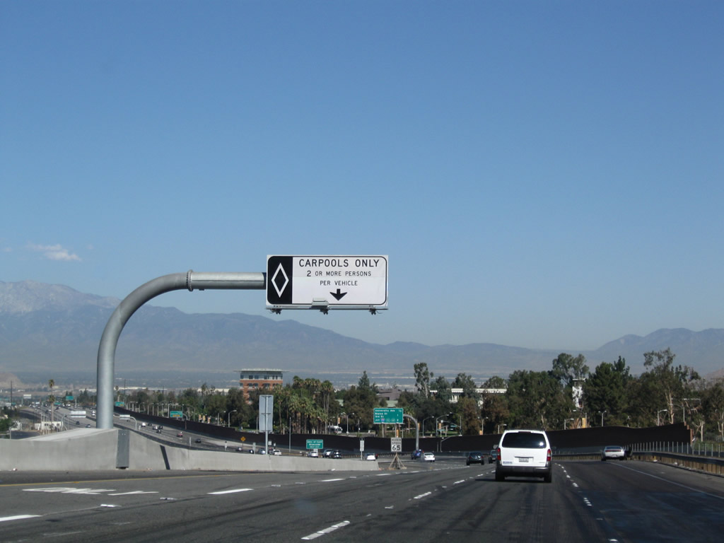
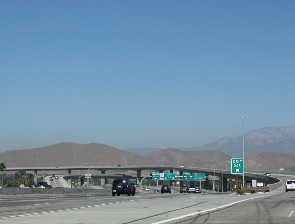
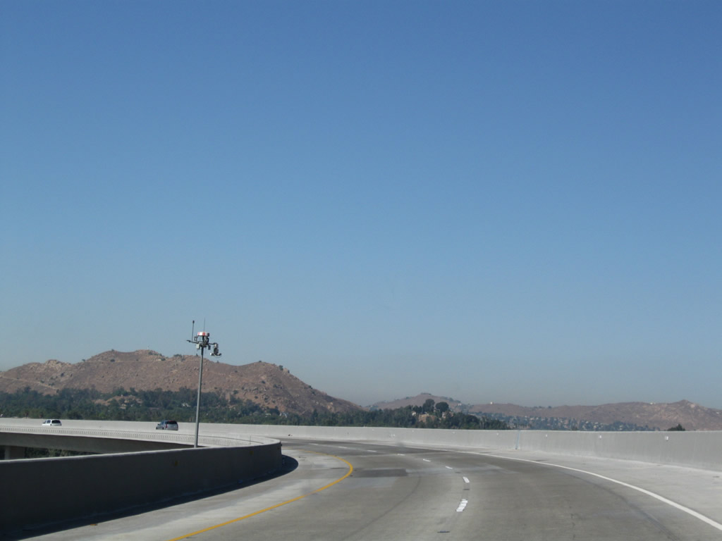
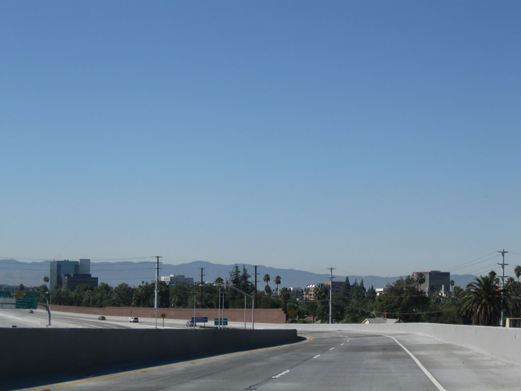
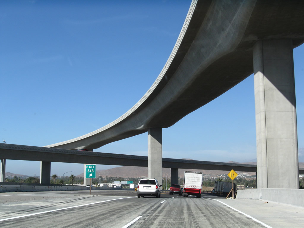
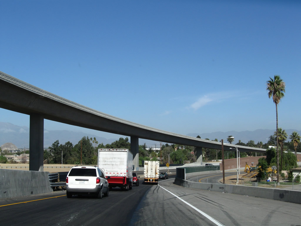
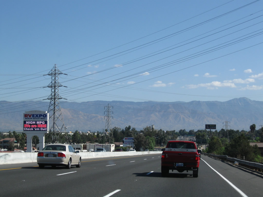
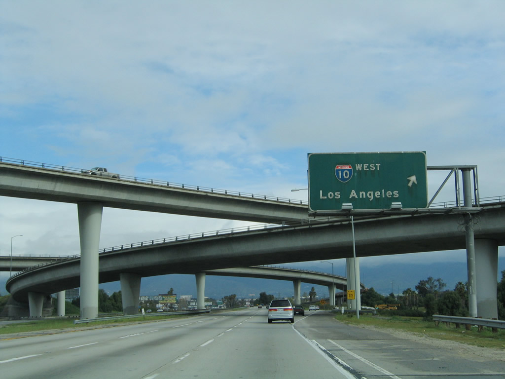
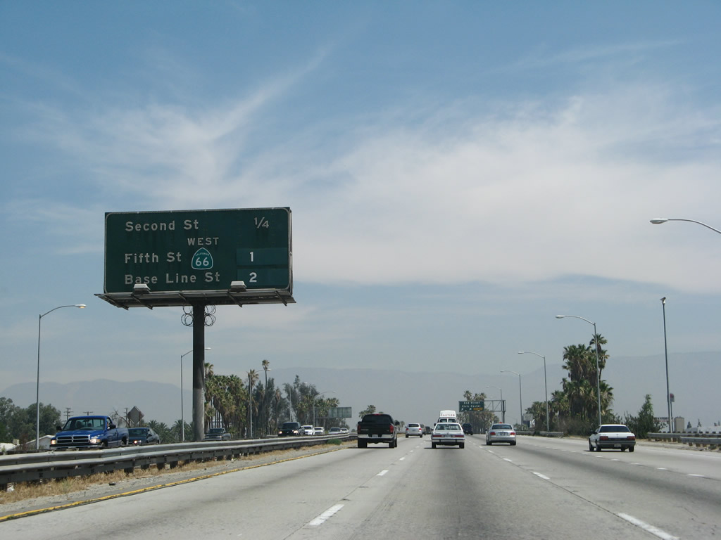
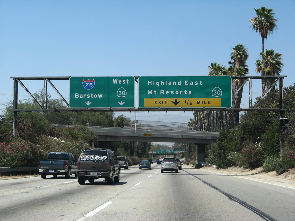
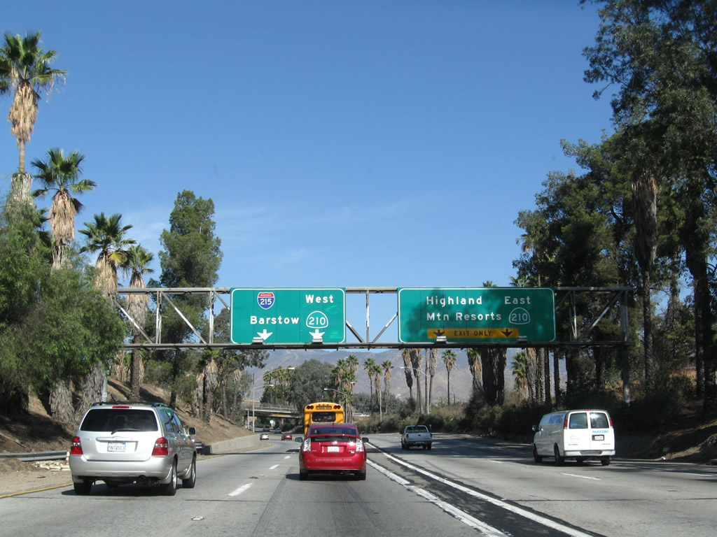
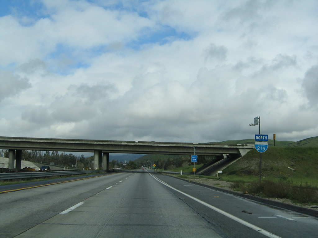
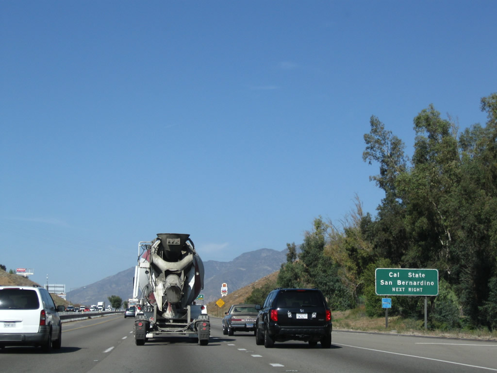
Northbound Interstate 215/Westbound California 60 reaches Exit 30A, Fair Isle Drive/Box Springs. Prior to reconstruction and expansion of the shared alignment of Interstate 215 and California 60 in 2008, access to Exit 30A was allowed from Interstate 215. That access was eliminated with the completion of the newly widened freeway through Riverside. Photos taken 09/28/08 and 02/20/05. |
|
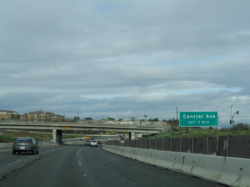
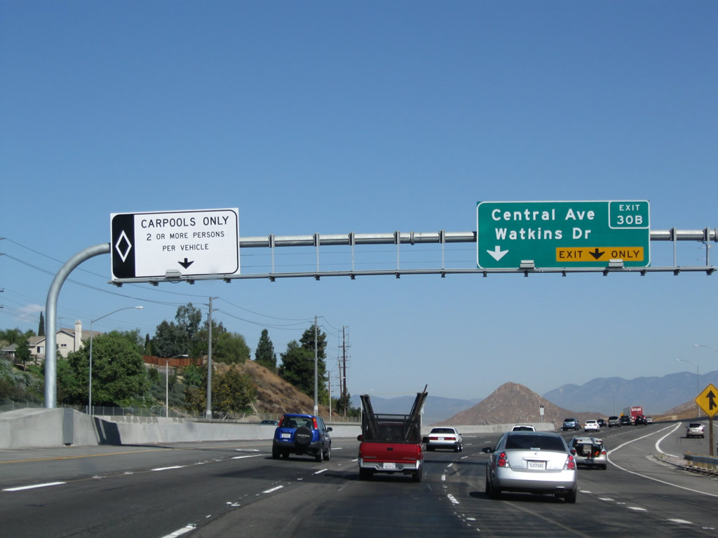
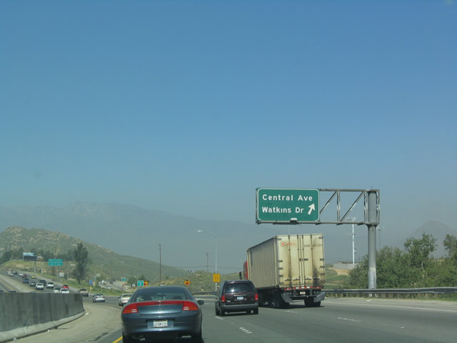
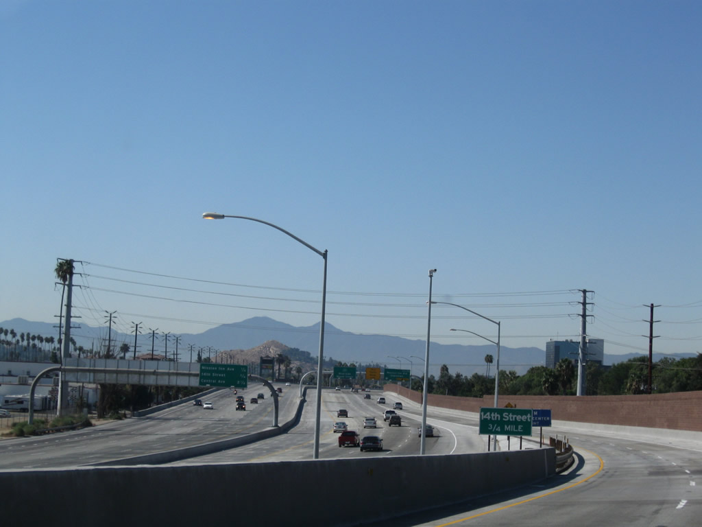
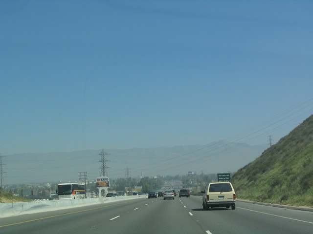
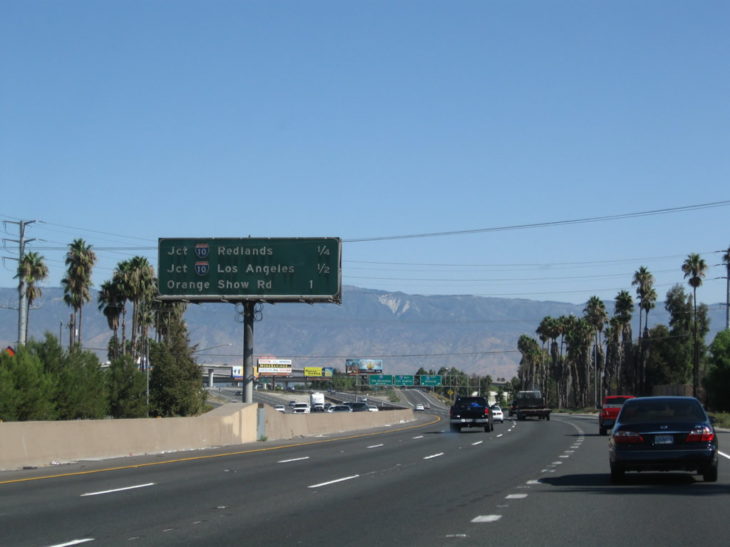
This one-mile advance sign along Interstate 215 north and California 60 (Moreno Valley Freeway) west for Exit 30B, Central Avenue and Watkins Drive was removed with the project to expand this often-congested stretch of freeway. Photo taken 02/20/05. |
|
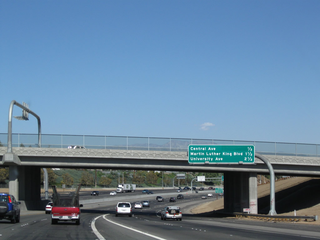
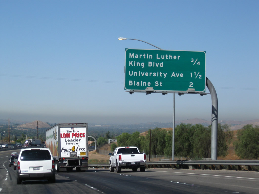
This mileage sign provides the distance to the next three exits along Interstate 215 north and California 60 (Moreno Valley Freeway) west: Exit 30B, Central Avenue and Watkins Drive; Exit 31, Martin Luther King, Jr. Boulevard; and Exit 32, California 60 Business (University Avenue). Photo taken 09/28/08. |
|
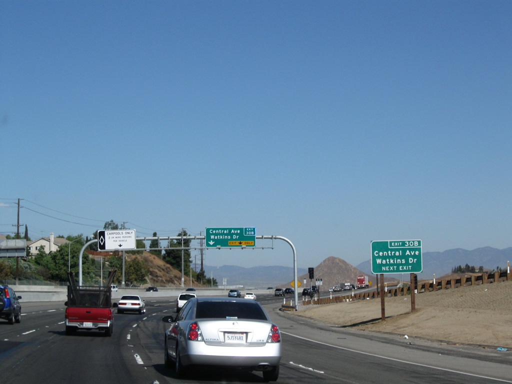
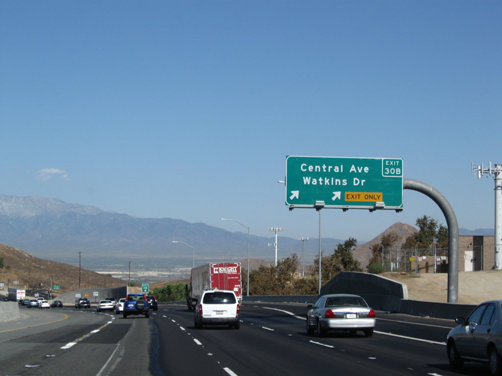
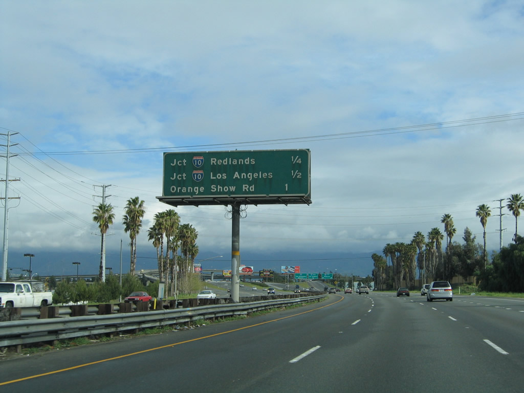
A roadside sign is posted along Interstate 215 north and California 60 (Moreno Valley Freeway) west for Exit 30B, Central Avenue and Watkins Drive. Photo taken 09/28/08. |
|
The left lane will become a high occupancy vehicle (HOV or carpool) lane, while the right two lanes connect to Exit 30B, Central Avenue and Watkins Drive. The center three lanes continue northwest on Interstate 215 and California 60. Photo taken 09/28/08. |
|
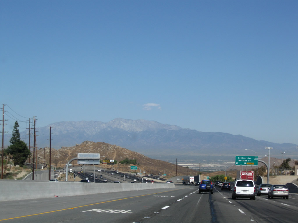
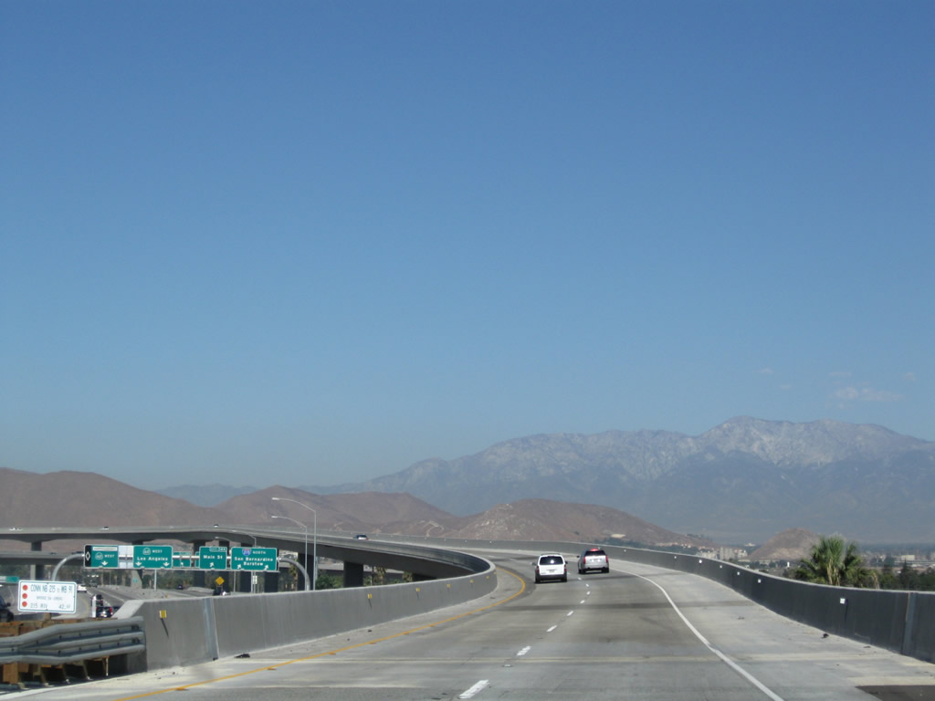
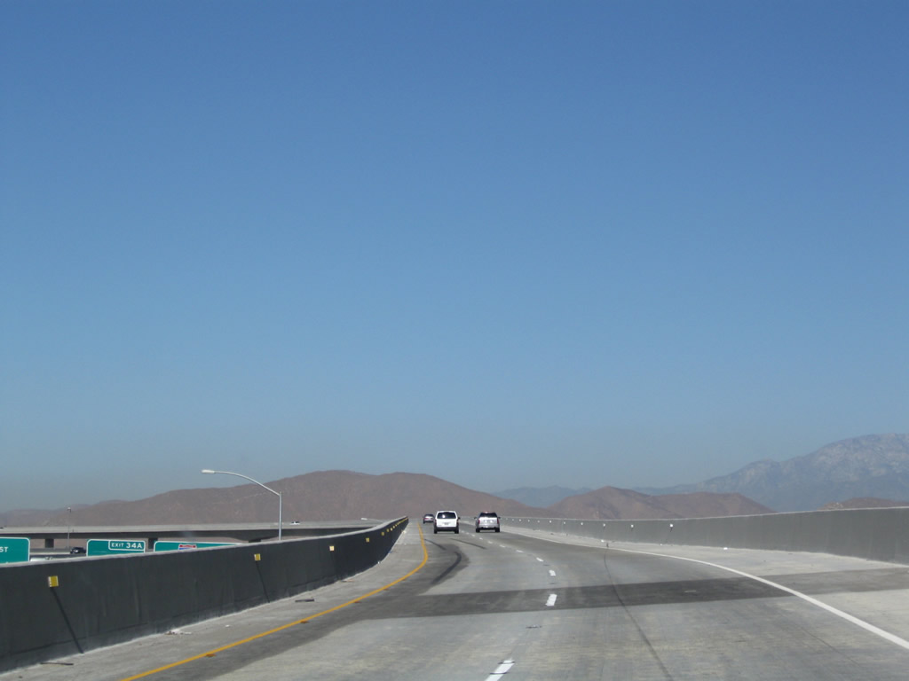
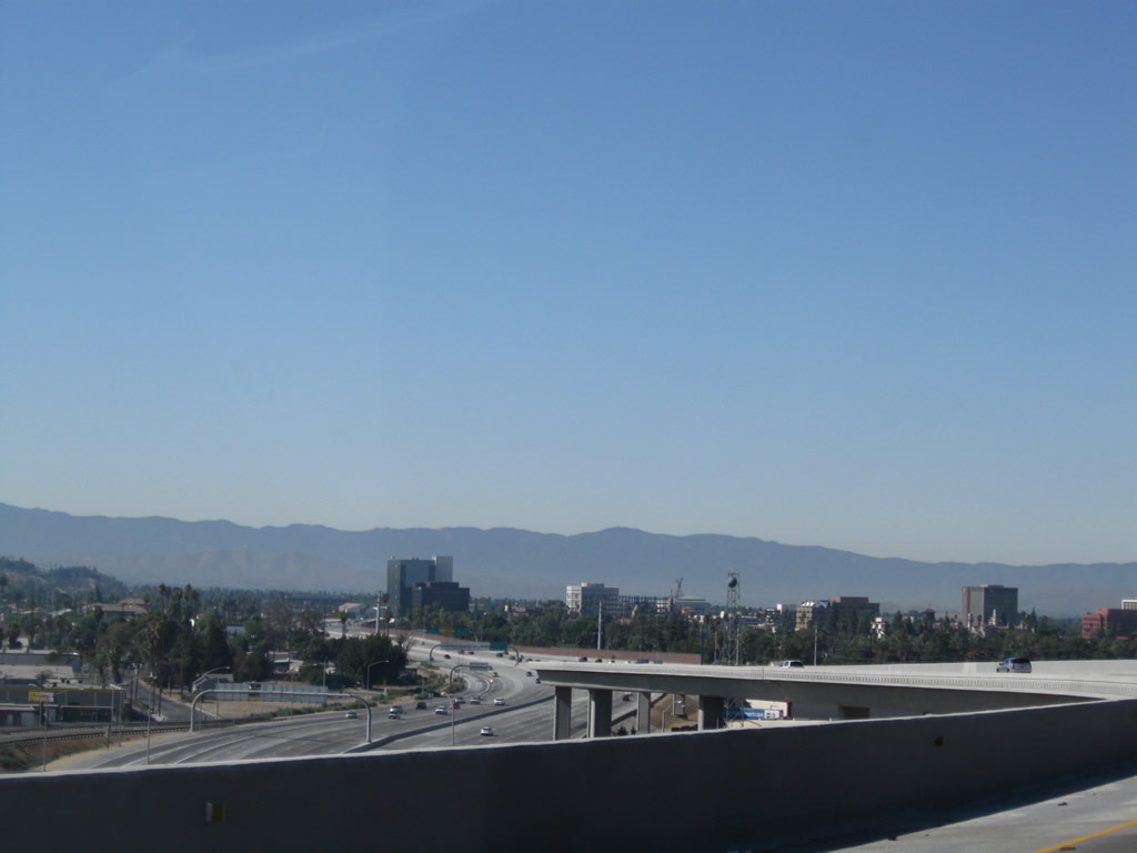
Prior to Exit 30B, Central Avenue and Watkins Drive is this view of the freeway as it travels downhill toward the massive California 60-91-215 interchange. Photo taken 09/28/08. |
|
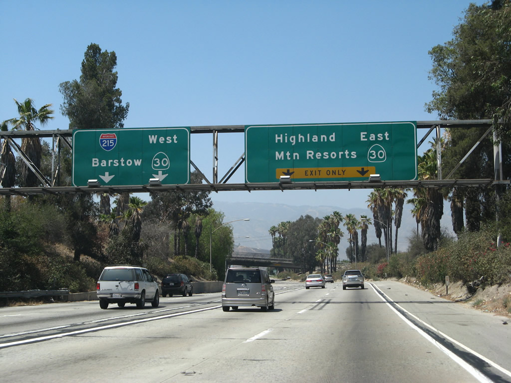
This mileage sign along Interstate 215 north and California 60 (Moreno Valley Freeway) west for the California 91 interchange, Pomona, and Los Angeles was removed once this section of freeway was widened. Photo taken 02/20/05. |
|
|
Northbound Interstate 215 and westbound California 60 (Moreno Valley Freeway) reaches Exit 30B, Central Avenue and Watkins Drive. Photos taken 09/28/08 and 03/20/04. |
|
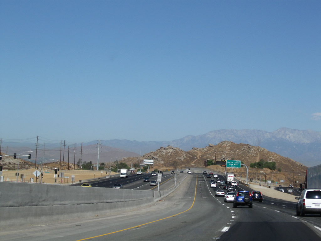
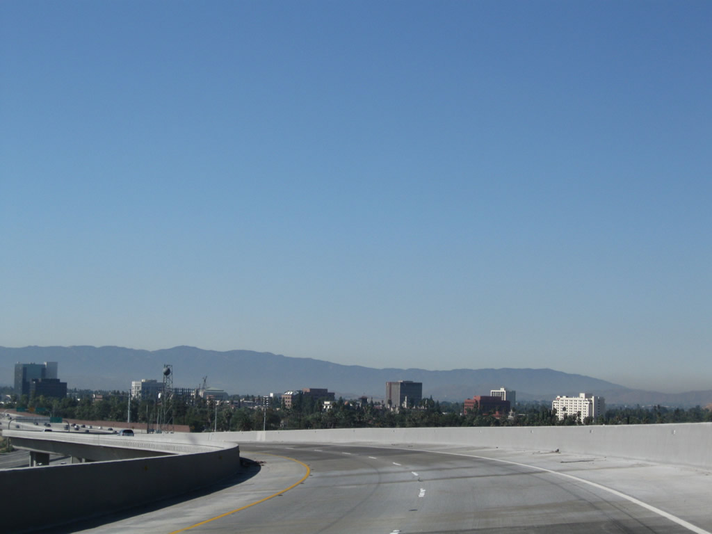
Near the Central Avenue and Watkins Drive interchange is another view of the freeway as it continues northwest. Photo taken 09/28/08. |
|
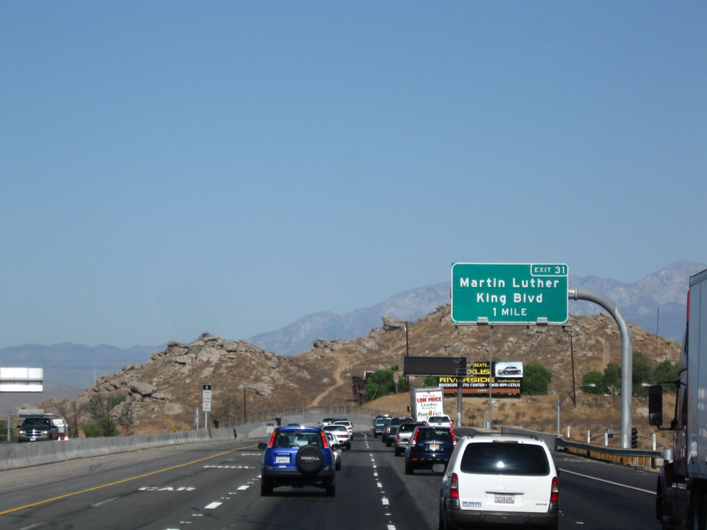
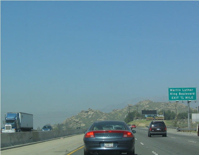
The next exit along northbound is Exit 31, Martin Luther King, Jr. Boulevard (one mile). Prior to 2008, access to Martin Luther King, Jr. Boulevard was provided by exiting Interstate 215 at El Cerrito Drive, an interchange that was constructed similar to a trumpet. With the construction of a full diamond interchange at Martin Luther King, Jr. Boulevard, the El Cerrito Drive interchange was no longer required and removed from service (see photo below of this interchange). Photo taken 09/28/08. |
|
|
This mileage sign provides the distance to the next three exits along northbound Interstate 215 and westbound California 60 (Moreno Valley Freeway): Exit 31, Martin Luther King, Jr. Boulevard (0.75 mile); Exit 32, California 60 Business (University Avenue) (1.50 miles); and Exit 33, Blaine Street and Third Street. The original (2004) sign was not a mileage sign and only mentioned Exit 31. Photos taken 09/28/08 and 03/20/04. |
|
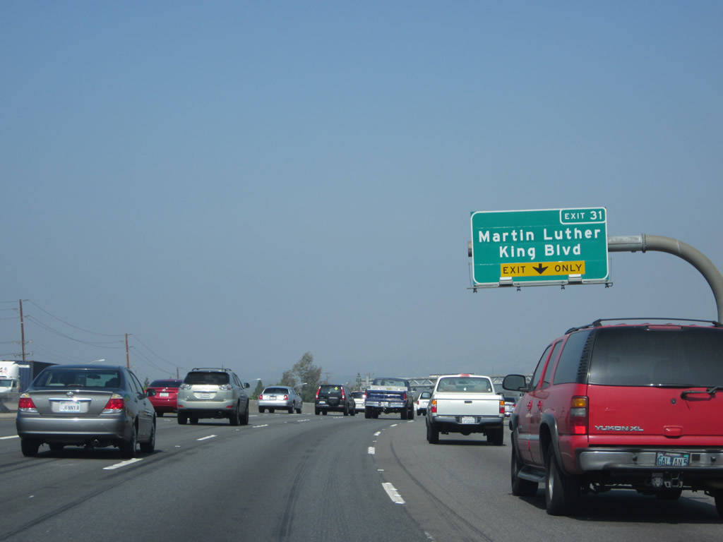
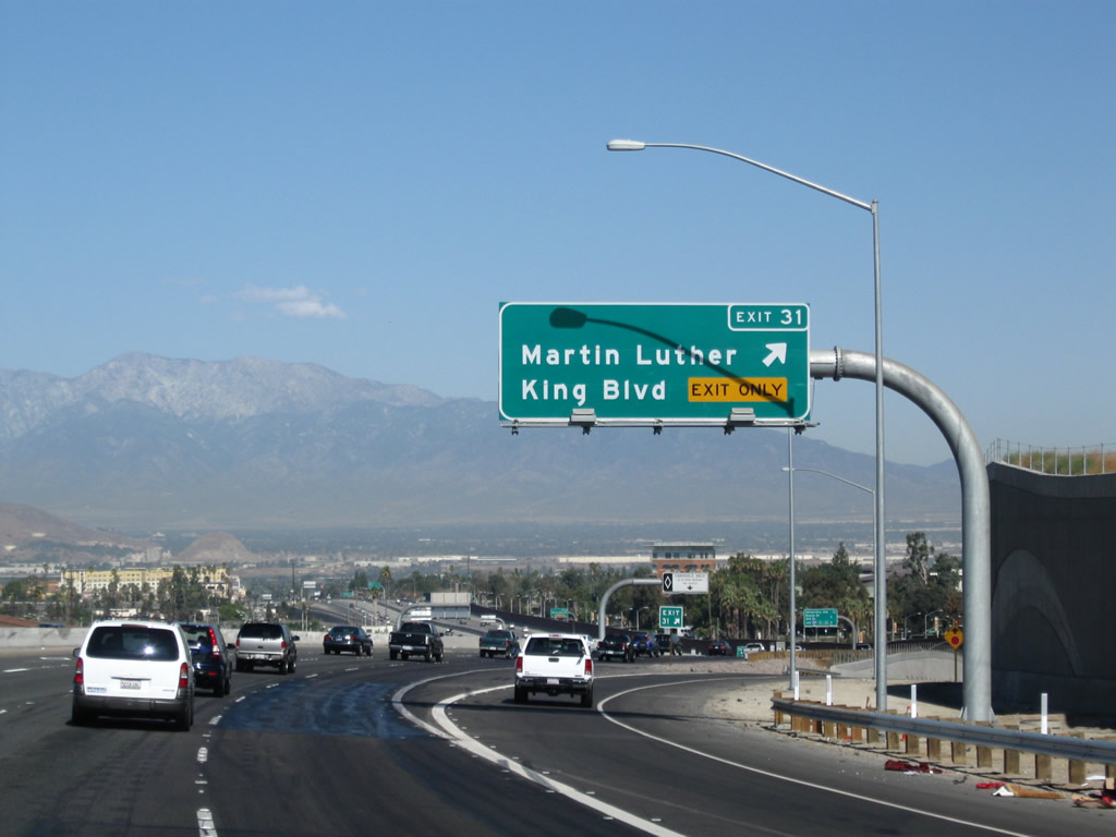
The right lane of Interstate 215 north and California 60 west becomes exit only for Exit 31, Martin Luther King, Jr. Boulevard. Photo taken 05/05/12. |
|
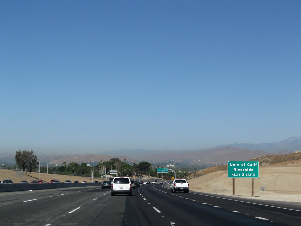
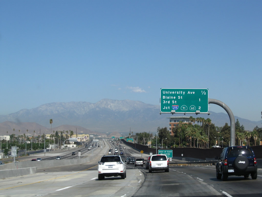
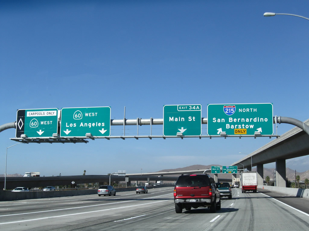
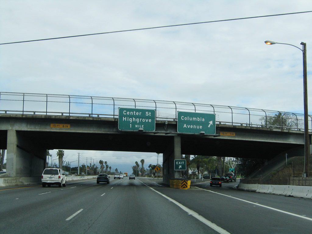
To the University of California at Riverside, use either Exit 31 (Martin Luther King, Jr. Boulevard) or Exit 32 (California 60 Business (University Avenue)). The freeway actually bisects the campus. The next six exits all serve the city of Riverside: Exit 31, Martin Luther King, Jr. Boulevard; Exit 32, California 60 Business (University Avenue); Exit 33, Blaine Street/Third Street; Exits 34A-B, California 60 west and California 91 (Riverside Freeway) west; Exit 35, Columbia Avenue; and Exit 36, Center Street/Highgrove. Photo taken 09/28/08. |
|
Prior to the reconstruction of Interstate 215 and California 60, an interchange served El Cerrito Drive. With the opening of the new Exit 31, Martin Luther King, Jr. Boulevard, the older El Cerrito Drive interchange was eliminated and removed from service. This photo, showing the older advance sign for Exit 32, California 60 Business (University Avenue), also shows the original El Cerrito Drive interchange. The photo above shows the whole area scraped, with the overpass gone. Photo taken 02/20/05. |
|
An Interstate 215 and California 60 reassurance shield assembly used to be posted after the El Cerrito Drive interchange, but the shields are now gone with the elimination of this interchange. Photo taken 02/20/05. |
|
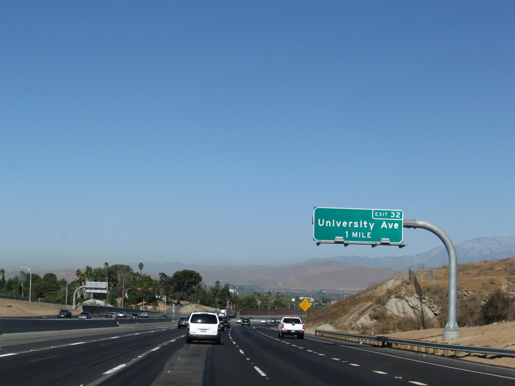
Shortly thereafter, still on a downgrade and prior to Exit 31, is the first solo advance sign for Exit 32, California 60 Business (University Avenue). The off-ramp for Exit 31 is just ahead. Photo taken 09/28/08. |
|
Northbound Interstate 215 (Escondido Freeway) and westbound California 60 (Moreno Valley Freeway) reaches Exit 31, Martin Luther King, Jr. Boulevard. Photo taken 09/28/08. |
|
The left lane continues west as a high occupancy vehicle lane. Through traffic on Interstate 215 north should not use this lane; in fact, Interstate 215 north traffic should begin to merge into the right lanes. The HOV lane only serves California 60 west. Photo taken 09/28/08. |
|
This mileage sign provides the distance to the next four exits along northbound Interstate 215 and westbound California 60: Exit 32, California 60 Business (University Avenue); Exit 33, Blaine Street and Third Street; Exit 34A, Main Street and California 60 west; and Exit 34B, California 91 (Riverside Freeway) west. Photo taken 09/28/08. |
|
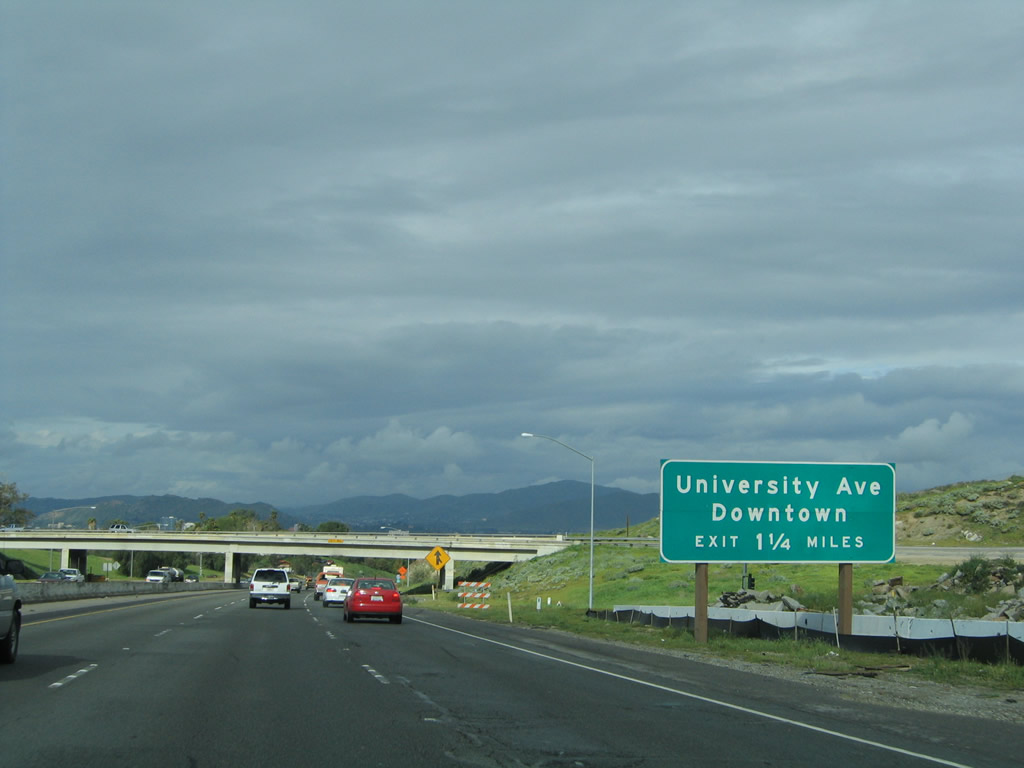
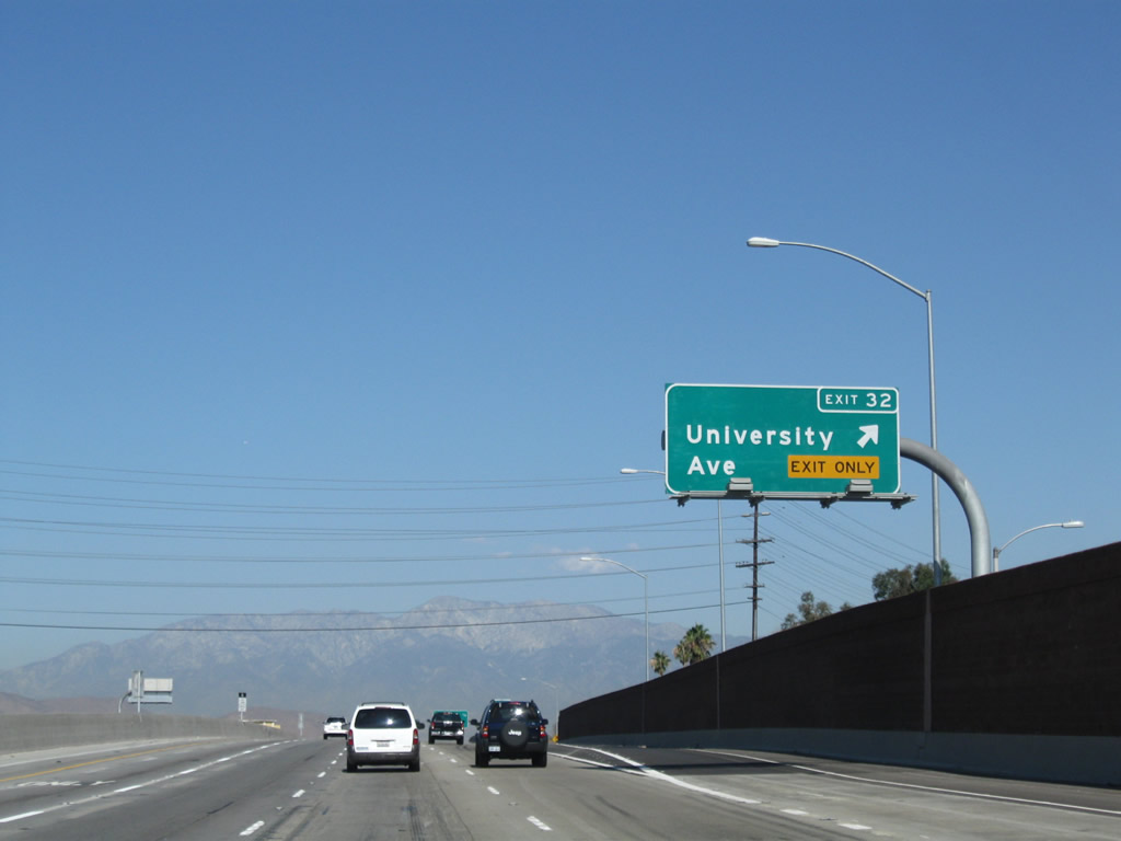
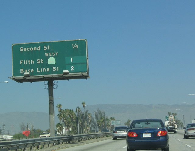
Things have changed dramatically between 2005 and 2009. This is one of the advance signs for Exit 32, University Avenue to downtown Riverside. Photo taken 02/20/05. |
|
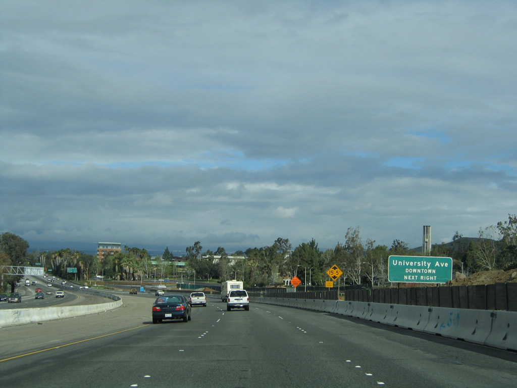
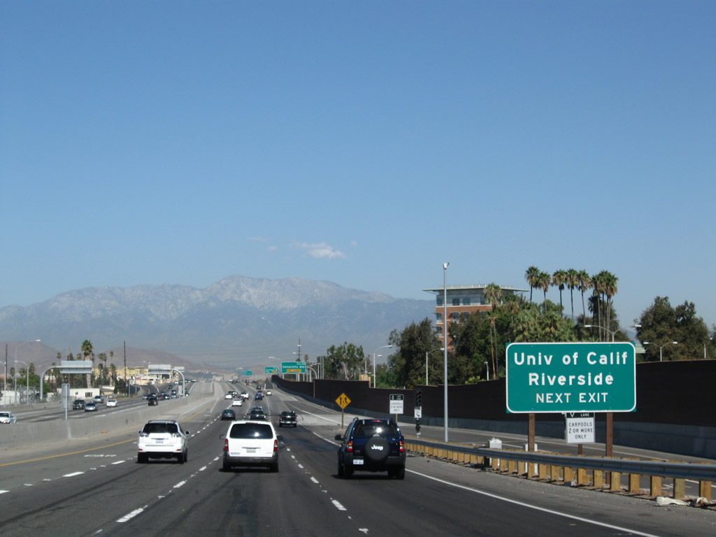
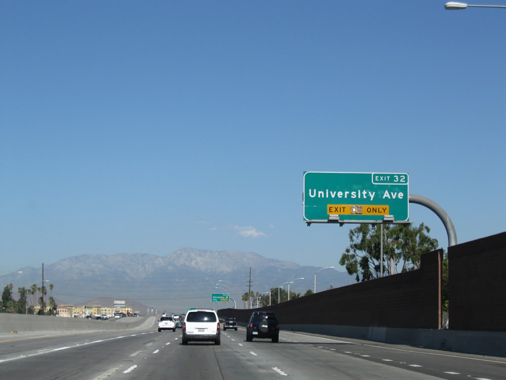
Use Exit 32 to the University of California at Riverside. California 60 Business follows the old alignment of U.S. 60 through downtown Riverside via University Avenue. While U.S. 70-99 roughly followed Interstate 10 through San Bernardino to the north, U.S. 60 strayed south to pass through Riverside. California 60 approximates the route of U.S. 60, but westbound U.S. 60 rejoined U.S. 70-99 at Pomona, while California 60 does not rejoin Interstate 10 until entering East Los Angeles. Photo taken 09/28/08. |
|
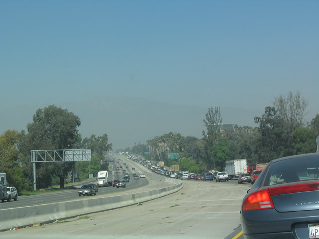
This view of the crowded Moreno Valley Freeway looks northwest as it enters downtown Riverside prior to the reconstruction project that was completed in 2008. Interstate 215 used to have substantial traffic issues through this stretch of freeway through Riverside. Photo taken 03/20/04. |
|
|
The right lane becomes exit only for Exit 32, California 60 Business (University Avenue). Before the reconstruction project, an interchange sequence sign was posted for the next three exits: Exit 32, California 60 Business (University Avenue); Exit 33, Blaine Street/Third Street; and Exits 34A-B, California 60 (Pomona Freeway) west and California 91 (Riverside Freeway) west. Photos taken 09/28/08 and 02/20/05. |
|
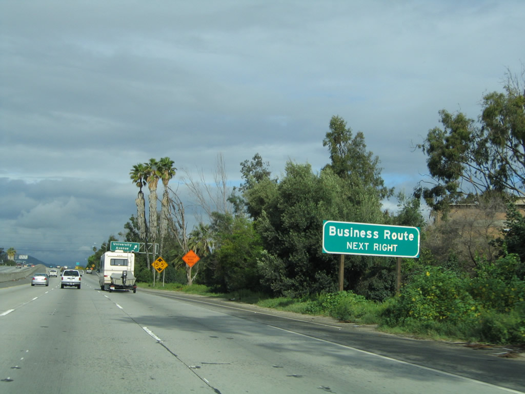
A business route sign was posted prior to Exit 32 along northbound Interstate 215 and westbound California 60 for Exit 32, California 60 Business (University Avenue). This sign was gone after the reconstruction. Photo taken 02/20/05. |
|
|
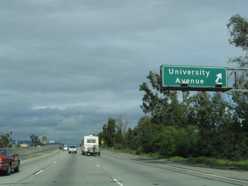
Northbound Interstate 215 and westbound California 60 meet Exit 32, California 60 Business (University Avenue), which travels west to the University of California at Riverside and then continues west into downtown Riverside. Photos taken 09/28/08 and 02/20/05. |
|
|
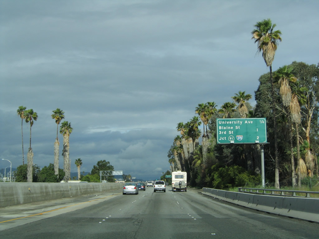
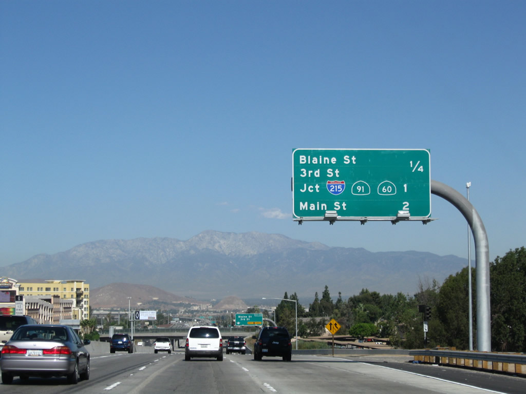
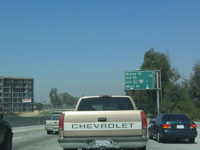
This mileage sign provides the distance to the next three exits on northbound Interstate 215 and westbound California 60: Exit 33, Blaine Street and Third Street; Exit 34A, California 60 (Pomona Freeway) west to Main Street and Orange Street; and Exit 34B, California 91 (Riverside Freeway) southwest to Orange County. Photos taken 09/28/08 and 03/20/04. |
|
The right lane of Interstate 215 north and California 60 west becomes exit only for Exit 33, Blaine Street and Third Street. Photo taken 09/28/08. |
|
|
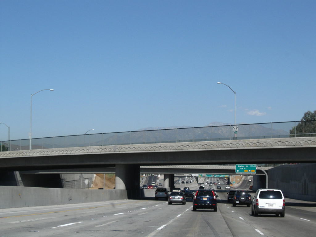
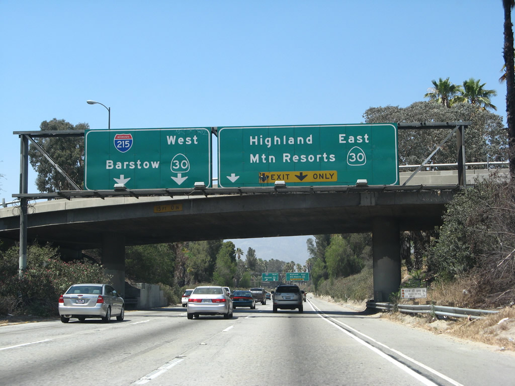
These two photos compare the below-grade segment of Interstate 215 and California 60 before and after the construction project to widen the Moreno Valley Freeway through here. Photos taken 09/28/08 and 03/20/04. |
|
|
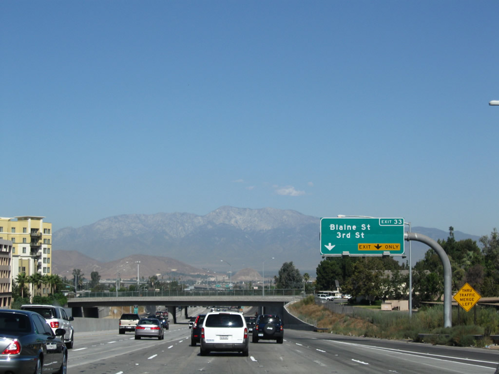
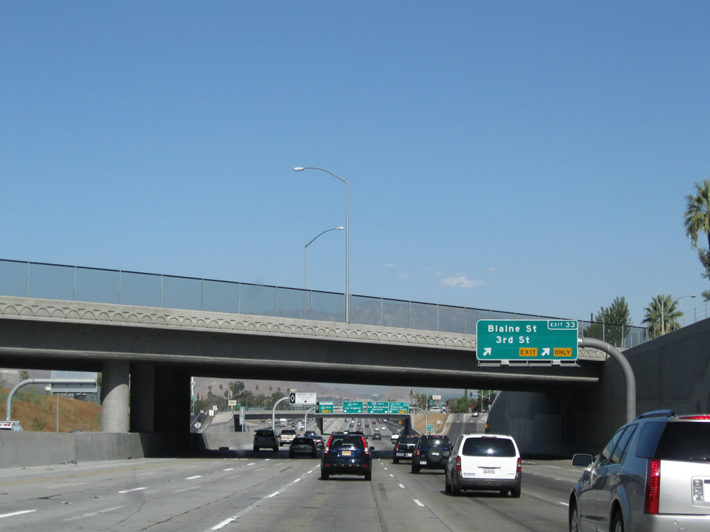
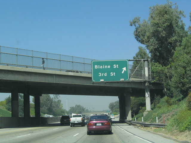
Northbound Interstate 215 and westbound California 60 reach Exit 33, Blaine Street and Third Street to downtown Riverside. Photos taken 09/28/08 and 03/20/04. |
|
At the gore point for Exit 33 is another sign for the entrance to the carpool lane. Photo taken 09/28/08. |
|
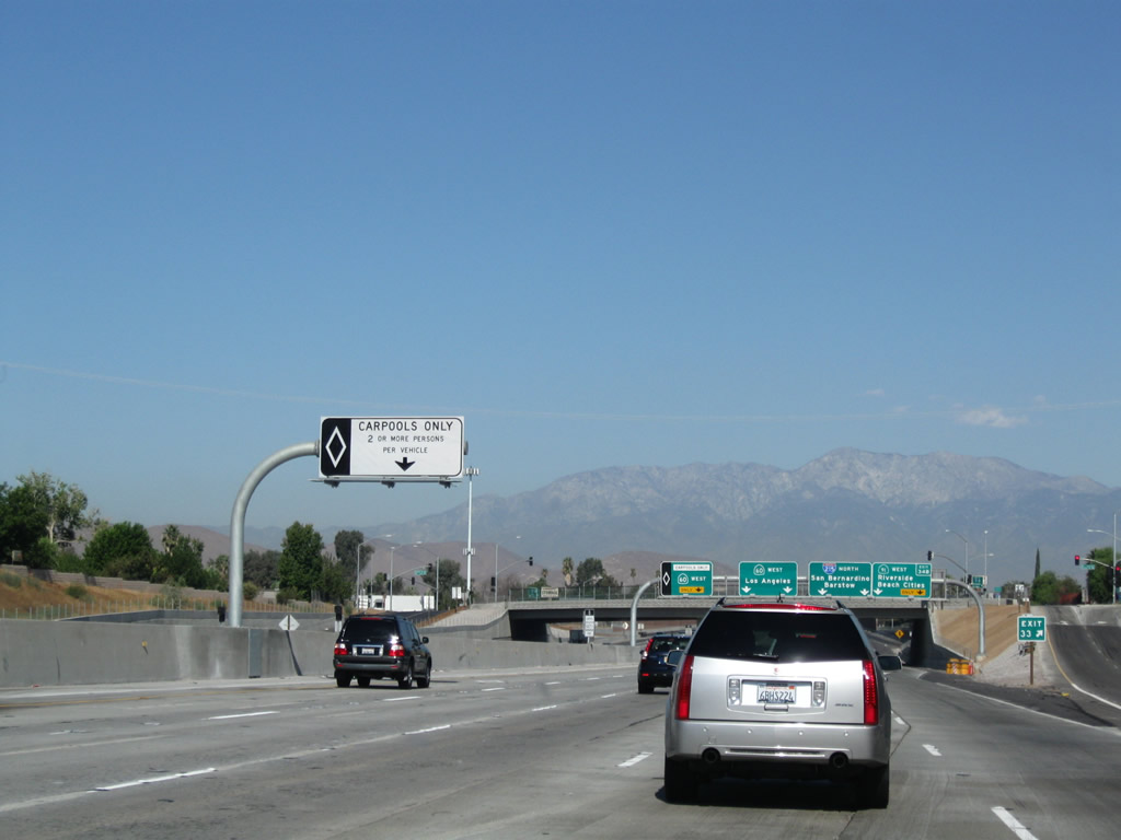
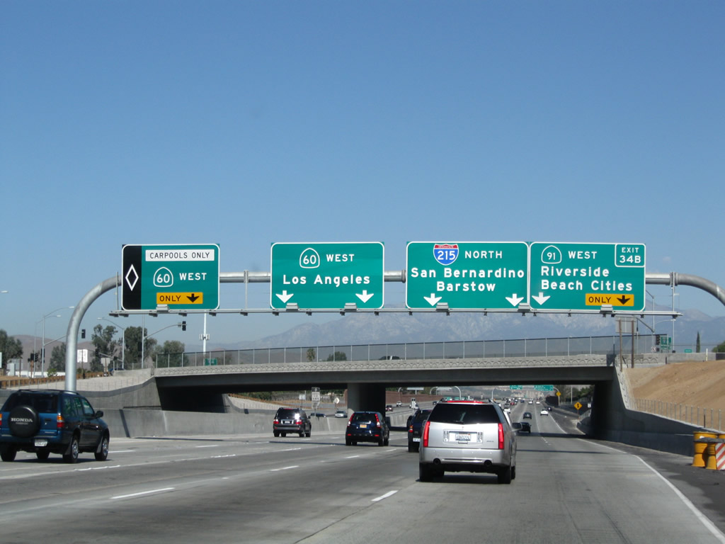
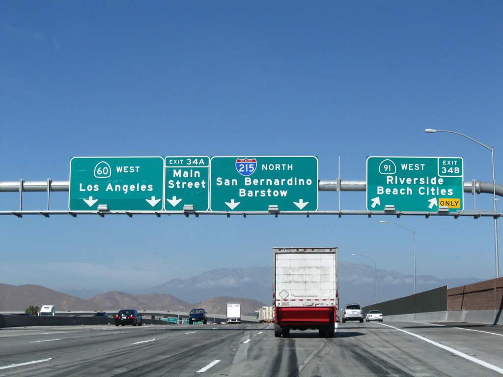
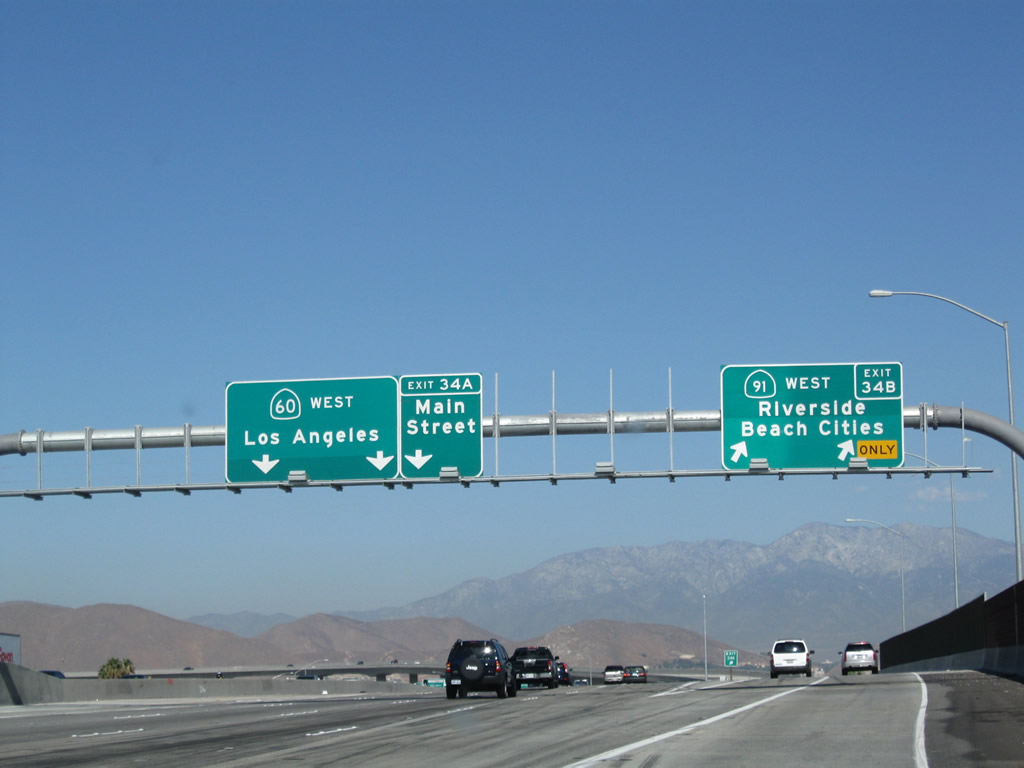
As Interstate 215 north and California 60 prepare to pass under the Blaine Street and Third Street overpass, an array of signs for Exits 34A-B greets motorists. To continue north on Interstate 215, use the center-right two lanes. To California 60 west and Main Street (Exit 34A), stay left or use the HOV lane. To California 91 (Riverside Freeway) west (Exit 34B), use the right two lanes. Despite the exit numbering rules, Exit 34B will be the next exit, not Exit 34A (even though we are traveling north). The exit numbers were originally based on the cloverleaf interchange design. Photo taken 09/28/08. |
|
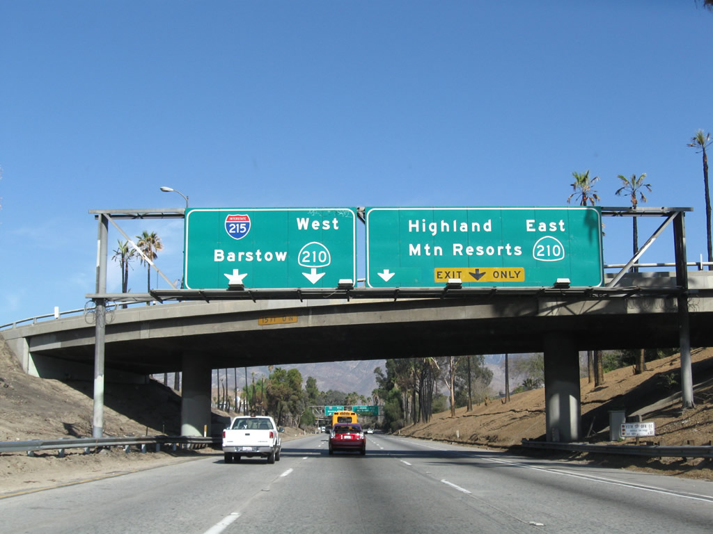
Looking back to 2004, one of the most under-powered interchanges in the Inland Empire used to be the nexus between California 60, California 91, and Interstate 215. Originally built as a cloverleaf, this interchange had been the cause of numerous delays in all directions. While no construction was visible in this 2004 photo, by 2008 the two most needed flyover ramps had been built and opened to traffic. Photo taken 02/20/05. |
|
|
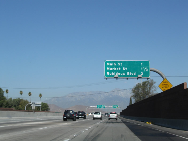
This mileage sign along northbound Interstate 215 and westbound California 60 provides the distance to the next three exits along California 60 west after Exits 34A-B, California 60, California 91, and Interstate 215. The three exits are Main Street (former California 91 Business), Market Street, and Rubidoux Street. Photos taken 09/28/08 and 02/20/05. |
|
|
Northbound Interstate 215 and westbound California 60 reach Exit 34B, California 91 (Riverside Freeway) southwest to Anaheim and Long Beach. The Interstate 215 pull-through sign was missing from the sign rack in the September 2008 photo. Photos taken 11/10/08 and 09/28/08. |
|
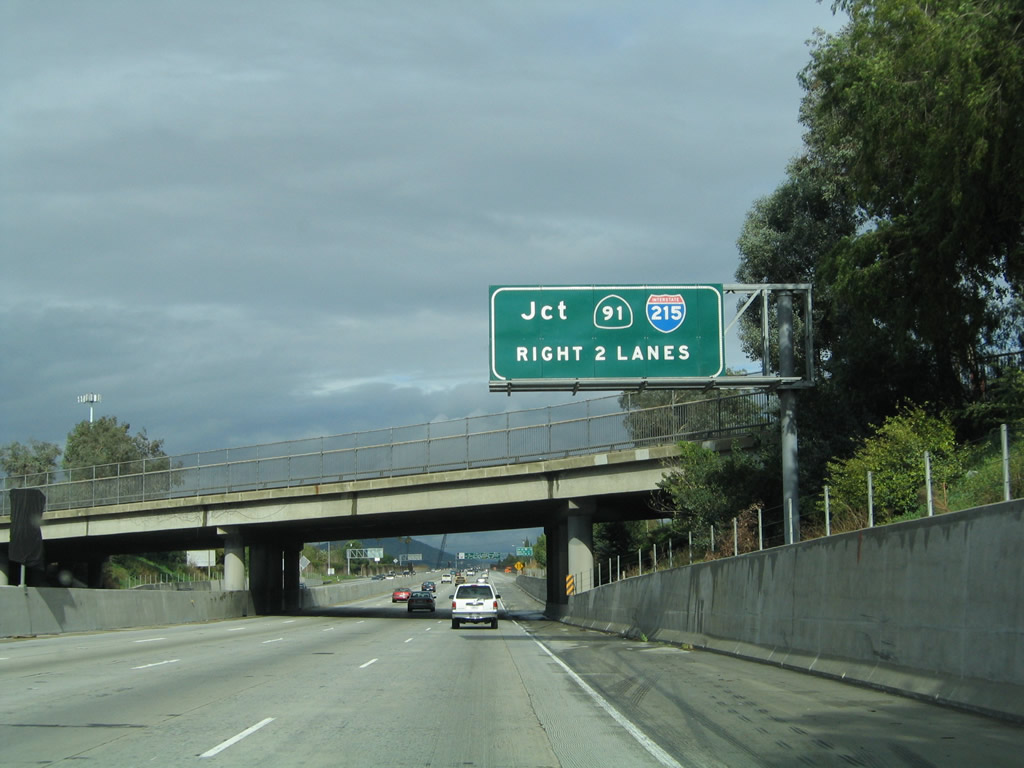
At the gore point for Exit 34B (California 91 west) is this view of the newly improved 60-91-215 interchange. In the distance is the continuation of Interstate 215 north and California 60 west. The gore point sign (Exit 34A) does not match the overhead sign (Exit 34B). Calnexus refers to the California 91 off-ramp as Exit 34B. Photo taken 09/28/08. |
|
|
|
This suite of pictures shows the transition from Interstate 215 north to California 91 southwest. Based on our odometer, this flyover ramp is over a mile in length! A the end of the ramp, the two lanes merge onto California 91 prior to the Mission Inn Avenue interchange. Photos taken 09/28/08. |
|
|
|
|
|
|
|
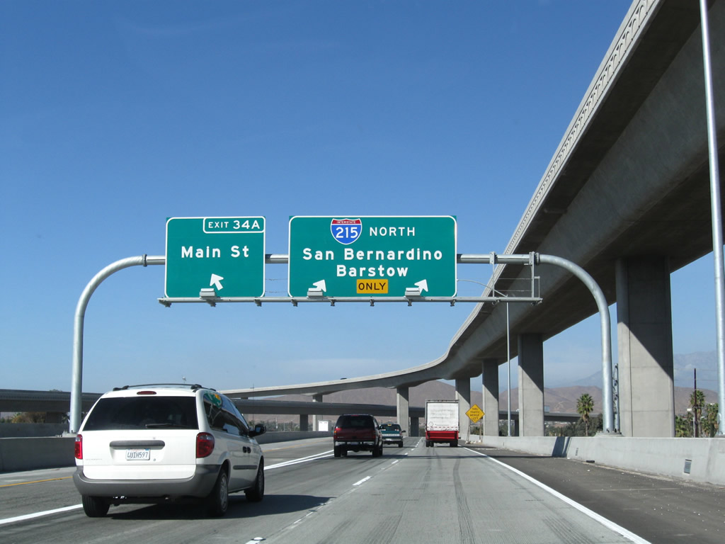
After the split with California 91, the next exit is Exit 34A, California 60 west to Pomona and Los Angeles and Main Street. This "exit" actually consists of two exits: the left three lanes continue west on California 60, while the right three lanes connect to Main Street and act as the mainline for Interstate 215 north. Photo taken 11/10/08. |
|
The three-lane ramp splits immediately thereafter, with the left lane of the ramp connecting to Exit 34A, Main Street, and the right two lanes continue as the mainline for Interstate 215 north. Photo taken 11/10/08. |
|
Above the gore point for Exit 34A (Main Street) is the towering transition ramp to California 91 (Riverside Freeway) west. Photo taken 11/10/08. |
|
Despite the reconstructed interchange, Interstate 215 north still narrows to one lane as the mainline freeway prepares to merge with California 91 (Riverside Freeway) east. Interstate 215 will now assume the Riverside Freeway designation. Photo taken 11/10/08. |
|
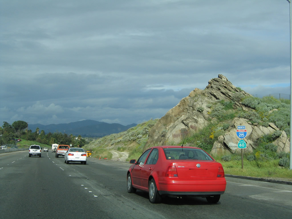
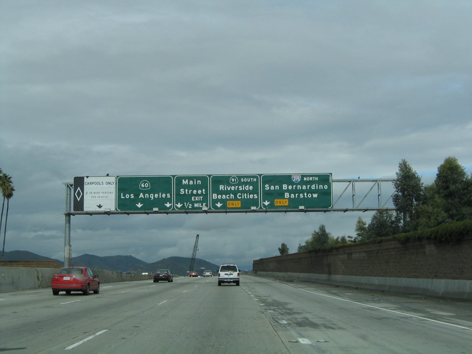
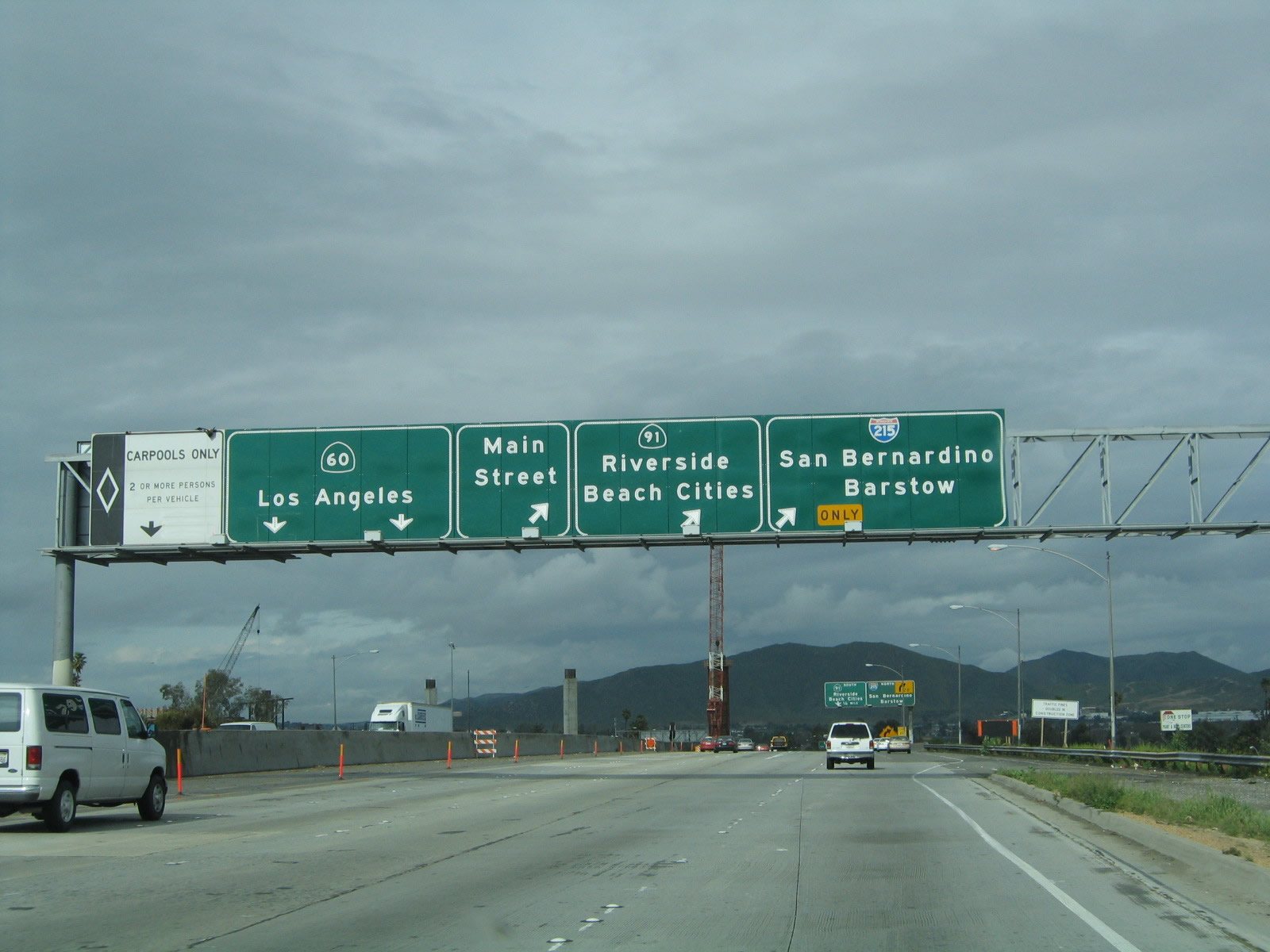
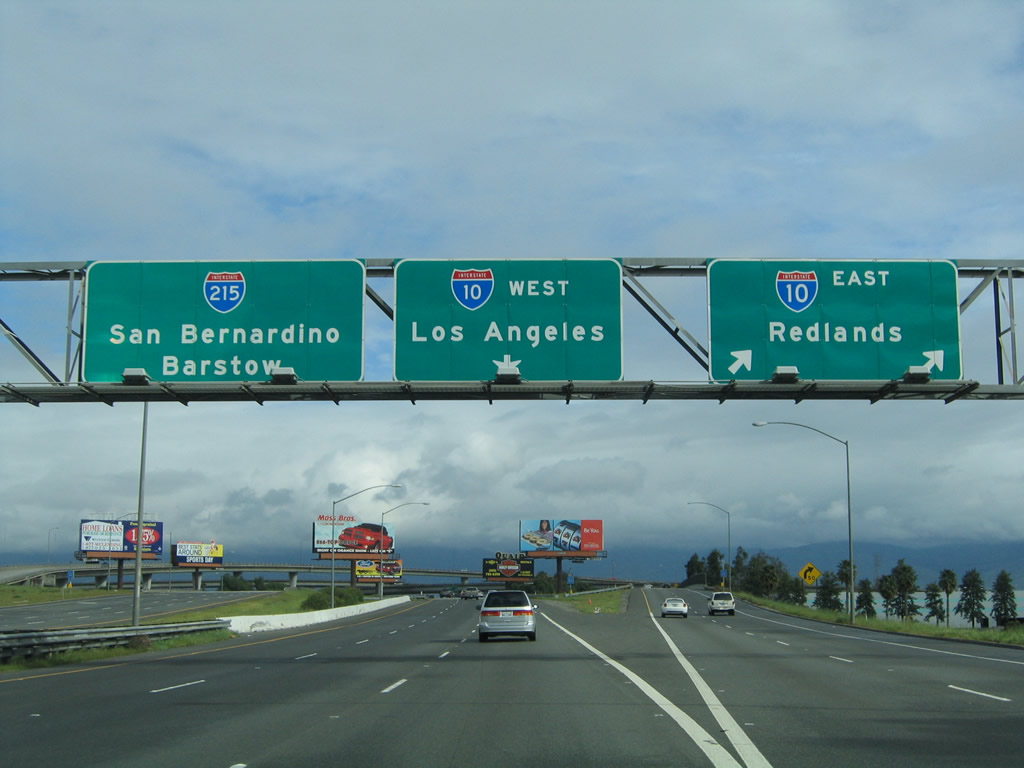
Looking back to 2005 and old configuration of the 60-91-215 interchange, the far right lane used to take Interstate 215 north; the #4 lane was exit only for California 91; and the remaining three lanes carry through traffic for California 60 west. This interchange is one reason why California 60 is not a good alternative to Interstate 10 and why Interstate 215 is not a good alternative to Interstate 15. Photo taken 02/20/05. |
|
Back in 2004, traffic ground to a halt as Interstate 215 and California 60 prepare to split and California 91 launches southwest toward Orange County and coastal Los Angeles County. California 60 is a "left exit" here, as it takes Exit 34A from northbound. The ramps to California 91 and former California 91 Business/Main Street are treated as part of the ramp system departing from California 60 after Exit 34A. Confused yet? Photo taken 02/20/05. |
|
|
Looking back during the construction project, Interstate 215 and California 60 split at this point. The 2007 photo shows the area under construction. Still back in 2004, northbound Interstate 215 reaches Exit 34A, California 60 west to Exit 34B, California 91 west (left exit). Of course, this exit looks more like California 60 continues along the mainline and Interstate 215 exits, but that was a temporary condition until this underwhelming cloverleaf was reconstructed and replaced. Photos taken 06/24/07 and 02/20/05. |
|
In this close-up of the previous sign (which is now gone), note the outline of the U.S. 395 shield that is still visible today. It is possible (but unlikely) that an Interstate 15E shield also graced this sign. Photo taken 03/20/04. |
|
Interstate 215 northbound narrows to one lane as it navigated the cloverleaf interchange with California 91; this is merely the connector from westbound California 60 to onto the Riverside Freeway. The Escondido Freeway designation for Interstate 215 ends at this point. Photo taken 03/20/04. |
| To continue west on California 60 freeway, go to California 60 west. |
| Interstate 215/Riverside Freeway north |
|
|
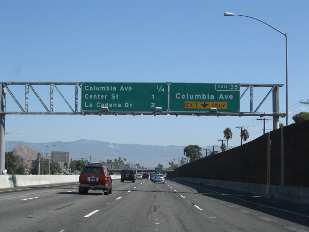
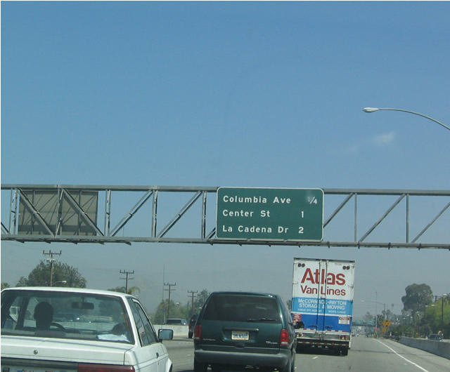
After Interstate 215 north and California 91 east merge together, this mileage sign along northbound Interstate 215 provides the distance to the next three exits: Exit 35, Columbia Avenue; Exit 36, Columbia Avenue; and Exit 37, La Cadena Drive. The right lane becomes exit only for Exit 35, Columbia Avenue (sign added as part of the 60-91-215 interchange project). Photos taken 09/28/08 and 03/20/04. |
|
This reassurance shield for northbound Interstate 215 used to be posted prior to the Columbia Avenue exit. Photo taken 03/20/04. |
|
|
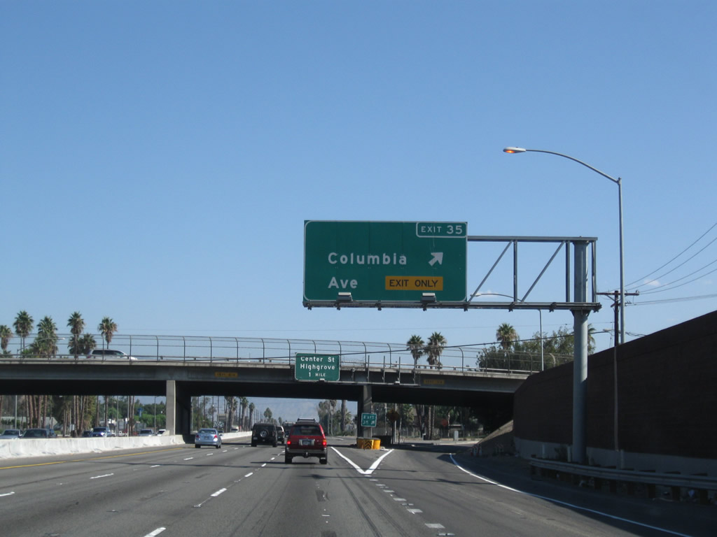
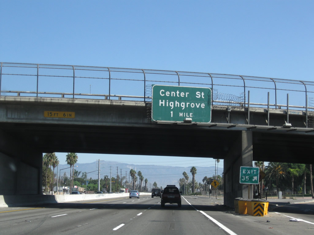
Northbound Interstate 215/Riverside Freeway reaches Exit 35, Columbia Avenue. The next exit is Exit 36, Center Street to Highgrove. Photos taken 09/28/08 and 02/20/05. |
|
The next exit along Interstate 215/Riverside Freeway north is Exit 36, Center Street (one mile). The empty sign bracket for the former Exit 35 sign shown in the previous 2004 photo still has a light fixture attached to it. Photo taken 09/28/08. |
|
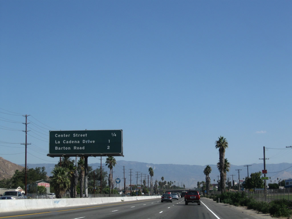
This mileage sign along northbound Interstate 215 provides the distance to Exit 36, Center Street; Exit 37, La Cadena Drive; and Exit 38, Barton Road. Photo taken 09/28/08. |
|
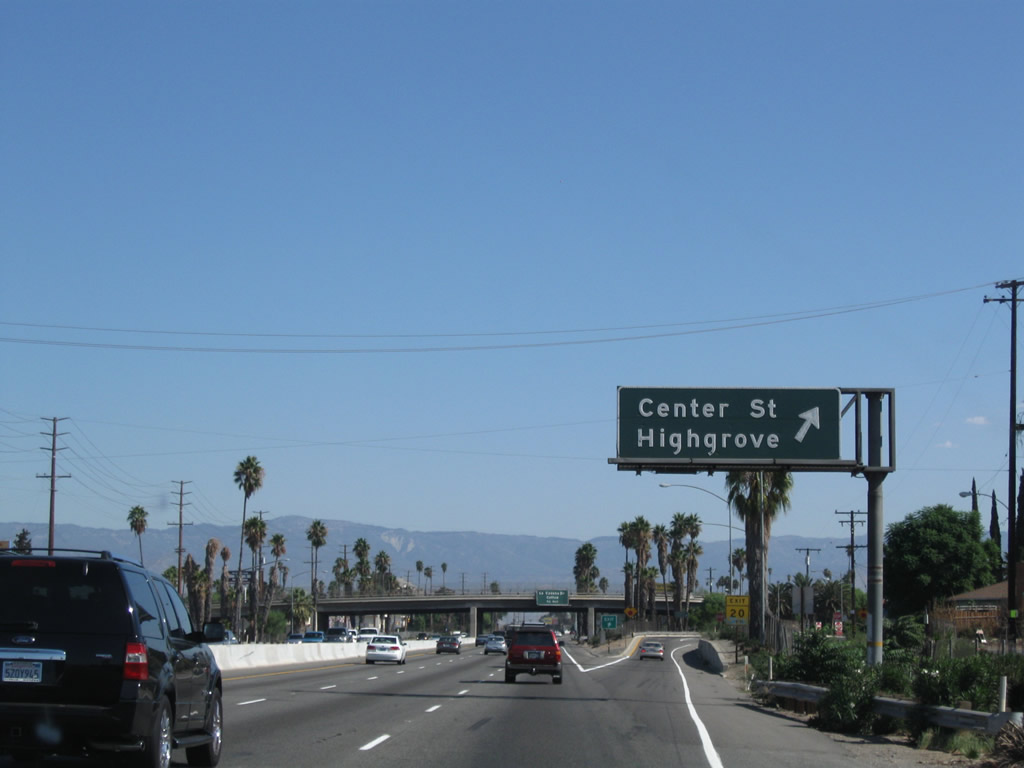
Northbound Interstate 215 at Exit 36, Center Street, which heads east toward the community of Highgrove. Photo taken 09/28/08. |
|
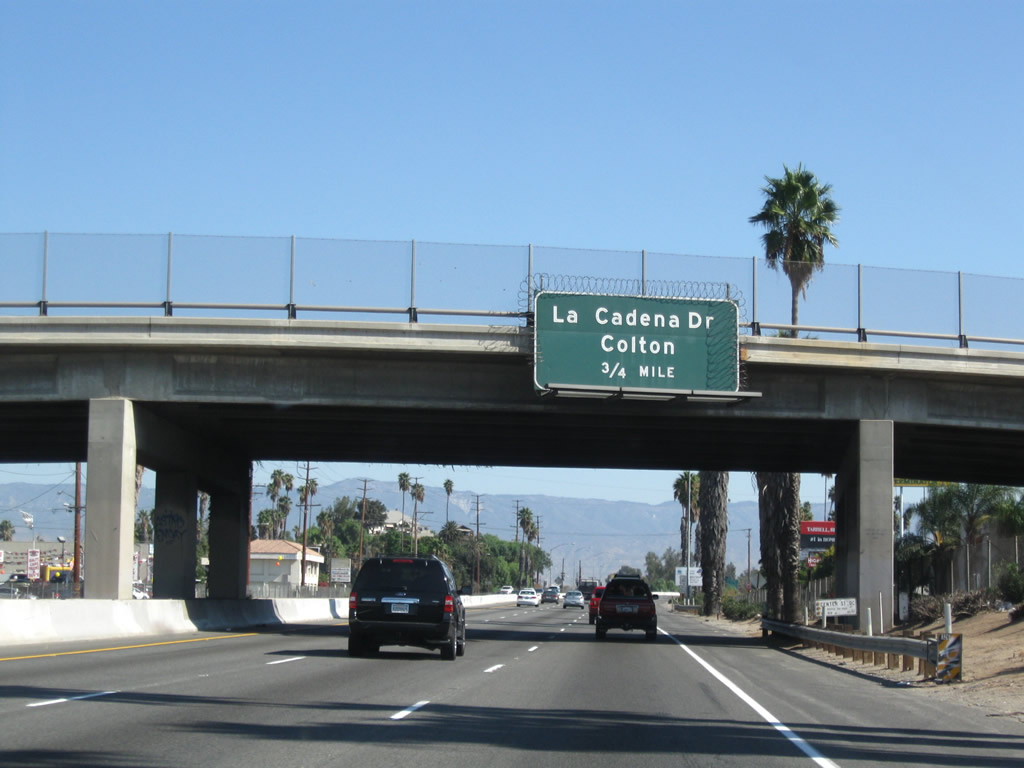
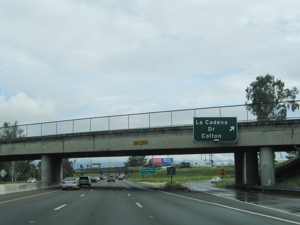
The next exit along northbound is Exit 37, La Cadena Drive (Old U.S. 91-395), which serves the cities of Colton and Grand Terrace in San Bernardino County. Photo taken 09/28/08. |
|
Interstate 215 leaves Riverside County and the city of Riverside and enters San Bernardino County and the city of Colton. Photo taken 09/28/08. |
|
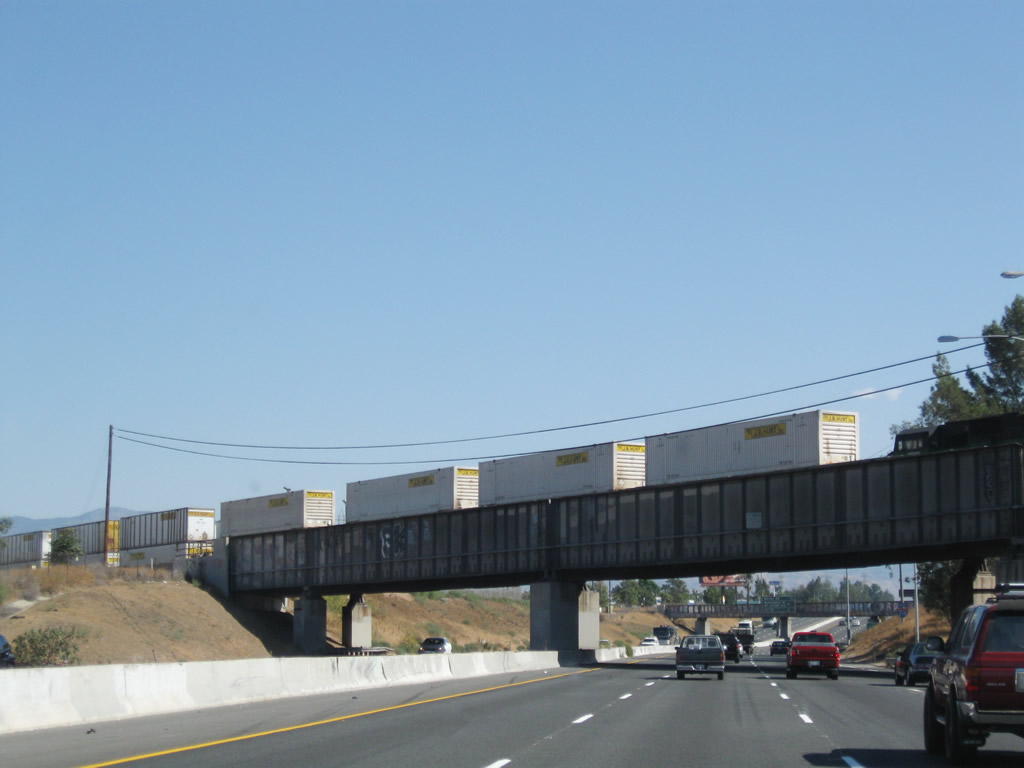
A railroad track crosses over Interstate 215 on this bridge. Photo taken 09/28/08. |
|
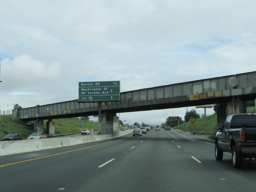
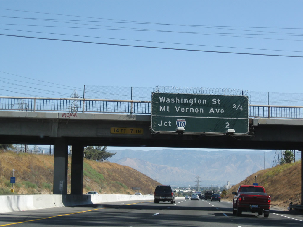
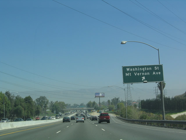
This mileage sign along northbound Interstate 215 provides the distance to the next three exits: Exit 37, La Cadena Drive; Exit 38, Barton Road; and Exit 39, Washington Street/Mount Vernon Avenue. Photo taken 02/20/05. |
|
Northbound Interstate 215/Riverside Freeway reaches Exit 37, La Cadena Drive. Photo taken 02/20/05. |
|
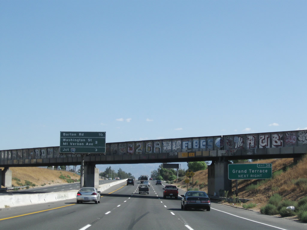
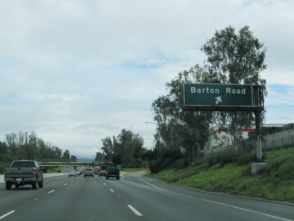
The next exit along Interstate 215/Riverside Freeway north is Exit 38, Barton Road to Grand Terrace. Photo taken 02/20/05. |
|
|
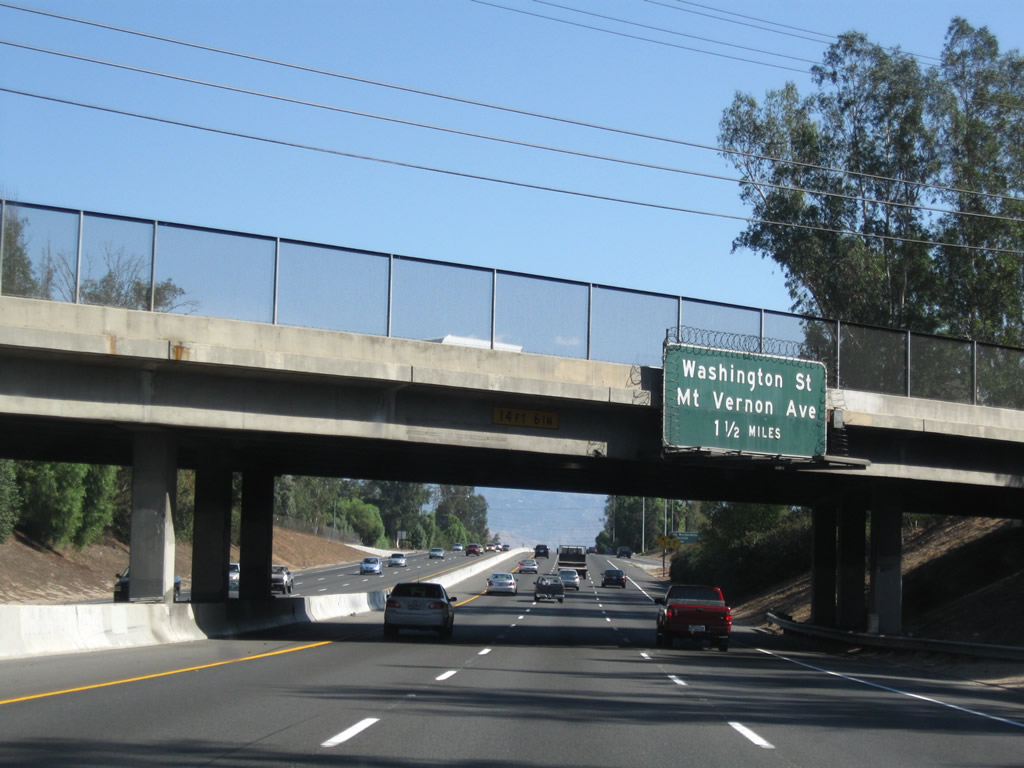
Another mileage sign along northbound for the next four exits: Exit 38, Barton Road; Exit 39, Washington Street/Mount Vernon Avenue; and Exit 40A-B, Interstate 10. Use Exit 38 to the city of Grand Terrace, which is known as the Blue Mountain City (so named due to its location between Blue Mountain to the east, and La Loma Hills to the west). As of the 2000 Census, the population of Grand Terrace was 11,626 and consisted of 3.5 square miles. Grand Terrace was incorporated in 1978. Photos taken 09/28/08 and 02/20/05. |
|
Northbound Interstate 215/Riverside Freeway reaches Exit 38, Barton Road to the city of Grand Terrace. Photo taken 02/20/05. |
|
The next exit along northbound is Exit 39, Mount Vernon Avenue and Washington Street. Photo taken 09/28/08. |
|
This mileage sign along northbound Interstate 215/Riverside Freeway provides the distance to the next three exits: Exit 39, Washington Street/Mount Vernon Avenue and Exits 40A-B, Interstate 10. Photo taken 09/28/08. |
|
Interstate 215 descends from Grand Terrace into the city of Colton. Photo taken 03/20/04. |
|
Several 230kV and 138kV power lines cross over Interstate 215 adjacent to a hilltop substation. Ahead, the freeway will descend into the valley containing San Bernardino. Photo taken 09/28/08. |
|
Northbound Interstate 215/Riverside Freeway reaches Exit 39, Washington Street and Mount Vernon Avenue. Photo taken 03/20/04. |
|
The next exit along northbound is Exits 40A-B, Interstate 10. As the primary east-west freeway from the desert to the Inland Empire and Los Angeles Basin, Interstate 10 is frequently congested. California 210 acts as an alternate route to avoid troublesome commutes and delays on weekends. Note that the signs were replaced in 2000 with reflective signs; these signs were installed prior to the decision to implement an exit numbering system in California. Photo taken 02/20/05. |
|
|
This mileage sign along northbound Interstate 215 provides the distance to the next three exits: Exit 40A, Interstate 10 east; Exit 40B, Interstate 10 west; and Exit 41, Orange Show Road and Auto Plaza Drive. Photos taken 09/28/08 and 02/20/05. |
|
Northbound Interstate 215/Riverside Freeway reaches Exit 40A, Interstate 10 east to Redlands, Palm Springs, Indio, and Phoenix. The next exit (Exit 40B) serves westbound Interstate 10 to Los Angeles and Santa Monica. Photo taken 02/20/05. |
|
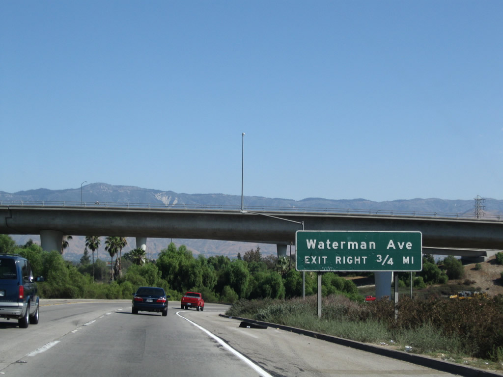
Now on the transition ramp from Interstate 215 north to Interstate 10 east, there is a connection to Waterman Avenue, which is the next exit on Interstate 10 east (Exit 73A). Photo taken 09/28/08. |
|
Immediately thereafter, northbound Interstate 215 reaches Exit 40B, Interstate 10 (San Bernardino Freeway) west to Los Angeles. Unlike the interchange with California 60, this interchange is a stack interchange with flyover ramps. At this point, Interstate 215 leaves the city of Colton and enters the city of San Bernardino. Photo taken 02/20/05. |
| Interstate 215 (San Bernardino Freeway) north |
|
After the Interstate 10 stack interchange, Interstate 215 leaves the Riverside Freeway and becomes part of the final distance of the San Bernardino Freeway. The next exit along northbound Interstate 215 is Exit 41, Orange Show Road and Auto Plaza Drive. This segment of Interstate 215 (from Interstate 10 to California 210) has been under construction for freeway widening/expansion. We'll update this section of the route once the construction activities are complete. Photo taken 11/14/04. |
|
Orange Show Road travels east from this interchange, connecting with South E Street and South Waterman Avenue. Auto Plaza Drive heads southwest to end at Fairway Drive just north of Interstate 10. Photo taken 11/14/04. |
|
Northbound Interstate 215 (San Bernardino Freeway) reaches Exit 41, Orange Show Road and Auto Plaza Drive. Photo taken 11/14/04. |
|
As Interstate 215 approaches Exit 42A, through traffic should remain in the left three lanes. The number five lane is exit only onto Exit 42A, while the number four lanes ahead. Photo taken 06/24/07. |
|
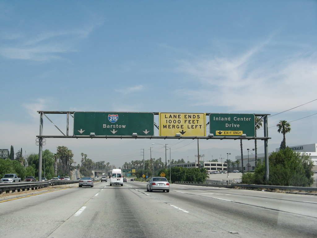
Northbound Interstate 215 (San Bernardino Freeway) reaches Exit 42A, Inland Center Drive. Photo taken 06/24/07. |
|
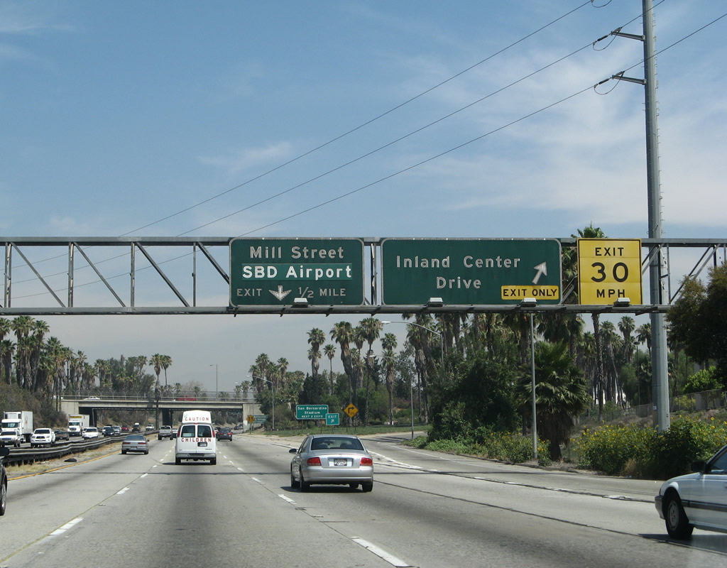
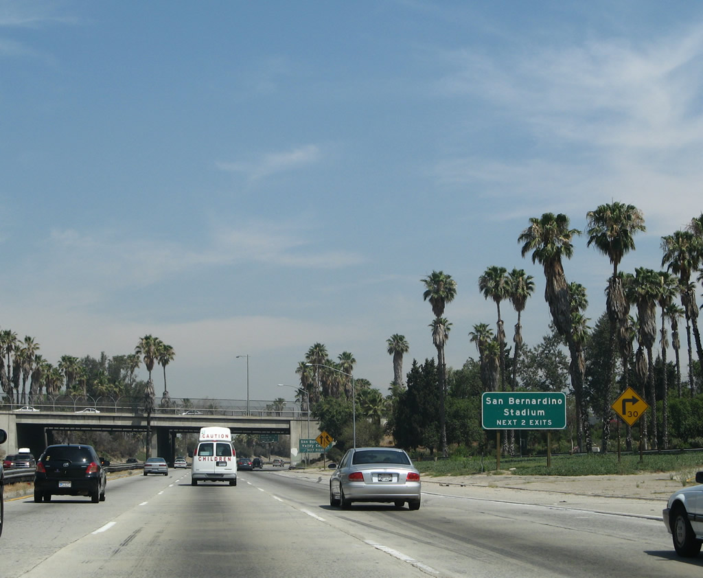
After the off-ramp to Exit 42A, this auxiliary sign advises that the next two exits (Exit 42B and Exit 43) can be used for San Bernardino Stadium. Photo taken 06/24/07. |
|
Exit 42B also serves San Bernardino Community College. Photo taken 06/24/07. |
|
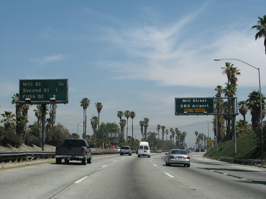
This mileage sign provides the distance to the next three exits along northbound Interstate 215: Exit 42B, Mill Street/San Bernardino Airport; Exit 43, Second Street/Civic Center; and Exit 44A, California 66 (Fifth Street) west and Fifth Street east. The right lane becomes exit only for Exit 42B. Photo taken 06/24/07. |
|
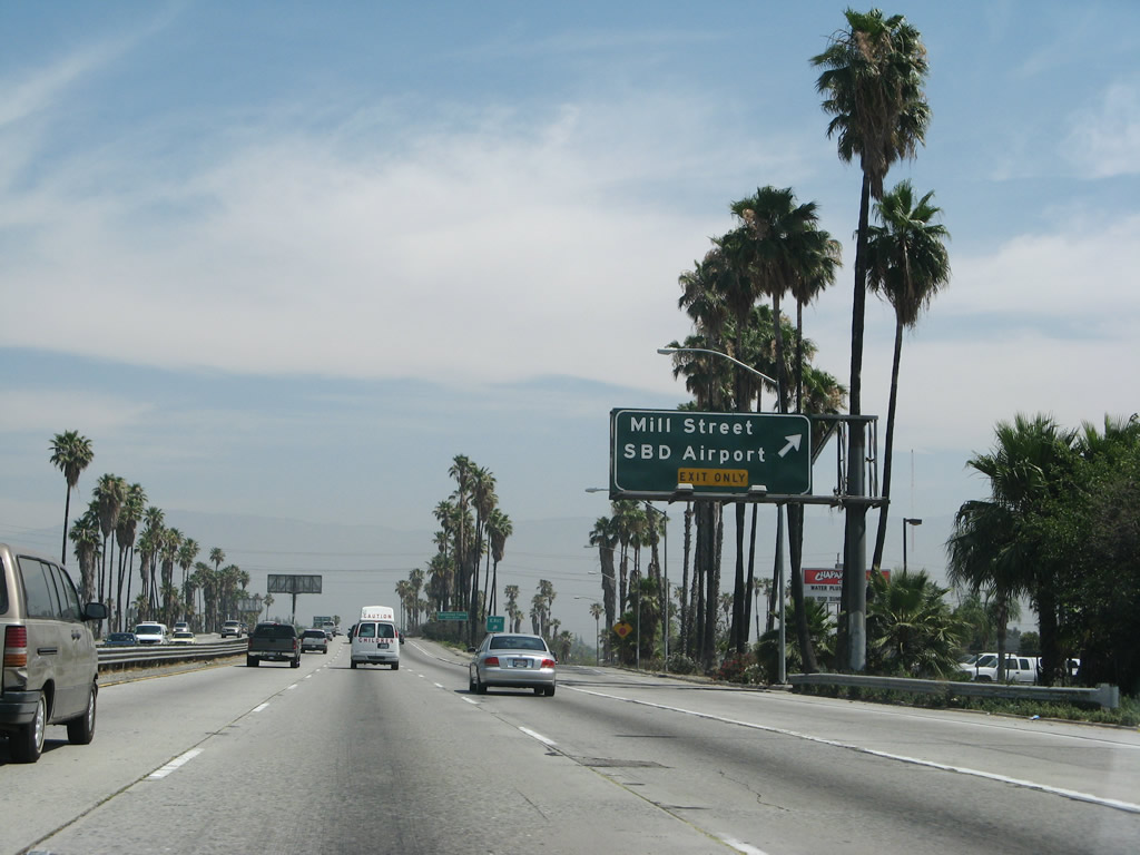
Northbound Interstate 215 (San Bernardino Freeway) reaches Exit 42B, Mill Street and the San Bernardino Airport. Photo taken 06/24/07. |
|
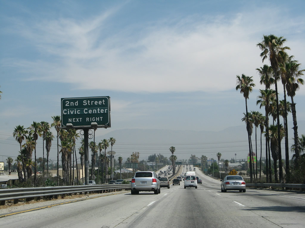
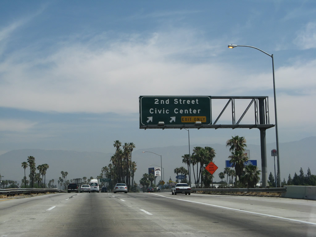
The next exit is Exit 43, Second Street to downtown San Bernardino and the Civic Center. It is not clear why this sign says "next right" since there are three more advance guide signs! Photo taken 06/24/07. |
|
Northbound Interstate 215 approaches Exit 43, Second Street/Civic Center, in San Bernardino, three-eighths of a mile. Photo taken 06/24/07. |
|
|
Use Second Street to downtown San Bernardino and the Civic Center. The next exit after that is Exit 44A, California 66 (Fifth Street) west. The California 66 shield was so faded that it was rendered illegible in the 2004 photo, but it was replaced for the 2007 photo. Photos taken 06/24/07 and 03/20/04. |
|
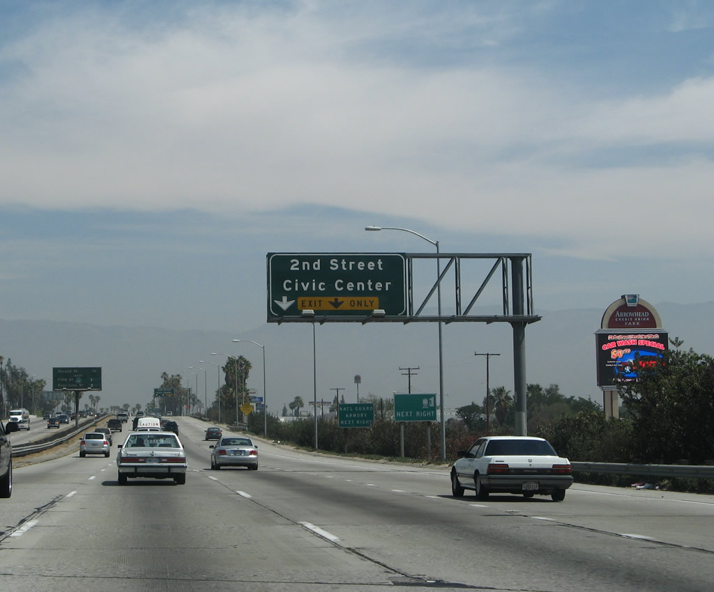
Northbound Interstate 215 (San Bernardino Freeway) reaches Exit 43, Second Street/Civic Center, in San Bernardino. Photo taken 06/24/07. |
|
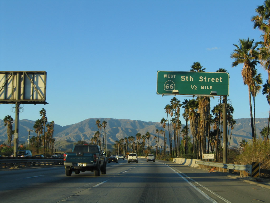
The next exit along Interstate 215 north is Exit 44A, California 66 (Historic U.S. 66)/Fifth Street as it crosses over Second Street (accessible from Exit 43). Historically, U.S. 66 followed a couple of different routes through San Bernardino. The historic route markers are generally posted on Cajon Boulevard and Mount Vernon Avenue, implying that U.S. 66 did not as far east as Interstate 215. Photo taken 11/14/04. |
|
Northbound Interstate 215 (San Bernardino Freeway) reaches Exit 44A, California 66 west and Fifth Street into downtown San Bernardino. The ramp speed is set to 25 mph due to the sharp curve in the off-ramp. Photo taken 02/20/05. |
|
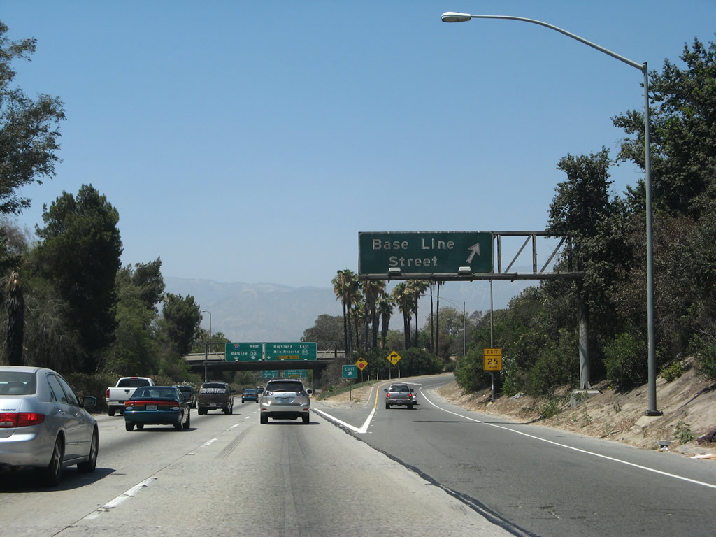
The next exit along northbound Interstate 215 is Exit 44B, Base Line Street, 0.75 mile. Photo taken 06/24/07. |
|
Since the right lane eventually defaults onto eastbound California 210 via northbound California 259, through traffic is advised to use the two left lanes for Interstate 215. Photo taken 06/24/07. |
|
Baseline Street is an integral part of the street grid network in San Bernardino; however, this exit ramp actually accesses West 13th Street and H Street. Take H Street south to reach Baseline Street. Photo taken 06/24/07. |
|
Since Interstate 215 is very narrow with several lanes that will convert to "exit only," this sign reminds through traffic to use the two left lanes. Note the new control city of Barstow. The third lane will become exit-only onto California 210 (former California 30). Photo taken 06/24/07. |
|
Northbound Interstate 215 reaches Exit 44B, Base Line Street. Base Line Street westbound changes into Base Line Road, part of which was California 30 in other parts of San Bernardino County. The signage for the California 210/30 freeway is visible in the background. Photo taken 06/24/07. |
|
|
After the Base Line Street exit, the next exit along Interstate 215 is Exit 45A, California 259 north to California 210 (Foothill Freeway) east. These new reflective signs, found along northbound after Exit 44B, are a little bit off from normal sign specifications. First, the directional indicator is shown in the same font as the control cities in mixed case. Second, the shields are very angular, unlike the more common "bubble shields" found on modern overhead signs. Finally, no control city is listed for California 210 east. The 2007 photo shows the California 30 designation; the 2008 photo shows the California 210 designation. Photos taken 11/10/08 and 06/24/07. |
|
|
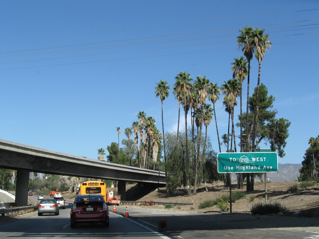
Northbound Interstate 215 splits with California 259. Use California 259 north to California 210 east. The "ramp" that connects northbound Interstate 215 with eastbound California 210 (former California 30) is actually its own state route -- California 259 -- with its own exit at Highland Avenue. The overhead signs do not mention this designation, but it does appear on some road maps, including Thomas Guide. The exit to California 210 west is another couple miles north of Exit 45A. Photos taken 11/10/08 and 06/24/07. |
|
|
This photo shows the beginning of northbound California 259 as seen at the Exit 45A split. Interstate 215 northbound veers off to the left. To California 210 (Foothill Freeway) west, use Highland Avenue (former California 30). A high-speed direct ramp will begin construction in 2009 for this missing link. Photos taken 11/10/08 and 06/24/07. |
| Interstate 215 (Barstow Freeway) north |
|
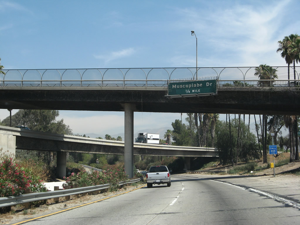
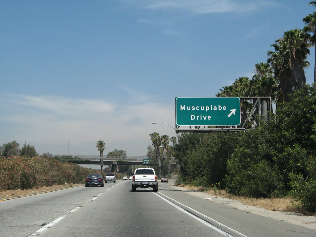
The next exit along northbound is Exit 45B, Muscupiabe Drive. After the California 259 split, Interstate 215 becomes known as the Barstow Freeway. Photo taken 06/24/07. |
|
|
Interstate 215 only has two northbound lanes after the California 259 split. At one time, this stretch of freeway was signed as U.S. 66-91-395 north. Vegetation was cleared along the freeway due to planned widening, so the southbound left exit ramp is now visible. Photos taken 11/10/08 and 06/24/07. |
|
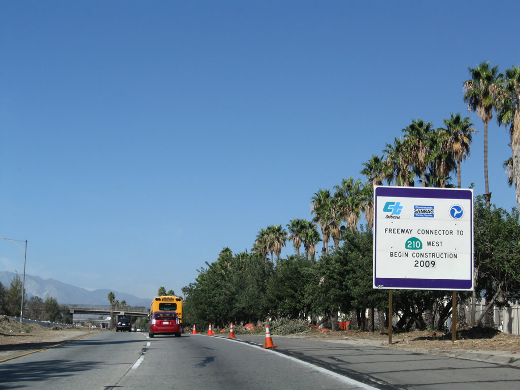
A construction sign advises of the proposed connector ramp to be under construction in 2009 from Interstate 215 to California 210 west. Photo taken 06/24/07. |
|
Northbound Interstate 215 reaches Exit 45B, Muscupiabe Drive. The next exit is Exit 46A, former California 30/Highland Avenue west. Photo taken 06/24/07. |
|
|
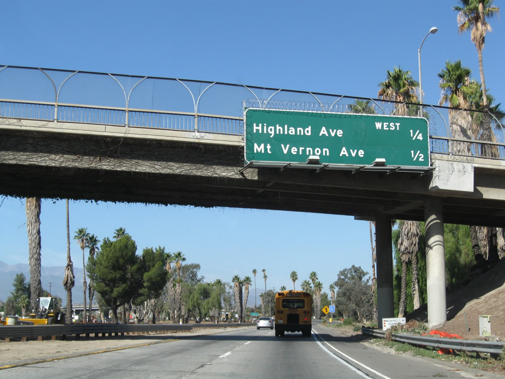
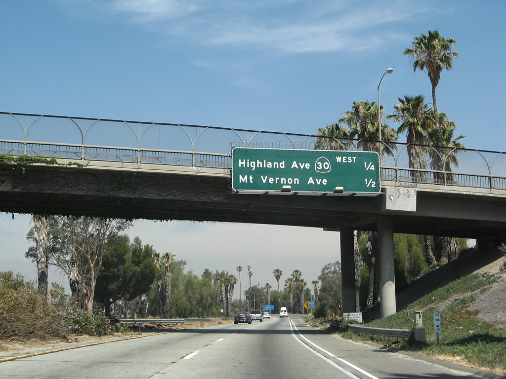
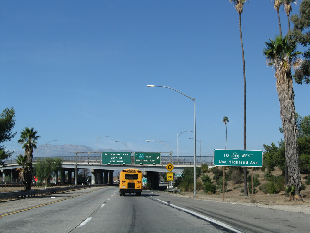
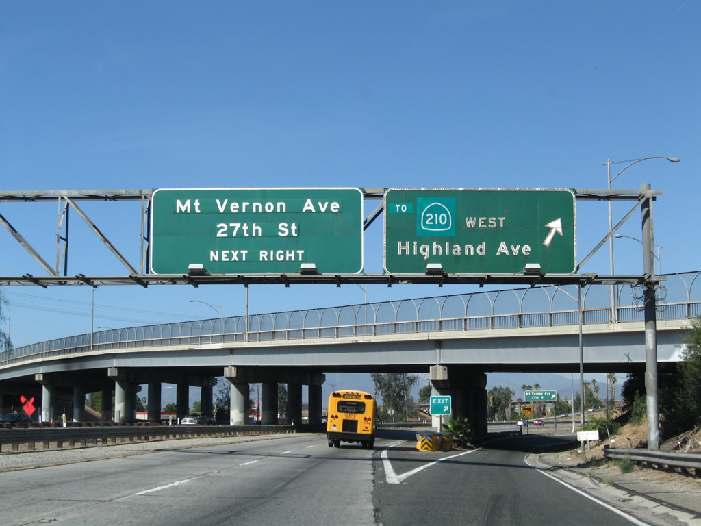
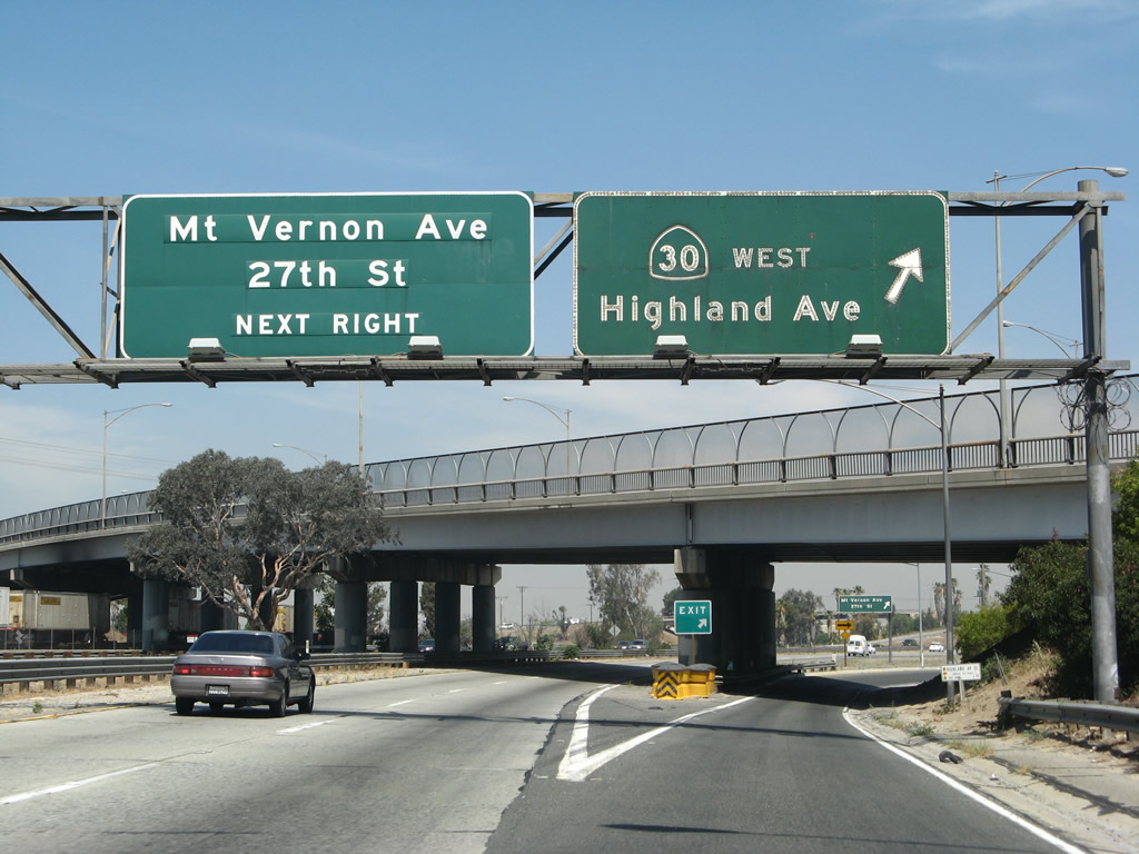
The next two exits are Exit 46A, former California 30/Highland Avenue west and Exit 46B, Mount Vernon Avenue and 27th Street. Photos taken 11/10/08 and 06/24/07. |
|
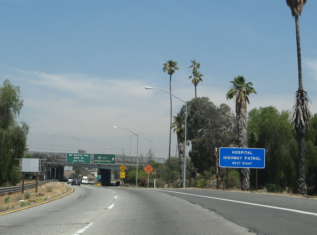
Use Highland Avenue west to a California Highway Patrol (CHP) station and the Community Hospital of San Bernardino. Photo taken 06/24/07. |
|
The temporary connection from Interstate 215 north to California 210 west is currently via Highland Avenue (formerly California 30). Photo taken 11/10/08. |
|
|
Northbound Interstate 215 (Barstow Freeway) reaches Exit 46A, former California 30/Highland Avenue west. With the completion of the California 210 freeway in 2007, California 30 was decommissioned, and California 210 has essentially replaced California 30. The next exit is Exit 46B, Mount Vernon Avenue and 27th Street. Photos taken 11/10/08 and 06/24/07. |
|
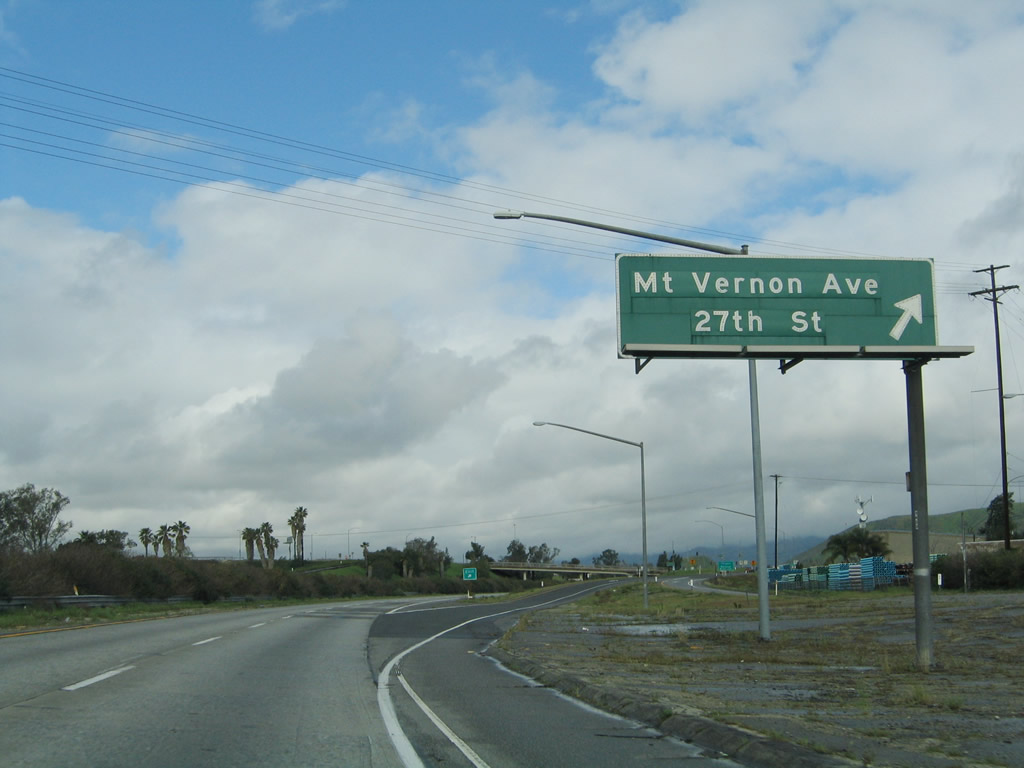
Soon thereafter, northbound Interstate 215 (Barstow Freeway) reaches Exit 46B, Mount Vernon Avenue and 27th Street. Mount Vernon Avenue is Old U.S. 66 heading south through San Bernardino; it connects to the southern end of Cajon Boulevard. Photo taken 02/20/05. |
|
This Interstate 215 north reassurance shield was posted shortly thereafter. Photo taken 02/20/05. |
|
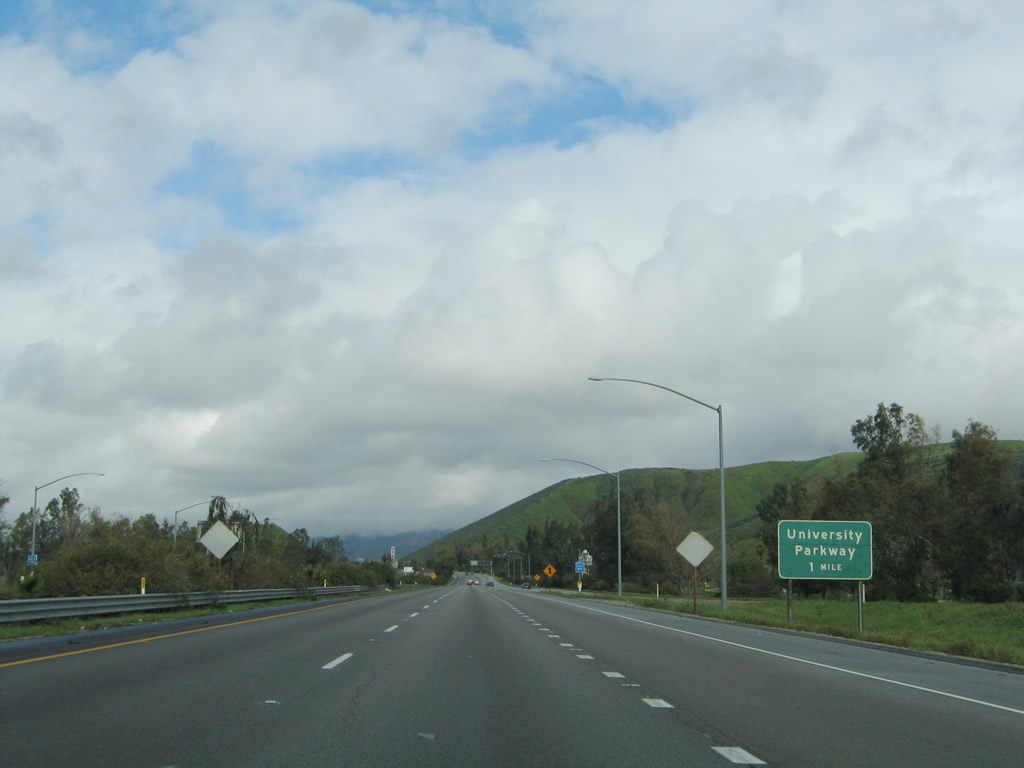
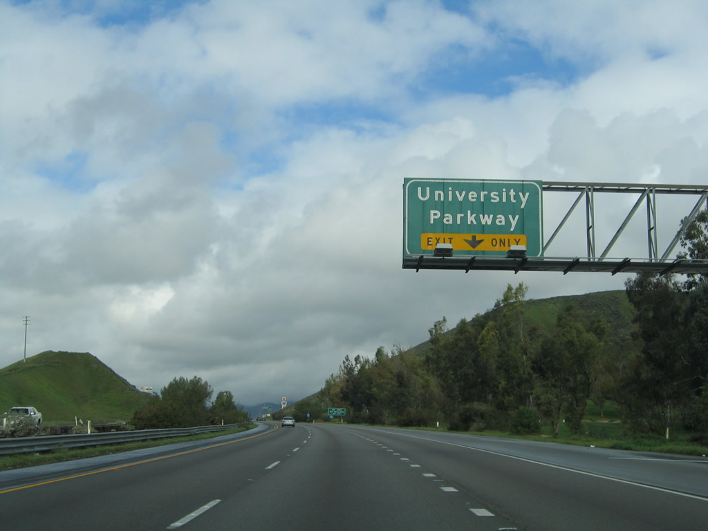
The next exit along northbound is Exit 48, University Parkway, which is so named because it leads northeast to California State University at San Bernardino. Photo taken 02/20/05. |
|
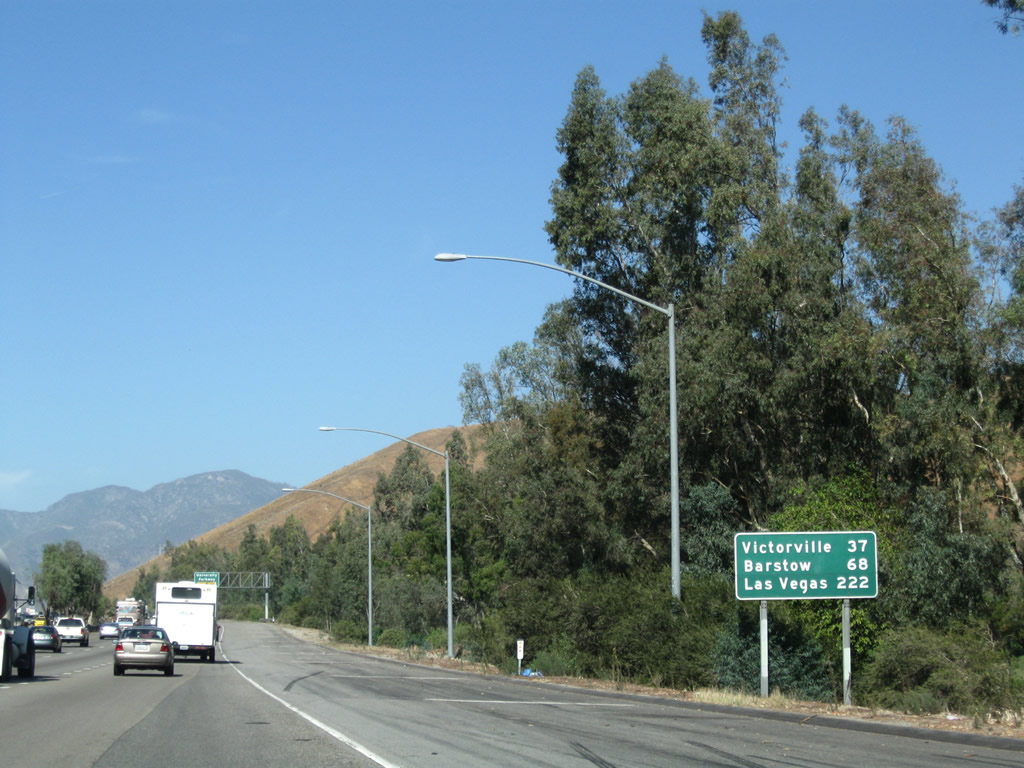
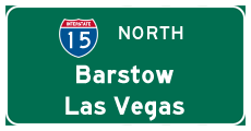
This mileage sign provides the distance to Victorville (37 miles), Barstow (68 miles), and the control city of Las Vegas (222 miles). Photo taken 11/10/08. |
|
University Parkway connects with Kendall Drive (Former California 206 and Former U.S. 66 Business) to the east and Historic U.S. 66 (Cajon Boulevard) to the west. Photo taken 02/20/05. |
|
Use University Parkway northeast to California State University at San Bernardino (CSUSB). Photo taken 11/10/08. |
|
Northbound Interstate 215 reaches Exit 48, University Parkway. Photo taken 02/20/05. |
|
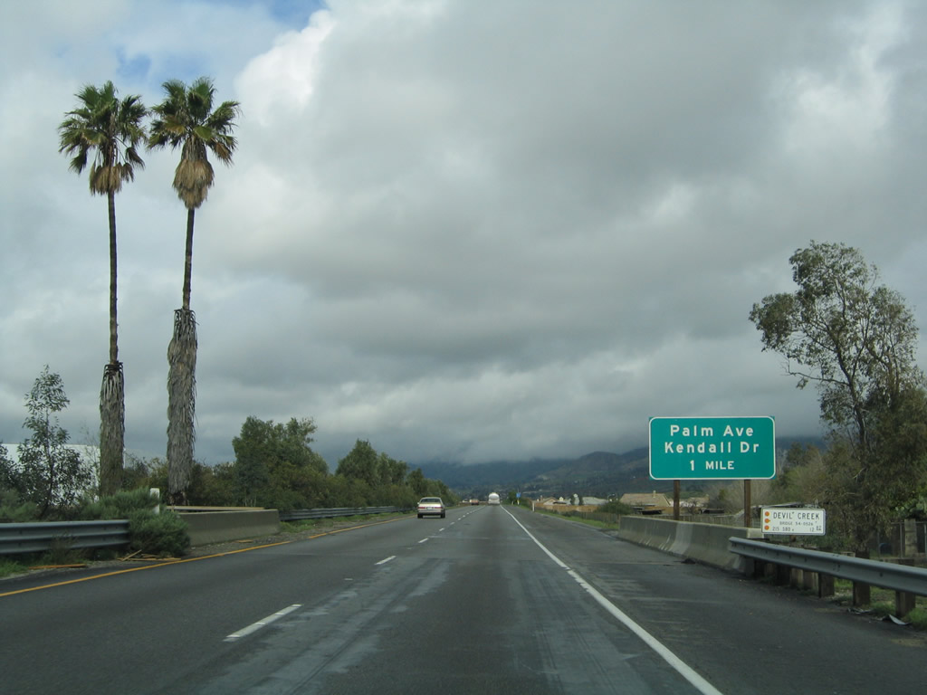
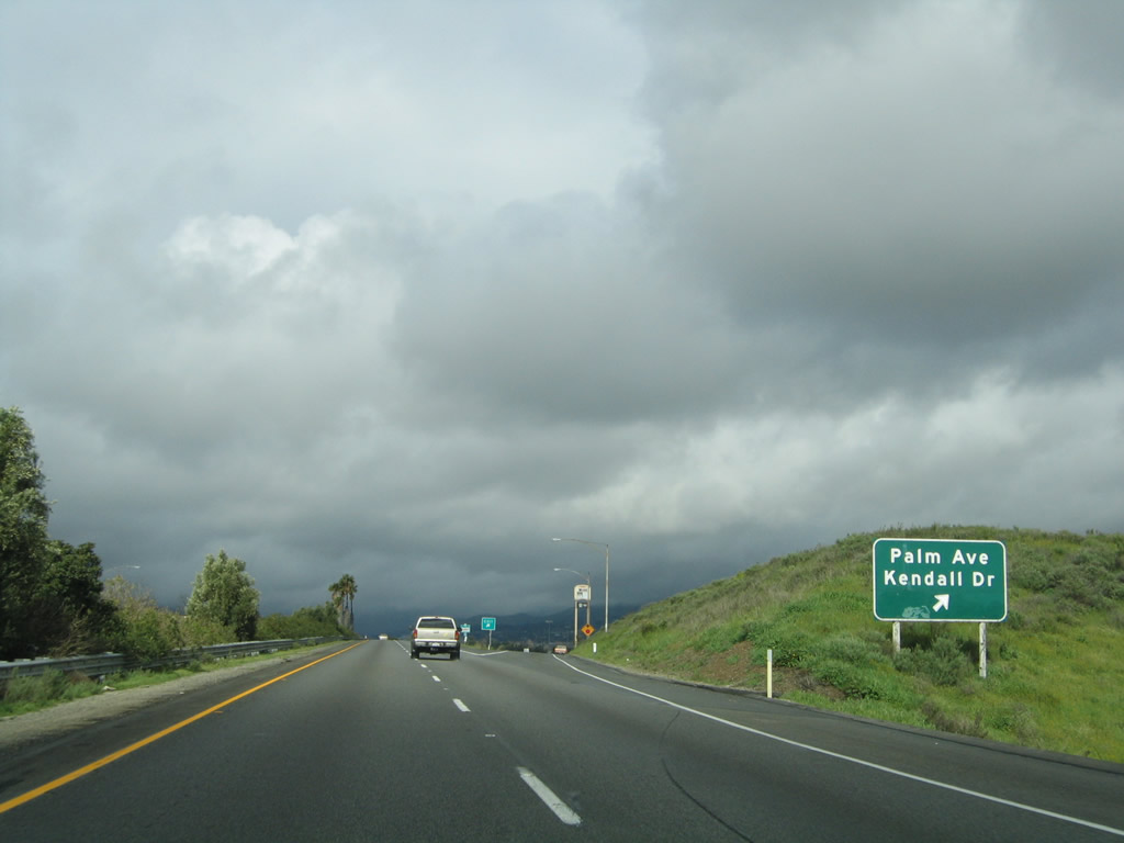
The next exit along northbound is Exit 50, former California 206 South/Kendall Drive, Palm Avenue, and Little League Drive. Photo taken 02/20/05. |
|
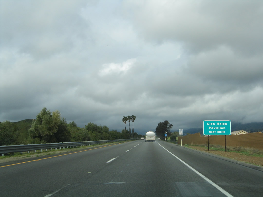
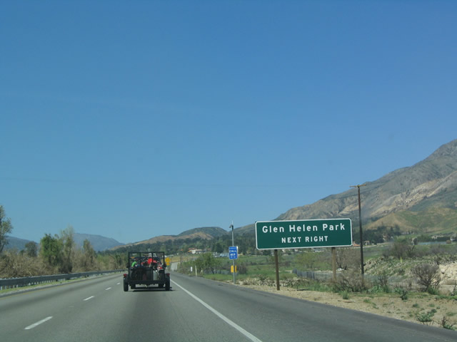
Use Exit 50 to reach the Glen Helen Pavilion, which is located west of Interstate 215. Photo taken 02/20/05. |
|
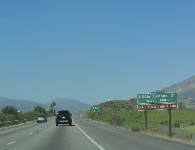
In addition to serving Palm Avenue and Kendall Drive, Exit 50 also connects to Little League Drive and the off road vehicle area at Glen Helen Park. Photo taken 03/20/04. |
|
Northbound Interstate 215 reaches Exit 50, Palm Avenue, Kendall Drive, and Little League Drive. Kendall Drive, which heads southeast from here, is former California 206 (which was previously U.S. 66 Business). California 206 was decommissioned in the late 1990s, and unfortunately it was not reestablished as Business Loop I-215. Hopefully they will reconsider; Kendall Drive changes into E Street, which passes through the heart of San Bernardino. Photo taken 03/20/04. |
|
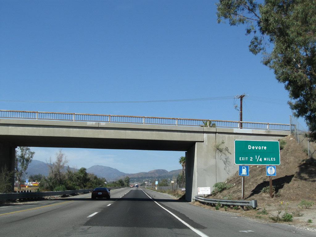
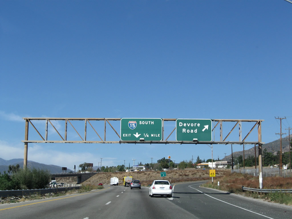
The next exit along Interstate 215 (Barstow Freeway) north is Exit 54A, Devore Road, 2.25 miles. Photo taken 11/10/08. |
|
Use Devore Road (Exit 54A) to Glen Helen Park. Exit 50 also provided access to the park. Photo taken 03/20/04. |
|
Interstate 215 (Barstow Freeway) gradually gains elevation as it begins to ascend to Cajon Summit. Photo taken 11/10/08. |
|
Northbound Interstate 215 (Barstow Freeway) reaches Exit 54A, Devore Road. This exit connects the freeway to the community of Devore, and it also links to Old U.S. 66-91-395. The next exit is a ramp to southbound Interstate 15. Photo taken 11/10/08. |
|
|
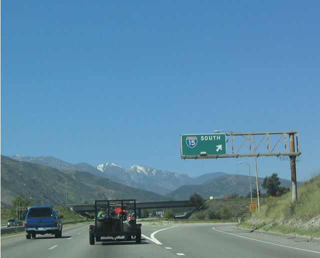
A bit of snow dusted the tops of the peaks of the San Bernardino Mountains as Interstate 215 north reaches Exit 54A, Interstate 15 South. An exit number sign was added between 2004 and 2008. Photos taken 11/10/08 and 03/20/04. |
|
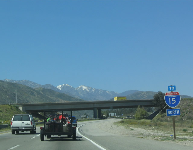
A I-15 trailblazer indicates that Interstate 215 ends and Interstate 15 resumes. In the past, U.S. 66-91-395 continued north from here up toward Cajon Summit. Photo taken 03/20/04. |
|
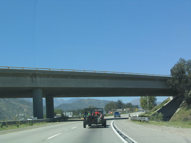
This overpass carries northbound Interstate 15 onto northbound Interstate 215. Photo taken 03/20/04. |
|
|
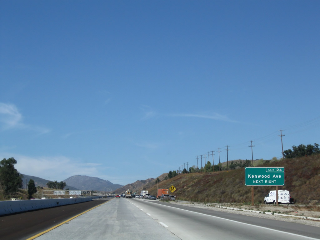
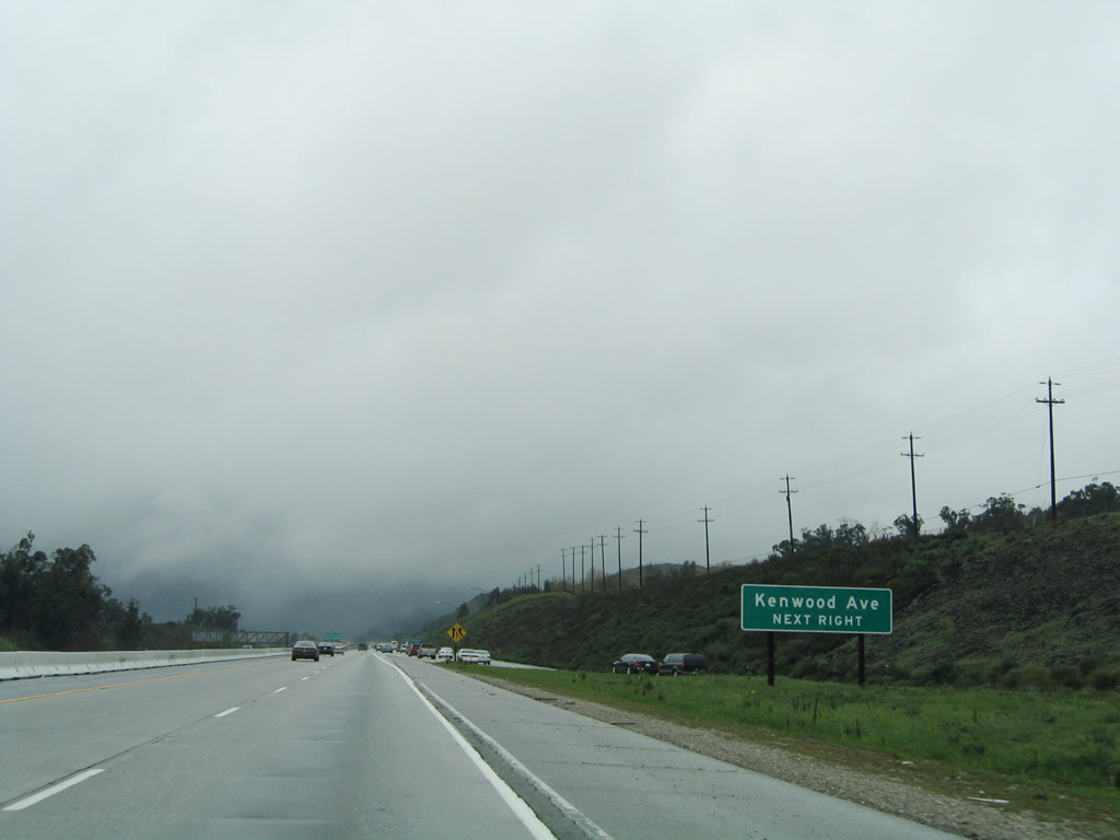
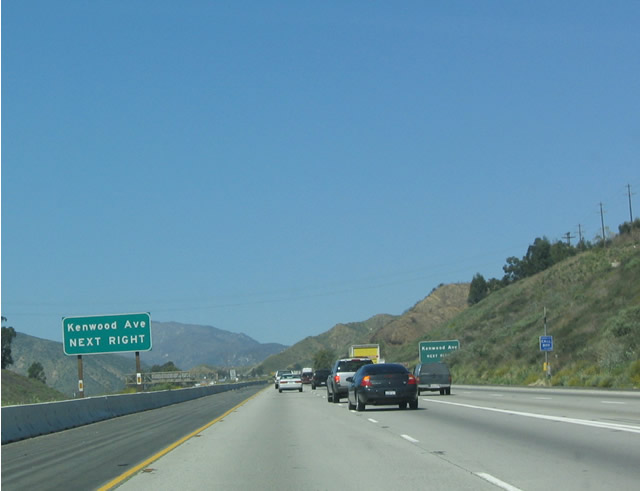
The first exit along northbound Interstate 15/Mojave Freeway after Interstate 215 merges is Exit 124, Kenwood Road to Historic U.S. 66-91-395. Photos taken 11/10/08 and 02/20/05. |
|
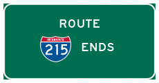
Interstate 215 ends as it merges onto northbound Interstate 15 and prepares to ascend to the Cajon Summit. Northbound Interstate 15 merges in from the right, while Interstate 215 becomes the left lanes. Photo taken 03/20/04. |