| Interstate 215 south |
|
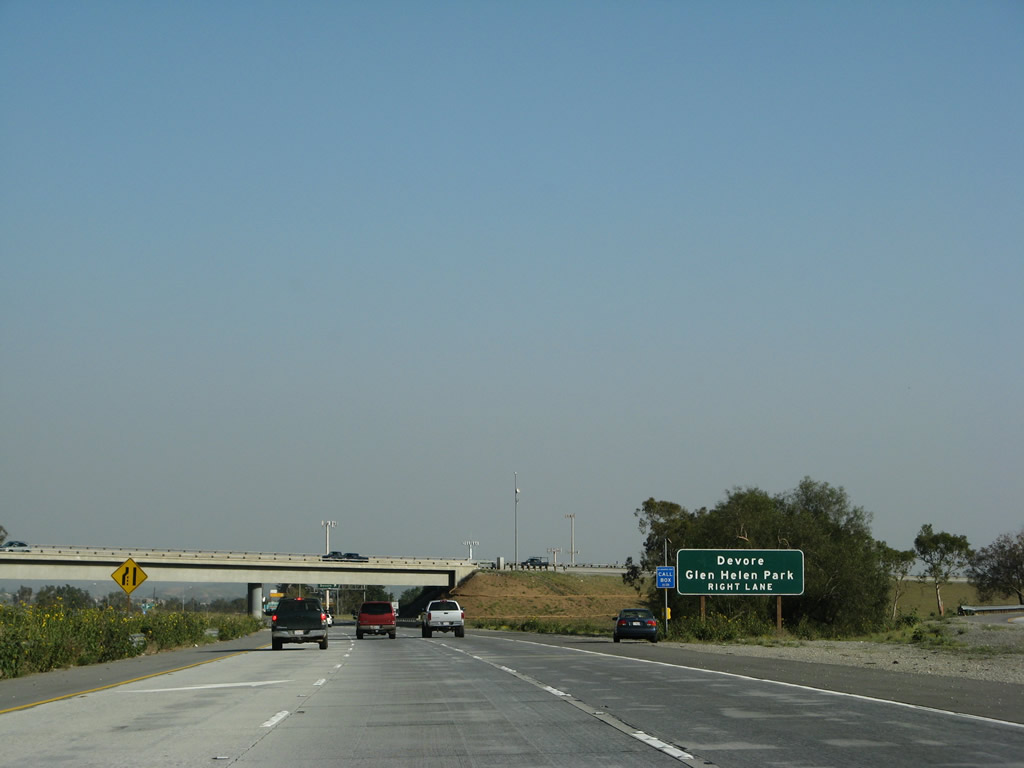
After splitting from Interstate 15, the left three lanes of Interstate 215 immediately consolidate into two lanes. The first exit along Interstate 215 (Barstow Freeway) south is Exit 54, Devore Road to the community of Devore and Glen Helen Park. The overpass carries Interstate 15 north over Interstate 215 for its connection with Interstate 215 north. Photo taken 03/31/08. |
|
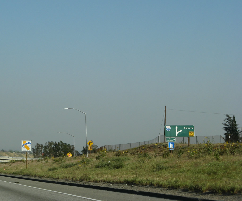
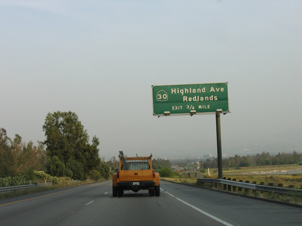
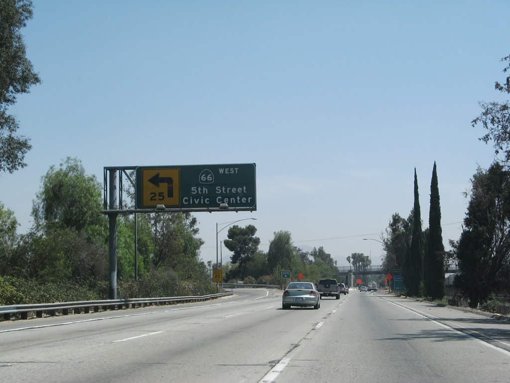
An older, porcelain enamel overhead sign for the Devore Road exit is posted at Exit 54 for southbound Interstate 215 traffic. To follow Historic U.S. 66-91-395 south, exit here, follow Devore Road south, then turn left on Cajon Boulevard. U.S. 66-91-395 parallels Interstate 215 on the southwest side of the Interstate 215 freeway. Photo taken 03/31/08. |
|
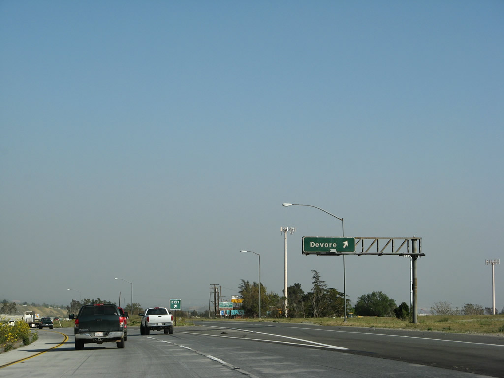
The collector distributor lanes for Exit 54 include a on-ramp from Interstate 15 north as well as traffic to and from Devore Road. A small roadside sign advises of the connection back to Interstate 215 south. Photo taken 03/31/08. |
|
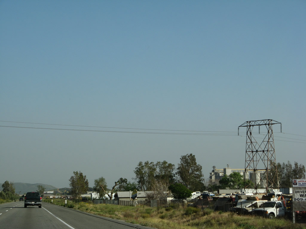
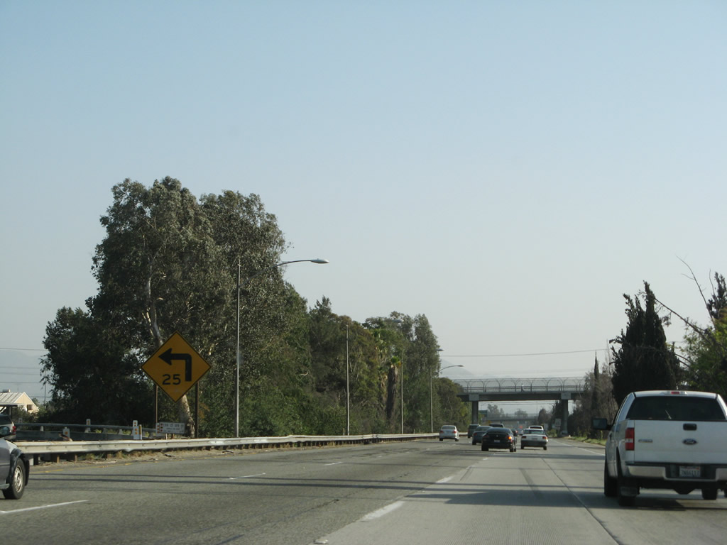
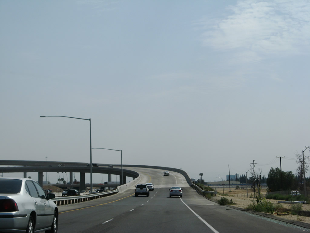
A Southern California Edison power transmission line crosses Interstate 215 near a junkyard. The freeway initially has only four lanes until the California 210 interchange. Photo taken 03/31/08. |
|
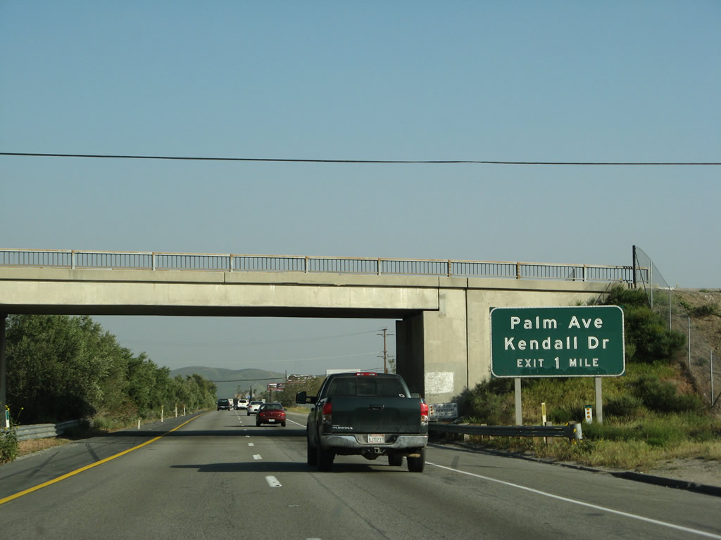
The next exit along Interstate 215 south is Exit 50, Palm Avenue and Kendall Drive to Verdemont. This interchange used to serve as the northern terminus of former California 206, which was signed as U.S. 66 Business before 1964. California 206 used to follow Kendall Drive from Interstate 215 Exit 50 southeast to the point where it changes into North E Street. California 206 used to end at California 18-30 Business (Highland Avenue) in San Bernardino and then California 30/Foothill Freeway (now California 210). California 206 was decommissioned in 1991, and the route is now a city-maintained street. Photo taken 03/31/08. |
|
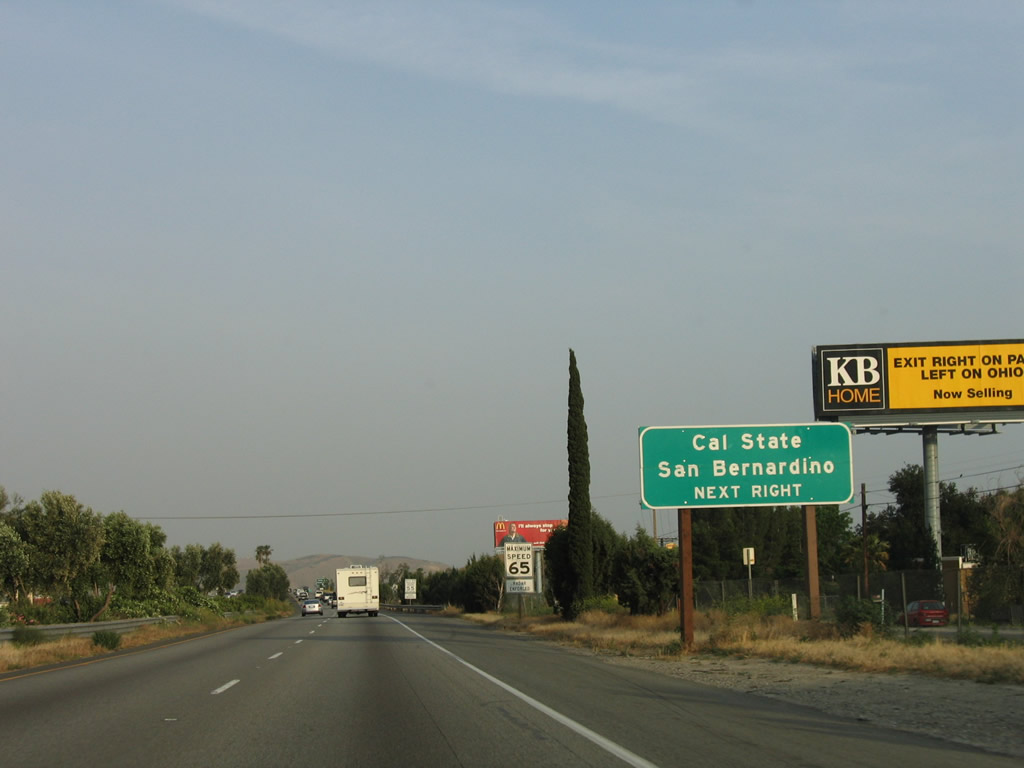
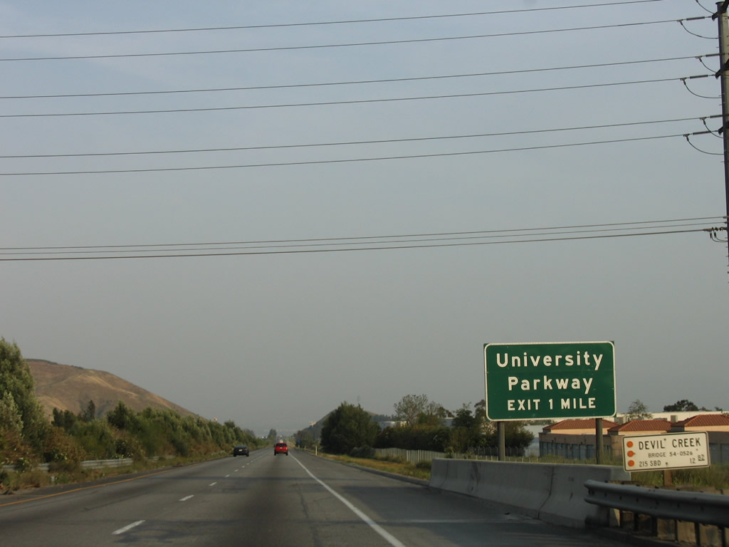
The next two exits serve California State University at San Bernardino. Use Exit 50 and follow Kendall Drive southeast to University Parkway north or use Exit 48, University Parkway north. Photo taken 05/13/05. |
|
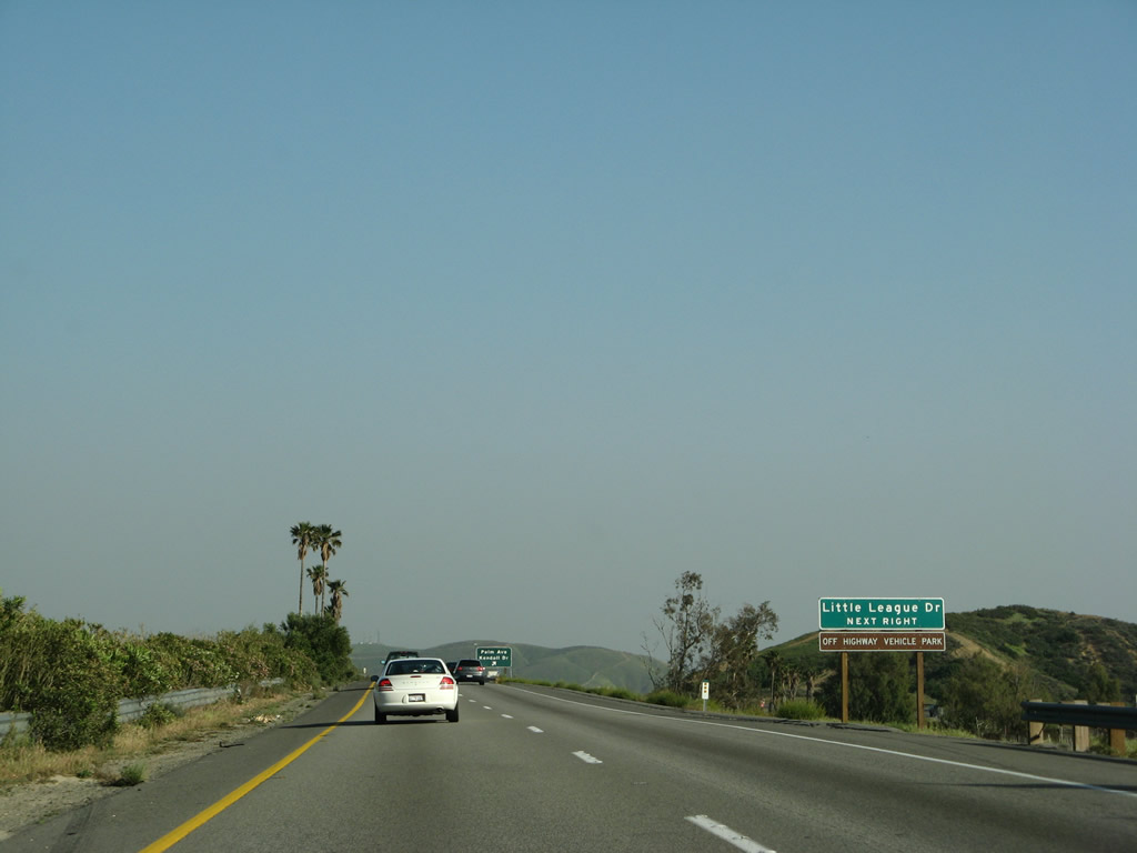
Little League Drive is the frontage road on the eastern side of the freeway that connects the freeway with the Western Headquarters of Little League. Upon exiting Interstate 215, turn left on Palm Avenue, then turn left on Little League Drive after passing under the freeway. Photo taken 03/31/08. |
|
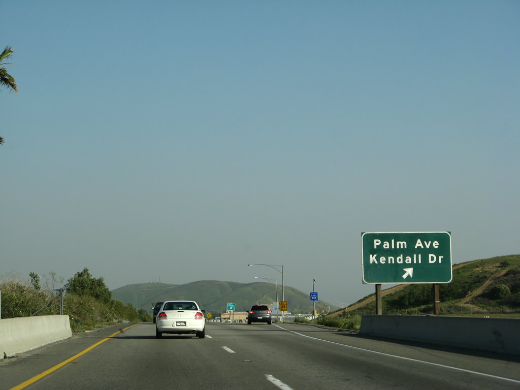
Southbound Interstate 215 (Barstow Freeway) reaches Exit 50, Palm Avenue to Kendall Drive and Little League Drive. This is the first exit to serve the city of San Bernardino. Photo taken 03/31/08. |
|
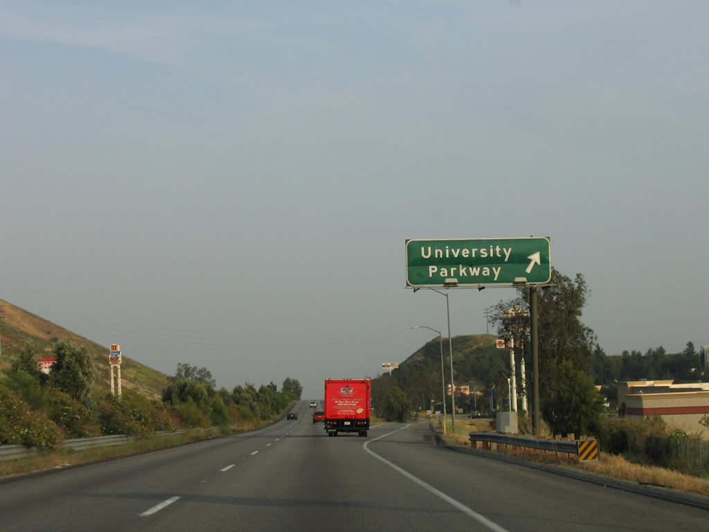
The next exit along Interstate 215 south is Exit 48, University Parkway north to California State University at San Bernardino (in the city of San Bernardino) and south to the unincorporated community of Muscoy. Photo taken 05/13/05. |
|
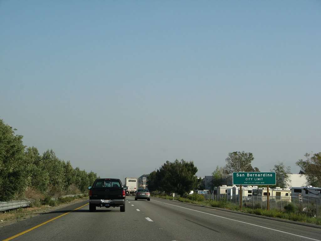
At this point, Interstate 215 enters the city of San Bernardino. Named on May 20, 1810 (for Roman Catholic St. Bernardino de Sienna), the city of San Bernardino was incorporated in 1854. Home of the first McDonald's restaurant (opened by the McDonald brothers in 1948 on U.S. 66 Business at 1398 North E Street), San Bernardino is the seat of San Bernardino County. The city consists of 59.2 square miles, has about 16 inches of rainfall annually, sits at an elevation of 1,046 feet, and had a population of 185,401 people as of the 2000 Census. Photo taken 03/31/08. |
|
|
Southbound Interstate 215 (Barstow Freeway) reaches Exit 48, University Parkway to California State University at San Bernardino, the city of San Bernardino, and Muscoy. The exit guide sign was replaced between 2005 and 2008 to include an exit number. Photos taken 03/31/08 and 05/13/05. |
|
|
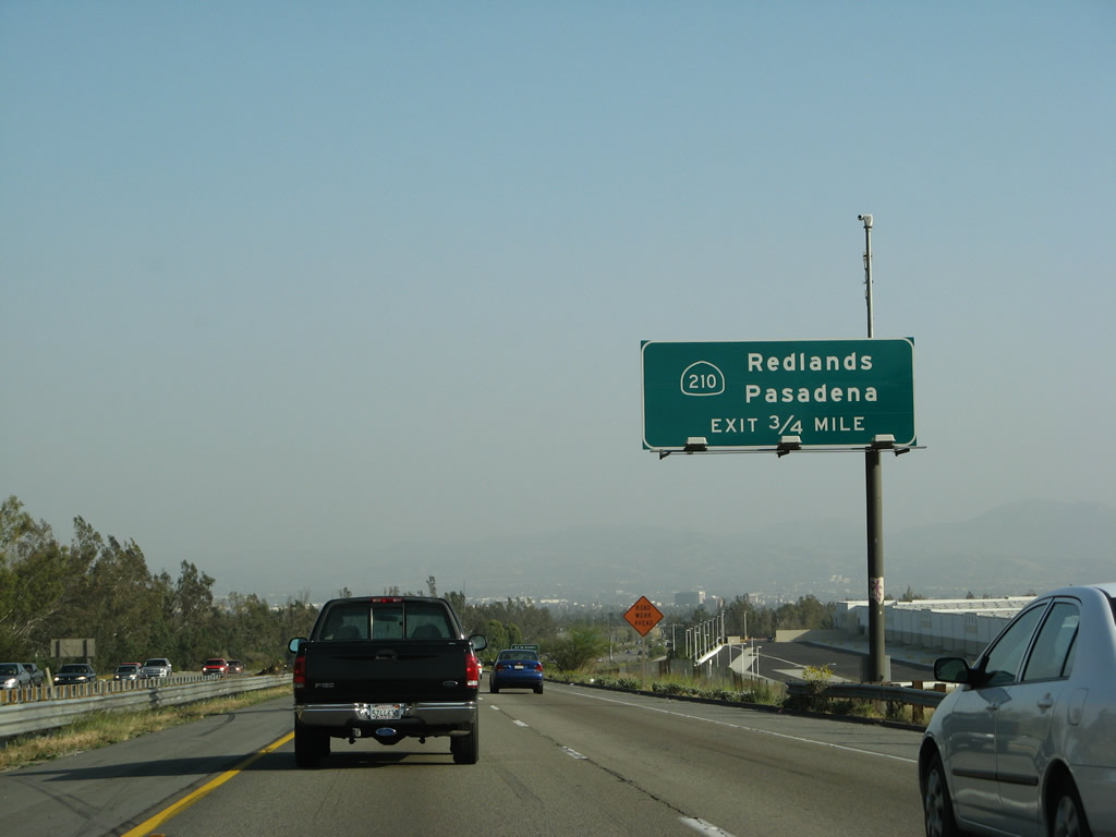
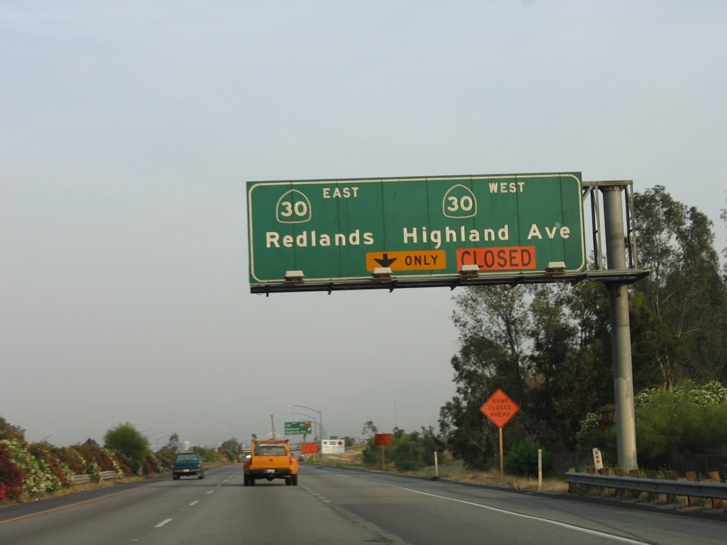
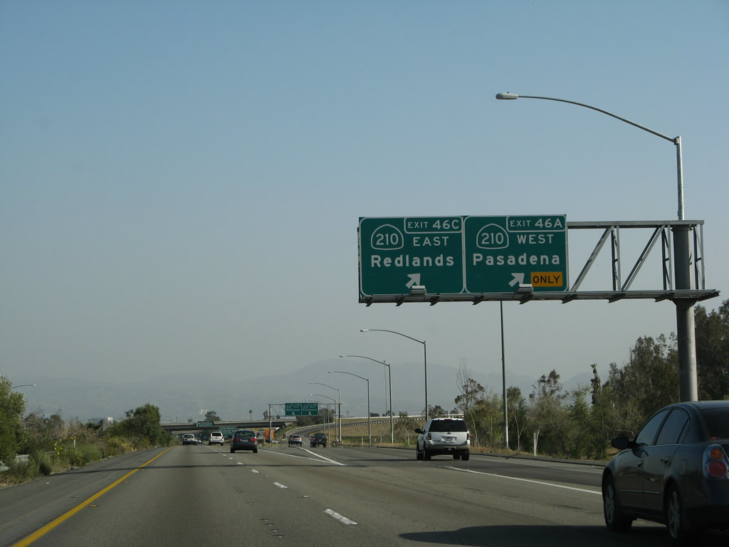
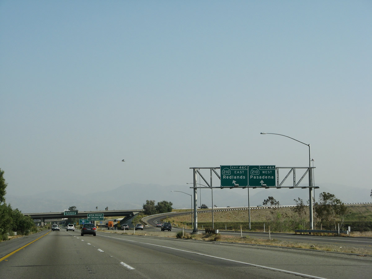
The next interchange along southbound Interstate 215 (Barstow Freeway) is Exit 46C, California 210. Note the change in signage between 2005 and 2008, which shows the elimination of the California 30 designation and reflects the completion of the Foothill Freeway west to Pasadena. Highland Avenue is eliminated in the newer sign, since Exit 46C is now a freeway-to-freeway interchange. Photos taken 03/31/08 and 05/13/05. |
|
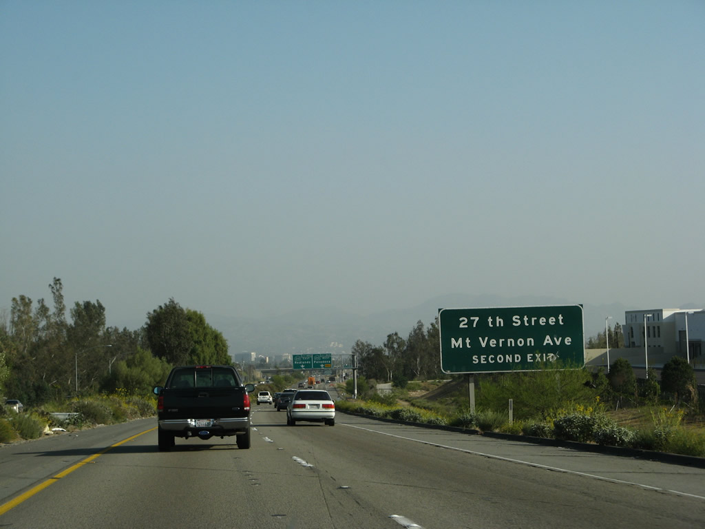
After the interchange with California 210 (Exit 46C), the next exit will be Exit 46B, Mount Vernon Avenue south and 27th Street east. Mount Vernon Avenue picks up the Historic U.S. 66 designation after merging with Cajon Boulevard. From there, Historic U.S. 66 travels south to California 66 (West Fifth Street), then turns west toward Rialto, Fontana, and Rancho Cucamonga. Photo taken 05/13/05. |
|
|
Southbound Interstate 215 (Barstow Freeway) approaches Exit 46C, California 210. California 210 is the Foothill Freeway; it was completed as a full freeway in July 2007 through Muscoy to Rialto. With that completion, the former California 30 freeway east of here was renumbered as California 210. Shields were erected in Fall 2007, and by Winter 2008, California 30 shields were mostly removed in favor of California 210. Photos taken 03/31/08 and 05/13/05. |
|
|
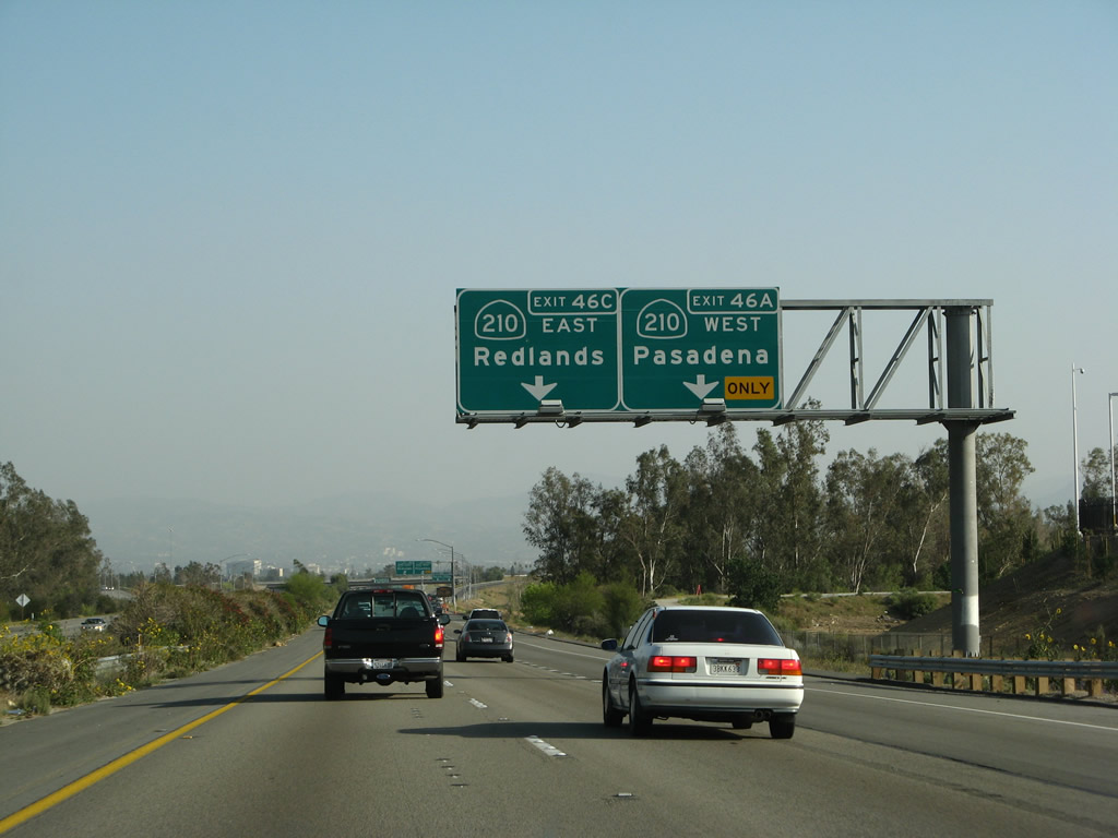
Southbound Interstate 215 (Barstow Freeway) reaches Exit 46C, California 210 east to Redlands and west to Pasadena. This freeway route is a good alternative to Interstate 10, especially when that freeway is traffic choked. Photos taken 03/31/08 and 05/13/05. |
|
|
This view shows the transition ramp from Interstate 215 (Barstow Freeway) south to Exit 46C, California 210 east to Redlands and west to Pasadena. Curiously, this exit is signed as both Exit 46C and 46A, which is atypical of Caltrans exit numbering practices since there is only one exit from the mainline southbound onto California 210, then the ramp subdivides. However, plenty of other states sign their exits in this manner. Photos taken 03/31/08 and 05/13/05. |
|
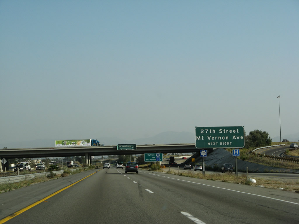
The next exit along Interstate 215 south is Exit 46B, Mount Vernon Avenue south to Historic U.S. 66 and West 27th Street east into northern San Bernardino. Photo taken 03/31/08. |
|
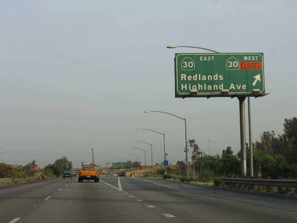
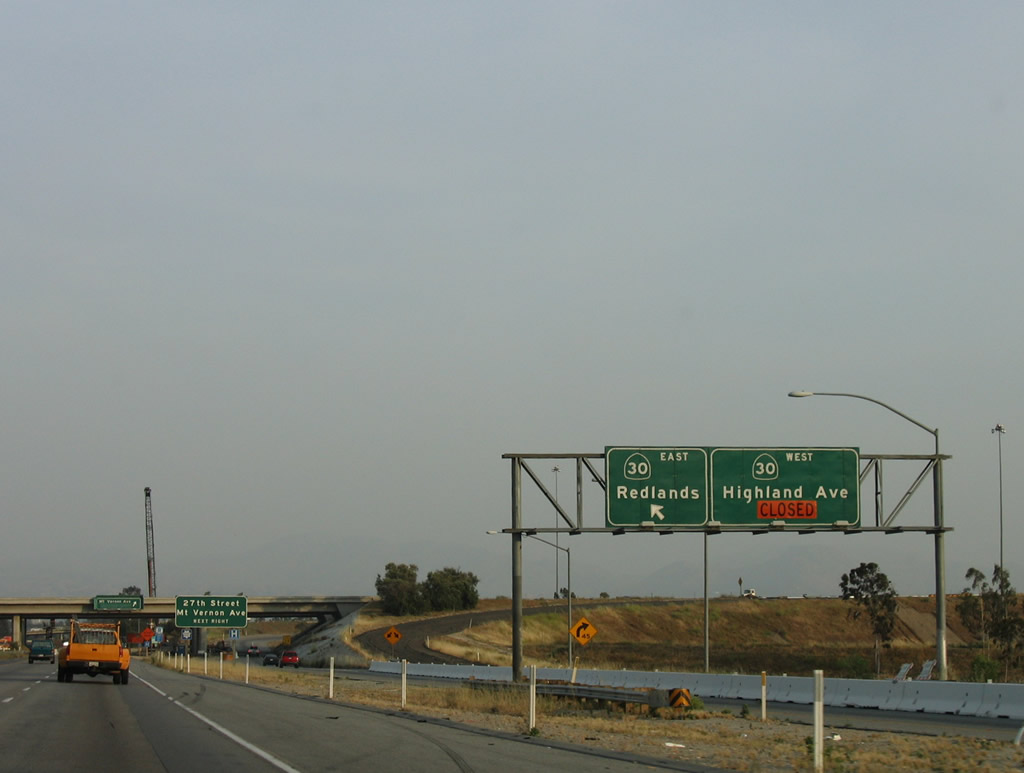
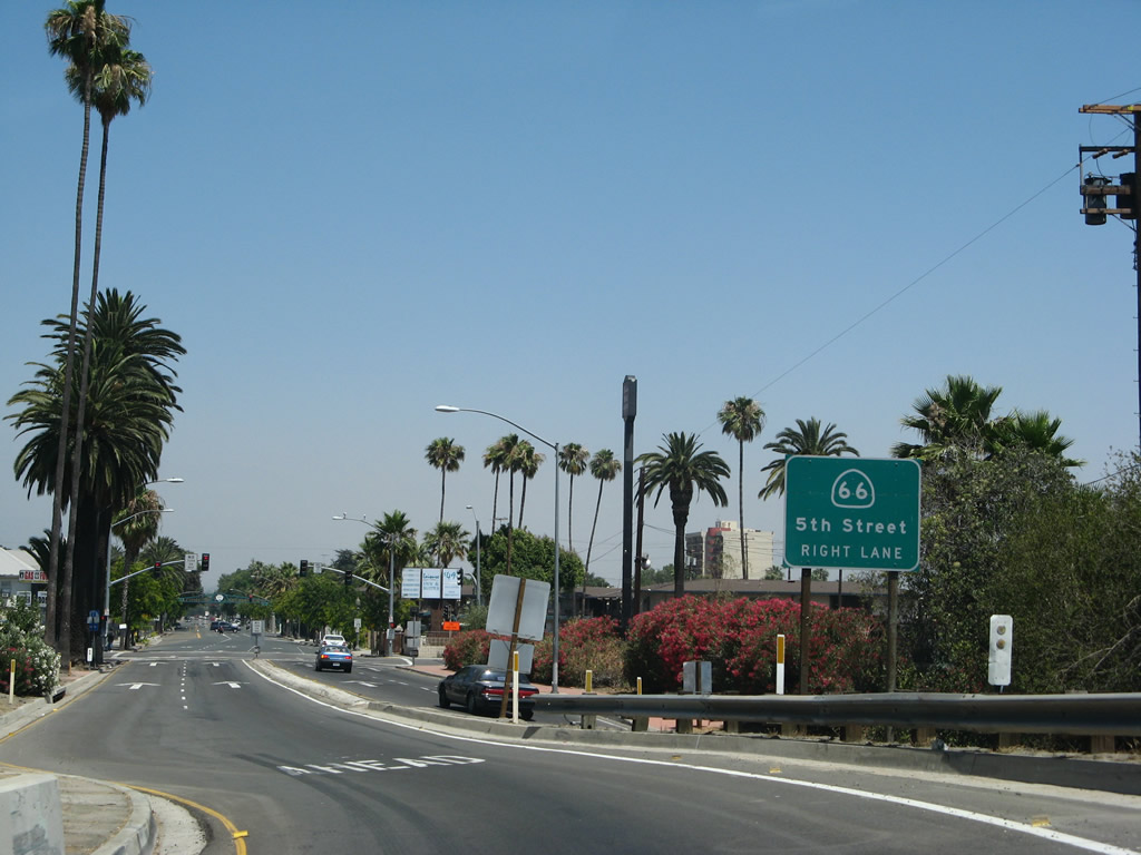
A newer sign (placed between 2005 and 2008) advises motorists to use Exit 46B, Mount Vernon Avenue south to Highland Avenue, which is the former alignment of California 30. Parts of Highland Avenue are still signed as California 30 Business, especially east of Interstate 215. Photo taken 03/31/08. |
|
Passing under the California 210 (Foothill Freeway) overpass, southbound Interstate 215 reaches Exit 46B, Mount Vernon Avenue south to Historic U.S. 66 and West 27th Street east into northern San Bernardino. Photo taken 03/31/08. |
|
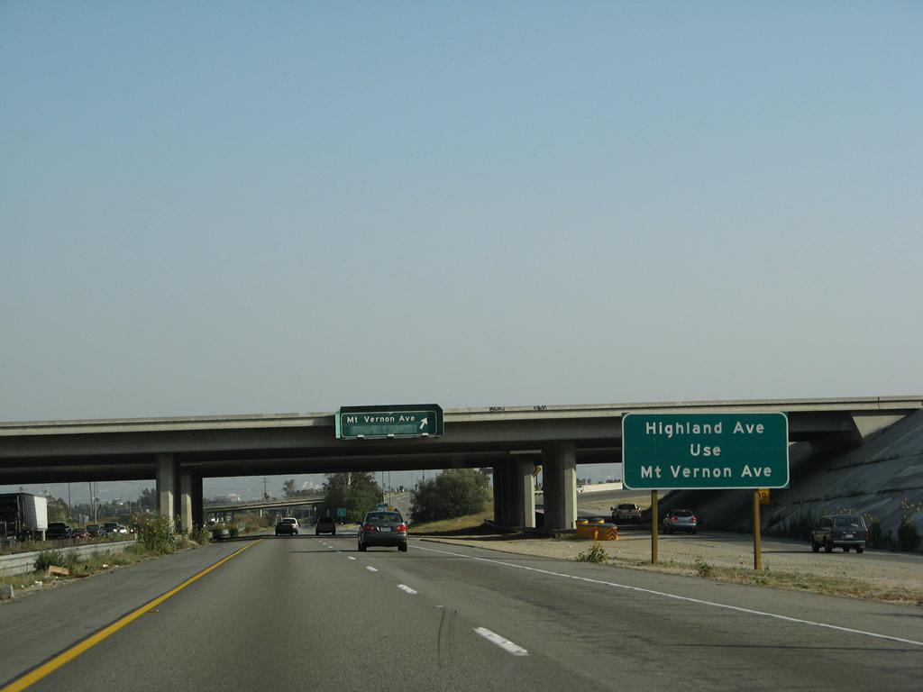
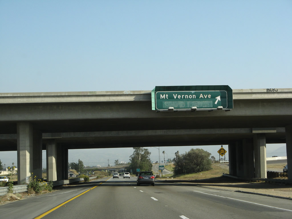
The off-ramp from Interstate 215 south to Mount Vernon Avenue is a bit windy. Upon reaching the top of the ramp, turn right to Mount Vernon Road south. The bridge at the right side of the picture is the Cajon Boulevard overcrossing. Mount Vernon Avenue turns southeast to parallel Cajon Boulevard, then they merge together south of the Highland Avenue intersection. Photo taken 03/31/08. |
|
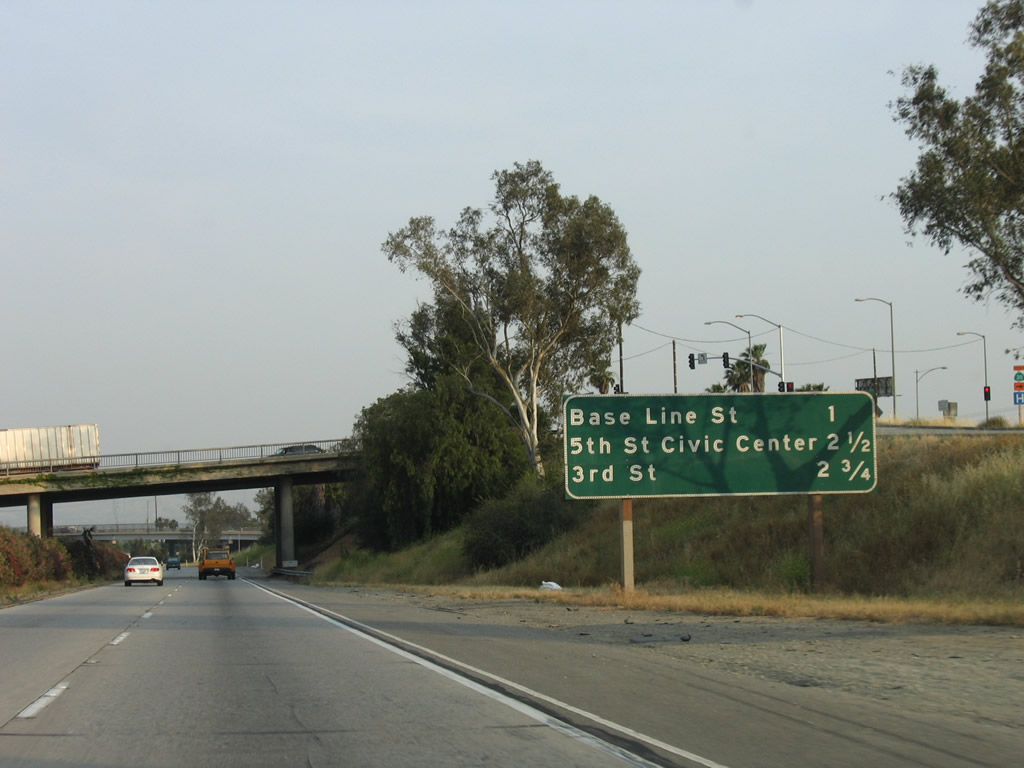
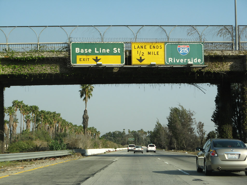
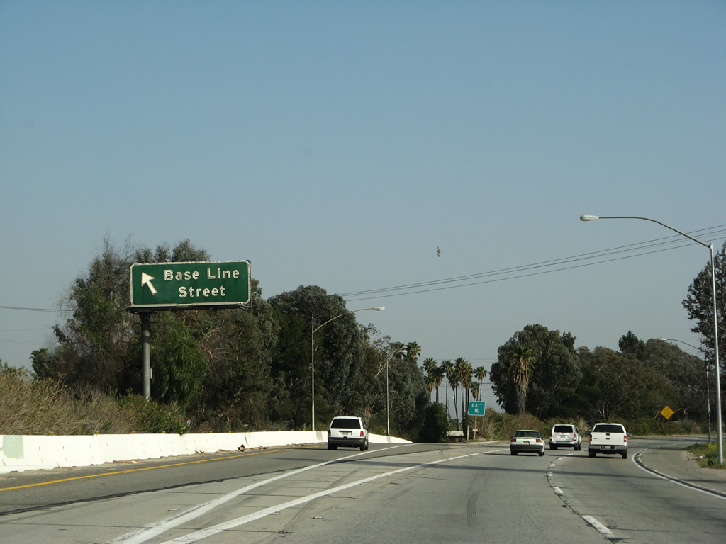
The next three exits along Interstate 215 south are Exit 45, West 13th Street to H Street and Baseline Street; Exit 44, West Sixth Street to California 66 (Fifth Street) and the San Bernardino Civic Center; and Exit 43, Third Street to the Carousel Mall. Photo taken 05/13/05. |
|
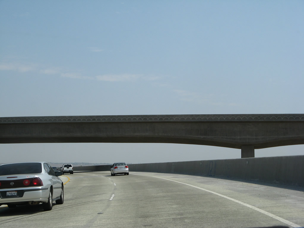
The Mount Vernon Avenue and West 27th Street overpass has old-style bridge railing. After this overpass, Interstate 215 turns a bit to the southeast until the merge with California 259. Photo taken 03/31/08. |
|
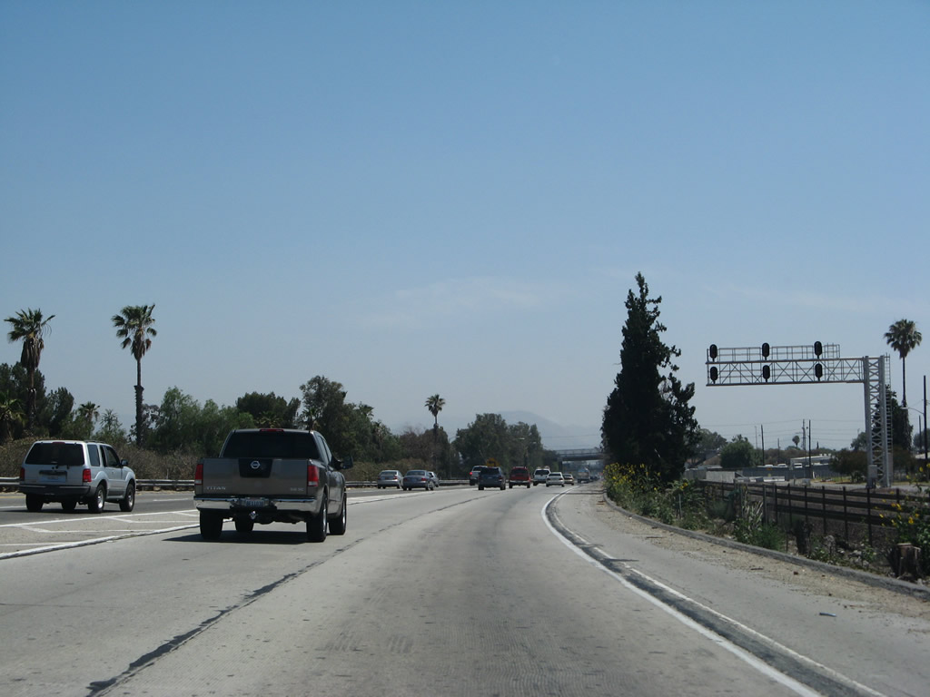
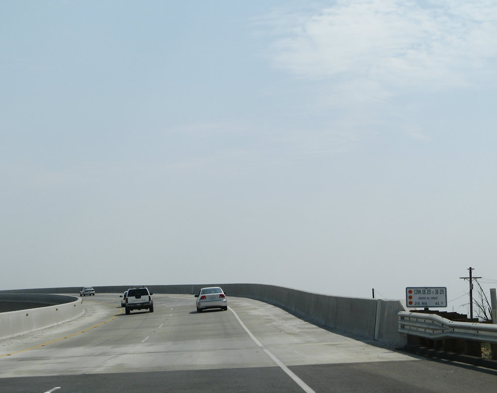
With the anticipated widening of Interstate 215 planned for completion by 2013, it is likely that changes to this four-lane section of freeway are coming. Photo taken 03/31/08. |
|
This mileage sign provides the distance to Riverside (12 miles) and Los Angeles (61 miles). Photo taken 03/31/08. |
|
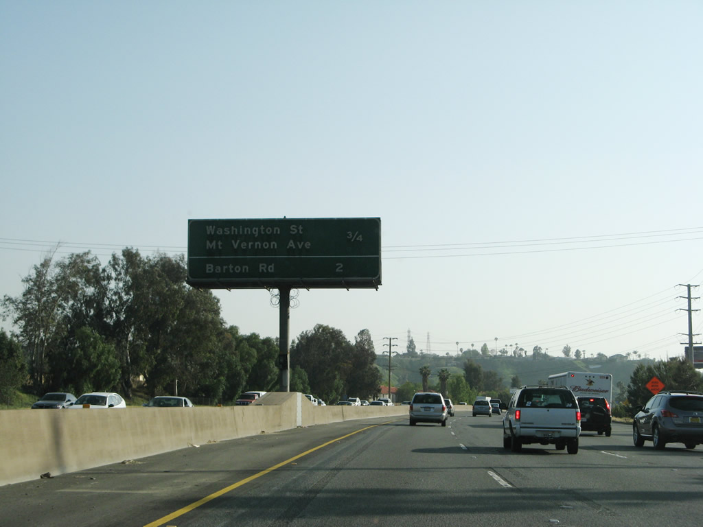
A new left lane forms on Interstate 215 south for the connection to Exit 45, West 13th Street to Baseline Street (via a one-block connection on H Street). Oddly, all through traffic for Interstate 215 currently must merge right to continue south. This situation will be addressed as part of the overall widening and reconstruction of Interstate 215 through downtown San Bernardino. Photo taken 03/31/08. |
|
Southbound Interstate 215 (Barstow Freeway) reaches Exit 45, West 13th Street to Baseline Street (left exit). Through traffic should merge into the right lane. All too often during commuting hours, this is a choke point for traffic. The merge with California 259 south comes soon after this exit. Photo taken 03/31/08. |
|
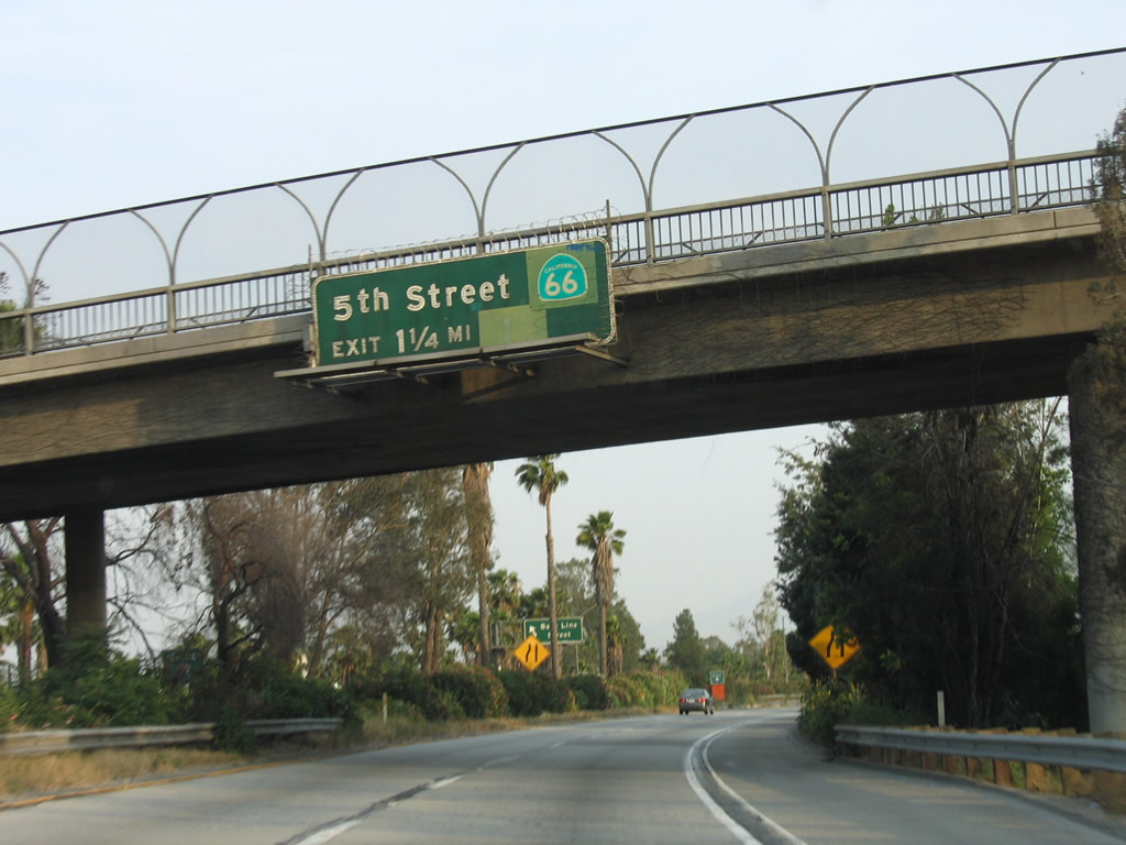
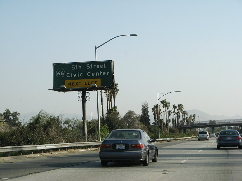
The next exit along Interstate 215 south is Exit 44, West Sixth Street to California 66 (Fifth Street) and the San Bernardino Civic Center. Beneath the California 66 shield pasted onto this original porcelain enamel overhead sign is likely to be a U.S. 66 shield. In the background one can see the guide sign for the Baseline Street exit from California 259 south. Photo taken 05/13/05. |
|
Traffic from California 259 freeway merges onto Interstate 215 south from the left. At this point, the existing left lane of Interstate 215 merges into the right lane. From here, Interstate 215 takes on two new left lanes courtesy of California 259 and quite a bit more traffic. California 259 is a short connector between Interstate 215 and California 210 that enables freeway flow between 215 north and 210 east and between 210 west and 215 south. Photo taken 03/31/08. |
| Interstate 215 (San Bernardino Freeway) south |
|
Now that we've merged with California 259 south, Interstate 215 gains a new designation: the San Bernardino Freeway. This freeway naming only lasts until the Interstate 10 interchange. Photo taken 03/31/08. |
|
Interstate 215 is closely paralleled by the Burlington Northern Santa Fe (Union Pacific) Railroad on the west side of the freeway. This will limit the amount of space available for freeway widening along this very busy section of Interstate 215. Photo taken 06/24/07. |
|
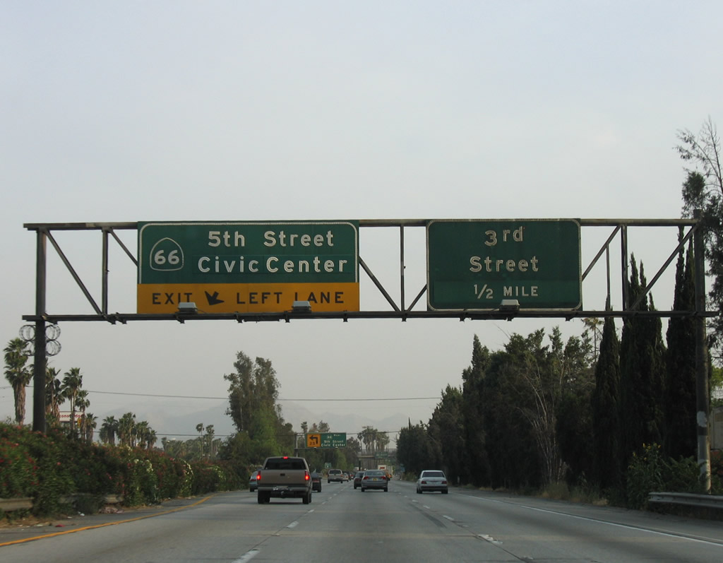
The next exit along Interstate 215 (San Bernardino Freeway) south is Exit 44, California 66/West Fifth Street. The left exit actually defaults onto eastbound West Sixth Street, so a brief turn south on either H Street or G Street makes the connection to California 66. Photo taken 03/31/08. |
|
A new left lane forms on Interstate 215 (San Bernardino Freeway) south for Exit 44, West Sixth Street to California 66/West Fifth Street. Use Exit 44 to the San Bernardino Civic Center. The next exit will be Exit 43, West Third Street. Photo taken 05/13/05. |
|
Southbound Interstate 215 (San Bernardino Freeway) reaches Exit 44, California 66/West Fifth Street to downtown San Bernardino. Photo taken 06/24/07. |
|
Now on the off-ramp, the connection to California 66 is via Sixth Street east, H Street south, and Fifth Street west. This guide sign advises of the connection. Photo taken 06/24/07. |
|
An odd configuration of two sets of one-way traffic converges (one set comes from Interstate 215 south, and the other comes from Interstate 215 north). The traffic signal ahead is configured to allow full movements (left, right, or straight) from either set of lanes. Turn right for H Street south to California 66 (Fifth Street) west. Photo taken 06/24/07. |
|
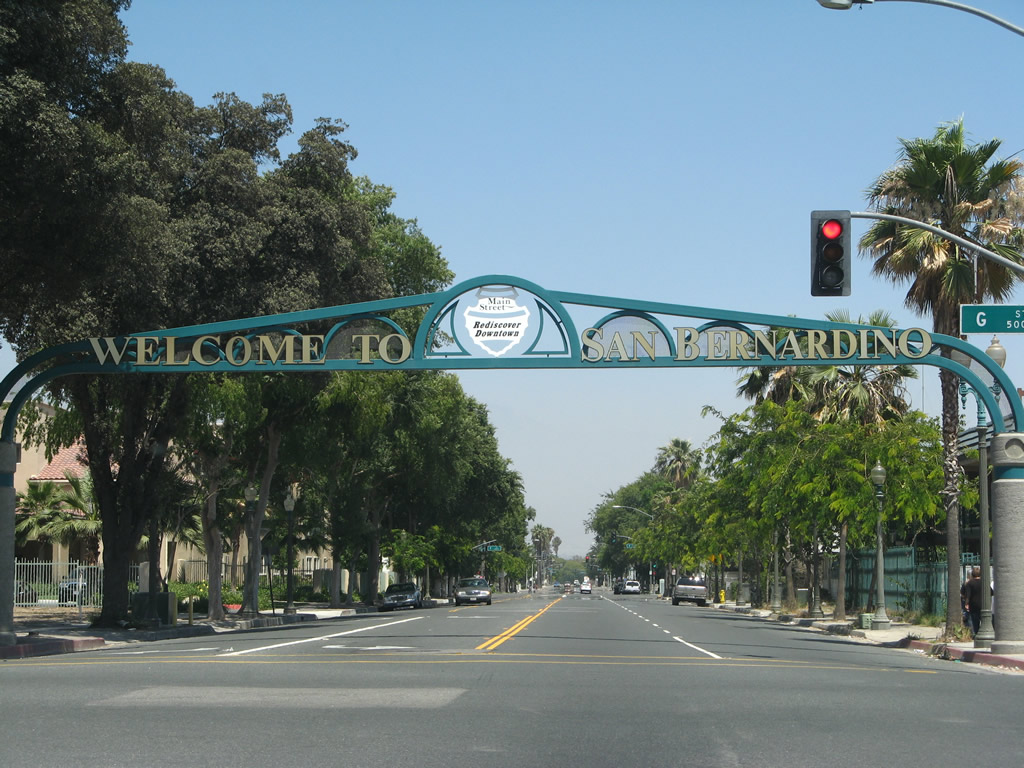
One block east of Sixth Street and H Street is this arch, which welcomes visitors to San Bernardino's downtown. Photo taken 06/24/07. |
|
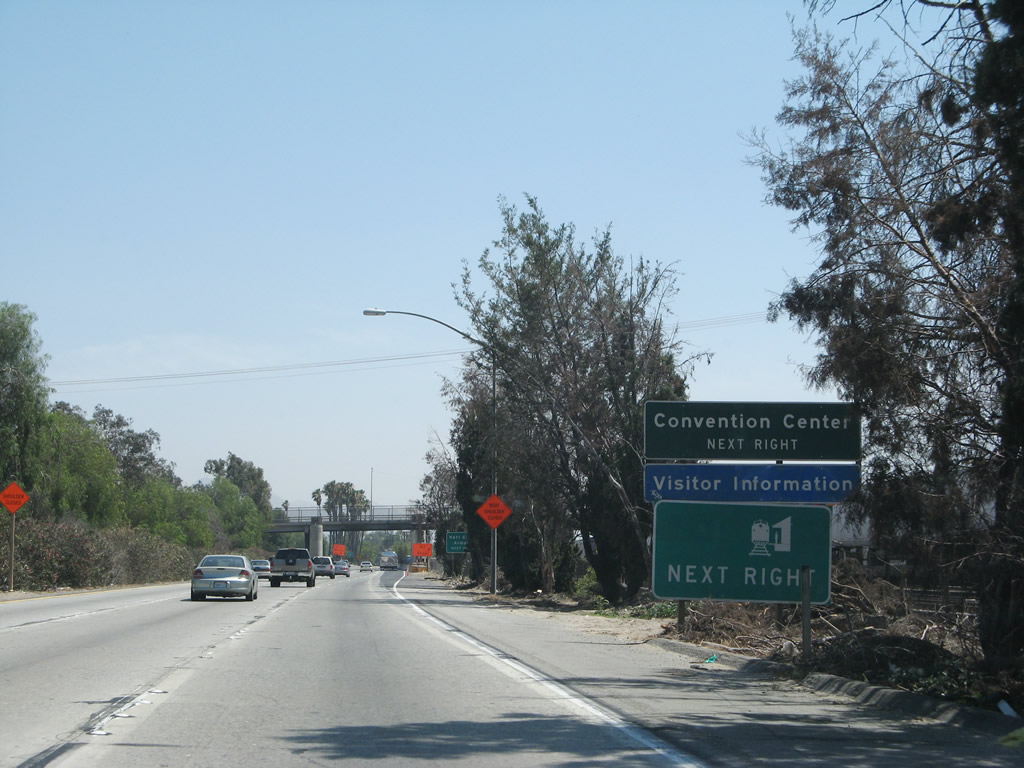
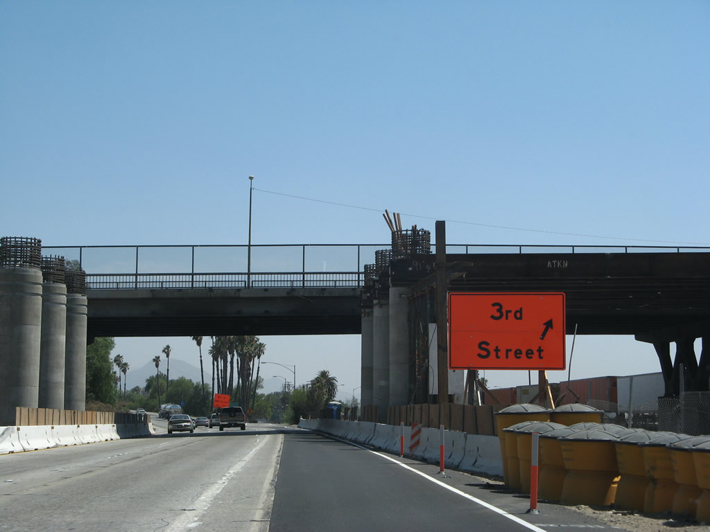
Use Exit 43 (Third Street) to the visitors center, convention center, train station, and Carousel Mall. Photo taken 03/31/08. |
|
|
Southbound Interstate 215 (San Bernardino Freeway) reaches Exit 43, Third Street. These porcelain enamel overhead signs were removed in 2007 with the start of the project to widen the Third Street overpass. Photos taken 06/24/07 and 05/13/05. |
|
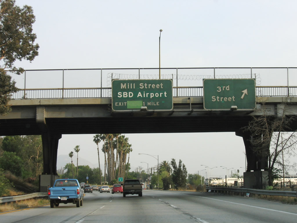
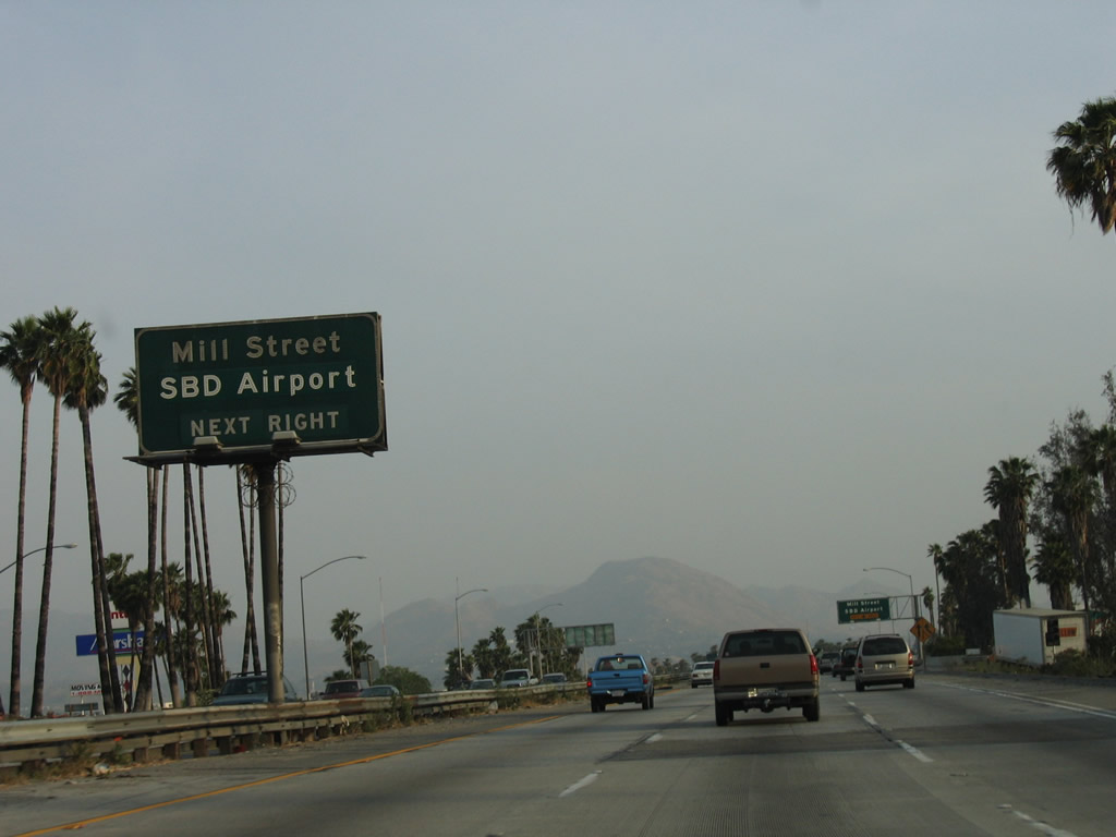
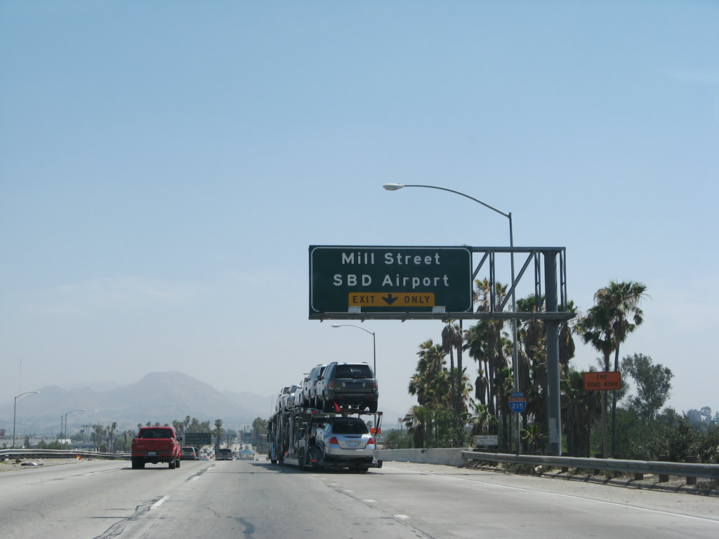
The next exit along Interstate 215 south is Exit 42B, Mill Street, which travels west to Mount Vernon Avenue south to the College of San Bernardino. Photo taken 06/24/07. |
|
Mill Street also travels east to the San Bernardino International Airport, which until 1994 was Norton Air Force Base. The site was remodeled into an airport more recently, and plans call for the airport to offer commercial service starting in Fall 2008. Photo taken 05/13/05. |
|
The right lane of Interstate 215 south becomes exit only for Exit 42B, Mill Street west to the College of San Bernardino and east to San Bernardino International Airport. Photo taken 06/24/07. |
|
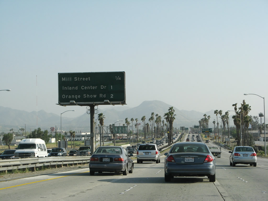
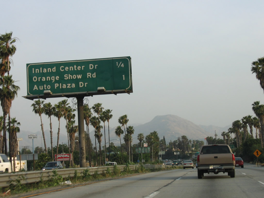
This mileage sign along Interstate 215 south provides the distance to the next three exits: Exit 42B, Mill Street; Exit 42A, Inland Center Drive; and Exit 41, Orange Show Road and Auto Plaza Drive. Photo taken 03/31/08. |
|
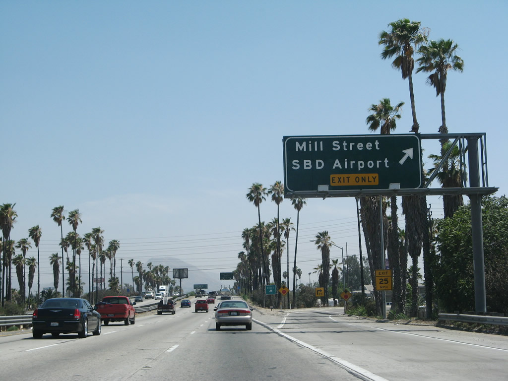
Southbound Interstate 215 (San Bernardino Freeway) reaches Exit 42B, Mill Street, to the College of San Bernardino and San Bernardino International Airport. Photo taken 06/24/07. |
|
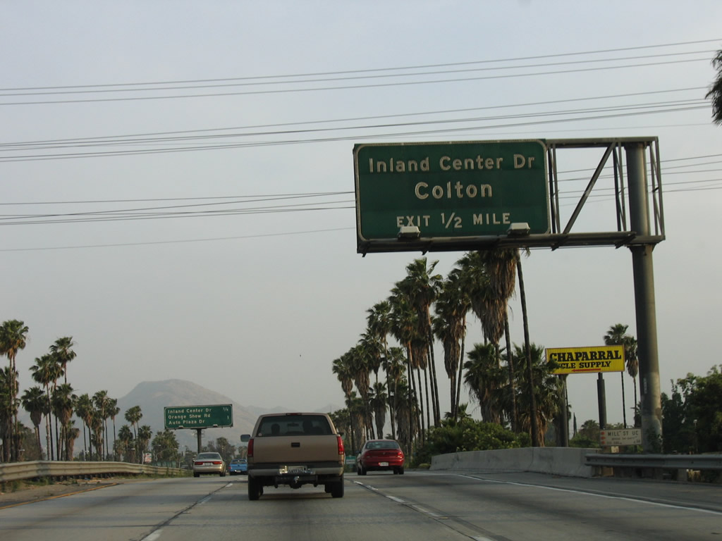
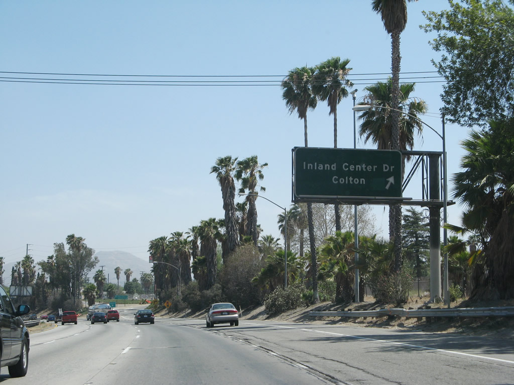
The next exit along Interstate 215 south is Exit 42A, Inland Center Drive southwest to the city of Colton and northeast to the Inland Center (shopping mall). Photo taken 05/13/05. |
|
This mileage sign along Interstate 215 south provides the distance to the next two exits: Exit 42A, Inland Center Drive and Exit 41, Orange Show Road/Auto Plaza Drive. Photo taken 05/13/05. |
|
Southbound Interstate 215 (San Bernardino Freeway) reaches Exit 42A, Inland Center Drive to Colton. Photo taken 06/24/07. |
|
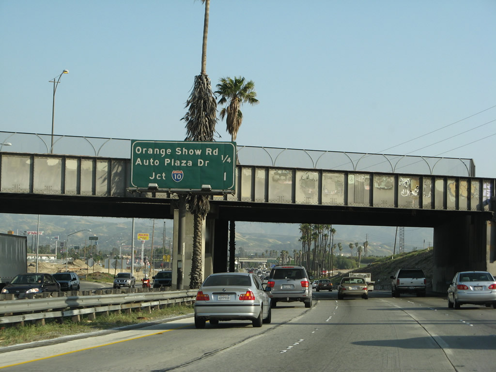
This mileage sign along Interstate 215 south provides the distance to the next two exits: Exit 41, Orange Show Road/Auto Plaza Drive and Exit 40, Interstate 10 east to Los Angeles and west to Redlands and Phoenix. This sign is located next to the Inland Center Drive overpass. Photo taken 05/13/05. |
|
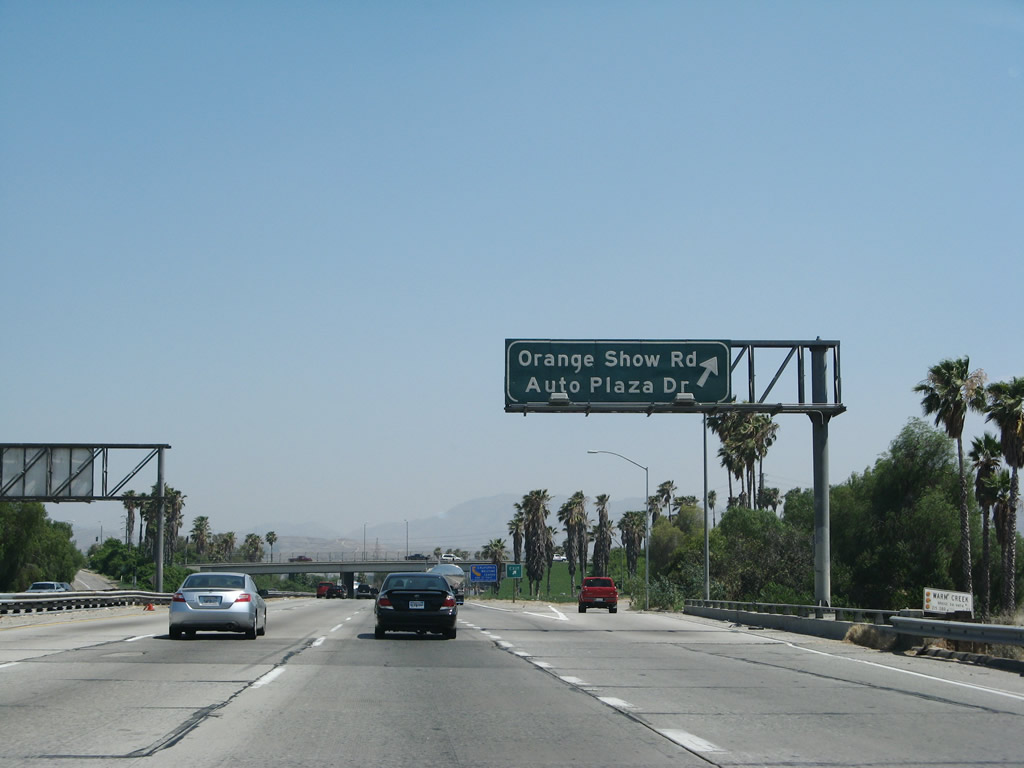
Southbound Interstate 215 (San Bernardino Freeway) reaches Exit 41, Orange Show Road and Auto Plaza Drive. Photo taken 06/24/07. |
|
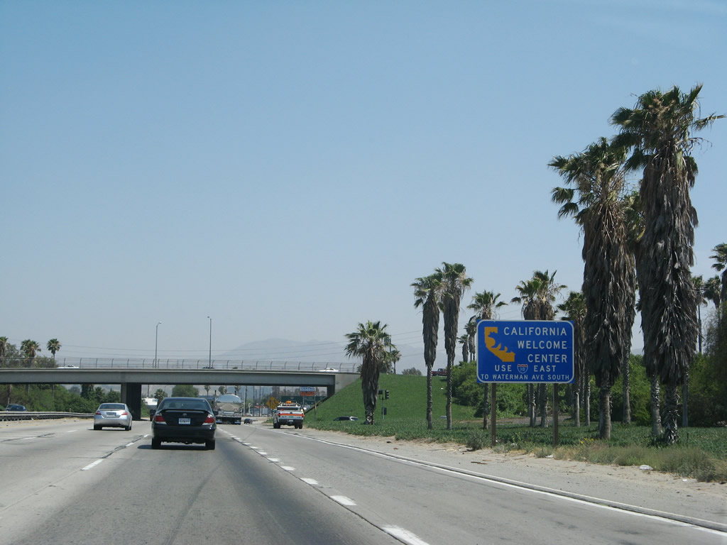
A State of California Welcome Center is located off of Interstate 10 at the Waterman Avenue interchange. Follow Interstate 10 (Redlands Freeway) east to Exit 73A, which is Waterman Avenue, then follow the signs. Tourist information, maps and directions, other motorist information, and restrooms are available at the welcome center. Photo taken 06/24/07. |
|
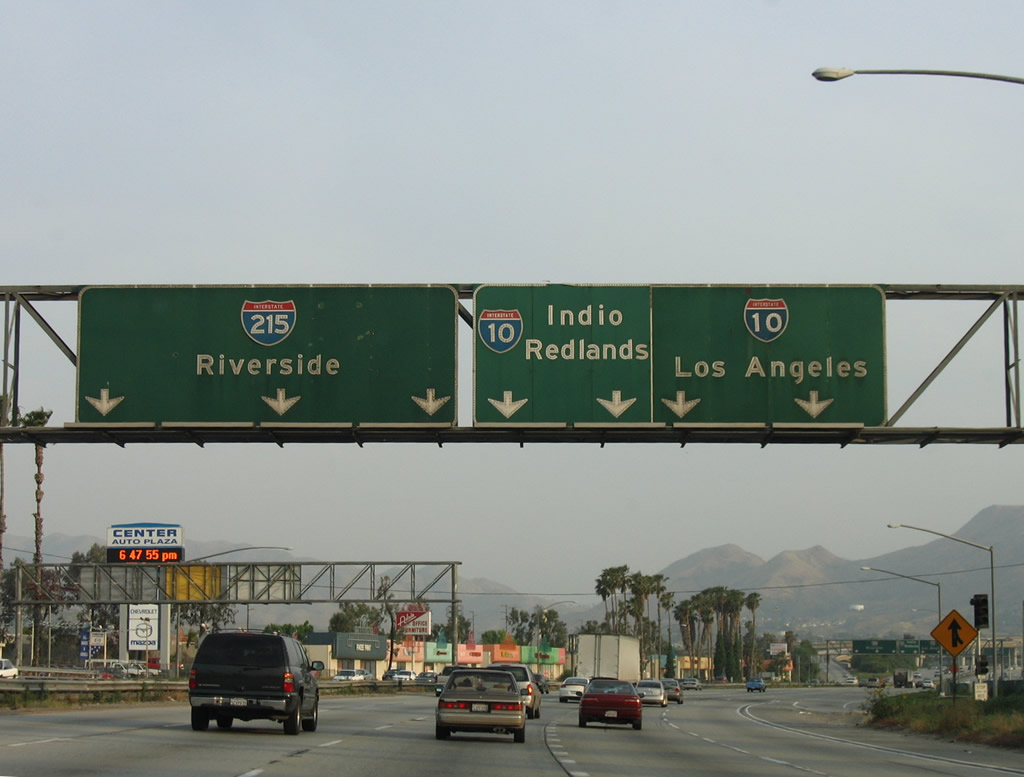
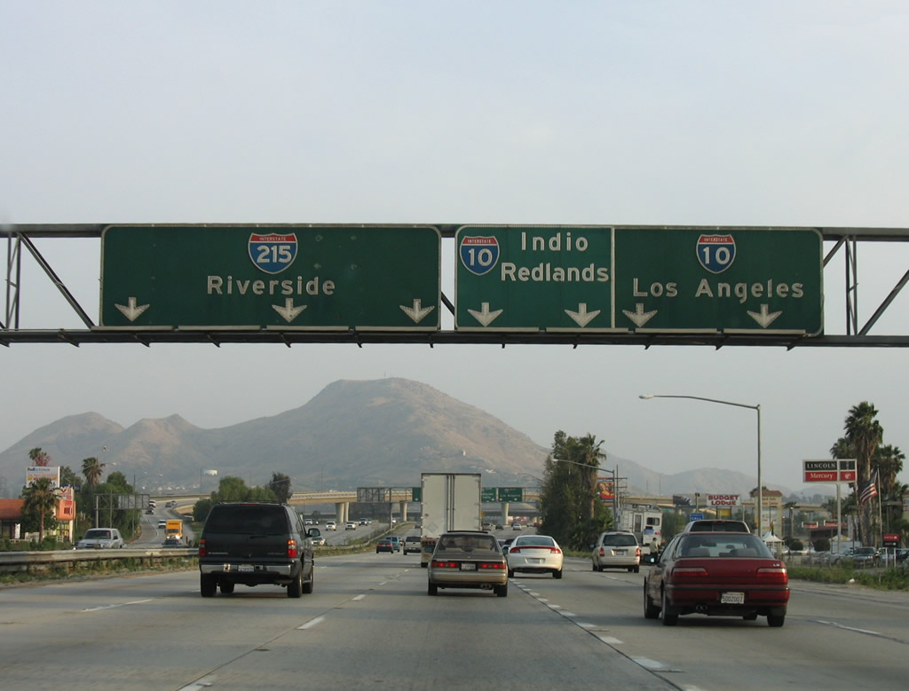
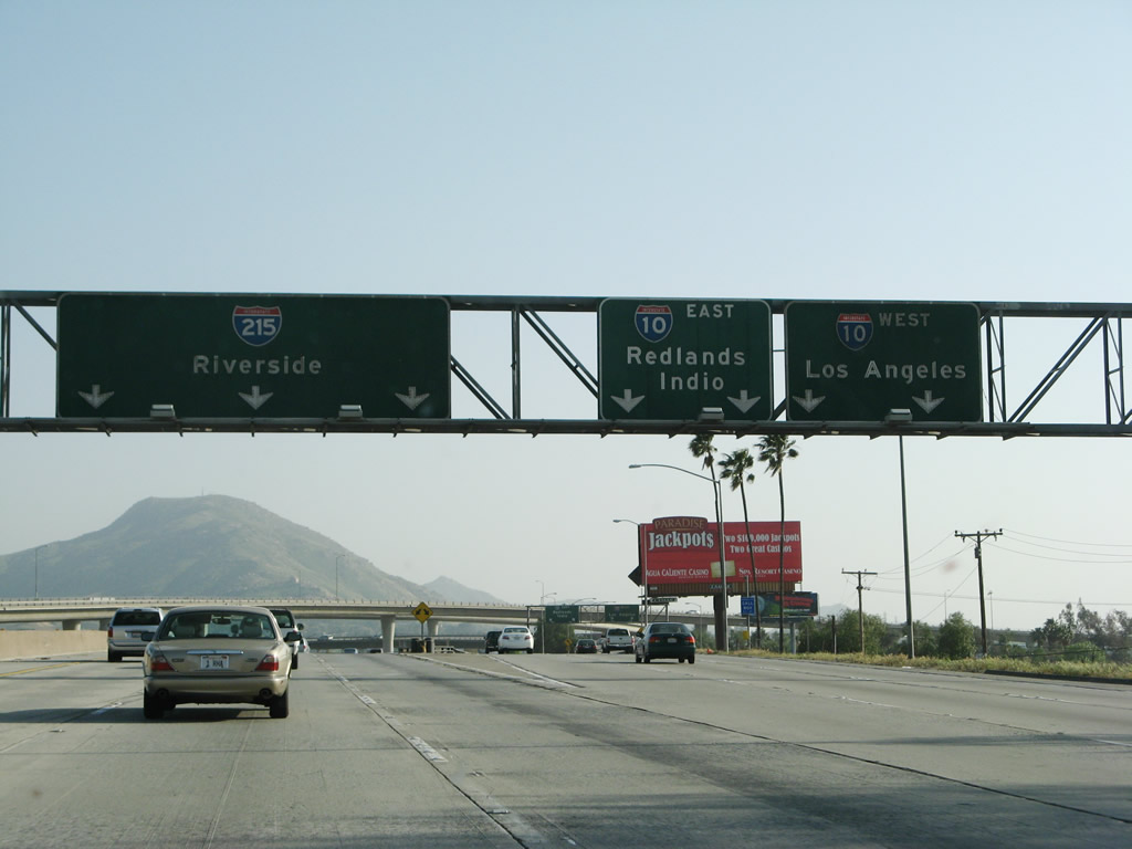
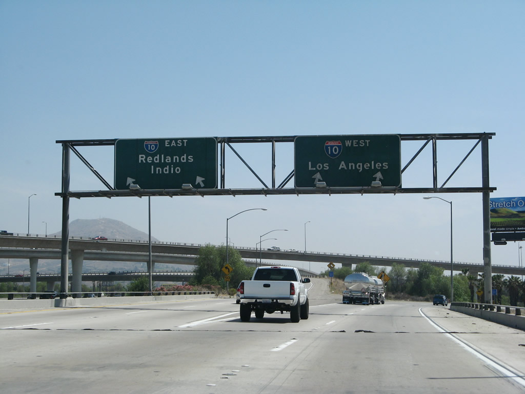
The next exit along southbound Interstate 215 is Exit 40, Interstate 10 (Redlands Freeway) east to Redlands, Palm Springs, Indio, Blythe, and Phoenix and Interstate 10 (San Bernardino Freeway) west to Pomona, Los Angeles, and Santa Monica. This is a major freeway interchange that is almost a symmetrical stack interchange except for a loop ramp that connects Interstate 215 north with Interstate 10 west. All other connections are high-speed ramps including flyovers. Photo taken 05/13/05. |
|
The left three lanes continue south on Interstate 215/Riverside Freeway. The right three lanes will make the connection to Interstate 10 east and west. Photo taken 05/13/05. |
|
Southbound Interstate 215 reaches Exit 40, Interstate 10. The left three lanes continue south on the Riverside Freeway, while the right lanes depart for Interstate 10. At this point, Interstate 215 crosses over the Santa Ana River, which will generally parallel the Riverside Freeway as it travels southwest toward Orange County. Photo taken 03/31/08. |
|
Now on the transition ramp, this view shows the connection from southbound Interstate 215 to Interstate 10 (Redlands Freeway) east to Indio and Phoenix and Interstate 10 (San Bernardino Freeway) west to Los Angeles and Santa Monica. Both transition ramps have two lanes. Photo taken 06/24/07. |
| Interstate 215/Riverside Freeway south |
|
|
Back on the mainline, southbound Interstate 215/Riverside Freeway passes through the almost symmetrical stack interchange with Interstate 10. The Riverside Freeway designation follows Interstate 215 from Interstate 10 south to the California 60-91-215 interchange. Photos taken 05/13/05 and 03/31/08. |
|
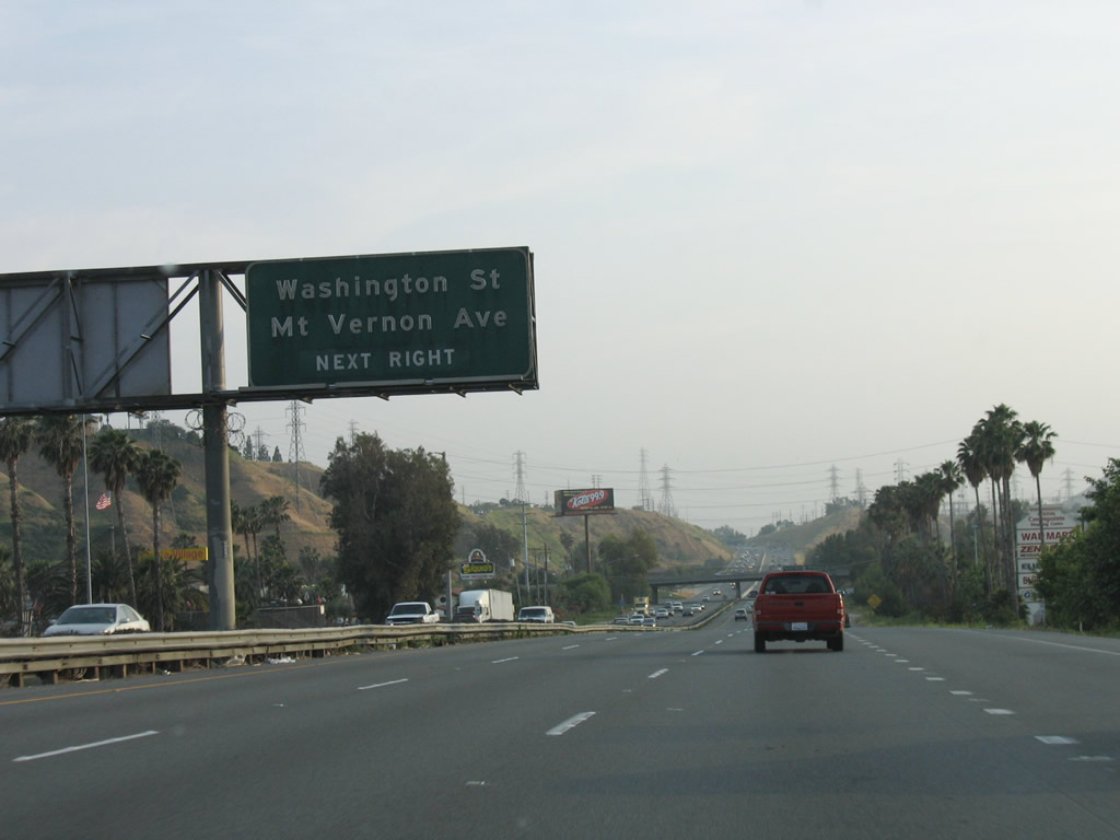
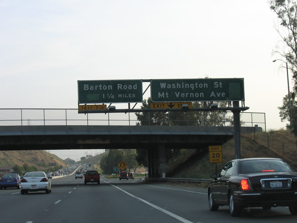
The next two exits along Interstate 215/Riverside Freeway are Exit 39, Washington Street and Mount Vernon Avenue and Exit 38, Barton Road. At this point, Interstate 215 turns southwest to pass through the cities of Colton and Grand Terrace before entering Riverside County. Photo taken 03/31/08. |
|
The city of Colton had a population of 47,662 as of the 2000 Census and constitutes 15.7 square miles at an elevation of 1,004 feet. The city of Colton is a major transportation crossroads due to the location of the interchange between Interstate 10 and Interstate 215 within its city limits, as well as the connection between the Union Pacific Railroad and Burlington Northern Santa Fe (BNSF) Railroad. Follow Mount Vernon Avenue north toward downtown Colton and Washington Street east toward the Reche Canyon area. Photo taken 05/13/05. |
|
Southbound Interstate 215/Riverside Freeway reaches Exit 39, Washington Street and Mount Vernon Avenue. The next exit along southbound is Exit 38, Barton Road. Photo taken 05/13/05. |
|
An Interstate 215 south reassurance shield is posted after the Washington Street and Mount Vernon Avenue interchange. Photo taken 05/13/05. |
|
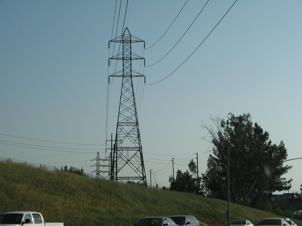
A large Southern California Edison substation is located on top of this hill that overlooks the Santa Ana River and the freeway. Photo taken 07/15/07. |
|
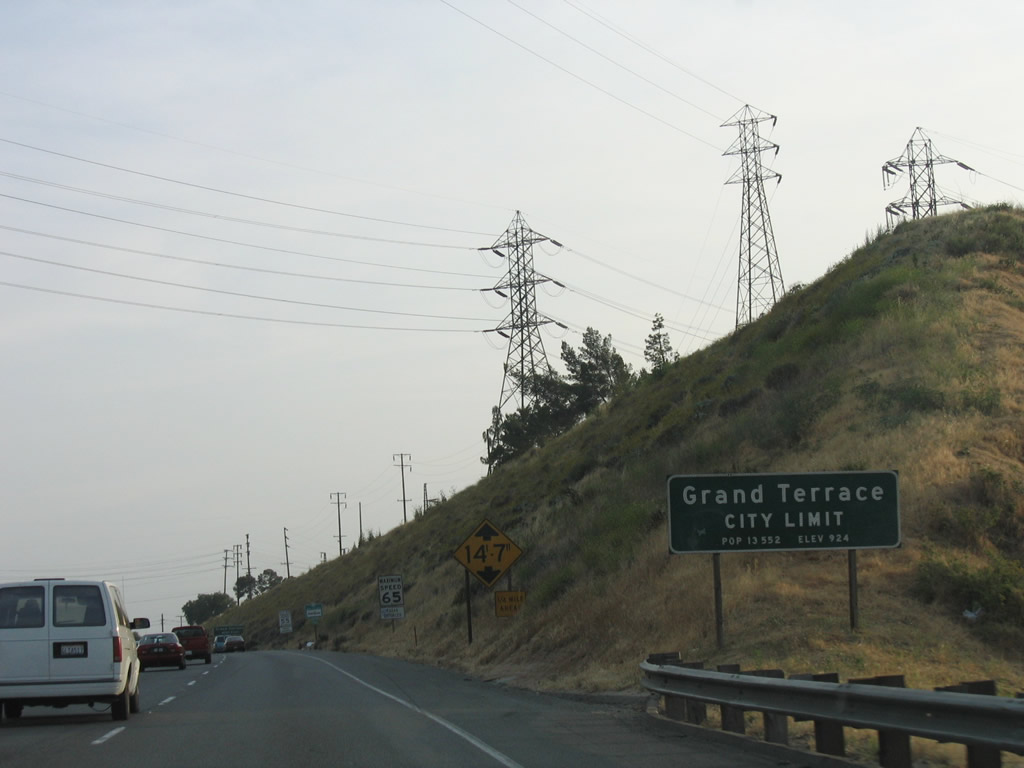
Ascending away from the Santa Ana River valley, Interstate 215 south briefly leaves Colton and enters the city of Grand Terrace, the Blue Mountain City (so named due to its location between Blue Mountain to the east, and La Loma Hills to the west). As of the 2000 Census, the population of Grand Terrace was 11,626 and consisted of 3.5 square miles. Grand Terrace was incorporated in 1978. Note the low bridge warning sign; bridges on the Interstate Highway System are supposed to allow for at least 16 feet of clearance; the next overpass only allows 14 feet and seven inches of clearance. Photo taken 05/13/05. |
|
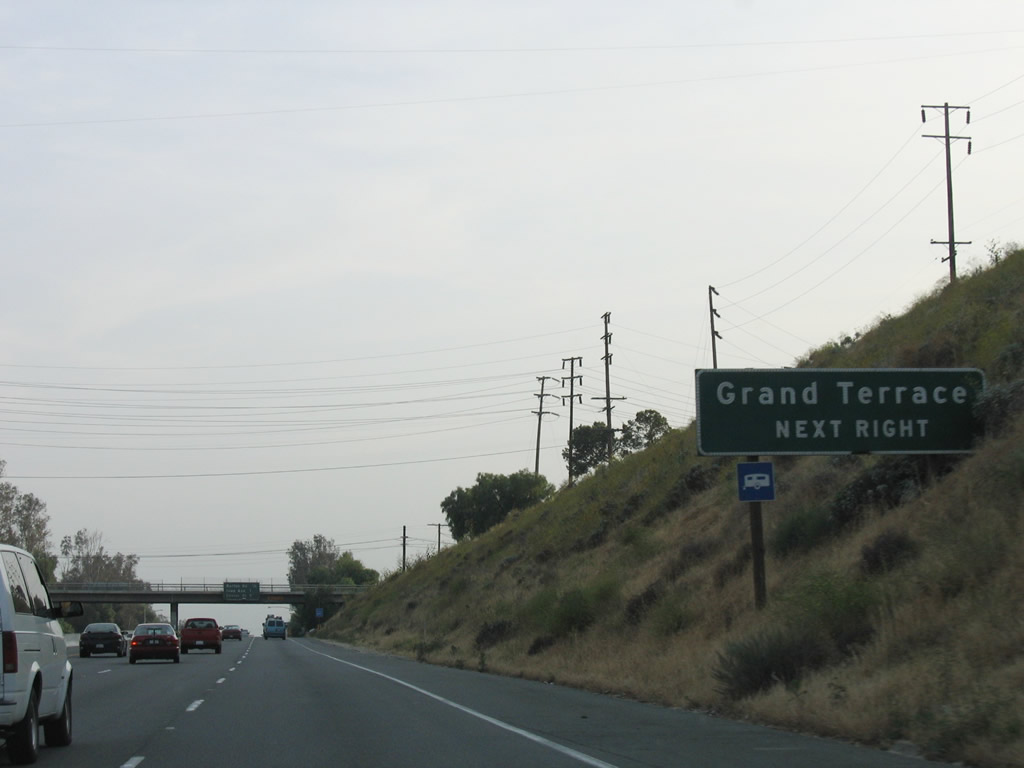
Only Exit 38 (Barton Road) serves the city of Grand Terrace. Photo taken 05/13/05. |
|
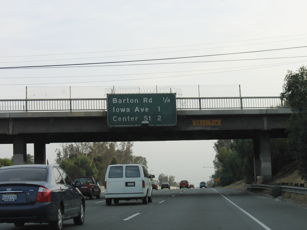
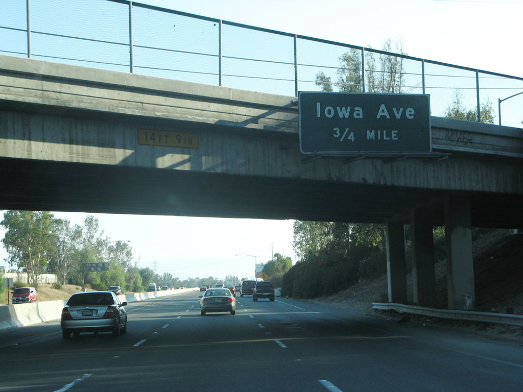
This mileage sign provides the distance to the next three exits on Interstate 215/Riverside Freeway south: Exit 38, Barton Road; Exit 37, La Cadena Drive and Iowa Avenue; and Exit 36, Center Street to Highgrove (an unincorporated community in Riverside County). This is the low clearance bridge mentioned earlier. There are other bridges along this section of Interstate 215 with lower than standard clearances. Photo taken 05/13/05. |
|
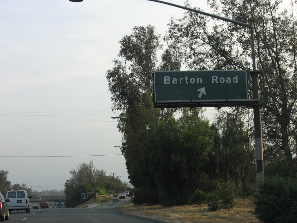
Southbound Interstate 215/Riverside Freeway reaches Exit 38, Barton Road to Grand Terrace. Photo taken 05/13/05. |
|
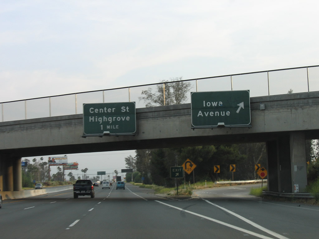
The next exit along Interstate 215 south is Exit 37, Iowa Avenue and La Cadena Drive (former U.S. 395). Photo taken 05/13/05. |
|
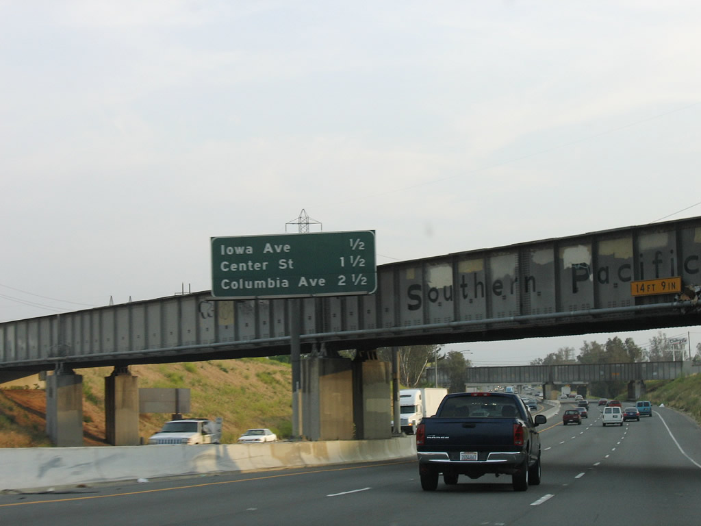
This mileage sign provides the distance to the next three exits on Interstate 215/Riverside Freeway south: Exit 37, La Cadena Drive and Iowa Avenue; Exit 36, Center Street to Highgrove; and Exit 35, Columbia Avenue. Photo taken 05/13/05. |
|
After passing under the Union Pacific Railroad bridge, this power line crosses over Interstate 215. Around this point, Interstate 215 leaves Grand Terrace and re-enters the city of Colton. Photo taken 03/31/08. |
|
Southbound Interstate 215/Riverside Freeway reaches Exit 37, Iowa Avenue and La Cadena Drive (former U.S. 395). This is the last interchange to serve San Bernardino County and the city of Colton. After this exit, Interstate 215 enters Riverside County. Photo taken 05/13/05. |
|
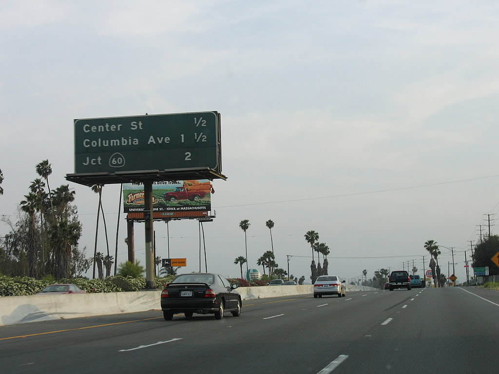
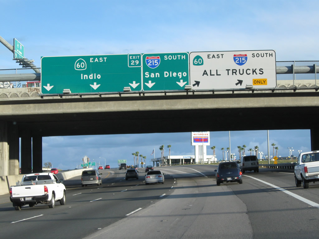
This mileage sign provides the distance to the next three exits on Interstate 215/Riverside Freeway south: Exit 36, Center Street to Highgrove; Exit 35, Columbia Avenue; and Exit 34C, California 60 west. Photo taken 05/13/05. |
|
Interstate 215/Riverside Freeway leaves San Bernardino Freeway and enters Riverside County. Photo taken 05/13/05. |
|
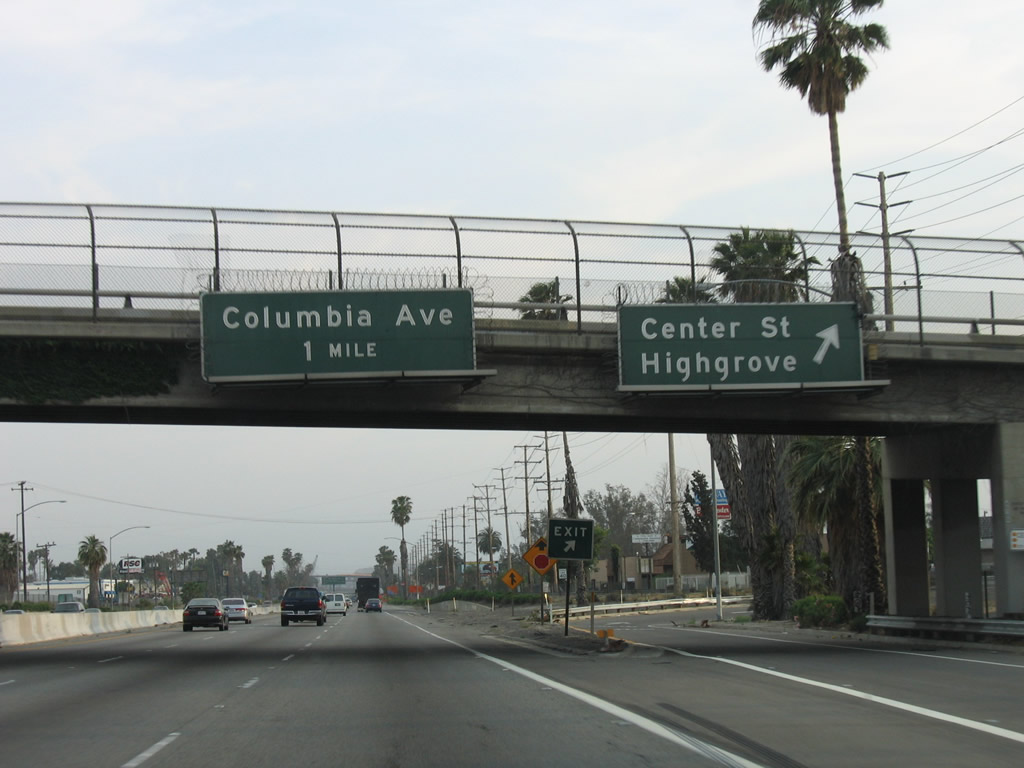
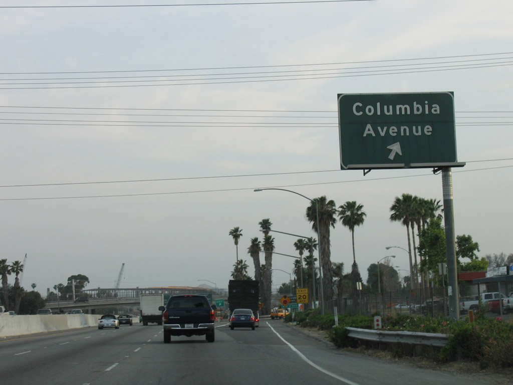
Southbound Interstate 215/Riverside Freeway reaches Exit 36, Center Street to the unincorporated community of Highgrove. The next exit along Interstate 215 south is Exit 35, Columbia Avenue. Photo taken 05/13/05. |
|
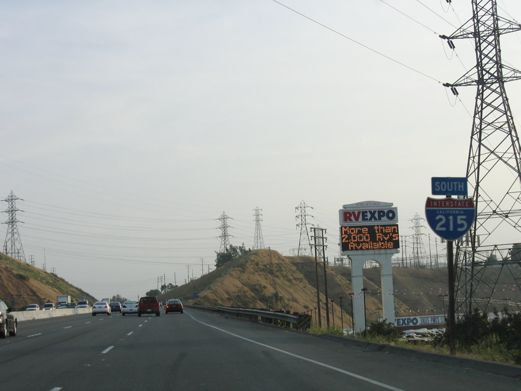
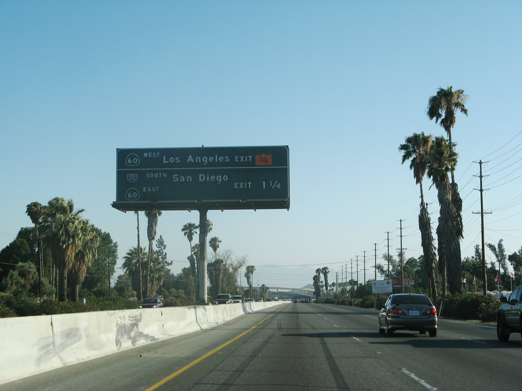
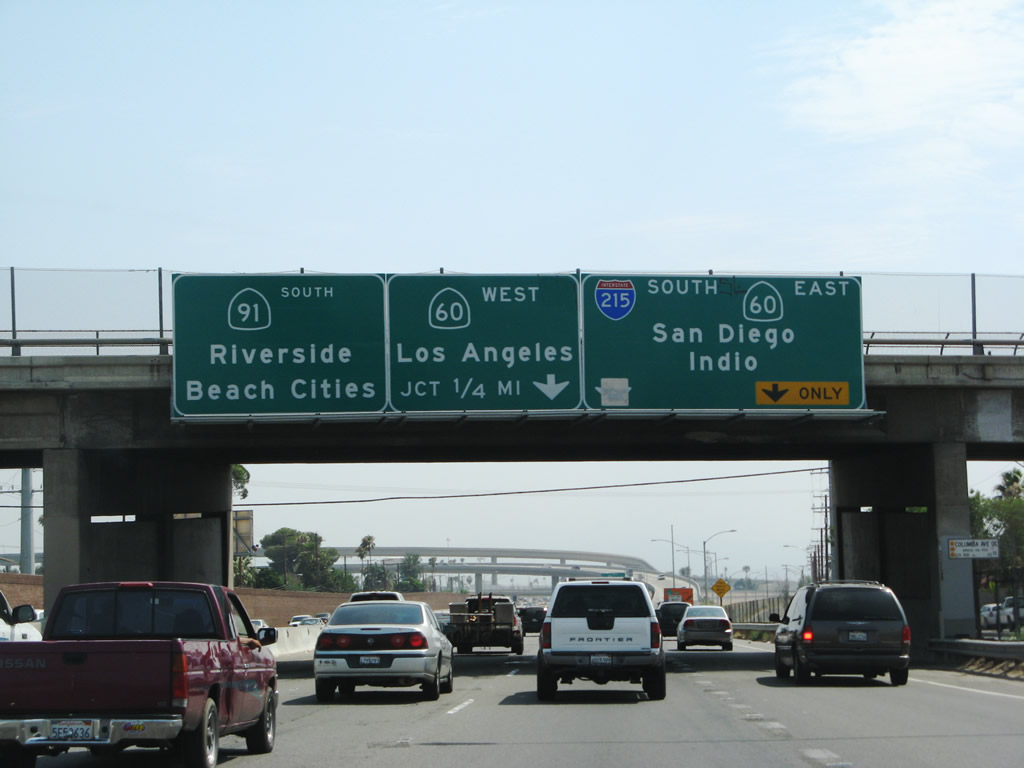
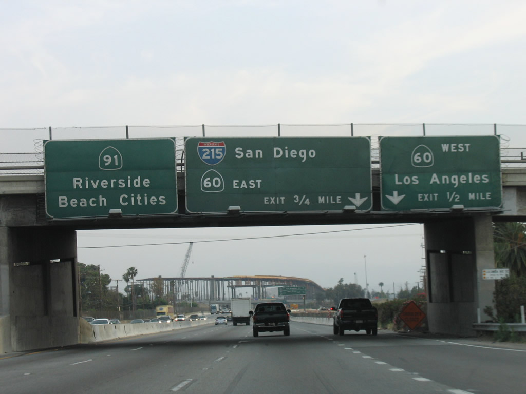
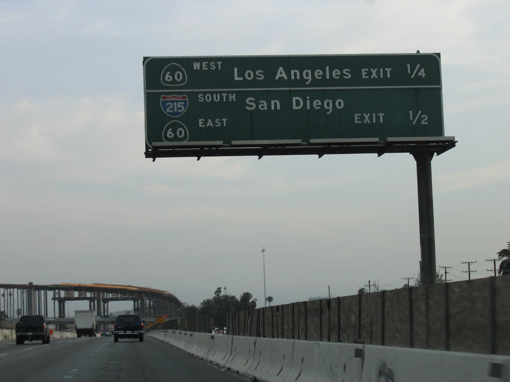
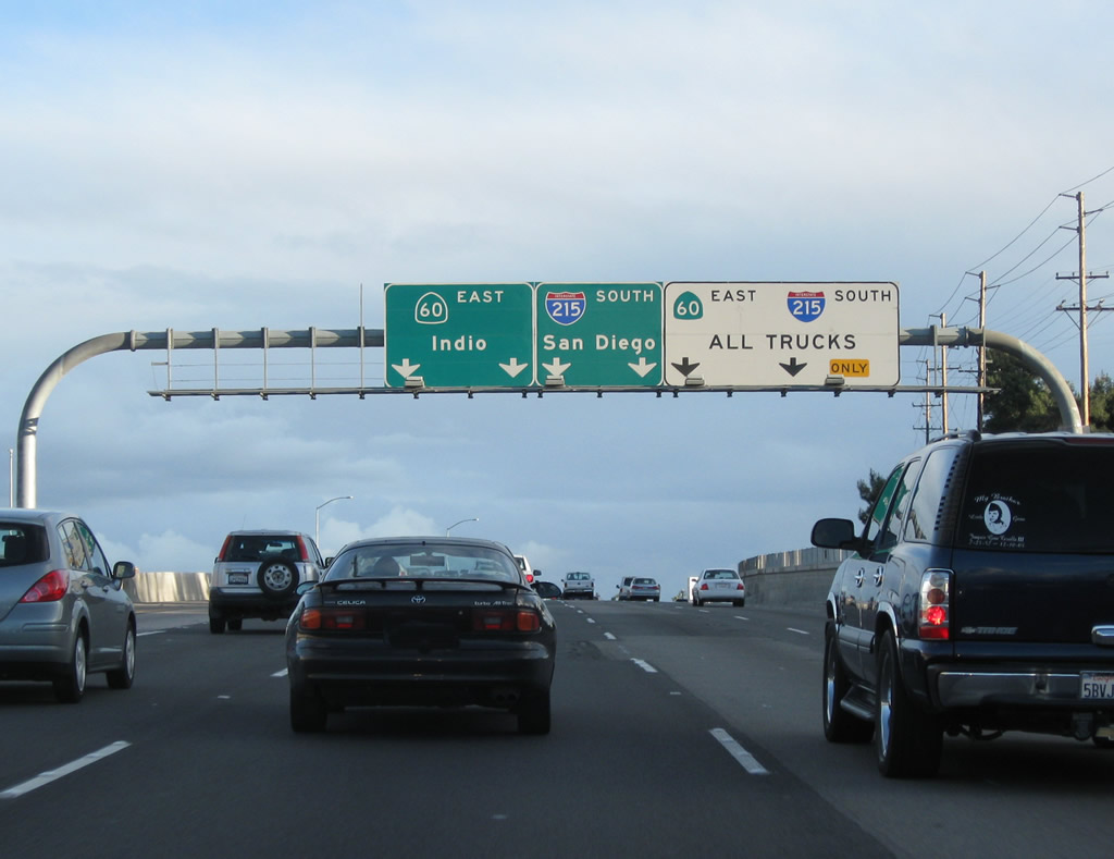
Prior to Exit 35, this mileage sign provides the distance to Exit 34C, California 60 west (was one mile before construction and is now 0.75 mile) and Exit 34B, California 91 (Riverside Freeway) southwest to Corona and all Orange County destinations. At this interchange, Interstate 215 departs the Riverside Freeway and moves onto the Moreno Valley Freeway southeast. Photo taken 05/13/05. |
|
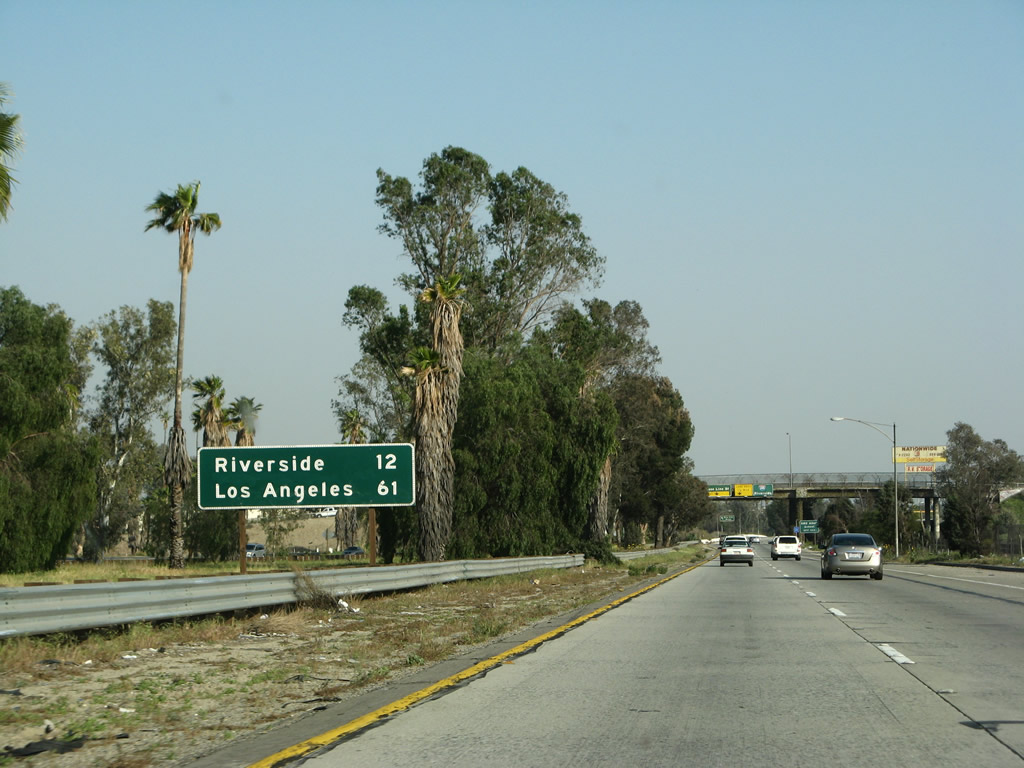
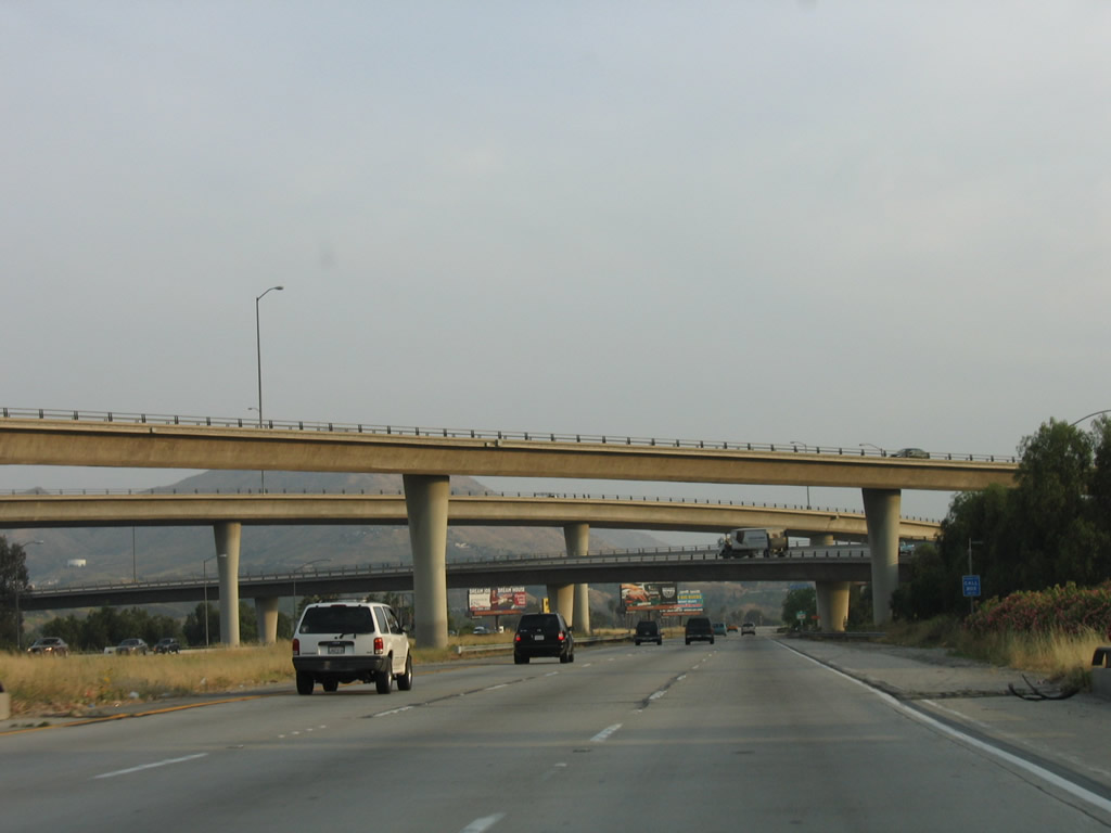
Southbound Interstate 215/Riverside Freeway reaches Exit 35, Columbia Avenue. At this point, Interstate 215 enters the city of Riverside, home to 255,166 people as of the 2000 Census. Like other Inland Empire cities, Riverside is growing (2006 Census estimate is a population of 293,761 people). Founded in 1870 by John North, Riverside was incorporated on October 11, 1883, consists of 78.4 square miles, and sits at an elevation of 860 feet. The city grew around the burgeoning citrus industry, although the number of active citrus groves in Riverside are not as common as they once were. Oranges, grapefruit, lemons, and other citrus became the economic engine for Riverside; a grove is preserved as part of California Citrus State Historic Park. Citrus was first planted in 1871, and nearly half of the 500,000 citrus trees in existence in California in 1882 were located in Riverside. While orange groves have gradually yielded to development through the years, several citrus groves remain actively cultivated in Riverside today. The historic Mission Inn is a major tourist attraction in downtown Riverside; it started with the core Glenwood Cottage in 1876, and eventually it expanded to encompass an entire city block. Today, the inn remains in business (despite being closed and restored between 1985 and 1992) complete with overnight accommodations, restaurants, and related attractions. Photo taken 05/13/05. |
|
|
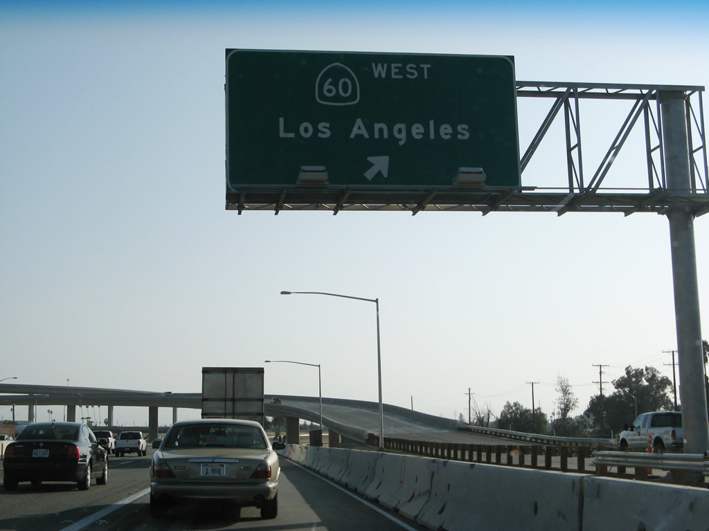
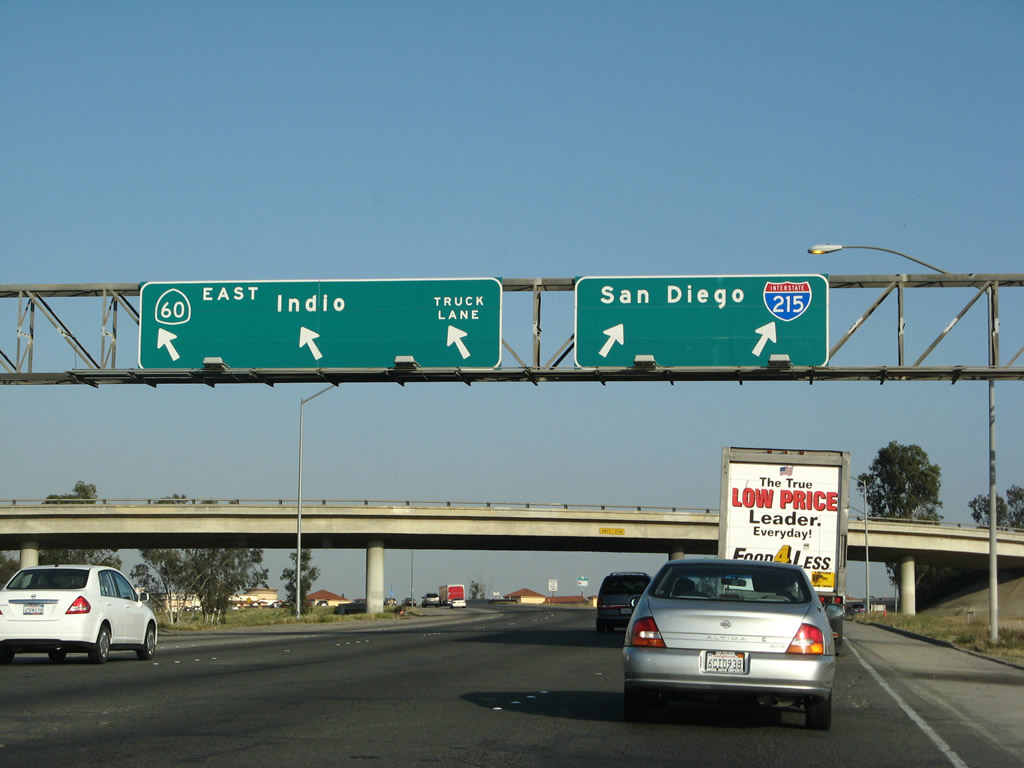
The overhead signs posted prior to the California 60 and California 91 interchange have changed as a result of the new flyover ramps. Now the first exit to the right is the continuation of Interstate 215 south and California 60 east to Moreno Valley and San Diego. The second exit is the connection to California 60 west (Exit 34C), and the left three lanes continue west on California 91 (Riverside Freeway) to Corona and all Orange County destinations. Photos taken 07/14/08 and 05/13/05. |
|
Interstate 215 south and California 60 east split to the right onto the new flyover ramp. All mainline traffic for Interstate 215 should exit here; the left lanes continue west along California 91 (Riverside Freeway) toward Corona and Orange County. Photo taken 07/14/08. |
|
|
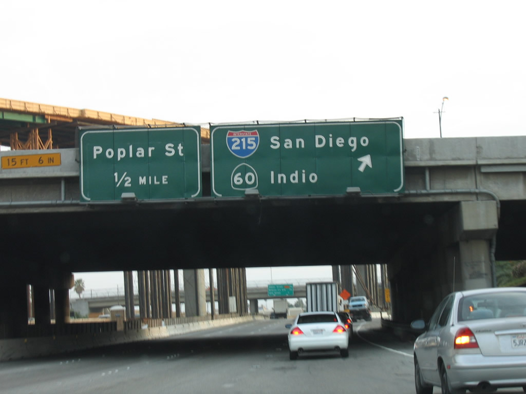
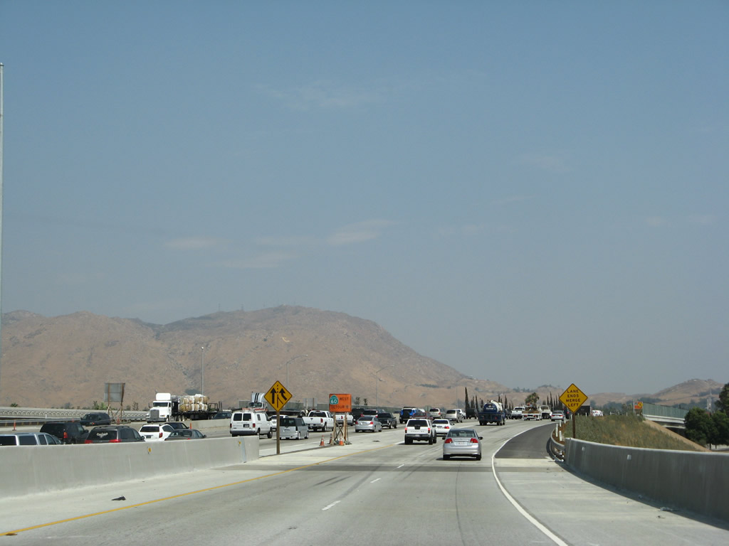
After the Interstate 215 south and California 60 east traffic departs, the next exit is for California 60 west. The 2005 signage shows the former mileage sign that was posted here, before the flyover ramps were opened to traffic in 2008. Photos taken 03/31/08 and 05/13/05. |
|
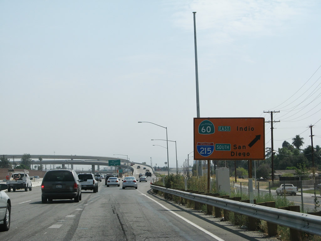
This photo show the former loop ramp connection that used to guide Interstate 215 travelers south on the connection from the Riverside Freeway southwest to the Moreno Valley (Escondido) Freeway southeast. These signs are gone, and the loop ramp was removed from service once the new flyover ramps were opened for use. Photo taken 05/13/05. |
|
Looking south from the loop ramp that connects Interstate 215 from the Riverside Freeway to the Moreno Valley (Escondido) Freeway is this view of the transition ramp from Interstate 215 north and California 60 west to California 91 southwest. Photo taken 07/15/07. |
|
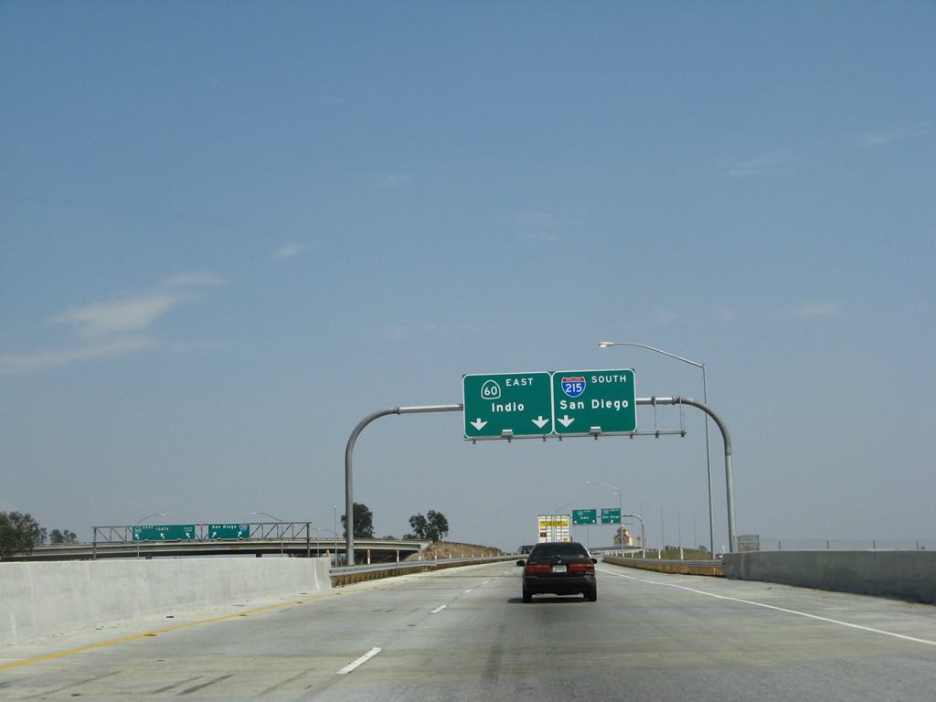
|
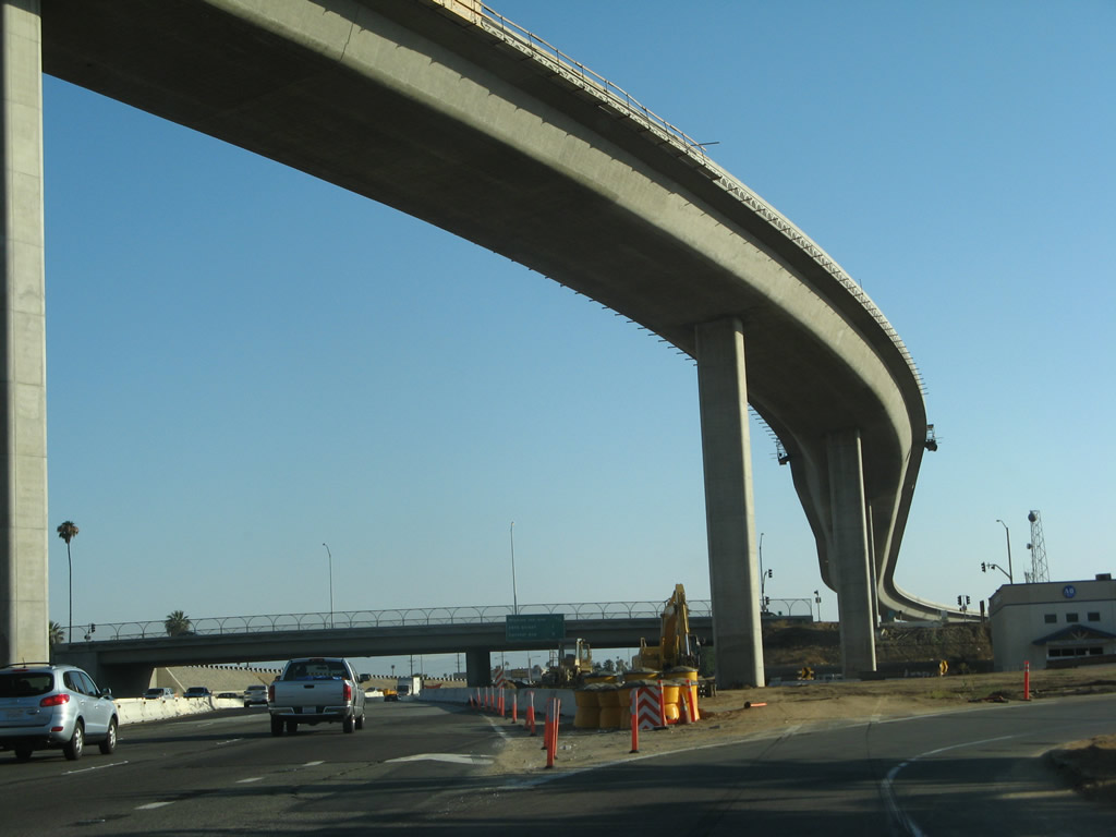
Now traveling the two-lane transition ramp, Interstate 215 south flies high above the 60-91-215 interchange. This ramp, dubbed the "215 Connection to Southbound 215," opened to traffic in 2008. Photos taken 07/14/08. |
|
|
|
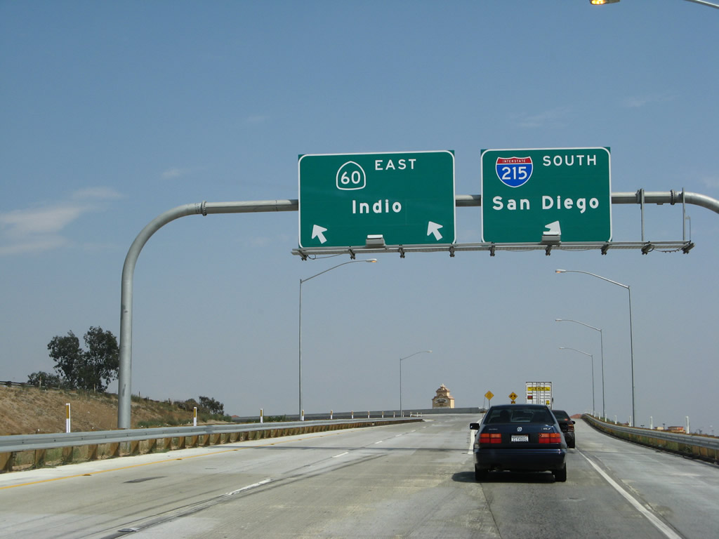
Traffic from Interstate 215 south merges with traffic from California 60 east. Photo taken 07/14/08. |
| Interstate 215 south and California 60 (Moreno Valley Freeway) east |
|
After merging onto California 60 east on the former loop ramp, this view shows the new Interstate 215 direct transition ramp and the new 60-215 north to 91 west ramp. There is a loop ramp from California 60 east to Interstate 215/Riverside Freeway north (which is California 60's Exit 53B). Photo taken 07/15/07. |
|
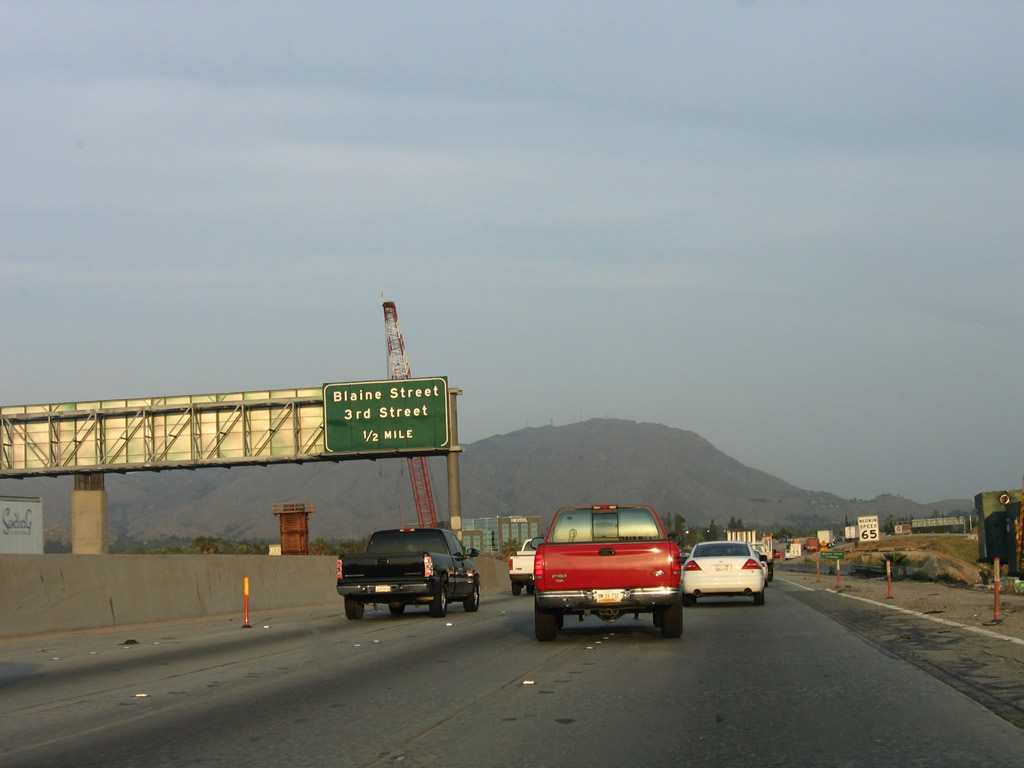
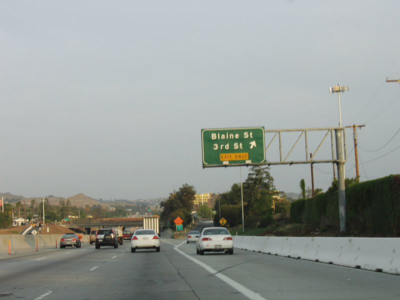
The next exit along Interstate 215 south and California 60 east is Third Street west and Blaine Street east. This whole area has been reconstructed, and these signs are no longer present. Photo taken 05/13/05. |
|
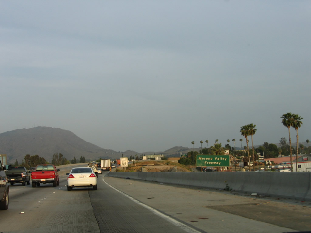
Signs indicate that the shared section of California 60 east and Interstate 215 south are known as the Moreno Valley Freeway. Legislatively, this section of freeway is also known as the Escondido Freeway, which carries Interstate 215 south to Murrieta and Interstate 15 all the way to its southern terminus in San Diego. Note all the cleared land adjacent to the freeway that has since become part of the expanded Interstate 215 corridor through Riverside. Photo taken 05/13/05. |
|
|
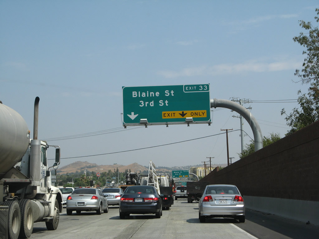
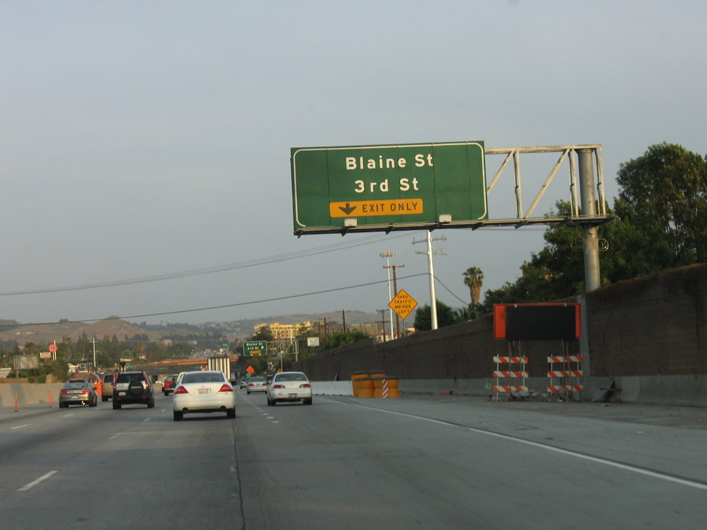
The right lane becomes exit only for Exit 33, Third Street and Blaine Street. This configuration has changed with the arrival of the new Interstate 215 connecting ramps. Photos taken 07/14/08 and 05/13/05. |
|
|
Southbound Interstate 215 (Escondido Freeway) and eastbound California 60 (Moreno Valley Freeway) reach Exit 33, Third Street and Blaine Street. With the widening of this section of road and the opening of the 215 southbound flyover ramp at the 60-91-215 interchange, new signs were installed in 2008. Photos taken 07/14/08 and 05/13/05. |
|
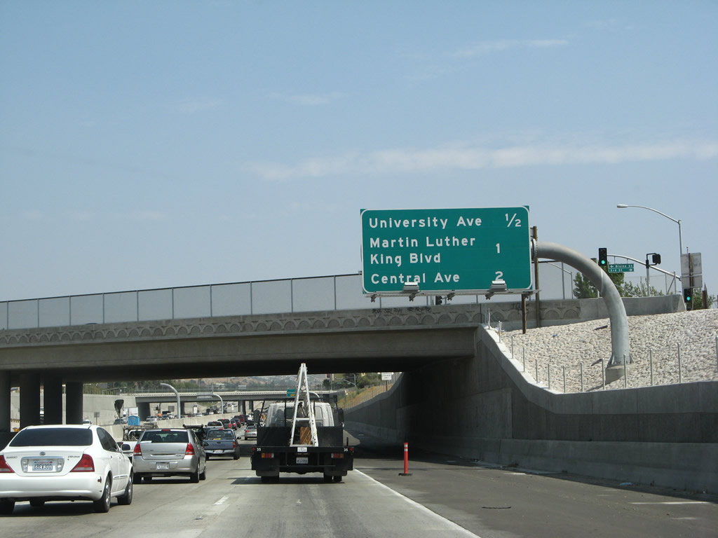
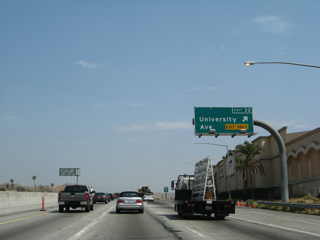
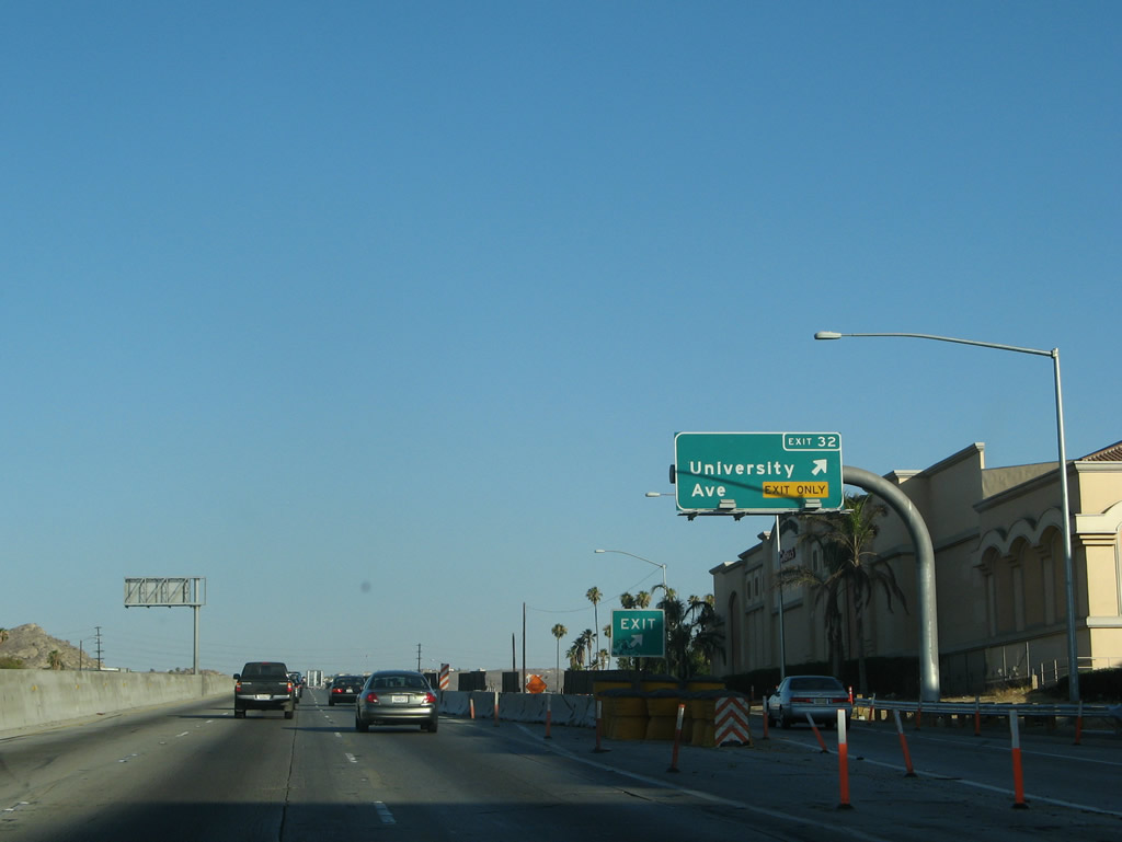
THe next three exits along Interstate 215 south and California 60 east are Exit Exit 32, University Avenue (California 60 Business); Exit 31, Martin Luther King, Jr. Boulevard; and Exit 30B, Central Avenue west and Watkins Drive north. Photo taken 07/14/08. |
|
|
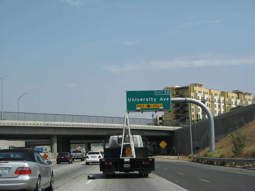
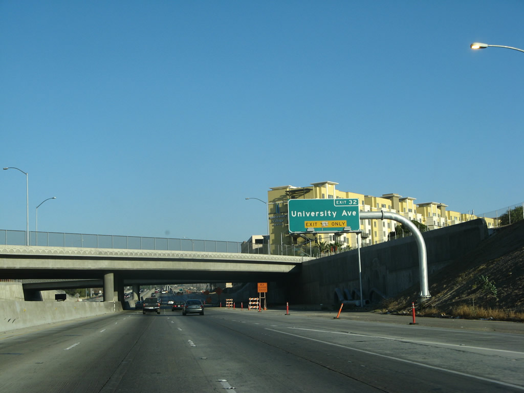
The next exit along Interstate 215 south and California 60 east is Exit 32 (Exit 32B), University Avenue (California 60 Business) to the University of California at Riverside. The university campus straddles both sides of the freeway between Exits 32 and 31 (Martin Luther King, Jr. Boulevard). Photos taken 07/14/08 and 07/15/07. |
|
|
Southbound Interstate 215 and California 60 east reaches Exit 32 (Exit 32B), University Avenue (California 60 Business) to the University of California at Riverside. This interchange was reconstructed as part of the 60-91-215 interchange widening and improvement project. Photos taken 07/14/08 and 07/15/07. |
|
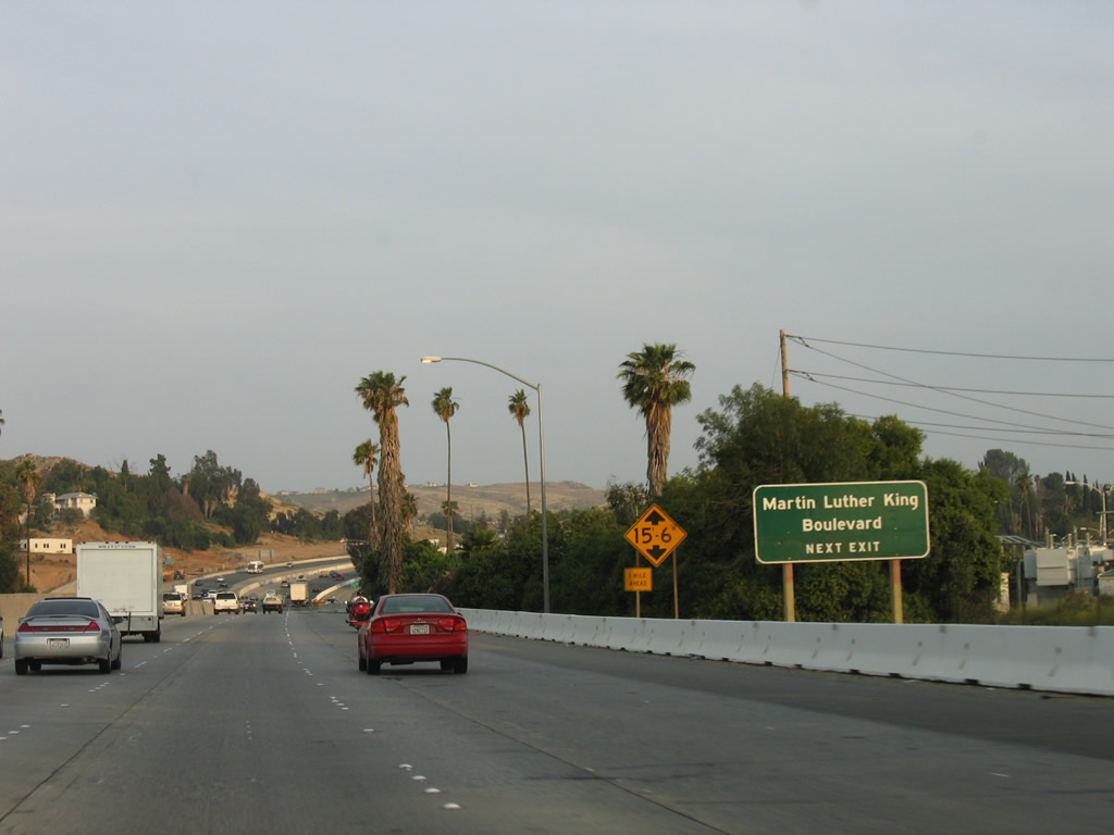
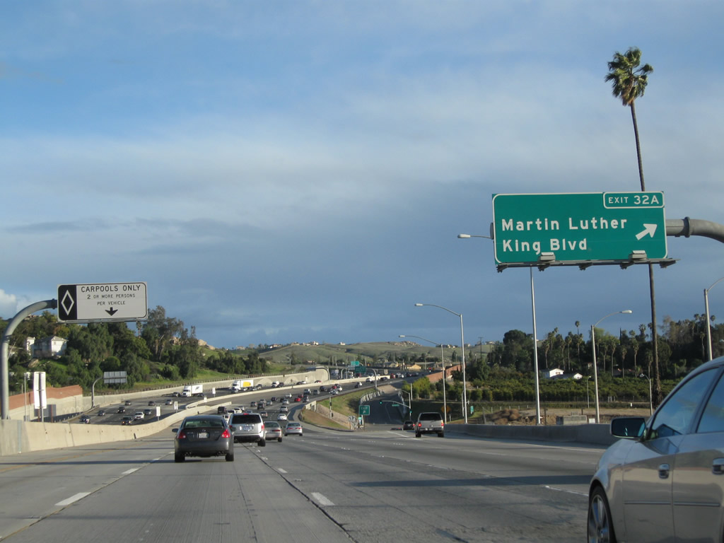
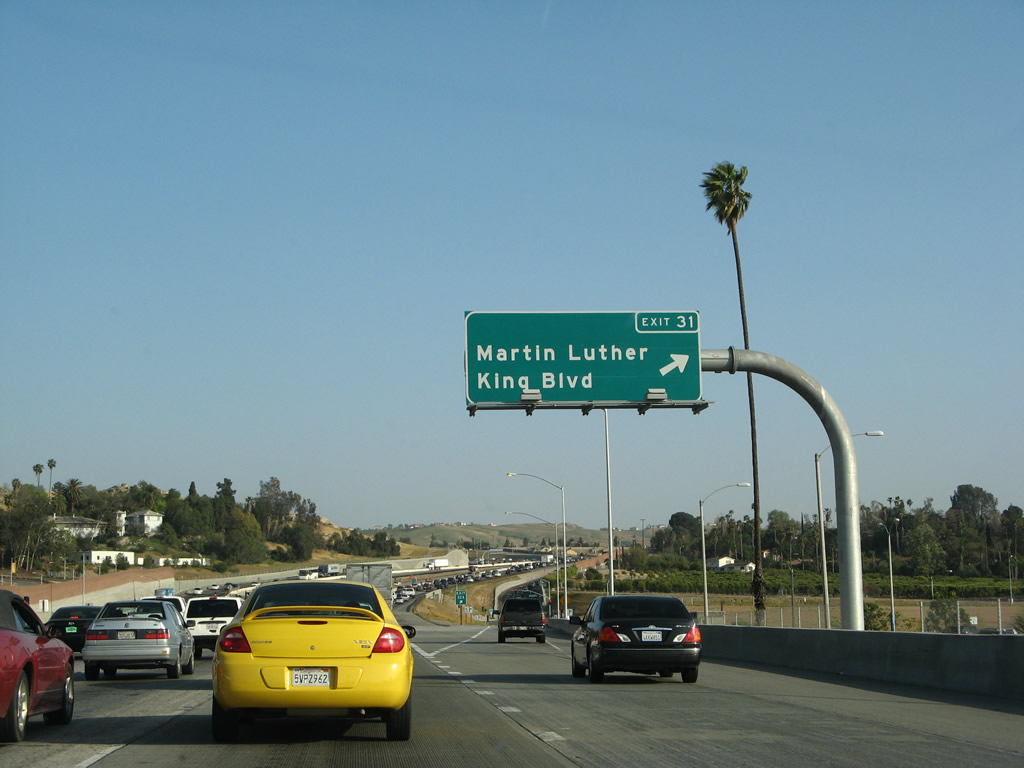
The next exit along Interstate 215 south and California 60 east is Exit 31 (Exit 32A), Martin Luther King, Jr. Boulevard. A former interchange with El Cerrito Drive has since been closed. Photo taken 05/13/05. |
|
|
Southbound Interstate 215 and eastbound California 60 meet Exit 31 (Exit 32A), Martin Luther King, Jr. Boulevard. Revisiting this location in 2011 indicated this was Exit 32A, but the Caltrans webpage shows it as Exit 31. Photo taken 03/31/08. |
|
The gore point sign for Exit 31 (Exit 32A), Martin Luther King, Jr. Boulevard showed as Exit 32A in 2008 and as an unnumbered off-ramp in 2011. Photo taken 03/31/08. |
|
|
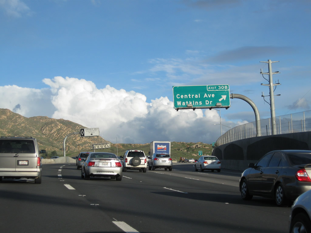
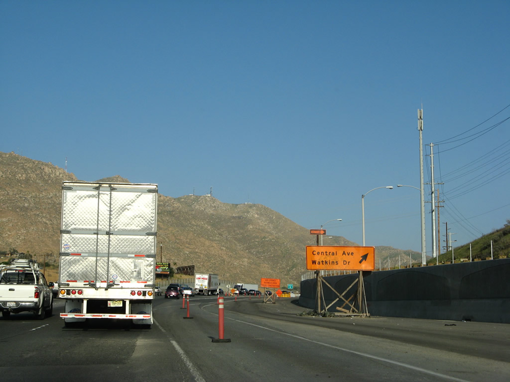
The next exit along Interstate 215 south and California 60 east is Exit 30B, Central Avenue west and Watkins Drive north. Photos taken 07/14/08 and 05/13/05. |
|
|
Southbound Interstate 215 and eastbound California 60 meet Exit 30B, Central Avenue west and Watkins Drive north. Photos taken 02/26/11 and 03/31/08. |
|
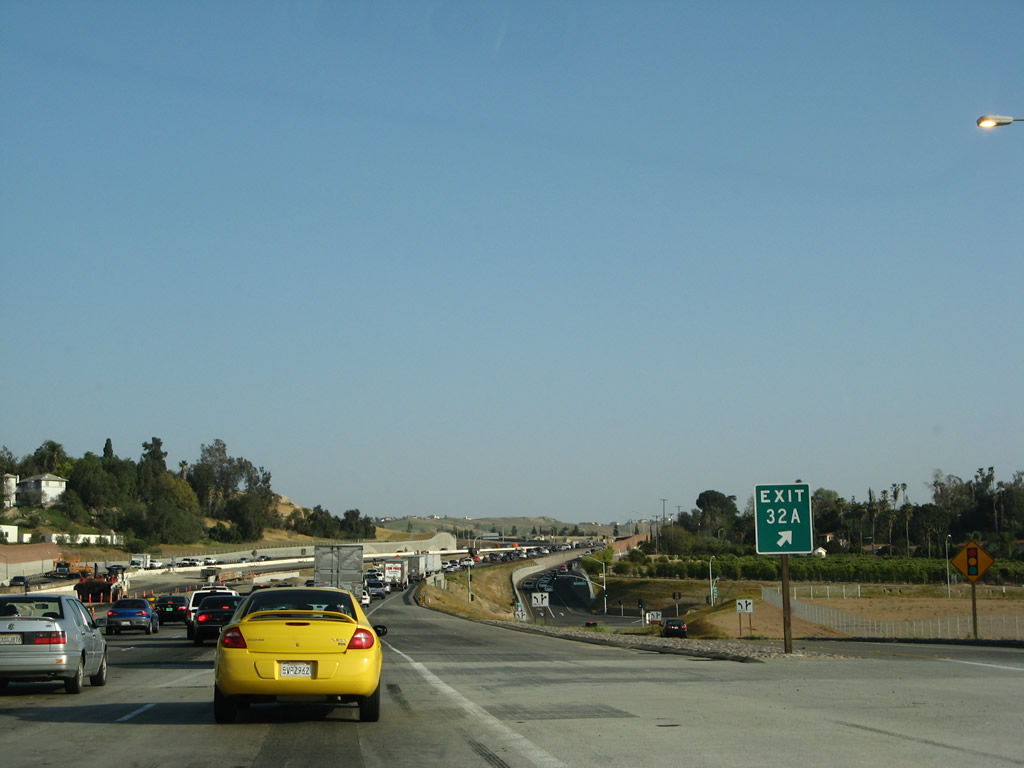
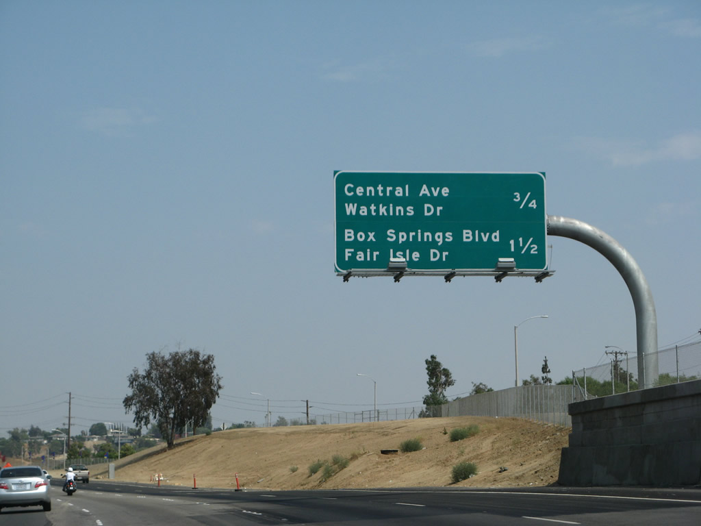
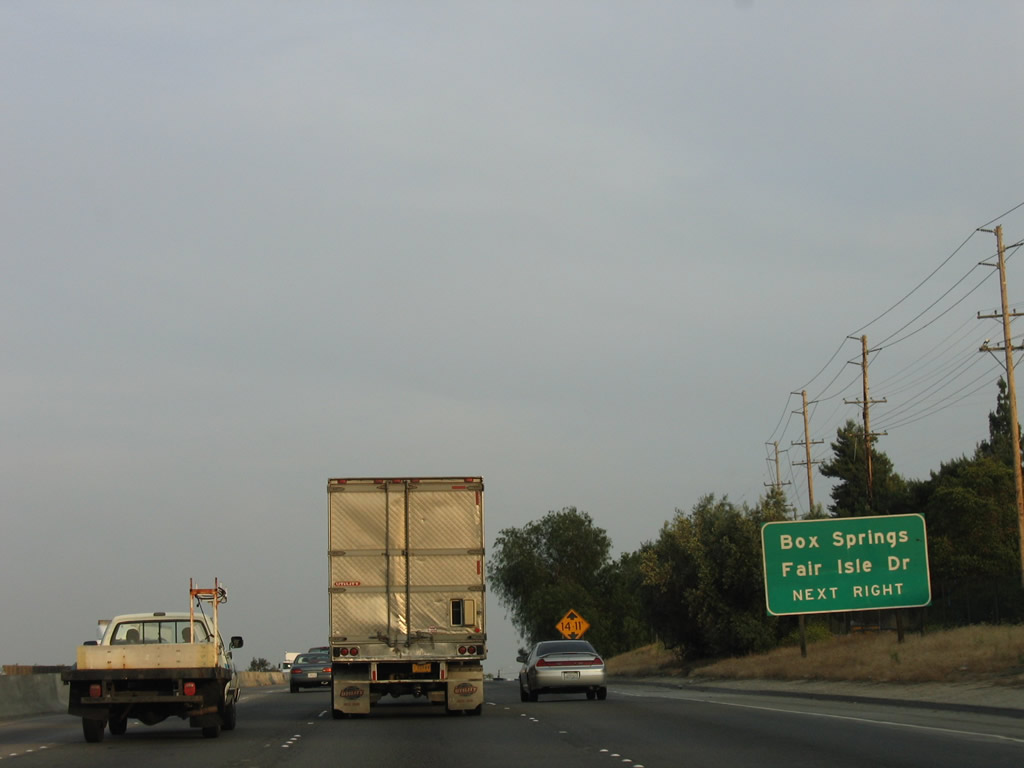
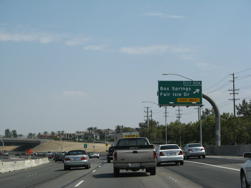
The next exit along Interstate 215 south and California 60 east is Exit 30A, Box Springs Road east to Moreno Valley and Fair Isle Drive southwest to the University City neighborhood of the city of Riverside. Photo taken 05/13/05. |
|
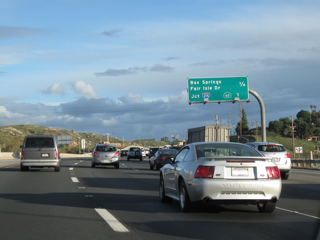
A mileage sign provides the distance to the next two exits along Interstate 215 south and California 60 east: Exit 30A, Box Springs Road east to Moreno Valley and Fair Isle Drive southwest and Exit 29, California 60 and Interstate 215 split. Photo taken 02/26/11. |
|
Southbound Interstate 215 and eastbound California 60 reach Exit 30A, Box Springs Road and Fair Isle Drive. This is the final exit along the shared alignment of these two freeways. Photo taken 07/14/08. |
|
Stay right to use the truck bypass connection for Interstate 215 south and California 60 east. Stay left for the continuation of California 60 (Exit 29). Photo taken 02/26/11. |
|
|
|
The right two lanes connect to the truck bypass connection for Interstate 215 south and California 60 east. See below for coverage of the truck bypass lanes. Photos taken 02/26/11 and 07/14/08. |
|
Back in March 2008, the new truck bypass connection for Interstate 215 south and California 60 east was nearly complete, even though at that time the new lanes did not yet connect to the existing mainline. Since then, the truck lanes have opened. Photo taken 03/31/08. |
|
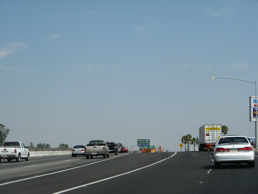
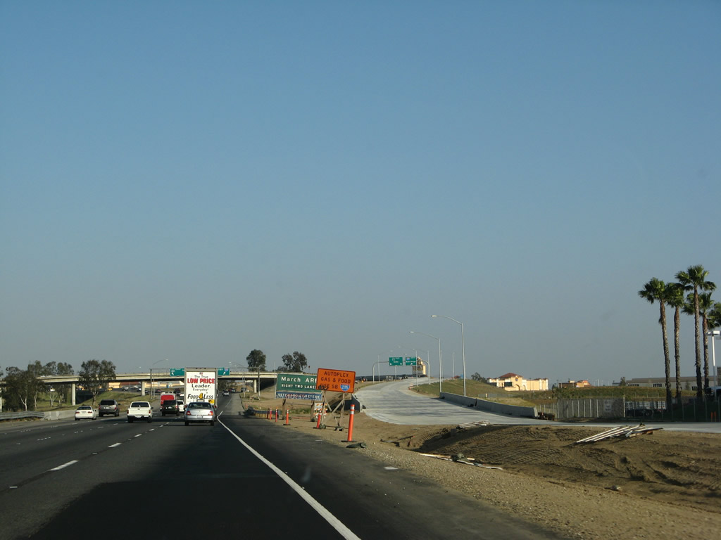
Use Interstate 215 south to the March Air Force Reserve Base (ARB). Photo taken 03/31/08. |
|
The two right lanes continue south on Interstate 215 (Escondido Freeway), while the left three lanes continue east on California 60 (Moreno Valley Freeway) east. This interchange is located in the eastern city of Riverside community of Canyon Springs. Interstate 215 travels south along Old U.S. 395 to Sun City, Perris, and Murrieta. Interstate 215 merges onto Interstate 15 south at that point, and Interstate 15 continues south to Temecula, Escondido, and San Diego. California 60, meanwhile, continues east into the city of Moreno Valley. It eventually ends at its merge onto Interstate 10 in Beaumont. Photo taken 03/31/08. |
| Truck Lanes - Interstate 215 south & California 60 east |
|
Now on the truck bypass lanes, the right lane connects to Interstate 215 (Escondido Freeway) south, while the left two lanes continue onto California 60 (Moreno Valley Freeway) east. Photo taken 07/14/08. |
|
The truck bypass splits: the left lanes continue east on California 60, while the right lane departs for Interstate 215 south. Photo taken 07/14/08. |
| To continue east on California 60 (Moreno Valley Freeway), go to California 60 east. |
Page Updated April 17, 2011.