| Interstate 680/Donald D. Doyle Highway north |
|
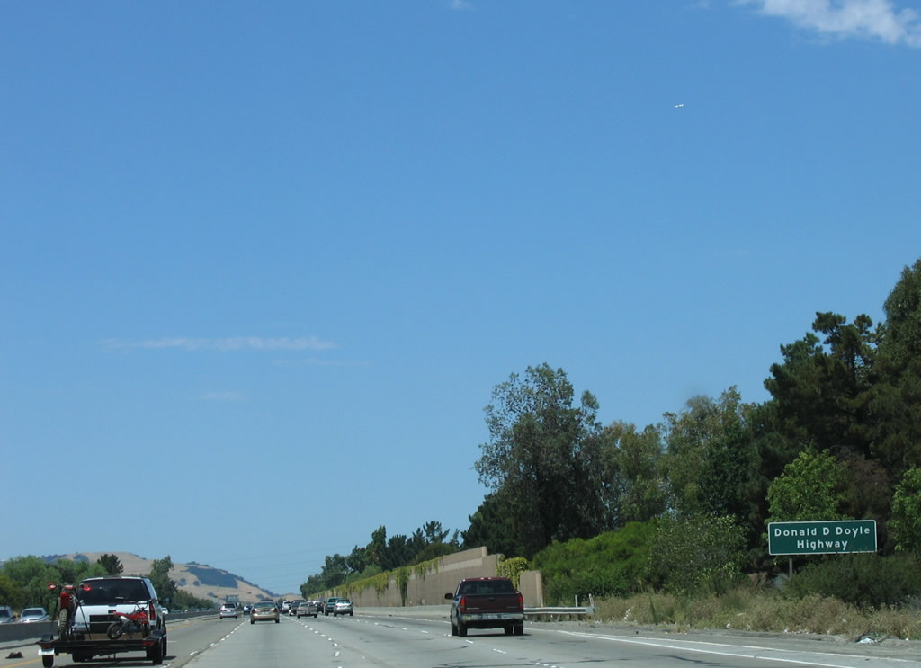
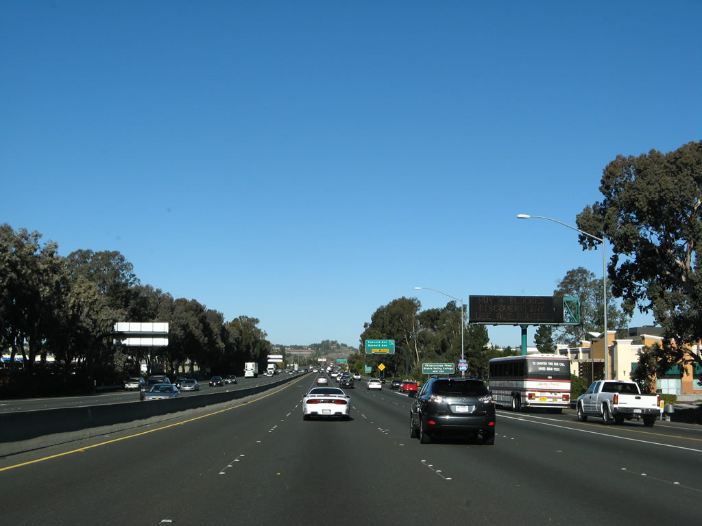
Interstate 680 in Contra Costa County is known as Donald D. Doyle Highway. Entering the city of San Ramon, Interstate 680 will have two more exits to serve San Ramon: Exit 34, Bollinger Canyon Road and Exit 36, Crow Canyon Road. San Ramon had 44,722 people as of the 2000 Census and incorporated as a city in 1983. Photo taken 08/05/05. |
|
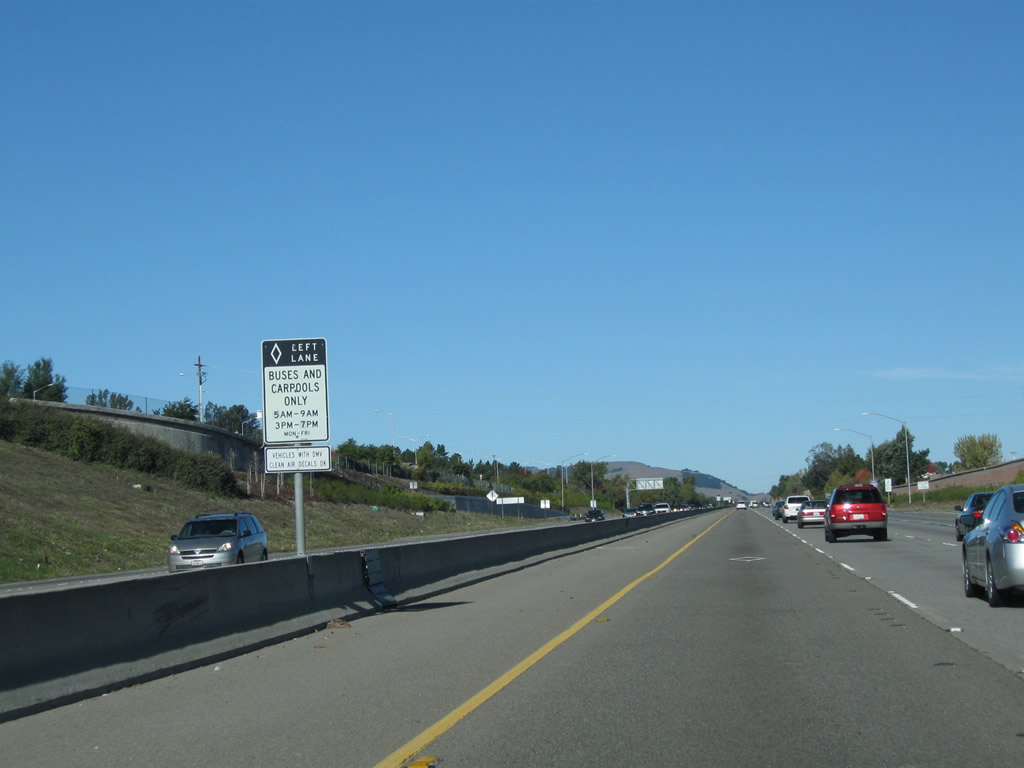
The left lane is sometimes a high occupancy vehicle; pay attention to the days and times for the restricted use. Photo taken 11/25/10. |
|
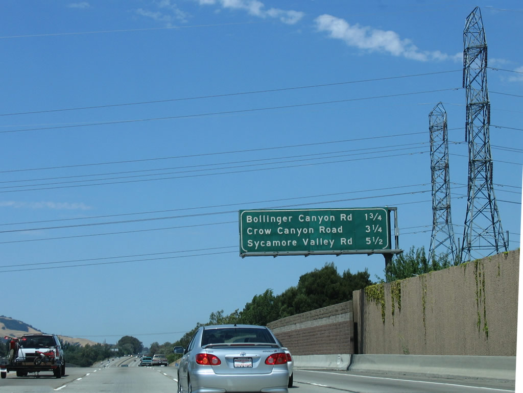
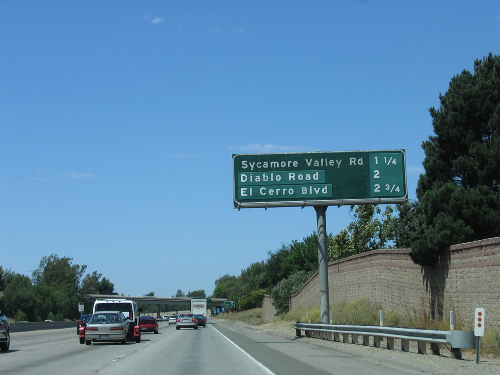
After the on-ramp from Exit 31 (Alcosta Boulevard) onto Interstate 680 north, this mileage sign provides the distance to Exit 34, Bollinger Canyon Road (1.75 miles); Exit 36, Crow Canyon Road (3.25 miles); and Exit 38, Sycamore Valley Road (5.50 miles). Photo taken 08/05/05. |
|
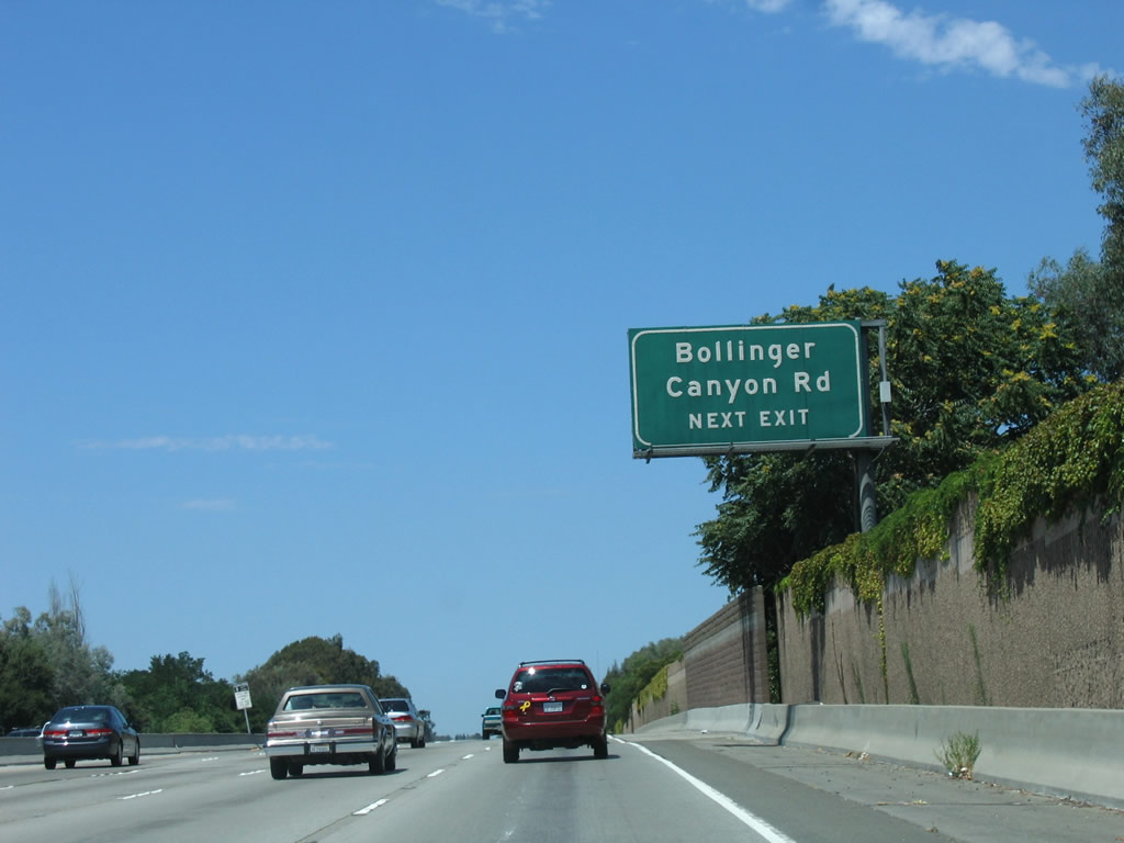
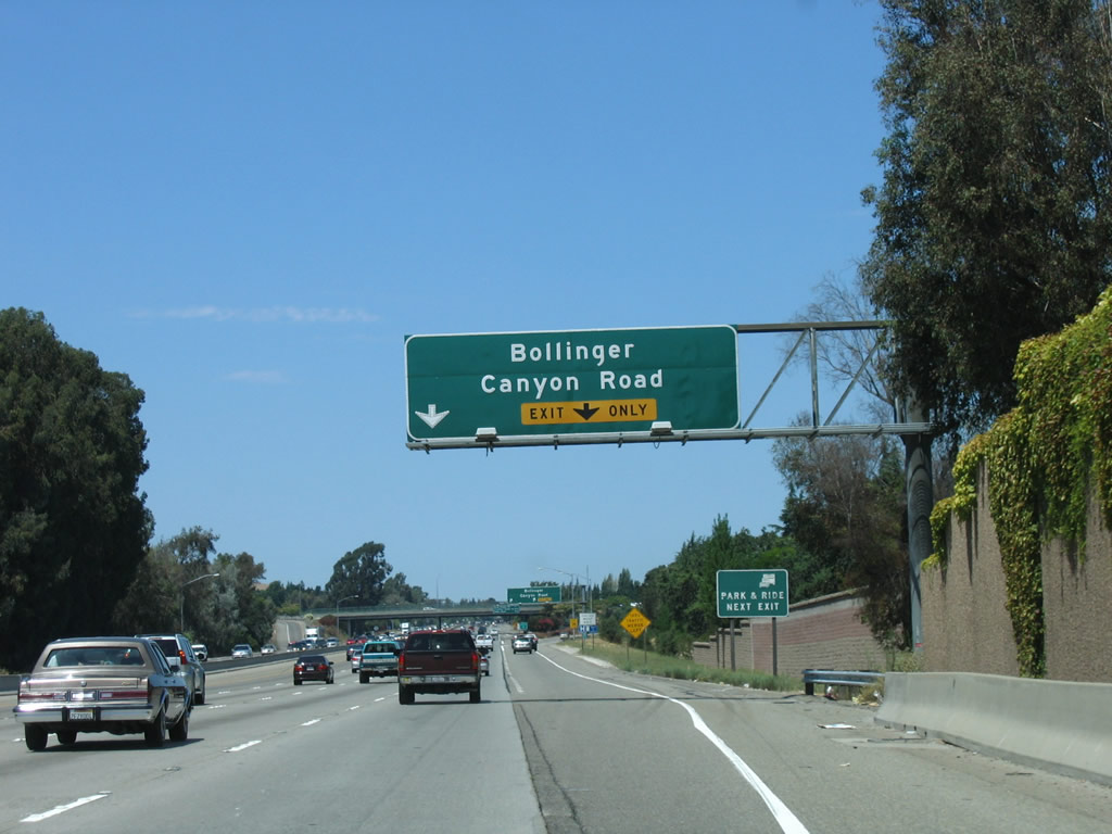
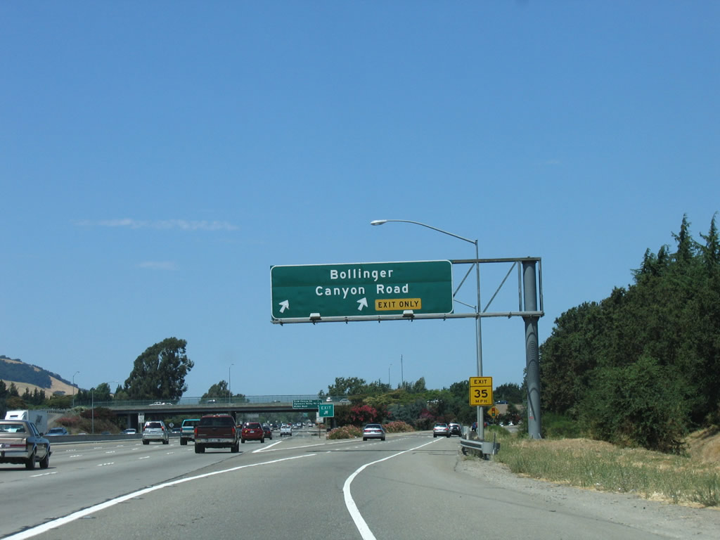
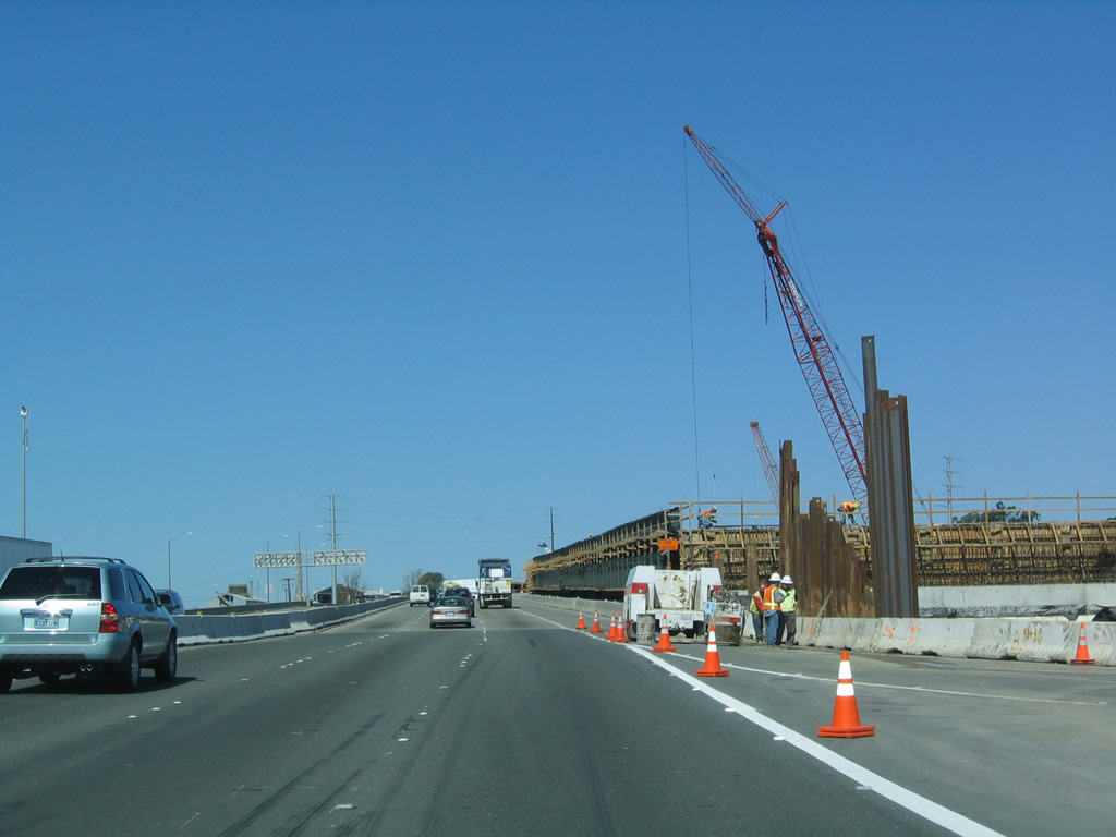
The next exit along Interstate 680 north is Exit 34, Bollinger Canyon Road, next right. Many segments of Interstate 680 through the San Ramon Valley tend to have soundwalls to keep freeway noise from penetrating nearby communities and neighborhoods. Photo taken 08/05/05. |
|
An auxiliary lane forms on the right for the connection to Exit 34, Bollinger Canyon Road. Photo taken 08/05/05. |
|
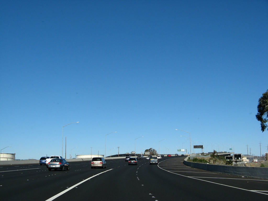
Northbound Interstate 680 reaches Exit 34, Bollinger Canyon Road. Bollinger Canyon Road leads northwest through San Ramon to connect to Crow Canyon Road, and eastbound Bollinger Canyon Road links to Alcosta Boulevard. Photo taken 08/05/05. |
|
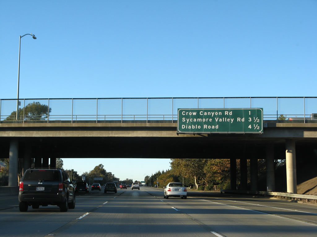
The next three exits along Interstate 680/Donald D. Doyle Highway north are Exit 36, Crow Canyon Road; Exit 38, Sycamore Valley Road; and Exit 39, Diablo Road. There are a variety of services, including shopping, at each of these exits, including Crow Canyon Road in the city of San Ramon. Photo taken 11/22/07. |
|
|
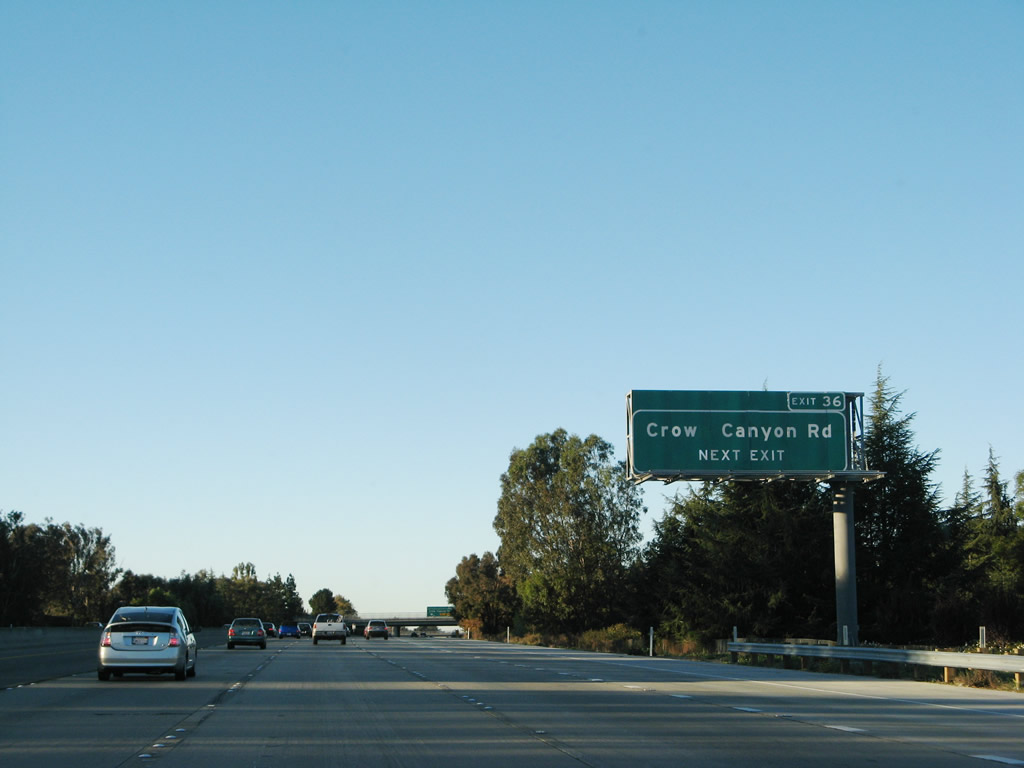
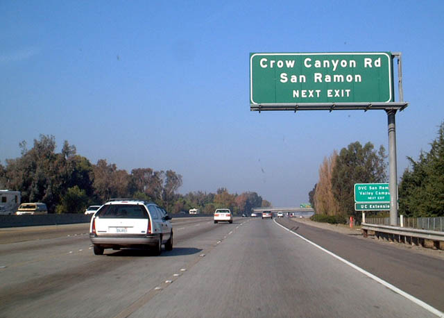
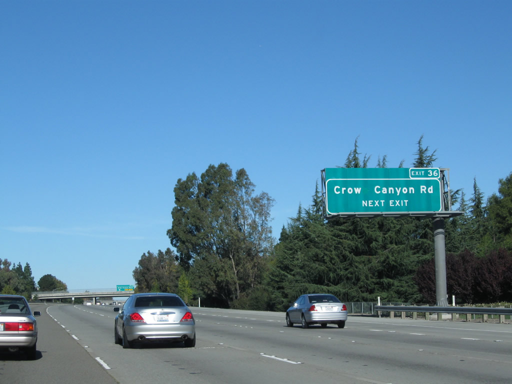
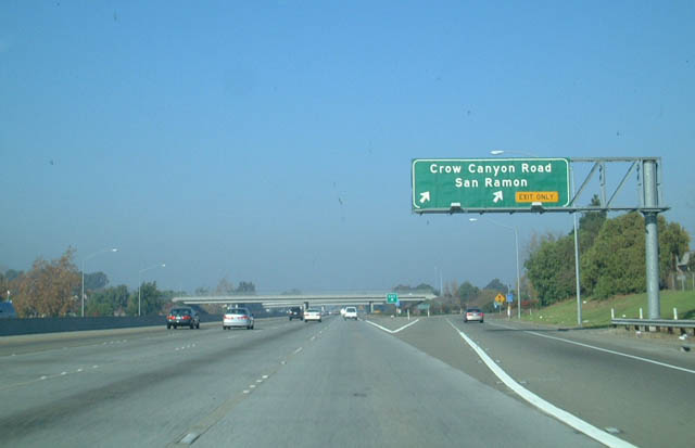
The next exit along Interstate 680/Donald D. Doyle Highway north is Exit 36, Crow Canyon Road. Exit number signs were added along this stretch in 2007. Photos taken 11/22/07 and 11/28/02. |
|
|
The auxiliary lane was added to alleviate congestion between the Bollinger Canyon Road and Crow Canyon Road interchanges. Photos taken 11/25/10 and 11/22/07. |
|
|
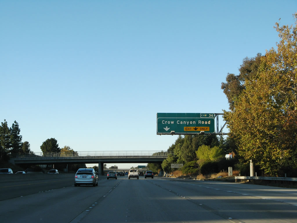
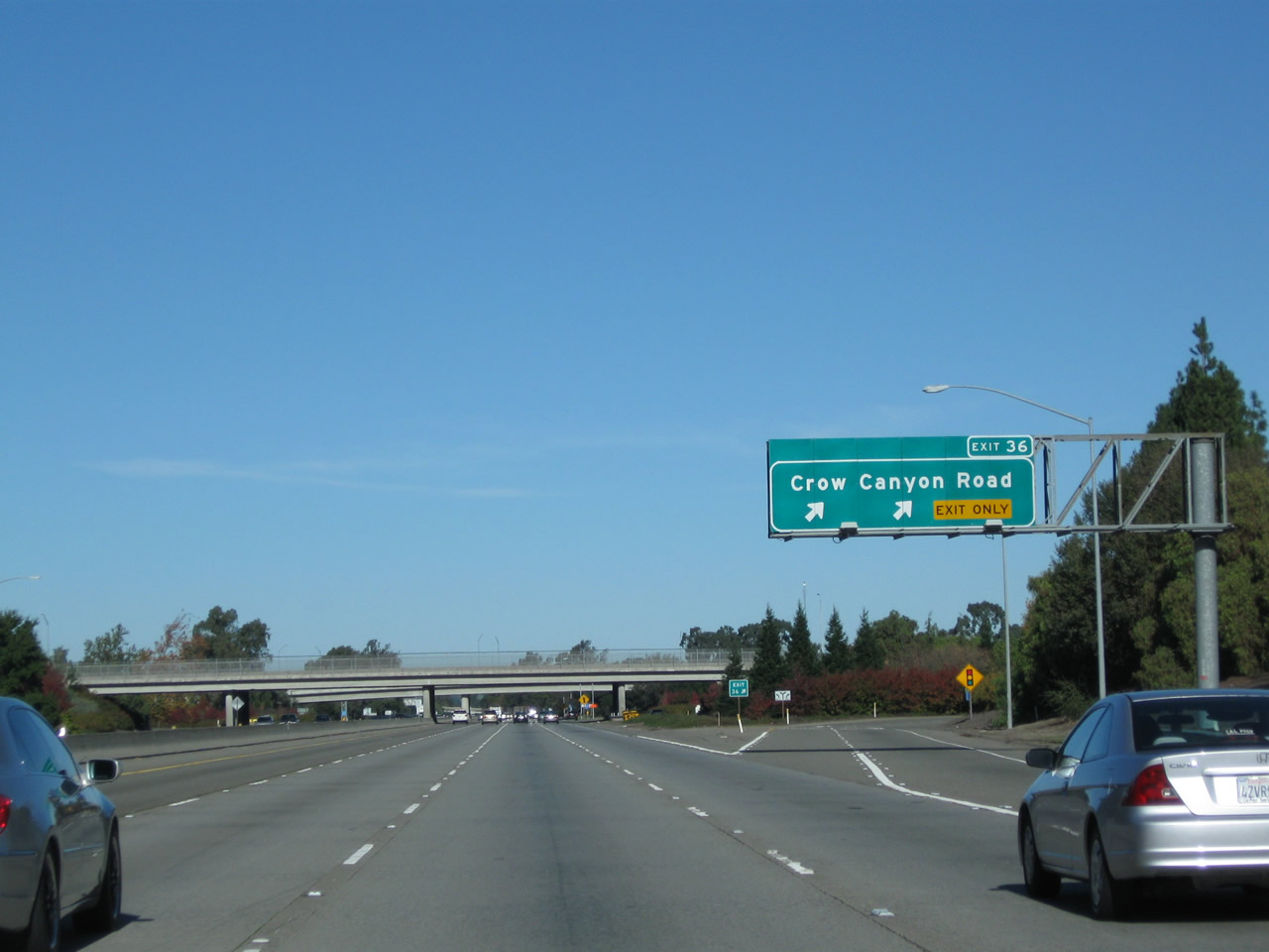
Northbound Interstate 680 reaches the two-lane off-ramp for Exit 36, Crow Canyon Road. This is the last exit into the city of San Ramon. Photos taken 11/25/10 and 11/28/02. |
|
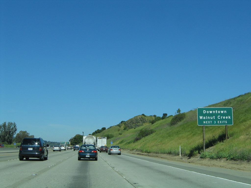
An Interstate 680 reassurance shield is posted after the on-ramp from Crow Canyon Road. Interstate 680 is an official state scenic highway from Exit 10 at the Santa Clara-Alameda County Line north to Exit 46A, California 24 in Walnut Creek/Contra Costa County. Photo taken 08/05/05. |
|
Leaving San Ramon, Interstate 680 next enters the town of Danville. Home to the famous, 350-year-old Danville Oak Tree situated in the middle of Diablo Road (an annual tree lighting festival is held at the end of each November), Danville is home to 41,715 as of the 2000 Census. A quaint shopping area is located in downtown Danville, and the Iron Horse Trail (formerly a part of the Southern Pacific Railroad), a multiple-use paved trail for bicyclists, runners, and hikers has several access points within Danville. This is one of the Bay Area's many residential enclaves, so commuting to the northern part of Contra Costa County, San Francisco, and Silicon Valley all take place along Interstate 680. Photo taken 08/05/05. |
|
The next three exits along Interstate 680/Doyle Highway north are Exit 38, Sycamore Canyon Road; Exit 39, Diablo Road; and Exit 40, El Cerro Boulevard/El Pintado Road. All of these exits serve the city of Danville. The village is located west of Interstate 680, which a variety of neighborhoods and residential developments are located east of Interstate 680. Mount Diablo, the large mountain to the east of Interstate 680, can be seen from the freeway on most days. Photo taken 08/05/05. |
|
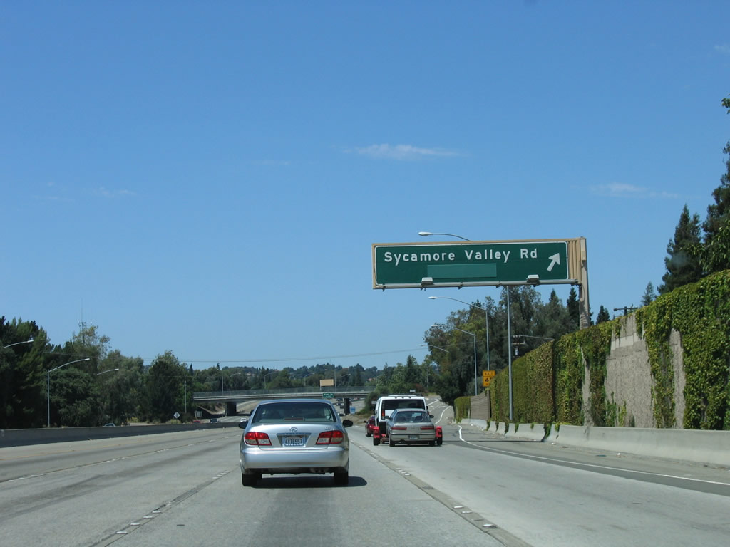
The next interchange along Interstate 680/Doyle Highway is Exit 38, Sycamore Canyon Road. Like Crow Canyon Road, Sycamore Canyon Road east leads east to Camino Tassajara, which becomes southbound Tassajara Road (which ultimately leads to Interstate 580 in Dublin/Pleasanton). To the west, Sycamore Canyon Road connects to San Ramon Valley Road (former California 21), which faithfully parallels Interstate 680. Use this exit to Hartz Avenue and Railroad Avenue in downtown Danville. Photo taken 08/05/05. |
|
Through Danville, Interstate 680 maintains four northbound lanes. During commuting hours, the left lane becomes a high occupancy vehicle (HOV) lane. However, this lane is not always restricted; note the signs that identify the days and time of HOV enforcement. The freeway is diamond-ground concrete, but the area where the lane markers appear not to have diamond ground. The next exit is Exit 38, Sycamore Canyon Road to Danville. Photo taken 08/05/05. |
|
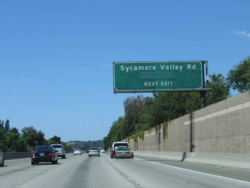
Northbound Interstate 680/Doyle Highway reaches Exit 38, Sycamore Canyon Road. For whatever reason, the word "Danville" has been covered or removed on this and all other Exit 38 approach signs. Photo taken 08/05/05. |
|
|
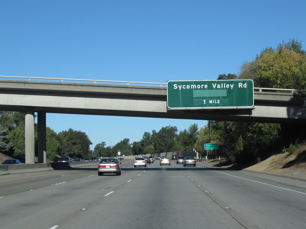
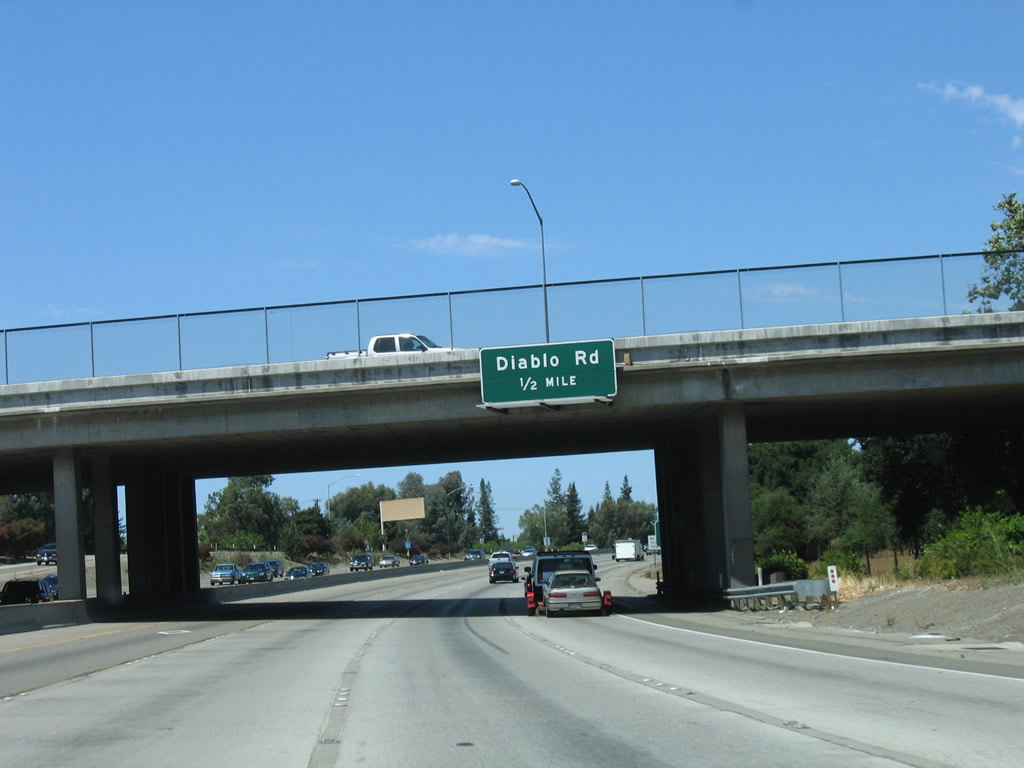
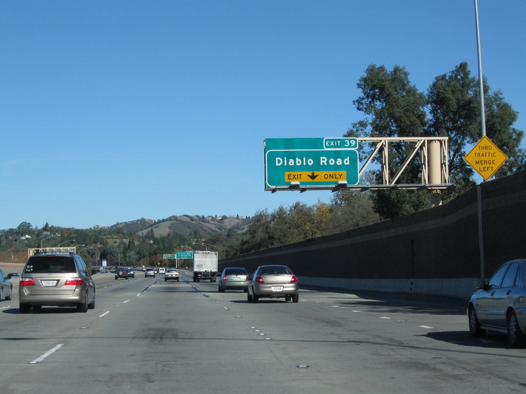
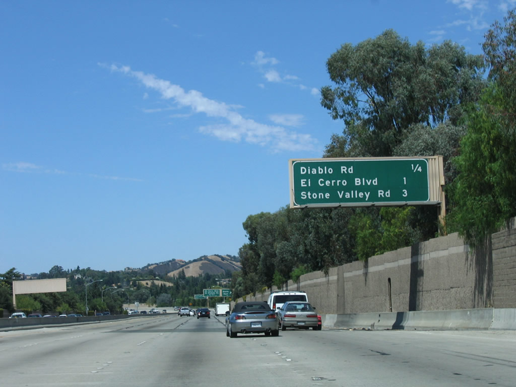
The next exit on Interstate 680 north is Exit 39, Diablo Road. The half mile advance sign was replaced with an interchange sequence sign by 2009. A very old oak tree is situated in the median of westbound Diablo Road between Interstate 680 and Front Street in Danville; this oak tree is lighted with holiday decorations in a locally famous ceremony on the Friday after Thanksgiving. The tree is over 350 years old and is supported by metal brackets to ensure it does not fall down. Photos taken 11/25/10 and 08/05/05. |
|
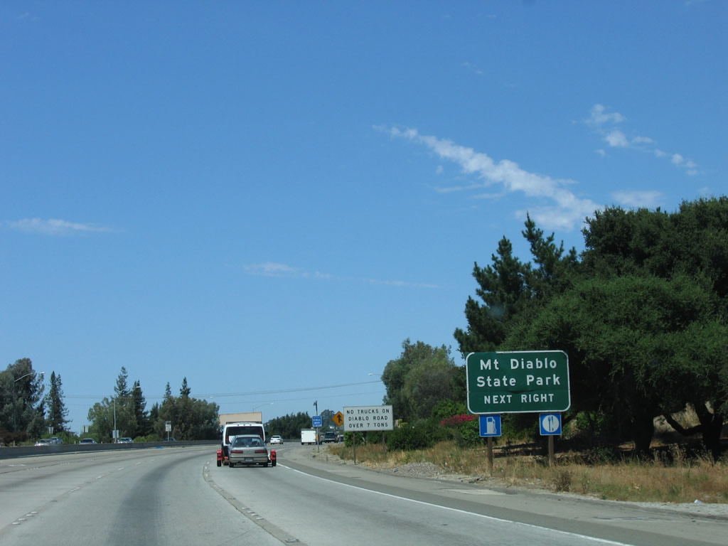
Use Diablo Road east to Mount Diablo State Park, which features endless vistas and hiking. Diablo Road travels east to the communities of Diablo and Blackhawk, and a left turn onto Mount Diablo Scenic Boulevard (South Gate Road) takes motorists to the summit. Views from the top can be incredible, especially on the day after a winter storm moves through the area. The Golden Gate Bridge, the Coast Range, Mount Hamilton near San Jose, and the Sierra Nevada can all be seen on a clear day. Mount Diablo itself is an extinct volcano that rises to a 3,849-foot summit, and its peak dominates the skyline from the San Ramon Valley. This state park is well worth a day's visit. Photo taken 08/05/05. |
|
|
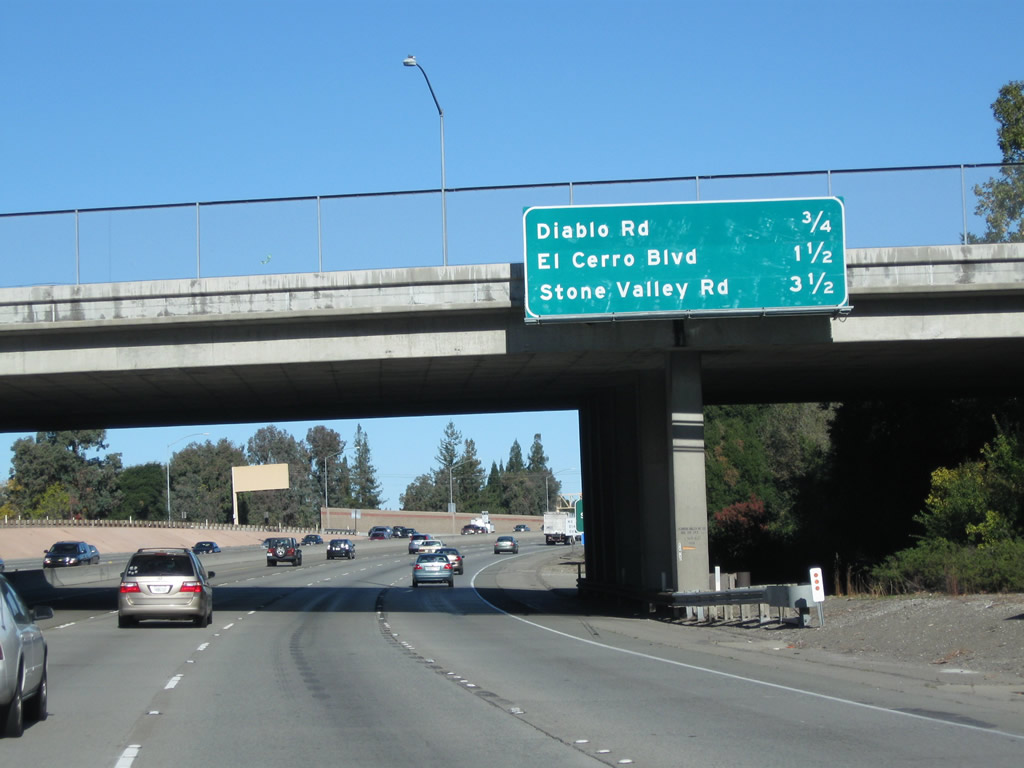
The next four exits along Interstate 680/Doyle Highway north are Exit 39, Diablo Road; Exit 40, El Cerro Boulevard/El Pintado Road; and Exits 42A-B, Stone Valley Road east/west to Alamo. All of these exits serve the city of Danville. The village is located west of Interstate 680, which a variety of neighborhoods and residential developments are located east of Interstate 680. Mount Diablo, the large mountain to the east of Interstate 680, can be seen from the freeway on most days. With the installation of a new auxiliary lane on Interstate 680 north, a new exit-only lane carries traffic onto Exit 39, Diablo Road. Photos taken 11/25/10 and 08/05/05. |
|
|
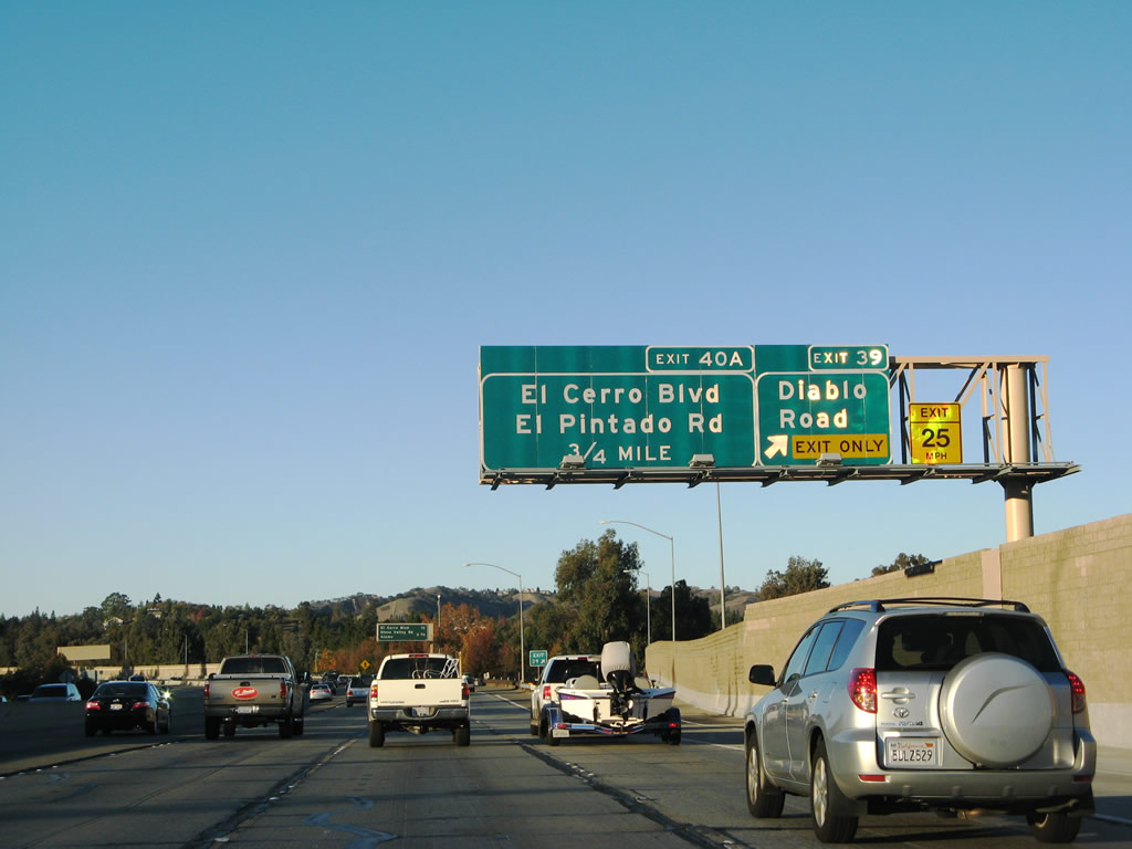
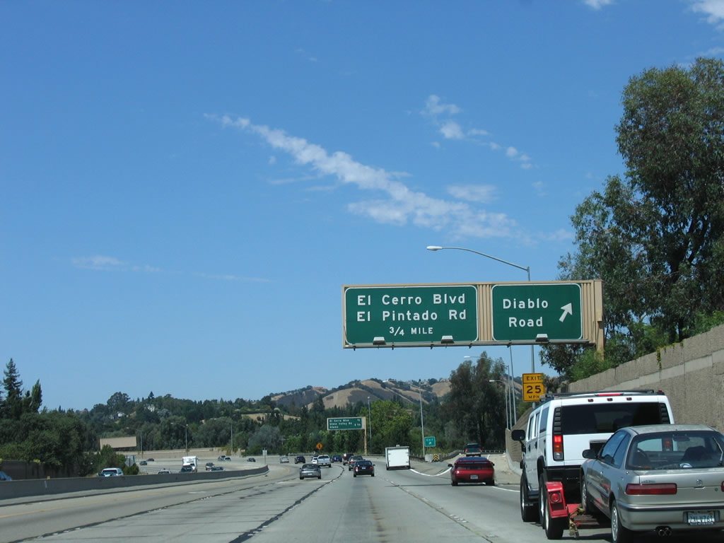
Northbound Interstate 680 reaches Exit 39, Diablo Road west to downtown Danville and east to Mount Diablo State Park and Blackhawk. Note the changes to exit signage between 2005 and 2007. It is not clear why the exit number for the next interchange is "Exit 40A" and not Exit 40. Photos taken 11/22/07 and 08/05/05. |
|
The next three exits along Interstate 680/Doyle Highway north are Exit 40, El Cerro Boulevard/El Pintado Road and Exits 42A-B, Stone Valley Road east/west to Alamo. Photo taken 08/05/05. |
|
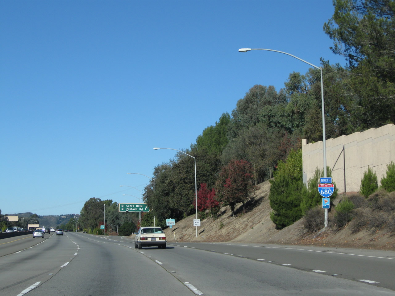
The right lane (on-ramp from Diablo Road) becomes exit-only for Exit 40, El Cerro Boulevard/El Pintado Road. Photo taken 11/25/10. |
|
An Interstate 680 north reassurance shield is posted between the Diablo Road on-ramp and the El Cerro Boulevard off-ramp. Photo taken 11/25/10. |
|
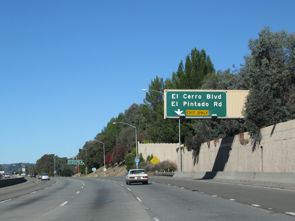
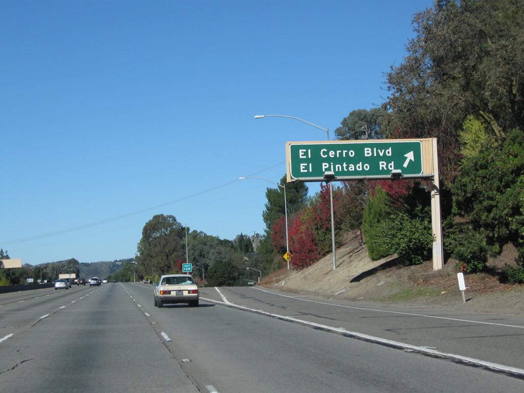
Northbound Interstate 680 meets Exit 40, El Cerro Boulevard/El Pintado Road. El Cerro Boulevard is an east-west road serving several communities in northern Danville, while El Pintado Road carves a semi-circular path in the same vicinity. Photo taken 11/25/10. |
|
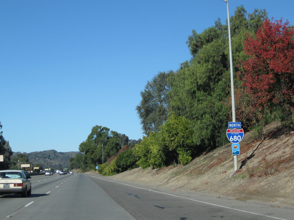
An Interstate 680 north reassurance shield is posted after the El Cerro Boulevard on-ramp. Photo taken 11/25/10. |
|
Another Interstate 680 north reassurance shield is posted after the El Pintado Road on-ramp. Photo taken 11/25/10. |
|
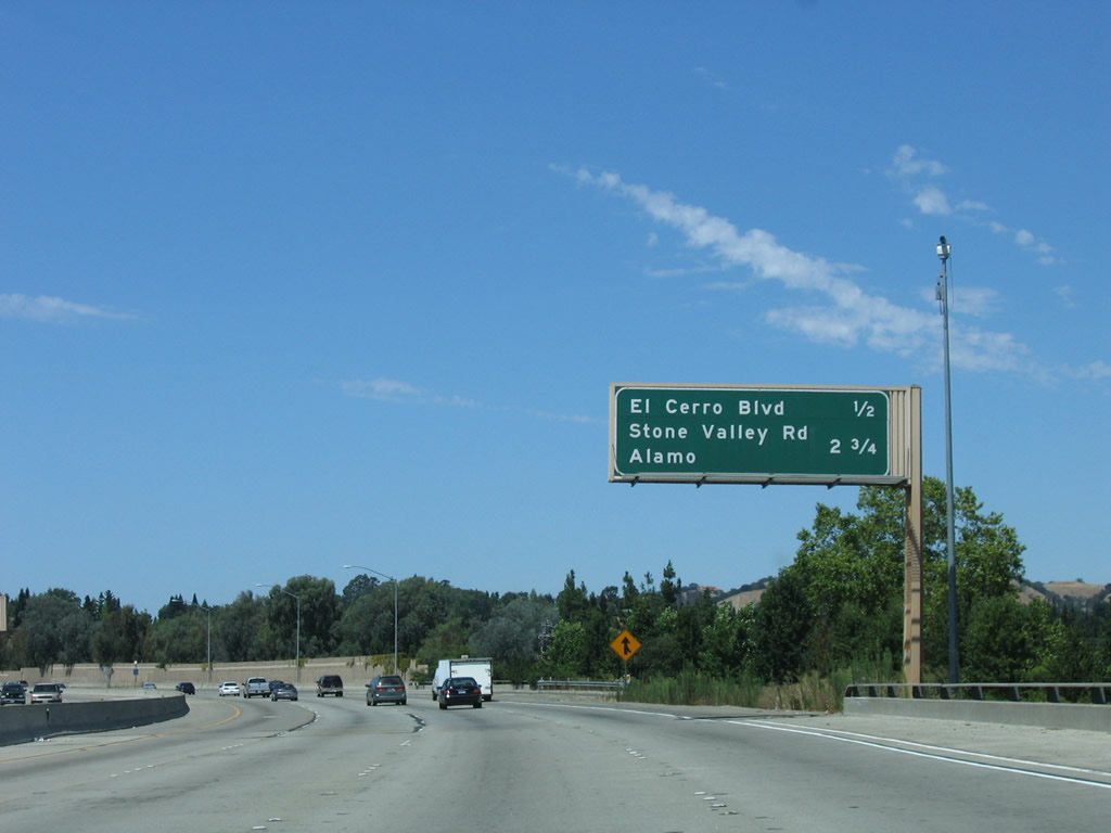
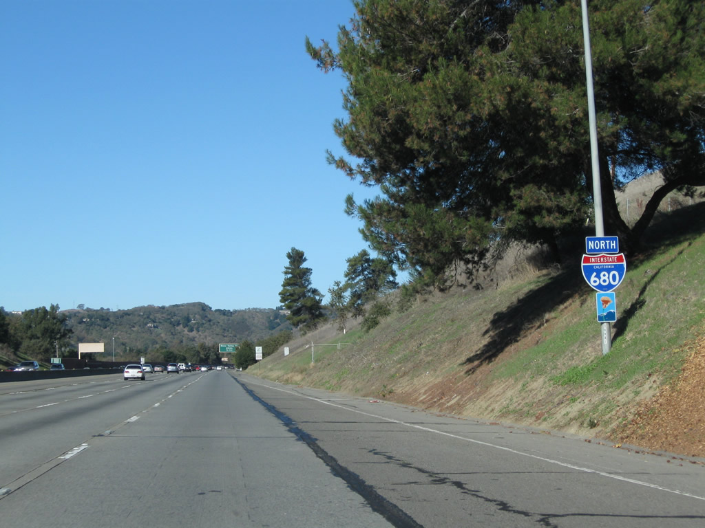
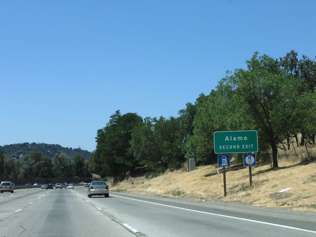
The next exit along Interstate 680/Doyle Highway north is Exits 42A-B, Stone Valley Road. While Exit 42A connects to Stone Valley Road east to Monte Vista in eastern Danville and the community of Blackhawk, Exit 42B (Stone Valley Road west) is the main exit into Alamo, a small unincorporated community wedged between Danville and Walnut Creek. Photo taken 11/25/10. |
|
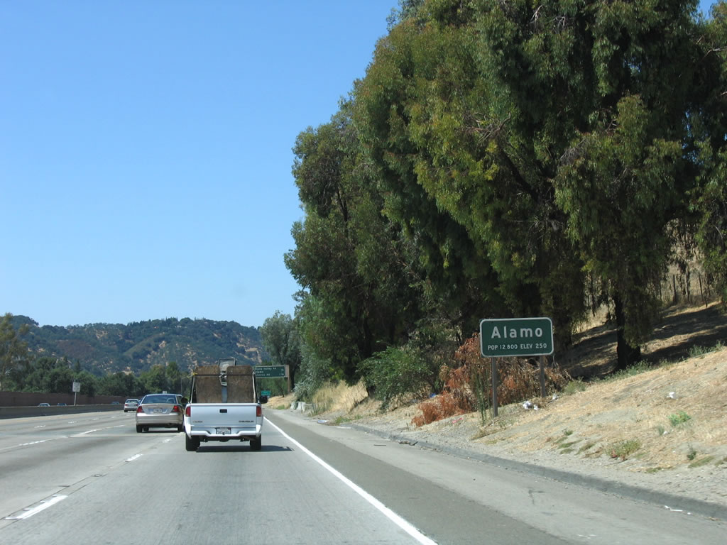
Alamo is an unincorporated community of Contra Costa County and is home to 15,626 as of the 2000 Census. Passing by Hap McGee Ranch Park, Interstate 680 leaves the city of Danville and enters the unincorporated area briefly at a northwesterly angle. Use Exit 42B to Alamo. Photo taken 08/05/05. |
|
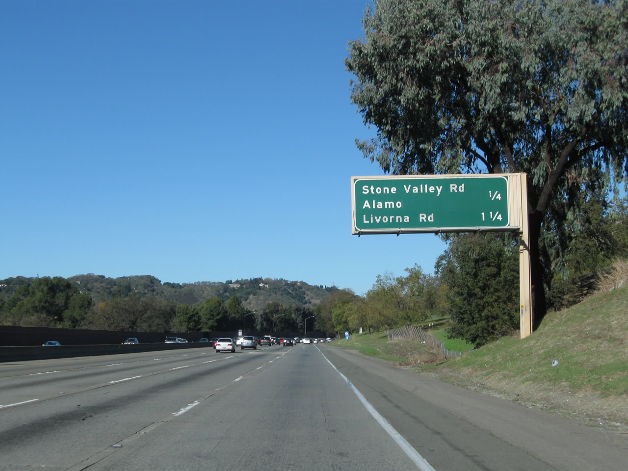
The next three exits along Interstate 680/Doyle Highway north are Exits 42A-B, Stone Valley Road east/west to Alamo and Exit 43, Livorna Road. Photo taken 11/25/10. |
|
Use Stone Valley Road west to Alamo (Exit 42B). Food, gas, and motorist services are available at the intersection of Stone Valley Road and Danville Boulevard, which follows old California 21. The Iron Horse Trail closely parallels Danville Boulevard through Alamo. Photo taken 08/05/05. |
|
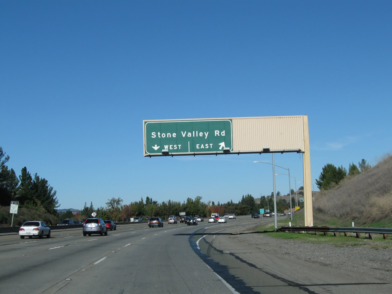
Northbound Interstate 680/Doyle Highway meets Exit 42A, Stone Valley Road east to eastern Danville (including the Monte Vista area) and unincorporated Blackhawk. Stone Valley Road leads east to Green Valley Road, then connects to Diablo Road to the south. The next exit is Exit 42B, Stone Valley Road west to Alamo. Photo taken 11/25/10. |
|
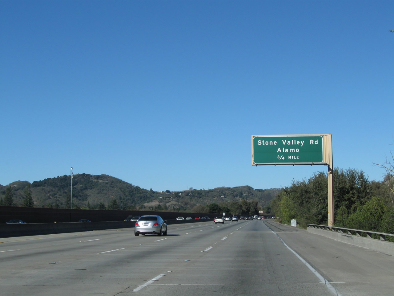
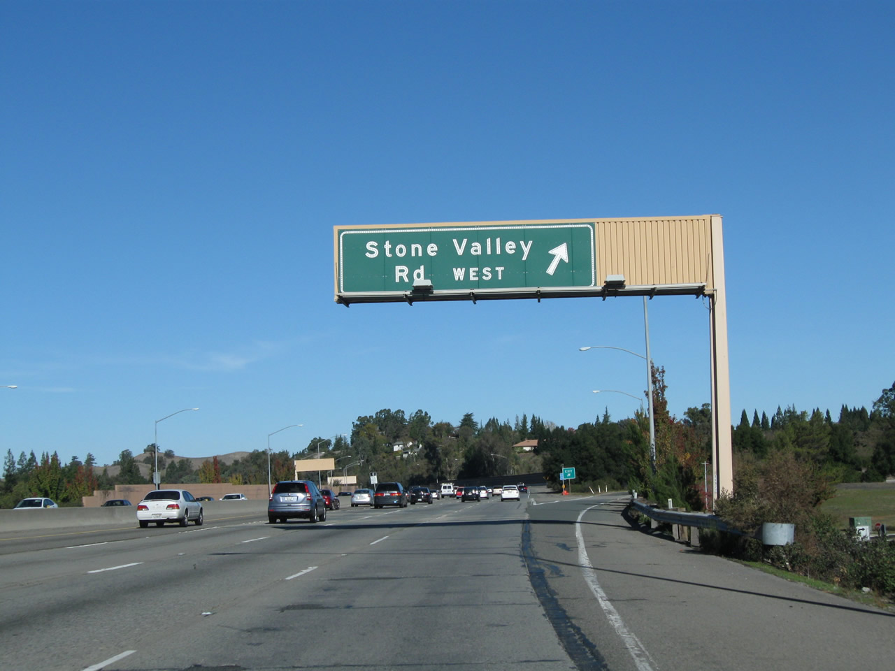
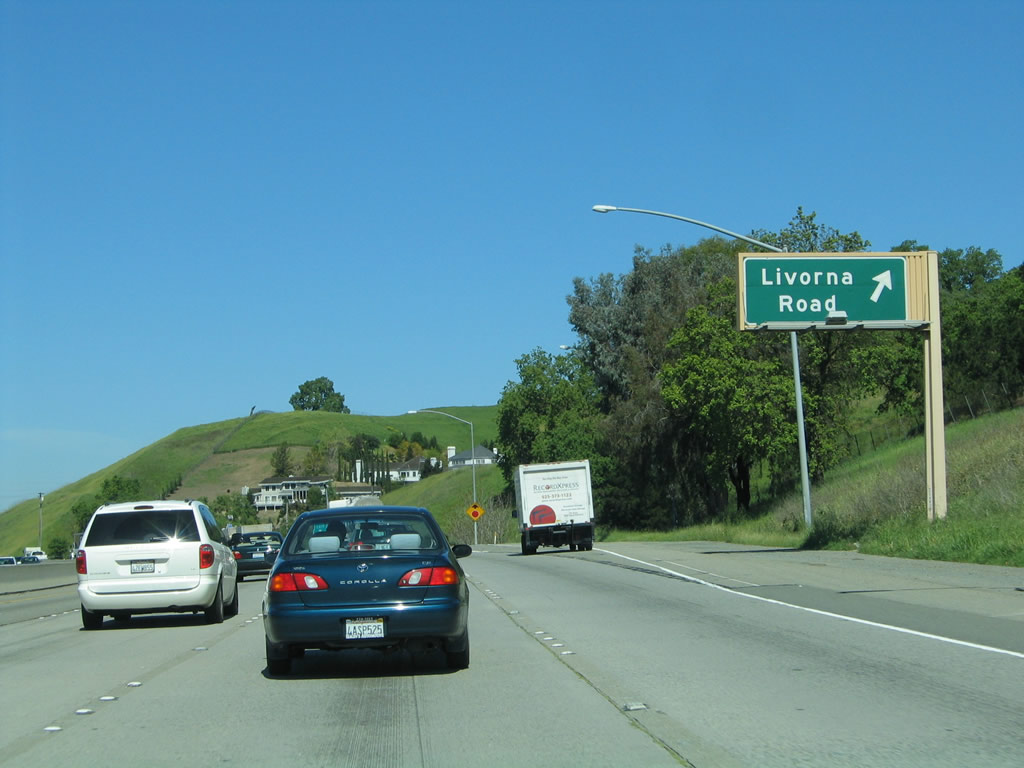
Northbound Interstate 680 reaches Exit 42B, Stone Valley Road west to Alamo. Westbound Stone Valley Road enters the downtown area of Alamo, linking with Danville Boulevard (Former California 21), then changes into Lunada Lane just west of Danville Boulevard. The next exit (Livorna Road) is in Alamo, but the following exit along northbound Interstate 680 is in the city of Walnut Creek. At or near Exit 43/Livorna Road, the Donald D. Doyle Highway designation of Interstate 680 ends. Photo taken 11/25/10. |
|
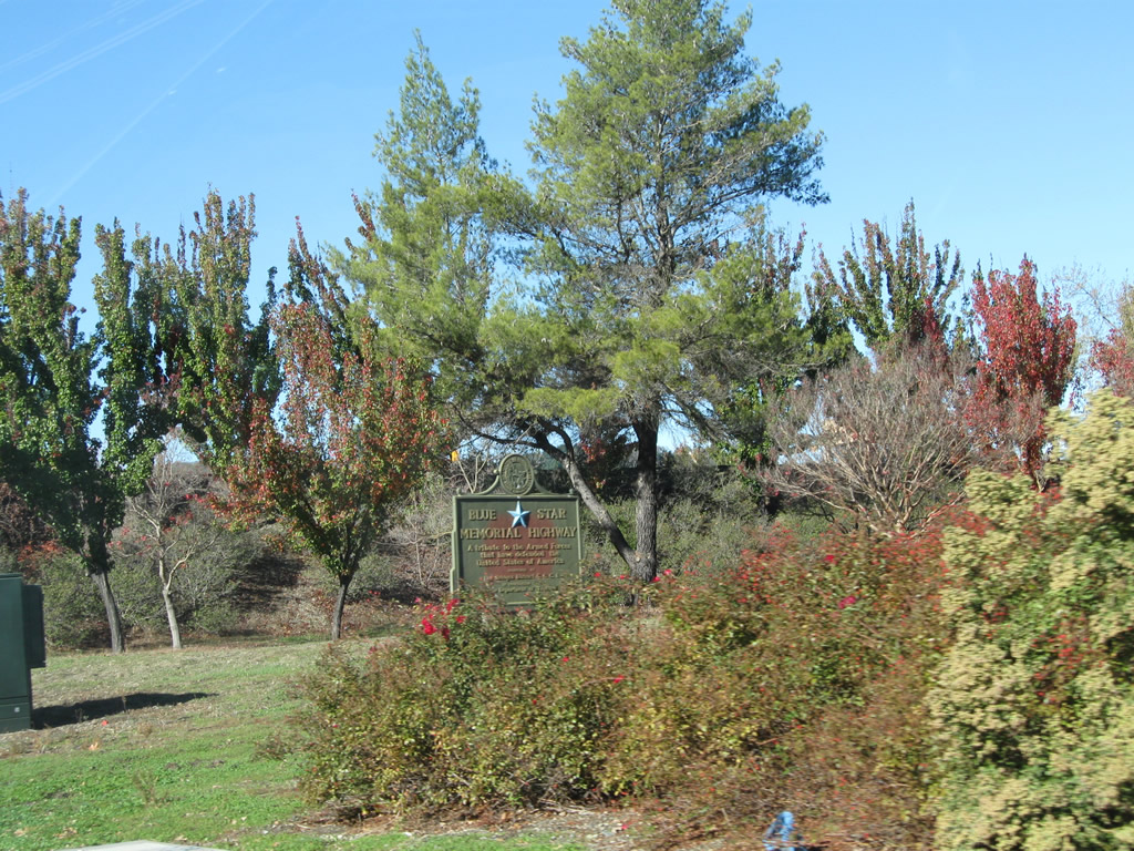
Upon exiting, look for a Blue Star Memorial Highway plaque in the interchange loop. Photo taken 11/25/10. |
|
Back on the mainline, this reassurance shield for Interstate 680 north is posted immediately after the on-ramp from Stone Valley Road in Alamo. Photo taken 03/31/05. |
|
Northbound Interstate 680 next connects with Exit 43, Livorna Road. This interchange also serves the community of Alamo. Photo taken 03/31/05. |
|
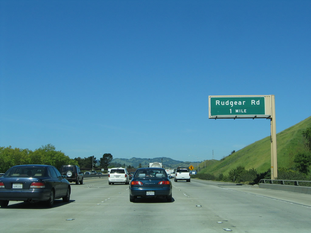
The next exit along Interstate 680 north is Exit 44, Rudgear Road. Photo taken 03/31/05. |
| Interstate 680 north |
|
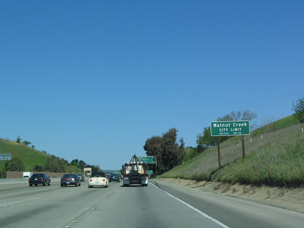
After the on-ramp from Livorna Road, Interstate 680 north the city of Walnut Creek, home to 64,296 residents as of the 2000 Census. Walnut Creek was incorporated on October 21, 1914, and consists of 19.9 square miles. Situated at the junction of Interstate 680 and California 24, the area is a bedroom community for San Francisco but has a large business base. The Bay Area Rapid Transit (BART) system also passes through town, offering direct commuter service to Oakland and San Francisco. In addition to its downtown, Walnut Creek is renowned for its extensive system of open space lands. Photo taken 04/02/04. |
|
This mileage sign along northbound Interstate 680 provides the distance to the next three exits: Exit 44, Rudgear Road; Exit 45A, South Main Street; and Exit 45B, Olympic Boulevard. Photo taken 04/02/04. |
|
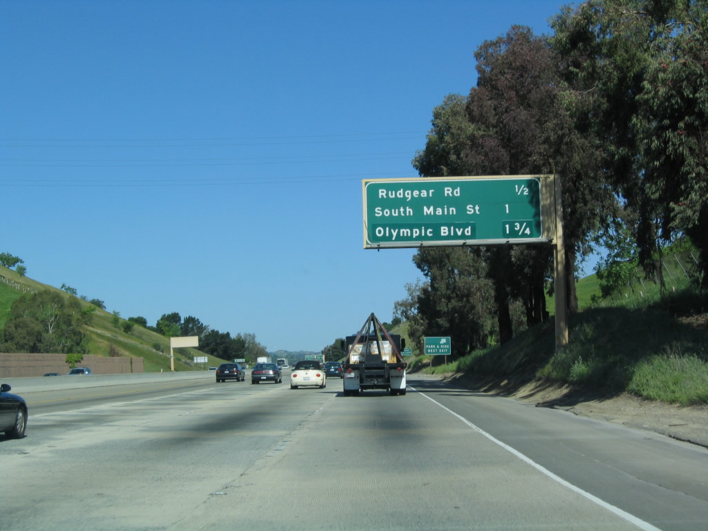
The next three exits along Interstate 680 north serve downtown Walnut Creek: Exit 44, Rudgear Road; Exit 45A, South Main Street; and Exit 45B, Olympic Boulevard. Photo taken 03/31/05. |
|
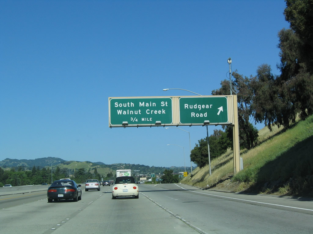
Northbound Interstate 680 reaches Exit 44, Rudgear Road. The next exit is Exit 45A, South Main Street, which together with North Main Street forms what ought to be a business loop through downtown Walnut Creek. Photo taken 04/02/04. |
|
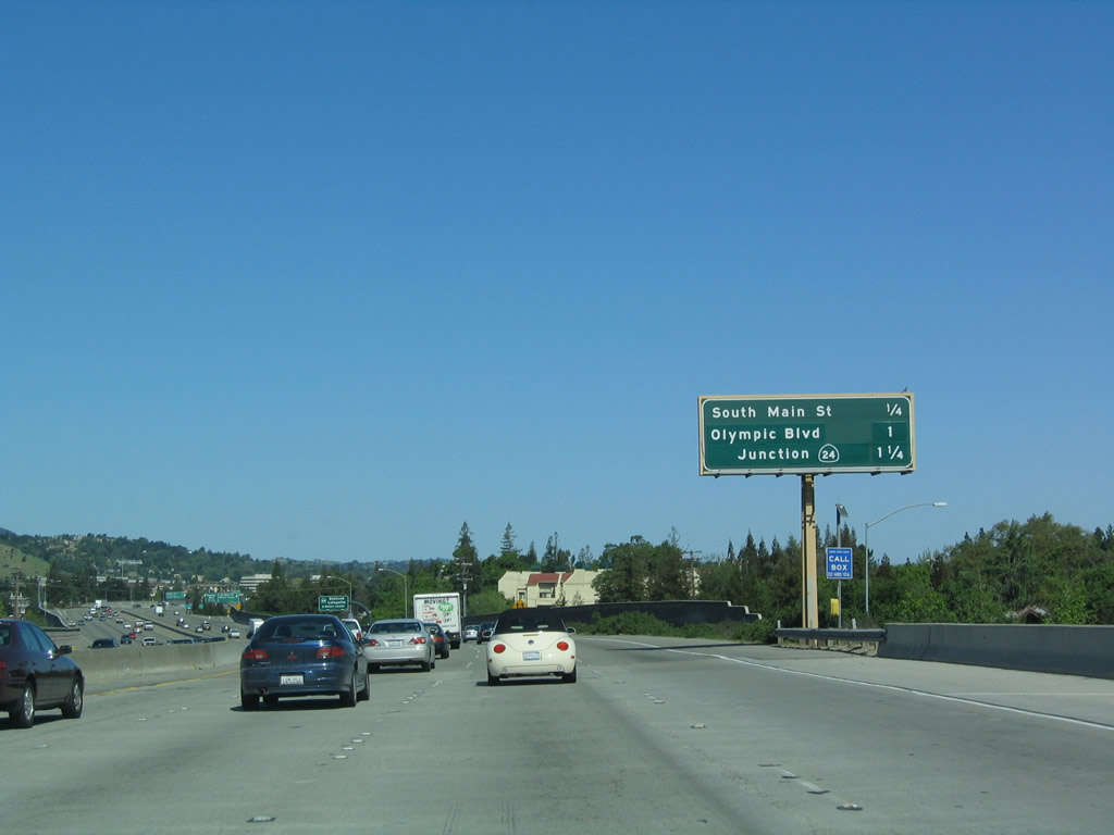
This mileage sign along northbound Interstate 680 provides the distance to the next three exits: Exit 45A, South Main Street; Exit 45B, Olympic Boulevard; and Exit 46A, California 24. Photo taken 04/02/04. |
|
Through traffic on northbound Interstate 680 must remain in the three left lanes; the two right lanes become exit only onto California 24 ahead. Photo taken 04/02/04. |
|
If Interstate 680 were to have a business route, one of the best candidates along its route would be Main Street through Walnut Creek, since it connects to the freeway at both ends and passes through downtown. This picture shows the Main Street exit (Exit 45A) as seen from northbound. Photo taken 04/02/04. |
|
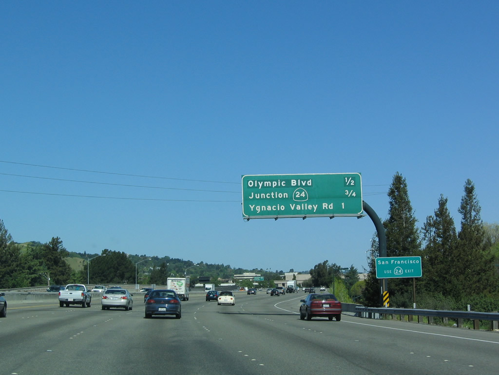
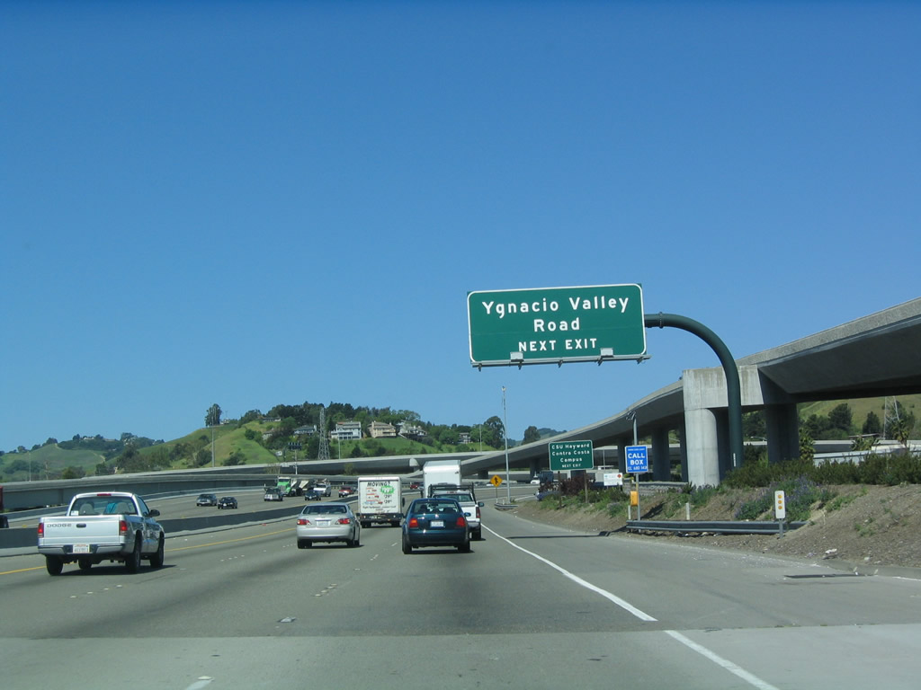
This mileage sign along northbound Interstate 680 provides the distance to Exit 45B, Olympic Boulevard; Exit 46A, west California 24; and Exit 46B, Ygnacio Valley Boulevard. Photo taken 04/02/04. |
|
Through traffic on northbound Interstate 680 must remain in the three left lanes; the two right lanes become exit only onto California 24 ahead. Photo taken 04/02/04. |
|
|
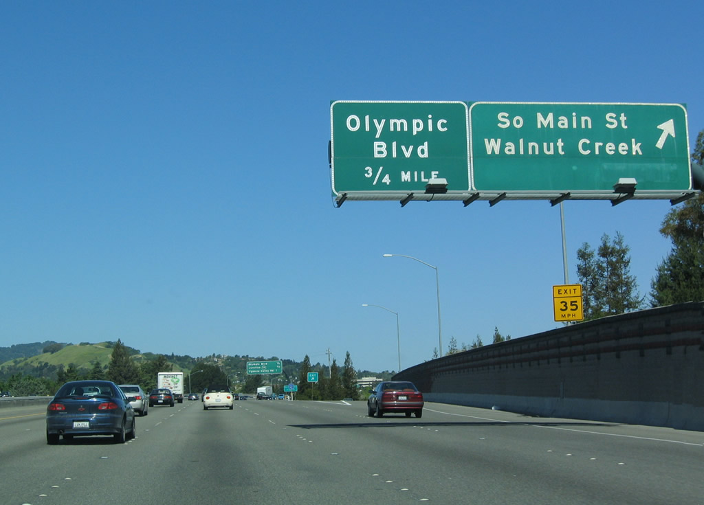
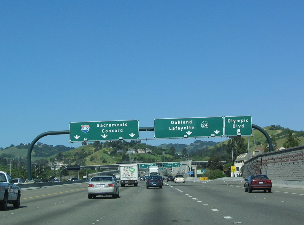
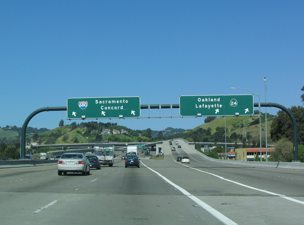
Northbound Interstate 680 reaches Exit 45B, Olympic Boulevard in Walnut Creek, approaches Exit 46A, California 24. California 24 leads west from this interchange to serve the East Bay communities of Lafayette, Orinda, and Moraga en route to Berkeley and Oakland. If there were to be a business loop in Walnut Creek, it could follow Olympic Boulevard and Main Street through Walnut Creek. Photos taken 11/23/07 and 04/02/04. |
|
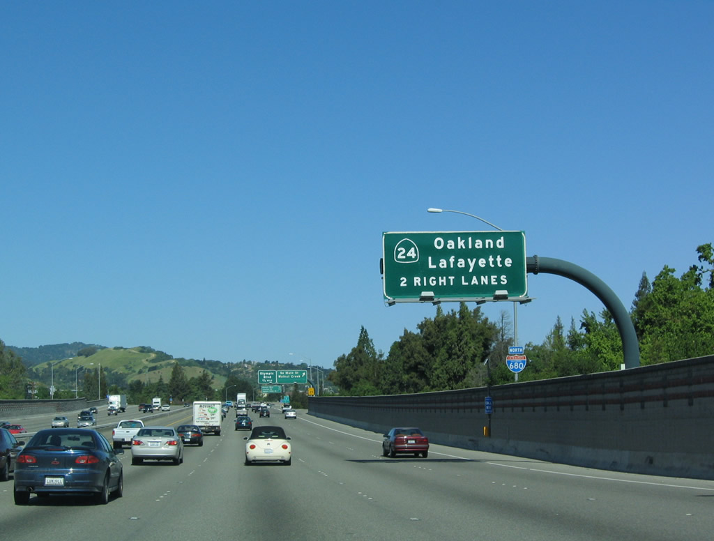
Northbound Interstate 680 next reaches Exit 46A, California 24 in Walnut Creek. This interchange was reconstructed to increase capacity in the late 1990s. Even with these improvements, this interchange still experiences delays during morning and afternoon commuting hours. Photo taken 04/02/04. |
|
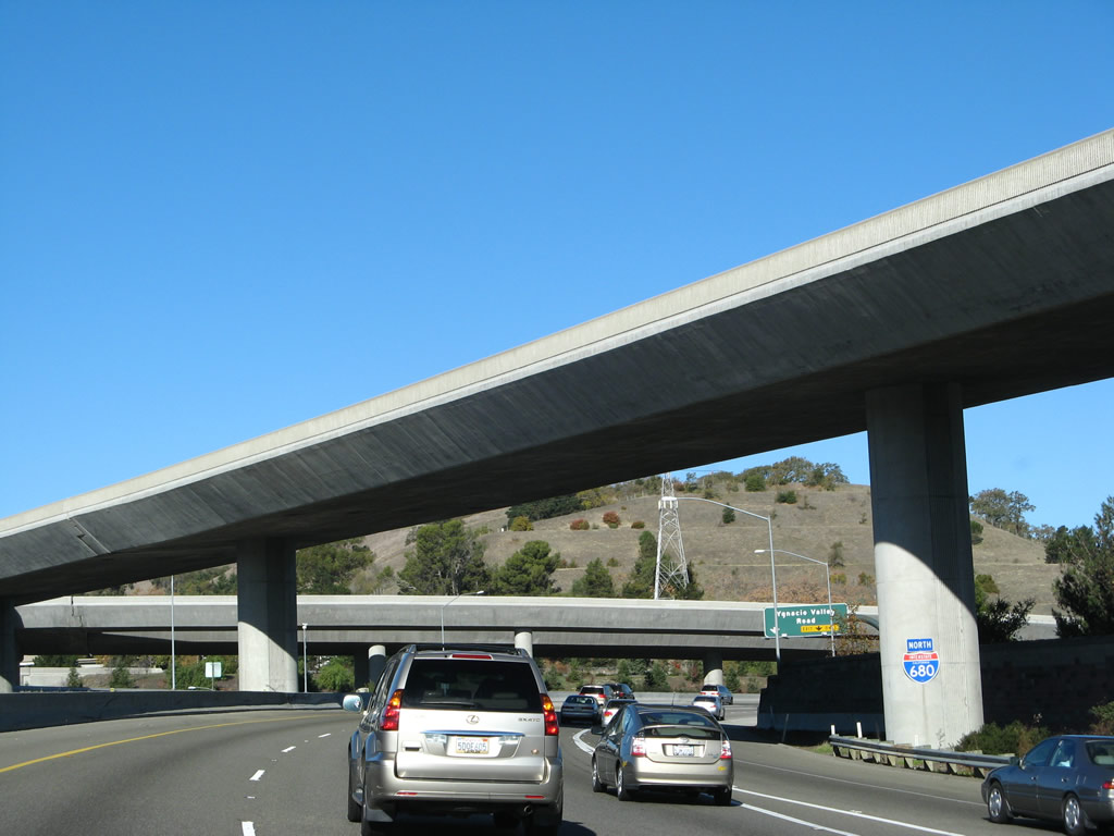
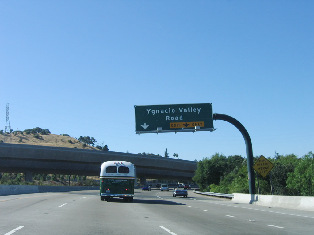
Continuing north, the next exit along Interstate 680 after the transition to westbound California 24 is Exit 46B, Ygnacio Valley Boulevard. Photo taken 04/02/04. |
|
The California 24 transition ramp flies over Interstate 680 north. An Interstate 680 shield is affixed to the bent (concrete post) that supports the overpass. Photo taken 11/23/07. |
|
The right lane becomes exit only for Exit 46B, Ygnacio Valley Boulevard. Photo taken 07/06/06.
|
|
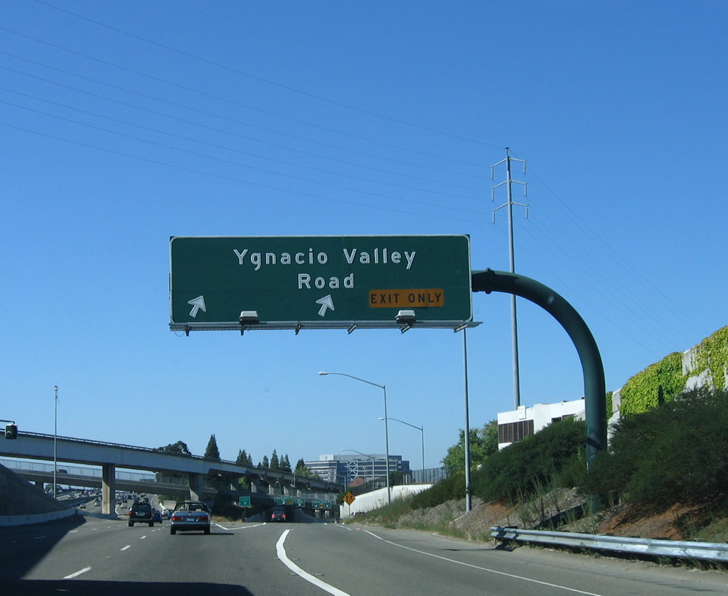
Northbound Interstate 680 reaches Exit 46B, Ygnacio Valley Boulevard. These black, tubular sign bridges were placed in the late 1990s when the Interstate 680/California 24 interchange was reconstructed. Photo taken 07/06/06.
|
|
Shortly after the Ygnacio Valley Boulevard off-ramp, the Bay Area Rapid Transit (BART) flies over Interstate 680. The BART shifts from the California 24 freeway median to north Walnut Creek, then turns north to parallel Interstate 680 and California 242 toward downtown Concord. This line eventually merges onto the median of California 4 east of Concord. Ahead, traffic from California 24 merges from the left onto Interstate 680 north. Photo taken 07/06/06.
|
|
Three lanes from eastbound California 24 merge onto northbound Interstate 680. A mileage sign for this incredibly wide freeway can be seen in the distance. Photo taken 11/23/07. |
|
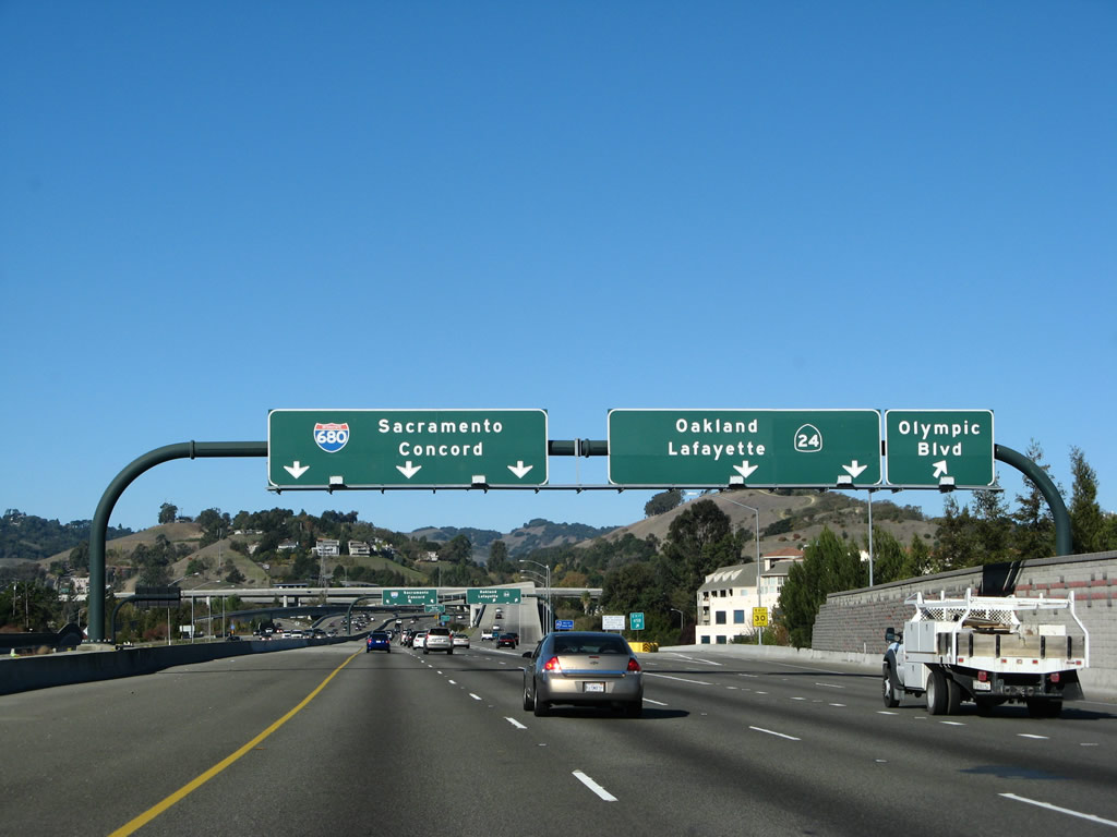
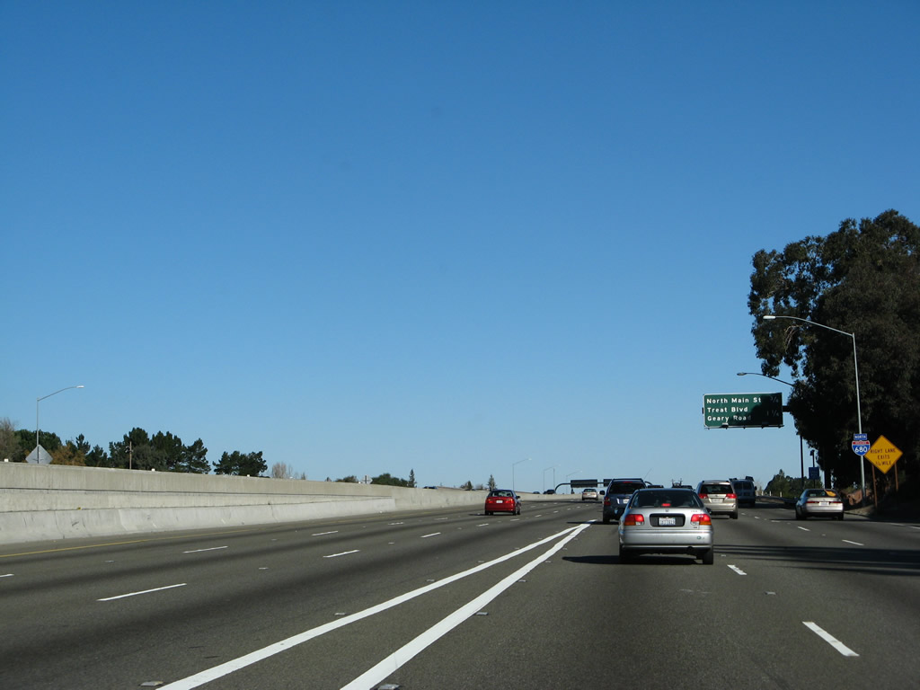
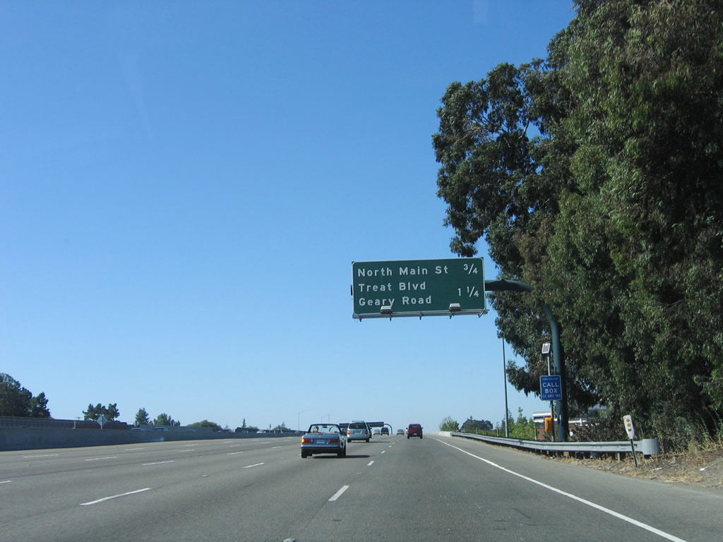
Interstate 680 north now has six lanes after traffic from California 24 merges onto the freeway. This mileage sign along northbound Interstate 680 provides the distance to the next three exits: Exit 47, North Main Street; Exit 48, Treat Boulevard/Geary Road; and Exit 49A, Contra Costa Boulevard. Photo taken 07/06/06.
|
|
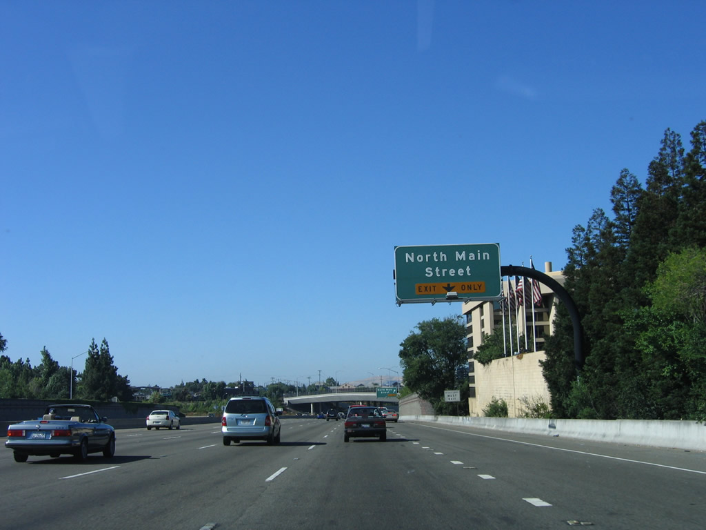
North Main Street is former California 21, and it passes through downtown Walnut Creek. This would make an excellent business loop if it were so designated. Photo taken 07/06/06.
|
|
Northbound Interstate 680 reaches Exit 47, North Main Street. North Main Street closely parallels Interstate 680 to the west between Exits 47 and 49A. Photo taken 07/06/06.
|
|
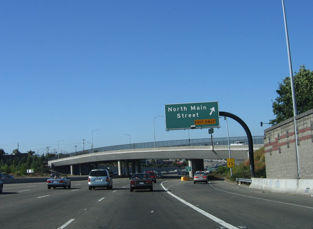
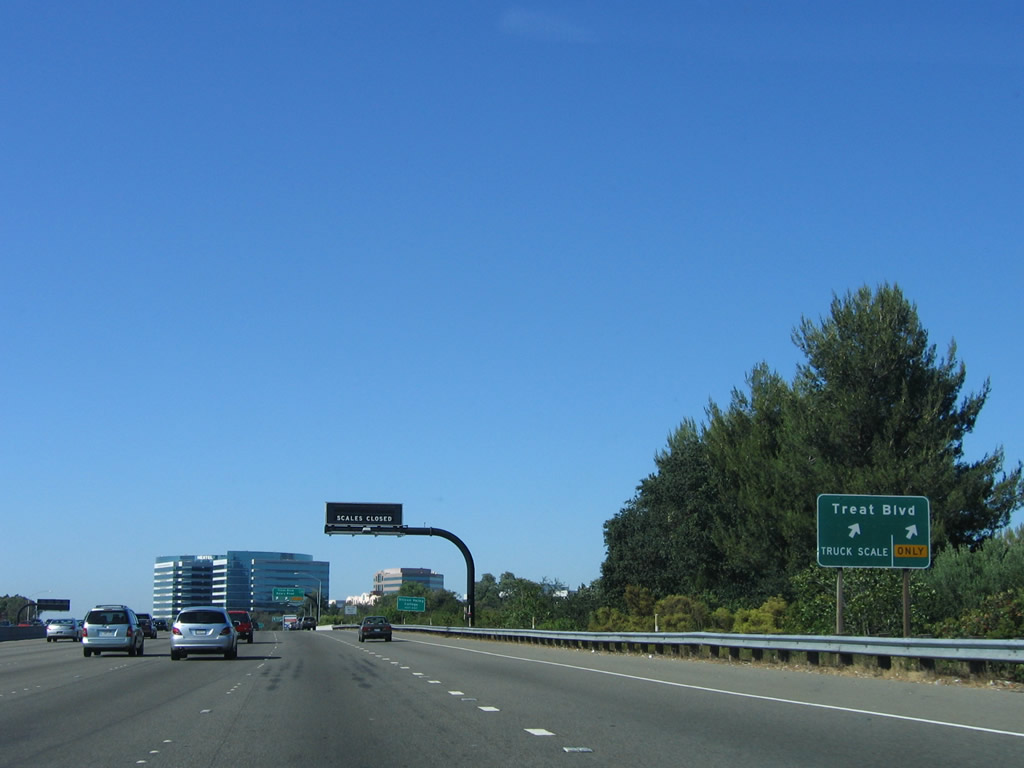
Passing under the North Main Street overcrossing, northbound Interstate 680 next approaches Exit 48, which connects to a weigh station as well as Treat Boulevard and Geary Road. Photo taken 07/06/06.
|
|
This mileage sign along northbound Interstate 680 provides the distance for the next two exits: Exit 48, Treat Boulevard/Geary Road and Exit 49A, Contra Costa Boulevard. Photo taken 07/06/06.
|
|
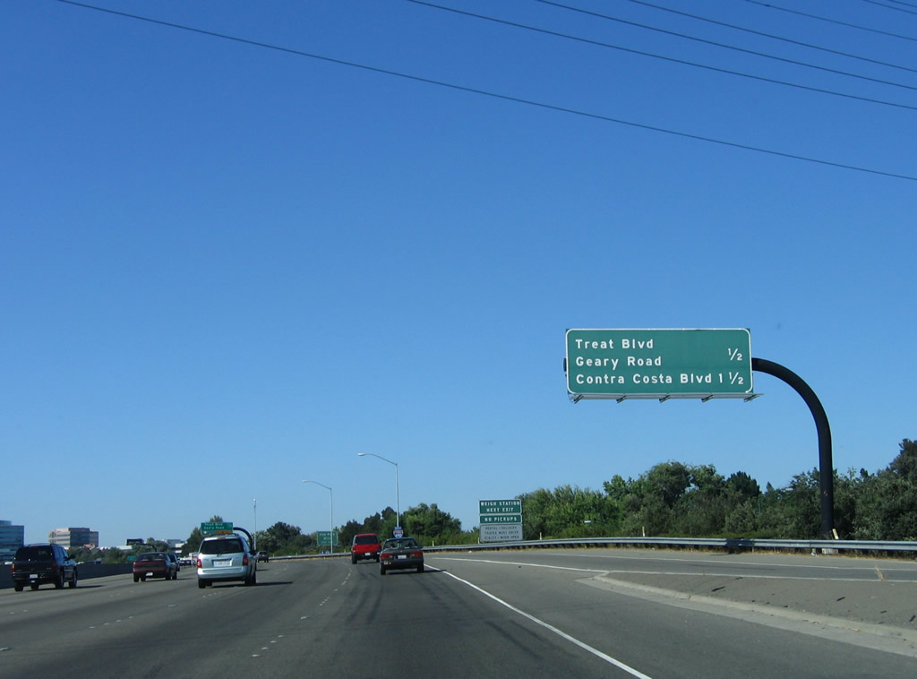
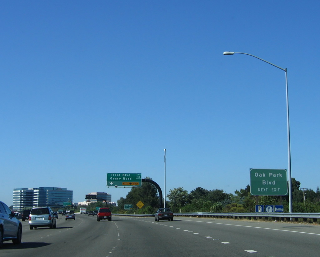
At Exit 48, a left turn at the top of the exit ramp connects to Geary Road west to Pleasant Hill and northwest Walnut Creek. A right turn connects to Treat Boulevard east to northern Walnut Creek and southeastern Concord. Use Treat Boulevard east to the BART Station and Oak Park Boulevard, which parallels Interstate 680 to the east. Photo taken 07/06/06.
|
|
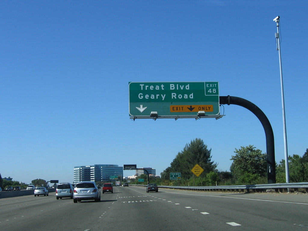
The right lane becomes exit only for Exit 48, Treat Boulevard/Geary Road. Photo taken 07/06/06.
|
|
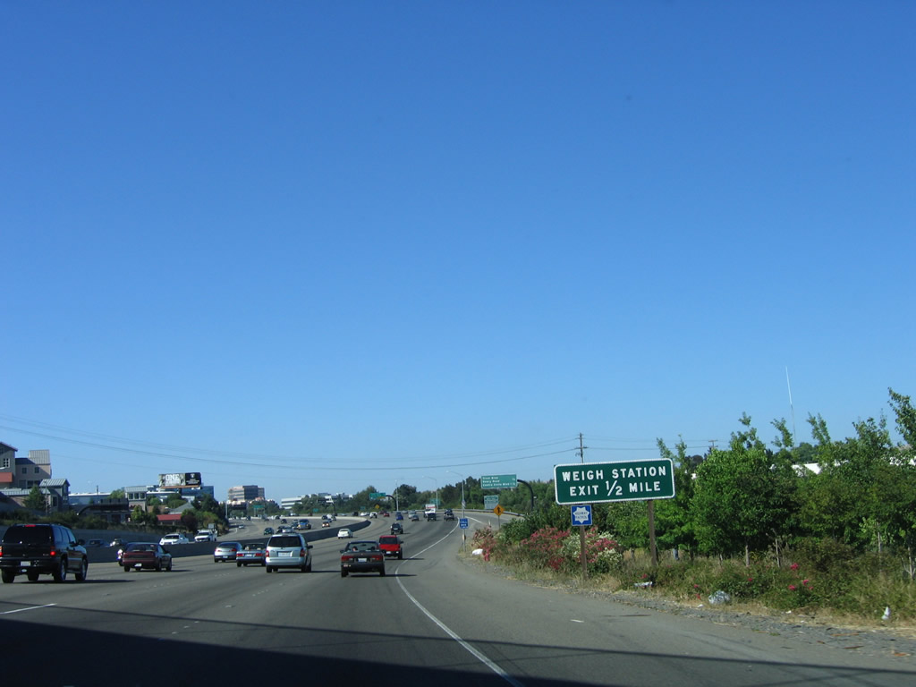
A small diagrammatical sign shows the lane allocation for the weigh station and exit ramp to Exit 48. Photo taken 07/06/06.
|
|
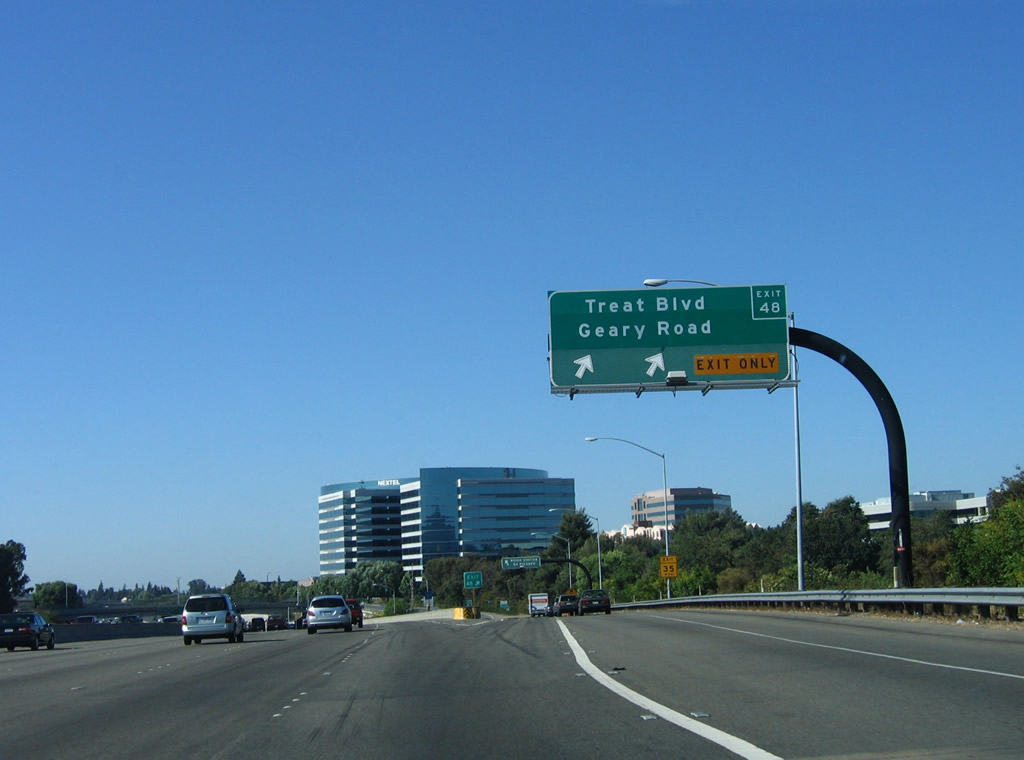
Northbound Interstate 680 reaches Exit 48, Treat Boulevard/Geary Road. In 2005, Caltrans placed exit number overlay strips on several of the existing signs, some which were only put in place during the late 1990s after the major reconstruction of the Interstate 680 and California 24 interchange. Photo taken 07/06/06.
|
|
|
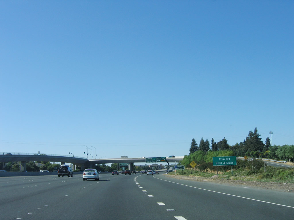
Leaving Walnut Creek, Interstate 680 north enters the city of Pleasant Hill, which is home to 32,837 people as of the 2000 Census. Pleasant Hill was founded in 1961 as the region developed in the post-World War II boom. This mileage sign along northbound Interstate 680 provides the distance to the next three exits: Exit 49A, Contra Costa Boulevard. The next exits are Exit 49B, Monument Boulevard (in Pleasant Hill) and Exit 50, California 242 to Concord. Photos taken 11/23/07 and 04/02/04. |
|
|
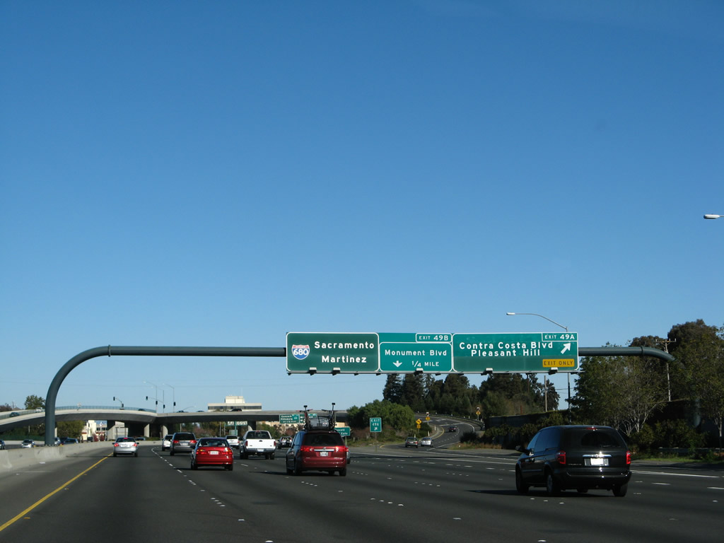
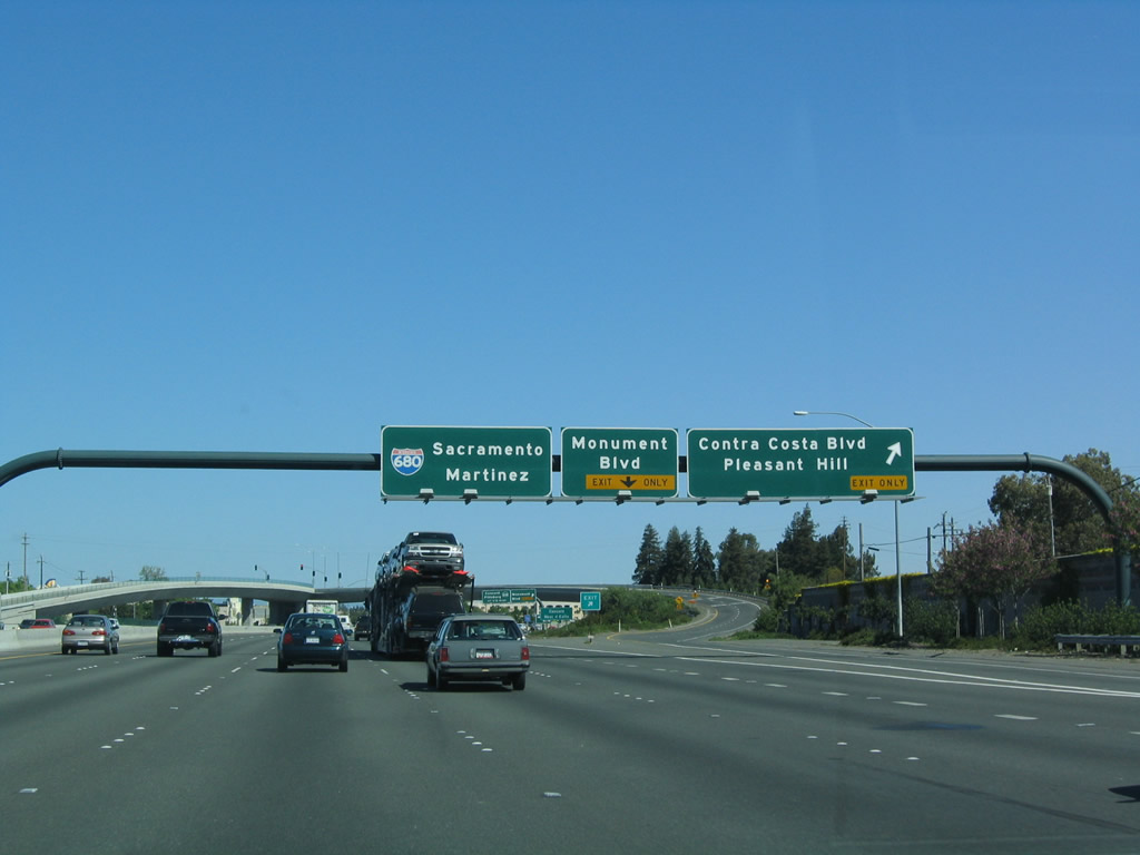
Northbound Interstate 680 approaches Exit 49A, Contra Costa Boulevard/Pleasant Hill (next right) and Exit 49B, Monument Boulevard (one-half mile). Photos taken 11/23/07 and 04/02/04. |
|
|
Northbound Interstate 680 reaches Exit 49A, Contra Costa Boulevard/Pleasant Hill. The next exit is for Exit 49B, Monument Boulevard, one-quarter mile. Photos taken 11/23/07 and 04/02/04. |
|
The next four exits serve the city of Concord: Exit 49B, Monument Boulevard; Exit 50, California 242; Exit 51, Taylor Boulevard/Sunvalley Boulevard/Willow Pass Road; and Exit 52, Concord Avenue. Photo taken 07/06/06.
|
|
|
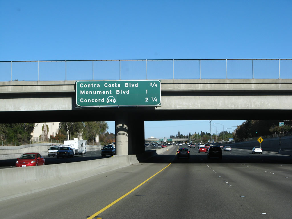
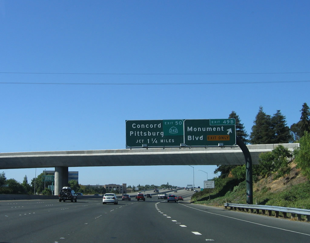
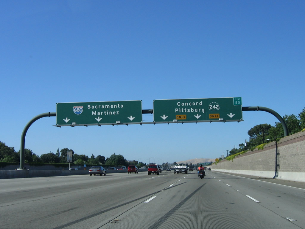
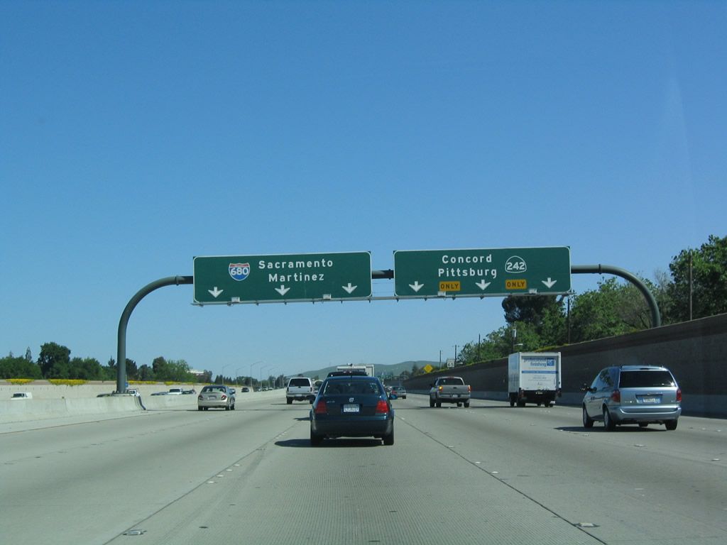
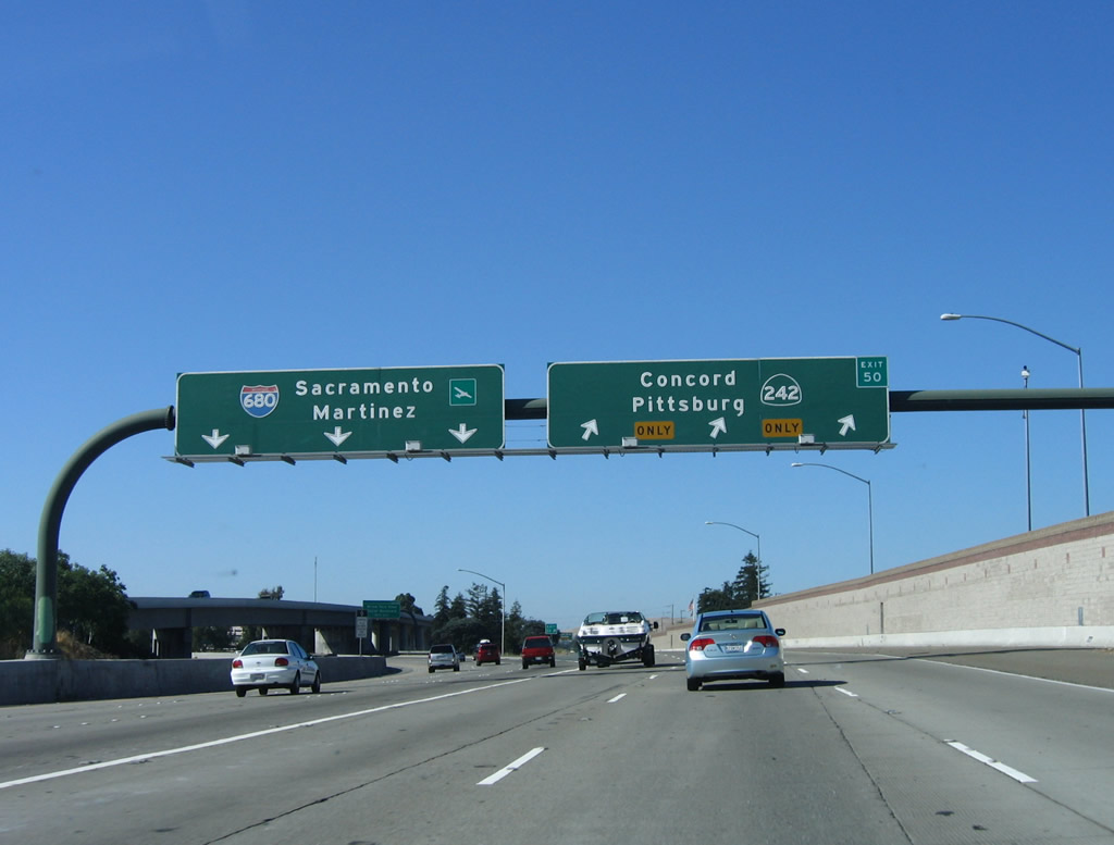
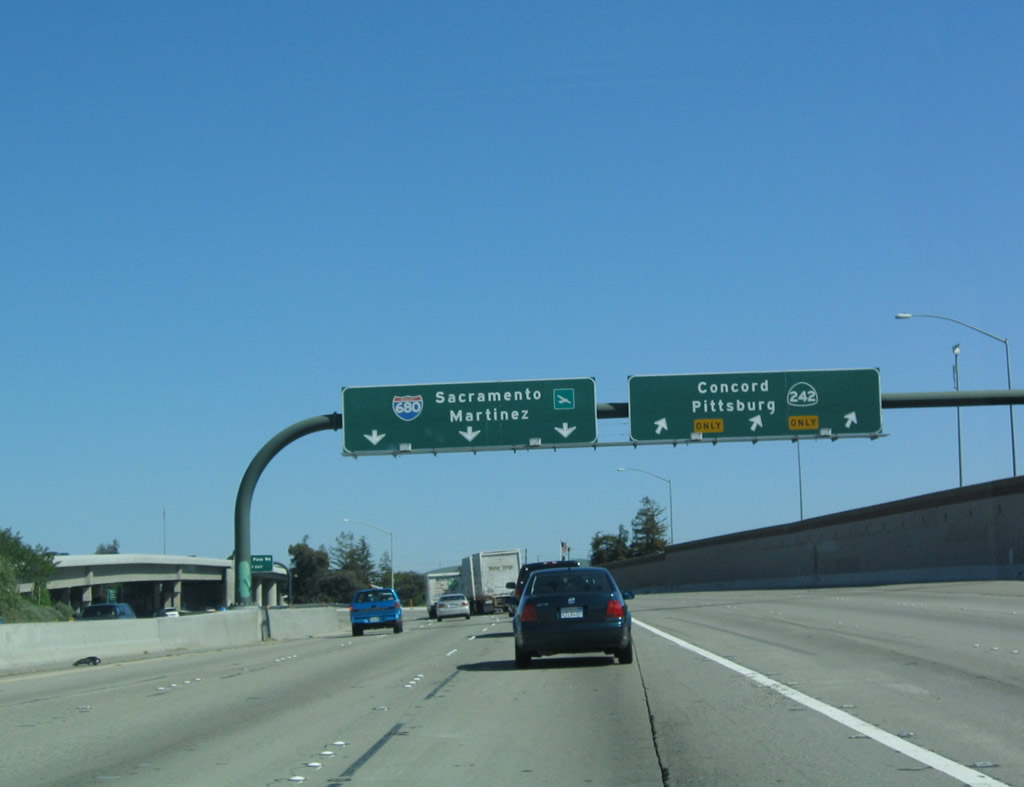
Northbound Interstate 680 reaches Exit 49B, Monument Boulevard, which is the second and last interchange to serve Pleasant Hill. This is the first of several interchanges to serve the city of Concord. The next exit is Exit 50, California 242 north. Photos taken 07/06/06 and 04/02/04. |
|
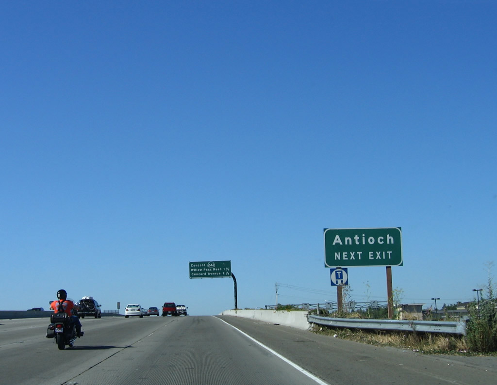
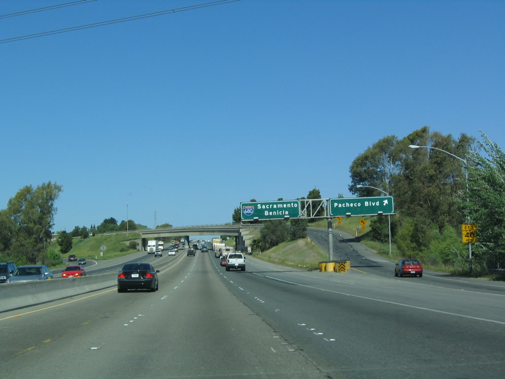
California 242 is a short freeway connector that provides a more direct route from Interstate 680 north to California 4 east and from California 4 west to Interstate 680 south. Originally part of a much longer California 24, the freeway now serves as a connector entirely located within the city of Concord. One of the destinations for California 4 east is Antioch, and California 242 shares Pittsburg and Antioch as destination cities. Photo taken 07/06/06.
|
|
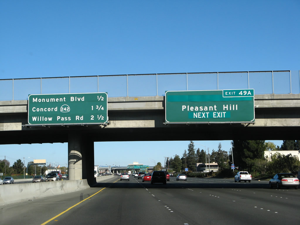
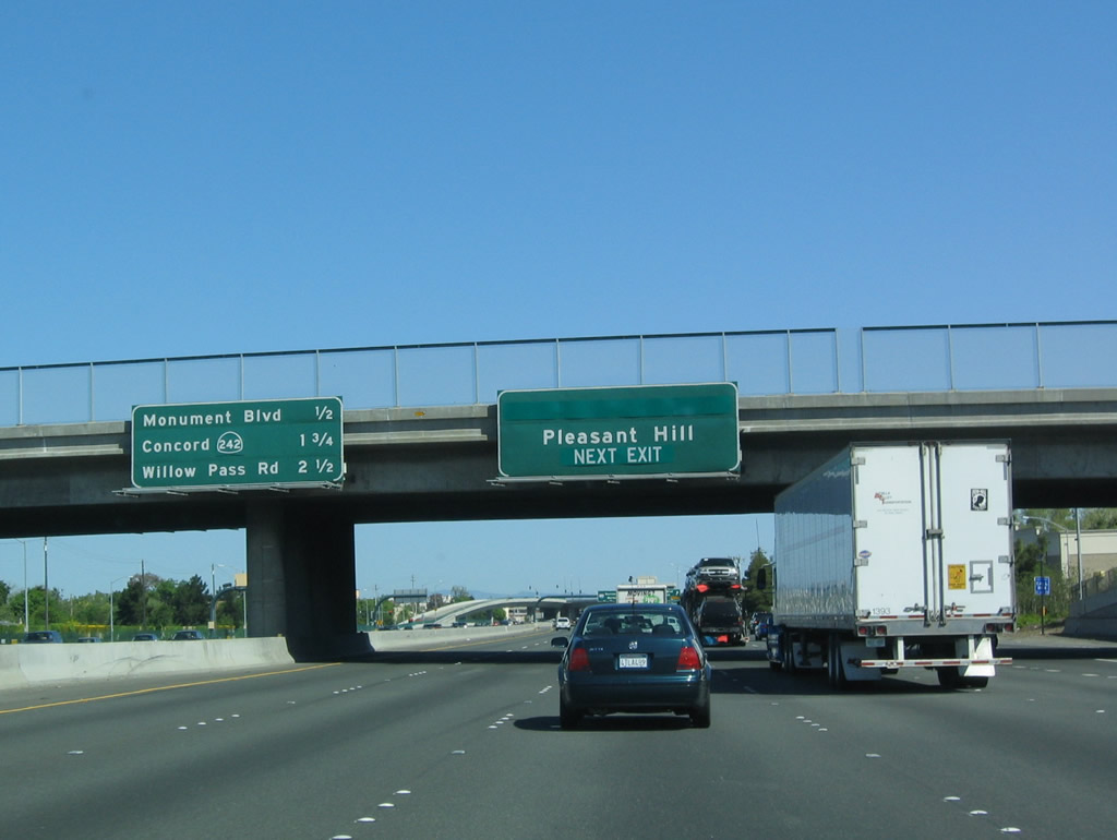
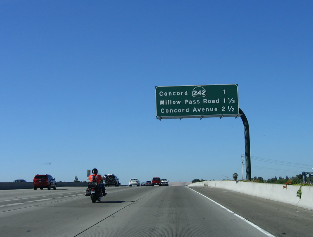
This mileage sign along northbound Interstate 680 provides the distance to the next three exits: Exit 50, California 242 north; Exit 51, Willow Pass Road/Sunvalley Boulevard; and Exit 52, Concord Avenue/Chilpancingo Parkway/Burnett Avenue. Photo taken 07/06/06.
|
|
|
Northbound Interstate 680 approaches Exit 50, California 242, a freeway which leads northeast between Interstate 680 and California 4 in Concord. This short freeway was originally part of a much longer California 24, but when California 24 was curtailed to eliminate the overlapped route, this orphaned section was recommissioned as California 242. Pittsburg is a city located along California 4 east of Concord along the Sacramento-San Joaquin River delta. Photos taken 07/06/06 and 04/02/04. |
|
|
Northbound Interstate 680 reaches Exit 50, California 242 north to California 4 (California Delta Highway) east to Pittsburg, Antioch, Brentwood, and Stockton. From here, Interstate 680 will bend a bit to the northwest, while California 242 travels north-northeast. Photos taken 07/06/06 and 04/02/04. |
|
|
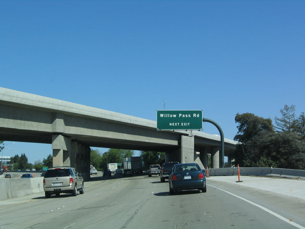
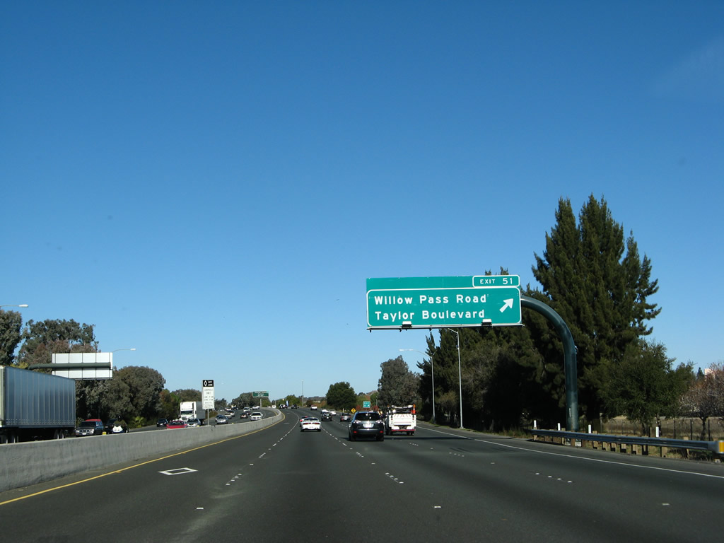
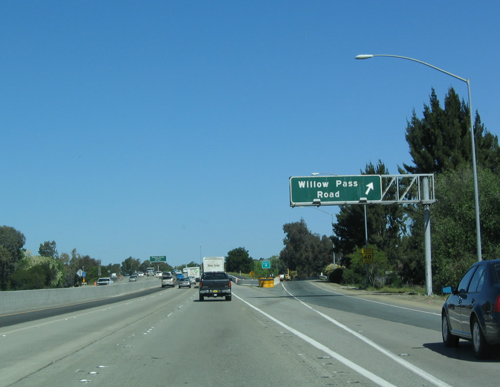
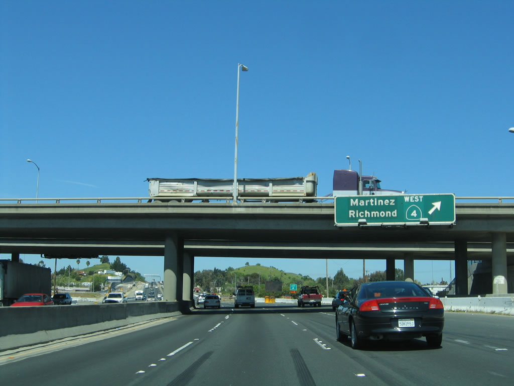
The next exit along northbound Interstate 680 is Exit 51, Willow Pass Road/Taylor Boulevard to Sunvalley Boulevard. The overpass here is the transition ramp from southbound California 242 to southbound Interstate 680. Photos taken 11/23/07 and 04/02/04. |
|
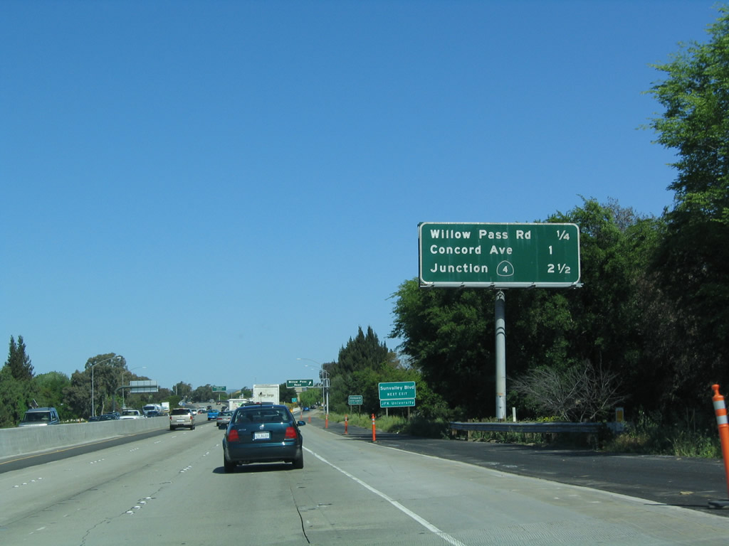
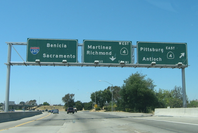
This mileage sign along northbound Interstate 680 provides the distance to the next three exits: Exit 51, Willow Pass Road/Taylor Boulevard to Sunvalley Boulevard; Exit 52, Chilpancingo Parkway/Concord Avenue/Burnett Avenue; and Exit 53, California 4. Photo taken 04/02/04. |
|
Interstate 680 enters the city of Concord, which is the largest city in Contra Costa County (but is not the county seat). Home to 121,780 people as of the 2000 Census, Concord contains 31.31 square miles and was incorporated as a town in February 1905. Photo taken 11/23/07. |
|
|
Northbound Interstate 680 reaches Exit 51, Willow Pass Road/Taylor Boulevard to Sunvalley Boulevard. Shopping and other amenities are abundant in both directions at this Concord exit. After this exit, Interstate 680 will leave the city of Concord. Photos taken 11/23/07 and 04/02/04. |
|
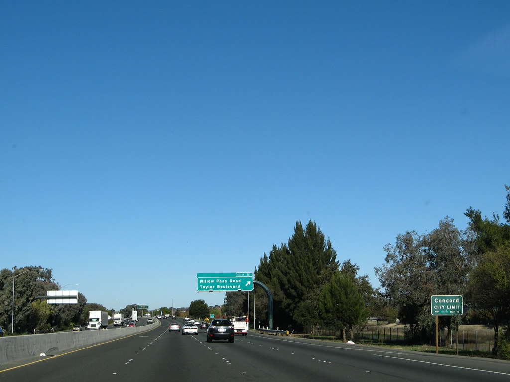
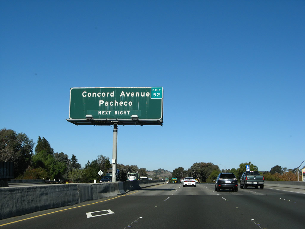
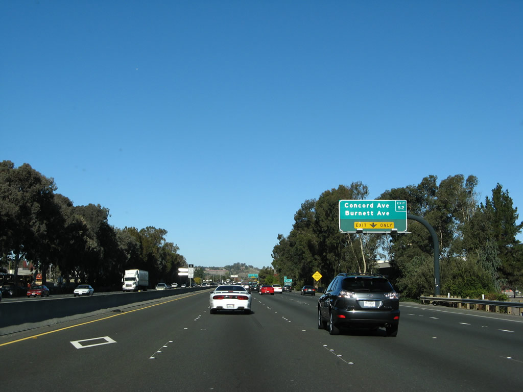
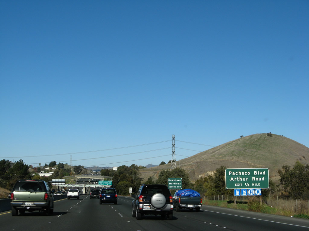
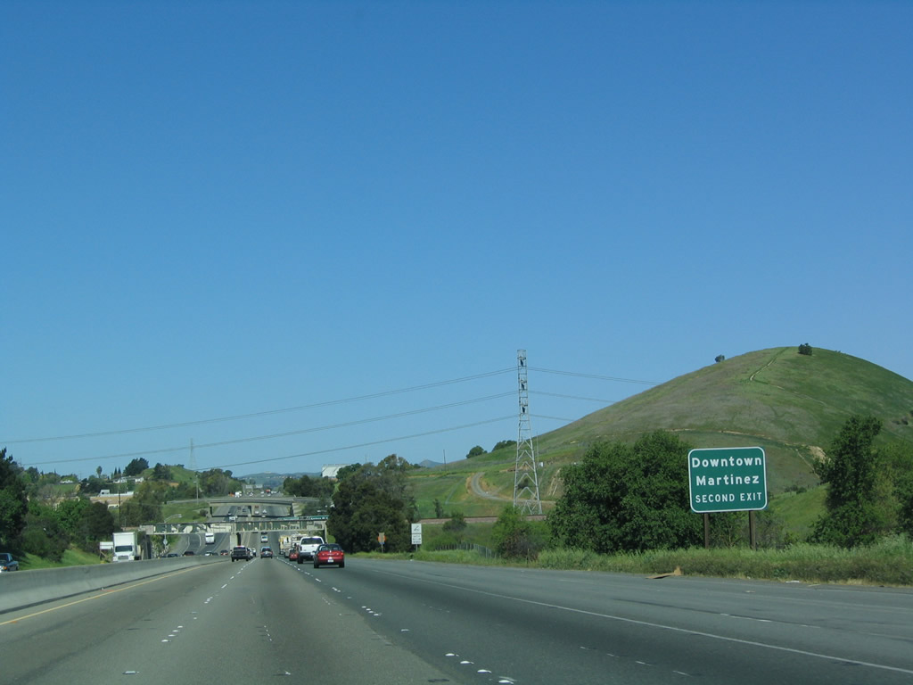
The next exit along Interstate 680 north is Exit 52, Concord Avenue east to Concord and Chilpancingo Parkway west to northern Pleasant Hill, unincorporated Pacheco, and the southern edge of the city of Martinez (seat of Contra Costa County). Exit 52 also connects to Diablo Valley College via Chilpancingo Parkway west to Contra Costa Boulevard south to Golf Club Road west. This interchange also connects to Burnett Avenue in Concord. On this porcelain-enamel sign, a reflective exit tab was attached sometime around 2005. Photo taken 11/23/07. |
|
A variable message sign indicated that on this day in November 2007, an accident was blocking California 4 in Discovery Bay, east of Antioch. As a result, all through traffic to Sacramento were advised to use Interstate 680 north to Interstate 80 east. Photo taken 11/23/07. |
|
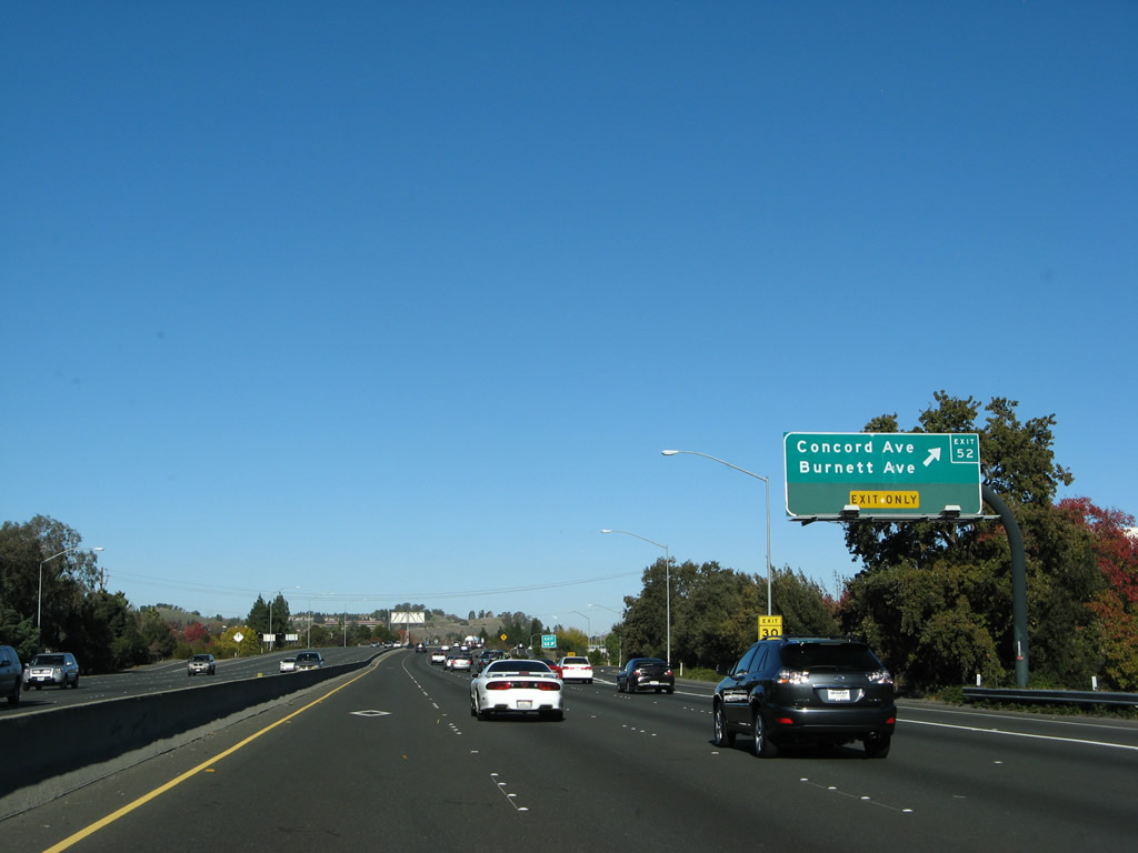
The new auxiliary lane from the Willow Pass Road/Taylor Boulevard interchange on-ramp becomes exit only for Exit 52. At Exit 52, the off-ramp connects directly to Burnett Avenue. To get to Concord Avenue and Chilpancingo Parkway, turn left (north) on Diamond Boulevard after exiting the freeway. Photo taken 11/23/07. |
|
Northbound Interstate 680 reaches Exit 52, Concord Avenue east to Concord and Chilpancingo Parkway west to Pacheco. Like the other signs along this stretch, the exit number was retrofitted onto these signs. Since this section of Interstate 680 was widened in the late 1990s, many of the signs were newer than the porcelain-enamel signs that used to grace this freeway. Photo taken 11/23/07. |
|
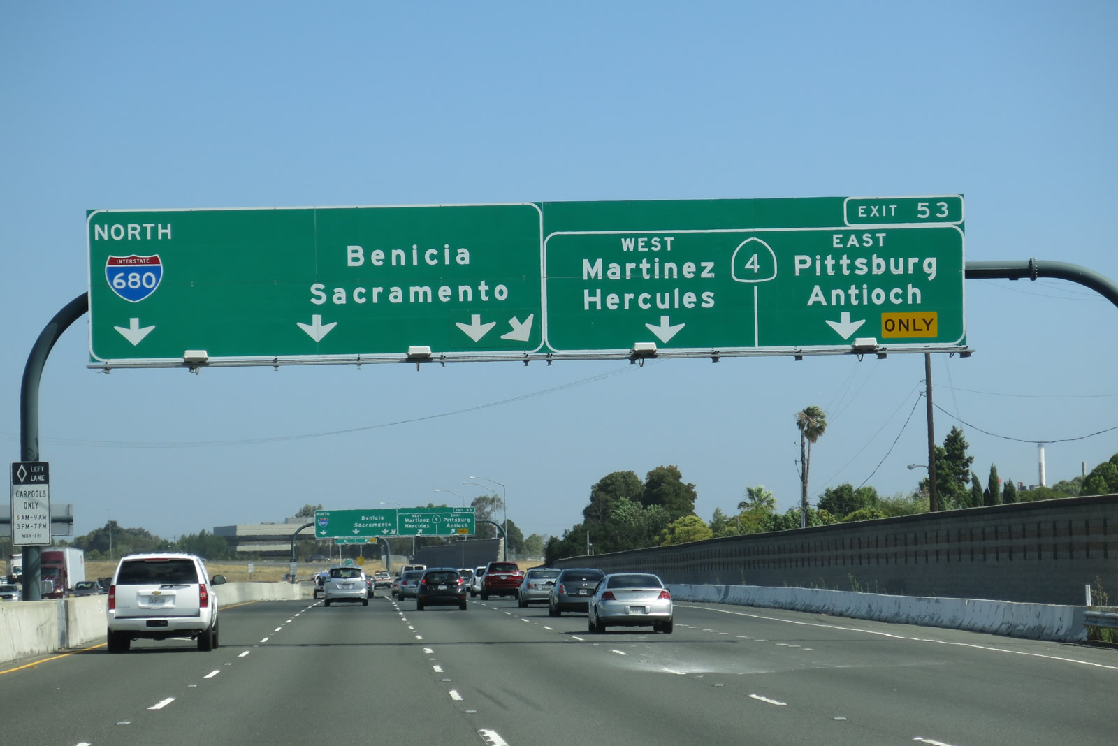
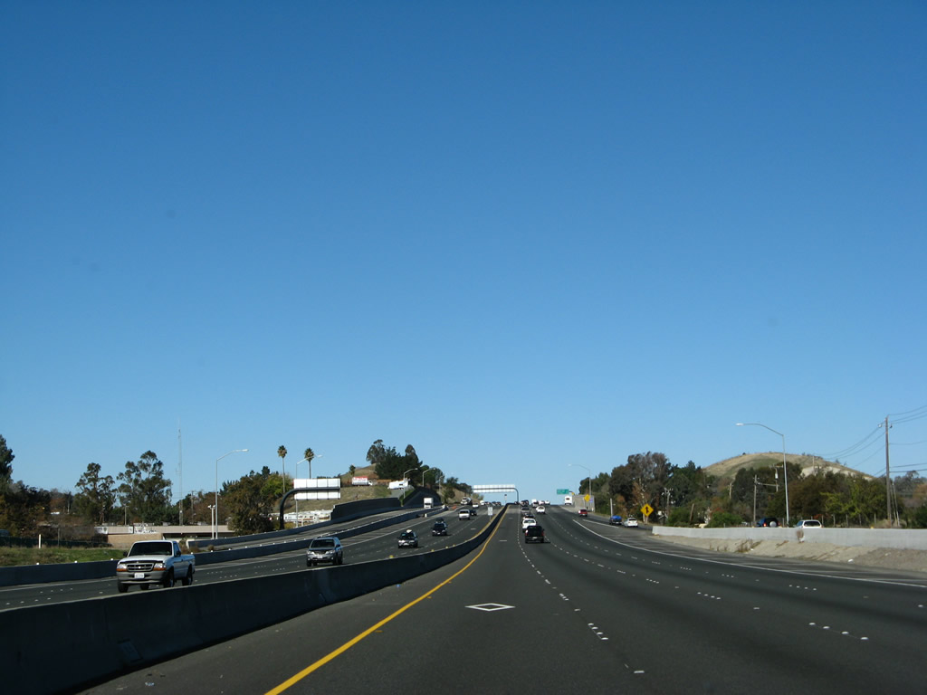
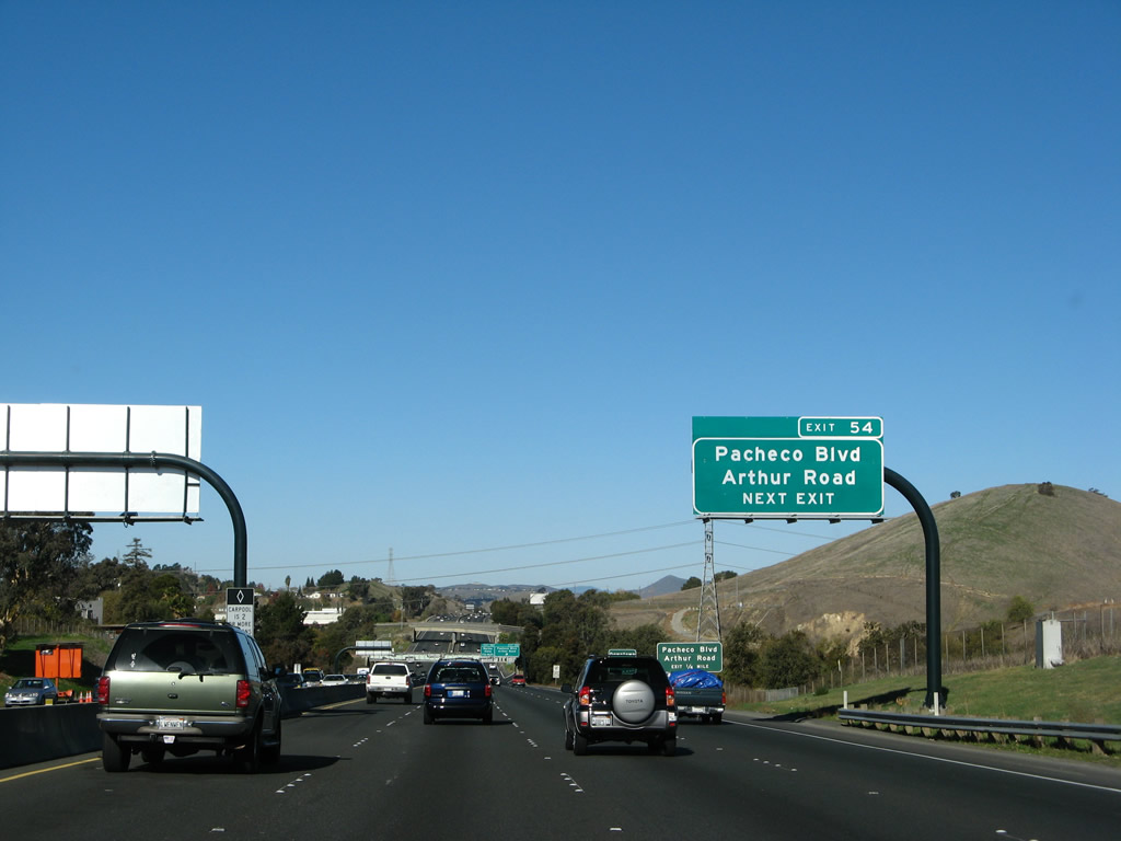
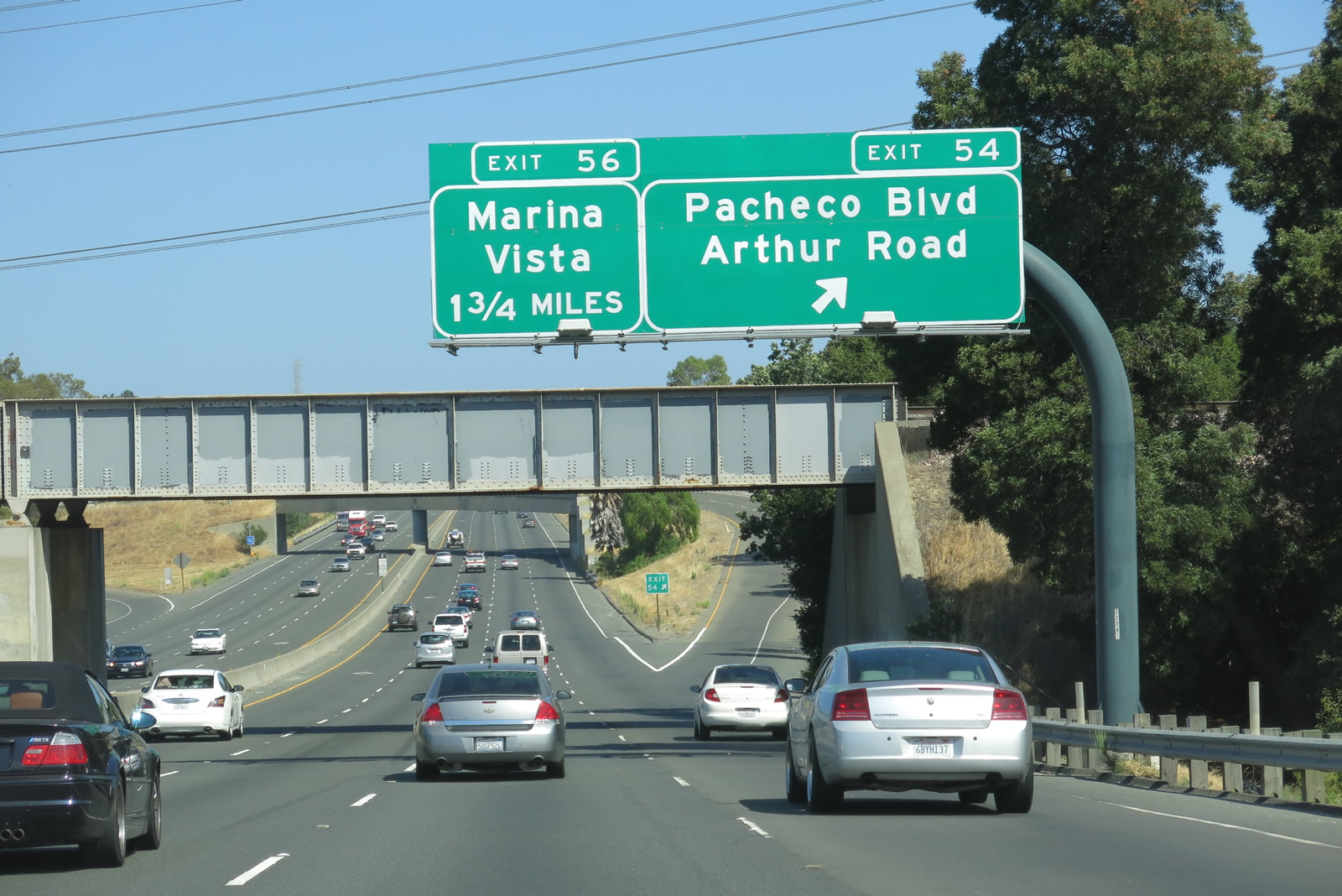
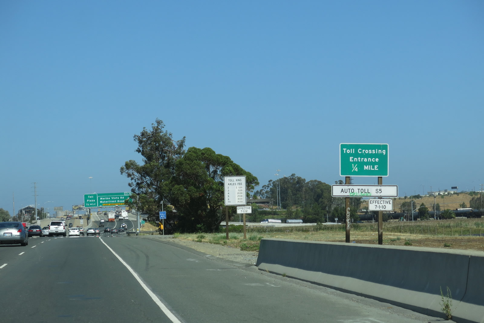
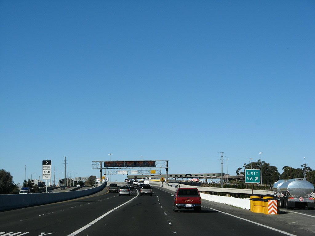
The next there exits along Interstate 680 north are Exit 53, California 4; Exit 54 Pacheco Boulevard; and Exit 56, Marina Vista. This interchange is located in unincorporated Contra Costa County; the city of Martinez lies to the west, and the city of Concord is to the east and south. Photo taken 11/23/07. |
|
|
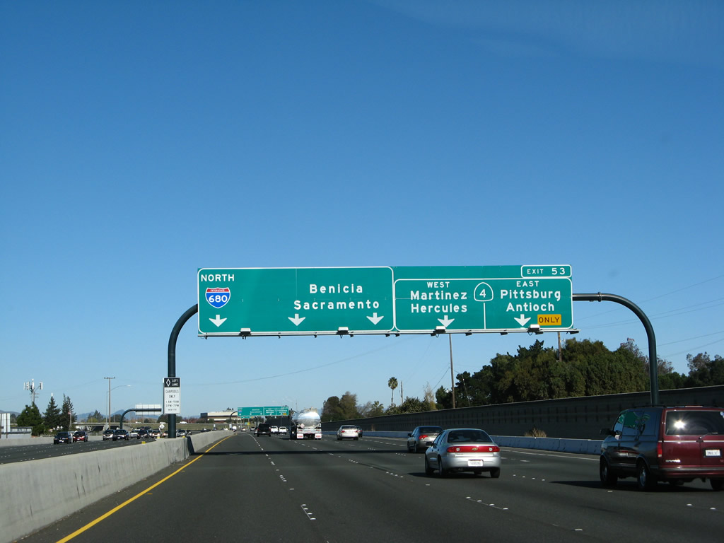
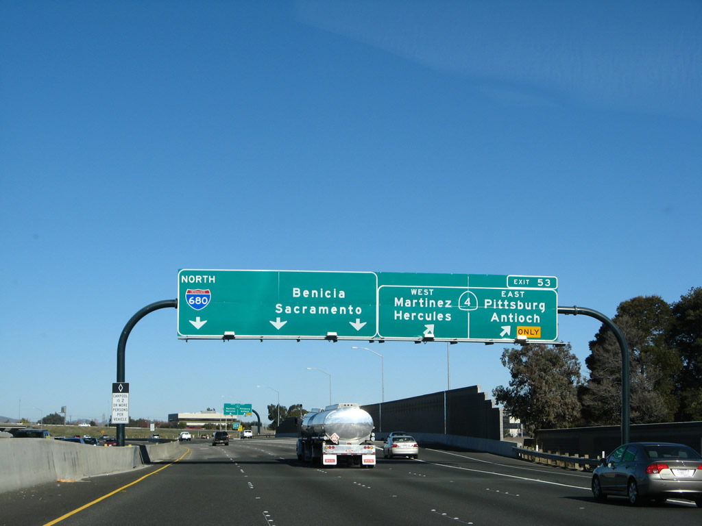
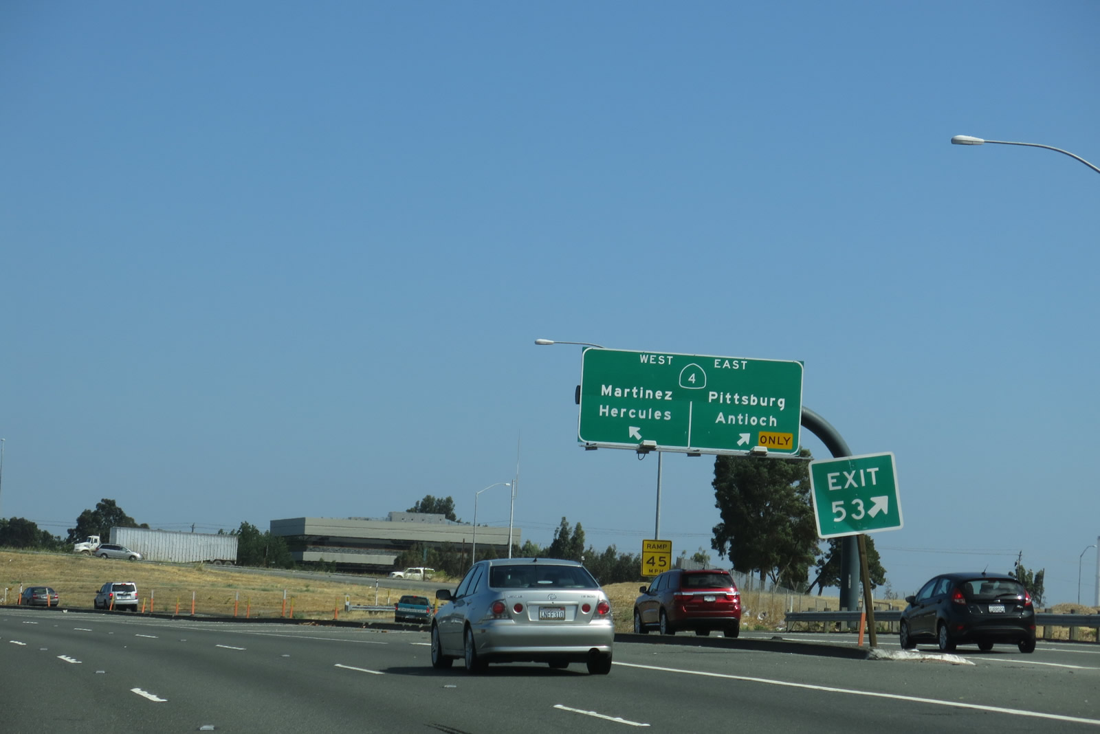
The next exit along Interstate 680 north is Exit 53, California 4. This is a major interchange, and it was reconstructed in 2006. California 4 (California Delta Highway) extends east from this interchange to Pittsburg, Antioch, and Stockton. Freeway expansion has resulted in a longer California 4 freeway east of here, penetrating further into Oakley and Brentwood. To the west, California 4 (John Muir Parkway) travels through Martinez to its end at Interstate 80 in Hercules near the Carquinez Bridge (Alfred Zampa Bridge). Some sections of California 4 west of Martinez were upgraded to freeway standards in 2002. This sign was modified slightly by 2013 by including a fourth arrow in the pull-through sign for Interstate 680 north. Photos taken 07/05/13 and 11/23/07. |
|
|
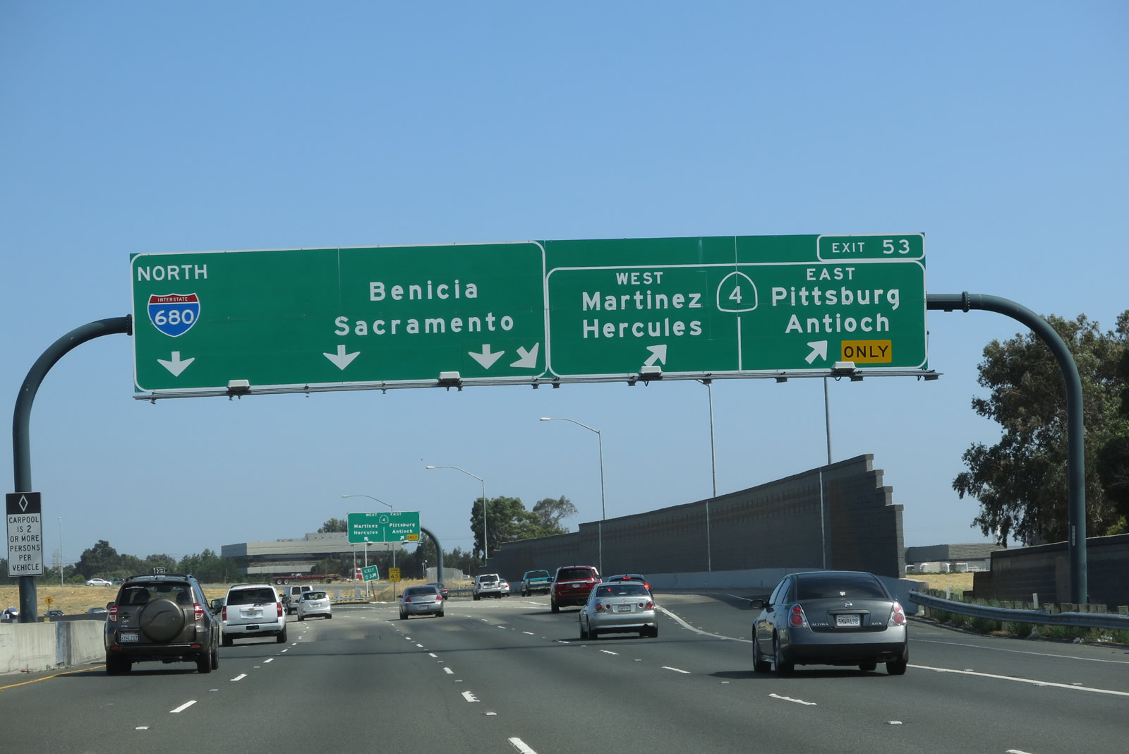
Northbound Interstate 680 reaches Exit 53, California 4. This is a two-lane exit, with the right lane connecting to California 4 (California Delta Highway) east and the other lane connecting to California 4/John Muir Highway west. This sign was modified slightly by 2013 by including a fourth arrow in the pull-through sign for Interstate 680 north. Photos taken 07/05/13 and 11/23/07. |
|
|
With recent construction, this interchange was upgraded from a standard cloverleaf to a modified cloverleaf, which allows exiting cars to mix with mainline traffic once rather than multiple times. A sign is posted on the collector distributor lanes for the two ramps to California 4, east and west (respectively). Photos taken 07/05/13 and 11/23/07. |
|
In the old configuration of this interchange as a cloverleaf, northbound Interstate 680 first met Exit 53A, California 4 (California Delta Highway) east to Antioch, and the following ramp connected to Exit 53B, California 4/John Muir Highway west to Hercules. Photo taken 05/25/03 by Pete Sison.
|
|
Also in the old configuration, Interstate 680 north had a loop ramp connection to Exit 53B, California 4 west to Hercules and Interstate 80. This configuration has been eliminated in favor of the one shown in the 2007 photos above. Photo taken 03/31/05.
|
|
This centerline view of Interstate 680 is taken from the left lane (carpool lane) after passing under the California 4 overpass. Photo taken 11/23/07. |
|
An Interstate 680 north reassurance shield shield is posted after the collector distributor lane from the California 4 interchange rejoins the main lanes of Interstate 680. Photo taken 07/05/13. |
|
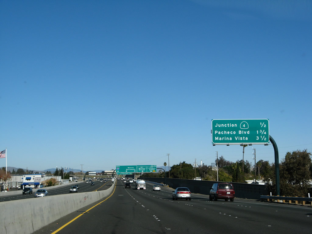
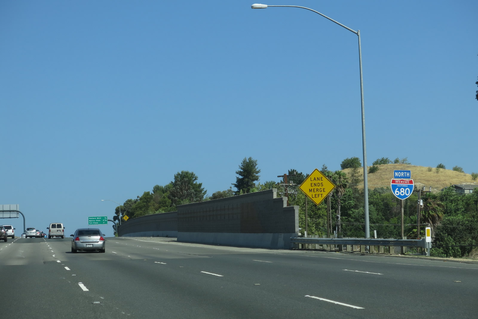
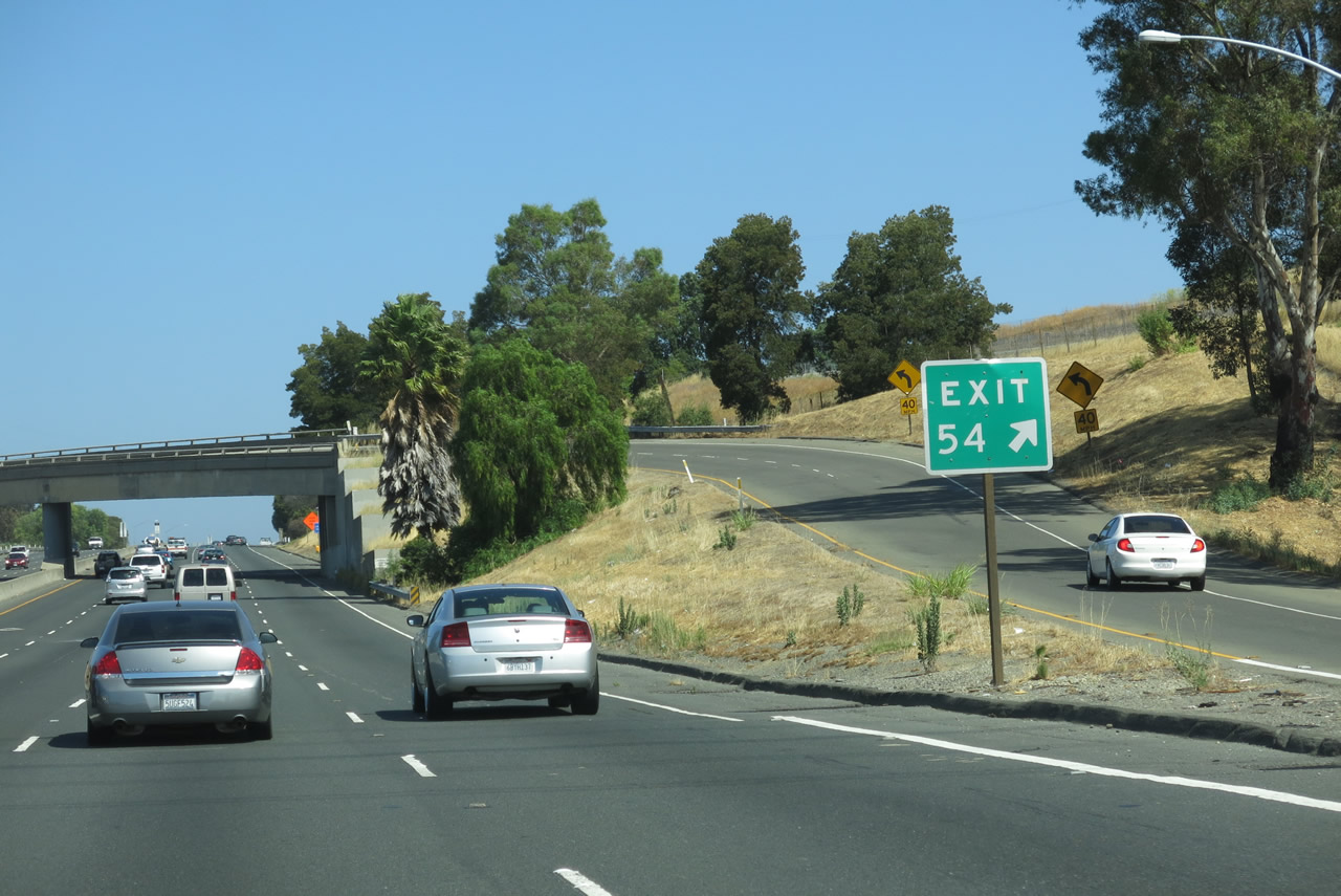
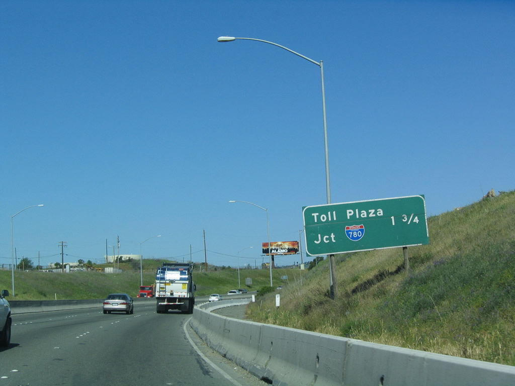
The next exit along Interstate 680 north is Exit 54, Pacheco Boulevard, one-half mile. This mileage sign is the first one along northbound to note the toll plaza on the Martinez-Benicia Bridge. With the August 2007 opening of the new northbound bridge, the toll plaza is now located at the south end of the bridge, so the approach to the bridge is only 4.50 miles from here. Photo taken 03/31/05.
|
|
Exit 54 is a bit unusual since the exit ramp is a high-speed connection from Interstate 680 directly onto a short connector road that ends at Pacheco Boulevard. From this short spur, Pacheco Road then travels northwest into the city center of Martinez. Both this exit and Exit 56 (Marina Vista) offer good routes into downtown Martinez from Interstate 680. Despite its proximity, Interstate 680 does not enter the city limits of Martinez until after passing Exit 56. Photo taken 11/23/07. |
|
Use Exit 54 to Arthur Road, which travels north from Pacheco Boulevard into a small residential area northeast of the freeway in unincorporated Contra Costa County. This connection is also required for those returning to Interstate 680 north after using Exit 54. Photo taken 11/23/07. |
|
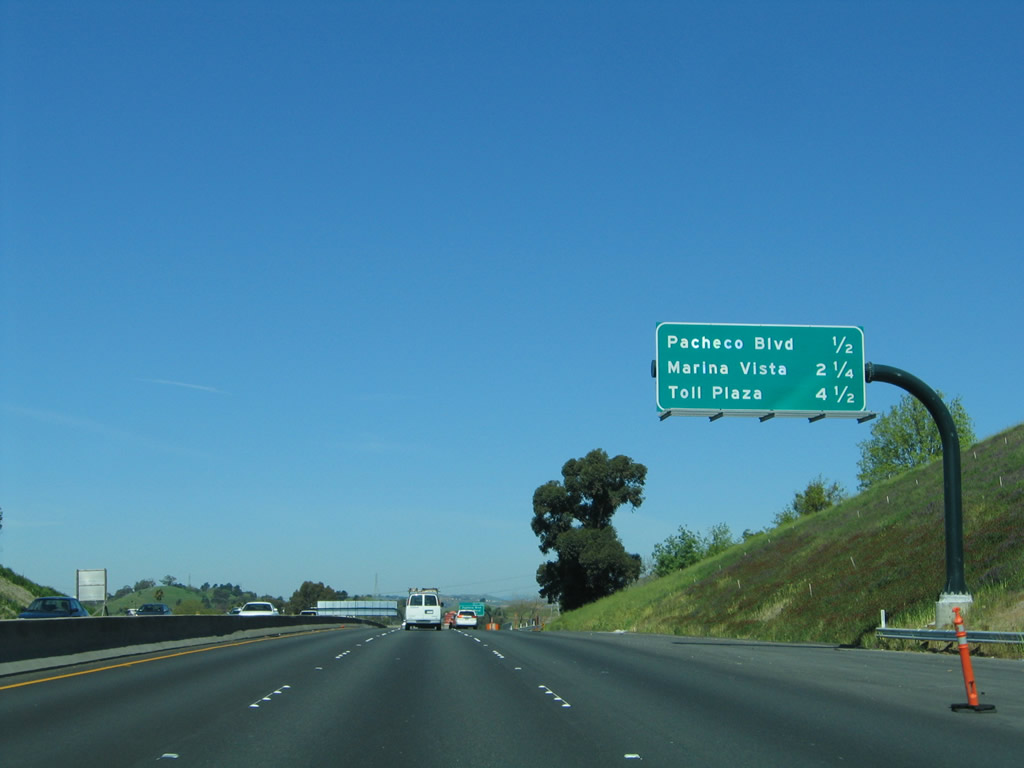
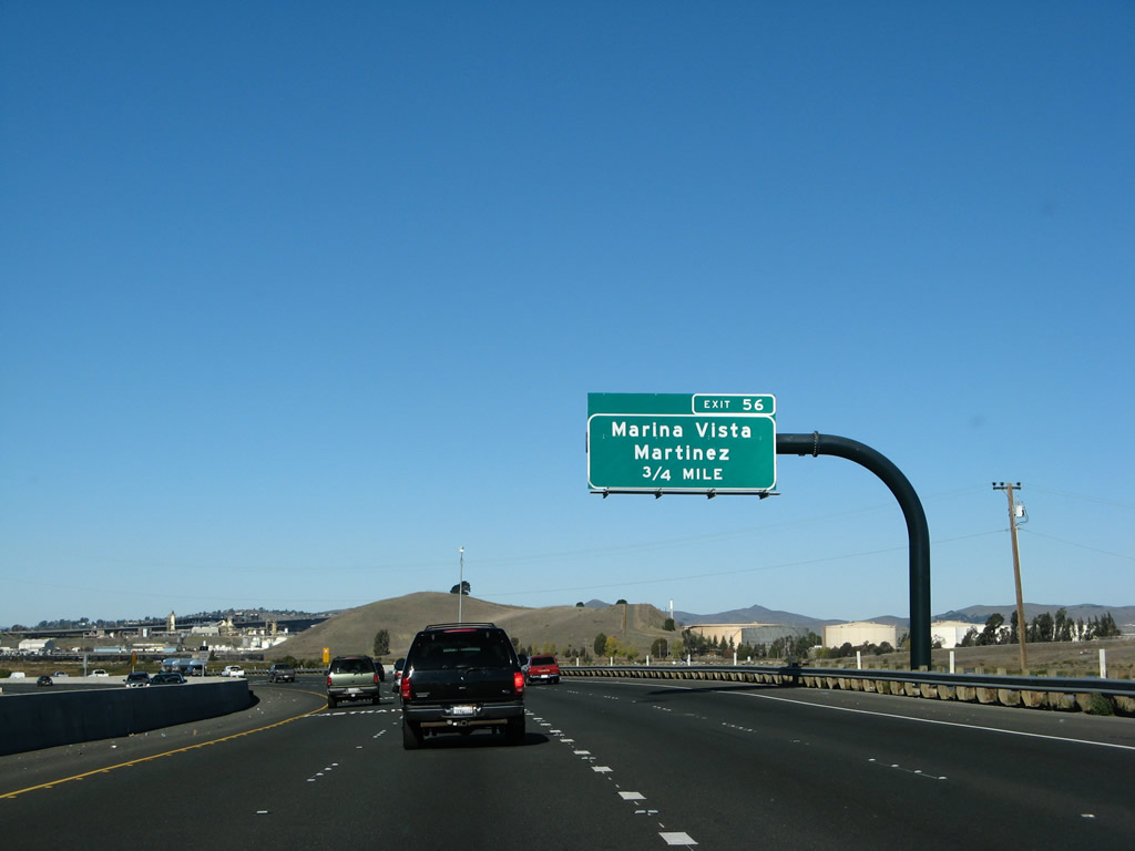
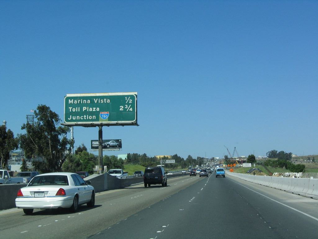
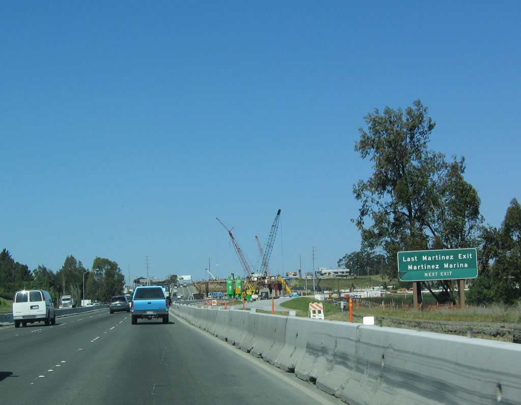
Either Pacheco Boulevard (Exit 54) or Marina Vista (Exit 56) travels west into downtown Martinez, the seat of Contra Costa County. Founded in 1876, Martinez contains 12.5 square miles and is home to over 36,700 residents. Interstate 680 skirts the city, only entering the city limits as it begins its journey across the Carquinez Strait via the Benicia-Martinez Bridge. This sign advises motorists to use Exit 56, since the distance traveled off the freeway is less; however, either road suffices. Photo taken 04/02/04. |
|
|
Northbound Interstate 680 reaches Exit 54, Pacheco Boulevard. Note how the signage was changed from a butterfly gantry in 2005 with a pull-through sign for Interstate 680 to an advance sign posted prior to the railroad bridge that also mentions Exit 56. Photos taken 07/05/13 and 04/02/04. |
|
This view shows the high-speed ramp from Interstate 680 north to the Pacheco Boulevard connector road at Exit 54. Photo taken 07/05/13. |
|
An Interstate 680 north reassurance shield is posted shortly after the Arthur Road on-ramp. Photo taken 07/05/13. |
|
The next exit along northbound Interstate 680 is Exit 56, Marina Vista, 0.75 mile. Photo taken 11/23/07. |
|
|
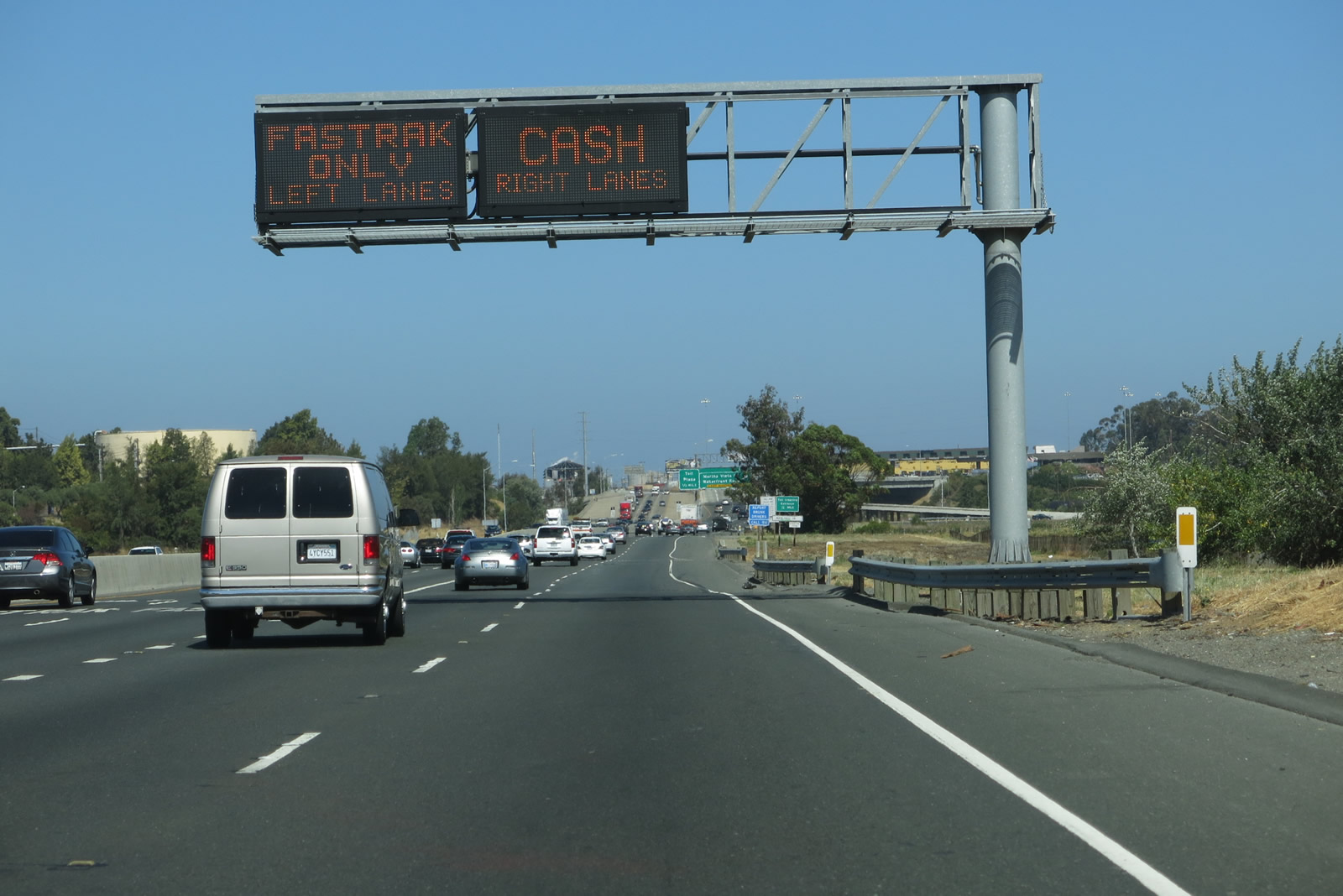
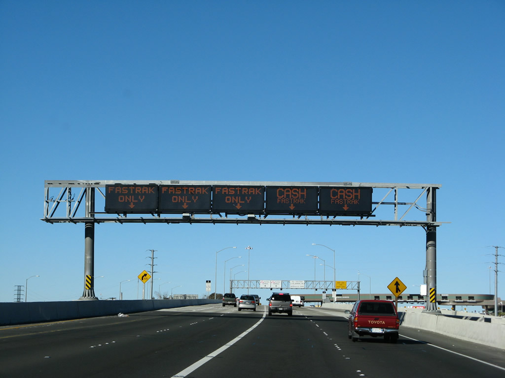
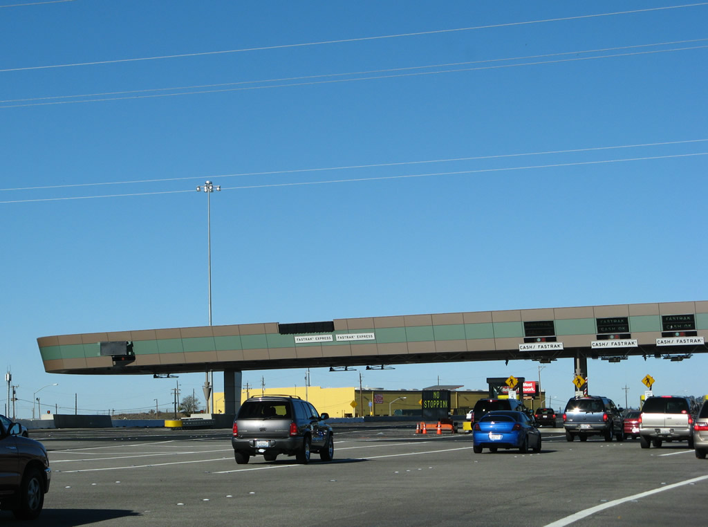
Northbound Interstate 680 approaches Exit 56, Marina Vista, in Martinez. The delta is visible to the right (east) of the northbound lanes. The Martinez-Benicia Bridge is just ahead (note "Toll Plaza" as a destination on the mileage sign). Although the sign did not change between 2004 and 2007, the lane allocation and pavement markings did. Note that the left two lanes become "Fastrak-Only" lanes, while the right two lanes will connect to the toll plaza for cash tolls. Photos taken 11/23/07 and 04/02/04. |
|
|
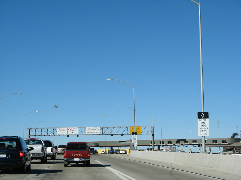
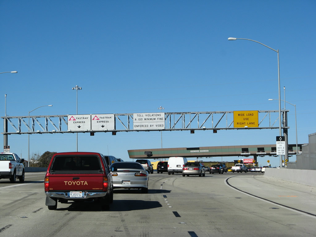
New signs indicate the lane allocation for toll collection. If you don't have an electronic toll collection tag (Fastrak), then move over to the right lanes. A variable message sign is posted shortly after the toll lane allocation signs for traffic situations. Compare this arrangement to the companion photo from 2004, which included a beat-up roadside sign for Exit 56, Marina Vista/Martinez. New reflective signs are posted in the distance ahead. Photos taken 07/05/13 and 04/02/04. |
|
The toll as of 2007 was $4 per automobile. This rate is subject to change, and motorists should check the cost prior to crossing the bridge. Tolls are only charged on northbound; there is no toll for southbound traffic. Photo taken 07/05/13. |
|
Northbound Interstate 680 reaches Exit 56, Marina Vista/Martinez. This is the final Contra Costa County exit; Interstate 680 will cross the Carquinez Strait (Sacramento-San Joaquin River Delta) and soon leave Contra Costa County for Solano County. The toll plaza is the next stop, one-half mile ahead. Photo taken 11/23/07. |
|
As Interstate 680 meets Exit 56, the freeway begins to rise above ground level. The approach onto the new George Miller III Bridge (Benicia-Martinez Bridge) has begun. Photo taken 11/23/07. |
| Interstate 680/George Miller III Bridge (Benicia-Martinez Bridge) north
|
|
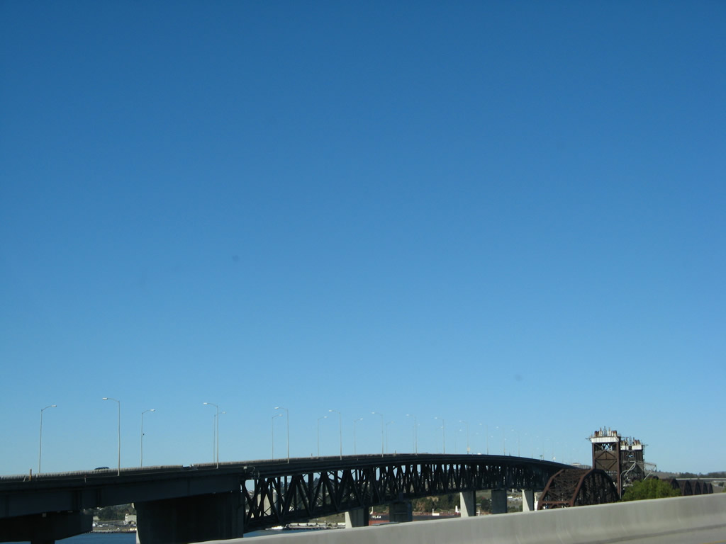
The original Benicia-Martinez Bridge was opened to traffic on September 15, 1962 (George Miller, Jr. Bridge, deck truss span, 1.2 miles); the new span opened on August 25, 2007 (segmented concrete span, George Miller III Bridge, 1.7 miles). A Union Pacific railroad lift bridge sits between the two spans; it was built in 1929-1930. As part of a project to expand the Benicia-Martinez Bridge to include a new northbound span, this picture shows the massive bridge deck being installed. Pillars for the new bridge were being placed at the time this picture was taken. Upon completion, Interstate 680 over the delta was brought up to Interstate standards, including full shoulders. Photo taken 11/23/07. |
|
High occupancy vehicles (three or more people per vehicle in this instance) may use a special lane during certain commuting hours and not pay a toll to cross the bridge. Photo taken 11/23/07. |
|
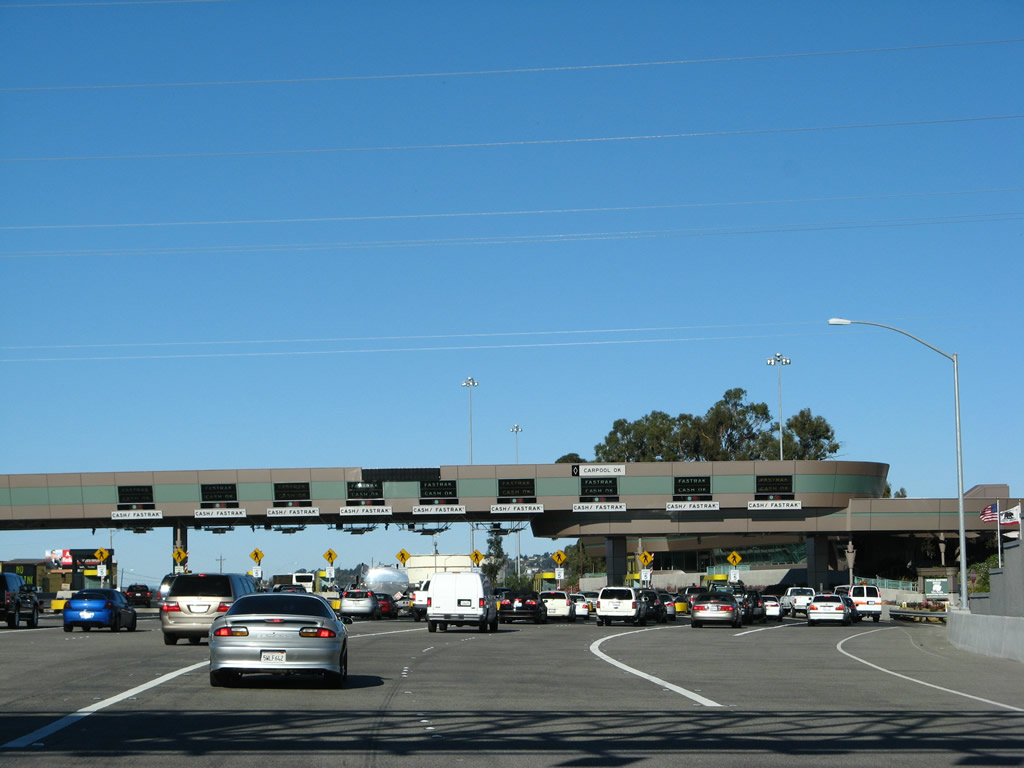
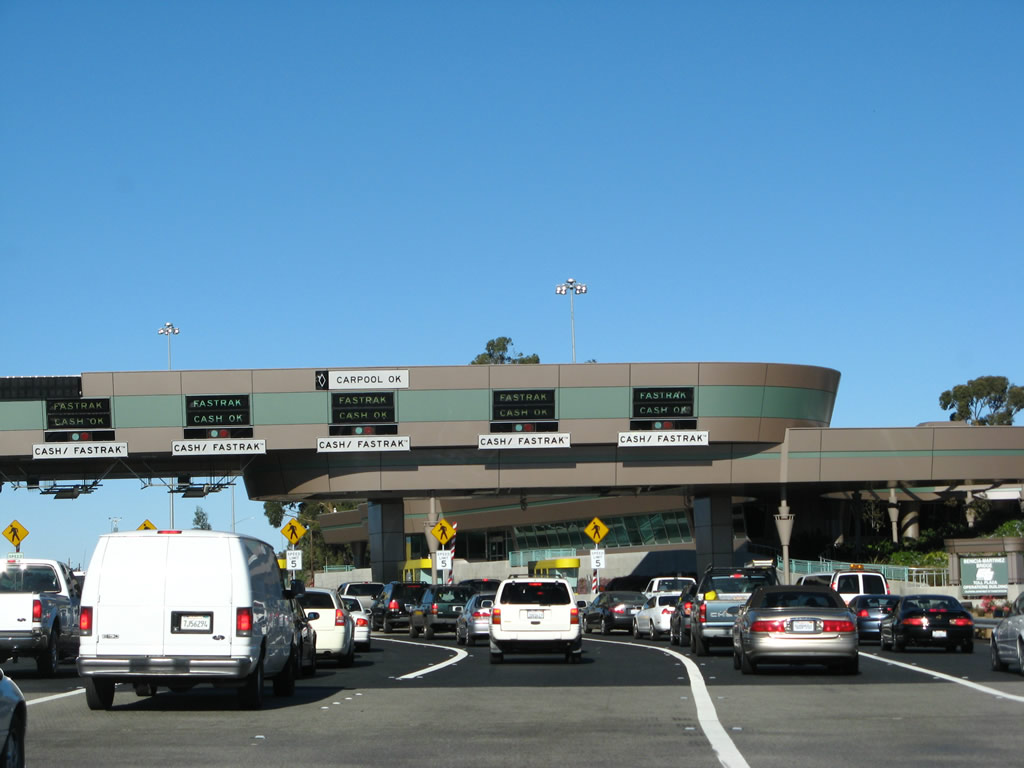
All cash-paying customers should stay right; open-road tolling is allowed via Fastrak in the left lanes. There are plenty of booths to the right to handle drivers, including a wide-load station on the right side. Photo taken 11/23/07. |
|
Northbound Interstate 680 approaches the new toll plaza, which opened on August 25, 2007. The design of the plaza was modified to allow for open road tolling/Fastrak electronic toll collection at the left side of the plaza. However, nine lanes are open to motorists. Note that one of the lanes is designated for carpools/high occupancy vehicles. Photo taken 11/23/07. |
|
This view shows the Fastrak (Open Road Tolling) lanes on the left side of the bridge. Photo taken 11/23/07. |
|
The toll plaza also including an operations building and offices. This is an upgrade when compared to the old toll plaza (see the Solano County photos of Interstate 680 north for comparison). Photo taken 11/23/07. |
|
Leaving the toll plaza after paying the toll, more of the operations building comes into view. Photo taken 11/23/07. |
|
High-mast lighting illuminates the area around the toll plaza. Landscaping next to the building greens the approach onto the main span of the bridge. Note the lane markings, which help brings traffic back together with five northbound lanes. Photo taken 11/23/07. |
|
Five through lanes of Interstate 680 north form as the older deck truss bridge comes into view. Photo taken 11/23/07. |
|
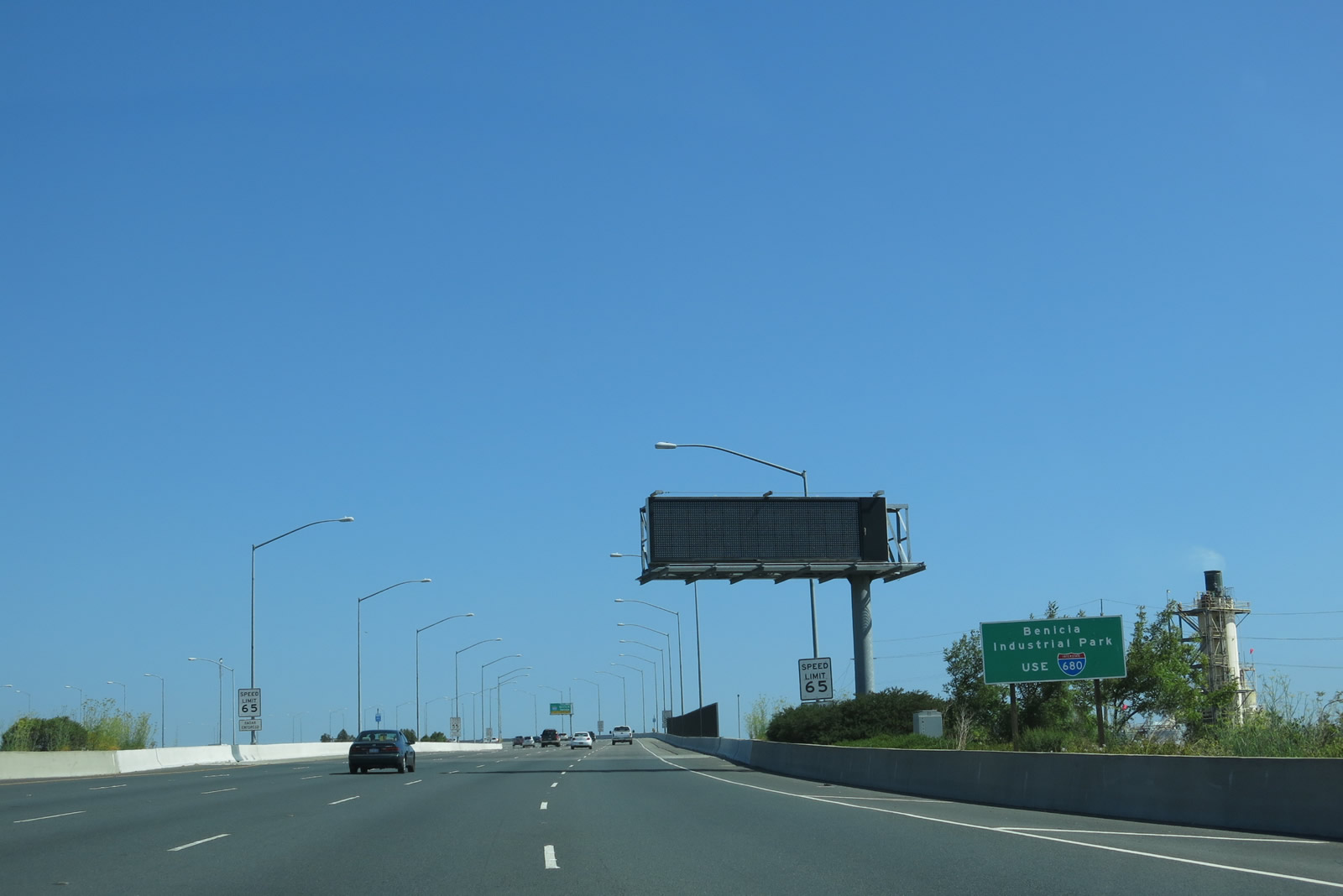
For Benicia Industrial Park, follow Interstate 680 north. Photo taken 07/05/13. |
|
Asphalt gives way to concrete as the freeway shifts onto the main span. This bridge was constructed in segments, and each segment was lifted into place to create the final bridge. Note the Interstate 780 overhead sign, which is on the 1962 deck truss bridge and would likely be removed as that bridge is shifted to full southbound service. Photo taken 11/23/07. |
|
The George Miller III Bridge (Benicia-Martinez Bridge) curves a bit to the left. Photo taken 11/23/07. |
|
With that curve, the original 1962 Benicia-Martinez Bridge comes into view, and the deck truss component is clearly visible under the span. In addition, the top of the railroad lift bridge is also visible below the new bridge. Photo taken 11/23/07. |
|
|
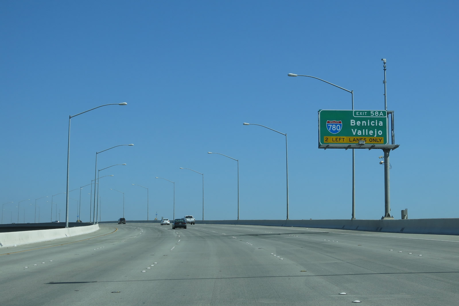
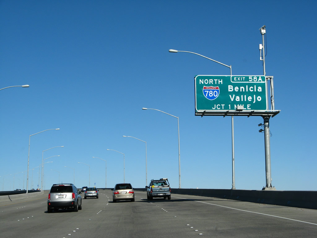
The next exit along Interstate 680 north is Exit 58A, Interstate 780 west to Benicia and Vallejo. It is arguable as to whether Interstate 780 should be signed east-west or north-south. Interstate 780 generally travels west between Interstate 680 and Interstate 80. However, Interstate 780 could also be signed north since it is part of the logical connector between Interstate 680 north and California 29 north. The sign was modified between 2007 and 2013 to indicate a left exit and to remove the direction banner (Interstate 780 is signed east-west, not north-south). Photos taken 07/05/13 and 11/23/07. |
|
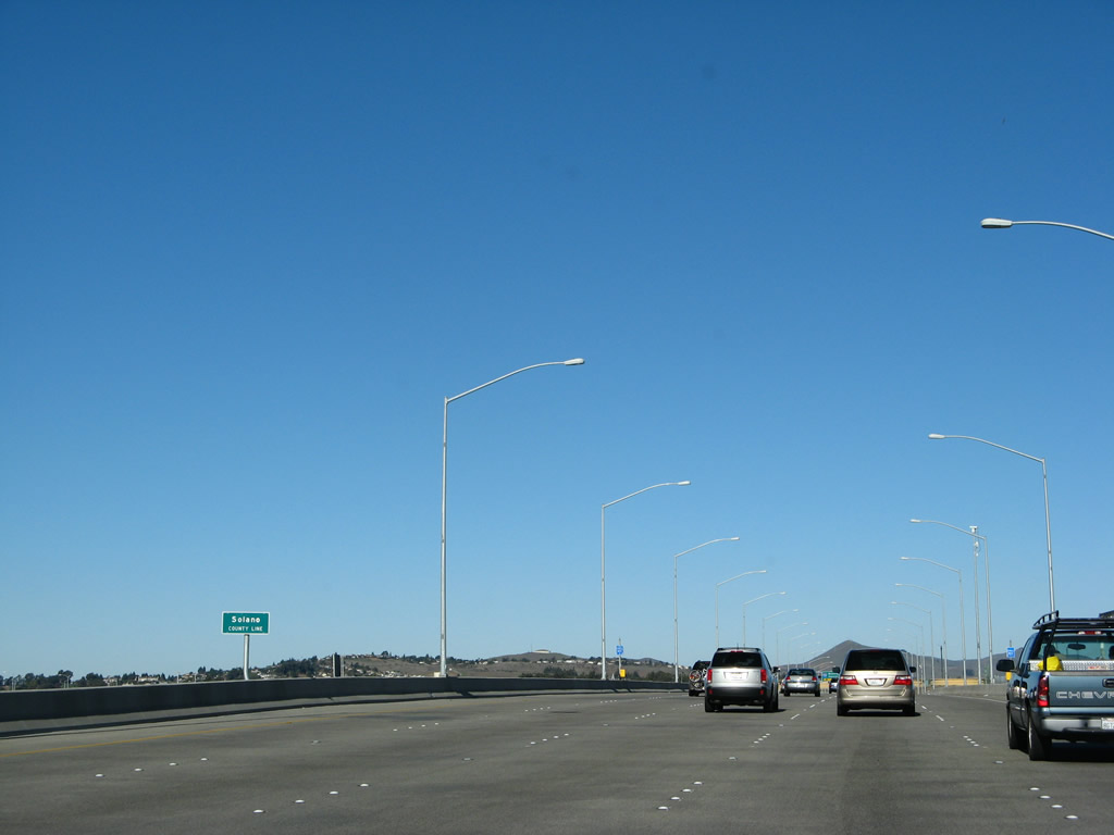
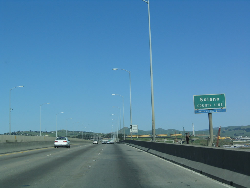
Around mid-span, the Benicia-Martinez Bridge leaves Contra Costa County and enters Solano County. The actual interchange with Interstate 780 is located within Solano County. Photo taken 11/23/07. |
| Interstate 680 (Benicia-Martinez Bridge) north (OLD CONFIGURATION)
|
|
This series of photos shows the original routing of Interstate 680 back when the northbound and southbound directions shared the same bridge to cross over the combined Sacramento River and San Joaquin River Delta (Carquinez Strait). The new construction is evident to the right of the former northbound lanes as we begin the approach to the 1962 deck truss bridge. Photo taken 04/02/04. |
|
The next exit along northbound is Exit 58A, Interstate 780 west. This exit is located just after the bridge toll plaza, which used to be located at the north end of the bridge (unlike the new configuration, which has the toll plaza at the north end). Photo taken 04/02/04. |
|
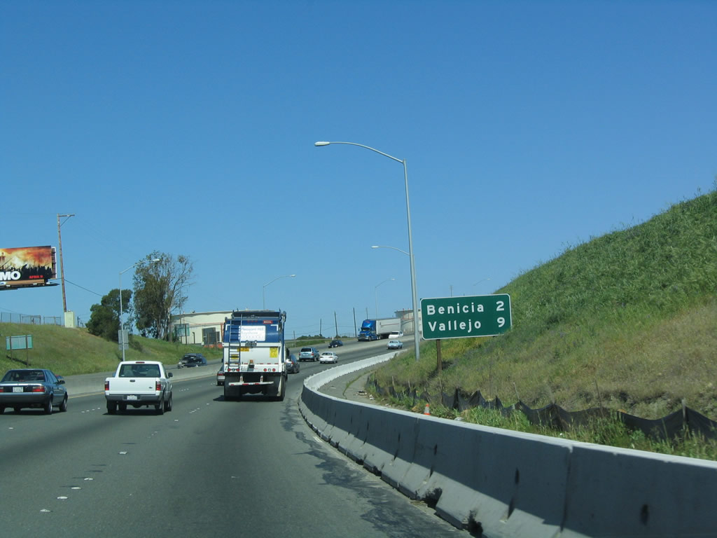
A mileage sign along northbound Interstate 680 provides the distance to Benicia (two miles) and Vallejo via Interstate 780 (nine miles) in Solano County. Photo taken 04/02/04. |
|
The bridge that used to carry both directions of Interstate 680 was named in honor of George Miller Jr.; the new northbound bridge honors his son, George Miller III. This overhead sign, which has since been decommissioned from use, used to advise of the pending junction with Exit 58A, Interstate 780 west. In this old configuration, traffic en route to Vallejo via Interstate 780 should use the left lanes; through traffic on northbound Interstate 680 should use the right lanes. Photo taken 04/02/04. |
|
Northbound Interstate 680 crosses over the tolled Benicia-Martinez Bridge, which passes over the Sacramento and San Joaquin Delta (also known as the Carquinez Straits and Suisun Bay near Martinez). The view from the top of this bridge provides quite a view of the surrounding environs, and the industry built up along the river is clearly visible. Near the mid-span of the George Miller, Jr. Bridge, northbound Interstate 680 departs Contra Costa County and enters Solano County. Photo taken 04/02/04. |
Page Updated August 29, 2013.