| Interstate 680 south |
|
|
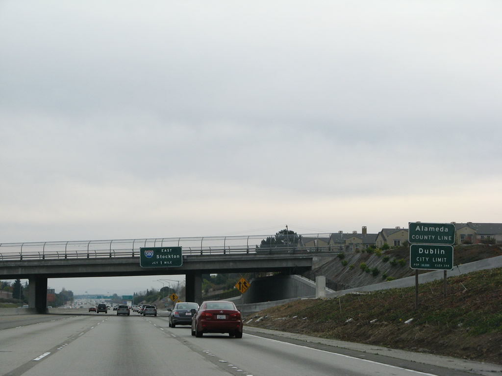
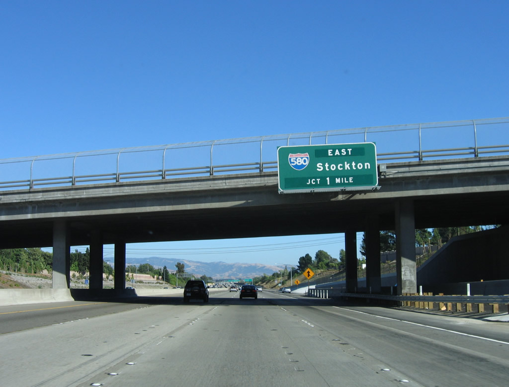
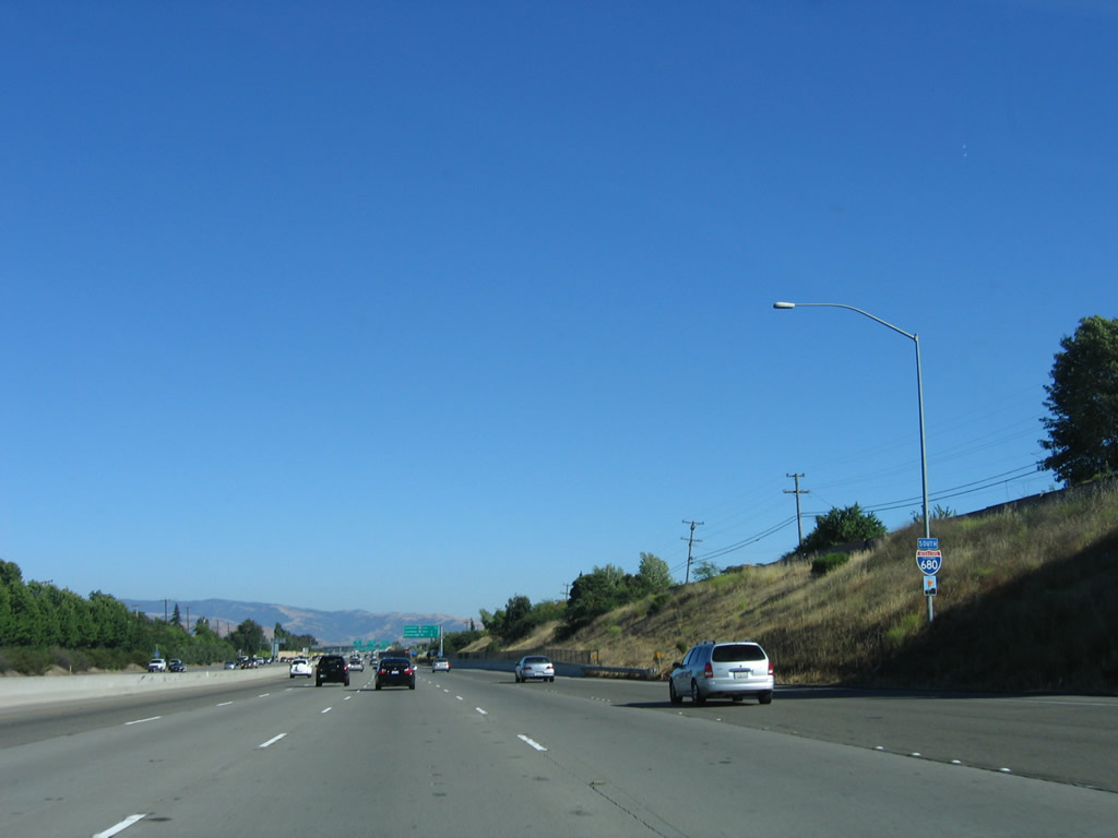
Interstate 680 departs Contra Costa County and enters Alameda County as it passes under the Alcosta Boulevard bridge. The next exit along southbound is Exit 30B, Interstate 580 east to Tracy, Stockton, and Interstate 5. Photos taken 11/27/07 and 07/04/06. |
|
|
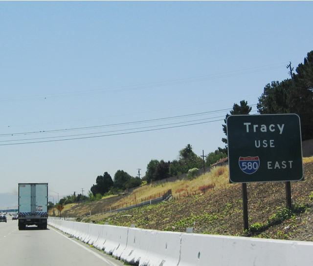
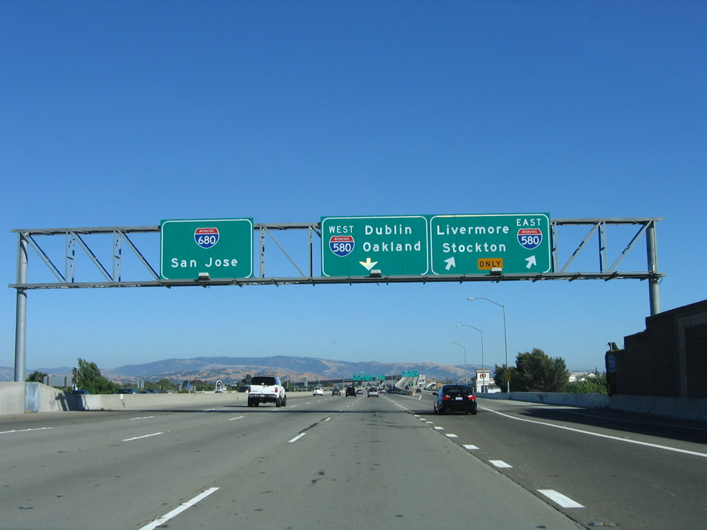
For the city of Tracy, use Interstate 580 east (Exit 30B). This sign used to be located between the Interstate 680 reassurance shield and the interchange sequence sign. As seen in the 2006 photo, this sign has since been removed. Photos taken 07/06/04 and 07/04/06. |
|
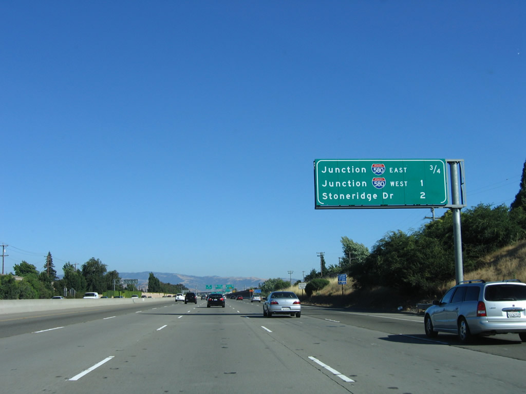
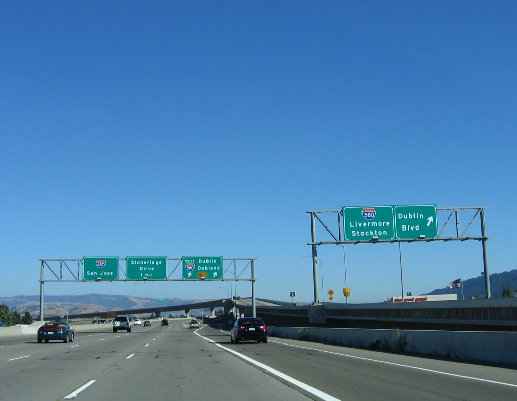
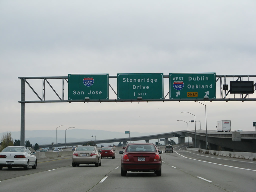
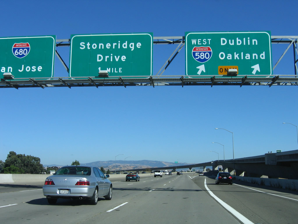
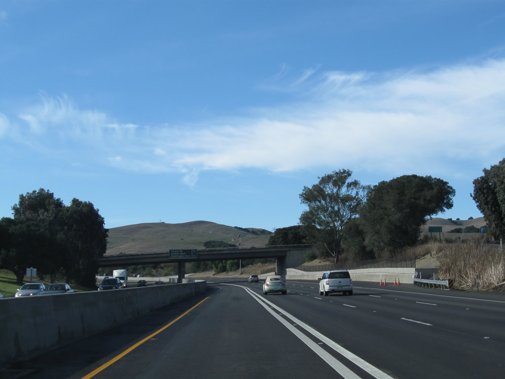
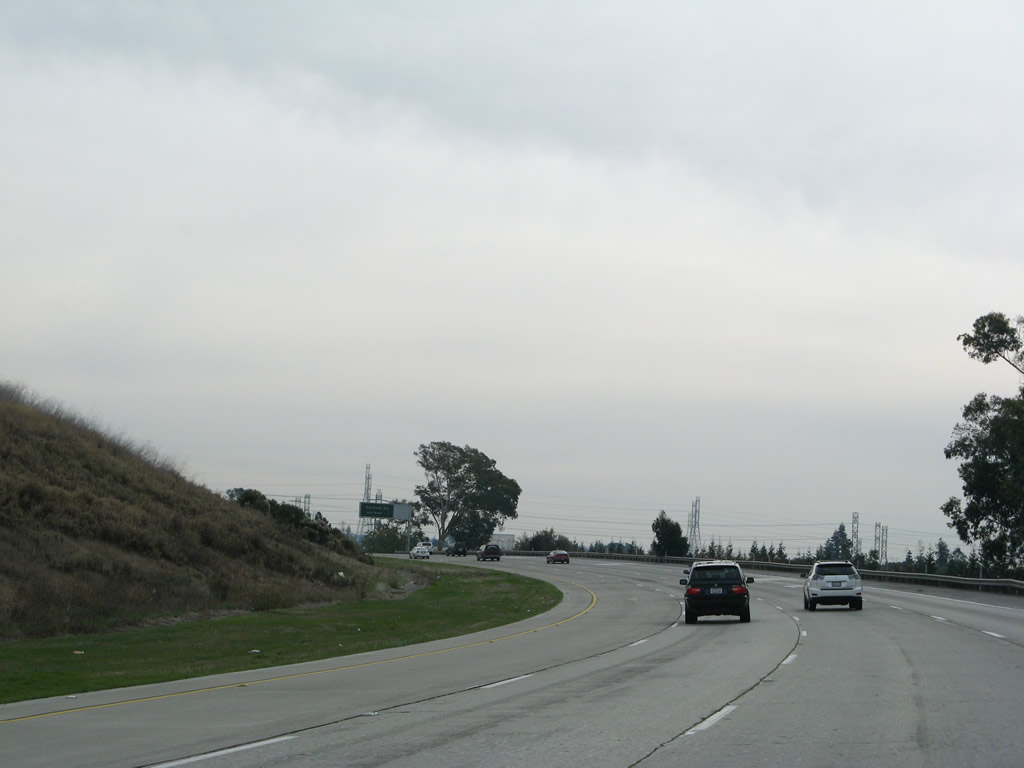
The next three exits along southbound are: Exit 30B, Interstate 580 east; Exit 30A, Interstate 580 west; and Exit 29, Stoneridge Drive. Photo taken 07/04/06. |
|
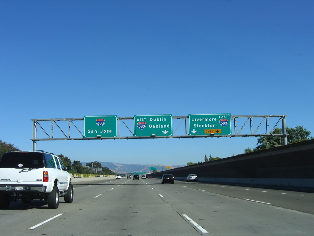
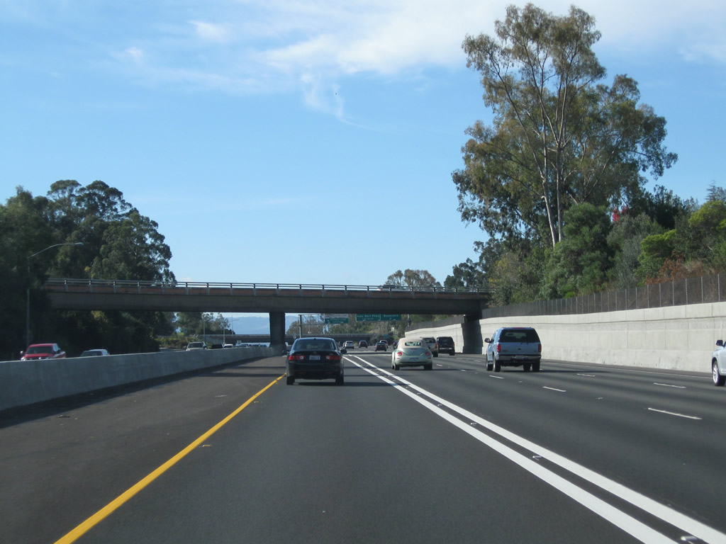
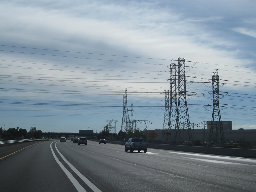
Southbound Interstate 680 approaches Exits 30B-A, Interstate 580, in Dublin. This sign was replaced recently with a reflective sign as a result of the Interstate 580/680 interchange reconstruction project. During the construction project, a flyover ramp was built to allow for Interstate 680 south traffic to merge directly onto eastbound Interstate 580 at freeway speeds rather than having to use a cloverleaf loop ramp. Photo taken 07/04/06. |
|
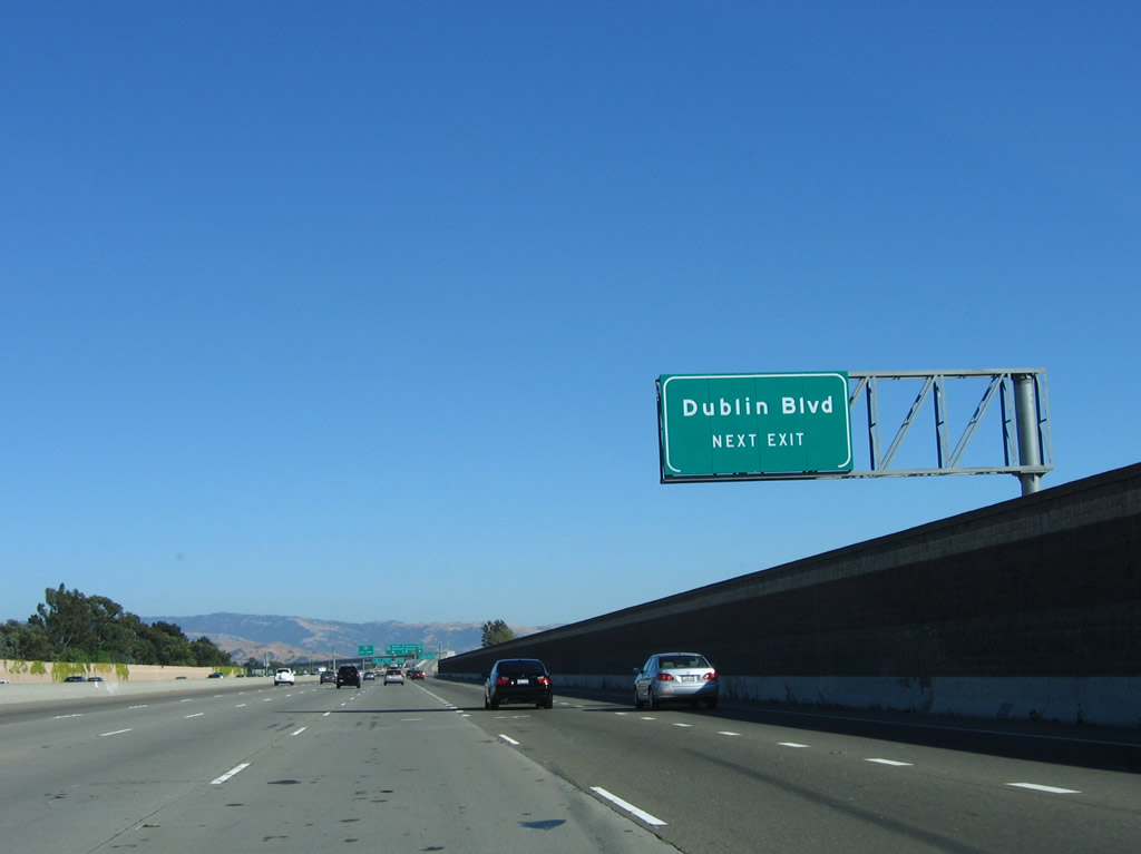
As part of Exit 30B/Interstate 580 east is a ramp to Dublin Boulevard, which is the second and final Dublin exit. South of Interstate 580, Interstate 680 leaves Dublin and enters the city of Pleasanton. Incorporated in 1894, Pleasanton has 63,654 people as of 2000 Census and is located at the crossroads of Interstate 680 and Interstate 580. Photo taken 07/04/06. |
|
First, southbound Interstate 680 reaches Exit 30B, which provides a flyover ramp from southbound to eastbound Interstate 580 en route to the Central Valley. This ramp replaces the loop of a former modified cloverleaf interchange. Photo taken 07/04/06. |
|
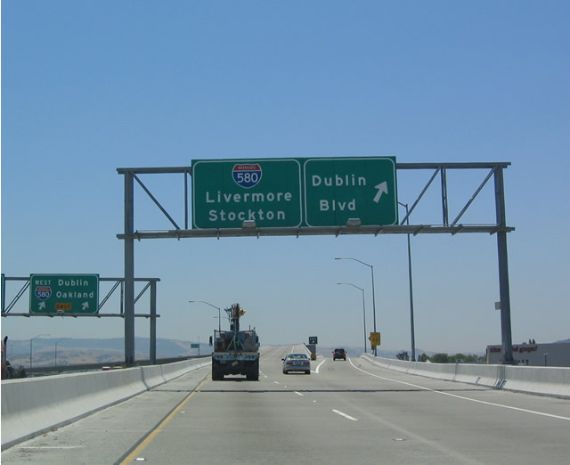
Now on the transition ramp from southbound Interstate 680 to eastbound Interstate 580, the ramp for Dublin Boulevard is made from the right lane. Note the signage for the ramp to westbound Interstate 580 (Exit 30A) in the background. Photo taken 07/06/04. |
|
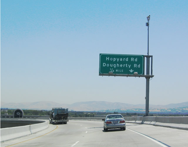
The next exit along the Interstate 680 south to Interstate 580 east transition ramp is for Hopyard Road/Dougherty Road. Photo taken 07/06/04. |
|
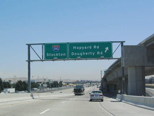
The transition ramp is almost concluded, as the ramp to Hopyard Road/Dougherty Road is accessed from the right lane. The two left lanes continue directly onto eastbound Interstate 580. Photo taken 07/06/04. |
|
Back on the mainline, the next ramp connects Interstate 680 south with Interstate 580 west. Believe it or not, this interchange used to be a modified cloverleaf. With the new flyover ramp from Interstate 680 south to Interstate 580 east, traffic moves much more efficiently through this interchange. Photo taken 07/04/06. |
|
|
Next, southbound Interstate 680 reaches Exit 30A, Interstate 580 west to Dublin and Oakland. The next exit is Exit 29, Stoneridge Drive. Photos taken 07/06/04 and 07/04/06. |
|
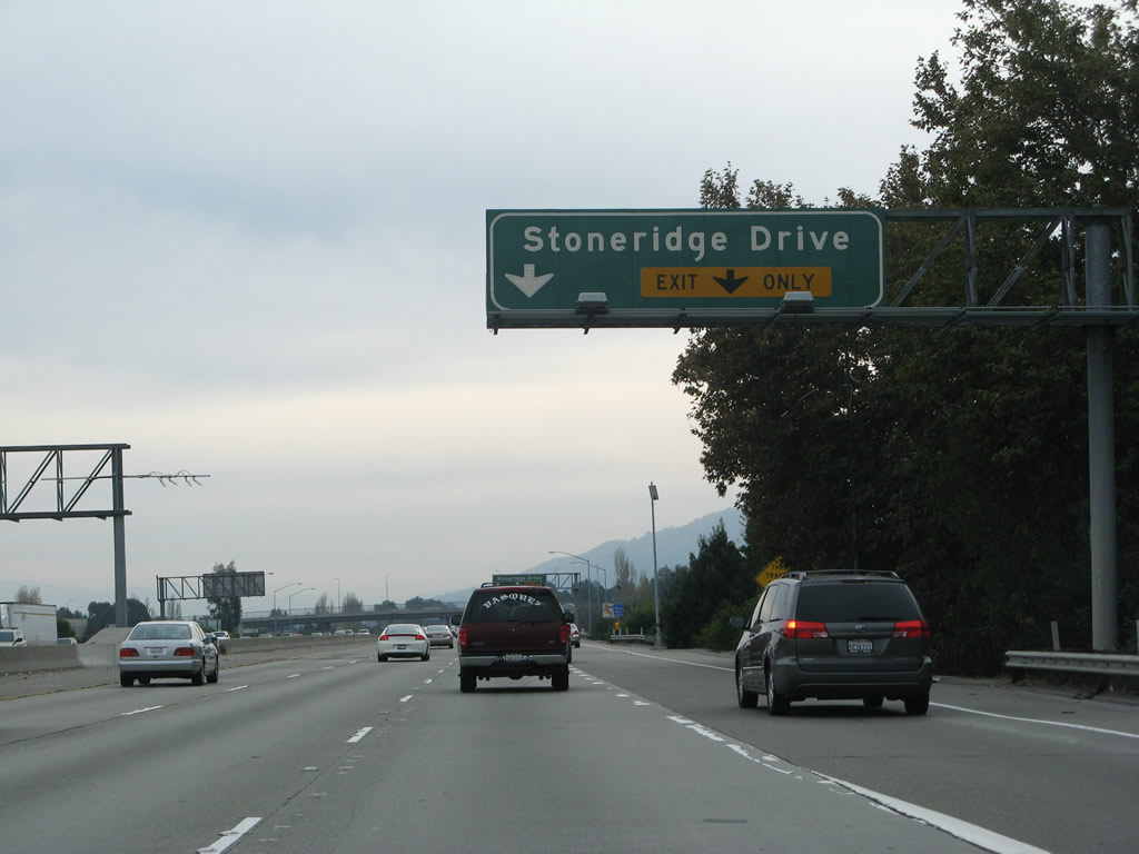
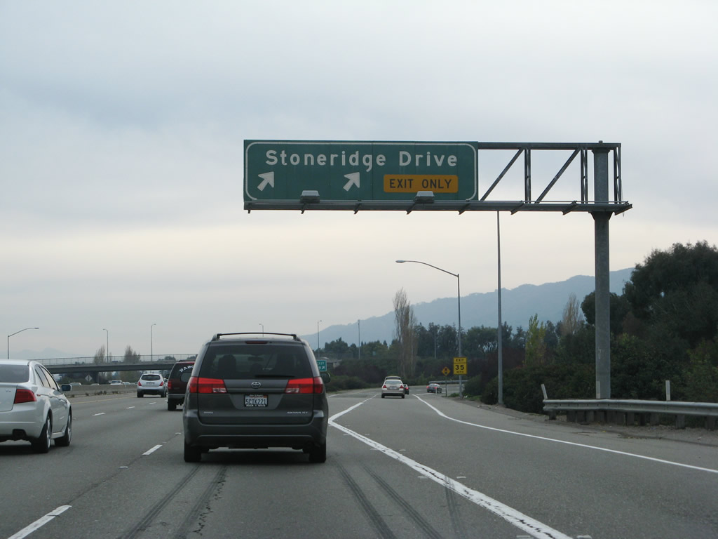
After the Interstate 580 interchange, the right two lanes prepare to exit from southbound Interstate 680 onto Exit 29, Stoneridge Drive. The left four lanes continue south on Interstate 680. Photo taken 11/27/07. |
|
Southbound Interstate 680 meets Exit 29, Stoneridge Drive. Photo taken 11/27/07. |
|
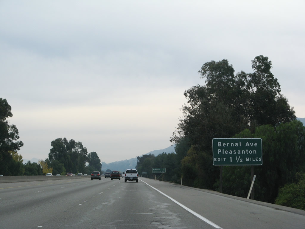
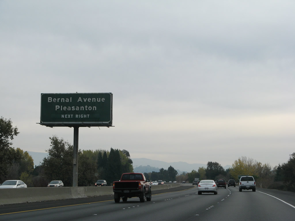
The next exit along southbound Interstate 680 is Exit 26, Bernal Avenue. Photo taken 11/27/07. |
|
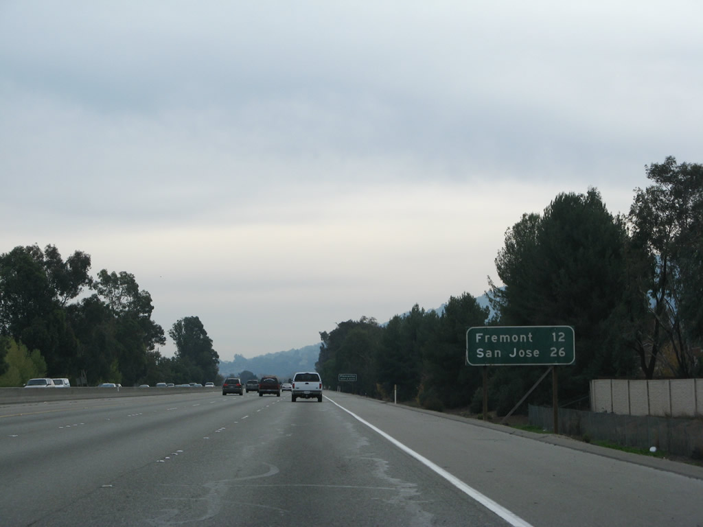
This mileage sign along southbound Interstate 680 provides the distance to Fremont (12 miles) and San Jose (26 miles). Photo taken 11/27/07. |
|
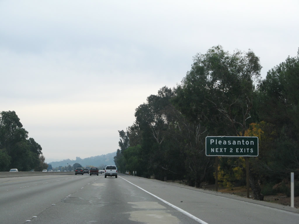
The next two interchanges serve the city of Pleasanton. Photo taken 11/27/07. |
|
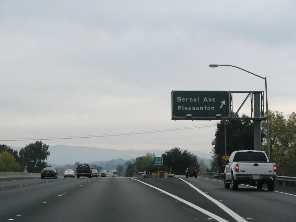
Use Exit 26/Bernal Avenue east to downtown Pleasanton. This older button copy sign is porcelain enamel. Photo taken 11/27/07. |
|
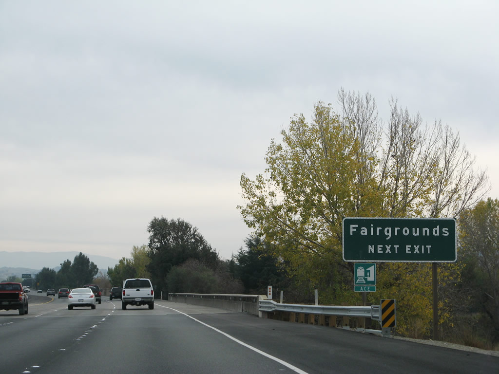
Bernal Avenue also travels east to the Alameda County Fairgrounds and train station. Photo taken 11/27/07. |
|
Southbound Interstate 680 reaches Exit 26, Bernal Avenue. Follow Bernal Avenue east to the Alameda County Fairgrounds, Pleasanton Fairways Golf Course, Library, Civic Center, and Centennial Park (via Sunol Boulevard). Photo taken 11/27/07. |
|
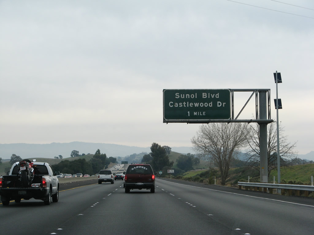
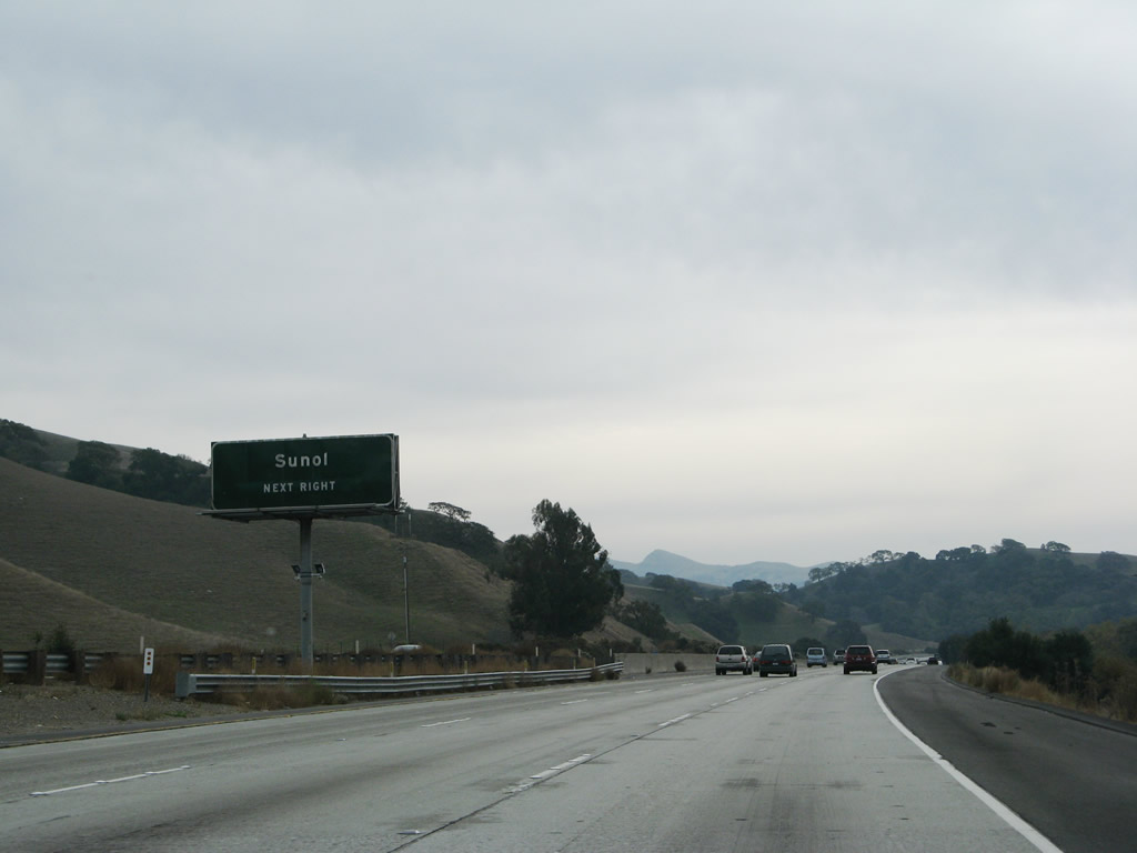
The next exit along southbound Interstate 680 is Exit 25, Sunol Boulevard/Castlewood Drive. After this exit, Interstate 680 will depart the city of Pleasanton and pass through several miles of unincorporated Alameda County (including the town of Sunol), then eventually enter the city of Fremont near Exit 18, Vargas Road. Photo taken 11/27/07. |
|
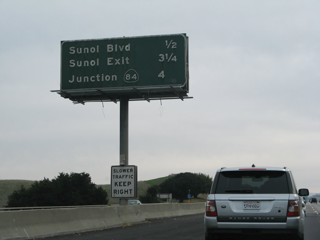
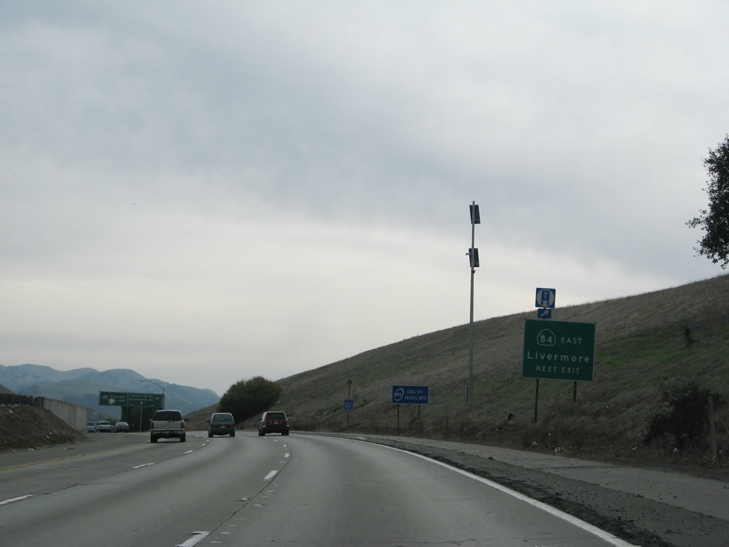
This mileage sign provides the distance to the next three exits along southbound Interstate 680: Exit 25, Sunol Boulevard/Castlewood Drive; Exit 22, Sunol; and Exit 21, California 84 east to Livermore and west to Fremont and the Dumbarton Bridge. Exit 21 also connects to Calaveras Road. Photo taken 11/27/07.
|
|
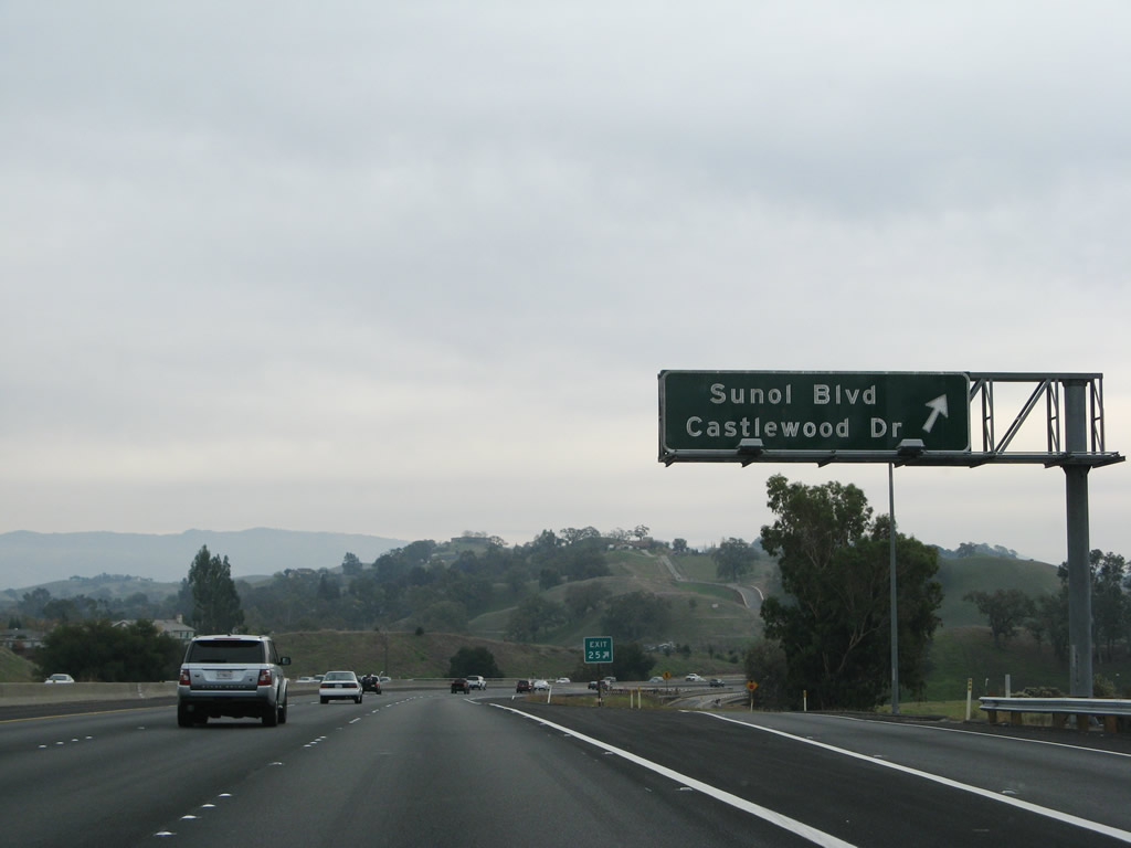
Southbound Interstate 680 reaches Exit 25, Sunol Boulevard and Castlewood Drive. Photo taken 11/27/07. |
|
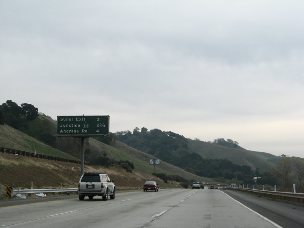
After the off-ramp for Exit 25 (Sunol Boulevard), this mileage sign provides the distance to the next three exits along southbound Interstate 680: Exit 22, Koopman Road to Sunol; Exit 21, California 84 east to Livermore and west to Fremont and the Dumbarton Bridge and Calaveras Road south; and Exit 20, Andrade Road/Sheridan Road. Photo taken 11/27/07. |
|
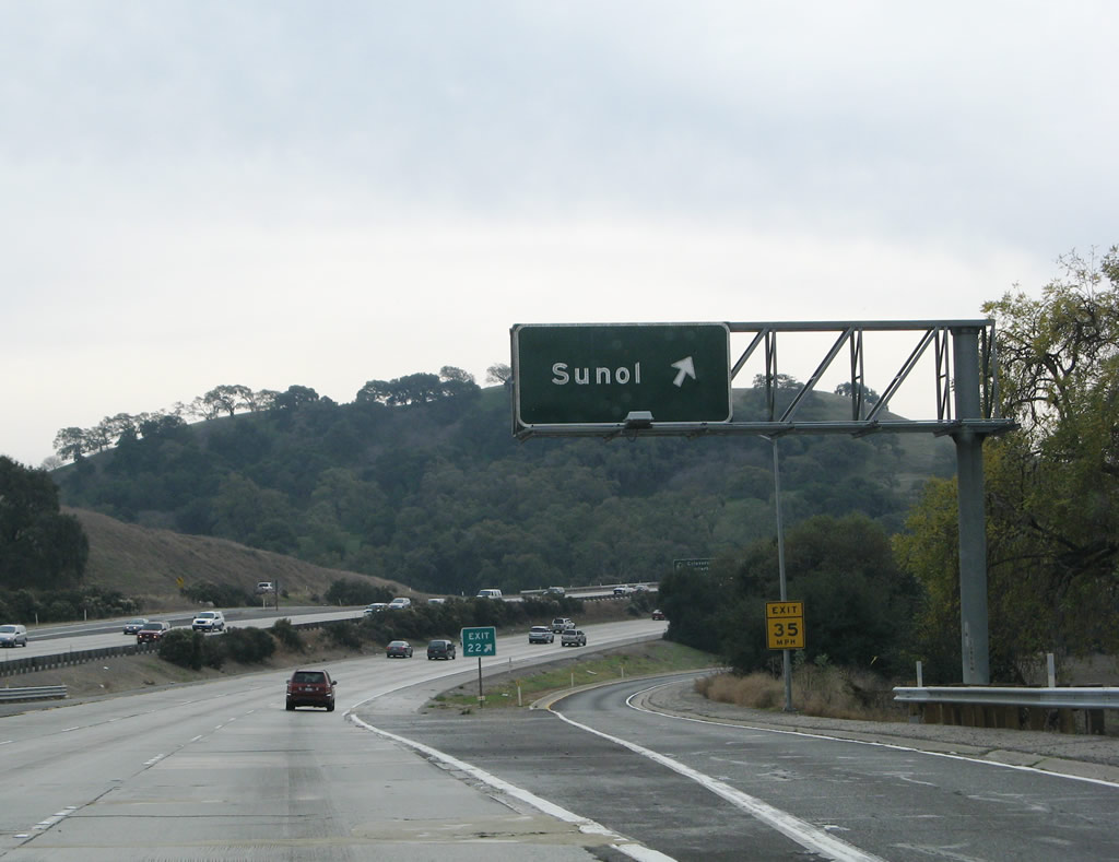
The next exit along southbound Interstate 680 is Exit 22, Koopman Road west to former California 21/Pleasanton-Sunol Road and Koopman Road north for local/ranch access. Photo taken 11/27/07. |
|
Exit 22 is a half-diamond interchange that only serves southbound Interstate 680. There is no direct reentry to southbound from Exit 22, although traffic may connect onto Pleasanton-Sunol Road south to California 84/Paloma Road east back to Interstate 680. Another Sunol exit is located at Exit 21A, which is the junction with California 84 west to Sunol and Niles Canyon. Photo taken 11/27/07. |
|
Southbound Interstate 680 meets Exit 22, which connects to Pleasanton-Sunol Road (old California 21) south to Sunol. The old state highway follows Interstate 680 to the west of the freeway. Photo taken 11/27/07. |
|
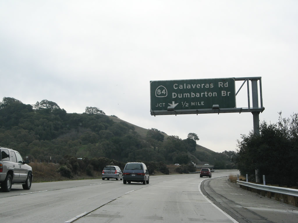
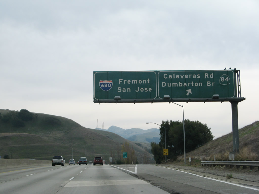
The next exit on southbound Interstate 680 is Exit 21A, California 84 (Niles Canyon Road) west to the Dumbarton Bridge and California 84/Vallecitos Road east to Livermore. Photo taken 11/27/07. |
|
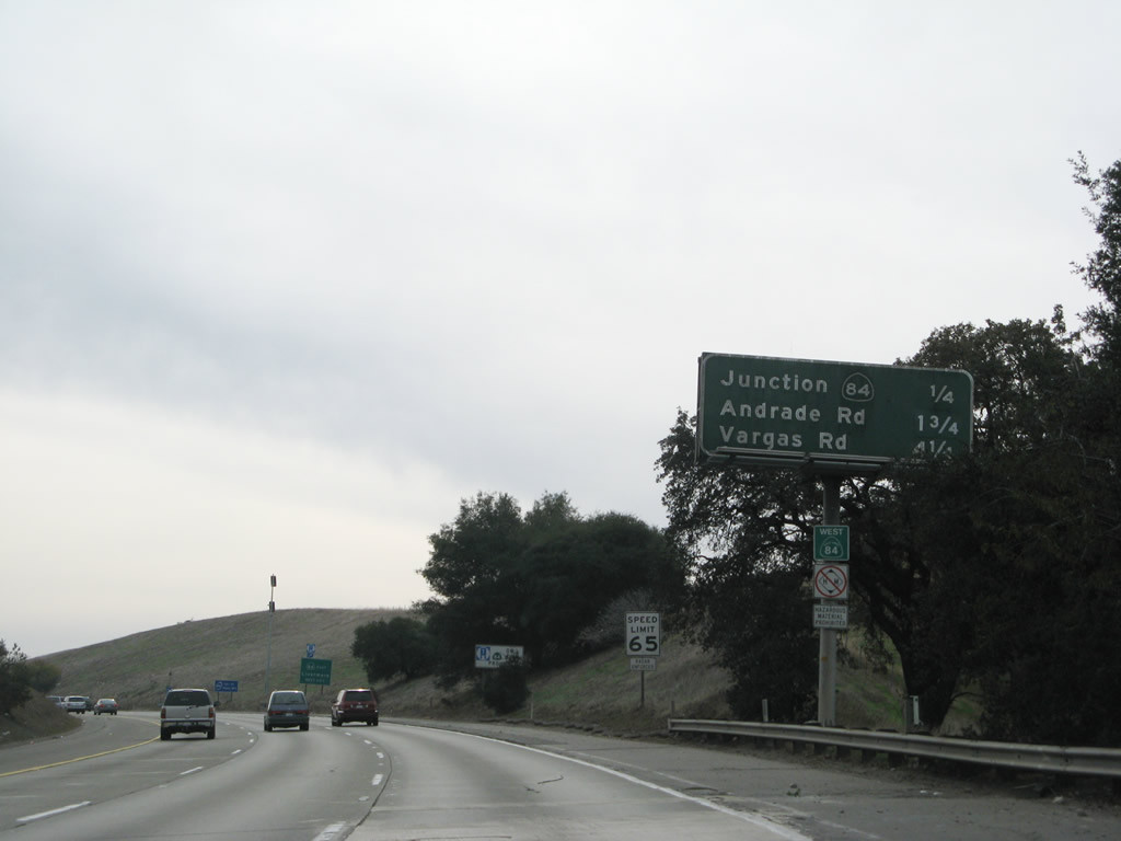
The next three exits on southbound Interstate 680 are Exit 21A, California 84; Exit 20, Andrade Road and Sheridan Road; and Exit 18, Vargas Road. Note that there is a truck restriction for westbound California 84 (Niles Canyon Road). Photo taken 11/27/07. |
|
An auxiliary sign advises that Exit 21A serves California 84 east to Livermore. This connection is a bit odd, since you have to exit here, turn left, take a loop ramp to backtrack onto Interstate 680 north, then exit onto California 84 east. It is not clear if a future Exit 21B is planned for an eventual direct connection from Interstate 680 south to California 84 east. Photo taken 11/27/07. |
|
Southbound Interstate 680 connects to Exit 21A, California 84 west to the Dumbarton Bridge and east to Livermore. At the base of the ramp, turn left to California 84 east and right to California 84 west. Interstate 680 leaves the Tri-Valley area and proceeds into an open space area between Sunol and Fremont. Photo taken by 11/27/07. |
|
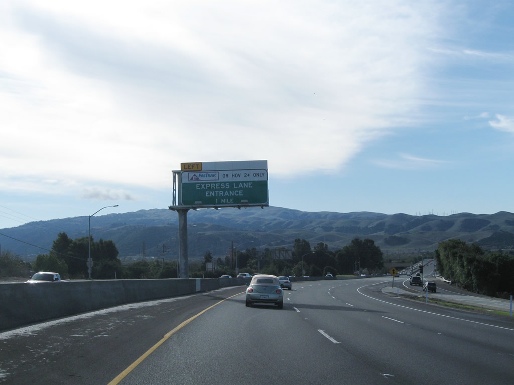
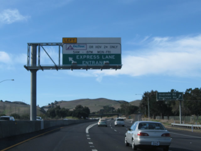
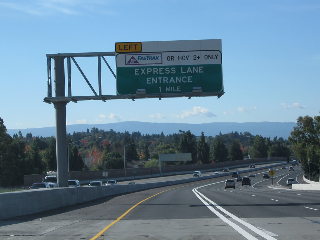
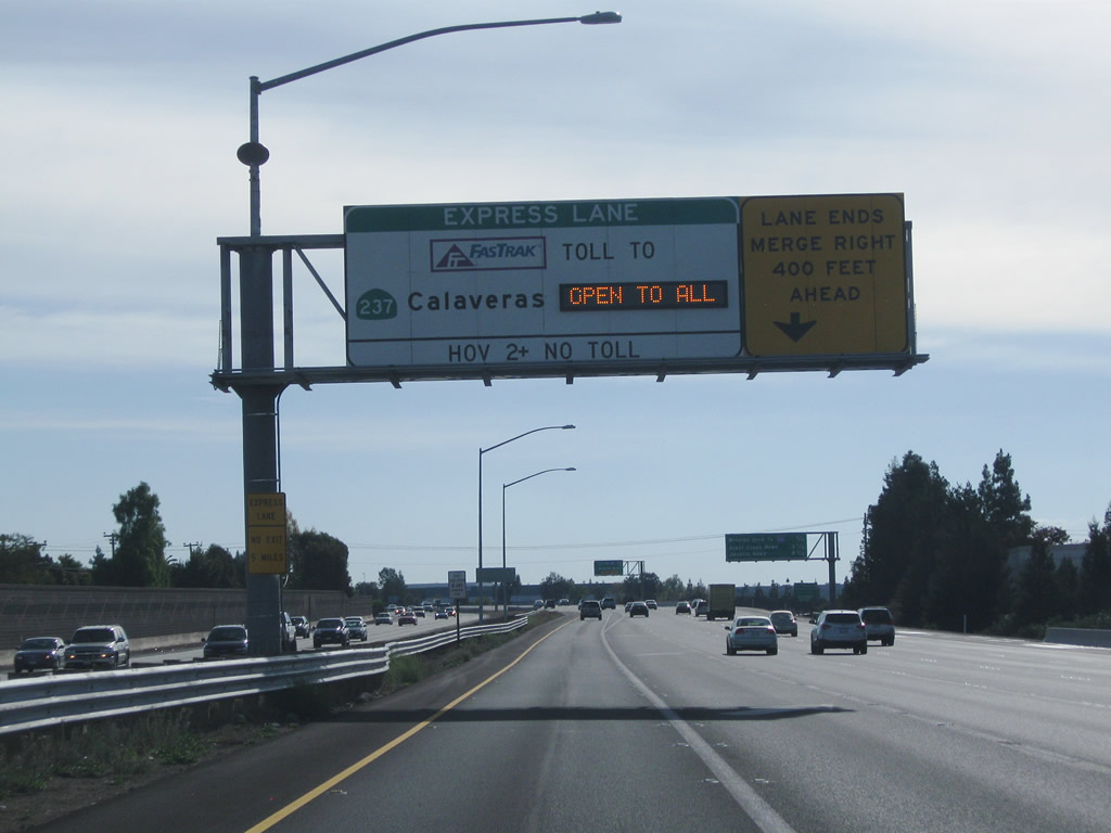
As we pass through the California 84 interchange, signage indicates that the Interstate 680 Express Lane begins in one mile. Open to high occupancy vehicles (HOV), carpools, and toll-paying customers, the left lane of Interstate 680 is reserved for these vehicles. By the official opening on September 20, 2010, the express lanes extended from just south of the California 84 interchange southwest to the California 237 interchange; construction had begun in May 2009. According to the official project webpage, the Interstate 680 southbound Express Lanes are "the first High Occupancy Toll (HOT) lane facility in northern California which will allow single occupant vehicles to use the HOV lane for a toll." Photo taken 11/28/10. |
|
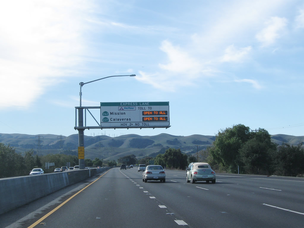
A variable message sign advises of the toll rates for use of the Express Lane, which can be modified based on usage. Interstate 680 sees a fair amount of morning and afternoon commute traffic (connecting the San Ramon Valley with Fremont and San Jose), so rates are likely to be highest during those periods. Photo taken 11/28/10. |
|
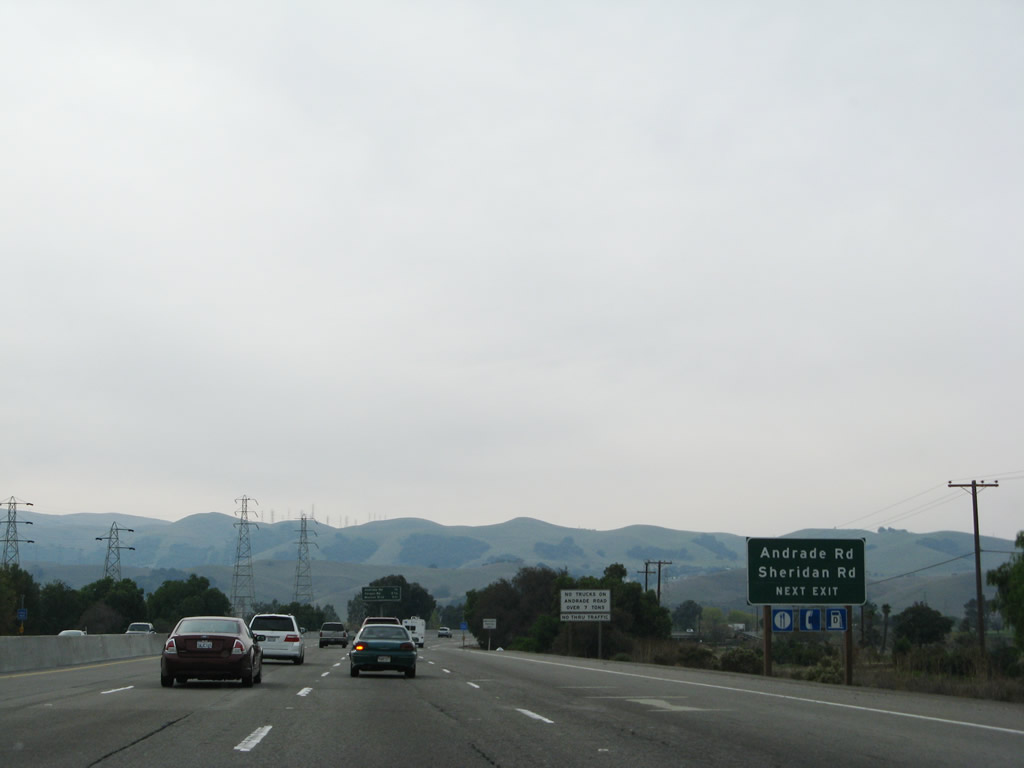
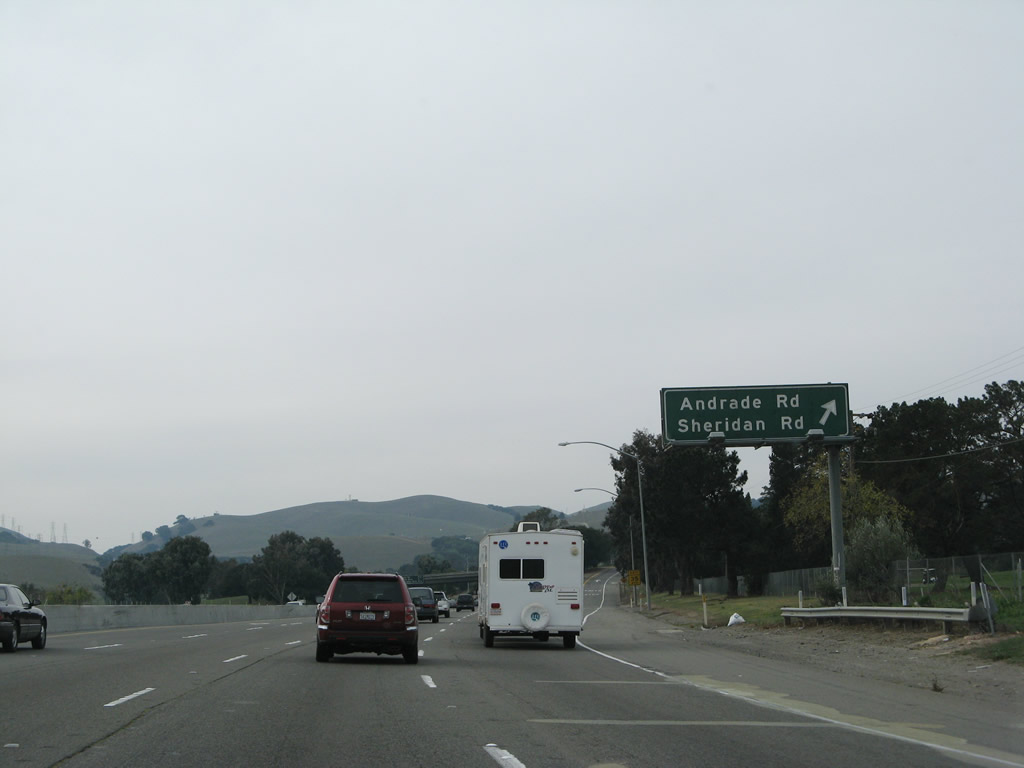
The next exit on Interstate 680 south is Exit 20, Andrade Road and Sheridan Road. Meanwhile, the left lane will become restricted to HOV, carpool, and toll-paying customers only at about the same point as the off-ramp to Exit 20. Photo taken 11/27/07. |
|
This mileage sign provides the distance to the next three exits on southbound Interstate 680: Exit 20, Andrade Road/Sheridan Road; Exit 18, Vargas Road; and Exit 16, California 238 (Mission Boulevard) north to Hayward and Mission Boulevard south to the Mission San Jose district of the city of Fremont. note that there is a truck restriction for westbound California 84 (Niles Canyon Road). Photo taken 11/27/07. |
|
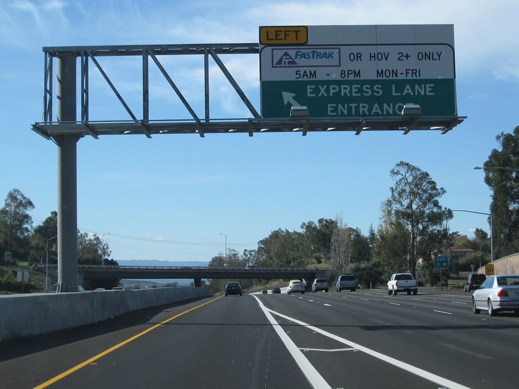
The Interstate 680 Express Lane begins just before the Andrade Road off-ramp. The Express Lane is administered by the Sunol Smart Carpool Lane Joint Powers Authority (SSCLJPA), which consists of the Alameda County Congestion Management Agency (ACCMA), the Alameda County Transportation Improvement Authority, and the Santa Clara Valley Transportation Authority. Motorists are electronically charged a toll through the FasTrak transponder system, which is also useable for Bay Area toll bridges, other Express Lanes (such as Interstate 15 Express Lanes and the 91 Express Lanes), and toll roads (such as California 125) throughout the state of California. Photo taken 11/28/10. |
|
Southbound Interstate 680 meets Exit 20, Andrade Road and Sheridan Road. Use this exit to Sunol Valley Golf Course and to Mission Road (frontage road). Photo taken 11/27/07. |
|
Traffic on the Interstate 680 Express Lane is separated from the mainline by a pair of white stripes (two-foot buffer), unlike comparable carpool lane configurations found in Southern California that feature two double yellow lines and a single white line. The double white striping separate the Express Lane from the regular lanes, and access zones at certain intervals allow for motorists to enter or exit the Express Lane. Photo taken 11/28/10. |
|
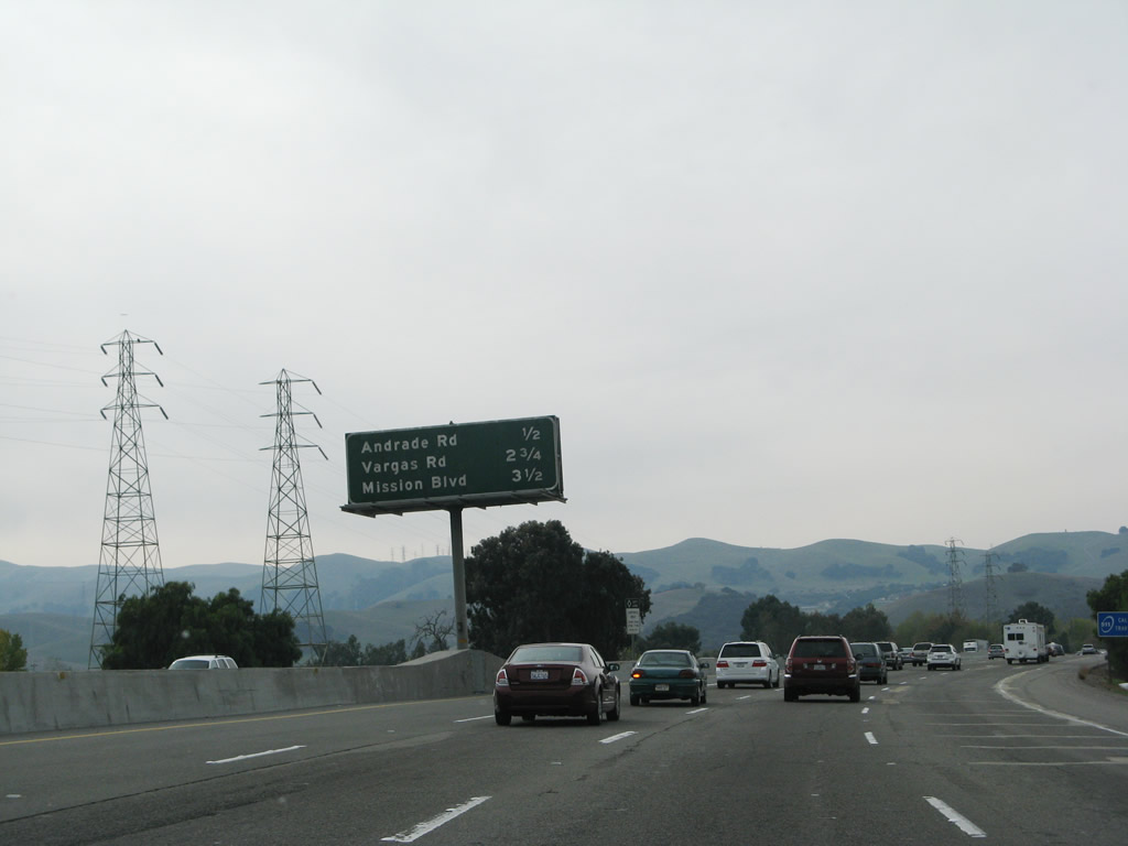
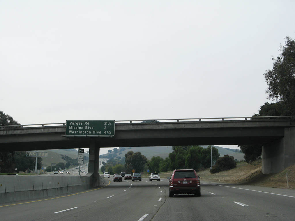
This mileage sign provides the distance to the next three exits on Interstate 680 south: Exit 18, Vargas Road; Exit 16, California 238 (Mission Boulevard); and Exit 15, Washington Boulevard. The California 238 shield is omitted on this interchange sequence sign. Photo taken 11/27/07. |
|
After the Andrade Road/Sheridan Road interchange, Interstate 680 climbs out of Sunol Valley toward Fremont. A fifth climbing lane begins on the right. In 2007, there was a high occupancy vehicle (carpool) lane that began on the left, but that lane became part of the Express Lane in 2010. Photo taken 11/27/07. |
|
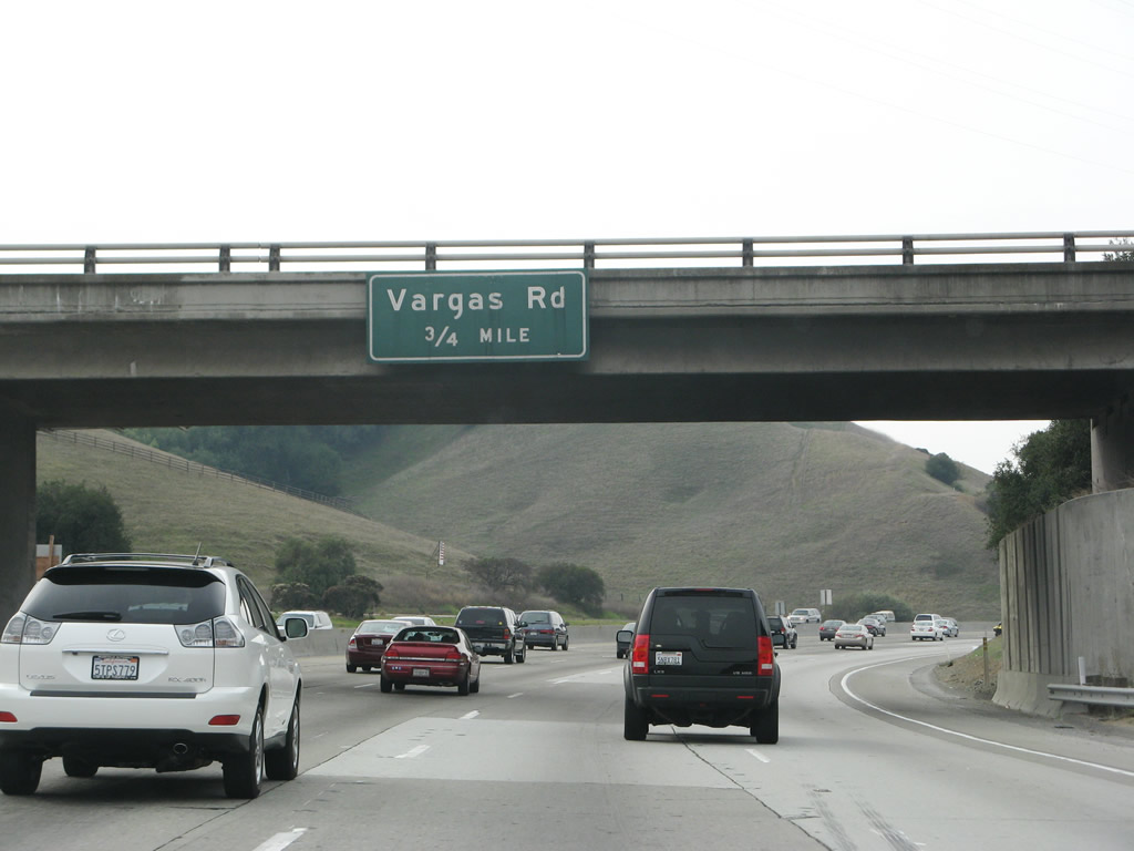
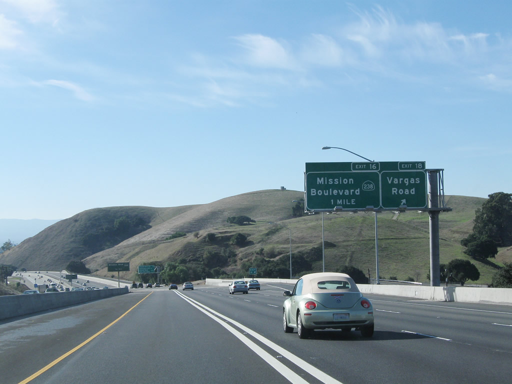
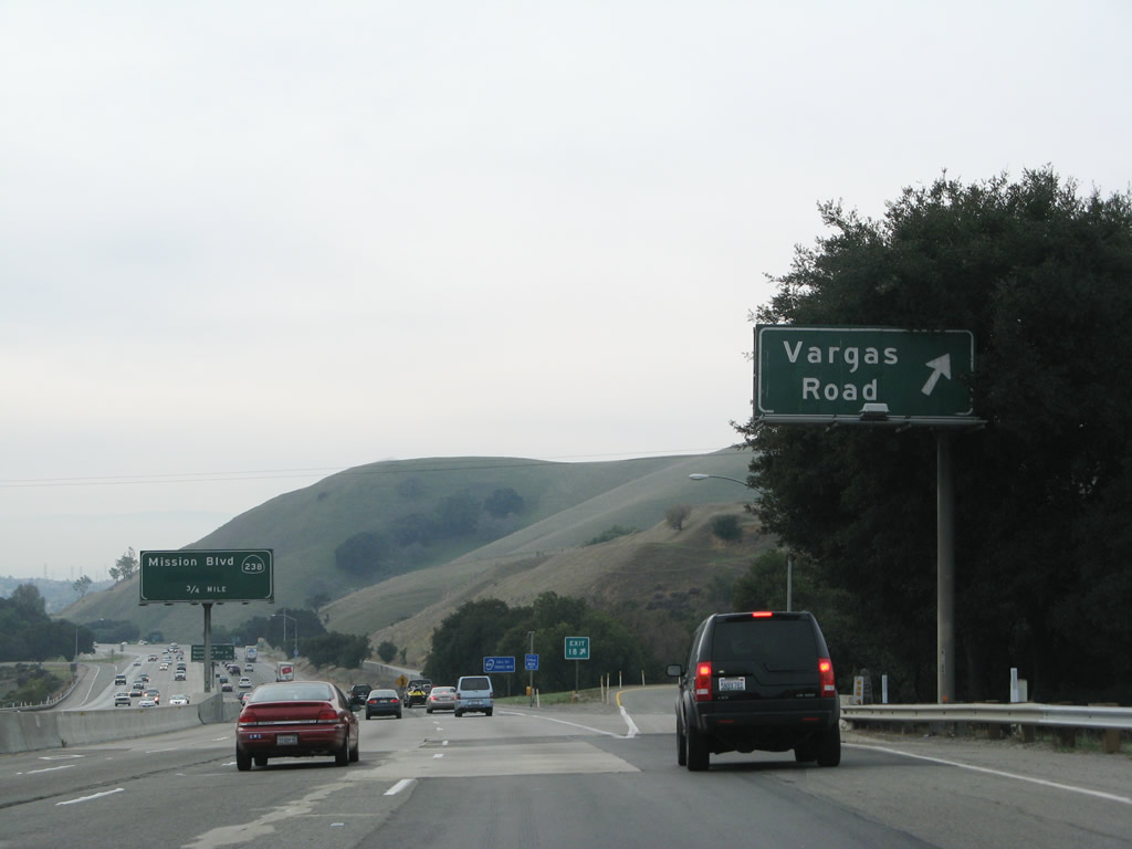
Toward the top of the grade is another advance sign for Exit 18, Vargas Road (0.75 mile). Photo taken 11/27/07. |
|
The Interstate 680 Express Lane project resulted in changes to Interstate 680 prior to Vargas Road, including retaining walls and a barrier median. Photo taken 11/28/10. |
|
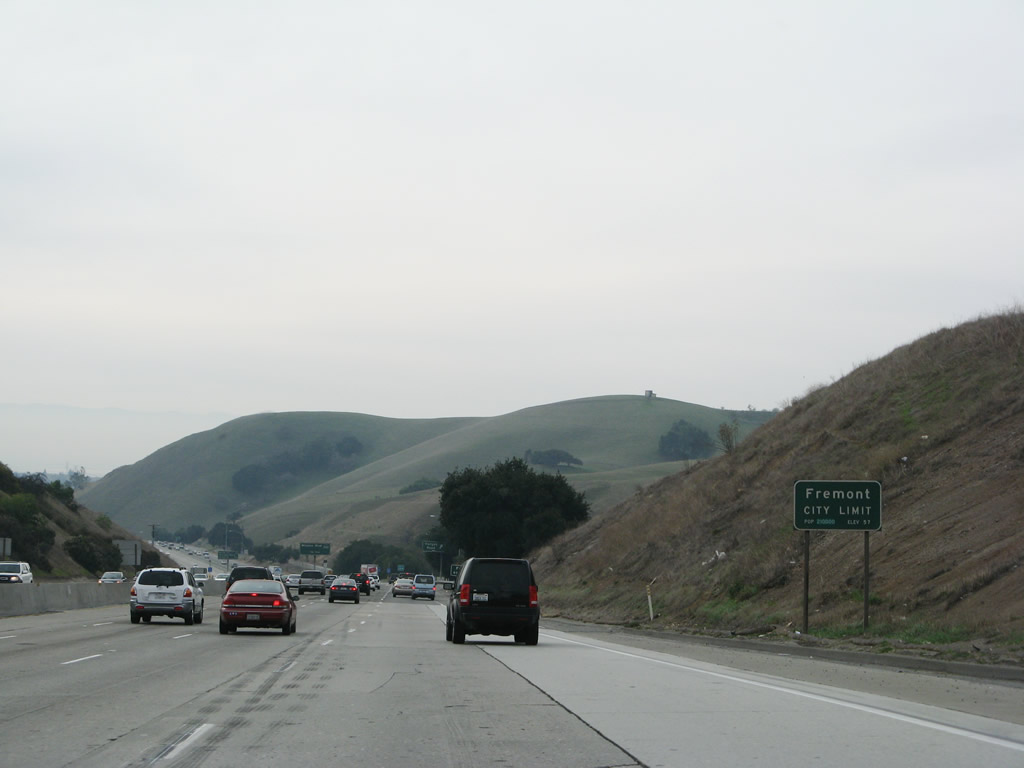
Interstate 680 enters the city of Fremont. Incorporated on January 23, 1956, the city of Fremont is home to 203,413 people as of the 2000 Census and was formed from the merger of five smaller communities: Centerville, Irvington, Mission San Jose, Niles, and Warm Springs. The city consists of 87.1 square miles and is named for John C. Fremont, the Great Pathfinder. Photo taken 11/27/07. |
|
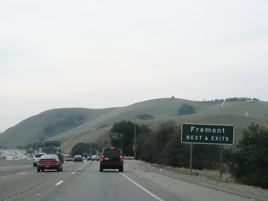
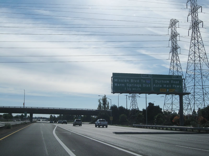
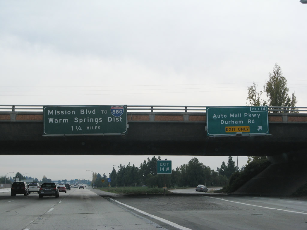
The next six exits along southbound Interstate 680 serve city of Fremont: Exit 18, Vargas Road; Exit 16, California 238 (Mission Boulevard); Exit 15, Washington Boulevard; Exit 14, Durham Road; Exit 12, California 262 (Mission Boulevard); and Exit 10, Scott Creek Road. Photo taken 11/27/07. |
|
|
Southbound Interstate 680 meets Exit 18, Vargas Road. The overhead signs here were replaced with the installation of the new Interstate 680 Express Lane. The new signs show the exit number and also include an advance sign for Exit 16, California 238. Photos taken 11/28/10 and 11/27/07. |
|
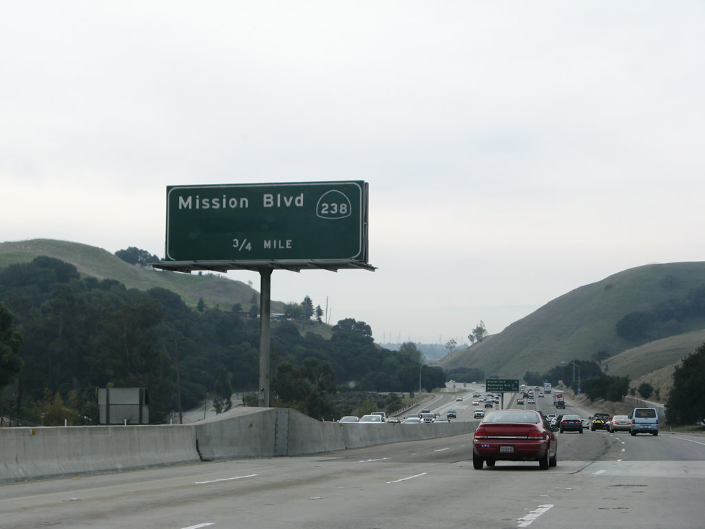
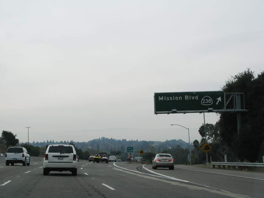
The next exit on southbound Interstate 680 is Exit 16, California 238 (Mission Boulevard). A green overlay panel covers the word "Fremont" on this sign. Photo taken 11/27/07.
|
|
|
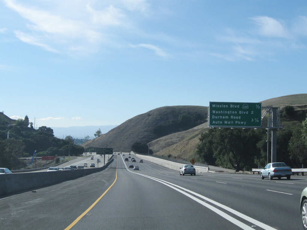
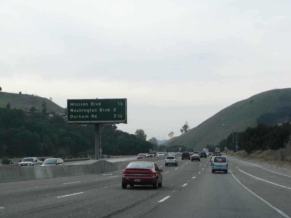
This mileage sign provides the distance to the next three exits along southbound Interstate 680: Exit 16, California 238 (Mission Boulevard); Exit 15 Washington Boulevard; and Exit 14, Durham Road. With the Express Lane project, the overhead mileage sign was moved from the median to the roadside. Photos taken 11/28/10 and 11/27/07. |
|
A reassurance shield and scenic route sign are posted on southbound after the on ramp from Vargas Road. Photo taken 11/27/07. |
|
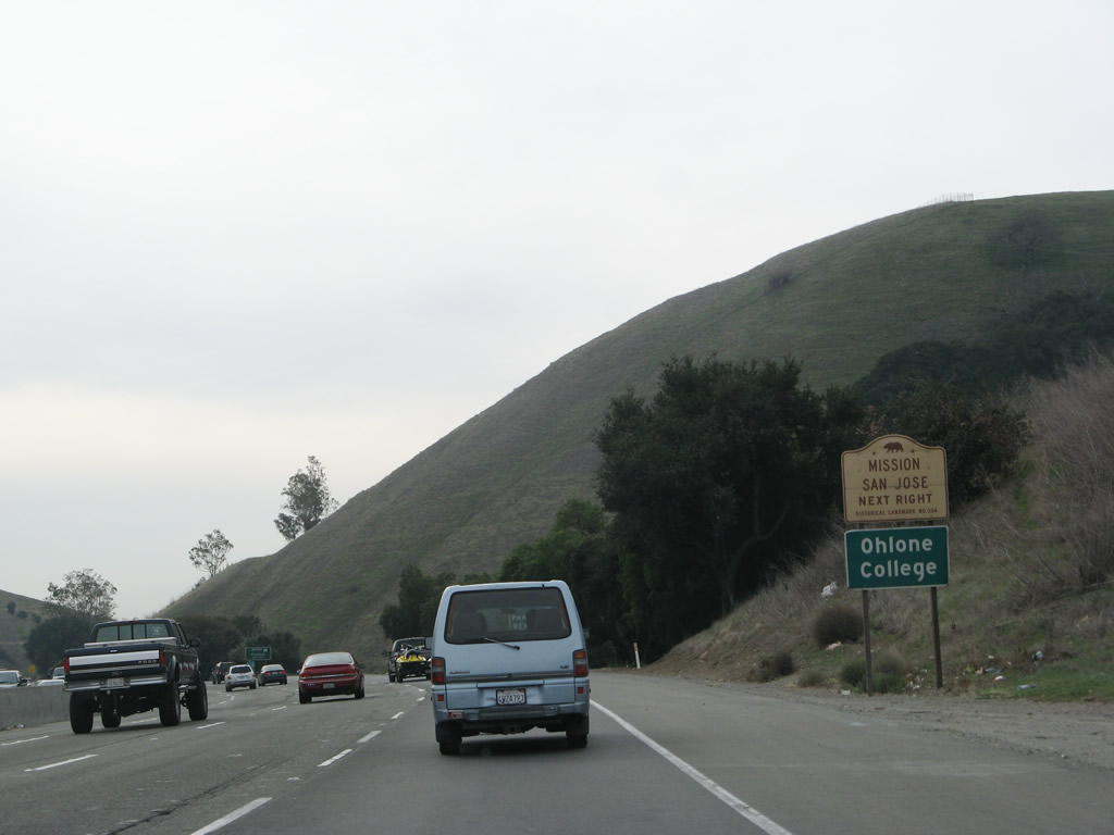
Use Mission Boulevard south to the historic Mission San Jose de Guadalupe and to Ohlone College. Photo taken 11/27/07. |
|
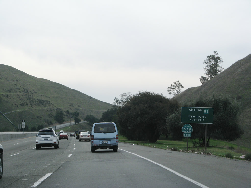
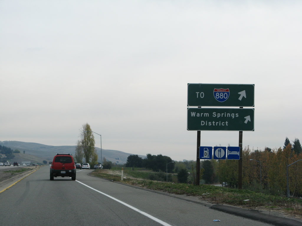
Use California 238 (Mission Boulevard) north to the Fremont Amtrak Station. From here, California 238 travels north Union City and Hayward. Plans originally called for California 238 to be bypassed by the Mission Freeway, but that bypass has been cancelled. Road improvements to Mission Boulevard may be implemented to help improve capacity on this busy state route. At the north end, California 238 connects directly onto Interstate 238, a major east-west freeway connector between San Leandro and unincorporated Castro Valley. Photo taken 11/27/07. |
|
|
Southbound Interstate 680 meets Exit 16, California 238 (Mission Boulevard) to Fremont. The overhead signs here were replaced with the installation of the new Interstate 680 Express Lane. The new signs show the exit number and also include an advance sign for Exit 15, Washington
|
|
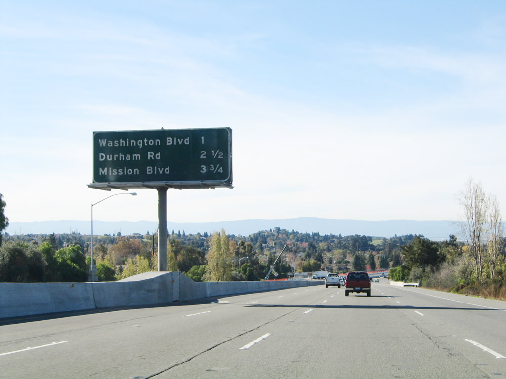
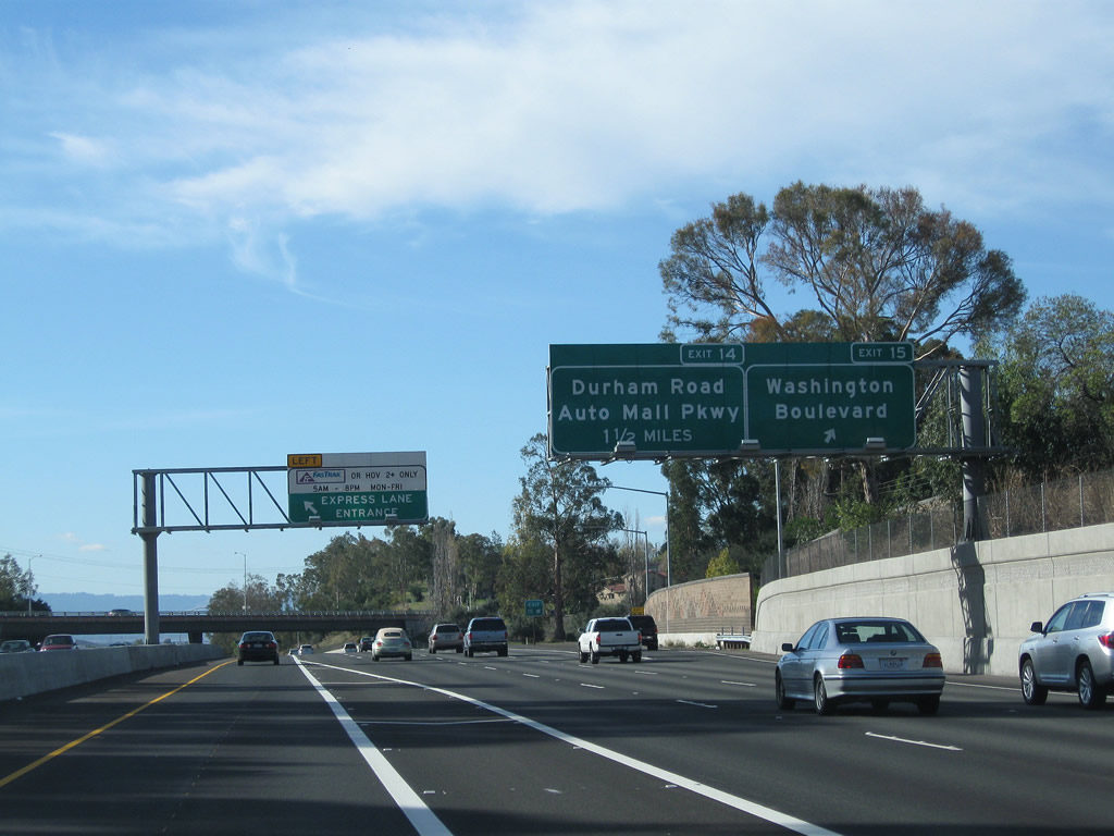
The next three exits along Interstate 680 south are Exit 15, Washington Boulevard; Exit 14, Durham Road; and Exit 12, California 262 (Mission Boulevard). This sign was replaced and moved to the side of the road with the Express Lanes project. Photo taken 11/29/04. |
|
An entrance to and exit from the Interstate 680 Express Lane is one mile ahead. Photo taken 11/28/10. |
|
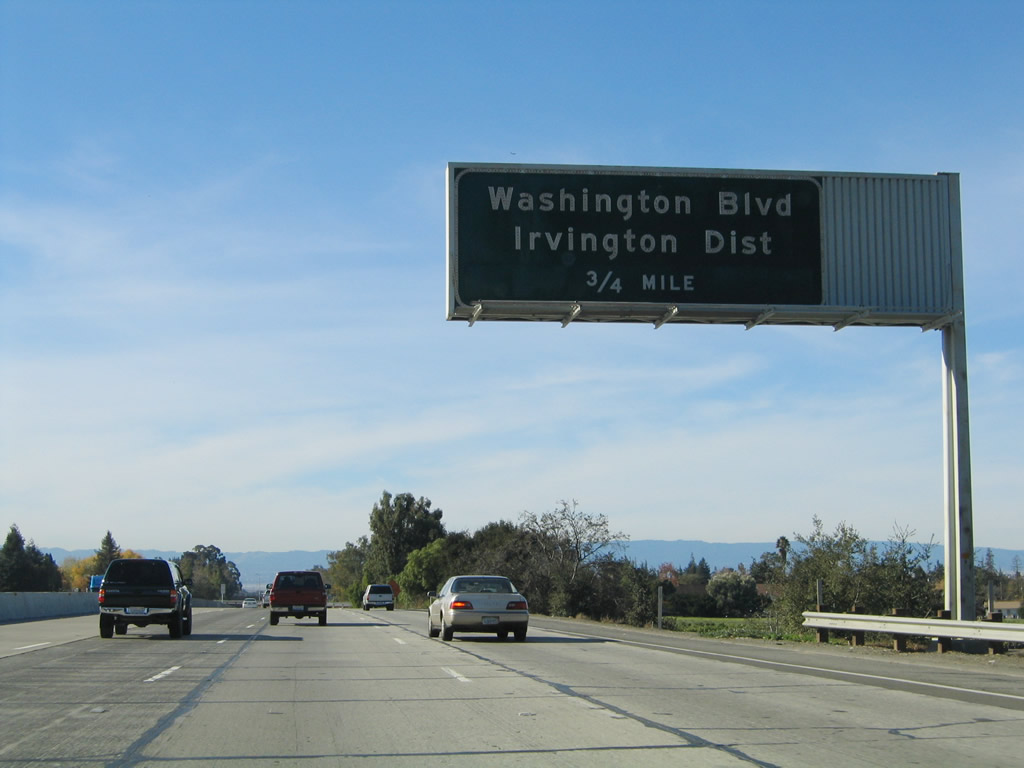
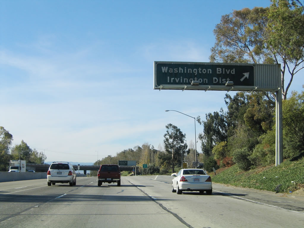
Southbound Interstate 680 next approaches Exit 15, Washington Boulevard. Washington Boulevard travels east into Mission San Jose and west toward the Irvington District of Fremont, the Fremont Hub Center, and the current south end of the Bay Area Rapid Transit (BART) System at the Fremont Station via Mowry Avenue. The BART station is located a good distance away from the freeway. Follow Washington Street west to Fremont Boulevard, then take Fremont Boulevard northwest to Mowry Avenue. Turn northeast on Mowry Avenue and follow it all the way the BART Station (follow the signs). Eventually, BART will extend south to San Jose, but for now, the Fremont Station is the southernmost point on the BART system. Photo taken 11/29/04. |
|
The one-half mile sign for Exit 15, Washington Boulevard features the exit number. Photo taken 11/28/10. |
|
A variable message sign advises as to when the Express Lanes are restricted and what amount the tolls will be based on traffic congestion pricing. Photo taken 11/28/10. |
|
The configuration here is three main lanes and one express lane. Photo taken 11/28/10. |
|
|
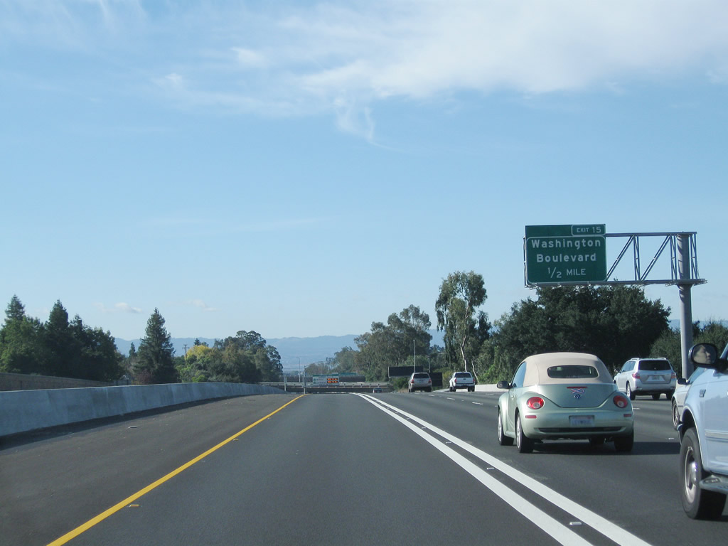
Soon thereafter, Interstate 680 south meets Exit 15, Washington Boulevard. With the completion of the Express Lane, the exit signage here was replaced. Photos taken 11/28/10 and 11/29/04. |
|
The express lane entrance is located around the same point as the exit ramp on the left side of the freeway. Photo taken 11/28/10. |
|
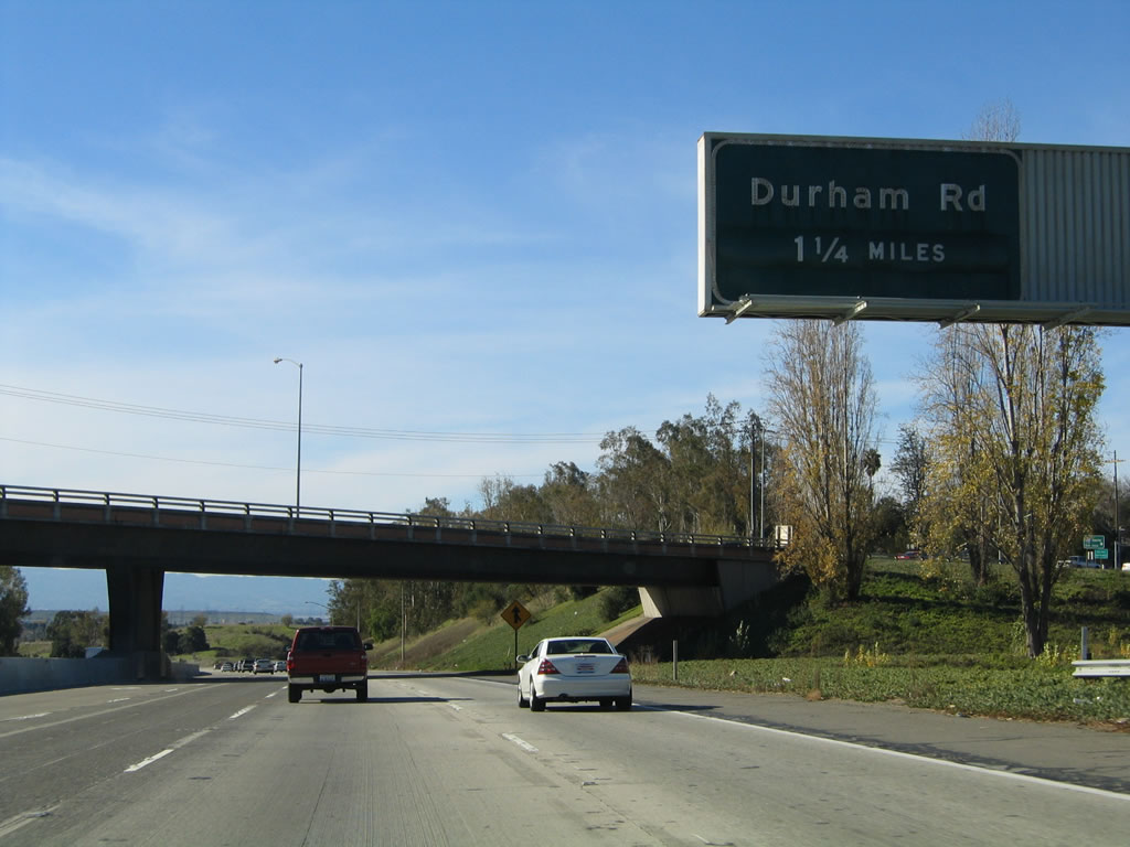
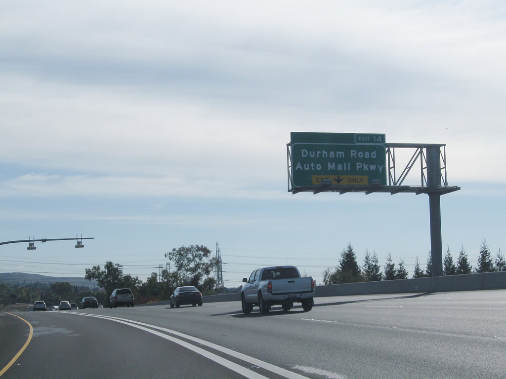
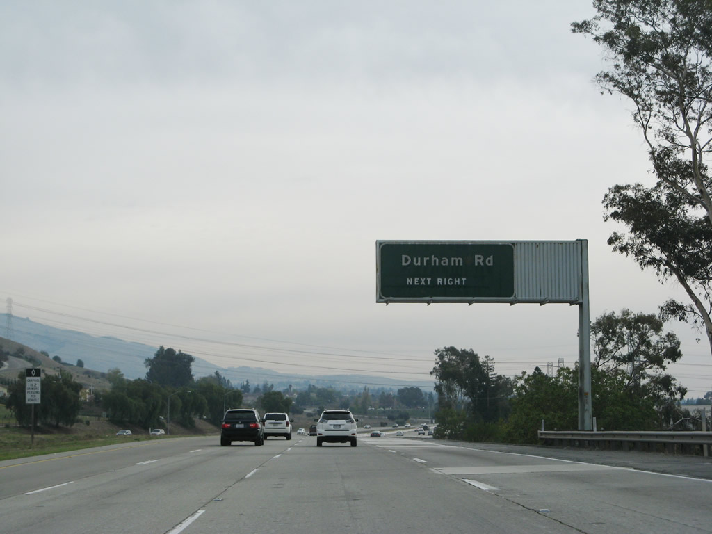
The next exit along southbound Interstate 680 is Exit 14, Durham Road. The overpass for Washington Boulevard is found immediately behind this sign. This sign was gone by 2010, presumably removed as part of the Express Lanes project. Photo taken 11/29/04. |
|
|
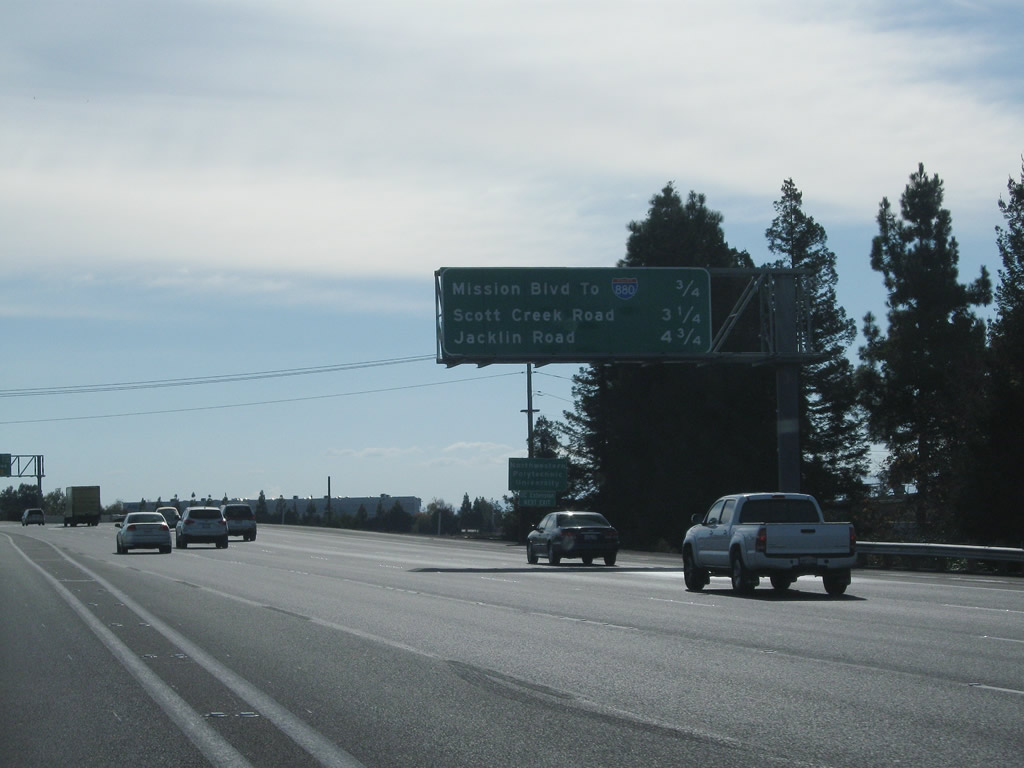
This mileage sign provides the distance to the next three exits along southbound Interstate 680: Exit 14, Durham Road; Exit 12, California 262 (Mission Boulevard) west to Interstate 880; and Exit 10, Scott Creek Road. After this mileage sign, Interstate 680 turns due south at the same point where the proposed and now dead California 238/Mission Freeway interchange would have been located. Photos taken 11/28/10 and 11/29/04. |
|
|
Until May 2002, stub ramps and a short section of freeway was in place here for the proposed connection to California 238/Mission Freeway north. However, with a needed widening of Interstate 680 (new high occupancy vehicle lane), the stub ramp was removed. There was little chance then and even less chance now that the Mission Freeway project would be resumed, so the removal makes sense (although the bridge over the southbound lanes was never used). The grading for the original proposed interchange can be seen here. Some remnant concrete from the lanes is probably also still present, although it cannot be seen from Interstate 680 itself. Photos taken 11/27/07. |
|
|
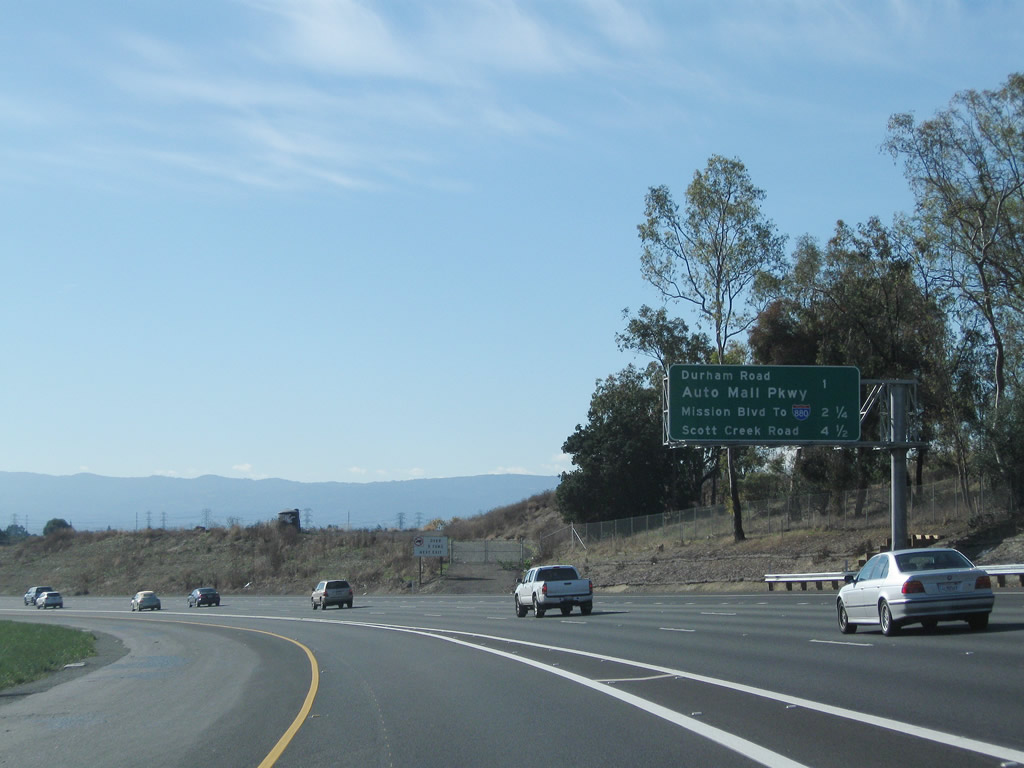
Another sign for Exit 14, Durham Road is posted as we leave the immediate vicinity of the formerly planned California 238/Mission Freeway merge point. Photos taken 11/28/10 and 11/27/07. |
|
|
|
|
|
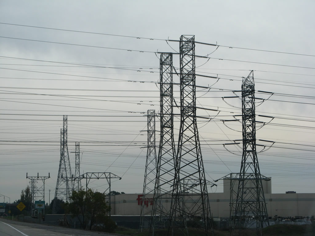
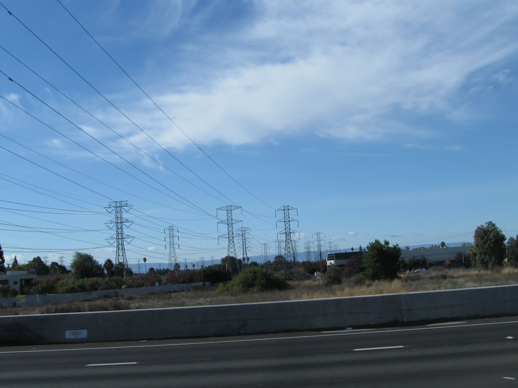
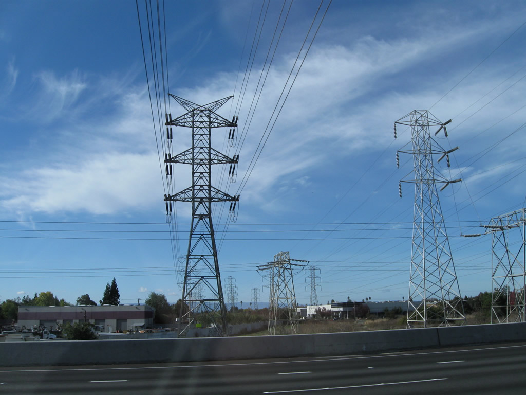
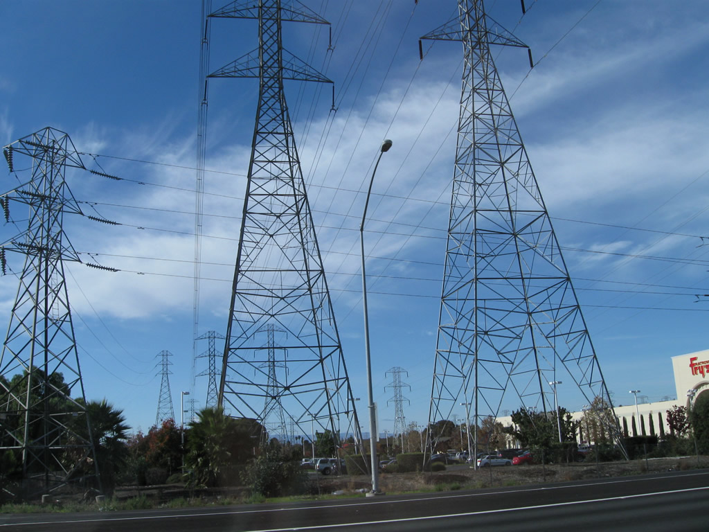
| Several Pacific Gas and Electric (PG&E) power lines (mostly 230kV and 138kV) cross over Interstate 680 just before the Durham Road interchange. These lines carry power from the Tesla substation located near the Interstate 580 and Corral Hollow Road interchange into the South Bay Area. Photos taken 11/28/10 and 11/27/07. |
|
|
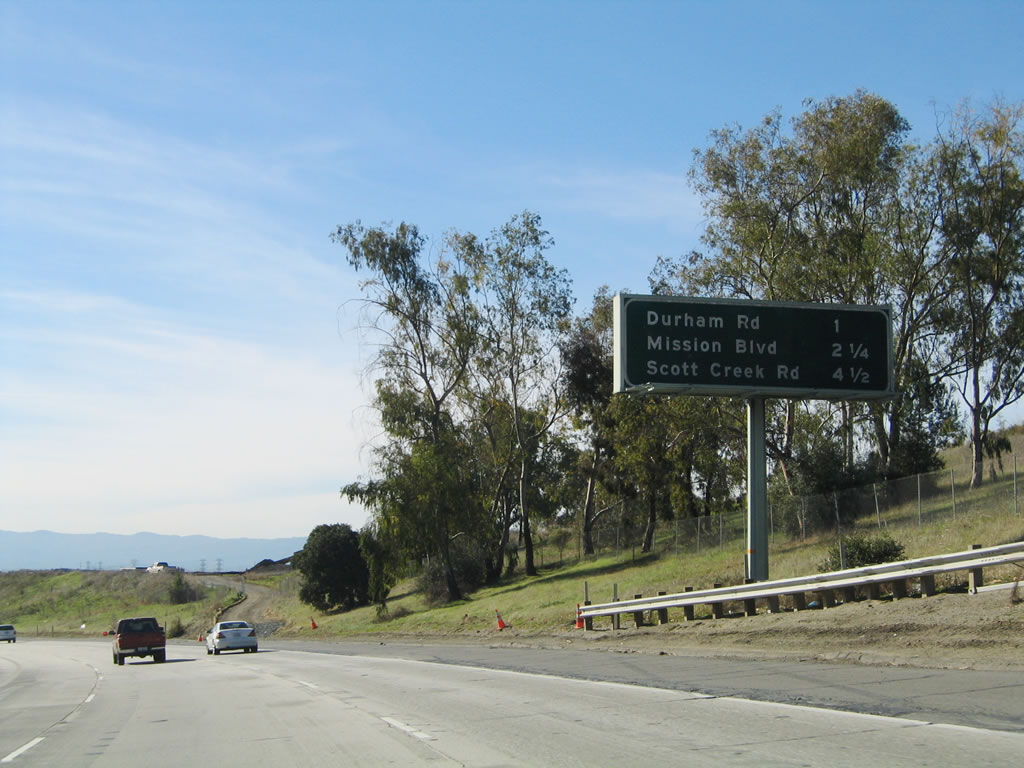
Southbound Interstate 680 meets Exit 14, Durham Road. The next interchange is Exit 12, California 262 west to Interstate 880. Photos taken 11/28/10 and 11/27/07. |
|
Another guide sign in the left lane advises of the variable toll rates for the Interstate 680 Express Lane. Photo taken 11/28/10. |
|
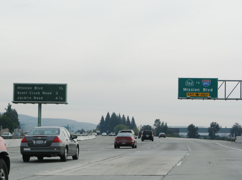
This mileage sign provides the distance to the next three exits: Exit 12, California 262 (Mission Boulevard) west; Exit 10, Scott Creek Road; and Exit 9, Jacklin Road. Photo taken 11/28/10. |
|
|
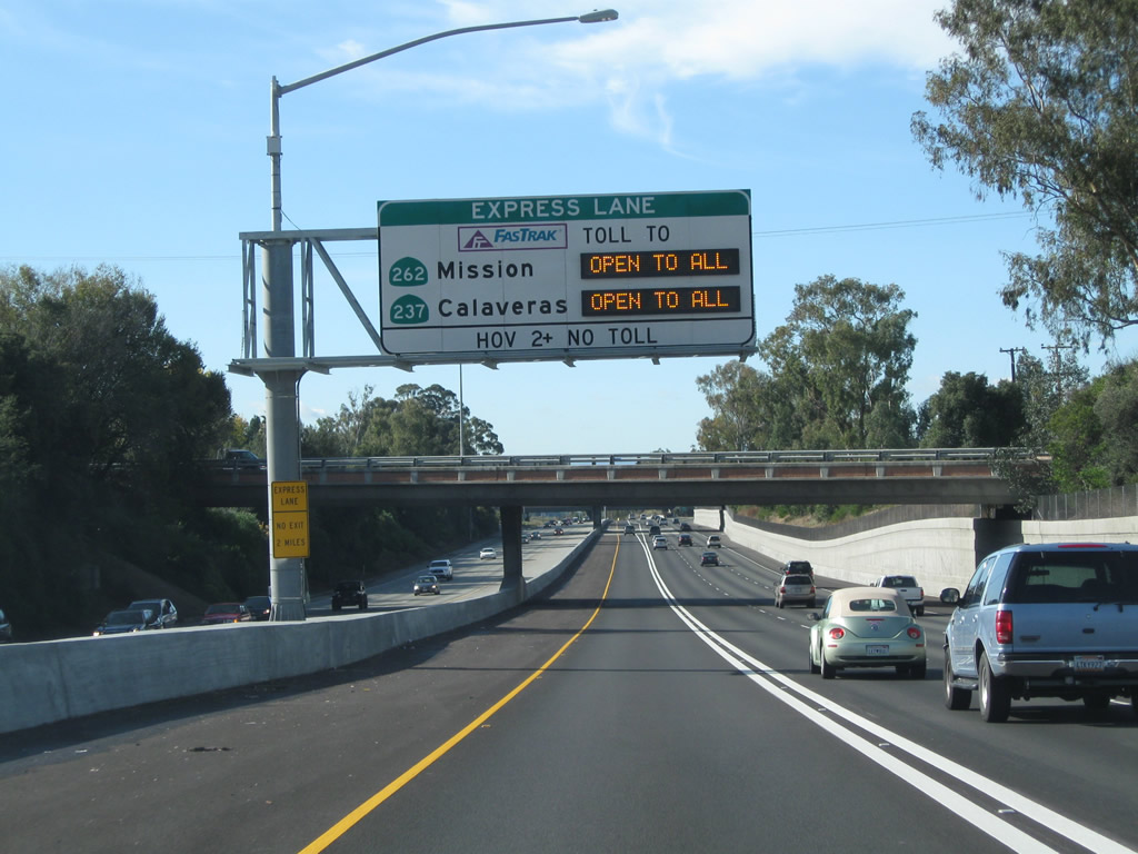
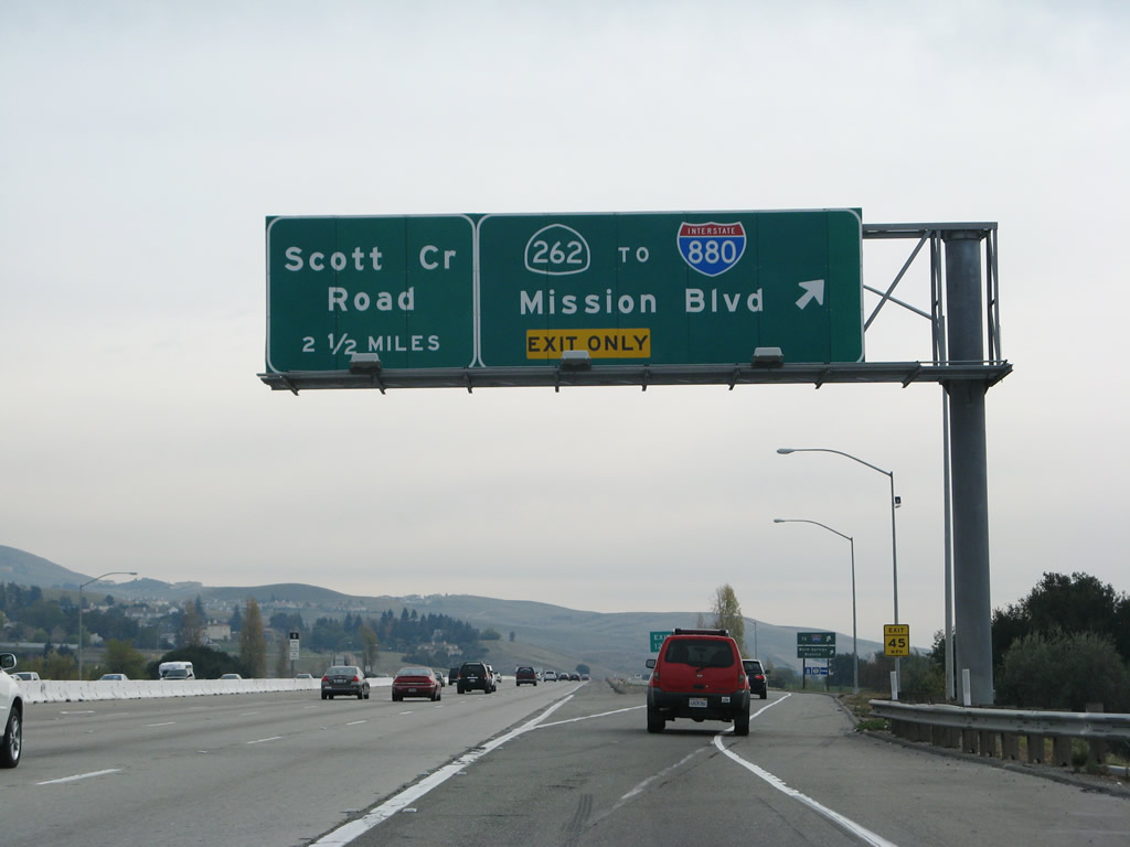
The mileage sign shown here has been removed. The right lane exit only sign is for California 262, a short state route that connects Interstate 680 with Interstate 880 in Mountain View via Mission Boulevard. This formerly unsigned route follows what used to be part of California 238 before it was retracted to its current alignment. Photos taken 11/28/10 and 11/27/07. |
|
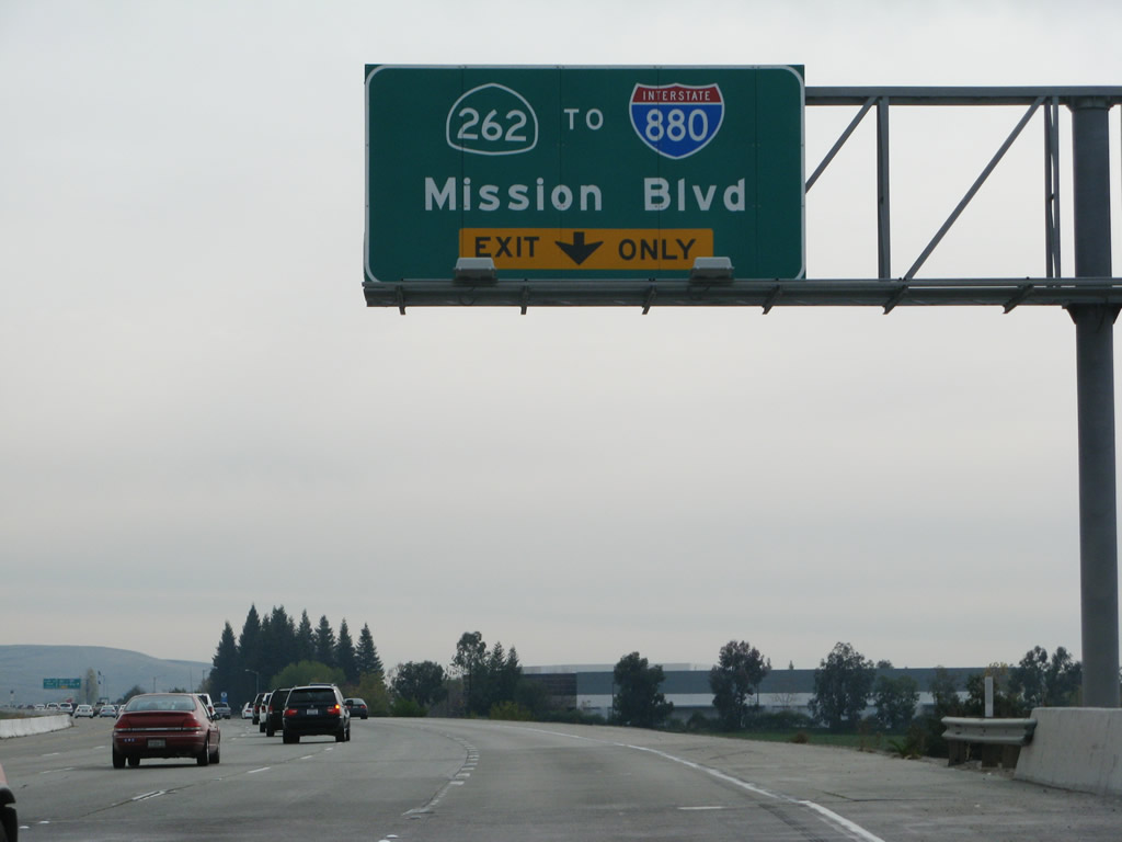
The right lane becomes exit only for Exit 12, California 262 (Mission Boulevard) west (same sign as shown in the prior photobox but has since been replaced). These overhead signs reflect the only place where California 262 is signed in the field currently, but that will likely change once a construction project to improve California 262 is complete. Photo taken 11/27/07. |
|
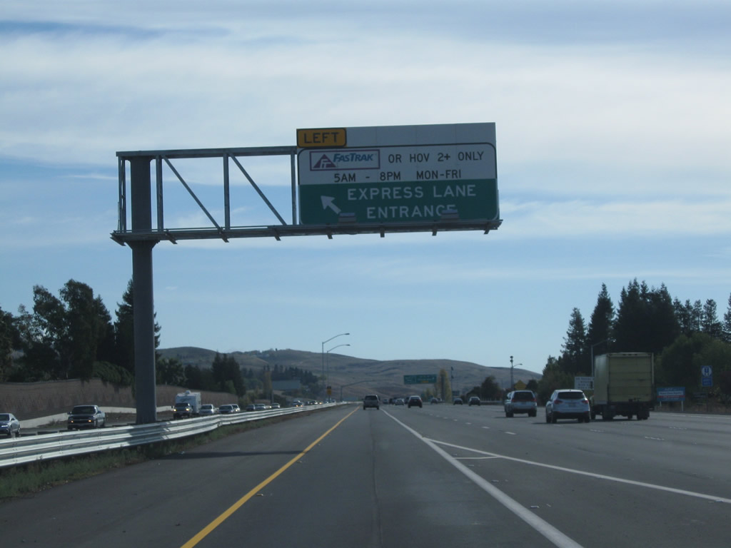
An entrance to the left lane is located between the Durham Road on-ramp and the Mission Boulevard off-ramp. Photo taken 11/28/10. |
|
|
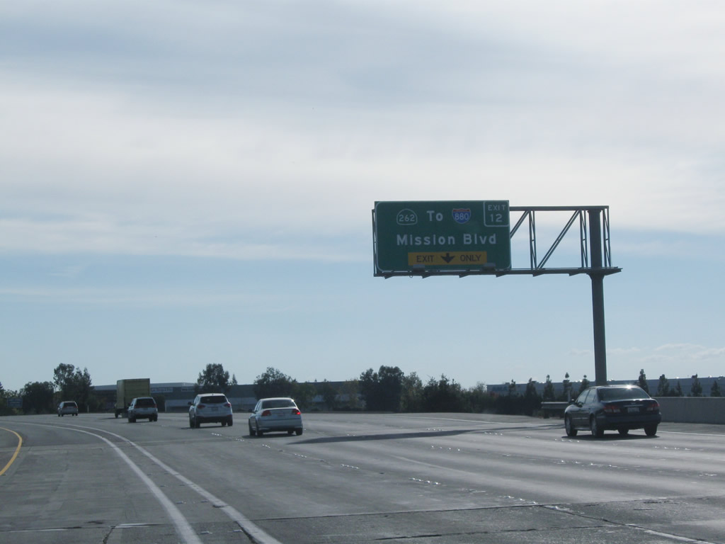
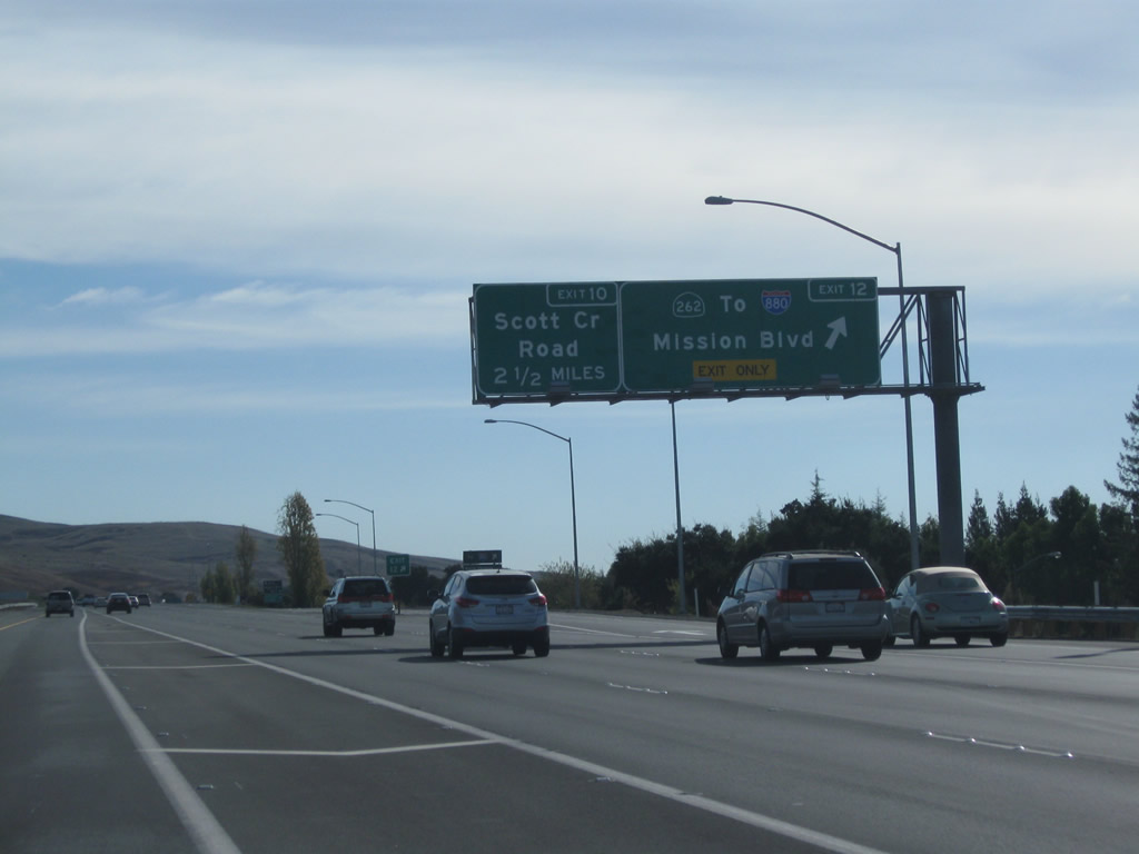
Southbound Interstate 680 meets Exit 12, California 262 (Mission Boulevard) west to Interstate 880 (Nimitz Freeway). The next exit is Scott Creek Road. Photos taken 11/28/10 and 11/27/07. |
|
Exit 12 is a modified cloverleaf interchange. The first ramp connects to California 262 west to Interstate 880, and the second ramp connects to Mission Boulevard north to Mission San Jose. This is the same Mission Boulevard that Interstate 680 met at Exit 16 (south end of California 238). Photo taken 11/27/07. |
|
The ramp at Exit 12, California 262 (Mission Boulevard) splits at this gore point. Photo taken 11/27/07. |
|
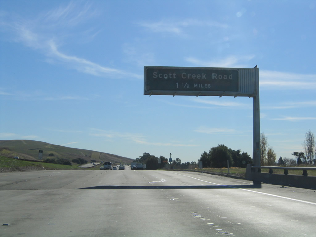
Back on the mainline, the next exit along Interstate 680 south is Exit 10, Scott Creek Road. This is the final interchange serving the city of Fremont and marks the transition from Alameda County to Santa Clara County. Photo taken 11/29/04. |
|
|
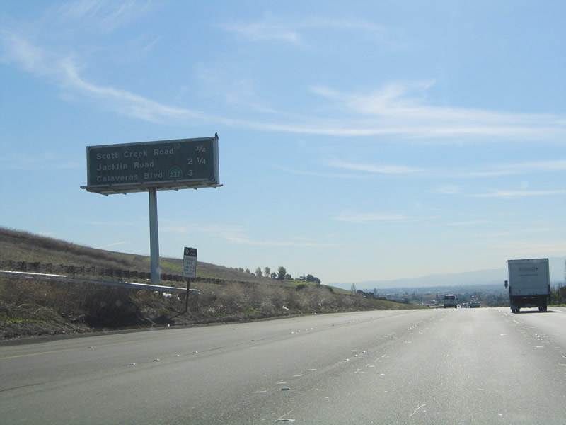
This mileage sign provides the distance to the next three exits on Interstate 680 south: Exit 10, Scott Creek Road; Exit 9, Jacklin Road; and Exit 8, California 237 (Calaveras Boulevard) to Central Milpitas. This sign was moved once the express lane opened. Photos taken 11/28/10 and 11/29/04. |
|
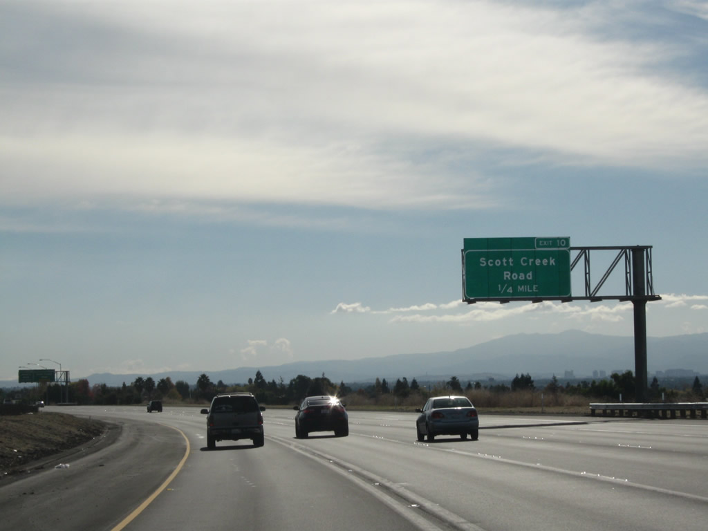
Interstate 680 south approaches Exit 10, Scott Creek Road (0.25 mile). Photo taken 11/28/10. |
|
|
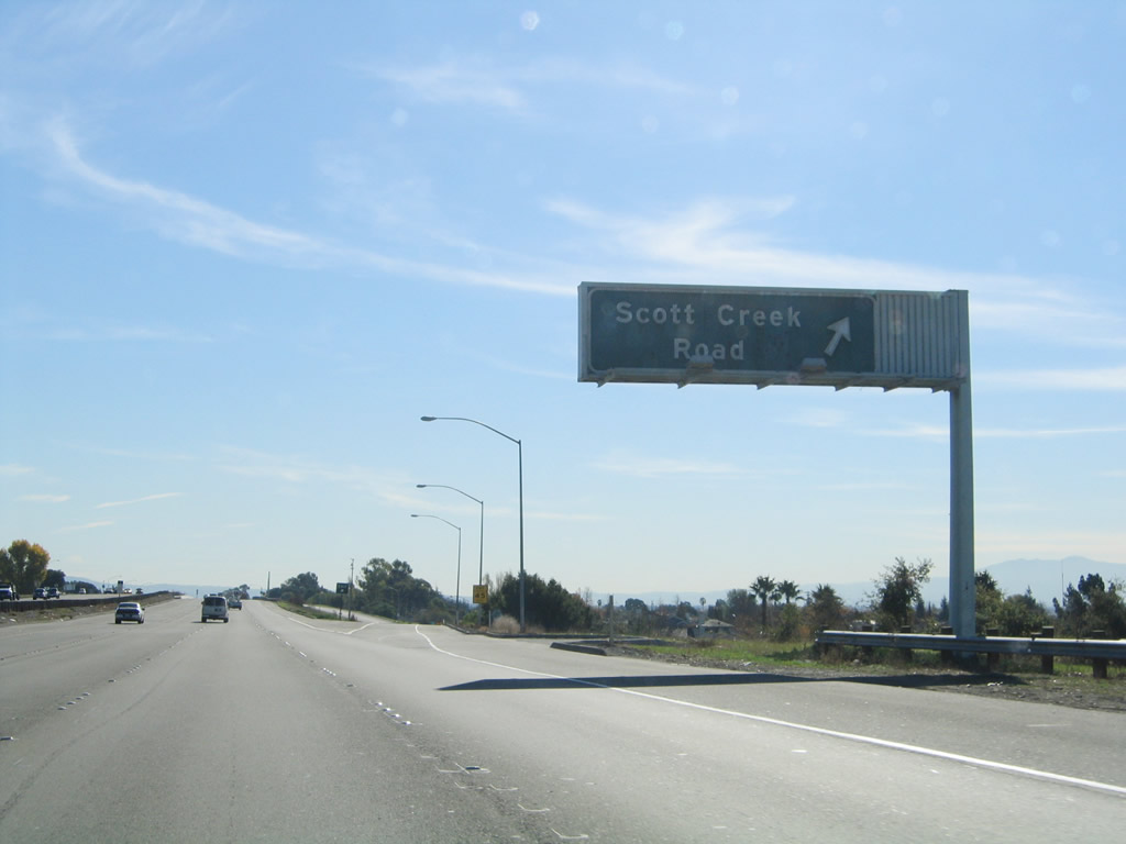
Southbound Interstate 680 meets Exit 10, Scott Creek Road. Shortly after this interchange, Interstate 680 leaves Alameda County and enters Santa Clara County. Photos taken 11/28/10 and 11/29/04. |
Page Updated November 20, 2011.