
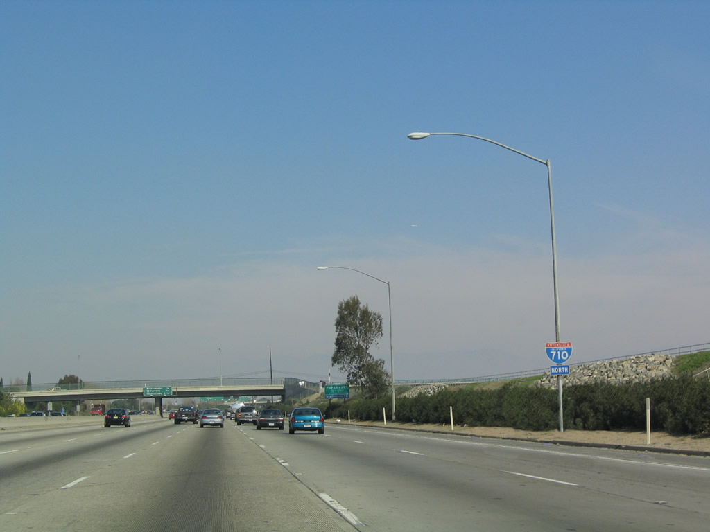
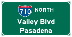
Interstate 710 North
| Interstate 710 (Long Beach Freeway) north | ||
|---|---|---|
 |
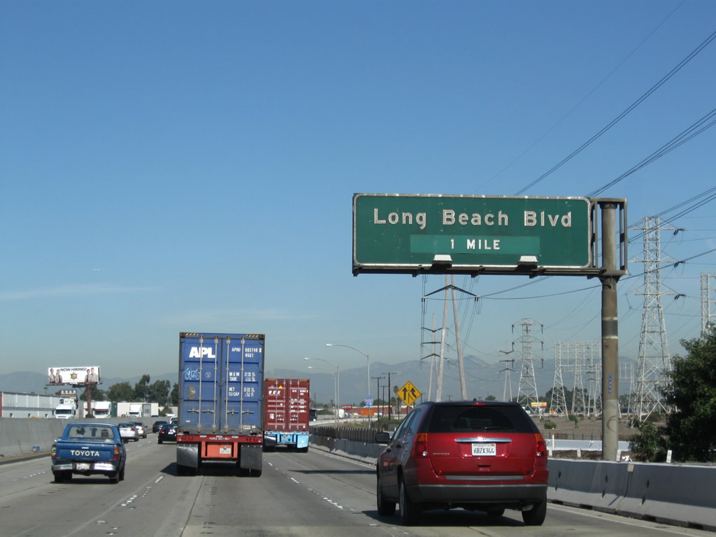 |
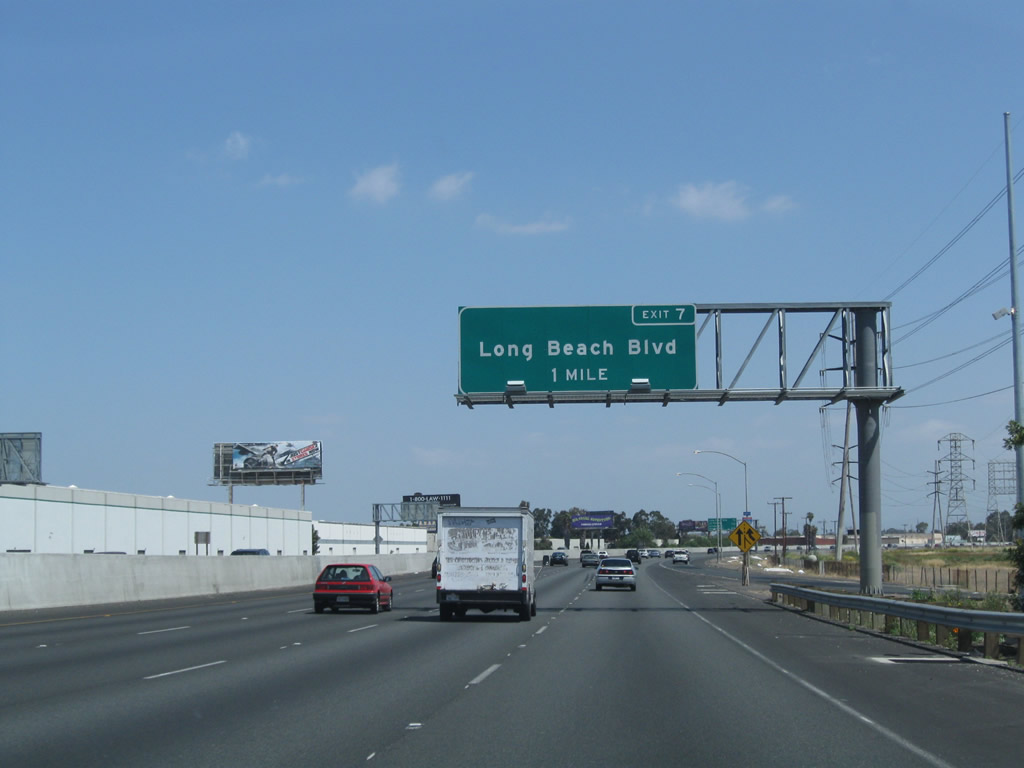
The next exit from Interstate 710 (Long Beach Freeway) north is Exit 7, Long Beach Boulevard. With the addition of an auxiliary lane in 2009, the signs were replaced for Exit 7 to include the exit number. Photos taken 05/02/10 and 11/08/08. |
 |
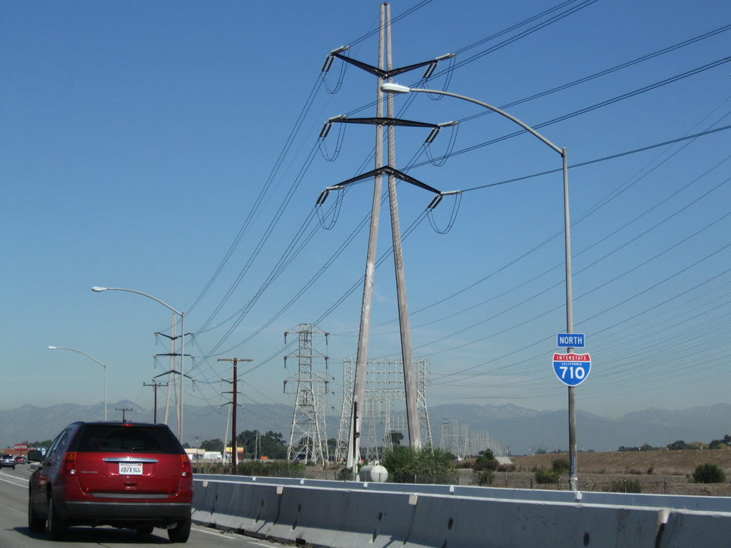 |
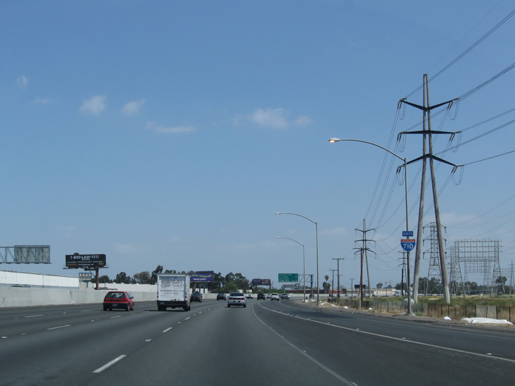
An Interstate 710 north reassurance shield is posted after the on-ramp from Del Amo Boulevard. Photos taken 05/02/10 and 11/08/08. |
 |
 |
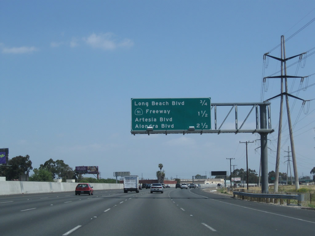
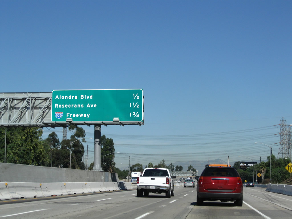
This mileage sign provides the distance to the next four exits from Interstate 710 (Long Beach Freeway) north: Exit 7, Long Beach Boulevard; Exit 8A, Artesia Boulevard and California 91 (Artesia Freeway) east; Exit 8B, California 91 west; and Exit 9, Alondra Boulevard. The mileage sign (and median barrier) were both replaced as a result of freeway construction. Photos taken 05/02/10 and 11/25/04. |
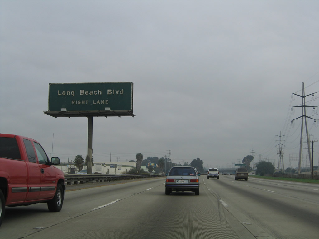 |
This porcelain enamel sign for Exit 7 was removed and not replaced. Photo taken 11/25/04. | |
 |
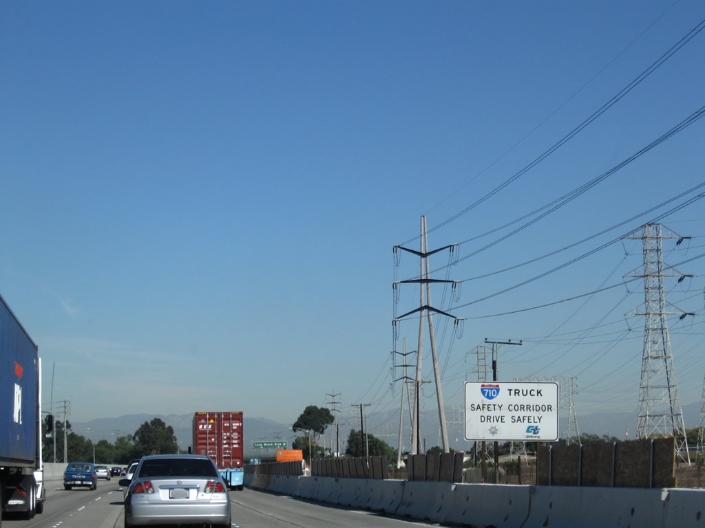 |
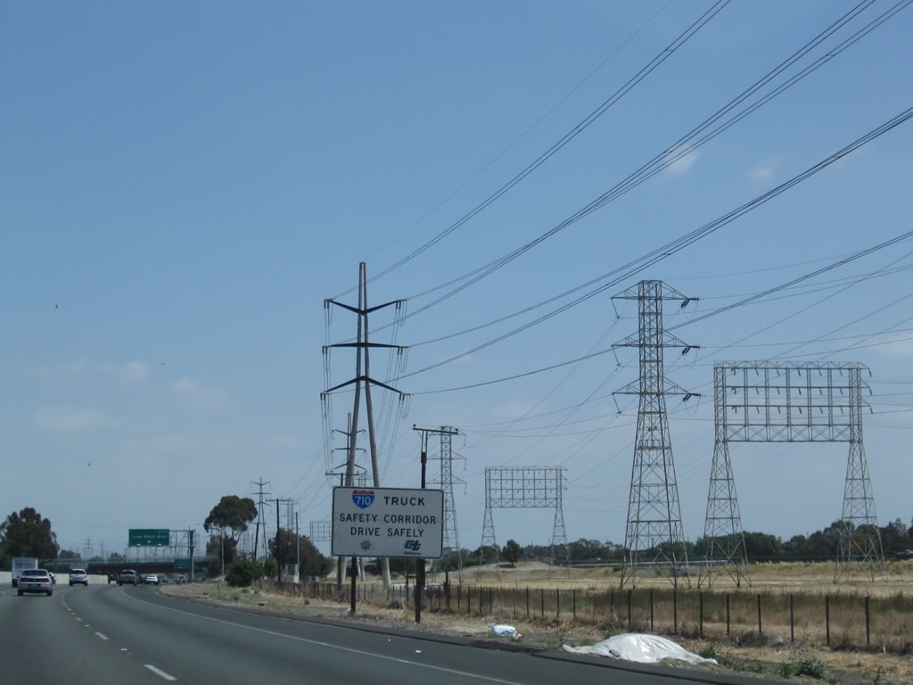
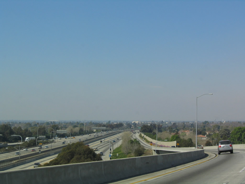
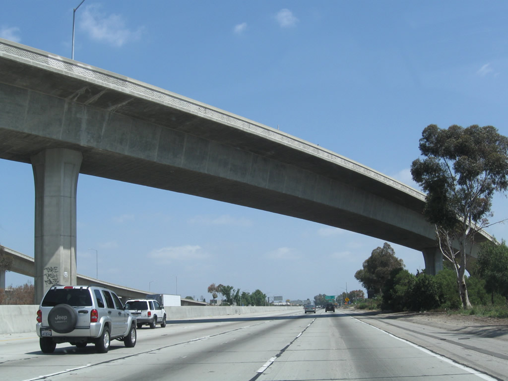
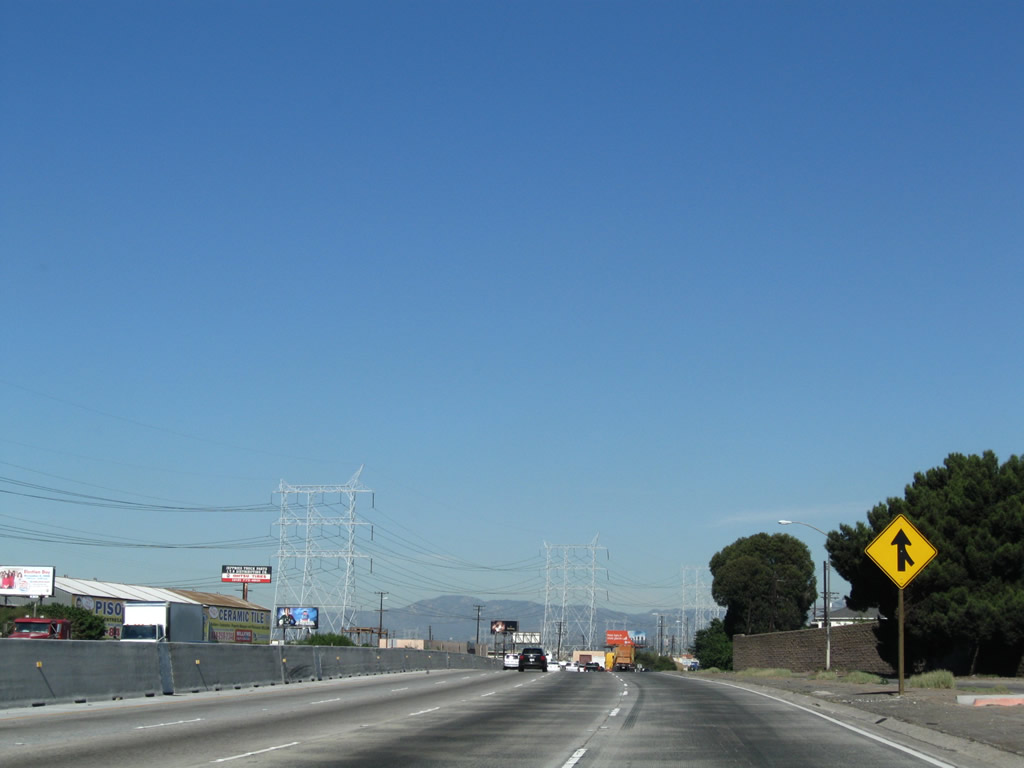
As evidenced in the 2008 photo, Interstate 710 is a designated truck safety corridor, in large part due to its direct connection to the Ports of Long Beach and Los Angeles. Photos taken 05/02/10 and 11/08/08. |
 |
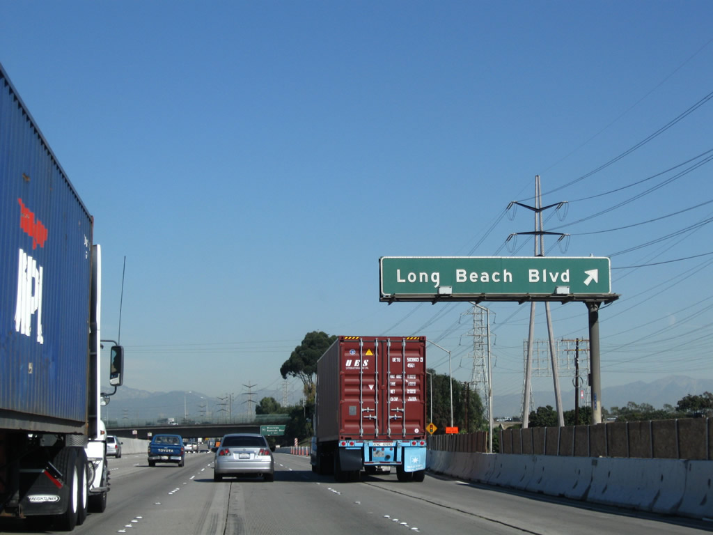 |
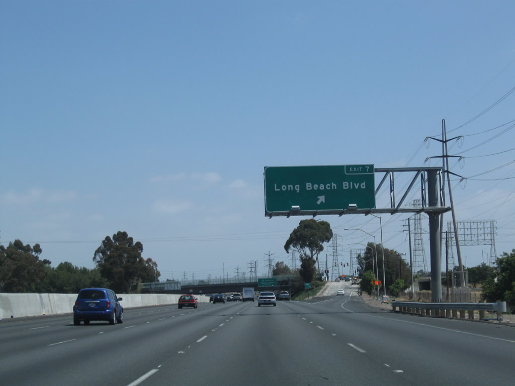
Northbound Interstate 710 (Long Beach Freeway) reaches Exit 7, Long Beach Boulevard. Photos taken 05/02/10 and 11/08/08. |
 |
 |
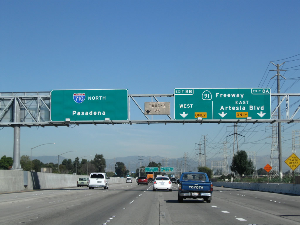
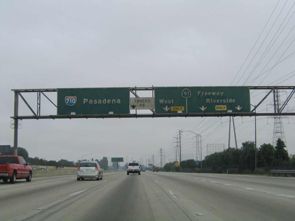
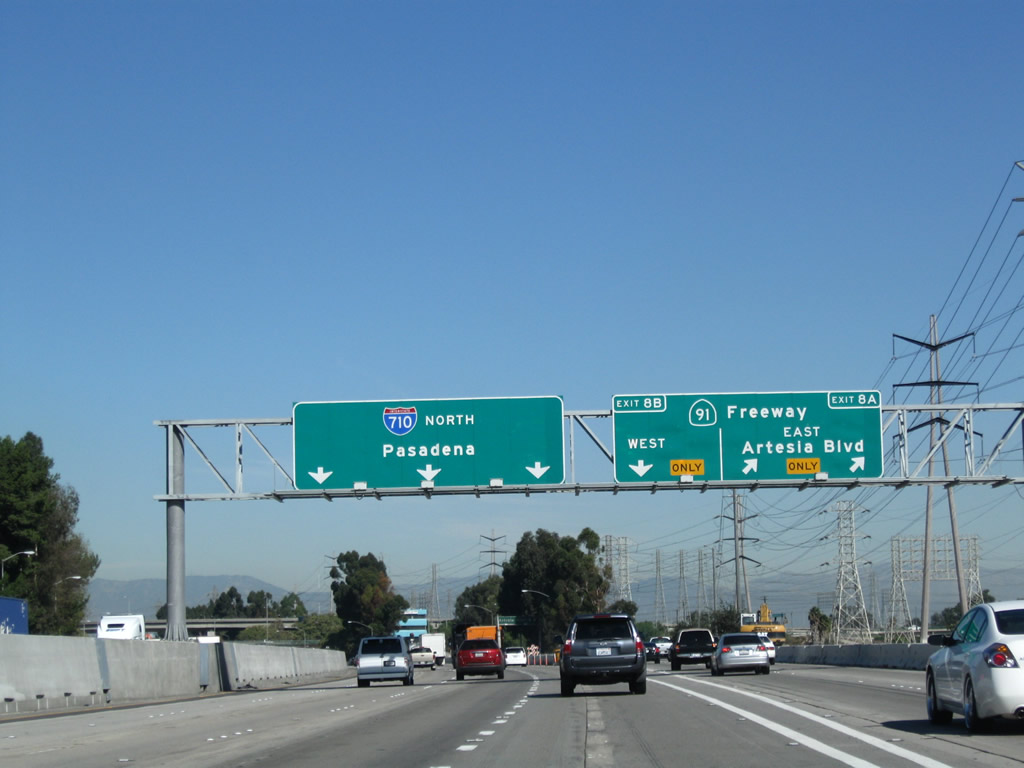
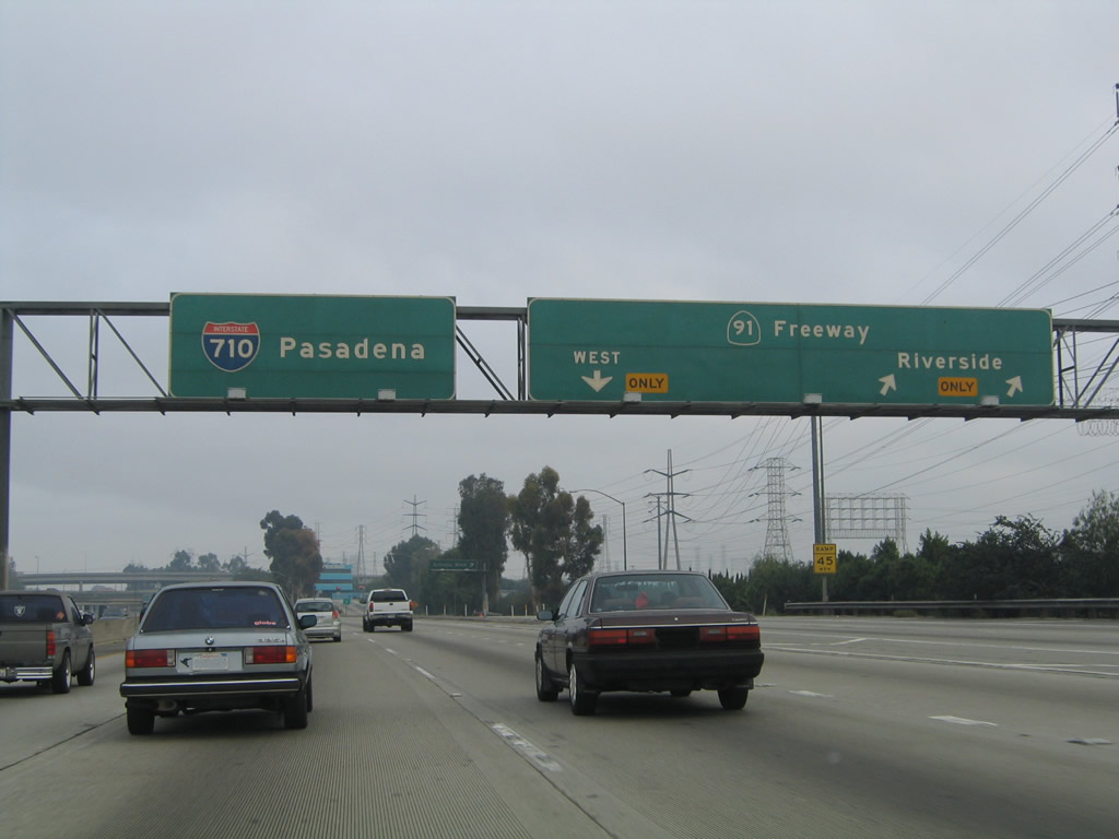
The next two exits along Interstate 710 (Long Beach Freeway) north are Exit 8A, Artesia Boulevard and California 91 (Artesia Freeway) east and Exit 8B, California 91 west. Photos taken 05/02/10 and 11/08/08. |
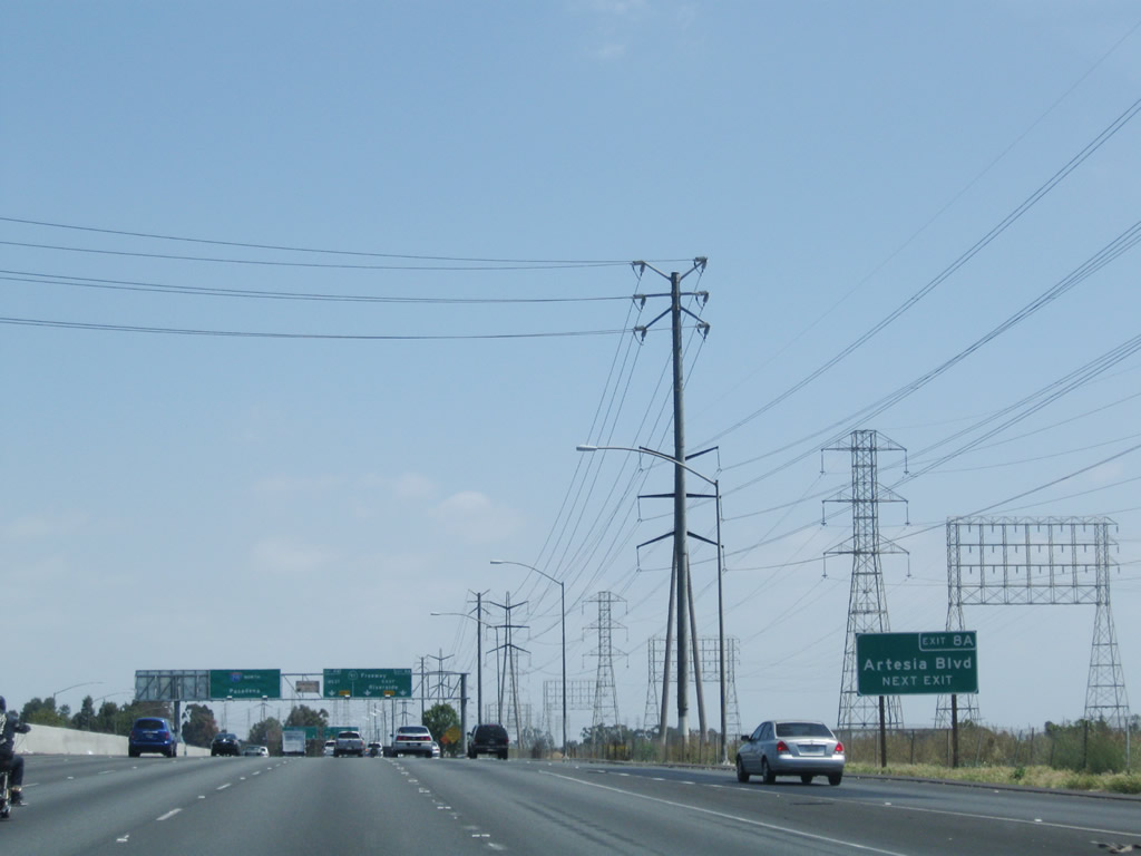 |
Use Exit 8A to Artesia Boulevard. Photo taken 05/02/10. | |
 |
 |
The right three lanes of Interstate 710 (Long Beach Freeway) north will connect to Exit 8A, Artesia Boulevard and California 91 (Artesia Freeway) east and Exit 8B, California 91 west. Photos taken 05/02/10 and 11/25/04. |
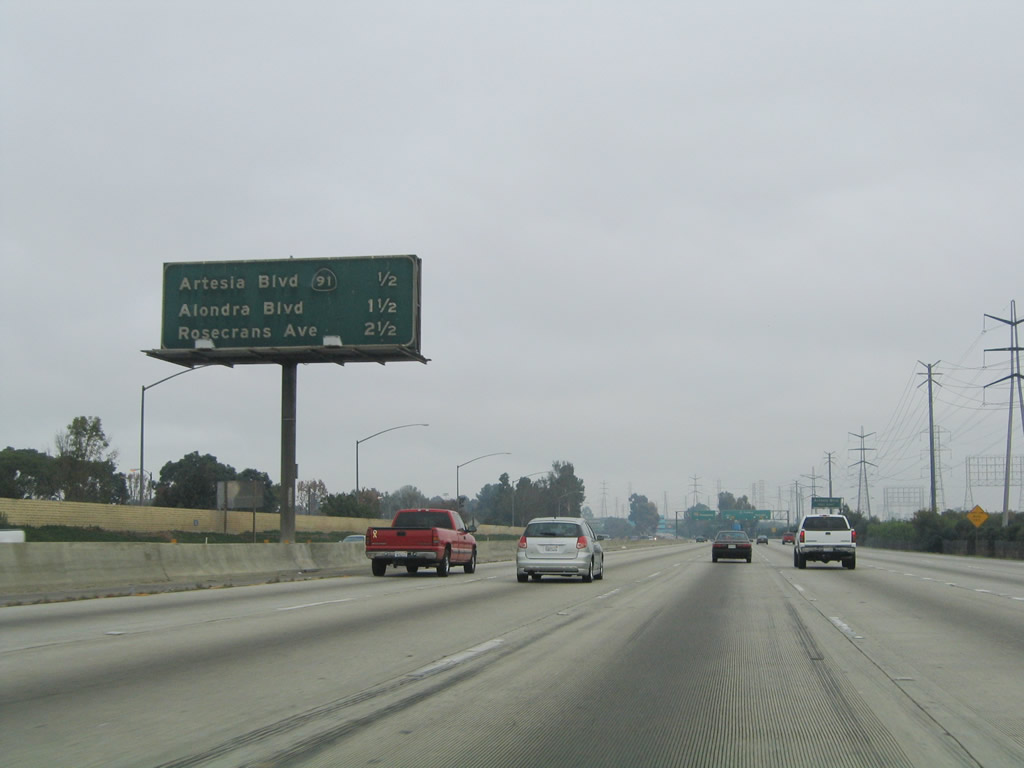 |
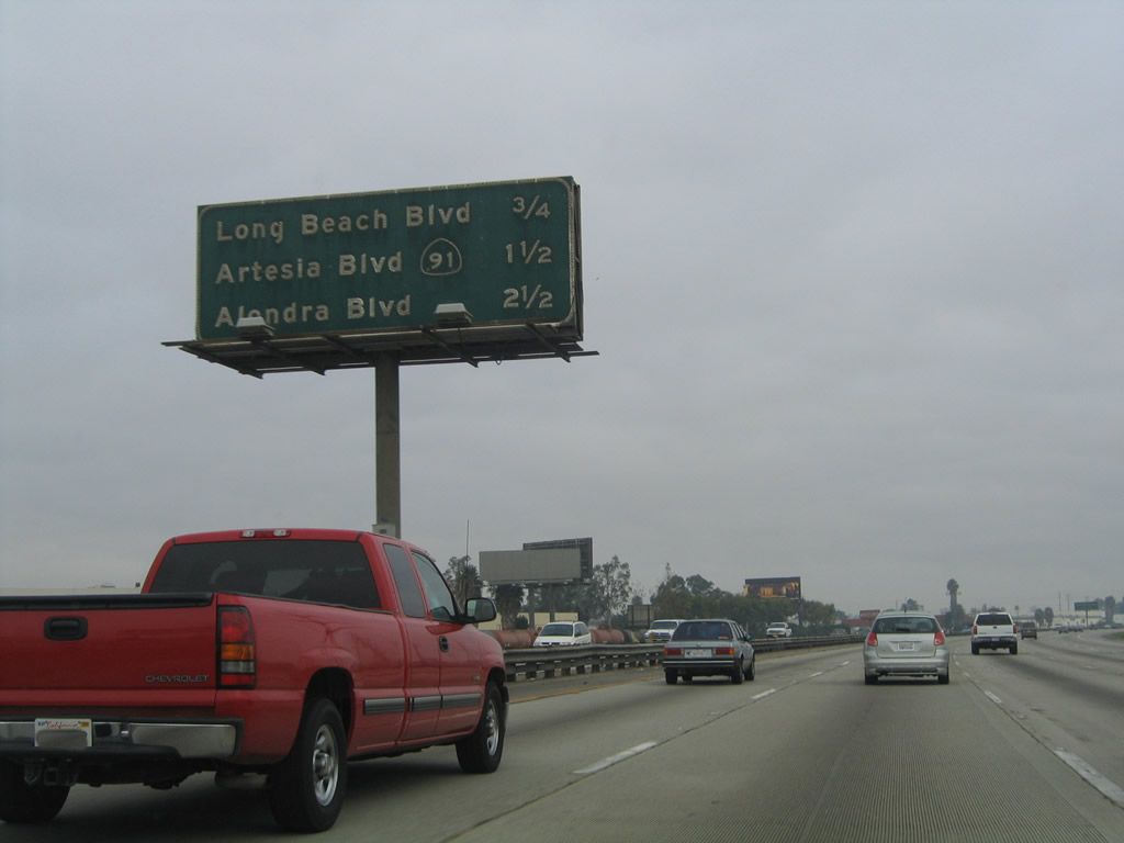
Prior to freeway construction, this mileage sign used to provides the distance to the next four exits from Interstate 710 (Long Beach Freeway) north: Exit 8A, Artesia Boulevard and California 91 (Artesia Freeway) east; Exit 8B, California 91 (Artesia Freeway) west; Exit 9, Alondra Boulevard; and Exit 10, Rosecrans Avenue. This porcelain enamel sign is now gone. Photo taken 11/25/04. | |
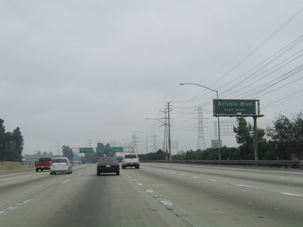 |
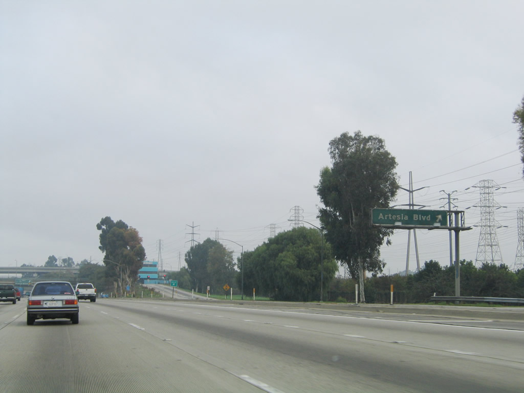
A separate overhead sign for Exit 8A, Artesia Boulevard used to be posted on northbound prior to the California 91 interchange. This porcelain enamel sign is now gone. Photo taken 11/25/04. | |
 |
 |
Northbound Interstate 710 (Long Beach Freeway) reaches Exit 8A, Artesia Boulevard and California 91 (Artesia Freeway) east. The second off-ramp connects to Exit 8B, California 91 west. Photos taken 11/08/08 and 11/25/04. |
 |
A porcelain enamel sign was posted for the ramp linking to Artesia Boulevard. Photo taken 11/25/04. | |
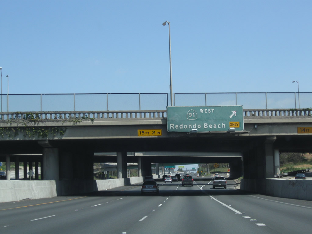 |
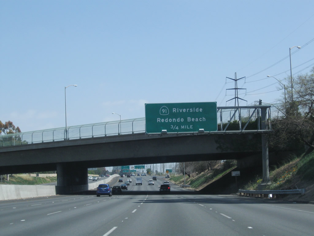
Back on the mainline, the next off-ramp from Interstate 710 north connects to Exit 8B, a loop ramp to California 91 west to Long Beach and Redondo Beach. Photo taken 05/02/10. | |
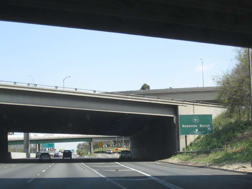 |
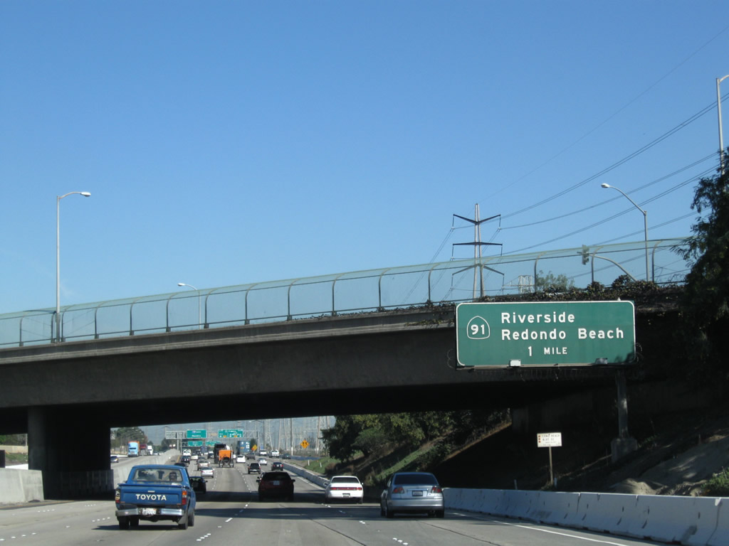
A second roadside sign is posted for Exit 8B. Photo taken 05/02/10. | |
 |
This mileage sign provides the distance to the next three exits from Interstate 710 (Long Beach Freeway) north: Exit 9, Alondra Boulevard; Exit 10, Rosecrans Avenue; and Exit 11, Interstate 105/Century (Glenn Anderson) Freeway. Photo taken 11/08/08. | |
 |
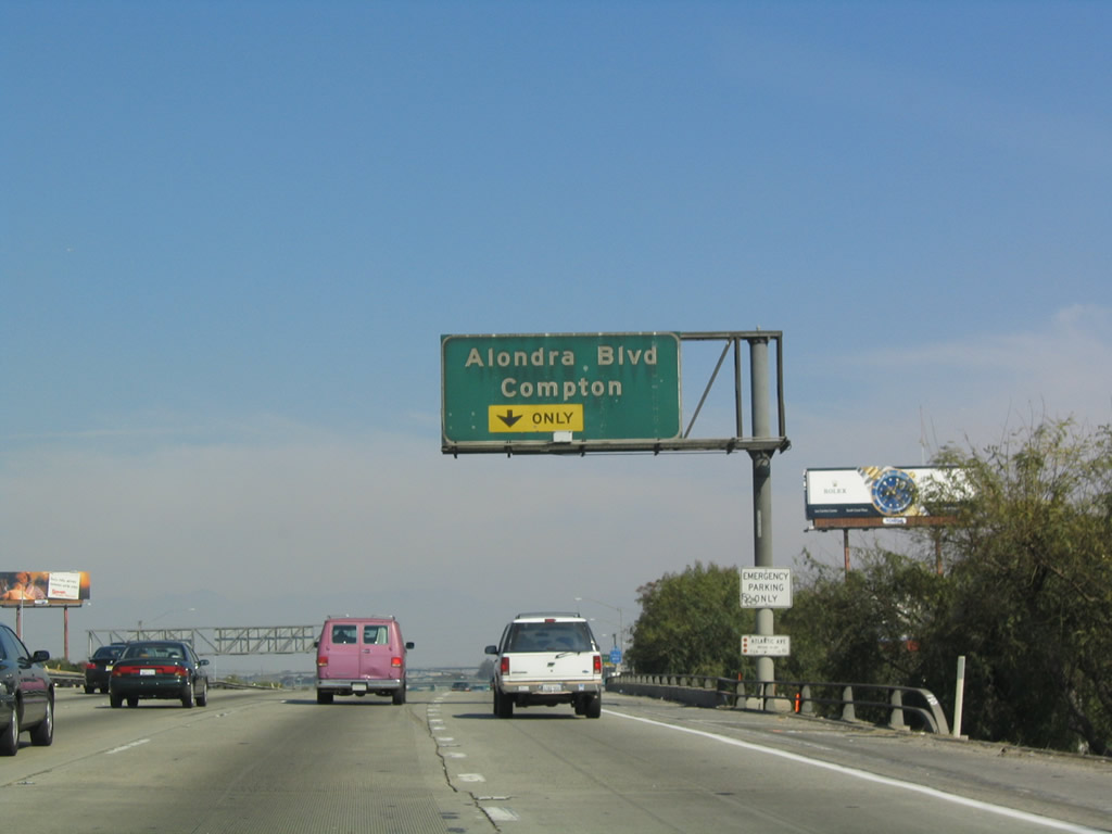 |
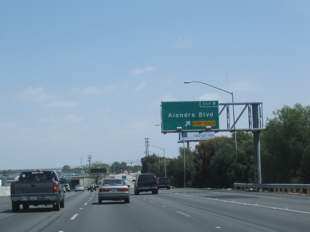
The right lane of Interstate 710 (Long Beach Freeway) north becomes exit only for Exit 9, Alondra Boulevard. Around this point, Interstate 710 leaves Long Beach for the first time and enters the eastern edge of the city of Compton, the Hub City. Compton had a population of 93,493 as of the 2000 Census and was incorporated on May 11, 1888. Photos taken 05/02/10 and 02/15/04. |
 |
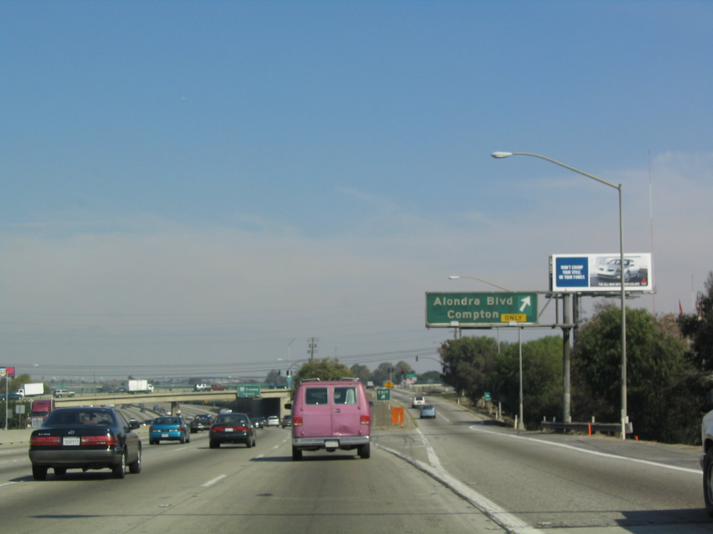 |
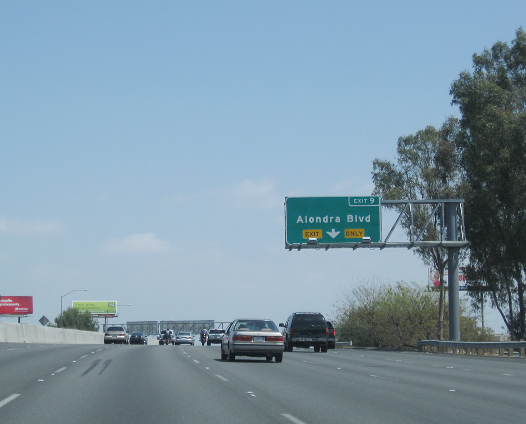
Northbound Interstate 710 (Long Beach Freeway) reaches Exit 9, Alondra Boulevard into Compton. Photos taken 05/02/10 and 02/15/04. |
 |
 |
Rosecrans Avenue and Interstate 105 are the next two major interchanges along northbound Interstate 710. Oddly, it seems like the Exit 11 tab for the Interstate 105 sign was pasted right on top of a sign already covered in graffiti. Photos taken 05/02/10 and 02/15/04. |
 |
This Interstate 710 north reassurance shield is posted shortly after the on-ramp from Alondra Boulevard. Photo taken 02/15/04. | |
 |
Interstate 710 leaves Compton and enters the western edge of the city of Paramount (population 55,266 as of 2000 Census; incorporated January 30, 1950). Photo taken 11/08/08. | |
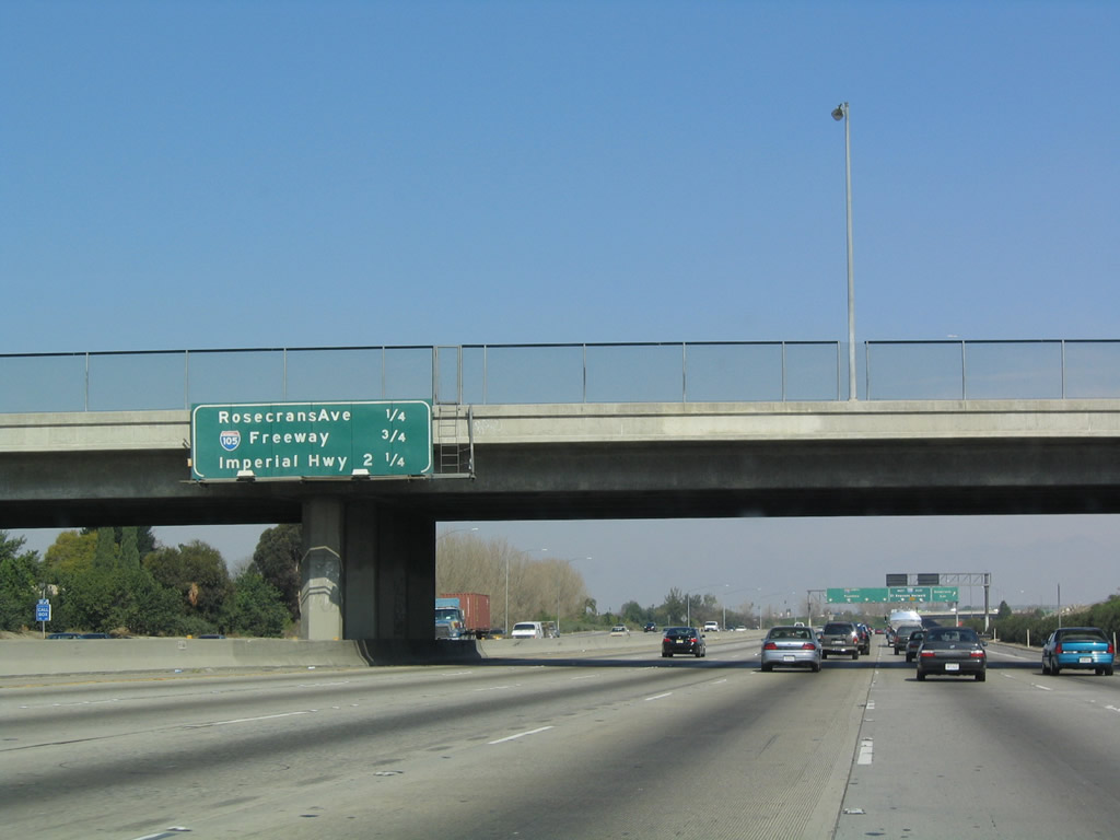 |
This mileage sign provides the distance to the next four exits from Interstate 710 (Long Beach Freeway) north: Exit 10, Rosecrans Avenue; Exits 11A-B, Interstate 105/Century (Glenn Anderson) Freeway; and Exit 12, Imperial Highway. Photo taken 11/08/08. | |
 |
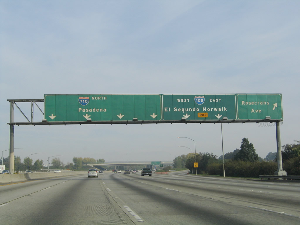 |
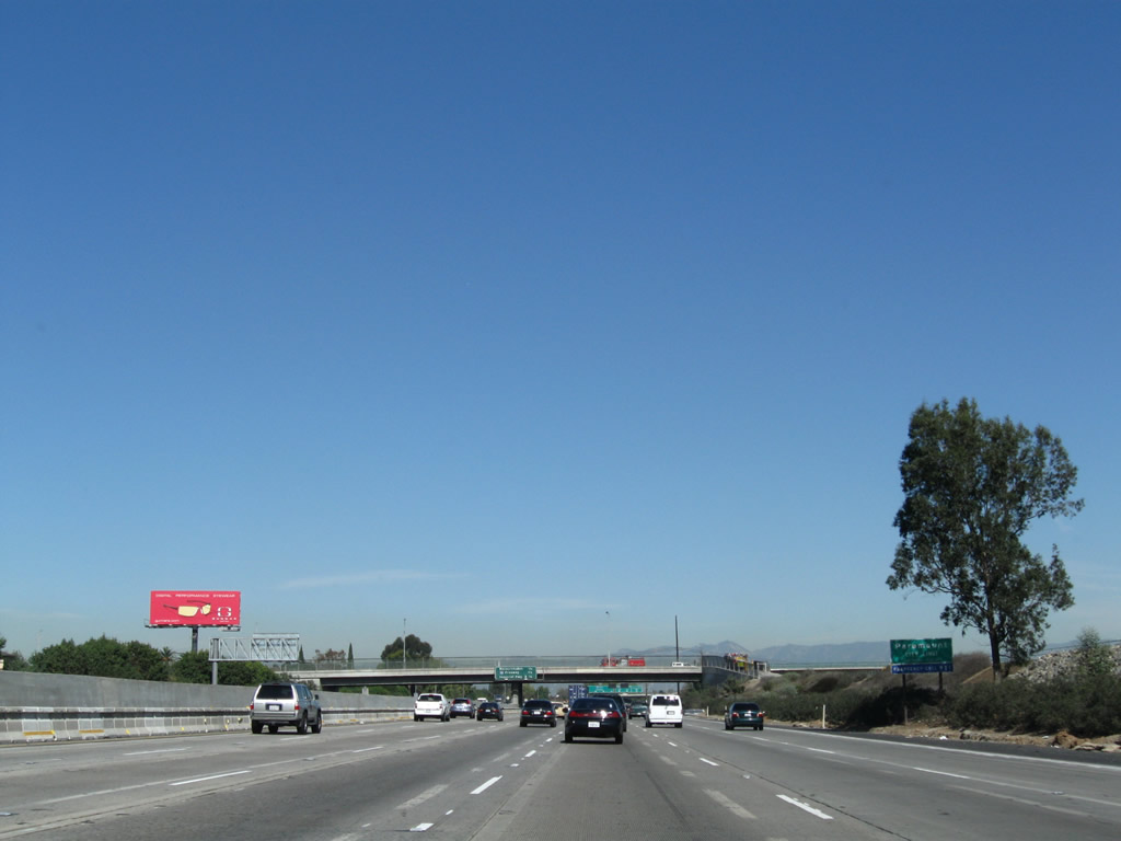
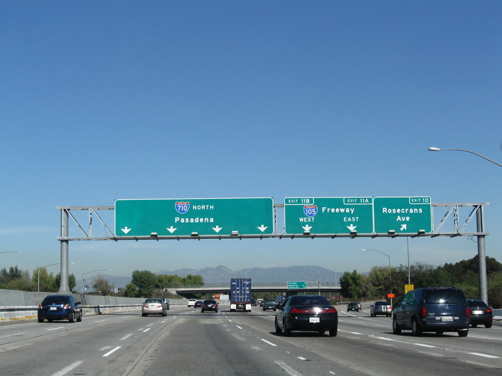
Northbound Interstate 710 (Long Beach Freeway) reaches Exit 10, Rosecrans Avenue. The next two exits are Exit 11A, Interstate 105 east to Norwalk and Exit 11B, Interstate 105 west to Los Angeles International Airport and El Segundo. Photos taken 05/02/10 and 02/15/04. |
 |
 |
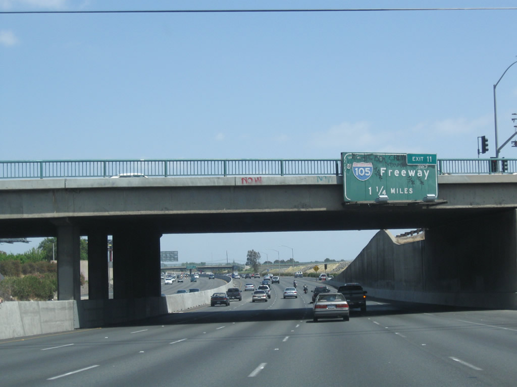
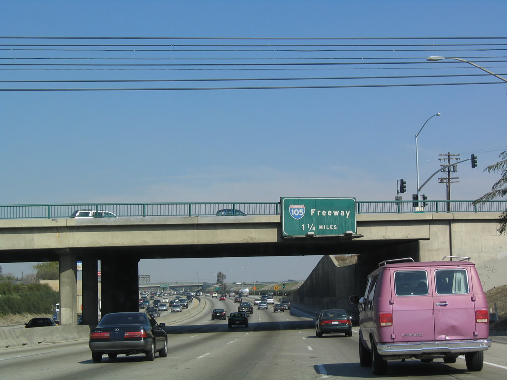
This mileage sign along northbound Interstate 710 (Long Beach Freeway) provides the distance to the next four exits: Exits 11A-B, Interstate 105; Exit 12, Imperial Highway; and Exit 13, Firestone Boulevard (former California 42). Photos taken 11/08/08 and 02/15/04. |
 |
 |
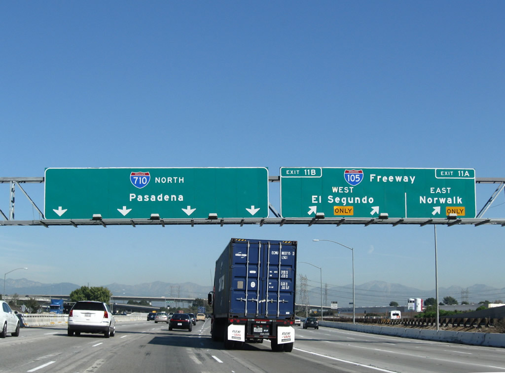
Northbound Interstate 710 (Long Beach Freeway) reaches Exit 11, Interstate 105/Century Freeway. Interstate 105 leads east to Norwalk and west to Los Angeles International Airport and El Segundo. Photos taken 11/08/08 and 11/25/04. |
 |
Now on the transition ramp from northbound Interstate 710 (Long Beach Freeway), the ramp divides between Exits 11A and 11B to eastbound Interstate 105/Century Freeway (right lanes) and westbound Interstate 105/Century Freeway (left lanes). Stay right for the connection to Garfield Avenue south to Paramount and north to South Gate. Photo taken 02/15/04. | |
 |
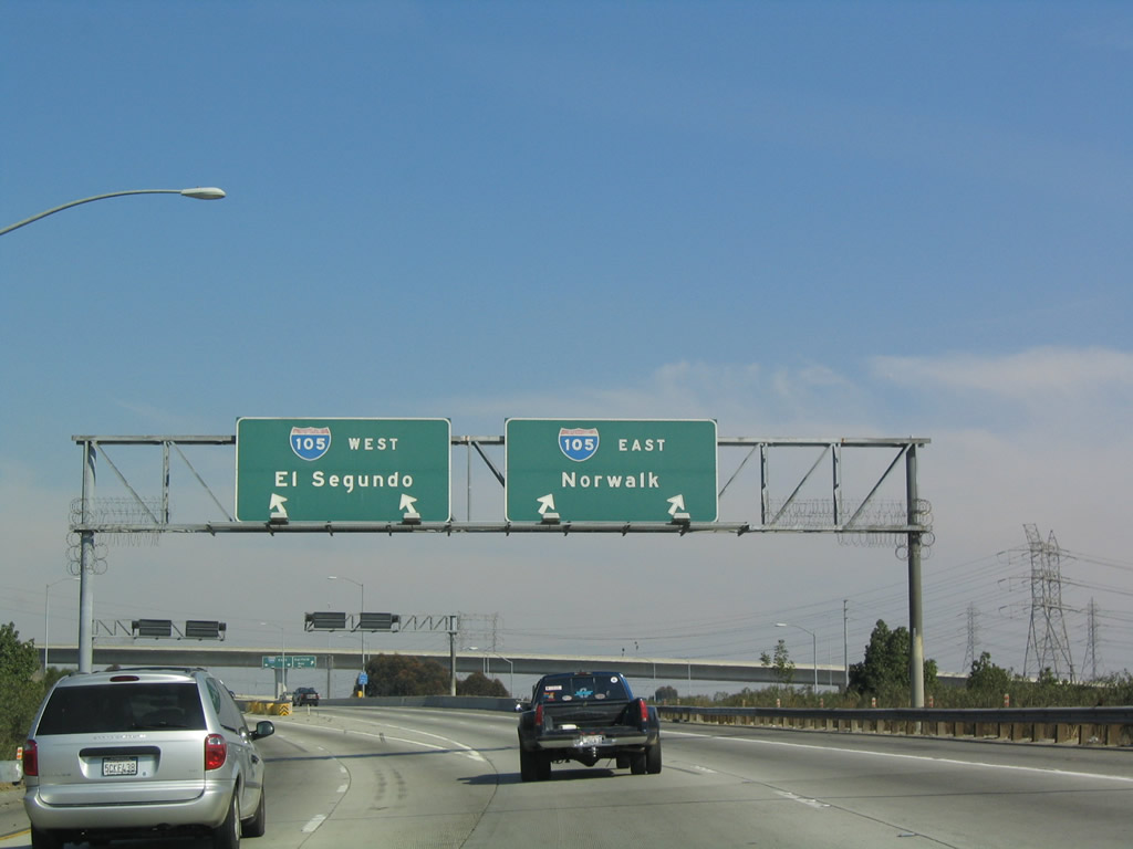
Here we follow the ramp from Interstate 710 north to Interstate 105 west. The Century Freeway (Glenn Anderson Freeway) comes into view. Photo taken 02/15/04. | |
 |
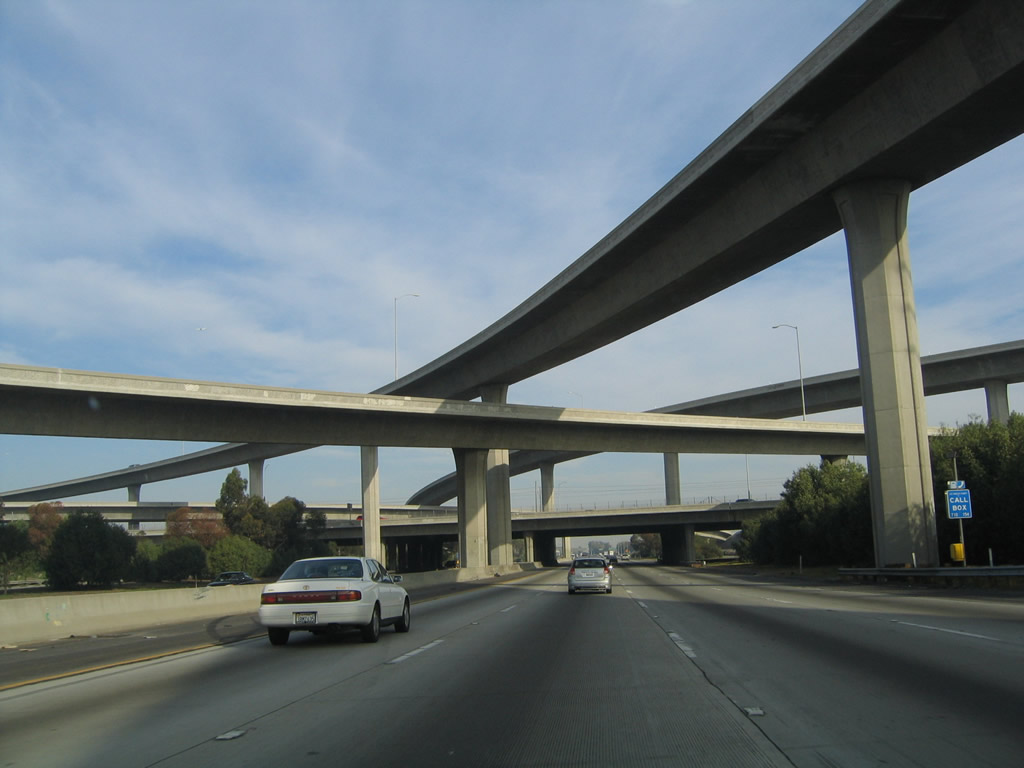 |
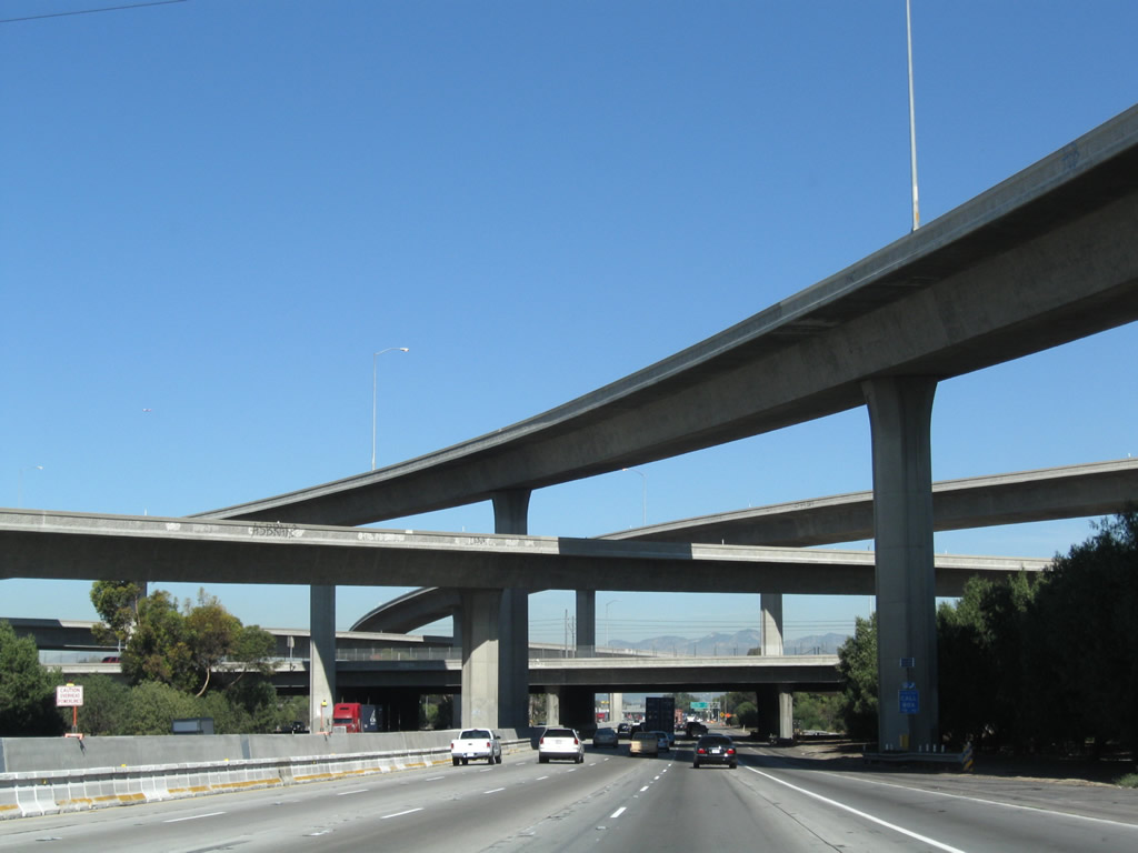
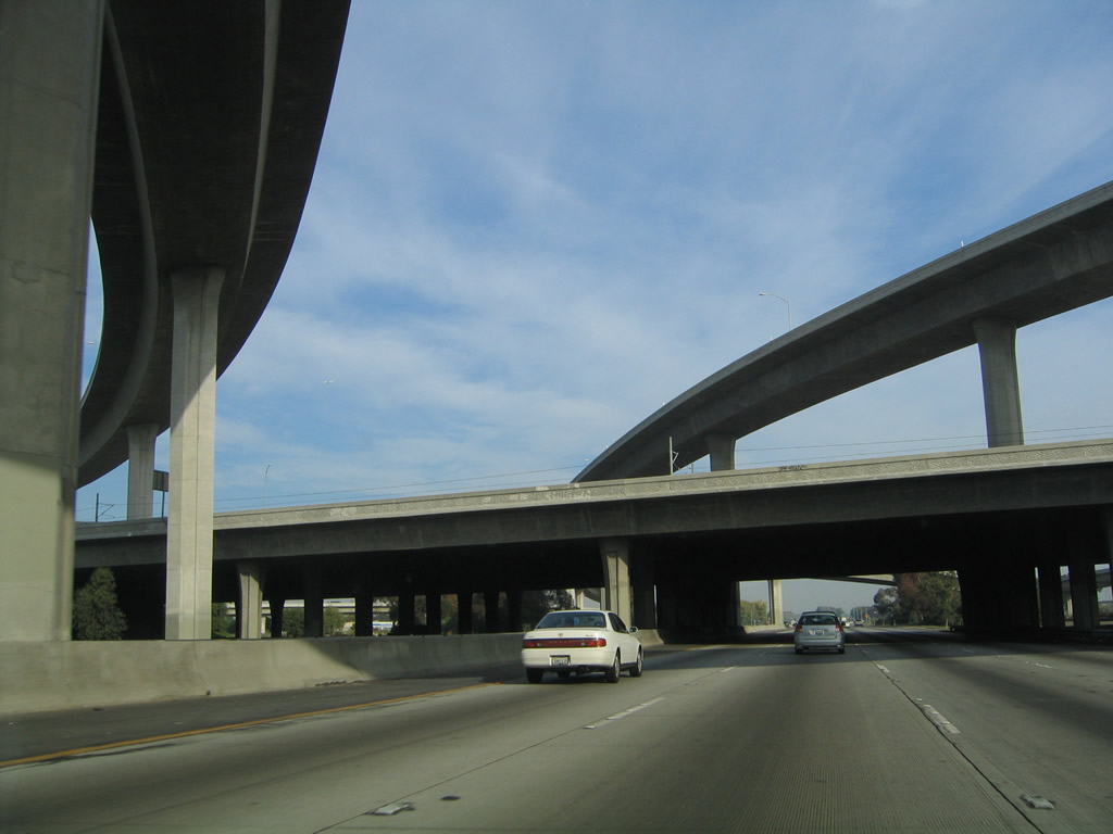
Interstate 710 passes through the towering, symmetrical stack interchange with Interstate 105. Photos taken 11/08/08 and 11/25/04. |
 |
 |
In the heart of the interchange, Interstate 710 passes under the Interstate 105 mainline, then passes under the transition ramp from Interstate 105 east to Interstate 710 north. Photos taken 11/08/08 and 05/02/10. |
 |
 |
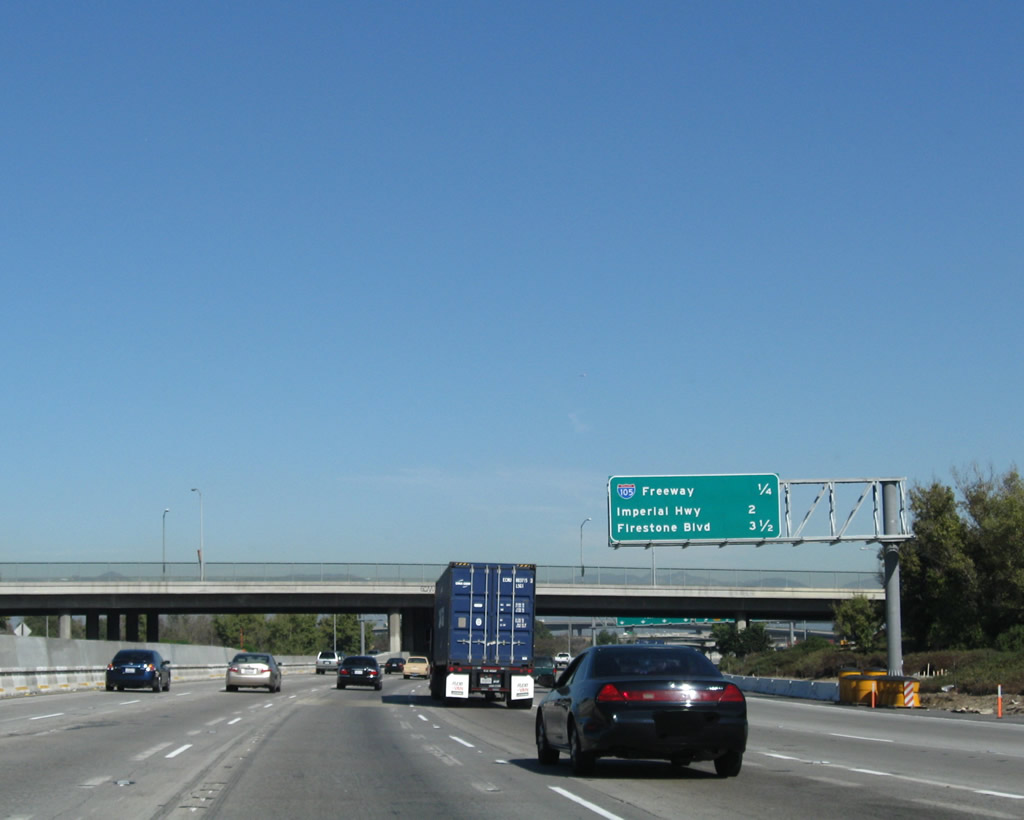
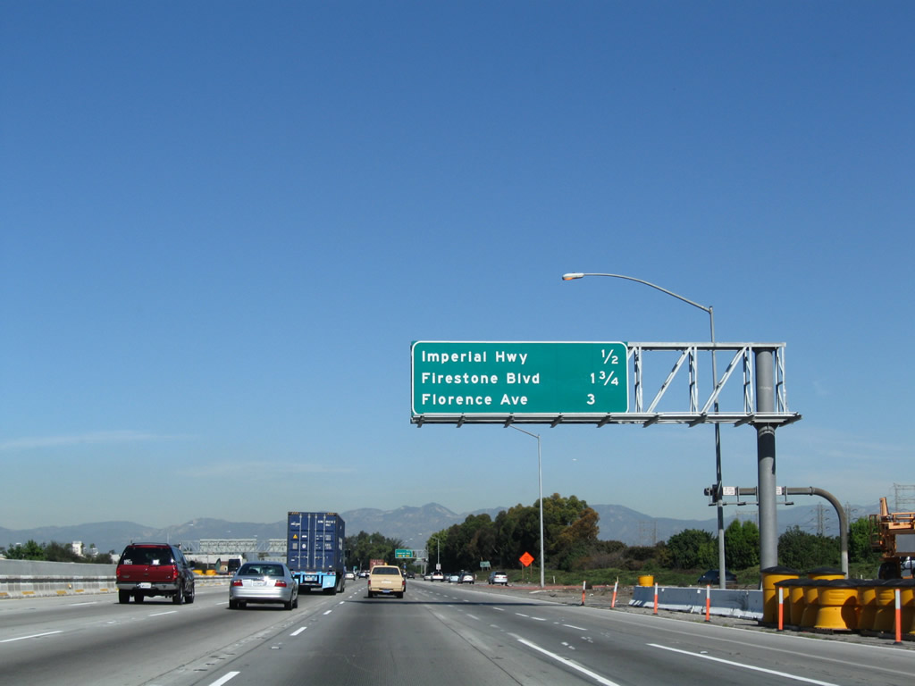
This mileage sign along northbound Interstate 710 (Long Beach Freeway) provides the distance to the next three exits: Exit 12, Imperial Highway; Exit 13, Firestone Boulevard (former California 42); and Exit 15, Florence Avenue. Photos taken 11/08/08 and 11/25/04. |
 |
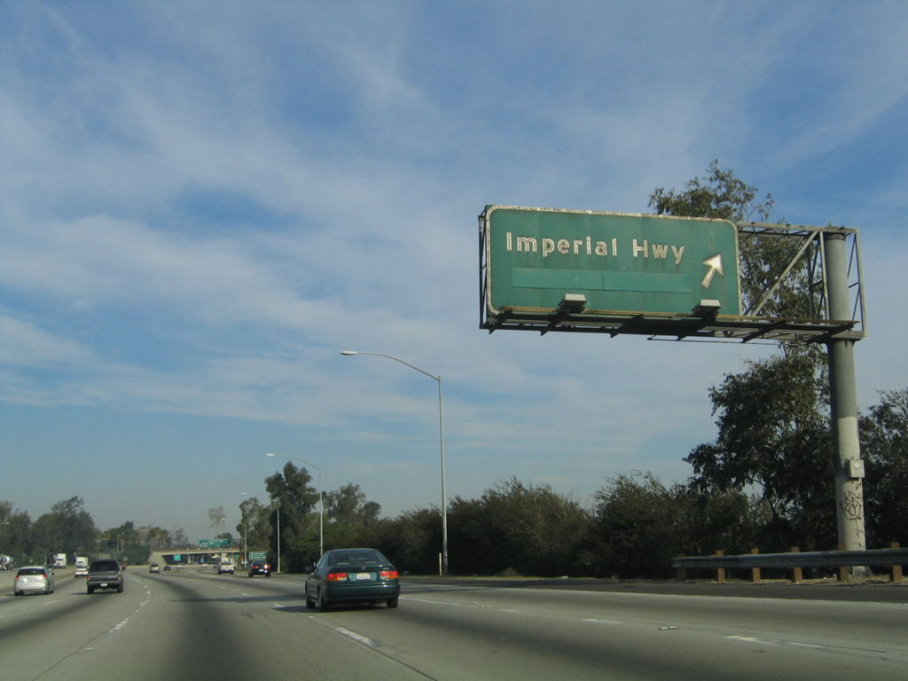
Use Exit 12 (Imperial Highway west) to Lynwood. Although not visible, Interstate 710 continues to parallel the Los Angeles River. Photo taken 11/25/04. | |
 |
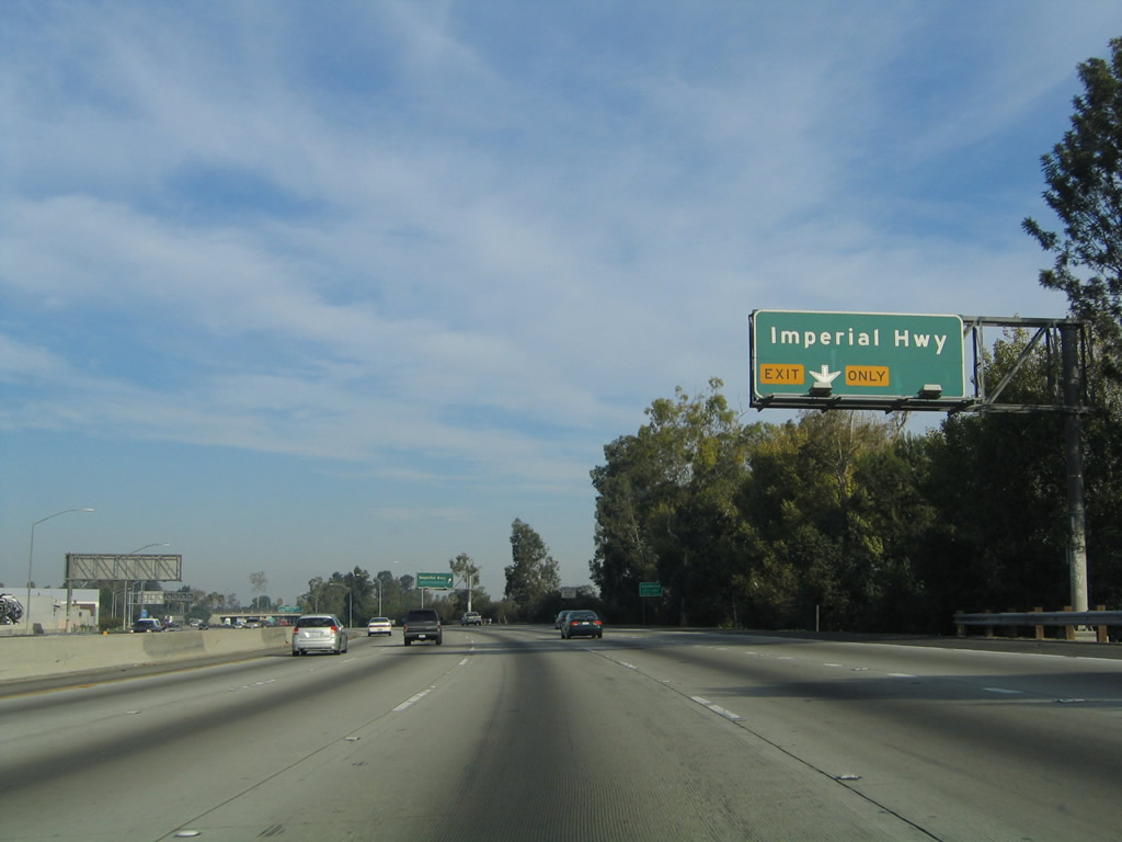 |
The right lane of Interstate 710 (Long Beach Freeway) north becomes exit only for Exit 12, Imperial Highway. Photos taken 11/08/08 and 11/25/04. |
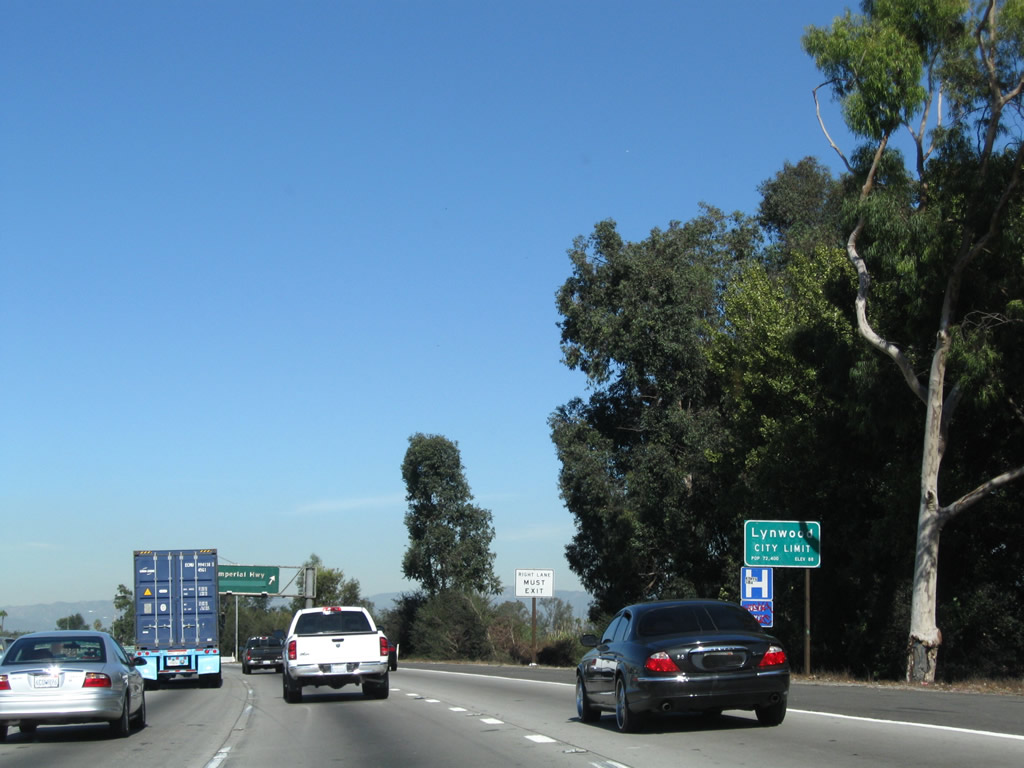 |
Interstate 710 leaves Paramount and enters the city of Lynwood (population 69,845 as of 2000 Census). Photo taken 11/25/04. | |
 |
 |
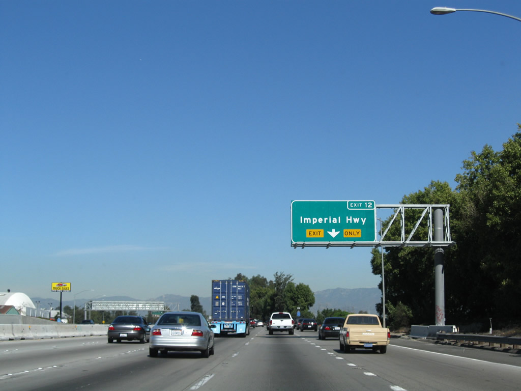
Northbound Interstate 710 (Long Beach Freeway) meets Exit 12, Imperial Highway. Photos taken 05/02/10 and 11/25/04. |
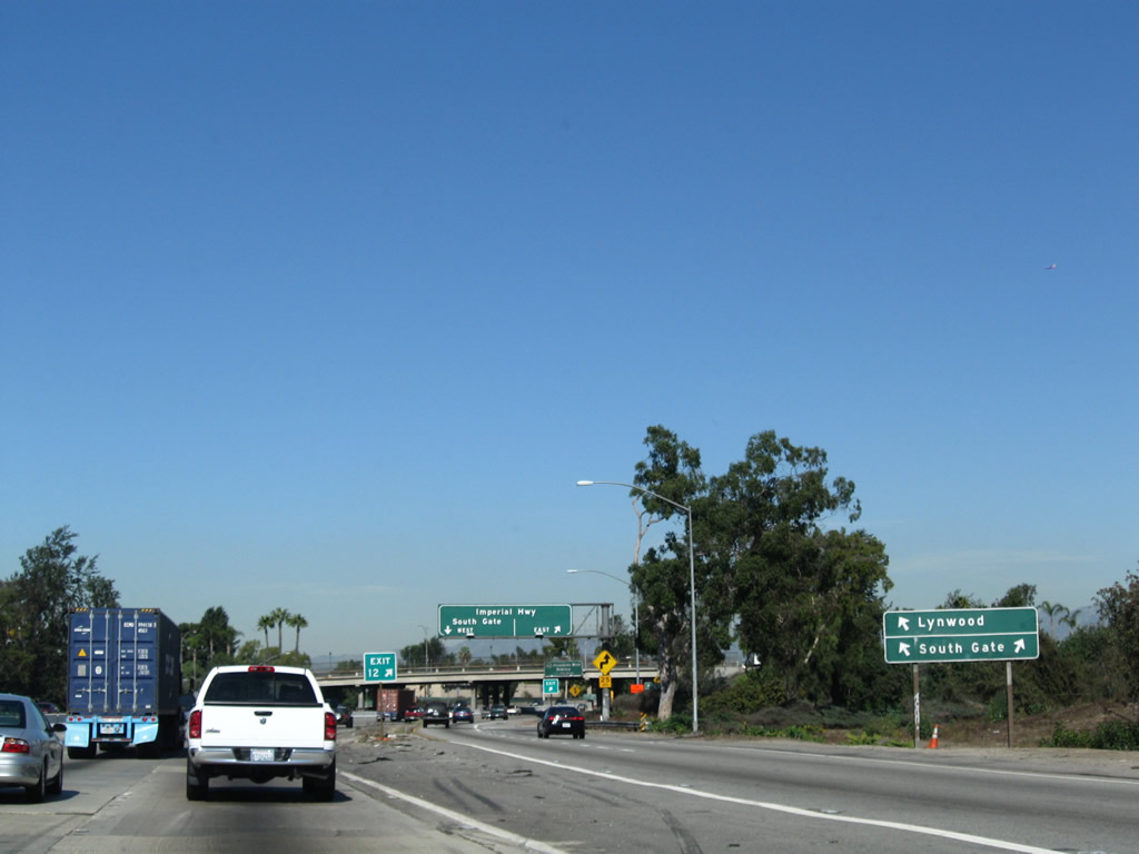 |
Upon exiting at Exit 12, use Imperial Highway east to South Gate and Downey and west to Lynwood and South Gate. Photo taken 11/08/08. | |
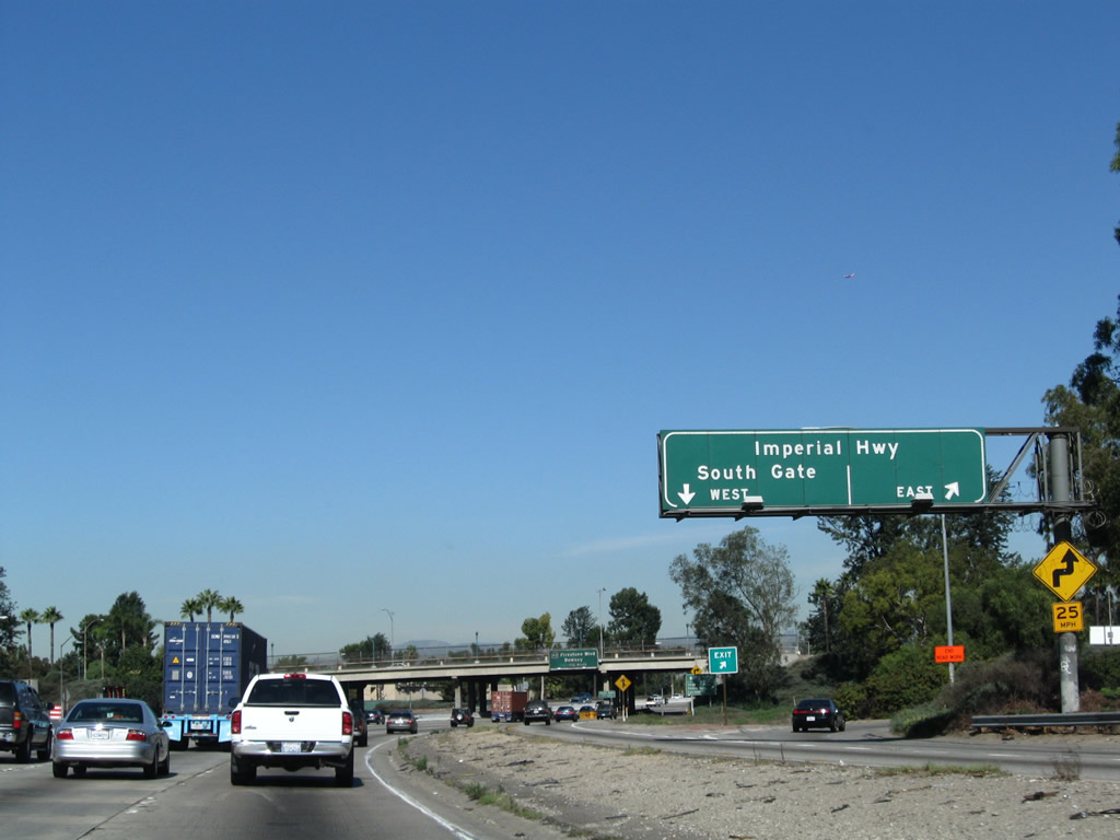 |
The Imperial Highway interchange functions like a modified cloverleaf. The first ramp connects to Imperial Highway east, and the second ramp connects to Imperial Highway west. The collector distributor lane allows traffic to pass through the interchange and return to the northbound freeway. Photo taken 11/08/08. | |
 |
Upon passing under Imperial Highway, Interstate 710 leaves Lynwood and enters the city of South Gate, which was incorporated on January 20, 1923, and was home to 96,375 people as of the 2000 Census. Photo taken 11/25/04. | |
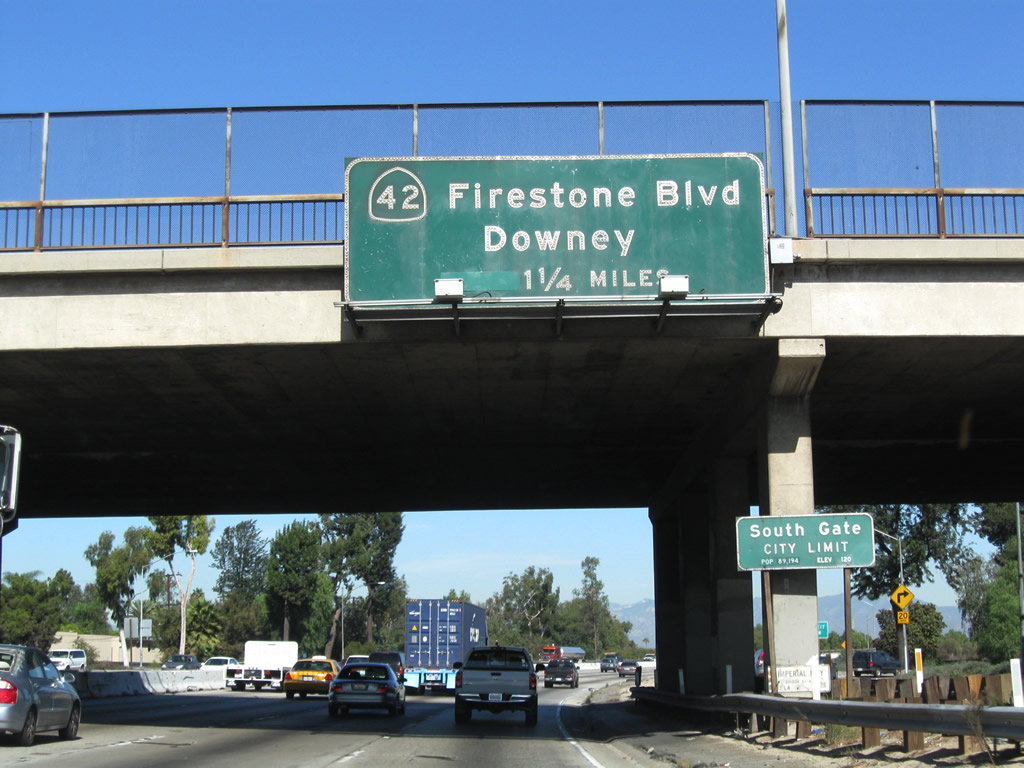 |
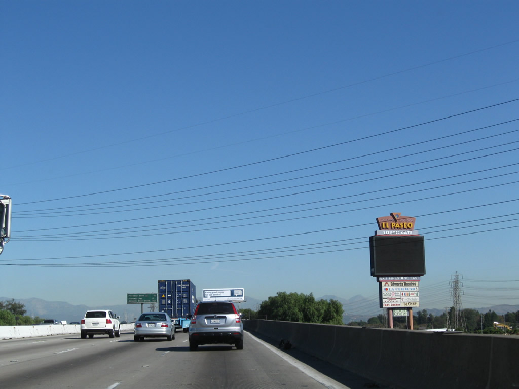
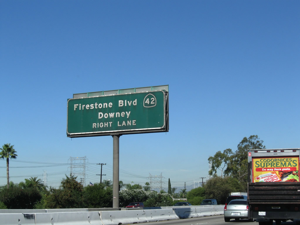
The next exit along Interstate 710 (Long Beach Freeway) north is Exit 13, California 42/Firestone Boulevard. Prior to completion of the Interstate 105 freeway, California 42 was considered to be the main east-west route across this part of the Los Angeles Basin. With the gradual elimination of this route through the 1990s after Interstate 105 opened in 1993 (as municipalities along its route took it over and added the street into their respective street networks), California 42 gradually faded into oblivion. The state no longer maintains any portion of former California 42 (at one time defined along Firestone Boulevard and Manchester Boulevard from Los Angeles near Playa del Rey east to Norwalk). Residual signs for California 42 remain, such as this overhead guide sign on Interstate 710 north. Photo taken 11/08/08. | |
 |
Graffiti seems to be a never-ending problem for signs along Interstate 710, including this northbound reassurance shield. Photo taken 11/08/08. | |
 |
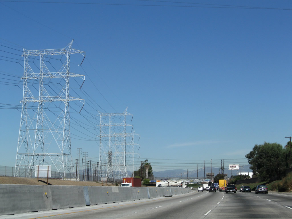
Passing under these Los Angeles Department of Water and Power lines indicates that Interstate 710 is passing over the Los Angeles River. Photo taken 11/08/08. | |
 |
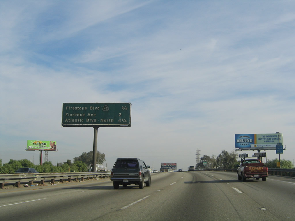 |
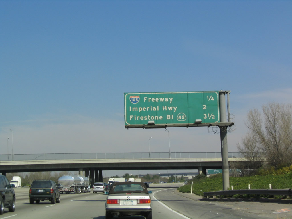
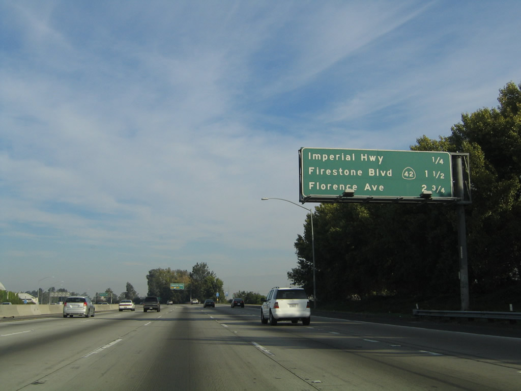
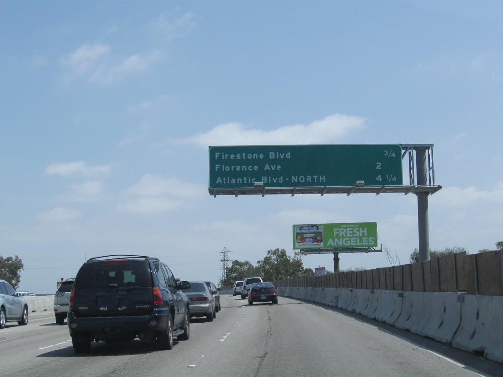
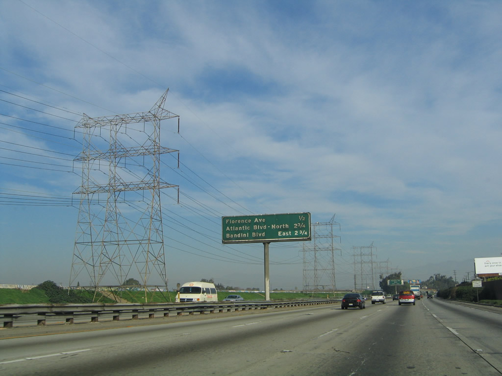
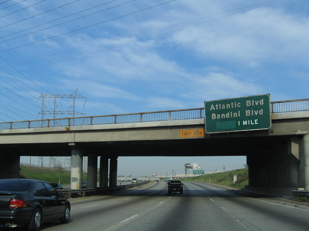
This mileage sign along northbound Interstate 710 (Long Beach Freeway) provides the distance to the next four exits: Exit 13, Firestone Boulevard (former California 42); Exit 15, Florence Avenue; Exit 17A, Bandini Boulevard east and Atlantic Boulevard north; and Exit 17B, Bandini Boulevard west and Atlantic Boulevard south. Photos taken 05/02/10 and 11/25/04. |
 |
 |
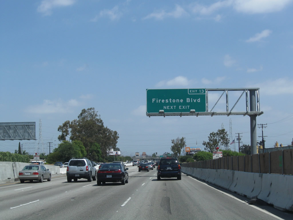
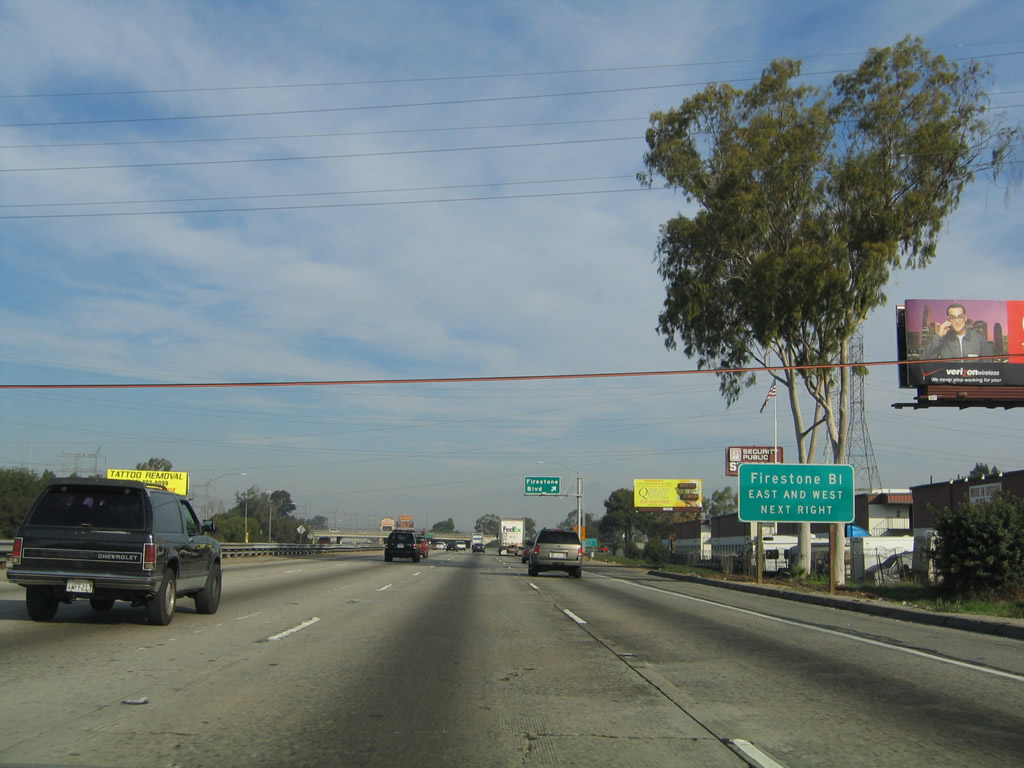
The next exit along Interstate 710 (Long Beach Freeway) north is Exit 13, Firestone Boulevard (former California 42). The overhead signs were moved from the median barrier to the side of the freeway; the new signs include the exit number and omit the former state route designation. Photos taken 05/02/10 and 11/08/08. |
 |
Use the Exit 13 off-ramp to both directions of Firestone Boulevard (via a collector distributor lane configuration). Photo taken 11/25/04. | |
 |
Northbound Interstate 710 reaches Exit 13, Firestone Boulevard (former California 42) east to Downey and west to South Gate. Photo taken 11/08/08. | |
 |
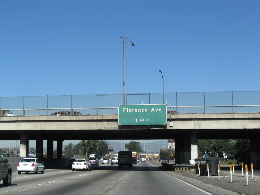 |
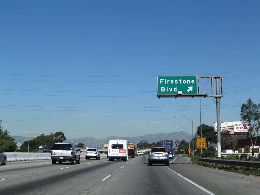
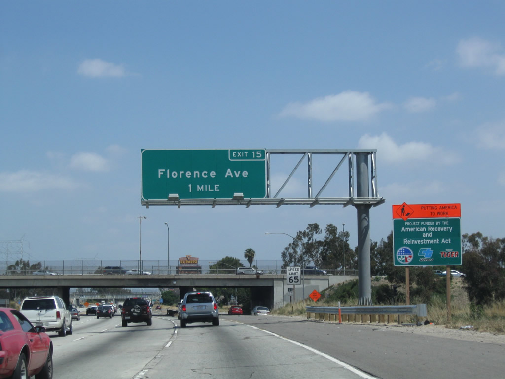
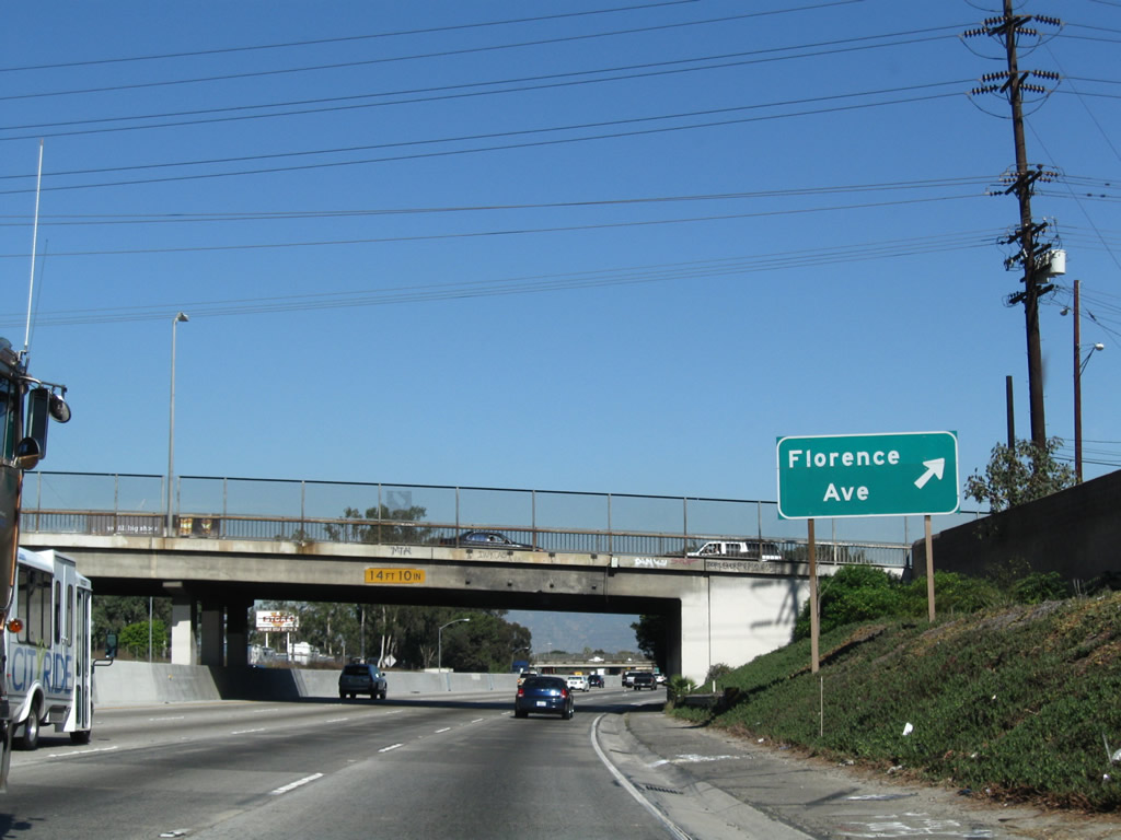
The next exit along Interstate 710 (Long Beach Freeway) north is Exit 15, Florence Avenue. As a result of ongoing construction along Interstate 710, the advance guide sign for Exit 15 was moved off the Firestone Boulevard overpass and instead is posted now on its own sign bridge. Photos taken 05/02/10 and 11/08/08. |
 |
 |
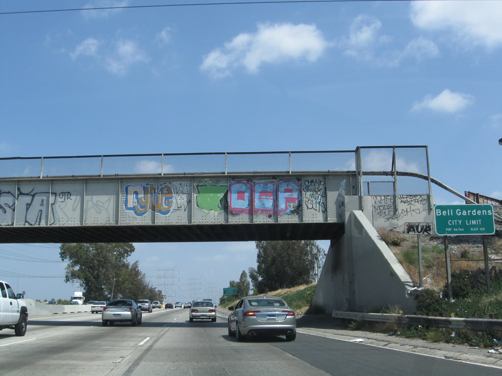
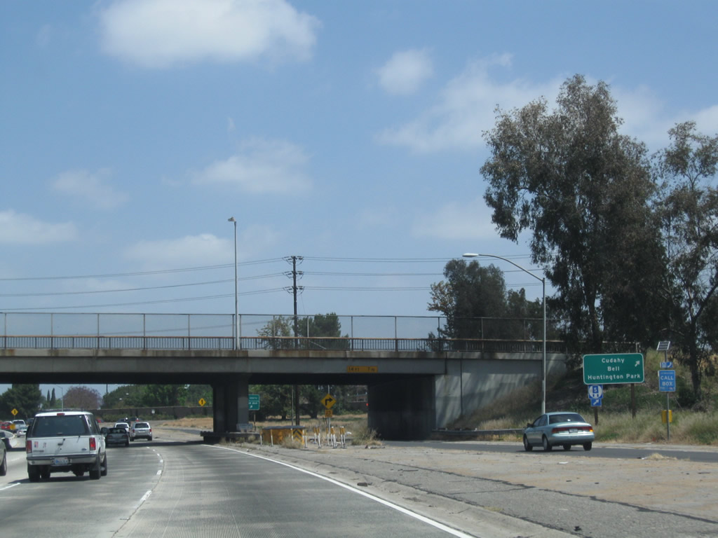
Interstate 710 (Long Beach Freeway) enters the city of Bell Gardens; back in 2008, the city limits sign erroneously stated that Interstate 710 entered the city of Bell at this point. From this Union Pacific overpass north to the Exit 15 cloverleaf interchange with Florence Avenue, Interstate 710 will serve as the eastern boundary of the city of Cudahy (population 24,208 as of the 2000 Census and incorporated on November 10, 1960) and the western boundary of the city of Bell Gardens (population 44,054 as of the 2000 Census and incorporated on August 1, 1961). Photos taken 05/02/10 and 11/08/08. |
 |
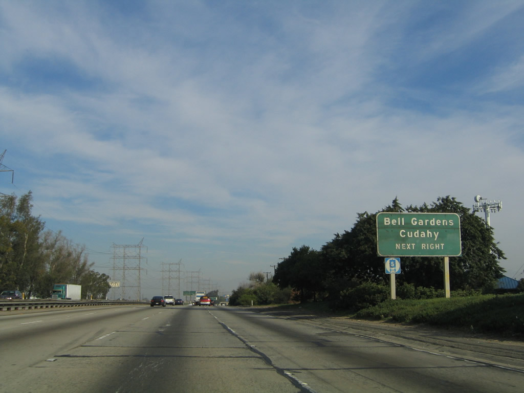 |
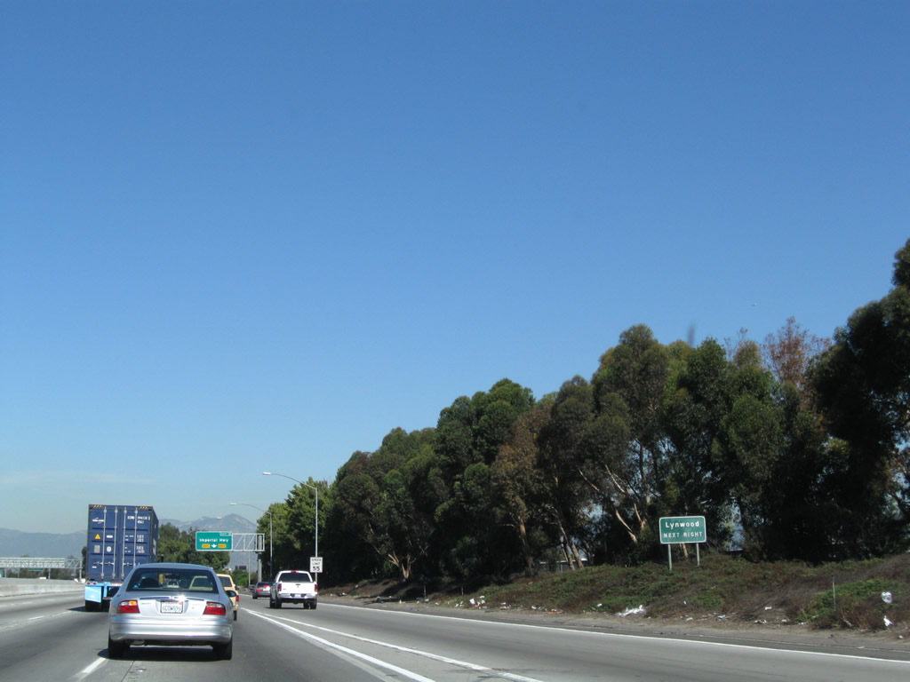
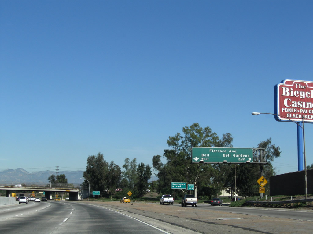
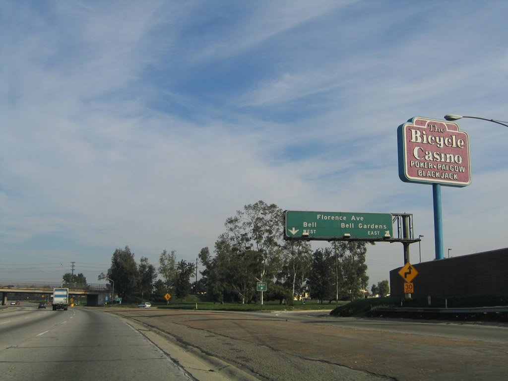
The next sign advises that motorists may use the Florence Avenue interchange to Cudahy and Bell Gardens. A set of major Los Angeles Department of Water and Power transmission lines joins the freeway at this point. They will follow Interstate 710 north on a path between the Los Angeles River (which parallels the freeway to the west) and the freeway itself. Photos taken 05/02/10 and 11/25/04. |
 |
 |
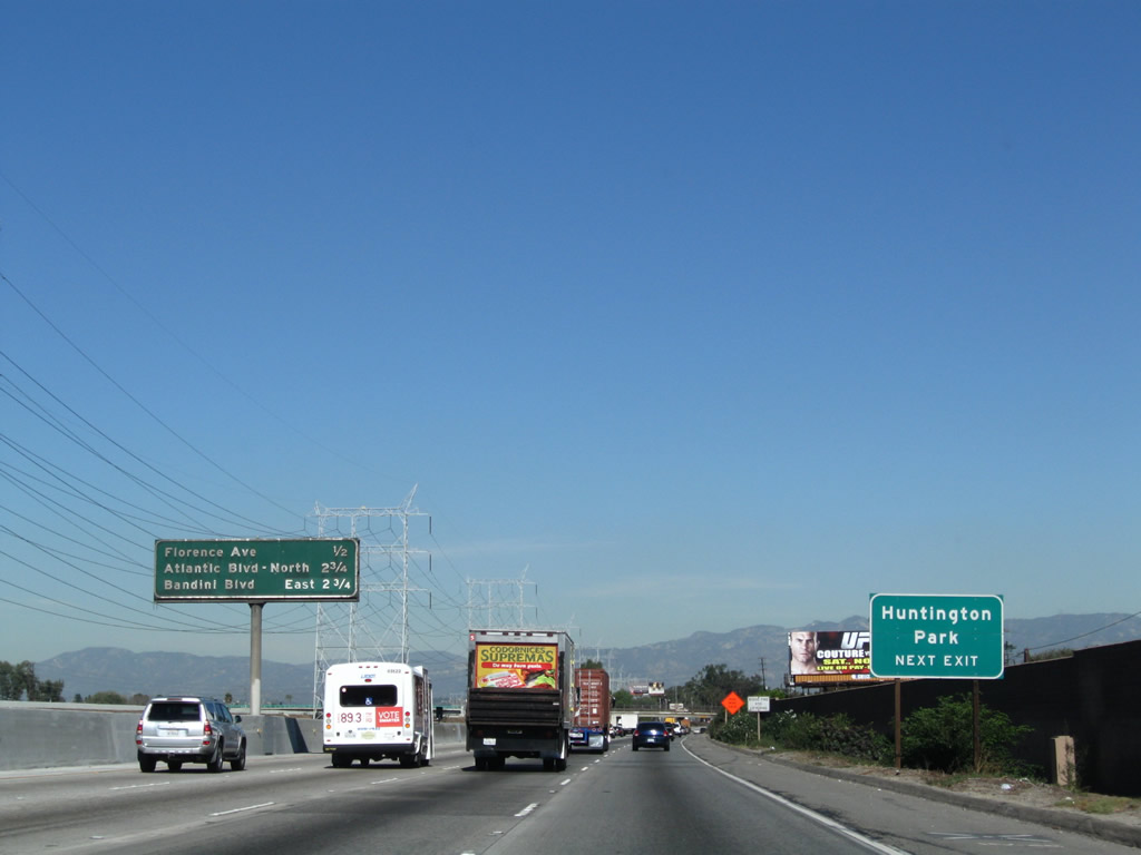
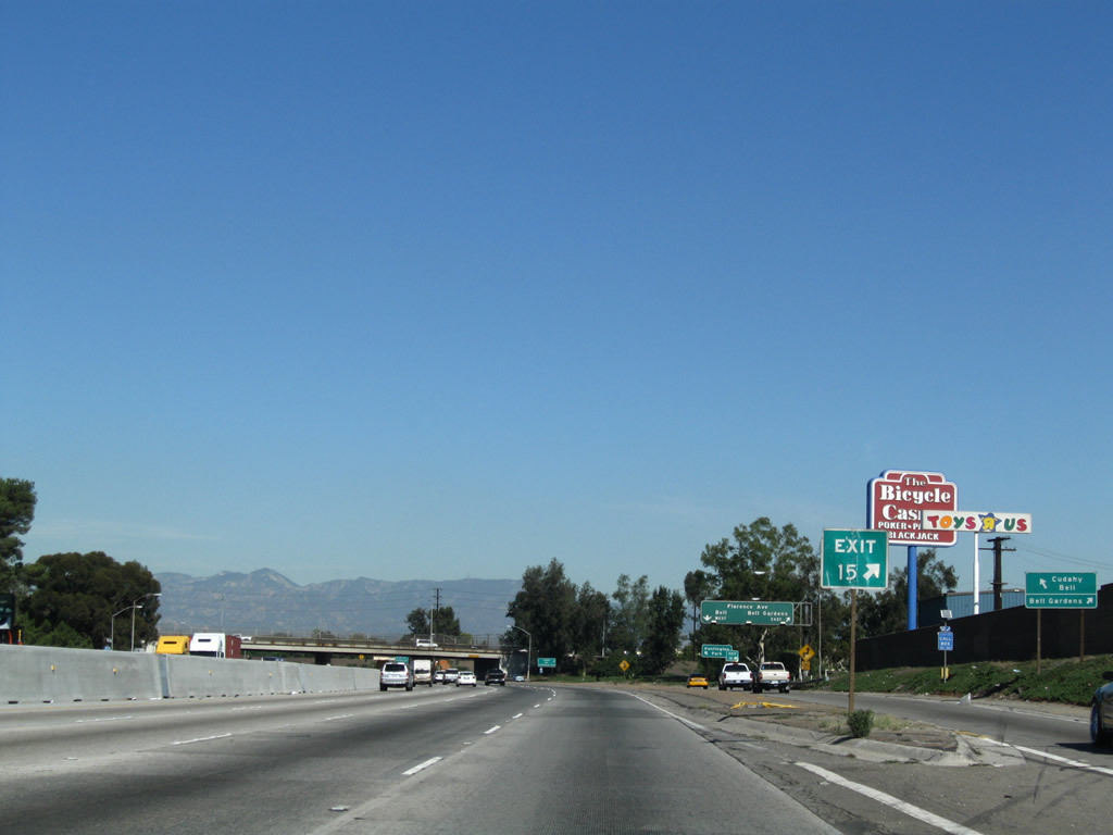
This mileage sign along northbound Interstate 710 (Long Beach Freeway) provides the distance to the next three exits: Exit 15, Florence Avenue; Exit 17A, Bandini Boulevard east and Atlantic Boulevard north; and Exit 17B, Bandini Boulevard west and Atlantic Boulevard south. An additional sign indicating that Florence Avenue travels west to the city of Huntington Park was added by 2008. Photos taken 11/08/08 and 11/25/04. |
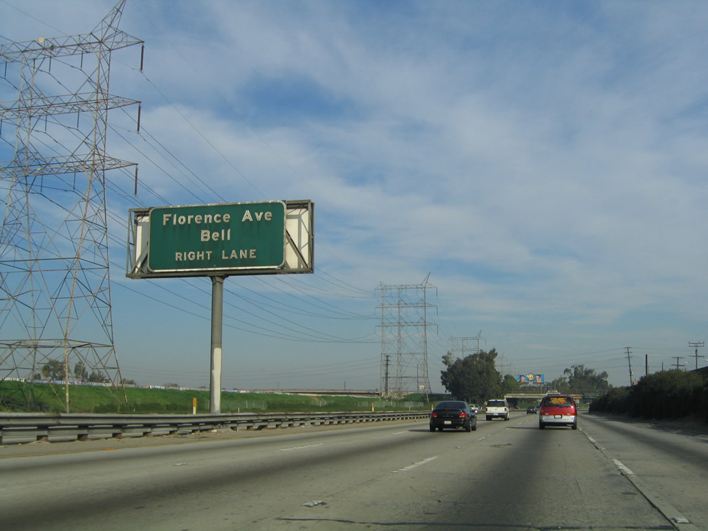 |
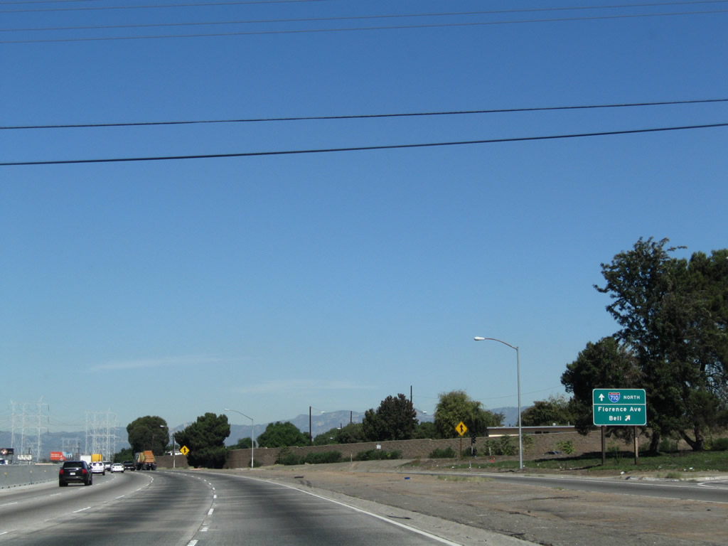
The next exit along Interstate 710 (Long Beach Freeway) north is Exit 15, Florence Avenue. This older porcelain-enamel sign was still in place as of May 2010. Use Florence Avenue west to the city of Bell; Interstate 710 will enter Bell upon entering the cloverleaf interchange at Exit 15. Photo taken 11/08/08. | |
 |
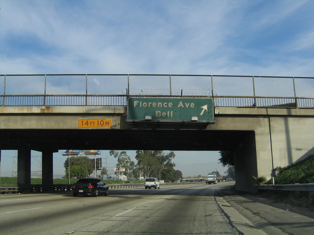 |
Northbound Interstate 710 (Long Beach Freeway) meets Exit 15, Florence Avenue. This is a modified cloverleaf interchange, with the first ramp linking to Florence Avenue east to Bell Gardens and Downey. The second ramp links to Florence Avenue west to Bell, Cudahy, and Huntington Park. The overhead sign, an original porcelain-enamel guide sign, was removed, and a roadside sign was placed by 2008 (and is still in place as of May 2010). The freeway passes under Clara Street, which passes over both Interstate 710 and the Los Angeles River to connect Cudahy to the west with Bell Gardens to the east. Photos taken 11/08/08 and 11/25/04. |
 |
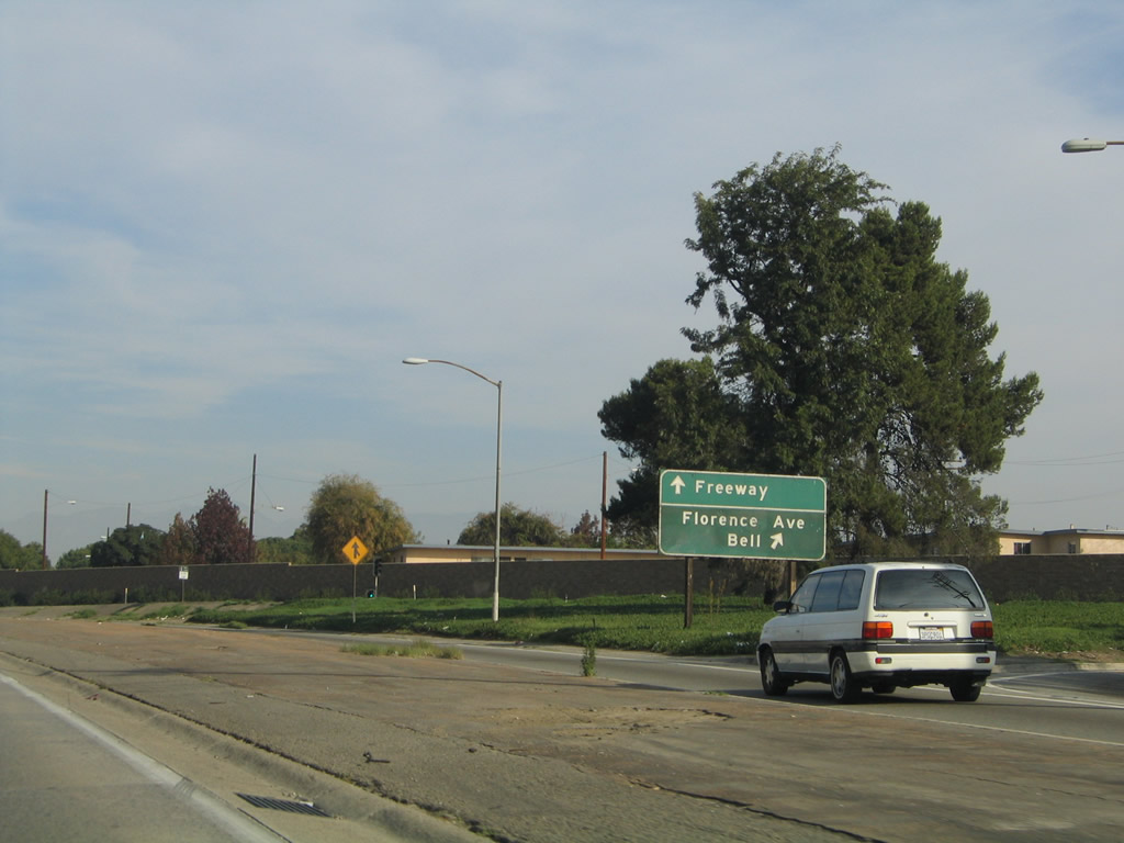
The gore point for Exit 15, Florence Avenue includes the exit number. Auxiliary signage points the way to the nearby cities. Photo taken 11/08/08. | |
 |
 |
Additional signage for nearby cities was added between 2004 and 2008 to the collector distributor lane for the connection from Interstate 710 (Long Beach Freeway) north to Florence Avenue at Exit 15. Photos taken 11/08/08 and 11/25/04. |
 |
The second ramp in this modified cloverleaf interchange connects to Florence Avenue west to Cudahy, Bell, and Huntington Park. Photo taken 05/02/10. | |
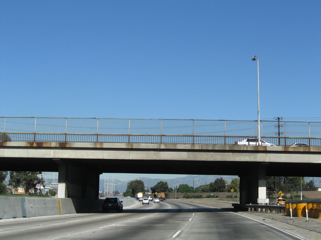 |
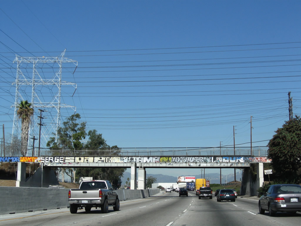
Interstate 710 passes under the Florence Avenue overpass. Photo taken 11/08/08. | |
 |
 |
The gore point sign for the loop ramp from Interstate 710 north to Florence Avenue west was replaced between 2004 and 2008. Photos taken 11/08/08 and 11/25/04. |
 |
Traffic from the collector distributor lanes merges back onto Interstate 710 north after the Florence Avenue interchange. Photo taken 11/08/08. | |
 |
This mileage sign along northbound Interstate 710 (Long Beach Freeway) provides the distance to the next two exits: Exit 17A, Bandini Boulevard east and Atlantic Boulevard north and Exit 17B, Bandini Boulevard west and Atlantic Boulevard south. Photo taken 11/08/08. | |
 |
 |
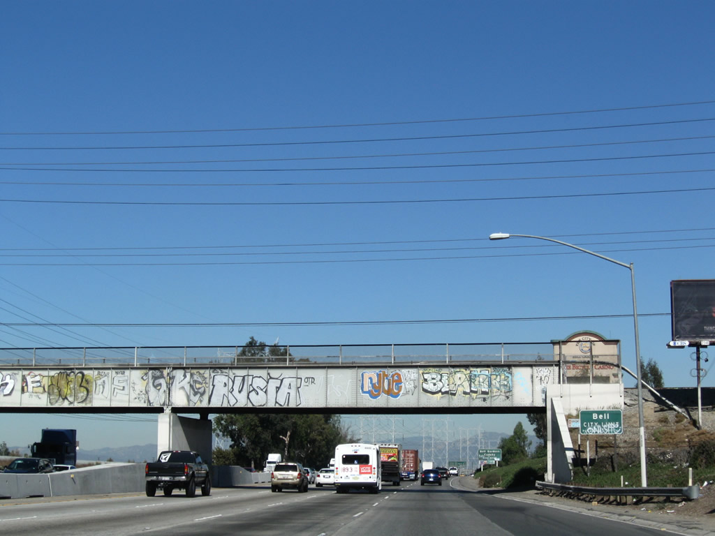
The freeway, power lines, and river all curve toward the northeast. Between Exits 15 and the Union Pacific Railroad overpass (second picture), Interstate 710 serves as the boundary between Bell on the west and Bell Gardens on the east. After the railroad overpass, Interstate 710 will stay in the city of Bell (population 36,664 as of the 2000 Census and incorporated on November 7, 1927) until the Bandini Boulevard interchange (Exits 17A-B). Bell received national notoriety as a result of a scandal in July 2010 involving high-ranking city officials allegedly paying themselves some of the highest salaries of comparable jobs in the region. This scandal resulted in official and media reviews of city official salaries for government jobs in local and regional posts throughout Southern California.1,2 Photos taken 11/08/08. |
 |
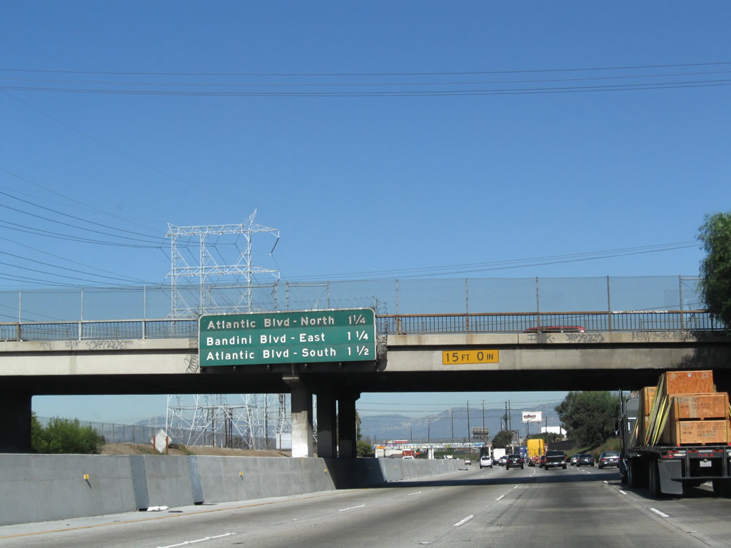
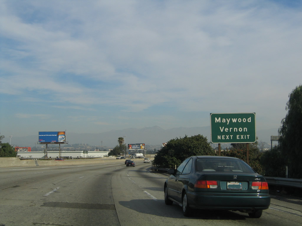
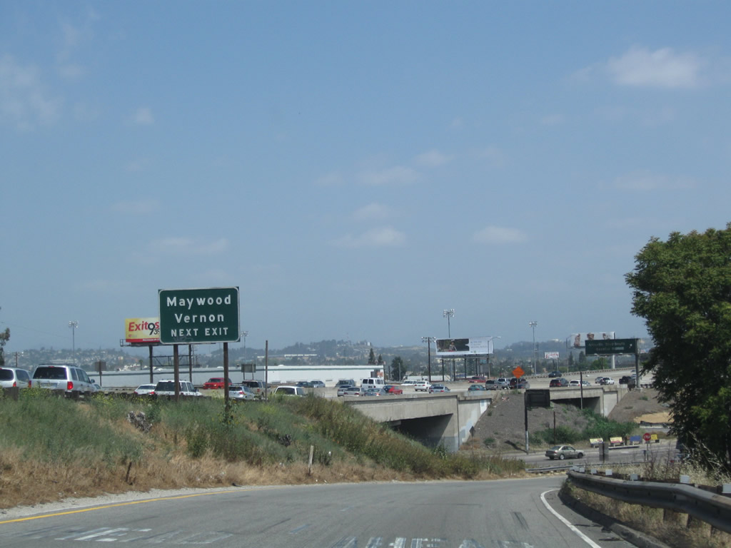
The next two exits along Interstate 710 (Long Beach Freeway) north are Exit 17A, Atlantic Boulevard north and Exit 17B, Bandini Boulevard east/west and Atlantic Boulevard south. This sign is mounted on the Slauson Avenue overpass. Interstate 710 remains in the city of Bell, but it briefly skirted the edge of the City of Commerce briefly (between the railroad and the Slauson Avenue overpass). From here north to Exits 17A-B, Interstate 710 serves as the boundary between Bell on the east (yes, east) and the cities of Maywood and Vernon on the west. Photo taken 11/25/04. | |
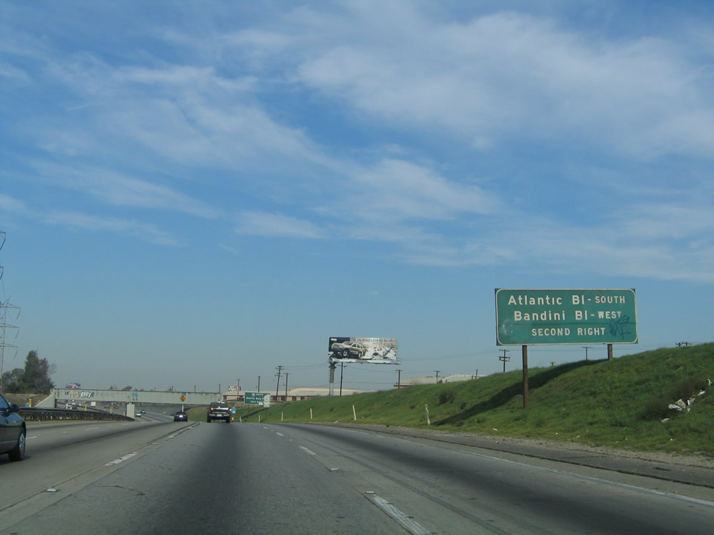 |
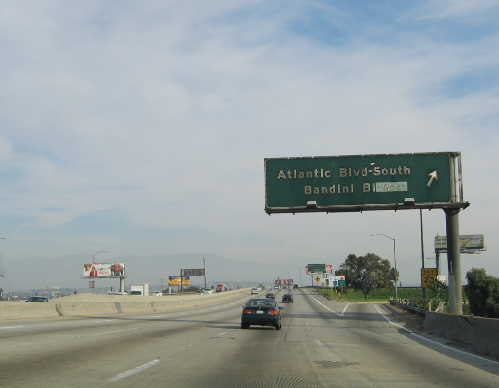
The interchange between Interstate 710 (Long Beach Freeway) and Exits 17A-B, Atlantic Boulevard and Bandini Boulevard is rather complicated due to the orientation of the various roadways. Interstate 710 approaches from the south, while Atlantic Boulevard travels southwest-northeast and Bandini Boulevard travels northwest-southeast. The three roads converge at one point, resulting in some complicated ramp arrangements; see Google Maps for the unusual arrangement. The first ramp is Exit 17A, linking to Atlantic Boulevard north and Bandini Boulevard east; the second ramp links to Exit 17B, Atlantic Boulevard south and Bandini Boulevard west. Photo taken 11/25/04. | |
 |
Interstate 710 passes under the Burlington Northern Santa Fe Railroad overpass. To Interstate 5 (Santa Ana Freeway) south, use Exit 17A, Atlantic Boulevard north. Photo taken 11/25/04. | |
 |
The right lane of Interstate 710 north becomes exit only for Exit 17A, Atlantic Boulevard north and Bandini Boulevard east. Photo taken 05/02/10. | |
 |
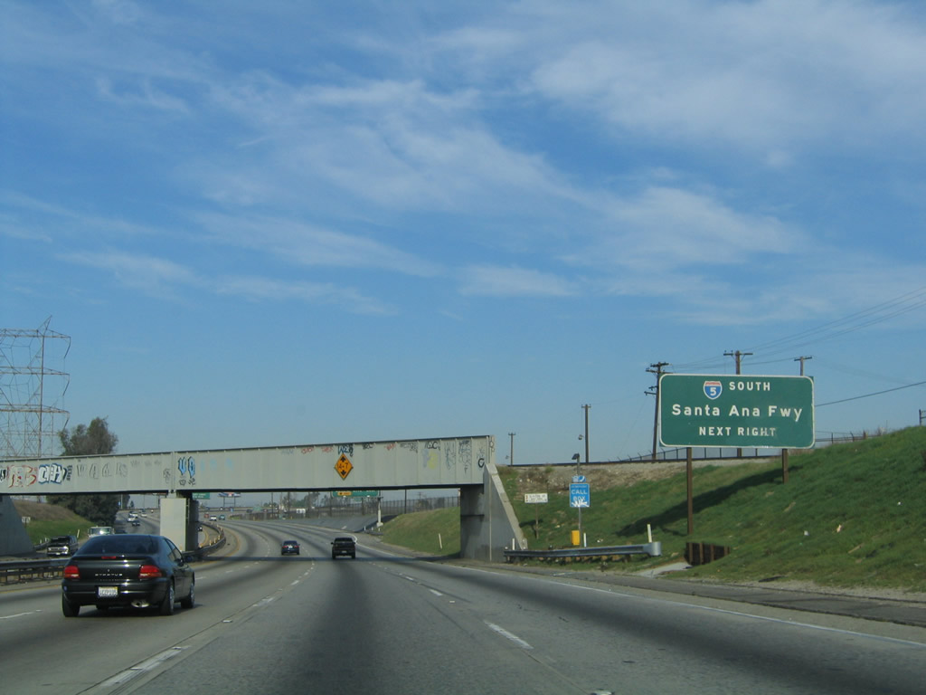
Stay left for the connection from Interstate 710 (Long Beach Freeway) north to Interstate 5 (Santa Ana Freeway) north at Exit 18A. Photo taken 05/02/10. | |
 |
During times of high traffic or detours, motorists may also connect with Interstate 5 north by way of Interstate 710 north to Interstate 10 east. This helps to avoid the East Los Angeles Interchange, which can be a traffic delay during commuting hours and other periods of congestion. Photo taken 11/25/04. | |
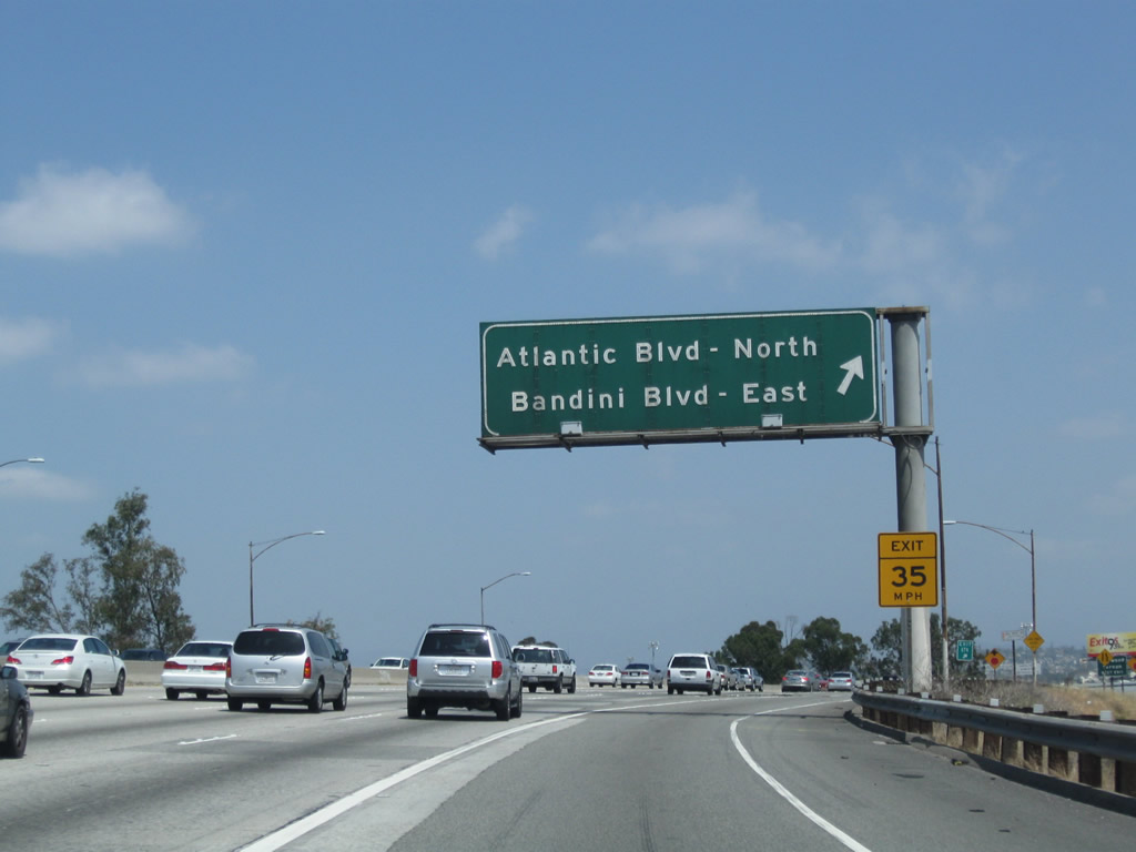 |
Northbound Interstate 710 (Long Beach Freeway) meets Exit 17A, Atlantic Boulevard north and Bandini Boulevard east. Use Atlantic Boulevard northeast to the City of Commerce and unincorporated East Los Angeles. Use Bandini Boulevard east to the northeastern section of Bell and more of the City of Commerce. Photo taken 05/02/10. | |
 |
 |
After the off-ramp to Exit 17A, Interstate 710 curves north again, separating from the Los Angeles River for the first time since its origins in Long Beach. As we curve northeast, Interstate 710 leaves Bell and enters the city of Vernon, "Exclusively Industrial: The City that Does More." Vernon had a population of 91 as of the 2000 Census, as it is largely located within the industrial areas south of downtown Los Angeles. The city was incorporated on September 22, 1905. Photos taken 11/25/04 and 05/02/10. |
 |
Northbound Interstate 710 (Long Beach Freeway) reaches Exit 17B, Atlantic Boulevard south and Bandini Boulevard west. Use Atlantic Boulevard southwest into the city of Maywood. Incorporated on September 2, 1924, Maywood had a population of 28,083 as of the 2000 Census. Like neighboring Bell and Vernon, Maywood has been impacted by various political difficulties, including the outsourcing of most governmental services to other entities in June 2010.3 Photo taken 11/25/04. | |
Sources:
- L.A. County D.A. expands probe into Bell government by Richard Winton, Jeff Gottlieb and Andrew Blankstein, July 28, 2010, Los Angeles Times
- Bell councilman 'ashamed,' 'disgusted' that Rizzo earned $1.5 million by Jeff Gottlieb and Ruben Vives, August 08, 2010, Los Angeles Times
- Maywood to hire others to run the city by Ruben Vives, Jeff Gottlieb and Hector Becerra, June 23, 2010, Los Angeles Times

Page Updated November 22, 2010.
|
About Contact Glossary |
In The News Interstate Guide |
Social Media:
 |
|
© 2000-25 AARoads.com | All Rights Reserved | Privacy Policy / Terms of Use
|
||