In Ventura County, U.S. 101 passes through the major cities of that county, narrowing down to four lanes for the first time since downtown Los Angeles. Since most north-south, intrastate traffic utilizes Interstate 5 through the Central Valley, most traffic along U.S. 101 is headed for Santa Barbara or the Central Coast (San Luis Obispo). U.S. 101 returns within sight of the coast in the vicinity of Oxnard and Ventura, where it picks up California 1 (the Pacific Coast Highway). For the first time, farms are visible along U.S. 101 at varying intervals, especially east of Camarillo.
| U.S. 101 (Ventura Freeway / El Camino Real) north |
|
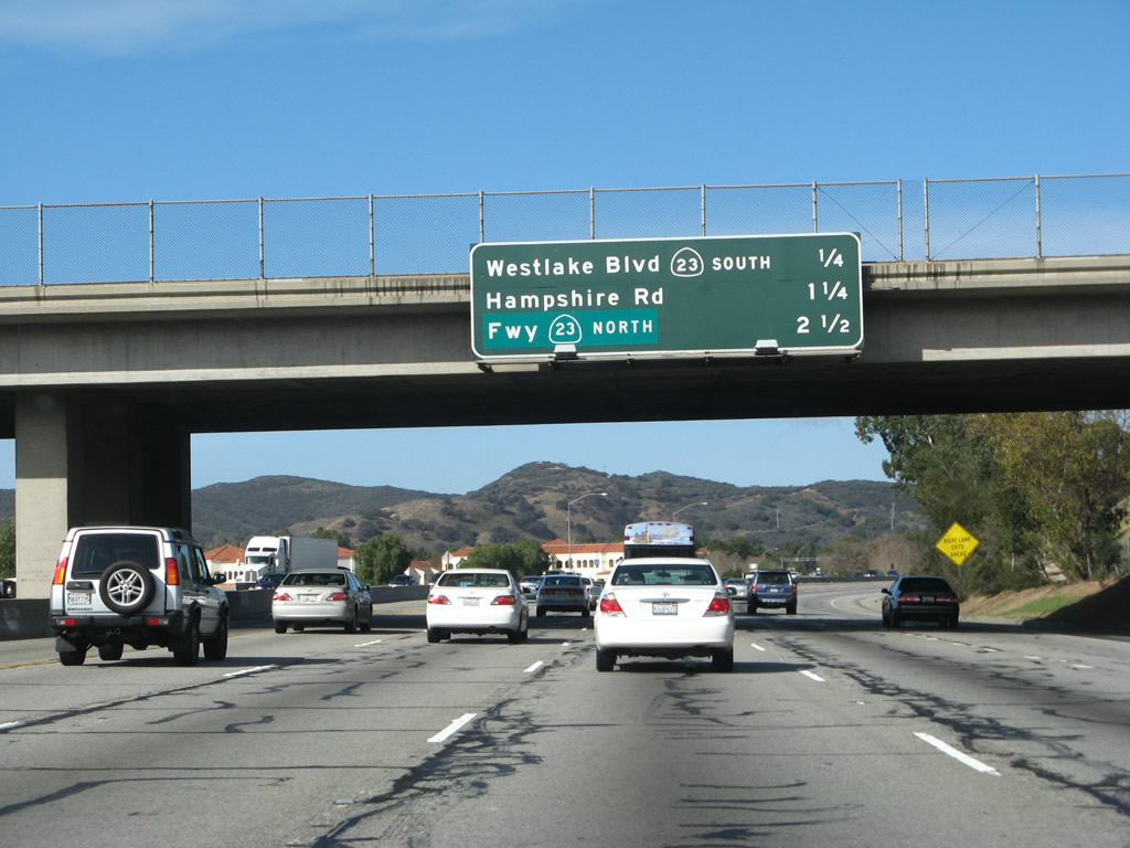
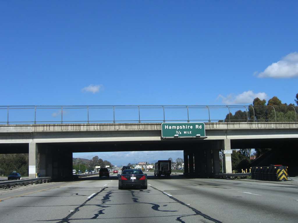
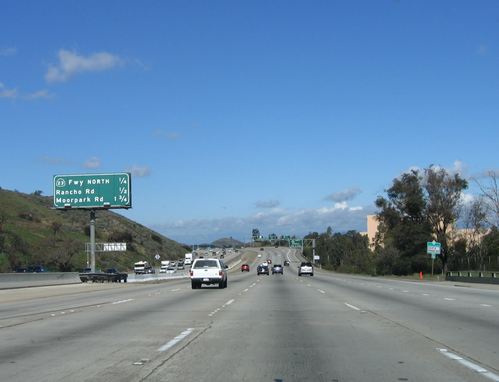
Now in Ventura County, the next three exits along U.S. 101 (Ventura Freeway) north are: Exit 40, California 23/Westlake Boulevard south; Exit 41, Hampshire Road; and Exit 43A, California 23 freeway north to Moorpark and Fillmore. Photo taken 02/02/08. |
|
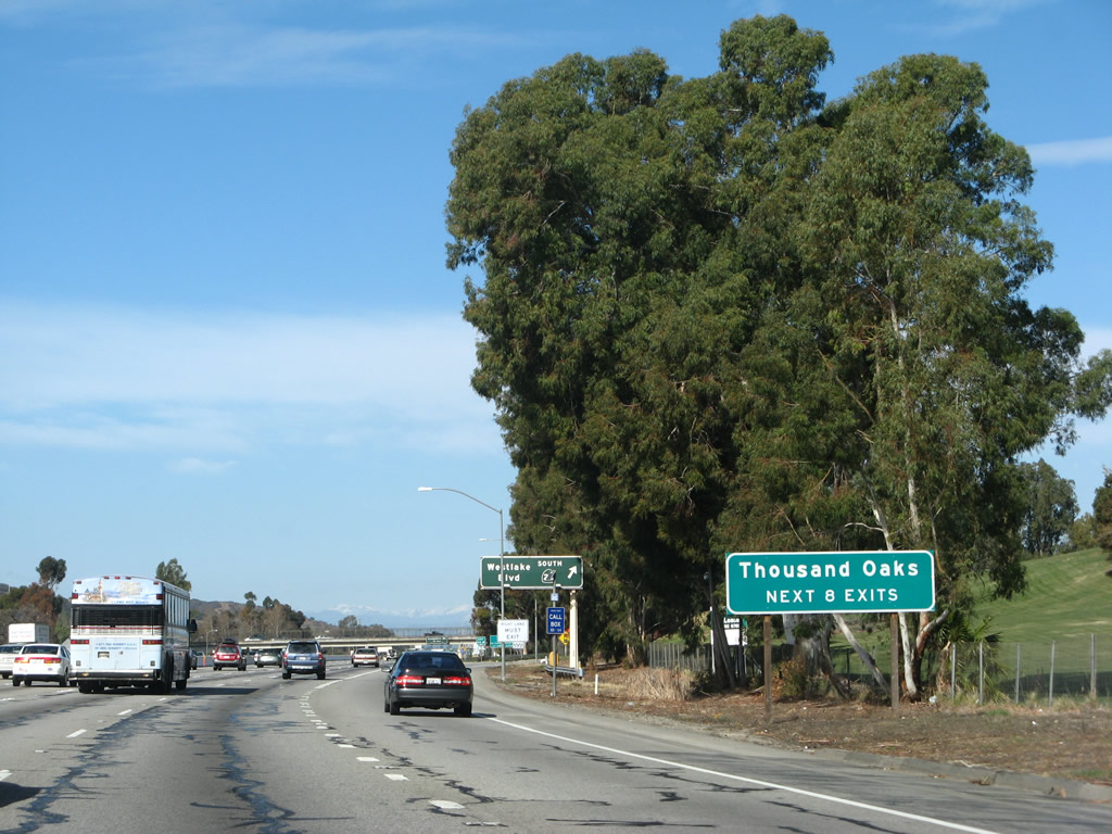
The next eight exits all serve the city of Thousand Oaks, which is the easternmost city in Ventura County and is located in the Conejo Valley. An entirely master planned community, Thousand Oaks incorporated as a city on September 29, 1964, and consists of several smaller planned communities. The California 23 freeway bisects the city, while U.S. 101 stays close to the southern edge of the city. Photo taken 02/02/08. |
|
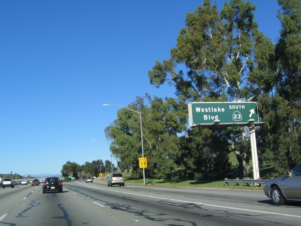
California 23 is a state highway that originates on California 1 (Pacific Coast Highway) west of Malibu near El Pescador State Beach and travels north via Decker Road through the Santa Monica Mountains. Upon crossing the Los Angeles-Ventura County line, California 23 follows Westlake Road into Westlake Village, where it connects to U.S. 101. U.S. 101 and California 23 merge together between Westlake Village and Thousand Oaks, and while U.S. 101 travels west toward Oxnard and Ventura, California 23 continues due north along a freeway to Moorpark. At the California 118 interchange, California 23 enters Moorpark and then follows a two-lane conventional highway north to Fillmore, where the state route ends at its intersection with California 126. Photo taken 12/23/04. |
|
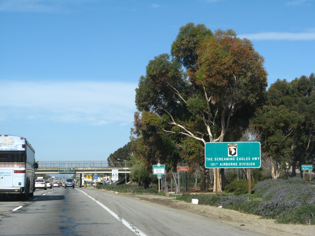
This section of U.S. 101 also designated as the "Screaming Eagles Highway (101st Airborne Division)." Photo taken 02/02/08. |
| U.S. 101 (Ventura Freeway) and California 23 north |
|
The next exit along U.S. 101 (Ventura Freeway) and California 23 north is Exit 41, Hampshire Road. Photo taken 12/23/04. |
|
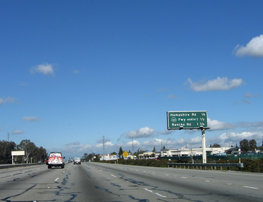
This mileage sign provides the distance to the next three exits along U.S. 101 (Ventura Freeway) north: Exit 41, Hampshire Road; Exit 43A, California 23 freeway north to Moorpark and Fillmore; and Exit 43B, Rancho Road. Photo taken 02/02/08. |
|
An auto tour sign for the Juan Bautista de Anza Trail is posted on U.S. 101 north. Photo taken 03/18/06. |
|
Northbound U.S. 101 (Ventura Freeway) and California 23 reach Exit 41, Hampshire Road. The next off-ramp is for Exit 43A, California 23 freeway north to Fillmore. Photo taken 03/18/06. |
|
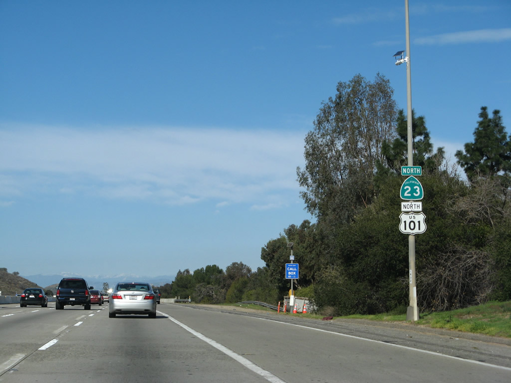
California 23 takes precedence over U.S. 101 in this reassurance shield assembly along northbound U.S. 101 (Ventura Freeway) and California 23 prior to Exit 43A, California 23 freeway north. Photo taken 02/02/08. |
|
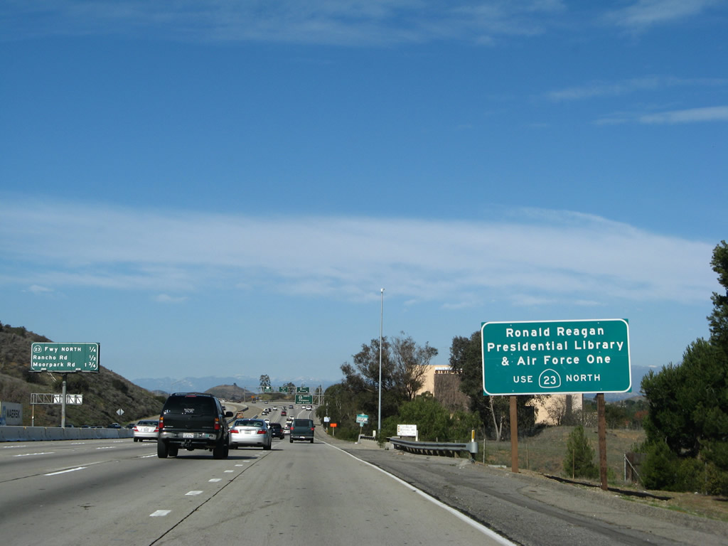
Use California 23 north to the Ronald Reagan Presidential Library in Simi Valley. In October 2005, President Reagan's Air Force One was permanently opened for the public to see at the library. Photo taken 02/02/08. |
|
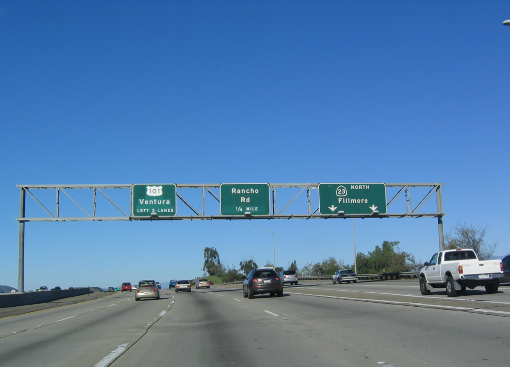
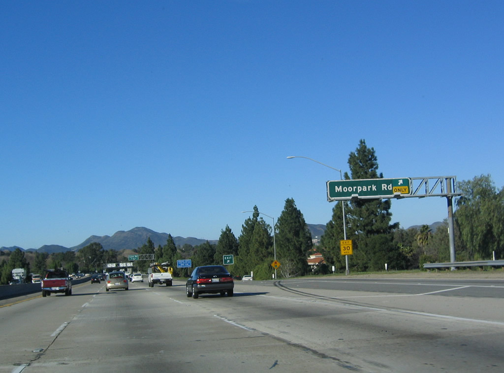
This mileage sign provides the distance to the next three exits along U.S. 101 (Ventura Freeway) north: Exit 43A, California 23 north to Moorpark and Fillmore; Exit 43B, Rancho Road; and Exit 44, Moorpark Road. Photo taken 02/02/08. |
|
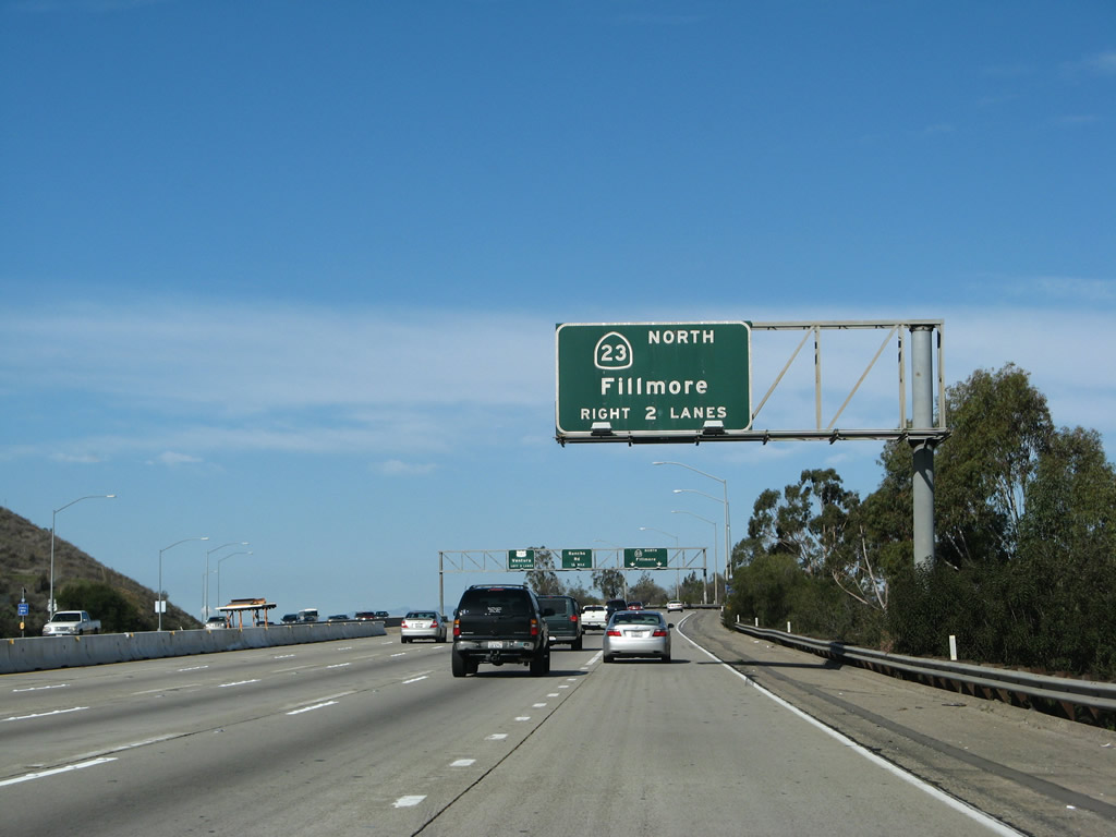
The right two lanes of northbound U.S. 101 (Ventura Freeway) will connect to California 23 north at Exit 43A. Note that the exit utilizes the far right lane as an exit-only lane, and the second lane from the right is an "optional" lane that permits either exit onto the California 23 freeway or remaining on U.S. 101 northbound. Photo taken 02/02/08. |
|
Northbound U.S. 101 (Ventura Freeway) reaches Exit 43A, California 23 north. Again note the variation in pavement color to differentiate through traffic from exit lanes. Also notice that the entire U.S. 101 through traffic sign has been overlaid with a new shield, control city, and number of lanes for through traffic. Photo taken 12/23/04. |
| U.S. 101 (Ventura Freeway / El Camino Real) north |
|
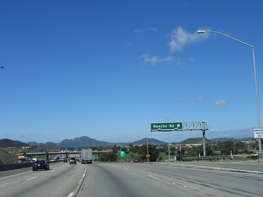
Immediately thereafter, northbound U.S. 101 (Ventura Freeway) reaches Exit 43B, Rancho Road in Thousand Oaks. Photo taken 03/18/06. |
|
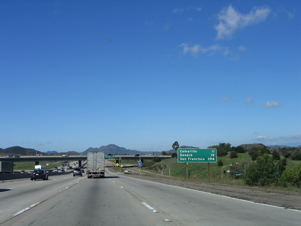
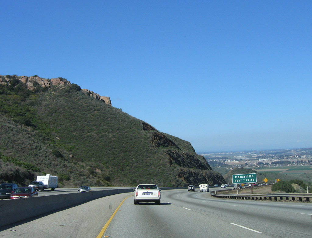
This mileage sign along northbound U.S. 101 (Ventura Freeway) provides the distance to Camarillo (11 miles), Oxnard (19 miles), and new control city of San Francisco (394 miles). Omitted is the distance to Ventura, which has been the control city since leaving downtown Los Angeles. Photo taken 03/18/06. |
|
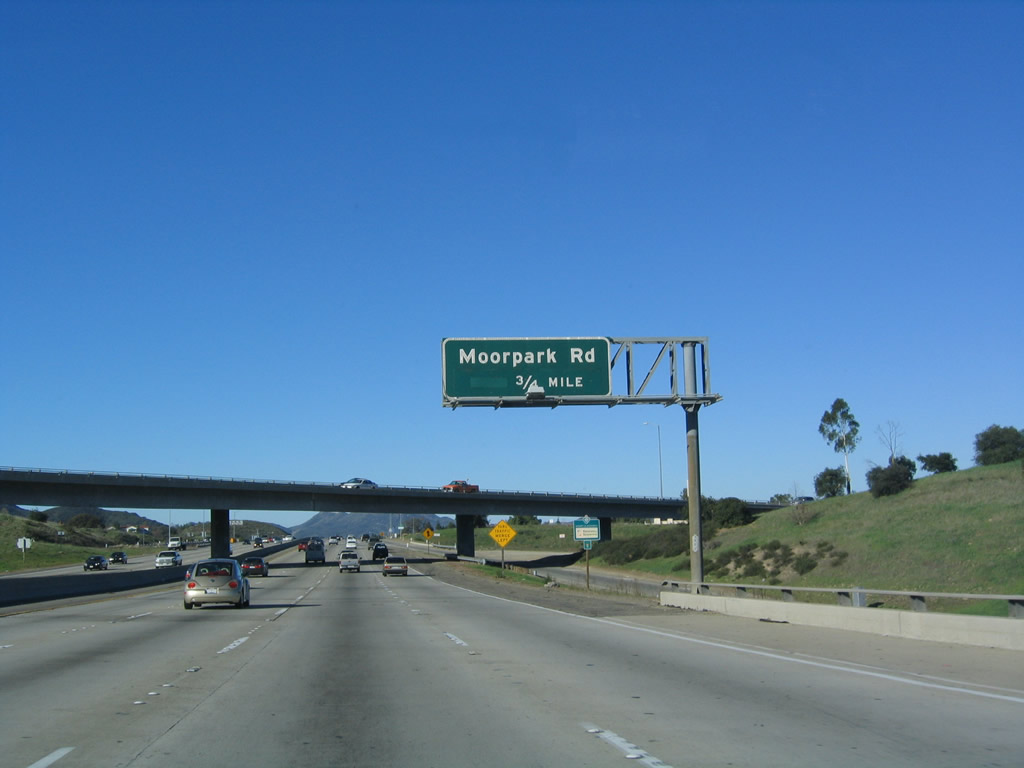
The next exit along U.S. 101 (Ventura Freeway) north is Exit 44, Moorpark Road (former California 23). Photo taken 12/23/04. |
|
A U.S. 101 north reassurance shield is posted after the on-ramp from California 23. Photo taken 03/18/06. |
|
This mileage sign provides the distance to the next three exits along U.S. 101 (Ventura Freeway) north: Exit 44, Moorpark Road; Exit 45, Lynn Road; and Exit 46, Ventu Park Road. Photo taken 03/18/06. |
|
Northbound (westbound) U.S. 101 (Ventura Freeway) reaches Exit 44, Moorpark Road. Photo taken 03/18/06. |
|
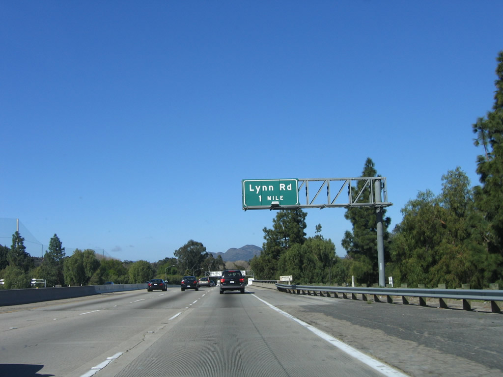
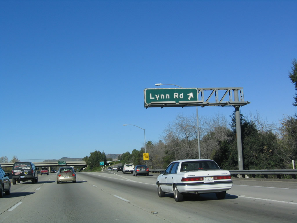
The next exit along U.S. 101 (Ventura Freeway) north is Exit 45, Lynn Road (one mile). Photo taken 03/18/06. |
|
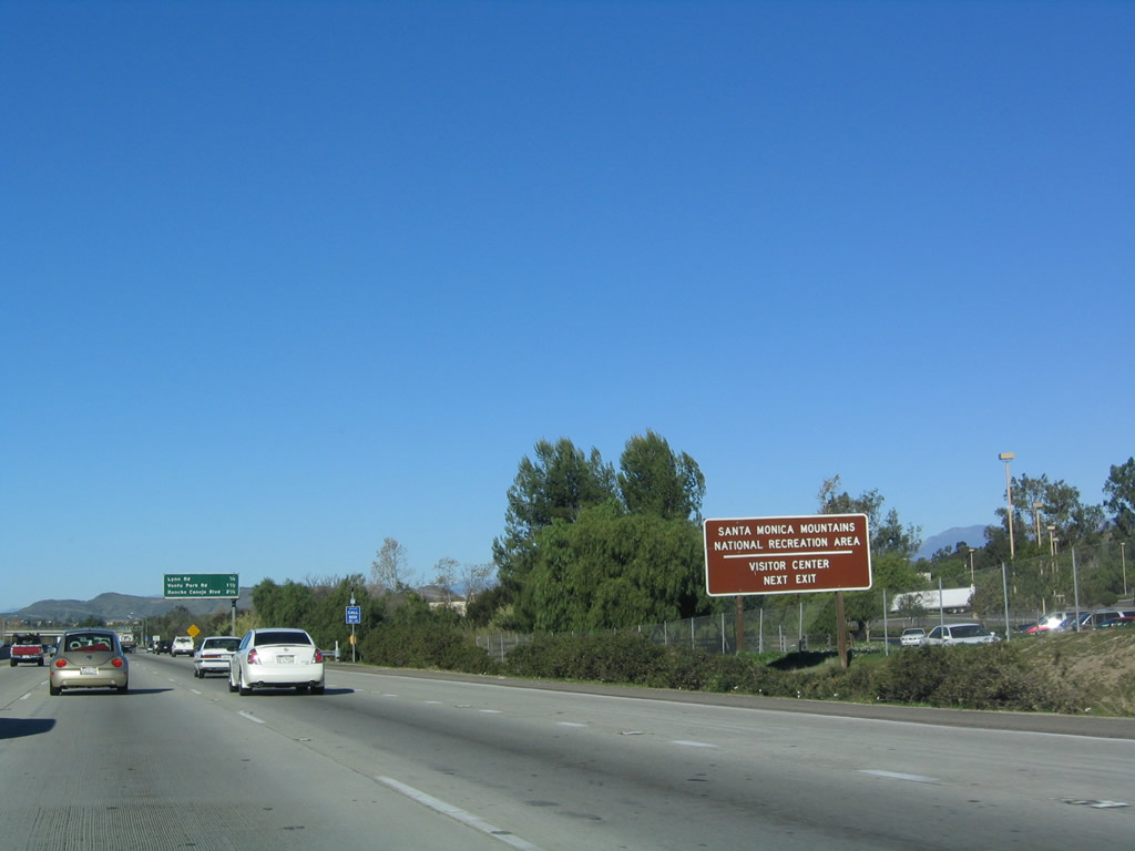
The Santa Monica Mountains National Recreation Area visitors center is located off of Lynn Road. Photo taken 12/23/04. |
|
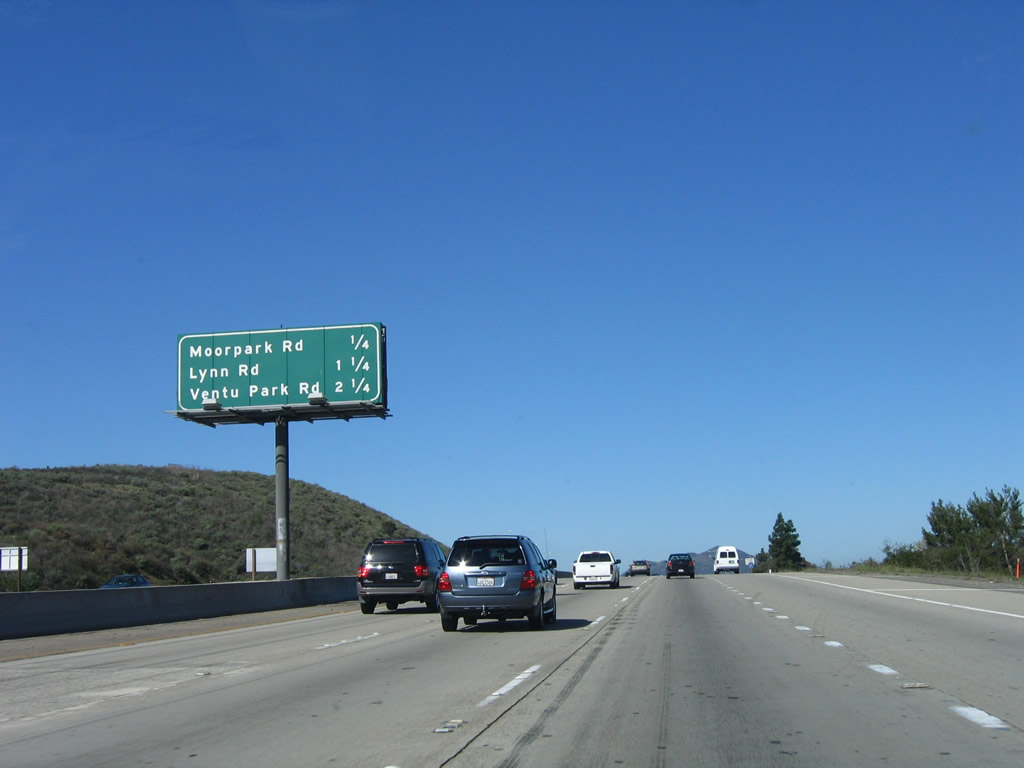
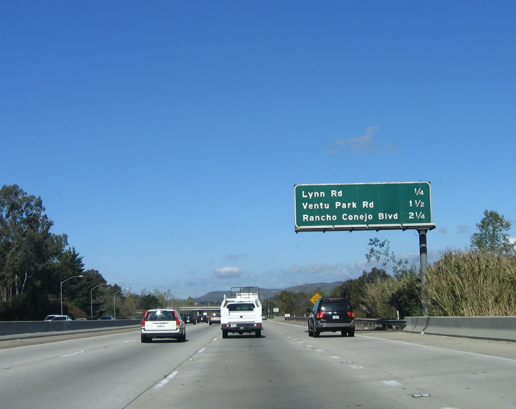
This mileage sign provides the distance to the next four exits along U.S. 101 (Ventura Freeway) north: Exit 45, Lynn Road; Exit 46, Ventu Park Road; and Exits 47A-B, Rancho Conejo Boulevard and Borchard Road. Photo taken 03/18/06. |
|
Northbound U.S. 101 (Ventura Freeway) reaches Exit 45, Lynn Road. Photo taken 12/23/04. |
|
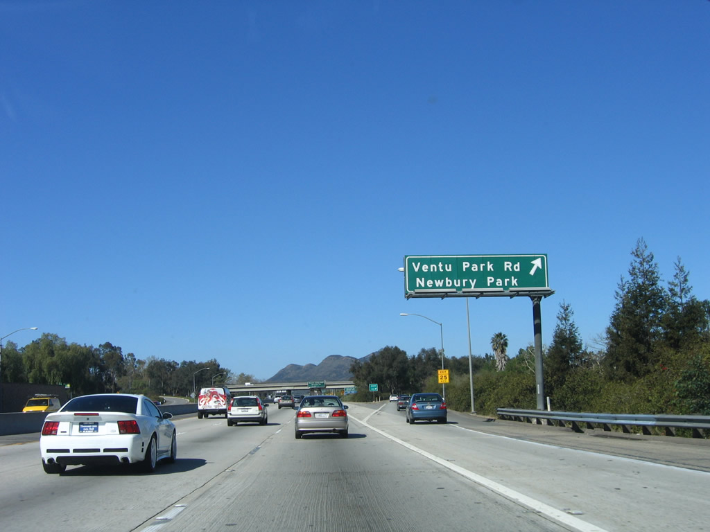
The next exit along U.S. 101 (Ventura Freeway) north (west) is Exit 46, Ventu Park Road to Newbury Park (one mile). Photo taken 12/23/04. |
|
After the on ramp from Lynn Road, this U.S. 101 north reassurance shield is posted. Photo taken 03/18/06. |
|
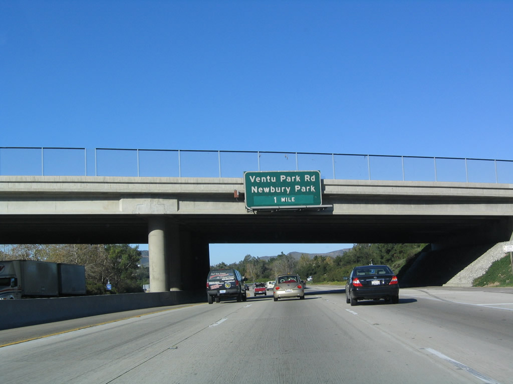
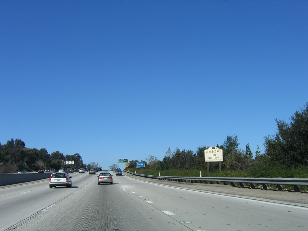
Ventu Park Road connects U.S. 101 with the Stagecoach Inn Museum in the city of Thousand Oaks. Photo taken 03/18/06. |
|
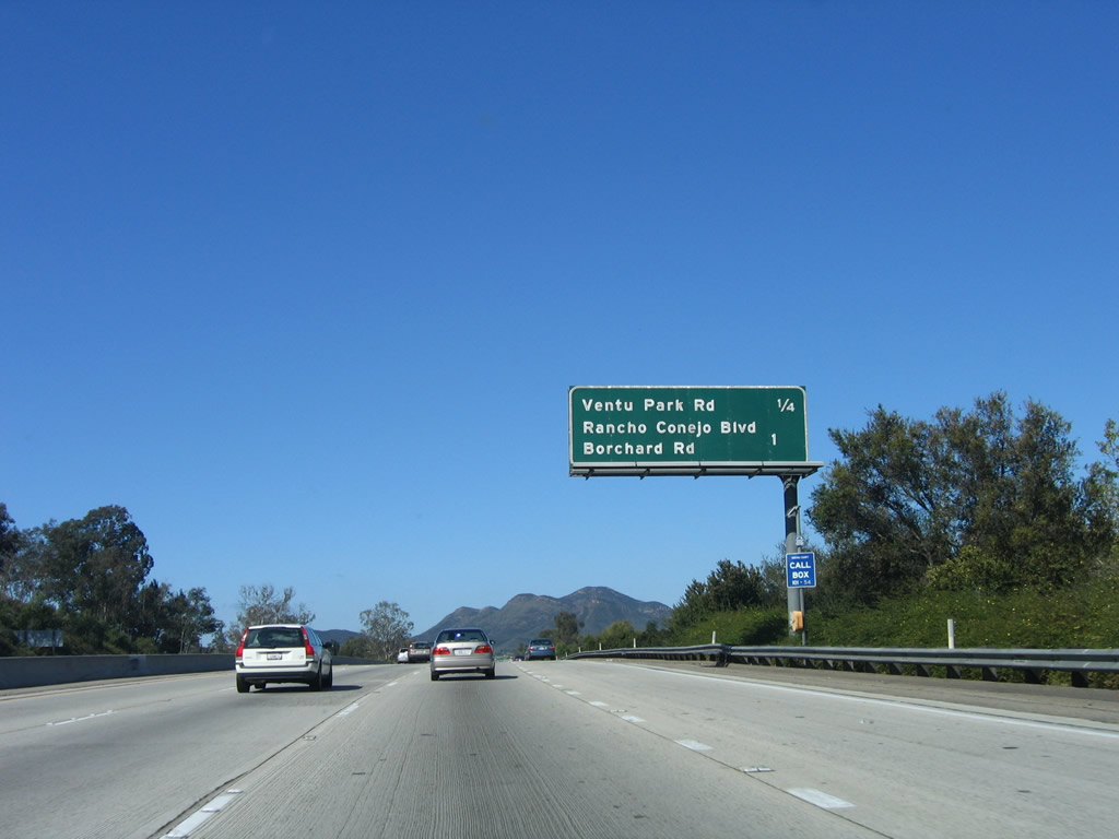
This mileage sign provides the distance to the next three exits along U.S. 101 (Ventura Freeway) north: Exit 46, Ventu Park Road and Exits 47A-B, Rancho Conejo Boulevard and Borchard Road. Photo taken 03/18/06. |
|
Northbound U.S. 101 (Ventura Freeway) reaches Exit 46, Ventu Park Road to Newbury Park. The community of Newbury Park includes portions of the city of Thousand Oaks and a square-shaped section of unincorporated area that is entirely surrounded by Thousand Oaks (south of the freeway). Photo taken 03/18/06. |
|
|
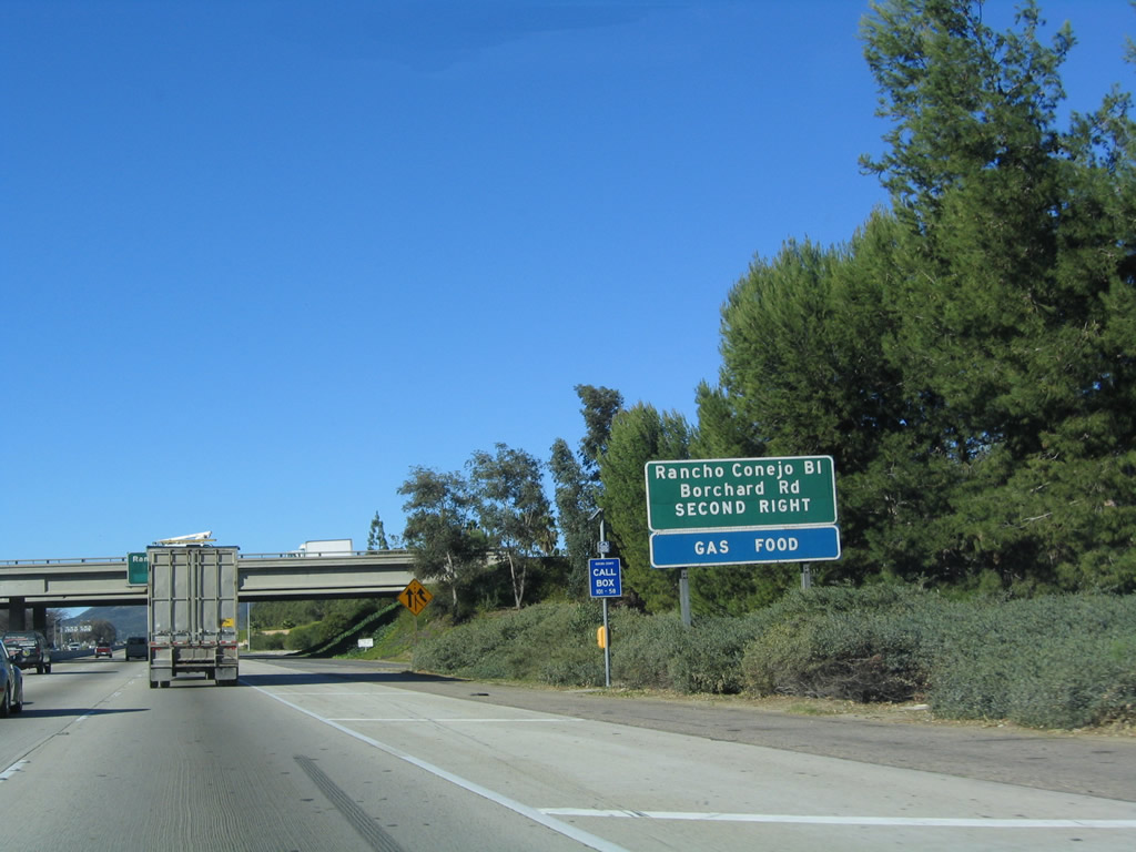
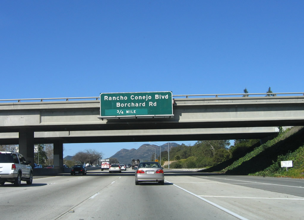
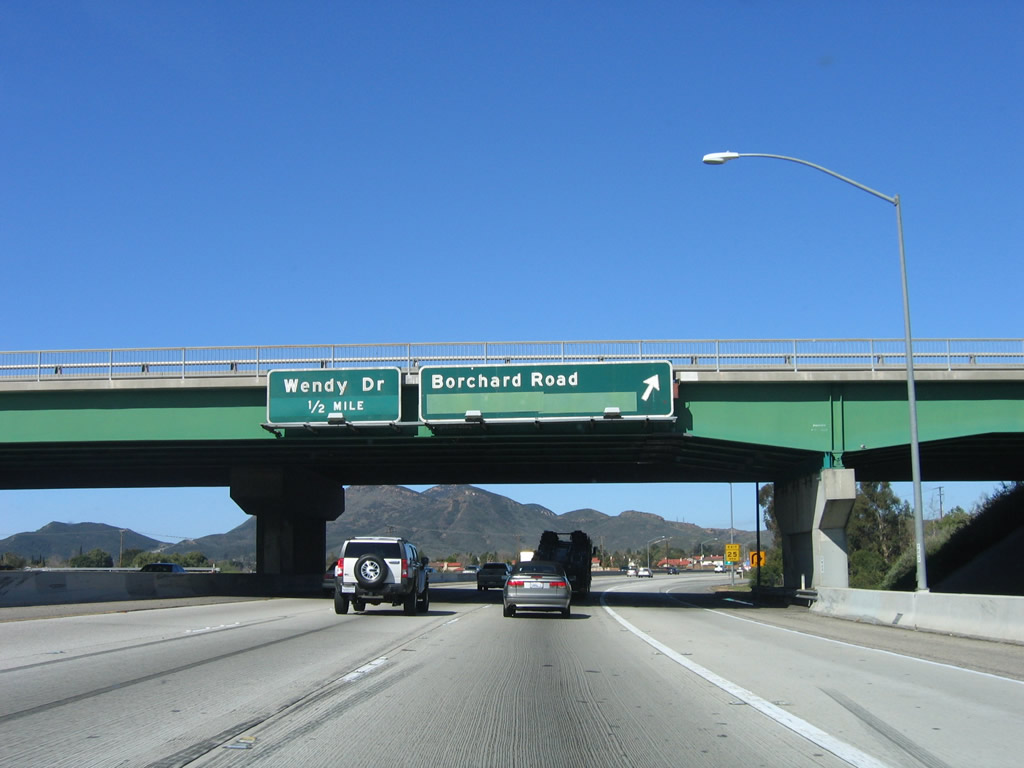
The next two exits along U.S. 101 (Ventura Freeway) north (west) are Exits 47A-B, Rancho Conejo Boulevard and Borchard Road. Both the roadside sign and overhead sign (mounted on the Ventu Park Road overpass) share the same information. Photos taken 12/23/04 and 03/18/06. |
|
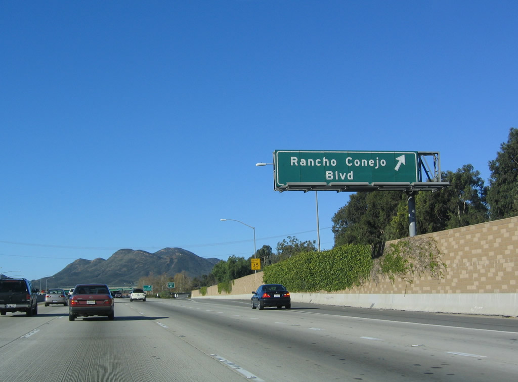
Northbound U.S. 101 (Ventura Freeway) reaches Exit 47A, Rancho Conejo Boulevard north. The next exit is Exit 47B, Borchard Road west. At this interchange, Rancho Conejo Boulevard changes names to Borchard Road, and the road takes a new direction to serve western Thousand Oaks and Newbury Park. Photo taken 12/23/04. |
|
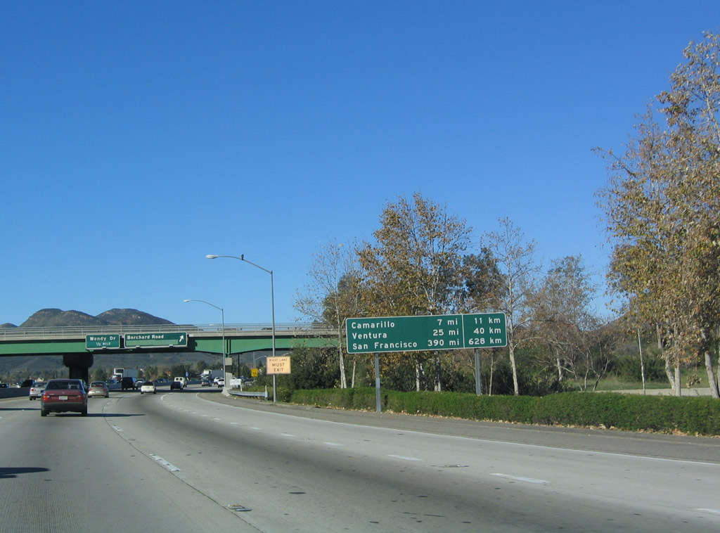
This mileage sign provides the distance to Camarillo (seven miles), Ventura (25 miles), and San Francisco (390 miles). This is one of the few remaining mileage signs in California that continue to show distances both in miles and kilometers. This was an experiment from the 1970s, and since that time, few of these signs remain in place. Thus far, we've not seen metric distances on any reflective distance sign (except for border crossings). Photo taken 03/18/06. |
|
Northbound U.S. 101 (Ventura Freeway) reaches Exit 47B, Borchard Road west to western Thousand Oaks and Newbury Park. The next exit is Exit 48, Wendy Drive. Photo taken 03/18/06. |
|
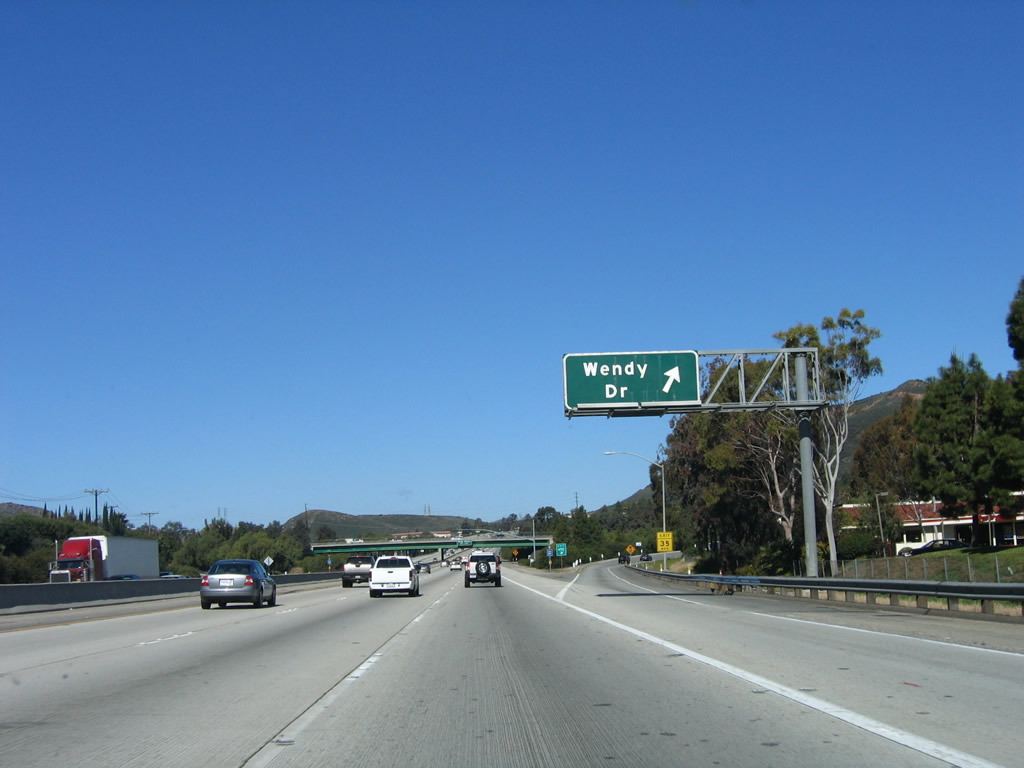
Immediately thereafter, northbound U.S. 101 (Ventura Freeway) reaches Exit 48, Wendy Drive. This is the final interchange to serve the city of Thousand Oaks and Newbury Park; hereafter, U.S. 101 will cross Conejo Pass, then descend toward Camarillo. Photo taken 03/18/06. |
|
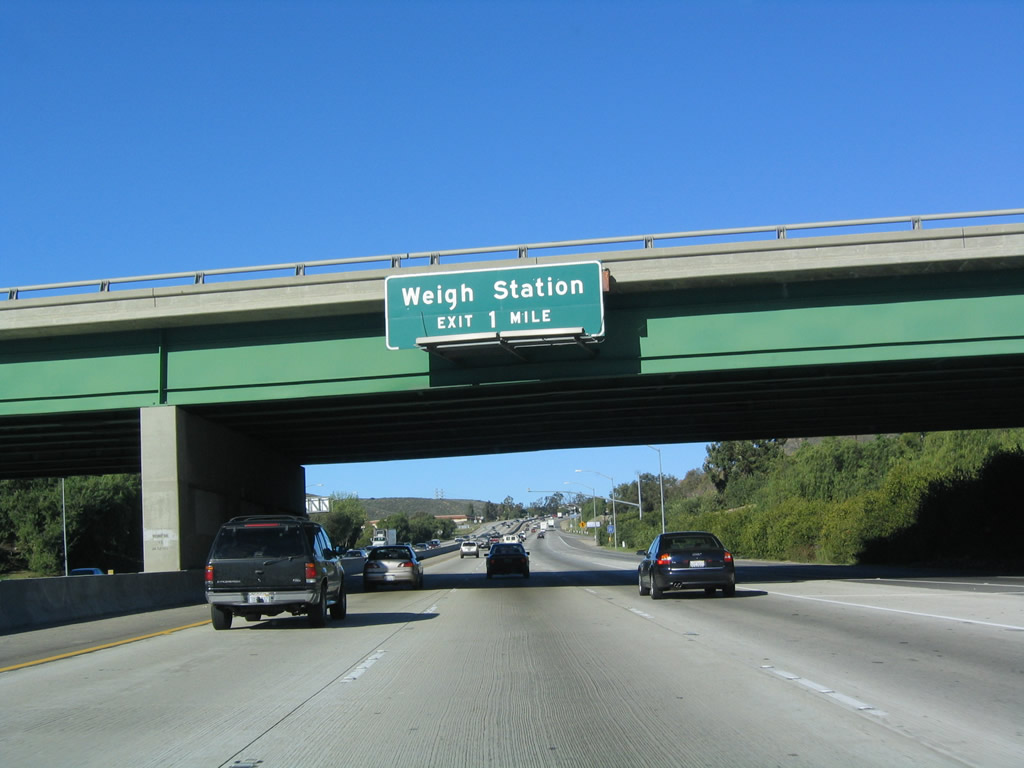
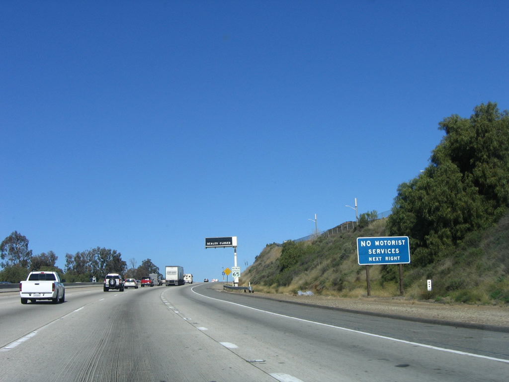
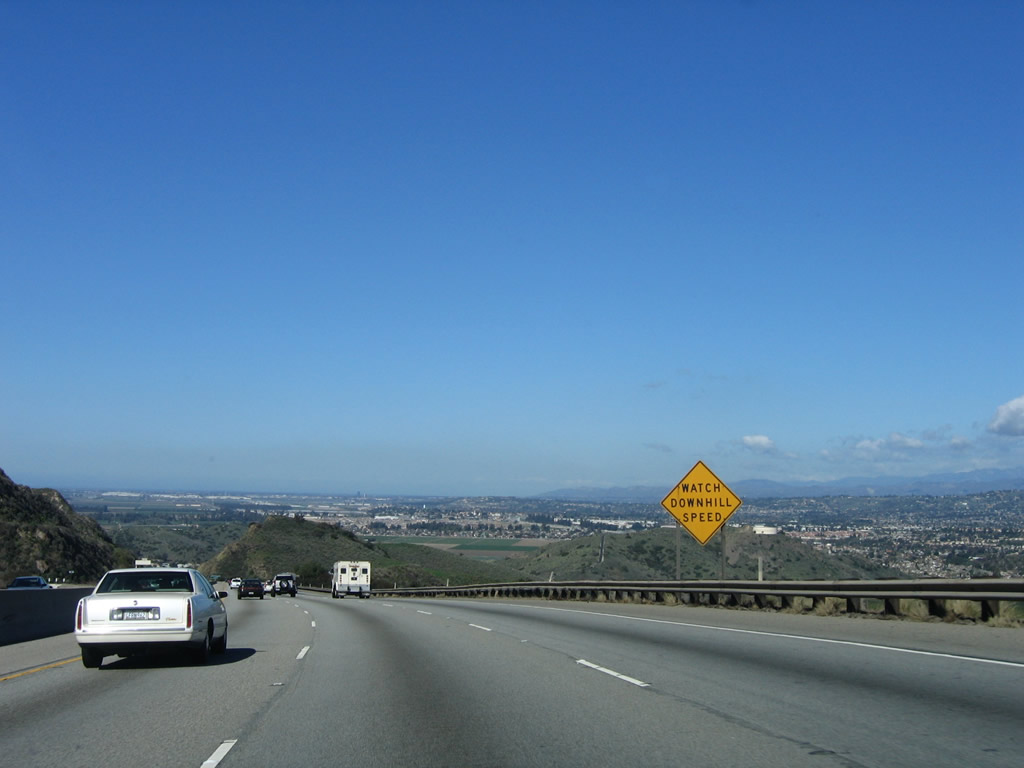
The next exit along U.S. 101 (Ventura Freeway) north (west) is Exit 49, Conejo Pass Weigh Station (one mile). Photo taken 12/23/04. |
|
No motorist services are available at Exit 49, Conejo Pass Weigh Station. Photo taken 03/18/06. |
|
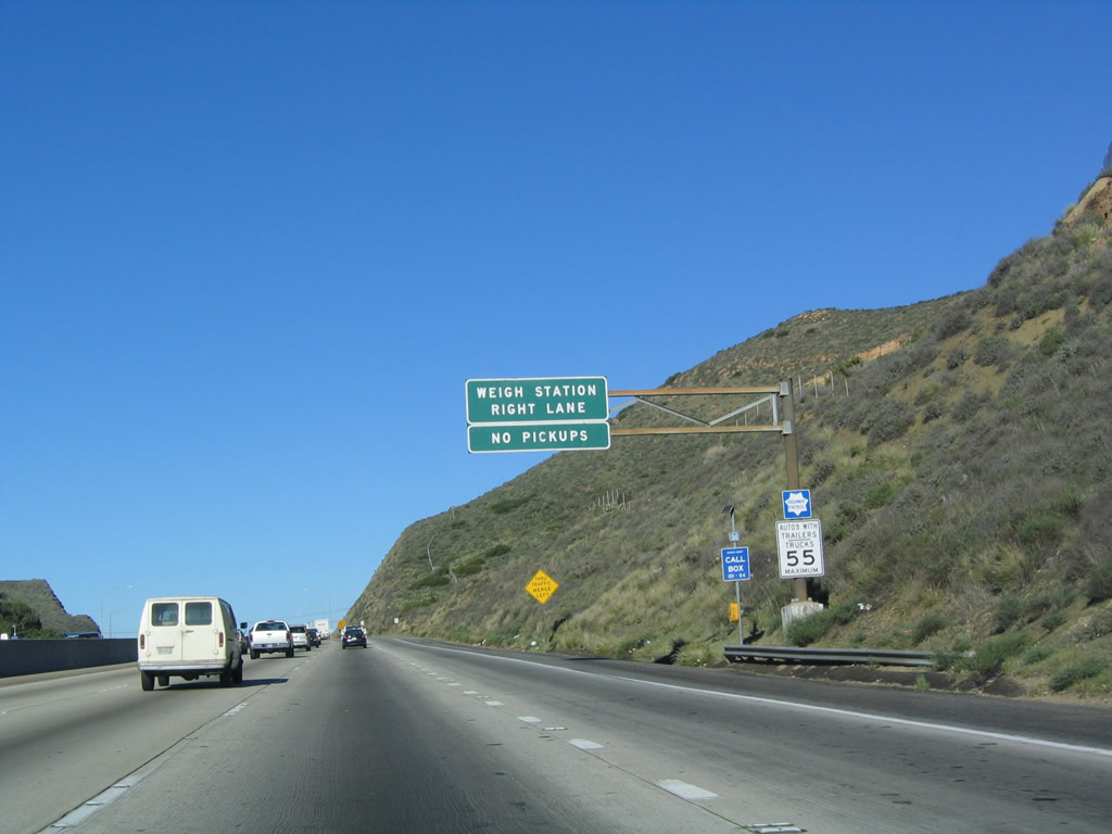
The right lane of U.S. 101 becomes exit only for Exit 49, Conejo Pass Weigh Station. Photo taken 12/23/04. |
|
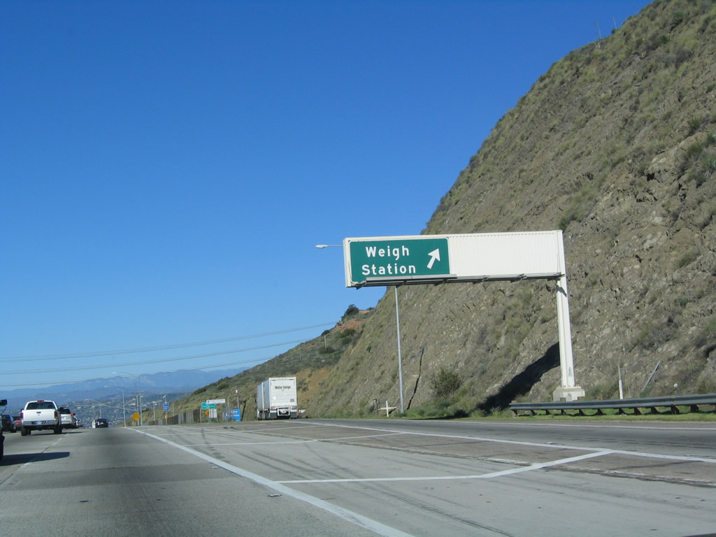
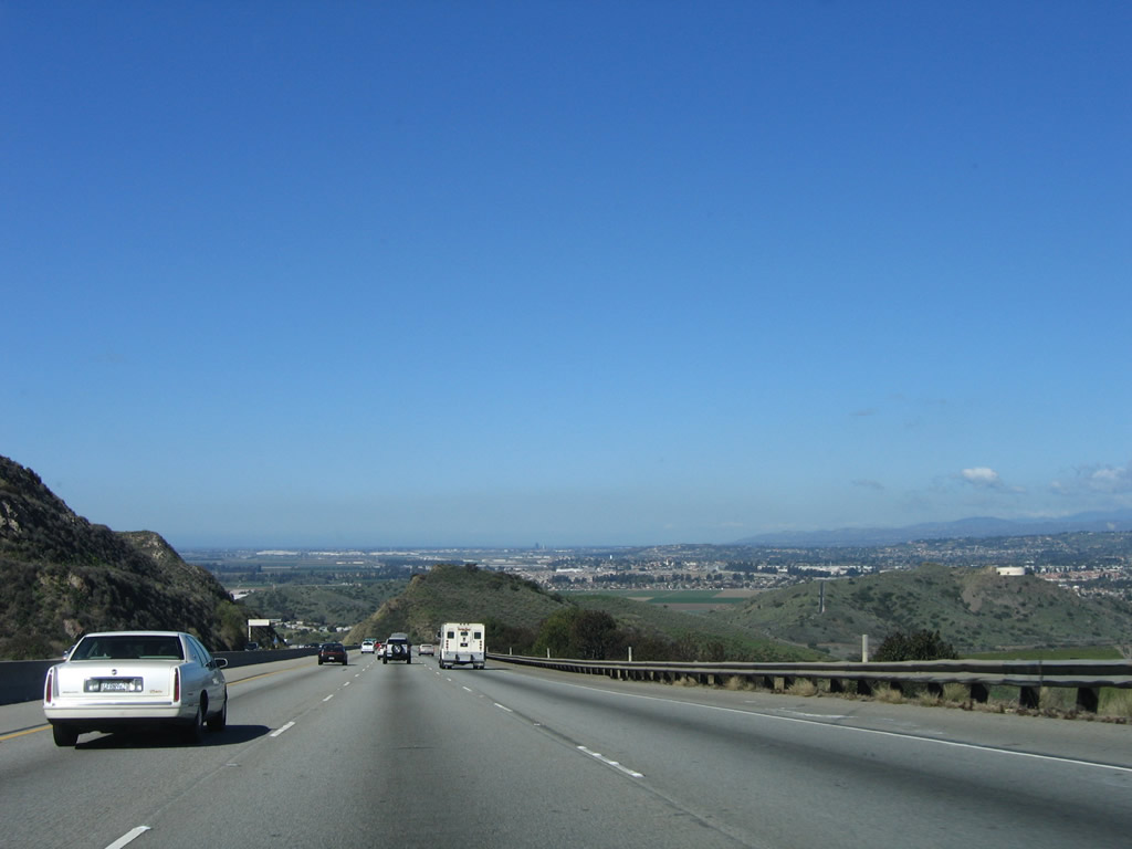
Nonthbound (westbound) U.S. 101 (Ventura Freeway) reaches Exit 49, Conejo Pass Weigh Station. At this point, the freeway reaches its highest point on the Conejo Grade and will soon descend toward Camarillo. Photo taken 12/23/04. |
|
|
|
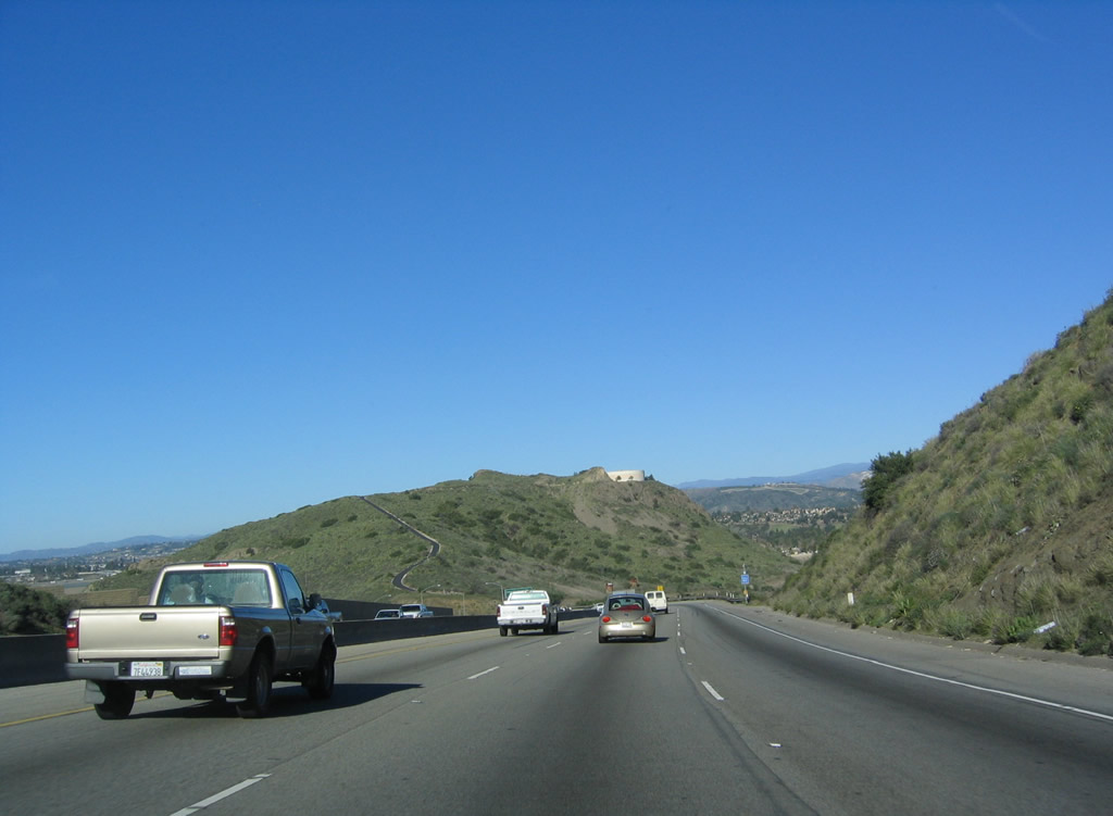
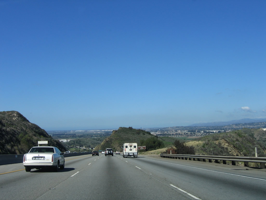
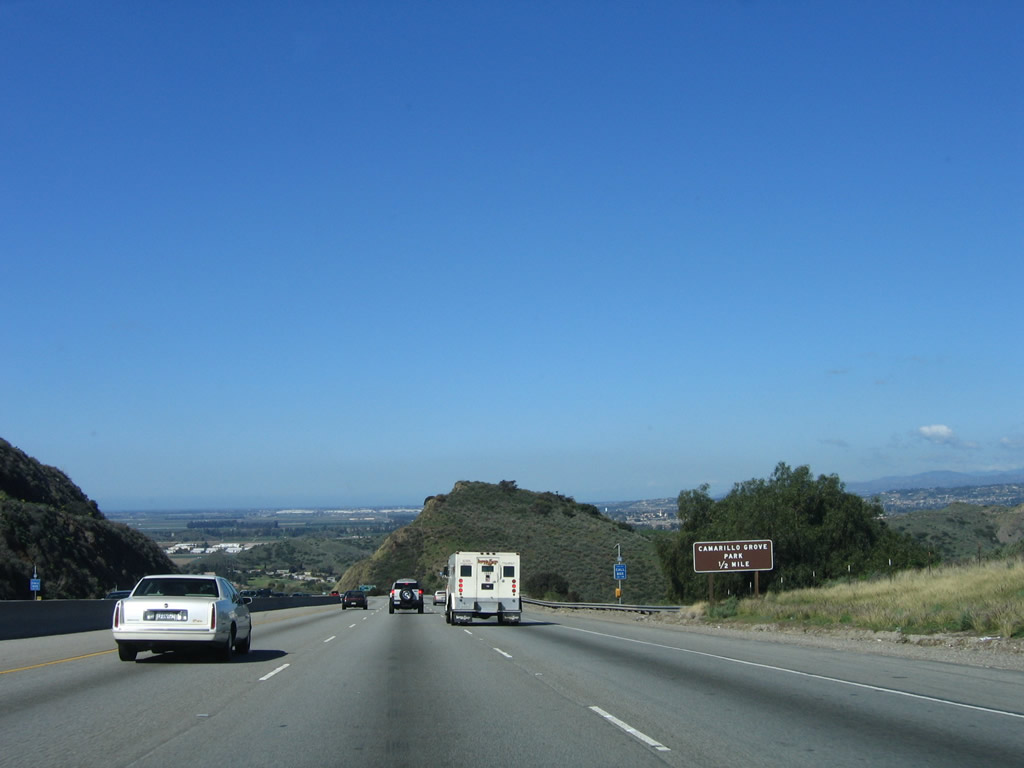
As U.S. 101 descends along a steep grade from Conejo Pass, incredible views of Camarillo and the distant foothills provide a dramatic driving experience. Only three lanes travel downhill from the truck weigh station. The next seven exits all serve the city of Camarillo. Photos taken 12/23/04 and 03/18/06. |
|
|
|
|
|
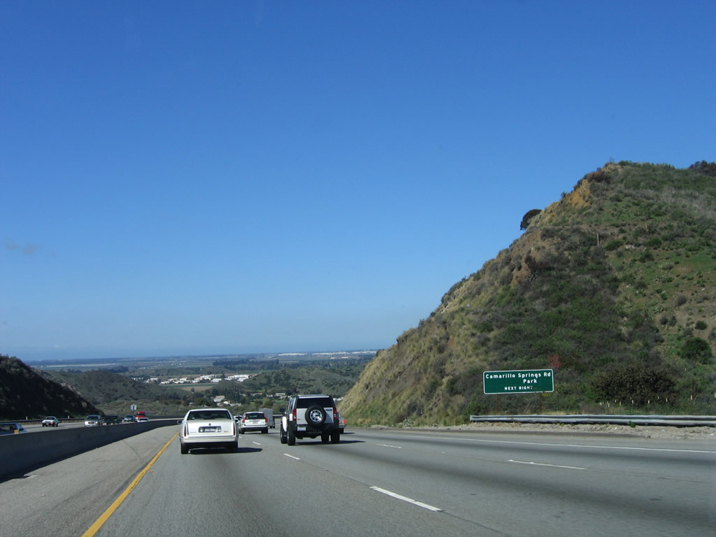
The next exit along U.S. 101 (Ventura Freeway) north (west) is Exit 50, Camarillo Springs Road to Camarillo Grove Park. Photos taken 03/16/08. |
|
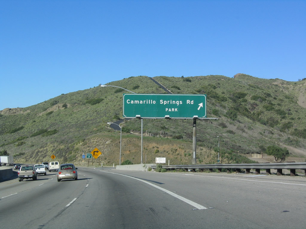
Nonthbound (westbound) U.S. 101 (Ventura Freeway) reaches Exit 50, Camarillo Springs Road to Camarillo Grove Park. Photo taken 12/23/04. |
|
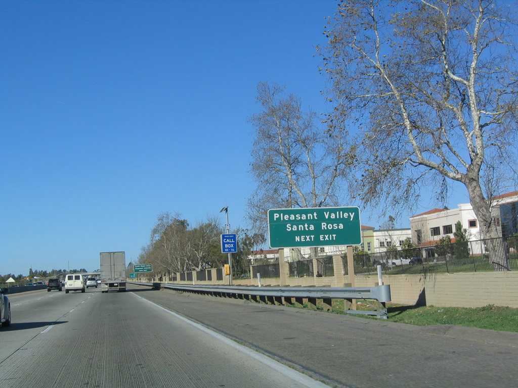
The next exit along U.S. 101 (Ventura Freeway) north (west) is Exit 52, Pleasant Valley Road and Santa Rosa Road (1.25 miles). Photo taken 12/23/04. |
|
A monument sign greets motorists at the bottom of the Conejo Grade for the city of Camarillo (population 57,077 as of the 2000 Census, incorporated in 1964, 19.0 square miles in size, and elevation 177 feet). Photo taken 03/18/06. |
|
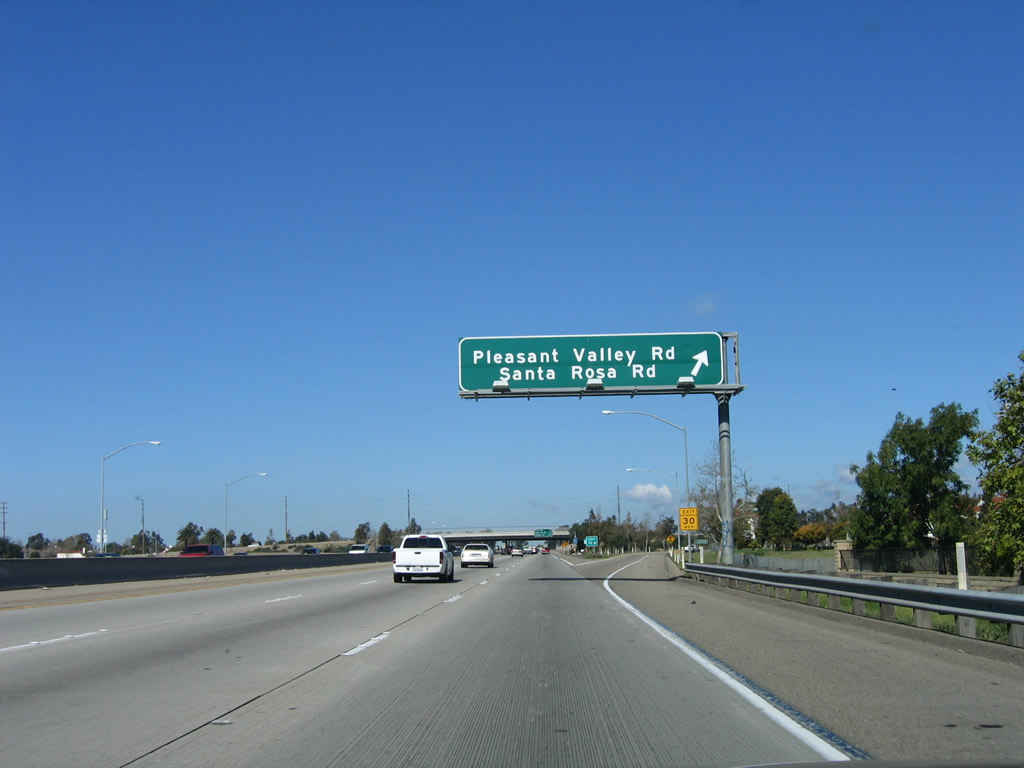
Northbound U.S. 101 (Ventura Freeway) approaches Exit 52, Pleasant Valley Road and Santa Rosa Road. Photo taken 12/23/04. |
|
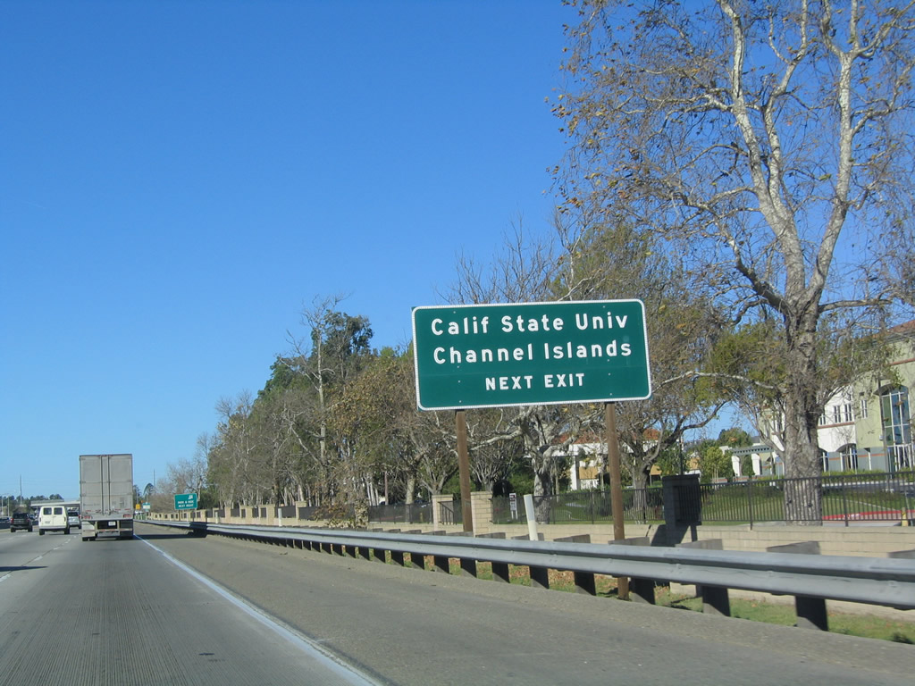
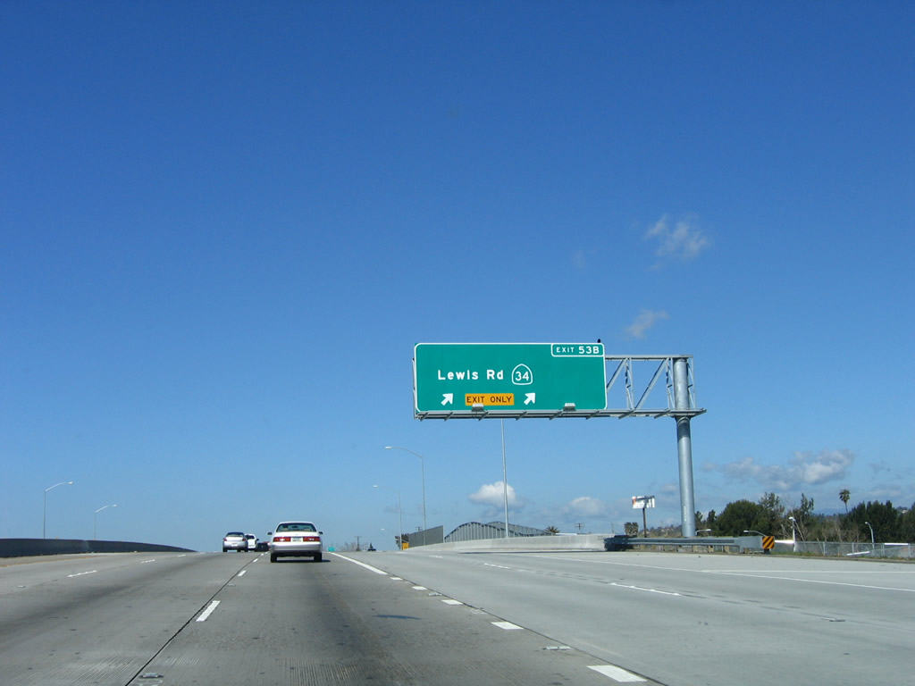
Use Exit 52 to California State University - Channel Islands via Pleasant Valley Road southwest to Lewis Road south. To California 34/Fifth Street west, use Pleasant Valley Road southwest to Fifth Street. (U.S. 101 has an interchange with California 34 at Exit 53B.) Photo taken 12/23/04. |
|
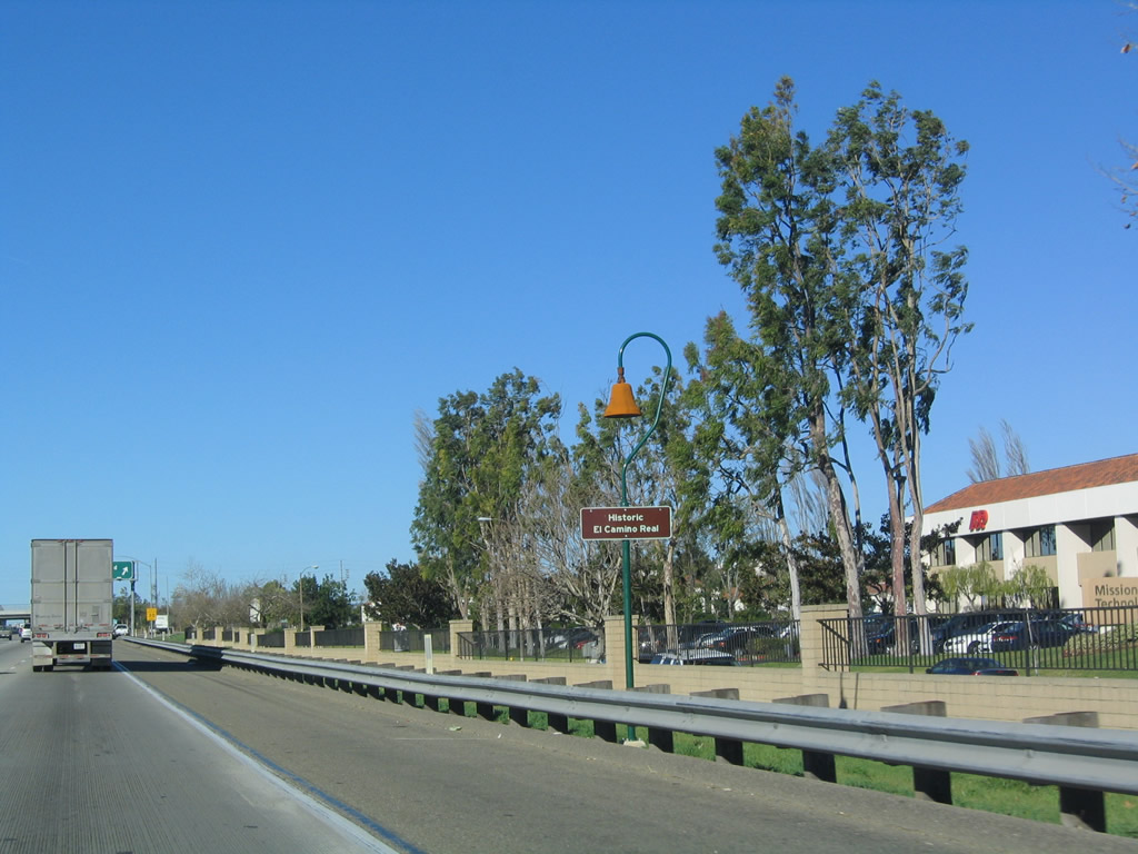
An El Camino Real replica bell and sign are posted on U.S. 101 (Ventura Freeway) prior to Exit 52, Pleasant Valley Road and Santa Rosa Road. Photo taken 12/23/04. |
|
Northbound U.S. 101 (Ventura Freeway) reaches Exit 52, Pleasant Valley Road and Santa Rosa Road. Photo taken 03/18/06. |
|
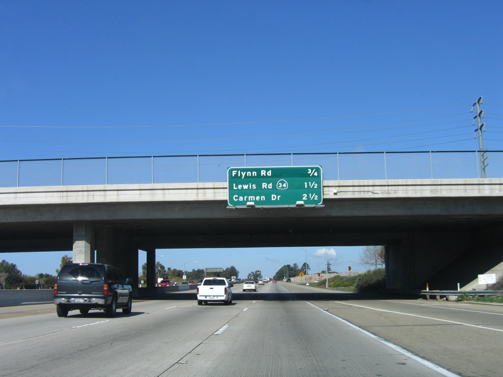
This mileage sign provides the distance to the next three exits along U.S. 101 (Ventura Freeway) north: Exit 53A, Flynn Road; Exit 53B, California 34/Lewis Road; and Exit 54, Carmen Drive. Photo taken 03/18/06. |
|
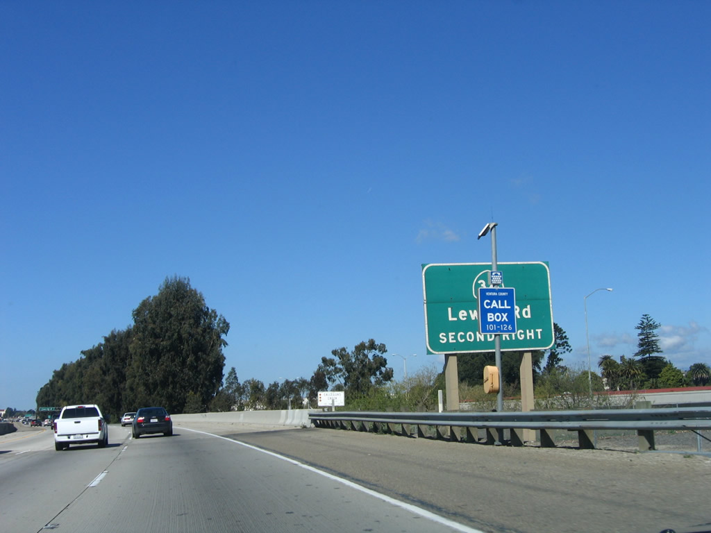
Exit 53B connects U.S. 101 to California 34, a short, east-west state route that connects Camarillo with Oxnard. This sign is poorly located behind a call box, making it all but illegible to fast-moving traffic. Photo taken 03/18/06. |
|
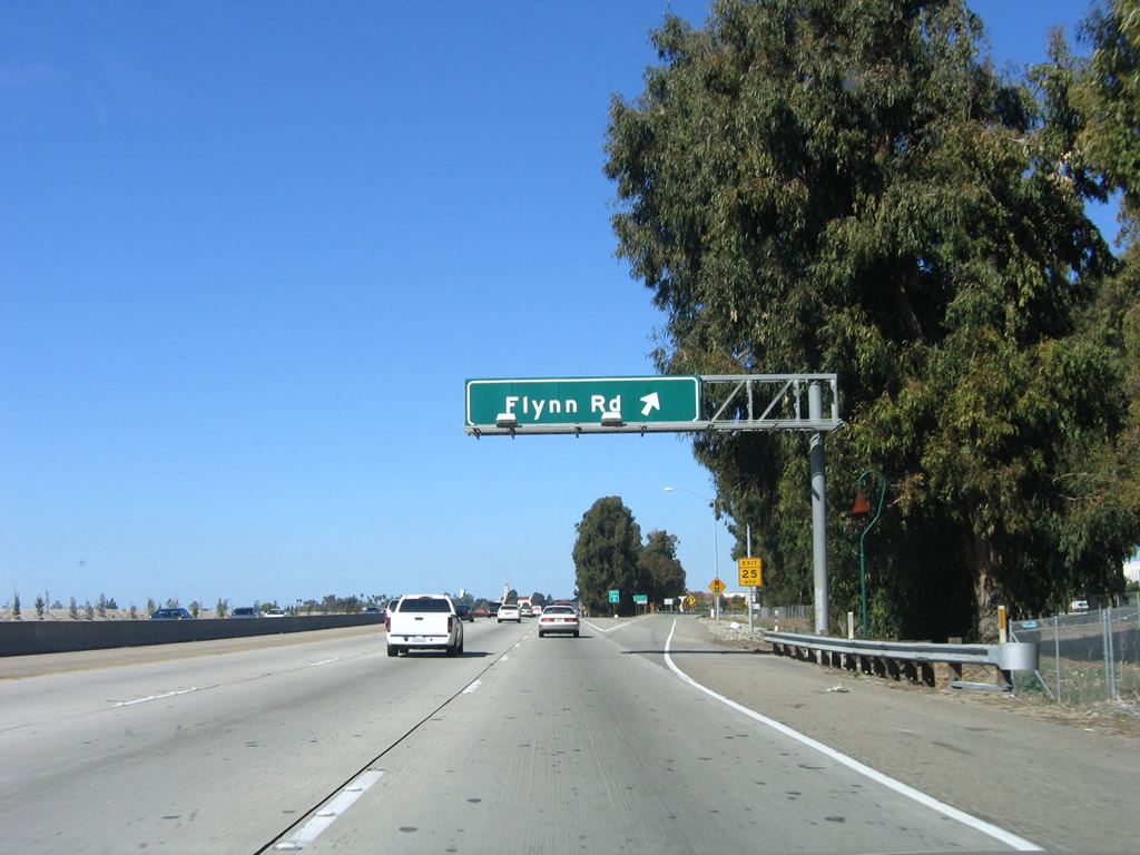
Northbound U.S. 101 (Ventura Freeway) reaches Exit 53A, Flynn Road. The next interchange is Exit 53B, California 34/Lewis Road in Camarillo. Photo taken 03/18/06. |
|
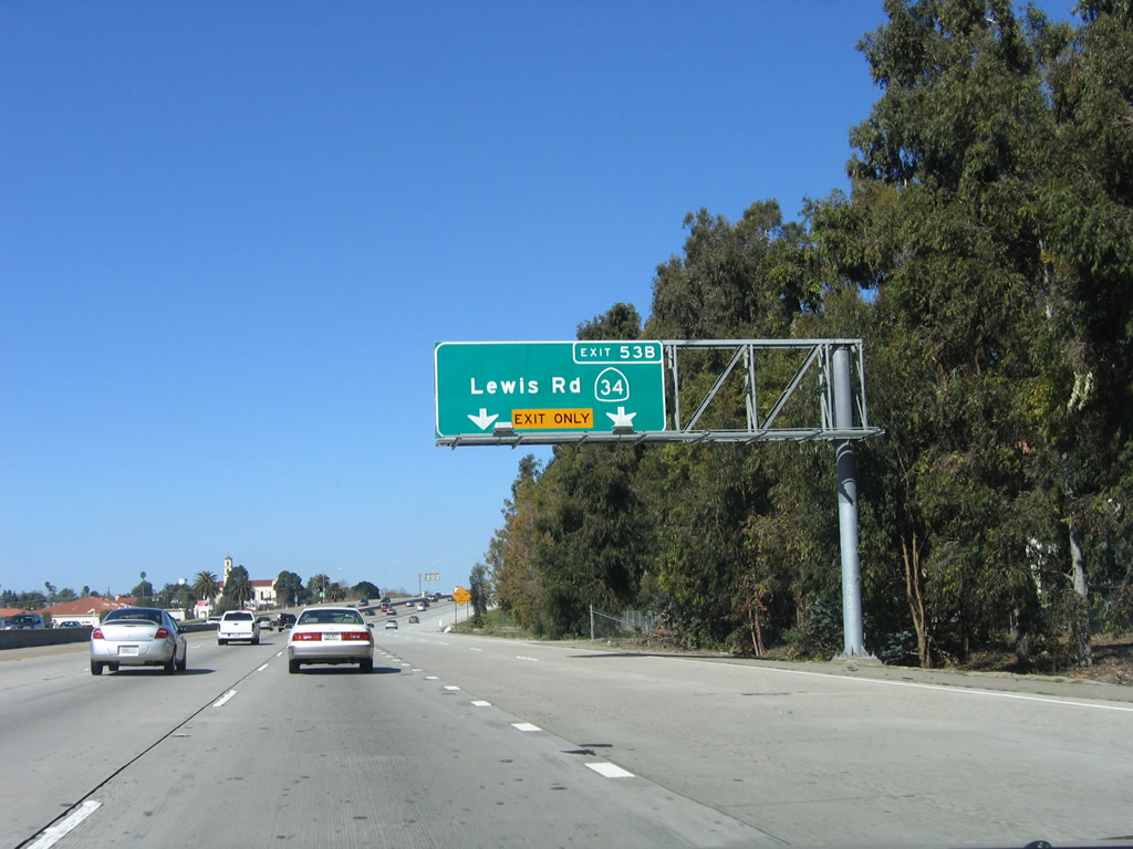
The next exit along U.S. 101 (Ventura Freeway) north is Exit 53B, California 34/Lewis Road (the right two lanes become exit only for Lewis Road). Photo taken 03/18/06. |
|
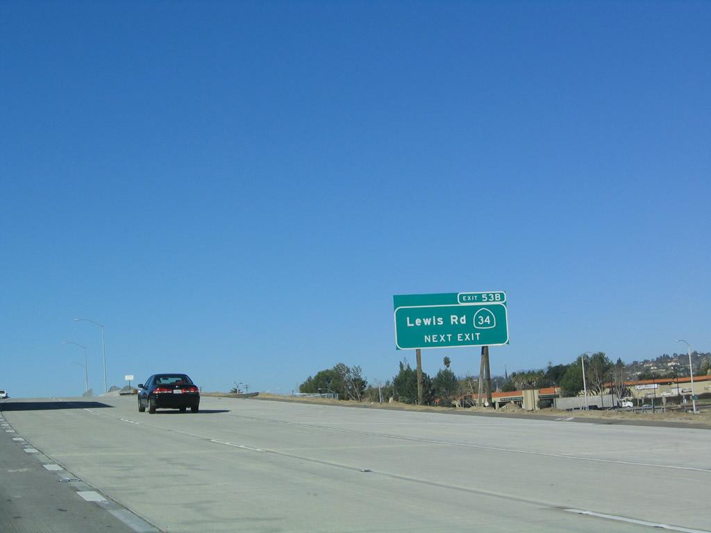
A roadside exit number sign is posted soon thereafter for Exit 53B, California 34/Lewis Road. Photo taken 03/18/06. |
|
Northbound U.S. 101 (Ventura Freeway) reaches Exit 53B, California 34/Lewis Road. California 34 travels west to Oxnard and north into downtown Camarillo from this interchange. Photo taken 03/18/06. |
|
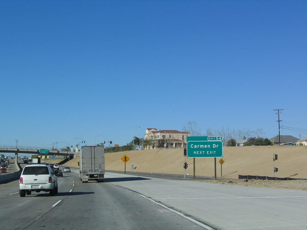
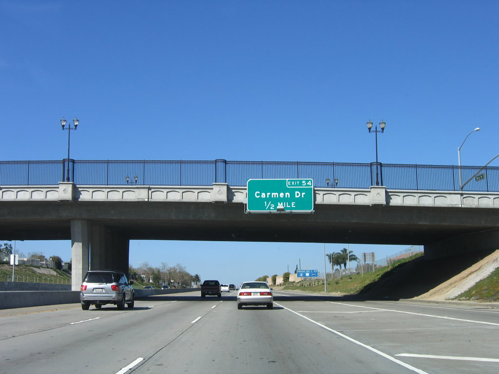
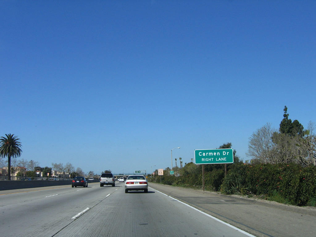
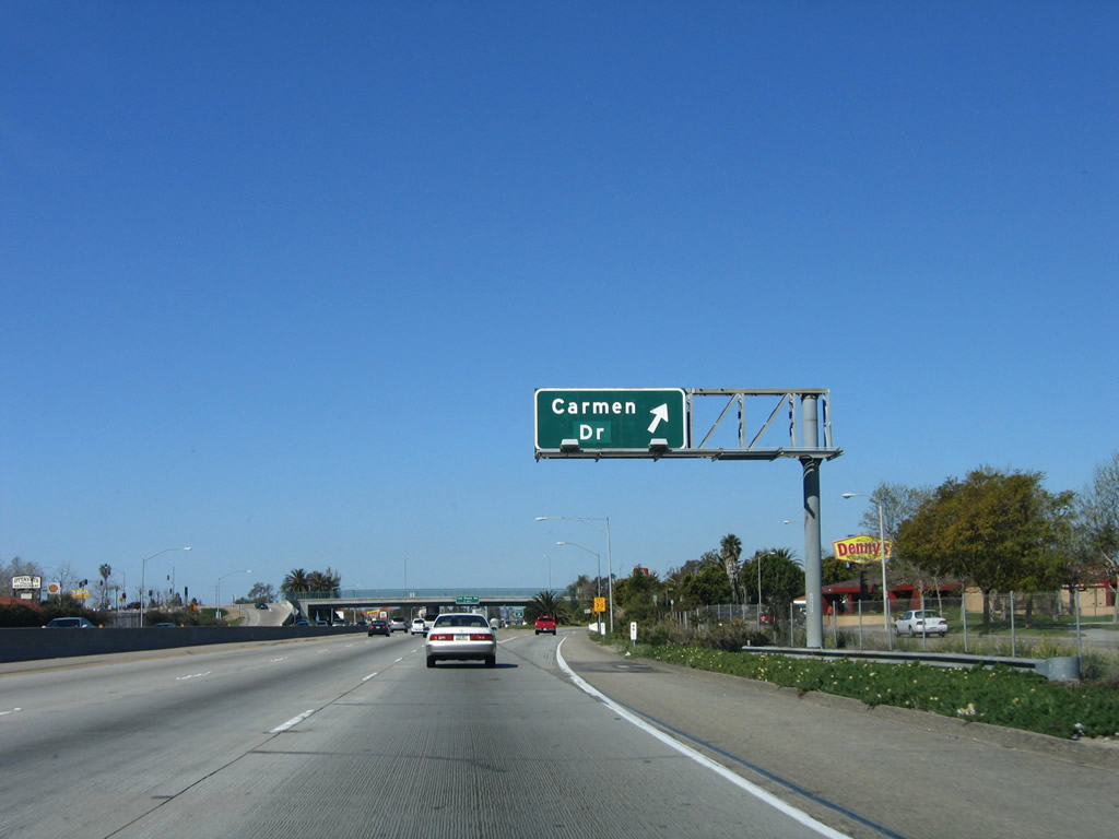
The next exit along U.S. 101 (Ventura Freeway) north is Exit 54, Carmen Drive. Photo taken 03/18/06. |
|
Carmen Drive travels north to Las Posas Road in Camarillo. Photo taken 03/18/06. |
|
After the on-ramp from Daily Drive (connecting road from California 34/Lewis Road), this U.S. 101 north reassurance shield is posted. Photo taken 03/18/06. |
|
Another roadside sign for Exit 54, Carmen Drive is posted shortly thereafter. Photo taken 03/18/06. |
|
Northbound U.S. 101 (Ventura Freeway) reaches Exit 54, Carmen Drive. Photo taken 03/18/06. |
|
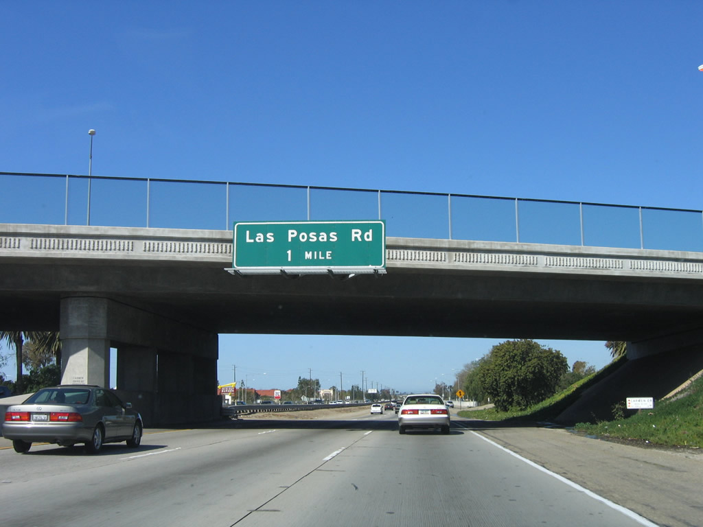
The next exit along U.S. 101 (Ventura Freeway) north is Exit 55, Las Posas Road (one mile). Photo taken 03/18/06. |
|
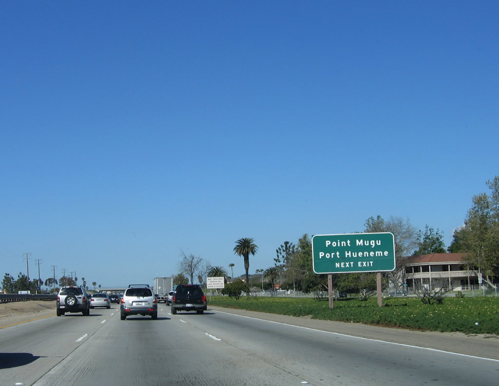
Use Las Posas Road south to Point Mugu and Port Hueneme. Photo taken 03/18/06. |
|
Northbound (westbound) U.S. 101 (Ventura Freeway) reaches Exit 55, Las Posas Road. Photo taken 03/18/06. |
|
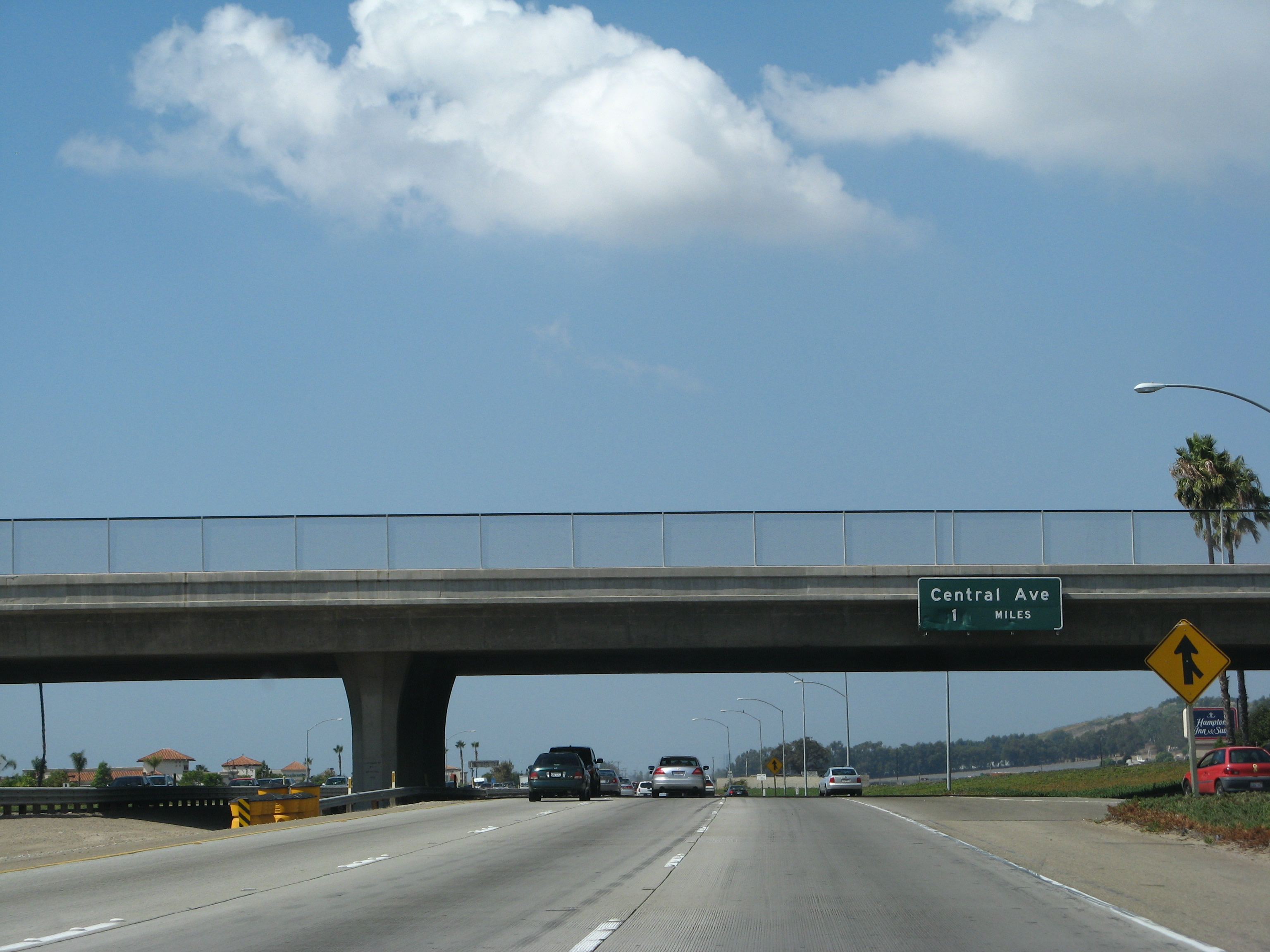
The next exit along northbound U.S. 101 (Ventura Freeway) is Exit 57, Central Avenue (one mile). Photo taken 09/29/07. |
|
Northbound U.S. 101 (Ventura Freeway) reaches Exit 57, Central Avenue. This porcelain-enamel sign is unique in that there are no buttons on the late 1960s-era sign; most button copy signs from this era were retrofitted with buttons to increase letter visibility at night. Photo taken 12/23/04. |
|
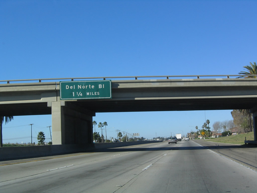
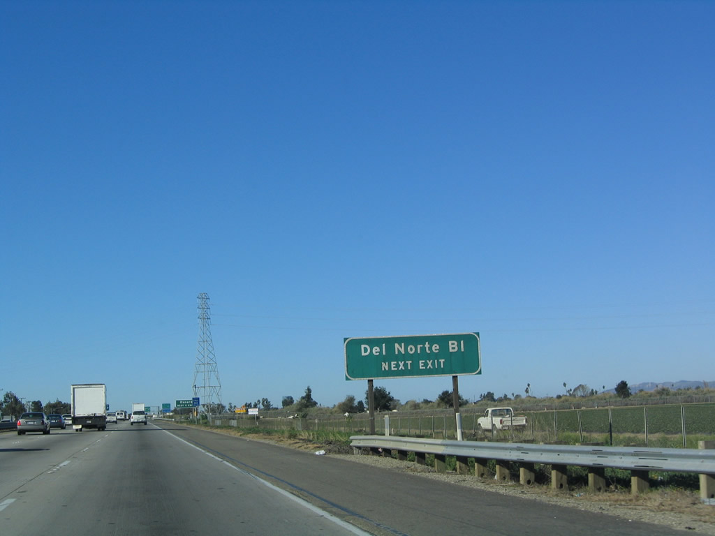
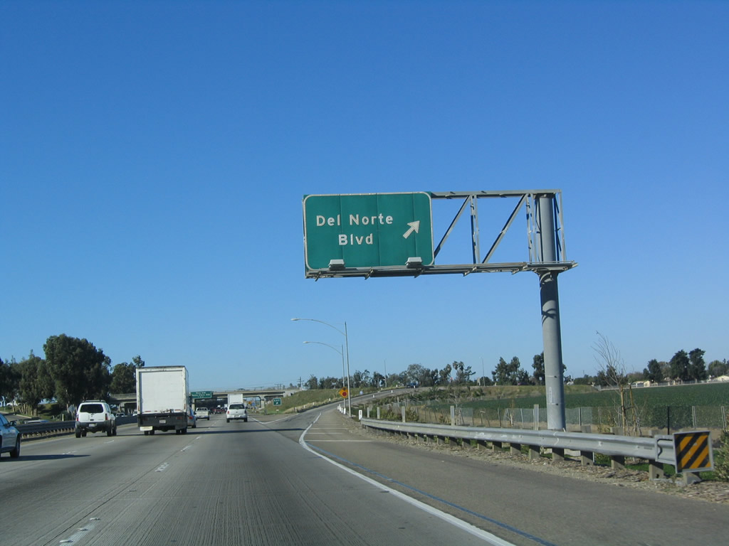
The next exit along U.S. 101 (Ventura Freeway) north is Exit 59, Del Norte Boulevard. Photo taken 12/23/04. |
|
A U.S. 101 north reassurance shield is posted after the on-ramp from Central Avenue. Photo taken 03/18/06. |
|
Use Del Norte Boulevard south to California 34/Fifth Street through the eastern edge of the city of Oxnard. Photo taken 12/23/04. |
|
The next five exits along U.S. 101 (Ventura Freeway) north all serve the city of Oxnard. Photo taken 12/23/04. |
|
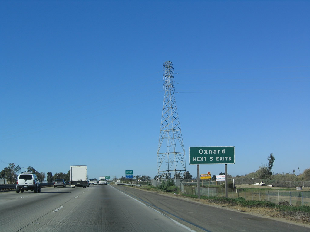
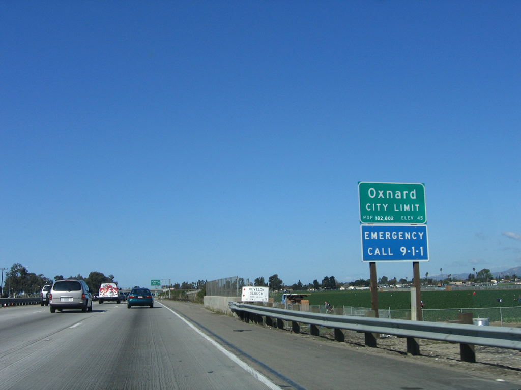
U.S. 101 enters the city of Oxnard. Located at the western edge of the Oxnard Plain, Oxnard is an agricultural community located on the Pacific Ocean and is near Naval Base Ventura County. Strawberries grow in abundance in Oxnard, which is the largest city in Ventura County (with a population of 170,358 as of the 2000 Census). Incorporated on June 30, 1903, Oxnard consists of 36.6 square miles. Photo taken 03/18/06. |
|
Northbound (westbound) U.S. 101 (Ventura Freeway) reaches Exit 59, Del Norte Boulevard. Photo taken 12/23/04. |
|
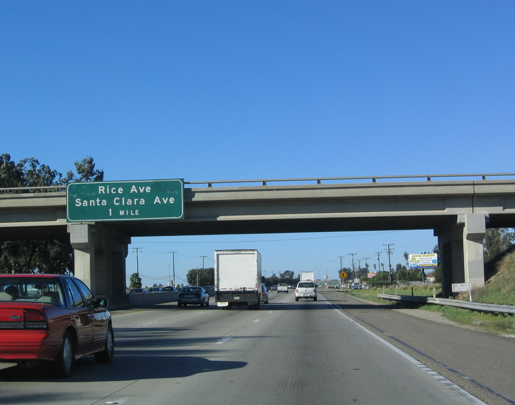
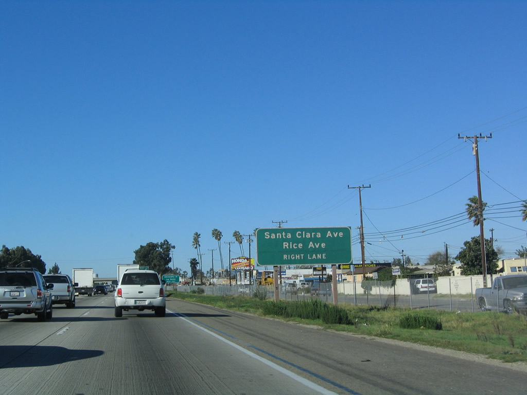
The next exit along U.S. 101 (Ventura Freeway) north is Exit 60, Santa Clara Avenue and Rice Avenue. Use Rice Avenue south to California 1 (Pacific Coast Highway) southwest to Point Mugu. Photo taken 12/23/04. |
|
Use Rice Avenue south to California 1 (Pacific Coast Highway). Plans call for Rice Avenue to be expanded to expressway or freeway standards for an eventual connection to California 1 and to provide a bypass from the naval base north to U.S. 101. Photo taken 12/23/04. |
|
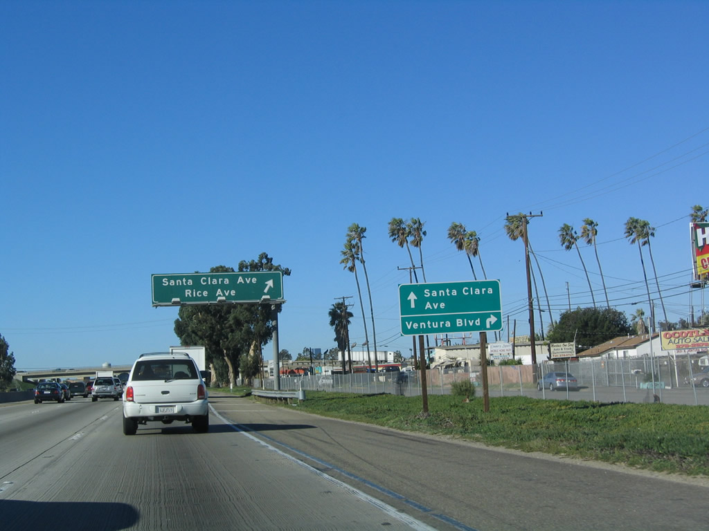
The off-ramp for Exit 60 connects to Ventura Boulevard, the original alignment for U.S. 101 and now a frontage road on the north side of the freeway. Follow the signs for lane allocation carefully for the connection to Santa Clara Avbenue north to Nyeland Acres. Photo taken 12/23/04. |
|
|
Northbound U.S. 101 (Ventura Freeway) reaches Exit 60, Ventura Boulevard to Santa Clara Avenue north and Rice Avenue south in Oxnard. Photos taken 12/23/04 and 03/18/06. |
|
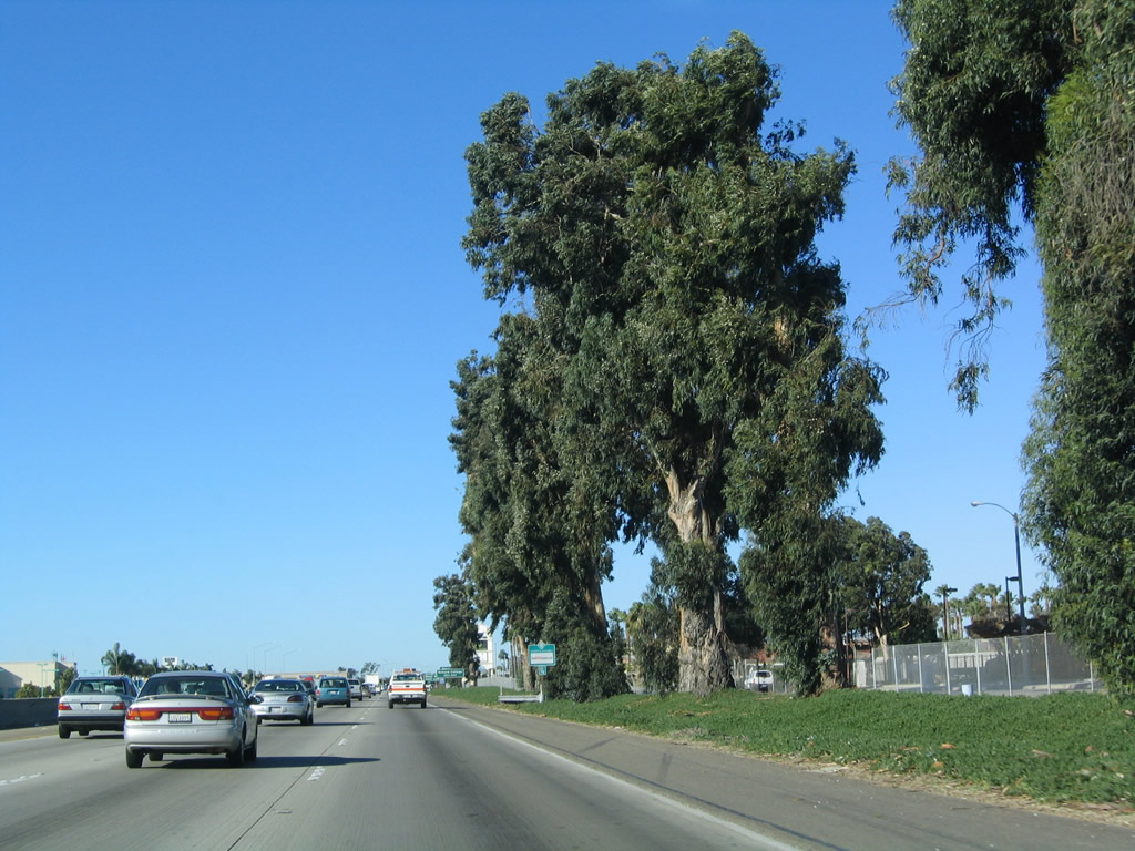
Tall eucalyptus trees line the north side of northbound (westbound) U.S. 101 (Ventura Freeway) prior to Exit 61, Rose Avenue. Photo taken 12/23/04. |
|
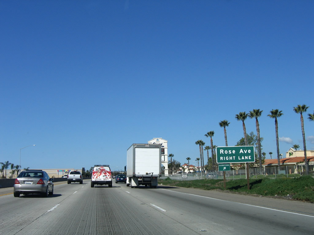
The next exit along U.S. 101 (Ventura Freeway) north is Exit 61, Rose Avenue. Photo taken 03/18/06. |
|
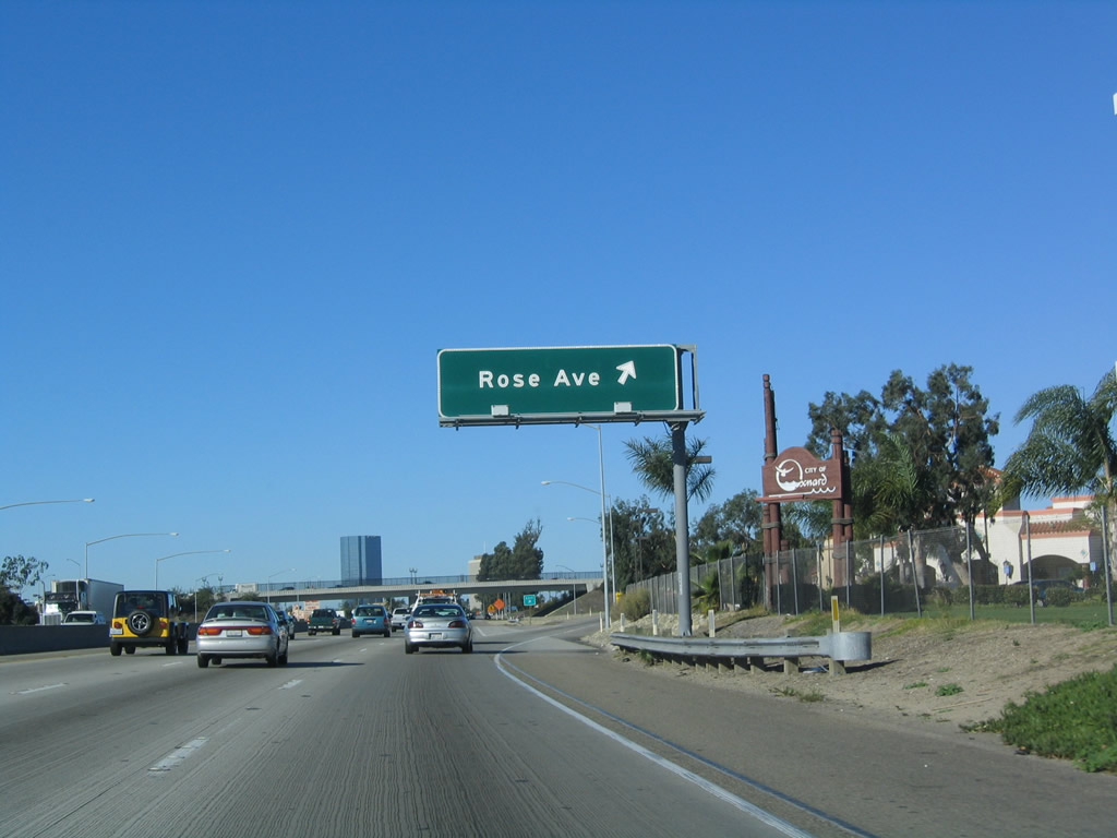
Northbound U.S. 101 (Ventura Freeway) reaches Exit 61, Rose Avenue. A city-placed entry monument for Oxnard is located next to the overhead sign. The lone skyscraper visible in the distance marks the skyline of the city of Oxnard. Photo taken 12/23/04. |
|
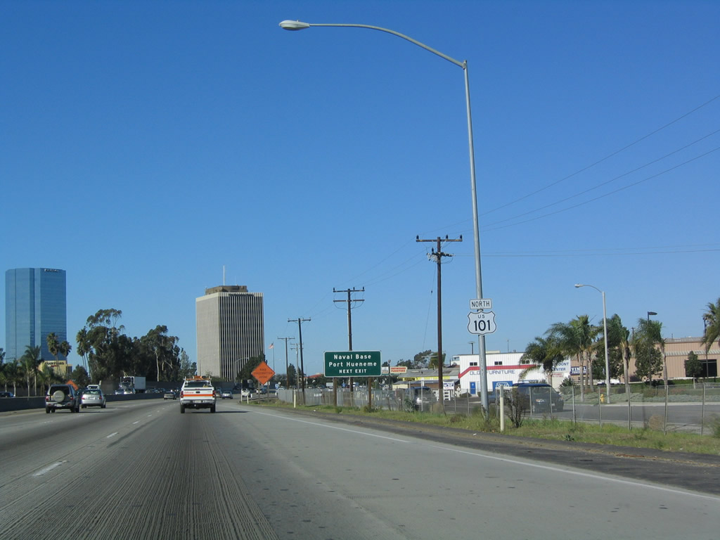
A U.S. 101 north reassurance shield is posted after the on-ramp from Exit 61, Rose Avenue. The next exit along northbound is Exit 62A, California 232 (Vineyard Avenue) to downtown Oxnard. Photo taken 12/23/04. |
|
|
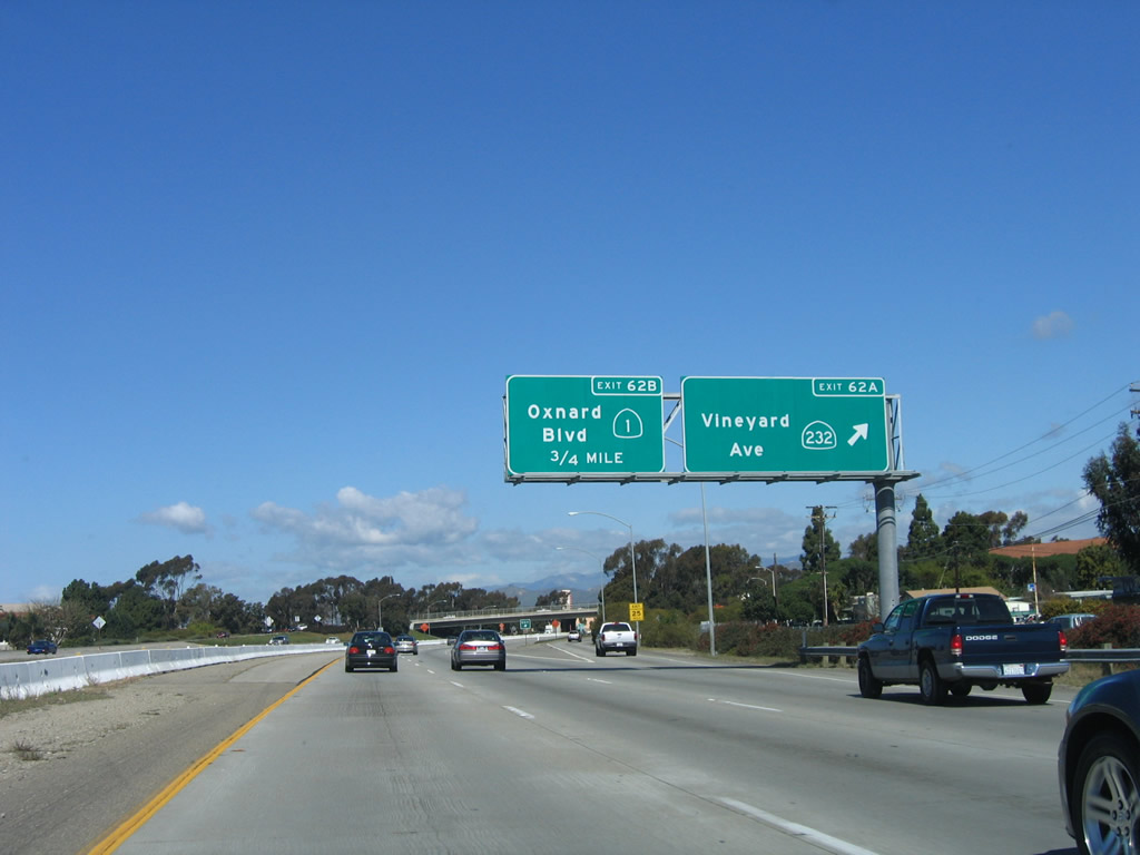
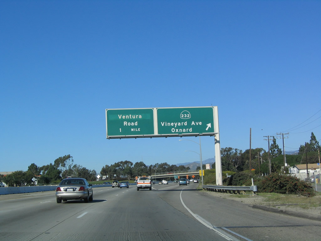
Northbound U.S. 101 (Ventura Freeway) reaches Exit 62A, California 232 (Vineyard Avenue). California 232 is a short state route that travels north to connect to California 118 (Los Angeles Avenue) and south to meet California 1/Oxnard Boulevard (Pacific Coast Highway) in downtown Oxnard. Both California 232 and California 34 meet their end along California 1 in Oxnard. Photos taken 03/18/06 and 12/23/04. |
|
|
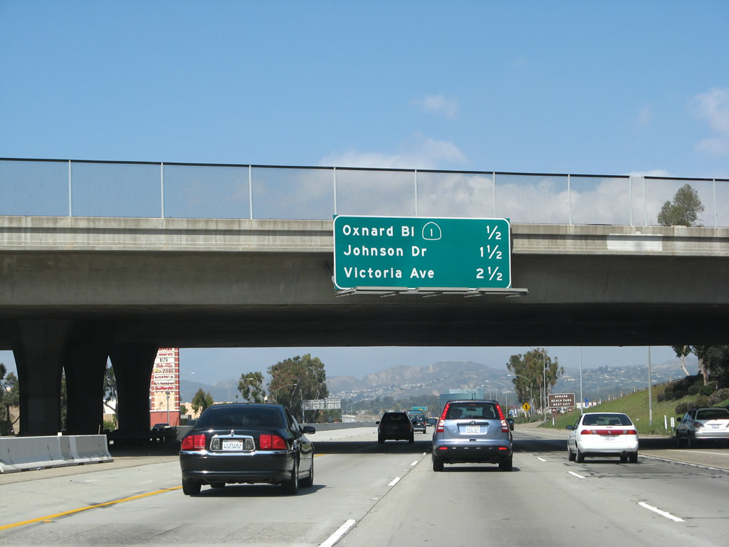
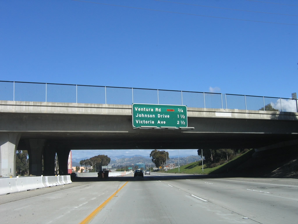
This mileage sign provides the distance to the next three exits along U.S. 101 (Ventura Freeway) north: Exit 62B, California 1/Oxnard Boulevard to Ventura Road; Exit 63, North Bank Drive to Johnson Drive; and Exit 64, Victoria Avenue. Photos taken 09/29/07 and 03/18/06. |
|
Use Exit 62 to Ventura Road south to Oxnard Airport, McGrath State Beach (via Gonzales Road west), and Channel Islands Harbor. This interchange was reconstructed in the early and mid-2000s, resulting in a much wider freeway over the Santa Clara River and an improved flow of traffic through the Oxnard Boulevard interchange. In 2004, the interchange was closed; it had reopened by 2006. Photo taken 12/23/04. |
|
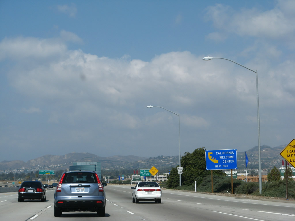
A California Welcome Center is located at Exit 62B. Maps, tourist brochures, and traveler information is available at the welcome center. Unlike most states, California tends to place its welcome centers throughout the state and rarely at border crossings. Photo taken 09/29/07. |
|
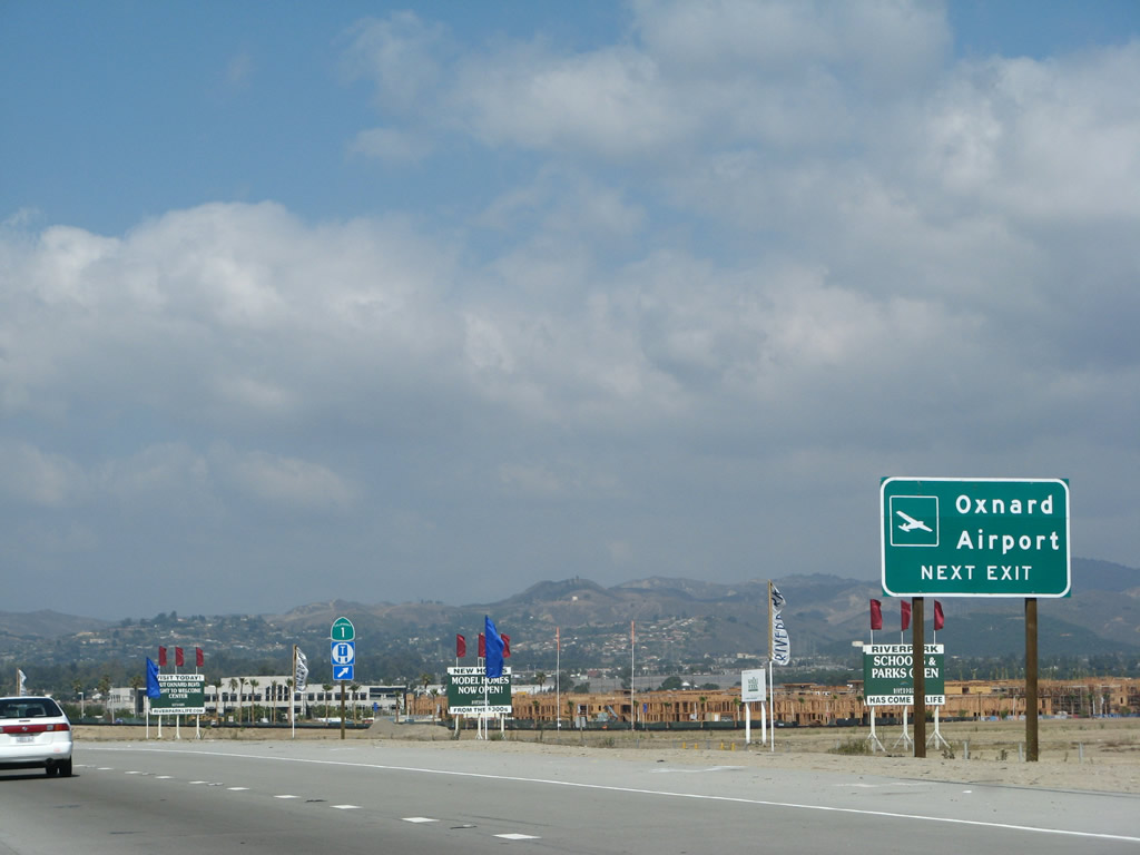
Use Ventura Road south to Oxnard Airport. Photo taken 09/29/07. |
|
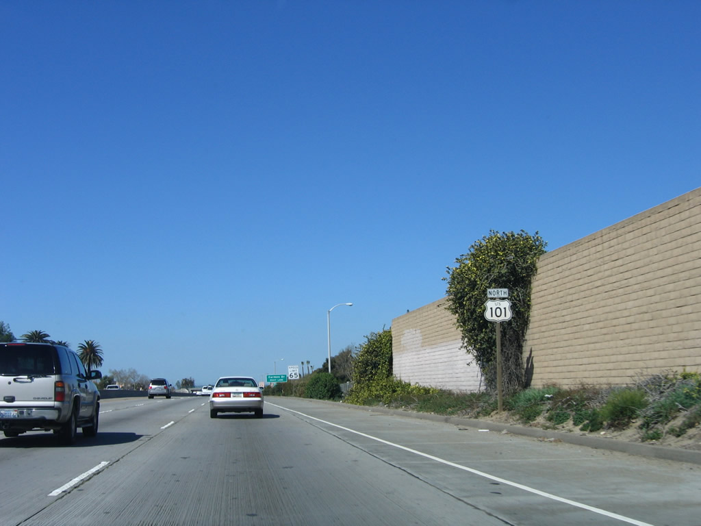
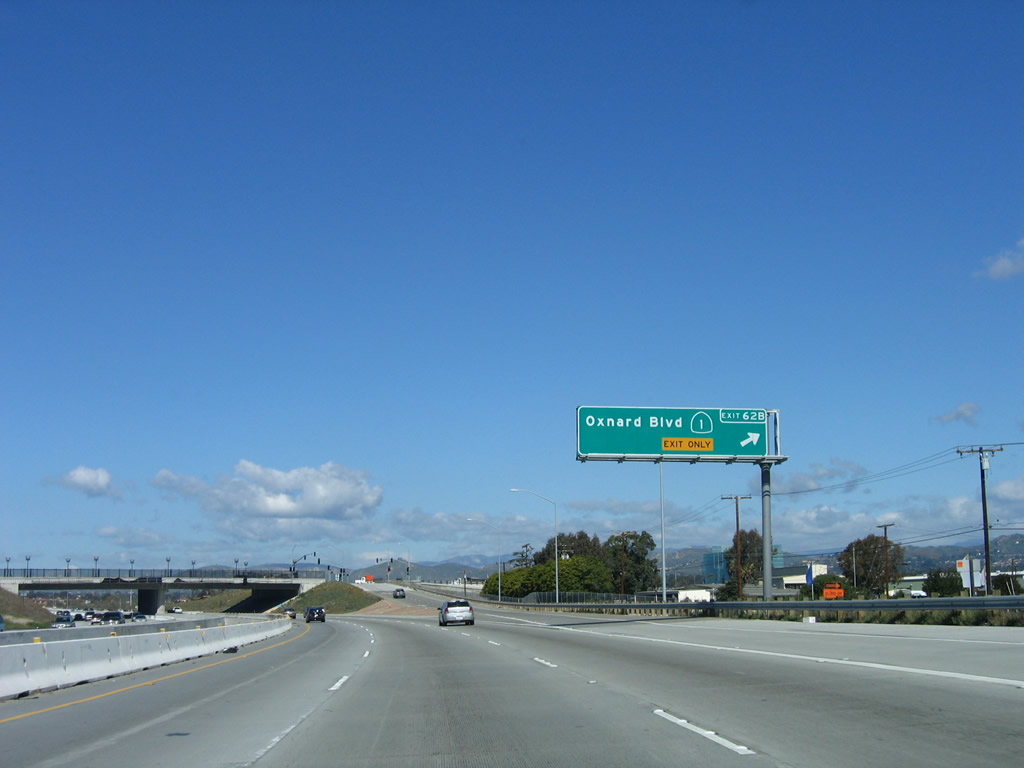
Northbound U.S. 101 (Ventura Freeway) reaches Exit 62B, California 1/Oxnard Boulevard south and Oxnard Boulevard north to Ventura Road. After this interchange, California 1 silently merges onto U.S. 101 north (west) all the way to the split north of Gaviota, with the exception of a short extant section through Solimar Beach, Faria Beach, and Seacliff in western Ventura County. No California 1 shields are signed along U.S. 101 on reassurance shield assemblies or overhead signs in the northbound direction, but overhead signs point to California 1 in the southbound direction. Photo taken 03/18/06. |
|
The completed Oxnard Boulevard bridge is next, as well as erroneous signage for California 1 north. Through traffic for California 1 north should follow U.S. 101 north, rather than exit here and turn north on Oxnard Boulevard. Photo taken 09/29/07. |
|
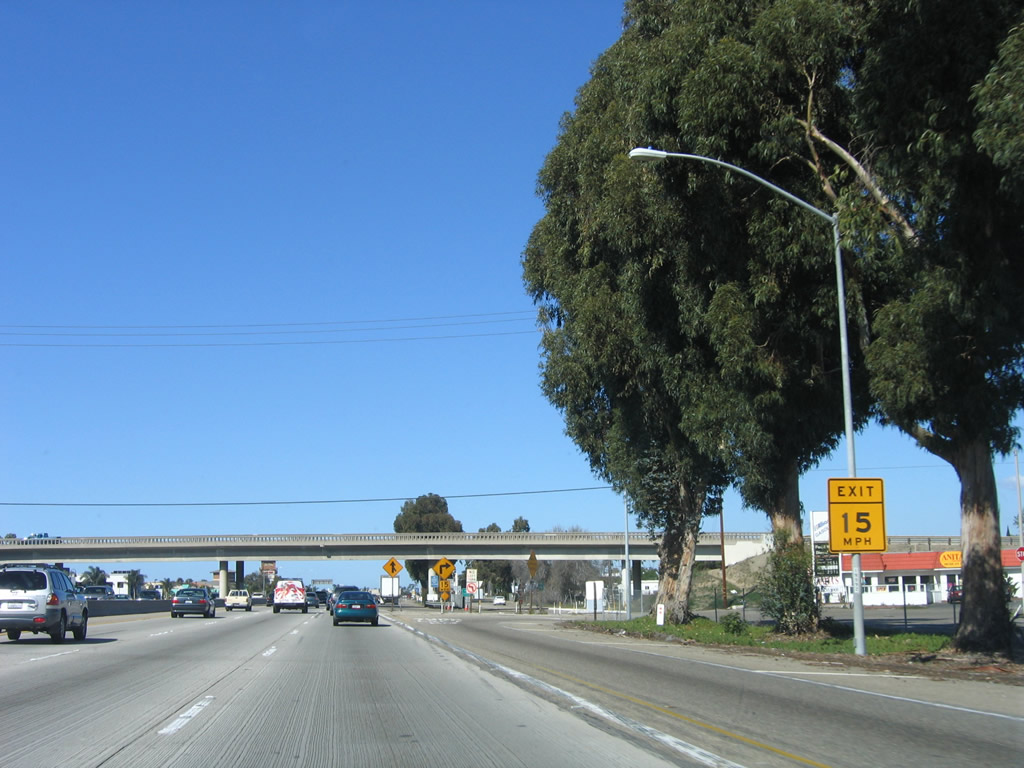
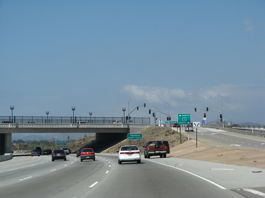
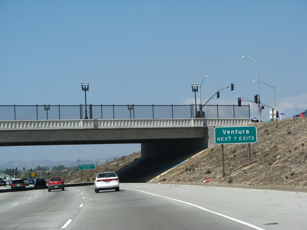
The next seven exits will serve the city of Ventura. Photo taken 09/29/07. |
|
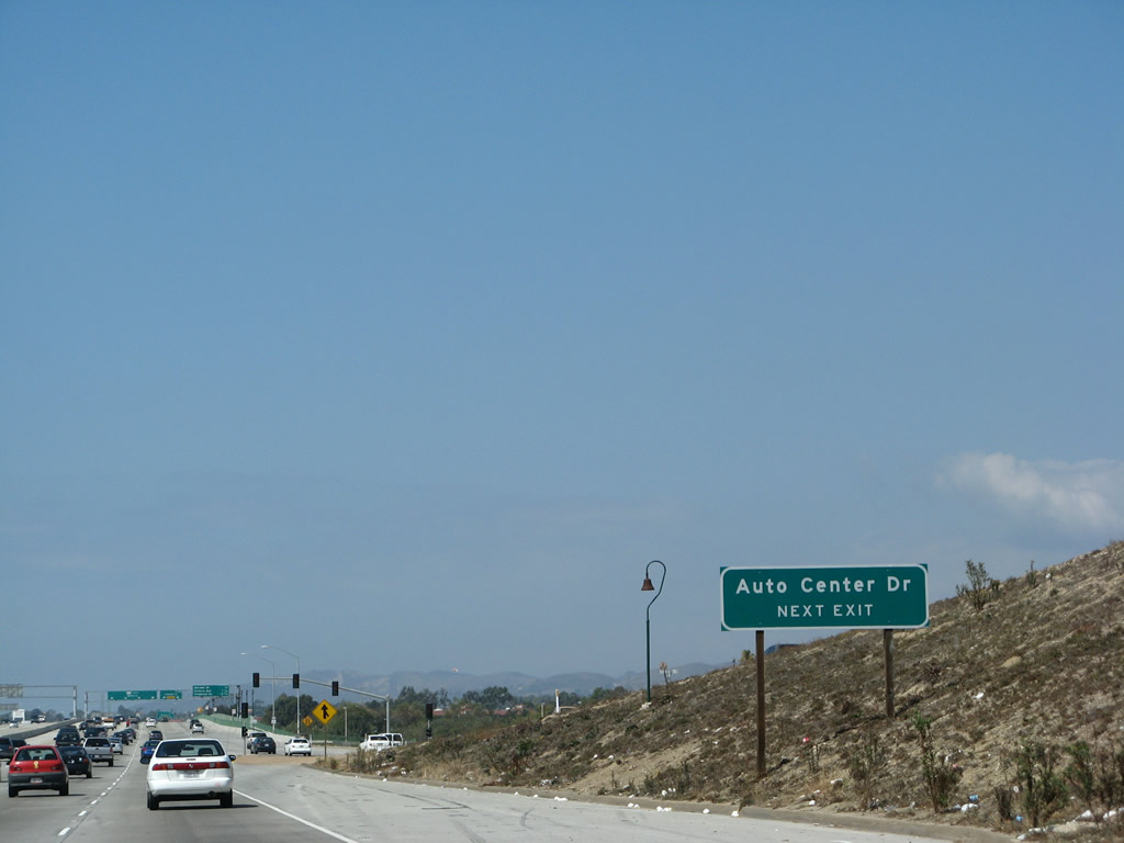
The next exit along U.S. 101 north (and also California 1 north) will be Exit 63, Auto Center Drive and Johnson Drive. Photo taken 09/29/07. |
Page Updated March 8, 2009.