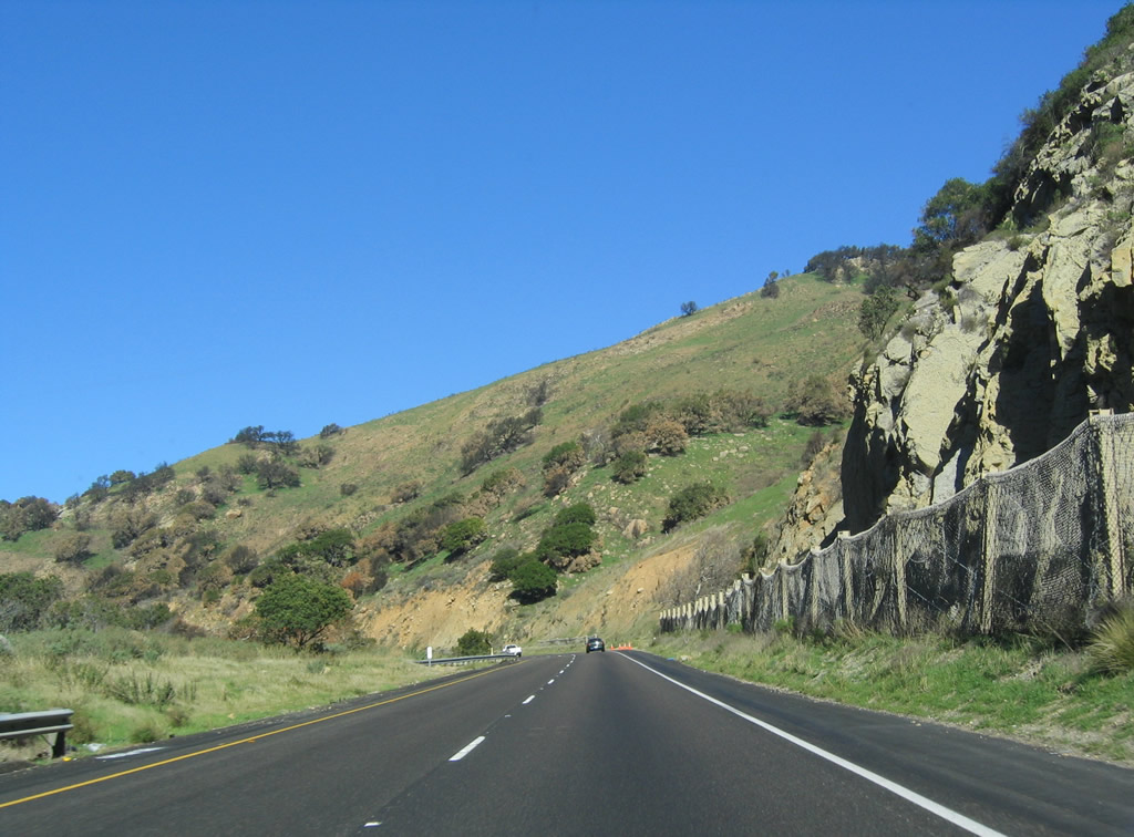
Continuing within sight of the Pacific Ocean, U.S. 101 hugs the coast as it leaves Ventura County and enters Santa Barbara County. The segment of freeway passing through downtown Santa Barbara was constructed in the late 1980s, and there are several instances where the freeway reverts to expressway status in the county. At Gaviota, U.S. 101 leaves the coast, turning due north toward Santa Maria and San Luis Obispo, two major Central California cities. Passing alongside the coast and mountains, traversing old bridges and passing through a tunnel, this segment of U.S. 101 is truly a crown jewel in California's freeway system.
| U.S. 101 (El Camino Real) and California 1 north |
|
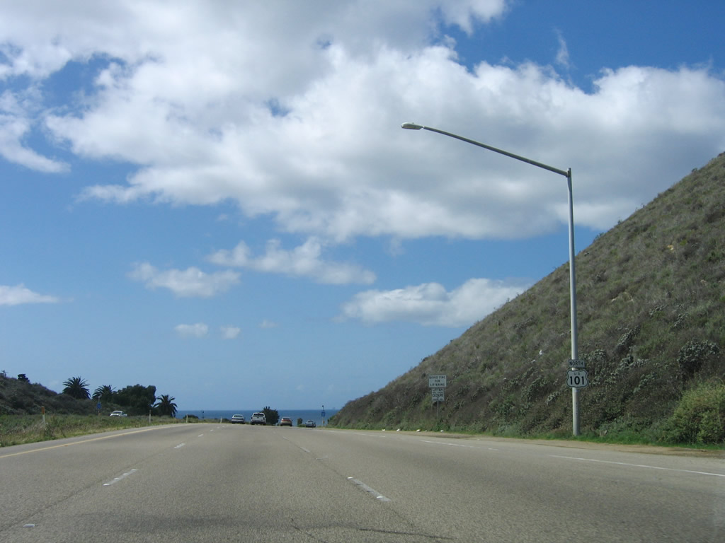
A U.S. 101 reassurance shield is posted after the on-ramp from Exit 120, Refugio Road to Refugio State Beach. Photo taken 03/18/06. |
|
The climbing lane ends shortly thereafter. Photo taken 12/23/04. |
|
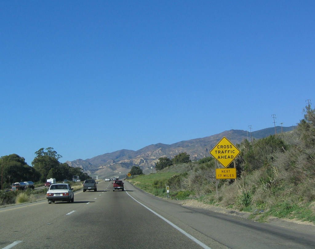
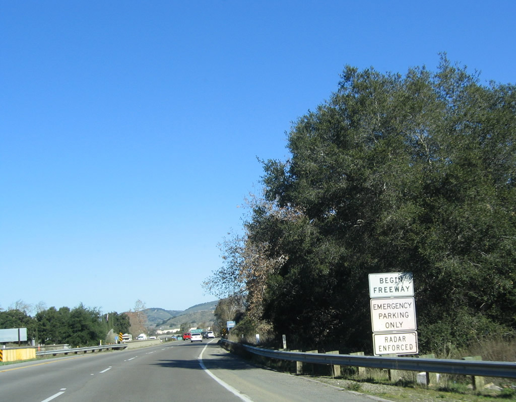
The U.S. 101 freeway agains transitions to an expressway alignment; watch for cross traffic. Photo taken 03/18/06. |
|
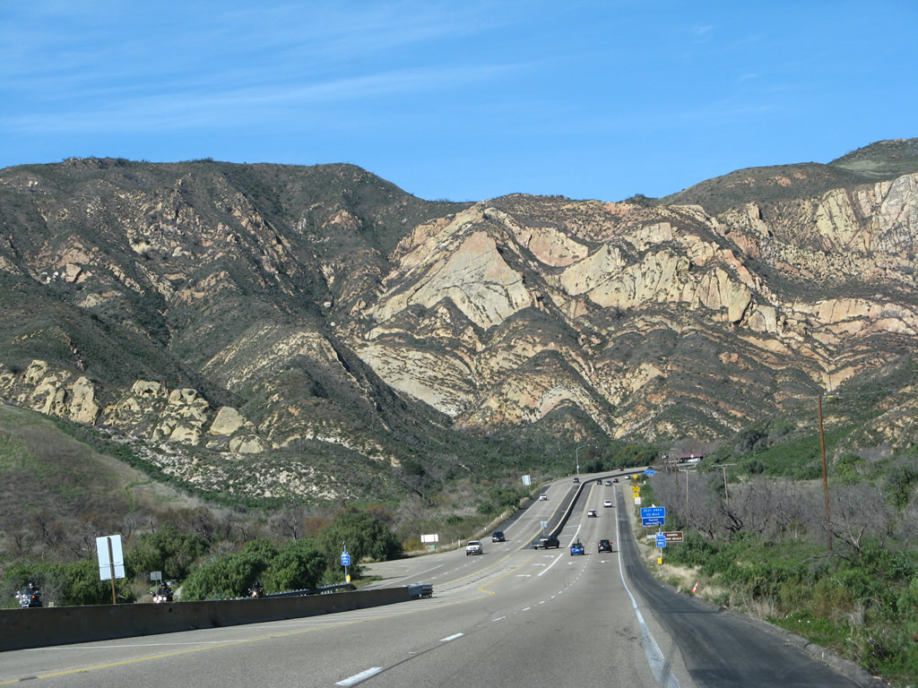
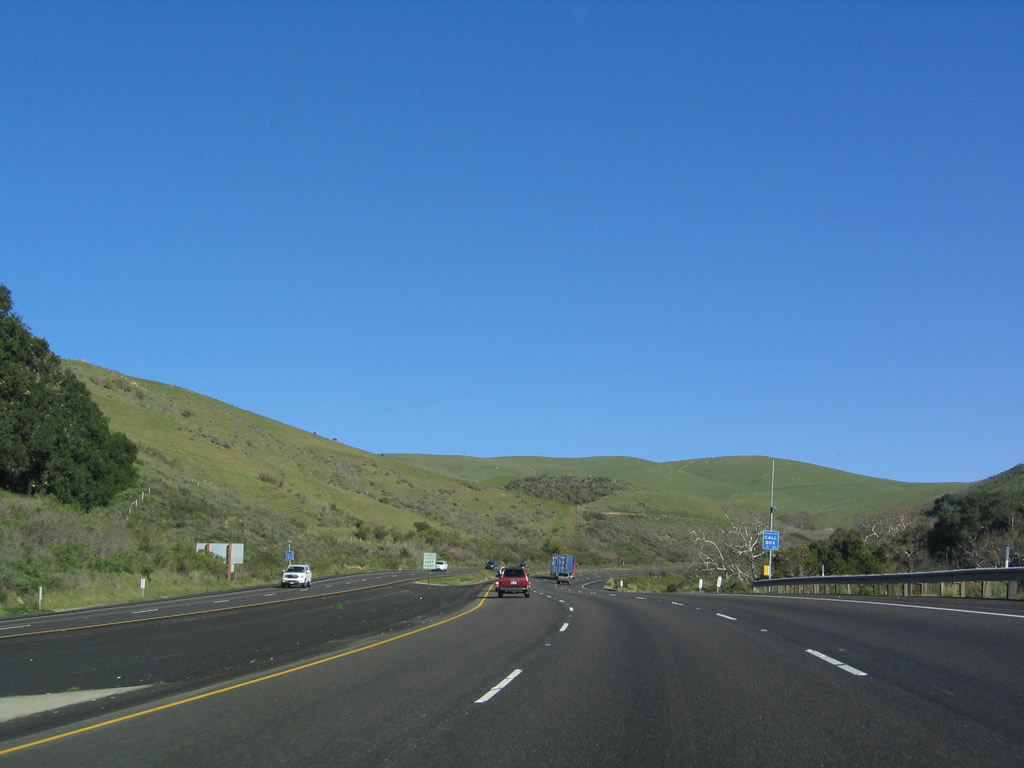
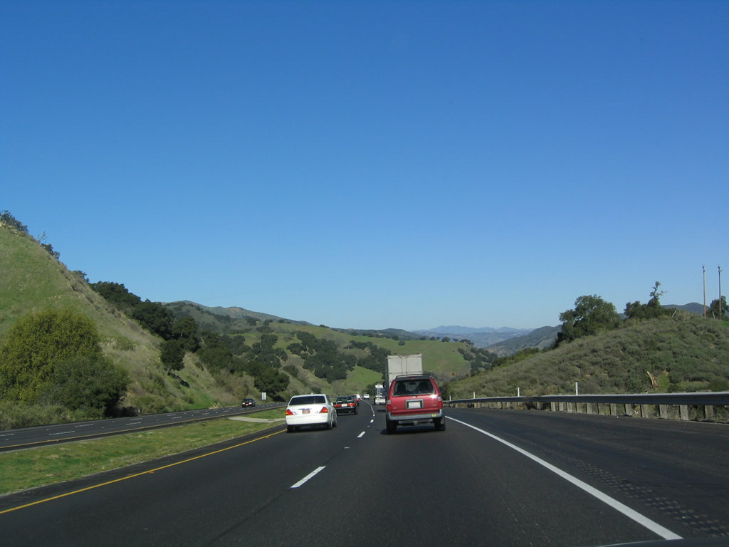
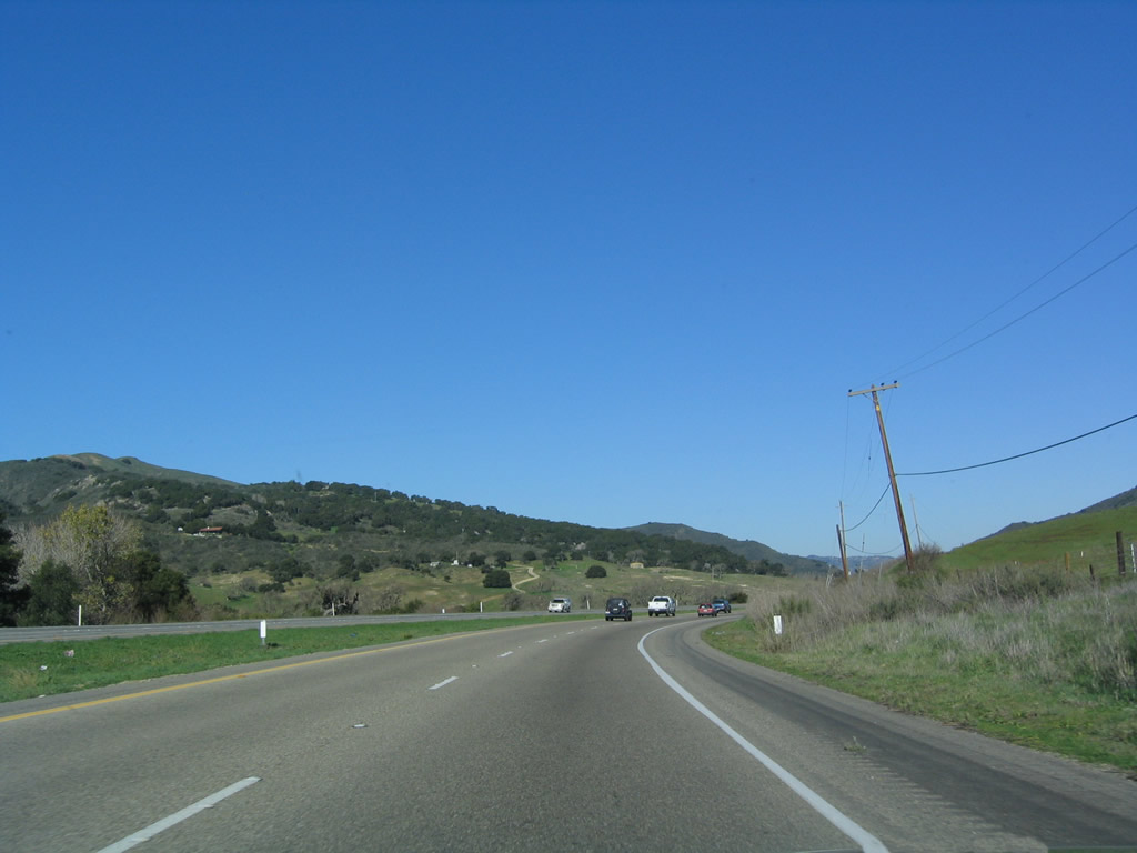
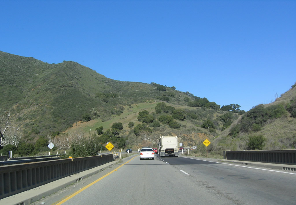
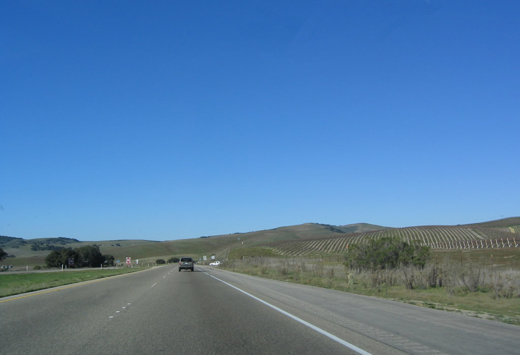
Staying on a bluff overlooking the ocean, U.S. 101 will spend the next 12 miles enjoying spectacular ocean and coastal mountain scenery. The Union Pacific Railroad, which carries the north-south Amtrak passenger rail connection between Los Angeles and San Francisco, stays close to U.S. 101 between the highway and the beach. At Gaviota, the railroad will continue west along the coastline toward Point Conception, while U.S. 101 will turn north toward Buellton and points north. Photo taken 03/18/06. |
|
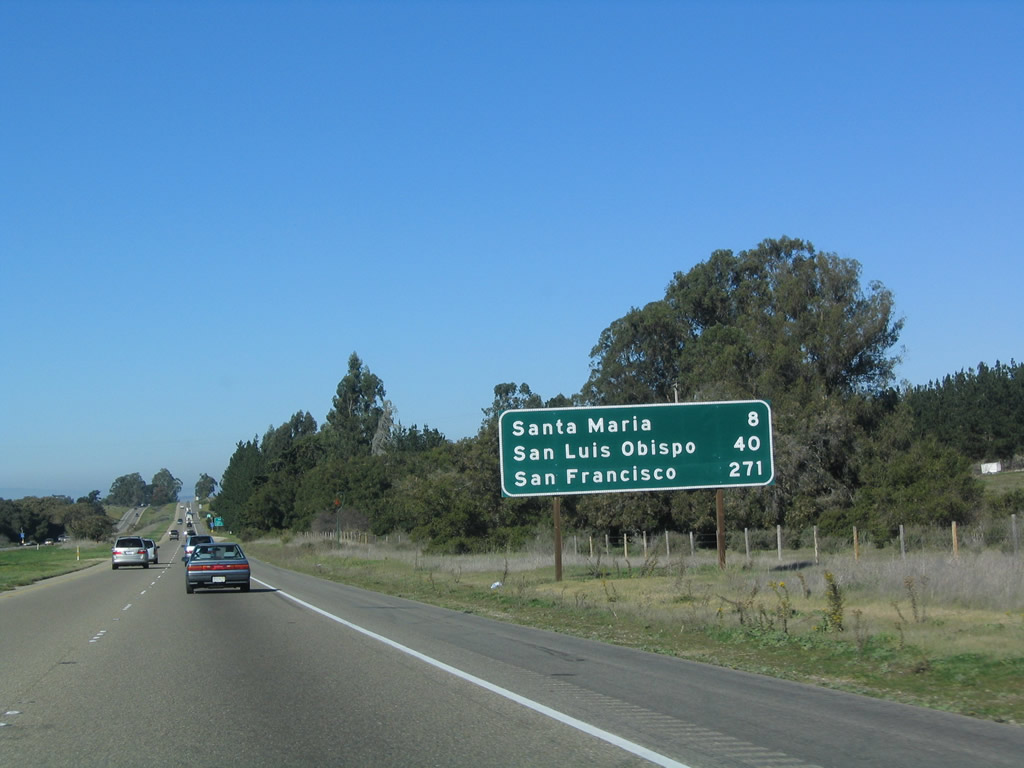
This mileage sign provides the distance to Gaviota (7 miles), Santa Maria (50 miles), and San Francisco (314 miles). Photo taken 12/23/04. |
|
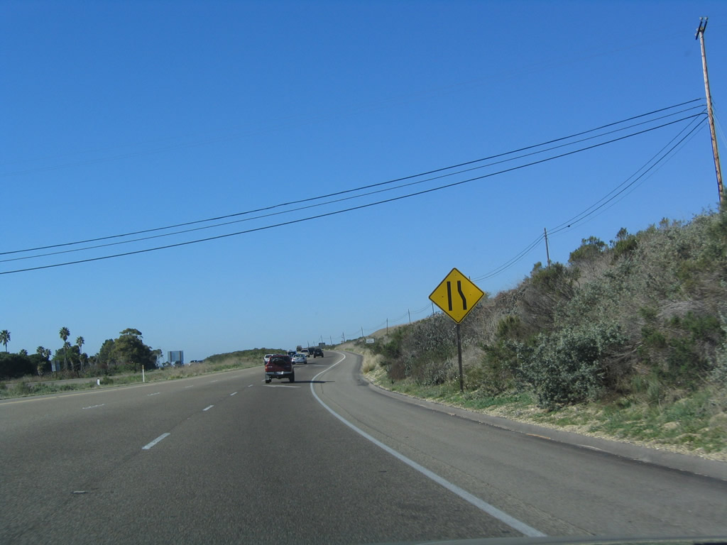
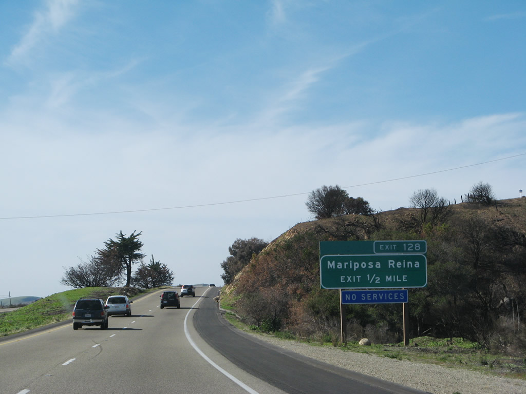
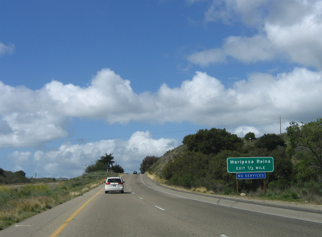
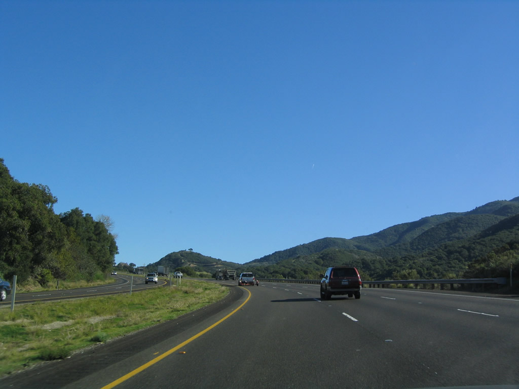
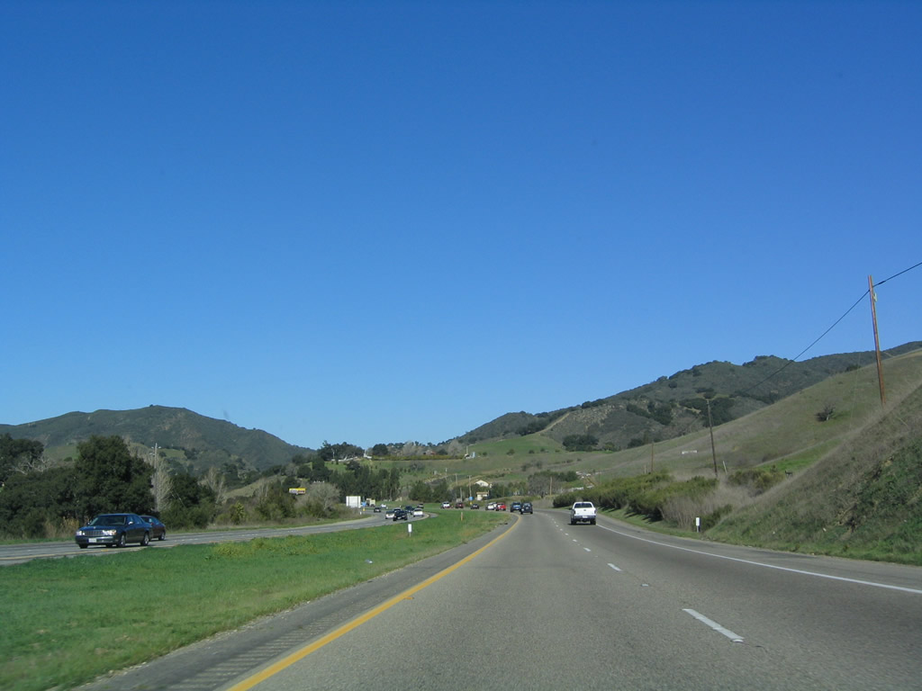
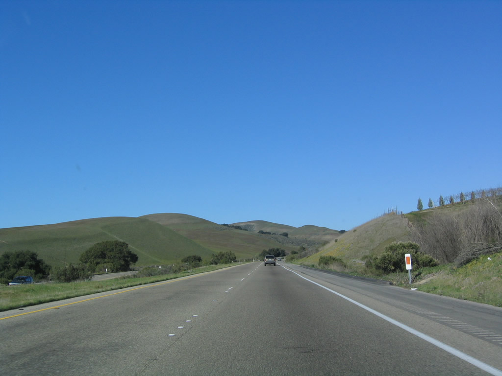
While there are certain interchanges in the next 17 miles (such as Exit 128, Mariposa Reina and Exit 132, California 1 northwest to Lompoc), there are also plenty of at-grade crossings. Photo taken 12/23/04. |
|
The first at-grade intersection is with Arroyo Quemada Lane. Turn left to Tajiguas along the coast. Photo taken 03/18/06. |
|
Dominant views of the Santa Ynez Mountains compete with the serenity of the Pacific Ocean along U.S. 101 west. Photo taken 03/18/06. |
|
The next intersection is with Tajiguas Landfill Road north to the county landfill. Photo taken 03/18/06. |
|
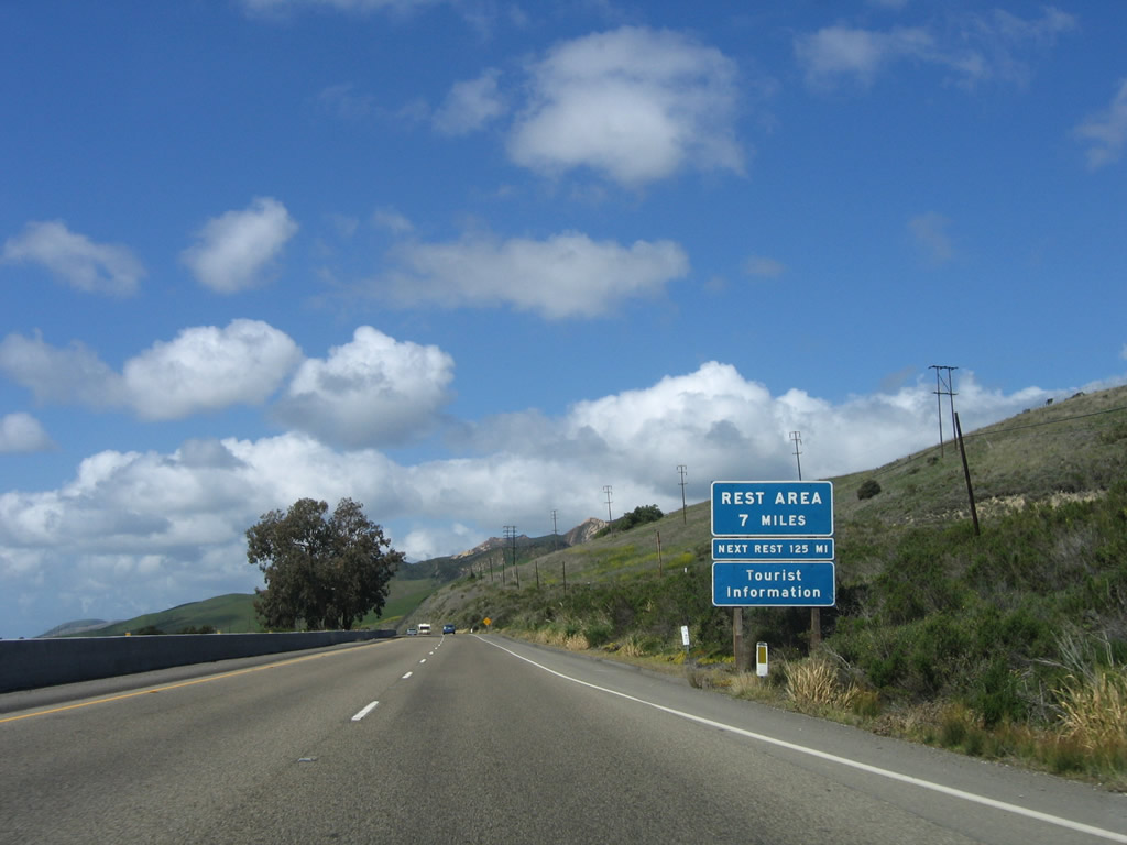
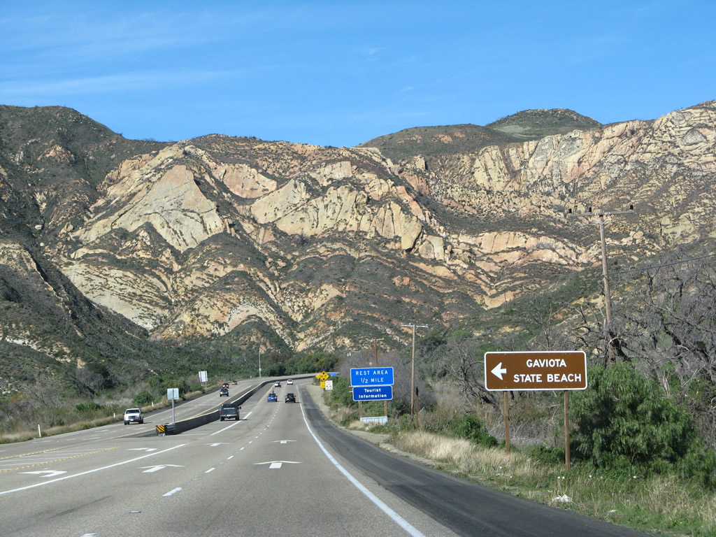
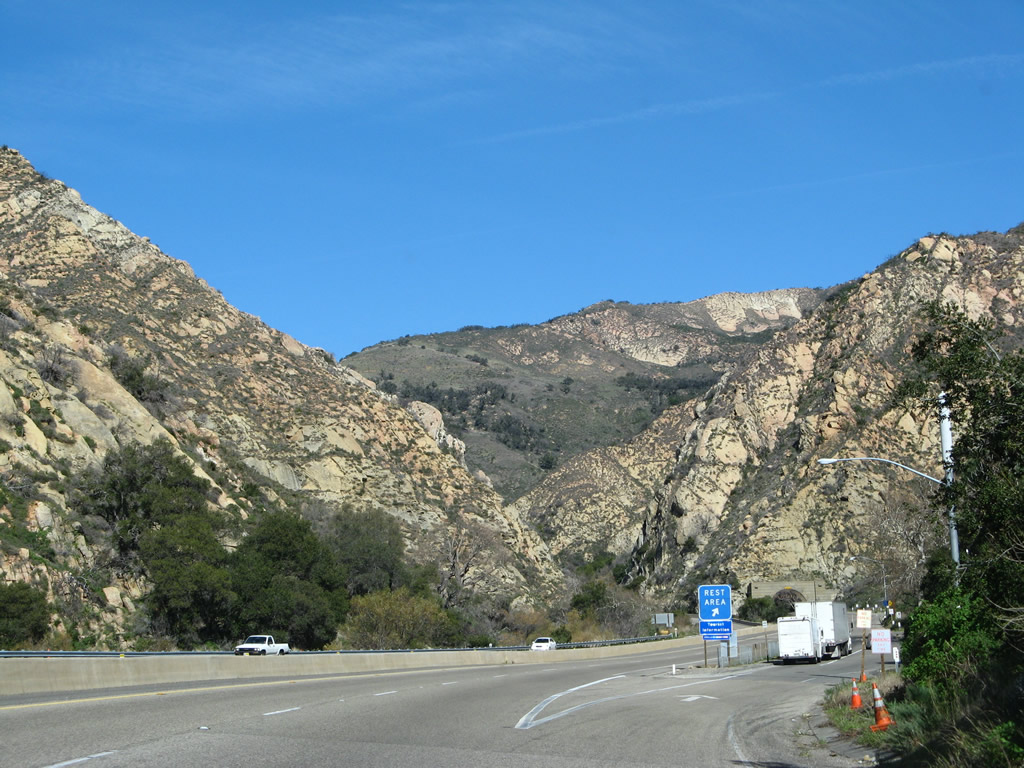
A rest area is located after the Gaviota exit, seven miles northwest of here. U.S. 101 will next cross over Arroyo Hondo, which is bridged by a historic multi-arch bridge by U.S. 101's southbound lanes. Photo taken 03/18/06. |
|
Local and ranch access is provided at this turnoff to a private road. A U-turn ahead provides the connection from this local road to U.S. 101 south. Photo taken 03/18/06. |
|
Leaving the Arroyo Hondo Preserve behind, U.S. 101 approaches the aforementioned U-Turn. A right turn connects to a private driveway. The median widens again, but there are more at-grade intersections and regular interchanges ahead. Photo taken 03/18/06. |
|
This intersection connects with Calle Real, the north frontage road (mostly dirt). Photo taken 03/18/06. |
|
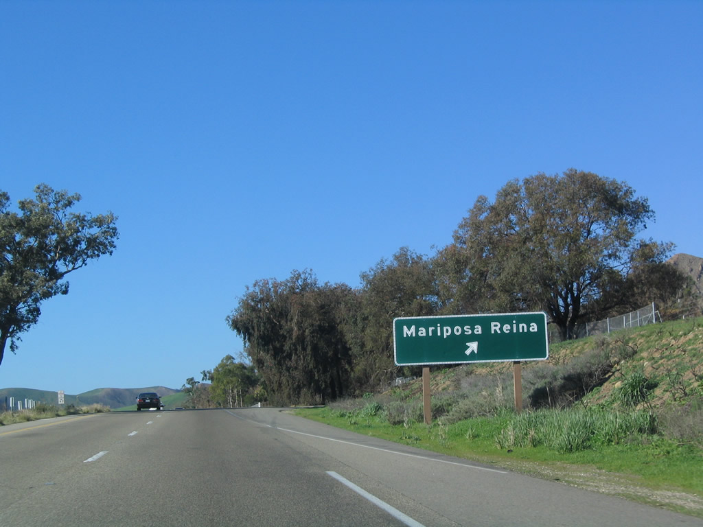
The Mariposa Reina overpass is visible ahead, after the off-ramp to Exit 128, Mariposa Reina. Photo taken 03/18/06. |
|
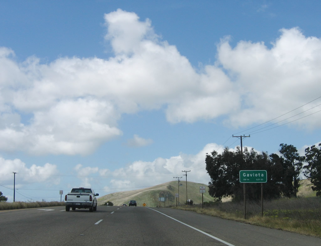
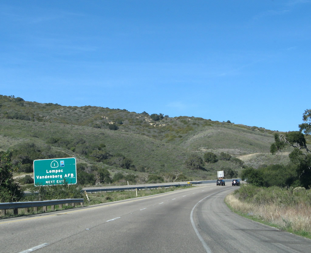
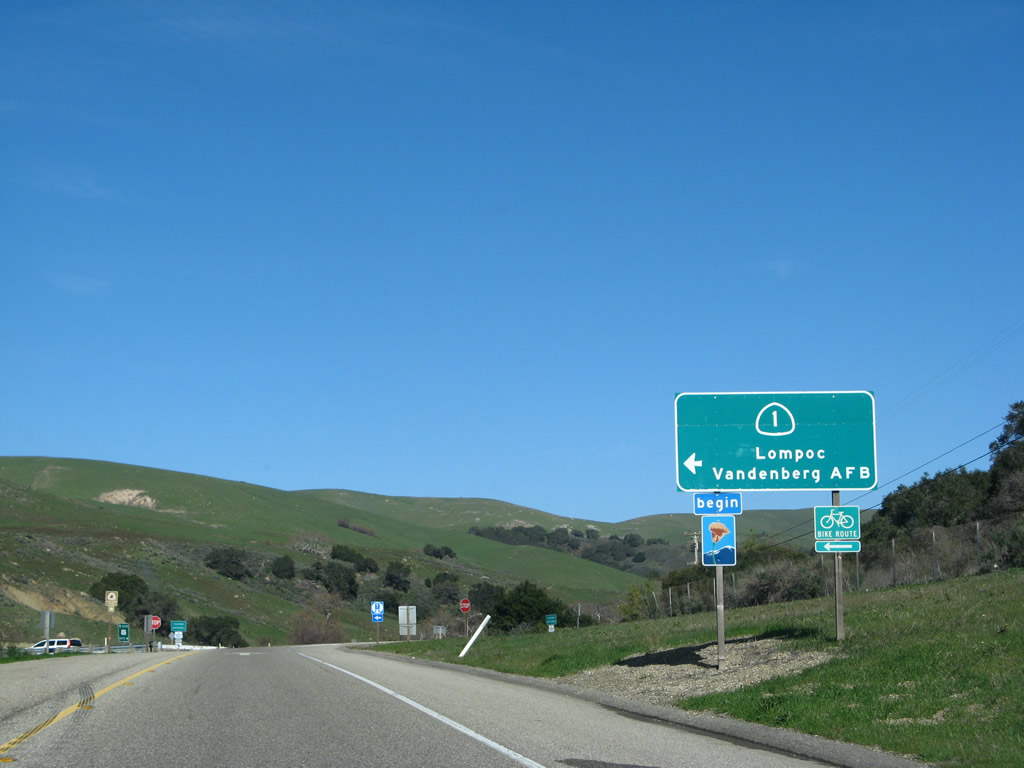
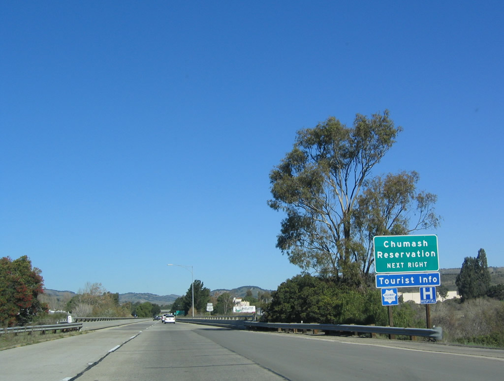
The next left turn leads the eastern reaches of Gaviota Beach State Park. A second connection into the park is located at Exit 130 (at-grade intersection). At this point, U.S. 101 and California 1 enter the unincorporated community of Gaviota. Photo taken 03/18/06. |
|
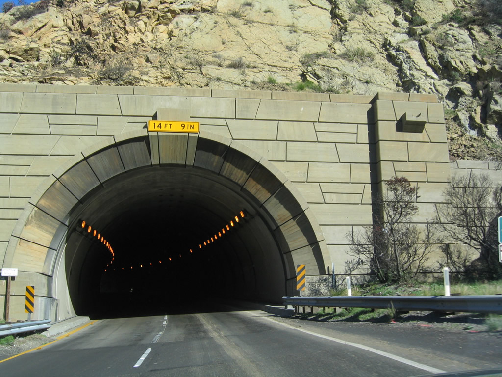
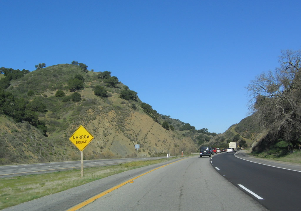
After the Gaviota Beach State Park east turnoff, this sign advises of the Gaviota Gorge Tunnel that will carry U.S. 101 and California 1 north through Gaviota Pass and through the Santa Ynez Mountains toward Buellton and Lompoc. Photo taken 03/18/06. |
|
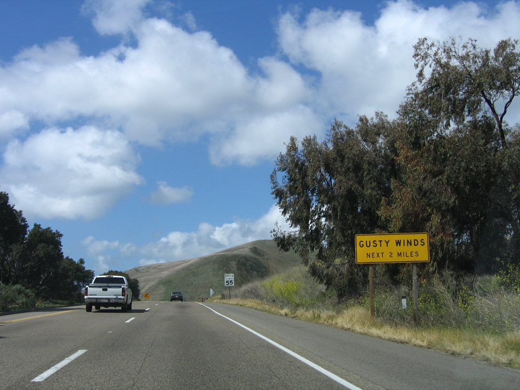
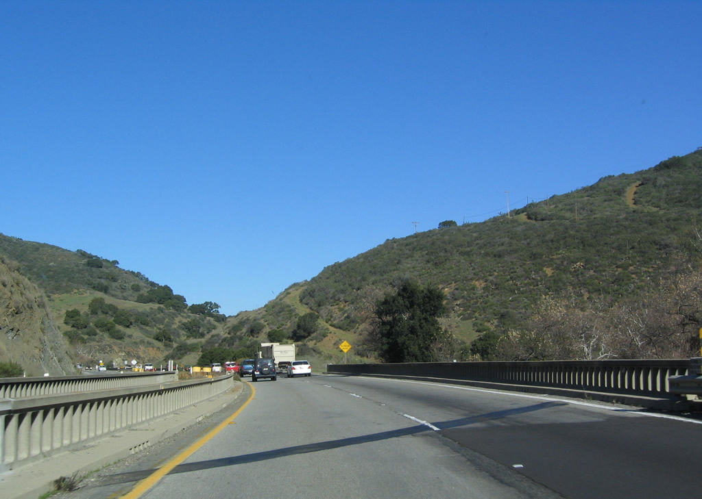
Gusty winds are likely in the next two miles. Photo taken 03/18/06. |
|
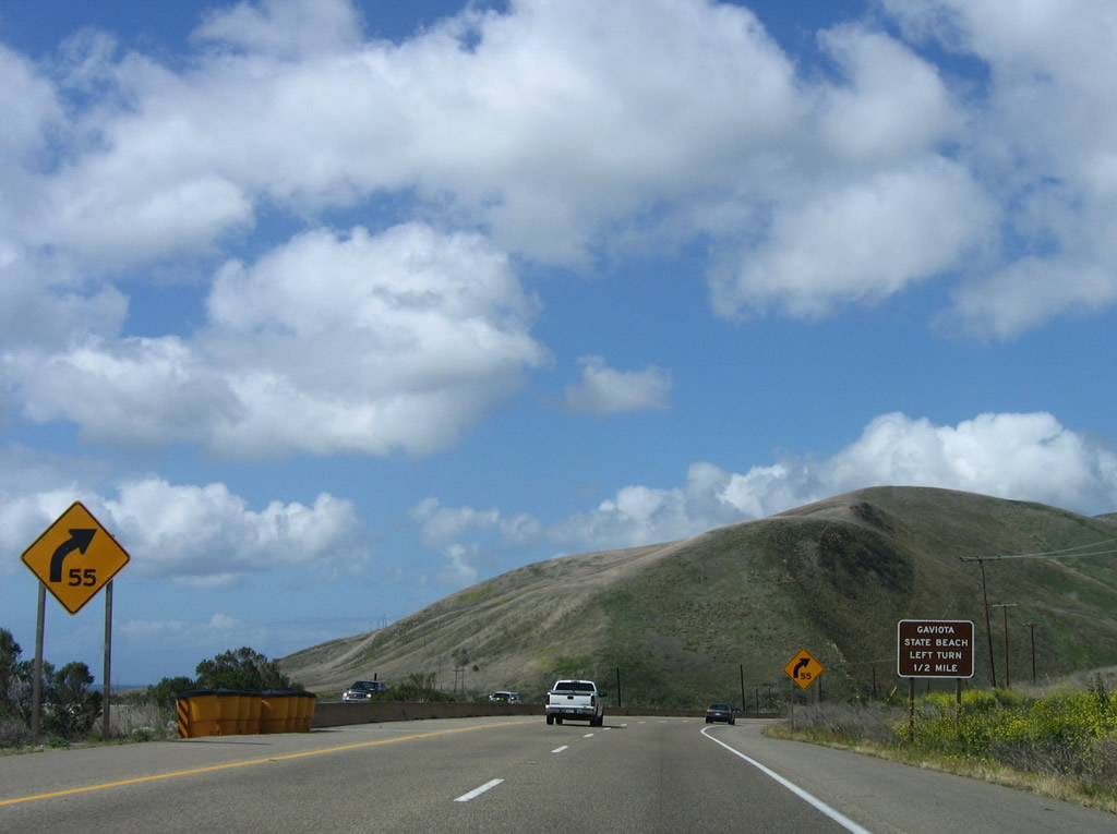
Use the next left turn to Gaviota Beach State Park (Exit 130). This is the last beach exit along northbound; U.S. 101 makes a sharp turn inland from here, and it will not see the ocean again until near Pismo Beach. The section of coast west of Gaviota (including Point Conception and Point Arguello) is considered to be the "lost coast," because it is largely inaccessible and unpopulated from here north to Vandenberg Air Force Base. Photo taken 03/18/06. |
|
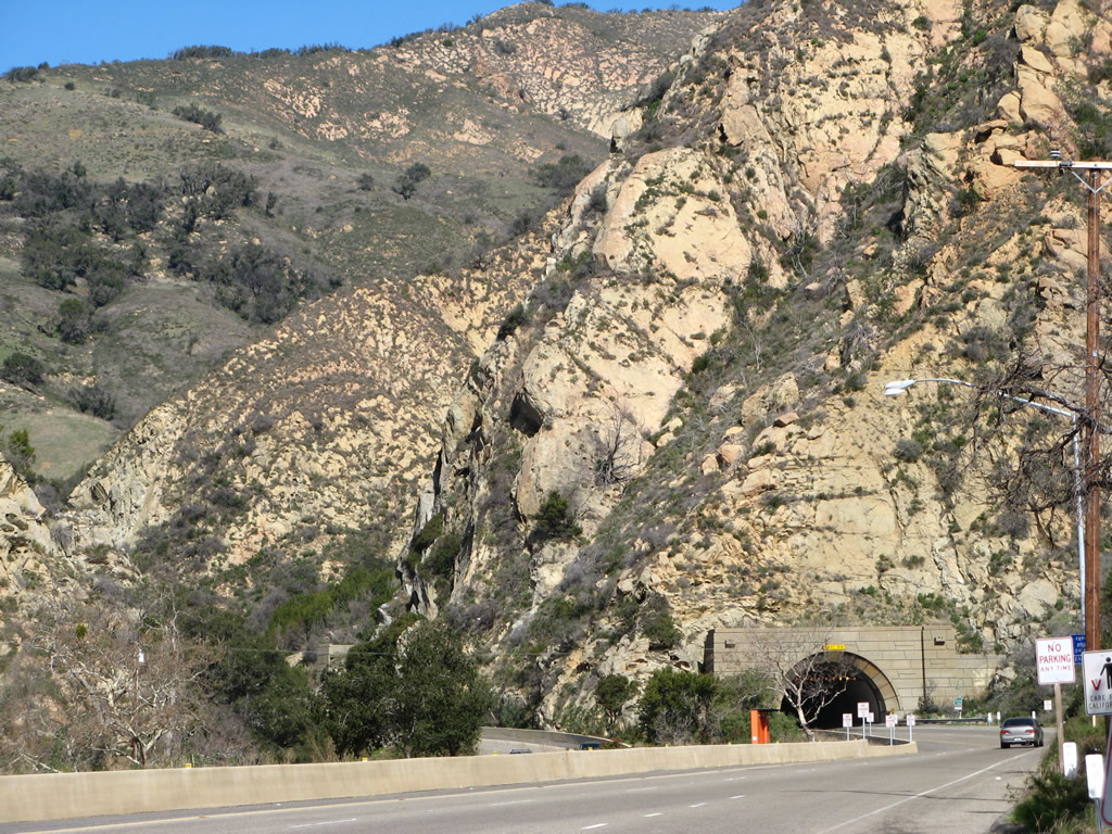
Prior to "Exit 130," U.S. 101 offers this dramatic view looking north toward Gaviota Pass. The freeway now turns due north for the first time since leaving Los Angeles and will now journey into interior Santa Barbara County. Photo taken 02/02/08. |
|
Northbound U.S. 101 and California 1 reach Exit 130, Gaviota Beach State Park. The next exit is Exit 131, Gaviota Rest Area, the first rest area along northbound. Photo taken 02/02/08. |
|
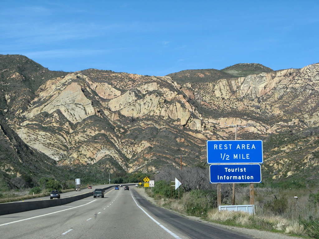
The next exit is Exit 131, Gaviota Rest Area (0.50 mile). Photo taken 02/02/08. |
|
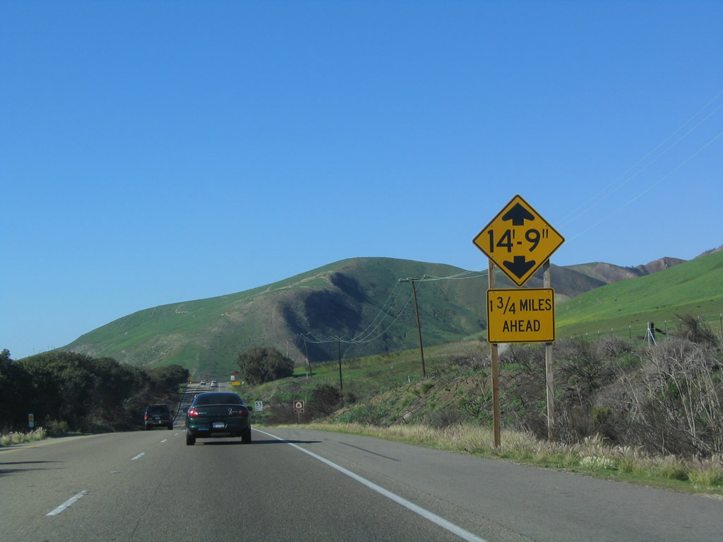
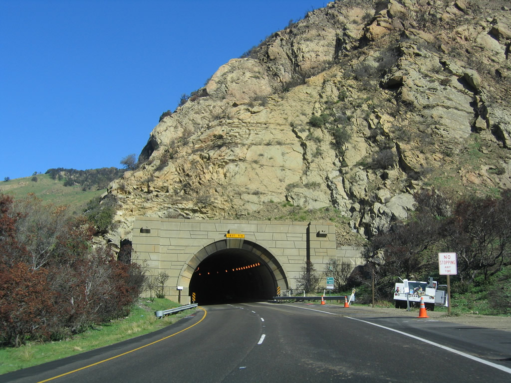
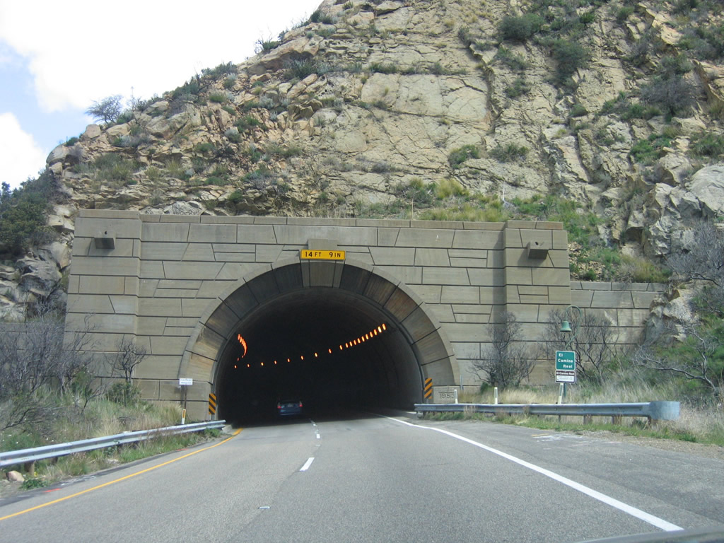
The Gaviota Gorge Tunnel's height allows for a maximum vehicle height of 14 feet, nine inches. High profile vehicles have no alternative around the tunnel except to use California 154 over San Marcos Pass. Built in 1953, the tunnel allowed U.S. 101 to be widened to four lanes through Gaviota Pass. Photo taken 02/02/08. |
|
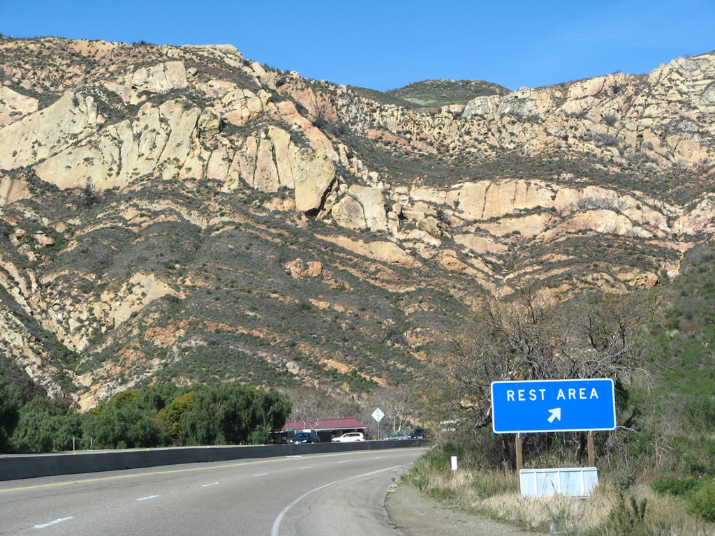
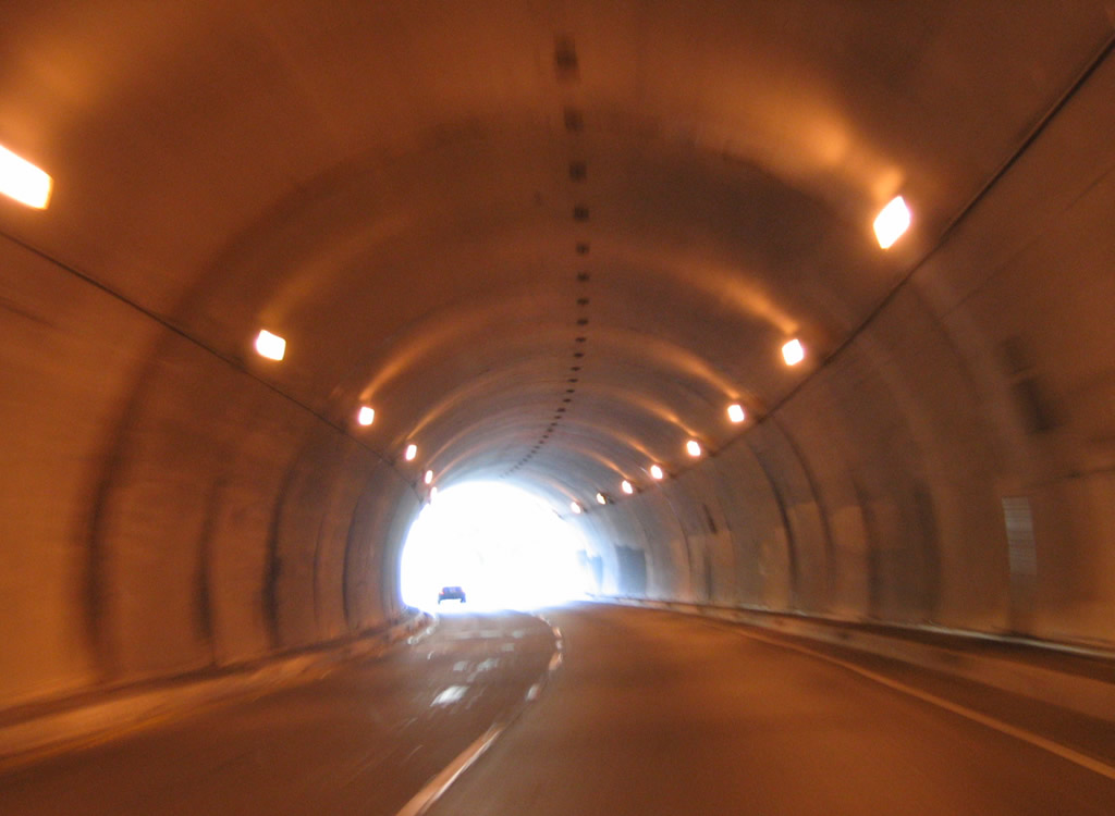
Northbound U.S. 101 and California 1 reach Exit 131, Gaviota Rest Area. Bicycles are allowed on this stretch of freeway due to the lack of alternatives through Gaviota Pass, so watch for them in the tunnel ahead. Photo taken 02/02/08. |
|
Some tourist information is available at Gaviota Rest Area in the form of signage and panels, but no brochures or maps are typically available here. Photo taken 02/02/08. |
|
A U.S. 101 north reassurance shield is posted shortly thereafter. Photo taken 03/18/06. |
|
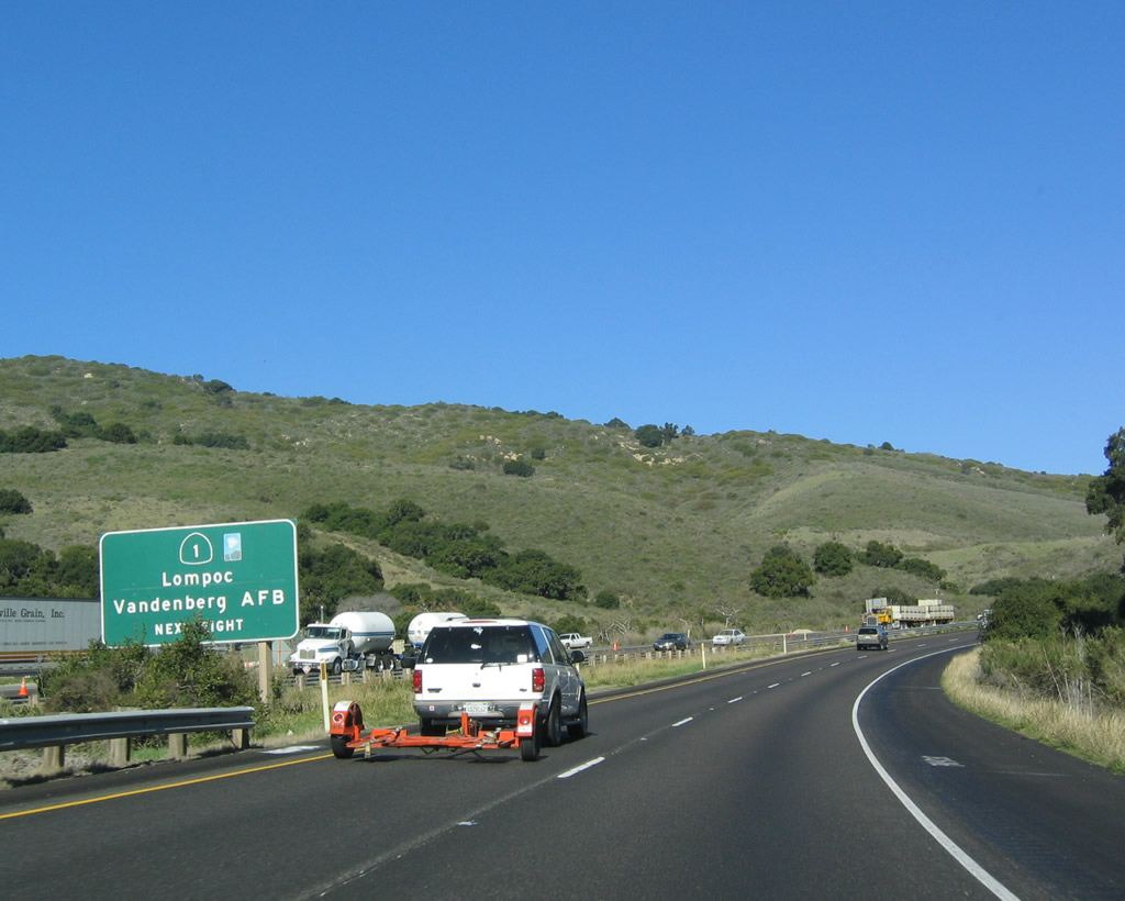
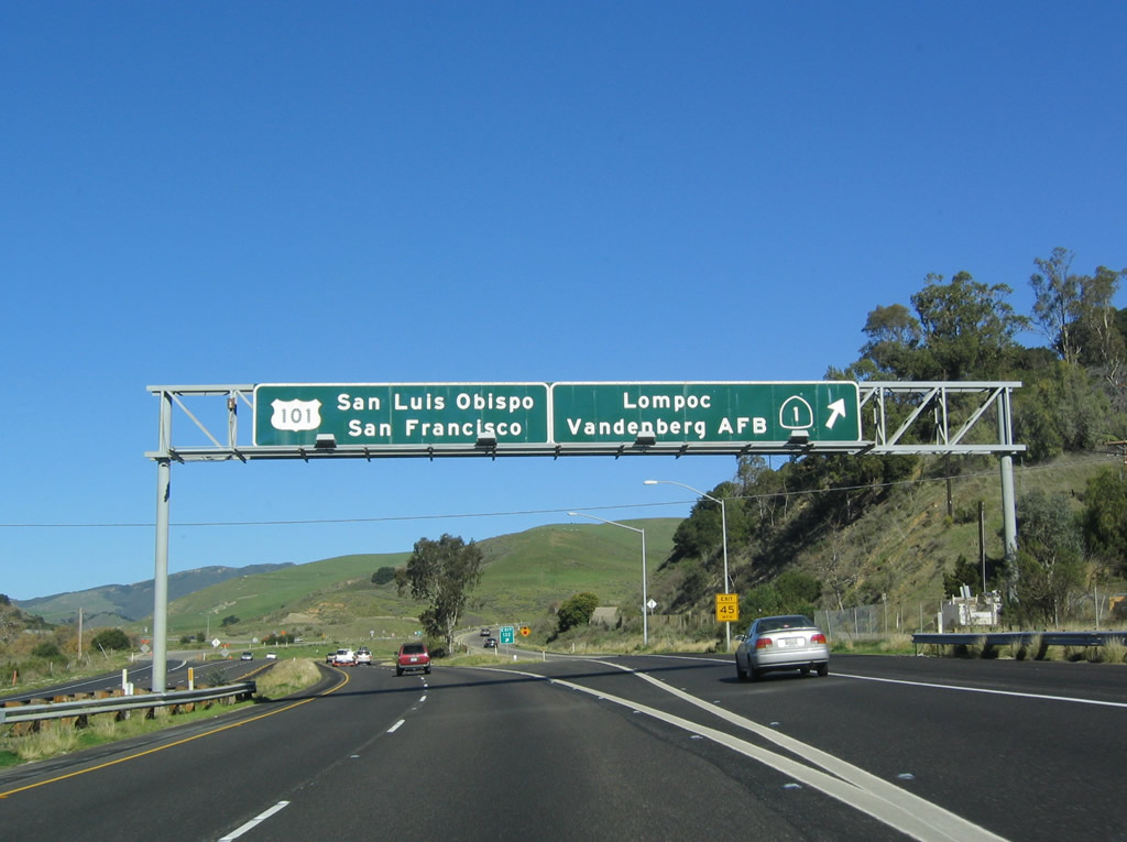
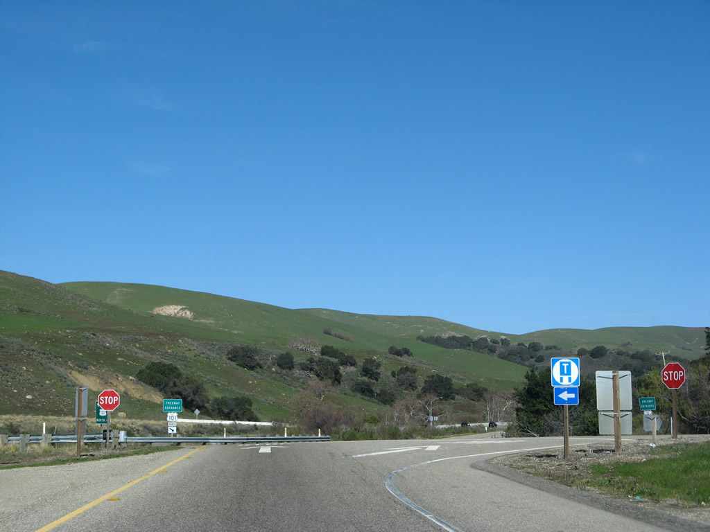
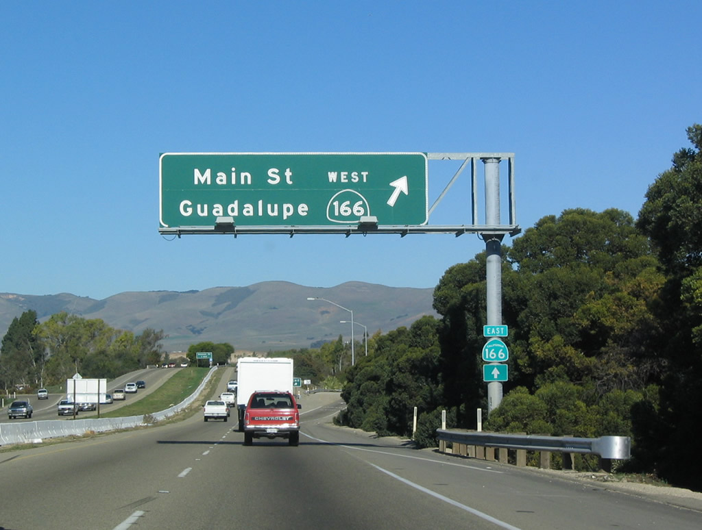
Northbound U.S. 101 and California 1 split at Exit 132. California 1 (Cabrillo Highway) turns northwest toward Lompoc and Guadalupe, then proceeds north to rejoin U.S. 101 again at Milepost 187. U.S. 101 travels north to Buellton, Santa Maria, and San Luis Obispo. Photo taken 12/23/04. |
|
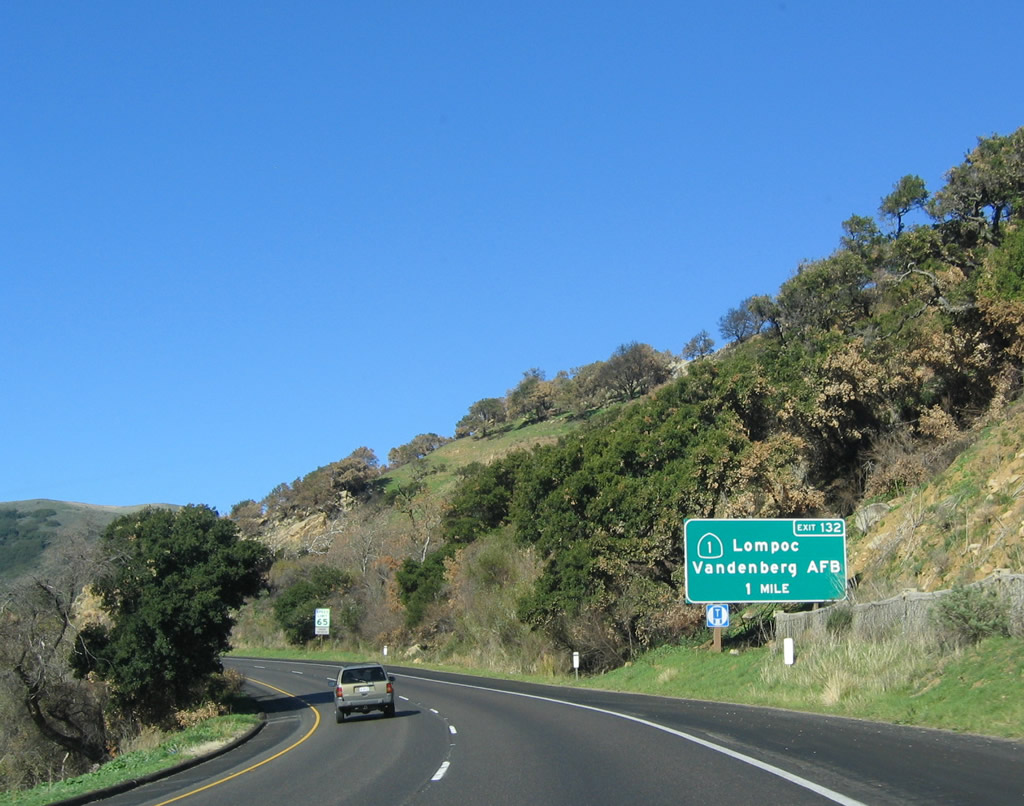
Now on the off-ramp to Exit 132, turn left to follow California 1 north to Lompoc and Vandenburg Air Force Base. Photo taken 02/02/08. |
|
From here, California 1 (Cabrillo Highway) will proceed northwest and uphill between the Santa Ynez Mountains and Santa Rosa Hills, then descend into the Santa Ynez River valley near the city of Lompoc. Photo taken 02/02/08. |
| U.S. 101 north |
|
Back on the mainline of U.S. 101, more streets will cross the expressway, so the freeway temporarily ends again after the California 1 interchange. Photo taken 12/23/04. |
|
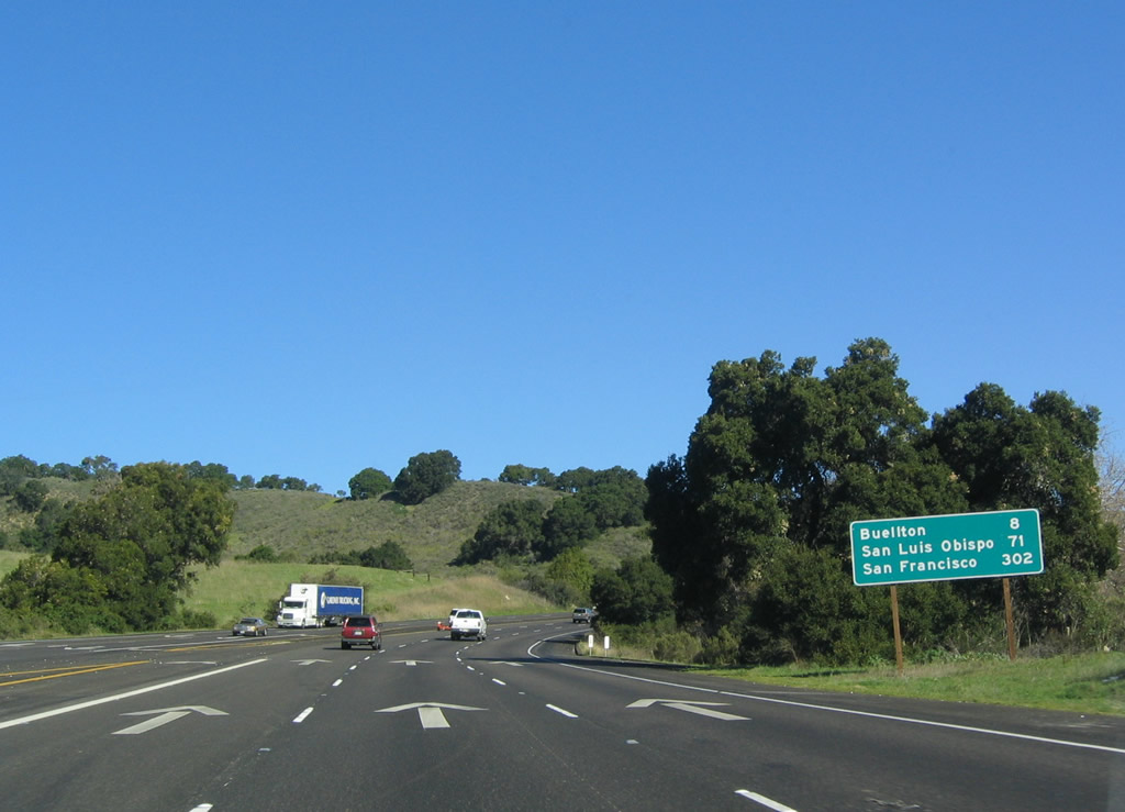
At the intersection with a local access road (possible old alignment of U.S. 101) is this mileage sign that provides the distance to Buellton (eight miles), San Luis Obispo (71 miles), and San Francisco (302 miles). Photo taken 12/23/04. |
|
U.S. 101 begins its ascent up Nojoqui Summit with three northbound lanes. Photo taken 12/23/04. |
|
The expressway travels up to the 920-foot high point of Nojoqui Summit after traveling at or near sea level for the last 30 miles. U.S. 101 will see greater heights further north, especially near San Luis Obispo. Photo taken 12/23/04. |
|
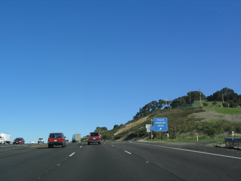
A private driveway departs to the east while U.S. 101 finally reaches Nojoqui Summit. A truck parking area is available at the summit for motorists to test brakes before the upcoming downgrade. At the end of the truck parking area is an intersection with La Lata Place, which is an old alignment of U.S. 101 that features single-slab concrete paving that dates from the original route of U.S. 101. Look for the turnoff to the right after the truck parking area. La Lata Place (Old Coast Highway) reconnects with U.S. 101 several miles north of here. Photo taken 12/23/04. |
|
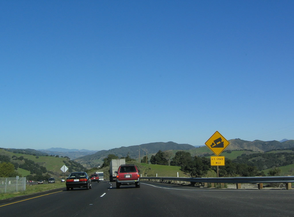
After the turnoff for La Lata Place, U.S. 101 begins its descent into the Santa Ynez River valley. The sharpest descent is 6% for the next mile. Photo taken 12/23/04. |
|
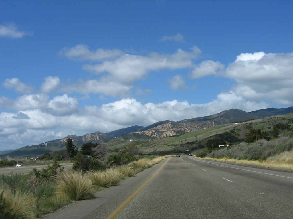
Early rains brought unusually green hills during the winter of 2004-2005. Most of Southern and Central California received substantial rain starting in October that brought early sprouting and greenery not commonly seen in a typical December. In summer these hills would be a golden brown. Photo taken 12/23/04. |
|
This left turn again provides local and ranch access as U.S. 101 continues to descend from Nojoqui Summit. Photo taken 12/23/04. |
|
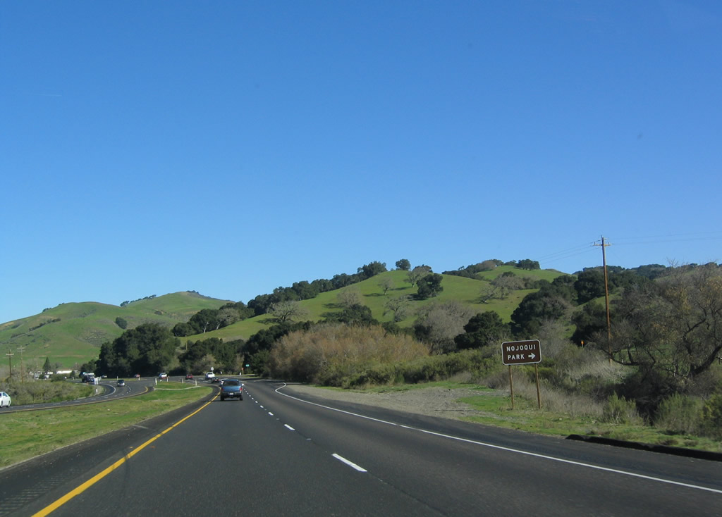
At the bottom of the grade, U.S. 101 again meets La Lata Place (Old Coast Highway/Old U.S. 101). Turn right to follow La Lata Place south to Alisal Road (Santa Rosa Road), then turn left (east) to Nojoqui Falls County Park. Photo taken 12/23/04. |
|
A U.S. 101 reassurance shield is posted after the intersection with La Lata Place. Photo taken 12/23/04. |
|
U.S. 101 again crosses Nojoqui Creek on an older bridge (mid-1950s). Photo taken 12/23/04. |
|
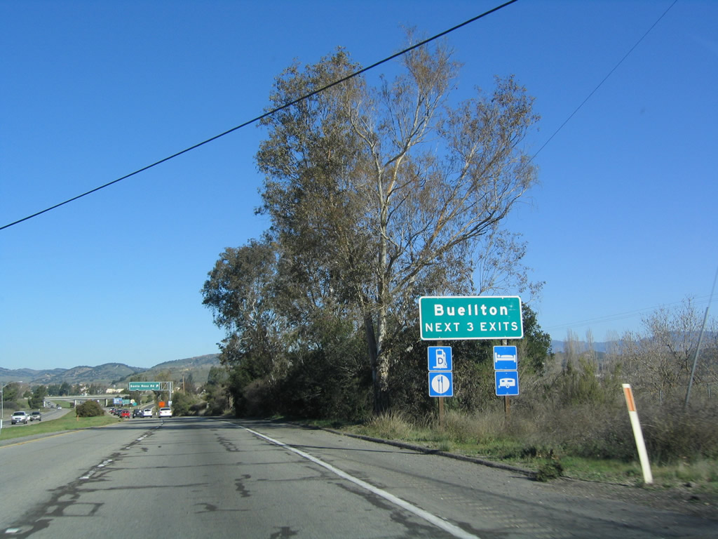
U.S. 101 will again assume freeway characteristics for the bypass of Buellton. Built in 1965, this freeway bypasses the old alignment that follows the Avenue of Flags (Buellton Parkway). The next exit along U.S. 101 (El Camino Real) north is Exit 139, Santa Rose Road west and Avenue of the Flags (Buellton Parkway) north into downtown Buellton. Photo taken 12/23/04. |
|
An El Camino Real mission bell and old bridge railing (1955) are located after another Nojoqui Creek bridge crossing. Photo taken 12/23/04. |
|
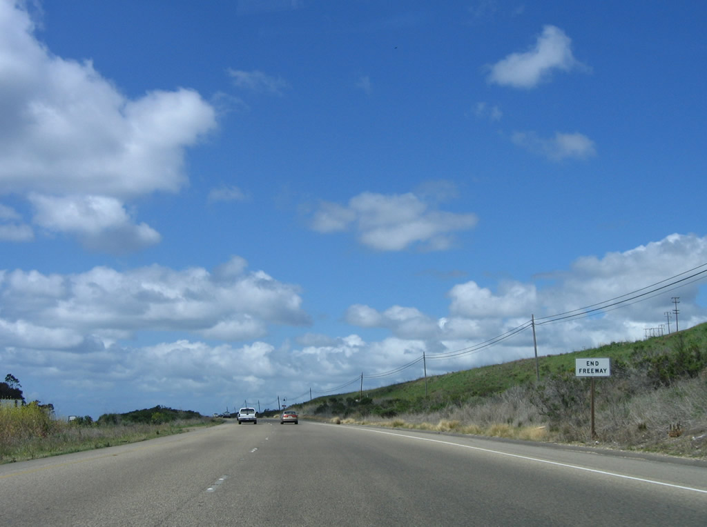
The freeway officially resumes after the final at-grade crossing on the expressway. Photo taken 12/23/04. |
|
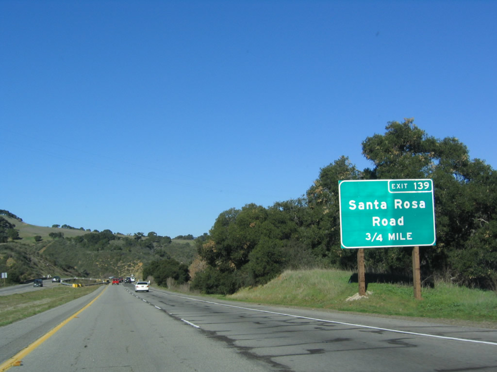
The next three exits all serve the city of Buellton: Exit 139, Avenue of Flags (Buellton Parkway) and Santa Rosa Road; Exit 140A, California 246 east to Solvang and west to Lompoc; and Exit 140B, Damassa Street to Avenue of Flags (Buellton Parkway) and McMurray Road. Both Exits 139 and 140B connect to the old alignment of U.S. 101, which could have been designated as a business route but is not signed as such. Photo taken 12/23/04. |
|
Northbound U.S. 101 (El Camino Real) reaches Exit 139, Avenue of Flags (Buellton Parkway) and Santa Rosa Road. Photo taken 12/23/04. |
|
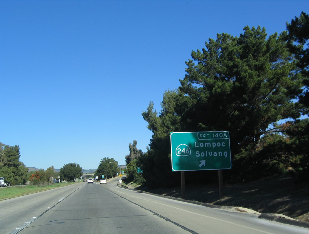
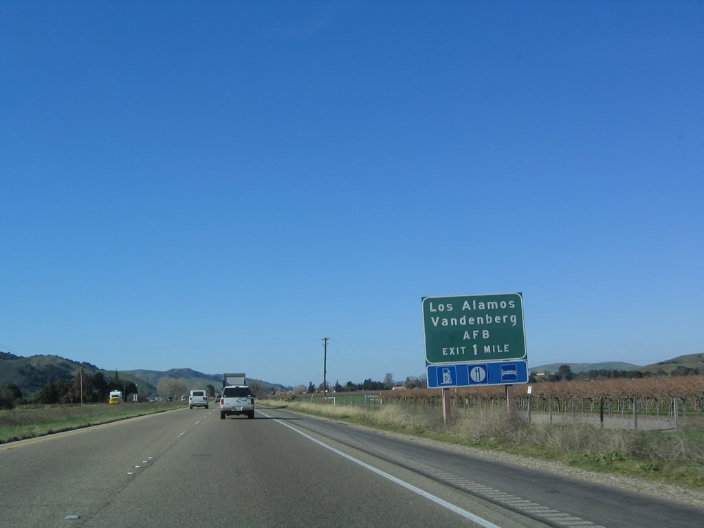
The next exit along U.S. 101 north is Exit 140A, California 246 east to Solvang and west to Buellton and Lompoc (one-half mile). Exit 140A is the first to feature motorist services since leaving Goleta, thirty miles southeast of here. Photo taken 12/23/04. |
|
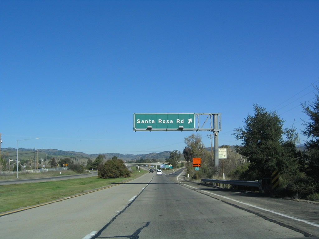
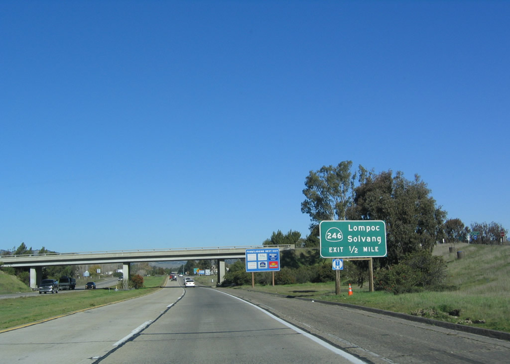
California 246 is a relatively short east-west state route that serves the Santa Ynez River valley. The state route originates at the western city limits of Lompoc, follows Ocean Avenue east through the city (including a shared alignment with California 1), then passes through Buellton, Solvang, and Santa Ynez before ending at California 154. The former western terminus was Surf at the Pacific Ocean, but the section of highway between Surf and the western limits of Lompoc was transferred to local maintenance and control. Use Exit 140A to follow California 246 east to Mission Santa Inez, the wine country surrounding the Danish village of Solvang, and Santa Ynez Indian Reservation. Upon meeting California 154 east of here, take California 154 east to Lake Cachuma and San Marcos Pass (California 154 eventually unites with U.S. 101 in Santa Barbara). After this sign, U.S. 101 crosses the Santa Ynez River itself. Photo taken 12/23/04. |
|
Northbound U.S. 101 reaches Exit 140A, California 246 in Buellton. California 246 leads west to Lompoc (and a county road connection to Surf and Vandenberg Air Force Base) and east to Solvang and California 154 in Santa Ynez. California 246 provides access to the Santa Ynez Valley wine country made famous in the 2004 movie Sideways. The movie features plenty of road photos including the Gaviota Gorge Tunnel and several exits off U.S. 101. Photo taken 12/23/04. |
|
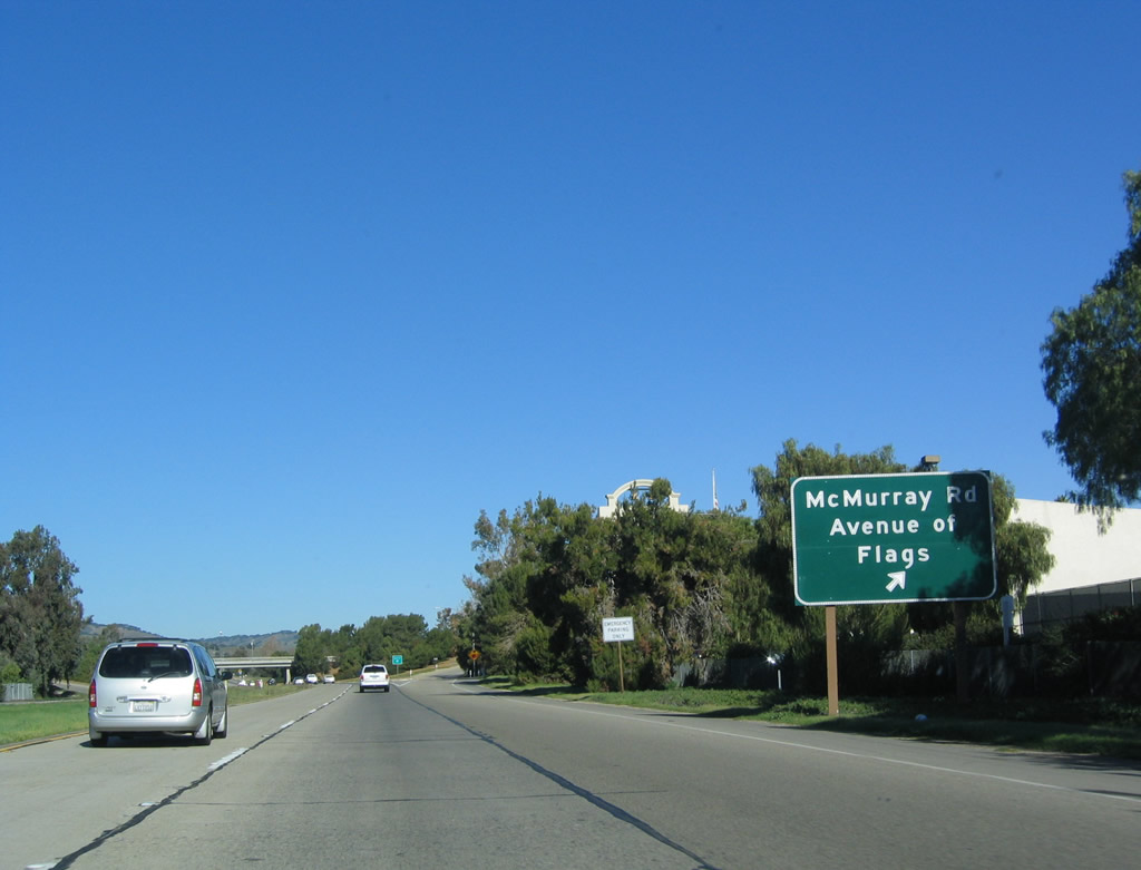
The next exit along U.S. 101 (El Camino Real) north is Exit 140B, Damassa Street to Avenue of Flags (Buellton Parkway) and McMurray Road. Damassa Street is a short east-west city street that connects two north-south city streets: Avenue of Flags on the west side of the freeway and McMurray Road on the east side. Photo taken 12/23/04. |
|
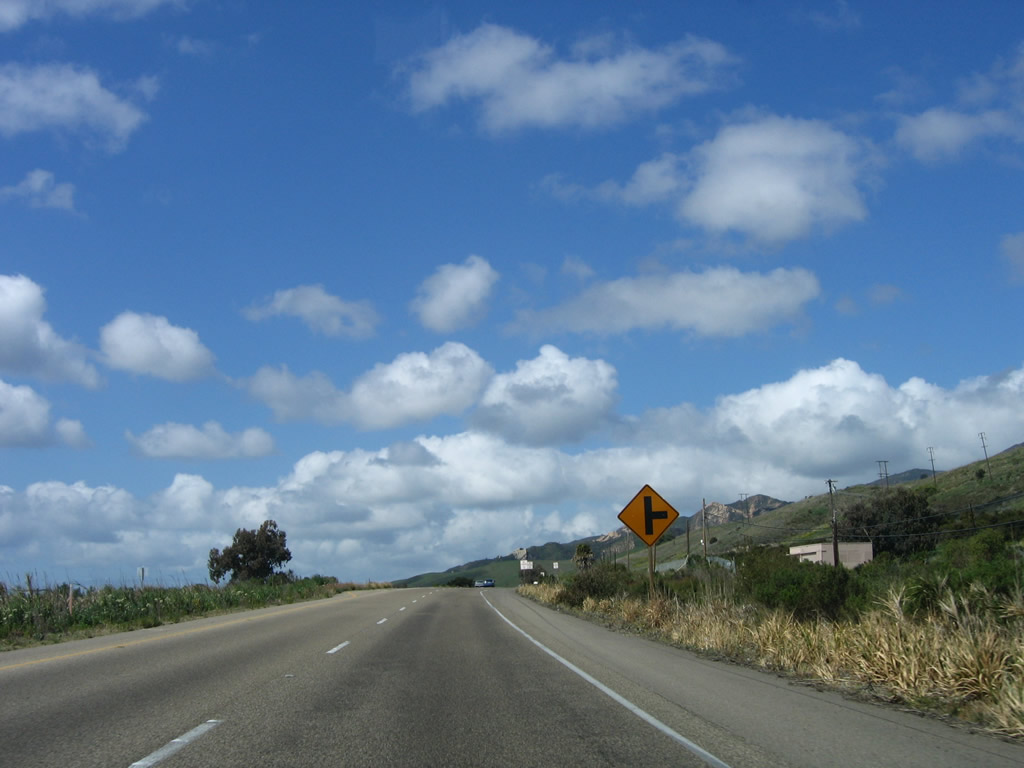
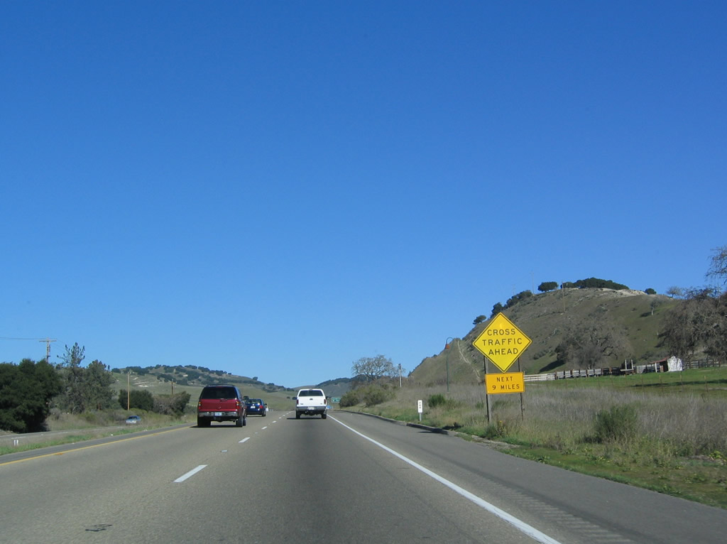
Leaving Buellton, U.S. 101 reverts again to an expressway configuration. While the next interchange is about six miles north of here (at Exit 146, California 154 east), this sign advises of nine miles of at-grade intersections (so watch for cross traffic at intersecting roads). Photo taken 12/23/04. |
|
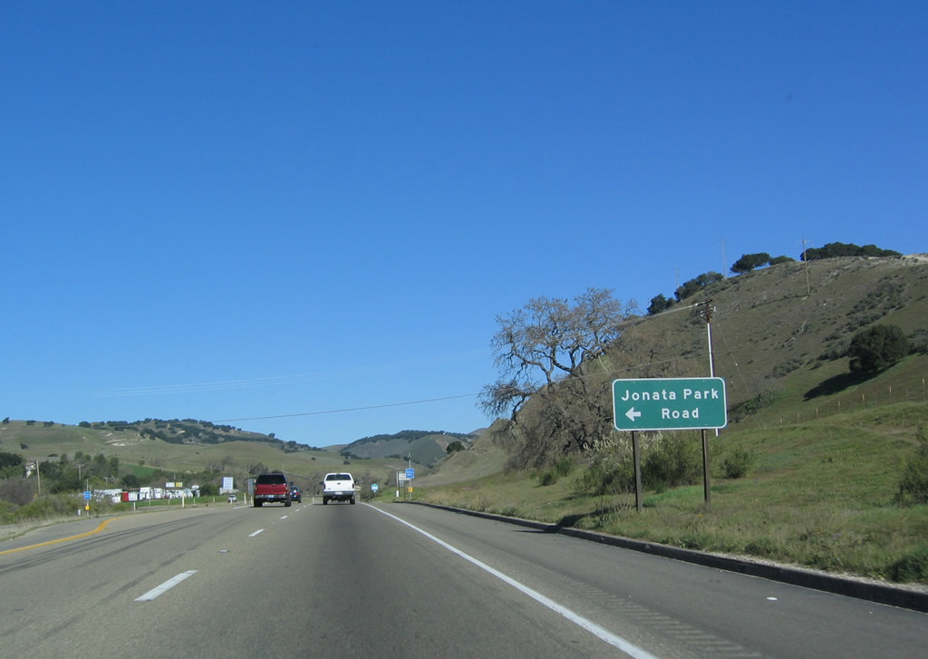
Old U.S. 101, which follows Jonata Park Road north out of Buellton, connects to U.S. 101 at this intersection. To see some more single-slab concrete roadway, turn left at this intersection and follow Jonata Park Road north parallel to U.S. 101. However, this road dead-ends and does not merge back onto U.S. 101, so it is an interesting side trip, not an alternate route. Photo taken 12/23/04. |
|
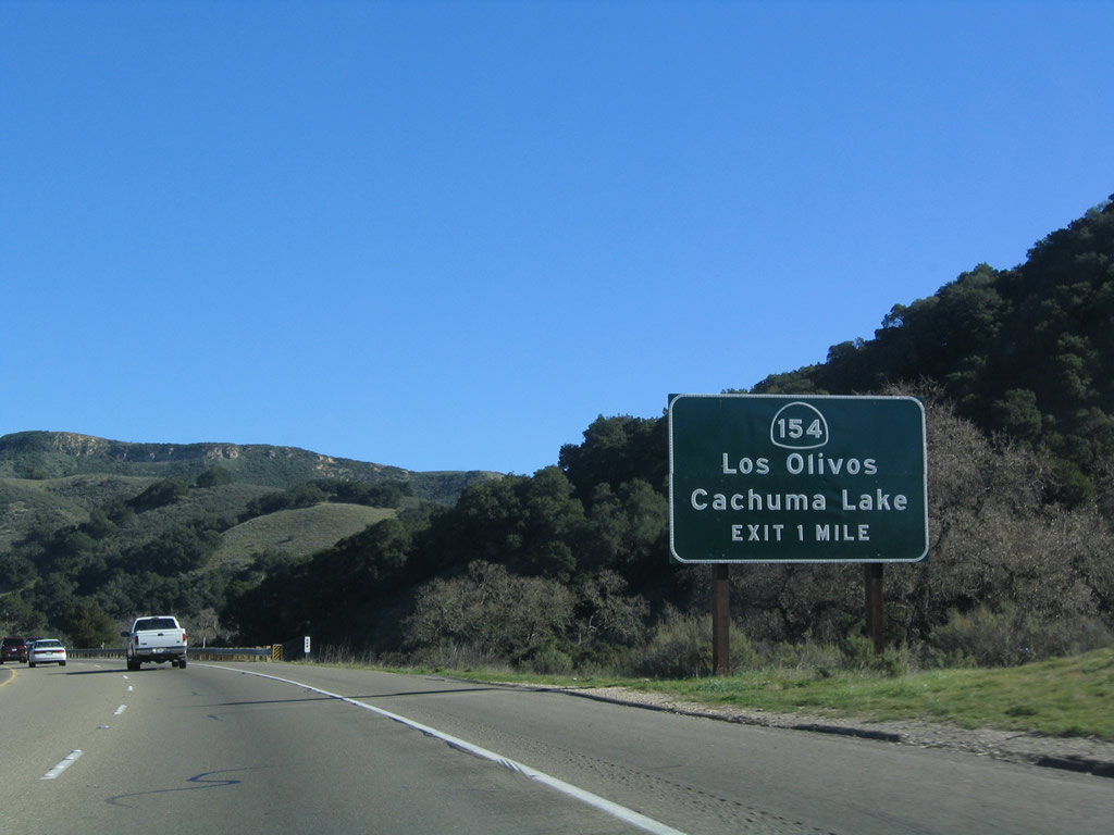
The next exit along U.S. 101 north is Exit 146, California 154 east to Los Olivos, Santa Ynez, Lake Cachuma, and San Marcos Pass (el. 2,224 feet). Photo taken 12/23/04. |
|
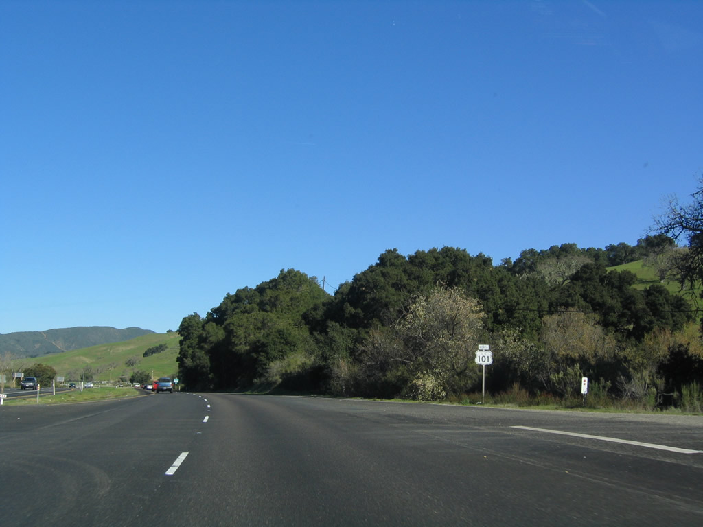
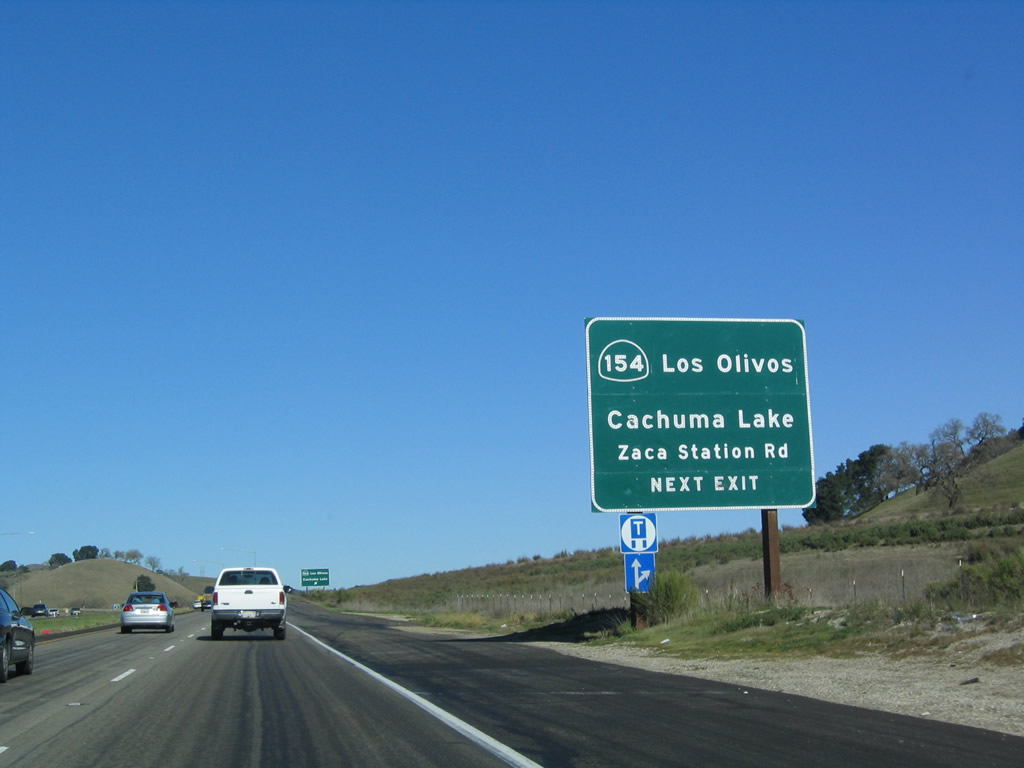
California 154 is a state route that begins at U.S. 101 Exit 146 and extends southeast to U.S. 101 Exit 101B in Santa Barbara. To avoid Gaviota Gorge Tunnel, motorists would need to use California 154 as an alternate route. To Zaca Station Road, exit California 154 and turn left to follow Zaca Station Road northeast to Foxen Canyon Road, which used to become California 176/Foxen Canyon Road in Sisquoc (California 176 was eliminated in 1984). Foxen Canyon Road travels north and northwest through Foxen Canyon, then passes through Sisquoc and Garey before returning to U.S. 101 via Stowell Road at Exit 170 in Santa Maria. Photo taken 12/23/04. |
|
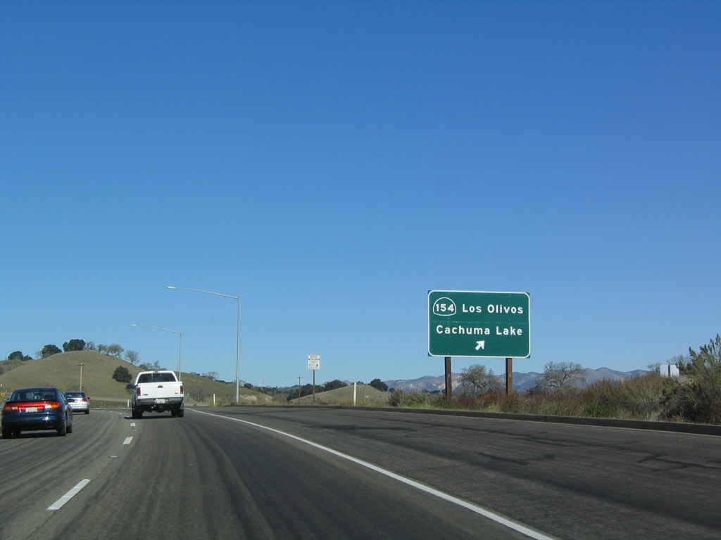
Northbound U.S. 101 (El Camino Real) reaches Exit 146, California 154 east to Los Olivos and Zaca Station Road north to Foxen Canyon and former California 176 in Sisquoc. Photo taken 12/23/04. |
|
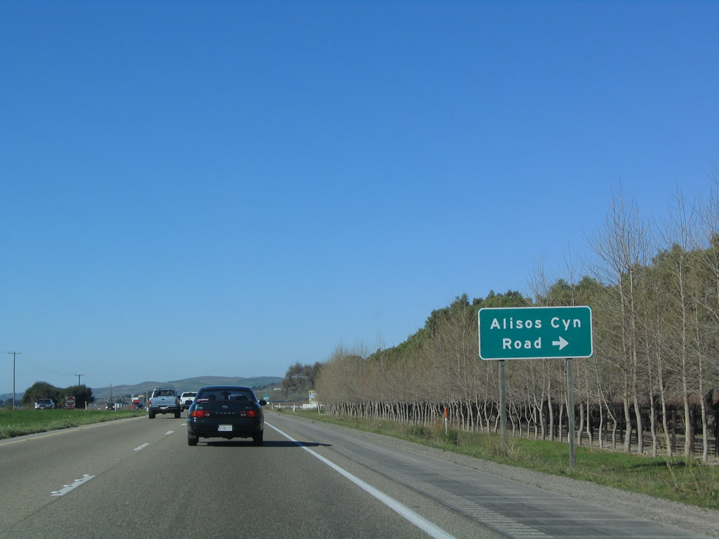
Continuing northwest, U.S. 101 passes east of the Purisima Hills and soon enters the community of Los Alamos. Here, northbound U.S. 101 meets Alisos Canyon Road, which travels east to meet Foxen Canyon Road (former California 176) via Foxen Canyon. Photo taken 12/23/04. |
|
The next exit along U.S. 101 north is Exit 154, California 135/Price Ranch Road to California 135/Bell Street west along San Antonio Creek to Vandenburg Air Force Base. This exit serves the community of Los Alamos, and California 135 follows Bell Street through town. Photo taken 12/23/04. |
|
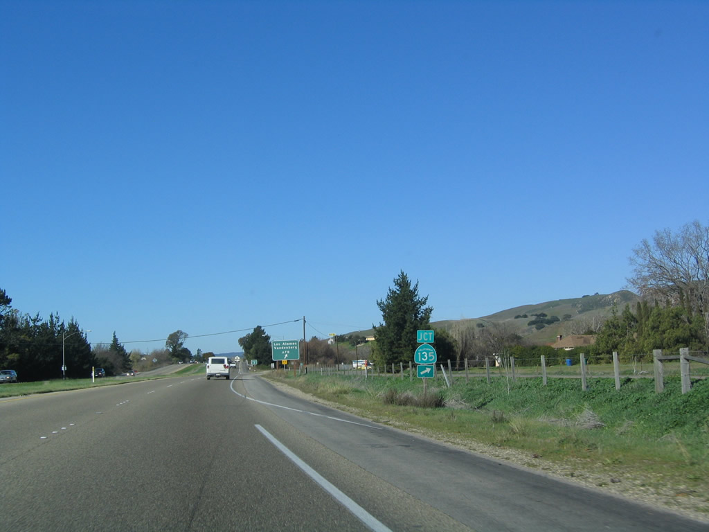
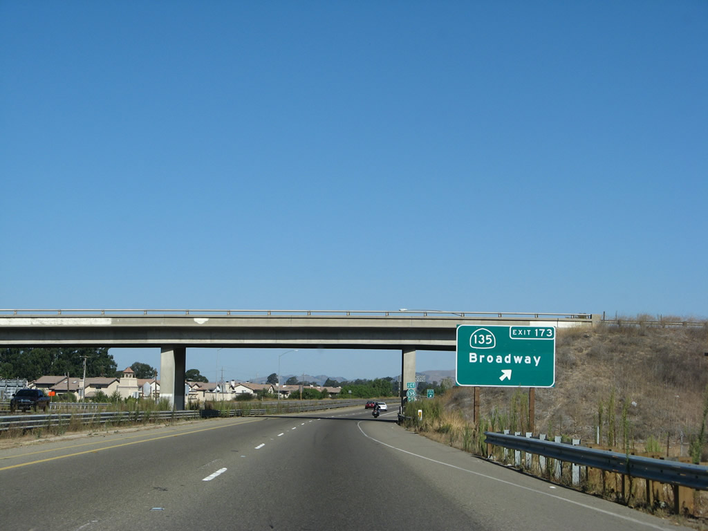
A single California 135 trailblazer is the only indication that this exit connects to a state route. California 135 travels west to meet California 1 south of Santa Maria, then turns north to serve Orcutt and Santa Maria. California 135 rejoins U.S. 101 at Exit 173 in Santa Maria after a brief overlap with U.S. 101 Business through downtown Santa Maria. Photo taken 12/23/04. |
|
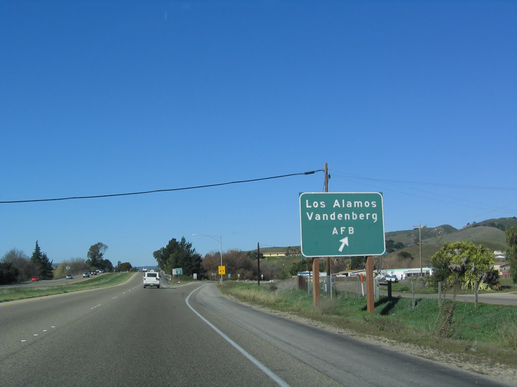
Northbound U.S. 101 (El Camino Real) reaches Exit 154, California 135/Bell Street west to Los Alamos and Vandenburg Air Force Base. Bell Street is an old alignment of U.S. 101. While it is merged with California 135 through town, Bell Street splits away and almost rejoins U.S. 101 northwest of Los Alamos (the road dead ends rather than reconnect to the mainline route). Photo taken 12/23/04. |
|
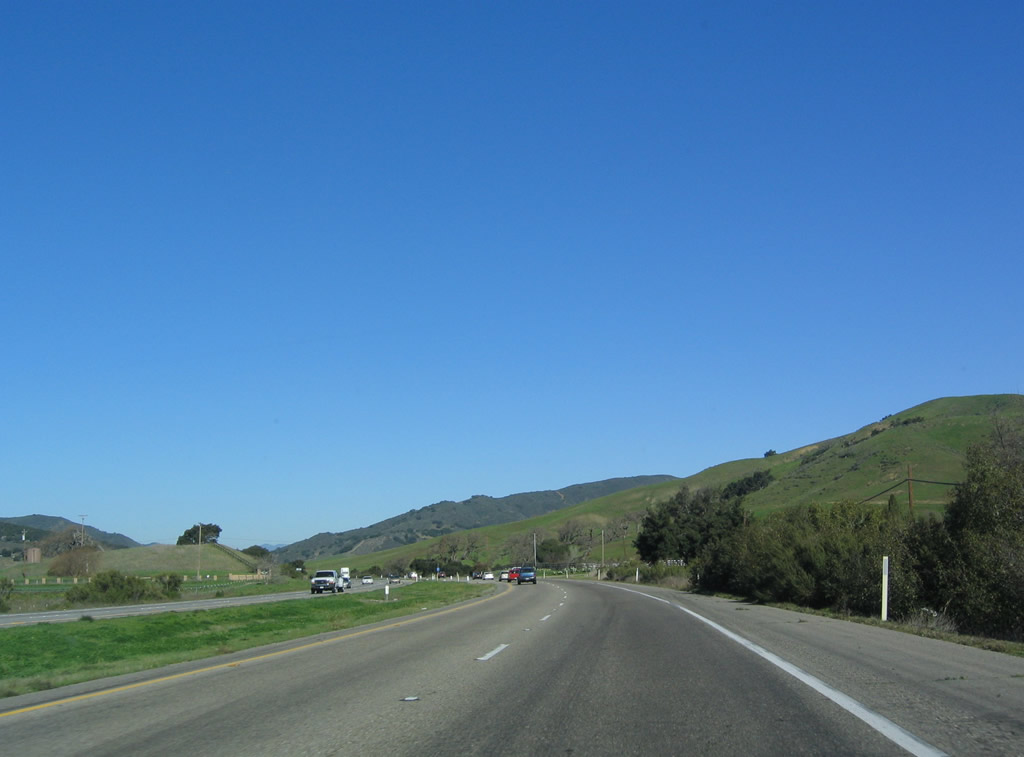
The U.S. 101 expressway continues northwest from Los Alamos toward Orcutt and Santa Maria, the largest city in northern Santa Barbara County. The highway rolls through hills dominated by vineyards growing the grapes of the Central Coast region. Photo taken 12/23/04. |
|
The Solomon Hills lie ahead, and U.S. 101 again gains elevation to pass through the hills at a summit of 780 feet. Watch for the right turn to Palmer Road, which travels northeast to Sisquoc and connects to former California 176. Photo taken 12/23/04. |
|
Exit 161, a local access interchange with no apparent cross street, is unsigned except for this single exit gore point sign. Photo taken 12/23/04. |
|
This mileage sign on U.S. 101 north provides the distance to Santa Maria (eight miles), San Luis Obispo (40 miles), and San Francisco (271 miles). The freeway again resumes, and U.S. 101 will retain freeway standards through Orcutt, Santa Maria, and Nipomo. Photo taken 12/23/04. |
|
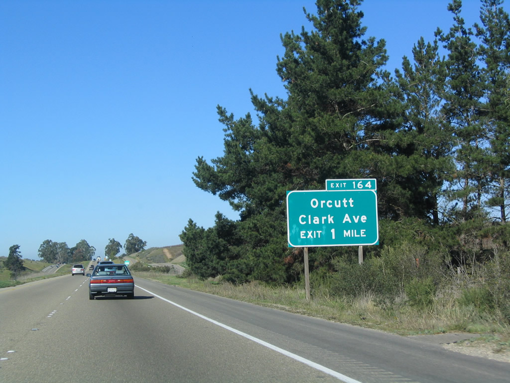
The next exit along U.S. 101 (El Camino Real) north is Exit 164, Clark Avenue west to Orcutt. Photo taken 12/23/04. |
|
Northbound U.S. 101 (El Camino Real) reaches Exit 164, Clark Avenue west to Orcutt. About a mile or so north of Clark Avenue is a proposed interchange with an east-west expressway that is planned to follow existing Union Valley Parkway. Watch for changes north of Clark Avneue as this interchange is constructed and opened to traffic. Photo taken 12/23/04. |
|
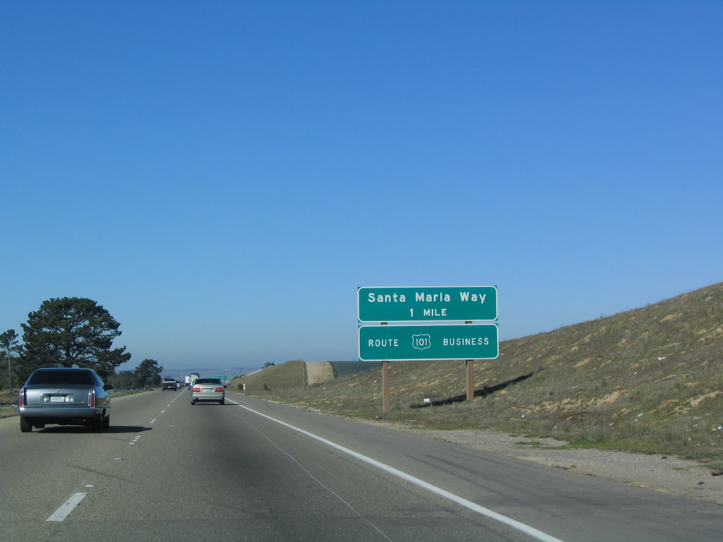
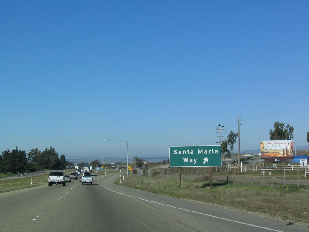
The next exit along U.S. 101 (El Camino Real) north is Exit 167, U.S. 101 Business/Santa Maria Way (one mile). This is a rare instance of an outline U.S. 101 shield in use on a reflective sign. Photo taken 12/23/04. |
|
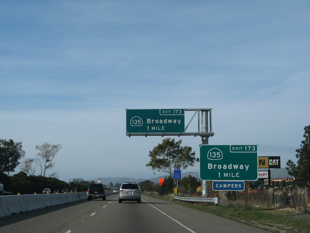
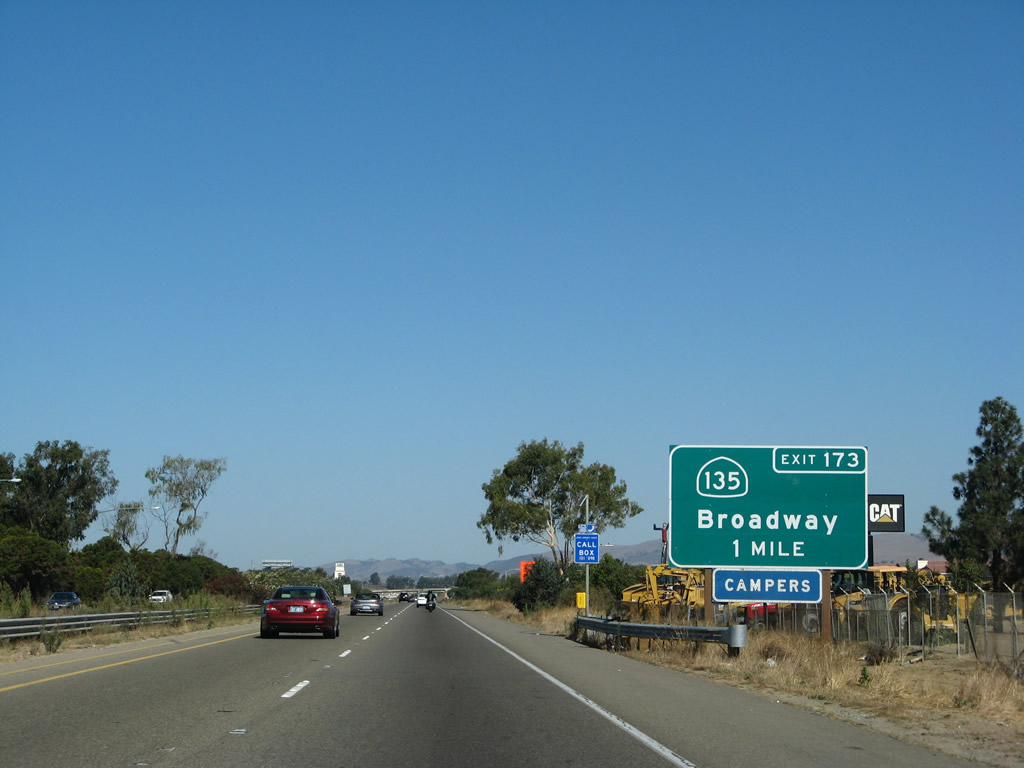
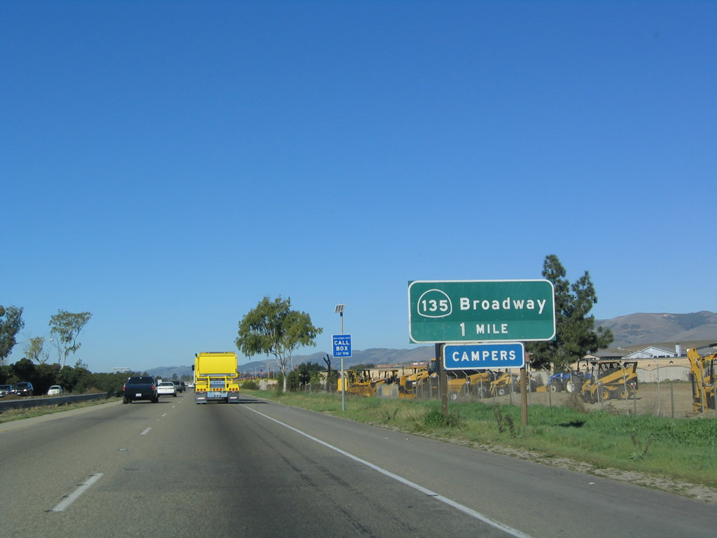
The next six exits along northbound U.S. 101 serve the city of Santa Maria: Exit 167, U.S. 101 Business/Santa Maria Way north; Exit 169, Betteravia Road; Exit 170, Stowell Road (former California 176); Exit 171, California 166 (Main Street) west; Exit 172, Donovan Road; and Exit 173, U.S. 101 Business and California 135/Broadway south. Photo taken 12/23/04. |
|
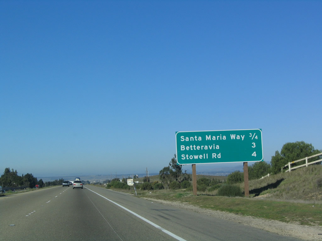
This mileage sign provides the distance to the next three exits along northbound U.S. 101 (El Camino Real): Exit 167, U.S. 101 Business/Santa Maria Way north; Exit 169, Betteravia Road; and Exit 170, Stowell Road (former California 176). Photo taken 12/23/04. |
|
Northbound U.S. 101 (El Camino Real) reaches Exit 167, U.S. 101 Business/Santa Maria Way to Santa Maria. From here, the business route follow Santa Maria Way northwest to California 135/Broadway, then turns north on Broadway through downtown Santa Maria and will rejoin U.S. 101 at Exit 173. Photo taken 12/23/04. |
|
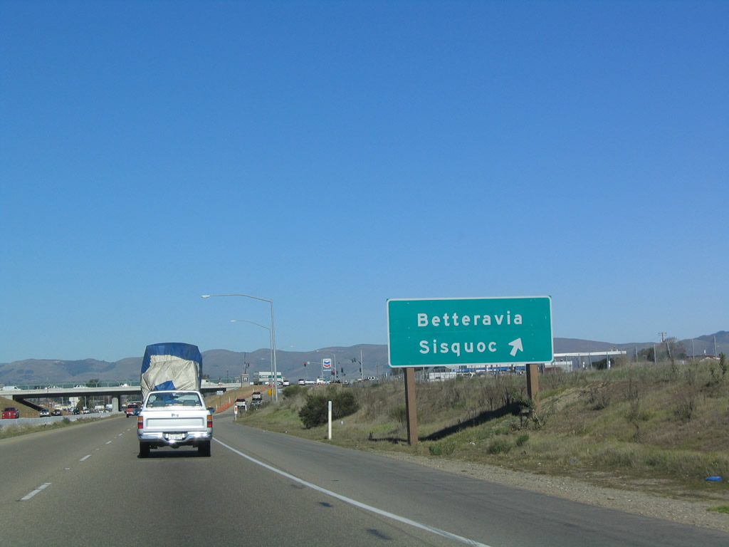
The next exit along U.S. 101 (El Camino Real) north is Exit 169, Betteravia Road. Use Betteravia Road east to Sisquoc; former California 176 used a portion of Betteravia Road east of Philbric Road. Photo taken 12/23/04. |
|
This mileage sign provides the distance to the next three exits along northbound U.S. 101 (El Camino Real): Exit 169, Betteravia Road; Exit 170, Stowell Road (former California 176); and Exit 171, California 166 (Main Street) west. Photo taken 12/23/04. |
|
Use Betteravia Road west to Skyway Drive south to the Santa Maria Airport. This section of U.S. 101 has been under construction in 2007-8 to add a third lane in each direction. Photo taken 12/23/04. |
|
Northbound U.S. 101 (El Camino Real) reaches Exit 169, Betteravia Road to the Santa Maria Airport and Sisquoc. Photo taken 12/23/04. |
|
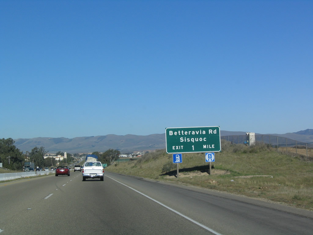
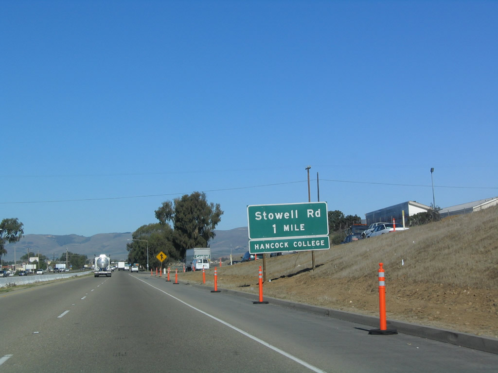
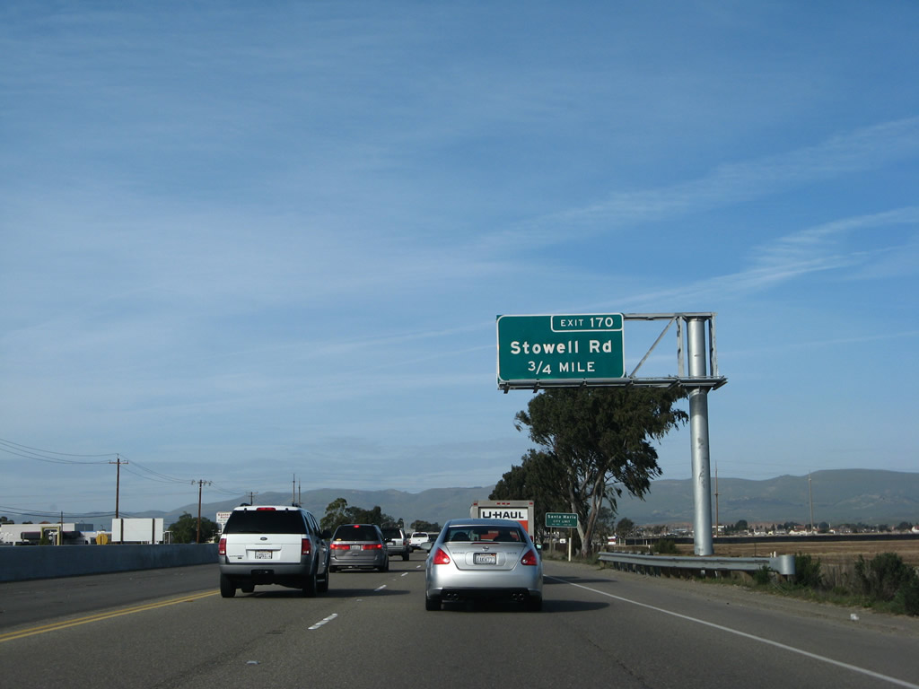
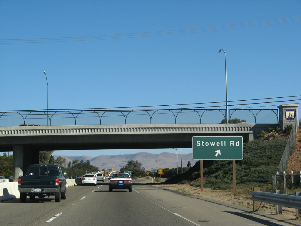
The next exit along northbound U.S. 101 (El Camino Real) is Exit 170, Stowell Road (former California 176). Photo taken 12/23/04. |
|
With the U.S. 101 expansion project, an overhead guide sign for Exit 170, Stowell Road (former California 176) was installed between fall 2007 and winter 2008. Photo taken 02/02/08. |
|
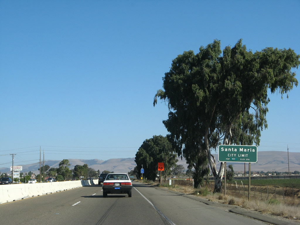
U.S. 101 (El Camino Real) enters Santa Maria. The city of Santa Maria had a population of 77,423 as of the 2000 Census. Santa Maria is the largest city in Santa Barbara County and is known for its wine country, agriculture, proximity to Vandenburg Air Force Base, and barbecue. Santa Maria consists of 19.7 square miles, and nearby Orcutt, Lompoc, and Guadalupe expand along with the city of Santa Maria. Photo taken 09/30/07. |
|
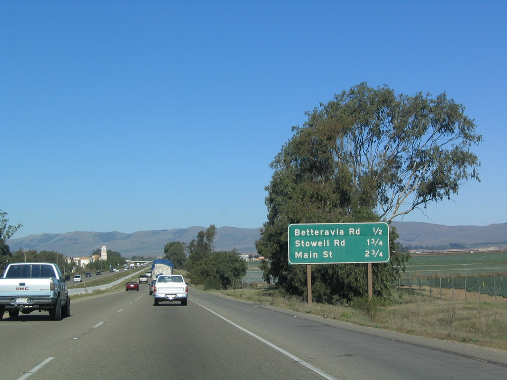
Use Stowell Road west to the Santa Barbara County Fairgrounds. This interchange represents the northern end of former California 176. Decommissioned in 1984, California 176 to follow Stowell Road east, Philbric Road south, and Foxen Canyon Road southeast, ending in Sisquoc. Foxen Canyon Road continues southeast and returns to U.S. 101 with a connection via Zaca Station Road to the California 154 interchange. Photo taken 09/30/07. |
|
Northbound U.S. 101 (El Camino Real) reaches Exit 170, Stowell Road (former California 176). Photo taken 09/30/07. |
|
|
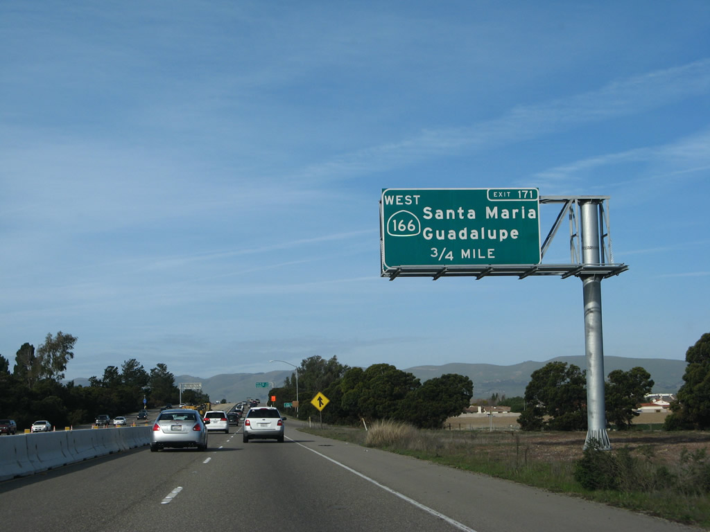
The next exit along U.S. 101 (El Camino Real) north is Exit 171, California 166 (Main Street) west to downtown Santa Maria and the city of Guadalupe. California 166 will merge onto U.S. 101 north from this interchange to cross the Santa Maria River and continue its journey east toward Maricopa in Kern County. Photos taken 02/02/08 and 12/23/04. |
|
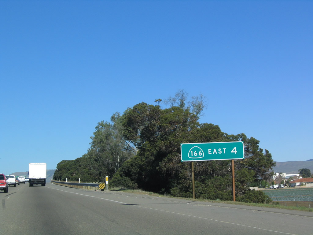
After Exit 171, U.S. 101 and California 166 will overlap for about four miles, as California 166 east will depart the freeway at Exit 175. Photo taken 12/23/04. |
|
|
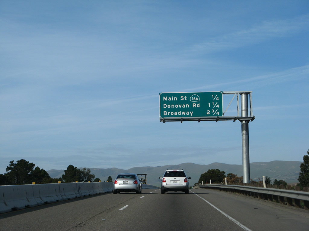
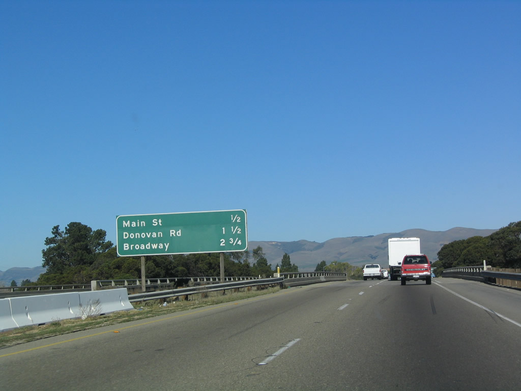
This mileage sign along U.S. 101 (El Camino Real) north provides the distance to the next three exits: Exit 171, California 166 (Main Street) west to Santa Maria and Guadalupe; Exit 172, Donovan Road; and Exit 173, U.S. 101 Business and California 135/Broadway south. The median sign was removed during widening activities in 2007 and replaced with an overhead sign in 2008. Photos taken 02/02/08 and 12/23/04. |
|
Main Street also travels east from this intersection toward the Santa Maria River, then turns southeast to turn into Philbric Road via Rex. Photo taken 09/30/07. |
|
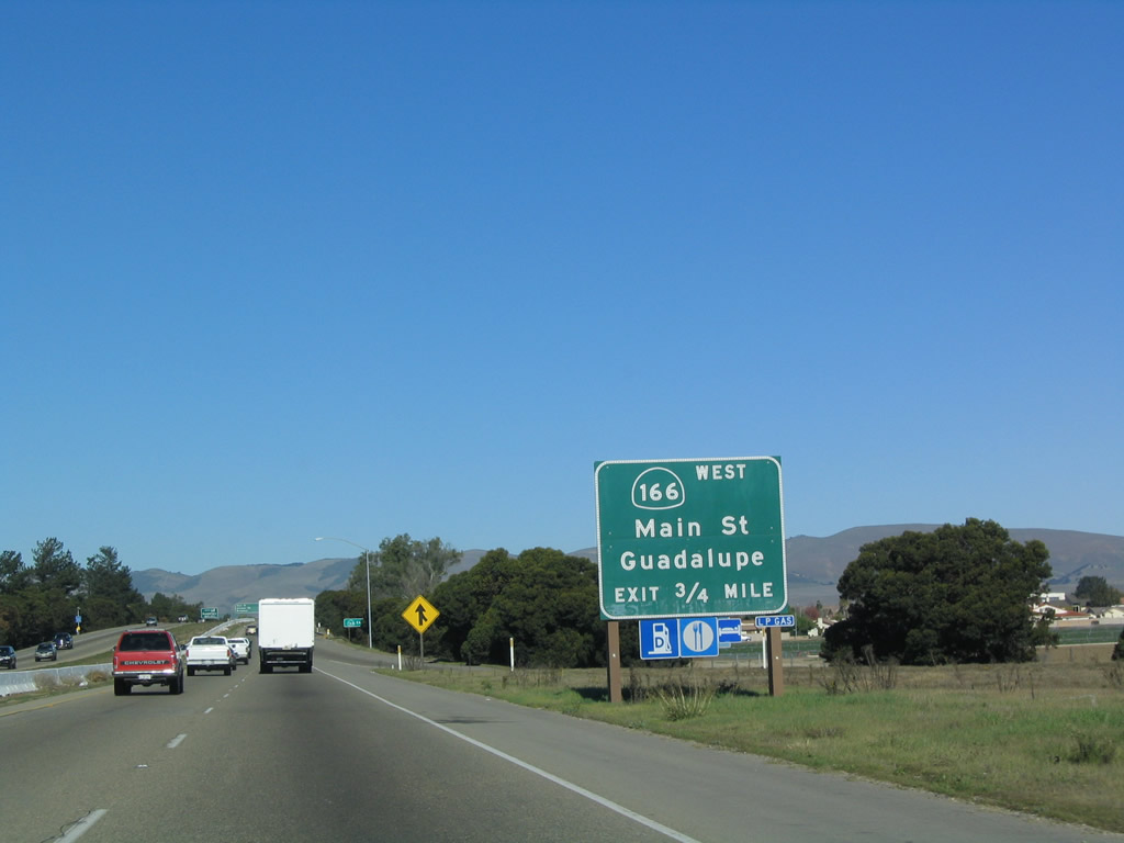
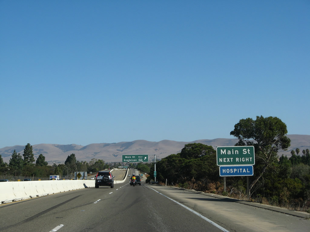
Northbound U.S. 101 (El Camino Real) reaches Exit 171, California 166 (Main Street) west to Santa Maria and Guadalupe. Photo taken 12/23/04. |
|
Upon exiting, the ramp connects to the east frontage road (Nicolson Avenue). Turn left (north) on Nicolson Avenue to Main Street. Turn left to follow California 166 west to Guadalupe. Photo taken 09/30/07. |
|
Nicolson Avenue northbound becomes the on-ramp back to U.S. 101 north. Photo taken 09/30/07. |
|
|
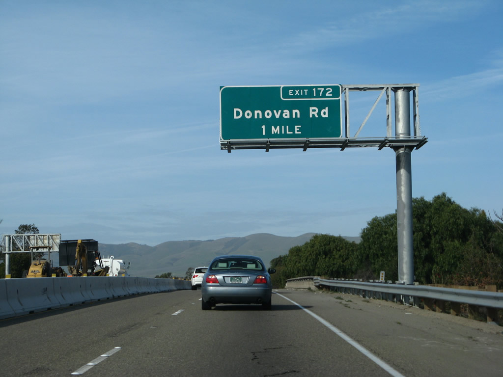
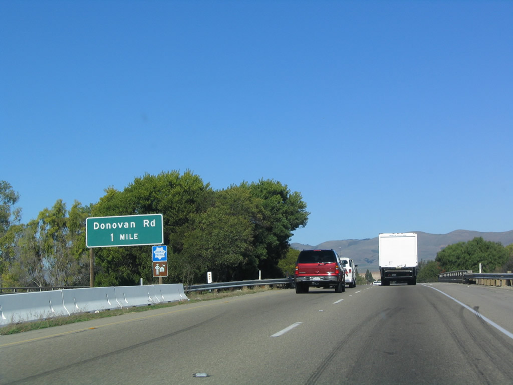
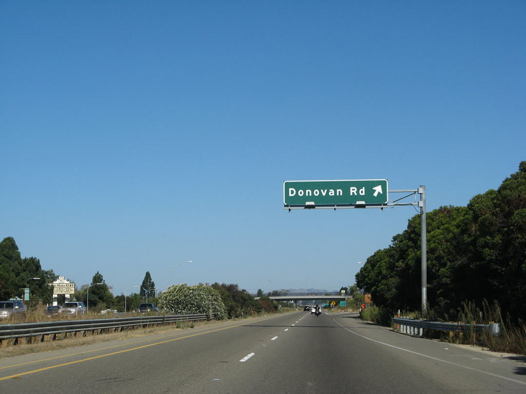
Back on the mainline, the next exit along northbound U.S. 101 is Exit 172, Donovan Road (one mile). Photos taken 02/02/08 and 12/23/04. |
| U.S. 101 (El Camino Real) and California 166 east |
|
|
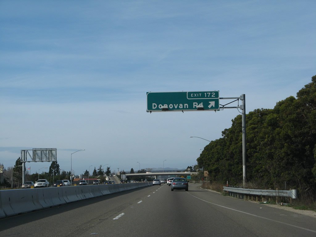
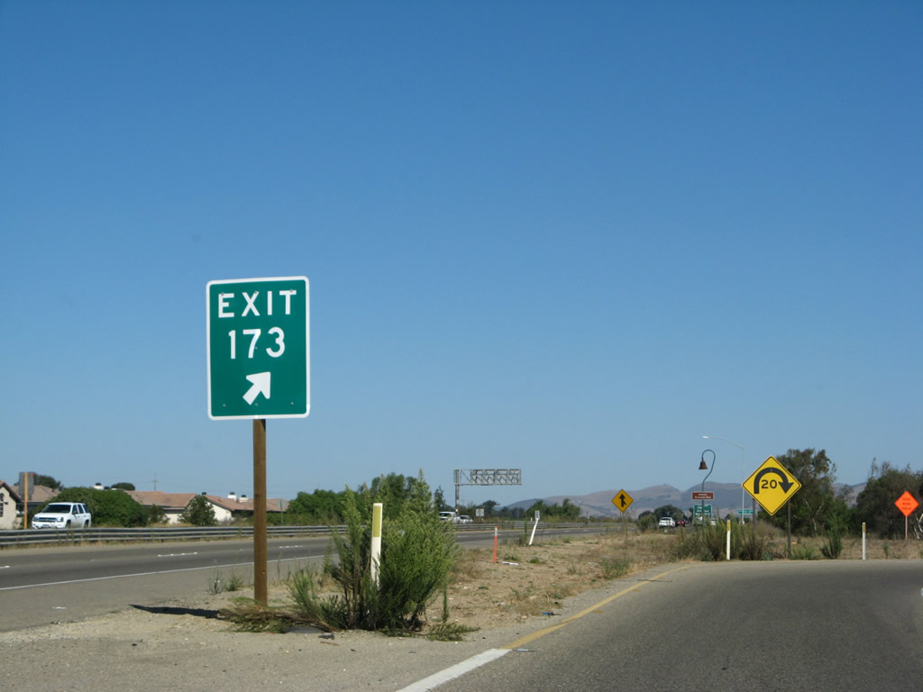
Northbound U.S. 101 (El Camino Real) and California 166 east reach Exit 172, Donovan Road. Road construction resulted in the replacement of this sign (along with others along this stretch), and now the off-ramp sign has an exit number. Photos taken 02/02/08 and 12/23/04. |
|
Under the shadow of the Donovan Road overpass is this shield assembly for U.S. 101 north and California 166 east. Photo taken 09/30/07. |
|
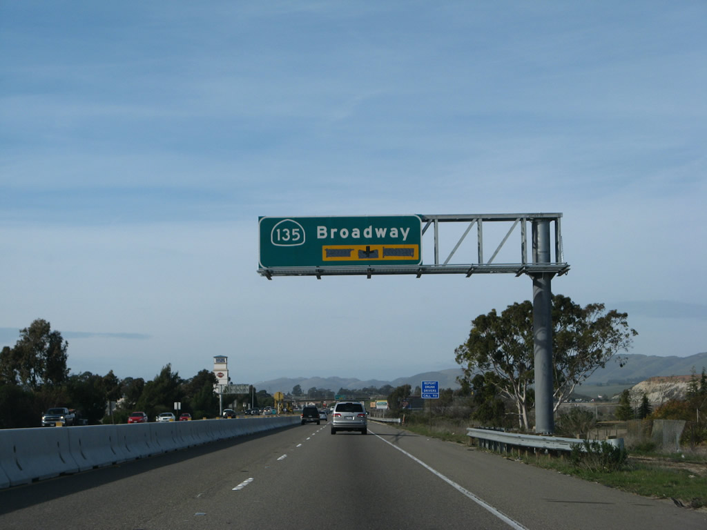
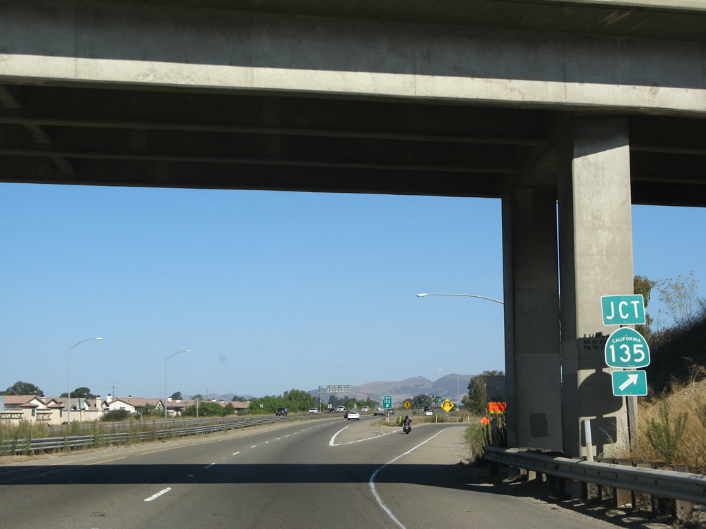
A single California 135 trailblazer is posted prior to the Broadway off-ramp. Photo taken 09/30/07. |
|
The off-ramp to California 135/Broadway south is a loop ramp, part of a trumpet interchange. Photo taken 09/30/07. |
|
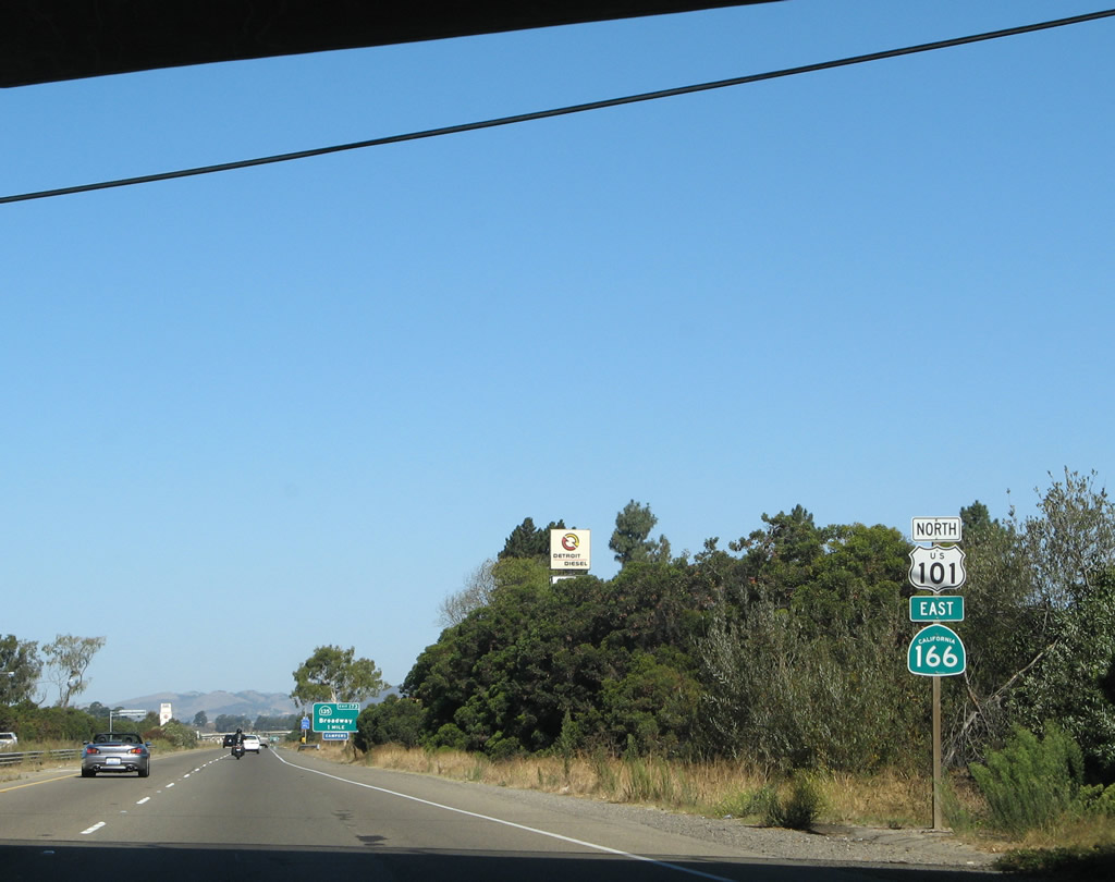
Back on the mainline, U.S. 101 and California 166 leave Santa Barbara County and enter San Luis Obispo County. The freeway will soon cross the Santa Maria River, and the first exit on the north bank of the river is where the two routes (U.S. 101 and California 166) divide. Photo taken 02/02/08. |
Page Updated March 29, 2009.