U.S. 101 enters San Luis Obispo County, as it passes through Nipomo, Arroyo Grande, Pismo Beach, San Luis Obispo, Atascadero, and Paso Robles. The scenery returns to the coastal imagery of Santa Barbara County, but the freeway quickly retreats inland, leaving the rugged coast to its two-lane alternate, California 1 (Pacific Coast Highway). U.S. 101 enters farming country, passing by the vineyards of Paso Robles as it continues its northerly trek, now focused on Monterey Bay and the San Francisco Bay Area.
| U.S. 101 (El Camino Real) north and California 166 east |
|
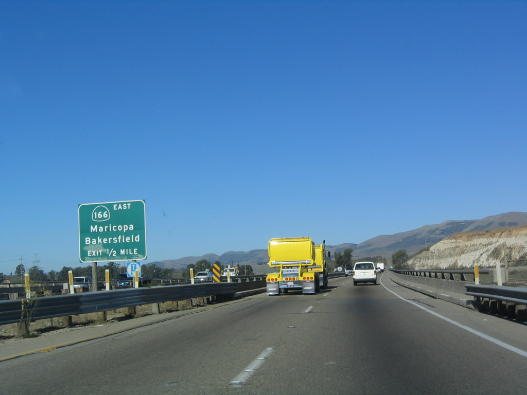
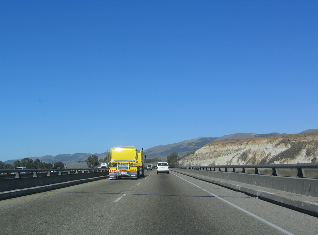
The first exit in San Luis Obispo County serves the continuation of California 166 east to Maricopa. The state route generally follows the Cuyama River east into the Cuyama Valley, then joins briefly with California 33 northeast into Maricopa. East of Maricopa, California 166 follows the Maricopa Highway across the southern Central Valley to Interstate 5 and California 99 near Wheeler Ridge. At this point, U.S. 101 crosses the Santa Maria River. Photo taken 12/23/04. |
|
The Santa Maria River bridge carries both U.S. 101 and California 166 over the Santa Maria River. Photo taken 12/23/04. |
|
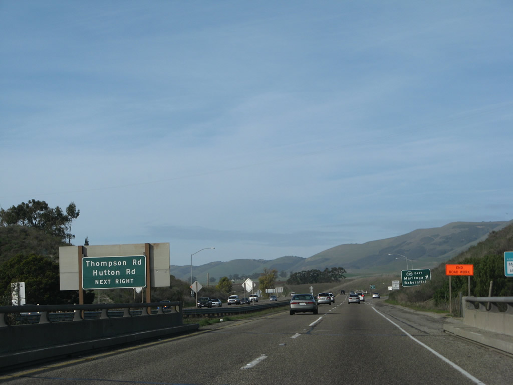
Use Exit 175 to Thompson Avenue (east side frontage road) and Hutton Road (west side frontage road). Thompson Avenue is the old alignment of U.S. 101, and it serves as the unsigned business route into the unincorporated community of Nipomo. Hutton Road also starts as a frontage road, then turns into Joshua Street and Orchard Avenue toward Nipomo Community Park. Photo taken 02/02/08. |
|
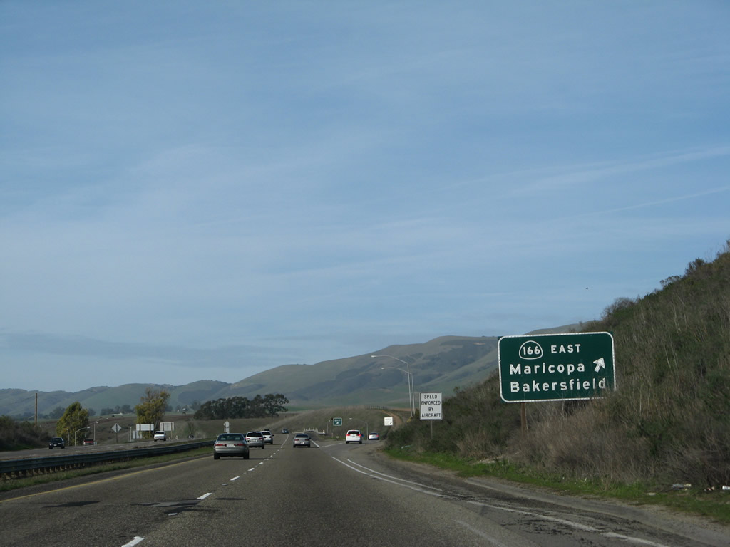
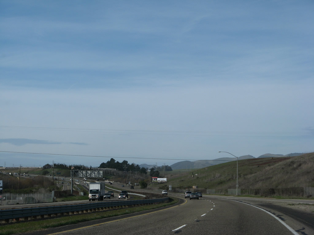
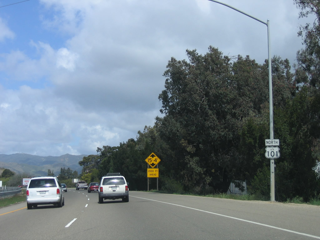
Northbound U.S. 101 reaches Exit 175, California 166 east to New Cuyama, Maricopa, and Bakersfield (via California 99 north). Photo taken 02/02/08. |
| U.S. 101 north |
|
After California 166 departs east, U.S. 101 continues north as a freeway toward Nipomo. Photo taken 02/02/08. |
|
This mileage sign provides the distance to Arroyo Grande (12 miles), Pismo Beach (15 miles), and San Francisco (260 miles). Photo taken 12/23/04. |
|
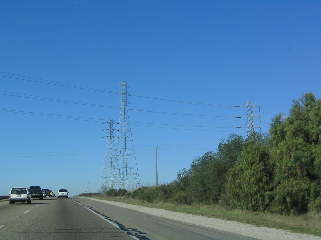
Pacific Gas and Electric (PG&E) transmission towers carry electricity across the freeway prior to the Tefft Street interchange (Exit 179). Photo taken 12/23/04. |
|
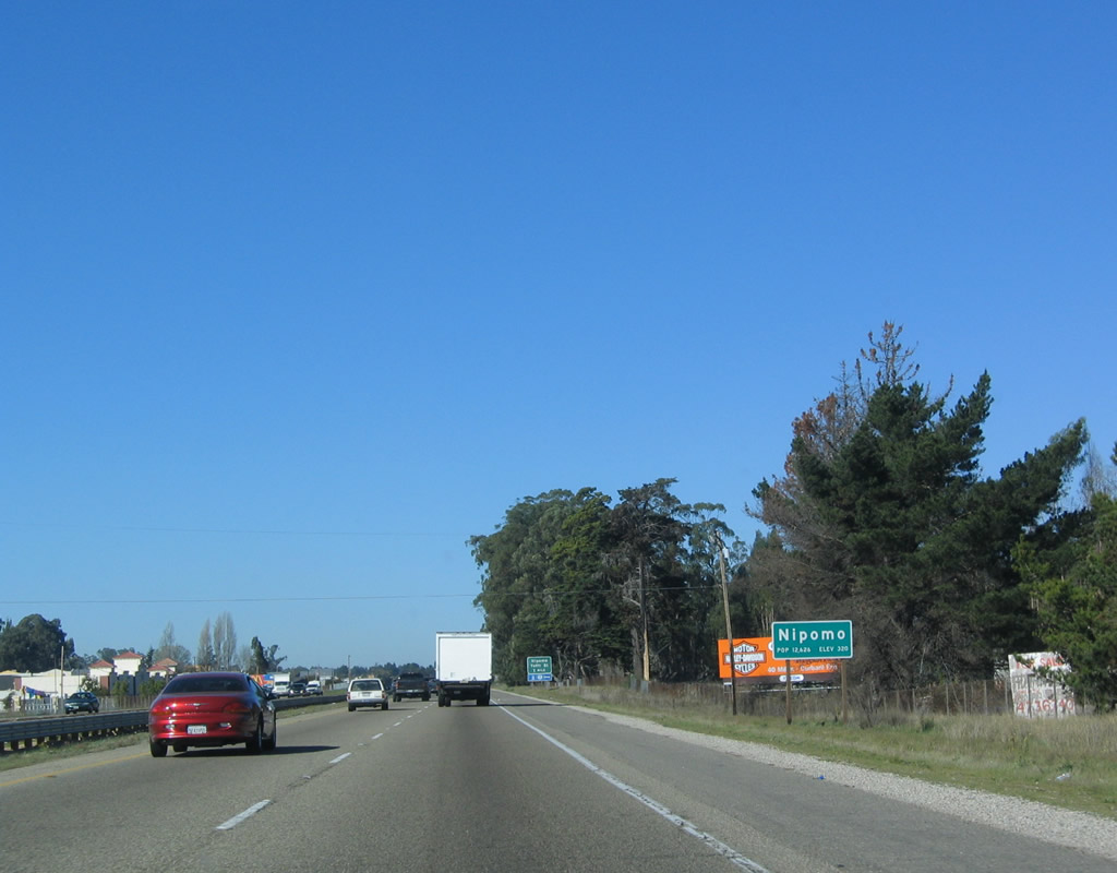
U.S. 101 enters the unincorporated community of Nipomo. Photo taken 12/23/04. |
|
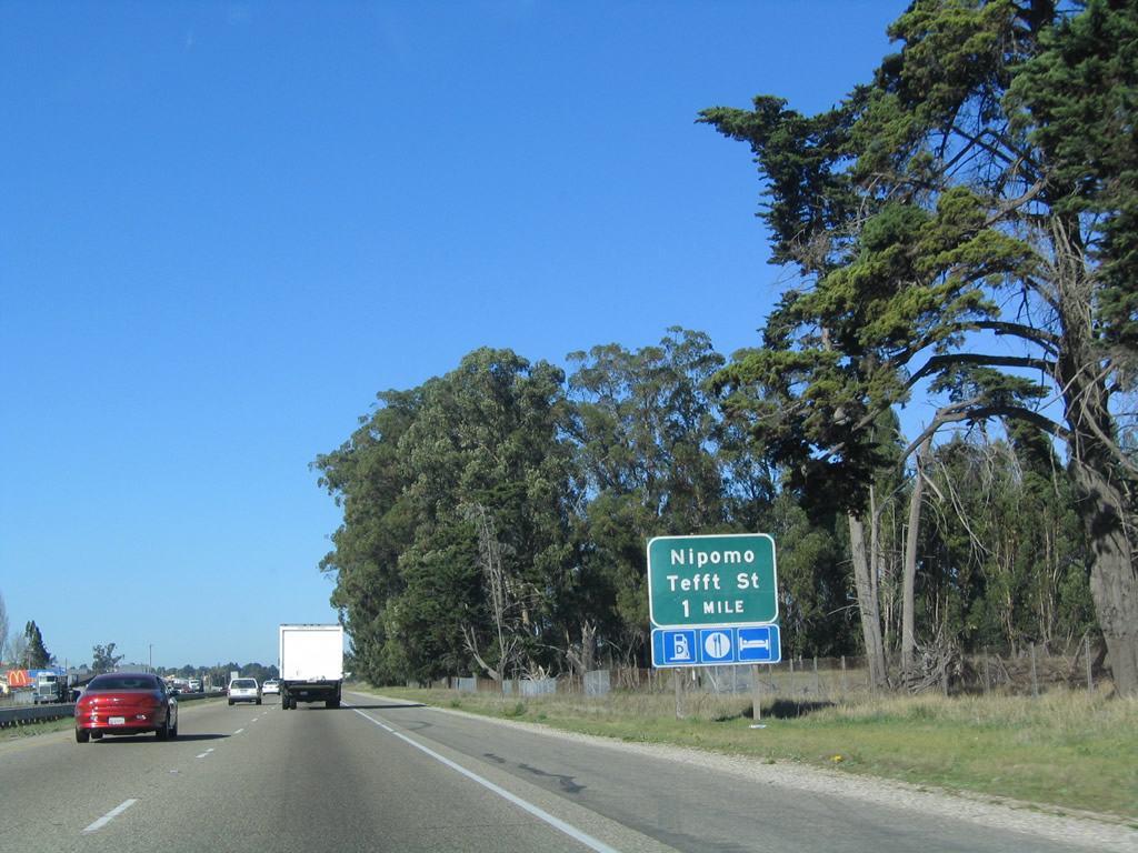
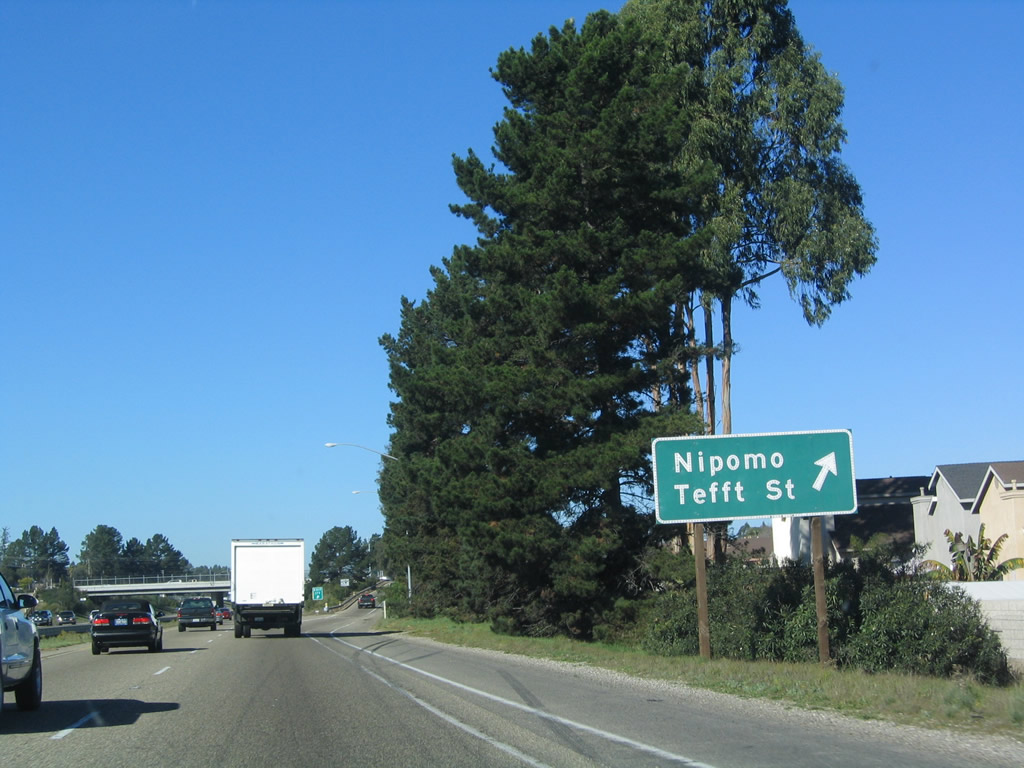
The next exit along U.S. 101 north is Exit 179, Tefft Street to Nipomo (one mile). Photo taken 12/23/04. |
|
Northbound U.S. 101 (El Camino Real) reaches Exit 179, Tefft Street in Nipomo. Photo taken 12/23/04. |
|
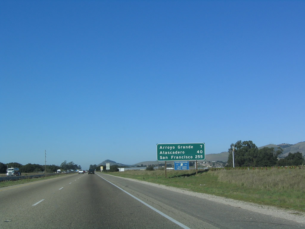
This mileage sign provides the distance to Arroyo Grande (seven miles), Atascadero (40 miles), and San Francisco (255 miles). Photo taken 12/23/04. |
|
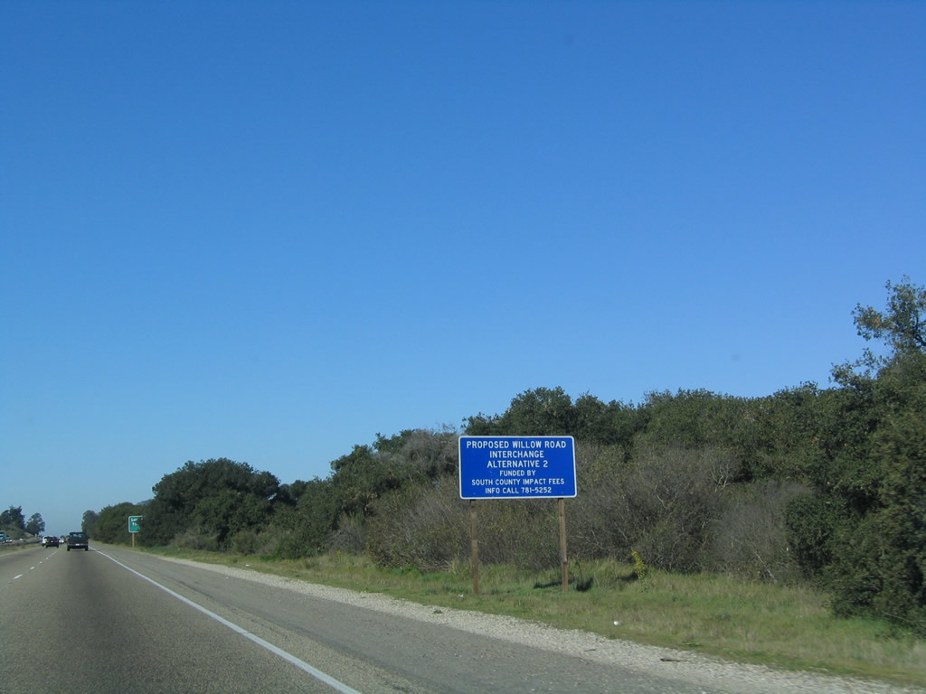
A proposed new interchange with Willow Road (future Exit 181) would be constructed at this location in Nipomo per the blue informational sign. Photo taken 12/23/04. |
|
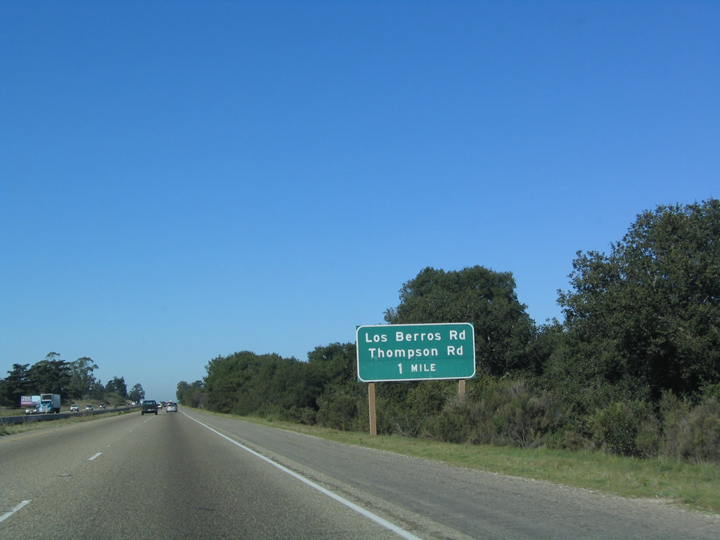
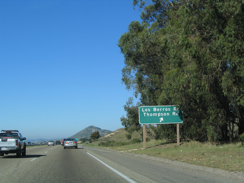
The next exit along U.S. 101 north is Exit 182, Los Berros Road and Thompson Avenue (one mile). At Exit 182, Historic U.S. 101 crosses the freeway and changes names from Thompson Avenue to Los Berros Road. Photo taken 12/23/04. |
|
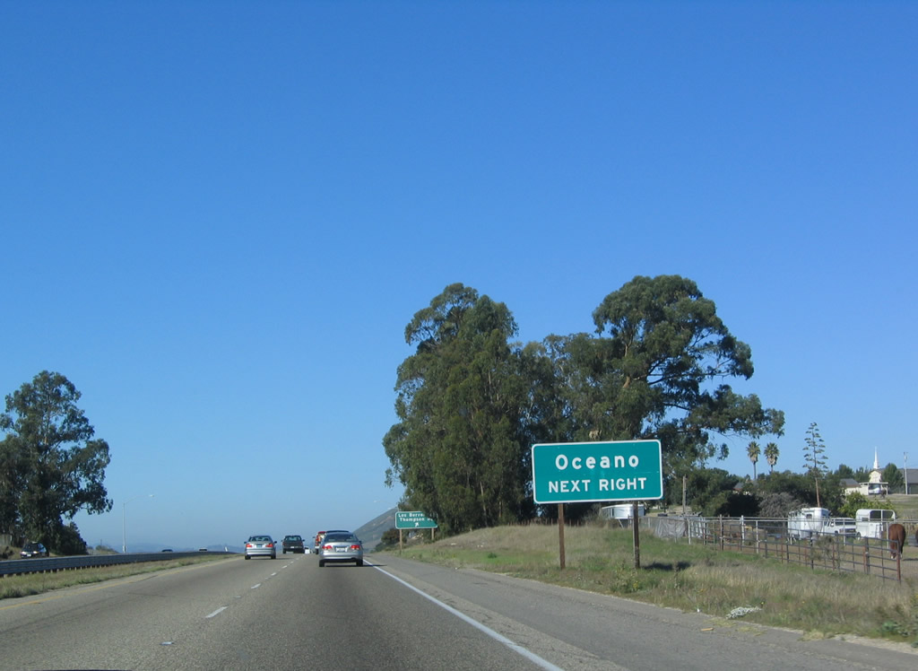
Use Los Berros Road northwest to the community of Oceano along the California 1 corridor. Photo taken 12/23/04. |
|
Northbound U.S. 101 (El Camino Real) reaches Exit 182, Los Berros Road and Thompson Avenue. Photo taken 12/23/04. |
|
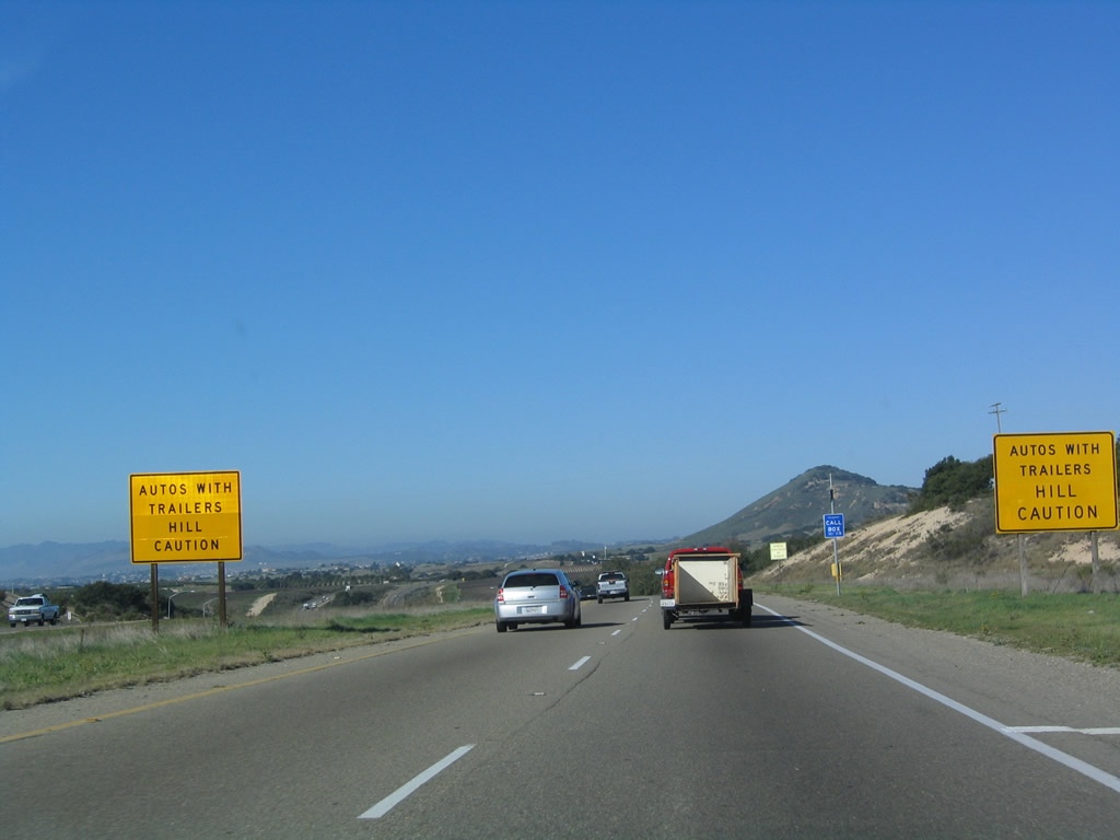
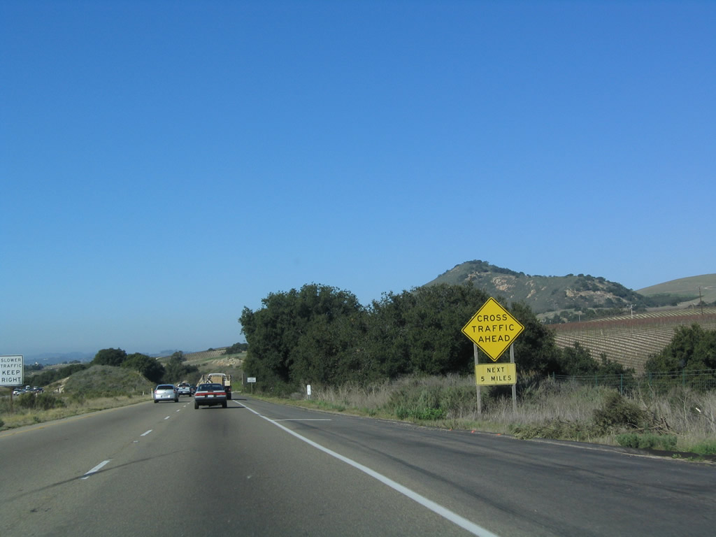
Between Nipomo and Arroyo Grande, U.S. 101 passes by the Newsom Ridge and enters this hilly region. Warning signs flank the northbound lanes due to the upcoming hill. Photo taken 12/23/04. |
|
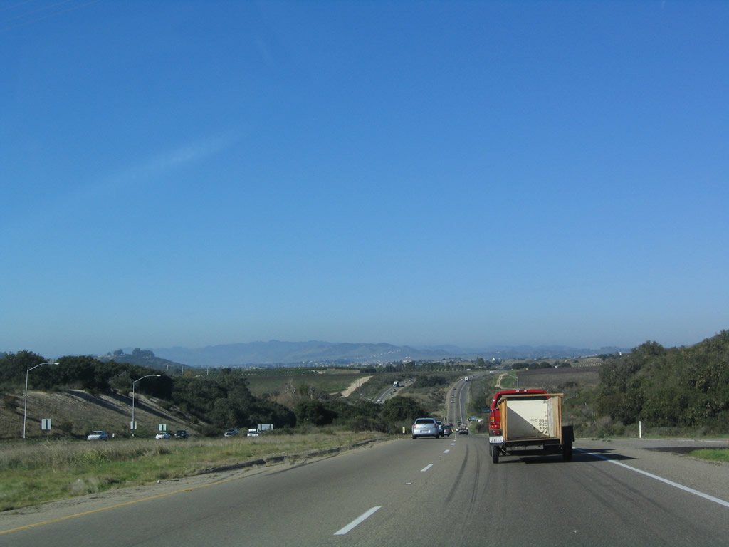
Descending from the summit, Arroyo Grande comes into view in the distance. Photo taken 12/23/04. |
|
The freeway again ends, and U.S. 101 will shift to an expressway configuration with at-grade intersections for the next five miles. Photo taken 12/23/04. |
|
|
The next exit along U.S. 101 (El Camino Real) is Exit 186, U.S. 101 Business (Traffic Way) to the city of Arroyo Grande. The sign was replaced between 2004 and 2008 to incorporate exit numbers. Photos taken 02/02/08 and 12/23/04. |
|
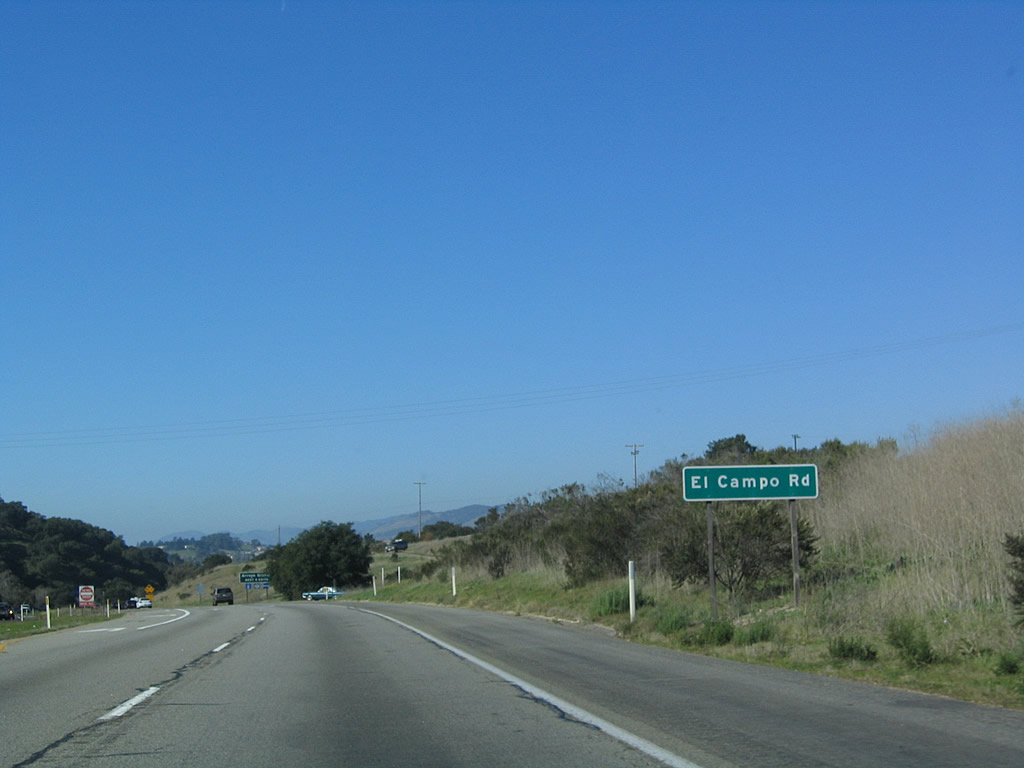
Prior to Exit 186, El Campo Road joins with U.S. 101 at an at-grade intersection. This is likely where Old U.S. 101 again returns to the highway after leaving Los Berros Road. Photo taken 12/23/04. |
|
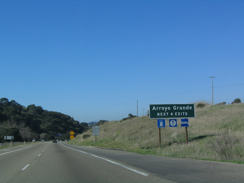
The next four exits all serve the city of Arroyo Grande: Exit 186, U.S. 101 Business (Traffic Way); Exit 187A, California 227/Grand Avenue to Branch Street; Exit 187B, Brisco Road; and Exit 188, Oak Park Road, West Branch Street, and Camino Mercado. Note the begin freeway placard just beyond this sign. Photo taken 12/23/04. |
|
|
Northbound U.S. 101 reaches Exit 186, U.S. 101 Business (Traffic Way) in Arroyo Grande. The signs were replaced to accommodate exit numbering between 2004 and 2008. Photos taken 02/02/08 and 12/23/04. |
|
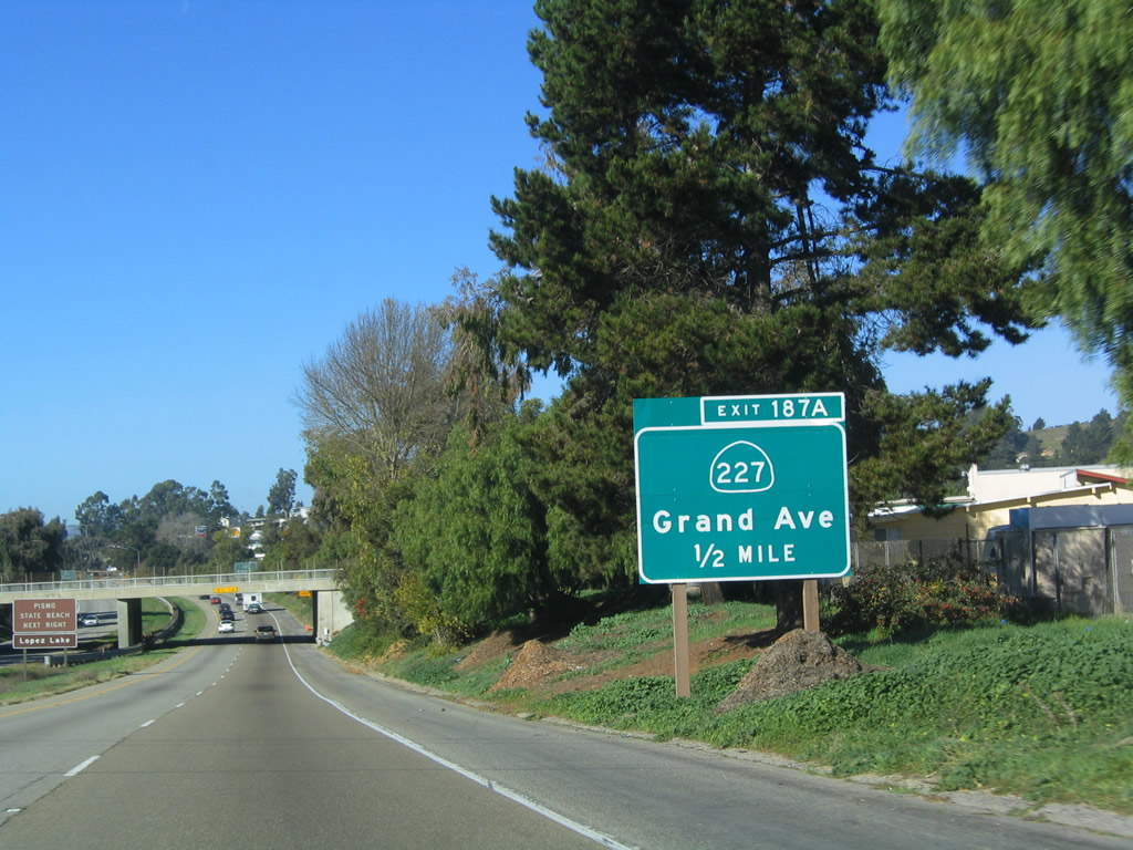
The next exit along U.S. 101 (El Camino Real) north is Exit 187A, California 227/Grand Avenue to Branch Street. This interchange serves as the southern terminus of California 227, a state route that connects Arroyo Grande with San Luis Obispo by way of Edna. Photo taken 12/23/04. |
|
|
Northbound U.S. 101 reaches Exit 187A, California 227/Grand Avenue to Branch Street. California 227 travels east through Arroyo Grande on Branch Street, then turns north on Corbett Canyon Road to Printz Road and Carpenter Canyon Road. This two-lane route offers an alternative to often-busy U.S. 101. Photos taken 02/02/08 and 12/23/04. |
|
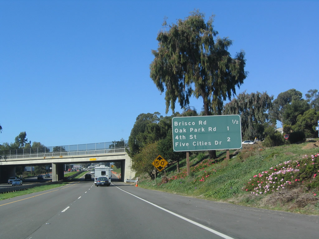
The next three exits along U.S. 101 (El Camino Real) north are: Exit 187B, Brisco Road; Exit 188, Oak Park Road, West Branch Street, and Camino Mercado; and Exit 189, Fourth Street south to Grover Beach, Five Cities Drive west to Pismo Beach, and James Way. Photo taken 12/23/04. |
|
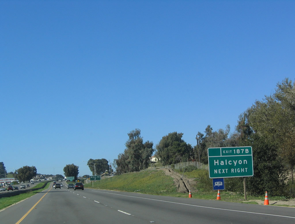
Use Exit 187B, Brisco Road west through Arroyo Grande to Grover Beach. This exit also serves as a connection to southbound Halycon Road, which serves Arroyo Grande and Oceano before meeting California 1 south en route to Guadalupe. Photo taken 12/23/04. |
|
Northbound U.S. 101 (El Camino Real) reaches Exit 187B, Brisco Road and Halycon Road. Photo taken 12/23/04. |
|
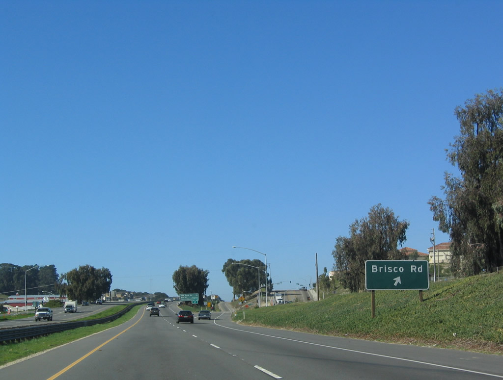
Passing over Brisco Road, the next two exits along U.S. 101 (El Camino Real) north are: Exit 188, Oak Park Road, West Branch Street, and Camino Mercado; and Exit 189, Fourth Street south to Grover Beach, Five Cities Drive west to Pismo Beach, and James Way. Photo taken 12/23/04. |
|
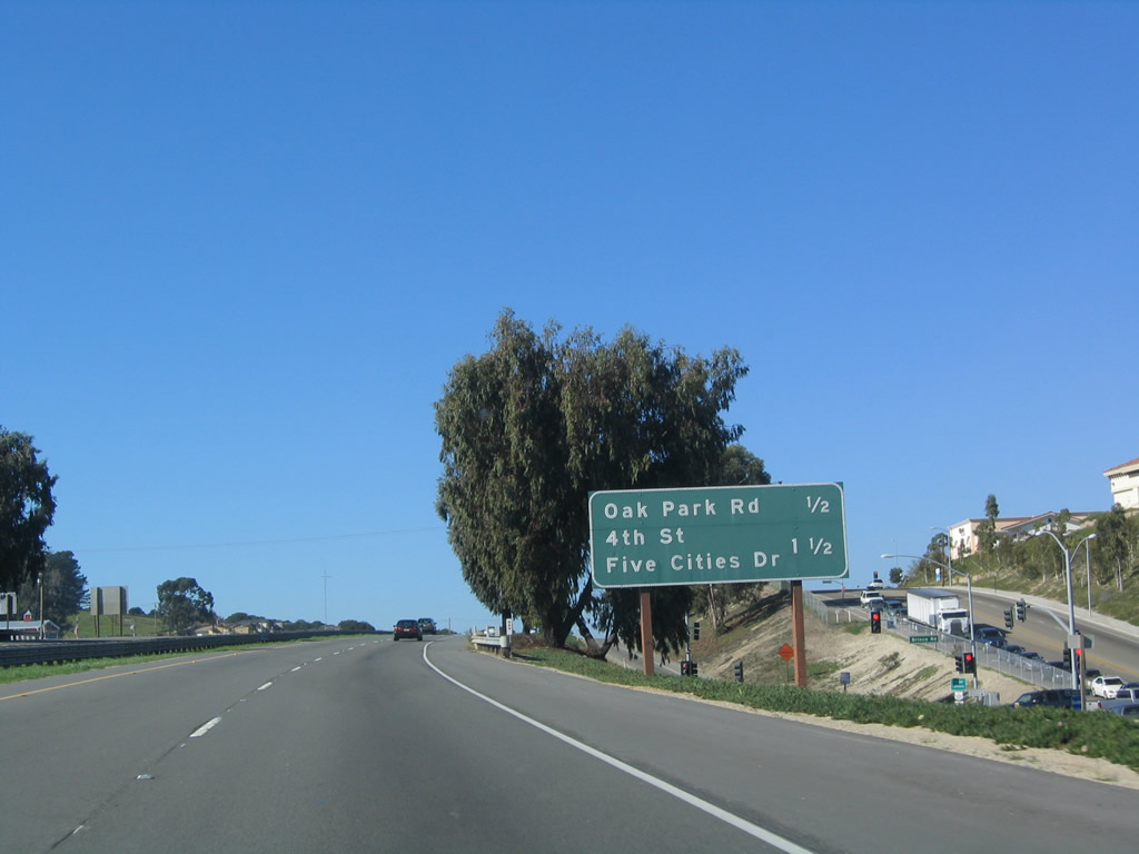
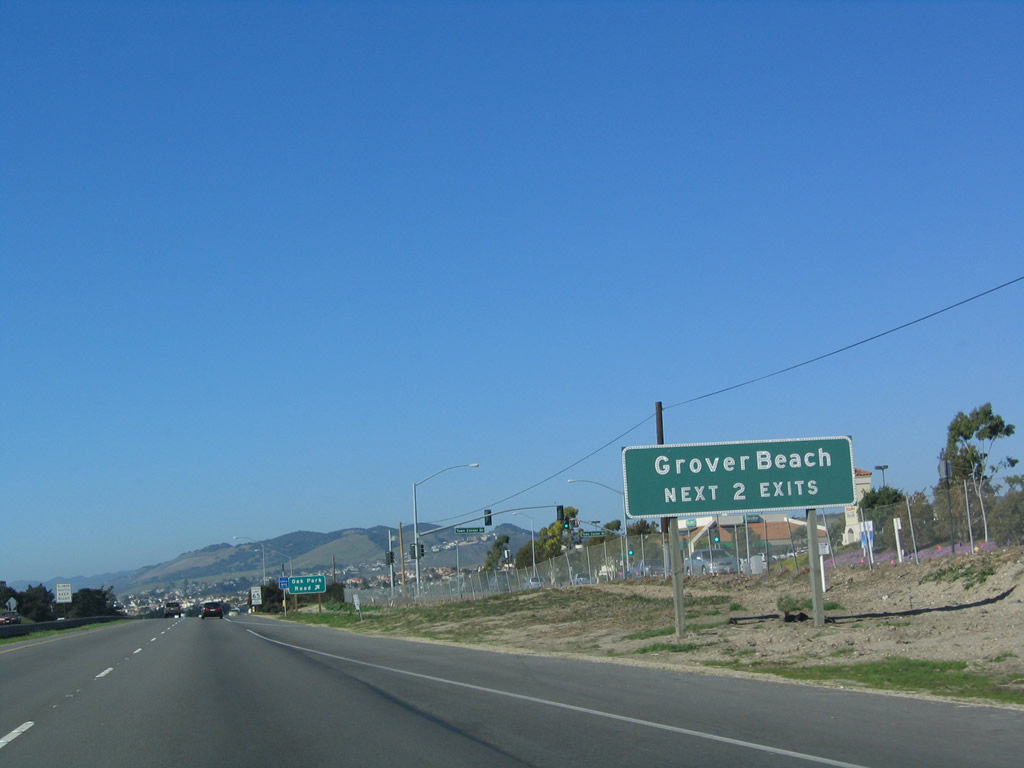
Both Exit 188 (Oak Park Road) and Exit 189 (Fourth Street) serve the city of Grover Beach, which is nearly bypassed by U.S. 101. Photo taken 12/23/04. |
|
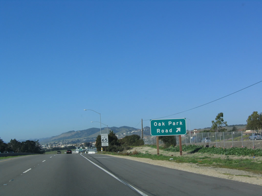
Northbound U.S. 101 (El Camino Real) reaches Exit 188, Oak Park Road, West Branch Street, and Camino Mercado. Photo taken 12/23/04. |
|
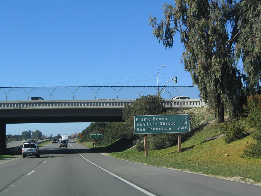
A roadside mileage sign is posted prior to the Oak Park Road overpass for Pismo Beach (two miles), San Luis Obispo (14 miles), and San Francisco (246 miles). U.S. 101 leaves the city of Arroyo Grande and enters the city of Pismo Beach. Grover Beach is located just southwest of U.S. 101, but the freeway does not enter that city. Photo taken 12/23/04. |
|
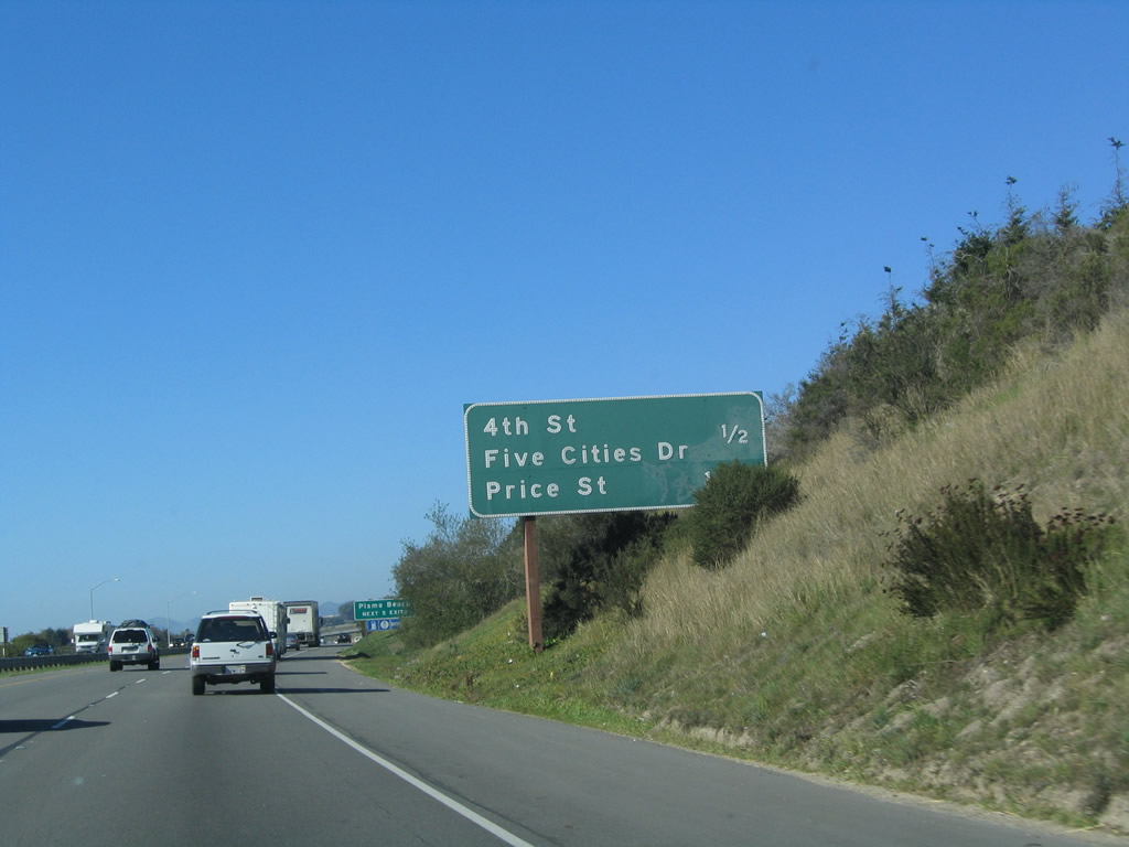
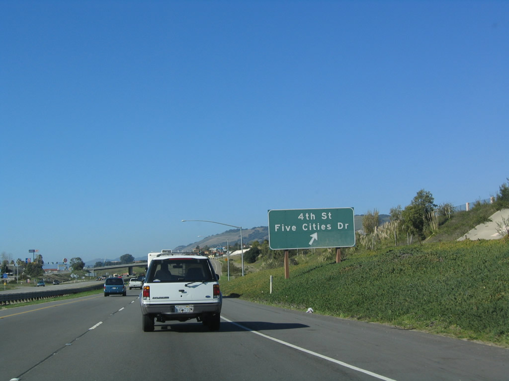
The next two exits along U.S. 101 (El Camino Real) north are: Exit 189, Fourth Street south to Grover Beach, Five Cities Drive west to Pismo Beach, and James Way and Exit 190, U.S. 101 Business (Price Street) northwest to Pismo Beach. Photo taken 12/23/04. |
|
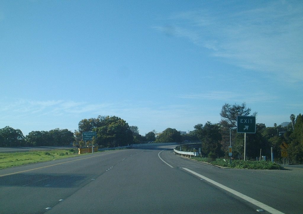
The next five exits along U.S. 101 (El Camino Real) north serve the city of Pismo Beach: Exit 189, Fourth Street; Exit 190, U.S. 101 Business (Price Street); Exit 191A, Wadsworth Street to California 1 south; Exit 191B, Mattie Road and Shell Beach Road; and Exit 193, Spyglass Drive. Photo taken 12/23/04. |
|
Northbound U.S. 101 reaches Exit 189, Fourth Street/Five Cities Drive. The "five cities" were Arroyo Grande, Grover Beach, Oceano, Pismo Beach, and Shell Beach. Of these five "cities," only four remain. Shell Beach was absorbed into the city of Pismo Beach in the late 1970s or early 1980s. This interchange was the location of a shopping area referred to as "Five Cities Shopping Center." The old shopping center was became vacant, and was eventually leveled to create the outlet mall currently located at this interchange. Photo taken 12/23/04. |
|
|
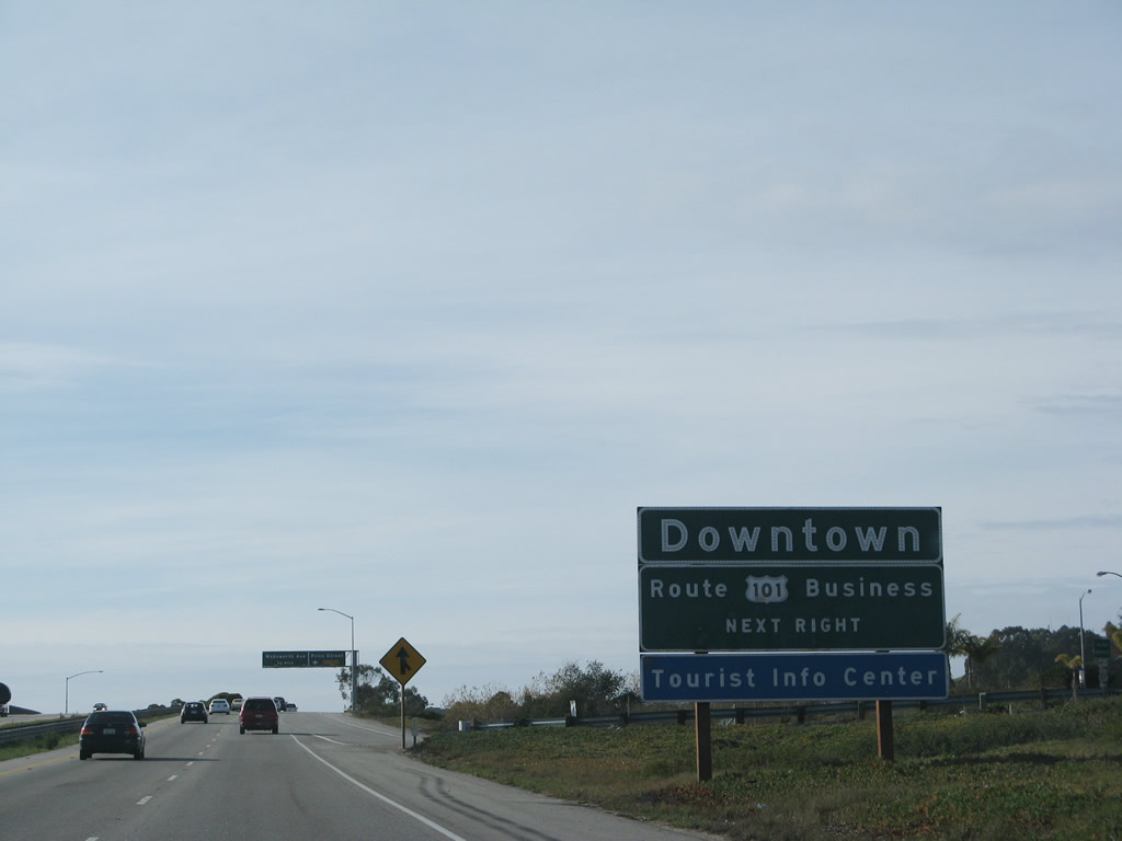
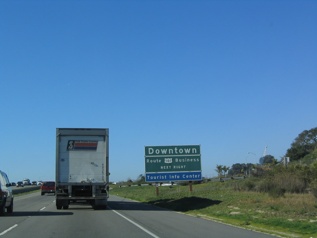
The next exit along U.S. 101 (El Camino Real) is Exit 190, U.S. 101 Business (Price Street) for Pismo Beach. This sign is somewhat misleading, since it does not clarify which of the five cities' downtowns are reached by using this exit. The business loop is mostly unsigned and reconnects with U.S. 101 at Exit 191B, Mattie Road. Photos taken 02/02/08 and 12/23/04. |
|
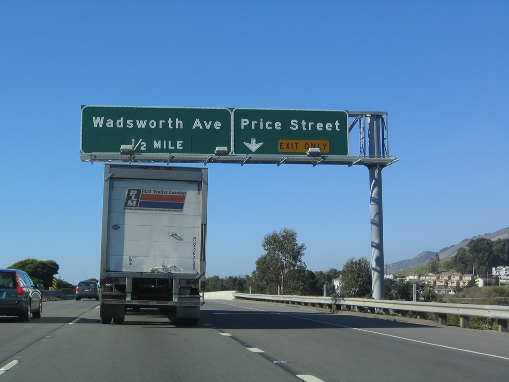
The right lane of U.S. 101 (El Camino Real) north becomes exit only for Exit 190, U.S. 101 Business (Price Street), and the next exit along northbound is Exit 191A, Wadsworth Street. Photo taken 12/23/04. |
|
Northbound U.S. 101 (El Camino Real) reaches Exit 190, U.S. 101 Business (Price Street). Photo taken 12/23/01. |
|
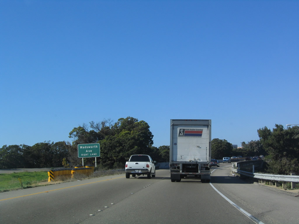
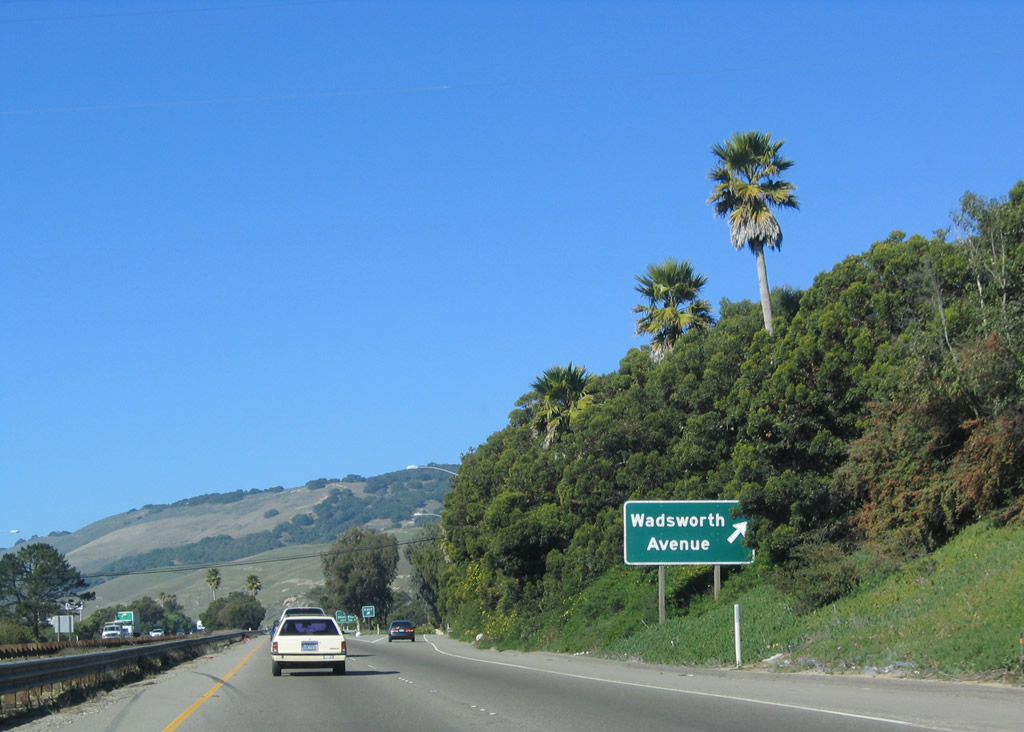
The next exit along U.S. 101 (El Camino Real) is Exit 191A, Wadsworth Avenue. At this point, California 1 rejoins U.S. 101, and they will remain merged between Exit 191A and Exit 203B (in San Luis Obispo). Through Pismo Beach, California 1 enters the city from the south via Pacific Boulevard, follows Dolliver Street into the city, turns onto Hinds Avenue, then turns northwest on Bello Street to merge onto U.S. 101 a short distance ahead. Photo taken 12/23/04. |
|
Northbound U.S. 101 (El Camino Real) reaches Exit 191A, Wadsworth Avenue to California 1 (Dolliver Street) south. Photo taken 12/23/04. |
| U.S. 101 (El Camino Real) and California 1 north |
|
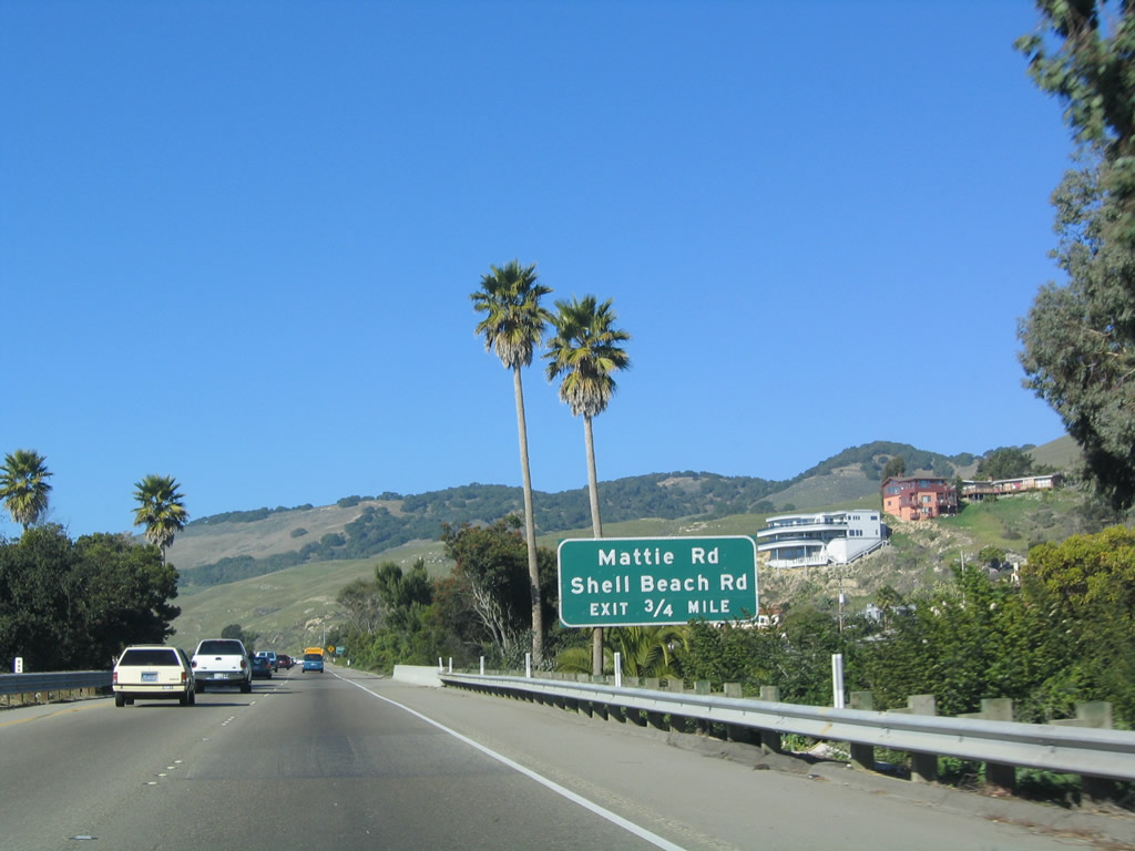
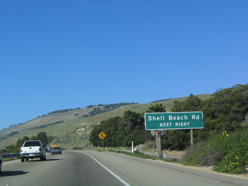
The next exit along U.S. 101 (El Camino Real) and California 1 (Cabrillo Highway) is Exit 191B, Mattie Road and Shell Beach Road. Photo taken 12/23/04. |
|
Shell Beach Road leads into the community of Shell Beach, which is part of the city of Pismo Beach. Photo taken 12/23/04. |
|
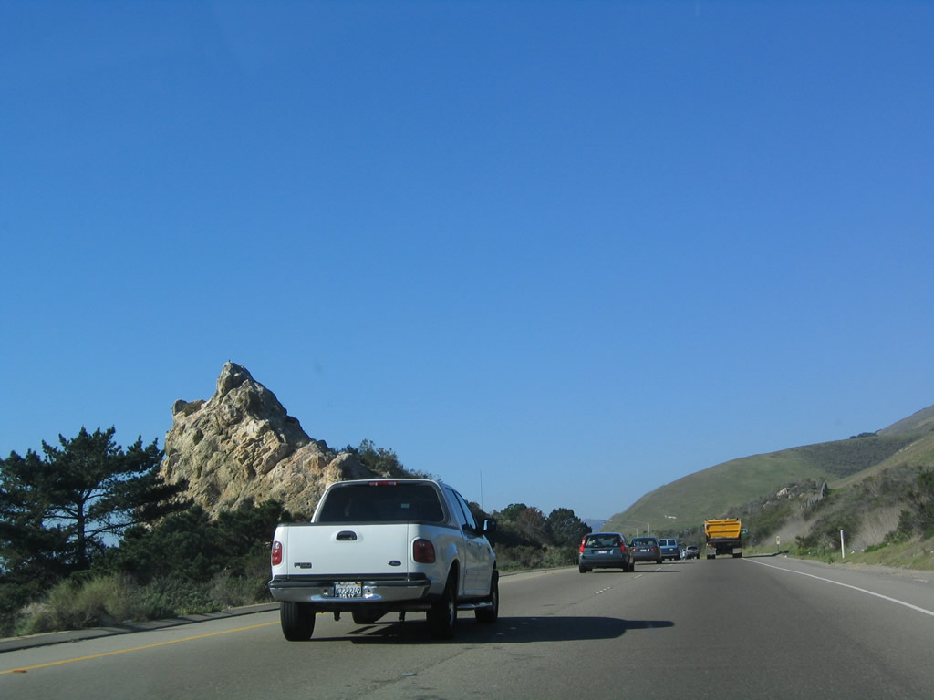
An unusual rock outcropping is located in the median strip of U.S. 101 prior to the Mattie Road/Shell Beach Road interchange. Photo taken 12/23/04. |
|
Northbound U.S. 101 (El Camino Real) and California 1 (Cabrillo Highway) reach Exit 191B, Mattie Road and Shell Beach Road. U.S. 101 Business may return at this interchange, although signage is inconclusive. Photo taken 12/23/04. |
|
This reassurance shield assembly contains shields for both U.S. 101 and California 1 north after the on-ramp from Shell Beach Road and Mattie Road. Photo taken 12/23/04. |
|
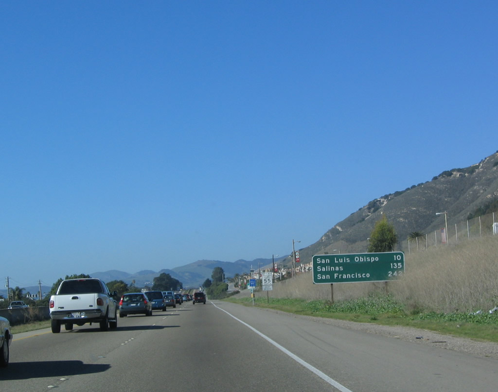
A mileage sign provides the distance to San Luis Obispo (10 miles), Salinas (Monterey County seat, 135 miles), and San Francisco (control city, 242 miles). Photo taken 12/23/04. |
|
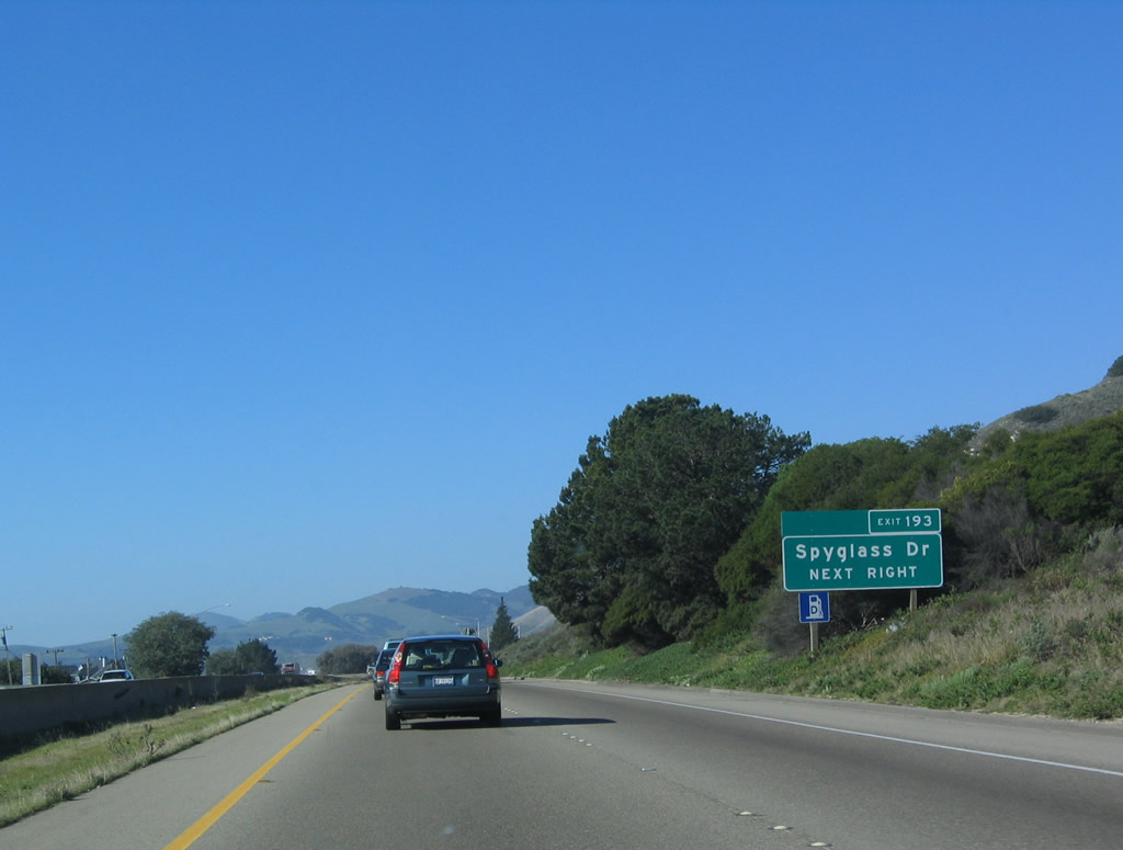
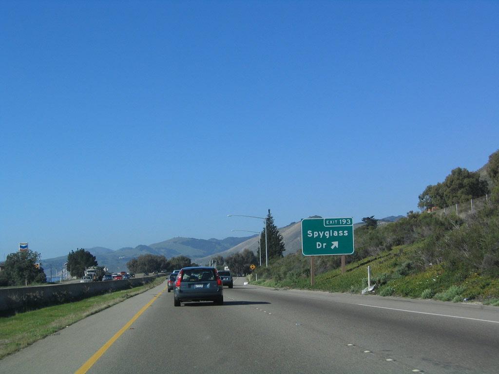
The next exit along U.S. 101 and California 1 north is Exit 193, Spyglass Drive (one-half mile). This is the final exit to serve Shell Beach and Pismo Beach. Photo taken 12/23/04. |
|
Northbound U.S. 101 and California 1 reach Exit 193, Spyglass Drive. Photo taken 12/23/04. |
|
Another reassurance shield assembly for U.S. 101 and California 1 north is posted after the on-ramp from Spyglass Drive. Photo taken 12/23/04. |
|
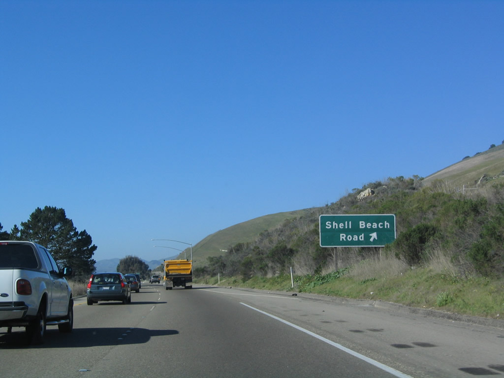
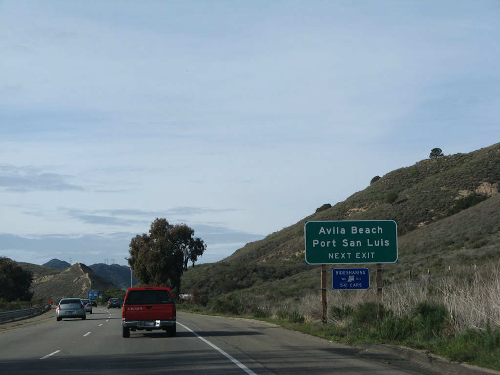
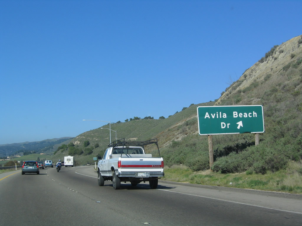
The next exit along U.S. 101 and California 1 north is Exit 195, Avila Beach Drive west to Avila Beach. This exit also connects to the north end of Shell Beach Road, which might be the north end of the business route through Shell Beach and Pismo Beach. Photo taken 02/02/08. |
|
Northbound U.S. 101 and California 1 reach Exit 195, Avila Beach Drive. Photo taken 12/23/04. |
|
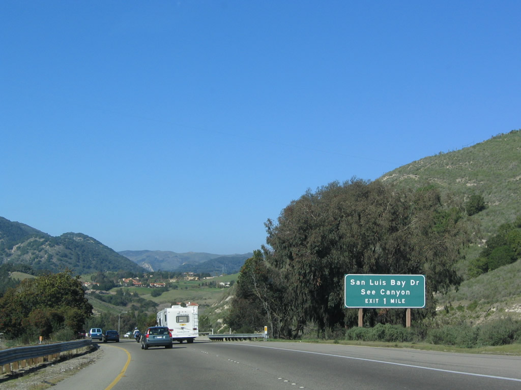
The next exit along U.S. 101 and California 1 north is Exit 196, San Luis Bay Drive. Photo taken 12/23/04. |
|
Another set of reassurance shields for U.S. 101 and California 1 north are posted prior to the San Luis Obispo Creek bridge. After being ignored for the most part in Santa Barbara County, California 1 not only gets its own shield but also receives top billing on this assembly. Photo taken 12/23/04. |
|
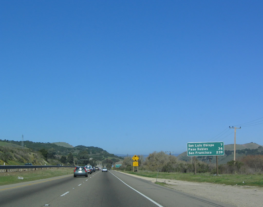
This mileage sign provides the distance to San Luis Obispo (seven miles), Paso Robles (36 miles), and San Francisco (239 miles). Photo taken 12/23/04. |
|
Northbound U.S. 101 and California 1 reach Exit 196, San Luis Bay Drive. Photo taken 12/23/04. |
|
|
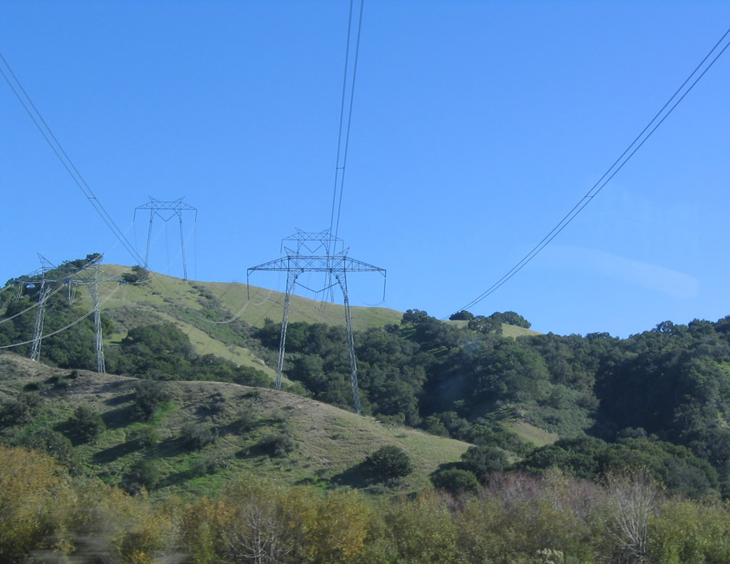
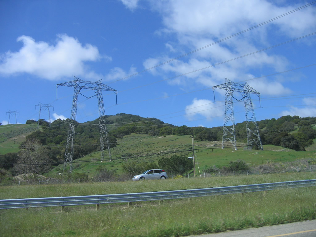
A pair of 500kV power lines cross over U.S. 101 and California 1. This lines lead from the Diablo Canyon Nuclear Generating Station northeast to the Path 15 500kV power lines in the Central Valley (meeting Path 15 and other lines at the massive Midway substation off California 58 in Buttonwillow). Operated by Pacific Gas and Electric, Diablo Canyon is one of two nuclear power plants in California (the other is San Onofre Nuclear Generating Station south of San Clemente in northern San Diego County owned by Southern California Edison, San Diego Gas and Electric, and the city of Riverside). A third 500kV power line from Diablo Canyon connects to Path 15, and that line will cross U.S. 101 at the California 58 interchange near Santa Margarita. Photos taken 12/23/04 and 03/18/06. |
|
|
|
|
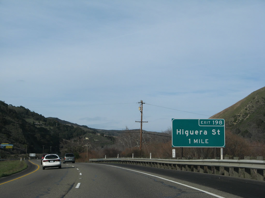
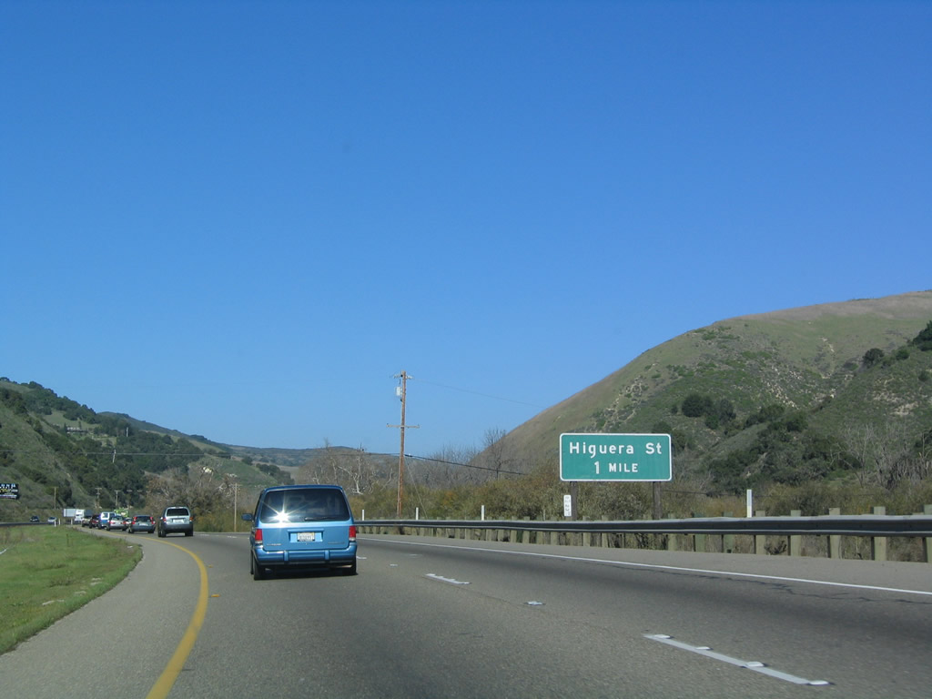
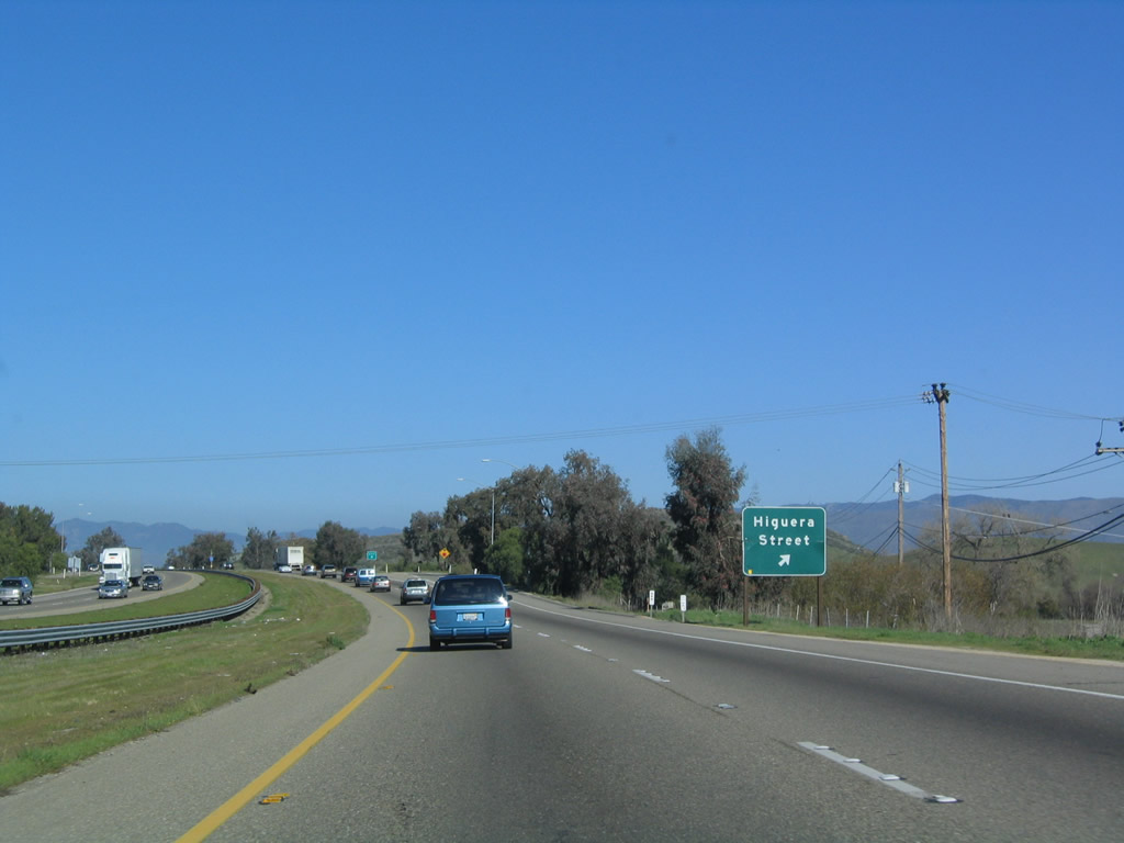
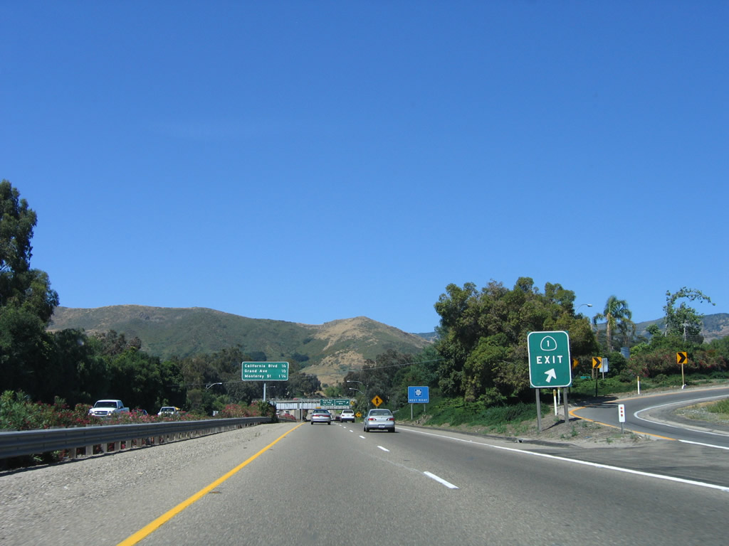
The next exit along U.S. 101 and California 1 north is Exit 198, Higuera Street (one mile). Photos taken 02/02/08 and 12/23/04. |
|
|
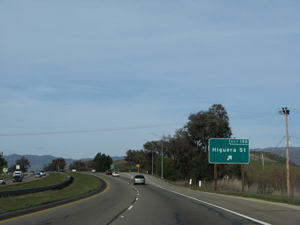
Northbound U.S. 101 and California 1 reach Exit 198, Higuera Street. This exit serves the old alignment of U.S. 101 into San Luis Obispo. It is not designated as an official business route. Old U.S. 101 followed Higuera Street north into the city, used the Higuera Street-Marsh Street one-way couplet through downtown, and reconnected with U.S. 101 north of town via Monterey Street (reunite with the freeway at Exit 204). Photos taken 02/02/08 and 12/23/04. |
|
The next exit along northbound U.S. 101 (El Camino Real) and California 1 (Cabrillo Highway) is Exit 200A, Los Osos Valley Road. Photo taken 12/23/04. |
|
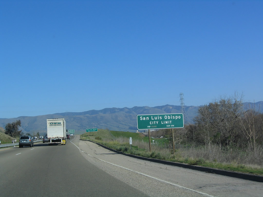
U.S. 101 and California 1 enter the city of San Luis Obispo. Commonly known as SLO, San Luis Obispo is the seat of San Luis Obispo County and is the among the larger cities on the Central Coast of California (population 44,174 as of the 2000 Census, elevation 234 feet). Founded along with the Mission San Luis Obispo de Tolosa in 1772 by Father Junipero Serra, San Luis Obispo features a bustling downtown and features an incredible array of restaurants, shops, and museums in a walkable core. The city is also home to the California State Polytechnic University (Cal Poly), which has over 18,000 students and offers a variety of degree programs. The 6,000-acre campus is situated northwest of U.S. 101 and can be reached via Exit 203D, Grand Avenue. Photo taken 12/23/04. |
|
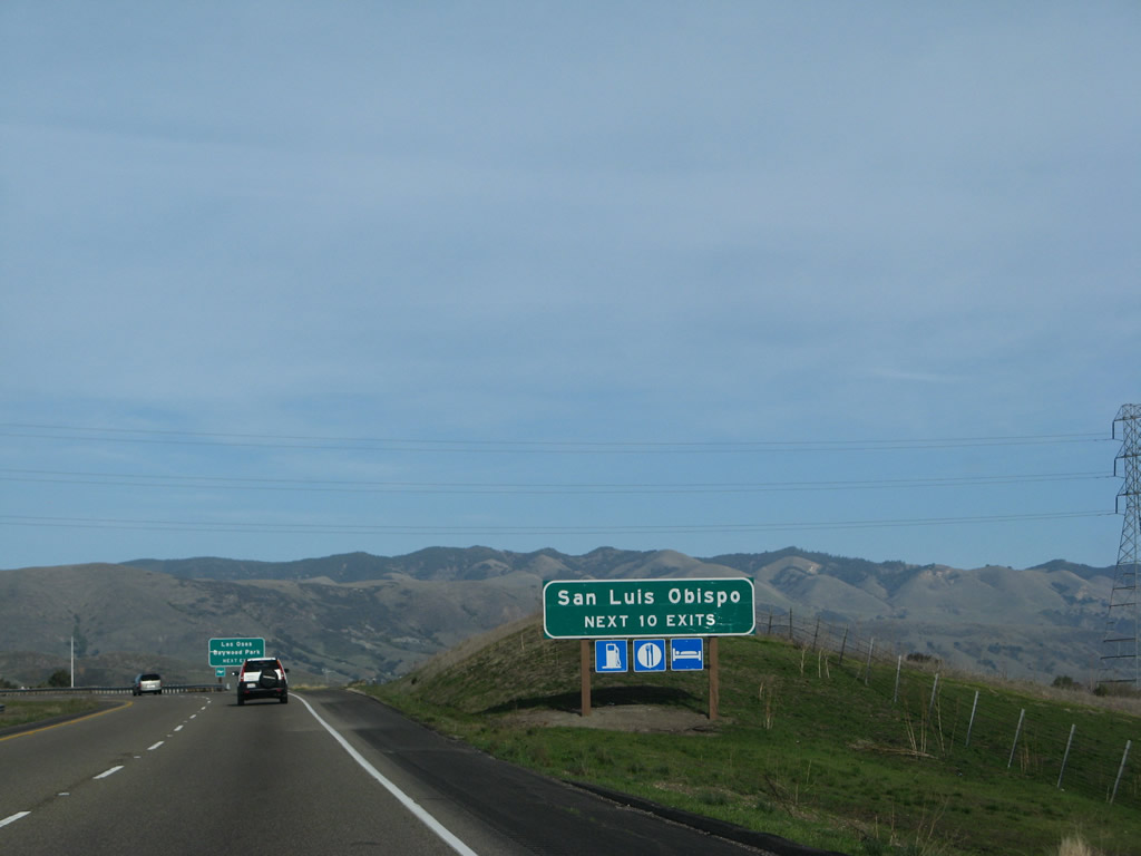
The next ten exits along northbound U.S. 101 (El Camino Real) and California 1 (Cabrillo Highway) serve the city of San Luis Obispo: Exit 200A, Los Osos Valley Road; Exit 200B, Prado Road and Elks Lane; Exit 201, California 227/Madonna Road; Exit 202A, Marsh Street; Exit 202B, Broad Street; Exit 203A, Osos Street; Exit 203B, Walnut Street to California 1 (Cabrillo Highway) (Santa Rosa Street) north to Cambria and Hearst Castle; Exit 203C, California Boulevard; Exit 203D, Grand Avenue; and Exit 204, Monterey Street. Photo taken 02/02/08. |
|
|
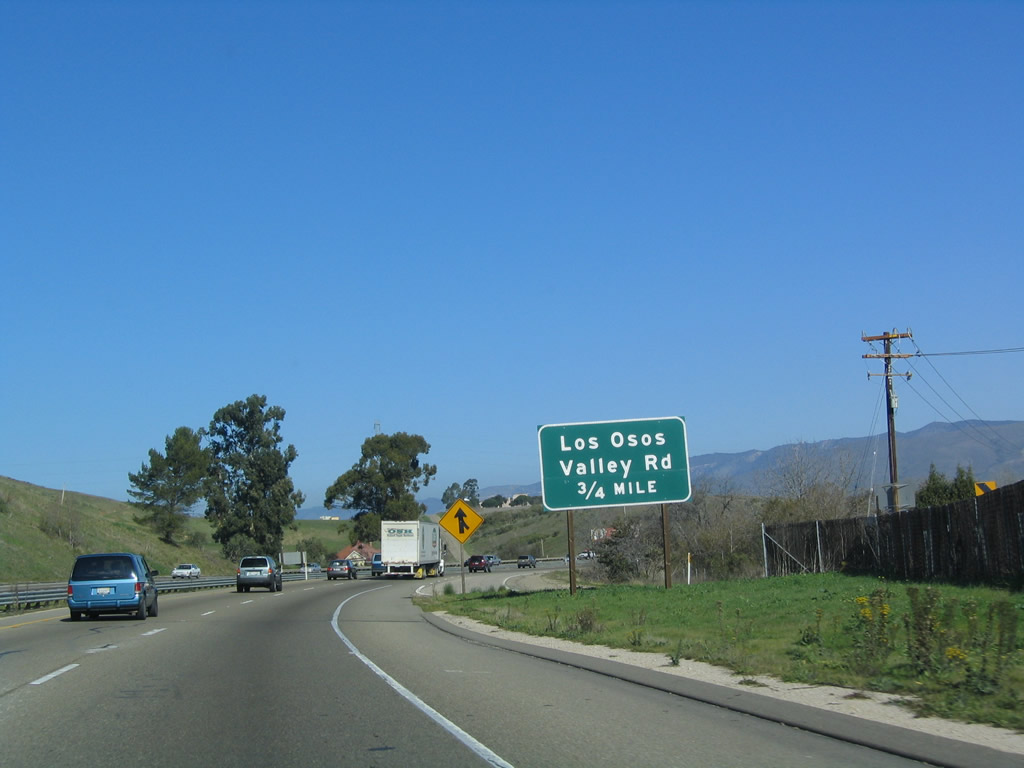
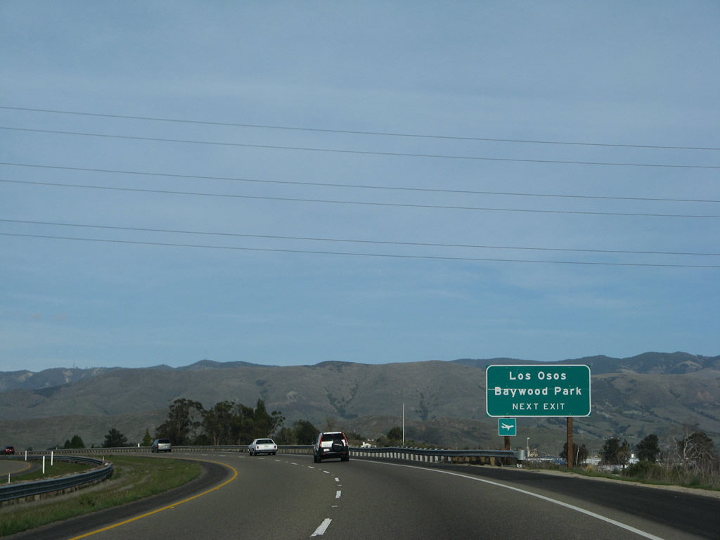
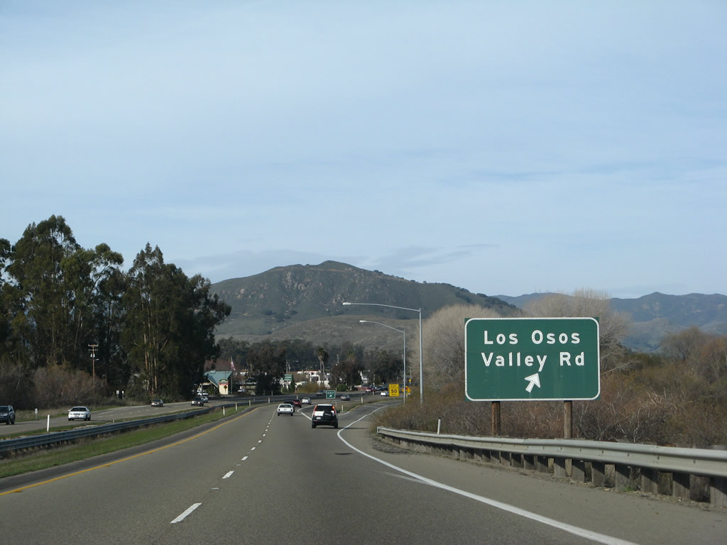
Use Exit 200A, Los Osos Valley Road west to the unincorporated communities of Baywood Park and Los Osos, both of which are located along the coast just south of Morro Bay. When the sign was replaced between 2004 and 2008, no exit number was added. Photos taken 02/02/08 and 12/23/04. |
|
Northbound U.S. 101 (El Camino Real) and California 1 (Cabrillo Highway) reach Exit 200A, Los Osos Valley Road to Los Osos and Baywood. Photo taken 02/02/08. |
|
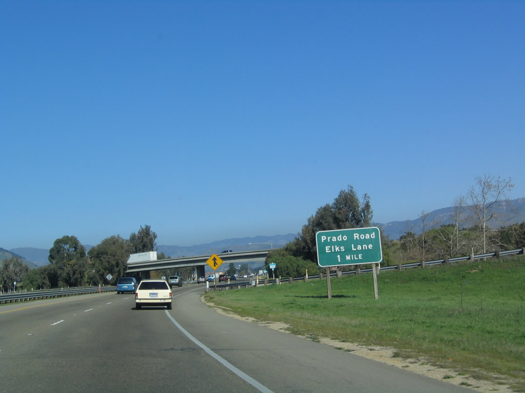
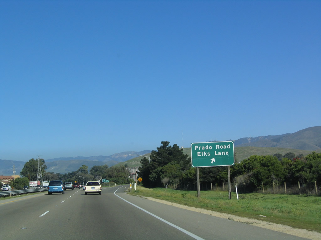
The next exit along northbound U.S. 101 (El Camino Real) and California 1 (Cabrillo Highway) is Exit 200B, Prado Road and Elks Lane (one mile). Photo taken 12/23/04. |
|
Northbound U.S. 101 (El Camino Real) and California 1 (Cabrillo Highway) reach Exit 200B, Prado Road and Elks Lane. Photo taken 12/23/04. |
|
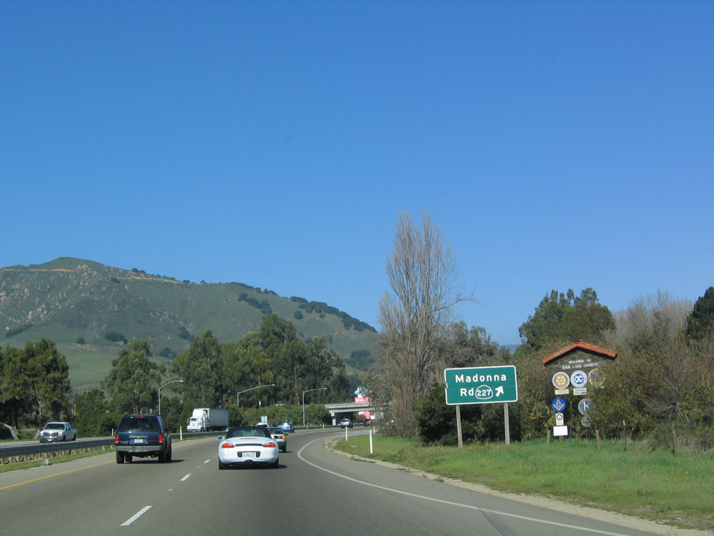
The next exit along northbound U.S. 101 and California 1 is Exit 201, California 227/Madonna Road south. This exit is home to the famous Madonna Inn (no relation to the pop music star of the same name). The Madonna Inn dominates the view on the west side of the freeway; its 109 rooms are decorated in themes. The Madonna Inn was built in 1958 by Alex Madonna, and includes a rock waterfall urinal. Photo taken 12/23/04. |
|
A U.S. 101 north reassurance shield is posted after the on-ramp from Prado Road and Elks Lane. A California 1 shield was missing from the brackets below the U.S. 101 shield on this pole. Photo taken 03/18/06. |
|
Northbound U.S. 101 and California 1 reach Exit 201, California 227/Madonna Road. From here, California 227 travels east on Madonna Road, turns north briefly on Higuera Street, turns west on South Street, and then turns south on Broad Street for the distance south toward Edna and Arroyo Grande. Photo taken 12/23/04. |
|
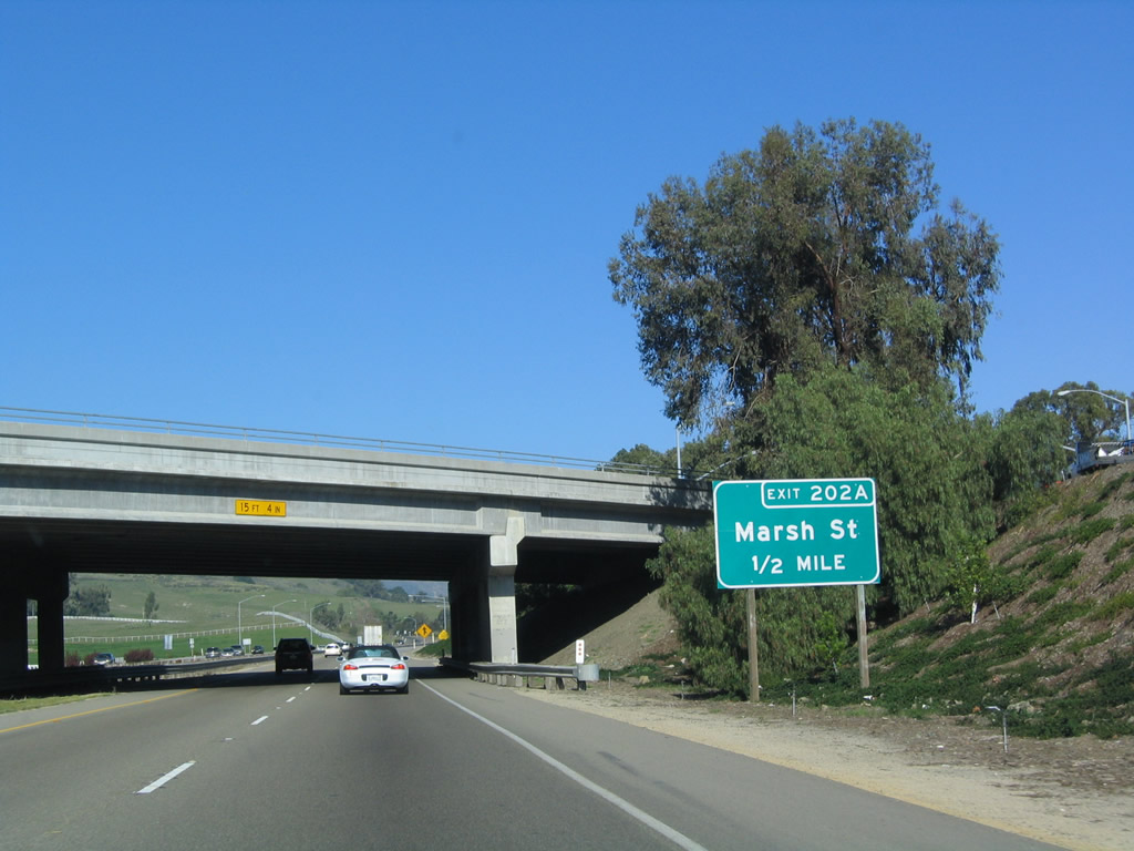
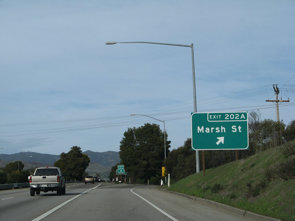
The next exit along northbound U.S. 101 and California 1 is Exit 202A, Marsh Street (old alignment of U.S. 101 and possible former U.S. 101 Business through SLO). This exit leads into downtown San Luis Obispo. Photo taken 12/23/04. |
|
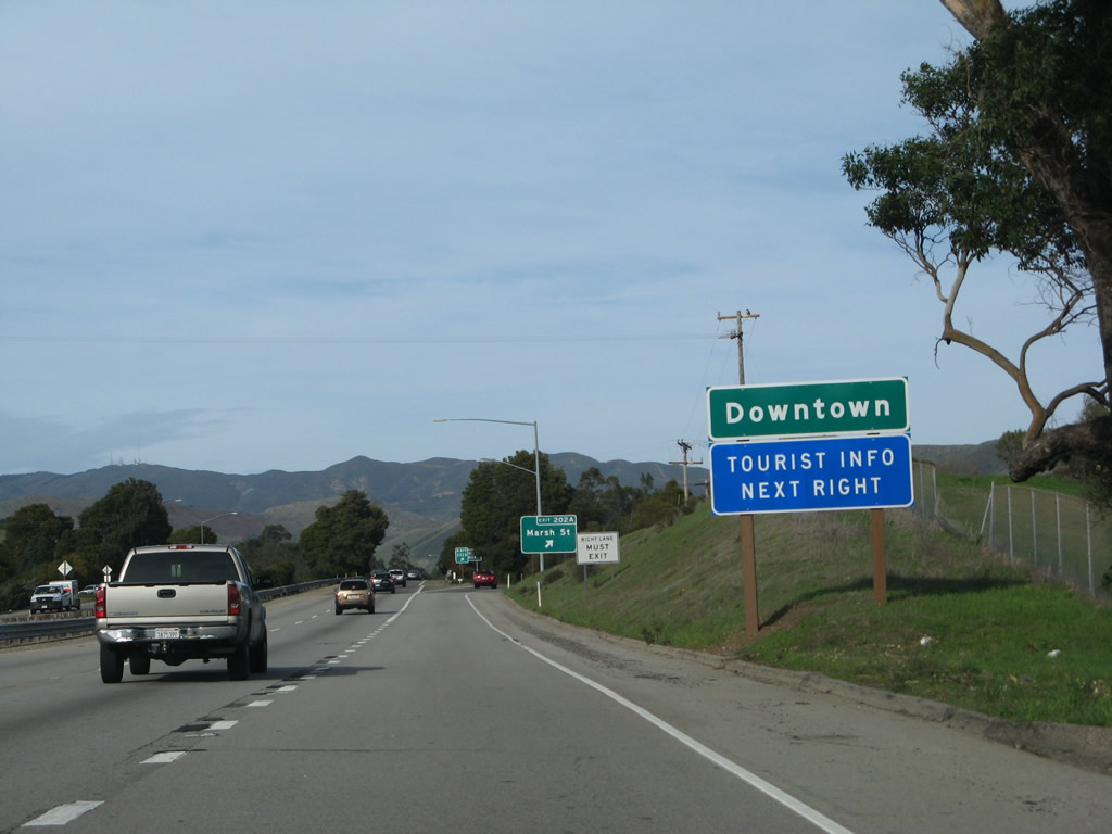
Exit 202A, (Former U.S. 101 Business/Marsh Street) is the best route into downtown San Luis Obispo. The northbound traffic follow Marsh Street, and southbound traffic follows Higuera Street. To Mission San Luis Obispo, follow Marsh Street northeast to Broad Street, then turn left. Photo taken 02/02/08. |
|
Northbound U.S. 101 and California 1 reach Exit 202A, Marsh Street (old U.S. 101 through SLO). Photo taken 02/02/08. |
|
Upon exiting, the off-ramp immediately merges onto Marsh Street and proceeds northeast into downtown SLO. Photo taken 12/23/04. |
|
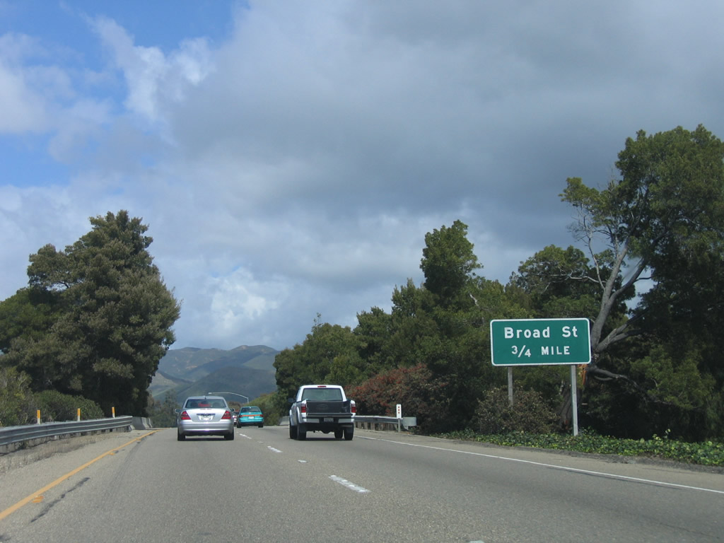
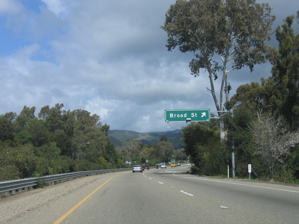
The next exit along northbound U.S. 101 and California 1 is Exit 202B, Broad Street. Photo taken 03/18/06. |
|
Use Exit 202B (Broad Street) to the Mission San Luis Obispo de Tolosa. Founded in 1772 by Father Junipero Serra, the mission is located near downtown San Luis Obispo and features museums and historic buildings dating to the California mission era. Named after Saint Louis, Bishop of Toulouse, France, the mission was the fifth founded by Father Serra in California. Photo taken 06/28/06. |
|
This mileage sign provides the distance to three of the next four exits from U.S. 101 north: Exit 202B, Broad Street; Exit 203A, Osos Street; Exit 203B, California 1 (Cabrillo Highway) north; and Exit 203C, California Boulevard. Photo taken 03/18/06. |
|
Northbound U.S. 101 (El Camino Real) reaches Exit 202B, Broad Street. Passing through San Luis Obispo, the next five exits come quickly; exiting traffic should stay right. U.S. 101 has limited sight distance due to its winding path through downtown San Luis Obispo. Photo taken 03/18/06. |
|
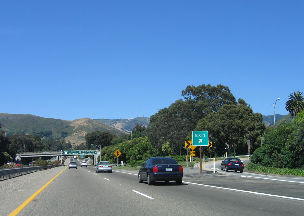
At Exit 203B, California 1 (Cabrillo Highway) and U.S. 101 (El Camino Real) will split, with California 1 following the coastline toward Big Sur and Monterey and U.S. 101 taking a more interior route toward Salinas. The two routes will not reunite until the foot of the Golden Gate Bridge in San Francisco. Photo taken 03/18/06. |
|
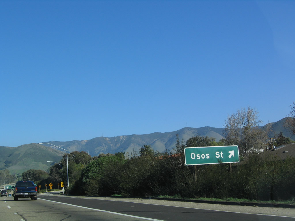
Northbound California 1 (Cabrillo Highway) and U.S. 101 (El Camino Real) reach Exit 203A, Osos Street. Photo taken 06/28/06. |
|
The Osos Street exit ramp only connects to Osos Street south into downtown. There is no access to the section of Osos Street north of the freeway without taking a detour by way of Santa Rosa Street (California 1). Photo taken 06/28/06. |
|
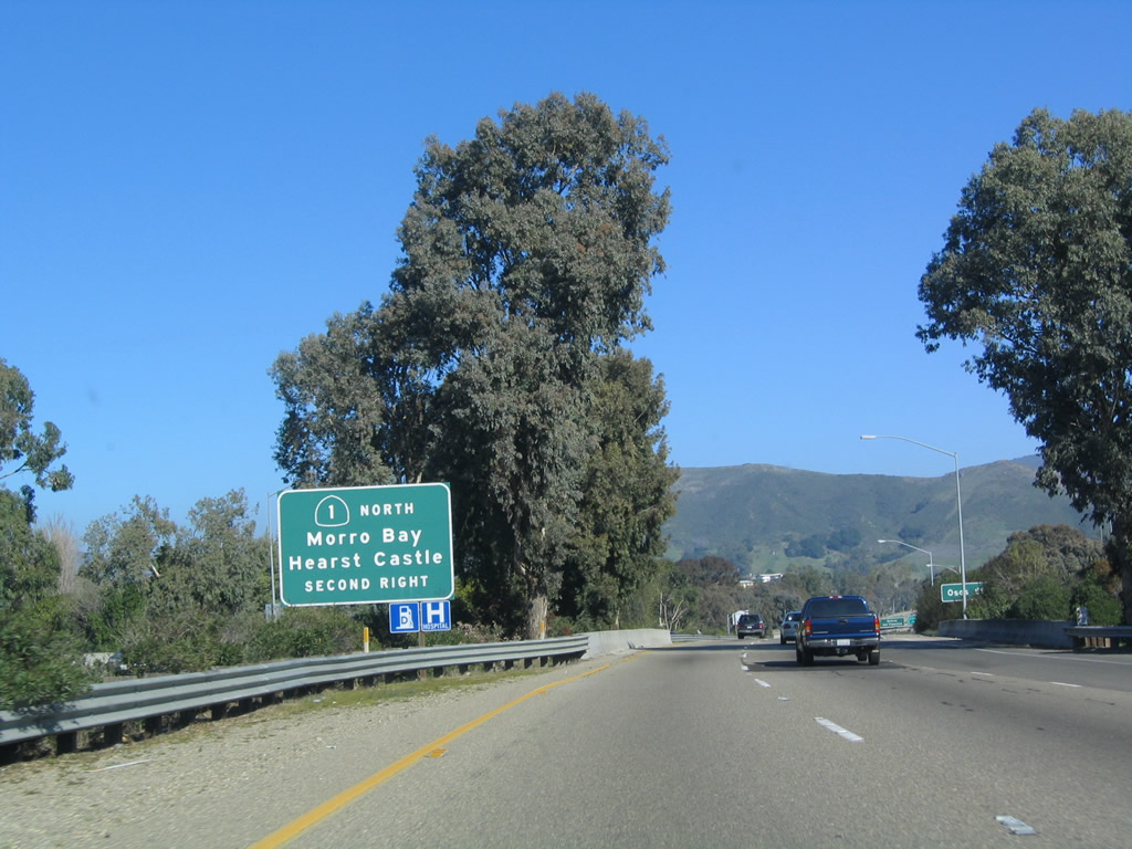
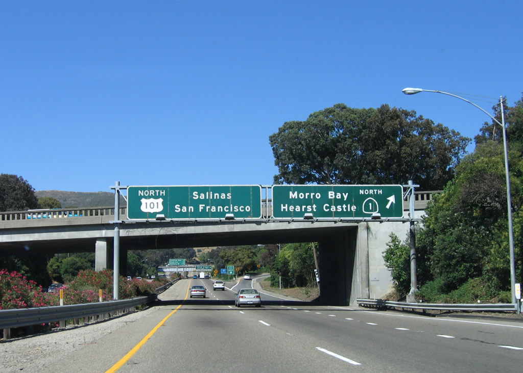
Immediately after Exit 203A (Osos Street), the freeway will split between U.S. 101 and California 1. While U.S. 101 stays inland and offers a mostly freeway and expressway route to the San Francisco Bay Area by way of Paso Robles, Salinas, and San Jose, California 1 provides a scenic coastal route from San Luis Obispo through Morro Bay to Cambria, Big Sur, Monterey, and Santa Cruz. Note the use of the Hearst Castle as a control city for California 1 north. Photo taken 06/28/06. |
|
Northbound U.S. 101 and California 1 reach Exit 203B, California 1 (Cabrillo Highway) north. California 1 leads north along the coast into the Big Sur, and it is consistently ranked as one of the most beautiful drives in the United States. U.S. 101 stays inland to avoid the coast and provide a faster route to the San Francisco Bay Area. Photo taken 06/28/06. |
|
At the top of the ramp is this sign for California 1's continuation. Upon exiting, California 1 follows Walnut Street in a loop until meeting Santa Rosa Street. At that intersection, California 1 will turn northwest toward Morro Bay. Photo taken 03/18/06. |
|
Walnut Street meets Santa Rosa Street at this intersection. Turn left into downtown San Luis Obispo or right to follow California 1 northwest to Morro Bay and Hearst Castle. Photo taken 03/18/06. |
| U.S. 101 north |
|
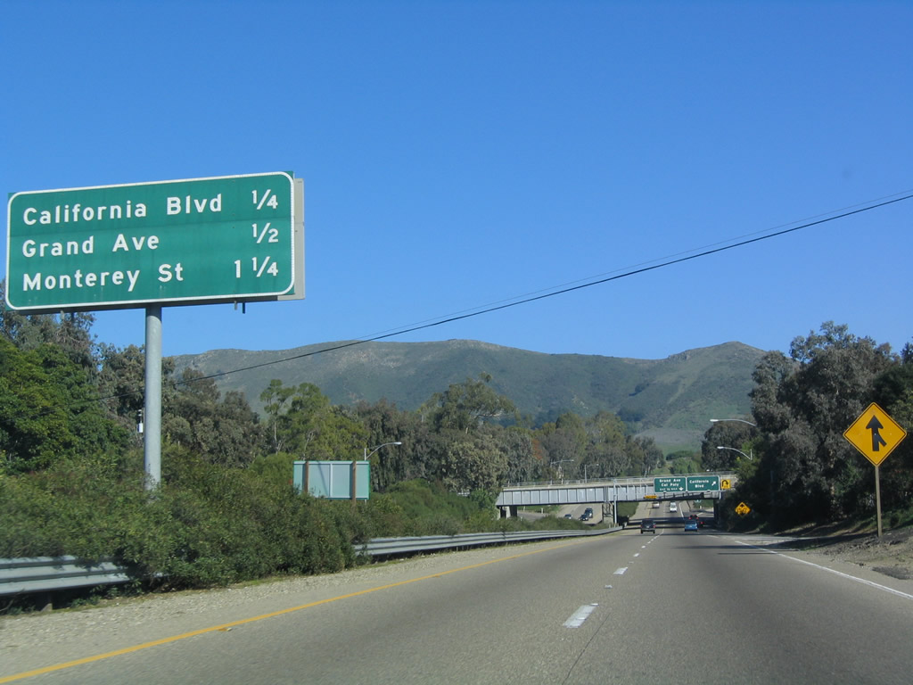
Back on the mainline, this mileage sign provides the distance to the next three exits from U.S. 101 (El Camino Real) north: Exit 203C, California Boulevard; Exit 203D, Grand Avenue; and Exit 204, Monterey Street (Old U.S. 101/north end of former business loop). Photo taken 12/23/04. |
|
Northbound U.S. 101 (El Camino Real) reaches Exit 203C, California Boulevard. The next exit along northbound is Exit 203D, Grand Avenue. Photo taken 06/28/06. |
|
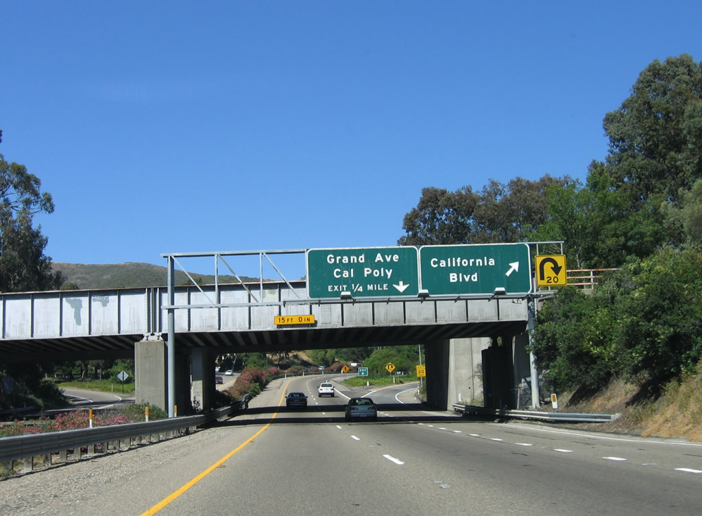
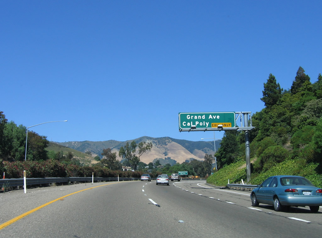
Immediately thereafter, northbound U.S. 101 (El Camino Real) reaches Exit 203D, Grand Avenue south to downtown and north to California Polytech State University (often referred to as "Cal Poly"). Photo taken 06/28/06. |
|
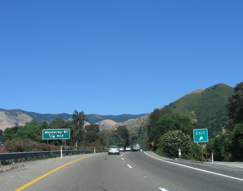
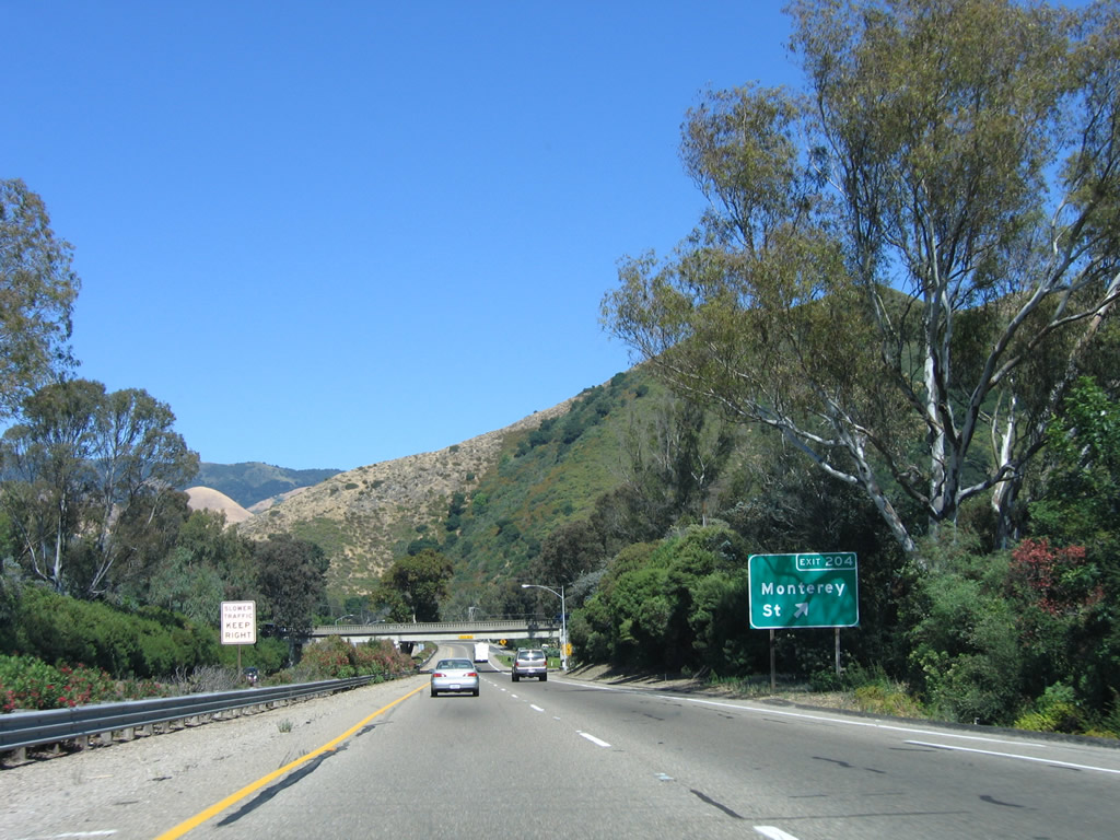
The final exit along U.S. 101 (El Camino Real) north to serve the city of San Luis Obispo is Exit 204, Monterey Street (0.25 mile). Photo taken 06/28/06. |
|
Northbound U.S. 101 (El Camino Real) reaches Exit 204, Monterey Street. Use Monterey Street south to follow Old U.S. 101 back toward downtown SLO. From here, U.S. 101 begins its ascent up Cuesta Grade (el. 1,522 feet). Photo taken 06/28/06. |
|
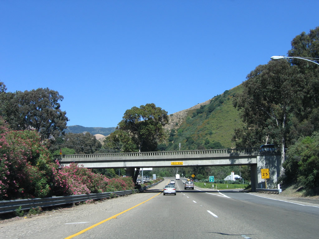
An old style bridge carries Monterey Street over U.S. 101; the exit ramp is located after the overpass. Photo taken 06/28/06. |
|
This U.S. 101 reassurance shield is posted after the Monterey Street interchange. Photo taken 06/28/06. |
Page Updated March 31, 2009.