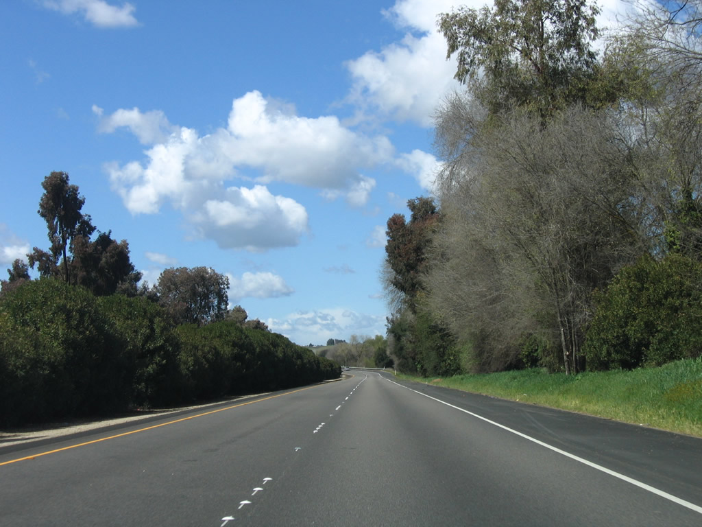
U.S. 101 enters San Luis Obispo County, as it passes through Nipomo, Arroyo Grande, Pismo Beach, San Luis Obispo, Atascadero, and Paso Robles. The scenery returns to the coastal imagery of Santa Barbara County, but the freeway quickly retreats inland, leaving the rugged coast to its two-lane alternate, California 1 (Pacific Coast Highway). U.S. 101 enters farming country, passing by the vineyards of Paso Robles as it continues its northerly trek, now focused on Monterey Bay and the San Francisco Bay Area.
| U.S. 101 north |
|
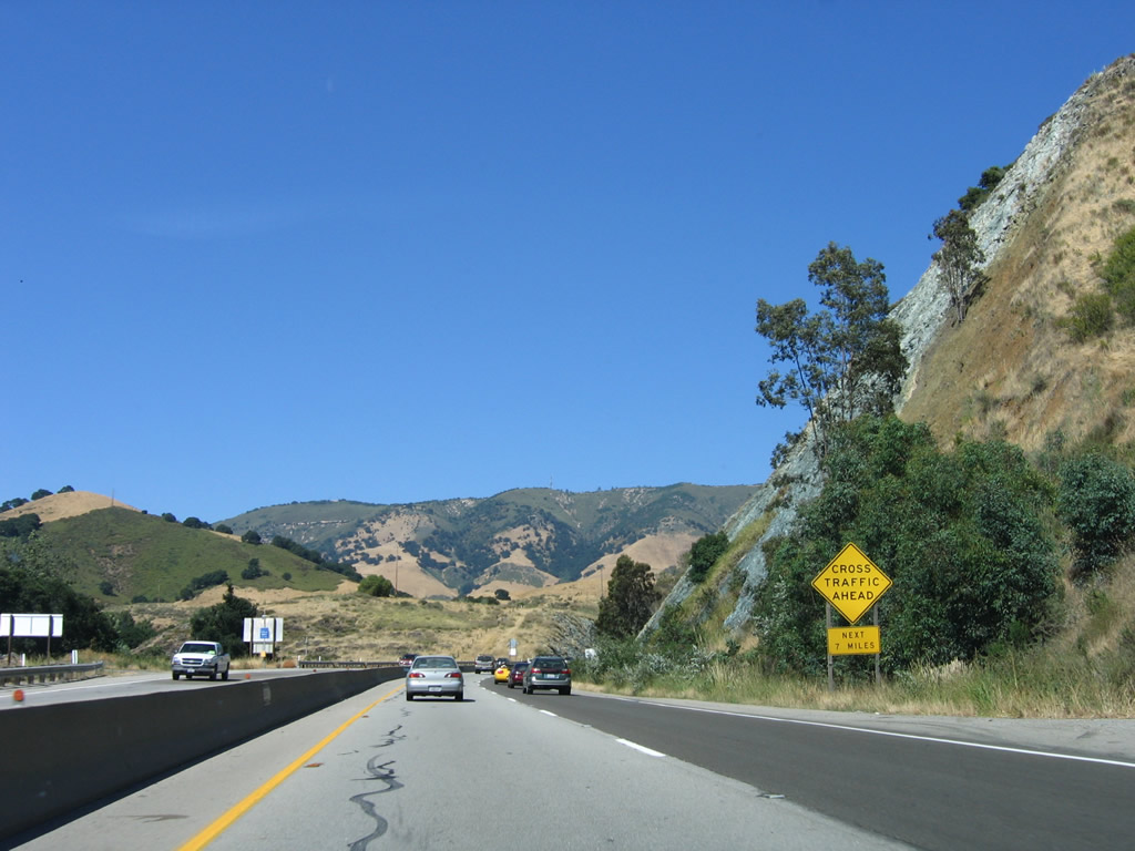
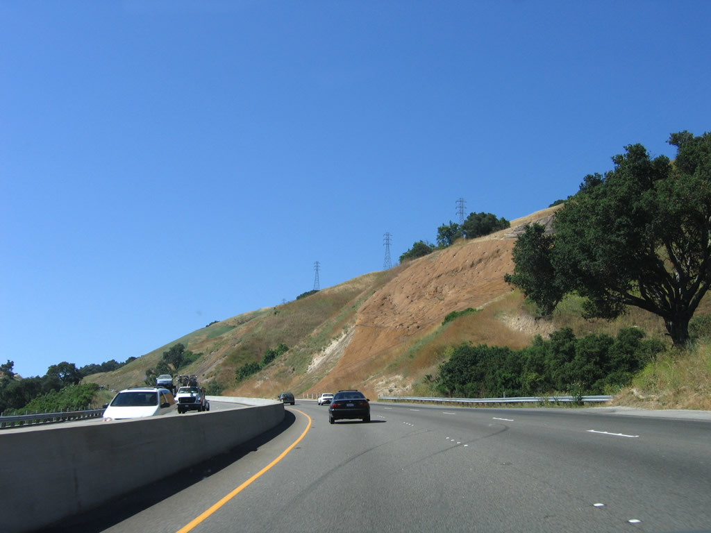
For the next seven miles (after the Monterey Street interchange), U.S. 101 will cross over Cuesta Grade. For this distance, the highway again reduces to an expressway configuration with at-grade intersections. Photo taken 06/28/06. |
|
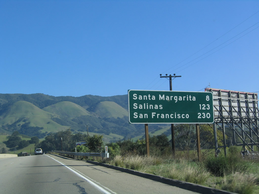
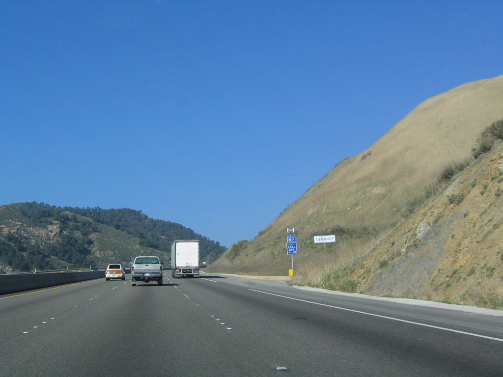
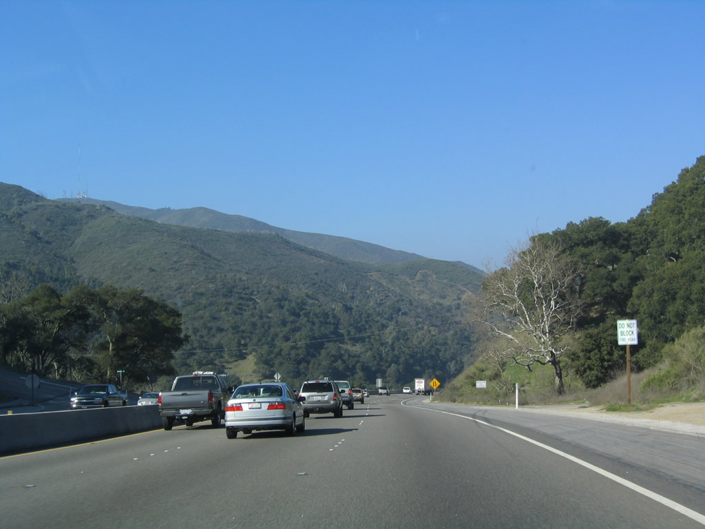
This mileage sign provides the distance to Santa Margarita (eight miles), Salinas (123 miles), and San Francisco (230 miles). This mileage sign is posted at the intersection with Fox Hollow Road (and Loomis Road, but there's no access to Loomis Road from U.S. 101 north). From here, U.S. 101 travels northeast and then north to the top of the grade. Photo taken 12/23/04. |
|
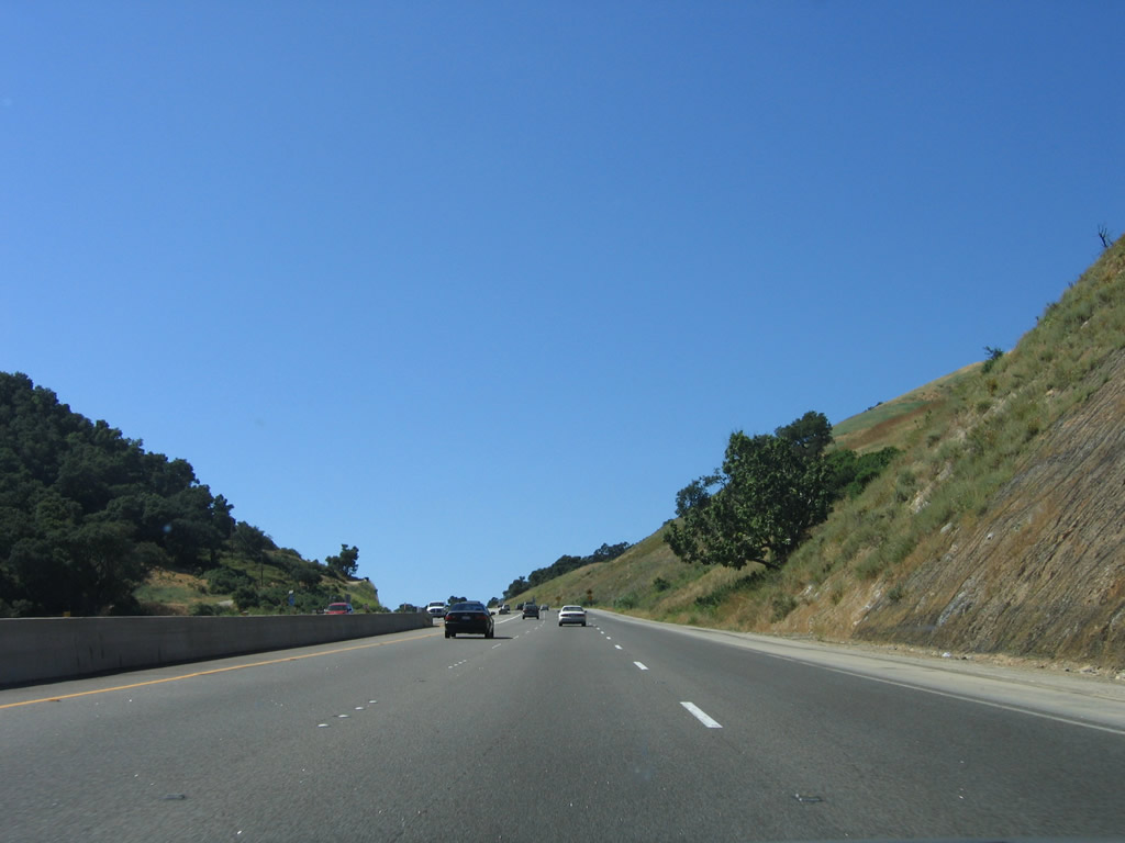
Northbound U.S. 101 (El Camino Real) approaches Reservoir Canyon Road, another at-grade intersection. Photo taken 06/28/06. |
|
|
|
|
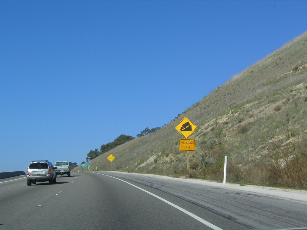
U.S. 101 travels up the daunting Cuesta Grade, with a nearly seven percent incline. The freeway gains a third lane for truck climbing part way up the slope. Photos taken 06/28/06 and 12/23/04. |
|
|
|
|
|
A warning sign advises that the upcoming downgrade will be seven percent, which is steeper than most grades found on the Interstate Highway System. Most Interstates are capped at a six percent grade. Photo taken 12/23/04. |
|
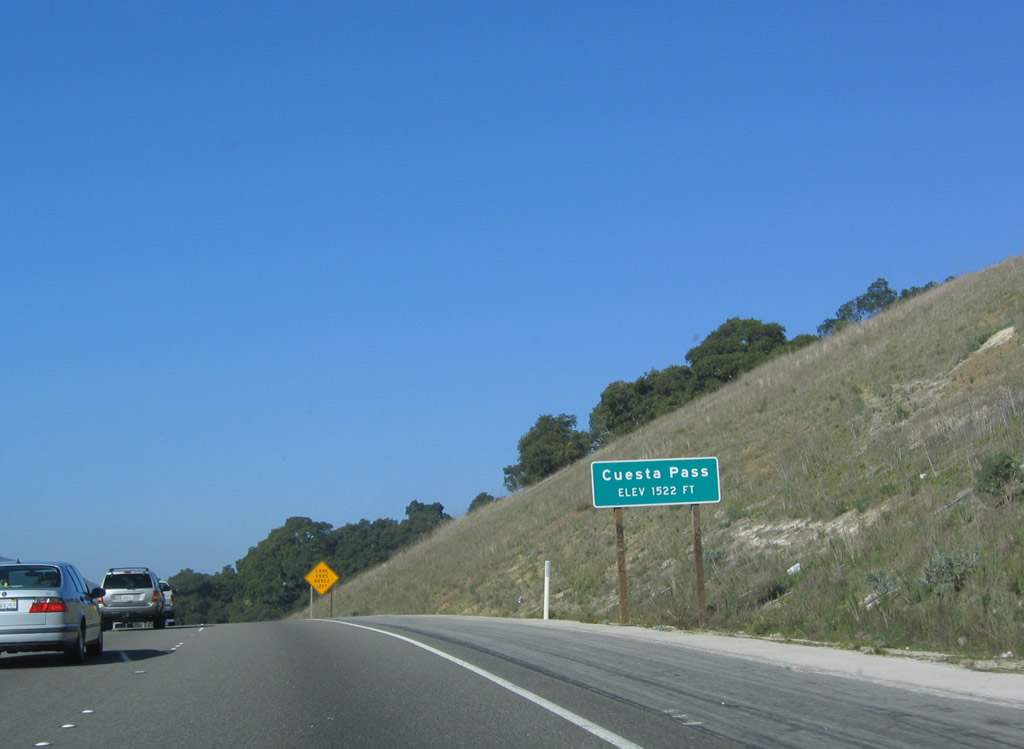
U.S. 101 meets the top of Cuesta Grade shortly thereafter, cresting at elevation 1,522 feet. From here, it's all downhill into Santa Margarita and the pending junction with California 58/California's Loneliest Road east to Carrizo Plain and California Valley. Photo taken 12/23/04. |
|
|
|
|
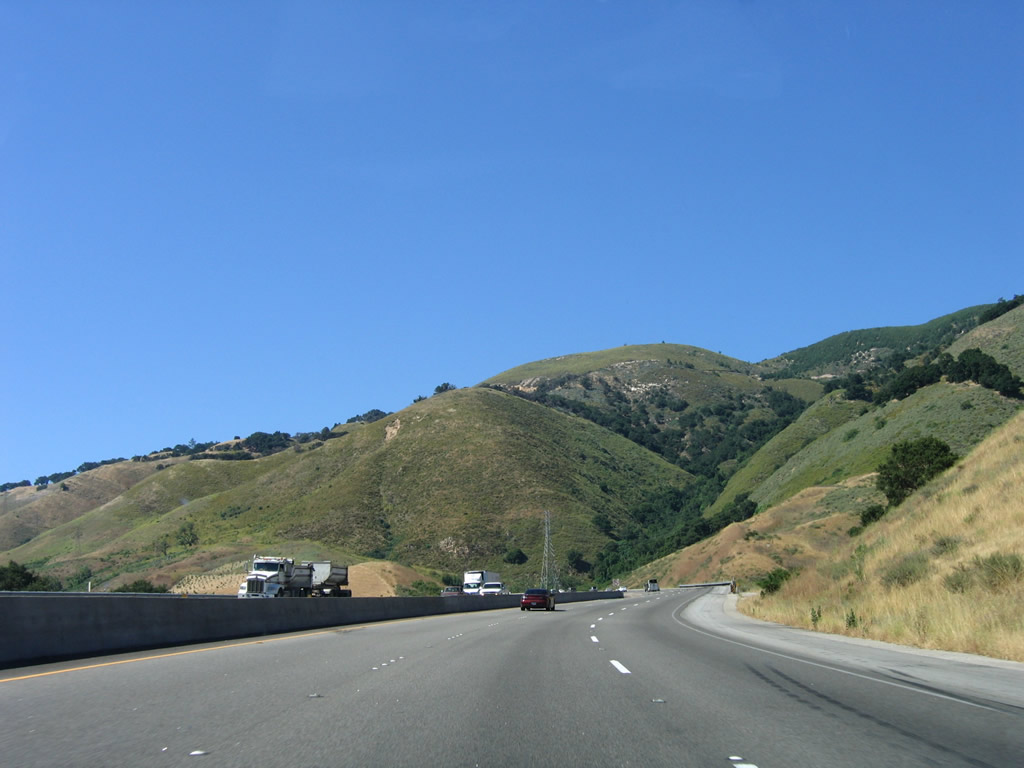
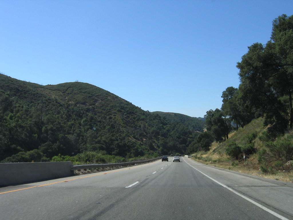
Now on the descent, U.S. 101 reduces to two northbound lanes. Watch for stopped or slowing traffic, especially trucks on this steep downgrade. Upon reaching the bottom of the hill, U.S. 101 will follow the Salinas River Valley from Atascadero north all the way to Salinas. Photos taken 06/28/06 and 12/23/04. |
|
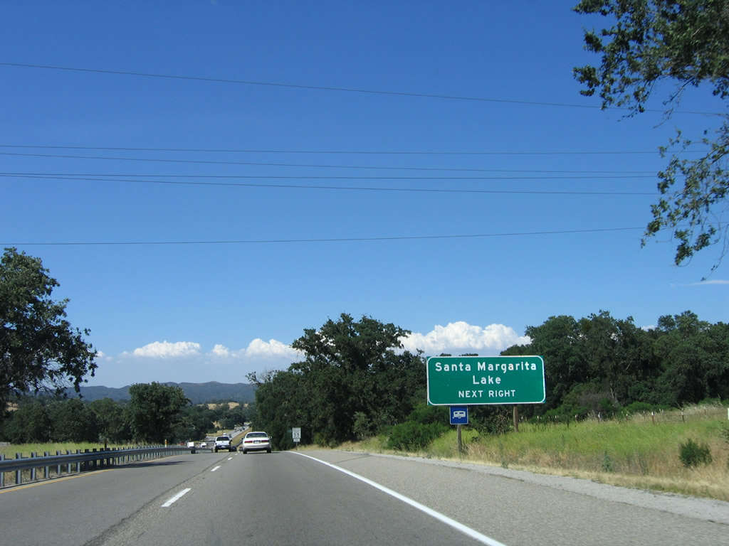
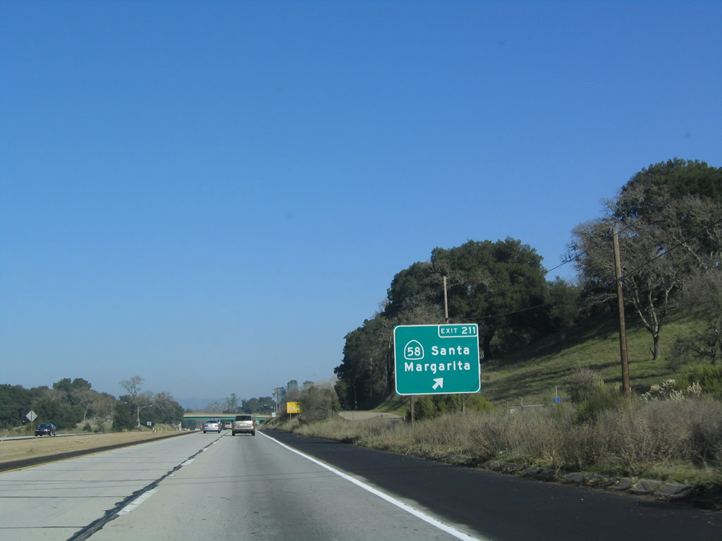
The next exit along U.S. 101 (El Camino Real) is Exit 211, California 58, which leads northeast toward Santa Margarita Lake. Photo taken 12/23/04. |
|
The next exit along U.S. 101 (El Camino Real) is Exit 211, California 58, which leads northeast toward Santa Margarita Lake. The freeway again resumes at this point, ending another expressway section (but not the last such section, either). Photo taken 06/28/06. |
|
California 58 is long east-west route that begins here at Exit 211 and travels due east across Carrizo Plain and California Valley to McKittrick in the southwestern Central Valley. From Taft, California 58 continues east to Buttonwillow and Bakersfield, then becomes a freeway as it follows Old U.S. 466 east through Tehachapi, Mojave, Boron, and Kramers Junction (Four Corners) to end at Interstate 15 in Barstow. Photo taken 12/23/04. |
|
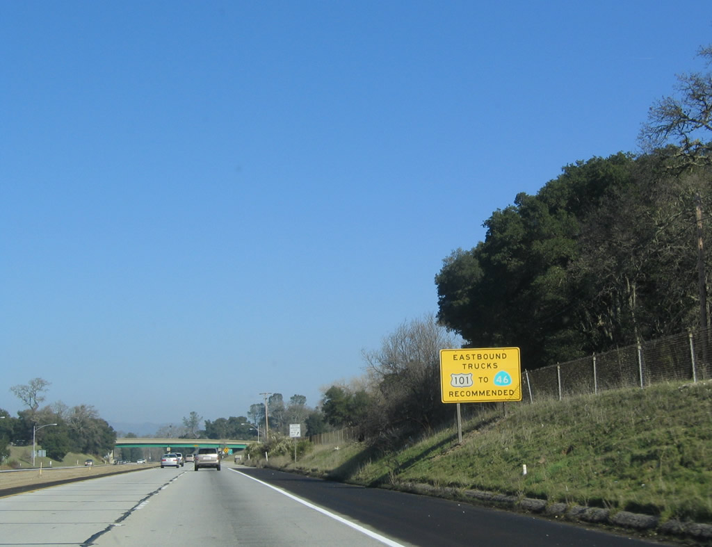
Through truck traffic should use California 46 rather than California 58 due to the winding route California 58 takes between the Carrizo Plain and McKittrick via the Temblor Range. Photo taken 12/23/04. |
|
Northbound U.S. 101 reaches Exit 211, California 58 in Santa Margarita. This marks the western terminus of this lengthy east-west route, which becomes quite busy east of Bakersfield. To Old U.S. 101/Old El Camino Real, follow California 58 east into Santa Margarita, then continue north out of town toward Atascadero. The old alignment returns to U.S. 101 in Atascadero by either linking near the state hospital or at the north end of town. Photo taken 12/23/04. |
|
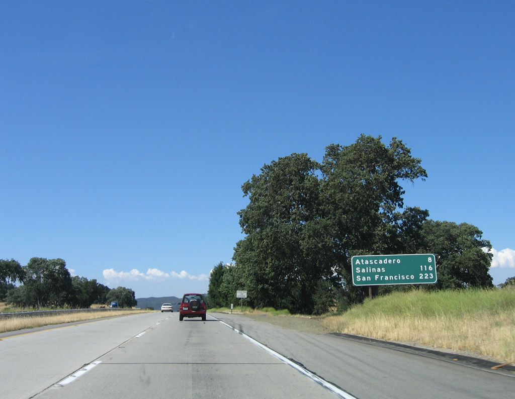
After the California 58 interchange, this mileage sign provides the distance to Atascadero (eight miles), Salinas (116 miles), and San Francisco (223 miles). Photo taken 06/28/06. |
|
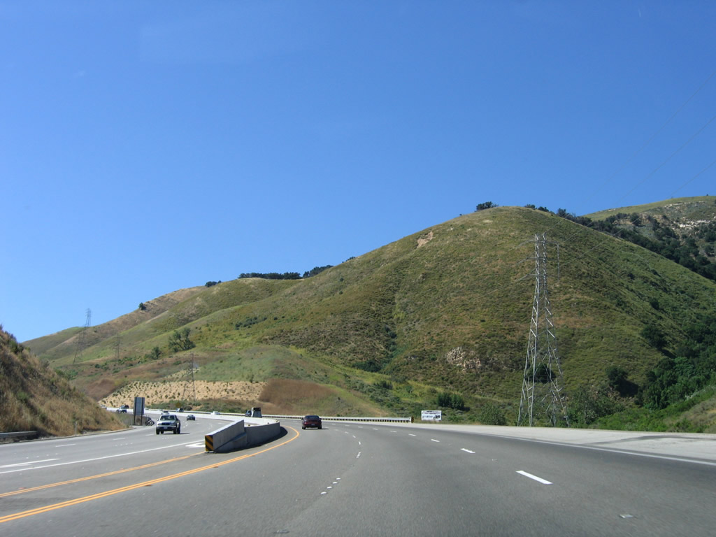
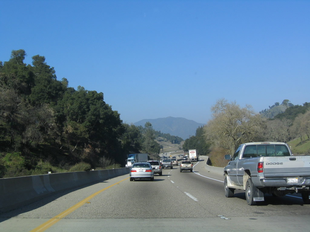
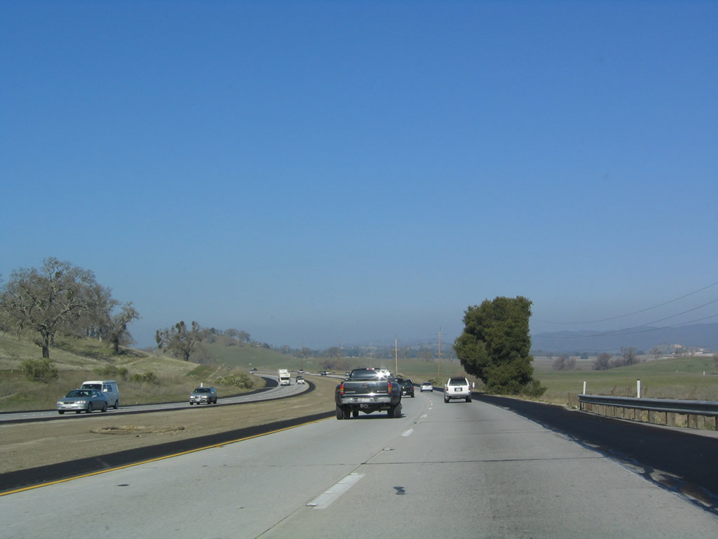
For the next several miles, U.S. 101 remains four lanes with no at-grade intersections. Photo taken 12/23/04. |
|
The next nine exits all serve the city of Atascadero: Exit 216A, Santa Barbara Road; Exit 216B, San Diego Way; Exit 218A, Santa Rosa Road and San Gabriel Road; Exit 218B, Curbaril Avenue; Exit 219, California 41/Mercedes Avenue; Exit 220A, Traffic Way; Exit 220B, San Anselmo Road; Exit 222, Del Rio Road; and Exit 223, San Ramon Road south and El Camino Real (Old U.S. 101) south to Santa Cruz Road and Traffic Way. Photo taken 12/23/04. |
|
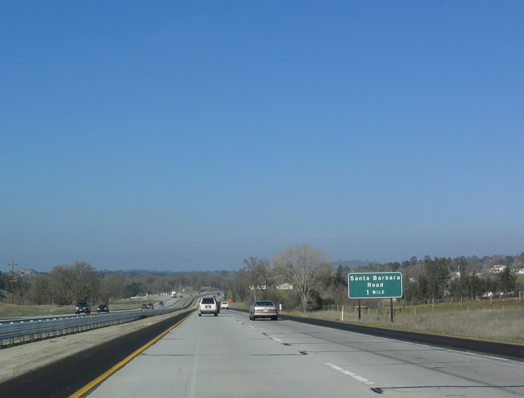
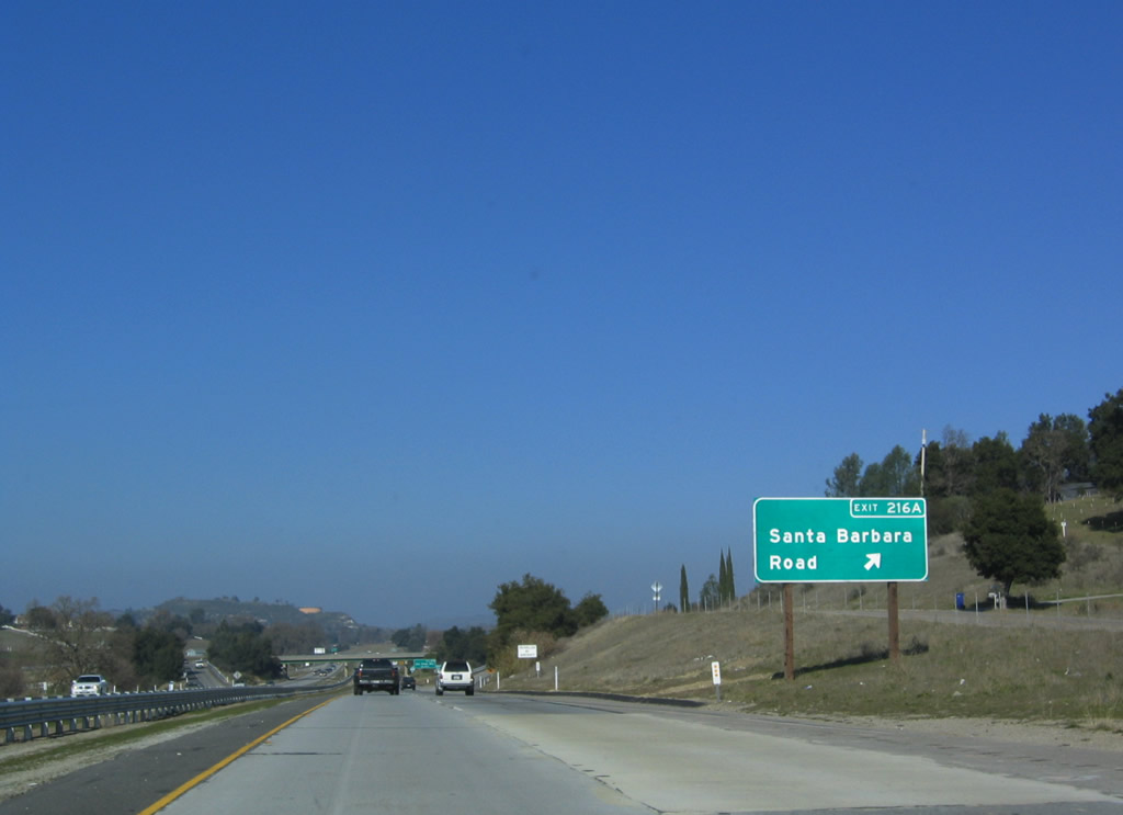
The next exit along U.S. 101 north is Exit 216A, Santa Barbara Road (one mile). Photo taken 12/23/04. |
|
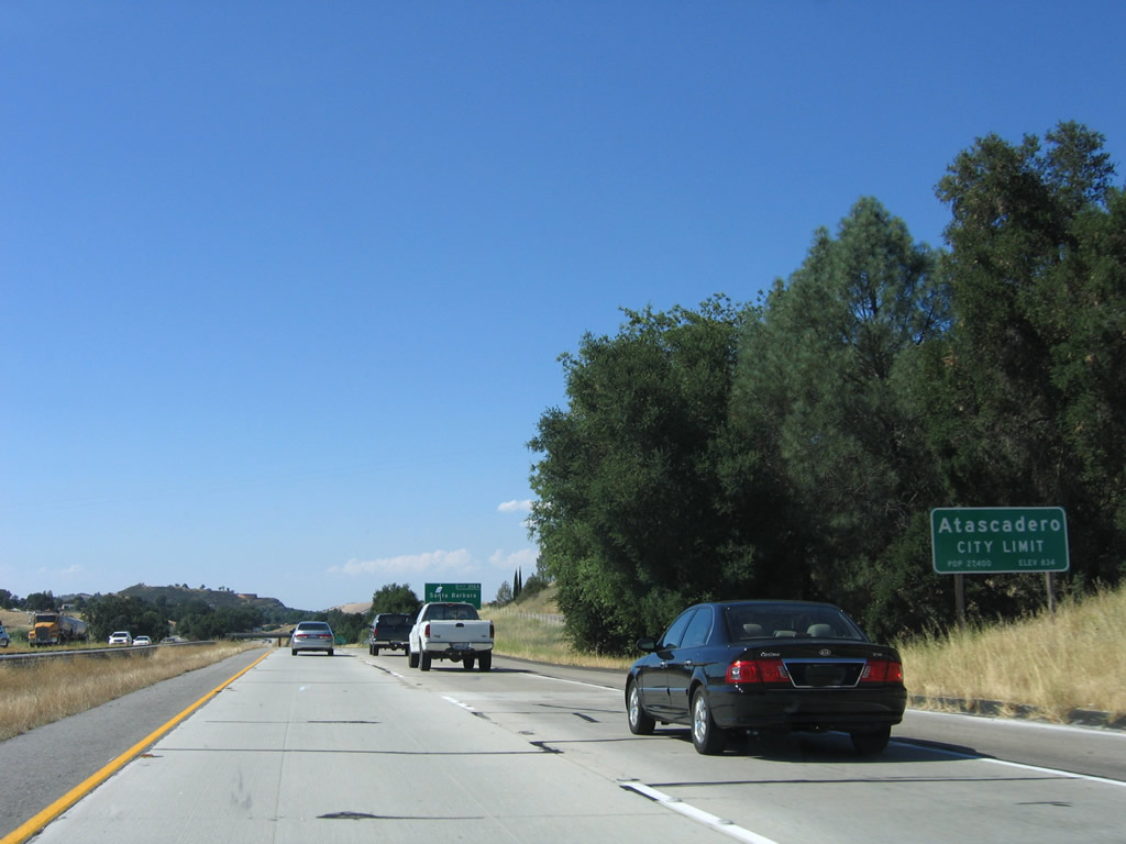
U.S. 101 enters the city of Atascadero, which has a population of 26,411 as of the 2000 Census, sits at an elevation of 879 feet, and consists of 26.7 square miles. Located approximately 225 miles from either San Francisco or Los Angeles, Atascadero was founded in 1913 and incorporated in 1979. Atascadero was founded as a utopian society colony by Edward Gardner Lewis. Damage to the city was sustained during the December 22, 2003, San Simeon earthquake (6.5 magnitude), which also damaged downtown Paso Robles to the north. Photo taken 06/28/06. |
|
Northbound U.S. 101 reaches Exit 216A, Santa Barbara Road. Photo taken 12/23/04. |
|
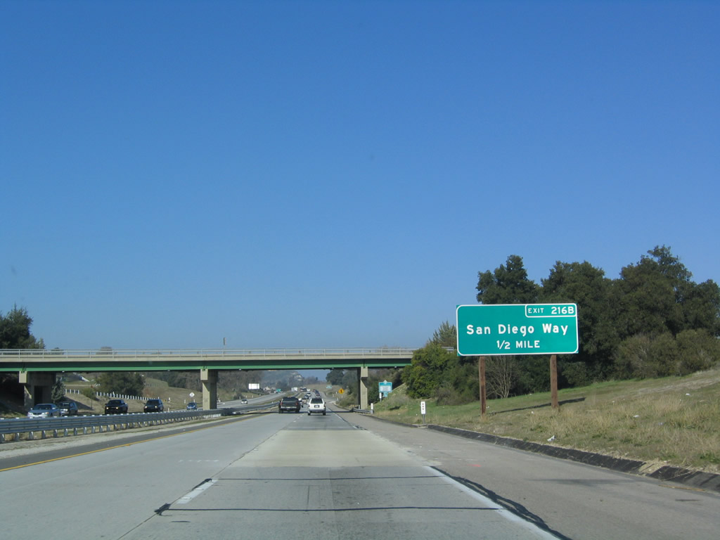
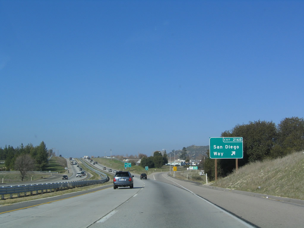
The next exit along U.S. 101 (El Camino Real) is Exit 216B, San Diego Way. Photo taken 12/23/04. |
|
To the state mental hospital, use San Diego Way north to El Camino Real, then follow the signs to the main entrance. Photo taken 06/28/06. |
|
Northbound U.S. 101 (El Camino Real) reaches Exit 216B, San Diego Way. Photo taken 12/23/04. |
|
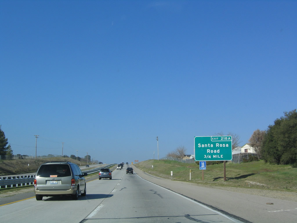
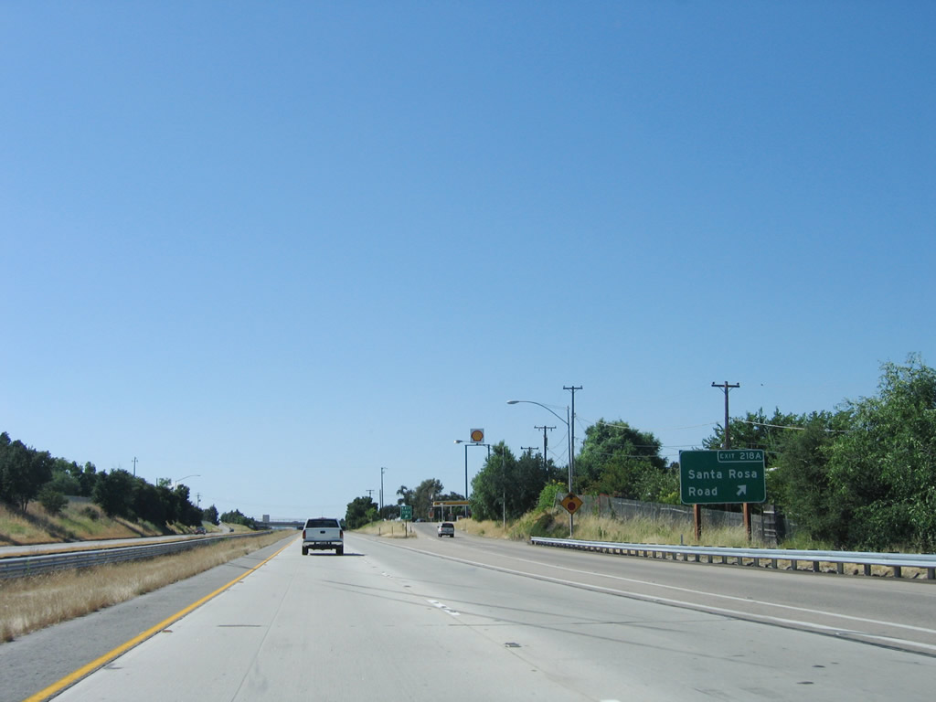
The next exit along U.S. 101 (El Camino Real) is Exit 218A, Santa Rosa Road. One advantage of the recently implemented exit numbering system is to alleviate confusion on exits with the same name. Along northbound U.S. 101, there are four exits with the name "Santa Rosa" (Avenue, Road, or Street): Exits 139, 218A, 484A, and 488A. On southbound, there are five such named off-ramps: Exits 488A, 484A, 218A, 203A, and 139. Photo taken 12/23/04. |
|
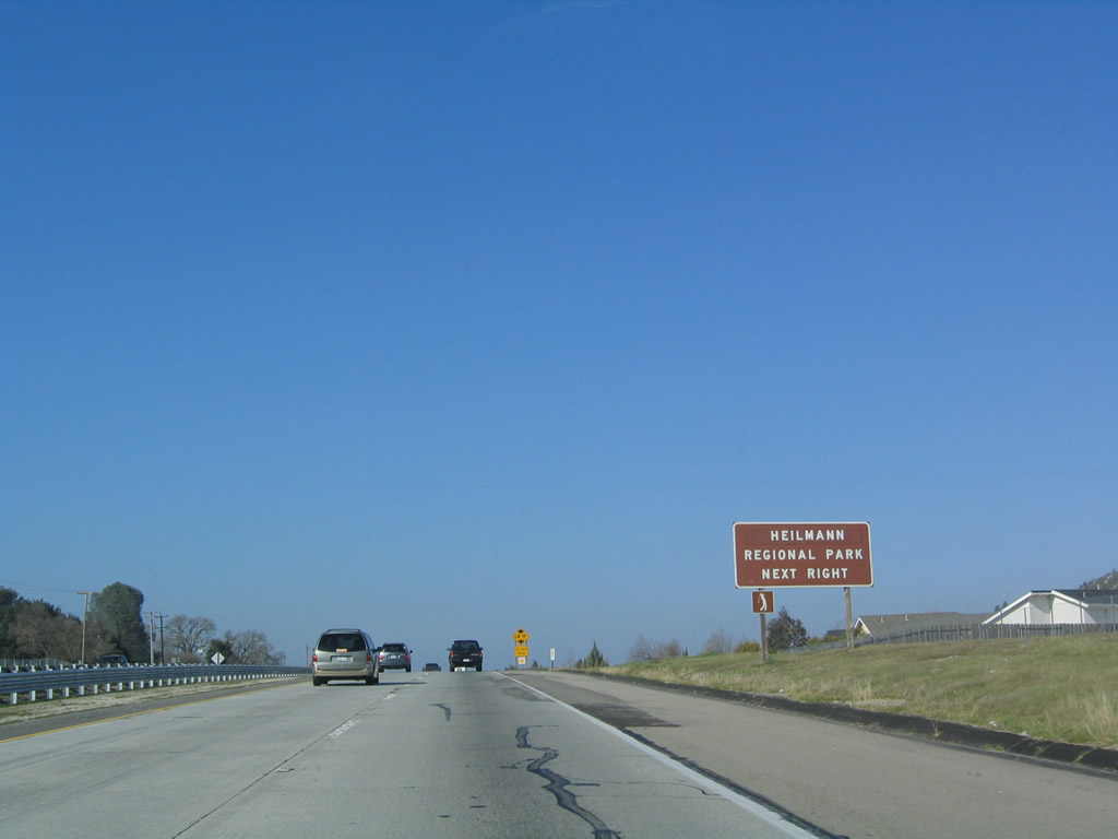
Use Santa Rosa Road east to El Camino Real to the entrance to Heilmann Regional Park. Photo taken 12/23/04. |
|
Northbound U.S. 101 reaches Exit 218A, Santa Rosa Road. Photo taken 06/28/06. |
|
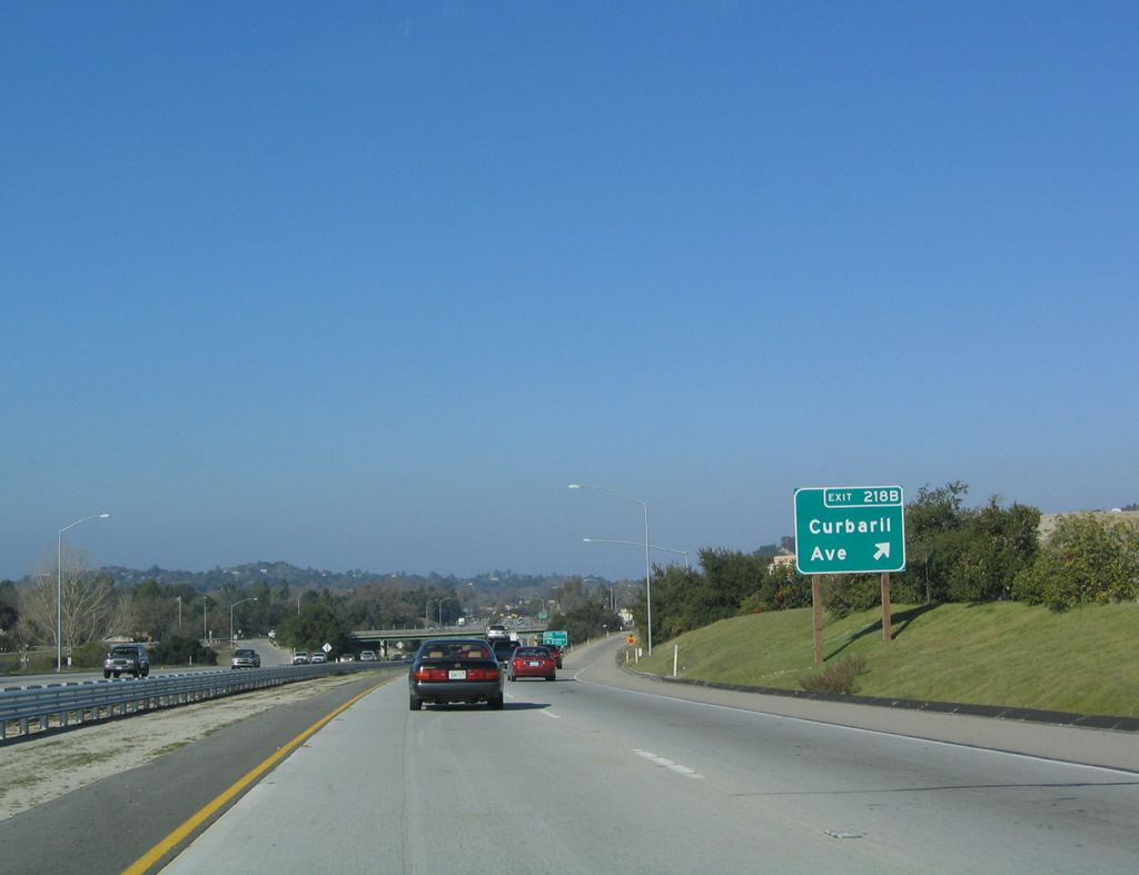
The next exit along U.S. 101 north is Exit 218B, Curbaril Avenue (0.75 mile). The freeway passes under Santa Rosa Road. Photo taken 12/23/04. |
|
A second advance sign for Exit 218B, Curbaril Avenue is posted after the on-ramp from Santa Rosa Road. Photo taken 12/23/04. |
|
Northbound U.S. 101 reaches Exit 218B, Curbaril Avenue. Photo taken 12/23/04. |
|
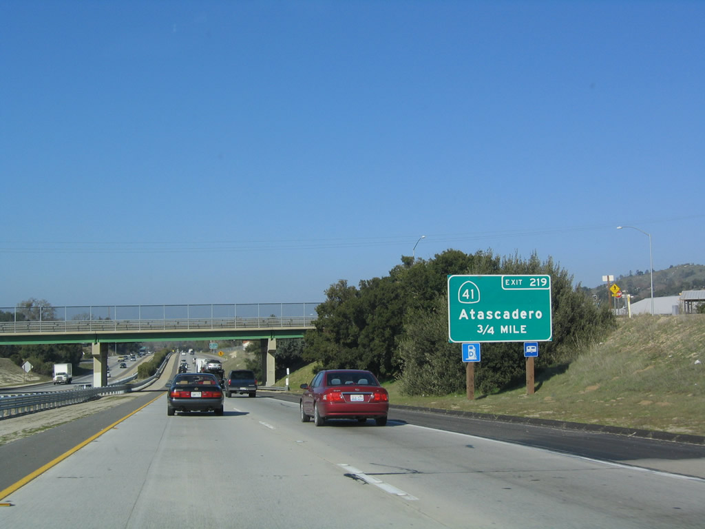
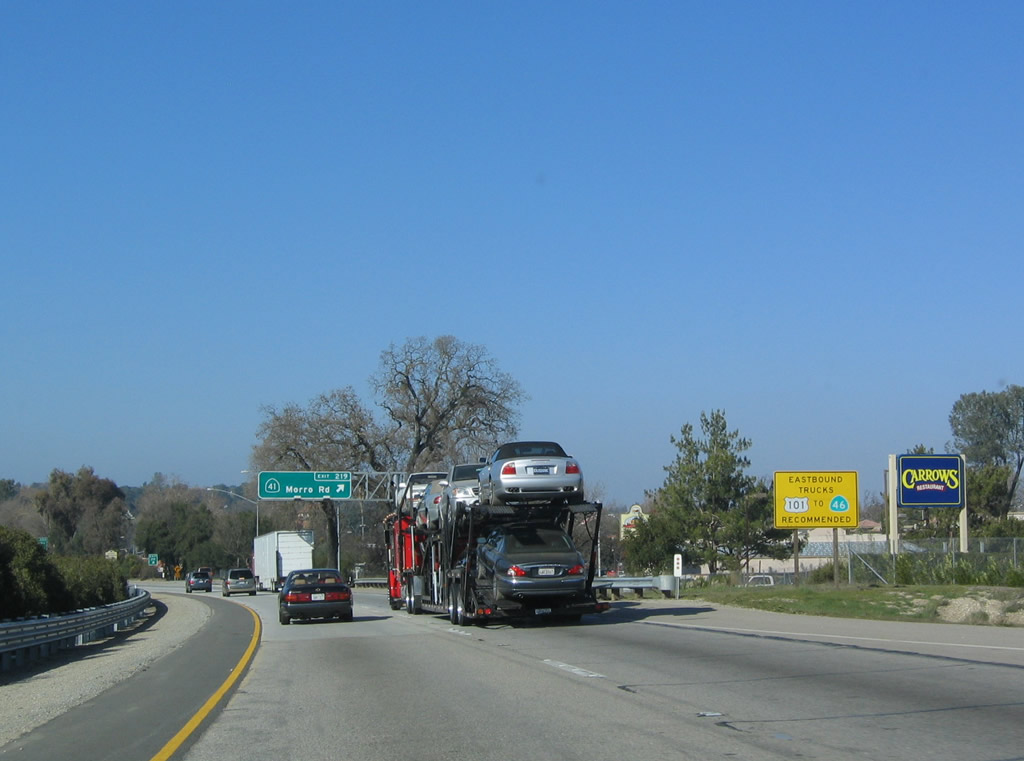
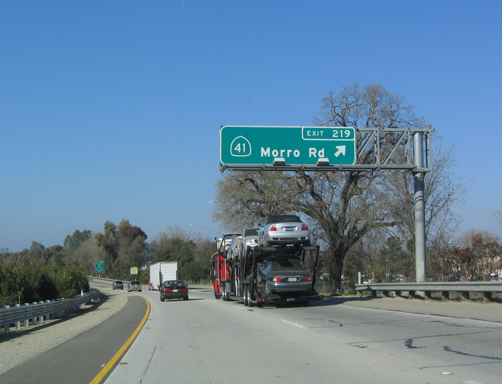
The next exit along U.S. 101 (El Camino Real) is Exit 219, California 41. This used to be the U.S. 466 interchange prior to 1964, as U.S. 466 used to end in Morro Bay and followed California 41 from Morro Bay through Atascadero to Shandon (California 46 east of Paso Robles). Prior to 1964, U.S. 466 generally followed today's California 41, California 46, California 99, California 58, and Interstate 15 from Morro Bay to Atascadero, Shandon, Lost Hills, Wasco, Bakersfield, Tehachapi, Mojave, Boron, Kramers Junction (Four Corners), Barstow, and Las Vegas. The section of U.S. 466 from Las Vegas to Kingman via U.S. 93 south remained intact and signed for another decade or so after decommissioning in California. U.S. 466 ended at its junction with U.S. 66 in Kingman. Photo taken 12/23/04. |
|
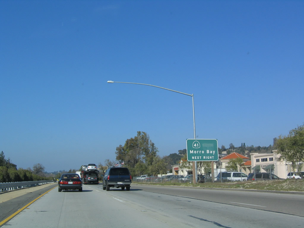
From here, California 41 more or less travels west to meet California 1 in Morro Bay and northeast toward Interstate 5 and California 99 in Fresno, finally culminating its journey in Yosemite National Park. Note the cardinal direction is covered; California 41 is signed east-west through Atascadero and Morro Bay. Photo taken 12/23/04. |
|
To the northeast, California 41 is a deceptively winding and hilly route between Atascadero and Shandon. Through traffic should continue north on U.S. 101 to California 46 east to all points north and east, including Fresno, Wasco, and Interstate 5. Photo taken 12/23/04. |
|
Northbound U.S. 101 (El Camino Real) reaches Exit 219, California 41 (former U.S. 466) west to Morro Bay and north to Shandon. Photo taken 12/23/04. |
|
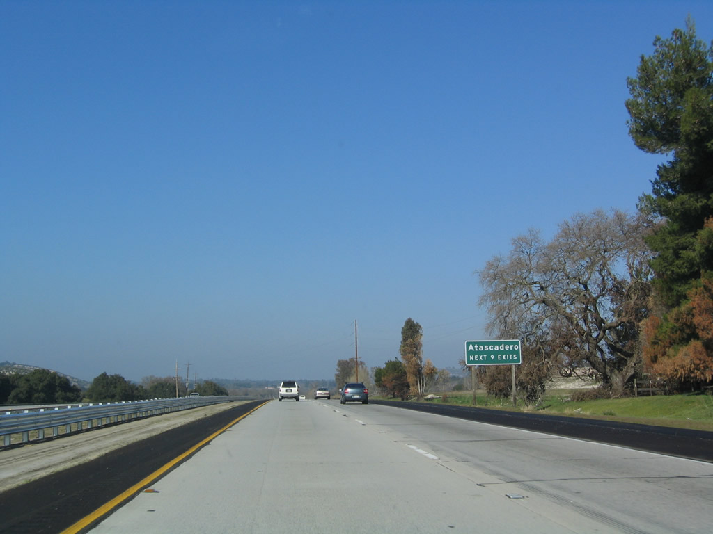
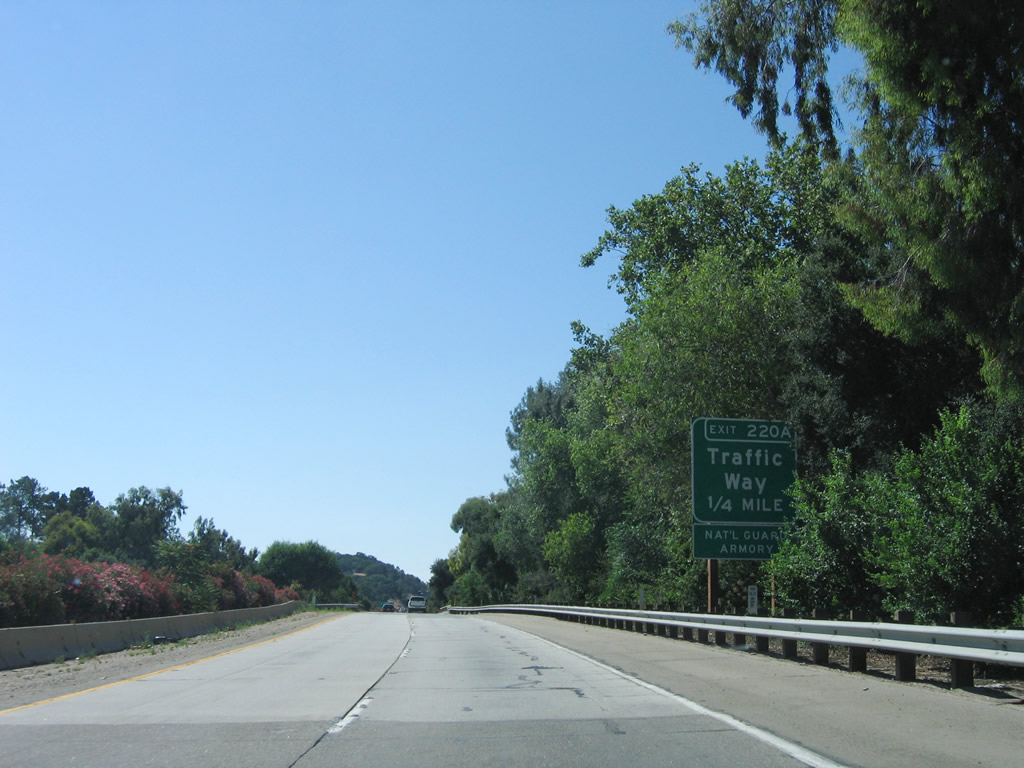
The next exit along U.S. 101 north is Exit 220A, Traffic Way in Atascadero. This is the second occurrence of a "Traffic Way" interchange along northbound in San Luis Obispo County. Photo taken 06/28/06. |
|
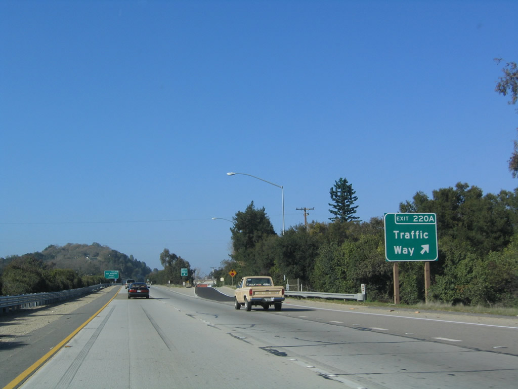
Northbound U.S. 101 reaches Exit 220A, Traffic Way in Atascadero. There is speculation that this exit might have been a prior instance of U.S. 101 Business (via Traffic Way and maybe El Camino Real), but any signage to that effect is now gone. Photo taken 12/23/04. |
|
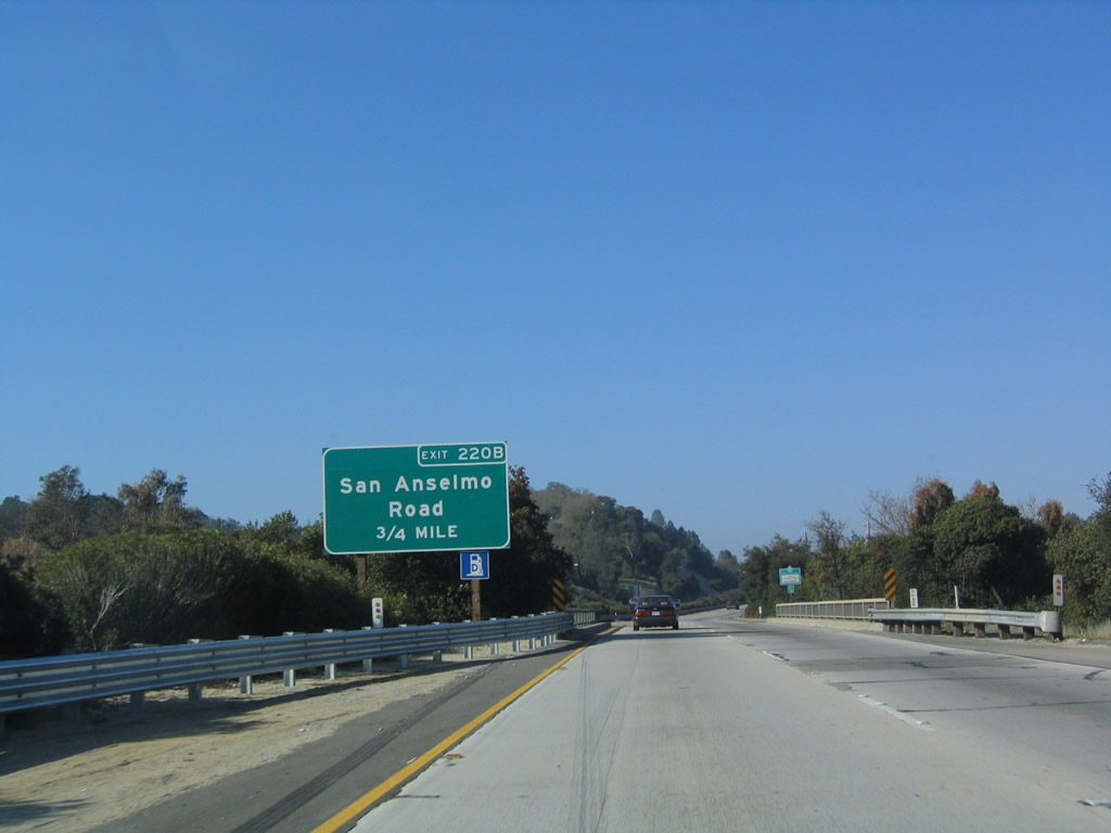
The next exit along U.S. 101 north is Exit 220B, San Anselmo Road (0.75 mile). Photo taken 12/23/04. |
|
This U.S. 101 north reassurance shield is posted after the on-ramp from Traffic Way. Photo taken 12/23/04. |
|
Northbound U.S. 101 reaches Exit 220B, San Anselmo Road. Photo taken 12/23/04. |
|
|
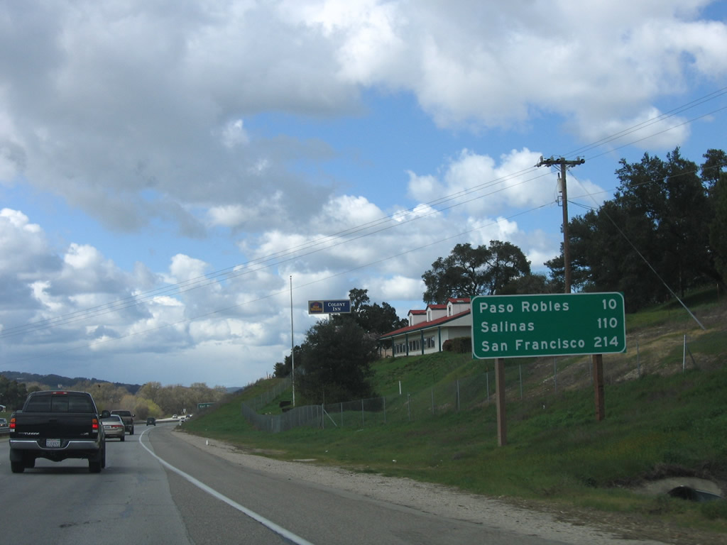
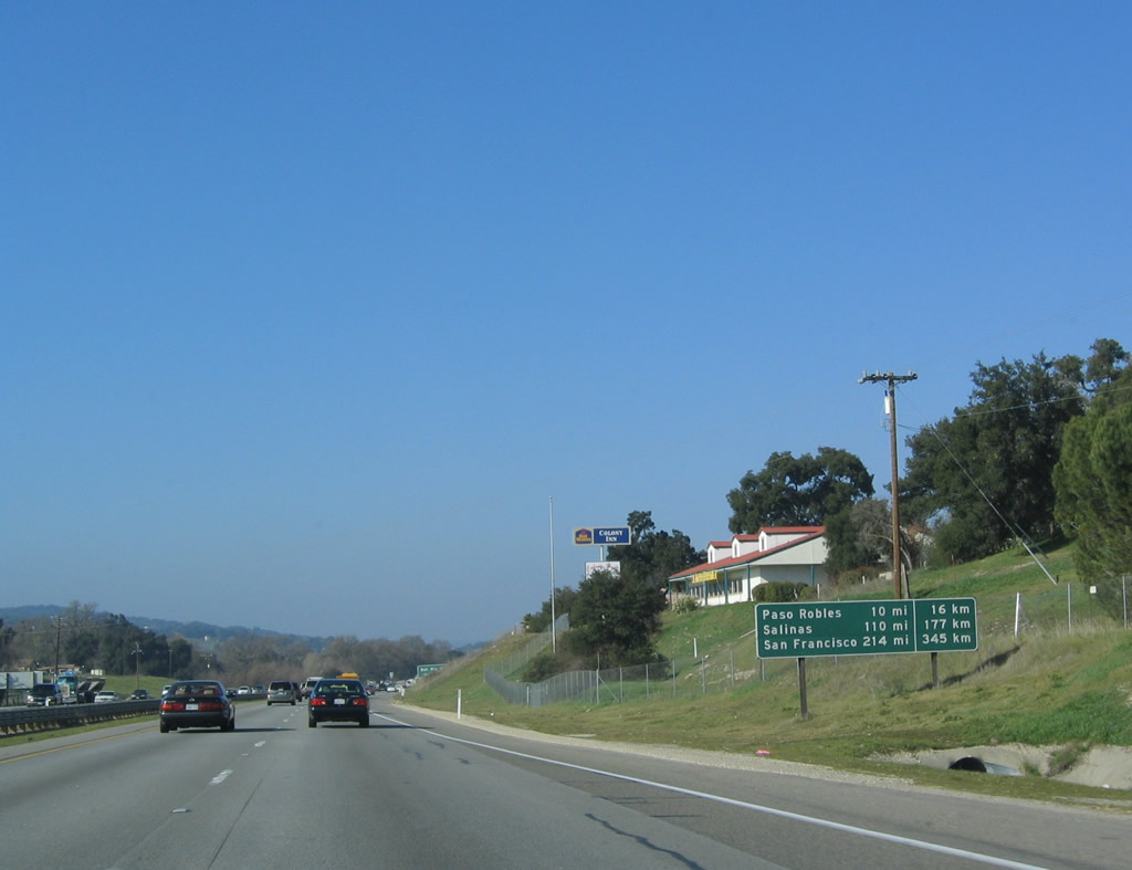
This mileage sign provides the distance to Paso Robles (10 miles), Salinas (110 miles), and San Francisco (214 miles). The 1970s era mileage sign with distances also provided in kilometers was replaced by March 2006. Photos taken 03/18/06 and 12/23/04. |
|
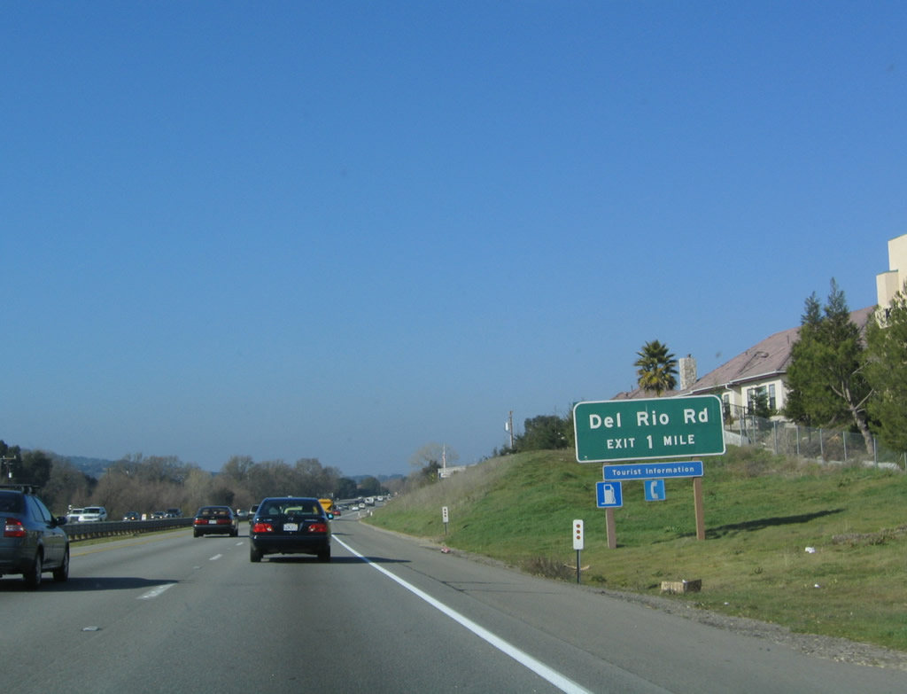
The next exit along U.S. 101 north is Exit 222, Del Rio Road. Photo taken 12/23/04. |
|
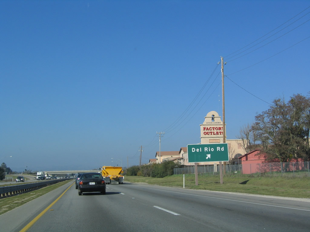
Northbound U.S. 101 reaches Exit 222, Del Rio Road. The Atascadero Factory Outlets are located at this interchage (east of the freeway). Photo taken 12/23/04. |
|
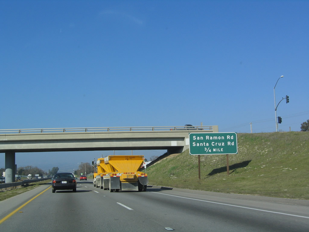
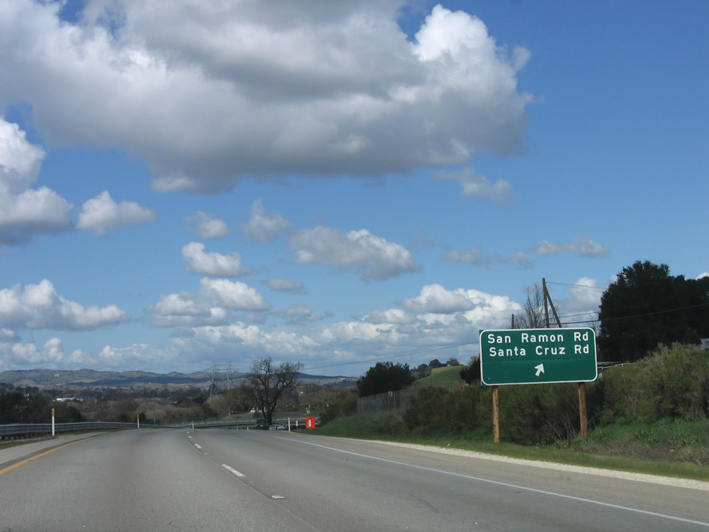
The next exit along U.S. 101 north is Exit 223, San Ramon Road and Santa Cruz Road (0.75 mile). This would be the north end of the business loop via Traffic Way or via El Camino Real, as both these roads lead into this interchange. All frontage roads reconnect with the freeway here; there is no local road that leads north into Templeton aside from the freeway. Photo taken 12/23/04. |
|
Northbound U.S. 101 (El Camino Real) reaches Exit 223, San Ramon Road and Santa Cruz Road to Traffic Way south and El Camino Real south. Photo taken 12/23/04. |
|
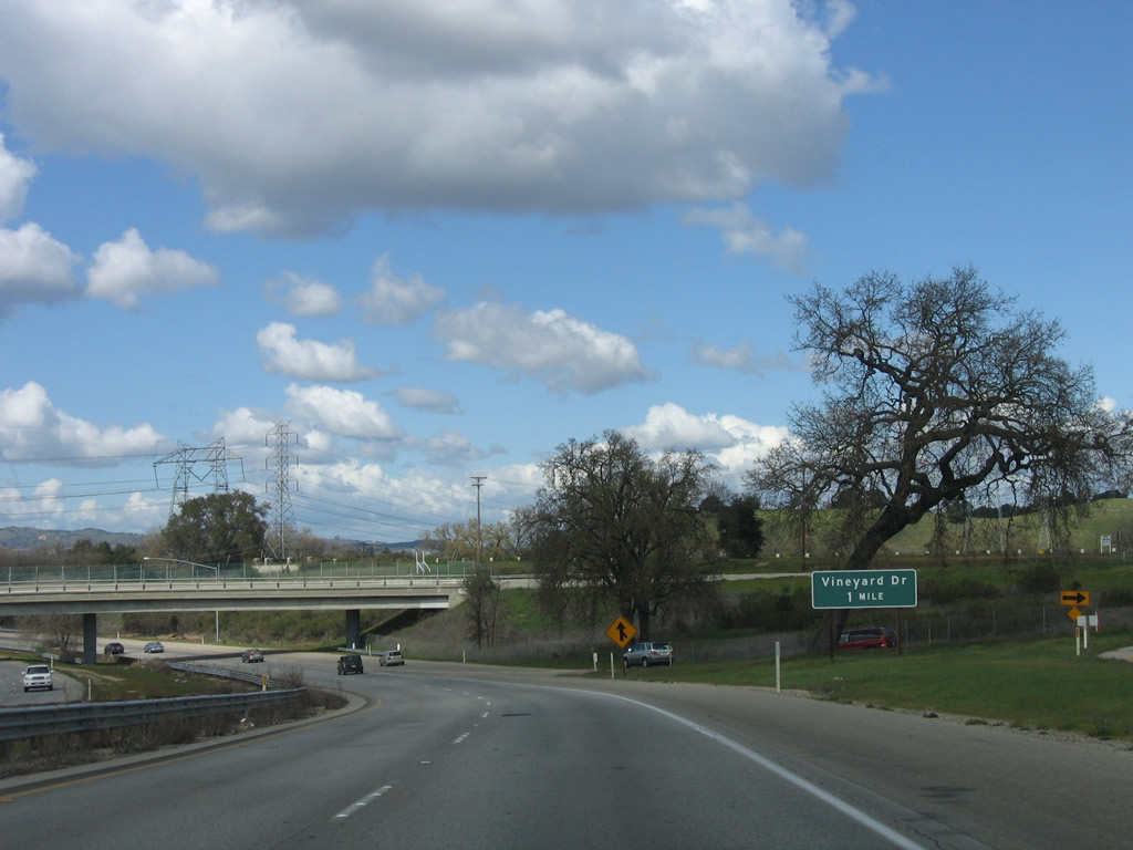
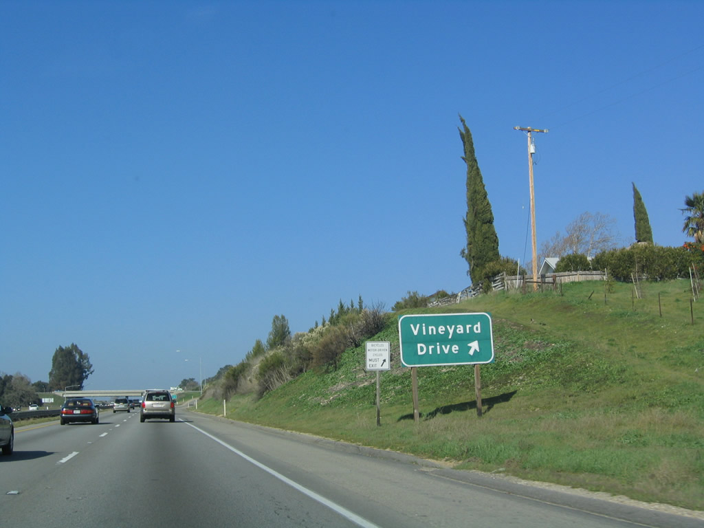
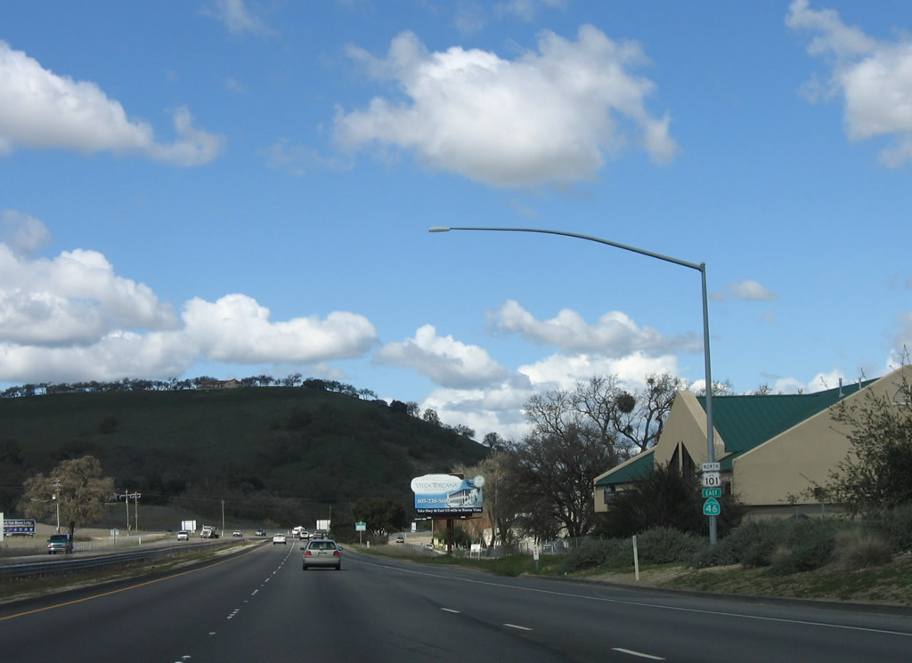
The next exit along U.S. 101 (El Camino Real) is Exit 224, Vineyard Drive. This view also shows the interchange with San Ramon Road and Santa Cruz Road. The 500kV power lines in the distance carry nuclear power from the Diablo Canyon Nuclear Generating Station located near Morro Bay to the Central Valley, where these lines interconnect with the north-south Path 15 power transmission corridor. This particular line has paralleled U.S. 101 to the west and finally crosses the freeway to turn northeast toward a substation near Coalinga. Photo taken 03/18/06. |
|
U.S. 101 prepares to cross over Paso Robles Creek, which flows east into the Salinas River. Photo taken 03/18/06. |
|
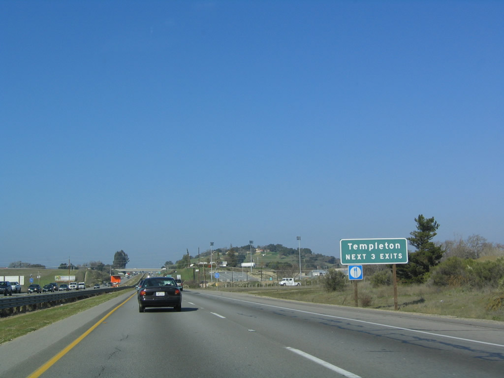
The next three exits along U.S. 101 (El Camino Real) serve the unincorporated community of Templeton: Exit 224, Vineyard Drive; Exit 225; Las Tablas Road; and Exit 226, Main Street. Photo taken 12/23/04. |
|
Northbound U.S. 101 (El Camino Real) reaches Exit 224, Vineyard Drive. Photo taken 12/23/04. |
|
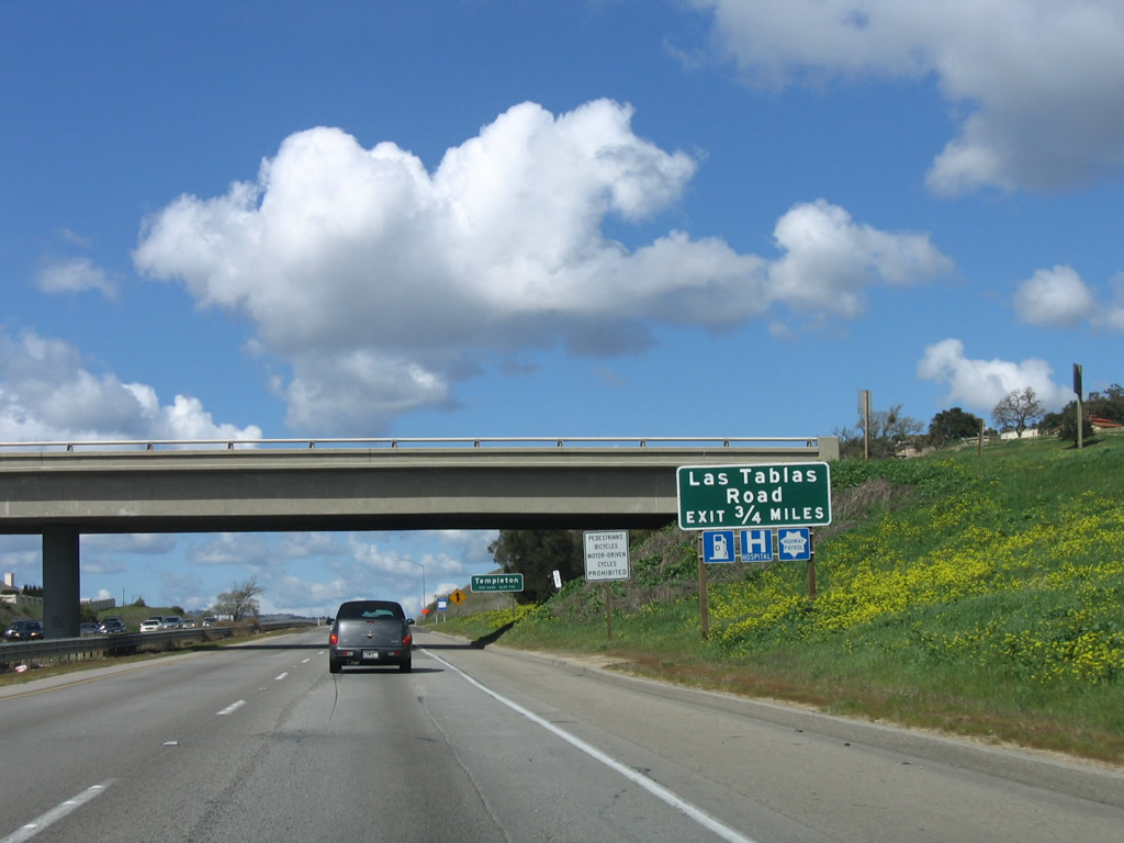
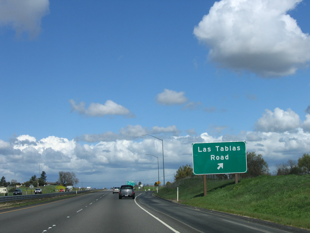
The next exit along U.S. 101 (El Camino Real) is Exit 225, Las Tables Road (0.75 mile). Photo taken 03/18/06. |
|
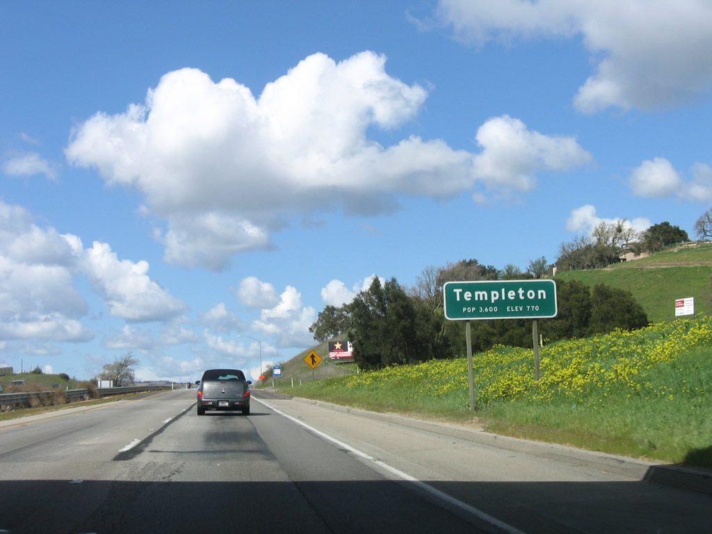
Templeton (population 4,687 as of 2000 Census) was founded in 1886. Like Paso Robles and Atascadero, Templeton is in a Mediterranean climate and sees about 15 inches of precipitation annually, most of which falls during the fall-winter-spring months. Photo taken 03/18/06. |
|
Northbound U.S. 101 (El Camino Real) reaches Exit 225, Las Tables Road. Photo taken 03/18/06. |
|
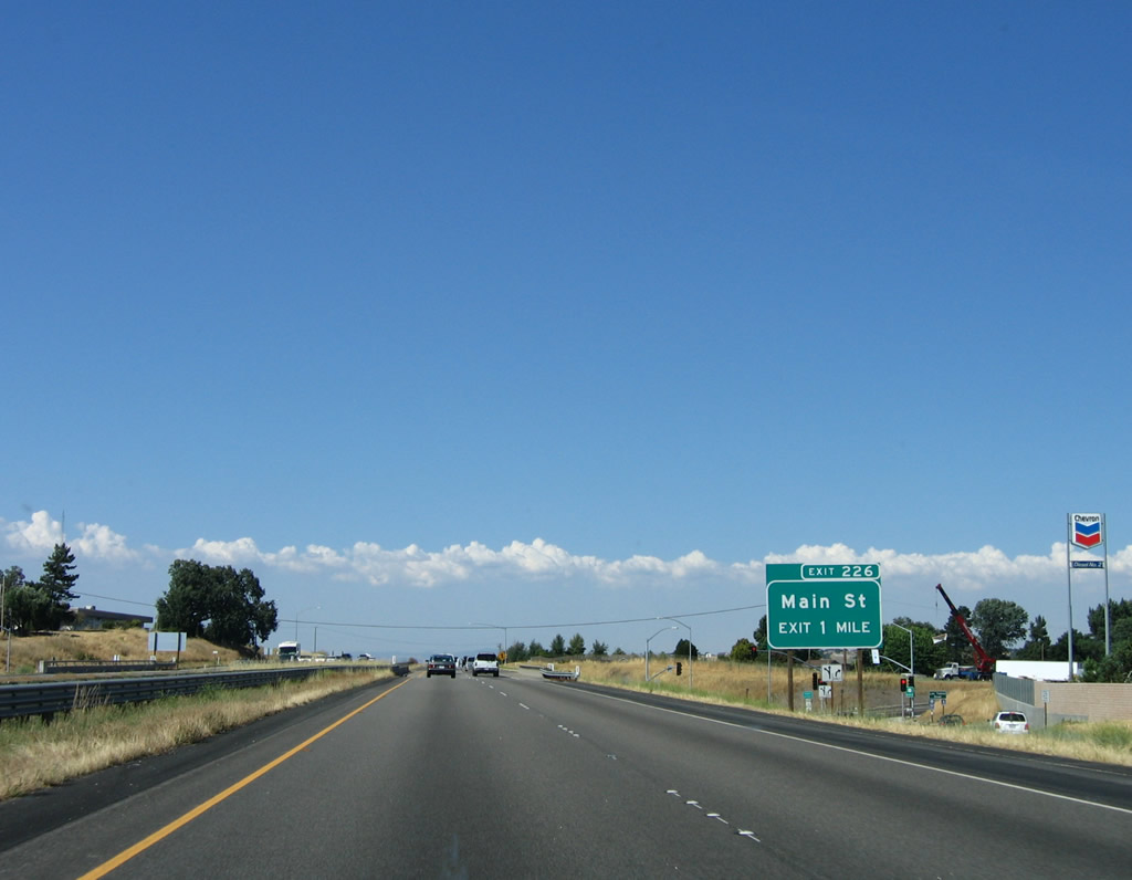
The next exit along U.S. 101 (El Camino Real) is Exit 226, Main Street. Photo taken 06/28/06. |
|
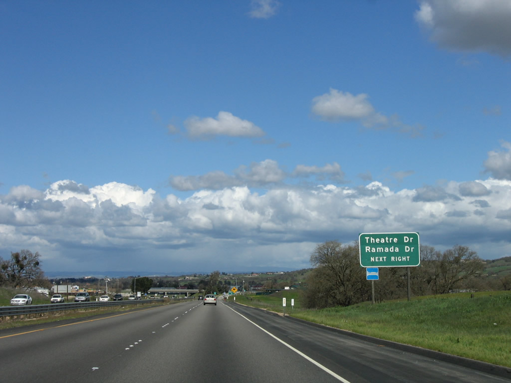
Use the Main Street exit to Theater Drive (west frontage road) and Ramada Drive north (east frontage road). Photo taken 03/18/06. |
|
Northbound U.S. 101 (El Camino Real) reaches Exit 226, Main Street in Templeton. Photo taken 06/28/06. |
|
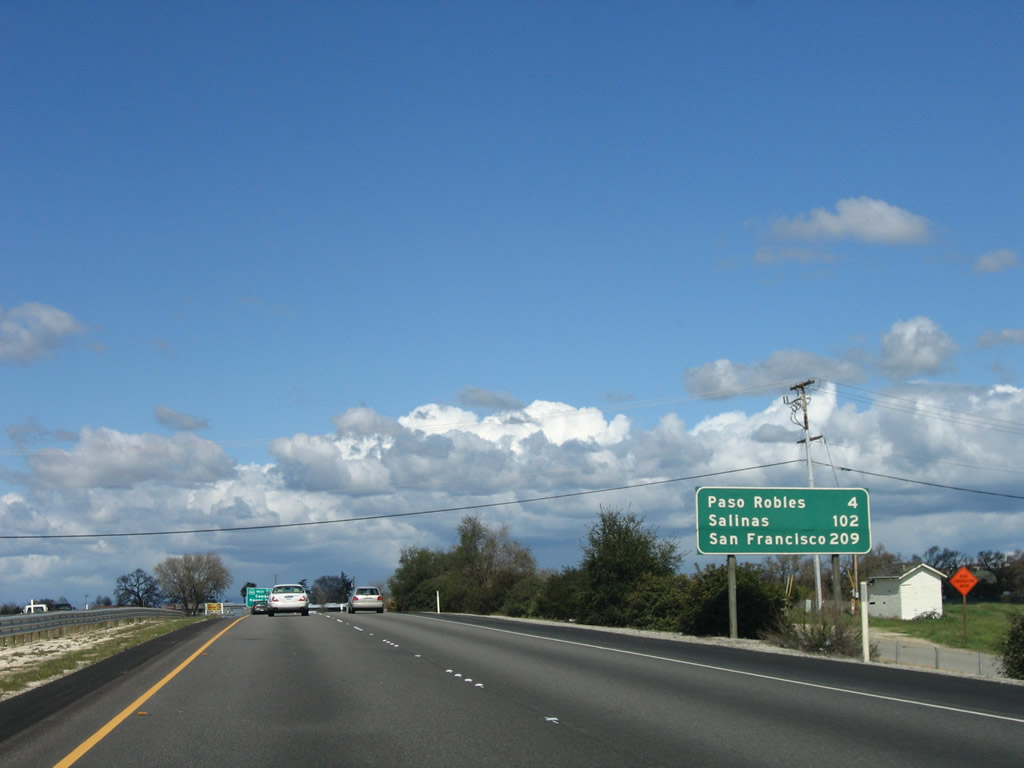
This mileage sign provides the the distance to Paso Robles (four miles), Salinas (102 miles), and San Francisco (209 miles). Photo taken 03/18/06. |
|
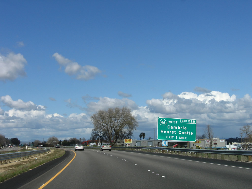
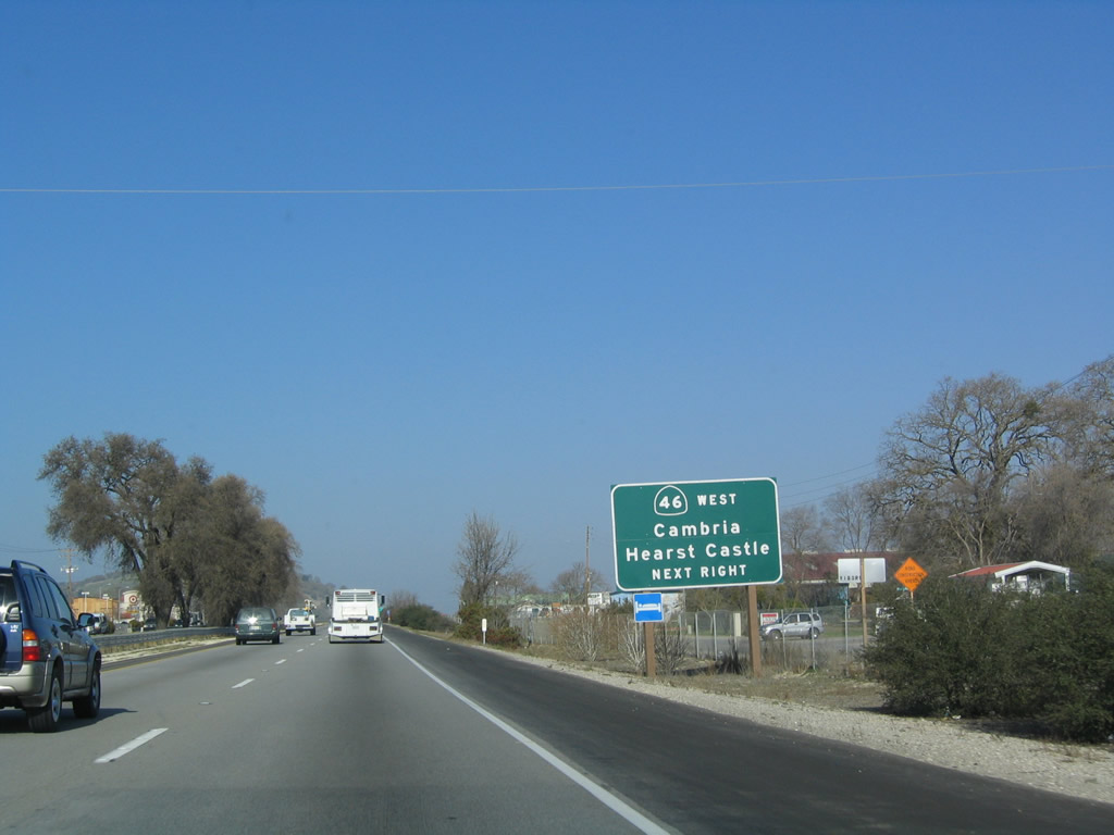
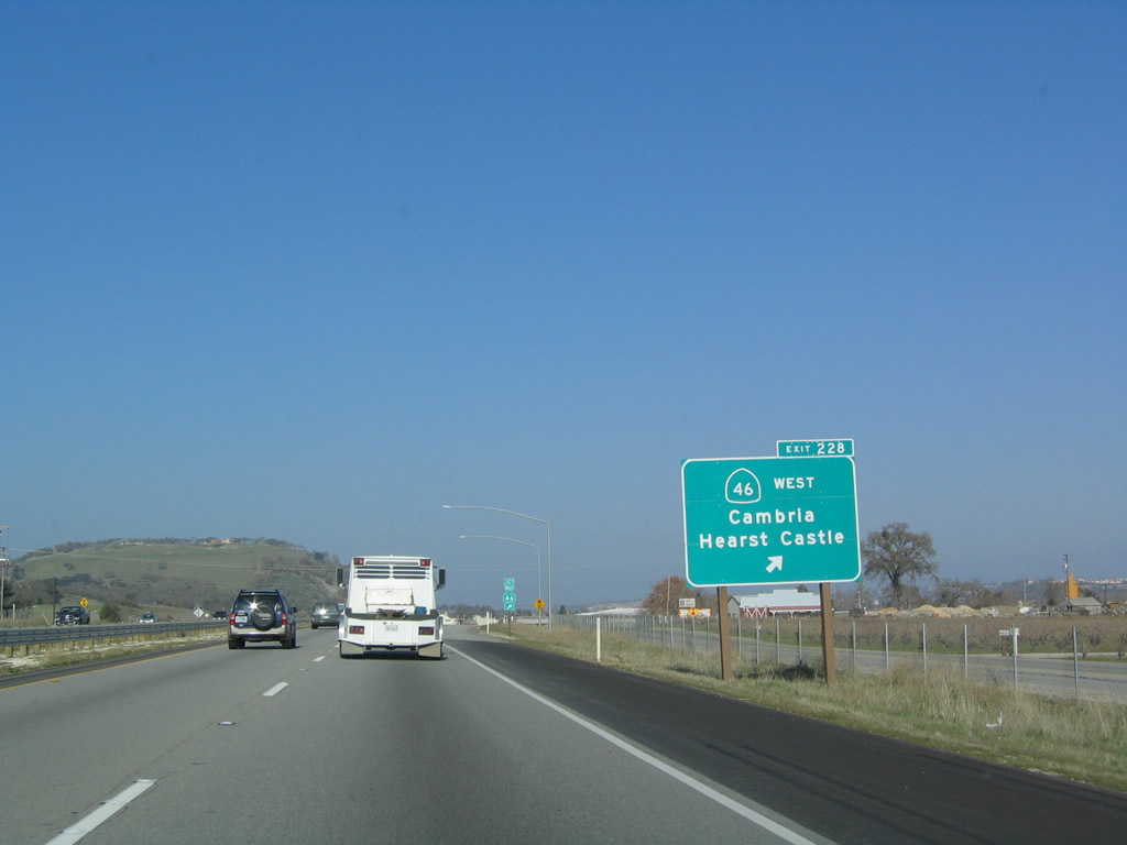
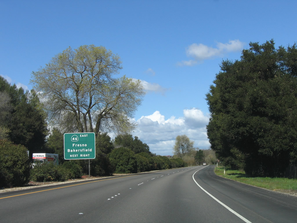
The next exit along U.S. 101 (El Camino Real) is Exit 228, California 46 west (one mile). California 46 connects U.S. 101 with the coast, ending at California 1 near Cambria. Photo taken 03/18/06. |
|
California 46 is a major east-west corridor that extends from California 1 at Cambria east to California 99 near Wasco. The section of California 46 from U.S. 101 to California 99 is part of the most direct east-west route from the Central Coast to the Central Valley and Interstate 5. Photo taken 12/23/04. |
|
Northbound U.S. 101 reaches Exit 228, California 46 west. Between Exits 228 and 231, California 46 runs concurrently with U.S. 101. Note the trailblazer, which indicates that eastbound California 46 should continue straight ahead. Photo taken 12/23/04. |
|
U.S. 101 passes over the interchange with California 46 west. The exit for California 46 east is three miles north of here, at Exit 231 in Paso Robles. U.S. 101 and California 46 share the freeway alignment for the next three miles. Photo taken 12/23/04. |
|
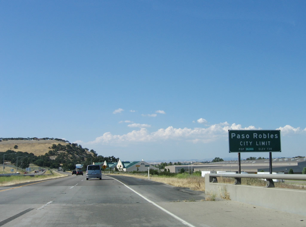
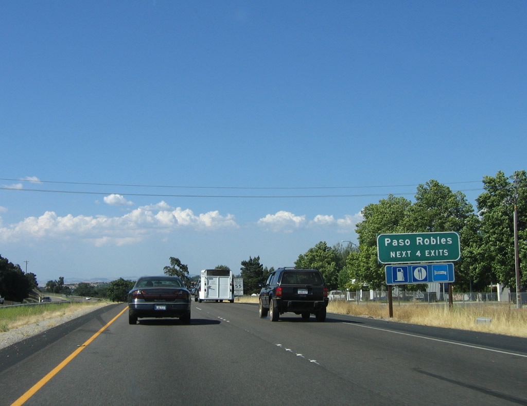
The city of Paso Robles is the first incorporated city found along U.S. 101 south in San Luis Obispo County. Paso Robles means "Pass of the Oaks." Incorporated in 1889, Paso Robles originated from the Paso Robles Rancho (Mexican land grant) and is famous for its wine country and mineral bath waters. The city has a population of 24,297 as of the 2000 Census, sits at an elevation of 794 feet along the Salinas River. Paso Robles consists of 19.9 square miles in area. On December 22, 2003, a destructive 6.5 earthquake shook the city and caused two deaths from debris falling from a nearby clock tower (built in 1892). The central business district was damaged, but restorative work has continued through the rest of the decade, including erection of a new clock tower.1 Photo taken 06/28/06. |
| U.S. 101 (El Camino Real) north and California 46 east |
|
After the on-ramp from Exit 228, California 46, both U.S. 101 north and California 46 east are signed. Photo taken 03/18/06. |
|
The next three exits along U.S. 101 north and California 46 east will serve the city of Paso Robles: Exit 229, U.S. 101 Business/Spring Street north; Exit 230, Paso Robles Street; Exit 231, California 46 east and San Luis Obispo County G-14/Nacimiento Lake Drive west; and Exit 232, U.S. 101 Business/Spring Street south. Photo taken 12/23/04. |
|
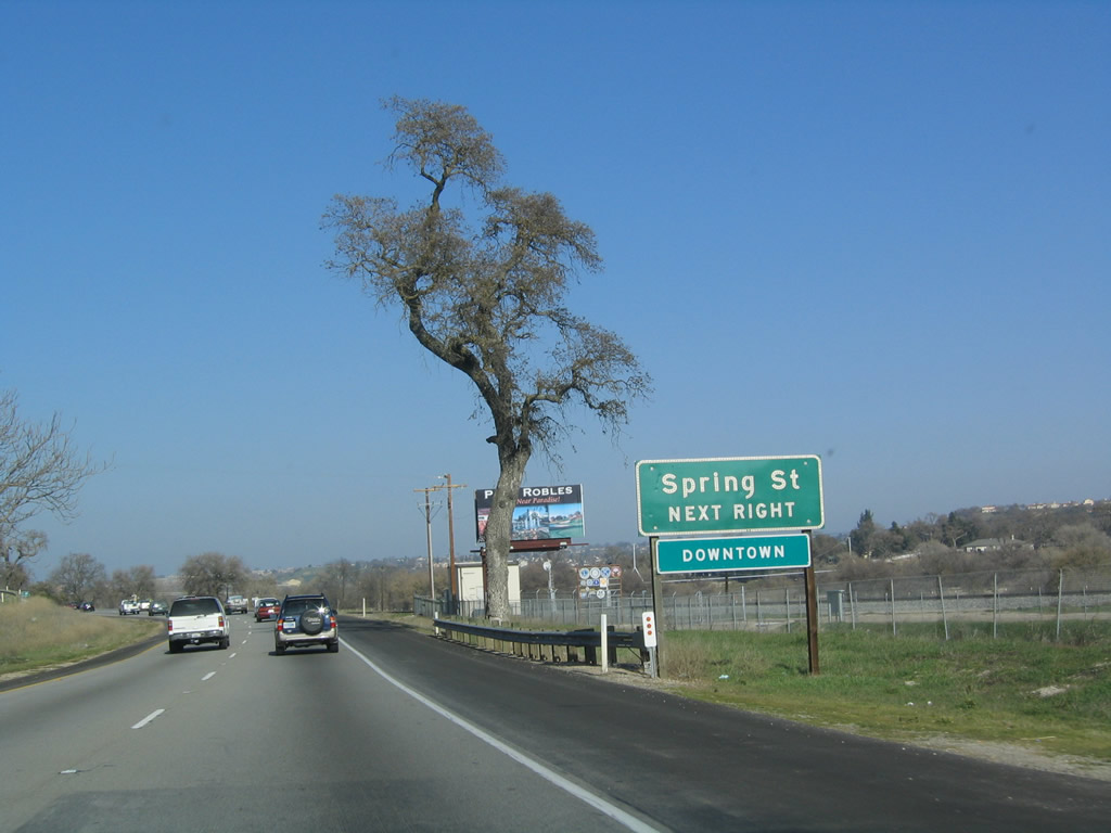
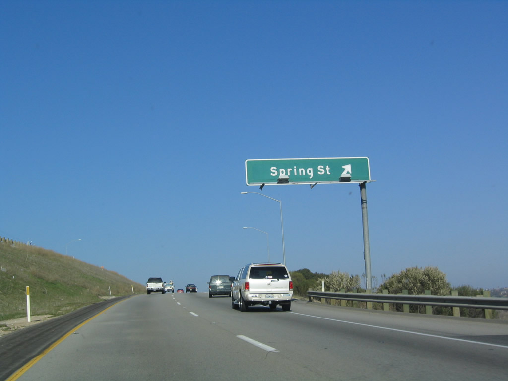
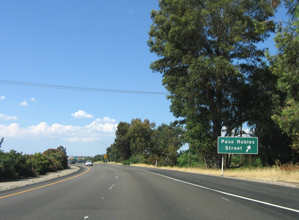
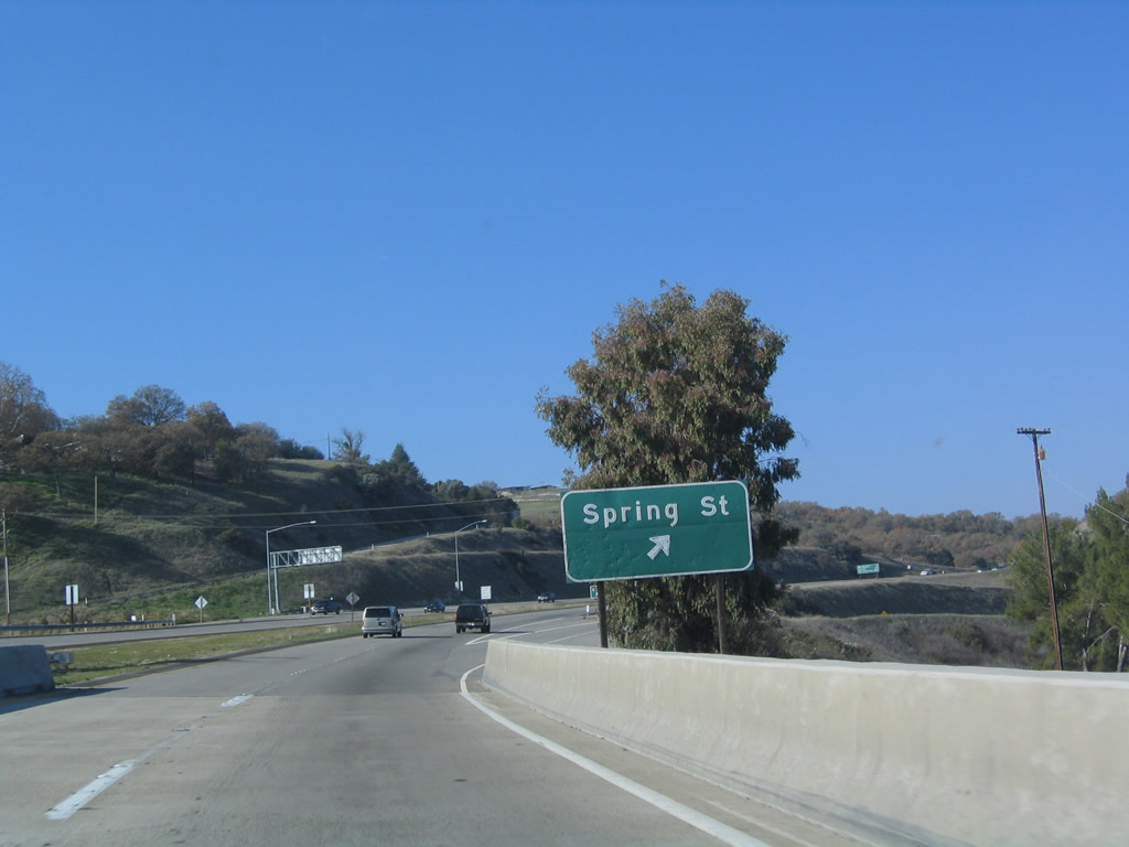
The next exit along U.S. 101 north and California 46 east is Exit 229, U.S. 101 Business/Spring Street north into downtown Paso Robles. Photo taken 12/23/04. |
|
Northbound U.S. 101 and eastbound California 46 reaches Exit 229, U.S. 101 Business/Spring Street north to downtown. Use this exit to Niblick Road east across the Salinas River to east Paso Robles. Photo taken 12/23/04. |
|
The next exit along U.S. 101 north and California 46 east is Exit 230, Paso Robles Street. Photo taken 12/23/04. |
|
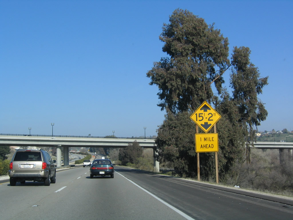
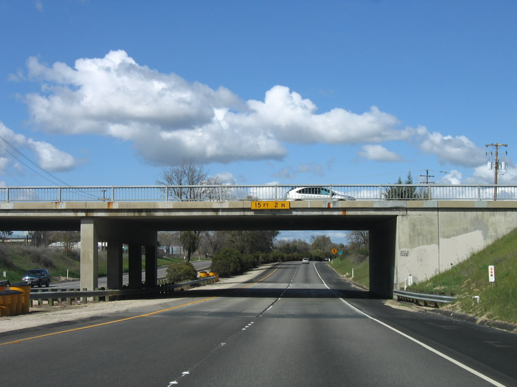
The freeway will pass under Niblick Road ahead; the bridge is built to pass over both the freeway and the nearby Salinas River. Photo taken 12/23/04. |
|
Northbound U.S. 101 and eastbound California 46 reach Exit 230, Paso Robles Street. Photo taken 06/28/06. |
|
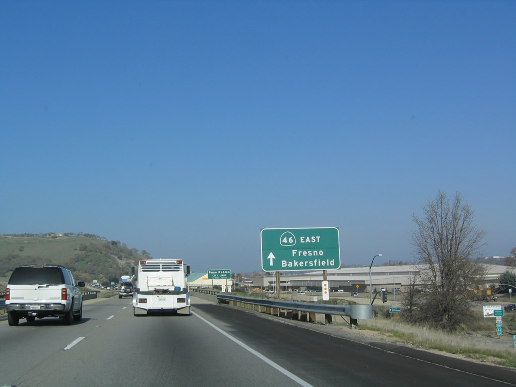
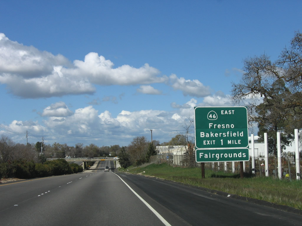
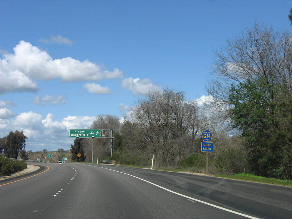
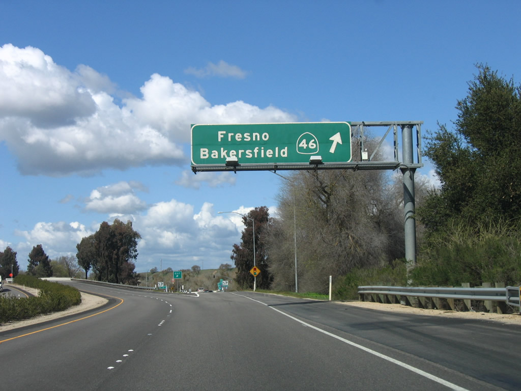
The next exit along northbound U.S. 101 and eastbound California 46 is Exit 231, California 46/24th Street east and San Luis Obispo County G-14/24th Street northwest (one mile). This is the primary east-west route between the Central Coast (Cambria and Paso Robles) and the San Joaquin Valley (Fresno and Bakersfield). Photo taken 03/18/06. |
|
Thirteenth Street passes over U.S. 101; an on-ramp leads from 13th Street onto U.S. 101 north, but there is no direct access to 13th Street from U.S. 101 north. Photo taken 03/18/06. |
|
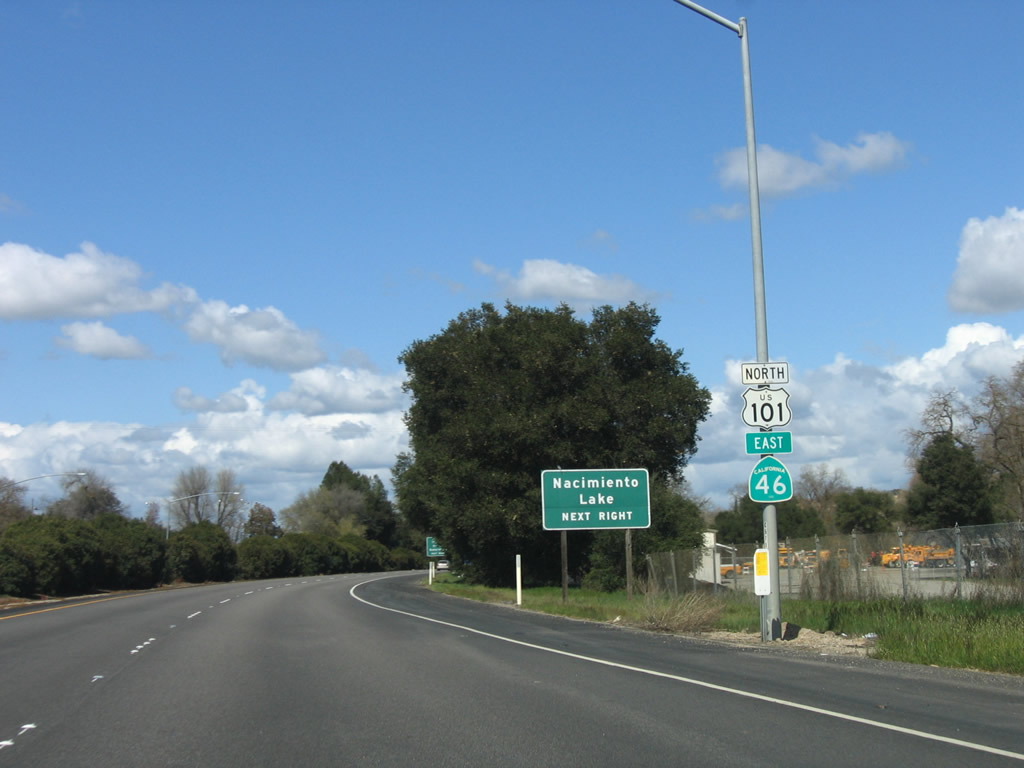
San Luis Obispo County G-14 follows Nacimiento Lake Road northwest of Paso Robles to Nacimiento Lake. Another set of reassurance shields is posted after the on-ramp from 13th Street. Photo taken 03/18/06. |
|
Use California 46/24th Street east to Airport Road north to Paso Robles Municipal Airport. Photo taken 03/18/06. |
|
California 46 travels to neither Fresno nor Bakersfield. To Fresno, follow California 46 east to California 41 north; to Bakersfield, follow California 46 east to its end at California 99, then turn south on California 99. Photo taken 03/18/06. |
|
Exit here for the continuation of the San Juan Bautista de Anza Trail (via 24th Street west). Photo taken 03/18/06. |
|
San Luis Obispo County G-14 follows Nacimiento Lake Road. Note the use of the standalone county pentagon route marker. Photo taken 03/18/06. |
|
Northbound U.S. 101 reaches Exit 231, California 46/Twenty-fourth Street east and San Luis Obispo County G-14/Twenty-fourth Street northwest. County Route G-14 follows Nacimiento Lake Road and Interlake Road to the north as it enters Monterey County. The county route will rejoin U.S. 101 at King City. Photo taken 03/18/06. |
|
This view looks down the off-ramp at Exit 231. Photo taken 03/18/06. |
| U.S. 101 north |
|
Check it out ... no traffic! Photo taken 03/18/06. |
|
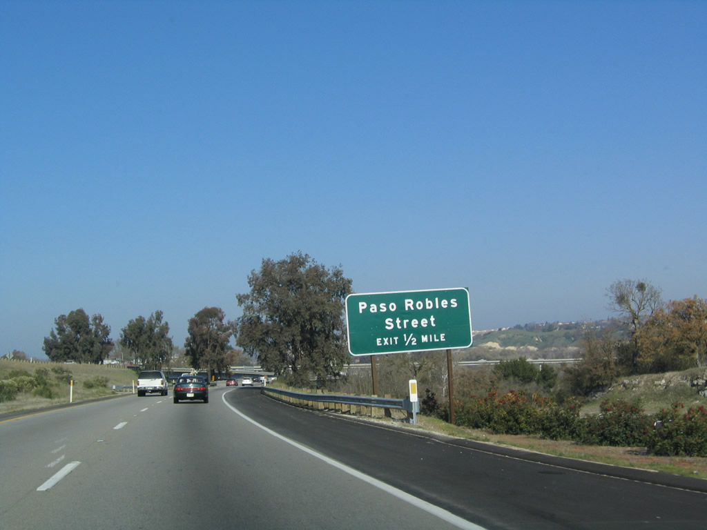
The final Paso Robles exit along U.S. 101 north is Exit 232, U.S. 101 Business/Spring Street south. Photo taken 12/23/04. |
|
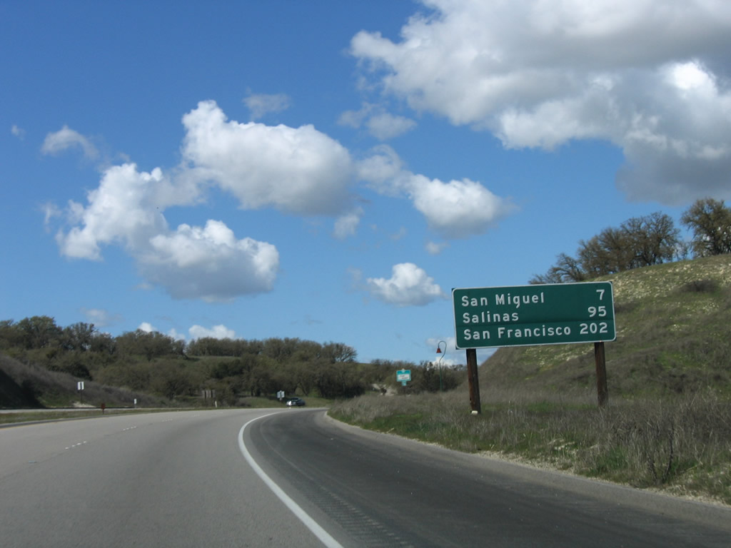
Continuing north out of Paso Robles, this mileage sign provides the distance to San Miguel, the last town in San Luis Obispo County (seven miles); Salinas (95 miles); and the control city of San Francisco (202 miles). Photo taken 03/18/06. |
|
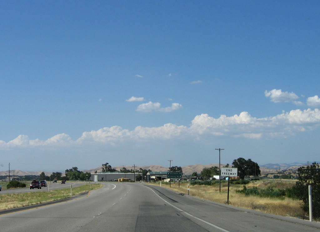
As traffic from Spring Street merges onto U.S. 101 north, the freeway will again downgrade to an expressway configuration (for the next seven miles, until San Miguel). Photo taken 12/23/04. |
|
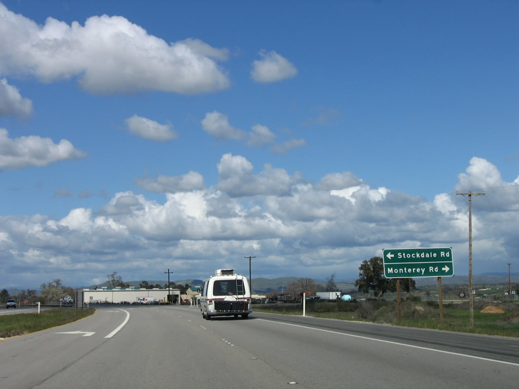
An end freeway sign is posted shortly thereafter; the first at-grade intersection is with Stockdale Road and Monterey Road. Photo taken 06/28/06. |
|
U.S. 101 north meets Stockdale Road and Monterey Road at this intersection. Photo taken 03/18/06. |
|
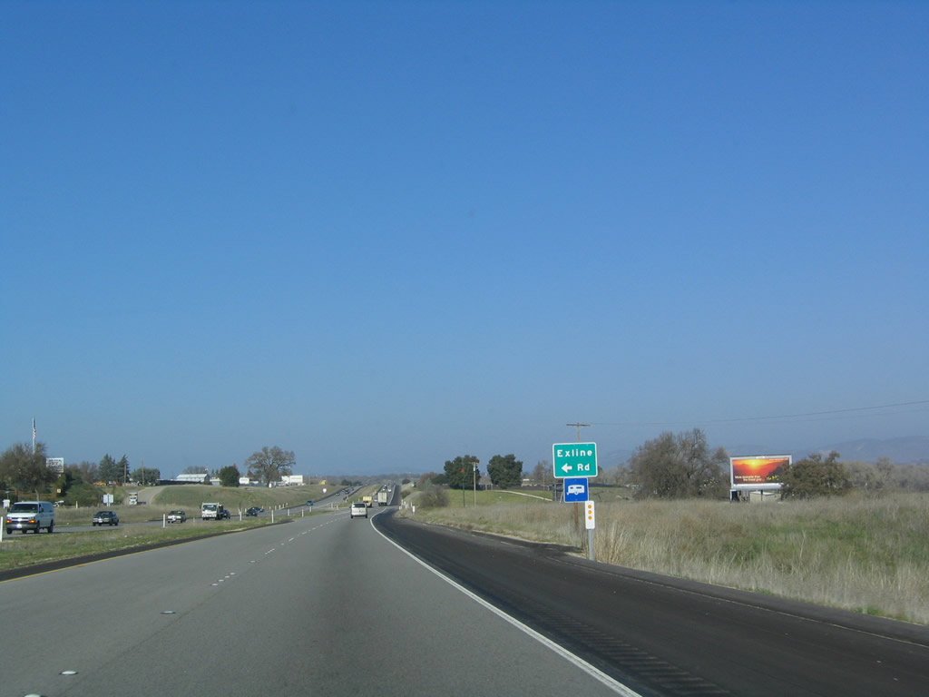
The next intersection is with Exline Road. Photo taken 12/23/04. |
|
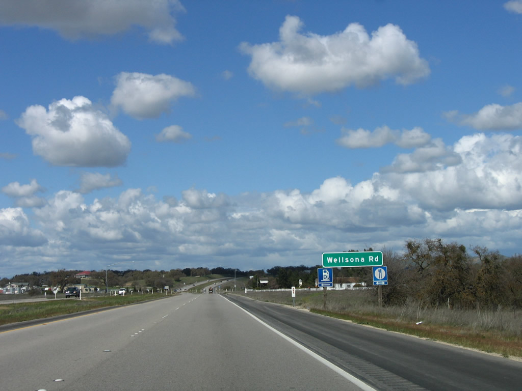
Northbound U.S. 101 approaches Wellsona Road. Photo taken 03/18/06. |
|
|
|
|
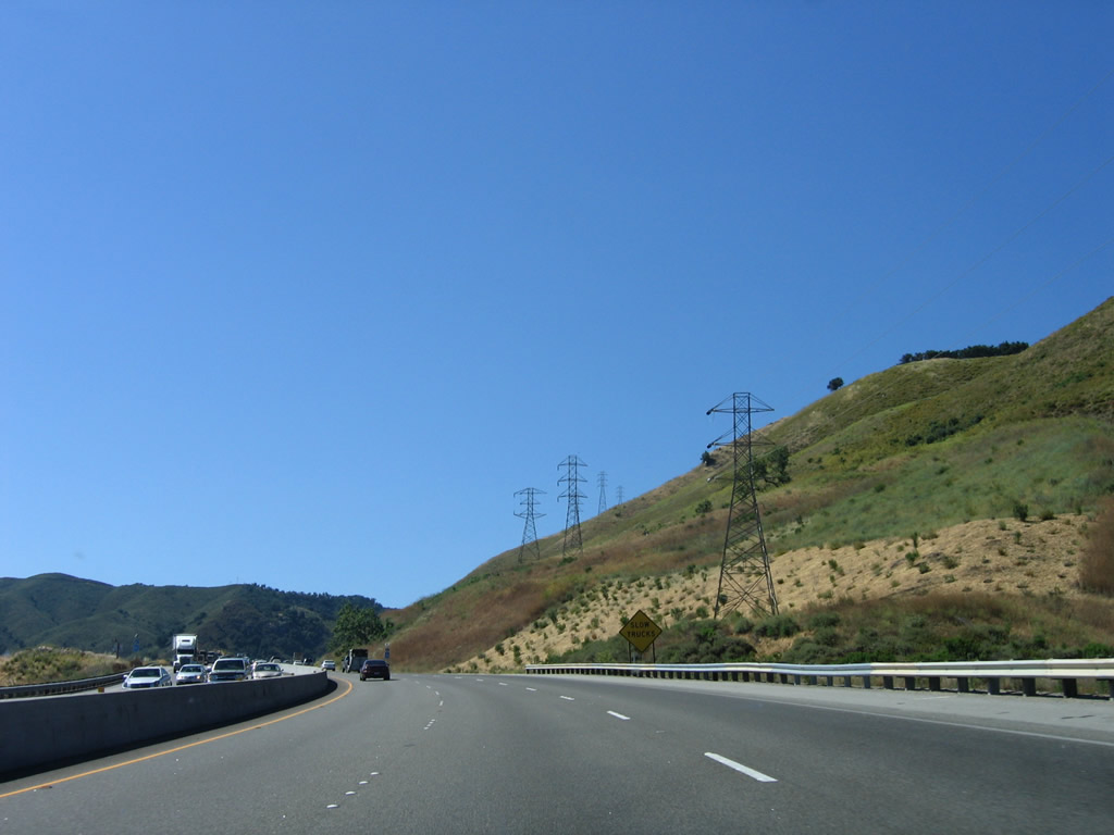
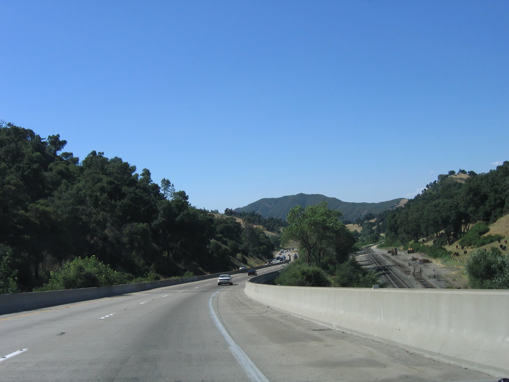
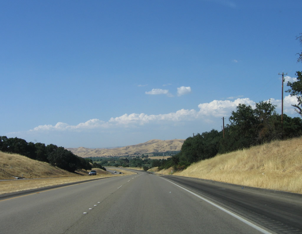
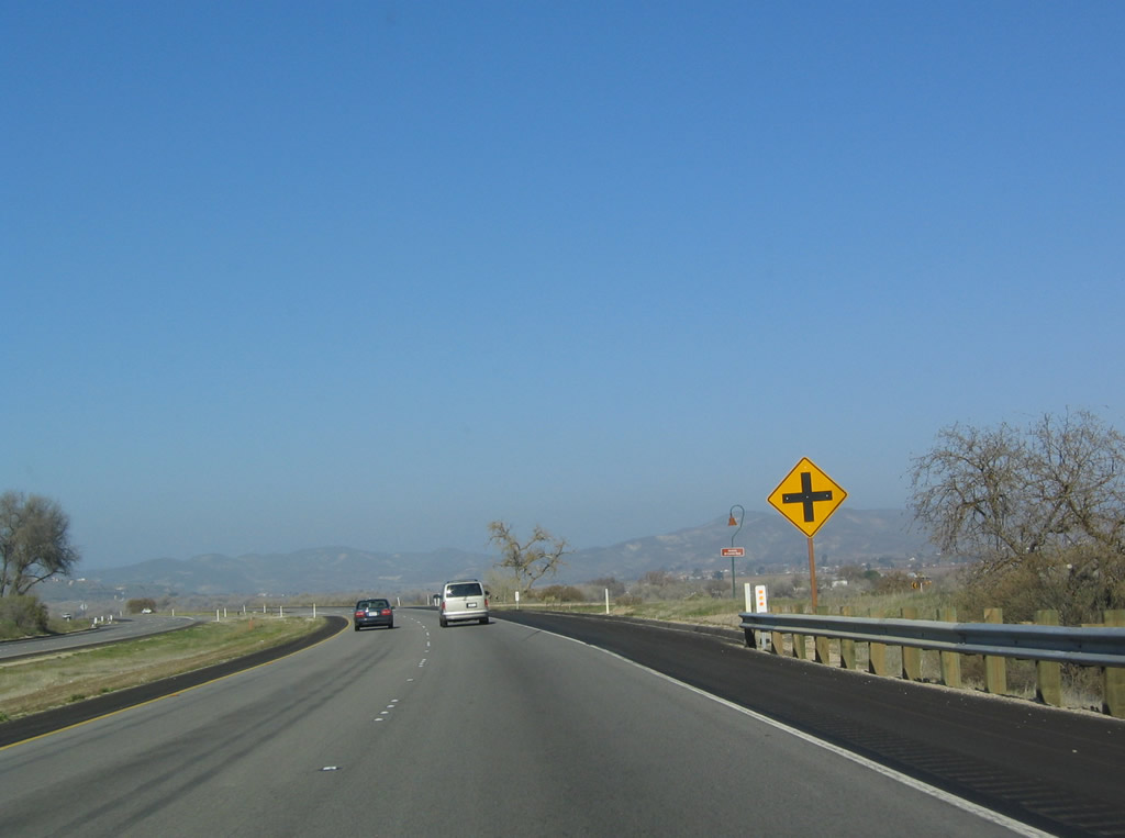
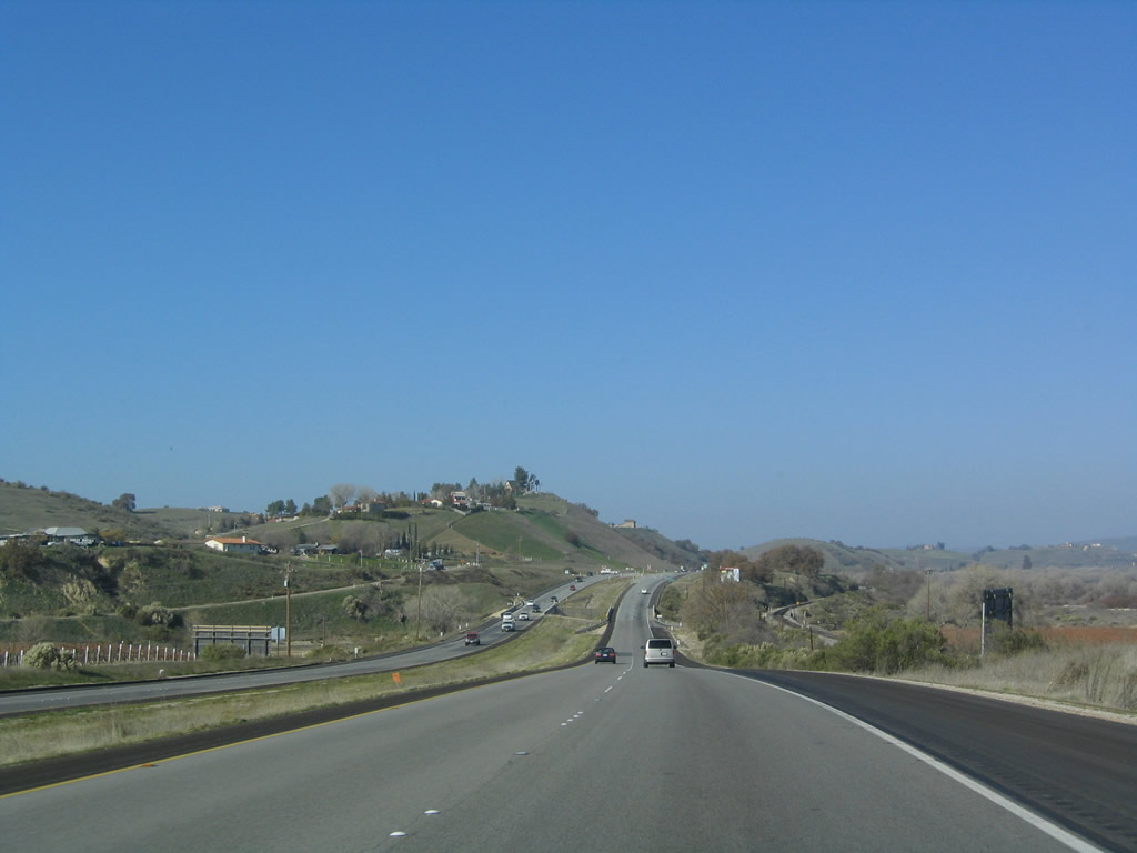
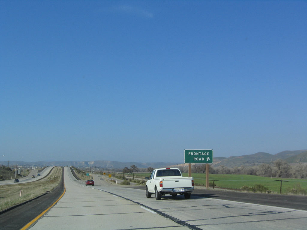
U.S. 101 continues north through rural areas with sporadic homes and ranches along the way. Photos taken 06/28/06, 03/18/06, and 12/23/04. |
|
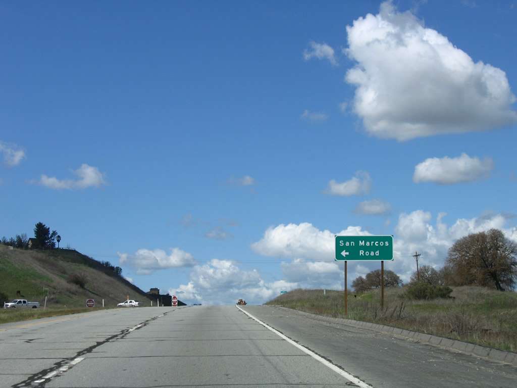
The next signed intersection along U.S. 101 (El Camino Real) north is with San Marcos Road. Photo taken 03/18/06. |
|
After San Marcos Road, the freeway again resumes. Photo taken 12/23/04. |
|
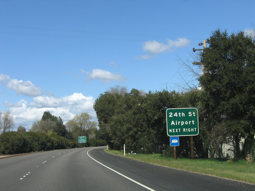
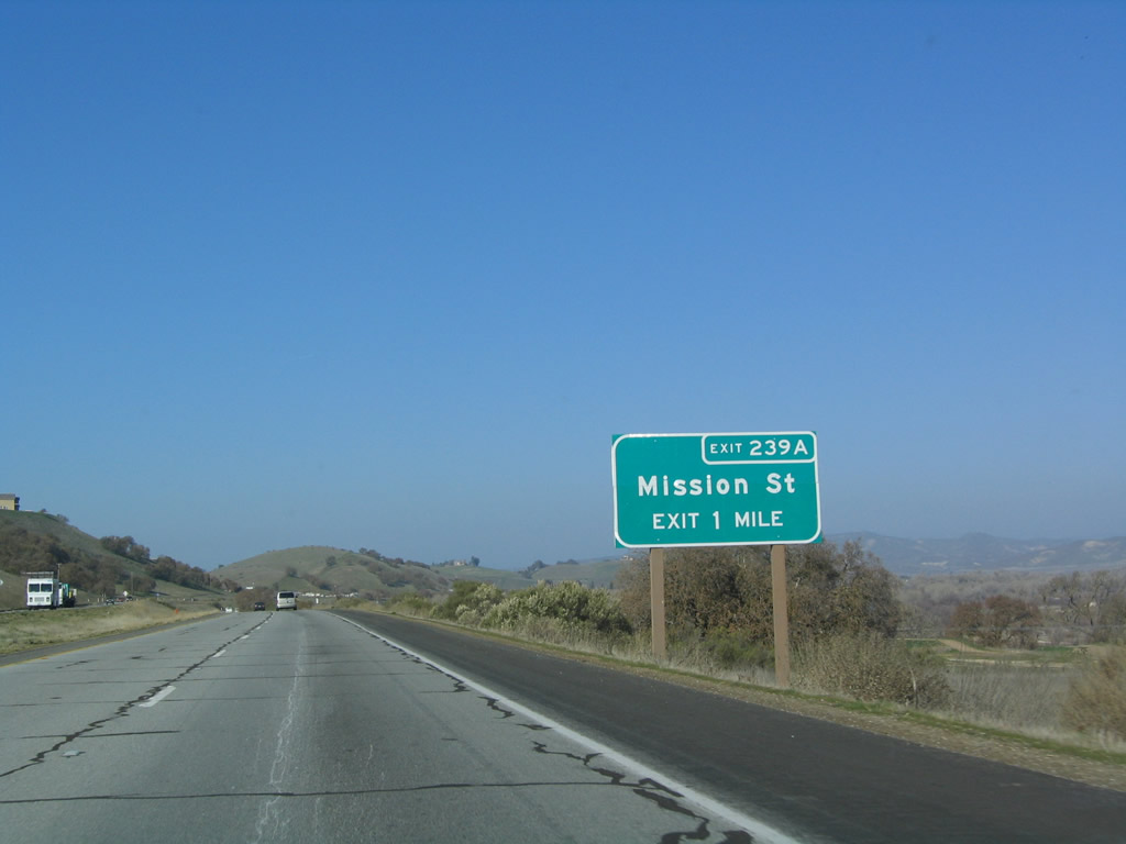
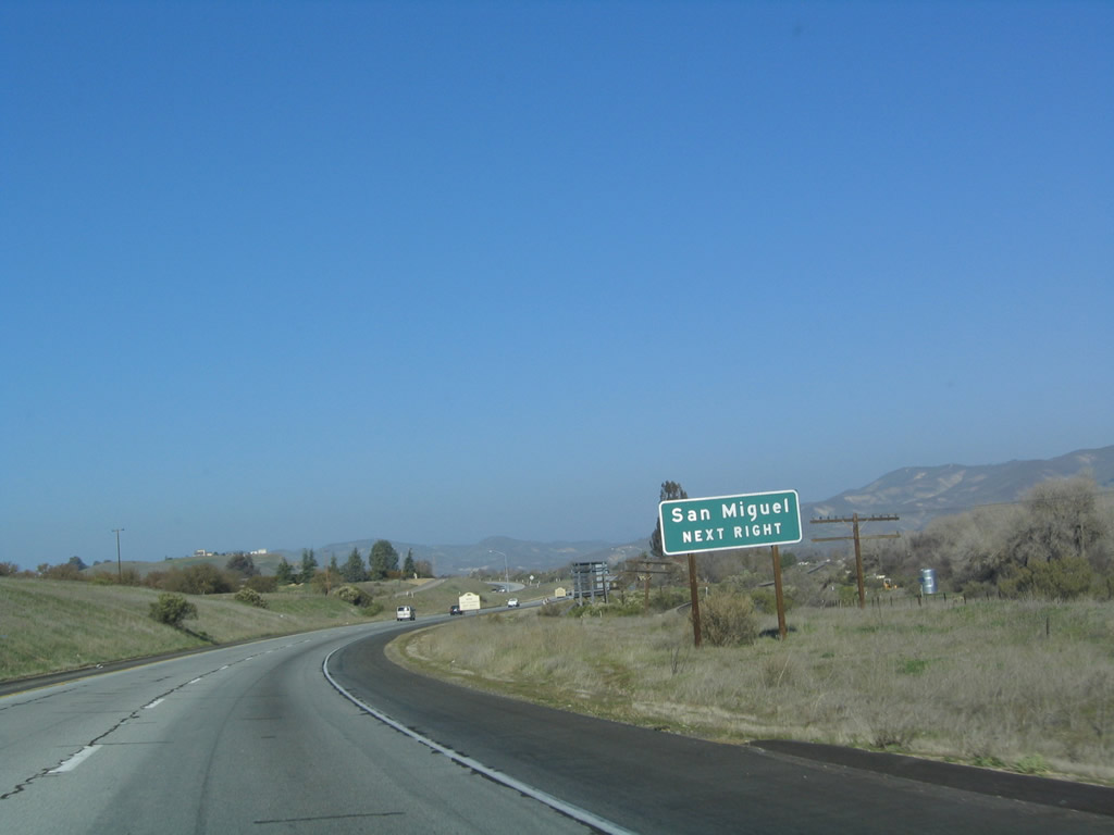
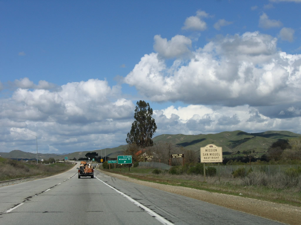
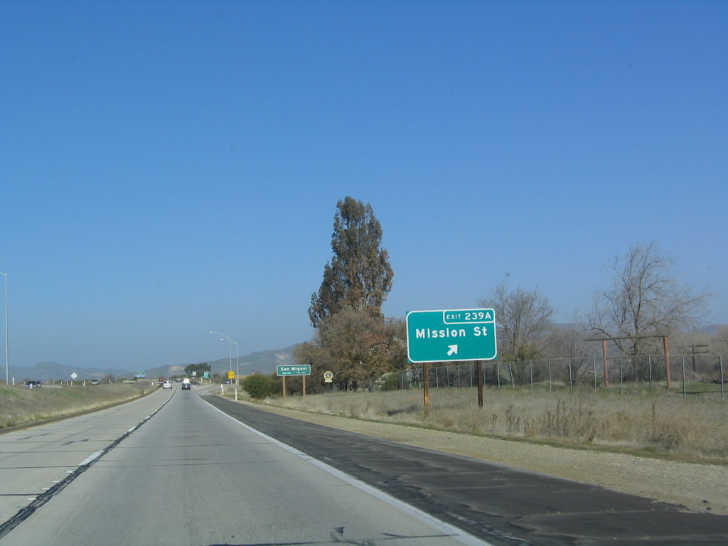
The next exit along U.S. 101 north is Exit 239A, Old U.S. 101/Mission Street north to San Miguel, an unincorporated community of northern San Luis Obispo County. Photo taken 12/23/04. |
|
The next three exits serve San Miguel: Exit 239A, Mission Street north; Exit 239B, Tenth Street; and Exit 241, Mission Street south. Photo taken 12/23/04. |
|
|
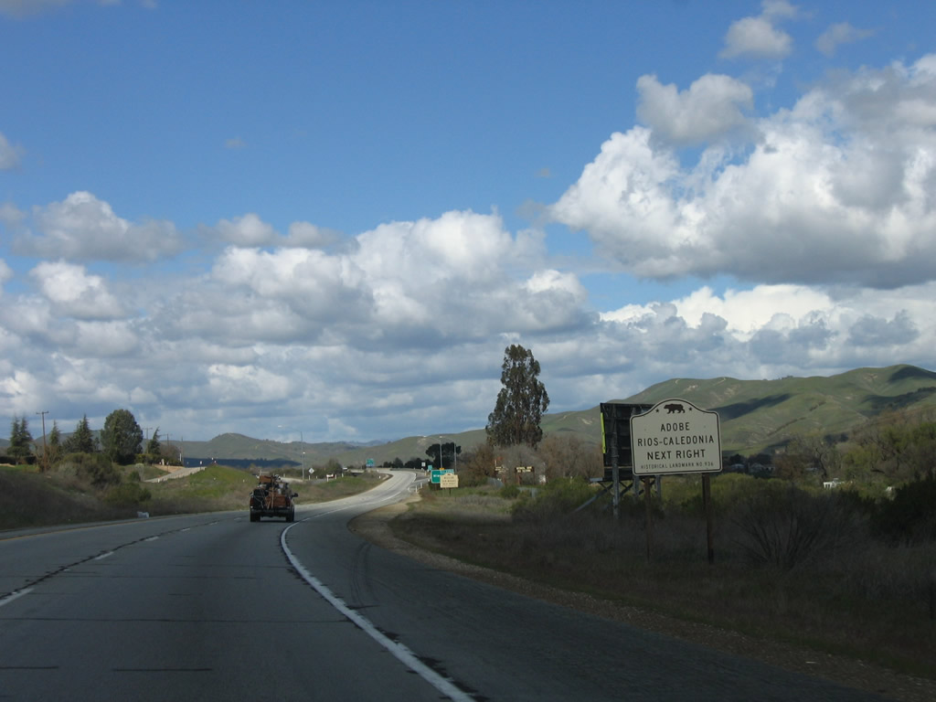
Use Mission Street north to Adobe Rios Caledonia and Mikssion San Miguel Arc-ngel. These historic sites are located close to the freeway by way of old U.S. 101. The old alignment follows Mission Street through town, returning to the freeway at Exit 241. Photos taken 03/18/06. |
|
Northbound U.S. 101 (El Camino Real) reaches Exit 239A, Old U.S. 101/Mission Street north to San Miguel. Photo taken 12/23/04. |
|
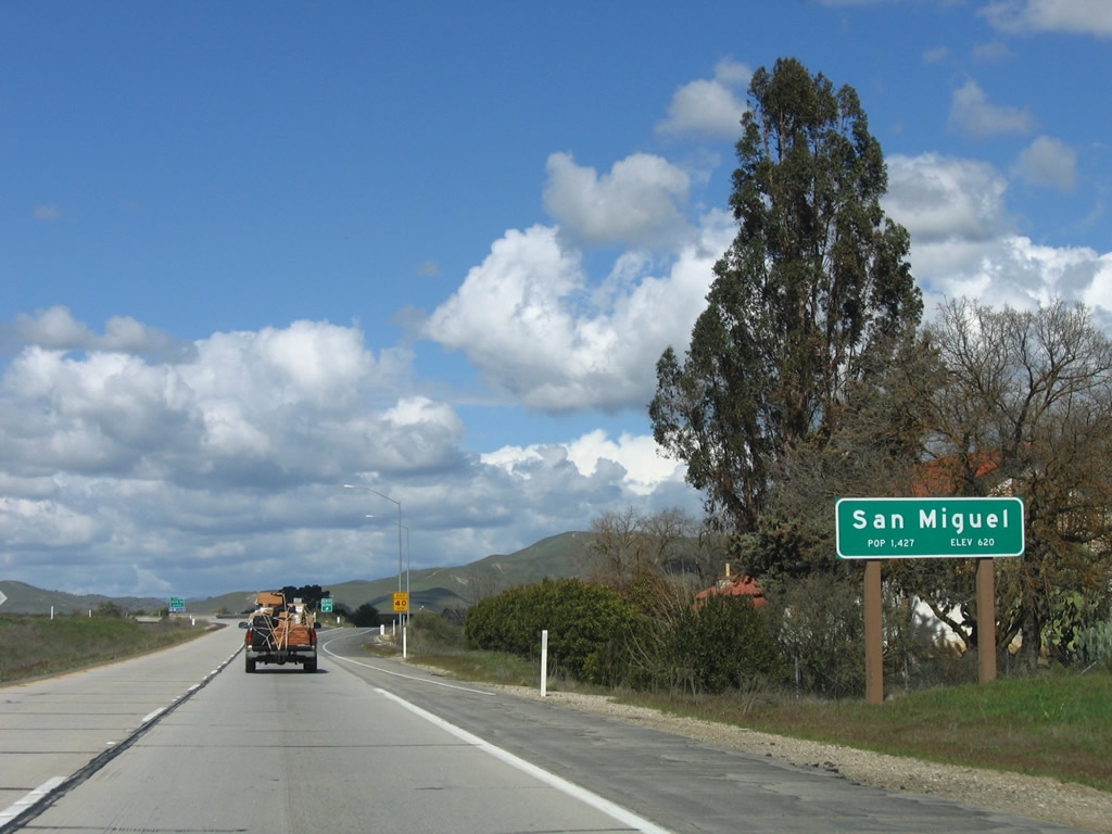
U.S. 101 enters San Miguel, an unincorporated community of San Luis Obispo County. San Miguel was founded with the construction of Mission San Miguel Arc-ngel on July 25, 1797, and it has a population of 1,427 people (as of 2000 Census). Photo taken 03/18/06. |
|
|
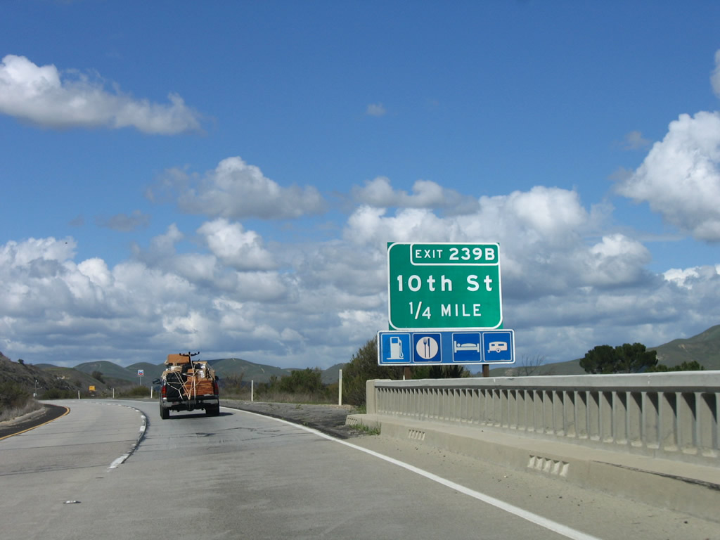
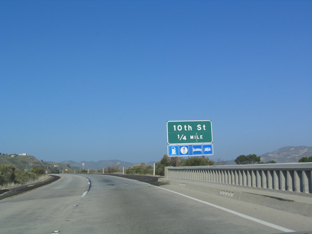
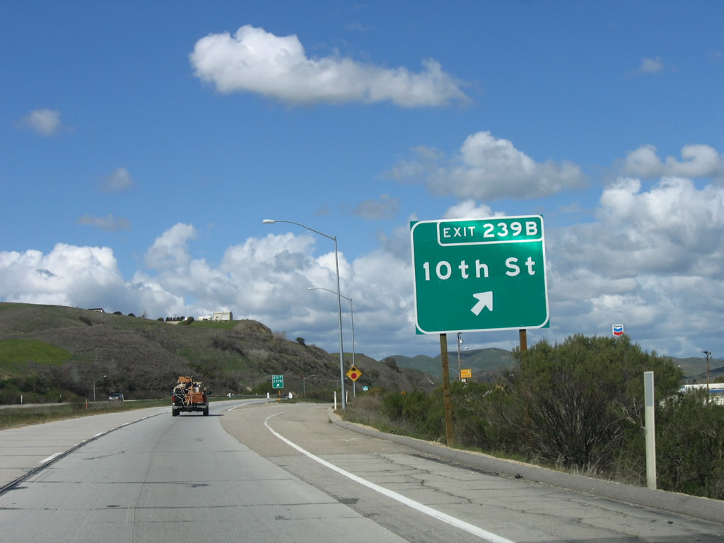
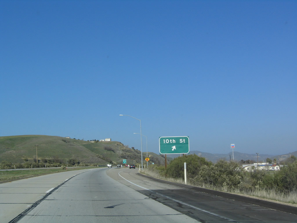
The next exit along U.S. 101 (El Camino Real) north is Exit 239B, Tenth Street to San Miguel. As northbound U.S. 101 passes over the ramp from Mission Street southbound to U.S. 101 southbound, old bridge railing and divoted curbing are prevalent. Signs were replaced between 2004 and 2006. Photos taken 03/18/06 and 12/23/04. |
|
|
Northbound U.S. 101 (El Camino Real) reaches Exit 239B, Tenth Street to San Miguel. Photos taken 03/18/06 and 12/23/04. |
|
|
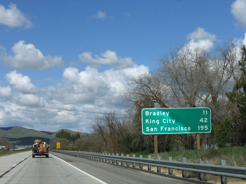
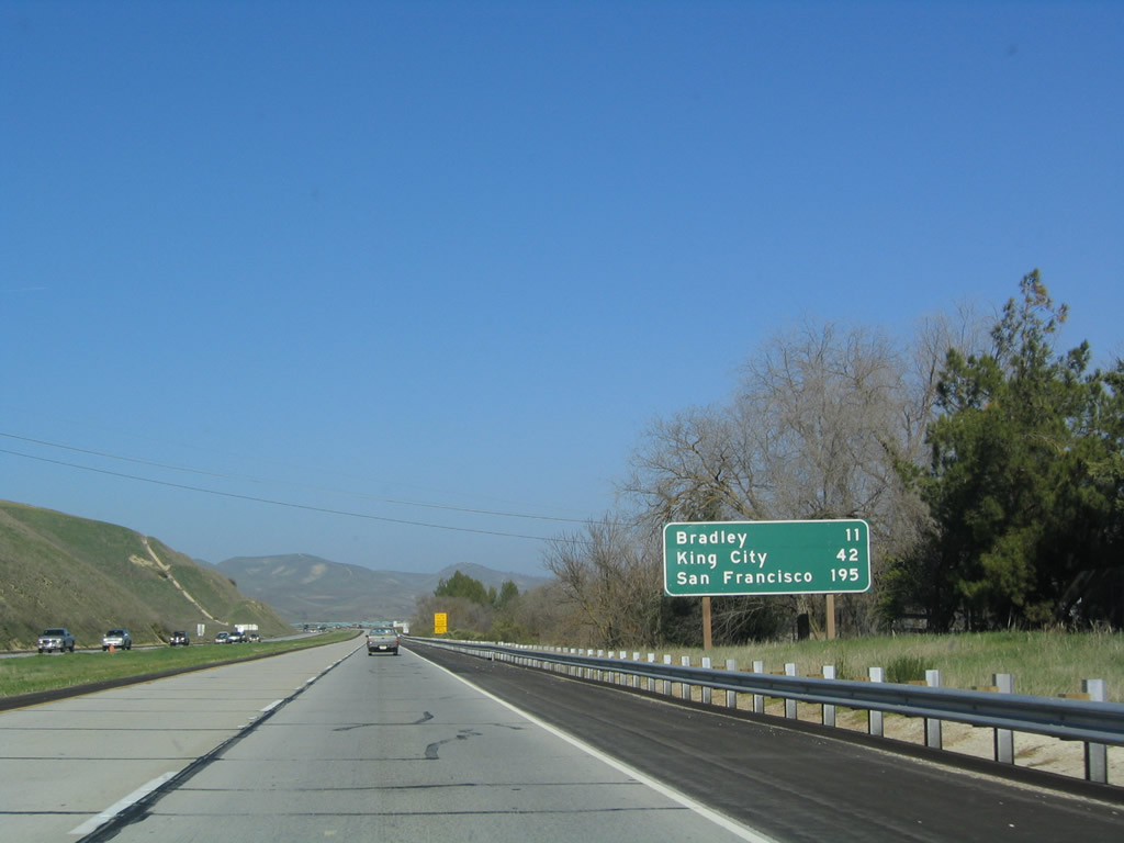
This mileage sign provides the distance to Bradley (11 miles), King City (42 miles), and San Franscisco (195 miles). This sign was also replaced. Photos taken 03/18/06 and 12/23/04. |
|
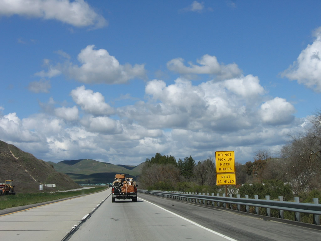
For the next 13 miles, it is suggested not to pick up hitchhikers due to the proximity of a prison. U.S. 101 approaches the vicinity of Camp Roberts Military Reservation. Photo taken 03/18/06. |
|
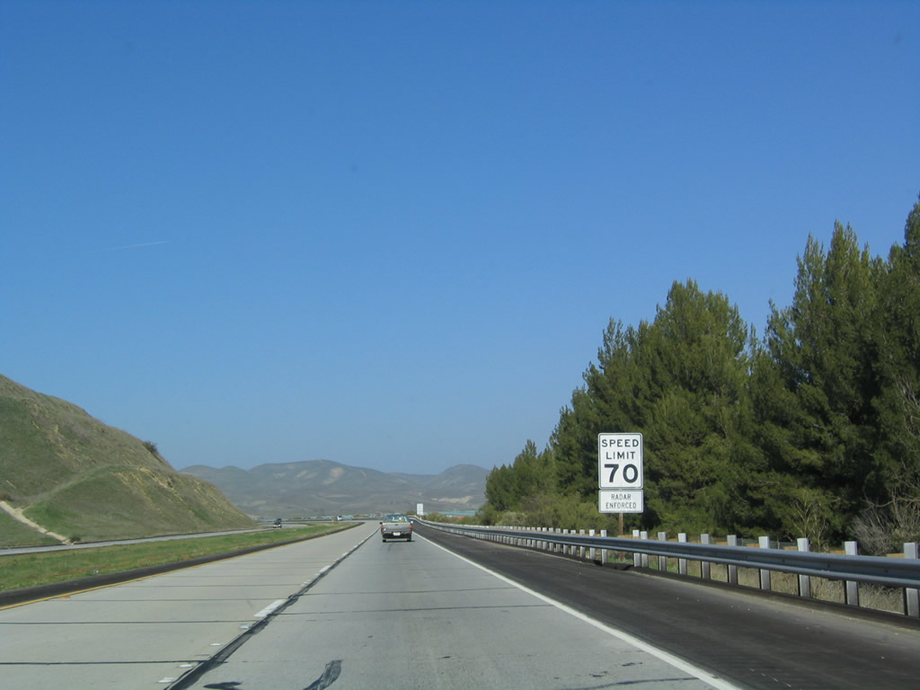
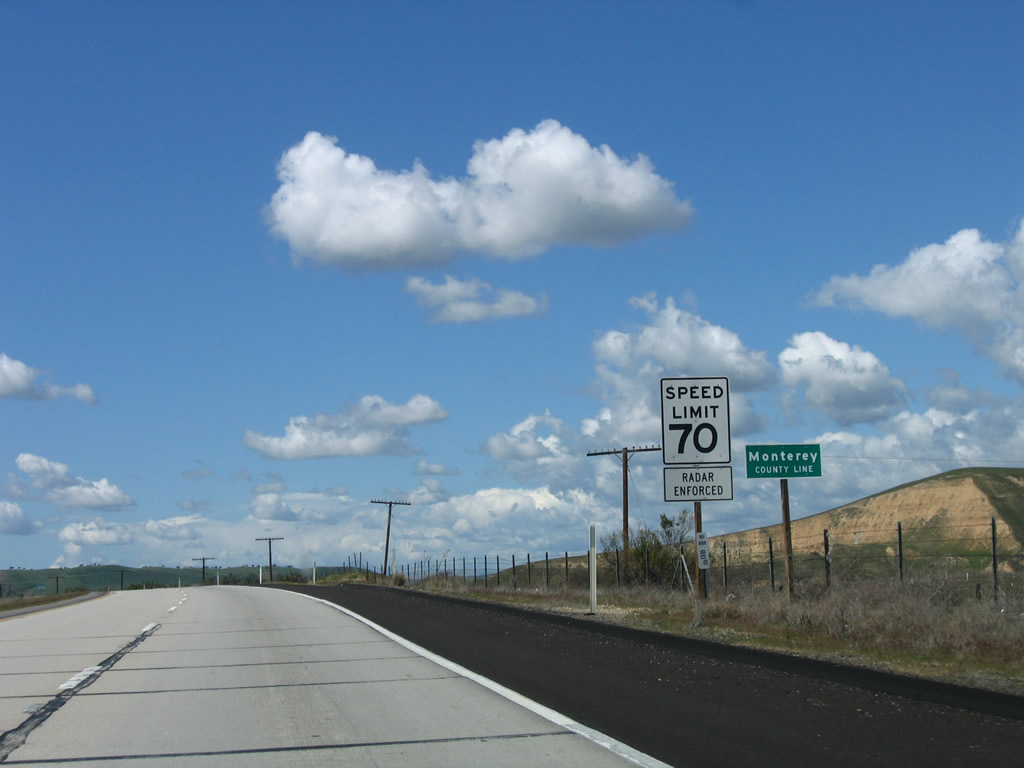
For the first time on U.S. 101 north, the speed limit increases to 70 miles per hour. Photo taken 12/23/04. |
|
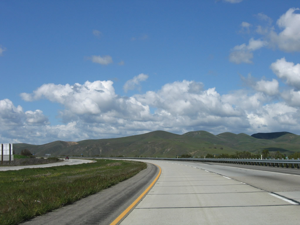
Beautiful skies dominate the green hills in late winter/early spring. Photo taken 03/18/06. |
|
These hills will turn a golden hue each summer, and become green each winter, a hallmark of the Mediterranean climate. Photo taken 03/18/06. |
|
The next exit along U.S. 101 north is Exit 241, Mission Street. Photo taken 12/23/04. |
|
Northbound U.S. 101 meets the north end of Mission Road at this interchange (Exit 241). Photo taken 03/18/06. |
|
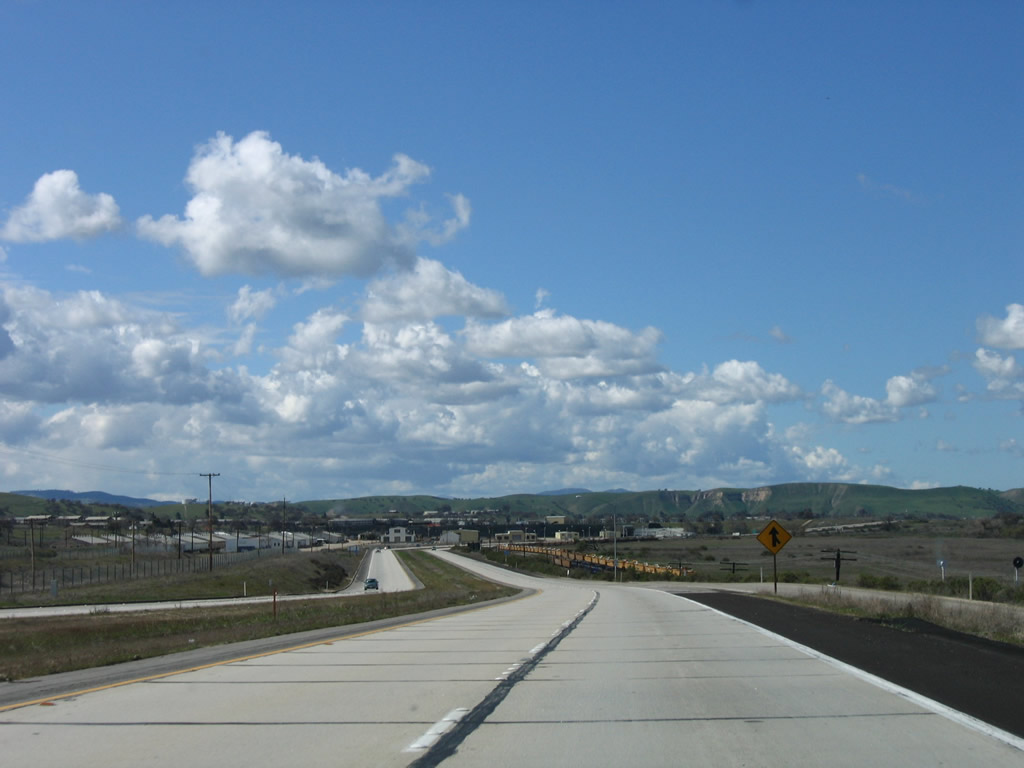
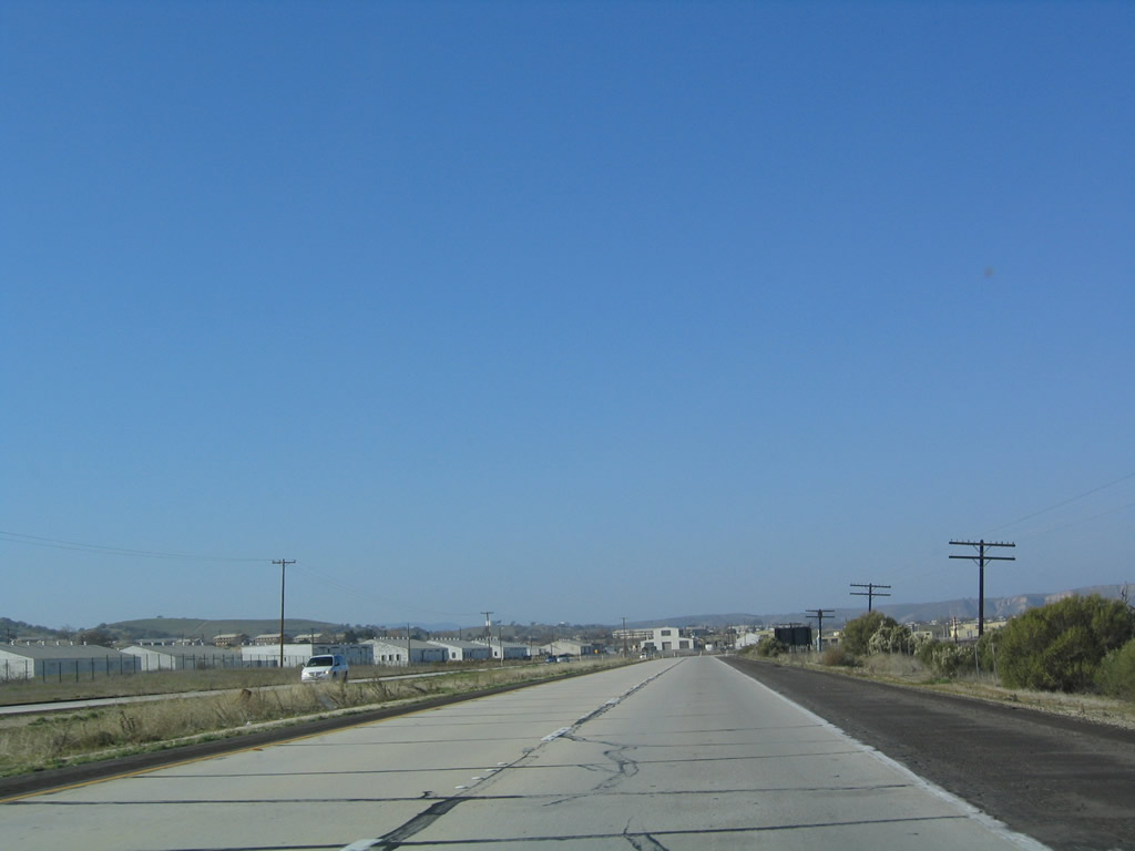
As traffic merges onto U.S. 101 north from Mission Street, Camp Roberts comes into view. This former U.S. Army base is now operated by the California Army National Guard. Photo taken 03/18/06. |
|
Old base buildings line the freeway behind locked gates. Photo taken 12/23/04. |
|
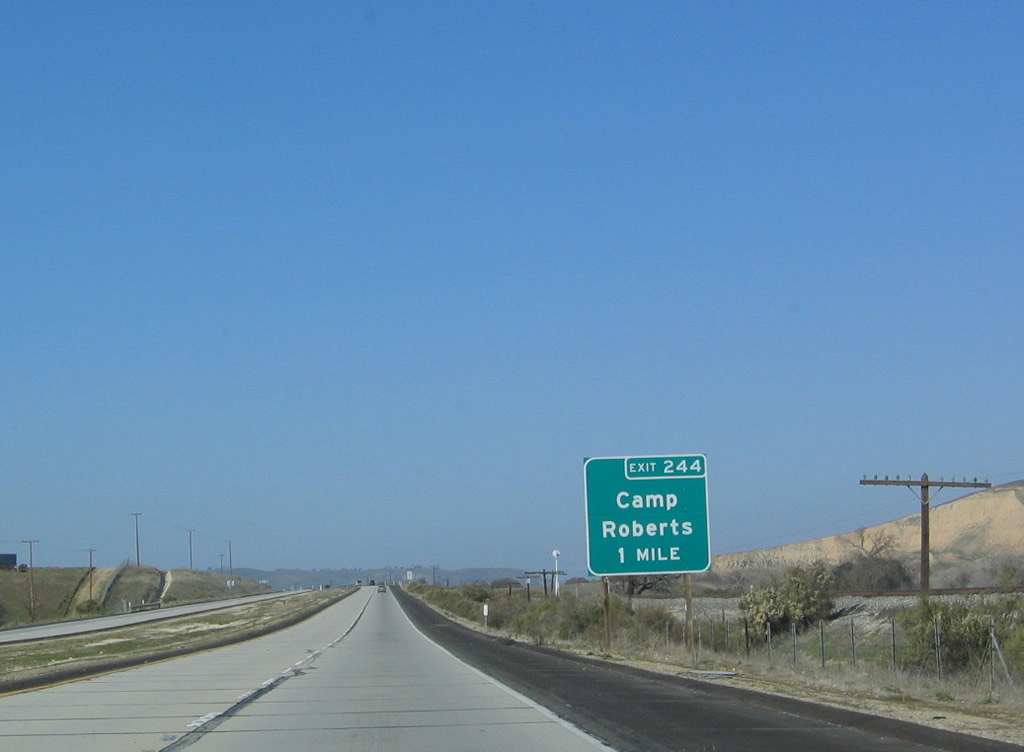
The next exit along U.S. 101 (El Camino Real) is Exit 244, Camp Roberts. Use this exit to the main gate, which is located in Monterey County. This exit also serves Nacimiento. Photo taken 12/23/04. |
|
U.S. 101 leaves San Luis Obispo County and enters Monterey County. Photo taken 03/18/06. |
Page Updated March 31, 2009.