Entering Marin County, U.S. 101 enters some of the highest-priced real estate in a very expensive state for property. Land use restrictions and parkland preservation prevent much growth outside established urban areas, and the largest ranches are owned by the rich and famous. Included in this is Skywalker Ranch, home to Star Wars director and creator George Lucas. U.S. 101 passes by much of this as a four to eight-lane freeway, but it does not hint at the value of the land it passes. The freeway passes through Sausalito, San Rafael (Interstate 580), and Novato (California 37) before it reaches Sonoma County.
| U.S. 101 (Redwood Highway) and California 1 north |
|
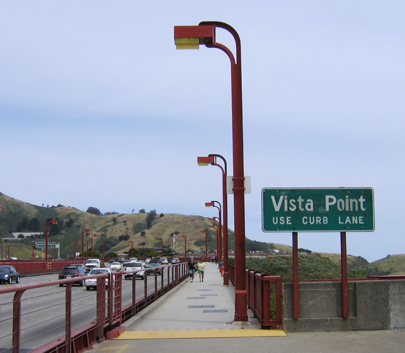
Upon crossing under the second (northern) tower of the Golden Gate Bridge, U.S. 101 and California 1 leave San Francisco County and enter Marin County. Now exiting the bridge, the next exit is the vista point. The sign was placed by the Golden Gate Bridge Authority, not Caltrans, hence why it is not a standard sign. Photo taken 11/28/03. |
|
Leaving the Golden Gate Bridge, U.S. 101 begins its northbound journey on the Redwood Highway. It will follow this historic route all the way to the U.S. 199 split north of Crescent City in Del Norte County. Redwood Highway culminates its journey in Grants Pass, where U.S. 199 merges onto Interstate 5 (Old U.S. 99/Pacific Highway) northbound. Reassurance signs for the Redwood Highway are posted intermittently all the way to Oregon via U.S. 101 and U.S. 199. Photo taken 05/26/06. |
|
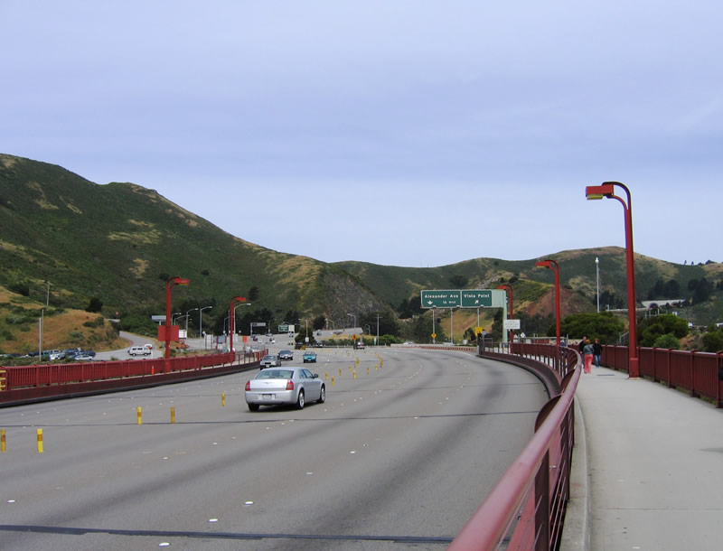
Northbound U.S. 101 and California 1 meet Exit 441, Vista Point turnoff. The next exit is Exit 442, Alexander Avenue. The control city on mileage signs and overhead signs is now Eureka, with destinations such as Santa Rosa, Cloverdale, and other cities posted along the way. Photo taken 05/26/06. |
|
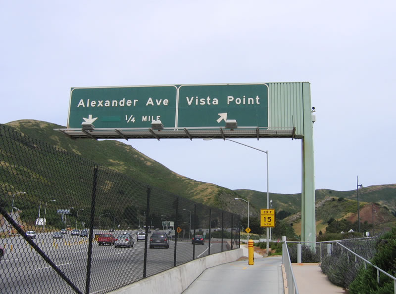
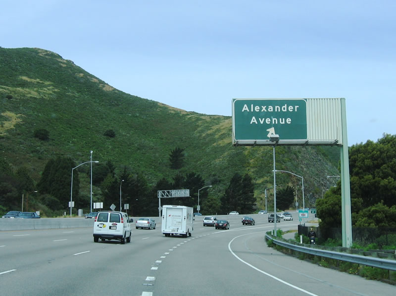
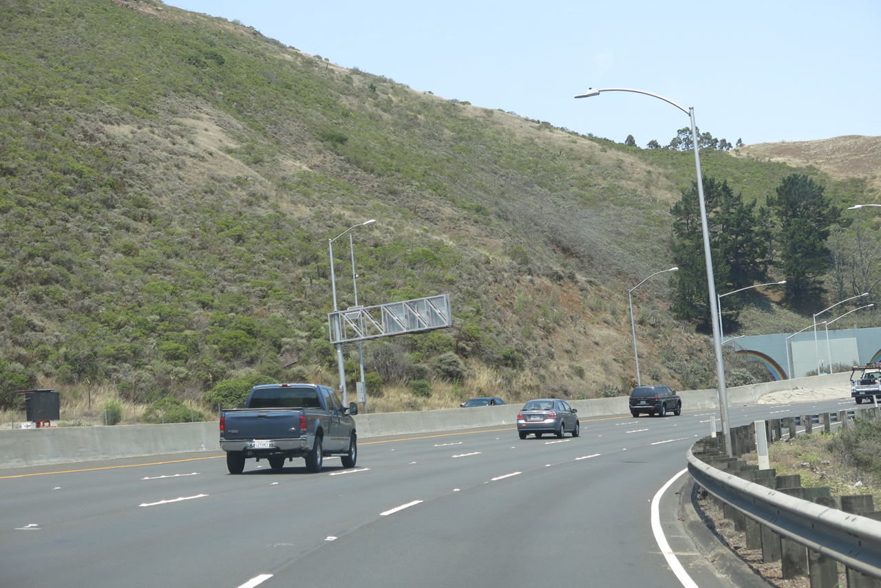
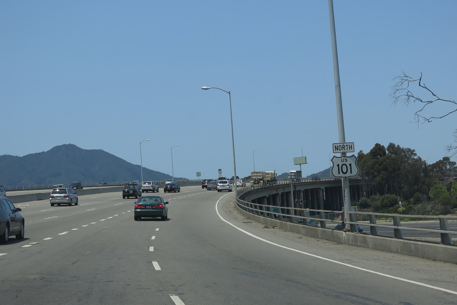
Immediately thereafter, northbound U.S. 101 (Redwood Highway) and California 1 reach Exit 442, Alexander Avenue. This is the last exit before U.S. 101 passes into a tunnel. Alexander Avenue provides an alternate route to Sausalito. Ascending from the Golden Gate, northbound U.S. 101 & California 1 begin to gather a sense of normalcy after the amazing trip across the Golden Gate Bridge. With four lanes in each direction, this section of U.S. 101 is very busy, but it is generally wider than the bridge (which can be configured for three lanes each way or four lanes in one direction and two lanes in the other direction). Photo taken 05/26/06. |
|
Traffic from Alexander Avenue merges onto U.S. 101 (Redwood Highway) and California 1 north. Photo taken 07/02/13. |
|
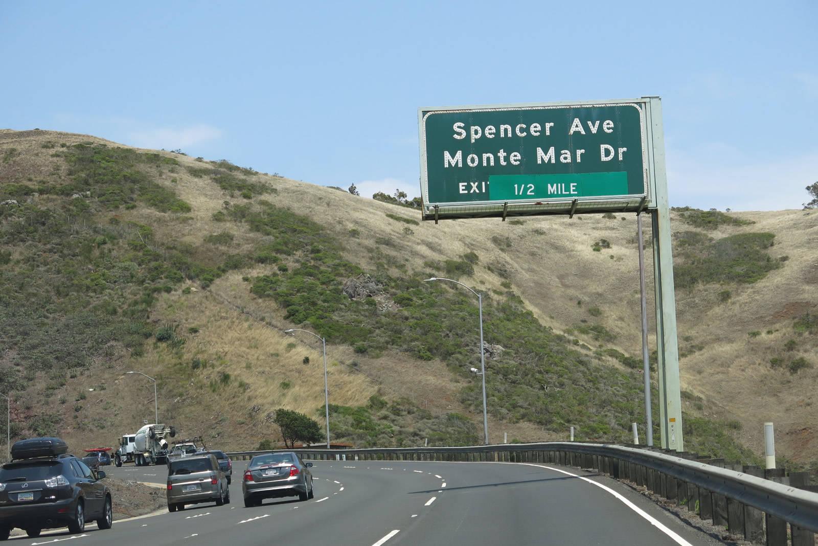
This mileage sign on northbound U.S. 101 (Redwood Highway) and California 1 provides the distance to Exit 443, Spencer Avenue and Monte Mar Drive, 0.75 mile. The off-ramp is located after the forthcoming Waldo Tunnel (also known as the Rainbow Tunnel). Photo taken 07/02/13. |
|
The northern San Francisco Bay comes into view to the east of U.S. 101. In the foreground is Alexander Avenue, which leads into Sausalito. Photo taken 07/02/13. |
|
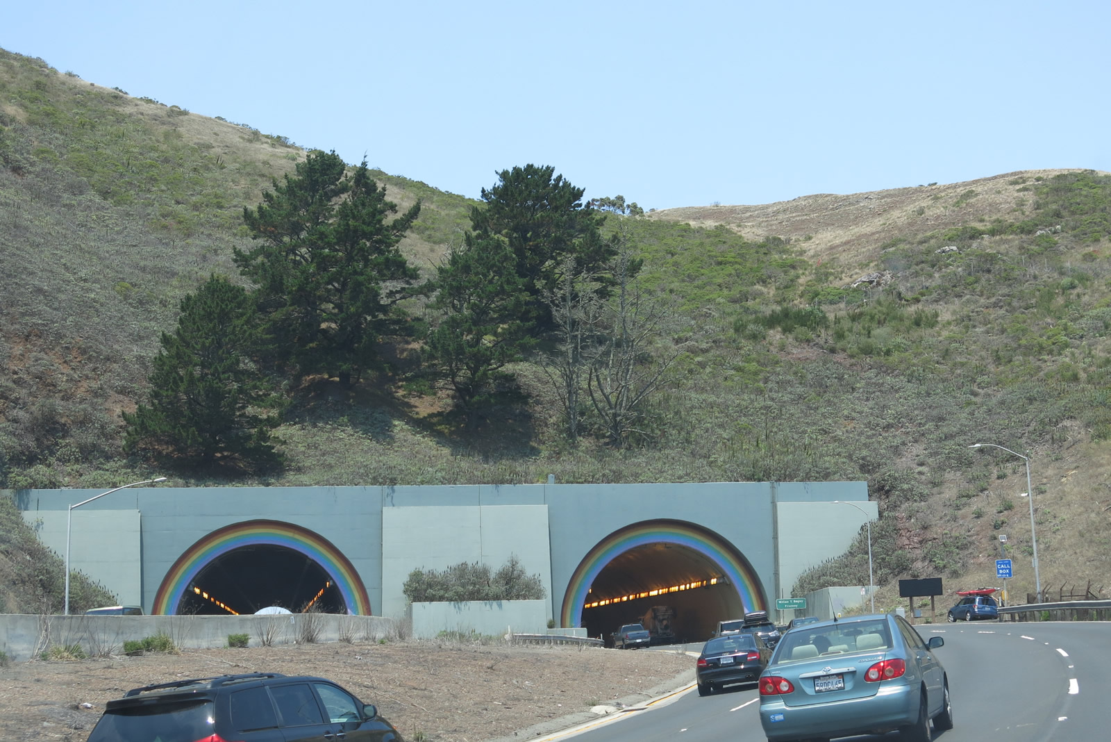
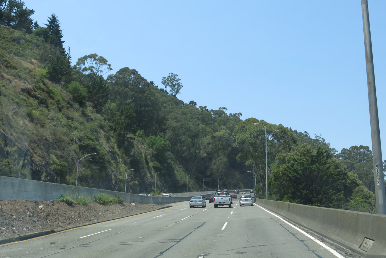
U.S. 101 gains elevation as it ascends the Waldo Grade and approaches the entrance to the Waldo Tunnel. Photo taken 07/02/13. |
|
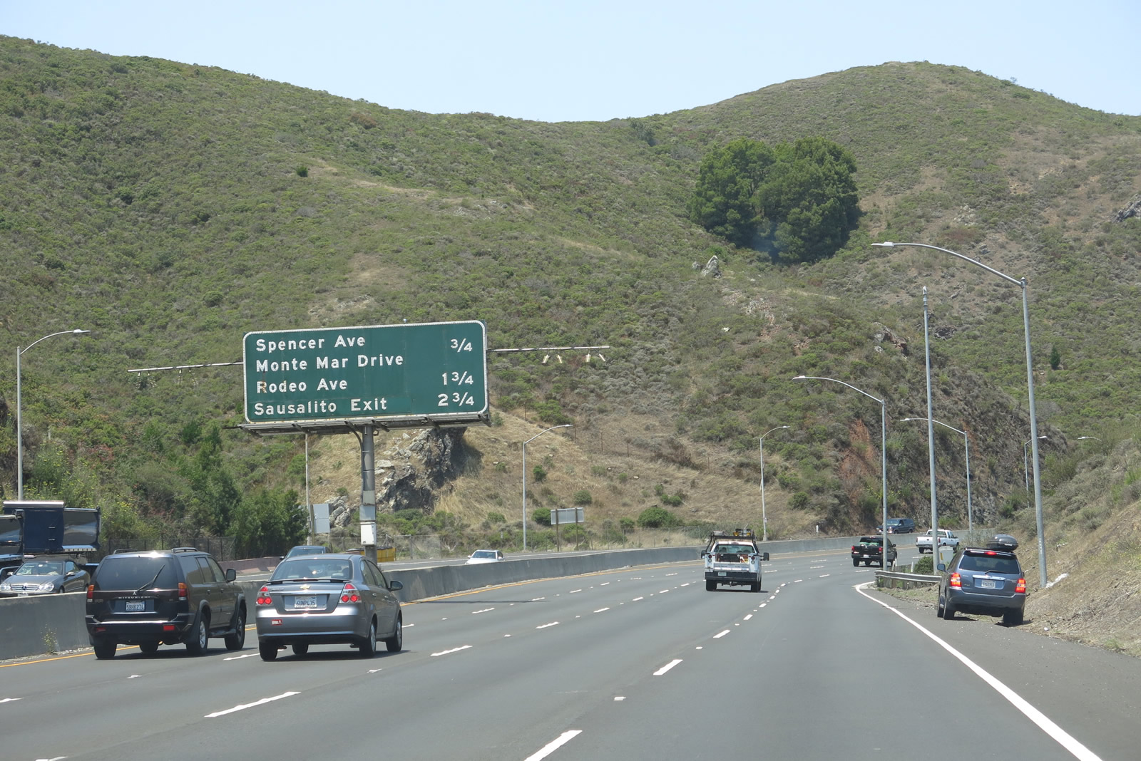
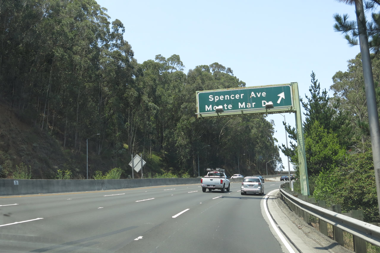
A second advance guide sign is posted along U.S. 101 and California 1 for the Exit 443, Spencer Avenue and Monte Mar Drive to the city of Sausalito. Photo taken 07/02/13. |
|
|
|
|
|
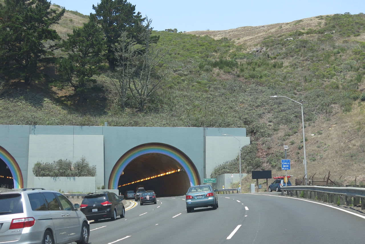
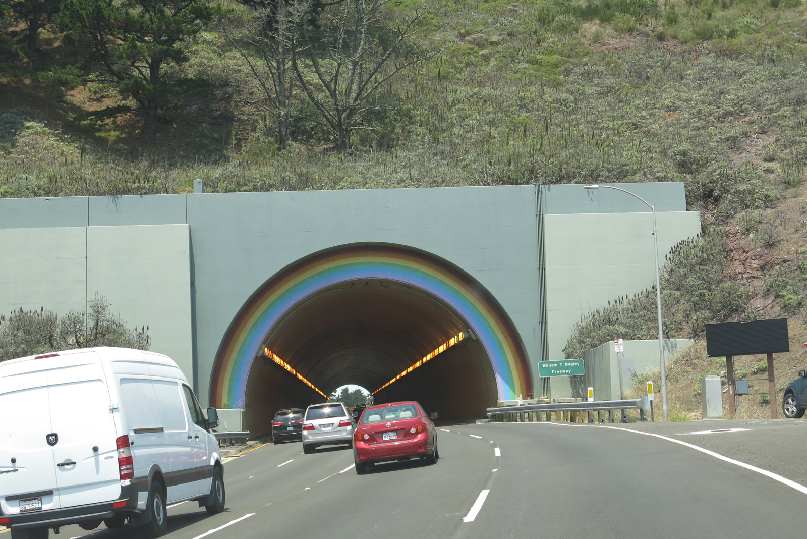
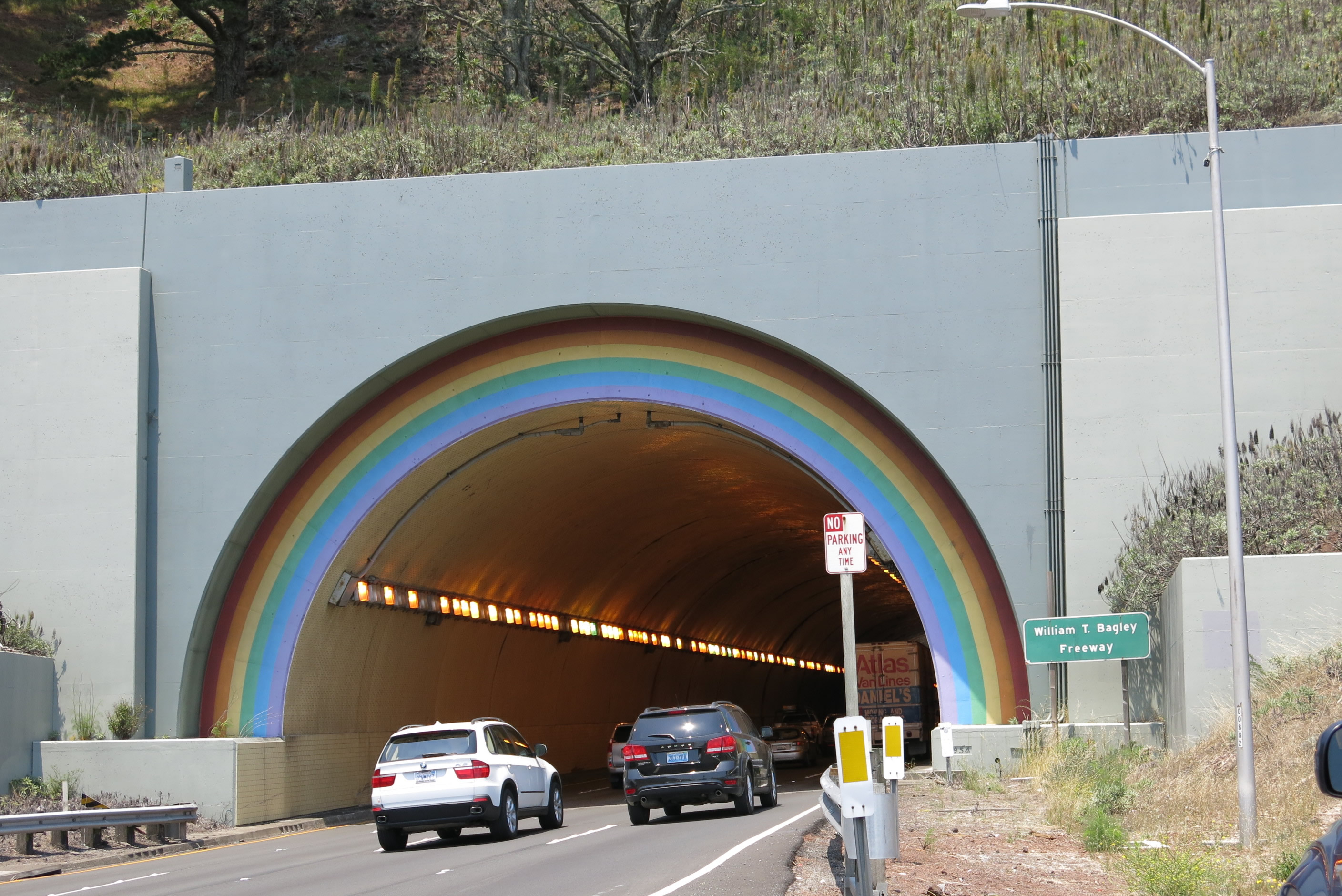
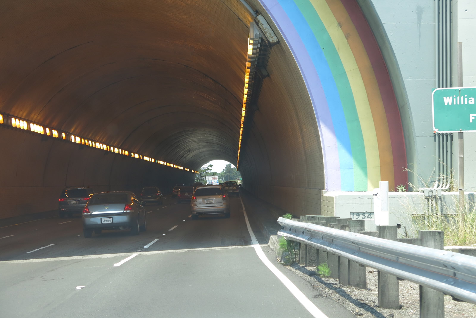
| U.S. 101 and California 1 pass into a tunnel at the top of the Waldo Grade, which originates at the Golden Gate. Known as the Waldo Tunnel and also as the Rainbow Tunnel, the tunnel complex consists of two tubes. The southbound tube was built in 1937, and the northbound tube was built in 1954. A date stamp at the entrance to the northbound tunnel confirms the latter date. The 1937 tunnel was built to enable access to the Golden Gate Bridge, which opened at the same time. Prior to completion of the tunnel and bridge, U.S. 101 followed a ferry from the Hyde Street terminal (at today's San Francisco Maritime National Historical Park) across the bay to Sausalito Terminal. When the Golden Gate Bridge and Waldo Tunnel opened, U.S. 101 was routed out of Sausalito and now bypasses downtown Sausalito to the west. Each tube carries four lanes to pass pass under the hill at the top of Waldo Grade. Both tubes of the Waldo Tunnel are painted with vibrant rainbow colors around the mouths of the portal; the tunnel has a nickname of "Rainbow Tunnel" due to these colors arcing around the tunnel entrance. As for U.S. 101, this is the first tunnel on northbound since passing through the Gaviota Tunnel back in Santa Barbara County. Photos taken 07/02/13 and 05/26/06. |
|
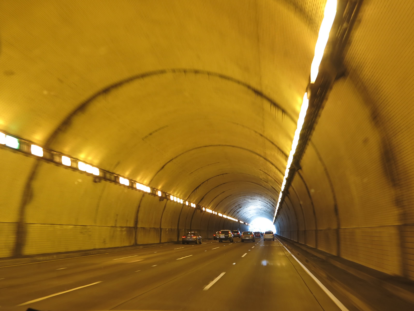
U.S. 101 and California 1 pass through the lit Waldo Tunnel. The Waldo Tunnel is four lanes wide with no shoulders. A similarly sized tube is in place for southbound traffic. Photo taken 07/02/13. |
|
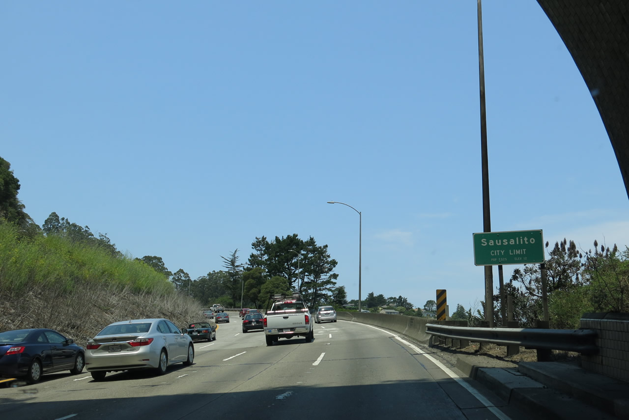
Upon exiting the Waldo Tunnel, northbound U.S. 101 and California 1 enter the city of Sausalito (population 7,061 as of the 2010 Census and incorporated on September 4, 1893). Photo taken 07/02/13. |
|
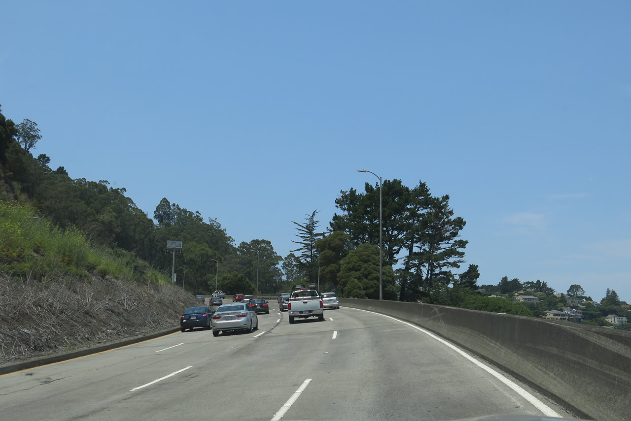
Four lanes carry northbound U.S. 101 and California 1 just before the off-ramp to Exit 443. Photo taken 07/02/13. |
|
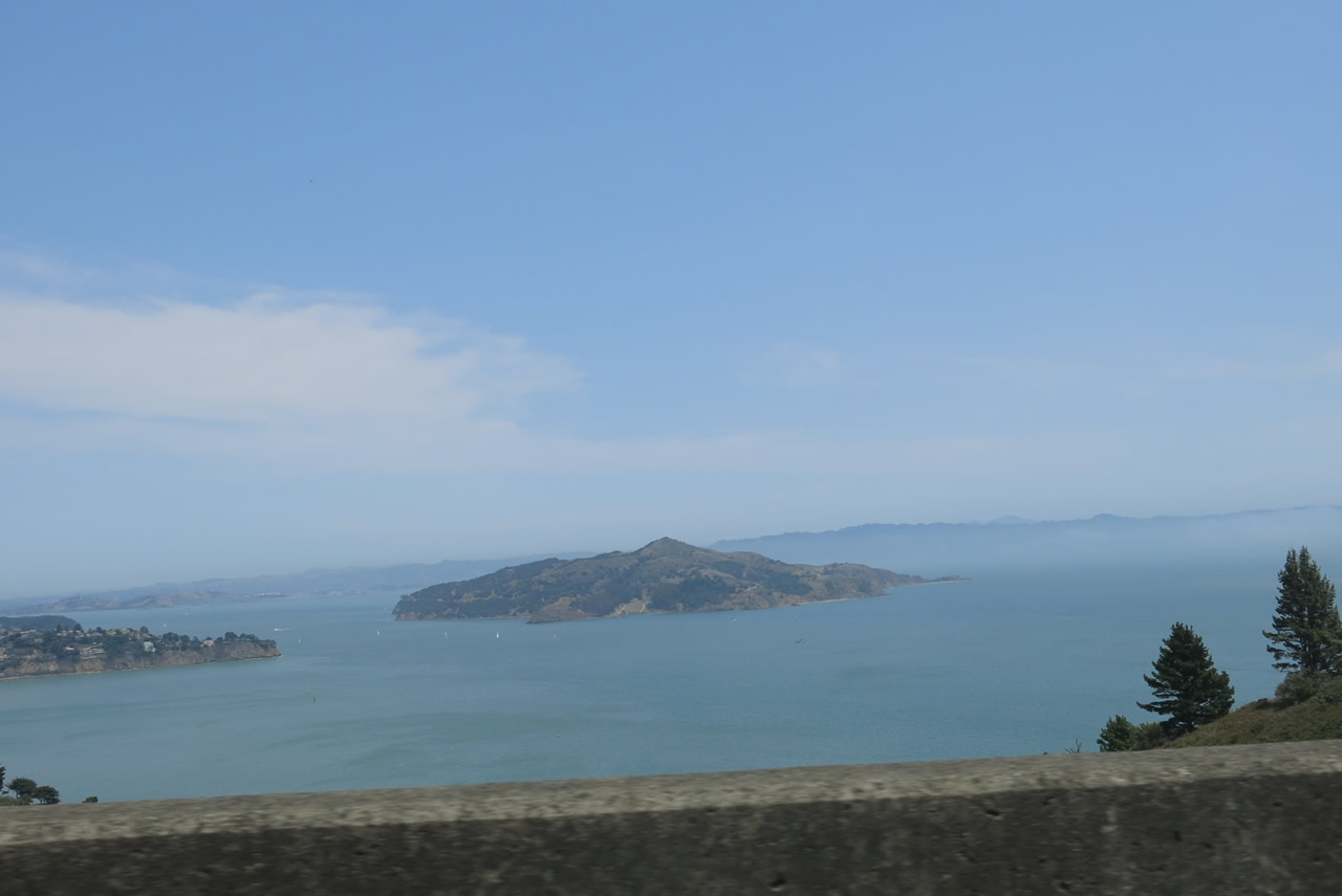
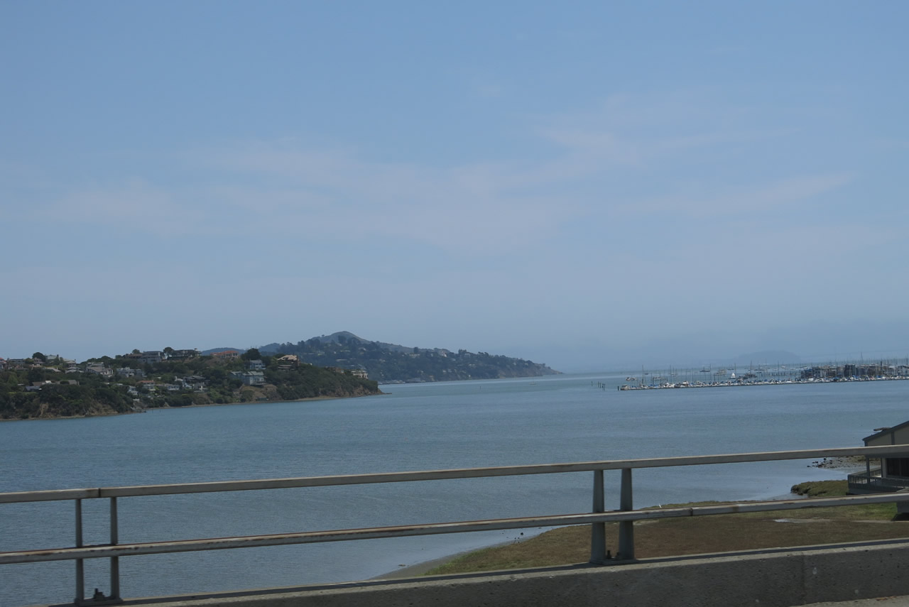
A look to the east from U.S. 101 and California 1 north reveals Angel Island State Park, which can be accessed by ferry from the town of Tiburon just north of here (or from the larger cities of San Francisco, Oakland, or Alameda). Photo taken 07/02/13. |
|
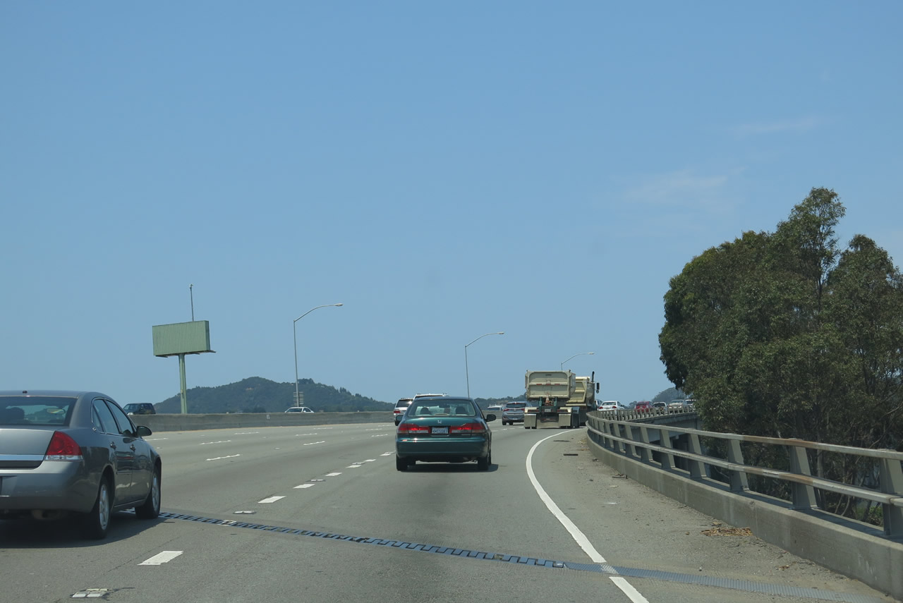
Although a busy freeway, there is no shoulder along this stretch of U.S. 101. The fourth lane was added at the expense of a typical freeway shoulder. Photo taken 07/02/13. |
|
Northbound U.S. 101 (Redwood Highway) and California 1 meet Exit 443, Spencer Avenue and Monte Mar Drive into the city of Sausalito. Photo taken 07/02/13. |
|
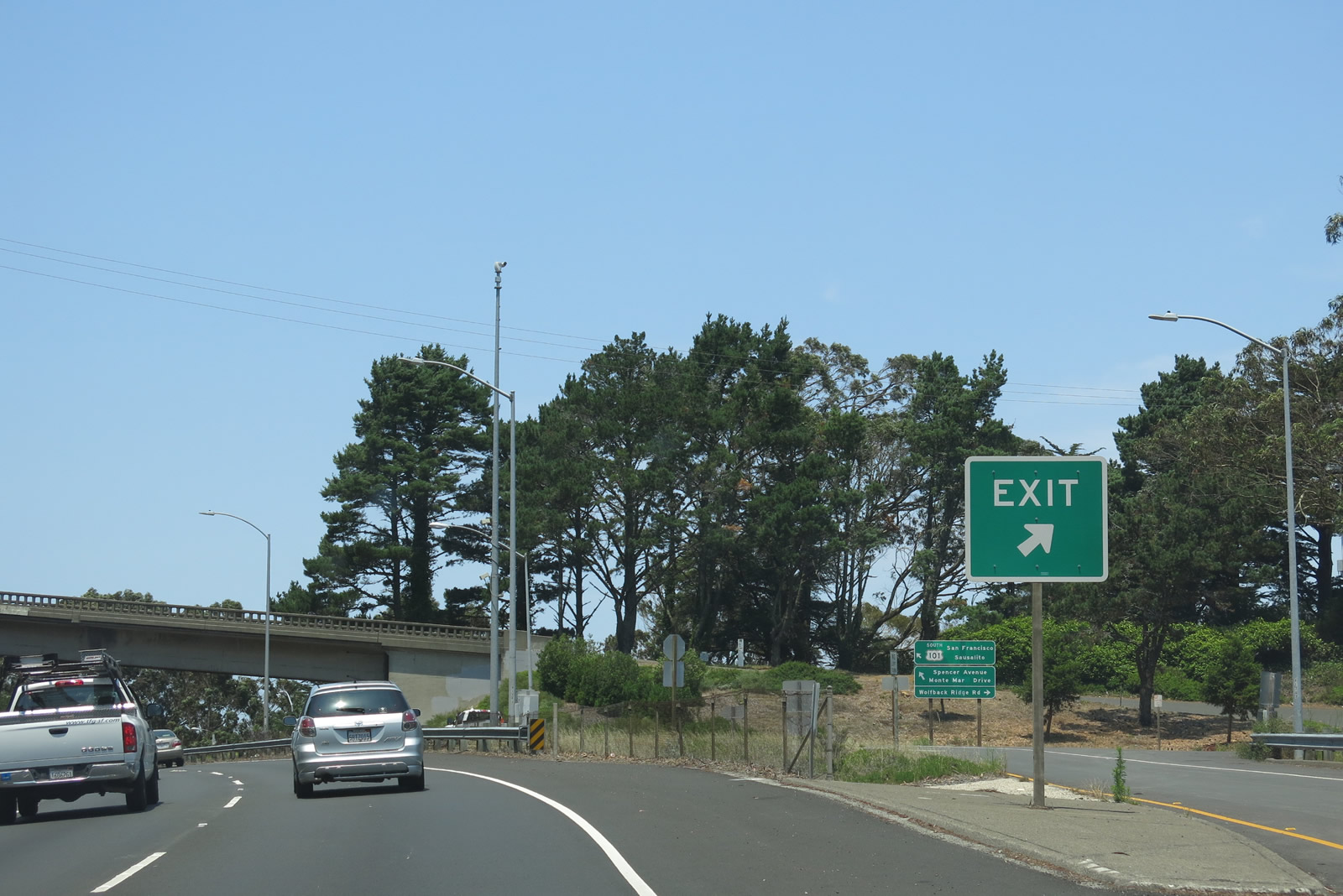
The off-ramp to Exit 443 includes a connection to southbound U.S. 101 (Redwood Highway) and California 1 (although the state route is not mentioned on these signs). Photo taken 07/02/13. |
|
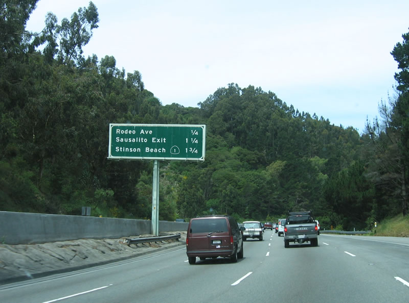
This mileage sign along northbound U.S. 101 (Redwood Highway) and California 1 provides the distance to Exit 444, Rodeo Avenue; Exit 445A, Bridge Way; and Exit 445B, California 1 (Shoreline Highway) north. Photo taken 07/02/13. |
|
A route marker assembly featuring both U.S. 101 and California 1 is posted after the on-ramp from Spencer Avenue and Monte Mar Drive. Photo taken 07/02/13. |
|
Another mileage sign along U.S. 101 (Redwood Highway) and California 1 provides the distances to the same destinations as the preceding sign: Exit 444, Rodeo Avenue; Exit 445A, Bridge Way; and Exit 445B, California 1 (Shoreline Highway) north. Photo taken 05/26/06. |
|
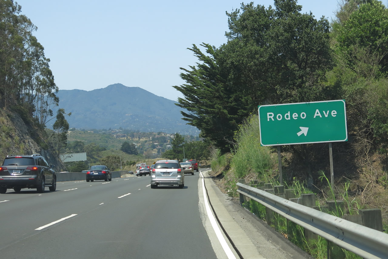
Northbound U.S. 101 and California 1 meet Exit 444, Rodeo Avenue to Sausalito. Photo taken 07/02/13. |
|
The off-ramp to Exit 444 (Rodeo Avenue) still had no exit number as of 2013. Photo taken 05/26/06. |
|
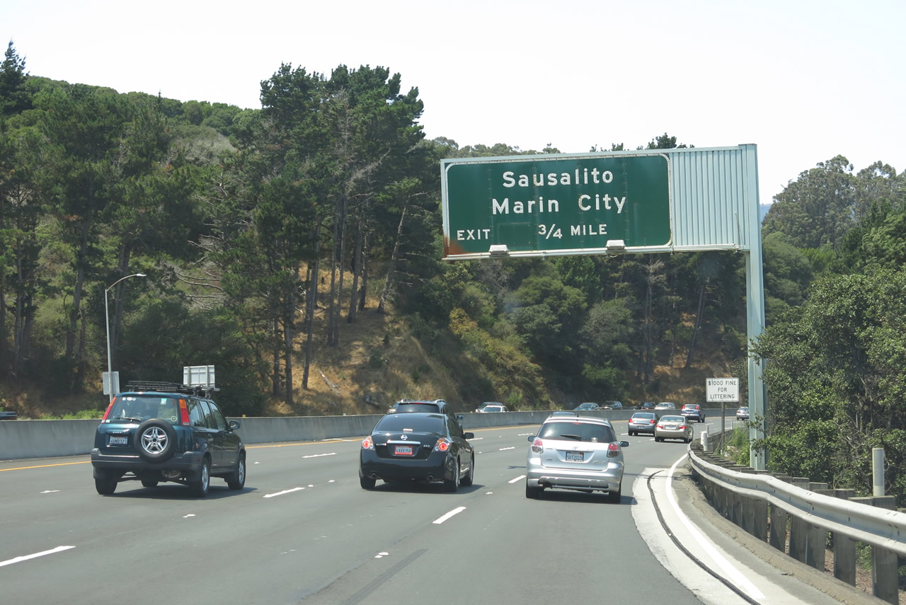
The next exit along northbound U.S. 101 (Redwood Highway) and California 1 is Exit 445A, Bridge Way to Sausalito and Marin City. This off-ramp provides access to the Marin County city of Sausalito, a picturesque city that rests on the shores of the bay with incredible views of San Francisco and the Golden Gate. Photo taken 05/26/06. |
|
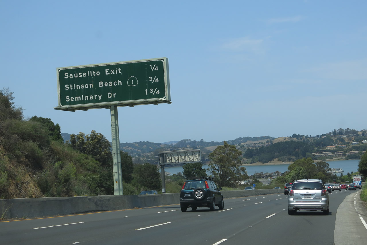
This mileage sign along northbound U.S. 101 (Redwood Highway) and California 1 provides the distance to the next three exits: Exit 445A, Bridge Way; Exit 445B, California 1 north; and Exit 446, Seminary Drive. Photo taken 07/02/13. |
|
Northbound U.S. 101 (Redwood Highway) and California 1 meet Exit 445A, Bridge Way to Sausalito and Marin City. Sausalito sits along the bay, while Marin City sits just west of the freeway. Photo taken 07/02/13. |
|
|
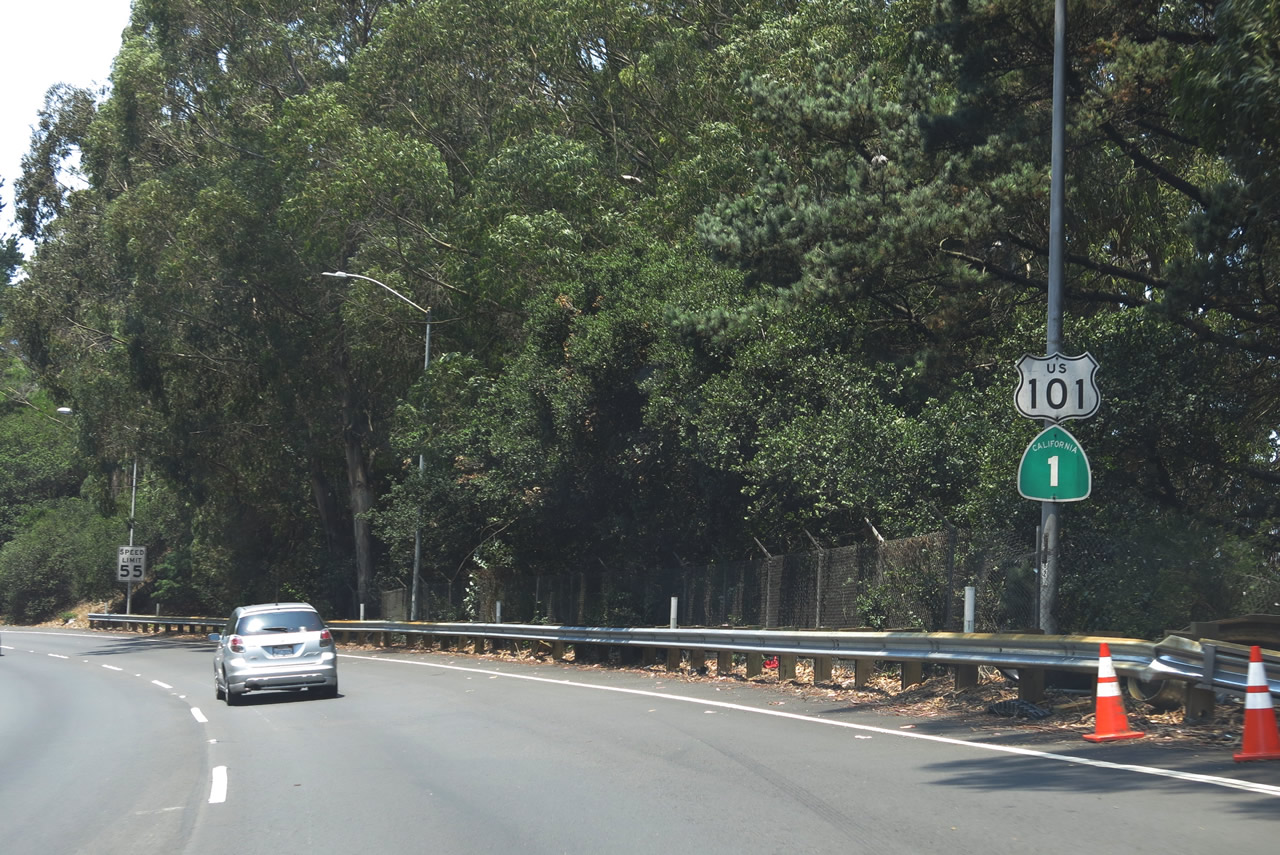
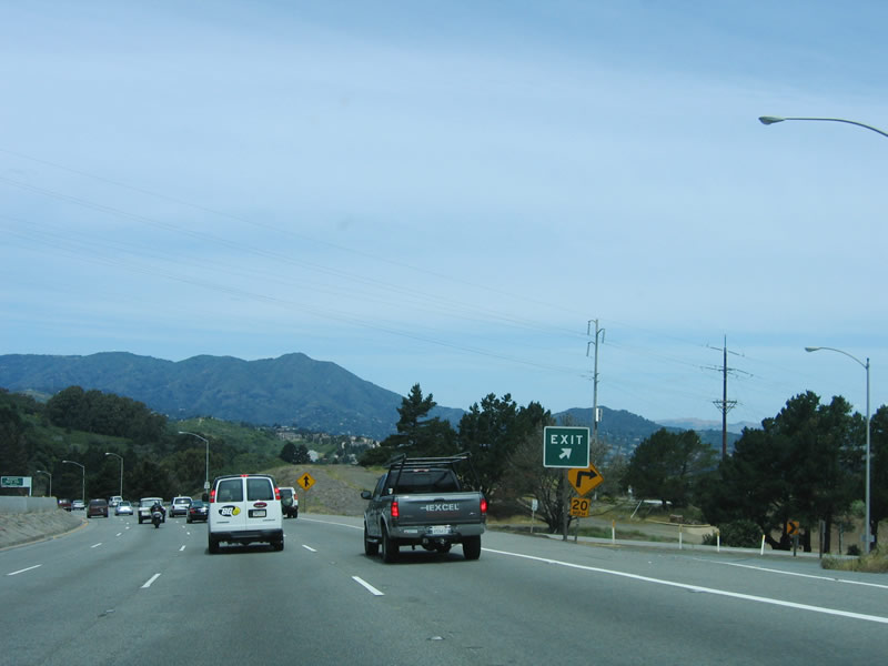
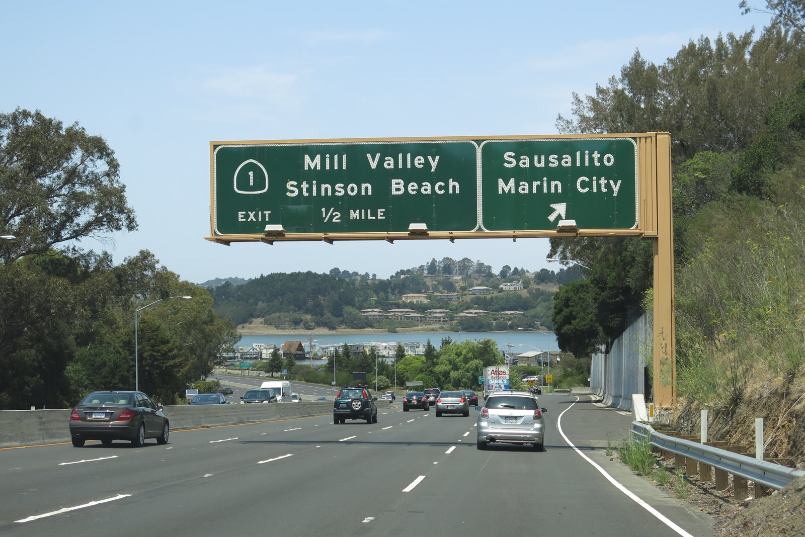
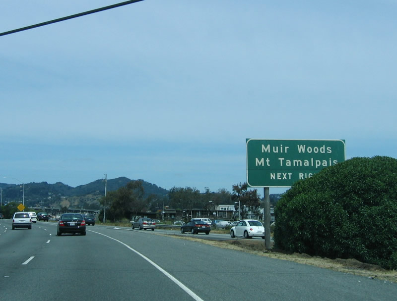
California 1 continues its course up the Pacific Ocean coast, with connections to Muir Woods National Monument (famous for being the filming location for the forest moon of Endor in Star Wars: Return of the Jedi) and Mount Tamalpais via the Panoramic Highway. An exit number sign was in place here by 2013. Photos taken 07/02/13 and 05/26/06. |
|
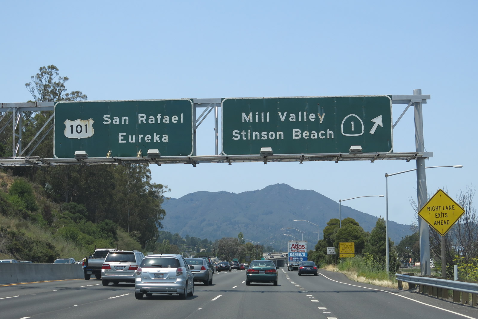
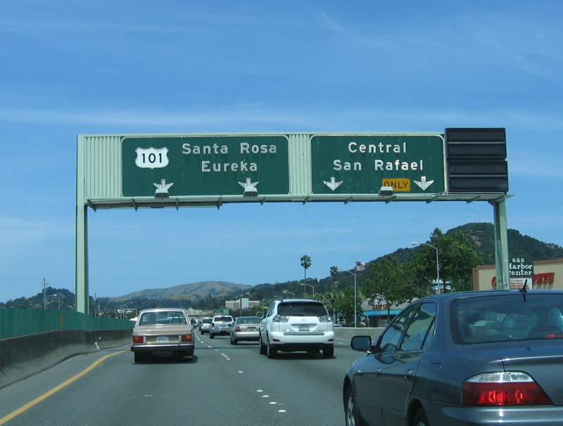
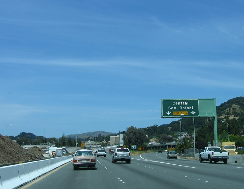
For the last time, northbound U.S. 101 separates from California 1 at Exit 445B; California 1 will trace the coastline through Marin, Sonoma, and Mendocino Counties before returning to U.S. 101 at Leggett, which is the northern terminus of California 1. California 1 passes through more picturesque seaside communities such as Bodega Bay and Mendocino, and it passes along the eastern fringe of the Point Reyes National Seashore. Photo taken 07/02/13. |
|
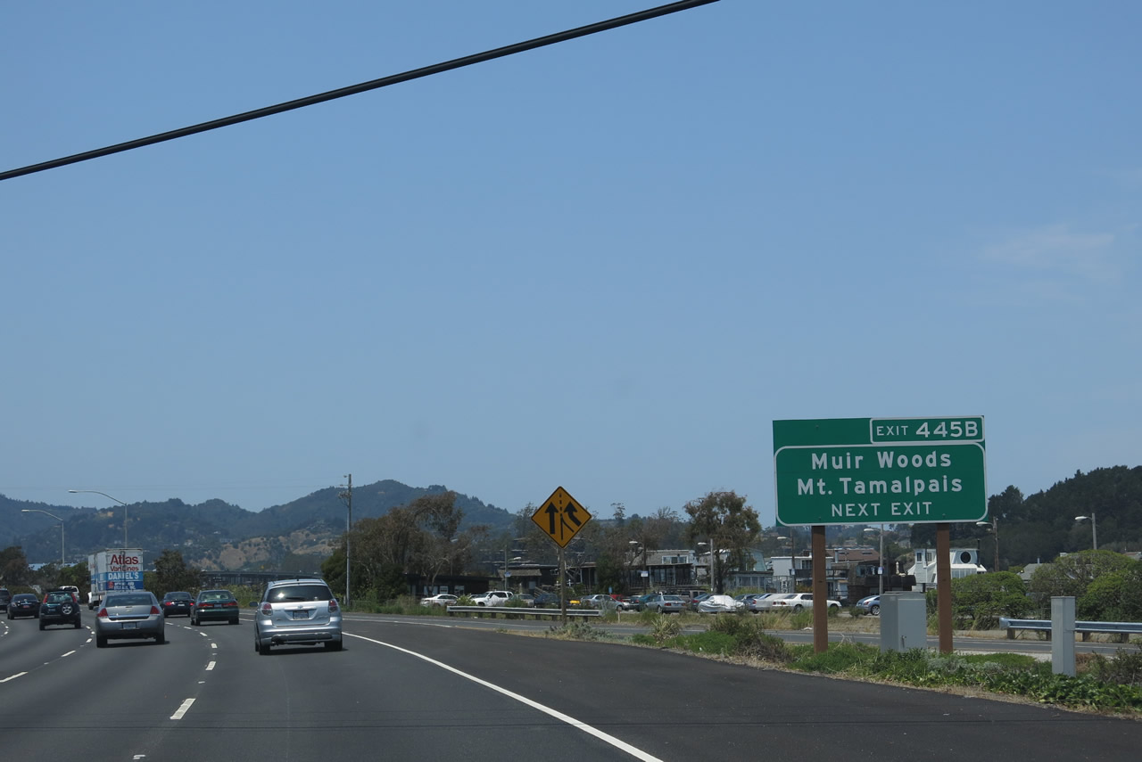
Larger vehicles are not recommended to use California 1 north due to its winding path as it heads toward Muir Woods, Stinson Beach, and Point Reyes. Photo taken 07/02/13. |
| U.S. 101 (Redwood Highway) north |
|
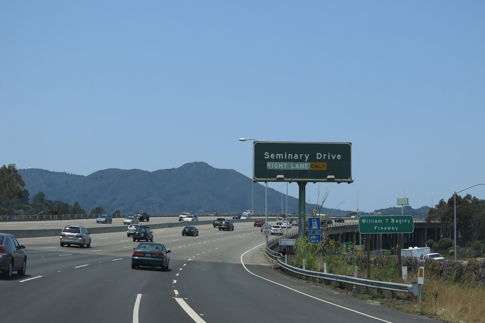
The next exit along northbound U.S. 101 (Redwood Highway) is Exit 446, Seminary Drive. U.S. 101 passes over a branch of Richardson Bay here, just east of Tamalpais Valley. Photo taken 07/02/13. |
|
|
|
|
| This bridge carries U.S. 101 (Redwood Highway) over Richardson Bay, prior to the Seminary Drive interchange (Exit 446). A U.S. 101 reassurance shield is posted at the foot of the bridge. Photos taken 07/02/13 and 05/26/06. |
|
Northbound U.S. 101 (Redwood Highway) reaches Exit 446, Seminary Drive. Photo taken 07/02/13. |
|
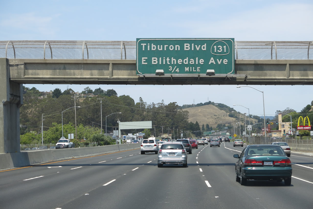
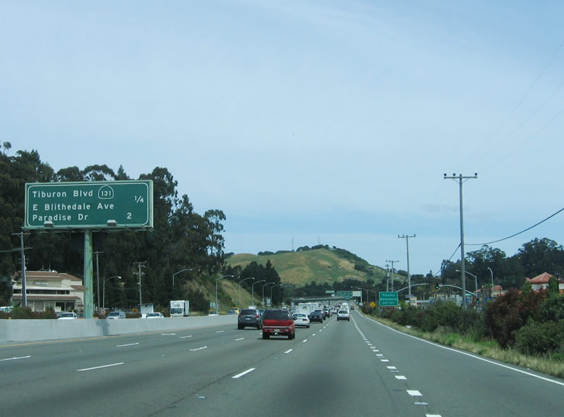
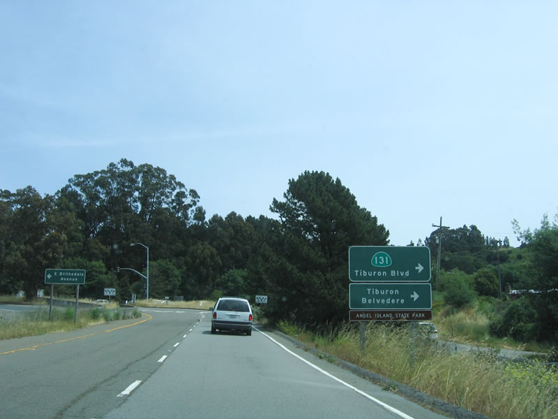
The next exit on northbound U.S. 101 (Redwood Highway) is Exit 447, California 131/Tiburon Boulevard east to Tiburon and East Blithedale Avenue west to Mill Valley (0.75 mile). This interchange serves as the western terminus of California 131. Photo taken 07/02/13. |
|
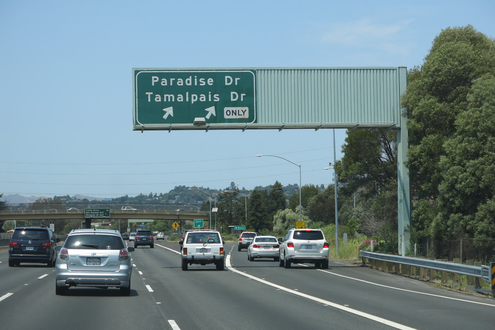
This mileage sign is located along northbound U.S. 101 (Redwood Highway) and provides the distance to Exit 447, California 131/Tiburon Boulevard and East Blithedale Avenue and Exit 449, Paradise Drive and Tamalpais Drive. Taking this exit to the west leads into the heart of Mill Valley. Photo taken 05/26/06. |
|
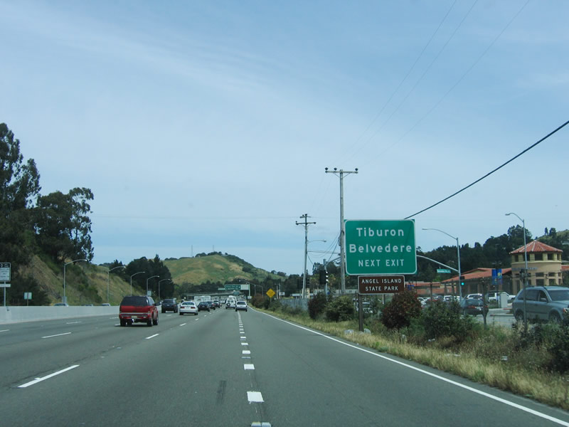
Use Exit 447, California 131/Tiburon Boulevard and East Blithedale Avenue to Tiburon and Belvedere as well as Angel Island State Park. At one time, a suspension bridge was proposed from downtown San Francisco north to Angel Island and then northwest to Tiburon, ultimately connecting with California 131. This bridge was never built, but plans remain in the California Department of Transportation Library's historical files. Photo taken 05/26/06. |
|
Northbound U.S. 101 meets Exit 447, California 131. The state route travels east along Tiburon Boulevard to Tiburon, which is located at the tip of a peninsula and offers incredible views of the bay and city of San Francisco. California 131 ends in downtown Tiburon. This interchange was constructed in 1956. Photo taken 05/26/06. |
|
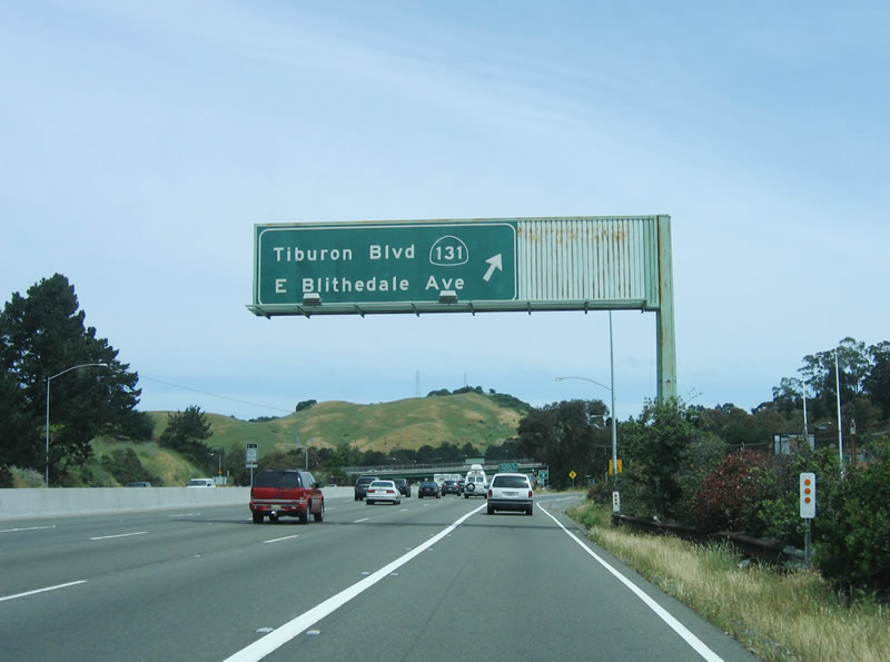
Now on the off-ramp to California 131, turn right to follow California 131 east to Tiburon, Belvedere, and Angel Island State Park. Turn left to follow East Blithedale Avenue into the city of Mill Valley (population 13,903 as of the 2010 Census and incorporated on September 1, 1900). Photo taken 05/26/06. |
|
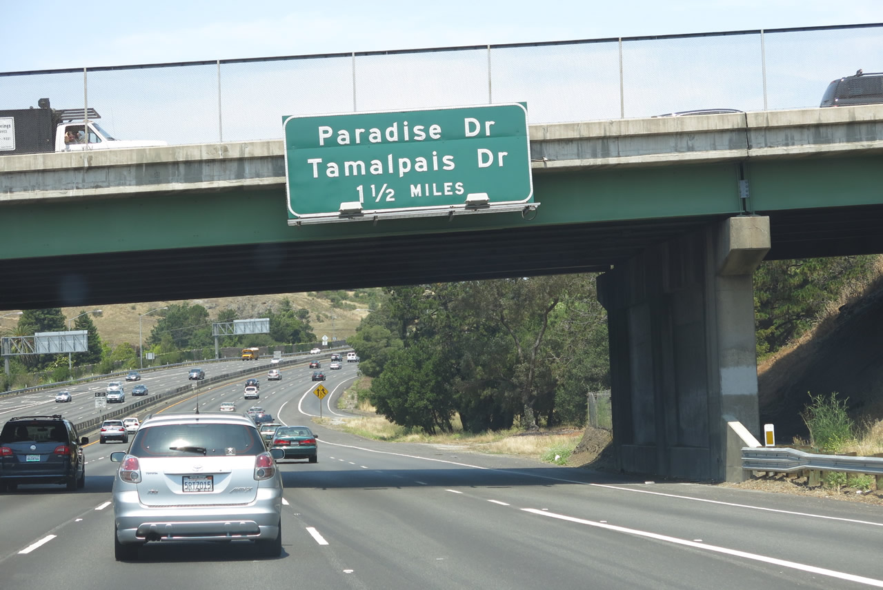
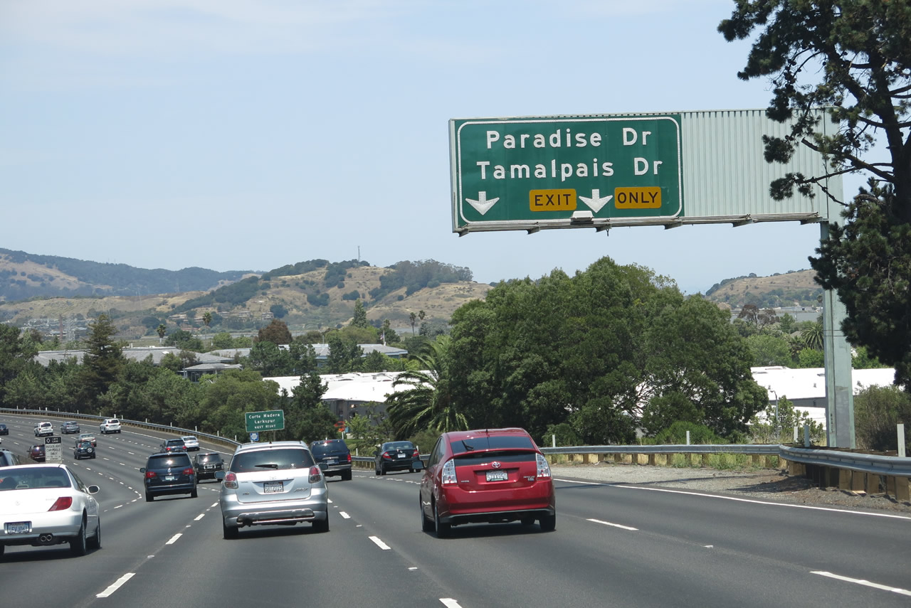
The next exit on northbound U.S. 101 (Redwood Highway) is Exit 449, Paradise Drive and Tamalpais Drive (1.50 miles). Photo taken 07/02/13. |
|
A U.S. 101 north reassurance shield shield is posted after the on-ramp from California 131. Photo taken 07/02/13. |
|
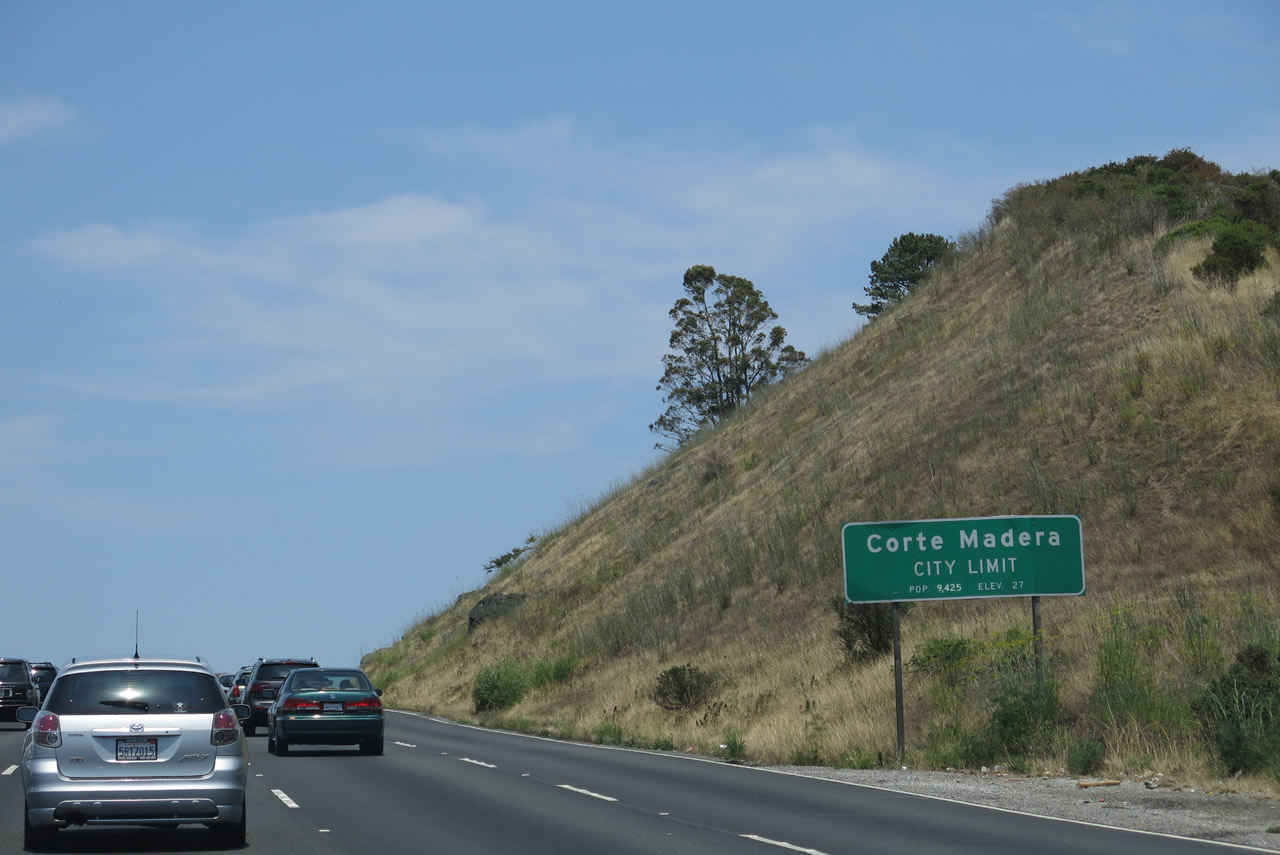
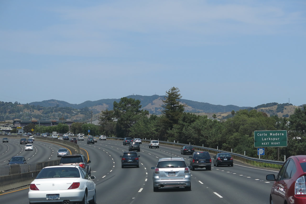
U.S. 101 enters the town of Corte Madera, which was incorporated on June 10, 1916, and had a population of 9,253 as of the 2010 Census. Photo taken 07/02/13. |
|
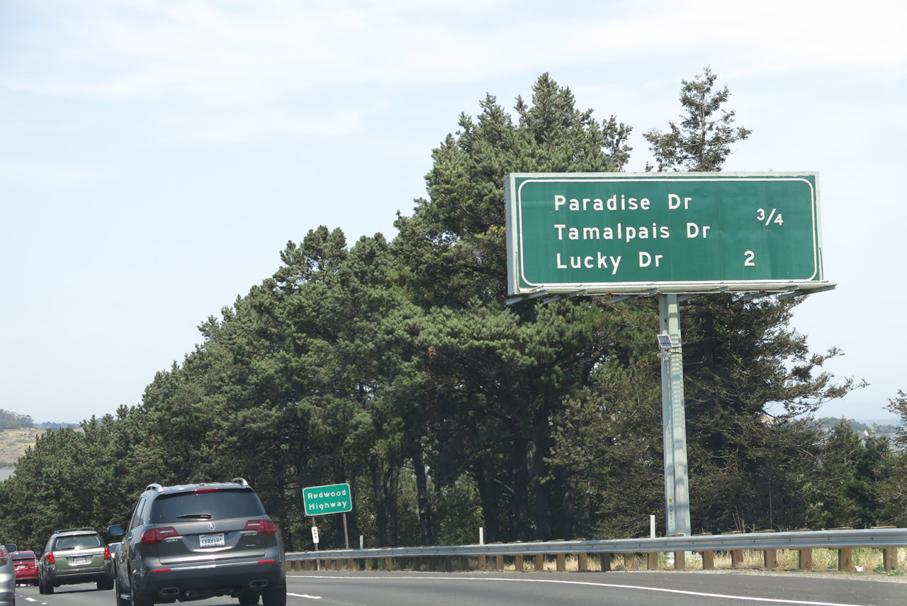
This mileage sign along northbound U.S. 101 (Redwood Highway) provides the distance to the next two interchanges: Exit 449, Paradise Drive and Tamalpais Drive and Exit 450A, Lucky Drive. Photo taken 07/02/13. |
|
The right two lanes of northbound U.S. 101 (Redwood Highway) connect to Exit 449, Paradise Drive and Tamalpais Drive, next right. Mt. Tamalpais, which dominates the Marin skyline to the west of here, is best known for its outstanding hiking and driving trails. The mountain rises high above the headlands below, and it offers spectacular views of the ocean and San Francisco on clear days. Photo taken 07/02/13. |
|
In addition to serving the town of Corte Madera, U.S. 101 also serves the city of Larkspur, which had a population of 11,926 as of the 2010 Census and was incorporated on March 1, 1908. Photo taken 07/02/13. |
|
Northbound U.S. 101 (Redwood Highway) reaches Exit 449, Paradise Drive and Tamalpais Drive. Photo taken 05/26/06. |
|
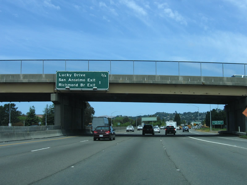
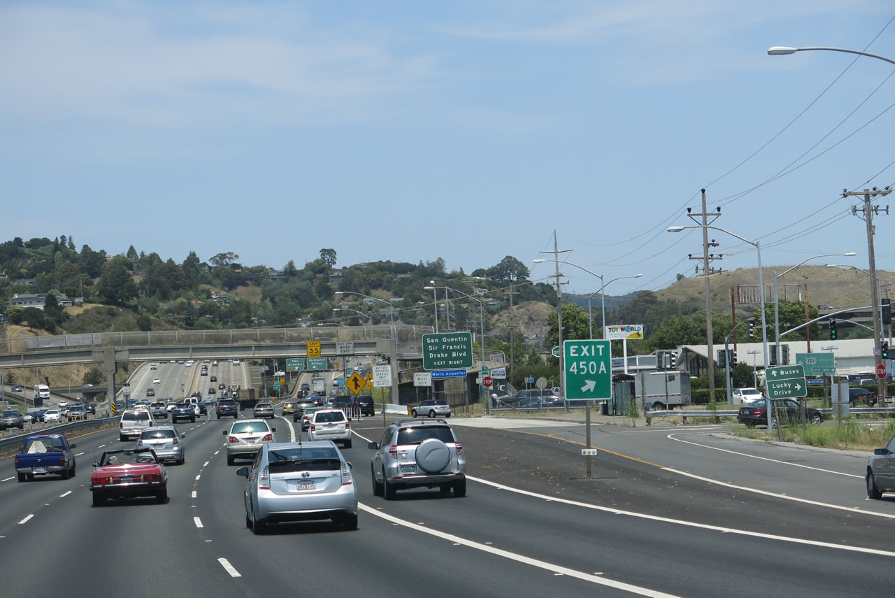
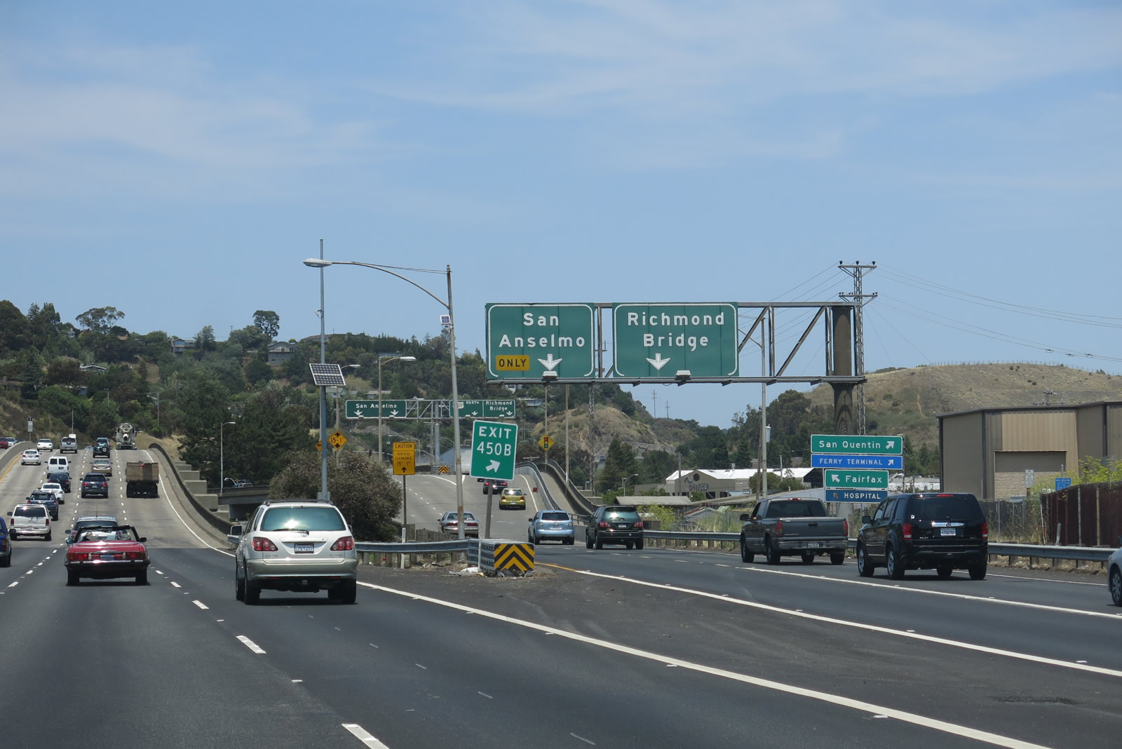
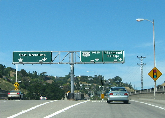
This mileage sign is located along northbound U.S. 101 (Redwood Highway) prior to Exit 450A, Lucky Drive and Exit 450B, Sir Francis Drake Boulevard. For some reason, Drake Boulevard is only listed on two of the five advance signs for Exit 450B. The other times, it is signed as "San Anselmo/Richmond Bridge." This is confusing, considering that Exit 451 also provides a short cut to San Quentin State Prison and the Interstate 580/Richmond-San Rafael Bridge. Photo taken 05/26/06. |
|
The next exit along northbound U.S. 101 (Redwood Highway) is Exit 450A, Lucky Drive and Exit 450B, Sir Francis Drake Boulevard. Photo taken 05/26/06. |
|
The next two exits along U.S. 101 north are Exit 450A (Lucky Drive) and Exit 450B (Sir Francis Drake Boulevard and Richmond Bridge). Exit 450B connects to Sir Francis Drake Boulevard, which leads east to the infamous San Quentin State Prison. The next exit (not signed) is Lucky Drive, Exit 450A. Notice how both signs have the same exit number, which is accurate. This sign was also in place in 2006, making it one of the earliest exit number installations along the Marin County stretch of U.S. 101. Photo taken 07/02/13. |
|
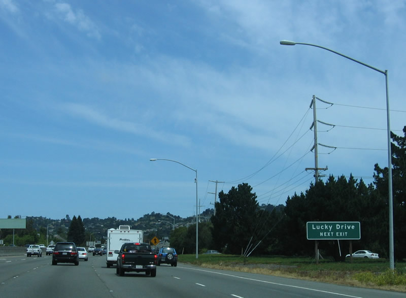
Northbound U.S. 101 (Redwood Highway) rises over a hill. The off-ramp to Exit 450A, Lucky Drive comes into view. This interchange is oddly configured and is not Interstate standard due to limited sight distance and limited deceleration lanes. Photo taken 05/26/06. |
|
Northbound U.S. 101 (Redwood Highway) reaches Exit 450A, Lucky Drive. Photo taken 07/02/13. |
|
These signs are mounted on a pedestrian overcrossing along northbound U.S. 101 (Redwood Highway) approaching Exit 450B, Sir Francis Drake Boulevard. Drake Boulevard leads east to San Quentin and the Richmond Bridge (it's shorter than going all the way to Interstate 580) and northwest to Ross and San Anselmo. Photo taken 05/26/06. |
|
Through traffic on northbound U.S. 101 may decide to use the collector distributor lanes of Exit 450B; there is no need for that traffic to merge onto the main lanes. Photo taken 05/26/06. |
|
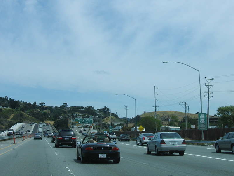
Signage for the Richmond Bridge and San Anselmo off-ramp is visible from the mainline of U.S. 101 north. Photo taken 07/02/13. |
|
|
Still looking at the collector distributor lanes, the left lanes depart to the left, while the right lanes exit onto the Richmond Bridge exit as well as provide a connection to northbound U.S. 101. Photos taken 07/02/13 and 05/26/06. |
|
|
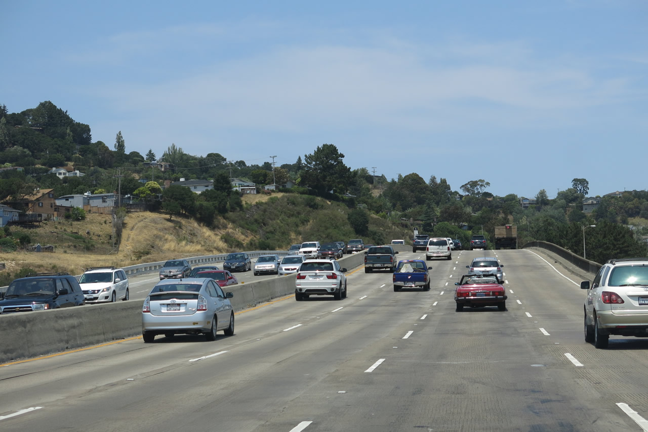
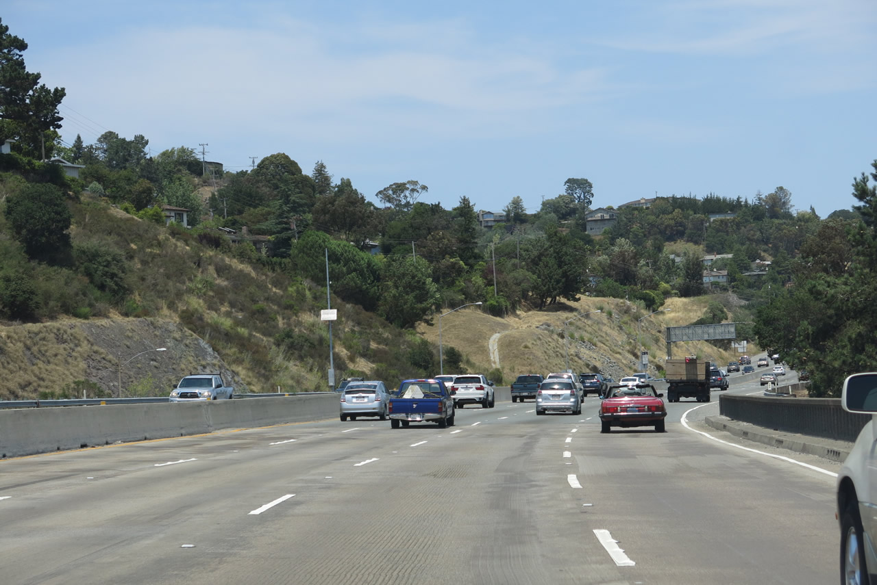
Plenty of traffic flows along northbound U.S. 101 as we pass through the Sir Francis Drake Boulevard interchange complex. Photos taken 07/02/13. |
|
|
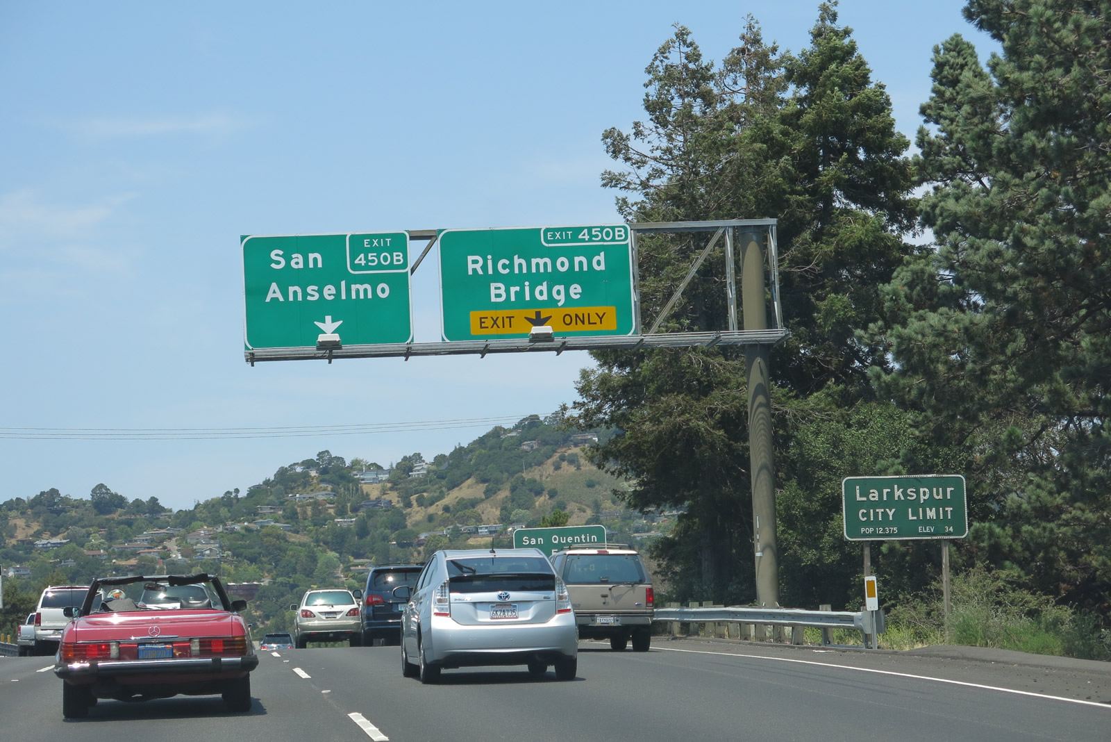
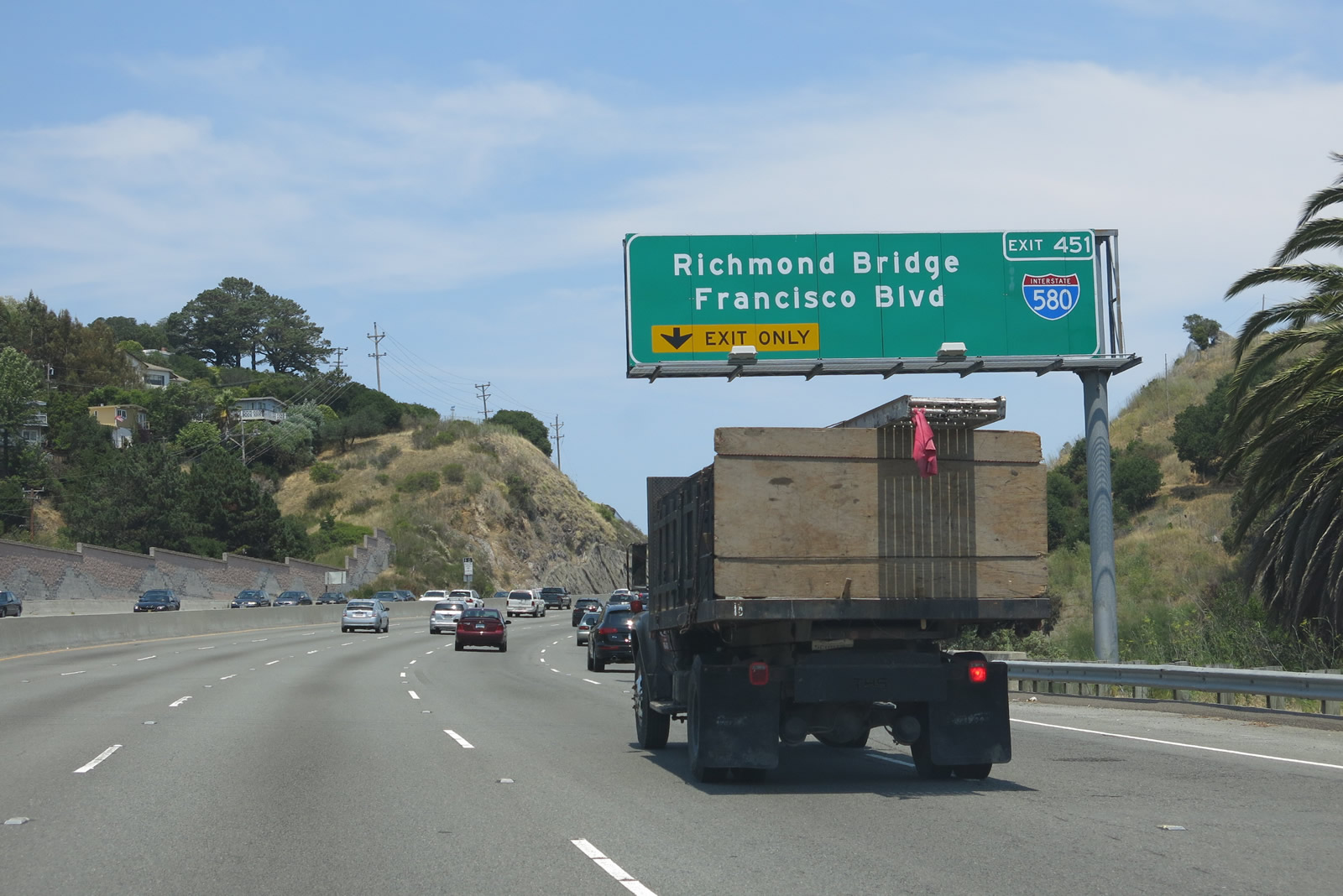
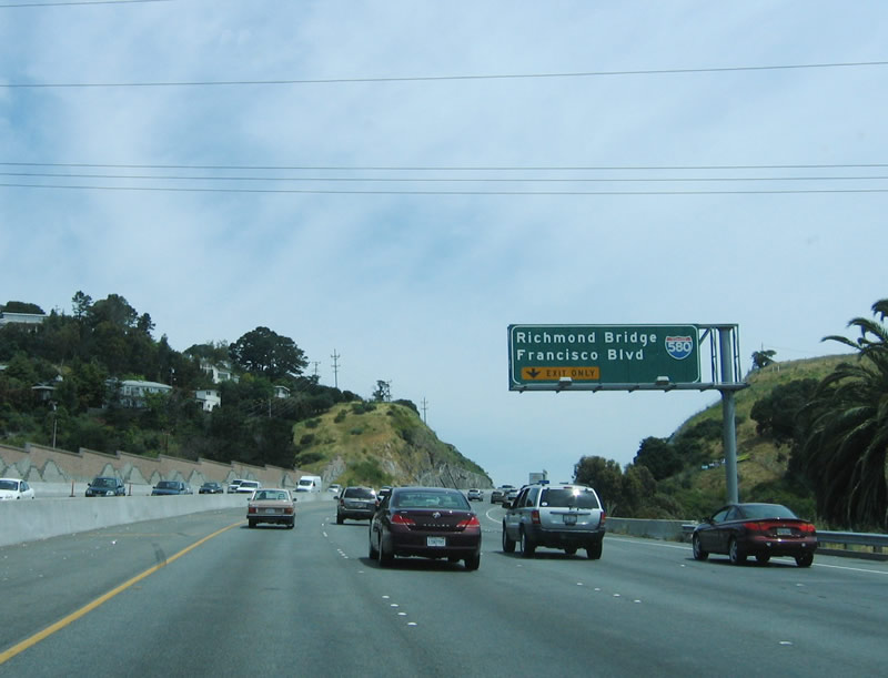
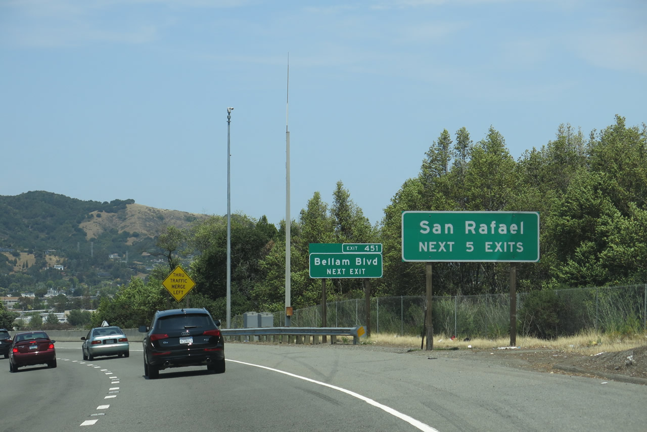
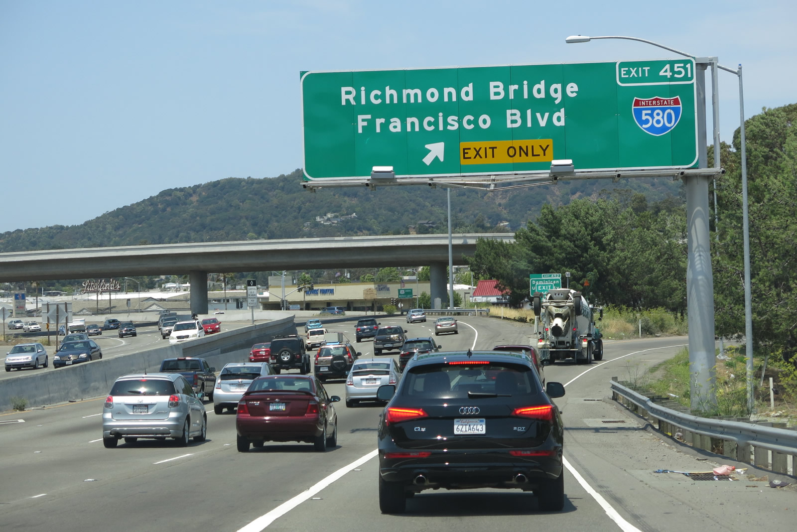
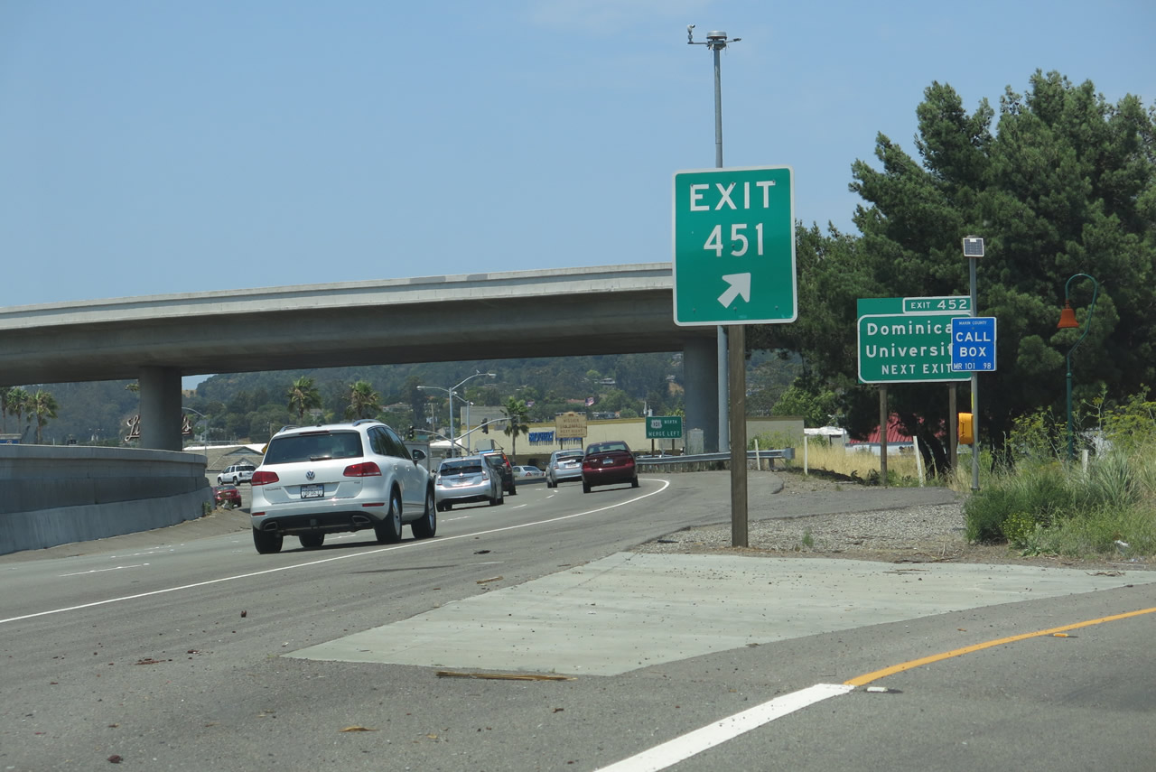
The next interchange along U.S. 101 north is Exit 451, Bellam Boulevard to Interstate 580. A major Bay Area freeway, Interstate 580 departs U.S. 101 at Exit 451 to cross over the northern San Francisco Bay over the Richmond-San Rafael bridge and meet Interstate 80 east of Richmond. Resuming in Oakland, Interstate 580 passes through Hayward, Pleasanton, and Dublin before crossing the Altamont Pass and descending into the Central Valley. It terminates at Interstate 5 southeast of Tracy and north of Vernalis. Photos taken 07/02/13 and 05/26/06. |
|
|
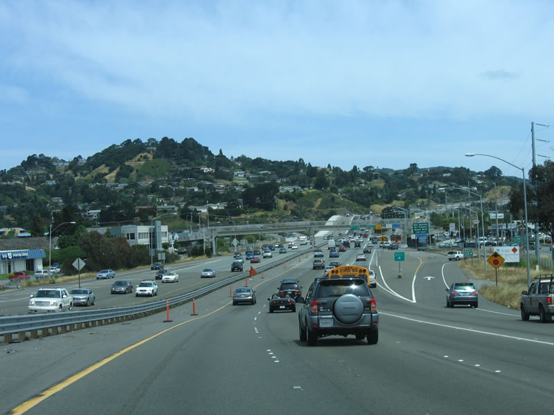
The next five exits along U.S. 101 (Redwood Highway) north serve the city San Rafael (population 57,713 as of the 2010 Census and incorporated on February 18, 1874), which is the seat of Marin County. Photos taken 07/02/13. |
|
|
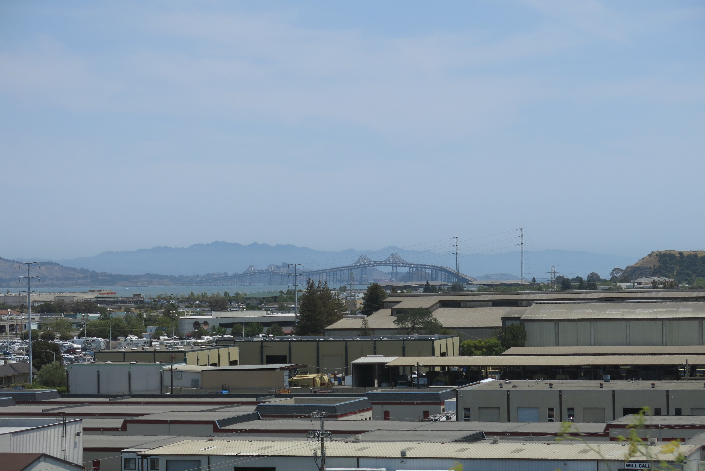
Looking to the east, we can see the Richmond-San Rafael Bridge crossing over San Pablo Bay. Ahead, a set of power lines cross over the freeway before the Bellam Boulevard interchange. Photos taken 07/02/13. |
|
|
Northbound U.S. 101 (Redwood Highway) meets Exit 451, Bellam Boulevard to Interstate 580/Richmond-San Rafael Bridge east to Richmond and Oakland. Use Interstate 580 east to Richmond, Berkeley, Oakland, Tracy, Stockton, and Los Angeles. This interchange was improved in 2009. Photos taken 07/02/13 and 05/26/06. |
|
|
|
|
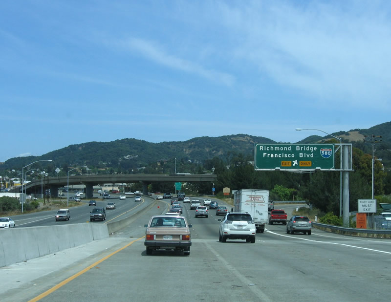
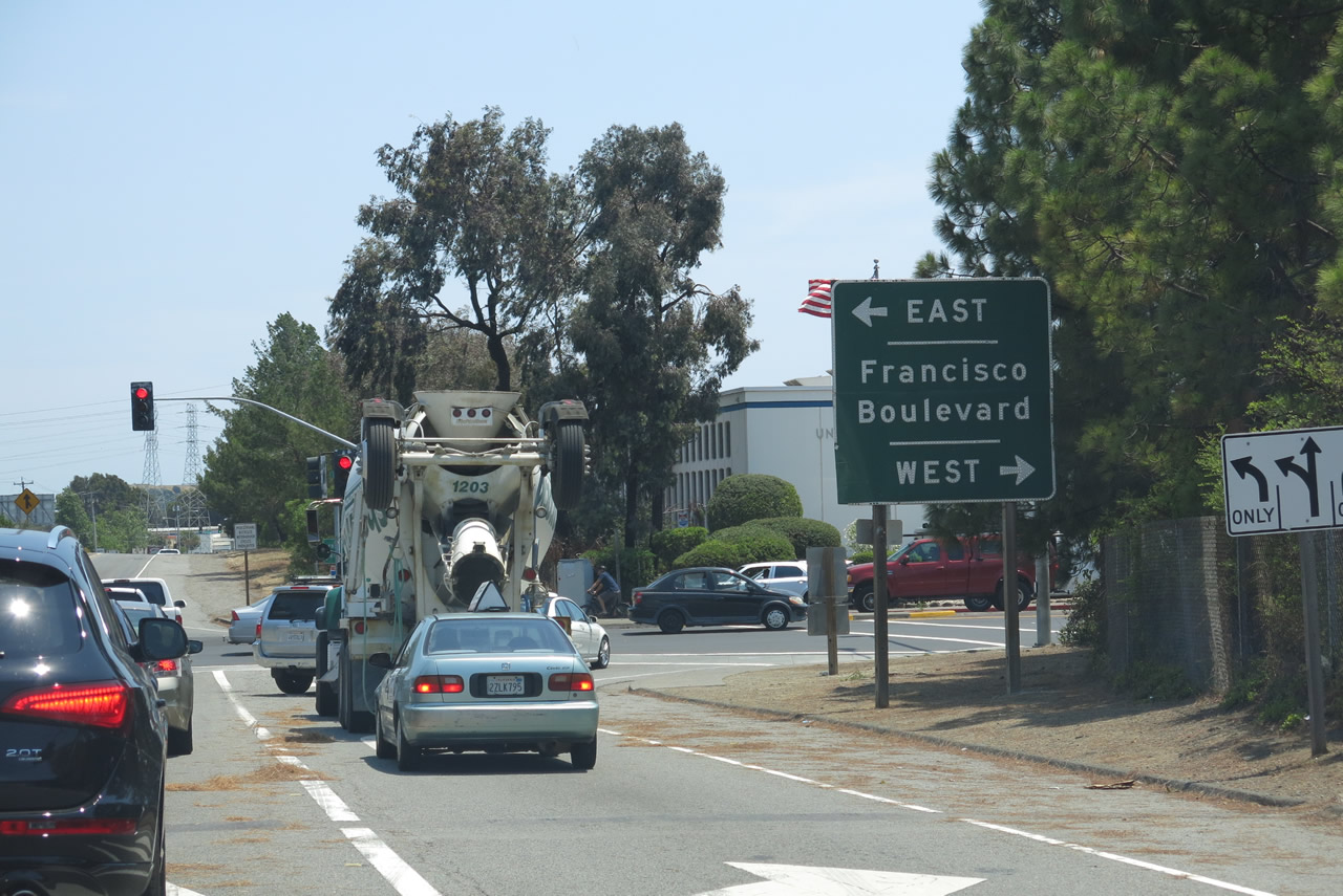
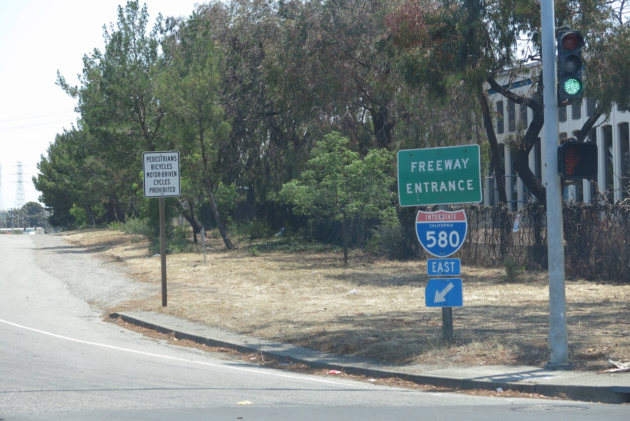
| This series of pictures follows the connection from U.S. 101 north to Interstate 580 east. Motorists must pass through one traffic signal (with Francisco Boulevard) before connecting with the Interstate 580 mainline. Photos taken 07/02/13. |
|
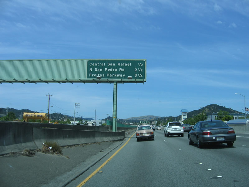
Returning to the mainline, the next exit along northbound U.S. 101 (Redwood Highway) is Exit 452, 2nd Street/3rd Street (Central San Rafael), one-half mile. U.S. 101 passes over downtown San Rafael on an elevated viaduct that was built and expanded to its current configuration in stages between 1941, 1965, and 1971. San Rafael was incorporated on February 18, 1874, and is home to 56,900 people (California Department of Finance 2005 estimate). Photo taken 05/26/06. |
|
Third Street leads west through town as a one-way street, then merges onto 4th Street and Red Hill Avenue upon reaching the city of San Anselmo. Second Street leads east out of downtown as a one-way street, then merges with Third Street en route to Point San Pedro Road. This route ultimately becomes a circle with North San Pedro Road, passing through vast open space lands. Photo taken 05/26/06. |
|
Northbound U.S. 101 (Redwood Highway) reaches Exit 452, 2nd and 3rd Street (Central San Rafael). The Central Rafael off-ramp connects to 2nd and 3rd Street in downtown San Rafael. This interchange also provides connections to a bus stop located below the downtown viaduct. Photo taken 05/26/06. |
|
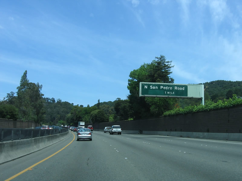
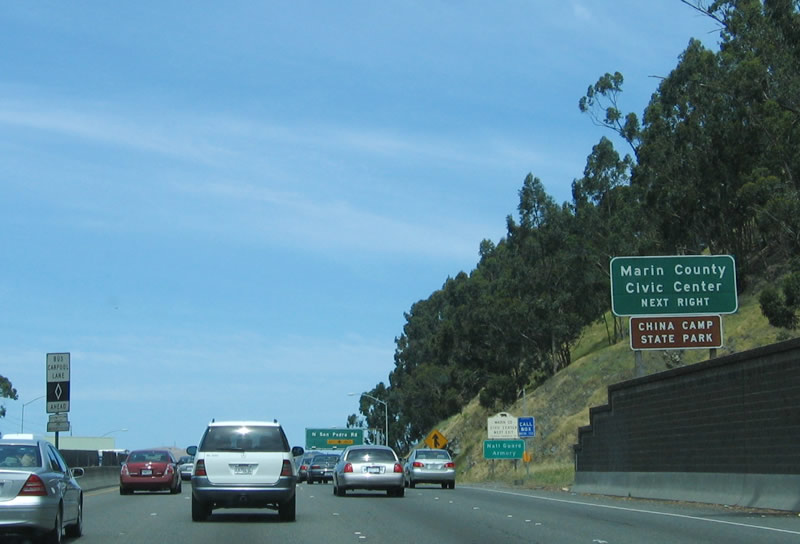
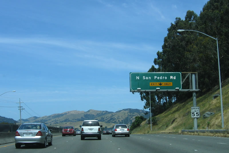
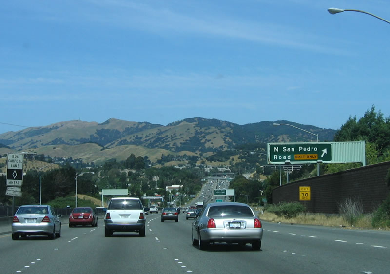
The next exit along northbound U.S. 101 (Redwood Highway) is Exit 454, North San Pedro Road, one mile. The Marin County Civic Center is located at this exit; take eastbound North San Pedro Road to Civic Center Drive north. Photo taken 05/26/06. |
|
Exit 454, North San Pedro Road leads northeast into Santa Venetia, with access to the San Pedro Mountain Open Space Preserve and the north side of the China Camp State Park. Photo taken 05/26/06. |
|
The right lane of northbound U.S. 101 (Redwood Highway) becomes exit only for Exit 454, North San Pedro Road. The left four lanes continue north along U.S. 101. Photo taken 05/26/06. |
|
Northbound U.S. 101 (Redwood Highway) reaches Exit 454, North San Pedro Road. Photo taken 05/26/06. |
|
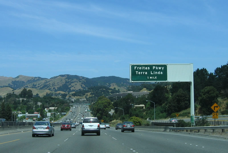
Coming to a rise on U.S. 101, this spacious valley opens up along northbound as it approaches the Freitas Parkway exit (Exit 455). Photo taken 05/26/06. |
|
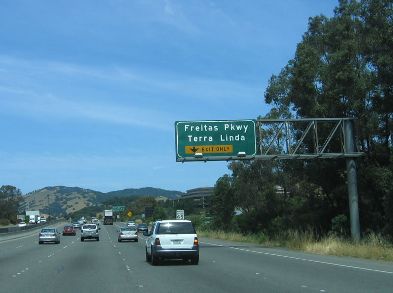
The right lane exits directly onto Freitas Parkway (Exit 455) in San Rafael. The left four lanes continue north along U.S. 101. Photo taken 05/26/06. |
|
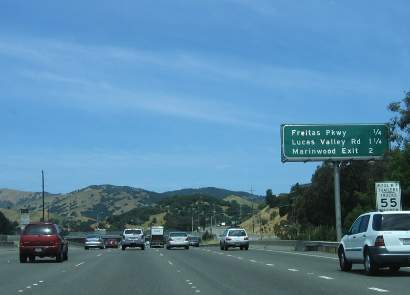
This mileage sign provides the distance to the next three exits along northbound U.S. 101: Exit 455, Freitas Parkway; Exit 456, Lucas Valley Road; and Exit 457, Marinwood. Photo taken 05/26/06. |
|
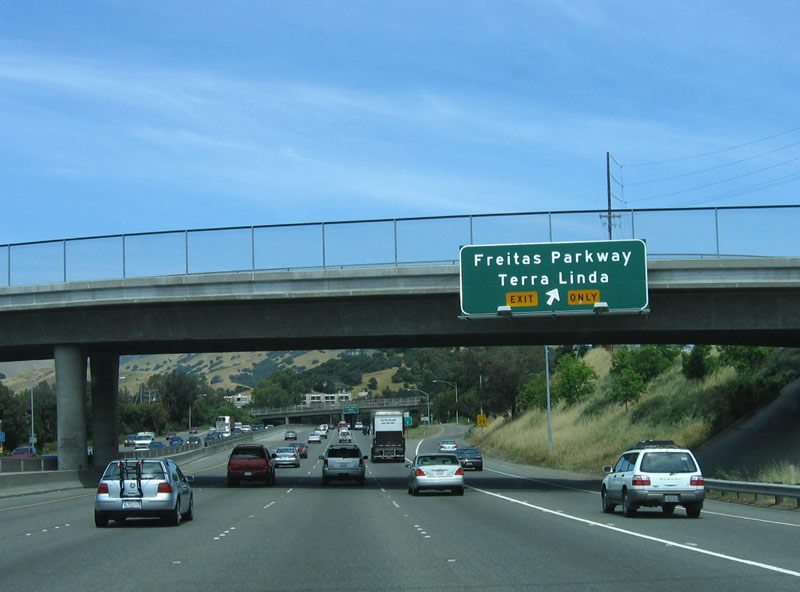
Northbound U.S. 101 (Redwood Highway) reaches Exit 455, Freitas Parkway, which leads northwest to Las Gallinas Avenue and Terra Linda, the northernmost community of the city of San Rafael. Photo taken 05/26/06. |
|
Of particular interest to science fiction fans is the exit leading to the home of the creator of Star Wars, George Lucas. While it is no phantom menace, one needs to pay close attention for Lucas' house (Skywalker Ranch) located on the north side of Lucas Valley Road. Just look for the tall fences and warning signs. Was Lucas Valley Road named for George Lucas? No, but his ranch is located along Lucas Valley Road nonetheless. Photo taken 05/26/06. |
|
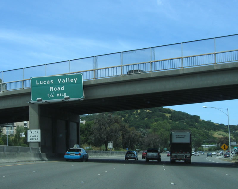
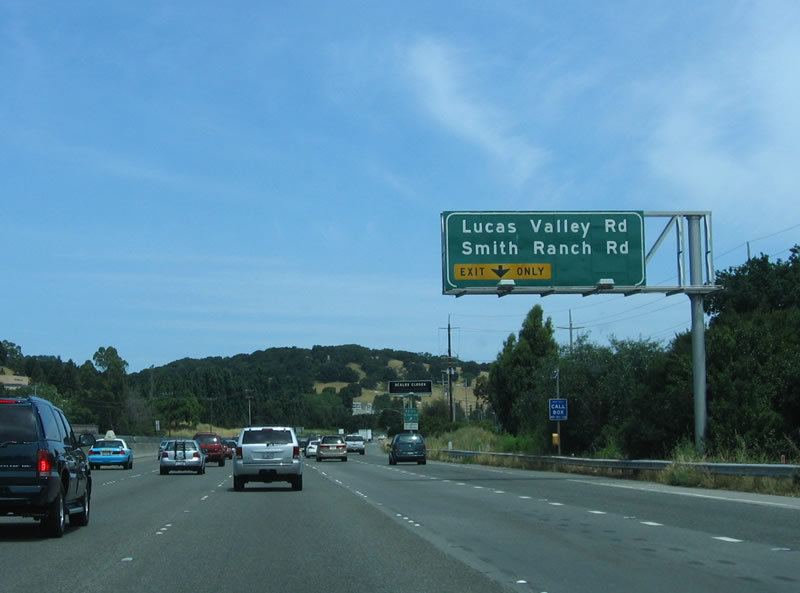
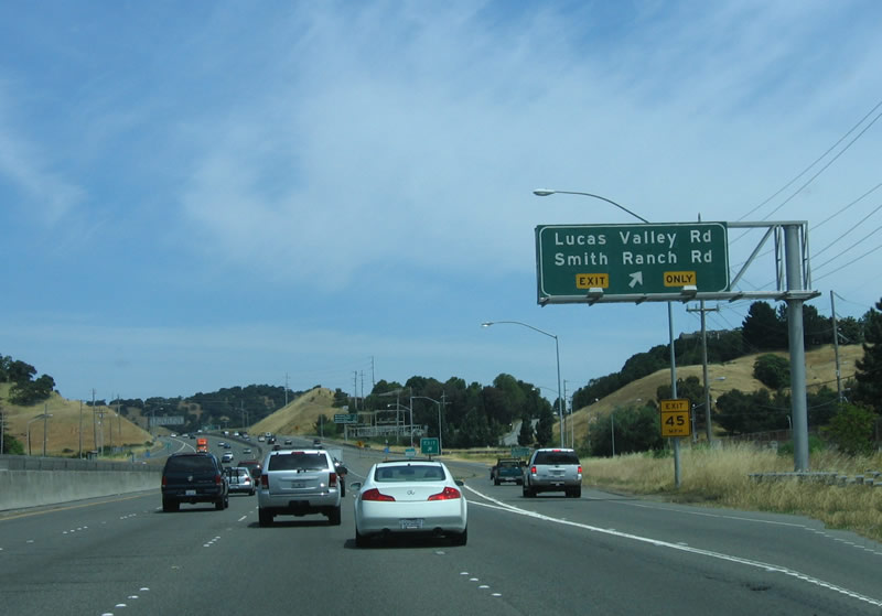
U.S. 101 north approaches Lucas Valley Road and Smith Ranch Road. Photo taken 05/26/06. |
|
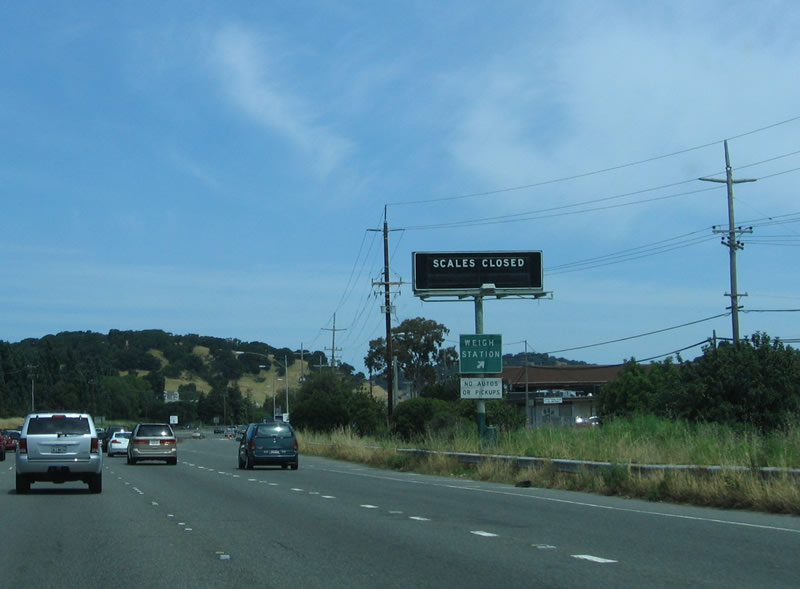
A weigh station is located within Exit 456, Lucas Valley Road and Smith Ranch Road. Photo taken 05/26/06. |
|
Exit 456 leaves U.S. 101 north for Lucas Valley Road to Skywalker Ranch. Photo taken 05/26/06. |
|
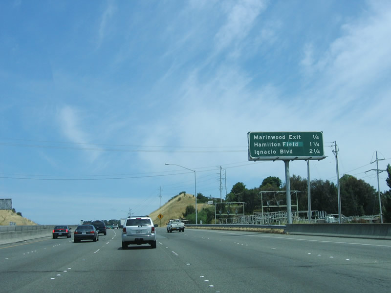
This mileage sign is found along northbound U.S. 101 after the Lucas Valley Road and Smith Ranch Road off-ramp and prior to Exit 457, St. Vincent Drive and Marinwood. Photo taken 05/26/06. |
|
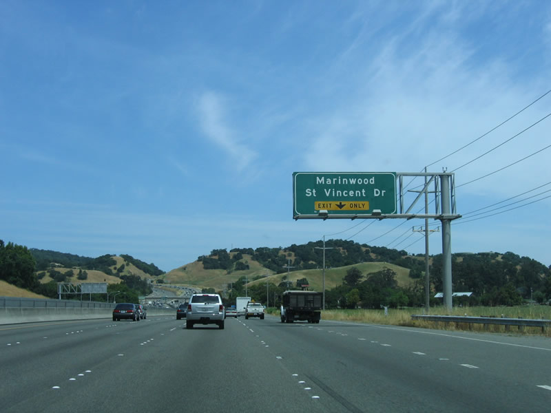
The next exit along northbound U.S. 101 is Exit 457, St. Vincent Drive and Marinwood. The right lane becomes exit only for Exit 457. Photo taken 05/26/06. |
|
Northbound U.S. 101 (Redwood Highway) reaches Exit 457, St. Vincent Drive and Marinwood. Photo taken 05/26/06. |
|
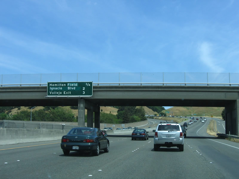
The next exit along northbound U.S. 101 at Exit 458, Nave Drive and Hamilton Field. The freeway now enters the city of Novato, the last city along northbound before leaving Marin County and entering Sonoma County. Photo taken 05/26/06. |
|
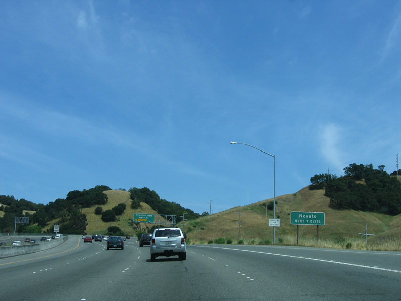
Novato is home to 47,630 people as of the 2000 Census and is the furthest north city along U.S. 101 before the highway leaves Marin County and enters Sonoma County. While the downtown elevation is 18 feet, Mt. Burdell within the city limits rises to 1,558 feet. The city was incorporated on January 20, 1960, as a general law city. Photo taken 05/26/06. |
|
The right lane becomes exit only for Exit 458, Nave Drive and Hamilton Field. The left four lanes continue north on U.S. 101 (Redwood Highway). Photo taken 05/26/06. |
|
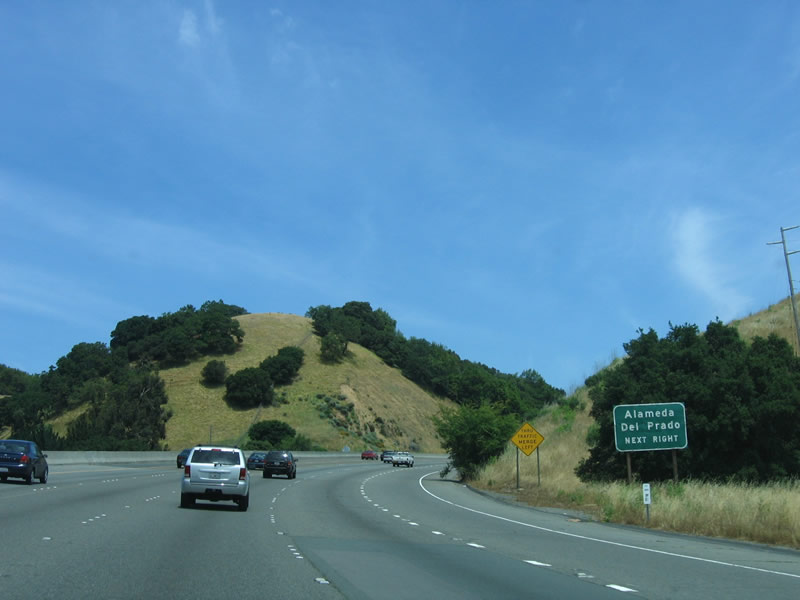
Use Exit 458 to Alameda del Prado, a local city street. It connects to Pacheco Valle Open Space Preserve, which features a 2.7-mile hike. Photo taken 05/26/06. |
|
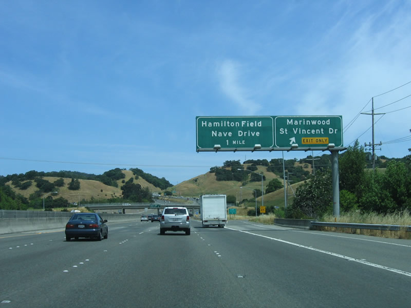
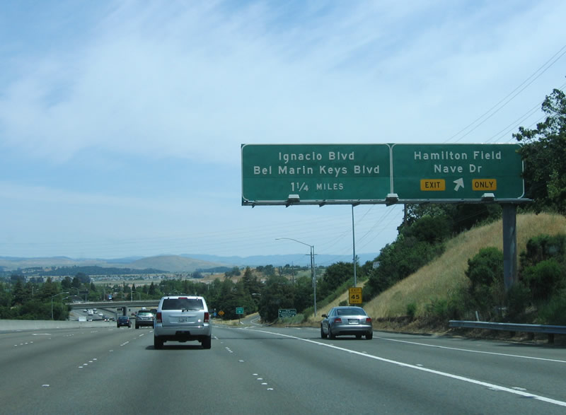
Northbound U.S. 101 (Redwood Highway) reaches Exit 458, Nave Drive, Hamilton Field, and Alameda del Prado. Photo taken 05/26/06. |
|
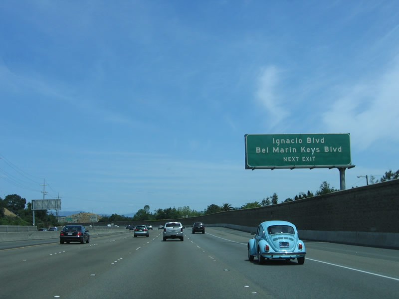
The next exit is Exit 459, Ignacio Boulevard and Bel Marin Keys Boulevard. Photo taken 05/26/06. |
|
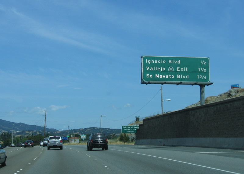
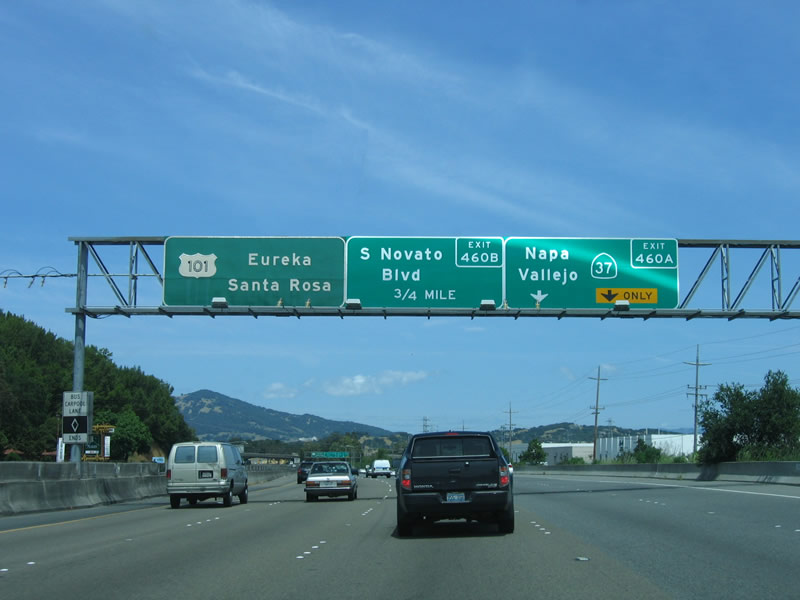
This mileage sign provides the distance to Exit 459, Ignacio Boulevard/Bel Marin Keys Boulevard; Exit 460A, California 37 east to Vallejo; and Exit 460B, South Novato Boulevard. Photo taken 05/26/06. |
|
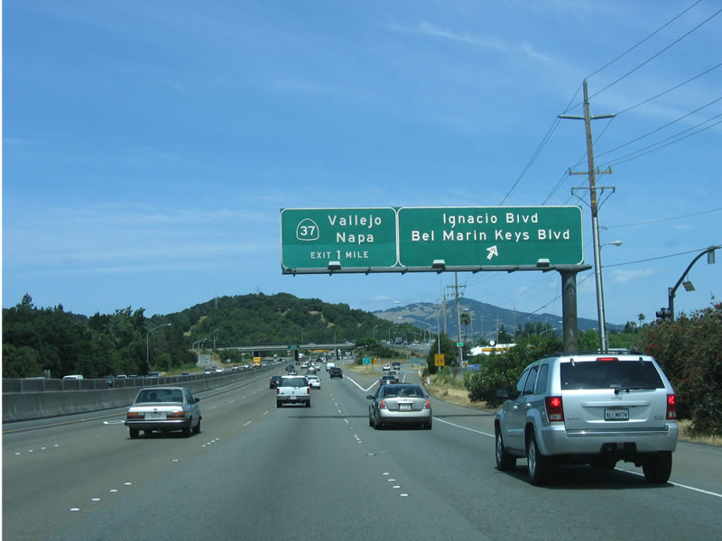
Northbound U.S. 101 meets Exit 459, Ignacio Boulevard and Bel Marin Keys Boulevard. The next exit is Exit 460A, California 37. Photo taken 05/26/06. |
|
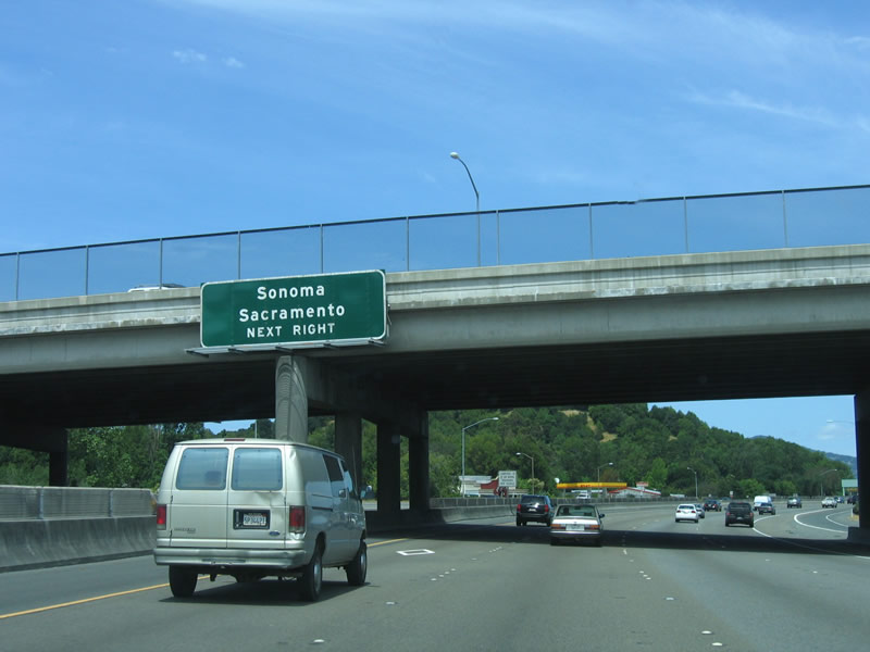
This sign indicates that Exit 460A, California 37 east is the best route to Sonoma and Sacramento, even though California 37 does not enter either city. However, California 37 and California 121 may be used to reach Sonoma and Napa, while California 37 connects to Interstate 80 in Vallejo. Interstate 80 continues northeast to Sacramento. Photo taken 05/26/06. |
|
Northbound U.S. 101 approaches Exit 460A, California 37 east. Exit 460B accesses South Novato Boulevard, which leads north into Novato (not to be confused with the business loop at Rowland Boulevard). Photo taken 05/26/06. |
|
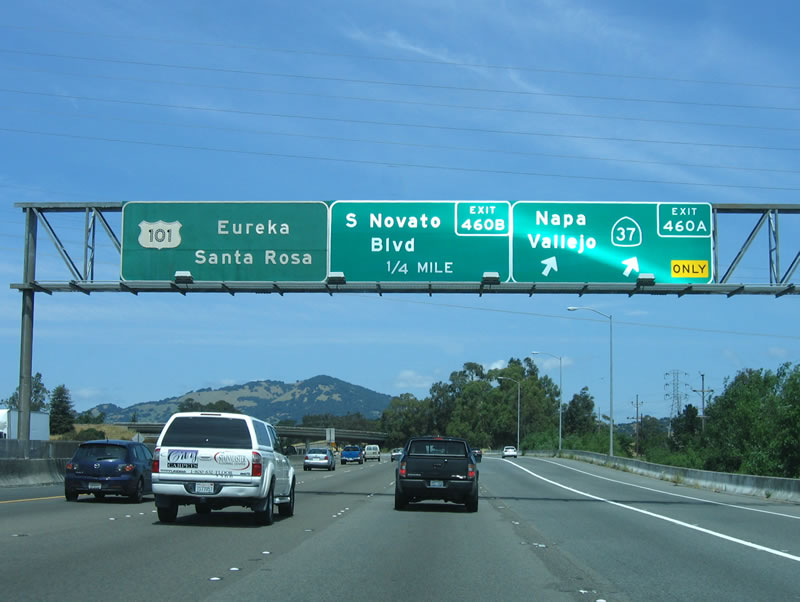
Northbound U.S. 101 reaches Exit 460A, eastbound California 37. While California 37 is marketed as the best route to Vallejo and Sacramento, it is not a freeway. The route from U.S. 101 to California 121 is an expressway, and the section of the route (former California 48) between California 121 and just west of the Vallejo city limits is merely a two-lane highway with passing lanes and a barrier between the two directions of traffic. This situation is dangerous and has contributed to a higher than normal frequency of accidents. Nicknamed "Blood Alley," California 37 will hopefully be expanded to four lanes for its entire length in the coming years (pending funding availability during the California Budget Crisis). Photo taken 05/26/06. |
|
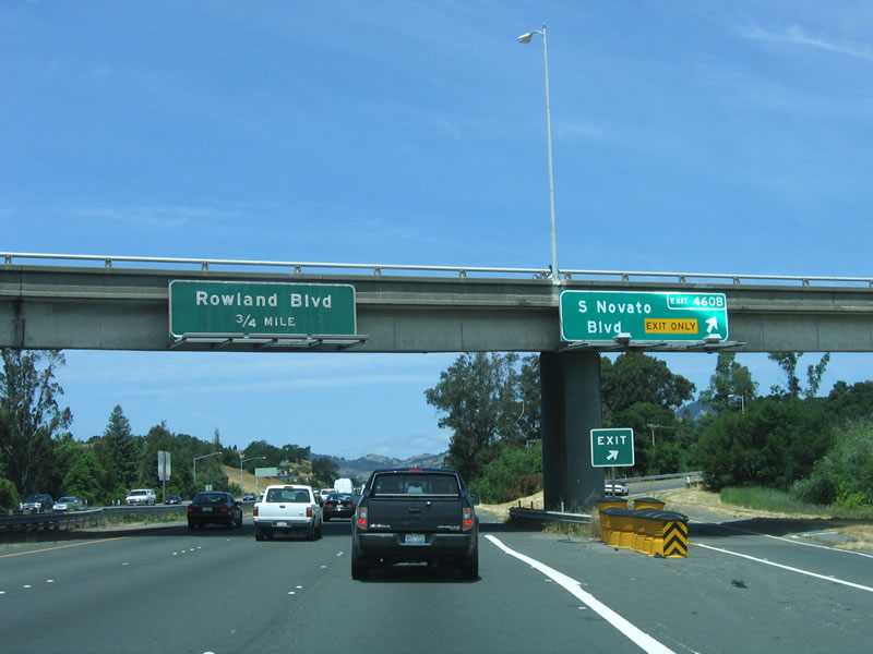
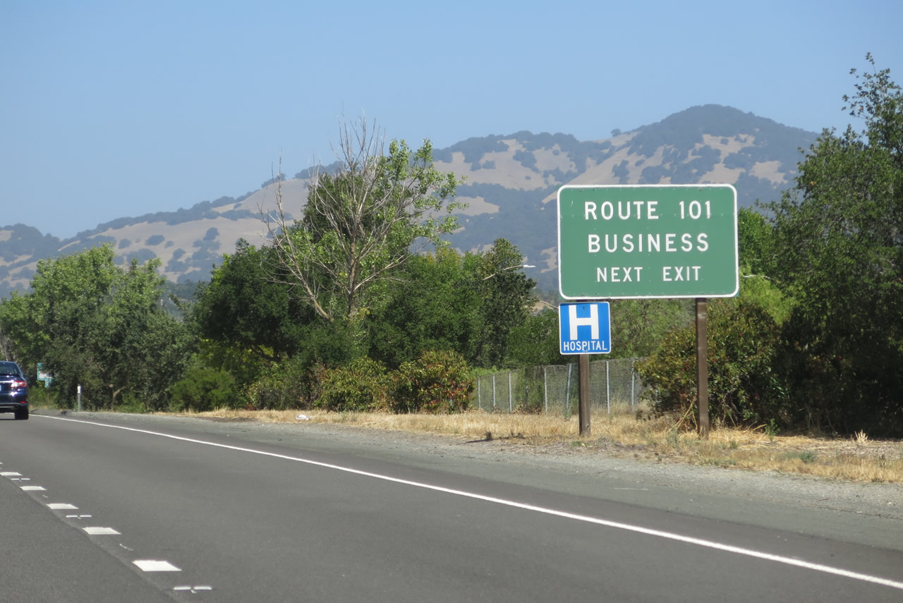
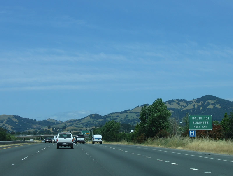
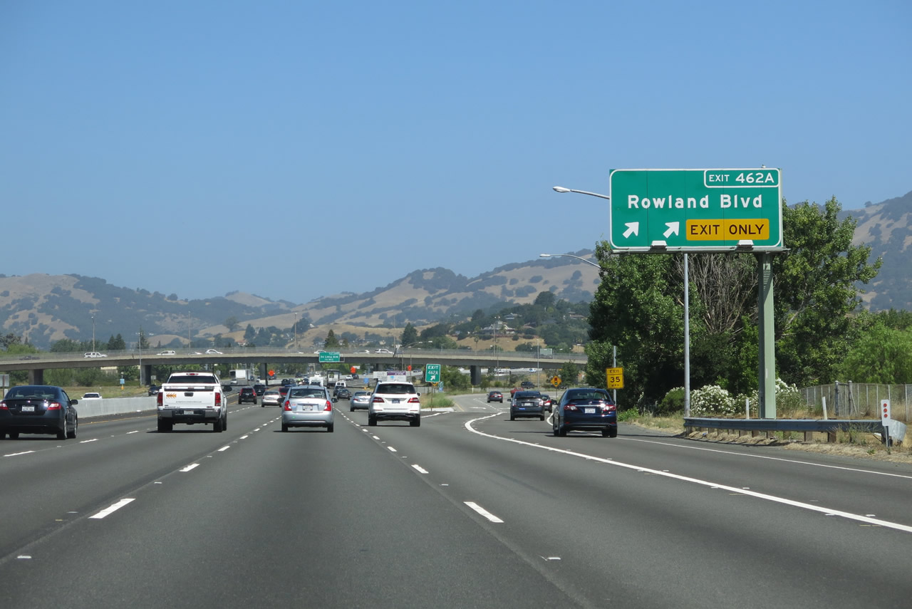
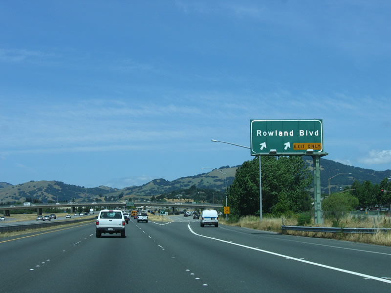
Northbound U.S. 101 (Redwood Highway) reaches Exit 460B, South Novato Boulevard. The next exit is Exit 462A, U.S. 101 Business/Rowland Avenue. Photo taken 05/26/06. |
|
|
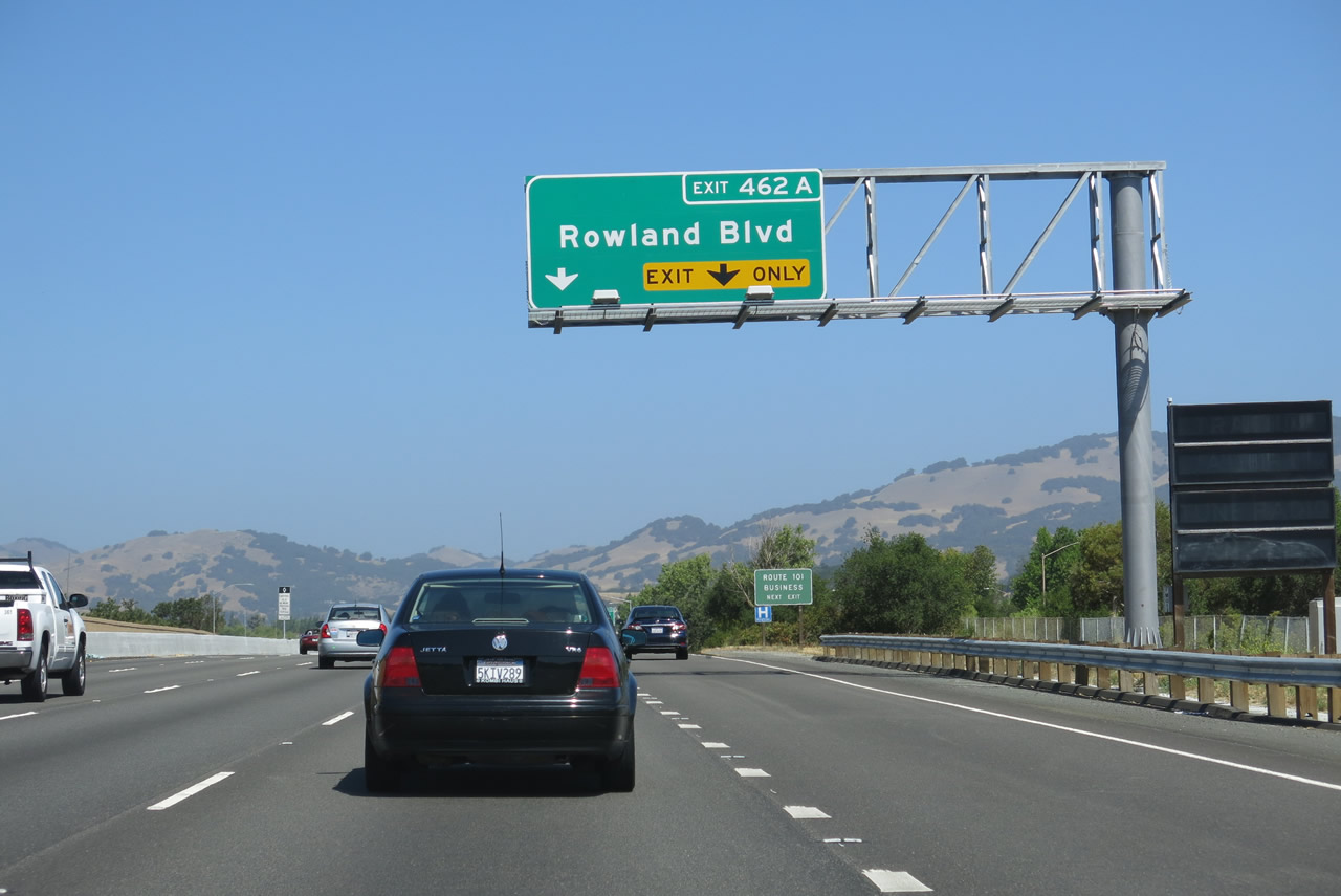
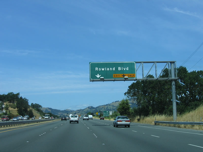
The next exit along U.S. 101 (Redwood Highway) north is Exit 462A, U.S. 101 Business/Rowland Avenue. This exit serves the city of Novato and is first business route along northbound U.S. 101 since leaving San Francisco. Beginning at Exit 462A, U.S. 101 Business is a fairly short business route that follows an old alignment of U.S. 101 through downtown Novato and returns to the freeway at Exit 463. Photos taken 07/05/13 and 05/26/06. |
|
|
A Route 101 Business sign is posted prior to the Rowland Avenue interchange. This is the only indication that Exit 462A serves a business route. Photos taken 07/05/13 and 05/26/06. |
|
|
Northbound U.S. 101 (Redwood Highway) reaches Exit 462A, U.S. 101 Business north and Rowland Boulevard. Rowland Boulevard east serves a major shopping center, which features retailers such as Costco, Target, and Marshall's. Photos taken 07/05/13 and 05/26/06. |
|
|
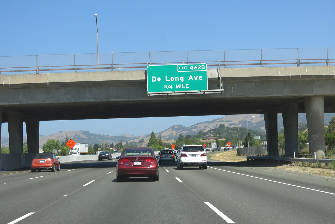
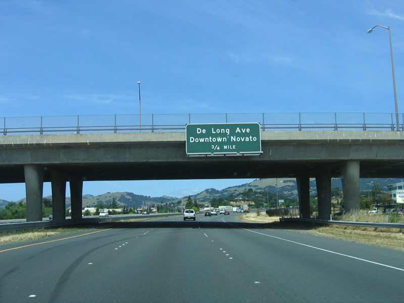
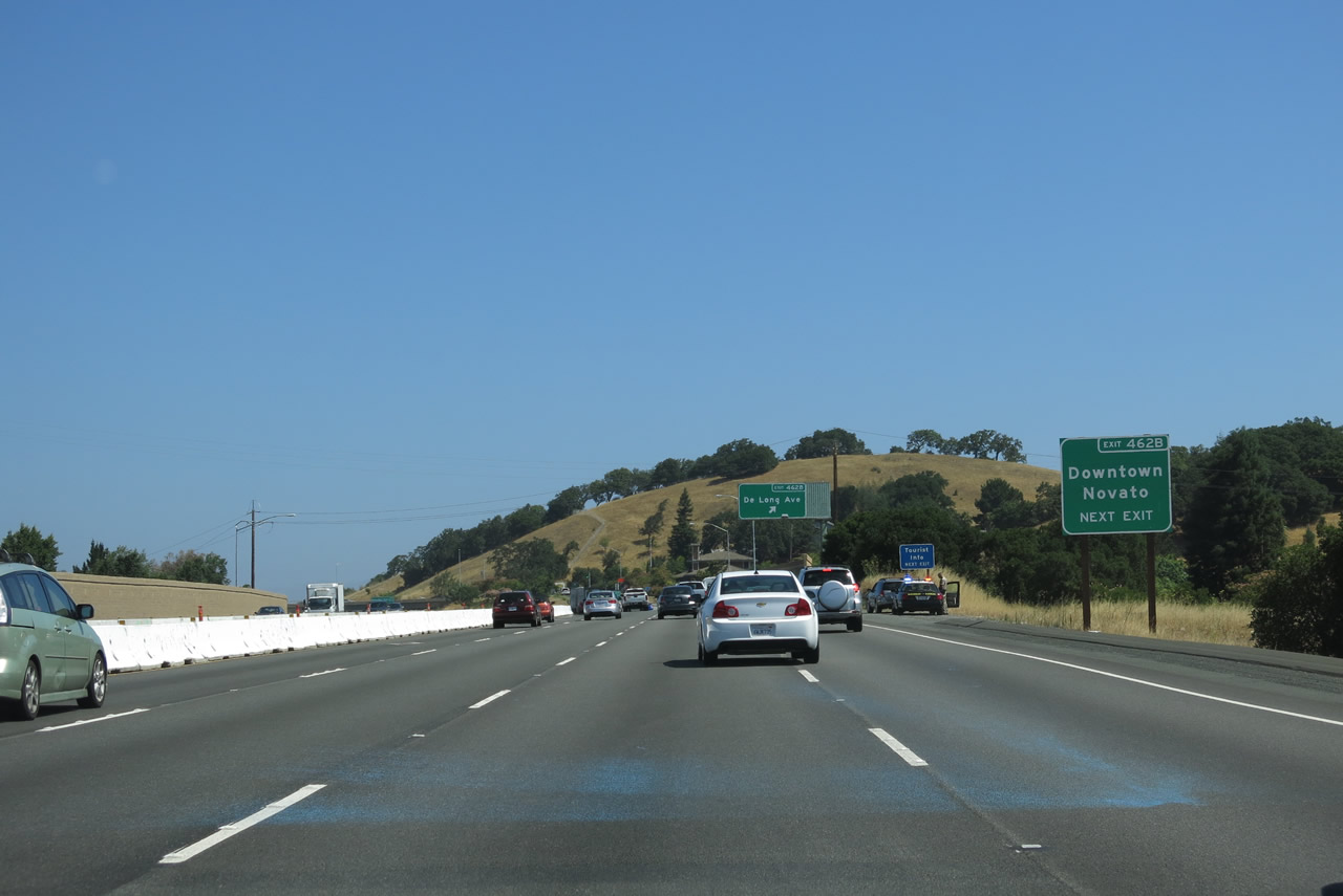
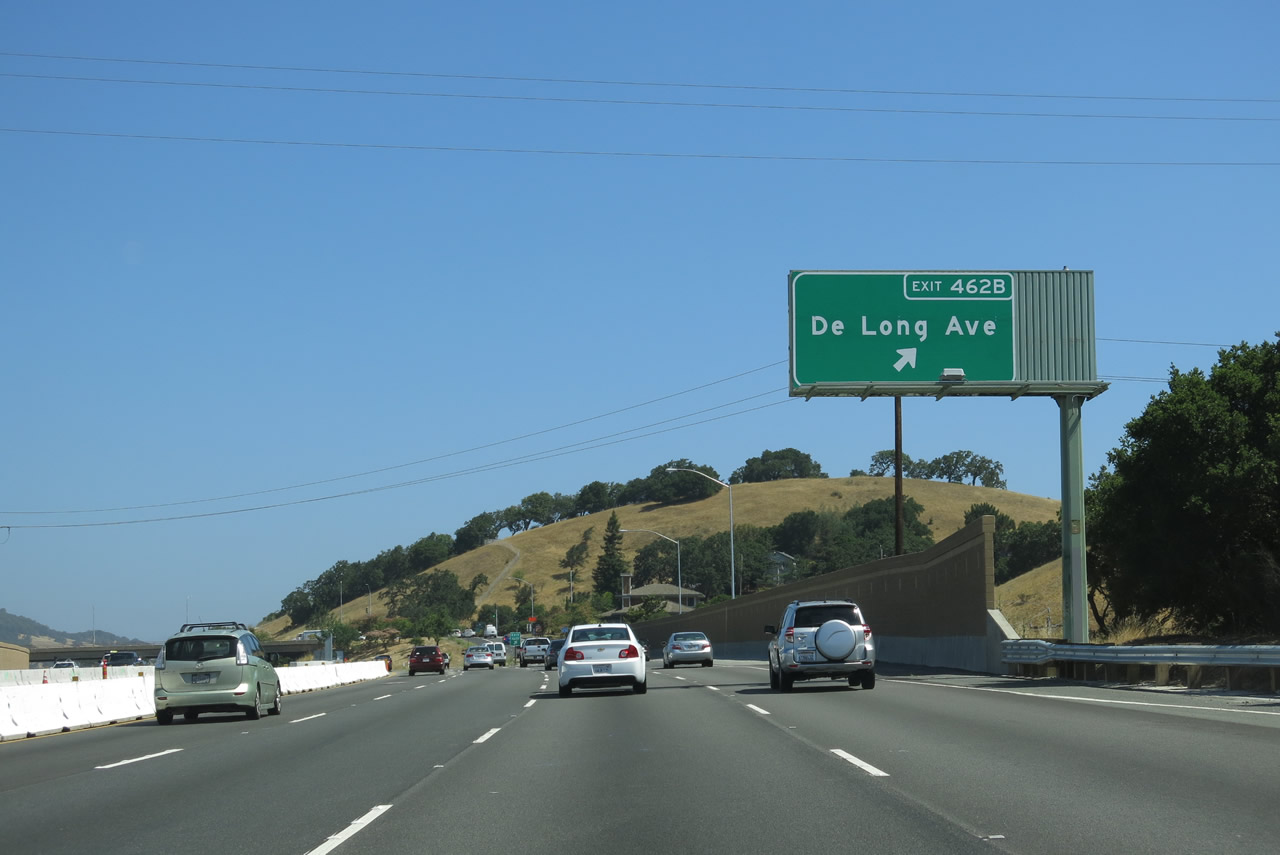
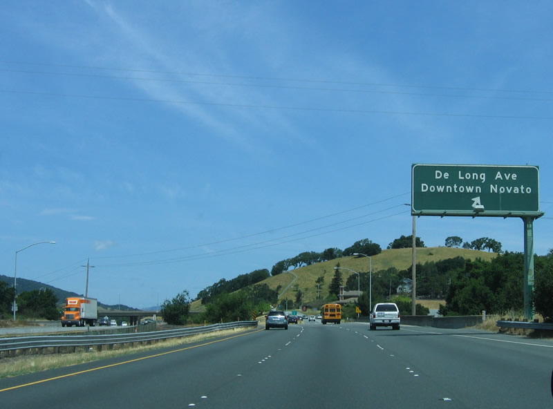
The next exit along northbound U.S. 101 (Redwood Highway) is Exit 462B, De Long Avenue and downtown Novato. A widening project in 2013 added a fourth northbound lane through here. Photos taken 07/05/13 and 05/26/06. |
|
Use De Long Avenue west to downtown Novato. The older signs had "Downtown Novato" signed along with De Long Avenue on each approach sign. When the signs were replaced and exit number added, the "Downtown Novato" sign was relegated to this roadside sign. Photos taken 07/05/13. |
|
|
Northbound U.S. 101 (Redwood Highway) reaches Exit 462B, De Long Avenue and downtown Novato. Photos taken 07/05/13 and 05/26/06. |
|
|
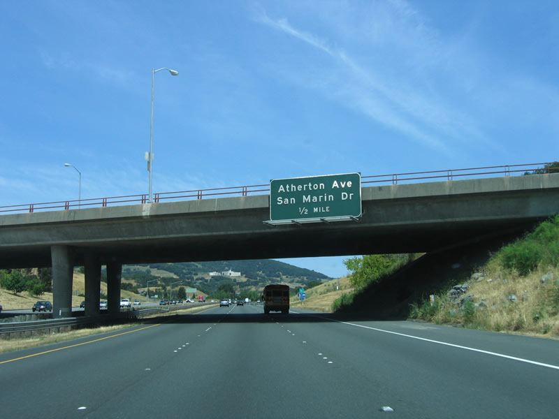
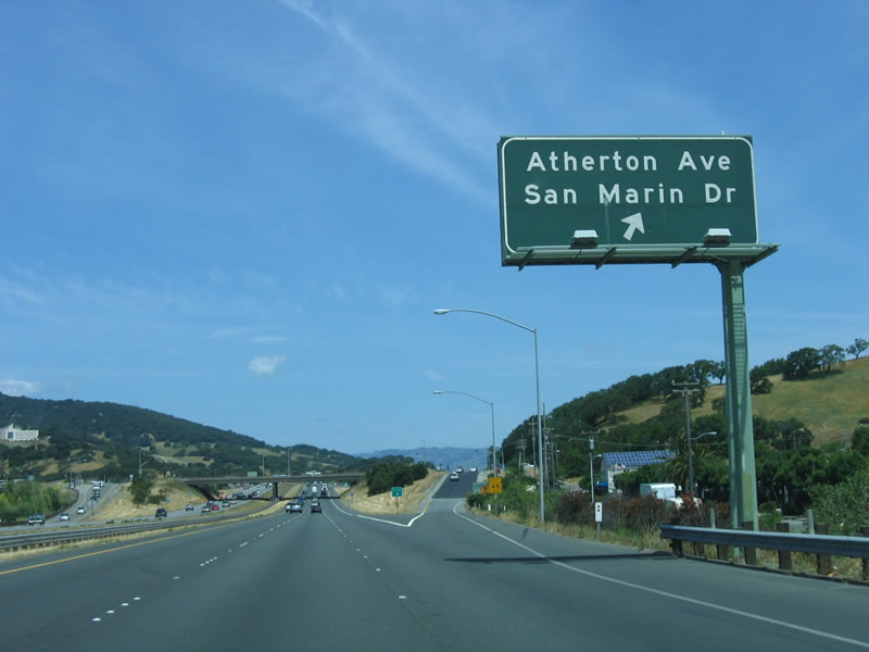
The next exit along northbound U.S. 101 (Redwood Highway) is Exit 463, Atherton Avenue and San Marin Avenue. U.S. 101 Business returns to U.S. 101 at this point. Photos taken 07/05/13 and 05/26/06. |
|
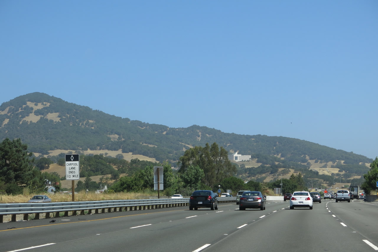
At the time this picture was taken, the carpool (high occupancy vehicle) lane ended near the Atherton Avenue interchange (Exit 463). Photos taken 07/05/13. |
|
|
Northbound U.S. 101 (Redwood Highway) reaches Exit 463, Atherton Avenue and San Marin Avenue. This is the final Novato exit. Photos taken 07/05/13 and 05/26/06. |
|
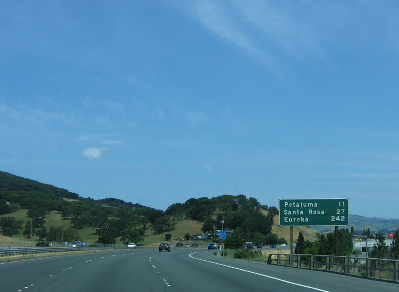
This mileage sign provides the distance to Petaluma (11 miles), Santa Rosa (27 miles), and Eureka (242 miles). Photo taken 05/26/06. |
|
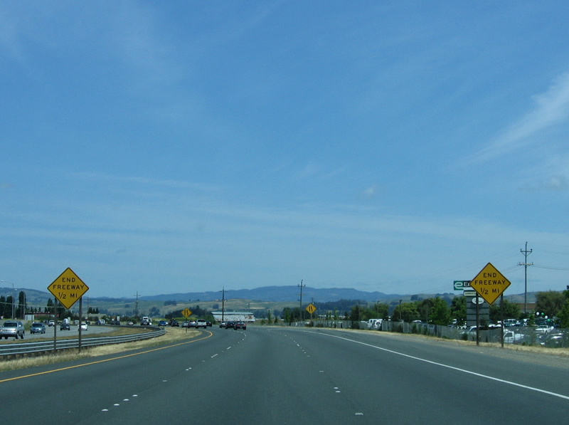
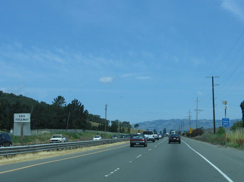
The freeway ends shortly after the Atherton Avenue interchange. end freeway signs are posted on either side of the now northbound lanes. The three northbound lanes will merge down to two northbound lanes. By 2013, active construction was underway to convert the expressway into a freeway. Photo taken 05/26/06. |
|
A frequently busy section of highway, U.S. 101 between Novato and Petaluma reduces to two lanes in each direction with cross traffic. Plans call for this section to be upgraded to freeway, with key intersections along the way removed. For now, an end freeway sign is posted. Photo taken 05/26/06. |
|
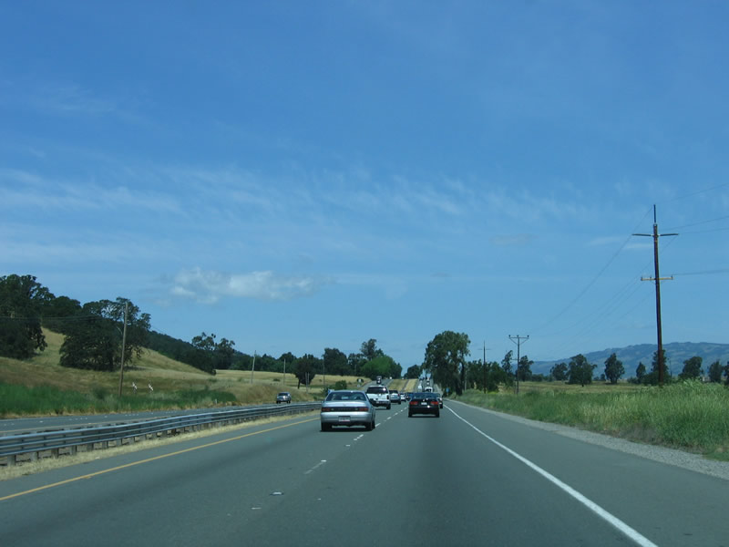
Pastoral grasslands surround U.S. 101 as it plies north toward Petaluma. Photo taken 05/26/06. |
|
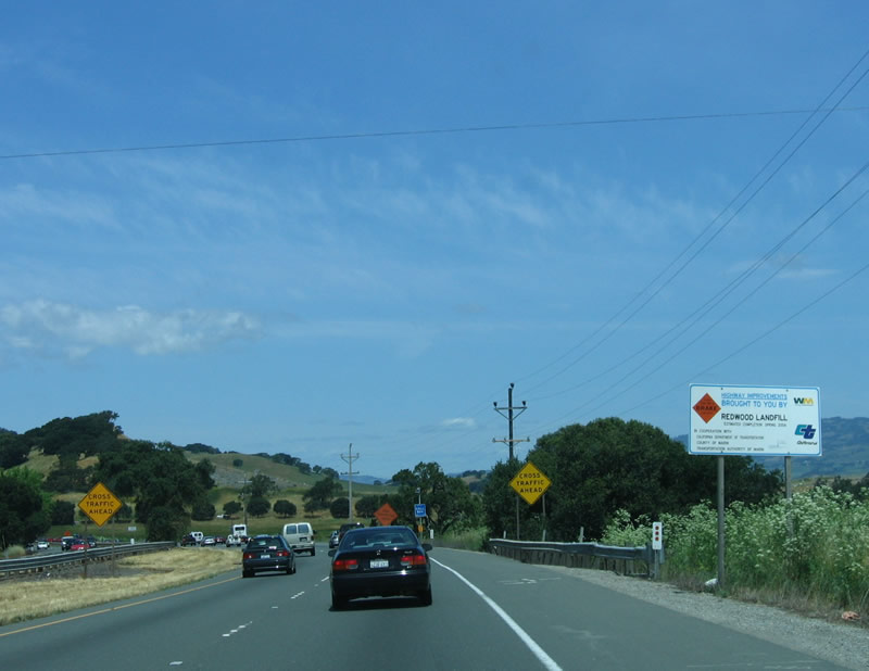
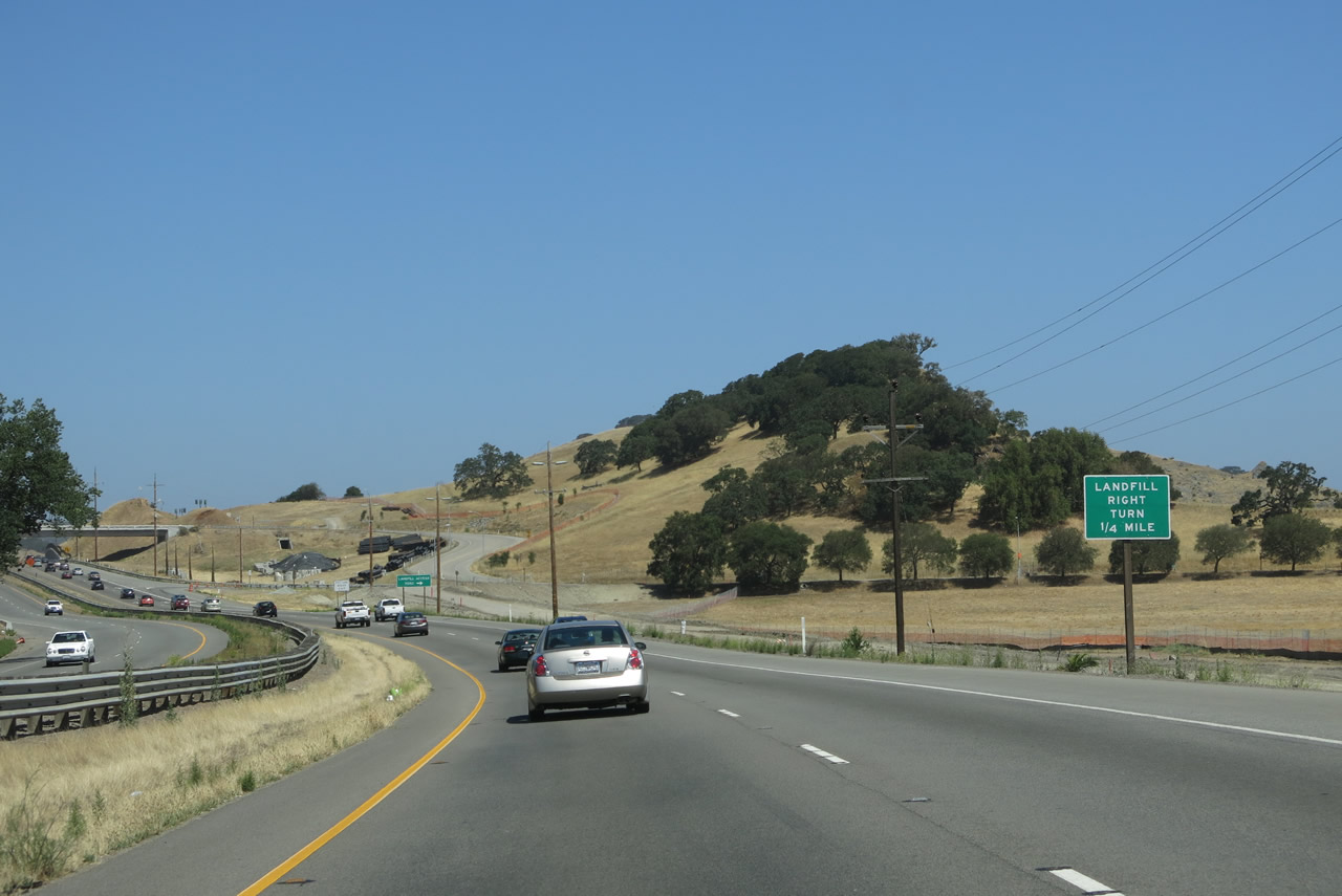
Construction of a new interchange at the Redwood Landfill access road was underway at the time this photo was taken. A construction sign advising of the work was posted prior to the future interchange. Photo taken 05/26/06. |
|
|
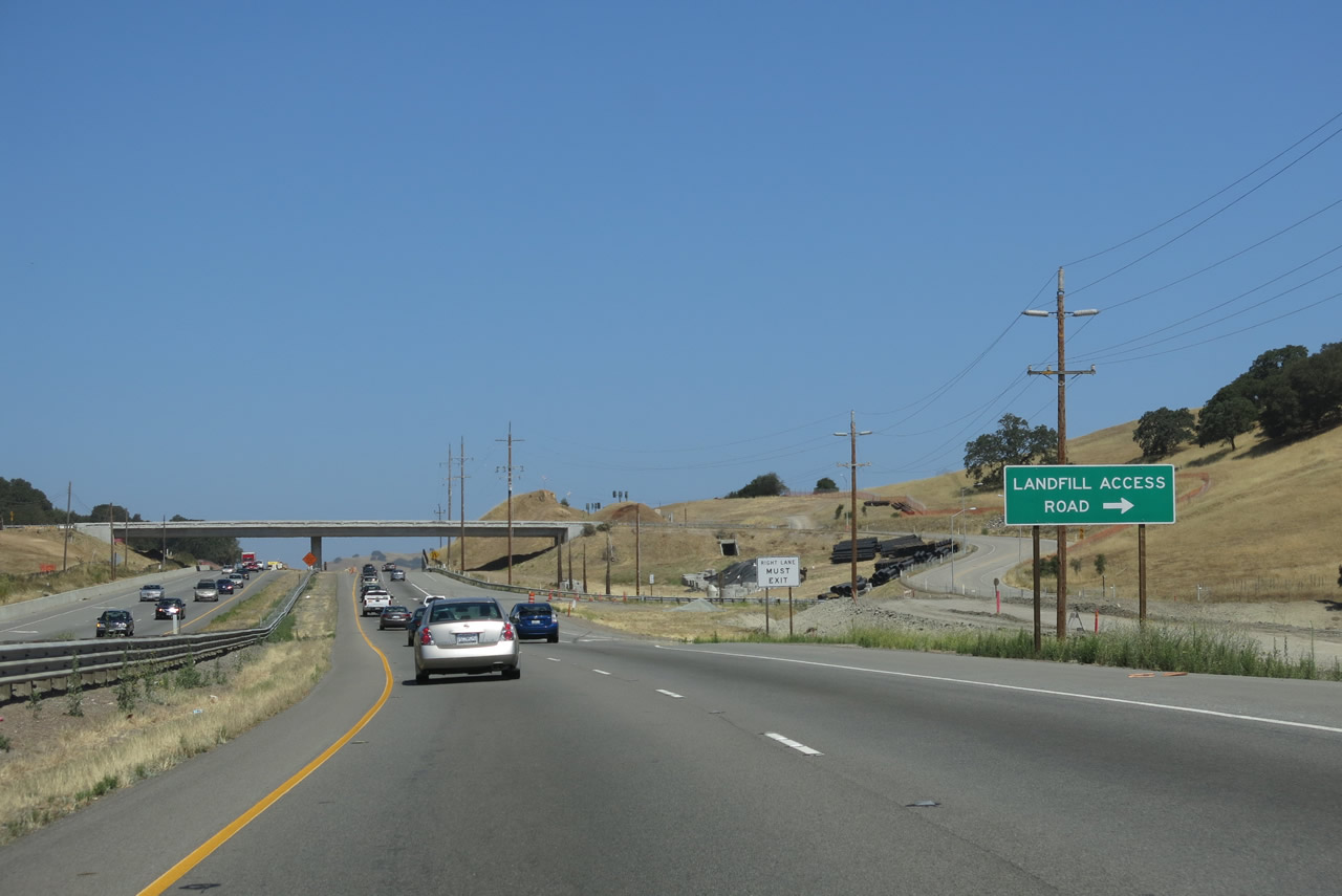
The new interchange with Redwood Landfill was complete by 2013, and a new access ramp connects U.S. 101 with the landfill. Photos taken 07/05/13 and 05/26/06. |
|
|
Northbound U.S. 101 (Redwood Highway) meets Exit 468, Redwood Landfill. Photos taken 07/05/13 and 05/26/06. |
|
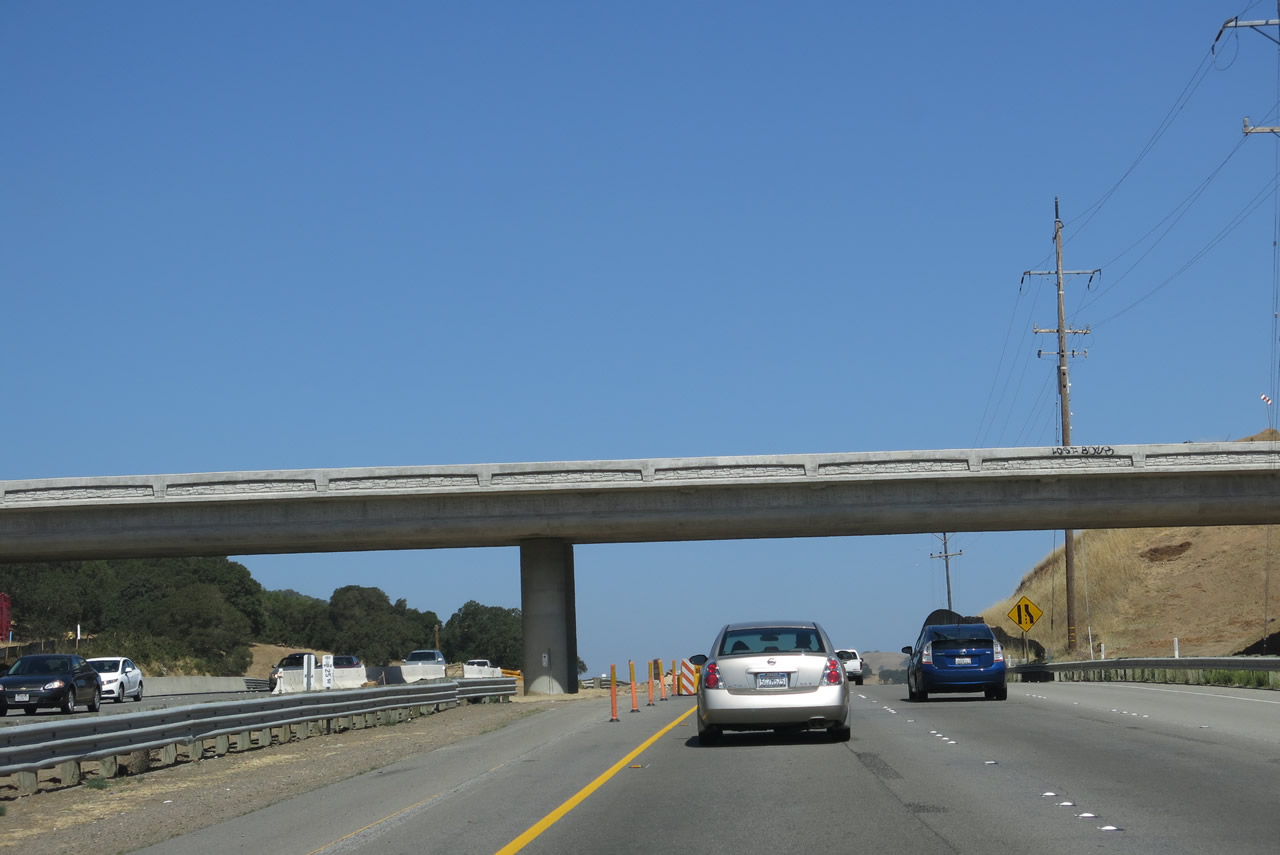
U.S. 101 passes under the Redwood Landfill access road bridge. Photo taken 05/26/06. |
|
|
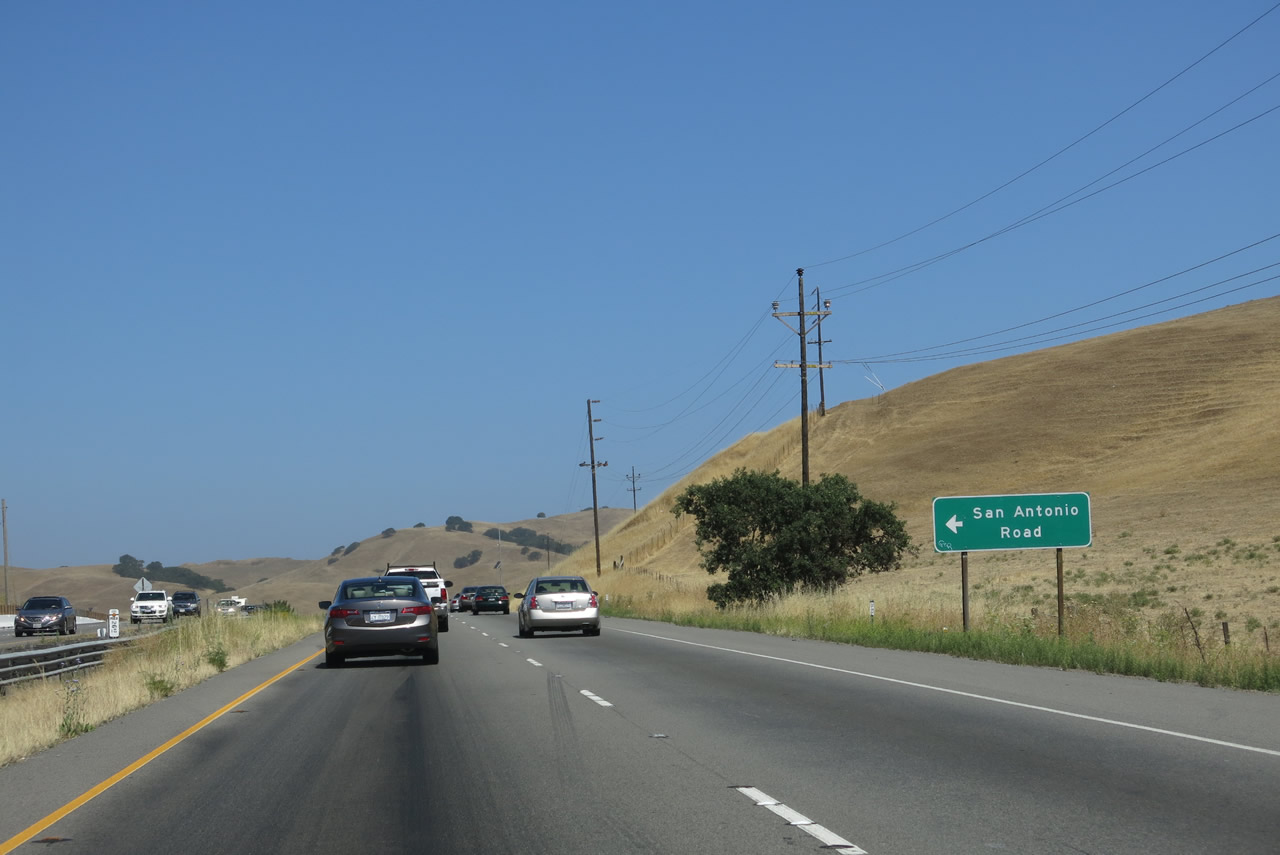
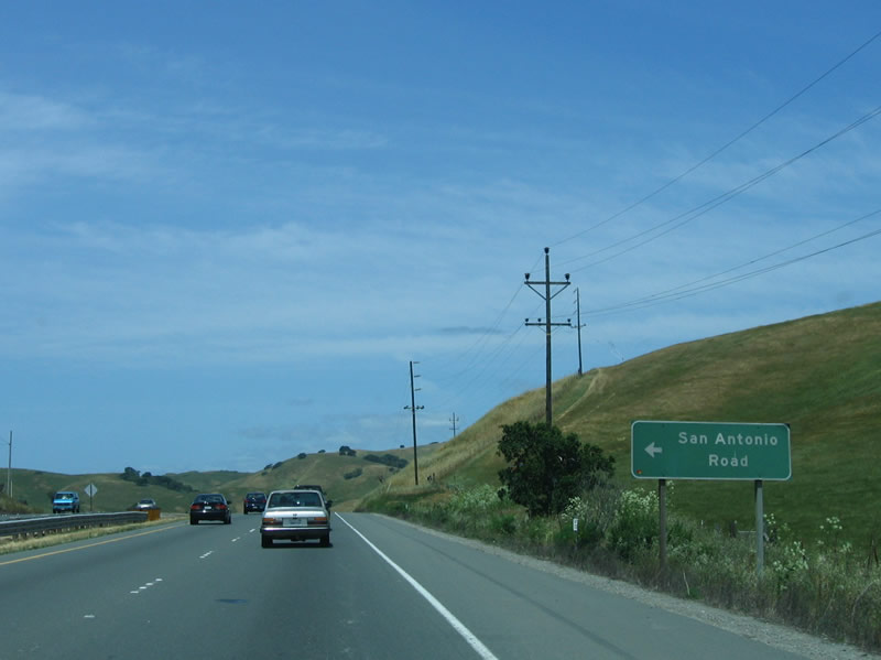
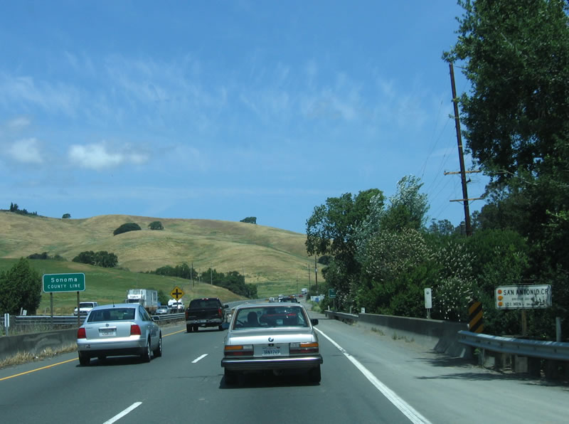
The next exit is a left turn onto San Antonio Road. This rural road is the last exit along northbound U.S. 101. The highway will shortly depart from Marin County and enter Sonoma County. Photos taken 07/05/13 and 05/26/06. |
|
|
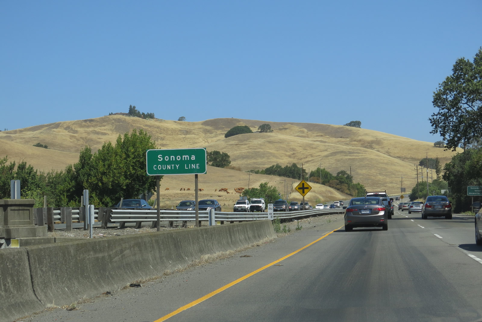
U.S. 101 leaves Marin County and enters Sonoma County upon crossing San Antonio Creek. The northbound San Antonio Creek bridge was built in 1929 and expanded in 1979. Photos taken 07/05/13 and 05/26/06. |
Page Updated August 31, 2013.