

U.S. 101 South - Sonoma County
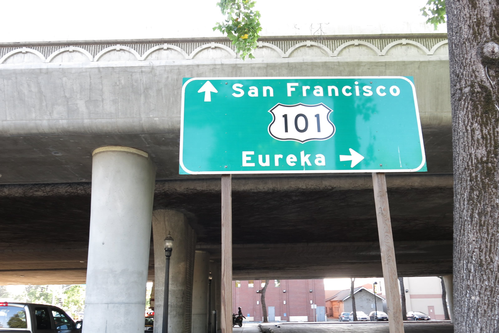
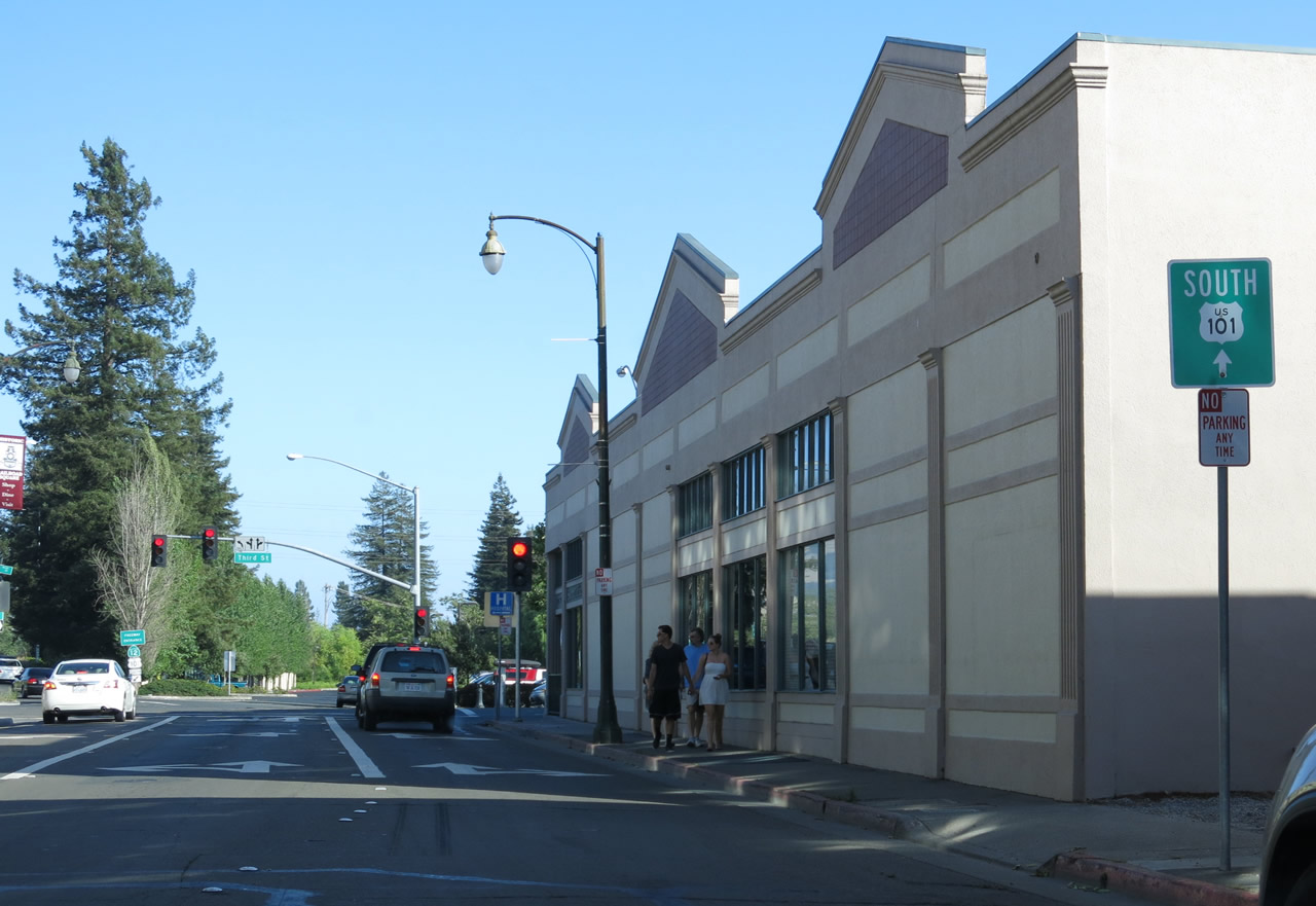
A U.S. 101 approach guide sign is posted along westbound Third Street in downtown Santa Rosa as Third Street passes under the Santa Rosa Downtown Viaduct, which carries U.S. 101 above the central business district. Photo taken 07/05/13.
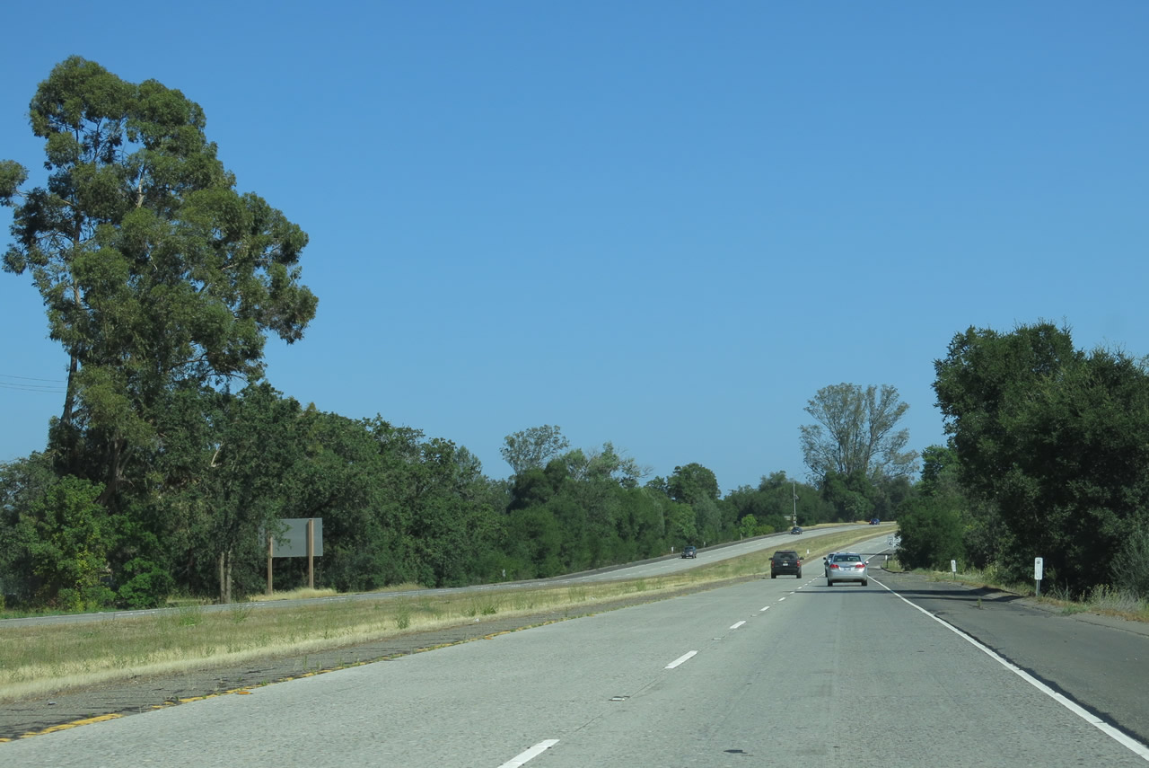
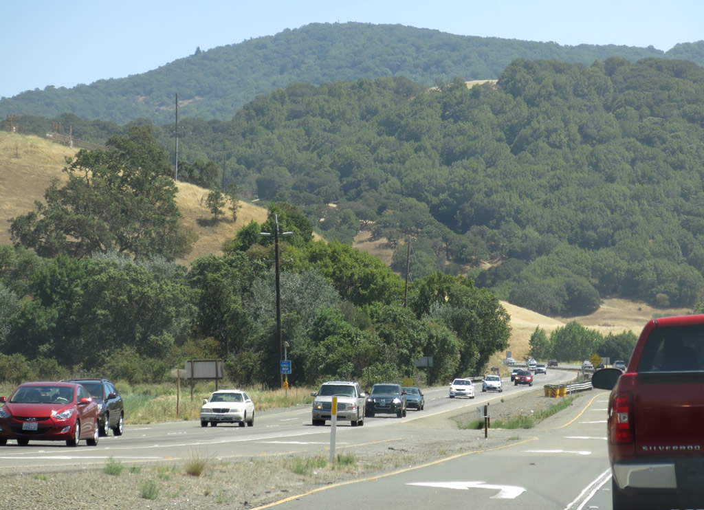
Sonoma County is internationally known for its extensive vineyards and fine quality wines, and it as a result it is compared frequently to its better-known neighbor to the east, Napa County. However, Sonoma County is also known for other features, including the urbanized Santa Rosa Plain and its tracts of redwoods especially close to the coast. U.S. 101 finds its way through Santa Rosa Plain and the Alexander Valley as it passes through Sonoma County. It sees urbanized development in cities like Santa Rosa but also sees pastoral areas in the many grape-growing regions of the county.
| U.S. 101 (Redwood Highway) south and California 128 east | |
|---|---|
 |
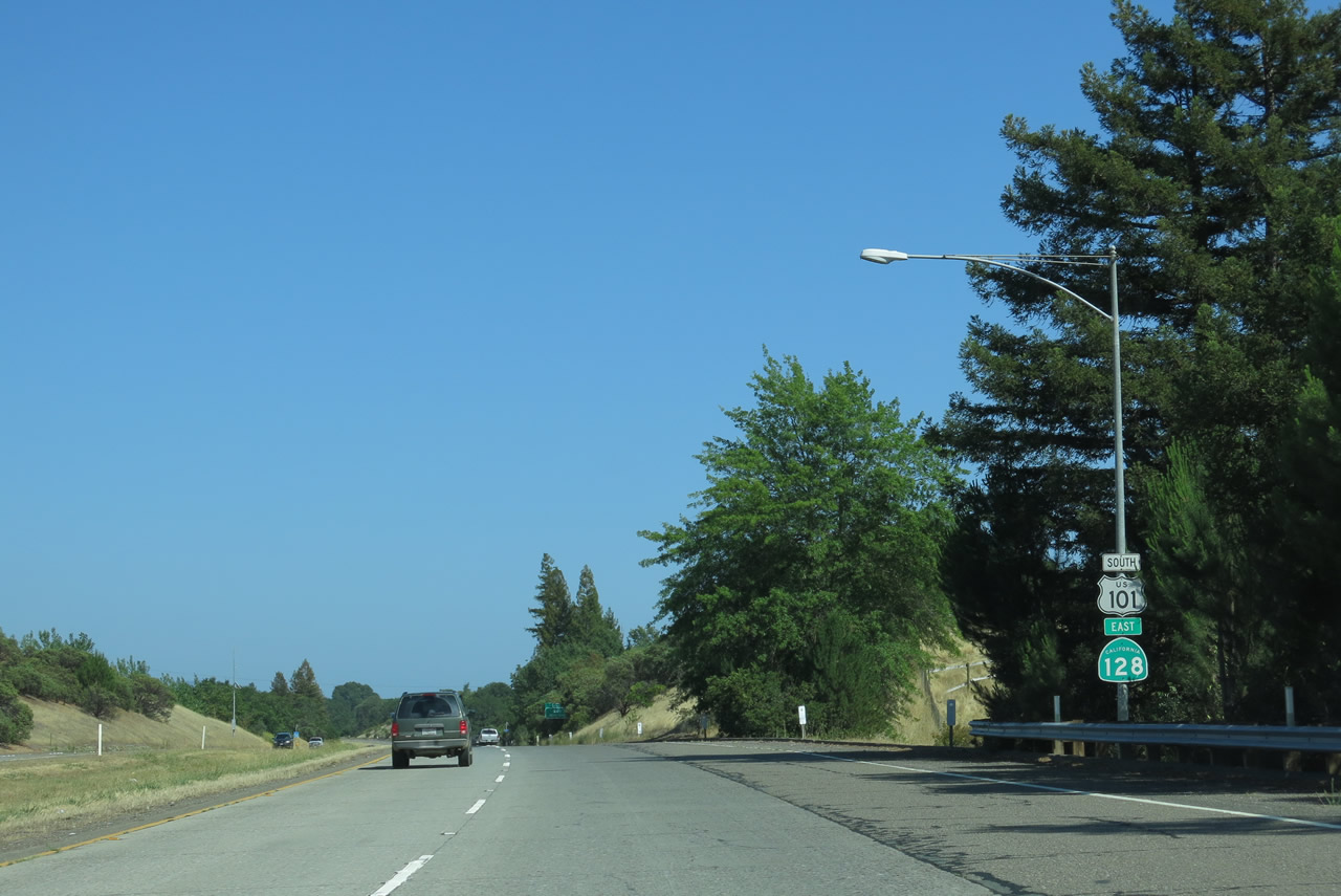
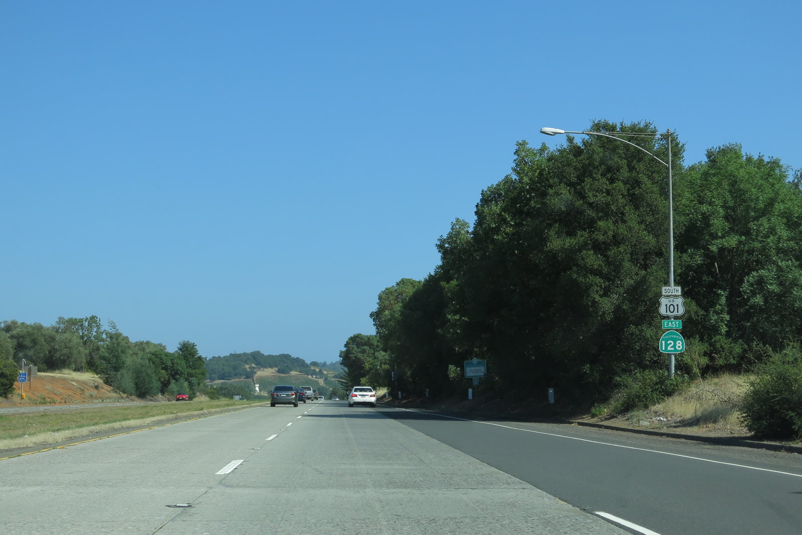
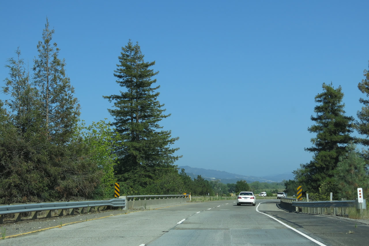
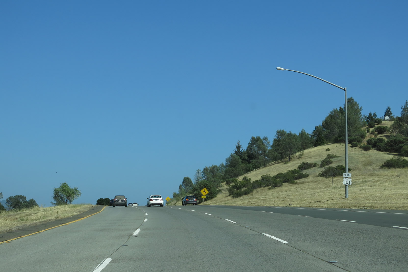
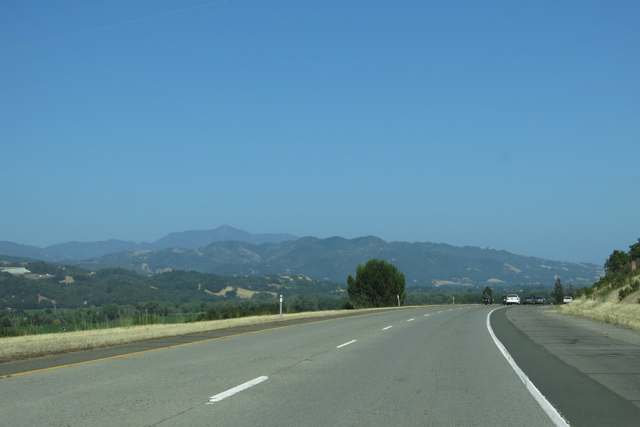
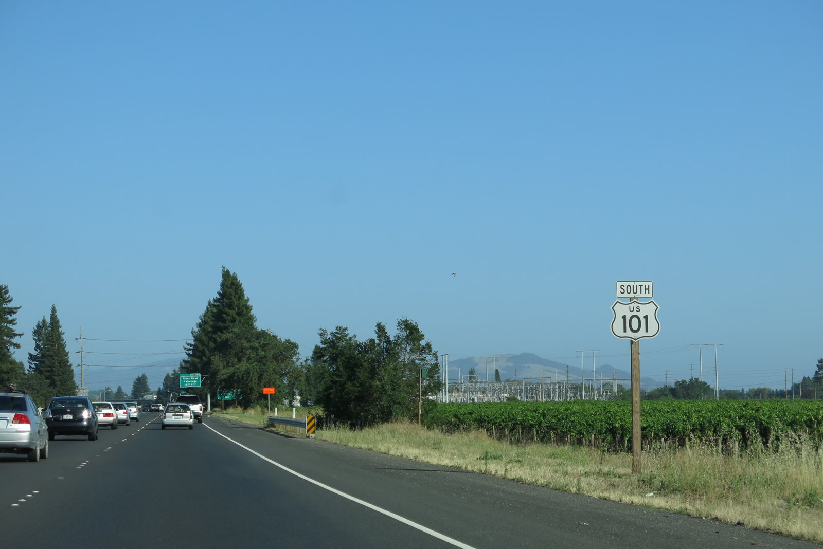
We resume following southbound U.S. 101 (Redwood Highway) after the South Cloverdale Boulevard interchange (Exit 519) in Cloverdale. U.S. 101, now joined with California 128, proceeds south through the Alexander Valley alongside the Russian River. This grape-growing region is well known for its wineries and vineyards, as well as nearby rolling hills and redwoods. U.S. 101 and California 128 will travel together south to Geyserville, then separate, with U.S. 101 continuing south to Santa Rosa and California 128 turning southeast toward Calistoga and northern Napa Valley. Photo taken 07/05/13. |
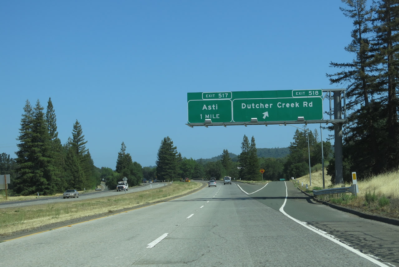 |
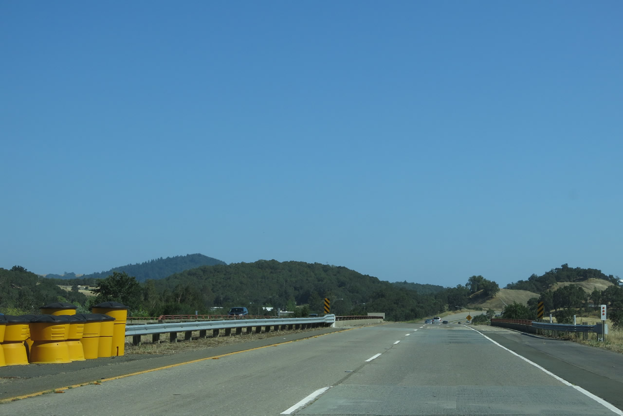
Southbound U.S. 101 (Redwood Highway) and eastbound California 128 meet Exit 518, Dutcher Creek Road south and Theresa Drive west. Dutcher Creek Road travels south to Dry Creek Road (unsigned Sonoma County C-1), which travels northwest to Lake Sonoma or southeast to Healdsburg. The next exit along southbound is Exit 517, Asti Store Road east and Simmons Road west. Photo taken 07/05/13. |
 |
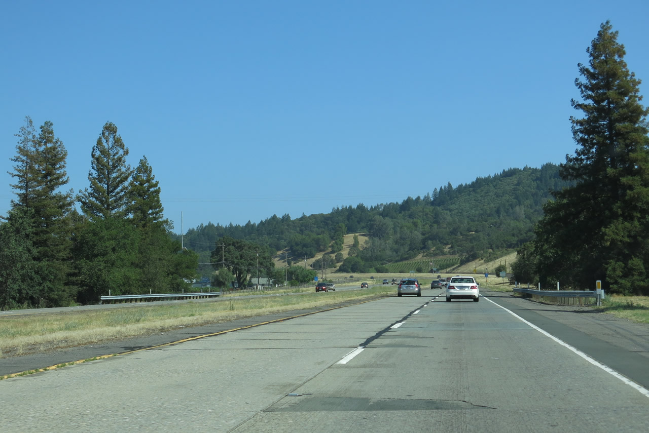
U.S. 101 south and California 128 east are cosigned between Cloverdale and Geyserville through Alexander Valley. Photo taken 07/05/13. |
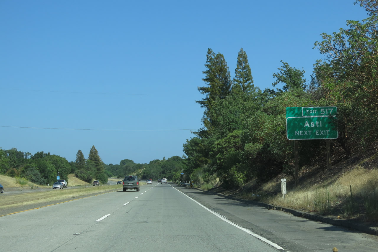 |
Exit 517 is signed for Asti, an unincorporated community that has its roots as an Italian Swiss Agricultural Colony established by Andrea Sbarboro in 1881 and named after Asti, Italy. Several wineries surround Asti, making this a popular destination in northern Sonoma County. Photo taken 07/05/13. |
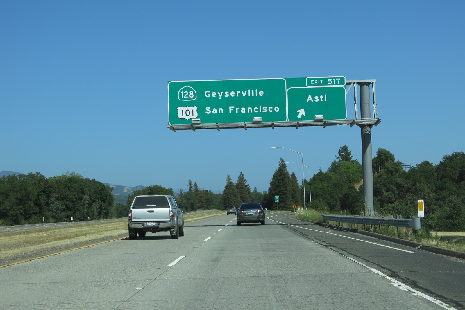 |
Southbound U.S. 101 and eastbound California 128 meet Exit 517, Asti Store Road east and Simmons Road west. A frontage road along the east side of U.S. 101 (Asti Road) is the old alignment of U.S. 101 through here. Photo taken 07/05/13. |
 |
U.S. 101 south and California 128 east are signed after the on-ramp from Exit 517. The next interchange is about five miles southeast of here. Photo taken 07/05/13. |
 |
 |
 |
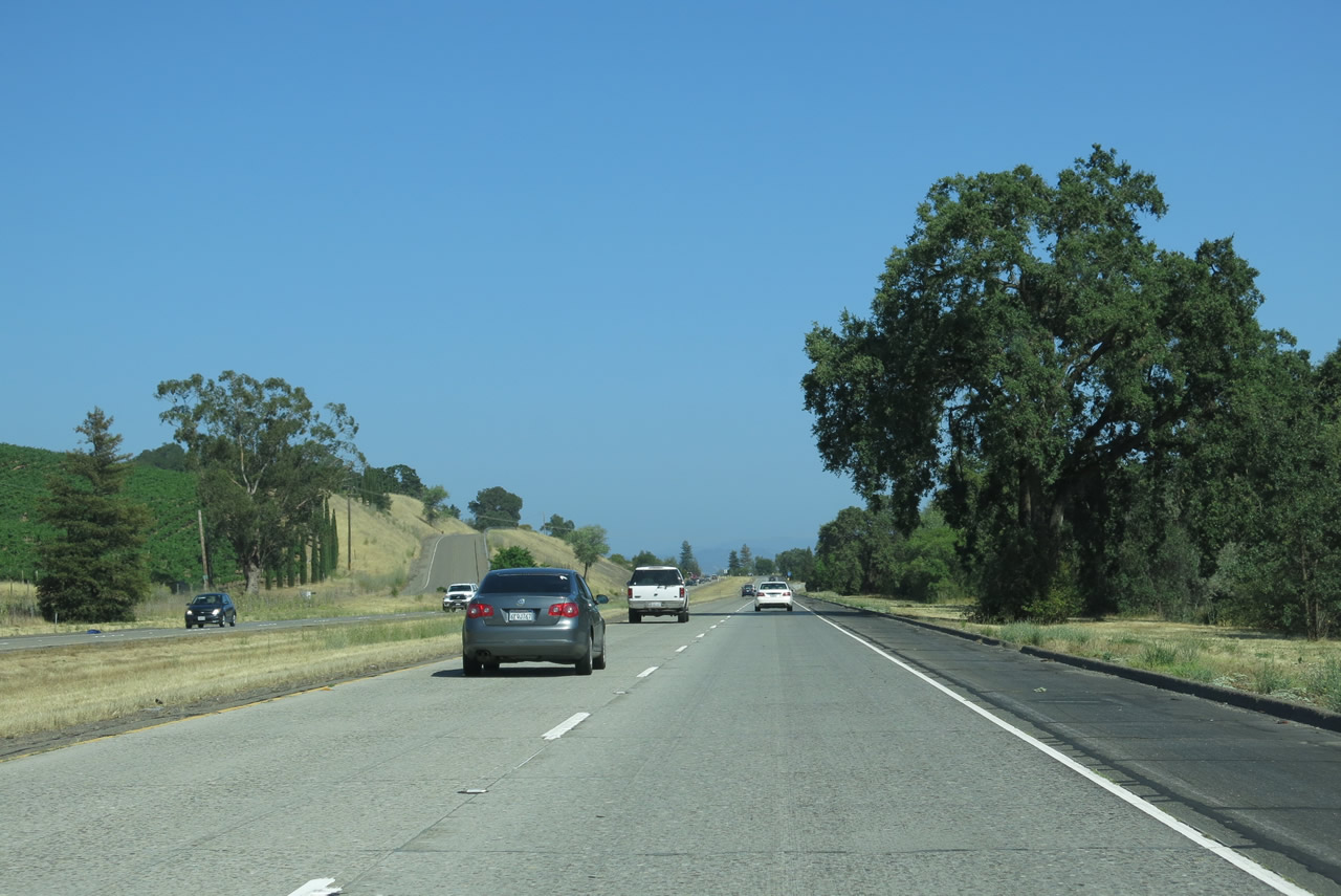
Proceeding southeast through the Alexander Valley alongside the Russian River through prime grape growing areas, U.S. 101 south and California 128 east proceed through rolling hills on the ridge to the east of the river between Asti and Geyserville. Photos taken 07/05/13. |
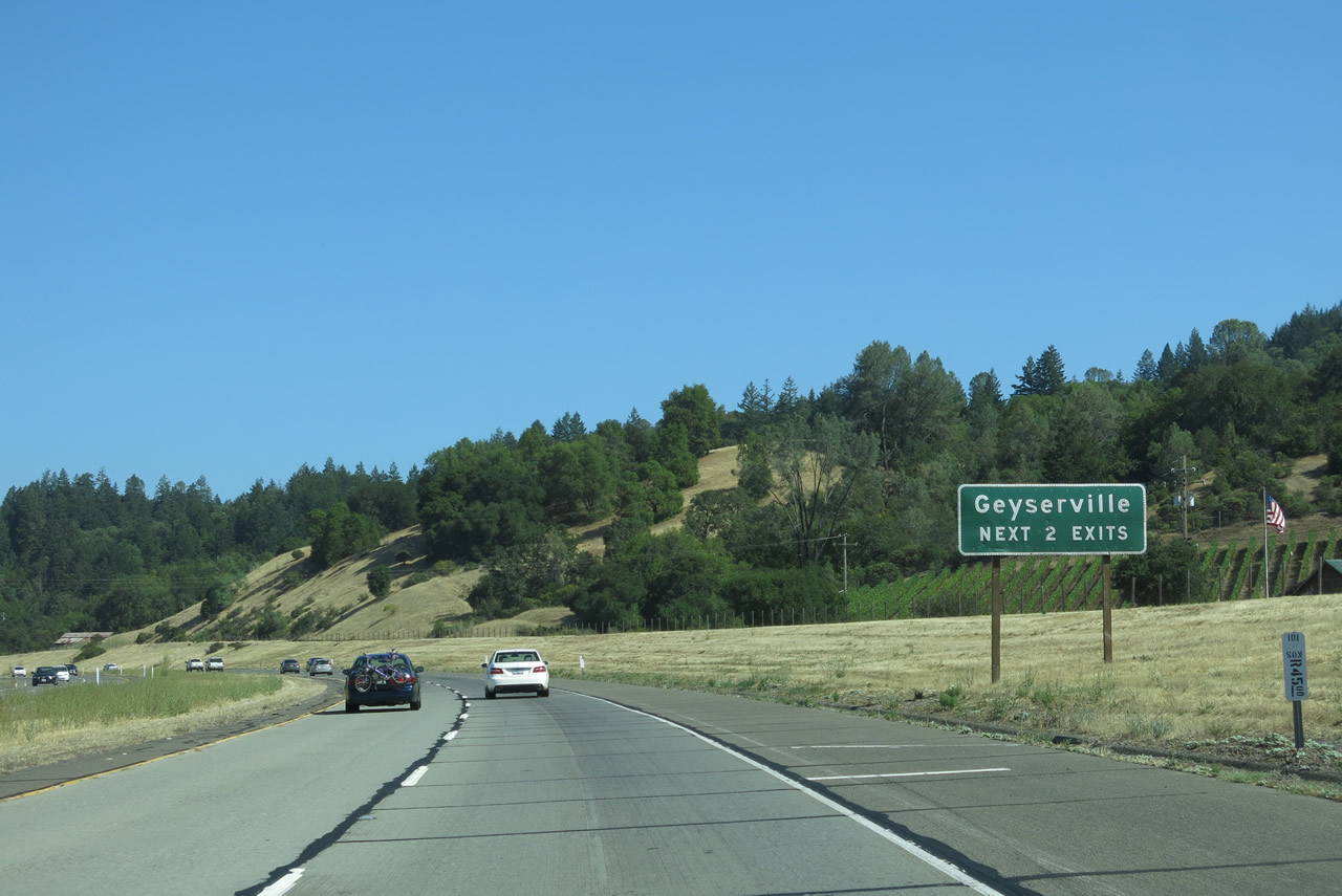 |
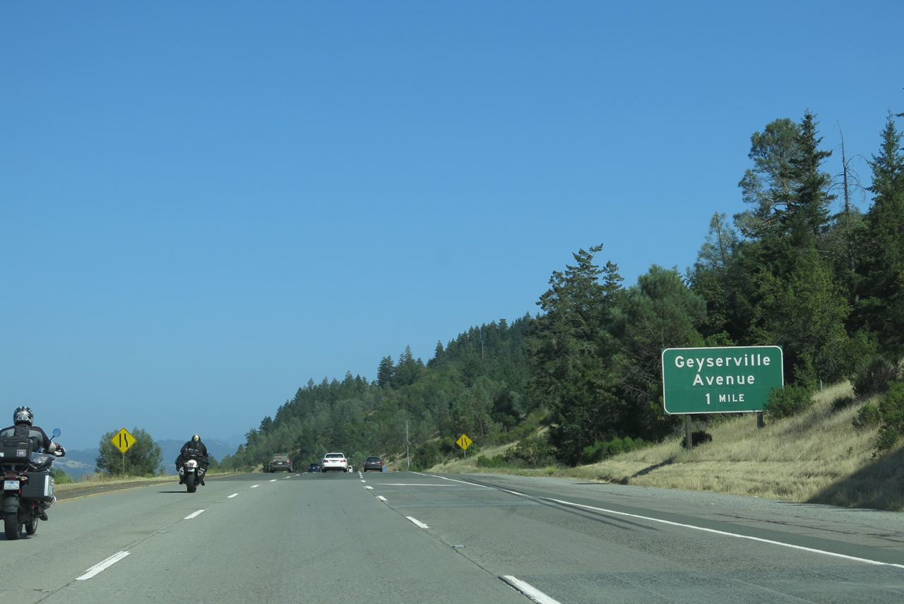
The next two exits of U.S. 101 south and California 128 east serve the unincorporated community of Geyserville, the self-proclaimed "Wine Capital of Sonoma County," although it's likely other grape-growing regions of Sonoma County (such as Sonoma Valley to the southeast of here) may take issue with this designation. Geyserville had a population of 862 as of the 2010 Census. Photo taken 07/05/13. |
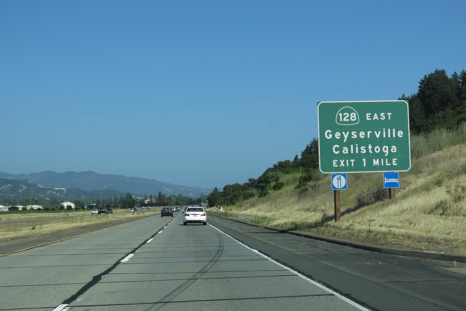 |
U.S. 101 south and California 128 east will split at Exit 512, which is the next exit along the southbound Redwood Highway. After this interchange, U.S. 101 will continue south along the Redwood Highway as a freeway to the most populated area of Sonoma County, passing through Healdsburg, Windsor, Santa Rosa, Rohnert Park, Cotati, and Petaluma. After passing through Marin County, U.S. 101 continues south across the Golden Gate Bridge into San Francisco, then proceeds another 430 miles southeast to Los Angeles. California 128, meanwhile, is a much shorter route, serving downtown Geyserville and crossing the Russian River en route to the Napa Valley. It serves the cities of Calistoga and St. Helena (including an overlap with California 29), then turns east again at Rutherford. The final stretch of California 128 takes the state highway to Winters, where it ends at Interstate 505. Photo taken 07/05/13. |
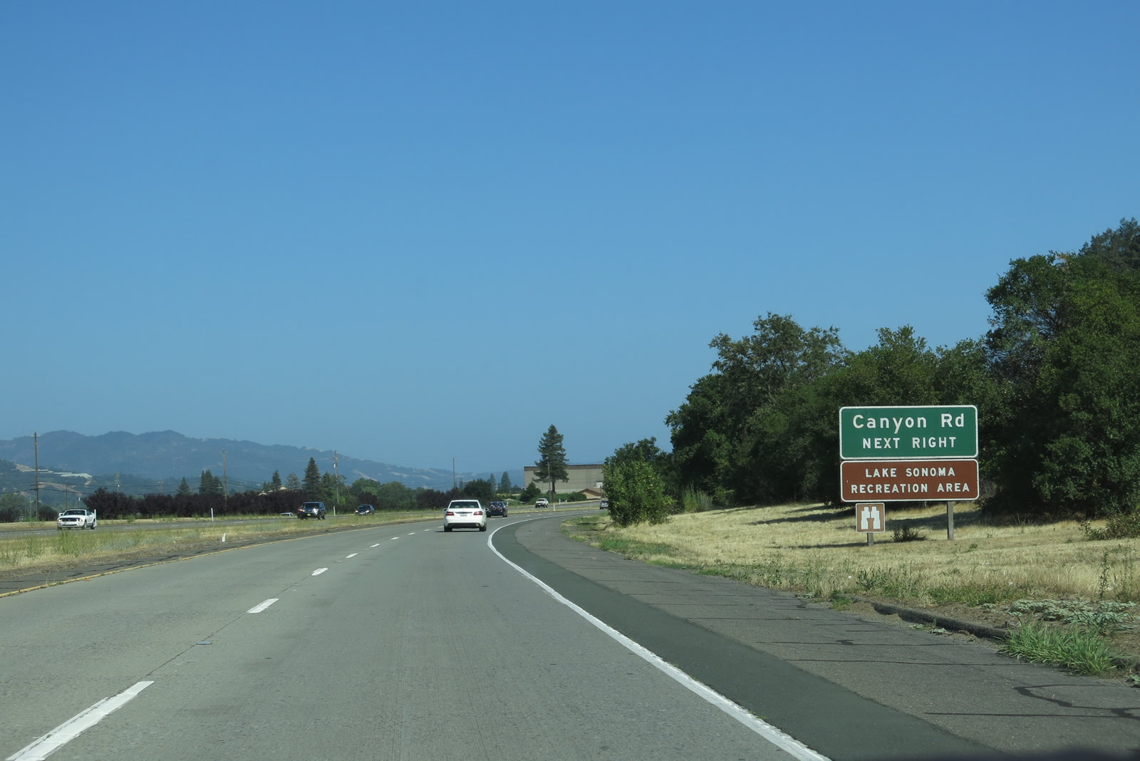 |
In addition to serving the continuation of California 128 east, Exit 512 also connects U.S. 101 south to Sonoma County C-1/Canyon Road. Unsigned C-1 travels west along Canyon Road, then turns northwest along Dry Creek Road to Lake Sonoma. C-1 was fully signed along both directions of U.S. 101 back in 1993, but the shields were gone by 2006. No C-1 signs are posted on Canyon Road. Photo taken 07/05/13. |
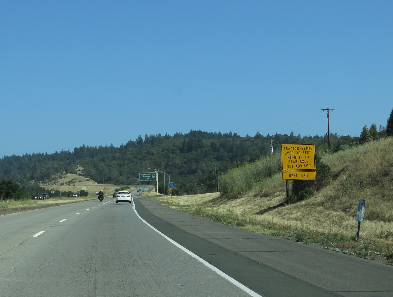 |
Due to the winding nature of California 128 and Sonoma County C-1, some truck restrictions are in place. Photo taken 07/05/13. |
 |
Southbound U.S. 101 and eastbound California 128 split at Exit 512, California 128 east to Geyserville and Calistoga and Sonoma County C-1/Canyon Road west to Lake Sonoma. To follow Historic U.S. 101 through Geyserville, follow California 128 east to Geyserville Avenue south. There is no officially designated business route through Geyserville, but most motorist services (food and lodging) are available there. The return to U.S. 101 is at Exit 510. Photo taken 07/05/13. |
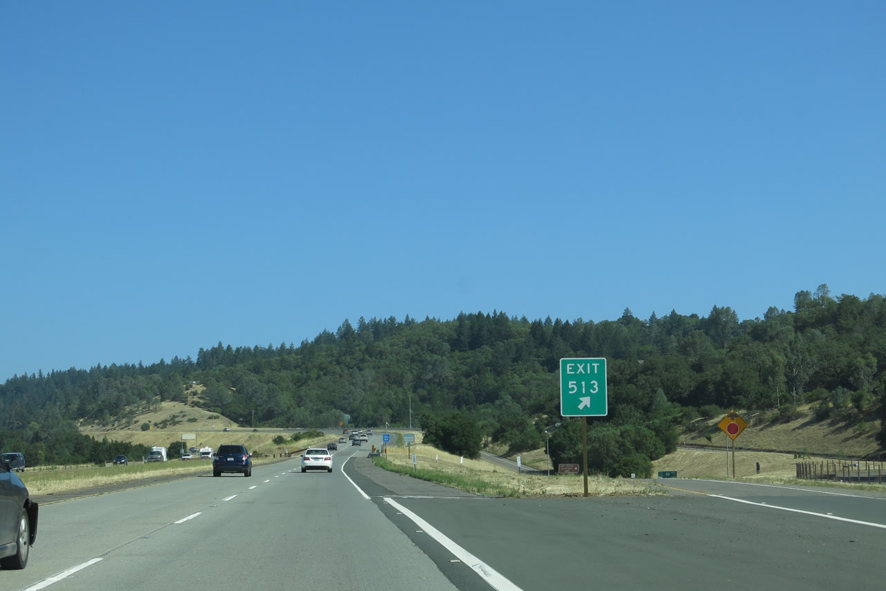 |
As of July 2013, the gore point sign was the only advance guide sign to feature the exit number. Calnexus lists this interchange as Exit 512; the sign posted in the field shows Exit 513 (probably an error). Photo taken 07/05/13. |
| U.S. 101 south | |
|---|---|
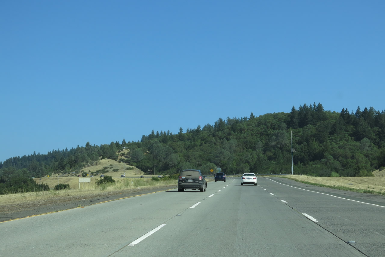 |
A third lane begins as U.S. 101 passes through the Canyon Road interchange and ascends a hill adjacent to Geyserville. Photo taken 07/05/13. |
 |
Continuing uphill away from Canyon Road, a U.S. 101 south route marker assembly is posted after the on-ramp from Canyon Road. Photo taken 07/05/13. |
 |
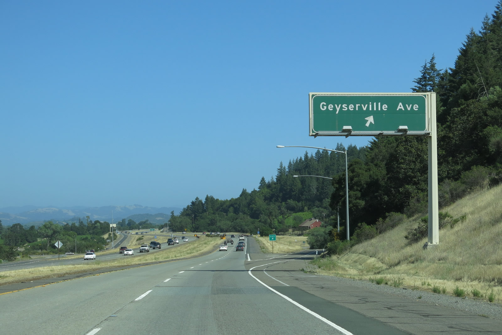
At the top of the grade, the third lane for climbing ends. The next exit along U.S. 101 south is Exit 510, Geyserville Avenue (one mile). This interchange serves as the southern business connection into Geyserville via Geyserville Avenue, which is Historic U.S. 101. Photo taken 07/05/13. |
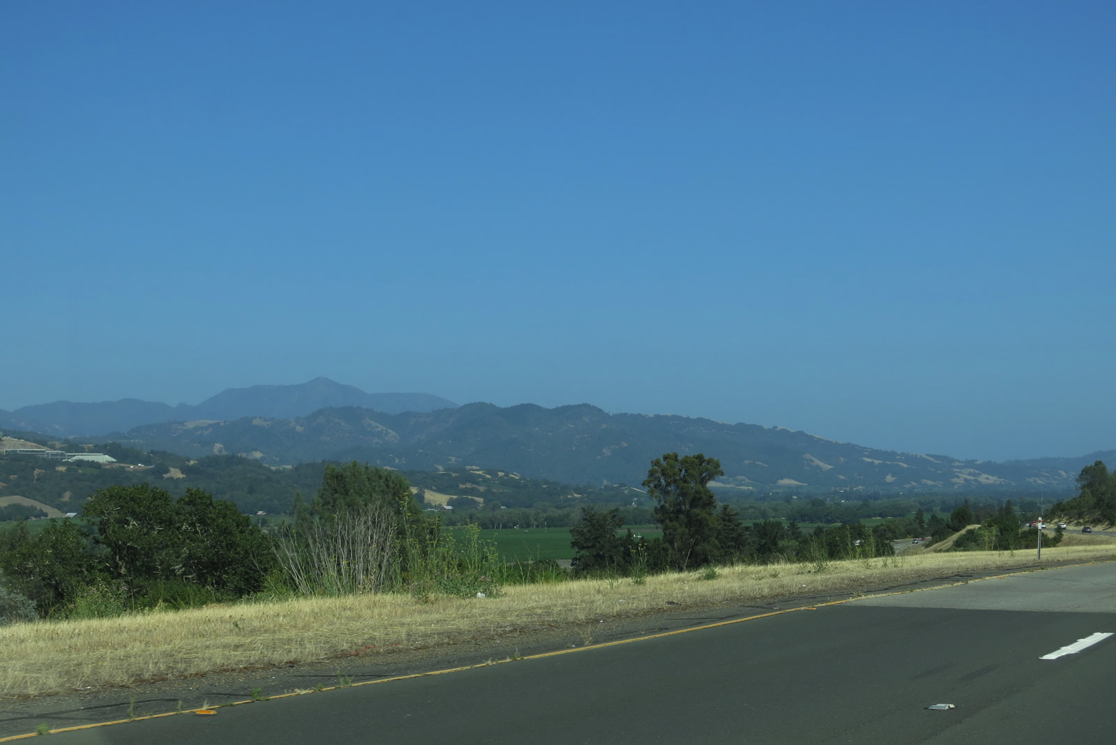 |
Looking to the southeast past the Alexander Valley and Geyserville, we see the Mayacmas Mountains in all their glory. Visible from here in the distance is Mt. St. Helena (el. 4,343 feet), an extinct volcano that marks the northern edge of the Napa Valley. California 29 has the task of winding its way up and over the mountain, serving as one of the few state routes leading into Lake County and Clear Lake, another grape-growing region. Photo taken 07/05/13. |
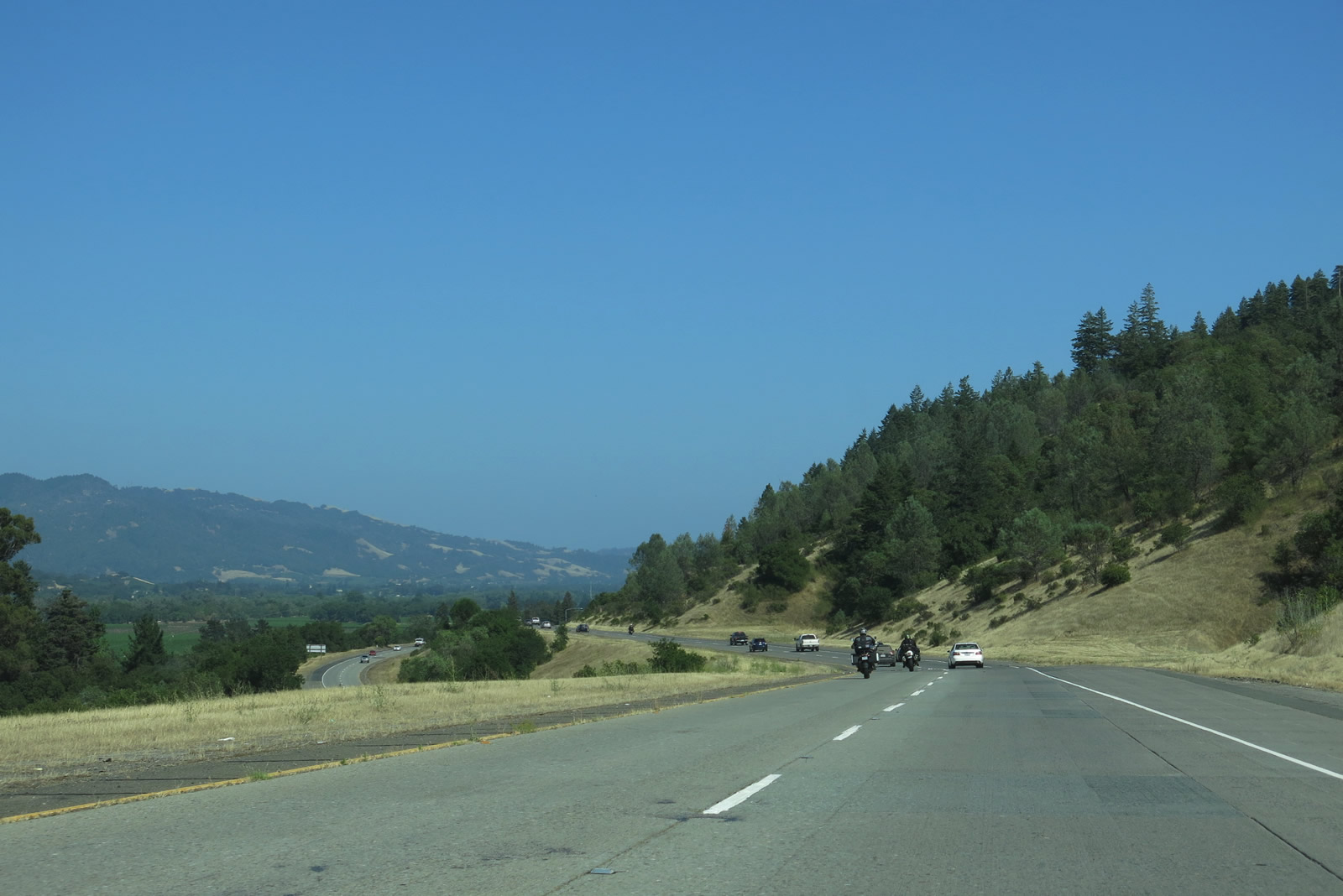 |
The southern extent of Alexander Valley comes into view, along with the northbound lanes of U.S. 101. Photo taken 07/05/13. |
 |
U.S. 101 continues to provide dramatic views of the valley before meeting the southern Geyserville interchange. Photo taken 07/05/13. |
 |
Southbound U.S. 101 (Redwood Highway) reaches Exit 510, Geyserville Avenue north to Geyserville (southern entrance) and south to provide local access between Geyserville and Healdsburg. Geyserville Avenue is Old U.S. 101, and Geyserville Avenue eventually becomes Healdsburg Avenue on its way into the city of Healdsburg. Photo taken 07/05/13. |
 |
U.S. 101 south crosses over Geyserville Avenue. Photo taken 07/05/13. |
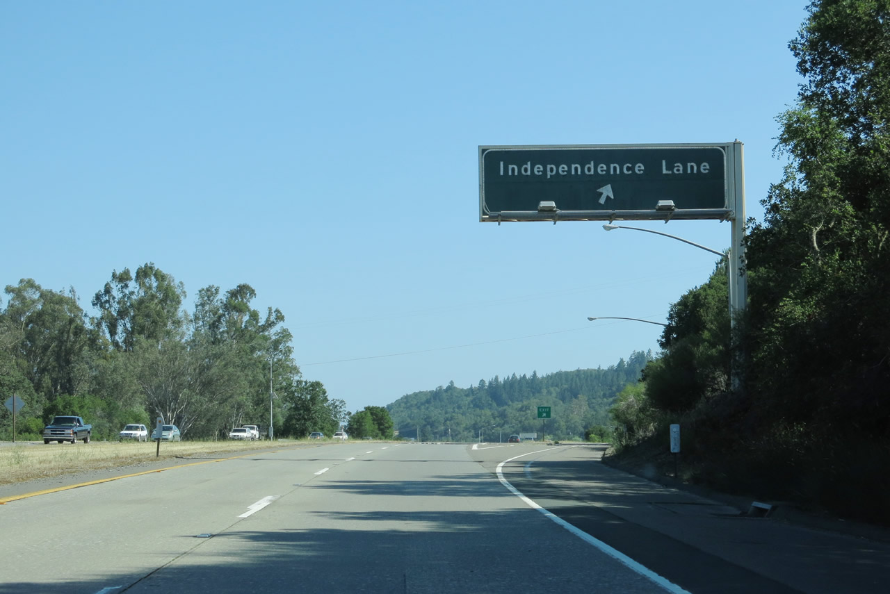 |
Soon thereafter, southbound U.S. 101 meets Exit 509, Independence Lane. This exit provides access to Geyserville Avenue and Fredson Road as well as local vineyard and winery access. Francis Ford Coppola Winery, owned by the famous film marker, is located just west of this interchange. Photo taken 07/05/13. |
 |
U.S. 101 crosses over Independence Lane at Exit 509 (diamond interchange). Photo taken 07/05/13. |
 |
We find this U.S. 101 route marker after the Independence Lane interchange. Photo taken 07/05/13. |
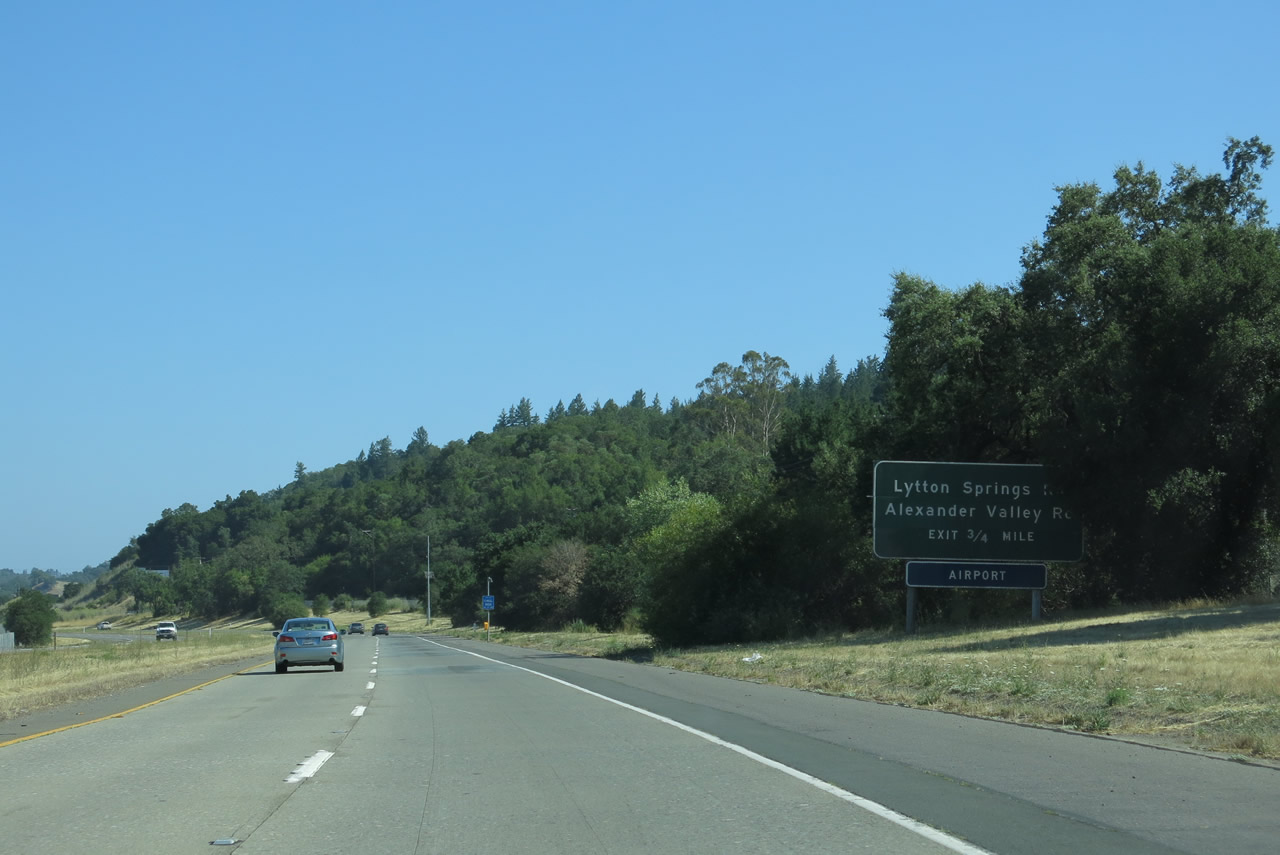 |
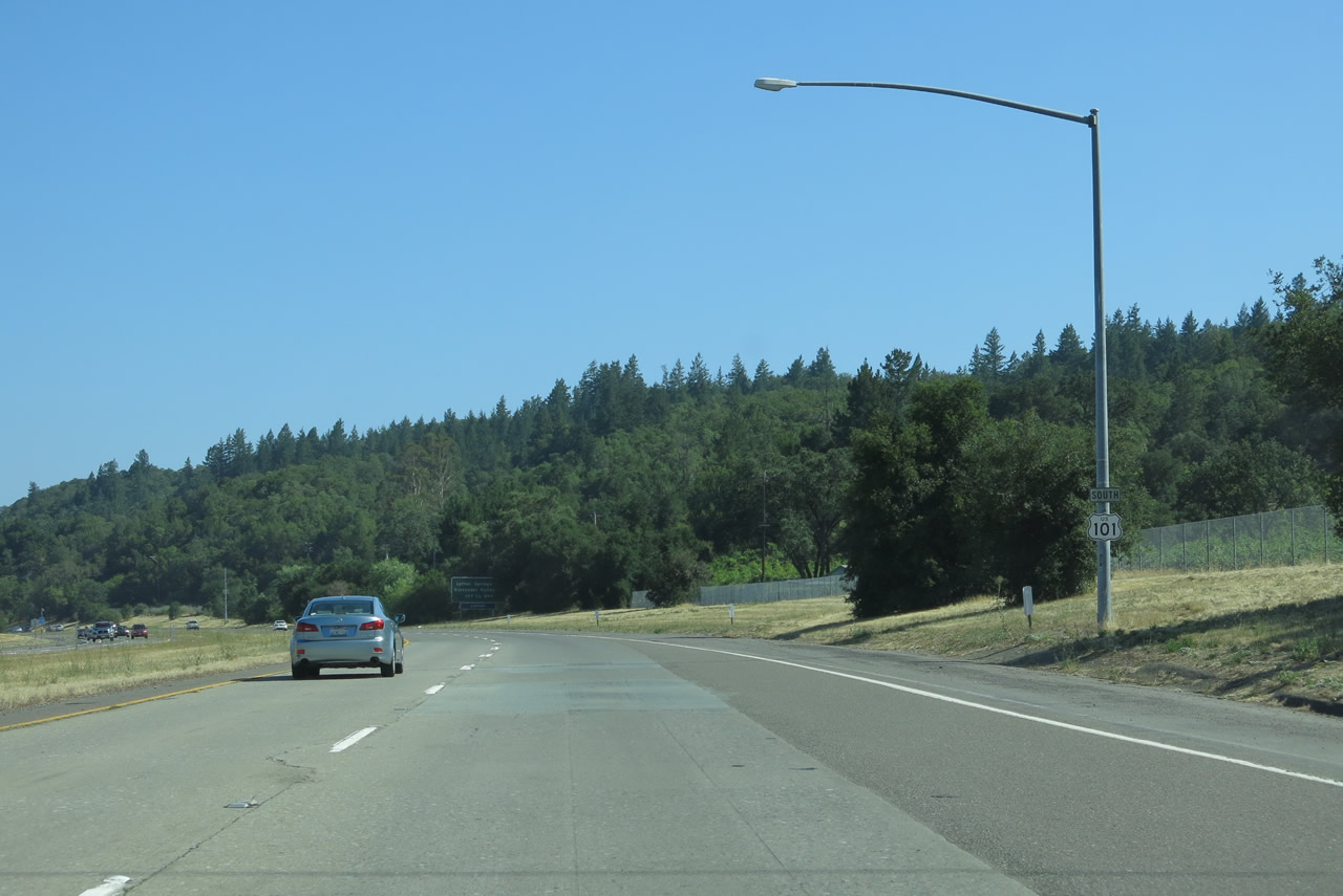
The next exit along U.S. 101 (Redwood Highway) south is Exit 507, Lytton Springs Road west and Alexander Valley Road east (0.75 mile). Photo taken 07/05/13. |
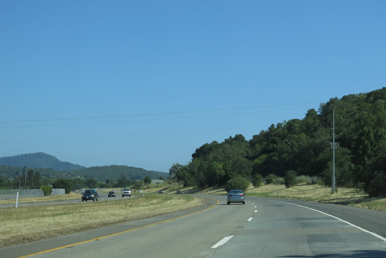 |
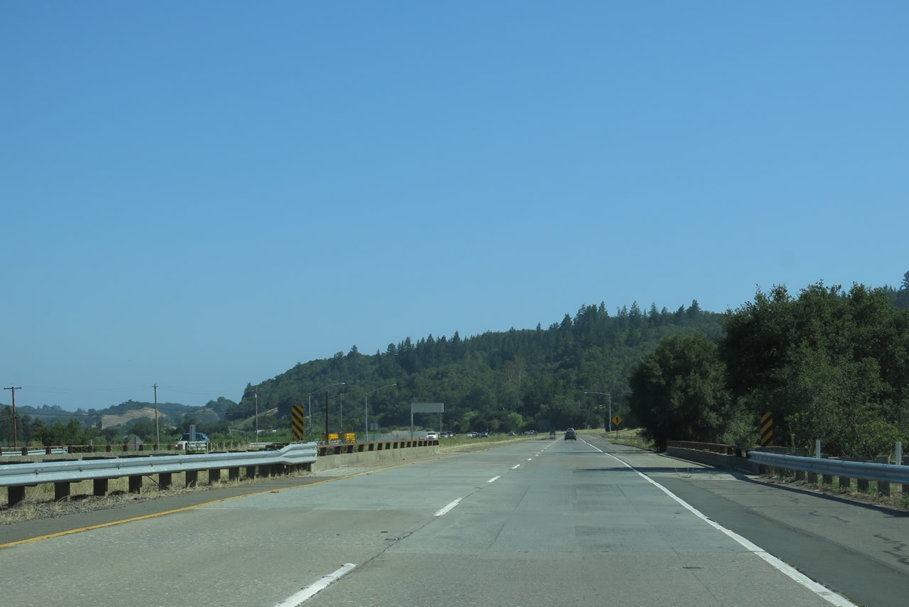
U.S. 101 (Redwood Highway) flattens out and continues southeast through the southern Alexander Valley. Photo taken 07/05/13. |
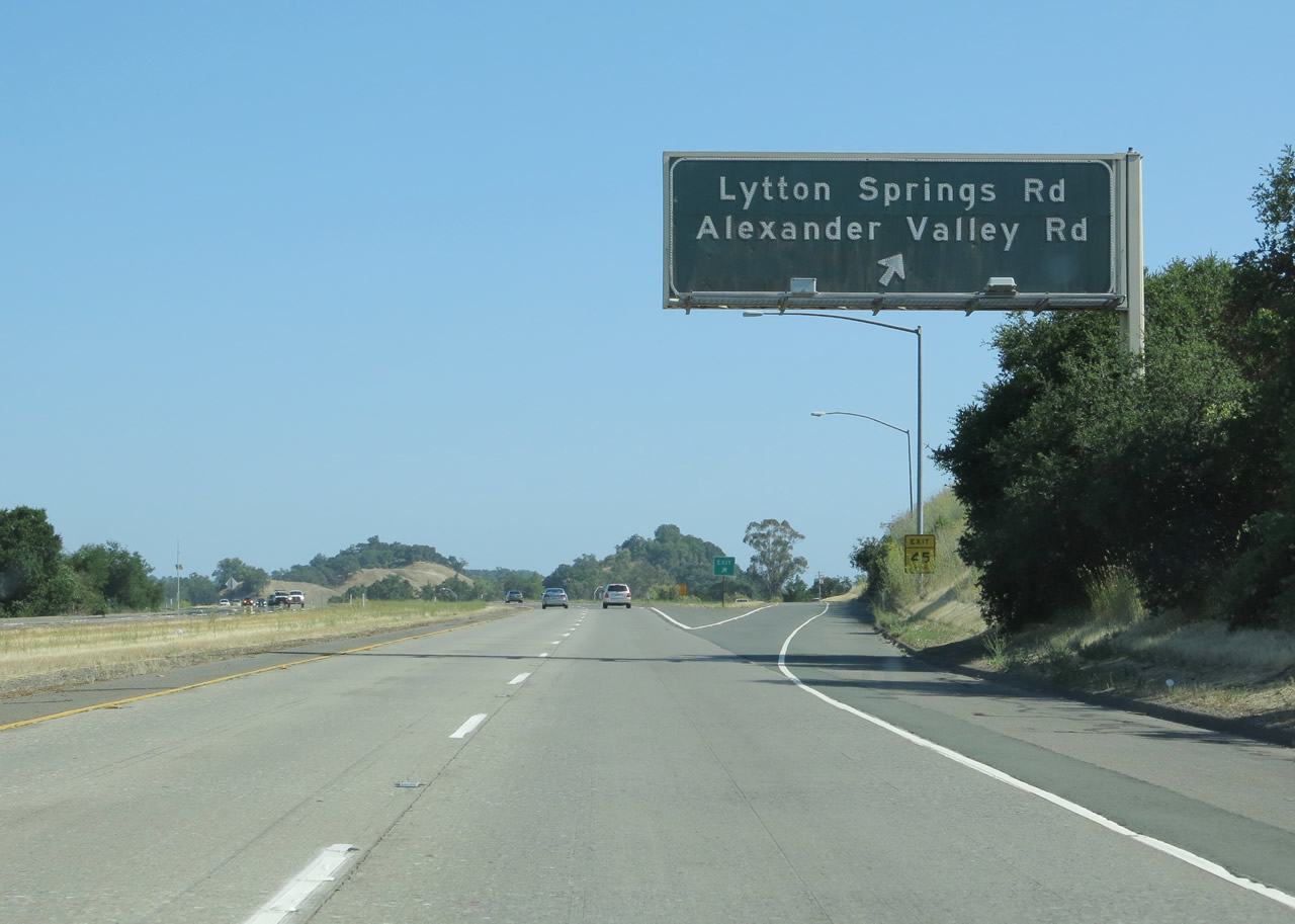 |
Southbound U.S. 101 (Redwood Highway) reaches Exit 507, Lytton Springs Road west and Alexander Valley Road east. Lytton Springs Road travels west from this interchange to Dry Creek Road, which travels alongside Dry Creek between Healdsburg and Lake Sonoma. Lytton Springs Road also travels east briefly to connect to Geyserville Avenue and Lytton Station Road, which are part of old U.S. 101. Alexander Valley Road can be reached via a connection with Old U.S. 101/Lytton Station Road (Healdsburg Avenue) south. Photo taken 07/05/13. |
 |
U.S. 101 (Redwood Highway) crosses over Lytton Springs Road. Photo taken 07/05/13. |
 |
Another U.S. 101 south reassurance shield is posted after the Lytton Springs Road interchange. Photo taken 07/05/13. |
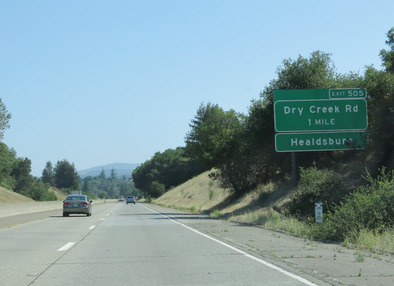 |
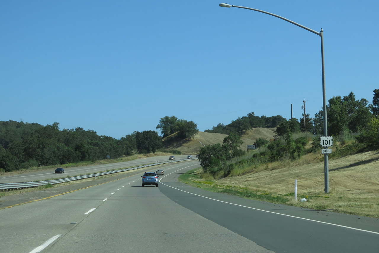
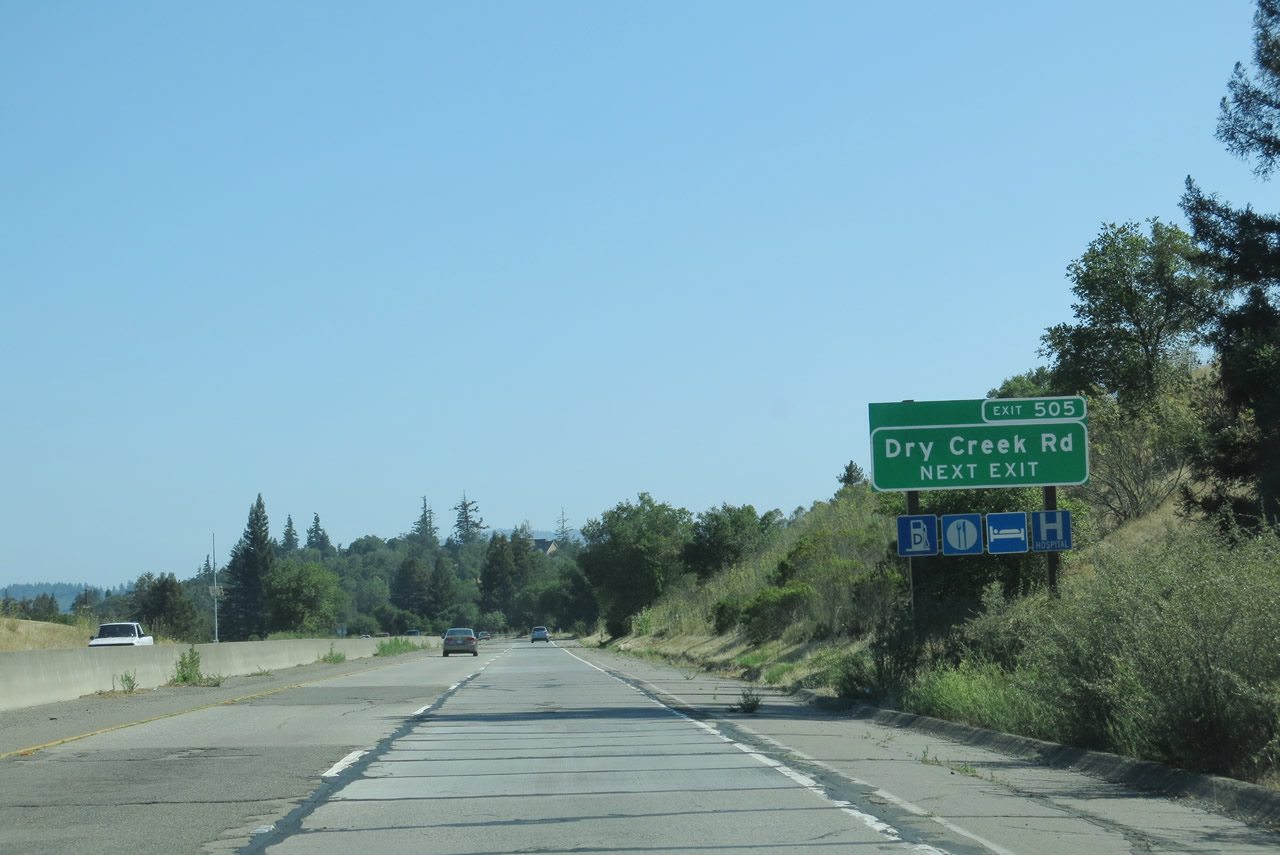
The next exit along U.S. 101 south is Exit 505, Dry Creek Road (one mile). Dry Creek Road travels northwest from here to Warm Springs Dam and Lake Sonoma; it has paralleled U.S. 101 since near Geyserville. To the east, Dry Creek Road leads into Healdsburg, becoming March Avenue after crossing Healdsburg Avenue (old U.S. 101). Photo taken 07/05/13. |
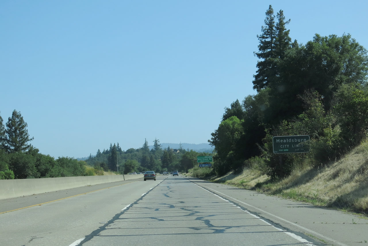 |
U.S. 101 south enters the city of Healdsburg. Home to 11,254 people as of the 2010 Census, the city of Healdsburg was founded in 1857 by entrepreneur Harmon Heald and incorporated as a city on February 20, 1867. The Northwestern Pacific Railroad was extended to Healdsburg in 1871, shortly after it became a city. Photo taken 07/05/13. |
 |
As the primary northern entrance into Healdsburg from U.S. 101 south, all motorist services are available in Healdsburg via Dry Creek Road. No signed business route passes through Healdsburg, but a loop can be made through the city via Dry Creek Road east to Healdsburg Avenue south. At the south end of downtown, a ramp directly links from Healdsburg Avenue south to U.S. 101 south. Photo taken 07/05/13. |
 |
U.S. 101 (Redwood Highway) meets Exit 505, Dry Creek Road east into Healdsburg and northwest to Lake Sonoma. Photo taken 07/05/13. |
 |
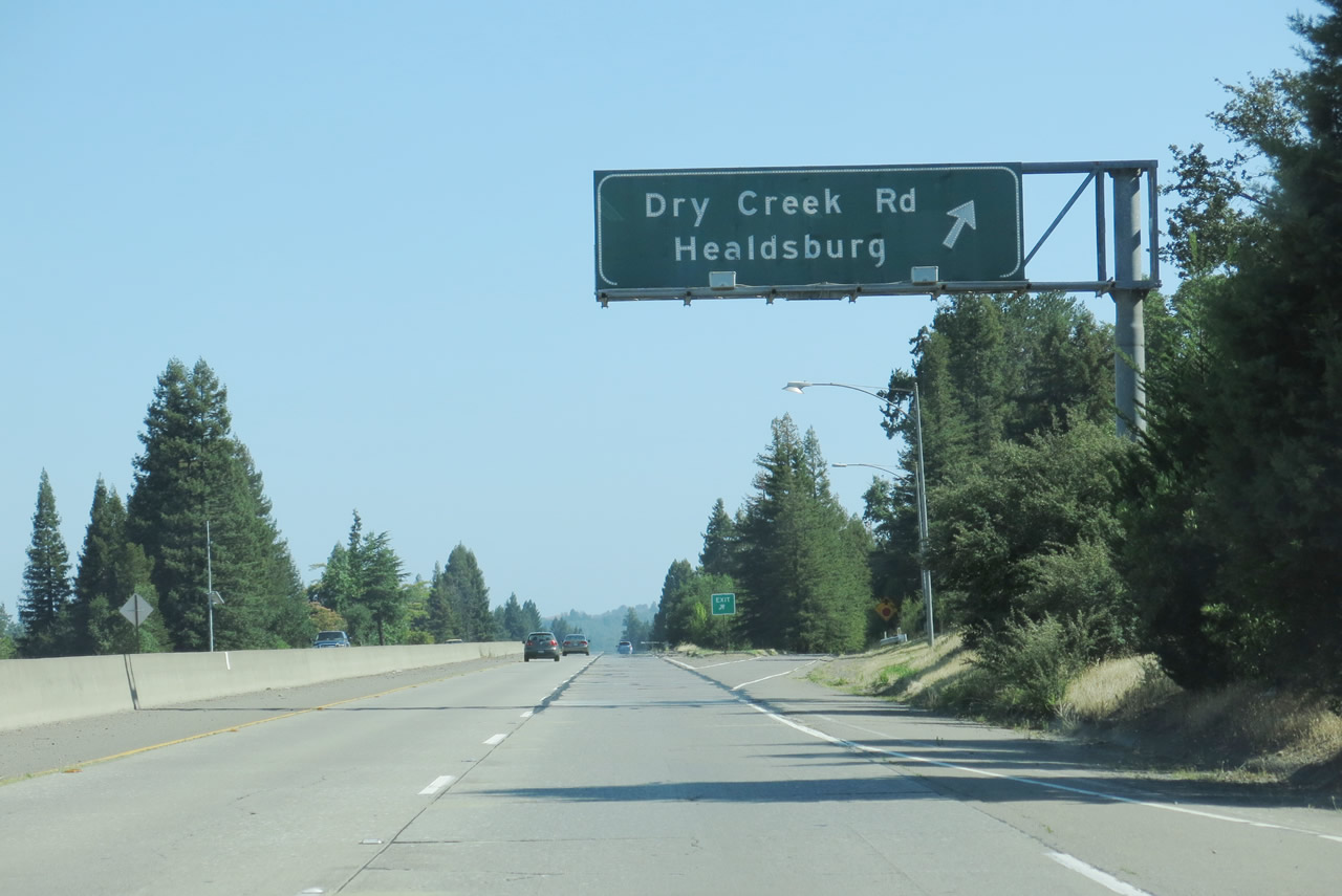
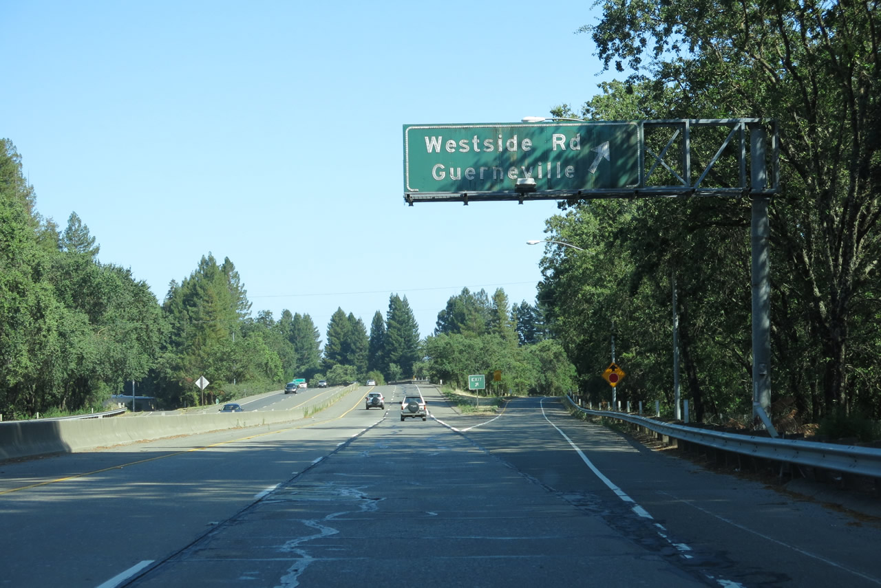
While crossing over Dry Creek Road, a guide sign announces the next interchange along U.S. 101 south: Exit 504, Westside Road southwest and Mill Street east. Mill Street leads into downtown Healdsburg. Exit 504 is a half-diamond interchange; the return to U.S. 101 south is made via Mill Street east to Healdsburg Avenue south. All motorist services are available in Healdsburg. Photo taken 07/05/13. |
 |
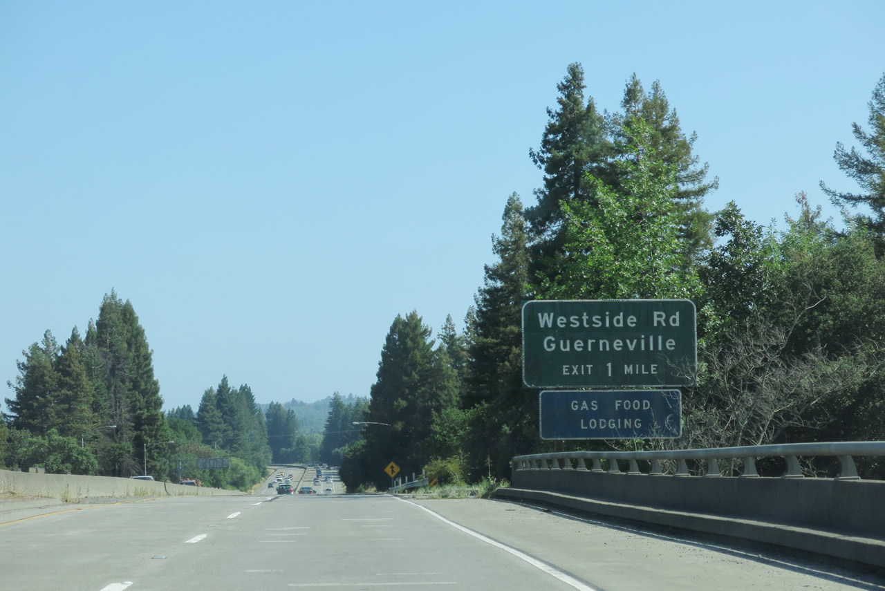
Westside Road follows the Russian River as it travels southwest toward Guerneville; it eventually connects with River Road east of Guerneville in Hacienda. Photo taken 07/05/13. |
 |
Tall trees surround U.S. 101 on its somewhat narrow bypass of Healdsburg as it skirts the western edge of downtown. Photo taken 07/05/13. |
 |
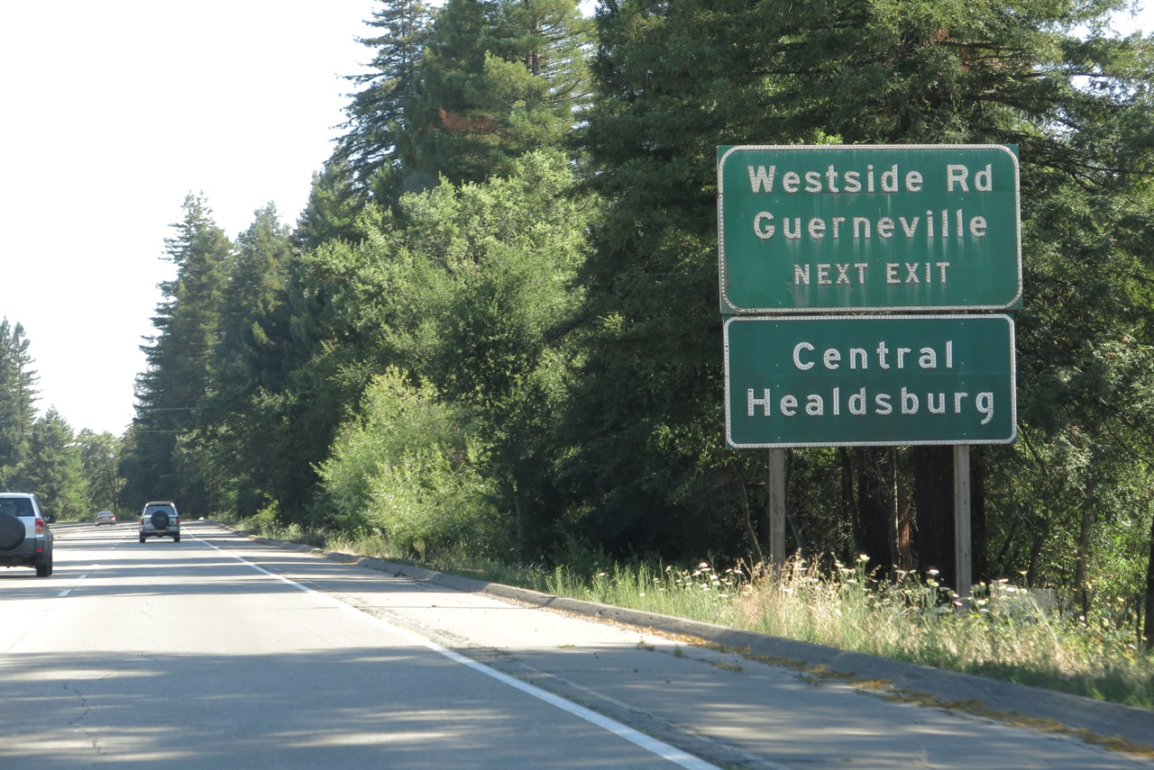
Southbound U.S. 101 (Redwood Highway) reaches Exit 504, Westside Road southwest and Mill Street east to downtown Healdsburg. Photo taken 07/05/13. |
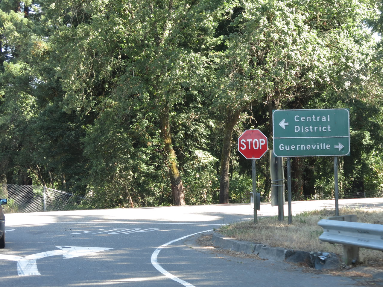 |
Now on the off-ramp to Exit 504, turn left for Mill Street east to downtown Healdsburg or turn right for Westside Road west to Guerneville. Photo taken 07/05/13. |
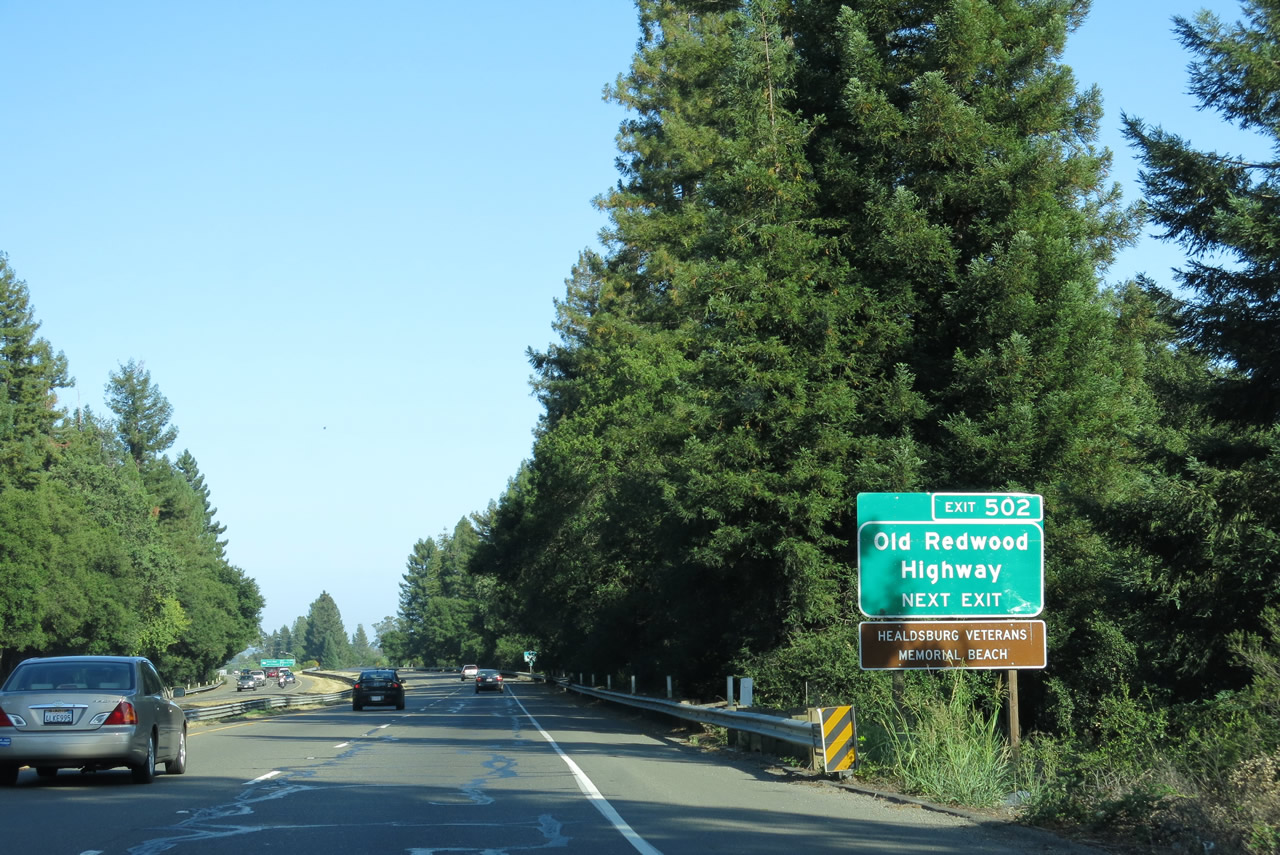 |
The next exit along U.S. 101 (Redwood Highway) is Exit 502, Old Redwood Highway (Historic U.S. 101). Use Exit 502 to the Healdsburg Veterans Memorial Beach. Photo taken 07/05/13. |
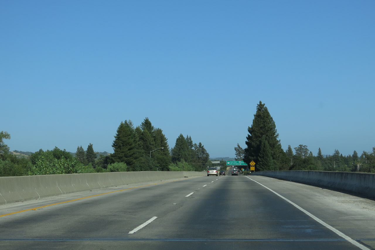 |
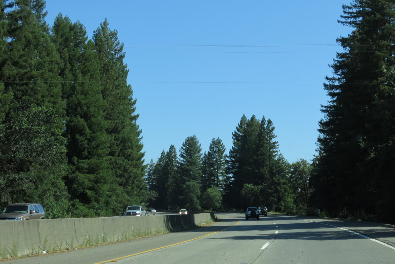
For a final time, U.S. 101 (Redwood Highway) crosses over the Russian River. The river will turn west from here, flowing toward Guerneville and onward to the Pacific Ocean. Ahead, U.S. 101 will continue onto the Santa Rosa Plain, a wide expanse of relatively flat land that includes the most populated portion of Sonoma County. Approximately 30 inches of rain fall in this area annually, mostly in the winter and spring each year. Sonoma County is generally considered to be the northern reaches of the North Bay region. Photo taken 07/05/13. |
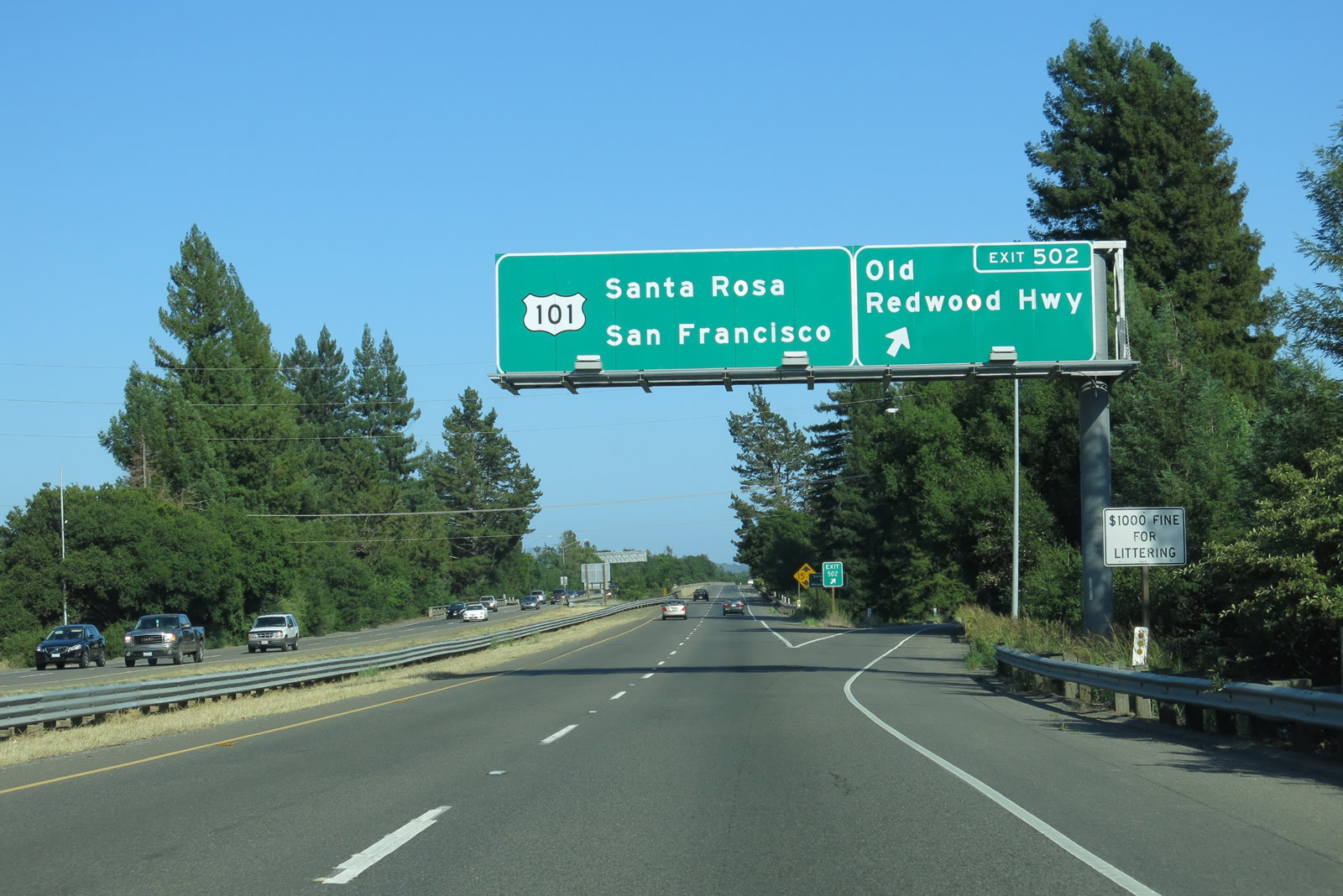 |
Southbound U.S. 101 (Redwood Highway) reaches Exit 502, Old Redwood Highway (Historic U.S. 101). The old alignment of U.S. 101 follows the freeway, connecting with the town of Windsor and city of Santa Rosa. Photo taken 07/05/13. |
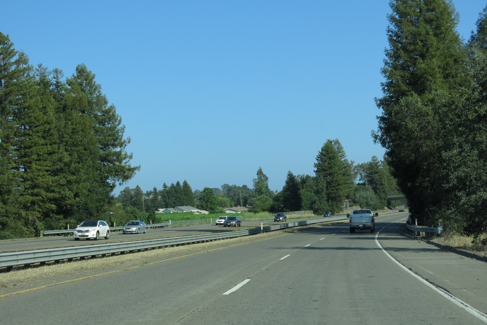 |
U.S. 101 (Redwood Highway) continues as a four-lane freeway between Healdsburg and Windsor. Photo taken 07/05/13. |
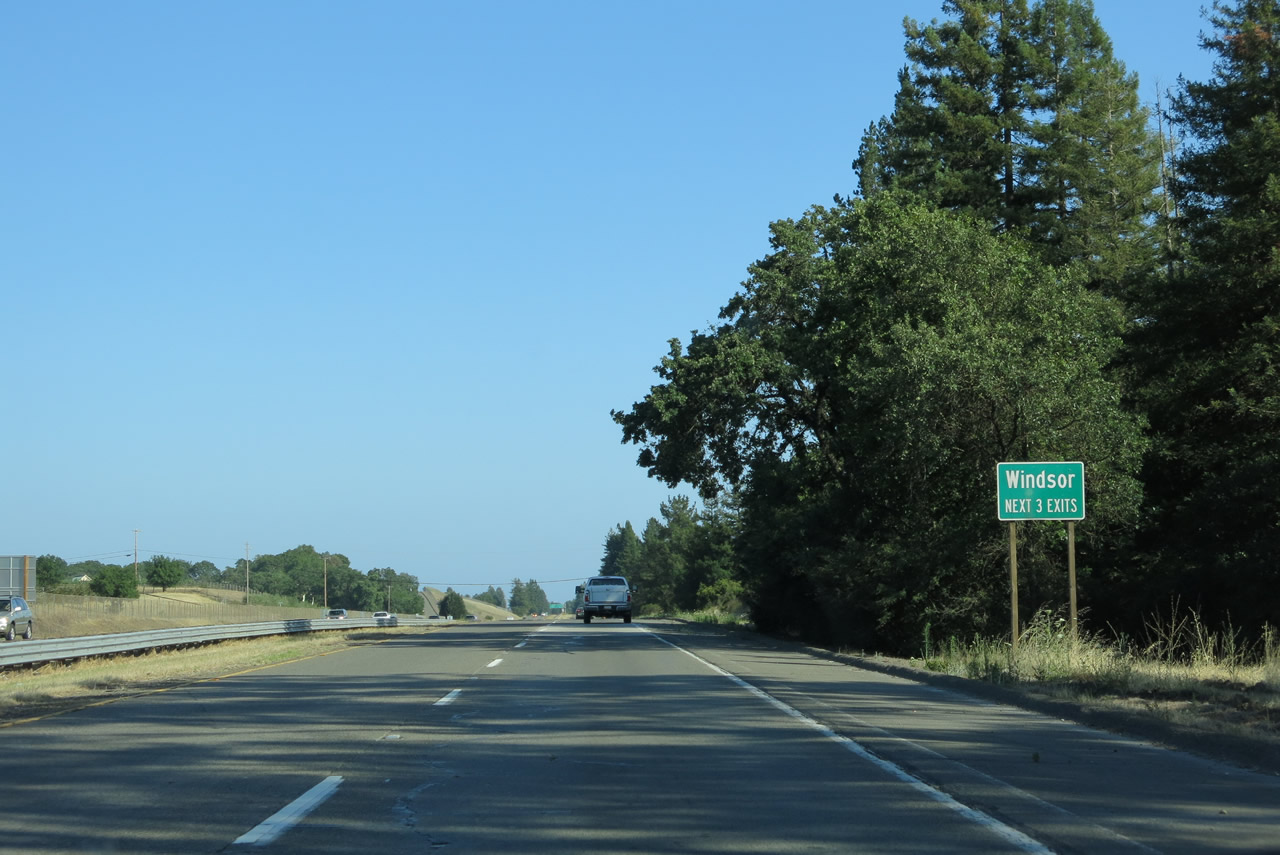 |
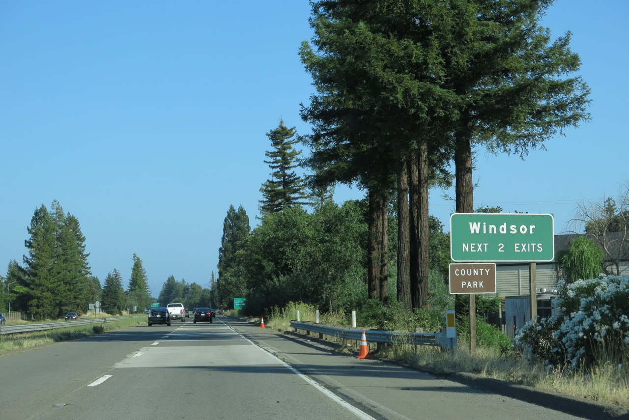
The next three exits along U.S. 101 (Redwood Highway) south serve the town of Windsor, which had a population of 26,801 as of the 2010 census and was incorporated on July 1, 1992. The next three interchanges are Exit 499, Arata Lane; Exit 498, Old Redwood Highway and Historic U.S. 101; and Exit 496, Shiloh Road. Photo taken 07/05/13. |
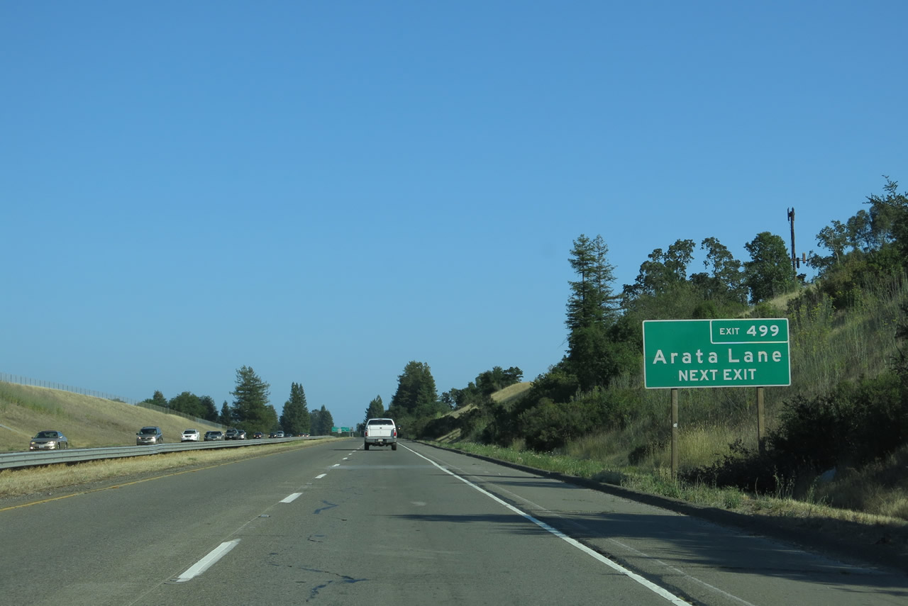 |
The next exit along U.S. 101 (Redwood Highway) south is Exit 499, Arata Lane. Photo taken 07/05/13. |
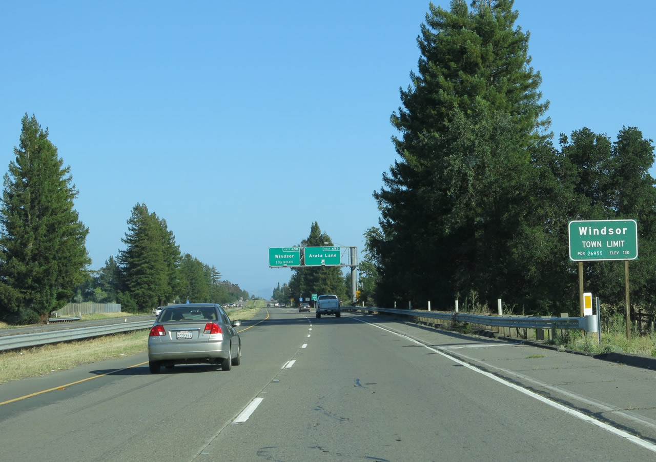 |
U.S. 101 (Redwood Highway) crosses the town limits of Windsor. Photo taken 07/05/13. |
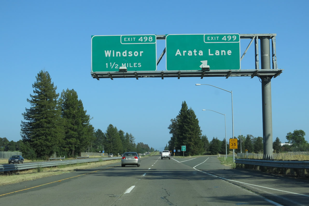 |
Southbound U.S. 101 (Redwood Highway) reaches Exit 499, Arata Lane. Use this exit also for Old Redwood Highway (Old U.S. 101) south into downtown Windsor. The next interchange along U.S. 101 south is Exit 498, Old Redwood Highway and Historic U.S. 101. Photo taken 07/05/13. |
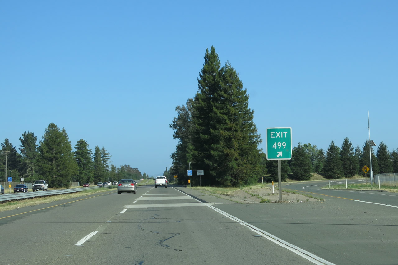 |
Exit 499 is signed at the gore point for the Arata Lane interchange. This off-ramp actually curves west to connect with Old Redwood Highway, which in turn connects to an intersection with Arata Lane. As of this writing, Arata Lane is the northern limits of residential development at the northern edge of Windsor on the east side of U.S. 101. After traveling a good distance east, Arata Lane turns south into Hembree Lane. Photo taken 07/05/13. |
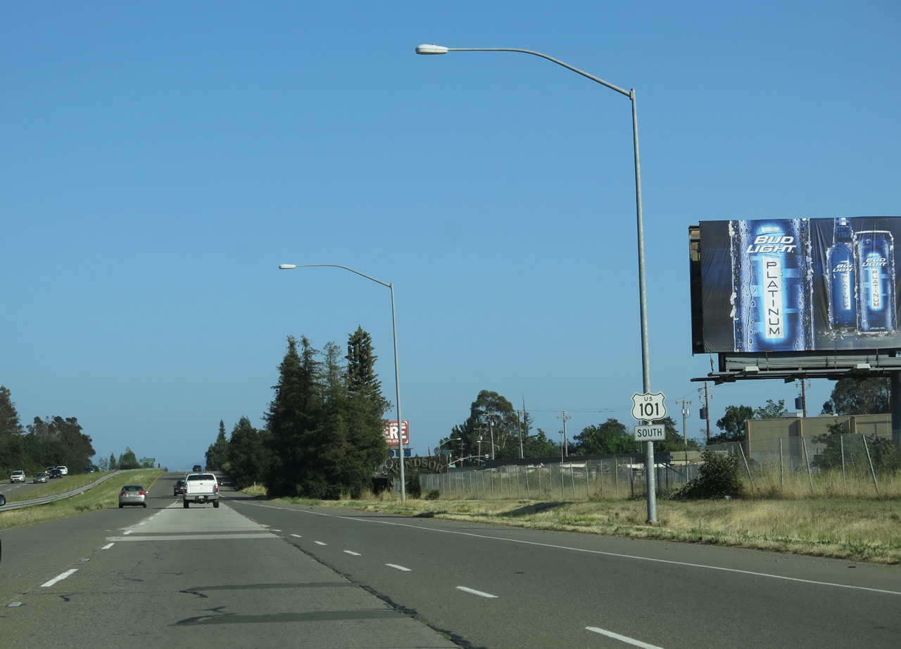 |
A U.S. 101 south reassurance shield is posted after the on-ramp from Arata Lane. Photo taken 07/05/13. |
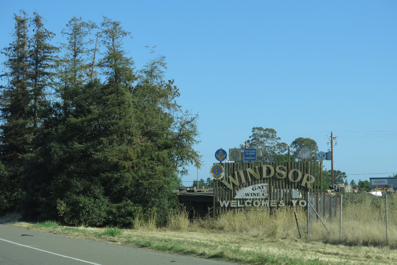 |
This "Windsor Welcomes You" sign is posted on the west side of the freeway. It has been damaged but would say that Windsor is the "Gateway to the Wine Country." Photo taken 07/05/13. |
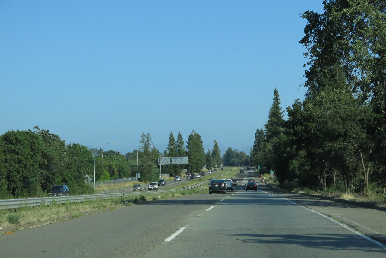 |
Four lanes carry U.S. 101 traffic through Windsor. Photo taken 07/05/13. |
 |
The next two exits serve the town of Windsor. Photo taken 07/05/13. |
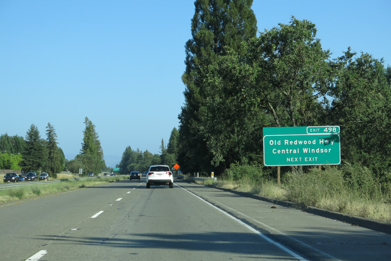 |
The next exit along U.S. 101 (Redwood Highway) south is Exit 498, Old Redwood Highway southeast and Windsor River Road west. Photo taken 07/05/13. |
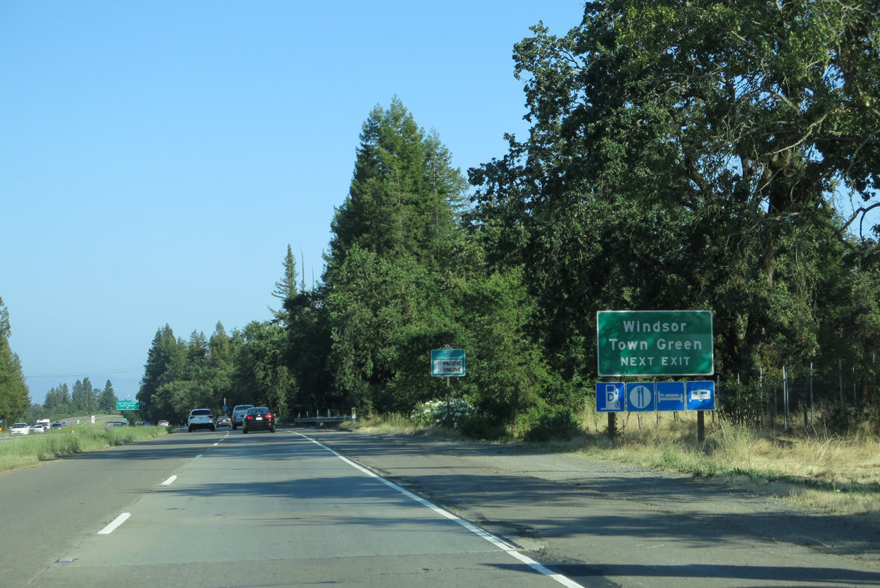 |
Use Exit 498 to Windsor Town Green, which is located on the west side of the freeway along Old Redwood Highway. Photo taken 07/05/13. |
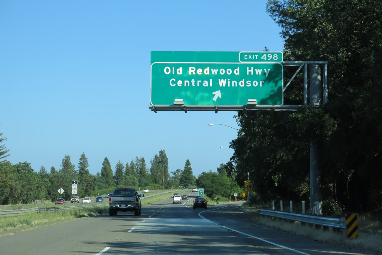 |
Southbound U.S. 101 reaches Exit 498, Old Redwood Highway and Windsor River Road. Photo taken 07/05/13. |
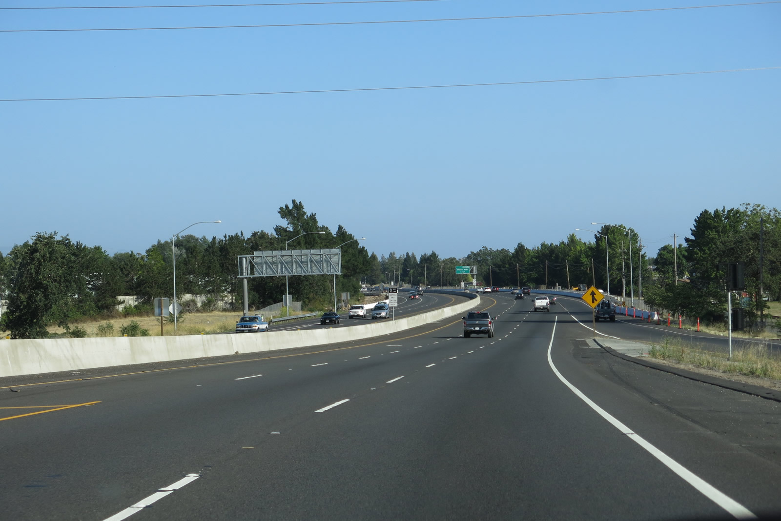 |
A freeway widening project that has been underway in phases through the late 2000s and early 2010s has resulted in a third lane for carpools (high occupancy vehicles) in each direction. This third lane began south of Exit 498 in Windsor. Photo taken 07/05/13. |
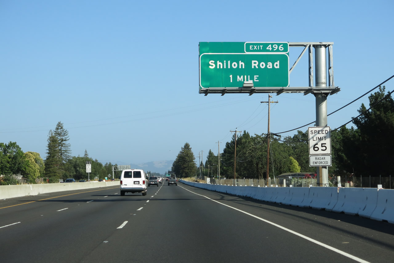 |
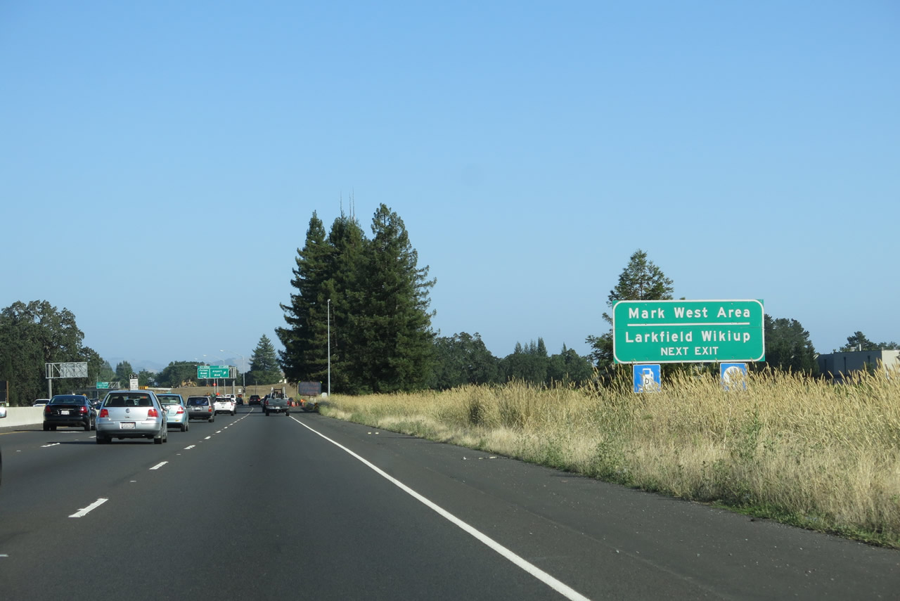
The next exit along U.S. 101 (Redwood Highway) south is Exit 496, Shiloh Road (one mile). Now south of downtown Windsor, this exit will serve the southern reaches of that town. Photo taken 07/05/13. |
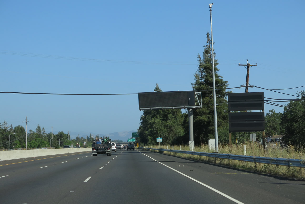 |
A variable message sign is posted shortly thereafter along U.S. 101 south. Photo taken 07/05/13. |
 |
Shiloh Road travels east to Old Redwood Highway and west to Windsor Road. Photo taken 07/05/13. |
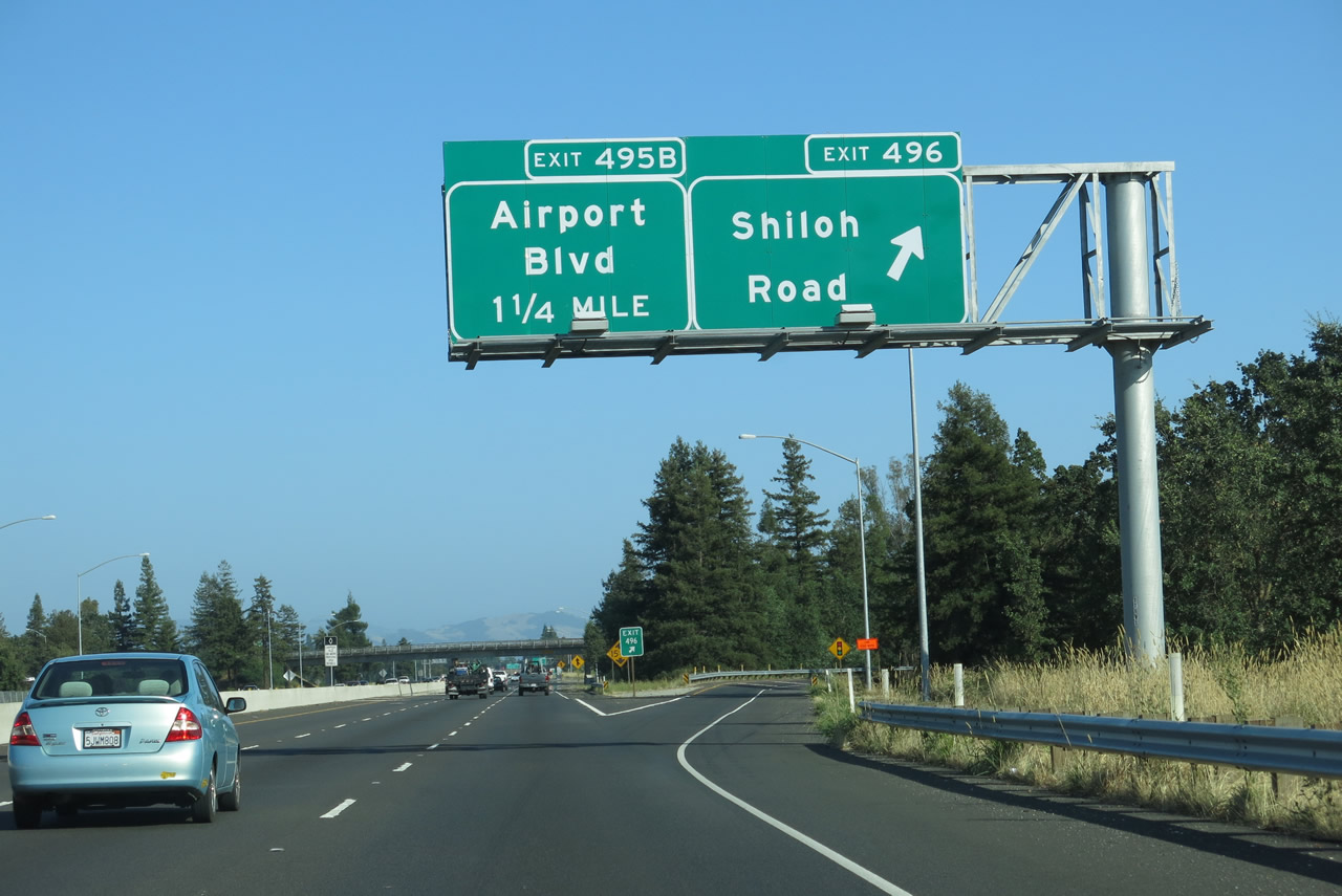 |
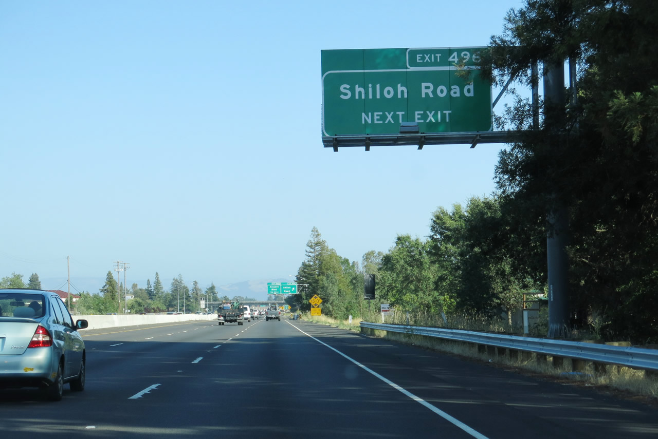
Southbound U.S. 101 (Redwood Highway) reaches Exit 496, Shiloh Road. The following interchange is Exit 495B, Airport Boulevard. Photo taken 07/05/13. |
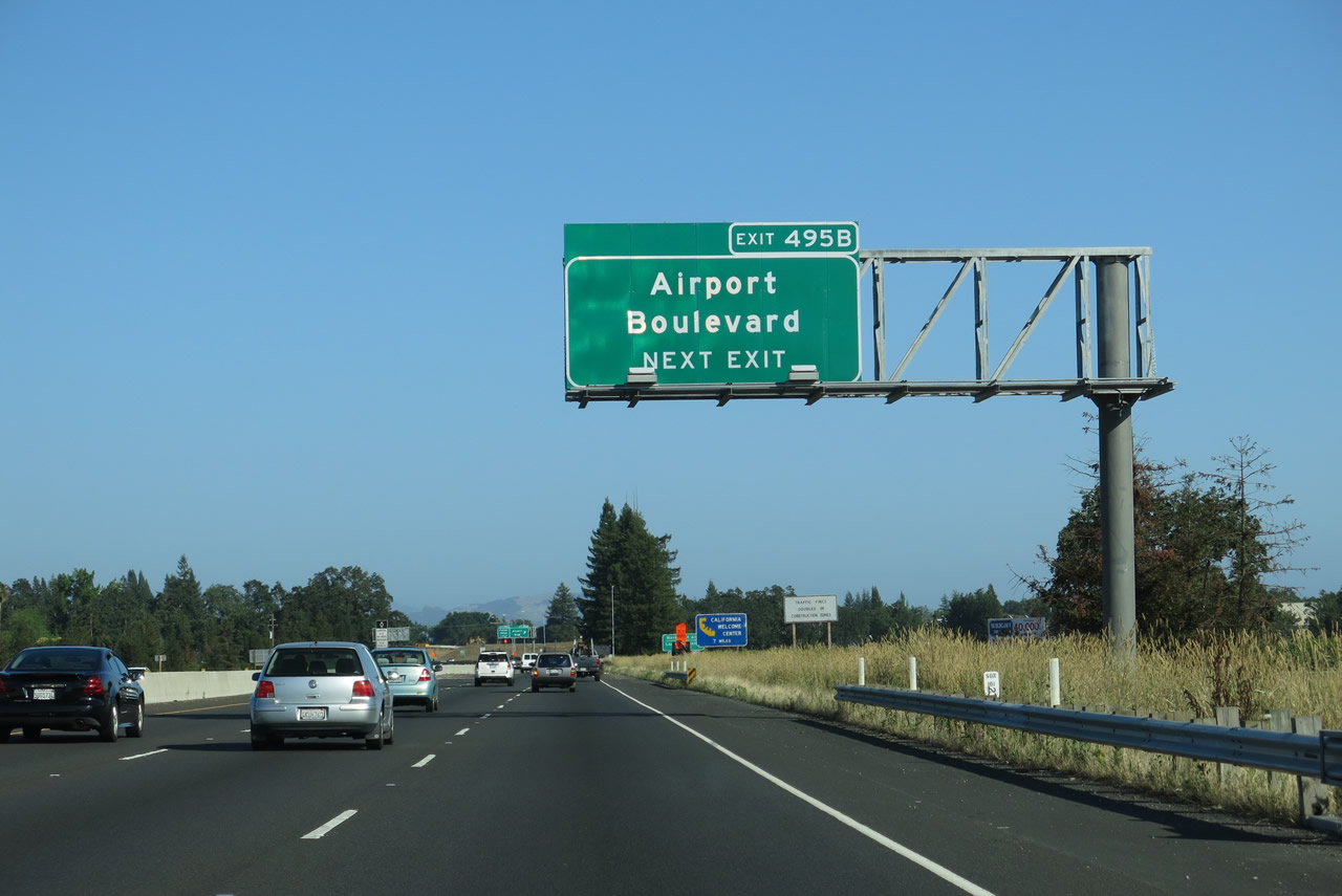 |
The next exit along U.S. 101 (Redwood Highway) south is Exit 495B, Airport Boulevard. A project is underway as of July 2013 to eliminate the Fulton Road interchange, which would be accommodated by a revision of the Airport Boulevard interchange. The U.S. 101/Airport Boulevard project page stated that "this project will convert the two existing partial interchanges on U.S. 101 at Fulton Road and at Airport Boulevard into a single complete interchange at Airport Boulevard, eliminating the on- and off- ramps at Fulton Road." The project should be fully completed by the end of 2014. Photo taken 07/05/13. |
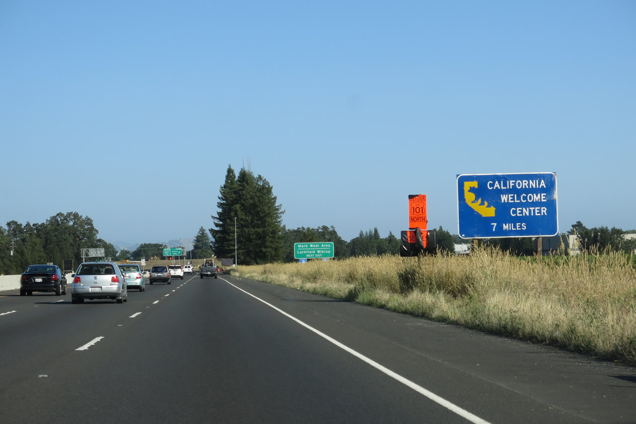 |
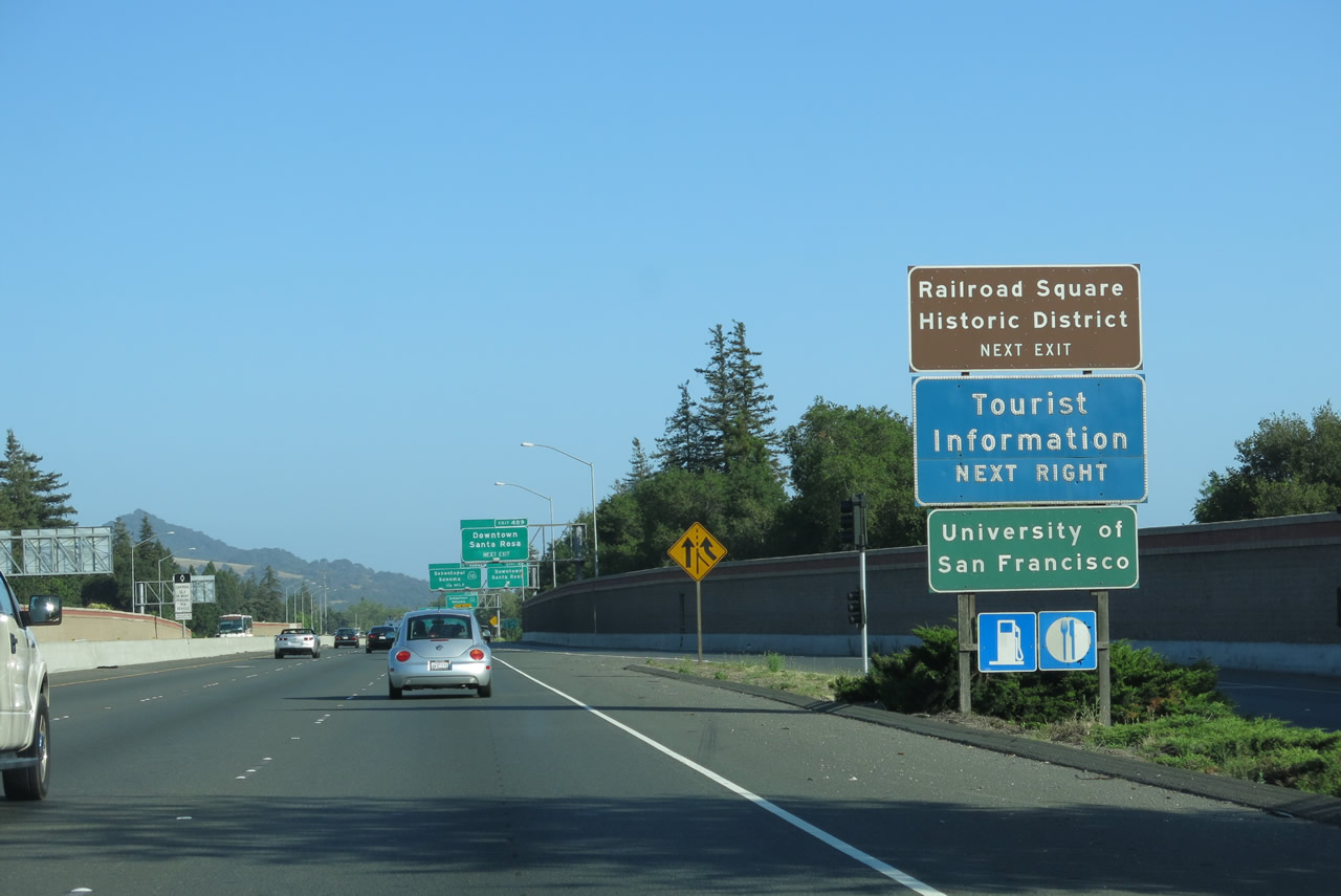
A California Welcome Center is located at Railroad Square in downtown Santa Rosa. Follow U.S. 101 (Redwood Highway) south to Exit 489, Davis Street south to Fourth Street west to Depot Park. The welcome center is located within the historic railroad depot building. Photo taken 07/05/13. |
 |
Use Exit 495B for Airport Boulevard west to Charles M. Schulz Sonoma County Airport, which is located a little more than a mile west of U.S. 101 and offers commercial and general aviation service. To the east, Airport Boulevard connects with Old Redwood Highway in the unincorporated community of Larkfield-Wikiup. Photo taken 07/05/13. |
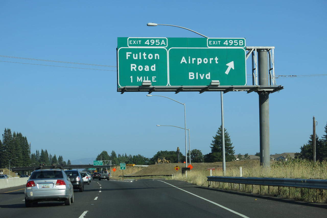 |
Southbound U.S. 101 (Redwood Highway) reaches Exit 495B, Airport Boulevard. The following interchange is Exit 495A, Fulton Road. Photo taken 07/05/13. |
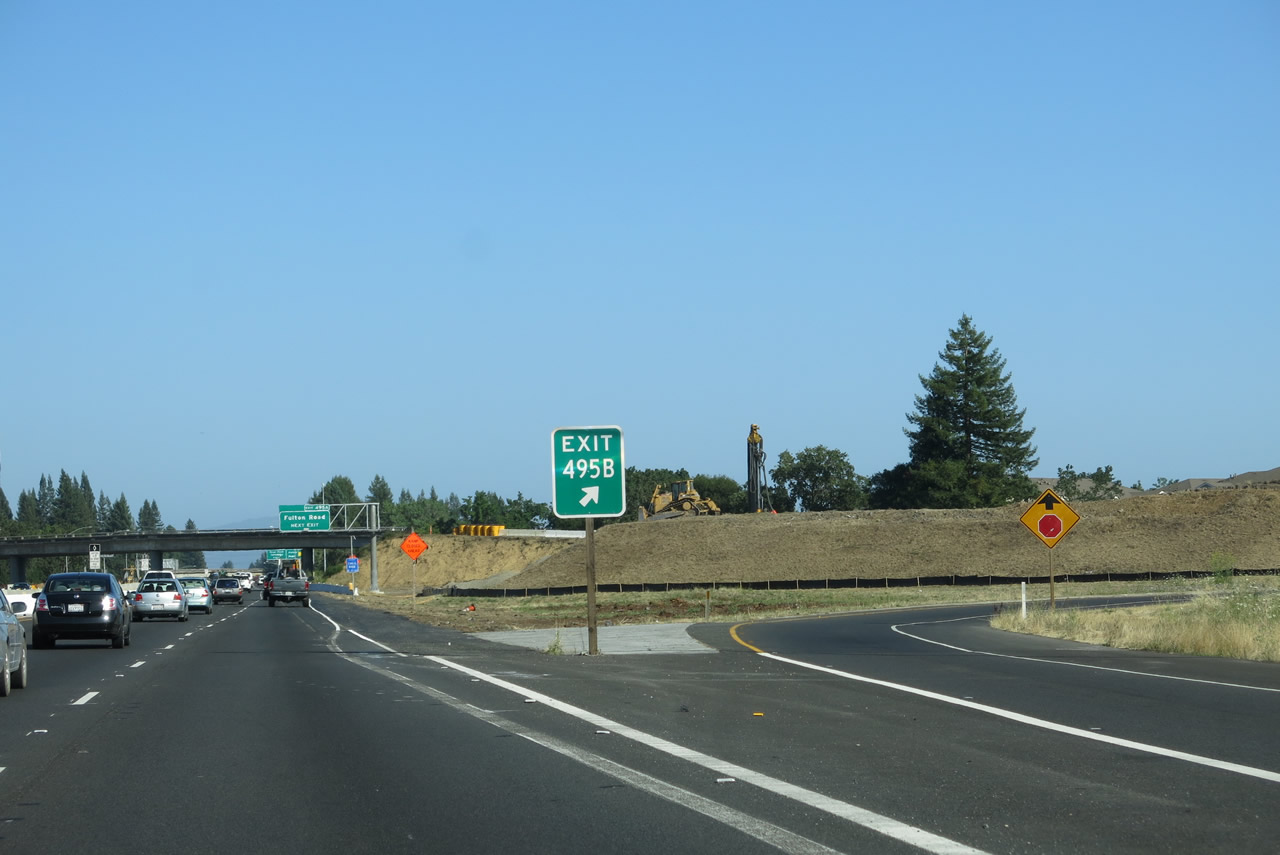 |
Exit 495B is posted at the gore point. Photo taken 07/05/13. |
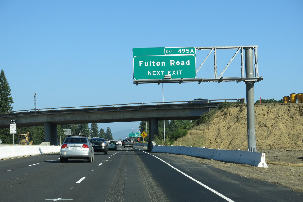 |
The next exit along U.S. 101 (Redwood Highway) south is Exit 495A, Fulton Road. Use Fulton Road south to western Santa Rosa. The California 12 freeway segment through downtown Santa Rosa currently meets its western terminus at Fulton Road. Photo taken 07/05/13. |
 |
Southbound U.S. 101 (Redwood Highway) meets Exit 495A, Fulton Road. The off-ramp was closed due to ongoing interchange construction. Photo taken 07/05/13. |
 |
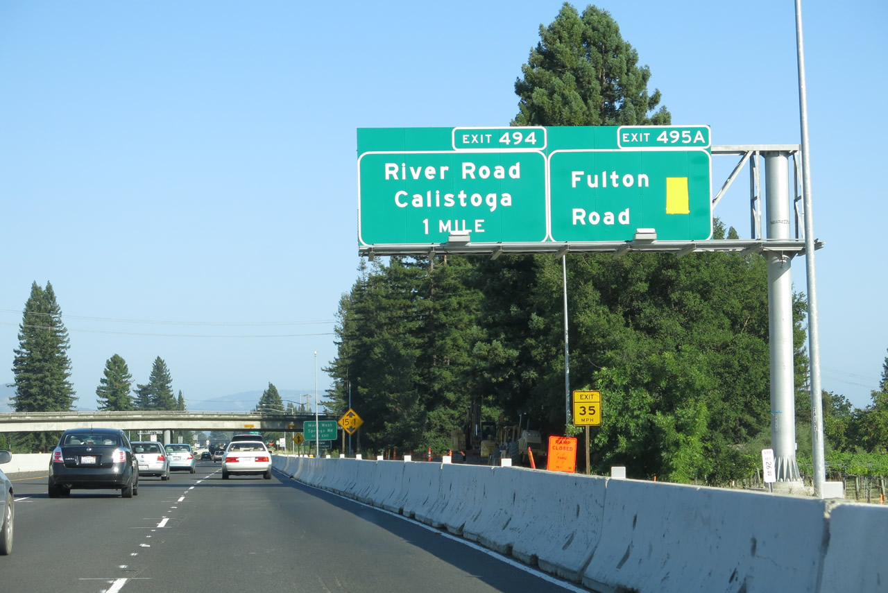
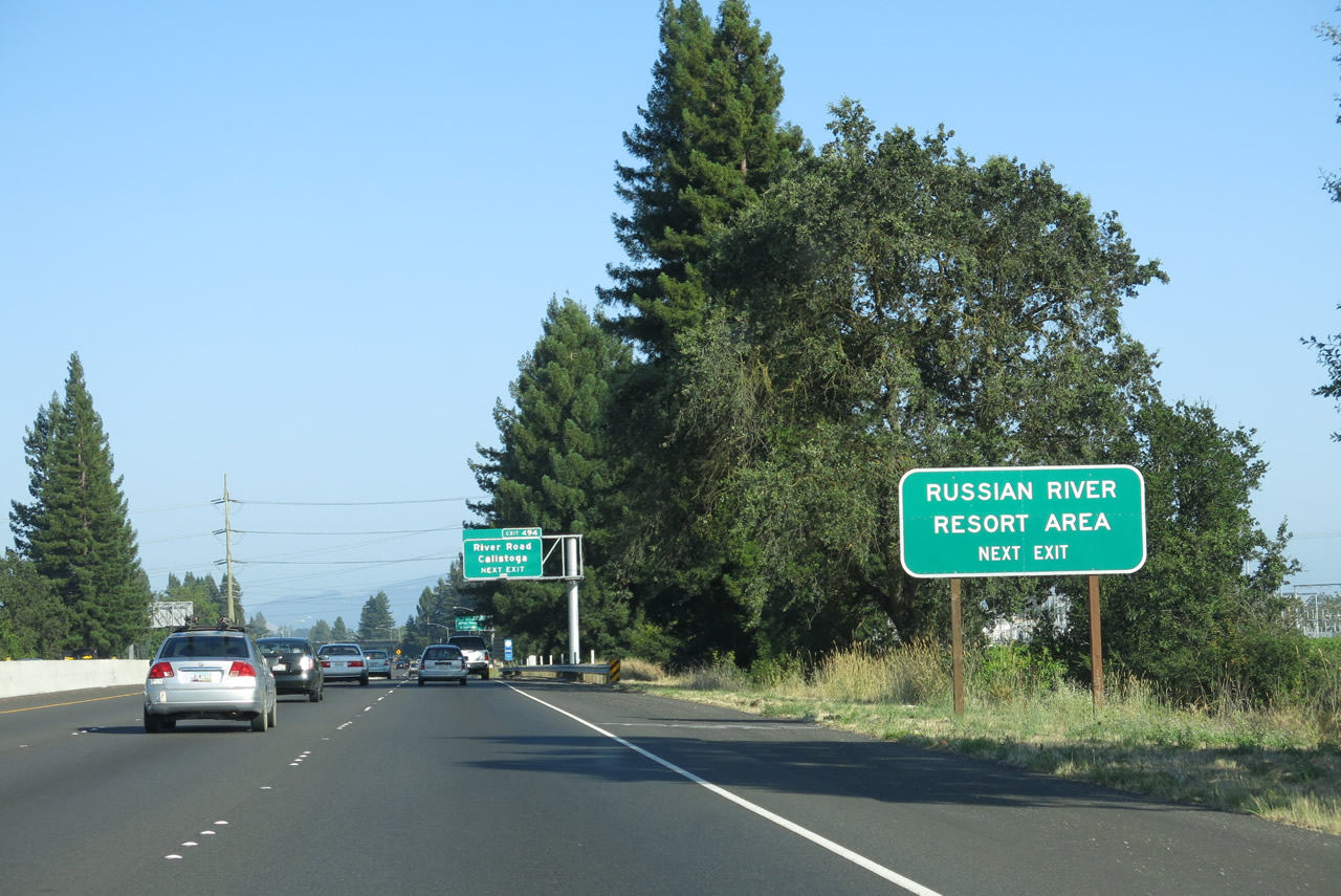
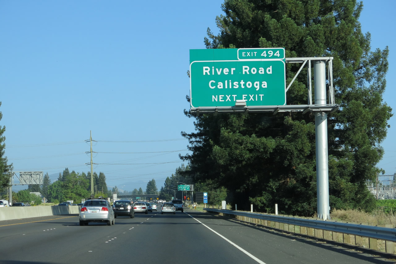
The next exit along U.S. 101 (Redwood Highway) south is Exit 494, River Road west to Guerneville and Mark West Springs Road east to Calistoga. Mark West Springs Road travels east toward Larkfield-Wikiup, Mark West, and the city of Calistoga, which is located at the confluence of California 128 and California 29 at the northern end of Napa Valley. Mark West Springs Road changes names into Porter Creek Road, and a left turn onto Petrified Forest Road east is necessary to connect to Calistoga. Other communities in Lake County (including Middletown and Clearlake) and Napa Valley (such as St. Helena and Yountville) can be reached via Mark West Springs Road east (as opposed to using California 128 east or California 175 east). Photo taken 07/05/13. |
 |
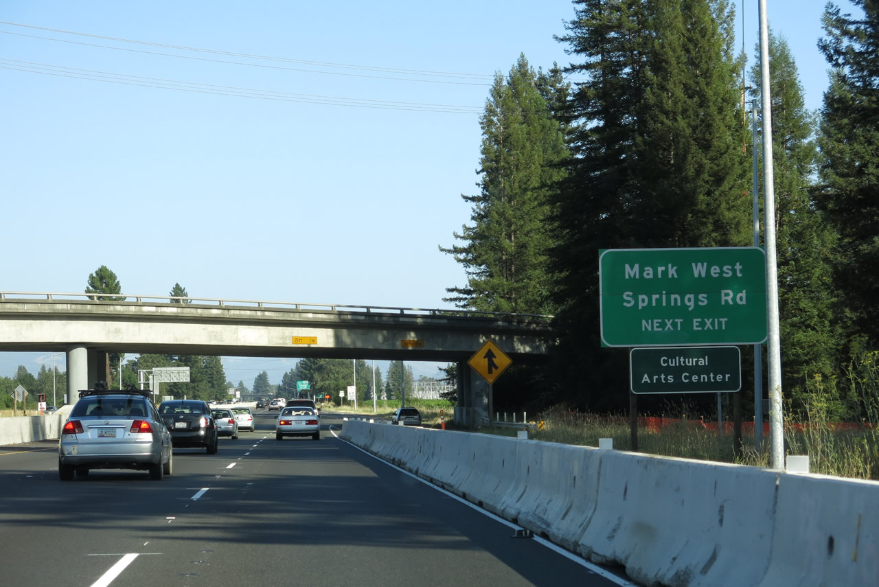
After the Fulton Road interchange, we find a U.S. 101 south reassurance marker. Just north of the River Road and Mark West Springs Road interchange, we see several Pacific Gas and Electric powerlines crossing U.S. 101 to connect to the power substation located on the west side of the freeway. The 230kV power line travels north from this substation to The Geysers, where geothermal electricity is produced. Photo taken 07/05/13. |
 |
River Road is the most direct route from northern Santa Rosa to Guerneville. Initially, River Road will follow the southern bank of the Russian River, but it switches to the north side before reaching Guerneville. West of Guerneville, River Road becomes part of California 116, and the state highway continues to follow the Russian River all the way to the coast, where California 116 ends at California 1 (Shoreline Highway) in the small community of Jenner. Photo taken 07/05/13. |
 |
U.S. 101 south approaches River Road west and Mark West Springs Road east. Photo taken 07/05/13. |
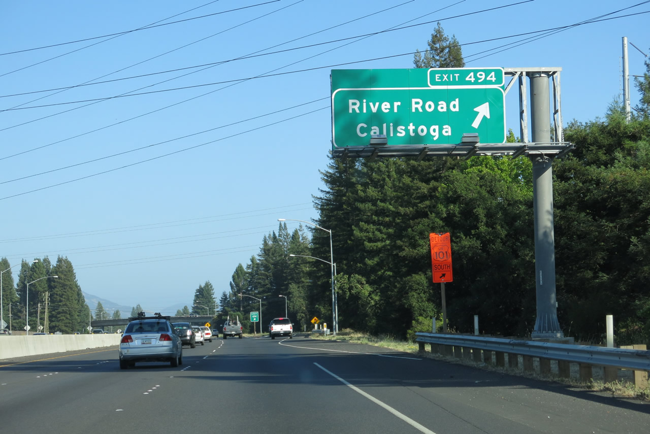 |
Southbound U.S. 101 (Redwood Highway) reaches Exit 494, River Road west to Fulton, Guerneville, and Jenner and Mark West Springs Road east to Mark West, Calistoga, and northern Napa Valley. Photo taken 07/05/13. |
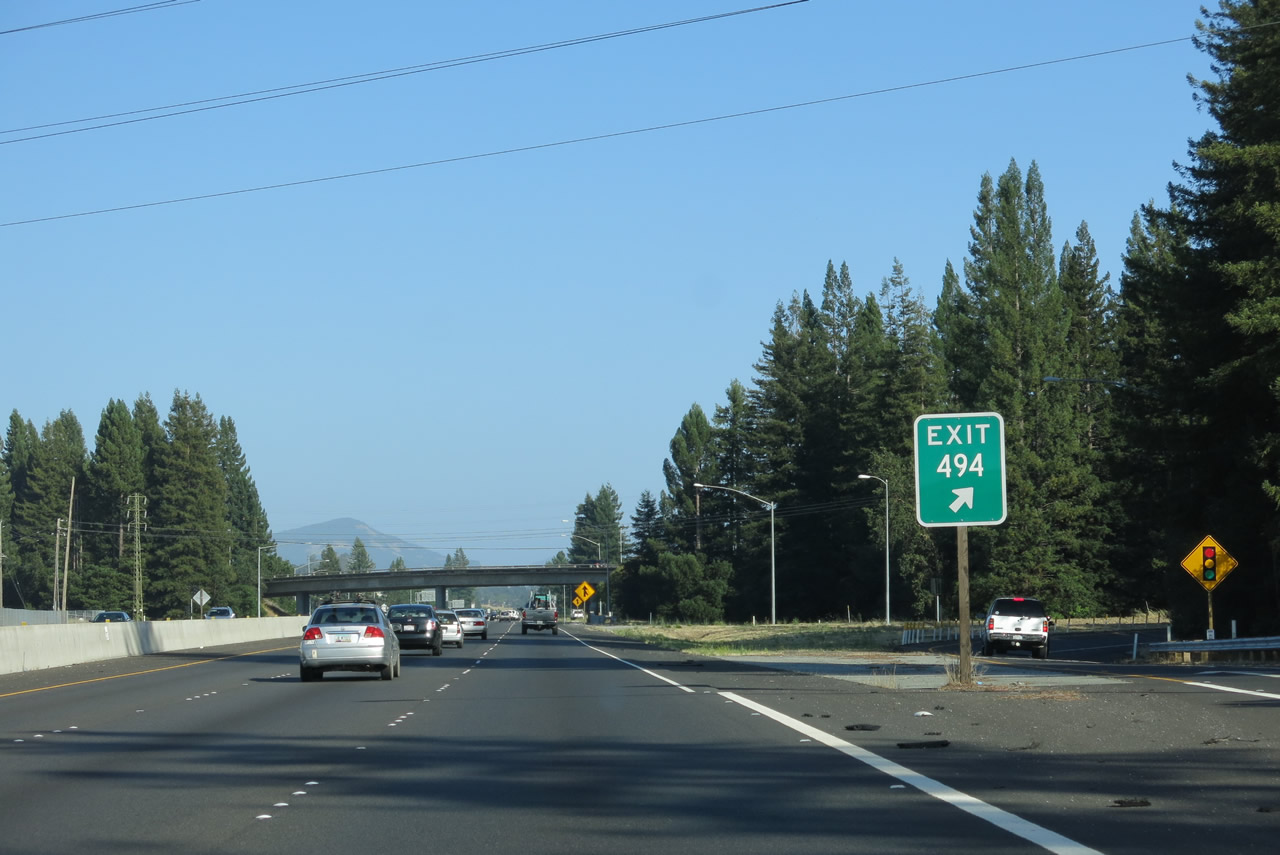 |
Three lanes carry U.S. 101 (Redwood Highway) south through the Exit 494 interchange. Tall redwoods surround the interchange. Photo taken 07/05/13. |
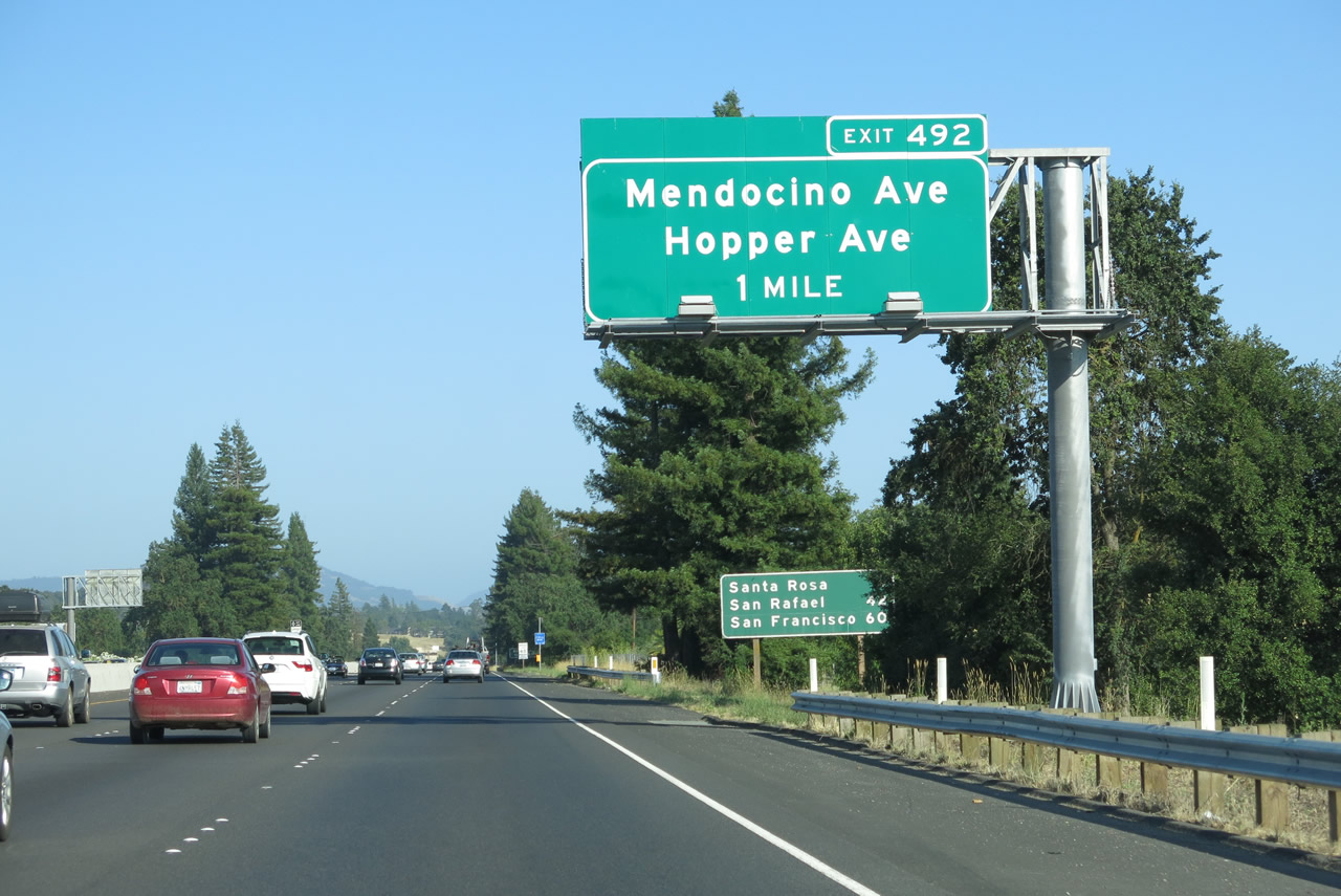 |
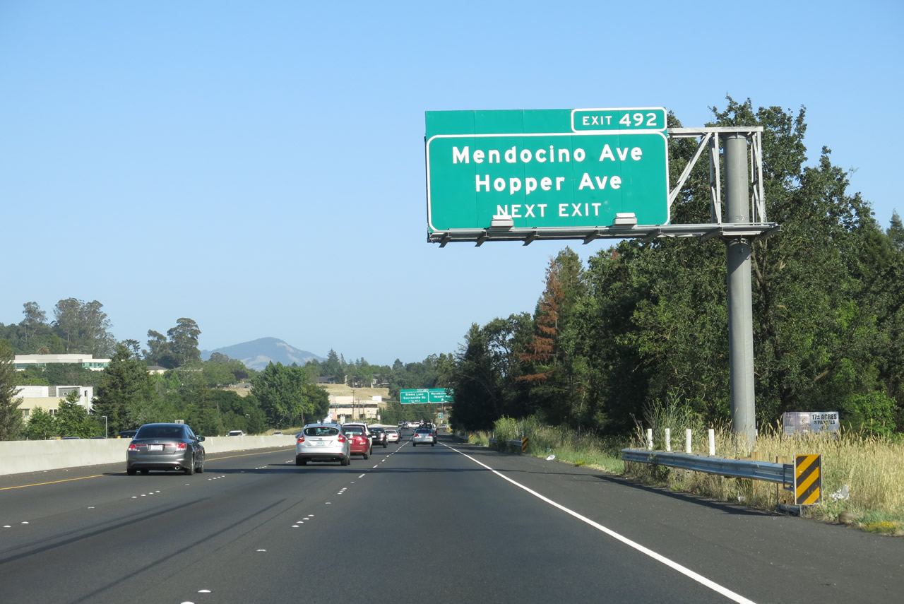
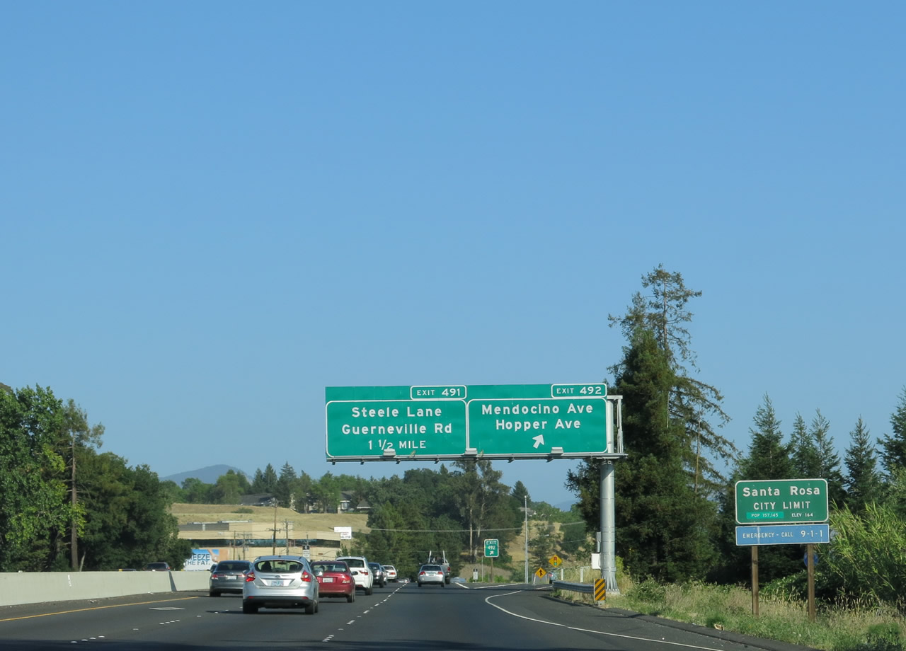
The next interchange along U.S. 101 (Redwood Highway) south is Exit 492, U.S. 101 Business/Mendocino Avenue south, Old Redwood Highway north, Hopper Avenue west, and Cleveland Avenue south. The off-ramp will link directly to Hopper Avenue and Cleveland Avenue and offer a signed path to Mendocino Avenue on the east side of the freeway. Photo taken 07/05/13. |
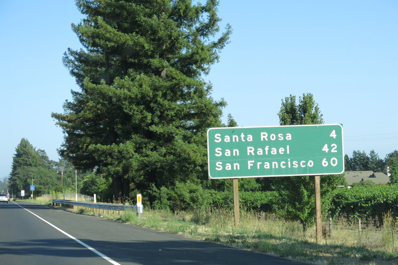 |
This mileage sign along U.S. 101 (Redwood Highway) south provides the distance to Santa Rosa (four miles), San Rafael (42 miles), and San Francisco (60 miles). Photo taken 07/05/13. |
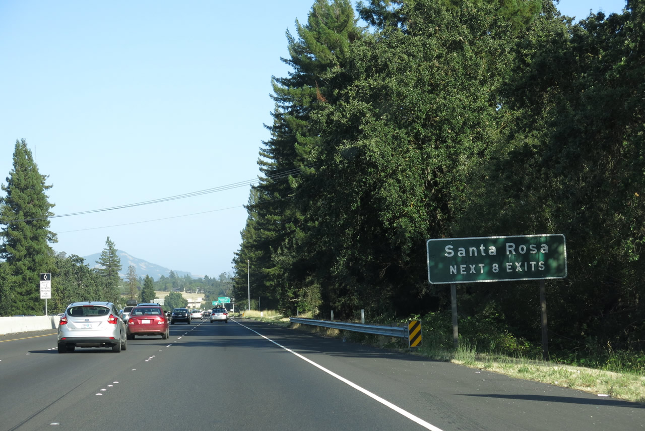 |
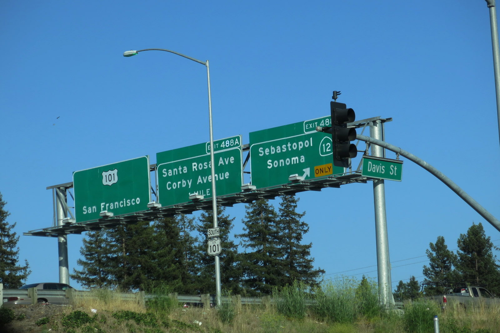
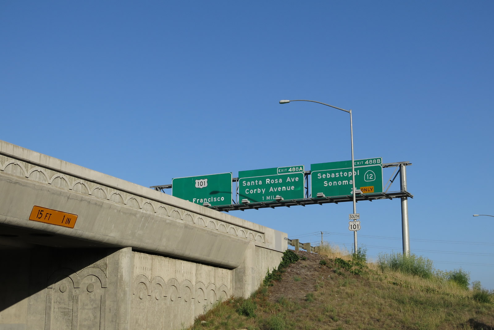
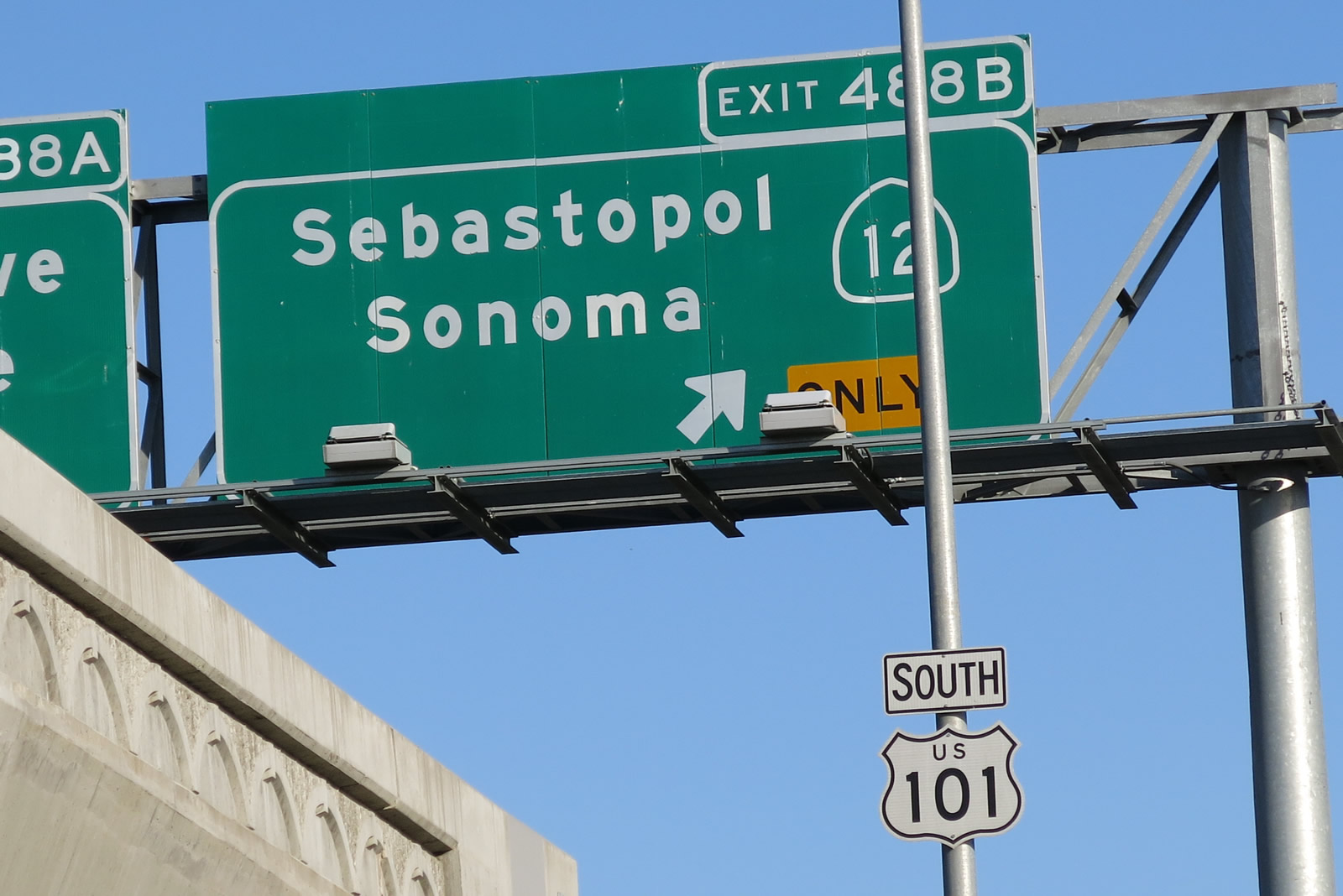
The next eight exits from U.S. 101 (Redwood Highway) south serve the city of Santa Rosa: Exit 492, U.S. 101 Business/Mendocino Avenue south, Old Redwood Highway north, Hopper Avenue west, and Cleveland Avenue south; Exit 491, Steele Lane and Guerneville Road; Exit 490, College Avenue; Exit 489, Downtown Santa Rosa (Davis Street to Sixth, Fifth, Fourth, and Third Streets); Exit 488B, California 12 west to Sebastopol and east to Sonoma; Exit 488A, To U.S. 101 Business/Santa Rosa Avenue and Baker Avenue; Exit 487, Hearn Avenue and Yolanda Avenue; and Exit 485, Todd Road. Photo taken 07/05/13. |
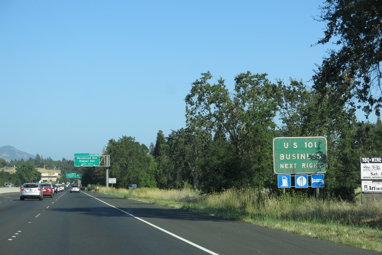 |
U.S. 101 Business follows Mendocino Avenue and Santa Rosa Avenue through Santa Rosa. Since we first visited the area in 1992, the business loop has only been signed from the southbound U.S. 101 freeway and only signed around the north end of the route. This remains the case in 2013. Having said that, various trailblazers pointing the way back to the U.S. 101 freeway are commonly found along both Mendocino Avenue and Santa Rosa Avenue. Photo taken 07/05/13. |
 |
To Mendocino Avenue, follow Exit 492 and turn left onto Cleveland Avenue south, then turn left onto a bridge over the freeway that links to Mendocino Avenue. This path is fairly well signed with U.S. 101 Business and Mendocino Avenue signs. Photo taken 07/05/13. |
 |
The city of Santa Rosa is the seat of Sonoma County. Incorporated on March 26, 1868, Santa Rosa was home to Luther Burbank, a world-renowned horticulturist. Burbank introduced hundreds of plants in the region during his 50-year stay in Santa Rosa, until his death in 1926. Luther Burbank's home and gardens are preserved near downtown Santa Rosa, and are a national historic landmark. Santa Rosa was home to Peanuts creator Charles M. Schulz from 1958 through 2002. The Peanuts comic strip still runs in newspapers today; a museum dedicated to Mr. Schulz's life work is found at Charles M. Schulz Museum and Research Center. The museum is located near the Redwood Empire Ice Arena and Snoopy's Gallery and Gift Shop at the intersection of West Steele Lane and Hardies Lane west of U.S. 101. Use Exit 491A to reach the museum. As of the 2000 Census, 147,595 lived in Santa Rosa; by 2005, the population had estimated to increase to 153,158 residents. By the 2010 Census, Santa Rosa had a population of 167,815. Photo taken 07/05/13. |
 |
Southbound U.S. 101 (Redwood Highway) meets Exit 492, U.S. 101 Business/Mendocino Avenue south, Old Redwood Highway north, Hopper Avenue west, and Cleveland Avenue south. There is no direct exit from U.S. 101 south onto Bicentennial Way, so access to Bicentennial way is achieved via Exit 492 as well (follow the signs for Mendocino Avenue south). Photo taken 07/05/13. |
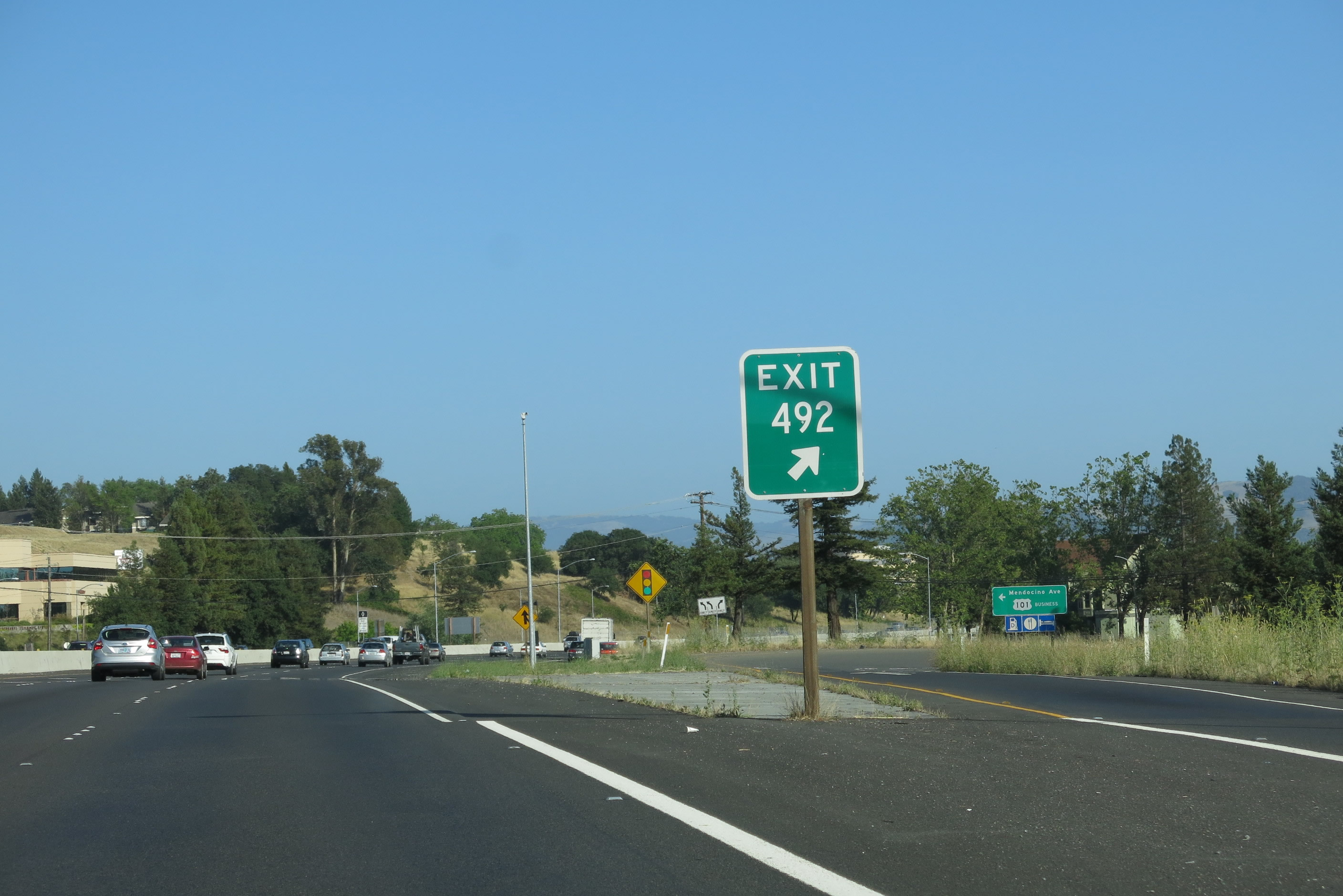 |
A U.S. 101 Business route marker guide sign is posted on the off-ramp to Exit 492. The business route follows the old alignment of U.S. 101 before the modern freeway alignment was built. Photo taken 07/05/13. |
 |
Traffic from Hopper Avenue and Cleveland Avenue merge onto U.S. 101 (Redwood Highway) south as part of the Exit 492 interchange. Photo taken 07/05/13. |
|
Traffic from Hopper Avenue and Cleveland Avenue merge onto U.S. 101 (Redwood Highway) south as part of the Exit 492 interchange. Photo taken 07/05/13. |
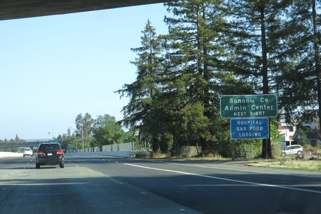 |
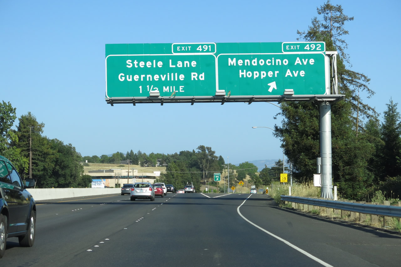
The next exit along U.S. 101 (Redwood Highway) south is Exit 491, Steele Lane and Guerneville Road. All motorist services are available at this exit (gas, food, lodging, and hospital). Photo taken 07/05/13. |
 |
U.S. 101 continues with three southbound lanes as it enters urban Santa Rosa. Photo taken 07/05/13. |
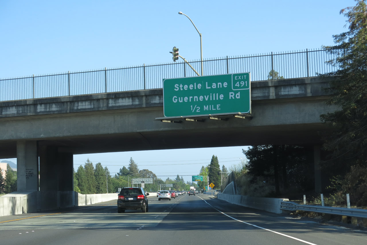 |
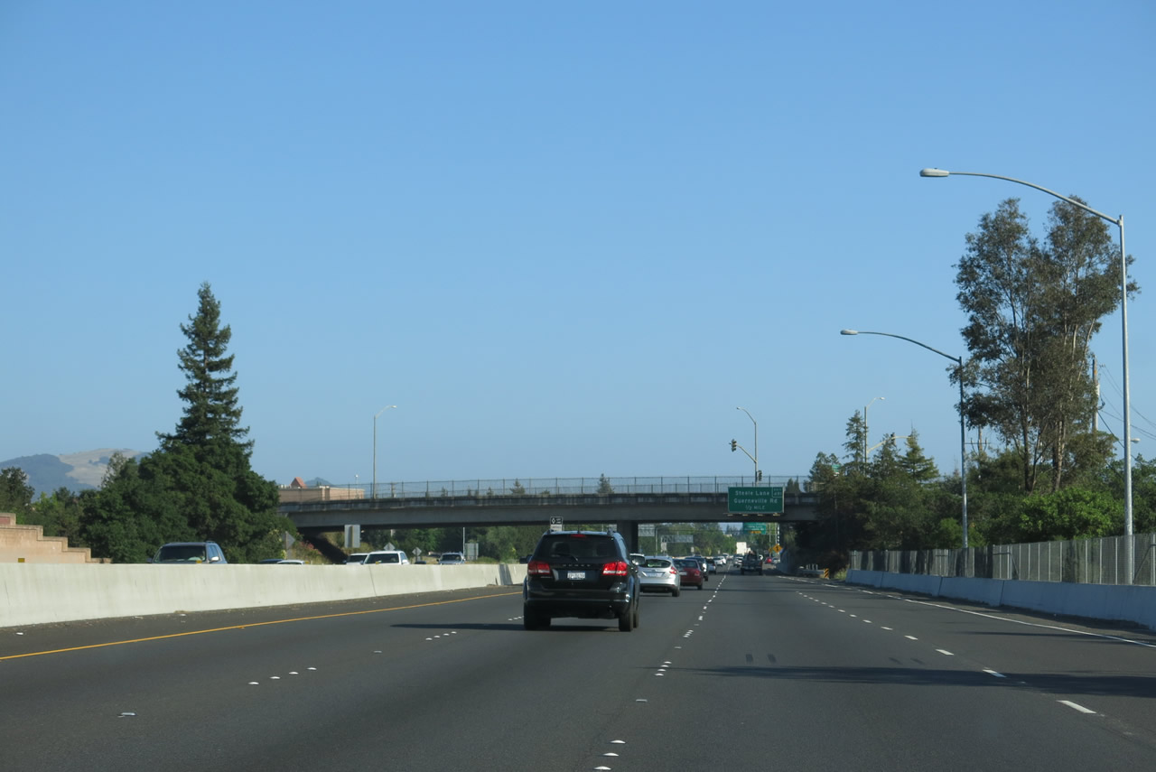
Passing under Bicentennial Way, U.S. 101 (Redwood Highway) south approaches Exit 491, Steele Lane east to U.S. 101 Business/Mendocino Avenue and Guerneville Road west to California 116 near Forestville. Steele Lane extends west to Marlow Road and east to U.S. 101 Business/Mendocino Avenue. Guerneville Road travels southeast from this interchange to a point southwest of its intersection with Dutton Avenue, then it turns due west to travel all the way to California 116/Gravenstein Highway north of Sebastopol. Guerneville Road doesn't make it all the way to Guerneville, but California 116 travels the remaining distance northwest to Guerneville. Photo taken 07/05/13. |
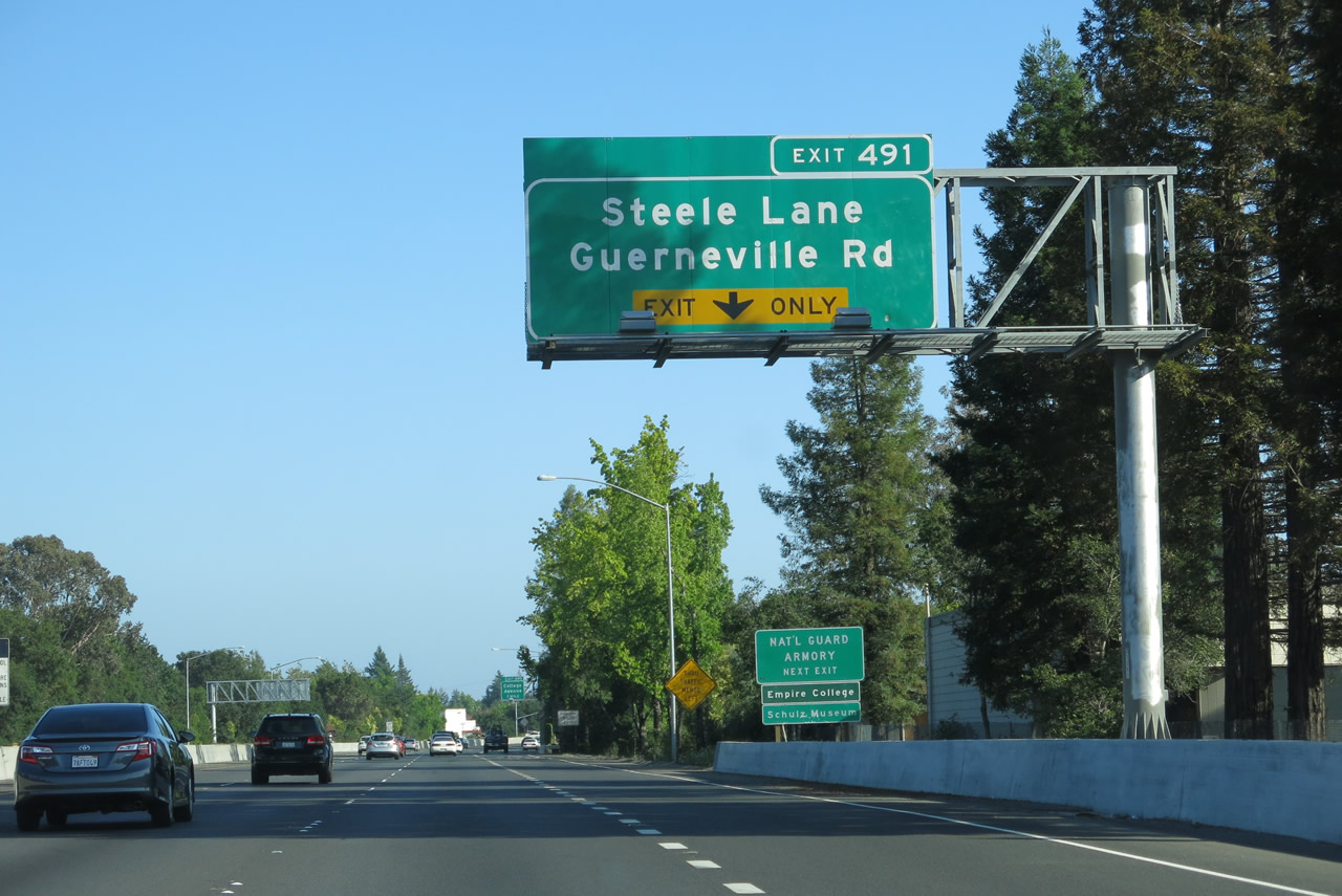 |
The right lane of U.S. 101 (Redwood Highway) south becomes exit only for Exit 491, Steele Lane and Guerneville Road. The off-ramp (not shown) is located just around the bend. Use this exit for the Charles M. Schulz Museum and Research Center (follow Steele Lane west; the museum complex is on the north side of Steele Lane after the intersection with Hardies Lane). Photo taken 07/05/13. |
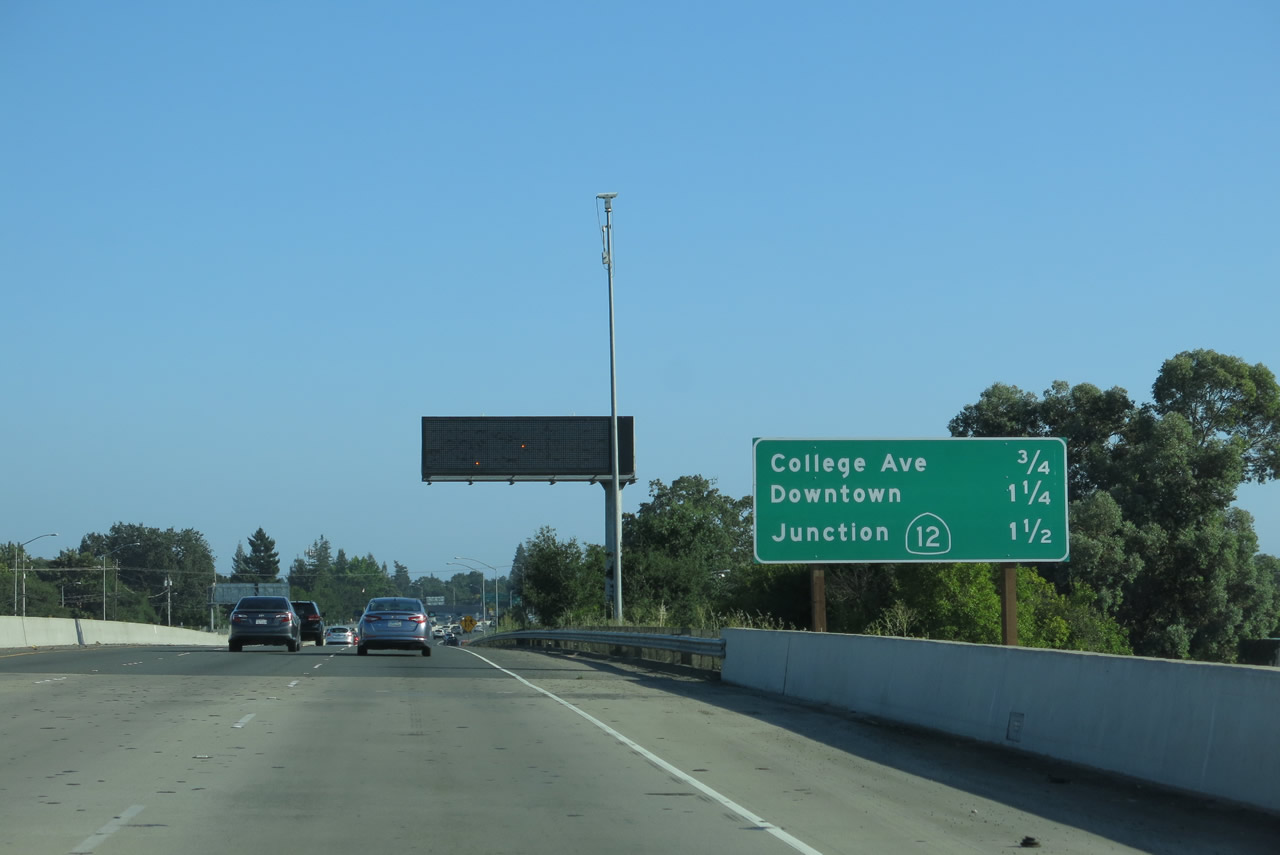 |
Passing over Steele Lane and Guerneville Road, this mileage sign along U.S. 101 south provides the distance to Exit 490, College Avenue; Exit 489, Downtown Santa Rosa (Davis Street to Sixth, Fifth, Fourth, and Third Streets); and Exit 488B, California 12 west to Sebastopol and east to Sonoma. Photo taken 07/05/13. |
 |
Traffic from Steele Lane and Guerneville Road merges onto U.S. 101 south; a reassurance shield/shield assembly is posted shortly thereafter. Photo taken 07/05/13. |
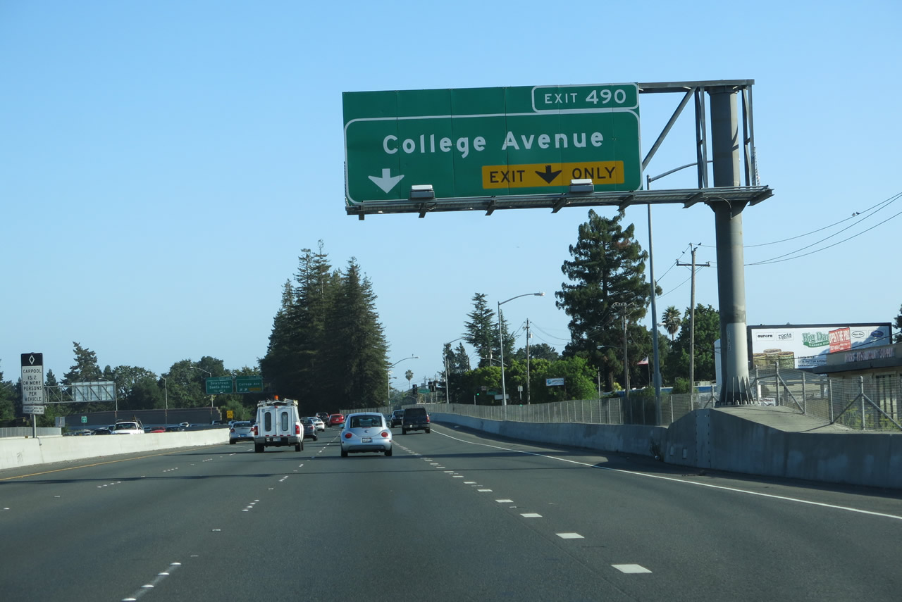 |
The right two lanes of U.S. 101 (Redwood Highway) south connect to Exit 490, College Avenue. Photo taken 07/05/13. |
 |
Southbound U.S. 101 (Redwood Highway) reaches Exit 490, College Avenue to Santa Rosa Junior College. Photo taken 07/05/13. |
 |
The next exit along U.S. 101 (Redwood Highway) south is Exit 489, Downtown Santa Rosa (Davis Street south to Sixth, Fifth, Fourth, and Third Streets). Davis Street reconnects with U.S. 101 after its intersection with Third Street. Its companion is Morgan Street on the east side of U.S. 101 through downtown. After Exit 489, U.S. 101 will cross the Downtown Viaduct and then meet California 12 at the downtown interchange. Use Exit 489 to the Santa Rosa California Welcome Center, Historic Railroad Square, Santa Rosa Plaza (the downtown mall), the central business district, and Courthouse Square at the center of Santa Rosa. Photo taken 07/05/13. |
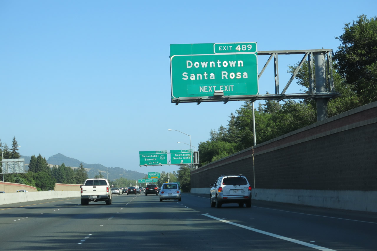 |
The right lane of U.S. 101 (Redwood Highway) south will connect to Exit 489, Downtown Santa Rosa (Davis Street south to Sixth, Fifth, Fourth, and Third Streets). Four lanes carry U.S. 101 south across the Downtown Viaduct until we reach the California 12 interchange. Photo taken 07/05/13. |
 |
Southbound U.S. 101 (Redwood Highway) reaches Exit 489, Downtown Santa Rosa (Davis Street south to Sixth, Fifth, Fourth, and Third Streets). Davis Street reconnects with U.S. 101 after its intersection with Third Street. Photo taken 07/05/13. |
 |
Railroad Square lies on the west side of the U.S. 101 downtown viaduct, while the central business district and Courthouse Square lie on the east side of the freeway. Use Davis Street south to Third Street east to pass under U.S. 101 and the downtown mall to connect to U.S. 101 Business/Mendocino Avenue north and U.S. 101 Business/Santa Rosa Avenue south. (The name change along U.S. 101 Business from Mendocino Avenue to Santa Rosa Avenue actually happens at the Fourth Street intersection.) Photo taken 07/05/13. |
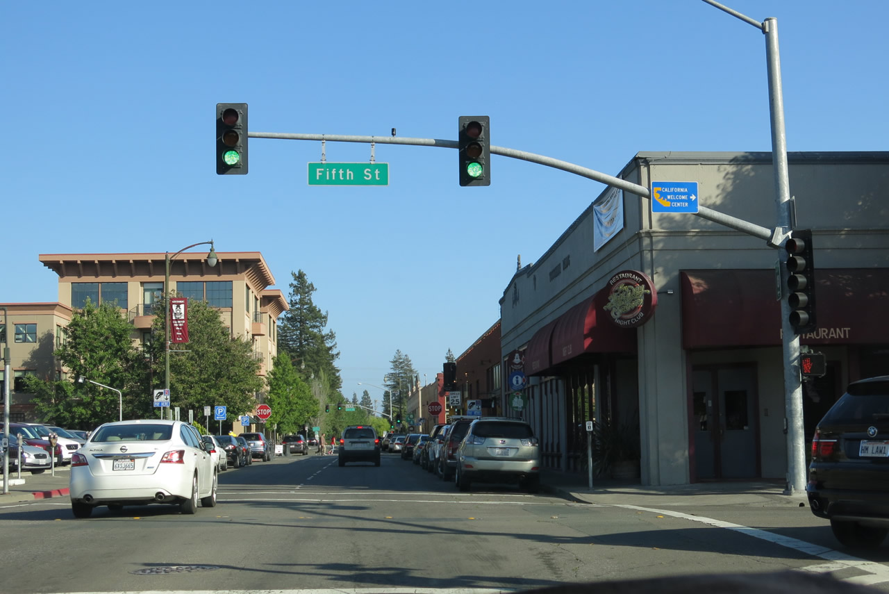 |
The off-ramp to Davis Street immediately brings drivers into the heart of Historic Railroad Square, a shopping and arts district. Restaurants and shops abound in this area; turn right at Fifth Street to get to the welcome center in the old railroad depot. Photo taken 07/05/13. |
 |
Davis Street only travels four blocks before returning back onto U.S. 101 south. A small U.S. 101 trailblazer is posted between the Fourth Street and Third Street intersections. Photo taken 07/05/13. |
 |
 |
 |
Southbound Davis Street meets Third Street. Turn left here for Third Street east to Old Courthouse Square and the central business district of Santa Rosa. Ahead, Davis Street will merge back onto U.S. 101 south with access to California 12 east/west. Photos taken 07/05/13. |
 |
 |
 |
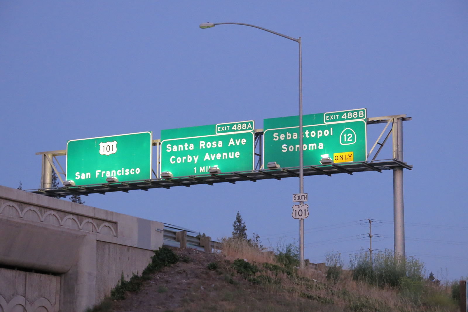 |
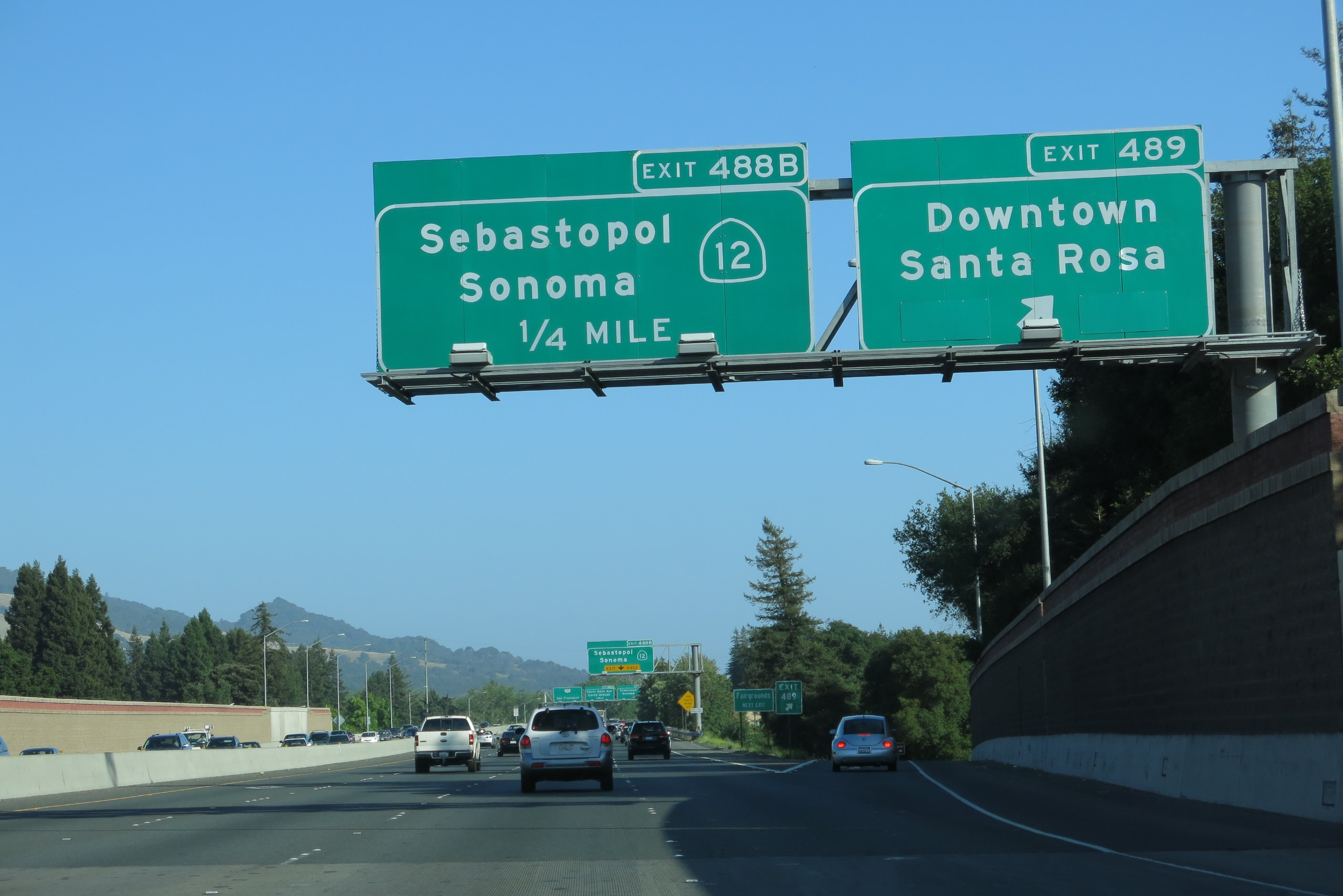
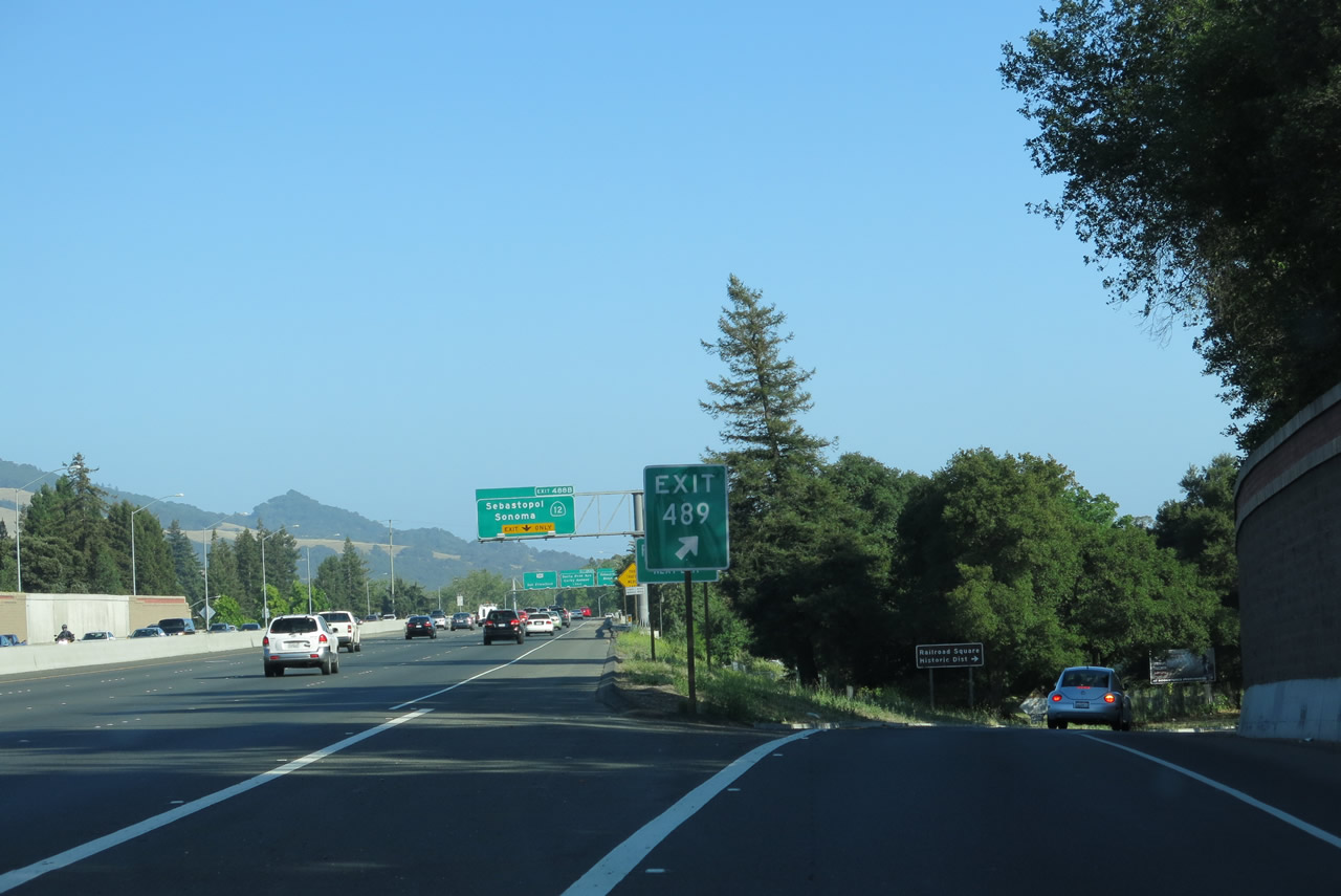
| Back on the mainline, the next exit along U.S. 101 (Redwood Highway) south is Exit 488B, California 12 east to Sonoma and west to Sebastopol and Bodega Bay. California 12 is a major east-west route extending from Sebastopol east to Santa Rosa and Sonoma, then southeast to Napa and Fairfield. After passing through the California Delta, California 12 emerges in Lodi, then proceeds to meet California 49 near Jackson. Photos taken 07/05/13. | |||
| U.S. 101 (Redwood Highway) south and California 116 east | |
|---|---|
 |
Leaving the interchange with California 116/Gravenstein Highway, U.S. 101 proceeds south through more grape growing areas located between Rohnert Park/Cotati and Petaluma. The freeway does not follow the historic route of U.S. 101, which swung southeast of Cotati via Old Redwood Highway to Penngrove, then turned south toward Petaluma. The historic route and modern route reconnect at Exit 476, four miles southeast of here. A truck pull-off area is located near Milepost 480. Photo taken 07/06/13. |
 |
An entire hillside of grapes grows adjacent to the freeway near the truck parking area. Photo taken 07/06/13. |
 |
After passing through a relatively undeveloped span between Rohnert Park and the northern reaches of Petaluma, traffic from Pepper Road and Stony Point Road join U.S. 101 south and California 116 east. A reassurance shield assembly is posted after this on-ramp. Photo taken 07/06/13. |
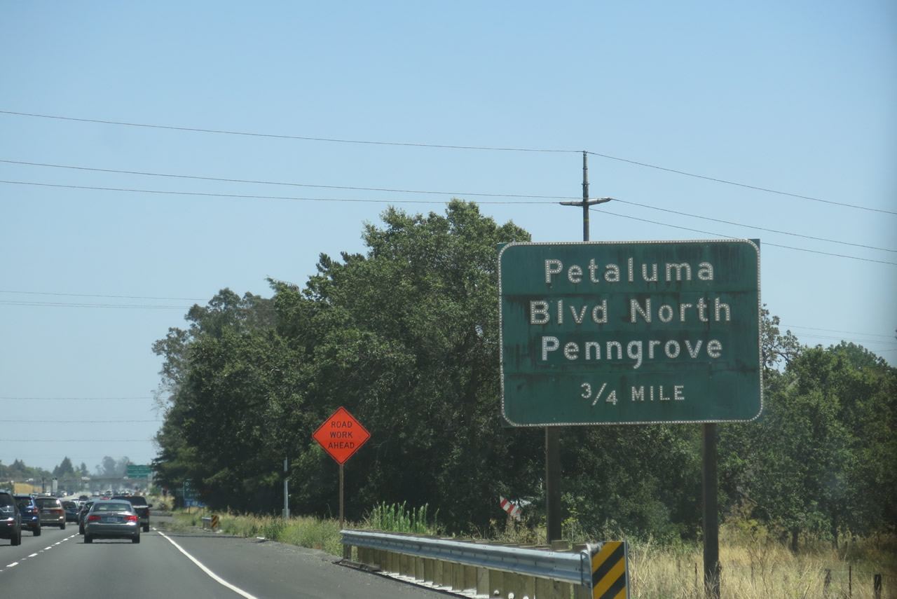 |
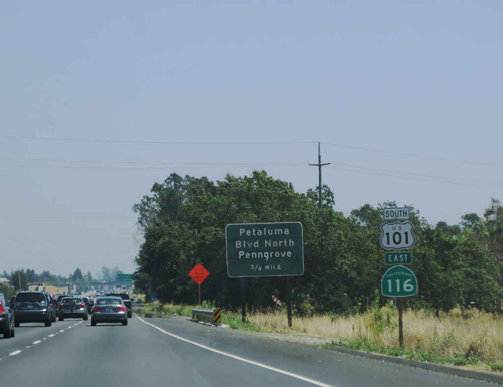
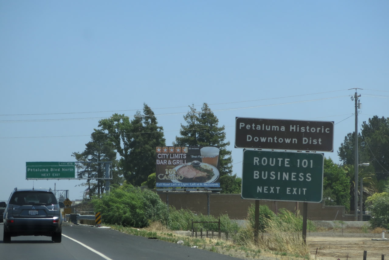
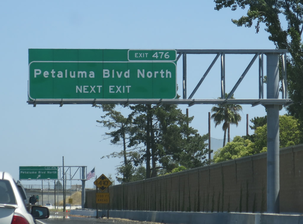
The next exit along U.S. 101 (Redwood Highway) south and California 116 east is Exit 476, U.S. 101 Business/Petaluma Boulevard south and Historic U.S. 101/Old Redwood Highway north to Penngrove. Photo taken 07/06/13. |
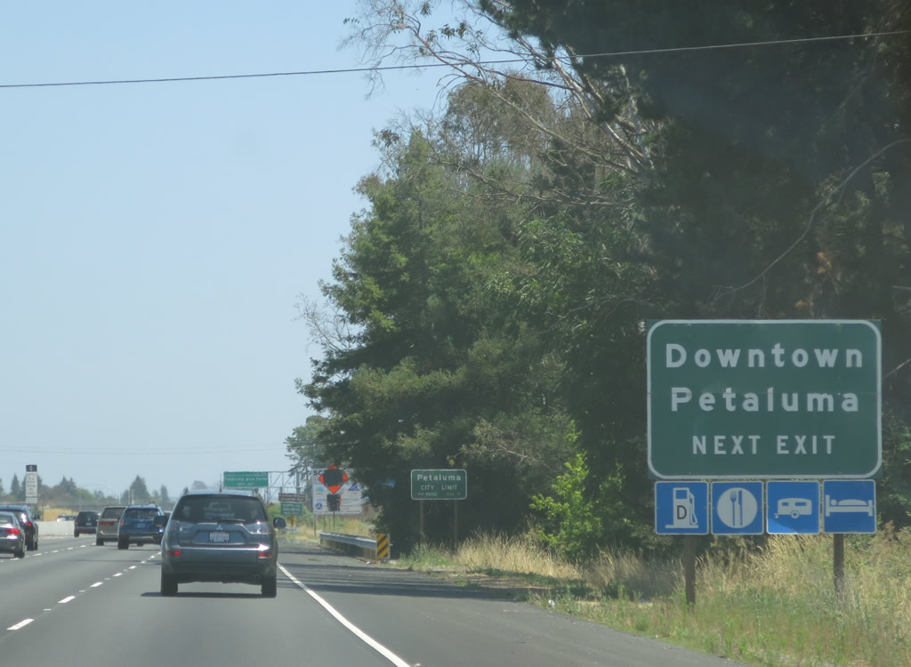 |
All motorist services are available at Exit 476. Use U.S. 101 Business south to downtown Petaluma. Photo taken 07/06/13. |
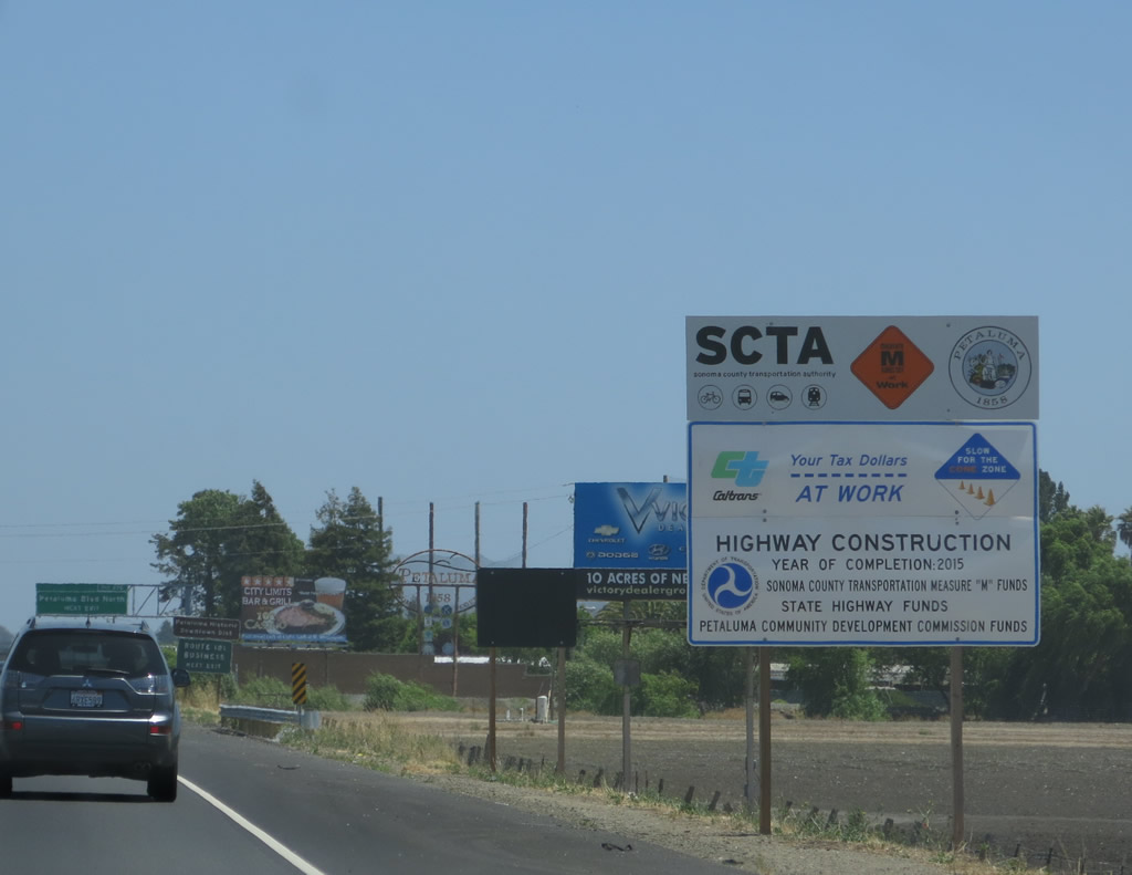 |
A freeway expansion project was underway when we visited in 2013; we'll have to return after 2015 to see the results of the road work that was underway. Photo taken 07/06/13. |
 |
U.S. 101 Business follows the old alignment of U.S. 101 through downtown Petaluma. The bypass of Petaluma was constructed and opened to traffic in 1956; the old route was signed as a business route in the 1990s. Petaluma was founded in 1852 (incorporated on April 12, 1858) primarily due to its proximity to the navigable Petaluma River and San Francisco Bay. Known as the "World's Egg Basket," Petaluma is known for its dairies. As of the 2010 Census, 57,941 people live in Petaluma. Photo taken 07/06/13. |
 |
An overhead sign for Exit 476, U.S. 101 Business/Petaluma Boulevard south and Historic U.S. 101/Old Redwood Highway north to Penngrove was added as part of the ongoing freeway expansion project. Photo taken 07/06/13. |
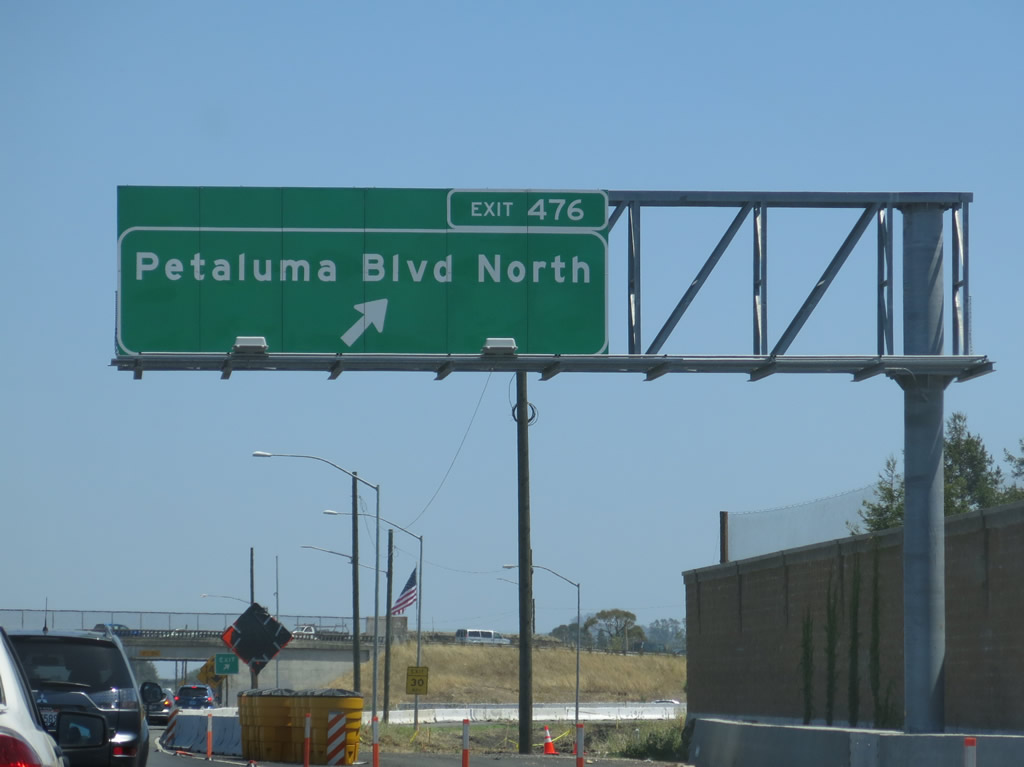 |
Southbound U.S. 101 (Redwood Highway) and eastbound California 116 meet Exit 476, U.S. 101 Business/Petaluma Boulevard south and Historic U.S. 101/Old Redwood Highway north to Penngrove. Photo taken 07/06/13. |
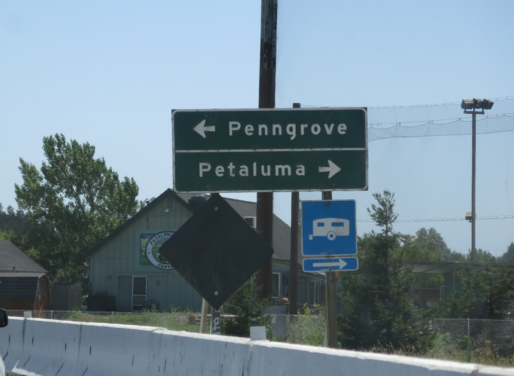 |
Once on the off-ramp, motorists may choose a right turn for U.S. 101 Business/Petaluma Boulevard south or a left turn for Historic U.S. 101/Old Redwood Highway north to Penngrove. Photo taken 07/06/13. |
 |
The next exit along U.S. 101 south and California 116 east is Exit 474, East Washington Street, which travels southwest into downtown Petaluma or northeast to Petaluma Municipal Airport and Prince Park. Photo taken 07/06/13. |
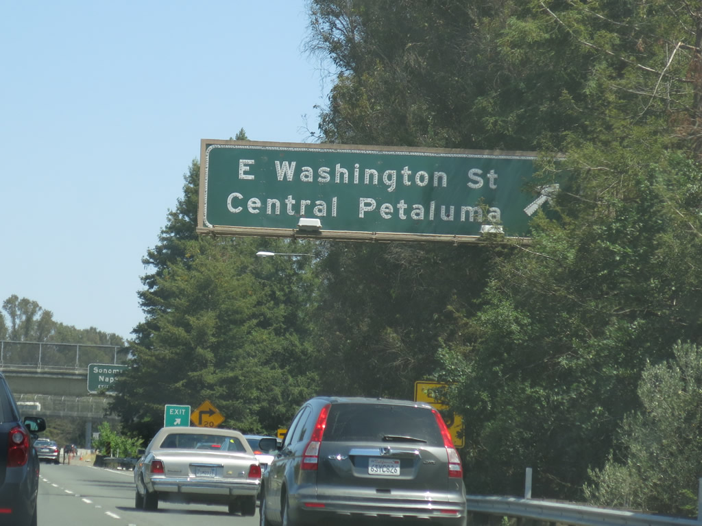 |
Southbound U.S. 101 (Redwood Highway) and eastbound California 116 meet Exit 474, East Washington Street. Photo taken 07/06/13. |
 |
The next exit along U.S. 101 south is Exit 472B, California 116/Lakeville Highway east and Lakeville Street west into downtown Petaluma. Photo taken 07/06/13. |
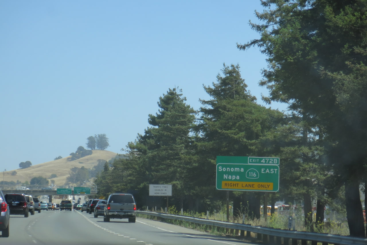 |
U.S. 101 south approaches Exit 472B, California 116/Lakeville Highway east and Lakeville Street west into downtown Petaluma. Photo taken 07/06/13. |
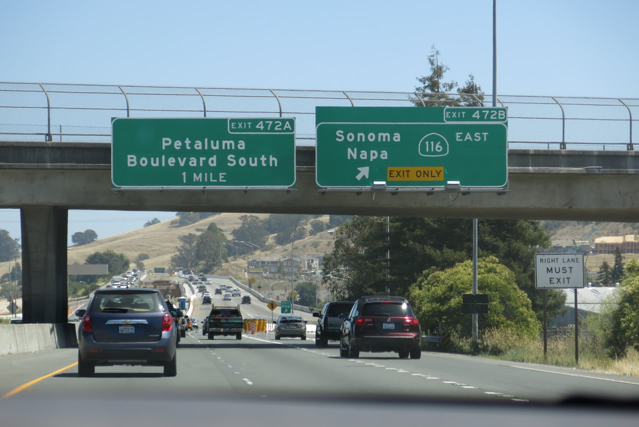 |
Southbound U.S. 101 splits with eastbound California 116 at Exit 472B, California 116/Lakeville Highway east and Lakeville Street west into downtown Petaluma. California 116 travels east along Lakeville Highway to Stage Gulch Road, then turns again onto Arnold Drive. The state route ends at California 121 (Carneros Highway) south of the city of Sonoma. The next interchange along southbound U.S. 101 is Exit 472A, U.S. 101 Business/Petaluma Boulevard north. Photo taken 07/06/13. |
| U.S. 101 south | |
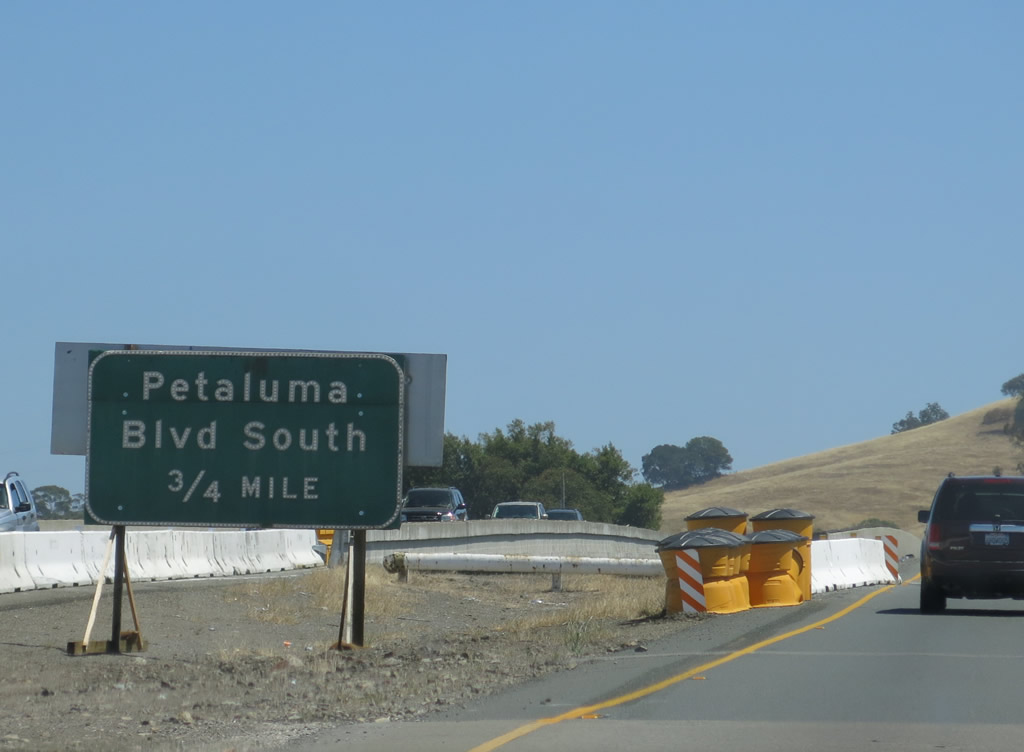 |
The next exit along U.S. 101 south is Exit 472A, U.S. 101 Business/Petaluma Boulevard north to downtown Petaluma. Construction relocated the advance guide sign for Exit 472A. Look for a replacement sign once the freeway expansion project is done. Photo taken 07/06/13. |
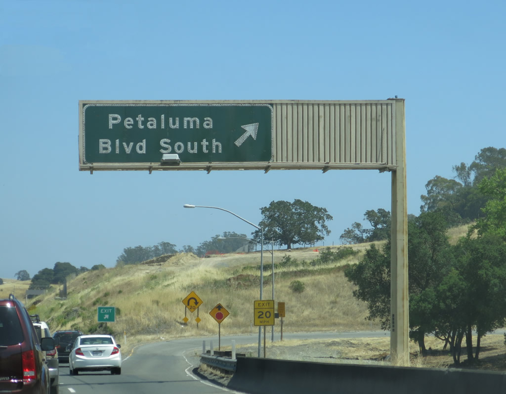 |
Southbound U.S. 101 (Redwood Highway) reaches Exit 472A, U.S. 101 Business/Petaluma Boulevard north to downtown Petaluma. This old porcelain enamel guide sign is likely not going to be around much longer, with the ongoing freeway expansion project underway on the Petaluma bypass. Photo taken 07/06/13. |
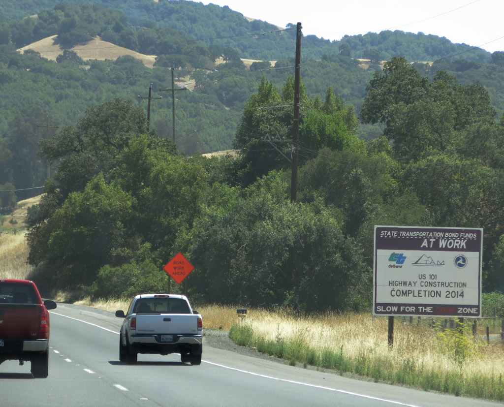 |
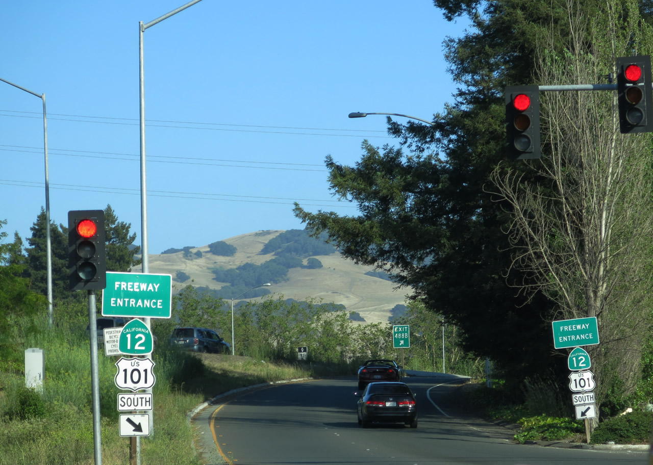
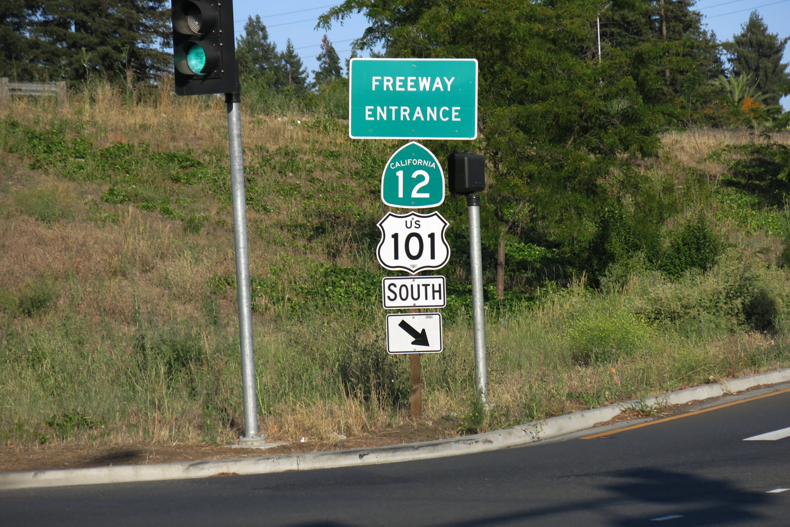
Between Petaluma and Novato (and between southern Sonoma County and northern Marin County), U.S. 101 shifts to an expressway alignment. Construction was underway when we visited to make this into a freeway. This area is known as the "Novato Narrows" or the "Marin-Sonoma Narrows" due to its heavy traffic and four-lane configuration. The Marin-Sonoma Narrows Project was underway as of this writing and will result in conversion of the four-lane expressway into six-lane freeway. The three largest of the intersections within the Narrows are at Redwood Landfill, San Antonio Road, and Kastania Road; these are at-grade intersections are planned to be eliminated and given access control. In May 2006, the Redwood Landfill intersection was being converted into a grade-separated interchange and was thus the first intersection to be converted; the interchange was made freeway-standard by 2012. Driveways are mostly found on the southbound lanes; Caltrans estimates 80 at-grade intersections along the narrows. Frontage roads would supply access to these areas, hence why the freeway would partially be on a new alignment. Designated as a safety corridor due to high traffic volume and substandard segments, U.S. 101 is planned for widening and upgrades including additional lanes south of Santa Rosa. Realignment and freeway conversion of U.S. 101 near San Antonio Road is planned to begin construction in 2015. Photo taken 07/06/13. |
 |
Southbound U.S. 101 meets San Antonio Road at this at-grade intersection. This area will change signficantly once the realigned freeway is constructed through here in 2015. Photo taken 07/06/13. |


Page Updated September 19, 2013.
|
About Contact Glossary |
In The News Interstate Guide |
Social Media:
 |
|
© 2000-25 AARoads.com | All Rights Reserved | Privacy Policy / Terms of Use
|
||