
State Route 62

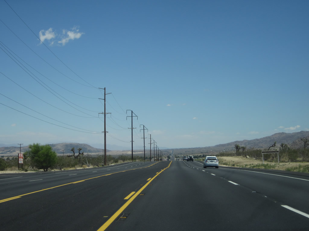
Serving Desert Hot Springs, Morongo Valley, Yucca Valley, Joshua Tree and Twentynine Palms, California State Route 62 is a five lane boulevard between Interstate 10 and Twentynine Palms. - 04/26/2014
California 62 is a major desert highway that starts at Interstate 10 near White Water, heads north via Morongo Valley and Yucca Valley, then turns east into Joshua Tree National Park via Twenty-Nine Palms. California 62 then enters the undeveloped desert, with no services between Twenty-Nine Palms and Vidal Junction. The highway ends when it crosses the Colorado River and becomes Arizona State Route 95 Alternate at Parker, Arizona.
One of the most eccentric things about California 62 is a shoe tree. Donald Burke writes:
I've driven California 62 west from Parker to Twentynine Palms on four occasions in the last few years. Each time, I've passed a lone tree at the roadside which is adorned with hundreds of sneakers and other footwear. A couple of years ago, it had been stripped but a few weeks ago I passed it and it was full again. Does anybody know the story behind this tree and its bizarre decoration?
Well, it turns out that there are plenty of shoe trees throughout the Southwest. According to the Roadside America Shoe Tree Guide, shoe trees may be found on U.S. 50 near Middle Gate, Nevada, and on U.S. 395 south of Alturas, California. According to this web page, unfortunately, the shoe tree on California 62 was burned down in 2004.1
California State Route 62 Guides
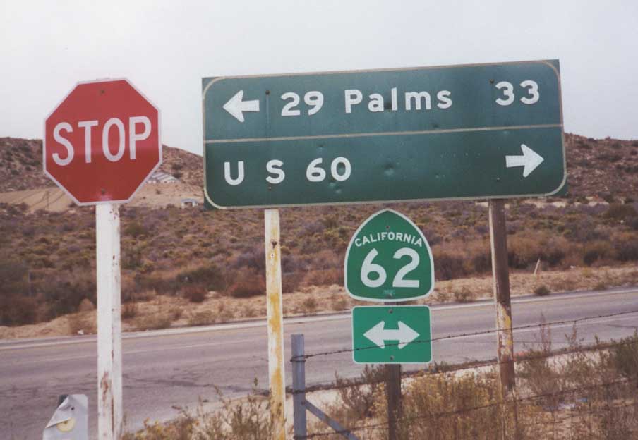
U.S. 60 was decommissioned in California in 1964, but was still referenced on this distance sign posted where Hess Boulevard intersects SR 62 at Morongo Valley. This sign was removed by 2007.
11/12/00
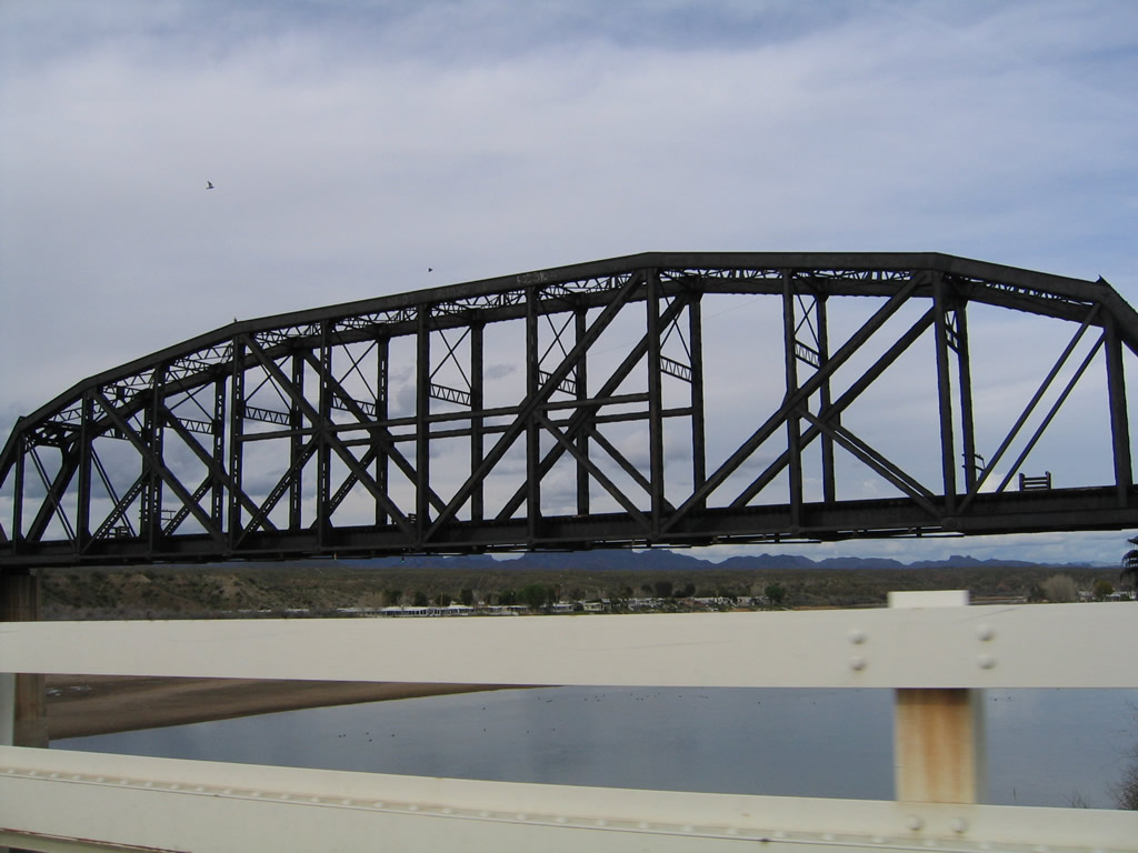
The BNSF Railroad bridge parallels the Colorado River Bridge linking Arizona State Route 95 Alternate and California State Route 62 to the north.
02/20/05
References:
- Personal Email, "Regarding the 'hoe tree' question on CA 62 page," from Colin on March 19, 2005.
Photo Credits:
- Andy Field: 11/12/00
- Alex Nitzman: 02/20/05
Connect with:
Page Updated Monday May 19, 2014.