
U.S. 95

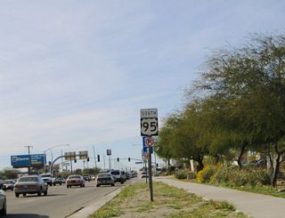
U.S. 95 travels 104.25 miles north from the International border at San Luis in southwestern Arizona to Business Loop I-10 (Main Street) and SR 95 (Central Boulevard) in Quartzsite. U.S. 95 overlaps with Business Loop I-10 west 1.74 miles to I-10 at Exit 17, and with Interstate 10 for 19.94 miles to the California state line.
U.S. 95 Arizona Guides
U.S. 95 originates in San Luis along Main Street north from San Luis Río Colorado in Mexico. Following a stair stepped route north across the Yuma Valley, U.S. 95 leads to Gadsden, Somerton and the city of Yuma. Turning east along 16th Street, U.S. 95 passes north of the Yuma city center en route to El Prado Estates in the South Gila Valley.
State maintenance commences along U.S. 95 east from the intersection with Araby Road northeast of Yuma and 29.14 miles from the south end in San Luis. Curving northward ahead of Blaisdell, the highway runs along western reaches of the Gila Mountains and then along the east side of the Laguna Mountains.
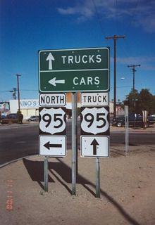
Progressing north toward Quartzsite, U.S. 95 travels through the Yuma Proving Ground. The remote stretch extends north along U.S. 95 between the Chocolate and Castle Dome Mountains onto the La Posa Plain. U.S. 95 enters the town of Quartzsite along Central Boulevard. Where it turns west onto Business Loop I-10 (Main Street), SR 95 takes over on Central Boulevard north en route to Parker and Lake Havasu City.
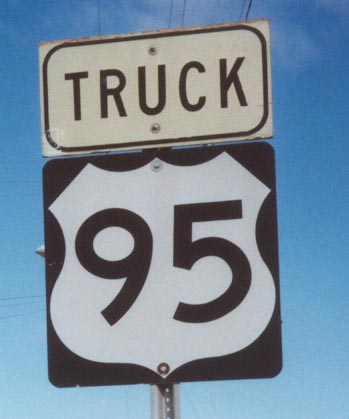
 Truck - San Luis Truck Border Crossing North
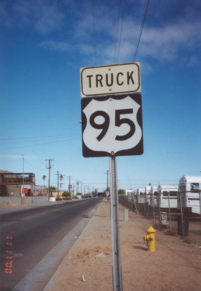
This Truck U.S. 95 reassurance shield is posted on northbound in San Luis after leaving the border crossing. Truck U.S. 95 provides an alternate route for commercial vehicles so they can bypass downtown San Luis and reach the commercial port of entry directly. Regular U.S. 95 goes through downtown San Luis, connects with the primary port of entry, then connects with Truck U.S. 95 at the commercial port of entry.
11/10/00
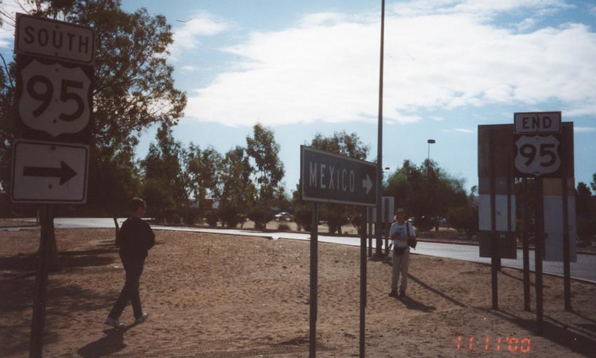
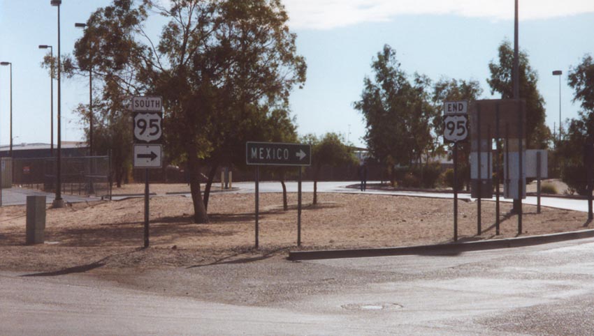
Truck - San Luis Truck Border Crossing South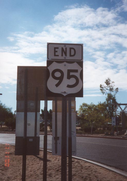
End Southbound U.S. 95 shield at the Truck Port of Entry and Border Crossing. Traffic that continues past this port of entry enters the town of San Luis Colorado in the Mexican state of Sonora. This marks the southern terminus of U.S. 95.
11/10/00
scenes
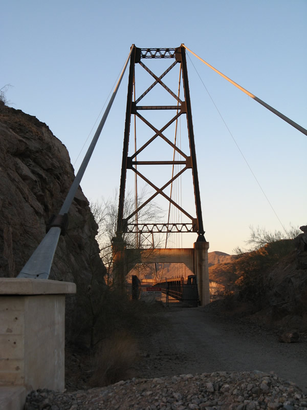
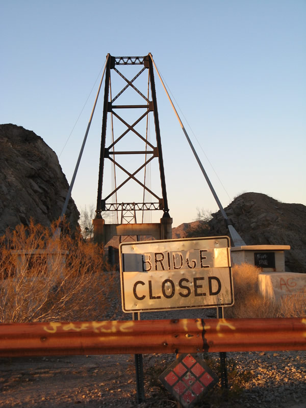
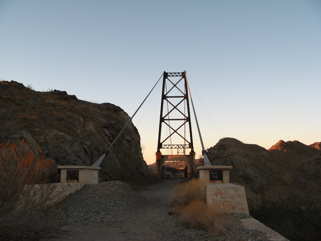
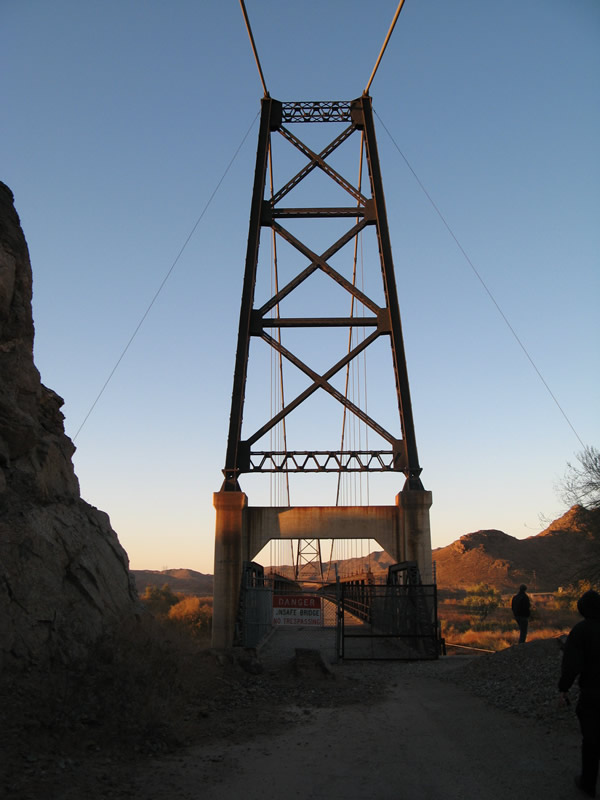
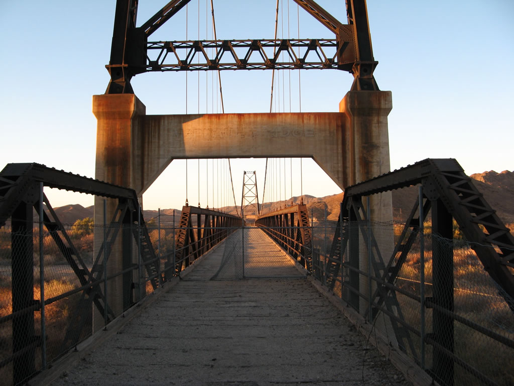
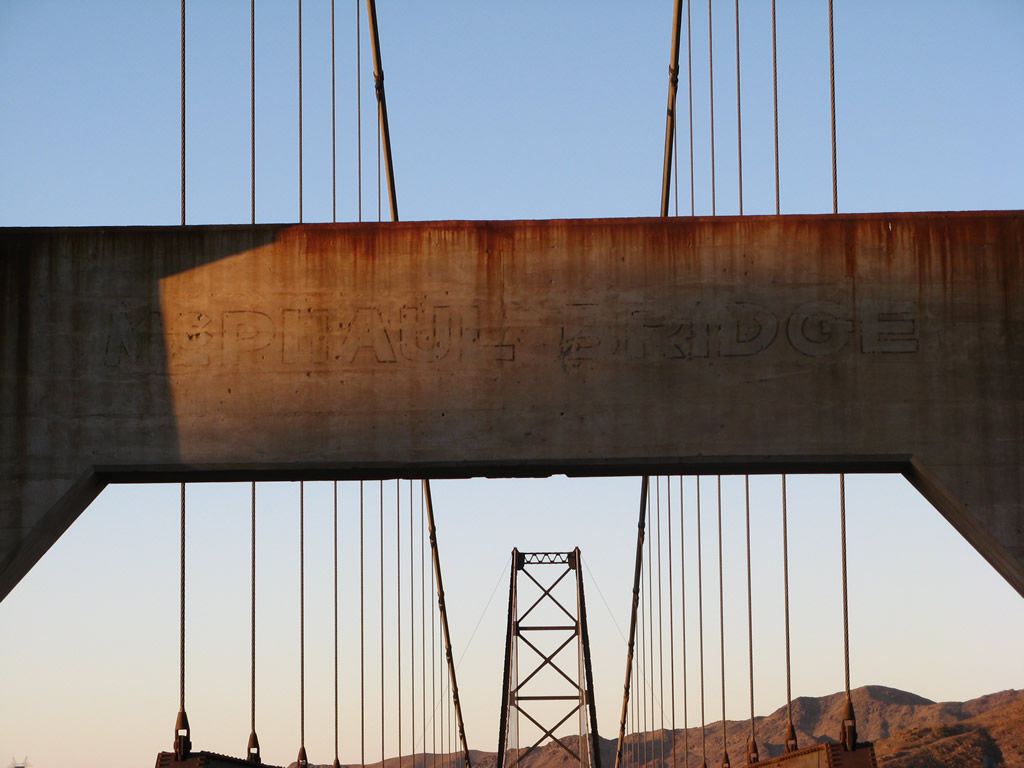
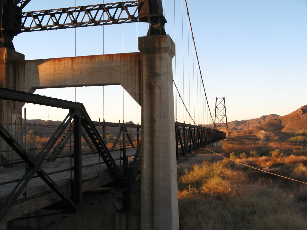
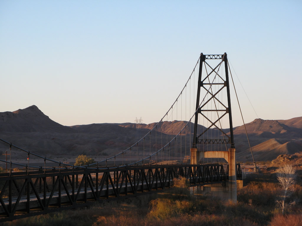
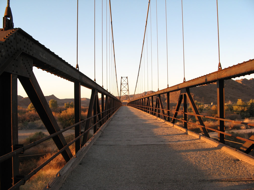
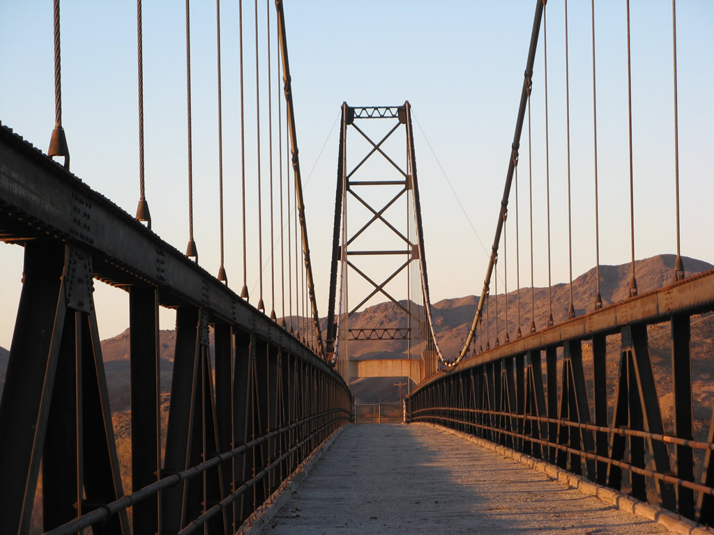
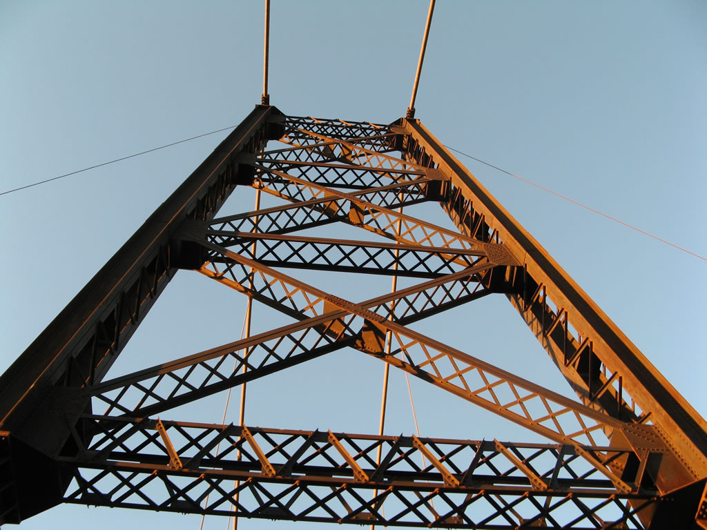
The McPhaul Suspension Bridge, which was built in 1928 by the state of Arizona and Yuma County, was part of the early link along the Yuma to Quartzsite road. It was named in honor of Harry McPhaul of Yuma and opened to traffic in the following year, 1929. McPhaul Bridge was the longest suspension bridge in Arizona at the time it was constructed (the main span between suspension towers is 798 feet). However, it was replaced in 1967 when s new U.S. 95 concrete bridge was constructed across the Gila River (the 1967 bridge was destroyed by flood and was replaced in 1993 - but the McPhaul Bridge survived the flood). As a result, the suspension bridge had not been used as the main route for over forty years by the time these pictures were taken. Vehicular traffic is prohibited on the McPhaul Bridge, especially because the bridge deck is made of wood. Concerns about the durability of the wood have resulted in warning signs being posted for people trying to cross the bridge, even by foot.1
01/15/07
References:
- Wellton-Mohawk Irrigation and Drainage District - History (Bridges) - excellent resource for crossings over the Gila River
Photo Credits:
- Andy Field: 11/10/00, 01/15/07
Connect with:
Page Updated Monday June 18, 2007.