
Interstate 15 North - Downtown Las Vegas to Garnet
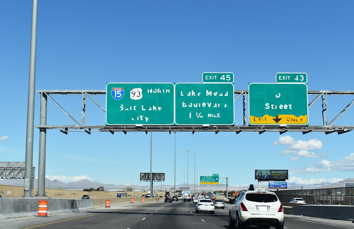
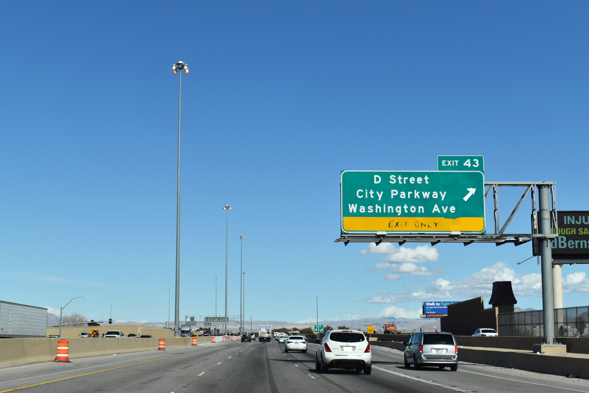
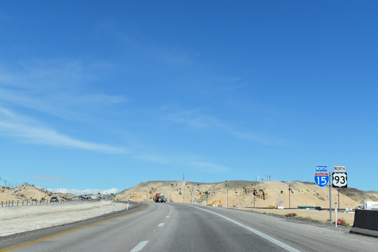
A split diamond interchange at Exit 43 joins I-15/U.S. 93 with D Street and Washington Avenue (SR 578) east to the Cashman Complex.
10/24/25
Washington Avenue is SR 578 for 0.66 miles east from D Street and I-15/U.S. 93 to Las Vegas Boulevard.
10/24/25
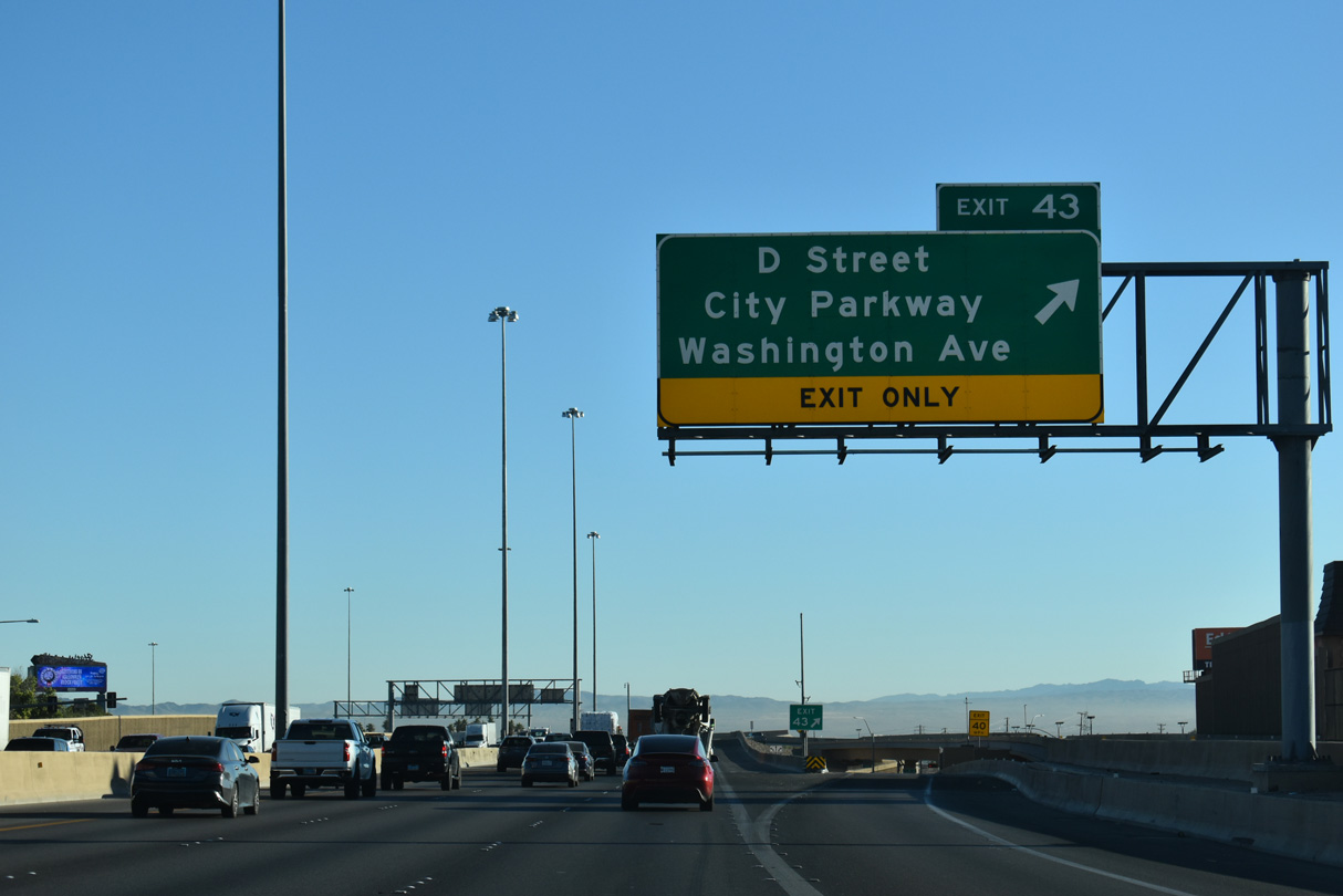
The D Street Connector links I-15/U.S. 93 with City Parkway at Bonanza Road (SR 579) to the south. Washington Avenue west heads SR 599 (Rancho Drive) through the West Las Vegas neighborhood.
10/24/25
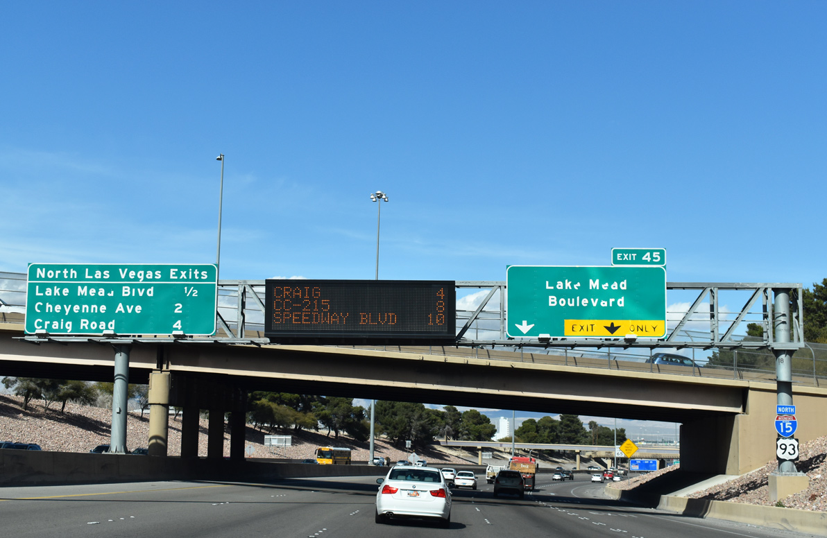
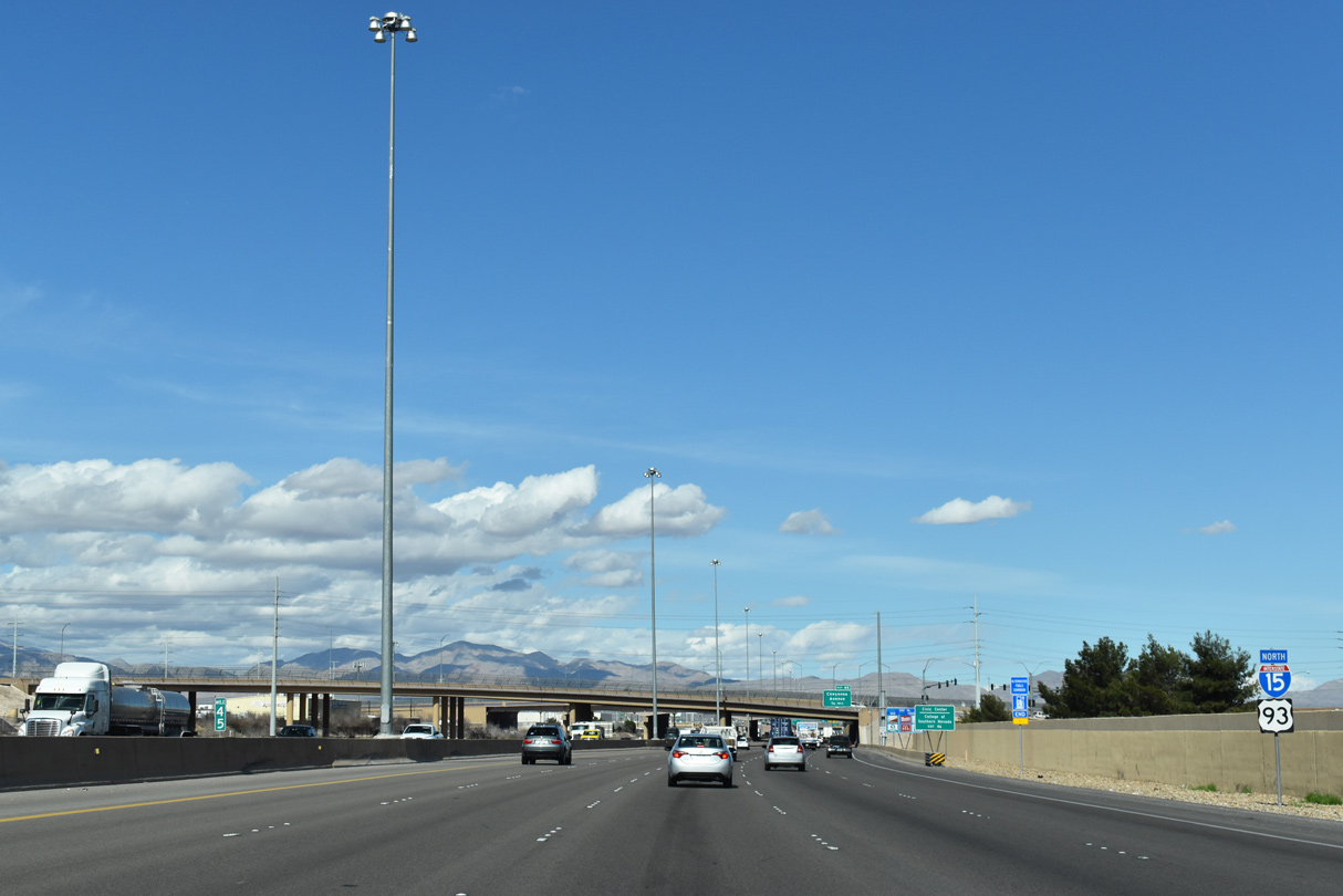
Northbound I-15/U.S. 93 advances north to Exit 45 for Lake Mead Boulevard (old SR 147) from Owens Avenue.
10/21/25
A pedestrian walkway and Union-Pacific railroad line span I-15/U.S. 93 ahead of Lake Mead Boulevard.
10/21/25
Simcre truncated east to Pecos Road, Lake Mead Boulevard was part of SR 147 for 14.309 miles1 between Losee Road and the North boundary of Lake Mead National Recreation Area.
10/21/25
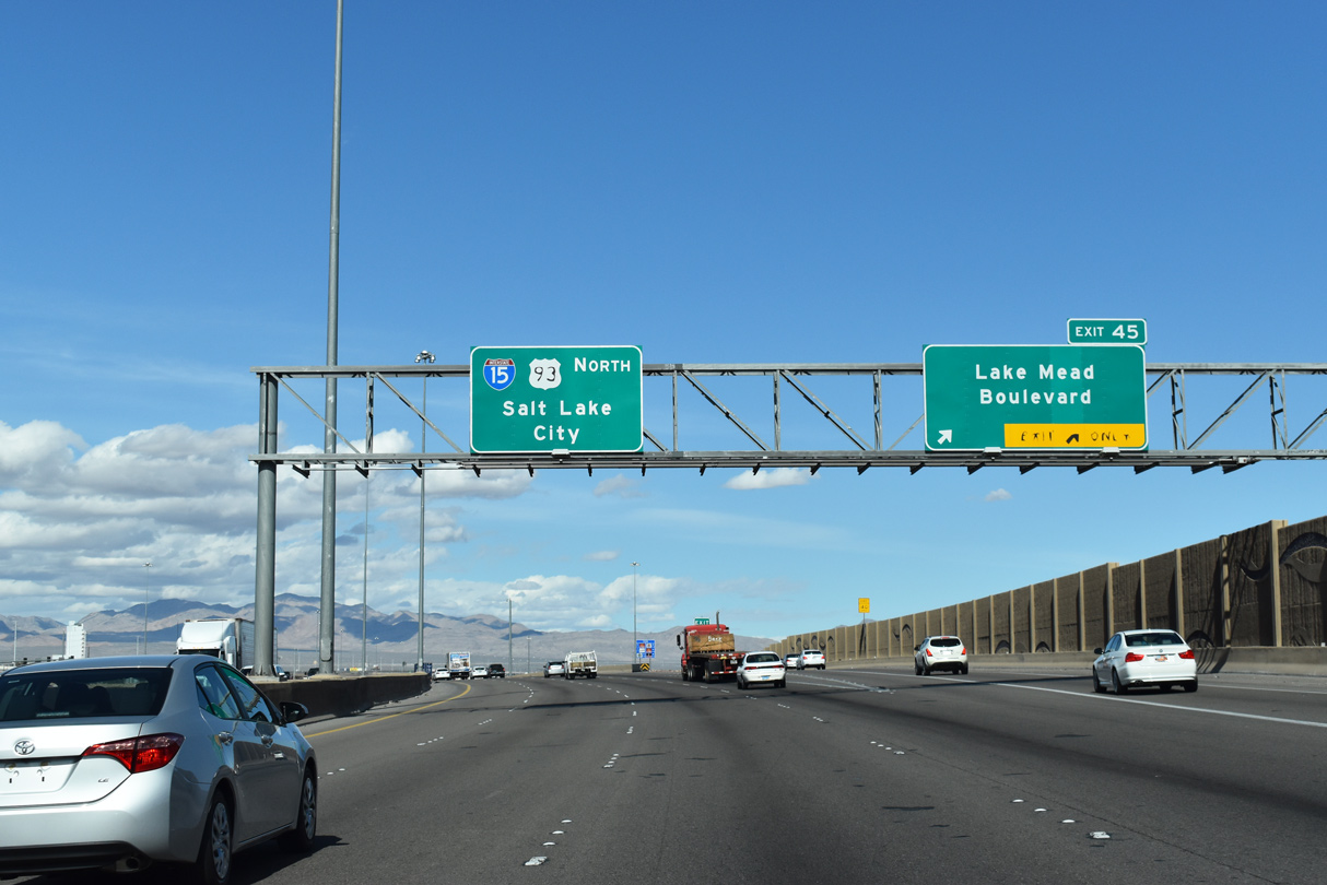
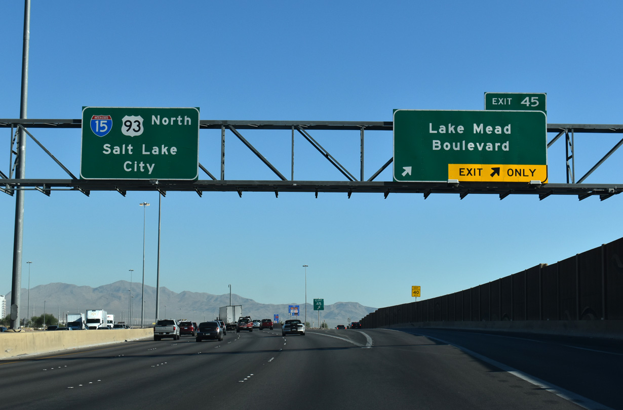
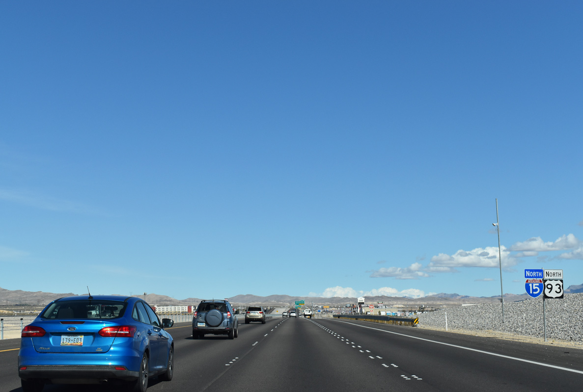
Confirming markers posted beyond the Lake Mead Boulevard (SR 147) entrance ramp. U.S. 93 overlaps with I-15 north for 21 miles.
10/21/25
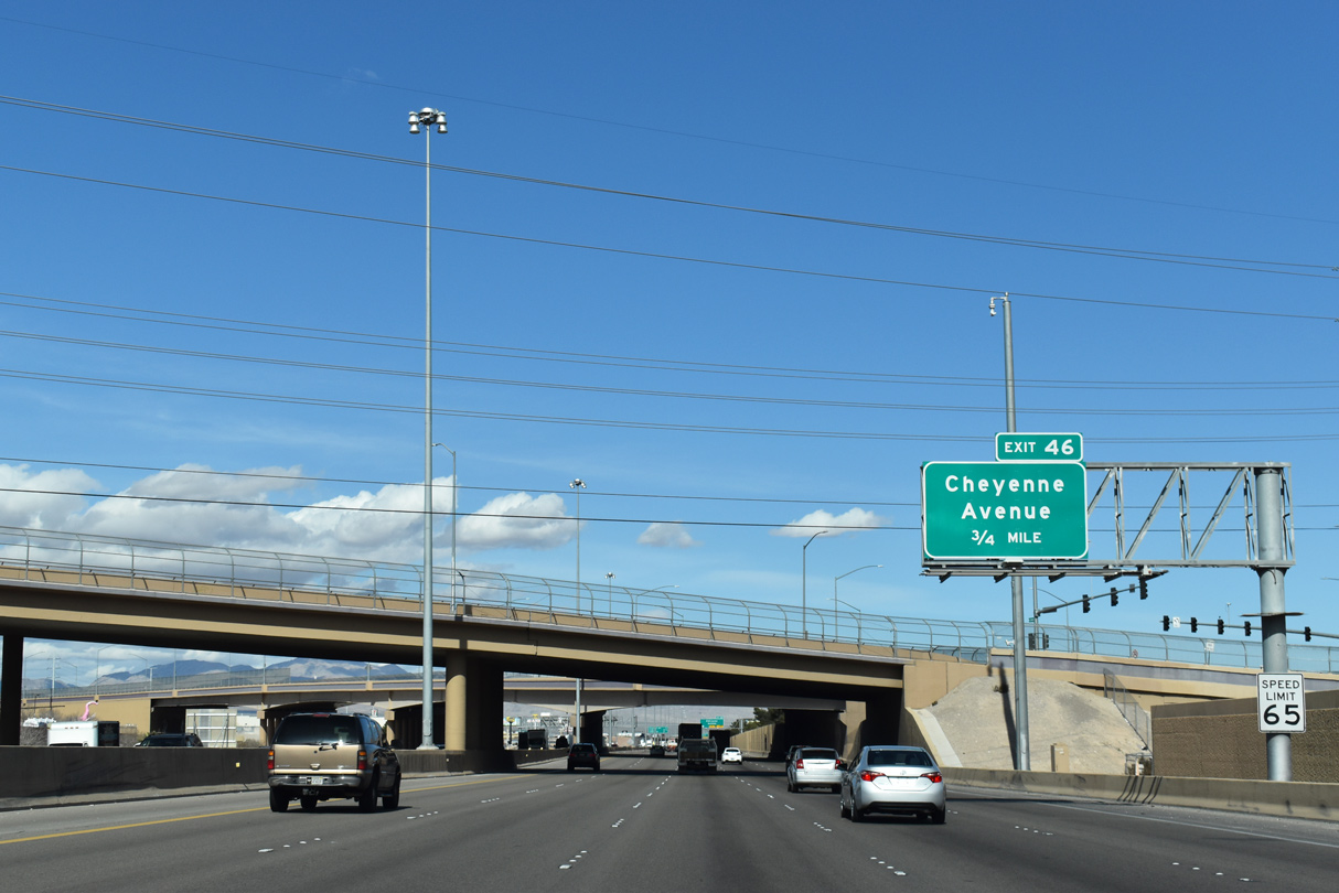
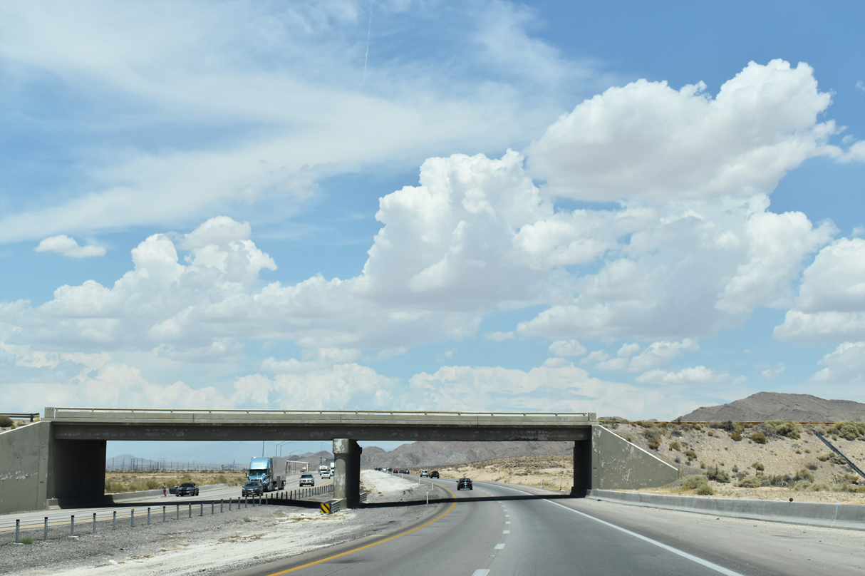
Carey Avenue and N 5th Street converge above I-15/U.S. 93, 0.75 miles south of Exit 46 to SR 574 (Cheyenne Avenue).
10/21/25
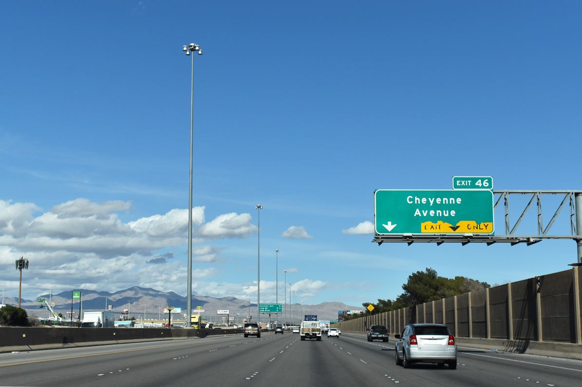
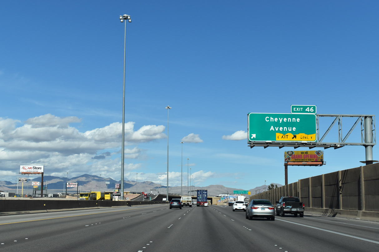
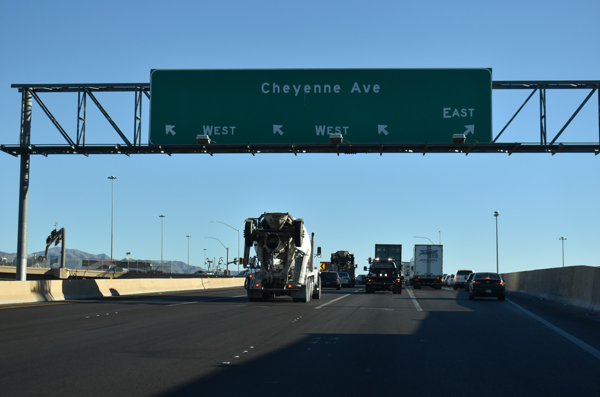
Meeting I-15/U.S. 93 at a SPUI (Exit 46), Cheyenne Avenue runs across the extent of North Las Vegas from CC-215 east to SR 612 (Nellis Boulevard).
10/21/25
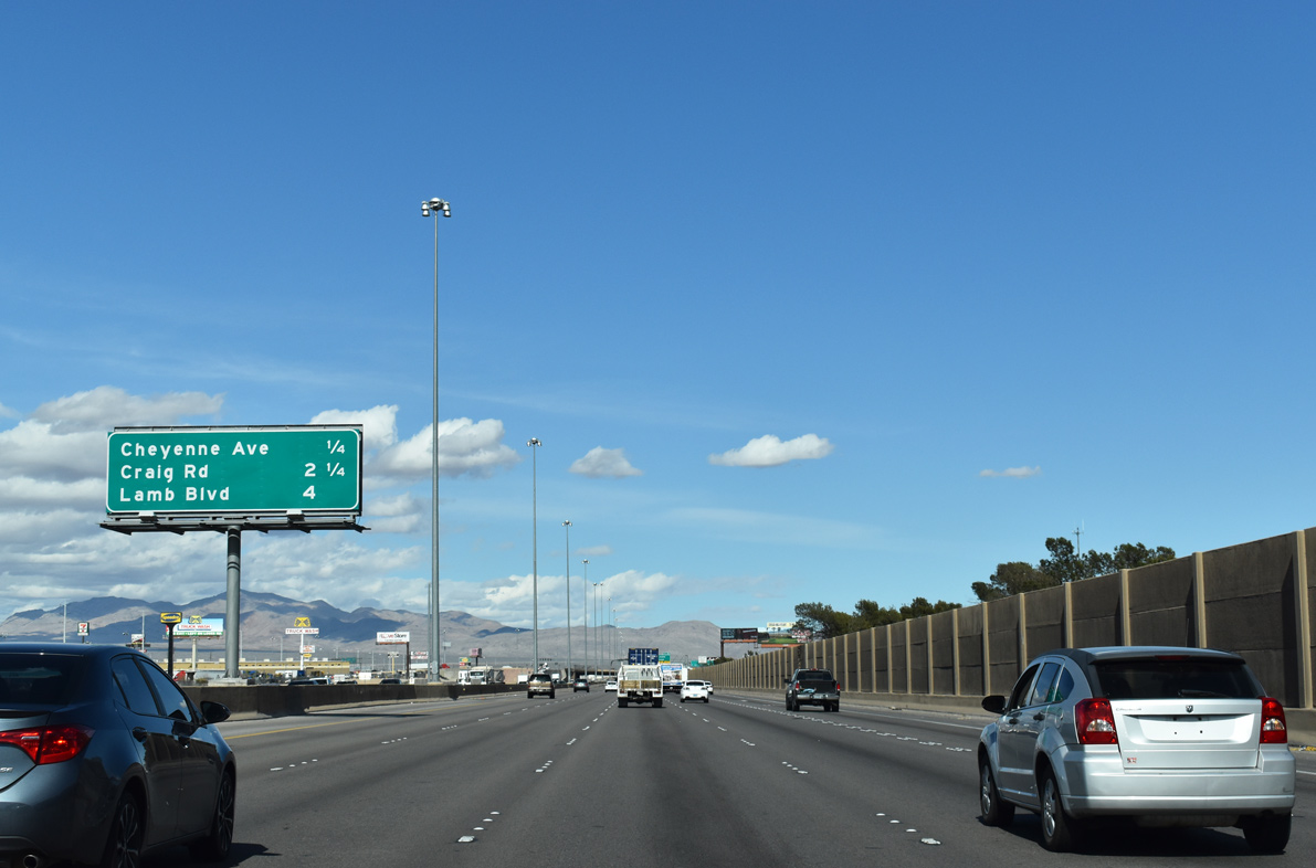
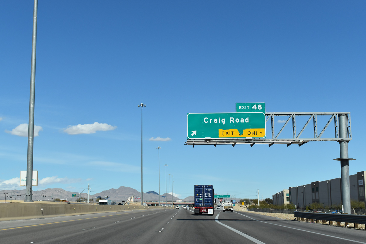
An interchange sequence sign one quarter mile ahead of Exit 46 to SR 574 (Cheyenne Avenue). Craig Road (SR 573) joins the freeway with Nellis AFB in 2.25 miles.
10/21/25
SR 574 overlays Cheyenne Avenue across North Las Vegas between Decatur Boulevard and SR 612 (Nellis Boulevard) southwest of Nellis AFB.
10/21/25
SR 574 extends west 4.7 miles along Cheyenne Avenue to Decatur Boulevard near North Las Vegas Airport (VGT). Inventoried at 0.23 miles, a second segment of Cheyenne Avenue is designated as SR 574 within the parclo interchange at I-11/U.S. 95.
10/24/25
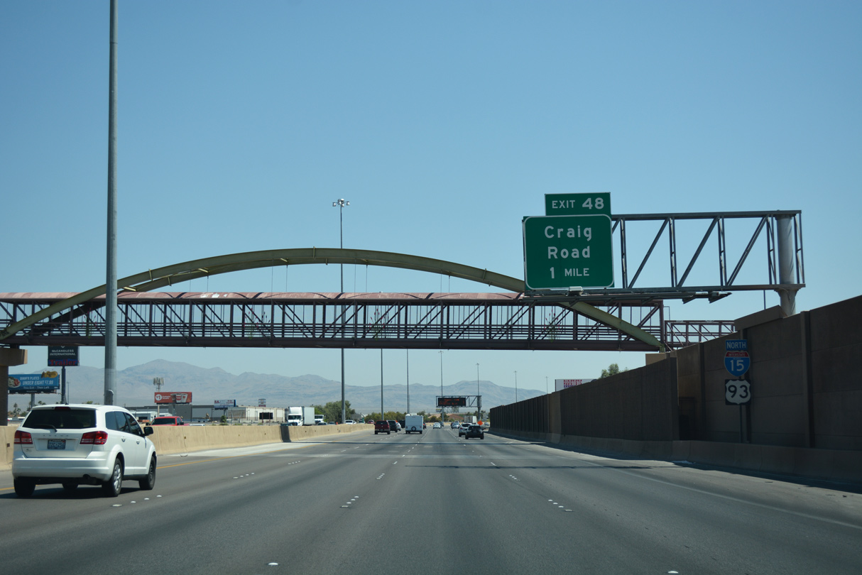
A pedestrian steel arch bridge for the Lower Las Vegas Wash Trail crosses I-15/U.S. 93 one mile ahead of Exit 48 to SR 573 (Craig Road).
10/21/25
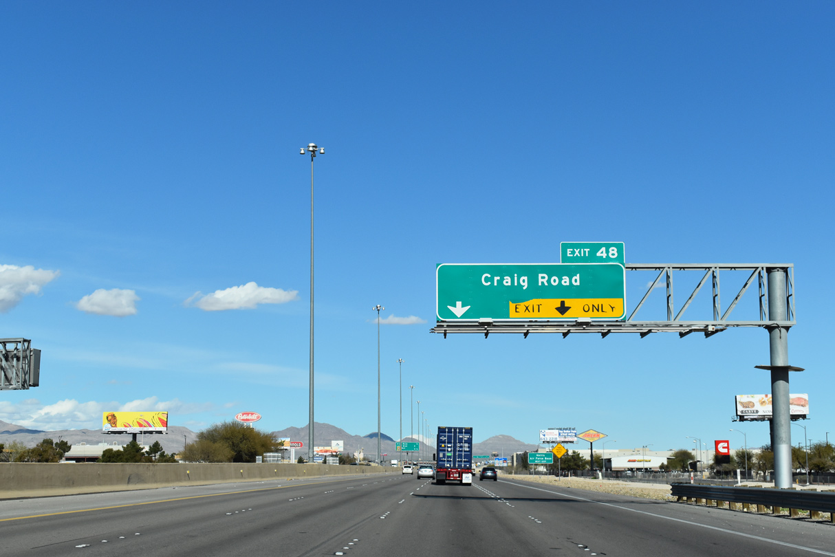
SR 573 overlays two separate segments of Craig Road. The western section of SR 573 joins Decatur Boulevard with I-11/U.S. 95 west of the North Las Vegas city line.
10/21/25
Craig Road provides the most direct route into Nellis AFB. Encompassing 14,000 acres of land, the base is located east of SR 604 (Las Vegas Boulevard) outside the limits of North Las Vegas.2
10/21/25
3.25 miles separate Interstate 15 from the northern end of the Bruce Woodbury Beltway (Clark County Route 215).
10/21/25
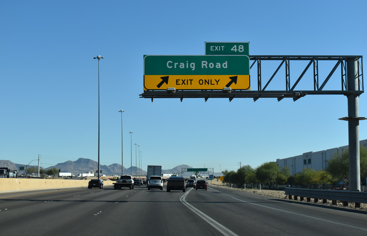
Two lanes leave I-15/U.S. 93 north at Exit 46 for Craig Road (SR 573).
10/21/25
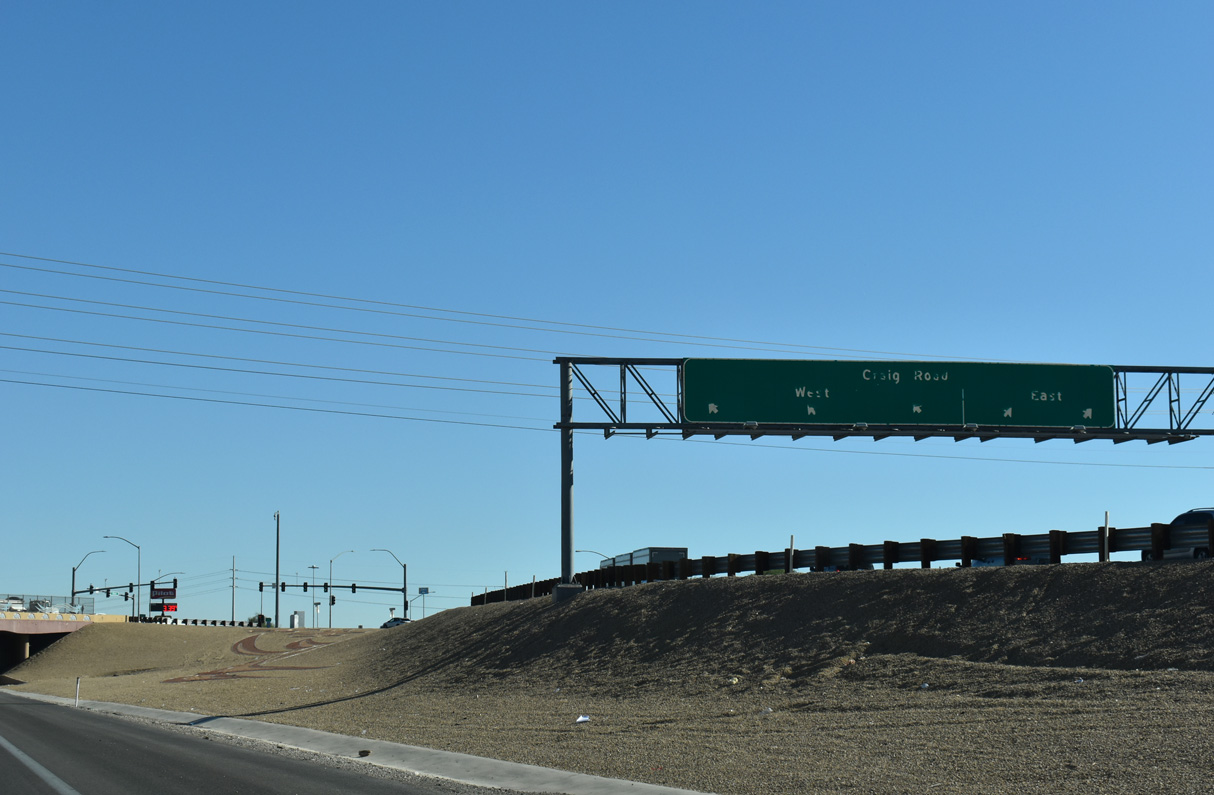
Beginning at Frehner Road west of I-15/U.S. 93, SR 573 heads 3.09 miles east to SR 604 (Las Vegas Boulevard) across from Fitzgerald Boulevard and the main gate to Nellis AFB.
10/21/25
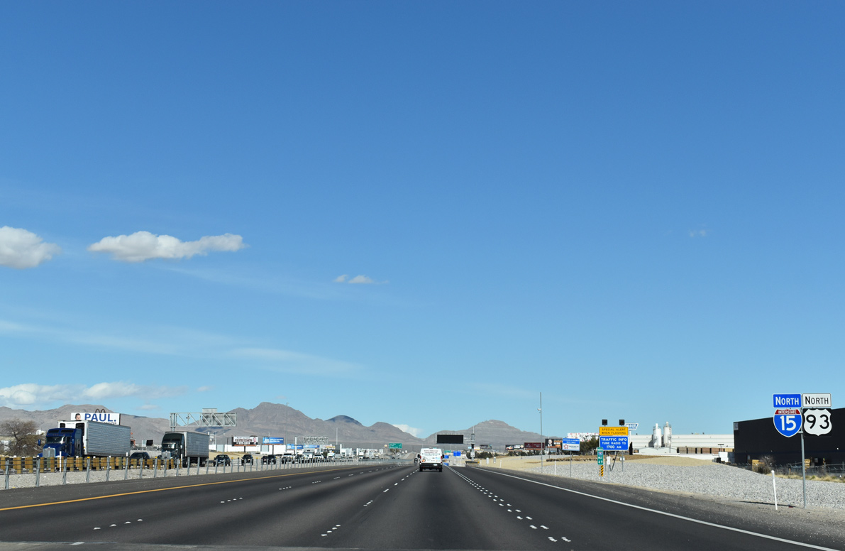
I-15/U.S. 93 continue northeast from Craig Road through industrial areas in North Las Vegas.
10/21/25
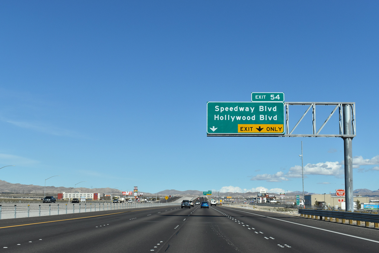
Speedway Boulevard joins the freeway with the Las Vegas Motor Speedway at Exit 54 in four miles.
10/21/25
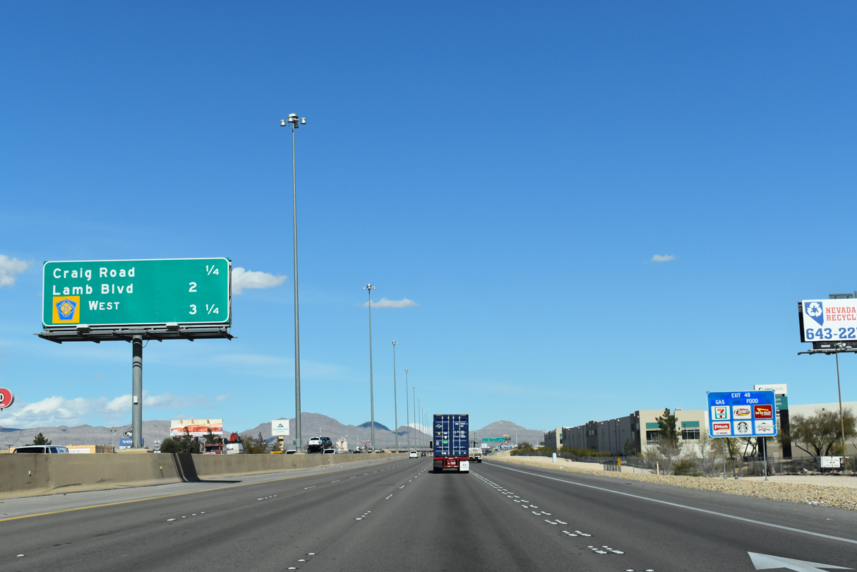
Lamb Boulevard extends north 15.8 miles from Boulder Highway (SR 582) and Desert Inn Road in eastern Las Vegas to the Bruce Woodbury Beltway (CC-215).
10/21/25
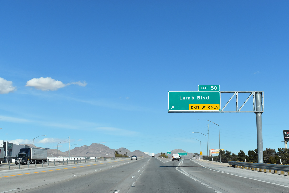
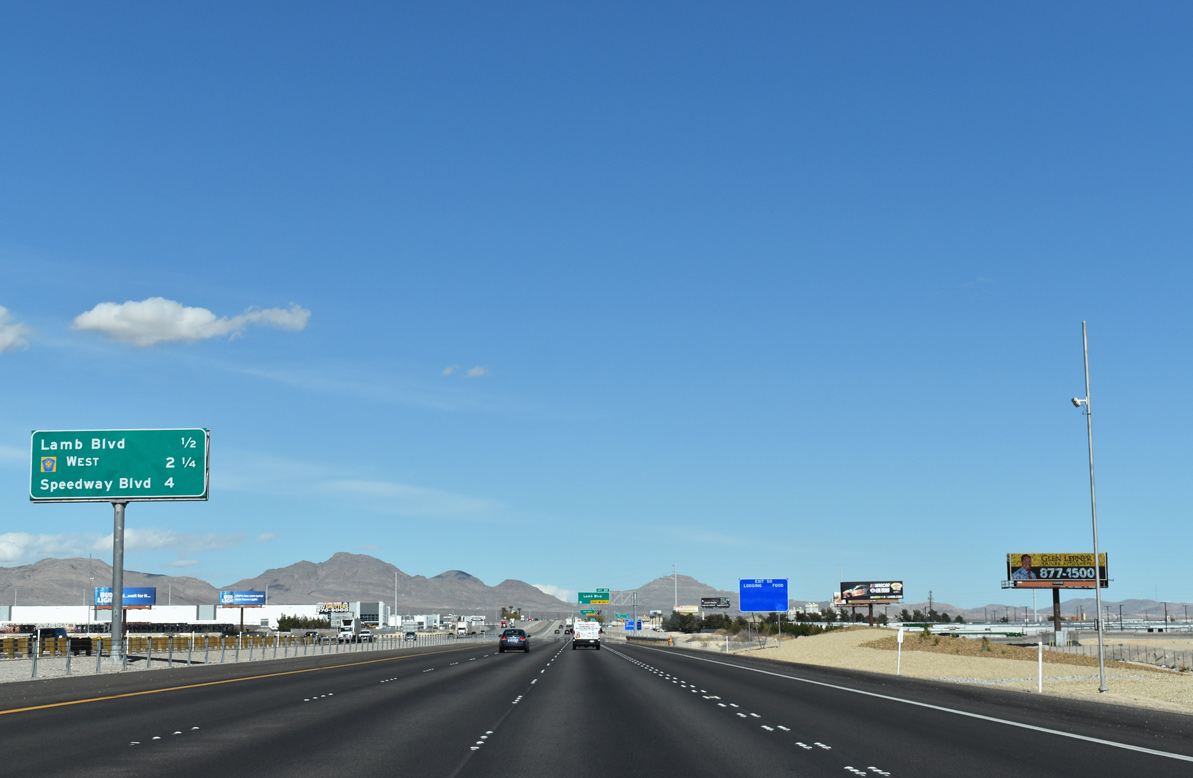
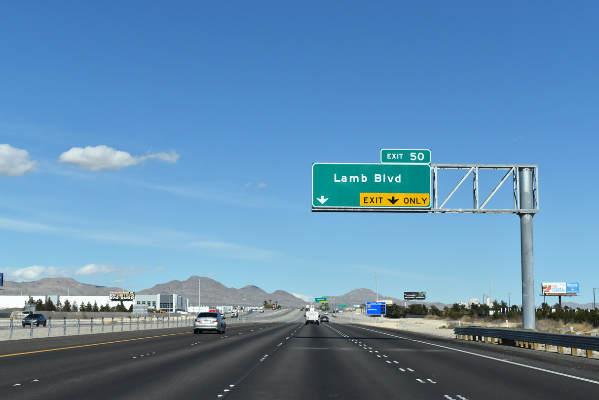
Distribution centers line the north side of I-15/U.S. 93 ahead of the SPUI (Exit 50) with Lamb Boulevard (SR 610).
10/21/25

Lamb Boulevard is SR 610, 2.37 miles south from Exit 50 to SR 604 (Las Vegas Boulevard) at Sunrise Manor.
10/21/25
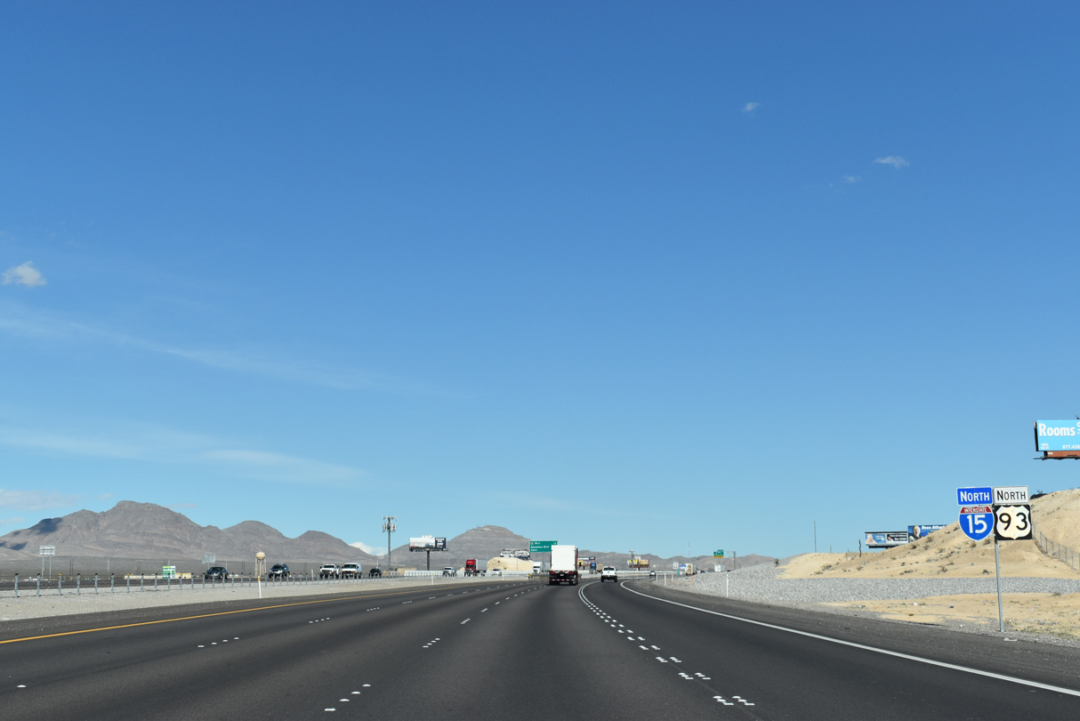
Exit 52 A joins I-15/U.S. 93 with CC-215 (Bruce Woodbury Beltway) west to northwest Las Vegas next. CC-215 follows the Las Vegas beltway 39 miles south to I-15/215 at the Fish Bowl Interchange between Enterprise and Paradise.
10/21/25

I-15/U.S. 93 turn northeast ahead of the directional T interchange (Exit 52 A) with CC-215.
10/21/25
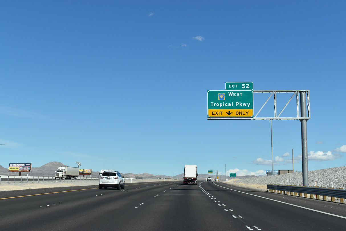
The diamond interchange (Exit 52 B) joining I-15/U.S. 93 with Tropical Parkway falls within the exchange with the Bruce Woodbury Beltway.
03/04/19
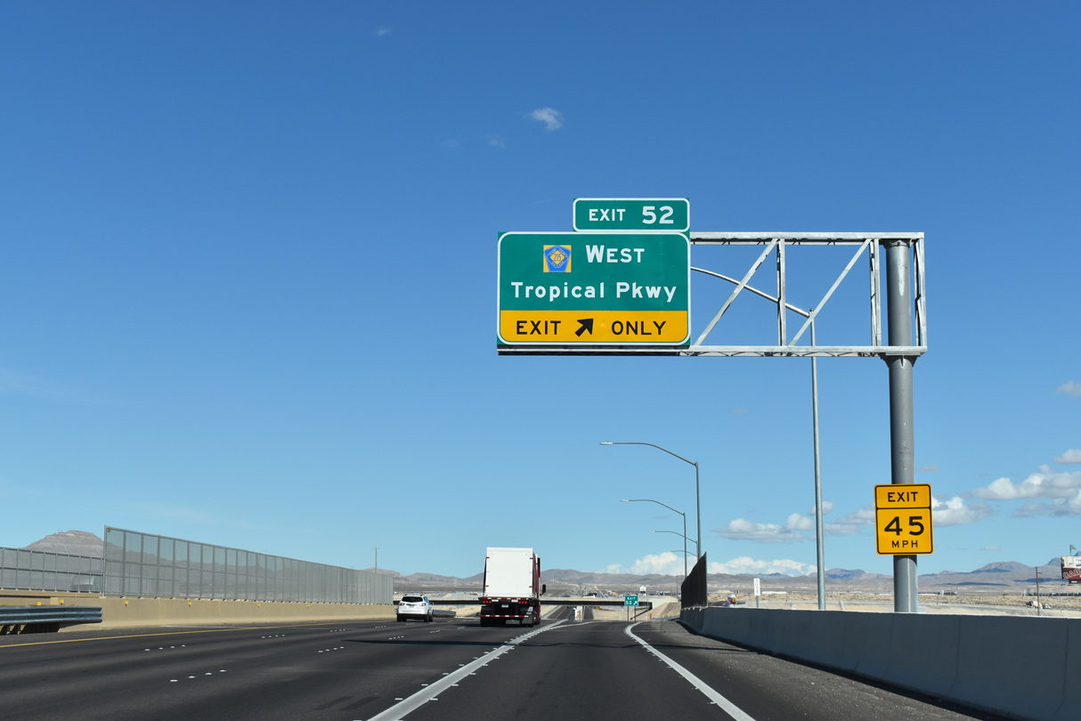
Opened August 2, 2018, Tropical Parkway joins I-15/U.S. 93 with a large area of distribution centers east toward las Vegas Motor Speedway (Marroquin, 2018a).
10/21/25

CC-215 runs 12 miles west from Exit 52 A to the Centennial Bowl interchange with I-11/U.S. 95 in Las Vegas. The systems interchange between I-15 and the Bruce Woodbury Beltway opened to traffic in late 2022.
10/21/25
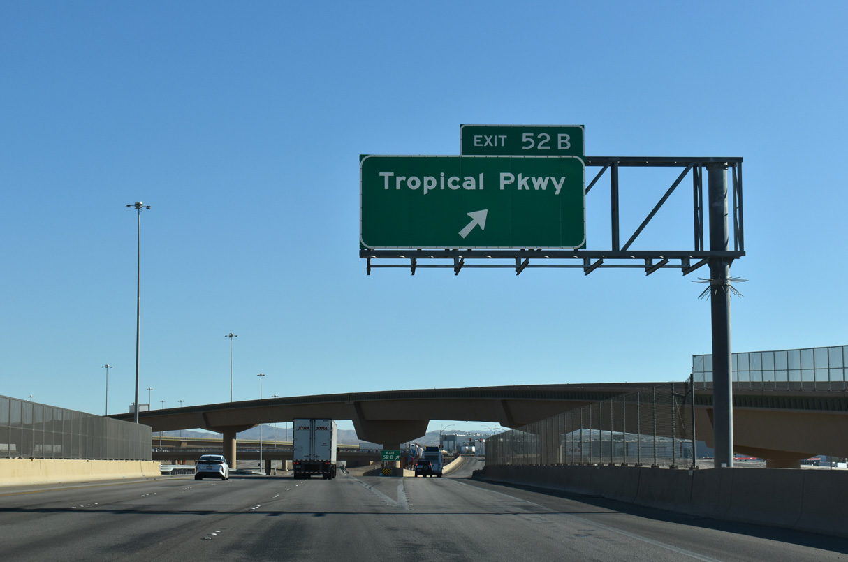
I-15/U.S. 93 spans a Union-Pacific railroad line and N Range Road where Exit 52 B departs for Tropical Parkway. Tropical Parkway ties into E Centennial Parkway to the north and N Hollywood Boulevard to the east.
10/21/25
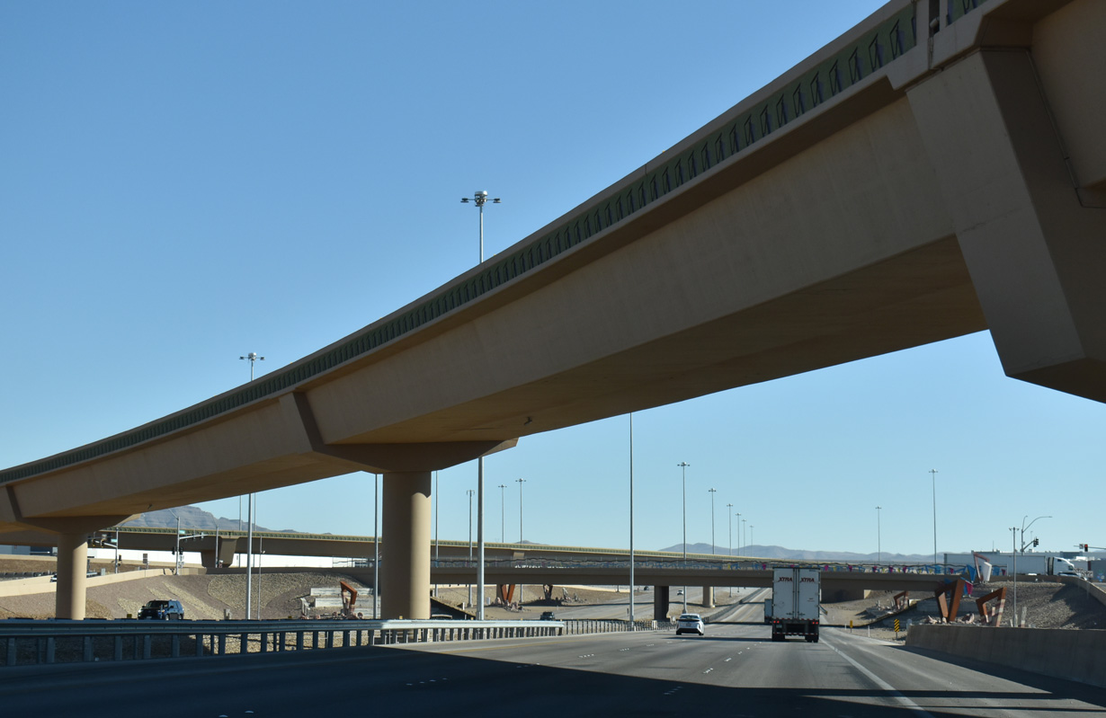
The flyover ramp for CC-215 west from northbound I-15/U.S. 93.
10/21/25
Costing $33.8 million, I-15/U.S. 93 northeast from CC-215 to Exit 54 for Speedway Boulevard was widened to six lanes by March 2018 to accommodate additional traffic during NASCAR events (Marroquin, 2018b).
10/21/25
Hollywood Boulevard branches from Speedway Boulevard just south of Exit 54 through industrial areas, connecting with SR 604 (Las Vegas Boulevard) at the north end of Nellis AFB.
10/21/25
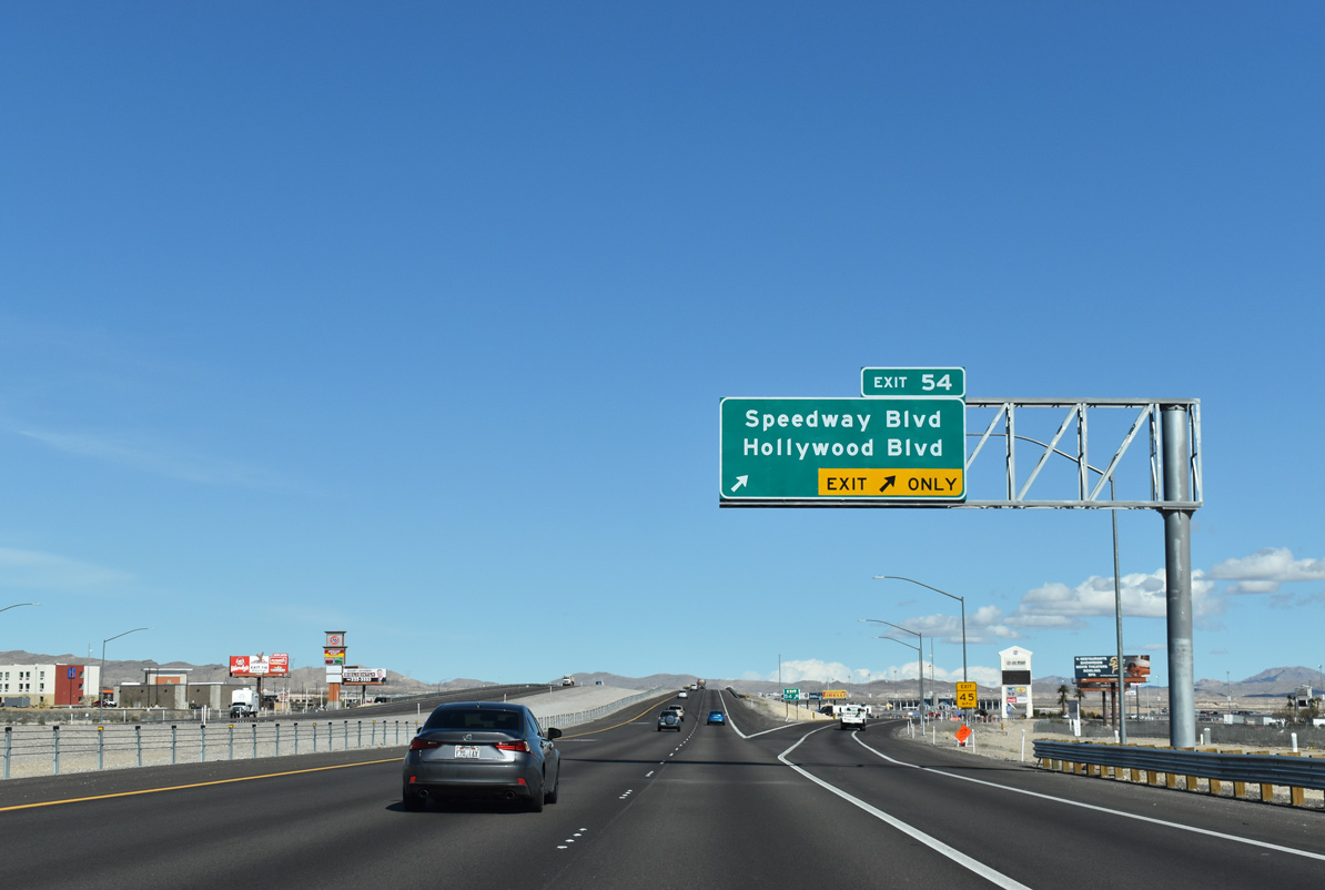
Part of the NASCAR Cup Series, Las Vegas Motor Speedway, is 0.75 miles southeast from Exit 54. Speedway Boulevard extends southeast to Las Vegas Boulevard (SR 604) near the backstretch of the 1.5 mile oval track.
10/21/25
The terrain remains relatively flat between Speedway Boulevard / Exit 54 and SR 604 / Exit 58, with elevations ranging between 2,100 and 2,250 feet above sea level.
10/21/25
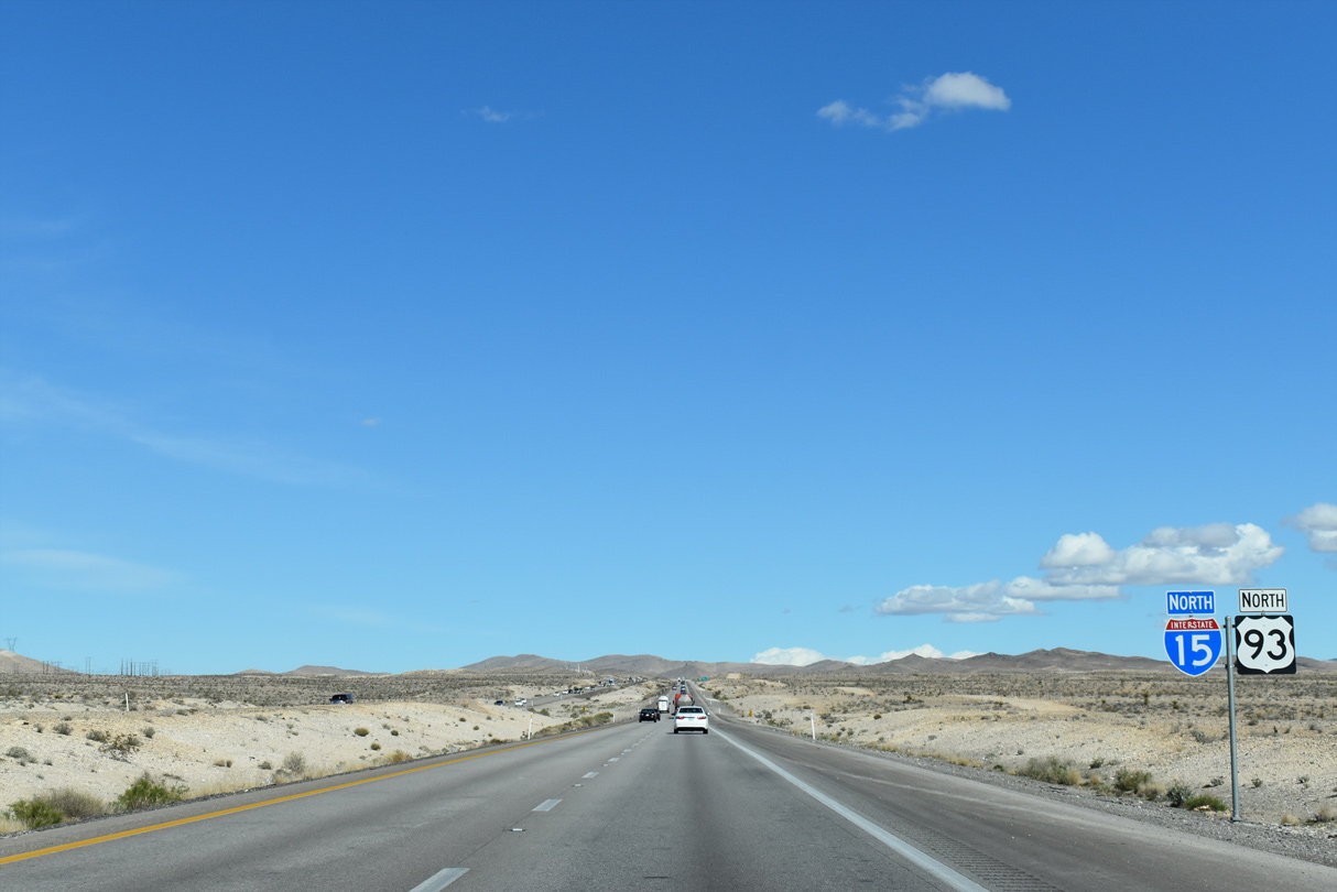
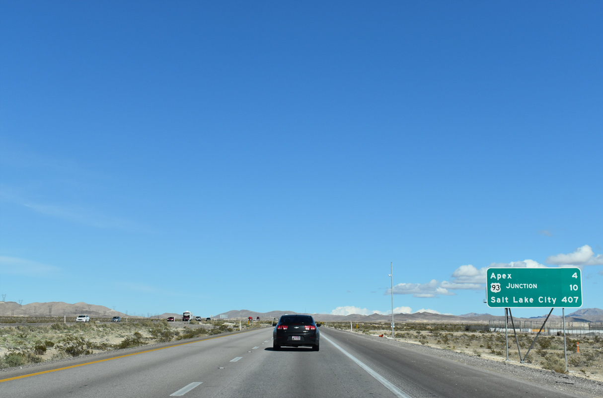
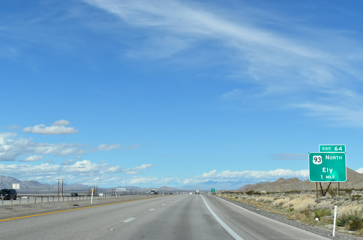
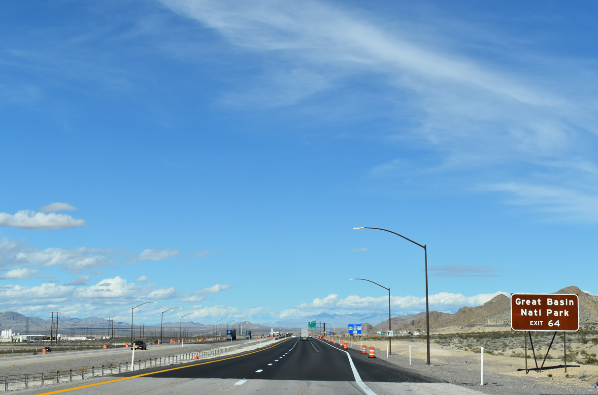
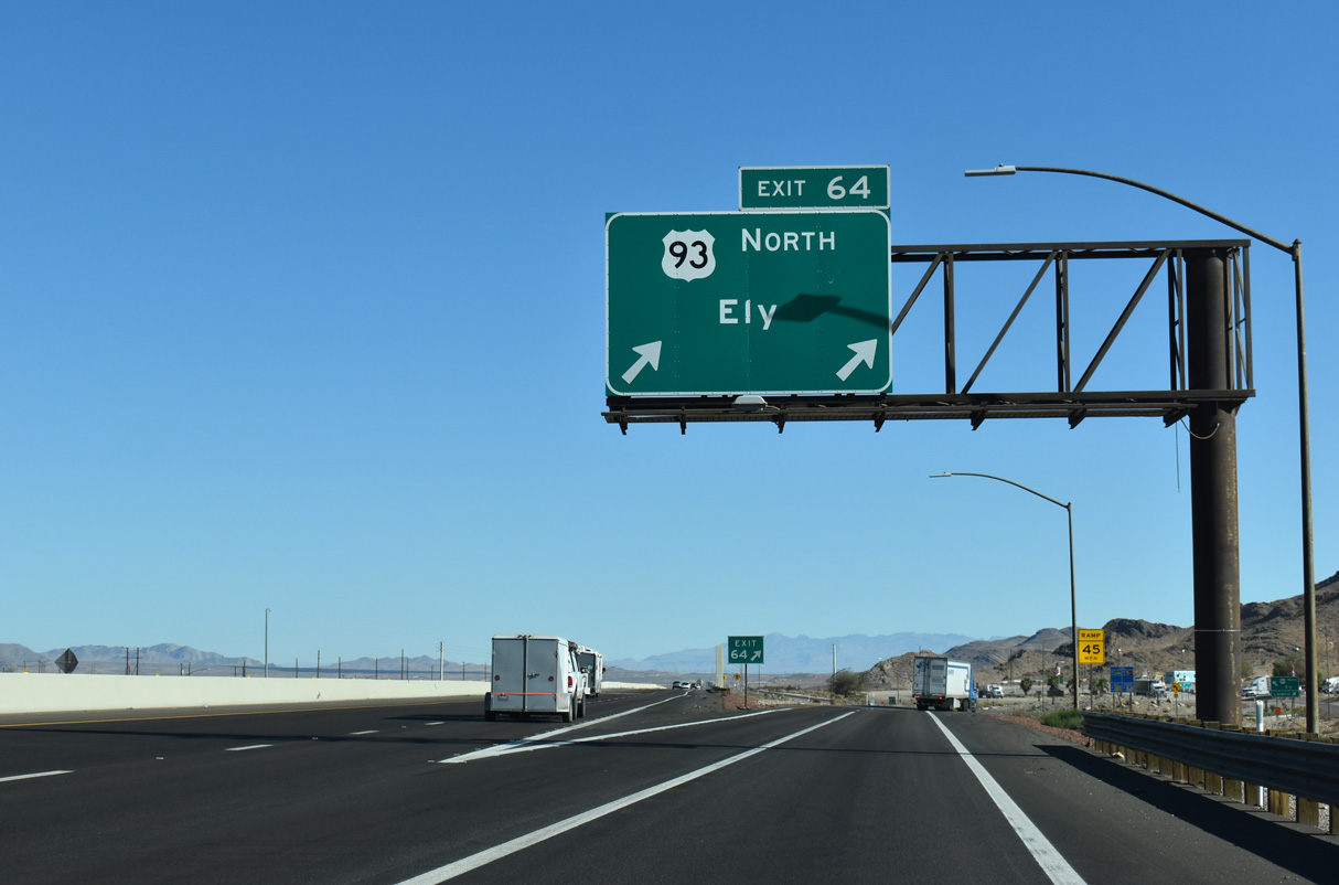
I-15/U.S. 93 beelines northeast four miles to Apex. U.S. 93 leaves the freeway for Ely at Exit 64.
10/21/25
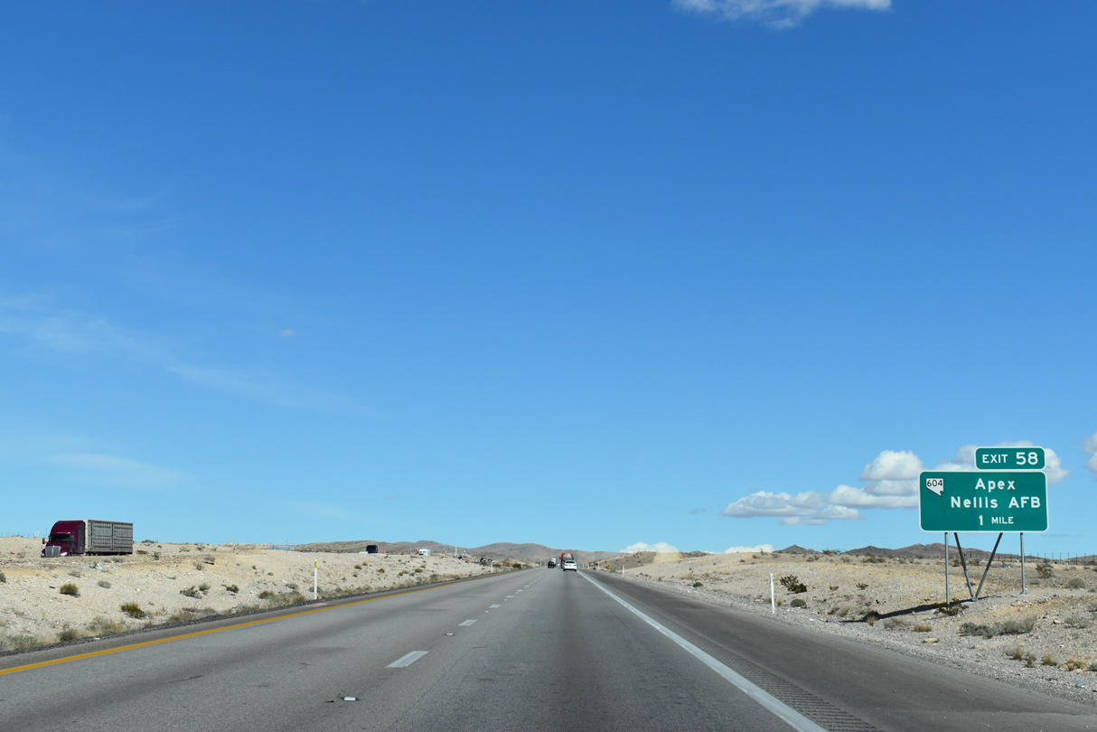
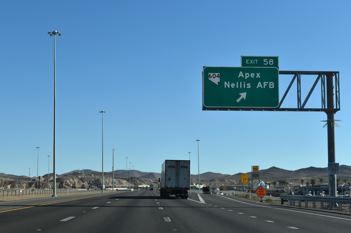
One mile from the diamond interchange (Exit 58) with SR 604 (Las Vegas Boulevard) south to Nellis AFB. Apex is an unincorporated area to the north of the exchange.
10/21/25
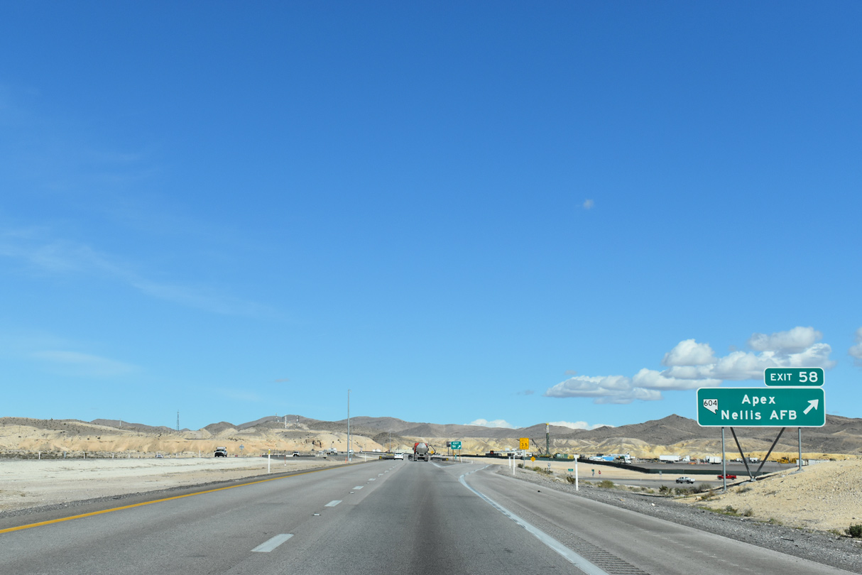
SR 604 overlays Las Vegas Boulevard southwest 12.01 miles from Exit 58 to Carey Avenue in North Las Vegas.
10/21/25
Las Vegas Boulevard continues northeast from Exit 58, paralleling I-15/U.S. 93 to Garnet.
10/21/21
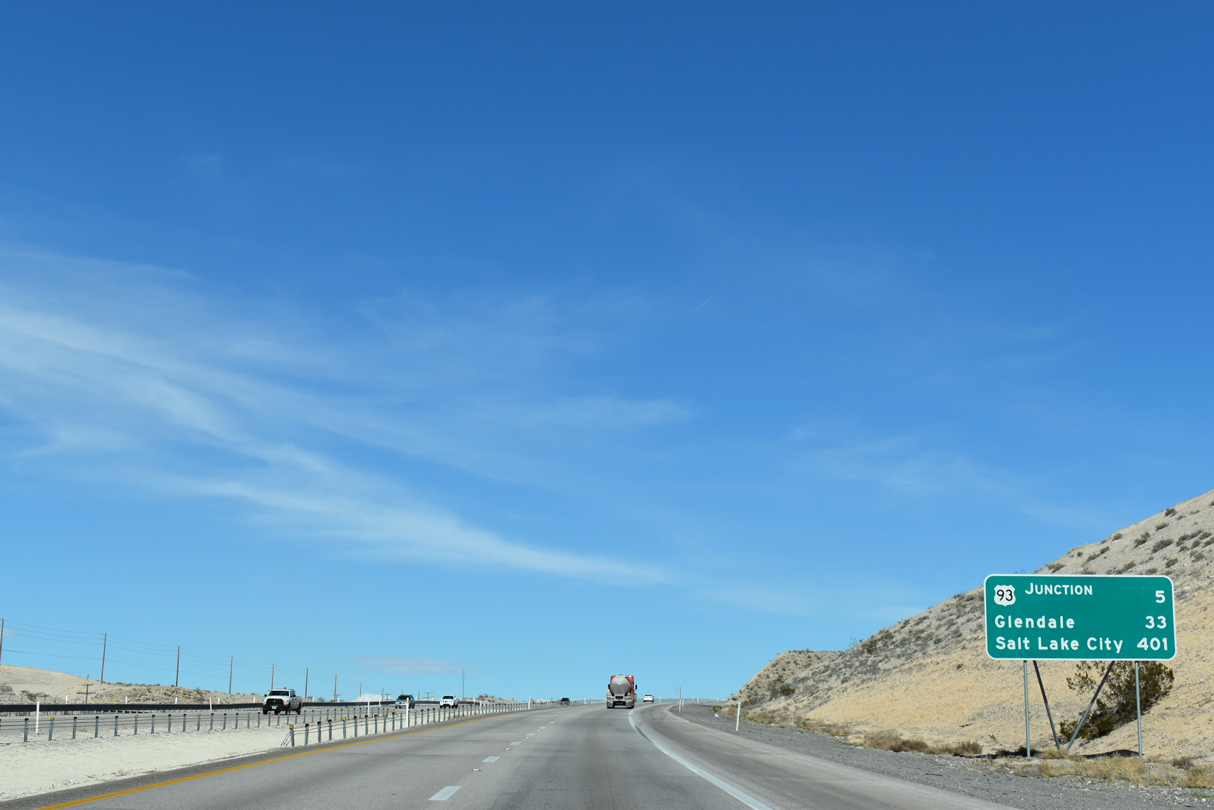
I-15/U.S. 93 advances northward from Las Vegas Boulevard five miles to their separation at Garnet. SR 168 ties into I-15 at Glendale in 33 miles.
10/21/25
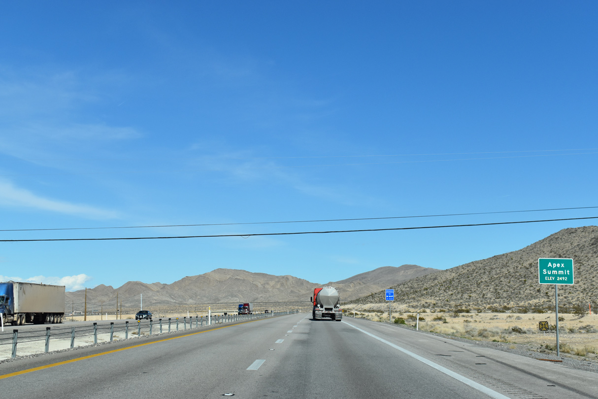
I-15/U.S. 93 north at Apex Summit, elevation 2,492 feet above sea level.
10/21/25
A commercial vehicle inspection site lines southbound I-15/U.S. 93, one mile south of a truck parking area along northbound.
10/21/25

The Dry Lake Range rises to the northeast of the ensuing stretch on I-15/U.S. 93.
10/21/25
The truck parking facility was built in conjunction with the widening of I-15/U.S. 93 between SR 604 and the Garnet Interchange.
10/21/25
I-15 shifts west of the parallel Union Pacific Railroad and nearby Dry Lake Range on the two miles preceding Exit 64 for U.S. 93 (Great Basin Highway).
10/21/25
Confirming markers are also posted beyond the truck parking facility.
10/21/25
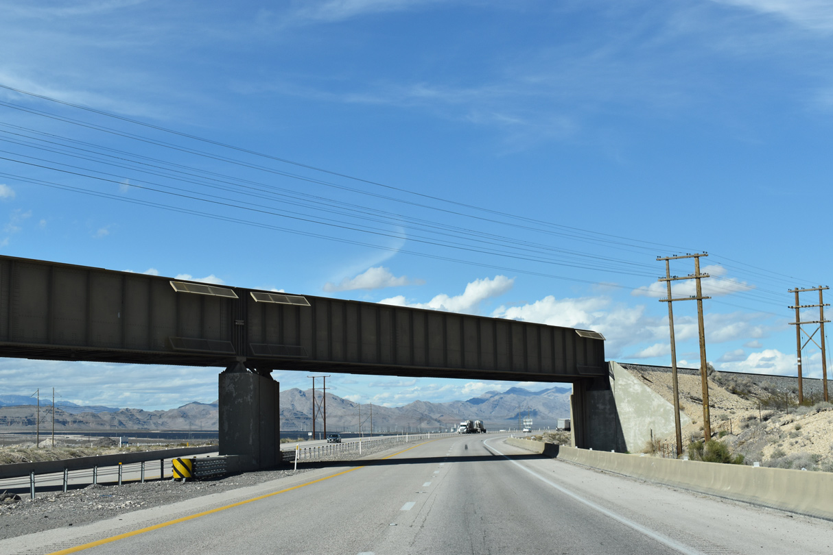
The Union Pacific railroad spans I-15/U.S. 93 adjacent to Las Vegas Boulevard (Historic U.S. 91). This freight rail line generally follows the I-15 corridor between Barstow, California and Salt Lake City, Utah.
10/21/25
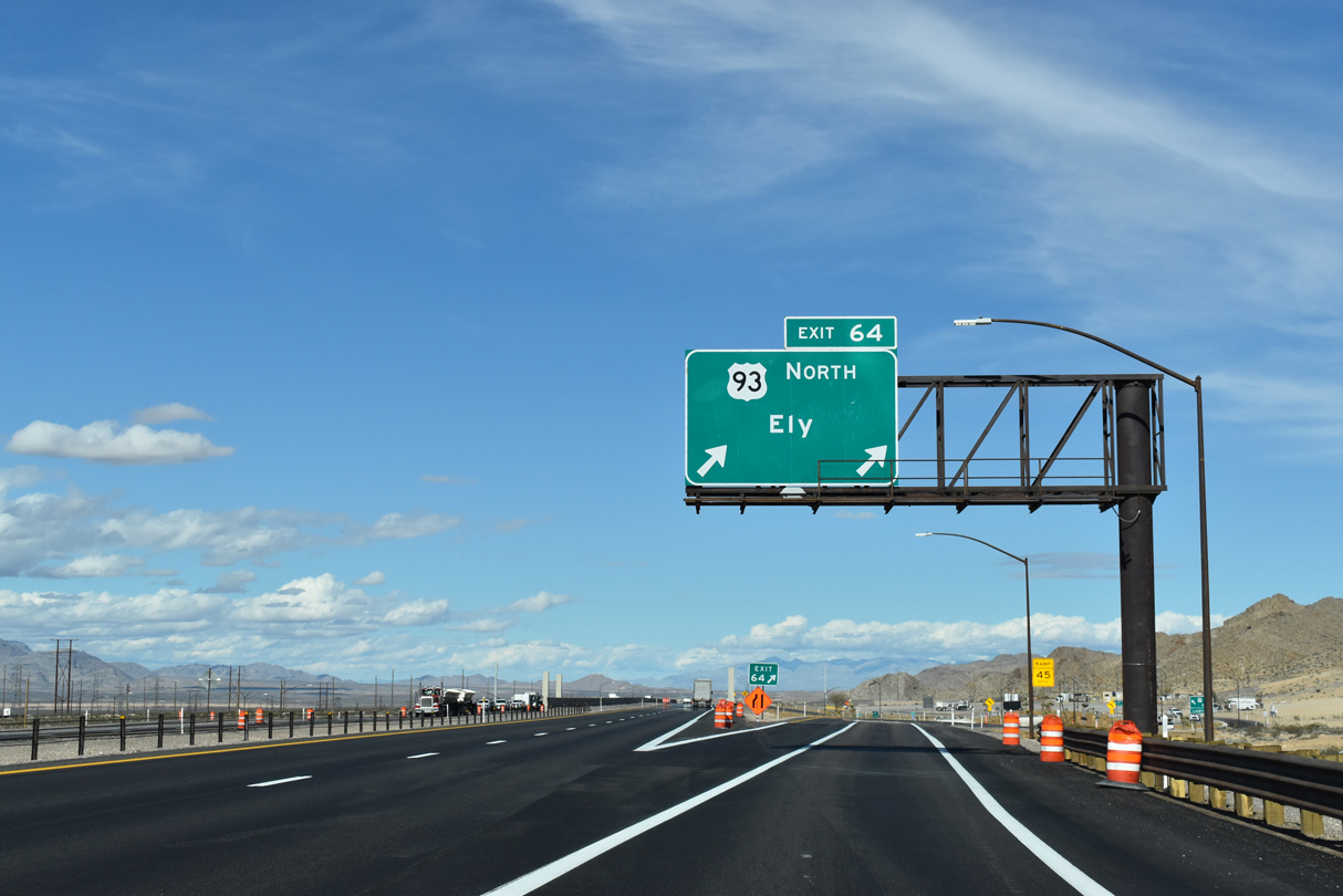
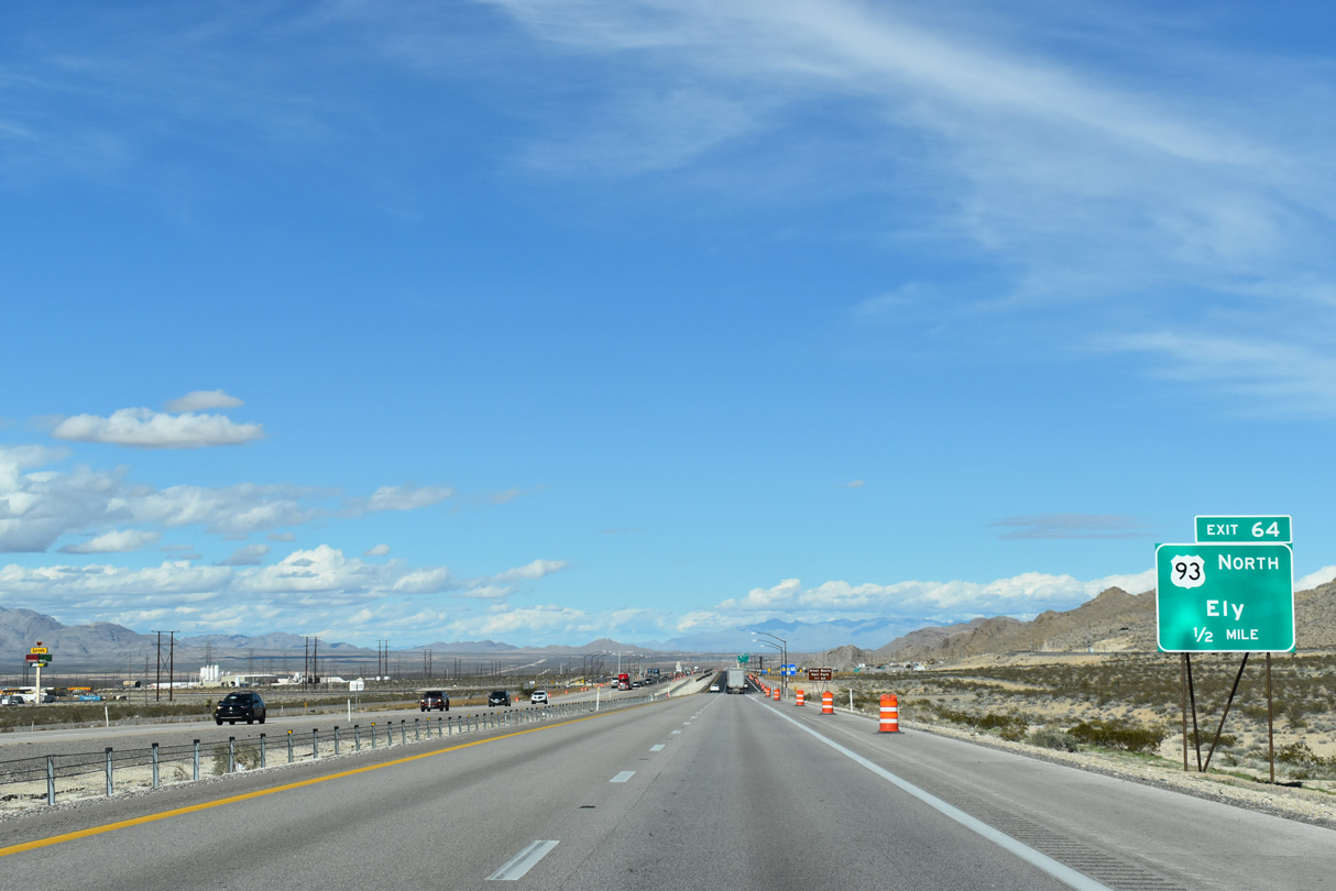
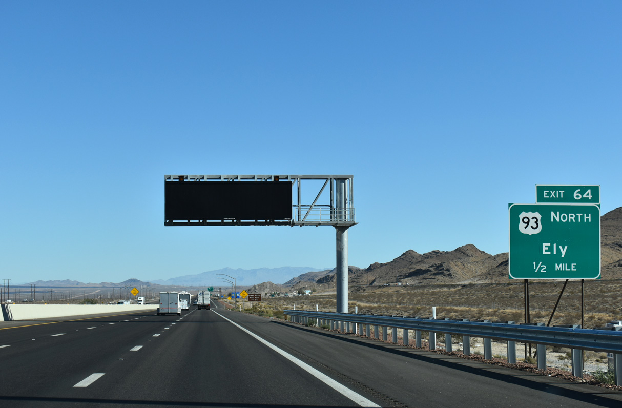
U.S. 93 branches north from I-15 in one mile at a modified DDI (Exit 64), locally referenced as the Garnet Interchange.
10/21/25
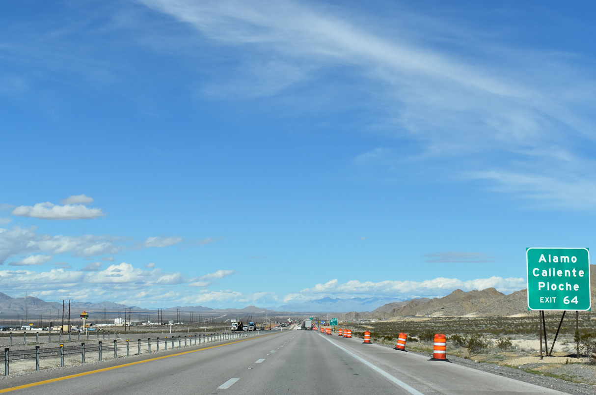
U.S. 93 follows the Great Basin Highway northward through east central Nevada to Caliente, Pioche and Ely.
10/21/25
Completed by the end of 2018, a $58 million project redesigned Exit 64 from a diamond interchange into a DDI. Work also included improving a five mile stretch of U.S. 93 between I-15 and Apex Power Parkway (Akers, 2018).
10/21/25
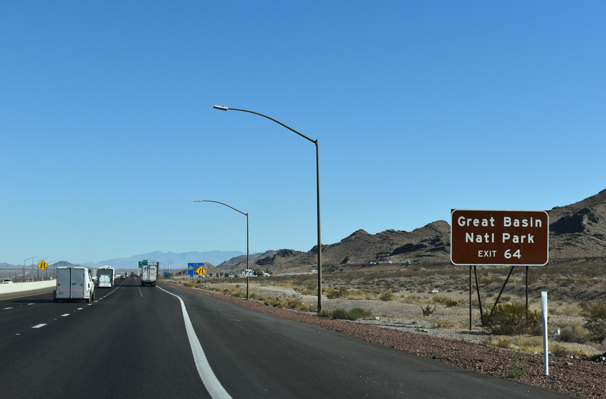
Great Basin National Park is located east of U.S. 93 and the Spring Valley and south of U.S. 6/50 in the Snake Range.
10/21/25
U.S. 93 traverses sparsely populated areas north to Alamo in the Pahranagat Valley and east across the Delamar Mountains to Caliente. U.S. 93 constitutes a major highway connecting the Las Vegas area with Ely and Wells in eastern reaches of the Silver State.
10/21/25
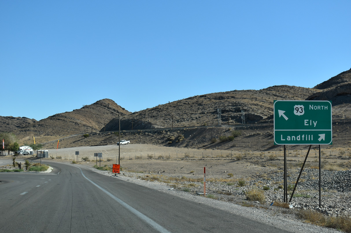
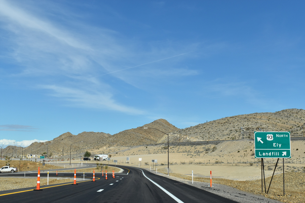
Exit 64 partitions with two lanes for U.S. 93 north through the DDI and a turn off for the adjacent regional landfill.
10/21/25

References:
- State Maintained Highways of Nevada - Descriptions and Maps, January 2019 edition (pdf).
- Nellis Air Force Base Fact Sheet. Nellis Air Force Base website. http://www.nellis.af.mil/About/Fact-Sheets/Display/Article/284174/nellis-air-force-base/
Marroquin, A. (2018, August 2) Road opens to industrial area rising near Las Vegas Motor Speedway. (2018, August 2). Las Vegas Review-Journal. https://www.reviewjournal.com/local/traffic/road-opens-to-industrial-area-rising-near-las-vegas-motor-speedway/
Marroquin, A. (2018, March 2). I-15 widening in North Las Vegas helps with NASCAR traffic. (2018, March 2). Las Vegas Review-Journal. https://www.reviewjournal.com/traffic/i-15-widening-in-north-las-vegas-helps-with-nascar-traffic/
Ackers, M. (2018, January 2). $58 million freeway enhancement planned for NLV near Apex. Las Vegas Sun. https://lasvegassun.com/news/2018/jan/02/58-million-freeway-enhancement-planned-for-nlv-nea/
Photo Credits:
- ABRoads: 03/04/19, 10/21/21, 10/21/25, 10/24/25
Connect with:
Page Updated Monday November 17, 2025.