
Interstate 440 / Cliff Benson Beltline - East


 East
East  North
North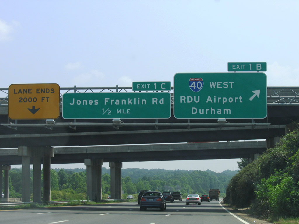
Interstate 440 begins at the cloverleaf interchange joining U.S. 1/64 with I-40 along the Cary and Raleigh city line. Exit 1B loops onto a c/d roadway for I-40 west toward Raleigh Durham International Airport (RDU) and the city of Durham.
06/06/05
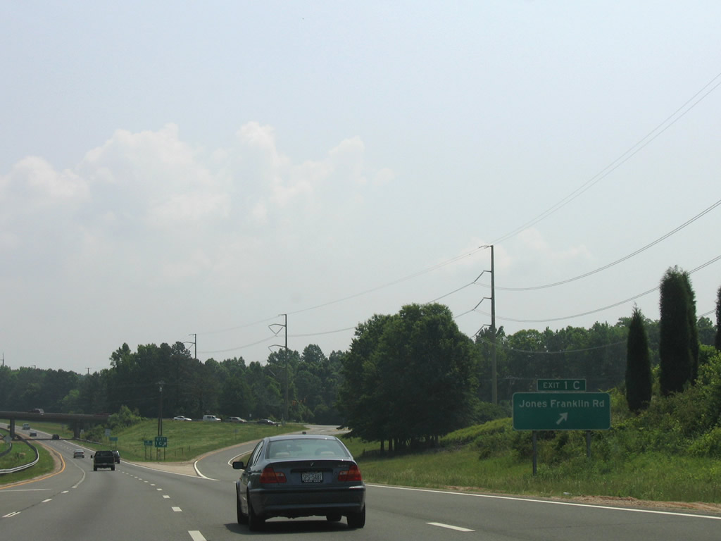
Exit 1C quickly follows as a parclo interchange with Jones Franklin Road. Jones Franklin Road heads south by Lake Johnson Park into east Cary and north to Hillsborough Street near the North Carolina State Fairgrounds.
06/06/05
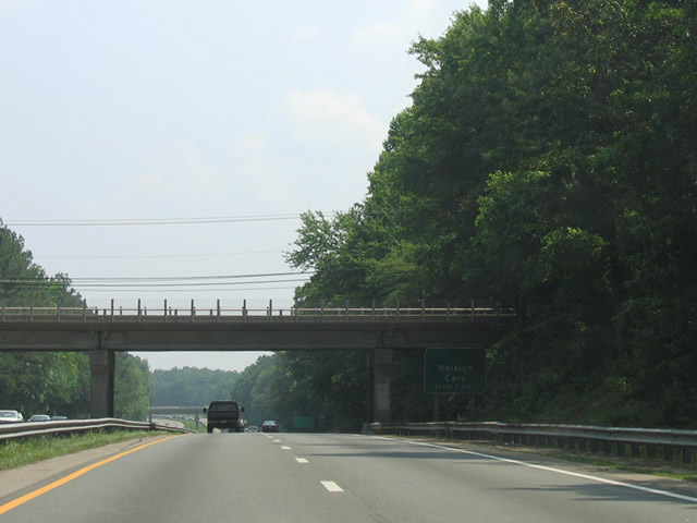
I-440/U.S. 1 pass under Athens Drive one mile ahead of Exit 2 to Western Boulevard.
06/06/05
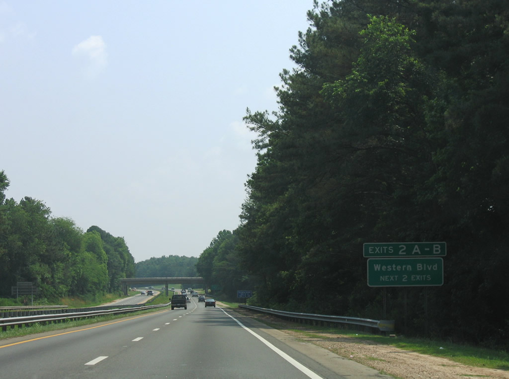
Western Boulevard travels west to Jones Franklin Road and east to North Carolina State University from the directional cloverleaf interchange (Exit 2) the Cliff Benson Beltline. The I-440 Improvements project reconfigures this exchange into a diverging diamond interchange (DDI).
06/06/05

A half diamond interchange (Exit 1D) joins Interstate 440 west with Melbourne Road.
06/06/05

Exit 2A departs I-440/U.S. 1 for Western Boulevard (SR 1012) east into the N.C. State campus. The arterial continues from the college to Downtown Raleigh and Shaw University.
06/06/05
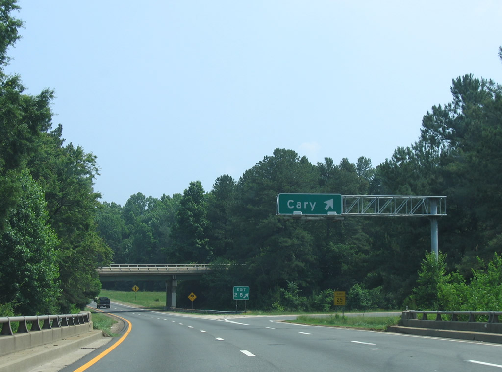
West from Exit 2B, Western Boulevard (SR 1012) connects Interstate 440 with Hillsborough Street west to Chatham Street in the city of Cary. Historically, Western Boulevard carried U.S. 64.
06/06/05
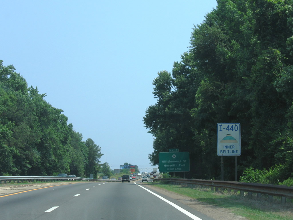
An older sign for Interstate 440 / Inner Beltline. These signs were phased out for conventional Interstate markers with east or westbound cardinal direction banners.
06/06/05
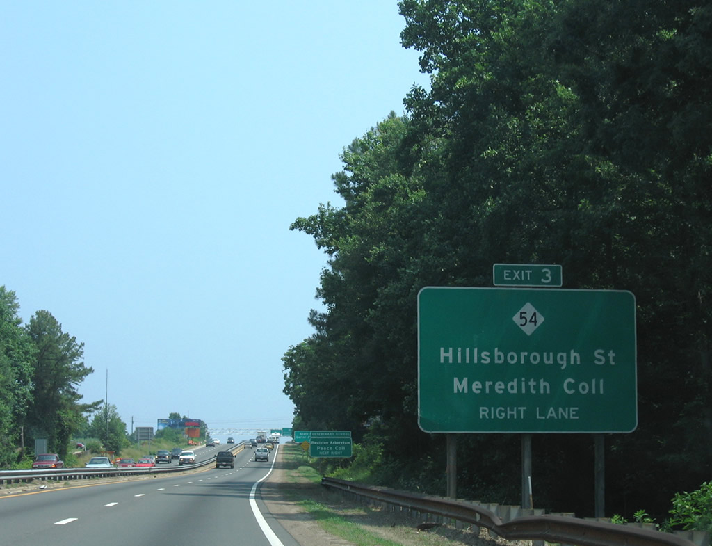
Hillsborough Street (SR 3007) meets Interstate 440 between Meredith College and the North Carolina State College of Veterinary Medicine at Exit 3. I-440 represents the east end of NC 54.
06/06/05
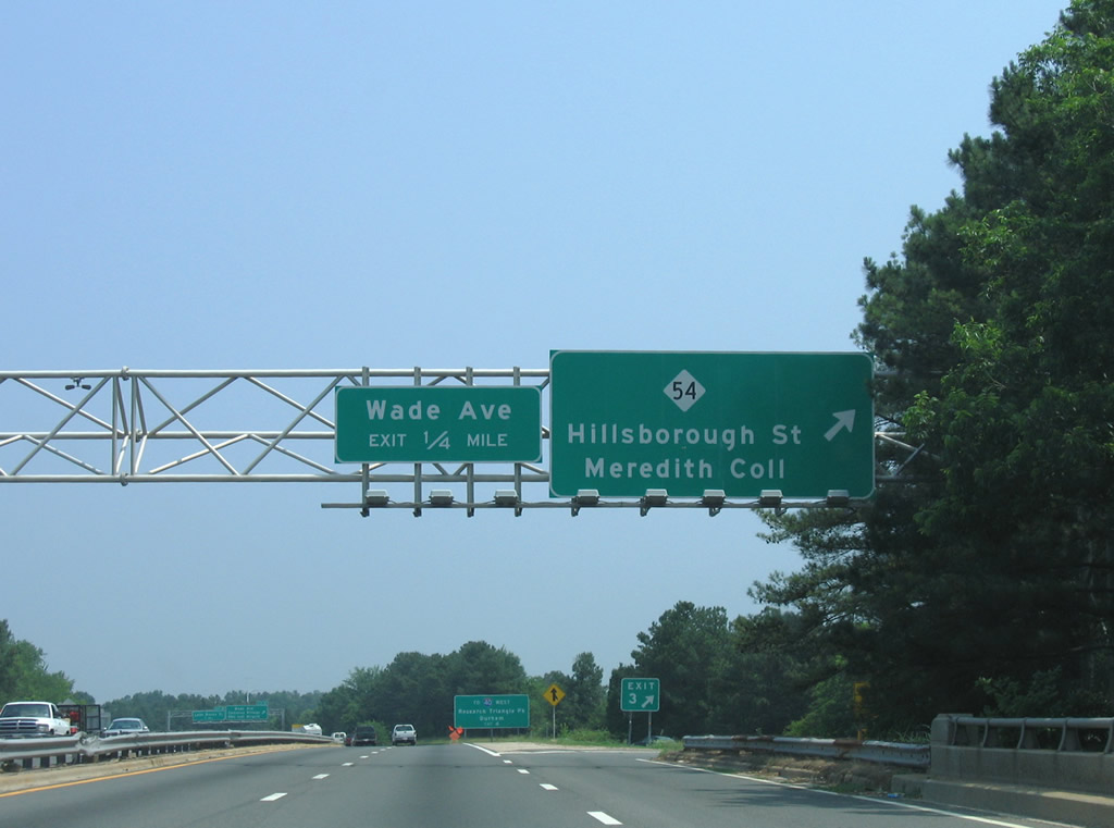
The folded diamond interchange (Exit 3) with NC 54 (Hillsborough Street) lies north of parallel CSX Railroad tracks. NC 54 heads west to Chapel Hill Road in the Westover section of Raleigh. Hillsborough Street (SR 3007) east continues to N.C. State and the North Carolina State Capitol in Downtown.
06/06/05
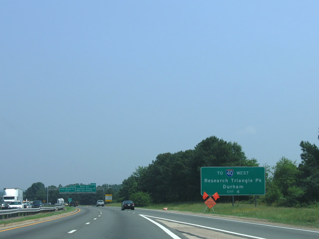
Wade Avenue (SR 1728) constitutes a freeway extending 3.06 miles from I-440 at Exit 4 onto westbound Interstate 40 toward Research Triangle Park and the city of Durham.
06/06/05
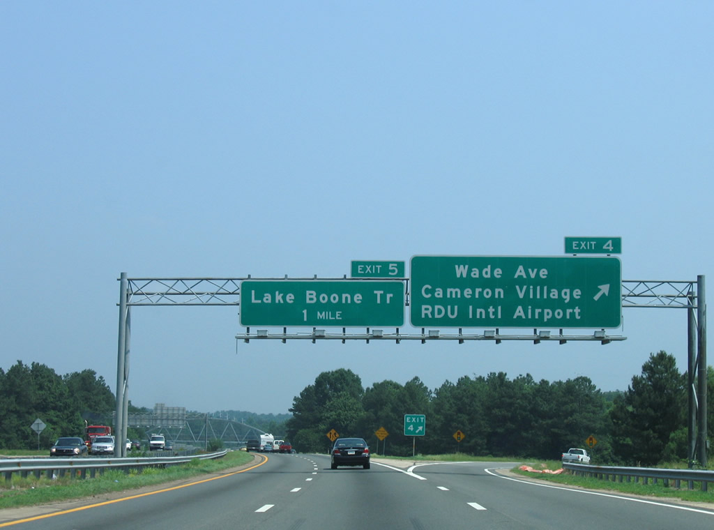
Previously separate ramps, Exit 4 directs all motorists to Wade Avenue in unison due to the removal of the westbound loop ramp. Wade Avenue consists of a busy freeway connecting with PNC Arena, Carter Findley Stadium, and I-40. Eastward, Wade Avenue (SR 1728) continues through the Cameron Village neighborhood to U.S. 70 and U.S. 401.
06/06/05
Raleigh's Reedy Creek Trail greenway passes over the beltline within the exchange at Wade Avenue. This greenway stretches 5.0 miles from William B. Umstead State Park to N.C. State.
06/06/05
An older style reassurance sign assembly for I-440/U.S. 1 posted after Exit 4. All banner less or inner/outer signs for Interstate 440 were scheduled for replacement in 2009.
06/06/05
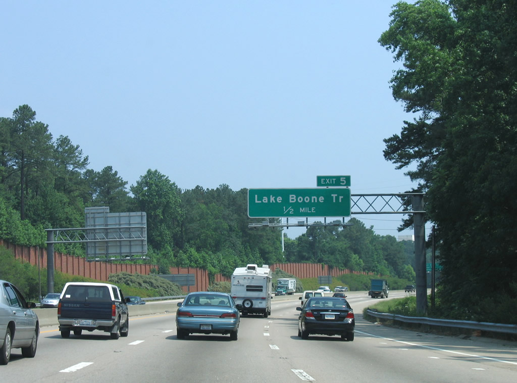
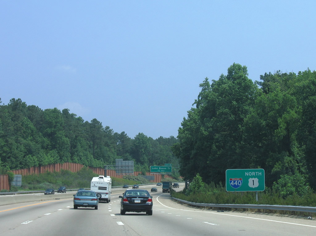
Curving northeast toward the parclo interchange (Exit 5) with Lake Boone Trail.
06/06/05
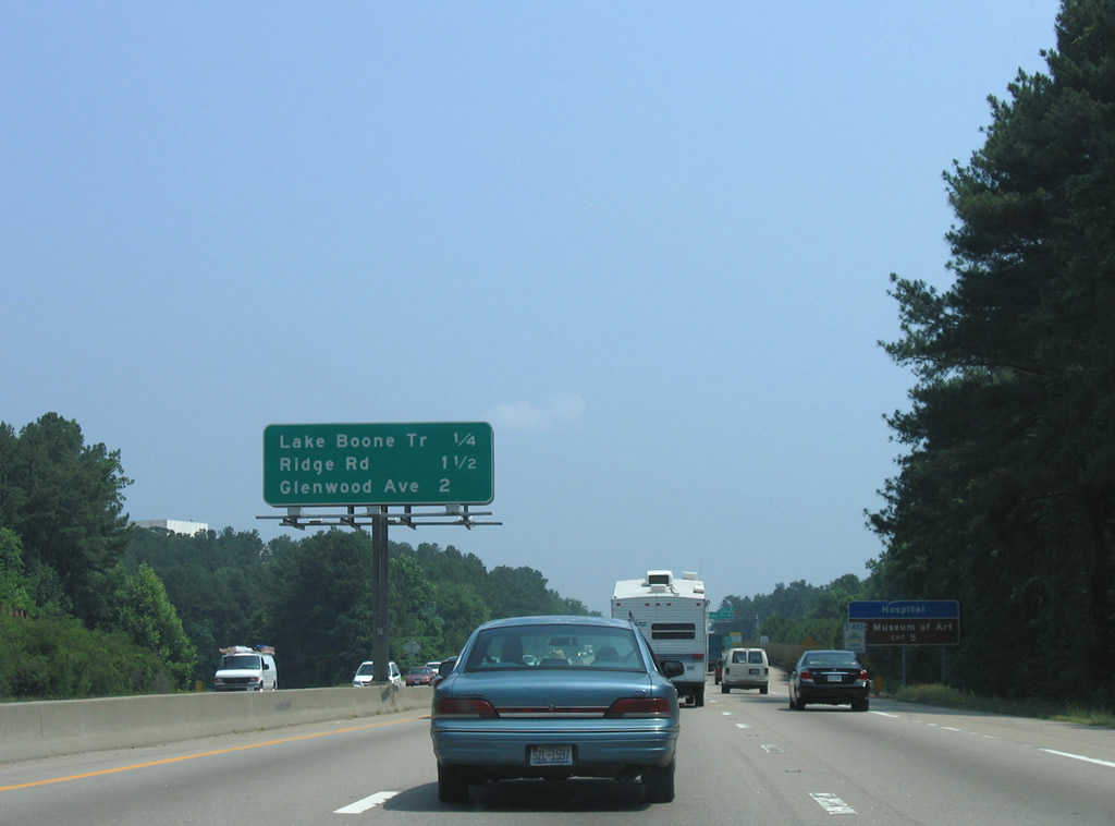
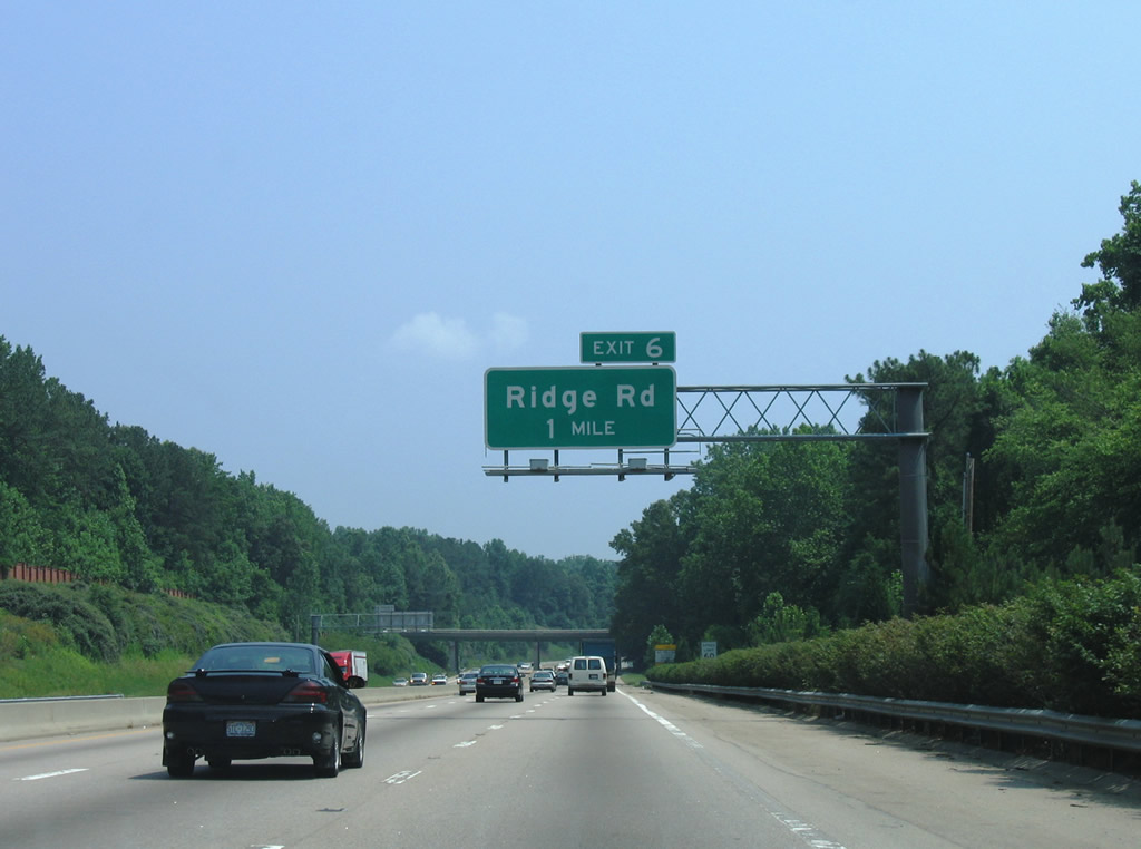
Lake Boone Trail leads west to UNC Rex Hospital and Blue Ridge Road. Interstate 440 continues 1.5 miles to Ridge Road and two miles to Glenwood Avenue (U.S. 70).
06/06/05

Lake Boone Trail continues east from Exit 5 through leafy neighborhoods to U.S. 70/NC 50 at Carolina Country Club.
06/06/05
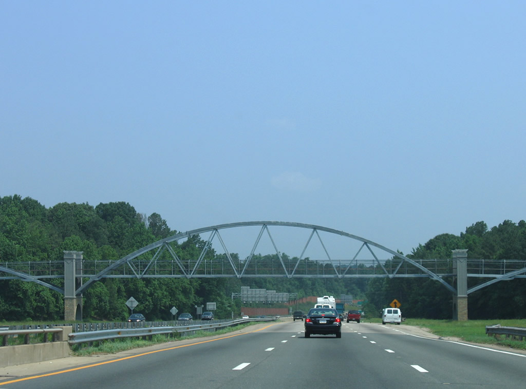
Continuing northward along I-440/U.S. 1. Woods obscure adjacent commercial development to the west.
06/06/05
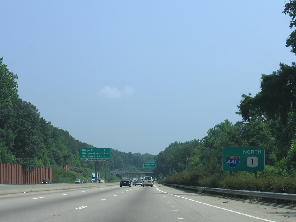
Ridge Road heads north from the Coley Lakes neighborhood area to meet the Cliff Benson Beltline at a parclo interchange (Exit 7).
06/06/05
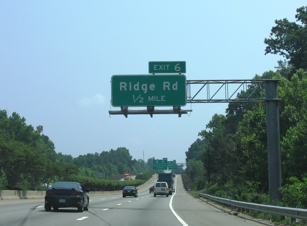
Turning more toward the east, I-440/U.S. 1 advance to within a half mile of Ridge Road (Exit 7). Ridge Road ends at the freeway due to the adjacent interchange with U.S. 70/NC 50 (Glenwood Avenue).
06/06/05
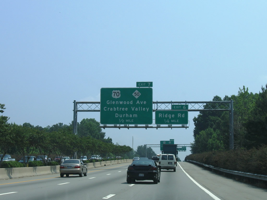
U.S. 70/NC 50 (Glenwood Avenue) meet the freeway at a three quarter cloverleaf interchange near Crabtree Valley Mall. The pair split just north of the freeway on respective routes through the northwest suburbs.
06/06/05
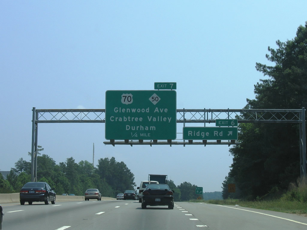
Ridge Road parallels the beltline southward from Exit 6 to Ridgewood and Wade Avenue. U.S. 70/NC 50 progress southeast to Wade Avenue and converge with U.S. 401 outside Downtown Raleigh.
06/06/05
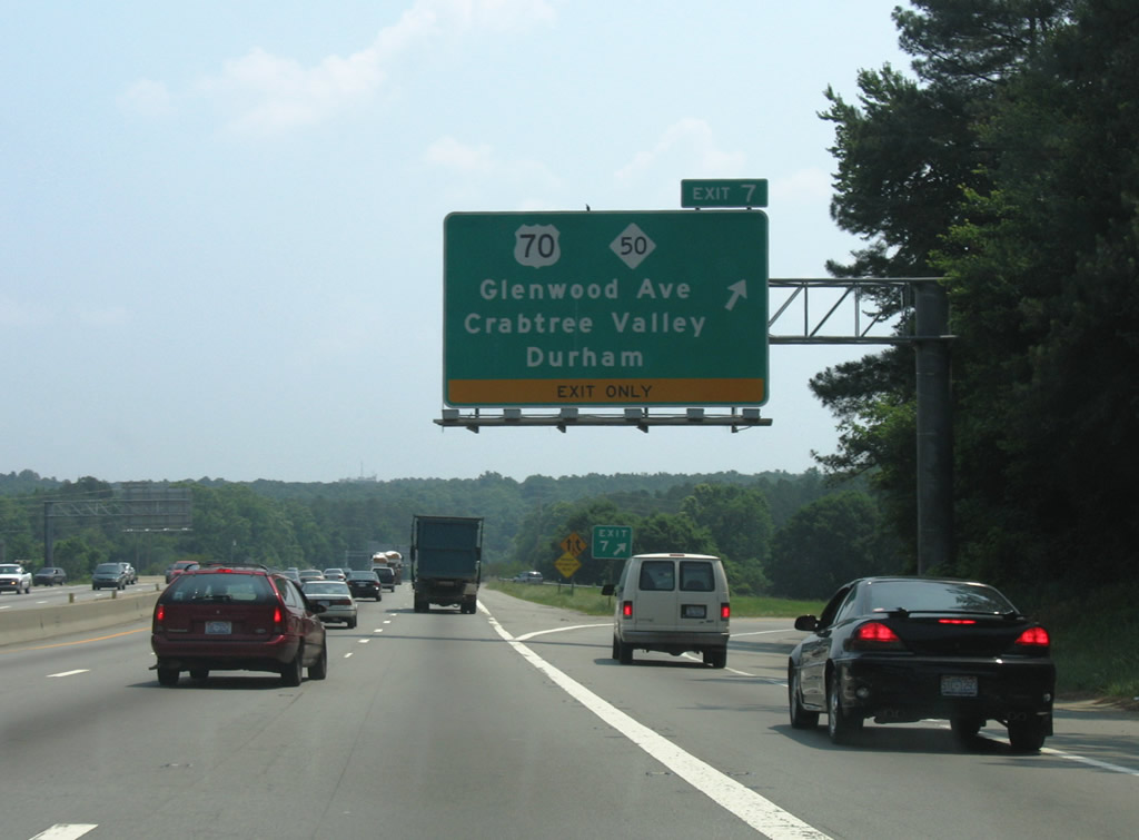
With the removal of the westbound loop ramp for U.S. 70, a single ramp joins I-440 east with Greenwood Avenue at Exit 7. U.S. 70 joins Raleigh with Durham to the northwest. NC 50 leaves the Raleigh area for Falls Lake and Creedmoor.
06/06/05
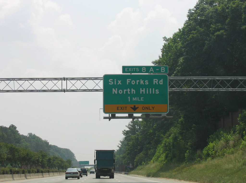
Curving eastward, I-440/U.S. 1 next meet Six Forks Road by North Hills Mall at Exits 8A/B.
06/06/05
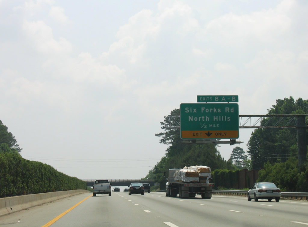
Six Forks Road meets the freeway at a six-ramp parclo interchange sandwiched between an apartment complex and two office parks. Six Forks Road weaves through the North Hills section of the city to Interstate 540 at Exit 11.
06/06/05

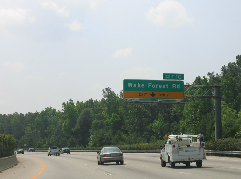
Angling southeast, Six Forks Road (SR 1005) intersects Wake Forest Road (SR 2000) in 1.39 miles just south Interstate 440 at Exit 10.
06/06/05
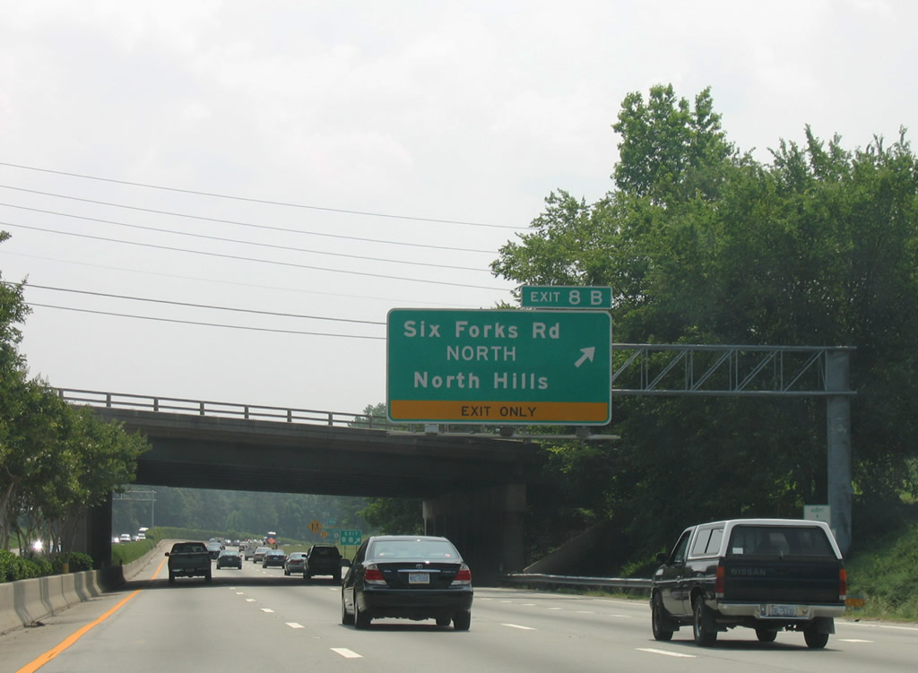
Exit 8B quickly follows as a loop ramp onto Six Forks Road north ahead of North Hills Mall and Lassiter Mill Road. Six Forks Road meanders all the way to Falls Lake.
06/06/05
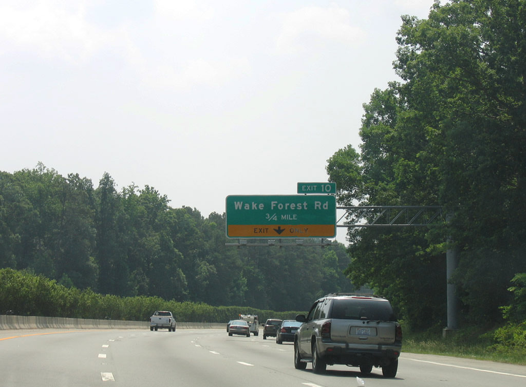
Wake Forest Road constitutes a busy commercial arterial through the Eastgate and Millbrook areas north of Interstate 440.
06/06/05
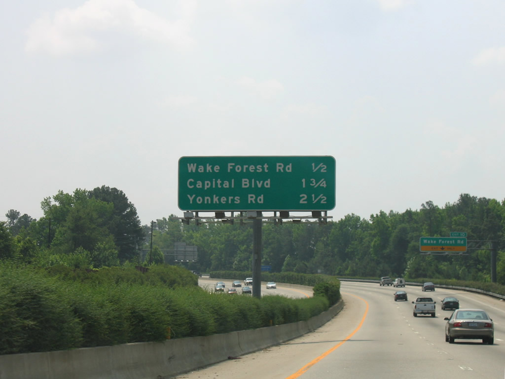
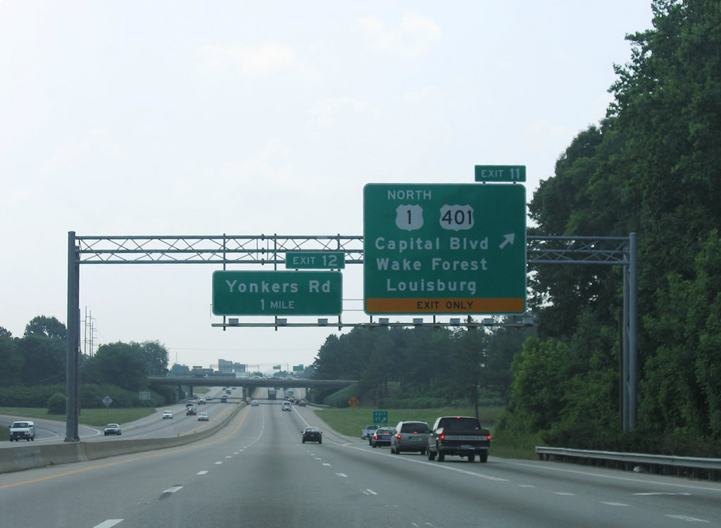
Interchange sequence signs are posted consistently along Interstate 440 east. This assembly outlines the distances to Exit 10, 11 and 12.
06/06/05
Exit 8 serves Duke Raleigh Hospital to the north and connects with U.S. 401 (Capital Boulevard) to the south.
06/06/05
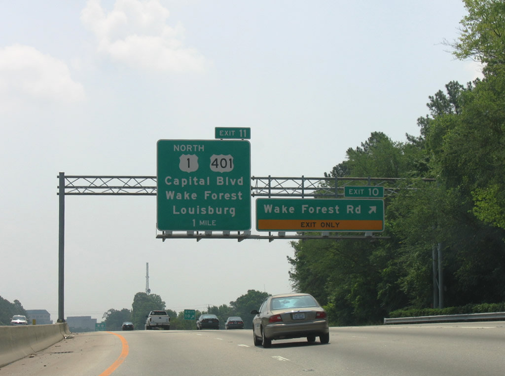
Turning southward, I-440 east / U.S. 1 north enter a diamond interchange at Exit 10. The pair part ways at the succeeding exit in one mile.
06/06/05
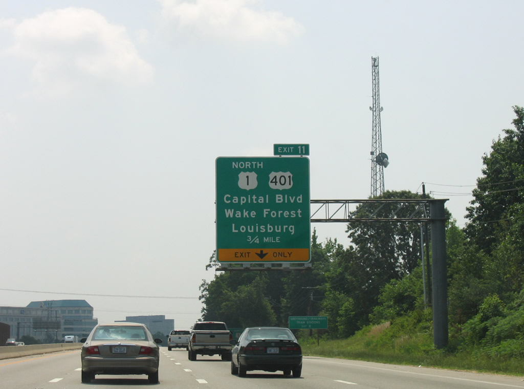
U.S. 401 follows the original route of U.S. 1 northeast along Capital Boulevard from Downtown Raleigh to Exit 11. U.S. 1 combines with U.S. 401 northward through the New Hope section of Raleigh.
06/06/05
Mid-rise office blocks line the north side of Interstate 440 along parallel Highwoods Boulevard ahead of Exit 11.
06/06/05
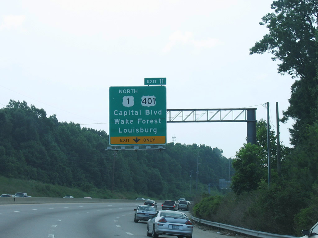
An auxiliary lane accompanies the three eastbound lanes to Exit 11 for U.S. 1 north. U.S. 1 joins Raleigh with Wake Forest and Henderson while U.S. 401 turns northeastward to Louisburg.
06/06/05
Exit 11 departs for directional ramps to Capital Boulevard. U.S. 401 continues south through a warehouse district and combines with U.S. 70/NC 50 (Wade Avenue) to the central business district and I-40 at Exit 298.
06/06/05
East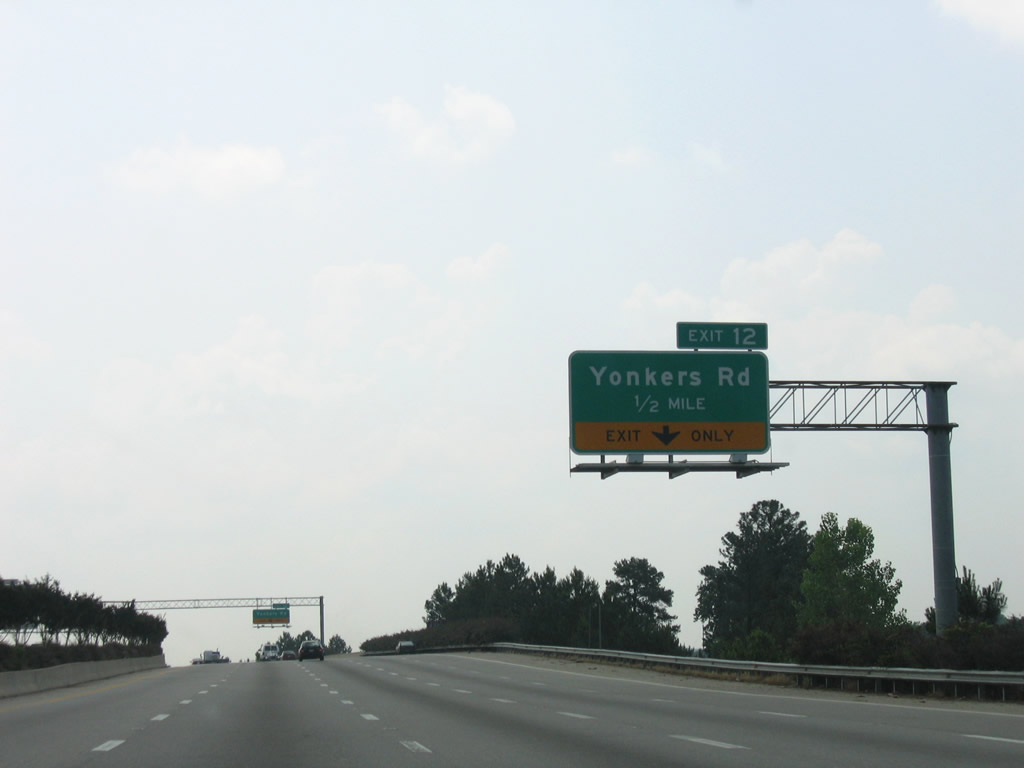
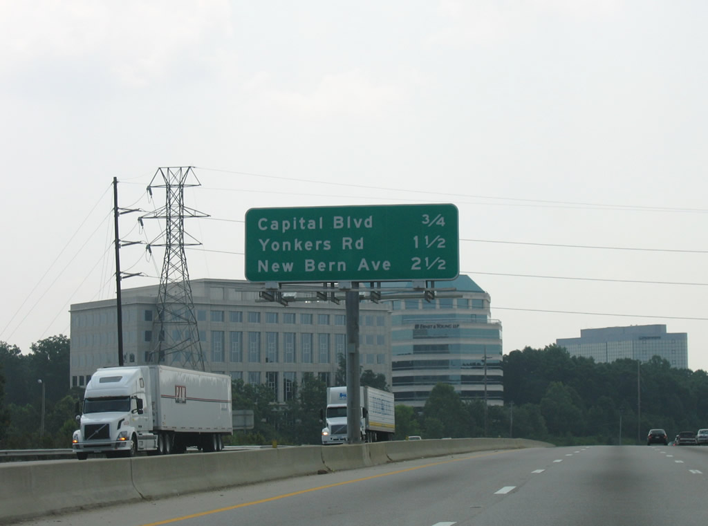
Yonkers Road is the west side frontage road for the beltline from Capital Boulevard southeast to New Bern Avenue.
06/06/05
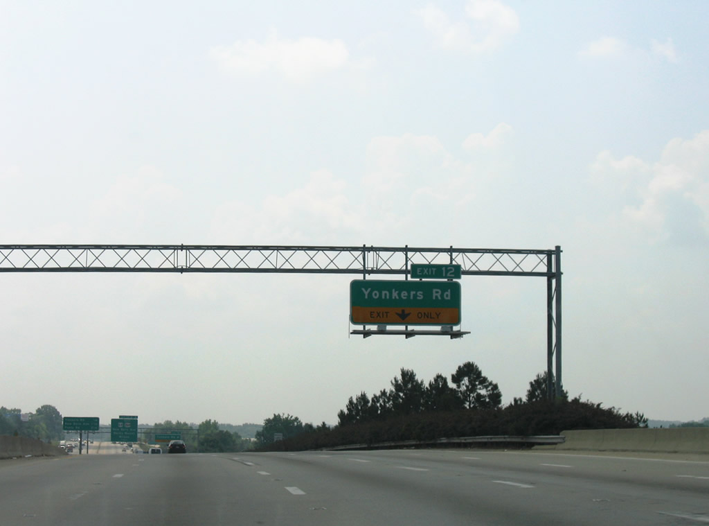
Exit 12 joins Interstate 440 east with adjacent Yonkers Road beyond the Raleigh Boulevard underpass. Yonkers Road serves a bevy of industrial businesses alongside the freeway.
06/06/05
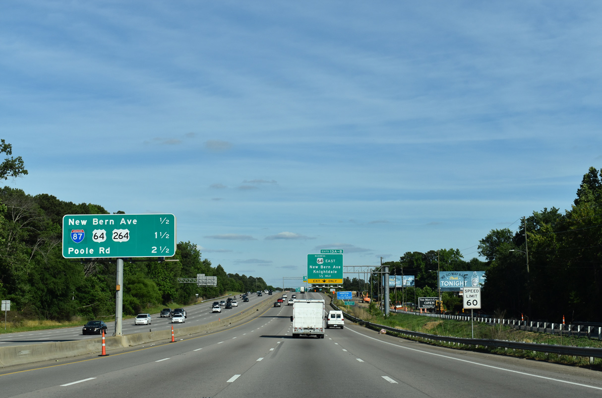
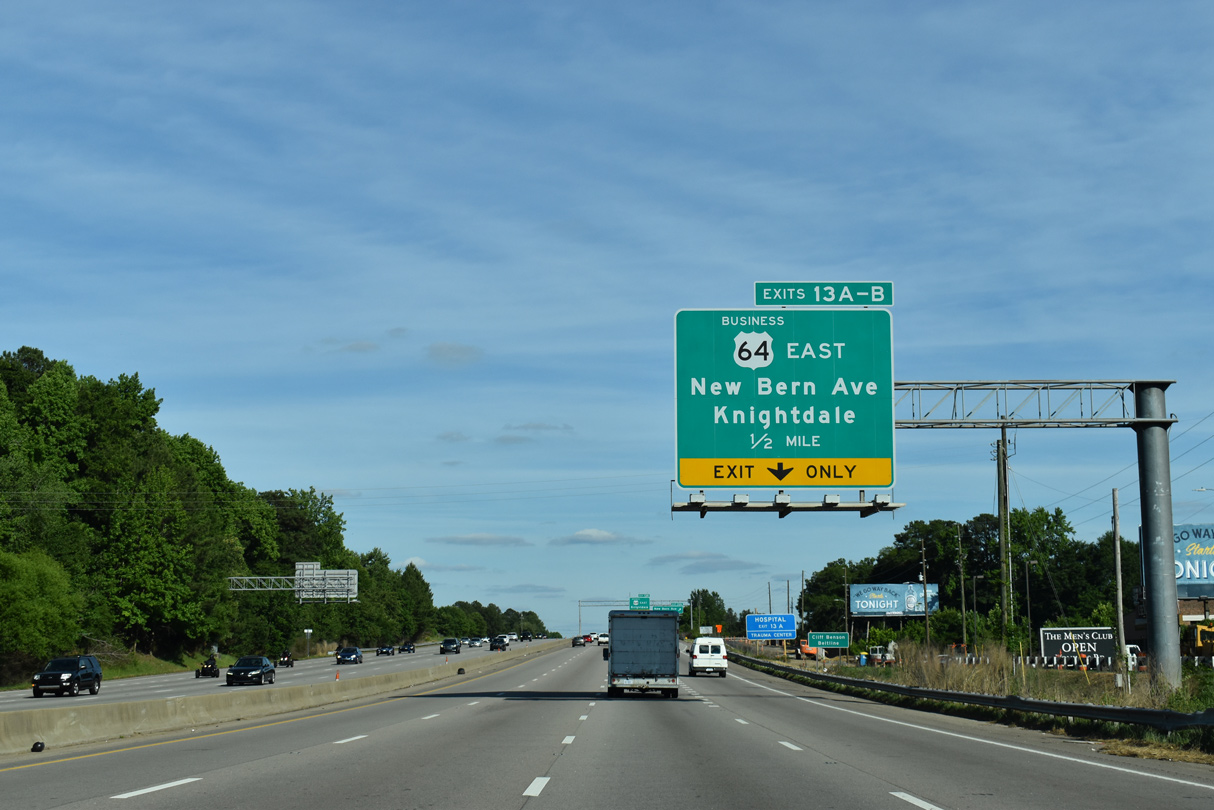
Right in right out (RIRO) style ramps connect Interstate 440 with Yonkers Road at Exit 12. U.S. 64 Business (New Bern Avenue) meets the freeway next at a six-ramp parclo interchange (Exits 13A/B).
06/06/05
An array of industrial businesses line the west side of Interstate 440 between Yonkers Road and a parallel Norfolk Southern Railroad line southeast to Marsh Creek.
05/31/21
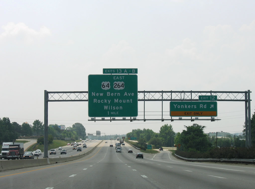
Opened to traffic in July 2005, the forthcoming Knightdale Bypass (I-87) replaced New Bern Avenue as the route of U.S. 64/264 east from Exit 13.
05/31/21
U.S. 64 Business follows New Bern Avenue east through the Wilders Grove and Milburnie communities of east Raleigh.
05/31/21
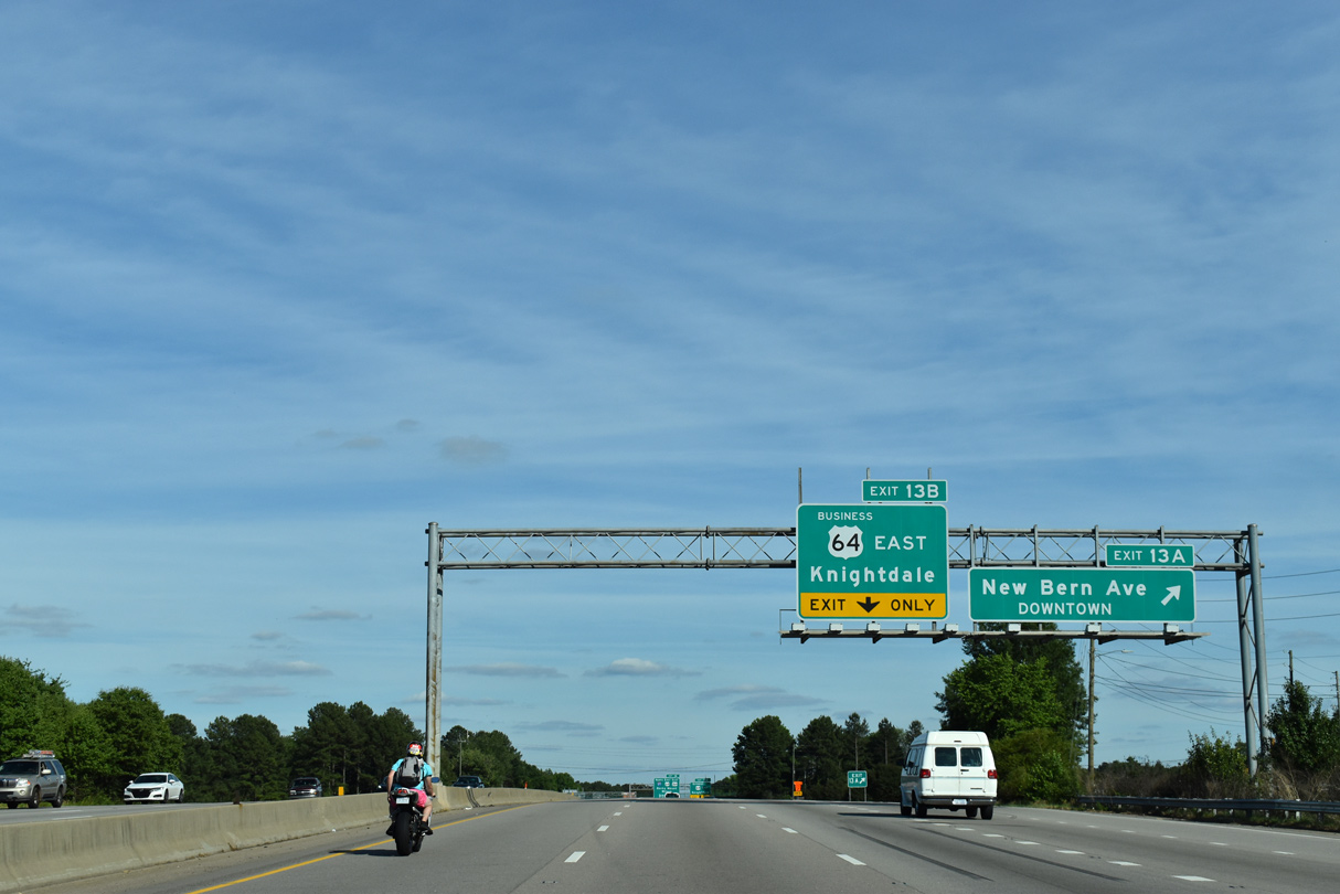
Exit 13 A leaves I-440 east for New Bern Avenue (SR 2911 / former U.S. 64) west to the WakeMed Raleigh Campus, East Raleigh, Battery Heights and Downtown Raleigh.
05/31/21
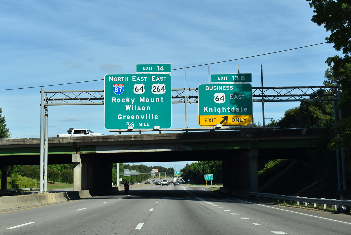
Exit 13 B follows onto U.S. 64 Business (New Bern Avenue) east for Knightdale. Sign changes made here replaced Rocky Mount and Wilson with Knightdale. The exchange previously was a full cloverleaf.
05/31/21
I-87/U.S. 64-264 bypass Knightdale, Wendell and Zebulon along a 17.1 mile long concurrency to the east. U.S. 264 and Future I-587 separate outside Zebulon and continue 55.7 miles east to Greenville.
05/31/21
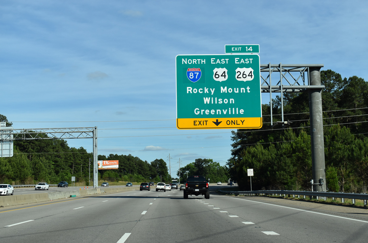
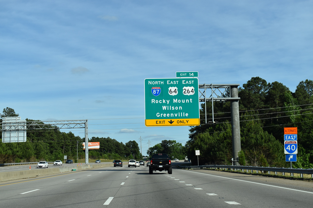
I-440 turns southward to Exit 14 with I-87 north / U.S. 64-264 east. I-495 was established on the western 4.00 miles of the U.S. 64 freeway on December 12, 2013. The remainder east to I-95 was designated as Future I-495.
This changed in 2016, with all of U.S. 64 east from Raleigh to Williamston included in the I-87 corridor leading northeast to Hampton Roads, Virginia.
05/31/21
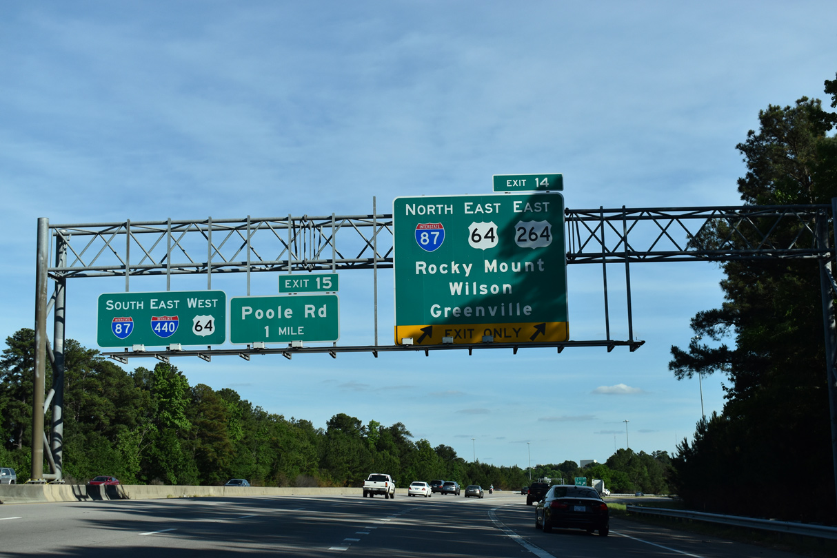
A two lane flyover departs I-440 east for I-87/U.S. 64/264 east. U.S. 264 commences a 215 mile route to Wilson and Manns Harbor near the Outer Banks here. U.S. 64 extends east as a freeway from Raleigh to I-95 near Rocky Mount, Tarboro and Williamston.
05/31/21
Passing through the directional T interchange with I-87/U.S. 64-264 on Interstate 440 east. U.S. 64 west joins the belt line 2.65 miles to connect with I-40 west across south Raleigh.
06/06/05
 South East West
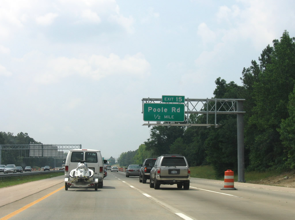
Poole Road meets I-87-440/U.S. 64 at a diamond interchange (Exit 15) near Walnut Creek and Oak View County Parks.
06/06/05
Poole Road (SR 1007) winds westward to New Bern Avenue outside Downtown Raleigh and continues east to Wendell.
01/02/08
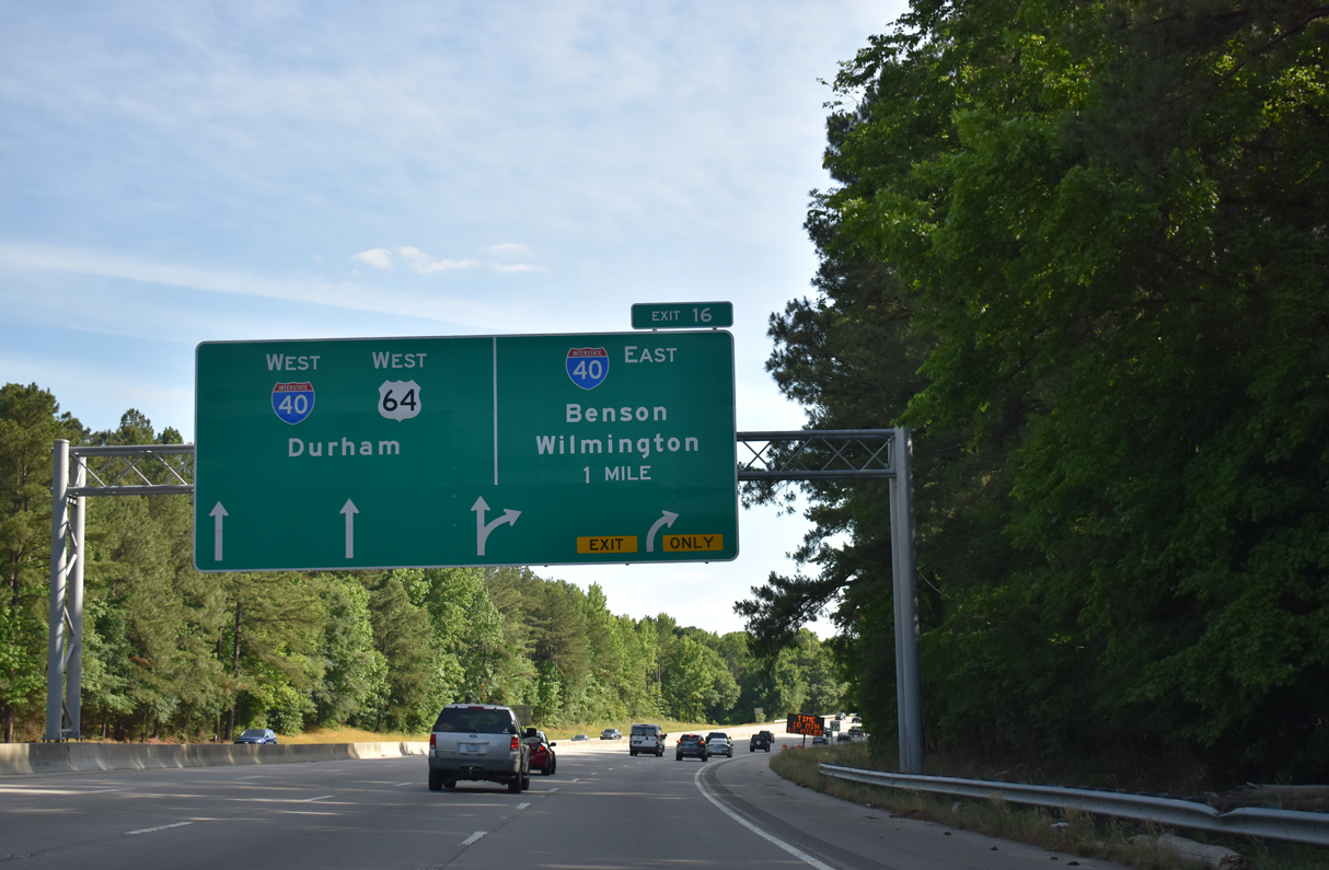
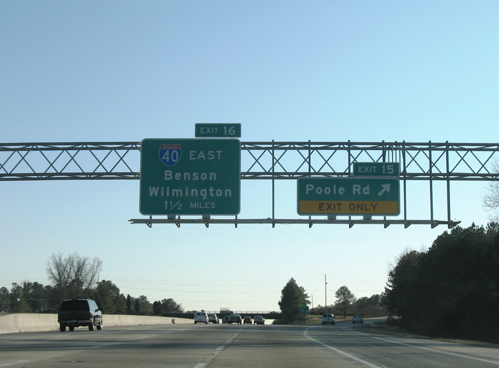
I-87-440/U.S. 64 (Cliff Benson Beltline) arc southwest one mile to I-40 at Exit 16.
05/31/21
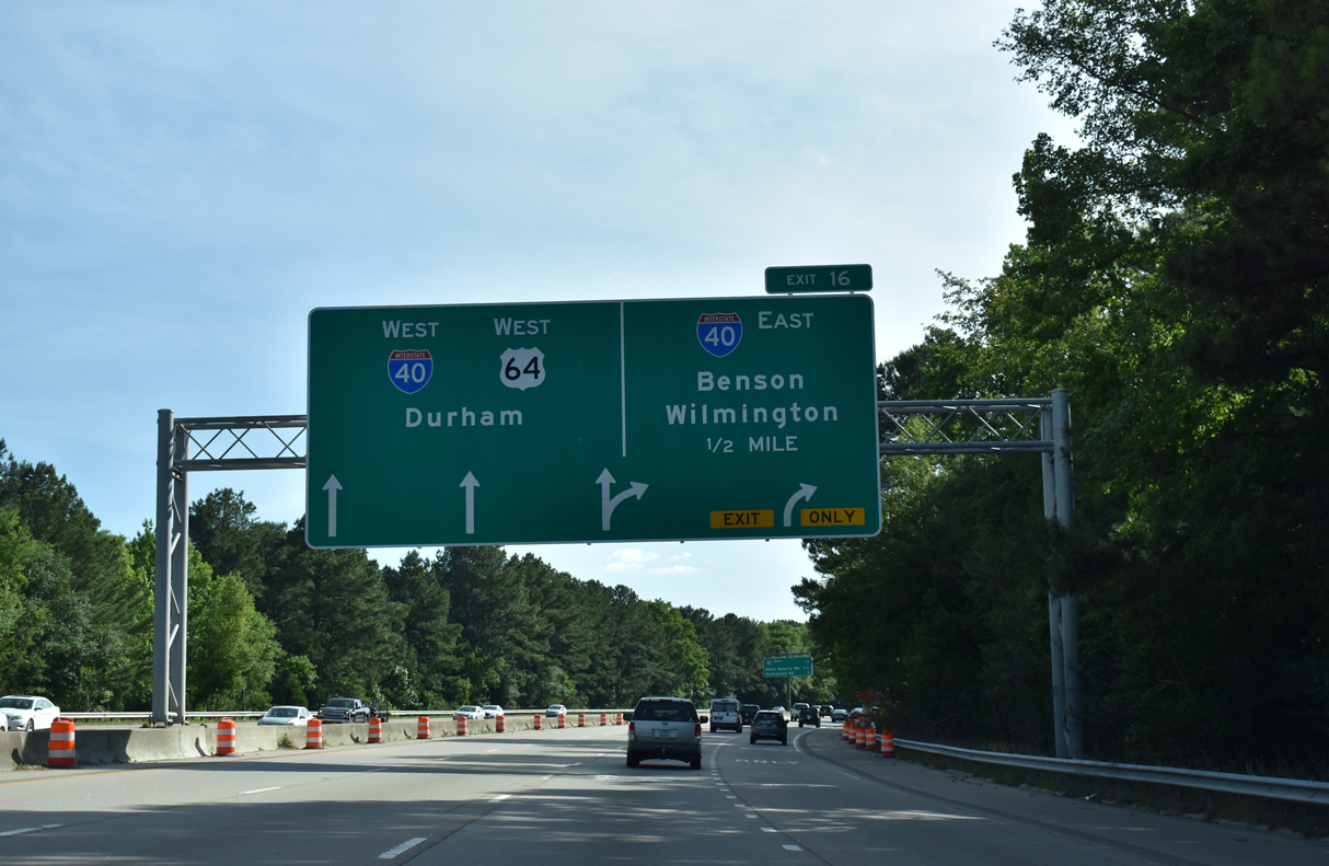
I-87-440/U.S. 64 default onto I-40 west through Raleigh. Exit 16 constitutes a flyover ramp to I-40 eastbound for Benson, Goldsboro, Smithfield and Fayetteville.
05/31/21
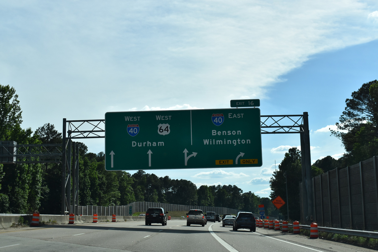
Interstate 40 encircles the south and west sides of Raleigh to Wade Avenue. U.S. 64 joins I-40 west 8.5 miles to U.S. 1 at Cary.
05/31/21
Photo Credits:
- Andy Field: 06/06/05
- Brent Ivy: 05/31/21
- Alex Nitzman: 01/02/08
Connect with:
Page Updated Monday January 30, 2023.