
Route 31
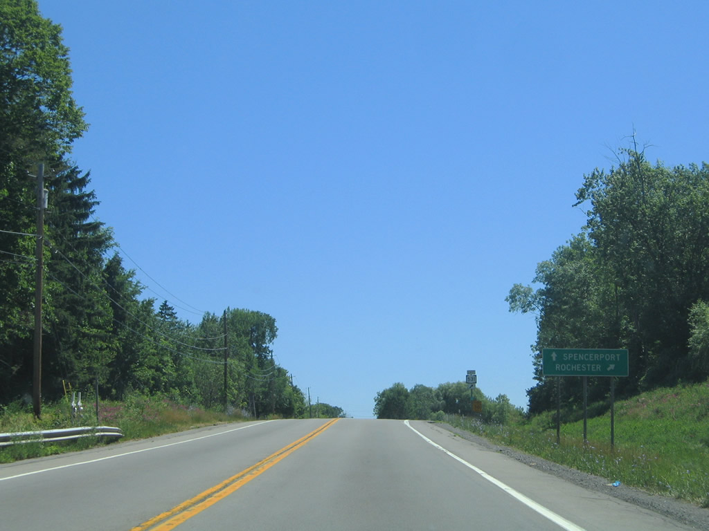
NY 31 travels 207.83 miles from NY 104 in Niagara Falls to NY 26 at Vernon Center. The state route runs through the city of Rochester and across the north side of the Syracuse metropolitan area.
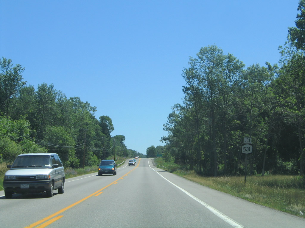
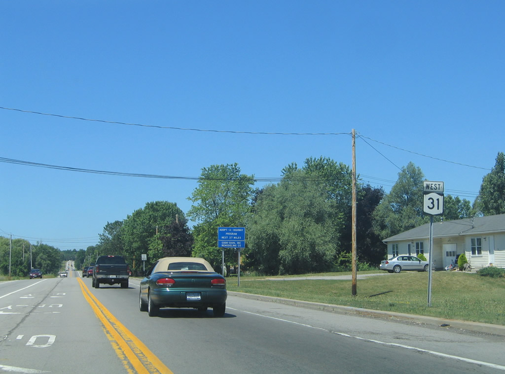
Construction in 2017 shifted NY 31 southward from its original alignment along Brockport Spencerport Road to meet NY 531 (Spencerport Expressway) directly.
07/02/05
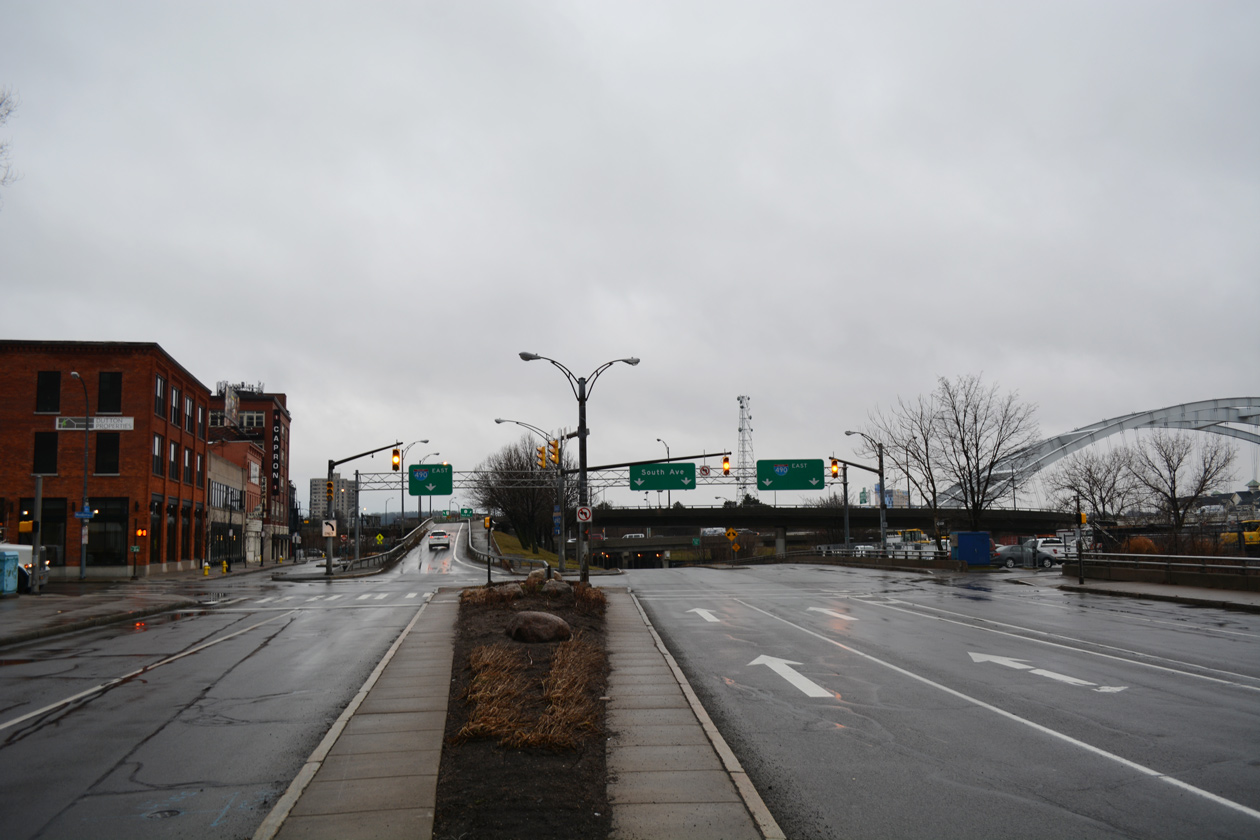
NY 531 follows the Spencerport Expressway east 7.56 miles from NY 31 and NY 36 (Washington Street) to Interstate 490 at Gates.
07/02/05
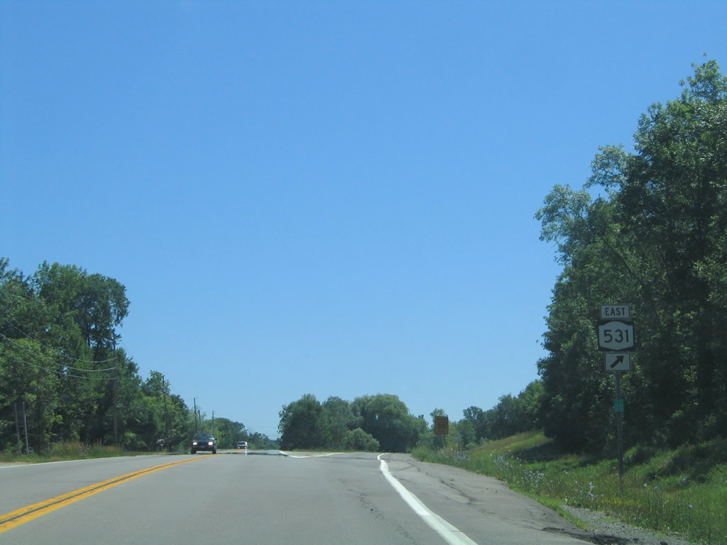
The Spencerport Expressway (NY 531) was part of a planned route between Rochester and Buffalo.1
07/02/05
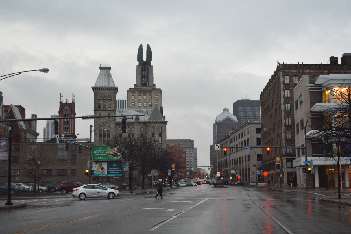
NY 31 branches south from W Main Street onto W Broad Street ahead of Plymouth Avenue (Route 942G) in Downtown Rochester.
01/17/17
Route 942G lines Plymouth Avenue 0.20 miles south from NY 31 (Broad Street) to a loop ramp for I-490 east. Heading north, Route 942G continues 0.31 miles to the Inner Loop freeway by Frontier Field.
01/18/17
Confirming marker posted along W Broad Street beyond Plymouth Avenue (Route 942G).
01/18/17
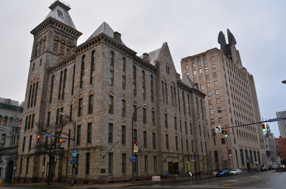
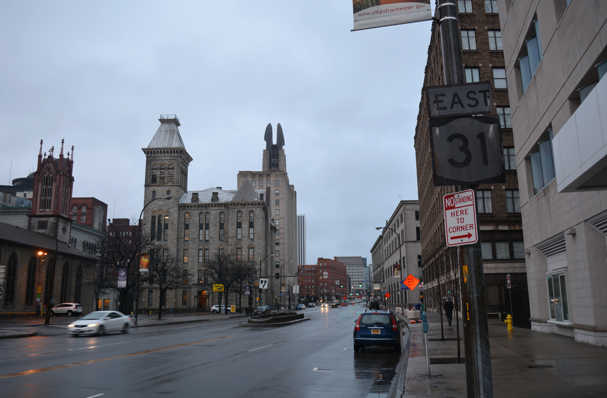
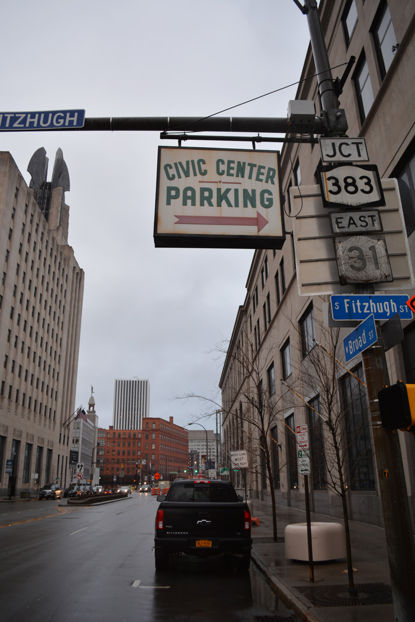
NY 31 (W Broad Street) east at Fitzhugh Street and the Old City Hall Building.
01/18/17
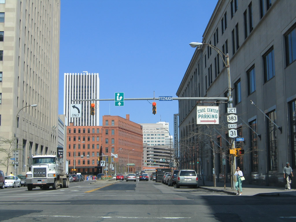
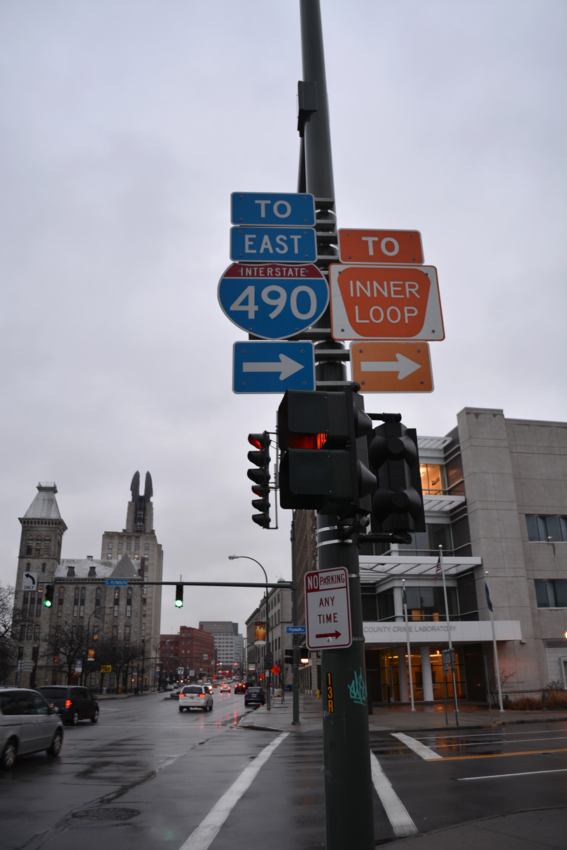
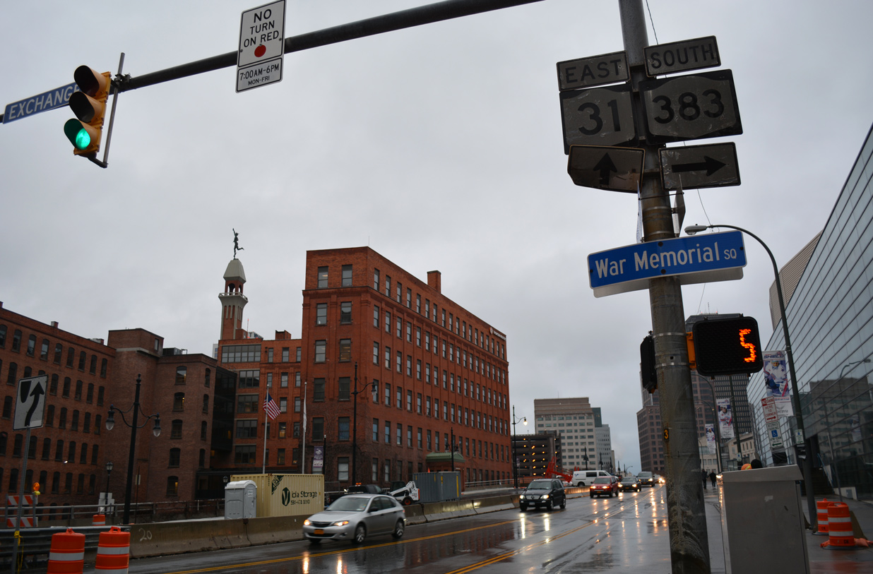
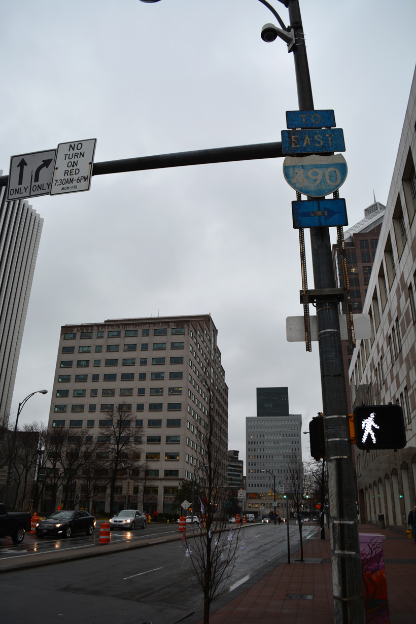
Eastbound reassurance shield posted for NY 31 at Fitzhugh Street. NY 383 begins at the succeeding intersection (Exchange Boulevard) adjacent to Blue Cross Arena.
05/10/05
01/18/17
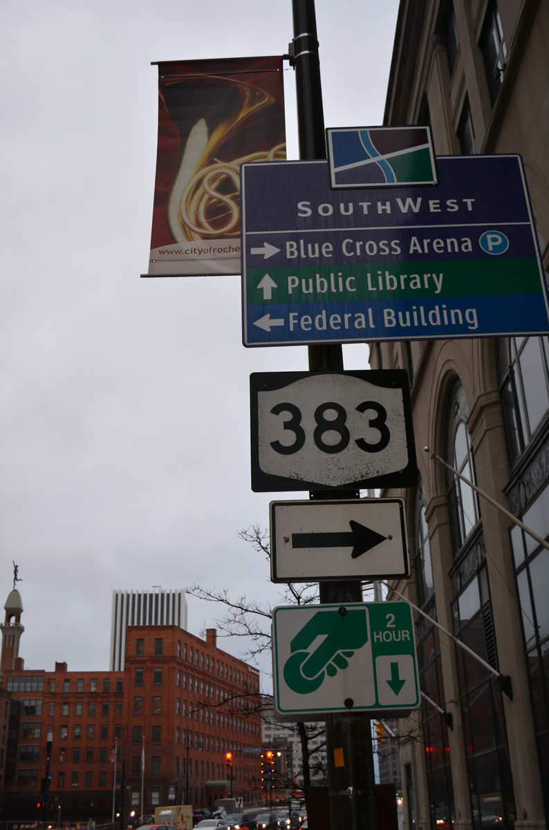
NY 383 travels 18.72 miles south from NY 31 (Broad Street) in Downtown Rochester to NY 36 at Mumford.
01/18/17
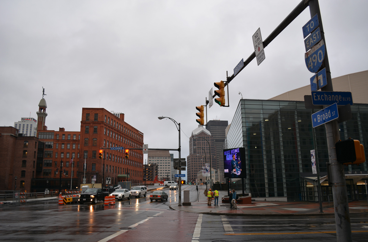
Exchange Boulevard extends State Street south from E Main Street to Ford Street along the Genesee River.
01/18/17
NY 383 runs along the Genesee River southwest to Greater Rochester International Airport (ROC), Chili and Scottsville.
01/18/17
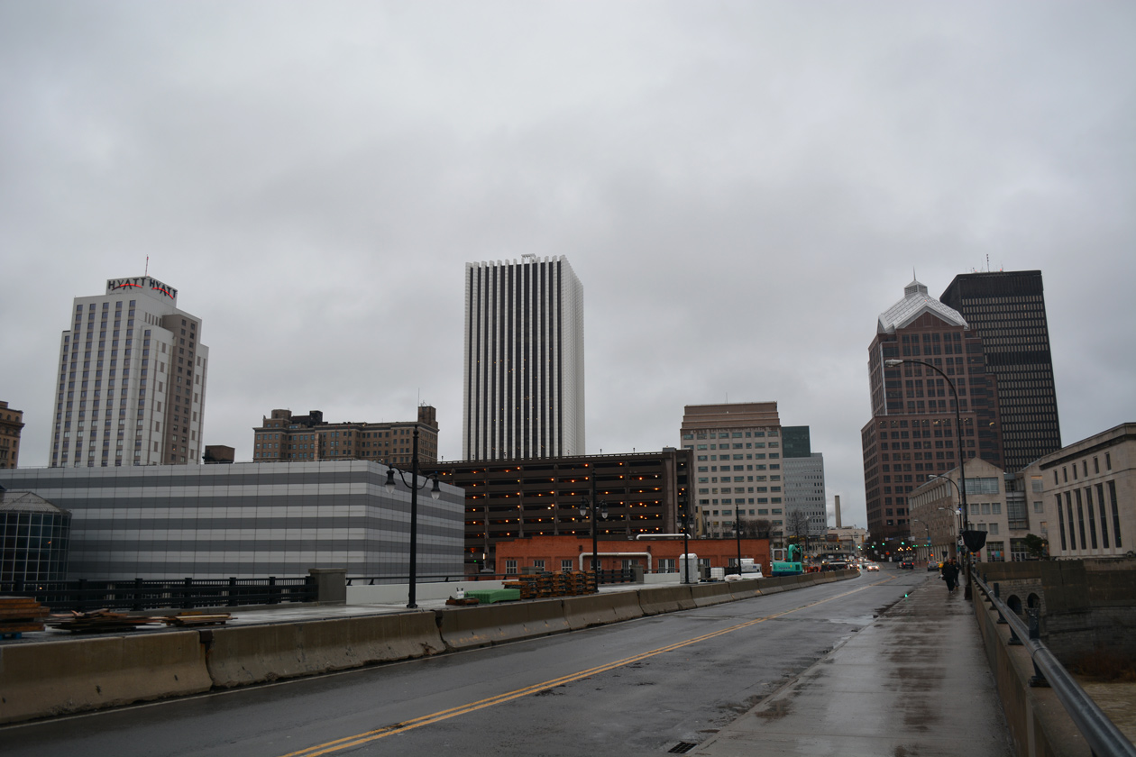
NY 31 continues east along Broad Street across the Genesee River.
01/18/17
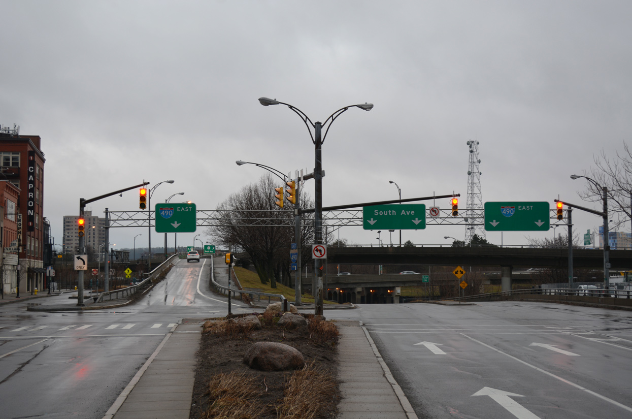
NY 31 turns south from E Broad Street onto South Avenue at the east end of the Genesee River bridge.
01/18/17

South Avenue heads three blocks south to ramps with Interstate 490 east.
01/18/17
Eastbound NY 31 partitions with westbound along South Avenue two blocks south to Woodbury Boulevard east. NY 31 west follows Clinton Avenue north to E Broad Street west.
05/10/05
The shield referencing the turn of NY 31 onto South Avenue was removed in 2016.
01/18/17
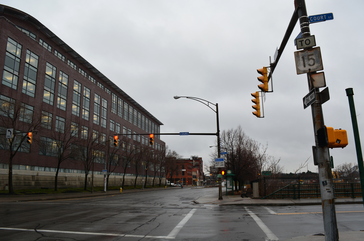
A trailblazer for U.S. 15 appears along South Avenue (NY 31) at Court Street. Court Street heads west across the Genesee River to Exchange Boulevard (NY 383) at Blue Cross Arena and east to E Broad Street at Manhattan Square Park.
01/18/17
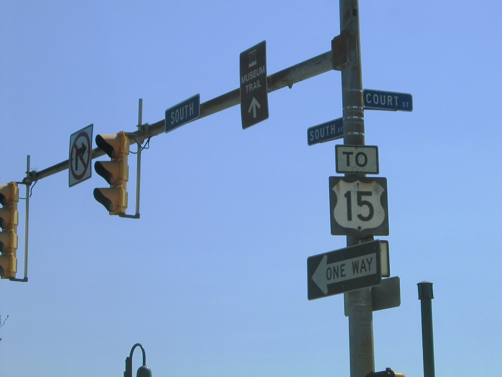
U.S. 15 was truncated south from Rochester to Painted Post (NY 17) in 1974. The route southbound began at the intersection of South Avenue with Mt. Hope Avenue and Byron Street.
05/10/05
South Avenue separates at Woodbury Boulevard ramps for Interstate 490 east and South Avenue Extension.
01/18/17
NY 31 makes an unmarked turn east onto Woodbury Boulevard. South Avenue leads to NY 15 along Mt. Hope Avenue. Separate ramps for Interstate 490 join the freeway eastbound, one of which was meant for the unbuilt extension of the Genesee Expressway.
01/18/17
NY 31 follows Woodbury Boulevard east to Chestnut Street south across from Manhattan Square Drive to The Strong Museum.
07/02/05
Chestnut Street leads NY 31 south onto Monroe Avenue at Howell Street. Howell Street replaced the Inner Loop freeway, which formerly traveled below grade at NY 31 west to I-490.
07/02/05
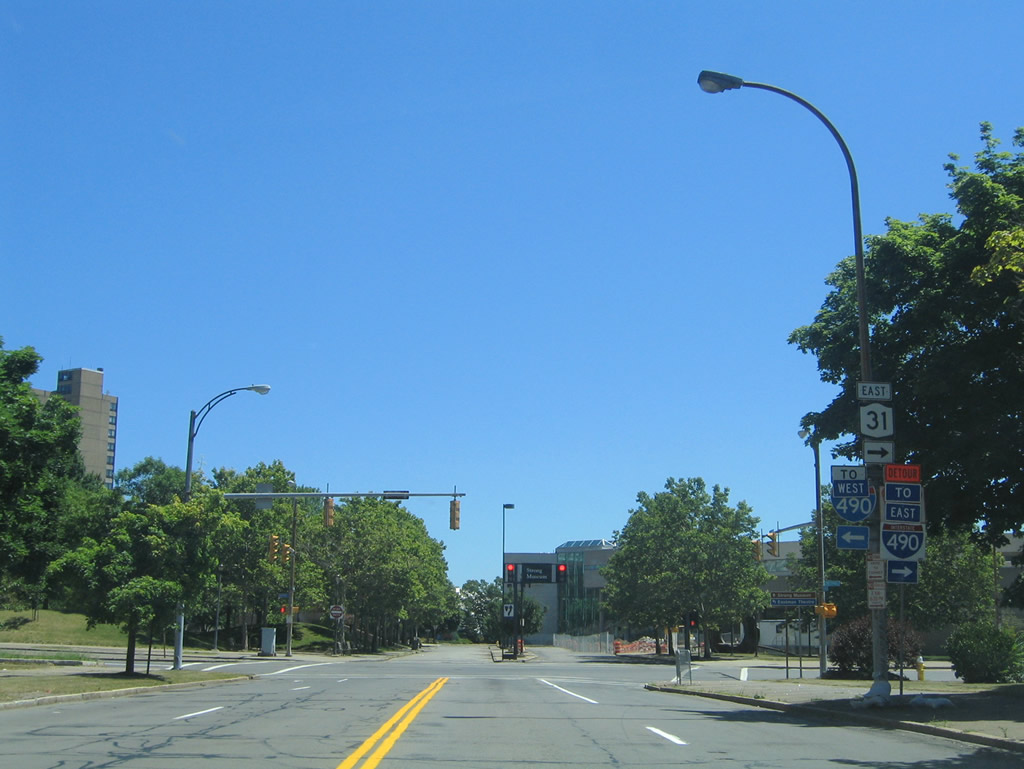
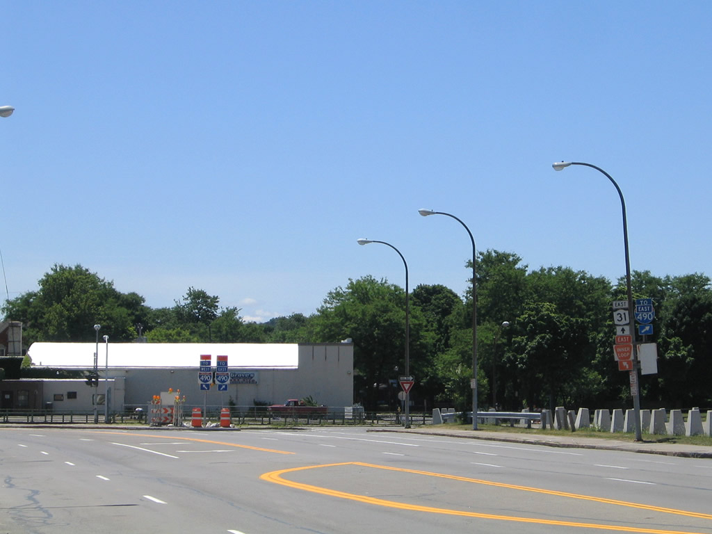
A diamond interchange (Exit 30) connects Interstate 81 with NY 31 (Seymour Street) at the town of Cicero.
05/09/05
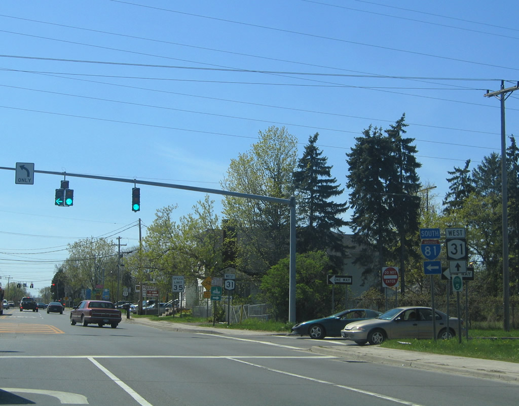
NY 31 (Seymour Street) west at the southbound entrance ramp for I-81 to North Syracuse and Syracuse. NY 31 intersects U.S. 11 (Brewerton Road) ahead near the Cicero town center.
05/09/05
Entering Downtown Rochester, NY 31 follows Chestnut Street north from Monroe Avenue. The state route dog legs along Woodbury Boulevard one block west to Clinton Avenue (NY 15) north.
07/02/05
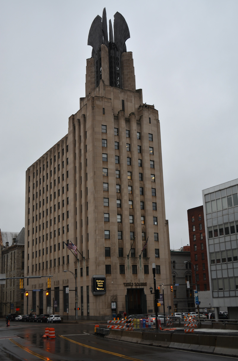
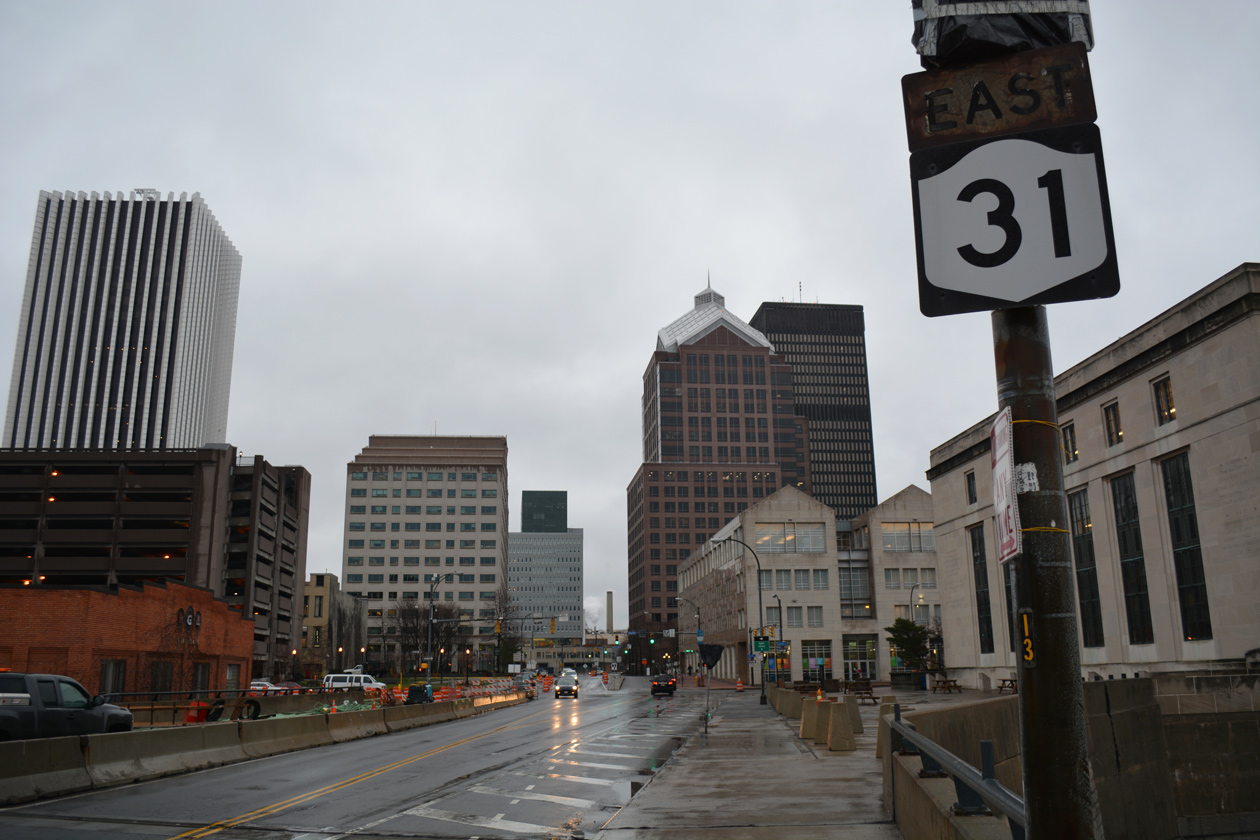
NY 31 crosses the Genesee River along E Broad Street ahead of Exchange Boulevard and the Times Square Building.
01/18/17
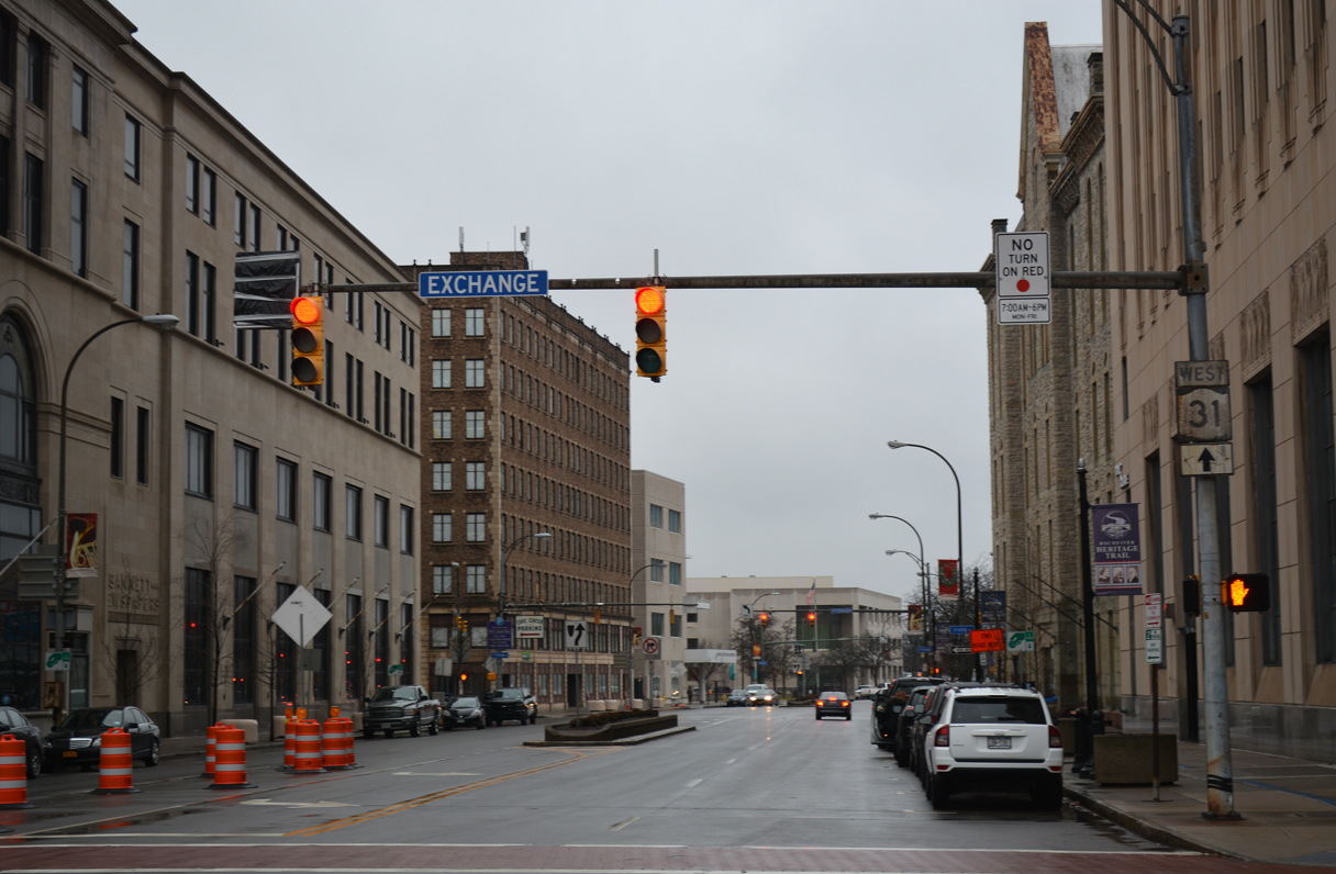
Exchange Boulevard south from NY 31 (E Broad Street) is a part of NY 383.
01/18/17
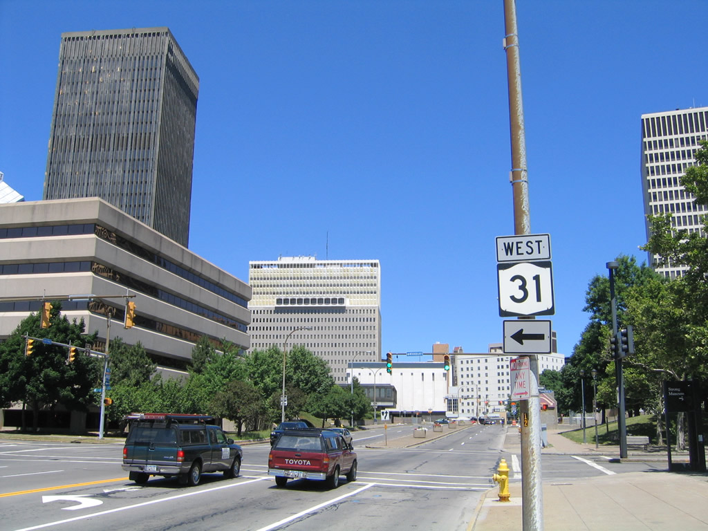
Leaving the intersection with NY 36's north end (Washington Street) on NY 31 (Brockport Spencerport Road) west near Adams Basin.
07/02/05
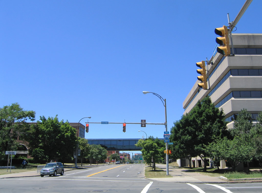
Manhattan Square Drive connects with NY 31 at Chestnut Street and Woodbury Boulevard from The Strong Museum in Downtown Rochester. This view looks west from Manhattan Square Drive at Woodbury Boulevard west, two blocks north of Howell Street west to I-490.
07/02/05
References:
Photo Credits:
- Alex Nitzman: 05/09/05, 05/10/05, 07/02/05, 01/17/17, 01/18/17
Connect with:
Page Updated Wednesday March 18, 2020.