
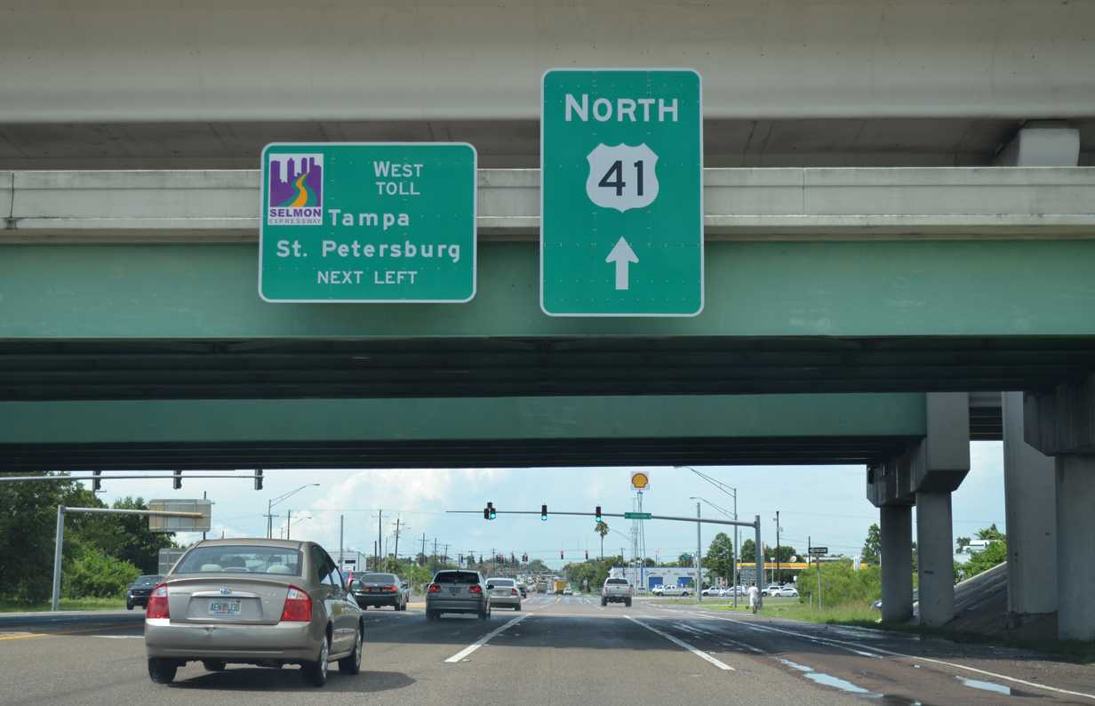
U.S. 41 North - East Tampa to Seminole Heights, Tampa
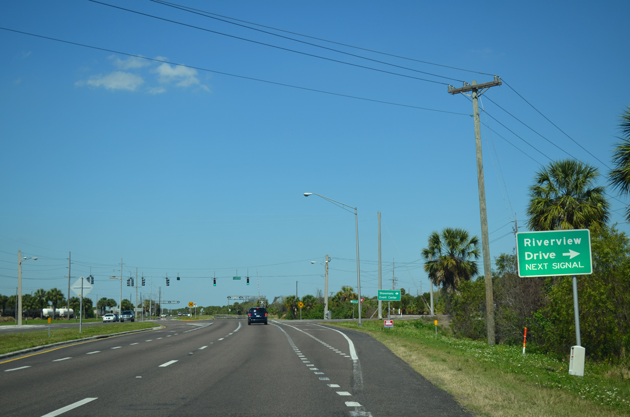
Riverview Drive parallels the Alafia River east to I-75 and a stair stepped route north to U.S. 301 in Riverview.
03/02/14
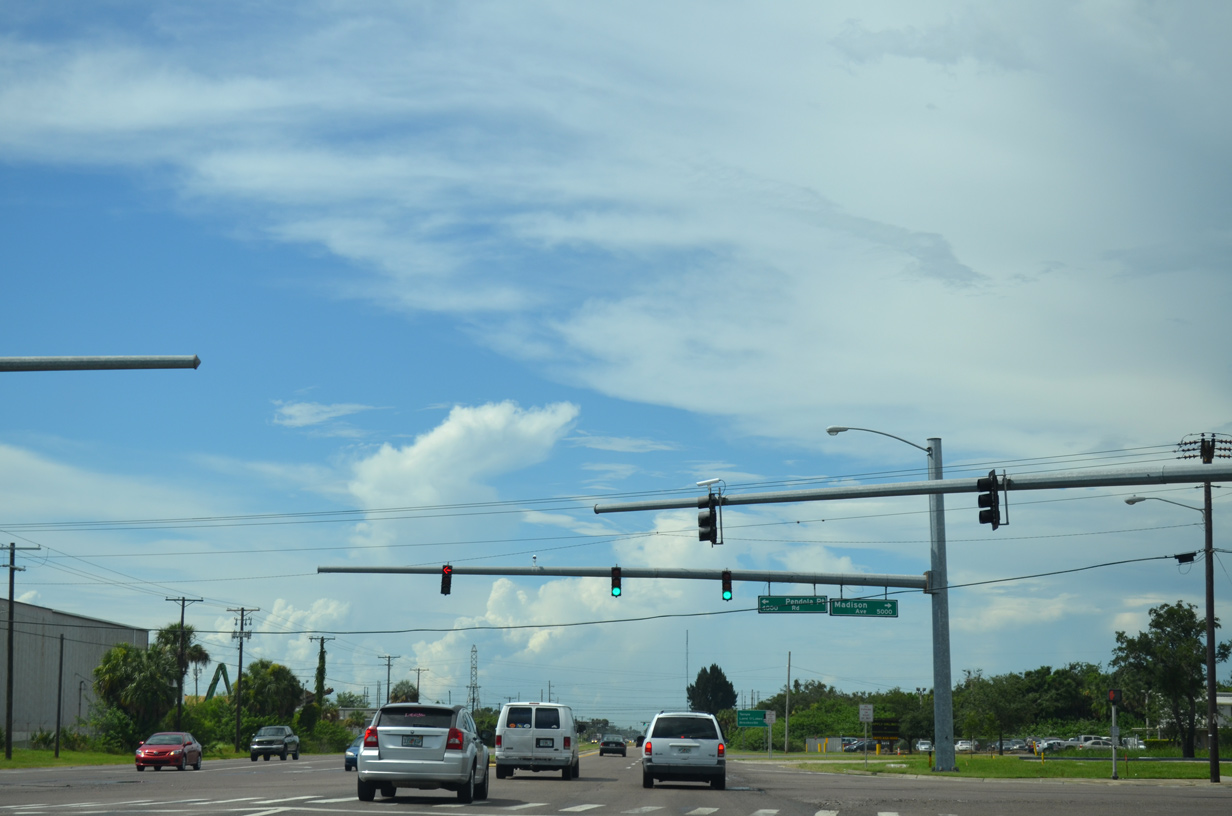
Madison Avenue west and Pendola Point Road east come together at this traffic light along U.S. 41. Madison Avenue east doubles as the westernmost extent of unsigned County Road 676A, a 9.82 mile route extending east to Lithia-Pinecrest Road (CR 640) in Brandon.
07/08/14
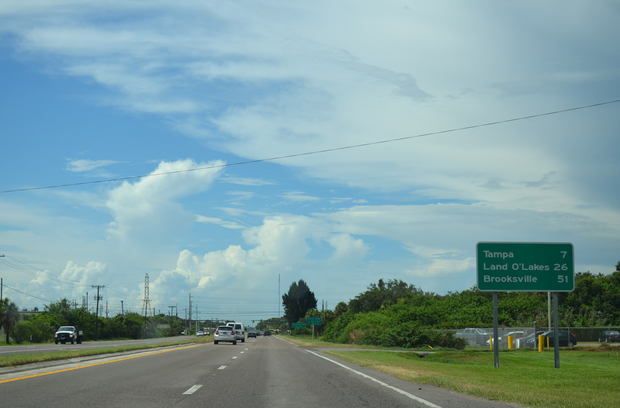
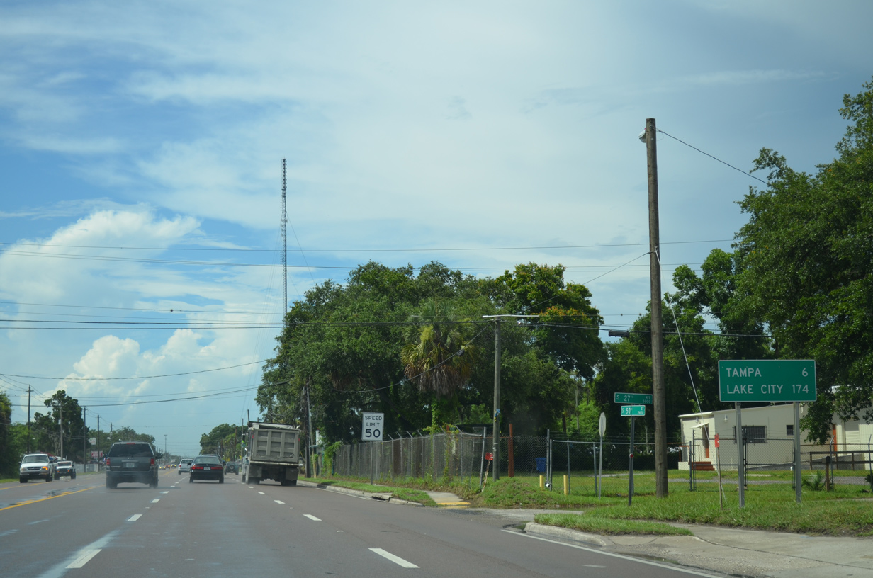
Land O' Lakes and Brooksville debut on northbound distance signage for U.S. 41 at 26 and 51 miles out respectively. Downtown is a seven mile drive to the north via U.S. 41 Business.
07/08/14
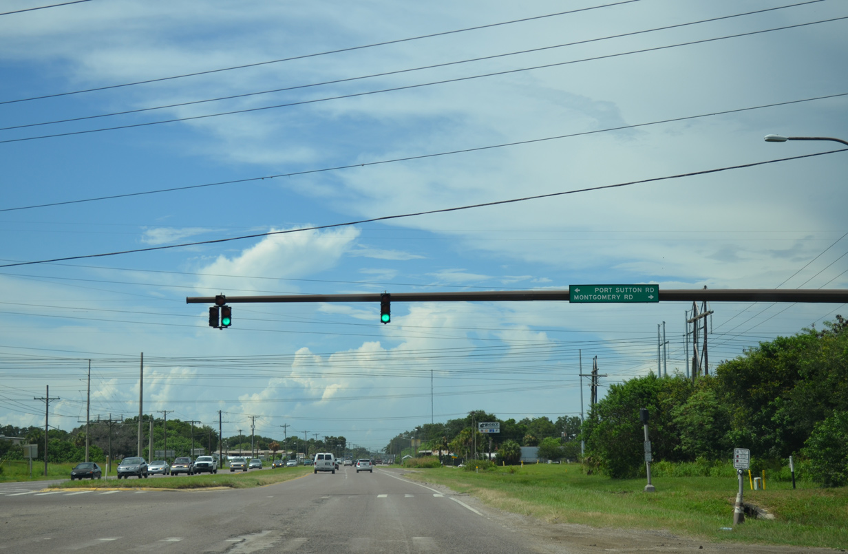
Port Sutton Road follows from U.S. 41 (South 50th Street) west to the Port Sutton Berths of Port Tampa Bay.
07/08/14
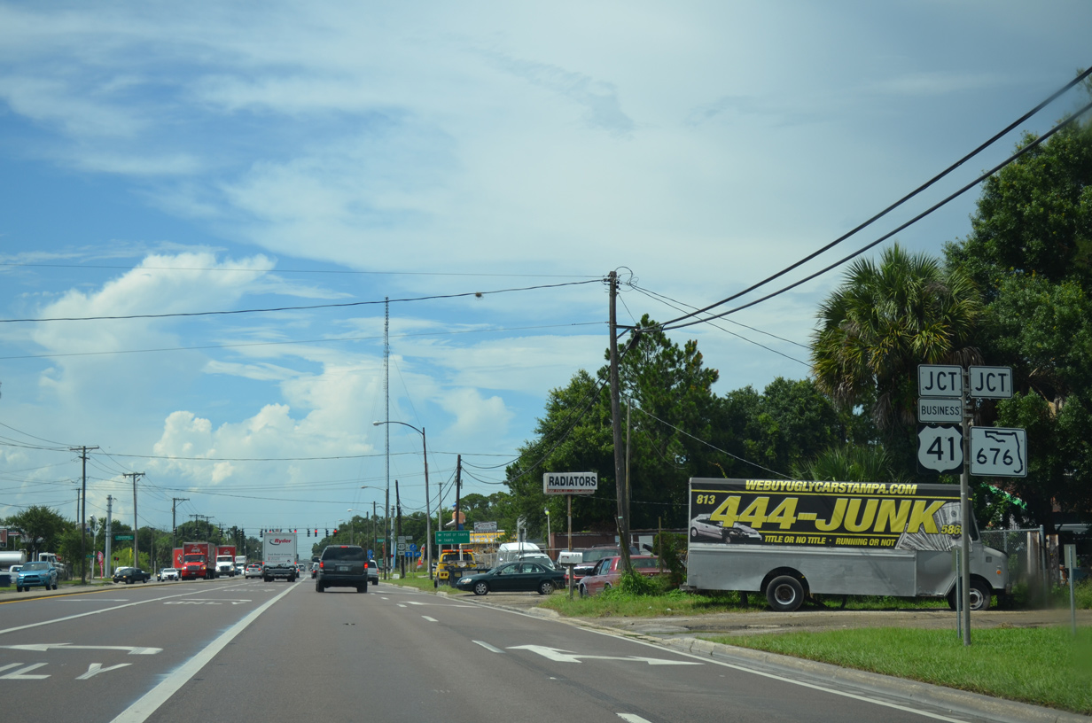
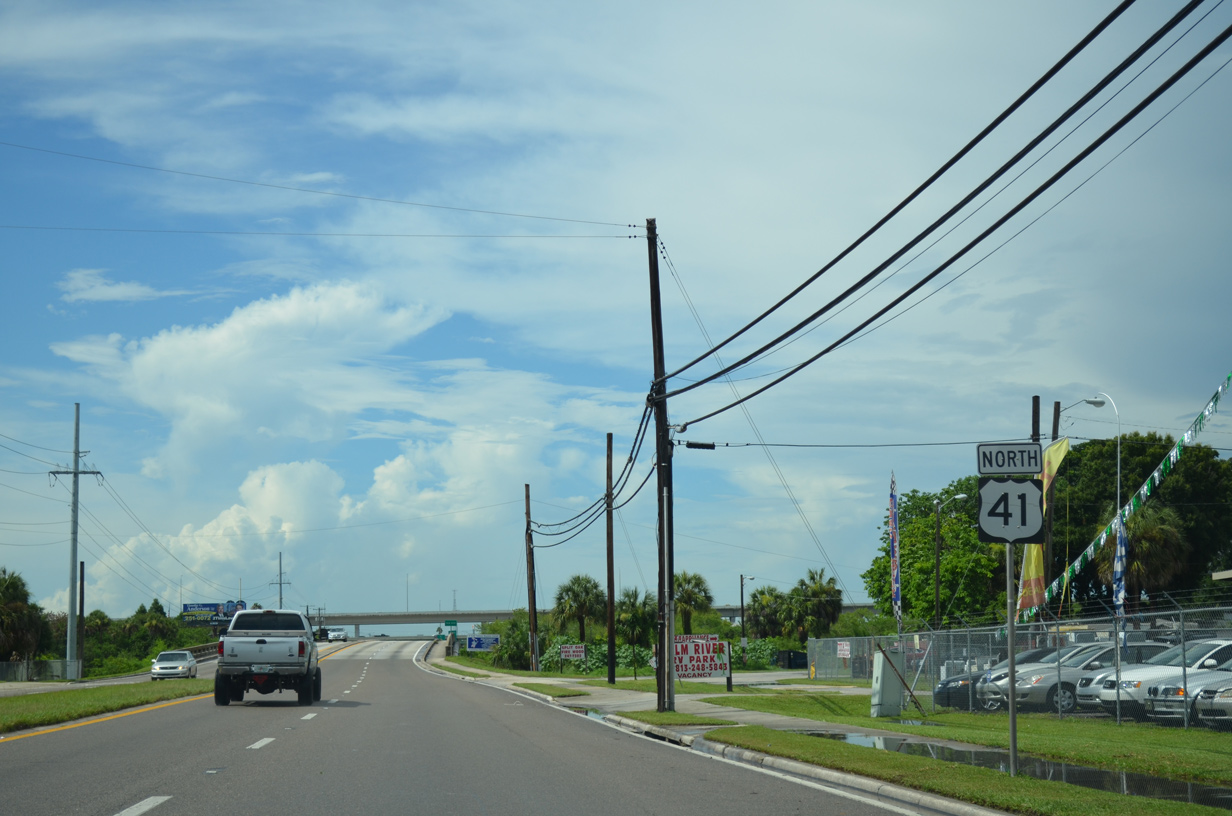
Becoming more industrial, U.S. 41 (South 50th Street) enters the Palm River area and split with U.S. 41 Business north to Port Tampa Bay and Downtown. Also beginning at the upcoming traffic light is SR 676, a 3.19 mile route east through Clair-Mel to U.S. 301 and unsigned CR 676.
07/08/14
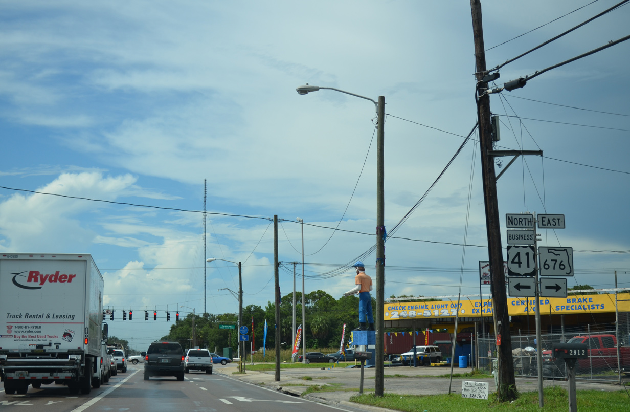
U.S. 41 Business loops west across McKay Bay along Causeway Boulevard and 22nd Street Causeway. The route dog legs west to Channelside and Downtown Tampa before resuming a northward heading along Florida Avenue / Tampa Street to Tampa Heights. SR 676 extends Causeway Boulevard east as a truck route to U.S. 301 for those headed to either I-75 or the Selmon Expressway (SR 618).
07/08/14
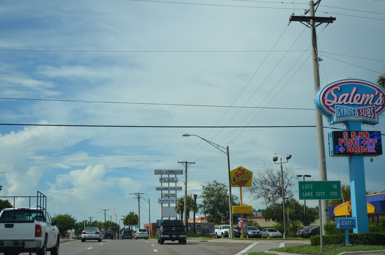
Continuing north, Lake City replaces Lutz, Land O'Lakes and Brooksville on this distance sign as the long distance destination of U.S. 41 beyond Tampa Bay and the Nature Coast.
07/08/14

Palm River Road spurs west from U.S. 41 to a town home community along the Palm River and east to S 78th Street (CR 573) while en route to Brandon.
07/08/14
Northbound reassurance shield posted between Palm River Road and the Palm River.
07/08/14
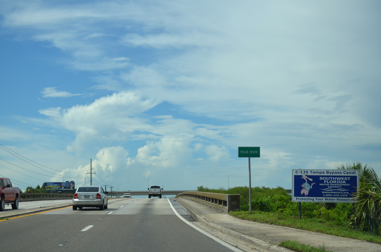
Spanning the Palm River on a 1958-built bridge on U.S. 41 north. The Palm River is part of the Tampa Bypass Canal operated by the Southwest Florida Water Management District. The canal was built in the 1960s and 70s to redirect flood waters from Hillsborough to Tampa Bay.
07/08/14
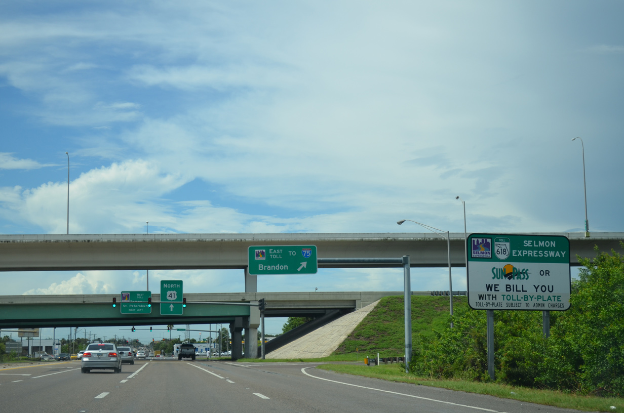
A diamond interchange lies just north of the Palm River with the Lee Roy Selmon (Crosstown) Expressway. Signs posted at SR 618 on-ramps reference the toll by plate system, as the expressway switched to all electronic tolling (AET) in September 2010.
07/08/14
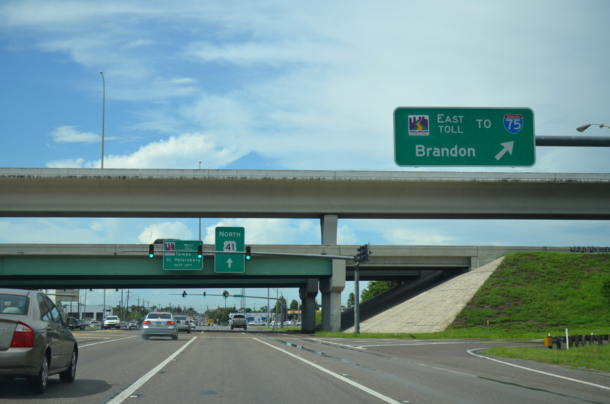
The Selmon Expressway (SR 618) winds east and south to end at Interstate 75 opposite Brandon Parkway. Brandon Parkway extends east from the toll road end to Lumsden Road in unincorporated Brandon.
07/08/14
SR 618 (Selmon Expressway) provides a direct and fast route to Downtown Tampa from Brandon, I-75, U.S. 301 and U.S. 41 from points south. The toll road runs 14.1 miles overall to U.S. 92 (Gandy Boulevard), east of St. Petersburg, in South Tampa.
07/08/14
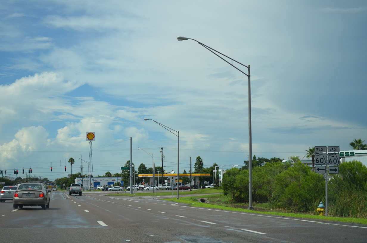
U.S. 41 (50th Street) quickly intersects SR 60 (Adamo Drive) to the immediate north of the Selmon Expressway. SR 60 measures 161.3 miles overall between Clearwater Beach and Vero Beach. The route serves local interests in Tampa to Memorial Highway by Tampa International Airport (TPA) and Brandon.
07/08/14
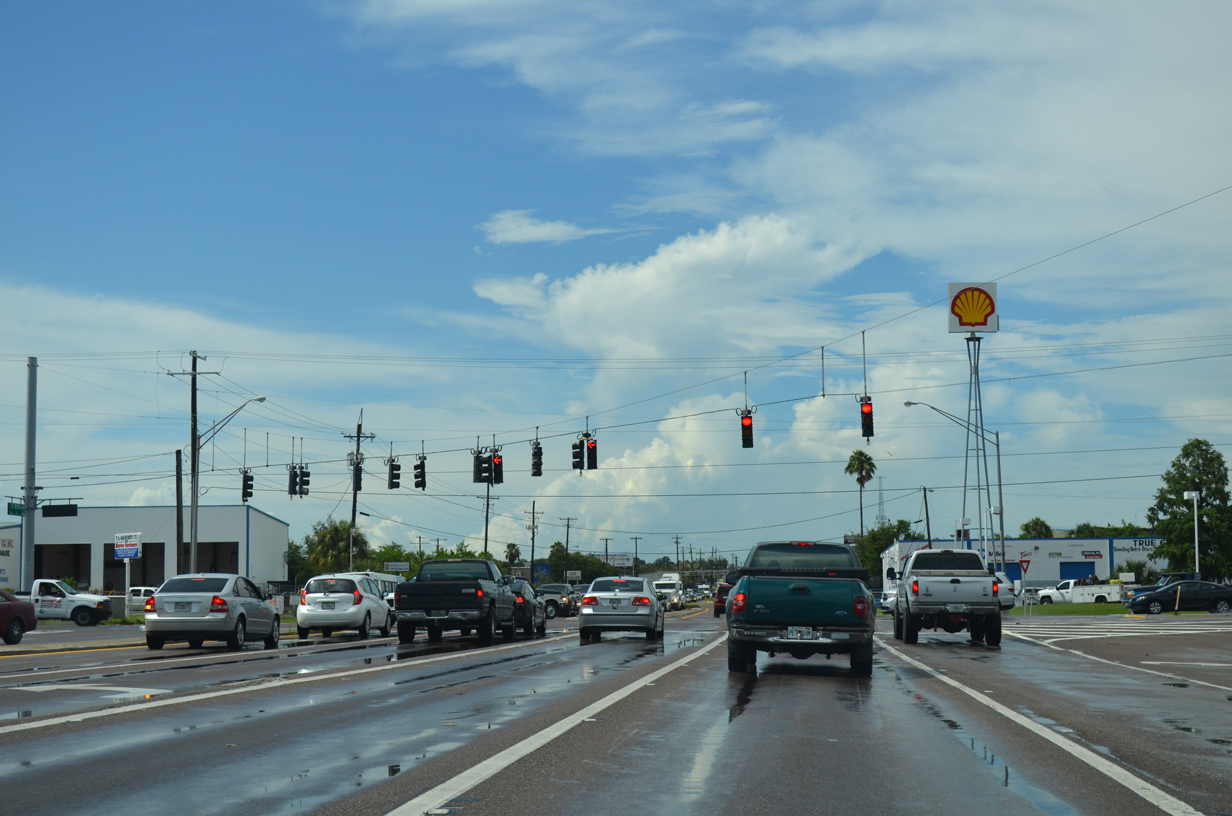
SR 60 constitutes an arterial route west toward Ybor City and east through industrial areas of east Tampa to I-75 (Exit 256).
07/08/14
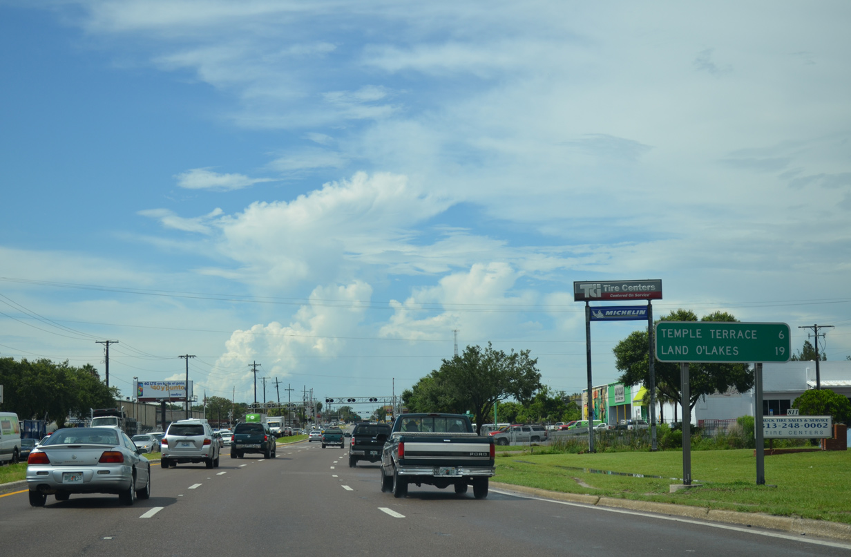
A pair of CSX Railroad crossings follow as U.S. 41 pushes north toward Grant Park in east Tampa. Temple Terrace is referenced on this distance sign for SR 583, which follows N 50th Street beyond its partition with U.S. 41.
07/08/14

E 7th Avenue and E Broadway Avenue intersect U.S. 41 (N 50th Street) at the next signal along northbound. Collectively the two roadways are a part of unsigned CR 574, a 9.25 mile long route stretching west through Historic Ybor City and east to Mango.
07/08/14
Lutz and Lake City return as the destination cities on this distance sign posted beyond CR 574 on U.S. 41 (N 50th Street) north.
07/08/14
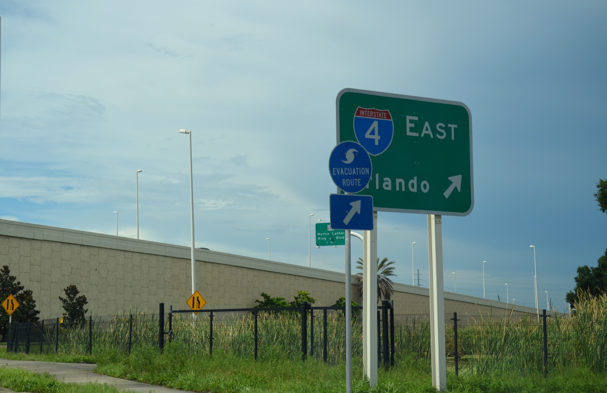
Interstate 4 trailblazers precede the intersection with Columbus Drive and the split diamond interchange (Exit 3) with the freeway. Interests to I-4 west to Downtown are directed onto the on-ramp from Columbus Drive west.
07/08/14
Columbus Drive parallels Interstate 4 west as part of a couplet with 17th, 18th and 19th Streets to College Hill and Ybor City. Eastward the road ends at Broadway Avenue (CR 574) near Orient Park.
Columbus Drive was realigned southward during the mid-2000s reconstruction of Interstate 4. Expansion of the freeway severed the original alignment of the drive.
07/08/14

Approaching the Interstate 4 overpasses along U.S. 41 north. An eastbound service road joins the off-ramp (Exit 3) from I-4 east to N 50th Street ahead.
07/08/14
Interstate 4 angles northeast from U.S. 41 (N 50th Street) to exit the Tampa city limits between Grant Park and Orient Park. The freeway runs east to Mango, Plant City and Lakeland.
07/08/14
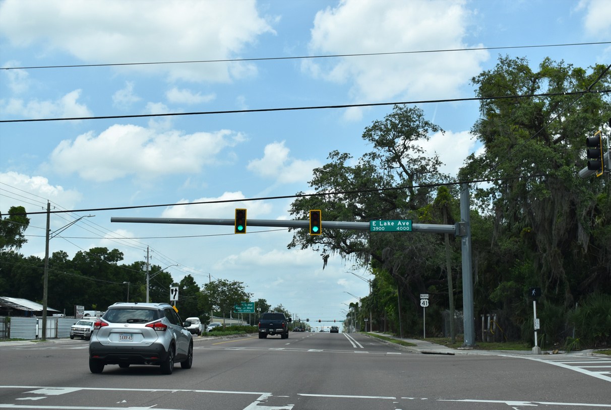
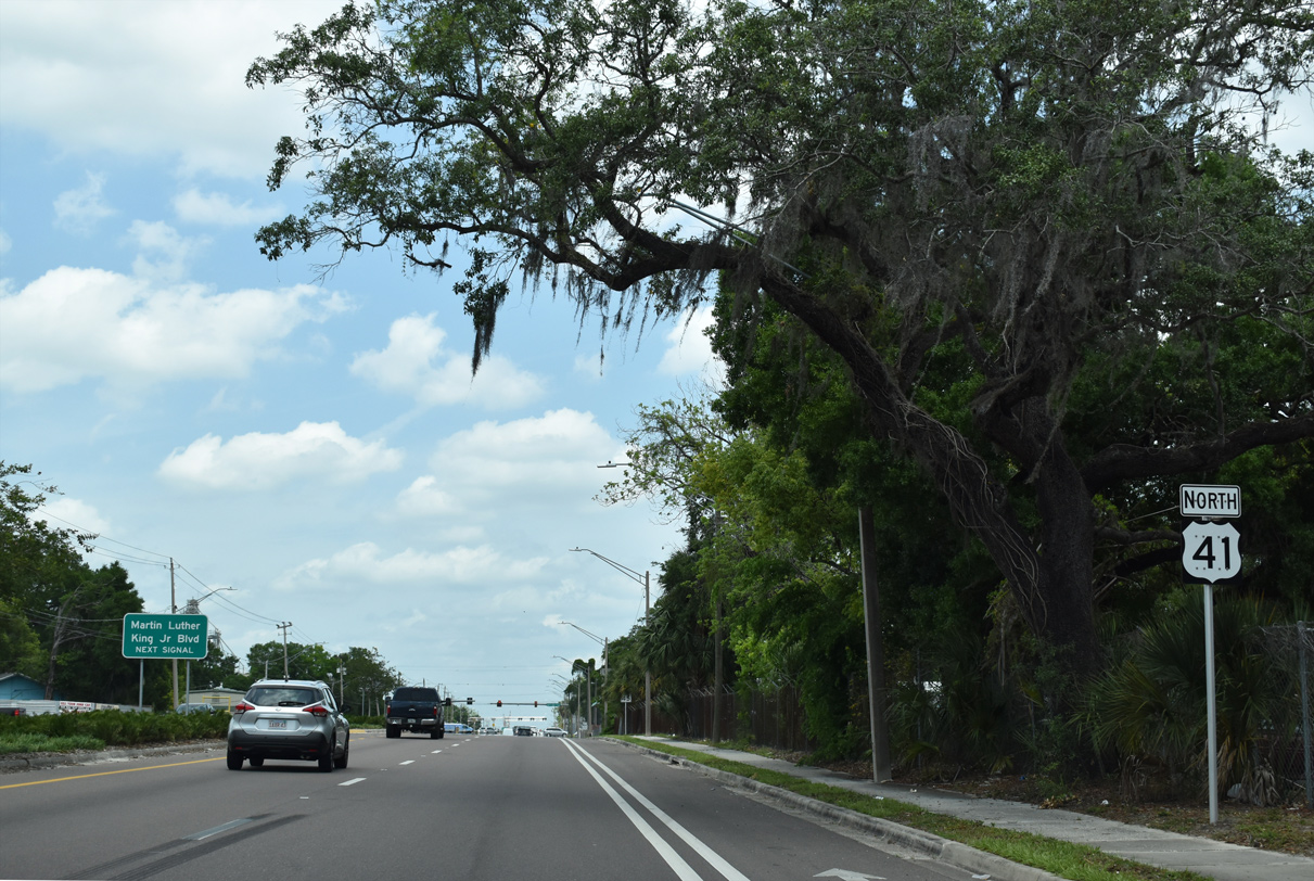
U.S. 41 (N 40th Street) proceeds north from SR 569 to intersect Lake Avenue at the Jackson Heights neighborhood in Tampa.
04/23/21
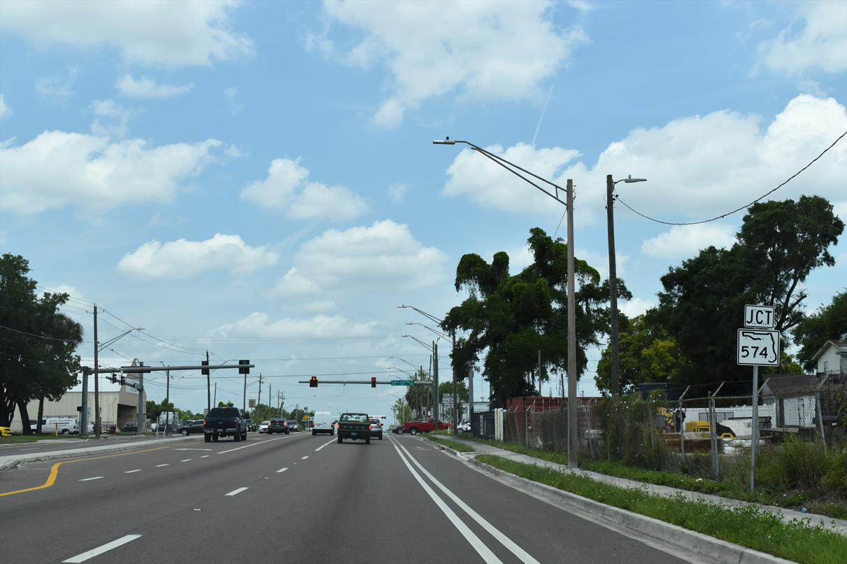
SR 574 (Dr. Martin Luther King, Jr. Boulevard) crosses U.S. 41 (N 40th Street) at the succeeding intersection between Rainbow Heights and Grant Park in Tampa.
04/23/21
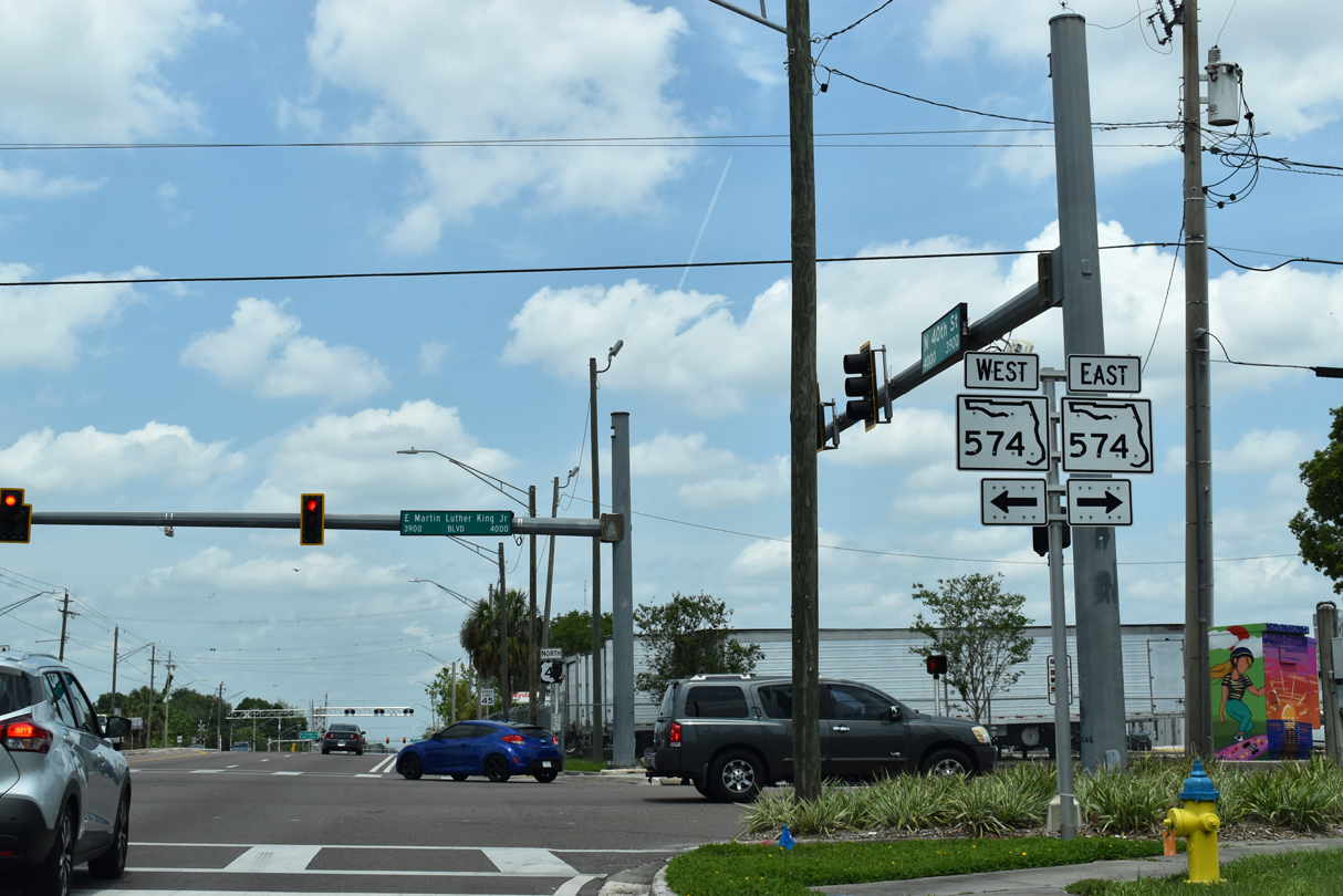
SR 574 extends east across Tampa along Dr. Martin Luther King, Jr. Boulevard from U.S. 92 (Dale Mabry Highway) near Raymond James Stadium to Mango and Seffner.
04/23/21
 North
North  West
West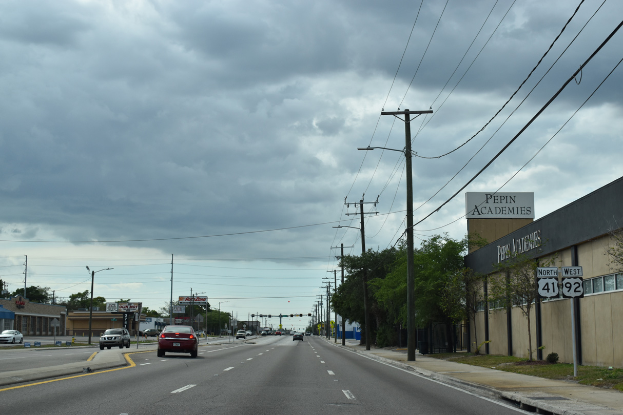
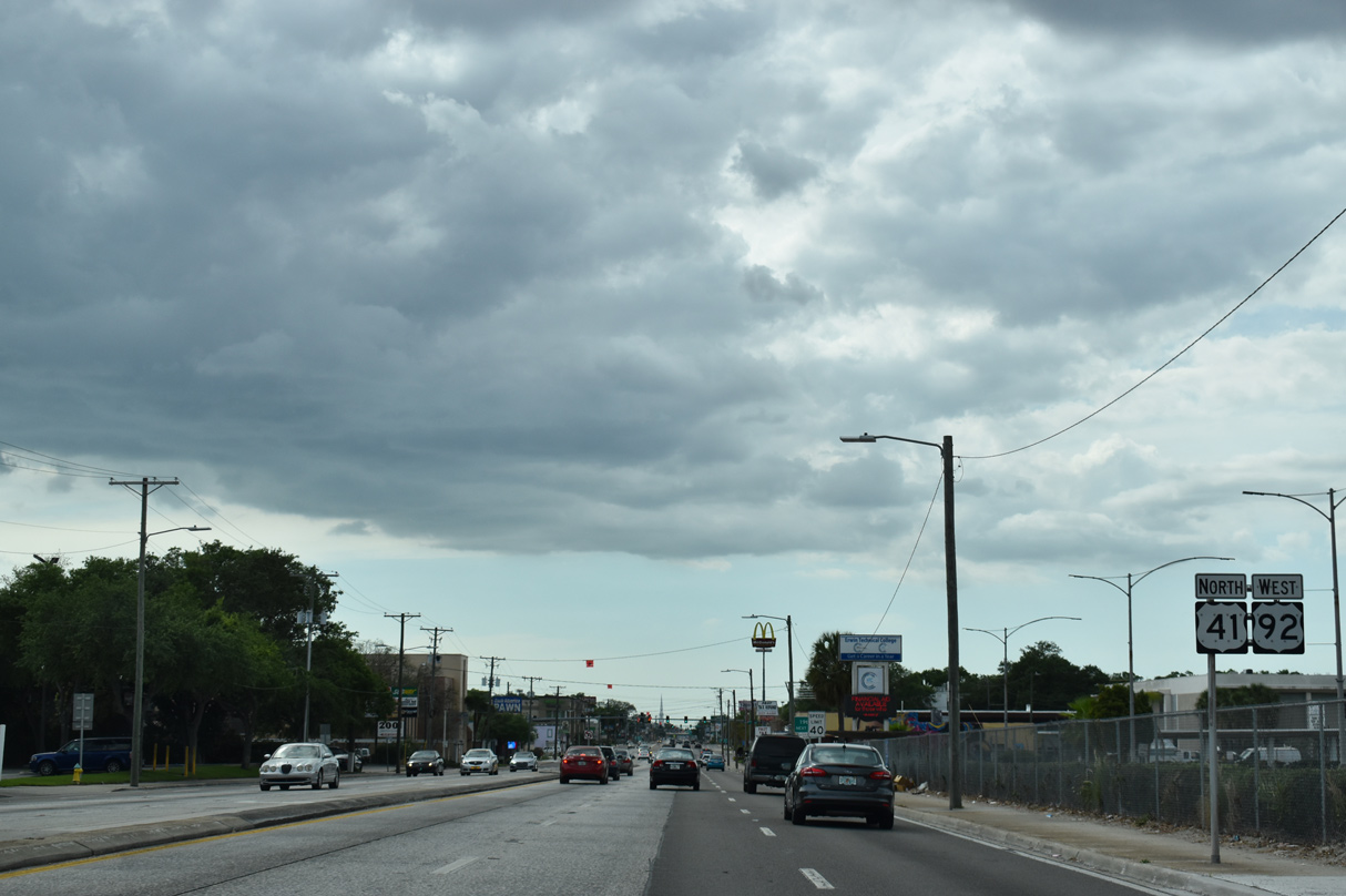
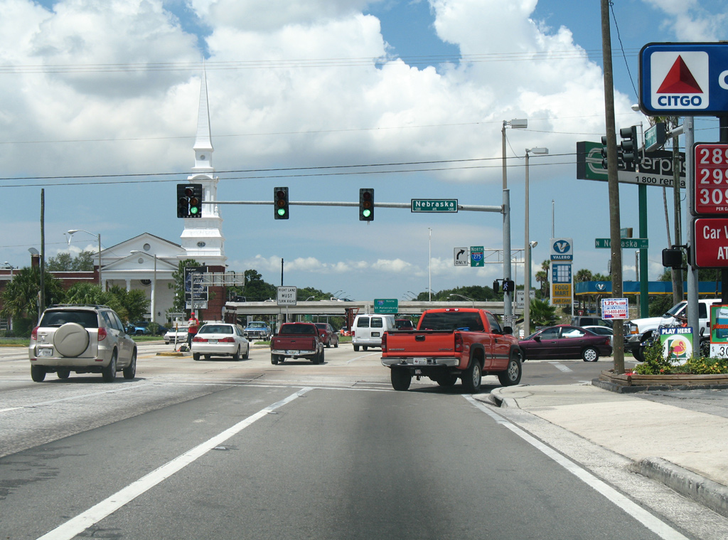
U.S. 41/92 (Hillsborough Avenue) combine for 2.27 miles west from N 40th Street to SR 45 (Nebraska Avenue).
03/22/20
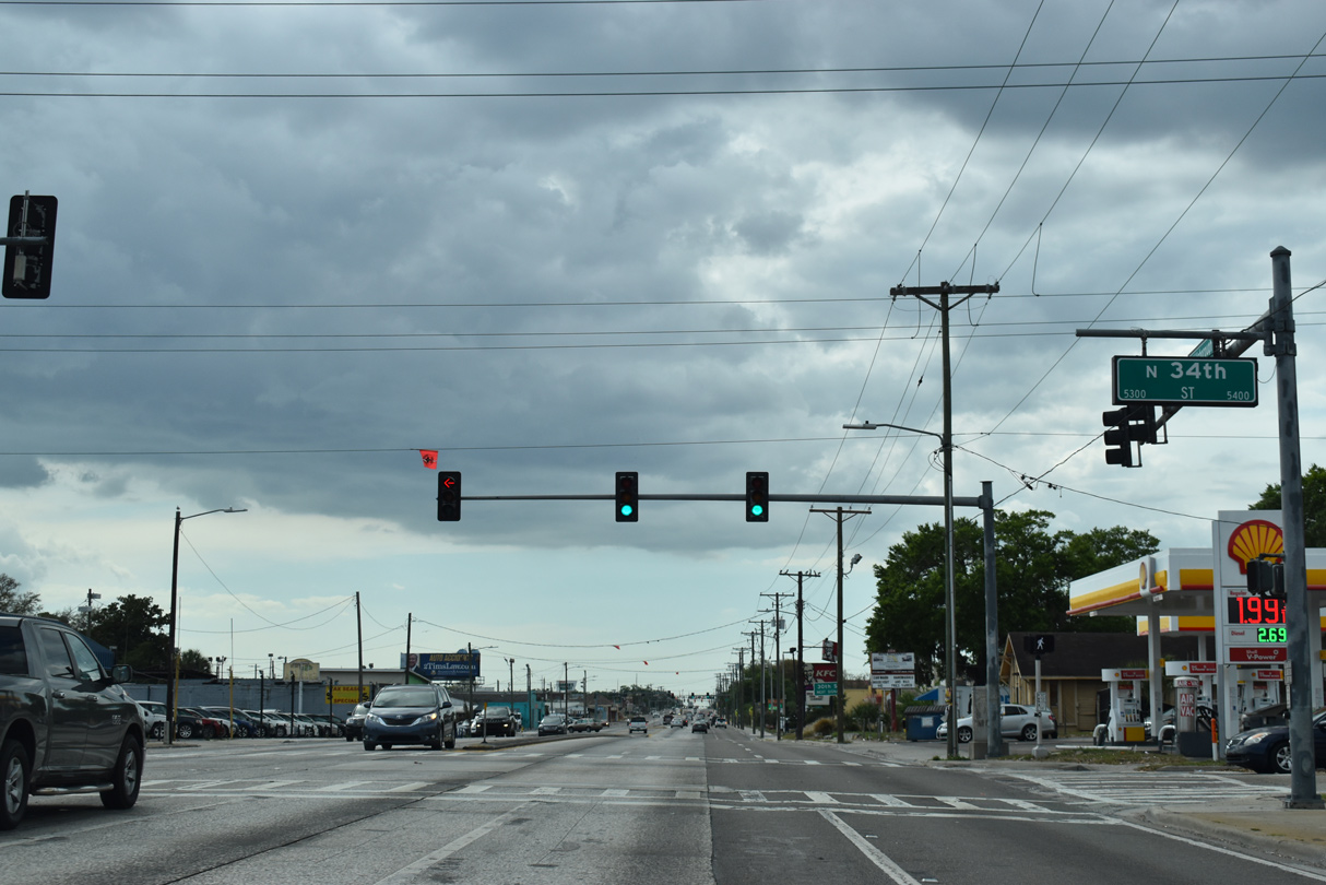
U.S. 41/92 (Hillsborough Avenue) west at N 34th Street.
03/22/20
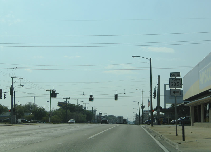
Decommissioned in 2016, SR 585 followed 22nd Street south to Ybor City and the east split of U.S. 41 Business and SR 60 at Adamo Drive.
03/19/06
U.S. 41/92 (Hillsborough Avenue) advance one mile west from N 22nd Street (old SR 585) to SR 45 (Nebraska Avenue) at Hampton Terrace.
03/22/20

15th Street runs north through Old Seminole Heights and south to Historic Ybor. A second section of 15th Street forms a minor arterial route north of the Hillsborough River as well.
03/22/20
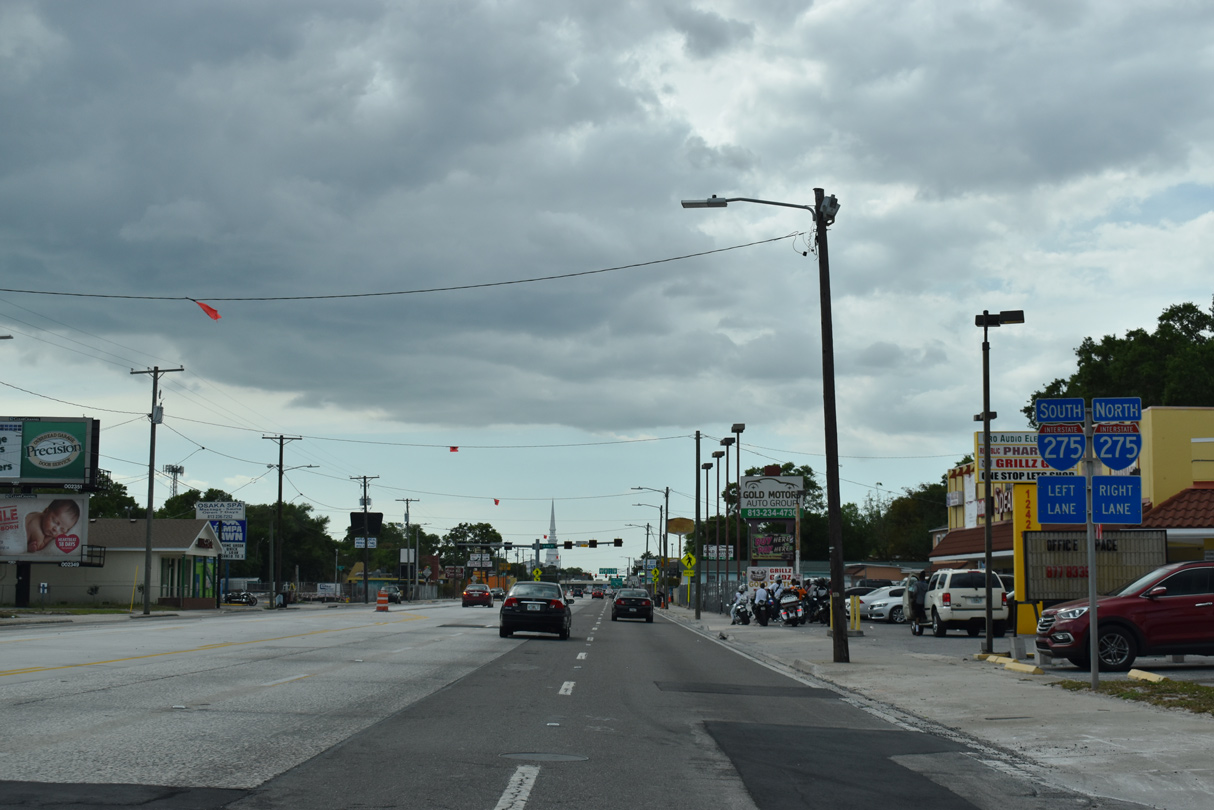
Trailblazers after 15th Street reference the forthcoming parclo interchange joining U.S. 92 (Hillsborough Avenue) with Interstate 275.
03/22/20
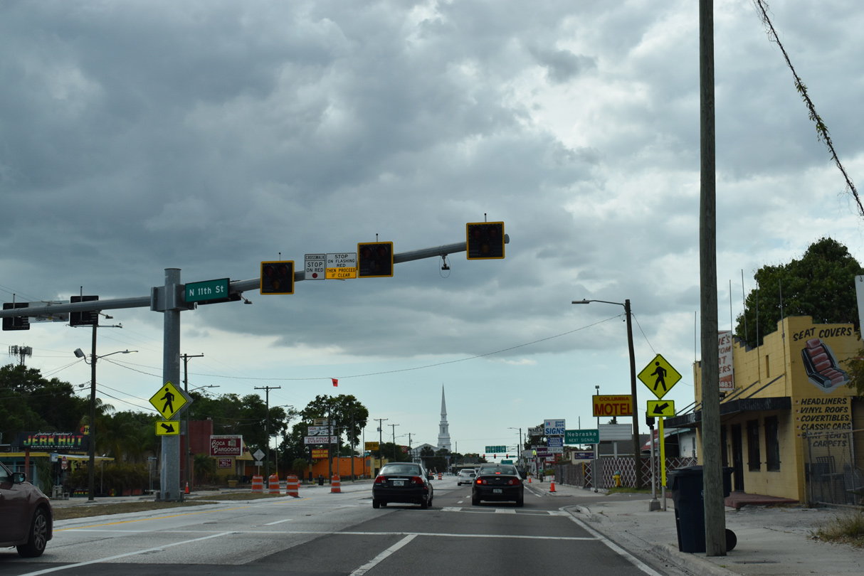
A HAWK signal was installed along Hillsborough Avenue at 11th Street by April of 2016 to improve pedestrian safety.
03/22/20
U.S. 41/SR 45 north parallel I-275 along Nebraska Avenue into unincorporated Lutz. SR 45 is the hidden counterpart of U.S. 41 northward to Sulphur Springs, North Tampa and ultimately High Springs.
05/26/16
Photo Credits:
- ABRoads: 03/02/14, 05/26/16, 03/22/20, 04/23/21
- Alex Nitzman: 03/19/06, 07/08/14
Connect with:
Page Updated Thursday March 03, 2022.