
U.S. 41 South - Seminole Heights, Tampa to East Tampa
 South
South  East
East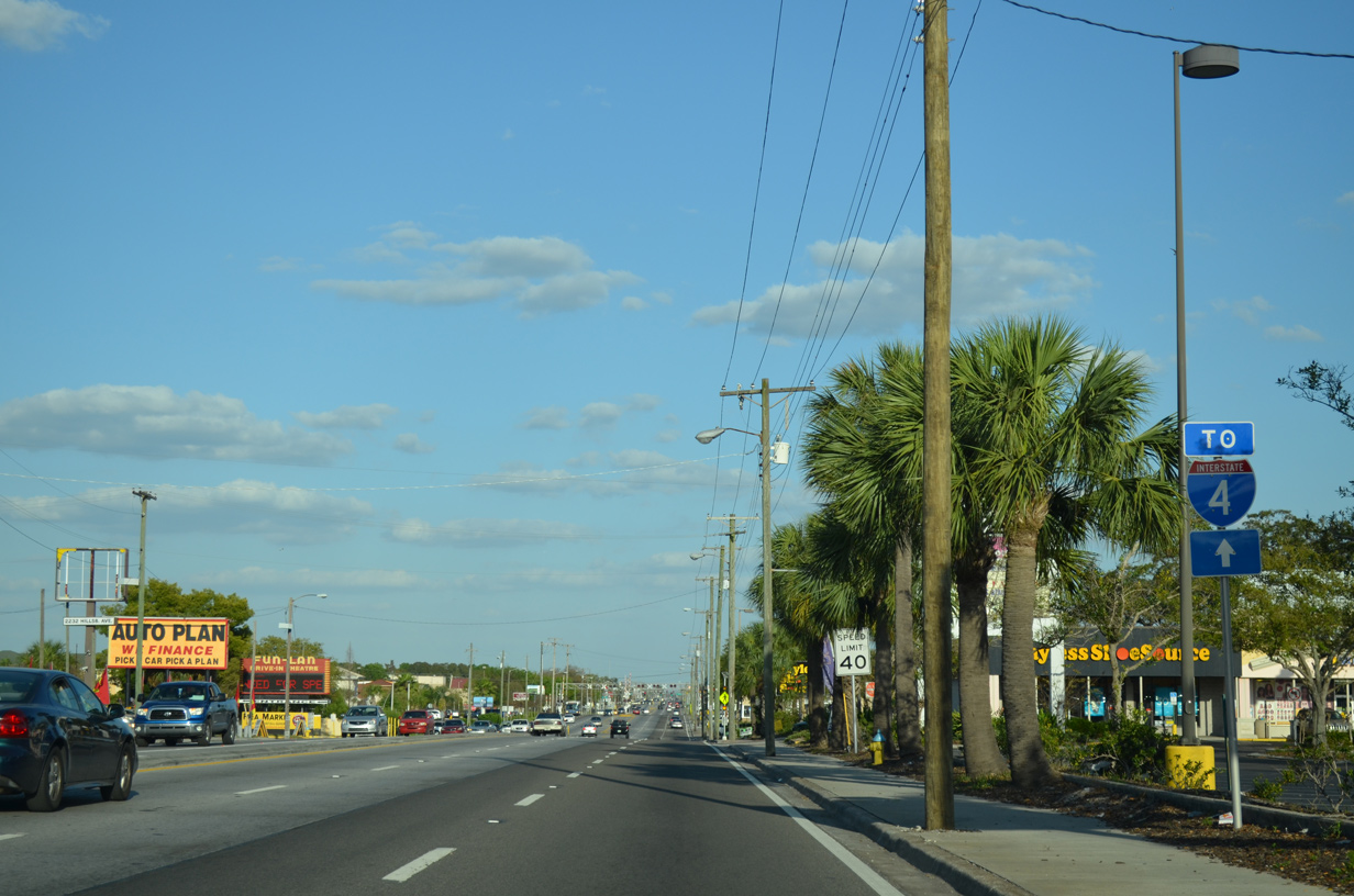
U.S. 92 (Hillsborough Avenue) leads east directly to I-4 near Eureka Springs. U.S. 41 and former SR 585 (22nd Street) also provide access to the freeway, which runs 2.1 miles to the south.
03/15/14

The next eastbound signal on Hillsborough Avenue operates at N 34th Street. 34th Street leads south to Rainbow Heights and East Ybor Historic district and north through Live Oaks Square.
03/15/14
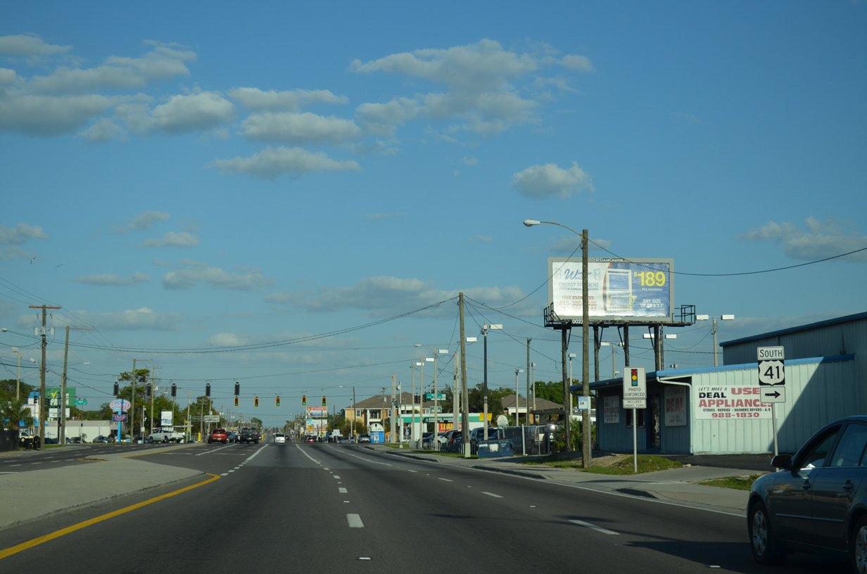
U.S. 41 heads south from U.S. 92 and Tampa to Palm River, Gibsonton and Ruskin along eastern reaches of Hillsborough and Tampa Bay. U.S. 92 remains east to Harney and the Florida State Fairgrounds to parallel I-4 to Plant City and Lakeland.
03/15/14
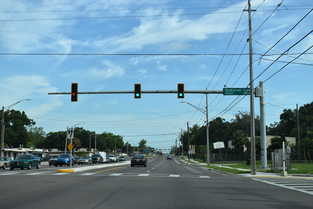
Osborne Avenue crosses U.S. 41 (N 40th Street) west from the Northview Hills neighborhood to the East Tampa Business & Civic neighborhood and Middleton High School.
05/18/18
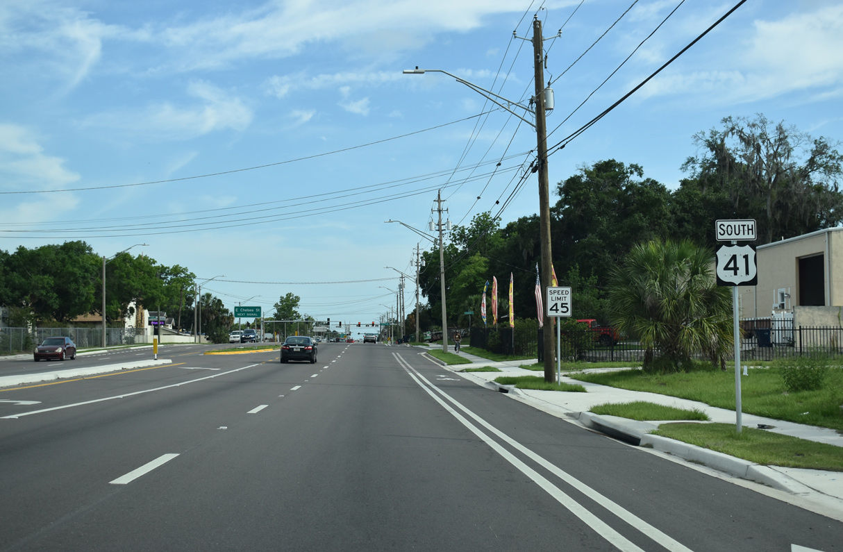
South from Osborne Avenue, U.S. 41 (N 40th Street) runs along the Rainbow Heights neighborhood in Tampa.
05/18/18
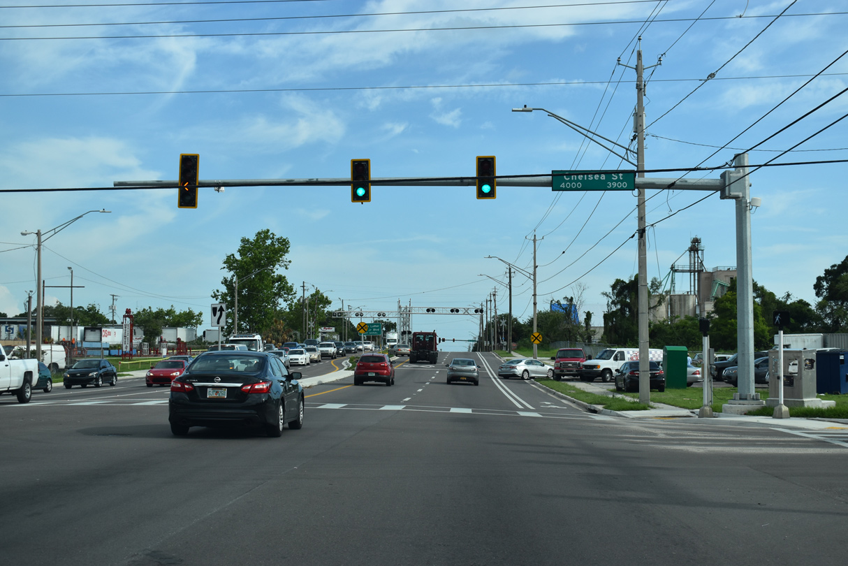
Chelsea Street heads east to Northview Hills and SR 583 (N 50th Street) and west through Rainbow Heights to Southeast Seminole Heights.
05/18/18

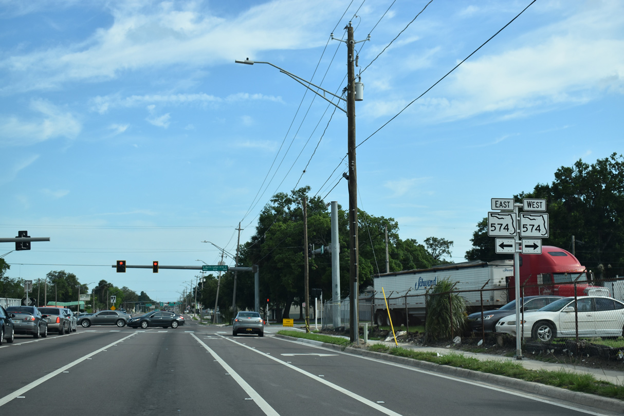
Forthcoming SR 574 (Dr. Martin Luther King, Jr. Boulevard) travels across the city of Tampa from U.S. 92 (Dale Mabry Highway) at Drew Park to the east city line at Grant Park.
05/18/18
Measuring 23.05 miles overall, SR 574 (MLK Boulevard) continues east from Tampa to East Lake-Orient Park, Mango, Seffner, Dover and U.S. 92 (Reynolds Street) in Plant City.
05/18/18
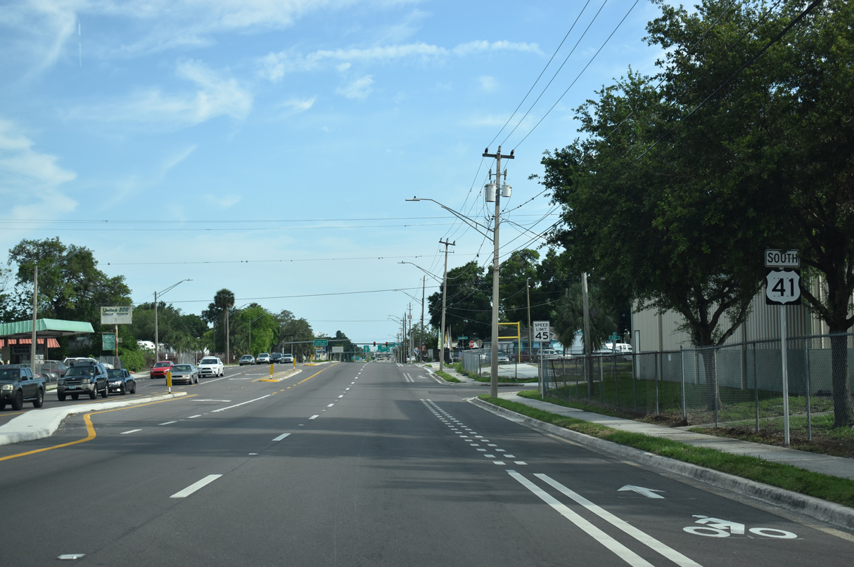
Confirming marker posted south of SR 574 (MLK Boulevard) along N 40th Street. U.S. 41 underwent a road diet from six to four lanes to accommodate bike lanes between May and June 2017 during a repaving project.
05/18/18
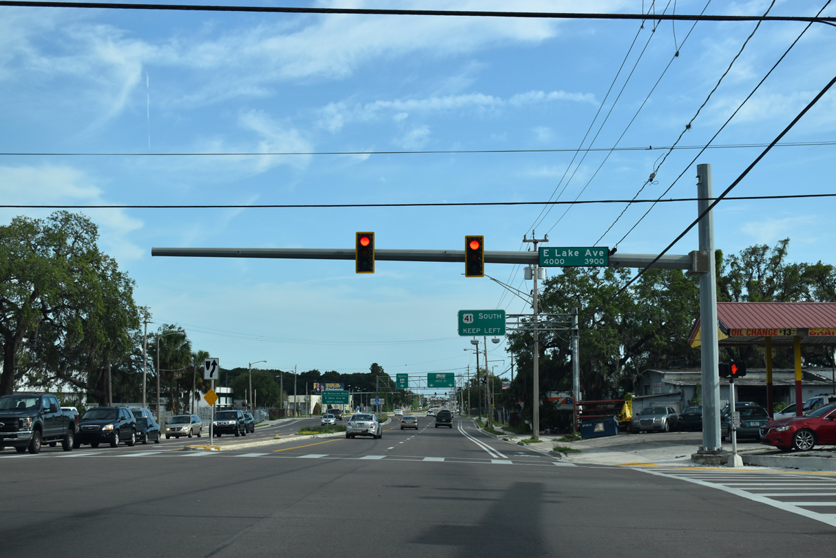
Lake Avenue branches southwest from SR 574 (MLK Boulevard) to cross U.S. 41 (N 40th Street) ahead of the Jackson Heights and College Hill-Belmont Heights neighborhoods.
05/18/18
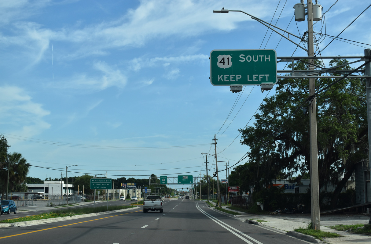
U.S. 41 turns east from N 40th Street (SR 569) onto Melburne Boulevard through the Highland Pines neighborhood to connect with SR 583 (N 50th Street).
05/18/18
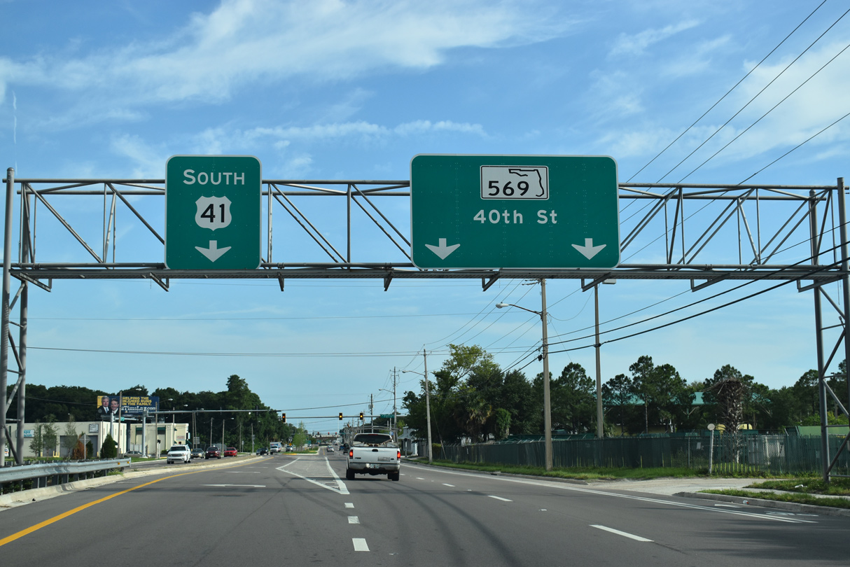
N 40th Street extends south from U.S. 41 (Melburne Boulevard) as SR 569 to the East Ybor Historic neighborhood. SR 569 measures just 1.33 miles along 40th and 39th Streets to SR 60 (Adamo Drive).
05/18/18
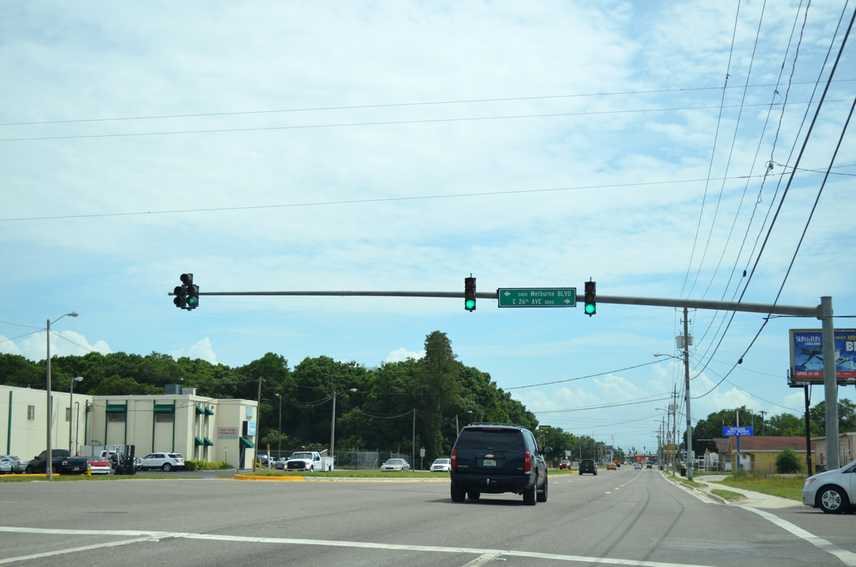
26th Avenue branches west from U.S. 41 and SR 569 into the Jackson Heights neighborhood.
04/15/15
U.S. 41 follows Melburne Boulevard east 0.726 miles from N 40th Street to E 21st Avenue and N 48th Street through the Highland Pines community.
05/18/18
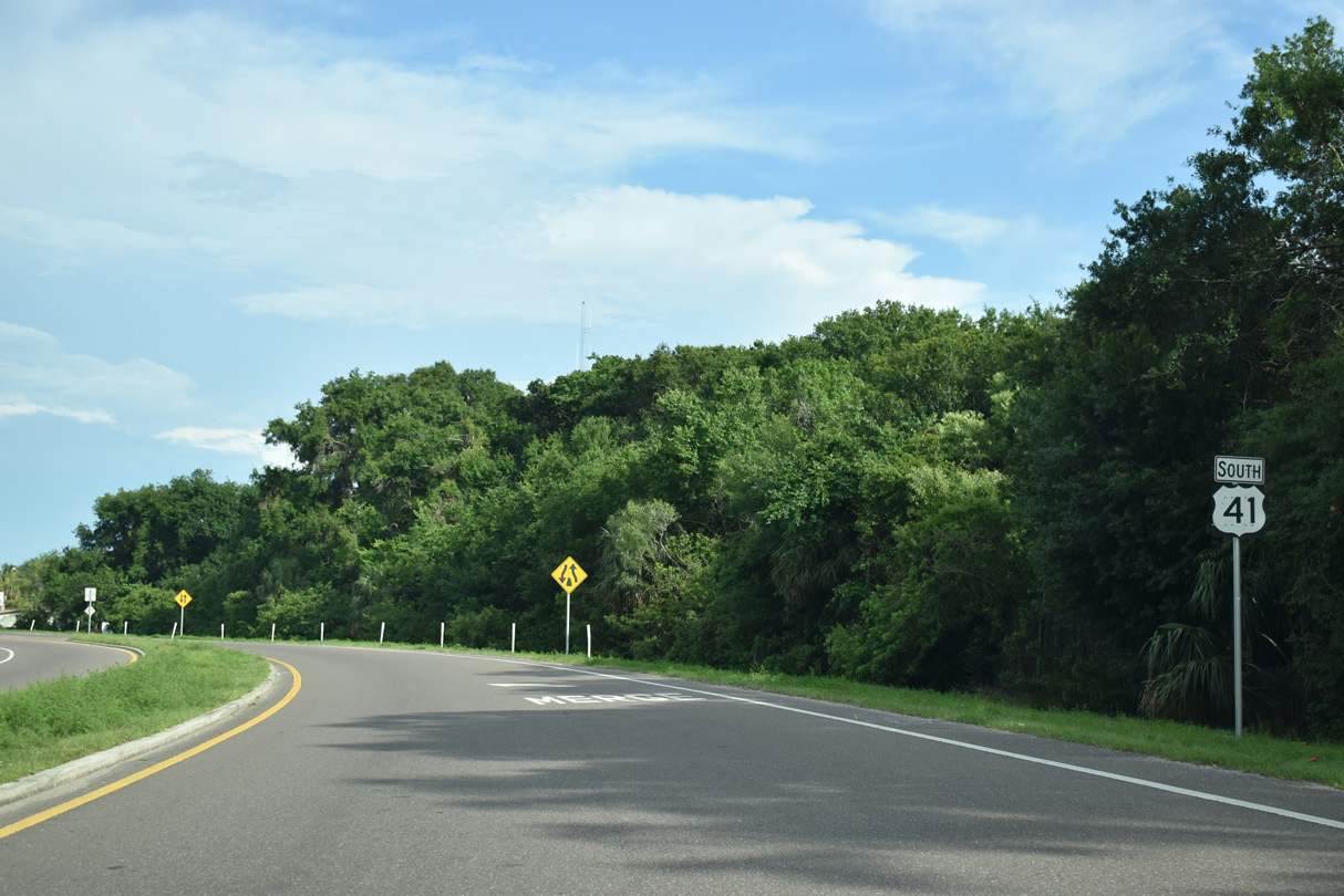
U.S. 41 (Melburne Boulevard) overtakes 21st Avenue two blocks east to meet the south end of SR 583 (N 50th Street).
05/18/18

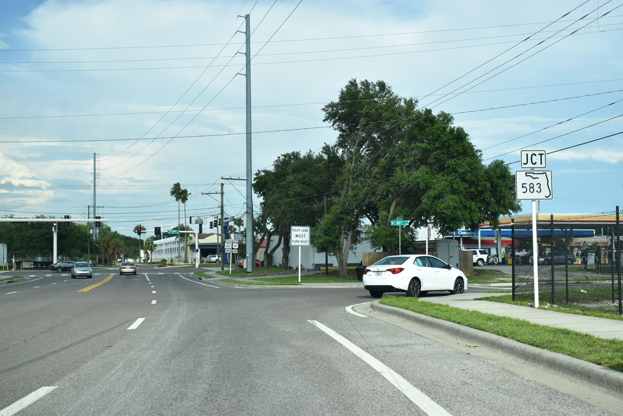
SR 583 (N 50th Street) is an arterial route leading 6.01 miles north to SR 580 (Busch Boulevard) east of Busch Gardens and SR 582 (Fowler Avenue) in the city of Temple Terrace.
05/18/18
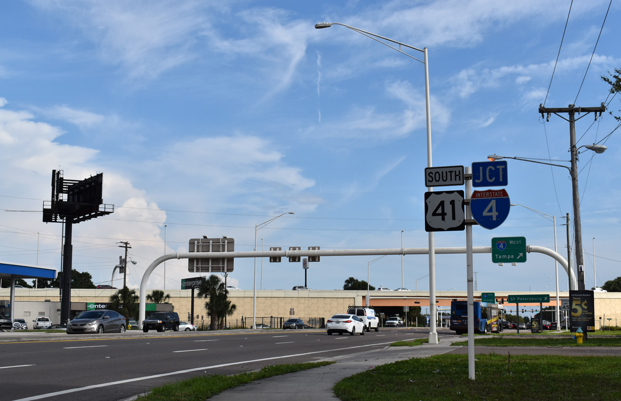
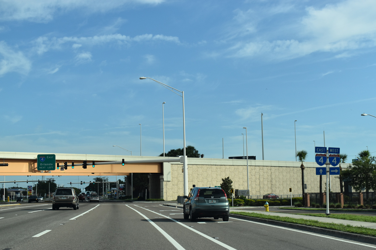
U.S. 41 overtakes N 50th Street south from SR 583 leading into the split diamond interchange (Exit 3) with Interstate 4.
05/18/18
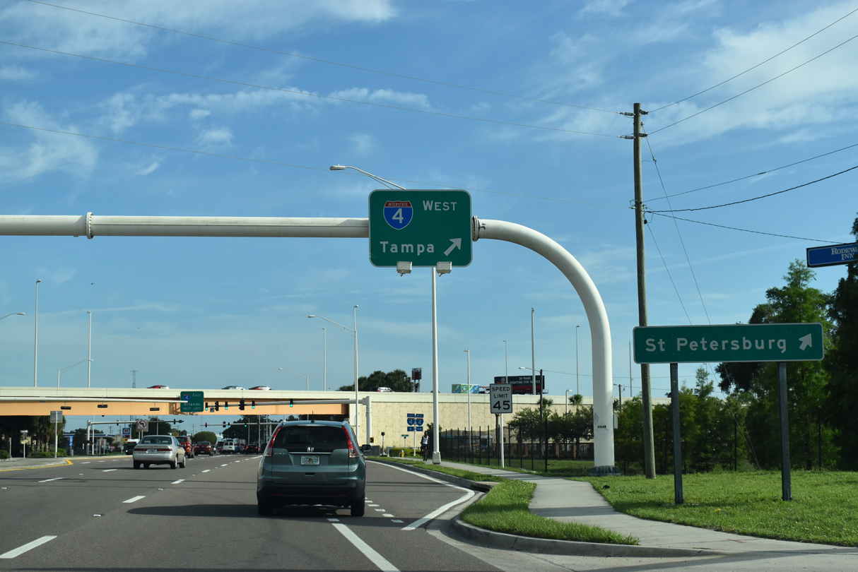
Interstate 4 travels west to I-275 at the Downtown Interchange. I-275 continues from there to Westshore in Tampa and across the Howard Frankland Bridge to St. Petersburg.
05/18/18
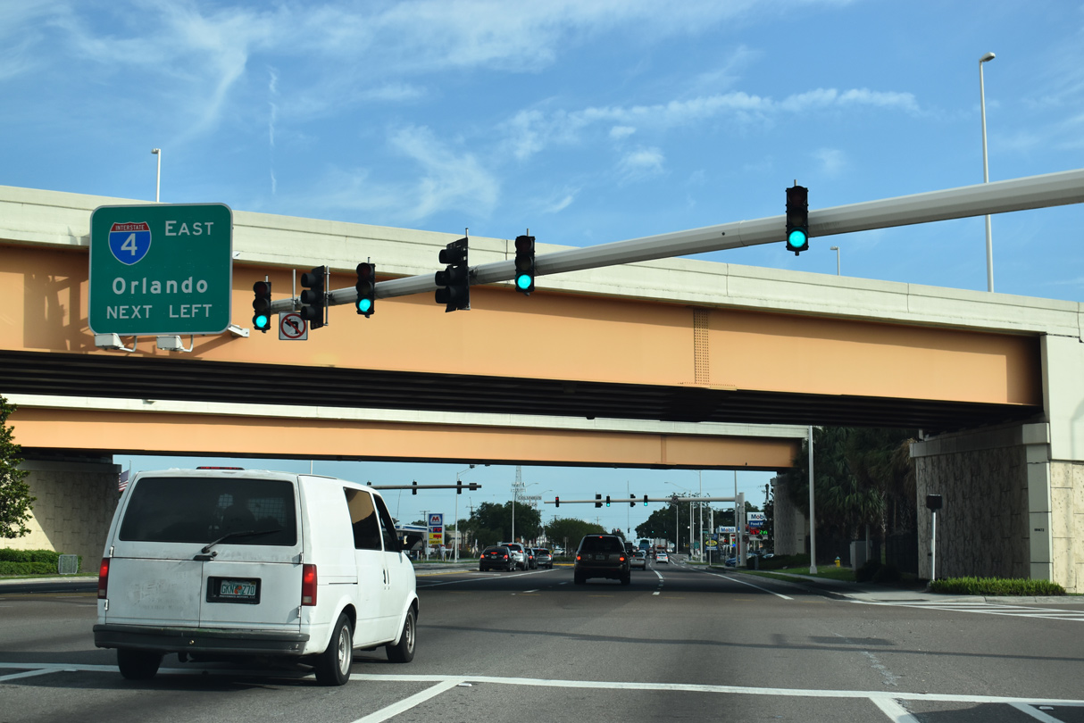
Interstate 4 crosses the Florida peninsula northeast to Lakeland, Orland, Sanford, Deltona and I-95 at Daytona Beach.
05/18/18
South of I-4, U.S. 41 (N 50th Street) advances to E Columbus Drive. Columbus Drive was realigned southward during mid 2000s widening of Interstate 4.
05/18/18
U.S. 41 (N 50th Street) continues south from Columbus Drive to a signalized intersection with E 10th Avenue at Oak Park in Tampa.
05/18/18

Broadway Avenue west and E 7th Avenue come together at U.S. 41 as unsigned CR 574 between Ybor City and Orient Park.
07/10/11
South from Broadway Avenue (CR 574), U.S. 41 passes through the East Side Commercial area of Tampa to SR 60 (Adamo Drive).
07/10/11
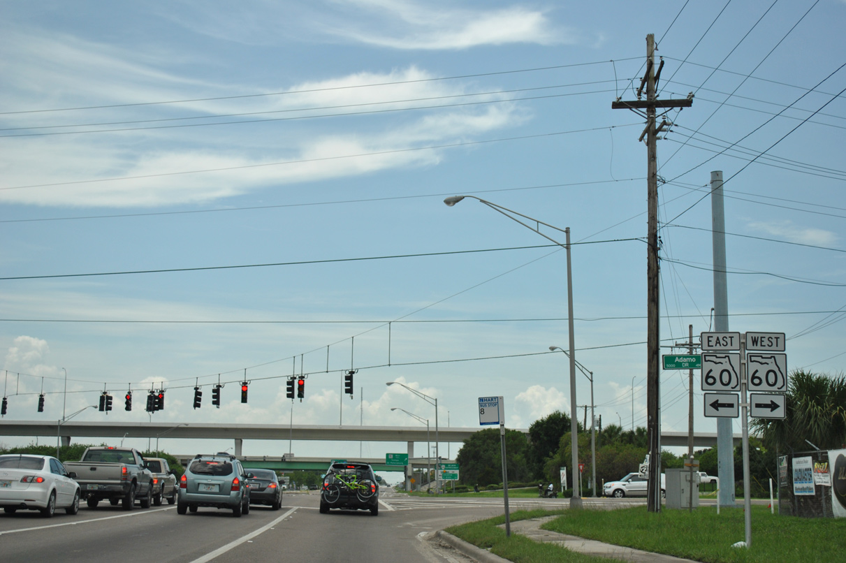
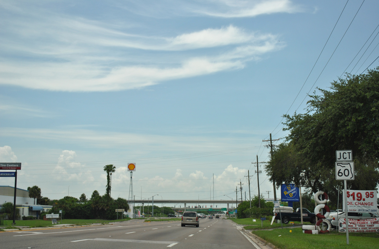
SR 60 (Adamo Drive) is a major arterial route joining Ybor City and the Channel District in Tampa with Brandon.
07/10/11
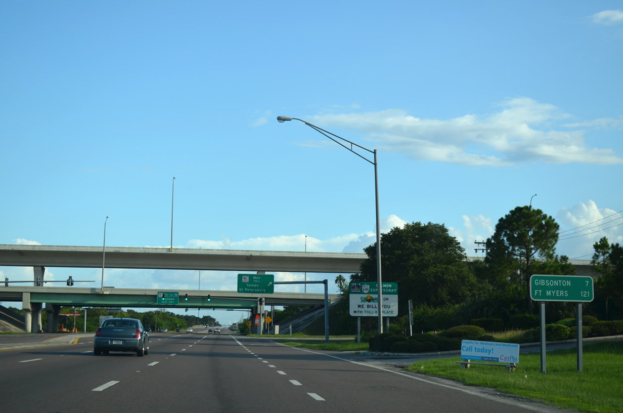
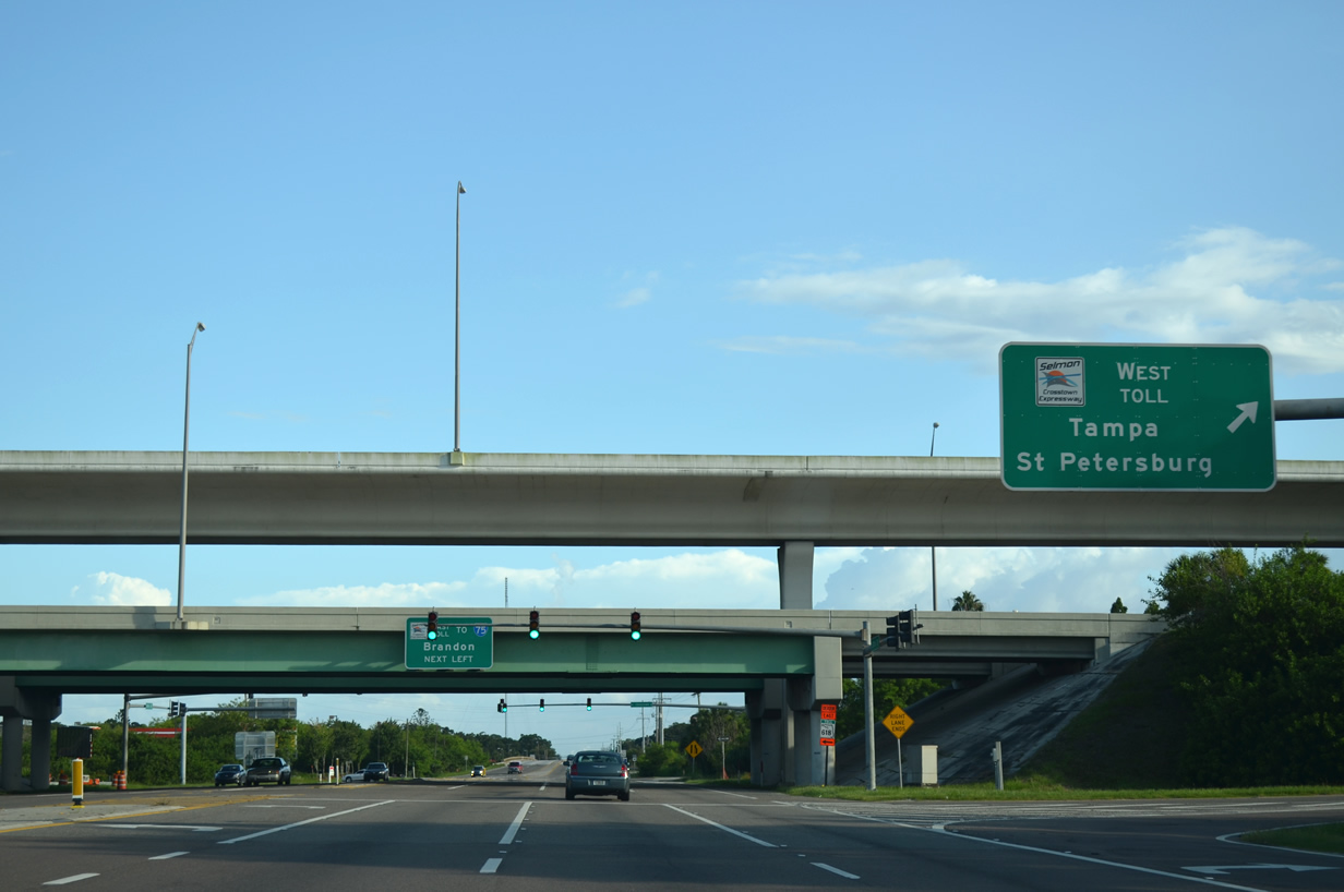
U.S. 41 (Tamiami Trail) enters a diamond interchange with SR 618 (LeRoy Selmon Expressway) to the immediate south of SR 60 (Adamo Drive). A replaced distance sign referenced Fort Myers at 121 miles away. Apollo Beach - 13 miles and Ruskin - 17 miles are displayed on the newer sign.
07/06/13
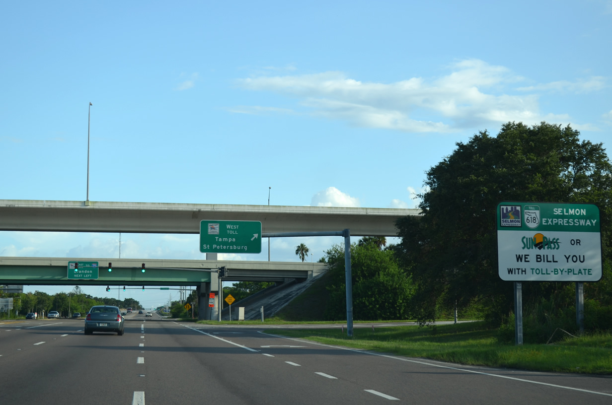
This style of advisory sign was placed along the mainline and at all interchanges to alert motorists of varied toll collection methods in late 2010 when cash collections ceased along the tolled expressway.
07/06/13
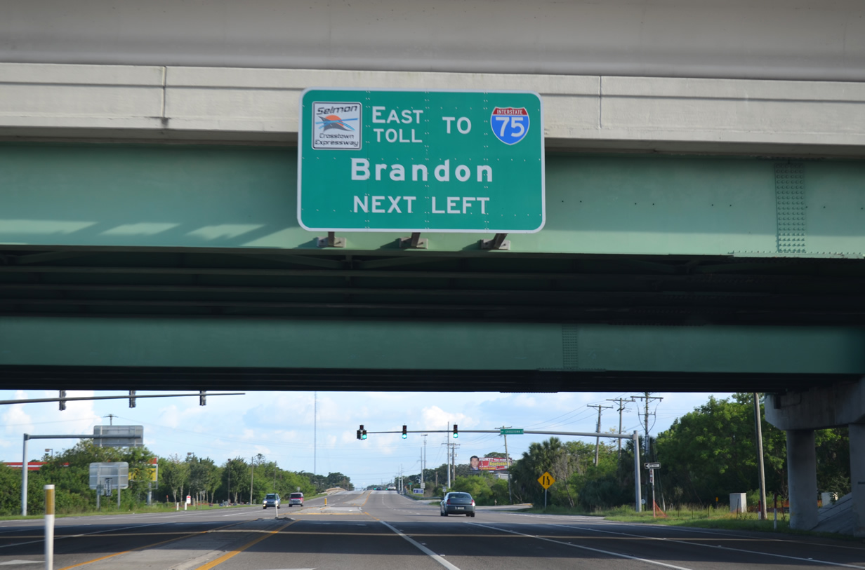
The reversible express lanes span the exchange joining U.S. 41 and the Selmon Expressway. SR 618 joins Brandon with Downtown Tampa and St. Petersburg via U.S. 92 across the Gandy Bridge.
07/06/13
The Selmon Expressway east connects with both Interstate 76 and Brandon Parkway. U.S. 41 continues south across Palm River into the Palm River-Clair Mel community.
07/06/13
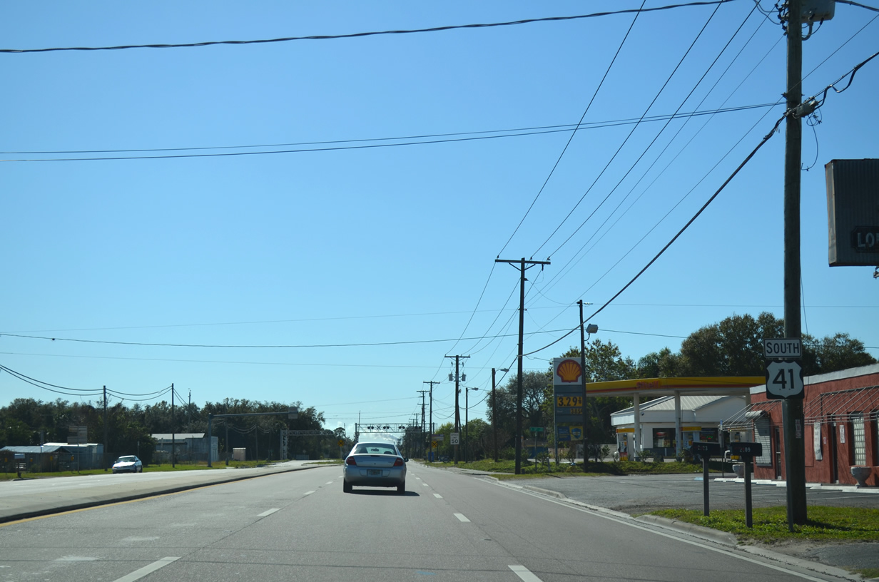
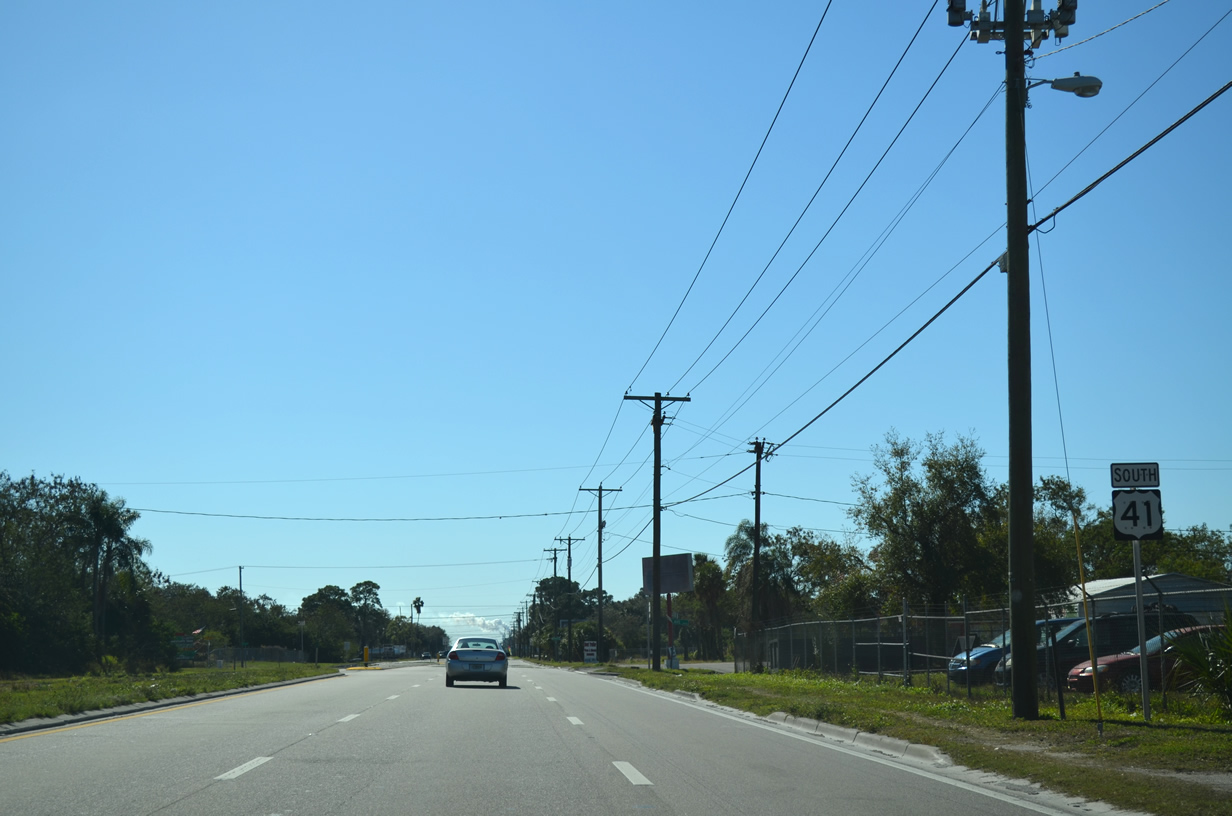
Bypassing Port Sutton to the east, U.S. 41 (S 50th Street) continues from U.S. 41 Business north and SR 676 east (Causeway Boulevard).
01/19/14
This reassurance marker stands along U.S. 41 at S 34th Avenue near Delaney Creek.
01/19/14
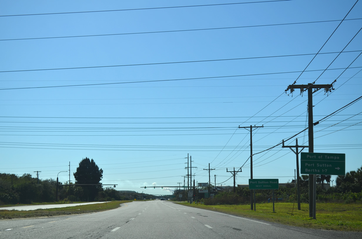
Port Sutton Boulevard spurs west from U.S. 41 (Tamiami Trail) to Port Tampa Bay facilities on Black Point.
01/19/14
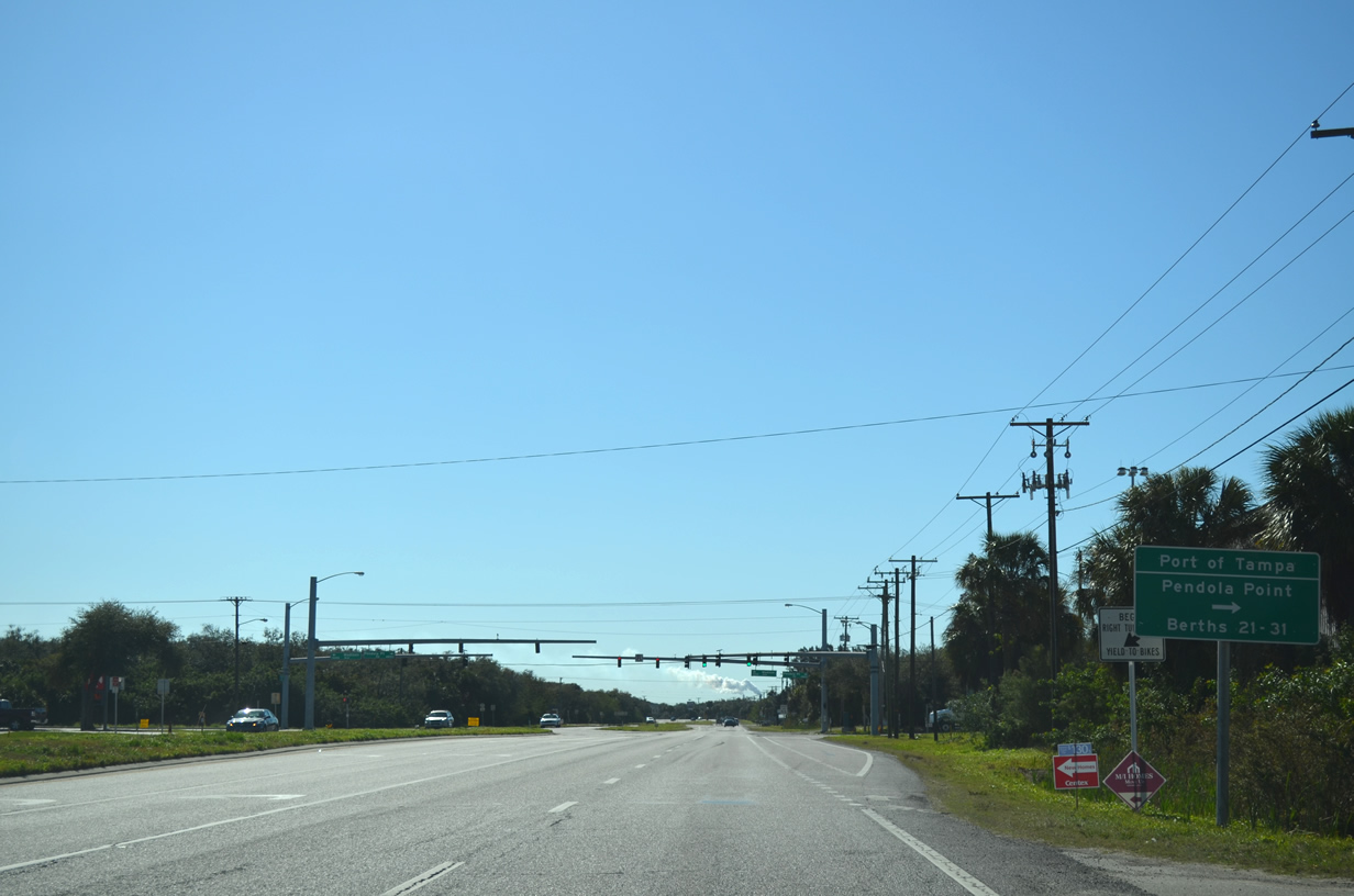
Pendola Point Road follows as a spur to the Port of Tampa berths on Pendola Point. Unsigned CR 676A stems east from the U.S. 41 intersection via Madison Avenue to Progress Boulevard and Progress Village.
01/19/14
Riverview Drive travels east from U.S. 41 to Riverview. The south end of unsigned CR 573 (78th Street) lies one mile to the east.
01/19/14
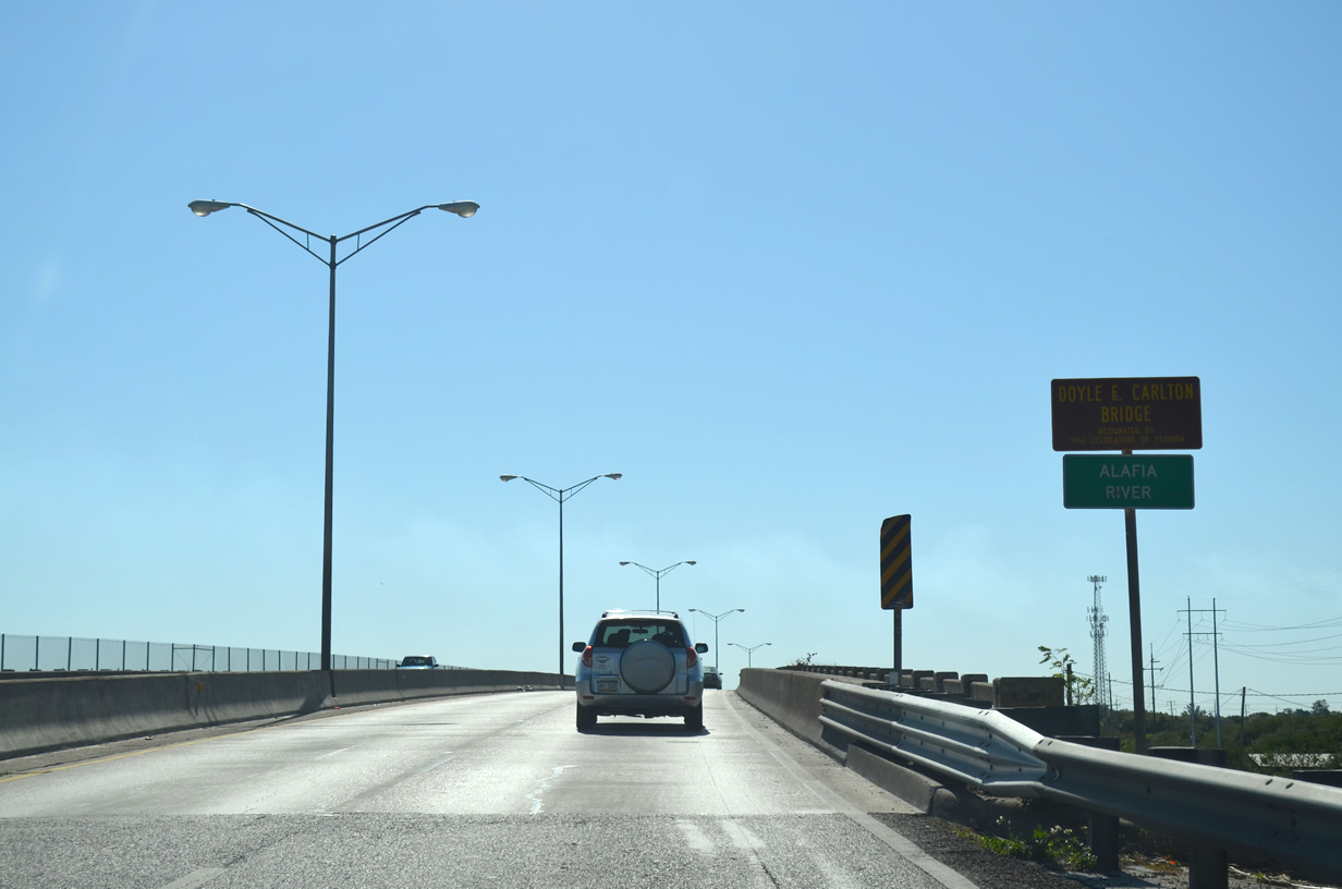
U.S. 41 (Tamiami Trail) spans the Alafia River as it enters Gibsonton from the north. The Alafia River flows 25 miles from interior Hillsborough County into McKay Bay.
01/19/14

Photo Credits:
- AARoads: 07/10/11, 03/15/14
- ABRoads: 05/18/18
- Alex Nitzman: 07/06/13, 01/19/14, 04/15/15
Connect with:
Page Updated Thursday March 03, 2022.