Interstate 490 Eastbound - Downtown to I-90
| Interstate 490 West | |
|---|---|
 |
Interstate 490 comprises the southwestern third of the Inner Loop freeway at downtown Rochester. At Exit 13, the Inner Loop returns eastward for the High Falls district and central business districts. A tri-level stack interchange joins the two freeways adjacent to the Triple A baseball stadium Frontier Field. Photo taken 05/09/05. |
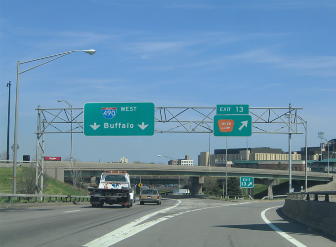 |
Two lanes of Interstate 490 resume a westerly course at the Exit 13 split with the Inner Loop freeway east. Drivers continuing east along the Inner Loop pass over the High Falls/Genesee River ahead of the South Avenue diamond interchange. Photo taken 05/09/05. |
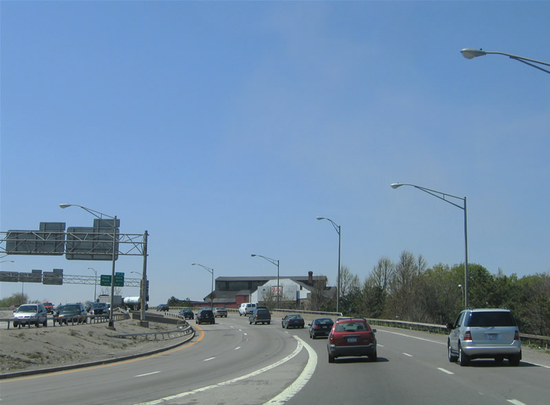 |
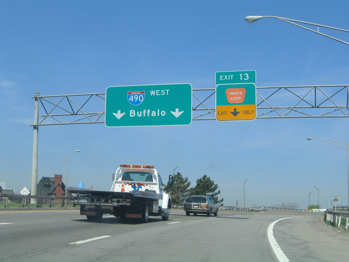
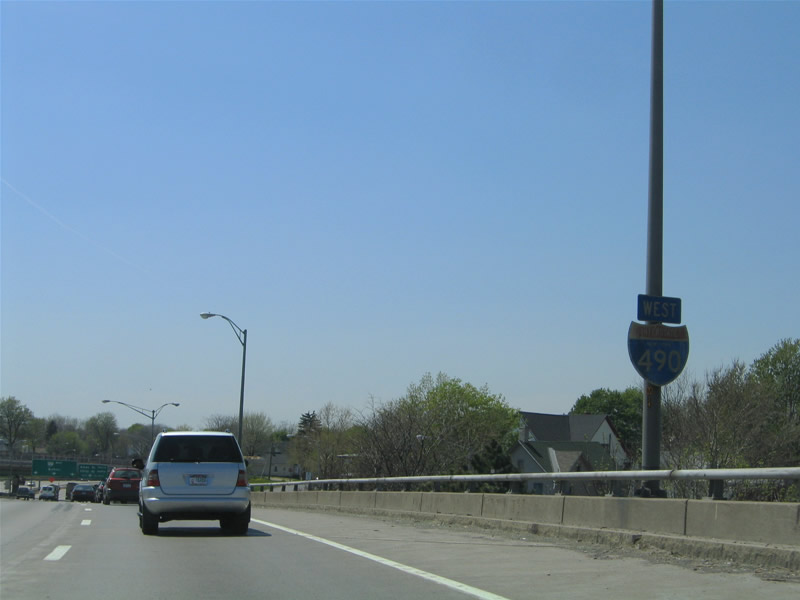
Drivers from the Inner Loop freeway merge onto Interstate 490 west at the Platt Street and New York 31 (Broad Street) under crossing. Interstate 490 follows the West Expressway from downtown to Interstate 390. Photo taken 05/10/05. |
 |
The right-hand lane gained from the Inner Loop defaults onto the Exit 11 two-pronged off-ramp to Ames and Child Streets. Child Street travels north-south between Danforth Street and New York 31 (Lyell Avenue). Photo taken 05/10/05. |
 |
An original Interstate 490 New York shield resides along the westbound viaduct at the Brown Street under crossing. Photo taken 05/10/05. |
 |
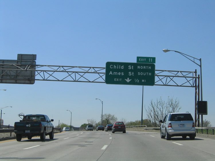
Attached to the Grape Street overpass is a set of original button copy overheads for Interstate 490 west to Buffalo and Exit 11 to Ames Street south and Child Street north. Ames Street travels parallels Child Street to the west between New York 33 (West Avenue) and Masseth Street. The signs indicate cardinal directions for the streets respectively to indicate through routes. Photo taken 05/10/05. |
 |
Exit 11 leaves Interstate 490 west after the Saxton Street overpass. Use Child Street north for New York 31 (Lyell Avenue) west and Ames Street south to New York 33 (West Avenue) west to industrial areas of west Rochester. Photo taken 05/10/05. |
 |
Westbound at the Exit 11 ramp departure to Child and Ames Street. Interstate 490 maintains six through lanes throughout western Rochester. Photo taken 05/10/05. |
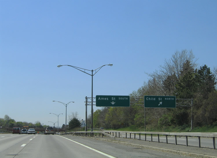 |
What is an otherwise split-diamond interchange, Exit 11 features a two-pronged off-ramp for westbound travelers. The Child Street ramp quickly ascends to its end while the Ames Street ramp parallels Interstate 490 underneath Child Street and the Colvin Street pedestrian over crossing before reaching its end. Eastbound travelers must utilize Wilder Street, a parallel frontage street between Ames and Child Streets, to make the connection. Photo taken 05/10/05. |
 |
Passing underneath Child Street on Interstate 490 west. The freeway remains below grade through to the New York Central Railroad under crossing west of Hague Street. Photo taken 05/10/05. |
|
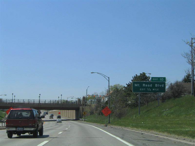
Next in line for westbound travelers is the six-ramp parclo interchange with Mt. Read Boulevard (Exit 10). Mt. Read Boulevard constitutes a north-south arterial between New York 33 (Buffalo Road) and New York 18 (Latta Road). Photo taken 05/10/05. |
 |
A button copy overhead directs motorists onto Interstate 490 westbound from Ames Street ahead of the aforementioned railroad underpass. Photo taken 05/10/05. |
 |
The Exit 11 on-ramp from Ames Street forms the Exit 10 exit-only lane to Mt. Read Boulevard. Mt. Read Boulevard serves the Kodak Distribution Center to the north along an expressway section of highway between Lexington Avenue and New York 104 (Ridge Road). Photo taken 05/10/05. |
 |
Drivers bound for Mt. Read Boulevard depart Interstate 490 west at Exit 10. Mt. Read Boulevard northbound serves industrial areas of west Rochester between New York 31 (Lyell Avenue) and Ridge Road. Interchanges exist along the arterial at Ridgeway Avenue and New York 104 (former U.S. 104). Photo taken 05/10/05. |
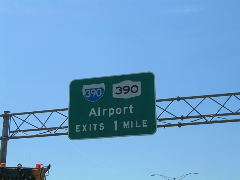 |
A closer look at the one-mile panel for Interstate 390 south & New York 390 north (Exits 9B/A) posted on the Exit 11 sign bridge. The forthcoming interchange serves Rochester International Airport and the south suburbs of Henrietta via Interstate 390 south. New York 390 continues the freeway north to Greece and the Lake Ontario State Parkway. Photo taken 05/10/05. |
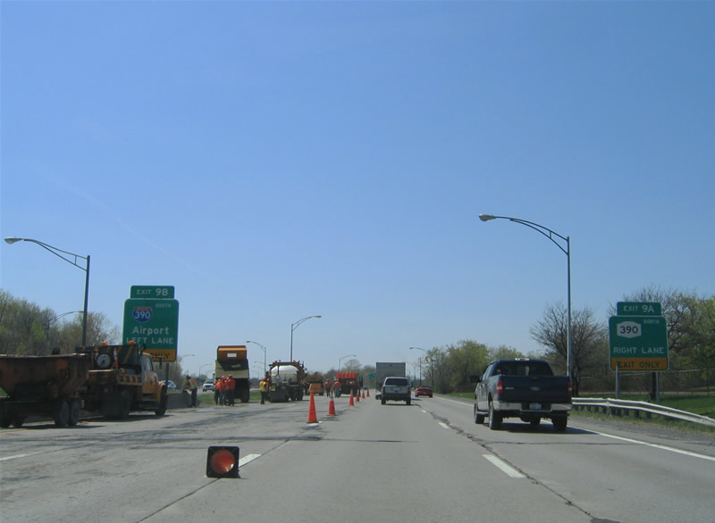 |
The multi level interchange between Interstate 490 and I-390/NY 390 includes some left exit ramps. Exit 9B departs from the left onto the southbound beginning of Interstate 390 for the airport, Henrietta, Geneseo, Dansville, and the Southern Tier. Exit 9A leaves from the right toward Greece, Lake Ontario State Parkway, and north Rochester. Photo taken 05/10/05. |
 |
Exit 9B leaves I-490 west for I-390 south. Interstate 390 travels along the Outer Loop freeway southeast to I-590. From there the freeway travels south to I-90 (New York Thruway) en route to I-86/NY 17 near Avoca. Photo taken 05/10/05. |
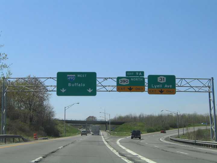 |
Travelers bound for New York 390 are provided with the option to exit at New York 31 (Lyell Avenue) as well. A parclo interchange with New York 390 and Lyell Avenue resides just north of Interstate 490. Lyell Avenue carries the state route west to Spencerport Road. New York 390 meanwhile continues north to New York 104 (former U.S. 104) and the Lake Ontario State Parkway near O'Neil Point. Photo taken 05/10/05. |
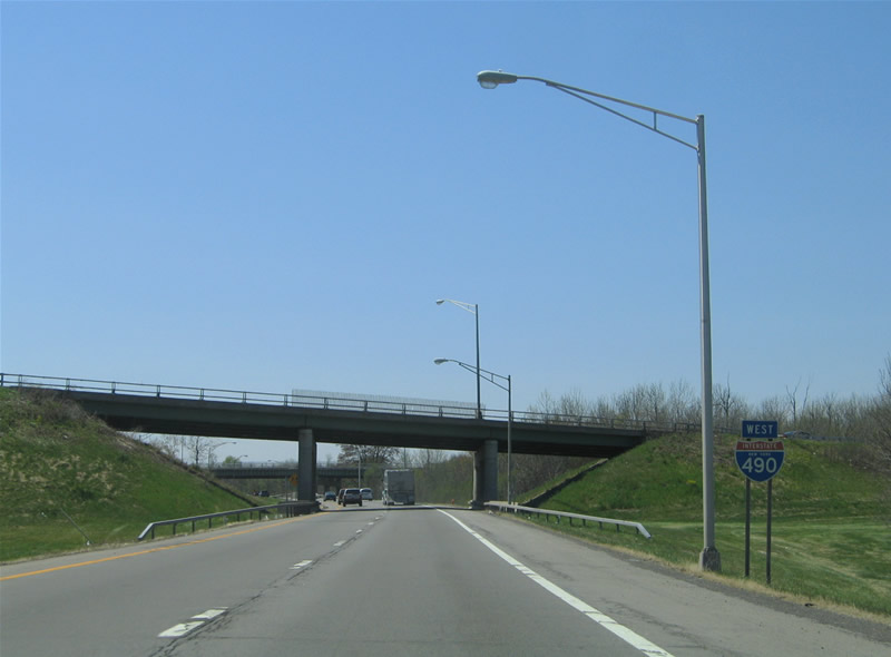 |
A state-named shield for Interstate 490 with arial font resides within the stack interchange of Exit 9 on westbound. There were a handful of these style shields on Interstate 490 through the western suburbs as of Summer 2005. Photo taken 05/10/05. |
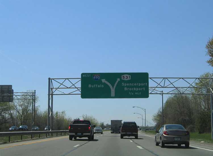 |
The first of two Diagrammatic overheads for the Exit 8 split with New York 531 (Spencerport Expressway). Extended to almost Brockport in 1995, New York 531 comprises a freeway west from Interstate 490 to the Rochester Technology Park nearby and Spencerport. Photo taken 05/10/05. |
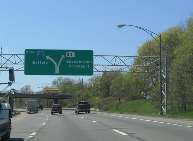 |
Nearing the split of Interstate 490 and New York 531 (Spencerport Expressway) west at the Wegman Road overpass. New York 531 ended at New York 386 (Elmgrove Road) within one mile until 1994. The road saw extension to provide better access to Brockport in conjunction with New York 31 (Brockport-Spencerport Road). Photo taken 05/10/05. |
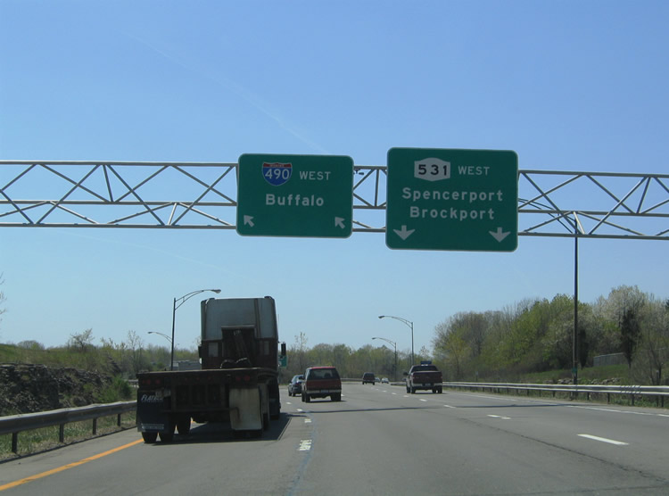 |
An unstacked directional interchange facilitates the movements between Interstate 490 and New York 531 (Spencerport Expressway) at Exit 8. Interstate 490 turns south from the freeway split. New York 531 sees three Rochester Technology Park area interchanges within its first two miles. They serve New York 386, North Road at the plant itself, and Manitou Road. New York 531 ends at its merge with New York 31 six miles to the west. Photo taken 05/10/05. |
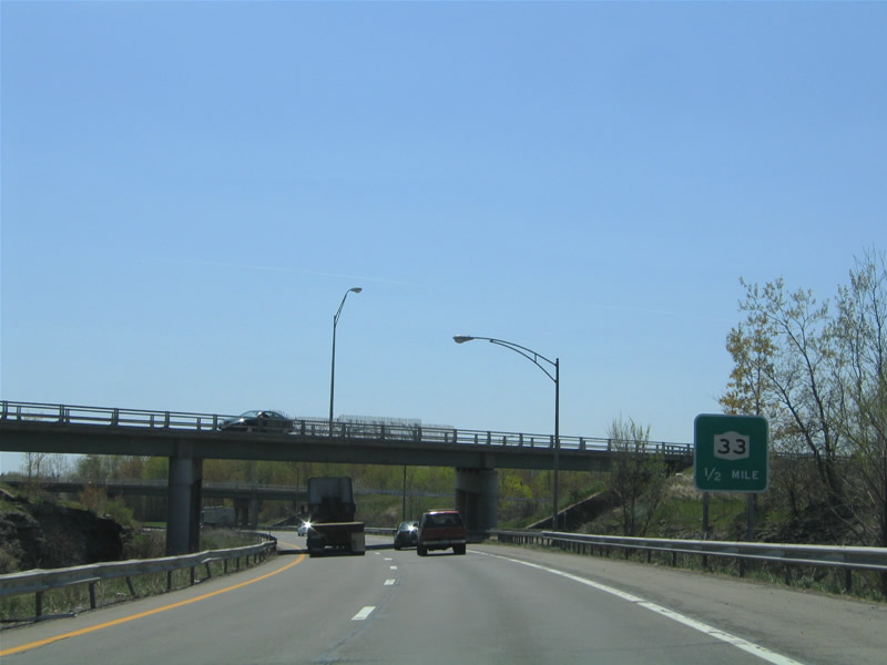 |
Interstate 490 travels just one-half mile south from Exit 8 to New York 33 (Exits 7B/A). New York 33 (Buffalo Road) travels west from the city of Rochester through Gates Center to Interstate 490. Photo taken 05/10/05. |
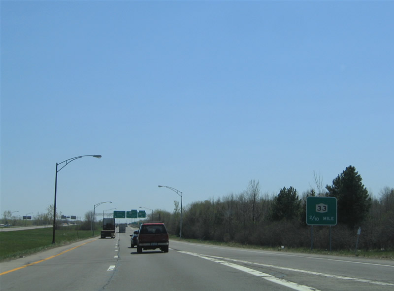 |
Two-tenths of a mile sign posted for New York 33 (Exits 7B/A) on Interstate 490 west. New York 33 west serves an industrial area between the freeway and Howard Road. The state route continues east into Rochester via West Avenue and West Main Street. Photo taken 05/10/05. |
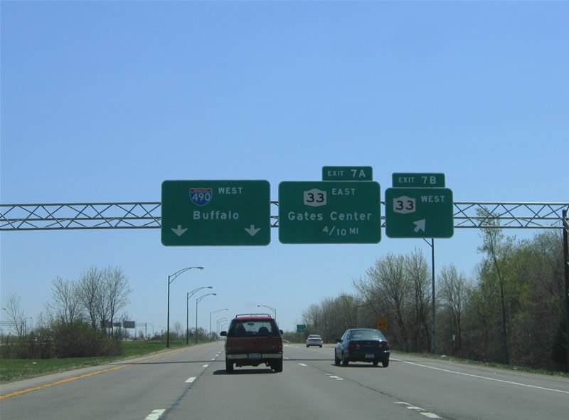 |
Westbound at the cloverleaf interchange with New York 33 (Buffalo Road) on Interstate 490. Exit 7B serves Buffalo Road westbound to New York 211 (Coldwater Road) and North Chili. Photo taken 05/10/05. |
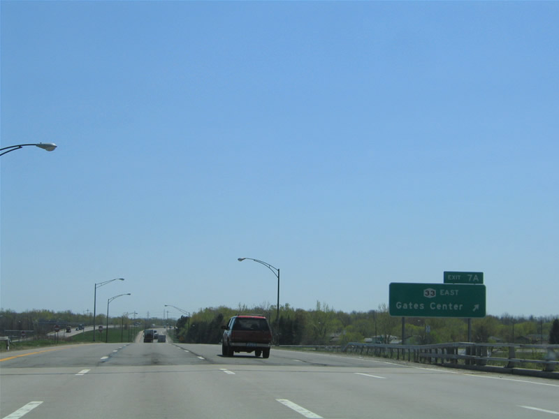 |
Exit 7A leaves Interstate 490 west for New York 33 (Buffalo Road) east into industrial areas and Gates Center. Photo taken 05/10/05. |
 |
Next in line for westbound travelers is the Exit 6 trumpet interchange with New York 204 (Airport Expressway). Following the Airport Expressway initially, New York 204 meanders east from Interstate 490 to Rochester International Airport and south Rochester. The freeway ends abruptly within one mile at New York 33A (Chili Avenue). Photo taken 05/10/05. |
 |
Interstate 490 westbound at the Exit 6 ramp departure to New York 204 (Airport Expressway). The Airport Expressway was originally envisioned to continue east directly to Rochester International Airport and Interstate 390. The freeway was withdrawn after improvements to the terminal were made from the Interstate 390 side. New York 204 instead follows New York 33A (Chili Avenue) east from the Airport Expressway to Brooks Avenue. Photo taken 05/10/05. |
 |
 |
Page Updated July 28, 2006.
|
About Contact Glossary |
In The News Interstate Guide |
Social Media:
 |
|
© 2000-25 AARoads.com | All Rights Reserved | Privacy Policy / Terms of Use
|
||