
Interstate 635 South - Texas
| Interstate 635 South | |
|---|---|
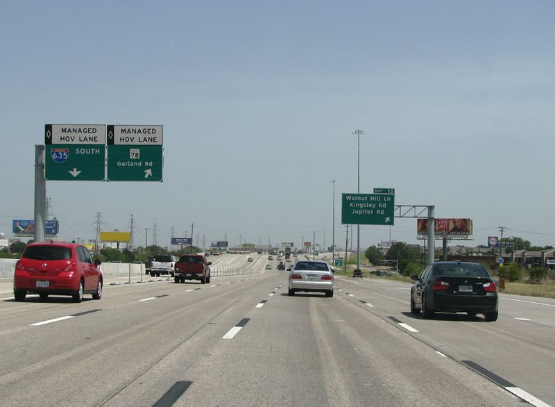 |
IH 635 turns to the south here, and this view looks at the Walnut Hill exit. This area of town is fairly nice, with many garden apartment complexes and retail establishments. The HOV lane has an exit for SH 78 here, but there is no new lane added as was the case with the last exit. Photo taken 07/27/08. |
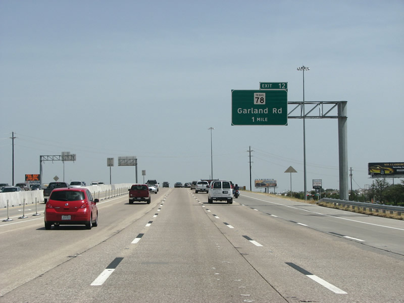 |
Garland Road, or SH 78, is the main route from Dallas to Garland. The arterial is very busy and begins down south at IH 30 near downtown. It continues north to downtown Garland. North of there, SH 78 continues north all the way to the Oklahoma state line and continues as OK 78. Photo taken 07/27/08. |
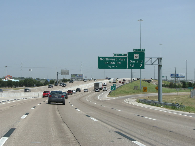 |
IH 635 southbound at SH 78. The exit here is only a half diamond, because of a railroad on the opposite side of the state highway. Navigating the local arterials here is fairly tricky, and long wait times at traffic lights are very common. Photo taken 07/27/08. |
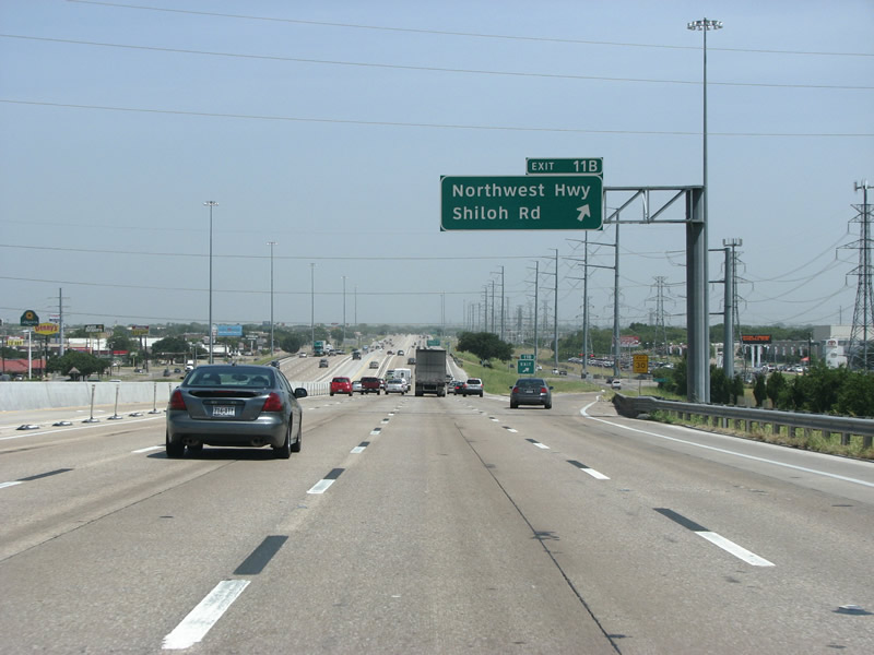 |
IH 635 southbound at Northwest Highway. NW Hwy is not a numbered route here, but runs west and forms the northern portion of Loop 12. It's a major road that sees the city's oldest mall and most upscale business district, Preston Center. NW Hwy continues east into Garland for a bit as Northwest Drive. Photo taken 07/27/08. |
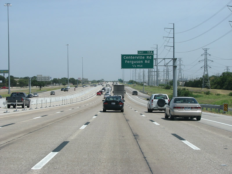 |
Large power lines sit to the west side of the freeway here in Garland as IH 635 nears Centerville/Ferguson. |
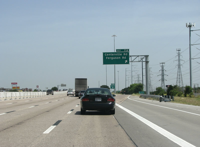 |
Like several preceding exits, Centerville changes names here to Ferguson, which runs south into Dallas. This forms the final exit in the city of Garland. Photo taken 07/27/08. |
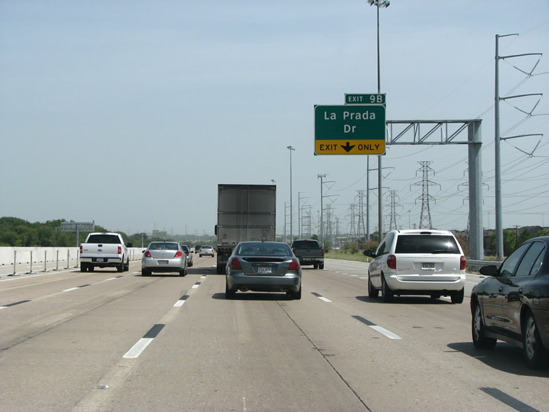 |
La Prada Dr is a short collector street that runs along the border between the suburbs of Mesquite and Garland. Photo taken 07/27/08. |
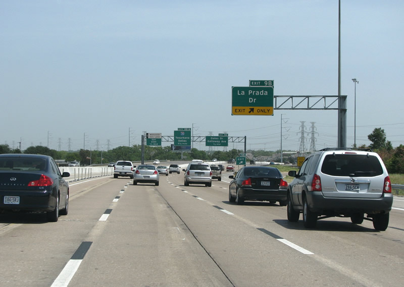 |
IH 635 southbound at La Prada Dr. No discussion of IH 635 would be complete without mentioning is local name, LBJ Freeway. The loop route was named by the city of Dallas after LBJ on October 2, 1961 ' while he was still vice president. The suburbs soon followed suit. The road is almost always locally referred to as 'LBJ'. Photo taken 07/27/08. |
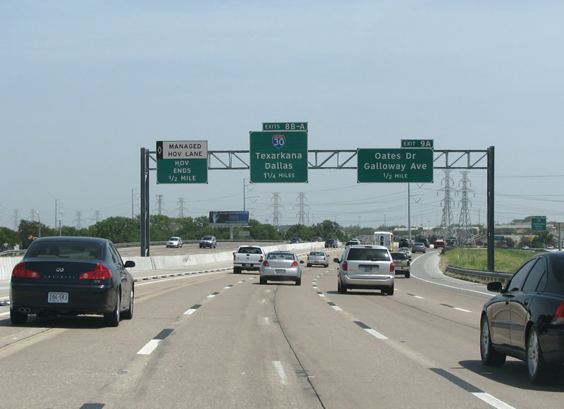 |
IH 635 southbound enters Mesquite with the first mentions of IH 30. Photo taken 07/27/08. |
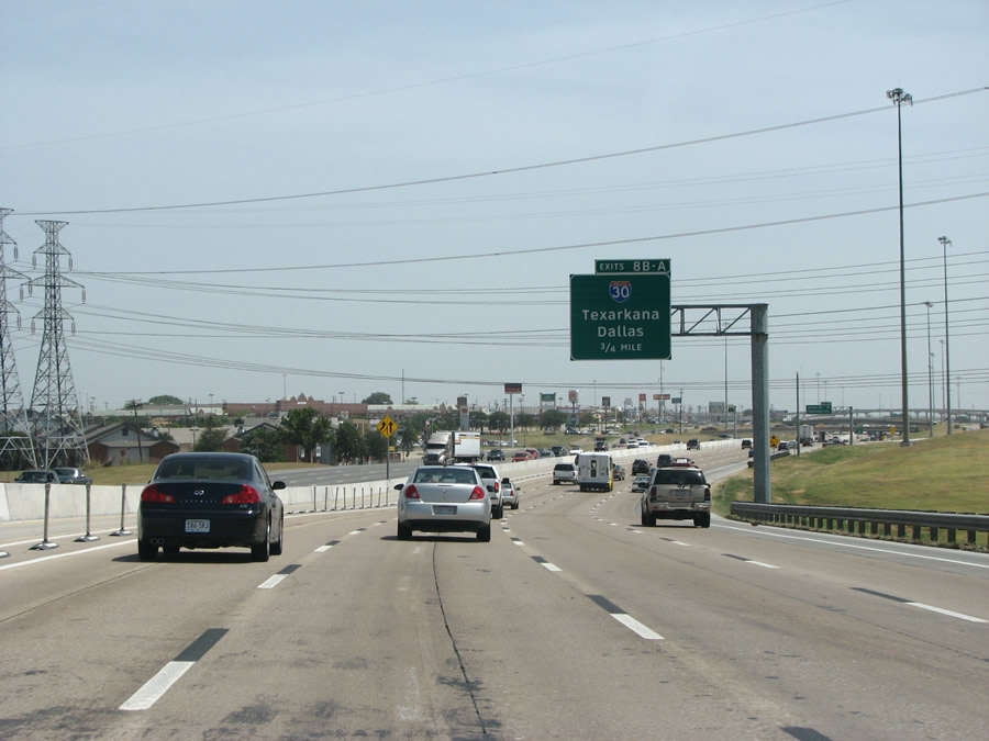 |
More mentions here of the upcoming IH 30 interchange, that freeway is locally known as 'RL Thornton', after a Dallas mayor. Photo taken 07/27/08. |
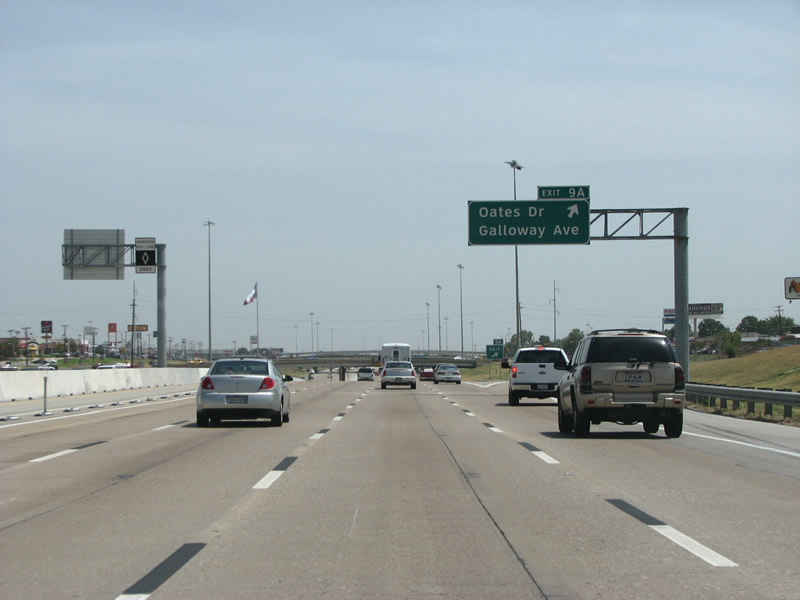 |
Oates Dr runs north into Garland, while Galloway runs south and forms the main arterial of Mesquite. Photo taken 07/27/08. |
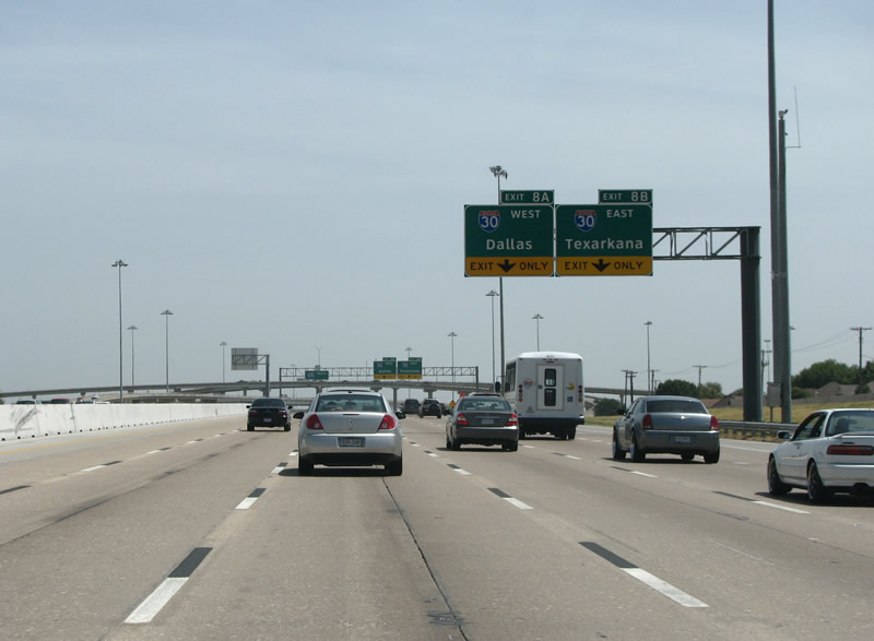 |
IH 30 is the first major junction in Mesquite, and the freeway gains some collector-distributor lanes from the end of the HOV to the left and the incoming traffic from Oates/Galloway. Photo taken 07/27/08. |
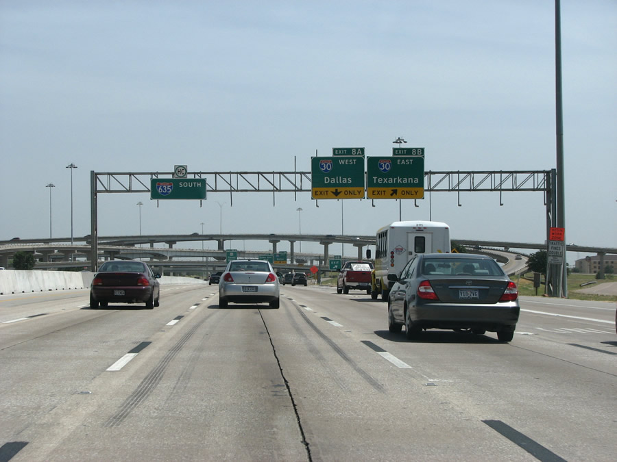 |
IH 30 runs into downtown Dallas as the RL Thornton Freeway. It continues west through Fort Worth to end in Parker County about 60 miles away. This junction marks the beginning of the congested Mesquite commercial district. Photo taken 07/27/08. |
 |
IH 635 southbound at IH 30 west. This stack opened in 1970 along with an almost identical stack at US 80 to the south. LBJ was opened between IH 30 and Military Parkway in Mesquite in an interesting ceremony. Clyde the cheetah, from Mesquite's newly opened World of Animals wildlife park, cut the ribbon by running through it. The ceremony, which took place on August 5, 1970, was slightly delayed as the cheetah kept jumping over the ribbon rather than through it. Photo taken 07/27/08. |
 |
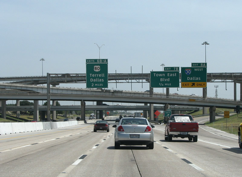
New weaved ramps are being put into place to address congestion from IH 30 and the Town East exit. Also, the freeway is being widened to 10 main lanes, up from 8, through here. Photo taken 07/27/08. |
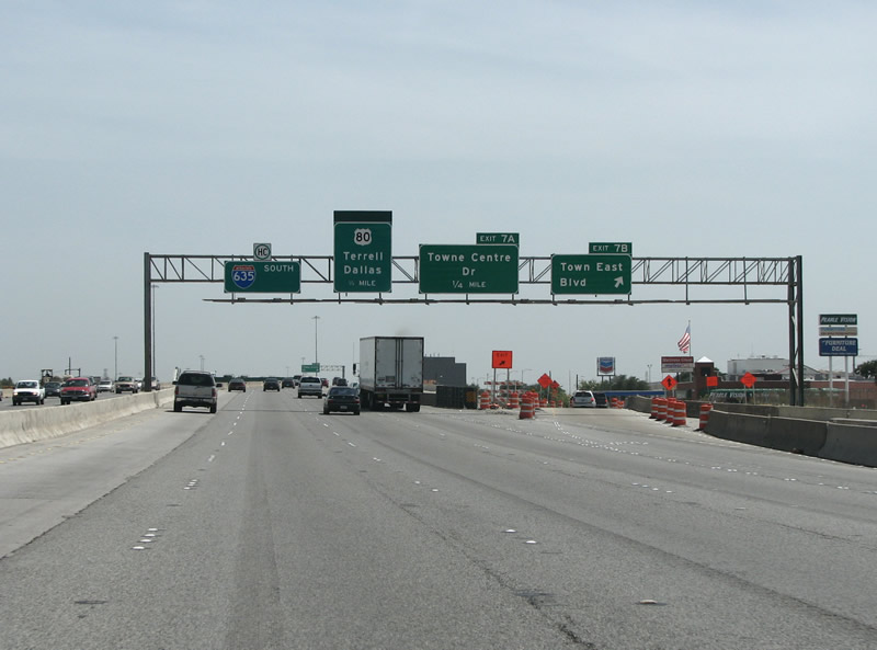 |
Town East Boulevard is Mesquite's main economic arterial. Formerly New Hope Road, it was renamed to spur development in 1968. Town East Mall, adjacent to the exit here, opened in 1970. Mesquite is the main commercial hub for eastern Dallas County and serves a wide ranging area extending far out to the rural east and north. Photo taken 07/27/08. |
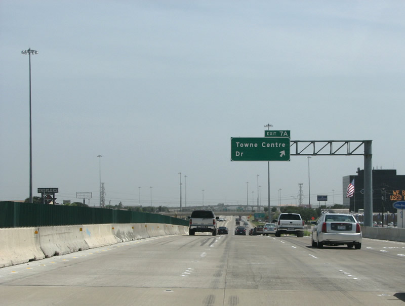 |
Towne Centre Dr is a short road that runs along the south side of the mall. The exit was added around 2001 to ease traffic congestion through here. Photo taken 07/27/08. |
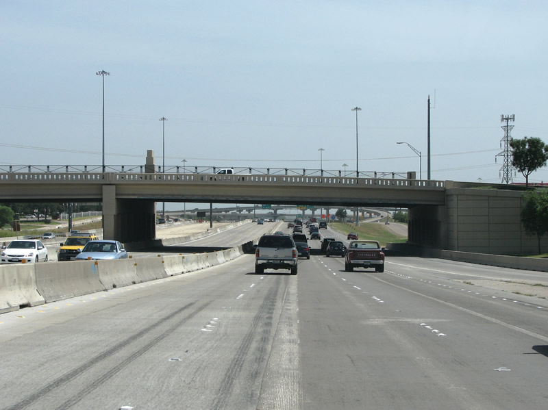 |
A view of the Towne Centre bridge, which differs from all the others along this 1970s era freeway. Photo taken 07/27/08. |
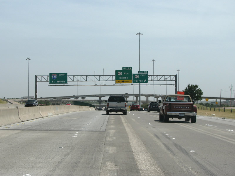 |
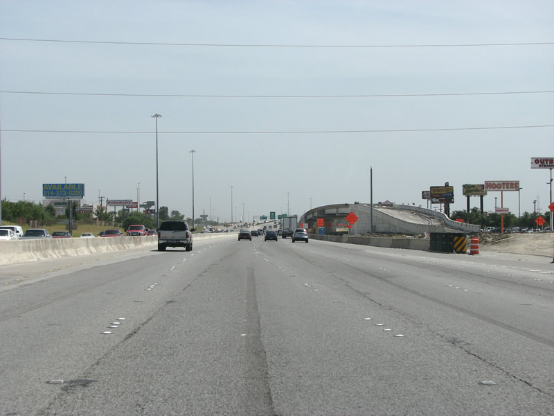
Fort Worth is a very odd choice for a control point here at US 80, Balch Springs or Hutchins would be a better representation of where most traffic goes through here. The US 80 stack was constructed in 1970. Photo taken 07/27/08. |
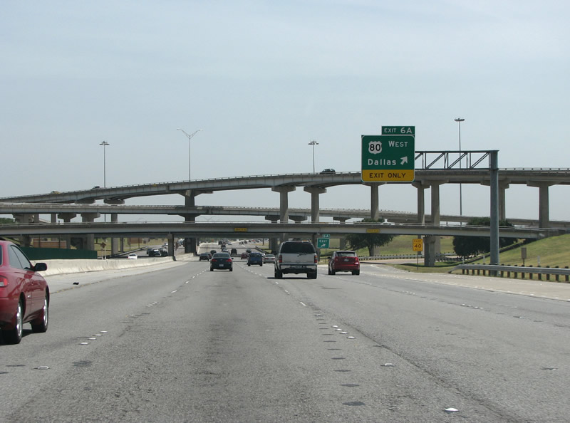 |
IH 635 southbound at US 80 west. US 80 is a freeway in Dallas County and is one of the few remaining in the area with only 4 lanes, it is scheduled to be rebuilt soon. US 80, once stretching west to California, now ends here in Mesquite just a few miles to the west. Photo taken 07/27/08. |
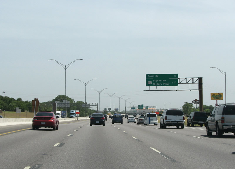 |
635 southbound before Gross Road in Mesquite. Traffic counts generally drop from this point southward, making this the least busiest section of the freeway ' although it's still pretty bad. Photo taken 07/27/08. |
 |
IH 635 southbound at Gross Rd in Mesquite (it is pronounced groh-ss, not grah-ss as some of the newbie traffic reporters might say). Mesquite's retail area extends southward to here. 635's frontage roads also end here, headed southbound. Fort Worth disappears here as a control point, too, thankfully. Photo taken 07/27/08. |
 |
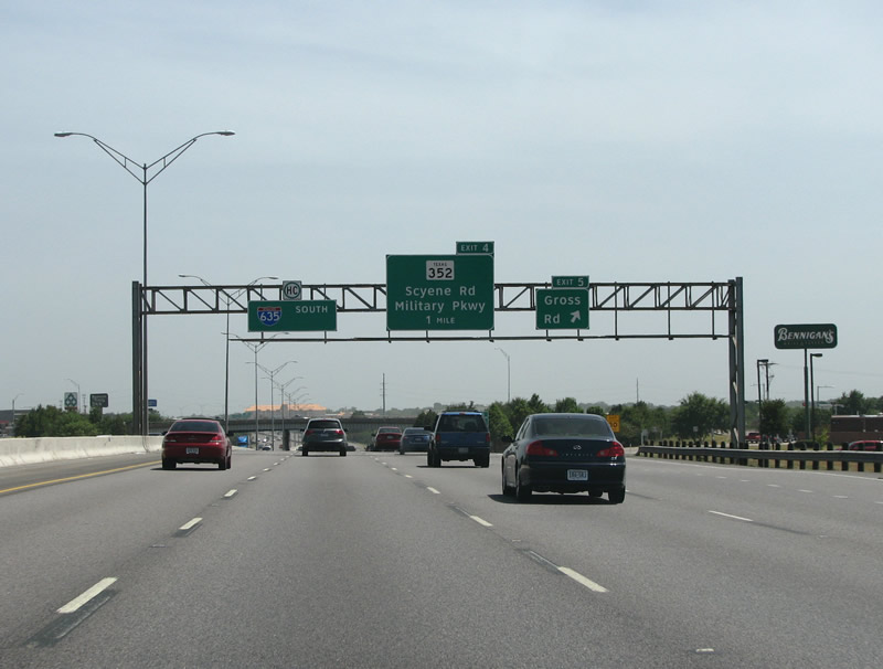
IH 635 southbound at SH 352, Military/Scyene (pronounced Sigh-EEN). This is an old routing of US 80 and eastbound traffic here will be headed into downtown Mesquite. Photo taken 07/27/08. |
 |
South of SH 352, IH 635 is occassionally signed as "to IH 20". The reason behind this is that until 1988, the two routes were overlapped here. When IH 20 was realigned, the tabs were changed to "to".Photo taken 10/19/03. |
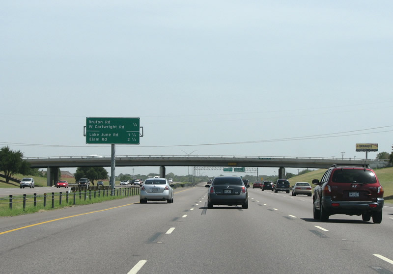 |
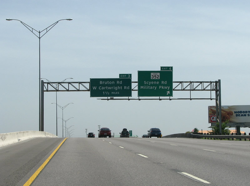
IH 635 southbound before Bruton/Cartwright. Photo taken 07/27/08. |
 |
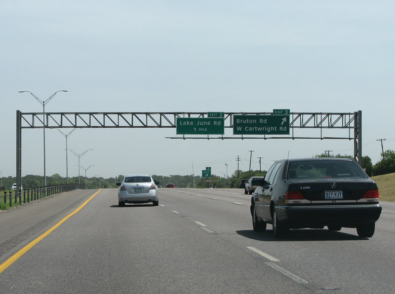 |
IH 635 southbound at Bruton Road. This marks the end of Mesquite and the beginning of the suburb of Balch Springs. In 2005, Bruton Rd was renamed Cartwright Rd east of this interchange, and the new signs reflect that. This marks yet another instance of roads changing names at IH 635. New Photo taken 07/27/08, old Photo taken 10/19/03. |
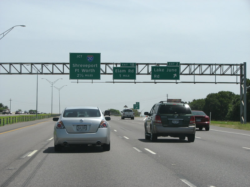 |
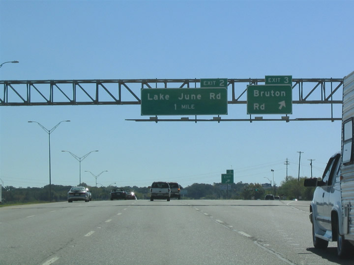
IH 635 southbound at Lake June Rd in Balch Springs. Lake June runs westbound into Dallas' large Pleasant Grove neighborhood. Local note: the Mexican Restaurant on the southwest corner was originally an animal hospital. Photo taken 07/27/08. |
 |
This view looks southbound into the suburb of Balch Springs. Photo taken 07/27/08. |
 |
 |
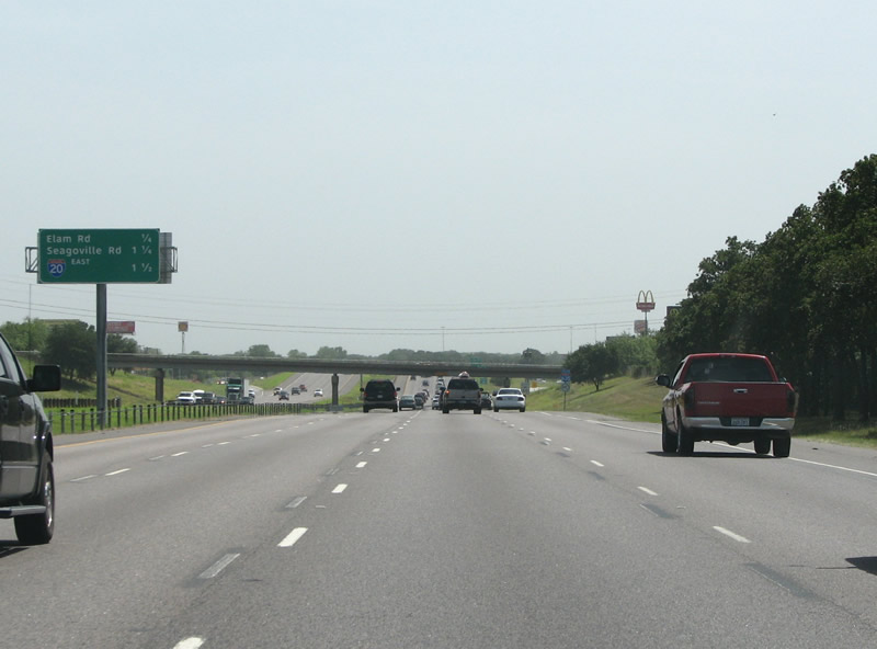
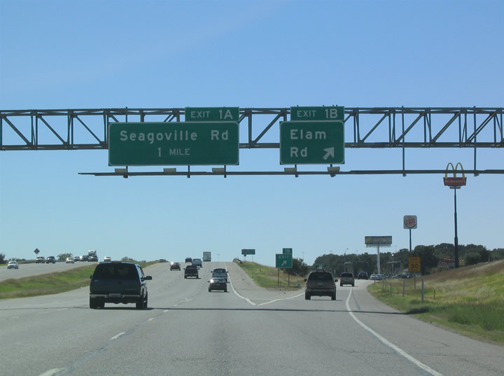
IH 635 southbound at Elam Rd (pronounced EE-lum) in Balch Springs. This exit primarily serves the blue collar suburb, with the city hall just off Elam to the east. Advance signage for Seagoville Road, which can be seen in the older photo, was missing by 2007. New Photo taken 07/27/08, old Photo taken 10/19/03. |
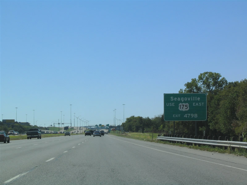 |
Seagoville is signed as an auxiliary control point for US 175 eastbound. The town is still very rural, for being so close via freeway to the city. Photo taken 10/19/03. |
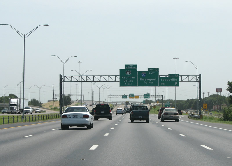 |
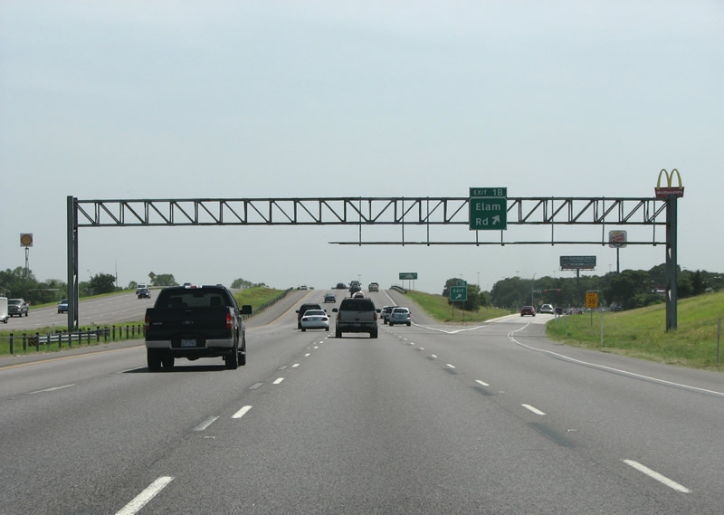
IH 635 southbound at Seagoville Road, just as it prepares to end. Seagoville Road winds its way southeast to the town of Seagoville, originally it was the main route out of Dallas to the southeast. In the 1940s it was replaced by a new alignment of US 175. Photo taken 07/27/08. |
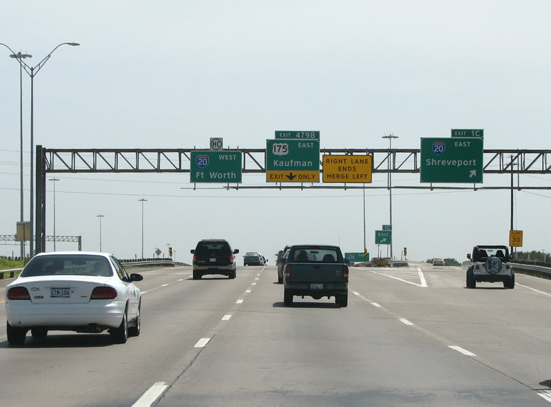 |
IH 635 ends southbound as IH 20 comes in from the east and US 175 comes in from the west. This interchange was constructed in 1987-1988 with IH 20's realignment west of Terrell. Photo taken 07/27/08. |
 |
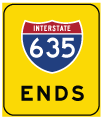
Yellow end banners mark the end of IH 635 in this advance signage in Balch Springs, just past Elam Rd. Photo taken 10/19/03. |
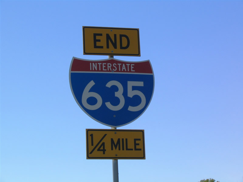 |
Another view of the 635 end sign and yellow banners. Photo taken 10/19/03. |
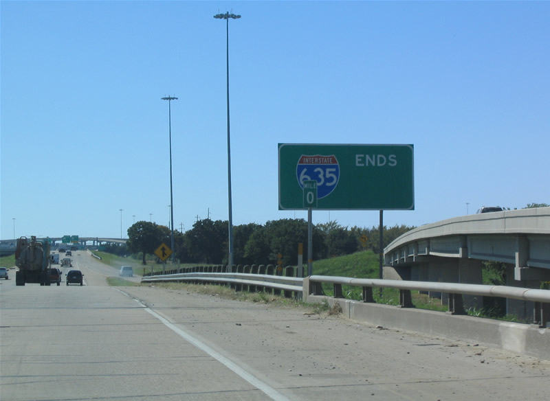 |
IH 635 ends southbound. IH 635 was truncated here in 1988, thus the reason for the large sign. Texas usually makes no distinction of road endings, but this end of IH 635 is very well signed due to its rather recent shortening. Photo taken 10/19/03. |
Page Updated August 21, 2008.
|
About Contact FAQ |
Spotlights Interstate Guide |
Social Media:
 |
|
© 2000-25 AARoads.com | All Rights Reserved | Privacy Policy / Terms of Use
|
||