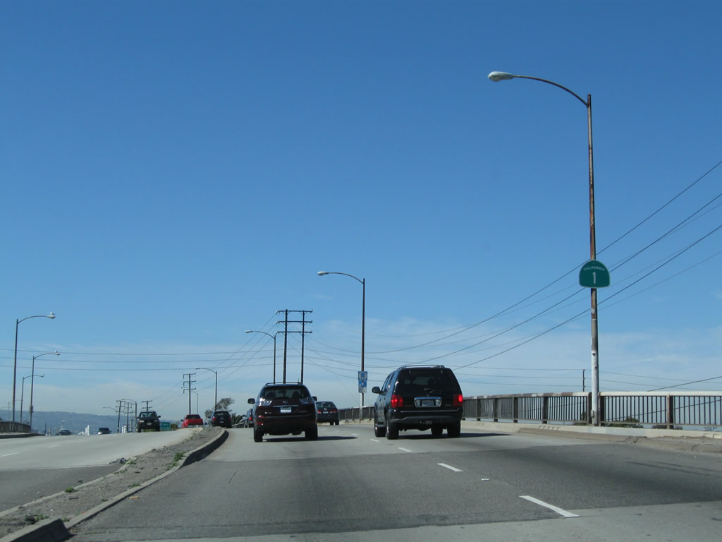
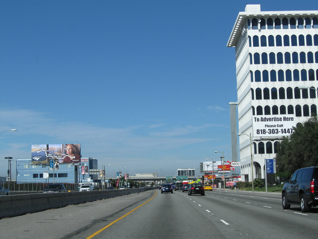
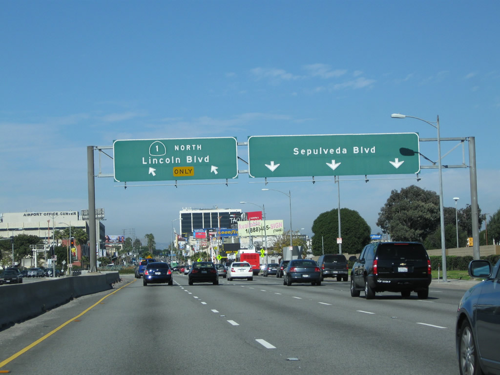
| California 1 (Pacific Coast Highway) north |
|
After First Street in Seal Beach, California 1 leaves Orange County and enters Los Angeles County and the city of Long Beach. Photo taken 02/26/11. |
|
Long Beach employes a unique marker for its bicycle route system. A map of the Long Beach city bike routes can be found at Bike Long Beach.org. Long Beach Bike Route 85 travels north along the San Gabriel River bike path. Photo taken 02/26/11. |
|
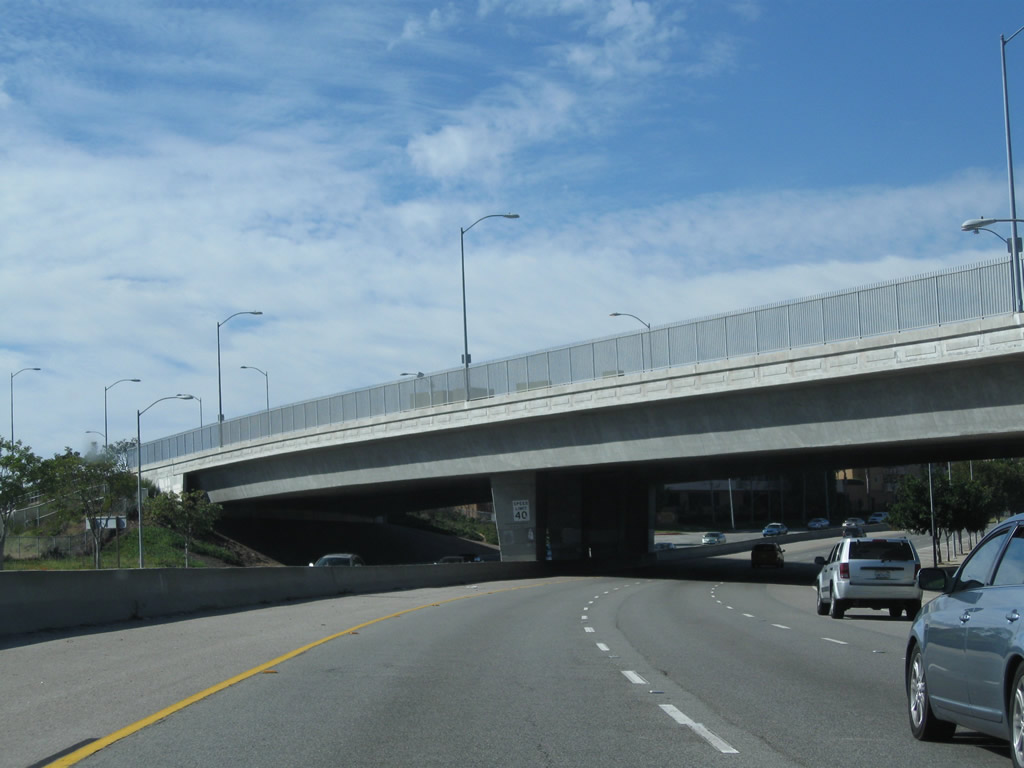
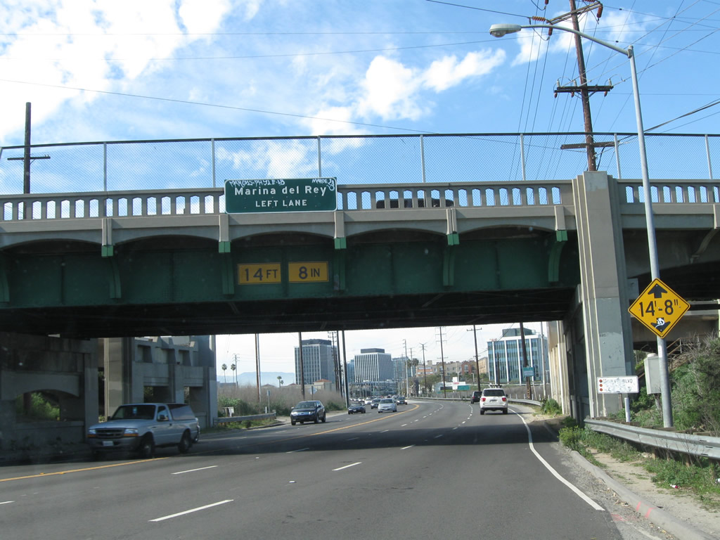
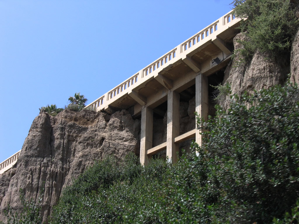
A 1931 bridge carries California 1 over the San Gabriel River. This bridge was widened to its current width in 1962. Photo taken 02/26/11. |
|
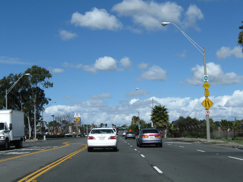
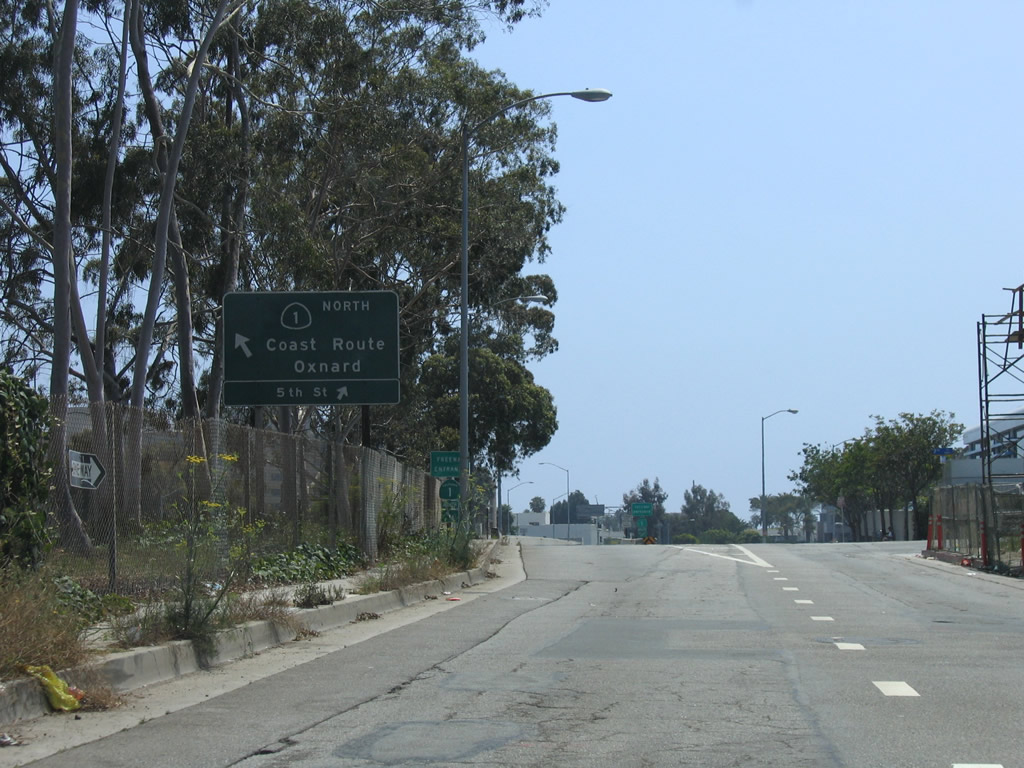
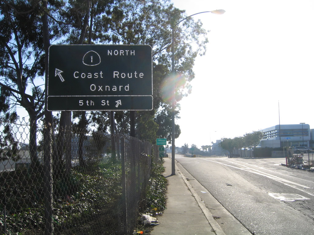
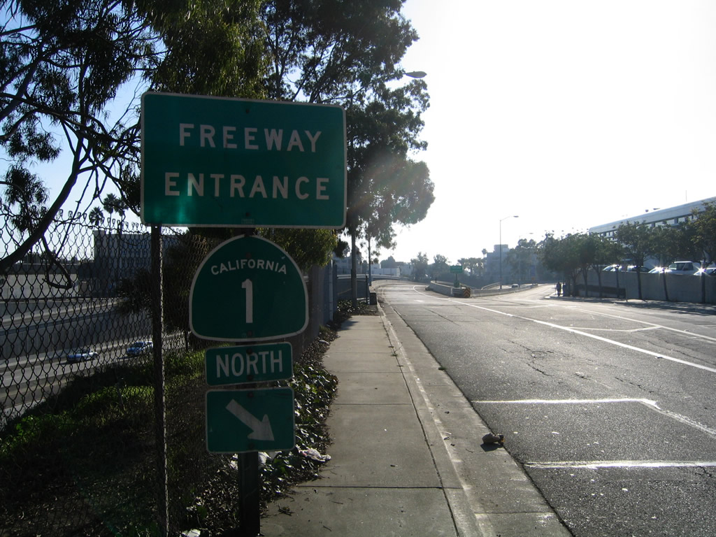
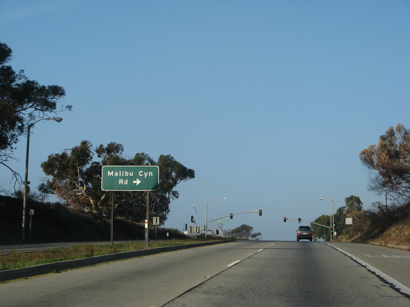
Northbound California 1 approaches and meets Studebaker Road at this intersection. This section is not contiguous with the main section of Studebaker Road. To access that section, continue north on California 1 to Second Street, then turn right east. Studebaker Road proceeds north from Second Street to California 22 east, Interstate 605 north, or Interstate 405. While we are on California 1 in Long Beach, the Long Beach Bike Route 1 signs are much more common than state route reassurance shields. Photo taken 02/26/11. |
|
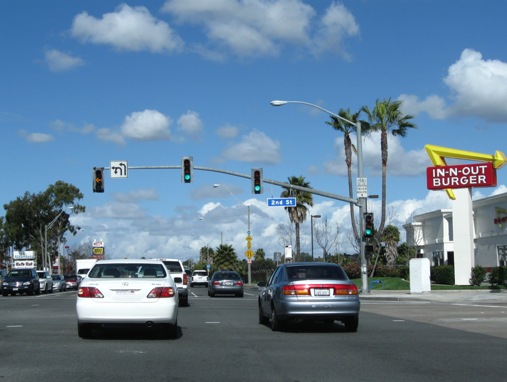
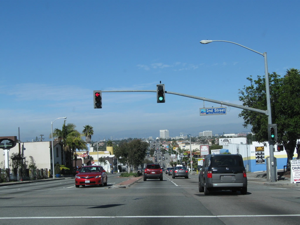
Northbound California 1 meets Second Street, which travels east to connect to Studebaker Road north. Photo taken 02/26/11. |
|
Long Beach Bike Route 1 basically follows the route of California 1 through Long Beach. Photo taken 02/26/11. |
|
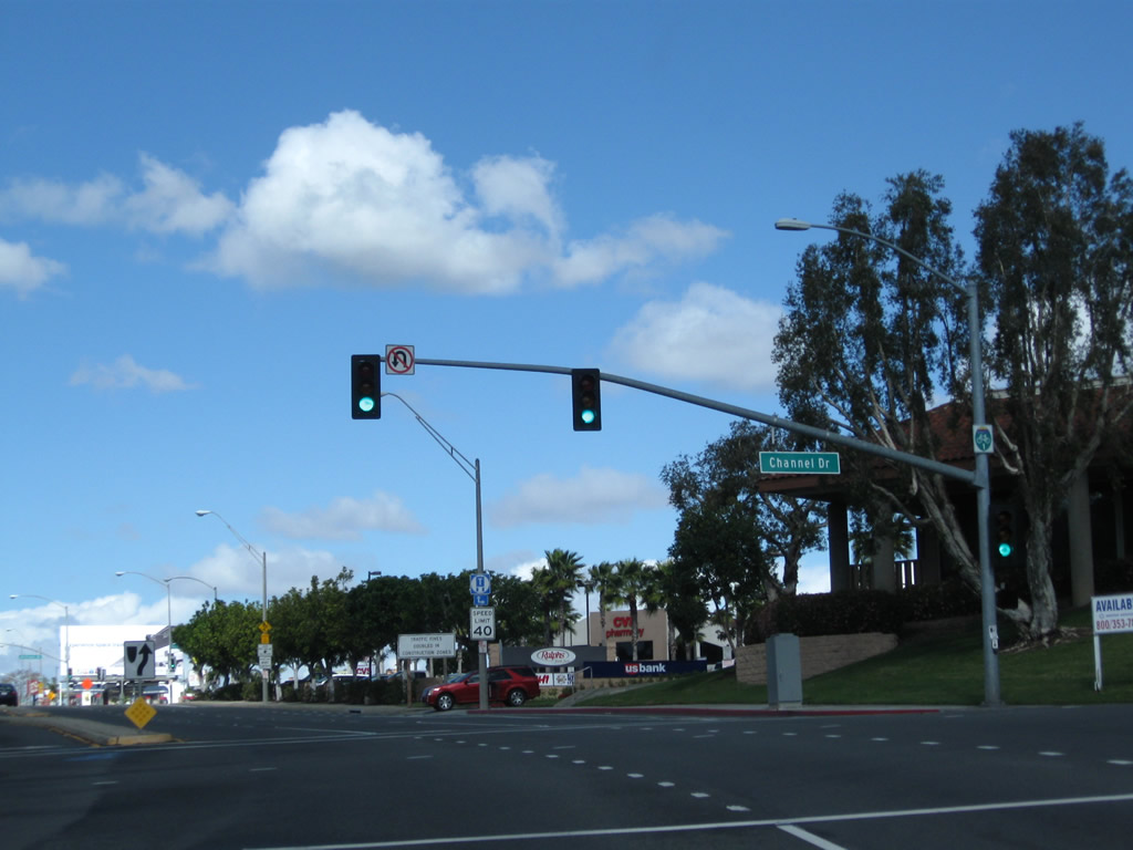
Northbound California 1 meets Channel Drive. The next turnoff connects California 1 north to California 22 east to Garden Grove. Photo taken 02/26/11. |
|
A truck regulation sign is the only indication that California 1 north is approaching California 22. Use Bellflower Boulevard (next intersection) to connect to California 22 east. Photo taken 02/26/11. |
|
Northbound California 1 approaches Bellflower Boulevard. Use Bellflower Boulevard north to California 22 (Seventh Street) east to Interstate 405 and Garden Grove. Photo taken 02/26/11. |
|
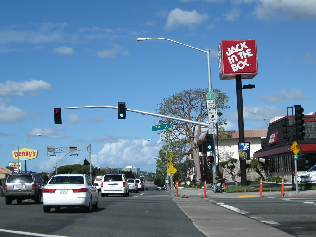
Quickly thereafter, northbound California 1 meets California 22 (Seventh Street). This intersection marks the western terminus of California 22, which extends east from Long Beach to Garden Grove and Santa Ana before ending in Orange. California 55 serves as the eastern terminus. Photo taken 02/26/11. |
|
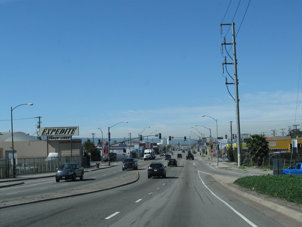
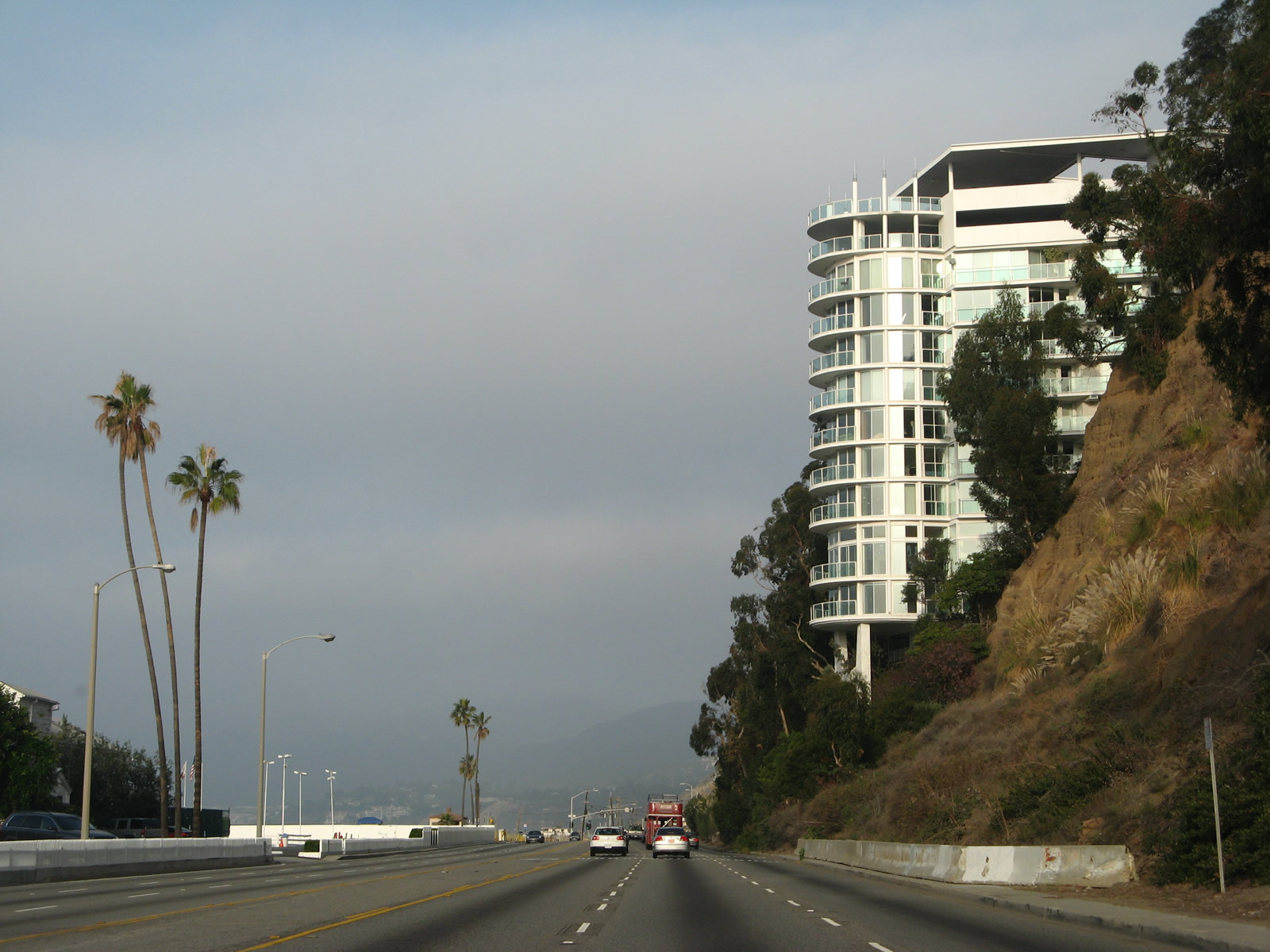
Leaving the intersection with California 22 (Seventh Street) in the city of Long Beach, northbound California 1 (Pacific Coast Highway [PCH]) proceeds northwest past California State University at Long Beach. The university campus is generally located east of California 1, south of Interstate 405, and north of California 22. Photo taken 02/13/11. |
|
California 1 (Pacific Coast Highway) carries two lanes in each direction with a center median and alternating turn lanes. Photo taken 02/13/11. |
|
Many students of California State University at Long Beach live in Long Beach and other nearby communities. Photo taken 02/13/11. |
|
Most residential development is located off this section of California 1, allowing for fewer intersections. Photo taken 02/13/11. |
|
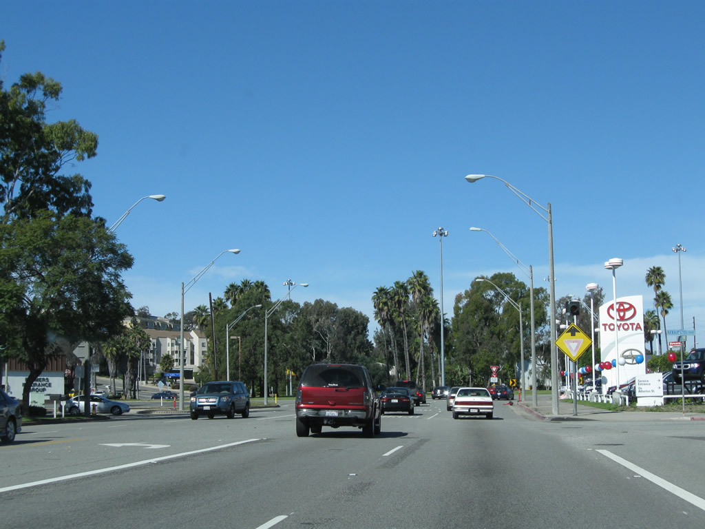
The next intersection along California 1 north is with Anaheim Street. On the southwest side of California 1 is a municipal golf course. Photo taken 02/13/11. |
|
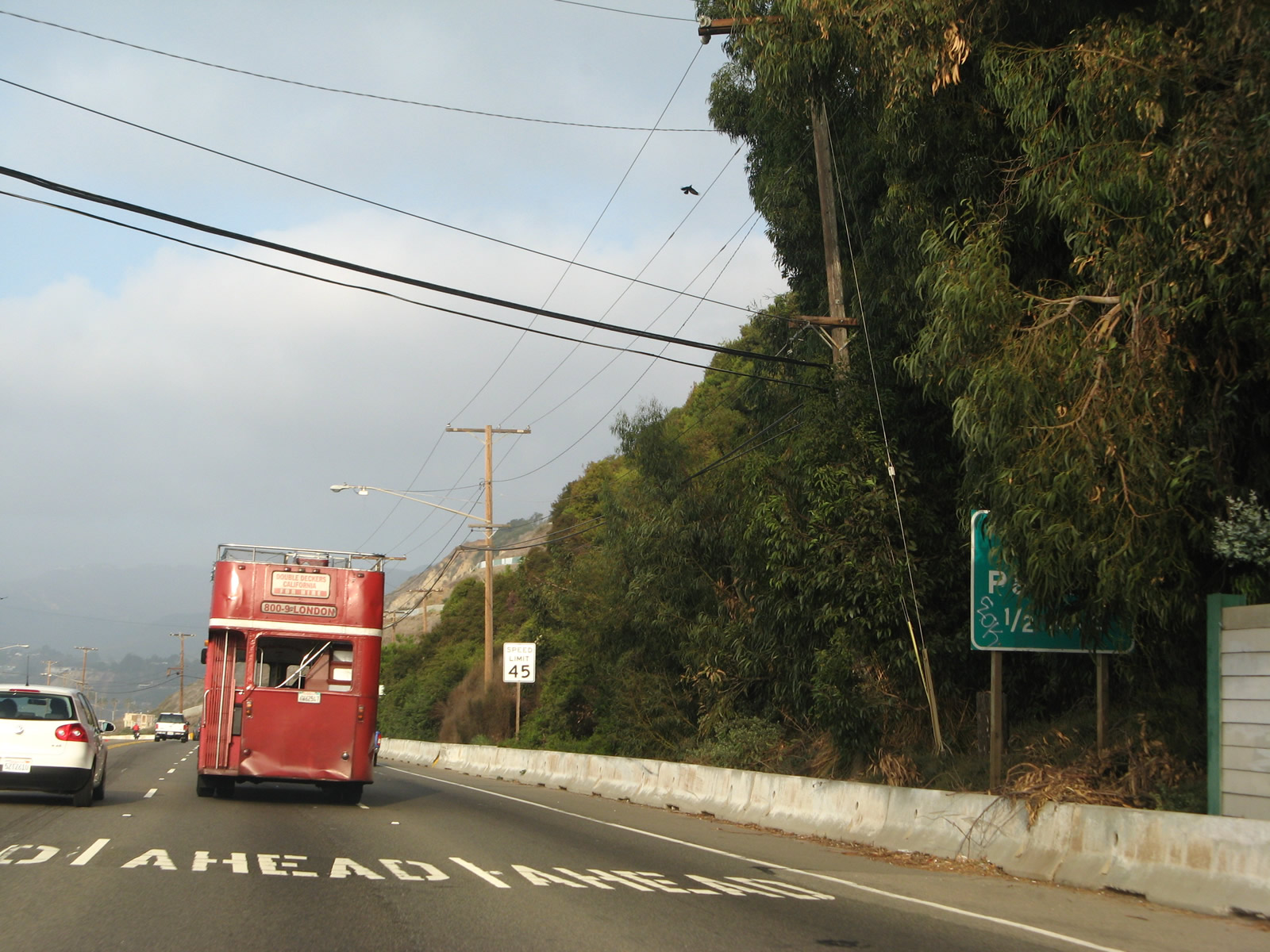
Long Beach city bike route signs mark major bike routes through the city. The Pacific Coast Highway route is aptly designated as Bike Route 1. Signs for the bike route are posted, even though a reassurance shield for California 1 should be here and is missing. Photo taken 02/13/11. |
|
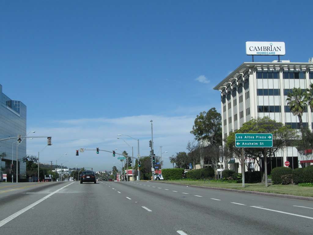
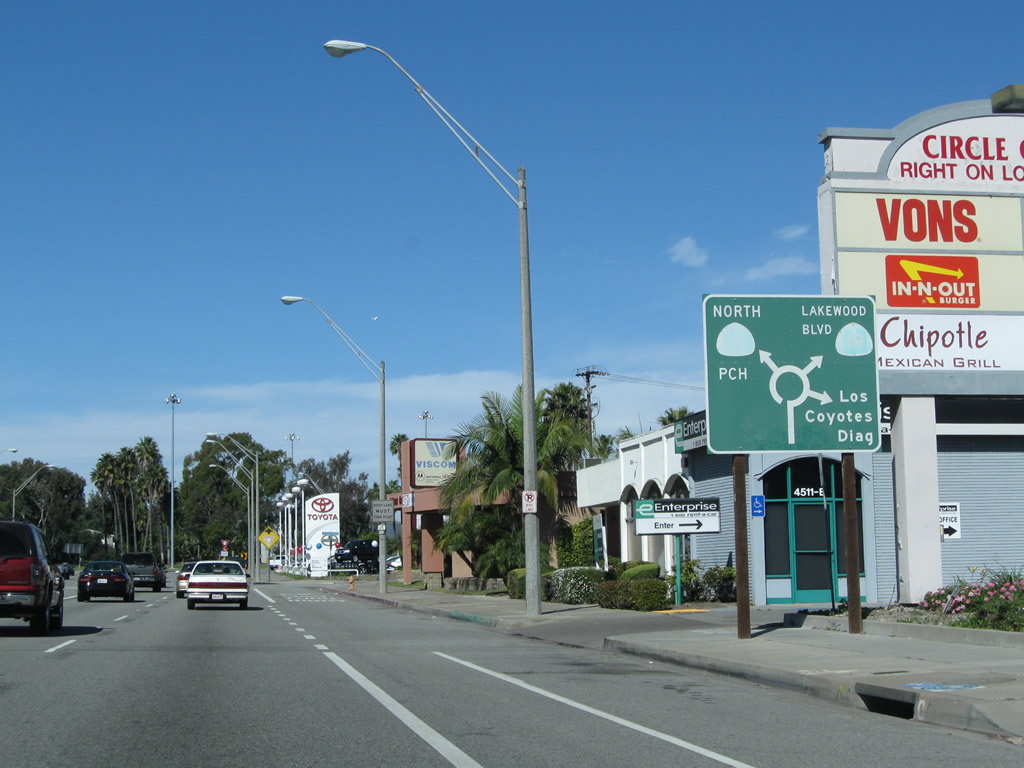
After the Clark Avenue intersection, a large sign is posted advising motorists of the upcoming Los Alamitos Traffic Circle, which was built in 1930 and converted to a modern style roundabout in 1993. The roundabout has four directions: California 1 northwest, California 1 southeast, California 19 (Lakewood Boulevard) north, and Los Coyotes Diagonal northeast. Photo taken 02/13/11. |
|
After the traffic signal with Ximeno Avenue, this diagrammatical sign indicates the movements available when using the Los Alamitos Traffic Circle. Proceeding north through the traffic circle, the first right connects to Los Coyotes Diagonal, followed by California 19 (Lakewood Boulevard) and U.S. 91 north and California 1 (Pacific Coast Highway) northwest. Click here to see the traffic circle in Google Maps. Photo taken 02/13/11. |
|
|
|
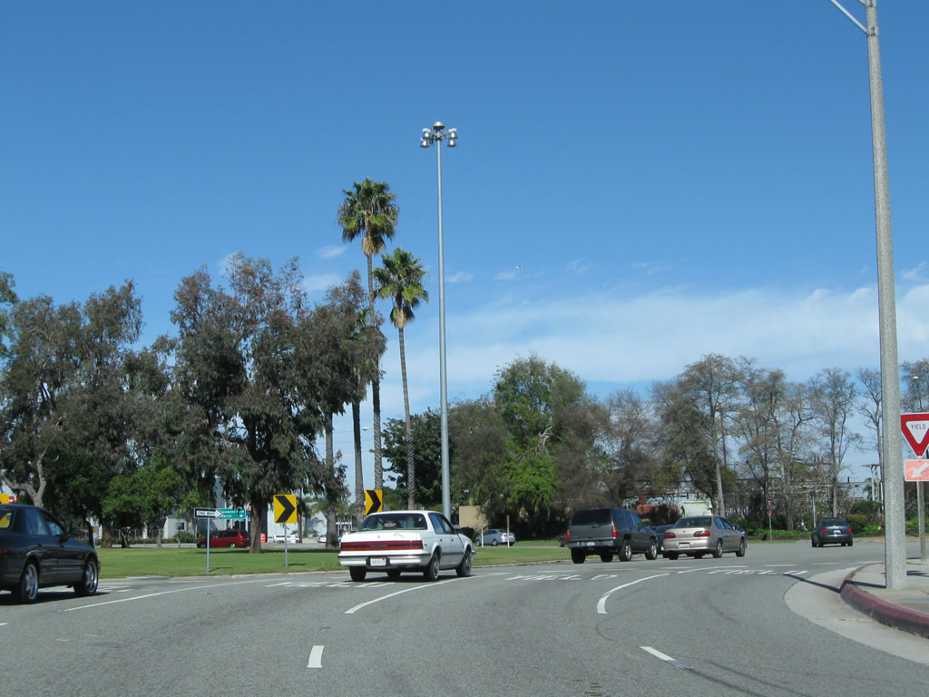
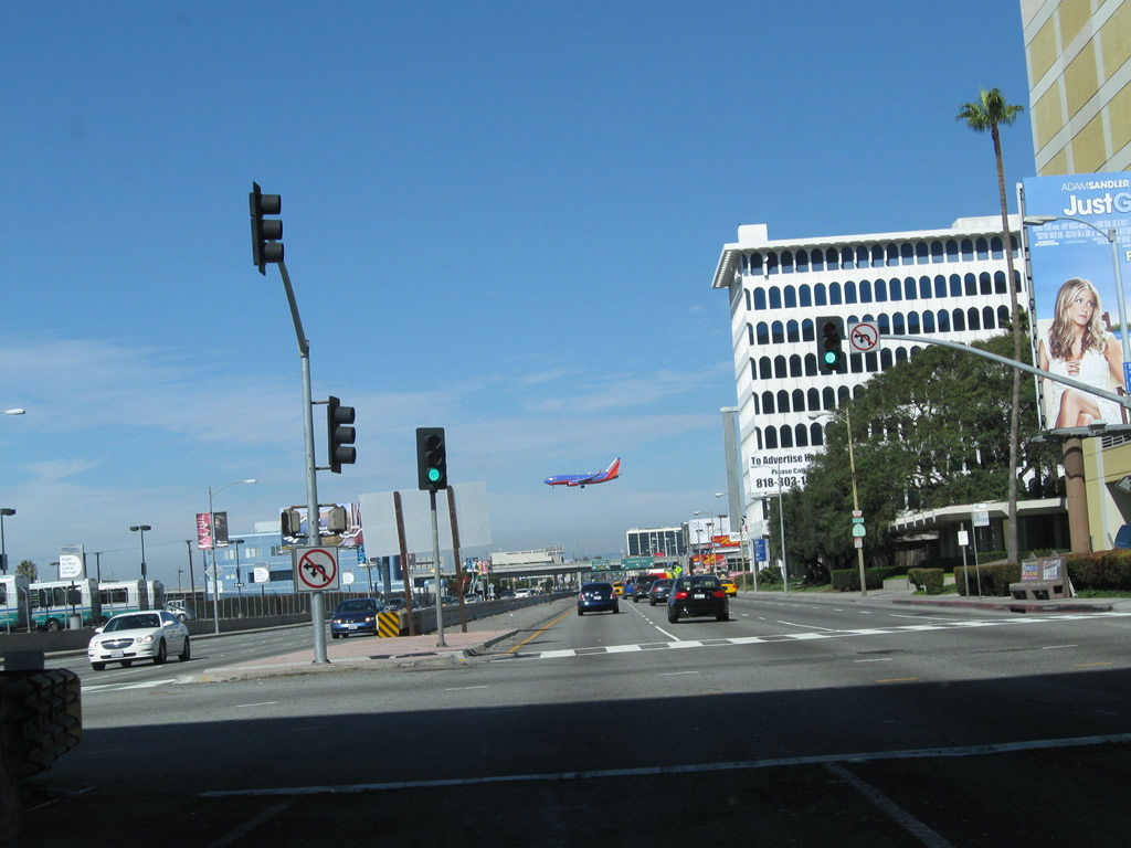
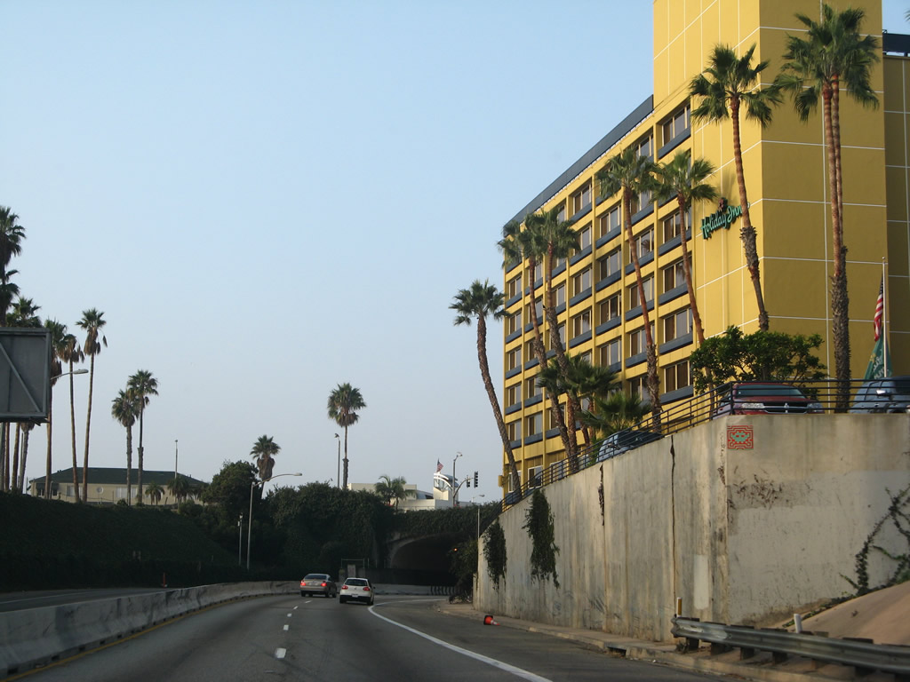
Northbound California 1 (Pacific Coast Highway) approaches and enters the Los Alamitos Traffic Circle (first intersecting Outer Traffic Circle before entering the actual roundabout). Several high mast lights are located within the turf traffic circle. The City of Long Beach maintains the landscaping within the traffic circle, while the state maintains the roadway passing through the circle. Contrary to popular belief, this traffic circle did not serve as the historic termini for U.S. 6 and U.S. 91; that honor is reserved for the intersection between Pacific Coast Highway and Atlantic Avenue west of here. Photos taken 02/13/11. |
|
|
|
Within Los Alamitos Traffic Circle, the first right connects to Los Coyotes Diagonal, which travels northeast to Bellflower. The second right connects to California 19 (Lakewood Boulevard) north to Downey. California 19, which follows Lakewood Boulevard and Rosemead Boulevard between California 1 and Interstate 210, is gradually being decommissioned to local control. The section of Lakewood Boulevard within Long Beach city limits has been transferred to the city, and most signage for California 19 has been removed as a result. At this point, Historic U.S. 91 comes from the north via Lakewood Boulevard to join California 1 northwest. Photos taken 02/13/11. |
| California 1 (Pacific Coast Highway) north and Historic U.S. 91 south |
|
California 1 north and U.S. 91 south exit the traffic circle at the next turnoff. The two routes used to share alignment between Los Alamitos Traffic Circle and Atlantic Avenue until 1964, when U.S. 91 was decommissioned. U.S. 91 may have continued all the way to theLong Beach Freeway (former California 15 and former California 7). Photo taken 02/13/11. |
|
Three lanes carry California 1 northwest out of the traffic circle. Photo taken 02/13/11. |
|
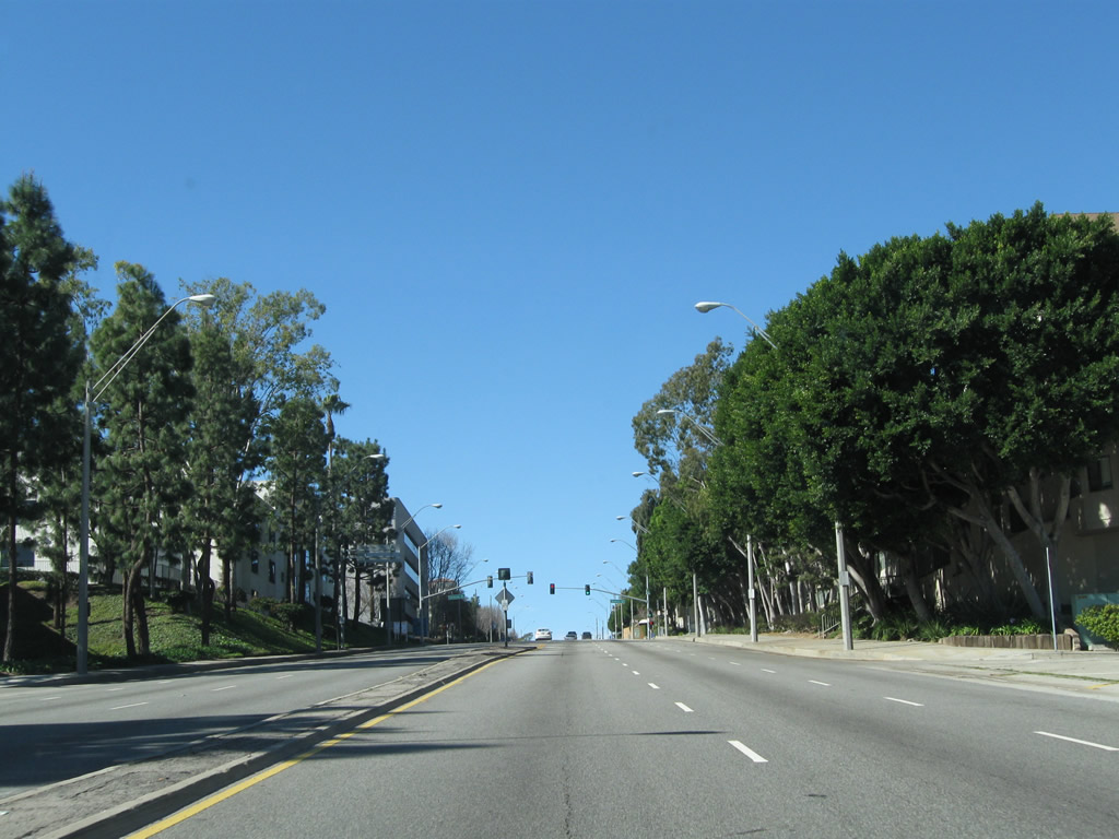
It is all uphill from the traffic circle to Termino Avenue. Photo taken 02/13/11. |
|
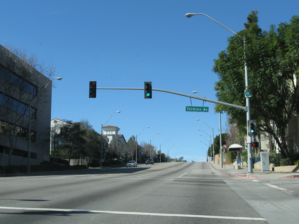
Northbound California 1 (and southbound Historic U.S. 91) meet Termino Avenue at this traffic signal in Long Beach. Photo taken 02/13/11. |
|
Turn right here for Reservoir Drive for a cutoff to Redondo Avenue. At this intersection, California 1 becomes the dividing line between the city of Long Beach to the south and the city of Signal Hill to the north. Signal Hill, an enclave which is entirely surrounded by the city of Long Beach, was incorporated on April 22, 1924, and had a population of 9,333 as of the 2000 Census. Just prior to Cherry Avenue (not pictured), California 1 reenters Long Beach solely. Photo taken 02/13/11. |
|
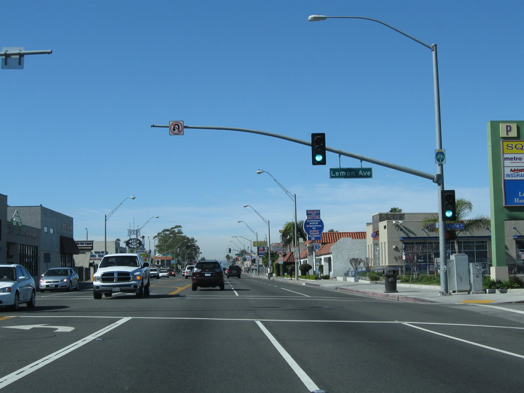
Skipping ahead about 1.5 miles from Redondo Avenue, northbound (westbound) California 1 (Pacific Coast Highway) approaches Lemon Avenue at this traffic signal, just after the intersection with Orange Avenue and Alamitos Avenue in Long Beach. Photo taken 02/13/11. |
|
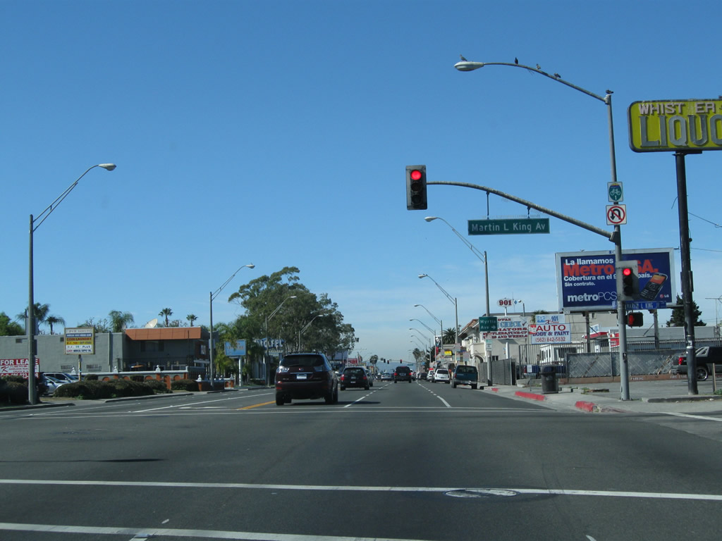
Shortly thereafter, northbound (westbound) California 1 (Pacific Coast Highway) meets Martin Luther King, Jr. Avenue at this signalized intersection (next to Long Beach Polytechnic High School). Photo taken 02/13/11. |
|
The next right turn connects to Myrtle Avenue. Photo taken 02/13/11. |
|
Historic U.S. 91 approaches its southern terminus at Atlantic Avenue. From 1932 until its elimination in 1964, U.S. 91 started at the intersection of Pacific Coast Highway and Atlantic Avenue in Long Beach. The U.S. highway followed California 1 (Pacific Coast Highway) east to the Los Alamitos Traffic Circle, turned north via Lakewood Boulevard to Carson Street, then turned east on Carson Street, which changes into Lincoln Avenue and eventually entered the Santa Ana Canyon on a route closely paralleled by today's California 91 (Riverside Freeway) en route to Riverside and San Bernardino, then northeast toward Las Vegas. Many sections of old U.S. 91 remain intact for traveling today, including this segment. Photo taken 02/13/11. |
|
Northbound (westbound) California 1 (Pacific Coast Highway) meets Atlantic Avenue, which is the former alignment of California 15. It is no longer a state route. Turn left here to follow Atlantic Avenue south to downtown Long Beach and waterfront attractions. At this point, Historic U.S. 91 meets its southern terminus (although U.S. 91 may have briefly extended as far west as the current Interstate 710 interchange briefly before U.S. 91 was decommissioned). However, this intersection also serves as the western terminus of U.S. 6. Formerly a transcontinental route, U.S. 6 proceeds west along with California 1 from this intersection to Figueroa Street (later the Harbor Freeway), then turned north toward downtown Los Angeles and points northeast. Photo taken 02/13/11. |
| California 1 (Pacific Coast Highway) north and U.S. 6 east |
|
Leaving the Atlantic Avenue intersection behind, northbound California 1 (Pacific Coast Highway) and eastbound (northbound) U.S. 6 proceed almost due west through Long Beach. While U.S. 6 is not acknowledged with historic markers in Long Beach (yet), there is a plaque commemorating the route located near the Long Beach Convention Center in downtown Long Beach. See U.S. 6 for more on this plaque. Photo taken 02/13/11. |
|
Westbound California 1 meets Long Beach Boulevard at this traffic signal. The Metro Blue Line uses the median of Long Beach Boulevard for its light rail service that connects Union Station in downtown Los Angeles with a terminal in downtown Long Beach. Photo taken 02/13/11. |
|
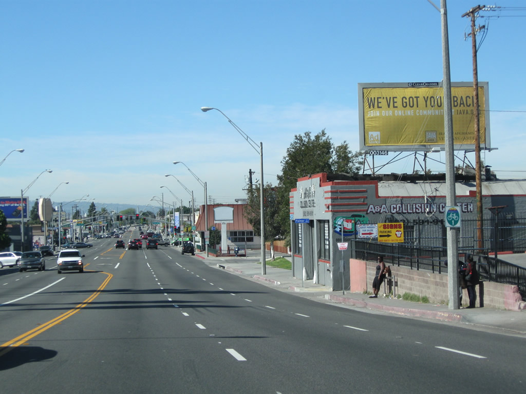
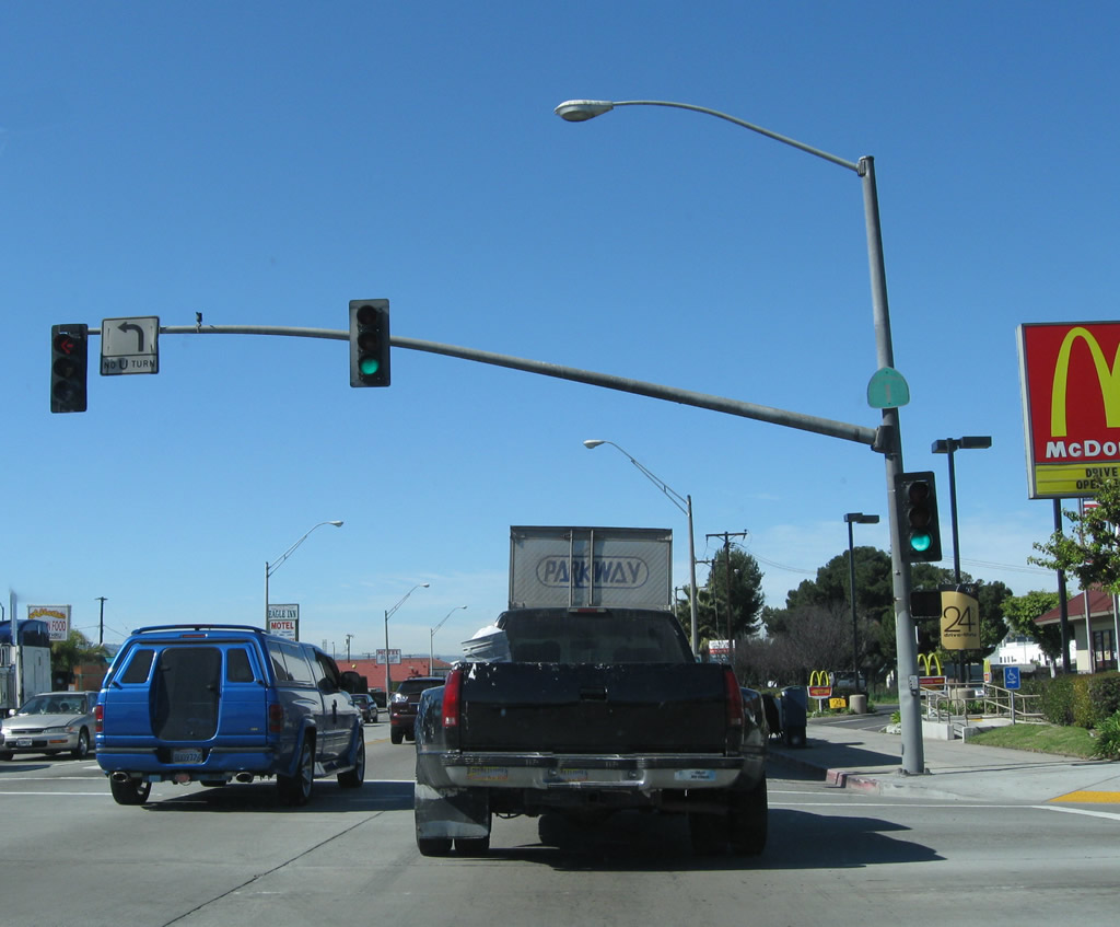
A bike route sign is posted rather than a California 1 route marker after Long Beach Boulevard. Photo taken 02/13/11. |
|
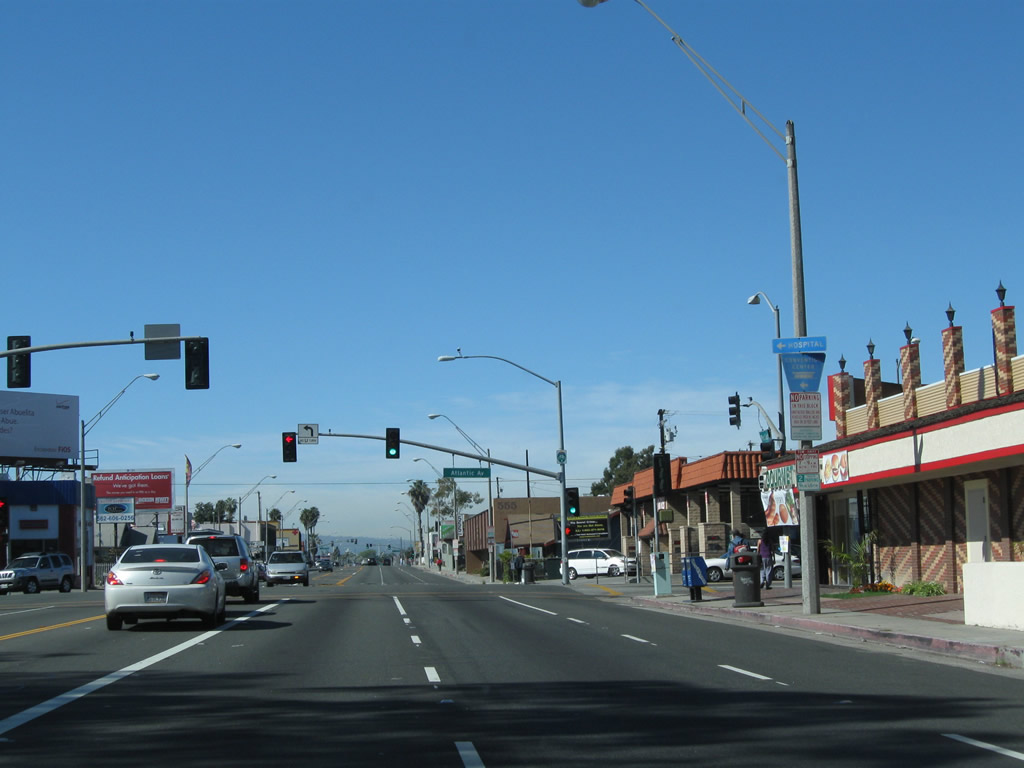
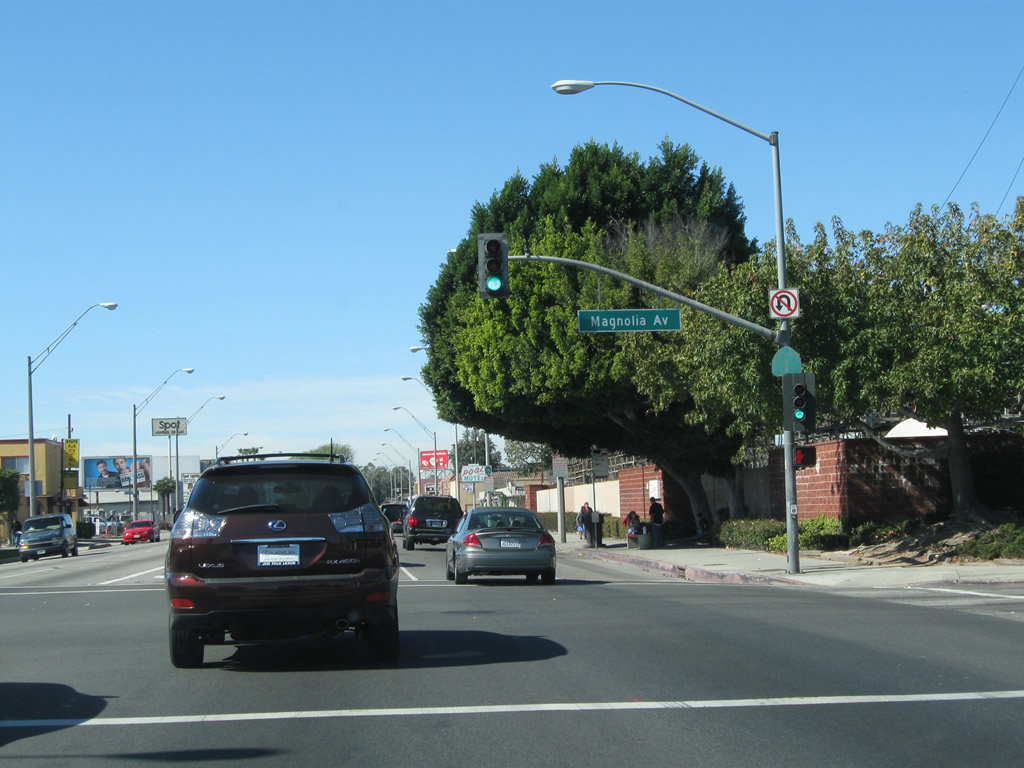
An Interstate 710 trailblazer is posted on northbound (westbound) California 1 prior to the signalized intersection with Magnolia Avenue. Photo taken 02/13/11. |
|
A California 1 reassurance shield is posted on the traffic signal pole at the point where Pacific Coast Highway meets Magnolia Avenue in Long Beach. Photo taken 02/13/11. |
|
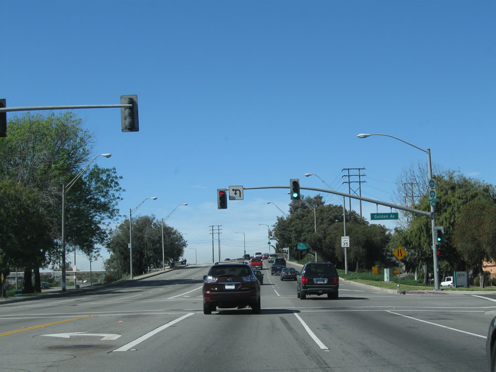
Northbound (westbound) California 1 meets Golden Avenue at this traffic signal. Turn right here to connect to Long Beach Bike Route 7, which follows the Los Angeles River. It might be a coincidence that Long Beach's Bike Route 7 more or less follows Interstate 710, which was formerly known as California 7. Photo taken 02/13/11. |
|
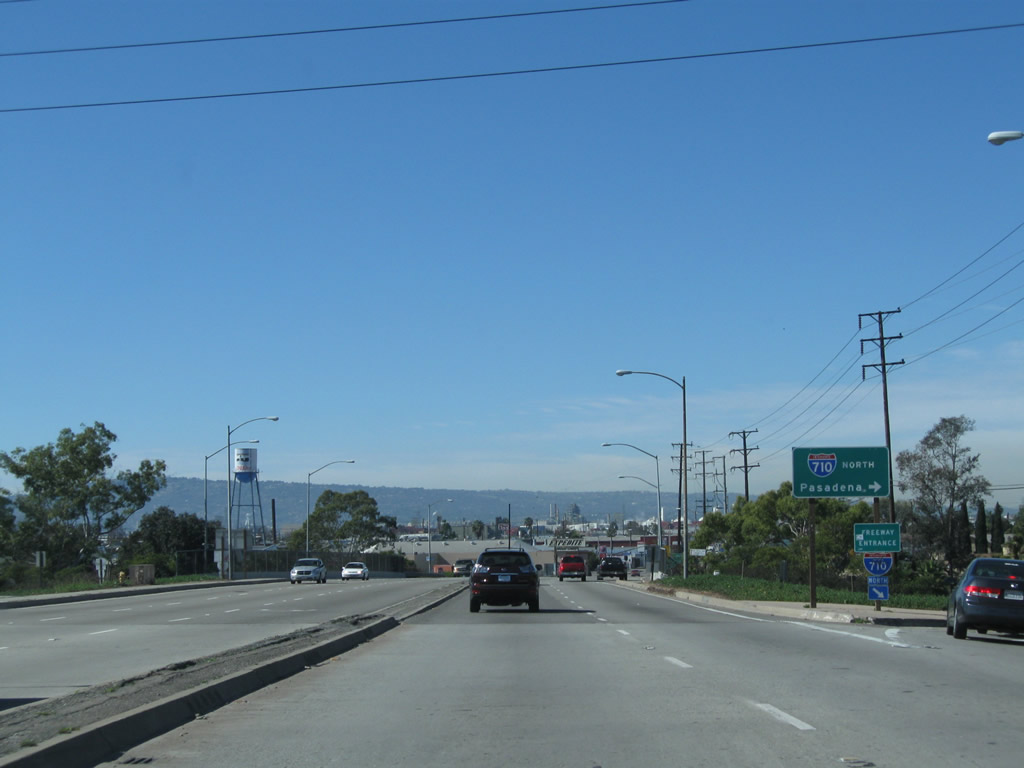
Speaking of Interstate 710, the next interchange along California 1 is with Interstate 710 (Long Beach Freeway). California 1 first gains elevation to cross over the Los Angeles River, then meets a full cloverleaf interchange with busy Interstate 710. This freeway, which was built as California 15, renumbered as California 7 in 1964, and renumbered again as Interstate 710 in 1983 once the Long Beach Freeway was added to the Interstate Highway System. Interstate 710 is an important truck route connecting the Ports of Long Beach and Los Angeles with Interstate 10 and Interstate 5. Photo taken 02/13/11. |
|
A California 1 reassurance shield is posted on the bridge that carries Pacific Coast Highway over the Los Angeles River. Despite its name, the Pacific Coast Highway stays pretty far inland, avoiding downtown Long Beach and the ample beach strand that gives Long Beach its name. Take Interstate 710 south to downtown, the beach, and waterfront attractions (including the Aquarium of the Pacific and Queen Mary). Photo taken 02/13/11. |
|
Northbound California 1 (and U.S. 6) meets Interstate 710 (Long Beach Freeway) north to downtown Los Angeles, points north (Sacramento) via Interstate 5, and points east (Phoenix) via Interstate 10. Photo taken 02/13/11. |
|
California 1 passes over Interstate 710 on a separate bridge. Photo taken 02/13/11. |
|
A loop ramp connects California 1 north (and U.S. 6 north) with Interstate 710 south to the Port of Long Beach, Queen Mary, and Downtown Long Beach. Photo taken 02/13/11. |
|
The next signalized intersection along California 1 north (west) is with Harbor Avenue. Photo taken 02/13/11. |
|
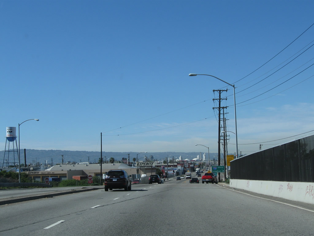
This Long Beach Bikeway Route 3 is posted on northbound California 1 and U.S. 6 prior to the intersection with Santa Fe Avenue. Photo taken 02/13/11. |
|
Northbound California 1 and U.S. 6 meets Santa Fe Avenue at this traffic signal. Photo taken 02/13/11. |
|
|
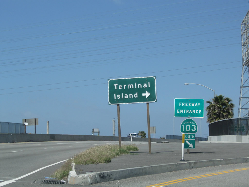
Northbound California 1 (Pacific Coast Highway [PCH]), which actually travels due west through here, passes through a cloverleaf interchange with California 103 (Terminal Island Freeway). The first ramp at this interchange links California 1 north with California 103 north. From this interchange, California 103 proceeds north to its end at Willow Street, which changes into Sepulveda Boulevard upon entering the city of Los Angeles. Photos taken 05/02/10. |
|
|
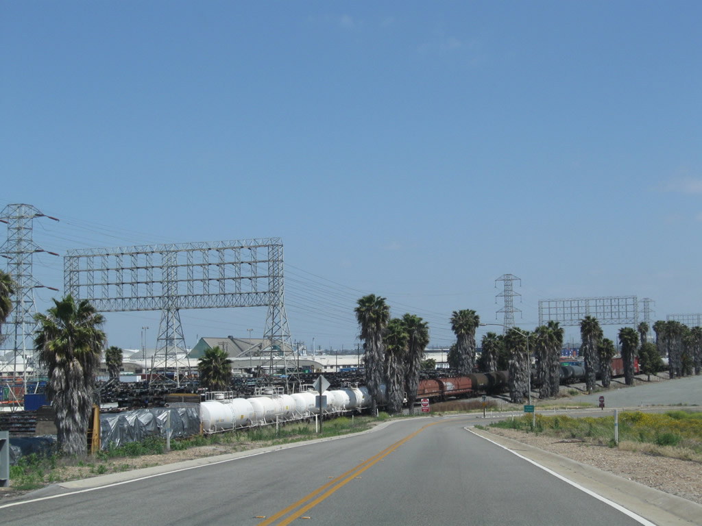
California 1 (Pacific Coast Highway) passes over California 103 (Terminal Island Freeway) on this 1948 bridge. The Terminal Island Freeway is an example of older freeway infrastructure that has not been extensively modified since its inception. Photos taken 05/02/10. |
|
|
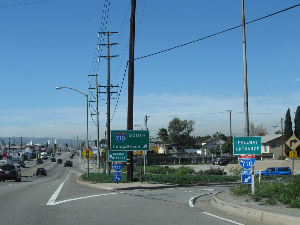
At the other end of the bridge, California 1 (Pacific Coast Highway) north meets the loop transition ramp to California 103 (Terminal Island Freeway) south. Follow California 103 south to California 47 south en route to Heim Lift Bridge, Terminal Island, Ocean Boulevard (Interstate 710 and California 47), and the Ports of Long Beach and Los Angeles. The last three pictures in sequence show the connecting ramp from California 1 north to California 103 south. Massive cargo storage yards and rail are visible from the transition ramp. Divoted curbing, commonly used in the 1940s but seldom found in modern road construction, lines the ramp as it leads onto California 103 south. Photos taken 05/02/10. |
|
|
|
|
| California 1 (Pacific Coast Highway) north |
|
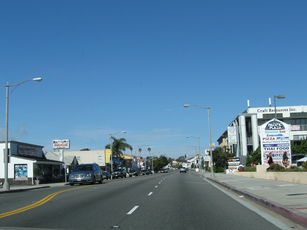
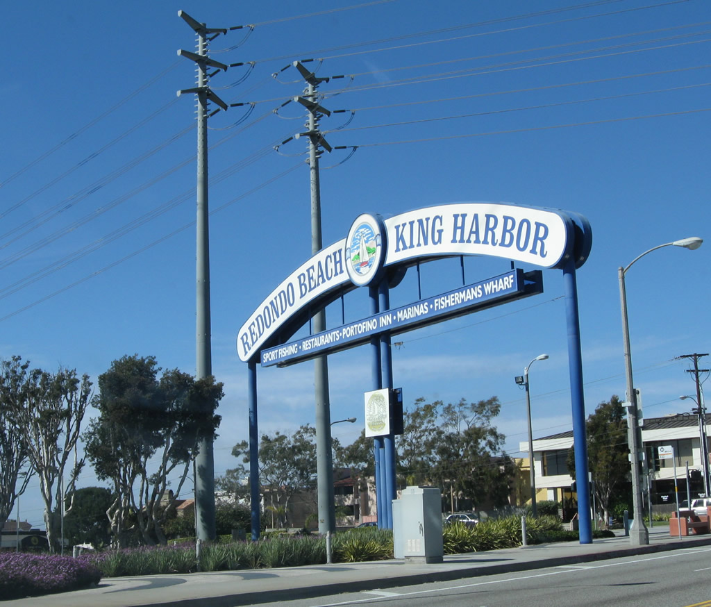
We skip ahead on California 1 to this view, taken on northbound California 1 (Pacific Coast Highway) after the intersection with Torrance Boulevard in the city of Redondo Beach near the Redondo Beach Pier. The city had a population of 63,261 as of the 2000 Census and was incorporated on April 29, 1892. Photo taken 02/13/11. |
|
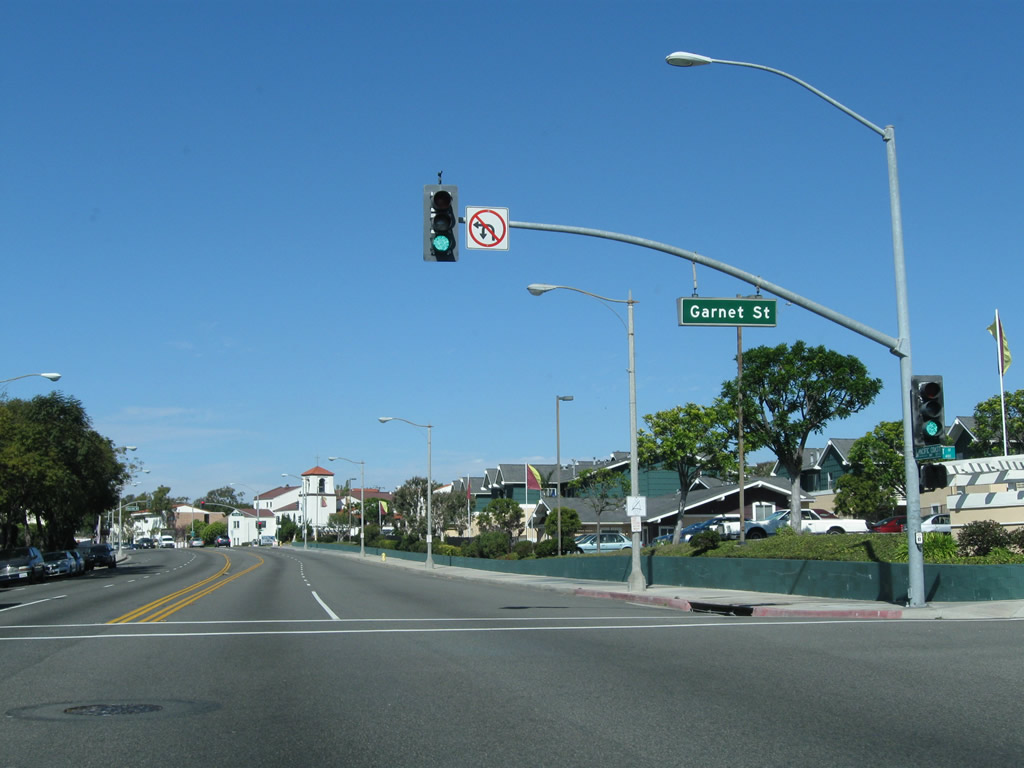
Northbound California 1 (Pacific Coast Highway) meets Garnet Street at this traffic signal, just one block north of Torrance Boulevard. If you missed the turnoff at Torrance Boulevard, you can turn west to King Harbor and Redondo Beach Pier by making a left at Garnet Street. Photo taken 02/13/11. |
|
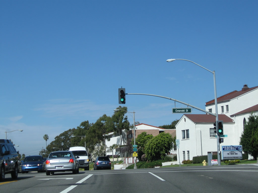
The next signalized intersection on California 1 north is with Emerald Street. Photo taken 02/13/11. |
|
A California 1 north reassurance shield is posted after the Emerald Street intersection. Photo taken 02/13/11. |
|
Northbound California 1 (Pacific Coast Highway) meets Diamond Street at this traffic signal. Photo taken 02/13/11. |
|
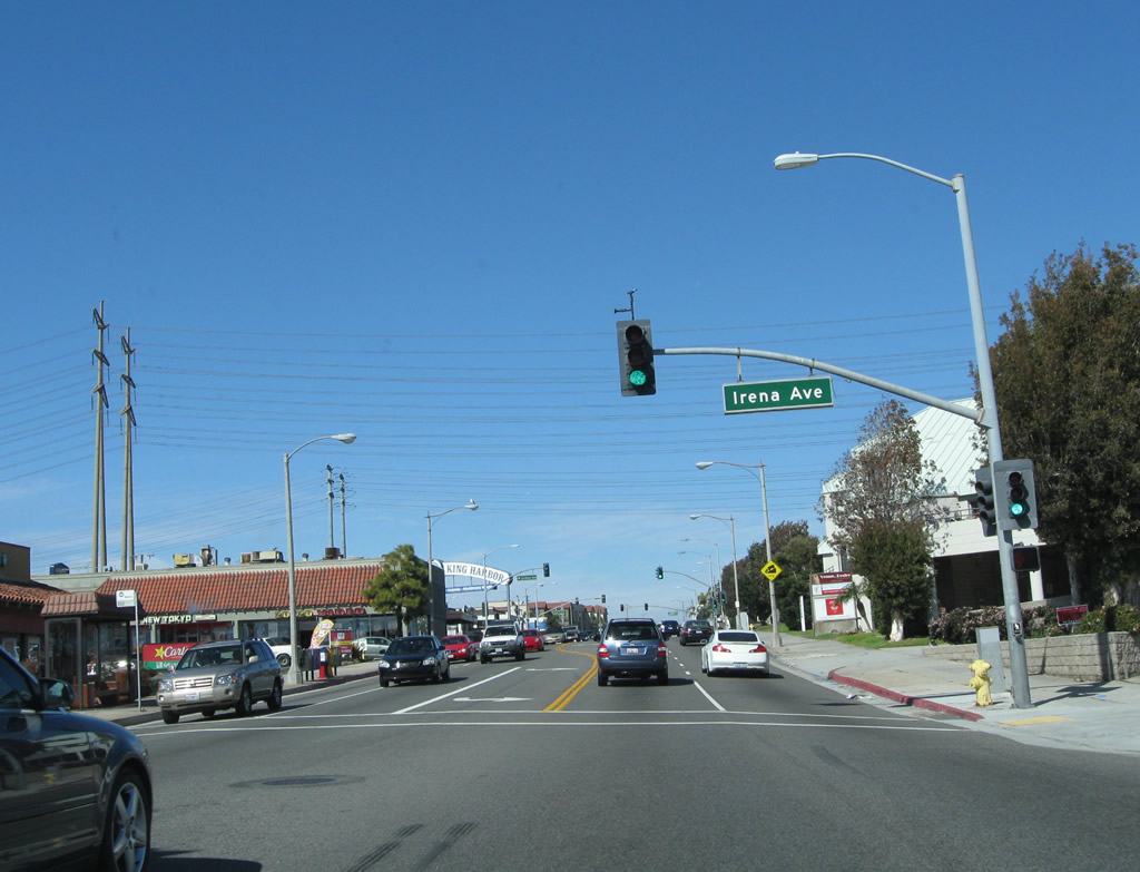
After passing by Carnelian Street, Beryl Street, and Agate Street, California 1 intersects with Irena Avenue here. Irena Avenue travels southeast toward Redondo Union High School. Photo taken 02/13/11. |
|
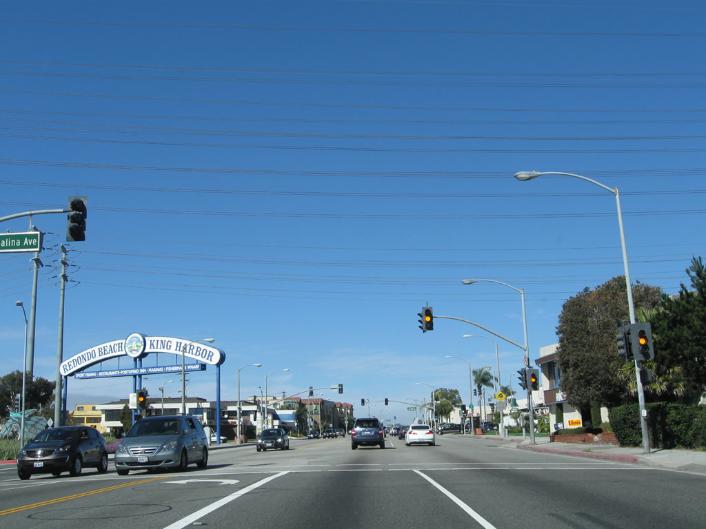
With several high-tension power lines passing overhead, northbound California 1 meets Catalina Avenue. This road travels southwest and then south to parallel the coast, offering more beach views than those found on California 1 itself. A sign heralding the Redondo Beach Pier is located at this intersection, even though the pier itself is located several blocks south of here. The sign is marked here mostly for southbound travelers using Catalina Avenue to travel to the pier. Photo taken 02/13/11. |
|
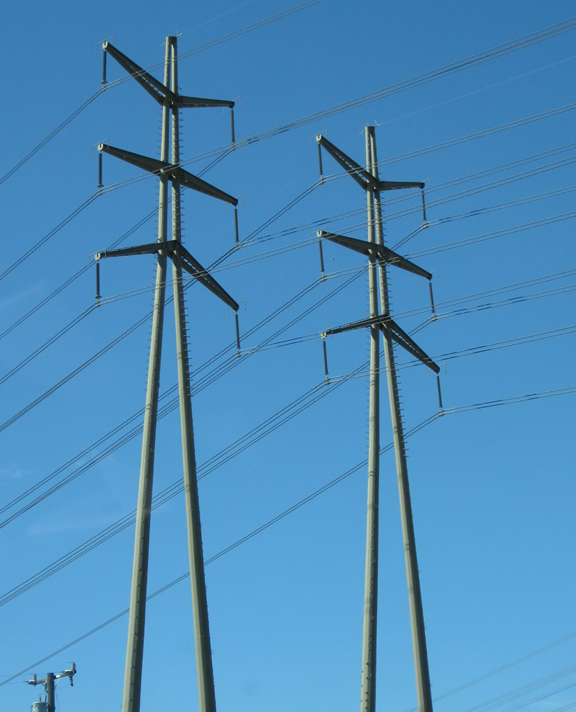
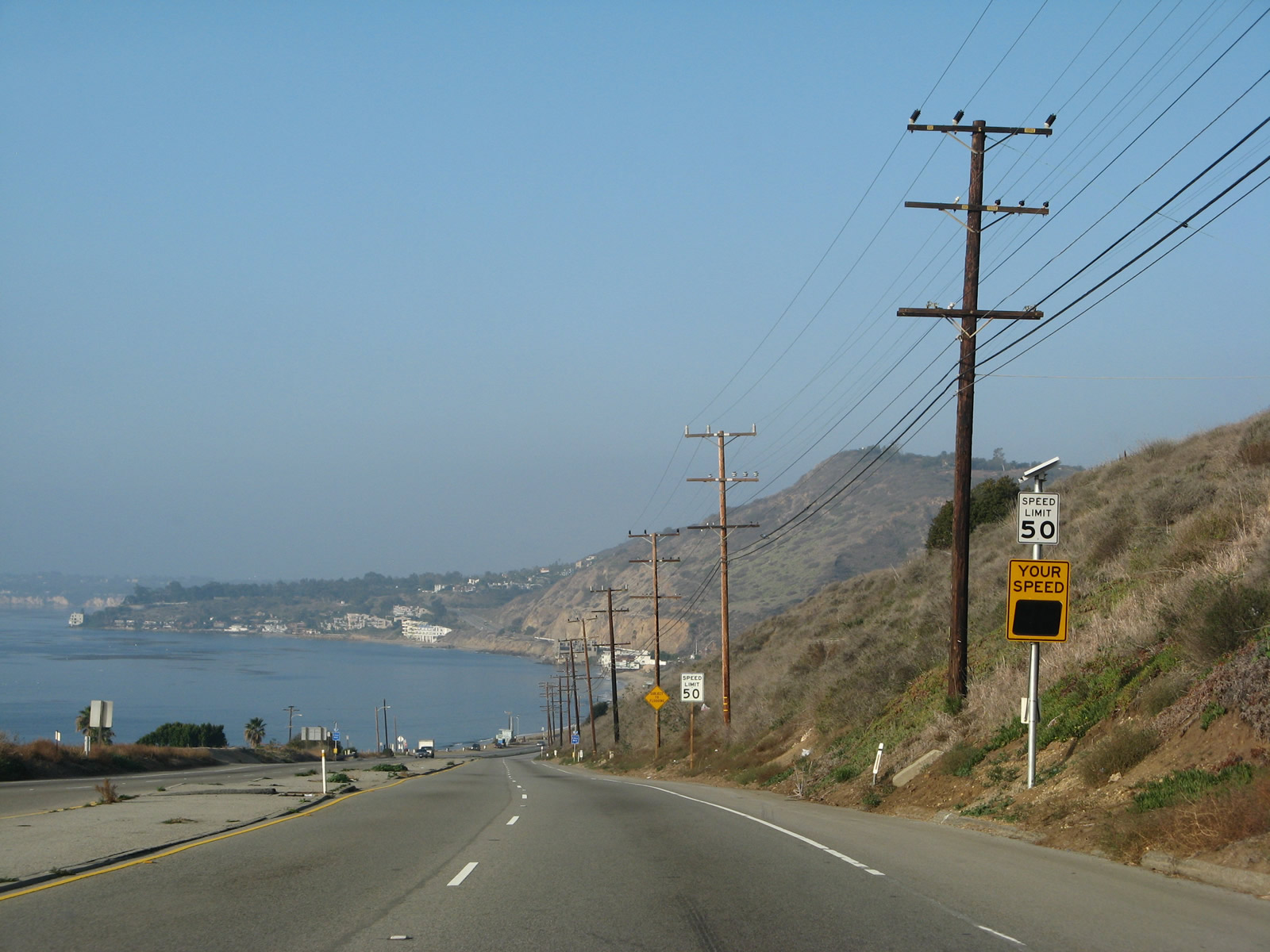
Towering 220kV Southern California Edison cross over the Pacific Coast Highway in northern Redondo Beach (this view looks west). These lines transmit electricity generated by the AES California power plant. 1350 megawatts of electricity is generated by steam heated by natural gas. Photo taken 02/13/11. |
|
This view looks east at the same power lines looking east. These power lines lead to a large substation located near the interchange of Interstate 405 and California 91 (near the intersection of Yukon Avenue and 177th Street in Torrance). Photo taken 02/13/11. |
|
Here's another view of the pier welcome sign at the intersection of California 1 and Catalina Avenue. Photo taken 02/13/11. |
|
Back on the mainline, northbound California 1 (Pacific Coast Highway) meets Herondo Street west and Anita Street/190th Street east. At this intersection, California 1 leaves Redondo Beach and enters the city of Hermosa Beach (population was 18,566 as the 2000 Census and incorporated on January 14, 1907). The north-south streets closest to the coast are Hermosa Avenue and Beach Drive; both roads located several blocks west of California 1. Photo taken 02/13/11. |
|
After several signalized intersections with numbered streets that begin with First Street near the southern border of Hermosa Beach, northbound California 1 (Pacific Coast Highway) eventually meets 10th Street and Aviation Boulevard. For those looking for a shortcut to California 91 (Artesia Boulevard) east, Aviation Boulevard is a good route. Photo taken 02/13/11. |
|
Just a few blocks farther north, northbound California 1 (Pacific Coast Highway) meets 14th Street and Pier Avenue at this intersection. Turn left here to the Hermosa Beach Pier, which is municipally owned. Photo taken 02/13/11. |
|
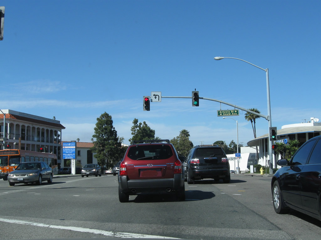
About ten blocks north of Pier Avenue, northbound California 1 meets California 91 (Artesia Boulevard) east and Gould Avenue west. Based on our observation, there were no signs for California 91 on northbound California 1, but there were signs for California 91 on both Artesia Boulevard and on southbound California 1 approaching this intersection. From here, California 91 travels east as an arterial along Artesia Boulevard until the interchange with Interstate 110, where it becomes a freeway. The freeway proceeds east and then northeast through Fullerton, Anaheim, the Santa Ana River Canyon, and Corona before ending in Riverside at Interstate 215 and California 60. Photo taken 02/13/11. |
| California 1/Sepulveda Boulevard north |
|
After the intersection with Artesia Boulevard, California 1 becomes the boundary between Hermosa Beach and Manhattan Beach. Several blocks north of there, at Boundary Place (between Longfellow Avenue and Duncan Avenue), California 1 leaves Hermosa Beach and enters the city of Manhattan Beach (population 33,852 as of the 2000 Census and incorporated on December 12, 1912). Upon entering Manhattan Beach, California 1 changes names from Pacific Coast Highway to Sepulveda Boulevard, a name it will carry until California 1 splits from Sepulveda Boulevard at Los Angeles International Airport. Photo taken 02/13/11. |
|
Northbound California 1/Sepulveda Boulevard meets Second Street at this intersection. A nice view from this vantage point looks north toward Manhattan Beach and El Segundo. Photo taken 02/13/11. |
|
Melaleuca trees line the median of California 1 as we approach Manhattan Beach Boulevard (visible near the Target store in the distance ahead). Photo taken 02/13/11. |
|
At Rosecrans Avenue, California 1/Sepulveda Boulevard leaves Manhattan Beach and enters the city of El Segundo (population of 16,033 at the 2000 Census and incorporated on January 18, 1917). Photo taken 02/13/11. |
|
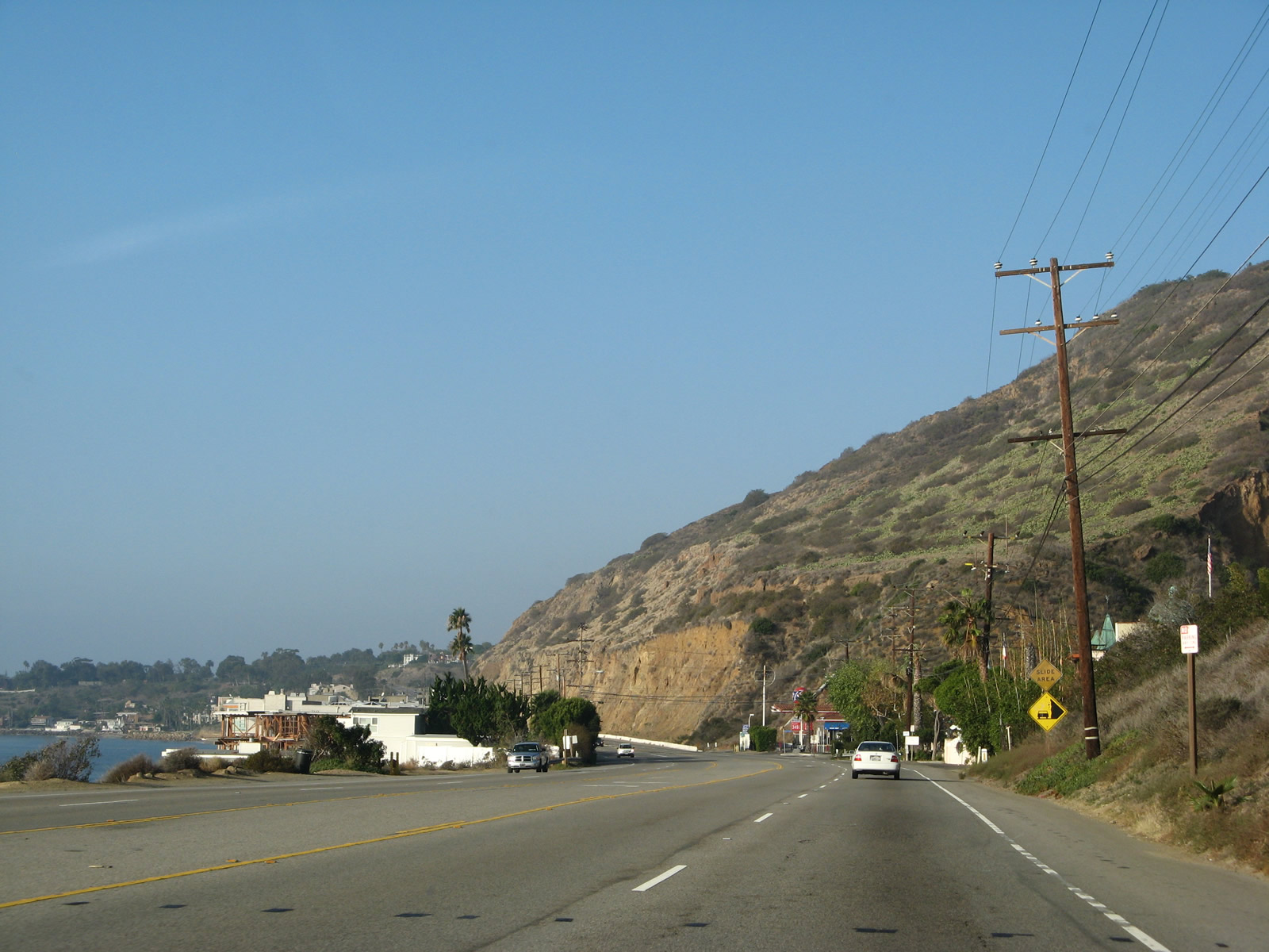
In southern El Segundo, California 1 passes by a large oil field and refinery. A Southern California Edison power transmission line passes overhead, parallel to Rosecrans Avenue. Photo taken 02/13/11. |
|
The dynamics of California 1 change as a result of entering the oil refinery area. The state route widens out to allow four northbound lanes, and the closed-in development common to the beach cities south of here becomes less common in El Segundo. The railroad tracks visible ahead serve the Chevron El Segundo Oil Refinery located on the west side of California 1. The refinery was named El Segundo since it was the second of Chevron's refineries. Photo taken 02/13/11. |
|
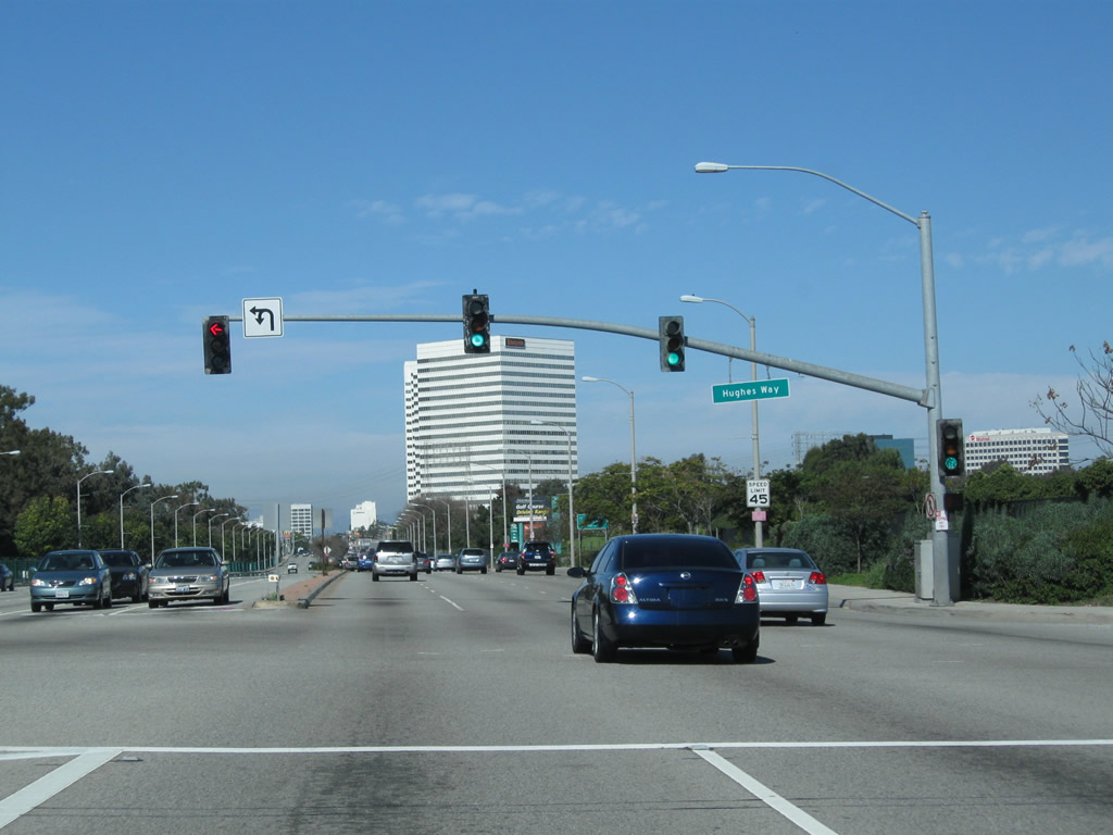
Northbound California 1/Sepulveda Boulevard meets Hughes Way. Several defense contractors are also located in El Segundo, making for a diverse economy. Photo taken 02/13/11. |
|
The next major intersection along California 1/Sepulveda Boulevard north is with El Segundo Boulevard. Turn left at this intersection to downtown El Segundo, including the civic center. Photo taken 02/13/11. |
|
Northbound California 1/Sepulveda Boulevard meets El Segundo Boulevard. Photo taken 02/13/11. |
|
An office building with the Boeing insignia is visible from California 1 at the intersection with Mariposa Avenue. Photo taken 02/13/11. |
|
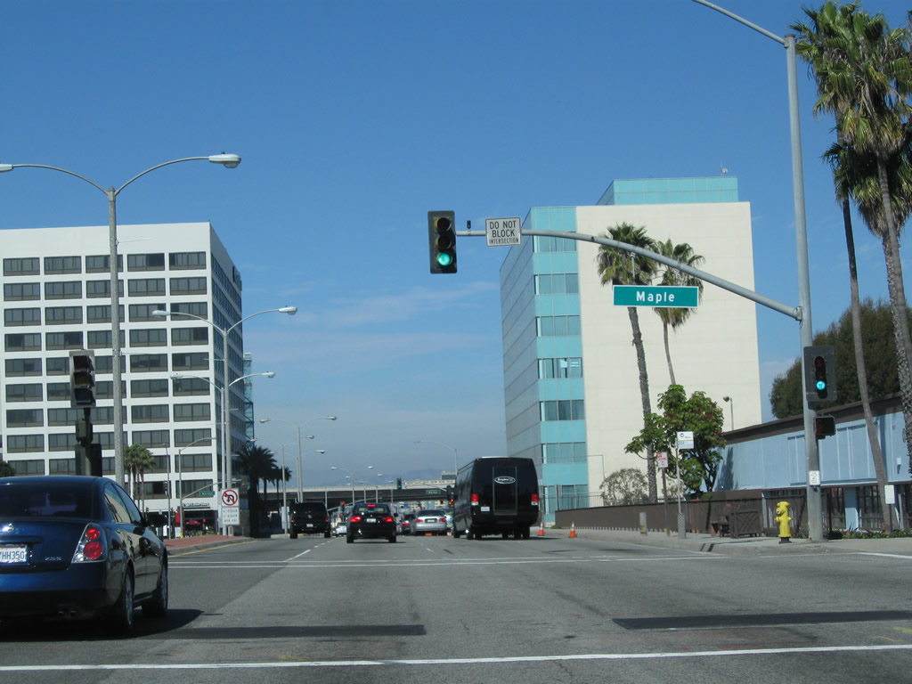
Northbound California 1/Sepulveda Boulevard next meets Maple Avenue. Photo taken 02/13/11. |
|
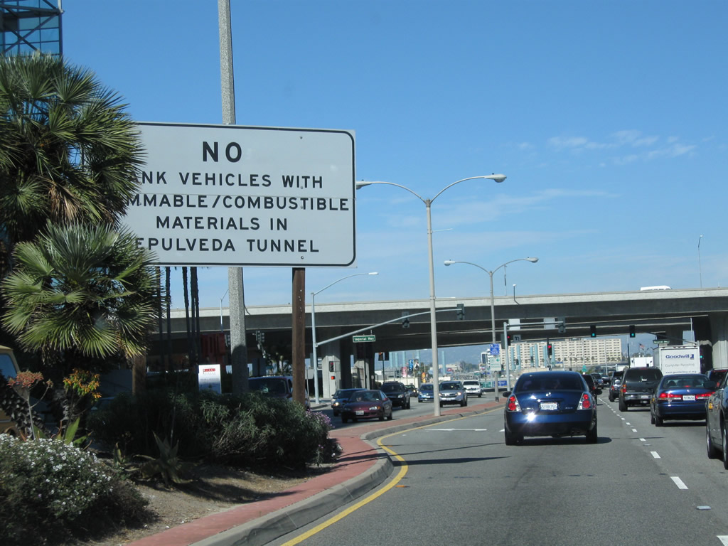
After the intersection with Walnut Avenue, a warning sign advises of the restrictions associated with Sepulveda Tunnel, which carries California 1/Sepulveda Boulevard under the southern east-west runway of Los Angeles International Airport. The elevated viaduct ahead carries Interstate 105/Glenn Anderson (Century) Freeway over California 1. Photo taken 02/13/11. |
|
Turn right at Imperial Highway to connect to Interstate 105/Glenn Anderson Freeway east to Norwalk. Turn left at Imperial Highway to Vista del Mar and Dockweiler State Beach. The state beach is located just west of the international airport. Photo taken 02/13/11. |
|
|
Northbound California 1/Sepulveda Boulevard meets Imperial Highway at this traffic signal. Ramps connecting to Interstate 105/Glenn Anderson (Century) Freeway pass over California 1, with access to the freeway afforded via Imperial Highway. Interstate 105's western terminus is only a few blocks west of here, where the lanes touchdown to connect directly with Imperial Highway at California Street. Photos taken 02/13/11. |
|
|
These views look east along Imperial Highway with the Interstate 105 viaduct as seen from California 1/Sepulveda Boulevard. Photos taken 02/13/11. |
|
Upon passing under Interstate 105, California 1 leaves El Segundo and re-enters the city of Los Angeles for the first time since briefly passing through it near the Interstate 110 interchange. A California 1 north reassurance shield along with a Los Angeles International Airport trailblazer are posted here. This traffic signal connects Interstate 105 west with California 1 north, and it is one of the major routes from the freeway network to the airport. Photo taken 02/13/11. |
|
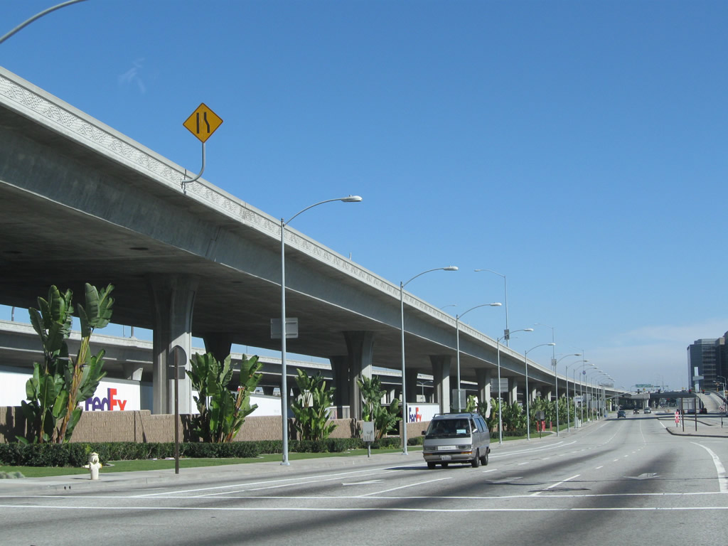
California 1 goes below grade as it prepares to enter Sepulveda Tunnel. Through traffic for California 1 north should stay left; airport-bound traffic should stay right. Photo taken 02/13/11. |
|
Los Angeles International Airport, which goes by the airport code "LAX," is one of the world's busiest with over 59 million passengers (in 2008 per the official webpage), five square miles, and hundreds of daily flights. The airport first opened in 1928 as Mines Field, and its size grew in proportion to the growth of Southern California. Major expansions came in 1961 (construction of current terminal) and early 1980s (expansion of terminals to include more domestic and international flights). Photo taken 02/13/11. |
|
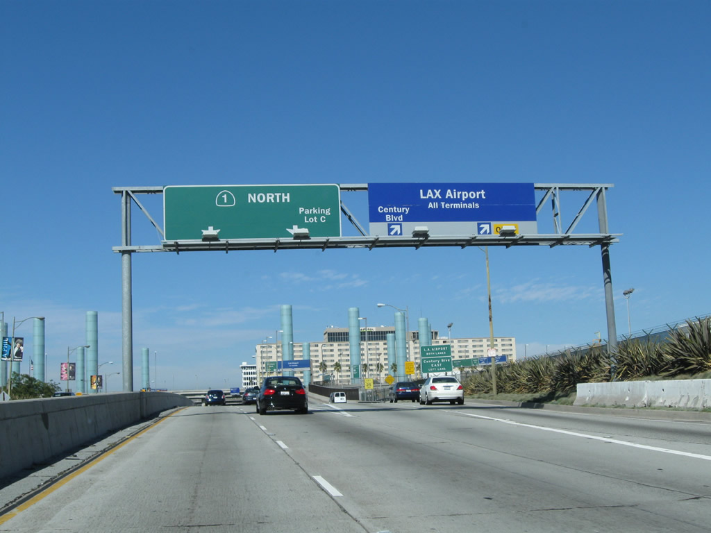
To continue north on California 1/Sepulveda Boulevard, stay left. Access to the airport and Century Boulevard is via the right two lanes. These overhead signs were placed by the airport authority. Photo taken 02/13/11. |
|
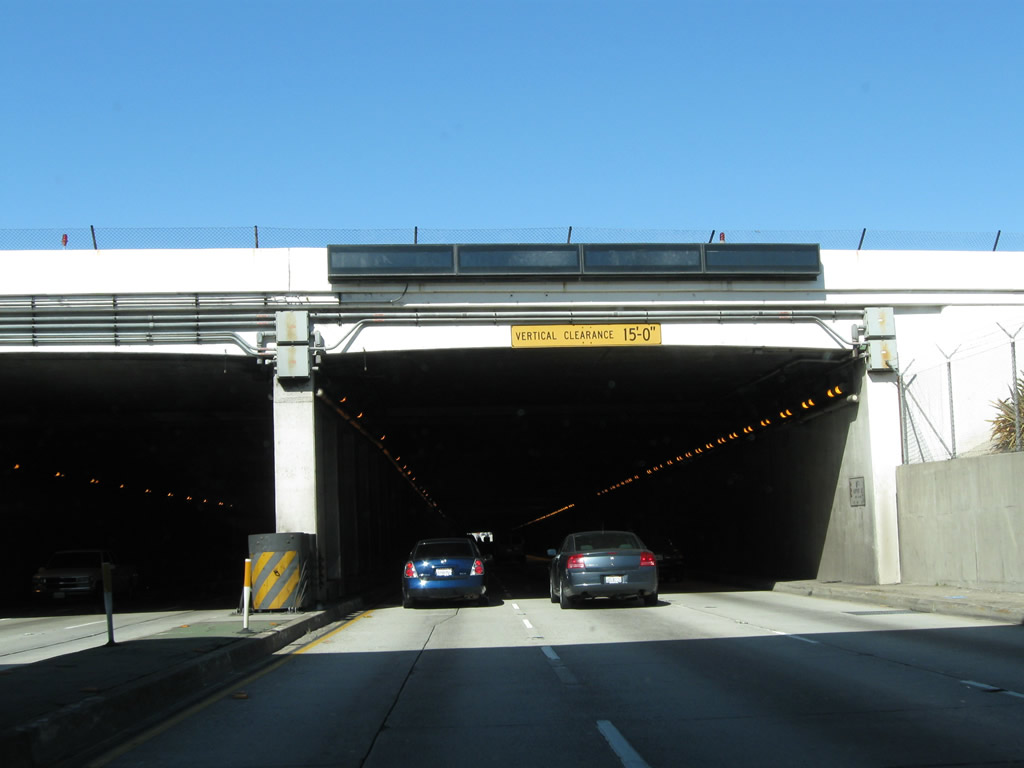
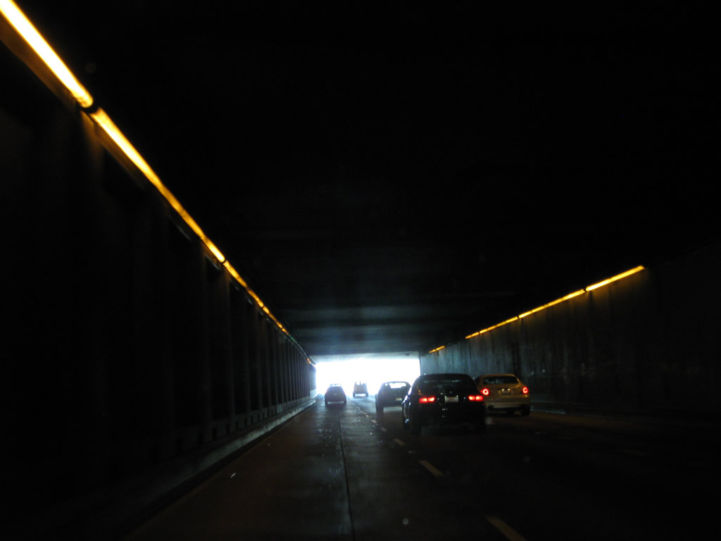
California 1/Sepulveda Boulevard enters Sepulveda Tunnel, which allows the southern runway of the Los Angeles International Airport to cross over Sepulveda Boulevard. This tunnel was built to allow the longer southern runways accommodate larger airplanes. This tunnel, which is not to be confused with the Sepulveda Tunnel in the Santa Monica Mountains, carries three lanes in each direction and is approximately 1,900 feet long. Photo taken 02/13/11. |
|
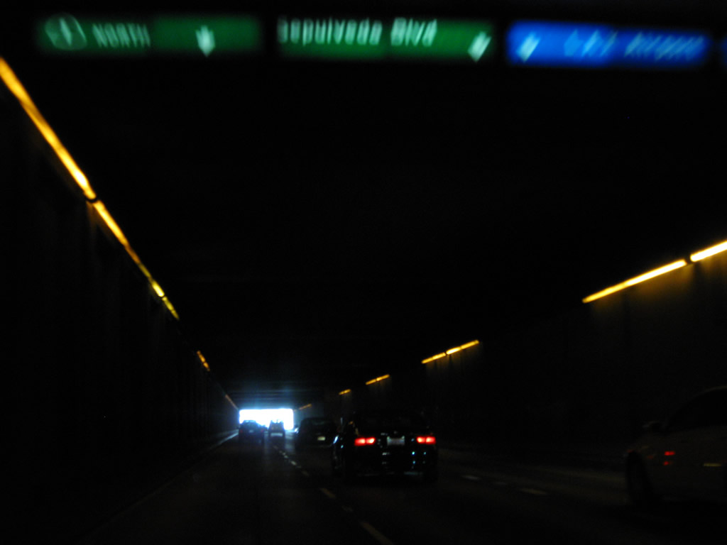
This view shows the interior of the tunnel, which is often very busy due to its role as one of the main routes to the airport. Photo taken 02/13/11. |
|
An internally lit overhead guide sign shows the lane allocation for California 1, Sepulveda Boulevard, and the airport. Photo taken 02/13/11. |
|
Soon thereafter, California 1 prepares to emerge from the tunnel. Photo taken 02/13/11. |
|
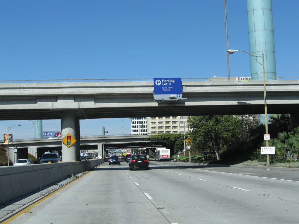
Use Century Boulevard to the Rental Car Return. Photo taken 02/13/11. |
|
Northbound California 1/Sepulveda Boulevard meets the off-ramp to Century Boulevard and Los Angeles International Airport. Photo taken 02/13/11. |
|
The transition ramp has two lanes. Stay left on the exit ramp to Century Boulevard or either lane to the airport. Photo taken 02/13/11. |
|
|
|
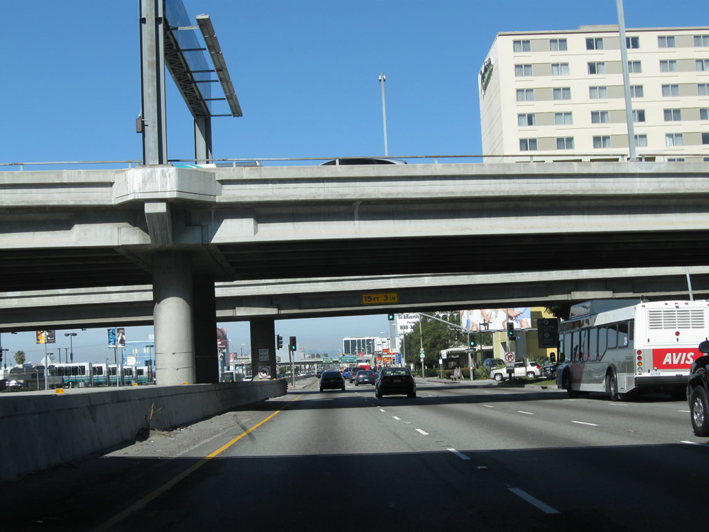
California 1/Sepulveda Boulevard enters the Century Boulevard interchange. California 1 does not achieve freeway standards through here, despite the presence of multiple flyover ramps. Photos taken 02/13/11. |
|
|
|
|
Immediately thereafter, California 1 and Sepulveda Boulevard prepare to split. This is (almost) the historic southern terminus of California 7, which used to follow Sepulveda Boulevard from here north to Sylmar and was replaced in stages by Interstate 405. This iteration of California 7 was eliminated in 1964 when many state routes were given new numerical designations. This intersection was realigned due to airport expansion, hence why this split is not the original starting point for former California 7. A more recent iteration of the California 7 designation was the Long Beach Freeway (now Interstate 710). Currently, California 7 is the designation for the expressway connecting Interstate 8 to the Calexico East (Garita Numero Dos) border crossing in Imperial County. Photo taken 02/13/11. |
|
The left two lanes continue north on California 1, which becomes known as Lincoln Boulevard. The right three lanes will connect to Sepulveda Boulevard (former California 7), which will generally parallel Interstate 405 from here north to Sylmar. Photo taken 02/13/11. |
|
On the right side of California 1 are the large letters L A X for the airport. Photo taken 02/13/11. |
|
Northbound California 1 has a traffic signal at the intersection with southbound traffic for Sepulveda Boulevard. Lincoln Boulevard begins ahead. Photo taken 02/13/11. |
| California 1 (Lincoln Boulevard) north |
|
The northern runway for LAX is located just west of here; this median tower helps aircraft land on the northern runway. Photo taken 02/13/11. |
|
|
Curving toward the northwest, California 1 (Lincoln Boulevard) approaches an off-ramp to Westchester Parkway (an east-west roadway that links Pershing Drive and Sepulveda Boulevard. The intersection between California 1 and Westchester Boulevard is grade separated. Photos taken 02/13/11. |
|
|
|
|
California 1 curves north again after passing under Westchester Parkway. Entering the neighborhoods of Loyola Village and Westchester in the city of Los Angeles, California 1 next approaches a signalized intersection with La Tijera Boulevard. Photos taken 02/13/11. |
|
Northbound California 1 (Lincoln Boulevard) meets Loyola Boulevard at this intersection. Photo taken 02/13/11. |
|
The next intersection along northbound California 1 is with Manchester Avenue, which was formerly designated as California 42 and today is no longer a state route. California 42 was decommissioned in phases after Interstate 105 was completed in 1993. Photo taken 02/13/11. |
|
Northbound California 1 (Lincoln Boulevard) meets Manchester Avenue (former California 42) at this intersection. At its original length, California 42 extended from this point east to Norwalk via Manchester Avenue and Firestone Boulevard, with significant sections in the cities of Inglewood, South Gate, and Downey. California 42 ended at Interstate 5 at the Firestone Boulevard interchange. Photo taken 02/13/11. |
|
In Playa del Rey, California 1 (Lincoln Boulevard) approaches Loyola Marymount University. Photo taken 07/03/05. |
|
Northbound California 1 (Lincoln Boulevard) approaches Jefferson Boulevard. Photo taken 07/03/05. |
|
California 1 crosses over Ballona Creek, where it leaves Playa del Rey and enters Marina del Rey. Photo taken 07/03/05. |
|
An interchange is located at Culver Boulevard after the creek crossing (not shown), and this sign advises traffic for Marina del Rey to stay in the left lane. Photo taken 02/13/11. |
|
The Culver Boulevard bridge was built to allow for future expansion on the north side of the bridge. Photo taken 02/13/11. |
|
California 1 carries three northbound lanes prior to the intersection with Fiji Way in Marina del Rey. Note the pavement changes between asphalt and concrete. Photo taken 02/13/11. |
|
After Fiji Way, a California 1 north reassurance shield is posted on northbound Lincoln Boulevard. Photo taken 02/13/11. |
|
Northbound California 1 (Lincoln Boulevard) meets Mindanao Way. Photo taken 02/13/11. |
|
A California 1 reassurance shield is posted after Mindanao Way. Turn right here for a shortcut to California 90 (Marina Freeway) east. Two sets of power lines parallel this stretch of California 1; the ones on the left are Los Angeles Department of Water and Power, while the ones on the right are Southern California Edison. Photo taken 02/13/11. |
|
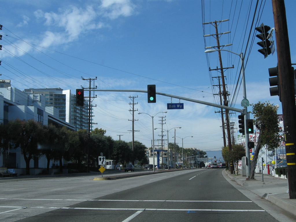
Northbound California 1 (Lincoln Boulevard) meets Bali Way. Another reassurance shield is posted on the traffic signal pole. Photo taken 02/13/11. |
|
And yet another California 1 north reassurance shield is posted between Bali Way and California 90/Marina Expressway. Photo taken 02/13/11. |
|
Leaving the Tsunami Hazard Zone, northbound California 1 (Lincoln Boulevard) approaches California 90/Marina Expressway. California 90 is a short expressway-freeway combination that connects California 1, Interstate 405, and Slauson Avenue. The beginnings of a planned east-west freeway that would follow Slauson Avenue and connect to Imperial Highway, only the short section near California 1 and Interstate 405 was built. The rest remains a legal definition for a future freeway, but it is not likely it will ever be built. Photo taken 02/13/11. |
|
A short ramp connects California 1 (Lincoln Boulevard) north with California 90/Marina Expressway east. Photo taken 02/13/11. |
|
After the junction with California 90, California 1 (Lincoln Boulevard) leaves Marina del Rey and enters Venice, a community of the city of Los Angeles, one of the Westside districts. Located between Marina del Rey and Santa Monica, Venice includes famous Venice Beach and Muscle Beach. This is the second time California 1 has entered the city of Los Angeles; the first time was near the Ports of Long Beach and Los Angeles at the Interstate 110 interchange. Photo taken 03/25/07. |
|
Northbound California 1 (Lincoln Boulevard) approaches Maxella Avenue. Photo taken 03/25/07. |
|
|
|
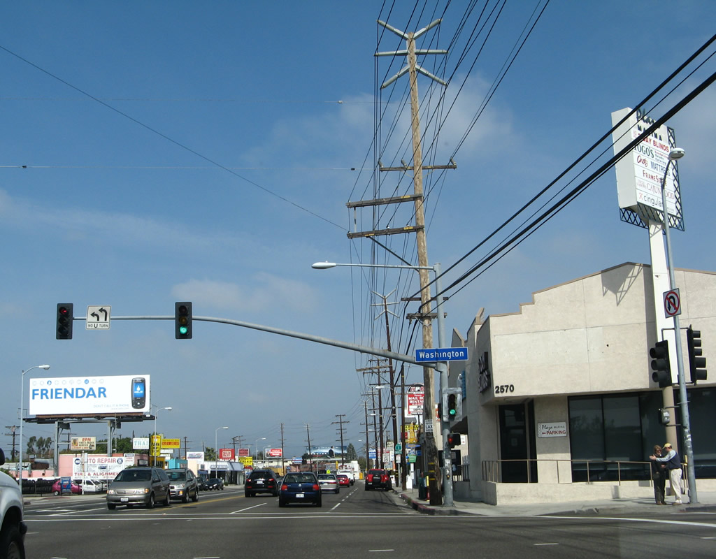
Passing through Venice, California 1 (Lincoln Boulevard) is a largely commercial strip that stays inland from the beach. However, several intersecting streets travel west toward the coast and world-famous Venice Beach. A major intersection is with Washington Boulevard, a major east-west street that immediately enters Culver City to the east, then proceeds through various Los Angeles communities on a path generally parallel to Interstate 10. To the west, Washington Boulevard reaches the ocean at Pacific Avenue and connects directly to the Venice Fishing Pier. Photos taken 03/25/07. |
|
This California 1 north shield is posted along nortbound Lincoln Boulevard between Washington Boulevard and California 187 (Venice Boulevard). Photo taken 03/25/07. |
|
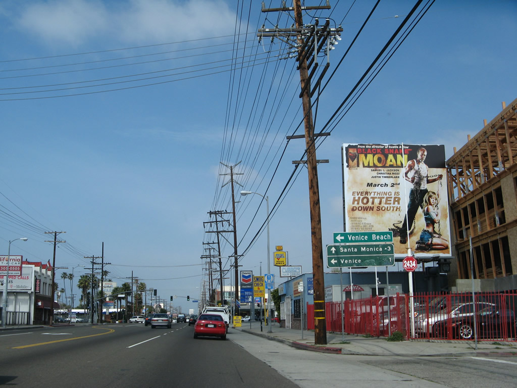
The next major intersection along California 1 (Lincoln Boulevard) north is with California 187 (Venice Boulevard). The state route follows Venice Boulevard northeast through the Mar Vista and Palms communities of Los Angeles, skirting the northern edges of Culver City. It ends at Interstate 10 (Santa Monica Freeway) Exit 7A near the intersection with La Cienega Boulevard. California 187 is basically unsigned, with no reassurance shields or route markers on intersecting state routes. However, some structures are marked with 187 postmiles. Photo taken 03/25/07. |
|
Northbound California 1 (Lincoln Boulevard) meets California 187 (Venice Boulevard) at this signalized intersection. To the west, Venice Boulevard is the most direct route to Venice Beach and Pacific Avenue, which is the closest north-south arterial to the beach and coastline. California 1 stays inland since there is no crossing over the Marina del Rey entrance channel, thus making Pacific Avenue a discontinuous arterial and unavailable for through traffic between Marina del Rey and Playa del Rey. Photo taken 03/25/07. |
|
California 1 tends to be well-signed through Venice. A reassurance shield is posted after California 187 (Venice Boulevard), and this one is found several blocks further to the north after the Superba Avenue intersection. Photo taken 07/03/05. |
|
After the Rose Avenue intersection, California 1 leaves Venice and enters the city of Santa Monica. Santa Monica had a population of 84,084 people as of the 2000 Census and was incorporated on November 30, 1886. The city is a well-known tourist destination with the famous Santa Monica Pier, Palisades Park on a coastal bluff, the west end of Historic U.S. 66 at the intersection of Lincoln Boulevard and Olympic Boulevard (near today's Interstate 10 and California 1 interchange), and shopping at the Third Street Promenade. Photo taken 07/03/05. |
|
|
|
Like in Venice, California 1 serves as a prime arterial corridor with commercial establishments lining both sides of Lincoln Boulevard. The roadway is heavily traveled, especially on weekends as visitors flock to the beach. The last picture shows California 1 north approaching Pico Boulevard, a major intersection. Turn left (west) here to the Santa Monica Civic Center, Ocean Avenue (the continuation of Pacific Avenue in Santa Monica), and Santa Monica Pier. Photos taken 07/03/05. |
|
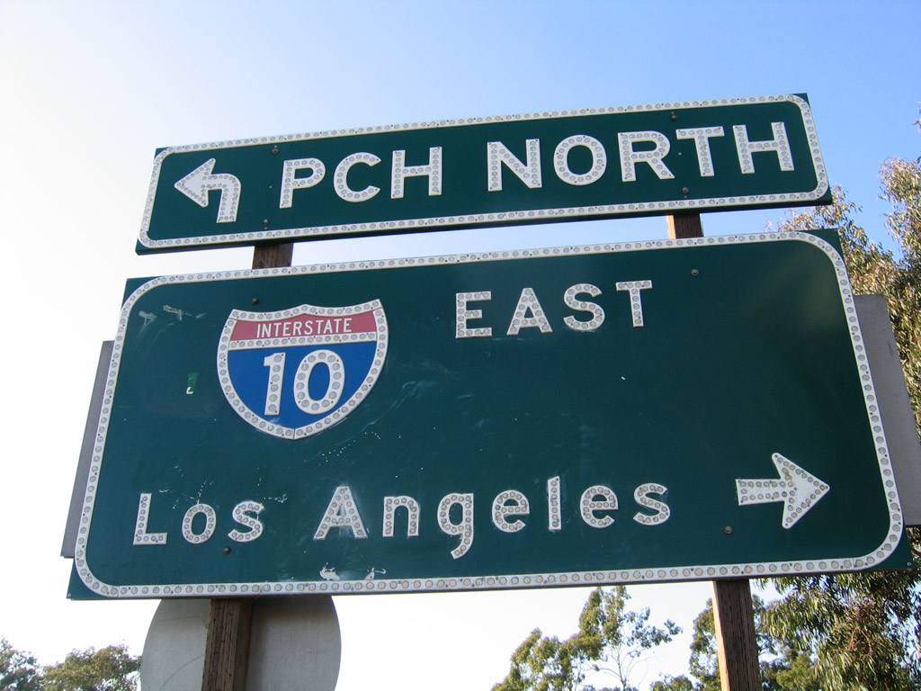
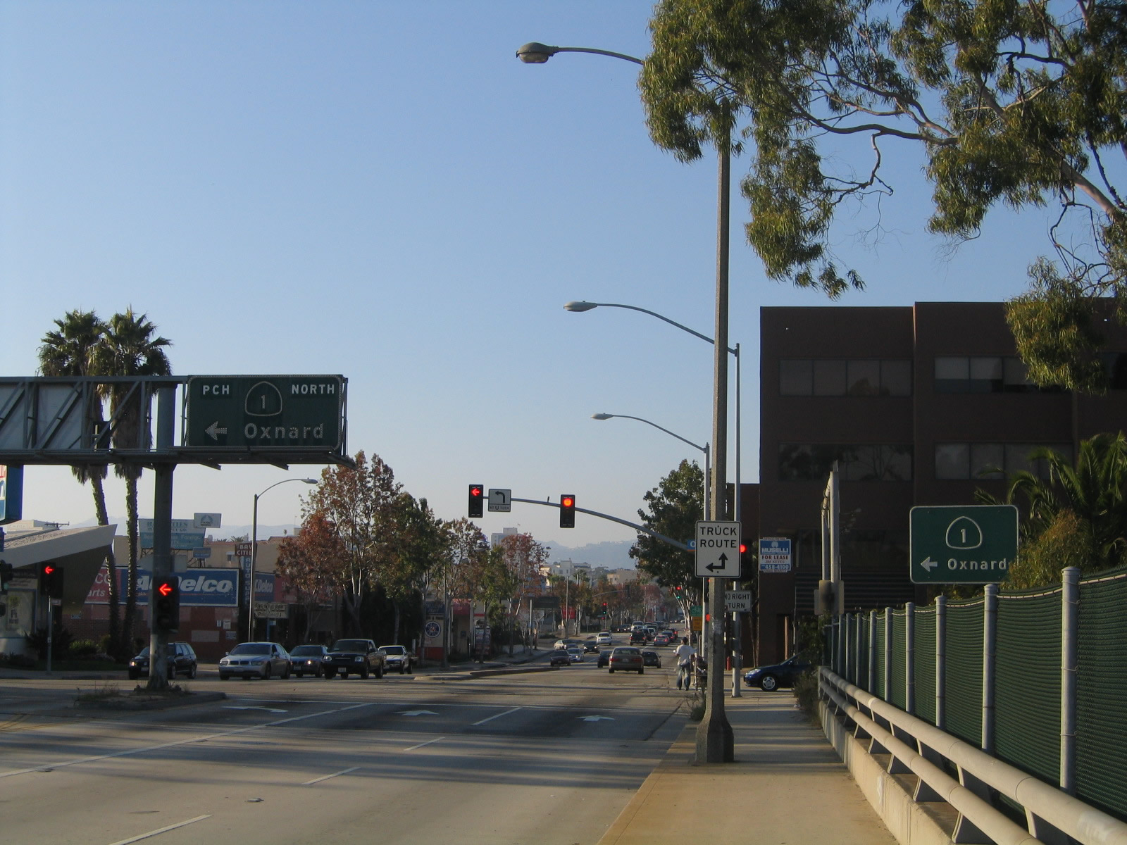
The first sign advising of the pending interchange with Interstate 10 is posted along California 1 north just prior to the Michigan Avenue intersection. Stay in the right two lanes to connect to Interstate 10 (Santa Monica Freeway) east to downtown Los Angeles and points east (San Bernardino, Indio, Blythe, Phoenix, Tucson, El Paso). This interchange will serve as the western terminus of Interstate 10. Through traffic on California 1 north should merge left, as California 1 will turn onto the Santa Monica Freeway to become the Pacific Coast Highway once again. Photo taken 07/03/05. |
|
|
Northbound California 1 (Lincoln Boulevard) meets Olympic Boulevard twice, once on the south side of Interstate 10 and again on the north side of Interstate 10. The first Olympic Boulevard is one way eastbound, and the second Olympic Boulevard is one way westbound. Use Olympic Boulevard east to the on-ramp for Interstate 10 (Santa Monica Freeway) east to Los Angeles. Photos taken 10/30/05. |
|
|
After passing over the Santa Monica Freeway, northbound California 1 (Lincoln Boulevard) meets the westbound direction of Olympic Boulevard. This historic intersection serves as the official western terminus of U.S. 66, which began at Alternate U.S. 101 and traveled north on Lincoln Boulevard for three blocks, then turned east on Santa Monica Boulevard toward Hollywood. California 2 served as the successor to U.S. 66, but the state route has been decommissioned in Santa Monica (and few signs for the state route remain). Through traffic on California 1 should turn left here to join the Pacific Coast Highway. Photos taken 10/30/05. |
| California 1 north and Olympic Boulevard west |
|
|
California 1 leaves Lincoln Boulevard and briefly travels west on Olympic Boulevard for the on-ramp to the Pacific Coast Highway. Stay left for the slip ramp that will merge California 1 with Interstate 10 (Santa Monica Freeway) to enter the McClure Tunnel and proceed onto the Pacific Coast Highway. A freeway entrance shield assembly marks the continuation of California 1 to proceed north to Malibu and Oxnard. Photos taken 07/03/05 and 10/30/05. |
|
|
|
|
California 1 leaves Olympic Boulevard and merges onto the Santa Monica Freeway, which becomes the Pacific Coast Highway. At the point where California 1 merges onto the freeway, Interstate 10 reaches its western end. Photos taken 07/03/05. |
|
|
| California 1 (Pacific Coast Highway) north |
|
Joining the westbound lanes of Interstate 10/Santa Monica (Christopher Columbus Transcontinental) Freeway, California 1 becomes the dominant route as the Interstate Highway comes to its end. California 1 continues with its most common appellation once again: the Pacific Coast Highway. California 1 only carries two lanes in each direction with a single jersey barrier median as it travels below-grade. Main Street passes overhead on an old concrete arch bridge built in 1925 as an overpass to Olympic Boulevard (which preceded California 1 along this stretch). Photo taken 11/22/07. |
|
A yellow Holiday Inn hotel comes into view on the north side of the highway. The McClure Tunnel, which carries traffic under the Palisades, will bring the ocean into view for the first time in Santa Monica. Photo taken 11/22/07. |
|
Built between 1935 and 1939 as part of Alternate U.S. 101, the Robert E. McClure (Palisades) Tunnel is a historic resource in the greater Los Angeles transportation network. The tunnel is not wide enough to meet Interstate standards and thus is not a part of Interstate 10. However, it is part of a dramatic and fitting end to a long Interstate route. Photo taken 11/22/07. |
|
After passing through the Palisades, the McClure Tunnel brings California 1 motorists to the beach in Santa Monica. Photo taken 11/22/07. |
|
California 1 turns from west to north to parallel the beach on the west and the Palisades to the east. An on-ramp will join the Pacific Coast Highway from the right. Photo taken 11/22/07. |
|
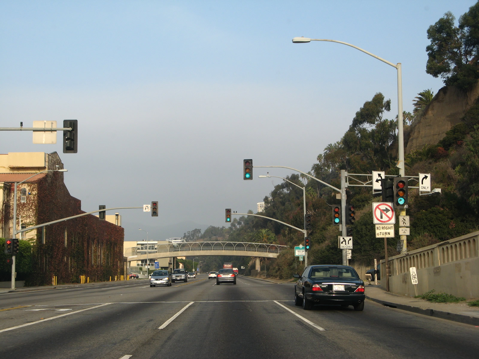
The first California 1 north reassurance shield after the Interstate 10 merge is posted shortly thereafter. Several pedestrian bridges cross over the Pacific Coast Highway to facilitate pedestrian movements across the very busy roadway. During peak beach hours, this section of highway can be severely congested. Photo taken 11/22/07. |
|
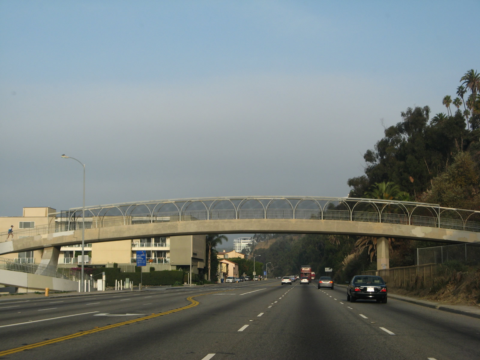
This view looks north on California 1 (Pacific Coast Highway) from a pedestrian bridge in Santa Monica. Photo taken 11/11/09. |
|
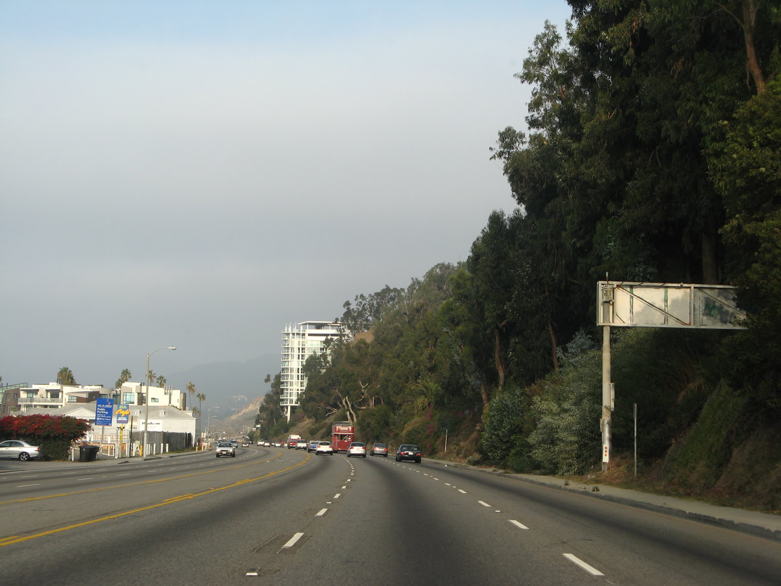
Several houses line the west side of California 1, and the Palisades line the east side as a pedestrian bridge crosses the highway. From here, California 1 proceeds northwest along the coast toward Malibu. Photo taken 11/22/07. |
|
Palisades (sandstone bluffs) separate the Santa Monica central business district from California 1 (Pacific Coast Highway). Photo taken 11/22/07. |
|
The California Incline connects California Avenue and Ocean Avenue with California 1 (Pacific Coast Highway) in Santa Monica. Bridge structures (sidehill viaducts) and roadway surfaces built into the hillside (approximately 1,400 feet in length) carry the Incline over the irregular bluffs as the street leads downhill; these were largely built in the 1930s. The California Incline itself was first conceived in 1896 as the "Sunset Trail"; the structure seen here was buit in 1930. Starting on April 20, 2015, the city of Santa Monica began construction to replace the California Incline, with completion in 2016. Photo taken 07/03/05. |
|
A series of pedestrian bridges cross over California 1 (Pacific Coast Highway). On the bluff, the California Incline descends to an intersection with California 1, which is at the next signalized intersection. Photo taken 11/22/07. |
|
At Postmile LA 36.00, northbound California 1 (Pacific Coast Highway) meets California Incline (California Avenue), which travels southeast into the Santa Monica central business district. Ahead, California 1 proceeds toward Pacific Palisades and onward to Malibu. Photo taken 11/22/07. |
|
Another pedestrian bridge crosses over California 1. Photo taken 11/22/07. |
|
California 1 (Pacific Coast Highway) is a designated safety corridor through Santa Monica, Pacific Palisades (part of Los Angeles), and Malibu. Photo taken 11/22/07. |
|
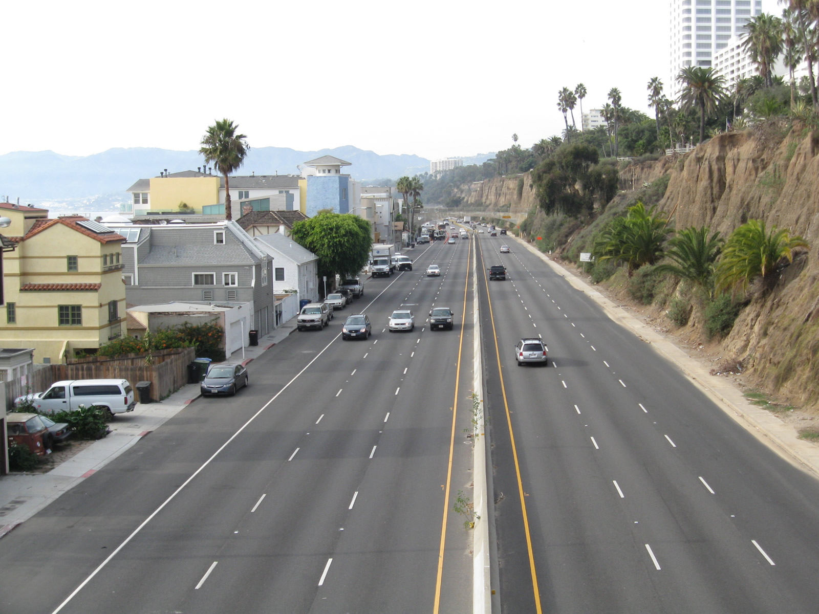
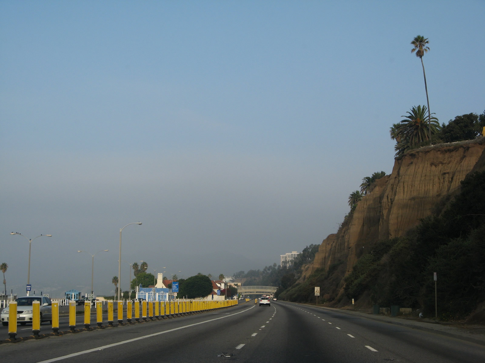
A large city limits sign for Santa Monica is posted along southbound California 1 (Pacific Coast Highway) yet is located on the east side of the highway, which makes for the back of this sign to be visible for northbound travelers. California California 1 proceeds with three northbound lanes as it leaves Santa Monica and enters the city of Los Angeles once again, this time in the community of Pacific Palisades. The lack of traffic depicted in this series of pictures if fairly rare. On most days, California 1 (Pacific Coast Highway) is quite busy and full of traffic. Photo taken 11/22/07. |
|
A residential tower stands sentinel over California 1 (Pacific Coast Highway) in Pacific Palisades. Photo taken 11/22/07. |
|
A tunnel below California 1 (Pacific Coast Highway) allows pedestrian access to the beach while avoiding having to cross the busy state highway at a signalized crosswalk. Photo taken 11/22/07. |
|
Northbound California 1 (Pacific Coast Highway) meets Entrada Drive (next traffic signal/first right turn) and approaches the turnoff to West Channel Road (second right) and Chautauqua Boulevard (third right). California 1 passes over Rustic Creek between the two traffic signals. Photo taken 11/22/07. |
|
After crossing Rustic Creek, northbound California 1 (Pacific Coast Highway) meets the turnoff to West Channel Road and Chautauqua Boulevard north. Use Chautauqua Boulevard north as a good shortcut to Sunset Boulevard east to notable places such as Riviera Country Club, Brentwood, and (after crossing Interstate 405) the University of California at Los Angeles (UCLA). Sunset Boulevard is a major arterial, ultimately linking Pacific Palisades with downtown Los Angeles via UCLA and Hollywood. A portion of the road through Hollywood and Downtown at one time carried fabled designations such as U.S. 66 and U.S. 101. Photo taken 07/03/05. |
|
California 1 (Pacific Coast Highway) continues along the coastline with a large retaining wall and virtually no shoulder. On high-speed, high-volume roads like this, we would not prefer to be riding a bicycle, despite what the sign says. The lack of shoulders makes bicycling here all the more treacherous. Photo taken 11/22/07. |
|
This partially obscured sign reads, "Beach Parking, one-half mile." Photo taken 11/22/07. |
|
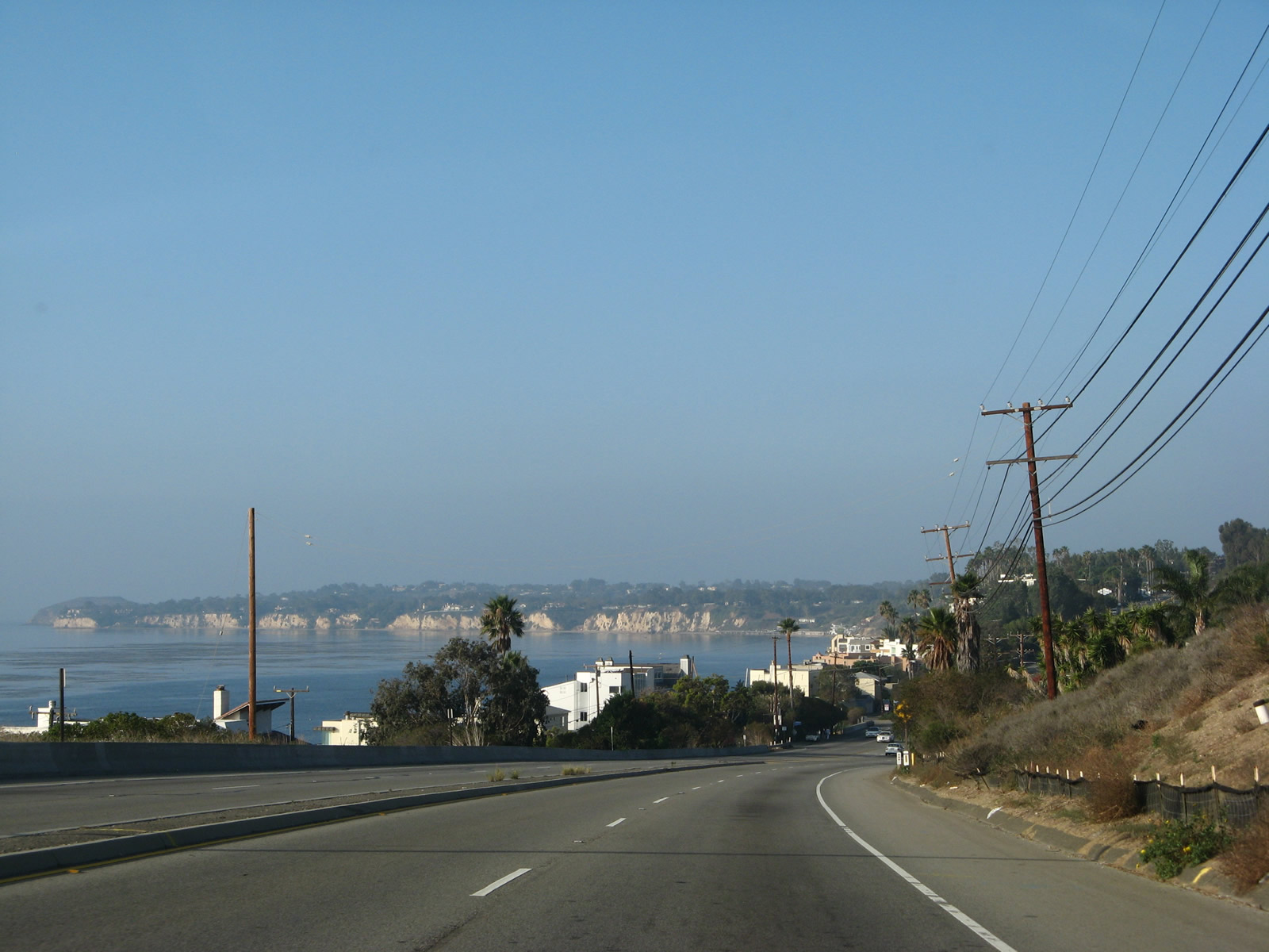
Views of the ocena are quite stunning along California 1 (Pacific Coast Highway). Photo taken 11/22/07. |
|
Northbound California 1 (Pacific Coast Highway) meets Temescal Canyon Road near Will Rogers State Park in Pacific Palisades. Near here is the original site of the Port of Los Angeles before it was moved to its current location near San Pedro and Long Beach. Photo taken 11/22/07. |
|
While pedestrian bridges are the preferred way to cross this busy highway, occasional walkways cross the highway as well. Photo taken 07/03/05. |
|
Northbound California 1 (Pacific Coast Highway) reaches the traffic signal for Bay Club Drive, which leads into the Bel-Air Bay Club. Photo taken 11/22/07. |
|
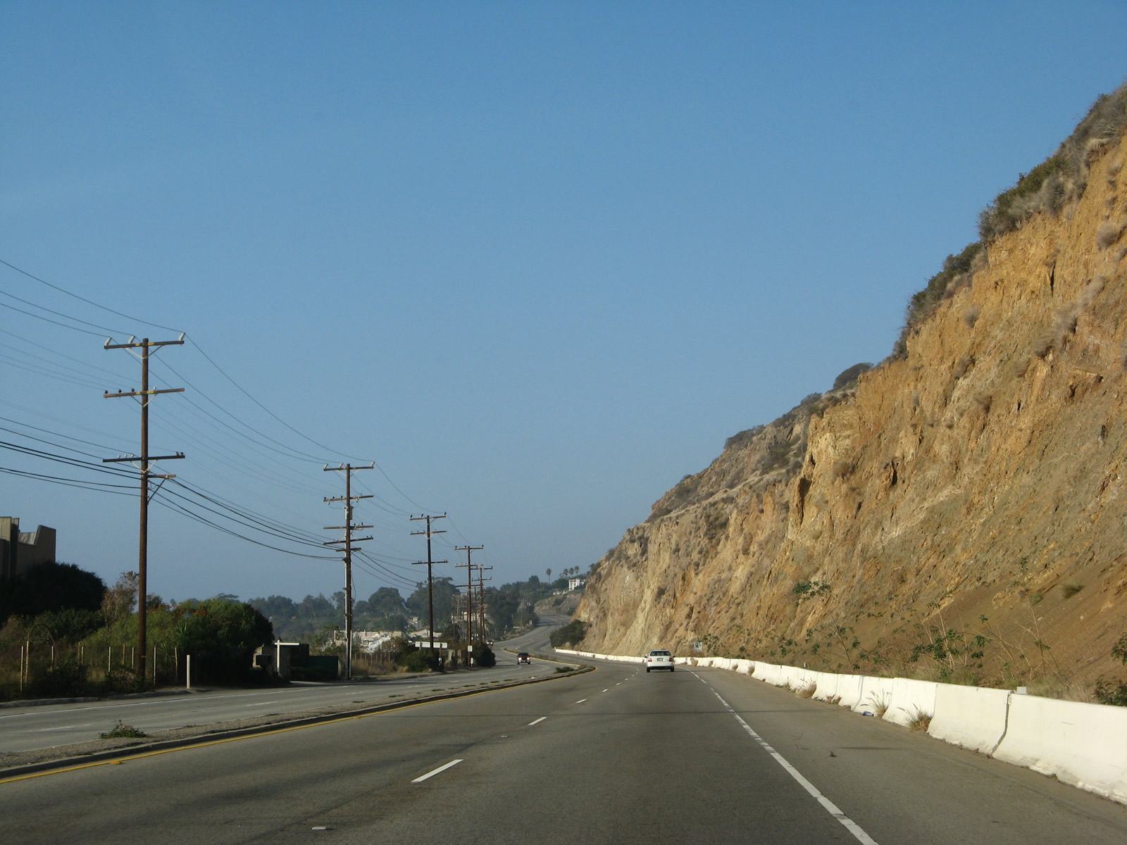
With crumbling sandstone cliffs adjacent to the Pacific Coast Highway, it becomes evident why certain areas have retaining walls. Photo taken 11/22/07. |
|
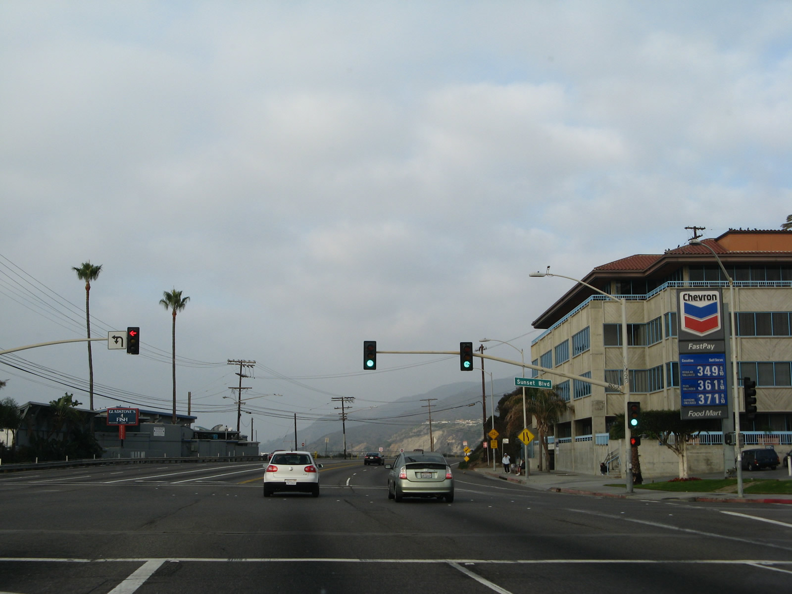
Northbound California 1 (Pacific Coast Highway) meets Sunset Boulevard at this traffic signal. A very long, winding arterial route, Sunset Boulevard travels east (generally) toward Hollywood and downtown Los Angeles. Photo taken 11/22/07. |
|
Another pedestrian bridge crosses over the busy Pacific Coast Highway. A signalized intersection with Porto Marina Way follows. Photo taken 11/22/07. |
|
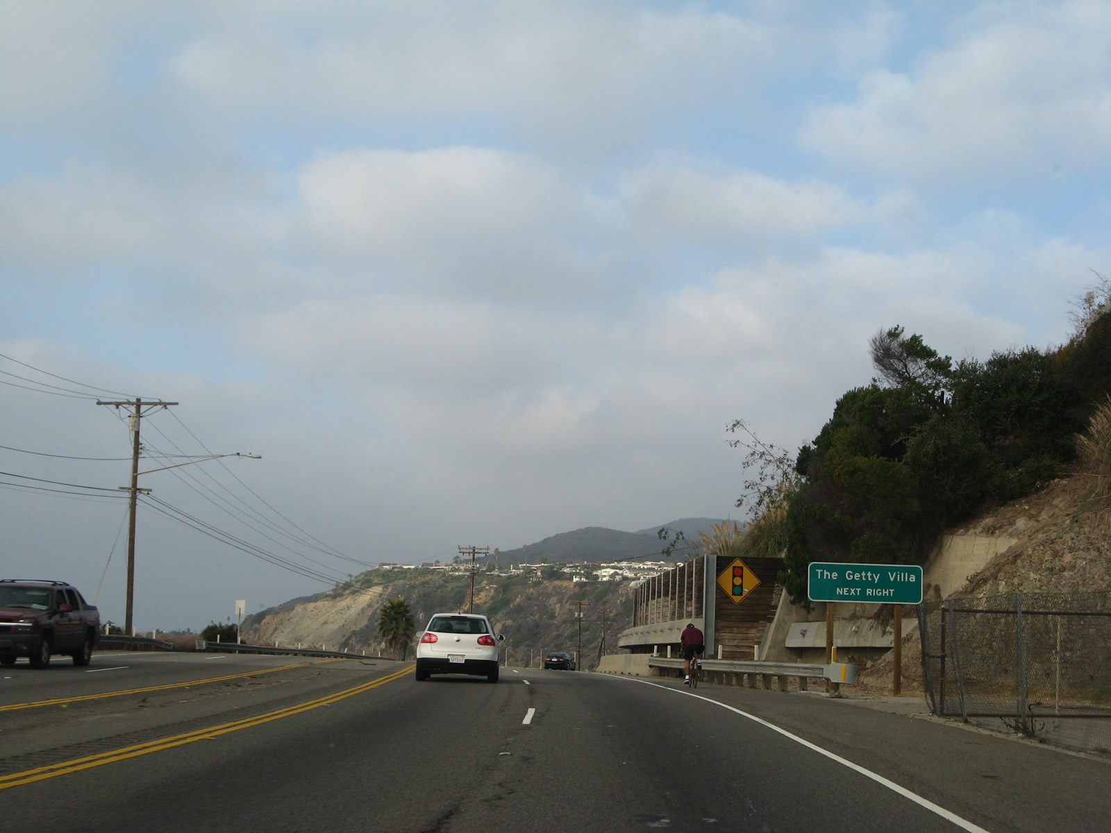
The next right serves the Getty Villa. Linked with the companion Getty Center in Brentwood off Interstate 405, the Getty Villa is an educational center focused on the history of Greece and Rome. Photo taken 11/22/07. |
|
The ocean again comes into view along northbound California 1 (Pacific Coast Highway). Note the large retaining wall adjacent to the northbound lanes. Photo taken 11/22/07. |
|
Bluff erosion is a common problem adjacent to the Pacific Coast Highway, and measures have been taken to prevent hillsides from sliding onto the state route. Photo taken 07/03/05. |
|
Turn right on Coastline Drive to enter the Getty Villa. Photo taken 11/22/07. |
|
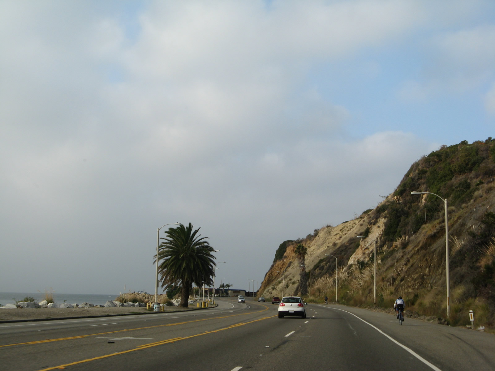
California 1 proceeds northwest along the coastline, now with five lanes (two in each direction with one center turn lane). Photo taken 11/22/07. |
|
Continuing northwest toward Malibu, another bluff with the potential for falling rocks rises along the northbound lanes. Photo taken 11/22/07. |
|
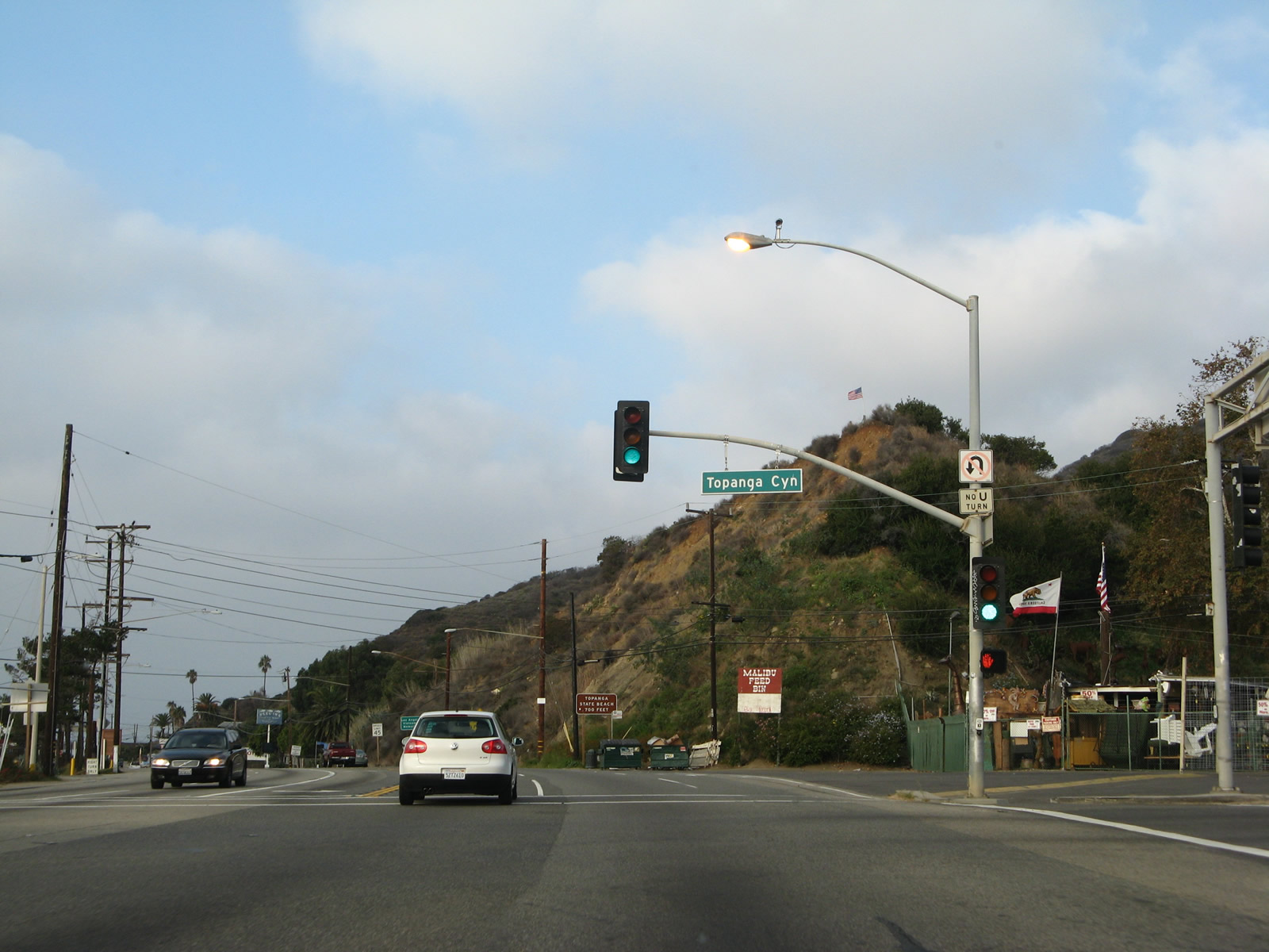
The next signalized intersection along California 1 north is with California 27 (Topanga Canyon Boulevard) north. Trucks are restricted on California 27, which oddly is not mentioned on any advance guide signs. Photo taken 11/22/07. |
|
Curving almost due west now, northbound California 1 (Pacific Coast Highway) meets California 27 (Topanga Canyon Boulevard) at this traffic signal. Soon after this intersection, California 1 will enter the city of Malibu. There are no guide signs for the southern terminus of California 27 here. Photo taken 11/22/07. |
|
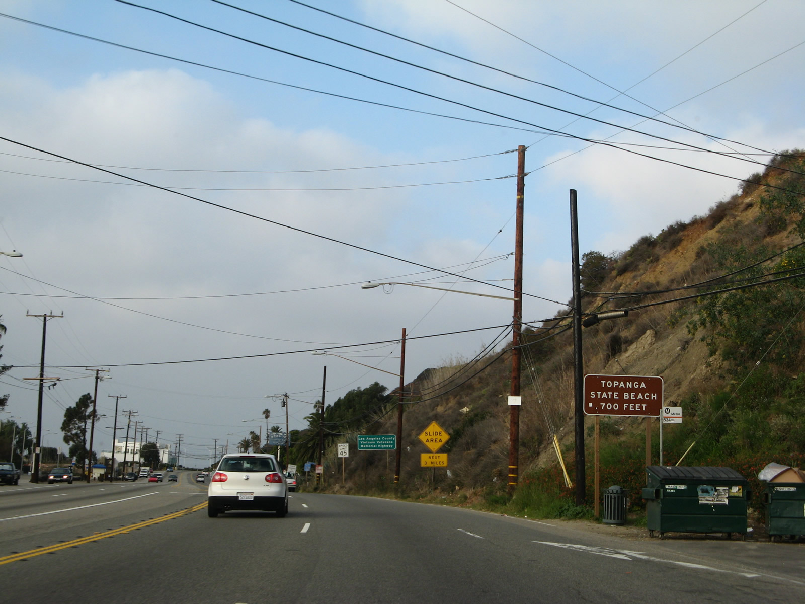
Leaving the intersection with California 27 (Topanga Canyon Boulevard), California 1 continues almost due west to a turnoff to Topanga State Beach. Photo taken 11/22/07. |
|
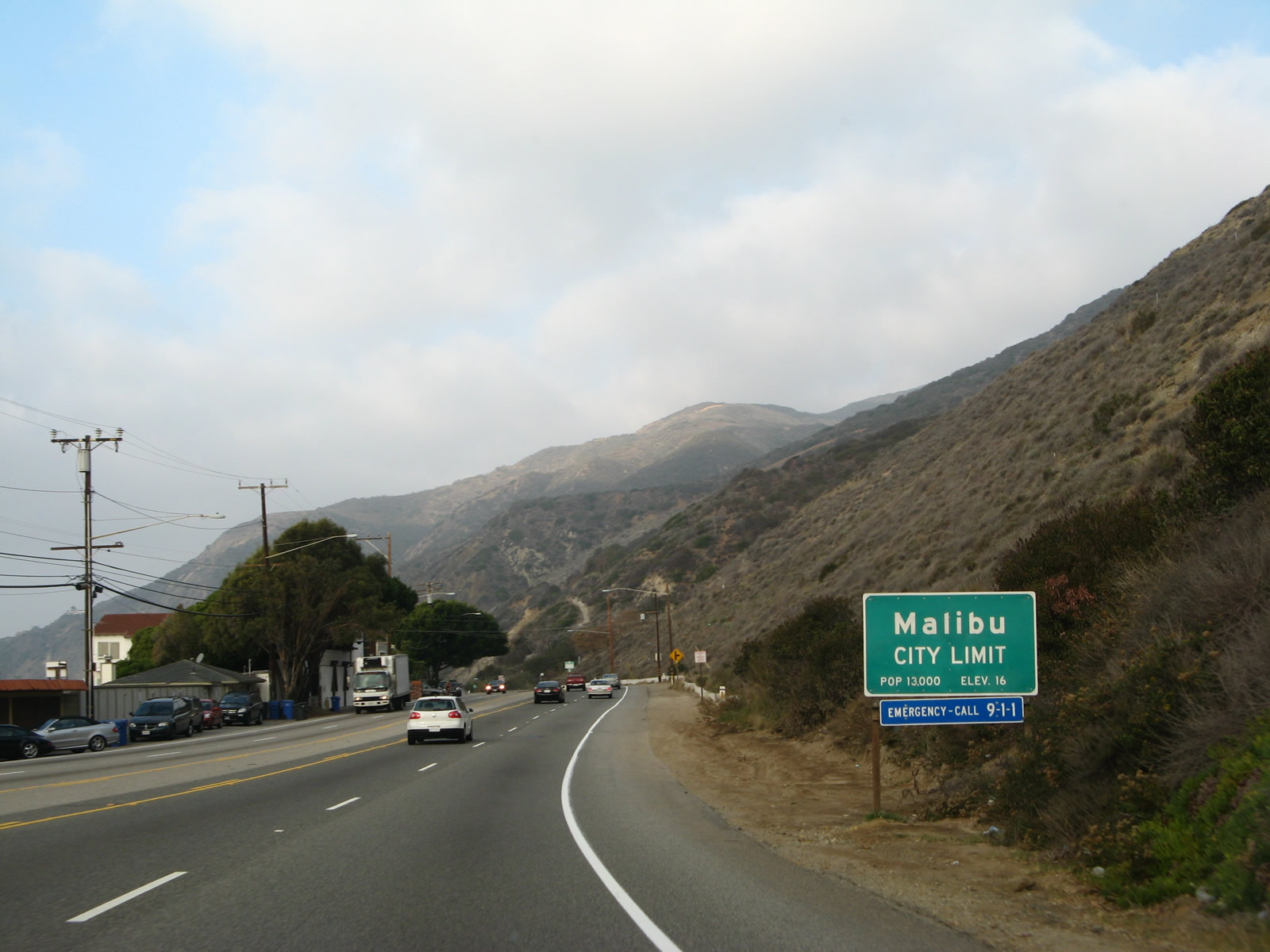
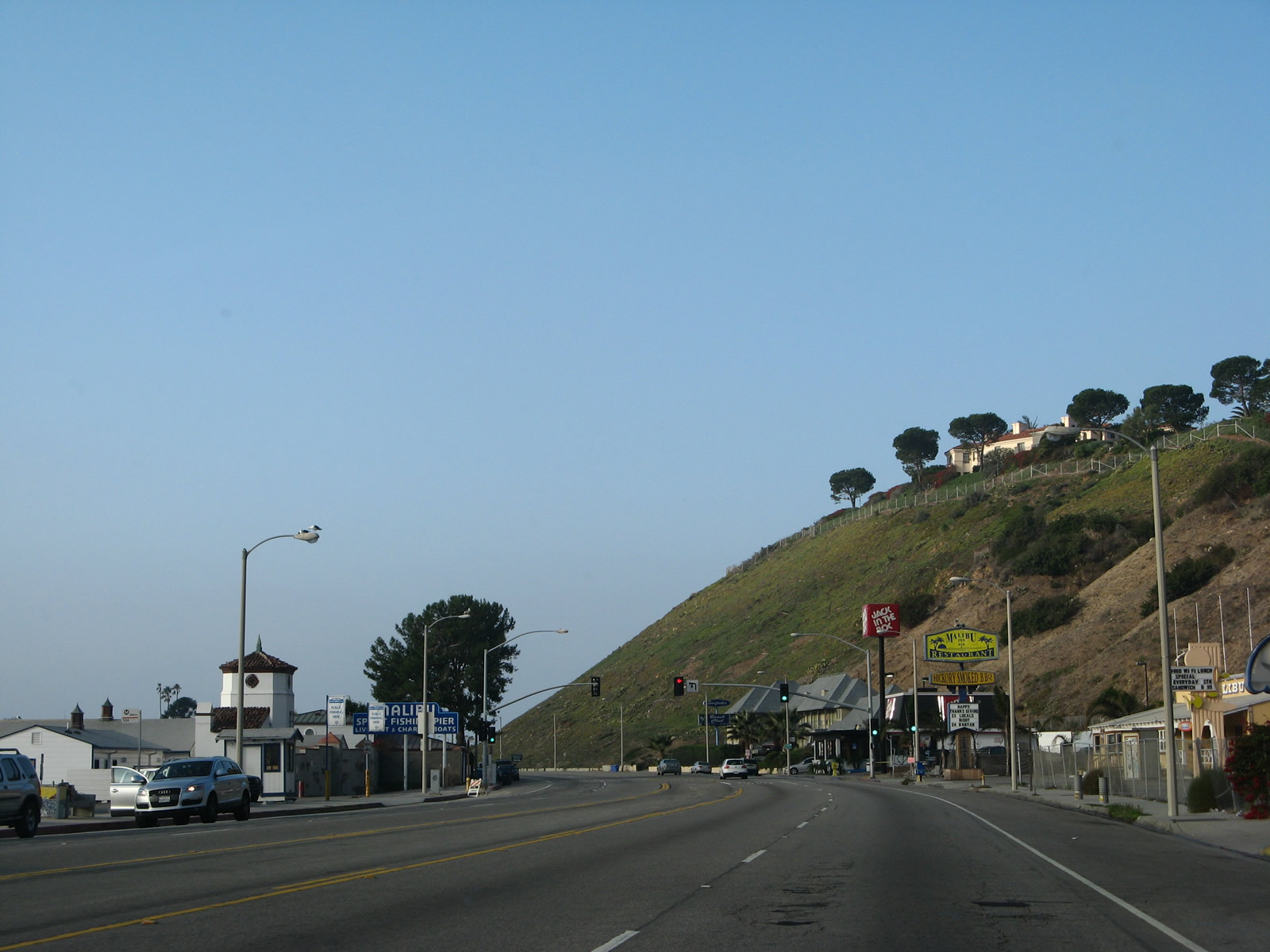
Northbound California 1 (Pacific Coast Highway) leaves Los Angeles and enters the city of Malibu, which had a population of 12,645 as of the 2010 Census and incorporated as a city in 1991. A 21-mile strip of oceanfront land along the Pacific Coast Highway, Malibu is well-known for being affluent and is home for some of the most famous and wealthy people in the United States. Only two days after we passed through Malibu, on November 24, 2007, the Corral Fire swept through the area causing damage to dozens of structures. Photo taken 11/22/07. |
|
A California 1 reassurance shield is posted next to a "Malibu: 27 Miles of Scenic Beauty" sign. While the city of Malibu extends for 21 miles, the entire length of coast known as "Malibu" extends for 27 miles. Photo taken 11/22/07. |
|
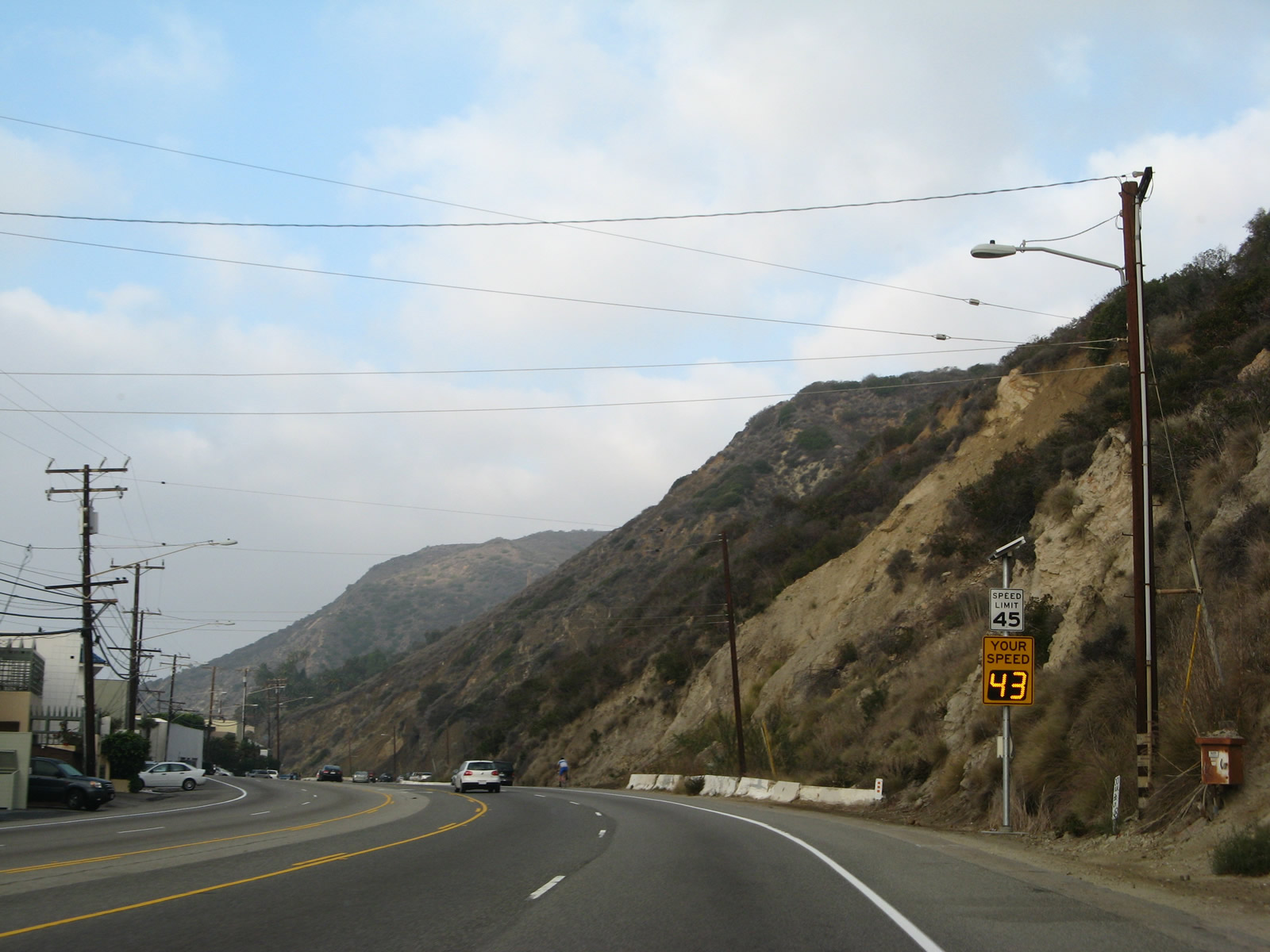
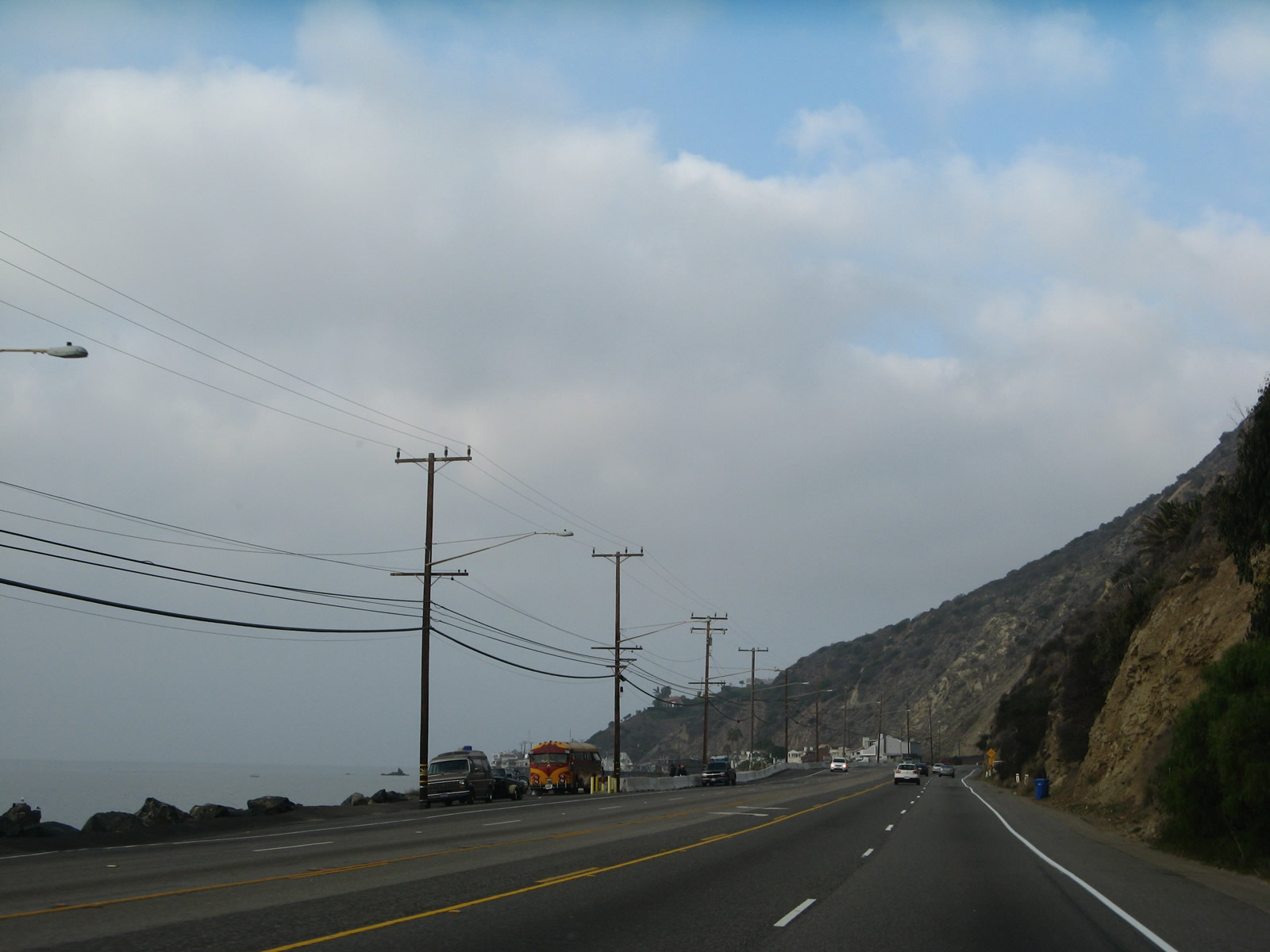
The model of development along California 1 through Malibu is fairly common: coastal development on the south side (left side) of California 1 (since we're traveling west at this point) and rugged hills on the north side (right side) of the highway. Photo taken 11/22/07. |
|
|
|
This series of pictures follows California 1 west through the city of Malibu along the Pacific Coast Highway. Photos taken 11/22/07. |
|
|
|
Northbound (westbound) California 1 (Pacific Coast Highway) meets Big Rock Drive at this signalized intersection. Photos taken 11/22/07. |
|
|
|
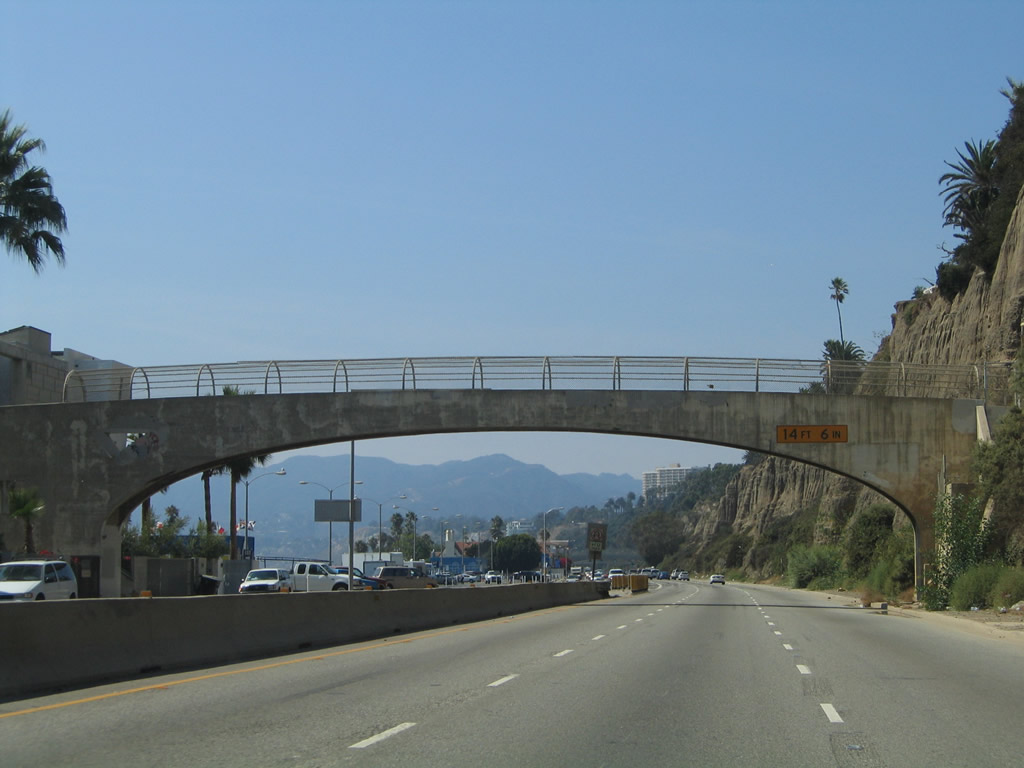
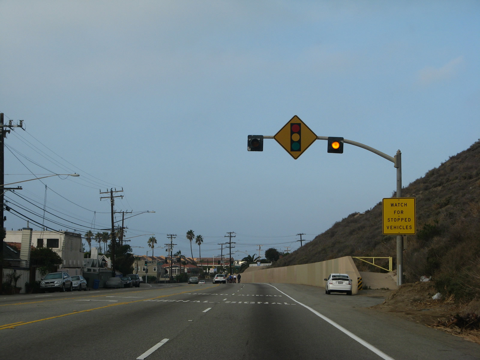
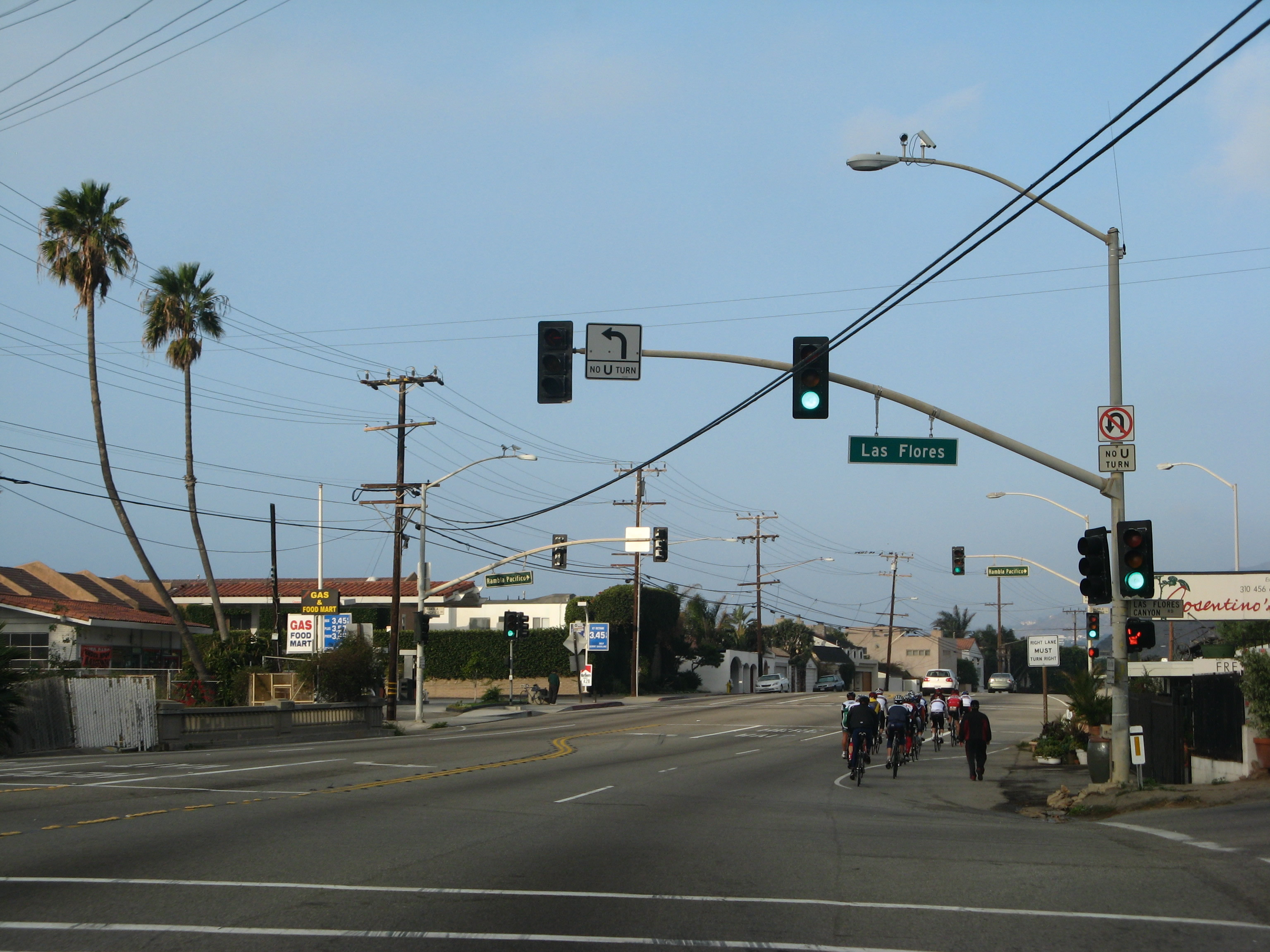
Fragile sandstone cliffs line the northern edge of California 1 (Pacific Coast Highway) westward through Malibu. In the final picture of this set, California 1 meets both Las Flores Canyon Road and Rambla Pacifica Street at two signalized intersections that lie very close to each other. Bicyclists are common along Pacific Coast Highway, including the stretch through Malibu. Both Las Flores Canyon Road and Rambla Pacifica Street travel north from this intersection into the hills, offering access to residential areas and evetually linking to Stunt Road and Mulholland Highway. Between these two intersections is a 1931 bridge; look for old style bridge railing along the northbound lanes of California 1. Photos taken 11/22/07. |
|
|
|
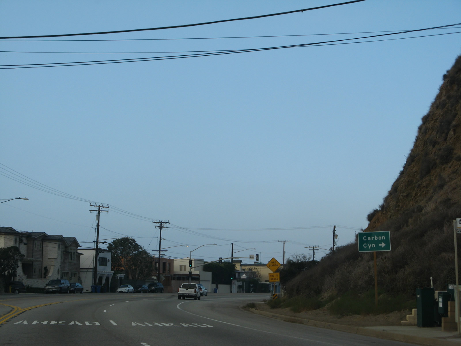
Northbound/westbound California 1 (Pacific Coast Highway) approaches Carbon Canyon Road. Increasing commercial development becomes more common as the state route advances west along the coastline. Photos taken 11/22/07. |
|
|
|
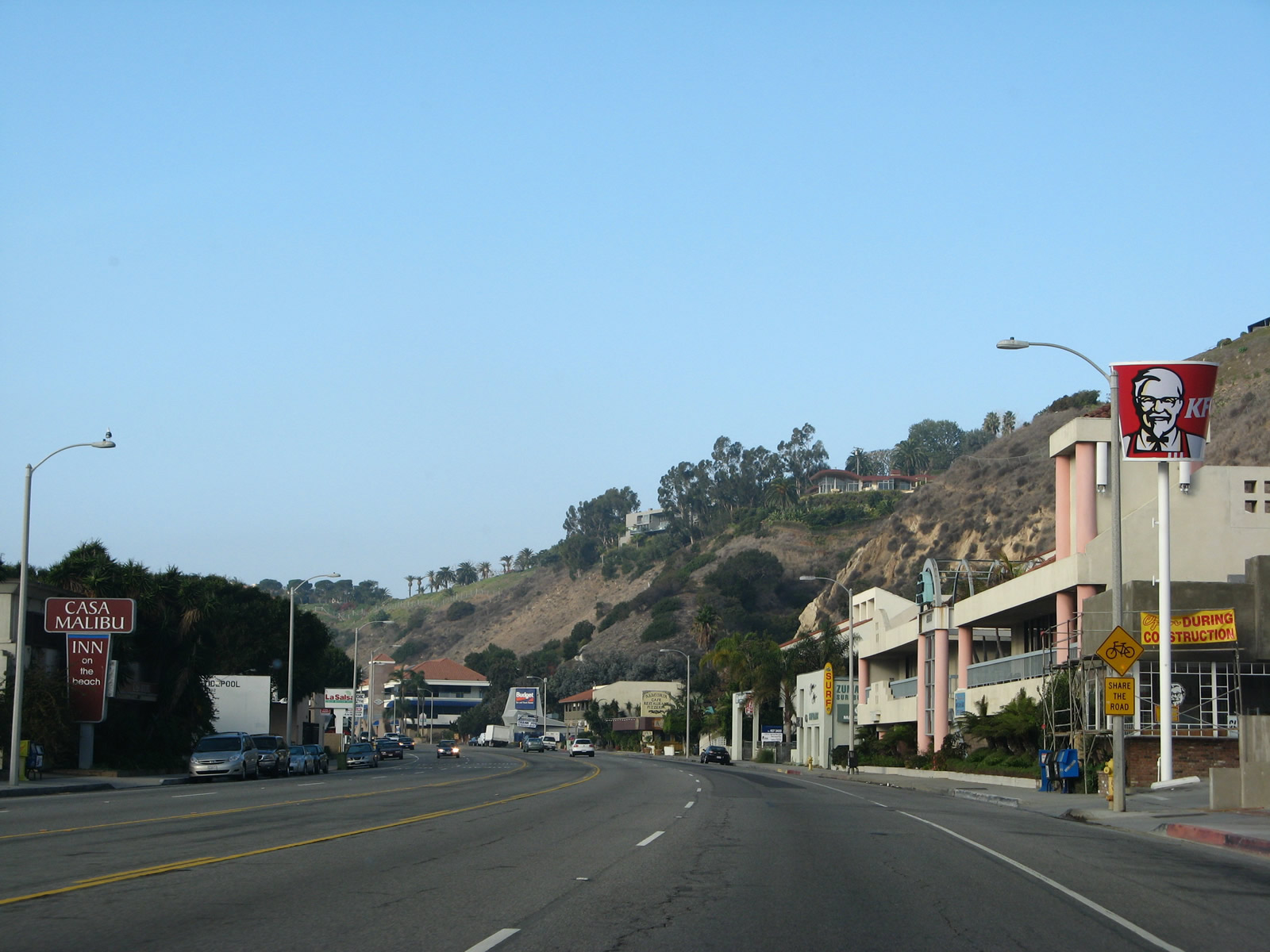
California 1 (Pacific Coast Highway) approaches Malibu Pier, which is operated by California State Parks. The pier is a launching point for boat charter tours as well as a place to fish, swim, and surf. It was built in 1905 and opened to the public in 1934. The State of California took ownership in 1980 and has operated ever since, although it was closed for a period in the mid-1990s due to storm damage to the pier. Following the pier, the next turnoff is for Malibu Lagoon State Beach. Use on-street parking or this parking area to visit the Pier, the historic Adamson House (contains a museum), and scenic beauty of the lagoon. Photos taken 11/22/07. |
|
|
|
Immediately thereafter, California 1 (Pacific Coast Highway) crosses Malibu Lagoon and approaches Cross Creek Road, which connects to Civic Center Way and a signficant business district of Malibu. More state park parking is available by turning left at this traffic signal. Photos taken 11/22/07. |
|
|
|
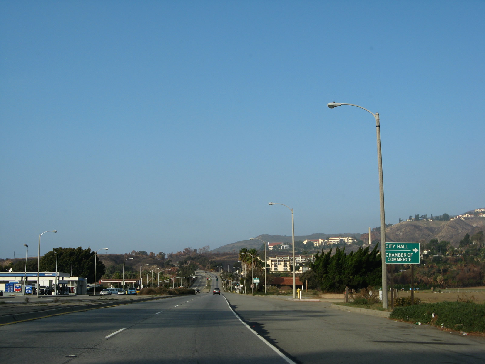
After the intersection with Cross Creek Road, California 1 (Pacific Coast Highway) approaches and meets Webb Way, which serves as a turnoff to the Malibu City Hall and Civic Center. Pepperdine University comes into view on the hill overlooking the civic center area. Photos taken 11/22/07. |
|
|
|
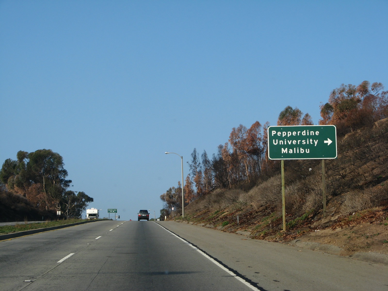
Northbound California 1 (Pacific Coast Highway) approaches and meets Los Angeles County N-1/Malibu Canyon Road, which travels north through the mountains to U.S. 101 (Ventura Freeway). N-1 was not signed from northbound California 1 at the time we took these pictures. Photos taken 11/22/07. |
|
|
|
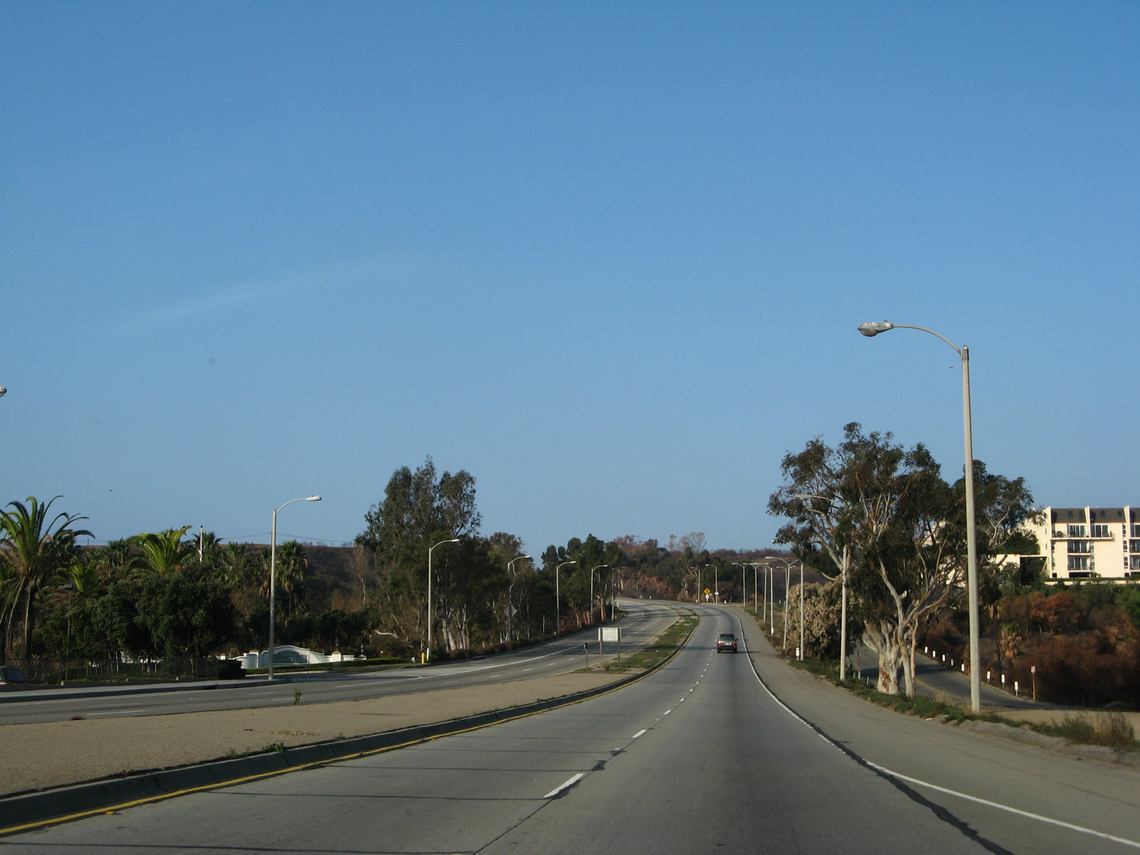
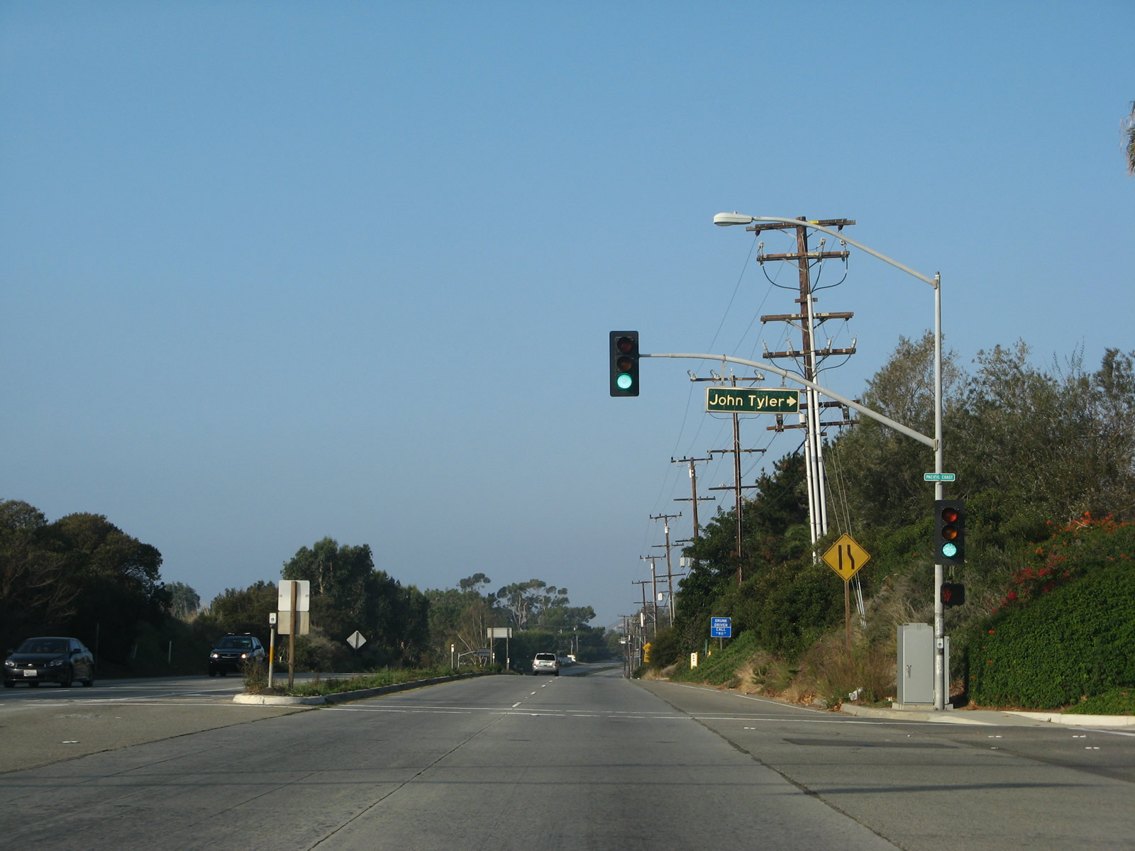
After the Malibu Canyon Road intersection, California 1 (Pacific Coast Highway) proceeds west. It passes John Tyler Drive, which links with Pepperdine University's campus. Area development decreases as the state route advances west beyond the campus. Photos taken 11/22/07. |
|
|
|
The Pacific Ocean again comes into view along California 1 (Pacific Coast Highway). Gorgeous! Photos taken 11/22/07. |
|
|
|
California 1 (Pacific Coast Highway) continues west along the coastline. Photos taken 11/22/07. |
|
|
|
California 1 (Pacific Coast Highway) meets Latigo Canyon Road at this intersection, then proceeds to another stunning view of the Malibu coast. The four-lane highway continues in a near-expressway configuration. Photos taken 11/22/07. |
|
|
|
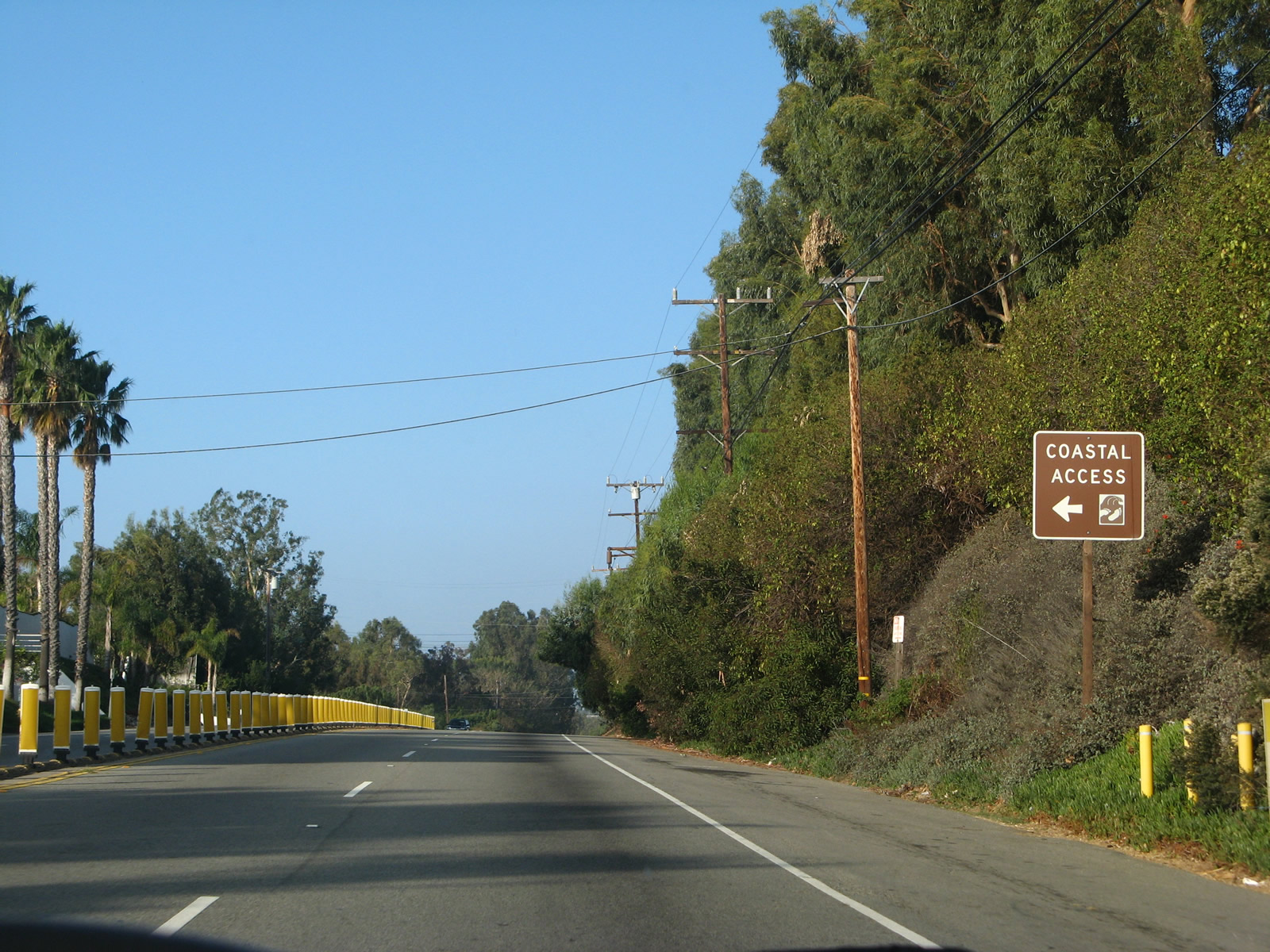
We continue traveling west along California 1 (Pacific Coast Highway) as it follows the Pacific coastline through the city of Malibu. Coastal access signs (brown) show the way for the public to have access to the coast, sometimes with parking readily available. The California coastline has significant public ownership with numerous public access points. More on this topic is available at Coastal Clash: How Beaches Work, which states, "In Malibu, the debate rages not only over whether the sand itself is public or private but also over the maintenance of public access ways, called 'offers to dedicate' (OTDs). OTDs are legal easements that provide access to the coast across private property. In Malibu, these 'dedicated' strips of land often run between densely packed multimillion-dollar beach homes along the Pacific Coast Highway. The California Coastal Conservancy works in partnership with local governments, other state agencies and nonprofit land trusts to acquire, develop and manage public passageways." Photos taken 11/22/07. |
|
|
|
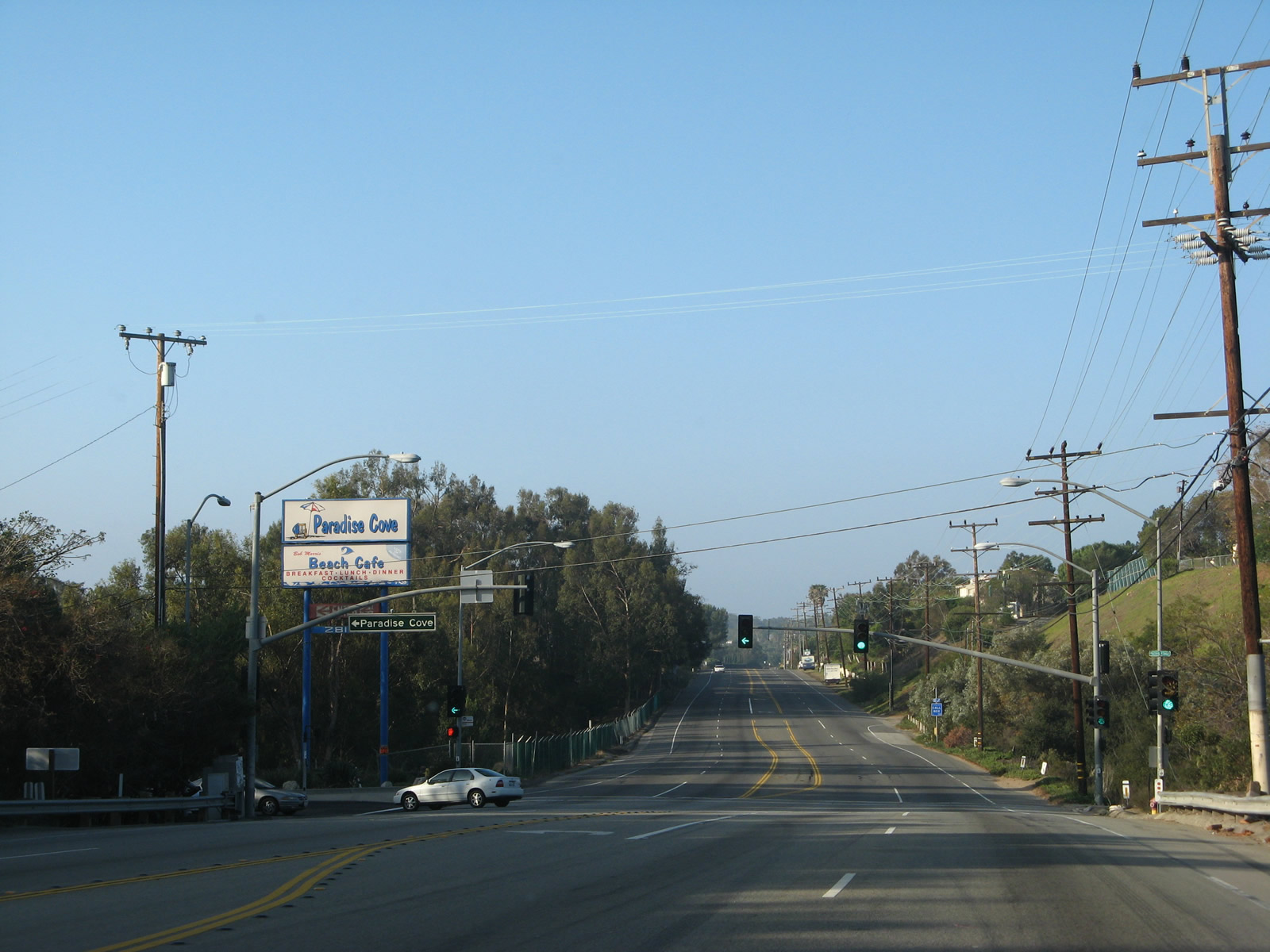
The next traffic signal is with Paradise Cove Road, which leads to Paradise Cove, which includes a restaurant and pier. On-the-sand dining was available last time we visited. Photos taken 11/22/07. |
|
|
|
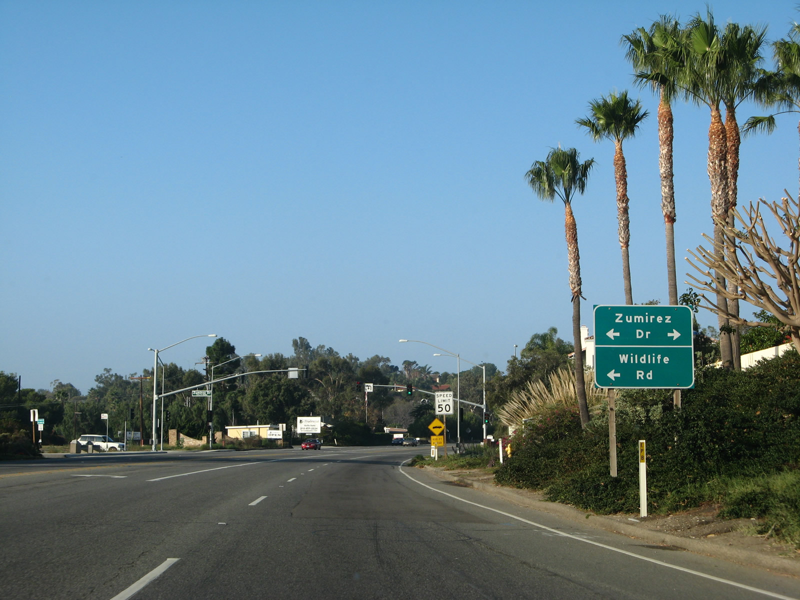
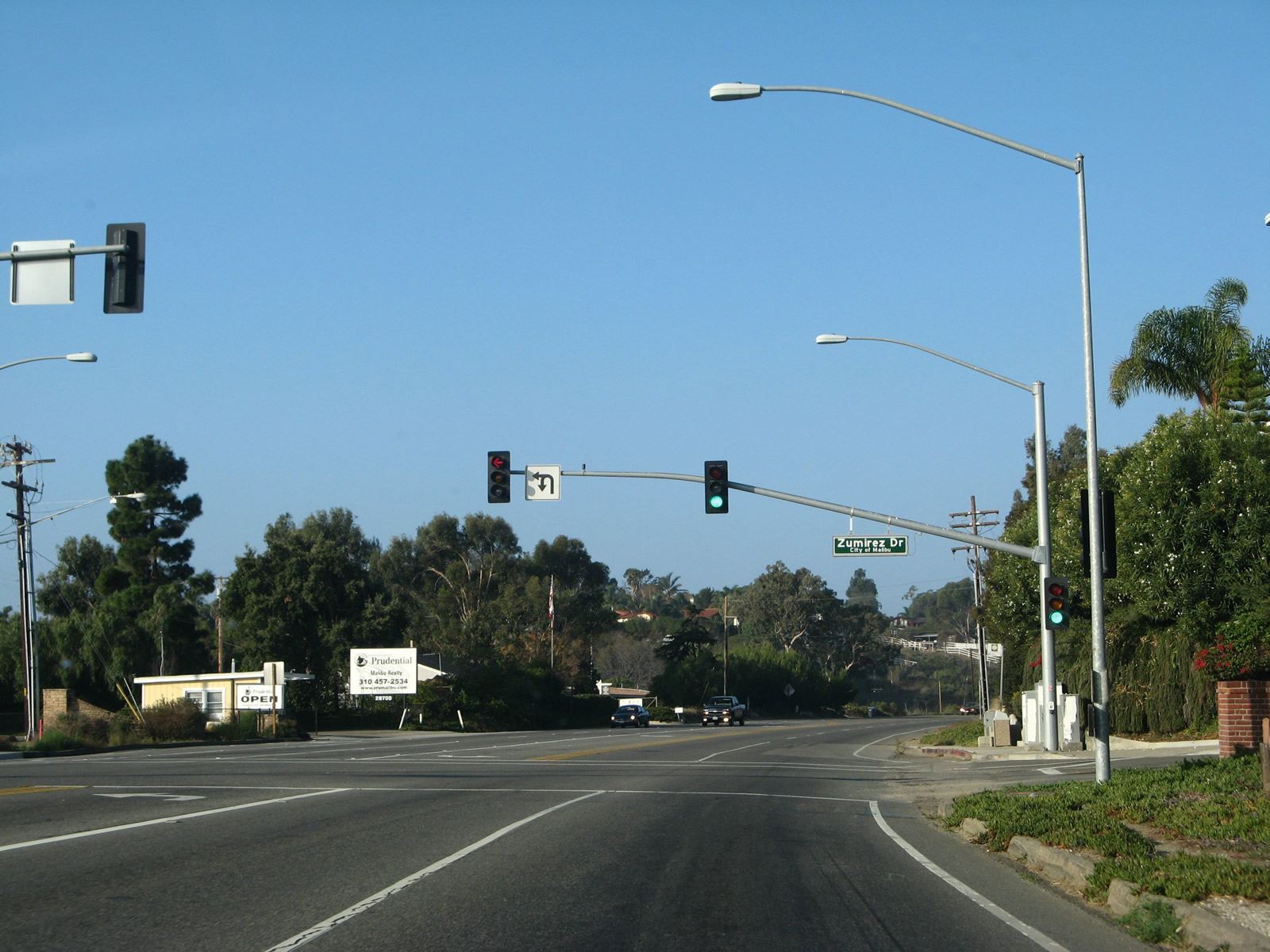
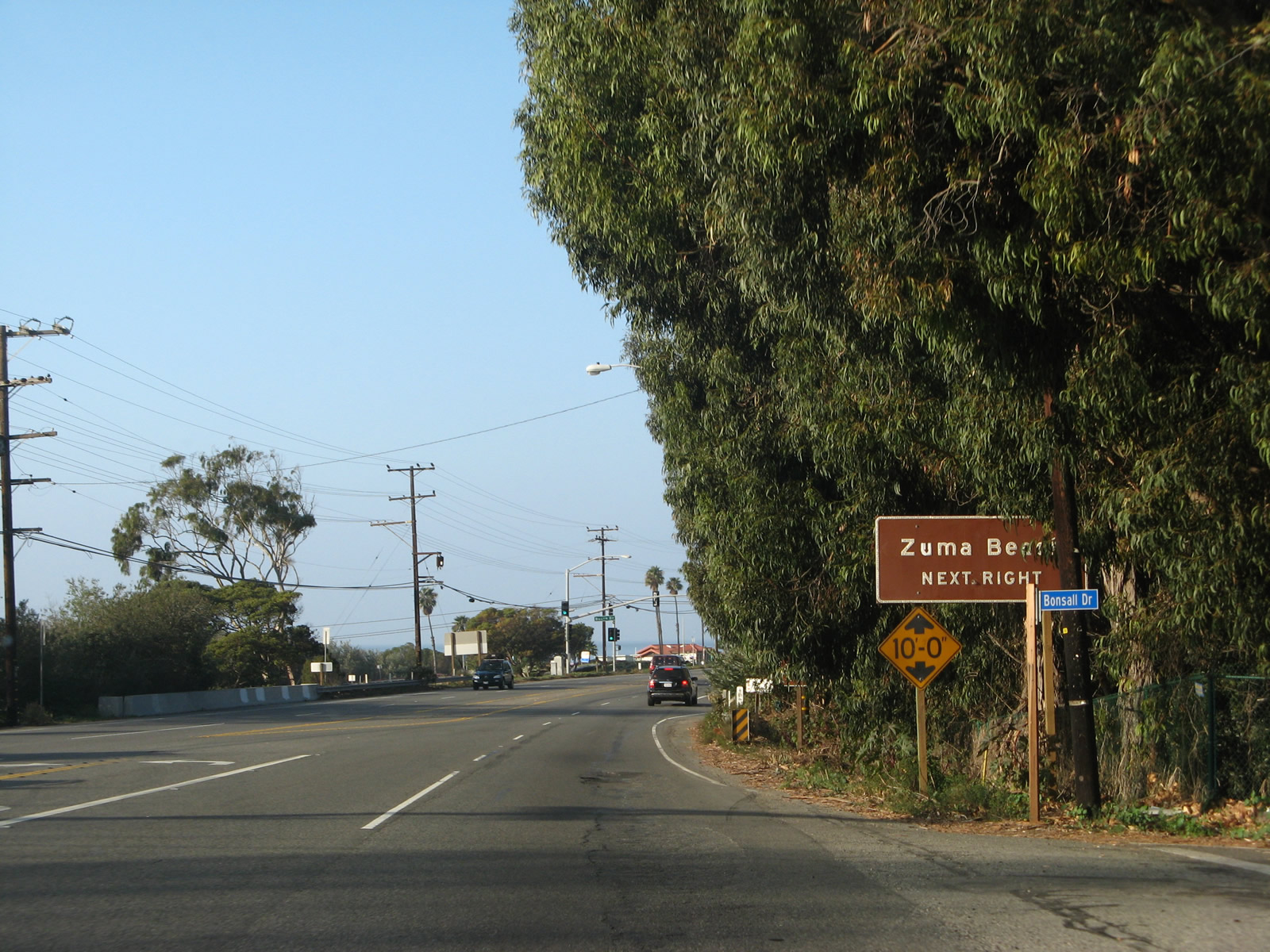
Northbound (westbound) California 1 (Pacific Coast Highway) approaches Zumirez Drive, which travels north-south to provide local access. Access to Point Dume State Beach can be provided via Zumirez Drive/Wildlife Road south to Fernhill Drive south to Cliffside Drive west. Another method is to remain on California 1 (PCH) west until the turnoff at Zuma Beach just ahead, which also connects to Westward Beach, which is a county park. Photos taken 11/22/07. |
|
|
|
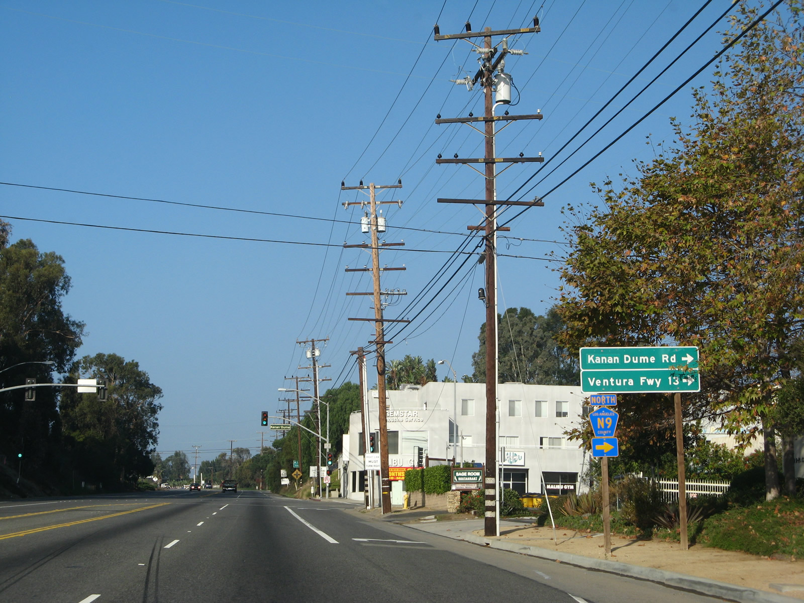
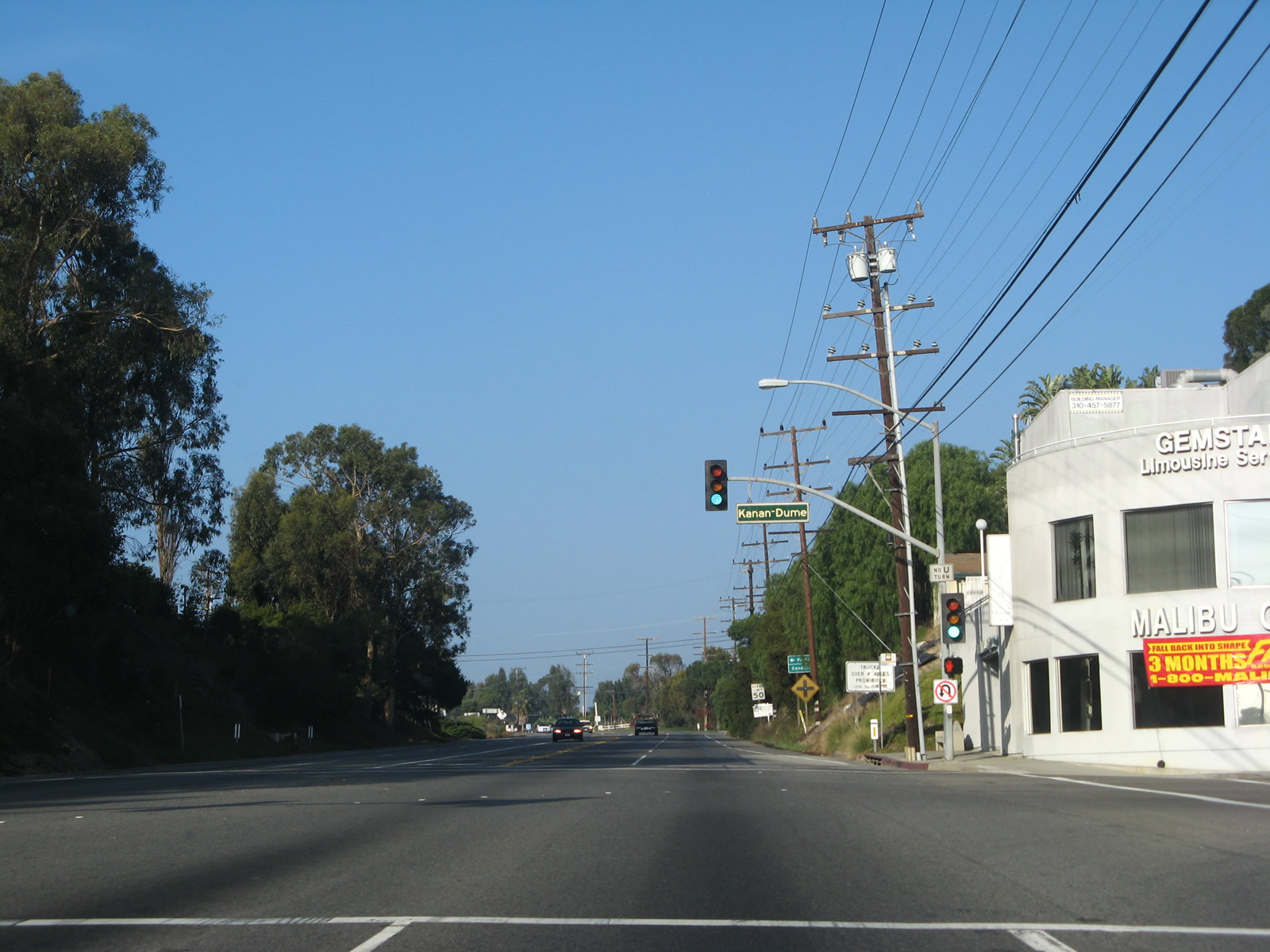
The next traffic signal is with Los Angeles County N-9/Kanan Dume Road. Use Kanan Dume Road north through the Santa Monica Mountains, which have been keeping California 1 separate from inland valleys since entering Malibu. These mountains extend from Point Mugu in Ventura County east to the Hollywood Hills in Los Angeles. They are a natural barrier between the ocean and populated areas along the U.S. 101 (Ventura Freeway) corridor; they also keep development limited in the area between the coast and U.S. 101. Los Angeles County N-9 travels north as Kanan-Dume Road through a canyon to reach Mulholland Highway, then it changes names to Kanan Road and turns northeast a bit to meet U.S. 101 at Exit 36 in the community of Agoura Hills. The entire route from PCH to U.S. 101 is about 13 miles long, with the Kanan Road segment built in 1964 and the Kanan-Dume Road segment built in 1974.1 The highway travels through Santa Monica Mountains National Recreation Area and features three tunnels (one south of Mulholland Highway and two north of Mulholland Highway). Assigned N-9 in 1974, the combined Kanan Road and Kanan Dume Road was the last signed pentagon county route to be signed in Los Angeles County (as of 2016). Photos taken 11/22/07. |
|
|
|
Northbound (westbound) California 1 (Pacific Coast Highway) meets Heathercliff Road, then approaches Westward Beach Road (next left) to both Point Dume State Beach and Westward Beach. Following that is the turnoff to Zuma Beach via Busch Drive. Photos taken 11/22/07. |
|
|
|
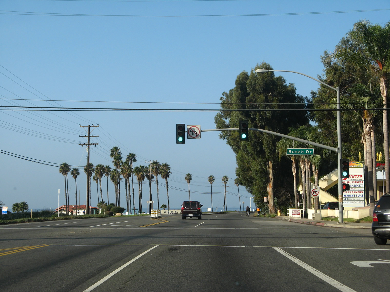
California 1 curves northeast to leave Point Dume and proceed along Zuma Beach, a wide expanse of sand. The next two signalized intersections are with Busch Drive and Morning View Drive. Turn right on Monrning View Drive to Malibu High School. Photos taken 11/22/07. |
|
|
|
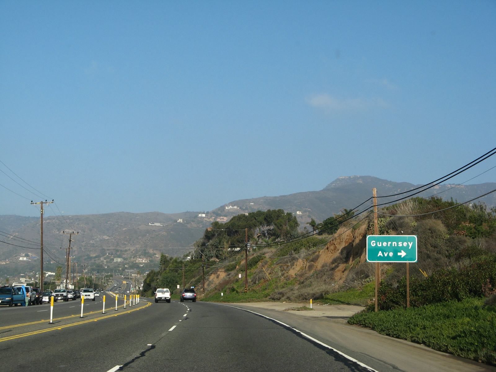
Still in Malibu along Zuma Beach, northbound (westbound) California 1 (Pacific Coast Highway) meets Guernsey Avenue and a signalized intersection with Broad Beach Road (to a public coastal access point) and Trancas Canyon Road north to a residential area; it is not a through street. Broad Beach Road is a residential access road that parallels California 1 briefly; it rejoins the route a mile or so further west of here. Photos taken 11/22/07. |
|
|
|
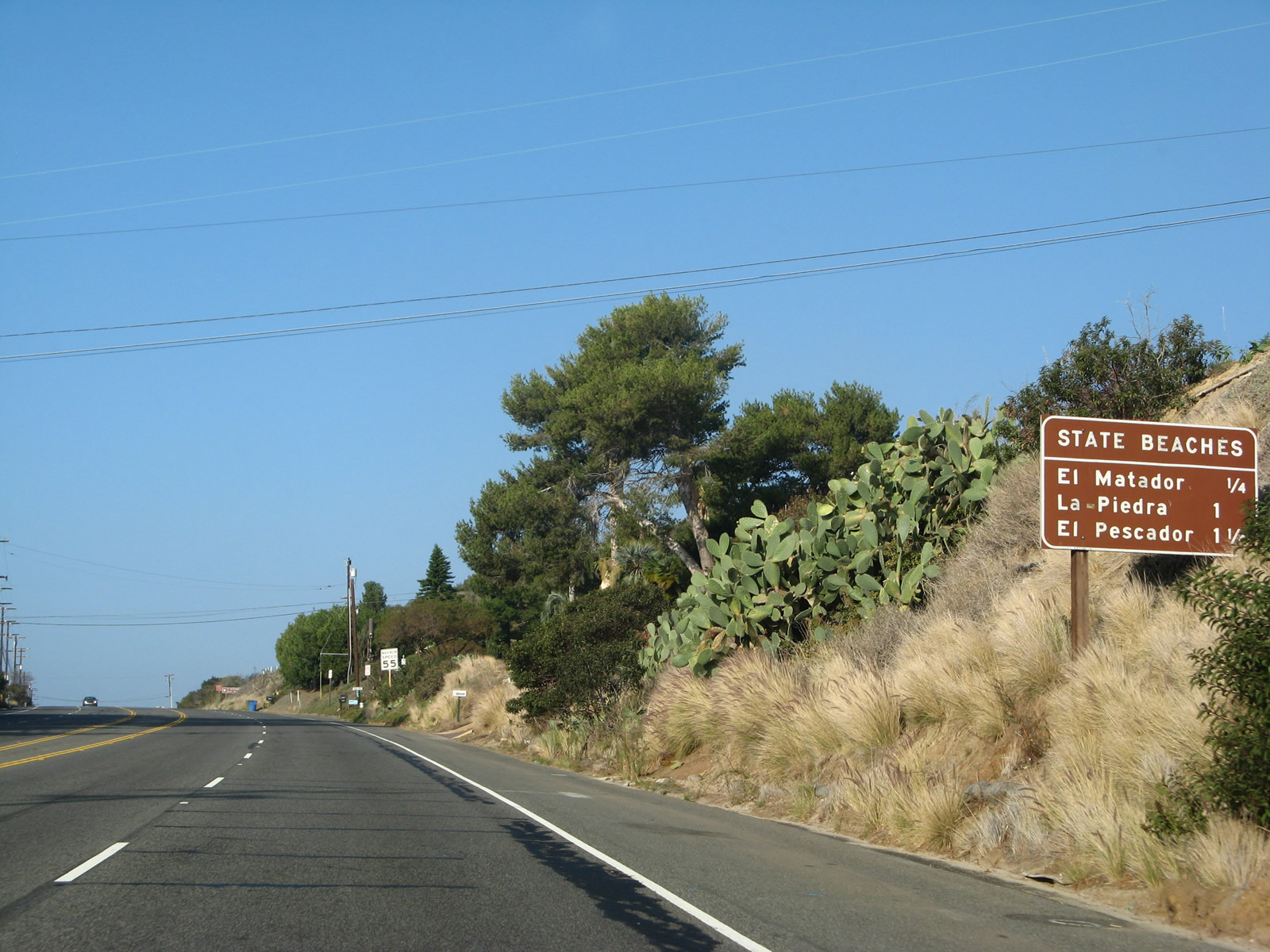
Broad Beach Drive rejoins California 1, and then a mileage sign provides the distance to El Matador State Beach, La Piedra State Beach, and El Pescador State Beach. Each of these state beaches provides public access to the sand and ocean. Photos taken 11/22/07. |
|
|
|
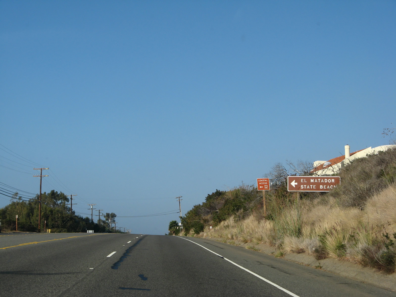
California 1 meets the turnoff for El Matador State Beach, then intersects Encinal Canyon Road, which travels north to Charmlee Wildernees Park before ending at California 23/Decker Road. Photos taken 11/22/07. |
|
|
|
|
|
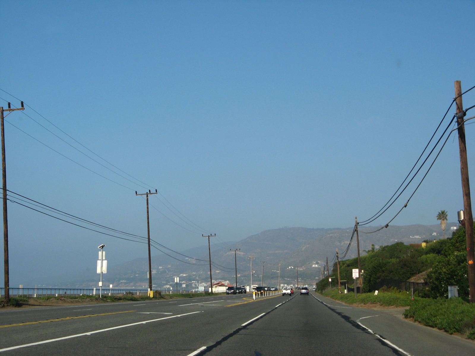
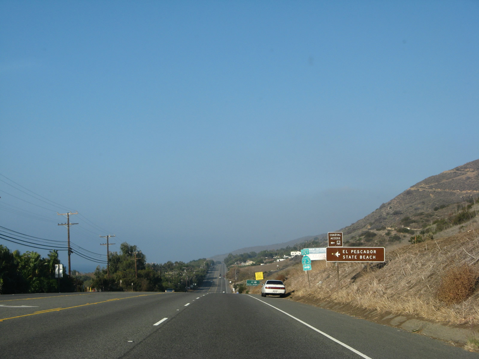
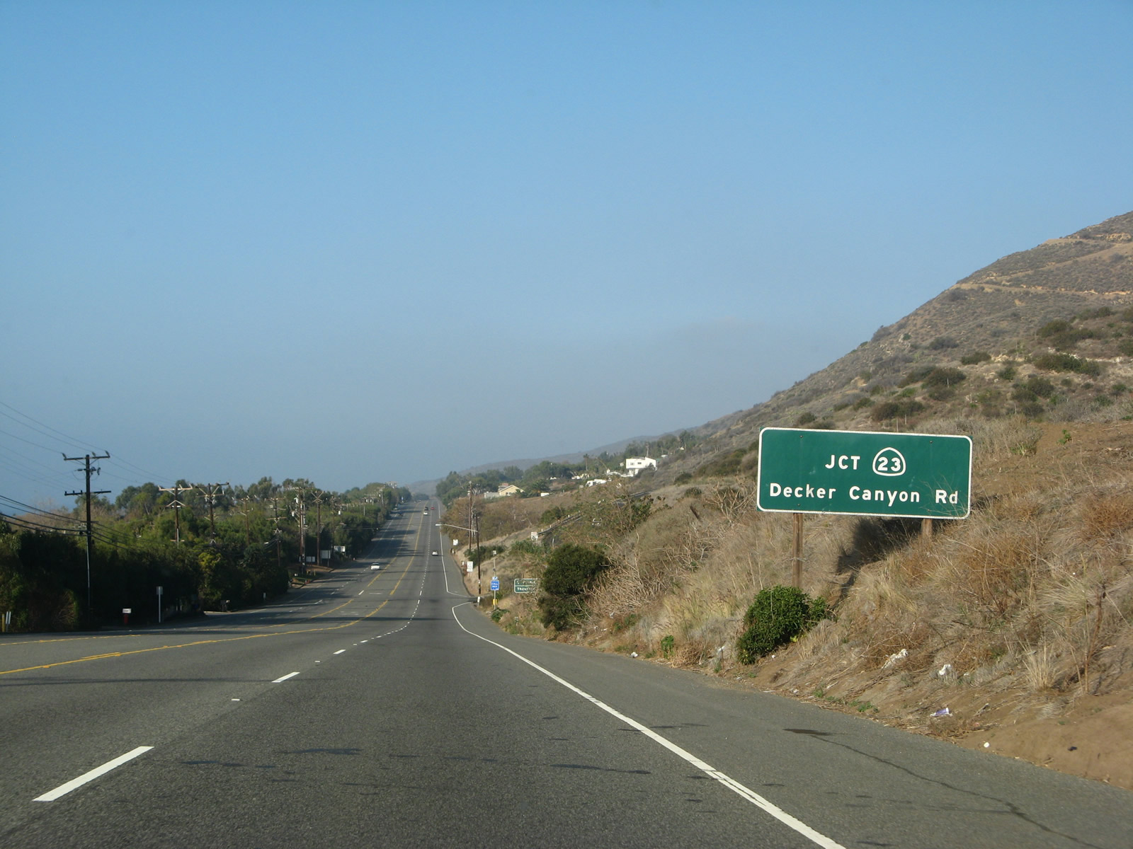
| After the turnoffs to the three state beaches -- El Matador State Beach, La Piedra State Beach, and El Pescador State Beach -- northbound California 1 (Pacific Coast Highway) approaches the junction with California 23/Decker Road. California 34 travels north along Decker Road to cross the Santa Monica Mountains to meet U.S. 101 at Exit 40 in Thousand Oaks. This winding, busy road is not necessarily the most direct route between California 1 and U.S. 101, as Los Angeles County N-9 is arguably a better road. However, it is a state highway, and it is built to state highway standards. While the portion of California 23 between U.S. 101 (Ventura Freeway) and California 118 (Ronald Reagan [Simi Valley] Freeway) in Moorpark is built to freeway standards, the segment of California 23 from here north to U.S. 101 is generally a two-lane conventional highway. California 23 reverts to two lanes north of Moorpark and reaches its northern terminus at California 126 in Fillmore. Photos taken 11/22/07. |
Page Updated January 3, 2016.