
California 91 East - Exits 15 to 29
| California 91 - Artesia Boulevard east | |
|---|---|
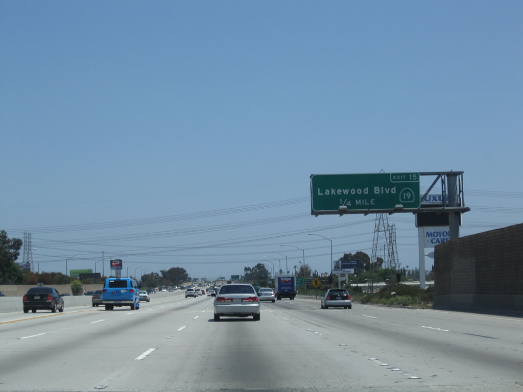 |
The next exit along eastbound California 91 (Artesia Freeway) is Exit 15, California 19 (Lakewood Boulevard). This major north-south arterial has been in the state highway system for years, but it is being systematically decommissioned as cities take over maintenance of the arterial route. However, the entire route is still signed from California 1 (Pacific Coast Highway) at Los Alamitos Traffic Circle north to Interstate 210 (Foothill Freeway). Photo taken 05/02/10. |
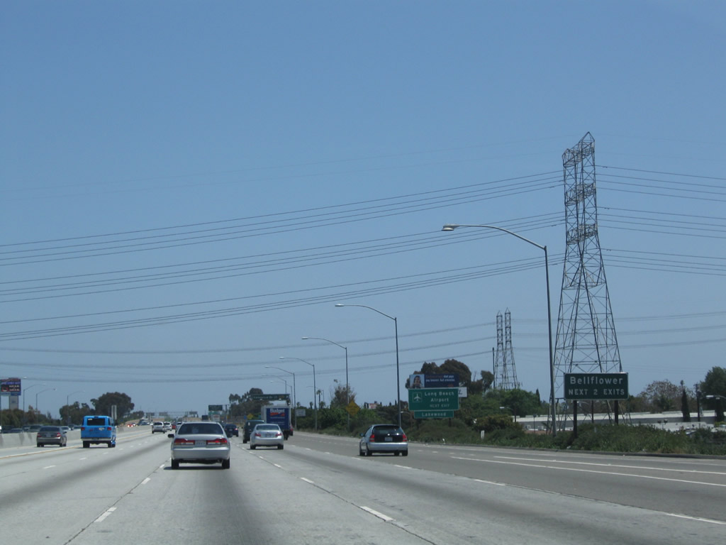 |
The next two exits will serve the city of Bellflower. Ahead, a towering Los Angeles Department of Water and Power transmission line will cross over California 91 as it proceeds south to a power generating station located near Long Beach. California 91 continues to parallel former California 14/Artesia Boulevard. Contrary to common belief, the Artesia Freeway segment of California 91 was never part of U.S. 91; instead, U.S. 91 originated at the intersection of Atlantic Avenue and Pacific Coast Highway, followed Pacific Coast Highway east, turned north on Lakewood Boulevard, then turned east on Lincoln Avenue. U.S. 91 will not join the modern California 91 alignment until we get close to the California 55 freeway interchange. Photo taken 05/02/10. |
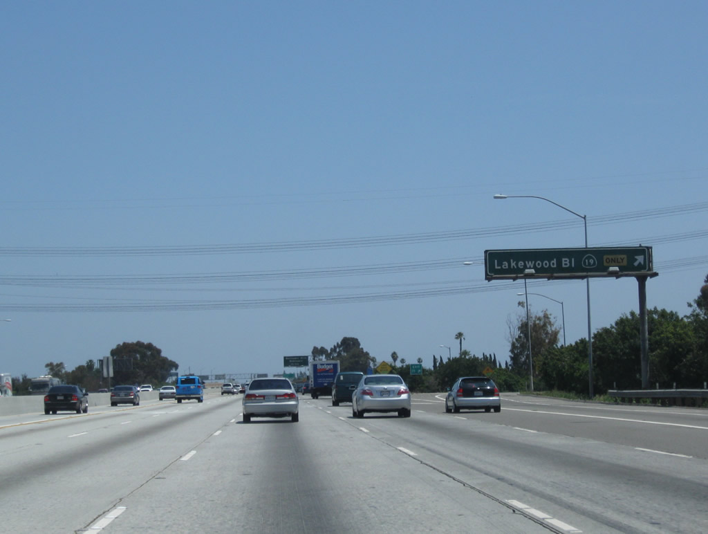 |
Eastbound California 91 reaches Exit 15, California 19 (Lakewood Boulevard). Photo taken 05/02/10. |
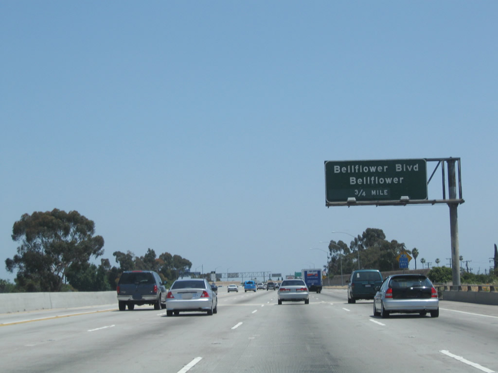 |
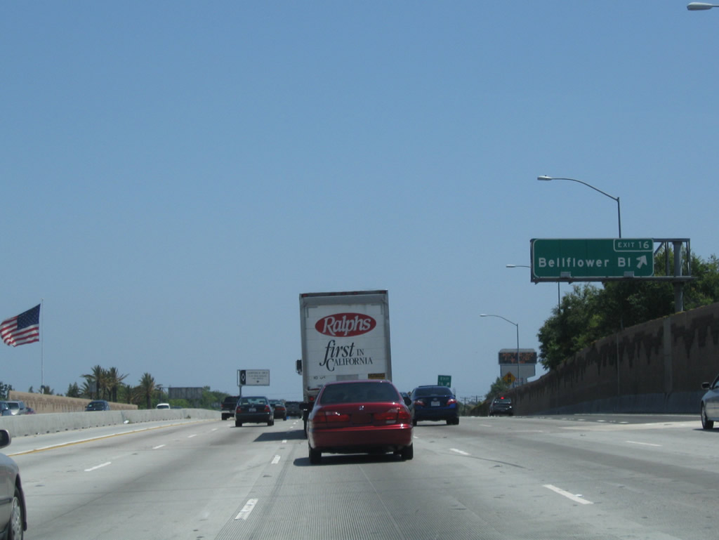
The next exit along California 91 east is Exit 16, Bellflower Boulevard. Photo taken 05/02/10. |
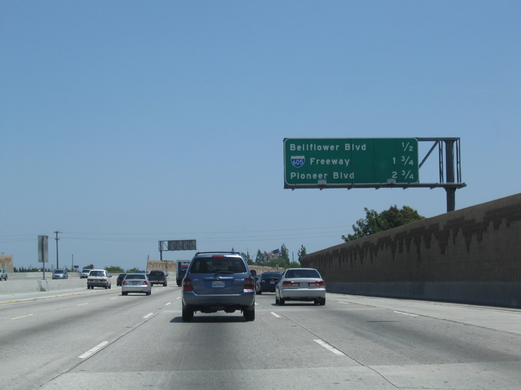 |
This interchange sequence sign provides the distance to the next three exits along California 91 east: Exit 16, Bellflower Boulevard; Exit 17, Interstate 605 (San Gabriel River Freeway); and Exit 18, Pioneer Boulevard. Photo taken 05/02/10. |
 |
Eastbound California 91 (Artesia Freeway) reaches Exit 16, Bellflower Boulevard. Photo taken 05/02/10. |
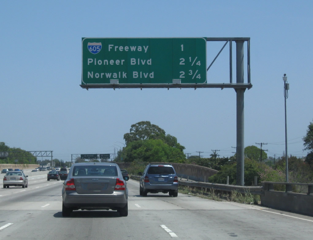 |
This interchange sequence sign provides the distance to the next three exits along California 91 east: Exit 17, Interstate 605 (San Gabriel River Freeway); Exit 18, Pioneer Boulevard; and Exit 19A, Norwalk Boulevard. Photo taken 05/02/10. |
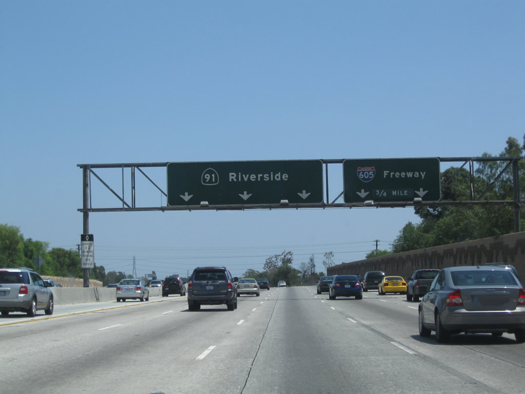 |
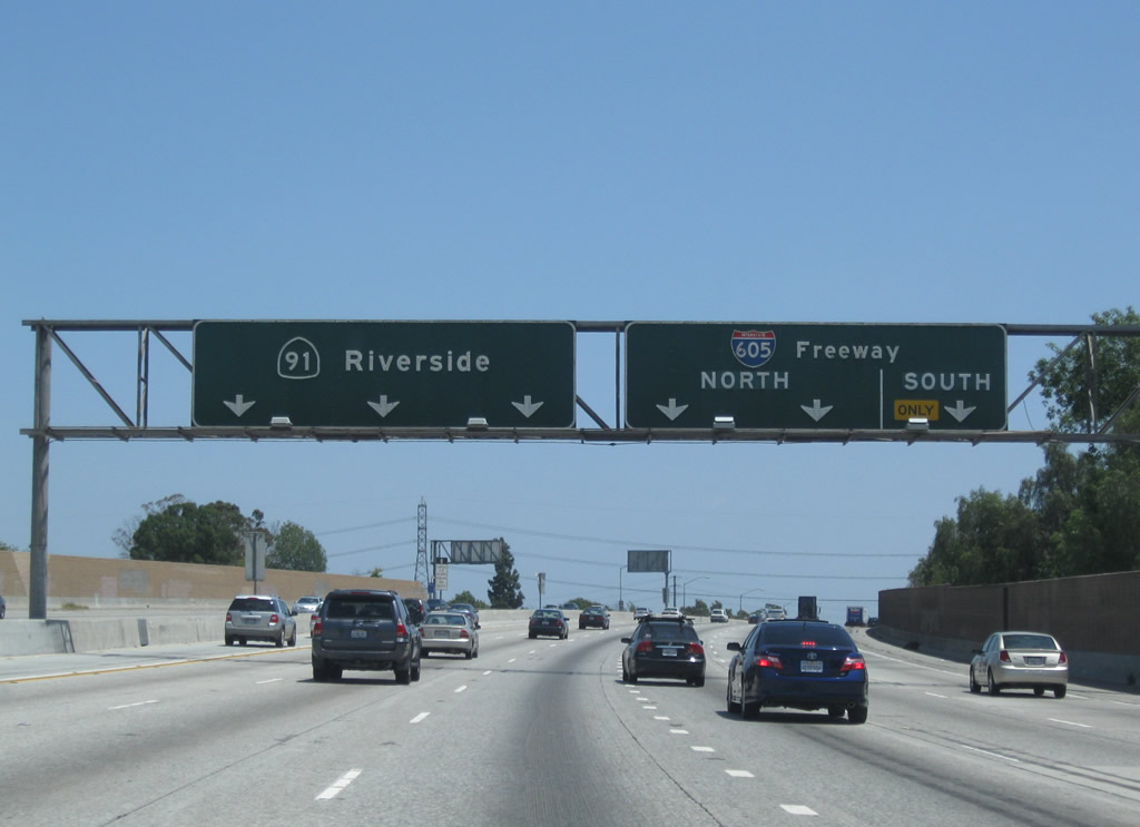
The right two lanes of California 91 east connect to Exit 17, Interstate 605 (San Gabriel River Freeway). Around this point, California 91 leaves Bellflower and enters the city of Cerritos(incorporated on April 24, 1956, and population of 51,488 as of the 2000 Census). The city consists of 8.9 square miles. Pat Nixon, wife of former President Richard Nixon, had a childhood home at Pat Nixon Park. Photo taken 05/02/10. |
 |
Interstate 605 (San Gabriel River Freeway) travels south to Interstate 405 and California 22 in Long Beach-Seal Beach, at the Orange-Los Angeles County Line. To the north, Interstate 605 follows the river to Duarte (U.S. 66, just north of Interstate 210). Photo taken 05/02/10. |
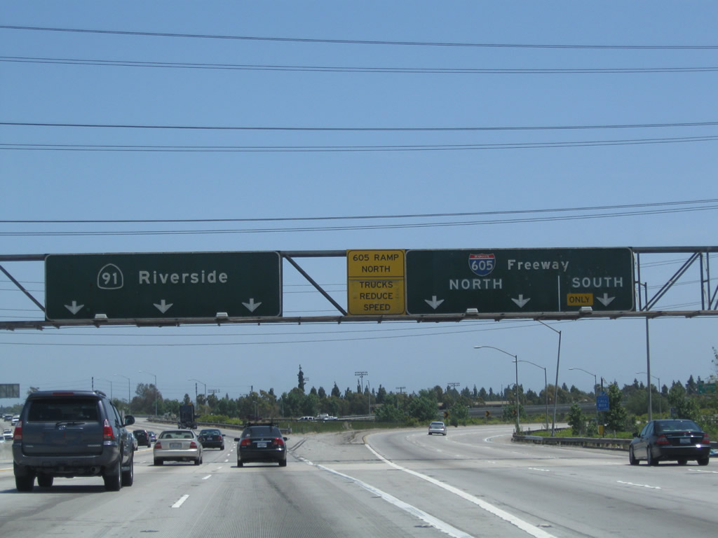 |
Crossing over the San Gabriel River, eastbound California 91 meets the transition ramp to Exit 17, Interstate 605 (San Gabriel River Freeway). Upon exiting, stay left for Interstate 605 north or right for Interstate 605 south. Photo taken 05/02/10. |
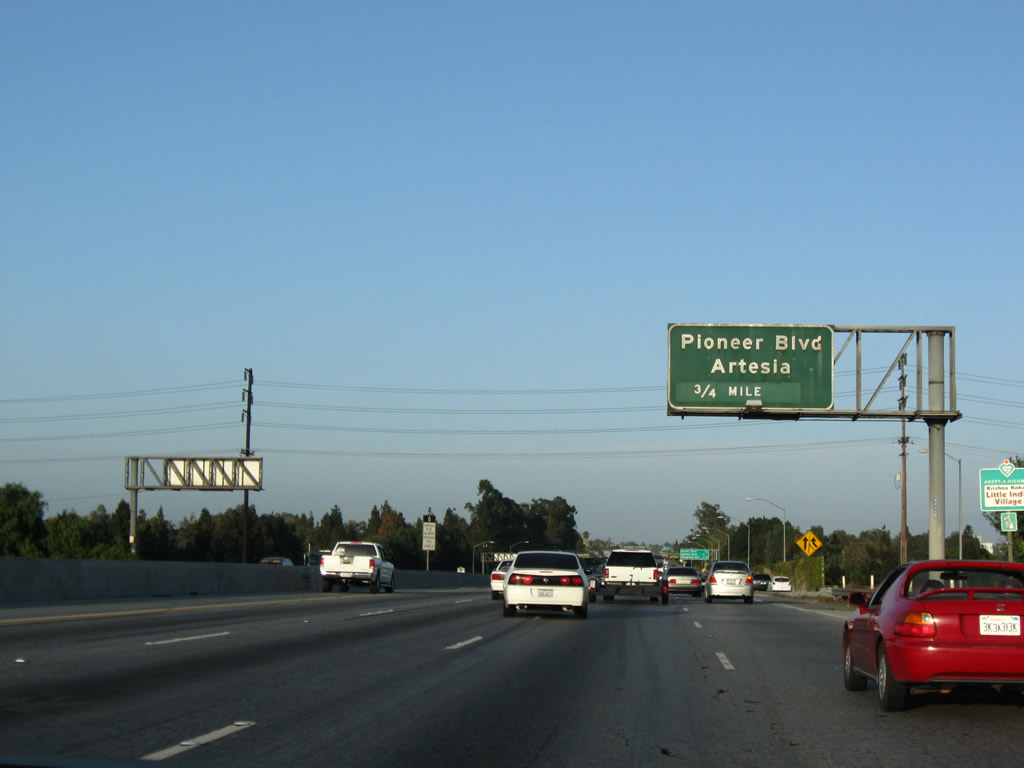 |
After the Interstate 605 (San Gabriel River Freeway) interchange, the next interchange is Exit 18, Pioneer Boulevard to the city of Artesia. Photo taken 07/19/09. |
 |
This mileage sign provides the distance to the next three exits along California 91 (Artesia Freeway) east: Exit 18, Pioneer Boulevard; Exit 19A, Norwalk Boulevard; and Exit 19B, Bloomfield Avenue. Photo taken 07/19/09. |
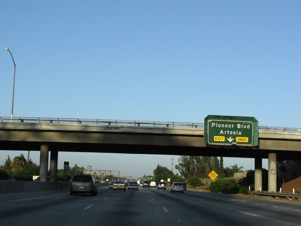 |
The right lane of California 91 (Artesia Freeway) east becomes exit only for Exit 18, Pioneer Boulevard. Use Pioneer Boulevard south to Artesia and north to Norwalk. Photo taken 07/19/09. |
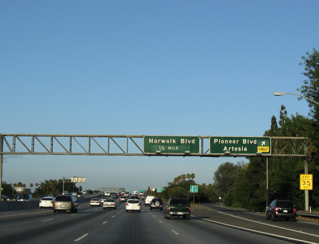 |
Eastbound California 91 (Artesia Freeway) meets Exit 18, Pioneer Boulevard. The next interchange is with Exit 19A, Norwalk Boulevard. Photo taken 07/19/09. |
 |
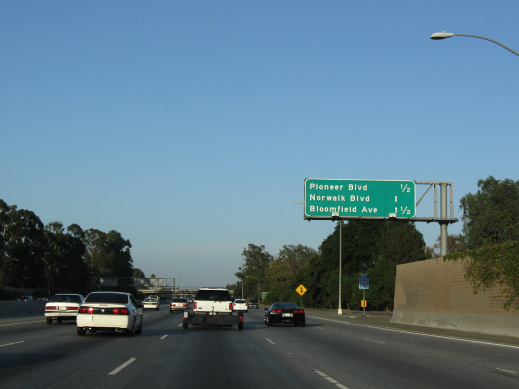
A pair of mileage signs provides the distance to the next three exits along California 91 (Artesia Freeway) east: Exit 19A, Norwalk Boulevard; Exit 19B, Bloomfield Avenue; and Exit 19C, Shoemaker Avenue. Photo taken 07/19/09. |
 |
Eastbound California 91 (Artesia Freeway) reaches Exit 19A, Norwalk Boulevard. The next exit along eastbound California 91 is Exit 19B, Bloomfield Avenue. Photo taken 07/19/09. |
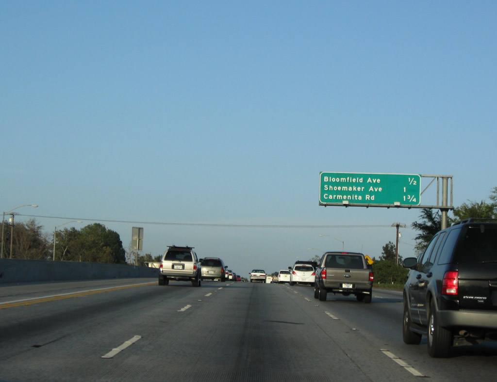 |
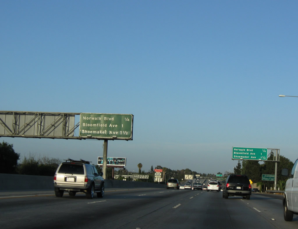
This mileage sign provides the distance to the next three exits along California 91 (Artesia Freeway) east: Exit 19B, Bloomfield Avenue; Exit 19C, Shoemaker Avenue; and Exit 20, Carmenita Avenue. Photo taken 07/19/09. |
 |
A California 91 east reassurance shield is posted after the on-ramp from Norwalk Boulevard. Photo taken 07/19/09. |
 |
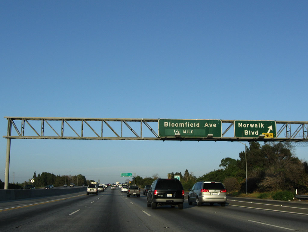
Eastbound California 91 (Artesia Freeway) reaches Exit 19B, Bloomfield Avenue. Photo taken 07/19/09. |
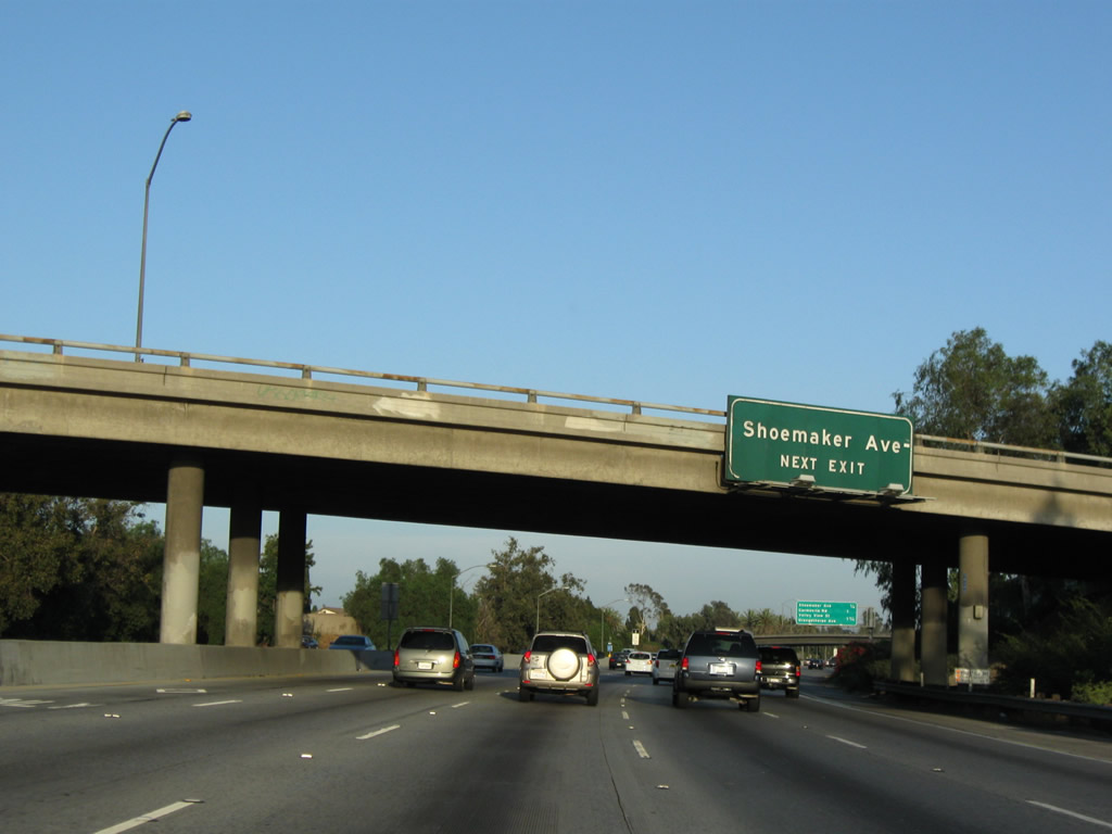 |
The next interchange along eastbound California 91 (Artesia Freeway) is Exit 19C, Shoemaker Avenue. Photo taken 07/19/09. |
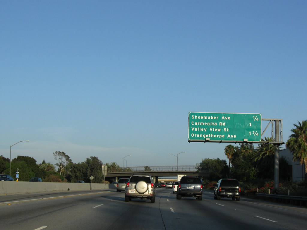 |
This mileage sign provides the distance to the next three exits along California 91 (Artesia Freeway) east: Exit 19C, Shoemaker Avenue; Exit 20, Carmenita Avenue; and Exit 21, Orangethorpe Avenue and Valley View Street. Photo taken 07/19/09. |
 |
Eastbound California 91 (Artesia Freeway) reaches Exit 19C, Shoemaker Avenue. The next exit along eastbound is Exit 20, Carmenita Avenue. Photo taken 07/19/09. |
 |
This mileage sign provides the distance to the next three exits along California 91 (Artesia Freeway) east: Exit 19C, Shoemaker Avenue; Exit 20, Carmenita Avenue; and Exit 21, Orangethorpe Avenue and Valley View Street. Photo taken 07/19/09. |
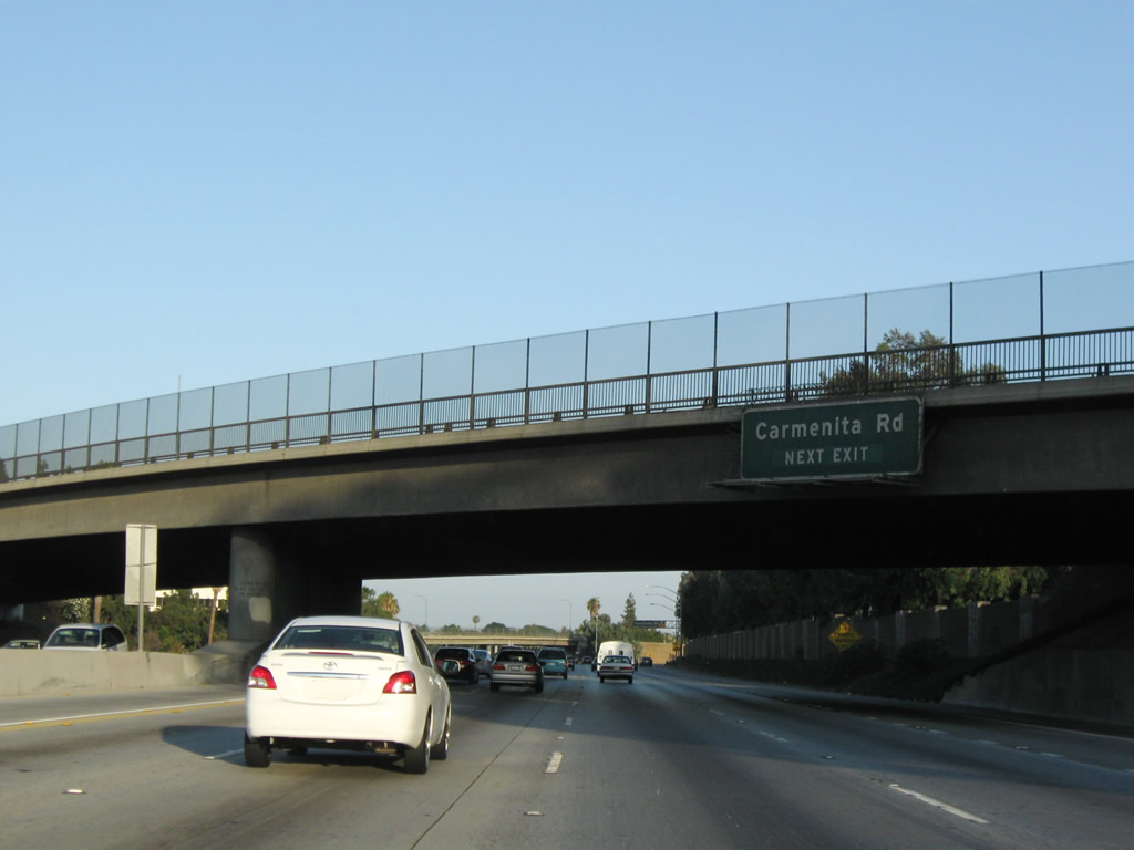 |
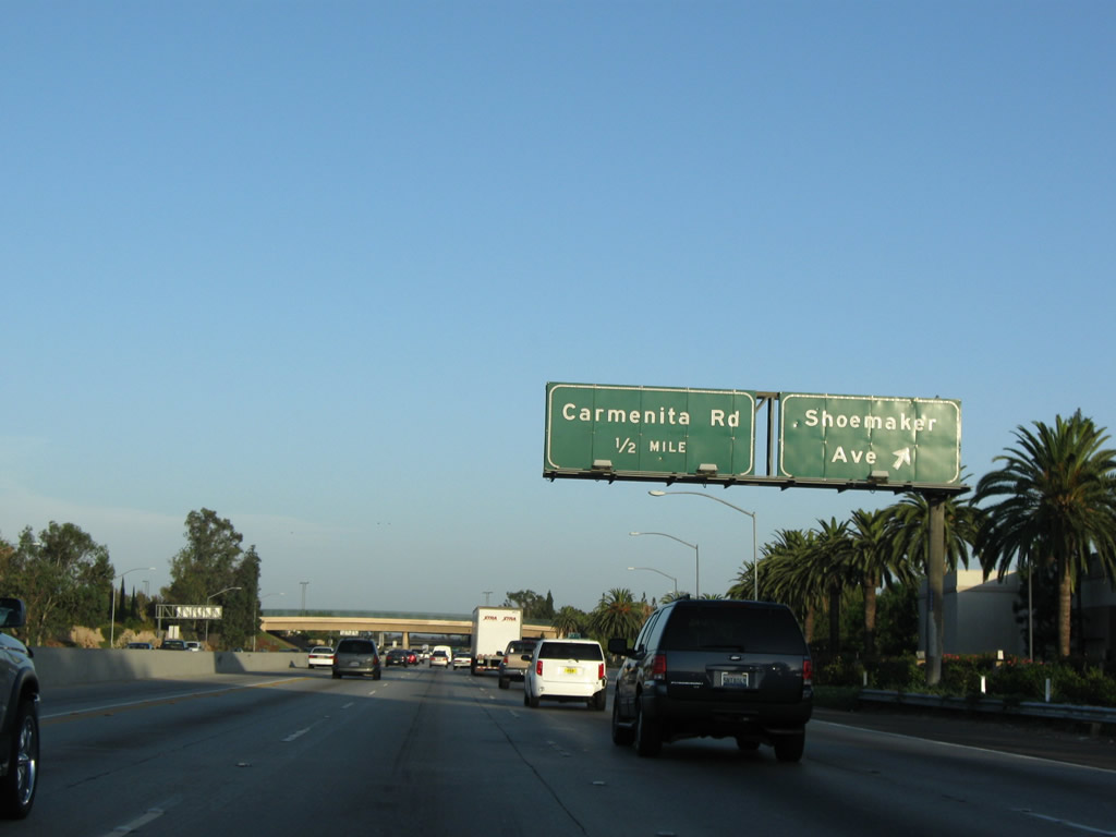
The next exit along California 91 (Artesia Freeway) east is Exit 20, Carmenita Avenue. Photo taken 07/19/09. |
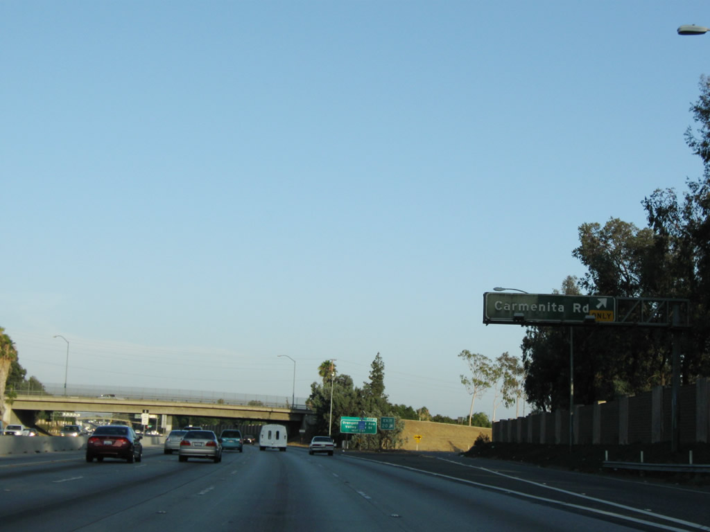 |
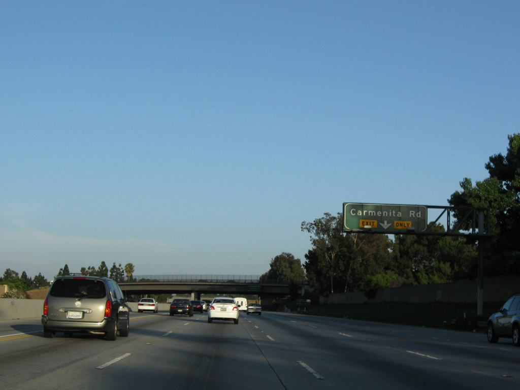
Eastbound California 91 (Artesia Freeway) reaches Exit 20, Carmenita Avenue. Photo taken 07/19/09. |
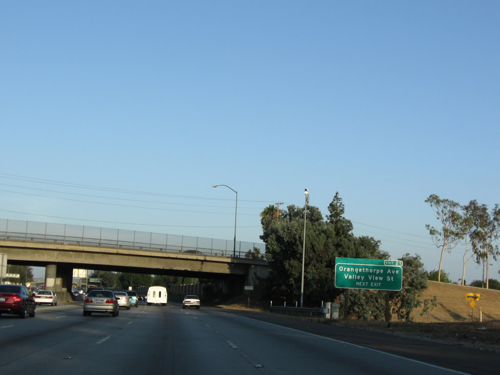 |
The next exit along California 91 (Artesia Freeway) east is Exit 21, Valley View Street and Orangethorpe Avenue (next right). This is one of the few exit number signs along this stretch of freeway. Photo taken 07/19/09. |
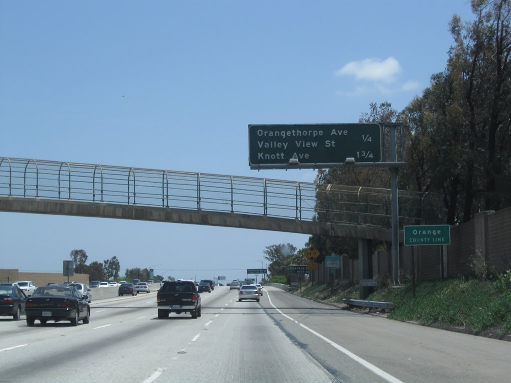 |
Crossing into Orange County (population 2,846,293 as of the 2000 Census with Santa Ana as the county seat), a mileage sign provides the distance to the next three exits along California 91 (Artesia Freeway) east: Exit 21, Valley View Street and Orangethorpe Avenue and Exit 23A, Knott Avenue. California 91 leaves Cerritos and enters La Palma. Photo taken 05/02/10. |
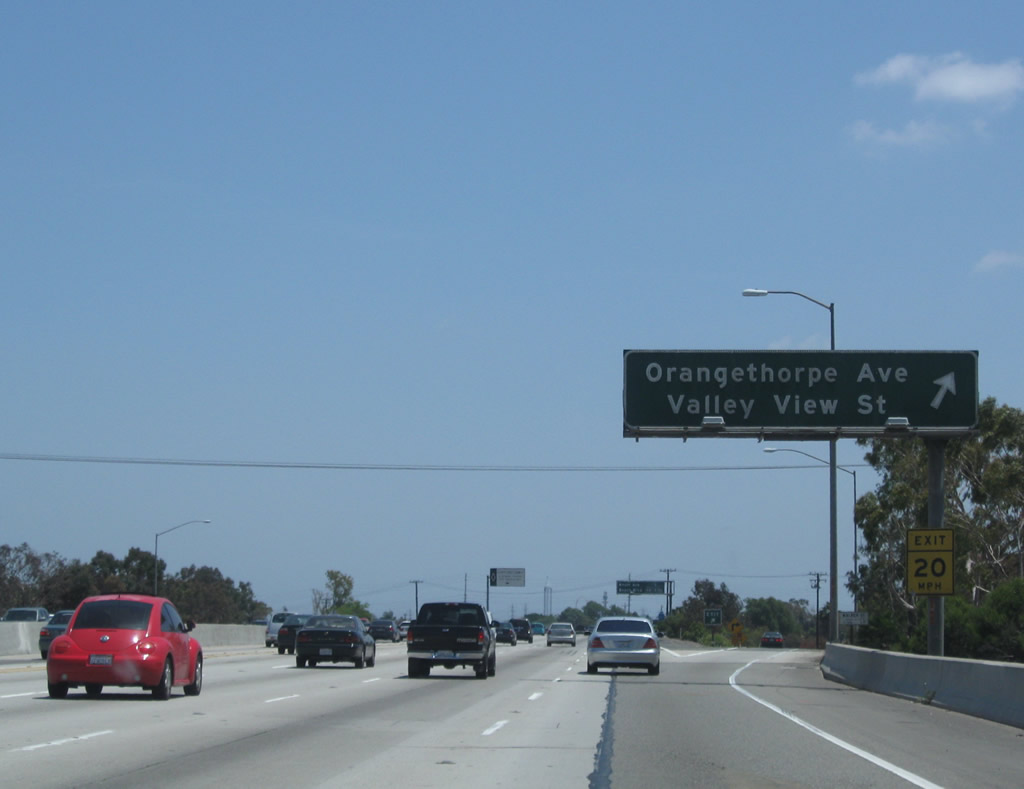 |
Eastbound California 91 (Artesia Freeway) reaches Exit 21, Valley View Street and Orangethorpe Avenue. Photo taken 07/19/09. |
 |
As California 91 leaves La Palma and enters the city of Buena Park (incorporated in 1953). As of the 2000 Census, the city had a total population of 78,282 and consists of 10.6 square miles. The next exit along California 91 east is Exit 23A, Knott Avenue. Photo taken 07/19/09. |
 |
A direct access ramp links California 91 (Artesia Freeway) east with Interstate 5 (Santa Ana Freeway) south. The interchange between California 91 and Interstate 5 is located at the meeting points of the cities of Buena Park to the west, Fullerton to the northeast, and Anaheim to the southeast. Photo taken 07/19/09. |
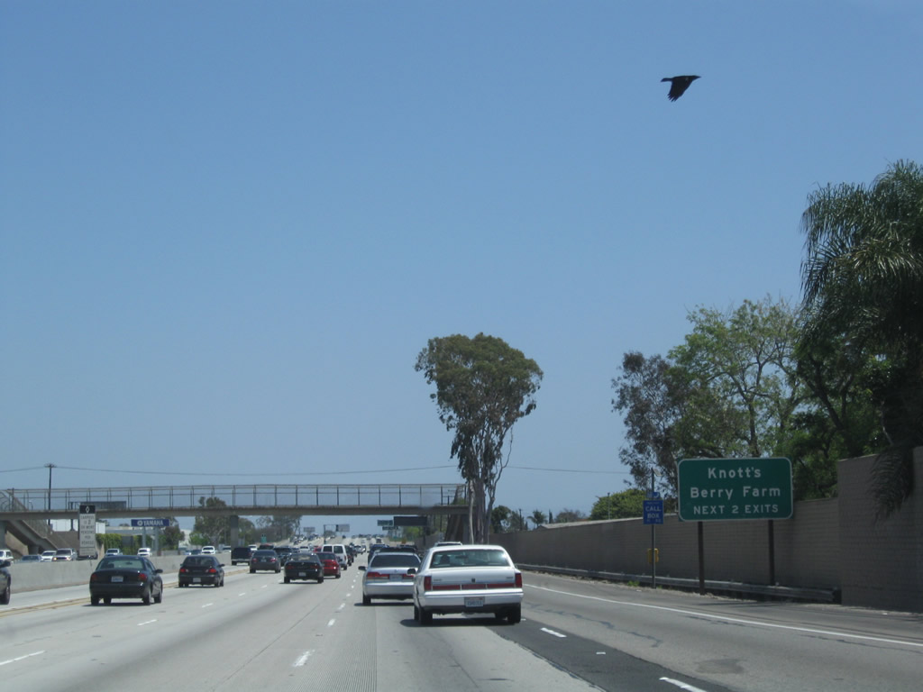 |
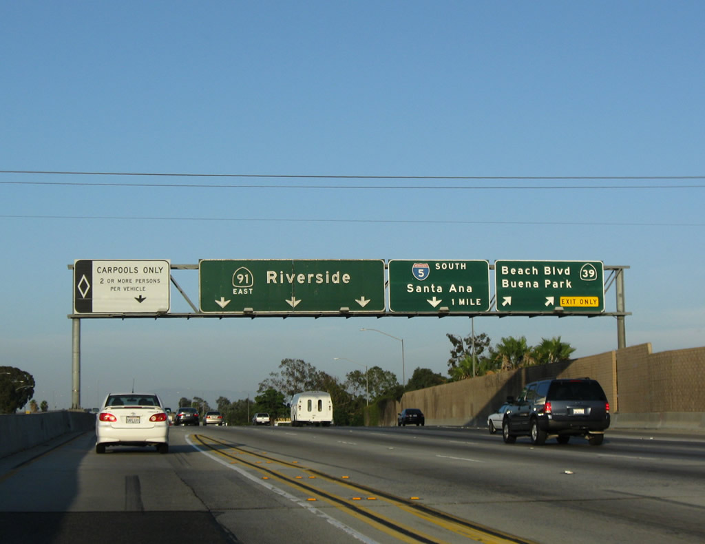
The next two exits (Exit 23A, Knott Avenue and Exit 23B, California 39 (Beach Boulevard)) serve Knott's Berry Farm, a popular theme park with roller coasters built on the lands of a former orchard. Photo taken 05/02/10. |
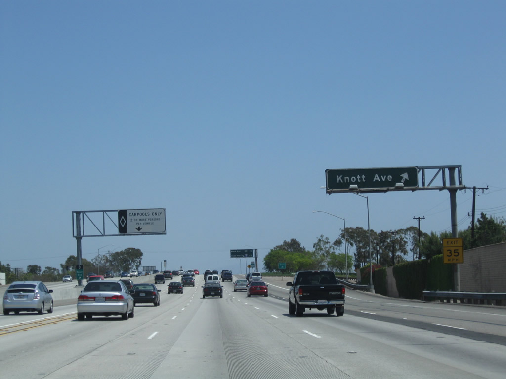 |
Eastbound California 91 (Artesia Freeway) reaches Exit 23A, Knott Avenue. Photo taken 05/02/10. |
 |
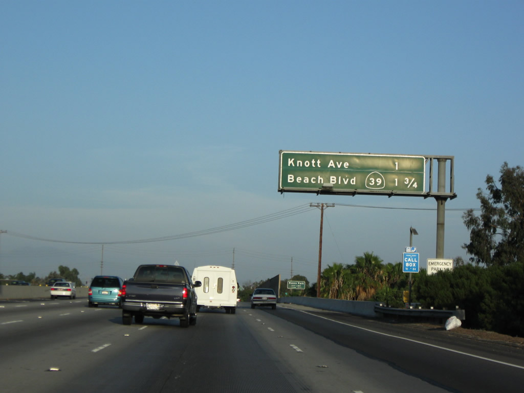
The next two exits along California 91 (Artesia Freeway) east are Exit 23B, California 39 (Beach Boulevard) and Exit 24, Interstate 5 (Santa Ana Freeway). Photo taken 07/19/09. |
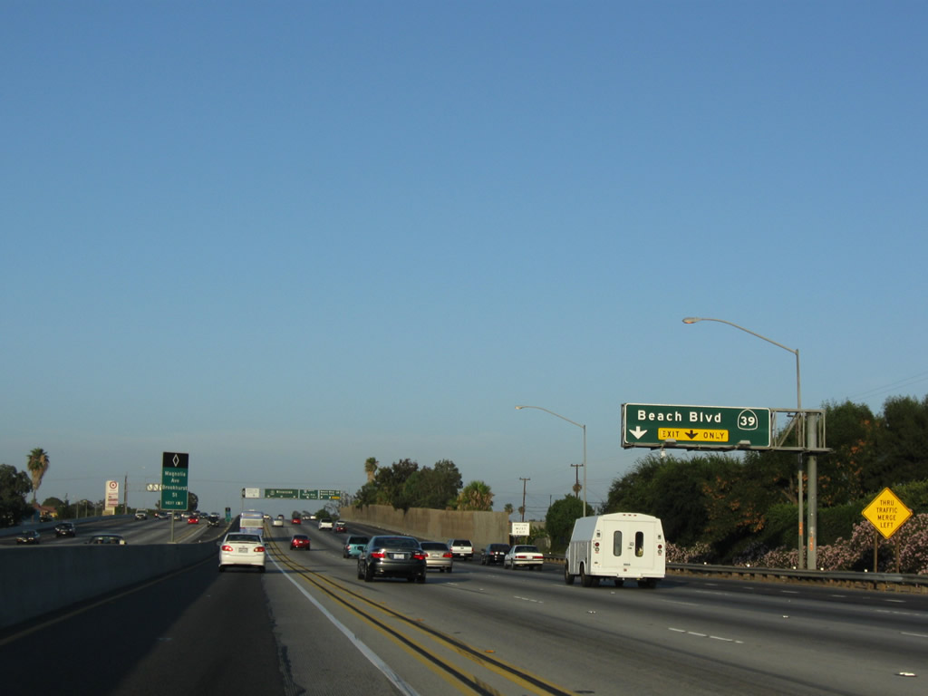 |
The right lane of California 91 (Artesia Freeway) east becomes exit only for Exit 23B, California 39 (Beach Boulevard). Photo taken 07/19/09. |
 |
 |
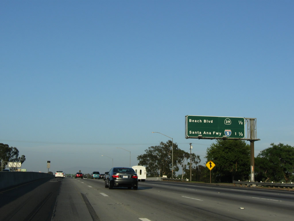
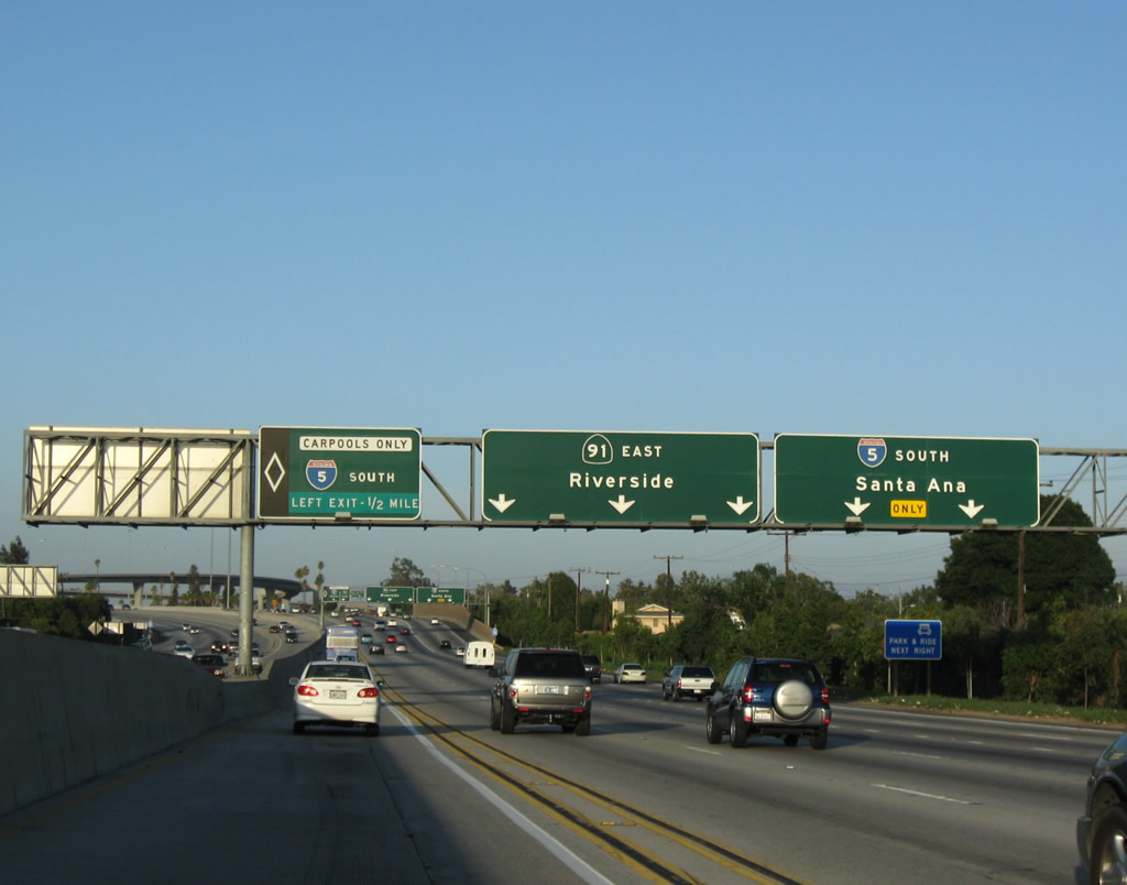
Eastbound California 91 (Artesia Freeway) meets Exit 23B, California 39 (Beach Boulevard). The next interchange along eastbound connects to Exit 24, Interstate 5 (Santa Ana Freeway) south to Santa Ana, Irvine, and San Diego. Exit 24 also connects to north-south Magnolia Avenue. There is no direct access to Interstate 5 north, since that is considered an illogical connection due to Interstate 5's orientation that carries it southeast to northwest. Photos taken 07/19/09 and 05/02/10. |
 |
The next exit along California 91 (Artesia Freeway) east is Exit 24, Interstate 5 (Santa Ana Freeway) south to Santa Ana, Irvine, and San Diego. To Magnolia Avenue, use Exit 24. Photo taken 07/19/09. |
 |
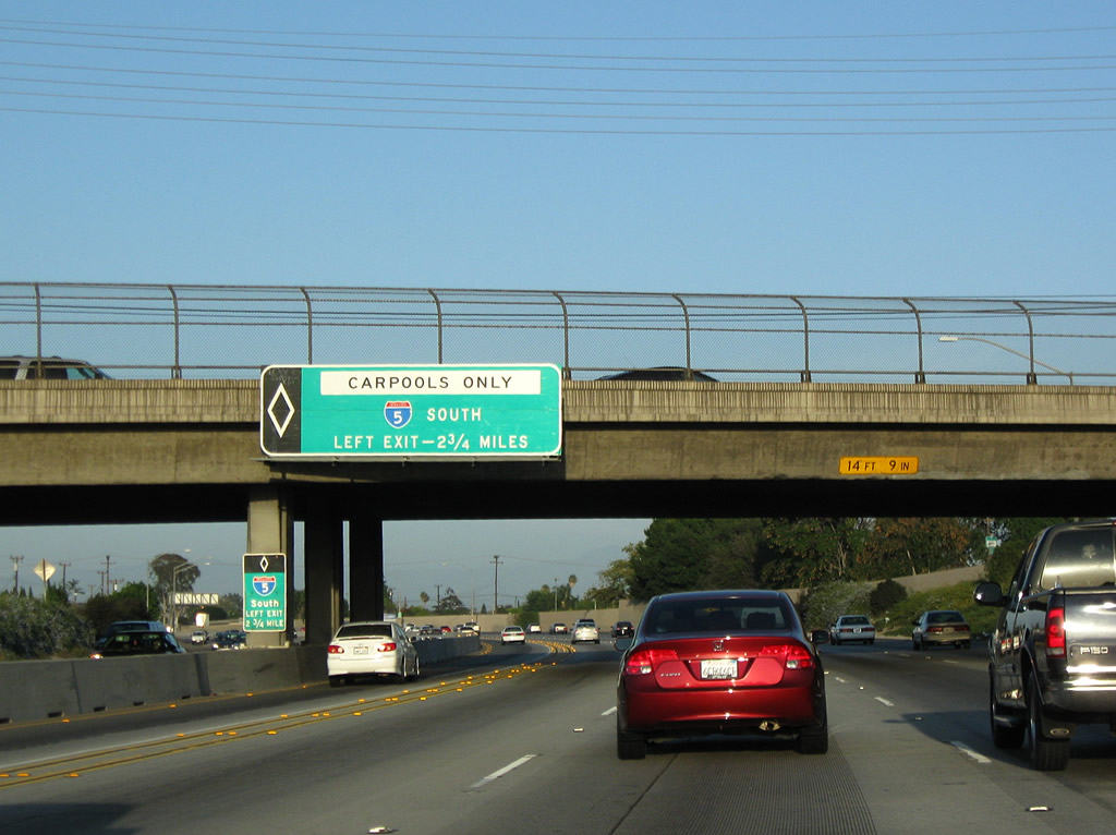
The right two lanes of California 91 (Artesia Freeway) become exit only for Exit 24, Interstate 5 (Santa Ana Freeway) south to Santa Ana, Irvine, and San Diego. The left three lanes continues east on California 91 (Riverside Freeway). A direct connection from the California 91 carpool (HOV) lanes links to the Interstate 5 carpool (HOV) lanes. Photo taken 07/19/09. |
 |
Eastbound California 91 (Artesia Freeway) meets Exit 24, Interstate 5 (Santa Ana Freeway) south to Santa Ana, Irvine, and San Diego. This view shows the interchange from the carpool lane. Photo taken 07/19/09. |
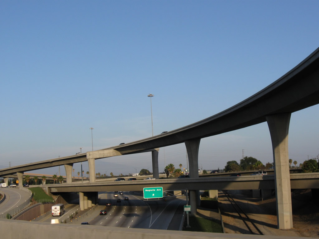 |
This view looks down on Interstate 5 as seen from the California 91 carpool lane ramp to Interstate 5 south. Photo taken 07/19/09. |
 |
Now on the carpool transition ramp from California 91 east to Interstate 5 south, we return to ground level and prepare to merge with Interstate 5's carpool lane. Photo taken 07/19/09. |
| California 91 - Riverside Freeway east | |
|---|---|
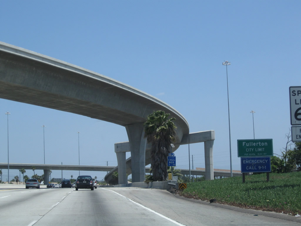 |
Back on the mainline, California 91 passes through the Interstate 5 interchange. The freeway designation changes from Artesia Freeway to Riverside Freeway. For the next four miles, California 91 will straddle the borders between Fullerton on the north and Anaheim on the south. The city of Fullerton is known as "The Education Community" and had a population of 126,003 as of the 2000 census. Its larger neighbor to the south, the city of Anaheim, was founded in 1857, incorporated on March 18, 1876, had a population of 345,556 people per the 2000 Census, and consists of approximately 50.5 square miles of area. After Exit 28 (Harbor Boulevard), California 91 will be solely located within Anaheim as the freeway approaches the Santa Ana River Canyon. Photo taken 05/02/10. |
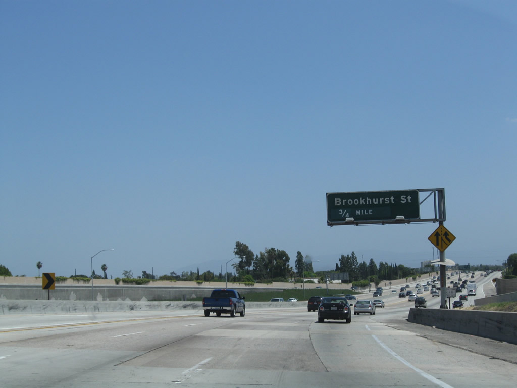 |
The next exit along California 91 east is Exit 26, Brookhurst Street (0.75 mile). Photo taken 05/02/10. |
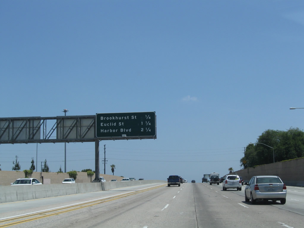 |
This mileage sign along California 91 (Riverside Freeway) east provides the distance to the next three exits: Exit 26, Brookhurst Street; Exit 27, Euclid Street; and Exit 28, Harbor Boulevard, Lemon Street, and Anaheim Boulevard. All three of these exits serve Fullerton, and the next 12 exits all serve the city of Anaheim, including aforementioned Exits 26 through 28 and also Exit 29, East Street and Raymond Avenue; Exit 30A, State College Boulevard (Former California 250 from 1965-1981); Exit 30B, California 57 (Orange Freeway); Exit 31, Kraemer Boulevard and Glassell Street; Exit 33, Tustin Avenue; Exit 34, California 55 (Costa Mesa Freeway) south to Newport Beach; Exit 35, Lakeview Avenue; Exit 36, California 90 (Imperial Highway) west; and Exit 39, Weir Canyon Road serve the city of Anaheim. Photo taken 05/02/10. |
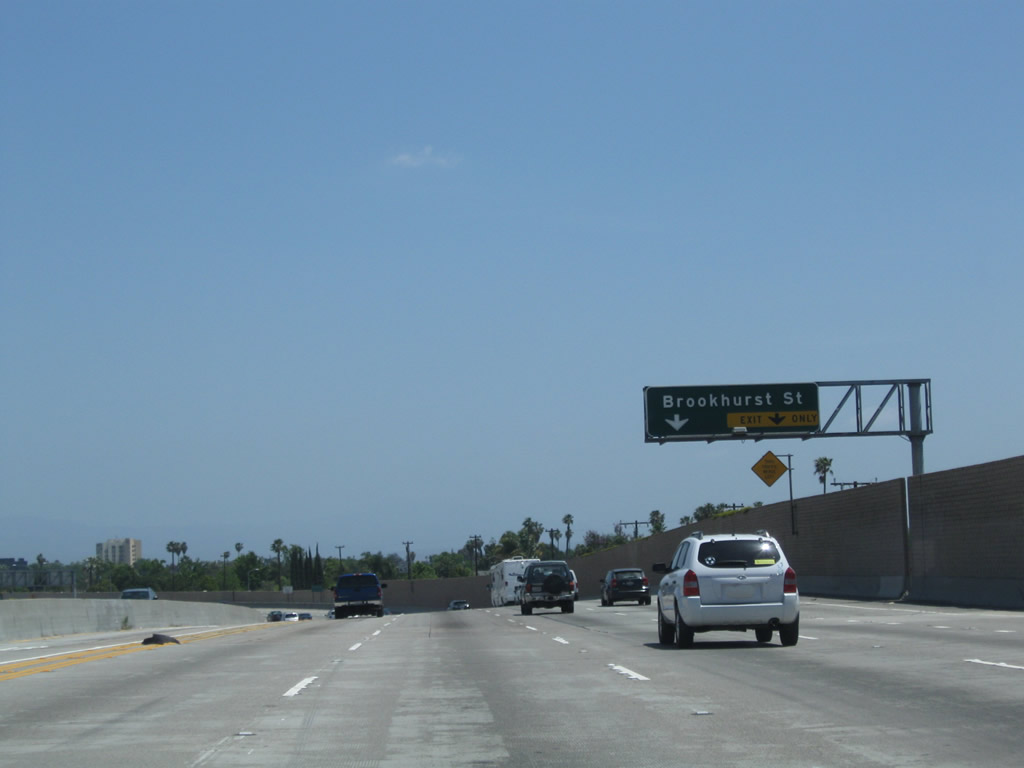 |
The right two lanes of California 91 east serve Exit 26, Brookhurst Street. Ahead of this point, California 91 meets the off-ramp to Exit 26. Photo taken 05/02/10. |
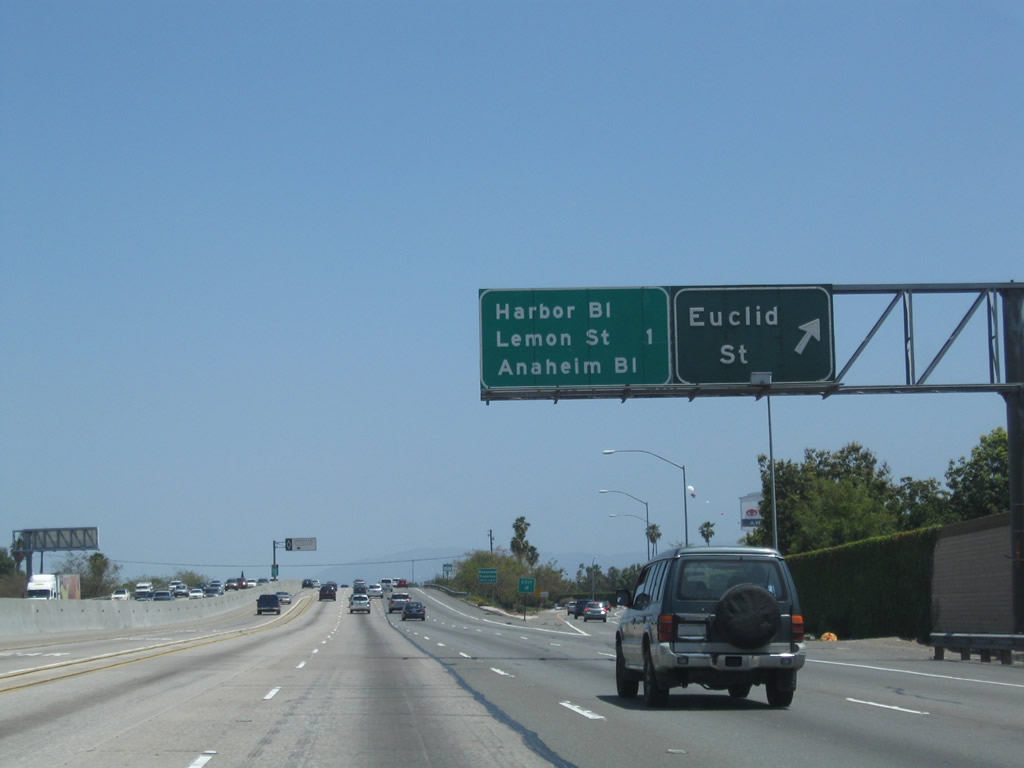 |
Soon thereafter, eastbound California 91 reaches Exit 27, Euclid Street. The following exit is Exit 28, Harbor Boulevard, Lemon Street, and Anaheim Boulevard. Photo taken 05/02/10. |
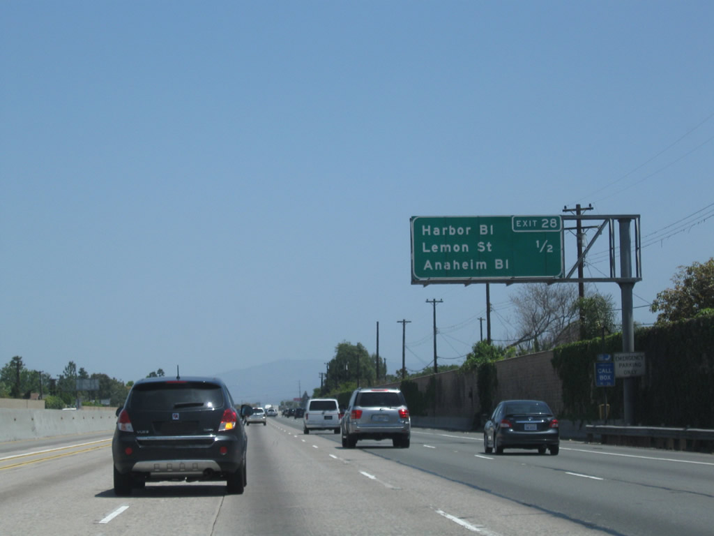 |
Eastbound California 91 (Riverside Freeway) next approaches Exit 28, Harbor Boulevard, Lemon Street, and Anaheim Boulevard. Photo taken 05/02/10. |
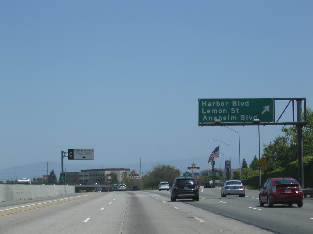 |
Eastbound California 91 (Riverside Freeway) meets Exit 28, Harbor Boulevard, Lemon Street, and Anaheim Boulevard. Upon exiting, traffic will first meet a traffic signal for the connection to north-south Harbor Boulevard. Shortly thereafter, a second traffic signal connects the off-ramp to Lemon Street north into Fullerton or Anaheim Boulevard south. After this interchange, California 91 leaves the border between Fullerton-Anaheim and will solely remain in Anaheim all the way to the Orange-Riverside County line. Photo taken 05/02/10. |
 |
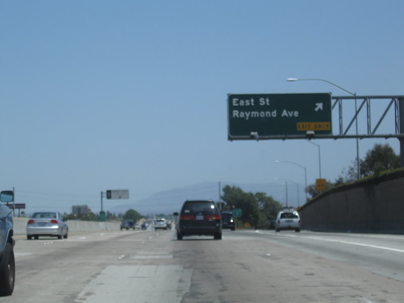
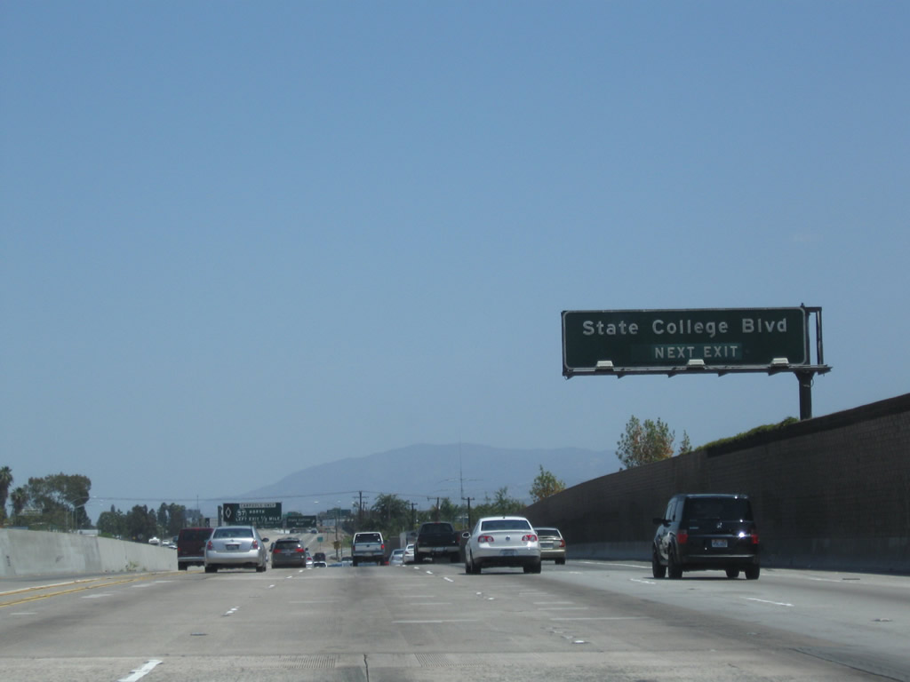
The next exit along California 91 (Riverside Freeway) east is Exit 29, East Street and Raymond Avenue, followed by Exit 30A, State College Boulevard (former California 250). Photo taken 05/02/10. |
 |
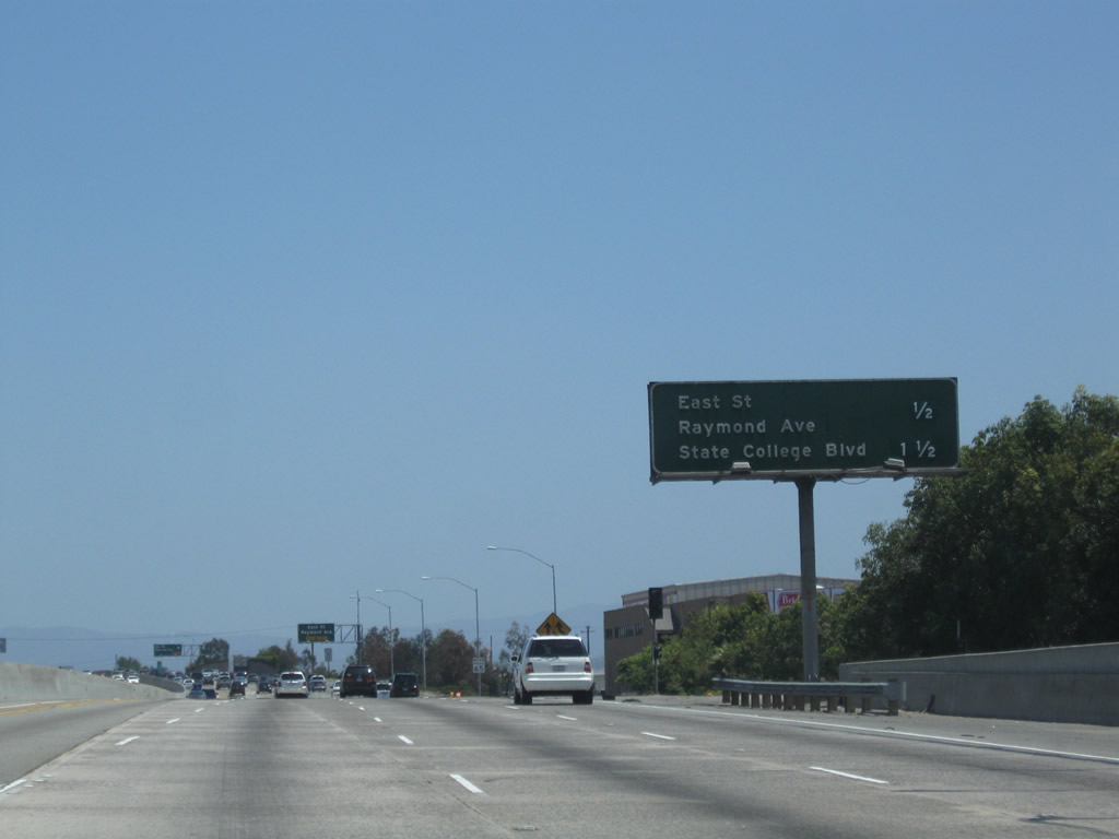
Eastbound California 91 (Riverside Freeway) reaches Exit 29, East Street and Raymond Avenue. Photo taken 05/02/10. |
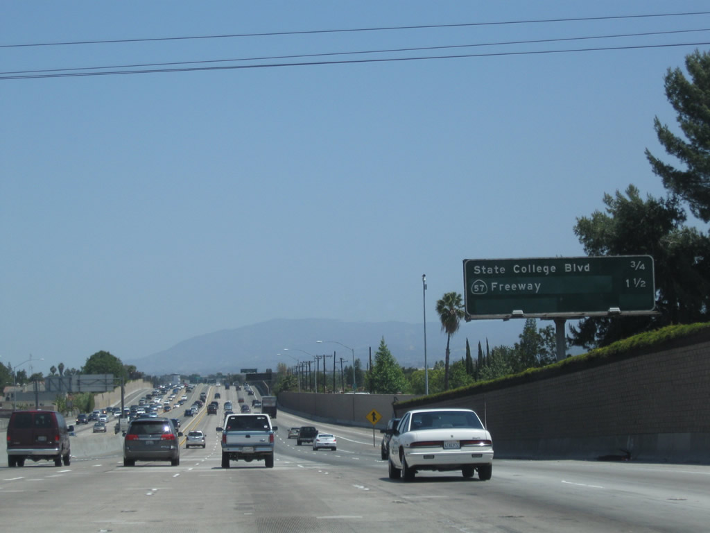 |
This mileage sign provides the distance to the next two exits along California 91 (Riverside Freeway) east: Exit 30A, State College Boulevard (former California 250) and Exit 30B, California 57 (Orange Freeway). Photo taken 05/02/10. |
 |
Assigned in 1965 and decommissioned in 1981, California 250 briefly followed State College Boulevard between Interstate 5 and California 91 through Anaheim. With the completion of California 57 (Orange Freeway), California 250 was removed from the state highway system (as intended). Photo taken 05/02/10. |
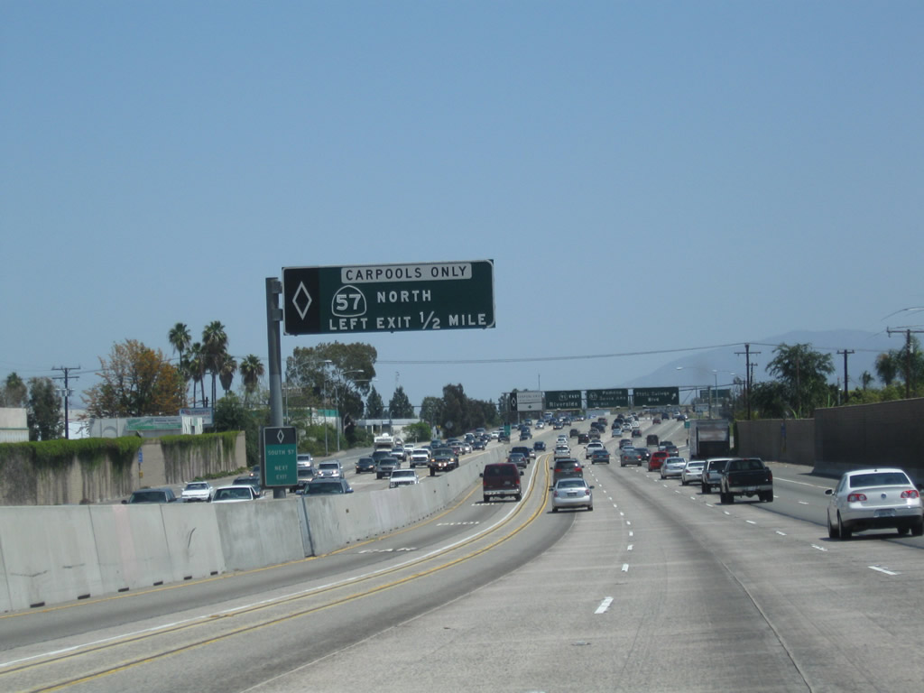 |
The first advance signage for Exit 30B, California 57 (Orange Freeway) is for the direct access ramp from the California 91 HOV lanes to the California 57 HOV lanes (eastbound to northbound link). Photo taken 05/02/10. |
 |
Eastbound California 91 (Riverside Freeway) meets Exit 30A, State College Boulevard (former California 250). The next exit along California 91 east is with Exit 30B, California 57 (Orange Freeway). This is one of the few remaining overhead sign bridges on California 91 to still carry button copy, porcelain enamel signs as of May 2010. Photo taken 05/02/10. |
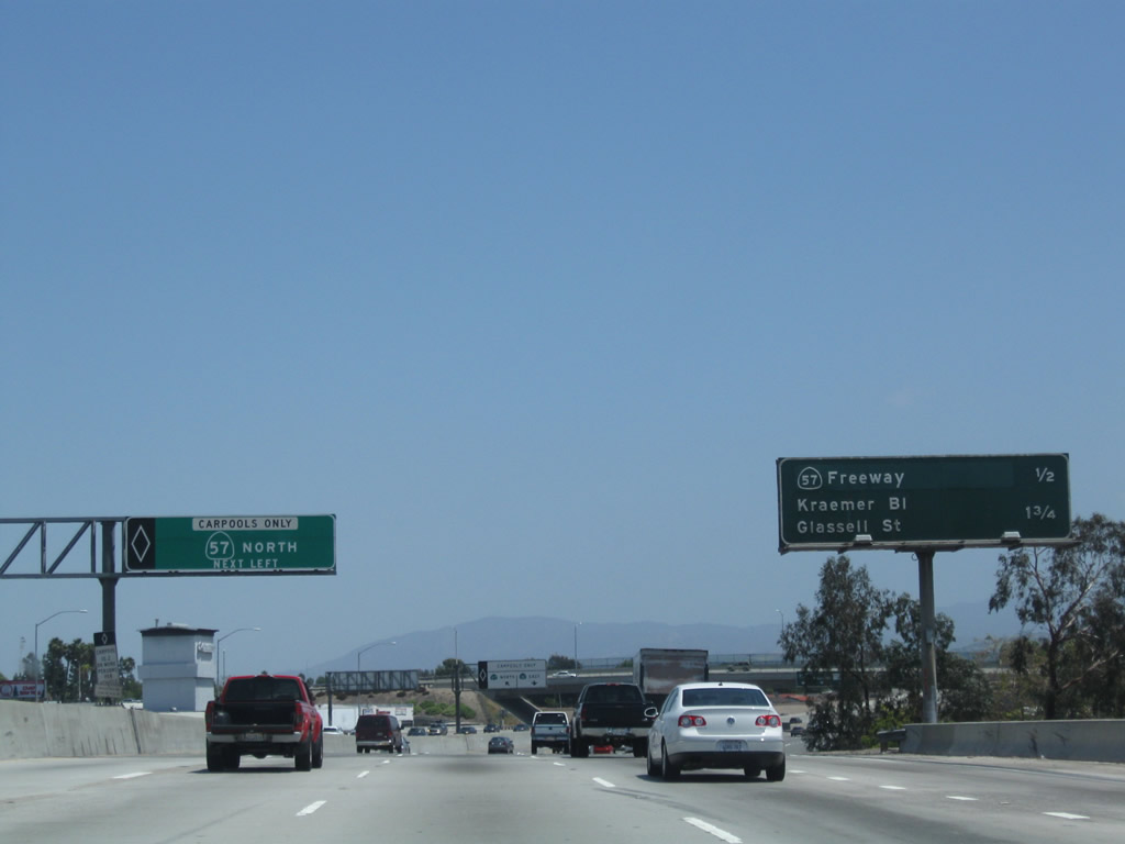 |
This mileage sign provides the distance to the next two exits along California 91 (Riverside Freeway) east: Exit 30B, California 57 (Orange Freeway) and Exit 31, Kraemer Boulevard and Glassell Street. Over in the carpool lanes, we approach the direct ramp to California 57 north. Photo taken 05/02/10. |
 |
The carpool lanes split between California 57 north (left exit) and California 91 east (continue straight ahead in carpool lanes). Photo taken 05/02/10. |
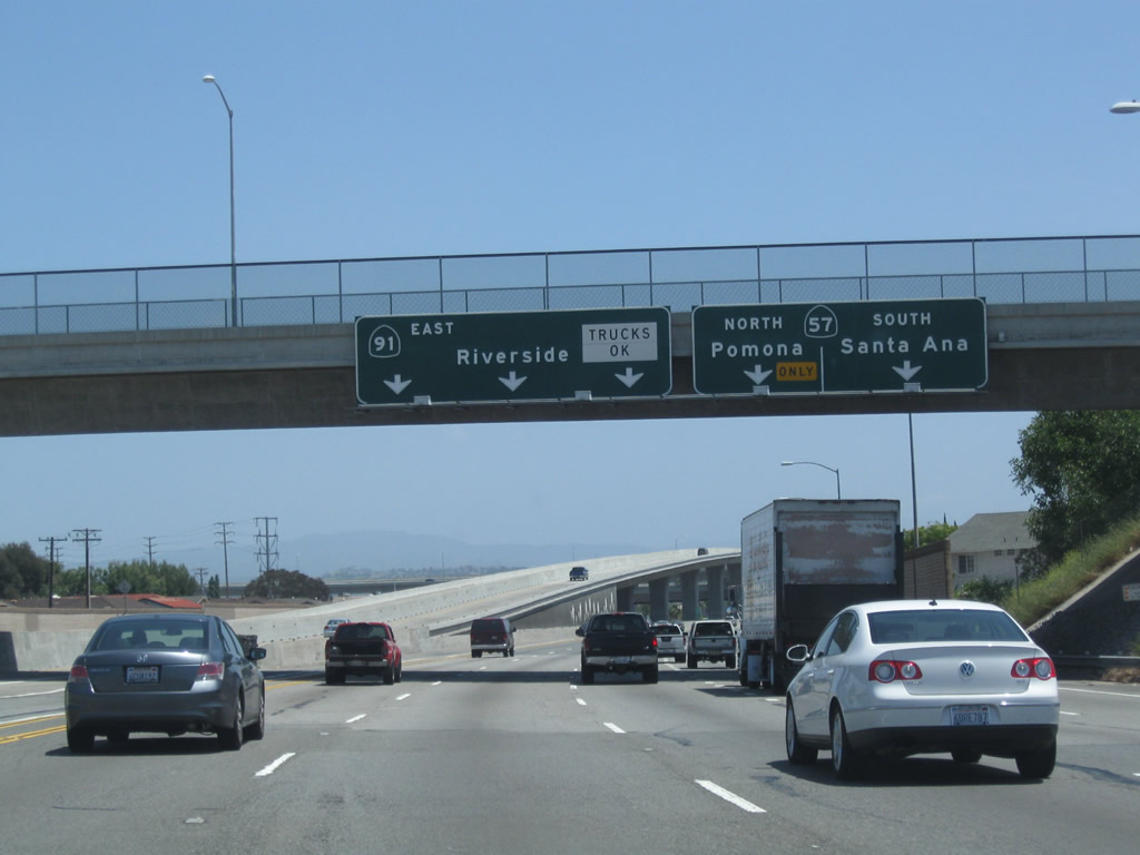 |
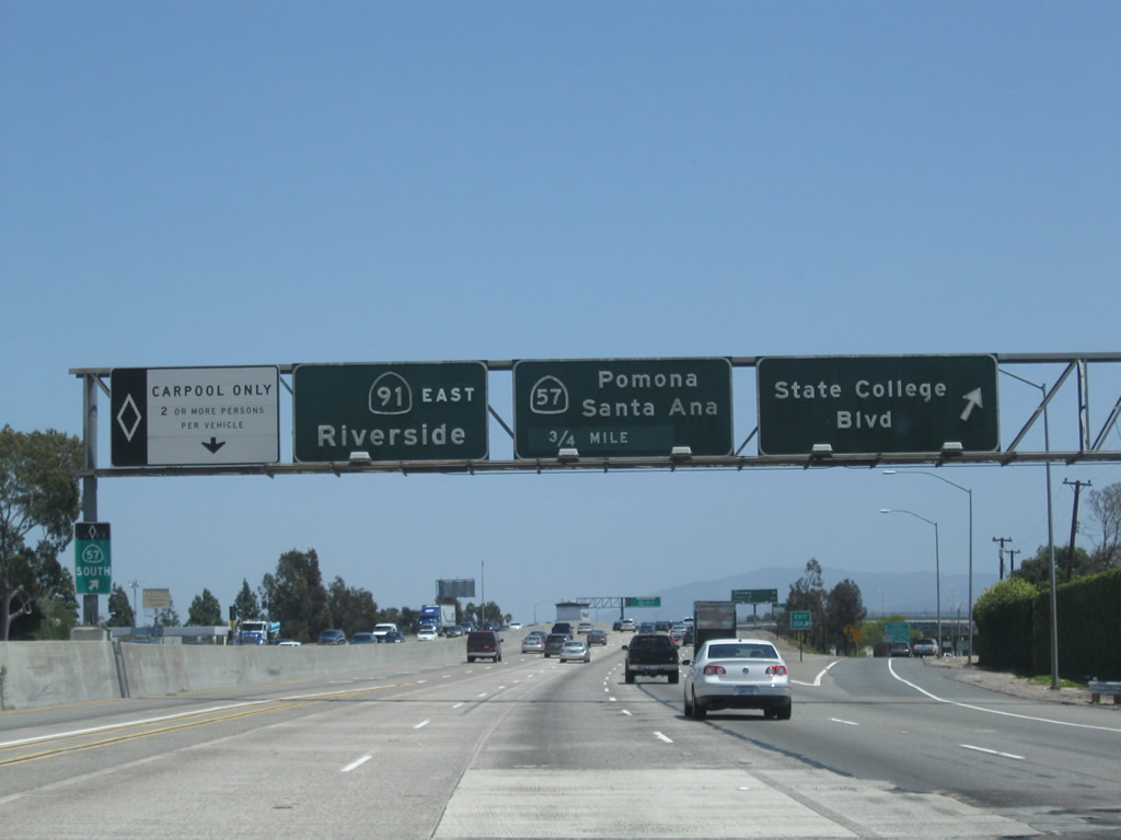
This overhead sign provides lane allocations for the continuation of California 91 (Riverside Freeway) east and Exit 30B, California 57 (Orange Freeway). California 57 is a major north-south freeway that connects Interstate 5 in Anaheim with Interstate 210 in San Dimas. Known as the Orange Freeway, California 57 is a busy commuter route with ample traffic possible at all times of the day. Photo taken 05/02/10. |
 |
Eastbound California 91 (Riverside Freeway) reaches Exit 30B, California 57 (Orange Freeway) north to Pomona and south to Santa Ana. The tall ramps to the left connect the high occupancy vehicles lanes of both freeways. Photo taken 05/02/10. |
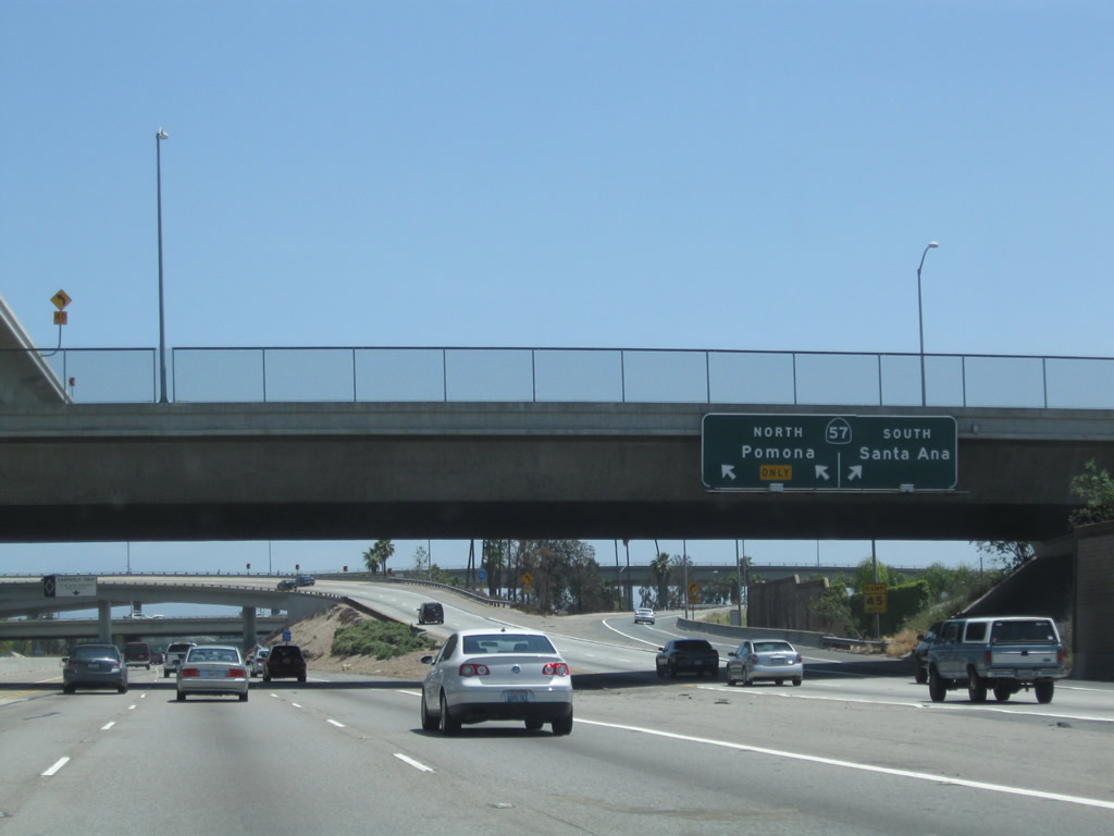 |
Looking at the transition ramp to California 57 (Orange Freeway), two lanes connect to California 57 north to Pomona while one lane links to California 57 south to Santa Ana and Interstate 5. Photo taken 05/02/10. |
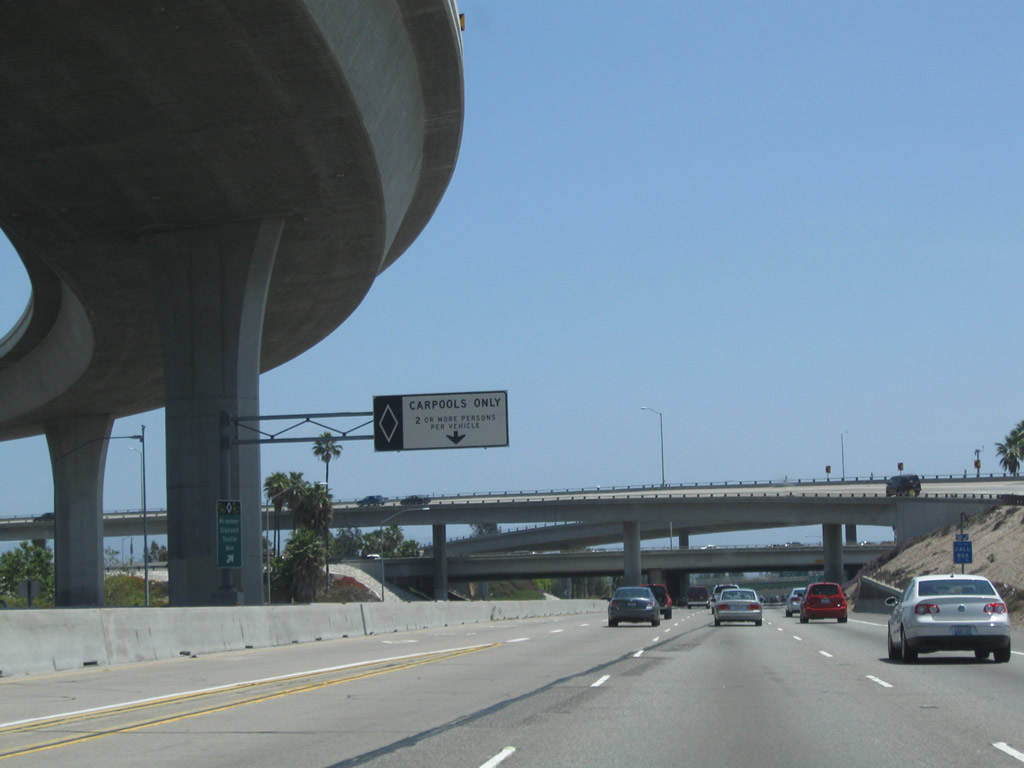 |
A carpool lane entrance is located in the shadow of the direct connector ramp for carpool (HOV) traffic at the California 57 and California 91 interchange. Photo taken 05/02/10. |
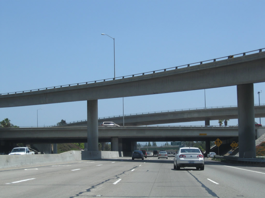 |
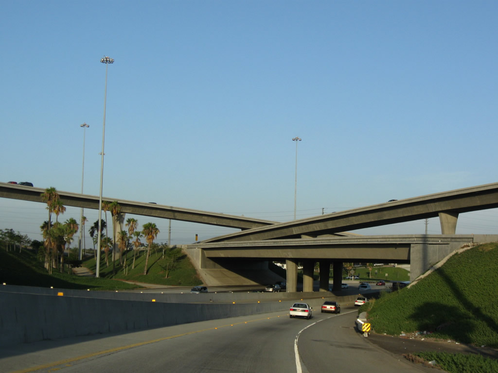
The interchange between California 91 (Riverside Freeway) and California 57 (Orange Freeway) is a stack interchange that is nearly symmetrical except for loop ramps connecting California 57 north to California 91 west and California 57 south to California 91 east. Photo taken 05/02/10. |

Page Updated July 17, 2010.
|
About Contact Glossary |
In The News Interstate Guide |
Social Media:
 |
|
© 2000-25 AARoads.com | All Rights Reserved | Privacy Policy / Terms of Use
|
||